The Wadden Sea, Germany and Netherlands - Trilateral Wadden ...
The Wadden Sea, Germany and Netherlands - Trilateral Wadden ...
The Wadden Sea, Germany and Netherlands - Trilateral Wadden ...

Create successful ePaper yourself
Turn your PDF publications into a flip-book with our unique Google optimized e-Paper software.
<strong>The</strong> <strong>Wadden</strong> <strong>Sea</strong>,<br />
<strong>Germany</strong> <strong>and</strong> Netherl<strong>and</strong>s (N1314) -<br />
Extension Denmark <strong>and</strong> <strong>Germany</strong><br />
<strong>The</strong> <strong>Wadden</strong> <strong>Sea</strong>, <strong>Germany</strong> <strong>and</strong> Netherl<strong>and</strong>s (N1314) - Extension Denmark <strong>and</strong> <strong>Germany</strong><br />
1<br />
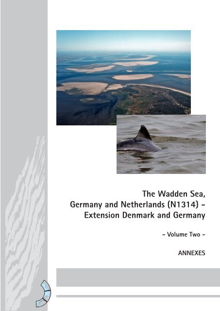
- Volume Two -<br />
ANNEXES
Annexes<br />
Annex 1 List of <strong>Wadden</strong> <strong>Sea</strong> fish species. 5<br />
Annex 2 List of <strong>Wadden</strong> <strong>Sea</strong> bird species. 13<br />
Annex 3 List of endemic salt marsh species. 19<br />
Annex 4 <strong>The</strong> <strong>Wadden</strong> <strong>Sea</strong> Quality Status Report 2009. Marencic, H. <strong>and</strong> de Vlas,<br />
J. (Eds.), 2009. <strong>Wadden</strong> <strong>Sea</strong> Ecosystem No. 25. (only on DVD) 29<br />
Annex 5 <strong>The</strong> <strong>Wadden</strong> <strong>Sea</strong> Quality Status Report – Synthesis Report 2010.<br />
Wolff, W.J, Bakker, J.P., Laursen, K. <strong>and</strong> Reise, K., 2010.<br />
<strong>Wadden</strong> <strong>Sea</strong> Ecosystem No. 29. 31<br />
Annex 6 Sylt Declaration <strong>and</strong> 2010 Joint Declaration.<br />
11 th <strong>Trilateral</strong> Governmental Conference on the Protection of the<br />
<strong>Wadden</strong> <strong>Sea</strong>, Westerl<strong>and</strong>/Sylt, 18 March 2010. 109<br />
Annex 7 Administrative Agreement 2010 on a Common Secretariat for the<br />
Cooperation on the Protection of the <strong>Wadden</strong> <strong>Sea</strong>. 181<br />
Annex 8 Agreement on the Conservation of <strong>Sea</strong>ls in the <strong>Wadden</strong> <strong>Sea</strong><br />
according to Article 4 of the Convention on the Conservation of<br />
Migratory Species of Wild Animals (CMS, Bonn Convention), 1990. 189<br />
Annex 9 <strong>Trilateral</strong> <strong>Wadden</strong> <strong>Sea</strong> Plan 2010. 197<br />
Annex 10 German Federal Nature Conservation Act,<br />
§ 30 Legally Protected Biotopes, February 2012. 303<br />
Annex 11 Act on the National Park “Niedersächsisches Wattenmeer”,<br />
amended February 2010. 307<br />
Annex 12 Danish Nature Protection Act, LBK nr 933 of 24/09/2009. 343<br />
Annex 13 Danish Statutory Order on Nature Conservation <strong>and</strong> a Nature Reserve<br />
in the <strong>Wadden</strong> <strong>Sea</strong>, Statutory Order BEK nr 867 of 21/06/2007. 377<br />
Annex 14 Danish Act on National Parks, LOV nr 533 of 06/06/2007. 389<br />
Annex 15 Danish Statutory Order on National Park <strong>Wadden</strong> <strong>Sea</strong>,<br />
BEK nr 1159 of 30/09/. 399<br />
Annex 16 Danish National Park Plan <strong>Wadden</strong> <strong>Sea</strong> 2013 – 2018. (only on DVD) 405<br />
Annex 17 Designation of the <strong>Wadden</strong> <strong>Sea</strong> as Particularly Sensitive <strong>Sea</strong> Area (PSSA)<br />
by the International Maritime Organization, 2002. 407<br />
Annex 18 Regional declarations supporting the nomination. 433<br />
Annex 19 Image inventory list. 441<br />
Annex 20 40 topographical maps of the property, scale 1:50,000. extra supplement<br />
Annex 21 DVD with photographs, GIS data, topographical maps <strong>and</strong> all<br />
documents. extra supplement
Annex 1<br />
List of <strong>Wadden</strong> <strong>Sea</strong> fish species.<br />
5/450
6/450
List of <strong>Wadden</strong> <strong>Sea</strong> fish species<br />
compiled by Ralf Vorberg<br />
Main tasks of the TMAP ad-hoc working group fish are the development of targets <strong>and</strong><br />
assessment tools for trilateral <strong>Wadden</strong> <strong>Sea</strong> fish. A possible target could be "presence of a<br />
typical <strong>Wadden</strong> <strong>Sea</strong> fish fauna". As a provisional assessment tool a priority list of <strong>Wadden</strong><br />
<strong>Sea</strong> fish species was defined, using data from the existing demersal <strong>and</strong> pelagic fish<br />
surveys. Another tool could be the definition of a range for species composition <strong>and</strong>/or<br />
species abundances. For this purposes a comprehensive compilation of fish species<br />
occurring in the <strong>Wadden</strong> <strong>Sea</strong> turned out to be useful.<br />
Information derived from running monitoring programmes as the 30-year data sets of the<br />
demersal (young) fish survey, DFS <strong>and</strong> DYFS as listed in table, in the Netherl<strong>and</strong>s <strong>and</strong><br />
<strong>Germany</strong> <strong>and</strong> of the stow net fishery in Schleswig-Holstein, Lower Saxony <strong>and</strong> from the river<br />
Elbe. In addition species lists from the literature were used (Zijlstra et al., 1979; Fricke et al.,<br />
1994; Vorberg & Breckling, 1999).<br />
<strong>The</strong> compilation of <strong>Wadden</strong> <strong>Sea</strong> fish species yielded a total of 149 proofs, of which 13 are<br />
freshwater species <strong>The</strong> total number of North <strong>Sea</strong> fish species at the moment is 189 (Fröse<br />
& Pauly 2007). what means that about 72% of all North <strong>Sea</strong> fish species (can) occur in the<br />
<strong>Wadden</strong> <strong>Sea</strong>. With regard to a trilateral monitoring <strong>and</strong> assessment program only one half of<br />
all species is of practical importance: 50 species (33,6%) are common, 25 species (16,8%)<br />
are fairly common. 74 species (49,7%) have to be regarded as rare or even extremely rare in<br />
the <strong>Wadden</strong> <strong>Sea</strong>.<br />
Literature<br />
FRICKE, R.; BERGHAHN, R.; RECHLIN, O.; NEUDECKER, T.; WINKLER, H.; BAST, H.-D.<br />
& HAHLBECK, E. (1994): Rote Liste und Artenverzeichnis der Rundmäuler und Fische<br />
(Cyclostomata Pisces) im Bereich der deutschen Nord- und Ostsee. IN: NOWAK, E.; BLAB,<br />
J. & BLESS, R.: Rote Liste der gefährdeten Wirbeltiere in Deutschl<strong>and</strong>. - Kilda Vlg.: 157-176.<br />
FROESE, R. <strong>and</strong> D. PAULY. Editors. 2007.FishBase. World Wide Web electronic<br />
publication. www.fishbase.org, version (02/2007).<br />
VORBERG, R. & BRECKLING, P. (1999): Atlas der Fische im schleswig-holsteinischen<br />
Wattenmeer. Schriftenreihe des Nationalparks Schleswig-Holsteinisches Wattenmeer, Heft<br />
10: 180 S.<br />
WITTE, J.Y. & ZIJLSTRA, J.J. (1979): <strong>The</strong> species of fish occurring in the <strong>Wadden</strong> <strong>Sea</strong>. In.<br />
DANKERS, N.; WOLFF, W.J. & ZIJLSTRA, J.J.: Fishes <strong>and</strong> fisheries of the <strong>Wadden</strong> <strong>Sea</strong>. -<br />
A. A. Balkema, Rotterdam: 10-25.<br />
7/450
Annex 1 List of <strong>Wadden</strong> <strong>Sea</strong> fish species 2<br />
No Scientific name<br />
English name German name Dutch name Danish name DYF<br />
S<br />
DFS Witte<br />
&<br />
Zijlstra<br />
1 Abramis brama Carp Bream Brasse Brasem Brasen x (e)r<br />
2 Acipenser sturio Sturgeon Stör Steur Almindelig stør x x (e)r<br />
3 Agonus cataphractus Hooknose Steinpicker Harnasmannetje Almindelig panserulk x x x x c<br />
4 Alburnus alburnus Bleak Ukelei Alver Almindelig løje (e)r<br />
5 Alopias vulpinus Thresher Fuchshai Voshaai Almindelig rævehaj x (e)r<br />
6 Alosa alosa Allis Shad Maifisch Elft Majsild x x x fc<br />
7 Alosa fallax Twaite Shad Finte Fint Stavsild x x x c<br />
8 Ammodytes marinus Lesser S<strong>and</strong>eel Kleiner S<strong>and</strong>aal Noorse Z<strong>and</strong>spiering Havtobis x x x x c<br />
9 Ammodytes tobianus Small S<strong>and</strong>eel Tobiasfisch Z<strong>and</strong>spiering Kysttobis x (e)r<br />
10 Anarhichas denticulatus Northern Wolffish Blauer Seewolf Zeewolf Blå havkat x (e)r<br />
11 Anguilla anguilla Eel Aal Aal Europæisk ål x x x x c<br />
12 Aphia minuta Transparent Goby Glasgrundel Glasgrondel Glaskutling x x x c<br />
13 Argyrosomus regius Meagre Umberfisch Ombervis Almindelig ørnefisk x (e)r<br />
14 Arnoglossus laterna Scaldfish Lammzunge Schurftvis Almindelig tungehvarre x x x x c<br />
15 Aspitrigla cuculus Red Gurnard Seekuckuck Engelse Poon Tværstribet knurhane x x (e)r<br />
16 Aspius aspius Asp Rapfen Roofblei Asp (e)r<br />
17 Atherina presbyter S<strong>and</strong>-smelt Ährenfisch Koornaarvis Almindelig stribefisk x x x x c<br />
18 Atherina boyeri Big-scale S<strong>and</strong> Smelt Kleiner Ährenfisch Kleine Koornaarvis Lille Stribefisk x (e)r<br />
19 Barbus barbus Barbel Barbe Barbeel Barbe (e)r<br />
20 Balistes carolinensis Trigger-Fish Grauer Drückerfisch Trekkervis Almindelig aftrækkerfisk x (e)r<br />
21 Belone belone Garfish Hornhecht Geep Almindelig hornfisk x x x x c<br />
22 Blicca bjoerkna White Bream Güster Kolblei Flire x (e)r<br />
23 Boops boops Bogue Gelbstrieme Bokvis Okseøjefisk x x (e)r<br />
24 Brama brama Ray's Bream Brachsenmakrele Braam Almindelig havbrasen x x (e)r<br />
25 Buglossidium luteum Solenette Zwergzunge Dwergtong Glastunge x x x x c<br />
26 Callionymus lyra Dragonet gestreifter Leierfisch Pitvis Stribet Fløjfisk x x x x c<br />
27 Callionymus maculatus Spotted Dragonet gefleckter Leierfisch Rasterpitvis Plettet Fløjfisk x (e)r<br />
28 Callionymus reticulatus Reticulated Dragonet Ornament-Leierfisch Gevlektepitvis Kortfinnet fløjfisk x x (e)r<br />
29 Carassius carassius Crucian Carp Karausche Kroeskarper Karusse (e)r<br />
30 Cetorhinus maximus Basking Shark Riesenhai Reuzehaai Brugde x (e)r<br />
8/450<br />
Red<br />
List<br />
occurrence<br />
(e)r: (extremely) rare<br />
fc: fairly common<br />
c: common
Annex 1 List of <strong>Wadden</strong> <strong>Sea</strong> fish species 3<br />
31 Cheilopogon heterurus Atlantic Flying-Fish Fliegender Fisch Noordse Vliegende Vis Almindelig flyvefisk x (e)r<br />
32 Chelon labrosus Thick-lipped Mullet Dicklippige Meeräsche Diklip Harder Tyklæbet multe x x x x c<br />
33 Ciliata mustela Five-bearded Rockling Fünfbärtelige Seequappe Vijfdradige Meun Femtrådet havkvabbe x x x x c<br />
34 Clupea harengus Herring Hering Haring Atlantisk sild x x x x c<br />
35 Conger conger Conger Eel Meeraal Zeepaling Almindelig havål x x (e)r<br />
36 Coregonus oxyrinchus Houting Nordseeschnäpel Houting Snæbel x x fc<br />
37 Crystallogobius linearis Crystal Goby Kristallgrundel Kristalgrondel Krystalkutling x (e)r<br />
38 Ctenolabrus rupestris Goldsinny Klippenbarsch Kliplipvis Havkarusse x (e)r<br />
39 Cyclopterus lumpus Lumpsucker Seehase Snotolf x x x x c<br />
40 Cynoglossus browni Nigerian tonguesole Hundszunge Nigeriaanse Hondstong Nigeriansk hundetunge x (e)r<br />
41 Cyprinus carpio Carp Karpfen Karper Karpe (e)r<br />
42 Dasyatis pastinaca Common Stingray Stechrochen Pijlstaartrog Europæisk pigrokke x x x fc<br />
43 Dentex maroccanus Morocco Dentex Marokkanische<br />
Zahnbrasse<br />
Rode T<strong>and</strong>brasem Marokkansk havrude<br />
x (e)r<br />
44 Dicentrarchus labrax <strong>Sea</strong> Bass Wolfsbarsch Zeebaars Havbars x x x x c<br />
45 Echiichthys vipera Lesser Weever Vipernqueise Kleine Pieterman Lille Fjæsing x x x x fc<br />
46 Enchelyopus cimbrius Four-bearded Rockling Vierbärtelige Seequappe Vierdradige Meun Firtrådet havkvabbe x x x fc<br />
47 Engraulis encrasicolus Anchovy Sardelle Ansjovis Europæisk ansjos x x x x c<br />
48 Entelurus aequoreus Snake Pipefish Große Schlangennadel Adderzeenaald Snippe x x x x c<br />
49 Eutrigla gurnadus Grey Gurnard Grauer Knurrhahn Grauwe Poon Grå knurhane x x x x c<br />
50 Gadus morhua Cod Kabeljau Kabeljauw Almindelig torsk x x x x c<br />
51 Gaidropsarus<br />
mediterranaeus<br />
Shore Rockling Mittelmeer-Seequappe<br />
Driedradige Meun Tretrådet havkvabbe<br />
(e)r<br />
52 Gaidropsarus vulgaris Three-bearded Rockling Dreibärtelige Seequappe Driedradige Meun Almindelig gråhaj x x x x fc<br />
53 Galeorhinus galeus Tope Shark Hundshai Ruwehaai Almindelig gråhaj x x fc<br />
54 Galeus melastomus Blackmouth Catshark Fleckhai Hondshaai Ringhaj x (e)r<br />
55 Gasterosteus aculeatus Stickleback Dreistacheliger Stichling Driedoornige Stekelbaars Trepigget hundestejle x x x x c<br />
56 Glyptocephalus<br />
cynoglossus<br />
Witch Hundszunge Witje Skærising x x fc<br />
57 Gobiusculus flavescens Two-spotted Goby Schnappgrundel Blonde Grondel Toplettet kutling x (e)r<br />
58 Gymnocephalus cernuus Ruffe Kaulbarsch Pos Nøgentobis x x fc<br />
59 Hexanchus griseus Bluntnose Sixgill Shark Grauhai Grauwe Haai Almindelig seksgællet haj x (e)r<br />
60 Hippocampus<br />
hippocampus<br />
<strong>Sea</strong>-Horse Seepferdchen Zeepaardje Søhest<br />
x (e)r<br />
61 Hippoglossoides<br />
platessoides<br />
American Plaice Doggerscharbe Lange Schar Håising x x fc<br />
62 Hyperoplus immaculatus Greater S<strong>and</strong>-Eel Ungefleckter Großer<br />
S<strong>and</strong>aal<br />
Effen Smelt Uplettet tobiskonge<br />
x (e)r<br />
9/450
Annex 1 List of <strong>Wadden</strong> <strong>Sea</strong> fish species 4<br />
63 Hyperoplus lanceolatus Great S<strong>and</strong>eel Gefleckter Großer<br />
S<strong>and</strong>aal<br />
Smelt<br />
Plettet tobiskonge<br />
x x x x c<br />
64 Labrus bergylta Balan Wrasse Gefleckter Lippfisch Gevlekte Lipvis Berggylte x (e)r<br />
65 Lamna nasus Porbeagle Heringshai Neushaai Almindelig sildehaj x (e)r<br />
66 Lampetra fluviatilis River Lamprey Flußneunauge Rivierprik x x x x c<br />
67 Leucaspius delineatus Sunbleak Moderlieschen Vetje Regnløje (e)r<br />
68 Leuciscus idus Ide Orfe Winde Almindelig Rimte (e)r<br />
69 Lim<strong>and</strong>a lim<strong>and</strong>a Dab Kliesche Schar Ising x x x x c<br />
70 Liparis liparis <strong>Sea</strong> Snail Großer Scheibenbauch Slakdolf Finnebræmmet Ringbug x x x x c<br />
71 Liparis montagui Montagu's <strong>Sea</strong> Snail Kleiner Scheibenbauch Montagu's Slakdolf Særfinnet Ringbug x x c<br />
72 Lipophrys pholis Shanny Schan Slijmvis Tangkvabbe x x (e)r<br />
73 Liza aurata Golden Grey Mullet Goldmeeräsche Goudharder Guldmulte x x (e)r<br />
74 Liza ramada Thin-lipped Grey Mullet Dünnlippige Meeräsche Dunlip Harder Multe x x (e)r<br />
75 Lophius piscatorius Angler Seeteufel Zeeduivel Europæisk havtaske x (e)r<br />
76 Maurolicus muelleri Pearlsides Lachshering Lichtend Sprotje x x fc<br />
77 Melanogrammus<br />
aeglefinus<br />
Haddock Schellfisch Schelvis Kuller x x (e)r<br />
78 Merlangius merlangus Whiting Wittling Wijting Hvilling x x x x c<br />
79 Merluccius merluccius European Hake Seehecht Heek Europæisk kulmule x x x fc<br />
80 Micromesistius poutassou Blue Whiting Blauer Wittling Blauwe Wijting Blåhvilling x x fc<br />
81 Microstomus kitt Lemon Sole Lim<strong>and</strong>e, Rotzunge Tongschar Rødtunge x x x x c<br />
82 Mola mola Sunfish Mondfisch Maanvis Almindelig klumpfisk x x (e)r<br />
83 Molva molva Ling Leng Leng Almindelig lange (e)r<br />
84 Mullus barbatus Red Mullet Rote Meerbarbe Gewone Zeebarbeel Rød mulle x (e)r<br />
85 Mullus surmelutus Surmullet Streifenbarbe Mul Stribet mulle x x x x c<br />
86 Mustelus mustelus Smooth Hound Glatthai Gladde Haai Almindelig glathaj x (e)r<br />
87 Myoxocephalus scorpius Bull Rout Seeskorpion Zeedonderpad Almindelig ulk x x x x c<br />
88 Nerophis lumbriciformis Worm Pipefish Krummschnauzige<br />
Schlangennadel<br />
Kleine Wormzeenaald Stor næbsnog<br />
x (e)r<br />
89 Onchorhynchus mykiss Rainbow Trout Regenbogenforelle Regenboogforel Kamchatka-ørred (e)r<br />
90 Osmerus eperlanus Smelt Stint Spiering Europæisk smelt x x x x c<br />
91 Pagellus acarne Axillary <strong>Sea</strong>bream Achselfleckbrasse Spaanse Zeebrasem Akarnaisk blankesten x (e)r<br />
92 Pagellus bogaraveo Blackspotted <strong>Sea</strong>bream Graubarsch Zeebrasem Almindelig blankesten x (e)r<br />
93 Pagellus erythrinus Common P<strong>and</strong>ora Rotbrasse Zeebrasem Rød blankesten x (e)r<br />
94 Parablennius gattorugine Tompot Blenny Gestreifter Schleimfisch Gehoornde Slijmvis Stribet slimfisk x x (e)r<br />
95 Perca fluviatilis European Perch Flussbarsch Baars Europæisk aborre x (e)r<br />
96 Petromyzon marinus <strong>Sea</strong> Lamprey Meerneunauge Zeeprik Havlampret x x x c<br />
10/450
Annex 1 List of <strong>Wadden</strong> <strong>Sea</strong> fish species 5<br />
97 Pholis gunellus Butterfish Butterfisch Botervis Tangspræl x x x x c<br />
98 Phrynorhombus<br />
norvegicus<br />
Norwegian topknot Norwegischer Zwergbutt Dwergtarbot Småhvarre x (e)r<br />
99 Platichthys flesus Flounder Flunder Bot Skrubbe x x x x c<br />
100 Pleuronectes platessa Plaice Scholle Schol Rødspætte x x x x c<br />
101 Pollachius pollachius Pollack Pollack Pollak Lubbe x x x fc<br />
102 Pollachius virens Saithe Seelachs Koolvis Gråsej x x x x fc<br />
103 Pomatoschistus lozanoi Lozano's Goby Lozanos Grundel Lozanos Grondel Lozanos kutling x x x fc<br />
104 Pomatoschistus microps Common Goby Str<strong>and</strong>grundel Brakwatergrondel Lerkutling x x x c<br />
105 Pomatoschistus minutus S<strong>and</strong> Goby S<strong>and</strong>grundel Dikkopje S<strong>and</strong>kutling x x x c<br />
106 Pomatoschistus pictus Painted Goby Fleckengrundel Kleurige Grondel Spættet kutling x fc<br />
107 Psetta maxima Turbot Steinbutt Tarbot Pighvarre x x x x c<br />
108 Pterycombus brama Atlantic Fanfish Silberbrassen Zilverbraam Sølvbrasen x (e)r<br />
109 Pungitius pungitius Ninespine Stickleback Zwergstichling Tiendoornige stekelbaars<br />
Nipigget hundestejle<br />
x x fc<br />
110 Raja clavata Thornback Nagelrochen Stekelrog Sømrokke x x (e)r<br />
111 Raniceps raninus Tadpole-Fish Froschdorsch Vorskwab Sortvels x (e)r<br />
112 Remora remora Common Remora Ansauger Remora Almindelig sugefisk x (e)r<br />
113 Rutilus rutilus Roach Rotauge Blankvoorn Almindelig Skalle x (e)r<br />
114 Salmo salar Salmon Lachs Zalm Atlanterhavslaks x x x c<br />
115 Salmo trutta <strong>Sea</strong> Trout Meerforelle Zeeforel Almindelig ørred x x x c<br />
116 Sardina pilchardus Sardine Sardine Sardien Almindelig sardin x x x x c<br />
117 Scomber japonicus Chub Mackerel Mittelmeermakrele Spaanse Makreel Spansk makrel x (e)r<br />
118 Scomber scombrus Mackerel Atlantische Makrele Makreel Makrel x x x x c<br />
119 Scomberesox saurus Skipper Makrelenhecht Makreelgeep Almindelig makrelgedde x (e)r<br />
120 Scophthalmus rhombus Brill Glattbutt Griet Europæisk slethvarre x x x x c<br />
121 Scyliorhinus caniculus Lesser spotted Dogfish Kleingefleckter Katzenhai Hondshaai Småplettet rødhaj x x (e)r<br />
122 Scyliorhinus stellaris Greater spotted Dogfish Großgefleckter Katzenhai Kathaai Storplettet rødhaj x (e)r<br />
123 Sebastes marinus Redfish Rotbarsch Noorse Schelvis Stor rødfisk x (e)r<br />
124 Serranus cabrilla Comber Sägebarsch Zaagbaars Lille Rødfisk x (e)r<br />
125 Solea solea Sole Seezunge Tong Almindelig tunge x x x x c<br />
126 Spinachia spinachia <strong>Sea</strong> Stickleback Seestichling Zeestekelbaars Tangsnarre x x x fc<br />
127 Spodyliosoma cantharus Black <strong>Sea</strong> Bream Streifenbrasse Zeekarper Almindelig havrude x (e)r<br />
128 Sprattus sprattus Sprat Sprotte Sprot Europæisk brisling x x x x c<br />
129 Squalus acanthias Spur-Dog Dornhai Doornhaai Almindelig pighaj x (e)r<br />
130 Squatina squatina Monkfish Meerengel Zeeengel Europæisk havengel x x (e)r<br />
11/450
Annex 1 List of <strong>Wadden</strong> <strong>Sea</strong> fish species 6<br />
131 Stizostedion lucioperca Pike Perch Z<strong>and</strong>er Snoekbaars S<strong>and</strong>art x x x fc<br />
132 Symphodus melops Corkwing Goldmaid Zwaartooglipvis Almindelig savgylte x (e)r<br />
133 Syngnathus acus Great Pipefish Große Seenadel Grote Zeenaald Stor Tangnål x x x c<br />
134 Syngnathus rostellatus Nilsson's Pipefish Kleine Seenadel Kleine Zeenaald Lille Tangnål x x x x c<br />
135 Syngnathus typhle Deep-snouted Pipefish Grasnadel Trompetterzeenaald Almindelig tangnål x x fc<br />
136 Taractes asper Rough pomfret Kleine Brachsenmakrele Hoogvinbraam Højfinnet havbrasen x (e)r<br />
137 Taractichthys longipinnis Bigscale Pomfret Langflossen-<br />
Brachsenmakrele<br />
(Langvinbraam) Langfinnet havbrasen<br />
x (e)r<br />
138 Taurulus bubalis Long-spined <strong>Sea</strong><br />
Scorpion<br />
Seebull Groene Zeeonderpad Langtornet Ulk x x fc<br />
139 Trachinotus ovatus Derbio Gabelmakrele Gaffelmakreel Almindelig gaffelmakrel x (e)r<br />
140 Trachinus draco Greater Weaver Petermännchen Grote Pieterman Almindelig fjæsing x x x fc<br />
141 Trachurus trachurus Horse Mackerel Stöcker Horsmakreel Almindelig hestemakrel x x x x c<br />
142 Trigla lucerna Tub Gurnard Roter Knurrhahn Rode Poon Rød knurhane x x x x c<br />
143 Trisopterus esmarki Norway Pout Stintdorsch Kever Calypso x x fc<br />
144 Trisopterus luscus Bib Franzosendorsch Steenbolk Skægtorsk x x x x c<br />
145 Trisopterus minutus Poor Cod Zwergdorsch Dwergbolk Glyse x x x x fc<br />
146 Xiphias gladius Sword-Fish Schwertfisch Zwaardvis Sværdfisk x (e)r<br />
147 Zeugopterus punctatus Topknot Haarbutt Gevlekte Griet Hårhvarre x x (e)r<br />
148 Zeus faber Dory Heringskönig Zonnevis Sanktpetersfisk x (e)r<br />
149 Zoarces viviparus Eelpout Aalmutter Puitaal Almindelig ålekvabbe x x x x c<br />
12/450
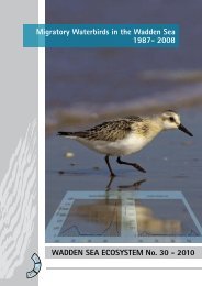
Annex 2<br />
List of <strong>Wadden</strong> <strong>Sea</strong> bird species.<br />
13/450
14/450
List of <strong>Wadden</strong> <strong>Sea</strong> bird species<br />
<strong>The</strong> table below indicates the birds species monitored in the trilateral Joint Monitoring of<br />
Migratory/Breeding Birds program to the EU Birds Directive.<br />
Bird species are listed<br />
a) according EU Birds Directive Annex I/II in Special Protection Areas (SPA) of the <strong>Wadden</strong><br />
<strong>Sea</strong> in Denmark, Schleswig-Holstein, Hamburg, Niedersachsen <strong>and</strong> <strong>The</strong> Netherl<strong>and</strong>s <strong>and</strong><br />
b) in the trilateral "Joint Monitoring of Migratory Birds" (JMMB) <strong>and</strong> "Joint Monitoring of<br />
Breeding Birds" (JMBB) program<br />
Remark:<br />
B,M,BM - bird linked as "Breeding", "Migratory" or as "Breeding <strong>and</strong> Migratory" bird to SPA.<br />
15/450
List of <strong>Wadden</strong> <strong>Sea</strong> bird species 2<br />
No Species, scientific name SH HH Nds NL DK JMMB<br />
JMBB<br />
Danish name German name Dutch name Order Family<br />
1 Red-Throated Diver (Gavia stellata) M M M Rødstrubet Lom Sterntaucher Roodkeelduiker Gaviiformes Gaviidae<br />
2 Black-Throated Diver (Gavia arctica) M M Sortstrubet Lom Prachttaucher Parelduiker Gaviiformes Gaviidae<br />
3 Little Grebe (Tachybaptus ruficollis) M Lille Lappedykker Zwergtaucher Dodaars Podicipediformes Podicipedidae<br />
4 Great Crested Grebe (Podiceps cristatus) M Toppet Lappedykker Haubentaucher Fuut Podicipediformes Podicipedidae<br />
5 Red-Necked Grebe (Podiceps grisegena) Gråstrubet<br />
Lappedykker<br />
Rothalstaucher Roodhalsfuut Podicipediformes Podicipedidae<br />
6 Black-Necked Grebe (Podiceps nigricollis) M Sorthalset<br />
Lappedykker<br />
Schwarzhalstaucher Geoorde Fuut Podicipediformes Podicipedidae<br />
7 Northern Fulmar (Fulmarus glacialis) Mallemuk; Stormfugl Eissturmvogel Noordse<br />
Stormvogel<br />
Procellariiformes Procellariidae<br />
8 Great Cormorant (Phalacrocorax carbo) BM BM BM BM Skarv Kormoran Aalscholver Pelecaniformes Phalacrocoracidae<br />
9 Bittern (Botaurus stellaris) B B B B Rørdrum Rohrdommel Roerdomp Ciconiiformes Ardeidae<br />
10 Little Egret (Egretta garzetta) BM B Silkehejre Seidenreiher Kleine Zilverreiger Ciconiiformes Ardeidae<br />
11 Grey Heron (Ardea cinerea) M Fiskehejre Graureiher Blauwe Reiger Ciconiiformes Ardeidae<br />
12 White Stork (Ciconia ciconia) B B B Fiskehejre Weißstorch Ooievaar Ciconiiformes Ciconiidae<br />
13 Eurasian Spoonbill (Platalea leucorodia) BM BM BM BM Fiskehejre Löffler Lepelaar Ciconiiformes Threskiornithidae<br />
14 Mute Swan (Cygnus olor) M Knopsvane Höckerschwan Knobbelzwaan Anseriformes Anatidae<br />
15 Bewick's Swan (Cygnus columbianus bewickii) M M M M Pibesvane Zwergschwan Kleine Zwaan Anseriformes Anatidae<br />
16 Whooper Swan (Cygnus cygnus) M M M Sangsvane Singschwan Wilde Zwaan Anseriformes Anatidae<br />
17 Bean Goose (Anser fabalis) M Sædgås Saatgans Toendrarietgans Anseriformes Anatidae<br />
18 Pink-Footed Goose (Anser brachyrhynchus) M Kortnæbbet Gås Kurzschanbelgans Kleine Rietgans Anseriformes Anatidae<br />
19 White-Fronted Goose (Anser albifrons) M M Blisgås Blaessgans Kolgans Anseriformes Anatidae<br />
20 Greylag Goose (Anser anser) M M M M M Grågås Graugans Grauwe Gans Anseriformes Anatidae<br />
21 Barnacle Goose (Branta leucopsis) BM M M M BM Bramgås Nonnengans,<br />
Weißwangengans<br />
Br<strong>and</strong>gans Anseriformes Anatidae<br />
22 Brent Goose (Branta bernicla) M M M M M Knortegås Ringelgans Rotgans Anseriformes Anatidae<br />
23 Shelduck (Tadorna tadorna) BM M M BM BM Grav<strong>and</strong> Br<strong>and</strong>gans Bergeend Anseriformes Anatidae<br />
24 Wigeon (Anas penelope) M M M BM BM Pibe<strong>and</strong> Pfeifente Smient Anseriformes Anatidae<br />
25 Gadwall (Anas strepera) B M Knar<strong>and</strong> Schnatterente Krakeend Anseriformes Anatidae<br />
26 Teal (Anas crecca) M BM M M Krik<strong>and</strong> Krickente Wintertaling Anseriformes Anatidae<br />
27 Mallard (Anas platyrhynchos) M M M M Grå<strong>and</strong> Stockente Wilde Eend Anseriformes Anatidae<br />
28 Pintail (Anas acuta) M M M BM BM Spids<strong>and</strong> Spießente Pijlstaart Anseriformes Anatidae<br />
29 Garganey (Anas querquedula) M B Atling<strong>and</strong> Knäkente Zomertaling Anseriformes Anatidae<br />
30 Shoveler (Anas clypeata) M BM M M M Ske<strong>and</strong> Löffelente Slobeend Anseriformes Anatidae<br />
31 Scaup (Aythya marila) M Bjerg<strong>and</strong> Bergente Toppereend Anseriformes Anatidae<br />
32 Common Eider (Somateria mollissima) BM BM BM BM BM Ederfugl Eiderente Eidereend Anseriformes Anatidae<br />
33 Common Scoter (Melanitta nigra) M M M Sort<strong>and</strong> Trauerente Zwarte Zeeeend Anseriformes Anatidae<br />
34 Goldeneye (Bucephala clangula) M Isl<strong>and</strong>sk Hvin<strong>and</strong> Schellente Brilduiker Anseriformes Anatidae<br />
35 Smew (Mergus albellus) M Lille Skallesluger Zwergsäger Nonnetje Anseriformes Anatidae<br />
36 Red-breasted Merganser (Mergus serrator) BM M B Toppet Skallesluger Mittelsäger Middelste Zaagbek Anseriformes Anatidae<br />
37 Goos<strong>and</strong>er (Mergus merganser) M Stor Skallesluger Gänsesäger Grote Zaagbek Anseriformes Anatidae<br />
38 Red Kite (Milvus milvus) Rød Glente Rotmilan Rode Wouw Falconiformes Accipitridae<br />
39 White-Tailed Eagle (Haliaeetus albicilla) M M M Havørn Seeadler Zeearend Falconiformes Accipitridae<br />
16/450
List of <strong>Wadden</strong> <strong>Sea</strong> bird species 3<br />
40 Marsh Harrier (Circus aeruginosus) B B B B Rørhøg Rohrweihe Bruine Kiekendief Falconiformes Accipitridae<br />
41 Hen Harrier (Circus cyaneus) B B B BM B Blå Kærhøg Kornweihe Blauwe Kiekendief Falconiformes Accipitridae<br />
42 Montagu's Harrier (Circus pygargus) B B B Hedehøg Wiesenweihe Grauwe Kiekendief Falconiformes Accipitridae<br />
43 Rough-Legged Buzzard (Buteo lagopus) M Fjeldvåge Rauhfußbussard Ruigpootbuizerd Falconiformes Accipitridae<br />
44 Merlin (Falco columbarius) M Dværgfalk Merlin Smelleken Falconiformes Falconidae<br />
45 Peregrine Falcon (Falco peregrinus) B BM M M V<strong>and</strong>refalk W<strong>and</strong>erfalke Slechtvalk Falconiformes Falconidae<br />
46 Water Rail (Rallus aquaticus) B V<strong>and</strong>rikse Wasserralle Waterral Gruiformes Rallidae<br />
47 Spotted Crake (Porzana porzana) B B B B Plettet Rørvagtel Tüpfelsumpfhuhn Porseleinhoen Gruiformes Rallidae<br />
48 Corn Crake (Crex crex) B B B Engsnarre Wachtelkönig Kwartelkoning Gruiformes Rallidae<br />
49 Oystercatcher (Haematopus ostralegus) BM BM M M BM BM Str<strong>and</strong>skade Austernfischer Scholekster Charadriiformes Haematopoditae<br />
50 Black-Winged Stilt (Himantopus himantopus) Stylteløber Stelzenläufer Steltkluut Charadriiformes Recurvirostridae<br />
51 Avocet (Recurvirostra avosetta) BM BM BM BM BM BM Klyde Säbelschnäbler Kluut Charadriiformes Recurvirostridae<br />
52 Great Ringed Plover (Charadrius hiaticula) BM BM M BM BM Stor Præstekrave S<strong>and</strong>regenpfeifer Bontbekplevier Charadriiformes Charadriidae<br />
53 Kentish Plover (Charadrius alex<strong>and</strong>rinus) BM B BM BM BM Hvidbrystet<br />
Præstekrave<br />
Seeregenpfeifer Str<strong>and</strong>plevier Charadriiformes Charadriidae<br />
54 Golden Plover (Pluvialis apricaria) M M M M M M Hjejle; Hedehjejle Goldregenpfeifer Goudplevier Charadriiformes Charadriidae<br />
55 Grey Plover (Pluvialis squatarola) M M M M M M Str<strong>and</strong>hjejle Kiebitzregenpfeifer Zilverplevier Charadriiformes Charadriidae<br />
56 Northern Lapwing (Vanellus vanellus) BM BM M BM Vibe Kiebitz Kievit Charadriiformes Charadriidae<br />
57 Knot (Calidris canutus) M M M M M M Isl<strong>and</strong>sk Ryle Knutt Kanoetstr<strong>and</strong>loper Charadriiformes Scolopacidae<br />
58 S<strong>and</strong>erling (Calidris alba) M M M M M M S<strong>and</strong>løber; Selning S<strong>and</strong>erling Drieteenstr<strong>and</strong>loper Charadriiformes Scolopacidae<br />
59 Curlew S<strong>and</strong>piper (Calidris ferruginea) M M M M Krumnæbbet Ryle Sichelstr<strong>and</strong>läufer Krombekstr<strong>and</strong>loper Charadriiformes Scolopacidae<br />
60 Dunlin (Calidris alpina) BM M M M BM BM Almindelig Ryle Alpenstr<strong>and</strong>läufer Bonte Str<strong>and</strong>loper Charadriiformes Scolopacidae<br />
61 Ruff (Philomachus pugnax) BM M M BM BM Brushane Kampfläufer Kemphaan Charadriiformes Scolopacidae<br />
62 Common Snipe (Gallinago gallinago) BM B B Dobbeltbekkasin Bekassine Watersnip Charadriiformes Scolopacidae<br />
63 Black-tailed Godwit (Limosa limosa) BM BM M BM Stor Kobbersneppe Uferschnepfe Grutto Charadriiformes Scolopacidae<br />
64 Bar-Tailed Godwit (Limosa lapponica) M M M M M Lille Kobbersneppe Pfuhlschnepfe Rosse Grutto Charadriiformes Scolopacidae<br />
65 Whimbrel (Numenius phaeopus) M M M Lille Regnspove;<br />
Småspove<br />
Regenbrachvogel Regenwulp Charadriiformes Scolopacidae<br />
66 Eurasian Curlew (Numenius arquata) BM M BM M BM BM Stor Regnspove Großer Brachvogel Wulp Charadriiformes Scolopacidae<br />
67 Spotted Redshank (Tringa erythropus) M M M M Sortklire Dunkelwasserläufer Zwarte Ruiter Charadriiformes Scolopacidae<br />
68 Common Redshank (Tringa totanus) BM BM M BM BM Rødben Rotschenkel Tureluur Charadriiformes Scolopacidae<br />
69 Greenshank (Tringa nebularia) M M M M M Hvidklire Grünschenkel Groenpootruiter Charadriiformes Scolopacidae<br />
70 Wood S<strong>and</strong>piper (Tringa glareola) M Tinksmed Bruchwaserläufer Bosruiter Charadriiformes Scolopacidae<br />
71 Turnstone (Arenaria interpres) BM M M BM Stenvender Steinwälzer Steenloper Charadriiformes Scolopacidae<br />
72 Red-Necked Phalarope (Phalaropus lobatus) M Odinshane Odinshühnchen Grauwe Franjepoot Charadriiformes Scolopacidae<br />
73 Mediterranean Gull (Larus melanocephalus) B B Sorthovedet Måge Schwarzkopfmöwe Zwartkopmeeuw Charadriiformes Laridae<br />
74 Little Gull (Larus minutus) BM M B B Dværgmåge Zwergmöwe Dwergmeeuw Charadriiformes Laridae<br />
75 Black-headed Gull (Larus ridibundus) BM M BM Hættemåge Lachmöwe Kokmeeuw Charadriiformes Laridae<br />
76 Common Gull (Larus canus) BM M BM Stormmåge Sturmmöwe Stormmeeuw Charadriiformes Laridae<br />
77 Lesser Black-backed Gull (Larus fuscus) BM M B BM<br />
Heringsmöwe Kleine<br />
Charadriiformes Laridae<br />
Sildemåge<br />
Mantelmeeuw<br />
78 Herring Gull (Larus argentatus) BM M BM Sølvmåge Silbermöwe Zilvermeeuw Charadriiformes Laridae<br />
79 Great Black-backed Gull (Larus marinus) BM M BM Svartbag Mantelmöwe Grote Mantelmeeuw Charadriiformes Laridae<br />
80 Kittiwake (Larus tridactylus) M Ride Dreizehenmöwe Drieteenmeeuw Larus tridactylus Laridae<br />
81 Gull-billed Tern (Gelochelidon nilotica) B B B B S<strong>and</strong>terne Lachseeschwalbe Lachstern Charadriiformes Sternidae<br />
17/450
List of <strong>Wadden</strong> <strong>Sea</strong> bird species 4<br />
82 S<strong>and</strong>wich tern (Sterna s<strong>and</strong>vicensis) BM BM BM B BM B Splitterne Br<strong>and</strong>seeschwalbe Grote Stern Charadriiformes Sternidae<br />
83 Common Tern (Sterna hirundo) BM BM BM B BM B Fjordterne Flußseeschwalbe Visdief Charadriiformes Sternidae<br />
84 Arctic Tern (Sterna paradisaea) BM BM BM B BM B Havterne Küstenseeschwalbe Noordse Stern Charadriiformes Sternidae<br />
85 Little Tern (Sterna albifrons) BM BM BM B BM B Dværgterne Zwergseeschwalbe Dwergstern Charadriiformes Sternidae<br />
86 Black Tern (Chlidonias niger) B M M B Sortterne Trauerseeschwalbe Zwarte Stern Charadriiformes Sternidae<br />
87 Guillemot (Uria aalge) M Atlantisk Lomvie Trottellumme Zeekoet Charadriiformes Alcidae<br />
88 Razorbill (Alca torda) M Alk Tordalk Alk Charadriiformes Alcidae<br />
89 Short-eared Owl (Asio flammeus) B B B B BM B Mosehornugl Sumpfohreule Velduil Strigiformes Strigidae<br />
90 Kingfisher (Alcedo atthis) Isfugl Eisvogel Ijsvogel Coraciiformes Alcedinidae<br />
91 Wood Lark (Lullula arborea) M Hedelærke Heidelerche Boomleeuwerik Passeriformes Alaudidae<br />
92 Sky Lark (Alauda arvensis) B Sanglærke Feldlerche Veldleeuwerik Passeriformes Alaudidae<br />
93 Shore (Horned) Lark (Eremophila alpestris) M Bjerglærke Ohrenlerche Str<strong>and</strong>leeuwerik Passeriformes Alaudidae<br />
94 Meadow Pipit (Anthus pratensis) Engpiber Wiesenpieper Graspieper Passeriformes Motacillidae<br />
95 Blue-Headed Wagtail (Motacilla flava) B Gul Vipstjert Schafstelze Gele Kwikstaart Passeriformes Motacillidae<br />
96 Bluethroat (Luscinia svecica) B B B Blåhals Blaukelchen Blauwborst Passeriformes Muscicapidae<br />
97 Whinchat (Saxicola rubetra) B B Bynkefugl Braunkehlchen Paapje Passeriformes Muscicapidae<br />
98 Stonechat (Saxicola torquata) B Sortstrubet<br />
Bynkefugl<br />
Schwarzkehlchen Roodborsttapuit Passeriformes Muscicapidae<br />
99 Wheatear (Oenanthe oenanthe) B B Almindelig<br />
Stenpikker<br />
Steinschmätzer Tapuit Passeriformes Muscicapidae<br />
100 Savi's Warbler (Locustella luscinioides) B Savisanger Rohrschwirl Snor Passeriformes Sylviidae<br />
101 Sedge Warbler (Acrocephalus schoenobaenus) B B Sivsanger Schilfrohrsänger Rietzanger Passeriformes Sylviidae<br />
102 Red-Breasted Flycatcher (Ficedula parva) M<br />
Zwergschnäpper Kleine<br />
Passeriformes Muscicapidae<br />
Lille Fluesnapper<br />
Vliegenvanger<br />
(Muscicapinae)<br />
103 Bearded Tit (Panurus biarmicus) Skægmejse Bartmeise Baardmannetje Passeriformes Timaliidae<br />
104 Red-Backed Shrike (Lanius collurio) B Rødrygget<br />
Tornskade<br />
Neuntöter Grauwe Klauwier Passeriformes Laniidae<br />
105 Twite (Carduelis flavirostris) M Bjergirisk Berghänfling Frater Passeriformes Fringillidae<br />
106 Snow Bunting (Plectrophenax nivalis) M Snespurv Schneeammer Sneeuwgors Passeriformes Emberizidae<br />
18/450
Annex 3<br />
List of endemic salt marsh species.<br />
19/450
20/450
List of endemic saltmarsh species<br />
<strong>The</strong> table below lists 271 endemic species in the saltmarshes of the nominated property. A<br />
selection of a bibliography in English language with regard to the endemites is given for<br />
further information.<br />
ANDRESEN, H., BAKKER, J.P., BRONGERS, M., HEYDEMANN, B. & IRMLER, U. (1990):<br />
Long-term changes of salt marsh communities by cattle grazing. Vegetatio, 89, 137-148.<br />
DESENDER, K. (1985): Wing polymorphism <strong>and</strong> reproductive biology in the halobiont<br />
Carabid-Beetle Pogonus chalceus (Marsham) (Coleoptera, Carabidae). Biol. Jb. Dodonaea<br />
53, 89-100.<br />
FOSTER, W.A. & TREHERNE, J.E. (1975): <strong>The</strong> distribution of an intertidal Aphid,<br />
Pemphigus trehernei FOSTER, on marine saltmarshes.-Oecologia 21, 141-155.<br />
FOSTER, W.A. (1983): Activity rhythms <strong>and</strong> the tide in a saltmarsh beetle Dicheirotrichus<br />
gustavi. Oecologia 60, 111-113.<br />
HEMMINGA, M.A.und VAN SOELEN, J. (1988): Estuarine gradients <strong>and</strong> the growth <strong>and</strong><br />
development of Agapanthia villosoviridescens ( Coleptera), a stem-borer of the salt marsh<br />
halophyte Aster tripolium. Oecologia 77, 307-312.<br />
MEYER, H. , FOCK, H., HAASE, A., REINKE, H.-D. & TULOWITZKI,I. (1995): Structure of<br />
the invertebrate fauna in salt marshes of the <strong>Wadden</strong> <strong>Sea</strong> coast of Schleswig-Holstein<br />
influenced by sheep-grazing. - Helgoländer Meeresuntersuchungen 49: 563-589; Hamburg.<br />
[D: SH; eco]<br />
REINKE, H.-D., MEYER, H. (1999): Monitoring of the evertebrate fauna in <strong>Wadden</strong> <strong>Sea</strong> salt<br />
marshes. - Senckenbergiana Maritima 29 (Supplement): 127-133., Frankfurt am Main.<br />
SOELEN, J., VAN & MARKUSSE, M.M. (1983): Notes on the distribution of some insect<br />
species in the stems of Aster tripolium L (Compositae). - Ent. Berichten Amsterdam 43: 124-<br />
127.<br />
WYATT, T.D. & FOSTER, W.A. (1988): Distribution <strong>and</strong> abundance of the intertidal<br />
saltmarsh beetle Bledius spectabilis. - Ecological Entomology 13: 453-464.<br />
21/450
Order<br />
Family Species Salt-typ<br />
Gastropoda Assiminea grayana (Fleming) hal-1<br />
Gastropoda Hydrobia ulvae (Pennant) hal-1<br />
Gastropoda Limapontia capitata Müller hal-1<br />
Gastropoda Ovatella myosotis (Draparnaud) hal-1<br />
Crustacea Corophium volutator (Pallas) hal-1<br />
Crustacea Orchestia gammarellus Pallas hal-1<br />
Oribatei Oribatei Ameronothrus nigrofemoratus hal-1<br />
Oribatei Oribatei Ameronothrus schneideri (Oudemanns) hal-1<br />
Oribatei Oribatei Hermannia subglabra Berlese hal-1<br />
Oribatei Oribatei Oribatella arctica litoralis Strenzke hal-1<br />
Oribatei Oribatei Punctoribates quadrivertex (Halbert) hal-1<br />
Gamasina Gamasina Leioseicus salinus (Halbert) hal-1<br />
Gamasina Gamasina Parasitus trouessarti (Berlese) hal-1<br />
Gamasina Gamasina Dendrolaelaps halophilus (Willmann) hal-1<br />
Collembola Collembola Archisotoma pulchella (Moniez) hal-1<br />
Collembola Collembola Folsomia sexoculata (Tullberg) hal-1<br />
Collembola Collembola Isotoma maritima (Tullberg) hal-1<br />
Collembola Collembola Onychiurus debilis (Moniez) hal-1<br />
Araneae Dictynidae Argenna patula Simon hal-1<br />
Araneae Linyphiidae Allomengea scopigera hal-2<br />
Araneae Linyphiidae Baryphyma duffeyi (Millidge) hal-1<br />
Araneae Linyphiidae Ceratinopsis sativa (Simon) hal-2<br />
Araneae Linyphiidae Erigone arctica (White) hal-2<br />
Araneae Linyphiidae Erigone longipalpis (Sundevall) hal-2<br />
Araneae Linyphiidae Erigone vagans (Audouin) hal-2<br />
Araneae Linyphiidae Hypomma bituberculatum (Wider) hal-3<br />
Araneae Linyphiidae Hypselistes jacksoni (O.P.Cambridge) hal-2<br />
Araneae Linyphiidae Oedothorax retusus (Westring) hal-2<br />
Araneae Linyphiidae Porrhomma microphthalmum (O.P.Cambridge) hal-2<br />
Araneae Linyphiidae Silometopus ambiguus (O.P.Cambridge) hal-1<br />
Araneae Linyphiidae Silometopus curtus (Simon) hal-1-2<br />
Araneae Linyphiidae Silometopus incurvatus (O.P.Cambridge) hal-1<br />
Araneae Linyphiidae Silometopus reussi (Thorell) hal-2<br />
Araneae Linyphiidae Walckenaeria vigilax (Blackwell) hal-2<br />
Araneae Lycosidae Pardosa purbeckesis (O.P.Cambridge) hal-1<br />
Araneae <strong>The</strong>ridiidae Robertus heydemanni Wiehle hal-1<br />
Araneae <strong>The</strong>ridiidae Enoplognatha mordax (Thorell) hal-2<br />
Araneae Thomisidae Ozyptila westringi hal-1<br />
Coleoptera Apionidae Pseudaplemonus limonii Kirby hal-1<br />
Coleoptera Cantharidae Cantharis fulvicillis F. hal-2<br />
Coleoptera Cantharidae Cantharis rufa var. darwiniana Sharp. hal-1<br />
Coleoptera Carabidae Acupalpus elegens (Dejean) hal-1<br />
Coleoptera Carabidae Agonum monachum (Duftschmidt) [= atratum hal-1<br />
Dufts.]<br />
Coleoptera Carabidae Amara convexiuscula (Marsham) hal-2<br />
Coleoptera Carabidae Amara ingenua (Duftschmid) hal-2<br />
Coleoptera Carabidae Amara strenua Zimmermann hal-1<br />
Coleoptera Carabidae Anisodactylus poeciloides (Stephens) hal-1<br />
Coleoptera Carabidae Bembidion aeneum Germar hal-1<br />
Coleoptera Carabidae Bembidion ephippium Germar hal-1<br />
Coleoptera Carabidae Bembidion fumigatum Duftschmidt hal-2<br />
Coleoptera Carabidae Bembidion iricolor Bedel hal-1<br />
Coleoptera Carabidae Bembidion lunatum (Duftschmid) hal-2-3<br />
Coleoptera Carabidae Bembidion lunulatum (Geoffroy) hal-2-3<br />
Coleoptera Carabidae Bembidion maritimum (Stephens) hal-2<br />
Coleoptera Carabidae Bembidion minimum (Fabricius) [= Bembidion hal-2<br />
pusillum Gyllenhal]<br />
Coleoptera Carabidae Bembidion normannum Dejean hal-1<br />
Coleoptera Carabidae Bembidion pallidipenne (Illiger) hal-1<br />
22/450<br />
2
Coleoptera Carabidae Bembidion cruciatum polonicum Müller hal-2<br />
Coleoptera Carabidae Bembidion saxatile Gyllenhal hal-2<br />
Coleoptera Carabidae Bembidion tenellum Erichson hal-1<br />
Coleoptera Carabidae Cicindela maritima Dejean hal-1<br />
Coleoptera Carabidae Cillenus lateralis (Leach) hal-1<br />
Coleoptera Carabidae Dicheirotrichus gustavii Crotch hal-1<br />
Coleoptera Carabidae Dyschirius chalceus Erichson hal-1<br />
Coleoptera Carabidae Dyschirius impunctipennis Dawson hal-2<br />
Coleoptera Carabidae Dyschirius obscurus Gyllenhal hal-2<br />
Coleoptera Carabidae Dyschirius salinus Schaum hal-1<br />
Coleoptera Carabidae Pogonus chalceus (Marsham) hal-1<br />
Coleoptera Carabidae Pogonus luridipennis (Germar) hal-1<br />
Coleoptera Carabidae Tachys scutellaris Stephens hal-1<br />
Coleoptera Carabidae Tachys scutellaris Stephens hal-1<br />
Coleoptera Cerambycidae Agapanthia víllosoviridescens (de Geer) hal-2-3<br />
Coleoptera Chrysomelidae Longitarsus plantagomaritimus Degeer hal-1<br />
Coleoptera Chrysomelidae Phaedon concinnus Stephens hal-1<br />
Coleoptera Coccinellidae Coccinellia undecimpunctata tripunctata Linne hal-2<br />
Coleoptera Curculionidae Limnobaris dolorosa (Goeze) (= pilistriata Steph.) hal-2-3<br />
Coleoptera Curculionidae Mecinus collaris Germar hal-2<br />
Coleoptera Curculionidae Pelenomus zumpti Wagner hal-1<br />
Coleoptera Curculionidae Polydrusus pulchellus Stephens hal-1<br />
Coleoptera Curculionidae Trichosirocalus thalhammeri (Grenier) hal-1<br />
Coleoptera Heteroceridae Heterocerus flexuosus Stephens hal-1<br />
Coleoptera Heteroceridae Heterocerus fossor Kiesenwetter hal-1<br />
Coleoptera Heteroceridae Heterocerus hispidulus hal-2-3<br />
Coleoptera Heteroceridae Heterocerus maritimus Guérin hal-1<br />
Coleoptera Hydraenidae Ochthebius auriculatus Rey hal-1<br />
Coleoptera Hydraenidae Ochthebius dilatatus Stephens hal-1<br />
Coleoptera Hydraenidae Ochthebius marinus (Paykull) hal-1<br />
Coleoptera Hydrophilidae Cercyon depressus (Stephens) hal-1<br />
Coleoptera Hydrophilidae Cercyon litoralis (Gyllenhal) hal-1<br />
Coleoptera Hydrophilidae Enochrus bicolor (F.) hal-2<br />
Coleoptera Malachiidae Anthocomus coccineus (Schaller) [= rufus Herbst] hal-2<br />
Coleoptera Ptiliidae Ptenidium fuscicorne Erichson hal-2<br />
Coleoptera Scirtidae Cyphon laevipennis Tournier<br />
hal-2<br />
[= phragmiteticola Nyholm]<br />
Coleoptera Staphylinidae Amischa analis Gray. hal-2-3<br />
Coleoptera Staphylinidae Atheta orbata (Erichson) hal-2-3<br />
Coleoptera Staphylinidae Atheta vestita Gray. hal-1<br />
Coleoptera Staphylinidae Bledius bicornis (Germar) hal-1<br />
Coleoptera Staphylinidae Bledius opacus (Block) hal-2-3<br />
Coleoptera Staphylinidae Bledius spectabilis Kraatz hal-1<br />
Coleoptera Staphylinidae Bledius tricornis (Herbst) hal-1-2<br />
Coleoptera Staphylinidae Brundinia marina (Mulsant & Rey) [= Atheta] hal-1<br />
Coleoptera Staphylinidae Cafius xantholoma Gravenhorst hal-1<br />
Coleoptera Staphylinidae Carpelimus foveolatus (Sahlberg) hal-2<br />
Coleoptera Staphylinidae Carpelimus halophilus (Kiesenwetter) hal-2<br />
Coleoptera Staphylinidae Carpelimus schneideri (Gangelbauer) hal-1-2<br />
Coleoptera Staphylinidae Diglotta submarina Faim.& Lab. hal-1<br />
Coleoptera Staphylinidae Halobrecta flavipes Thompson hal-1<br />
Coleoptera Staphylinidae Halobrecta puncticeps (Thompson) hal-1<br />
Coleoptera Staphylinidae Micralymma marinum (Ström) hal-1<br />
Coleoptera Staphylinidae Omalium riparium Thompson hal-1<br />
Coleoptera Staphylinidae Oxypoda brachyptera (Stephens) hal-2-3<br />
Coleoptera Staphylinidae Oxypoda exoleta Erichson [= bavaria, hütheri<br />
Scheerp.]<br />
hal-2<br />
Coleoptera Staphylinidae Quedius simplicifrons Fairmaire [= hispanicus hal-1<br />
Bernhauer]<br />
Coleoptera Staphylinidae Tomoglossa heydemanni Lohse hal-1<br />
Lepidoptera Cochylidae Phalonidia affinitana (Douglas) hal-1<br />
Lepidoptera Cochylidae Phalonidia vectisana (Humphreys & Westwood) hal-2<br />
23/450<br />
3
Lepidoptera Coleophoridae Coleophora adjunctella Hodkinson hal-1<br />
Lepidoptera Coleophoridae Coleophora artemisiella Scott hal-2<br />
Lepidoptera Coleophoridae Coleophora asteris Mühlig hal-1<br />
Lepidoptera Coleophoridae Coleophora atriplicis Meyrick hal-1<br />
Lepidoptera Coleophoridae Coleophora moeniacella Stainton hal-1<br />
Lepidoptera Coleophoridae Coleophora salicorniae Wocke hal-1<br />
Lepidoptera Coleophoridae Coleophora simillimella Fuchs hal-2<br />
Lepidoptera Coleophoridae Coleophora suaedivora Meyrick hal-1<br />
Lepidoptera Coleophoridae Goniodoma limoniella hal-1<br />
Lepidoptera Elachistidae Elachista scirpi (Stainton) hal-1<br />
Lepidoptera Gelechiidae Aristotelia brizella hal-2<br />
Lepidoptera Gelechiidae Monochroa tetragonella (Stainton) hal-1<br />
Lepidoptera Gelechiidae Scrobipalpa instabiella (Douglas) hal-1<br />
Lepidoptera Gelechiidae Scrobipalpa nitentella (Fuchs) hal-1<br />
Lepidoptera Gelechiidae Scrobipalpa obsoletella (F. v. Röslerstamm) hal-2<br />
Lepidoptera Gelechiidae Scrobipalpa plantaginella hal-1<br />
Lepidoptera Gelechiidae Scrobipalpa salinella hal-1<br />
Lepidoptera Gelechiidae Scrobipalpa samadensis (Pfaff.) hal-1<br />
Lepidoptera Gelechiidae Scrobipalpa strangei (E. Hering) hal-1<br />
Lepidoptera Gelechiidae Xystophora gudmanni Larsen hal-1<br />
Lepidoptera Geometridae Scopula emutaria Hbn. [= Acidalia emutaria] hal-1<br />
Lepidoptera Lyonetiidae Bucculatrix maritima (Stainton) hal-1<br />
Lepidoptera Noctuidae Apamea oblonga (Hayworth) hal-2<br />
Lepidoptera Noctuidae Amphipoea (Mythimna) fucosa (Freyer) hal-2<br />
Lepidoptera Noctuidae Mythimna favicolor (Barret) hal-1<br />
Lepidoptera Pterophoridae Agdistis benneti Curt. hal-1<br />
Lepidoptera Pyralidae Pediarsia aridella (<strong>The</strong>nberg) hal-1<br />
Lepidoptera Tortricidae Bactra robustana (Christoph) hal-1<br />
Lepidoptera Tortricidae Eucosoma krygeri Rebel hal-1<br />
Lepidoptera Tortricidae Eucosoma maritima (Humphreys & Westwood) hal-2<br />
Lepidoptera Tortricidae Eucosoma tripoliana (Barret) hal-1<br />
Lepidoptera Tortricidae Lobesia litoralis (Humphreys & Westwood) hal-2<br />
Rhynchota-<br />
Aphidoidea<br />
Aphididae Aphis tripolii Laing, 1920 hal-1<br />
Rhynchota-<br />
Aphidoidea<br />
Aphididae Chaitaphis suaedae (Mimeur) hal-1<br />
Rhynchota- Aphididae Coloradoa (Lidaja) heizei (Börner, 1952) / Börner, hal-1<br />
Aphidoidea<br />
1952<br />
Rhynchota-<br />
Aphidoidea<br />
Aphididae Hayhurstia atriplicis hal-2<br />
Rhynchota-<br />
Aphidoidea<br />
Aphididae Macrosiphoniella asteris (Walker, 1849) hal-1<br />
Rhynchota-<br />
Aphidoidea<br />
Aphididae Macrosiphoniella pulvera (Walker, 1848) hal-1<br />
Rhynchota-<br />
Aphidoidea<br />
Aphididae Staticobium limonii (Contarini, 1847) hal-1<br />
Rhynchota-<br />
Aphidoidea<br />
Callaphididae Juncobia leegei (Börner, 1930) hal-2<br />
Rhynchota-<br />
Aphidoidea<br />
Chaitophoridae Atheroides brevicornis Laing hal-2<br />
Rhynchota-<br />
Aphidoidea<br />
Chaitophoridae Sipha litoralis (Walker) hal-1<br />
Rhynchota- Pemphigidae Geoica utricularia (Passerini, 1856) sensu hal-1<br />
Aphidoidea<br />
Mordvilko, 1935<br />
Rhynchota-<br />
Aphidoidea<br />
Pemphigidae Aploneura lentisci (Passerini) hal-2<br />
Rhynchota-<br />
Aphidoidea<br />
Pemphigidae Pemphigus trehernei Foster hal-1<br />
Diptera-<br />
Cecidomyiidae Jaapiella schmidti (RÜBSAAMEN, 1912) hal-1<br />
Nematocera<br />
Diptera-<br />
Nematocera<br />
Cecidomyiidae Mayetiola agrostivora MEYER, 1985 hal-2<br />
24/450<br />
4
Diptera-<br />
Nematocera<br />
Diptera-<br />
Nematocera<br />
Diptera-<br />
Nematocera<br />
Diptera-<br />
Nematocera<br />
Diptera-<br />
Nematocera<br />
Diptera-<br />
Brachycera<br />
Diptera-<br />
Brachycera<br />
Diptera-<br />
Brachycera<br />
Diptera-<br />
Brachycera<br />
Diptera-<br />
Brachycera<br />
Diptera-<br />
Brachycera<br />
Diptera-<br />
Brachycera<br />
Diptera-<br />
Brachycera<br />
Diptera-<br />
Brachycera<br />
Diptera-<br />
Brachycera<br />
Diptera-<br />
Brachycera<br />
Diptera-<br />
Brachycera<br />
Diptera-<br />
Brachycera<br />
Diptera-<br />
Brachycera<br />
Diptera-<br />
Brachycera<br />
Diptera-<br />
Brachycera<br />
Diptera-<br />
Brachycera<br />
Diptera-<br />
Brachycera<br />
Diptera-<br />
Brachycera<br />
Diptera-<br />
Brachycera<br />
Diptera-<br />
Brachycera<br />
Diptera-<br />
Brachycera<br />
Diptera-<br />
Brachycera<br />
Diptera-<br />
Brachycera<br />
Diptera-<br />
Brachycera<br />
Diptera-<br />
Brachycera<br />
Cecidomyiidae Mayetiola puccinelliae MEYER, 1980 hal-1<br />
Cecidomyiidae Procystiphora gerardii MEYER, 1980 hal-1<br />
Cecidomyiidae Rhopalomyia florum (KIEFFER, 1890) hal-1<br />
Limoniidae Symplecta hybrida (Meigen) hal-2<br />
Limoniidae Symplecta stictica (Meigen) hal-1-2<br />
Agromyzidae Amauromyza luteiceps (HENDEL, 1920) hal-1<br />
Agromyzidae Cerodontha fasciata (STROBL, 1880) hal-1<br />
Agromyzidae Cerodontha suturalis (HENDEL, 1931) hal-1<br />
Agromyzidae Chromatomyia asteris (= Phytomyza) (HENDEL,<br />
1934)<br />
hal-1<br />
Agromyzidae Liriomyza angulicornis (MALLOCH, 1918) hal-1<br />
Agromyzidae Liriomyza cicerina (RONDANI, 1875) hal-2<br />
Agromyzidae Liriomyza gudmanni HERING, 1928 hal-1<br />
Agromyzidae Liriomyza latipalpis HENDEL, 1920 hal-1<br />
Agromyzidae Melanagromyza tripolii SPENCER, 1957 hal-1<br />
Agromyzidae Metopomyza junci VON TSCHIRNHAUS, 1981 hal-1<br />
Agromyzidae Napomyza maritima VON TSCHIRNHAUS, 1981 hal-1<br />
Agromyzidae Napomyza tripolii SPENCER, 1966 hal-1<br />
Agromyzidae Ophiomyia ononidis SPENCER, 1966 hal-2<br />
Agromyzidae Phytomyza euphrasiae KALTENBACH, 1860 hal-2<br />
Agromyzidae Phytomyza isais HERING, 1936 hal-2<br />
Agromyzidae Phytomyza plantaginis ROBIN.-DESVOIDY, 1851 hal-1<br />
Anthomyiidae Pegomya betae atriplicis (CURTIS, 1847) hal-1<br />
Chloropidae Aphanotrigonum fasciellum (ZETTERSTEDT,<br />
1855)<br />
hal-1<br />
Chloropidae Aphanotrigonum femorellum COLLIN, 1946 hal-1<br />
Chloropidae Aphanotrigonum femorellum COLLIN, 1946 hal-1<br />
Chloropidae Chlorops calceatus MEIGEN, 1830 hal-1<br />
Chloropidae Dicraeus fennicus DUDA, 1933 hal-1<br />
Chloropidae Elachiptera cornuta (FALLÉN, 1820) hal-1<br />
Chloropidae Eribolus slesvicensis BECKER, 1910 hal-1<br />
Chloropidae Eurina lurida MEIGEN, 1830 hal-1<br />
Chloropidae Incertella (= Tropidoscinis) junci n.sp. VON<br />
TSCHIRNHAUS, 1981<br />
25/450<br />
hal-1<br />
5
Diptera-<br />
Brachycera<br />
Diptera-<br />
Brachycera<br />
Diptera-<br />
Brachycera<br />
Diptera-<br />
Brachycera<br />
Diptera-<br />
Brachycera<br />
Diptera-<br />
Brachycera<br />
Diptera-<br />
Brachycera<br />
Diptera-<br />
Brachycera<br />
Diptera-<br />
Brachycera<br />
Diptera-<br />
Brachycera<br />
Diptera-<br />
Brachycera<br />
Diptera-<br />
Brachycera<br />
Diptera-<br />
Brachycera<br />
Diptera-<br />
Brachycera<br />
Diptera-<br />
Brachycera<br />
Diptera-<br />
Brachycera<br />
Diptera-<br />
Brachycera<br />
Diptera-<br />
Brachycera<br />
Diptera-<br />
Brachycera<br />
Diptera-<br />
Brachycera<br />
Diptera-<br />
Brachycera<br />
Diptera-<br />
Brachycera<br />
Diptera-<br />
Brachycera<br />
Diptera-<br />
Brachycera<br />
Diptera-<br />
Brachycera<br />
Diptera-<br />
Brachycera<br />
Diptera-<br />
Brachycera<br />
Diptera-<br />
Brachycera<br />
Diptera-<br />
Brachycera<br />
Diptera-<br />
Brachycera<br />
Diptera-<br />
Brachycera<br />
Chloropidae Incertella (= Tropidoscinis) triglochinidis n.sp.<br />
VON TSCHIRNHAUS, 1981<br />
hal-1<br />
Chloropidae Melanum laterale (HALIDAY, 1833) hal-1<br />
Chloropidae Meromyza nigriventris MACQUART, 1835 hal-2<br />
Chloropidae Meromyza puccinelliae n.sp. VON<br />
TSCHIRNHAUS, 1981<br />
hal-1<br />
Chloropidae Microcercis (= Tropidoscinis] zuercheri (DUDA,<br />
1933)<br />
hal-1<br />
Chloropidae Microcercis trigonella (= Oscinella) (DUDA, 1933) hal-1<br />
Chloropidae Oscinimorpha albisetosa (DUDA, 1932) hal-1<br />
Chloropidae Oscinimorpha albisetosa (DUDA, 1932) hal-1<br />
Chloropidae Pseudopachychaeta approximatonervis<br />
(ZETTERSTEDT, 1848)<br />
hal-1<br />
Dolichopodidae Aphrosylus mitis Verrall, 1912 hal-1<br />
Dolichopodidae Asyndetus longicornis Negrobov, 1973 hal-1<br />
Dolichopodidae Campsicnemus armatus (Zetterstedt, 1849) hal-2<br />
Dolichopodidae Campsicnemus magius (Loew, 1845) hal-1<br />
Dolichopodidae Dolichopus clavipes Haliday, 1832 hal-1<br />
Dolichopodidae Dolichopus diadema Haliday, 1832 hal-1<br />
Dolichopodidae Dolichopus latipennis Fallén, 1823 hal-2<br />
Dolichopodidae Dolichopus plumipes (Scopoli, 1763) hal-2-3<br />
Dolichopodidae Dolichopus sabinus Haliday, 1838 hal-1<br />
Dolichopodidae Dolichopus signifer Haliday, 1838 hal-2<br />
Dolichopodidae Dolichopus strigipes Verrall, 1875 hal-2<br />
Dolichopodidae Hydrophorus oceanus (Macquart, 1838) hal-1<br />
Dolichopodidae Hydrophorus praecox (Lehmann, 1822) hal-2<br />
Dolichopodidae Machaerium maritimae Haliday, 1832 hal-1<br />
Dolichopodidae Medetera micacea Loew, 1857 hal-2-3<br />
Dolichopodidae Melanostolus nigricilius (Loew, 1871) hal-2<br />
Dolichopodidae Micromorphus albipes (Zetterstedt, 1843) hal-1-2<br />
Dolichopodidae Muscidideicus praetextatus (Haliday, 1855) hal-1<br />
Dolichopodidae Orthoceratium lacustre (Scopoli, 1763) hal-1<br />
Dolichopodidae Poecilobothrus regalis (Meigen, 1824) hal-2<br />
Dolichopodidae Rhaphium consobrinum Zetterstedt, 1843 hal-2<br />
Dolichopodidae Rhaphium riparium (Meigen, 1824) hal-1-2<br />
26/450<br />
6
Diptera-<br />
Brachycera<br />
Dolichopodidae Schoenophilus versutus (Haliday, 1851) hal-2<br />
Diptera-<br />
Brachycera<br />
Dolichopodidae Sciapus maritimus Becker, 1918 hal-1<br />
Diptera-<br />
Brachycera<br />
Dolichopodidae Sympycnus desoutteri Parent, 1925 hal-2-3<br />
Diptera-<br />
Brachycera<br />
Dolichopodidae Syntormon filiger Verrall, 1912 hal-2<br />
Diptera-<br />
Brachycera<br />
Dolichopodidae Syntormon pallipes (Fabricius, 1794) hal-2-3<br />
Diptera-<br />
Brachycera<br />
Dolichopodidae Syntormon rufipes hal-2<br />
Diptera-<br />
Brachycera<br />
Dolichopodidae Thinophilus flavipalpis (Zetterstedt, 1843) hal-1<br />
Diptera-<br />
Brachycera<br />
Dolichopodidae Thinophilus ruficornis (Haliday, 1838) hal-1-2<br />
Diptera-<br />
Brachycera<br />
Empididae Hilara lundbecki Frey, 1913 hal-1<br />
Diptera-<br />
Empididae Rhamphomyia (Pararhamphomyia) simplex hal-1<br />
Brachycera<br />
Zetterstedt, 1849<br />
Diptera-<br />
Brachycera<br />
Hybotidae Chersodromia cursitans (Zetterstedt, 1819) hal-2<br />
Diptera-<br />
Brachycera<br />
Hybotidae Chersodromia speculifera Walker, 1851 hal-1<br />
Diptera-<br />
Brachycera<br />
Hybotidae Crossopalpus curvipes (Meigen, 1822) hal-2<br />
Diptera-<br />
Brachycera<br />
Hybotidae Stilpon nubilus Collin, 1926 hal-2<br />
Diptera-<br />
Brachycera<br />
Stratiomyidae Nemotelus notatus Zetterstedt hal-1<br />
Diptera-<br />
Brachycera<br />
Stratiomyidae Nemotelus uliginosus (Linne) hal-1<br />
Diptera-<br />
Brachycera<br />
Syrphidae Eristalinus sepulchralis (L.) hal-1<br />
Diptera-<br />
Brachycera<br />
Syrphidae Lathyrophthalmus aeneus hal-1<br />
Diptera-<br />
Brachycera<br />
Tephritidae Ensina sonchi (LINNÉ, 1767) hal-1<br />
Diptera-<br />
Brachycera<br />
Tephritidae Paroxyna plantaginis (HALIDAY, 1883) hal-1<br />
Heteroptera Miridae Exolygus maritimus Wagner hal-2<br />
Heteroptera Miridae Conostethus frisicus Wagner hal-1<br />
Heteroptera Miridae Melanotrichus moncreaffi D.Sc. [Ortholygus] hal-1<br />
Heteroptera Miridae Melanotrichus rubidus (Puton) [Ortholygus] hal-1<br />
Heteroptera Miridae Poliopterus litoralis Wagner [Plagiognathus] hal-1<br />
Heteroptera Tingidae Agramma confusa (Puton) hal-1<br />
Heteroptera Saldidae Chartoscirta elegantula (Fallen) hal-2-3<br />
Heteroptera Saldidae Chiloxanthus pilosus (Fallen) hal-1-2<br />
Heteroptera Saldidae Chiloxanthus setulosus hal-1-2<br />
Heteroptera Saldidae Halosalda lateralis (Fallen) hal-1<br />
Heteroptera Saldidae Salda littoralis (Linne) hal-2-3<br />
Heteroptera Saldidae Saldula pallipes (Fabricius) hal-2-3<br />
Heteroptera Saldidae Saldula palustris (Douglas & Scott) hal-1<br />
Heteroptera Saldidae Saldula pilosella (Thomson) hal-2-3<br />
Heteroptera Saldidae Saldula saltatoria (L.) hal-2-3<br />
Auchenorrhyncha Cicadellidae Anoscopus limicola (=Aphrodes li. W.Wa.37)<br />
(Edwards, 1908)<br />
hal-1<br />
Auchenorrhyncha Cicadellidae Arthaldeus pascuellus (Falle´n, 1826) hal-2-3<br />
Auchenorrhyncha Cicadellidae Cicadula (Cicadula) quadrinotata (Fabricius,<br />
1794)<br />
hal-2-3<br />
Auchenorrhyncha Cicadellidae Conosanus obsoletus (Kirschbaum, 1858) hal-2-3<br />
Auchenorrhyncha Delphacidae Delphax pulchellus (Curtis, 1833) hal-2-3<br />
27/450<br />
7
Auchenorrhyncha Cicadellidae Eupteryx artemisiae (Kirschbaum, 1868)<br />
[Poliopterus litoralis]<br />
hal-1<br />
Auchenorrhyncha Cicadellidae Macrosteles (Macrosteles) horvathi (W. Wagner,<br />
1935)<br />
hal-1-2<br />
Auchenorrhyncha Cicadellidae Macrosteles (Macrosteles) sordidipennis (Stal,<br />
1858)<br />
hal-2<br />
Auchenorrhyncha Cicadellidae Paramesus obtusifrons (Stal, 1853) hal-1<br />
Auchenorrhyncha Cicadellidae Psammotettix putoni (= Deltoc. halophilus<br />
Edw.24) (<strong>The</strong>n, 1898)<br />
hal-1<br />
Auchenorrhyncha Cicadellidae Stroggylocephalus agrestis (Falle´n, 1806) hal-2-3<br />
28/450<br />
8
Annex 4<br />
<strong>The</strong> <strong>Wadden</strong> <strong>Sea</strong> Quality Status Report<br />
2009. Marencic, H. <strong>and</strong> de Vlas, J. (Eds.),<br />
2009. <strong>Wadden</strong> <strong>Sea</strong> Ecosystem No. 25.<br />
(only on DVD)<br />
29/450
30/450
Annex 5<br />
<strong>The</strong> <strong>Wadden</strong> <strong>Sea</strong> Quality Status Report -<br />
Synthesis Report 2010. Wolff, W.J, Bakker,<br />
J.P., Laursen, K. <strong>and</strong> Reise, K., 2010.<br />
<strong>Wadden</strong> <strong>Sea</strong> Ecosystem No. 29.<br />
31/450
32/450
<strong>The</strong> <strong>Wadden</strong> <strong>Sea</strong> 2010<br />
<strong>The</strong> <strong>Wadden</strong> <strong>Sea</strong> - A Universally<br />
Outst<strong>and</strong>ing Tidal Wetl<strong>and</strong><br />
<strong>The</strong> <strong>Wadden</strong> <strong>Sea</strong> Quality Status Report<br />
Synthesis Report 2010<br />
WADDEN SEA ECOSYSTEM No. 29 - 2010<br />
33/450
A universally outst<strong>and</strong>ing tidal wetl<strong>and</strong><br />
<strong>Wadden</strong> <strong>Sea</strong> Ecosystem No. 29 2010<br />
34/450
<strong>The</strong> <strong>Wadden</strong> <strong>Sea</strong> 0 0<br />
<strong>The</strong> <strong>Wadden</strong> <strong>Sea</strong> – A Universally<br />
Outst<strong>and</strong>ing Tidal Wetl<strong>and</strong><br />
<strong>The</strong> <strong>Wadden</strong> <strong>Sea</strong> Quality Status Report<br />
- Synthesis Report 0 0<br />
35/450<br />
A universally outst<strong>and</strong>ing tidal wetl<strong>and</strong><br />
<strong>Wadden</strong> <strong>Sea</strong> Ecosystem No. 29 2010
A universally outst<strong>and</strong>ing tidal wetl<strong>and</strong><br />
<strong>Wadden</strong> <strong>Sea</strong> Ecosystem No. 29 2010<br />
Colophon<br />
Publisher<br />
Common <strong>Wadden</strong> <strong>Sea</strong> Secretariat (CWSS), Wilhelmshaven, <strong>Germany</strong>;<br />
Language support<br />
<strong>Sea</strong>bury Salmon<br />
Cover Photo<br />
Klaus Janke<br />
Layout <strong>and</strong> technical editing<br />
Common <strong>Wadden</strong> <strong>Sea</strong> Secretariat<br />
Graphic support<br />
Gerold Lüerßen<br />
Published<br />
2010<br />
ISSN 0946896X<br />
This publication should be cited as:<br />
Karsten Reise, Martin Baptist, Peter Burbridge, Norbert Dankers, Ludwig Fischer, Burghard Flemming,<br />
Albert P. Oost, Cor Smit, 2010. <strong>The</strong> <strong>Wadden</strong> <strong>Sea</strong> – A Universally Outst<strong>and</strong>ing Tidal Wetl<strong>and</strong>. <strong>Wadden</strong> <strong>Sea</strong><br />
Ecosystem No. 29. Common <strong>Wadden</strong> <strong>Sea</strong> Secretariat, Wilhelmshaven, <strong>Germany</strong>, page 7 24.<br />
Wim J. Wolff, Jan P. Bakker, Karsten Laursen, Karsten Reise, 2010. <strong>The</strong> <strong>Wadden</strong> <strong>Sea</strong> Quality Status Report<br />
Synthesis Report 2010. <strong>Wadden</strong> <strong>Sea</strong> Ecosystem No. 29. Common <strong>Wadden</strong> <strong>Sea</strong> Secretariat, Wilhelms<br />
haven, <strong>Germany</strong>, page 25 74.<br />
36/450
<strong>The</strong> designation of the Dutch <strong>and</strong> German parts<br />
of the <strong>Wadden</strong> <strong>Sea</strong> Conservation Area as a World<br />
Heritage Site by UNESCO in June 2009 was a major<br />
step in formally recognizing the global importance<br />
of the <strong>Wadden</strong> <strong>Sea</strong> as a nature area. As such, it<br />
is managed through a joint effort of Denmark,<br />
<strong>Germany</strong> <strong>and</strong> <strong>The</strong> Netherl<strong>and</strong>s. <strong>The</strong>refore, the QSR<br />
Synthesis Report 2010 is preceded by a summary<br />
report of the universally outst<strong>and</strong>ing <strong>and</strong> most<br />
significant natural values. This is based on the<br />
nomination dossier <strong>and</strong> is here extended to cover<br />
the entire <strong>Wadden</strong> <strong>Sea</strong><br />
In this <strong>Trilateral</strong> <strong>Wadden</strong> <strong>Sea</strong> Cooperation, the<br />
<strong>Trilateral</strong> Monitoring <strong>and</strong> Assessment Program<br />
(TMAP) plays a central role, providing the basis<br />
for a periodic assessment of the condition of the<br />
<strong>Wadden</strong> <strong>Sea</strong> ecosystem, <strong>and</strong> for an evaluation of<br />
progress towards the ecological targets set out in<br />
the <strong>Wadden</strong> <strong>Sea</strong> Plan.<br />
This Quality Status Report 2009 (QSR 2009)<br />
was prepared to update the findings of the QSR<br />
2004 <strong>and</strong> to provide input into the <strong>Trilateral</strong><br />
Governmental Conference on Sylt on 18 March<br />
2010. <strong>The</strong> work was coordinated by the Common<br />
<strong>Wadden</strong> <strong>Sea</strong> Secretariat <strong>and</strong> the <strong>Trilateral</strong> Moni<br />
toring <strong>and</strong> Assessment Group. Over 115 scientists<br />
from <strong>The</strong> Netherl<strong>and</strong>s, <strong>Germany</strong> <strong>and</strong> Denmark<br />
contributed to this project during 20082009.<br />
<strong>The</strong>y prepared 30 thematic reports which were<br />
published in November 2009 (http://www.wad<br />
denseasecretariat.org/QSR2009/index.htm).<br />
<strong>The</strong>se thematic reports, together with findings<br />
from the 12 th International <strong>Wadden</strong> <strong>Sea</strong> Sympo<br />
sium (Wilhelmshaven, 30 March – 3 April 2009)<br />
(<strong>Wadden</strong> <strong>Sea</strong> Ecosystem No. 26) provide the basis<br />
for the QSR synthesis report presented here. It<br />
summarizes the main findings of the QSR thematic<br />
reports <strong>and</strong> attempts to present an integrated<br />
assessment of the main ecosystem developments<br />
<strong>and</strong> identify main issues of concern <strong>and</strong> gaps of<br />
knowledge for science, management <strong>and</strong> policy.<br />
Common <strong>Wadden</strong> <strong>Sea</strong> Secretariat<br />
37/450<br />
A universally outst<strong>and</strong>ing tidal wetl<strong>and</strong><br />
Foreword<br />
<strong>Wadden</strong> <strong>Sea</strong> Ecosystem No. 29 2010
A universally outst<strong>and</strong>ing tidal wetl<strong>and</strong><br />
<strong>Wadden</strong> <strong>Sea</strong> Ecosystem No. 29 2010<br />
38/450
<strong>The</strong> <strong>Wadden</strong> <strong>Sea</strong> 0 0<br />
<strong>The</strong> <strong>Wadden</strong> <strong>Sea</strong> – A Universally<br />
Outst<strong>and</strong>ing Tidal Wetl<strong>and</strong><br />
Karsten Reise, Martin Baptist, Peter Burbridge, Norbert Dankers, Ludwig<br />
Fischer, Burghard Flemming, Albert P. Oost, Cor Smit ______ page<br />
<strong>The</strong> <strong>Wadden</strong> <strong>Sea</strong> Quality Status Report<br />
- Synthesis Report 0 0<br />
Wim J. Wolff, Jan P. Bakker, Karsten Laursen, Karsten Reise page<br />
39/450<br />
A universally outst<strong>and</strong>ing tidal wetl<strong>and</strong><br />
<strong>Wadden</strong> <strong>Sea</strong> Ecosystem No. 29 2010
A universally outst<strong>and</strong>ing tidal wetl<strong>and</strong><br />
<strong>Wadden</strong> <strong>Sea</strong> Ecosystem No. 29 2010<br />
40/450
WADDEN SEA ECOSYSTEM No. 29<br />
<strong>The</strong> <strong>Wadden</strong> <strong>Sea</strong> – A Universally<br />
Outst<strong>and</strong>ing Tidal Wetl<strong>and</strong><br />
A universally outst<strong>and</strong>ing tidal wetl<strong>and</strong><br />
Karsten Reise<br />
Martin Baptist<br />
Peter Burbridge<br />
Norbert Dankers<br />
Ludwig Fischer<br />
Burghard Flemming<br />
Albert P. Oost<br />
Cor Smit<br />
20 0<br />
Common <strong>Wadden</strong> <strong>Sea</strong> Secretariat<br />
41/450<br />
7<br />
<strong>Wadden</strong> <strong>Sea</strong> Ecosystem No. 29 2010
A universally outst<strong>and</strong>ing tidal wetl<strong>and</strong><br />
<strong>Wadden</strong> <strong>Sea</strong> Ecosystem No. 29 2010<br />
This publication should be cited as:<br />
Karsten Reise, Martin Baptist, Peter Burbridge, Norbert Dankers, Ludwig Fischer, Burghard Flemming,<br />
Albert P. Oost, Cor Smit, 2010. <strong>The</strong> <strong>Wadden</strong> <strong>Sea</strong> – A Universally Outst<strong>and</strong>ing Tidal Wetl<strong>and</strong>. <strong>Wadden</strong> <strong>Sea</strong><br />
Ecosystem No. 29. Common <strong>Wadden</strong> <strong>Sea</strong> Secretariat, Wilhelmshaven, <strong>Germany</strong>, page 7 24.<br />
42/450
Along the North <strong>Sea</strong> shore, the largest coherent<br />
tidal flat area of the temperate world has evolved.<br />
Sediment supply from the sea has sufficiently<br />
balanced a slow sealevel rise in the last 8,000<br />
years to maintain a coastal configuration of a<br />
seaward s<strong>and</strong>y barrier, extensive tidal flats <strong>and</strong><br />
episodically flooded marshes. <strong>The</strong> <strong>Wadden</strong> <strong>Sea</strong> is<br />
unique in that it consists of vast (4,700 km²) bare<br />
s<strong>and</strong> <strong>and</strong> mud flats, emerging twice daily at low<br />
tide. Oceanic waters dominate river influence, <strong>and</strong><br />
dynamic s<strong>and</strong>y shoals <strong>and</strong> dune isl<strong>and</strong>s provide a<br />
partial shelter against waves <strong>and</strong> winds of a rough<br />
sea. In the course of a year, the <strong>Wadden</strong> <strong>Sea</strong> is<br />
visited by an unparalleled 1012 million birds for<br />
foraging <strong>and</strong> resting on their East Atlantic flyway.<br />
Food provision in the form of tidal flat fauna<br />
is 1020 times higher than in adjacent deeper<br />
waters. When the tide is in, the flats serve as a<br />
rich nursery for shrimp <strong>and</strong> fish. <strong>The</strong> <strong>Wadden</strong> <strong>Sea</strong><br />
constitutes a gigantic biological filter between<br />
l<strong>and</strong> <strong>and</strong> sea. This filter is primarily composed (1)<br />
of extensive beds of molluscan suspension feeders<br />
which filter the local tidal volume about twice a<br />
month, (2) of sediment kept permeable by bio<br />
turbating lugworms, <strong>and</strong> (3) of marsh vegetation<br />
which functions as a filter during episodic storm<br />
surges when waters are loaded with resuspended<br />
fine particles. An impressive number of about<br />
10,000 species of plants, fungi <strong>and</strong> animals thrive<br />
in the <strong>Wadden</strong> <strong>Sea</strong>. After a long phase of over<br />
exploitation, protection measures have triggered<br />
spectacular recoveries in breeding birds <strong>and</strong> seals.<br />
Largescale l<strong>and</strong> claims have ceased <strong>and</strong> the Wad<br />
den <strong>Sea</strong> is today highly rated for its serene beauty.<br />
Global warming with an accelerating sealevel<br />
rise, however, may threaten the s<strong>and</strong>y barrier <strong>and</strong><br />
the extent of the tidal flats.<br />
43/450<br />
A universally outst<strong>and</strong>ing tidal wetl<strong>and</strong><br />
Abstract<br />
9<br />
Bird flock on the <strong>Wadden</strong><br />
<strong>Sea</strong> beach (Photo: J. van<br />
de Kam).<br />
<strong>Wadden</strong> <strong>Sea</strong> Ecosystem No. 29 2010
0 A universally outst<strong>and</strong>ing tidal wetl<strong>and</strong><br />
. Introduction<br />
Figure 1:<br />
Satellite images taken in<br />
2000-2002 <strong>and</strong> combined<br />
to show low tide<br />
conditions everywhere. In<br />
reality tidal waves progress<br />
counter-clockwise over a<br />
six-hour period through<br />
the <strong>Wadden</strong> <strong>Sea</strong> (Source:<br />
Eurimage, Common<br />
<strong>Wadden</strong> <strong>Sea</strong> Secretariat<br />
& Brockmann Consult).<br />
Arrows indicate boundaries<br />
between sub-regions.<br />
Inset shows tidal basins<br />
in the Northern <strong>Wadden</strong><br />
<strong>Sea</strong> (modified from CPSL,<br />
2005).<br />
<strong>Wadden</strong> <strong>Sea</strong> Ecosystem No. 29 2010<br />
<strong>The</strong> earliest <strong>and</strong> most famous historical testimony<br />
of the <strong>Wadden</strong> <strong>Sea</strong> is recorded in the ‘Historia<br />
Naturalis’ by Plinius the Elder who visited the<br />
southern coast of the North <strong>Sea</strong> in the year 47<br />
AD. He was amazed by the ‘indistinctness’ <strong>and</strong><br />
‘immeasurable expanse’ of l<strong>and</strong> inundated by the<br />
sea twice daily. <strong>The</strong> intimate bond between the<br />
people <strong>and</strong> this changeable environment was quite<br />
incomprehensible to him. However, perception<br />
of pleasure was derived from the <strong>Wadden</strong> <strong>Sea</strong><br />
when in the 1819th centuries the ‘aesthetics of<br />
the sublime’ stimulated human senses to ascribe<br />
outst<strong>and</strong>ing value to this serene coastal sea with<br />
l<strong>and</strong> diving under water <strong>and</strong> water running off<br />
the l<strong>and</strong>, with an open horizon <strong>and</strong> limitless sky,<br />
<strong>and</strong> a calm sea which may all of a sudden turn<br />
wild with an arising torrential storm (Fischer <strong>and</strong><br />
Hasse, 2001).<br />
<strong>The</strong> <strong>Wadden</strong> <strong>Sea</strong> is mostly shallow enough to<br />
wade across. <strong>The</strong> unique vastness of the tidal flats<br />
<strong>and</strong> shoals, fringing salt marshes, wide beaches<br />
<strong>and</strong> dune isl<strong>and</strong>s with a spectacular abundance of<br />
44/450<br />
wildlife has been the motivation for proposing the<br />
<strong>Wadden</strong> <strong>Sea</strong> as a UNESCO World Heritage Site. <strong>The</strong><br />
following text is condensed from the description<br />
<strong>and</strong> justification chapters of the DutchGerman<br />
nomination dossier (CWSS, 2008, 2009), but here<br />
extended to cover the entire <strong>Wadden</strong> <strong>Sea</strong> area<br />
including the Danish part. <strong>The</strong> foremost question<br />
was: On which universally outst<strong>and</strong>ing, most<br />
significant natural values should the inscription<br />
be based? We have employed major reviews of<br />
scientific knowledge (Wolff 1983), quality assess<br />
ments (CWSS, 1991; De Jong, 1999; Essink et al.,<br />
2005; Marencic & de Vlas, 2009), <strong>and</strong> cite repre<br />
sentative studies on the geomorphology, ecology<br />
<strong>and</strong> biology of the region from the 19th century<br />
onwards. Comparisons with other coasts of the<br />
world are based on Reineck <strong>and</strong> Singh (1980),<br />
Flemming (2002), Reise (2001) <strong>and</strong> own surveys<br />
(see annex 3 in CWSS, 2008). <strong>The</strong> purpose of this<br />
paper is to provide a concise overview on physical<br />
<strong>and</strong> biotic values which lend the <strong>Wadden</strong> <strong>Sea</strong> a<br />
universally outst<strong>and</strong>ing status worthy for inscrip<br />
tion as UNESCO World Heritage Site.
<strong>The</strong> <strong>Wadden</strong> <strong>Sea</strong> has the world’s largest continu<br />
ous belt of bare tidal flats partially sheltered by<br />
a s<strong>and</strong>y barrier against a rough sea, with the<br />
latter’s waters dominating river influence. When<br />
postglacial sea level rise began to slow down<br />
about 8,000 years ago, the <strong>Wadden</strong> <strong>Sea</strong> emerged<br />
with a seaward barrier of dune isl<strong>and</strong>s <strong>and</strong> s<strong>and</strong>y<br />
shoals, <strong>and</strong> a l<strong>and</strong>ward area of tidal flats <strong>and</strong> salt<br />
marshes (Zagwijn, 1986; Flemming <strong>and</strong> Davis,<br />
1994). <strong>The</strong> rates of sealevel rise <strong>and</strong> sediment<br />
supply varied over time <strong>and</strong> locality, causing<br />
continuous dynamics in the coastal morphology of<br />
the <strong>Wadden</strong> <strong>Sea</strong>. As a result, at times parts of the<br />
coast have grown where the sea tides <strong>and</strong> waves<br />
have washed in more sediment from the adjacent<br />
offshore zone than was needed to compensate for<br />
sea level rise. At other times, the coast retreated<br />
in some places when sediment supply has been<br />
unable to compensate for sea level rise. In this<br />
way, the Holocene history of sea level, climate,<br />
<strong>and</strong> depositional responses has been preserved in<br />
the stratigraphic record of the <strong>Wadden</strong> <strong>Sea</strong> (Streif,<br />
1989; Bartholdy <strong>and</strong> Pejrup, 1994; Behre, 2003).<br />
With the <strong>Wadden</strong> <strong>Sea</strong>, a universally outst<strong>and</strong><br />
ing coastal l<strong>and</strong>scape has arisen at the southern<br />
<strong>and</strong> eastern shores of the North <strong>Sea</strong> (Figure 1).<br />
Along a coastal stretch of approximately 500 km,<br />
an uninterrupted belt of s<strong>and</strong> <strong>and</strong> mud flats with<br />
a total area of 4,700 km² is exposed to the air <strong>and</strong><br />
then covered by water twice daily in the rhythm<br />
of the tides. This belt of tidal flats is dissected by<br />
more than 30 branching tidal inlets <strong>and</strong> five major<br />
estuaries. Such a vast <strong>and</strong> coherent intertidal area<br />
not covered by salt marsh vegetation is found<br />
nowhere else in the world.<br />
<strong>The</strong>re are many other sedimentary coasts<br />
which, in one way or another, resemble the Wad<br />
den <strong>Sea</strong> morphologically but are much smaller or<br />
differ in terms of climate, river influence, tides<br />
or waves. Other large tidal flats can be found in<br />
the Arctic, but there the tides tend to be smaller<br />
than in the <strong>Wadden</strong> <strong>Sea</strong>, <strong>and</strong> the shore is frozen<br />
<strong>and</strong> covered by ice most of the year. In tropical<br />
<strong>and</strong> subtropical climates, the tidal zone is often<br />
occupied by mangroves, whereas in the <strong>Wadden</strong><br />
<strong>Sea</strong> tidal flats lack upright growing plants, except<br />
for salt marsh vegetation above mean hightide<br />
level. On other coasts, most of the sediment is<br />
directly supplied from the hinterl<strong>and</strong> by rivers,<br />
<strong>and</strong> salinity is ususally low or variable. Examples<br />
of such coasts are the Arctic Lena Delta, the tem<br />
perate Mississippi Delta or tropical deltaic regions<br />
of the Amazon, Niger or Ganges. Also, the wide<br />
mud flats along the coasts of the Yellow <strong>Sea</strong> have<br />
been built up by rivers.<br />
<strong>The</strong> <strong>Wadden</strong> <strong>Sea</strong> is special in that almost all of<br />
the sediments are supplied from the adjacent sea<br />
with only a minor or local river influence (Arends,<br />
1833; van Straaten <strong>and</strong> Kuenen, 1957). Salinity<br />
ranges mostly between 20 <strong>and</strong> 30 psu, which is<br />
less than in the open ocean (34) but more than<br />
in estuaries (020), where most other intertidal<br />
flats are found in Europe. Large s<strong>and</strong> <strong>and</strong> mud<br />
flats occur along the NW African coast where<br />
the Banc d’Arguin covers an area of 630 km² <strong>and</strong><br />
which corresponds to 13% of the tidal flat area<br />
of the <strong>Wadden</strong> <strong>Sea</strong> (Wolff et al., 1993). <strong>The</strong>se tidal<br />
flats constitute a relic from a former river delta,<br />
<strong>and</strong> are intimately linked to the <strong>Wadden</strong> <strong>Sea</strong> by<br />
its wading birds overwintering there (Wymenga<br />
et al., 1990). <strong>The</strong> <strong>Wadden</strong> <strong>Sea</strong> comprises about<br />
60% of the intertidal area at the northeastern<br />
Atlantic shores.<br />
A further feature of the <strong>Wadden</strong> <strong>Sea</strong> is a sea<br />
ward barrier of s<strong>and</strong>y isl<strong>and</strong>s <strong>and</strong> shoals which is<br />
a consequence of moderate tidal ranges, <strong>and</strong> s<strong>and</strong><br />
having been supplied from the offshore by waves<br />
<strong>and</strong> subsequently moved by the wind (Oost <strong>and</strong><br />
de Boer, 1994). Tides have increased with the ris<br />
ing level of the sea <strong>and</strong> today span from 1.5 to 4<br />
m. Below a tidal range of about 0.5 m, unbroken<br />
barrier spits <strong>and</strong> lagoons develop <strong>and</strong> above about<br />
3.5 m barrier isl<strong>and</strong>s no longer occur due to the<br />
large tidal prisms. <strong>The</strong> <strong>Wadden</strong> <strong>Sea</strong> may be divided<br />
into three morphological subregions (see arrows<br />
in Figure 1), based on tidal ranges between 1.5<br />
to 3 m in the South <strong>and</strong> North, <strong>and</strong> >3 m in the<br />
central part, as well as on coastal orientation <strong>and</strong><br />
river influence:<br />
• In the Southern <strong>Wadden</strong> <strong>Sea</strong>, twelve major<br />
barrier isl<strong>and</strong>s located 5 to 15 km off the<br />
mainl<strong>and</strong> shore, shelter the tidal area against<br />
waves generated by northwesterly <strong>and</strong> north<br />
erly winds. Sediment imported from the sea<br />
does not fully compensate for sealevel rise<br />
<strong>and</strong> isl<strong>and</strong>s migrate l<strong>and</strong>wards. A large embay<br />
ment, the former brackish Zuiderzee (3,600<br />
km²), was part of the Southern <strong>Wadden</strong> <strong>Sea</strong><br />
until it was separated by a dam in 1932. It<br />
was subsequently converted into a freshwater<br />
lake <strong>and</strong> arable l<strong>and</strong>. Another embayment, the<br />
estuarine Dollard, still exists.<br />
• In the Central <strong>Wadden</strong> <strong>Sea</strong>, tidal ranges often<br />
exceed 3 m <strong>and</strong> there are four estuaries caus<br />
ing a lower <strong>and</strong> more variable salinity than<br />
in the other two regions. A seaward chain<br />
of barrier isl<strong>and</strong>s is absent. Here, sediment<br />
import seems to balance sealevel rise. With<br />
the Jadebusen, a large embayment extends<br />
deep into the lowlying coastal marshl<strong>and</strong>.<br />
45/450<br />
A universally outst<strong>and</strong>ing tidal wetl<strong>and</strong><br />
2. Physical Environment<br />
<strong>Wadden</strong> <strong>Sea</strong> Ecosystem No. 29 2010
2 A universally outst<strong>and</strong>ing tidal wetl<strong>and</strong><br />
Figure 2:<br />
Tidal divide where tidal<br />
creeks running northward<br />
intersect a coherent<br />
seagrass bed (dark colour),<br />
while creeks running southwest<br />
(upper right) intersect<br />
a s<strong>and</strong>y flat with scattered<br />
seagrass patches (Photo: K.<br />
Reise).<br />
<strong>Wadden</strong> <strong>Sea</strong> Ecosystem No. 29 2010<br />
• In the Northern <strong>Wadden</strong> <strong>Sea</strong>, eight isl<strong>and</strong>s <strong>and</strong><br />
elevated s<strong>and</strong> bars form a seaward barrier 5 to<br />
25 km off the mainl<strong>and</strong>. <strong>The</strong>y provide shelter<br />
against waves generated by the prevailing<br />
westerly winds. Mostly, sediment supply does<br />
not compensate for sealevel rise, except for<br />
an oversupply between the isl<strong>and</strong>s of Rømø<br />
<strong>and</strong> Fanø. Several marsh isl<strong>and</strong>s are scattered<br />
across the tidal area. <strong>The</strong>se are remnants of a<br />
coherent marshl<strong>and</strong> which became drowned<br />
in late medieval times. In the North, some<br />
Pleistocene cliffs meet the sea.<br />
A distinctive hydrological feature of the <strong>Wadden</strong><br />
<strong>Sea</strong> is a series of tidal basins which are marine<br />
analogues to river catchments (Postma, 1954;<br />
Ehlers, 1988). However, flow direction alternates<br />
with the tides (see inset in Figure 1). <strong>The</strong> exist<br />
ence of tidal basins is interrelated with barrier<br />
isl<strong>and</strong>s <strong>and</strong> elevated s<strong>and</strong>s. Between these, the<br />
tidal flow is compressed <strong>and</strong> scours deep tidal<br />
inlets with a mean flow of about 1 m s1 . Be<br />
hind the barrier isl<strong>and</strong>s, most inlets branch into<br />
major tidal channels which, in turn, branch into<br />
successively smaller tidal creeks or runnels in<br />
a recurrent fractal pattern. In the backbarrier<br />
area, flood waters of adjacent tidal inlets meet<br />
at tidal divides (watersheds) where currents tend<br />
to calm down (Figure 2). Other than in lagoons,<br />
tidal divides allow for a direct lateral connection<br />
between basins. <strong>Sea</strong>ward of tidal inlets, ebbdelta<br />
shoals are formed. Here, ebb currents interact with<br />
waves <strong>and</strong> a longshore current which runs from<br />
southwest towards northeast.<br />
<strong>The</strong> sediment distribution along deltaic coasts<br />
is typically from coarse materials inshore to pro<br />
gressively finer sediments offshore. In the <strong>Wadden</strong><br />
46/450<br />
<strong>Sea</strong>, by contrast, the decrease in grain size is the<br />
other way round (van Straaten, 1954). This differ<br />
ence is caused by the sediment transport routes<br />
perpendicular to the shore running in opposite<br />
directions, whith the source either rivers or the<br />
sea. Along tropical <strong>and</strong> subtropical coasts, tidal<br />
flats may also develop behind a barrier of coralline<br />
reefs. Here the sediment particles primarily consist<br />
of biogenic carbonates, whereas in the <strong>Wadden</strong><br />
<strong>Sea</strong> siliclastic sediments prevail.<br />
Strong hydraulic <strong>and</strong> aeolian dynamics are<br />
an important characteristic of the <strong>Wadden</strong> <strong>Sea</strong><br />
region. Twice a day the tides move an average<br />
volume of 15 km³ of sea water through the tidal<br />
channels <strong>and</strong> inlets into the tidal basins where<br />
roughly the same volume remains at low tide, thus<br />
swelling up to some 30 km³ at high tide. A high<br />
exchange rate of tidal water masses secures the<br />
dominance of marine conditions in the backbar<br />
rier area (Postma, 1954). In the course of a tidal<br />
cycle, the sum of freshwater discharge is
Ecologically the <strong>Wadden</strong> <strong>Sea</strong> functions as a gi<br />
gantic coastal filter of unique composition, <strong>and</strong><br />
offers plenty of food to a rich aquatic nursery <strong>and</strong><br />
to 1012 million birds in the course of a year. <strong>The</strong><br />
habitats of the <strong>Wadden</strong> <strong>Sea</strong> show in a fascinating<br />
way how physical forces <strong>and</strong> biological activities<br />
interact to generate conditions for life in a frag<br />
ile balance. Along this coast physical forces are<br />
strong, biological activities high, <strong>and</strong> the basic<br />
materials are soft sediments <strong>and</strong> fluid waters.<br />
This combination makes the dynamic interactions<br />
between organisms <strong>and</strong> their environment readily<br />
apparent <strong>and</strong> attractive to study. Major habitats<br />
are arranged along an offshoreinshore gradient<br />
<strong>and</strong> from deep tidal inlets up to the highest dunes:<br />
an offshore belt seaward of the barrier isl<strong>and</strong>s, a<br />
tidal area with subtidal gullies <strong>and</strong> shoals, inter<br />
tidal mud <strong>and</strong> s<strong>and</strong>, with seagrass meadows or<br />
mixed oyster <strong>and</strong> mussel beds, a few estuaries,<br />
salt marshes on isl<strong>and</strong>s <strong>and</strong> along the mainl<strong>and</strong><br />
coast, beaches <strong>and</strong> dunes mainly on the isl<strong>and</strong>s.<br />
<strong>The</strong>se habitats are functionally interrelated <strong>and</strong><br />
constitute a characteristic combination.<br />
<strong>The</strong> offshore belt of the <strong>Wadden</strong> <strong>Sea</strong> is opera<br />
tionally defined as the zone seaward of the barrier<br />
isl<strong>and</strong>s <strong>and</strong> elevated outer s<strong>and</strong>s, extending into<br />
the North <strong>Sea</strong> down to the –15 m depth contour.<br />
This belt has no tidal flats <strong>and</strong> drops off smoothly<br />
towards the open North <strong>Sea</strong> but does not fully<br />
comply with it in terms of the biota. <strong>The</strong>re is a<br />
continuous exchange of both water <strong>and</strong> sediment<br />
with the tidal area. <strong>The</strong> sediment supply from the<br />
offshore belt is vital for the resilience of the coast<br />
when responding to changes in tidal area, sea<br />
level <strong>and</strong> to disturbances caused by storm surges<br />
(Flemming <strong>and</strong> Bartholomä, 1997). Phytoplankton<br />
blooms often start in this belt because turbidity is<br />
low enough for sufficient light <strong>and</strong> nutrient con<br />
centrations are high (Postma, 1954; van Beusekom<br />
<strong>and</strong> de Jonge, 2002). Through the tidal channels<br />
<strong>and</strong> inlets this offshore primary production reaches<br />
the inshore zoobenthos. In the offshore belt,<br />
autotrophic production prevails <strong>and</strong> in the tidal<br />
area, heterotrophic production is dominant. Also<br />
larvae of benthic fauna <strong>and</strong> fish drift from the<br />
offshore belt further inshore. Shrimp, fish, diving<br />
birds, seals <strong>and</strong> harbour porpoises readily commute<br />
between offshore <strong>and</strong> inshore zones (Bückmann,<br />
1934; Wolff <strong>and</strong> Zijlstra, 1980). In severe winters,<br />
the offshore belt provides an important refuge for<br />
the survival of populations otherwise confined to<br />
the tidal area.<br />
Within the tidal area, the subtidal shoals <strong>and</strong><br />
gullies similarly serve as a refuge for the intertidal<br />
fauna when conditions turn harsh. <strong>The</strong> subtidal<br />
fringe <strong>and</strong> low intertidal zone are the primary<br />
sites for beds of suspension feeders, mussels <strong>and</strong><br />
oysters in particular (Hagmeier <strong>and</strong> Kändler, 1927).<br />
Mussels are kept in bottom cultures <strong>and</strong> also oc<br />
cur naturally in mixed beds with oysters (Figure 3;<br />
Dankers <strong>and</strong> Zuidema, 1995; Nehls et al., 2006). A<br />
native subtidal oyster has been driven to extinction<br />
by overexploitation, while the introduced Pacific<br />
oyster recently invaded the intertidal mussel beds.<br />
47/450<br />
A universally outst<strong>and</strong>ing tidal wetl<strong>and</strong><br />
. Ecology<br />
Figure 3:<br />
Bed of suspension feeding<br />
mussels (Mytilus edulis)<br />
bound together by byssal<br />
threads. Shells are partly<br />
overgrown by barnacles<br />
(mainly Elminius modestus),<br />
a few oysters (Crassostrea<br />
gigas), bladder wrack (Fucus<br />
vesiculosus forma mytili),<br />
<strong>and</strong> periwinkles (Littorina<br />
littorea) graze on microbial<br />
films (Photo: K. Reise).<br />
<strong>Wadden</strong> <strong>Sea</strong> Ecosystem No. 29 2010
A universally outst<strong>and</strong>ing tidal wetl<strong>and</strong><br />
Figure 4:<br />
Fecal castings of lugworms<br />
(Arenicola marina) which<br />
are reworking <strong>and</strong> irrigating<br />
vast tidal flats in the <strong>Wadden</strong><br />
<strong>Sea</strong>, thereby maintaining<br />
a permeable s<strong>and</strong>y<br />
sediment (Photo: K. Reise).<br />
<strong>Wadden</strong> <strong>Sea</strong> Ecosystem No. 29 2010<br />
Together with other suspension feeders, the entire<br />
volume of tidal waters is filtered within two weeks<br />
(Verwey, 1952). Mussels <strong>and</strong> oysters also stabilize<br />
the bottom <strong>and</strong> accrete fine sediments, accumu<br />
late large amounts of shell material, provide at<br />
tachment for algae <strong>and</strong> sessile invertebrates, <strong>and</strong><br />
shelter for mobile invertebrates <strong>and</strong> fish. This rich<br />
association served as a model for the community<br />
concept (biocoenosis) developed by Möbius (1877)<br />
with the assumption of balanced species interac<br />
tions maintaining a community of organisms. This<br />
concept is still favoured in ecological textbooks.<br />
Tidal elevation <strong>and</strong> sediment composition are<br />
two major determinants of benthic assemblages<br />
on the tidal flats (Thamdrup, 1935; Wohlenberg,<br />
1937; Linke, 1939). Suspended fine particles,<br />
mostly comprising aggregates of mineral grains<br />
<strong>and</strong> organics, tend to accumulate on the l<strong>and</strong>ward<br />
side of the tidal flats (Postma, 1961; Dronkers,<br />
1984). This general phenomenon was initially<br />
explained by van Straaten <strong>and</strong> Kuenen (1957)<br />
with a combination of settling lag <strong>and</strong> scour lag.<br />
<strong>The</strong> former is a time lag between the moment at<br />
which a decreasing current is no longer able to<br />
hold a particle in suspension <strong>and</strong> the moment at<br />
which this particle reaches the bottom. <strong>The</strong> lat<br />
ter is the time lag caused, among others, by the<br />
extracellular slime of the microalgal film on the<br />
bottom, binding settling particles so that stronger<br />
currents are required for resuspension than the<br />
velocity at which deposition of the same particle<br />
48/450<br />
had occurred. <strong>The</strong> vast tidal flats of the <strong>Wadden</strong><br />
<strong>Sea</strong> serve as a primary example for this progres<br />
sively shorewardfining gradient in particle size.<br />
<strong>The</strong> sediment surface is almost completely cov<br />
ered with microscopic algae <strong>and</strong> bacterial colonies.<br />
Some of these are mobile <strong>and</strong> once buried under<br />
new deposits, they crawl back to the surface. This<br />
behavior may generate a laminated structure of<br />
mud deposition until reworked by the occasional<br />
storm surges (Wohlenberg, 1953). Intertidal sea<br />
grass beds may also accumulate fine particles.<br />
However, most leaves are shed in autumn <strong>and</strong> then<br />
waves resuspend the intermittent accretion. <strong>The</strong><br />
most extensive seagrass meadows occur in the<br />
Northern <strong>Wadden</strong> <strong>Sea</strong> on approximately 10% of<br />
the tidal flat area, <strong>and</strong> these represent the largest<br />
intertidal seagrass beds in Europe (Figure 2; Reise<br />
<strong>and</strong> Kohlus, 2008).<br />
A large proportion of the tidal flats of the<br />
<strong>Wadden</strong> <strong>Sea</strong> consist of waverippled s<strong>and</strong>s. This<br />
habitat is maintained by the constant sediment<br />
reworking of lugworms (Figure 4). In analogy to<br />
Darwin who described the role of earthworms in<br />
the shaping of the l<strong>and</strong>scape in Engl<strong>and</strong>, lugworms<br />
shape the appearance of the tidal flats <strong>and</strong> the<br />
spatial relationship between mud <strong>and</strong> s<strong>and</strong> flats<br />
in the <strong>Wadden</strong> <strong>Sea</strong>. <strong>The</strong>ir fecal mounds with<br />
coiled strings of s<strong>and</strong> are the most characteristic<br />
feature of the tidal flats in the <strong>Wadden</strong> <strong>Sea</strong>. <strong>The</strong><br />
total population size may comprise about one<br />
billion worms <strong>and</strong> this is considered the largest
worldwide. Lugworms recycle the upper layer<br />
of the sediment 1020 times per year through<br />
their guts (Cadée, 1976) <strong>and</strong> prevent clogging<br />
of the interstices of s<strong>and</strong> with organic material<br />
(Volkenborn et al., 2007). <strong>The</strong>y also irrigate their<br />
burrows with water from above <strong>and</strong> build up an<br />
oxic environment in otherwise anoxic sediment.<br />
This increases bacterial activity <strong>and</strong> the perme<br />
able s<strong>and</strong> functions as an effective filter for the<br />
tidal waters.<br />
<strong>The</strong> impressive ecological productivity of the<br />
tidal flats comprises high bacterial remineralisa<br />
tion rates, strong import of suspended microalgae,<br />
<strong>and</strong> a generally high productivity at the bottom by<br />
microscopic algae instead of large plants (Cadée<br />
<strong>and</strong> Hegeman, 1974; Loebl et al., 2007). Together<br />
this constitutes a readily consumable food supply<br />
for a zoobenthos which builds up an exceptionally<br />
high biomass, dominated by molluscan suspen<br />
sion feeders, followed by deposit feeding worms<br />
<strong>and</strong> small snails (Beukema, 1976; Beukema et al,.<br />
2002; Asmus, 1987; Reise et al., 1994). <strong>The</strong>se in<br />
turn provide plenty of food for small crabs, shrimp<br />
<strong>and</strong> fish which use the flats as a nursery when the<br />
tide is in (Smidt, 1951; Kuipers, 1977; Strasser,<br />
2002), <strong>and</strong> for huge flocks of wading birds, gulls<br />
<strong>and</strong> ducks when the tide is out (Piersma, 1987;<br />
Scheiffarth <strong>and</strong> Nehls, 1997). <strong>The</strong>se have the<br />
advantage of searching for prey on a very large<br />
intertidal area, with a fair chance of frequently<br />
encountering patches of a sufficient quality <strong>and</strong><br />
quantity of accessible food. On the permanently<br />
submerged bottom of the North <strong>Sea</strong>, the zoomass<br />
is 1020 times lower than on the tidal flats. This<br />
is why the <strong>Wadden</strong> <strong>Sea</strong> can feed 1012 million<br />
coastal birds in the course of a year (Blew et al.,<br />
2005). Most of these are migrants along the East<br />
Atlantic flyway <strong>and</strong> use the <strong>Wadden</strong> <strong>Sea</strong> as their<br />
central staging area to replenish energy lost dur<br />
ing breeding <strong>and</strong> longdistance flights (Figure 5).<br />
Thus, the <strong>Wadden</strong> <strong>Sea</strong> feeds birds which travel to<br />
many other coasts or fly further inl<strong>and</strong>. Similarly,<br />
the tidal flat fauna offers food for young fish<br />
which as adults migrate into the open sea or into<br />
the rivers. <strong>Sea</strong>ls <strong>and</strong> harbour porpoises are at the<br />
top of the aquatic food web, <strong>and</strong> birds of prey<br />
represent a link to the terrestrial food web (Baird<br />
et al., 2004). A diverse assemblage of parasites<br />
hitchhikes on these trophic pathways (Thieltges<br />
et al., 2006).<br />
<strong>The</strong> estuaries as tidally influenced transition<br />
zones between marine <strong>and</strong> riverine environments<br />
are not a dominant feature <strong>and</strong> are small in size<br />
relative to the marine parts of the <strong>Wadden</strong> <strong>Sea</strong><br />
(Harten <strong>and</strong> Vollmers, 1978). This is in contrast to<br />
most other tidal areas in Europe <strong>and</strong> the world.<br />
Nevertheless, these estuaries supply the <strong>Wadden</strong><br />
<strong>Sea</strong> with nutrients, are pathways for diadromous<br />
fish <strong>and</strong> add habitats of low <strong>and</strong> variable salin<br />
ity.<br />
Mangroves <strong>and</strong> salt marshes dominate tidal<br />
areas along most tropical <strong>and</strong> temperate sedimen<br />
tary coasts of the world. However, in the <strong>Wadden</strong><br />
<strong>Sea</strong>, climate is too cold for mangroves <strong>and</strong> salt<br />
49/450<br />
A universally outst<strong>and</strong>ing tidal wetl<strong>and</strong><br />
Figure 5:<br />
Staging knots (Calidris<br />
canutus) probing intertidal<br />
sediments of the <strong>Wadden</strong><br />
<strong>Sea</strong> for small molluscs.<br />
About 450,000 fly towards<br />
Greenl<strong>and</strong> <strong>and</strong> Canada, <strong>and</strong><br />
340,000 fly towards Siberia<br />
for breeding. During winter,<br />
most stay in western Africa<br />
(Photo: K. Reise).<br />
<strong>Wadden</strong> <strong>Sea</strong> Ecosystem No. 29 2010
A universally outst<strong>and</strong>ing tidal wetl<strong>and</strong><br />
Figure 6:<br />
Dunes on <strong>Wadden</strong> <strong>Sea</strong> barrier<br />
isl<strong>and</strong>s are generated<br />
by an interplay between<br />
s<strong>and</strong> mobilizing wind <strong>and</strong><br />
stabilizing marram grass<br />
(Ammophila arenaria)<br />
(Photo: K. Reise).<br />
<strong>Wadden</strong> <strong>Sea</strong> Ecosystem No. 29 2010<br />
marshes are relegated to hightide level <strong>and</strong> the<br />
episodically flooded supratidal zone. Thus, bare<br />
tidal flats prevail. In contrast, the Georgia Bight,<br />
on the other side of the Atlantic, represents a<br />
geomorphologically similar coast with many tidal<br />
areas <strong>and</strong> seaward barriers of s<strong>and</strong>y isl<strong>and</strong>s over a<br />
length of 1,200 km. However, bare mud flats com<br />
prise only 300 km², whereas salt marshes occupy<br />
4,200 km² (Dame et al., 2000). In the <strong>Wadden</strong> <strong>Sea</strong><br />
this habitat ratio is reversed with tidal flats oc<br />
cupying 4,700 km² <strong>and</strong> salt marshes 400 km². <strong>The</strong><br />
reason for this difference is still open to debate.<br />
<strong>The</strong> Georgia Bight is warmer than the <strong>Wadden</strong> <strong>Sea</strong><br />
which may be of particular benefit for the cord<br />
grass which dominates the marsh there. On the<br />
other h<strong>and</strong>, <strong>and</strong> unlike the <strong>Wadden</strong> <strong>Sea</strong>, the riv<br />
ers along the east coast of North America supply<br />
huge amounts of finegrained sediments which<br />
are trapped in the cord grass meadows, allowing<br />
these to exp<strong>and</strong>. In addition, mean wave height in<br />
the <strong>Wadden</strong> <strong>Sea</strong> is twice that of the backbarrier<br />
area in the Georgia Bight. This may also explain<br />
why salt marshes are relegated towards hightide<br />
level in the <strong>Wadden</strong> <strong>Sea</strong>.<br />
50/450<br />
Beaches <strong>and</strong> dunes are found along many<br />
coasts. However, in the <strong>Wadden</strong> <strong>Sea</strong>, numerous<br />
s<strong>and</strong>y barrier isl<strong>and</strong>s are aligned along the coast<br />
like strings of pearls. S<strong>and</strong> blown by prevailing<br />
westerly winds from dry parts of the beach is<br />
trapped by pioneer plants. In the <strong>Wadden</strong> <strong>Sea</strong>,<br />
the main dune generating species is a marram<br />
grass (Ammophila arenaria) which is able to grow<br />
upwards with the accumulating s<strong>and</strong> (Figure<br />
6). It does not stabilize the s<strong>and</strong> sufficiently to<br />
prevent further aeolian transport. Along retreat<br />
ing shorelines, one dune may therefore overtop<br />
another. When a dune height of 20 m is exceeded,<br />
the characteristically strong winds of the North<br />
<strong>Sea</strong> region overrule the marram grass <strong>and</strong> bare<br />
migrant dunes arise (Priesmeier, 1970). Without<br />
marram grass, the barrier isl<strong>and</strong>s would presum<br />
ably look very different. This can be inferred from<br />
observations made along the coast of Oregon in<br />
the northwest of North America. <strong>The</strong>re, marram<br />
grass was originally absent. After it had been<br />
introduced, it quickly generated a high <strong>and</strong> per<br />
manent foredune barrier behind the beach where<br />
none had been before.
<strong>The</strong> <strong>Wadden</strong> <strong>Sea</strong> displays a complex matrix of<br />
habitats across environmental gradients of depth<br />
<strong>and</strong> salinity, height <strong>and</strong> dryness, exposure to hy<br />
drodynamics <strong>and</strong> winds, <strong>and</strong> substrates modified<br />
by organisms. <strong>The</strong>se habitats occur in dynamic<br />
sequences in a highly repetitive pattern due to<br />
the long chain of isl<strong>and</strong>s <strong>and</strong> shoals, tidal basins<br />
<strong>and</strong> estuaries, <strong>and</strong> together accommodate a high<br />
diversity of aquatic <strong>and</strong> terrestrial species. <strong>The</strong><br />
<strong>Wadden</strong> <strong>Sea</strong> has a long tradition of research on<br />
the composition of the regional flora <strong>and</strong> fauna<br />
(Wolff, 1983; Gerlach, 2004; Niedringhaus et al.;<br />
2008). It forms the habitat for about 2,700 species<br />
of marine origin <strong>and</strong> at least 5,100 semiterrestrial<br />
<strong>and</strong> terrestrial species, mostly the flora <strong>and</strong> fauna<br />
of salt marshes <strong>and</strong> dunes on the isl<strong>and</strong>s (Table 1).<br />
Various unicellular groups <strong>and</strong> small metazoans<br />
such as terrestrial nematodes have not been in<br />
cluded in the surveys. Adding these, we estimate<br />
that the <strong>Wadden</strong> <strong>Sea</strong> area is populated by about<br />
10,000 taxa, not including bacteria <strong>and</strong> archaea.<br />
Of the taxa recorded, phototrophic plants com<br />
prise about 2,300, macrofungi 1,300 <strong>and</strong> animals<br />
4,200 species. With this impressive species rich<br />
ness the <strong>Wadden</strong> <strong>Sea</strong> helps to arrest the loss of<br />
coastal biodiversity in temperate coastal zones.<br />
Presumably a crucial factor for the high species<br />
richness is the repetitive sequences of dynamic<br />
habitats on a large scale. This is likely to reduce<br />
the risk of extinction. On a s<strong>and</strong>y beach <strong>and</strong> s<strong>and</strong><br />
flat of the isl<strong>and</strong> of Sylt, extending 115 m between<br />
the high <strong>and</strong> low tide lines, altogether more than<br />
one million individuals have been examined <strong>and</strong><br />
identified to species level. Most belong to the<br />
interstitial fauna, composed of metazoans small<br />
enough to move through the interstices of s<strong>and</strong><br />
without having to push s<strong>and</strong> grains out of their<br />
way. In toto, 652 species have been recorded, <strong>and</strong><br />
for 148 of them it is the type locality where they<br />
have been described for the first time (Armonies<br />
<strong>and</strong> Reise, 2000). Contrary to larger marine organ<br />
isms, the hot spot of diversity for the interstitial<br />
fauna lies in the intertidal zone rather than at<br />
greater depth (Figure 7). Adding estimates for<br />
unicellular algae, the territories of almost 1,000<br />
species are trespassed when walking from high to<br />
low tide line at that site. Nowhere else in the world<br />
has species richness of a beach been analysed in<br />
such detail.<br />
An incredible number of small arthropod spe<br />
cies live in the salt marshes, mainly insects <strong>and</strong><br />
spiders (Heydemann 1981). <strong>The</strong> main primary<br />
producers, the vascular plants, comprise only 45<br />
species. Directly feeding on these plants are 6<br />
species of waterfowl <strong>and</strong> 400 species of insects.<br />
Another 500 species have been found to feed<br />
on dead plant material, algae <strong>and</strong> fungi. Preda<br />
ceous arthropods comprise 245 <strong>and</strong> parasites<br />
250 species. To this spectrum we may add about<br />
100 species of birds feeding <strong>and</strong> resting in salt<br />
marshes. <strong>The</strong> sum of all these species is almost<br />
1,600. To these terrestrial organisms some 500<br />
species of aquatic, mostly marine invertebrates<br />
of the meiofauna, have to be added. Again, con<br />
sidering unicellular organisms not included in<br />
the surveys, the gr<strong>and</strong> total is about 2,300 taxa<br />
which may dwell in salt marshes of the <strong>Wadden</strong><br />
<strong>Sea</strong>. This compares well with the species richness<br />
encountered in European temperate forests. More<br />
species occur in salt marshes than in beaches <strong>and</strong><br />
s<strong>and</strong> flats because the vegetation generates a<br />
more complex habitat.<br />
Of the 140plus species of fish recorded in the<br />
<strong>Wadden</strong> <strong>Sea</strong>, 20 spend their entire life in the tidal<br />
Marine aquatic organisms Terrestrial, semi-terrestrial <strong>and</strong> freshwater<br />
organisms<br />
Vascular plants 2 Macrofungi (isl<strong>and</strong>s) 1,300<br />
Macroalgae 80 Lichens (isl<strong>and</strong>s) 347<br />
Pelagic microalgae 380 Mosses (isl<strong>and</strong>s) 338<br />
Benthic microalgae 260 Vascular plants 900<br />
Zooplankton 260 Molluscs 70<br />
Benthic microfauna 1,200 Arthropods 2,000<br />
Benthic macrofauna 400 Birds 176<br />
Fish 149 Other vertebrates 40<br />
Marine mammals 3 Man 1<br />
51/450<br />
A universally outst<strong>and</strong>ing tidal wetl<strong>and</strong><br />
. Biodiversity<br />
7<br />
Table 1:<br />
Overview of species richness<br />
in the <strong>Wadden</strong> <strong>Sea</strong>.<br />
In some groups, numbers<br />
have been estimated. Due<br />
to taxonomic uncertainties,<br />
not all species complexes<br />
have been analysed, <strong>and</strong><br />
in terrestrial environments<br />
surveys on small soil<br />
fauna are incomplete. Rare<br />
visitors are left out. Most<br />
numbers are from lists of<br />
species in Wolff (1983).<br />
<strong>Wadden</strong> <strong>Sea</strong> Ecosystem No. 29 2010
A universally outst<strong>and</strong>ing tidal wetl<strong>and</strong><br />
Figure 7:<br />
Across 120 m of a sheltered<br />
beach <strong>and</strong> intertidal s<strong>and</strong><br />
flat (photo, top) the incredibly<br />
high species number<br />
of the small fauna in the<br />
interstices of s<strong>and</strong> (green<br />
panel) attains a maximum<br />
near mid tide level (bottom<br />
panal, columns, right scale),<br />
while macrofaunal species<br />
numbers gradually increase<br />
towards spring low tide<br />
line (red line, left scale).<br />
Horizontal acis indicates<br />
distance (m) from the bend<br />
(0) in the slope between the<br />
tide lines (modified after<br />
Armonies <strong>and</strong> Reise, 2000).<br />
<strong>Wadden</strong> <strong>Sea</strong> Ecosystem No. 29 2010<br />
50<br />
40<br />
30<br />
20<br />
10<br />
Macrofauna<br />
0<br />
100 50 20 10 5 0 -5 -10 -15<br />
area. Plaice (Pleuronectes platessa) <strong>and</strong> sole (Solea<br />
solea) spawn in the North <strong>Sea</strong> <strong>and</strong> their pelagic<br />
eggs <strong>and</strong> larvae drift into the tidal area, meta<br />
morphose <strong>and</strong> settle on the mud flats. <strong>The</strong>re they<br />
benefit from ample food <strong>and</strong> warm temperatures<br />
(Zijlstra, 1972). <strong>The</strong>y leave the <strong>Wadden</strong> <strong>Sea</strong> as<br />
juveniles before their first winter. Also, juveniles<br />
of herring (Clupea harengus) <strong>and</strong> sprat (Sprattus<br />
sprattus) occur in big shoals, particularly at<br />
night. Several diadromous species spawn in the<br />
rivers <strong>and</strong> merely pass through the <strong>Wadden</strong> <strong>Sea</strong>.<br />
Whiting (Merlangius merlangus) <strong>and</strong> cod (Gadus<br />
morrhua) have open sea nurseries, but in late<br />
summer <strong>and</strong> autumn of some years juveniles make<br />
incursions into the <strong>Wadden</strong> <strong>Sea</strong> with dramatic<br />
52/450<br />
Interstitial fauna<br />
400<br />
300<br />
200<br />
100<br />
effects on shrimp <strong>and</strong> small fish on which they<br />
prey (Jansen, 2002).<br />
For coastal birds, the <strong>Wadden</strong> <strong>Sea</strong> is not only<br />
attractive because of the high availability of food.<br />
Some of the isl<strong>and</strong>s <strong>and</strong> high s<strong>and</strong>s are without<br />
mammalian predators <strong>and</strong> human disturbance.<br />
Almost one million groundbreeding birds belong<br />
ing to 31 species use these sites (Koffijberg et al.,<br />
2006). Of Eurasian spoonbill, avocet, gullbilled<br />
tern <strong>and</strong> s<strong>and</strong>wich tern more than 25% of the<br />
European populations breed in the <strong>Wadden</strong> <strong>Sea</strong><br />
region. For 43 species, the <strong>Wadden</strong> <strong>Sea</strong> supports<br />
more than 1% of the flyway population, which<br />
is the criterion of the Ramsar Convention for<br />
identifying wetl<strong>and</strong>s of international importance.<br />
0
Of these, 4 are breeding in the <strong>Wadden</strong> <strong>Sea</strong>, 15<br />
are only visiting during their seasonal migrations,<br />
<strong>and</strong> 24 do both. Almost the entire population of<br />
darkbellied brent goose (Branta b. bernicla) <strong>and</strong><br />
the entire European <strong>and</strong> WestRussian population<br />
of dunlin (Calidris alpina) use the <strong>Wadden</strong> <strong>Sea</strong><br />
during periods of the annual cycle (Figure 8). An<br />
additional seven species are present with more<br />
than 50% <strong>and</strong> further 14 species with more than<br />
10% of their flyway populations. In absolute num<br />
bers, it is estimated that dunlin reaches a seasonal<br />
maximum of 1.4 million, oystercatcher 582,000,<br />
blackheaded gull 499,000, red knot 339,000<br />
<strong>and</strong> wigeon 333,000. In late summer, almost all<br />
shelducks of Northern <strong>and</strong> Western Europe con<br />
centrate with about 200,000 birds for moulting in<br />
the least disturbed areas of the <strong>Wadden</strong> <strong>Sea</strong> (Blew<br />
et al., 2005). Many birds use the <strong>Wadden</strong> <strong>Sea</strong> only<br />
briefly, others do so for several months <strong>and</strong> use<br />
the area to gain enough energy for further migra<br />
tion. Other species spend the whole winter in the<br />
area. Hence, the numbers actually using the area<br />
<br />
<br />
(10 to 12 million) are much higher than the total<br />
numbers present at any one moment. Nonetheless,<br />
the <strong>Wadden</strong> <strong>Sea</strong> is one of the most spectacular<br />
sites for coastal birds in the world.<br />
Indigenous species of marine mammals in<br />
the <strong>Wadden</strong> <strong>Sea</strong> are common seal (Phoca vitulina),<br />
grey seal (Halichoerus grypus) <strong>and</strong> harbour<br />
porpoise (Phocoena phocoena). <strong>The</strong> <strong>Wadden</strong><br />
<strong>Sea</strong> now sustains approximately 20% of the<br />
NortheastAtlantic subspecies of common seal.<br />
Archaeological findings suggest that grey seals<br />
were the dominant seal species until medieval<br />
times <strong>and</strong> then vanished entirely. <strong>The</strong> cause was<br />
most probably the ease of hunting during whelp<br />
ing on the upper beaches. Recently grey seals have<br />
also started a comeback (Reijnders et al., 1995).<br />
During the moulting season, 20,250 common<br />
seals <strong>and</strong> 1,900 grey seals resting on s<strong>and</strong> bars<br />
have been counted from the air in 2008. In the<br />
Northern <strong>Wadden</strong> <strong>Sea</strong>, female harbour porpoise<br />
with offspring are observed with a density of 12<br />
individuals per km².<br />
53/450<br />
A universally outst<strong>and</strong>ing tidal wetl<strong>and</strong><br />
9<br />
Figure 8:<br />
Maximum estimated<br />
numbers of migratory birds<br />
between 1992-2000 given<br />
as proportion of flyway<br />
populations for the entire<br />
<strong>Wadden</strong> <strong>Sea</strong> (from: Blew et<br />
al., 2005).<br />
<strong>Wadden</strong> <strong>Sea</strong> Ecosystem No. 29 2010
20 A universally outst<strong>and</strong>ing tidal wetl<strong>and</strong><br />
. History <strong>and</strong> Outlook<br />
Figure 9:<br />
Introduced Pacific oysters<br />
are spreading throughout<br />
the <strong>Wadden</strong> <strong>Sea</strong>. <strong>The</strong>y have<br />
added new biogenic reefs<br />
<strong>and</strong> partially displaced<br />
native mussel beds (Photo:<br />
K. Reise).<br />
<strong>Wadden</strong> <strong>Sea</strong> Ecosystem No. 29 2010<br />
Humans have always been present in the Wad<br />
den <strong>Sea</strong> region. Hunting <strong>and</strong> fishing seem to have<br />
driven large animals such as grey whale, Dalmatian<br />
pelican, sturgeon <strong>and</strong> salmon to extinction (Wolff,<br />
2000). <strong>The</strong>se will not come back without active<br />
support. Bird <strong>and</strong> seal populations have strikingly<br />
recovered when protection measures became ef<br />
fective in the course of the 20 th century, but there<br />
is still room for more. Almost a thous<strong>and</strong> years<br />
ago, embanking of salt marsh areas commenced<br />
<strong>and</strong> culminated in the 20 th century when also mud<br />
flats <strong>and</strong> entire embayments were cut off from the<br />
<strong>Wadden</strong> <strong>Sea</strong> by seawalls. This reduced the extent<br />
of salt marshes <strong>and</strong> nearshore mud flats, <strong>and</strong> at<br />
the same time interfered with a further deposi<br />
tion of silt <strong>and</strong> clay where the tidal zone became<br />
narrower <strong>and</strong> hydrodynamic energy increased<br />
per unit area (Flemming <strong>and</strong> Bartholomä, 1997).<br />
<strong>The</strong>se distortions of natural processes constitute<br />
a major challenge to habitat restorations along<br />
the mainl<strong>and</strong> coast.<br />
In the 1950s <strong>and</strong> 1960s, pollutants in <strong>Wadden</strong><br />
<strong>Sea</strong> organisms reached very high levels <strong>and</strong> caused<br />
incidences of mass mortalities in Eider ducks <strong>and</strong><br />
s<strong>and</strong>wich terns, <strong>and</strong> reduced reproduction rates<br />
in seals (Brouwer et al., 1989). Discharges of<br />
pollutants have decreased since then. Sublethal<br />
effects are hard to detect <strong>and</strong> persistent pollut<br />
54/450<br />
ants are still in the sediments. Nutrient loads in<br />
the rivers debouching into or near the <strong>Wadden</strong><br />
<strong>Sea</strong> reached a maximum in the 1970s, but have<br />
declined since then. However, they are still 25<br />
fold above preindustrial values. Enhanced algal<br />
blooms have been observed in the past <strong>and</strong>,<br />
although somewhat decreased, have not ceased<br />
altogether (van Beusekom 2005; Philippart et al.,<br />
2007). <strong>The</strong> question will be, how low do we wish<br />
to go with the nutrient loads?<br />
North <strong>Sea</strong> fish have for a long time been<br />
subject to strong fishery pressure (Holm, 2005).<br />
After large fish had disappeared, fisheries in the<br />
<strong>Wadden</strong> <strong>Sea</strong> focused on shellfish <strong>and</strong> shrimp.<br />
This has affected the benthos in general: native<br />
oysters have vanished, subtidal mussels are mostly<br />
confined to culture lots, <strong>and</strong> intertidal beds are<br />
intermittently strongly decimated, while catches<br />
of shrimp (Crangon crangon) have been sustained<br />
(Lotze, 2005). Industrial cockle fishery has recently<br />
been banned completely. <strong>The</strong>re seems to be a<br />
large potential for fish <strong>and</strong> shellfish recovery but<br />
management efforts are still in their infancy.<br />
At least 60 alien aquatic species have been<br />
unintentionally introduced by shipping or with<br />
imported oysters. <strong>The</strong> Pacific oyster (Crassostrea<br />
gigas) became extremely abundant on mussel beds<br />
<strong>and</strong> beyond (Figure 9). This species, <strong>and</strong> others
introduced earlier, seem to particularly benefit<br />
from the current trend of warming (Nehring et al.,<br />
2009). Around the lowtide line, the epibenthic<br />
community is already dominated by alien species,<br />
giving rise to new functions <strong>and</strong> habitats. Pre<br />
ventative measures against further introductions<br />
are urgently needed.<br />
In the long run, sealevel rise triggered by glo<br />
bal warming is expected to exceed the adaptive<br />
capacity of the <strong>Wadden</strong> <strong>Sea</strong>. <strong>The</strong> rise could be<br />
of the order of 1 m until the end of this century<br />
(Rahmstorf, 2007). Along the mainl<strong>and</strong>, seawalls<br />
prevent a l<strong>and</strong>ward shift of the tidal area in<br />
response to higher water levels, <strong>and</strong> sediment<br />
supply from the North <strong>Sea</strong> may not keep up with<br />
the speed of sealevel rise. A time lag in sediment<br />
transport from the offshore belt to the tidal area<br />
would result in the intertidal zone being drowned.<br />
As the tidal flats provide the core function <strong>and</strong><br />
services of the <strong>Wadden</strong> <strong>Sea</strong> ecosystem, plans<br />
should be prepared on how to facilitate sediment<br />
supply from the North <strong>Sea</strong> into the tidal area,<br />
<strong>and</strong> how to trap suspended particles from the<br />
tidal waters even in embanked low marshes. This<br />
dem<strong>and</strong>s an innovative <strong>and</strong> interdisciplinary re<br />
search agenda leading towards a strengthening of<br />
the regional identity in a changing world (Kabat<br />
et al., 2009).<br />
Conclusions<br />
As a universally outst<strong>and</strong>ing combination of at<br />
tributes, the <strong>Wadden</strong> <strong>Sea</strong><br />
(1) has the largest unbroken belt of bare intertidal<br />
mud <strong>and</strong> s<strong>and</strong> flats in the world,<br />
• supplied with sediment primarily from the<br />
sea,<br />
• <strong>and</strong> a long chain of barrier isl<strong>and</strong>s providing<br />
shelter to the tidal area behind,<br />
• adapting to sealevel rise by vertical accretion<br />
<strong>and</strong> by retreat of the s<strong>and</strong>y barrier,<br />
• being subject to relatively high waves <strong>and</strong><br />
strong seasonal storm surges,<br />
•<br />
•<br />
with tides doubling the volume of water<br />
twice daily,<br />
<strong>and</strong> a strong dominance of oceanic waters<br />
over their riverine counterparts;<br />
(2) functions as a gigantic coastal filter,<br />
•<br />
•<br />
•<br />
composed of extensive molluscan beds,<br />
<strong>and</strong> the largest lugworm population in the<br />
world keeping sediments permeable,<br />
<strong>and</strong> salt marshes confined to areas near<br />
hightide level, unable to encroach on the<br />
vast tidal flats;<br />
(3) offers a wide food availability based on<br />
• phytoplankton imported from an offshore belt<br />
<strong>and</strong> on benthic microalgae,<br />
• both readily consumed by an abundant ben<br />
thic fauna,<br />
• which provides food to an aquatic nursery of<br />
shrimp, fish <strong>and</strong> seals,<br />
• <strong>and</strong> food to 1012 million birds in the course<br />
of a year;<br />
(4) has a complex <strong>and</strong> repetitive habitat matrix<br />
• with about 10,000 species of aquatic <strong>and</strong><br />
terrestrial organisms,<br />
• which is indispensible for 44 populations of<br />
34 species of coastal birds,<br />
• showing a recovery of bird <strong>and</strong> seal popula<br />
tions after centuries of exploitation,<br />
• no longer threatened by l<strong>and</strong> claim ambitions,<br />
<strong>and</strong> being protected by trilateral policy.<br />
<strong>The</strong> <strong>Wadden</strong> <strong>Sea</strong> may thus be perceived as a coast<br />
of hope. Extraordinary flocks of coastal birds <strong>and</strong><br />
abundant seals are indicative of a thriving tidal<br />
ecosystem in spite of a history of strong human<br />
impacts. Ongoing species introductions <strong>and</strong> cli<br />
matic warming will inevitably change the species<br />
composition. Eventually, accelerating sealevel rise<br />
will threaten the large extent of the tidal flats.<br />
This will require nature protection <strong>and</strong> coastal<br />
defence agencies to join forces in a common<br />
management plan to maintain the natural values<br />
<strong>and</strong> at the same time to allow for a sustainable<br />
shared human use.<br />
Acknowledgements<br />
We are most grateful to the staff of the Com<br />
mon <strong>Wadden</strong> <strong>Sea</strong> Secretariat <strong>and</strong> the many civil<br />
servants of Dutch <strong>and</strong> German Nature Protection<br />
Agencies who have been involved in writing the<br />
nomination dossier <strong>and</strong> encouraged this manu<br />
script.<br />
55/450<br />
A universally outst<strong>and</strong>ing tidal wetl<strong>and</strong><br />
2<br />
<strong>Wadden</strong> <strong>Sea</strong> Ecosystem No. 29 2010
22 A universally outst<strong>and</strong>ing tidal wetl<strong>and</strong><br />
References<br />
<strong>Wadden</strong> <strong>Sea</strong> Ecosystem No. 29 2010<br />
Arends, J.R.L., 1833. Physische Geschichte der Nordsee<br />
Küste und deren Veränderungen durch Sturmfluthen seit<br />
der Cymbrischen Fluth bis jetzt. Facsimile print 1974, Verlag<br />
Schuster, Leer.<br />
Armonies, W., Reise, K., 2000. Faunal diversity across a s<strong>and</strong>y<br />
shore. Mar. Ecol. Prog. Ser., 196, 4957.<br />
Asmus, H., 1987. Secondary production of an intertidal mussel<br />
bed community related to its storage <strong>and</strong> turnover compart<br />
ments. Mar. Ecol. Prog. Ser., 39, 251266.<br />
Baird, D., Asmus, H., Asmus, R., 2004. Energy flow of a boreal<br />
intertidal ecosystem, the SyltRømø Bight. Mar. Ecol. Prog.<br />
Ser., 279, 4561.<br />
Bartholdy, J., Pejrup, M., 1994. Holocene evolution of the Danish<br />
<strong>Wadden</strong> <strong>Sea</strong>. Senckenbergiana maritima, 24, 187209.<br />
Behre, K.E., 2003. Eine neue Meeresspiegelkurve für die süd<br />
liche Nordsee. Probleme der Küstenforschung im südlichen<br />
Nordseegebiet, 28, 963.<br />
Beukema, J.J., 1976. Biomass <strong>and</strong> species richness of the<br />
macrobenthic animals living on the tidal flats of the Dutch<br />
<strong>Wadden</strong> <strong>Sea</strong>. Neth. J. <strong>Sea</strong> Res., 10, 236261.<br />
Beukema, J.J., Cadée, G.C., Dekker, R, 2002. Zoobenthic biomass<br />
limited by phytoplankton abundance: evidence from parallel<br />
changes in two longterm data series in the <strong>Wadden</strong> <strong>Sea</strong>. J.<br />
<strong>Sea</strong> Res., 48, 11125.<br />
Blew, J., Günther, K., Laursen, K., van Roomen, M., Südbeck, P.,<br />
Eskildsen, K., Potel, P., Rösner, HU., 2005. Overview of numbers<br />
<strong>and</strong> trends of migratory waterbirds in the <strong>Wadden</strong> <strong>Sea</strong> 1980<br />
2000. <strong>Wadden</strong> <strong>Sea</strong> Ecosystem No. 20, 8148.<br />
Brouwer, A., Reijnders, P.J.H., Koeman, J.H., 1989. Polychlorin<br />
ated biphenyl (PCB) – contaminated fish induces vitamin A<br />
<strong>and</strong> thyroid hormone deficiency in the common seal (Phoca<br />
vitulina). Aquatic Toxicology, 15, 99106.<br />
Bückmann, A., 1934. Über die Jungschollenbevölkerung der<br />
deutschen Wattenküste der Nordsee. Ber. Dtsch. Wiss. Komm.<br />
Meeresforsch. NS, 7, 205213.<br />
Cadée, G.C., 1976. Sediment reworking by Arenicola marina<br />
on tidal flats in the Dutch <strong>Wadden</strong> <strong>Sea</strong>. Neth. J. <strong>Sea</strong> Res., 10,<br />
440460.<br />
Cadée, G.C., Hegeman, J., 1974. Primary production of the<br />
benthic microflora living on tidal flats in the Dutch <strong>Wadden</strong><br />
<strong>Sea</strong>. Neth J. <strong>Sea</strong> Res., 8, 260291.<br />
CPSL, 2005. Coastal Protection <strong>and</strong> <strong>Sea</strong> Level Rise. Solutions<br />
for Sustainable Coastal Protection in the <strong>Wadden</strong> <strong>Sea</strong> Region.<br />
<strong>Wadden</strong> <strong>Sea</strong> Ecosystem No. 21. Common <strong>Wadden</strong> <strong>Sea</strong> Secre<br />
tariat. Wilhelmshaven, <strong>Germany</strong>.<br />
CWSS, 1991. <strong>The</strong> <strong>Wadden</strong> <strong>Sea</strong> status <strong>and</strong> developments in an<br />
international perspective. Report to the sixth Govermental<br />
Conference on the Protection of the <strong>Wadden</strong> <strong>Sea</strong>. National<br />
Forest <strong>and</strong> Nature Agency, the Ministry of the Environment,<br />
Denmark <strong>and</strong> <strong>The</strong> Common <strong>Wadden</strong> <strong>Sea</strong> Secretariat.<br />
CWSS, 2008. Nomination of the DutchGerman <strong>Wadden</strong> <strong>Sea</strong><br />
as World Heritage Site. <strong>Wadden</strong> <strong>Sea</strong> Ecosystem No. 24, 1200.<br />
Common <strong>Wadden</strong> <strong>Sea</strong> Secretariat. Wilhelmshaven, <strong>Germany</strong>.<br />
CWSS, 2009. Nomination of the DutchGerman <strong>Wadden</strong> <strong>Sea</strong><br />
as World Heritage Site. Supplementary Information. Common<br />
<strong>Wadden</strong> <strong>Sea</strong> Secretariat. Wilhelmshaven, <strong>Germany</strong>.<br />
Dame, M. et al., 2000. Estuaries of the South Atlantic Coast<br />
of North America: <strong>The</strong>ir geographical signatures. Estuaries,<br />
23, 793819.<br />
Dankers, N., Zuidema D.R., 1995. <strong>The</strong> role of the mussel<br />
(Mytilus edulis) <strong>and</strong> mussel culture in the Dutch <strong>Wadden</strong> <strong>Sea</strong>.<br />
Estuaries, 18, 7180.<br />
56/450<br />
De Jong, F., Bakker, J., van Berkel, K., Dankers, N., Dahl, K., Gätje,<br />
C., Marencic, H., Potel, P., 1999. <strong>Wadden</strong> <strong>Sea</strong> Quality Status<br />
Report. <strong>Wadden</strong> <strong>Sea</strong> Ecosystem No. 9, 1259.<br />
Dronkers, J., 1984. Import of fine marine sediment in tidal<br />
basins. In: Proc. Fourth International <strong>Wadden</strong> <strong>Sea</strong> Symposium<br />
1983. Neth Inst for <strong>Sea</strong> Res Publ Ser 10, 83106.<br />
Ehlers, J., 1988. Morphodynamics of the <strong>Wadden</strong> <strong>Sea</strong>. Balkema,<br />
Rotterdam.<br />
Essink, K., Dettmann, C., Farke, H., Laursen, K., Lüerßen, G.,<br />
Marencic, H., Wiersinga, W., (Eds), 2005. <strong>Wadden</strong> <strong>Sea</strong> Quality<br />
Status Report 2004. <strong>Wadden</strong> <strong>Sea</strong> Ecosystem No. 19, 1359.<br />
Fischer, L., Hasse, J., 2001. Historical <strong>and</strong> current perceptions<br />
of l<strong>and</strong>scapes in the <strong>Wadden</strong> <strong>Sea</strong> region. In: Vollmer, M. et<br />
al. (Eds.) L<strong>and</strong>scape <strong>and</strong> cultural heritage in the <strong>Wadden</strong> <strong>Sea</strong><br />
region. <strong>Wadden</strong> <strong>Sea</strong> Ecosystem No. 12, 7297.<br />
Flemming, B.W., 2002. Geographic distribution of muddy<br />
coasts. In: Healy, T., Wang, Y., Healy JA (eds) Muddy coasts of<br />
the world: processes, deposits <strong>and</strong> function. Elsevier Science,<br />
Amsterdam, 99201.<br />
Flemming, B.W., Bartholomä, A., 1997. Response of the <strong>Wadden</strong><br />
<strong>Sea</strong> to a rising sea level: a predictive empirical model. German<br />
J. Hydrogr., 49, 343353.<br />
Flemming, B.W., Davis, R.A. Jr., 1994. Holocene evolution,<br />
morphodynamics <strong>and</strong> sedimentology of the Spiekeroog bar<br />
rier isl<strong>and</strong> system (southern North <strong>Sea</strong>). Senckenbergiana<br />
maritima, 25, 117155.<br />
Gerlach, S.A., 2004. Checkliste der Mikro und Meiofauna im<br />
schleswigholsteinischen Wattenmeer. In: Bundesanstalt für<br />
Gewässerkunde (Ed.). Die Biodiversität in der deutschen Nord<br />
und Ostsee. Bd. 2. Bericht BfG1397, Koblenz.<br />
Hagmeier, A., Kändler, R., 1927. Neue Untersuchungen im<br />
nordfriesischen Wattenmeer und auf den fiskalischen Austern<br />
bänken. Wiss. Meeresunters. (Helgol<strong>and</strong>), 16,190.<br />
Harten, H., Vollmers, H., 1978. <strong>The</strong> estuaries of the German<br />
North <strong>Sea</strong> coast. Die Küste, 32, 5065.<br />
Heydemann, B., 1981. Ökologie und Schutz des Wattenmeeres.<br />
Schriftenreihe Bundesministerium Ernährung L<strong>and</strong>wirtschaft<br />
Forsten, Reihe A: Angew<strong>and</strong>te Wissenschaft,255, 1232.<br />
Holm, P., 2005. Human impacts on fisheries resources <strong>and</strong><br />
abundance in the Danish <strong>Wadden</strong> <strong>Sea</strong>, c1520 to the present.<br />
Helgol. Mar. Res., 59, 3944<br />
Jansen, S., 2002. Das RäuberBeutesystem juveniler Gadiden,<br />
Grundeln und Garnelen im Wattenmeer nördlich von Sylt. PhD<br />
<strong>The</strong>sis, Hamburg: University Hamburg, 154 pp.<br />
Kabat, P., Bazelmans, J., van Dijk, J., Herman, P.M.J., Speelman,<br />
H., Deen, N.R.J., Hutjes, R.W.A., 2009. Knowledge for a sustain<br />
able future of the <strong>Wadden</strong>. Integrated research agenda oft he<br />
<strong>Wadden</strong> AcademyKNAW. <strong>The</strong> Netherl<strong>and</strong>s, 1124.<br />
Koffijberg, K., Dijksen, L., Hälterlein, B., Laursen, K., Potel, P.,<br />
Südbeck, P., 2006. Breeding birds in the <strong>Wadden</strong> <strong>Sea</strong> in 2001.<br />
<strong>Wadden</strong> <strong>Sea</strong> Ecosystem No. 22, 1132.<br />
Kuipers, B.R., 1977. On the ecology of juvenile plaice on a tidal<br />
flat in the <strong>Wadden</strong> <strong>Sea</strong>. J. <strong>Sea</strong> Res., 11, 5691.<br />
Linke, O., 1939. Die Biota des Jadebusens. Helgol. Wiss.<br />
Meeresunters., 1, 201348.<br />
Loebl, M., Dolch, T., van Beusekom, J.E.E., 2007. Annual dynam<br />
ics of pelagic production <strong>and</strong> respiration in a shallow coastal<br />
basin. J. <strong>Sea</strong> Res., 58, 269282.<br />
Lotze, H.K., 2005. Radical changes in the <strong>Wadden</strong> <strong>Sea</strong> fauna <strong>and</strong><br />
flora over the last 2,000 years. Helgol. Mar. Res., 59, 7183.
Marencic, H. <strong>and</strong> de Vlas, J. (Eds), 2009. Quality Status Report<br />
2009. <strong>Wadden</strong> <strong>Sea</strong> Ecosystem No. 25. Common <strong>Wadden</strong> <strong>Sea</strong><br />
Secretariat, <strong>Trilateral</strong> Monitoring <strong>and</strong> Assessment Group,<br />
Wilhelmshaven, <strong>Germany</strong>.<br />
Möbius, K., 1877. Die Auster und die Austernwirthschaft.<br />
Wieg<strong>and</strong>t, Hempel & Parey, Berlin.<br />
Nehls, G., Diederich, S., Thieltges, DW., Strasser, M., 2006.<br />
<strong>Wadden</strong> <strong>Sea</strong> mussel beds invaded by oysters <strong>and</strong> slipper<br />
limpets: competition or climate control? Helgol. Mar. Res.,<br />
60, 135143.<br />
Nehring, S., Reise, K., Dankers, N., Kristensen, P.S., 2009. Alien<br />
species. <strong>The</strong>matic Report No. 7. In: Marencic, H. & Vlas, J.<br />
de (Eds), 2009. Quality Status Report 2009. <strong>Wadden</strong> <strong>Sea</strong><br />
Ecosystem No. 25.<br />
Niedringhaus, R., Haeseler, V., Janiesch, P., (Eds.) 2008. Die Flora<br />
und Fauna der Ostfriesischen Inseln – Artenverzeichnisse und<br />
Auswertungen zur Biodiversität. Nationalpark Niedersächisches<br />
Wattenmeer, 11, 1470.<br />
Oost, A.P., de Boer, P.L., 1994. Sedimentology <strong>and</strong> develop<br />
ment of barrier isl<strong>and</strong>s, ebbtidal deltas, inlets <strong>and</strong> backbarrier<br />
areas of the Dutch <strong>Wadden</strong> <strong>Sea</strong>. Senckenbergiana maritima,<br />
25, 65115.<br />
Philippart, C.J.M., Beukema, J.J., Cadée, G.C., Dekker, R.,<br />
Goedhart, P.W., van Iperen, J.M., Leopold, M.F., Herman, P.M.J.,<br />
2007. Impacts of nutrient reduction on coastal communities.<br />
Ecosystems, 10, 96119.<br />
Piersma, T., 1987. Production by intertidal benthic animals <strong>and</strong><br />
limits to their predation by shorebirds: a heuristic model. Mar.<br />
Ecol. Prog. Ser., 38, 187196.<br />
Postma, H., 1954. Hydrography of the Dutch <strong>Wadden</strong> <strong>Sea</strong>.<br />
Archs. Néerl. Zool., 10, 405511.<br />
Postma, H., 1961. Transport <strong>and</strong> accumulation of suspended<br />
matter in the Dutch <strong>Wadden</strong> <strong>Sea</strong>. Neth. J. <strong>Sea</strong> Res., 1, 148<br />
190.<br />
Priesmeier, K., 1970. Form und Genese der Dünen des Listl<strong>and</strong>es<br />
auf Sylt. Schr. Naturw. Ver. Schlesw.Holst., 40, 1151.<br />
Rahmstorf, S., 2007. A semiempirical approach to projecting<br />
sealevel rise. Science, 315, 368370.<br />
Reijnders, P.J.H, van Dijk, J., Kuiper, D., 1995. Recolonization<br />
of the Dutch <strong>Wadden</strong> <strong>Sea</strong> by the grey seal Halichoerus grypus.<br />
Biological Conservation, 71, 231235.<br />
Reineck, H.E., Singh, I.B. (Eds.) 1980. Depositional sedimentary<br />
environments. SpringerVerlag, Berlin.<br />
Reise, K. (Ed.) 2001. Ecological comparisons of sedimentary<br />
shores. Ecological studies 151. SpringerVerlag, Berlin.<br />
Reise, K., Herre, E., Sturm, M., 1994. Biomass <strong>and</strong> abundance<br />
of macrofauna in intertidal sediments of Königshafen in the<br />
northern <strong>Wadden</strong> <strong>Sea</strong>. Helgol. Meeresunters., 48, 201215.<br />
Reise, K., Kohlus, J., 2008. <strong>Sea</strong>grass recovery in the Northern<br />
<strong>Wadden</strong> <strong>Sea</strong>? Helgol. Mar. Res., 62, 7784.<br />
Scheiffarth, G., Nehls, G., 1997. Consumption of benthic<br />
carnivorous birds in the <strong>Wadden</strong> <strong>Sea</strong>. Helgol. Meeresunters.,<br />
51, 373387.<br />
Smidt, E.L.B., 1951. Animal production in the Danish Wad<br />
densea. Med. Kom. Danm. Fiskeri og Havunders. Ser Fiskeri,<br />
11(6), 1151.<br />
Strasser, M., 2002. Reduced epibenthic predation on intertidal<br />
bivalves after a severe winter in the European <strong>Wadden</strong> <strong>Sea</strong>.<br />
Mar. Ecol. Prog. Ser., 241, 113123.<br />
Streif, H., 1989. Barrier isl<strong>and</strong>s, tidal flats, <strong>and</strong> coastal marshes<br />
resulting from relative rise of sea level in East Frisia on the Ger<br />
man North <strong>Sea</strong> coast. Proceedings KNGMG Symposium ‘Coastal<br />
Lowl<strong>and</strong>s, Geology <strong>and</strong> Geotechnology’, 1987, 213223.<br />
Thamdrup, H.M., 1935. Beiträge zur Ökologie der Wattfauna.<br />
Medd. Dan. Fisk. Havunders., 10(2), 1125.<br />
Thieltges, D.W., Krakau, M., Andresen, H., Fottner, S., Reise, K.,<br />
2006. Macroparasite community in molluscs of a tidal basin<br />
in the <strong>Wadden</strong> <strong>Sea</strong>. Hegol. Mar. Res., 60, 307316.<br />
Van Beusekom, J.E.E., 2005. A historic perspective on <strong>Wadden</strong><br />
<strong>Sea</strong> eutrophication. Helgol. Mar. Res., 59, 4554.<br />
Van Beusekom, J.E.E., de Jonge, V.N., 2002. Longterm changes<br />
in <strong>Wadden</strong> <strong>Sea</strong> nutrient cycles: importance of organic mat<br />
ter import from the North <strong>Sea</strong>. Hydrobiologia, 475/476,<br />
185194.<br />
Van Straaten, L.M.J.U., 1954. Composition <strong>and</strong> structure of<br />
recent marine sediments in the Netherl<strong>and</strong>s. Leidse Geol.<br />
Med., 19, 1110.<br />
Van Straaten, L.M.J.U., Kuenen, P.H., 1957. Accumulation<br />
of finegrained sediments in the Dutch <strong>Wadden</strong> <strong>Sea</strong>. Geol<br />
Mijnbouw, 19, 329354.<br />
Verwey, J., 1952. On the ecology on the distribution of cockle<br />
<strong>and</strong> mussel in the Dutch <strong>Wadden</strong>sea, their role in sedimenta<br />
tion <strong>and</strong> the source of their food supply. Archs néerl. Zool.,<br />
10, 171239.<br />
Volkenborn, N., Hedtkamp, S.I.C., van Beusekom, J.E.E., Reise,<br />
K., 2007. Effects of bioturbation <strong>and</strong> bioirrigation by lugworms<br />
(Arenicola marina) on physical <strong>and</strong> chemical sediment proper<br />
ties <strong>and</strong> implications for intertidal habitat succession. Estuar.<br />
Coast. Shelf Sci., 74, 331343.<br />
Weisse, R., Plüß, A., 2006. Stormrelated sea level variations<br />
along the North <strong>Sea</strong> coast as simulated by a highresolution<br />
model 19582002. Ocean Dynamics, 56, 1625.<br />
Wohlenberg, E., 1937. Die WattenmeerLebensgemeinschaf<br />
ten im Königshafen von Sylt. Helgol. Wiss. Meeresunters., 1,<br />
192.<br />
Wohlenberg, E., 1953. Sinkstoff, Sediment und Anwachs am<br />
Hindenburgdamm. Die Küste, 2(2), 3394.<br />
Wolff, W.J. (Ed.) 1983. Ecology of the <strong>Wadden</strong> <strong>Sea</strong>. Balkema,<br />
Rotterdam, <strong>The</strong> Netherl<strong>and</strong>s.<br />
Wolff, W.J., 2000. Causes of extirpations in the <strong>Wadden</strong> <strong>Sea</strong>,<br />
an estuarine area in <strong>The</strong> Netherl<strong>and</strong>s. Conservation Biology,<br />
14, 876885.<br />
Wolff, W.J., van der L<strong>and</strong>, J., Nienhuis, P.H., de Wilde, P.A.W.J.,<br />
1993. <strong>The</strong> functioning of the ecosystem of the Banc d’Arguin,<br />
Mauritania: a review. Hydrobiologia, 258, 211222.<br />
Wolff, W.J., Zijlstra, J.J., 1980. Management of the <strong>Wadden</strong><br />
<strong>Sea</strong>. Helgol. Meeresunters., 33, 596613.<br />
Wymenga, E., Engelmoer, M., Smit, C.J., van Spanje, T.M., 1990.<br />
Geographical breeding origin <strong>and</strong> migration of waders winter<br />
ing in West Africa. Ardea, 78, 83112.<br />
Zagwijn, W.H., 1986. Nederl<strong>and</strong> in het Holoceen. Rijks Geol.<br />
Dienst, Haarlem, 46 pp.<br />
Zijlstra, J.J., 1972. On the importance of the <strong>Wadden</strong>sea as<br />
a nursery area in relation to the conservation of the south<br />
ern North <strong>Sea</strong> fishery resources. Symp. Zool. Soc. Lond., 29,<br />
233258.<br />
57/450<br />
A universally outst<strong>and</strong>ing tidal wetl<strong>and</strong><br />
2<br />
<strong>Wadden</strong> <strong>Sea</strong> Ecosystem No. 29 2010
2<br />
A universally outst<strong>and</strong>ing tidal wetl<strong>and</strong><br />
<strong>Wadden</strong> <strong>Sea</strong> Ecosystem No. 29 2010<br />
58/450
QSR Synthesis Report 2010<br />
WADDEN SEA ECOSYSTEM No. 29<br />
<strong>The</strong> <strong>Wadden</strong> <strong>Sea</strong> Quality Status<br />
Report - Synthesis Report 2010<br />
Wim J. Wolff<br />
Jan P. Bakker<br />
Karsten Laursen<br />
Karsten Reise<br />
2010<br />
Common <strong>Wadden</strong> <strong>Sea</strong> Secretariat<br />
59/450<br />
25<br />
<strong>Wadden</strong> <strong>Sea</strong> Ecosystem No. 29 2010
26<br />
<strong>Wadden</strong> <strong>Sea</strong> Ecosystem No. 29 2010<br />
QSR Synthesis Report 2010<br />
This publication should be cited as:<br />
Wim J. Wolff, Jan P. Bakker, Karsten Laursen, Karsten Reise, 2010. <strong>The</strong> <strong>Wadden</strong> <strong>Sea</strong> Quality Status Report<br />
Synthesis Report 2010. <strong>Wadden</strong> <strong>Sea</strong> Ecosystem No. 29. Common <strong>Wadden</strong> <strong>Sea</strong> Secretariat, Wilhelms<br />
haven, <strong>Germany</strong>, page 25 74.<br />
60/450
QSR Synthesis Report 2010<br />
1. Protection <strong>and</strong> Management _____________________________ 29<br />
1.1 <strong>Trilateral</strong> <strong>Wadden</strong> <strong>Sea</strong> Cooperation _______________________________________________ 29<br />
1.2 World Heritage Site ___________________________________________________________ 29<br />
1.3 International protection regimes _________________________________________________ 30<br />
1.4 National protection regimes _____________________________________________________ 30<br />
2. Human Activities <strong>and</strong> Impacts ____________________________ 31<br />
2.1 Reclamations <strong>and</strong> dams between isl<strong>and</strong>s <strong>and</strong> mainl<strong>and</strong> ________________________________ 31<br />
2.2 Damaging effects of water pollution ______________________________________________ 31<br />
2.3 Dredging <strong>and</strong> extraction of s<strong>and</strong> <strong>and</strong> shells _________________________________________ 31<br />
2.4 Cultivation of mussels, oysters <strong>and</strong> fish ____________________________________________ 31<br />
2.5 Extraction <strong>and</strong> transport of natural gas <strong>and</strong> crude oil _________________________________ 33<br />
2.6 Fisheries for fish, cockles, blue mussels <strong>and</strong> shrimp ___________________________________ 33<br />
2.7 Helicopters <strong>and</strong> other small aircraft _______________________________________________ 35<br />
2.8 Tourism, sailing ______________________________________________________________ 35<br />
2.9 Military training ______________________________________________________________ 35<br />
2.10 Shipping ___________________________________________________________________ 35<br />
2.11 Hunting ___________________________________________________________________ 35<br />
2.12 Scientific research ___________________________________________________________ 35<br />
2.13 Not listed in 1985: wind energy _________________________________________________ 35<br />
2.14 Not listed in 1985: climate change <strong>and</strong> introduced alien species ________________________ 36<br />
3. Monitoring Habitat <strong>and</strong> Species __________________________ 37<br />
3.1 Nutrients, phytoplankton <strong>and</strong> eutrophication _______________________________________ 37<br />
3.2. Hazardous substances _________________________________________________________ 40<br />
3.3 Benthic habitats ______________________________________________________________ 42<br />
3.4 Aquatic alien species __________________________________________________________ 46<br />
3.5 Salt marshes ________________________________________________________________ 47<br />
3.6 Beaches <strong>and</strong> dunes ___________________________________________________________ 49<br />
3.7 Offshore Area _______________________________________________________________ 50<br />
3.8 Estuaries ___________________________________________________________________ 51<br />
3.9 Fish ______________________________________________________________________ 53<br />
3.10 Birds ______________________________________________________________________ 54<br />
3.11 Marine mammals ____________________________________________________________ 57<br />
4. <strong>The</strong> Main Issues _______________________________________ 59<br />
4.1. Maintaining a great natural heritage ______________________________________________ 59<br />
4.2. Healing the old wounds ________________________________________________________ 62<br />
4.3. Mitigating external disturbances _________________________________________________ 64<br />
4.4. Adapting to global change ______________________________________________________ 66<br />
4.5. Towards excellence in integrated management ______________________________________ 67<br />
List of QSR 2009 <strong>The</strong>matic Reports _________________________ 71<br />
Recommendations from the 12 th International Sientific <strong>Wadden</strong><br />
<strong>Sea</strong> Sympoisum, March 2009 ______________________________ 73<br />
61/450<br />
Contents<br />
27<br />
<strong>Wadden</strong> <strong>Sea</strong> Ecosystem No. 29 2010
28<br />
<strong>Wadden</strong> <strong>Sea</strong> Ecosystem No. 29 2010<br />
QSR Synthesis Report 2010<br />
62/450
<strong>The</strong> <strong>Wadden</strong> <strong>Sea</strong> is subject to a comprehensive<br />
nature protection scheme on national <strong>and</strong> regional<br />
levels as well as to extensive protection <strong>and</strong> man<br />
agement arrangements between the countries in<br />
the framework of the <strong>Trilateral</strong> <strong>Wadden</strong> <strong>Sea</strong> Co<br />
operation. Also, several European directives play<br />
a part (e.g., Natura 2000).<br />
Significant new developments since the QSR<br />
2004 are the designation of the Danish <strong>Wadden</strong><br />
<strong>Sea</strong> as a National Park (2010), the adoption of a re<br />
vised <strong>Wadden</strong> <strong>Sea</strong> Plan (2010) <strong>and</strong> the inscription<br />
by UNESCO of the Dutch <strong>and</strong> German parts of the<br />
<strong>Wadden</strong> <strong>Sea</strong> as a World Heritage Site (2009).<br />
1.1 <strong>Trilateral</strong> <strong>Wadden</strong> <strong>Sea</strong><br />
Cooperation<br />
Since 1978, the <strong>Trilateral</strong> <strong>Wadden</strong> <strong>Sea</strong> Cooperation<br />
(TWSC) between Denmark, <strong>Germany</strong> <strong>and</strong> <strong>The</strong> Neth<br />
erl<strong>and</strong>s has been dealing with the joint protection<br />
of the <strong>Wadden</strong> <strong>Sea</strong> ecosystem. Central elements<br />
of the trilateral arrangements are the guiding<br />
principles, common management principles <strong>and</strong><br />
the common targets upon which common policies<br />
<br />
QSR Synthesis Report 2010<br />
1. Protection <strong>and</strong> Management<br />
<br />
<br />
<br />
<br />
<br />
<strong>and</strong> management have been agreed (<strong>Wadden</strong> <strong>Sea</strong><br />
Plan, 2010). <strong>The</strong> Guiding Principle of the <strong>Trilateral</strong><br />
<strong>Wadden</strong> <strong>Sea</strong> policy is “to achieve, as far as possi<br />
ble, a natural <strong>and</strong> sustainable ecosystem in which<br />
natural processes proceed in an undisturbed way”.<br />
<strong>The</strong> <strong>Wadden</strong> <strong>Sea</strong> Plan, the policy <strong>and</strong> manage<br />
ment plan for the <strong>Wadden</strong> <strong>Sea</strong> Area proper, which<br />
includes the central objectives <strong>and</strong> principles of<br />
the <strong>Wadden</strong> <strong>Sea</strong> Cooperation, was agreed at the<br />
8 th <strong>Trilateral</strong> <strong>Wadden</strong> <strong>Sea</strong> Conference at Stade in<br />
1997. <strong>The</strong> <strong>Trilateral</strong> Monitoring <strong>and</strong> Assessment<br />
Program (TMAP), associated with the implemen<br />
tation of the <strong>Wadden</strong> <strong>Sea</strong> Plan, was launched on<br />
the same occasion.<br />
<strong>The</strong> <strong>Wadden</strong> <strong>Sea</strong> Area covers about 14,700<br />
km²; the Conservation Area is about 11,200 km²<br />
(Table 1.1).<br />
1.2 World Heritage Site<br />
In June 2009, the World Heritage Committee<br />
inscribed the Dutch <strong>and</strong> German parts of the Wad<br />
den <strong>Sea</strong> on the World Heritage List under natural<br />
criteria (viii) geomorphology, (ix) ecological <strong>and</strong><br />
Conservation Area (km²) <strong>Wadden</strong> <strong>Sea</strong> Area (km²)<br />
Denmark 1,250 1,500<br />
<strong>Germany</strong>* 9,050<br />
SchleswigHolstein National Park 4,410<br />
Hamburg National Park 137.5<br />
Niedersachsen National Park 2,777<br />
Nds: NSG Ems, Elbe 34<br />
Netherl<strong>and</strong>s* 2,600 3,900<br />
Disputed Area (NL, FRG) 250<br />
<strong>Trilateral</strong> 11,208.5 14,700<br />
63/450<br />
29<br />
Figure 1.1:<br />
Map of the <strong>Wadden</strong> <strong>Sea</strong><br />
Area <strong>and</strong> Conservation<br />
Area.<br />
Table 1.1:<br />
Size of the Conservation<br />
Area <strong>and</strong> <strong>Wadden</strong> <strong>Sea</strong> Area<br />
(km²). *Because of the<br />
disputed area in the Ems<br />
estuary, the figures for NL<br />
<strong>and</strong> FRG are approximate.<br />
<strong>Wadden</strong> <strong>Sea</strong> Ecosystem No. 29 2010
30<br />
Figure 1.2:<br />
Map of the <strong>Wadden</strong> <strong>Sea</strong><br />
World Heritage Site (CWSS,<br />
2009).<br />
<strong>Wadden</strong> <strong>Sea</strong> Ecosystem No. 29 2010<br />
QSR Synthesis Report 2010<br />
biological processes, <strong>and</strong> (x) biological diversity.<br />
<strong>The</strong> Committee also adopted a Statement of Out<br />
st<strong>and</strong>ing Universal Value which, according to the<br />
Operational Guidelines, forms the basis for the<br />
future protection <strong>and</strong> management of the property<br />
(UNESCO, 2009).<br />
1.3 International protection<br />
regimes<br />
<strong>The</strong> European Union’s environmental legislation<br />
is of specific significance for the <strong>Wadden</strong> <strong>Sea</strong><br />
<strong>and</strong> has increased in importance during the past<br />
two decades. <strong>The</strong> legislation is transboundary<br />
<strong>and</strong>, increasingly, covers all environmental policy<br />
areas. It also has direct implications for Member<br />
States’ legislation. Of the comprehensive list of<br />
environmental legislation, the Habitats, Birds<br />
(Natura 2000) <strong>and</strong> Water Framework Directives<br />
are the most relevant for the protection <strong>and</strong><br />
sustainable use of the nominated property. <strong>The</strong><br />
Marine Strategy Framework Directive is currently<br />
being implemented <strong>and</strong> will also be important for<br />
<strong>Wadden</strong> <strong>Sea</strong> policy.<br />
Other relevant European Union legislation<br />
includes the Environmental Impact Assessment<br />
Directive <strong>and</strong> the Strategic Environmental Assess<br />
ment Directive, which are of central importance<br />
for the assessment of the environmental impacts<br />
of policies, plans <strong>and</strong> concrete projects. Also, the<br />
recommendation of the European Parliament <strong>and</strong><br />
the Council on Integrated Coastal Zone Manage<br />
ment is of particular importance for the <strong>Wadden</strong><br />
<strong>Sea</strong>, because it deals specifically with the inter<br />
64/450<br />
face of l<strong>and</strong> <strong>and</strong> sea <strong>and</strong><br />
management of conditions<br />
at that interface.<br />
<strong>The</strong> <strong>Wadden</strong> <strong>Sea</strong> coun<br />
tries are contractual parties<br />
to several international<br />
agreements, conventions<br />
<strong>and</strong> treaties, in particular<br />
the Convention on Wetl<strong>and</strong>s<br />
of International Importance<br />
[especially as waterfowl<br />
habitat] (Ramsar Conven<br />
tion), the Convention on<br />
Biological Diversity (CBD),<br />
the Convention on the<br />
Conservation of Migratory<br />
Species of Wild Animals<br />
(CMS, Bonn Convention)<br />
also comprising the Agree<br />
ment on the Conservation<br />
of <strong>Sea</strong>ls in the <strong>Wadden</strong><br />
<strong>Sea</strong> (<strong>Sea</strong>l Agreement), the<br />
Agreement on the Conser<br />
vation of AfricanEurasian Waterbirds (AEWA)<br />
<strong>and</strong> the Agreement on the Conservation of Small<br />
Cetaceans of the Baltic, North East Atlantic, Irish<br />
<strong>and</strong> North <strong>Sea</strong>s (ASCOBANS), the Convention on<br />
the Conservation of European Wildlife <strong>and</strong> Natural<br />
Habitats (Bern Convention) <strong>and</strong> the Convention for<br />
the Protection of the Marine Environment of the<br />
NorthEast Atlantic (OSPAR Convention).<br />
1.4 National protection regimes<br />
In <strong>The</strong> Netherl<strong>and</strong>s, the protection of the Dutch<br />
part of the <strong>Wadden</strong> <strong>Sea</strong> combines a unique nation<br />
al physical planning approach (the Key Planning<br />
Decision <strong>Wadden</strong> <strong>Sea</strong> (PKB)) with a designation<br />
under the Nature Conservation Act 1998, sup<br />
ported by additional designations.<br />
In <strong>Germany</strong>, the <strong>Wadden</strong> <strong>Sea</strong> is protected as<br />
national parks established in 1985, 1986 <strong>and</strong><br />
1990 in SchleswigHolstein, Niedersachsen <strong>and</strong><br />
Hamburg respectively.<br />
In Denmark, the revised Statutory Order for<br />
the Danish Nature <strong>and</strong> Wildlife Reserve was<br />
enacted in 1998. In 2008, the Danish parliament<br />
formally agreed to establish the Danish <strong>Wadden</strong><br />
<strong>Sea</strong> National Park, which covers almost 146,000<br />
ha. <strong>The</strong> national park was inaugurated in October<br />
2010, together with the enactment of the Statu<br />
tory Order.<br />
A comprehensive overview of the national<br />
protection <strong>and</strong> management regimes is given in<br />
the QSR 2009 <strong>The</strong>matic Report No. 1 “<strong>The</strong> <strong>Wadden</strong><br />
<strong>Sea</strong> – Protection <strong>and</strong> Management”.
<strong>The</strong> <strong>Trilateral</strong> Monitoring <strong>and</strong> Assessment Program<br />
(TMAP) has a predecessor which operated from<br />
19661985. This was the International <strong>Wadden</strong><br />
<strong>Sea</strong> Working Group, a private organization of Dan<br />
ish, Dutch <strong>and</strong> German <strong>Wadden</strong> <strong>Sea</strong> scientists who<br />
aimed at better protection of the <strong>Wadden</strong> <strong>Sea</strong>. In<br />
1983 their collective knowledge was published<br />
in the three volumes of ‘Ecology of the <strong>Wadden</strong><br />
<strong>Sea</strong>’ <strong>and</strong> in 1985 these 124 <strong>Wadden</strong> <strong>Sea</strong> scientists<br />
published a document ‘<strong>The</strong> management of the<br />
<strong>Wadden</strong> <strong>Sea</strong>’. Because this private working group<br />
suffered from a shortage of money, only a Dutch<br />
version (‘Het beheer van de <strong>Wadden</strong>’) was actually<br />
printed. This littleknown booklet contains a table<br />
in which the threats to the <strong>Wadden</strong> <strong>Sea</strong> system are<br />
listed <strong>and</strong> ranked according to the severity of the<br />
problem. <strong>The</strong> ranking is based on: 1) the speed of<br />
recovery after occurrence of a human impact, 2)<br />
the maximum geographical extent of the effects<br />
of an impact, 3) the frequency of the impact. In<br />
the following paragraphs these threats or impacts<br />
are listed <strong>and</strong> discussed in a sequence of decreas<br />
ing impact, as defined in the 1985 document. So,<br />
the first human activities listed were supposed to<br />
have the largest (potential) impact on the <strong>Wadden</strong><br />
<strong>Sea</strong> system. For better underst<strong>and</strong>ing some of the<br />
activities are brought under the same heading.<br />
This ranked list of human activities illustrates<br />
very well the progress which has been made<br />
in 25 years of managing the <strong>Wadden</strong> <strong>Sea</strong> as a<br />
nature reserve. It also shows the areas where lit<br />
tle progress has been made. At the same time it<br />
makes clear which human activities <strong>and</strong> impacts<br />
still played an important part between the QSR<br />
2004 <strong>and</strong> the QSR 2009.<br />
2.1 Reclamations <strong>and</strong> dams between<br />
isl<strong>and</strong>s <strong>and</strong> mainl<strong>and</strong><br />
In 1985, reclamations of salt marshes <strong>and</strong> inter<br />
tidal flats were considered to be the largest threat<br />
to the <strong>Wadden</strong> <strong>Sea</strong> ecosystem, mainly because<br />
the impact was seen as irreversible. At that time<br />
reclamations of part of the <strong>Wadden</strong> <strong>Sea</strong> were still<br />
being discussed. Nowadays, <strong>Wadden</strong> <strong>Sea</strong> policy in<br />
all three countries makes any reclamation highly<br />
improbable. Instead, summer polders along the<br />
coast of the <strong>Wadden</strong> <strong>Sea</strong> are changed to salt<br />
marshes <strong>and</strong> intertidal flats by removing (part of)<br />
the surrounding seawalls.<br />
Dams to the isl<strong>and</strong>s were also seen as a very<br />
serious threat in 1985. Again, this is a discussion<br />
of the past.<br />
This changed attitude to reclamation <strong>and</strong><br />
dambuilding shows that the largest threats to<br />
the <strong>Wadden</strong> <strong>Sea</strong> have been eliminated. This is due<br />
to a strong involvement of nature conservation<br />
QSR Synthesis Report 2010<br />
2. Human Activities <strong>and</strong> Impacts<br />
NGOs <strong>and</strong> a consequent governmental policy on<br />
protection of the <strong>Wadden</strong> <strong>Sea</strong>.<br />
2.2 Damaging effects of water<br />
pollution<br />
<strong>The</strong> 1985 report put effects of various forms of<br />
water pollution high on the list of threats to<br />
the <strong>Wadden</strong> <strong>Sea</strong>. PCBs, oil pollution, pesticides,<br />
heavy metals, discharge of wastewater with high<br />
concentrations of organic matter from agricul<br />
tural industries, <strong>and</strong> eutrophication were listed<br />
in an order of decreasing impact. Since that time<br />
pollution problems have greatly diminished. For<br />
example, the huge loads of waste water sluiced<br />
by agricultural industries into the eastern Dutch<br />
<strong>Wadden</strong> <strong>Sea</strong> have completely disappeared. PCBs,<br />
pesticides <strong>and</strong> heavy metals all have strongly<br />
decreased <strong>and</strong> nowadays occur in mainly low<br />
quantities (see chapter 3.2). Oil pollution is still<br />
present <strong>and</strong> continues to constitute a problem.<br />
Eutrophication of the <strong>Wadden</strong> <strong>Sea</strong> was increasing<br />
in 1985 but has been decreasing in later years.<br />
This reduction of pollution problems is due to an<br />
active environmental policy of all states bordering<br />
the North <strong>Sea</strong>. However, some forms of pollution<br />
continue to occur in smaller quantities <strong>and</strong> their<br />
presence is still being monitored (see sections<br />
3.1 <strong>and</strong> 3.2).<br />
2.3 Dredging <strong>and</strong> extraction of<br />
s<strong>and</strong> <strong>and</strong> shells<br />
Dredging <strong>and</strong> extraction of s<strong>and</strong> <strong>and</strong> shells fig<br />
ured high on the list of 1985 threats. Since 1985<br />
extraction of s<strong>and</strong> <strong>and</strong> shells has been strongly<br />
regulated <strong>and</strong> has been confined to the deeper<br />
parts of the <strong>Wadden</strong> <strong>Sea</strong> <strong>and</strong> the North <strong>Sea</strong>. In<br />
parts of the <strong>Wadden</strong> <strong>Sea</strong>, s<strong>and</strong> can only be ex<br />
tracted in combination with dredging; otherwise<br />
it has to be brought in from the North <strong>Sea</strong>.<br />
Dredging of shipping lanes has been increasing<br />
since 1985 to accommodate ever larger vessels on<br />
their way to the major ports in the <strong>Wadden</strong> <strong>Sea</strong><br />
area. At present it constitutes a major problem<br />
especially in the estuaries of Ems, Weser <strong>and</strong> Elbe.<br />
Dredging causes water turbidity which cuts light<br />
penetration of the water column.<br />
2.4 Cultivation of mussels,<br />
oysters <strong>and</strong> fish<br />
Cultivation of blue mussels occurs in <strong>Germany</strong> <strong>and</strong><br />
<strong>The</strong> Netherl<strong>and</strong>s. <strong>The</strong> culture is based on the avail<br />
ability of small seed mussels which are fished on<br />
wild banks <strong>and</strong> subsequently sown on the culture<br />
plots for growth to marketable size. Since 1985 the<br />
collection of seed mussels has had an increasing<br />
impact on the presence of wild mussels. Around<br />
65/450<br />
31<br />
<strong>Wadden</strong> <strong>Sea</strong> Ecosystem No. 29 2010
32<br />
Figure 2.1:<br />
L<strong>and</strong>ings of blue mussels in<br />
the <strong>Wadden</strong> <strong>Sea</strong> 1965-<br />
2007 (in tons wet weight).<br />
(Source: Nehls et al., 2009,<br />
QSR 2009, <strong>The</strong>matic Report<br />
No. 3.5).<br />
Figure 2.2:<br />
Areas in the <strong>Wadden</strong> <strong>Sea</strong><br />
region permanently closed<br />
for mussel fishery in 2008.<br />
<strong>Wadden</strong> <strong>Sea</strong> Ecosystem No. 29 2010<br />
QSR Synthesis Report 2010<br />
wet weight (tons)<br />
140,000<br />
120,000<br />
100,000<br />
80,000<br />
60,000<br />
40,000<br />
20,000<br />
0<br />
1990 an unprecedented low was reached in the<br />
Dutch <strong>Wadden</strong> <strong>Sea</strong>. At present, regulations to<br />
prevent overfishing <strong>and</strong> damage to natural values<br />
are in place in all <strong>Wadden</strong> <strong>Sea</strong> countries.<br />
Cultivation of European flat oysters is an activ<br />
ity of the past: this oyster species is now extinct.<br />
Its market position has partly been taken over by<br />
the Pacific or Japanese oyster, an alien species<br />
introduced into the <strong>Wadden</strong> <strong>Sea</strong> around 1985.<br />
Some experimental fishing is carried out on the<br />
nowabundant oyster beds.<br />
Cultivation of fish does not play an important<br />
part in the <strong>Wadden</strong> <strong>Sea</strong>.<br />
Amount <strong>and</strong> abundance of natural spatfall of<br />
blue mussels is always varying. Hence, catches of<br />
blue mussels show strong fluctuations per year <strong>and</strong><br />
region. Because of low seed availability, in recent<br />
years low catches were reported, accompanied<br />
by a decreasing or failing spatfall <strong>and</strong> declining<br />
mussel harvest (Fig. 2.1).<br />
DK<br />
SH<br />
Nds<br />
NL<br />
1965<br />
1968<br />
1971<br />
1974<br />
1977<br />
1980<br />
1983<br />
1986<br />
1989<br />
1992<br />
1995<br />
1998<br />
2004<br />
2001<br />
2007<br />
66/450<br />
Year<br />
In the period 19942007 the average annual<br />
l<strong>and</strong>ings of mussels were about 56,000 tons wet<br />
weight (including shells). Most of them (about<br />
35,000 t) were l<strong>and</strong>ed in <strong>The</strong> Netherl<strong>and</strong>s. On<br />
average about 70% of all <strong>Wadden</strong> <strong>Sea</strong> mussels are<br />
of Dutch origin. A considerable part of the German<br />
l<strong>and</strong>ings are transported to <strong>The</strong> Netherl<strong>and</strong>s where<br />
the majority of l<strong>and</strong>ings are traded. Bluemussel<br />
fishing is regulated in all three countries <strong>and</strong> in<br />
certain areas is not permitted at all (Fig. 2.2).<br />
In <strong>The</strong> Netherl<strong>and</strong>s the mussel culture was<br />
also restructured. Starting in 2008, a programme<br />
started to gradually phase out fishing of seed mus<br />
sels from the sea floor. Instead they were collected<br />
from ropes <strong>and</strong> nets suspended in the water. It is<br />
foreseen that in a number of 20% increments,<br />
all seed mussels will ultimately be obtained from<br />
suspended ropes <strong>and</strong> nets. Presently, shortages<br />
of seed mussels in the Dutch <strong>Wadden</strong> <strong>Sea</strong> are<br />
compensated by seed mussels imported from the
German <strong>Wadden</strong> <strong>Sea</strong>, <strong>and</strong> mussel cultures off Sylt<br />
have even been supplied with imports from the<br />
British Isles in recent years.<br />
2.5 Extraction <strong>and</strong> transport of<br />
natural gas <strong>and</strong> crude oil<br />
Natural gas was extracted from under the <strong>Wadden</strong><br />
<strong>Sea</strong> from locations on the mainl<strong>and</strong> (Groningen<br />
field) since about 1960. In 1981 licenses were is<br />
sued for gas extraction directly from the <strong>Wadden</strong><br />
<strong>Sea</strong> area in <strong>The</strong> Netherl<strong>and</strong>s (Zuidwal, Amel<strong>and</strong>).<br />
In the outer part of the Ems estuary gas was ex<br />
tracted from German territory. At that time the<br />
impact of gas extraction was not very clear <strong>and</strong><br />
serious consequences were predicted. Hence, a<br />
monitoring program was established at the Ame<br />
l<strong>and</strong> site in 1982. <strong>The</strong> results of this monitoring<br />
program were used in discussions about extracting<br />
gas from new fields in the Dutch <strong>Wadden</strong> <strong>Sea</strong> after<br />
1994. It was finally decided to grant a new license<br />
for gas extraction from underneath the <strong>Wadden</strong><br />
<strong>Sea</strong> near Lauwersoog. <strong>The</strong> impact of this activity<br />
is closely monitored; if the subsidence of intertidal<br />
flats <strong>and</strong> salt marshes exceeds a certain threshold<br />
value, the extraction will be stopped. So far the<br />
subsidence of the flats seems to be compensated<br />
by sedimentation of s<strong>and</strong> <strong>and</strong> mud. Hence, eco<br />
logical effects seem negligable.<br />
Crude oil is extracted from the Dithmarschen<br />
part of the <strong>Wadden</strong> <strong>Sea</strong>. Due to strong safety pre<br />
cautions no oil pollution incidents have occurred.<br />
<strong>The</strong> oil was initially brought to the mainl<strong>and</strong> by<br />
tankers, but since 2005 this has been done via a<br />
pipeline. No incidents have been reported.<br />
Natural gas from the <strong>Wadden</strong> <strong>Sea</strong>, the North<br />
<strong>Sea</strong> <strong>and</strong> the <strong>Wadden</strong> <strong>Sea</strong> isl<strong>and</strong>s is transported<br />
through pipelines. <strong>The</strong> construction <strong>and</strong> situation<br />
on the seabed of these pipelines had a consider<br />
able impact on the tidal flats <strong>and</strong> channels but<br />
wet weight (tons)<br />
70,000<br />
60,000<br />
50,000<br />
40,000<br />
30,000<br />
20,000<br />
10,000<br />
1977<br />
1979<br />
1981<br />
1983<br />
1985<br />
1987<br />
DK (tons wet weight)<br />
SH (tons wet weight)<br />
1989<br />
1991<br />
1993<br />
1995<br />
1997<br />
Nds (wet weight, calculated from<br />
tons meat =15% of wet weight)<br />
1999<br />
QSR Synthesis Report 2010<br />
monitoring has shown that the original ecosystem<br />
conditions were restored in 510 years.<br />
<strong>The</strong> State Parties confirmed their commitment<br />
not to permit exploration <strong>and</strong> extraction of oil<br />
<strong>and</strong> gas at locations within the boundaries of the<br />
<strong>Wadden</strong> <strong>Sea</strong> World Heritage Site.<br />
2.6 Fisheries for fish, cockles,<br />
blue mussels <strong>and</strong> shrimp<br />
In the 1985 report, fishing for fish <strong>and</strong> brown<br />
shrimp was believed to have a stronger negative<br />
impact than fishing for cockles <strong>and</strong> seed mus<br />
sels. Based on a major research effort, this point<br />
of view has changed to the present notion that<br />
shellfish fisheries are more harmful than fisheries<br />
for shrimp.<br />
In the period between QSR 2004 <strong>and</strong> QSR 2009<br />
fishing in the <strong>Wadden</strong> <strong>Sea</strong> hardly involved fish.<br />
Brown shrimps <strong>and</strong> blue mussels were the main<br />
catches. Starting in 2005, the mechanized fish<br />
ing of cockles, which proved particularly harmful<br />
to the tidal flat ecosystem, was prohibited in <strong>The</strong><br />
Netherl<strong>and</strong>s; in <strong>Germany</strong> <strong>and</strong> almost all part of<br />
the Danish <strong>Wadden</strong> <strong>Sea</strong> it was already banned. In<br />
<strong>The</strong> Netherl<strong>and</strong>s also the mussel culture is being<br />
restructured. L<strong>and</strong>ings of brown shrimps were high<br />
in the period 20042008.<br />
2004 was the last year in which mechanized<br />
fishing for cockles was allowed in <strong>The</strong> Netherl<strong>and</strong>s<br />
(Fig. 2.3). Nowadays cocklefishing is prohibited<br />
in most of the <strong>Wadden</strong> <strong>Sea</strong>. Only a manual cockle<br />
fishery is still allowed in <strong>The</strong> Netherl<strong>and</strong>s with a<br />
maximum yearly catch of 5% of the cockle stock.<br />
A maximum of 31 licenses for manual cockle fish<br />
ery have been granted. <strong>The</strong> fished amounts were<br />
between 0.1 <strong>and</strong> 1.5 % of the stock (Fig. 2.4).<br />
In all three <strong>Wadden</strong> <strong>Sea</strong> countries, fishing of<br />
brown shrimps (Crangon crangon) is carried out<br />
in the offshore coastal waters <strong>and</strong> in almost all<br />
67/450<br />
2001<br />
2003<br />
2005<br />
2007<br />
NL (wet weight, calculated from<br />
tons meat =16% of wet weight)<br />
33<br />
Figure 2.3:<br />
L<strong>and</strong>ings of cockles in<br />
the <strong>Wadden</strong> <strong>Sea</strong> 1977-<br />
2007 (in tons wet weight)<br />
(sources: DTU Aqua,<br />
Fischerblatt, RIVO, PVIS),<br />
(QSR 2009).<br />
<strong>Wadden</strong> <strong>Sea</strong> Ecosystem No. 29 2010
34<br />
Figure 2.4:<br />
Cockle catch (meat weight)<br />
by h<strong>and</strong> rakers in the Dutch<br />
<strong>Wadden</strong> <strong>Sea</strong> (information<br />
from Rakers Association,<br />
OHV, presented by Bert<br />
Keus) (QSR 2009).<br />
Figure 2.5:<br />
L<strong>and</strong>ings of brown shrimps<br />
in 1981-2007 (in tons<br />
wet weight) (sources: DTU<br />
AQUA, Fischerblatt, PVIS)<br />
(DK: data for 1991 – 2002<br />
for Danish vessels) (QSR<br />
2009).<br />
<strong>Wadden</strong> <strong>Sea</strong> Ecosystem No. 29 2010<br />
QSR Synthesis Report 2010<br />
meat weight (tons)<br />
700<br />
600<br />
500<br />
400<br />
300<br />
200<br />
100<br />
0<br />
1995<br />
1996<br />
19 97<br />
19 98<br />
1999<br />
2000<br />
20<br />
01<br />
2002<br />
20 03<br />
20 04<br />
2005<br />
2006<br />
20 07<br />
2<br />
gullies <strong>and</strong> channels within the <strong>Wadden</strong> <strong>Sea</strong>. Only<br />
in the Danish part of the Conservation Area, in<br />
95% of the area of the Hamburg National Park<br />
<strong>and</strong> in the zerouse zone of the SchleswigHol<br />
stein National Park in <strong>Germany</strong> is shrimp fishery<br />
not allowed. Generally, there are no substantial<br />
differences in policies <strong>and</strong> practices within the<br />
<strong>Trilateral</strong> Cooperation Area, except for Denmark<br />
where shrimp fishery is prohibited within the<br />
line of barrier isl<strong>and</strong>s. L<strong>and</strong>ings are recorded by<br />
country <strong>and</strong> kept separately. Record l<strong>and</strong>ings<br />
were found in 2005 for all three <strong>Wadden</strong> <strong>Sea</strong><br />
countries. However, German l<strong>and</strong>ings declined in<br />
2006, posing the question as to whether the lower<br />
catch was caused by reduced fishing activity or<br />
reduced stock.<br />
<strong>The</strong> Netherl<strong>and</strong>s<br />
In the Dutch part, shrimp fishery is carried out by<br />
204 licensed vessels. Of these, 90 vessels operate<br />
in the <strong>Wadden</strong> <strong>Sea</strong>, with 60 exclusively fishing<br />
on shrimps. <strong>The</strong> total average annual catch in <strong>The</strong><br />
Netherl<strong>and</strong>s (including that from vessels outside<br />
the <strong>Wadden</strong> <strong>Sea</strong>) was about 15,000 t in most<br />
wet weight (tons)<br />
40,000<br />
35,000<br />
30,000<br />
25,000<br />
20,000<br />
15,000<br />
10,000<br />
5,000<br />
0<br />
1981<br />
1983<br />
DK D NL<br />
1985<br />
1987<br />
1989<br />
1991<br />
1993<br />
1995<br />
68/450<br />
1997<br />
1999<br />
2001<br />
2003<br />
2005<br />
2007<br />
008<br />
year<br />
Year<br />
recent years (Fig. 2.5.). Fishermen estimated that<br />
roughly half of these l<strong>and</strong>ings are fished in the<br />
<strong>Wadden</strong> <strong>Sea</strong>.<br />
<strong>Germany</strong><br />
In <strong>Germany</strong>, the shrimp catch has on average been<br />
12,000 t/yr (19942007). Fishery on smallsized<br />
shrimp for animal consumption <strong>and</strong> fish meal is<br />
still carried out in Niedersachsen in the second half<br />
of the year. <strong>The</strong> l<strong>and</strong>ings are around 6001,200 t/<br />
yr, which is about 13% of the amount l<strong>and</strong>ed for<br />
human consumption in Niedersachsen.<br />
Denmark<br />
In the last 15 years, between 21 <strong>and</strong> 28 licensed<br />
vessels have fished for shrimps in Danish waters<br />
west of the ‘Shrimp Line’ (SL) drawn between<br />
the <strong>Wadden</strong> <strong>Sea</strong> isl<strong>and</strong>s from the peninsula of<br />
Skallingen to Rømø. Between 100 <strong>and</strong> 150 vessels<br />
(mainly German, Dutch <strong>and</strong> a few Belgian) fish for<br />
shrimps periodically or more permanently in the<br />
Danish Economical zone in the North <strong>Sea</strong>. <strong>The</strong><br />
SL has been enforced since 1977. In the last 15<br />
years, the Danish l<strong>and</strong>ings have been on average
around 2,900 t (only Danish vessels) <strong>and</strong> about<br />
3,400 t annually (including vessels from other<br />
EU countries) (in Fig. 2.5, Danish data are total<br />
l<strong>and</strong>ings including foreign vessels).<br />
2.7 Helicopters <strong>and</strong> other small<br />
aircraft<br />
<strong>The</strong> 1985 study listed helicopters <strong>and</strong> small fixed<br />
wing aircraft as causing disturbance of shorebirds<br />
<strong>and</strong> seals. Between QSR 20042009, this dis<br />
turbance decreased, mainly because lowflying<br />
aircraft were prohibited.<br />
2.8 Tourism, sailing<br />
Every year many millions of tourists are drawn<br />
to the <strong>Wadden</strong> <strong>Sea</strong> coast. <strong>The</strong>y constitute an im<br />
portant source of income for the region. For the<br />
people living in the predominantly rural regions of<br />
the countries bordering the <strong>Wadden</strong> <strong>Sea</strong>, there is<br />
in most cases no alternative to tourism. Almost 50<br />
million overnight stays, with a turnover of up to 6<br />
billion euro per year, were estimated for the years<br />
2007/2008. However, the available data sources,<br />
applied methods <strong>and</strong> statistics in the countries are<br />
too different to allow a reliable quantitative trend<br />
analysis <strong>and</strong> impact assessment for the entire<br />
<strong>Wadden</strong> <strong>Sea</strong>. To improve the situation, a multi<br />
dimensional market research instrument should be<br />
developed with which dem<strong>and</strong>, changes in utiliza<br />
tion behaviour, <strong>and</strong> their impacts on nature <strong>and</strong><br />
the environment, can be monitored. It should also<br />
form the basis for coordinated regional develop<br />
ment concepts in the <strong>Wadden</strong> <strong>Sea</strong> region. <strong>The</strong>se<br />
need to set out a clear overall direction but allow<br />
for flexible <strong>and</strong> pragmatic solutions to the many<br />
specific challenges posed by the diverse dem<strong>and</strong>s<br />
of nature protection, tourism <strong>and</strong> recreation.<br />
<strong>The</strong> recent designation of the DutchGerman<br />
<strong>Wadden</strong> <strong>Sea</strong> as UNESCO World Heritage Site is<br />
likely to enhance tourists’ awareness of the need<br />
to protect the <strong>Wadden</strong> <strong>Sea</strong>. <strong>The</strong> development of<br />
a sustainable tourism strategy as requested by<br />
the UNESCO World Heritage Committee in June<br />
2009 should be used to establish a reliable basis<br />
for monitoring <strong>and</strong> assessment of tourism impacts<br />
on the <strong>Wadden</strong> <strong>Sea</strong>.<br />
<strong>The</strong> 1985 report only discussed sailing <strong>and</strong><br />
intertidalflat walking. <strong>The</strong>ir impact was rated<br />
moderate.<br />
2.9 Military training<br />
Military training was recorded in the 1985 report<br />
as having moderate impact, mainly through distur<br />
bance of shorebirds <strong>and</strong> seals. Now, 25 years later,<br />
the impact has been reduced even further.<br />
QSR Synthesis Report 2010<br />
2.10 Shipping<br />
Along the <strong>Wadden</strong> <strong>Sea</strong> coast, a number of large<br />
ports of international significance form the des<br />
tinations of many merchant vessels. <strong>The</strong> waters<br />
off <strong>The</strong> Netherl<strong>and</strong>s, <strong>Germany</strong> <strong>and</strong> Denmark are<br />
among the world’s busiest shipping routes. Mer<br />
chant shipping is of high economic importance for<br />
the <strong>Wadden</strong> <strong>Sea</strong> Region, but a shipping accident<br />
could have disastrous ecological <strong>and</strong> economic<br />
consequences for the <strong>Wadden</strong> <strong>Sea</strong>. <strong>The</strong>refore ship<br />
ping safety, including avoidance of illegal dumping<br />
of oil residues, is of utmost importance.<br />
To raise awareness of the vulnerability of the<br />
<strong>Wadden</strong> <strong>Sea</strong>, the area was designated as a Particu<br />
larly Sensitive <strong>Sea</strong> Area (PSSA) by the International<br />
Maritime Organisation (IMO) in 2002.<br />
<strong>The</strong> high risk <strong>and</strong> potential consequences of ac<br />
cidents, <strong>and</strong> the PSSA designation, pointed to the<br />
need to maintain <strong>and</strong> where necessary enhance<br />
shipping safety <strong>and</strong> reduce impacts from ship<br />
ping on the <strong>Wadden</strong> <strong>Sea</strong>. <strong>The</strong> International <strong>and</strong><br />
European Communities have introduced several<br />
important pieces of legislation aimed at protect<br />
ing the environment from shipping activities. Also<br />
further implementation of policies <strong>and</strong> actions to<br />
prevent oil pollution from shipping both from<br />
illegal discharges <strong>and</strong> from accidents as well<br />
as control <strong>and</strong> enforcement measures needs to<br />
be continued.<br />
2.11 Hunting<br />
Already in 1985 hunting had a minor impact on<br />
the <strong>Wadden</strong> <strong>Sea</strong> system. This is still true at the<br />
time of QSR 2009.<br />
2.12 Scientific research<br />
In 1985 it was concluded that scientific field<br />
research was not entirely without effects on the<br />
<strong>Wadden</strong> <strong>Sea</strong> ecosystem. This situation has not<br />
changed in 2009.<br />
2.13 Not listed in 1985:<br />
wind energy<br />
In 1985, the <strong>Wadden</strong> <strong>Sea</strong> area had hardly any<br />
large windmills for energy production. <strong>The</strong>se were<br />
not seen as a problem for conservation. This has<br />
changed considerably.<br />
In 2009 the construction of wind turbines is<br />
prohibited in the whole <strong>Wadden</strong> <strong>Sea</strong> Conservation<br />
Area. On the isl<strong>and</strong>s <strong>and</strong> the adjacent mainl<strong>and</strong><br />
outside the <strong>Wadden</strong> <strong>Sea</strong> Conservation Area, the<br />
construction of wind turbines <strong>and</strong> wind farms is<br />
only allowed if important ecological <strong>and</strong> l<strong>and</strong>scape<br />
values are not negatively affected. Policies are in<br />
69/450<br />
35<br />
<strong>Wadden</strong> <strong>Sea</strong> Ecosystem No. 29 2010
36<br />
Figure 2.6:<br />
Offshore wind farms in the<br />
<strong>Wadden</strong> <strong>Sea</strong> <strong>and</strong> adjacent<br />
North <strong>Sea</strong> (status September<br />
2009). Only approved<br />
pilot projects <strong>and</strong> wind<br />
farms in operation are<br />
shown (QSR 2009, <strong>The</strong>matic<br />
Report No. 3.6)<br />
<strong>Wadden</strong> <strong>Sea</strong> Ecosystem No. 29 2010<br />
QSR Synthesis Report 2010<br />
force regarding the construction of wind turbines<br />
outside the <strong>Wadden</strong> <strong>Sea</strong> Area along the coast<br />
<strong>and</strong> offshore considering ecological <strong>and</strong> l<strong>and</strong><br />
scape criteria. In particular, cables crossing the<br />
<strong>Wadden</strong> <strong>Sea</strong> need attention.<br />
In the Exclusive Economic Zone (EEZ) north of<br />
the Dutch <strong>Wadden</strong> isl<strong>and</strong>s, three offshore wind<br />
energy projects have been submitted for a license.<br />
In <strong>Germany</strong>, the first offshore wind farm “Alpha<br />
Ventus”, around 45 km north of the isl<strong>and</strong> of Bor<br />
kum, has been in operation since 2009. A further<br />
18 projects for the German North <strong>Sea</strong> EEZ are at<br />
various stages of planning. In Denmark, three off<br />
shore wind farms are currently in operation in the<br />
North <strong>Sea</strong>. <strong>The</strong> latest one, of about 200 MW, Horns<br />
Rev II was inaugurated in September 2009.<br />
2.14 Not listed in 1985: climate<br />
change <strong>and</strong> introduced alien<br />
species<br />
<strong>The</strong> first scientific meeting on the effects of cli<br />
mate change on the <strong>Wadden</strong> <strong>Sea</strong> was held in 1988.<br />
At that time, climate change was a new subject of<br />
scientific research. After more than 20 years the<br />
70/450<br />
situation has changed consider<br />
ably. It has been concluded that<br />
the effects of climate change<br />
are likely to be large. Enhanced<br />
temperatures will cause northern<br />
species to disappear <strong>and</strong> enable<br />
the settlement of species adapted<br />
to warmer climates. <strong>Sea</strong> level rise,<br />
if the predicted rate comes true,<br />
may be the most serious conse<br />
quence of climate change, since<br />
it threatens the very existence of<br />
the <strong>Wadden</strong> <strong>Sea</strong>.<br />
Climate change is treated in<br />
two separate chapter in the QSR<br />
2009 focusing on geomorphologi<br />
cal <strong>and</strong> ecological consequences.<br />
Effects of climate change may<br />
become apparent in many of the<br />
monitoring programs targeted<br />
at different groups of plants <strong>and</strong><br />
animals.<br />
Underst<strong>and</strong>ing the functioning<br />
of the <strong>Wadden</strong> <strong>Sea</strong> morphohy<br />
droecosystem as a composite<br />
including positive <strong>and</strong> negative<br />
feedback mechanisms, is ur<br />
gently needed to develop prognostic models <strong>and</strong><br />
to construct reliable future scenarios. To this end,<br />
monitoring has to be extended to improve both<br />
temporal <strong>and</strong> spatial resolution to improve both<br />
the abiotic <strong>and</strong> biotic modeling of the <strong>Wadden</strong><br />
<strong>Sea</strong> system.<br />
However, in order to adequately underst<strong>and</strong><br />
<strong>and</strong> project the consequences of climate change<br />
for hydromorphodynamics, biodiversity <strong>and</strong><br />
ecosystem functioning of the sea, we need to (1)<br />
extend our coastal monitoring efforts; (2) extend<br />
our knowledge on sensitivities <strong>and</strong> adaptation<br />
capabilities of (abiotic) key processes <strong>and</strong> (biotic)<br />
species in the marine environment; <strong>and</strong> (3) develop<br />
fitfor purpose models to manage our marine<br />
environment.<br />
Species introduced unintentionally with ship<br />
ping <strong>and</strong> other transports, as well as introduced<br />
on purpose, are spreading at an unprecedented<br />
rate in the <strong>Wadden</strong> <strong>Sea</strong>. Many of the introductions<br />
benefit from recent warming. This invasion is ac<br />
celerating <strong>and</strong> is shifting species dominance in the<br />
benthos <strong>and</strong> the dune vegetation in particular.
3.1 Nutrients, phytoplankton<br />
<strong>and</strong> eutrophication<br />
Eutrophication, caused by increased nutrient<br />
loadings, is one of the factors influencing the<br />
quality of the <strong>Wadden</strong> <strong>Sea</strong> area. Since the earliest<br />
nutrient measurements in the <strong>Wadden</strong> <strong>Sea</strong>, a clear<br />
increase in nutrient loadings <strong>and</strong> concentrations<br />
has been documented. Among the negative effects<br />
associated with the increased nutrient loads are<br />
Phaeocystis blooms, a decline of seagrass beds,<br />
increased blooms of green macroalgae <strong>and</strong> anoxic<br />
sediments. After a peak in the 1980s, nutrient<br />
levels have decreased again.<br />
Eutrophication of the <strong>Wadden</strong> <strong>Sea</strong> continues<br />
to decrease. A main development since the<br />
QSR 2004 is a continuation of the decrease<br />
of riverine nutrient input. Also, compared to<br />
background estimates of autumn NH +NO 4 2<br />
concentrations in the <strong>Wadden</strong> <strong>Sea</strong>, present values<br />
are still clearly elevated, but have decreased<br />
when compared to the QSR 2004.<br />
3.1.1 Nutrients<br />
Riverine nutrient input showed a gradual decrease<br />
during the period 19852006 (Fig. 3.1). Since<br />
1985, the specific total nitrogen (TN) load to the<br />
Southern <strong>and</strong> Central <strong>Wadden</strong> <strong>Sea</strong> decreased<br />
each year by 2.1% on average. <strong>The</strong> specific total<br />
phosphorus (TP) load decreased even more strongly<br />
than the specific TN load, but in recent years the<br />
rate of decrease has slowed down. It now amounts<br />
to 2.9% per year for the Southern <strong>Wadden</strong> <strong>Sea</strong><br />
<strong>and</strong> 2.1% per year for the Central <strong>Wadden</strong> <strong>Sea</strong>.<br />
Note that during the period 19852002 the rates<br />
were about 0.4% higher. In the Elbe <strong>and</strong> Weser, a<br />
slowdown in the decrease in specific TP load has<br />
been evident since about 1990.<br />
Salinitynormalized nitrate+nitrite concen<br />
trations in the German Bight in winter reflect<br />
the decreasing total nitrogen load, <strong>and</strong> in some<br />
total nitrogen load (tons/year)<br />
800,000<br />
600,000<br />
400,000<br />
200,000<br />
total phosphorus load (tons/year)<br />
60,000<br />
40,000<br />
20,000<br />
QSR Synthesis Report 2010<br />
3. Monitoring Habitats <strong>and</strong> Species<br />
<strong>Wadden</strong> <strong>Sea</strong> subareas a decreasing trend is now<br />
apparent.<br />
<strong>The</strong> salinitynormalized winter nitrate data (at<br />
salinity 27) show a downward trend in some areas<br />
since the early 1990s. In the Dutch <strong>Wadden</strong> <strong>Sea</strong>, a<br />
slight decrease was observed from around 50 µM<br />
(early 1990s) to around 40 µM (since 2002). In the<br />
Ems river district (Ems estuary <strong>and</strong> Lower Saxony),<br />
winter nitrate decreased from 80 µM (early 1990s)<br />
to around 60 µM (since 2002). In Dithmarschen<br />
(Eider district), winter nitrate decreased from 70<br />
80 µM (early 1990s) to around 5060 µM (since<br />
2002). In the North Frisian <strong>Wadden</strong> <strong>Sea</strong> <strong>and</strong> in the<br />
Danish <strong>Wadden</strong> <strong>Sea</strong>, no clear trends were observed.<br />
Salinitynormalized nitrate concentrations were<br />
around 4449 µM.<br />
Salinitynormalized winter phosphate concen<br />
trations showed the strongest decrease between<br />
1985 <strong>and</strong> 1995 (QSR 2004). Since then, no further<br />
changes are apparent for most areas <strong>and</strong> salin<br />
ity normalized concentrations range between<br />
about 0.9 µM in the western Dutch <strong>Wadden</strong> <strong>Sea</strong>,<br />
<strong>and</strong> about 1.1 µM in the Danish <strong>Wadden</strong> <strong>Sea</strong> to<br />
around 1.8 µM near the Ems <strong>and</strong> Elbe estuaries.<br />
In the western Dutch <strong>Wadden</strong> <strong>Sea</strong> only, a further<br />
decrease was observed, from 1.4 µM during the<br />
early 1990s to about 0.9µM since 2002.<br />
However, compared to background estimates of<br />
winter nutrient concentrations (DIN 6 – 9 µM, DIP<br />
0.40.5 µM), present values are clearly elevated.<br />
3.1.2 Primary producers<br />
<strong>The</strong> decreasing nutrient input (TN loads by Rhine,<br />
Meuse, Weser <strong>and</strong> Elbe) had a significant effect<br />
on the phytoplankton biomass (as chlorophyll) in<br />
the Southern <strong>Wadden</strong> <strong>Sea</strong> (Western Dutch <strong>Wadden</strong><br />
<strong>Sea</strong>, Lower Saxonian <strong>Wadden</strong> <strong>Sea</strong>, Norderney) in<br />
summer. In the Northern <strong>Wadden</strong> <strong>Sea</strong>, decreas<br />
ing TN loads by the rivers Weser <strong>and</strong> Elbe had a<br />
significant effect on the summer chlorophyll levels<br />
in the List Tidal Basin <strong>and</strong> in the Grådyb.<br />
0<br />
1970 1980 1990 2000 2010<br />
Elbe, Weser<br />
0<br />
1970 1980 1990 2000 2010<br />
Rhine, Maas, English Channel, IJsselmeer, Ems<br />
71/450<br />
37<br />
Figure 3.1:<br />
Specific nitrogen <strong>and</strong><br />
phosphorus load (mean<br />
annual load / mean annual<br />
discharge) to the Southern<br />
<strong>Wadden</strong> <strong>Sea</strong> (Rhine, Meuse,<br />
Noordzeekanaal, IJsselmeer<br />
<strong>and</strong> Ems) <strong>and</strong> to the Central<br />
<strong>and</strong> Northern <strong>Wadden</strong><br />
<strong>Sea</strong> (Weser, Elbe). Data<br />
source: DONAR, NLWKN,<br />
Lenhart <strong>and</strong> Pätsch (2001),<br />
updated to 2006.<br />
<strong>Wadden</strong> <strong>Sea</strong> Ecosystem No. 29 2010
38<br />
Figure 3.2:<br />
Spatial distribution of summer<br />
chlorophyll a (May-<br />
September) in the <strong>Wadden</strong><br />
<strong>Sea</strong> during 2000-2006.<br />
Circles indicate the area<br />
considered <strong>and</strong> numbers<br />
inside indicate the number<br />
of stations used for the<br />
mean.<br />
<strong>Wadden</strong> <strong>Sea</strong> Ecosystem No. 29 2010<br />
QSR Synthesis Report 2010<br />
However, the evaluation of present levels<br />
against background estimates is difficult because<br />
the three <strong>Wadden</strong> <strong>Sea</strong> countries use different es<br />
timates, time windows <strong>and</strong> statistics. Background<br />
mean chlorophyll levels during the growth season<br />
(MarchSeptember) for the Dutch <strong>Wadden</strong> <strong>Sea</strong> are<br />
estimated at 8 µg Chla/l (BarettaBekker et al.,<br />
2008). German estimates are almost two times<br />
lower <strong>and</strong> amount to 23 µg Chla/l which are<br />
similar to the range in Denmark (1.9 µg <strong>and</strong> 4.0 µg<br />
Chla/l, (MaySeptember). In all areas, present val<br />
ues are clearly higher than background values.<br />
In general, summer chlorophyll levels are higher<br />
in the Southern <strong>Wadden</strong> <strong>Sea</strong> than in the Northern<br />
<strong>Wadden</strong> <strong>Sea</strong> <strong>and</strong> are in line with the conclusion<br />
in QSR 2004 of a higher eutrophication status<br />
in the Southern <strong>Wadden</strong> <strong>Sea</strong>. However, within<br />
both <strong>Wadden</strong> <strong>Sea</strong> regions, large differences exist:<br />
hotspots are the Eastern Dutch <strong>Wadden</strong> <strong>Sea</strong>, the<br />
Elbe estuary <strong>and</strong> Gradyb. Lowest values are found<br />
in the Danish <strong>and</strong> North Frisian <strong>Wadden</strong> <strong>Sea</strong> (be<br />
tween Eiderstedt <strong>and</strong> Gradyb) (Fig. 3.2)<br />
Toxic blooms are observed in all parts of the<br />
<strong>Wadden</strong> <strong>Sea</strong>, but no decreasing or increasing trend<br />
in relation to nutrient input is evident. <strong>The</strong> main<br />
nuisance blooms were due to Phaeocystis. Long<br />
term data from the Marsdiep (Western Dutch<br />
<strong>Wadden</strong> <strong>Sea</strong>) show a decreasing trend in bloom<br />
9.7<br />
3<br />
Rhine/Meuse<br />
19.9<br />
3<br />
North <strong>Sea</strong><br />
11.5<br />
1<br />
72/450<br />
Ems<br />
12.5 1<br />
5.9<br />
5.4<br />
duration. Present macroalgae abundance in the<br />
Northern <strong>Wadden</strong> <strong>Sea</strong> correlates with riverine TN<br />
input <strong>and</strong> is below the maximum levels observed<br />
during the early 1990s.<br />
3.1.3 Organic matter turnover<br />
<strong>The</strong> autumn NH 4 +NO 2 values are a good indicator<br />
of organic matter turnover in the Southern Wad<br />
den <strong>Sea</strong>. <strong>The</strong> decreasing nutrient input (TN loads<br />
by Rhine <strong>and</strong> Meuse) lead to decreasing autumn<br />
NH 4 +NO 2 values in the Southern <strong>Wadden</strong> <strong>Sea</strong>. In<br />
the Northern <strong>Wadden</strong> <strong>Sea</strong>, a less clear picture<br />
emerges <strong>and</strong> no correlation with riverine TN input<br />
is observed (Table 3.1).<br />
<strong>The</strong> recent distribution patterns of autumn<br />
NH 4 +NO 2 values show a similar pattern as sum<br />
mer chlorophyll <strong>and</strong> both proxies are strongly<br />
correlated (r² = 0.87; N = 7; p
QSR Synthesis Report 2010<br />
Table 3.1:<br />
Classification of the <strong>Wadden</strong> <strong>Sea</strong> into Non-Problem, Potential Problem <strong>and</strong> Problem Areas based on autumn concentrations<br />
of NH4+NO2 (µM) as proposed by van Beusekom et al. (2001) <strong>and</strong> modified with data from the recent study. <strong>The</strong> division<br />
in sub-regions is based on the availability of seasonal data. <strong>The</strong> present autumn values refer to values between 2000 -<br />
2006. Non-problem conditions were based on background values for the Western Dutch <strong>Wadden</strong> <strong>Sea</strong>. Values for the other<br />
areas proportionally assigned on the basis of present-day values (van Beusekom et al., 2001). All threshold values were<br />
formally derived <strong>and</strong> an uncertainty range of ±1 µM should be added. (Beusekom et al., 2009, QSR 2009 <strong>The</strong>matic Report<br />
No. 6).<br />
Area Non-Problem<br />
conditions<br />
Potential Problem<br />
conditions<br />
Problem<br />
conditions<br />
Values QSR 2004<br />
(1997-2002)<br />
„Present“ values<br />
(2000-2006)<br />
Western Dutch <strong>Wadden</strong> <strong>Sea</strong> 8.3 µM 9.9 µM 8.2 µM<br />
Eastern Dutch <strong>Wadden</strong> <strong>Sea</strong> 10.2 µM 19.8 µM 16.8 µM<br />
Lower Sax. <strong>Wadden</strong> <strong>Sea</strong> 8.2 µM 10.6 µM 9.9 µM<br />
List Tidal Basin 4.2 µM 6.1 µM 5.9 µM<br />
Danish <strong>Wadden</strong> <strong>Sea</strong> (Gradyb) 6.5 µM 10.2 µM 8.3µM<br />
to phosphorus <strong>and</strong> nitrogen compounds. <strong>The</strong><br />
decreasing nutrient loads into the coastal North<br />
<strong>Sea</strong> <strong>and</strong> directly into the <strong>Wadden</strong> <strong>Sea</strong> have led to<br />
a decreasing eutrophication status in the entire<br />
<strong>Wadden</strong> <strong>Sea</strong>. However, the target of a <strong>Wadden</strong><br />
<strong>Sea</strong> without eutrophication problems has not been<br />
reached yet. <strong>The</strong>refore it is recommended that<br />
policies to reduce nutrient input are continued.<br />
<strong>The</strong> present study confirms the previous con<br />
clusion (QSR 2004) on regional differences within<br />
the international <strong>Wadden</strong> <strong>Sea</strong>. <strong>The</strong> reasons for<br />
these differences have to be revealed in order to<br />
formulate regionspecific st<strong>and</strong>ards for a good<br />
ecological status, as for instance dem<strong>and</strong>ed by<br />
the Water Framework Directive. Further effort is<br />
needed to underst<strong>and</strong> the regional differences in<br />
nutrient patterns <strong>and</strong> their implications for the<br />
coastal ecosystem, <strong>and</strong> to improve the temporal<br />
<strong>and</strong> spatial resolution of existing monitoring<br />
programs in order to cover the entire seasonal<br />
cycle.<br />
For the assessment of the phytoplankton eu<br />
trophication status in the <strong>Wadden</strong> <strong>Sea</strong>, two met<br />
rics are presently discussed in the Water Frame<br />
work Directive: 1) the percentage of observations<br />
with Phaeocystis bloom conditions (>10 7 cells/l);<br />
Cd (tons/year)<br />
6 |10>11|<br />
5<br />
4<br />
3<br />
2<br />
1<br />
0<br />
1986 1990 1994 1998 2002 2006<br />
<strong>and</strong> 2) deviations from a reference phytoplankton<br />
biomass. In the latter case, the 90percentile of<br />
chlorophylla during the period MarchOctober<br />
is used as indicator. In the <strong>Wadden</strong> <strong>Sea</strong> area, no<br />
agreement has been reached yet on the reference<br />
conditions <strong>and</strong> boundaries between good <strong>and</strong><br />
moderate for phytoplankton biomass.<br />
3.2. Hazardous substances<br />
<strong>The</strong> pollution of the <strong>Wadden</strong> <strong>Sea</strong> derives mainly<br />
from external sources, i.e. the major rivers Elbe,<br />
Weser, Ems <strong>and</strong> the IJssel, the North <strong>Sea</strong> <strong>and</strong><br />
the atmosphere. Although long-time downward<br />
trends are observed for most hazardous<br />
substances, there are no significant differences<br />
between the situation described in the QSR<br />
2004 <strong>and</strong> the present situation described in<br />
the QSR 2009. Cleaning-up the <strong>Wadden</strong> <strong>Sea</strong><br />
is obviously a slow process.<br />
<strong>The</strong> riverine input of metals (Cd, Cu, Hg, Pb,<br />
Zn) in the period 19962007 remained at the<br />
same level as in 1995 or continued to decrease<br />
at a moderate rate (Fig. 3.3). For some metals, the<br />
target of background concentrations in sediment<br />
has not yet been reached in all subareas of the<br />
<strong>Wadden</strong> <strong>Sea</strong>. Regarding the “effects range level”<br />
Cd (st<strong>and</strong>ardized ow) (tons/year)<br />
4.0<br />
3.5<br />
3.0<br />
2.5<br />
2.0<br />
1.5<br />
1.0<br />
0.5<br />
0.0<br />
1986 1 990 1994 1998 2002 2006<br />
Lake IJssel Ems Weser Elbe Eider<br />
73/450<br />
39<br />
Figure 3.3:<br />
Loads of Cadmium by<br />
riverine inputs (tonnes/<br />
year). Right panel: corrected<br />
for flow differences<br />
to a st<strong>and</strong>ardized flow of<br />
1010 m³∙y -1 (comparable<br />
to the average flow of the<br />
Weser). <strong>The</strong> major decrease<br />
occurred until 2002. <strong>The</strong><br />
rivers Elbe <strong>and</strong> Weser water<br />
concentrations are twice<br />
those of Lake IJssel, Eider<br />
<strong>and</strong> Ems (Bakker et al.,<br />
2009, QSR 2009 <strong>The</strong>matic<br />
Report No. 5.1 Hazardous<br />
substances).<br />
<strong>Wadden</strong> <strong>Sea</strong> Ecosystem No. 29 2010
40<br />
Figure 3.4:<br />
Loads of PCBs by riverine<br />
inputs (kg/year). Right<br />
panel: corrected for flow<br />
differences to a St<strong>and</strong>ardized<br />
Flow of 1010 m 3 ∙y -1<br />
(comparable to the average<br />
flow of the Weser). <strong>The</strong><br />
major decreases occurred<br />
until 1994 (Elbe) <strong>and</strong> 1999<br />
(Weser). <strong>The</strong> rivers Elbe <strong>and</strong><br />
Weser water concentrations<br />
are 3-4 fold those of<br />
Lake IJssel, Eider <strong>and</strong> Ems<br />
(Bakker et al., 2009, QSR<br />
2009 <strong>The</strong>matic Report No.<br />
5.1 Hazardous substances)<br />
Figure 3.5:<br />
Logit-transformed oil rates<br />
in common guillemots in<br />
the areas around the <strong>Wadden</strong><br />
<strong>and</strong> overall declining<br />
linear trends in <strong>The</strong><br />
Netherl<strong>and</strong>s (black lines),<br />
<strong>and</strong> in <strong>Germany</strong> (red lines).<br />
Logit values of 0.0 refer<br />
to oil rates to 50%; 100%<br />
<strong>and</strong> 0% are infinitely<br />
large positive <strong>and</strong> negative<br />
values respectively. ns =<br />
North <strong>Sea</strong>, ws = <strong>Wadden</strong><br />
<strong>Sea</strong>, isl = isl<strong>and</strong>s, mainl =<br />
mainl<strong>and</strong> (Camphuysen et<br />
al. 2009, QSR 2009 <strong>The</strong>matic<br />
Report No. 5.3).<br />
<strong>Wadden</strong> <strong>Sea</strong> Ecosystem No. 29 2010<br />
QSR Synthesis Report 2010<br />
PCBs (kg/year)<br />
100 |---200---|<br />
90<br />
80<br />
70<br />
60<br />
50<br />
40<br />
30<br />
20<br />
10<br />
0<br />
0<br />
1986 1990 1994 1998 2002 2006 1986 1990 1994 1998 2002 2006<br />
(ERL) by OSPAR, mercury <strong>and</strong> lead concentra<br />
tions in the sediments pose a risk to the <strong>Wadden</strong><br />
<strong>Sea</strong> ecosystem in the majority of subareas. For<br />
metals in blue mussels, the target of background<br />
concentrations has been reached for copper, zinc<br />
<strong>and</strong> nickel, whereas cadmium, mercury <strong>and</strong> lead<br />
concentrations are above the background. <strong>The</strong>re<br />
fore, continued effort to reduce metal discharges<br />
through rivers debouching into the <strong>Wadden</strong> <strong>Sea</strong><br />
is necessary.<br />
For a number of xenobiotic (manmade) com<br />
pounds discharges to <strong>and</strong> concentrations in the<br />
<strong>Wadden</strong> <strong>Sea</strong> (Fig. 3.4) have decreased; however,<br />
the target (concentrations resulting from zero<br />
emission) has not yet been reached. Some of these<br />
substances still pose a risk to the ecosystem. Many<br />
newly developed xenobiotics, including hormone<br />
disruptors, have a wide occurrence in the Wad<br />
den <strong>Sea</strong> ecosystem, <strong>and</strong> may have deleterious<br />
effects on it. <strong>The</strong> concentrations of xenobiotic<br />
substances in sediment, blue mussels <strong>and</strong> bird<br />
eggs have decreased over the last 20 years due<br />
4.00<br />
3.00<br />
2.00<br />
1.00<br />
0.00<br />
-1.00<br />
-2.00<br />
-3.00<br />
-4.00<br />
PCBs (st<strong>and</strong>ardized ow) (kg/year)<br />
90<br />
80<br />
70<br />
60<br />
50<br />
40<br />
30<br />
20<br />
10<br />
Lake IJssel Ems Weser Elbe Eider<br />
1988/89<br />
1989/90<br />
1990/91<br />
1991/92<br />
1993/94<br />
1994/95<br />
1995/96<br />
1996/97<br />
1997/98<br />
1999/00<br />
2000/01<br />
2001/02<br />
2002/03<br />
2003/04<br />
2004/05<br />
2005/06<br />
2006/07<br />
2007/08<br />
74/450<br />
to a reduction in riverine inputs <strong>and</strong> a phaseout<br />
of compounds such as PCBs, Lindane, DDT <strong>and</strong><br />
TBT. However, concentrations of some compounds<br />
such as PCB still exceed background levels. Un<br />
explained peaks continue to occur as well, which<br />
may be related to old deposits. Altogether these<br />
fluctuations still may have effects on sensitive<br />
biota. <strong>The</strong> target of “concentrations of manmade<br />
substances as resulting from zerodischarge” has<br />
not been reached due to the remaining diffuse<br />
losses <strong>and</strong> numerous hazardous substances still<br />
being in use. This implies that efforts to further<br />
reduce diffuse <strong>and</strong> also global emissions <strong>and</strong> losses<br />
need to continue.<br />
<strong>The</strong> major sources of oil pollution at sea in<br />
the <strong>Wadden</strong> <strong>Sea</strong> region are illegal discharges of<br />
fuel oil residues, which are a constant threat to<br />
sea <strong>and</strong> waterbirds. This is confirmed by a clear<br />
clustering of recorded slicks around the major<br />
shipping lanes in the southern <strong>and</strong> in the south<br />
eastern North <strong>Sea</strong>.<br />
DK<br />
#REF!<br />
Nds ns<br />
SH ws<br />
SH ns<br />
NL ws<br />
NL isl<br />
NL mainl<br />
Linear (Nds ns)<br />
Linear (SH ws)<br />
Linear (SH ws)<br />
Linear (SH ns)<br />
Linear (NL ws)<br />
Linear (NL mainl)
Although the oil rates among beached birds<br />
have decreased since the 1980s they are still<br />
high.<br />
<strong>The</strong> oil rate of the guillemot has decreased since<br />
the mid 1980s but is still about three times higher<br />
than the OSPAREcoQO of 10% set for this species<br />
(Fig. 3.5). <strong>The</strong> results give a modest indication of a<br />
sharper decline since 1999, <strong>and</strong> in fact, with the<br />
exception of <strong>Germany</strong>’s North <strong>Sea</strong> exposed coasts,<br />
oil rates seem to have stabilized over the most<br />
recent years at levels just below 50%.<br />
<strong>The</strong> <strong>Wadden</strong> <strong>Sea</strong> coast is hit regularly by oil<br />
spills, which cause the deaths of thous<strong>and</strong>s of<br />
birds.<br />
Litter in the marine environment is a constant<br />
threat to wildlife, a hindrance to human activi<br />
ties, incurs high economic costs, is unsightly <strong>and</strong><br />
reduces the recreational value of our coasts. It is<br />
a worldwide problem that does not stop on the<br />
borders of the <strong>Wadden</strong> <strong>Sea</strong>. Plastic items make<br />
up the major part of litter polluting the marine<br />
environment. One of the main sources of pollution<br />
is the fisheries industry, with lost or discarded nets,<br />
although various forms of packaging account for a<br />
large proportion of the litter recorded on beaches<br />
in the region. OSPAR beach surveys indicate that<br />
litter pollution is presently on the increase in the<br />
wadden 1500<br />
Dunes <strong>and</strong> higher shoals<br />
AD 1500<br />
Intertidal areas <strong>and</strong> salt marshes<br />
Endiked areas <strong>and</strong> high marsh area<br />
Peat bogs Legend<br />
Pleistocene <strong>and</strong> older<br />
Water Dunes <strong>and</strong> higher shoals<br />
Intertidal areas <strong>and</strong> salt marshes<br />
Endiked areas <strong>and</strong> high marsh area<br />
Peat bogs<br />
Pleistocene <strong>and</strong> older<br />
Water<br />
QSR Synthesis Report 2010<br />
southern North <strong>Sea</strong> area <strong>and</strong> a recent analysis of<br />
beached bird data indicates that entanglements<br />
with litter are also on the increase in the region<br />
(Fleet et al., 2009, QSR 2009 <strong>The</strong>matic Report<br />
No. 3.8).<br />
3.3 Benthic habitats<br />
Changes of the geomorphology <strong>and</strong> its driving<br />
force, sea level rise, are slow processes <strong>and</strong><br />
consequently no significant changes have been<br />
observed in the short period between the QSR<br />
2004 <strong>and</strong> the QSR 2009. <strong>The</strong> same conclusion<br />
applies to the area of seagrass beds <strong>and</strong><br />
the zoobenthic biomass; both are more or less<br />
stable. An exception is the Baltic tellin Macoma<br />
balthica which has strongly decreased. Intertidal<br />
mussel beds continued to decline except for the<br />
eastern Dutch <strong>Wadden</strong> <strong>Sea</strong>.<br />
3.3.1 Geomorphology<br />
<strong>The</strong> core habitat of the <strong>Wadden</strong> <strong>Sea</strong> region is the<br />
tidal area with its large extent of coherent inter<br />
tidal <strong>and</strong> subtidal flats fringed by salt marshes<br />
<strong>and</strong> beaches, <strong>and</strong> dissected by branching tidal<br />
inlets exchanging half of the tidal volume twice<br />
daily with the North <strong>Sea</strong>. <strong>The</strong> large intertidal flats<br />
came into existence about 5000 years ago when<br />
the average tidal range had increased from
42<br />
Figure 3.6b:<br />
First attempt of the reconstruction<br />
of the entire<br />
<strong>Wadden</strong> <strong>Sea</strong> coast of 1850<br />
<strong>and</strong> 2000 based on historical,<br />
geological, geomorphological,<br />
topographic <strong>and</strong><br />
soil maps, as well as on<br />
previous reconstructions of<br />
parts of the <strong>Wadden</strong> <strong>Sea</strong><br />
(Wiersma et al., 2009, QSR<br />
2009, <strong>The</strong>matic Report No.<br />
9 Geomorphology).<br />
<strong>Wadden</strong> <strong>Sea</strong> Ecosystem No. 29 2010<br />
QSR Synthesis Report 2010<br />
wadden 1850<br />
wadden 2000<br />
Dunes <strong>and</strong> higher shoals<br />
AD 1850<br />
Intertidal areas <strong>and</strong> salt marshes<br />
Endiked areas <strong>and</strong> high marsh area<br />
Peat bogs Legend<br />
Pleistocene <strong>and</strong> older<br />
Water Dunes <strong>and</strong> higher shoals<br />
Intertidal areas <strong>and</strong> salt marshes<br />
Endiked areas <strong>and</strong> high marsh area<br />
Peat bogs<br />
Pleistocene <strong>and</strong> older<br />
Water<br />
Dunes <strong>and</strong> higher shoals<br />
AD Intertidal areas 2000 <strong>and</strong> salt marshes<br />
Endiked areas <strong>and</strong> high marsh area<br />
Peat bogs Legend<br />
Pleistocene <strong>and</strong> older<br />
Water Dunes <strong>and</strong> higher shoals<br />
Intertidal areas <strong>and</strong> salt marshes<br />
Endiked areas <strong>and</strong> high marsh area<br />
Peat bogs<br />
Pleistocene <strong>and</strong> older<br />
Water<br />
76/450
to ~2 m. <strong>The</strong> further course of geological develop<br />
ment differed somewhat between the southern,<br />
central <strong>and</strong> northern <strong>Wadden</strong> <strong>Sea</strong>, <strong>and</strong> intermit<br />
tently some tidal areas turned into brackish <strong>and</strong><br />
freshwater marshes or bogs. Traces of this history<br />
are still evident <strong>and</strong> occasionally have effects on<br />
present day processes.<br />
<strong>The</strong> main driving force of coastal morphology<br />
is a balance between sea level change <strong>and</strong> sedi<br />
ment supply from shallow zones of the adjacent<br />
North <strong>Sea</strong>. With the onset of l<strong>and</strong> claim by the<br />
13 th century AD, the <strong>Wadden</strong> <strong>Sea</strong> entered a phase<br />
when human engineering interfered with natural<br />
developments <strong>and</strong> which culminated with large<br />
scale embankments in the 20 th century. Compared<br />
to 1500, the area of tidal flats decreased by<br />
about one third, mainly due to l<strong>and</strong> claim <strong>and</strong> in<br />
the north also because of coastal retreat. Still,<br />
the large intertidal area has remained the most<br />
outst<strong>and</strong>ing natural feature of the <strong>Wadden</strong> <strong>Sea</strong><br />
in a worldwide comparison (Fig. 3.6). With an<br />
expected rate of sea level rise of about 1 m at<br />
the end of this century, it is questionable to what<br />
extent a natural sediment supply from the North<br />
<strong>Sea</strong> could keep up with such a rise in water level.<br />
In the early postglacial phase of the Holocene,<br />
sedimentation rates were insufficient to fill up<br />
the coastal area at such a high rate of sea level<br />
rise. Presumably this is what the tidal area of the<br />
<strong>Wadden</strong> <strong>Sea</strong> is facing in the coming decades.<br />
S<strong>and</strong> nourishments are already carried out to<br />
defend the outer coastline of barrier isl<strong>and</strong>s. In a<br />
similar way, supplementing natural sedimenta<br />
tion rates in the tidal basins could be considered<br />
<strong>Sea</strong>grass beds in the<br />
<strong>Wadden</strong> <strong>Sea</strong> Area<br />
Approximate distribution in sub-regions<br />
based on available area data from 2007/2008<br />
Legend<br />
Coverage<br />
N<br />
>20%<br />
5-20%<br />
Intertidal Area<br />
0 10 20 30 40 50 Kilometer<br />
s<br />
1,000 ha<br />
THE NETHERLANDS GERMANY<br />
QSR Synthesis Report 2010<br />
to allow intertidal flats to grow at the same rate<br />
as the sea level rises. Accomplishing this without<br />
harming the benthic habitats of the tidal area is<br />
likely to be a main challenge for the protection of<br />
the <strong>Wadden</strong> <strong>Sea</strong> in the decades to come.<br />
3.3.2 <strong>Sea</strong>grass beds <strong>and</strong> green algal<br />
mats<br />
<strong>The</strong> past geological development <strong>and</strong> present pat<br />
tern of sedimentation <strong>and</strong> erosion are relevant to<br />
the distribution of major habitats in the <strong>Wadden</strong><br />
<strong>Sea</strong>. For example in the northern region, large<br />
meadows of seagrass abound where plants find<br />
a firm rooting in peat <strong>and</strong> clay of drowned l<strong>and</strong><br />
now underlying a thin layer of loose sediment.<br />
Conversely, areas where shifting sediments prevail<br />
tend to be devoid of seagrass. <strong>Sea</strong>grass beds are<br />
a very sensitive habitat in the intertidal zone.<br />
<strong>The</strong>y are very unevenly distributed with small<br />
beds of mostly low plant density in the southern<br />
<strong>and</strong> central <strong>Wadden</strong> <strong>Sea</strong> whereas, in the northern<br />
<strong>Wadden</strong> <strong>Sea</strong>, the beds are extensive with a dense<br />
cover from July to September. <strong>Sea</strong>grass beds with a<br />
coverage of more than 20% comprise about 11,000<br />
ha with more than 90% of these beds occurring in<br />
the North Frisian <strong>and</strong> Danish part of the <strong>Wadden</strong><br />
<strong>Sea</strong> (Fig. 3.7). To what extent this unevenness is<br />
natural or caused by eutrophication <strong>and</strong> other<br />
disturbances is still not clear. Climatic differences<br />
cannot account for this pattern because seagrass<br />
beds of the two species Zostera noltii <strong>and</strong> Z.<br />
marina thrive all along the Atlantic shores from<br />
Sc<strong>and</strong>inavia to northern Africa.<br />
>5%<br />
77/450<br />
DENMARK<br />
43<br />
Figure 3.7:<br />
Distribution of intertidal<br />
seagrass beds (with various<br />
densities) in the <strong>Wadden</strong><br />
<strong>Sea</strong> (in ha) in different<br />
sub-regions in 2007/2008<br />
(van der Graaf et al., 2009,<br />
QSR 2009 <strong>The</strong>matic Report<br />
No. 12).<br />
<strong>Wadden</strong> <strong>Sea</strong> Ecosystem No. 29 2010
44<br />
Figure 3.8:<br />
<strong>Sea</strong>grass bed (more than<br />
20% coverage) area (km²)<br />
in the North Frisian <strong>Wadden</strong><br />
<strong>Sea</strong> in August/ September<br />
from aerial surveys in 1978,<br />
1991 <strong>and</strong> 1994-2008 (from<br />
Reise et al., unpubl.), (van<br />
der Graaf et al., 2009. QSR<br />
2009 <strong>The</strong>matic Report No.<br />
12).<br />
<strong>Wadden</strong> <strong>Sea</strong> Ecosystem No. 29 2010<br />
QSR Synthesis Report 2010<br />
area (km²)<br />
100<br />
75<br />
50<br />
25<br />
0<br />
1978 1991 94 96 98 00 02 04 06 08<br />
After a longterm decline, there has been an<br />
increase in seagrass area since the middle of the<br />
1990s. However, this may have come to a halt<br />
in recent years. <strong>The</strong> increase could have been a<br />
response to reduced eutrophication stress, im<br />
proved light conditions, an intermittent decrease<br />
in storminess, or a combination of such factors.<br />
More research is needed on the cause of seagrass<br />
bed development because seagrass provides an<br />
important habitat in the <strong>Wadden</strong> <strong>Sea</strong> <strong>and</strong> is<br />
used as a main indicator of ecosystem quality.<br />
<strong>The</strong> methods for assessing seagrass beds require<br />
further harmonizing in the <strong>Wadden</strong> <strong>Sea</strong>. Manage<br />
ment should continue to reduce nutrient loads to<br />
improve the growth of the two seagrass species<br />
which are best adapted to oligotrophic conditions.<br />
<strong>The</strong>re is also concern that dredging <strong>and</strong> dumping<br />
of sediments <strong>and</strong> the subsequent light attenuation<br />
has been harmful to seagrass.<br />
Green algal mats attained massive proportions<br />
in the summer months of the early 1990s. Subse<br />
quently they fluctuated strongly at a moderately<br />
high level with a strong peak in 2001. Omitting<br />
this peak value, the area covered by green algae,<br />
as observed from plane in the SchleswigHolstein<br />
intertidal zone, is significantly correlated with<br />
the total nitrogen load of the Elbe <strong>and</strong> Weser. In<br />
spite of considerable scatter, this suggests that<br />
the extent of green algal mats may serve as an<br />
indicator for the eutrophication status in the Wad<br />
den <strong>Sea</strong>. However, other factors also seem to be<br />
important for the extent of green algal mats. For<br />
example, a rough sea easily removes green algae<br />
from exposed tidal flats. Often, drifting green<br />
algae become trapped between groynes of sedi<br />
mentation fields <strong>and</strong> then smother any seagrass<br />
that is present.<br />
3.3.3 Zoobenthos<br />
Intertidal seagrass <strong>and</strong> green algae serve as food<br />
for brent goose <strong>and</strong> wigeon in particular, while the<br />
benthic fauna of all intertidal flats is important for<br />
78/450<br />
foraging waders, shelduck <strong>and</strong> gulls. Particularly<br />
the mid tidal zone is rich in zoobenthic biomass.<br />
In parts of the subtidal zone quantities of biomass<br />
might be even higher. However, the latter habitat<br />
has not been sufficiently sampled throughout the<br />
<strong>Wadden</strong> <strong>Sea</strong> to make a sound estimate.<br />
<strong>The</strong> depositfeeding lugworm Arenicola marina<br />
significantly contributes to biomass on s<strong>and</strong>y<br />
intertidal flats but not on the estuarine mud flats<br />
<strong>and</strong> in the subtidal zone. Suspensionfeeding bi<br />
valves usually dominate the biomass, i.e., the clam<br />
Mya arenaria at estuarine sites <strong>and</strong> the cockle<br />
Cerastoderma edule at marine sites. Occasionally<br />
alien species significantly increase the biomass,<br />
i.e. the razor clam Ensis americanus at the lowest<br />
tidal zone <strong>and</strong> the worm Marenzelleria viridis on<br />
mudflats in the Dollard. <strong>The</strong> establishment of such<br />
invaders suggests that the resident fauna had been<br />
below carrying capacity, probably under topdown<br />
control in the food web rather than being limited<br />
by food availability.<br />
Over the past decades there are neither con<br />
sistent temporal trends in total biomass in mac<br />
rozoobenthos nor in the abundances of 19 species<br />
at ten localities spread throughout the <strong>Wadden</strong><br />
<strong>Sea</strong>. <strong>The</strong> zoobenthos in general may not be very<br />
suitable for indicating trends in eutrophication.<br />
However, the tellin Macoma balthica has probably<br />
responded with enhanced growth <strong>and</strong> biomass to<br />
eutrophication in the 1980s to the mid 1990s in<br />
the western Dutch <strong>Wadden</strong> <strong>Sea</strong>. With the excep<br />
tion of the Dollard <strong>and</strong> a site near Norderney, this<br />
major food source for the large flocks of knots is<br />
now declining throughout the <strong>Wadden</strong> <strong>Sea</strong>.<br />
<strong>The</strong> recent predominance of mild winters is<br />
having a negative effect on recruitment in many<br />
bivalves including M. balthica. <strong>The</strong> underlying<br />
process seems to be improved survival <strong>and</strong> early<br />
arrival in the tidal zone of predaceous crabs <strong>and</strong><br />
shrimps which then prey heavily on bivalve spat<br />
in subsequent spring <strong>and</strong> summer. Severe winters
cause high mortality or delay in the appearance<br />
of these predators in the tidal zone. This may al<br />
low young bivalves to survive their early benthic<br />
stage. However, there seem to be many exceptions<br />
to this pattern.<br />
Many sites show an increase in species richness<br />
after mild winters <strong>and</strong> none shows a decline. This<br />
may be seen already as a consequence of global<br />
warming. Monitoring of zoobenthos should be<br />
generally extended into the subtidal zone, <strong>and</strong><br />
sampling efforts should be spread more evenly<br />
through the entire <strong>Wadden</strong> <strong>Sea</strong>. <strong>The</strong> macrozoob<br />
enthos is an important trophic link between the<br />
productive microalgae <strong>and</strong> the coastal birds in the<br />
<strong>Wadden</strong> <strong>Sea</strong>, <strong>and</strong> thus serves as a good indicator<br />
of ecological quality. This particularly applies to<br />
the mussel beds (Mytilus edulis) of the <strong>Wadden</strong><br />
<strong>Sea</strong> which occur in the lower intertidal <strong>and</strong> at<br />
sheltered sites in the subtidal zone.<br />
3.3.4 Mussel beds<br />
After a strong decrease of intertidal mussel beds<br />
in the early 1990s, mussel fishing has been banned<br />
from substantial parts of the tidal area. Despite<br />
considerable efforts to protect stable mussel beds,<br />
most continued to decline. As outlined above, this<br />
may be caused by mild winters favouring predators<br />
on mussel spat. However, increases of mussels in<br />
2001, 2003 <strong>and</strong> 2005 in parts of the Dutch <strong>Wadden</strong><br />
<strong>Sea</strong> <strong>and</strong> locally also in Lower Saxony, indicates that<br />
factors other than winter temperature need to be<br />
considered to explain the population dynamics.<br />
<strong>The</strong> management target to increase the area of<br />
mussel beds has only been achieved in parts of<br />
the Dutch <strong>Wadden</strong> <strong>Sea</strong>. As with zoobenthos in<br />
general, more monitoring of mussels in the subti<br />
dal zone is necessary for a better underst<strong>and</strong>ing<br />
of the dynamics. <strong>The</strong> recent spread of introduced<br />
Pacific oysters on intertidal mussel beds as well<br />
as in the shallow subtidal will be discussed below<br />
in a section on alien species.<br />
Mussels are cultured on the bottom in the<br />
subtidal Dutch <strong>and</strong> German <strong>Wadden</strong> <strong>Sea</strong>. For this a<br />
total area of 11,000 ha has been reserved, but only<br />
about half of that area is actually in use. <strong>The</strong> main<br />
reason for this is that parts of the reserved plots<br />
are unsuitable for mussel culture for hydrographi<br />
cal <strong>and</strong> geomorphological reasons. Young mussels<br />
are harvested from natural beds for transfer to the<br />
culture lots. In recent years, the scarcity of these<br />
socalled seed mussels was partly compensated<br />
by imports from the British Isles. Experiments<br />
are underway to collect young mussels on ropes<br />
<strong>and</strong> nets suspended in the water. <strong>The</strong>se are out<br />
of reach of the benthic predators <strong>and</strong> survival of<br />
young mussels is much higher there than on the<br />
QSR Synthesis Report 2010<br />
sea floor. Collecting spat in this way is common<br />
practice on many coasts in the world <strong>and</strong> has the<br />
potential to eventually free natural mussel beds<br />
from the disturbances caused by dredging for seed<br />
mussels in the <strong>Wadden</strong> <strong>Sea</strong>.<br />
3.3.5 Subtidal habitats<br />
Roughly one half of the tidal area consists of<br />
subtidal flats <strong>and</strong> deep gullies. This habitat is not<br />
as unusual as the large coherent intertidal flats<br />
of the <strong>Wadden</strong> <strong>Sea</strong> which supply the huge flocks<br />
of birds with food. However, on a European scale<br />
it is certainly important, with diving birds <strong>and</strong><br />
marine mammals exploiting the subtidal habitats.<br />
Shrimp, crabs <strong>and</strong> fish commute between the in<br />
ter <strong>and</strong> subtidal zones. Many invertebrates <strong>and</strong><br />
some macroalgae have partial populations in both<br />
zones. Very often the intertidal serves as a nursery<br />
<strong>and</strong> the adults occur subtidally, although the re<br />
verse occasionally occurs as well (i.e., the worms<br />
Nephtys hombergii <strong>and</strong> Phyllodoce mucosa).<br />
In previous centuries, beds of the European<br />
oyster Ostrea edulis in the shallow <strong>and</strong> deep subti<br />
dal zone have been overexploited. This species no<br />
longer occurs in the <strong>Wadden</strong> <strong>Sea</strong>. Also almost all<br />
reefs of the colonial tubeworm Sabellaria spinulosa<br />
, which once occurred in the deep gullies in<br />
the Danish <strong>and</strong> German <strong>Wadden</strong> <strong>Sea</strong>, are gone.<br />
Direct destruction with heavy chains to remove<br />
these obstacles which affected trawling for shrimp<br />
may have caused the decline. Other factors such<br />
as sediment dredging to ease shipping may have<br />
played a role as well. Repeated small disturbances<br />
by bottom trawling may prevent recolonization.<br />
However, experimental studies should explore<br />
this issue.<br />
Beds of subtidal seagrass Zostera marina in<br />
the northern <strong>and</strong> western <strong>Wadden</strong> <strong>Sea</strong> vanished<br />
in the wake of an epidemic disease in the 1930s<br />
<strong>and</strong> they never recovered. As with the native oyster<br />
beds <strong>and</strong> Sabellariareefs, the lack of recovery is<br />
not well understood. It is possible that the mere<br />
absence of factors which have caused the decline<br />
is not sufficient to trigger a recovery. In the west<br />
ernmost Dutch <strong>Wadden</strong> <strong>Sea</strong>, the construction of<br />
the Afsluitdijk in 1932, causing changes in the<br />
hydrography, may have played a part as well. But<br />
even without these conspicuous biogenic habitats,<br />
the subtidal is a zone of high biodiversity, probably<br />
because of the relative shelter against strong surf<br />
from the open sea <strong>and</strong> high food availability in<br />
the shallows. <strong>The</strong>re are indications that benthic<br />
biomass is even higher on shallow subtidal flats<br />
than in the mid intertidal.<br />
Together with requirements of European Direc<br />
tives on ecological qualities, all this highlights that<br />
79/450<br />
45<br />
<strong>Wadden</strong> <strong>Sea</strong> Ecosystem No. 29 2010
46<br />
Figure 3.9:<br />
Razor clams Ensis americanus,<br />
introduced with ballast<br />
water, are washed up on<br />
a bed of Pacific oysters<br />
Crassostrea gigas that were<br />
introduced for farming in<br />
the <strong>Wadden</strong> <strong>Sea</strong> near Sylt<br />
(Photo: K. Reise).<br />
<strong>Wadden</strong> <strong>Sea</strong> Ecosystem No. 29 2010<br />
QSR Synthesis Report 2010<br />
more research <strong>and</strong> monitoring needs to be done<br />
in the subtidal part of the <strong>Wadden</strong> <strong>Sea</strong>. For the<br />
intertidal <strong>and</strong> terrestrial parts, aerial photographs<br />
have been of great help to map the distribution<br />
of habitats. In the subtidal part, acoustic methods<br />
may help in an analogous way. With sidescan<br />
sonars towed behind a ship, the strength of the<br />
returning acoustic beam is measured <strong>and</strong> pro<br />
vides information on objects protruding from the<br />
sediment. Multibeam sonar systems have been<br />
mounted on the hull of a research vessel. <strong>The</strong><br />
time between emission <strong>and</strong> the backscatter to<br />
the receiver is measured. This instrument provides<br />
highly accurate bathymetric records <strong>and</strong> can even<br />
be used for sediment classification. However, it<br />
cannot be used at very shallow subtidal flats. A<br />
combination of methods in addition to acoustic<br />
devices, such as underwater video, sediment cor<br />
ing <strong>and</strong> conventional oyster dredges, is required<br />
for surveying the subtidal <strong>Wadden</strong> <strong>Sea</strong>. This is<br />
regarded as an urgent task to improve nature<br />
conservation, as is restoring the <strong>Wadden</strong> <strong>Sea</strong><br />
below low tide level where possible.<br />
3.4 Aquatic alien species<br />
<strong>The</strong> number of alien species in the <strong>Wadden</strong> <strong>Sea</strong><br />
continues to increase. An important new addition<br />
to the range of alien species since the QSR<br />
2004 is the American comb jelly Mnemiopsis<br />
leidyi. It is thought to cause major changes in<br />
marine ecosystems. <strong>The</strong> Pacific oyster Crassostrea<br />
gigas has continued its invasion of the<br />
<strong>Wadden</strong> <strong>Sea</strong>.<br />
Alien species have been transported by human<br />
means across their natural boundaries, interact<br />
with native species, <strong>and</strong> may irrevocably alter<br />
ecosystem functions <strong>and</strong> the services ecosystems<br />
80/450<br />
provide to humanity. <strong>The</strong> introduction of alien<br />
species for aquaculture or by shipping is not a<br />
new phenomenon. However, in recent years, such<br />
aliens are beginning to play a predominant role<br />
in the <strong>Wadden</strong> <strong>Sea</strong> ecosystem <strong>and</strong> can no longer<br />
be neglected as agents of change (Fig. 3.9). Just<br />
to name some of these changes: Dense swards<br />
of the introduced Spartinagrass extend salt<br />
marshes <strong>and</strong> displace other pioneer plants <strong>and</strong><br />
intertidal flat organisms. Larvae of Pacific oysters<br />
Crassostrea gigas settle on mussels, grow faster<br />
<strong>and</strong> larger, <strong>and</strong> finally turn intertidal mussel beds<br />
into oyster reefs. After a few years, these in turn<br />
provide shelter for Pacific shore crabs of the ge<br />
nus Hemigrapsus. On the shells, an Australasian<br />
barnacle Austrominius modestus dominates na<br />
tive ones. In the shallow subtidal zone, clumps of<br />
these oysters provide anchorage to a more than<br />
3m long Pacific seaweed Sargassum muticum. On<br />
these branching algae cling Pacific ghost shrimp<br />
Caprella mutica <strong>and</strong> drifting American comb jelly<br />
Mnemiopsis leidyi also becomes entangled in this<br />
kelp forest. Overall, it constitutes a completely<br />
new habitat in the <strong>Wadden</strong> <strong>Sea</strong>.<br />
At least 50 introduced alien algae <strong>and</strong> inver<br />
tebrate species have established with permanent<br />
populations in the <strong>Wadden</strong> <strong>Sea</strong>. Some remain<br />
rare, others first boost <strong>and</strong> then bust, <strong>and</strong> some<br />
achieve continuing dominance. In most cases they<br />
constitute additions, fill apparently empty niches,<br />
<strong>and</strong> provide new habitat structures. At times they<br />
benefit native species, but they may also harm or<br />
displace them. It is impossible to simply catego<br />
rize aliens as bad or good. <strong>The</strong>ir interactions with<br />
natives <strong>and</strong> among each other, their effects on<br />
habitats <strong>and</strong> on human health may vary between<br />
sites <strong>and</strong> with time. More subtle are introductions<br />
of genetically different individuals which then in<br />
terbreed with residents. It is also possible that new<br />
reciprocal adaptations have evolved in the course<br />
of interactions between alien <strong>and</strong> native species.<br />
All these introductions <strong>and</strong> their consequences are<br />
essentially irreversible developments, changing<br />
the biota of the <strong>Wadden</strong> <strong>Sea</strong> forever. <strong>The</strong>ir number<br />
is rapidly increasing <strong>and</strong> none of them has gone<br />
again or is likely to do so.<br />
This conspicuously advancing tide of alien in<br />
vaders is primarily facilitated by a global exchange<br />
of aquaculture organisms <strong>and</strong> by more, larger <strong>and</strong><br />
faster ships carrying more alien organisms. Estab<br />
lishment is eased by the common availability of<br />
floating objects such as buoys <strong>and</strong> pontoons where<br />
introduced species may settle in the absence of<br />
benthic predators. Also, hard coastal defence<br />
structures often constitute gateways for alien
species. A breakthrough for aliens is now provided<br />
by the recent trend of warming by an average of<br />
1.5°C in the past 30 years.<br />
Most donor regions of introduced species are<br />
at coasts with a warmer climate than it used to<br />
be in the <strong>Wadden</strong> <strong>Sea</strong>. Either newcomers now<br />
meet easier conditions to become established, or<br />
aliens which were already introduced a long time<br />
ago now no longer suffer from severe winters <strong>and</strong><br />
benefit from warmer summers. <strong>The</strong> combined ef<br />
fect of increasing global trade <strong>and</strong> global warming<br />
has triggered a revolution in the biotic composi<br />
tion of the <strong>Wadden</strong> <strong>Sea</strong> compared to the earlier<br />
rates of changes. Alien species introductions are<br />
a global phenomenon <strong>and</strong> some alien species<br />
become universal. For instance, the Pacific oyster<br />
is spreading to almost all coasts within temperate<br />
zones, heading a progressing homogenization of<br />
the world’s coastal biota.<br />
This tends to undermine the biotic unique<br />
ness of the <strong>Wadden</strong> <strong>Sea</strong>, calling for a global<br />
management to reduce the rate of introductions.<br />
Treatment of ballast water <strong>and</strong> control of hull<br />
fouling, halting the use of alien species in open<br />
aquaculture facilities, <strong>and</strong> banning any other form<br />
of intentional introductions are obvious steps to<br />
be implemented in the framework of international<br />
conventions. <strong>The</strong> <strong>Trilateral</strong> <strong>Wadden</strong> <strong>Sea</strong> needs a<br />
common approach to the prevention, manage<br />
ment <strong>and</strong> monitoring of aquatic <strong>and</strong> terrestrial<br />
alien species introductions. Monitoring <strong>and</strong> early<br />
detection is necessary because eradication is<br />
only feasible at a very early stage of invasion.<br />
Above all, a strong effort is required to raise more<br />
awareness among professionals <strong>and</strong> the general<br />
QSR Synthesis Report 2010<br />
public as a prerequisite for effective precaution<br />
ary measures.<br />
3.5 Salt marshes<br />
<strong>The</strong> QSR 2009 revealed an increase of nearly<br />
1,600 ha (about 5%) of salt marshes in the<br />
Dutch <strong>and</strong> German parts of the <strong>Wadden</strong> <strong>Sea</strong><br />
when compared to the QSR 2004. However,<br />
changes in the vegetation between the QSR<br />
2004 <strong>and</strong> the QSR 2009 feature a decrease<br />
in the pioneer zone <strong>and</strong> an extension of late<br />
successional <strong>and</strong> climax stages.<br />
Salt marshes occupy the upper parts of the<br />
intertidal zone <strong>and</strong> the supralitoral, i.e. the inter<br />
face between l<strong>and</strong> <strong>and</strong> sea <strong>and</strong> extend vertically<br />
from well below the mean hightide level up to<br />
the highest water mark. <strong>The</strong>y constitute precious<br />
<strong>and</strong> irreplaceable habitat for a wide range of or<br />
ganisms, although the number of species per unit<br />
area may be relatively low. With about 40,000 ha<br />
(Table 3.2), salt marshes of the <strong>Wadden</strong> <strong>Sea</strong> make<br />
up about 20% of the total area of salt marshes<br />
along the European Atlantic <strong>and</strong> Baltic coasts.<br />
3.5.1 Area of salt marshes has<br />
increased<br />
<strong>The</strong> QSR 2009 revealed an increase of the total<br />
extent of salt marshes in <strong>The</strong> Netherl<strong>and</strong>s <strong>and</strong><br />
German parts of the <strong>Wadden</strong> <strong>Sea</strong> when compared<br />
to the QSR 2004 (39,680 ha <strong>and</strong> 40,620 ha, re<br />
spectively, Fig. 3.10). <strong>The</strong> new marshes comprise<br />
mainly young natural salt marsh including embry<br />
onic dunes <strong>and</strong> driftline vegetation. This increase<br />
occurred predominantly on both the isl<strong>and</strong>s <strong>and</strong><br />
the mainl<strong>and</strong> coast of SchleswigHolstein.<br />
L<strong>and</strong>form<br />
<strong>The</strong> Netherl<strong>and</strong>s<br />
Lower<br />
Saxony<br />
Hamburg Schleswig-<br />
Holstein<br />
Denmark 1) Total (ha)<br />
Year of survey<br />
Isl<strong>and</strong>s<br />
20022006 2004 2004 2006/2007 2005<br />
Backbarrier (forel<strong>and</strong> incl.) 4,280 3,660 260 1,250 2,230 11,770<br />
Green beaches<br />
Deembanked<br />
850 280 4 100 320 1,550<br />
(summer)polder 902) 150 40 280<br />
Summerpolder<br />
Mainl<strong>and</strong><br />
10 60 80 150<br />
Backbarrier 720 1,620 2,340<br />
Forel<strong>and</strong>type<br />
Deembanked summer<br />
3,910 5,460 7,880 2,240 19,490<br />
polder 320 2403) 560<br />
Summerpolder<br />
Hallig<br />
960 1,400 10 2,370<br />
50 2,160 2,210<br />
Total 10,470 11,250 380 12,200 6,320 40,620<br />
1) Habitat type 1330 only (cf. Appendix I)<br />
2) Total deembanked area<br />
3) includes both deembanked <strong>and</strong> opened summerpolder<br />
81/450<br />
47<br />
Table 3.2:<br />
Recent extent (ha) of<br />
salt marshes in different<br />
parts of the <strong>Wadden</strong><br />
<strong>Sea</strong> specified according to<br />
their geomorphology. <strong>The</strong><br />
areas include the pioneer<br />
zone, except for Denmark.<br />
<strong>The</strong> pioneer zone has been<br />
defined as the area where<br />
pioneer vegetation cover ≥<br />
5%; in Schleswig Holstein,<br />
this threshold value was<br />
10%. On the isl<strong>and</strong>s, deembanked<br />
summerpolders<br />
may be added to the backbarrier<br />
marshes; on the<br />
mainl<strong>and</strong> to the forel<strong>and</strong>type<br />
salt marshes. (Esselink<br />
et al., 2009, QSR 2009<br />
<strong>The</strong>matic Report No. 8).<br />
<strong>Wadden</strong> <strong>Sea</strong> Ecosystem No. 29 2010
48<br />
Figure 3.10:<br />
Comparison of the extent<br />
of salt marshes in different<br />
parts of the <strong>Wadden</strong> <strong>Sea</strong><br />
during the 1995/2001<br />
(left-h<strong>and</strong> bars) <strong>and</strong> the<br />
2002/2007 (right-h<strong>and</strong><br />
bars) salt marsh surveys.<br />
For Denmark, the data from<br />
the consecutive surveys<br />
were not comparable <strong>and</strong><br />
did not include pioneer<br />
salt marsh. Data of the<br />
1995/2001 survey after<br />
QSR 2004 (Esselink et al.,<br />
2009, QSR 2009 <strong>The</strong>matic<br />
Report No. 8).<br />
Figure 3.11:<br />
Vegetation change in three<br />
mainl<strong>and</strong> salt marshes <strong>and</strong><br />
on five barrier isl<strong>and</strong>s in<br />
<strong>The</strong> Netherl<strong>and</strong>s <strong>Wadden</strong><br />
<strong>Sea</strong> over an approximately<br />
25-year period. <strong>The</strong> graphs<br />
present the incidence (%)<br />
of the main vegetation<br />
zones <strong>and</strong> climax communities<br />
(Dijkema et al. 2007).<br />
Data from vegetation<br />
mapping 1978 – 2006 by<br />
RWS-DID (Esselink et al.,<br />
2009, QSR 2009 <strong>The</strong>matic<br />
Report No. 8).<br />
<strong>Wadden</strong> <strong>Sea</strong> Ecosystem No. 29 2010<br />
QSR Synthesis Report 2010<br />
area (ha)<br />
incidence (%)<br />
12,000<br />
10,000<br />
8,000<br />
6,000<br />
4,000<br />
2,000<br />
100<br />
80<br />
60<br />
40<br />
20<br />
0<br />
0<br />
1985<br />
Texel Schorren<br />
2005<br />
NL LS HH SH DK<br />
1991<br />
Tersch. Boschplaat<br />
2006<br />
sector<br />
3.5.2 Vegetation development <strong>and</strong><br />
ageing<br />
<strong>The</strong> main result from the comparison of vegeta<br />
tion changes in the QSR 2009 is a decrease of the<br />
pioneer zone <strong>and</strong> an extension of late successional<br />
<strong>and</strong> climax stages in many salt marshes across all<br />
<strong>Wadden</strong> <strong>Sea</strong> regions. <strong>The</strong>se climax communities<br />
are usually formed by almost monospecific st<strong>and</strong>s<br />
of the dominant plant species (namely Elytrigia<br />
atherica community on the high salt marshes,<br />
Phragmites australis community in brackish<br />
marshes, <strong>and</strong> Atriplex portulacoides community<br />
in low salt marshes). Hence, climax communities<br />
have a low species <strong>and</strong> structural diversity. See Fig.<br />
3.11 for examples without or reduced livestock<br />
grazing from <strong>The</strong> Netherl<strong>and</strong>s <strong>and</strong> Fig. 3.12 for<br />
examples from <strong>Germany</strong>. <strong>The</strong> examples also show<br />
that the changes take not years but decades.<br />
Not only does ageing affect the floristic di<br />
versity on the salt marsh, but also the diversity<br />
of the entire saltmarsh community. About one<br />
third of the invertebrate fauna is phytophagous,<br />
among which a considerable number are highly<br />
specialised monophagous species. Thus exten<br />
sion of climax plant communities at the expense<br />
of early succession communities will inevitably<br />
1998<br />
Amel<strong>and</strong> East<br />
2002<br />
1984<br />
Schiermonnikoog<br />
2004<br />
1981<br />
Rottumerplaat<br />
2004<br />
1982<br />
Fryslân<br />
2002<br />
isl<strong>and</strong><br />
Hallig<br />
mainl<strong>and</strong><br />
(A) ISLANDS (B) MAINLAND<br />
82/450<br />
1982<br />
Groningen<br />
2002<br />
also lead to a decline of the<br />
specific invertebrate diversity<br />
in a salt marsh.<br />
<strong>The</strong> saltmarsh succession<br />
may be driven by three fac<br />
tors, namely: (1) an increase<br />
in marsh elevation by sedi<br />
mentation (dominates in the<br />
forel<strong>and</strong>type salt marshes),<br />
(2) an increase in plant nu<br />
trients, especially nitrogen<br />
(main factor in s<strong>and</strong>y back<br />
barrier marshes), <strong>and</strong> (3)<br />
cessation of livestock graz<br />
ing. A lack of natural spatial<br />
dynamics may form another important factor for<br />
the observed overall trend of ageing. <strong>The</strong> contem<br />
porary <strong>Wadden</strong> <strong>Sea</strong> salt marshes have to a large<br />
extent been dictated by human activities.<br />
Within that framework recommendations are<br />
(1) a reduction of artificial drainage which may<br />
increase abiotic variation <strong>and</strong> a retardation of<br />
the ageing processes in wet parts, (2) creation of<br />
wide salt marshes (in combination with deem<br />
bankments as indicated in the next paragraph)<br />
which have the possibility to develop wet parts,<br />
(3) superimposed on the abiotic conditions,<br />
discussion on the target type of community for<br />
conservation, including plant <strong>and</strong> animal species<br />
composition, structure of the vegetation being<br />
affected by livestock grazing (intensive grazing<br />
with a homogeneous sward, moderate grazing<br />
with a heterogeneous sward, no grazing with a<br />
homogeneous sward at the long term), or ‘laissez<br />
faire’ without further discussion.<br />
3.5.3 Salt-marsh restoration<br />
In the QSR 2004, an increase of the area of salt<br />
marshes was assessed as management target <strong>and</strong><br />
deembankment of summer polders was consid<br />
ered an appropriate measure. Over 800 ha of salt<br />
marsh have been restored so far. In addition to<br />
1981<br />
Dollard<br />
2006<br />
Phragmites communities<br />
Elytrigia spp communities<br />
brackish marsh<br />
high salt marsh<br />
low salt marsh<br />
pioneer zone
incidence (%)<br />
100<br />
80<br />
60<br />
40<br />
20<br />
0<br />
1988 1996 2001 2006<br />
year<br />
the total area, deembankment of summer pol<br />
ders may improve the quality of the salt marshes,<br />
because deembankment creates the possibility to<br />
restore wide salt marshes with a more complete<br />
hydrodynamic gradient than most of the existing<br />
narrow salt marshes. Removal of artificial s<strong>and</strong><br />
dikes may restore washovers <strong>and</strong> rejuvenate salt<br />
marshes on barrier isl<strong>and</strong>s (see next paragraph).<br />
Through deembankment, sedimentation gives<br />
the area the possibility to adapt to the expected<br />
sealevel rise <strong>and</strong> climate change. <strong>The</strong> composition<br />
<strong>and</strong> structure of the vegetation depends on the<br />
grazing regime, as in existing salt marshes.<br />
3.6 Beaches <strong>and</strong> Dunes<br />
Since the QSR 2004, no progress was made in<br />
1) increasing the dynamics of dune systems, 2)<br />
reduction of atmospheric deposition, <strong>and</strong> 3) in<br />
reduction of groundwater extraction.<br />
Beaches <strong>and</strong> coastal dunes together constitute<br />
one morphogenetic habitat system <strong>and</strong> play an<br />
important role in the <strong>Wadden</strong> <strong>Sea</strong>. <strong>The</strong>y build<br />
the barrier isl<strong>and</strong>s <strong>and</strong> provide habitats for many,<br />
often highly specialized, species. In their shelter,<br />
salt marshes can develop. At the same time, they<br />
are important for coastal defence <strong>and</strong> as recrea<br />
tion areas.<br />
3.6.1 <strong>The</strong> status of the dune fauna<br />
It is increasingly acknowledged that the fauna<br />
in the dunes plays an important role. Of course,<br />
livestock is introduced into many dune systems.<br />
This is done partly to enhance the dynamics <strong>and</strong><br />
partly to retard or stop succession towards climax<br />
stages. <strong>The</strong> effects on the geomorphology <strong>and</strong> veg<br />
etation are often part of monitoring programmes.<br />
However, the status of natural fauna elements<br />
including birds, mammals <strong>and</strong> invertebrates, is<br />
largely unknown. Programmes that monitor the<br />
QSR Synthesis Report 2010<br />
Vegetation type (dominant plant species)<br />
other<br />
Elytrigia atherica<br />
Festuca rubra<br />
Juncus gerardi / Glaux maritima<br />
Atriplex portulacoides / Puccinellia maritima<br />
Puccinellia maritima<br />
low salt marsh, unspecic<br />
Salicornia spp / Suaeda maritima<br />
Spartina anglica<br />
effects of management practices should be ex<br />
tended to include the fauna.<br />
3.6.2 A new geo-ecological concept<br />
of <strong>Wadden</strong> <strong>Sea</strong> barrier isl<strong>and</strong>s<br />
In response to questions about both climatic<br />
change <strong>and</strong> coastal safety on the one h<strong>and</strong>, <strong>and</strong><br />
different scenarios for a natureconservation<br />
strategy on the other h<strong>and</strong>, a new model of the<br />
geoecological functioning of <strong>Wadden</strong> <strong>Sea</strong> barrier<br />
isl<strong>and</strong>s has been developed (ten Haaf & Buijs 2008;<br />
de Leeuw et al. 2008; Löffler et al. 2008, see details<br />
in Lammerts et al., QSR 2009 <strong>The</strong>matic Report<br />
No. 15). <strong>The</strong> model identifies the most important<br />
geomorphic driving forces at different spatial <strong>and</strong><br />
temporal scales. As a result, a barrier isl<strong>and</strong> in the<br />
model comprises five geomorphological main units<br />
with several subunits (Fig. 3.13):<br />
(1) Isl<strong>and</strong> heads:<br />
<strong>The</strong> development of isl<strong>and</strong> heads depends on the<br />
sedimentation <strong>and</strong> erosion processes in the tidal<br />
deltas between the isl<strong>and</strong>s. Periodically bare beach<br />
plains grow together with isl<strong>and</strong>s: at the north<br />
side when the s<strong>and</strong> comes from the outer (ebb)<br />
delta, at the south when it comes from the inner<br />
(flood) delta. On the isl<strong>and</strong> heads, green beaches<br />
may develop in places where the beach plain is<br />
partly cutoff from the sea by embryonic dunes.<br />
<strong>The</strong> vegetation of green beaches is characterized<br />
by a combination of pioneer species from salt<br />
marshes <strong>and</strong> dune slacks. Salt marshes may also<br />
develop on the leeside of embryonic dunes or<br />
dune ridges.<br />
(2) Dune-bow complexes:<br />
<strong>The</strong> dune bow complex comprises an old central<br />
part of the model isl<strong>and</strong>, where much s<strong>and</strong> has<br />
been blowing in during long periods of sedimen<br />
tation. Different dune ridges merged to large<br />
83/450<br />
49<br />
Figure 3.12:<br />
Vegetation development on<br />
the Hamburger Hallig from<br />
1988 until 2006 based<br />
on vegetation surveys of<br />
the total area. Note that<br />
the whole area was grazed<br />
intensively with sheep<br />
until 1991, when three<br />
management regimes were<br />
introduced in different<br />
parts of the area. Vegetation<br />
types are according<br />
to TMAP typology. For<br />
graphical reasons, vegetation<br />
types with a limited<br />
distribution (incidence<br />
< 5% in all years) were<br />
merged into one collective<br />
group (other) (Esselink<br />
et al., 2009, QSR 2009<br />
<strong>The</strong>matic Report No. 8).<br />
<strong>Wadden</strong> <strong>Sea</strong> Ecosystem No. 29 2010
50<br />
Figure 3.13:<br />
New geomorphological<br />
model of a barrier isl<strong>and</strong><br />
with its characteristic main<br />
units <strong>and</strong> sub-units (for<br />
explanation see text <strong>and</strong><br />
QSR 2009 <strong>The</strong>matic Report<br />
2009 No. 15). Salt marshes<br />
may be found in sub-units<br />
2c, 3bc, 4b <strong>and</strong> 5a. This<br />
representation of the model<br />
is characteristic for the<br />
Dutch <strong>and</strong> Lower Saxony<br />
barrier isl<strong>and</strong>s (Lammerts<br />
et al., 2009, QSR 2009<br />
<strong>The</strong>matic Report No. 15).<br />
<strong>Wadden</strong> <strong>Sea</strong> Ecosystem No. 29 2010<br />
QSR Synthesis Report 2010<br />
1b<br />
1a<br />
2a<br />
2b<br />
2c<br />
1c<br />
2d<br />
2e<br />
5a 5b<br />
parabolic dune systems which include grey dunes,<br />
heath l<strong>and</strong>s, dune slacks, scrub <strong>and</strong> woodl<strong>and</strong>. Ex<br />
tensive salt marshes have developed on the south<br />
side of dunebow complexes under the influence<br />
of inundation by seawater from the <strong>Wadden</strong> <strong>Sea</strong>.<br />
<strong>The</strong>se marshes are characterized by different<br />
vegetation zones from high to low salt marsh<br />
<strong>and</strong> pioneer vegetation. Large parts of these salt<br />
marshes have been turned into agricultural areas<br />
through embankment.<br />
(3) Wash-over complexes:<br />
A washover consists of a northsouth oriented<br />
part of the beach plain accompanied at both sides<br />
by natural dune ridges. Washover complexes that<br />
are formed on the North <strong>Sea</strong> side of the isl<strong>and</strong><br />
gradually merge with saltmarsh vegetation on<br />
the <strong>Wadden</strong> <strong>Sea</strong> side. However, this connection<br />
has often been closed by artificial s<strong>and</strong> dikes.<br />
<strong>The</strong> washover complex itself can either be bare,<br />
covered with algae or with pioneer saltmarsh or<br />
dune vegetation comparable to green beaches. A<br />
dynamic washover complex is subject to both<br />
the deposition <strong>and</strong> erosion of s<strong>and</strong> by wind, as<br />
well as to frequent inundation by seawater <strong>and</strong><br />
sedimentation from the water column. <strong>The</strong>se<br />
processes affect both succession <strong>and</strong> rejuvena<br />
tion processes of the salt marsh that fringes the<br />
washover complex to the south.<br />
(4) Isl<strong>and</strong> tails:<br />
<strong>The</strong> isl<strong>and</strong> tail consists of a beach plain at the<br />
eastern side of the isl<strong>and</strong>. Initially, isl<strong>and</strong> tails are<br />
bare s<strong>and</strong> flats that are periodically subject to<br />
erosion <strong>and</strong> accretion. On these s<strong>and</strong> flats, small<br />
embryonic dunes may be formed, <strong>and</strong> may grow<br />
into larger dune complexes that are separated<br />
from each other by washovers. On most of <strong>The</strong><br />
Netherl<strong>and</strong>s isl<strong>and</strong>s, these dune complexes have<br />
been connected by an artificial dune ridge, espe<br />
cially during the 20th century. On the leeside of<br />
84/450<br />
3a<br />
3d<br />
3c<br />
3b<br />
4a<br />
4b<br />
these artificial dune ridges extensive salt marshes<br />
have developed, such as the Boschplaat on the<br />
isl<strong>and</strong> of Terschelling. <strong>The</strong> presence of the artificial<br />
dune ridges explains why in a quantitative sense,<br />
isl<strong>and</strong> tails are the most important units for salt<br />
marsh vegetation, <strong>and</strong> why the actual extent of<br />
isl<strong>and</strong> salt marshes is well above historic reference<br />
values . In addition, the almost complete elimina<br />
tion of morphodynamic influences from the North<br />
<strong>Sea</strong> on both sedimentation <strong>and</strong> erosion explains<br />
that young succession stages are almost absent,<br />
<strong>and</strong> old succession stages generally dominate the<br />
northern fringe of these marshes.<br />
(5) Beach <strong>and</strong> foreshore<br />
<strong>The</strong> beach <strong>and</strong> foreshore at the North <strong>Sea</strong> side<br />
are important elements as a transport route for<br />
sedimentation <strong>and</strong> erosion. <strong>The</strong> beach can harbour<br />
embryonic dunes. Periodically, extensive areas of<br />
green beach may develop, <strong>and</strong> then may disappear<br />
quickly when largescale dynamic processes are<br />
less favourable.<br />
<strong>The</strong> next step could be the extension of this<br />
model to all barrier isl<strong>and</strong>s in the <strong>Wadden</strong> <strong>Sea</strong>.<br />
Moreover, experimental tests are needed to vali<br />
date the model.<br />
3.7 Offshore Area<br />
No major geomorphological changes in the<br />
offshore zone have been recorded. A comprehensive<br />
monitoring programme for the offshore<br />
zone is lacking in TMAP. Bird monitoring in the<br />
offshore zone of the <strong>Wadden</strong> <strong>Sea</strong> has been<br />
started only by Schleswig-Holstein in 2004.<br />
<strong>The</strong>re is insufficient monitoring data to draw<br />
conclusions on biological changes.<br />
<strong>The</strong> Offshore Area of the <strong>Wadden</strong> <strong>Sea</strong> Coop<br />
eration Area is defined as the nearshore zone<br />
between the barrier isl<strong>and</strong>s <strong>and</strong> the line three<br />
nautical miles off the baseline (respectively 12<br />
4c
nautical miles when the conservation area exceeds<br />
this line). <strong>The</strong> boundaries of this 4,000km² area<br />
are artificial. However, with its slope from about<br />
15 m depth up to the isl<strong>and</strong> shores <strong>and</strong> ebb delta<br />
shoals in front of the inlets, this zone constitutes<br />
an important transition from the <strong>Wadden</strong> <strong>Sea</strong><br />
proper to the open North <strong>Sea</strong>. In this zone, the<br />
most violent breakers occur, <strong>and</strong> many ships have<br />
been wrecked during storms in this turbulent sea.<br />
Waves mobilize s<strong>and</strong> from the bottom, <strong>and</strong> the net<br />
transport processes of s<strong>and</strong> may play a key role<br />
for the sediment budget of the <strong>Wadden</strong> <strong>Sea</strong>. <strong>The</strong><br />
permanent exchange of water masses, sediments,<br />
planktonic drift <strong>and</strong> animals migrations between<br />
the tidal areas <strong>and</strong> the offshore zone justify the<br />
inclusion of the latter in the Cooperation Area.<br />
Among the multiple anthropogenic pressures<br />
in the offshore zone, offshore wind farms, ship<br />
traffic, fisheries <strong>and</strong> s<strong>and</strong> <strong>and</strong> gravel extractions<br />
are of primary concern. <strong>The</strong> increasing interest<br />
in building wind farms brings another risk to<br />
both seabirds <strong>and</strong> marine mammals in the North<br />
<strong>Sea</strong>. Wind farms are not allowed in the Nature<br />
Conservation Area, but some have already been<br />
established <strong>and</strong> others are planned close to this<br />
area, <strong>and</strong> can, therefore, influence parts of the<br />
same populations that use both the offshore<br />
area <strong>and</strong> the tidal area. Off the northern part of<br />
the Danish <strong>Wadden</strong> <strong>Sea</strong> at Horns Rev, a 160 MW<br />
wind farm has operated since 2002 <strong>and</strong> a 200 MW<br />
wind farm was opened in 2009. Followup stud<br />
ies on the 160 MW wind farm have shown that<br />
bird species such as divers avoid the farm while<br />
common scoters occur there in smaller densities,<br />
gulls <strong>and</strong> terns occur in the same densities <strong>and</strong><br />
cormorants in larger densities than in the sur<br />
rounding waters. Birds on migration through the<br />
area initiate a change of their route by 34 km<br />
to avoid the wind park. Thus the parks influence<br />
the birds’ utilization of the offshore area, but up<br />
to now not seriously. However, the cumulative<br />
effects of more wind parks in the North <strong>Sea</strong> may<br />
aggravate the situation.<br />
Currently, there are no indications of major<br />
geomorphological changes in the offshore zone,<br />
however, accelerated sealevel rise <strong>and</strong> altering<br />
sediment dynamics must be taken into account<br />
as probable causes of future changes. Upcoming<br />
coastal defence measures (including s<strong>and</strong> <strong>and</strong><br />
gravel extraction <strong>and</strong> beach nourishment) might<br />
impact the natural sediment dynamics at least on<br />
a regional spatial scale.<br />
Crustaceans, bivalves <strong>and</strong> polychaetes are the<br />
most important benthic organisms in the off<br />
shore zone. With respect to nutrition of seabirds,<br />
QSR Synthesis Report 2010<br />
bivalves (mainly Spisula <strong>and</strong> Ensis) are of highest<br />
importance. Fish in the offshore zone are crucial<br />
for a variety of piscivorous seabird species. Breed<br />
ing failures of several species currently indicate<br />
fundamental changes in availability <strong>and</strong>/or quality<br />
of fish. Among the seabird species, blackheaded<br />
gull, common eider <strong>and</strong> herring gull as well as<br />
common scoter are most important. <strong>The</strong>re are<br />
significant proportions of the respective biogeo<br />
graphic populations of common eiders, s<strong>and</strong>wich<br />
terns <strong>and</strong> lesser blackbacked gulls in the offshore<br />
water of <strong>Germany</strong> alone. <strong>The</strong>re is insufficient<br />
monitoring data to draw conclusions on biologi<br />
cal changes.<br />
It is strongly recommended to continue the<br />
monitoring program of birds in the offshore zone<br />
of the <strong>Wadden</strong> <strong>Sea</strong> that has been started by<br />
SchleswigHolstein in 2004, <strong>and</strong> to extend it to<br />
Niedersachsen, Denmark <strong>and</strong> <strong>The</strong> Netherl<strong>and</strong>s.<br />
3.8 Estuaries<br />
<strong>The</strong> estuaries constitute the part of the <strong>Wadden</strong><br />
<strong>Sea</strong> in the worst ecological condition. Although<br />
the <strong>Wadden</strong> <strong>Sea</strong> estuaries are subject to many<br />
strong, human-induced pressures, the available<br />
monitoring data from TMAP is insufficient to<br />
prove any significant ecological change since<br />
the QSR 2004. On a longer time-scale, water<br />
quality in most estuaries has improved whereas<br />
many other characteristics show a declining<br />
quality.<br />
Estuaries are tidal river mouths with a free wa<br />
ter exchange with the sea. <strong>The</strong>y are characterized<br />
by tidal brackish <strong>and</strong> freshwater areas forming the<br />
transition zone between rivers <strong>and</strong> highsalinity<br />
tidal waters. <strong>The</strong>re are five such estuaries in the<br />
<strong>Wadden</strong> <strong>Sea</strong> Area with ‘open access’ to the Wad<br />
den <strong>Sea</strong>, namely the Varde Å in the Danish <strong>Wadden</strong><br />
<strong>Sea</strong> Area, the Eider, the Elbe <strong>and</strong> the Weser in the<br />
German <strong>Wadden</strong> <strong>Sea</strong> Area, <strong>and</strong> the Ems in the<br />
German <strong>and</strong> Dutch <strong>Wadden</strong> <strong>Sea</strong> Area.<br />
<strong>The</strong> estuaries are of high relevance for the Wad<br />
den <strong>Sea</strong> ecosystem because they are the pathways<br />
along which nutrients, toxic substances <strong>and</strong> silt<br />
from the rivers reach the <strong>Wadden</strong> <strong>Sea</strong>; <strong>and</strong> be<br />
cause they serve as migration, nursery <strong>and</strong> feeding<br />
areas for animals. On the other h<strong>and</strong>, the estuaries<br />
themselves are a specific habitat, characterized by<br />
strong variability <strong>and</strong> dynamics of key factors, such<br />
as salinity, tidal range, turbidity <strong>and</strong> others. From<br />
an ecological point of view, they are important for<br />
migrating species (in particular birds <strong>and</strong> fish), but<br />
additionally they are inhabited by various char<br />
acteristic brackishwater <strong>and</strong> estuaryendemic<br />
species. <strong>The</strong> brackish saltmarsh vegetation along<br />
the shores produces more biomass than any other<br />
85/450<br />
51<br />
<strong>Wadden</strong> <strong>Sea</strong> Ecosystem No. 29 2010
52<br />
Figure 3.14:<br />
Changes in tidal range<br />
between 1880 <strong>and</strong> 2005 in<br />
the Eider (gauges Tönning<br />
<strong>and</strong> Friedrichstadt), Elbe<br />
(gauge Hamburg St. Pauli),<br />
Weser (gauge Bremen<br />
Oslebshausen) <strong>and</strong> Ems<br />
(gauge Herbrum) (5-yearrunning<br />
mean) (Schuchardt<br />
<strong>and</strong> Scholle, QSR 2009<br />
<strong>The</strong>matic Report No. 16).<br />
<strong>Wadden</strong> <strong>Sea</strong> Ecosystem No. 29 2010<br />
QSR Synthesis Report 2010<br />
tidal range (m)<br />
4.5<br />
4.0<br />
3.5<br />
3.0<br />
2.5<br />
2.0<br />
1.5<br />
1.0<br />
0.5<br />
Weser<br />
Elbe<br />
Ems<br />
Eider<br />
0<br />
1880 1900 1920 1940<br />
Years<br />
1960 1980 2000<br />
salt marsh. With proper management, this attracts<br />
large numbers of ducks <strong>and</strong> geese.<br />
Most of the river outflows (especially the<br />
smaller ones) in the <strong>Wadden</strong> <strong>Sea</strong> Area have sluices<br />
or storm surge barriers that prevent or reduce<br />
natural mixing of fresh <strong>and</strong> salt water <strong>and</strong> the<br />
establishment of transition zones. <strong>The</strong> estuar<br />
ies of the rivers Elbe, Weser <strong>and</strong> Ems constitute<br />
the seaward access routes to the major German<br />
<strong>and</strong> Dutch sea ports <strong>and</strong> are among the most<br />
industrialized regions of the <strong>Wadden</strong> <strong>Sea</strong> Area.<br />
<strong>The</strong> industrial development along these rivers<br />
<strong>and</strong> their estuaries has resulted in significant<br />
alterations in morphology, hydrography (includ<br />
ing tidal amplitude), flora <strong>and</strong> fauna, amongst<br />
others as a result of deepening of channels <strong>and</strong><br />
embankment of river banks, including the result<br />
ing loss of brackish marshes. <strong>The</strong> increase of the<br />
tidal range of the estuaries (Fig. 3.14) may serve<br />
to illustrate the strong human influence on the<br />
state of the estuaries. A gradual increase reflects<br />
the ongoing narrowing <strong>and</strong> deepening, while the<br />
ups <strong>and</strong> downs at the Eider have been caused by<br />
barrage construction.<br />
Large sections of the forel<strong>and</strong> <strong>and</strong> water areas<br />
of the estuaries have been designated as Natura<br />
2000 sites, thus creating the basic conditions for<br />
sound ecological management. However, restora<br />
tion of brackish marshes <strong>and</strong> meadows along the<br />
estuaries has so far not been achieved. That is<br />
also the case for tidal forests <strong>and</strong> marshes in the<br />
freshwater tidal part of the estuaries. On the other<br />
h<strong>and</strong>, loads of nutrients <strong>and</strong> several contaminants<br />
have been reduced during the past 20 years (see<br />
Figures 3.1, 3.3, 3.4). Water quality should be<br />
improved much more, however.<br />
<strong>The</strong> ecological importance of the upper Ems<br />
estuary <strong>and</strong> especially its tidal freshwater reach<br />
has drastically deteriorated over the past 20<br />
86/450<br />
years. <strong>The</strong> water quality is affected in particular<br />
by a huge increase of suspended solids <strong>and</strong> by<br />
oxygen depletion. Consequently the aquatic fauna<br />
has strongly declined. <strong>The</strong>se developments have<br />
occurred mainly as a result of deepening of the<br />
upper estuary for shipyard purposes. In addition,<br />
a storm surge barrier (also in use as a temporary<br />
tidal weir to enable passage of newly built ships)<br />
has been constructed; its effects have not been<br />
well studied.<br />
During the past 20 years the Weser ecosystem<br />
has undergone fewer changes than that of the<br />
Ems. However, further deepening of the estuary<br />
has occurred <strong>and</strong> the resulting increase of the<br />
tidal amplitude is very large. <strong>The</strong> tidal freshwater<br />
reach of the Elbe estuary shows bad water quality<br />
(especially oxygen deficiency). High dredged vol<br />
umes <strong>and</strong> further deepening of the fairway have<br />
further changed the ecological system. <strong>The</strong> Varde<br />
Å estuary has morphologically changed least, but<br />
its forel<strong>and</strong>s have been subject to intensive agri<br />
cultural exploitation for decades. Hence, a joint<br />
agricultural <strong>and</strong> environmental project for the<br />
extensive meadows around the estuary of Varde<br />
Å was initiated during the years 19982002, <strong>and</strong><br />
extensification is now taking place in almost 2400<br />
hectares of marshl<strong>and</strong>.<br />
Apart from the large estuaries there are few<br />
natural transitions between fresh <strong>and</strong> salt water<br />
left, such as several tributaries of the large estuar<br />
ies. <strong>The</strong>se should be conserved. Some progress has<br />
been made modifying sluice regimes, building fish<br />
passages <strong>and</strong> restoring brackish marshes, thus in<br />
creasing the opportunities to develop habitats <strong>and</strong><br />
species depending on natural transition zones.<br />
All taken together, the estuaries constitute<br />
the part of the <strong>Wadden</strong> <strong>Sea</strong> with the worst<br />
ecological condition. It will require a huge effort<br />
to preserve, let alone to augment the ecological
values still remaining in <strong>and</strong> along the estuaries.<br />
Such an effort will no doubt be hampered by a<br />
tendency to further increase the draught of the<br />
vessels heading for the ports along the Ems, the<br />
Weser <strong>and</strong> the Elbe, requiring further deepening<br />
of the channels. Climate change will also affect<br />
the ecological situation in the estuaries due to<br />
changes in the freshwater flow regime, acceler<br />
ated sea level rise, rising temperature <strong>and</strong> others.<br />
Because of climate change adaptation, measures<br />
will become necessary with respect to e.g. coastal<br />
defence. This may lead to additional impact on the<br />
estuarine ecosystem.<br />
3.9 Fish<br />
Few conclusions can be drawn on changes in<br />
fish populations since the QSR 2004 because<br />
the TMAP did not include a fish monitoring<br />
program. However, the inclusion of fish since<br />
the QSR 2004 is an important step in itself.<br />
Below is an analysis of the state of the <strong>Wadden</strong><br />
<strong>Sea</strong> fish fauna based on various sources.<br />
Based on a number of unrelated fish monitoring<br />
programs, the QSR 2004 described <strong>and</strong> assessed<br />
the temporal trends <strong>and</strong> spatial distribution of<br />
20 fish species <strong>and</strong> the brown shrimp (Crangon<br />
crangon). Because of the unrelatedness of these<br />
monitoring programs, it underlined the need<br />
for a regular assessment of the fish fauna <strong>and</strong><br />
formulated recommendations on management,<br />
monitoring <strong>and</strong> research. <strong>The</strong>se were adopted in<br />
the recommendations of the 11 th International<br />
Scientific <strong>Wadden</strong> <strong>Sea</strong> Symposium in Esbjerg<br />
(April 2005), <strong>and</strong> it was advised to include fish<br />
monitoring in the ongoing <strong>Trilateral</strong> Monitoring<br />
<strong>and</strong> Assessment Program (further indicated as<br />
TMAP) revision process. Following the <strong>Trilateral</strong><br />
Ministers Conference 2005, a TMAP ad hoc expert<br />
group on fish monitoring was established in March<br />
2006. For the first time, the QSR 2009 provided<br />
a comprehensive <strong>and</strong> harmonized analysis of the<br />
fish fauna of the entire <strong>Wadden</strong> <strong>Sea</strong>.<br />
<strong>The</strong> <strong>Wadden</strong> <strong>Sea</strong> estuaries <strong>and</strong> rivers are subject<br />
to substantial anthropogenic pressures, which<br />
are reflected in the aquatic biotic communities<br />
<strong>and</strong> in the fish fauna in particular. Among the<br />
most relevant anthropogenic factors influencing<br />
the habitat conditions in river systems are dams,<br />
sluices, weirs <strong>and</strong> riverbed maintenance. In the<br />
estuaries, dredging <strong>and</strong> the disposal of dredged<br />
material, coastal protection <strong>and</strong> flood defence<br />
<strong>and</strong> the direct or diffuse input of substances from<br />
industry <strong>and</strong> agriculture are main threats. In the<br />
<strong>Wadden</strong> <strong>Sea</strong> proper, shrimp fishery <strong>and</strong> mussel<br />
culture also affect the fish fauna. Many fish<br />
migrate between the <strong>Wadden</strong> <strong>Sea</strong> <strong>and</strong> the North<br />
QSR Synthesis Report 2010<br />
<strong>Sea</strong>. <strong>The</strong> latter is subject to increasing human<br />
impacts by shipping, exploitation of resources (gas<br />
<strong>and</strong> oil, s<strong>and</strong> <strong>and</strong> gravel), fishery <strong>and</strong> wind energy.<br />
Intermingled with the anthropogenic pressures<br />
that are exerted, natural variability plays a very<br />
important role.<br />
Next to past overexploitation, the migrant<br />
(diadromous) fish currently seem to suffer most<br />
from bottlenecks in the upstream parts of (some)<br />
estuaries, where water quality is low <strong>and</strong> essential<br />
habitats are failing, resulting in some species (al<br />
most) missing (sturgeon, allis shad, salmon, hout<br />
ing) <strong>and</strong> low abundance of others (twaite shad, sea<br />
lamprey, river lamprey). Only sea trout, smelt, eel<br />
<strong>and</strong> flounder, although decreased in number, are<br />
more common in the estuaries. Unhindered migra<br />
tion for almost extinct species such as the houting<br />
<strong>and</strong> salmon, good water quality, suitable spawn<br />
ing habitats <strong>and</strong> favourable conditions for larval<br />
growth are essential to restore or maintain vital<br />
populations of diadromous fish in the estuaries<br />
<strong>and</strong> river systems in the <strong>Wadden</strong> <strong>Sea</strong>. Attempts to<br />
reintroduce the exterminated sturgeon have not<br />
been successful up to now. <strong>The</strong> houting belongs to<br />
the most endangered fish species of the <strong>Wadden</strong><br />
<strong>Sea</strong>/North <strong>Sea</strong> <strong>and</strong> is a prioritized species under<br />
the EC Habitats Directive. Previously, it was com<br />
mon in the <strong>Wadden</strong> <strong>Sea</strong> Area <strong>and</strong> adjacent river<br />
systems, but today it is only found in the Danish<br />
part of the <strong>Wadden</strong> <strong>Sea</strong> Area (<strong>and</strong> maybe also in<br />
SchleswigHolstein) <strong>and</strong> in certain adjacent rivers.<br />
<strong>The</strong> actual conservation status is unfavourable.<br />
Most of the larger fish species occurring in<br />
the past, now are rare or even absent from the<br />
<strong>Wadden</strong> <strong>Sea</strong>. This applies in the first place to<br />
slowly reproducing species such as thornback<br />
ray, sting ray, <strong>and</strong> several species of small sharks.<br />
<strong>The</strong>ir decline is probably related to the intensive<br />
demersal fisheries in the North <strong>Sea</strong>, since these<br />
species spend part of the year in the North <strong>Sea</strong><br />
to visit the <strong>Wadden</strong> <strong>Sea</strong>, especially in summer.<br />
But cod <strong>and</strong> whiting have also decreased in the<br />
<strong>Wadden</strong> <strong>Sea</strong>; in this case there might also be a<br />
relationship with increased water temperatures in<br />
the North <strong>Sea</strong> due to global warming.<br />
Flatfishes such as dab <strong>and</strong> sole showed very<br />
pronounced decreases in abundance in most of the<br />
subareas in the <strong>Wadden</strong> <strong>Sea</strong> <strong>and</strong> a similar trend<br />
occurred in Igroup plaice (= plaice in their second<br />
calendar year of life), although this was masked in<br />
the current analysis by the still abundant presence<br />
of 0group individuals that dominate the catches.<br />
<strong>The</strong> declining trend in Igroup plaice abundance is<br />
reflected in the decrease in mean length of plaice<br />
in the western <strong>Wadden</strong> <strong>Sea</strong>.<br />
87/450<br />
53<br />
<strong>Wadden</strong> <strong>Sea</strong> Ecosystem No. 29 2010
54<br />
Figure 3.15:<br />
Catch density (N/1000 m²)<br />
of cod in East Frisia (left<br />
panel) <strong>and</strong> whiting in the<br />
eastern Dutch <strong>Wadden</strong> <strong>Sea</strong><br />
(right panel). <strong>The</strong> trend is<br />
indicated by a drawn line,<br />
whereas the horizontal<br />
black line indicates the<br />
long-term average abundance<br />
(Jager et al., 2009,<br />
QSR 2009 <strong>The</strong>matic Report<br />
No. 14).<br />
<strong>Wadden</strong> <strong>Sea</strong> Ecosystem No. 29 2010<br />
QSR Synthesis Report 2010<br />
N / 1000m 2<br />
100<br />
10<br />
1<br />
0.1<br />
East Frisia<br />
0.01<br />
1970 1975 1980 1985 1990<br />
year<br />
1995 2000 2005<br />
An offshore shift in the spatial distribution<br />
of young plaice appeared to occur in the Dutch<br />
<strong>Wadden</strong> <strong>Sea</strong> in the 1990s, which is attributed<br />
primarily to increased summer temperatures. At<br />
the same time, a decrease in predation risk <strong>and</strong><br />
competition in the offshore areas allowed the<br />
juvenile plaice to distribute more widely. <strong>The</strong> shift<br />
in distribution of juvenile plaice was also manifest<br />
in the German <strong>Wadden</strong> <strong>Sea</strong>. By comparing 1987<br />
to 1991 <strong>and</strong> 2002 to 2006 abundance data, it<br />
could be demonstrated that the distribution of<br />
young plaice shifted from the 5mdepth strata<br />
towards the deeper areas as well as from inshore<br />
areas towards the further offshore areas. This is<br />
an indication that, throughout the <strong>Wadden</strong> <strong>Sea</strong>,<br />
young plaice have either changed their preference<br />
towards deeper <strong>and</strong> more offshore areas or that<br />
an earlier exodus occurs. Whether it is caused by<br />
faster growth <strong>and</strong>/or differences in environmental<br />
conditions needs still to be proven.<br />
<strong>The</strong> observed distribution shifts of juvenile<br />
flatfish indicate changed conditions in the Wad<br />
den <strong>Sea</strong> nursery, which may have become less fa<br />
vourable due to higher water temperatures during<br />
summer. Similar to the observed phenomenon in<br />
juvenile flatfish, brown shrimp also appear to have<br />
undergone a distribution shift to more offshore,<br />
<strong>and</strong> also to more northerly waters.<br />
Increasing water temperatures have a positive<br />
effect on the occurrence of more southern species<br />
such as the anchovy. Exotic or alien fish species,<br />
introduced from outside the North East Atlantic<br />
seas, are still rare in the <strong>Wadden</strong> <strong>Sea</strong>.<br />
<strong>The</strong> estuarine resident species, i.e. those species<br />
spending the major part of their life cycle in the<br />
<strong>Wadden</strong> <strong>Sea</strong>, are the least known <strong>and</strong> understood<br />
group, although of all fish species they may reflect<br />
the status <strong>and</strong> quality of the <strong>Wadden</strong> <strong>Sea</strong> ecosys<br />
tem to the largest extent.<br />
In contrast to the estuaries, there is no exist<br />
ing fish index or tool to assess the status of the<br />
<strong>Wadden</strong> <strong>Sea</strong> fish fauna. Some fish species are<br />
not adequately covered in the current monitoring<br />
programs. Although the number of fish species <strong>and</strong><br />
the species composition seem to have remained<br />
88/450<br />
N / 1000m 2<br />
100<br />
10<br />
1<br />
0.1<br />
Eastern Dutch <strong>Wadden</strong> <strong>Sea</strong><br />
0.01<br />
1970 1975 1980 1985<br />
year<br />
1990 1995 2000 2005<br />
fairly stable over the last decades, the abundance<br />
of several fish species has decreased to levels<br />
below the longterm average. <strong>The</strong> factors (natural<br />
or anthropogenic) causing these changes are still<br />
largely unknown.<br />
3.10 Birds<br />
Since the QSR 2004, nearly half of the breeding<br />
birds have continued their decreasing trends<br />
in parts of the <strong>Wadden</strong> <strong>Sea</strong>. For migratory<br />
birds, decreasing trends for several species<br />
have changed to stable or increasing numbers,<br />
especially for Arctic-breeding species. However,<br />
some bird species are still decreasing. <strong>The</strong>re are<br />
some indications that overfishing, as well as<br />
insufficient large roosting <strong>and</strong> moulting areas<br />
affect numbers <strong>and</strong> distribution of migratory<br />
birds.<br />
3.10.1 Birds in the <strong>Wadden</strong> <strong>Sea</strong> area<br />
<strong>The</strong> <strong>Wadden</strong> <strong>Sea</strong> region is one of the most impor<br />
tant breeding areas for birds in Western Europe,<br />
especially for those species connected to coastal<br />
areas such as beaches, salt marshes <strong>and</strong> polder<br />
areas with extensive grassl<strong>and</strong>. Despite the large<br />
areas of these habitat types in the <strong>Wadden</strong> <strong>Sea</strong>,<br />
<strong>and</strong> despite these l<strong>and</strong>scapes being considered as<br />
well conserved <strong>and</strong> protected, large numbers of<br />
the breeding bird species are decreasing, <strong>and</strong> some<br />
species will soon be on the edge of extinction from<br />
the <strong>Wadden</strong> <strong>Sea</strong> area.<br />
For the migratory birds, the <strong>Wadden</strong> <strong>Sea</strong> is<br />
of outst<strong>and</strong>ing importance, <strong>and</strong> is one of the<br />
most significant staging <strong>and</strong> wintering sites in<br />
the world. Between 1012 million birds rest here<br />
during autumn, moulting their feathers after the<br />
breeding season <strong>and</strong> refuelling their fat reserves<br />
before flying further on to the Mediterranean <strong>Sea</strong>,<br />
to West Africa <strong>and</strong> for some even further to South<br />
Africa where they spend the winter. During spring<br />
they return to build up their body reserves for<br />
the flight to the breeding areas that stretch from<br />
Canada in the west over Icel<strong>and</strong> <strong>and</strong> Sc<strong>and</strong>inavia<br />
to European Russia <strong>and</strong> Siberia in the east. This<br />
shows that birds from a huge area of the northern<br />
hemisphere depend on the <strong>Wadden</strong> <strong>Sea</strong>. Large
numbers of the migratory birds are supported by<br />
the tidal areas that constitute large <strong>and</strong> reliable<br />
feeding grounds.<br />
<strong>The</strong> results for several of the breeding bird<br />
species show that the situation is critical. Large<br />
decreases are observed, <strong>and</strong> for several species this<br />
can probably be attributed to management of the<br />
<strong>Wadden</strong> <strong>Sea</strong> saltmarsh habitats. For the migra<br />
tory species, decreases are also documented but,<br />
except for the mussel eating birds, these decreases<br />
can probably not be tied to conditions in the Wad<br />
den <strong>Sea</strong> habitats. However, some of the migratory<br />
species are also showing increases <strong>and</strong> these,<br />
together with some of the decreasing species,<br />
seem to be biogeographical changes involving a<br />
much larger scale than the <strong>Wadden</strong> <strong>Sea</strong>.<br />
3.10.2 Breeding birds<br />
Since the QSR 2004, 13 species of breeding birds<br />
have continued their decreasing trends in many<br />
Mediterranean gull<br />
Great cormorant<br />
Red-breasted merganser<br />
Eurasian spoonbill<br />
Lesser black-backed gull<br />
Great black-backed gull<br />
Common gull<br />
Shelduck<br />
S<strong>and</strong>w ich tern<br />
Little tern<br />
Hen harrier<br />
Short-eared owl<br />
Arctic tern<br />
Black-headed gull<br />
Oystercatcher<br />
Common eider<br />
Avocet<br />
Common redshank<br />
Common tern<br />
Eurasian curlew<br />
Gull-billed tern<br />
Herring gull<br />
Northern lapw ing<br />
Black-tailed godw it<br />
Great ringed plover<br />
Kentish plover<br />
Common snipe<br />
Ruff<br />
Dunlin<br />
QSR Synthesis Report 2010<br />
parts of the <strong>Wadden</strong> <strong>Sea</strong>, 8 species are increas<br />
ing, <strong>and</strong> 7 species are stable. Many breeding bird<br />
species dependant on the saltmarsh areas <strong>and</strong><br />
extensively managed grassl<strong>and</strong>s are declining<br />
(Fig 3.16). Several reasons for the declines are<br />
mentioned, such as increased predation by foxes,<br />
effect of climate change (some species are also<br />
decreasing outside the <strong>Wadden</strong> <strong>Sea</strong>), <strong>and</strong> salt<br />
marsh management. Several of the breeding wader<br />
species depend more or less on grazing or mowing<br />
of their breeding habitats. <strong>The</strong> monitoring results<br />
for the salt marshes show large areas that are left<br />
ungrazed <strong>and</strong> which are following the succession<br />
pattern to a climax stage dominated by tall plants.<br />
<strong>The</strong>se habitat types are obviously not suitable<br />
for breeding wader species, <strong>and</strong> could contribute<br />
to their decreasing numbers. Increased summer<br />
floodings may also cause losses of fledglings.<br />
Change of climate during recent years affects<br />
several bird species breeding near the shoreline<br />
-30 -20 -10 0 10 20 30 40<br />
annual population change 1991-2006 (%)<br />
89/450<br />
55<br />
Figure 3.16:<br />
Trends in breeding birds<br />
1991-2006, expressed as<br />
the rate of annual population<br />
change (in %). Nonsignificant<br />
changes are<br />
marked light-blue. Population<br />
changes in common<br />
snipe, ruff <strong>and</strong> dunlin are<br />
estimated from the data of<br />
the total counts in 1991,<br />
1996, 2001 <strong>and</strong> 2006<br />
(Koffijberg et al., 2009,<br />
QSR 2009 <strong>The</strong>matic Report<br />
No. 18).<br />
<strong>Wadden</strong> <strong>Sea</strong> Ecosystem No. 29 2010
56<br />
Figure 3.17:<br />
Changes in numbers of 34<br />
migratory waterbird species<br />
in the <strong>Wadden</strong> <strong>Sea</strong> over 20<br />
years (1987/88-2006/07).<br />
Green columns indicate<br />
species with significant,<br />
increasing numbers; grey<br />
indicate species with<br />
stable numbers <strong>and</strong> orange<br />
columns indicate species<br />
with significant, decreasing<br />
numbers. *Data for<br />
common eiders are from<br />
1992/93-2006/07 (Laursen<br />
et al., 2009, QSR 2009<br />
<strong>The</strong>matic Report No. 19).<br />
<strong>Wadden</strong> <strong>Sea</strong> Ecosystem No. 29 2010<br />
QSR Synthesis Report 2010<br />
<strong>and</strong> on the beaches. High water levels during the<br />
breeding season increase the risk of destroying<br />
bird nests <strong>and</strong> eggs, causing losses in recruitment.<br />
For several species these breeding failures cannot<br />
be prevented but for gulls <strong>and</strong> terns, artificial<br />
s<strong>and</strong>fields or bargevessels can be established<br />
as breeding sites or platforms.<br />
<strong>The</strong> negative trends in some populations of<br />
breeding birds have become more dominant<br />
compared to the QSR 2004. <strong>The</strong>se are most obvi<br />
ous in waders, in shellfisheating species, <strong>and</strong><br />
in beachbreeding species, <strong>and</strong> suggest that the<br />
conservation status of many species has become<br />
worse recently. <strong>The</strong> background to this decline is<br />
only partly known <strong>and</strong> is related to less favour<br />
able food availability, poor breeding performance,<br />
Eurasian spoonbill<br />
Great cormorant<br />
Barnacle goose<br />
S<strong>and</strong>erling<br />
Curlew s<strong>and</strong>piper<br />
Northern pintail<br />
Grey plover<br />
Common ringed plover<br />
Ruddy turnstone<br />
Common gull<br />
Northern lapwing<br />
Northern shoveler<br />
Eurasian curlew<br />
Eurasian wigeon<br />
Common greenshank<br />
Bar-tailed godwit<br />
Dark-bellid brent Goose<br />
Red knot<br />
Common redshank<br />
Dunlin<br />
Common shelduck<br />
Black-headed gull<br />
Pied avocet<br />
European herring gull<br />
Great Black-backed gull<br />
Common teal<br />
European golden plover<br />
Eurasian oystercatcher<br />
Spotted redshank<br />
Whimbrel<br />
Common eider*<br />
Mallard<br />
Kentish plover<br />
Ruff<br />
-100 -80 -60 -40 -20 0 20 40 60 80 100<br />
% changes during 20 years<br />
90/450<br />
increased predation, <strong>and</strong> disturbance by outdoor<br />
recreations, the latter in the case of beachbreed<br />
ing species. <strong>The</strong> impact of other factors, such<br />
as changes in saltmarsh management, climate<br />
change or changes in the ecosystem, is largely<br />
unknown yet.<br />
3.10.3 Migratory birds<br />
Since the QSR 2004, 14 species of migratory birds<br />
have decreased, 8 species have increased <strong>and</strong> 12<br />
species show stable populations. A few years ago,<br />
the Arctic species generally showed decreasing<br />
trends, but several of these species have now<br />
stabilized (Fig. 3.17). <strong>The</strong> present results show<br />
that the species still declining are those breeding<br />
in North, Central <strong>and</strong> Western Europe. Except for<br />
400<br />
400<br />
288<br />
151<br />
124
the shellfishfeeding species these bird species<br />
do not show a common preference for the same<br />
habitat types, indicating that the causes are not<br />
to be found in the <strong>Wadden</strong> <strong>Sea</strong> ecosystem. <strong>The</strong><br />
shellfishfeeding bird species have shown a long<br />
term decline in <strong>The</strong> Netherl<strong>and</strong>s due to intensive<br />
mussel <strong>and</strong> cockle fisheries. <strong>The</strong> mechanized<br />
cockle fishery was terminated in <strong>The</strong> Netherl<strong>and</strong>s<br />
in 2004. Recently the blue mussel biomass has<br />
increased in <strong>The</strong> Netherl<strong>and</strong>s. However, this has<br />
not stopped the decreasing trends for the shell<br />
fishfeeding species, indicating that other factors<br />
are probably involved.<br />
<strong>The</strong> analyses of the migratory birds suggest<br />
that largescale changes have taken place. During<br />
recent years several species arrive earlier <strong>and</strong> stay<br />
longer in autumn in the <strong>Wadden</strong> <strong>Sea</strong> area than<br />
in former years. Also, several species arrive earlier<br />
in spring from the winter areas <strong>and</strong> leave the<br />
<strong>Wadden</strong> <strong>Sea</strong> later than before. Species showing<br />
these changes in periods of occurrence are geese,<br />
ducks <strong>and</strong> waders, using quite different habitat<br />
types. <strong>The</strong>se longer stays during autumn <strong>and</strong><br />
spring could indicate an increased biomass due<br />
to a milder climate. For the Dutch <strong>Wadden</strong> <strong>Sea</strong> at<br />
least, a general increase in the winter biomass for<br />
macrozoobenthos was found. For the biomass in<br />
spring there are no trilateral monitoring results,<br />
but surveys in the Danish <strong>Wadden</strong> <strong>Sea</strong> show in<br />
creasing macrozoobenthos biomass during recent<br />
years. This could support a longer stay for wader<br />
species during spring. <strong>The</strong> longer stay of most of<br />
these species gives no management problems, but<br />
in some areas the increasing goose numbers cause<br />
damage to farmers’ crops, especially during winter<br />
<strong>and</strong> spring. Since the goose numbers increase in<br />
all parts of the <strong>Wadden</strong> <strong>Sea</strong> region, a trilateral<br />
approach of goose management, such as proposed<br />
by the <strong>Wadden</strong> <strong>Sea</strong> Forum, is necessary.<br />
It can be concluded that longterm trends for<br />
migratory birds reveal some improvement in the<br />
development of several species. Species which<br />
show an increasing trend have also increased in<br />
their overall flyway population. Species with de<br />
creasing numbers mainly breed in North, Central<br />
<strong>and</strong> Western Europe, many of them using inl<strong>and</strong><br />
polder areas <strong>and</strong> mussel beds for feeding in the<br />
<strong>Wadden</strong> <strong>Sea</strong>. <strong>The</strong>re are some indications that over<br />
fishing, as well as insufficiently large roosting <strong>and</strong><br />
moulting areas, affect numbers <strong>and</strong> distribution<br />
of migratory birds. A management concept should<br />
be developed on a species flyway scale <strong>and</strong> this<br />
should also take into account changes caused by<br />
climate conditions.<br />
QSR Synthesis Report 2010<br />
3.11 Marine mammals<br />
Since the QSR 2004 the number of harbour<br />
seals in the <strong>Wadden</strong> <strong>Sea</strong> has increased strongly<br />
– by about 25%. Even stronger was the increase<br />
of the grey seal population, which almost doubled.<br />
Less is known about the harbour porpoise;<br />
numbers seem to be stable at least.<br />
<strong>The</strong> harbour (or common) seal, the grey seal<br />
<strong>and</strong> the harbour porpoise are indigenous <strong>Wadden</strong><br />
<strong>Sea</strong> species. Marine mammals, as top predators<br />
<strong>and</strong> often longlived species, have an important<br />
indicative function for the quality of the Wad<br />
den <strong>Sea</strong> ecosystem. <strong>The</strong>se species <strong>and</strong> other top<br />
predators (i.e. several bird species) that overlap in<br />
habitat needs, dem<strong>and</strong> special attention. Because<br />
of their longevity <strong>and</strong> dependence both directly<br />
<strong>and</strong> indirectly on large areas, they can be vulner<br />
able to disturbance <strong>and</strong> pollution.<br />
In the years after the virus epidemics in 1988<br />
<strong>and</strong> 2002, the population of the harbour seal<br />
has shown a rapid recovery. During coordinated<br />
flights in the entire <strong>Wadden</strong> <strong>Sea</strong> Area in 2008, a<br />
total of 20,250 seals was counted, the highest<br />
number ever counted in the <strong>Wadden</strong> <strong>Sea</strong> during<br />
the moulting season.<br />
Grey seals have relatively recently recolonized<br />
the <strong>Wadden</strong> <strong>Sea</strong>. Currently the species is regularly<br />
seen in all countries, including the Danish Wad<br />
den <strong>Sea</strong> area, which seems to be the last area to<br />
be colonized. <strong>The</strong> maximum number of grey seals<br />
counted during the moult in 2008 in the <strong>Wadden</strong><br />
<strong>Sea</strong> <strong>and</strong> at Helgol<strong>and</strong>, was 2,224 animals.<br />
Estimates in 2005 of harbour porpoise numbers,<br />
for the total North <strong>Sea</strong> area, amount to 335,000<br />
animals. <strong>The</strong> main concentrations seem to have<br />
shifted from the northern North <strong>Sea</strong> southwards.<br />
As porpoise may migrate into coastal waters <strong>and</strong><br />
close to the <strong>Wadden</strong> <strong>Sea</strong>, numbers recorded have<br />
been strikingly augmented in the early 2000s.<br />
German studies show hot spots of abundance <strong>and</strong><br />
frequency (Sylter Außenriff, Borkum Riffgrund <strong>and</strong><br />
the area north of Helgol<strong>and</strong>). Knobsände off Am<br />
rum <strong>and</strong> the isl<strong>and</strong> of Sylt show a relatively high<br />
density of mothercalf groups (the suckling period<br />
of this species lasts approximately 8 months). It<br />
can be concluded that this area is important for<br />
rearing harbour porpoises.<br />
<strong>The</strong> present conservation status of harbour<br />
seals, grey seals <strong>and</strong> harbour porpoises in the<br />
<strong>Wadden</strong> <strong>Sea</strong> Area is determined by several en<br />
vironmental factors, including disturbance as<br />
a result of various human activities (such as<br />
recreation, construction of offshore wind parks,<br />
fisheries, air traffic <strong>and</strong> some military activities)<br />
91/450<br />
57<br />
<strong>Wadden</strong> <strong>Sea</strong> Ecosystem No. 29 2010
58<br />
Figure 3.18:<br />
Number of counted harbour<br />
seals in the <strong>Wadden</strong> <strong>Sea</strong><br />
1975 - 2009; NL = <strong>The</strong><br />
Netherl<strong>and</strong>s, DK = Denmark,<br />
NdS/HH = Niedersachsen<br />
<strong>and</strong> Hamburg, SH =<br />
Schleswig-Holstein, Total =<br />
entire <strong>Wadden</strong> <strong>Sea</strong> (Reijnders<br />
et al. 2009, QSR 2009<br />
<strong>The</strong>matic Report No. 20).<br />
Figure 3.19:<br />
Counts of grey seals in the<br />
<strong>Wadden</strong> <strong>Sea</strong> during the<br />
moult (March/April). ▲<br />
data for <strong>The</strong> Netherl<strong>and</strong>s<br />
(source: IMARES); ● data<br />
for Schleswig-Holstein<br />
<strong>and</strong> Helgol<strong>and</strong> (source:<br />
National Park Schleswig-<br />
Holsteinisches Wattenmeer;<br />
□ data for Niedersachsen<br />
(source: Nationalpark<br />
Niedersächsisches Wattenmeer).<br />
(Reijnders et al.<br />
2009, QSR 2009 <strong>The</strong>matic<br />
Report No. 20).<br />
<strong>Wadden</strong> <strong>Sea</strong> Ecosystem No. 29 2010<br />
QSR Synthesis Report 2010<br />
25,000<br />
20,000<br />
15,000<br />
10,000<br />
5,000<br />
0<br />
1977<br />
1978<br />
1979<br />
1980<br />
1981<br />
1982<br />
1983<br />
1984<br />
1985<br />
1986<br />
1987<br />
1988<br />
1989<br />
1990<br />
1991<br />
1992<br />
1993<br />
1994<br />
1995<br />
1996<br />
1997<br />
1998<br />
1999<br />
2000<br />
2001<br />
2002<br />
2003<br />
2004<br />
2005<br />
2006<br />
2007<br />
2008<br />
2009<br />
<strong>and</strong> food availability. At present, the harbour seal<br />
population does not show any indication of density<br />
dependence.<br />
Pollution is presently not a major issue for<br />
marine mammals in this area. At current levels<br />
the seal species do not seem to be affected in<br />
their population growth. Attention to possible new<br />
sources of pollutants should remain, however.<br />
Though probably still not at the population<br />
level of around 1900, the harbour seal population<br />
has recovered well from the very low numbers<br />
observed in the mid1970s after hunting was<br />
forbidden, <strong>and</strong> after the 1988 <strong>and</strong> 2002 epidem<br />
ics. <strong>The</strong> total population size indicates that the<br />
present harbour seal population can be regarded<br />
as viable. Data are lacking to estimate the natural<br />
reproduction capacity directly, but comparison<br />
number<br />
2,000<br />
1,500<br />
1,000<br />
500<br />
0<br />
1975 1980 1985 1990 1995 2000 2005 2010<br />
year<br />
92/450<br />
SH Total<br />
NL DKNds./HH<br />
with harbour seal populations elsewhere leads<br />
to the conclusion that the reproduction capac<br />
ity of the <strong>Wadden</strong> <strong>Sea</strong> harbour seal population<br />
is at a satisfying level. Still, juvenile mortality is<br />
relatively high (approx. 35% instead of 2025%),<br />
despite the good protection of the main resting<br />
<strong>and</strong> nursing places.<br />
For both the grey seal <strong>and</strong> the harbour porpoise,<br />
data are lacking to enable to assess whether the<br />
current stocks dependent on the <strong>Wadden</strong> <strong>Sea</strong> area<br />
are viable, or to adequately estimate the natural<br />
reproduction capacity. In both cases the current<br />
stocks seem strongly dependent on the stocks<br />
occurring elsewhere in the North <strong>Sea</strong>.<br />
<strong>The</strong> numbers of grey seals <strong>and</strong> harbour seals<br />
observed in the <strong>Wadden</strong> <strong>Sea</strong> have increased over<br />
the past years. <strong>The</strong> question may arise whether <strong>and</strong><br />
at what point the population may reach the carry<br />
ing capacity of the area when biological regulating<br />
processes will occur (resulting in lowered repro<br />
duction <strong>and</strong> survival, a stagnating growth rate,<br />
increasing prevalence of parasites <strong>and</strong> diseases).<br />
General issues of concern with regard to marine<br />
mammals are increasing disturbance through<br />
noise (e.g. offshore wind farms) <strong>and</strong> disturbance<br />
(e.g. increase of unregulated recreational activi<br />
ties). In particular, insights into the cumulative<br />
effects of the various factors are lacking.
<strong>The</strong> guiding principle “to achieve, as far as possi<br />
ble, a natural <strong>and</strong> sustainable ecosystem in which<br />
natural processes proceed in an undisturbed way”<br />
(Ministerial Declaration Esbjerg, 1991) is based on<br />
the observation that the present level of quality<br />
of the <strong>Wadden</strong> <strong>Sea</strong> is affected by ongoing distur<br />
bances <strong>and</strong> developments which interfere with<br />
the natural processes <strong>and</strong> threaten the sustain<br />
ability. <strong>The</strong>refore, a <strong>Trilateral</strong> <strong>Wadden</strong> <strong>Sea</strong> Plan<br />
(WSP Stade, 1997 <strong>and</strong> updated 2010) has been<br />
adopted with specified environmental targets.<br />
This is combined with a <strong>Trilateral</strong> Monitoring <strong>and</strong><br />
Assessment Program (TMAP) which measures<br />
indicators of the actual status of the <strong>Wadden</strong><br />
<strong>Sea</strong> ecosystem. Periodically, this status <strong>and</strong> the<br />
corresponding targets are compared in a <strong>Wadden</strong><br />
<strong>Sea</strong> Quality Status Report. In the updated version<br />
of the <strong>Wadden</strong> <strong>Sea</strong> Plan an ecosystem approach<br />
is explicitly adopted <strong>and</strong> as overarching themes<br />
climate change, alien species <strong>and</strong> shipping safety<br />
are addressed. Below, the authors focus on some<br />
main issues with an outlook on possible longterm<br />
developments in the <strong>Wadden</strong> <strong>Sea</strong> region.<br />
4.1. Maintaining a great<br />
natural heritage<br />
<strong>The</strong> Dutch <strong>and</strong> German parts of the <strong>Wadden</strong> <strong>Sea</strong><br />
Conservation Area have been given the rank of a<br />
World Heritage by the UNESCO World Heritage<br />
Committee in June 2009. This recognizes on a glo<br />
bal level the outst<strong>and</strong>ing natural values which are<br />
under excellent nature conservation management<br />
supported by a broad societal consensus. Com<br />
pared to other coasts of the world which are also<br />
inhabited by highly developed agricultural <strong>and</strong><br />
QSR Synthesis Report 2010<br />
industrial societies, the geomorphological shape<br />
<strong>and</strong> the ecological conditions of the <strong>Wadden</strong> <strong>Sea</strong><br />
have been well preserved. Maintaining this high<br />
level of environmental quality for the coming<br />
generations would be a great achievement.<br />
<strong>The</strong> <strong>Wadden</strong> <strong>Sea</strong>’s most outst<strong>and</strong>ing natural<br />
feature is the large extent of its intertidal s<strong>and</strong><br />
<strong>and</strong> mud flats, interacting with adjacent salt<br />
marshes <strong>and</strong> beaches. This is its core value already<br />
expressed in its name, which implies that one<br />
can wade across this sea when the tide is out.<br />
Thus, maintaining the tidal area (intertidal <strong>and</strong><br />
subtidal area) with its morphological dynamics<br />
<strong>and</strong> its food supply for the spectacular flocks of<br />
coastal birds deserves highest priority. <strong>The</strong> tidal<br />
area is sheltered by a s<strong>and</strong>y barrier against a rough<br />
North <strong>Sea</strong>. This furthers special living conditions,<br />
but many biota commute between the tidal area<br />
<strong>and</strong> the offshore zone in order to select the best<br />
opportunities, depending on season <strong>and</strong> life<br />
stage. On the l<strong>and</strong>ward side, the intertidal flats<br />
transcend into salt marshes <strong>and</strong> into estuaries.<br />
Birds especially commute between the intertidal<br />
flats for foraging <strong>and</strong> the salt marshes for breed<br />
ing <strong>and</strong> resting, while many fish migrate into or<br />
through the estuaries. Offshore zone, s<strong>and</strong>y barrier<br />
isl<strong>and</strong>s, salt marshes <strong>and</strong> estuaries surround the<br />
tidal flat area <strong>and</strong> interact with it in many ways.<br />
Each habitat is essential for the functioning of the<br />
<strong>Wadden</strong> <strong>Sea</strong> ecosystem as a whole. However, these<br />
habitats are not as universally outst<strong>and</strong>ing as the<br />
tidal flat area. In addition to natural habitats,<br />
there are also interactions with the neighbouring<br />
rural areas which are therefore partially integrated<br />
into management <strong>and</strong> monitoring.<br />
93/450<br />
4. <strong>The</strong> Main Issues<br />
59<br />
<strong>Wadden</strong> <strong>Sea</strong> Ecosystem No. 29 2010
60<br />
Figure 4.1:<br />
Dike built in 1980/81 at<br />
the Danish-German border<br />
of the <strong>Wadden</strong> <strong>Sea</strong> to<br />
shorten <strong>and</strong> strengthen the<br />
line of defence. <strong>The</strong> embanked<br />
area is maintained<br />
as a semi-natural wetl<strong>and</strong>.<br />
In front of the dike, a forel<strong>and</strong><br />
has been developed<br />
to dissipate wave energy.<br />
Further off the dike, natural<br />
saltmarsh succession has<br />
commenced (lower left),<br />
(Photo: K. Reise).<br />
<strong>Wadden</strong> <strong>Sea</strong> Ecosystem No. 29 2010<br />
QSR Synthesis Report 2010<br />
Throughout its existence over the past 5,000<br />
years, the tidal area has undergone considerable<br />
changes, with marshes advancing <strong>and</strong> retreating<br />
in line with the balance between sea level change<br />
<strong>and</strong> sediment supply. In the last millennium,<br />
human engineering increasingly impacted the<br />
l<strong>and</strong>scape of the <strong>Wadden</strong> <strong>Sea</strong>. Following an early<br />
period of reclaiming <strong>and</strong> draining peat areas <strong>and</strong><br />
embanking salt marshes, the intertidal area grew<br />
again because storm surges breached seawalls <strong>and</strong><br />
flooded embanked marshes. Due to a subsiding<br />
l<strong>and</strong> level, the intruding tidal waters could not be<br />
easily kept out again. Tidal flat areas in the west<br />
ernmost Dutch <strong>Wadden</strong> <strong>Sea</strong>, Dollard, Jadebusen<br />
<strong>and</strong> in the Northfrisian region now extend where<br />
once an agriculturally exploited marshl<strong>and</strong> had<br />
been. With advances in coastal defence, the size<br />
of the tidal area began to decrease again until<br />
l<strong>and</strong> claim was halted, towards the end of the past<br />
century (Fig. 4.1). <strong>The</strong> cessation of claiming l<strong>and</strong><br />
from the sea was triggered by the fading need for<br />
more agricultural l<strong>and</strong> <strong>and</strong> its economical feasibil<br />
ity in the European economy <strong>and</strong> at the same time<br />
by a growing appreciation of the natural values<br />
of the tidal area.<br />
<strong>The</strong> changeable extent of the tidal area makes<br />
it impossible to derive objectively a reference size<br />
of the area from the past which could then serve<br />
as an environmental target. It is therefore best to<br />
set a target that the presentday size of the area<br />
should not be diminished. This is an important<br />
decision because sea level is expected to rise<br />
faster in the wake of global warming. Under the<br />
present rate of sea level rise most tidal flats <strong>and</strong><br />
salt marshes seem able to keep pace with sea level<br />
rise. It is not known exactly to what extent natural<br />
94/450<br />
sedimentation can compensate for the accelera<br />
tion of the rising sea level to keep the size of the<br />
tidal zone constant. If a sediment deficit arises<br />
studies should explore how s<strong>and</strong> nourishments<br />
could compensate such a development <strong>and</strong> could<br />
contribute to maintaining the outst<strong>and</strong>ing natural<br />
values. Spatial planning to adapt coastal zones to<br />
higher levels of the sea may include buffer zones<br />
which in addition to their purpose for defence<br />
could develop into zones of high natural value.<br />
Targets for the tidal area in the <strong>Wadden</strong> <strong>Sea</strong><br />
Plan do not refer to the size of the area per se but<br />
to “a natural dynamic situation in the tidal area”<br />
<strong>and</strong> “an increased area of geomorphologically <strong>and</strong><br />
biologically undisturbed tidal flats <strong>and</strong> subtidal<br />
areas”. This implies that it is best to avoid disturb<br />
ing the natural dynamics of the area by harmful<br />
activities – dredging <strong>and</strong> stabilizing channels,<br />
dumping sediments, changing natural erosion<br />
<strong>and</strong> sedimentation patterns or the seafloor level,<br />
by dredging or raking away biogenic structures<br />
or by removing organisms. Levels of turbidity,<br />
contamination <strong>and</strong> eutrophication should also<br />
be minimized.<br />
Although to a casual observer the tidal area<br />
may appear to be OK, all the disturbances of the<br />
natural dynamics listed above are evident, as<br />
outlined in this report. To a large extent, these<br />
are concessions to human needs <strong>and</strong> rights in the<br />
area. <strong>The</strong> challenge for the future is to fulfil human<br />
requirements <strong>and</strong> still lower the level of interfer<br />
ence with the natural dynamics. For example,<br />
instead of widening <strong>and</strong> deepening channels to<br />
accommodate the growing size of ferries which<br />
commute between mainl<strong>and</strong> <strong>and</strong> isl<strong>and</strong>s, new<br />
types of ferries should be designed which do not
equire exp<strong>and</strong>ed channels with larger ports <strong>and</strong><br />
longer revetments. This would be a substantial<br />
contribution to improving natural sediment dy<br />
namics in the tidal area. As another example, the<br />
bottom cultures of the mussel fishery are supplied<br />
with socalled seed mussels which traditionally<br />
have been dredged after settlement as wild beds.<br />
Now, promising experiments are being conducted<br />
with collectors of young mussels. Such collectors<br />
are ropes or nets suspended above the bottom.<br />
Supply of seed mussels from such collectors could<br />
free the natural beds from recurrent dredging <strong>and</strong><br />
their dynamics could proceed in an undisturbed<br />
way. Hopefully, other disruptions to the natural<br />
dynamics can eventually be resolved by ingenious<br />
inventions. <strong>The</strong>re should be incentives <strong>and</strong> awards<br />
to promote such endeavours.<br />
<strong>The</strong> targets for the tidal area to have more<br />
natural mussel beds, more worm reefs, more<br />
seagrass beds <strong>and</strong> favourable food availability<br />
for birds cannot be regarded as fulfilled. However,<br />
management may not be able to do much in these<br />
cases. <strong>The</strong> reasons for a lack of recovery are not<br />
clear enough to take immediate action <strong>and</strong> food<br />
shortages for shellfishfeeding birds may have<br />
to do more with climatic developments than the<br />
fishery. Present monitoring is largely confined to<br />
the intertidal part of the tidal area. This severely<br />
limits our underst<strong>and</strong>ing of population dynamics<br />
in many benthic species. More emphasis on the<br />
subtidal shallow areas <strong>and</strong> gullies is necessary in<br />
monitoring. To promote epibenthic biogenic habi<br />
tats, more experimental research is needed.<br />
When touristic <strong>and</strong> military facilities began to in<br />
vade the barrier isl<strong>and</strong>s of the <strong>Wadden</strong> <strong>Sea</strong>, many<br />
kinds of hard core defences were used to stabilize<br />
QSR Synthesis Report 2010<br />
the shoreline positions. Some s<strong>and</strong>y beaches<br />
were partially displaced by artificial rocky shores.<br />
Thus, the use of s<strong>and</strong> nourishments were a great<br />
achievement. S<strong>and</strong> sucked up at offshore source<br />
areas is carried to the shore by ship <strong>and</strong> pipeline.<br />
It is either directly sprayed upon eroding beaches<br />
or it is deposited in front of the beaches to protect<br />
the isl<strong>and</strong> shores. <strong>The</strong>re is still a large potential<br />
for coastal defence with s<strong>and</strong> nourishments. For<br />
example, at Sylt the exposed beaches facing the<br />
North <strong>Sea</strong> are supplied every year with about one<br />
million m³ of s<strong>and</strong> to balance natural erosion.<br />
On its other side, where the isl<strong>and</strong> is facing the<br />
tidal area, beaches are still replaced by more hard<br />
structures (Fig. 4.2). <strong>The</strong>se spoil the l<strong>and</strong>scape <strong>and</strong><br />
reduce natural biodiversity. Maintaining natural<br />
shores at barrier isl<strong>and</strong>s would require more s<strong>and</strong><br />
nourishments rather than enforcing <strong>and</strong> extending<br />
hard structures of defence.<br />
Salt marshes along the mainl<strong>and</strong> coast are<br />
almost all of the artificial forel<strong>and</strong>type. <strong>The</strong><br />
natural salt marshes have disappeared with past<br />
embankments. Forel<strong>and</strong> grew at the expense of<br />
intertidal flats by means of sedimentation fields<br />
surrounded by brushwood groynes, combined with<br />
digging ditches for drainage. <strong>The</strong> original purpose<br />
of such l<strong>and</strong> claim for agriculture has given way<br />
to coastal defence <strong>and</strong> conservation purposes<br />
since the 197080s. Forel<strong>and</strong>s absorb wave energy<br />
which otherwise would hit the seawall. Except<br />
for a few sites, the present extent of forel<strong>and</strong> is<br />
regarded as sufficient. Occasionally, existing fore<br />
l<strong>and</strong> is protected against erosion. Overall, a status<br />
quo between areas of forel<strong>and</strong> <strong>and</strong> intertidal flats<br />
is now maintained.<br />
95/450<br />
61<br />
Figure 4.2:<br />
While exposed beaches at<br />
Sylt are regularly replenished<br />
with s<strong>and</strong> nourishments<br />
to combat erosion,<br />
its more sheltered <strong>Wadden</strong><br />
shores are still enforced<br />
with new hard structures.<br />
More sustainable in the<br />
face of sea level rise would<br />
be dunes <strong>and</strong> beaches created<br />
with s<strong>and</strong> borrowed<br />
from the North <strong>Sea</strong> (Photo:<br />
K. Reise).<br />
<strong>Wadden</strong> <strong>Sea</strong> Ecosystem No. 29 2010
62<br />
Figure 4.3:<br />
One of the last free moving<br />
dunes in the <strong>Wadden</strong> <strong>Sea</strong><br />
area is approaching a busy<br />
road. Will winds continue<br />
to shift this dune across<br />
the isl<strong>and</strong> of Sylt or will<br />
it be stopped by artificial<br />
planting? (Photo: K. Reise).<br />
<strong>Wadden</strong> <strong>Sea</strong> Ecosystem No. 29 2010<br />
QSR Synthesis Report 2010<br />
Estuaries as a whole are in a very bad shape.<br />
Small ones have either been closed with sluices<br />
or stormsurge barriers reducing tidal flow. Large<br />
estuaries have been converted into shipping chan<br />
nels for ever larger vessels. This increased the tidal<br />
range, caused silting up of sidearms, oxygen de<br />
ficiencies at the bottom, a high load of suspended<br />
particles <strong>and</strong> it requires constant dredging. <strong>The</strong>se<br />
problems are so severe that gr<strong>and</strong> solutions have<br />
to be thought of – as radical as shifting port func<br />
tions from inshore to offshore locations. Such a<br />
partial shift of port activities out of the estuaries<br />
<strong>and</strong> away from the shallow coast could release<br />
estuaries from the burden of accommodating<br />
incompatible functions. <strong>The</strong> estuaries should not<br />
be adapted to the growing size of vessels <strong>and</strong><br />
the volume of trade. Rather, the mode of cargo<br />
transfer should be adapted to conserve the shape<br />
<strong>and</strong> form of the coast. Solutions should be sought<br />
to conserve the natural values rather than satisfy<br />
the immediate human need.<br />
In conclusion, maintaining the great natural<br />
heritage of the <strong>Wadden</strong> <strong>Sea</strong> is a very challeng<br />
ing task. <strong>The</strong> current size of the intertidal zone<br />
cannot be taken for granted. Mitigating the level<br />
of interference with the natural dynamics of the<br />
tidal area requires innovative ideas. Maintaining<br />
barrier isl<strong>and</strong>s relies on proper ways to enhance<br />
artificial s<strong>and</strong> supply, while the unsustainable<br />
situation in the estuaries needs radically new<br />
solutions. Maintaining the natural heritage would<br />
require considerably more than conventional na<br />
ture conservation <strong>and</strong> asks for a joint effort of all<br />
coastal agencies.<br />
96/450<br />
4.2. Healing the old wounds<br />
<strong>The</strong> historical conversion of episodically flooded<br />
marshes <strong>and</strong> regularly flooded tidal flats into em<br />
banked agricultural l<strong>and</strong> cut through the coastal<br />
gradient across which matter had been exchanged<br />
in natural processes between l<strong>and</strong> <strong>and</strong> sea. <strong>The</strong>re<br />
was no natural seaward growth of the tidal area,<br />
so this loss was not compensated for. In particular,<br />
brackish transitions between freshwater marshes<br />
<strong>and</strong> salt marshes, once common all along the<br />
mainl<strong>and</strong> coast, are nowadays relegated to estuar<br />
ies. Forel<strong>and</strong>s are not relicts of former salt marshes<br />
but have been created in front of seawalls (see<br />
above). Forel<strong>and</strong>s mostly look very different from<br />
natural salt marshes because of their parallel<br />
ditches, the vegetation grazed down to a lawn<br />
<strong>and</strong> a deviating species composition.<br />
As a success of nature management, large<br />
artificial forel<strong>and</strong>s are gradually developing to<br />
wards a more natural state as brushwood groynes<br />
at sheltered localities go unrenewed, drainage<br />
ditches are neglected <strong>and</strong> livestock grazing pres<br />
sure is reduced. Summer dikes have been removed<br />
at several locations to allow pasture l<strong>and</strong> to re<br />
vert to salt marsh meadows. <strong>The</strong> adopted policy<br />
<strong>and</strong> management is based on sound science <strong>and</strong><br />
comprehensive monitoring. It has over the years<br />
advanced to a great success in regaining natural<br />
salt marsh vegetation <strong>and</strong> the associated fauna.<br />
This is a classic case of a winwin situation for<br />
coastal defence <strong>and</strong> nature conservation <strong>and</strong> is a<br />
path which should be continued.<br />
Dunes on the <strong>Wadden</strong> <strong>Sea</strong> isl<strong>and</strong>s suffer from<br />
past stabilization programs. Where salt marshes
have developed in the shelter of such dunes, these<br />
also lack the influence of natural disturbances.<br />
This promotes ageing. Plant succession as such<br />
is a natural process. However, the dominance of<br />
late successional or climaxstages is a result of<br />
preventing or repairing physical disturbances such<br />
as strong winds <strong>and</strong> washovers. On some isl<strong>and</strong>s,<br />
trampling by visitors has introduced some small<br />
scale disturbances that have remobilized drifting<br />
s<strong>and</strong>. For the sake of coastal protection, this has<br />
been stopped. Eutrophication, decreased grazing<br />
<strong>and</strong> invading bushes <strong>and</strong> trees have led to a more<br />
dense vegetation than there would have been<br />
under natural conditions. To restore more natural<br />
<strong>and</strong> dynamic states, a new <strong>and</strong> promising geo<br />
ecological concept has been developed for barrier<br />
isl<strong>and</strong>s. This approach has still to gain more public<br />
support <strong>and</strong> needs to be finetuned to individual<br />
isl<strong>and</strong>s. It is a promising first step to reverse the<br />
degrading development of dune l<strong>and</strong>scapes <strong>and</strong><br />
backbarrier salt marshes. Reintroducing more<br />
dynamics on the barrier isl<strong>and</strong>s would also con<br />
tribute to their longterm persistence (Fig. 4.3).<br />
Similar concepts should be developed for tidal<br />
basins <strong>and</strong> estuaries.<br />
Coastal birds <strong>and</strong> their eggs were severely over<br />
exploited when a large market for coastal products<br />
grew in the exp<strong>and</strong>ing cities within reach of the<br />
<strong>Wadden</strong> <strong>Sea</strong> region. A tipping point was reached<br />
at the onset of the 20 th century. <strong>The</strong> sad condi<br />
tion of coastal bird populations was realized <strong>and</strong><br />
sanctuaries for breeding colonies were secured.<br />
Finally, largescale egg collecting <strong>and</strong> hunting<br />
ceased, together with control of chemical pollu<br />
tion. <strong>The</strong>se initiatives have surely increased the<br />
colonial breeding bird species as gulls <strong>and</strong> terns<br />
QSR Synthesis Report 2010<br />
<strong>and</strong> also spoonbill <strong>and</strong> cormorants are increasing.<br />
However, despite protection <strong>and</strong> conservation<br />
large parts of the breeding bird species are de<br />
creasing, <strong>and</strong> some species are about to get lost<br />
from the <strong>Wadden</strong> <strong>Sea</strong> area. A recently observed<br />
threat is the increasing number of floodings of<br />
salt marshes during the summer period when the<br />
fledglings can not yet fly, <strong>and</strong> are drowned. For the<br />
migratory species that especially rely on the huge<br />
areas of intertidal flats, large changes in numbers<br />
occur. However, except for the shellfishfeeding<br />
bird species, they do not show a common prefer<br />
ence for the same habitat types, indicating that<br />
the causes for the changing numbers are not only<br />
to be found inside the <strong>Wadden</strong> <strong>Sea</strong> ecosystems,<br />
but rather in geographical ranges involving larger<br />
regions than the <strong>Wadden</strong> <strong>Sea</strong> area. <strong>The</strong> increasing<br />
goose numbers have in part resulted from suc<br />
cessful conservation strategies, namely livestock<br />
grazing, <strong>and</strong> huge flocks of these big birds can be<br />
seen all over the <strong>Wadden</strong> <strong>Sea</strong> area.<br />
Similarly, the recovery of seals after a ban on<br />
hunting, the avoidance of disturbances at resting<br />
<strong>and</strong> haulout places, declining contaminants,<br />
together resulted in counts of about 20,000 har<br />
bour seals <strong>and</strong> about 2,000 grey seals in the past<br />
year (Fig. 4.4). <strong>Sea</strong>l watching has grown into an<br />
important recreational activity <strong>and</strong> decreasing<br />
disturbance distances of seals facilitated this<br />
development. Two virus epidemics interrupted<br />
the recovery of harbour seals <strong>and</strong> highlighted that<br />
even the best management cannot protect against<br />
threats from outside.<br />
<strong>The</strong>re is still a large potential for habitat res<br />
toration <strong>and</strong> population recovery in the <strong>Wadden</strong><br />
<strong>Sea</strong>. Among fish, only the houting in the Danish<br />
97/450<br />
63<br />
Figure 4.4:<br />
Grey seals once driven<br />
out of the <strong>Wadden</strong> <strong>Sea</strong><br />
are now recolonizing their<br />
former habitat. This constitutes<br />
a great success of<br />
dedicated nature protection<br />
(Photo: K. Reise).<br />
<strong>Wadden</strong> <strong>Sea</strong> Ecosystem No. 29 2010
64<br />
Figure 4.5:<br />
Watchman of the beach<br />
modelled from gloves of<br />
sailors <strong>and</strong> fishermen <strong>and</strong><br />
other debris washed ashore<br />
on a stretch of less than<br />
one kilometre (Photo: K.<br />
Reise).<br />
<strong>Wadden</strong> <strong>Sea</strong> Ecosystem No. 29 2010<br />
QSR Synthesis Report 2010<br />
part of the <strong>Wadden</strong> <strong>Sea</strong> <strong>and</strong> its tributaries received<br />
the benefit of a wellplanned <strong>and</strong> comprehensive<br />
management to achieve a recovery. A good next<br />
c<strong>and</strong>idate would be sturgeon which was fished<br />
to extinction in the estuaries of the <strong>Wadden</strong> <strong>Sea</strong><br />
early in the last century. Reintroducing <strong>and</strong> pro<br />
tecting such a large <strong>and</strong> conspicuous fish would<br />
draw public attention to the poor state of fish<br />
populations in the <strong>Wadden</strong> <strong>Sea</strong> compared to what<br />
it could be. However, little can be done within the<br />
confines of the <strong>Wadden</strong> <strong>Sea</strong> unless fishery pressure<br />
is reduced in the North <strong>Sea</strong>.<br />
In conclusion, important steps have been taken<br />
to reintroduce a more natural development for<br />
salt marsh <strong>and</strong> dune habitats. <strong>The</strong> recovery of seal<br />
populations is a great success, demonstrating that<br />
a consequent pursuit of the respective targets is<br />
the right way to go <strong>and</strong> should be extended to<br />
other old wounds as well.<br />
4.3. Mitigating external<br />
disturbances<br />
As with coastal regions in general, the <strong>Wadden</strong> <strong>Sea</strong><br />
is wide open to external influences from both, the<br />
l<strong>and</strong> <strong>and</strong> the sea. Eutrophication <strong>and</strong> pollutants<br />
have received much attention in the past <strong>and</strong> their<br />
mitigation is one major objective of the European<br />
Water Framework Directive. Riverine loads of<br />
nutrients are declining at a rate of about 2% per<br />
year. Compared to assumed background levels, the<br />
eutrophication status is still elevated in the tidal<br />
area, salt marshes <strong>and</strong> dunes of the <strong>Wadden</strong> <strong>Sea</strong>.<br />
<strong>The</strong>re are apparent subregional differences <strong>and</strong><br />
the signals differ for groups of phytoplankton,<br />
98/450<br />
benthic macroalgae, turnover of organic matter<br />
<strong>and</strong> dominant grasses in the salt marshes <strong>and</strong><br />
dunes. No alarming blooms of algae or of sedi<br />
ments turning anoxic up to the surface have been<br />
observed during the last decade. <strong>The</strong> question<br />
arises: how low should we go with the reduction<br />
of nutrient loads <strong>and</strong> contaminants? Preindustrial<br />
conditions may be out of reach. Would the money<br />
needed to achieve such a target be used better to<br />
mitigate other threats? <strong>The</strong>se are important ques<br />
tions which require comparisons between relevant<br />
impacts <strong>and</strong> consideration of their interactions in<br />
order to arrive at a sound decision.<br />
Litter in the countryside has become a rare<br />
sight <strong>and</strong> much effort goes into recycling of<br />
garbage. By contrast, huge amounts of plastic<br />
packaging continue to spoil beaches after a storm.<br />
Particularly embarrassing is the high share of de<br />
bris from fisheries. On a short stretch of coastline,<br />
one can easily find enough orange rubber gloves<br />
to model a dragon or a fisherman on the beach<br />
(Fig. 4.5).<br />
Many fish <strong>and</strong> birds are migrating species for<br />
which threats have to be assessed at a scale larger<br />
than the <strong>Wadden</strong> <strong>Sea</strong> to identify the factor most<br />
limiting the populations. In fish, particularly in<br />
top predators, this is usually the fishery in the<br />
North <strong>Sea</strong> which would overrun any attempts of<br />
conservation within the <strong>Wadden</strong> <strong>Sea</strong>. In birds,<br />
hunting pressure along the migration routes <strong>and</strong><br />
the breeding success in the Arctic or in Eastern<br />
Europe may often be crucial for population devel<br />
opment. In such cases, more awareness of the fate<br />
of fish <strong>and</strong> birds has to be raised in the respective<br />
countries to influence international policies.<br />
Raising more awareness is also required in the<br />
case of introduced alien species. Particularly in<br />
the epibenthos of the tidal area but also in dunes<br />
adjacent to housing estates, alien invasions have<br />
increased in the last couple of years to such an<br />
extent that aliens often predominate in biotic<br />
communities. <strong>The</strong>y originate from distant coasts<br />
<strong>and</strong> have arrived directly by human carriers or in<br />
directly when introduced to other European coasts<br />
from where secondary dispersal has brought them<br />
into the <strong>Wadden</strong> <strong>Sea</strong>. <strong>The</strong> latter has been by far<br />
the prevailing route of immigration. This highlights<br />
that preventative measures such as ballast water<br />
treatment, control of hull fouling, banning the<br />
use of exotic organisms in open aquacultures <strong>and</strong><br />
seaside aquaria, can only be effective if all coastal<br />
countries implement adequate prevention accord<br />
ing to international conventions. Parliaments of<br />
the <strong>Wadden</strong> <strong>Sea</strong> countries should be urged to<br />
ratify such conventions.
Once alien aquatic organisms have arrived,<br />
only immediate action has a chance to eradicate<br />
immigrants. Dispersal with the currents <strong>and</strong><br />
broadcasting of vast numbers of spores or larvae<br />
severely limits the prospects of successfully con<br />
trolling such invaders. Some invaders are poorly<br />
integrated into the food web <strong>and</strong> hence may af<br />
fect the performance of the ecosystems. However,<br />
the main issue is an ongoing homogenization of<br />
coastal biota on a global scale. Successful univer<br />
sal invaders produce a growing similarity between<br />
distant biota which once had no species in com<br />
mon. This process has received little attention in<br />
the past because most of the introduced coastal<br />
organisms are small <strong>and</strong> inconspicuous. With the<br />
invasion of Pacific oysters, this has changed (Fig.<br />
4.6). Wide intertidal flats will never be as before.<br />
A common management strategy on the issue of<br />
alien species is needed.<br />
<strong>The</strong> <strong>Wadden</strong> <strong>Sea</strong> region is expected to be chal<br />
lenged by an accelerating rise in sea level. As this<br />
is a consequence of increasing greenhouse gas<br />
emissions, one could assume this region would be<br />
at the forefront of climate change mitigation. This<br />
is not the case. Power plants using fossil carbon<br />
particularly abound in the <strong>Wadden</strong> <strong>Sea</strong> region.<br />
Gas extraction amounts to 10 billion m³ per year<br />
in the Dutch <strong>Wadden</strong> <strong>Sea</strong>, <strong>and</strong> in the German part<br />
about two million tons of oil is extracted annually.<br />
<strong>The</strong>re is no indication that this might become less<br />
in the coming years. Isl<strong>and</strong>s such as Sylt <strong>and</strong> Texel<br />
make no effort to reduce traffic with cars using<br />
combustion engines. This paradox may produce a<br />
rather bad image.<br />
Although the <strong>Wadden</strong> <strong>Sea</strong> is supplied almost<br />
continuously with wind which could drive large<br />
numbers of wind turbines, the policy to keep wind<br />
QSR Synthesis Report 2010<br />
turbines out of the Conservation Area is justified<br />
because of the high density of coastal birds <strong>and</strong><br />
the importance of preserving an unspoiled l<strong>and</strong><br />
<strong>and</strong> seascape in a touristic area. However, the<br />
adjacent rural areas accommodate one of the<br />
highest densities of wind turbines. <strong>The</strong> offshore<br />
area next to the <strong>Wadden</strong> <strong>Sea</strong> is planned to deliver<br />
as much as 20,000 to 25,000 MW per year from<br />
giant wind turbines by 2030. This industrial neigh<br />
bourhood will inevitably entail a burden to the<br />
<strong>Wadden</strong> <strong>Sea</strong> <strong>and</strong> care is necessary to minimize the<br />
effects on the protected nature area. For example,<br />
effects of cable crossing through the conservation<br />
area should be minimized by bundling these on<br />
a single line.<br />
In conclusion, for the wide open <strong>Wadden</strong> <strong>Sea</strong><br />
external disturbances play a major role in the<br />
performance of the geoecosystem. Efforts over<br />
the past decades to reduce the influx of excess<br />
nutrients <strong>and</strong> contaminants have improved the<br />
ecological quality, but residual problems remain.<br />
No success has been achieved so far in stemming<br />
the amount of litter washed ashore. <strong>The</strong> imple<br />
mentation of international strategies is necessary<br />
to improve situations of migrating birds <strong>and</strong> fish.<br />
Fish migrating between the tidal area of the<br />
<strong>Wadden</strong> <strong>Sea</strong> <strong>and</strong> the North <strong>Sea</strong> are particularly<br />
underrepresented in the ecosystem. This distorts<br />
the food web <strong>and</strong> thus ecosystem functioning. On<br />
the other h<strong>and</strong>, too many alien species are invad<br />
ing the <strong>Wadden</strong> <strong>Sea</strong> <strong>and</strong> international conventions<br />
to reduce their dispersal by human carriers are<br />
not yet implemented. Unlimited alien invasions<br />
are undermining efforts of restoring past diversity<br />
<strong>and</strong> are seriously changing the biotic composition<br />
in the ecosystem.<br />
99/450<br />
65<br />
Figure 4.6:<br />
Vast areas of tidal flats<br />
have been overgrown by<br />
invading Pacific oysters.<br />
<strong>The</strong>se have been intentionally<br />
introduced to<br />
the isl<strong>and</strong> of Sylt for sea<br />
ranching but these oysters<br />
have reproduced to such<br />
an extent that they are<br />
now out of control (Photo:<br />
K. Reise).<br />
<strong>Wadden</strong> <strong>Sea</strong> Ecosystem No. 29 2010
66<br />
Figure 4.7:<br />
<strong>The</strong> Asian crab Hemigrapsis<br />
sanguineus is currently<br />
spreading throughout the<br />
<strong>Wadden</strong> <strong>Sea</strong> <strong>and</strong> may potentially<br />
displace the native<br />
shore crabs. Monitoring<br />
<strong>and</strong> research is needed to<br />
keep track of such invasions<br />
<strong>and</strong> its ecological<br />
effects (Photo: K. Reise).<br />
<strong>Wadden</strong> <strong>Sea</strong> Ecosystem No. 29 2010<br />
QSR Synthesis Report 2010<br />
4.4. Adapting to global change<br />
<strong>The</strong> <strong>Wadden</strong> <strong>Sea</strong> cannot be a museum in a chang<br />
ing world. Mean annual sea surface temperature<br />
has increased by 1.5°C within the past 25 years in<br />
the inner North <strong>Sea</strong> <strong>and</strong> the <strong>Wadden</strong> <strong>Sea</strong>. Rising<br />
temperature entails an increased frequency of<br />
mild winters <strong>and</strong> hot summers, more precipita<br />
tion during winters <strong>and</strong> more weather extremes<br />
at any time of the year. In the shallow <strong>Wadden</strong><br />
<strong>Sea</strong>, water temperature follows air temperature<br />
very closely <strong>and</strong> this is predicted to rise further by<br />
almost 2°C in the next decades. This corresponds<br />
to water temperatures now encountered on the<br />
French coast south of Brittany. Although the Wad<br />
den <strong>Sea</strong> <strong>and</strong> the Atlantic shores of France have<br />
many coastal species in common, there will still<br />
be a considerable change in species composition<br />
<strong>and</strong> abundances. <strong>The</strong> warmer stage will have a<br />
number of new actors <strong>and</strong> their interplay will be<br />
different from what we are used to.<br />
To make predictions in this biotic realm is<br />
almost impossible. <strong>The</strong> speed of northward dis<br />
persal by southern species <strong>and</strong> genotypes may<br />
exhibit a wide range <strong>and</strong> we know almost noth<br />
ing of specific dispersal rates under conditions<br />
of a rapid increase in temperature. From present<br />
observations, socalled mismatch phenomena<br />
between prey <strong>and</strong> predator will intermittently<br />
abound. More southern species will immigrate<br />
than Boreal species will leave the <strong>Wadden</strong> <strong>Sea</strong>.<br />
Introduced alien species often find themselves<br />
in a pole position because they originate in most<br />
cases from coasts warmer than the <strong>Wadden</strong> <strong>Sea</strong>.<br />
<strong>The</strong>y may occupy niches before other species ar<br />
rive by natural dispersal from adjacent southern<br />
100/450<br />
regions. Compared to previous times, there will<br />
be a revolutionary rate of change in the coastal<br />
biota. Intensified monitoring will be necessary to<br />
keep track of these changes (Fig. 4.7). Otherwise<br />
we will lose any underst<strong>and</strong>ing of what goes on in<br />
the interplay of life <strong>and</strong> cannot explain the novel<br />
phenomena in the ecology of the <strong>Wadden</strong> <strong>Sea</strong>.<br />
However, at the regional scale nothing can be<br />
done to mitigate this kind of change. <strong>The</strong> best<br />
precaution for not losing too many species <strong>and</strong><br />
genotypes in a period of rapid change is to main<br />
tain or restore a wide spectrum of habitats. A more<br />
complex array of habitats will lower the chance of<br />
a loss in genetic diversity within populations, pre<br />
vent competitive exclusion between species <strong>and</strong><br />
extirpations of plants, prey <strong>and</strong> hosts by grazers,<br />
predators <strong>and</strong> parasites, respectively. <strong>The</strong>refore,<br />
faced with climate change, efforts to prevent<br />
displacements of natural habitats <strong>and</strong> to restore<br />
degraded habitats deserve a high priority.<br />
An expected rate of sea level rise in the or<br />
der of one metre at the end of this century will<br />
presumably cause a much greater challenge to<br />
the <strong>Wadden</strong> <strong>Sea</strong> region than the mere change in<br />
temperature or precipitation. <strong>Sea</strong> level rise af<br />
fects the safety of the people; may squeeze salt<br />
marshes; <strong>and</strong> may drown the intertidal flat zone<br />
in front of defended coastlines. It will raise the<br />
input of hydrodynamic energy <strong>and</strong> be followed<br />
by a loss of mud relative to s<strong>and</strong> <strong>and</strong> a loss of<br />
seagrass as s<strong>and</strong> waves arise in the tidal zone. <strong>The</strong><br />
barrier isl<strong>and</strong>s will be affected most by erosion.<br />
In spite of these dim longterm prospects, one<br />
metre of sea level rise within a century is still in<br />
an order of magnitude where adaptations to the<br />
consequences seem possible.
Other than with weather or the outcome of<br />
multiple biotic interactions, sea level is reason<br />
ably predictable in the long term. This allows a<br />
careful planning of the adaptations, learning by<br />
experience, <strong>and</strong> most importantly, there is time to<br />
harmonize cultural, socioeconomic <strong>and</strong> geoeco<br />
logical consequences. Probably the most difficult<br />
problem is that our society has not yet learned<br />
to cope with such slow but relentless changes<br />
– changes which dem<strong>and</strong> timely adaptations so<br />
that subsequent generations will not be faced with<br />
more to do than they can h<strong>and</strong>le.<br />
<strong>The</strong> present coastal configuration is not sus<br />
tainable. Large parts of the embanked l<strong>and</strong> lie<br />
below sea level <strong>and</strong> cannot rise in concert with<br />
the sea. Salt marshes in front of the seawalls <strong>and</strong><br />
in backbarrier position may, in large part, be<br />
adapted to rise with the sea. It is known that net<br />
surface elevation change (sedimentation minus<br />
compaction) of salt marshes depends on the<br />
position in the tidal basin, elevation, distance to<br />
the source of sediment input, <strong>and</strong> structure of the<br />
vegetation as affected by grazing. For tidal flats,<br />
the adaptation is very uncertain <strong>and</strong> may depend<br />
on the size <strong>and</strong> shape of tidal basins as well as a<br />
variable sediment supply from the adjacent North<br />
<strong>Sea</strong>. Keeping isl<strong>and</strong> shores in position will require<br />
more <strong>and</strong> more effort. Concepts such as the geo<br />
ecological model of barrier isl<strong>and</strong>s (see paragraph<br />
3.6.2) will be helpful.<br />
In due time we should shift from online coastal<br />
defence, with its focus on strengthening seawalls<br />
<strong>and</strong> beaches, to a coast growing with the sea with<br />
a focus on s<strong>and</strong> nourishments from offshore to<br />
inshore <strong>and</strong> attempts to trap sediments behind<br />
seawalls for raising the surface of embanked l<strong>and</strong>.<br />
Both parts of this strategy require spatial planning<br />
<strong>and</strong> learning by experience. For the isl<strong>and</strong>s <strong>and</strong><br />
the tidal area, the aim is to keep them more or<br />
less as they are, while in the lowlying embanked<br />
mainl<strong>and</strong> structural adaptations to survive hazards<br />
would be an option. Without such adaptations, the<br />
Conservation Area would risk losing its universally<br />
outst<strong>and</strong>ing natural values, <strong>and</strong> the rural area<br />
would run an everhigher risk of disaster if its<br />
protective seawalls were ever breached.<br />
S<strong>and</strong> nourishments should be done with the<br />
least possible energy dem<strong>and</strong> or by tapping en<br />
ergy from offshore wind parks. S<strong>and</strong> extraction<br />
should be limited to offshore areas. S<strong>and</strong> should<br />
be supplied in a way that minimises interference<br />
with the natural sediment dynamics. At present<br />
there is insufficient knowledge as to how isl<strong>and</strong>s<br />
<strong>and</strong> the tidal area can be maintained with s<strong>and</strong><br />
nourishments. This ought to be an area of research<br />
QSR Synthesis Report 2010<br />
with high priority. Raising the level of embanked<br />
marshes may be even more challenging than<br />
finding proper strategies for sensible s<strong>and</strong> nour<br />
ishments.<br />
In conclusion, the inevitable change in species<br />
composition in the wake of global warming is best<br />
accommodated with a high diversity of habitats.<br />
This aspect is already sufficiently covered by the<br />
existing targets. Adaptation to the expected rise in<br />
sea level seems possible by s<strong>and</strong> nourishments at<br />
the barrier isl<strong>and</strong>s <strong>and</strong> in the tidal area. Without<br />
such gradual adaptations to the consequences of<br />
climate change, the <strong>Wadden</strong> <strong>Sea</strong> natural heritage<br />
is at risk in the long term.<br />
4.5. Towards excellence in<br />
integrated management<br />
Integrated management taking into account<br />
ecological, socioeconomic <strong>and</strong> cultural values<br />
requires informed, involved <strong>and</strong> committed socie<br />
ties in the three <strong>Wadden</strong> <strong>Sea</strong> countries. Joining<br />
the forces of the <strong>Trilateral</strong> <strong>Wadden</strong> <strong>Sea</strong> Coopera<br />
tion <strong>and</strong> the <strong>Wadden</strong> <strong>Sea</strong> Forum to represent the<br />
interests of the stakeholders promises to meet<br />
the challenges of the major issues, particularly<br />
the envisioned adaptations to global change. <strong>The</strong><br />
UNESCO World Heritage nomination dossier for<br />
the <strong>Wadden</strong> <strong>Sea</strong>, the <strong>Wadden</strong> <strong>Sea</strong> Quality Status<br />
Report 2009, the insights <strong>and</strong> recommendations<br />
from the 12 th Scientific <strong>Wadden</strong> <strong>Sea</strong> Symposium<br />
<strong>and</strong> the <strong>Wadden</strong> <strong>Sea</strong> Plan 2010 provide a sound<br />
basis for a common management approach to<br />
wards solving the main issues. It has been proven<br />
successful to treat the <strong>Wadden</strong> <strong>Sea</strong> as a coherent<br />
system <strong>and</strong> to imbed the Conservation Area into a<br />
wider regional structure of the adjacent l<strong>and</strong> <strong>and</strong><br />
the Exclusive Economic Zones in the North <strong>Sea</strong><br />
belonging to the <strong>Wadden</strong> <strong>Sea</strong> countries.<br />
Accelerating sea level rise, increasing tempera<br />
ture <strong>and</strong> introduced alien species complicate the<br />
interpretation of signals received from indicators<br />
thought to be specific for certain targets. Warming<br />
seems to facilitate pelagic <strong>and</strong> benthic grazing<br />
pressure on phytoplankton, suppressing blooms<br />
which otherwise would indicate that nutrients<br />
are still at a level too high to tolerate. Increased<br />
benthic grazing pressure follows from invasive<br />
alien species, notably the Pacific oysters <strong>and</strong><br />
American slipper limpets which have benefited<br />
from warming. Identifying effects caused by the<br />
mussel fishery is hardly possible any more because<br />
mussel recruitment is affected by warming <strong>and</strong><br />
intertidal mussel beds are overgrown by Pacific<br />
oysters. Both warming <strong>and</strong> alien species con<br />
tribute to an increasing number of species. High<br />
101/450<br />
67<br />
<strong>Wadden</strong> <strong>Sea</strong> Ecosystem No. 29 2010
68<br />
<strong>Wadden</strong> <strong>Sea</strong> Ecosystem No. 29 2010<br />
QSR Synthesis Report 2010<br />
species richness would otherwise have been taken<br />
as evidence of successful conservation manage<br />
ment. <strong>The</strong> crux is that these rapid changes lower<br />
our underst<strong>and</strong>ing of the ecological system <strong>and</strong><br />
increase the risk of misinterpreting indicators. <strong>The</strong><br />
only way out is to intensify research <strong>and</strong> moni<br />
toring. Monitoring should be long term <strong>and</strong> at a<br />
large scale, e.g. that of the tidal basins between<br />
isl<strong>and</strong>s. This is a better way to quantify cumulative<br />
impacts of exploitation instead of the present ad<br />
hoc smallscale <strong>and</strong> shortterm “research”.<br />
Global warming inevitably entails sealevel<br />
rise, albeit with some time lag. However, breeding<br />
birds have recently faced higher summer floods<br />
on salt marshes than in the past. Moreover, there<br />
is already a rising high tide level in the German<br />
Bight which is higher than the global rate of mean<br />
sea level rise. This gives a foretaste of what may<br />
come under global temperature rise. Predictions<br />
on the magnitude of sea level rise until the end of<br />
this century are still unreliable, but the direction<br />
is not. Falsely assuming that sea level will not rise<br />
as predicted <strong>and</strong> thus rejecting adaptive measures<br />
may have more serious consequences than falsely<br />
assuming the reverse. Adaptations such as s<strong>and</strong><br />
102/450<br />
nourishments within tidal basins collide with the<br />
target of a natural dynamic situation. What is<br />
“natural” is hard to define under conditions of a<br />
global change triggered by anthropogenic green<br />
house gas emissions (Fig. 4.8). Probably we have<br />
to relax the geomorphological target under these<br />
circumstances <strong>and</strong> focus on the main issue of not<br />
losing intertidal flats.<br />
<strong>The</strong> overriding consequences of global change<br />
dem<strong>and</strong> a more integrated approach to the<br />
targets than has been taken up to now. A more<br />
hierarchical approach may be considered to<br />
ease management decisions. More importantly,<br />
adaptations in the <strong>Wadden</strong> <strong>Sea</strong> region to cope<br />
with changing precipitation patterns <strong>and</strong> with<br />
sea level rise have effects on coastal defence <strong>and</strong><br />
many cultural, social <strong>and</strong> economic values. <strong>The</strong>se<br />
have to be considered alongside geoecological<br />
concerns. <strong>The</strong> <strong>Wadden</strong> <strong>Sea</strong> community has already<br />
started along this path but there is a tremendous<br />
challenge before us. Although sticking to the path<br />
will be difficult, doing so offers the prospect of<br />
successfully conserving the <strong>Wadden</strong> <strong>Sea</strong>’s sublime<br />
nature <strong>and</strong> wildlife, thereby making the region<br />
even more worthwhile to live in.
103/450<br />
QSR Synthesis Report 2010<br />
69<br />
Figure 4.8:<br />
Well integrated management<br />
is required to meet<br />
multiple targets. <strong>The</strong> salt<br />
marsh (lower left) has<br />
received dredged sediment<br />
from an adjacent harbour<br />
site which is silting up.<br />
Construction of brushwood<br />
groynes for l<strong>and</strong> claim<br />
disturb a seagrass bed (dark<br />
patch in centre), <strong>and</strong> in the<br />
shelter of these groynes,<br />
the introduced Spartinagrass<br />
is spreading into the<br />
mud flat. Protecting natural<br />
values at such a shore<br />
will be a growing challenge<br />
when sea level rise accelerates<br />
in the coming decades<br />
(Photo: K. Reise).<br />
<strong>Wadden</strong> <strong>Sea</strong> Ecosystem No. 29 2010
70<br />
<strong>Wadden</strong> <strong>Sea</strong> Ecosystem No. 29 2010<br />
QSR Synthesis Report 2010<br />
104/450
Harald Marencic (Ed.), 2009. <strong>The</strong> <strong>Wadden</strong> <strong>Sea</strong> Protection <strong>and</strong><br />
Management. QSR 2009, <strong>The</strong>matic Report No. 1.<br />
Schroor, M., Kühn, J., Brown, N., Enemark, J., Vollmer, M.,<br />
2009. L<strong>and</strong>scape <strong>and</strong> Culture. QSR 2009, QSR 2009, <strong>The</strong>matic<br />
Report No. 2.<br />
Jacobus Hofstede, <strong>Trilateral</strong> Working Group CPSL, 2009. Coastal<br />
Defence. QSR 2009, <strong>The</strong>matic Report No. 3.1.<br />
Nickie Butt, Paul Wright, Natalie Vigar, 2009. Harbors <strong>and</strong><br />
Shipping. QSR 2009, <strong>The</strong>matic Report No. 3.2<br />
Georg Nehls, Sophia Witte, Norbert Dankers, Jaap de Vlas,<br />
Floor Quirijns, Per S<strong>and</strong> Kristensen, 2009. Fishery. QSR 2009,<br />
<strong>The</strong>matic Report No. 3.3.<br />
Anna Christine Br<strong>and</strong>t & Anja Wollesen, 2009. Tourism <strong>and</strong><br />
Recreation. QSR 2009, <strong>The</strong>matic Report No. 3.4.<br />
Harald Marencic <strong>and</strong> Stefan Nehring, 2009. Military Activities.<br />
QSR 2009, <strong>The</strong>matic Report No. 3.5.<br />
Georg Nehls <strong>and</strong> Sophia Witte, 2009. Energy. QSR 2009,<br />
<strong>The</strong>matic Report No. 3.6.<br />
Georg Nehls <strong>and</strong> Sophia Witte, 2009. Extractoin <strong>and</strong> Dredging.<br />
QSR 2009, <strong>The</strong>matic Report No. 3.7.<br />
David Fleet, Jan van Franeker, Jeroen Dagevos <strong>and</strong> Merijn Hou<br />
gee 2009. Marine Litter. QSR 2009, <strong>The</strong>matic Report No. 3.8.<br />
Albert Oost, Pavel Kabat, Ane Wiersma <strong>and</strong> Jacobus Hofstede,<br />
2009. Climate. QSR 2009, <strong>The</strong>matic Report No. 4.1.<br />
Katja Philippart <strong>and</strong> Eric Epping, 2009. Climate change <strong>and</strong><br />
ecology. QSR 2009, <strong>The</strong>matic Report No. 4.2.<br />
Joop Bakker, Gerold Lüerßen, Harald Marencic, Kristine Jung,<br />
2009. Hazardous Substances. QSR 2009, <strong>The</strong>matic Report<br />
No. 5.1.<br />
Peter H. Becker <strong>and</strong> Tobias Dittmann, 2009. Contaminants in<br />
Bird Eggs. QSR 2009, <strong>The</strong>matic Report No. 5.2.<br />
Kees (C.J.) Camphuysen, M. S. Dieckhoff, D. M. Fleet & K.<br />
Laursen, 2009. Oil Pollution <strong>and</strong> <strong>Sea</strong>birds. QSR 2009, <strong>The</strong>matic<br />
Report No. 5.3.<br />
J.E.E. van Beusekom, P.V.M. Bot, J. Carstensen, J.H.M. Goebel,<br />
H. Lenhart, J. Pätsch, T. Petenati, T. Raabe, K. Reise <strong>and</strong> B.<br />
Wetsteijn, 2009. Eutrophication. QSR 2009, <strong>The</strong>matic Report<br />
No. 6.<br />
Stefan Nehring, Karsten Reise, Norbert Dankers <strong>and</strong> Per S<strong>and</strong><br />
Kristensen, 2009. Alien species. QSR 2009, <strong>The</strong>matic Report<br />
No. 7.<br />
All QSR 2009 <strong>The</strong>matic Reports are available as PDF download at:<br />
http://www.waddenseasecretariat.org/TMAP/Monitoring.html<br />
QSR Synthesis Report 2010<br />
List of QSR 2009 <strong>The</strong>matic Reports<br />
Esselink, P., J. Petersen, S. Arens, J.P. Bakker, J. Bunje, K.S. Dijke<br />
ma, N. Hecker, U. Hellwig, A.V. Jensen, AS. Kers, P. Körber, E.J.<br />
Lammerts, M. Stock, R.M. Veeneklaas, M. Vreeken & M. Wolters,<br />
2009. Salt Marshes. QSR 2009, <strong>The</strong>matic Report No. 8.<br />
Ane P. Wiersma, Albert P. Oost, Meindert W. van der Berg, Peter<br />
C. Vos, Veronique Marges <strong>and</strong> Sieb de Vries, 2009. Geomorphol<br />
ogy. QSR 2009, <strong>The</strong>matic Report No. 9.<br />
S<strong>and</strong>ra van der Graaf, Jaap de Vlas, Marc Herlyn, Joachim Voss,<br />
Karin Heyer, Jan Drent, 2009. Macrozoobenthos. QSR 2009,<br />
<strong>The</strong>matic Report No. 10.<br />
Georg Nehls, Sophia Witte, Heike Büttger, Norbert Dankers,<br />
Jeroen Jansen, Gerald Millat, Mark Herlyn, Alex<strong>and</strong>ra Markert,<br />
Per S<strong>and</strong> Kristensen, Maarten Ruth, Christian Buschbaum <strong>and</strong><br />
Achim Wehrmann, 2009. Beds of blue mussels <strong>and</strong> Pacific<br />
oysters. QSR 2009, <strong>The</strong>matic Report No. 11.<br />
S<strong>and</strong>ra van der Graaf, Ilse Jonker, Marc Herlyn, Jörn Kohlus,<br />
Hanne Fogh Vinther, Karsten Reise, Dick de Jong, Tobias Dolch,<br />
Grethe Bruntse, Jaap de Vlas, 2009. <strong>Sea</strong>grass. QSR 2009,<br />
<strong>The</strong>matic Report No. 12.<br />
Ralf Vorberg, Frouke Fey <strong>and</strong> Jeroen Jansen, 2009. Mapping of<br />
subtidal habitats. QSR 2009, <strong>The</strong>matic Report No. 13.<br />
Zwanette Jager, Loes Bolle, Andreas Dänhardt, Britta Died<br />
erichs, Tom Neudecker, Jörg Scholle, Ralf Vorberg, 2009. Fish.<br />
QSR 2009, <strong>The</strong>matic Report No. 14.<br />
Evert Jan Lammerts, Jörg Petersen, & Axel Hochkirch, 2009.<br />
Beaches <strong>and</strong> Dunes. QSR 2009, <strong>The</strong>matic Report No. 15.<br />
Bastian Schuchardt & Jörg Scholle, 2009. Estuaries. QSR 2009,<br />
<strong>The</strong>matic Report No. 16.<br />
Stefan Garthe, Philipp Schwemmer, Ib Krag Petersen <strong>and</strong><br />
Karsten Laursen, 2009. Offshore Area. QSR 2009, <strong>The</strong>matic<br />
Report No. 17.<br />
Kees Koffijberg, Lieuwe Dijksen, Bernd Hälterlein, Karsten<br />
Laursen, Petra Potel <strong>and</strong> Stefan Schrader, 2009. Breeding Birds.<br />
QSR 2009, <strong>The</strong>matic Report No. 18.<br />
Karsten Laursen, Jan Blew, Bruno Ens, Kai Eskildsen, Klaus<br />
Günther, Bernd Hälterlein, Kees Koffijberg, Petra Potel <strong>and</strong><br />
Marc van Roomen, 2009. Migratory Birds. QSR 2009, <strong>The</strong>matic<br />
Report No. 19.<br />
Peter J.H. Reijnders, Sophie M.J.M. Brasseur, Thomas Borchardt,<br />
Kees Camphuysen, Richard Czeck, Anita Gilles, Lasse Fast<br />
Jensen, Mardik Leopold, Klaus Lucke, Sven Ramdohr, Meike<br />
Scheidat, Ursula Siebert <strong>and</strong> Jonas Teilmann, 2009. Marine<br />
Mammals. QSR 2009, <strong>The</strong>matic Report No. 20.<br />
105/450<br />
71<br />
<strong>Wadden</strong> <strong>Sea</strong> Ecosystem No. 29 2010
72<br />
<strong>Wadden</strong> <strong>Sea</strong> Ecosystem No. 29 2010<br />
QSR Synthesis Report 2010<br />
106/450
General Preamble<br />
Nature conservation <strong>and</strong> management in the<br />
<strong>Wadden</strong> <strong>Sea</strong> should, as formulated in the trilat<br />
eral Guiding Principle, aim “to achieve, as far as<br />
possible, a natural <strong>and</strong> sustainable ecosystem in<br />
which natural processes proceed in an undisturbed<br />
way”. Much has already been achieved in recent<br />
decades but the <strong>Wadden</strong> <strong>Sea</strong> is still facing issues<br />
of concern such as retarded recovery of biological<br />
diversity, the loss of salt marshes, <strong>and</strong> ongoing<br />
contamination with new chemical substances.<br />
<strong>The</strong>re is also the need to develop strategies to deal<br />
with the consequences of global developments<br />
such as climate change <strong>and</strong> invasive alien species.<br />
Finally, in terms of policy <strong>and</strong> management, there<br />
is an increasingly complex system of international,<br />
European <strong>and</strong> national legal instruments <strong>and</strong><br />
agreements which can both lead to confusion<br />
<strong>and</strong>/or work at crosspurposes. <strong>The</strong>refore, there<br />
is an urgent need for a better integration in re<br />
search, monitoring <strong>and</strong> management with timely<br />
involvement <strong>and</strong> participation of all stakeholders<br />
(researchers from various disciplines, government<br />
agencies, NGOs <strong>and</strong> other sectors). A similar ho<br />
listic <strong>and</strong> integrative approach should be applied<br />
when exploring possibilities for EUfunding.<br />
<strong>The</strong> Twelfth International Scientific <strong>Wadden</strong><br />
<strong>Sea</strong> Symposium discussed these issues under the<br />
title ‘Science for Nature Conservation <strong>and</strong> Man<br />
agement’. Given that the trilateral <strong>Wadden</strong> <strong>Sea</strong><br />
Cooperation serves as an example in the wider<br />
European or even global context, the symposium<br />
considered the following recommendations to<br />
be of strategic importance for the three <strong>Wadden</strong><br />
Governments.<br />
Recomendations from the<br />
QSR Synthesis Report 2010<br />
12 th Int. Scientific <strong>Wadden</strong> <strong>Sea</strong> Symposium<br />
12th International Scientific <strong>Wadden</strong> <strong>Sea</strong><br />
Symposium<br />
Wilhelmshaven, 30 March - 3 April 2009<br />
Recommendations to the<br />
<strong>Trilateral</strong> Governmental<br />
Conference 2010<br />
1. Develop one comprehensive scheme for the<br />
conservation <strong>and</strong> sustainable development of<br />
the trilateral <strong>Wadden</strong> <strong>Sea</strong> in order to imple<br />
ment the various EU Directives more effec<br />
tively. Such a scheme will serve as an example<br />
for the wider EU. In this context it is important<br />
that:<br />
a. <strong>The</strong> trilateral <strong>Wadden</strong> <strong>Sea</strong> is considered<br />
as a subregion according to the Marine<br />
Strategy Framework Directive <strong>and</strong><br />
b. the definitions of “Good Ecological Status<br />
/ Favourable Conservation Status / Good<br />
Environmental Status” as respectively<br />
required by the Water Framework Direc<br />
tive / Habitats <strong>and</strong> Species Directive <strong>and</strong><br />
the Marine Strategy Framework Directive<br />
have to be harmonised to ensure that also<br />
the implementation of these Directives is<br />
harmonised.<br />
c. the Ecosystem Approach should be applied<br />
to <strong>Wadden</strong> <strong>Sea</strong> policy <strong>and</strong> management.<br />
d. we must build on existing trilateral struc<br />
tures, agreements <strong>and</strong> instruments, includ<br />
ing monitoring <strong>and</strong> data h<strong>and</strong>ling.<br />
2. Extend the trilateral cooperation area by add<br />
ing the adjacent offshore conservation areas,<br />
because there is a strong relationship between<br />
the <strong>Wadden</strong> <strong>Sea</strong> <strong>and</strong> these areas <strong>and</strong> treat the<br />
inshore <strong>and</strong> near offshore areas as a single<br />
system.<br />
107/450<br />
73<br />
<strong>Wadden</strong> <strong>Sea</strong> Ecosystem No. 29 2010
74<br />
<strong>Wadden</strong> <strong>Sea</strong> Ecosystem No. 29 2010<br />
QSR Synthesis Report 2010<br />
3. <strong>The</strong> monitoring efforts of the trilateral area<br />
should not be restricted to the minimum<br />
requirements resulting from the Natura2000,<br />
Water <strong>and</strong> Marine Strategy Framework Direc<br />
tives as these do not provide sufficient infor<br />
mation for a proper <strong>and</strong> scientifically sound<br />
ecosystem management of the <strong>Wadden</strong> <strong>Sea</strong>.<br />
Accordingly, the TMAP should be exp<strong>and</strong>ed to<br />
develop trilateral strategies <strong>and</strong> methodolo<br />
gies for monitoring <strong>and</strong> assessing the ecologi<br />
cal values of in particular the subtidal area.<br />
Furthermore, a large effort should be given<br />
to the development of conservation objec<br />
tives which underpin the whole management<br />
process.<br />
108/450<br />
4. Where necessary <strong>and</strong> possible restore the<br />
natural structure <strong>and</strong> functioning both to<br />
increase resilience to the impacts of accelerat<br />
ing sea level rise <strong>and</strong> to enhance sustainable<br />
economic development, taking due account of<br />
geomorphological conditions.<br />
5. <strong>The</strong> natural l<strong>and</strong>scape of the <strong>Wadden</strong> <strong>Sea</strong> <strong>and</strong><br />
the cultural l<strong>and</strong>scape of the adjacent l<strong>and</strong><br />
area must be regarded as complementary parts<br />
of the same l<strong>and</strong>scape. <strong>The</strong>refore cooperation<br />
between the cultural <strong>and</strong> environmental herit<br />
age should be improved.<br />
6. Governments need to join <strong>and</strong> reinforce ongo<br />
ing international efforts to prevent alien spe<br />
cies introductions <strong>and</strong> develop an alien species<br />
management strategy for the <strong>Wadden</strong> <strong>Sea</strong>.
Annex 6<br />
Sylt Declaration <strong>and</strong> 2010 Joint<br />
Declaration. 11th <strong>Trilateral</strong> Governmental<br />
Conference on the Protection of the<br />
<strong>Wadden</strong> <strong>Sea</strong>, Westerl<strong>and</strong>/Sylt,<br />
18 March 2010.<br />
109/450
110/450
SYLT DECLARATION<br />
<strong>and</strong> 2010 Joint Declaration<br />
11th <strong>Trilateral</strong> Governmental Conference<br />
on the Protection of the <strong>Wadden</strong> <strong>Sea</strong>,<br />
Westerl<strong>and</strong>/Sylt 18 March 2010<br />
111/450
68<br />
2010 Joint Declaration<br />
11 th <strong>Trilateral</strong> Governmental Conference 2010<br />
112/450
SYLT DECLARATION<br />
Ministerial Council Declaration of the<br />
Eleventh <strong>Trilateral</strong> Governmental Conference<br />
on the Protection of the <strong>Wadden</strong> <strong>Sea</strong><br />
Westerl<strong>and</strong>/Sylt, 8 March 20 0<br />
20 0 Joint Declaration on the<br />
Protection of the <strong>Wadden</strong> <strong>Sea</strong><br />
113/450<br />
11 th <strong>Trilateral</strong> Governmental Conference 2010
2<br />
Publisher<br />
Common <strong>Wadden</strong> <strong>Sea</strong> Secretariat (CWSS), Wilhelmshaven, <strong>Germany</strong><br />
Cover<br />
National Park Administration Schleswig-Holstein<br />
Conference photos<br />
Martin Stock, Kristine Jung<br />
11 th <strong>Trilateral</strong> Governmental Conference 2010<br />
Colophon<br />
Translations<br />
Ministry of the Environment; Danish Forest <strong>and</strong> Nature Agency, Denmark<br />
Federal Ministry for the Environment, Nature Conservation <strong>and</strong> Nuclear Safety, <strong>Germany</strong><br />
Minstry of Agriculture, Nature <strong>and</strong> Food Quality, <strong>The</strong> Netherl<strong>and</strong>s<br />
Lay-out<br />
CWSS<br />
Print<br />
BMU Hausdruckerei<br />
Number of copies<br />
1,600<br />
Published<br />
2010<br />
This publication should be cited as:<br />
Common <strong>Wadden</strong> <strong>Sea</strong> Secretariat, 2010. Sylt Declaration. Ministerial Council Declaration<br />
of the Eleventh <strong>Trilateral</strong> Governmental Conference on the Protection of the <strong>Wadden</strong> <strong>Sea</strong>.<br />
Common <strong>Wadden</strong> <strong>Sea</strong> Secretariat, Wilhelmshaven, <strong>Germany</strong>.<br />
114/450
Contents<br />
Preface ________________________________________5<br />
Sylt Declaration _________________________________7<br />
Erklärung von Sylt (Deutsch) _____________________ 9<br />
Verklaring van Sylt (Nederl<strong>and</strong>s) __________________<br />
Sild-deklarationen (Dansk) ______________________ 4<br />
20 0 Joint Declaration __________________________ 55<br />
List of Acronyms <strong>and</strong> Glossary ____________________ 67<br />
<strong>The</strong> Ministerial Council Declaration, the Sylt Declaration 2010, has been translated into<br />
Danish, German <strong>and</strong> Dutch. It is emphasized that the English version is the original one. <strong>The</strong><br />
2010 Joint Declaration which replaces the Joint Declaration signed at the 1982 <strong>Wadden</strong><br />
<strong>Sea</strong> Conference in Copenhagen has been attached to the Ministerial Council Declaration.<br />
All conference documents are available from www.waddensea-secretariat.org<br />
115/450<br />
11 th <strong>Trilateral</strong> Governmental Conference 2010<br />
English<br />
Deutsch<br />
Dansk Nederl<strong>and</strong>s<br />
2010 Joint Declaration
4<br />
Opening of the exhibtion at the Conference Center in Westerl<strong>and</strong>/Sylt on 17 March 2010<br />
(Photo: Martin Stock)<br />
11 th <strong>Trilateral</strong> Governmental Conference 2010<br />
116/450
Preface<br />
<strong>The</strong> 11th <strong>Trilateral</strong> Governmental Conference on the Protection of the <strong>Wadden</strong> was held on<br />
the German <strong>Wadden</strong> <strong>Sea</strong> isl<strong>and</strong> of Sylt on 17 - 18 March 2010 under the chairmanship of<br />
the German State Secretary Ursula Heinen-Esser. <strong>The</strong> Dutch <strong>and</strong> the Danish governments<br />
were represented by Minister Gerda Verburg <strong>and</strong> Minister Karen Ellemann.<br />
In June 2009, the Dutch-German <strong>Wadden</strong> <strong>Sea</strong> was inscribed on the World Heritage List.<br />
<strong>The</strong> nomination has been a tremendous success <strong>and</strong> been embraced by the region. Denmark<br />
was not able to nominate its parts because of the ongoing process of establishing a<br />
national park for its <strong>Wadden</strong> <strong>Sea</strong>. <strong>The</strong> ministers agreed to start in the forthcoming period<br />
a possible nomination of the Danish <strong>Wadden</strong> <strong>Sea</strong> <strong>and</strong> the nomination of the Hamburg<br />
<strong>Wadden</strong> <strong>Sea</strong> National Park for inclusion on the World Heritage List.<br />
A revised <strong>Wadden</strong> <strong>Sea</strong> Plan was also adopted. <strong>The</strong> 2010 <strong>Wadden</strong> <strong>Sea</strong> Plan updates the<br />
trilateral policies <strong>and</strong> management since the first <strong>Wadden</strong> <strong>Sea</strong> Plan was adopted at the 8th Conference in Stade in 1997. <strong>The</strong> <strong>Wadden</strong> <strong>Sea</strong> Plan constitutes the common framework for<br />
the protection <strong>and</strong> sustainable management of the <strong>Wadden</strong> <strong>Sea</strong> as an ecological entity.<br />
In addition to agreements to enhance the international cooperation to protect the migratory<br />
birds, for which the <strong>Wadden</strong> <strong>Sea</strong> is a key site, climate change, sea level rise, coastal<br />
protection <strong>and</strong> alien species were high up on the minister’s agenda. Climate change <strong>and</strong><br />
its consequences such as enhanced sea level rise, increased temperatures, <strong>and</strong> increasing<br />
sediment deficits will have impacts on the ecology <strong>and</strong> l<strong>and</strong>scape of the <strong>Wadden</strong> <strong>Sea</strong> <strong>and</strong><br />
may affect the safety of the inhabitants. It was agreed that there is a further need to<br />
strengthen the natural processes of the <strong>Wadden</strong> <strong>Sea</strong> in order to cope with such changes<br />
<strong>and</strong> to further cooperate in developing common strategies <strong>and</strong> enhancing the knowledge.<br />
For invasive species, which is an issue of concern for all parts of the <strong>Wadden</strong> <strong>Sea</strong>, a common<br />
approach will also be developed in the coming period.<br />
Shipping safety was again on the agenda. It remains an issue which is of great concern<br />
for the region since an accident can have potentially enormous impact, ecologically <strong>and</strong><br />
economically. It is of the highest priority that safety is kept on a high level <strong>and</strong> that everything<br />
is done to prevent accidents. <strong>The</strong> ministers agreed to a number of actions in this<br />
field including to continue to raise the awareness of the significance of the <strong>Wadden</strong> <strong>Sea</strong><br />
amongst the maritime sector.<br />
117/450<br />
11 th <strong>Trilateral</strong> Governmental Conference 2010<br />
5
6<br />
A highlight of the Conference was the signing of the 2010 Joint Declaration on the Protection<br />
of the <strong>Wadden</strong> <strong>Sea</strong> in a formal signing ceremony at the Kurhaus in Westerl<strong>and</strong>. <strong>The</strong><br />
2010 Joint Declaration replaces the Joint Declaration, signed at the 1982 <strong>Wadden</strong> <strong>Sea</strong><br />
Conference in Copenhagen, which had become progressively outdated. It will not alter the<br />
spirit or legal status of the Cooperation. This will remain a formal (but not legally binding)<br />
Cooperation between the governments of the three countries. In conjunction with the<br />
signing of the 2010 Joint Declaration new governance structures will be launched <strong>and</strong><br />
replace the existing structures. <strong>The</strong> <strong>Trilateral</strong> <strong>Wadden</strong> <strong>Sea</strong> Board is the governing body of<br />
the Cooperation. Peter Ilsøe, Denmark, was appointed by the ministers as the first chairman<br />
of the Board.<br />
<strong>The</strong> Sylt Conference introduced a new element into the <strong>Wadden</strong> <strong>Sea</strong> Conference. During<br />
the open session of the Conference an interactive discussion with the ministers, stakeholders<br />
<strong>and</strong> guests on “A Vision for the <strong>Wadden</strong> <strong>Sea</strong> - Steps to Achievement” was held. <strong>The</strong><br />
overall objective for this session was to encourage all participants that they have a part to<br />
play in achieving the vision for the <strong>Wadden</strong> <strong>Sea</strong>. <strong>The</strong> session was moderated by Dr. Andy<br />
Brown who had earlier evaluated the Cooperation <strong>and</strong> had gained a considerable knowledge<br />
of the Cooperation. This session was much appreciated by the participants because<br />
it was felt that this was a central function of the Conferences: To obtain the good ideas<br />
<strong>and</strong> commitment of key stakeholders for the protection of the <strong>Wadden</strong> <strong>Sea</strong>, <strong>and</strong> a fruitful<br />
continuation of the <strong>Wadden</strong> <strong>Sea</strong> Cooperation.<br />
Common <strong>Wadden</strong> <strong>Sea</strong> Secretariat<br />
November 2010<br />
<strong>The</strong> interactive discussion at the conference moderated by Mr. Andy Brown (Photo: Kristine<br />
Jung).<br />
11 th <strong>Trilateral</strong> Governmental Conference 2010<br />
118/450
Sylt Declaration 2010<br />
SYLT DECLARATION<br />
Ministerial Council Declaration of the<br />
Eleventh <strong>Trilateral</strong> Governmental Conference<br />
on the Protection of the <strong>Wadden</strong> <strong>Sea</strong><br />
Westerl<strong>and</strong>/Sylt, 18 March 2010<br />
119/450<br />
11 th <strong>Trilateral</strong> Governmental Conference 2010<br />
English
8<br />
Sylt Declaration 2010<br />
11 th <strong>Trilateral</strong> Governmental Conference 2010<br />
Contents<br />
Sylt Declaration<br />
Governance <strong>Wadden</strong> <strong>Sea</strong> Cooperation _____________________________________10<br />
<strong>Wadden</strong> <strong>Sea</strong> World Heritage ____________________________________________10<br />
Nature Conservation <strong>and</strong> Management ____________________________________ 11<br />
Sustainable Use of the <strong>Wadden</strong> <strong>Sea</strong> _______________________________________12<br />
L<strong>and</strong>scape <strong>and</strong> Cultural Heritage _________________________________________12<br />
Climate, <strong>Sea</strong> Level Rise <strong>and</strong> Coastal Protection ______________________________12<br />
Alien Species ________________________________________________________13<br />
Shipping <strong>and</strong> Ship’s Safety ______________________________________________13<br />
Communication ______________________________________________________14<br />
Monitoring, Assessment <strong>and</strong> Scientific Research _____________________________14<br />
<strong>Wadden</strong> <strong>Sea</strong> Forum ___________________________________________________15<br />
International Cooperation ______________________________________________15<br />
Cooperation 2010 - 2013 _______________________________________________16<br />
Signatures __________________________________________________________16<br />
120/450
Sylt Declaration 2010<br />
SYLT DECLARATION<br />
Ministers responsible for the protection of the <strong>Wadden</strong> <strong>Sea</strong> of the Netherl<strong>and</strong>s, Denmark<br />
<strong>and</strong> <strong>Germany</strong> <strong>and</strong> representing their respective Governments in the <strong>Trilateral</strong> <strong>Wadden</strong> <strong>Sea</strong><br />
Governmental Council on the Protection of the <strong>Wadden</strong> <strong>Sea</strong> on the isl<strong>and</strong> of Sylt;<br />
Acknowledging the positive outcome of the evaluation of the Cooperation carried out<br />
since the 2005 Schiermonnikoog <strong>Wadden</strong> <strong>Sea</strong> Conference, confirming that the Cooperation<br />
is a pioneering model for the protection <strong>and</strong> management of a trans-boundary ecological<br />
system of international importance <strong>and</strong> the need for a continued effective Cooperation<br />
to conserve the <strong>Wadden</strong> <strong>Sea</strong>;<br />
Appreciating the refreshment of the Joint Declaration on the Protection of the <strong>Wadden</strong><br />
<strong>Sea</strong> <strong>and</strong> the Governance Arrangements;<br />
Reaffirming the objective of the Joint Declaration 2010 to protect <strong>and</strong> manage the <strong>Wadden</strong><br />
<strong>Sea</strong> as a single ecological entity shared by the three countries in accordance with the<br />
Guiding Principle for the Nature Conservation Area, which is to achieve, as far as possible,<br />
a natural <strong>and</strong> sustainable ecosystem in which natural processes proceed in an undisturbed<br />
way. This is done in the recognition that this can only be attained in cooperation with those<br />
who live, work <strong>and</strong> recreate in the area <strong>and</strong> are willing to endow its protection. Conditions<br />
for safety <strong>and</strong> sustainable development must be maintained;<br />
Welcoming with appreciation the inclusion of the Dutch-German <strong>Wadden</strong> <strong>Sea</strong> on the<br />
UNESCO World Heritage List <strong>and</strong> thus the global recognition of its outst<strong>and</strong>ing universal<br />
value;<br />
Welcoming with appreciation the designation of the Danish <strong>Wadden</strong> <strong>Sea</strong> as a national<br />
park;<br />
Appreciating the support <strong>and</strong> input of the <strong>Wadden</strong> <strong>Sea</strong> Forum <strong>and</strong> other stakeholder fora<br />
<strong>and</strong> the wider community for the protection <strong>and</strong> sustainable use of the <strong>Wadden</strong> <strong>Sea</strong> <strong>and</strong><br />
to further sustainable regional development;<br />
121/450<br />
11 th <strong>Trilateral</strong> Governmental Conference 2010<br />
English
10<br />
Sylt Declaration 2010<br />
Recognizing the unique status of the <strong>Wadden</strong> <strong>Sea</strong>, notably in the Year of Biodiversity<br />
2010 <strong>and</strong> its contribution to the biodiversity targets of the European Union, as well as the<br />
targets of the Convention of Biological Diversity;<br />
Welcoming the Quality Status Report 2009, which provides a comprehensive overview<br />
of the status of the <strong>Wadden</strong> <strong>Sea</strong> <strong>and</strong> a valuable basis for developing appropriate policies<br />
<strong>and</strong> management initiatives;<br />
Acknowledging the recommendations of the 12th International Scientific <strong>Wadden</strong> <strong>Sea</strong><br />
Symposium for the further development of the protection <strong>and</strong> management of the <strong>Wadden</strong><br />
<strong>Sea</strong> as an ecological entity;<br />
Recognizing the improvements of the environmental <strong>and</strong> natural status of the <strong>Wadden</strong><br />
<strong>Sea</strong> <strong>and</strong> the need to continue to act on specific areas to further improve the status of<br />
the <strong>Wadden</strong> <strong>Sea</strong> <strong>and</strong> exp<strong>and</strong> the cooperation for the protection <strong>and</strong> management of the<br />
<strong>Wadden</strong> <strong>Sea</strong>, as outlined in the Policy Assessment Report;<br />
Acknowledging the shared l<strong>and</strong>scape <strong>and</strong> cultural heritage of the <strong>Wadden</strong> <strong>Sea</strong> Region.<br />
Welcoming the international cooperation, in particular with West Africa, the Republic of<br />
Korea <strong>and</strong> <strong>The</strong> Wash/North Norfolk Coast to further the international protection of tidal<br />
areas <strong>and</strong> their biodiversity;<br />
Concerned about the possible impacts from human uses, invasive alien species <strong>and</strong> particularly<br />
climate change;<br />
Determined to meet these challenges <strong>and</strong> to continue to protect <strong>and</strong> manage the <strong>Wadden</strong><br />
<strong>Sea</strong> for present <strong>and</strong> future generations;<br />
<strong>and</strong> therefore share the view to:<br />
11 th <strong>Trilateral</strong> Governmental Conference 2010<br />
Governance <strong>Wadden</strong> <strong>Sea</strong> Cooperation<br />
1. Authorize the <strong>Wadden</strong> <strong>Sea</strong> Board to commence its activities as the governing body<br />
of the Cooperation, to provide strategic <strong>and</strong> collective leadership <strong>and</strong> to ensure performance<br />
<strong>and</strong> accountability through good governance <strong>and</strong> good external relations<br />
<strong>and</strong> communication with all key stakeholders in accordance with Article 5 (2) of the<br />
Joint Declaration.<br />
2. Appreciate the willingness of stakeholders to act as advisors to the Board.<br />
<strong>Wadden</strong> <strong>Sea</strong> World Heritage<br />
3. Welcome the inscription of the Dutch-German <strong>Wadden</strong> <strong>Sea</strong> on the World Heritage<br />
List under natural criteria (viii), (ix) <strong>and</strong> (x) by decision of the UNESCO World Heritage<br />
Committee at its 33rd Session, Seville, June 2009 <strong>and</strong> acknowledge that the Statement<br />
of Outst<strong>and</strong>ing Universal Value adopted by the Committee encompassing the<br />
current rules <strong>and</strong> regulations <strong>and</strong> management <strong>and</strong> enforcement activities governing<br />
the protection of the <strong>Wadden</strong> <strong>Sea</strong> constitutes the basis for the future protection<br />
<strong>and</strong> management of the property according to Article 155 of the Operational Guidelines.<br />
4. Agree to start in the forthcoming period a possible nomination of the Danish <strong>Wadden</strong><br />
<strong>Sea</strong> in accordance with encouragement of the World Heritage Committee <strong>and</strong> the<br />
nomination of the Hamburg <strong>Wadden</strong> <strong>Sea</strong> National Park including, where necessary<br />
<strong>and</strong> appropriate, minor boundary modifications for inclusion on the World Heritage<br />
List to complement the existing property.<br />
122/450
Sylt Declaration 2010<br />
5. Instruct the Board to initiate <strong>and</strong> organize the development of an overall Sustainable<br />
Tourism Development Strategy for the <strong>Wadden</strong> <strong>Sea</strong> World Heritage Site, in order to<br />
meet the request of the World Heritage Committee, the Hamburg <strong>Wadden</strong> <strong>Sea</strong> National<br />
Park, <strong>and</strong> the Danish National Park, pending formal approval by its forthcoming board,<br />
<strong>and</strong> as a first step to adopt a <strong>Wadden</strong> <strong>Sea</strong> Communication <strong>and</strong> Marketing Programme<br />
2010-13.<br />
6. Engage in a close cooperation with the African Eurasian Waterbird Agreement (AEWA)<br />
with a view to promote <strong>and</strong> strengthen cooperation on management <strong>and</strong> research on<br />
the African Eurasian Flyways with relevant state parties as requested by the World<br />
Heritage Committee <strong>and</strong> establish cooperation for the protection <strong>and</strong> management<br />
of migratory birds relying on the <strong>Wadden</strong> <strong>Sea</strong>.<br />
Nature Conservation <strong>and</strong> Management<br />
7. Adopt the <strong>Wadden</strong> <strong>Sea</strong> Plan 2010 as elaborated in accordance with §6 of the Schier- Schiermonnikoog<br />
Declaration.<br />
8. Acknowledge the broad spectrum of harmonisation already achieved within the trilateral<br />
cooperation <strong>and</strong> its value added, in particular with regard to monitoring <strong>and</strong><br />
assessment at an integrated ecosystem level.<br />
9. Focus future harmonisation efforts on high priority challenges, for example climate<br />
change, invasive non-native species, decline of birds, <strong>and</strong> on fisheries, in the national<br />
implementation of the Birds, Habitats, Water Framework <strong>and</strong> Marine Strategy Framework<br />
Directives.<br />
10. Support the further development of integrated assessments <strong>and</strong> reporting in the<br />
framework of these Directives, including investigating the option of preparing a<br />
common integrated Natura 2000 <strong>Wadden</strong> <strong>Sea</strong> report.<br />
11. Increase collaboration in relation to appropriate assessments under the Habitats Directive,<br />
<strong>and</strong> especially to exchange experience on the interpretation <strong>and</strong> application<br />
of site integrity, in combination effects <strong>and</strong> compensation measures.<br />
12. Support the start of necessary further developments of the <strong>Wadden</strong> <strong>Sea</strong> Plan during<br />
the Danish presidency, e.g. regarding the harmonized application of European legislation<br />
<strong>and</strong> taking account of the preliminary recommendations of the High Level<br />
Review study on strategic elements.<br />
13. Authorize the Board to develop <strong>and</strong> adopt a programme of projects <strong>and</strong> measures for<br />
the forthcoming period to support the implementation <strong>and</strong> further development of<br />
the <strong>Wadden</strong> <strong>Sea</strong> Plan with a view to strengthen <strong>and</strong>, where necessary, also restore<br />
the natural functioning of the <strong>Wadden</strong> <strong>Sea</strong>, incorporating the appropriate actions<br />
<strong>and</strong> activities of this Declaration.<br />
14. Welcome the Guidance for Goose Management in the <strong>Wadden</strong> <strong>Sea</strong> Region as prepared<br />
under the leadership of the <strong>Wadden</strong> <strong>Sea</strong> Forum, in cooperation with the <strong>Trilateral</strong><br />
<strong>Wadden</strong> <strong>Sea</strong> Cooperation, <strong>and</strong> declare their willingness to support the development<br />
of a Goose Management Plan in cooperation with relevant authorities, to achieve a<br />
balanced management to accommodate geese in the <strong>Wadden</strong> <strong>Sea</strong> region.<br />
15. Reaffirm the guidelines concerning taking <strong>and</strong> releasing of seals from the Leeuwarden<br />
Declaration (§§60 <strong>and</strong> 61) <strong>and</strong> instruct the Board to update the <strong>Sea</strong>l Management<br />
Plan, which will expire this year, for the period 2011 – 2016, based on an evaluation<br />
of the current Plan.<br />
123/450<br />
11 th <strong>Trilateral</strong> Governmental Conference 2010<br />
11<br />
English
12<br />
Sylt Declaration 2010<br />
11 th <strong>Trilateral</strong> Governmental Conference 2010<br />
Sustainable Use of the <strong>Wadden</strong> <strong>Sea</strong><br />
16. Reaffirm the concept of sustainable use as defined by the Convention on Biological<br />
Diversity in protecting <strong>and</strong> conserving the ecological integrity of the <strong>Wadden</strong> <strong>Sea</strong><br />
ecosystem, thus supporting lasting economic prosperity <strong>and</strong> social well-being.<br />
17. Acknowledge promising developments of recent years towards sustainable fisheries,<br />
notably on shrimps <strong>and</strong> blue mussels, <strong>and</strong> ask the Board to develop <strong>Wadden</strong> <strong>Sea</strong> wide<br />
trilateral policy principles for a further development of sustainable fisheries, inter<br />
alia aiming at the consistent implementation of the Natura 2000 objectives, in close<br />
cooperation with the fisheries sector <strong>and</strong> nature NGOs.<br />
L<strong>and</strong>scape <strong>and</strong> Cultural Heritage<br />
18. Acknowledge that a comprehensive draft cultural l<strong>and</strong>scape strategy has been developed<br />
in the framework of the LancewadPlan project. <strong>The</strong> cooperation on l<strong>and</strong>scape<br />
<strong>and</strong> cultural heritage takes place to a large extent outside the Cooperation Area, for<br />
which the governments of <strong>The</strong> Netherl<strong>and</strong>s, <strong>Germany</strong> <strong>and</strong> Denmark have declared<br />
their cooperation.<br />
19. Request the Board to discuss <strong>and</strong> evaluate the draft strategy in order to decide together<br />
with the relevant regions upon whether or not parts of it may be accepted by<br />
the <strong>Trilateral</strong> <strong>Wadden</strong> <strong>Sea</strong> Cooperation.<br />
20. Encourage the competent authorities to develop the accepted parts into a trilateral<br />
policy provided that the principles <strong>and</strong> policies of the <strong>Wadden</strong> <strong>Sea</strong> Plan are reflected.<br />
Climate, <strong>Sea</strong> Level Rise <strong>and</strong> Coastal Protection<br />
21. Concerned that climate change <strong>and</strong> its consequences such as enhanced sea level<br />
rise, higher storm surges, increased temperatures <strong>and</strong> increasing sediment deficits<br />
will have impacts on the ecology <strong>and</strong> l<strong>and</strong>scape of the <strong>Wadden</strong> <strong>Sea</strong> <strong>and</strong> may affect<br />
the safety of the inhabitants.<br />
22. Aware of the long time scales of the processes <strong>and</strong> reactions involved, <strong>and</strong> thus of<br />
the urgent need to strengthen natural processes, to continue mitigation activities<br />
<strong>and</strong> to start concrete measures for adaptation to the expected impacts of climate<br />
change in the <strong>Wadden</strong> <strong>Sea</strong> Area <strong>and</strong> to ensure the safety of the inhabitants of the<br />
region <strong>and</strong> the ecological integrity.<br />
23. Aware that more knowledge is needed for adaptation <strong>and</strong> mitigation measures <strong>and</strong><br />
therefore determined to improve the trilateral knowledge base <strong>and</strong> instruct the Board<br />
to<br />
•<br />
Initiate a trilateral study on sustainable solutions to balance the expected sediment<br />
deficits on the basis of research questions specified by the CPSL.<br />
124/450
•<br />
•<br />
Sylt Declaration 2010<br />
Initiate a project developing model spatial plans for pilot sites in the <strong>Wadden</strong> <strong>Sea</strong><br />
region with the aim of developing a practicable spatial planning methodology<br />
to meet the challenges of climate change.<br />
Establish a working group focusing on increasing the adaptability of the <strong>Wadden</strong><br />
<strong>Sea</strong> ecosystem <strong>and</strong> l<strong>and</strong>scape to climate change, also responsible for coordinating<br />
<strong>and</strong> supervising the above studies.<br />
24. Support the global <strong>and</strong> national efforts to mitigate causes of climate change at the<br />
regional level, by calling especially upon local <strong>and</strong> regional competent authorities <strong>and</strong><br />
stakeholders, to work towards developing the <strong>Wadden</strong> <strong>Sea</strong> Region into a CO 2 -neutral<br />
area by 2030 or before, putting the focus on the special threats for coastal zones by<br />
global warming <strong>and</strong> sea level rise.<br />
Alien Species<br />
25. Support the ongoing international efforts to prevent <strong>and</strong> manage alien species introductions<br />
inter alia by ratifying the 2004 International Convention for Control <strong>and</strong><br />
Management of Ships’ Ballast Water <strong>and</strong> Sediments (BWM Convention) as soon as<br />
possible, but in all cases not later than 2013 <strong>and</strong> instruct the Board to investigate<br />
the possibility to get involved in already ongoing ballast water projects covering the<br />
<strong>Wadden</strong> <strong>Sea</strong> (e.g. the Interreg Project “North <strong>Sea</strong> Ballast Water Opportunity”).<br />
26. Instruct the Board to develop during the period until the next Ministerial Conference<br />
a common strategy for dealing with alien species introductions in the <strong>Wadden</strong> <strong>Sea</strong>,<br />
also taking account of the request of the UNESCO World Heritage Committee <strong>and</strong><br />
the BWM Convention.<br />
Shipping <strong>and</strong> Ship´s Safety<br />
27. Acknowledge the progress made in improving ship safety <strong>and</strong> reducing the environmental<br />
impact of shipping since the designation of the <strong>Wadden</strong> <strong>Sea</strong> Particularly<br />
Sensitive <strong>Sea</strong> Area (PSSA) in 2002 by the IMO <strong>and</strong> the improvements resulting from<br />
the implementation of the Schiermonnikoog Declaration.<br />
28. Welcome all efforts to reduce air emissions <strong>and</strong> water pollution in shipping <strong>and</strong> in<br />
the harbours in the <strong>Wadden</strong> <strong>Sea</strong> Region by e.g. the introduction of environmentally<br />
friendly energy <strong>and</strong> logistic infrastructure (so called “Clean Shipping Approach”)<br />
29. Recognize the importance of shipping to the <strong>Wadden</strong> <strong>Sea</strong> Region but also that it is<br />
necessary to continue to raise the awareness of the <strong>Wadden</strong> <strong>Sea</strong> as a PSSA <strong>and</strong> the<br />
ongoing efforts of the IMO <strong>and</strong> the EU to enhance the shipping safety <strong>and</strong> to reduce<br />
the environmental impact from shipping.<br />
30. Coordinate <strong>and</strong> h<strong>and</strong>le within the <strong>Trilateral</strong> Monitoring <strong>and</strong> Assessment Programme<br />
the collection of relevant shipping <strong>and</strong> environmental data for the <strong>Wadden</strong> <strong>Sea</strong> PSSA,<br />
taking into account existing data bases as Safe<strong>Sea</strong>Net in order to avoid additional<br />
effort.<br />
125/450<br />
11 th <strong>Trilateral</strong> Governmental Conference 2010<br />
13<br />
English
14<br />
Sylt Declaration 2010<br />
31. Coordinate <strong>and</strong> intensify raising the awareness <strong>and</strong> education for the <strong>Wadden</strong> <strong>Sea</strong><br />
PSSA <strong>and</strong> other relevant regulations to mariners <strong>and</strong> relevant stakeholders.<br />
32. Establish within the already existing framework of the DenGerNeth Agreement the<br />
coordination mechanisms for issues related to the <strong>Wadden</strong> <strong>Sea</strong> PSSA.<br />
33. Encourage the competent authorities to complete the entries concerning the <strong>Wadden</strong><br />
<strong>Sea</strong> PSSA in charts.<br />
34. Enhance the awareness of the shipping community for container losses <strong>and</strong> support<br />
relevant studies concerning prevention of the loss of containers.<br />
35. Closely follow the steps <strong>and</strong> outcome of the project “Sub-regional risk of spill of oil<br />
<strong>and</strong> hazardous substances in the Baltic <strong>Sea</strong> (BRISK)” under HELCOM <strong>and</strong> to encourage<br />
the competent authorities to consider to transfer the experiences <strong>and</strong> the methodological<br />
approach accordingly to the North <strong>Sea</strong>, taking into account the objectives <strong>and</strong><br />
requirements of the Marine Strategy Framework Directive.<br />
36. Reaffirm the importance of shipping safety with respect to any offshore activity. <strong>The</strong><br />
safety of shipping in the North <strong>Sea</strong> Area should be kept at least at the present level,<br />
irrespective of which kind of offshore development might occur, <strong>and</strong> where feasible<br />
be enhanced.<br />
37. Instruct the Board to evaluate the interrelation <strong>and</strong> potential conflicts between the<br />
interests of shipping <strong>and</strong> wind energy production <strong>and</strong> their potential implications for<br />
the <strong>Wadden</strong> <strong>Sea</strong> ecosystem.<br />
38. Instruct the Board to discuss the PSSA Evaluation Report <strong>and</strong> further steps of implementation<br />
with the relevant competent authorities <strong>and</strong> develop a vision on the<br />
impact of shipping <strong>and</strong> ship’s safety on the <strong>Wadden</strong> <strong>Sea</strong> PSSA.<br />
11 th <strong>Trilateral</strong> Governmental Conference 2010<br />
Communication<br />
39. Convinced that the perception of <strong>and</strong> the identification with the <strong>Wadden</strong> <strong>Sea</strong> as a<br />
shared ecological <strong>and</strong> cultural heritage constitute an essential basis for a successful<br />
<strong>Wadden</strong> <strong>Sea</strong> protection in the long term, <strong>and</strong> therefore strengthen the communication<br />
about the <strong>Trilateral</strong> <strong>Wadden</strong> <strong>Sea</strong> <strong>and</strong> the Cooperation, in particular regarding<br />
the World Heritage Site <strong>and</strong> the Danish <strong>and</strong> Hamburg National Parks, by developing a<br />
trilateral communication strategy, which should include the activities of the International<br />
<strong>Wadden</strong> <strong>Sea</strong> School (IWSS), <strong>and</strong> enable the Common <strong>Wadden</strong> <strong>Sea</strong> Secretariat<br />
accordingly to fulfil these tasks.<br />
Monitoring, Assessment <strong>and</strong> Scientific Research<br />
40. Aware that an acceleration of global change entails unprecedented effects on the<br />
geomorphology <strong>and</strong> biodiversity of the <strong>Wadden</strong> <strong>Sea</strong> ecosystem, <strong>and</strong> that in order to<br />
be able to cope with these changes, a joint interdisciplinary research agenda for the<br />
protection of natural values <strong>and</strong> the development of sustainable use perspectives in<br />
a changing world is needed.<br />
41. Support the establishment of a trilateral research platform preferably directly connected<br />
with existing national networks. <strong>The</strong> platform will elaborate a trilateral agenda<br />
for policy-relevant research in consultation with the Board, based upon the QSR<br />
126/450
Sylt Declaration 2010<br />
analysis <strong>and</strong> the outcome of the scientific symposium, <strong>and</strong> initiate trilateral research<br />
projects, explore financing possibilities, <strong>and</strong> communicate the outcome with the<br />
<strong>Wadden</strong> <strong>Sea</strong> Board.<br />
42. Reconfirm the central importance of the <strong>Trilateral</strong> Monitoring <strong>and</strong> Assessment Programme<br />
(TMAP), which was further revised to fit the requirements of relevant EC<br />
Directives as stipulated in the Schiermonnikoog Declaration, as the indispensable<br />
basis for the joint status assessment <strong>and</strong> the successful management of the <strong>Wadden</strong><br />
<strong>Sea</strong> as a single ecological entity.<br />
43. Reconfirm the continuation of TMAP <strong>and</strong> incorporate, as necessary, parameters to<br />
develop TMAP in order to facilitate an integrated assessment across the relevant EC<br />
Directives <strong>and</strong> better monitor new challenges, e.g. climate change <strong>and</strong> its impacts,<br />
<strong>and</strong> agree on a long term development strategy to increase its value to a wider range<br />
of stakeholders.<br />
<strong>Wadden</strong> <strong>Sea</strong> Forum<br />
44. Take into account the activities <strong>and</strong> recommendations by the <strong>Wadden</strong> <strong>Sea</strong> Forum on<br />
sustainable development <strong>and</strong> participatory processes, in particular with regard to<br />
• <strong>The</strong> development of a sustainability indicator tool for the Region<br />
• <strong>The</strong> further development of ICZM <strong>and</strong> marine spatial planning<br />
• Future energy generation developments along <strong>and</strong> adjacent to the <strong>Wadden</strong> <strong>Sea</strong><br />
• <strong>Trilateral</strong> goose management<br />
• <strong>The</strong> inscription of the Dutch-German <strong>Wadden</strong> <strong>Sea</strong> as a World Heritage site.<br />
45. Support the cooperation with WSF as an independent stakeholder organisation for<br />
the period 2011-2013 with a focus on the elaboration of joint projects regarding<br />
integrated management <strong>and</strong> the protection of the <strong>Wadden</strong> <strong>Sea</strong> <strong>and</strong> welcome the<br />
mutual exchange of information, ideas <strong>and</strong> visions <strong>and</strong> acknowledge the function to<br />
act as a platform for developing conflict solutions.<br />
International Cooperation<br />
46. Welcome the aim of the OSPAR Ministerial Meeting 2010 to further develop the<br />
ecosystem approach for the Northeast Atlantic Ocean, as well their contribution to<br />
the further specification of the Good Environmental Status (GES) definition under the<br />
Marine Strategy Framework Directive, because both activities are highly relevant for<br />
the protection of the <strong>Wadden</strong> <strong>Sea</strong>, which is the world’s largest tidal flat ecosystem<br />
<strong>and</strong> World Heritage site<br />
47. Offer to support these activities by contributing the extensive experience of the <strong>Wadden</strong><br />
<strong>Sea</strong> states with integrated ecosystem management <strong>and</strong> sustainable human use<br />
in a transboundary context.<br />
48. Continue the cooperation with Korea in the framework of the Memor<strong>and</strong>um of Underst<strong>and</strong>ing,<br />
concluded in 2009 with emphasis on information exchange <strong>and</strong> capacity<br />
building.<br />
127/450<br />
11 th <strong>Trilateral</strong> Governmental Conference 2010<br />
15<br />
English
16<br />
Sylt Declaration 2010<br />
49. Acknowledge the ongoing cooperation with WWF WAMER for sustainable development<br />
of the West African Ecoregion, which plays a key role for migratory birds passing<br />
through the <strong>Wadden</strong> <strong>Sea</strong>.<br />
50. Continue the exchange of information <strong>and</strong> experiences on the <strong>Wadden</strong> <strong>Sea</strong> <strong>and</strong> the<br />
Wash North Norfolk Coast with Natural Engl<strong>and</strong> in the framework of the Memor<strong>and</strong>um<br />
of Intent, concluded in 1991.<br />
11 th <strong>Trilateral</strong> Governmental Conference 2010<br />
Cooperation 2010 – 13<br />
51. Thank <strong>Germany</strong> for chairing the Cooperation during a prolonged period of time.<br />
52. Welcome the chairmanship of Denmark for the forthcoming period 2010 – 2013.<br />
53. Hold the next <strong>Trilateral</strong> Governmental Conference on the Protection of the <strong>Wadden</strong><br />
<strong>Sea</strong> <strong>and</strong> the regular <strong>Trilateral</strong> Governmental Council meeting in 2013 on the invitation<br />
of the Danish Government.<br />
54. Hold the 13th International Scientific <strong>Wadden</strong> <strong>Sea</strong> Symposium in 2012 in the Netherl<strong>and</strong>s<br />
on the invitation of the Dutch Government.<br />
Sylt, <strong>Germany</strong>, 18 March 2010.<br />
For the Government of the Federal Republic of <strong>Germany</strong><br />
………………………………………………………..<br />
Ursula Heinen-Esser, Parliamentary State Secretary<br />
For the Government of the Kingdom of Denmark<br />
………………………………………………………..<br />
Karen Ellemann, Minister for the Environment<br />
For the Government of the Kingdom of <strong>The</strong> Netherl<strong>and</strong>s<br />
…………………………………………………………<br />
Gerda Verburg, Minister of Agriculture, Nature <strong>and</strong> Food Quality<br />
128/450<br />
Signatures
Sylt Declaration 2010<br />
After the signing of the Ministerial Council Declaration: Minister Gerda Verburg, State<br />
Secretary Ursula Heinen-Esser <strong>and</strong> Minister Karen Ellemann (from left to right, Photo:<br />
Martin Stock).<br />
129/450<br />
11 th <strong>Trilateral</strong> Governmental Conference 2010<br />
1<br />
English
18<br />
Sylt Declaration 2010<br />
<strong>The</strong> Chairman of the Sylt Conference State Secretary Ms. Heinen-Esser <strong>and</strong> with the German<br />
delegation chaired by the German Senior Official Ms. Nickel (3rd <strong>and</strong> 4th from the<br />
right) (Photo: Kristine Jung).<br />
Opening address by Minister Juliane Rumpf, Schleswig-Holstein (Photo: Martin Stock).<br />
11 th <strong>Trilateral</strong> Governmental Conference 2010<br />
130/450
Erklärung von Sylt 2010<br />
ERKLÄRUNG VON<br />
SYLT<br />
Erklärung des <strong>Trilateral</strong>en Wattenmeer-Rates<br />
(Ministererklärung)<br />
Elfte <strong>Trilateral</strong>e Regierungskonferenz<br />
zum Schutz des Wattenmeers<br />
Westerl<strong>and</strong>/Sylt, 18. März 2010<br />
131/450<br />
11. <strong>Trilateral</strong>e Regierungskonferenz 2010<br />
19<br />
Deutsch
20<br />
Erklärung von Sylt 2010<br />
11. <strong>Trilateral</strong>e Regierungskonferenz 2010<br />
Inhalt<br />
Erklärung von Sylt<br />
Strukturen zur Steuerung der Wattenmeer-Kooperation _______________________22<br />
Welterbe Wattenmeer _________________________________________________22<br />
Naturschutz und Management __________________________________________23<br />
Nachhaltige Nutzung des Wattenmeeres ___________________________________24<br />
L<strong>and</strong>schaft und kulturelle Werte _________________________________________24<br />
Klimaw<strong>and</strong>el, Meeresspiegelanstieg und Küstenschutz ________________________25<br />
Gebietsfremde Arten __________________________________________________25<br />
Schifffahrt und Schiffssicherheit _________________________________________26<br />
Kommunikation ______________________________________________________27<br />
Monitoring, Bewertung und wissenschaftliche Forschung ______________________27<br />
Wattenmeerforum ____________________________________________________28<br />
Internationale Zusammenarbeit __________________________________________28<br />
Kooperation 2010 – 2013 _______________________________________________29<br />
Unterschriften _______________________________________________________29<br />
132/450
Erklärung von Sylt 2010<br />
ERKLÄRUNG VON<br />
SYLT<br />
Die für den Schutz des Wattenmeeres zuständigen Ministerinnen und Minister der<br />
Niederl<strong>and</strong>e, Dänemarks und Deutschl<strong>and</strong>s als Vertreter ihrer jeweiligen Regierungen im<br />
<strong>Trilateral</strong>en Wattenmeer-Rat (<strong>Trilateral</strong> <strong>Wadden</strong> <strong>Sea</strong> Governmental Council) zum Schutz<br />
des Wattenmeeres auf der Insel Sylt;<br />
In Anerkennung der positiven Ergebnisse der seit der Wattenmeerkonferenz 2005 auf<br />
Schiermonnikoog durchgeführten Evaluation der Kooperation, die bestätigt hat, dass<br />
die Kooperation ein wegweisendes Modell für den Schutz und das Management eines<br />
grenzüberschreitenden ökologischen Systems von internationaler Bedeutung ist und die<br />
Notwendigkeit besteht, die erfolgreiche Zusammenarbeit zur Erhaltung des Wattenmeeres<br />
fortzuführen;<br />
In Würdigung der Aktualisierung der Gemeinsamen Erklärung zum Schutz des Wattenmeeres<br />
sowie der Strukturen zur Steuerung der Zusammenarbeit;<br />
In Bekräftigung des Ziels der Gemeinsamen Erklärung 2010, das Wattenmeer als grenzüberschreitende<br />
ökologische Einheit im Einklang mit dem Leitprinzip für das <strong>Trilateral</strong>e<br />
Schutzgebiet zu schützen und zu managen, um so weit wie möglich ein natürliches und sich<br />
selbst erhaltendes Ökosystem zu erreichen, in dem natürliche Prozesse ungestört ablaufen<br />
können. Dies erfolgt in Anerkennung, dass dies nur in Zusammenarbeit mit den Menschen<br />
erreichbar ist, die in diesem Gebiet leben, arbeiten, sich erholen und gewillt sind, es zu<br />
schützen. Die Bedingungen für Sicherheit und nachhaltige Entwicklung sind zu erhalten;<br />
In anerkennender Begrüßung der Aufnahme des deutschen und des niederländischen Teils<br />
des Wattenmeeres in die UNESCO-Liste des Welterbes und somit die weltweite Anerkennung<br />
seines außergewöhnlichen universellen Wertes;<br />
In anerkennender Begrüßung der Ausweisung des dänischen Wattenmeeres als Nationalpark;<br />
In Würdigung der Unterstützung und des Beitrags des Wattenmeerforums (<strong>Wadden</strong> <strong>Sea</strong><br />
Forum) und <strong>and</strong>erer Interessengruppen sowie einer breiteren Öffentlichkeit für den Schutz<br />
und die nachhaltige Nutzung des Wattenmeeres und für die nachhaltige Entwicklung der<br />
Region;<br />
In Anerkennung des einzigartigen Status des Wattenmeeres, insbesondere im Internationalen<br />
Jahr der Biologischen Vielfalt 2010, und seines Beitrags zu den von der Europäischen<br />
Union gesetzten Zielen zur biologischen Vielfalt sowie den Zielvorgaben des Übereinkommens<br />
über die biologische Vielfalt;<br />
In Begrüßung des Qualitätszust<strong>and</strong>sberichts (Quality Status Report) 2009, der einen umfassenden<br />
Überblick über den Zust<strong>and</strong> des Wattenmeeres gibt und eine wertvolle Grundlage<br />
für die Entwicklung geeigneter Politiken und Managementmaßnahmen ist;<br />
133/450<br />
11. <strong>Trilateral</strong>e Regierungskonferenz 2010<br />
21<br />
Deutsch
22<br />
Erklärung von Sylt 2010<br />
In Anerkennung der Empfehlungen des 12. Internationalen Wissenschaftlichen Wattenmeersymposiums<br />
für die Weiterentwicklung von Schutz und Management des Wattenmeeres<br />
als ökologische Einheit;<br />
In Anerkennung der Verbesserungen der Umweltbedingungen und des natürlichen Zust<strong>and</strong>s<br />
des Wattenmeeres und der Notwendigkeit weiterer Bemühungen in bestimmten<br />
Bereichen, um seinen Zust<strong>and</strong> weiter zu verbessern und die Zusammenarbeit zum Schutz<br />
und zum Management des Wattenmeeres auszubauen, wie im Politik-Bewertungsbericht<br />
(Policy Assessment Report) dargelegt;<br />
In Anerkennung der gemeinsamen l<strong>and</strong>schaftlichen und kulturellen Werte der Wattenmeer-Region;<br />
In Begrüßung der internationalen Zusammenarbeit, namentlich mit Westafrika, der Republik<br />
Korea und <strong>The</strong> Wash/North Norfolk Coast, zur Förderung des internationalen Schutzes<br />
von Wattengebieten und ihrer biologischen Vielfalt;<br />
In Besorgnis über die möglichen Auswirkungen von Nutzungen durch den Menschen,<br />
invasiver gebietsfremder Arten und insbesondere des Klimaw<strong>and</strong>els;<br />
In der Entschlossenheit, diesen Herausforderungen zu begegnen und den Schutz und<br />
das Management des Wattenmeeres zum Wohle heutiger und künftiger Generationen<br />
fortzusetzen;<br />
stimmen überein:<br />
Strukturen zur Steuerung der Wattenmeer<br />
Kooperation<br />
1. den Wattenmeer-Ausschuss (<strong>Wadden</strong> <strong>Sea</strong> Board) zu bevollmächtigen, seine Arbeit als<br />
Lenkungsorgan der Kooperation aufzunehmen, die strategische und gemeinschaftliche<br />
Führung zu übernehmen und durch eine verantwortungsvolle Steuerung und gute<br />
Außen- und Kommunikationsbeziehungen mit allen wichtigen Interessengruppen in<br />
Übereinstimmung mit Artikel 5 Absatz 2 der Gemeinsamen Erklärung Effizienz und<br />
Glaubwürdigkeit sicherzustellen.<br />
2. die Bereitschaft der Interessengruppen zu würdigen, als Berater (Advisors) des Wattenmeer-Ausschusses<br />
zu fungieren.<br />
11. <strong>Trilateral</strong>e Regierungskonferenz 2010<br />
Welterbe Wattenmeer<br />
3. die Eintragung des deutschen und des niederländischen Teils des Wattenmeeres in<br />
die Liste des Welterbes nach den Kriterien (viii), (ix) <strong>and</strong> (x) für Naturgüter durch<br />
Beschluss des Welterbekomitees der UNESCO auf seiner 33. Sitzung im Juni 2009<br />
in Sevilla zu begrüßen und anzuerkennen, dass die von dem Komitee angenommene<br />
Erklärung zum außergewöhnlichen universellen Wert (Statement of Outst<strong>and</strong>ing<br />
Universal Value), die die geltenden Regeln und Vorschriften sowie die Management-<br />
und Umsetzungsmaßnahmen zum Schutz des Wattenmeeres umfasst, die Grundlage<br />
für den künftigen Schutz und das Management des Gebietes gemäß Artikel 155 der<br />
Richtlinien für die Durchführung des Übereinkommens zum Schutz des Kultur- und<br />
Naturerbes der Welt darstellt.<br />
134/450
Erklärung von Sylt 2010<br />
4. in der kommenden Arbeitsperiode die mögliche Anmeldung des dänischen Wattenmeeres<br />
im Einklang mit der Anregung des Welterbekomitees und die Anmeldung<br />
des Nationalparks Hamburgisches Wattenmeer zu beginnen, einschließlich, wenn<br />
erforderlich und angemessen, geringfügiger Grenzänderungen, zur Eintragung in die<br />
Liste des Welterbes, um das eingetragene Gebiet zu vervollständigen.<br />
5. den Wattenmeer-Ausschuss zu beauftragen, die Ausarbeitung einer Gesamtstrategie<br />
für Nachhaltige Tourismusentwicklung zu initiieren und durchzuführen, für das Weltnaturerbegebiet<br />
Wattenmeer entsprechend der Empfehlung des Welterbekomitees, für<br />
den Hamburgischen Wattenmeer-Nationalpark sowie für den dänischen Nationalpark,<br />
vorbehaltlich der formellen Zustimmung seines künftigen Vorsitzes, und als ersten<br />
Schritt ein Kommunikations- und Marketingprogramm 2010-2013 für das Wattenmeer<br />
zu verabschieden.<br />
6. enge Arbeitskontakte mit dem Afrikanisch-Eurasischen Wasservogelabkommen (AEWA)<br />
zu unterhalten, um die Zusammenarbeit mit den relevanten Vertragsstaaten im Bereich<br />
des Managements und der Erforschung der afrikanisch-eurasischen Zugwege, wie vom<br />
Welterbekomitee empfohlen, zu fördern und zu verstärken, und Kooperationen zum<br />
Schutz und zum Management von Zugvögeln zu etablieren, die auf das Wattenmeer<br />
angewiesen sind.<br />
Naturschutz und Management<br />
7. den nach Ziffer 6 der Erklärung von Schiermonnikoog ausgearbeiteten Wattenmeerplan<br />
2010 zu verabschieden.<br />
8. die bereits in weiten Teilen erzielte Harmonisierung innerhalb der <strong>Trilateral</strong>en<br />
Kooperation und ihren Mehrwert anzuerkennen, insbesondere im Hinblick auf die<br />
Umweltbeobachtung und Bewertung auf integrierter ökosystemarer Ebene.<br />
9. die künftigen Harmonisierungsbemühungen in der nationalen Umsetzung der Vogelschutzrichtlinie,<br />
der FFH-Richtlinie, der Wasserrahmenrichtlinie und der Meeresstrategie-Rahmenrichtlinie<br />
auf vordringliche Herausforderungen zu konzentrieren, wie z.<br />
B. den Klimaw<strong>and</strong>el, invasive gebietsfremde Arten, den Rückgang der Vogelbestände<br />
sowie auf die Fischerei.<br />
10. die weitere Entwicklung integrierter Bewertungen und Berichterstattungen im Rahmen<br />
dieser Richtlinien zu unterstützen, einschließlich der Prüfung der Option, einen<br />
gemeinsamen, integrierten Natura 2000 - Bericht für das Wattenmeer zu erstellen.<br />
11. die Zusammenarbeit bei der Durchführung von Verträglichkeitsprüfungen nach<br />
der FFH-Richtlinie zu verstärken, insbesondere Erfahrungen auszutauschen über<br />
die Auslegung und Anwendung der Bestimmung, dass ein Gebiet als solches nicht<br />
erheblich beeinträchtigt werden darf, im Hinblick auf Kombinationswirkungen und<br />
Ausgleichsmaßnahmen.<br />
12. den Beginn notwendiger Weiterentwicklungen des Wattenmeerplans während der<br />
dänischen Präsidentschaft 2010 – 2013 zu unterstützen, z. B. hinsichtlich der abgestimmten<br />
Anwendung von EU-Rechtsvorschriften und unter Berücksichtigung der<br />
vorläufigen stragischen Empfehlungen der Studie zur Anwendung von EU-Richtlinien<br />
mit Blick auf Zusammenarbeit und Harmonisierung (High Level Review).<br />
13. den Wattenmeer-Ausschuss zu ermächtigen, für die kommende Arbeitsperiode ein<br />
Programm mit Projekten und Maßnahmen zu entwickeln und zu verabschieden, um<br />
die Umsetzung und Weiterentwicklung des Wattenmeerplans zu unterstützen, mit<br />
135/450<br />
11. <strong>Trilateral</strong>e Regierungskonferenz 2010<br />
23<br />
Deutsch
24<br />
Erklärung von Sylt 2010<br />
dem Ziel, natürliche Prozesse und Funktionen im Wattenmeer zu stärken und erforderlichenfalls<br />
auch wiederherzustellen. Dabei werden die geeigneten Maßnahmen<br />
und Aktivitäten dieser Erklärung berücksichtigt.<br />
14. die unter der Leitung des Wattenmeerforums in Zusammenarbeit mit der <strong>Trilateral</strong>en<br />
Wattenmeer-Kooperation erarbeiteten Leitlinien für das Gänsemanagement in der<br />
Wattenmeerregion zu begrüßen und die Bereitschaft zu erklären, die Erstellung<br />
eines Gänsemanagementplans in Zusammenarbeit mit den zuständigen Behörden<br />
zu unterstützen, mit dem Ziel, für die Aufnahme von Gänsepopulationen in der<br />
Wattenmeerregion ein ausgewogenes Management zu erreichen.<br />
15. die Richtlinien zur Entnahme und Wiederfreilassung von Seehunden in der Erklärung<br />
von Leeuwarden (Ziffer 60 und 61) erneut zu bestätigen und den Wattenmeer-Ausschuss<br />
zu beauftragen, den in diesem Jahr auslaufenden Managementplan für Seehunde<br />
für den Zeitraum 2011-2016 ausgehend von einer Bewertung des derzeitigen<br />
Plans fortzuschreiben.<br />
Nachhaltige Nutzung des Wattenmeeres<br />
16. das Konzept der nachhaltigen Nutzung gemäß der Definition des Übereinkommens<br />
über die biologische Vielfalt erneut zu bestätigen, die ökologische Integrität des<br />
Wattenmeer-Ökosystems zu schützen und zu erhalten und so dauerhaften wirtschaftlichen<br />
Wohlst<strong>and</strong> und soziales Wohlbefinden zu unterstützen.<br />
17. vielversprechende Entwicklungen der letzten Jahre hin zu nachhaltiger Fischerei,<br />
insbesondere in der Miesmuschel- und Krabbenfischerei, anzuerkennen, und den Wattenmeer-Ausschuss<br />
zu ersuchen, in enger Zusammenarbeit mit dem Fischereisektor<br />
und Naturschutzverbänden wattenmeerweite Grundsätze trilateraler Politik für eine<br />
nachhaltige Fischerei zu entwickeln, unter <strong>and</strong>erem mit dem Ziel einer einheitlichen<br />
Umsetzung der Natura 2000-Erhaltungsziele.<br />
11. <strong>Trilateral</strong>e Regierungskonferenz 2010<br />
L<strong>and</strong>schaft und kulturelle Werte<br />
18. anzuerkennen, dass im Rahmen des LancewadPlan-Projekts der Entwurf einer<br />
umfangreichen kulturl<strong>and</strong>schaftlichen Strategie erarbeitet worden ist. Die Zusammenarbeit<br />
zum Schutz und Erhalt der l<strong>and</strong>schaftlichen und kulturellen Werte der<br />
Wattenmeerregion findet zum großen Teil außerhalb des von den Regierungen der<br />
Niederl<strong>and</strong>e, Deutschl<strong>and</strong>s und Dänemarks für ihre Zusammenarbeit ausgewiesenen<br />
Kooperationsgebiets statt.<br />
19. den Wattenmeer-Ausschuss zu ersuchen, den Strategieentwurf zu erörtern und zu<br />
bewerten, um zusammen mit den dafür zuständigen Regionen zu entscheiden, ob Teile<br />
daraus von der <strong>Trilateral</strong>en Wattenmeer-Kooperation übernommen werden können.<br />
20. die zuständigen Behörden zu ermuntern, die akzeptierten Teile zu einer trilateralen<br />
Politik zu entwickeln, unter der Voraussetzung, dass die Grundsätze und Politiken des<br />
Wattenmeerplans berücksichtigt werden.<br />
136/450
Erklärung von Sylt 2010<br />
Klimaw<strong>and</strong>el, Meeresspiegelanstieg und<br />
Küstenschutz<br />
21. die Besorgnis zu teilen, dass der Klimaw<strong>and</strong>el und seine Folgen wie etwa der zunehmende<br />
Anstieg des Meeresspiegels, höhere Sturmfluten, erhöhte Temperaturen und ein<br />
zunehmendes Sedimentdefizit Auswirkungen auf die Ökologie und die L<strong>and</strong>schaft des<br />
Wattenmeeres haben werden und die Sicherheit der Bewohnerinnen und Bewohner<br />
gefährden können.<br />
22. sich der Langfristigkeit der beteiligten Prozesse und Reaktionen und damit der<br />
dringenden Notwendigkeit bewusst zu sein, natürliche Prozesse zu stärken, Minderungsmaßnahmen<br />
fortzuführen und konkrete Maßnahmen zur Anpassung an die zu<br />
erwartenden Auswirkungen des Klimaw<strong>and</strong>els im Wattenmeergebiet einzuleiten, und<br />
die Sicherheit der Bewohnerinnen und Bewohner dieser Region sowie die ökologische<br />
Integrität zu gewährleisten.<br />
23. sich der Notwendigkeit profunderen Wissens für Anpassungs- und Minderungsmaßnahmen<br />
bewusst und daher entschlossen zu sein, die trilaterale Wissensbasis zu<br />
verbessern, und den Wattenmeer-Ausschuss zu beauftragen,<br />
• eine trilaterale Studie zu initiieren, um auf der Basis der von der Arbeitsgruppe<br />
Küstenschutz und Meeresspiegelanstieg (CPSL) entwickelten Forschungsfragen<br />
nachhaltige Lösungen zu finden, wie die zu erwartenden Sedimentdefizite ausgeglichen<br />
werden können,<br />
• ein Projekt zur Entwicklung modellhafter Raumordnungspläne für Pilotst<strong>and</strong>orte<br />
in der Wattenmeerregion einzuleiten mit dem Ziel, eine praxistaugliche Raumplanungsmethode<br />
zur Bewältigung der Herausforderungen des Klimaw<strong>and</strong>els zu<br />
entwickeln,<br />
• eine Arbeitsgruppe einzurichten mit dem Schwerpunkt Erhöhung der Widerst<strong>and</strong>sfähigkeit<br />
des Ökosystems und der L<strong>and</strong>schaft des Wattenmeeres gegenüber<br />
Auswirkungen des Klimaw<strong>and</strong>els, die auch für die Koordinierung und Überwachung<br />
der oben genannten Untersuchungen verantwortlich ist.<br />
24. die globalen und nationalen Bemühungen zur Verminderung der Ursachen des Klimaw<strong>and</strong>els<br />
auf regionaler Ebene zu unterstützen und hierzu insbesondere die zuständigen<br />
Stellen und Interessengruppen auf lokaler und regionaler Ebene aufzufordern, darauf<br />
hinzuarbeiten, die Wattenmeerregion bis spätestens 2030 zu einem CO 2 -neutralen<br />
Gebiet zu entwickeln, wobei sich das Hauptaugenmerk auf die besondere Bedrohung<br />
der Küstenzonen durch die globale Erwärmung und den Meeresspiegelanstieg richtet.<br />
Gebietsfremde Arten<br />
25. die laufenden internationalen Bemühungen zu unterstützen, die Einw<strong>and</strong>erung<br />
gebietsfremder Arten zu verhindern und damit umzugehen, unter <strong>and</strong>erem durch<br />
die schnellstmögliche Ratifizierung des Internationalen Übereinkommens von 2004<br />
zur Überwachung und Beh<strong>and</strong>lung von Ballastwasser und Sedimenten von Schiffen<br />
(Ballastwasser-Übereinkommen), jedoch spätestens bis 2013, und den Wattenmeer-<br />
137/450<br />
11. <strong>Trilateral</strong>e Regierungskonferenz 2010<br />
25<br />
Deutsch
26<br />
Erklärung von Sylt 2010<br />
Ausschuss anzuweisen, eine mögliche Beteiligung an bereits laufenden Ballastwasserprojekten<br />
im Wattenmeerraum zu untersuchen (z.B. das Interreg-Projekt „North<br />
<strong>Sea</strong> Ballast Water Opportunity“).<br />
26. den Wattenmeer-Ausschuss zu beauftragen, in der Zeit bis zur nächsten Ministerkonferenz<br />
eine gemeinsame Strategie für den Umgang mit Einschleppungen gebietsfremder<br />
Arten in das Wattenmeer zu entwickeln, auch unter Berücksichtigung der Empfehlung<br />
des UNESCO Welterbekomitees und des Ballastwasser-Übereinkommens.<br />
11. <strong>Trilateral</strong>e Regierungskonferenz 2010<br />
Schifffahrt und Schiffssicherheit<br />
27. den Fortschritt, der bei der Verbesserung der Schiffssicherheit und der Reduzierung<br />
der Auswirkungen der Schifffahrt auf die Umwelt erzielt wurde, seit die Internationale<br />
Seeschifffahrtsorganisation (IMO) im Jahr 2002 das Wattenmehr als besonders<br />
empfindliches Meeresgebiet (Particularly Sensitive <strong>Sea</strong> Area, PSSA) ausgewiesen<br />
hat, und die Verbesserungen infolge der Umsetzung der Schiermonnikoog-Erklärung<br />
anzuerkennen.<br />
28. alle Bemühungen zu begrüßen, die Luftemissionen und Wasserverschmutzung in<br />
der Schifffahrt und in den Häfen der Wattenmeerregion zu reduzieren, z. B. durch<br />
die Einführung umweltfreundlicher Energie- und Logistikinfrastruktur (sogenannter<br />
“Clean Shipping Approach“).<br />
29. die Bedeutung der Schifffahrt für die Wattenmeerregion anzuerkennen, aber ebenso die<br />
Notwendigkeit, weiterhin das Bewusstsein für das Wattenmeer als PSSA zu schärfen,<br />
wie auch die laufenden Bemühungen der Internationalen Seeschifffahrtsorganisation<br />
und der EU, die Sicherheit der Schifffahrt zu erhöhen und die Auswirkungen der<br />
Schifffahrt auf die Umwelt zu reduzieren.<br />
30. die Sammlung relevanter Schifffahrts- und Umweltdaten für das PSSA Wattenmeer<br />
im Rahmen des trilateralen Monitoring- und Bewertungsprogramms (TMAP) zu<br />
koordinieren und zu bearbeiten, wobei bestehende Datenbanken wie Safe<strong>Sea</strong>Net<br />
berücksichtigt werden sollen, um zusätzliche Arbeit zu vermeiden.<br />
31. die Sensibilisierungs- und Aufklärungsbemühungen über das PSSA Wattenmeer und<br />
<strong>and</strong>ere einschlägige Regelungen für Seeleute und Interessengruppen zu koordinieren<br />
und zu intensivieren.<br />
32. im Rahmen des bereits bestehenden DenGerNeth-Abkommens zwischen Dänemark,<br />
Deutschl<strong>and</strong> und den Niederl<strong>and</strong>en Koordinationsmechanismen für Fragen zum PSSA<br />
Wattenmeer einzurichten.<br />
33. die zuständigen Behörden darauf hinzuweisen, die Einträge bezüglich des PSSA<br />
Wattenmeer in Seekarten zu vervollständigen.<br />
34. das Bewusstsein der Schifffahrtindustrie für den Verlust von Containern zu erhöhen und<br />
entsprechende Studien zur Vermeidung von Containerverlusten zu unterstützen.<br />
35. die Schritte und Ergebnisse des Projektes „Sub-regional risk of spill of oil <strong>and</strong> hazardous<br />
substances in the Baltic <strong>Sea</strong> (BRISK)” unter dem Dach der HELCOM genau<br />
zu verfolgen und die zuständigen Behörden anzuhalten, die Erfahrungen und den<br />
methodologischen Ansatz entsprechend auf die Nordsee zu übertragen, wobei die<br />
Ziele und Anforderungen der Meeresstrategie-Rahmenrichtlinie zu berücksichtigen<br />
sind.<br />
138/450
Erklärung von Sylt 2010<br />
36. die Bedeutung der Schiffssicherheit in Bezug auf jegliche Offshore-Aktivitäten erneut<br />
zu bestätigen. Die Sicherheit der Schifffahrt in der Nordsee sollte ungeachtet der<br />
möglicherweise auftretenden Offshore-Entwicklungen mindestens auf dem gegenwärtigen<br />
Niveau bleiben und, wo möglich, verbessert werden.<br />
37. den Wattenmeer-Ausschuss zu beauftragen, die Wechselbeziehungen und potenziellen<br />
Konflikte zwischen den Interessen der Schifffahrt und der Windenergieproduktion<br />
und deren möglichen Auswirkungen auf das Ökosystem Wattenmehr zu bewerten.<br />
38. den Wattenmeer-Ausschuss zu beauftragen, den PSSA-Evaluierungsbericht und<br />
weitere Umsetzungsschritte mit den zuständigen Behörden zu besprechen und eine<br />
Vision hinsichtlich der Auswirkungen der Schifffahrt und Schiffssicherheit auf das<br />
PSSA Wat-tenmeer zu entwickeln.<br />
Kommunikation<br />
39. in der Überzeugung, dass die Wahrnehmung des Wattenmeeres und die Identifizierung<br />
mit ihm als ein gemeinsames natürliches und kulturelles Erbe eine wesentliche Voraussetzung<br />
für einen langfristig erfolgreichen Wattenmeerschutz ist, die Kommunikation<br />
über das <strong>Trilateral</strong>e Wattenmeer und die Kooperation zu verstärken, insbesondere im<br />
Hinblick auf das Weltnaturerbegebiet und den dänischen und den Hamburgischen<br />
Nationalpark, durch Entwicklung einer <strong>Trilateral</strong>en Kommunikationsstrategie, in die<br />
auch die Aktivitäten der Internationalen Wattenmeerschule (IWSS) einbezogen werden<br />
sollen, und das Gemeinsame Wattenmeersekretariat in die Lage zu versetzen, diese<br />
Aufgaben zu erfüllen.<br />
Monitoring, Bewertung und wissenschaftliche<br />
Forschung<br />
40. sich bewusst zu sein, dass eine Beschleunigung des globalen W<strong>and</strong>els noch nie<br />
dagewesene Auswirkungen auf die Geomorphologie und biologische Vielfalt des<br />
Ökosystems Wattenmeer mit sich bringt und dass es einer gemeinsamen interdisziplinären<br />
Forschungsagenda zum Schutz der natürlichen Werte und der Entwicklung<br />
nachhaltiger Nutzungsperspektiven in einer sich verändernden Welt bedarf, um diesen<br />
Veränderungen begegnen zu können.<br />
41. die Errichtung einer trilateralen Forschungsplattform zu unterstützen, vorzugsweise<br />
direkt verbunden mit vorh<strong>and</strong>enen nationalen Netzwerken. Diese Plattform erarbeitet<br />
in Absprache mit dem Wattenmeer-Ausschuss eine trilaterale Agenda für politikrelevante<br />
Forschung, ausgehend von der Analyse des Qualitätszust<strong>and</strong>sberichtes (QSR)<br />
und den Ergebnissen des wissenschaftlichen Symposiums. Sie veranlasst trilaterale<br />
Forschungsvorhaben, erkundet Finanzierungsmöglichkeiten und kommuniziert das<br />
Ergebnis mit dem Wattenmeer-Ausschuss.<br />
42. die zentrale Bedeutung des <strong>Trilateral</strong>en Monitoring- und Bewertungsprogramms<br />
(TMAP) erneut zu bestätigen, das, wie in der Erklärung von Schiermonnikoog festgelegt,<br />
zur Erfüllung der Anforderungen der relevanten EU-Richtlinien weiter überarbeitet<br />
wurde, als unverzichtbare Grundlage der gemeinsamen Zust<strong>and</strong>sbewertung und des<br />
erfolgreichen Managements des Wattenmeeres als ökologischer Einheit.<br />
139/450<br />
11. <strong>Trilateral</strong>e Regierungskonferenz 2010<br />
27<br />
Deutsch
28<br />
Erklärung von Sylt 2010<br />
43. die Fortsetzung des TMAP erneut zu bestätigen, und gegebenenfalls Parameter zur<br />
Weiterentwicklung des TMAP aufzunehmen, um eine integrierte Bewertung aller<br />
relevanten EU-Richtlinien zu erleichtern und um neue Herausforderungen wie z. B.<br />
den Klimaw<strong>and</strong>el und seine Auswirkungen besser überwachen zu können; außerdem<br />
eine langfristige Entwicklungsstrategie zu vereinbaren, um den Wert des TMAP für<br />
ein breiteres Spektrum von Interessengruppen zu erhöhen.<br />
11. <strong>Trilateral</strong>e Regierungskonferenz 2010<br />
Wattenmeerforum<br />
44. die Aktivitäten und Empfehlungen des Wattenmeerforums (WSF) zu nachhaltiger<br />
Entwicklung und Mitbestimmungsprozessen zu berücksichtigen, insbesondere im<br />
Hinblick auf<br />
• die Entwicklung eines Katalogs von Nachhaltigkeitsindikatoren für die Region<br />
• die Weiterentwicklung des Integrierten Küstenzonenmanagement (IKZM) und der<br />
Raumordnung im Bereich des Meeres<br />
• künftige Entwicklungen im Bereich der Energieerzeugung im Wattenmeer und in<br />
der angrenzenden Region<br />
• das trilaterale Gänsemanagement<br />
• die Eintragung des niederländisch-deutschen Wattenmeeres als Welterbestätte<br />
45. die weitere Zusammenarbeit mit dem Wattenmeerforum als unabhängiger Interessengruppenorganisation<br />
im Zeitraum 2011 bis 2013 mit dem Schwerpunkt auf der<br />
Erarbeitung gemeinsamer Projekte bezüglich integriertem Management und dem<br />
Schutz des Wattenmeeres zu unterstützen und den gegenseitigen Austausch von<br />
Informationen, Ideen und Visionen zu begrüßen sowie die Funktion als Plattform zur<br />
Entwicklung von Konfliktlösungen anzuerkennen.<br />
Internationale Zusammenarbeit<br />
46. das Ziel des OSPAR-Ministertreffens 2010, den Ökosystem-Ansatz für den Nordostatlantik<br />
weiterzuentwickeln, zu begrüßen, sowie seinen Beitrag zu einer weiteren<br />
Präzisierung der Definition eines guten Umweltzust<strong>and</strong>es im Rahmen der EU Meeresstrategie-Rahmenrichtlinie,<br />
da beide Aktivitäten für den Schutz des Wattenmeeres als<br />
weltweit größtes Wattenökosystem und Weltnaturerbegebiet enorm wichtig sind.<br />
47. die Unterstützung dieser Aktivitäten anzubieten und die umfangreichen Erfahrungen<br />
der Wattenmeerstaaten mit integriertem Ökosystemmanagement und nachhaltiger<br />
Nutzung im grenzüberschreitenden Kontext beizutragen.<br />
48. die Zusammenarbeit mit Korea im Rahmen der 2009 geschlossenen Vereinbarung<br />
(Memor<strong>and</strong>um of Underst<strong>and</strong>ing) fortzusetzen mit den Schwerpunkten Informationsaustausch<br />
und Kompetenzaufbau.<br />
49. die bestehende Zusammenarbeit mit WWF WAMER zur nachhaltigen Entwicklung der<br />
westafrikanischen Ökoregion zu würdigen, die für die im Wattenmeer durchziehenden<br />
Zugvögel eine Schlüsselrolle spielt.<br />
50. den Austausch von Informationen und Erfahrungen mit „Natural Engl<strong>and</strong>“ über das<br />
Wattenmeer und <strong>The</strong> Wash/North Norfolk Coast im Rahmen der 1991 unterzeichneten<br />
Vereinbarung (Memor<strong>and</strong>um of Intent) fortzusetzen.<br />
140/450
Erklärung von Sylt 2010<br />
Kooperation 2010 – 2013<br />
51. Deutschl<strong>and</strong> zu danken, dass es für einen verlängerten Zeitraum den Vorsitz der<br />
Kooperation übernommen hat.<br />
52. die Übernahme des Vorsitzes für die kommende Periode 2010 – 2013 durch Dänemark<br />
zu begrüßen.<br />
53. die nächste trilaterale Regierungskonferenz zum Schutz des Wattenmeeres und die<br />
reguläre Sitzung des <strong>Trilateral</strong>en Wattenmeer-Rats im Jahr 2013 auf Einladung der<br />
dänischen Regierung abzuhalten.<br />
54. das 13. Internationale Wissenschaftliche Wattenmeer-Symposium auf Einladung der<br />
niederländischen Regierung 2012 in den Niederl<strong>and</strong>en abzuhalten.<br />
Sylt, Deutschl<strong>and</strong>, 18. März 2010<br />
Unterschriften<br />
Für die Regierung der Bundesrepublik Deutschl<strong>and</strong><br />
Ursula Heinen-Esser, Parlamentarische Staatssekretärin im Ministerium für Umwelt, Naturschutz<br />
und Reaktorsicherheit<br />
Für die Regierung des Königreichs Dänemark<br />
Karen Ellemann, Ministerin für Umwelt<br />
Für die Regierung des Königreichs der Niederl<strong>and</strong>e<br />
Gerda Verburg, Ministerin für L<strong>and</strong>wirtschaft, Natur und Lebensmittelqualität<br />
141/450<br />
11. <strong>Trilateral</strong>e Regierungskonferenz 2010<br />
29<br />
Deutsch
30<br />
Erklärung von Sylt 2010<br />
<strong>The</strong> Dutch delegation with the Minister Gerda Verburg <strong>and</strong> her Senior Official Mr. Hendrik<br />
Oosterveld (3rd <strong>and</strong> 4th from right) (Photo: Kristine Jung).<br />
Welcome address of Minister Gerda Verburg at the opening of the Sylt Confernce (Photo:<br />
Martin Stock).<br />
11. <strong>Trilateral</strong>e Regierungskonferenz 2010<br />
142/450
Verklaring van Sylt 2010<br />
VERKLARING VAN<br />
SYLT<br />
Verklaring van de Ministerraad<br />
van de 11 de <strong>Trilateral</strong>e Regeringsconferentie<br />
over de Bescherming van de <strong>Wadden</strong>zee<br />
Westerl<strong>and</strong>/Sylt, 18 mart 2010<br />
143/450<br />
11 de <strong>Trilateral</strong>e Regeringsconferentie 2010<br />
31<br />
Nederl<strong>and</strong>s
32<br />
Verklaring van Sylt 2010<br />
11 de <strong>Trilateral</strong>e Regeringsconferentie 2010<br />
Inhoudsopgave<br />
Verklaring van Sylt<br />
Bestuur <strong>Wadden</strong>zeesamenwerking ________________________________________34<br />
Werelderfgoed <strong>Wadden</strong>zee ______________________________________________34<br />
Natuurbescherming en beheer ___________________________________________35<br />
Duurzaam gebruik van de <strong>Wadden</strong>zee _____________________________________35<br />
L<strong>and</strong>schap en cultureel erfgoed __________________________________________36<br />
Klimaat, zeespiegelstijging en kustbescherming ______________________________36<br />
Uitheemse soorten ____________________________________________________37<br />
Scheepvaart en scheepsveiligheid ________________________________________37<br />
Communicatie _______________________________________________________38<br />
Monitoring, beoordeling en wetenschappelijk onderzoek _______________________38<br />
<strong>Wadden</strong>zee forum ____________________________________________________39<br />
Internationale samenwerking ____________________________________________39<br />
Samenwerking 2010 – 2013 _____________________________________________40<br />
Ondertekening _______________________________________________________40<br />
144/450
Verklaring van Sylt 2010<br />
VERKLARING VAN<br />
SYLT<br />
De Ministers van Nederl<strong>and</strong>, Denemarken en Duitsl<strong>and</strong> verantwoordelijk voor de bescherming<br />
van de <strong>Wadden</strong>zee en vertegenwoordigers van de respectievelijke regeringen in de<br />
<strong>Trilateral</strong>e Regeringsraad voor de <strong>Wadden</strong>zee over de bescherming van de <strong>Wadden</strong>zee<br />
op het eil<strong>and</strong> Sylt;<br />
erkennen de positieve resultaten van de samenwerkingsevaluatie uitgevoerd sinds de<br />
<strong>Wadden</strong>zeeconferentie op Schiermonnikoog in 2005 en bevestigen dat de samenwerking<br />
een voortrekkersmodel is voor de bescherming en het beheer van een grensoverschrijdend<br />
ecosysteem van internationale betekenis en de noodzaak voor een blijvende effectieve<br />
samenwerking voor het behoud van de <strong>Wadden</strong>zee;<br />
waarderen de vernieuwing van de Gezamenlijke Verklaring omtrent de bescherming van<br />
de <strong>Wadden</strong>zee (Joint Declaration) en de Bestuursregelingen (Governance Arrangements);<br />
bevestigen opnieuw de doelstelling van de Gezamenlijke Verklaring van 2010 om de <strong>Wadden</strong>zee<br />
te beschermen en te beheren als een ecologische entiteit gedeeld door de drie<br />
l<strong>and</strong>en volgens het grondbeginsel voor het natuurbeschermingsgebied (Guiding Principle<br />
for the Nature Conservation Area), nl. het voor zover mogelijk bereiken van een natuurlijk<br />
en duurzaam ecosysteem waarin natuurlijke processen ongestoord kunnen plaatsvinden.<br />
Dit alles in het besef dat dit alleen kan worden bereikt door samenwerking met de mensen<br />
die in het gebied wonen, werken en recreëren en bereid zijn een bijdrage te leveren aan de<br />
bescherming van het gebied. De voorwaarden voor veiligheid en duurzame ontwikkeling<br />
moeten worden behouden;<br />
verwelkomen met waardering de inschrijving van het Nederl<strong>and</strong>s-Duitse deel van de<br />
<strong>Wadden</strong>zee op de Werelderfgoedlijst van UNESCO en daarmee de wereldwijde erkenning<br />
van de bijzondere universele waarde ervan;<br />
verwelkomen met waardering de aanwijzing van de Deense <strong>Wadden</strong>zee als nationaal<br />
park;<br />
waarderen de steun en bijdrage van het <strong>Wadden</strong> <strong>Sea</strong> Forum en <strong>and</strong>ere fora van belanghebbenden<br />
en de bredere maatschappij voor de bescherming en het duurzaam gebruik<br />
van de <strong>Wadden</strong>zee en het bevorderen van duurzame ontwikkeling;<br />
erkennen de unieke status van de <strong>Wadden</strong>zee, met name in het Jaar van de Biodiversiteit<br />
2010, en haar bijdrage aan zowel de biodiversiteitsdoelen van de Europese Unie als aan<br />
de doelen van het Biodiversiteitsverdrag;<br />
verwelkomen het Quality Status Report van 2009 wat een breed overzicht geeft van de<br />
toest<strong>and</strong> van de <strong>Wadden</strong>zee en een waardevolle basis biedt voor het ontwikkelen van<br />
passend beleid en beheersinitiatieven;<br />
erkennen de aanbevelingen van het 12e Internationale Wetenschappelijk <strong>Wadden</strong>zeesymposium<br />
voor het verder ontwikkelen van de bescherming en het beheer van de <strong>Wadden</strong>zee<br />
als ecologische entiteit;<br />
erkennen de verbetering van het milieu en de natuurlijke toest<strong>and</strong> van de <strong>Wadden</strong>zee en<br />
de noodzaak te blijven h<strong>and</strong>elen op specifieke terreinen om de toest<strong>and</strong> van de <strong>Wadden</strong>zee<br />
te verbeteren en de samenwerking uit te breiden voor de bescherming en het beheer van<br />
de <strong>Wadden</strong>zee als beschreven in het beleidsevaluatierapport (Policy Assessment Report);<br />
145/450<br />
11 de <strong>Trilateral</strong>e Regeringsconferentie 2010<br />
33<br />
Nederl<strong>and</strong>s
34<br />
Verklaring van Sylt 2010<br />
erkennen het gedeelde l<strong>and</strong>schappelijke en culturele erfgoed van het <strong>Wadden</strong>gebied;<br />
verwelkomen de internationale samenwerking, in het bijzonder met West-Afrika, Korea en<br />
Engel<strong>and</strong> (<strong>The</strong> Wash/North Norfolk Coast) ter bevordering van de internationale bescherming<br />
van getijdengebieden en hun biodiversiteit;<br />
zijn bezorgd over de mogelijke invloed van menselijk gebruik, invasieve uitheemse soorten<br />
en vooral de ver<strong>and</strong>ering van het klimaat;<br />
zijn vastbesloten deze uitdagingen aan te gaan en de <strong>Wadden</strong>zee te blijven beschermen<br />
en beheren voor de huidige en toekomstige generaties;<br />
En zijn daarom gezamenlijk van mening:<br />
11 de <strong>Trilateral</strong>e Regeringsconferentie 2010<br />
Bestuur <strong>Wadden</strong>zeesamenwerking<br />
1. het Bestuur (<strong>Wadden</strong> <strong>Sea</strong> Board) te machtigen hun activiteiten als bestuurslichaam<br />
van de Samenwerking te starten, strategisch en gezamenlijk leiderschap te geven en<br />
te zorgen voor uitvoering en verantwoording door middel van behoorlijk bestuur en<br />
goede externe relaties en communicatie met alle belangrijke belanghebbenden in<br />
overeenstemming met Artikel 5 (2) van de Joint Declaration;<br />
2. de bereidheid van belanghebbenden te verwelkomen om op te treden als adviseur<br />
van het Bestuur;<br />
Werelderfgoed <strong>Wadden</strong>zee<br />
3. de inschrijving van het Nederl<strong>and</strong>s-Duitse deel van de <strong>Wadden</strong>zee op de Werelderfgoedlijst<br />
volgens natuurlijke criteria (viii), (ix) en (x) bij besluit van Werelderfgoedcomité<br />
van UNESCO tijdens de 33ste vergadering in Sevilla in juni 2009 te verwelkomen<br />
en te erkennen dat de Verklaring van bijzondere universele waarde (Statement of<br />
Outst<strong>and</strong>ing Universal Value) aangenomen door de Werelderfgoedcomité en die de<br />
huidige regels en beheers- en nalevingsactiviteiten omvat waaraan de bescherming<br />
van de <strong>Wadden</strong>zee moet voldoen de basis vormt voor de bescherming en het beheer<br />
van het erfgoed in de toekomst in overeenstemming met Artikel 155 van de Operationele<br />
Richtlijnen.<br />
4. af te spreken de komende periode voorbereidingen te treffen voor de mogelijke<br />
nominatie van het Deense deel van de <strong>Wadden</strong>zee in overeenstemming met de aanmoediging<br />
van het Werelderfgoedcomité en de nominatie van het Nationaal Park<br />
<strong>Wadden</strong>zee van Hamburg met inbegrip van kleine grensaanpassingen waar nodig en<br />
passend voor inschrijving ervan op de Werelderfgoedlijst om het besta<strong>and</strong>e erfgoed<br />
te complementeren.<br />
5. het Bestuur opdracht te geven een algemene Ontwikkelingsstrategie voor Duurzaam<br />
Tourisme voor het Werelderfgoedgebied <strong>Wadden</strong>zee op te zetten en te organiseren<br />
om tegemoet te komen aan het verzoek van het Werelderfgoedcomité, het Nationaal<br />
Park <strong>Wadden</strong>zee van Hamburg en het Deens Nationaal Park hangende de formele<br />
goedkeuring door het komend Bestuur en als eerste stap een Communicatie en<br />
Marketing Programma voor de <strong>Wadden</strong>zee 2010-2013 goed te keuren.<br />
6. nauwe samenwerking aan te gaan in het kader van de AEWA (African-Eurasian Waterbird<br />
Agreement) als verzocht door het Werelderfgoedcomité om de samenwerking<br />
met de relevante belanghebbenden inzake beheer en onderzoek van de Afrikaans-<br />
Eurazische vogeltrekroutes te bevorderen en te versterken en concrete samenwerking<br />
tot st<strong>and</strong> te brengen voor de bescherming en het beheer van trekvogels die van de<br />
<strong>Wadden</strong>zee afhankelijk zijn.<br />
146/450
Verklaring van Sylt 2010<br />
Natuurbescherming en beheer<br />
7. het <strong>Wadden</strong> <strong>Sea</strong> Plan aan te nemen zoals uitgewerkt in overeenstemming met §6<br />
van de Verklaring van Schiermonnikoog.<br />
8. het brede spectrum aan harmonisatie te erkennen dat binnen de <strong>Trilateral</strong>e Samenwerking<br />
al is bereikt als ook de waarde die het toevoegt met name voor wat monitoring<br />
en beoordeling op geïntegreerd ecosysteemniveau betreft.<br />
9. harmonisatie-inspanningen in de toekomst te richten op uitdagingen die hoge prioriteit<br />
hebben, zoals de ver<strong>and</strong>ering van het klimaat, invasieve uitheemse soorten<br />
en visserij bij de nationale implementatie van de Vogel- en Habitatrichtlijnen en de<br />
kaderrichtlijnen voor Water en Mariene Strategie.<br />
10. de verdere ontwikkeling van integrale beoordelingen en verslaglegging in het kader<br />
van deze richtlijnen te steunen, waaronder het verkennen van de optie om een<br />
gemeenschappelijk, geïntegreerd Natura 2000 rapport voor de <strong>Wadden</strong>zee voor te<br />
bereiden.<br />
11. de samenwerking met betrekking tot passende beoordelingen voortvloeiend uit de<br />
vereisten van de Habitatrichtlijn te vergroten en vooral ervaringen uit te wisselen<br />
omtrent de interpretatie en toepassing van gebiedsintegriteit, effecten in combinatie<br />
en compensatiemaatregelen.<br />
12. het aanvangen van de nodige verdere ontwikkelingen van het <strong>Wadden</strong> <strong>Sea</strong> Plan tijdens<br />
het Deens Voorzitterschap te steunen, bijvoorbeeld bij de geharmoniseerde toepassing<br />
van Europese wetgeving en rekening te houden met de voorlopige aanbevelingen van<br />
de evaluatiestudie (High Level Review) over strategische elementen.<br />
13. het Bestuur te machtigen een programma van projecten en maatregelen te ontwikkelen<br />
en aan te nemen voor de komende tijd om de implementatie en verdere ontwikkeling<br />
van het <strong>Wadden</strong> <strong>Sea</strong> Plan te steunen met het oog op versterking en waar<br />
nodig ook het herstel van het natuurlijk functioneren van de <strong>Wadden</strong>zee waarin de<br />
passende acties en activiteiten van deze Verklaring zijn verwerkt.<br />
14. de Richtlijnen voor Ganzenbeheer in het <strong>Wadden</strong>gebied als voorbereid onder leiding<br />
van het <strong>Wadden</strong> <strong>Sea</strong> Forum samen met de <strong>Trilateral</strong>e Samenwerking te verwelkomen<br />
en hun bereidheid te verklaren de ontwikkeling van een Ganzenbeheerplan te steunen<br />
in samenwerking met de relevante overheden om een evenwichtig beheer te bereiken<br />
om ganzen in het <strong>Wadden</strong>gebied een plaats te geven.<br />
15. de richtlijnen voor het vangen en uitzetten van zeehonden uit de Verklaring van<br />
Leeuwarden (§§60 en 61) opnieuw te bevestigen en het Bestuur opdracht te geven<br />
het Zeehondenbeheerplan dat dit jaar afloopt te updaten voor de periode 2011-2016<br />
op basis van een evaluatie van het huidige plan.<br />
Duurzaam gebruik van de <strong>Wadden</strong>zee<br />
16. het concept ‘duurzaam gebruik’ zoals gedefinieerd in het Biodiversiteitsverdrag bij de<br />
bescherming en het behoud van de ecologische integriteit van het ecosysteem van<br />
de <strong>Wadden</strong>zee opnieuw te bevestigen waarmee blijvende economische welvaart en<br />
maatschappelijk welbevinden wordt ondersteund.<br />
17. veelbelovende ontwikkelingen op het gebied van duurzame visserij uit de afgelopen<br />
jaren met name met betrekking tot garnalen- en mosselvisserij te erkennen en het<br />
Bestuur te vragen voor de hele <strong>Wadden</strong>zee trilaterale beleidsprincipes te ontwikkelen<br />
voor een verdere ontwikkeling van duurzame visserij onder meer gericht op<br />
147/450<br />
11 de <strong>Trilateral</strong>e Regeringsconferentie 2010<br />
35<br />
Nederl<strong>and</strong>s
36<br />
Verklaring van Sylt 2010<br />
de consequente implementatie van de Natura 2000 doelen in nauwe samenwerking<br />
met de visserijsector en NGO’s die zich met natuur bezighouden.<br />
11 de <strong>Trilateral</strong>e Regeringsconferentie 2010<br />
L<strong>and</strong>schap en cultureel erfgoed<br />
18. te erkennen dat er in het kader van het project LancewadPlan een uitgebreide conceptstrategie<br />
voor het cultuurl<strong>and</strong>schap is opgezet. Samenwerking op het gebied<br />
van l<strong>and</strong>schap en cultureel erfgoed vindt voor een belangrijk deel plaats buiten het<br />
Samenwerkingsgebied, waaraan de regeringen van Nederl<strong>and</strong>, Duitsl<strong>and</strong> en Denemarken<br />
hun medewerking hebben toegezegd.<br />
19. het Bestuur te verzoeken deze conceptstrategie te bespreken en te evalueren om<br />
samen met de relevante gebieden te besluiten of delen daarvan al dan niet door de<br />
<strong>Trilateral</strong>e Samenwerking kunnen worden geaccepteerd.<br />
20. de bevoegde autoriteiten aan te moedigen de geaccepteerde delen te ontwikkelen<br />
tot trilateraal beleid op voorwaarde dat het de uitgangspunten en het beleid van het<br />
<strong>Wadden</strong> <strong>Sea</strong> Plan weergeeft.<br />
Klimaat, zeespiegelstijging en kustbescherming<br />
21. bezorgd dat de ver<strong>and</strong>ering van het klimaat en de gevolgen daarvan, zoals snellere<br />
stijging van de zeespiegel, hogere vloedgolven, hogere temperaturen en steeds toenemende<br />
sedimenttekorten invloed zullen hebben op de ecologie en het l<strong>and</strong>schap<br />
van de <strong>Wadden</strong>zee en mogelijk de veiligheid van de bewoners in het gedrang kunnen<br />
brengen.<br />
22. zich bewust van de lange tijdsduur van de processen en de bijbehorende reacties en<br />
dus ook van de urgente noodzaak de natuurlijke processen te versterken, mitigatieactiviteiten<br />
te blijven uitvoeren en concrete maatregelen te starten voor aanpassing aan<br />
de verwachte invloeden van klimaatver<strong>and</strong>ering in het <strong>Wadden</strong>gebied en de veiligheid<br />
van de bewoners van het gebied en de ecologische integriteit te gar<strong>and</strong>eren.<br />
23. zich bewust van het feit dat meer kennis nodig is voor aanpassings- en mitigatiemaatregelen<br />
en daardoor vastbesloten de trilaterale kennisst<strong>and</strong> te verbeteren en<br />
het Bestuur opdracht te geven om:<br />
•<br />
•<br />
•<br />
een trilaterale studie over duurzame oplossingen in gang te zetten om het<br />
verwachte tekort aan sediment weer in balans te brengen op basis van onderzoeksvragen<br />
opgesteld door de CPSL groep.<br />
een project in gang te zetten voor het ontwikkelen van modellen voor ruimtelijke<br />
planning voor pilots in het <strong>Wadden</strong>gebied met als doel een praktische<br />
methodologie te ontwikkelen voor ruimtelijke planning om de uitdagingen van<br />
klimaatver<strong>and</strong>ering het hoofd te bieden.<br />
een werkgroep op te zetten die zich richt op het vergroten van het aanpassingsvermogen<br />
van het ecosysteem van de <strong>Wadden</strong>zee en het l<strong>and</strong>schap aan de<br />
ver<strong>and</strong>ering van het klimaat, en die ook verantwoordelijk is voor de coördinatie<br />
en het toezicht op voornoemde studies.<br />
24. de wereldwijde en nationale inspanningen om de oorzaken van klimaatver<strong>and</strong>ering<br />
op gebiedsniveau terug te brengen te steunen, met name door een beroep te doen<br />
op lokale en regionale bevoegde overheden en belanghebbenden om te werken aan<br />
148/450
Verklaring van Sylt 2010<br />
het CO 2 neutraal maken van het <strong>Wadden</strong>gebied in 2030 of eerder, en zich vooral<br />
te richten op de bedreigingen voor kustzones door de opwarming van de aarde en<br />
zeespiegelstijging.<br />
Uitheemse soorten<br />
25. de huidige internationale inspanningen om de introductie van uitheemse soorten te<br />
voorkomen en beheersbaar te houden te steunen onder meer door zo snel mogelijk,<br />
maar in geen geval later dan 2013, het in 2004 opgestelde Verdrag voor de controle<br />
en het beheer van ballastwater en sedimenten (BWM Convention) te ratificeren en<br />
het Bestuur opdracht te geven de mogelijkheid te onderzoeken voor deelname aan<br />
lopende ballastwaterprojecten die betrekking hebben op de <strong>Wadden</strong>zee (zoals het<br />
Interreg Project North <strong>Sea</strong> Ballast Water Opportunity).<br />
26. het Bestuur opdracht te geven om in de periode tot aan de volgende Ministersconferentie<br />
een gemeenschappelijke strategie te ontwikkelen voor het aanpakken van<br />
de introductie van uitheemse soorten in de <strong>Wadden</strong>zee, ook rekening houdend met<br />
het verzoek van de Werelderfgoedcomite van UNESCO en het ballastwaterverdrag.<br />
Scheepvaart en scheepsveiligheid<br />
27. de vooruitgang te erkennen die is gemaakt in de verbetering van de scheepsveiligheid<br />
en het terugbrengen van milieueffecten van de scheepvaart sinds het IMO in 2002 de<br />
<strong>Wadden</strong>zee als Particularly Sensitive <strong>Sea</strong> Area (PSSA, bijzonder kwetsbaar zeegebied)<br />
heeft aangewezen en de verbeteringen die het gevolg zijn van de implementatie van<br />
de Verklaring van Schiermonnikoog.<br />
28. alle inspanningen te verwelkomen om de uitstoot naar de lucht en vervuiling van het<br />
water in de scheepvaart en in de havens in het <strong>Wadden</strong>gebied terug te brengen door<br />
bijvoorbeeld de introductie van milieuvriendelijke energie en logistieke infrastructuur<br />
(de Clean Ship Approach).<br />
29. het belang van de scheepvaart voor het <strong>Wadden</strong>gebied te onderkennen maar ook<br />
de noodzaak mensen meer bewust te maken van de <strong>Wadden</strong>zee als PSSA en van<br />
de inspanningen van het IMO en de EU om de scheepvaart veiliger te maken en de<br />
milieueffecten van de scheepvaart terug te brengen.<br />
30. het verzamelen van de relevante scheepvaart- en milieugegevens voor de <strong>Wadden</strong>zee<br />
PSSA in het <strong>Trilateral</strong>e Monitorings- en Beoordelingsprogramma (TMAP) te<br />
coördineren en verwerken met inachtneming van de besta<strong>and</strong>e gegevensbest<strong>and</strong>en<br />
als Safe<strong>Sea</strong>Net om dubbel werk te voorkomen.<br />
31. de bewustwording van en voorlichting over de <strong>Wadden</strong>zee als PSSA en <strong>and</strong>ere relevante<br />
regelgeving te coördineren en te intensiveren voor schippers en <strong>and</strong>ere relevante<br />
belanghebbenden.<br />
32. binnen het besta<strong>and</strong>e kader van de DenGerNeth Overeenkomst de coördinatiemechanismen<br />
op te zetten voor kwesties die met de <strong>Wadden</strong>zee als PSSA te maken<br />
hebben.<br />
33. de bevoegde autoriteiten aan te moedigen de gegevens over de <strong>Wadden</strong>zee als PSSA<br />
op kaarten aan te brengen.<br />
149/450<br />
11 de <strong>Trilateral</strong>e Regeringsconferentie 2010<br />
37<br />
Nederl<strong>and</strong>s
38<br />
Verklaring van Sylt 2010<br />
34. de bewustwording van de scheepvaartgemeenschap omtrent het verlies van containers<br />
te vergroten en relevante studies over hoe verlies van containers kan worden<br />
voorkomen te ondersteunen.<br />
35. de stappen en resultaten van het Brisk project (Sub-regional risk of spill of oil <strong>and</strong><br />
hazardous substances in the Baltic <strong>Sea</strong>) onder de Verklaring van HELCOM nauwgezet<br />
te volgen en de bevoegde autoriteiten aan te moedigen te overwegen de ervaringen<br />
en methodologische aanpak dienovereenkomstig over te dragen naar de Noordzee<br />
rekening houdend met de doelstellingen en eisen van de kaderrichtlijn Mariene Strategie.<br />
36. het belang van de veiligheid voor schepen met betrekking tot alle offshore-activiteiten<br />
opnieuw te bevestigen. De veiligheid voor schepen in het Noordzeegebied moet op<br />
z’n minst op het huidige niveau blijven, en waar haalbaar verhoogd, ongeacht welke<br />
ontwikkeling aan offshore-activiteit zich ook mag voordoen.<br />
37. het bestuur opdracht te geven het onderlinge verb<strong>and</strong> en de mogelijke conflicten<br />
tussen de belangen van de scheepvaart en windenergieproductie in kaart te brengen<br />
en wat dat zou kunnen inhouden voor het ecosysteem van de <strong>Wadden</strong>zee.<br />
38. het Bestuur opdracht te geven om het PSSA evaluatierapport en de verdere stappen<br />
ter implementatie met de relevante bevoegde autoriteiten te bespreken en een visie<br />
te ontwikkelen over de invloed van scheepvaart en scheepsveiligheid op de PSSA<br />
<strong>Wadden</strong>zee.<br />
11 de <strong>Trilateral</strong>e Regeringsconferentie 2010<br />
Communicatie<br />
39. ervan overtuigd dat de perceptie van en de identificatie met de <strong>Wadden</strong>zee als<br />
gedeeld ecologisch en cultureel erfgoed een wezenlijke basis vormt voor het succes<br />
van lange termijn bescherming van de <strong>Wadden</strong>zee en dus de communicatie over de<br />
<strong>Trilateral</strong>e <strong>Wadden</strong>zee en de Samenwerking te versterken, vooral met betrekking tot<br />
het Werelderfgoedgebied en de Nationale Parken van Hamburg en Denemarken door<br />
een trilaterale communicatiestrategie te ontwikkelen, waaronder de activiteiten van<br />
de <strong>Wadden</strong>zeeschool (IWSS) zouden moeten vallen en op die manier het <strong>Wadden</strong>zeesecretariaat<br />
in staat te stellen deze taken te vervullen.<br />
Monitoring, beoordeling en<br />
wetenschappelijk onderzoek<br />
40. zich bewust van het feit dat een versnelling van wereldwijde ver<strong>and</strong>ering ongekende<br />
effecten heeft op de geomorfologie en biodiversiteit van het ecosysteem van de<br />
<strong>Wadden</strong>zee, en dat, om deze ver<strong>and</strong>eringen het hoofd te bieden, een gezamenlijke<br />
en interdisciplinaire onderzoeksagenda noodzakelijk is om in een ver<strong>and</strong>erende wereld<br />
de natuurlijke waarden te beschermen en duurzame gebruiksperspectieven te<br />
ontwikkelen.<br />
41. het opzetten van een trilateraal onderzoeksplatform te steunen dat bij voorkeur rechtstreeks<br />
gelieerd is aan besta<strong>and</strong>e nationale netwerken. Het platform zal in overleg<br />
met het Bestuur een trilaterale agenda uitwerken voor beleidsrelevant onderzoek,<br />
150/450
Verklaring van Sylt 2010<br />
gebaseerd op het Quality Status Report en de uitkomst van het wetenschappelijk<br />
symposium, en trilaterale onderzoeksprojecten in gang zetten, financieringsmogelijkheden<br />
verkennen, en de uitkomst bekendmaken aan het Bestuur.<br />
42. het centrale belang van het <strong>Trilateral</strong>e Monitorings- en Beoordelingsprogramma<br />
(TMAP) dat verder aangepast is om tegemoet te komen aan de voorwaarden van<br />
de desbetreffende EG Richtlijnen als bepaald in de Verklaring van Schiermonnikoog<br />
opnieuw te bevestigen als onontbeerlijke basis voor de gezamenlijke beoordeling<br />
van de toest<strong>and</strong> van de <strong>Wadden</strong>zee en een geslaagd beheer van de <strong>Wadden</strong>zee als<br />
ecologische entiteit.<br />
43. de voortzetting van het TMAP opnieuw te bevestigen en waar nodig parameters<br />
op te nemen om het TMAP te ontwikkelen teneinde een geïntegreerde beoordeling<br />
voor alle relevante EG Richtlijnen mogelijk te maken en nieuwe uitdagingen, zoals<br />
klimaatver<strong>and</strong>ering en de invloed hiervan, beter te kunnen monitoren, en een ontwikkelingsstrategie<br />
voor de lange termijn overeen te komen waarmee de waarde voor<br />
een bredere groep belanghebbenden wordt vergroot.<br />
<strong>Wadden</strong>zee forum<br />
44. rekening te houden met de activiteiten en aanbevelingen van het <strong>Wadden</strong> <strong>Sea</strong> Forum<br />
voor wat betreft duurzame ontwikkeling en inspraak met name op het gebied van<br />
• de ontwikkeling van een duurzaamheidsindicator voor het <strong>Wadden</strong>zeegebied<br />
• de verdere ontwikkeling van ICZM (Integrated Coastal Zone Management) en<br />
mariene ruimtelijke ordening<br />
• toekomstige ontwikkelingen in energieopwekking in en langs de <strong>Wadden</strong>zee<br />
• trilateraal ganzenbeheer<br />
• de inschrijving van het Nederl<strong>and</strong>s-Duitse deel van de <strong>Wadden</strong>zee op de Werelderfgoedlijst.<br />
45. de samenwerking met WSF als onafhankelijke belanghebbende partij in de periode<br />
2011-2013 te ondersteunen met het oog op de uitwerking van gezamenlijke projecten<br />
met betrekking tot geïntegreerd beheer en de bescherming van de <strong>Wadden</strong>zee<br />
en de uitwisseling van informatie, ideeën en visies te verwelkomen, en de functie<br />
te erkennen om als platform op te treden voor het ontwikkelen van oplossingen in<br />
conflictsituaties.<br />
Internationale samenwerking<br />
46. het doel van de OSPAR Ministeriële Vergadering 2010 te verwelkomen om de ecosysteem<br />
benadering voor het noordoostelijke deel van de Atlantische Oceaan verder te<br />
ontwikkelen, evenals de bijdrage van de Vergadering aan de nadere invulling van het<br />
Good Environmental Status (GES) concept uit de kaderrichtlijn voor Mariene Strategie,<br />
omdat beide activiteiten uiterst relevant zijn voor de bescherming van de <strong>Wadden</strong>zee,<br />
’s werelds grootste waddenecosysteem en Werelderfgoedgebied.<br />
47. aan te bieden deze activiteiten te steunen door bij te dragen met de ruime ervaring<br />
van de <strong>Wadden</strong>zeel<strong>and</strong>en met geïntegreerd ecosysteembeheer en duurzaam menselijk<br />
gebruik over de grenzen heen.<br />
151/450<br />
11 de <strong>Trilateral</strong>e Regeringsconferentie 2010<br />
39<br />
Nederl<strong>and</strong>s
40<br />
Verklaring van Sylt 2010<br />
48. de samenwerking met Korea in het kader van de Memor<strong>and</strong>um of Underst<strong>and</strong>ing<br />
uit 2009 voort te zetten, vooral wat betreft het uitwisselen van informatie en het<br />
opbouwen van capaciteit.<br />
49. de samenwerking met WWF voor duurzame ontwikkeling van de West-Afrikaanse<br />
Mariene Ecoregio (WAMER) te erkennen, die een belangrijke rol speelt voor trekvogels<br />
die het <strong>Wadden</strong>gebied a<strong>and</strong>oen.<br />
50. de uitwisseling van informatie en ervaring tussen de <strong>Wadden</strong>zee en de Wash North<br />
Norfolk Coast met Natural Engl<strong>and</strong> voort te zetten in het kader van het Memor<strong>and</strong>um<br />
of Intent uit 1991.<br />
11 de <strong>Trilateral</strong>e Regeringsconferentie 2010<br />
Samenwerking 2010 – 2013<br />
51. Duitsl<strong>and</strong> te bedanken voor haar langdurige voorzitterschap van de Samenwerking.<br />
52. Denemarken als voorzitter te verwelkomen voor de komende periode 2010 – 2013.<br />
53. de volgende <strong>Trilateral</strong>e Regeringsconferentie over de bescherming van de <strong>Wadden</strong>zee<br />
en de reguliere vergadering van de <strong>Trilateral</strong>e Regeringsraad in 2013 te houden op<br />
uitnodiging van Denemarken.<br />
54. Het 13de Internationale Wetenschappelijke <strong>Wadden</strong>zeesymposium 2012 in Nederl<strong>and</strong><br />
te houden op uitnodiging van de Nederl<strong>and</strong>se regering.<br />
Sylt, Duitsl<strong>and</strong>, 18 maart 2010<br />
Ondertekening<br />
Namens de regering van Bondsrepubliek Duitsl<strong>and</strong><br />
Ursula Heinen-Esser, Parlementair-Staatssecretaris in het Ministerie van Milieu, Natuurbescherming<br />
en Nucleaire Veiligheid<br />
Namens de regering van het Koninkrijk Denemarken<br />
Karen Ellemann, Minister van Milieu<br />
Namens de regering van het Koninkrijk der Nederl<strong>and</strong>en<br />
Gerda Verburg, Minister van L<strong>and</strong>bouw, Natuur en Voedselkwaliteit<br />
152/450
Meeting of the Ministerial Council (Photo: Martin Stock).<br />
153/450<br />
Sild-Deklarationen 2010<br />
11. <strong>Trilateral</strong>e Regeringskonference 2010<br />
41<br />
Dansk
42<br />
Sild-Deklarationen 2010<br />
<strong>The</strong> Danish delegation chaired by Minister Karen Ellemann (Photo: Kristine Jung).<br />
11. <strong>Trilateral</strong>e Regeringskonference 2010<br />
154/450
Sild-Deklarationen 2010<br />
SILD-<br />
DEKLARATIONEN<br />
Det <strong>Trilateral</strong>e Vadehavsråd<br />
11. <strong>Trilateral</strong>e Regeringskonference<br />
om Vadehavets Beskyttelse<br />
Westerl<strong>and</strong>/Sild, 18. marts 2010<br />
155/450<br />
11. <strong>Trilateral</strong>e Regeringskonference 2010<br />
43<br />
Dansk
44<br />
Sild-Deklarationen 2010<br />
11. <strong>Trilateral</strong>e Regeringskonference 2010<br />
Indhold<br />
Sild-Deklarationen<br />
Styring af Vadehavssamarbejdet __________________________________________46<br />
Vadehavet som Verdensarvsområde _______________________________________46<br />
Naturbevaring og forvaltning ___________________________________________47<br />
Bæredygtig udnyttelse af Vadehavet ______________________________________48<br />
L<strong>and</strong>skab og kulturarv _________________________________________________48<br />
Klima, havspejlsstigning og kystbeskyttelse _________________________________48<br />
Invasive arter ________________________________________________________49<br />
Skibsfart og sejladssikkerhed ____________________________________________49<br />
Kommunikation ______________________________________________________50<br />
Overvågning ågning gning of forskning _______________________________________________50<br />
Vadehavsforum _______________________________________________________51<br />
Internationalt samarbejde ______________________________________________51<br />
Vadehavssamarbejdet 2010-13 __________________________________________52<br />
Underskrifter ________________________________________________________52<br />
156/450
Sild-Deklarationen 2010<br />
SILD-<br />
DEKLARATIONEN<br />
Vi, de ansvarlige ministre for Vadehavets beskyttelse i Nederl<strong>and</strong>ene, Danmark og Tyskl<strong>and</strong>,<br />
og som repræsenterer de tre regeringer i Det <strong>Trilateral</strong>e Vadehavsråd,<br />
Anerkender de positive resultater af evalueringen af Det <strong>Trilateral</strong>e Vadehavssamarbejde,<br />
der har fundet sted siden regeringskonferencen om Vadehavet i 2005 på Schiermonnikoog.<br />
Resultaterne bekræfter dels, at Samarbejdet er banebrydende for beskyttelsen og forvaltningen<br />
af et grænseoverskridende økosystem af international betydning – og bekræfter<br />
dels behovet for et fortsat, effektivt vadehavssamarbejde for at bevare Vadehavet.<br />
Værdsætter fornyelsen af ”Fælleserklæringen om Vadehavets Beskyttelse” (1982) og af<br />
organiseringen af Det <strong>Trilateral</strong>e Vadehavssamarbejde.<br />
Bekræfter, at formålet med ”Fælleserklæringen 2010” for de tre l<strong>and</strong>e fortsat er at beskytte<br />
og forvalte Vadehavet som én samlet økologisk enhed i overensstemmelse med Det<br />
Vejledende Princip for forvaltningen af Det <strong>Trilateral</strong>e Naturbeskyttelsesområde. Princippet<br />
er så vidt muligt at opnå et naturligt og bæredygtigt økosystem, hvor de naturlige<br />
processer forløber uforstyrret. Dette gennemføres i erkendelse af, at det kun kan opnås i<br />
et samarbejde med de mennesker, der lever og arbejder i området, de der bruger området<br />
i fritiden – samt de der er villige til at bidrage til områdets beskyttelse. Sikkerheden for<br />
befolkningen og en bæredygtig udvikling skal opretholdes.<br />
Hilser det meget velkomment, at det nederl<strong>and</strong>ske og det tyske Vadehav er blevet<br />
optaget på UNESCO’s verdensarvsliste og dermed har opnået global anerkendelse for<br />
områdets enestående universelle værdi – samt at det danske Vadehav er blevet udpeget<br />
som nationalpark.<br />
Værdsætter støtten og medvirken fra Vadehavsforum og <strong>and</strong>re fora - samt fra det øvrige<br />
samfund - i beskyttelsen og den bæredygtige udnyttelse af Vadehavet, og som dermed<br />
bidrager til at fremme den bæredygtige regionale udvikling.<br />
Vedkender sig Vadehavets enestående status som naturområde, navnlig i relation til<br />
”Biodiversitetsåret 2010” - samt dets bidrag til EU’s målsætninger for biodiversiteten og<br />
målsætningerne i Biodiversitetskonventionen.<br />
Hilser rapporten om ”Vadehavets miljøtilst<strong>and</strong>” fra 2009 velkommen. Den giver et<br />
omfattende indblik i Vadehavets natur- og miljøtilst<strong>and</strong>, og den tjener samtidig som et<br />
157/450<br />
11. <strong>Trilateral</strong>e Regeringskonference 2010<br />
45<br />
Dansk
46<br />
Sild-Deklarationen 2010<br />
værdifuldt udgangspunkt for at videreudvikle hensigtsmæssige politikområder og forvaltningsinitiativer.<br />
Anerkender anbefalingerne fra det 12. Internationale Videnskabelige Vadehavssymposium<br />
om den fortsatte udvikling af beskyttelsen og forvaltningen af Vadehavet som én økologisk<br />
enhed.<br />
Anerkender forbedringerne af Vadehavets miljø- og naturtilst<strong>and</strong> og behovet for en fortsat<br />
målrettet indsats med henblik på yderligere at forbedre denne tilst<strong>and</strong>. Anerkender endvidere<br />
behovet for at udvide samarbejdet om beskyttelsen og forvaltningen af Vadehavet, som<br />
det er skitseret i rapporten ”Status over og anbefalinger til den fælles vadehavspolitik”.<br />
Anerkender de fælles l<strong>and</strong>skabsværdier og kulturarven i Vadehavsregionen.<br />
Hilser det internationale samarbejde velkomment, navnlig med Vestafrika, Sydkorea og<br />
med de engelske kystområder the Wash og North-Norfolk Coast for at fremme den internationale<br />
beskyttelse af tidev<strong>and</strong>sområder og disses biodiversitet.<br />
Er bekymrede over de mulige påvirkninger fra menneskelige aktiviteter, fra invasive og<br />
fremmede arter samt især fra klimafor<strong>and</strong>ringerne.<br />
Er fast besluttede på at imødegå disse udfordringer og fortsætte med at beskytte og<br />
forvalte Vadehavet til gavn for den nulevende og de kommende generationer.<br />
11. <strong>Trilateral</strong>e Regeringskonference 2010<br />
Styring af Vadehavssamarbejdet<br />
1. Bemyndiger vadehavsbestyrelsen, som ansvarligt organ for styringen af Samarbejdet,<br />
til at påbegynde sine aktiviteter, til at tilvejebringe et strategisk og kollektivt lederskab<br />
samt sikre ansvarlighed og resultater. Dette skal ske gennem god forvaltningspraksis,<br />
gode eksterne relationer samt kommunikation med alle væsentlige interessenter - i<br />
overensstemmelse med Fælleserklæringens artikel 5, stk. 2.<br />
2. Værdsætter, at interesseorganisationer har indvilget i at fungere som rådgivere for<br />
bestyrelsen.<br />
Vadehavet som Verdensarvsområde<br />
3. Hilser det velkomment, at UNESCO’s Verdensarvskommité på sit 33. møde i Sevilla i<br />
juni 2009 besluttede at optage det nederl<strong>and</strong>ske og tyske Vadehav på verdensarvslisten<br />
i henhold til naturkriterierne (viii), (ix) og (x).<br />
Anerkender samtidigt, at ledetråden for beskyttelsen af Vadehavet er komitéens<br />
erklæring om områdets enestående universelle betydning sammen med de eksisterende<br />
regler, forvaltningspraksis og håndhævelsesprocedurer. Erklæringen vil udgøre<br />
grundlaget for den fremtidige beskyttelse og forvaltning af det udpegede område i<br />
henhold til artikel 155 i UNESCO’s ”Operationelle retningslinjer”.<br />
4. Er enige om, at påbegynde en mulig indstilling af det danske Vadehav som verdensarvsområde<br />
i overensstemmelse med Verdensarvskommitteens opfordring i den<br />
kommende periode. Hertil kommer en indstilling af delstaten Hamburgs Nationalpark<br />
i Vadehavet som supplement til det nu udpegede område på verdensarvslisten. Beslutningen<br />
omfatter tillige mindre ændringer af den nuværende afgrænsning.<br />
5. Anmoder bestyrelsen om at iværksætte og organisere udarbejdelsen af en overordnet<br />
udviklingsstrategi for en bæredygtig turisme (1) for verdensarvsområdet med henblik<br />
på at leve op til anmodningen fra Verdensarvskommitéen, (2) for delstaten Hamburgs<br />
Nationalpark i Vadehavet og (3) for den danske nationalpark i Vadehavet. Sidstnævnte<br />
158/450
Sild-Deklarationen 2010<br />
må afvente accept fra den kommende nationalparkbestyrelse. Som et første skridt<br />
vedtages et kommunikations- og marketingprogram for Vadehavet for årene 2010-<br />
13.<br />
6. Vil indgå i et tæt samarbejde inden for ”Aftalen om beskyttelse af afrikansk-eurasiske<br />
trækkende v<strong>and</strong>fugle” (AEWA) med de relevante stater. Dette skal ske for at fremme<br />
og forstærke forvaltningen og forskningen af de afrikansk-eurasiske trækruter efter<br />
anmodning fra Verdensarvskommitéen. Endvidere at indlede samarbejde om beskyttelse<br />
og forvaltning af de trækfugle, som er afhængige af Vadehavet.<br />
Naturbevaring og forvaltning<br />
7. Vedtager Vadehavsplanen 2010 som er udarbejdet i overensstemmelse med § 6 i<br />
Schiermonnikoog-deklarationen.<br />
8. Anerkender den vidtgående harmonisering, der allerede har fundet sted inden for Det<br />
<strong>Trilateral</strong>e Vadehavssamarbejde, og den merværdi, der er opnået, navnlig hvad angår<br />
overvågningen af et integreret økosystem.<br />
9. Fokuserer de fremtidige bestræbelser på harmonisering med særlig vægt på f.eks.<br />
klimafor<strong>and</strong>ringer, invasive arter, tilbagegange i fuglebest<strong>and</strong>ene samt på fiskeriet<br />
- i forbindelse med den nationale implementering af fuglebeskyttelsesdirektivet,<br />
habitatdirektivet, v<strong>and</strong>rammedirektivet samt havstrategi-direktivet.<br />
10. Støtter videreudviklingen af en højere grad af ensartethed i vurderinger og afrapporteringer<br />
inden for rammerne af disse direktiver; herunder at undersøge mulighederne<br />
for at udarbejde ét fælles EU Natura 2000-bidrag for Vadehavet.<br />
11. Forstærker samarbejdet om analyser og vurderinger inden for rammerne af habitatdirektivet<br />
og navnlig udvekslingen af erfaringer vedrørende udlægninger af projekters<br />
og planers påvirkninger af områdets integritet samt iværksættelsen af kompenserende<br />
foranstaltninger.<br />
12. Støtter påbegyndelsen af nødvendige udviklinger af Vadehavsplanen under det danske<br />
form<strong>and</strong>skab. Dette omfatter f.eks. indarbejdelse af en harmoniseret udmøntning<br />
af EU-lovgivningen under hensyntagen til de foreløbige anbefalinger i den eksterne<br />
evaluering (”High Level Review”), som omfatter de strategiske perspektiver.<br />
13. Bemyndiger bestyrelsen til at udvikle og vedtage et program for projekter og foranstaltninger<br />
for den kommende periode med henblik på at styrke gennemførelsen og<br />
den videre udvikling af Vadehavsplanen. Hvor det skønnes påkrævet også at genoprette<br />
Vadehavets naturlige funktioner under passende inddragelse af beslutninger<br />
og aktiviteter indeholdt i denne deklaration.<br />
14. Hilser de retningslinjer for gåseforvaltning i Vadehavsregionen velkommen, som er<br />
udarbejdet af Vadehavsforum i samarbejde med Det <strong>Trilateral</strong>e Vadehavssamarbejde.<br />
Erklærer sig villige til at støtte udarbejdelsen af en gåseforvaltningsplan i samarbejde<br />
med de relevante myndigheder – med henblik på en afbalanceret forvaltning, som<br />
sikrer opretholdelse af gåsebest<strong>and</strong>e i Vadehavsregionen.<br />
15. Stadfæster retningslinjerne i Leeuwarden-deklarationens §§ 60-61 om indfangning<br />
og genudsætning af sæler og anmoder samtidig bestyrelsen om at opdatere Den<br />
<strong>Trilateral</strong>e Sælforvaltningsplan - gældende for perioden 2011-2016. Dette skal ske<br />
på grundlag af en evaluering af den nuværende plan.<br />
159/450<br />
11. <strong>Trilateral</strong>e Regeringskonference 2010<br />
47<br />
Dansk
48<br />
Sild-Deklarationen 2010<br />
11. <strong>Trilateral</strong>e Regeringskonference 2010<br />
Bæredygtig udnyttelse af Vadehavet<br />
16. Stadfæster princippet om en bæredygtig udnyttelse, som det er defineret i Biodiversitets-konventionen<br />
for (1) at beskytte og bevare Vadehavets økologiske integritet<br />
og (2) at sikre den økonomiske fremgang og befolkningens trivsel.<br />
17. Anerkender de seneste års lovende udviklinger for at opnå et bæredygtigt fiskeri især<br />
af rejer og blåmuslinger. Bestyrelsen anmodes om at udarbejde trilaterale principper<br />
for et bæredygtigt fiskeri gældende for hele Vadehavet, som bl.a. tilsigter en ensartet<br />
gennemførelse af Natura 2000-målsætningerne. Dette skal ske i et tæt samarbejde<br />
med fiskerisektoren og naturbeskyttelsesorganisationerne.<br />
L<strong>and</strong>skab og kulturarv<br />
18. Anerkender det omfattende udkast til en strategi for Vadehavsregionens kulturl<strong>and</strong>skaber,<br />
som er blevet udarbejdet inden for rammerne af LancewadPlan-projektet. Samarbejdet<br />
om l<strong>and</strong>skab og kulturarv foregår i vidt omfang uden for Det <strong>Trilateral</strong>e<br />
Samarbejdsområde, som regeringerne i Nederl<strong>and</strong>ene, Tyskl<strong>and</strong> og Danmark har<br />
erklæret at ville samarbejde inden for.<br />
19. Anmoder bestyrelsen om at drøfte og evaluere strategiudkastet med henblik påsammen<br />
med de relevante myndigheder - at beslutte om dele af udkastet kan accepteres<br />
af Det <strong>Trilateral</strong>e Vadehavssamarbejde – eller ej.<br />
20. Opfordrer de kompetente myndigheder til at udvikle de accepterede dele til en egentlig<br />
trilateral politik, forudsat at de afspejler principper og politikker i Vadehavsplanen.<br />
Klima, havspejlsstigning og kystbeskyttelse<br />
21. Er opmærksomme på, at klimaændringer og konsekvenser heraf - som f.eks. den accelererende<br />
havspejlsstigning, de højere stormfloder, de stigende temperaturersamt det<br />
voksende sedimentunderskud vil få konsekvenser for Vadehavets økologi og l<strong>and</strong>skab<br />
og s<strong>and</strong>synligvis også vil påvirke befolkningens sikkerhed.<br />
22. Er bevidste om de lange reaktionstider i processerne, som skyldes klimaændringer.<br />
Er tillige bevidste om nødvendigheden af (1) at styrke de naturlige processer og<br />
iværksætte forbyggende foranstaltninger og (2) at tage konkrete skridt til at øge<br />
Vadehavsområdets tilpasning for at imødegå de forventede for<strong>and</strong>ringer (3) at garantere<br />
befolkningens sikkerhed i Vadehavsregionen samt (4) at sikre den økologiske<br />
integritet.<br />
23. Er bevidste om, at øget viden er nødvendig for at foretage disse tilpasninger og for at<br />
iværksætte forebyggende foranstaltninger. Er derfor fast besluttet på at forstærke<br />
den trilaterale viden og anmoder derfor bestyrelsen om:<br />
•<br />
At tage initiativ til en trilateral undersøgelse om bæredygtige løsninger for at<br />
opveje det forventede sedimentunderskud i Vadehavet - med udgangspunkt i de<br />
spørgsmål, som er rejst af den trilaterale arbejdsgruppe om ”kystbeskyttelse og<br />
havspejlsstigning” (CPSL).<br />
160/450
•<br />
•<br />
Sild-Deklarationen 2010<br />
At iværksætte et projekt om udvikling af en model for fysisk planlægning i<br />
pilotområder i Vadehavsregionen, som indeholder en anvendelig metodik, der<br />
lever op til klimaændringernes udfordringer.<br />
At nedsætte en arbejdsgruppe, som skal fokusere på at øge økosystemets og<br />
l<strong>and</strong>skabernes evne til at tilpasse sig klimaændringerne. Arbejdsgruppen skal<br />
samtidig være ansvarlig for koordination og overvågning af ovennævnte undersøgelse<br />
og projekt.<br />
24. Støtter de globale og nationale bestræbelser på at mindske de regionale virkninger<br />
af klimaændringerne. Det sker især ved at opfordre lokale og regionale kompetente<br />
myndigheder og interessenter til at arbejde for at udvikle Vadehavsregionen til et<br />
CO 2 -neutralt område inden 2030 - eller tidligere. Der skal navnlig fokuseres på de<br />
særlige trusler i kystområderne, som skyldes den globale opvarmning og den stigende<br />
v<strong>and</strong>st<strong>and</strong> i havene.<br />
Invasive arter<br />
25. Støtter de igangværende internationale bestræbelser på at forebygge og forvalte<br />
invasive arter ved bl.a. så hurtigt som muligt - men senest i 2013 - at ratificere<br />
Ballastkonventionen fra 2004. Desuden ved at anmode bestyrelsen om at undersøge<br />
muligheden for at blive involveret i igangværende projekter om ballastv<strong>and</strong>, som<br />
omfatter Vadehavet (f.eks. interreg-projektet ”North <strong>Sea</strong> Ballast Opportunity”).<br />
26. Anmoder bestyrelsen om, indtil næste ordinære møde i Det <strong>Trilateral</strong>e Vadehavsråd,<br />
at udarbejde en fælles strategi for håndtering af invasive arter i Vadehavet. Denne<br />
strategi skal også tage hensyn til anmodningen fra UNESCO’s Verdensarvskommité<br />
samt til Ballastkonventionen.<br />
Skibsfart og sejladssikkerhed<br />
27. Anerkender de fremskridt, der er opnået med hensyn til at forbedre sejladssikkerheden<br />
og mindske dens miljømæssige påvirkninger siden IMO’s udpegning af Vadehavet som<br />
et ”Særligt Følsomt Havområde” (PSSA) i 2002. Anerkender endvidere de forbedringer,<br />
som er sket ved gennemførelsen af Schiermonnikoog-deklarationen fra 2005.<br />
28. Hilser skibsfartens og havnemyndighedernes bestræbelser velkommen, som reducerer<br />
luft- og havforureningen i Vadehavsregionen - f.eks. ved at introducere miljøvenlige<br />
energi- og transportformer (”Clean Shipping Approach”).<br />
29. Anerkender skibsfartens betydning for Vadehavsregionen, men også nødvendigheden<br />
af fortsat at udvikle bevidstheden om Vadehavets status som et ”Særligt Følsomt<br />
Havområde”. Hertil kommer de igangværende bestræbelser på - inden for IMO og EU -<br />
at forbedre sejladssikkerheden og mindske skibsfartens miljømæssige påvirkninger.<br />
30. Vil koordinere og forvalte indsamling af relevante skibsfarts- og miljødata for PSSA-<br />
Vadehavet inden for det trilaterale overvågningsprogram (TMAP). For at undgå dobbeltarbejde<br />
tages hensyn til de eksisterende databaser så som ”Safe<strong>Sea</strong>Net”.<br />
31. Vil koordinere og øge forståelsen for udpegningen og undervisningen af PSSA-<br />
Vadehavet samt <strong>and</strong>re relevante bestemmelser over for søfolk og relevante interessenter.<br />
161/450<br />
11. <strong>Trilateral</strong>e Regeringskonference 2010<br />
49<br />
Dansk
50<br />
Sild-Deklarationen 2010<br />
32. Vil etablere procedurer for koordination af spørgsmål i forbindelse med PSSA- Vadehavet<br />
inden for de eksisterende rammer af DenGerNeth-aftalen.<br />
33. Opfordrer de kompetente myndigheder til at færdiggøre indtegningen af PSSA-Vadehavet<br />
på søkort.<br />
34. Vil øge skibsfartens opmærksomhed på tab af containere og understøtte relevante<br />
studier om forebyggelse heraf.<br />
35. Følger udviklinger og resultater i ”BRISK-projektet” under HELCOM og opfordrer de<br />
kompetente myndigheder til at overveje at overføre erfaringer og metodevalg til<br />
Nordsøen under hensyntagen til formålene og bestemmelserne i EU’s havstrategidirektiv.<br />
36. Bekræfter, at sejladssikkerheden er et vigtigt spørgsmål i forhold til enhver offshoreaktivitet.<br />
Sejladssikkerheden i Nordsøen bør (1) som minimum fastholdes på det<br />
nuværende niveau, uanset hvilken form for offshore-udvikling, der måtte finde sted<br />
og (2) om muligt skærpes.<br />
37. Anmoder bestyrelsen om at evaluere sammenhængen og de s<strong>and</strong>synlige konflikter mellem<br />
søfartens interesser og produktionen af vindenergi samt de mulige konsekvenser<br />
for Vadehavets økosystem.<br />
38. Anmoder bestyrelsen om, sammen med de relevante myndigheder, at drøfte rapporten<br />
”Evaluering af PSSA-Vadehavet” og de videre skridt i forhold til dens anbefalinger.<br />
Desuden at udarbejde en vision for skibsfartens påvirkninger og sejladssikkerheden<br />
inden for PSSA-Vadehavet.<br />
11. <strong>Trilateral</strong>e Regeringskonference 2010<br />
Kommunikation<br />
39. Er overbeviste om, at opfattelsen og erkendelsen af Vadehavet som én fælles økologisk<br />
enhed og med en fælles kulturarv udgør et vigtigt grundlag for en vellykket og langsigtet<br />
beskyttelse af Vadehavet. Derfor skal kommunikationen om det internationale<br />
Vadehav og Det <strong>Trilateral</strong>e Vadehavssamarbejde forstærkes, navnlig med hensyn til<br />
Verdensarven og nationalparkerne i Danmark og i delstaten Hamburg. Det skal ske<br />
ved at udvikle en trilateral kommunikationsstrategi, som også bør omfatte Den Internationale<br />
Vadehavsskoles aktiviteter. Det skal samtidig gøres muligt for Det Fælles<br />
Vadehavssekretariat at udføre disse opgaver.<br />
Overvågning og forskning<br />
40. Er bevidste om, at de hastigt stigende, globale for<strong>and</strong>ringer medfører hidtil usete<br />
påvirkninger af l<strong>and</strong>skaberne og biodiversiteten i Vadehavets økosystem. For at håndtere<br />
disse for<strong>and</strong>ringer er der behov for en fælles strategi for tværfaglig forskning<br />
med henblik på at beskytte de naturlige værdier og på at udvikle perspektiver for en<br />
bæredygtig anvendelse.<br />
41. Støtter oprettelsen af et trilateralt forskningsforum, fortrinsvis med direkte tilknytning<br />
til eksisterende nationale netværk. Forummet skal i samarbejde med bestyrelsen<br />
udarbejde en trilateral dagsorden for relevant forskning, som skal udgøre grundlaget<br />
for den kommende vadehavspolitik. Det skal ske med udgangspunkt i statusrapporten<br />
om ”Vadehavets miljøtilst<strong>and</strong> 2010” (QSR) og resultaterne fra det videnskabelige<br />
162/450
Sild-Deklarationen 2010<br />
symposium i 2009. Desuden skal forummet iværksætte og rådgive om trilaterale<br />
forskningsprojekter og undersøge mulighederne for finansiering – samt underrette<br />
Vadehavsbestyrelsen.<br />
42. Genbekræfter den centrale betydning af Det <strong>Trilateral</strong>e Overvågningsprogram (TMAP),<br />
som er yderligere revideret for at leve op til kravene i de relevante EU-direktiver, som<br />
det blev præciseret i Schiermonnikoog-deklarationen. Heri er TMAP fremhævet som<br />
et uundværligt grundlag for den fælles analyse og vurdering af Vadehavets natur- og<br />
miljøtilst<strong>and</strong> og for en vellykket forvaltning af Vadehavet som én samlet økologisk<br />
enhed.<br />
43. Genbekræfter fortsættelsen af TMAP og vil indarbejde parametre til at udvikle<br />
TMAP for - om nødvendigt (1) at imødekomme en integreret vurdering af natur- og<br />
miljøtilst<strong>and</strong>en på tværs af de relevante EU-direktiver og for (2) at sikre en forbedret<br />
overvågning i forbindelse med f.eks. klimaændringerne og følgevirkningerne heraf.<br />
Aftaler desuden en langsigtet strategi for at øge kendskabet til TMAP i forhold til en<br />
bredere kreds af interessenter.<br />
Vadehavsforum<br />
44. Tager Vadehavsforums aktiviteter og anbefalinger i betragtning vedrørende en bæredygtig<br />
udvikling, især med hensyn til:<br />
• Udviklingen af bæredygtige indikatorer for Vadehavsregionen.<br />
• Videreudviklingen af en integreret kystzoneforvaltning (ICZM) og den fysiske<br />
havplanlægning.<br />
• Udviklingen af de fremtidige energiproducerende anlæg i Vadehavsregionen.<br />
• Udviklingen af en trilateral gåseforvaltning.<br />
• Indskrivningen af det tysk-nederl<strong>and</strong>ske vadehav som verdensarvsområde<br />
45. Støtter samarbejdet med Vadehavsforum som en uafhængig interesseorganisation<br />
for perioden 2011-13 – med fokus på udarbejdelsen af fælles projekter omfattende<br />
integreret forvaltning og beskyttelse af Vadehavet. Hilser den gensidige udveksling<br />
af informationer, ideer og visioner velkommen - og anerkender samtidig forummet<br />
som platform for konflikthåndtering.<br />
Internationalt samarbejde<br />
46. Hilser målsætningen fra OSPAR-ministermødet i 2010 velkommen, som er (1) at<br />
videreudvikle forvaltningen af det nordøstlige Atlanterhav med udgangspunkt i<br />
økosystemets tarv, og (2) at fremme bidraget til opnåelse af ”god økologisk status”<br />
i henhold til havstrategi-direktivet. Begge aktiviteter er yderst relevante for beskyttelsen<br />
af Vadehavet, som er verdens største økosystem af tidev<strong>and</strong>sflader - og delvist<br />
verdensarvsområde.<br />
47. Tilbyder, at støtte disse aktiviteter ved at bidrage med vadehavsl<strong>and</strong>enes store erfaring<br />
inden for integreret økosystemforvaltning og bæredygtig udnyttelse i et grænseoverskridende<br />
kystområde.<br />
163/450<br />
11. <strong>Trilateral</strong>e Regeringskonference 2010<br />
51<br />
Dansk
52<br />
Sild-Deklarationen 2010<br />
48. Fortsætter samarbejdet med Sydkorea inden for rammerne af hensigtserklæringen<br />
mellem parterne fra 2009 - med særlig vægt på udveksling af informationer samt<br />
opbygning og udvikling af særlige forvaltningskompetencer og færdigheder.<br />
49. Anerkender det igangværende samarbejde med WWF-WAMER om en bæredygtig udvikling<br />
af Den Vestafrikanske Økoregion, som spiller en central rolle for de trækfugle,<br />
der passerer gennem Vadehavet.<br />
50. Fortsætter udvekslingen af informationer og erfaringer om Vadehavet og de engelske<br />
kystområder ”the Wash” og ”North Norfolk Coast” med organisationen Natural Engl<strong>and</strong><br />
inden for rammerne af hensigtserklæringen fra 1991.<br />
11. <strong>Trilateral</strong>e Regeringskonference 2010<br />
Vadehavssamarbejdet 2010-13<br />
51. Takker Tyskl<strong>and</strong> for at have varetaget form<strong>and</strong>skabet for Samarbejdet i en forlænget<br />
periode.<br />
52. Hilser Danmark velkommen som form<strong>and</strong> for perioden 2010-2013.<br />
53. Afholder den næste trilaterale regeringskonference om Vadehavets beskyttelse og det<br />
ordinære møde i Det <strong>Trilateral</strong>e Vadehavsråd i 2013 - efter indbydelse fra den danske<br />
regering.<br />
54. Afholder det 13. Internationale Videnskabelige Vadehavssymposium i 2012 i Nederl<strong>and</strong>ene<br />
- efter indbydelse fra den nederl<strong>and</strong>ske regering.<br />
Sild, Tyskl<strong>and</strong>, den 18. marts 2010<br />
På vegne af regeringen i Forbundsrepublikken Tyskl<strong>and</strong><br />
Ursula Heinen-Esser, Parlamentarisk Statssekretær<br />
På vegne af regeringen i Kongeriget Danmark<br />
Karen Ellemann, Miljøminister<br />
På vegne af regeringen i Kongeriget Nederl<strong>and</strong>ene<br />
Gerda Verburg, Minister for L<strong>and</strong>brug, Naturbeskyttelse og Fødevarekvalitet<br />
164/450<br />
Underskrifter
Sild-Deklarationen 2010<br />
<strong>The</strong> conference excursion ”Through the <strong>Wadden</strong> <strong>Sea</strong> Plan” - a walk to the ultimate summit<br />
(Photo: Martin Stock).<br />
165/450<br />
11. <strong>Trilateral</strong>e Regeringskonference 2010<br />
53<br />
Dansk
54<br />
Sild-Deklarationen 2010<br />
11. <strong>Trilateral</strong>e Regeringskonference 2010<br />
166/450
2010 Joint Declaration<br />
2010 Joint Declaration on<br />
the Protection of the<br />
WaDDen <strong>Sea</strong><br />
Working together to meet present<br />
<strong>and</strong> future challenges<br />
Westerl<strong>and</strong>/Sylt, 17 March 2010<br />
167/450<br />
11 th <strong>Trilateral</strong> Governmental Conference 2010<br />
55<br />
2010 Joint Declaration
56<br />
2010 Joint Declaration<br />
11 th <strong>Trilateral</strong> Governmental Conference 2010<br />
contents<br />
1. Geographical Area of Cooperation ______________________________________58<br />
2. Guiding Principle <strong>and</strong> Vision ___________________________________________59<br />
3. Objectives for the Cooperation _________________________________________59<br />
4. Areas of Cooperation ________________________________________________60<br />
5. Institutional <strong>and</strong> Financial Arrangements _________________________________60<br />
Annex 1 <strong>Wadden</strong> <strong>Sea</strong> Area <strong>and</strong> Nature Conservation Area ______________________63<br />
Annex 2 Cultural Entities _______________________________________________65<br />
168/450
2010 Joint Declaration<br />
2010 Joint Declaration on<br />
the Protection of the<br />
WaDDen <strong>Sea</strong><br />
Working together to meet present<br />
<strong>and</strong> future challenges<br />
the GoVernMentS of the Kingdom of Denmark, the Federal Republic of <strong>Germany</strong> <strong>and</strong><br />
the Kingdom of the Netherl<strong>and</strong>s:<br />
realiSe that the <strong>Wadden</strong> <strong>Sea</strong>, encompassing the coastal zone from Den Helder in the<br />
Netherl<strong>and</strong>s to Blåv<strong>and</strong>s Huk in Denmark, is an exceptional ecosystem of world importance,<br />
<strong>and</strong> also together with its cultural l<strong>and</strong>scapes, is a shared responsibility of the<br />
three countries;<br />
recall their Joint Declaration in 1982 to cooperate on the Protection of the <strong>Wadden</strong> <strong>Sea</strong>,<br />
<strong>and</strong> the many achievements of their cooperation <strong>and</strong> in particular the high level of nature<br />
protection <strong>and</strong> wise management unprecedented throughout Europe for a transboundary<br />
wetl<strong>and</strong> especially with regard to legal protection, harmonised targets, common policy<br />
<strong>and</strong> management, integrated monitoring <strong>and</strong> assessment procedures <strong>and</strong> involvement of<br />
civil society;<br />
conScioUS that the precious ecosystem of the <strong>Wadden</strong> <strong>Sea</strong> <strong>and</strong> its remarkable biodiversity<br />
deserves world class conservation measures;<br />
conScioUS alSo of the unique l<strong>and</strong>scape <strong>and</strong> cultural heritage of the <strong>Wadden</strong> <strong>Sea</strong>,<br />
which complements the natural heritage, <strong>and</strong> on which an extensive cooperation has<br />
developed;<br />
realiSe that the <strong>Wadden</strong> <strong>Sea</strong> is an area where people live, work <strong>and</strong> recreate <strong>and</strong> whose<br />
interests <strong>and</strong> benefits are an integrated part of our common policy;<br />
recoGniSe that the safety of inhabitants from flooding must be secured through appropriate<br />
coastal defences;<br />
note that since their 1982 Joint Declaration the <strong>Wadden</strong> <strong>Sea</strong> has benefited from a comprehensive<br />
national <strong>and</strong> international nature conservation regime, including protection<br />
under European legislation, in particular the Birds <strong>and</strong> Habitats Directives <strong>and</strong> the Water<br />
169/450<br />
11 th <strong>Trilateral</strong> Governmental Conference 2010<br />
57<br />
2010 Joint Declaration
58<br />
2010 Joint Declaration<br />
Framework Directive <strong>and</strong> that there is a need to further coordinate <strong>and</strong> harmonise their<br />
efforts to ensure effective <strong>and</strong> consistent implementation of these obligations;<br />
acKnoWleDGe the progress which has been made on other issues related to the protection<br />
of the <strong>Wadden</strong> <strong>Sea</strong> including the designation of a number of National Parks <strong>and</strong> Biosphere<br />
Reserves, education <strong>and</strong> the sustainable development of the <strong>Wadden</strong> <strong>Sea</strong> Region, <strong>and</strong> the<br />
designation by the International Maritime Organization (IMO) as a Particularly Sensitive <strong>Sea</strong><br />
Area (PSSA) because of its vulnerability to damage by international maritime activities;<br />
aWare of the many present <strong>and</strong> future challenges to the protection, restoration <strong>and</strong><br />
sustainable use of the <strong>Wadden</strong> <strong>Sea</strong>, in particular the long term impacts of pollution, climate<br />
change <strong>and</strong> sea level rise <strong>and</strong> the loss of biodiversity <strong>and</strong> of the necessity of raising<br />
awareness for these challenges on the basis of this declaration;<br />
concerneD to ensure that further progress is made in restoring the natural ecosystem<br />
functions, improving water quality, integrating cultural <strong>and</strong> l<strong>and</strong>scape heritage, <strong>and</strong> reducing<br />
the negative environmental impacts of developments;<br />
recoGniSe the need to continue to enhance their efforts to protect <strong>and</strong> conserve the<br />
<strong>Wadden</strong> <strong>Sea</strong> as an ecological entity <strong>and</strong> its l<strong>and</strong>scapes <strong>and</strong> cultural heritage <strong>and</strong> to promote<br />
Integrated Coastal Zone Management;<br />
recoGniSe alSo the essential need for active support <strong>and</strong> involvement of all relevant<br />
stakeholders in the future protection <strong>and</strong> management of the area;<br />
reaffirM their intention to consolidate the existing cooperation between the States in<br />
consultation with the other governmental bodies involved, <strong>and</strong> to continue to manage the<br />
<strong>Wadden</strong> <strong>Sea</strong> as a single ecological entity for its natural, l<strong>and</strong>scape <strong>and</strong> cultural heritage<br />
values, for the benefit of present <strong>and</strong> future generations.<br />
Share the VieW on the folloWinG<br />
11 th <strong>Trilateral</strong> Governmental Conference 2010<br />
1. Geographical area of cooperation<br />
1.1 <strong>The</strong> participating Governments have previously identified a <strong>Wadden</strong> <strong>Sea</strong> Cooperation<br />
Area <strong>and</strong> within this a Nature Conservation Area as the geographical basis of their<br />
Cooperation:<br />
<strong>The</strong> <strong>Wadden</strong> <strong>Sea</strong> Cooperation Area in short ‘<strong>Wadden</strong> <strong>Sea</strong> Area’:<br />
- the area seaward of the main dike, or where the main dike is absent, the springhigh-tide<br />
waterline, <strong>and</strong> in the rivers, the brackish water limit;<br />
- an offshore zone 3 nautical miles from the baseline as fixed nationally or where<br />
the Nature Conservation Area exceeds the 3 nautical mile, the offshore boundaries<br />
of the Nature Conservation Area;<br />
- corresponding inl<strong>and</strong> areas to the designated Ramsar <strong>and</strong>/or EC Bird Directive<br />
areas being the adjacent inl<strong>and</strong> marsh areas of the Danish <strong>Wadden</strong> <strong>Sea</strong> Region<br />
designated as international nature protection areas <strong>and</strong> the Bird Directive Areas<br />
of Schleswig-Holstein adjacent to the Nature Conservation Area;<br />
- the isl<strong>and</strong>s.<br />
<strong>The</strong> ‘Nature Conservation Area’:<br />
- In the Netherl<strong>and</strong>s, the areas under the Key Planning Decision <strong>Wadden</strong> <strong>Sea</strong>;<br />
- In <strong>Germany</strong>, the <strong>Wadden</strong> <strong>Sea</strong> national parks <strong>and</strong> the protected areas under the Nature<br />
Conservation Acts seaward of the main dike <strong>and</strong> the brackish water limit;<br />
- In Denmark, the Wildlife <strong>and</strong> Nature Reserve <strong>Wadden</strong> <strong>Sea</strong>.<br />
1.2 <strong>The</strong> current extent of the <strong>Wadden</strong> <strong>Sea</strong> Area <strong>and</strong> the Nature Conservation Area are<br />
shown in Annex 1 to this Declaration <strong>and</strong> this may be amended from time to time by<br />
the responsible authorities.<br />
170/450
2010 Joint Declaration<br />
1.3 <strong>The</strong> protection <strong>and</strong> management of the <strong>Wadden</strong> <strong>Sea</strong> Area <strong>and</strong> the Nature Conservation<br />
Area require consideration of impacts which may arise outside these areas <strong>and</strong><br />
these should be addressed as necessary.<br />
1.4 For the specific purposes of cooperation on l<strong>and</strong>scape <strong>and</strong> cultural heritage the <strong>Wadden</strong><br />
<strong>Sea</strong> Area, <strong>and</strong> an area beyond, has been identified to include the main cultural<br />
entities <strong>and</strong> is shown in Annex 2 to this Declaration. Activities on l<strong>and</strong>scape <strong>and</strong><br />
cultural heritage should be carried out by, or in close cooperation with all relevant<br />
administrative levels <strong>and</strong> with support of the people living <strong>and</strong> working in the region.<br />
2. Guiding Principle <strong>and</strong> Vision<br />
2.1 <strong>The</strong> participating Governments reconfirm the guiding principle for the Nature Conservation<br />
Area:<br />
To achieve, as far as possible, a natural <strong>and</strong> sustainable ecosystem in which natural<br />
processes proceed in an undisturbed way.<br />
<strong>The</strong> principle aims at:<br />
I. maintaining the water movements <strong>and</strong> the attendant geomorphological <strong>and</strong><br />
pedological processes;<br />
II. improving the quality of water, sediment <strong>and</strong> air;<br />
III. safeguarding <strong>and</strong> optimizing the conditions for flora <strong>and</strong> fauna including:<br />
a) preservation of the <strong>Wadden</strong> <strong>Sea</strong> as a nursery area for North <strong>Sea</strong> fish;<br />
b) conservation of the feeding, breeding <strong>and</strong> roosting areas of birds, <strong>and</strong> the birth<br />
<strong>and</strong> resting areas of seals as well as the prevention of disturbances in those<br />
areas;<br />
c) conservation of salt marshes <strong>and</strong> dunes;<br />
IV. maintaining the scenic qualities of the l<strong>and</strong>scape, in particular the variety of<br />
l<strong>and</strong>scape types <strong>and</strong> the specific features of the wide, open scenery including the<br />
perception of nature <strong>and</strong> l<strong>and</strong>scape.<br />
2.2 Recognising the fundamental nature of the guiding principle the participating Governments<br />
have developed a vision for the <strong>Wadden</strong> <strong>Sea</strong>:<br />
<strong>The</strong> <strong>Wadden</strong> <strong>Sea</strong> is a unique, natural <strong>and</strong> dynamic ecosystem with characteristic biodiversity,<br />
vast open l<strong>and</strong>scapes <strong>and</strong> rich cultural heritage, enjoyed by all, <strong>and</strong> delivering<br />
benefits in a sustainable way to present <strong>and</strong> future generations.<br />
2.3 In the measures they take the participating Governments will allow themselves to be<br />
guided by the Precautionary Principle <strong>and</strong> Article 6 of the Habitats Directive.<br />
3. objectives for the cooperation<br />
3.1 <strong>The</strong> participating Governments aim to achieve:<br />
a) A natural ecosystem, its functions <strong>and</strong> characteristic biodiversity.<br />
b) Adaptability to climate change <strong>and</strong> other impacts.<br />
c) Maintenance of the l<strong>and</strong>scape <strong>and</strong> cultural heritage.<br />
d) Sustainable use as defined by the Convention on Biological Diversity <strong>and</strong> as referred<br />
to in the Habitats Directive.<br />
e) Public support for the protection of the <strong>Wadden</strong> <strong>Sea</strong>.<br />
171/450<br />
11 th <strong>Trilateral</strong> Governmental Conference 2010<br />
59<br />
2010 Joint Declaration
60<br />
2010 Joint Declaration<br />
3.2 <strong>The</strong> participating Governments share the view that unreasonable impairment of the<br />
interests of the local population <strong>and</strong> its traditional uses in the <strong>Wadden</strong> <strong>Sea</strong> Area have<br />
to be avoided <strong>and</strong> that any user interests have to be weighed on a fair <strong>and</strong> equitable<br />
basis in the light of the purpose of protection in general, <strong>and</strong> the particular case<br />
concerned.<br />
11 th <strong>Trilateral</strong> Governmental Conference 2010<br />
4. areas of cooperation<br />
<strong>The</strong> participating Governments will pursue these objectives through:<br />
a) <strong>The</strong> development <strong>and</strong> implementation of plans, policies <strong>and</strong> projects to maintain<br />
<strong>and</strong> enhance the natural values, l<strong>and</strong>scape <strong>and</strong> cultural heritage of the <strong>Wadden</strong><br />
<strong>Sea</strong>.<br />
b) Coordinated <strong>and</strong> consistent management, including the production <strong>and</strong> implementation<br />
of a periodically updated <strong>Wadden</strong> <strong>Sea</strong> Plan as a joint management plan to<br />
address the requirements of EC Directives <strong>and</strong> other future needs.<br />
c) Applying the concept of Integrated Coastal Zone Management.<br />
d) Contributing to secure sustainable development possibilities for the <strong>Wadden</strong> <strong>Sea</strong><br />
taking account of the natural <strong>and</strong> cultural values.<br />
e) Coordinating <strong>and</strong> commissioning research <strong>and</strong> monitoring to improve underst<strong>and</strong>ing<br />
of the <strong>Wadden</strong> <strong>Sea</strong> ecosystem <strong>and</strong> changes to it.<br />
f) Providing further opportunities for the public, with a specific focus on young<br />
people, to learn about, enjoy <strong>and</strong> experience the <strong>Wadden</strong> <strong>Sea</strong>, including the cross<br />
border context.<br />
g) Involving all relevant stakeholders <strong>and</strong> considering their concerns in an adequate<br />
manner.<br />
h) Intensifying international cooperation in relevant fields.<br />
i) Raising the international profile of the <strong>Wadden</strong> <strong>Sea</strong>.<br />
5. institutional <strong>and</strong> financial arrangements<br />
5.1 <strong>The</strong> participating Governments will, in order to modernize the organisational structure<br />
of the Cooperation, establish a <strong>Trilateral</strong> <strong>Wadden</strong> <strong>Sea</strong> Governmental Council,<br />
composed of the responsible ministers of the participating Governments to oversee<br />
the Cooperation, provide political leadership <strong>and</strong> strategic guidance.<br />
5.2 <strong>The</strong>y will also establish a <strong>Wadden</strong> <strong>Sea</strong> Board as the governing body of the <strong>Trilateral</strong><br />
<strong>Wadden</strong> <strong>Sea</strong> Cooperation to be responsible for the implementation of the Joint Declaration<br />
<strong>and</strong> other Council decisions, preparation, adoption <strong>and</strong> implementation of the<br />
Strategy of the Cooperation, trilateral measures <strong>and</strong> activities, monitoring performance<br />
<strong>and</strong> accountability, <strong>and</strong> for ensuring strong relations with key stakeholders.<br />
5.3 <strong>The</strong> Board will adopt rules of procedure <strong>and</strong> financial regulations for the organisation<br />
<strong>and</strong> management of its activities, <strong>and</strong> in particular:<br />
a) Each of the participating national Governments will continue to fund one third<br />
of the costs of the Secretariat.<br />
b) Projects may be funded on a unilateral, bilateral or trilateral basis.<br />
c) Other sources of funding will be pursued as necessary <strong>and</strong> the appropriate arrangements<br />
established to manage such funds.<br />
172/450
2010 Joint Declaration<br />
5.4 <strong>The</strong> Common <strong>Wadden</strong> <strong>Sea</strong> Secretariat (CWSS) will be supervised by the Board, <strong>and</strong><br />
will support the Council <strong>and</strong> the Board <strong>and</strong> the implementation of the policies <strong>and</strong><br />
projects agreed by them in accordance with the Administrative Agreement on a<br />
Common Secretariat for the Cooperation on the Protection of the <strong>Wadden</strong> <strong>Sea</strong>.<br />
This Declaration supersedes the original ‘Joint Declaration on the Protection of the <strong>Wadden</strong><br />
<strong>Sea</strong>’ signed in 1982.<br />
Signed in English this 17 March 2010 in four original copies each being authentic, of which<br />
one is deposited at the Common <strong>Wadden</strong> <strong>Sea</strong> Secretariat.<br />
For the Government of the Kingdom of Denmark<br />
………………………………………………………..<br />
Karen Ellemann, Minister for the Environment<br />
For the Government of the Federal Republic of <strong>Germany</strong><br />
………………………………………………………..<br />
Ursula Heinen-Esser, Parliamentary State Secretary<br />
For the Government of the Kingdom of <strong>The</strong> Netherl<strong>and</strong>s<br />
…………………………………………………………<br />
Gerda Verburg, Minister of Agriculture, Nature <strong>and</strong> Food Quality<br />
173/450<br />
11 th <strong>Trilateral</strong> Governmental Conference 2010<br />
61<br />
2010 Joint Declaration
62<br />
2010 Joint Declaration<br />
11 th <strong>Trilateral</strong> Governmental Conference 2010<br />
174/450
2010 Joint Declaration<br />
Annex 1<br />
anneX 1<br />
<strong>Wadden</strong> <strong>Sea</strong> area <strong>and</strong><br />
nature conservation area<br />
175/450<br />
11 th <strong>Trilateral</strong> Governmental Conference 2010<br />
63<br />
2010 Joint Declaration
64<br />
2010 Joint Declaration<br />
11 th <strong>Trilateral</strong> Governmental Conference 2010<br />
176/450
2010 Joint Declaration<br />
Annex 2<br />
Note: Parts of the identified cultural entities are located outside of the <strong>Wadden</strong> <strong>Sea</strong><br />
Cooperation Area as defined in 1.1. Activities on l<strong>and</strong>scape <strong>and</strong> cultural heritage should<br />
be carried out by, or in close cooperation with all relevant administrative levels <strong>and</strong> with<br />
support of the people living <strong>and</strong> working in the region.<br />
177/450<br />
anneX 2<br />
cultural entities<br />
11 th <strong>Trilateral</strong> Governmental Conference 2010<br />
65<br />
2010 Joint Declaration
66<br />
2010 Joint Declaration<br />
11 th <strong>Trilateral</strong> Governmental Conference 2010<br />
178/450
2010 Joint Declaration<br />
list of acronyms <strong>and</strong> Glossary<br />
AEWA Agreement on the Conservation of African-Eurasian Waterbirds<br />
BRISK Sub-regional risk of spill of oil <strong>and</strong> hazardous substances in the Baltic <strong>Sea</strong><br />
BWM Ballast Water Managment<br />
CBD Convention on Biological Diversity<br />
CPSL <strong>Trilateral</strong> Working Group on Coastal Protection <strong>and</strong> <strong>Sea</strong> Level Rise<br />
CWSS Common <strong>Wadden</strong> <strong>Sea</strong> Secretariat<br />
DenGerNeth Joint maritime contingency plan to combat marine pollution by oil or other<br />
harmful substances in Denmark, <strong>Germany</strong> <strong>and</strong> the Netherl<strong>and</strong>s.<br />
EC European Commission<br />
EU European Union<br />
HELCOM Helsinki Commission<br />
ICZM Intergrated Coastal Zone Management<br />
IMO Internatinal Maritime Organization<br />
IWSS International <strong>Wadden</strong> <strong>Sea</strong> School<br />
NGO Non-governmental organization<br />
OSPAR Oslo <strong>and</strong> Paris Convention<br />
PSSA Particularly Sensitive <strong>Sea</strong> Area<br />
QSR Quality Status Report<br />
Safe<strong>Sea</strong>Net European Platform for Maritime Data Exchange between<br />
Member States’ maritime authorities<br />
TMAP <strong>Trilateral</strong> Monitoring <strong>and</strong> Assessment Program<br />
UNESCO United Nations Educational, Scientific <strong>and</strong> Cultural Organization<br />
WAMER West African Marine Eco-Region<br />
WSF <strong>Wadden</strong> <strong>Sea</strong> Forum<br />
WSP <strong>Trilateral</strong> <strong>Wadden</strong> <strong>Sea</strong> Plan<br />
WWF World Wide Fund for Nature<br />
179/450<br />
11 th <strong>Trilateral</strong> Governmental Conference 2010<br />
67<br />
2010 Joint Declaration
180/450
Annex 7<br />
Administrative Agreement 2010 on a<br />
Common Secretariat for the Cooperation<br />
on the Protection of the <strong>Wadden</strong> <strong>Sea</strong>.<br />
181/450
182/450
183/450
184/450
185/450
186/450
187/450
188/450
Annex 8<br />
Agreement on the Conservation of <strong>Sea</strong>ls<br />
in the <strong>Wadden</strong> <strong>Sea</strong> according to Article 4<br />
of the Convention on the Conservation of<br />
Migratory Species of Wild Animals<br />
(CMS, Bonn Convention), 1990.<br />
189/450
190/450
Agreement on the Conservation of <strong>Sea</strong>ls in the <strong>Wadden</strong> <strong>Sea</strong>, 1990<br />
<strong>The</strong> Parties,<br />
RECOGNIZING that seals are an irreplaceable component of the <strong>Wadden</strong> <strong>Sea</strong> ecosystem <strong>and</strong> that<br />
they are of great importance as indicators of its condition;<br />
AWARE that they constitute a separate population whose main range <strong>and</strong> the main migration routes<br />
are located in the <strong>Wadden</strong> <strong>Sea</strong> <strong>and</strong> which should, as a consequence, be managed as a single unit;<br />
DEEPLY CONCERNED by the conservation status of that population, which as the result of mass<br />
deaths of seals has been reduced to the lowest level ever recorded;<br />
WITH A VIEW to improving this conservation status through concerted action on the part of the States<br />
that exercise jurisdiction over the range of that population;<br />
RECALLING the Convention on the Conservation of Migratory Species of Wild Animals signed at Bonn on<br />
23 June 1979 <strong>and</strong> notably its Appendix II which was amended in 1985 to include the <strong>Wadden</strong> <strong>Sea</strong><br />
population of the common or harbour seal;<br />
RECALLING the Joint Declaration on the Protection of the <strong>Wadden</strong> <strong>Sea</strong>, adopted at the Third<br />
Governmental Meeting on the Protection of the <strong>Wadden</strong> <strong>Sea</strong> in Copenhagen on 9 December 1982;<br />
RECALLING the Declarations adopted by the First International Conference on the Protection of the<br />
North <strong>Sea</strong>, Bremen, 1 November 1984, <strong>and</strong> the Second International Conference on the Protection of the<br />
North <strong>Sea</strong>, London, 25 November 1987;<br />
RECALLING the trilateral Administrative Agreement on a Common Secretariat for the Cooperation on the<br />
Protection of the <strong>Wadden</strong> <strong>Sea</strong> of 23 October 1987;<br />
191/450
Agreement on the Conservation of <strong>Sea</strong>ls 2<br />
HAVE AGREED as follows:<br />
I. Relationship with the Convention<br />
This Agreement shall be deemed to be an agreement as defined in Article IV paragraph 4 of the<br />
Convention on the Conservation of Migratory Species of Wild Animals signed at Bonn on 23 June 1979.<br />
II. Definitions<br />
For the purpose of this Agreement:<br />
a) "seal" means an animal of the species Phoca vitulina;<br />
b) the "Agreement Area" means the area of water known as the <strong>Wadden</strong> <strong>Sea</strong>, including all s<strong>and</strong>banks<br />
therein as well as all shore<br />
areas of the North <strong>Sea</strong> coasts of Denmark, the Federal Republic of <strong>Germany</strong> <strong>and</strong> the Netherl<strong>and</strong>s<br />
between Blaav<strong>and</strong>shuk to the<br />
north <strong>and</strong> Den Helder to the west. <strong>The</strong> main ranges <strong>and</strong> the main migration routes are located in the<br />
<strong>Wadden</strong> <strong>Sea</strong>;<br />
c) "seal population" means all seals which, at any time, are present in the Agreement Area;<br />
d) "habitat" means any part of the Agreement Area which is essential to the maintenance of the vital<br />
biological functions of seals,<br />
including but not limited to breeding, whelping, nursing, feeding or resting;<br />
e) "Convention" means the Convention on the Conservation of Migratory Species of Wild Animals<br />
signed at Bonn on 23 June 1979;<br />
f) the terms defined in Article I, sub-paragraphs 1 (a) to (d) <strong>and</strong> 1 (I) of the Convention shall have the<br />
same meaning in this<br />
Agreement.<br />
III. Purpose <strong>and</strong> Object<br />
<strong>The</strong> Parties shall cooperate closely with a view to achieving <strong>and</strong> maintaining a favourable conservation<br />
status for the seal population.<br />
IV. Conservation <strong>and</strong> Management Plan<br />
<strong>The</strong> Parties shall develop on the basis of scientific knowledge a conservation <strong>and</strong> management plan for<br />
the seal population. This plan shall contain a comprehensive statement of actions which are or are to be<br />
undertaken by the Parties to achieve the goals of this Agreement. <strong>The</strong> Parties shall keep the plan under<br />
review <strong>and</strong> amend it, as may be required, taking into consideration, in particular, the results of scientific<br />
research.<br />
192/450
Agreement on the Conservation of <strong>Sea</strong>ls 3<br />
V. Research <strong>and</strong> Monitoring<br />
1. 1. <strong>The</strong> Parties shall co-ordinate their research programmes <strong>and</strong> projects <strong>and</strong> their monitoring of<br />
the seal population to increase their knowledge of the biology <strong>and</strong> the habitats including harmful effects of<br />
human activities on the seal population to provide a basis for measures to improve its conservation status.<br />
2. 2. <strong>The</strong>y shall, in particular, monitor <strong>and</strong> co-ordinate their research on,<br />
a) population trends e.g. through periodic aerial surveys <strong>and</strong> counts;<br />
b) seal migration;<br />
c) seal population parameters, e.g. diseases, survival, age structure, sex ratio.<br />
VI. Taking<br />
1. 1. <strong>The</strong> Parties shall prohibit the taking of seals from the <strong>Wadden</strong> <strong>Sea</strong>.<br />
2. 2. <strong>The</strong> competent authorities may grant exemptions from the prohibition referred to in the first<br />
paragraph authorizing persons to take seals:<br />
- for institutions to be designated performing scientific research into the conservation of the seal<br />
population in the <strong>Wadden</strong> <strong>Sea</strong> or the conservation of the <strong>Wadden</strong> <strong>Sea</strong> ecosystem, insofar as the<br />
information required for such research cannot be obtained in any other way; or<br />
- for institutions to be designated nursing seals in order to release them after recovery, insofar as these<br />
are diseased or weakened seals or evidently ab<strong>and</strong>oned suckling seals.<br />
<strong>Sea</strong>ls which are clearly suffering <strong>and</strong> cannot survive may be killed by the persons referred to in this<br />
paragraph.<br />
1. 3. Any Party having granted exemptions as mentioned above shall notify the other Parties as soon<br />
as possible <strong>and</strong> provide them with an opportunity for review <strong>and</strong> comment.<br />
2. 4. <strong>The</strong> Parties shall take appropriate action to suppress illegal hunting <strong>and</strong> taking of seals.<br />
VII. Habitats<br />
1. 1. <strong>The</strong> Parties shall take appropriate measures for the protection of habitats. <strong>The</strong>y shall pay due<br />
regard to the necessity of creating <strong>and</strong> maintaining a network of protected areas also in the migration<br />
areas of the seals in the Agreement Area <strong>and</strong> of ensuring the preservation of areas which are essential to<br />
the maintenance of the vital biological functions of seals.<br />
2. 2. <strong>The</strong> Parties shall preserve habitats <strong>and</strong> seals present from undue disturbances or changes<br />
resulting, directly or indirectly, from human activities.<br />
3. 3. <strong>The</strong> Parties shall have regard to the protection of habitats from adverse effects resulting from<br />
activities carried out outside the Agreement Area.<br />
4. 4. <strong>The</strong> Parties shall explore the possibility of restoring degraded habitats <strong>and</strong> of creating new<br />
ones.<br />
VIII. Pollution<br />
<strong>The</strong> <strong>Wadden</strong> <strong>Sea</strong> States are determined to do their utmost to further reduce pollution of the North <strong>Sea</strong><br />
from whatever source with the aim of conserving <strong>and</strong> protecting the Agreement Area.<br />
To this end they shall:<br />
a) endeavour to identify the sources of such pollution;<br />
b) co-ordinate their research projects regarding seal diseases <strong>and</strong> the effects on the seal population of<br />
193/450
Agreement on the Conservation of <strong>Sea</strong>ls 4<br />
such substances, e. g. organochlorine compounds, heavy metals <strong>and</strong> oil, <strong>and</strong> agree on methods which<br />
permit a comparison of research results; c) monitor in the Agreement Area, in particular in seal tissues<br />
<strong>and</strong> in organisms which are preyed upon by seals, the levels of those substances which in the light of the<br />
results of research appear to play a major role in the conservation status of the seal population.<br />
IX. Responsible Authorities<br />
Each Party shall inform the other Parties of the authorities which shall be responsible for the<br />
implementation of this Agreement.<br />
X. Public Awareness<br />
<strong>The</strong> Parties shall take such measures as may be required to make the general public aware of the<br />
conservation status of the seal population, of the content <strong>and</strong> aims of this Agreement, <strong>and</strong> of the<br />
measures they have taken pursuant to this Agreement, including the Conservation <strong>and</strong> Management<br />
Plan, to improve this conservation status.<br />
XI. Amendment of the Agreement<br />
Any Party may propose amendments to this Agreement. Any such proposed amendment shall be<br />
submitted to the Depositary <strong>and</strong> communicated by it to all Parties, which shall inform the Depositary of<br />
their acceptance or rejection of the amendment as soon as possible after the receipt of the<br />
communication. <strong>The</strong> amendment shall enter into force ninety days after the Depositary has received<br />
notifications of acceptance of that amendment frcm all Parties.<br />
XII. Effects on International Conventions <strong>and</strong> other Legislation<br />
1. 1. <strong>The</strong> provisions of this Agreement shall in no way affect the rights or obligations of any Party<br />
deriving from any existing bilateral or multilateral convention.<br />
2. 2. <strong>The</strong> provisions of this Agreement shall in no way affect the right of Parties to adopt stricter<br />
domestic measures concerning the conservation of seals.<br />
XIII. Settlement of Disputes<br />
1. 1. Any dispute which may arise between the Parties with respect to the interpretation or<br />
application of the provisions of this Agreement shall be subject to negotiation between the Parties involved<br />
in the dispute.<br />
2. 2. If the dispute cannot be resolved in accordance with paragraph 1 of this Article within six<br />
months, the procedure provided for in the European Convention for the peaceful settlement of disputes of<br />
29 April 1957 shall be followed.<br />
XIV. Reservation<br />
<strong>The</strong> provisions of this Agreement shall not be subject to reservations.<br />
XV. Ratification, Acceptance, Approval<br />
This Agreement shall be subject to ratification, acceptance or approval. Instruments of ratification,<br />
acceptance or approval shall be deposited with the Government of the Federal Republic of <strong>Germany</strong>,<br />
194/450
Agreement on the Conservation of <strong>Sea</strong>ls 5<br />
which shall be the Depositary.<br />
XVI. Entry into Force<br />
This Agreement shall enter into force on the first day of the third month following the date of deposit of<br />
the third instrument of ratification, acceptance, approval or accession with the Depositary.<br />
XVII. Denunciation<br />
At any time, after the expiration of a period of five years from the date of entry into force of this<br />
Agreement, any Party may by written notice to the Depositary denounce this Agreement with effect<br />
from the end of a calendar year. This Agreement shall be terminated twelve months after the<br />
Depositary has received such notice.<br />
XVIII. Depositary<br />
1. 1. <strong>The</strong> original of this Agreement, in the Danish, Dutch, English <strong>and</strong> German languages, each<br />
version being equally authentic, shall be deposited with the Depositary. <strong>The</strong> Depositary shall transmit<br />
certified copies of each of these versions to the States which have signed the Agreement <strong>and</strong> the<br />
Secretariat of the Convention.<br />
2. 2. <strong>The</strong> Depositary shall inform all signatory States <strong>and</strong> the Secretariat of the Convention of<br />
signatures, deposit of instruments of ratification, acceptance, approval or accession, entry into force of this<br />
Agreement, amendments thereto, <strong>and</strong> notices of denunciation.<br />
3. 3. As soon as this Agreement enters into force, a certified copy thereof shall be transmitted by the<br />
Depositary to the Secretariat of the United Nations for registration <strong>and</strong> publication in accordance with<br />
Article 102 of the Charter of the United Nations, <strong>and</strong> to the Secretariat of the Convention.<br />
IN WITNESS WHEREOF the undersigned, being duly authorized to that effect, have signed this<br />
Agreement.<br />
DONE at Bonn on 16 October 1990<br />
For the Government of the Kingdom of Denmark<br />
For the Government of the Federal Republic of <strong>Germany</strong><br />
For the Government of the Kingdom of the Netherl<strong>and</strong>s<br />
195/450
196/450
Annex 9<br />
<strong>Trilateral</strong> <strong>Wadden</strong> <strong>Sea</strong> Plan 2010.<br />
197/450
198/450
<strong>Wadden</strong> <strong>Sea</strong> Plan 2010<br />
11th <strong>Trilateral</strong> Governmental Conference<br />
on the Protection of the <strong>Wadden</strong> <strong>Sea</strong>,<br />
Westerl<strong>and</strong>/Sylt 18 March 2010<br />
199/450
<strong>Wadden</strong> <strong>Sea</strong> Plan 2010<br />
200/450
<strong>Wadden</strong> <strong>Sea</strong> Plan 20 0<br />
ElEvEnth trilatEral GovErnmEntal<br />
ConfErEnCE on thE ProtECtion<br />
of thE WaddEn SEa<br />
WEStErl<strong>and</strong>/Sylt, 8 marCh 20 0<br />
201/450<br />
<strong>Wadden</strong> <strong>Sea</strong> Plan 2010
2<br />
Publisher<br />
Common <strong>Wadden</strong> <strong>Sea</strong> Secretariat (CWSS), Wilhelmshaven, <strong>Germany</strong><br />
Cover<br />
xxxx<br />
lanuage Check<br />
<strong>Sea</strong>bury Salmon<br />
lay-out<br />
CWSS<br />
Published<br />
2010<br />
<strong>Wadden</strong> <strong>Sea</strong> Plan 2010<br />
ColoPhon<br />
this publication should be cited as:<br />
Common <strong>Wadden</strong> <strong>Sea</strong> Secretariat, 2010. <strong>Wadden</strong> <strong>Sea</strong> Plan 2010. Eleventh <strong>Trilateral</strong><br />
Governmental Conference on the Protection of the <strong>Wadden</strong> <strong>Sea</strong>. Common <strong>Wadden</strong> <strong>Sea</strong><br />
Secretariat, Wilhelmshaven, <strong>Germany</strong>.<br />
202/450
PrEfaCE<br />
<strong>The</strong> 11 th <strong>Trilateral</strong> Governmental Conference on the Protection of the <strong>Wadden</strong> was held on<br />
the German <strong>Wadden</strong> <strong>Sea</strong> isl<strong>and</strong> of Sylt on 17 - 18 March 2010 under the chairmanship of<br />
the German State Secretary Ursula Heinen-Esser. <strong>The</strong> Dutch <strong>and</strong> the Danish governments<br />
were represented by Minister Gerda Verburg <strong>and</strong> Minister Karen Ellemann.<br />
<strong>The</strong> Ministerial Council adopted a revised <strong>Wadden</strong> <strong>Sea</strong> Plan. <strong>The</strong> 2010 <strong>Wadden</strong> <strong>Sea</strong> Plan<br />
updates the trilateral policies <strong>and</strong> management since the first <strong>Wadden</strong> <strong>Sea</strong> Plan was<br />
adopted at the 8 th Conference in Stade in 1997. <strong>The</strong> <strong>Wadden</strong> <strong>Sea</strong> Plan constitutes the<br />
common framework for the protection <strong>and</strong> sustainable management of the <strong>Wadden</strong> <strong>Sea</strong><br />
as an ecological entity.<br />
Common <strong>Wadden</strong> <strong>Sea</strong> Secretariat<br />
December 2010<br />
203/450<br />
<strong>Wadden</strong> <strong>Sea</strong> Plan 2010
<strong>Wadden</strong> <strong>Sea</strong> Plan 2010<br />
204/450
introduction _____________________________________ 7<br />
i. integrated Ecosystem management ________________<br />
1 <strong>The</strong> Ecosystem Approach ___________________________________________ 13<br />
2 Overarching themes _______________________________________________ 21<br />
ii. the targets ___________________________________2<br />
1 L<strong>and</strong>scape <strong>and</strong> Culture ____________________________________________ 27<br />
2 Water <strong>and</strong> Sediment ______________________________________________ 31<br />
3 Salt Marshes ____________________________________________________ 35<br />
4 Tidal Area ______________________________________________________ 41<br />
5 Beaches <strong>and</strong> Dunes _______________________________________________ 49<br />
6 Estuaries _______________________________________________________ 53<br />
7 Offshore Area ___________________________________________________ 57<br />
8 Rural Area ______________________________________________________ 61<br />
9 Birds __________________________________________________________ 65<br />
10 Marine Mammals ________________________________________________ 73<br />
11 Fish __________________________________________________________ 77<br />
iii. implementation _______________________________ 8<br />
1 Monitoring <strong>and</strong> Assessment ________________________________________ 83<br />
2 Implementation <strong>and</strong> Review ________________________________________ 89<br />
3 Communication, Information <strong>and</strong> Education ____________________________ 91<br />
maps<br />
Map 1: <strong>Wadden</strong> <strong>Sea</strong> Area <strong>and</strong> Conservation Area ___________________________ 95<br />
Map 2: <strong>Wadden</strong> <strong>Sea</strong> Habitats ___________________________________________ 97<br />
Map 3: Cultural Entities _______________________________________________ 99<br />
Map 4: Natura 2000 Areas in the <strong>Wadden</strong> <strong>Sea</strong> ____________________________ 101<br />
205/450<br />
ContEntS<br />
<strong>Wadden</strong> <strong>Sea</strong> Plan 2010
<strong>Wadden</strong> <strong>Sea</strong> Plan 2010<br />
206/450
introdUCtion<br />
aim <strong>and</strong> BaCkGroUnd<br />
<strong>The</strong> <strong>Wadden</strong> <strong>Sea</strong>, encompassing the coastal zone from Den Helder in <strong>The</strong> Netherl<strong>and</strong>s to<br />
Blåv<strong>and</strong>s Huk in Denmark, is an exceptional ecosystem of global importance, <strong>and</strong> together<br />
with its cultural l<strong>and</strong>scapes is a shared responsibility of the three countries.<br />
<strong>The</strong> vision of the <strong>Trilateral</strong> <strong>Wadden</strong> <strong>Sea</strong> Cooperation is a <strong>Wadden</strong> <strong>Sea</strong> which is a unique,<br />
natural <strong>and</strong> dynamic ecosystem with characteristic biodiversity, vast open l<strong>and</strong>scapes<br />
<strong>and</strong> rich cultural heritage, enjoyed by all, <strong>and</strong> delivering benefits in a sustainable way to<br />
present <strong>and</strong> future generations.<br />
1. <strong>The</strong> participating Governments have identified a <strong>Wadden</strong> <strong>Sea</strong> Cooperation Area <strong>and</strong><br />
within this a Nature Conservation Area as the geographical basis of their Cooperation<br />
(see Map 1):<br />
<strong>The</strong> <strong>Wadden</strong> <strong>Sea</strong> Cooperation Area in short ‘<strong>Wadden</strong> <strong>Sea</strong> Area’:<br />
• the area seaward of the main dike, or where the main dike is absent, the<br />
spring-high-tide waterline, <strong>and</strong> in the rivers, the brackish water limit;<br />
• an offshore zone 3 nautical miles from the baseline as fixed nationally<br />
or where the Nature Conservation Area exceeds the 3 nautical mile the<br />
offshore boundaries of the Nature Conservation Area;<br />
• corresponding inl<strong>and</strong> areas to the designated Ramsar <strong>and</strong>/or EC Bird Directive<br />
areas being the adjacent inl<strong>and</strong> marsh areas of the Danish <strong>Wadden</strong> <strong>Sea</strong><br />
Region designated as international nature protection areas <strong>and</strong> the Bird<br />
Directive Areas of Schleswig-Holstein adjacent to the Nature Conservation<br />
Area;<br />
• the isl<strong>and</strong>s.<br />
<strong>The</strong> ‘Nature Conservation Area’:<br />
• In <strong>The</strong> Netherl<strong>and</strong>s, the areas under the Key Planning Decision <strong>Wadden</strong><br />
<strong>Sea</strong>;<br />
• In <strong>Germany</strong>, the <strong>Wadden</strong> <strong>Sea</strong> national parks <strong>and</strong> the protected areas under<br />
the Nature Conservation Acts seaward of the main dike <strong>and</strong> the brackish<br />
water limit;<br />
• In Denmark, the Wildlife <strong>and</strong> Nature Reserve <strong>Wadden</strong> <strong>Sea</strong>.<br />
<strong>The</strong> Cultural Entities<br />
For the specific purposes of cooperation on l<strong>and</strong>scape <strong>and</strong> cultural heritage the <strong>Wadden</strong><br />
<strong>Sea</strong> Area, <strong>and</strong> an area beyond, has been identified to include the main cultural<br />
entities. Activities on l<strong>and</strong>scape <strong>and</strong> cultural heritage should be carried out by, or<br />
in close cooperation with all relevant administrative levels <strong>and</strong> with support of the<br />
people living <strong>and</strong> working in the region.<br />
2. <strong>The</strong> <strong>Wadden</strong> <strong>Sea</strong> Plan (WSP-2010) provides, in accordance with the Joint Declaration<br />
on the Protection of the <strong>Wadden</strong> <strong>Sea</strong>, a framework for the integrated management<br />
of the <strong>Wadden</strong> <strong>Sea</strong> Area as an ecological entity, as well as its l<strong>and</strong>scape <strong>and</strong> cultural<br />
heritage, within the cultural entities. It sets out a series of Targets, as well as policies,<br />
measures, projects <strong>and</strong> actions to achieve these Targets, to be implemented by the<br />
<strong>Wadden</strong> <strong>Sea</strong> countries.<br />
3. <strong>The</strong> Plan is a political agreement (meaning it is a legally non-binding document<br />
of common political interest) <strong>and</strong> will be implemented by the three countries in<br />
cooperation, <strong>and</strong> individually, by the competent authorities on the basis of existing<br />
legislation <strong>and</strong> through the participation of interest groups.<br />
207/450<br />
<strong>Wadden</strong> <strong>Sea</strong> Plan 2010<br />
7
8<br />
4. Through WSP-2010 the objectives of the <strong>Trilateral</strong> Cooperation, as contained in the<br />
Joint declaration, will be implemented, i.e. achieving<br />
a. a natural ecosystem, its functions <strong>and</strong> characteristic biodiversity;<br />
b. resilience to climate change <strong>and</strong> other impacts;<br />
c. maintenance of the l<strong>and</strong>scape <strong>and</strong> cultural heritage;<br />
d. sustainable use as defined by the Convention on Biological Diversity <strong>and</strong> the<br />
Habitats Directive;<br />
e. public support for the protection of the <strong>Wadden</strong> <strong>Sea</strong>.<br />
5. In relation to the <strong>Wadden</strong> <strong>Sea</strong> World Heritage Property , the WSP-2010 also serves<br />
as the overall management plan to ensure the coordinated management of the<br />
Property.<br />
6. WSP-2010 was developed with the participation of local <strong>and</strong> regional authorities<br />
<strong>and</strong> interest groups. It is a further development of WSP-1997, adopted at the 8 th<br />
<strong>Trilateral</strong> Governmental <strong>Wadden</strong> <strong>Sea</strong> Conference (TGC-8; Stade 1997), following<br />
a decision by the TGC-6 (Esbjerg, 1991) to elaborate a management plan covering<br />
the <strong>Wadden</strong> <strong>Sea</strong> from Den Helder to Blåv<strong>and</strong>s Huk in order to further substantiate<br />
the joint coherent protection. At the 1991 Esbjerg Conference <strong>and</strong> the subsequent<br />
TGC-7, (Leeuwarden, 1994), the cornerstones of the <strong>Wadden</strong> <strong>Sea</strong> Plan were adopted:<br />
the delimitation of the <strong>Trilateral</strong> Area of Cooperation <strong>and</strong> Conservation, the Guiding<br />
Principle, the Management Principles, <strong>and</strong> the Targets.<br />
7. At TGC-10 (Schiermonnikoog, 2005) it was acknowledged that in order to continue<br />
<strong>and</strong> further intensify the cooperation for the protection of the <strong>Wadden</strong> <strong>Sea</strong> as an<br />
ecological entity, a coordinated <strong>and</strong> consistent implementation of the European<br />
legislation in a transparent way must be ensured. It was therefore agreed to further<br />
develop the WSP in accordance with the stipulations entailed in the Habitats, Birds<br />
<strong>and</strong> Water Framework Directives <strong>and</strong> other European Union directives <strong>and</strong> regulations,<br />
in particular Article 6 (1) of the Habitats Directive.<br />
<strong>The</strong>refore the WSP incorporates the relevant EU directives, especially the Birds <strong>and</strong><br />
Habitats directives, into the management of the <strong>Wadden</strong> <strong>Sea</strong> Area.<br />
8. This also encompasses the l<strong>and</strong>scape <strong>and</strong> culture heritage of the <strong>Wadden</strong> <strong>Sea</strong> <strong>and</strong> will<br />
include the relevant regional <strong>and</strong> local level, with the task to get a detailed insight in<br />
best practice <strong>and</strong> to develop common trilateral strategies for the future management<br />
of these assets.<br />
It will furthermore include reviewing the <strong>Wadden</strong> <strong>Sea</strong> Forum recommendations for<br />
sustainable human use.<br />
<strong>Wadden</strong> <strong>Sea</strong> Plan 2010<br />
intEGratEd ECoSyStEm manaGEmEnt<br />
9. <strong>The</strong> objectives of WSP-2010 will be achieved by applying inter alia the instrument of<br />
Integrated Coastal Zone Management <strong>and</strong> by harmonizing conservation objectives <strong>and</strong><br />
good ecological status to the extent possible <strong>and</strong> at different levels of implementation,<br />
ranging from their definitions to harmonised methodologies for their assessment.<br />
10. In compliance with national legal provisions, the focal point of trilateral nature conservation<br />
policy <strong>and</strong> management is directed towards achieving the Guiding Principle<br />
for “the Nature Conservation Area”, as laid down in the “Joint Declaration”, i.e. “to<br />
achieve as far as possible, a natural <strong>and</strong> sustainable ecosystem in which natural<br />
processes proceed in an undisturbed way”.<br />
Such an ecosystem contains the full range of natural <strong>and</strong> dynamic habitats (see Map<br />
2), each of which needing a certain quality (natural dynamics, presence of typical<br />
species, absence of disturbance, absence of pollution), which can be reached by proper<br />
conservation <strong>and</strong> management. <strong>The</strong> quality of the habitats shall be maintained or<br />
improved by working towards achieving Targets which have been agreed upon for<br />
the tidal area, the offshore area, estuaries, salt marshes, beaches <strong>and</strong> dunes, the<br />
208/450
ural area, water <strong>and</strong> sediment quality, fish, birds <strong>and</strong> marine mammals, as well as<br />
l<strong>and</strong>scape <strong>and</strong> cultural aspects.<br />
In addition to the Guiding Principle, seven Management Principles have been adopted<br />
which are fundamental to decisions concerning protection <strong>and</strong> management within<br />
the <strong>Wadden</strong> <strong>Sea</strong> Area:<br />
• the Principle of Careful Decision Making, i.e. to take decisions on the basis of<br />
the best available information;<br />
• the Principle of Avoidance, i.e. activities which are potentially damaging to the<br />
<strong>Wadden</strong> <strong>Sea</strong> should be avoided;<br />
• the Precautionary Principle, i.e. to take action to avoid activities which are assumed<br />
to have significant damaging impact on the environment, even where<br />
there is no sufficient scientific evidence to prove a causal link between activities<br />
<strong>and</strong> their impact;<br />
• the Principle of Translocation, i.e. to translocate activities which are harmful to<br />
the <strong>Wadden</strong> <strong>Sea</strong> environment to areas where they will cause less environmental<br />
impact;<br />
• the Principle of Compensation, i.e. that the harmful effect of activities which<br />
cannot be avoided, must be balanced by compensatory measures; in those parts<br />
of the <strong>Wadden</strong> <strong>Sea</strong> where the Principle has not yet been implemented, compensatory<br />
measures will be aimed for;<br />
• the Principle of Restoration, i.e. that, where possible, parts of the <strong>Wadden</strong><br />
<strong>Sea</strong> should be restored if it can be demonstrated by reference studies that the<br />
actual situation is not optimal, <strong>and</strong> that the original state is likely to be reestablished;<br />
• the Principles of Best Available Techniques <strong>and</strong> Best Environmental Practice, as<br />
defined by the Paris Commission.<br />
11. <strong>The</strong> Targets of the <strong>Wadden</strong> <strong>Sea</strong> Plan are consistent with the national conservation<br />
objectives for habitat types <strong>and</strong> species in accordance with the EC Habitats <strong>and</strong> Bird<br />
Directives <strong>and</strong> national conservation laws, as well as water bodies <strong>and</strong> definitions of<br />
good chemical <strong>and</strong> ecological status in accordance with the EC Water Framework<br />
Directive. However, the three <strong>Wadden</strong> <strong>Sea</strong> states acknowledge some differences in<br />
their implementations of definitions of the Habitats Directive.<br />
12. As stated in the Joint Declaration, the participating Governments will, in the measures<br />
they take, be guided by the Guiding Principle, the Precautionary Principle <strong>and</strong> Article<br />
6 of the Habitats Directive.<br />
13. <strong>The</strong> Targets are a specification of the UNESCO criteria which apply to the <strong>Wadden</strong> <strong>Sea</strong><br />
World Heritage property in <strong>The</strong> Netherl<strong>and</strong>s <strong>and</strong> in <strong>Germany</strong> <strong>and</strong> serve to implement<br />
these criteria.<br />
14. <strong>The</strong> l<strong>and</strong>scape <strong>and</strong> cultural heritage compliments the natural <strong>and</strong> environmental<br />
heritage. Despite local <strong>and</strong> regional diversity, the <strong>Wadden</strong> <strong>Sea</strong> has a common history<br />
in developing <strong>and</strong> shaping the l<strong>and</strong>scape, in human survival adaptation strategies<br />
<strong>and</strong> techniques that have created a unique cultural heritage.<br />
15. <strong>The</strong> Integrated Ecosystem Management approach is further specified in the Chapter<br />
"Integrated management". This chapter also addresses a number of issues, with an<br />
overarching character. It concerns climate change, alien species <strong>and</strong> shipping.<br />
PrEConditionS<br />
16. <strong>The</strong> inhabitants of the coastal marshes <strong>and</strong> the isl<strong>and</strong>s in the larger <strong>Wadden</strong> <strong>Sea</strong><br />
region depend upon an adequate coastal protection in a changing climate. <strong>The</strong><br />
implementation of the Plan will not affect the priority of coastal flood defence <strong>and</strong><br />
protection <strong>and</strong> the safety of the local inhabitants against the sea.<br />
209/450<br />
<strong>Wadden</strong> <strong>Sea</strong> Plan 2010
0<br />
17. In accordance with the Joint Declaration, unreasonable impairment of the interests<br />
of the local population <strong>and</strong> its traditional uses in the <strong>Wadden</strong> <strong>Sea</strong> Area has to be<br />
avoided. Any user interests have to be weighed on a fair <strong>and</strong> equitable basis in the<br />
light of the purpose of protection in general, <strong>and</strong> the particular case concerned.<br />
<strong>Wadden</strong> <strong>Sea</strong> Plan 2010<br />
EConomiC dEvEloPmEnt <strong>and</strong> PotEntialS<br />
18. Within the constraints of suitable protection <strong>and</strong> natural development of the <strong>Wadden</strong><br />
<strong>Sea</strong>, economic activities <strong>and</strong> development remain possible. Tourism <strong>and</strong> recreation,<br />
agriculture, industry, shipping, <strong>and</strong> fisheries have considerable economic significance<br />
for the <strong>Wadden</strong> <strong>Sea</strong> <strong>and</strong> sustainable human uses will continue. <strong>The</strong>y must be<br />
continuously balanced in a harmonious relationship between the needs of society<br />
<strong>and</strong> ecological integrity. This will be done in cooperation with stakeholder fora <strong>and</strong><br />
organizations, e.g. the <strong>Wadden</strong> <strong>Sea</strong> Forum.<br />
19. Parts of the <strong>Wadden</strong> <strong>Sea</strong> Area of <strong>The</strong> Netherl<strong>and</strong>s <strong>and</strong> <strong>Germany</strong> have been designated<br />
by the UNESCO as biosphere reserves participating in the worldwide network of the<br />
Man <strong>and</strong> Biosphere Program (MAB). MAB Reserves are protected areas of representative<br />
terrestrial <strong>and</strong> coastal environments, which have been internationally recognized<br />
under the United Nations Educational, Scientific <strong>and</strong> Cultural Organization (UNESCO)<br />
MAB Program for their value in conservation <strong>and</strong> in providing the scientific knowledge,<br />
skills <strong>and</strong> human values to support sustainable economical development. <strong>The</strong> WSP<br />
encompasses the management of the biosphere reserves.<br />
20. After establishment of nearly the whole German <strong>Wadden</strong> <strong>Sea</strong> as National Parks in<br />
the years 1985, 1986 <strong>and</strong> 1990, Denmark has declared most of its <strong>Wadden</strong> <strong>Sea</strong> Area,<br />
including the isl<strong>and</strong>s <strong>and</strong> some embanked marshl<strong>and</strong>s on the mainl<strong>and</strong>, as National<br />
Park in 2010. <strong>The</strong> aim of the Danish National Park is to maintain a high nature protection<br />
level <strong>and</strong> to improve the culture <strong>and</strong> l<strong>and</strong>scape aspects, in combination with<br />
improved economic sustainable development in order to contribute to a more viable<br />
region.<br />
CommUniCation, information <strong>and</strong><br />
EdUCation<br />
21. For the successful implementation of the <strong>Wadden</strong> <strong>Sea</strong> Plan <strong>and</strong> the long-term protection<br />
of the <strong>Wadden</strong> <strong>Sea</strong> as an entity, the awareness <strong>and</strong> support of the people living<br />
in this region is important. Communication, stakeholder involvement, information<br />
<strong>and</strong> education are a prerequisite for raising awareness <strong>and</strong> support.<br />
<strong>The</strong> trilateral approach to communication, information <strong>and</strong> education is specified in<br />
Chapter III.3.<br />
imPlEmEntation <strong>and</strong> rEviEW<br />
22. Progress on implementing the trilateral policies <strong>and</strong> management in the <strong>Wadden</strong><br />
<strong>Sea</strong> Plan will be evaluated every 6 years. As appropriate, the Plan will be amended<br />
on the basis of the conclusions <strong>and</strong> recommendations of the review process, which<br />
is specified in the Chapter III.2.<br />
23. Projects <strong>and</strong> actions for implementing the trilateral policies are contained in a separate<br />
document to be developed <strong>and</strong> adopted by the <strong>Wadden</strong> <strong>Sea</strong> Board.<br />
210/450
i. integrated Ecosystem management<br />
211/450<br />
<strong>Wadden</strong> <strong>Sea</strong> Plan 2010
2<br />
<strong>Wadden</strong> <strong>Sea</strong> Plan 2010<br />
212/450
the Ecosystem approach as<br />
applied to the <strong>Wadden</strong> <strong>Sea</strong><br />
. introdUCtion<br />
<strong>The</strong> key message of the Joint Declaration (JD) is that <strong>Wadden</strong> <strong>Sea</strong> states will “… continue<br />
to manage the <strong>Wadden</strong> <strong>Sea</strong> as a single ecological entity for its natural, l<strong>and</strong>scape <strong>and</strong><br />
cultural heritage values, for the benefit of present <strong>and</strong> future generations”<br />
<strong>The</strong> challenge of the <strong>Trilateral</strong> <strong>Wadden</strong> <strong>Sea</strong> Cooperation (TWSC) is to implement ecosystem<br />
management of the <strong>Wadden</strong> <strong>Sea</strong> Area by applying <strong>and</strong> integrating relevant EU<br />
Directives, as set out in §6 of the Schiermonnikoog Declaration (2005): “… a coordinated<br />
<strong>and</strong> consistent implementation of the European legislation [….] in particular Article 6 (1)<br />
of the Habitats Directive [….] <strong>and</strong> to develop common trilateral strategies for the future<br />
management of the l<strong>and</strong>scape <strong>and</strong> cultural heritage.”<br />
<strong>The</strong> Objectives of the TWSC, as laid down in the JD <strong>and</strong> § 4 of the Introduction, are<br />
particularly relevant for an integrated ecosystem approach.<br />
According to the Convention on Biodiversity (CBd), the ecosystem approach “is a<br />
strategy for the integrated management of l<strong>and</strong>, water <strong>and</strong> living resources that promotes<br />
conservation <strong>and</strong> sustainable use in an equitable way. Application of the ecosystem approach<br />
will help to reach a balance of the three objectives of the Convention (conservation<br />
of biological diversity, the sustainable use of its components <strong>and</strong> the fair <strong>and</strong> equitable<br />
sharing of the benefits arising out of the utilization of genetic resources). It is based on<br />
the application of appropriate scientific methodologies focused on levels of biological<br />
organization which encompass the essential processes, functions <strong>and</strong> interactions among<br />
organisms <strong>and</strong> their environment. It recognizes that humans, with their cultural diversity,<br />
are an integral component of ecosystems.” [CBD, 2000]<br />
In the Preamble to the habitats directive it is stated “Whereas, the main aim of this<br />
Directive being to promote the maintenance of biodiversity, taking account of economic,<br />
social, cultural <strong>and</strong> regional requirements, this Directive makes a contribution to the general<br />
objective of sustainable development.”<br />
Three central elements in the above definitions are essential for integrated management<br />
of human activities:<br />
1. <strong>The</strong> conservation <strong>and</strong> protection of ecosystem processes, functions, habitats <strong>and</strong><br />
species <strong>and</strong> their interactions;<br />
2. Sustainable human use;<br />
3. Cultural diversity.<br />
According to the first element, human activities in ecosystems must be managed for all<br />
aspects of the system, not only species or habitats but also processes <strong>and</strong> interactions.<br />
<strong>The</strong> second element acknowledges that sustainable human use must be possible <strong>and</strong><br />
integrated with ecosystem protection <strong>and</strong> that cultural diversity is part of an integrated<br />
approach.<br />
<strong>The</strong> remainder of this Chapter addresses these elements in more detail:<br />
Section .2 addresses the trilateral Targets <strong>and</strong> relevant EC Directives (Habitats <strong>and</strong> Birds,<br />
Water Framework, Marine Strategy Framework) from the perspective of an integrated<br />
ecosystem management approach.<br />
Section . deals with L<strong>and</strong>scape <strong>and</strong> Culture.<br />
Section . covers the World Heritage Property <strong>Wadden</strong> <strong>Sea</strong>.<br />
Section . deals with sustainable use, in particular its management in <strong>and</strong> adjacent to<br />
the <strong>Wadden</strong> <strong>Sea</strong> Area.<br />
In Section . , the overall trilateral policy regarding integrated ecosystem management<br />
is formulated.<br />
213/450<br />
<strong>Wadden</strong> <strong>Sea</strong> Plan 2010
<strong>Wadden</strong> <strong>Sea</strong> Plan 2010<br />
.2 EC dirECtivES<br />
<strong>The</strong> 1992 Habitats Directive (HD) deals with specific habitats <strong>and</strong> species which have their<br />
own defined characteristics <strong>and</strong> are clearly delimited in space. Together with the 1979<br />
Birds Directive (BD), it provides the legal basis for establishing a Europe-wide network<br />
of representative protected areas (Natura 2000). <strong>The</strong> Habitats Directive requires member<br />
states to designate specific habitats <strong>and</strong> habitats for specific species as conservation areas<br />
<strong>and</strong> the adoption of conservation objectives for these habitats <strong>and</strong> species.<br />
<strong>The</strong> aim is to achieve favourable conservation status for designated species <strong>and</strong> habitats.<br />
<strong>The</strong> conservation status of a habitat is favourable if: its natural range <strong>and</strong> area is stable or<br />
increasing; if the specific structure <strong>and</strong> functions necessary for its long-term maintenance<br />
exist <strong>and</strong> are likely to continue for the foreseeable future; <strong>and</strong> if the conservation status of<br />
its typical species is favourable. <strong>The</strong> latter is the case if the species concerned is a viable<br />
part of its natural habitats on a long-term basis, its natural range is not reduced in the<br />
forseeable future <strong>and</strong> its habitats remain sufficiently large.<br />
<strong>The</strong> Water Framework Directive (WFD, 2000) aims at improving the aquatic environment.<br />
It requires that Member States take a new, holistic approach to managing their<br />
waters. Member states are all required to implement the necessary measures in order to<br />
achieve “good status” by 2015 in all rivers, lakes, transitional waters, coastal waters <strong>and</strong><br />
groundwater .“Good ecological status” for surface waters is defined through biological, hydromorphological,<br />
chemical <strong>and</strong> physico-chemical Quality Elements. <strong>The</strong> specific definition<br />
of the status of each quality element for each water category is provided in the Annexes<br />
to the Directive. Additionally, surface waters also have to have a good chemical status.<br />
<strong>The</strong> implementation of the Directive <strong>and</strong> the setting <strong>and</strong> achievement of good status<br />
<strong>and</strong> other environmental objectives <strong>and</strong> targets are to be based on a river basin district<br />
structure. Management plans <strong>and</strong> programmes of measures must be developed for each<br />
river basin district.<br />
<strong>The</strong>re is a requirement within the Directive for the linkages between surface <strong>and</strong><br />
groundwater <strong>and</strong> water quantity <strong>and</strong> water quality to be taken into account in meeting<br />
objectives. <strong>The</strong>re is also a requirement for the integration of the management of waterdependent<br />
Natura 2000 sites <strong>and</strong> river basin plans, <strong>and</strong> moreover, consideration must be<br />
given to the water needs of wetl<strong>and</strong>s.<br />
<strong>The</strong> aim of the Marine Strategy Framework Directive (MSFD, 2008) is to achieve or<br />
maintain good environmental status in the marine environment by the year 2020 at the<br />
latest. It requires the development <strong>and</strong> implemention of strategies to (a) protect <strong>and</strong><br />
preserve the marine environment, prevent its deterioration or, where practicable, restore<br />
marine ecosystems in areas where they have been adversely affected; <strong>and</strong> (b) prevent <strong>and</strong><br />
reduce inputs in the marine environment, with a view to phasing out pollution, so as to<br />
ensure that there are no significant impacts on, or risks to, marine biodiversity, marine<br />
ecosystems, human health or legitimate uses of the sea. It requires the application of an<br />
ecosystem-based approach to the management of human activities <strong>and</strong> the integration of<br />
environmental concerns into the different policies, agreements <strong>and</strong> legislative measures<br />
which have an impact on the marine environment. Table 1 provides a brief comparison of<br />
the four Directives.<br />
EC directives <strong>and</strong> the ecosystem approach<br />
<strong>The</strong> above Directives are the main legal instruments for implementing an ecosystem approach<br />
but are not ideal for this purpose. This is due to three main factors:<br />
1. Structural differences between the three Directives;<br />
2. Inherent deficiencies within each Directive;<br />
3. Differences in national implementation.<br />
<strong>The</strong> first factor is related to the broad time span over which the Directives have been<br />
developed. This has resulted in substantial differences in structures, making it difficult to<br />
integrate the three instruments at the administrative level.<br />
214/450
Factor 2 relates to the development history of the three Directives. <strong>The</strong> differences in<br />
contents reflect important developments in nature <strong>and</strong> environment policies over almost<br />
three decades, starting with a sectoral approach (Birds Directive) <strong>and</strong> ending with a much<br />
more integrative approach (MSFD).<br />
table : Comparison of EC Habitats <strong>and</strong> Birds Directives (HD, BD), Water Framework Directive<br />
(WFD) <strong>and</strong> Marine Strategy Framework Directive (MSFD).<br />
Bd + hd Wfd mSfd<br />
General objec- Favourable conservation Good ecological status / Good environmental status<br />
tive<br />
status<br />
potential & good chemical<br />
status<br />
Indicators Habitat (range, structure <strong>and</strong> Biological (species composi- Biological, physical <strong>and</strong><br />
function, characteristic/ typition <strong>and</strong> abundance) hydro- chemical characteristics,<br />
cal species)<br />
morphological, chemical <strong>and</strong> pressures <strong>and</strong> impacts<br />
Rare species (population,<br />
range, maintenance)<br />
physico-chemical Quality<br />
Elements<br />
Environemntal targets <strong>and</strong><br />
associated indicators<br />
Reporting unit Habitat type, species Water body Marine regions<br />
Scale Per country / bio-geographic River basin district Marine (sub)regions (overlap<br />
area<br />
with WFD)<br />
Time 20071 , 20151 20152 , 20212 20202 Management N2000 management plan River basins management Programme of measures<br />
plan<br />
(Art. 6)<br />
plan (Art 13, 11)<br />
(Art. 13)<br />
1 2 Reporting re. HD; Reaching Status<br />
As a result, the Directives apply principally different concepts. <strong>The</strong> HD was the first of the<br />
integrative framework directives <strong>and</strong> focuses on the protection of individual habitats <strong>and</strong><br />
not on ecosystems as a whole with their different interacting habitats <strong>and</strong> species.<br />
<strong>The</strong> WFD has a more integrative approach, but focuses mainly on the status of designated<br />
water bodies <strong>and</strong> not on key ecosystem processes. Biological quality elements are essential<br />
to define the status of surface water bodies according to the WFD, but only certain aquatic<br />
species are covered, e.g. not birds or mammals.<br />
<strong>The</strong> MSFD is the “most integrated” Directive. Its relevance for an integrated ecosystem<br />
approach for the <strong>Wadden</strong> <strong>Sea</strong> ecosystem has not yet been analysed in detail.<br />
Factor 3 is particularly relevant for the management of the <strong>Wadden</strong> <strong>Sea</strong> ecosystem, being<br />
a transboundary protected area. Because EU Member States implement framework directives<br />
at the national level (subsidiarity principle), differences may arise in the designation<br />
of areas covered by the directives, as well as conservation <strong>and</strong> protection aims.<br />
For the <strong>Wadden</strong> <strong>Sea</strong>, the various national conservation objectives for habitats <strong>and</strong><br />
species <strong>and</strong> the definition of good ecological status have proved to be highly comparable.<br />
Moreover, within the EU framework, work is ongoing to further harmonise <strong>and</strong> tune national<br />
implementation, as well as monitoring <strong>and</strong> assessment methodologies under the above<br />
mentioned Directives. This includes e.g. an intercalibration process under the WFD.<br />
<strong>The</strong>re are, however, also some important differences <strong>and</strong> inconsistencies (see list below).<br />
habitats <strong>and</strong> Birds directives<br />
a. Differences in the designation of <strong>Wadden</strong> <strong>Sea</strong> typical habitat <strong>and</strong> species types<br />
• NL has designated the tidal <strong>and</strong> offshore area as types 1110 (s<strong>and</strong>banks which<br />
are slightly covered by seawater all the time) <strong>and</strong> 1140 (mudflats <strong>and</strong> s<strong>and</strong>flats<br />
are not covered by seawater at low tide) only. <strong>Germany</strong> <strong>and</strong> Denmark have also<br />
designated types 1130 (estuaries), 1150 (coastal lagoons), 1160 (large shallow<br />
inlets <strong>and</strong> bays) <strong>and</strong> 1170 (reefs).*<br />
(*Following the recent clarification on the common definition of 1170 at EU level, the designation<br />
of eulitoral mussel banks as reefs in <strong>Germany</strong> will be revised at the next revision of the st<strong>and</strong>ard<br />
data forms.)<br />
• <strong>The</strong>re is much variation in the designation of bird species: only 25% of all relevant<br />
bird species is commonly designated.<br />
215/450<br />
<strong>Wadden</strong> <strong>Sea</strong> Plan 2010
• Variation in designation of fish species under the Habitats Directive.<br />
b. Differences in the definition of habitat/species conservation objectives<br />
• Quantified bird conservation objectives in NL <strong>and</strong> DK. Qualified objectives in D,<br />
mainly related to habitat quality.<br />
• <strong>The</strong> marine mammal objectives formulated by <strong>The</strong> Netherl<strong>and</strong>s partly comply<br />
with the relevant trilateral Target.<br />
c. Differences in assessment of size <strong>and</strong> quality of various habitat types<br />
• Habitat type 1170 (reefs)<br />
• Habitat type 1110 (s<strong>and</strong>banks which are slightly covered by seawater all the<br />
time)<br />
d. Differences in management policy<br />
• In NL <strong>and</strong> DK region-specific Natura 2000 management plans will be developed.<br />
In D, the WSP provides the management framework for the <strong>Wadden</strong> <strong>Sea</strong> national<br />
parks, supplemented by sectoral plans <strong>and</strong> specific Natura 2000 management<br />
plans for bordering sites inside the cooperation area.<br />
Water framework directive<br />
a. Differences in development of WFD reference conditions <strong>and</strong> classification tools.<br />
• <strong>The</strong> development of tools, testing <strong>and</strong> adaptation of tools as well as fine-tuning<br />
is carried out with (partly) different approaches <strong>and</strong> time scales.<br />
b. Differences in designation of water bodies<br />
• Different types <strong>and</strong> numbers of water bodies (WB): In NL <strong>and</strong> DK, the <strong>Wadden</strong><br />
<strong>Sea</strong> tidal area (intertidal <strong>and</strong> subtidal) is a single WB. In D, all four WB types<br />
have been assigned with a total number of 26 separate WBs (incl. Ems).<br />
• NL has assigned a 1 sm strip along the <strong>Wadden</strong> <strong>Sea</strong> mainl<strong>and</strong> coast as Heavily<br />
Modified Water Body (HMWB). In D, only transitional waters are HMWB.<br />
• DK has no transitional water bodies within its sea territory <strong>and</strong> has not assigned<br />
HMWB in the <strong>Wadden</strong> <strong>Sea</strong> Area.<br />
c. Development of management plans<br />
• Tuning of WFD <strong>and</strong> HD not yet carried out (assessment criteria, conservation<br />
objectives).<br />
• Regional differences (e.g. eutrophication) still exist.<br />
marine Strategy framework directive<br />
a. Differences in application<br />
• NL complies with the MSFD concerning the articles 2(1) <strong>and</strong> 3(1) sub a <strong>and</strong> b. NL<br />
will apply the MSFD to the part of the offshore area from the baseline to 3 nautical<br />
miles.<br />
• D <strong>and</strong> DK will apply the MSFD to the whole <strong>Wadden</strong> <strong>Sea</strong> according to Art. 3 (1) of<br />
the directive.<br />
the trilateral target concept<br />
<strong>The</strong> trilateral Target concept is principally an integrated ecosystem concept <strong>and</strong> therefore<br />
goes beyond the above EC directives. <strong>The</strong> Target concept fully covers <strong>and</strong> integrates the<br />
Habitats <strong>and</strong> BIrds Directives, the Water Framework Directive <strong>and</strong> the World Heritage<br />
criteria (see Table 2).<br />
<strong>The</strong> Targets are consistent with the Conservation Objectives <strong>and</strong> Good Ecological Status<br />
approach from the Directives <strong>and</strong> additionally serve the World Heritage criteria.<br />
<strong>The</strong> Target concept is, furthermore, a trilateral concept relevant for the whole <strong>Wadden</strong><br />
<strong>Sea</strong> Area. It is the common basis for the harmonisation of the different national approaches<br />
under the EC Directives.<br />
<strong>Wadden</strong> <strong>Sea</strong> Plan 2010<br />
216/450
table 2: <strong>The</strong>matic overlap of <strong>Wadden</strong> <strong>Sea</strong> Plan Targets with issues from the EC Directives<br />
<strong>and</strong> the World Heritage criteria<br />
toPiC <strong>Wadden</strong> <strong>Sea</strong><br />
Plan targets<br />
habitats /<br />
Birds directive<br />
Wfd mSfd World heritage<br />
Criteria<br />
L<strong>and</strong>scape + Culture + - -<br />
Water <strong>and</strong> Sediment + (indirectly) + + VIII, IX<br />
Salt Marshes + + + VIII, IX, X<br />
Tidal Area (eu- / sublitoral)<br />
+ + + + VIII, IX, X<br />
Beaches <strong>and</strong> Dunes + + - VIII, IX, X<br />
Estuaries + + + VIII, IX, X<br />
Offshore Zone + + - + VIII, IX, X<br />
Rural Area + + -<br />
Birds + + - + X<br />
Marine Mammals + + - + X<br />
Fish + + + (transitional) + X<br />
. l<strong>and</strong>SCaPE <strong>and</strong> CUltUrE<br />
<strong>The</strong> cultural l<strong>and</strong>scape heritage complements the natural <strong>and</strong> environmental assets in the<br />
<strong>Wadden</strong> <strong>Sea</strong>. Despite local <strong>and</strong> regional diversity, the <strong>Wadden</strong> <strong>Sea</strong> contains a common<br />
history in developing <strong>and</strong> shaping the l<strong>and</strong>scape, in human survival adaptation strategies<br />
<strong>and</strong> techniques <strong>and</strong> a unique cultural heritage.<br />
Based upon the WSP 1997, two projects regarding the maintenance <strong>and</strong> planning of<br />
the <strong>Wadden</strong> <strong>Sea</strong> l<strong>and</strong>scape <strong>and</strong> cultural heritage have been carried out (Lancewad <strong>and</strong><br />
LancewadPlan). <strong>The</strong>se projects emphasized that the management of l<strong>and</strong>scape <strong>and</strong> the<br />
cultural heritage is an issue of integrated spatial planning <strong>and</strong> the implementation of a<br />
trilateral strategy should be carried out by, or in close cooperation with, all administrative<br />
levels <strong>and</strong> with support of the people living <strong>and</strong> working in the region. <strong>The</strong> involvement<br />
of stakeholders is essential for the wise management of the heritage <strong>and</strong>, in particular,<br />
further integration of natural <strong>and</strong> l<strong>and</strong>scape management should be an aim.<br />
. World hEritaGE ProPErty<br />
In 2009 the nominated <strong>Wadden</strong> <strong>Sea</strong> of <strong>The</strong> Netherl<strong>and</strong>s, Niedersachsen <strong>and</strong> Schleswig-<br />
Holstein was inscribed in the World Heritage list.<br />
<strong>The</strong> inscription of the <strong>Wadden</strong> <strong>Sea</strong> as World heritage Property is based upon the<br />
following criteria<br />
• Criterion VIII: “outst<strong>and</strong>ing examples representing major stages of Earth’s history,<br />
including the record of life, significant ongoing geological processes in the development<br />
of l<strong>and</strong>forms, or significant geomorphic or physiographic features”<br />
• Criterion IX: “outst<strong>and</strong>ing examples representing significant ongoing ecological <strong>and</strong><br />
biological processes in the evolution <strong>and</strong> development of terrestrial, fresh water, coastal<br />
<strong>and</strong> marine ecosystems <strong>and</strong> communities of plants <strong>and</strong> animals”<br />
• Criterion X: “contain the most important <strong>and</strong> significant natural habitats for in situ<br />
conservation of biological diversity, including those containing threatened species of<br />
outst<strong>and</strong>ing universal value from the point of view of science or conservation”<br />
<strong>The</strong>se criteria are fully covered by the trilateral Targets, as shown in Table 2.<br />
217/450<br />
<strong>Wadden</strong> <strong>Sea</strong> Plan 2010<br />
7
8<br />
<strong>Wadden</strong> <strong>Sea</strong> Plan 2010<br />
. SUStainaBlE USE<br />
<strong>The</strong> trilateral <strong>Wadden</strong> <strong>Sea</strong> Cooperation applies the concept of sustainable use as defined<br />
by the Convention on Biological Diversity in protecting <strong>and</strong> conserving the ecological<br />
integrity of the <strong>Wadden</strong> <strong>Sea</strong> ecosystem, thus supporting lasting economic prosperity <strong>and</strong><br />
social well-being.<br />
<strong>The</strong>re are several approaches <strong>and</strong> instruments applied within the <strong>Wadden</strong> <strong>Sea</strong> Region<br />
through which sustainable use is developed <strong>and</strong> promoted. It concerns Integrated Coastal<br />
Zone Management (ICZM), zoning instruments, the Man <strong>and</strong> Biosphere (MAB) approach<br />
as well as many examples of interaction with stakeholders<br />
. . integrated Coastal Zone management<br />
Integrated Coastal Zone Management (ICZM) is a concept for achieving sustainable use<br />
in the coastal area. In the recommendation of the EU Council <strong>and</strong> Parliament on ICZM<br />
(2002/413/), member states were asked to prepare national ICZM strategies based upon<br />
the following principles:<br />
1. A holistic approach <strong>and</strong> strategic planning (l<strong>and</strong>-sea approach);<br />
2. A long-term perspective;<br />
3. A long-term process;<br />
4. Reflecting local/regional conditions;<br />
5. Working with natural processes;<br />
6. Participative planning;<br />
7. Involvement of all layers of government;<br />
8. Coherent use of a combination of instruments.<br />
Following the ICZM Recommendation, most EU Member States have prepared national<br />
strategies for ICZM. At the 10th <strong>Wadden</strong> <strong>Sea</strong> Conference, <strong>Wadden</strong> <strong>Sea</strong> states agreed to<br />
contribute to their national ICZM strategies in a trilaterally coordinated way, in consultation<br />
with the <strong>Wadden</strong> <strong>Sea</strong> Forum (Sch.D. §13).<br />
In §4c of the Joint Declaration, ICZM is listed as one of the areas of cooperation of<br />
the TWSC.<br />
. .2 Zoning<br />
Zoning is a management instrument, partly implemented by law, to balance nature protection<br />
<strong>and</strong> human use of the <strong>Wadden</strong> <strong>Sea</strong> in space <strong>and</strong> time. Zoning covers regulations<br />
<strong>and</strong> measures related to specified geographical areas in the <strong>Wadden</strong> <strong>Sea</strong> Area to avoid<br />
<strong>and</strong>/or to alleviate conflicting interests in space <strong>and</strong> time within a protected area. This<br />
also includes temporal or permanent closure of areas.<br />
In each country, zoning regulations for specific activities like agriculture, hunting,<br />
fisheries or tourism are implemented. Additional general zoning systems are in force in<br />
the three countries, regulating several human activities in the whole <strong>Wadden</strong> <strong>Sea</strong> Cooperation<br />
Area.<br />
Comparing the different approaches to zoning, it appears that some similarities exist<br />
with regard to the zoning systems, although, in a formal sense, different protection regimes<br />
are implemented in <strong>The</strong> Netherl<strong>and</strong>s, the three German Federal States <strong>and</strong> in Denmark.<br />
. . man <strong>and</strong> Biosphere<br />
Biosphere Reserves are protected areas of representative terrestrial <strong>and</strong> coastal environments<br />
or a combination of both, which are designated according to international guidelines<br />
in the framework of the UNESCO “Man <strong>and</strong> Bisophere” (MaB) programme for the worldwide<br />
net of Biosphere Reserves (UNESCO 1996). Biosphere Reserves are model regions in which<br />
people’s life <strong>and</strong> economic activity are in compliance with nature. <strong>The</strong> protection of nature<br />
is closely linked with sustainable use.<br />
<strong>The</strong> <strong>Wadden</strong> <strong>Sea</strong> has been designated a Man <strong>and</strong> Biosphere (MAB) Reserve under the<br />
UNESCO Man <strong>and</strong> Biosphere Program by <strong>The</strong> Netherl<strong>and</strong>s <strong>and</strong> the German states. Whereas<br />
the MAB-Reserve in the Dutch, Niedersachsen <strong>and</strong> Hamburg part is almost identical with<br />
218/450
the Conservation area, the MAB Reserve in Schleswig-Holstein also includes five Halligen<br />
isl<strong>and</strong>s as a development zone. In Niedersachsen, the uninhabited parts of the isl<strong>and</strong>s are<br />
included <strong>and</strong> the designation of a development zone l<strong>and</strong>ward of the dikes outside the<br />
National Park is in progress.<br />
. . danish national Park<br />
<strong>The</strong> Danish <strong>Wadden</strong> <strong>Sea</strong> Area, including the isl<strong>and</strong>s <strong>and</strong> parts of the hinterl<strong>and</strong> on the<br />
mainl<strong>and</strong>, has been designated as National Park. Besides nature conservation <strong>and</strong> preservation<br />
of the cultural <strong>and</strong> l<strong>and</strong>scape heritage, the aim is also to stimulate <strong>and</strong> promote<br />
commercial but sustainable activities like tourism <strong>and</strong> recreation. Moreover, it leaves<br />
space for the development of the more traditional industries (agriculture <strong>and</strong> fishery). It is<br />
intended that the “National Park <strong>Wadden</strong> <strong>Sea</strong>” will be a valuable contribution to regional<br />
development in the Danish <strong>Wadden</strong> <strong>Sea</strong> <strong>and</strong> serve as an example of ICZM.<br />
. . <strong>Wadden</strong> <strong>Sea</strong> forum<br />
<strong>The</strong> <strong>Wadden</strong> <strong>Sea</strong> Forum (WSF) was established in 2002, following a decision at the 9th <strong>Trilateral</strong> Governmental Conference 2001 in Esbjerg. <strong>The</strong> WSF acts as a cross-border<br />
stakeholder forum <strong>and</strong> an independent body consisting of representatives of Agriculture,<br />
Energy, Fisheries, Industry <strong>and</strong> Harbour, Nature Protection <strong>and</strong> Tourism, as well as local<br />
<strong>and</strong> regional authorities from <strong>The</strong> Netherl<strong>and</strong>s, <strong>Germany</strong> (Niedersachsen <strong>and</strong> Schleswig-<br />
Holstein) <strong>and</strong> Denmark.<br />
<strong>The</strong> Ministerial Declaration of the 10th <strong>Trilateral</strong> Governmental Conference 2005 in<br />
Schiermonnikoog reinforces the importance of stakeholder participation <strong>and</strong> recognizes<br />
that the achievement of the Guiding Principle of the Cooperation “can only be obtained in<br />
cooperation with those who live, work <strong>and</strong> recreate in the area <strong>and</strong> are willing to endow<br />
its protection”. Geographically, the WSF deals not only with the <strong>Wadden</strong> <strong>Sea</strong> Area but with<br />
the wider <strong>Wadden</strong> <strong>Sea</strong> Region.<br />
In its report “Breaking the Ice” (2005), the WSF developed a vision, agreed upon by all<br />
its members, that supports the protection of the <strong>Wadden</strong> <strong>Sea</strong> Area <strong>and</strong> emphasizes:<br />
“<strong>The</strong> <strong>Wadden</strong> <strong>Sea</strong> Region has a strong identity, which is rooted in the cultural heritage,<br />
the typical <strong>Wadden</strong> <strong>Sea</strong> l<strong>and</strong>scape features <strong>and</strong> the unique, from a world wide perspective,<br />
<strong>Wadden</strong> <strong>Sea</strong> nature area. <strong>The</strong> Region has a natural biodiversity <strong>and</strong> decreasing concentrations<br />
of polluting substances.<br />
<strong>The</strong> Region is characterized by dynamic urban centres <strong>and</strong> a vital rural community with<br />
a balanced population structure <strong>and</strong> good public facilities. <strong>The</strong> <strong>Wadden</strong> <strong>Sea</strong> Region offers<br />
room for entrepreneurship <strong>and</strong> economic activities make optimal (i.e. sustainable) use of the<br />
specific advantages of the Region, in particular the location by the sea, the nature potentials<br />
<strong>and</strong> the positive population development.<br />
In general people like to live in the <strong>Wadden</strong> <strong>Sea</strong> Region. For the <strong>Wadden</strong> <strong>Sea</strong> Area, which<br />
is the area covered by the <strong>Trilateral</strong> Cooperation on the Protection of the <strong>Wadden</strong> <strong>Sea</strong>, the<br />
trilateral Targets represent the ecological objectives. <strong>The</strong> Area has an unspoilt beauty, is<br />
understood as a joint heritage of the entire Region <strong>and</strong> the ecological Targets are respected<br />
by all sectors.”<br />
From 2006 the WSF defined the following goals:<br />
•<br />
•<br />
•<br />
•<br />
•<br />
•<br />
•<br />
to oversee, stimulate, support, facilitate <strong>and</strong> evaluate the implementation of the<br />
WSF strategies <strong>and</strong> action plan for sustainable development<br />
to exchange information on experiences <strong>and</strong> best practice with regard to the<br />
<strong>Wadden</strong> <strong>Sea</strong> Region <strong>and</strong> foster sustainable development within it;<br />
to bring together the sectoral interests of its members;<br />
to exchange views on general themes <strong>and</strong> topical issues;<br />
to prepare advice on issues related to sustainable development <strong>and</strong> integrated<br />
coastal zone management;<br />
to initiate <strong>and</strong> implement projects <strong>and</strong> actions on topical issues;<br />
to serve as a consultation body for governments.<br />
219/450<br />
<strong>Wadden</strong> <strong>Sea</strong> Plan 2010
20<br />
In 2008 a Memor<strong>and</strong>um of Underst<strong>and</strong>ing (MoU) was concluded between the WSF<br />
<strong>and</strong> the <strong>Trilateral</strong> <strong>Wadden</strong> <strong>Sea</strong> Cooperation (TWSC) recognizing the importance of a close<br />
cooperation. <strong>The</strong> MoU is based on the mutual acknowledgement by the WSF <strong>and</strong> the<br />
TWSC of the Shared Principles including the Guiding Principle, the Shared Vision <strong>and</strong> the<br />
Targets as laid down in the <strong>Wadden</strong> <strong>Sea</strong> Plan, respecting the existing protection levels <strong>and</strong><br />
ensuring sustainable economic development <strong>and</strong> quality of life. According to the MoU,<br />
WSF serves as an independent trilateral advisory <strong>and</strong> consultation body to the TWSC<br />
<strong>and</strong> prepares relevant statements <strong>and</strong> background information. It will be consulted <strong>and</strong><br />
prepare advice on matters regarding sustainable development of the <strong>Wadden</strong> <strong>Sea</strong> Region<br />
<strong>and</strong> will be consulted in the framework of the development of the <strong>Wadden</strong> <strong>Sea</strong> Plan, the<br />
draft Declaration of the 2010 <strong>Wadden</strong> <strong>Sea</strong> Conference, national ICZM strategies <strong>and</strong> other<br />
issues of relevance for the <strong>Wadden</strong> <strong>Sea</strong> Region in as far as this is within the m<strong>and</strong>ate of<br />
the TWSC. Several joint projects have been agreed upon. Among them are the further development<br />
of ICZM <strong>and</strong> sustainability indicators, the elaboration of a guidance document<br />
for a trilateral Goose Management Plan, cooperation on shipping safety issues, including<br />
container shipping, <strong>and</strong> support for <strong>and</strong> promotion of the <strong>Wadden</strong> <strong>Sea</strong> World Heritage<br />
Property among the sectors <strong>and</strong> stakeholders. Finally, the WSF will stimulate <strong>and</strong> support<br />
the cross-border <strong>and</strong> cross-sector dialogues <strong>and</strong> will discuss <strong>and</strong> integrate, to the extent<br />
possible, relevant input to the regional <strong>Wadden</strong> <strong>Sea</strong> advisory bodies <strong>and</strong> submit the results<br />
to the TWSC on a regular basis.<br />
<strong>Wadden</strong> <strong>Sea</strong> Plan 2010<br />
. trilatEral PoliCiES<br />
1.6.1 <strong>The</strong> overall policy objective is to further develop a consistent integrated trilateral<br />
management approach to the <strong>Wadden</strong> <strong>Sea</strong> ecosystem, based on the status of protected<br />
areas there <strong>and</strong> including sustainability of uses, aspects of the l<strong>and</strong>scape <strong>and</strong><br />
cultural heritage <strong>and</strong> the integrity of the World Natural Heritage Property. To this<br />
end the implementation of relevant EC Directives will be harmonised as far as possible,<br />
in particular with regard to differences in national conservation objectives that<br />
may, in the medium or long term, aggravate differences in protection level <strong>and</strong>/or<br />
conditions for sustainable use. More specific policies, relevant to harmonisation, are<br />
in the Target chapters.<br />
1.6.2 In line with the existing protection regimes, sustainable use will be further improved<br />
by stimulating relevant initiatives <strong>and</strong> projects, including the further development<br />
<strong>and</strong> improvement of ICZM <strong>and</strong> sustainability indicators, in close cooperation with<br />
the <strong>Wadden</strong> <strong>Sea</strong> Forum <strong>and</strong> other relevant stakeholder organisations.<br />
1.6.3 An overall Sustainable Tourism Development Strategy for the <strong>Wadden</strong> <strong>Sea</strong> World<br />
Heritage Site will be developed, in order to meet the request of the World Heritage<br />
Committee, the Hamburg <strong>Wadden</strong> <strong>Sea</strong> National Park, <strong>and</strong> the Danish National Park,<br />
pending formal approval by its forthcoming board. As a first step, a <strong>Wadden</strong> <strong>Sea</strong><br />
Communication <strong>and</strong> Marketing Programme 2010-13 will be adopted.<br />
220/450
2 overarching themes<br />
This chapter concerns climate change, alien species <strong>and</strong> shipping safety – three themes<br />
relevant to all <strong>Wadden</strong> <strong>Sea</strong> habitats <strong>and</strong> for which it is essential to apply an integrated<br />
ecosystem approach.<br />
A number of activities, the most prominent ones taking place outside the <strong>Wadden</strong> <strong>Sea</strong><br />
Conservation Area, potentially affect the <strong>Wadden</strong> <strong>Sea</strong> ecosystem, but are essential for the<br />
regional economy <strong>and</strong> conditions for people living in the area or visiting as tourists. <strong>The</strong>se<br />
activities are coastal flood defence <strong>and</strong> protection, energy generation, shipping <strong>and</strong> the<br />
related (maintenance) dredging of the shipping routes <strong>and</strong> harbour developments.<br />
For example, the increasing energy production in the <strong>Wadden</strong> <strong>Sea</strong> Region, both onshore<br />
<strong>and</strong> offshore, will have several side-effects, such as increasing ship traffic in the coastal<br />
sea <strong>and</strong> cable crossing through the conservation area. Air pollution may increase as well<br />
as interference with bird flyways. <strong>The</strong> increasing ship traffic in general results in increased<br />
dredging <strong>and</strong> harbour extension.<br />
As far as relevant these activities are covered in the respective Target chapters. All activities<br />
likely to have a significant effect on the <strong>Wadden</strong> <strong>Sea</strong> ecosystem, either individually or<br />
in combination with other plans oder projects, are subject to licensing following an impact<br />
assessment in accordance with the stipulations of the Habitats Directive.<br />
Also, coastal defense may be regarded as an overarching theme which is essential for the<br />
safety of the inhabitants while also having impacts on the <strong>Wadden</strong> <strong>Sea</strong> ecosystem. Aspects<br />
of coastal flood defense <strong>and</strong> protection are included in the section on Climate change.<br />
2. ClimatE ChanGE<br />
2. . Status <strong>and</strong> assessment<br />
Climate change will have an impact on <strong>Wadden</strong> <strong>Sea</strong> habitats <strong>and</strong> species, the safety of its<br />
people <strong>and</strong> on cultural heritage <strong>and</strong> sustainable use. <strong>The</strong> impacts may become manifest in<br />
two ways: first through changes in physical, chemical <strong>and</strong> biological parameters such as<br />
sea level rise, erosion or sedimentation, water temperature, acidity <strong>and</strong> species composition,<br />
i.e. fish; <strong>and</strong> second, through human responses such as coastal flood defence <strong>and</strong><br />
protection measures.<br />
Changes will affect valuable natural <strong>and</strong> cultural heritage assets throughout the <strong>Wadden</strong><br />
<strong>Sea</strong>. <strong>The</strong> combined impacts of these changes on the ecosystem are so diverse <strong>and</strong> numerous<br />
that predictions of the expected direction of change are very difficult <strong>and</strong> in some cases<br />
impossible to foresee. Major concerns exist with respect to latest projections on sea level<br />
rise that range between 0.5 <strong>and</strong> 1.3 m for this century. Thus is should be anticipated that,<br />
in the long term, not enough sediment will be imported <strong>and</strong> redistributed by natural processes<br />
to maintain present ecological functions. Nature protection, coastal flood defence<br />
<strong>and</strong> protection, cultural heritage <strong>and</strong> conservation policies <strong>and</strong> management must therefore<br />
become more flexible, so that adaptation to change is possible. This is particularly relevant<br />
in the implementation of conservation objectives under the Habitats <strong>and</strong> Birds Directives<br />
<strong>and</strong> the ecological quality requirements of the Water Framework Directive.<br />
2. .2 trilateral Policies<br />
An integrated approach is required. As a first step, a <strong>Trilateral</strong> working group on Coastal<br />
Protection <strong>and</strong> <strong>Sea</strong> level Rise (CPSL) was established in 1998, in which experts from coastal<br />
<strong>and</strong> nature protection, <strong>and</strong> since 2005 spatial planning, have worked together.<br />
A long-term trilateral strategy on increasing adaptability to the effects of climate change<br />
will be developed, with a view to protecting the people living in the region <strong>and</strong> conserving<br />
the natural, l<strong>and</strong>scape <strong>and</strong> cultural heritage qualities of the <strong>Wadden</strong> <strong>Sea</strong>.<br />
221/450<br />
<strong>Wadden</strong> <strong>Sea</strong> Plan 2010<br />
2
22<br />
Such a strategy<br />
• includes guidance on which policy steps to take for different climate impact scenarios;<br />
• aims to make conservation management more flexible by intensifying contacts with<br />
relevant scientists so that the latest research <strong>and</strong> advice is used to adapt monitoring<br />
<strong>and</strong> management programmes;<br />
• indicates concrete steps towards increasing the adaptability of the ecosystem i.e.<br />
its ability to cope with changes, the natural diversity, especially along the mainl<strong>and</strong><br />
coast. This will be done in close cooperation with responsible coastal flood defence<br />
<strong>and</strong> protection authorities <strong>and</strong> in close consultation with all stakeholders, taking into<br />
account l<strong>and</strong>scape <strong>and</strong> cultural heritage features;<br />
• contains pilot projects <strong>and</strong> research programmes on climate change adaptation<br />
of the <strong>Wadden</strong> <strong>Sea</strong>, the resilience of the ecosystem <strong>and</strong> on coastal flood defence<br />
<strong>and</strong> protection, <strong>and</strong> contains initiatives to share best practice <strong>and</strong> lessons learnt<br />
throughout the <strong>Wadden</strong> <strong>Sea</strong>. <strong>The</strong> focus will be on projects combining coastal <strong>and</strong><br />
nature protection;<br />
• includes concrete steps towards developing <strong>and</strong> implementing instruments for flexible<br />
spatial planning, integrating the living situation <strong>and</strong> safety of people, as well as the<br />
resilience of the ecosystem, <strong>and</strong> including l<strong>and</strong>scape <strong>and</strong> cultural heritage features.<br />
<strong>The</strong>se instruments will involve all relevant stakeholders <strong>and</strong> broad communication of<br />
the results in the planning process.<br />
<strong>Wadden</strong> <strong>Sea</strong> Plan 2010<br />
2.2 aliEn SPECiES<br />
2.2. Status <strong>and</strong> assessment<br />
<strong>The</strong> dispersal of organisms is a natural process limited by multiple barriers, among which<br />
geographical barriers are the most evident. However, for centuries humans have introduced<br />
alien species to new areas where they were previously absent. <strong>The</strong>y might survive <strong>and</strong><br />
subsequently reproduce in a newly occupied habitat. If they are invasive, they are known<br />
or expected to have negative effects on native populations <strong>and</strong> species, natural habitats<br />
<strong>and</strong> ecosystems.<br />
With increasing global trade, the introduction of alien species, both intentional <strong>and</strong><br />
unintentional, has increased concomitantly <strong>and</strong> has increased in complexity. Next to global<br />
habitat loss <strong>and</strong> climate change, this biological globalization has become a key process<br />
in altering the biosphere.<br />
At the North <strong>Sea</strong> coast, many of the introduced species, mainly algae <strong>and</strong> invertebrates,<br />
arrived via international ship traffic, especially in ballast waters, but also in aquaculture.<br />
<strong>The</strong>y most often became established within estuaries <strong>and</strong> on hard substrates, with more<br />
than 80 known species. About 52 of them occur within the <strong>Wadden</strong> <strong>Sea</strong> <strong>and</strong> a preliminary<br />
assessment of the aliens’ impact on the natural biodiversity of the <strong>Wadden</strong> <strong>Sea</strong> shows that<br />
presently most cause no or only minor impacts.<br />
Of the 52, six have already had or are about to have effects on the composition of the<br />
existing biota in the <strong>Wadden</strong> <strong>Sea</strong>: cord-grass, Japanese seaweed, bristle worm, American<br />
razor clam, American slipper limpet <strong>and</strong> Pacific oyster.<br />
Terrestrial alien plant <strong>and</strong> animal species have also found – <strong>and</strong> will find – their way<br />
into the <strong>Wadden</strong> <strong>Sea</strong> ecosystem. A well-known example is the (former) introduction of the<br />
rugose rose, which has in several places outflanked the native species <strong>and</strong> vegetation types,<br />
<strong>and</strong> reduced the typical dynamics of some dune habitat types. Of the mammalian aliens,<br />
the North American mink, ferret <strong>and</strong> muskrat have caused changes, e.g. in the predation<br />
pressure on breeding birds <strong>and</strong> the safety of sea dikes in some places.<br />
2.2.2 trilateral Policies<br />
<strong>The</strong> <strong>Trilateral</strong> Cooperation will support <strong>and</strong> intensify efforts to harmonise approaches<br />
to the prevention, management <strong>and</strong> monitoring of aquatic <strong>and</strong> terrestrial alien species<br />
222/450
introductions <strong>and</strong> will develop a common strategy for dealing with invasive alien species<br />
associated with ballast waters <strong>and</strong> aquaculture. This is also in line with a request from<br />
the UNESCO World Heritage Committee.<br />
2. ShiPPinG SafEty<br />
2. . Status <strong>and</strong> assessment<br />
<strong>The</strong> consequences of shipping accidents for the <strong>Wadden</strong> <strong>Sea</strong> can be immense. In order to<br />
raise awareness regarding the vulnerability of the <strong>Wadden</strong> <strong>Sea</strong>, the area has been designated<br />
as a Particularly Sensitive <strong>Sea</strong> Area (PSSA) by the IMO in 2002. Its effectiveness has<br />
been reviewed in 2010, leading to several recommendations.<br />
<strong>The</strong> general risk <strong>and</strong> potential consequences of accidents <strong>and</strong> the PSSA designation lead<br />
to the obligation to maintain <strong>and</strong> where necessary enhance shipping safety <strong>and</strong> reduce<br />
impacts from shipping on the <strong>Wadden</strong> <strong>Sea</strong>. Also further implementation of policies <strong>and</strong><br />
actions to prevent oil pollution from shipping - both from illegal discharges <strong>and</strong> from accidents<br />
- as well as control <strong>and</strong> enforcement measures needs to be continued. This is also<br />
valid for reducing the exhaust emissions from ships.<br />
2. .2 trilateral Policies<br />
Shipping <strong>and</strong> shipping safety is considered as one of the priority issues for the <strong>Wadden</strong><br />
<strong>Sea</strong> Region. This concern has also been raised in the <strong>Wadden</strong> <strong>Sea</strong> Forum, leading to 35<br />
recommendations concerning policy <strong>and</strong> management necessities. <strong>The</strong>se recommendations<br />
were reviewed in conjunction with the agreements taken at the Esbjerg Conference. Where<br />
not already taken, action is needed at both the trilateral <strong>and</strong> international level. Specific<br />
actions should be focused on:<br />
• spatial planning <strong>and</strong> shipping safety in the EEZ;<br />
• day-to-day joint cooperation in the framework of the DenGerNeth plan;<br />
• appropriate towing <strong>and</strong> pollution response capacity;<br />
• the practical implementation of Places of Refuge;<br />
• harmonization of the no-special-fees system;<br />
• aerial surveillance in the relevant coastal areas <strong>and</strong> the EEZ;<br />
• container shipping <strong>and</strong> loss of containers.<br />
As an important st<strong>and</strong>ard, the safety of shipping in the North <strong>Sea</strong> Area should be kept at<br />
least at the present level, irrespective of which kind of offshore development might occur,<br />
<strong>and</strong> where feasible be enhanced.<br />
223/450<br />
<strong>Wadden</strong> <strong>Sea</strong> Plan 2010<br />
2
2<br />
<strong>Wadden</strong> <strong>Sea</strong> Plan 2010<br />
224/450
225/450<br />
ii. the targets<br />
<strong>Wadden</strong> <strong>Sea</strong> Plan 2010<br />
2
2<br />
<strong>Wadden</strong> <strong>Sea</strong> Plan 2010<br />
226/450
l<strong>and</strong>scape <strong>and</strong> Culture<br />
For the specific purposes of cooperation on l<strong>and</strong>scape <strong>and</strong> cultural heritage, the <strong>Wadden</strong><br />
<strong>Sea</strong> Area <strong>and</strong> an area beyond has been identified for inclusion of the main cultural entities.<br />
As shown in Map 3, parts of the identified cultural entities are located outside the <strong>Wadden</strong><br />
<strong>Sea</strong> Cooperation Area. Activities on l<strong>and</strong>scape <strong>and</strong> cultural heritage should be carried out<br />
by, or in close cooperation with, all relevant administrative levels <strong>and</strong> with support of the<br />
people living <strong>and</strong> working in the region.<br />
In <strong>Germany</strong> such a cooperation would fall mainly under the responsibilty of the Counties<br />
(L<strong>and</strong>kreise). Although the importance of preserving the cultural heritage of the <strong>Wadden</strong><br />
<strong>Sea</strong> is acknowledged, the development of human use in a sustainable way remains<br />
further possible, because this is the basis of life of many people on the isl<strong>and</strong>s <strong>and</strong> in the<br />
coastal area.<br />
<strong>The</strong> l<strong>and</strong>scape of the <strong>Wadden</strong> <strong>Sea</strong> Coast, with some 22,000 km 2 the world’s largest<br />
transgressional coastal wetl<strong>and</strong> site, consists of three parts. <strong>The</strong> <strong>Wadden</strong> <strong>Sea</strong> proper basically<br />
comprises the <strong>Wadden</strong> <strong>Sea</strong> Conservation Area (ca. 11,000 km 2 ), consisting of water,<br />
tidal flats, salt marshes <strong>and</strong> dunes, as in Niedersachsen, where most of the isl<strong>and</strong>s are<br />
included in the Nature Conservation Area. Although the <strong>Wadden</strong> <strong>Sea</strong> is a natural area,<br />
it contains some very important cultural heritage features, past <strong>and</strong> present. Examples<br />
include the l<strong>and</strong>scape of isl<strong>and</strong>s, Halligen <strong>and</strong> marsh areas, the Friesian language <strong>and</strong><br />
regional traditions. <strong>The</strong>n there are the scores of ship-wrecks dating from Mediaeval <strong>and</strong><br />
Early Modern Times in the western <strong>Wadden</strong> <strong>Sea</strong> <strong>and</strong> in the northern <strong>Wadden</strong> <strong>Sea</strong> there<br />
are many inundated archaeological traces of agriculture <strong>and</strong> salt mining.<br />
<strong>The</strong> further parts are the isl<strong>and</strong>s which belong to the Cooperation Area <strong>and</strong>, mostly outside<br />
of the Cooperation Area, endiked former salt-marshes or polders which are l<strong>and</strong>wards<br />
of the sea dikes. <strong>The</strong> endiked area forms a cultural l<strong>and</strong>scape created at the interface of<br />
l<strong>and</strong> <strong>and</strong> sea. Being an amphibious l<strong>and</strong>scape, it constitutes a unique example of a transgressive<br />
coastal region with an occupational history of nearly three millennia. As such it<br />
is the result of the interaction of physical developments (a Holocene l<strong>and</strong>scape under a<br />
relatively strong sea level rise) <strong>and</strong> intentional as well as unintentional human actions.<br />
<strong>The</strong> 50 or so (Friesian) isl<strong>and</strong>s together can be roughly divided into two categories. <strong>The</strong><br />
larger category is formed by the generally s<strong>and</strong>y isl<strong>and</strong>s or isl<strong>and</strong>s with cores formed by<br />
glacial moraines. <strong>The</strong>se make up a chain of barrier isl<strong>and</strong>s from Den Helder at the southwestern<br />
end of the <strong>Wadden</strong> <strong>Sea</strong> region up to Esbjerg at its north-eastern end. <strong>The</strong> smaller<br />
category of isl<strong>and</strong>s, lying inside the barrier isl<strong>and</strong>s <strong>and</strong> off the North Friesian coast, are the<br />
so-called Halligen marsh isl<strong>and</strong>s that are partial remnants of a former salt-marsh destroyed<br />
by the sea. Apart from separating the <strong>Wadden</strong> <strong>Sea</strong> from the North <strong>Sea</strong>, the isl<strong>and</strong>s with<br />
their age-old agrarian-maritime societies form the most dynamic eco-cultural frontier<br />
zone of the <strong>Wadden</strong> <strong>Sea</strong>.<br />
<strong>The</strong> marshes have been settled uninterruptedly since 600 BC. Thous<strong>and</strong>s of dwelling<br />
mounds, <strong>and</strong> miles of ditches (partly of a natural, partly of an artificial origin) give archaeological<br />
<strong>and</strong> visual evidence of an occupational history reaching back nearly 3000<br />
years from today. Since about 1000 AD, intentional water <strong>and</strong> l<strong>and</strong>scape management by<br />
means of dike systems has resulted in the embankment of large salt marsh areas. Dike <strong>and</strong><br />
water management under transgressive maritime conditions originated here, in an area<br />
characterized by sluggish natural drainage. <strong>The</strong> techniques were subsequently exported<br />
to western central parts of Holl<strong>and</strong>, <strong>and</strong> from there to the Elbe- <strong>and</strong> Wesermarshes, to<br />
Pol<strong>and</strong>, Russia, France <strong>and</strong> Engl<strong>and</strong>.<br />
<strong>Sea</strong> level rise, together with the subsidence of the inl<strong>and</strong> moorl<strong>and</strong>s as a result of their<br />
cultivation from Carolingian times, put the inhabitants in constant jeopardy. Apart from the<br />
danger of floods, they had to adapt to an increased inflow of fresh water to the marshes by<br />
227/450<br />
<strong>Wadden</strong> <strong>Sea</strong> Plan 2010<br />
27
28<br />
using drainage, which as a consequence caused the subsidence of inl<strong>and</strong> bogs. Moreover,<br />
they faced a constant threat of diseases (endemic malaria etc.) because of the increasing<br />
volumes of fresh water. <strong>The</strong> insular character of the region (it was relatively isolated from<br />
the hinterl<strong>and</strong>) combined with the commercial success of farming in a fertile but hazardous<br />
environment to create a tradition of independence <strong>and</strong> self-sufficiency. During the Middle<br />
Ages, this coastal society found its political <strong>and</strong> social expression in the so-called Friesian<br />
freedom, evolving already in pre-modern times into a rather autonomous <strong>and</strong> individualistic<br />
society. One of the direct consequences was the high density of villages (parishes) with<br />
their still existing medieval churches as well as noble houses (stinzen, states, borgen), most<br />
of which have since been demolished.<br />
•<br />
•<br />
•<br />
•<br />
thE tarGEtS<br />
Identity - to preserve, restore <strong>and</strong> develop the elements that contribute to the<br />
character, or identity, of the l<strong>and</strong>scape, which forms the basis for life of the people<br />
living in the region<br />
Variety - to maintain the full variety of cultural l<strong>and</strong>scapes, typical for the <strong>Wadden</strong><br />
<strong>Sea</strong> l<strong>and</strong>scape<br />
History - to conserve the cultural-historic heritage<br />
Scenery - to pay special attention to the environmental perception of the l<strong>and</strong>scape<br />
<strong>and</strong> the cultural-historic contributions in the context of management <strong>and</strong> planning<br />
<strong>Wadden</strong> <strong>Sea</strong> Plan 2010<br />
StatUS <strong>and</strong> aSSESSmEnt<br />
<strong>The</strong> cultural l<strong>and</strong>scape of the <strong>Wadden</strong> <strong>Sea</strong> is a rich, complex <strong>and</strong> irreplaceable resource.<br />
It has great potential both with regard to its intrinsic value <strong>and</strong> its role in economic development.<br />
From an economic perspective, the l<strong>and</strong>scape of the <strong>Wadden</strong> <strong>Sea</strong> is gradually<br />
changing from a production area into a consumption area, as are many other cultural<br />
l<strong>and</strong>scapes today. <strong>The</strong>re is a growing need for distinctive <strong>and</strong> unique l<strong>and</strong>scapes, for places<br />
with stories <strong>and</strong> histories that offer visitors new perceptions <strong>and</strong> experiences <strong>and</strong> that offer<br />
local inhabitants <strong>and</strong> entrepreneurs new opportunities to generate income.<br />
Not only is the economic l<strong>and</strong>scape changing; the social situation of its inhabitants has<br />
changed significantly in the last few decades. This is reflected in the way people now look<br />
at their surroundings <strong>and</strong> the issues they raise concerning the environment they want to<br />
live <strong>and</strong> stay in. An environment which local people can identify with becomes increasingly<br />
important, especially in regions with a decreasing population – such as this area.<br />
<strong>The</strong> challenge is to safeguard cultural <strong>and</strong> l<strong>and</strong>scape assets <strong>and</strong> use those strengths<br />
regionally, because only a living l<strong>and</strong>scape will create living communities <strong>and</strong> vice versa.<br />
<strong>The</strong> heritage is however vulnerable to change resulting from agricultural policies, urban<br />
development, use of the l<strong>and</strong>scape for energy infrastructure <strong>and</strong> change in demography.<br />
Enlargement of l<strong>and</strong> parcels, urbanization <strong>and</strong> industrialization, e.g. harbour development<br />
<strong>and</strong> construction of power plants <strong>and</strong> the associated construction of infra-structural<br />
installations, enhance this transformation. This development interferes with characteristic<br />
elements such as the openness, serenity <strong>and</strong> identity of the l<strong>and</strong>scape, the topography<br />
of the l<strong>and</strong>scape, the biodiversity <strong>and</strong> the cultural-historic remnants. <strong>The</strong> construction of<br />
wind turbines has increased significantly during recent years because the production of<br />
electricity from wind energy is particularly productive in the area. However, wind turbine<br />
installations also impinge upon the l<strong>and</strong>scape values.<br />
hoW to ProCEEd<br />
<strong>The</strong> LancewadPlan project was carried out during the period 2004-2007. It was based<br />
upon the extensive inventory of the l<strong>and</strong>scape <strong>and</strong> cultural heritage in the wider <strong>Wadden</strong><br />
<strong>Sea</strong> from the Lancewad project (1999-2001), launched on the basis of the <strong>Wadden</strong> <strong>Sea</strong><br />
228/450
Plan. <strong>The</strong> LancewadPlan project has resulted in a draft Integrated L<strong>and</strong>scape <strong>and</strong> Cultural<br />
Heritage Management <strong>and</strong> Development Plan for the <strong>Wadden</strong> <strong>Sea</strong> Region “A Living Historic<br />
L<strong>and</strong>scape” for consideration by the Parties.<br />
<strong>The</strong> proposed strategy “A Living Historic L<strong>and</strong>scape” is a long term vision of how this<br />
heritage will be maintained as a shared heritage. <strong>The</strong> stakeholders, both governmental <strong>and</strong><br />
non-governmental, have an essential role <strong>and</strong> function to fulfil in conserving this heritage.<br />
It is intended to help create <strong>and</strong> extend new opportunities to stimulate local ownership <strong>and</strong><br />
local responsibility for the maintenance <strong>and</strong> sustainable use of the cultural l<strong>and</strong>scape. It is<br />
an integrated strategy which takes as its starting point the fact that the unique l<strong>and</strong>scape<br />
<strong>and</strong> cultural heritage are combined <strong>and</strong> multifaceted. This strength <strong>and</strong> potential must be<br />
safeguarded <strong>and</strong> further developed through an integrated approach.<br />
<strong>The</strong> aims of “<strong>The</strong> <strong>Wadden</strong> <strong>Sea</strong> Region: A Living Historic L<strong>and</strong>scape” are primarily<br />
• To establish an overall framework for the management <strong>and</strong> sustainable development<br />
of the cultural l<strong>and</strong>scapes <strong>and</strong> heritage in order to give the heritage a role<br />
in coastal development<br />
• To establish <strong>and</strong> further extend a network within which the competent stakeholders<br />
act <strong>and</strong> co-operate in a trans-boundary context<br />
• To implement sector strategies to support the opportunities that heritage presents<br />
for regional development<br />
• To further raise awareness of the unique l<strong>and</strong>scape <strong>and</strong> cultural heritage.<br />
It is recommended to identify <strong>and</strong> evaluate the l<strong>and</strong>scape <strong>and</strong> cultural heritage in an international<br />
context <strong>and</strong> on the basis hereof determine the specific features around which<br />
a cooperation should be further developed.<br />
<strong>The</strong> development of this approach is at different stages in the three countries. Policies<br />
on l<strong>and</strong>scape <strong>and</strong> culture have already been agreed upon in <strong>The</strong> Netherl<strong>and</strong>s <strong>and</strong> Denmark,<br />
whereas in <strong>Germany</strong> the discussion is just beginning.<br />
trilatEral PoliCy <strong>and</strong> manaGEmEnt<br />
1.1 Set up a working group of the three <strong>Wadden</strong> <strong>Sea</strong> countries including the responsible<br />
authorities <strong>and</strong> stakeholders with the aim of<br />
• Enhancing the involvement <strong>and</strong> responsibility of relevant authorities <strong>and</strong> stakeholders<br />
for the management of the l<strong>and</strong>scape <strong>and</strong> cultural heritage by, or in<br />
close cooperation with all relevant administrative levels <strong>and</strong> with support of the<br />
people living <strong>and</strong> working in the region.<br />
• Intensifying the integration <strong>and</strong> collaboration between the natural environment<br />
<strong>and</strong> l<strong>and</strong>scape management.<br />
• Promoting the further development of appropriate planning instruments.<br />
<strong>The</strong> group will take into account the results of the Lancewad Plan project as a starting<br />
point.<br />
229/450<br />
<strong>Wadden</strong> <strong>Sea</strong> Plan 2010<br />
2
0<br />
<strong>Wadden</strong> <strong>Sea</strong> Plan 2010<br />
230/450
2 Water <strong>and</strong> Sediment<br />
<strong>The</strong> <strong>Wadden</strong> <strong>Sea</strong> is an open system. With the rising tide, marine water <strong>and</strong> sediment<br />
from the North <strong>Sea</strong> enter the <strong>Wadden</strong> <strong>Sea</strong>. Fresh water <strong>and</strong> sediments are discharged by<br />
a number of large rivers. <strong>The</strong> quality of water <strong>and</strong> sediment in the <strong>Wadden</strong> <strong>Sea</strong> is mainly<br />
determined by the external sources through which polluting substances enter the <strong>Wadden</strong><br />
<strong>Sea</strong>. Atmospheric deposition is an additional source of pollution.<br />
Pollutants are generally divided into three types, namely ‘natural micro-pollutants’,<br />
‘man-made micro-pollutants’ <strong>and</strong> ‘macro-pollutants’. <strong>The</strong> first class contains substances<br />
like heavy metals, which are not only produced by humans, but which also occur naturally<br />
in the environment, be it in low concentrations.<br />
<strong>The</strong> second class, the man-made substances, also called xenobiotics, contains PCBs,<br />
pesticides <strong>and</strong> endocrine substances.<br />
<strong>The</strong> third class, macro-pollutants, contains substances which are of natural origin <strong>and</strong><br />
can be found in relatively high concentrations in the (marine) environment. <strong>The</strong> most<br />
important ones are nutrients, in particular phosphorus <strong>and</strong> nitrogen compounds.<br />
Micropollutants can have toxic effects on biota, for example, through interference with<br />
the reproductive system or the immune system. <strong>The</strong>se effects can be aggravated through<br />
bio-accumulation <strong>and</strong> synergism. Nutrients in excess concentrations <strong>and</strong> quantities may<br />
lead to increased primary production which, in turn, can cause negative effects like oxygen<br />
depletion as a result of decaying algal material, shifts in species composition, increased<br />
blooms of toxic algae <strong>and</strong> remobilization of micro-pollutants.<br />
A strategy for dealing with pollution of water from chemicals is set out in Article 16<br />
of the Water Framework Directive 2000/60/EC (WFD). As a first step of this strategy, a<br />
list of priority substances was adopted, identifying 33 substances of priority concern<br />
at Community level. <strong>The</strong> Directive 2008/105/EC of the European Parliament <strong>and</strong> of the<br />
Council on environmental quality st<strong>and</strong>ards in water policy (developed under Article<br />
16 of <strong>and</strong> amending Directive 2000/60/EC) has the objective to ensure a high level of<br />
protection against risks to or via the aquatic environment arising from these 33 priority<br />
substances by setting European environmental quality st<strong>and</strong>ards. In addition, the WFD<br />
requires Member States to identify specific pollutants in the river basins <strong>and</strong> to include<br />
them in the monitoring programmes (both of priority substances <strong>and</strong> other pollutants for<br />
the purpose of determining the chemical <strong>and</strong> ecological status according to Article 8 <strong>and</strong><br />
Annex V of the WFD).<br />
•<br />
•<br />
•<br />
•<br />
thE tarGEtS<br />
Background concentrations of natural micropollutants.<br />
Concentration of man-made substance as resulting from zero-discharges.<br />
A <strong>Wadden</strong> <strong>Sea</strong> ecosystem which can be regarded as eutrophication non-problem<br />
area.<br />
Improvement of habitat quality for conservation of species.<br />
<strong>The</strong> Targets are valid for the tidal area, the offshore area <strong>and</strong> the estuaries, <strong>and</strong> are consistent<br />
with the definitions of “good chemical status” according to the WFD. Under the<br />
WFD, Environmental Quality St<strong>and</strong>ards (EQS) have been developed for priority substances<br />
in water (Directive 2008/105/EC). Comparable st<strong>and</strong>ards for sediment <strong>and</strong> biota will not<br />
be available at the Community level but must be developed by the member states.<br />
<strong>The</strong> Targets also support the World Nature Heritage criteria VIII-X.<br />
In the assessment of the <strong>Wadden</strong> <strong>Sea</strong> Targets, the OSPAR Background Assessment Criteria<br />
(BAC) <strong>and</strong> the OSPAR Ecological Quality Objectives (EcoQOs) are applied.<br />
231/450<br />
<strong>Wadden</strong> <strong>Sea</strong> Plan 2010
2<br />
<strong>Wadden</strong> <strong>Sea</strong> Plan 2010<br />
StatUS <strong>and</strong> aSSESSmEnt<br />
<strong>The</strong> pollution of the <strong>Wadden</strong> <strong>Sea</strong> originates mainly from external sources. It concerns<br />
• <strong>The</strong> rivers. <strong>The</strong> major rivers Elbe, Weser, Ems <strong>and</strong> the IJssel, a branch of the Rhine. In<br />
addition, a substantial part of the Rhine water enters the <strong>Wadden</strong> <strong>Sea</strong> via the North<br />
<strong>Sea</strong> through a coastal flow along the Dutch coast. Rivers are by far the largest carrier<br />
of polluting substances from the l<strong>and</strong> to the <strong>Wadden</strong> <strong>Sea</strong>.<br />
• <strong>The</strong> North <strong>Sea</strong>. Due to the net North <strong>Sea</strong> current, a substantial part of North <strong>Sea</strong><br />
water <strong>and</strong> suspended particles - <strong>and</strong> consequently polluting substances - enter the<br />
<strong>Wadden</strong> <strong>Sea</strong>.<br />
• <strong>The</strong> atmosphere. <strong>The</strong> <strong>Wadden</strong> <strong>Sea</strong> lies at the rim of northwestern Europe. A significant<br />
part of its pollution is caused by atmospheric deposition which originates from<br />
the highly industrialized northwestern <strong>and</strong> central European countries <strong>and</strong> exhaust<br />
emissions from ships.<br />
Below is an assessment of the pollution status of the <strong>Wadden</strong> <strong>Sea</strong>.<br />
Eutrophication<br />
Though input of nutrients, especially of phosphate, has decreased, the entire <strong>Wadden</strong><br />
<strong>Sea</strong> still has to be considered a eutrophication problem area, meaning that the target of<br />
a <strong>Wadden</strong> <strong>Sea</strong> which can be regarded as “eutrophication non-problem area” has not yet<br />
been met. Regional differences observed indicate a more intense eutrophication in the<br />
southern as compared to the northern <strong>Wadden</strong> <strong>Sea</strong>.<br />
hazardous substances<br />
<strong>The</strong> riverine input of metals (Cd, Cu, Hg, Pb, Zn) in the period 1996 – 2007 remained at<br />
the same level as in 1995, or continued to decrease at a moderate rate. For some metals,<br />
the Target of background concentrations in sediment <strong>and</strong> biota (blue mussels <strong>and</strong> bird<br />
eggs) has not yet been reached in all sub-areas. For a number of xenobiotic compounds<br />
discharges to <strong>and</strong> concentrations in the <strong>Wadden</strong> <strong>Sea</strong> have decreased; however, the target<br />
has not yet been reached. Some of these substances still pose a risk to the ecosystem. Many<br />
newly developed xenobiotics, including hormone disruptors, occur widely in the <strong>Wadden</strong><br />
<strong>Sea</strong> ecosystem <strong>and</strong> may have deleterious effects on the ecosystem.<br />
oil <strong>and</strong> seabirds<br />
<strong>The</strong> major sources of oil pollution at sea in the <strong>Wadden</strong> <strong>Sea</strong> region are illegal discharges<br />
of oil residues, which are a constant threat to sea- <strong>and</strong> water-birds. Although the oil rates<br />
among beached birds have decreased since the 1980s they are still high. <strong>The</strong> oil rate of<br />
the guillemot is still about three times higher than the OSPAR-EcoQO of 10% set for this<br />
species. <strong>The</strong> <strong>Wadden</strong> <strong>Sea</strong> coast is hit repeatedly by oil spills. In the period since the last<br />
QSR was published, one oil spill from a cargo ship polluted the coast of Niedersachsen <strong>and</strong><br />
two oil spills from unknown sources polluted the Schleswig-Holstein west coast.<br />
marine litter<br />
Litter in the marine environment is a constant threat to wildlife, a hindrance to human<br />
activities, incurs high economic costs, is unsightly <strong>and</strong> reduces the recreational value of<br />
our coasts. It is a worldwide problem that doesn’t stop on the borders of the <strong>Wadden</strong><br />
<strong>Sea</strong>. Information on the levels <strong>and</strong> trends in litter pollution for the <strong>Wadden</strong> <strong>Sea</strong> region<br />
from OSPAR-Beach Litter Monitoring <strong>and</strong> other studies that have been carried out in the<br />
<strong>Wadden</strong> <strong>Sea</strong> <strong>and</strong> adjacent waters show that plastic items make up the major part of litter<br />
polluting the marine environment. Thous<strong>and</strong>s of litter items per kilometre are recorded<br />
regularly during the OSPAR beach surveys. Up to 40% of the litter recorded on beaches in<br />
the region comprises various forms of packaging. Lost or discarded nets from the fisheries<br />
industry make up 28% of the litter. <strong>The</strong> results of the OSPAR beach surveys indicate that<br />
litter pollution is presently on the increase in the southern North <strong>Sea</strong> area <strong>and</strong> a recent<br />
analysis of beached birds data indicates that entanglements with litter are also on the<br />
increase.<br />
232/450
hoW to ProCEEd<br />
<strong>The</strong> trilateral policy <strong>and</strong> management on pollution issues is closely related to developments<br />
within the Oslo <strong>and</strong> Paris Convention (OSPAR), the International Maritime Organization<br />
(IMO) <strong>and</strong> the European Union (WFD <strong>and</strong> MSFD). It is within these frameworks that international<br />
agreements on pollution issues, relevant for the whole catchment area of the<br />
<strong>Wadden</strong> <strong>Sea</strong> Area, are made.<br />
Water is the principal matrix for assessing compliance with the WFD Environmental<br />
Quality St<strong>and</strong>ards (EQS). <strong>The</strong> Directive on environmental quality st<strong>and</strong>ards in the field of<br />
water policy (Directive 2008/105/EC) underlines that sediment <strong>and</strong> biota are an important<br />
matrix for monitoring <strong>and</strong> obliges member states to set up EQS for sediment <strong>and</strong> biota<br />
where necessary <strong>and</strong> appropriate to complement the EQS set at Community level. Member<br />
states have to ensure that concentrations of priority substances <strong>and</strong> other pollutants do<br />
not increase in sediment <strong>and</strong> biota.<br />
For the <strong>Wadden</strong> <strong>Sea</strong>, the appropriate matrix for the assessment of hazardous substances<br />
will remain sediment <strong>and</strong> biota because concentrations in water are comparatively low<br />
<strong>and</strong> show high variability (in time <strong>and</strong> space). Assessment procedures <strong>and</strong> guidelines for<br />
sediment <strong>and</strong> biota will be developed in the framework of the TMAP.<br />
Shipping safety policies are addressed in the Chapter “Integrated management”.<br />
trilatEral PoliCy <strong>and</strong> manaGEmEnt<br />
2.1 <strong>Trilateral</strong> policies for the reduction of inputs of nutrients <strong>and</strong> hazardous substances<br />
from all sources are congruent with those within the relevant EC Directives (WFD,<br />
MSFD) <strong>and</strong> the OSPAR framework. Special emphasis must be given to substances that<br />
cause unintended/unacceptable biological responses.<br />
2.2 <strong>The</strong> current nutrient reduction policies within the framework of OSPAR, <strong>and</strong> the EC<br />
Urban Wastewater <strong>and</strong> Nitrogen Directives are supported by the EC Water Framework<br />
Directive <strong>and</strong> the new EU Agriculture Policy. In all three countries, these policies are<br />
being implemented together with national measures <strong>and</strong> programs in order to reach the<br />
Target. Special emphasis will be given to the trilaterally harmonised implementation<br />
of the relevant EC Directives, in particular with regard to monitoring <strong>and</strong> assessment<br />
at an integrated ecosystem level.<br />
2.3 Policies for the reduction of hazardous substances, especially from riverine inputs as<br />
the quantitatively most important source, will be continued, in particular for newly<br />
developed xenobiotics. Special emphasis will be given to the trilaterally harmonised<br />
implementation of the relevant EC Directives on this issue.<br />
2.4 <strong>The</strong> three countries will, in the framework of OSPAR <strong>and</strong> the EU, support the development<br />
<strong>and</strong> implementation of programmes <strong>and</strong> measures to reduce the input of<br />
marine litter <strong>and</strong> oil from its many sources, as well as removing litter <strong>and</strong> oil from<br />
the coastal <strong>and</strong> marine environments, also aiming at reducing negative effects on<br />
animal populations <strong>and</strong> ecosystem functions.<br />
Pollution from ships<br />
2.5 With the aim of eliminating operational pollution <strong>and</strong> minimizing accidental pollution,<br />
the obligatory installation of AIS (Automatic Identification System) on ships since<br />
2005 is an additional, informative, valuable <strong>and</strong> comprehensive tool for surveillance<br />
of ship traffic.<br />
2.6 Harbours bordering the <strong>Wadden</strong> <strong>Sea</strong> have adequate facilities to h<strong>and</strong>le all types of<br />
residues <strong>and</strong> wastes generated by ships to meet the requirements of the MARPOL<br />
Convention.<br />
2.7 To prevent spills of oil <strong>and</strong> other hazardous substances, residual materials <strong>and</strong> litter<br />
to the aquatic environment <strong>and</strong> wildlife, activities aiming at improving enforcement<br />
(surveillance <strong>and</strong> prosecution) of agreed regulations <strong>and</strong> policies to combat illegal<br />
discharges will be continued.<br />
233/450<br />
<strong>Wadden</strong> <strong>Sea</strong> Plan 2010
2.8 <strong>The</strong> three countries will support IMO initiatives with the goal to reduce ship emissions<br />
as much as <strong>and</strong> as quickly as possible both on sea <strong>and</strong> in the harbours.<br />
dredging <strong>and</strong> dumping of dredged material<br />
2.9 <strong>The</strong> three countries will develop <strong>and</strong> apply national criteria with regard to dredging<br />
operations <strong>and</strong> disposal of dredged material. <strong>The</strong>y will cooperate within the framework<br />
of existing international agreements <strong>and</strong> organizations by exchanging information<br />
about their main experiences with the implementation of these criteria.<br />
2.10 Dredged material from the <strong>Wadden</strong> <strong>Sea</strong> Area <strong>and</strong> <strong>Wadden</strong> <strong>Sea</strong> harbours will, in principle,<br />
be re-located within the system unless the contamination exceeds national criteria<br />
levels. Dredged material may be used for coastal defence measures <strong>and</strong> infrastructure<br />
works if appropriate.<br />
discharges from oil <strong>and</strong> gas exploration <strong>and</strong> exploitation activities<br />
2.11 <strong>The</strong> exploration <strong>and</strong> exploitation of the energy resources in the North <strong>Sea</strong>, as well as<br />
in the <strong>Wadden</strong> <strong>Sea</strong> Area, has to comply, at least, with the international agreements<br />
in the appropriate fora. This results inter alia in a prohibition on discharging oil-based<br />
muds <strong>and</strong> cuttings. Dumping or discharge of water based muds <strong>and</strong>/or cuttings is<br />
only allowed in line with relevant OSPAR agreements.<br />
2.12 <strong>The</strong> leaching of toxic substances from protective coatings of pipelines <strong>and</strong> other<br />
installations will be avoided by the use of appropriate materials.<br />
2.13 In the Nature Conservation Area, offshore activities that have an adverse impact on<br />
the <strong>Wadden</strong> <strong>Sea</strong> environment will be limited <strong>and</strong> zero-discharges will be applied. In<br />
the <strong>Wadden</strong> <strong>Sea</strong> Area outside the Nature Conservation Area, discharges of waterbased<br />
muds <strong>and</strong> cuttings will be reduced as far as possible, by applying Best Available<br />
Techniques <strong>and</strong> by prohibiting the discharge of production water from production<br />
platforms.<br />
<strong>Wadden</strong> <strong>Sea</strong> Plan 2010<br />
234/450
Salt marshes<br />
thE haBitat<br />
<strong>The</strong> habitat type salt marsh includes all mainl<strong>and</strong>, isl<strong>and</strong> <strong>and</strong> hallig salt marshes, including<br />
the pioneer zone. <strong>The</strong> brackish marshes in the estuaries are also considered part of this<br />
habitat type.<br />
All salt marshes are part of Natura 2000 areas <strong>and</strong> covered by the habitat types 1310<br />
(Salicornia <strong>and</strong> other annuals colonising mud <strong>and</strong> s<strong>and</strong>), 1320 (Spartina swards), 1330<br />
(Atlantic salt meadows) <strong>and</strong> mainly within the saltmarshes 1150 (coastal lagoons), for<br />
which national conservation objectives have been elaborated.<br />
In addition, in <strong>The</strong> Netherl<strong>and</strong>s, salt marshes (both area <strong>and</strong> quality) are considered as<br />
part of the quality element “angiosperms” within the Water Framework Directive (WFD),<br />
which is one element to assess the ecological status of water bodies. In <strong>Germany</strong> this is<br />
recently under discussion.<br />
Salt marshes form the upper parts of the intertidal zone <strong>and</strong> the supralitoral, the interface<br />
between l<strong>and</strong> <strong>and</strong> sea, <strong>and</strong> are strongly controlled by geomorphological, physical<br />
<strong>and</strong> biological processes, such as sedimentation in interaction with the vegetation, tidal<br />
regime <strong>and</strong> wind-wave pattern. <strong>The</strong>y constitute a habitat for a wide range of organisms.<br />
On a European scale, of some 1000 plant species that are bound to coastal habitats, nearly<br />
200 are restricted to salt marshes. <strong>The</strong> highest species diversity in salt marshes is found<br />
among the invertebrate fauna; about 1500 arthropod species inhabit salt marshes, of<br />
which a considerable number are restricted to this habitat. Salt marshes provide valuable<br />
<strong>and</strong> irreplaceable resting, breeding <strong>and</strong> feeding grounds for many bird species which are<br />
typical for the <strong>Wadden</strong> <strong>Sea</strong>. In addition, the natural salt marshes may be of importance as<br />
nursery <strong>and</strong> feeding ground for fish <strong>and</strong> for coastal flood defence <strong>and</strong> protection.<br />
NATURALLY DEVELOPING SALT MARSHES have a drainage system of irregular, winding<br />
gullies, a zonation of subtypes reaching from a pioneer zone up to higher saltmarshes <strong>and</strong><br />
in most cases transition to dunes, <strong>and</strong> - in the course of time - formations of salt marsh<br />
cliffs between older parts on the one side <strong>and</strong> pioneer zones on the bordering tidal flats<br />
on the other. Natural salt marshes can be found on the isl<strong>and</strong>s on the l<strong>and</strong>side of dune<br />
areas <strong>and</strong>, in some places, along the mainl<strong>and</strong> coast.<br />
FORELAND SALT MARSHES are salt marshes which have developed or which development<br />
has accelerated through active human interference, like shelter by means of brush wood<br />
groynes on mudflats with an artifical drainage from the beginning of their developement.<br />
<strong>The</strong>y are mainly situated in places where natural developments would not have led to salt<br />
marsh formation.<br />
SUMMER POLDERS are embanked parts of the salt marshes with dikes that are high<br />
enough to prevent flooding during the growing season. <strong>The</strong> frequency of inundation varies<br />
between only once per 2 or 3 years to several times per year, depending on the height<br />
of the dikes.<br />
In many cases summer polders do not have a typical salt marsh vegetation.<br />
•<br />
•<br />
•<br />
thE tarGEtS<br />
To maintain the full range of variety of salt marshes typical for the <strong>Wadden</strong> <strong>Sea</strong><br />
l<strong>and</strong>scale.<br />
An increased area of salt marshes with natural dynamics.<br />
An increased natural morphology <strong>and</strong> dynamics, including natural drainage of<br />
mainl<strong>and</strong> salt marshes, under the condition that the present surface area is not<br />
reduced.<br />
235/450<br />
<strong>Wadden</strong> <strong>Sea</strong> Plan 2010
• A salt marsh vegetation diversity reflecting the geomorphological conditions of the<br />
habitat with variation in vegetation structure.<br />
• Favourable conditions for all typical species.<br />
Salt marsh Targets are consistent with the relevant national conservation objectives for<br />
salt-marsh habitat types. <strong>The</strong> salt marsh Targets are consistent with the World Heritage<br />
criteria VIII, IX <strong>and</strong> X.<br />
<strong>Wadden</strong> <strong>Sea</strong> Plan 2010<br />
StatUS <strong>and</strong> aSSESSmEnt<br />
Large areas of natural <strong>and</strong> man-made salt marshes have been embanked in the past. This<br />
has not only caused a considerable loss of this typical <strong>Wadden</strong> <strong>Sea</strong> habitat, but also reduced<br />
the volume of the tidal area considerably. <strong>The</strong>se losses have been compensated for,<br />
at least partly, on the isl<strong>and</strong>s where new natural salt marshes developed in the shelter of<br />
s<strong>and</strong> dikes <strong>and</strong> on the mainl<strong>and</strong> through the stimulation of sedimentation. Most of the<br />
isl<strong>and</strong> salt marshes have developed in a natural way. Most mainl<strong>and</strong> salt marshes are man<br />
made <strong>and</strong> have developed by being protected by brushwood groynes. As a result of their<br />
artificial drainage patterns, their morphology differs to natural saltmarshes. Exceptions are<br />
the area between the Varde river estuary <strong>and</strong> the peninsula of Skallingen in the far north,<br />
salt marshes at the western end of Eiderstedt <strong>and</strong> in some coastal parts of Dithmarschen<br />
in front of brushwood groynes.<br />
<strong>The</strong> main interference with the natural development of salt marshes <strong>and</strong> summer polders<br />
is caused by coastal flood defence <strong>and</strong> protection. Salt marshes <strong>and</strong> summer dikes<br />
are important elements for coastal flood defence <strong>and</strong> protection. Salt marshes constitute<br />
an alternative to protecting the dike foot with hard constructions if the security of the<br />
dike is guaranteed.<br />
Agricultural activities, mainly intensive grazing <strong>and</strong> mowing <strong>and</strong> the then necessary<br />
drainage, but also the application of fertilizer <strong>and</strong> pesticides, affect the natural vegetation<br />
structure <strong>and</strong>, consequently, the faunal composition.<br />
Although different management tools (including h<strong>and</strong>s-off management) are applied<br />
in different parts of the <strong>Wadden</strong> <strong>Sea</strong>, the approach to salt marsh management can be<br />
regarded as a common one to achieve the Targets. Since the mid 1980s, the <strong>Wadden</strong> <strong>Sea</strong><br />
salt marshes in most areas have increased. Local losses occurred <strong>and</strong> were mainly due<br />
to poor sedimentation conditions or to erosion of the intertidal flat area adjacent to the<br />
marsh.<br />
In general, livestock grazing, mowing <strong>and</strong> artificial drainage have decreased in the entire<br />
<strong>Wadden</strong> <strong>Sea</strong> since the 1980s <strong>and</strong> the salt marshes now support a variety of more naturally<br />
distributed vegetation types. Ageing of salt marshes (a development of vegetation which is<br />
dominated by some single species after cessation of farming but continuation of artificial<br />
drainage) is considered to be a problem in some areas <strong>and</strong> will require more attention<br />
in salt marsh management in future. This is valid mainly for salt marshes with artificial<br />
drainage, high sedimentation rates <strong>and</strong> lacking rejuvenation processes.<br />
<strong>The</strong> role of saltmarsh gullies for juvenile fish is still largely unknown.<br />
In Denmark the current conservation status according to the Habitats Directive is<br />
unfavourable-bad for Habitat Type 1330.<br />
In <strong>Germany</strong> the conservation status of Types 1310 <strong>and</strong> 1320 is favourable <strong>and</strong> of Type<br />
1330 unfavourable-inadequate.<br />
In <strong>The</strong> Netherl<strong>and</strong>s the conservation status of Habitat Type 1310 is favourable, for Type<br />
1330 unfavourable-inadequate <strong>and</strong> for Type 1320 unfavourable-bad.<br />
hoW to ProCEEd<br />
Much has been achieved over the last decades to implement the Targets for salt marshes.<br />
In order to further implement the Targets <strong>and</strong> to comply with the Natura 2000 requirements,<br />
it is necessary to further increase the area of salt marshes with natural dynamics,<br />
to increase natural morphology <strong>and</strong> dynamics, <strong>and</strong> to improve natural vegetation structure<br />
236/450
of artificial salt marshes through further cessation of intensive grazing where possible,<br />
reduction of artificial drainage in salt marshes without any agricultural use, <strong>and</strong> de-embankment<br />
of summer polders where this is appropriate <strong>and</strong> compatible with the needs of<br />
coastal flood defence <strong>and</strong> protection.<br />
Outbankment of summer polders, excluding the summer dikes of the Halligen, because<br />
these protect the inhabitants, is an effective way to enlarge the salt marsh region.<br />
<strong>The</strong> present forel<strong>and</strong>s can be protected against extensive erosion because the size of<br />
the man-made salt marshes along the mainl<strong>and</strong> is still less than the total size before the<br />
embankements started. Brushwood groins in exposed positions in front of artificial salt<br />
marshes prevent erosion <strong>and</strong> also mitigate effects of stronger sea level rise.<br />
It is important to increase natural dynamics in conjunction with dune areas <strong>and</strong> tidal<br />
flats, to allow adaptation to sea level rise <strong>and</strong> to achieve favourable conservation status<br />
where not interfering with the protection of the isl<strong>and</strong>s.<br />
<strong>The</strong> width of the salt marsh is important in order to maintain or enhance zonal diversity<br />
<strong>and</strong> to slow down ageing. Sedimentation rate on the salt marshes should be sufficient to<br />
keep pace with sea level rise.<br />
With respect to saltmarsh management it is recommended to allow dynamic processes<br />
as far as possible. If saltmarsh works are necessary, sedimentation fields with brushwood<br />
groynes should be applied if feasible. In addition, the artificial drainage in sedimentation<br />
fields should be kept to a minimum.<br />
<strong>The</strong> assessment of the Target of a more natural vegetation structure, as well as the<br />
relevant N2000 conservation objectives, require further data analysis based on harmonised<br />
criteria. Such a <strong>Wadden</strong>-<strong>Sea</strong>-wide harmonised assessment of salt marsh development will<br />
be carried out using a common vegetation typology.<br />
Regional salt marsh management plans have proven to be important for harmonising<br />
the interests of nature protection <strong>and</strong> coastal defence for parts of the <strong>Wadden</strong> <strong>Sea</strong>. In<br />
order to further implement the Targets, as well as achieving a good ecological status,such<br />
plans should be developed for all parts of the <strong>Wadden</strong> <strong>Sea</strong>.<br />
<strong>The</strong> function of saltmarsh gullies for spawning <strong>and</strong> juvenile fish should be better elucidated.<br />
trilatEral PoliCy <strong>and</strong> manaGEmEnt<br />
3.1 <strong>The</strong> general trilateral policy regarding salt marshes aims at adequately protecting the<br />
full range of variety of salt marshes in order to allow natural processes to take place<br />
within this habitat, with special emphasis on flora <strong>and</strong> fauna <strong>and</strong> by this maintain<br />
or restore a favourable conservation status.<br />
3.2 Regional salt marsh management plans should be established for all <strong>Wadden</strong> <strong>Sea</strong><br />
salt marshes, insofar this has not yet been done. <strong>The</strong>se plans will contain, amongst<br />
others, Best Environmental Practice in salt marsh protection <strong>and</strong> development, taking<br />
account of experiences with local concepts <strong>and</strong> measures, as well as coastal flood<br />
defence <strong>and</strong> protection requirements, particularly focusing on possible impacts of<br />
sea level rise.<br />
Salt marsh area<br />
3.3 <strong>The</strong> trilateral policy takes as a starting point that the present area of salt marshes<br />
will not be reduced <strong>and</strong> that, where possible, the area of salt marshes with natural<br />
dynamics will be extended.<br />
3.4 <strong>The</strong> long-term goal is to maintain or restore a favourable conservation status for all<br />
salt marshes by limiting human interference, except for the edges which may need<br />
protection against erosion. In working towards this long-term goal, the interest of<br />
coastal flood defence <strong>and</strong> protection, cultural history <strong>and</strong> private rights should be<br />
taken into account.<br />
3.5 An increase of the salt marsh area with natural dynamics will be aimed for through<br />
the restoration of salt marshes, for example by opening summer dikes or by removing<br />
237/450<br />
<strong>Wadden</strong> <strong>Sea</strong> Plan 2010<br />
7
8<br />
s<strong>and</strong> dikes, provided that it is in line with the Targets for the region, socio-economic<br />
conditions <strong>and</strong> coastal flood defence <strong>and</strong> protection requirements. <strong>The</strong> Halligen are<br />
protected by summer dikes for the security of the inhabitants. <strong>The</strong>re is no intention<br />
to open these dikes.<br />
natural dynamics <strong>and</strong> natural diversity<br />
3.6 <strong>The</strong> natural drainage of salt marshes will be increased by reducing artifical drainage<br />
works where possible <strong>and</strong> practicable. Artificial structures, allowing predators<br />
to reach areas which they could not use under more natural conditions, may not be<br />
constructed, respectively removal considered where possible.<br />
3.7 It is the aim to reduce <strong>and</strong>/or diversify grazing in order to increase the natural dynamics<br />
or the diversity of vegetation <strong>and</strong> associated animal species in salt marshes,<br />
reflecting the geomorphological conditions of the habitat with the exception of those<br />
areas where grazing is necessary for coastal flood defence <strong>and</strong> protection measures.<br />
Economic dependences of farmers will be taken into account.<br />
3.8 Disturbance <strong>and</strong> damage caused by recreation <strong>and</strong> tourism will be further reduced<br />
by information systems <strong>and</strong>/or temporal <strong>and</strong> spatial zoning e.g. network of trails <strong>and</strong><br />
routes. (Identical with 4.31 <strong>and</strong> 5.6)<br />
3.9 <strong>The</strong> application of natural <strong>and</strong> artificial fertilizers <strong>and</strong> pesticides <strong>and</strong> other toxic<br />
substances on the salt marshes will be stopped.<br />
Coastal flood defence <strong>and</strong> Protection<br />
3.10 <strong>The</strong> interests of nature protection <strong>and</strong> sea defence measures will be further harmonised,<br />
through e.g. regional salt marsh/forel<strong>and</strong> management plans, giving priority<br />
to the safety of the inhabitants.<br />
3.11 As a principle, it is prohibited to embank salt marshes <strong>and</strong> the loss of biotopes through<br />
sea defence measures will be minimised. Reinforcement of existing dikes will be carried<br />
out on the location of existing dikes <strong>and</strong>, preferably, on the l<strong>and</strong> side. (Identical<br />
with 4.3)<br />
3.12 <strong>The</strong> application of Best Environmental Practices for coastal flood defence <strong>and</strong> protection<br />
will be enhanced.<br />
3.13 In general, clay for sea defence will be extracted behind the dikes. In special cases,<br />
i.e. where there is urgent <strong>and</strong> sudden need <strong>and</strong> if no other deposits behind the dikes<br />
are available, or if the extraction of suitable material is ecologically balanced, the<br />
extraction of clay may be allowed in front of the dike. In this case, the extraction shall<br />
be carried out in such a way that the environmental impact is kept to a minimum <strong>and</strong><br />
permanent or long lasting effects are avoided <strong>and</strong>, if this is not possible, compensated.<br />
Additional regional regulations may complete this policy.<br />
infrastructural works<br />
3.14 New infrastructural works which have a permanent or long-lasting impact should<br />
not be established in salt marshes.<br />
3.15 Infrastructural works which are necessary for the supply of the isl<strong>and</strong>s <strong>and</strong> the Halligen<br />
with, amongst others, gas, water <strong>and</strong> electricity, or other utilities, shall be carried out<br />
in a way that the environmental impact on the <strong>Wadden</strong> <strong>Sea</strong> is kept to a minimum<br />
<strong>and</strong> permanent, or long lasting, impacts are avoided. (Identical with 4.20)<br />
3.16 New licenses for the construction of pipelines in the salt marshes for the transport<br />
of gas <strong>and</strong> oil shall not be issued unless in the absence of alternative solutions, a<br />
plan or project must nevertheless be carried out for imperative reasons of overriding<br />
public interest including those of a social or economic nature.<br />
<strong>Wadden</strong> <strong>Sea</strong> Plan 2010<br />
238/450
3.17 To concentrate cable crossings through the <strong>Wadden</strong> <strong>Sea</strong> within a minimum of cable<br />
corridors <strong>and</strong> a minimum of cables, using the best available techniques, e.g. cables<br />
with highest capacity available, <strong>and</strong> avoiding salt marshes crossing as far as possible,<br />
<strong>and</strong> to communicate regularly on this item in order to use synergies. (Identical with<br />
4.19; 5.10; 7.3)<br />
3.18 <strong>The</strong> construction of wind turbines in the Nature Conservation Area is prohibited.<br />
(Identical with 4.17; 7.4; 8.4; 9.11)<br />
3.19 <strong>The</strong> construction of wind turbines, in the <strong>Wadden</strong> <strong>Sea</strong> Area outside the Nature Conservation<br />
Area, is only allowed, if important ecological <strong>and</strong> l<strong>and</strong>scape values are not<br />
negatively affected. (Identical with 4.18; 7.5; 8.5; 9.12)<br />
239/450<br />
<strong>Wadden</strong> <strong>Sea</strong> Plan 2010
0<br />
<strong>Wadden</strong> <strong>Sea</strong> Plan 2010<br />
240/450
tidal area<br />
thE haBitat<br />
<strong>The</strong> tidal area covers all tidal flats <strong>and</strong> subtidal areas. <strong>The</strong> border of the North <strong>Sea</strong> side is<br />
determined by an imaginary line between the tips of the isl<strong>and</strong>s. <strong>The</strong> borders to the estuaries<br />
are determined by the average 10‰ isohaline at high water in the winter situation<br />
Most of the tidal area is designated as a Natura 2000 area (see Map 4). National<br />
Conservation Objectives have been defined for Habitat Types 1110 (s<strong>and</strong>banks which are<br />
slightly covered by sea water all the time), 1130 (estuaries), 1140 (mudflats <strong>and</strong> s<strong>and</strong>flats<br />
not covered by seawater at low tide), 1150 (coastal lagoons), 1160 (large shallow inlets<br />
<strong>and</strong> bays) <strong>and</strong> 1170 (reefs).<br />
<strong>The</strong> entire tidal area has been assigned to 4 types of coastal water bodies <strong>and</strong> in the<br />
estuaries one type of transitional waters under the Water Framework Directive.<br />
<strong>The</strong> tidal area, with its ever-changing pattern of tidal flats, gullies <strong>and</strong> open water, is<br />
the most characteristic habitat of the <strong>Wadden</strong> <strong>Sea</strong>. At low tide, the tidal flats cover about<br />
two thirds of the tidal area. <strong>The</strong> tidal flats of the <strong>Wadden</strong> <strong>Sea</strong> form the largest unbroken<br />
stretch of mudflats worldwide.<br />
As a result of the daily tides <strong>and</strong> the open connection with the North <strong>Sea</strong>, the tidal<br />
area is very dynamic. It is exposed to natural impacts such as ice winters, strong gales <strong>and</strong><br />
extreme changes in temperature.<br />
A characteristic feature of the <strong>Wadden</strong> <strong>Sea</strong> tidal area is its high biological productivity,<br />
which is the main reason that the <strong>Wadden</strong> <strong>Sea</strong> is an important nursery area for North<br />
<strong>Sea</strong> fish <strong>and</strong> for the high numbers of breeding <strong>and</strong> migrating birds which feed in the area.<br />
Distinctive biological features of the tidal area are, amongst others, mussel beds, <strong>and</strong><br />
Zostera fields. At low tide, the tidal flats are important feeding, roosting <strong>and</strong>/or moulting<br />
areas for birds <strong>and</strong> seals.<br />
•<br />
•<br />
•<br />
•<br />
•<br />
•<br />
thE tarGEtS<br />
A natural dynamic situation in the tidal area.<br />
An increased area of geomorphologically <strong>and</strong> biologically undisturbed tidal flats<br />
<strong>and</strong> subtidal areas.<br />
A natural size, distribution <strong>and</strong> development of natural mussel beds, Sabellaria reefs<br />
<strong>and</strong> Zostera fields.<br />
Targets for the harbour seal, the grey seal <strong>and</strong> the harbour porpoise, see Chapter<br />
Mammals.<br />
Targets for migrating <strong>and</strong> breeding birds, see Chapter Birds.<br />
Targets for fish, see Chapter Fish.<br />
Tidal area Targets are consistent with the quality objectives of the WFD <strong>and</strong> relevant national<br />
conservation objectives for tidal area habitat types. <strong>The</strong> targets are also consistent<br />
with the World Nature Heritage criteria VIII – X. <strong>The</strong>re are differences in the designation<br />
of relevant Habitat Types between <strong>Wadden</strong> <strong>Sea</strong> countries, as well as size <strong>and</strong> number of<br />
water bodies (see further “Status <strong>and</strong> Assessment”).<br />
StatUS <strong>and</strong> aSSESSmEnt<br />
Geomorphology<br />
<strong>The</strong> tidal area between the mainl<strong>and</strong> <strong>and</strong> the isl<strong>and</strong>s is characterized by a high degree of<br />
natural dynamics. <strong>The</strong> positions <strong>and</strong> structures of tidal channels <strong>and</strong> shoals <strong>and</strong> emerging<br />
s<strong>and</strong> banks are changing continiously. <strong>The</strong> total area of the intertidal flats is almost the<br />
241/450<br />
<strong>Wadden</strong> <strong>Sea</strong> Plan 2010
2<br />
same as in the mid 1980s. Since then no further embankments of tidal areas have been<br />
carried out. However, there seems to be a general depletion of fine-grained material close<br />
to the mainl<strong>and</strong> coast due to hydromorphological changes as a combined result of l<strong>and</strong><br />
reclamations in the past <strong>and</strong> sea level rise.<br />
<strong>The</strong> tidal area is a sediment importing system <strong>and</strong> has, therefore, been able to compensate<br />
for the subsidence of the sea bottom. Accelerated sea level rise, expected as a result<br />
of climate change, will most probably increase the sediment importing dem<strong>and</strong>s. Current<br />
sea level rise is about 20 cm/100 years. <strong>The</strong> system may be able to compensate for sea<br />
level increases of up to approximately 50cm/100 years (a level that will considerably vary<br />
among different tidal basins), but higher levels will possibly result in a loss of tidal flats<br />
<strong>and</strong> a transition to a coastal lagoon system. As most recent prognoses for sea level rise vary<br />
from 50 to 130 cm/100 years, the long term functionality of the area may be affected.<br />
During the past decades, s<strong>and</strong> extraction has steadily declined. Still, a certain amount<br />
of s<strong>and</strong> is used for purposes of coastal protection, e.g. beach nourishment, dike <strong>and</strong> (on<br />
the Halligen) dwelling mound reinforcement.<br />
<strong>The</strong> exploitation of natural gas in <strong>and</strong> adjacent to the <strong>Wadden</strong> <strong>Sea</strong>, effects in a subsidence<br />
of the sea floor. Investigations show that this subsidence of tidal flats has been fully<br />
compensated by natural sedimentation until now.<br />
Biology<br />
mussel beds, seagrass meadows <strong>and</strong> Sabellaria reefs<br />
In the past, numbers <strong>and</strong> size of mature mussel beds have seriously declined all over the<br />
<strong>Wadden</strong> <strong>Sea</strong>, although there are regional differences. <strong>The</strong> lack of spatfall since 1999, fishing<br />
for seed mussels in some areas, as well as some winters with heavy storms, have played a<br />
role. In the past 10 years, a slow recovery of intertidal mussel beds has occurred in some<br />
areas, though in others the decline is ongoing, despite a reduction of seed mussel fishery.<br />
<strong>The</strong> situation of stable subtidal mussel beds is largely unknown.<br />
In the past, Sabellaria reefs <strong>and</strong> seagrass meadows in the <strong>Wadden</strong> <strong>Sea</strong> have also seriously<br />
declined, the latter varying between regions with most declines in south-western<br />
parts. It is unclear what the main causes for the decline in Sabellaria reefs <strong>and</strong> seagrass<br />
meadows have been. A slow recovery of seagrass st<strong>and</strong>s has been observed, for which the<br />
improved water quality is deemed responsible. Sabellaria forming reefs are actually very<br />
rare, though single individuals are found.<br />
Generally, there is insufficient knowledge of the situation of the sublittoral part of the<br />
tidal area.<br />
temperature<br />
Average temperatures in the <strong>Wadden</strong> <strong>Sea</strong> have increased as a result of global warming.<br />
Climate change may stress the present structure <strong>and</strong> functioning of the food web <strong>and</strong> may<br />
result in a cascade of yet unknown effects. For example, the response of organisms <strong>and</strong><br />
of the ecosystem as a whole may not only depend on absolute shifts in temperature, but<br />
on the phasing of the new temperature regime (tidally, daily <strong>and</strong> seasonally) with other<br />
key variables as well.<br />
alien species<br />
Although the present knowledge about the extent, patterns <strong>and</strong> mechanisms of aquatic<br />
bioinvasions is still in its infancy, it is clear that aliens are a significant force for change<br />
in aquatic communities globally. At the North <strong>Sea</strong> coast, many of the introduced species,<br />
mainly algae <strong>and</strong> invertebrates, arrived via shipping or via aquaculture. <strong>The</strong>y most often<br />
became established within estuaries <strong>and</strong> on hard substrates, with more than 80 known<br />
species, of which about 52 also occur within the <strong>Wadden</strong> <strong>Sea</strong>. Of the 52 known introduced<br />
species, six have already had, or are about to have, effects on the composition of the existing<br />
biota in the <strong>Wadden</strong> <strong>Sea</strong>. <strong>The</strong>se species differ in their effects, some of which may<br />
be of a dynamic character. Global warming may benefit some species, resulting in further<br />
<strong>Wadden</strong> <strong>Sea</strong> Plan 2010<br />
242/450
changes in dominance. Some introductions have become extremely numerous locally. In<br />
particular, pacific oysters are found today in all parts of the <strong>Wadden</strong> <strong>Sea</strong>, mainly on oyster<br />
beds <strong>and</strong> natural mussel beds, leading to the most obvious change in the community<br />
structure of mussel beds. It is as yet unknown what the community effects will be. <strong>The</strong>re<br />
is, however, no evidence that introduced species have caused the extinction of natives in<br />
the <strong>Wadden</strong> <strong>Sea</strong>.<br />
human activities<br />
<strong>The</strong>re are several human activities taking place in the tidal flat area. Those which cause<br />
adverse effects are regulated in time <strong>and</strong> space or, as appropriate, are prohibited by<br />
national laws. Where appropriate , activities are subject to licensing following an assessment<br />
of their impact on the <strong>Wadden</strong> <strong>Sea</strong> in accordance with the stipulations of the<br />
Habitats Directive.<br />
In addition, there are some activities such as leasure activities, civil air traffic, fishery,<br />
military activities, hunting <strong>and</strong> laying of cables that may potentially cause disturbance to<br />
the Nature Conservation Area. For many of these activities the natural dynamic processes<br />
which change the <strong>Wadden</strong> <strong>Sea</strong> over time have to be taken into account.<br />
<strong>The</strong> most prominent touristic activities in the tidal area are boating <strong>and</strong> mudflatwalking.<br />
Flat walking takes place mainly near the recreational beaches <strong>and</strong> on guided<br />
tours on defined routes.<br />
Though the construction of new wind turbines is not allowed within the Nature Conservation<br />
Area, it can be expected that cables from planned <strong>and</strong> anticipated wind farms in<br />
the North <strong>Sea</strong> will have to cross the <strong>Wadden</strong> <strong>Sea</strong> in most cases. It is also unavoidable that<br />
additional cables <strong>and</strong> pipelines for supplying the isl<strong>and</strong>s will be constructed through the<br />
<strong>Wadden</strong> <strong>Sea</strong> Area <strong>and</strong>, subsequently, also maintained. <strong>The</strong> construction of such infrastructure<br />
installations is subject to assessment <strong>and</strong> permission under the Habitats Directive. It<br />
is the aim to minimise the construction <strong>and</strong> maintenance effects as far as possible.<br />
Fishery may affect the natural environment of the <strong>Wadden</strong> <strong>Sea</strong>. Most important fisheries<br />
within the Nature Conservation Area are for blue mussel <strong>and</strong> shrimp.<br />
Shrimp fishery is allowed in the Dutch <strong>and</strong> German <strong>Wadden</strong> <strong>Sea</strong> with the exception<br />
of defined zero-use zones <strong>and</strong> is limited in Denmark to the area between the isl<strong>and</strong>s <strong>and</strong><br />
in the offshore area. <strong>The</strong> planned WSP project in 1997 could not be conducted due to a<br />
lack of funding. Thus, there are still open questions on the influence of shrimp fishery on<br />
bottom fauna <strong>and</strong> potential to further reduce the bycatch, which is mainly fish.<br />
Mechanical cockle fishery has been phased out in most parts of the Nature Conservation<br />
Area. Limited non-mechanical commercial cockle fishing (by h<strong>and</strong> digging) is allowed <strong>and</strong><br />
regulated in <strong>The</strong> Netherl<strong>and</strong>s. In other parts of the Area, non-mechanical cockle fishing is<br />
limited to private use only in accessible areas of the tidal flats.<br />
<strong>The</strong> policy of the three countries, including the needs of the Habitat Directive for blue<br />
mussel fishery <strong>and</strong> aquaculture since the <strong>Wadden</strong> <strong>Sea</strong> Plan of 1997, aimed for a sustainable<br />
<strong>and</strong> ecologically sound mussel fishery. In general, major parts of the intertidal are closed<br />
for blue mussel fishery, the area of of mussel culture lots has been stable or is reduced<br />
<strong>and</strong> seed mussel fishery is regulated.<br />
In Denmark, the mussel fishery takes place only at natural mussel beds (five licenses)<br />
<strong>and</strong> has for the time being been suspended (2009) due to stock decrease. According to<br />
the actual legislation, dispensation may be acquired to fish in three well-defined areas. In<br />
Hamburg, mussel fisheries is forbidden by the National Park Act. In Schleswig-Holstein,<br />
Niedersachsen <strong>and</strong> <strong>The</strong> Netherl<strong>and</strong>s mussel management programmes have been implemented<br />
<strong>and</strong> are being or will be updated.<br />
hunting is prohibited in the Nature Conservation Area, with the exception of a few<br />
areas. Further exemptions for hunting for wildlife management <strong>and</strong> pest control are possible<br />
in the whole area.<br />
<strong>The</strong> extent of military activities has been significantly reduced over the last years. <strong>The</strong>re<br />
are a few exercise areas such as the shooting range “Vliehors” on the isl<strong>and</strong> of Vliel<strong>and</strong> or<br />
the tidal area in front of the Meldorfer Bucht in Dithmarschen. All activities are limited<br />
243/450<br />
<strong>Wadden</strong> <strong>Sea</strong> Plan 2010
in time to take account of the breeding <strong>and</strong> moulting times for birds <strong>and</strong> seals. In the<br />
Danish <strong>Wadden</strong> <strong>Sea</strong>, military activities take place on the northern part of the isl<strong>and</strong> of<br />
Rømø. Here, air-to-ground training sessions are regularly performed, but they are strictly<br />
limited in time.<br />
EC directives<br />
differences in implementation<br />
<strong>The</strong> main differences in the national designation of the Habitats Directive for the tidal<br />
area are:<br />
• NL has designated the tidal area as Habitat Types 1110 (sublittoral banks) <strong>and</strong> 1140<br />
(eulittoral banks) only. NL has explicitly included the protection of sublittoral mussel<br />
beds in Habitat Type 1110;<br />
• In <strong>Germany</strong> <strong>and</strong> Denmark, additionally Types 1130, 1160 <strong>and</strong> 1170 have been designated.<br />
<strong>Germany</strong> has designated sublittoral mussel beds as Habitat Type 1170. Following<br />
the recent clarification on the common definition of 1170 at EU-level, the designation<br />
of eulitoral mussel banks as reefs in <strong>Germany</strong> will be revised at the next revision of<br />
the st<strong>and</strong>ard data forms.<br />
With regard to the Water Framework Directive, size <strong>and</strong> number of water bodies in the<br />
tidal area differ between NL (6 water bodies), D (18 water bodies) <strong>and</strong> DK (4 water bodies).<br />
<strong>The</strong>re are no transitional water bodies in DK. In principle, the WFD <strong>and</strong> WSP address<br />
the same area – the tidal area. <strong>The</strong>re is an overlap with the offshore area <strong>and</strong> estuaries<br />
as defined in the WSP.<br />
Conservation status<br />
In Denmark, the conservation status of HD Types 1110, 1130, 1140, 1160 <strong>and</strong> 1170 has been<br />
classified as unfavourable-bad. <strong>The</strong> status of Type 1150 is unknown.<br />
In <strong>Germany</strong>, the conservation status of Habitat Types 1110, 1160 <strong>and</strong> 1170 is unknown,<br />
for Type 1140 it is favourable.<br />
In <strong>The</strong> Netherl<strong>and</strong>s, HD Types 1110 <strong>and</strong> 1140 are assessed as unfavourable-inadequate.<br />
<strong>Wadden</strong> <strong>Sea</strong> Plan 2010<br />
hoW to ProCEEd<br />
In the framework of the trilateral cooperation, a large number of measures to counteract<br />
the negative effects of human presence in the area <strong>and</strong> the exploitation of natural <strong>and</strong><br />
mineral resources has been agreed upon.<br />
In the light of impacts of climate change, additional or amended policies are desirable<br />
for the management of the tidal area, in particular taking account of substantial changes<br />
in the ecosystem <strong>and</strong>, consequently, dealing with HD Conservation Objectives. Such policies<br />
must be carefully tuned with those concerning the dynamic situation in the offshore<br />
area, beaches <strong>and</strong> dunes, salt marshes <strong>and</strong> estuaries.<br />
Furthermore, a better management of characteristic tidal area communities, especially<br />
natural mussel beds, Zostera fields <strong>and</strong> Sabellaria reefs, is necessary for an effective implementation<br />
of the relevant Targets.<br />
In light of the ecological importance of the sublittoral part of the tidal area, a more<br />
harmonised trilateral management is necessary.<br />
Major challenges for the future tidal area policies are to collect relevant knowledge<br />
of the subtidal natural values, to develop harmonised assessment methodologies, <strong>and</strong> to<br />
specify <strong>and</strong> harmonise relevant Conservation Objectives in order to have a common approach<br />
between the <strong>Wadden</strong> <strong>Sea</strong> States.<br />
<strong>The</strong> WFD transitional waters cover partly the tidal area <strong>and</strong> partly the estuaries. This<br />
overlap has to be clarified in the <strong>Wadden</strong> <strong>Sea</strong> also in connection with the Habitat Directive<br />
areas in the estuaries.<br />
244/450
In the development of the WFD assessment tools, various approaches <strong>and</strong> methods<br />
are under discussion to define a water body type-specific reference condition <strong>and</strong> good<br />
ecological status.<br />
It is the overall aim to harmonise these different approaches at the trilateral level to<br />
produce comparable results.<br />
For invasive alien species, new trilateral policies will be developed (see Chapter Integrated<br />
Management).<br />
<strong>The</strong> development of fisheries into the direction of more sustainable activities in the<br />
<strong>Wadden</strong> <strong>Sea</strong> has started <strong>and</strong> will be continued. Existing national management plans <strong>and</strong><br />
policies for mussel fisheries are regarded as a step into this direction.<br />
In <strong>The</strong> Netherl<strong>and</strong>s, policy for mussel seed collectors will be further developed in conjunction<br />
with the transition of the mussel fishery <strong>and</strong> the Nature Recovery Programme<br />
<strong>Wadden</strong> <strong>Sea</strong> between 2009-2020.<br />
National policies regarding the import of seed mussels are different.<br />
<strong>Trilateral</strong> principles for sustainable shrimp fisheries should be developed in cooperation<br />
with the fisheries sector.<br />
<strong>The</strong> management of seals in the tidal area is covered by the <strong>Trilateral</strong> <strong>Sea</strong>l Management<br />
Plan. This plan is amended <strong>and</strong> updated at regular intervals.<br />
trilatEral PoliCy <strong>and</strong> manaGEmEnt<br />
natural dynamics <strong>and</strong> Coastal flood defence <strong>and</strong> Protection<br />
4.1 <strong>Trilateral</strong> policies will, as a principle, be based on an integrated approach to coastal<br />
defence <strong>and</strong> nature protection on the mainl<strong>and</strong> coast, the isl<strong>and</strong>s <strong>and</strong> the offshore<br />
zone taking into account the water management of the inl<strong>and</strong>.<br />
4.2 Future trilateral policies will aim at increasing the resilience of the <strong>Wadden</strong> <strong>Sea</strong> to<br />
impacts of climate change, in particular by promoting the development of natural<br />
dynamics.<br />
4.3 Embankments of tidal areas will, as a principle, be prohibited <strong>and</strong> the loss of biotopes<br />
through sea defence measures minimised. Reinforcement of existing dikes will be carried<br />
out on the location of existing dikes <strong>and</strong>, preferably, on the l<strong>and</strong> side. (Identical<br />
with 3.11)<br />
4.4 Permission for small-scale modifications of jetties, piers <strong>and</strong> other infrastructural<br />
works along the <strong>Wadden</strong> <strong>Sea</strong> coast shall only be given after a careful review of all<br />
interests.<br />
4.5 Permission for new permanent structures, which may influence the natural dynamics<br />
in the tidal area of the Nature Conservation Area, will not be granted unless for<br />
imperative reasons of overriding public interest <strong>and</strong> if no alternative can be found.<br />
Permission for new permanent structures, which are likely to have significant effects<br />
on the natural dynamics in the tidal area outside the Nature Conservation Area, will<br />
only be granted after having been made subject to an assessment in accordance with<br />
the EC Directive on Environmental Impact Assessment.<br />
Shipping, harbours <strong>and</strong> industrial facilities<br />
4.6 <strong>The</strong> extension, or major modification, of existing harbour <strong>and</strong> industrial facilities <strong>and</strong><br />
new construction shall be carried out in such a way that the environmental impact<br />
is kept to a minimum <strong>and</strong> permanent, or long lasting, effects are avoided <strong>and</strong>, if this<br />
is not possible, compensated.<br />
4.7 Shipping routes <strong>and</strong> harbours are to be managed for their intended purposes, including<br />
the necessary maintenance of shipping routes; in doing so, negative impacts should<br />
be avoided, as far as possible.<br />
Navigation dredging operations should aim at allowing natural processes to run their<br />
course, as far as possible.<br />
245/450<br />
<strong>Wadden</strong> <strong>Sea</strong> Plan 2010
4.8 New shipping routes to the harbours <strong>and</strong> the <strong>Wadden</strong> <strong>Sea</strong> isl<strong>and</strong>s will, in principle,<br />
not be dredged unless the present routes threaten to disappear or for shipping safety<br />
reasons.<br />
4.9 In shipping links across the water shed <strong>and</strong> other not designated routes that exist by<br />
virtue of natural dynamics in principle, no dredging operations will be carried out.<br />
4.10 Speed limits within the tidal area have been imposed where such is deemed necessary.<br />
mineral Extraction <strong>and</strong> infrastructure<br />
4.11 In the Nature Conservation Area, new exploitation installations for oil <strong>and</strong> gas will<br />
not be permitted.<br />
For the area of the World Heritage property, <strong>Germany</strong> <strong>and</strong> <strong>The</strong> Netherl<strong>and</strong>s have<br />
confirmed their commitment not to explore <strong>and</strong> extract oil <strong>and</strong> gas at locations<br />
within the revised boundaries of the nominated property in line with law in force.<br />
4.12 In the parts of the Nature Conservation Area not being designated as World Heritage<br />
Property exploration activities are permitted in accordance with national legislation<br />
if it is reasonably plausible that deposits can be exploited from outside the Nature<br />
Conservation Area. Net loss of nature value must be prevented. <strong>The</strong>refore, exploration<br />
activities will be regulated in space <strong>and</strong> time. Associated studies, mitigation <strong>and</strong><br />
compensation measures should be carried out where appropriate.<br />
4.13 In light of the expected acceleration in sea level rise <strong>and</strong> the consequent increased<br />
s<strong>and</strong> dem<strong>and</strong> of the system, trilateral policies generally take as a starting point that<br />
s<strong>and</strong> is not removed from the Nature Conservation Area.<br />
4.14 <strong>The</strong> extraction of s<strong>and</strong> in the Nature Conservation Area will be limited to the dredging<br />
<strong>and</strong> maintenance of shipping lanes. This s<strong>and</strong> can be used for, inter alia, sea defence<br />
purposes. In specific cases, s<strong>and</strong> may also be extracted for sea defence purposes.<br />
<strong>The</strong> extraction of s<strong>and</strong> in the <strong>Wadden</strong> <strong>Sea</strong> Area outside the Nature Conservation<br />
Area should make maximum use of s<strong>and</strong> generated by the maintenance of shipping<br />
lanes. It should be carried out in such a way that the environmental impact is kept<br />
to a minimum <strong>and</strong> permanent, or long lasting, effects are avoided <strong>and</strong>, if this is not<br />
possible, compensated.<br />
4.15 Small scale extractions of mud <strong>and</strong> sea water for medical purposes <strong>and</strong> of s<strong>and</strong><br />
remain licensable following national legislation.<br />
4.16 <strong>The</strong> construction of pipelines shall be such that the environmental impact on the<br />
<strong>Wadden</strong> <strong>Sea</strong> ecosystem is kept to a minimum <strong>and</strong> permanent, or long lasting, negative<br />
impacts are avoided, <strong>and</strong> if this is not possible, compensated. In the Nature<br />
Conservation Area, new licenses for the construction of pipelines in the tidal area for<br />
the transport of gas <strong>and</strong> oil shall not be issued unless in the absence of alternative<br />
solutions, a plan or project must nevertheless be carried out for imperative reasons<br />
of overriding public interest, including those of a social or economic nature.<br />
4.17 <strong>The</strong> construction of wind turbines in the Nature Conservation Area is prohibited.<br />
(Identical with 3.18; 7.4; 8.4; 9.11)<br />
4.18 <strong>The</strong> construction of wind turbines, in the <strong>Wadden</strong> <strong>Sea</strong> Area outside the Nature Conservation<br />
Area, is only allowed, if important ecological <strong>and</strong> l<strong>and</strong>scape values are not<br />
negatively affected. (Identical with 3.19; 7.5; 8.5; 9.12)<br />
4.19 To concentrate cable crossings through the <strong>Wadden</strong> <strong>Sea</strong> within a minimum of cable<br />
corridors <strong>and</strong> a minimum of cables using the best available techniques, e.g. cables<br />
with highest capacity available, <strong>and</strong> to communicate regularly on this item in order<br />
to use synergies. (Identical with 3.17; 5.10; 7.3)<br />
<strong>Wadden</strong> <strong>Sea</strong> Plan 2010<br />
246/450
4.20 Infrastructural works which are necessary for the supply of the isl<strong>and</strong>s <strong>and</strong> the Halligen<br />
with, amongst others, gas, water <strong>and</strong> electricity, or other utilities, shall be carried out<br />
in a way that the environmental impact on the <strong>Wadden</strong> <strong>Sea</strong> is kept to a minimum<br />
<strong>and</strong> permanent, or long lasting, impacts are avoided. (Identical with 3.15)<br />
dredged material<br />
4.21 <strong>The</strong> impact of re-location or dumping of dredged materials will be minimised. Criteria<br />
are, amongst others, appropriate dumping sites <strong>and</strong>/or dumping periods. This has<br />
been implemented on national level through joint concepts for dredged materials<br />
for marine <strong>and</strong> coastal waters. (Identical with 6.4)<br />
mussel, Cockle <strong>and</strong> Shrimp fishery<br />
4.22 Cockle fishery is not allowed in the <strong>Wadden</strong> <strong>Sea</strong> Area, with the exception of mechanical<br />
fisheries in some small areas along the Esbjerg shipping lane <strong>and</strong> in the Ho Bay,<br />
<strong>and</strong> in Niedersachsen outside of the conservation area (but will not be carried out<br />
at present), as well as non-mechanical cockle fishing in <strong>The</strong> Netherl<strong>and</strong>s. (Identical<br />
with 9.5)<br />
4.23 <strong>The</strong> effects of mussel fishery are limited by the permanent closure of considerable<br />
areas <strong>and</strong> the reservation of sufficient amounts of mussels for birds. In addition, the<br />
management of fishery on mussels should not be in conflict with protecting <strong>and</strong> enhancing<br />
the growth of natural mussel beds <strong>and</strong> Zostera fields. (Identical with 9.6)<br />
4.24 Mussel fishery will, in principle, be limited to designated parts of the subtidal area.<br />
Based on national management plans, fishery on the tidal flats <strong>and</strong> parts of the sublittoral<br />
may be granted. <strong>The</strong> fishery sector will, in close cooperation with competent<br />
authorities, improve existing practices in such a way that impacts of mussel fishery<br />
in general <strong>and</strong> seed mussel fishery in particular, will be minimised. (Identical with<br />
9.7)<br />
4.25 <strong>The</strong> current area of mussel culture lots will not be enlarged.<br />
4.26 <strong>The</strong> existing permit for oyster culture in Schleswig-Holstein will remain in force. New<br />
permits will not be granted.<br />
4.27 In order to reduce bycatch <strong>and</strong> to reduce impact on the sea floor, trilateral policy<br />
principles for a sustainable shrimp fishery will be developed in close cooperation with<br />
the fisheries sector. (Identical with 11.3)<br />
tourism <strong>and</strong> recreation<br />
4.28 <strong>The</strong> recreational values of the <strong>Wadden</strong> <strong>Sea</strong> will be maintained for the benefit of man<br />
<strong>and</strong> nature. To this end in the Nature Conservation Area,<br />
- in the ecologically most sensitive areas, zones have been or will be established<br />
where no recreational activities, including excursion ships <strong>and</strong> recreational<br />
boating, is allowed;<br />
- the use of jet skis, water skis <strong>and</strong> similar motorized equipment has been, or will<br />
be, prohibited, or limited, to small designated areas;<br />
- new marinas will be avoided <strong>and</strong> the extension of the existing marina capacity<br />
will only be allowed within the approved levels;<br />
- water sports, like wind surfing have to be balanced with the needs of nature<br />
protection <strong>and</strong> bathing tourism;<br />
- Kitesurfing can distort nature values, in particular roosting sites for birds. <strong>The</strong><br />
aim is a harmonised approach to kitesurfing consisting of zoning where the<br />
activity is allowed under conditions. (Identical with 9.21 <strong>and</strong> 10.5)<br />
4.29 Speed limits for ships have been imposed, taking into account safety, environmental<br />
recreational <strong>and</strong> fishery factors. (Identical with 9.22 <strong>and</strong> 10.6)<br />
247/450<br />
<strong>Wadden</strong> <strong>Sea</strong> Plan 2010<br />
7
8<br />
4.30 <strong>The</strong> negative effects of hovercraft <strong>and</strong> hydrofoil craft <strong>and</strong> other high-speed craft are<br />
minimised by the following strategies:<br />
- In <strong>The</strong> Netherl<strong>and</strong>s <strong>and</strong> <strong>Germany</strong>, hovercraft <strong>and</strong> hydrofoil craft are forbidden<br />
in the tidal area of the Nature Conservation Area; new, other high speed craft<br />
are forbidden (in <strong>Germany</strong>) outside the designated shipping routes in the area<br />
(in <strong>The</strong> Netherl<strong>and</strong>s);<br />
- In Denmark, applications for new, high-speed craft can only be granted on the<br />
basis of an Environmental Impact Assessment <strong>and</strong> if it is not in conflict with<br />
the nature protection targets for the area.<br />
4.31 Disturbance <strong>and</strong> damage caused by recreation <strong>and</strong> tourism will be further reduced<br />
through information systems, <strong>and</strong>/or temporal <strong>and</strong> spatial zoning, e.g. network of<br />
trails <strong>and</strong> routes. (Identical with 3.8 <strong>and</strong> 5.6)<br />
4.32 Experience of nature <strong>and</strong> l<strong>and</strong>scape should be made possible by appropriate measures.<br />
It is the aim to guide recreational activities <strong>and</strong> tourism by information systems, as<br />
well as temporal <strong>and</strong>/or spatial zonation, routing systems <strong>and</strong> field guidance in such<br />
a way that people can enjoy unspoiled nature, <strong>and</strong> disturbances <strong>and</strong> damages are<br />
minimised.<br />
<strong>Wadden</strong> <strong>Sea</strong> Plan 2010<br />
248/450
Beaches <strong>and</strong> dunes<br />
thE haBitat<br />
Beaches <strong>and</strong> dunes include beaches, s<strong>and</strong>bars, beach plains, <strong>and</strong> different types of dunes<br />
including humid dune slacks. Most beaches <strong>and</strong> dunes are situated on the North <strong>Sea</strong> side<br />
of the barrier isl<strong>and</strong>s. Mainl<strong>and</strong> beaches <strong>and</strong> dunes can be found on the Skallingen <strong>and</strong><br />
Eiderstedt peninsulas <strong>and</strong> near Cuxhaven.<br />
Almost all dune areas have been designated as Natura 2000 areas under the Birds <strong>and</strong><br />
Habitats Directives <strong>and</strong> National Conservation Objectives have been adopted for Habitat<br />
Types 2110 (embryonic dunes), 2120 (white dunes), 2130 (grey dunes), 2140 (decalcified fixed<br />
dunes with Empetrum nigrum), 2150 (Atlantic decalcified fixed dunes), 2160 (dunes with<br />
Hippophae rhamnoides), 2170 (dunes with Salix repens), 2180 (wooded dunes of the Atlantic,<br />
Continental <strong>and</strong> Boreal region) <strong>and</strong> 2190 (humid dune slacks). For beaches, HD types 1150<br />
(coastal lagoons), 1220 (perennial vegetation of stony banks), 1310 (Salicornia <strong>and</strong> other<br />
annuals colonising mud <strong>and</strong> s<strong>and</strong>) <strong>and</strong> 1330 (Atlantic salt meadows) are relevant.<br />
Beaches <strong>and</strong> coastal dunes together constitute one morphogenetic habitat system.<br />
Beaches <strong>and</strong> dunes play an important role in the <strong>Wadden</strong> <strong>Sea</strong> – they build up the barrier<br />
isl<strong>and</strong>s <strong>and</strong> provide habitats for many <strong>and</strong> often highly specialised species. At the same<br />
time, they are important for coastal defence <strong>and</strong> as recreation area.<br />
S<strong>and</strong>y beaches are the most dynamic physical system of the seashore. Coastal dunes<br />
develop where s<strong>and</strong> is mobilised at dry beaches <strong>and</strong> blown l<strong>and</strong>wards, trapped by shells<br />
or plants <strong>and</strong> giving rise to a succession of dunes, from embryonic to white, grey <strong>and</strong><br />
brown.<br />
Dunes are hot spots of biodiversity. Especially wet dune slacks are of outst<strong>and</strong>ing importance<br />
because they are inhabited by a number of endangered species.<br />
<strong>Wadden</strong> <strong>Sea</strong> isl<strong>and</strong> dunes have a far more natural character than those of the mainl<strong>and</strong><br />
dunes along the Northwest European coast. <strong>The</strong> <strong>Wadden</strong> dunes are to a large extent<br />
embedded in the natural l<strong>and</strong>scapes of the North <strong>Sea</strong> <strong>and</strong> the <strong>Wadden</strong> <strong>Sea</strong>.<br />
•<br />
•<br />
•<br />
thE tarGEtS<br />
Increased natural dynamics of beaches, primary dunes, beach planes <strong>and</strong> primary<br />
dune valleys in connection with the offshore zone.<br />
An increased presence of a complete natural vegetation succession.<br />
Targets for Birds, see chapter Birds.<br />
Few differences exist in the designation of HD dune types. Some types are not present in<br />
all three countries or only in very small areas with smooth transitions to other types. <strong>The</strong><br />
national conservation objectives are largely consistent with the Targets. <strong>The</strong> Targets for<br />
beaches <strong>and</strong> dunes are consistent with the World Heritage criteria VIII, IX <strong>and</strong> X.<br />
StatUS <strong>and</strong> aSSESSmEnt<br />
<strong>The</strong> dune Targets of increased natural dynamics <strong>and</strong> of an increased presence of a complete<br />
natural vegetation succession have not yet been reached. This is mainly due to:<br />
• Stabilization of dunes resulting in decreasing dune dynamics (mainly due to coastal<br />
defence measures);<br />
• Decrease of ground water level <strong>and</strong> impacts on dune slacks (due to water extraction);<br />
• Eutrophication of dunes by atmospheric deposition, leading inter alia to increased<br />
moss coverage;<br />
249/450<br />
<strong>Wadden</strong> <strong>Sea</strong> Plan 2010
0<br />
•<br />
•<br />
•<br />
Fragmentation of dune habitats;<br />
Invasive alien species;<br />
Mass development of rabbits on some isl<strong>and</strong>s.<br />
Many of the Atlantic coastal dunes are unnaturally stable. About two-thirds of the coastal<br />
dunes consist of mid- <strong>and</strong> late successional dune types. Important other types, in particular<br />
embryonic dunes <strong>and</strong> species-rich dune slacks <strong>and</strong> also grey dunes in typical appearance,<br />
are absent or show a further decline. Wet dune valleys become more <strong>and</strong> more dry.<br />
<strong>The</strong> main reason is that dunes <strong>and</strong> beaches have an important coastal flood defence<br />
<strong>and</strong> protection function <strong>and</strong> consequently the dynamics of the coastal zone have been<br />
restricted, especially near inhabited areas, areas of drinking water extraction, buildings<br />
<strong>and</strong> other artificial structures.<br />
<strong>The</strong> effect on the flora <strong>and</strong> fauna is that species typical of open s<strong>and</strong> dune grassl<strong>and</strong><br />
or heath are replaced by scrubs <strong>and</strong> secondary woodl<strong>and</strong>. <strong>The</strong> avoidance of penetration of<br />
salt water in areas of drinking-water extraction increases unnatural ageing of dunes. If<br />
younger dune stages are not sufficiently present, biodiversity in dunes <strong>and</strong> salt marshes,<br />
not only of higher plants but also of mosses, lichens <strong>and</strong> insects, may be lower or declines.<br />
Nowadays some of the most characteristic species, also some of the birds typical for open<br />
dunes, have vanished from the <strong>Wadden</strong> <strong>Sea</strong> isl<strong>and</strong>s.<br />
In areas where coastal defence measures have been reduced, natural dynamics have<br />
increased.<br />
Especially wet dune slacks are of outst<strong>and</strong>ing importance because they are inhabited<br />
by a number of endangered species which have became rare during the last decades because<br />
of habitat loss, stabilization of dunes <strong>and</strong> lowering of groundwater table through<br />
drinking water extraction.<br />
Over the last century all Northwest-European dune ecosystems have experienced changes<br />
due to increased nutrient deposition, planting of conifers, grazing pressure, or invasion of<br />
non-native species such as Rosa rugosa.<br />
Long-term nitrogen deposition has a strong potential to reduce plant species richness.<br />
Fast-growing species like grasses outcompete slow-growing species, usually small herbs<br />
<strong>and</strong> lichens. Generally N-sensitive vegetation has declined in semi-natural ecosystems in<br />
Europe. Examples are heath, grassl<strong>and</strong>s <strong>and</strong> fens.<br />
<strong>The</strong>re is a considerable extent <strong>and</strong> diversity of s<strong>and</strong>y beaches in the <strong>Wadden</strong> <strong>Sea</strong> Area.<br />
<strong>The</strong> biota is distinctly different in composition from that of the offshore belt <strong>and</strong> the tidal<br />
area. Beaches contribute considerably to overall faunal diversity with unique forms of<br />
life. In contrast to tidal flats, organisms have little effects on their habitat. Physical factors<br />
select the forms of life, most of which are rather small. Two of the most threatened<br />
breeding bird species in the <strong>Wadden</strong> <strong>Sea</strong> Area, the Kentish plover <strong>and</strong> the little tern, breed<br />
mainly on beaches.<br />
In Denmark the conservation status of all dune Habitat Types is unfavourable-bad,<br />
with the exception of 2110 <strong>and</strong> 2160 (unknown), which is mainly due to eutrophication,<br />
but there is also overgrowth, unnatural water levels/regimes, as well as lack of or reduced<br />
dynamics. In <strong>Germany</strong>, the conservation status of all dune Habitat Types is favourable<br />
with the exception of 2120 <strong>and</strong> 2190 (unfavourable-inadequate) <strong>and</strong> 2150 (unfavourable-<br />
bad). In <strong>The</strong> Netherl<strong>and</strong>s, Types 1310, 2110, 2120, 2150, 2160 <strong>and</strong> 2170 have a favourable<br />
conservation status, Types 1330, 2140, 2180 an 2190 are unfavourable-inadequate <strong>and</strong><br />
2130 is unfavourable-bad.<br />
<strong>Wadden</strong> <strong>Sea</strong> Plan 2010<br />
hoW to ProCEEd<br />
In order to implement the Targets on increased natural dynamics <strong>and</strong> natural vegetation<br />
succession, a more active policy is necessary, promoting coastal flood defence <strong>and</strong> protection<br />
techniques that allow for higher natural dynamics. In addition, active stimulation<br />
measures must be taken to enhance the dynamic situation on beaches <strong>and</strong> in dunes. Coastal<br />
management must be carefully tuned to natural values <strong>and</strong> natural processes, taking into<br />
account the priority of safety of the isl<strong>and</strong>s <strong>and</strong> their inhabitants.<br />
250/450
New insights suggest that coastal defence <strong>and</strong> nature management can benefit from<br />
each other. Where safety is provided by means of nourishments, natural processes might<br />
transfer s<strong>and</strong> from the beach inl<strong>and</strong>, <strong>and</strong> consequently will result in growing dunes <strong>and</strong><br />
rising surfaces, not only in the foredunes but also inl<strong>and</strong>. <strong>The</strong>refore, nature can serve safety.<br />
Policies for sea defences <strong>and</strong> for nature management could aim for the same goals. S<strong>and</strong><br />
nourishments for coastal flood defence <strong>and</strong> protection contribute positively in that they<br />
stabilize dunes under stronger sea level rise. <strong>The</strong> nourished material will, after renewed<br />
erosion during storm surges, finally accumulate in the tidal area, thereby stablising the<br />
system under sea level rise.<br />
All dune habitats are part of the Natura 2000 network of the EC Habitats Directive.<br />
However, the conservation status in at least parts of the dune areas has been assessed as<br />
“unfavourable”.<br />
<strong>The</strong> implementation of the European Nature Conservation Directives in the <strong>Wadden</strong> <strong>Sea</strong><br />
requires a tuning between <strong>The</strong> Netherl<strong>and</strong>s, <strong>Germany</strong> <strong>and</strong> Denmark.<br />
Additional protection of beach breeding species may be achieved through relatively<br />
simple zoning measures limited in space <strong>and</strong> time.inter alia closing of areas or visitor<br />
management. Similar protection measures can be applied to seals. <strong>The</strong>se policies will be<br />
continued.<br />
trilatEral PoliCy <strong>and</strong> manaGEmEnt<br />
5.1 Dunes are protected <strong>and</strong> natural processes are allowed to take place within this<br />
habitat, with special emphasis on geomorphology, flora <strong>and</strong> fauna. To this end, HD<br />
Conservation Objectives <strong>and</strong> Best Environmental Practices will be more harmonised<br />
<strong>and</strong> commonly applied in dune protection <strong>and</strong> development.<br />
5.2 <strong>The</strong> interests of nature protection <strong>and</strong> sea defence measures will be further harmonised,<br />
<strong>and</strong> the loss of biotopes by sea defence measures minimised, while taking into<br />
account that the safety of the inhabitants is essential.<br />
5.3 For beaches <strong>and</strong> dunes, the trilateral policy takes into account the dem<strong>and</strong>s of recreation<br />
<strong>and</strong> tourism, coastal flood defence <strong>and</strong> protection <strong>and</strong> natural values, like<br />
high geomorphological dynamics <strong>and</strong> important breeding areas. Where possible, the<br />
natural situation should be increased by ‘h<strong>and</strong>s-off management’.<br />
5.4 Coastal management should aim at a natural dynamic development recognizing the<br />
necessity to protect the security of the inhabitants on the isl<strong>and</strong>s <strong>and</strong> safeguarding<br />
the stability <strong>and</strong> the infrastructure of the isl<strong>and</strong>s.<br />
5.5 In case coastal flood defence <strong>and</strong> protection is carried out, Best Environmental Practice<br />
will be applied.<br />
5.6 Disturbance <strong>and</strong> damage caused by recreation <strong>and</strong> tourism are already managed <strong>and</strong><br />
will be further minimised through information systems <strong>and</strong>/or temporal <strong>and</strong> spatial<br />
zoning. (Identical with 3.8 <strong>and</strong> 4.31)<br />
5.7 Driving cars in breeding areas on beaches <strong>and</strong> in dunes is prohibited. (Identical with<br />
9.10)<br />
5.8 It is important to restore the natural dynamics. This could be done by e.g.<br />
- allowing s<strong>and</strong> drift,<br />
- restoring natural dune vegetation.<br />
Coastal flood defence <strong>and</strong> protection, existing buildings <strong>and</strong> infrastructure, as well<br />
as traditional use, are not affected.<br />
5.9 Ground water extraction on the isl<strong>and</strong>s will be limited to the extent possible <strong>and</strong> will<br />
be managed in such a way that negative impacts on wet dune valleys are avoided.<br />
5.10 To concentrate cable crossings through the <strong>Wadden</strong> <strong>Sea</strong> within a minimum of cable<br />
corridors <strong>and</strong> a minimum of cables, using the best available techniques, e.g. cables<br />
with highest capacity available, <strong>and</strong> to communicate regularly on this item in order<br />
to use synergies. (Identical with 3.17; 4.19; 7.3)<br />
5.11 To aim for natural nutrient levels in dunes.<br />
251/450<br />
<strong>Wadden</strong> <strong>Sea</strong> Plan 2010
2<br />
<strong>Wadden</strong> <strong>Sea</strong> Plan 2010<br />
252/450
Estuaries<br />
thE haBitat<br />
<strong>The</strong> estuaries in the <strong>Trilateral</strong> Cooperation Area are delimited on the l<strong>and</strong>ward side by the<br />
mean brackish water limit of the rivers, <strong>and</strong> on the seaward side by the average 10‰<br />
isohaline at winter high water. On the l<strong>and</strong>ward side of the rivers, the areas outside of the<br />
main dikes or, where the main dike is absent, the spring-high-tide-water line, including<br />
the corresponding inl<strong>and</strong> areas to the designated Ramsar <strong>and</strong>/or EC-Bird Directive areas,<br />
are part of the estuaries.<br />
Estuaries include the river mouths with a natural water exchange with the <strong>Wadden</strong> <strong>Sea</strong>.<br />
Such brackish areas belong to the transition zone between rivers <strong>and</strong> tidal waters. <strong>The</strong>re<br />
are five such estuaries in the <strong>Wadden</strong> <strong>Sea</strong> Area with ‘open access’ to the <strong>Wadden</strong> <strong>Sea</strong>,<br />
namely the Varde Å in the Danish <strong>Wadden</strong> <strong>Sea</strong> Area, the Eider, the Elbe <strong>and</strong> the Weser in<br />
the German <strong>Wadden</strong> <strong>Sea</strong> Area, <strong>and</strong> the Ems in the German <strong>and</strong> Dutch <strong>Wadden</strong> <strong>Sea</strong> Area.<br />
Most of the estuarine area is designated as Natura 2000 area (see Maps 2 <strong>and</strong> 4) with<br />
respect to the Habitat Directive as well as to the Bird Directive. With exception of the<br />
Ems estuary, national Conservation Objectives have been defined for the estuarine Habitat<br />
Types, of which 1130 (estuaries) is dominating.<br />
<strong>The</strong> entire estuarine area in <strong>The</strong> Netherl<strong>and</strong>s <strong>and</strong> <strong>Germany</strong> has been assigned as transitional<br />
water bodies under the Water Framework Directive. Managementplans for the<br />
rivers Elbe <strong>and</strong> Weser are in progress.<br />
<strong>The</strong> estuaries are of high relevance for the <strong>Wadden</strong> <strong>Sea</strong> ecosystem in terms of input of<br />
nutrients <strong>and</strong> toxic substances, sediment dynamics, nursery <strong>and</strong> feeding area for <strong>Wadden</strong><br />
<strong>Sea</strong> species on the one h<strong>and</strong>. However, the estuaries themselves are also viewed as a specific<br />
habitat, characterized by strong variability <strong>and</strong> dynamics of key factors such as salinity,<br />
tidal range, turbidity <strong>and</strong> others. From an ecological point of view they are important, e.g.<br />
for migrating species (in particular birds <strong>and</strong> fish), but additionally they are inhabited by<br />
various brackish-water <strong>and</strong> estuary-endemic species <strong>and</strong> are thus of special importance<br />
for nature protection reasons. <strong>The</strong> brackish salt marsh vegetation produces more biomass<br />
than any other salt marsh, attracting large numbers of ducks <strong>and</strong> geese.<br />
•<br />
•<br />
•<br />
•<br />
thE tarGEtS<br />
Protection of valuable parts of the estuaries.<br />
Maintaining <strong>and</strong> where possible restoring natural habitats <strong>and</strong> tidal dynamics typical<br />
of estuaries.<br />
Maintaining <strong>and</strong>, as far as possible, restoring the river banks in their natural state.<br />
Maintaining <strong>and</strong> where possible restoring the function as migration route <strong>and</strong> breeding<br />
area for fish <strong>and</strong> birds.<br />
<strong>The</strong> Targets are consistent with the quality objectives of the WFD <strong>and</strong> relevant national<br />
conservation objectives for tidal area habitat types. <strong>The</strong> Targets are also consistent with<br />
the World Nature Heritage criteria VIII-X.<br />
StatUS <strong>and</strong> aSSESSmEnt<br />
Especially the smaller river outflows in the <strong>Wadden</strong> <strong>Sea</strong> Area have sluices or surge barriers<br />
that prevent natural mixing of fresh <strong>and</strong> salt water <strong>and</strong> the establishment of transition<br />
zones.<br />
Of the five estuaries with open access to the <strong>Wadden</strong> <strong>Sea</strong>, the rivers Elbe, Weser <strong>and</strong><br />
Ems constitute the seaward access routes to the major German sea ports <strong>and</strong> are among<br />
253/450<br />
<strong>Wadden</strong> <strong>Sea</strong> Plan 2010
the most industrialized regions of the <strong>Wadden</strong> <strong>Sea</strong> Area. <strong>The</strong> industrial development of<br />
these rivers in the last centuries has resulted in significant alterations in morphology,<br />
hydrography (including tidal amplitude), flora <strong>and</strong> fauna, amongst others as a result of<br />
deepening <strong>and</strong> embankment <strong>and</strong> fixation of river banks, including the resulting loss of<br />
brackish marshes.<br />
By virtue of the designation of the vast majority of the forel<strong>and</strong> <strong>and</strong> water areas of the<br />
estuaries as Natura 2000 sites, the first target can be viewed as largely achieved. However,<br />
the attempts to achieve a favourable conservation status for river banks <strong>and</strong> maintenance<br />
of good water quality failed, although loads of nutrients <strong>and</strong> several contaminants have<br />
been reduced considerably during the last 20 years.<br />
<strong>The</strong> ecological importance of the upper Ems estuary <strong>and</strong> especially of its tidal brackish<br />
water reach has drastically deteriorated over the last 20 years. <strong>The</strong> water quality (in particular<br />
the increase of suspended solids <strong>and</strong> oxygen depletion) <strong>and</strong> the aquatic fauna have<br />
been severely depleted mainly as a result of deepening of the upper estuary for shipyard<br />
purposes. <strong>The</strong>re is a strong need for improvement. A storm surge barrier (also in use as a<br />
temporary tidal weir with respect to new build ships) has been constructed.<br />
During the last 20 years the Weser ecosystem has undergone fewer changes than<br />
that of the Ems. However, further deepening has occurred <strong>and</strong> the alteration of the tidal<br />
amplitude is highest.<br />
In the tidal freshwater reach of the Elbe estuary bad water quality (especially oxygen<br />
deficiency), high dredging volumes <strong>and</strong> further deepening have further degraded the<br />
ecological system.<br />
<strong>The</strong> Varde Å estuary has morphologically remained in its natural state, but has for<br />
decades been subject to intensive agricultural exploitation. However, a joint agricultural<br />
<strong>and</strong> environmental project for the extensive meadows around the estuary of Varde Å was<br />
initiated during the years 1998-2002, <strong>and</strong> extensification is now taking place in almost<br />
2,400 hectares of marshl<strong>and</strong>.<br />
<strong>The</strong> houting belongs to the most endangered fish populations of the <strong>Wadden</strong> <strong>Sea</strong>/North<br />
<strong>Sea</strong> <strong>and</strong> is one of two prioritized species under the EC Habitats Directive. Previously it was<br />
common in the <strong>Wadden</strong> <strong>Sea</strong> Area <strong>and</strong> adjacent river systems. Today it is found in the Danish<br />
part of the <strong>Wadden</strong> <strong>Sea</strong> Area <strong>and</strong> in upstream river systems in self-sustaining populations.<br />
<strong>The</strong> actual conservation status is unfavourable in Denmark. In Schleswig-Holstein, single<br />
individuals are found but there is no reproducing population.<br />
Apart from the large estuaries, there are few natural transitions between fresh <strong>and</strong><br />
salt water left. Some progress on modifying sluice regimes, building fish passages <strong>and</strong><br />
restoration of brackish marshes increased the opportunities to develop habitats <strong>and</strong> species<br />
depending on natural transition zones.<br />
Climate change will also alter the ecological situation in the estuaries due to changes<br />
in the freshwater flow regime, accelerated sea level rise, rising temperature <strong>and</strong> others.<br />
Due to climate change, adaptation measures will become necessary with respect to e.g.<br />
coastal defence. This may lead to additional impacts on the estuarine ecosystem.<br />
In all three countries, the Conservation status according to the Habitats Directive is<br />
unfavourable-bad for Habitat Type 1130.<br />
<strong>Wadden</strong> <strong>Sea</strong> Plan 2010<br />
hoW to ProCEEd<br />
Because it is necessary to maintain <strong>and</strong> restore ecological functions of estuaries <strong>and</strong> to<br />
manage shipping routes <strong>and</strong> harbours for their intended purposes, assessments of the<br />
environmental impacts of new activities, compensation <strong>and</strong> mitigation, <strong>and</strong> restoration<br />
projects are central elements in policy <strong>and</strong> management.<br />
Management plans according to the WFD (aiming in HMWB designated waterbodies<br />
at a good ecological potential) <strong>and</strong> the HD (aiming at a favourable conservation status)<br />
are currently under development, including the planning of restoration measures. <strong>The</strong>se<br />
plans should be developed in a harmonised way <strong>and</strong> should also include the freshwater<br />
tidal reaches of the estuaries.<br />
254/450
Possibilities for reducing artificially increased tidal amplitude <strong>and</strong> tidal pumping in<br />
estuaries should be considered, as has been started in the Elbe estuary<br />
In the Varde Å estuary, extensification of agricultural use is in progress <strong>and</strong> will be<br />
continued.<br />
Further progress on modifying sluice regimes, building fish passages <strong>and</strong> restoration<br />
of brackish marshes <strong>and</strong> reconstitution of spawning areas for migrating fish species is<br />
necessary.<br />
Long-term strategies for adaptation to climate change should be developed for the<br />
estuaries.<br />
trilatEral PoliCy <strong>and</strong> manaGEmEnt<br />
<strong>The</strong> policies for important elements of the estuaries, i.e. the water, sediment <strong>and</strong> tidal<br />
flats, the salt <strong>and</strong> brackish marshes, the rural area, birds <strong>and</strong> fish, have been formulated<br />
in Target Chapters 2, 3, 8, 9 <strong>and</strong> 11 respectively. <strong>The</strong> relevant parts of these policies also<br />
apply to valuable parts of estuaries. It concerns here, in particular, dumping of dredged<br />
material, agriculture, hunting, fisheries, recreation <strong>and</strong> energy.<br />
6.1 <strong>The</strong> extension, or major modification, of existing harbour <strong>and</strong> industrial facilities <strong>and</strong><br />
new construction shall be carried out in such a way that the environmental impact<br />
is kept to a minimum <strong>and</strong> permanent, or long lasting, effects are avoided <strong>and</strong>, if this<br />
is not possible, compensated. (Identical with 4.6)<br />
6.2 Large scale extractions <strong>and</strong> disposal of cooling water from power plants should be<br />
limited to a degree that is compatible with ecosystem requirements, applying best<br />
available technology to avoid incompatable heating of estuarine waters, shortage of<br />
oxygen <strong>and</strong> negative impacts on estuarine habitats <strong>and</strong> species, especially fish.<br />
6.3 <strong>The</strong> deepening of shipping lanes in the estuaries will be carried out in conjunction<br />
with an overall assessment, according to relevant EC Directives, of how to compensate<br />
<strong>and</strong> mitigate the measures.<br />
6.4 <strong>The</strong> impact of re-location <strong>and</strong> dumping of dredged materials will be minimised. Criteria<br />
are, amongst others, appropriate dumping sites <strong>and</strong>/or dumping periods. This<br />
has been implemented on national level through joint concepts for dredged materials<br />
for marine <strong>and</strong> coastal waters. (Identical with 4.21)<br />
6.5 River banks will remain in <strong>and</strong> be restored to their natural state, as far as possible.<br />
6.6 Good water quality will be maintained or restored as far as possible.<br />
6.7 <strong>The</strong> transition zone between fresh <strong>and</strong> salt water should be as natural as possible.<br />
6.8 Estuaries will be managed in such a way that vulnerability to climate change will be<br />
reduced.<br />
255/450<br />
<strong>Wadden</strong> <strong>Sea</strong> Plan 2010
<strong>Wadden</strong> <strong>Sea</strong> Plan 2010<br />
256/450
7 offshore area<br />
thE haBitat<br />
<strong>The</strong> offshore area ranges from seaward of the tidal area to the seaward border of the<br />
Nature Conservation Area. <strong>The</strong> border between the offshore area <strong>and</strong> the beaches on the<br />
isl<strong>and</strong>s is determined by the average low-tide-water mark.<br />
Most of the offshore area is designated as N2000 area (see Maps 2 <strong>and</strong> 4). National<br />
Conservation Objectives have been defined for Habitat Types 1110 (s<strong>and</strong>banks which are<br />
slightly covered by sea water all the time), 1140 (mudflats <strong>and</strong> s<strong>and</strong>flats not covered by<br />
seawater at low tide), 1160 (large shallow inlets <strong>and</strong> bays) <strong>and</strong> 1170 (reefs).<br />
<strong>The</strong> offshore area has been assigned to 4 types of coastal water bodies under the Water<br />
Framework Directive. <strong>The</strong> Marine Strategy Framework Directive covers the main part of<br />
the offshore area.<br />
<strong>The</strong> offshore area is dominated by water depths of more than 10 m. <strong>The</strong>re is a close<br />
connection between the tidal area <strong>and</strong> the offshore area. This connection is clear with<br />
respect to water, geomorphology <strong>and</strong> biology. <strong>The</strong> tide causes a daily exchange of water<br />
between the <strong>Wadden</strong> <strong>Sea</strong> <strong>and</strong> the North <strong>Sea</strong>, the extent of which is modified by wind<br />
conditions. <strong>The</strong> offshore area forms one coherent geomorphological system with the tidal<br />
area. This is demonstrated by the net transport of sediment from the North <strong>Sea</strong> into the<br />
<strong>Wadden</strong> <strong>Sea</strong>.<br />
<strong>The</strong> biology of the <strong>Wadden</strong> <strong>Sea</strong> <strong>and</strong> the North <strong>Sea</strong> is intimately linked. Phytoplankton<br />
is transported from the offshore zone to the <strong>Wadden</strong> <strong>Sea</strong> proper <strong>and</strong>, after dying off, is<br />
remineralised. <strong>The</strong> import of organic matter from the offshore zone is one of the main causes<br />
of the food richness of the <strong>Wadden</strong> <strong>Sea</strong>. Both cockles <strong>and</strong> blue mussels may restock the<br />
<strong>Wadden</strong> <strong>Sea</strong> from populations in deep water refuges in the North <strong>Sea</strong> after severe winters<br />
have decimated the population of the exposed tidal flats. Motile animals like fish, shrimps<br />
<strong>and</strong> crabs largely leave the <strong>Wadden</strong> <strong>Sea</strong> in autumn to survive the winter in the relatively<br />
warm waters of the North <strong>Sea</strong>, after which they return to the <strong>Wadden</strong> <strong>Sea</strong>. Without the<br />
high productivity in the <strong>Wadden</strong> <strong>Sea</strong>, the overall stock of these species would be greatly<br />
reduced. Birds <strong>and</strong> marine mammals demonstrate both a daily <strong>and</strong> a seasonal shift in their<br />
use of the <strong>Wadden</strong> <strong>Sea</strong> <strong>and</strong> the offshore area.<br />
•<br />
•<br />
•<br />
thE tarGEtS<br />
An increased natural morphology, including the outer deltas between the isl<strong>and</strong>s.<br />
<strong>The</strong> Targets for birds, marine mammals <strong>and</strong> fish are relevant for the offshore area.<br />
Targets on water quality, see chapter “Water <strong>and</strong> Sediment”.<br />
<strong>The</strong> offshore area Targets are consistent with the quality objectives of the WFD <strong>and</strong> relevant<br />
national Natura 2000 Conservation Objectives for offshore area habitat <strong>and</strong> species types.<br />
<strong>The</strong> targets are also consistent with World Nature Heritage criteria VIII – X.<br />
StatUS <strong>and</strong> aSSESSmEnt<br />
<strong>The</strong> natural morphology of the offshore zone is closely related to the natural dynamics<br />
in the tidal area <strong>and</strong> the beaches <strong>and</strong> dunes: there is a net transport of s<strong>and</strong> from the<br />
seaward shores of the isl<strong>and</strong>s up to the so-called wave base into the <strong>Wadden</strong> <strong>Sea</strong> <strong>and</strong><br />
this transport is determined by the overall water circulation. <strong>The</strong> wave base delineates the<br />
water depth, from below which no sediment can be stirred up by waves. In consequence,<br />
no (significant amount of) sediment is moved towards the <strong>Wadden</strong> <strong>Sea</strong> from below this<br />
257/450<br />
<strong>Wadden</strong> <strong>Sea</strong> Plan 2010<br />
7
8<br />
line. According to CPSL (2001), the wave base is situated in the offshore area between<br />
the 10 <strong>and</strong> 15 m isobath.<br />
<strong>Sea</strong> level rise <strong>and</strong> bottom subsidence cause a deepening of the tidal basin resulting in<br />
an increased net s<strong>and</strong> import from the offshore zone. <strong>The</strong> extraction of s<strong>and</strong> is increasingly<br />
regulated on the basis of the importance of the offshore area <strong>and</strong> for the overall<br />
<strong>Wadden</strong> <strong>Sea</strong> s<strong>and</strong> balance.<br />
Apart from coastal defence activities on the <strong>Wadden</strong> <strong>Sea</strong> isl<strong>and</strong>s (e.g., cross-shore<br />
dam at Texel) no evidence has become available of any negative development in natural<br />
dynamics of the geomorphology of the offshore area.<br />
Birds using the North <strong>Sea</strong> off the <strong>Wadden</strong> <strong>Sea</strong> have not been subject to regular monitoring.<br />
However, knowledge of the birdlife was derived through different initiatives <strong>and</strong><br />
in national campaigns in the 1980s <strong>and</strong> 1990s <strong>and</strong> has grown enormously in recent years.<br />
<strong>Sea</strong>bird species occurring in the offshore area in specific months of the year are divers,<br />
eider, scoters, gulls <strong>and</strong> terns. <strong>The</strong> s<strong>and</strong>wich terns breeding on the <strong>Wadden</strong> sea isl<strong>and</strong>s<br />
feed above subtidal s<strong>and</strong> banks in the off shore area.<br />
Notwithst<strong>and</strong>ing progress in protection, including the designation of the <strong>Wadden</strong> <strong>Sea</strong><br />
PSSA in 2002, there are several activities in the offshore zone of the <strong>Wadden</strong> <strong>Sea</strong>, including<br />
shipping adjacent to the area, which can pose a threat to the area ecology. <strong>The</strong> offshore<br />
zone is important for birds in periods of food shortage. Safeguarding the food situation of<br />
(diving) birds is closely connected to the shellfish fishery in the area. Repeated inventories<br />
have demonstrated the occurrence of important stocks of the bivalve Spisula subtruncata<br />
along the Dutch coast, <strong>and</strong> of S. solida along the coast of Schleswig-Holstein. <strong>The</strong>se bivalves<br />
are a major food source for diving ducks such as the common scoter <strong>and</strong> eider. For the eider<br />
in particular, these Spisula stocks are important for the survival when other bivalve stocks<br />
in the <strong>Wadden</strong> <strong>Sea</strong> are depleted, e.g. by severe winter conditions. Spisula-populations can<br />
show big natural fluctuations, e.g. Spisula solida off the coast of Schleswig-Holstein nearly<br />
died off during the severe winter of 1995/96 <strong>and</strong> has not recovered since.<br />
Intensive shipping traffic by cargo <strong>and</strong> fishery vessels may result in disturbance of seabirds<br />
<strong>and</strong> especially the seaduck species eider <strong>and</strong> common scooter, which depend on the<br />
offshore area both as a major roosting <strong>and</strong> foraging area during winter <strong>and</strong> again during<br />
the sensitive moulting period in late summer.<br />
<strong>The</strong> increased building of wind farms in the North <strong>Sea</strong> may affect both seabirds <strong>and</strong><br />
marine mammals in the North <strong>Sea</strong>. Wind farms are not allowed in the Nature Conservation<br />
Area, but some have already been established close to this area <strong>and</strong> others are planned,<br />
<strong>and</strong> can, therefore, influence parts of the wildlife populations that use both the offshore<br />
area <strong>and</strong> the tidal area.<br />
<strong>The</strong> environmental effects of the construction of wind farms in Danish offshore areas<br />
have been studied thoroughly during the last decade. <strong>The</strong> study includes one of the largest<br />
wind farms in the world, the Horns Rev 1 Wind Farm, constructed in 2002 (sited 14-20 km<br />
west of Blåv<strong>and</strong>s Huk with 80 turbines; 20 km 2 ). Additionally, an extension of the wind<br />
farm was completed by 2009 with another 91 turbines; 35 km 2 ).<br />
<strong>The</strong> main results of the ecological effects of the first phase are:<br />
In relation to fish, data have documented some effects of the cable route on fish<br />
behaviour, indicating avoidance of the cable as well as attraction, depending on species.<br />
Further investigations were made to see if fish began to colonize the turbine foundations<br />
as artificial reefs. <strong>The</strong> early results were not clear, but the colonization of the foundations<br />
will probably progress over the coming years, <strong>and</strong> may lead to higher diversity <strong>and</strong> biomass<br />
of fish species in the wind farm area.<br />
Hazards presented to birds by the construction include barriers to movement, habitat loss<br />
<strong>and</strong> collision risks. Observations confirmed that most of the more numerous species showed<br />
avoidance responses to the wind farm, although responses were highly species specific.<br />
Birds tended to avoid the vicinity of the turbines <strong>and</strong> there was considerable movement<br />
along the periphery of the wind farm. Post-construction studies showed almost complete<br />
<strong>Wadden</strong> <strong>Sea</strong> Plan 2010<br />
258/450
absence of divers <strong>and</strong> scoters within the farm. Other species showed no significant change.<br />
Although such bird displacement represents effective habitat loss, it is important to assess<br />
the loss in terms of the proportion of potential habitat affected relative to the areas which<br />
remain available outside the wind farms. However, the cumulative impacts of many other<br />
such wind farms may constitute a more significant effect in the future.<br />
To seals, the wind farm area is part of a much larger foraging area. No general change<br />
in behaviour at sea or at their nearby roosting sites could be linked to the construction<br />
or operation of the wind farm. Only a slight decrease in porpoise abundance was found<br />
during the construction <strong>and</strong> no effect during operation of the wind farm was observed.<br />
However, clear effects of pile driving the foundations were observed.<br />
Harbour seals spend part of their time in the offshore zone. Harbour porpoises appear<br />
in considerable numbers in the adjacent coastal part of the North <strong>Sea</strong>, especially in winter,<br />
partly in spring. <strong>The</strong> Schleswig-Holstein offshore area off Sylt is an important rearing area<br />
for harbour porpoises. Meanwhile there are indications that the offshore area in other<br />
parts of the <strong>Wadden</strong> <strong>Sea</strong> could also become important for these small whales.<br />
<strong>The</strong>re is little experience within the trilateral cooperation with the management of<br />
the offshore area. <strong>The</strong> whole of the Danish offshore part of the <strong>Wadden</strong> <strong>Sea</strong> Area is part<br />
of the national park. In the Danish offshore area, shellfish fishery on species other than<br />
mussel, cockle <strong>and</strong> shrimp, is not allowed. Parts of the German national parks are situated<br />
in the offshore area. <strong>The</strong> commercial extraction of s<strong>and</strong> is, in principle, not allowed.<br />
Cockle fishery is not carried out.<br />
In Denmark, the conservation status of Habitat Type 1110, 1160 <strong>and</strong> 1170 is unfavourable-bad.<br />
In <strong>Germany</strong>, the conservation status of Habitat Types 1110, 1160 <strong>and</strong> 1170 is unknown.<br />
In <strong>The</strong> Netherl<strong>and</strong>s, the conservation status of the offshore Habitat types 1110 <strong>and</strong><br />
1140 is unfavourable-inadequate.<br />
hoW to ProCEEd<br />
For the area of the World Heritage property, the state parties of <strong>Germany</strong> <strong>and</strong> <strong>The</strong> Netherl<strong>and</strong>s<br />
have confirmed their commitment not to explore <strong>and</strong> extract oil <strong>and</strong> gas at locations<br />
within the revised boundaries of the nominated property, in line with the law in force.<br />
<strong>The</strong> offshore area in <strong>The</strong> Netherl<strong>and</strong>s has been designated as a Natura 2000 area, to a<br />
limit of 3 sea miles for the Bird Directive <strong>and</strong> to the 5 meter depth line for the Habitats<br />
Directive. <strong>The</strong> management plan for this part of the offshore area must be ready by early<br />
2012 at the latest. <strong>The</strong> Netherl<strong>and</strong>s intends to enhance the designation as Natura 2000<br />
area to the 20 meter depth line <strong>and</strong> notified this extension to the EC in December 2008.<br />
<strong>The</strong>re is a need to evaluate differences in national policies for the offshore area, including<br />
differences in the implementation of relevant EC Directives, with the aim of identifying<br />
harmonisation needs <strong>and</strong> possibilities.<br />
Because of the interactions between hydrological <strong>and</strong> geomorphological processes in<br />
the offshore zone, the dunes <strong>and</strong> beaches, the tidal area <strong>and</strong> the salt marshes, policies<br />
aiming at increasing the natural dynamic situation in these habitats need to be further<br />
developed <strong>and</strong> intensified. Coastal flood defence <strong>and</strong> protection needs should not be affected,<br />
in particular in the light of increasing sea level rise.<br />
Policies for safeguarding the food situation for birds must be continued for the whole<br />
offshore area<br />
<strong>The</strong> management of seals in the offshore area is covered by the <strong>Trilateral</strong> <strong>Sea</strong>l Management<br />
Plan (see Chapter 10). This plan is amended <strong>and</strong> updated at regular intervals.<br />
In view of the high numbers of harbour porpoises in the offshore area, policies aiming<br />
at safeguarding these values, especially in rearing areas, will be further developed.<br />
259/450<br />
<strong>Wadden</strong> <strong>Sea</strong> Plan 2010
0<br />
<strong>Wadden</strong> <strong>Sea</strong> Plan 2010<br />
trilatEral PoliCy <strong>and</strong> manaGEmEnt<br />
7.1 <strong>Trilateral</strong> policies will be based on an integrated approach to coastal flood defence<br />
<strong>and</strong> protection <strong>and</strong> nature protection on the mainl<strong>and</strong> coast, the isl<strong>and</strong>s <strong>and</strong> the<br />
offshore zone.<br />
7.2 In view of accelerating sea level rise, increased attention will be given to the role<br />
of the offshore zone in the total <strong>Wadden</strong> <strong>Sea</strong> s<strong>and</strong> balance. In this respect s<strong>and</strong> will<br />
only be extracted from outside the <strong>Wadden</strong> <strong>Sea</strong> Area. Exemptions for local coastal<br />
flood defence <strong>and</strong> protection measures may be granted, provided it is the Best Environmental<br />
Practice for coastal protection (e.g. taking the s<strong>and</strong> from below the wave<br />
base).<br />
7.3 To concentrate cable crossings through the <strong>Wadden</strong> <strong>Sea</strong> within a minimum of cable<br />
corridors <strong>and</strong> a minimum of cables, using the best available techniques, e.g. cables<br />
with highest capacity available, <strong>and</strong> to communicate regularly on this item in order<br />
to use synergies. (Identical with 3.17; 4.19; 5.10)<br />
7.4 <strong>The</strong> construction of wind turbines in the Nature Conservation Area is prohibited.<br />
(Identical with 3.18; 4.17; 8.4; 9.11)<br />
7.5 <strong>The</strong> construction of wind turbines, in the <strong>Wadden</strong> <strong>Sea</strong> Area outside the Nature Conservation<br />
Area is only allowed if important ecological <strong>and</strong> l<strong>and</strong>scape values are not<br />
negatively affected. (Identical with 3.19; 4.18; 8.5; 9.12)<br />
260/450
8 rural area<br />
thE haBitat<br />
<strong>The</strong> rural area includes meadows <strong>and</strong> arable l<strong>and</strong> on the isl<strong>and</strong>s, Halligen <strong>and</strong> on the<br />
mainl<strong>and</strong> where there is a strong ecological relationship with the <strong>Wadden</strong> <strong>Sea</strong>.<br />
Human use, mainly agriculture, has priority in major parts of the rural area. <strong>The</strong> areas<br />
for wildlife <strong>and</strong> biodiversity have for centuries been determined by agricultural utilization.<br />
To migratory birds, in particular some wader, duck <strong>and</strong> goose species, rural areas behind<br />
the dikes on the isl<strong>and</strong>s <strong>and</strong> on the mainl<strong>and</strong> are very important during their stay in the<br />
<strong>Wadden</strong> <strong>Sea</strong> Area. Meadows, pasture l<strong>and</strong> <strong>and</strong> arable l<strong>and</strong> are utilized as roosting sites by<br />
golden plover, lapwing, ruff <strong>and</strong> curlew, <strong>and</strong> other species, mainly in spring <strong>and</strong> autumn.<br />
<strong>The</strong> herbivores widgeon, barnacle goose <strong>and</strong>, to a lesser extent, brent goose, also use<br />
meadows <strong>and</strong> arable l<strong>and</strong> as feeding areas during autumn <strong>and</strong> spring.<br />
Furthermore, some rural areas on the isl<strong>and</strong>s <strong>and</strong> on the mainl<strong>and</strong> are important alternative<br />
high-tide roosting sites when there are extraordinarily high water levels in the<br />
<strong>Wadden</strong> <strong>Sea</strong>.<br />
<strong>The</strong> rural area is in most cases not a habitat type according to the EC Habitats Directive,<br />
but it may contain designated habitat types, e.g. 3150 (natural eutrophic lakes with<br />
magnopotamion or hydracharition- type vegetation), 6510 (lowl<strong>and</strong> hay meadows) <strong>and</strong><br />
habitat types of the wet grassl<strong>and</strong> <strong>and</strong> the species rich meadow grassl<strong>and</strong>. <strong>The</strong> low-lying<br />
marshes <strong>and</strong> wetl<strong>and</strong>s are of utmost importance to a number of breeding bird species<br />
which are characteristic of the <strong>Wadden</strong> <strong>Sea</strong> Area <strong>and</strong> which are under protection of the<br />
EC Birds Directive. Several areas within the <strong>Wadden</strong> <strong>Sea</strong> Area, as well as areas adjacent to<br />
the <strong>Wadden</strong> <strong>Sea</strong> Area, have been designated as Special Protection Areas (SPA) according<br />
to the Birds Directive <strong>and</strong> Special Areas of Conservation (SAC) according to the Habitats<br />
Directive. <strong>The</strong>se areas include a number of protected habitat types <strong>and</strong> species<br />
•<br />
•<br />
thE tarGEtS<br />
Favourable conditions for flora <strong>and</strong> fauna, especially migrating <strong>and</strong> breeding birds.<br />
Good ecological connectivity between the tidal area, salt marshes <strong>and</strong> rural areas.<br />
StatUS <strong>and</strong> aSSESSmEnt<br />
Breeding birds<br />
Six species that rely on rural areas behind the seawall (oystercatcher, Northern lapwing,<br />
ruff, common snipe, black-tailed godwit, <strong>and</strong> common redshank) showed significant declines<br />
in 1991-2006. Drivers for the negative trends are not known in detail in all species.<br />
Some of the nests fail due to predation (mainly mainl<strong>and</strong>), whereas many other suffer from<br />
intensified agricultural practise (all areas). Numbers of spoonbill have increased, so have<br />
the numbers of them that have been observed feeding in ditches in the rural area.<br />
migratory birds<br />
Numbers of roosting birds during high tide are mainly linked to developments in the intertidal<br />
area, or factors in breeding grounds outside the <strong>Wadden</strong> <strong>Sea</strong> Area, mentioned in<br />
the chapter Birds. <strong>The</strong> species that rely on rural areas for feeding are golden plover, brent<br />
goose, widgeon, curlew, lapwing <strong>and</strong> barnacle goose. Among these, barnacle geese have<br />
shown a significant increase since 1987 (as part of a general population increase). Brent<br />
goose shows an adverse trend (now stable, but decline in the 1990s <strong>and</strong> probably also<br />
in the near future due to lack of good breeding years in Siberia). <strong>The</strong> other species show<br />
261/450<br />
<strong>Wadden</strong> <strong>Sea</strong> Plan 2010
2<br />
stable trends. <strong>The</strong> exception is the golden plover, which has shown a decline since 1987.<br />
This is one of the main species relying on rural areas behind the seawall.<br />
<strong>The</strong> herbivores wigeon, barnacle goose <strong>and</strong>, to a lesser extent, brent goose, use partly<br />
meadows <strong>and</strong> arable l<strong>and</strong> as feeding areas during the period September/October to March/<br />
April. A shift in habitat use from natural feeding areas such as seagrass beds <strong>and</strong> salt<br />
marshes to agricultural l<strong>and</strong> (e.g. intensively used grassl<strong>and</strong> areas) has occurred <strong>and</strong> resulted<br />
in damage to agricultural l<strong>and</strong> <strong>and</strong>, as a consequence, conflicts with farmers.<br />
At night, marshes, grassl<strong>and</strong>s <strong>and</strong> fields behind the dikes are utilized by wigeons.<br />
However, the use of agricultural l<strong>and</strong> by geese <strong>and</strong> ducks, <strong>and</strong> in consequence also the<br />
conflicts, are concentrated in specific localized areas. This is not only dependent on the<br />
management of the concerned area, but also on the management of habitats <strong>and</strong> geese<br />
elsewhere. <strong>The</strong> developments in agricultural use (e.g. cultivation of winter grain, set-aside<br />
or transformation of meadows to farml<strong>and</strong>) also have consequences for the use by geese<br />
<strong>and</strong> ducks.<br />
human activities<br />
A major change in the human use of the rural area has been a further intensification of<br />
agriculture. This mainly concerns turning pastures into arable l<strong>and</strong>, e.g. for growing maize.<br />
This development is enhanced by energy policies that enhance farmers to grow crops that<br />
can be used for generating energy from biomass. This change has a major (negative) impact<br />
on the biodiversity of the rural area.<br />
In all three <strong>Wadden</strong> <strong>Sea</strong> states biodiversity has decreased as a result of the ab<strong>and</strong>onment<br />
of the EU set-aside policies in 2008, in order to increase production of crops.<br />
Furthermore, earlier mowing of grassl<strong>and</strong> in spring has a negative impact on breeding<br />
success of meadow birds.<br />
In the past decades numerous wind farms have been constructed in the vicinity of the<br />
<strong>Wadden</strong> <strong>Sea</strong> Area, especially in Niedersachsen <strong>and</strong> Schleswig-Holstein, which may have<br />
an impact on roosting <strong>and</strong> migrating birds.<br />
Locally, agri-environmental schemes have been designed to improve breeding <strong>and</strong> feeding<br />
opportunities for farml<strong>and</strong> birds, but mainly species that have no direct connection<br />
with the <strong>Wadden</strong> <strong>Sea</strong>.<br />
national policies<br />
<strong>The</strong>re is a marked difference between the <strong>Wadden</strong> <strong>Sea</strong> countries regarding implementation<br />
of the EC Bird Directive. In Denmark <strong>and</strong> partly Schleswig-Holstein rural areas on<br />
the mainl<strong>and</strong>, with an ecological link to the <strong>Wadden</strong> <strong>Sea</strong>, are included in the <strong>Wadden</strong><br />
<strong>Sea</strong> Area. In Niedersachsen SPAs have been designated all along the mainl<strong>and</strong> coast, not<br />
being part of the <strong>Wadden</strong> <strong>Sea</strong> Area. In <strong>The</strong> Netherl<strong>and</strong>s there are only few SPAs on the<br />
mainl<strong>and</strong>, directly adjacent to the <strong>Wadden</strong> <strong>Sea</strong> Area.<br />
<strong>Wadden</strong> <strong>Sea</strong> Plan 2010<br />
hoW to ProCEEd<br />
<strong>The</strong> most important element in future policy <strong>and</strong> management is to work towards sustainable<br />
agricultural use of the rural area. However, it is evident that this can only be done in<br />
close cooperation, <strong>and</strong> on a voluntary basis, with the agricultural sector.<br />
Regional <strong>and</strong> local authorities have an important responsibility to stimulate sustainable<br />
use in cooperation with the people who live in the area.<br />
Also, measures in the tidal area <strong>and</strong> salt marshes will help to provide favourable conditions<br />
for the concerned bird species.<br />
<strong>The</strong>re are strong interactions between the tidal area, salt marshes <strong>and</strong> the rural areas,<br />
<strong>and</strong> this connection can be strengthened by the establishment of a sustainable development<br />
strategy which integrates policies for both the tidal area, salt marshes <strong>and</strong> the<br />
adjacent areas.<br />
262/450
<strong>The</strong> proper management of geese is an issue of increasing relevance in <strong>Wadden</strong> <strong>Sea</strong><br />
Region due to increasing numbers of geese. On the one h<strong>and</strong> geese “belong”, to the area,<br />
they are a natural asset <strong>and</strong> are a typical <strong>and</strong> to a large extent protected element of the<br />
<strong>Wadden</strong> <strong>Sea</strong> Region biodiversity. Due to the high proportion of the populations being<br />
dependent on the <strong>Wadden</strong> <strong>Sea</strong> there is also an international responsibility of the <strong>Wadden</strong><br />
<strong>Sea</strong> countries for these species. In addition, geese also constitute an important touristic<br />
attraction.<br />
On the other h<strong>and</strong>, some geese species cause increasing damage to farml<strong>and</strong>s, while<br />
current management schemes for geese are highly variable between countries <strong>and</strong> liable<br />
to further improvement.<br />
It is acknowledged that a coordinated <strong>and</strong> consistent management of geese grazing in<br />
the rural area is needed.<br />
<strong>The</strong>re is a need to make consistent national policies regarding the designation of parts<br />
of the rural area as SPA.<br />
trilatEral PoliCy <strong>and</strong> manaGEmEnt<br />
<strong>Trilateral</strong> measures regarding the management of human activities which are relevant<br />
for the rural area, <strong>and</strong> which have also relevance for the special Targets on birds, such as<br />
hunting, are dealt with comprehensively in Chapter 9 on birds.<br />
8.1 Sustainable agriculture for improving nature conservation, with particular emphasis on<br />
improving conditions for breeding meadow birds, limiting the use of artificial fertilizers<br />
<strong>and</strong> pesticides <strong>and</strong> a good water management, maintaining typical l<strong>and</strong>scape elements<br />
<strong>and</strong> protection of cultural heritage will be supported, amongst others, financially.<br />
8.2 Nature areas reclaimed for agricultural purposes should be restored, where possible,<br />
through voluntary cooperation with, <strong>and</strong> active participation of, the owners.<br />
8.3 <strong>The</strong> management of geese in the rural area will be based upon a strategic trilateral<br />
goose management plan.<br />
8.4 <strong>The</strong> construction of wind turbines in the Nature Conservation Area is prohibited.<br />
(Identical with 3.18; 4.17; 7.4; 9.11)<br />
8.5 <strong>The</strong> construction of wind turbines, in the <strong>Wadden</strong> <strong>Sea</strong> Area outside the Nature Conservation<br />
Area, is only allowed, if important ecological <strong>and</strong> l<strong>and</strong>scape values are not<br />
negatively affected. (Identical with 3.19; 4.18; 7.5; 9.12)<br />
263/450<br />
<strong>Wadden</strong> <strong>Sea</strong> Plan 2010
<strong>Wadden</strong> <strong>Sea</strong> Plan 2010<br />
264/450
Birds<br />
thE SPECiES<br />
<strong>The</strong> <strong>Wadden</strong> <strong>Sea</strong> is an important area for breeding <strong>and</strong> migrating birds.<br />
Of 5 species more than 25% of the NW-European population breeds in the <strong>Wadden</strong> <strong>Sea</strong>.<br />
A total of 14 breeding species is listed as Annex I species of the EC Bird Directive. Several<br />
species are included in national Red Lists in the <strong>Wadden</strong> <strong>Sea</strong> countries.<br />
At least 52 populations of 41 different species occur in high numbers as migrant, moulting<br />
or wintering bird in the <strong>Wadden</strong> <strong>Sea</strong>. For 44 populations in 34 species, the <strong>Wadden</strong> <strong>Sea</strong><br />
is an indispensable roosting area. All these species belong to the so-called East-Atlantic<br />
flyway, a system of migration routes between Greenl<strong>and</strong> <strong>and</strong> Western Siberia in the Arctic<br />
<strong>and</strong> wetl<strong>and</strong>s in Western <strong>and</strong> Southern Africa. <strong>The</strong> most important migratory <strong>and</strong> wintering<br />
birds are geese, ducks <strong>and</strong> waders.<br />
Birds use different habitat types of the <strong>Wadden</strong> <strong>Sea</strong> Area. <strong>The</strong>refore, all habitats which<br />
are used by one species or population are linked to <strong>and</strong> depend on each other. For example,<br />
feeding areas <strong>and</strong> appropriate roosting sites on the tidal flats or salt marshes should be<br />
available in sufficiently close distance to the breeding site of a species. During various<br />
periods, all these habitats are important habitat types for the different species <strong>and</strong> are<br />
essential for the natural development of these species in the <strong>Wadden</strong> <strong>Sea</strong> Area. <strong>The</strong>refore,<br />
the bird Targets are more or less relevant for all habitat types in the <strong>Wadden</strong> <strong>Sea</strong> Area.<br />
All countries have designated most of their parts of the <strong>Wadden</strong> <strong>Sea</strong> Area as SPA <strong>and</strong>/or<br />
SAC <strong>and</strong> have adopted conservation objectives for the designated species.<br />
•<br />
•<br />
•<br />
•<br />
•<br />
•<br />
thE tarGEtS<br />
Stable or increasing numbers <strong>and</strong> distribution taking into account that abundance<br />
of species is in line with prevailing physiographic, geographic <strong>and</strong> climatic conditions.<br />
Breeding success <strong>and</strong> survival determined by natural processes.<br />
Breeding, feeding, moulting <strong>and</strong> roosting sites supporting a natural population.<br />
Undisturbed connectivity between breeding, feeding, moulting <strong>and</strong> roosting sites<br />
Fluctuations in food stocks determined by natural processes.<br />
Habitat, food stocks <strong>and</strong> connectivity between habitats supporting a favourable<br />
conservation status.<br />
<strong>The</strong> Bird Targets are consistent with the national Natura 2000 conservation objectives.<br />
<strong>The</strong> Targets are also consistent with World Nature Heritage criterion “X”.<br />
StatUS <strong>and</strong> aSSESSmEnt<br />
<strong>The</strong> conservation status of birds in the <strong>Wadden</strong> <strong>Sea</strong> Area is primarily determined by weather<br />
conditions, the availability of habitats <strong>and</strong> their quality, the availability of adequate breeding<br />
or roosting areas, food availability, disturbance from various human activities, <strong>and</strong> by<br />
pollution. For migratory <strong>and</strong> some breeding birds these factors are relevant for the whole<br />
of their flyways.<br />
migratory Birds developments<br />
Trends for 34 waterbirds are now available for a 20-year period for the entire <strong>Wadden</strong> <strong>Sea</strong><br />
<strong>and</strong> show that 8 species show a strong or moderate increase, 12 species are stable <strong>and</strong> 14<br />
species show decreasing trends. Among the increasing species are the great cormorant,<br />
Eurasian spoonbill <strong>and</strong> barnacle goose. Some of the stable species are brent goose, Eurasian<br />
wigeon, red knot <strong>and</strong> Eurasian curlew. Among the decreasing species are common<br />
265/450<br />
<strong>Wadden</strong> <strong>Sea</strong> Plan 2010
shelduck, mallard, Eurasian oystercatcher <strong>and</strong> Kentish plover. <strong>The</strong> trend for common eider<br />
covers only the last 15 years <strong>and</strong> this is also decreasing.<br />
<strong>The</strong> reason for changes in numbers for most species is not known <strong>and</strong> for future assessments<br />
more detailed information <strong>and</strong> data are necessary together with ecological<br />
studies.<br />
Breeding Birds developments<br />
Analyses of trends of <strong>Wadden</strong> <strong>Sea</strong> breeding birds in 1991-2006 show that 13 of the 29<br />
monitored species for which a trend calculation was possible are actually in decline. Recent<br />
counts suggest that (further) declines are also due in common eider, arctic tern <strong>and</strong><br />
little tern. Especially in waders, declines are most pronounced: 12 of 13 declining species<br />
represent this group <strong>and</strong> they include both typical <strong>Wadden</strong> <strong>Sea</strong> breeding species like<br />
oystercatcher, avocet <strong>and</strong> common redshank <strong>and</strong> more farml<strong>and</strong>-dependent species like<br />
Northern lapwing <strong>and</strong> black-tailed godwit. Dunlin, ruff <strong>and</strong> common snipe have nearly gone<br />
extinct <strong>and</strong> mainly depend on management of their remaining breeding sites in Denmark.<br />
Backgrounds of the observed trends are only partly known. At least in some species it has<br />
been demonstrated that breeding success has been low for many years, Depleted food<br />
stocks have had a negative impact on especially shellfish-eating species (common eider,<br />
oystercatcher <strong>and</strong> herring gull). For Kentish plover <strong>and</strong> great ringed plover, disturbance<br />
<strong>and</strong> habitat changes are important limitations that prevent a recovery from the longterm<br />
declines observed in both species. For breeding meadow species it is evident that<br />
intensification of farming practice (drainage, fertilizing, early mowing in grassl<strong>and</strong>s etc.)<br />
has had clear negative effects on both breeding success <strong>and</strong> population developments. In<br />
addition an increased predation, often by invasive species, creates problems. <strong>The</strong> impact<br />
of other factors, such as changes in salt marsh management <strong>and</strong> climate change in the<br />
<strong>Wadden</strong> <strong>Sea</strong> ecosystem are largely unknown yet.<br />
Breeding Success<br />
In 2009 a new TMAP Parameter was introduced in order to explain downward trends in<br />
several breeding bird species. <strong>The</strong> new parameter ‘breeding success’ performs as an earlywarning<br />
system to detect changes in the ecosystem or assess human impact, since it is<br />
more directly linked with shifting conditions in the environment. Moreover, evaluation of<br />
the target ‘natural breeding success’, as addressed in the <strong>Wadden</strong> <strong>Sea</strong> Plan, was not possible<br />
with monitoring of only population size <strong>and</strong> distribution.<br />
Contaminants in bird eggs<br />
In 2008, the ecological quality objectives (EcoQOs) proposed by ICES <strong>and</strong> OSPAR for<br />
contaminants in seabird eggs have already been reached for some substances at some<br />
sites in the <strong>Wadden</strong> <strong>Sea</strong>. <strong>The</strong> stagnation of the levels of various substances <strong>and</strong> some<br />
recent increases point to local problems with environmental pollutants. At the hot spots<br />
of contamination, the present concentrations of ΣPCB <strong>and</strong> ΣDDT, especially in the eggs of<br />
common tern, are still very high in comparison with the target levels.<br />
roosting areas<br />
Waterbirds in the <strong>Wadden</strong> <strong>Sea</strong> gather at roosting places during high tide. Many of the<br />
important roosting sites can be found at areas with a low level of human activity <strong>and</strong> are<br />
located at close range of intertidal mudflats occur. Human disturbance is nevertheless<br />
among the most important factor with influence on bird numbers at high tide roosts,<br />
<strong>and</strong> it can put an extra stress on the species energetic balance <strong>and</strong> their tight migration<br />
schedule.<br />
High tide roosts are relatively well protected, with more than 80% of these roosts being<br />
located within Special Protection Areas. Despite this, disturbances can occur in all parts<br />
of the <strong>Wadden</strong> <strong>Sea</strong>. A main impact is by outdoor recreation, with peaks during July <strong>and</strong><br />
August but also, increasingly, in spring <strong>and</strong> autumn. Potential conflicts are minimized <strong>and</strong><br />
resolved by spatial <strong>and</strong> temporal zoning of recreational activities as well as convincing<br />
<strong>Wadden</strong> <strong>Sea</strong> Plan 2010<br />
266/450
visitor information systems. Different protection schemes for roosting birds are in place<br />
along the <strong>Wadden</strong> <strong>Sea</strong>.<br />
moulting areas<br />
Large numbers of moulting common shelduck, common eider <strong>and</strong> common scoter occur,<br />
<strong>and</strong> several sites within the <strong>Wadden</strong> <strong>Sea</strong> Area hold numbers of international importance.<br />
During the moult the species are flightless, <strong>and</strong> therefore very sensitive to disturbance,<br />
thus they choose areas with a minimum of human activity, especially by small boats. <strong>The</strong><br />
three species differs in moult periods, moulting locations <strong>and</strong> moulting behaviour. Because<br />
shelduck <strong>and</strong> eider concentrate very much during moulting, moulting areas are well known.<br />
As result of concomitant research on planned offshore windparks more information is<br />
available about the common scoter. Common scoters are highly dispersed at a huge area<br />
during their moult. <strong>The</strong>refore a protection scheme is difficult to find. <strong>The</strong> northern <strong>Wadden</strong><br />
<strong>Sea</strong> seems to be a very important moulting are for that species. Due to the concentration<br />
of almost all moulting Shelducks in just one area there is a permanent risk for this species<br />
which requires special attention.<br />
More information is needed about the planning of offshore wind parks <strong>and</strong> the associated<br />
traffic, as well as shrimp fisheries <strong>and</strong> s<strong>and</strong> extraction, which can potentially affect<br />
the distribution <strong>and</strong> activity of common scoters at sea during the moulting season.<br />
Generally further assessment of the dem<strong>and</strong> of undisturbed moulting sites in <strong>and</strong> outside<br />
the <strong>Wadden</strong> <strong>Sea</strong> is needed.<br />
food availability<br />
Large populations of herbivorous aquatic bird species, among which the barnacle goose,<br />
the dark-bellied brent goose, <strong>and</strong> the Eurasian wigeon, <strong>and</strong> semi-herbivorous aquatic bird<br />
species, such as the mallard <strong>and</strong> teal, occur in the <strong>Wadden</strong> <strong>Sea</strong>. Of these the barnacle goose<br />
shows a steady strong increase, the dark-bellied brent goose <strong>and</strong> the Eurasian wigeon<br />
are stable <strong>and</strong> the common teal together with mallard are decreasing. For none of the<br />
decreasing species food seems to be the cause.<br />
Fertilized grassl<strong>and</strong>s l<strong>and</strong>wards the dikes will always be of higher food quality <strong>and</strong><br />
could thus become more attractive for geese than the natural saltmarshes. Goose numbers<br />
(especially Barnacle goose) have increased further <strong>and</strong> with them the conflicts between<br />
different stakeholders.<br />
Common eider, oystercatcher <strong>and</strong> herring gull depend on shellfish <strong>and</strong> both, breeding <strong>and</strong><br />
roosting populations are decreasing. <strong>The</strong> common eider <strong>and</strong> the Eurasian oystercatcher use<br />
blue mussel as their main food source. Large scale studies in the Dutch <strong>Wadden</strong> <strong>Sea</strong> showed<br />
a possible connection between the exploitation of blue mussels <strong>and</strong> cockles <strong>and</strong> the size of<br />
bird populations. Simultanous declines in blue mussels <strong>and</strong> local bird populations of some<br />
species have been described. While the mussel fishery was hardly regulated in the 1980s<br />
<strong>and</strong> 1990s, since then management measures for mussel fisheries including regulations<br />
for food reservation for birds have been introduced in all <strong>Wadden</strong> <strong>Sea</strong> countries.<br />
Some bird species are now arriving earlier <strong>and</strong> staying longer during autumn, than in<br />
the past. <strong>The</strong>se major changes in phenology are most likely influenced by milder climate<br />
during the last 20 years, <strong>and</strong> from a management perspective this opens new challenges,<br />
meaning that the <strong>Wadden</strong> <strong>Sea</strong> shall in the future be able to host birds that no longer use<br />
their original autumn <strong>and</strong> wintering grounds as well as those individuals that normally<br />
use to stay in the <strong>Wadden</strong> <strong>Sea</strong> during autumn <strong>and</strong> winter.<br />
<strong>The</strong>re are four military exercise sites in the <strong>Wadden</strong> <strong>Sea</strong> Area: in the Dutch <strong>Wadden</strong><br />
<strong>Sea</strong> the exercise grounds the “Vliehors” <strong>and</strong> the “Mokbaai” are located partly within <strong>and</strong><br />
partly outside the Nature Conservation Area. <strong>The</strong> “Vliehors” is used on work days for firing<br />
guns <strong>and</strong> rockets <strong>and</strong> bomb dropping. Explosive bombs are only used outside the breeding<br />
season. Practices with bombs, rockets <strong>and</strong> gunning from fighter planes occur on average<br />
180 days per year. In the “Mokbaai” annually about 50 exercises involving zodiaks, l<strong>and</strong>ing<br />
crafts <strong>and</strong> helicopters of the naval forces are executed, confined to work days. In <strong>Germany</strong><br />
267/450<br />
<strong>Wadden</strong> <strong>Sea</strong> Plan 2010<br />
7
8<br />
a ballistic testing site for new weapons is located in the Meldorfer Bucht. <strong>The</strong> area has<br />
been used since the early 1980s. However, over the last ten years the range has been used<br />
on average on 0.5 days per year only. Tests are undertaken from platforms on the seawall<br />
outside the Nature Conservation Area, however the target area stretches into the Nature<br />
Conservation Area. In the Danish <strong>Wadden</strong> <strong>Sea</strong> military activities takes place at the northern<br />
part of the isl<strong>and</strong> of Rømø . Here air-to-ground training sessions are regularly performed,<br />
<strong>and</strong> these actions are quite distinctive, but strongly limited in time.<br />
All military activities are limited in time to take account of especially breeding <strong>and</strong><br />
moulting times for birds <strong>and</strong> seals. An impact assessment study in the Meldorfer Bucht<br />
conducted in 2001 showed that the overall impact on birds (<strong>and</strong> seals <strong>and</strong> macrobenthos)<br />
was very small. In combination with the very low frequency of testing activities here, it<br />
can hence be stated that the testing site has no negative effects on the biological values<br />
<strong>and</strong> the integrity of the Meldorfer Bucht area. On Rømø the closure of the area for the<br />
public has delivered important breeding sites with no or very little disturbance from other<br />
human activities compared to other saltmarsh <strong>and</strong> dune areas in the <strong>Wadden</strong> <strong>Sea</strong>. An<br />
agreement between the Ministry of Defence <strong>and</strong> the Ministry of the Environment includes<br />
a management plan (2002 – 2017) for the 2.200 ha of important saltmarsh <strong>and</strong> beach<br />
areas within the shooting range.<br />
EC Bird directive<br />
Only 15 bird species (13% of the total number of species) have been listed commonly as<br />
designating species in all countries. Hence, there is quite a variation among countries<br />
what species they have used. Differences were also found in implementation of the Bird<br />
Directive:<br />
•<br />
•<br />
•<br />
•<br />
use of numerical threshold values (number of birds) in Denmark;<br />
use of ecological carrying capacity of the habitat for a certain population size in <strong>The</strong><br />
Netherl<strong>and</strong>s;<br />
use of habitat quality as assessment parameter in Niedersachsen <strong>and</strong> Schleswig-<br />
Holstein <strong>and</strong> <strong>The</strong> Netherl<strong>and</strong>s;<br />
no site-based conservation targets in Hamburg <strong>and</strong> Denmark.<br />
<strong>Wadden</strong> <strong>Sea</strong> Plan 2010<br />
hoW to ProCEEd<br />
An important element in future policy <strong>and</strong> management is to work towards acceptable<br />
solutions to reduce the conflict between food requirements for birds <strong>and</strong> the interests of<br />
fisheries <strong>and</strong> agriculture. It is important to avoid food shortage due to disturbance of other<br />
human uses (such as recreational activities, aerial traffic, wind turbines <strong>and</strong> hunting), as<br />
well as, human activities which favor certain species of birds by increasing their food supply,<br />
e.g. fishery discards, eutrophication <strong>and</strong> agricultural practices in isl<strong>and</strong> polders <strong>and</strong> areas<br />
behind the dikes. However, it is evident, that this can only be done in close cooperation<br />
with the fishery <strong>and</strong> agricultural sectors.<br />
Policies for transition towards sustainable shellfish fisheries are described under tidal<br />
area.<br />
Policies for goose management are presented under Rural Area.<br />
Measures to protect breeding, roosting <strong>and</strong> feeding habitats can be achieved by establishing<br />
a sufficient number of bird reserves of proper size <strong>and</strong> through the management of<br />
human activities. Breeding populations of Kentish Plover <strong>and</strong> Little Tern, which are highly<br />
dependent on s<strong>and</strong>y beaches <strong>and</strong> primary dunes, are particularly threatened. <strong>The</strong> situation<br />
of these species will be further improved. <strong>The</strong> same is valid for migrating <strong>and</strong> moulting<br />
birds. Undisturbed moulting <strong>and</strong> roosting sites which lie close to their feeding areas are<br />
necessary for birds to avoid energy loss.<br />
It is important to avoid the construction of wind turbines in the rural area where this<br />
may cause a significant impact on birds.<br />
<strong>The</strong> impact of civil air traffic has been limited by, amongst others, minimum flight<br />
altitudes (<strong>Germany</strong>, <strong>and</strong> <strong>The</strong> Netherl<strong>and</strong>s) <strong>and</strong> by addional voluntary agreements with<br />
268/450
pilots <strong>and</strong> airport administrations (Schleswig-Holstein <strong>and</strong> Niedersachsen). No additional<br />
measures have been taken in Denmark. Because severe disturbances are still reported,<br />
there is a need to continue to further reduce impacts by civil air traffic in close cooperation<br />
with the relevant isl<strong>and</strong>s.<br />
Flyway-Cooperation Agreements have already been established with <strong>The</strong> Wash <strong>and</strong><br />
Guinea Bissau.<br />
<strong>The</strong> <strong>Trilateral</strong> Cooperation will further strengthen the cooperation on management <strong>and</strong><br />
research activities with state parties of the African Eurasian flyways, which also play a<br />
significant role in conserving migratory species along these flyways.<br />
Conservation objectives according to the Birds Directive will be made consistent to the<br />
extent possible <strong>and</strong> assessment methodologies harmonised.<br />
trilatEral PoliCy <strong>and</strong> manaGEmEnt<br />
Bird conservation <strong>and</strong> management at the general trilateral policy level is subordinated in<br />
the Nature Conservation Area to the Guiding Principle, i.e. a natural <strong>and</strong>, as far as possible,<br />
dynamic <strong>Wadden</strong> <strong>Sea</strong> ecosystem, even if natural dynamics may lead to less favourable<br />
conditions for some bird species or populations locally. That means that in the Nature<br />
Conservation Area the Guiding Principle is more important than special conservation<br />
measures for certain species. However, severe declines of protected bird species will not<br />
be accepted if the reasons are found regionally in the <strong>Wadden</strong> <strong>Sea</strong>.<br />
<strong>The</strong> general management measures for specific habitats, listed under the headlines of<br />
the habitat categories, can be relevant for bird populations in general.<br />
Site Protection<br />
9.1 <strong>The</strong> conditions for breeding birds will be further improved by appropriate management.<br />
9.2 It is the aim to further improve the conditions for migratory birds during roosting<br />
<strong>and</strong> feeding, as well as, for seaducks in the offshore area during moulting, through<br />
integrated management.<br />
9.3 Avoid barriers between feeding, roosting <strong>and</strong>/or moulting areas, e.g. by wind turbines<br />
or wind parks.<br />
9.4 Prevent introduction <strong>and</strong> immigration of mammalian predators to the <strong>Wadden</strong> <strong>Sea</strong><br />
isl<strong>and</strong>s. Artificial structures allowing predators to reach areas which they could not use<br />
under more natural conditions, may not be constructed, or, where possible, removal<br />
should be considered.<br />
food availability<br />
9.5 Cockle fishery is not allowed in the <strong>Wadden</strong> <strong>Sea</strong> Area, with the exception of mechanical<br />
fisheries in some small areas along the Esbjerg shipping lane <strong>and</strong> in the Ho Bay,<br />
<strong>and</strong> in Niedersachsen outside of the conservation area (but will not be carried out<br />
at present), as well as non-mechanical cockle fishing in <strong>The</strong> Netherl<strong>and</strong>s. (Identical<br />
with 4.22)<br />
9.6 <strong>The</strong> effects of mussel fishery are limited by the permanent closure of considerable<br />
areas <strong>and</strong> the optional reservation of sufficient amounts of mussels for birds. In addition,<br />
the management of fishery on mussels should not be in conflict with, protecting<br />
<strong>and</strong> enhancing the growth of natural mussel beds <strong>and</strong> Zostera fields. (Identical with<br />
4.23)<br />
9.7 Mussel fishery will, in principle, be limited to designated parts of the subtidal area.<br />
Based on national management plans, fishery on the tidal flats may be granted. <strong>The</strong><br />
fishery sector will, in close cooperation with competent authorities, improve existing<br />
practices in such a way that impacts of mussel fishery, in general <strong>and</strong> seed mussel<br />
fishery, in particular will be minimised. (Identical with 4.24)<br />
269/450<br />
<strong>Wadden</strong> <strong>Sea</strong> Plan 2010
70<br />
<strong>Wadden</strong> <strong>Sea</strong> Plan 2010<br />
acoustic <strong>and</strong> visual disturbance<br />
recreational <strong>and</strong> farming activities<br />
9.8 Disturbance in significant breeding, moulting <strong>and</strong> roosting areas will be further reduced<br />
<strong>and</strong> access to these areas will be made more predictable for birds, through<br />
clear temporal <strong>and</strong> spatial zoning (for example using only certain footpaths on salt<br />
marshes, beaches <strong>and</strong> dunes <strong>and</strong> information system for visitors). Regulations should<br />
be established in close cooperation with the involved stakeholders.<br />
9.9 It is the aim to further reduce the disturbance in significant breeding areas caused<br />
by grazing through the reduction of the grazing pressure <strong>and</strong> through postponing<br />
the beginning of the grazing period, except where a certain intensity of grazing is<br />
necessary for coastal flood defence <strong>and</strong> protection measures.<br />
9.10 Driving cars in breeding areas on beaches <strong>and</strong> in dunes is prohibited. (Identical with<br />
5.7)<br />
Wind energy<br />
9.11 <strong>The</strong> construction of wind turbines in the Nature Conservation Area is prohibited.<br />
(Identical with 3.18; 4.17; 7.4; 8.4)<br />
9.12 <strong>The</strong> construction of wind turbines in the <strong>Wadden</strong> <strong>Sea</strong> Area outside the Nature Conservation<br />
Area is only allowed if important ecological <strong>and</strong> l<strong>and</strong>scape values are not<br />
negatively affected. (Identical with 3.19; 4.18; 7.5; 8.5)<br />
hunting<br />
9.13 Hunting of migratory species is prohibited, or will be progressively phased out in the<br />
Nature Conservation Area or in an ecologically <strong>and</strong> quantitatively corresponding area<br />
in the <strong>Wadden</strong> <strong>Sea</strong> Area.<br />
9.14 Hunting of non-migratory species is prohibited, or will only be allowed in the Nature<br />
Conservation Area if migratory species are not harmed.<br />
Civil air traffic<br />
9.15 <strong>The</strong> impact of civil air traffic in the <strong>Wadden</strong> <strong>Sea</strong> Area will be further limited.<br />
9.16 New civil airports will not be constructed in the <strong>Wadden</strong> <strong>Sea</strong> Area.<br />
9.17 <strong>The</strong> expansion of existing civil airports in the <strong>Wadden</strong> <strong>Sea</strong> Area is restricted to cases<br />
where this is essential in order to increase the safety of air traffic.<br />
9.18 Minimum flight altitudes for civil air traffic have been or will be established in the<br />
<strong>Wadden</strong> <strong>Sea</strong> Area. Exemptions can be granted for safety reasons <strong>and</strong> for scientific<br />
purposes <strong>and</strong> will be confined to designated flight corridors situated in less vulnerable<br />
parts of the <strong>Wadden</strong> <strong>Sea</strong> Area.<br />
9.19 Advertisement flights are, in principle, prohibited in the <strong>Wadden</strong> <strong>Sea</strong> Area.<br />
9.20 Helicopter flight routes <strong>and</strong> altitudes are established in such a way that the disturbance<br />
to wildlife in the <strong>Wadden</strong> <strong>Sea</strong> Area is minimised.<br />
9.21 <strong>The</strong> recreational values of the <strong>Wadden</strong> <strong>Sea</strong> will be maintained for the benefit of man<br />
<strong>and</strong> nature. To this end in the Nature Conservation Area,<br />
- in the ecologically most sensitive areas, zones have been or will be established<br />
where no recreational activities, including excursion ships <strong>and</strong> recreational<br />
boating, is allowed;<br />
- the use of jet skis, water skis <strong>and</strong> similar motorized equipment has been, or will<br />
be, prohibited, or limited, to small designated areas;<br />
- new marinas will be avoided <strong>and</strong> the extension of the existing marina capacity<br />
will only be allowed within the approved levels;<br />
- water sports like wind surfing have to be balanced with the needs of nature<br />
protection <strong>and</strong> bathing tourism;<br />
270/450
- kitesurfing can distort nature values, in particular roosting sites for birds. <strong>The</strong><br />
aim is a harmonised approach to kitesurfing, consisting of zoning where the<br />
activity is allowed under conditions. (identical with 4.28 <strong>and</strong> 10.5)<br />
9.22 Speed limits for ships have been imposed, taking into account safety, environmental,<br />
recreational <strong>and</strong> fishery factors. (Identical with 4.29 <strong>and</strong> 10.6)<br />
military activities<br />
9.23 Disturbance caused by military activities has been, or will be, reduced <strong>and</strong> the possibilities<br />
for further concentrating <strong>and</strong>/or phasing out military activities will be<br />
regularly examined.<br />
9.24 <strong>The</strong> negative effects of low altitude flight routes of military aircraft have been, or<br />
will be, reduced by reducing the number of flights <strong>and</strong> the maximum speed.<br />
9.25 Action to minimize disturbance caused by military air traffic in the <strong>Wadden</strong> <strong>Sea</strong> Area<br />
will be taken on a coordinated basis.<br />
9.26 High priority will be given to the assignment of redundant shooting ranges as nature<br />
protection areas.<br />
271/450<br />
<strong>Wadden</strong> <strong>Sea</strong> Plan 2010<br />
7
72<br />
<strong>Wadden</strong> <strong>Sea</strong> Plan 2010<br />
272/450
0 marine mammals<br />
thE SPECiES<br />
<strong>The</strong> harbour (or common) seal, the grey seal <strong>and</strong> the harbour porpoise may be regarded as<br />
indigenous <strong>Wadden</strong> <strong>Sea</strong> species. Water is the main or exclusive element of these marine<br />
mammal species. <strong>The</strong> year round, the seals use other habitats than water, to haul out<br />
ashore. This includes s<strong>and</strong> banks in the tidal area <strong>and</strong> beaches or even any coastal shore.<br />
Grey seals tend to prefer areas that are available for longer periods, <strong>and</strong> could also haul<br />
out on higher grounds such as dunes. This holds especially when rearing pups, as grey seal<br />
pups do not usually swim for the first weeks of their lives. All these habitats are essential<br />
for the maintenance of the seals’ vital biological functions, such as whelping, nursing,<br />
breeding, moulting, resting <strong>and</strong> feeding.<br />
Marine mammals, as top predators <strong>and</strong> often long-lived species, have an important<br />
indicative function for the quality of the <strong>Wadden</strong> <strong>Sea</strong> ecosystem. <strong>The</strong>se species, <strong>and</strong> other<br />
top predators (i.e. several bird species) that overlap in habitat dem<strong>and</strong>, need special attention.<br />
Because of their longevity <strong>and</strong> dependence both directly <strong>and</strong> indirectly on large<br />
areas, they can be vulnerable to disturbance <strong>and</strong> pollution. On top of this they are often<br />
considered in competition with man for food resources.<br />
<strong>The</strong> harbour seal, the grey seal <strong>and</strong> the harbour porpoise are an Annex II species under<br />
the Habitats Directive, <strong>and</strong> special areas have been designated for their conservation.<br />
Furthermore harbour seal <strong>and</strong> grey seal are listed in Annex V, where the conservation objective<br />
is that taking in the wild <strong>and</strong> exploitation may be subject to management measures.<br />
National Conservation Objectives have been defined for all three species. In addition, the<br />
harbour seal is protected through the <strong>Trilateral</strong> <strong>Sea</strong>l Agreement under the Bonn Convention<br />
on the Conservation of Migratory Species of Wild Animals (UNEP/CMS) from 1990. <strong>The</strong><br />
harbour porpoise is protected according to the Agreement on the Conservation of Small<br />
Cetaceans of the Baltic <strong>and</strong> the North <strong>Sea</strong>s (ASCOBANS; UNEP/CMS, 1990).<br />
•<br />
•<br />
•<br />
•<br />
thE tarGEtS<br />
Viable stocks <strong>and</strong> a natural reproduction capacity of the harbour seal, including<br />
juvenile survival.<br />
Viable stocks <strong>and</strong> a natural reproduction capacity of the grey seal, including juvenile<br />
survival.<br />
Viable stocks <strong>and</strong> a natural reproduction capacity of the harbour porpoise<br />
Conservation of habitat quality for conservation of species.<br />
<strong>The</strong> Targets are consistent with the national Conservation Objectives under the Habitats<br />
Directive. <strong>The</strong> Targets are also consistent with World Natural Heritage criterion “X”.<br />
StatUS <strong>and</strong> aSSESSmEnt<br />
harbour <strong>Sea</strong>l<br />
In the years after the virus epidemics in 1988 <strong>and</strong> 2002, the population of the harbour seal<br />
has shown a rapid recovery. During coordinated flights in the entire <strong>Wadden</strong> <strong>Sea</strong> Area in<br />
2009, 21,500 seals were counted, the highest number ever counted in the international<br />
<strong>Wadden</strong> <strong>Sea</strong> during the moult.<br />
273/450<br />
<strong>Wadden</strong> <strong>Sea</strong> Plan 2010<br />
7
7<br />
<strong>Wadden</strong> <strong>Sea</strong> Plan 2010<br />
Grey <strong>Sea</strong>l<br />
Grey seals have relative recently recolonised the <strong>Wadden</strong> <strong>Sea</strong>. Currently the species is<br />
regularly seen in all countries, including in the Danish <strong>Wadden</strong> <strong>Sea</strong> area which seems to<br />
be the last area colonised. Since 2004, there have been coordinated counts of grey seals<br />
in NL <strong>and</strong> D. Breeding, occurring in December-January, is observed in several locations<br />
throughout the <strong>Wadden</strong> <strong>Sea</strong>. By far the largest colony is observed in the western Dutch<br />
<strong>Wadden</strong> <strong>Sea</strong> between the isl<strong>and</strong> of Vliel<strong>and</strong> <strong>and</strong> Terschelling, Two other breeding sites have<br />
developed in the area including Amrum <strong>and</strong> Helgol<strong>and</strong>. More scattered over the <strong>Wadden</strong><br />
<strong>Sea</strong>, single births <strong>and</strong> small groups have been recorded, sometimes breeding, indicating<br />
that the grey seal population in the <strong>Wadden</strong> <strong>Sea</strong> might still be exp<strong>and</strong>ing. <strong>The</strong> maximum<br />
number of grey seals counted during the moult 2009 in the <strong>Wadden</strong> <strong>Sea</strong> <strong>and</strong> at Helgol<strong>and</strong>,<br />
was 2756 animals.<br />
harbour Porpoise<br />
Estimates in 2005 of harbour porpoise numbers for the total North <strong>Sea</strong> area amount to<br />
335,000 animals. Parts of the population seem to have shifted from the northern North<br />
<strong>Sea</strong> southwards. As porpoise migrate into coastal waters <strong>and</strong> close to the <strong>Wadden</strong> <strong>Sea</strong>,<br />
numbers recorded have strikingly augmented in the early 2000s. German studies show hot<br />
spots of abundance <strong>and</strong> frequency (Sylter Außenriff, Borkum Riffgrund <strong>and</strong> the area north<br />
of Helgol<strong>and</strong>). Waters around the Knobsände off Amrum <strong>and</strong> west of the isl<strong>and</strong> of Sylt<br />
show a relatively high density of mother calf-groups (the suckling-period of this species<br />
lasts approx. 8 months) in this area. It can be concluded that this area is an important<br />
rearing area for harbour porpoises.<br />
aSSESSmEnt<br />
<strong>The</strong> present <strong>and</strong> short term conservation status of harbour seals, grey seals <strong>and</strong> harbour<br />
porpoises in the <strong>Wadden</strong> <strong>Sea</strong> Area is determined by several environmental factors, including<br />
disturbance as a result of various human activities (such as recreation activities,<br />
construction activities for off-shore wind parks, fisheries, air traffic, shipping <strong>and</strong> some<br />
military activities) <strong>and</strong> food availability. At present, the harbour seal population does not<br />
show any indication of density dependence.<br />
Pollution is presently not a major issue for marine mammals in this area. <strong>The</strong> current<br />
population levels of the seal species do not seem to be affected. Attention to possible new<br />
sources of pollutants should remain however.<br />
Though probably still not at the population level of around 1900, the harbour seal<br />
population has recovered well from the very low numbers observed in the mid-1970s after<br />
hunting was forbidden, <strong>and</strong> after the 1988 <strong>and</strong> 2002 epidemics. <strong>The</strong> total population size<br />
indicates that the present harbour seal population can be regarded as viable. Comparison<br />
with other harbour seal populations elsewhere leads to the conclusion that the reproduction<br />
capacity of the <strong>Wadden</strong> <strong>Sea</strong> harbour seal population is at a satisfying level. Still, juvenile<br />
mortality is relatively high (approx. 35% instead of 20-25%), despite good protection of<br />
the main resting <strong>and</strong> nursing places. Other factors such as disturbance are in some cases<br />
still not satisfactory.<br />
For both the grey seal <strong>and</strong> the harbour porpoise, data are lacking to enable an assessment<br />
of whether the current stocks dependent on the <strong>Wadden</strong> <strong>Sea</strong> area are viable, or to enable<br />
an adequate estimate of the natural reproduction capacity. In both cases the current stocks<br />
show strong interdepencies with stocks subsisting elsewhere in the North <strong>Sea</strong>.<br />
hoW to ProCEEd<br />
<strong>The</strong> quality of the habitat of harbour <strong>and</strong> grey seals, as well as harbour porpoises, needs<br />
at least to be maintained. This is the case both within the <strong>Wadden</strong> <strong>Sea</strong> area <strong>and</strong> in the<br />
adjacent North <strong>Sea</strong>, especially as extensive plans exist to further exploit the areas for a<br />
274/450
variety of industry, including s<strong>and</strong> mining <strong>and</strong> wind farming in the near future. Policies<br />
for harbour <strong>and</strong> grey seals have to be further developed in accordance with the actual<br />
<strong>Sea</strong>l Management Plan 2007-2010.<br />
For harbour porpoises, more ambitious policies for protected areas may be considered.<br />
However, with such a highly migratory species it will be difficult to identify adequate sites<br />
<strong>and</strong> design a flexible management regime.<br />
trilatEral PoliCy <strong>and</strong> manaGEmEnt<br />
harbour <strong>and</strong> Grey <strong>Sea</strong>l<br />
<strong>The</strong> ‘Agreement on the Conservation of <strong>Sea</strong>ls in the <strong>Wadden</strong> <strong>Sea</strong>’ (<strong>Sea</strong>l Agreement) was<br />
enacted on October 1, 1991 as the first agreement as defined in Article 4, of the Convention<br />
on the Conservation of Migratory Species of Wild Animals (<strong>The</strong> Bonn Convention). <strong>The</strong><br />
agreement was concluded between the <strong>Wadden</strong> <strong>Sea</strong> states with the aim to cooperate closely<br />
in achieving <strong>and</strong> maintaining a favourable conservation status for the harbour seal population<br />
of the <strong>Wadden</strong> <strong>Sea</strong> Area. <strong>The</strong> <strong>Sea</strong>l Agreement contains provisions, amongst others, on<br />
research <strong>and</strong> monitoring, on taking <strong>and</strong> on the protection of habitats, which have been<br />
specified in the ‘Conservation <strong>and</strong> Management Plan for the <strong>Wadden</strong> <strong>Sea</strong> <strong>Sea</strong>l Population<br />
1991 - 95’ (<strong>Sea</strong>l Management Plan) <strong>and</strong> the revised <strong>Sea</strong>l Management Plan 2007-2010.<br />
<strong>The</strong> latter also includes additional measures for the protection of the grey seal.<br />
Regarding the implementation of the Targets for the harbour <strong>and</strong> the grey seal, reference<br />
is made to the specific measures related to the different habitat types <strong>and</strong>, especially, to<br />
the <strong>Sea</strong>l Management Plan 2007-2010.<br />
Measures for the implementation of the Targets on seals are especially listed under<br />
“Required efforts <strong>and</strong> objectives” <strong>and</strong> Actions in the <strong>Sea</strong>l Management Plan 2007-2010,<br />
which are divided into actions on the trilateral <strong>and</strong> national level. <strong>The</strong>se actions include<br />
measures which should be implemented in different habitats <strong>and</strong> for different purposes,<br />
such as research, monitoring <strong>and</strong> protection of habitats<br />
<strong>The</strong> <strong>Sea</strong>l Management Plan will be updated covering the period 2011-2014.<br />
harbour Porpoise<br />
<strong>The</strong> Agreement on the Conservation of Small Cetaceans of the Baltic <strong>and</strong> the North <strong>Sea</strong>s<br />
(ASCOBANS) was also concluded under the auspices of the UNEP Convention on Migratory<br />
Species (the Bonn Convention) in September 1990 <strong>and</strong> came into force in March 1994.<br />
<strong>The</strong> ASCOBANS Conservation <strong>and</strong> Management Plan requires the parties to implement a<br />
variety of different measures including reducing by-catch, marine pollution <strong>and</strong> disturbance,<br />
conducting surveys <strong>and</strong> research on species ecology <strong>and</strong> abundance, adopting protective<br />
national laws <strong>and</strong> raising public awareness. A Conservation Plan for harbour porpoises in<br />
the North <strong>Sea</strong> is under development.<br />
10.1 <strong>The</strong> trilateral policy for harbour porpoise is to ensure to the greatest possible extent<br />
low disturbance levels, to limit underwater noise to an extent that it does not cause<br />
damage for harbour porpoises, to minimize the collision risks with ships <strong>and</strong> to use<br />
fishing techniques which are not a threat to whale species.<br />
10.2 It is the aim to protect important breeding/rearing areas of the harbour porpoise in<br />
the <strong>Wadden</strong> <strong>Sea</strong> Area <strong>and</strong> adjacent areas through appropriate measures.<br />
10.3 <strong>The</strong> public will be informed about small cetaceans in the <strong>Wadden</strong> <strong>Sea</strong> Area <strong>and</strong> the<br />
North <strong>Sea</strong> on a common basis in cooperation with ASCOBANS.<br />
10.4 To develop a joint monitoring strategy on harbour porpoise in cooperation with North<br />
<strong>Sea</strong> wide monitoring schemes.<br />
10.5 <strong>The</strong> recreational values of the <strong>Wadden</strong> <strong>Sea</strong> will be maintained for the benefit of man<br />
<strong>and</strong> nature. To this end in the Nature Conservation Area,<br />
- in the ecologically most sensitive areas, zones have been or will be established<br />
where no recreational activities, including excursion ships <strong>and</strong> recreational<br />
275/450<br />
<strong>Wadden</strong> <strong>Sea</strong> Plan 2010<br />
7
7<br />
boating, is allowed;<br />
- the use of jet skis, water skis <strong>and</strong> similar motorized equipment has been, or will<br />
be, prohibited, or limited, to small designated areas;<br />
- new marinas will be avoided <strong>and</strong> the extension of the existing marina capacity<br />
will only be allowed within the approved levels;<br />
- water sports like wind surfing have to be balanced with the needs of nature<br />
protection <strong>and</strong> bathing tourism;<br />
- kitesurfing can distort nature values, in particular roosting sites for birds. <strong>The</strong><br />
aim is a harmonised approach to kitesurfing ,consisting of zoning where the<br />
activity is allowed under conditions. (Identical with 4.28 <strong>and</strong> 9.21)<br />
10.6 Speed limits for ships have been imposed, taking into account safety, environmental<br />
recreational <strong>and</strong> fishery factors. (Identical with 4.29 <strong>and</strong> 9.22).<br />
<strong>Wadden</strong> <strong>Sea</strong> Plan 2010<br />
276/450
fish<br />
thE SPECiES<br />
<strong>The</strong> shallow coastal waters of the <strong>Wadden</strong> <strong>Sea</strong> <strong>and</strong> its tributary estuaries <strong>and</strong> rivers provide<br />
indispensable ecological functions to life of fish. <strong>The</strong>y support functions such as reproduction,<br />
breeding <strong>and</strong> feeding <strong>and</strong> they serve as an acclimatisation area <strong>and</strong> transit route for<br />
long-distance migrants from sea to their spawning grounds located in fresh water. <strong>The</strong><br />
estuaries, with their pronounced salinity gradient due to the mixing of riverine <strong>and</strong> marine<br />
waters, constitute a very specialised habitat within the <strong>Wadden</strong> <strong>Sea</strong>. This is reflected by<br />
the special fish fauna composition. <strong>The</strong> <strong>Wadden</strong> <strong>Sea</strong> ecosystem is also connected with<br />
<strong>and</strong> influenced by the North <strong>Sea</strong>: marine juvenile <strong>and</strong> marine seasonal species form an<br />
important constituent of the <strong>Wadden</strong> <strong>Sea</strong> fish fauna.<br />
<strong>The</strong> tidal area, with its flats, seagrass meadows <strong>and</strong> gullies, is not only the habitat for<br />
fish species living permanently in the <strong>Wadden</strong> <strong>Sea</strong> but is also an indispensable spawning<br />
<strong>and</strong> nursery ground for those species which migrate in a latter stage of life to the North<br />
<strong>Sea</strong> <strong>and</strong> Atlantic Ocean. Many of them are of commercial importance.<br />
<strong>The</strong> <strong>Wadden</strong> <strong>Sea</strong> fish fauna consists of approximately 150 species, including 13 freshwater<br />
species, of which about half are common or fairly common. <strong>The</strong> other half must be<br />
considered rare or even extremely rare in the <strong>Wadden</strong> <strong>Sea</strong>.<br />
•<br />
•<br />
•<br />
•<br />
•<br />
thE tarGEtS<br />
Viable stocks of populations <strong>and</strong> a natural reproduction of typical <strong>Wadden</strong> <strong>Sea</strong> fish<br />
species.<br />
Occurrence <strong>and</strong> abundance of fish species according to the natural dynamics in<br />
(a)biotic conditions.<br />
Favourable living conditions for endangered fish species.<br />
Maintenance of the diversity of natural habitats to provide substratum for spawning<br />
<strong>and</strong> nursery functions for juvenile fish.<br />
Maintaining <strong>and</strong> restoring the possibilities for the passage of migrating fish between<br />
the <strong>Wadden</strong> <strong>Sea</strong> <strong>and</strong> inl<strong>and</strong> waters<br />
<strong>The</strong> Water Framework Directive recognizes fish as a biological quality element for transitional<br />
waters (estuaries) <strong>and</strong> selected fish species are listed in the Habitats Directive.<br />
Among those are the twaite shad, river lamprey, sea lamprey <strong>and</strong> houting. In addition,<br />
characteristic fish species may be used to assess the status of the relevant habitat types<br />
described in the HD (e.g. 1110 submerged s<strong>and</strong>banks, 1130 estuaries, 1140 s<strong>and</strong>- <strong>and</strong> mudflats).<br />
Furthermore, some fish species listed under the Habitats Directives for the <strong>Wadden</strong><br />
<strong>Sea</strong> Natura 2000 network serve as main food item for birds or marine mammals.<br />
In the Marine Strategy Framework Directive, one of the descriptors of the good environmental<br />
status deals with commercially exploited fish <strong>and</strong> shellfish.<br />
StatUS <strong>and</strong> aSSESSmEnt<br />
<strong>The</strong> <strong>Wadden</strong> <strong>Sea</strong> estuaries <strong>and</strong> rivers are subject to substantial anthropogenic pressures,<br />
which are reflected in the aquatic biotic communities <strong>and</strong> in the fish fauna in particular.<br />
Among the most relevant anthropogenic factors influencing the habitat conditions in<br />
river systems are dams, sluices, weirs <strong>and</strong> riverbed maintenance. In the estuaries, dredging<br />
<strong>and</strong> the disposal of dredged material, coastal flood protection <strong>and</strong> flood defence <strong>and</strong> the<br />
direct or diffuse input of substances from industry <strong>and</strong> agriculture are main factors. <strong>The</strong><br />
North <strong>Sea</strong> is subject to increasing human dem<strong>and</strong>s for shipping, exploitation of resources<br />
277/450<br />
<strong>Wadden</strong> <strong>Sea</strong> Plan 2010<br />
77
78<br />
(gas <strong>and</strong> oil, s<strong>and</strong> <strong>and</strong> gravel) <strong>and</strong> wind energy, <strong>and</strong> to a lesser extent for coastal fishery.<br />
Intermingled with the anthropogenic pressures that are exerted, natural variability plays a<br />
very important role. Recently, an increasing number of publications point to the relationship<br />
between the North Atlantic Oscillation, or regime shifts in the North <strong>Sea</strong>, <strong>and</strong> fish<br />
populations, or to the effects of increasing water temperatures on fish.<br />
<strong>The</strong> diadromous fish currently seem to suffer most from bottlenecks in the upstream<br />
parts of (some) estuaries where water quality <strong>and</strong> essential habitats are failing. This has<br />
resulted in some species going missing <strong>and</strong> low abundance of the remaining species.<br />
Unhindered migration for near-extinct species like houting <strong>and</strong> salmon, plus good water<br />
quality, suitable spawning habitats <strong>and</strong> favourable conditions for larval recruitment are<br />
essential to maintain vital populations of all diadromous fish in the estuaries <strong>and</strong> river<br />
systems in the <strong>Wadden</strong> <strong>Sea</strong>. Pumps <strong>and</strong> sluices are a barrier to diadromous fish migration.<br />
Autonomous developments (sea level rise, climate change) leading to more pumps <strong>and</strong><br />
sluices, tend to increase the pressure on diadromous fish.<br />
<strong>The</strong> houting belongs to the most endangered fish populations of the <strong>Wadden</strong> <strong>Sea</strong>/North<br />
<strong>Sea</strong> <strong>and</strong> is one of two prioritized species under the EC Habitats Directive. Previously, it was<br />
common in the <strong>Wadden</strong> <strong>Sea</strong> Area <strong>and</strong> adjacent river systems. Today it is found in the Danish<br />
part of the <strong>Wadden</strong> <strong>Sea</strong> Area <strong>and</strong> in upstream river systems in self sustaining populations.<br />
<strong>The</strong> actual conservation status is unfavourable in Denmark. In Schleswig-Holstein, single<br />
individuals are found, but there is no reproducing population.<br />
In order to save the houting from complete extinction in the <strong>Wadden</strong> <strong>Sea</strong>, a Danish<br />
management plan was published in 2003, <strong>and</strong> as a follow up a large-scale EU LIFE Houting<br />
Rescue Project was set up. <strong>The</strong> project is primarily focused on creating access to usable<br />
spawning grounds for the adults, <strong>and</strong> creating new nursery areas for juveniles.<br />
<strong>The</strong> observed distribution shifts of juvenile flatfish indicate changed conditions in the<br />
<strong>Wadden</strong> <strong>Sea</strong> nursery, which may have become less favourable due to higher water temperatures<br />
during summer. At the same time the North <strong>Sea</strong> coastal <strong>and</strong> offshore area may<br />
now offer increased chances of survival due to decreased predation risk <strong>and</strong> competition<br />
since commercial fish stocks are at low levels. Here, a combination of high fishing pressure<br />
on the North <strong>Sea</strong> <strong>and</strong> regime-shifts in the North <strong>Sea</strong> <strong>and</strong> <strong>Wadden</strong> <strong>Sea</strong> ecosystems<br />
plays a role.<br />
<strong>The</strong> estuarine resident species are the least known <strong>and</strong> understood group, although of<br />
all fish species they may reflect the status <strong>and</strong> quality of the <strong>Wadden</strong> <strong>Sea</strong> ecosystem to<br />
the largest extent.<br />
<strong>The</strong> TMAP common package does not include fish monitoring, <strong>and</strong> the above information<br />
is derived from fish monitoring for other purposes (fish stock assessment for ICES or<br />
EU obligations).<br />
Following the requirements of the EC Water Framework Directive, new fish monitoring<br />
was initiated in 2006 in all transitional waters of the estuaries of the Ems, Weser, Elbe<br />
<strong>and</strong> Eider, to collect data on particularly pelagic <strong>and</strong> diadromous fish species in these<br />
water bodies. <strong>The</strong> status of fish in estuaries can thus be assessed by using the estuarine<br />
fish index that was developed for the Water Framework Directive transitional waters. <strong>The</strong><br />
status of fish in nearly all WFD transitional waters shows moderate to large deviations<br />
from the ‘undisturbed’ condition for natural estuaries. Although the species composition<br />
still resembles the assumed reference conditions, except for the too low number of<br />
diadromous species, the abundance of typical indicator species is currently at a very low<br />
level compared to the early 20 th century.<br />
In contrast to the assessment of the fish fauna in estuaries in accordance with the WFD,<br />
there is no existing fish index or tool to assess the status of fish fauna the entire <strong>Wadden</strong><br />
<strong>Sea</strong>. Some fish species are not adequately covered in the current monitoring programs. <strong>The</strong><br />
number of fish species <strong>and</strong> the species composition in terms of ecological guilds seem to<br />
have remained fairly stable over the last decades. <strong>The</strong> abundance of several fish species<br />
has decreased to levels below the long-term average, but factors causing these changes<br />
are still largely unknown. Also the role of saltmarshes for young fish is not known yet.<br />
<strong>Wadden</strong> <strong>Sea</strong> Plan 2010<br />
278/450
•<br />
•<br />
hoW to ProCEEd<br />
In general, the following conditions are necessary to reach the Fish Targets:<br />
Diversity of habitats (subtidal areas <strong>and</strong> tidal flats, including areas with seagrass <strong>and</strong><br />
mussel beds), to provide shelter <strong>and</strong> food for juvenile fish (nursery function <strong>and</strong> substratum<br />
for spawning for estuarine resident species <strong>and</strong> marine seasonal species).<br />
Suitable physical, chemical <strong>and</strong> morphological conditions with the underlying dynamic<br />
processes typical for tidal areas (for resident species <strong>and</strong> marine seasonal species).<br />
In addition, the existing Targets on tidal area (subtidal <strong>and</strong> intertidal) <strong>and</strong> salt marshes<br />
are regarded as beneficial.<br />
Estuaries <strong>and</strong> river Systems<br />
Conservation <strong>and</strong> restoration of estuarine habitats are priority issues. Improving water<br />
quality (including sufficient oxygen <strong>and</strong> reduced suspended matter concentrations) <strong>and</strong><br />
increasing the connectivity between waters will benefit diadromous fish populations, including<br />
the species that are protected by the EC Habitats Directive. Fish friendly management<br />
of sluices, avoidance of pumps or mitigation of these by creating fish passages <strong>and</strong> other<br />
techniques, <strong>and</strong> a more natural discharge of fresh water are needed.<br />
Juvenile fish<br />
<strong>The</strong> abundance of juvenile fish in the <strong>Wadden</strong> <strong>Sea</strong> has decreased, partly as a result of a<br />
distribution shift to the coastal zone which leads to juvenile flatfish in particular making<br />
less use of the <strong>Wadden</strong> <strong>Sea</strong> nursery. Reducing the fishing pressure on the North <strong>Sea</strong> commercial<br />
stocks leads to a more natural recruitment in the <strong>Wadden</strong> <strong>Sea</strong>.<br />
Juvenile fish <strong>and</strong> some estuarine resident fish species are susceptible to bycatch in the<br />
shrimp fishery. Measures to increase the sustainability of this type of fishery - by reducing<br />
discards <strong>and</strong> bottom disturbance - will benefit <strong>Wadden</strong> <strong>Sea</strong> fish populations.<br />
Because of their limited swimming capacities, marine juvenile fish are susceptible to<br />
being trapped in the cooling water of power stations <strong>and</strong> other industries. Large scale<br />
extraction of cooling water from the <strong>Wadden</strong> <strong>Sea</strong> or estuaries should be mitigated by<br />
applying the best available technology to reduce marine organism deaths caused by this<br />
entrainment.<br />
research <strong>and</strong> monitoring<br />
For a better underst<strong>and</strong>ing of the observed changes in the fish community, working<br />
hypotheses <strong>and</strong> subsequent analyses need to be formulated. <strong>The</strong> functional relationship<br />
between fish species <strong>and</strong> typical habitats should be investigated to better underst<strong>and</strong> the<br />
functioning <strong>and</strong> importance of those habitats for fish. Fundamental research on natural<br />
processes <strong>and</strong> anthropogenic impact affecting fish populations is needed to increase our<br />
knowledge of the ecology of <strong>Wadden</strong> <strong>Sea</strong> fish <strong>and</strong> to underst<strong>and</strong> the observed changes<br />
in the fish community.<br />
We should continue monitoring the occurring changes in the (<strong>Wadden</strong> <strong>Sea</strong>) fish fauna to<br />
advance our underst<strong>and</strong>ing. <strong>The</strong>re are gaps concerning the monitoring of pelagic fish <strong>and</strong><br />
the monitoring of the seasonal occurrence of species. <strong>The</strong> assessment of fish in estuaries<br />
will be advanced by the development of an assessment tool <strong>and</strong> continued (fish) monitoring,<br />
to meet the requirements of the WFD. For <strong>Wadden</strong> <strong>Sea</strong> fish, a first step toward a common<br />
assessment <strong>and</strong> the selection of suitable underlying metrics was made for the QSR 2009,<br />
but further effort is needed to develop an applicable analysis tool. In addition, the role of<br />
salt marsh gullies as habitat for fish should be better elucidated.<br />
trilatEral PoliCy <strong>and</strong> manaGEmEnt<br />
11.1 Promote conditions for inhindered migration between the sea <strong>and</strong> upstream <strong>and</strong>/or<br />
inl<strong>and</strong> waters <strong>and</strong> improvement of the physical conditions in river systems for diadromous<br />
fish.<br />
279/450<br />
<strong>Wadden</strong> <strong>Sea</strong> Plan 2010<br />
7
80<br />
11.2 <strong>The</strong> living conditions <strong>and</strong> the total area of habitats for Directive species will be<br />
maintained.<br />
11.3 In order to further reduce bycatch <strong>and</strong> to reduce impacts on the sea floor, the trilateral<br />
policy principles for a sustainable shrimp fishery will be developed in close<br />
cooperation with the fisheries sector. (Identical with 4.27)<br />
<strong>Wadden</strong> <strong>Sea</strong> Plan 2010<br />
280/450
iii. implementation<br />
281/450<br />
<strong>Wadden</strong> <strong>Sea</strong> Plan 2010<br />
8
82<br />
<strong>Wadden</strong> <strong>Sea</strong> Plan 2010<br />
282/450
monitoring <strong>and</strong> assessment<br />
. . oBJECtivE of thE tmaP<br />
<strong>The</strong> <strong>Trilateral</strong> Monitoring <strong>and</strong> Assessment Program (TMAP) is the common monitoring<br />
program for the <strong>Wadden</strong> <strong>Sea</strong> carried out by <strong>The</strong> Netherl<strong>and</strong>s, <strong>Germany</strong> <strong>and</strong> Denmark in<br />
the framework of the <strong>Trilateral</strong> <strong>Wadden</strong> <strong>Sea</strong> Cooperation.<br />
<strong>The</strong> general aim of the trilateral <strong>Wadden</strong> <strong>Sea</strong> monitoring, assessment <strong>and</strong> research is<br />
basically twofold, namely<br />
•<br />
•<br />
to provide a scientific assessment of the status of the ecosystem; <strong>and</strong><br />
to assess the status of implementation of the Targets of the <strong>Wadden</strong> <strong>Sea</strong> Plan.<br />
Both categories of information are essential for the development <strong>and</strong> evaluation of the<br />
trilateral <strong>Wadden</strong> <strong>Sea</strong> conservation policies <strong>and</strong> management in line with the relevant EC<br />
directives, the inscription on the World Heritage list <strong>and</strong> other international obligations.<br />
.2. StatUS of thE tmaP<br />
.2. . Parameters<br />
An overview of the TMAP parameters is in table . It underlines that most of the TMAP<br />
parameters are part of existing or planned monitoring programs in the three countries <strong>and</strong><br />
already cover the requirements of the EC Directives <strong>and</strong> other international agreements.<br />
TMAP parameters are coordinated trilaterally <strong>and</strong> a number of parameters have been<br />
harmonised (breeding <strong>and</strong> migratory birds, harbour seals, blue mussels, salt marshes,<br />
contaminants in bird eggs). <strong>The</strong>y have proven their value for the Target assessment (QSR<br />
2004, 2009) <strong>and</strong> for national <strong>and</strong> international reporting obligations (such as Ramsar,<br />
OSPAR, EC Directives).<br />
A detailed description of TMAP parameters is in the TMAP H<strong>and</strong>book, which is accessible<br />
at the CWSS website (www.waddensea-secretariat.org).<br />
.2.2. tmaP data management<br />
An elementary component of the TMAP is common data h<strong>and</strong>ling, which makes monitoring<br />
data available for trilateral assessment. For this purpose, identical TMAP Data Units have<br />
been installed in each country where the data can be stored in the same way.<br />
<strong>The</strong> TMAP data h<strong>and</strong>ling system aims to exchange monitoring data in a common format<br />
so that it can be used directly in the trilateral assessment work on the following tasks:<br />
• preparation of Quality Status Reports entailing most recent data <strong>and</strong> developments,<br />
• preparation of trilateral reports on specific topics (thematic reports, like breeding<br />
birds, migratory birds, seals, contaminants),<br />
• preparation of reports on unforeseeable events (e.g. eider mass mortality),<br />
• safeguarding long-term storage of relevant <strong>Wadden</strong> <strong>Sea</strong> data,<br />
• use of trilateral data for national <strong>and</strong> international programs.<br />
<strong>The</strong> TMAP data h<strong>and</strong>ling system supports reporting obligations (e.g. national status reports,<br />
EU reports concerning Natura 2000 <strong>and</strong> the Water Framework Directive, World Heritage,<br />
international reports concerning OSPAR, RAMSAR or other international conventions) by<br />
providing up-to-date <strong>and</strong> harmonised <strong>Wadden</strong> <strong>Sea</strong> data (including GIS) from different<br />
sources on the national <strong>and</strong> international level.<br />
.2. assessment reports<br />
Assessment reports on the <strong>Wadden</strong> <strong>Sea</strong> ecosystem (Quality Status Reports, QSR) are<br />
prepared at regular intervals related to the <strong>Trilateral</strong> Governmental Conferences. <strong>The</strong><br />
reports<br />
283/450<br />
<strong>Wadden</strong> <strong>Sea</strong> Plan 2010<br />
8
8<br />
•<br />
•<br />
•<br />
•<br />
describe <strong>and</strong> evaluate the current ecological status of the <strong>Wadden</strong> <strong>Sea</strong>,<br />
identify changes in this status <strong>and</strong> their possible causes,<br />
identify issues of concern <strong>and</strong> indicate possible measures of redress, including evaluation<br />
of the likely effectiveness of these measures,<br />
identify gaps in knowledge.<br />
Assessments are carried out together with experts <strong>and</strong> relevant national institutions in<br />
charge of the national assessment. Additionally, thematic reports are prepared which entail<br />
the results of running trilateral monitoring programs, e.g. monitoring of migratory <strong>and</strong><br />
breeding birds. <strong>The</strong> reports on selected subjects are prepared by trilateral expert groups.<br />
.2. . Ecological research<br />
<strong>The</strong> research component is the flexible element of the TMAP. Ecosystem research studies<br />
the environment on a broader perspective, <strong>and</strong> weighs the more detailed species <strong>and</strong><br />
habitat research work to gain an overall picture of the condition of the ecosystem. <strong>The</strong><br />
foremost tasks of ecosystem research are to discriminate between natural fluctuations<br />
<strong>and</strong> human impacts to find the causes of changes observed in the ecosystem. A further<br />
task is to continuously improve the efficiency of the monitoring program. <strong>The</strong>se tasks are<br />
essential for two goals of policy <strong>and</strong> management: the capability of providing evidence<br />
for man-made causes, <strong>and</strong> the capability of interpreting <strong>and</strong> predicting the reactions of<br />
the ecosystem correctly.<br />
Because research into the cause of observed changes is a prominent task for concomitant<br />
investigations of the ecosystem, new or alternative parameters <strong>and</strong> monitoring methods<br />
must be developed in order to adapt to new developments <strong>and</strong> to increase the efficiency<br />
of the program.<br />
So far, only a few trilateral research projects have been carried out, such as the joint<br />
seal project (1990-1994), the first pilot project on breeding success (1996-1997) <strong>and</strong> the<br />
assessment of contrasting trends in migratory birds (2009).<br />
<strong>Wadden</strong> <strong>Sea</strong> Plan 2010<br />
. . hoW to ProCEEd<br />
. . harmonization<br />
A major challenge for the <strong>Trilateral</strong> Cooperation is fine tuning the alignment between the<br />
national monitoring programs, the requirements of the <strong>Trilateral</strong> Cooperation <strong>and</strong> the EC<br />
Directives <strong>and</strong> other international developments. This dem<strong>and</strong>s a consistency in parameter<br />
selection <strong>and</strong> monitoring methods, as well as assessment procedures <strong>and</strong> reporting<br />
conditions (see Table 3).<br />
<strong>The</strong> national assessment schemes of the HD (definition of conservation objectives<br />
<strong>and</strong> favourable conservation status) <strong>and</strong> WFD (reference condition <strong>and</strong> a classification<br />
scheme for good ecological status) have to be linked with the <strong>Wadden</strong> <strong>Sea</strong> Plan (§6 SchD,<br />
2005) in order to develop a harmonised assessment scheme for all parameter groups of<br />
the TMAP.<br />
<strong>Trilateral</strong>ly harmonised assessment methods, including quantitative values, should<br />
be defined, especially for issues which have to be addressed at a broader scale, such as<br />
eutrophication, climate change, alien species, <strong>and</strong> species <strong>and</strong> habitats.<br />
On the basis of the <strong>Wadden</strong> <strong>Sea</strong> Plan, an overall strategy will be developed on how to<br />
harmonize the assessments at national, trilateral <strong>and</strong> EU level. <strong>The</strong>matic experts’ workshops<br />
will continue to discuss, <strong>and</strong> if necessary harmonize, assessment criteria <strong>and</strong> develop<br />
quantitative values for <strong>Wadden</strong> <strong>Sea</strong> Area.<br />
. .2 tmaP data h<strong>and</strong>ling <strong>and</strong> information System<br />
<strong>The</strong> TMAP data h<strong>and</strong>ling is an effective tool <strong>and</strong> has contributed positively to the QSR<br />
work. <strong>The</strong>re is great potential to use the TMAP data for other value-added national <strong>and</strong><br />
international purposes.<br />
284/450
However, there are still some bottlenecks in the data flow from the monitoring institutes<br />
to the TMAP data units <strong>and</strong> the responsible authorities on national <strong>and</strong> state level need<br />
to open these up.<br />
Further investment has to be realized to improve data access for a broader public.<br />
An effective TMAP information system should be able to hold complex data like a data<br />
warehouse, to be selectively called up <strong>and</strong> analysed using st<strong>and</strong>ard assessment procedures<br />
running through Internet browsers. <strong>The</strong> prototype of such an information system has been<br />
set up on basis of the content of the four data units <strong>and</strong> trilateral GIS data sets from<br />
the secretariat. It was presented at the Scientific Symposium in Wilhelmshaven in March<br />
2009 by applying the visualization software ‘disy Cadenza’. <strong>The</strong> system should be further<br />
developed by the TDG in the three countries with the aim of establishing an “online-QSR”<br />
for trilateral assessments.<br />
. . Parameters<br />
For some parameter groups, new monitoring strategies have to be developed. This concerns<br />
especially monitoring of subtidal habitats <strong>and</strong> monitoring in the offshore area (up<br />
to 12 sm).<br />
Further technical adaptations of TMAP parameters (such as locations, frequencies,<br />
methods) have also to be considered, as have their alignment with the HD, WFD <strong>and</strong>, where<br />
appropriate, MSFD assessment schemes which are under development. <strong>The</strong> main parameters<br />
in need concern macrozoobenthos, macrophytes, eutrophication fish <strong>and</strong> chemical<br />
substances. Specifically, the following is needed:<br />
• Development of a trilateral strategy of subtidal monitoring taking into account the<br />
existing operational <strong>and</strong> planned monitoring activities. This has to be tuned with<br />
the HD, WFD, <strong>and</strong> MSFD related activities, especially with regard to assessment <strong>and</strong><br />
reporting requirements.<br />
• Implementation of a trilateral monitoring strategy for seabird species, in order to<br />
harmonize the existing offshore surveys <strong>and</strong> make the results comparable in a trilateral<br />
assessment.<br />
• Investigation into the need for a joint monitoring of harbour porpoise in the framework<br />
of the Habitat Directive <strong>and</strong>, depending on the outcome, integration of such a<br />
parameter on the basis of the German monitoring of that species.<br />
. . Ecological research<br />
A more comprehensive trilateral research agenda may facilitate ecological research in the<br />
<strong>Wadden</strong> <strong>Sea</strong> countries, gain synergies <strong>and</strong> offer an opportunity to apply for funding by<br />
EU programs. A <strong>Trilateral</strong> Research Agenda must be developed in close cooperation with<br />
national research institutes <strong>and</strong> other organizations (such as the <strong>Wadden</strong> Academy). This<br />
can be used to try to secure additional EU funding of trilateral projects (e.g. within the<br />
framework of LIFE+).<br />
285/450<br />
<strong>Wadden</strong> <strong>Sea</strong> Plan 2010<br />
8
8<br />
<strong>Wadden</strong> <strong>Sea</strong> Plan 2010<br />
table : Parameters of the tmaP<br />
toPiC Parameter mEthod rEmarkS<br />
. tarGEtS on qUality of WatEr <strong>and</strong> SEdimEnt<br />
1.1 Eutrophication - nutrient inputs (river, Using OSPAR Common <strong>The</strong> TMAP parameters<br />
atmosph.)<br />
Procedure (see QSR 2004), cover the existing or<br />
- nutrients in water <strong>and</strong> WFD guidance planned WFD monitoring<br />
-<br />
-<br />
chlorophyll a<br />
phytoplankton<br />
programs in the three<br />
countries.<br />
- macroalgae<br />
- macrozoobenthos<br />
1.2 Natural micro- - metals in sediment <strong>and</strong> Using JAMP guidelines WFD priority substances<br />
pollutants (metals, biota (mussel, flounder, <strong>and</strong> WFD guidance. to be monitored in the<br />
PAH)<br />
bird eggs)<br />
water column using risk<br />
- PAH (water, sediment,<br />
analysis for individual<br />
mussel)<br />
Using OSPAR resp. TMAP/ water bodies.<br />
- Beached (oiled) birds TBBS guidelines<br />
1.3 Man-made sub- - organochlorines in sedi- Using JAMP guidelines WFD priority substances<br />
stances(xenobioment <strong>and</strong> biota (mussel, <strong>and</strong> WFD guidance to be monitored in the<br />
tics)<br />
flounder, bird eggs)<br />
water column using risk<br />
- TBT (sediment, biota)<br />
analysis for individual<br />
water bodies.<br />
2. tarGEtS on Salt marShES<br />
- area,<br />
Vegetation mapping Existing monitoring<br />
- vegetation<br />
(aerial photographs schemes to be contin-<br />
-<br />
-<br />
-<br />
selected typical species,<br />
grazing,<br />
drainage<br />
<strong>and</strong> ground truth); field<br />
surveys (permanent plots<br />
or stratified r<strong>and</strong>om<br />
sampling)<br />
ued.<br />
Common TMAP typology<br />
can be applied.<br />
. tarGEtS on tidal arEa<br />
3.1 Geomorphology - area of tidal flats Remote sensing <strong>and</strong> field Comparability of meth-<br />
- sediment type distribution<br />
sampling<br />
ods to be enhanced.<br />
3.2 Macrozoobenthos<br />
- species composition<br />
- abundance<br />
- biomass<br />
- age [not m<strong>and</strong>atory]<br />
3.3 Biogenic structures<br />
3.3.a <strong>Sea</strong>grass - area <strong>and</strong> distribution<br />
- coverage<br />
3.3.b Mussel beds - area <strong>and</strong> distribution<br />
- biomass<br />
- coverage<br />
3.3.c. Sabellaria<br />
reefs<br />
3.4. Fish<br />
Field surveys <strong>and</strong><br />
transects, national WFD<br />
guidelines.<br />
Mapping of intertidal seagrass<br />
beds (aerial mapping<br />
<strong>and</strong> field surveys).<br />
Mapping of intertidal<br />
blue mussel beds (aerial<br />
photographs <strong>and</strong> field<br />
surveys)<br />
- area <strong>and</strong> distribution Methods for subtidal<br />
habitats under development.<br />
- distribution <strong>and</strong> abundance<br />
of species in the<br />
<strong>Wadden</strong> <strong>Sea</strong><br />
- distribution <strong>and</strong> abundance<br />
of species in transitional<br />
waters<br />
286/450<br />
Existing surveys for<br />
demersal fish (IMARES,<br />
vTI-SF) <strong>and</strong> pelagic fish<br />
(LKN)<br />
Stow net fishery (pelagic<br />
fish), 3-4 stations in Ems,<br />
Weser, Elbe, Eider<br />
Revised TMAP guidelines<br />
prepared by seagrass<br />
group in 2006.<br />
From research projects<br />
on subtidal mapping<br />
in Niedersachsen, Schleswig-Holstein<br />
<strong>and</strong> <strong>The</strong><br />
Netherl<strong>and</strong>s.<br />
<strong>Wadden</strong> <strong>Sea</strong> fish assessment<br />
tool in preparation<br />
(similar to WFD tool in<br />
transitional waters).<br />
Guidelines developed<br />
for WFD monitoring<br />
(obligatory)
toPiC Parameter mEthod rEmarkS<br />
. tarGEtS on BEaChES <strong>and</strong> dUnES<br />
- area<br />
- vegetation<br />
- selected typical species<br />
- nitrogen deposition,<br />
- l<strong>and</strong> use<br />
Vegetation mapping<br />
(aerial photographs <strong>and</strong><br />
ground truth);<br />
Field surveys (permanent<br />
plots or stratified r<strong>and</strong>om<br />
sampling)<br />
. tarGEtS on offShorE ZonE (from baseline to 3 resp. 12 sm)<br />
- selected chemicals,<br />
- area <strong>and</strong> location of s<strong>and</strong><br />
banks <strong>and</strong> reefs,<br />
- selected typical species<br />
(birds)<br />
- marine mammals<br />
. tarGEtS on BirdS<br />
- number <strong>and</strong> distribution<br />
of breeding birds<br />
Using OSPAR guidelines<br />
<strong>and</strong> WFD st<strong>and</strong>ards.<br />
Methods for subtidal<br />
habitats under development<br />
in HD.<br />
Methods for BD <strong>and</strong> HD<br />
species under development<br />
Using JMBB/TMAP<br />
guidelines<br />
Existing monitoring<br />
schemes to be continued.<br />
Common TMAP typology<br />
can be applied. Comparability<br />
of field survey<br />
methods to be enhanced.<br />
Research projects on<br />
subtidal mapping area<br />
carried out in NL <strong>and</strong> D.<br />
Existing monitoring<br />
schemes to be continued.<br />
Adaptation to<br />
6-year reporting cycle.<br />
- breeding success JMBB/TMAP Pilot project Pilot project on “breeding<br />
success” started in<br />
spring 2009<br />
- number <strong>and</strong> distribution<br />
of migratory birds<br />
7. tarGEtS on marinE mammalS<br />
- numbers <strong>and</strong> distribution<br />
of harbour seals (adults &<br />
pups)<br />
- numbers <strong>and</strong> distribution<br />
of grey seals<br />
- numbers <strong>and</strong> distribution<br />
harbour porpoise<br />
8. hUman aCtivitiES<br />
- fishery<br />
- recreational activities<br />
. GEnEral ParamEtErS<br />
- costal protection<br />
measures<br />
- flooding/hydrology<br />
- l<strong>and</strong> use<br />
- weather conditions<br />
Using JMMB/TMAP<br />
guidelines<br />
Using TSEG / TMAP<br />
guidelines<br />
Existing monitoring<br />
schemes to be continued.<br />
Adapted to 6-year<br />
reporting cycle.<br />
Projects to be initiated<br />
to assess Targets (food<br />
availability, roosting <strong>and</strong><br />
moulting areas, natural<br />
flight distances.)<br />
Existing monitoring<br />
scheme to be continued.<br />
National surveys Harmonization of existing<br />
monitoring<br />
(ongoing by TSEG)<br />
National <strong>and</strong>/or North <strong>Sea</strong><br />
wide surveys according to<br />
national HD obligations<br />
Monitoring strategy to<br />
be developed in cooperation<br />
with North <strong>Sea</strong> wide<br />
monitoring schemes.<br />
Using TMAP guidelines. Available data on all<br />
other human activities<br />
relevant for assessment<br />
should also be compiled.<br />
All relevant available data<br />
from existing sources<br />
287/450<br />
Compilation in connection<br />
with trilateral<br />
assessment (QSR)<br />
<strong>Wadden</strong> <strong>Sea</strong> Plan 2010<br />
87
88<br />
<strong>Wadden</strong> <strong>Sea</strong> Plan 2010<br />
288/450
2 implementation <strong>and</strong> review<br />
2. StrUCtUrE of thE trilatEral WaddEn SEa<br />
CooPEration<br />
Decision-making within the <strong>Trilateral</strong> <strong>Wadden</strong> <strong>Sea</strong> Cooperation (TWSC) is limited to two<br />
levels.<br />
<strong>The</strong> <strong>Trilateral</strong> <strong>Wadden</strong> <strong>Sea</strong> Governmental Council (see figure) is the politically responsible<br />
body (Ministers) for the Cooperation. It establishes <strong>and</strong> oversees the Cooperation,<br />
approves its strategy, gives political leadership, assures international policy development,<br />
harmonisation <strong>and</strong> decision-making between the three governments.<br />
<strong>The</strong> <strong>Wadden</strong> <strong>Sea</strong> Board is the governing body of the Cooperation. It prepares <strong>and</strong> implements<br />
the Strategy, oversees the operational <strong>and</strong> advisory bodies, <strong>and</strong> secures relations<br />
with key stakeholders.<br />
<strong>The</strong> decision-making bodies are supported <strong>and</strong> advised by three types of operational<br />
<strong>and</strong> advisory bodies, namely advisors, including stakeholder representatives (WSF), Task<br />
Groups <strong>and</strong> Triennial conferences.<br />
<strong>The</strong> Secretariat for the <strong>Trilateral</strong> Cooperation is the Common <strong>Wadden</strong> <strong>Sea</strong> Secretariat<br />
(CWSS). CWSS is responsible for support to the Board <strong>and</strong> the Council, implementation<br />
of the CWSS Work Plan, support to scientific networks <strong>and</strong> projects, communications <strong>and</strong><br />
financial management.<br />
TG 1<br />
<strong>Trilateral</strong> Governmental<br />
Council<br />
Political/Policy Leadership<br />
TG 2<br />
Chair<br />
<strong>Wadden</strong> <strong>Sea</strong> Board<br />
Governance<br />
Advisors<br />
Task Groups<br />
Plans <strong>and</strong> Projects<br />
TG 3<br />
TG 4<br />
Figure 1: Organizational Structure <strong>Trilateral</strong> <strong>Wadden</strong> <strong>Sea</strong> Cooperation<br />
289/450<br />
<strong>Wadden</strong> <strong>Sea</strong><br />
Conferences<br />
Advice<br />
Secretary<br />
Common <strong>Wadden</strong><br />
<strong>Sea</strong> Secretariat<br />
Implementation<br />
<strong>and</strong> Support<br />
<strong>Wadden</strong> <strong>Sea</strong> Plan 2010<br />
8
0<br />
<strong>Wadden</strong> <strong>Sea</strong> Plan 2010<br />
2.2 imPlEmEntation<br />
<strong>The</strong> <strong>Wadden</strong> <strong>Sea</strong> Board is the responsible body for the supervision of the implementation<br />
of the <strong>Wadden</strong> <strong>Sea</strong> Plan. In addition, the <strong>Wadden</strong> <strong>Sea</strong> Board<br />
• Develops, coordinates <strong>and</strong> implements the Cooperation’s policy on major issues (including<br />
responses to significant development plans <strong>and</strong> projects), for approval by the<br />
<strong>Trilateral</strong> Governmental Council.<br />
• Provides advice to Ministers, inter alia through annual <strong>and</strong> triennial reports, the<br />
production of Quality Status Reports at regular intervals, <strong>and</strong> the organisation of<br />
International Scientific <strong>Wadden</strong> <strong>Sea</strong> Symposia.<br />
• Approves terms of reference for the task groups <strong>and</strong> monitors their performance.<br />
At the trilateral level, the <strong>Trilateral</strong> Monitoring <strong>and</strong> Assessment Program (TMAP) is the<br />
main programme for assessing progress in the implementation of the <strong>Wadden</strong> <strong>Sea</strong> Plan<br />
Targets. <strong>The</strong> TMAP provides the basis for the overall quality assessment of the <strong>Wadden</strong><br />
<strong>Sea</strong> ecosystem (Quality Status Report: QSR) through which feedback to the <strong>Wadden</strong> <strong>Sea</strong><br />
Board is arranged. In the framework of the implementation of the TMAP, an expert network<br />
has been established which is part of the feedback process of the <strong>Wadden</strong> <strong>Sea</strong> Plan<br />
implementation <strong>and</strong> which ensures the involvement of the operational management level<br />
in the trilateral process <strong>and</strong> which informs the regional level.<br />
<strong>The</strong> <strong>Wadden</strong> <strong>Sea</strong> Plan is a joint framework policy <strong>and</strong> management plan for the <strong>Wadden</strong><br />
<strong>Sea</strong> Area, <strong>and</strong> within that the National Parks the World Heritage Property <strong>and</strong> the Biosphere<br />
Reserves. For the specific purposes of cooperation on l<strong>and</strong>scape <strong>and</strong> cultural heritage it<br />
is also the framework for the cultural entities. <strong>The</strong> <strong>Wadden</strong> <strong>Sea</strong> Plan will be implemented<br />
through the responsible authorities in the countries. <strong>The</strong> close relationship between the<br />
regional management of the <strong>Wadden</strong> <strong>Sea</strong> Area <strong>and</strong> the trilateral level is essential to ensure<br />
that both levels are well informed <strong>and</strong> aligned <strong>and</strong> that issues of common concern<br />
throughout the process are discussed <strong>and</strong> solved in close cooperation.<br />
In order to perform the task of overseeing the implementation <strong>and</strong> further development<br />
of the <strong>Wadden</strong> <strong>Sea</strong> Plan, a close connection with the management level in the region is<br />
necessary.<br />
2. rEviEW<br />
An evaluation of the <strong>Wadden</strong> <strong>Sea</strong> Plan with a view to possible revisions takes place at 6<br />
year intervals. Plans <strong>and</strong> measures launched in the framework of the relevant EC Directives<br />
operate within this 6 year timespan. In the framework of the World Heritage Convention,<br />
state parties must also report every 6 years on their World Heritage properties. <strong>The</strong> Wad-<br />
den <strong>Sea</strong> Board will supervise the review in particular with regard to<br />
•<br />
•<br />
•<br />
•<br />
the status of the implementation of the projects <strong>and</strong> actions,<br />
the information from the Quality Status Reports <strong>and</strong> other assessment reports <strong>and</strong><br />
scientific findings in relation to the <strong>Wadden</strong> <strong>Sea</strong> Plan,<br />
the ongoing relevance of policies <strong>and</strong> management measures,<br />
the consequences for the <strong>Wadden</strong> <strong>Sea</strong> Plan of emerging international legislation, in<br />
particular from the European Union.<br />
<strong>The</strong> review will be discussed by the <strong>Wadden</strong> <strong>Sea</strong> Board to determine whether <strong>and</strong> to what<br />
extent the <strong>Wadden</strong> <strong>Sea</strong> Plan needs revision after the 6 year period.<br />
290/450
Communication, information <strong>and</strong><br />
Education<br />
. . What <strong>and</strong> Why to CommUniCatE<br />
<strong>Trilateral</strong> communication will secure public <strong>and</strong> political support for the protection <strong>and</strong><br />
integrated management of the <strong>Wadden</strong> <strong>Sea</strong> as a shared entity <strong>and</strong> it will enhance the<br />
awareness of the <strong>Wadden</strong> <strong>Sea</strong> as a shared heritage.<br />
<strong>The</strong> <strong>Trilateral</strong> Cooperation addresses the <strong>Wadden</strong> <strong>Sea</strong> as an entity which covers a.o.<br />
conservation <strong>and</strong> protection of all habitats <strong>and</strong> species, policy <strong>and</strong> management related<br />
issues, as well as research, monitoring <strong>and</strong> assessment. <strong>The</strong> transboundary <strong>and</strong> cross-sectoral<br />
aspects of such an ecosystem approach <strong>and</strong> the added value of the trilateral approach in<br />
respect to the national <strong>and</strong> international instruments, such as EU Directives, is the main<br />
contents of trilateral communication. <strong>The</strong> <strong>Wadden</strong> <strong>Sea</strong> Plan <strong>and</strong> Targets are an example<br />
of a transboundary management scheme at an ecosystem level which is also unique in a<br />
global perspective.<br />
Effective communication of this Plan <strong>and</strong> the Targets between partners is a prerequisite<br />
to securing the active support of relevant authorities, interest groups <strong>and</strong> local citizens.<br />
<strong>The</strong> close cooperation of politicians, conservationists <strong>and</strong> scientists, combined with the<br />
awareness <strong>and</strong> enthusiasm of the people living in the region, is key to the successful<br />
implementation of the Plan.<br />
<strong>The</strong> WSP is also the management plan for the World Heritage Property. <strong>The</strong> ecosystem<br />
approach of the <strong>Wadden</strong> <strong>Sea</strong> Plan <strong>and</strong> the Targets should therefore be the focus of trilateral<br />
communication.<br />
.2. to Whom <strong>and</strong> hoW to CommUniCatE<br />
<strong>Trilateral</strong> communication of the <strong>Wadden</strong> <strong>Sea</strong> Plan is focused both on internal <strong>and</strong> external<br />
target groups.<br />
<strong>The</strong> internal communication ensures that key information has been accurately conveyed<br />
to the trilateral working groups (as well as experts groups <strong>and</strong> workshops), including observer<br />
organizations. In addition, the scientific network has been involved since the 1970s<br />
in supplying information to support management <strong>and</strong> monitoring (e.g. in scientific projects<br />
or on Scientific <strong>Wadden</strong> <strong>Sea</strong> Symposia).<br />
External communication of the <strong>Wadden</strong> <strong>Sea</strong> Plan <strong>and</strong> its objectives to other target<br />
groups, such as the broad public, press <strong>and</strong> media, schools <strong>and</strong> universities, interest groups<br />
<strong>and</strong> international organizations, requires communication strategies tailored to the needs<br />
of the various groups.<br />
<strong>Trilateral</strong> communication is carried out mainly via the CWSS through a website (for<br />
internal <strong>and</strong> external use), an e-mail newsletter (a successor to the printed <strong>Wadden</strong> <strong>Sea</strong><br />
Newsletter), leaflets <strong>and</strong> posters, <strong>and</strong> thematic workshops <strong>and</strong> conferences in which the<br />
communication of the <strong>Wadden</strong> <strong>Sea</strong> Plan <strong>and</strong> Targets plays a central role.<br />
Comprehensive reports such as the Quality Status Reports <strong>and</strong> other thematic reports<br />
(e.g. on bird trends) provide substantial scientific information from the TMAP to experts<br />
<strong>and</strong> the scientific community, including an assessment of the Targets <strong>and</strong> recommendations<br />
for trilateral management.<br />
network of information Centers<br />
<strong>The</strong> overall visitor experience of wildlife, culture <strong>and</strong> l<strong>and</strong>scape along the <strong>Wadden</strong> <strong>Sea</strong><br />
coast has been hugely improved through an extended net of small <strong>and</strong> large information<br />
291/450<br />
<strong>Wadden</strong> <strong>Sea</strong> Plan 2010
2<br />
centers, visitor information systems, print <strong>and</strong> digital information <strong>and</strong> an increasing number<br />
of professional guides. This has been beneficial to people <strong>and</strong> nature.<br />
From data supplied by Schleswig-Holstein, it can be extrapolated, that more than 3<br />
million people a year receive information on the <strong>Wadden</strong> <strong>Sea</strong> through visiting centres or<br />
participating in guided tours. Thus, the flow of information <strong>and</strong> communication on all <strong>Wadden</strong><br />
<strong>Sea</strong> matters has increased very well over the past ten years. Nevertheless, there is still<br />
a gap on coordinated information about the <strong>Trilateral</strong> Cooperation <strong>and</strong> the <strong>Wadden</strong> <strong>Sea</strong><br />
Plan, i.e. the <strong>Wadden</strong> <strong>Sea</strong> as a crossborder protected nature area of global importance.<br />
Websites<br />
Extensive information on the <strong>Wadden</strong> <strong>Sea</strong> for the broad public is also available electronically.<br />
<strong>The</strong> common link to all aspects of trilateral <strong>Wadden</strong> <strong>Sea</strong> matters is the website of<br />
the Common <strong>Wadden</strong> <strong>Sea</strong> Secretariat (www.waddensea-secretariat.org).<br />
<strong>The</strong> Dutch link to the <strong>Wadden</strong> <strong>Sea</strong> is via “Interwad”. This organization develops <strong>and</strong><br />
operates the website www.waddenzee.nl. This website is a focal point for information,<br />
questions, answers <strong>and</strong> opinions related to the <strong>Wadden</strong> <strong>Sea</strong>. <strong>The</strong> objectives are to inform<br />
people, to raise awareness <strong>and</strong> to feed the discussion on all <strong>Wadden</strong> <strong>Sea</strong>-related topics.<br />
<strong>The</strong> German link is via the national park web site www.nationalpark-wattenmeer.de.<br />
This official website includes information on practically all aspects related to the protection<br />
<strong>and</strong> management of the German <strong>Wadden</strong> <strong>Sea</strong> <strong>and</strong> the activities of the national park<br />
authorities.<br />
In Denmark, the website www.vadehav.dk is based on a cooperation between all the<br />
information <strong>and</strong> education centers in the <strong>Wadden</strong> <strong>Sea</strong> area (Vadehavets Formidlerforum).<br />
<strong>The</strong> objectives are, among others, to stimulate the cooperation between <strong>Wadden</strong> <strong>Sea</strong> related<br />
institutions, to stimulate the awareness <strong>and</strong> to improve <strong>and</strong> extend the communication<br />
on nature <strong>and</strong> culture in the <strong>Wadden</strong> <strong>Sea</strong> region – with a special effort in relation to<br />
children. Vadehav.dk also keeps site visitors informed of the latest news <strong>and</strong> public events<br />
in the <strong>Wadden</strong> <strong>Sea</strong>.<br />
Specific information on the <strong>Wadden</strong> <strong>Sea</strong> World Heritage Property can be found on<br />
www.waddensea-worldheritage.org<br />
international <strong>Wadden</strong> <strong>Sea</strong> School<br />
At present, 10 of the environmental education centres in <strong>The</strong> Netherl<strong>and</strong>s, <strong>Germany</strong> <strong>and</strong> in<br />
Denmark work together in the International <strong>Wadden</strong> <strong>Sea</strong> School (IWSS) network (www.IWSS.<br />
org). <strong>The</strong> IWSS is a cross-border educational project for school classes <strong>and</strong> other groups of<br />
young people from the <strong>Wadden</strong> <strong>Sea</strong> countries initiated by the <strong>Wadden</strong> <strong>Sea</strong> Cooperation,<br />
running from 2003-2010. <strong>The</strong> aim of the IWSS is to enhance the awareness of the <strong>Wadden</strong><br />
<strong>Sea</strong> Area as a shared natural heritage <strong>and</strong> to create an underst<strong>and</strong>ing among young people<br />
of the need to protect <strong>and</strong> sustainably manage the <strong>Wadden</strong> <strong>Sea</strong> region as a whole.<br />
the <strong>Wadden</strong> <strong>Sea</strong> forum<br />
<strong>The</strong> involvement of stakeholders at the trilateral level is carried out via the <strong>Wadden</strong> <strong>Sea</strong><br />
Forum (WSF). WSF has been consulted in the preparation of the WSP <strong>and</strong> is involved in<br />
several projects, relevant for the implementation of the WSP.<br />
WSF is represented in the <strong>Wadden</strong> <strong>Sea</strong> Board as advisor, guaranteeing the interaction<br />
between the WSF members <strong>and</strong> the TWSC about the implemention of the WSP.<br />
<strong>Wadden</strong> <strong>Sea</strong> Plan 2010<br />
. . hoW to ProCEEd<br />
1. Following the recommendation of an External Evaluation of the <strong>Trilateral</strong> Cooperation<br />
in 2007, existing means of communication such as the website <strong>and</strong> the newsletter<br />
will be given a wider audience through improved linking <strong>and</strong> distribution. We should<br />
also make full use of the attention generated by the positive results of the designation<br />
of the Dutch-German parts of the <strong>Wadden</strong> <strong>Sea</strong> Area as a World Nature Heritage<br />
Property, <strong>and</strong> capitalize on projects like Lancewad.<br />
292/450
2. THe CWSS will also continue its work to compile <strong>and</strong> disseminate all relevant scientific<br />
information on the <strong>Wadden</strong> <strong>Sea</strong> through web-based media, symposiums, workshops<br />
<strong>and</strong> reports, as well as through meetings with other relevant organizations <strong>and</strong> institutions.<br />
3. <strong>The</strong> results of the TMAP <strong>and</strong> assessment of the WSP Targets will be made available<br />
for relevant authorities, interest groups <strong>and</strong> local citizens.<br />
4. <strong>The</strong> external communication <strong>and</strong> public promotion of the <strong>Wadden</strong> <strong>Sea</strong> Plan will be<br />
undertaken by circulating it via existing successful communication networks <strong>and</strong> by<br />
cooperation with external partners <strong>and</strong> relevant stakeholders such as the <strong>Wadden</strong><br />
<strong>Sea</strong> Forum.<br />
5. <strong>The</strong> International <strong>Wadden</strong> <strong>Sea</strong> School (IWSS) has developed specific communication<br />
activities to promote the ideas of the <strong>Trilateral</strong> Cooperation for environmental<br />
education for school children, so effectively linking the educational network in the<br />
three countries. This experience should be used to strengthen public outreach <strong>and</strong><br />
to communicate the <strong>Wadden</strong> <strong>Sea</strong> Plan to a broader public.<br />
293/450<br />
<strong>Wadden</strong> <strong>Sea</strong> Plan 2010
<strong>Wadden</strong> <strong>Sea</strong> Plan 2010<br />
294/450
map : <strong>Wadden</strong> <strong>Sea</strong> area <strong>and</strong><br />
Conservation area<br />
295/450<br />
<strong>Wadden</strong> <strong>Sea</strong> Plan 2010
<strong>Wadden</strong> <strong>Sea</strong> Plan 2010<br />
296/450
<strong>The</strong> <strong>Wadden</strong> <strong>Sea</strong><br />
<strong>Wadden</strong> <strong>Sea</strong> Area Mainl<strong>and</strong><br />
N<br />
Texel<br />
Vliel<strong>and</strong><br />
Den Helder<br />
<strong>Wadden</strong> <strong>Sea</strong> Area<br />
Offshore area<br />
Salt Marsh<br />
Dune, Beach <strong>and</strong> S<strong>and</strong><br />
Rural area <strong>and</strong> Marsh<br />
Estuary<br />
Tidal area<br />
Depth < 10 m<br />
Depth 10 - 20 m N<br />
Depth > 20 m<br />
0 10 20 30 40 50 Km<br />
map 2: <strong>Wadden</strong> <strong>Sea</strong> habitats<br />
Terschelling Amel<strong>and</strong><br />
Harlingen<br />
0 10 20 30 40 50 Km<br />
Leeuwarden<br />
Lakes <strong>and</strong> Rivers<br />
Peatl<strong>and</strong><br />
Dune, Beach <strong>and</strong> S<strong>and</strong><br />
Geest<br />
Marsh<br />
National Boundary<br />
Rottumerplaat<br />
Schiermonnikoog<br />
Borkum<br />
Delfzijl<br />
Groningen<br />
Juist<br />
THE NETHERLANDS<br />
North <strong>Sea</strong><br />
Emden<br />
297/450<br />
Blåv<strong>and</strong>shuk<br />
Helgol<strong>and</strong><br />
Norderney<br />
Baltrum<br />
Langeoog<br />
Spiekeroog<br />
Wangerooge<br />
Wilhelmshaven<br />
Skallingen<br />
Sylt<br />
Fanø<br />
Rømø<br />
M<strong>and</strong>ø<br />
Föhr<br />
Amrum<br />
Langeneß<br />
Hooge<br />
Süderoogs<strong>and</strong><br />
Pellworm<br />
Nordstr<strong>and</strong><br />
Ol<strong>and</strong><br />
Hamburger Hallig<br />
Japs<strong>and</strong><br />
Norderoogs<strong>and</strong><br />
Husum<br />
Süderoog<br />
Scharhörn<br />
Mellum<br />
Oldenburg<br />
Varde<br />
Langli<br />
Esbjerg DENMARK<br />
Trischen<br />
Neuwerk<br />
GERMANY<br />
Cuxhaven<br />
Ribe<br />
Tönning<br />
Bremerhaven<br />
Niedersachsen<br />
Tønder<br />
Meldorfer<br />
Bucht<br />
Bremen<br />
Schleswig-<br />
Holstein<br />
Heide<br />
Brunsbüttel<br />
Stade<br />
<strong>Wadden</strong> <strong>Sea</strong> Plan 2010<br />
7
8<br />
<strong>Wadden</strong> <strong>Sea</strong> Plan 2010<br />
298/450
map : Cultural Entities<br />
Note: Parts of the identified cultural entities are located outside the <strong>Wadden</strong> <strong>Sea</strong> Cooperation<br />
Area as defined in §1 of the Introduction. Activities on l<strong>and</strong>scape <strong>and</strong> cultural heritage<br />
should be carried out by, or in close cooperation with, all relevant administrative levels<br />
<strong>and</strong> with support of the people living <strong>and</strong> working in the region.<br />
299/450<br />
<strong>Wadden</strong> <strong>Sea</strong> Plan 2010
00<br />
<strong>Wadden</strong> <strong>Sea</strong> Plan 2010<br />
300/450
map : natura 2000 areas in the<br />
<strong>Wadden</strong> <strong>Sea</strong><br />
<strong>Wadden</strong> <strong>Sea</strong> Area <strong>and</strong><br />
Natura 2000<br />
Legend<br />
<strong>Wadden</strong> <strong>Sea</strong> Area<br />
Natura 2000<br />
Birds Directive (SPAs)<br />
Habitats Directive<br />
National boundary<br />
0 20 40<br />
Km ±<br />
THE NETHERLANDS<br />
301/450<br />
Niedersachsen<br />
DENMARK<br />
Schleswig-<br />
Holstein<br />
GERMANY<br />
<strong>Wadden</strong> <strong>Sea</strong> Plan 2010<br />
0
02<br />
<strong>Wadden</strong> <strong>Sea</strong> Plan 2010<br />
302/450
Annex 10<br />
German Federal Nature Conservation Act,<br />
§ 30 Legally Protected Biotopes,<br />
February 2012.<br />
303/450
304/450
§ 30 Legally Protected Biotopes – Extract from the Nature<br />
Conservation <strong>and</strong> L<strong>and</strong>scape Management Act (Federal<br />
Nature Conservation Act – BNatSchG) – Last amended:<br />
6 February 2012<br />
Extract from the Act on Nature Conservation <strong>and</strong><br />
L<strong>and</strong>scape Management (Federal Nature<br />
Conservation Act – BNatSchG)<br />
“Federal Nature Conservation Act of 29 July 2009 (Federal Law Gazette I p. 2542), as last<br />
amended by Article 5 of the Act of 6 February 2012 (Federal Law Gazette I p. 148)”<br />
Status: Last amended by Article 5 of the Act of 6 February 2012 (Federal Law Gazette I p.<br />
148)<br />
(+++ Text reference as of: 1 March 2010 +++)<br />
- unofficial translation: only the german version is legally binding –<br />
§ 30 Legally Protected Biotopes<br />
(1) Certain parts of nature <strong>and</strong> l<strong>and</strong>scapes that are of special importance as biotopes are<br />
protected by law (general principle).<br />
(2) Actions that could lead to the destruction or other significant adverse effects on the<br />
following biotopes shall be prohibited:<br />
1. natural or semi-natural zones of running <strong>and</strong> st<strong>and</strong>ing inl<strong>and</strong> waters, including<br />
their banks <strong>and</strong> relevant natural or semi-natural vegetation associated with the<br />
banks, together with their natural or seminatural sedimentation areas, backwaters<br />
<strong>and</strong> areas that are regularly flooded,<br />
2. bogs, swamps, reeds <strong>and</strong> large-sedge reed beds, wetl<strong>and</strong> meadows rich in sedges<br />
<strong>and</strong> rushes, springs <strong>and</strong> salt inl<strong>and</strong> deposits,<br />
3. open inl<strong>and</strong> dunes, open natural boulder, rubble <strong>and</strong> scree slopes, clay <strong>and</strong> loess<br />
walls, dwarf-shrub, broom <strong>and</strong> juniper heaths, mat-grass communities dry<br />
meadows, heavy metal grassl<strong>and</strong>, wood- <strong>and</strong> scrubl<strong>and</strong> in xerothermic locations.<br />
4. fen, bog <strong>and</strong> riparian forests, forests of ravines, slopes <strong>and</strong> screes, subalpine Larch<br />
<strong>and</strong> Larch-Swiss Pine forests,<br />
305/450
5. open rock formations, alpine grassl<strong>and</strong>s, snowbeds <strong>and</strong> elfin woodl<strong>and</strong>,<br />
6. rocky coasts <strong>and</strong> cliffs, coastal dunes <strong>and</strong> beach ridges, coastal lagoons, bodden<br />
waters with aggradation areas, salt meadows <strong>and</strong> tidal mud flats in coastal regions,<br />
seagrass beds <strong>and</strong> other marine macrophyte populations, reefs, sublittoral<br />
s<strong>and</strong>banks, mud plains with burrowing megafauna , <strong>and</strong> species-rich gravel,<br />
coarse-s<strong>and</strong> <strong>and</strong> shell bottoms in marine <strong>and</strong> coastal regions.<br />
<strong>The</strong> prohibitions set forth in Sentence 1 shall also apply to other biotopes protected by the<br />
laws of the Federal Länder.<br />
(3) Exceptions to the prohibitions set forth in (2) may be permitted, upon application, if the<br />
adverse effects can be compensated for.<br />
(4) If actions within the meaning of (2) are anticipated as a result of preparation,<br />
modification or supplementation of building development plans, a decision may be made,<br />
upon application by the municipality concerned <strong>and</strong> prior to preparation of the pertinent<br />
building development plan, regarding a necessary exception to, or exemption from, the<br />
prohibitions set forth in (2). If an exception has been permitted, or an exemption granted, no<br />
further exception or exemption shall be required for the implementation of a project that is<br />
otherwise permissible, if the implementation of the project begins within seven years<br />
following the entry into force of the relevant building development plan.<br />
(5) In case of legally protected biotopes that have developed during the term of a<br />
contractual agreement or during participation in public programmes to restrict utilization, (2)<br />
shall not apply to the resumption of any permissible agricultural, forestry or fishing use within<br />
ten years after termination of the relevant contractual agreement or participation in the<br />
relevant public programmes.<br />
(6) In case of legally protected biotopes that have developed in areas in which permissible<br />
extraction of natural resources has been restricted or interrupted, (2) shall not apply to the<br />
resumption of extraction within five years after the restriction or interruption.<br />
(7) <strong>The</strong> legally protected biotopes shall be registered, <strong>and</strong> the registration shall be made<br />
suitably accessible to the public. Such registration <strong>and</strong> its accessibility shall be regulated by<br />
the laws of the Federal Länder.<br />
(8) Protective regulations that are more stringent, including provisions regarding exceptions<br />
<strong>and</strong> exemptions, shall remain unaffected.<br />
306/450
Annex 11<br />
Act on the National Park<br />
“Niedersächsisches Wattenmeer”, amended<br />
February 2010.<br />
307/450
308/450
Act on the National Park “Niedersächsisches Wattenmeer”<br />
(NWattNGP)<br />
of 11 July 2001 (Niedersächsisches Gesetz- und Verordnungsblatt (Nds. GVBl.)), page 443, as last<br />
amended by Section 3 of the Act on Reforming Nature Legislation (Gesetz zur Neuordnung des<br />
Naturschutzrechts) of 19 February 2010 (Niedersächsisches Gesetz- und Verordnungsblatt (NNds.<br />
GVBl.)), page 104)<br />
Annexes 1 to 5<br />
§ 1<br />
National ParkNational Park “Niedersächsisches Wattenmeer”<br />
(1) <strong>The</strong> National Park “Niedersächsisches Wattenmeer”, whose scope is specified in the present Act, is<br />
located in the <strong>Wadden</strong> <strong>Sea</strong> area between the estuaries of the Elbe <strong>and</strong> Ems rivers.<br />
(2) 1 This Act adopts arrangements supplementing the Federal Nature Conservation Act<br />
(Bundesnaturschutzgesetz) of 29 July 2009 (Federal Law Gazette (BGBl.) I, page 2542) or<br />
derogating from it within the meaning of Article 72 (2) (3) Sentence 1 of the German Basic Law;<br />
the derogating arrangements shall not apply in the area of coastal waters (§ 56 (1) Federal Nature<br />
Conservation Act).<br />
2 In addition to the provisions of this Act, the Niedersachsen Law Implementing the Federal<br />
Nature Conservation Act (Niedersächsisches Ausführungsgesetz zum Bundesnaturschutzgesetz)<br />
shall apply with the exception of § 3 (2), § 4, § 14 (1) to (8) <strong>and</strong> (10), §§ 15 to 22 (3), §§ 23 <strong>and</strong> 24<br />
(1), § 25, § 43 (3) (1) No.s (1) to (4) <strong>and</strong> No.s (7) to (9), <strong>and</strong> § 45 (1) to (3) <strong>and</strong> (5) to (9), unless<br />
otherwise provided for in this Act.<br />
§ 2<br />
Protective Purpose<br />
(1)<br />
1<br />
<strong>The</strong> National Park is intended to preserve the special uniqueness of the natural resources <strong>and</strong><br />
l<strong>and</strong>scape of the <strong>Wadden</strong> <strong>Sea</strong> region off the Niedersachsen coast, including the characteristic<br />
appearance of the l<strong>and</strong>scape, <strong>and</strong> to protect them from potential harm.<br />
2<br />
<strong>The</strong> natural processes in these habitats are to continue to take place.<br />
3<br />
<strong>The</strong> biological diversity of the fauna <strong>and</strong> flora species in the area of the National Park is to be<br />
preserved.<br />
4<br />
<strong>The</strong> special protective purpose of the individual areas in the Core Zone is described in Annex 1.<br />
(2) 1 <strong>The</strong> areas of the National Park, except for the Recreation Zone above the mean high-tide line<br />
(MHTL), a part of Core Zone I/50 <strong>and</strong> the areas on the edge of the coastal heathl<strong>and</strong> between<br />
Sahlenburg <strong>and</strong> Berensch, are Special Protection Area under the European Birds Directive.<br />
2 <strong>The</strong> areas specified in Sentence 1 also serve the purpose to ensure the survival <strong>and</strong> reproduction<br />
of the bird species occurring there as stated in Annex I <strong>and</strong> Article 4 (2) of the Council Directive of<br />
2 April 1979 on the conservation of wild birds (79/409/EEC) (Official Journal of the European<br />
Communities No. L 103 Page 1), as amended; the main bird species <strong>and</strong> conservation objectives<br />
can be seen from Annex 5.<br />
(3)<br />
- Page 1 of 34 -<br />
309/450
1<br />
<strong>The</strong> areas of the National Park constitute a Site of Community Importance, unless otherwise<br />
specified in Annex 4.<br />
2<br />
<strong>The</strong> areas referred to in Sentence 1 also serve to maintain or restore a favourable conservation<br />
status for the main habitat types <strong>and</strong> fauna <strong>and</strong> flora species stated in Annex 5; the conservation<br />
objectives can be seen from Annex 5.<br />
§ 3<br />
Area of Application<br />
(1)<br />
1<br />
<strong>The</strong> boundaries of the National Park can be seen from the attached maps, which are part of this<br />
Act:<br />
1. Map on a scale of 1/100000(Annex 2),<br />
2. Reduced-size basic topographic maps of <strong>Germany</strong> (Deutsche Grundkarten) on a scale of<br />
1/10000 (Annex 3).<br />
2<br />
Areas enclosed by the National Park but not assigned to any of the zones listed in § 5 (1) are not<br />
part of the National Park.<br />
(2) On the seaward side <strong>and</strong> in the estuaries of the Ems, Weser <strong>and</strong> Elbe rivers, as well as in Jade Bay,<br />
the line connecting the points shown in Annex 2 <strong>and</strong> defined by geographic coordinates (GPS – World<br />
Geodetic System 84) denotes the boundary of the National Park, unless the Niedersachsen state boundary<br />
or a guide wall runs through the estuaries of the Elbe <strong>and</strong> Weser rivers between two coordinate points, in<br />
which case the boundary is formed by the state boundary or by the base of the guide wall facing away<br />
from the river.<br />
(3)<br />
1<br />
<strong>The</strong> l<strong>and</strong>ward boundaries of the National Park are depicted by dotted lines in Annexes 2 <strong>and</strong> 3.<br />
2<br />
In the boundary sections marked by an interrupted dotted line in Annexes 2 <strong>and</strong> 3, the mean<br />
high-tide line shall be definitive.<br />
3<br />
In the sections marked by a red dotted line in Annexes 2 <strong>and</strong> 3, the seaward boundary of the<br />
dike (§4 (3) of the Niedersachsen Dike Act (Niedersächsisches Deichgesetz)) shall be definitive.<br />
4<br />
With regard to the course of the boundaries marked by a continuous black dotted line in<br />
Annexes 2 <strong>and</strong> 3, the map shall be definitive.<br />
5<br />
Where, pursuant to Sentence 3, the seaward boundary of the dike forms the boundary of the<br />
National Park, that boundary shall alter with the changes permitted to the existing dike.<br />
6<br />
In such case the ministry responsible for nature conservation shall reissue Annexes 2 <strong>and</strong> 3, if<br />
necessary.<br />
§ 4<br />
Exclusion of Areas for Airfields <strong>and</strong> L<strong>and</strong>ing Sites<br />
(1) <strong>The</strong> state government shall be authorised, by way of regulation, to exclude areas on the East<br />
Frisian isl<strong>and</strong>s from the territory of the National Park to permit existing runways to be extended if the<br />
approvals required to do so, especially approvals in compliance with aviation legislation, have been<br />
obtained <strong>and</strong> such extension is imperative to fulfil the requirements laid down in § 1 (2) No. 1 of the<br />
Regulation on the Operation of Aircraft <strong>and</strong> Aeronautical Equipment (Betriebsordnung für<br />
Luftfahrtgerät) of 4 March 1970 (Federal Law Gazette I p. 262), last amended by Article 3 of the state<br />
ordinance dated 3 August 1998 (Federal Law Gazette I pp. 2010, 2669).<br />
(2) Where areas are excluded from the territory of the National Park pursuant to (1), the maps<br />
contained in Annexes 2 <strong>and</strong> 3 shall be modified mutatis mut<strong>and</strong>is within the framework of the state<br />
ordinance.<br />
- Page 2 of 34 -<br />
310/450
§ 5<br />
Division into Zones<br />
(1) 1 <strong>The</strong> National Park is divided into three zones, as shown on the maps referred to in § 3 (1):<br />
1. Core Zone (Zone I) – red,<br />
2. Intermediate Zone (Zone II) – green,<br />
3. Recreation Zone (Zone III) – yellow.<br />
2<br />
On the maps of Annexes 2 <strong>and</strong> 3, the individual areas of Zone I are marked by numbers (Arabic<br />
numerals).<br />
(2) Unless otherwise provided for in Paragraphs 3 <strong>and</strong> 4, the maps referred to in § 3 (1) shall be<br />
definitive regarding the boundaries between the zones.<br />
(3) 1 <strong>The</strong> areas of the Core Zone are described in Annex 1.<br />
2 <strong>The</strong> following shall apply to the demarcation of the Core Zone areas:<br />
1. Permanent boundary points shall be defined by geographic coordinates.<br />
2. Regarding the course of the Core Zone boundaries marked as permanent by an unbroken<br />
line in the maps referred to in § 3 (1), the map shall be definitive.<br />
3. <strong>The</strong> course of the Core Zone boundaries marked as subject to change by an interrupted<br />
line in the maps referred to in § 3 (1) is given in the information contained in Annex 1 –<br />
<strong>and</strong>, of those at sea, is given in combination with the official nautical chart applicable at<br />
the time. Where a Core Zone boundary is formed by the outer side of a s<strong>and</strong>bank or a<br />
s<strong>and</strong>bar, the chart datum line shall be definitive; where a Core Zone boundary is formed<br />
by a tidal inlet, a tidal channel or a narrow passage extending inl<strong>and</strong> from a shore, the<br />
chart datum line on the side facing toward the Core Zone shall be definitive. Where the<br />
boundary is formed by buoys, by a dune base or by other locally identifiable natural or<br />
artificial l<strong>and</strong>marks, their location shall be definitive.<br />
(4)<br />
1<br />
<strong>The</strong> seaward boundary of the Recreation Zone is formed by the mean high-tide line, unless<br />
Annex 3 designates lower lying areas as the Recreation Zone.<br />
2<br />
In such a case the seaward boundary, marked by an interrupted line, is formed by the chart<br />
datum line; the lateral boundary there is formed by the straight line between marking posts which,<br />
pursuant to the requirements in Annex 3, are located at the mean high-tide line <strong>and</strong> above that line,<br />
respectively.<br />
3<br />
<strong>The</strong> demarcation of lower lying areas of the Recreation Zone can, additionally, be deduced<br />
from the information provided in Annex 3.<br />
§ 6<br />
Activities Prohibited in theCore Zone<br />
(1)<br />
1<br />
In the Core Zone, any activities that destroy, damage or alter the National Park or any of its<br />
component parts shall be prohibited<br />
2<br />
In derogation from Sentence 1, the activities described in §§ 7 to 11 <strong>and</strong> 16 as well as in Annex<br />
1 shall be permitted.<br />
3<br />
Sentence 2 shall not apply to areas I/7, I/23, I/35, I/37, I/38, I/41, I/42 <strong>and</strong> I/45 in so far as such<br />
activities destroy, damage or alter the soil, its vegetation or Ross worm (Sabellaria spinulosa) .<br />
(2) To avoid posing a nuisance or danger to the protected natural resources of the National Park, it<br />
shall be prohibited to<br />
1. disturb the natural quiet of the park through noise or in any other way,<br />
- Page 3 of 34 -<br />
311/450
2. disturb wild animals or seek them out, photograph or film them in their nesting, breeding,<br />
habitat <strong>and</strong> refuge areas,<br />
3. allow dogs to go unleashed, unless this occurs in proper hunting practice,<br />
4. light or tend fires at places other than those designated for such purpose,<br />
5. fly kites – even from vehicles – model aircraft or other small aerial vehicles, launch<br />
balloons, or operate remote-controlled devices off-trail,<br />
unless such activities are permitted by or pursuant to the present Act.<br />
§ 7<br />
Agriculture <strong>and</strong> Grazing in the Core Zone<br />
(1) 1 Proper agricultural l<strong>and</strong> use in areas protected by a primary dike, overflow dam or protective<br />
dunes, including the maintenance <strong>and</strong> renovation of associated installations, the grazing of horses<br />
on inhabited isl<strong>and</strong>s, <strong>and</strong> the erection of conventional pasture fences, livestock watering troughs<br />
<strong>and</strong> milking parlours, shall not be subject to any restriction except as provided for in Sentence 2.<br />
2 It shall be prohibited to<br />
1. level surfaces, alter the surface profile existing at the time the present Act entered into<br />
force, or carry out excavations or embankment work,<br />
2. convert grassl<strong>and</strong> into arable l<strong>and</strong>,<br />
3. turn over grassl<strong>and</strong> for new planting <strong>and</strong> seeding, <strong>and</strong><br />
4. to use pesticides.<br />
(2) Proper agricultural l<strong>and</strong> use in areas not protected by a primary dike, overflow dam or protective<br />
dunes, including the maintenance <strong>and</strong> renovation of associated installations <strong>and</strong> the grazing of horses on<br />
inhabited isl<strong>and</strong>s, shall be permissible in the manner <strong>and</strong> to the extent previously practiced.<br />
(3) <strong>The</strong> authority responsible for managing the state-owned areas not protected by a primary dike,<br />
overflow dam or protective dunes shall, while paying due regard to Section 2, carry out such management<br />
in agreement with the National Park Administration, implementing foreshore management measures in<br />
consultation with the dike association concerned.<br />
(4) 1 <strong>The</strong> National Park Administration shall reach agreement with the relevant isl<strong>and</strong> communities<br />
<strong>and</strong> the demesne administration on the isl<strong>and</strong>s of Baltrum, Juist <strong>and</strong> Spiekeroog regarding a<br />
grazing plan for the state-owned salt meadow areas, following coordination with the haulage firm<br />
owners concerned.<br />
2 <strong>The</strong> grazing plan shall lay down options for grazing, making particular allowance for the<br />
draught horses used for haulage purposes.<br />
3 It shall ensure that the habitat types in the National Park affected by grazing <strong>and</strong> listed in Annex<br />
5 are not substantially impaired <strong>and</strong> that avifauna are protected from any significant impairment<br />
<strong>and</strong> disturbance.<br />
4 It shall take account of the level of grazing to date.<br />
§ 8<br />
Hunting in the Core Zone<br />
(1) <strong>The</strong> exercising of hunting rights shall be permitted in accordance with Niedersachsen’s Hunting<br />
Act (Niedersächsisches Jagdgesetz), unless provided for otherwise in (2).<br />
(2)<br />
1<br />
<strong>The</strong> hunting of waterfowl shall be permitted only on the inhabited isl<strong>and</strong>s <strong>and</strong> with the consent<br />
of the National Park Administration.<br />
2<br />
Such consent may be granted for up to ten days per year per isl<strong>and</strong>; the days are not required to<br />
be consecutive.<br />
- Page 4 of 34 -<br />
312/450
3<br />
<strong>The</strong> owner of the hunting grounds shall submit a request in writing no later than one week prior<br />
to the intended hunting date.<br />
4<br />
Approval shall be contingent on the hunting activities not significantly compromising the<br />
protective purpose of this Act.<br />
5<br />
No approval may be granted for the official census days that the relevant authority announces<br />
within the scope of the international water <strong>and</strong> wading bird census.<br />
6<br />
If a day approved for hunting is not used due to inclement weather, approval for a substitute day<br />
shall, upon request, be granted in accordance with Sentences 3 to 5.<br />
(3) <strong>The</strong> National Park Administration may initiate measures to control the stock of huntable as well as<br />
other animal species, including waterfowl.<br />
§ 9<br />
Fishing in the Core Zone<br />
(1) Professional fishing for fish <strong>and</strong> crab <strong>and</strong> professional static net fishing including the use of mud<br />
slides shall be permitted in the Core Zone; excepted shall be areas I/8, I/10, I/18, I/24, I/28, I/30, I/32,<br />
I/33, I/34 <strong>and</strong> I/48.<br />
(2) 1 Professional fishery on blue mussel including by-catches of Pacific oyster <strong>and</strong> mussel farming<br />
shall be permitted in areas I/2, I/4, I/5, I/6, I/13, I/14, I/21, I/22, I/27, I/29, I/31, I/36, I/39 <strong>and</strong> I/40<br />
of the Core Zone, subject to the restrictions arising from Sentences 2 <strong>and</strong> 3.<br />
2 On-bottom cultivation of blue mussels shall be permitted only within the framework of a<br />
management plan issued by the highest fisheries authority together with the highest nature<br />
conservation authority <strong>and</strong> updated every five years, regarding the protective purpose of the<br />
present Act; this shall also apply to area I/17 of the Core Zone in so far as the on-bottom<br />
cultivation of blue mussels is permissible there in accordance with Annex 1.<br />
3 Fishery on mussels from wild mussel beds for human consumption shall be permitted only if<br />
the mussels there are continually covered by water.<br />
(3) Sport <strong>and</strong> recreational fishing, including manual digging for lugworms from approved trails <strong>and</strong><br />
areas, shall be permitted.<br />
(4) Exercising of the participatory fishing rights entered in the Water Register for the shore of the<br />
River Weser shall be permitted for the inhabitants of the town of Langen, the municipality of Nordholz<br />
<strong>and</strong> the joint municipality of L<strong>and</strong> Wursten in areas I/44 <strong>and</strong> I/45 <strong>and</strong> in the south of the eastern part of<br />
area I/47 – bounded to the west by Neueappeler Tief <strong>and</strong> to the north by Oxstedter Tief – in so far as<br />
these areas can be travelled on foot.<br />
§ 10<br />
Further Uses of the Core Zone<br />
<strong>The</strong> operation of honeybee mating areas on the isl<strong>and</strong>s <strong>and</strong> the removal of mud from approved areas for<br />
therapeutic purposes shall be permitted.<br />
§ 11<br />
Entering of the Core Zone<br />
Entering of the Core Zone shall be permitted for the following purposes only:<br />
1. for the uses permitted under §§ 7 to 10,<br />
- Page 5 of 34 -<br />
313/450
2. for mudflat walking, hiking, bicycle tours, horse riding, carriage riding, <strong>and</strong> supply trips<br />
along approved trails <strong>and</strong> routes,<br />
3. for the use of public roads,<br />
4. for the temporary stay of crews of recreational craft left high <strong>and</strong> dry directly near to<br />
fairways crossing the Core Zone as defined by § 2 (1) (1) of the German Traffic<br />
Regulations for Navigable Maritime Waterways (Seeschifffahrtsstrassen-Ordnung),<br />
within a radius of 50 metres around the craft,<br />
5. for the inspection of craft left high <strong>and</strong> dry at approved locations near the harbour<br />
channel.<br />
§ 12<br />
Activities Prohibited in the Intermediate Zone<br />
(1) <strong>The</strong> activities prohibited under § 6 shall apply mutatis mut<strong>and</strong>is to the Intermediate Zone, unless<br />
otherwise stipulated in the paragraphs below.<br />
(2)<br />
1<br />
Where consistent with the protective purpose, exceptions from § 6 (1) (1) may be granted in<br />
individual cases for<br />
1. measures that result in damage to the vegetation cover,<br />
2. the setting-up of vending facilities, kiosks, temporary structures, tents <strong>and</strong> wicker beach<br />
chairs, <strong>and</strong><br />
3. the installation of advertising billboards, posters or inscriptions.<br />
2<br />
Under the conditions stated in Sentence 1, exceptions may be granted for<br />
1. the removal of s<strong>and</strong> or soil material to maintain coastal protection facilities, <strong>and</strong><br />
2. the removal of s<strong>and</strong> to maintain beaches in the Recreation Zone or on the East Frisian<br />
isl<strong>and</strong>s outside the National Park area.<br />
(3)<br />
1<br />
<strong>The</strong> activities prohibited under § 6 (2) (1) shall not apply to events designed to promote<br />
traditional customs.<br />
2<br />
Exceptions from the activities prohibited under § 6 (2) (2) may be granted in individual cases.<br />
§ 13<br />
Activities Permitted in the Intermediate Zone<br />
(1) §§ 7 to 10 shall apply mutatis mut<strong>and</strong>is, unless otherwise stipulated in the paragraphs below.<br />
(2) Exceptions from the restrictions laid down in § 7 (1) (2) Nos (3) <strong>and</strong> (4) may be granted in so far as<br />
this is consistent with the protective purpose.<br />
(3) <strong>The</strong> waterfowl hunting restrictions applicable pursuant to § 8 shall not apply.<br />
(4) <strong>The</strong> provisions in § 9 (2) shall apply mutatis mut<strong>and</strong>is throughout the Intermediate Zone.<br />
(5) Sport <strong>and</strong> recreational fishing including digging for lugworms shall be permitted throughout the<br />
Intermediate Zone in accordance with § 14 (2).<br />
(6) <strong>The</strong> inhabitants of the communities whose territories are located wholly or partly in the National<br />
Park (local population) shall be permitted to<br />
1. pick edible mushrooms <strong>and</strong> berries, <strong>and</strong>,<br />
2. in the months of May <strong>and</strong> June, harvest <strong>Sea</strong> Arrowgrass between the Weser <strong>and</strong> Elbe<br />
rivers for their own consumption.<br />
- Page 6 of 34 -<br />
314/450
(7) In the context of l<strong>and</strong> use in privately owned areas for forestry purposes consistent with the<br />
principles of good practice, the activities prohibited in § 12 (1) shall not apply with respect to<br />
1. utilising, in small groups, forest st<strong>and</strong>s of oak <strong>and</strong> aspen trees as well as forest st<strong>and</strong>s of<br />
shrubby oak trees <strong>and</strong> replanting with the same hardwood types, <strong>and</strong><br />
2. utilising the other forest st<strong>and</strong>s in the area of the town of Cuxhaven.<br />
§ 14<br />
Entering of the Intermediate Zone<br />
(1)<br />
1<br />
Except for the purposes referred to in §§ 11, 12 <strong>and</strong> 13, the Intermediate Zone may be entered<br />
only on foot, in wheelchairs or in non-motorised vehicles.<br />
2<br />
<strong>The</strong> parking of caravans shall be prohibited.<br />
3<br />
Overnight stays shall be permitted only on recreational craft lying in approved areas near the<br />
ports of the East Frisian Isl<strong>and</strong>s, for one night.<br />
4<br />
Driving or parking motor vehicles may be permitted in derogation from Sentence 1 in so far as<br />
this is consistent with the protective purpose.<br />
(2)<br />
1<br />
In the period from 1 April to 31 July of each year (birds’ breeding <strong>and</strong> rearing period),<br />
grassl<strong>and</strong> areas <strong>and</strong> associated tidal inlets located between the mean high-tide line <strong>and</strong> the primary<br />
dike, protective dune base facing the tidal flats or seaward base of the coastal heathl<strong>and</strong> boundary<br />
may be entered only via the approved areas, roads, trails or routes.<br />
2<br />
This restriction shall not apply to the exercising of activities permitted under §§ 7, 8, 9 (1), (2)<br />
<strong>and</strong> (4) <strong>and</strong> § 13 (6) (2).<br />
3<br />
Exceptions to the prohibition to enter in Sentence 1 may be granted in so far as this is consistent<br />
with the protective purpose.<br />
(3)<br />
1<br />
<strong>The</strong> right of entry may be restricted by individual order for specific areas that, following the<br />
coming into force of this Act, develop into one of the habitat types referred to in Annex 5 or have<br />
taken on a significantly greater importance for the conservation of species listed in Annex 5, or in<br />
which respect the restriction is necessary to counteract any significant harm to the priority natural<br />
habitat types listed in Annex 5.<br />
2<br />
Such restrictions shall be limited to a maximum of five years.<br />
3<br />
Upon expiry of this period they may be extended once, by no more than five years, if the<br />
reasons for the restrictions still apply.<br />
§ 15<br />
Recreation Zone<br />
(1) 1 <strong>The</strong> Recreation Zone may be used for recreation only, in particular for walking, camping,<br />
bathing, use of wicker beach chairs, horse riding, angling, collecting shells, kite flying, <strong>and</strong><br />
sporting activities.<br />
2 <strong>The</strong> use of motorised vehicles <strong>and</strong> the setting-up of beach shelters, mobile changing rooms,<br />
toilets <strong>and</strong> similar mobile facilities may be permitted in so far as this is necessary to make the<br />
activities permitted in Sentence 1 possible.<br />
(2) It is particularly prohibited<br />
1. to pitch tents or park caravans,<br />
2. to engage in noisy events <strong>and</strong> activities,<br />
3. to drive dune buggies or similar motorised recreational vehicles on the beach, <strong>and</strong><br />
4. to erect any structures, unless permitted under Paragraph 1 Sentence 2.<br />
- Page 7 of 34 -<br />
315/450
(3) Noise-intensive events <strong>and</strong> activities may, with the exception of motorsport events, be permitted in<br />
individual cases in so far as this is consistent with the protective purpose.<br />
(4) <strong>The</strong> removal <strong>and</strong> piling-up of s<strong>and</strong> for the purpose of beach maintenance shall be permitted in so<br />
far as this is consistent with the protective purpose.<br />
§ 16<br />
Exceptions<br />
1 <strong>The</strong> prohibitions under this Act shall not apply to<br />
1. activities serving to fulfil public functions <strong>and</strong> responsibilities<br />
a) of the National Park Administration,<br />
b) in the collection of waste <strong>and</strong> the cleaning of beaches,<br />
c) of the water management administration, with the exception of new dike<br />
construction,<br />
d) in fisheries <strong>and</strong> hunting administration,<br />
e) relating to hazard prevention, disaster control, explosive ordnance disposal (EOD)<br />
<strong>and</strong> accident prevention including marine rescue,<br />
f) of the Niedersachsen State Office for Soil Research (Niedersächsisches L<strong>and</strong>esamt<br />
für Bodenforschung) [now: Niedersachsen State Office for Mining, Energy <strong>and</strong><br />
Geology (L<strong>and</strong>esamt für Bergbau, Energie und Geologie)],<br />
g) of the Federal Maritime <strong>and</strong> Hydrographic Agency (Bundesamt für Seeschifffahrt<br />
und Hydrographie) (hydrographic surveying),<br />
h) of the Federal Waterways <strong>and</strong> Shipping Administration (Wasser- und<br />
Schifffahrtsverwaltung) in connection with the performance of its statutory tasks,<br />
especially in regard to government-owned shipping facilities <strong>and</strong> river<br />
constructions as well as the isl<strong>and</strong> protection installations to be maintained by the<br />
Federal Government pursuant to § 8 (5) of the Federal Waterways Act<br />
(Bundeswasserstrassengesetz), except waterways development,<br />
2. maintenance measures of the institutions in charge of dike preservation (coastal<br />
protection), with the exception of new dike construction,<br />
3. maintenance <strong>and</strong> repair measures<br />
a) in existing approaches to ports, including associated fairways,<br />
b) relating to existing roads <strong>and</strong> trails including associated wayside areas pursuant to<br />
§ 2 (2) of the Niedersachsen Road Act (Niedersächsisches Strassengesetz),<br />
c) on existing overflow dams,<br />
d) on the dike foreshore in so far as they are required for dike safety pursuant to §§ 21<br />
<strong>and</strong> 22 of the Niedersachsen Dike Act,<br />
4. the operation, maintenance <strong>and</strong> repair<br />
a) of pipe, cable <strong>and</strong> transmission lines for the supply of energy <strong>and</strong> water as well as<br />
for sanitation services, including associated facilities,<br />
b) postal <strong>and</strong> telecommunications services,<br />
c) existing rail <strong>and</strong> aviation facilities,<br />
d) existing water catchment <strong>and</strong> supply installations,<br />
5. the use <strong>and</strong> maintenance of existing, approved structures <strong>and</strong> associated open spaces in<br />
accordance with relevant permits,<br />
6. the use <strong>and</strong> maintenance of the camping site located in the Süderdünen district on the<br />
isl<strong>and</strong> of Spiekeroog, <strong>and</strong><br />
7. navigation of the Federal waterways in water craft in accordance with Federal waterways<br />
legislation.<br />
2 Where measures as referred to in Sentence 1 (1) <strong>and</strong> (2) are, either individually or in<br />
conjunction with other measures, capable of causing significant harm to the conservation<br />
resources specified in § 2 (2) <strong>and</strong> (3), they shall be permissible only if compliant with § 34 of<br />
the Federal Nature Conservation Act.<br />
- Page 8 of 34 -<br />
316/450
3 Deposition of s<strong>and</strong>, mud <strong>and</strong> dredged material shall not be excepted, apart from material<br />
relocated close to fairways <strong>and</strong> to parts of receiving water courses on the seaward side of dikes<br />
<strong>and</strong> in the mudflats.<br />
4 <strong>The</strong> collection of waste <strong>and</strong> the cleaning of beaches pursuant to Sentence 1 (1) (b) in the Core<br />
Zone shall be excepted only during certain periods on which the authority in charge shall decide<br />
in agreement with the National Park Administration, paying due regard to the protective<br />
purpose.<br />
§ 17<br />
Exemptions<br />
Where a request for exemption concerns projects or measures that are, individually or in conjunction with<br />
other projects or measures, capable of causing significant harm to the conservation resources specified in<br />
§ 2 (2) <strong>and</strong> (3), the exemption may be granted only if compliant with § 34 of the Federal Nature<br />
Conservation Act.<br />
§ 18<br />
Approval of Trails <strong>and</strong> Other Parts of the Area<br />
In so far as certain activities are permitted pursuant to §§ 9 to 11 <strong>and</strong> 14, as well as Annex 1, only on<br />
approved trails, routes, areas or other parts of the park, decisions regarding approval shall pay due regard<br />
to the protective purpose.<br />
§ 19<br />
- repealed -<br />
§ 20<br />
Information Activities<br />
(1)<br />
1<br />
<strong>The</strong> National Park Administration shall engage in information <strong>and</strong> educational activities in so<br />
far as this is consistent with the protective purpose pursuant to § 2.<br />
2<br />
To do this, it shall maintain suitable facilities in the National Park area or have a part in their<br />
maintenance.<br />
(2)<br />
1<br />
Such information <strong>and</strong> educational activities shall help realise the protective purpose of the<br />
National Park <strong>and</strong> foster appreciation for ecological issues.<br />
2<br />
<strong>The</strong>y shall call attention to the opportunities for experiencing nature <strong>and</strong> for recreation in the<br />
National Park <strong>and</strong> communicate the aims of the National Park to the general public.<br />
3<br />
<strong>The</strong> work that takes place in the National Park, including scientific studies <strong>and</strong> research<br />
projects, shall be explained.<br />
(3) 1 <strong>The</strong> National Park Administration shall work together with local communities <strong>and</strong> associations<br />
in its information <strong>and</strong> educational activities, undertaking such public relations work in regard to the<br />
National Park particularly through jointly maintained or state-funded facilities.<br />
2 It may arrange for suitable persons to take part in the information <strong>and</strong> educational activities.<br />
- Page 9 of 34 -<br />
317/450
§ 21<br />
Research<br />
(1)<br />
1<br />
<strong>The</strong> National Park Administration shall carry out scientific studies of its own <strong>and</strong> coordinate<br />
external research projects.<br />
2<br />
Scientific monitoring <strong>and</strong> research in the National Park shall require approval by the National<br />
Park Administration, which may be granted if the aim of such monitoring <strong>and</strong> research is to<br />
1. study the structure, development <strong>and</strong> relationships within natural <strong>and</strong> semi-natural<br />
biocoenoses,<br />
2. gain insights relevant to nature conservation,<br />
3. provide information on human impacts as well as for supra-regional monitoring of<br />
environmental changes, or<br />
4. assist the National Park Administration in the fulfilment of its tasks <strong>and</strong> responsibilities<br />
<strong>and</strong> is consistent with the protective purpose pursuant to § 2.<br />
(2) Approval may be made subject to the requirement that the results of the monitoring <strong>and</strong> research<br />
activities be made available to the National Park Administration.<br />
§ 22<br />
Maintenance, Development <strong>and</strong> Restoration Measures<br />
(1)<br />
1<br />
<strong>The</strong> National Park Administration may order certain measures to be taken for the purpose of<br />
maintaining, developing <strong>and</strong> restoring the National Park.<br />
2<br />
§ 15 (2) <strong>and</strong> (3) of the Niedersachsen Law Implementing the Federal Nature Conservation Act<br />
shall apply mutatis mut<strong>and</strong>is.<br />
(2) 1 Beyond the instances referred to in § 3 (4) of the Federal Nature Conservation Act, associations<br />
<strong>and</strong> other legal entities may, subject to their consent, be revocably entrusted also to<br />
1. look after, maintain, develop <strong>and</strong> restore parts of the National Park <strong>and</strong><br />
2. take on certain responsibilities in regard to species protection<br />
if they offer the guarantee of proper fulfilment of those responsibilities.<br />
2 <strong>The</strong> National Park Administration shall make the decision in this respect.<br />
3 Public authority powers shall be non-transferable.<br />
§ 23<br />
National Park Administration<br />
<strong>The</strong> “Niedersachsen <strong>Wadden</strong> <strong>Sea</strong>” National Park Administration is a state authority based in<br />
Wilhelmshaven.<br />
§ 24<br />
Responsibilities<br />
(1) In addition to the functions delegated to it under §§ 7, 8 <strong>and</strong> 20 to 22, the National Park<br />
Administration shall be responsible for<br />
1. preparing concepts for conservation, maintenance, development <strong>and</strong> restoration<br />
measures,<br />
- Page 10 of 34 -<br />
318/450
2. coordinating the work of the lower nature conservation authorities active in the National<br />
Park area as well as of the authorities <strong>and</strong> associations that have support, maintenance,<br />
development <strong>and</strong> restoration functions, or are otherwise active, in the National Park,<br />
3. approving exceptions <strong>and</strong> granting exemptions in the Intermediate Zone <strong>and</strong> Recreation<br />
Zone, except where the lower nature conservation authority according to (2) is<br />
responsible, <strong>and</strong> for granting exemptions in the Core Zone,<br />
4. approving the trails, routes, areas <strong>and</strong> other parts of the park for certain activities<br />
pursuant to § 18 or, in an area overseen by a lower nature conservation authority, with the<br />
latter’s consent,<br />
5. monitoring the condition of the protected resources specified in § 2 (3) in preparation for<br />
reporting to the European Commission,<br />
6. exercising the right of pre-emption in favour of the State,<br />
7. restricting the right of entry pursuant to § 14 (3), except where the lower nature<br />
conservation authority according to (2) is responsible,<br />
8. imposing a limitation on uses, except where the lower nature conservation authority<br />
according to (2) is responsible, <strong>and</strong> [Funktionslos, da § 15 Abs, 5 gestrichen worden ist.]<br />
9. other tasks including those delegated to the lower nature conservation authorities<br />
pursuant to § 32 (1) (1) of the Niedersachsen Law Implementing the Federal Nature<br />
Conservation Act, unless otherwise provided for in this Act.<br />
(2) 1 <strong>The</strong> lower nature conservation authorities shall be responsible for<br />
1. approving exceptions <strong>and</strong> granting exemptions in respect of areas of the Recreation Zone<br />
<strong>and</strong> Intermediate Zone lying in their territory,<br />
2. restricting right of entry pursuant to § 14 (3) in respect of areas lying in their territory,<br />
3. imposing a limitation on uses pursuant to § 15 (5) in respect of areas lying in their<br />
territory,<br />
4. coordinating the removal of flotsam from the dike foreshore with the dike associations,<br />
<strong>and</strong><br />
5. deciding on earth removal projects in respect of areas of the Recreation Zone <strong>and</strong><br />
Intermediate Zone lying in their territory.<br />
2 Exceptions, exemptions, approvals <strong>and</strong> orders pursuant to Sentence 1 shall be issued in<br />
consultation with the community on whose territory the activity or measure is to take place.<br />
(3) Where more than one exception or exemption for a project is necessary pursuant both to (1) <strong>and</strong><br />
(2), the National Park Administration shall decide upon their approval in consultation with the lower<br />
nature conservation authority.<br />
(4) 1 <strong>The</strong> National Park Administration shall be responsible for measures pursuant to § 3 (2) of the<br />
Federal Nature Conservation Act <strong>and</strong> § 2 (1) <strong>and</strong> (2) of the Niedersachsen Law Implementing the<br />
Federal Nature Conservation Act in the Core Zone <strong>and</strong> in the unincorporated parts of the<br />
Intermediate Zone <strong>and</strong> Recreation Zone lying below the mean high-tide line.<br />
2 In all other respects the lower nature conservation authorities shall be responsible.<br />
(5) <strong>The</strong> National Park Administration may set up a wardening service consisting of suitable persons to<br />
warden the territory of the National Park <strong>and</strong> ensure species protection.<br />
§ 25<br />
Regional Interests<br />
<strong>The</strong> authorities responsible shall, when making decisions under this Act, take account of the interests of<br />
the local population in safeguarding <strong>and</strong> developing their living <strong>and</strong> working conditions <strong>and</strong> interests in<br />
regard to regional development, the business economy <strong>and</strong> tourism, as far as in accordance with the<br />
protection purpose.<br />
- Page 11 of 34 -<br />
319/450
§ 26<br />
State-owned Areas<br />
<strong>The</strong> authorities deciding within the scope of their competence on the use of state-owned areas <strong>and</strong> on the<br />
granting of rights of use shall give special consideration in this regard to the protective purpose of this<br />
Act.<br />
§ 27<br />
National Park Advisory Board<br />
(1) 1 <strong>The</strong> National Park Administration shall receive advice from an advisory board, which is to<br />
assist the National Park Administration in its task of fulfilling the protective purpose while taking<br />
due account of other public interests.<br />
2 <strong>The</strong> advisory board shall include<br />
1. two members from the lower nature conservation authorities within whose sphere of<br />
responsibility parts of the National Park lie,<br />
2. three members from the municipalities,<br />
3. two members from the environmental associations which are recognised by the State of<br />
Niedersachsen pursuant to § 3 of the Environmental Appeals Act (Umwelt-<br />
Rechtsbehelfsgesetz) <strong>and</strong>, according to their statute, are active at national level,<br />
4. one member each from the chambers of industry <strong>and</strong> commerce in whose geographic<br />
area parts of the National Park lie, the Chamber of Agriculture Niedersachsen<br />
(L<strong>and</strong>wirtschaftskammer Niedersachsen), the dike associations, the tourism associations,<br />
<strong>and</strong> the state athletic federation (L<strong>and</strong>essportbund),<br />
5. two members from the scientific departments for nature protection/countryside<br />
conservation <strong>and</strong> biology at the universities in Niedersachsen,<br />
6. one member from the Federal Ministry for the Environment, Nature Conservation <strong>and</strong><br />
Nuclear Safety (BMU), <strong>and</strong><br />
7. one member from the Weser-Ems Fisheries Association (L<strong>and</strong>esfischereiverb<strong>and</strong> Weser-<br />
Ems).<br />
(2)<br />
1<br />
<strong>The</strong> members of the advisory board shall be appointed by the highest nature conservation<br />
authority for a period of five years.<br />
2<br />
<strong>The</strong> members referred to in (1) Sentence 2 Nos. 1, 3 <strong>and</strong> 4 shall be appointed by the authorities,<br />
associations <strong>and</strong> bodies sending them, the members in (1) Sentence 2 No. 2 by the working group<br />
of the local umbrella organisations of Niedersachsen (Arbeitsgemeinschaft der kommunalen<br />
Spitzenverbände Niedersachsens), <strong>and</strong> the members in (1) Sentence 2 No. 5 by the mentioned<br />
scientific departments.<br />
3<br />
§ 12 (1) of the Niedersachsen Equal Rights Act (Niedersächsisches Gleichberechtigungsgesetz)<br />
shall apply mutatis mut<strong>and</strong>is to the appointments.<br />
(3) If, in cases where a right of appointment is to be jointly exercised by more than one association <strong>and</strong><br />
organisation ((1) Sentence 2 Nos. 1, 3, 4 <strong>and</strong> 5), an agreement cannot be reached between the relevant<br />
associations <strong>and</strong> organisations within a period of two months after invitation for such appointment, the<br />
highest nature conservation authority shall then decide.<br />
(4) 1 <strong>The</strong> National Park Administration shall consult with the advisory board<br />
1. when preparing concepts for conservation, maintenance, development <strong>and</strong> restoration<br />
measures,<br />
2. on research projects (in so far as the National Park Administration is involved in them),<br />
- Page 12 of 34 -<br />
320/450
3. when preparing information material about the National Park or parts thereof,<br />
4. when setting up a wardening service, <strong>and</strong><br />
5. on matters of national <strong>and</strong> international cooperation (research, excursions, etc.).<br />
2 <strong>The</strong> advisory board may submit proposals concerning measures in the National Park on which<br />
the National Park Administration is required, within the framework of its responsibilities, to state<br />
its position.<br />
(5) <strong>The</strong> business of the advisory board, including representation by the advisory board members, shall<br />
be governed by the rules of procedure to be issued by the highest nature conservation authority.<br />
§ 28<br />
Administrative Offences<br />
(1) It is an administrative offence for anyone, intentionally or by negligence, <strong>and</strong> without being<br />
authorised by or pursuant to this Act, to<br />
1. engage in an activity in the Core Zone that, in breach of § 6 (1), will destroy, damage or<br />
alter that zone or individual parts thereof,<br />
2. engage in a disruptive or dangerous activity in the CoreZone in breach of § 6 (2),<br />
3. enter the CoreZone for purposes other than those permitted under § 11,<br />
4. engage in an activity in the Intermediate Zone that, in breach of § 12 (1) in conjunction<br />
with § 6 (1), would destroy, damage or alter that zone or individual parts thereof,<br />
5. engage in a disruptive or dangerous activity in the Intermediate Zone in breach of § 12<br />
(1) in conjunction with § 6 (2),<br />
6. enter the Intermediate Zone in breach of § 14,<br />
7. in the recreation zone, violates the prohibitions of §15(2) or a restriction pursuant to §15<br />
(5).<br />
(2) An administrative offence under (1) Nos. 2, 3 <strong>and</strong> 5 to 7 may be penalised with a fine of up to<br />
25,000 euros, <strong>and</strong> an administrative offence under (1) Nos. 1 <strong>and</strong> 4 with a fine of up to 50,000 euros.<br />
(3) § 72 of the Federal Nature Conservation Act shall apply mutatis mut<strong>and</strong>is to administrative<br />
offences under this Act.<br />
§ 29<br />
- repealed -<br />
§ 30<br />
Transitional Arrangements<br />
(1) Administrative authorisations, permissions, approvals <strong>and</strong> other administrative acts derogating<br />
from the protective measures in Core Zone areas I/51 <strong>and</strong> I/52 pursuant to §§ 6 to 11 which were in force<br />
on 8 November 2007 shall continue to apply.<br />
(2)<br />
1<br />
In regard to the proceedings pending on 28 February 2010, the following shall continue to<br />
apply:<br />
1. in case of Core Zone area I/51, the provisions referred to in §§ 2 to 5 of the Regulation on<br />
the Conservation Area “Küstenmeer vor den Ostfriesischen Inseln” (Verordnung über<br />
das Naturschutzgebiet “Küstenmeer vor den Ostfriesischen Inseln”) in the Niedersachsen<br />
12 nm zone of the North <strong>Sea</strong> dated 31 October 2007 (Niedersächsisches Ministerialblatt,<br />
Page 1241),<br />
- Page 13 of 34 -<br />
321/450
2. in case of Core Zone area I/52, the provisions referred to in §§ 2 to 5 of the Regulation on<br />
the Conservation Area “Roter S<strong>and</strong>” (Verordnung über das Naturschutzgebiet “Roter<br />
S<strong>and</strong>”) in the Niedersachsen 12 nm zone of the North <strong>Sea</strong> dated 31 October 2007<br />
(Niedersächsisches Ministerialblatt, Page 1243).<br />
2 Authorisation procedures <strong>and</strong> preliminary decision procedures pertaining to individual<br />
conditions for authorisation shall be considered as one procedure within the meaning of Sentence<br />
1.<br />
(3) <strong>The</strong> plans <strong>and</strong> measures laid down as part of spatial planning or set out in the state’s planning<br />
programme (L<strong>and</strong>es-Raumordnungsprogramm) prior to 1 March 2010 in which nature conservation<br />
concerns have been taken into account in the spatial planning procedures on the basis of the provisions of<br />
a regulation referred to in (2) (1) No. 1 or 2, do not, in Core Zone areas I/51 <strong>and</strong> I/52, require any<br />
exemption pursuant to § 67 (1) <strong>and</strong> (2) (1) of the Federal Nature Conservation Act or § 17 of the present<br />
Act.<br />
(4) § 60 (a) to (c) of the Niedersachsen Nature Conservation Act (Niedersächsisches<br />
Naturschutzgesetz) in the version in force until 31 October 2009 shall apply to the proceedings pending<br />
on 28 February 2010.<br />
Annex 1<br />
Core Zone area Special protective purpose Uses permissible beyond<br />
No. Designation, extent<br />
those in §§ 6 to 11 <strong>and</strong> 16<br />
I/1 Dollart<br />
Outer dike <strong>and</strong> mudflats as far<br />
as state boundary south of line<br />
connecting base of Geisesteert<br />
guide wall, in westerly<br />
direction, to kink in state<br />
boundary, in southerly<br />
direction<br />
I/2 Rysumer Nacken<br />
Outer dike <strong>and</strong> coastal mudflats<br />
between Upleward Recreation<br />
Zone <strong>and</strong> National Park outer<br />
boundary west of Rysumer<br />
Hammrich<br />
Manslagter Nacken<br />
Outer dike <strong>and</strong> coastal mudflats<br />
between dike builder’s<br />
monument <strong>and</strong> Altendeich<br />
Typical ecosystem of brackish<br />
water bay mudflats <strong>and</strong><br />
adjoining outer dike areas<br />
with typical fauna <strong>and</strong> flora<br />
<strong>and</strong> special importance as a<br />
resting, breeding <strong>and</strong> foraging<br />
area for sea <strong>and</strong> wading <strong>and</strong><br />
waterbirds, <strong>and</strong> offering<br />
particular variety of geohistorical<br />
<strong>and</strong> regional cultural<br />
phenomena.<br />
Important breeding, resting<br />
<strong>and</strong> foraging area for wading<br />
<strong>and</strong> water birds; important<br />
habitat for typical fauna <strong>and</strong><br />
flora species <strong>and</strong><br />
communities, <strong>and</strong> typical<br />
ecosystem with mudflats,<br />
s<strong>and</strong>- <strong>and</strong> shell banks, <strong>and</strong><br />
dike foreshore<br />
- Page 14 of 34 -<br />
322/450
Core Zone area Special protective purpose Uses permissible beyond<br />
No. Designation, extent<br />
those in §§ 6 to 11 <strong>and</strong> 16<br />
I/3 Greetsieler Nacken<br />
Outer dike <strong>and</strong> coastal mudflats<br />
between Ley fairway <strong>and</strong><br />
Pilsum<br />
I/4 Leybucht [Bay]<br />
Outer dike <strong>and</strong> bay coastal<br />
mudflats south of Norddeich<br />
mudflat fairway as far as<br />
former Norddeich radio station<br />
I/5 Leybucht S<strong>and</strong>s<br />
Mudflat areas of Hamburger<br />
S<strong>and</strong>, Kopers<strong>and</strong>, Mittels<strong>and</strong>,<br />
Itzendorfplate <strong>and</strong> Br<strong>and</strong>erplate<br />
south of Memmert mudflat<br />
fairway <strong>and</strong> north of Ley,<br />
Greetsieler Legde, Bantsbalje,<br />
Slapersbucht <strong>and</strong> Norddeich<br />
mudflat fairway, as far as<br />
Busetief [channel]<br />
I/6 R<strong>and</strong>zel <strong>and</strong> Lütje Hörn<br />
S<strong>and</strong>s south of the Borkum<br />
mudflat fairway, excluding<br />
Boesgatje<br />
I/7 R<strong>and</strong>zel eelgrass communities<br />
Area bounded by coordinates,<br />
south east of Blindes<br />
I/8<br />
R<strong>and</strong>zelgat<br />
Borkum – Ost (east)<br />
Important breeding, resting<br />
<strong>and</strong> foraging area for wading<br />
<strong>and</strong> water birds ; important<br />
habitat for typical fauna <strong>and</strong><br />
flora species <strong>and</strong><br />
communities, <strong>and</strong> typical<br />
ecosystem with mudflats,<br />
s<strong>and</strong>banks, <strong>and</strong> dike foreshore<br />
Important resting <strong>and</strong> foraging<br />
area for wading <strong>and</strong> water<br />
birds; important habitat for<br />
typical fauna <strong>and</strong> flora species<br />
<strong>and</strong> communities, <strong>and</strong> typical<br />
ecosystem with s<strong>and</strong>banks,<br />
mudflats, <strong>and</strong> dike foreshore<br />
Important partial habitat for<br />
seals; important resting <strong>and</strong><br />
foraging area for wading <strong>and</strong><br />
water birds; important habitat<br />
for typical fauna <strong>and</strong> flora<br />
species <strong>and</strong> communities, <strong>and</strong><br />
typical ecosystem with<br />
s<strong>and</strong>banks as large as small<br />
isl<strong>and</strong>s <strong>and</strong> mudflats<br />
Important eelgrass<br />
communities<br />
- Page 15 of 34 -<br />
323/450<br />
Operation of drilling rig <strong>and</strong><br />
conveying pipeline
Core Zone area Special protective purpose Uses permissible beyond<br />
No. Designation, extent<br />
those in §§ 6 to 11 <strong>and</strong> 16<br />
Waterdelle-Muschelfeld,<br />
Ostdünen [dunes in eastern part<br />
of isl<strong>and</strong>], isl<strong>and</strong> polders <strong>and</strong><br />
dike foreshore, salt meadows,<br />
embryonic dunes, beach <strong>and</strong><br />
isl<strong>and</strong> mudflats north of<br />
Borkum mudflat fairway,<br />
between coordinate-defined<br />
line <strong>and</strong> Ostplate [s<strong>and</strong>bank on<br />
isl<strong>and</strong> of Spiekeroog],<br />
excluding northern foreshore<br />
area <strong>and</strong> adjoining 50 m beach<br />
fringe above mean high-tide<br />
line, as far as Hooge Hörn<br />
I/9 Borkum – Nordstr<strong>and</strong> (north<br />
beach)<br />
Embryonic shifting dunes north<br />
of base of Kobbe <strong>and</strong><br />
Oldmanns-Olde dunes, as far<br />
as 50 m seaward of mean high-<br />
tide line<br />
I/10 Borkum – Greune Stee <strong>and</strong><br />
Ronde Plate<br />
Dunes, salt meadows <strong>and</strong><br />
mudflats on southern part of<br />
isl<strong>and</strong>, bounded by southern<br />
<strong>and</strong> Wolde dunes, railway<br />
embankment, port, south beach<br />
<strong>and</strong> salt meadows, north of<br />
railway embankment from<br />
eastern dike as far as<br />
Reededeich [dike]<br />
I/11 Hohes Riff<br />
S<strong>and</strong>s <strong>and</strong> mudflats west of<br />
Borkum<br />
I/12 Borkum Riff<br />
<strong>Wadden</strong> sea <strong>and</strong> territorial<br />
waters north of Borkum,<br />
Kachelotplate [dune isl<strong>and</strong>]<br />
<strong>and</strong> isl<strong>and</strong> of Juist as far as<br />
traffic separation scheme<br />
I/13 Kachelotplate [dune<br />
Important habitat for typical<br />
fauna <strong>and</strong> flora species <strong>and</strong><br />
communities, <strong>and</strong> typical<br />
ecosystem including coastal<br />
dunes, wet dune slacks, <strong>and</strong><br />
fen/marshes; breeding area<br />
important for harriers;<br />
important partial habitat for<br />
seals; important breeding,<br />
resting <strong>and</strong> foraging area for<br />
water, wading <strong>and</strong> meadow<br />
birds.<br />
Important habitat for typical<br />
fauna <strong>and</strong> flora species <strong>and</strong><br />
communities; ecosystem<br />
typical of embryonic dunes<br />
Important breeding, resting<br />
<strong>and</strong> foraging area for<br />
water<strong>and</strong> wading birds;<br />
breeding area important for<br />
harriers; important habitat for<br />
typical fauna <strong>and</strong> flora species<br />
<strong>and</strong> communities, <strong>and</strong> typical<br />
ecosystem including coastal<br />
dunes, wet dune slacks,<br />
fens/marshes, dike foreshore<br />
<strong>and</strong> salt meadows, coastal<br />
mudflats, <strong>and</strong> s<strong>and</strong>banks<br />
Important partial habitat for<br />
seals; breeding area important<br />
for wading birds; typical<br />
ecosystem including<br />
s<strong>and</strong>banks <strong>and</strong> coastal<br />
mudflats<br />
Specific ecosystem with<br />
gravel-to-stony bottoms, <strong>and</strong><br />
important resting <strong>and</strong> foraging<br />
area for loons, sea ducks,<br />
terns <strong>and</strong> gulls<br />
- Page 16 of 34 -<br />
324/450<br />
Picking of edible mushrooms<br />
<strong>and</strong> berries by local<br />
population for own<br />
consumption, ice-skating on<br />
Tüskendörsee lake, except in<br />
shore areas defined by<br />
National Park Administration<br />
as particularly sensitive;<br />
collection of blue mussels <strong>and</strong><br />
catching of grey mullet<br />
(Mugilidae) in tidal inlets by<br />
local population for own<br />
consumption.<br />
Entry on foot, outside of<br />
designated pathways, in<br />
the period from 16 July to 1<br />
March of every year<br />
Picking of edible mushrooms<br />
<strong>and</strong> berries, <strong>and</strong> recreational<br />
fishing, by local population<br />
for own consumption,<br />
excluding on salt meadows<br />
north of railway embankment.<br />
Skin diving
Core Zone area Special protective purpose Uses permissible beyond<br />
No. Designation, extent<br />
those in §§ 6 to 11 <strong>and</strong> 16<br />
isl<strong>and</strong>]/[isl<strong>and</strong> of] Memmert<br />
Isl<strong>and</strong> mudflats <strong>and</strong><br />
uninhabited s<strong>and</strong> isl<strong>and</strong>s<br />
bounded by Haaksgat fairway,<br />
Juister Balje, Nordl<strong>and</strong><br />
fairway, Memmertbalje, <strong>and</strong><br />
Osterems<br />
I/14 Juist – western part <strong>and</strong><br />
Schillplate [s<strong>and</strong>bank]<br />
Dunes, dike foreshore, <strong>and</strong><br />
isl<strong>and</strong> mudflats east of northern<br />
Haaksgat fairway <strong>and</strong> north of<br />
Juister Balje [channel]<br />
I/15 Juist – Mitte (centre of isl<strong>and</strong>)<br />
Salt meadows between Juist<br />
village <strong>and</strong> airport<br />
I/16 Juist – eastern part<br />
Beach <strong>and</strong> isl<strong>and</strong> mudflats,<br />
Kalfamer including eastern end<br />
as far as Kalfamergat<br />
Important partial habitat for<br />
harbour seals <strong>and</strong> grey seals;<br />
important breeding, resting<br />
<strong>and</strong> foraging area for<br />
water<strong>and</strong> wading birds;<br />
important habitat for typical<br />
fauna <strong>and</strong> flora species <strong>and</strong><br />
communities, <strong>and</strong> typical<br />
ecosystem including s<strong>and</strong>y<br />
beaches <strong>and</strong> isl<strong>and</strong> dunes with<br />
geologically important forms<br />
of l<strong>and</strong>scape (isl<strong>and</strong><br />
formation)<br />
Important partial habitat for<br />
seals; important breeding,<br />
resting <strong>and</strong> foraging area for<br />
wading <strong>and</strong> water birds;<br />
important habitat for typical<br />
fauna <strong>and</strong> flora species <strong>and</strong><br />
communities, <strong>and</strong> typical<br />
ecosystem including coastal<br />
dunes, wet dune slacks,<br />
bodies of st<strong>and</strong>ing water, dike<br />
foreshore, isl<strong>and</strong> mudflats,<br />
s<strong>and</strong>banks, <strong>and</strong> salt meadows<br />
with extensive tidal inlet<br />
systems<br />
Salt meadow area with<br />
extensive tidal inlet systems;<br />
important breeding, resting<br />
<strong>and</strong> foraging area for wading<br />
<strong>and</strong> water birds; important<br />
habitat for typical fauna <strong>and</strong><br />
flora species <strong>and</strong><br />
communities; typical<br />
ecosystem<br />
Important breeding, resting<br />
<strong>and</strong> foraging area for wading<br />
<strong>and</strong> water birds; important<br />
habitat for typical fauna <strong>and</strong><br />
flora species <strong>and</strong><br />
- Page 17 of 34 -<br />
325/450<br />
Access to isl<strong>and</strong> of Memmert<br />
requires official authorisation.<br />
Picking of edible mushrooms<br />
<strong>and</strong> berries <strong>and</strong> collection of<br />
blue mussels by local<br />
population for own<br />
consumption; use of<br />
Hammersee lake by local<br />
population for ice skating <strong>and</strong><br />
ice sailing; l<strong>and</strong>ing <strong>and</strong><br />
walking at approved location<br />
of rock fill on northern edge<br />
of Juister Balje, south of trail<br />
leading to rescue shelter,<br />
including access to walking<br />
trail for crews of vessels<br />
home-ported in Juist or<br />
Norderney
Core Zone area Special protective purpose Uses permissible beyond<br />
No. Designation, extent<br />
those in §§ 6 to 11 <strong>and</strong> 16<br />
I/17 Norderney<br />
South beach polders, dike<br />
foreshore, salt meadows,<br />
dunes, isl<strong>and</strong> mudflats, <strong>and</strong><br />
s<strong>and</strong>banks between Norderney<br />
town, waterworks <strong>and</strong> Wichter<br />
Ee north of Norderney mudflat<br />
fairway<br />
I/18 Aussendeich (outer dike)<br />
Dike foreshore including<br />
offshore l<strong>and</strong> reclamation areas<br />
between Finkenheller <strong>and</strong><br />
Dornumersiel, excluding<br />
Münstersommerpolder<br />
I/19 Baltrum – east<br />
Parts of central isl<strong>and</strong> dune<br />
region including embryonic<br />
dunes north of emergency<br />
access route<br />
I/20 Baltrum – Osterhook<br />
communities, <strong>and</strong> typical<br />
ecosystem including coastal<br />
dunes, wet dune slacks,<br />
coastal lagoons, isl<strong>and</strong><br />
mudflats <strong>and</strong> s<strong>and</strong>banks<br />
Important breeding, resting<br />
<strong>and</strong> foraging area for wading<br />
<strong>and</strong> water birds; breeding area<br />
important for harriers;<br />
important habitat for typical<br />
fauna <strong>and</strong> flora species <strong>and</strong><br />
communities, <strong>and</strong> typical<br />
ecosystem including s<strong>and</strong>y<br />
beaches, coastal dunes, wet<br />
dune slacks, fens/marshes,<br />
slack water areas, dike<br />
foreshore <strong>and</strong> salt meadows,<br />
isl<strong>and</strong> mudflats <strong>and</strong><br />
s<strong>and</strong>banks; area with<br />
geoscientifically important<br />
forms of l<strong>and</strong>scape (isl<strong>and</strong><br />
formation)<br />
Important breeding, resting<br />
<strong>and</strong> foraging area for wading<br />
<strong>and</strong> water birds ; important<br />
habitat for typical fauna <strong>and</strong><br />
flora species <strong>and</strong><br />
communities, <strong>and</strong> typical<br />
ecosystem including coastal<br />
mudflats <strong>and</strong> dike foreshore<br />
Important breeding, resting<br />
<strong>and</strong> foraging area for wading<br />
<strong>and</strong> water birds; important<br />
habitat for typical fauna <strong>and</strong><br />
flora species <strong>and</strong><br />
communities, <strong>and</strong> typical<br />
ecosystem including coastal<br />
dunes <strong>and</strong> wet dune slacks<br />
- Page 18 of 34 -<br />
326/450<br />
Picking of edible mushrooms<br />
<strong>and</strong> berries by local<br />
population for own<br />
consumption; on-bottom<br />
cultivation of blue mussels<br />
north of Norderney mudflat<br />
fairway as far as straight line<br />
passing through points 7° 14’<br />
36’’ E/53° 41’ 41’’ N <strong>and</strong> 7°<br />
16’ 26’’ E/53° 41’ 42’’ N, as<br />
well as in area bounded by<br />
Norderney mudflat fairway<br />
<strong>and</strong> traverse with following<br />
coordinates: 7° 19’ 45’’ E/53°<br />
42’ 13’’ N, 7° 19’ 31’’ E/53°<br />
42’ 20’’ N, 7° 19’ 29’’ E/53°<br />
42’ 29’’ N, 7° 20’ 29’’ E/53°<br />
42’ 42’’ N.<br />
Picking of edible mushrooms<br />
<strong>and</strong> berries by local<br />
population for own<br />
consumption; walking off-trail<br />
beyond approved routes in<br />
period from 16 July to 1<br />
March of every year
Core Zone area Special protective purpose Uses permissible beyond<br />
No. Designation, extent<br />
those in §§ 6 to 11 <strong>and</strong> 16<br />
Salt meadows south of<br />
emergency access route,<br />
Ostplate <strong>and</strong> eastern Baltrum<br />
isl<strong>and</strong> mudflats between<br />
Accumer Ee <strong>and</strong> Baltrum<br />
mudflat fairway<br />
I/21 Dornumer Nacken<br />
S<strong>and</strong>bank between Baltrum<br />
mudflat fairway <strong>and</strong><br />
Accumersieler Balje<br />
I/22 Neiderplate<br />
Neiderplate, western<br />
Damsumer S<strong>and</strong> <strong>and</strong><br />
Westerburer Watt, as well as<br />
dike foreshore including<br />
I/23<br />
offshore l<strong>and</strong> reclamation areas<br />
from Westeraccumersiel as far<br />
as Oldendorf<br />
Hungatplate<br />
Near-coast section of<br />
Hungatplate 100 m east of<br />
fairway to Bensersiel <strong>and</strong> on<br />
seaward side of l<strong>and</strong><br />
I/24<br />
reclamation areas<br />
Langeoog – Flinthörn<br />
Dunes, salt meadows, <strong>and</strong> tidal<br />
flat bay<br />
I/25 Langeoog – south east<br />
Osterhook, dunes <strong>and</strong> salt<br />
meadows; Langeoog isl<strong>and</strong><br />
mudflats as far as Langeoog<br />
mudflat fairway<br />
Important breeding, resting<br />
<strong>and</strong> foraging area for wading<br />
<strong>and</strong> water birds; important<br />
habitat for typical fauna <strong>and</strong><br />
flora species <strong>and</strong><br />
communities, <strong>and</strong> typical<br />
ecosystem including salt<br />
meadows <strong>and</strong> isl<strong>and</strong> mudflats<br />
Important partial habitat for<br />
seals; important breeding,<br />
resting <strong>and</strong> foraging area for<br />
water <strong>and</strong> wading birds<br />
Important resting <strong>and</strong> foraging<br />
area for wading <strong>and</strong> water<br />
birds; typical ecosystem<br />
including coastal mudflats <strong>and</strong><br />
dike foreshore<br />
Important eelgrass<br />
communities<br />
Important breeding, resting<br />
<strong>and</strong> foraging area for wading<br />
<strong>and</strong> water birds; important<br />
habitat for typical fauna <strong>and</strong><br />
flora species <strong>and</strong><br />
communities, <strong>and</strong> typical<br />
ecosystem including s<strong>and</strong>y<br />
beaches, coastal dunes, dike<br />
foreshore; area with<br />
geoscientifically important<br />
forms of l<strong>and</strong>scape (isl<strong>and</strong><br />
formation)<br />
Important partial habitat for<br />
seals; important breeding,<br />
resting, foraging <strong>and</strong> moulting<br />
area for wading <strong>and</strong> water<br />
- Page 19 of 34 -<br />
327/450<br />
Picking of edible mushrooms<br />
<strong>and</strong> berries <strong>and</strong> collection of<br />
blue mussels by local<br />
population for own<br />
consumption; skating by<br />
locals in areas west of eastern<br />
enclosing dike, sporting use of<br />
volleyball facility at NTB<br />
[Gymnastics Association of<br />
Niedersachsen] club house, as<br />
previously<br />
Picking of edible mushrooms<br />
<strong>and</strong> berries <strong>and</strong> collection of<br />
blue mussels by local<br />
population for own<br />
consumption.<br />
Picking of edible mushrooms<br />
<strong>and</strong> berries, collection of blue<br />
mussels, <strong>and</strong> fishing for grey<br />
mullet (Mugilidae) in tidal
Core Zone area Special protective purpose Uses permissible beyond<br />
No. Designation, extent<br />
those in §§ 6 to 11 <strong>and</strong> 16<br />
I/26 Langeoog – north east<br />
North beach, from access to<br />
“Meierei” [restaurant] at<br />
eastern end of isl<strong>and</strong>, including<br />
offshore mudflats <strong>and</strong> Süderriff<br />
from base of dune, as far as<br />
Otzumer Balje/Hullbalje<br />
fairway<br />
I/27 Janss<strong>and</strong>, Roggs<strong>and</strong> <strong>and</strong><br />
Stüversplate<br />
Mudflats between<br />
Stüverslegde, Hullbalje,<br />
Schillbalje <strong>and</strong> Baklegde<br />
fairways <strong>and</strong> Neuharlingersiel<br />
fairway<br />
I/28 Spiekeroog – Westergroen <strong>and</strong><br />
Ostergroen<br />
Western <strong>and</strong> central parts with<br />
dunes <strong>and</strong> salt meadows<br />
between former railway line –<br />
excluding camping site area<br />
east of railway line at rescue<br />
station – <strong>and</strong> Spiekeroog<br />
village, as well as salt<br />
meadows of Südergroen<br />
I/29<br />
(eastern part) <strong>and</strong> Ostergroen<br />
Spiekeroog – Ostplate<br />
birds; important habitat for<br />
typical fauna <strong>and</strong> flora species<br />
<strong>and</strong> communities, <strong>and</strong> typical<br />
ecosystem including coastal<br />
dunes, wet dune slacks,<br />
st<strong>and</strong>ing waters, salt<br />
meadows, dike foreshore <strong>and</strong><br />
isl<strong>and</strong> mudflats<br />
Important partial habitat for<br />
seals; important breeding,<br />
resting <strong>and</strong> foraging area for<br />
wading <strong>and</strong> water birds<br />
typical ecosystem including<br />
embryonic dunes <strong>and</strong><br />
s<strong>and</strong>banks; area with<br />
geoscientifically important<br />
forms of l<strong>and</strong>scape (isl<strong>and</strong><br />
formation)<br />
Important partial habitat for<br />
seals; typical ecosystem<br />
including s<strong>and</strong>banks <strong>and</strong><br />
coastal mudflats; area with<br />
geoscientifically important<br />
forms of l<strong>and</strong>scape<br />
Important breeding, resting<br />
<strong>and</strong> foraging area for wading<br />
<strong>and</strong> water birds; important<br />
habitat for fauna <strong>and</strong> flora<br />
species <strong>and</strong> communities, <strong>and</strong><br />
typical ecosystem<br />
- Page 20 of 34 -<br />
328/450<br />
inlets by local population for<br />
own consumption.<br />
Walking off-trail in period<br />
from 16 July to 1 March of<br />
every year<br />
Picking of edible mushrooms<br />
<strong>and</strong> berries by local<br />
population for own<br />
consumption.
Core Zone area Special protective purpose Uses permissible beyond<br />
No. Designation, extent<br />
those in §§ 6 to 11 <strong>and</strong> 16<br />
Spiekeroog isl<strong>and</strong> mudflats,<br />
Swinnplate <strong>and</strong> Bakenplate as<br />
far as Alte Harle/Muschelbalje<br />
fairway<br />
I/30 Schwerinsaussengroden<br />
Poldered marshl<strong>and</strong> (Groden)<br />
including offshore l<strong>and</strong><br />
reclamation areas <strong>and</strong> mudflats<br />
between Neuharlingersiel <strong>and</strong><br />
Harlesiel<br />
I/31 Elisabethaussengroden<br />
mudflat area<br />
<strong>and</strong><br />
Poldered marshl<strong>and</strong> areas on<br />
seaward side of dike<br />
(Aussengroden) <strong>and</strong> eastern<br />
Harlesiel mudflats; Langer Jan,<br />
Hoher Rücken, Süders<strong>and</strong> <strong>and</strong><br />
Neues Brack between<br />
Carolinensieler Balje,<br />
Telegraphenbalje, Wangerooge<br />
mudflat fairway, Minsener<br />
Balje <strong>and</strong> Minsener Oog<br />
I/32<br />
mudflat fairway<br />
Wangerooge – west<br />
Poldered marshl<strong>and</strong> areas on<br />
l<strong>and</strong>ward [Westinnengroden]<br />
<strong>and</strong> seaward<br />
[Westaussengroden] side of<br />
dike, saline bay (Salinenbucht)<br />
<strong>and</strong> western part of poldered<br />
“Mittelaussengroden”<br />
marshl<strong>and</strong> area<br />
I/33 Wangerooge – east<br />
Important breeding, resting<br />
<strong>and</strong> foraging area for wading<br />
<strong>and</strong> water birds ; important<br />
habitat for typical fauna <strong>and</strong><br />
flora species <strong>and</strong><br />
communities, <strong>and</strong> typical<br />
ecosystem including coastal<br />
dunes, wet dune slacks,<br />
coastal mudflats, dike<br />
foreshore, s<strong>and</strong>banks <strong>and</strong><br />
s<strong>and</strong>y beaches; area with<br />
geoscientifically important<br />
forms of l<strong>and</strong>scape (isl<strong>and</strong><br />
formation); important partial<br />
habitat for seals<br />
Important breeding, resting<br />
<strong>and</strong> foraging area for wading<br />
<strong>and</strong> water birds; important<br />
habitat for typical fauna <strong>and</strong><br />
flora species <strong>and</strong><br />
communities, <strong>and</strong> typical<br />
ecosystem including coastal<br />
mudflats <strong>and</strong> dike foreshore<br />
Important partial habitat for<br />
seals; important breeding,<br />
resting <strong>and</strong> foraging area for<br />
wading <strong>and</strong> water birds;<br />
important habitat for typical<br />
fauna <strong>and</strong> flora species <strong>and</strong><br />
communities, <strong>and</strong> typical<br />
ecosystem including s<strong>and</strong>y<br />
beaches, dike foreshore, <strong>and</strong><br />
coastal mudflats<br />
Important breeding, resting<br />
<strong>and</strong> foraging area for wading<br />
<strong>and</strong> water birds; important<br />
habitat for typical fauna <strong>and</strong><br />
flora species <strong>and</strong><br />
communities, <strong>and</strong> typical<br />
ecosystem including coastal<br />
dunes, poldered marshl<strong>and</strong><br />
areas, <strong>and</strong> isl<strong>and</strong> mudflats<br />
- Page 21 of 34 -<br />
329/450<br />
Collection of blue mussels <strong>and</strong><br />
fishing for grey mullet<br />
(Mugilidae) in tidal inlets by<br />
local population for own<br />
consumption; transport of<br />
heavy goods along route from<br />
floodgate (Deichtor) to former<br />
pier near Hermann-Lietz-<br />
Schule (edge of mudflats)<br />
Picking of edible mushrooms<br />
<strong>and</strong> berries by local<br />
population for own<br />
consumption.
Core Zone area Special protective purpose Uses permissible beyond<br />
No. Designation, extent<br />
those in §§ 6 to 11 <strong>and</strong> 16<br />
Parts of Ostinnengroden<br />
poldered marshl<strong>and</strong> area, dune<br />
ridge east of third dune<br />
overpass beginning at Café<br />
Neudeich as well as at salt<br />
meadows <strong>and</strong> mudflat areas<br />
between Georgspad <strong>and</strong> Blauer<br />
Balje<br />
I/34 Minsener Oog<br />
From outer boundary of<br />
National Park as far as<br />
Minsener Oog fairway,<br />
I/35<br />
Minsener Balje, <strong>and</strong> Blauer<br />
Balje<br />
Crildumersiel<br />
Dike foreshore <strong>and</strong> mudflat<br />
areas up to 50 m on seaward<br />
side of chart datum line<br />
between Crildumersiel dike<br />
overpass <strong>and</strong> Wangerl<strong>and</strong><br />
pumping station, as well as<br />
channel area between chart<br />
datum line <strong>and</strong> outer boundary<br />
of National Park southward in<br />
direction of Hooksieler<br />
I/36<br />
Hafentief [harbour channel]<br />
Jadebusen (Jade Bay)<br />
Petersaußengroden,<br />
Cäcilienaußengroden, S<strong>and</strong>er<br />
Watt <strong>and</strong> Bordumer S<strong>and</strong> north<br />
of Dangaster Aussentief,<br />
Nordender Aussengroden <strong>and</strong><br />
Dangaster Aussengroden,<br />
Kronshörne, Schweinsrücken,<br />
Arngasts<strong>and</strong>, western<br />
Würdelehers<strong>and</strong> <strong>and</strong> Vareler<br />
Watt between training dam,<br />
Varel fairway <strong>and</strong> Vareler Tief<br />
[channel]; Nordschweiburger<br />
Groden, Neuer Groden,<br />
Neuwapeler Aussengroden,<br />
Südender Aussengroden,<br />
eastern Würdeleher S<strong>and</strong> <strong>and</strong><br />
Schweiburger Watt between<br />
Vareler Tief <strong>and</strong> Schweiburger<br />
Tief; Augustaussengroden,<br />
Kleihörne <strong>and</strong> Sehestedt<br />
floating bog, Seefelder <strong>and</strong><br />
Stollhammer Watt, north of<br />
Schweiburger Tief, with<br />
Important breeding, resting<br />
<strong>and</strong> foraging area for wading<br />
<strong>and</strong> water birds; important<br />
habitat for typical fauna <strong>and</strong><br />
flora species <strong>and</strong><br />
communities, <strong>and</strong> typical<br />
ecosystem including s<strong>and</strong>y<br />
beaches, coastal dunes, salt<br />
meadows <strong>and</strong> isl<strong>and</strong> mudflats<br />
Important breeding, resting<br />
<strong>and</strong> foraging area for wading<br />
<strong>and</strong> water birds; typical<br />
ecosystems including dry<br />
s<strong>and</strong>bars <strong>and</strong> coastal mudflats<br />
Foraging area for wading <strong>and</strong><br />
water birds <strong>and</strong> waterfowl;<br />
eelgrass communities; habitat<br />
for typical fauna <strong>and</strong> flora<br />
species <strong>and</strong> communities,<br />
especially of Ross worm<br />
(Sabellaria spinulosa)<br />
Important partial habitat for<br />
seals; important breeding,<br />
resting <strong>and</strong> foraging area for<br />
wading <strong>and</strong> water birds;<br />
important habitat for typical<br />
fauna <strong>and</strong> flora species <strong>and</strong><br />
communities, <strong>and</strong> typical<br />
ecosystem including bay<br />
mudflats, dike foreshore, <strong>and</strong><br />
floating peat bog; area with<br />
geoscientifically important<br />
forms of l<strong>and</strong>scape (tidal inlet<br />
system, floating peat bog)<br />
- Page 22 of 34 -<br />
330/450<br />
L<strong>and</strong>ing <strong>and</strong> walking by crews<br />
of recreational craft on<br />
approved area between beach<br />
marker buoy <strong>and</strong> old pier,<br />
including access to circular<br />
track around isl<strong>and</strong>, giving<br />
special consideration to<br />
breeding habitat of little tern<br />
(Sterna albifrons),<br />
Swimming by visitors at<br />
Hooksiel beach.
Core Zone area Special protective purpose Uses permissible beyond<br />
No. Designation, extent<br />
those in §§ 6 to 11 <strong>and</strong> 16<br />
exception of Core Zone area<br />
I/38<br />
I/37 Vareler Rinne (Varel Channel)<br />
From outer boundary of<br />
National Park to level with<br />
Arngast lighthouse between<br />
I/38<br />
Schweinsrücken chart datum<br />
line in west <strong>and</strong> Jappens<strong>and</strong><br />
chart datum line in east<br />
Seefelder Watt<br />
Near-shore mudflats off<br />
I/39<br />
Augustaussengroden poldered<br />
marshl<strong>and</strong> area<br />
Hoher Weg<br />
Langwarder<br />
Aussendeichsgroden poldered<br />
marshl<strong>and</strong> area, l<strong>and</strong>ing sites<br />
on seaward side of Feldhauser<br />
Groden, Hohe-Weg-Watt<br />
excluding Turmloch, Mellum,<br />
Robbenplate, Mellumriffe <strong>and</strong><br />
Mellumplate between Tossens<br />
sewage treatment plant <strong>and</strong><br />
Sengwarder Balje, outer<br />
boundaries of National Park<br />
<strong>and</strong> Fedderwarder Priel<br />
I/40 Grosse Plate west of River<br />
Weser<br />
S<strong>and</strong>banks extending from<br />
National Park outer boundary,<br />
from Langlütjen Oberfeuer<br />
[light beacon] as far as<br />
Suezpriel in westerly direction<br />
I/41 Burhaver Plate<br />
S<strong>and</strong>bank west of Core Zone<br />
area I/40<br />
I/42 <strong>Wadden</strong>ser Plate [s<strong>and</strong>bank]<br />
I/43<br />
Mudflats off <strong>Wadden</strong>ser outer<br />
dike<br />
Groden [poldered marshl<strong>and</strong><br />
areas]<br />
Tettenser Groden, Schockumer<br />
Groden, Volkenser Groden<br />
Langlütjen I isl<strong>and</strong>, <strong>and</strong><br />
offshore mud flats<br />
Habitat for typical fauna <strong>and</strong><br />
flora species <strong>and</strong><br />
communities, especially of<br />
Ross worm (Sabellaria<br />
spinulosa)<br />
Important eelgrass<br />
communities<br />
Important partial habitat for<br />
seals; important breeding,<br />
resting <strong>and</strong> foraging area for<br />
wading <strong>and</strong> water birds;<br />
important habitat for typical<br />
fauna <strong>and</strong> flora species <strong>and</strong><br />
communities, <strong>and</strong> typical<br />
ecosystem including<br />
s<strong>and</strong>banks, coastal dunes,<br />
coastal mudflats, <strong>and</strong> dike<br />
foreshore; area with<br />
geoscientifically important<br />
forms of l<strong>and</strong>scape (isl<strong>and</strong><br />
formation)<br />
Important partial habitat for<br />
seals; important resting <strong>and</strong><br />
foraging area for wading <strong>and</strong><br />
water birds; important habitat<br />
for typical fauna <strong>and</strong> flora<br />
species <strong>and</strong> communities, <strong>and</strong><br />
typical ecosystem<br />
Important eelgrass<br />
communities<br />
Important eelgrass<br />
communities<br />
Important breeding, resting<br />
<strong>and</strong> foraging area for wading<br />
<strong>and</strong> water birds; typical<br />
ecosystem including coastal<br />
- Page 23 of 34 -<br />
331/450<br />
Access to isl<strong>and</strong> of Memmert<br />
requires official authorisation.
Core Zone area Special protective purpose Uses permissible beyond<br />
No. Designation, extent<br />
those in §§ 6 to 11 <strong>and</strong> 16<br />
I/44 Rintzeln<br />
Rintzeln dike foreshore <strong>and</strong><br />
mudflats between Wremer<br />
Tief, Wurster Arm <strong>and</strong><br />
Schmarrener Loch<br />
I/45 Schmarrener Watt<br />
Mudflats off outer dike,<br />
extending over some 500 m in<br />
width from Schmarren to<br />
Solthörn<br />
I/45a Paddingbütteler Aussendeich<br />
(outer dike)<br />
Dike foreshore between<br />
Paddingbüttel <strong>and</strong> Dorumer-<br />
Neufeld<br />
I/46 Platen [s<strong>and</strong>banks]<br />
Robbenplate, bounded on<br />
eastern side by Wurster Arm<br />
<strong>and</strong> Tegeler Plate, between<br />
Dwarsgat [buoys] <strong>and</strong> Tegeler<br />
Rinne [channel]<br />
I/47 Knechts<strong>and</strong> [s<strong>and</strong>bank]<br />
mudflats <strong>and</strong> dike foreshore<br />
Important resting <strong>and</strong> foraging<br />
area for wading <strong>and</strong> water<br />
birds; typical ecosystem<br />
including coastal mudflats <strong>and</strong><br />
dike foreshore<br />
Important eelgrass<br />
communities<br />
Important breeding, resting<br />
<strong>and</strong> foraging area for wading<br />
<strong>and</strong> water birds; important<br />
habitat for typical fauna <strong>and</strong><br />
flora species, <strong>and</strong> typical dike<br />
foreshore ecosystem<br />
Important partial habitat for<br />
seals; important resting,<br />
moulting <strong>and</strong> foraging area<br />
for wading <strong>and</strong> water birds;<br />
typical ecosystem including<br />
s<strong>and</strong>banks <strong>and</strong> coastal<br />
mudflats<br />
- Page 24 of 34 -<br />
332/450<br />
Harvesting of <strong>Sea</strong><br />
Arrowgrassin approved areas<br />
in months of May <strong>and</strong> June by<br />
local population for own<br />
consumption.<br />
Harvesting of <strong>Sea</strong> Arrowgrass<br />
in approved areas in months of<br />
May <strong>and</strong> June by local<br />
population for own<br />
consumption.
Core Zone area Special protective purpose Uses permissible beyond<br />
No. Designation, extent<br />
those in §§ 6 to 11 <strong>and</strong> 16<br />
Kleine Knechtsände<br />
[s<strong>and</strong>banks], Evers<strong>and</strong>,<br />
Schwarze Gründe, Robben-<br />
Hohenhörn-Sände, Spiekaer<br />
Barre, Neuwerker Watt,<br />
Kleinwatt, <strong>and</strong> eastern<br />
Sahlenburger Watt between<br />
Spieka-Neufeld <strong>and</strong> Werner<br />
Wald [woods], as well as outer<br />
dike at Arenscher Ufer [shore]<br />
including offshore mudflats,<br />
bounded by Wurster Arm <strong>and</strong><br />
Tegeler Rinne channels,<br />
National Park outer boundary,<br />
Robbenloch, Nordertill as far<br />
as southern Schaafs<strong>and</strong> <strong>and</strong><br />
Hamburg state boundary,<br />
excluding south-western<br />
Sahlenburger Watt, summer<br />
dike near Berensch-<br />
Arensch/Spieka Neufeld,<br />
I/48<br />
Spiekaer Tief [channel] <strong>and</strong><br />
Weser-Elbe mudflat fairway.<br />
Eitzens<strong>and</strong><br />
S<strong>and</strong>s west of Weser-Elbe<br />
mudflat fairway<br />
I/49 Duhner Anwachs<br />
Salt meadows including<br />
offshore mudflats<br />
I/50 Duhner Heide<br />
Heath-covered cliff (Geestkliff)<br />
<strong>and</strong> dunes bordering on Core<br />
Zone area I/49 to south east<br />
I/51 Territorial sea off East Frisian<br />
Isl<strong>and</strong>s<br />
From “Borkumriff” [Borkum<br />
Reef] maritime area as far as<br />
“Mellumplate” [Mellum Flats],<br />
interrupted by Intermediate<br />
Important partial habitat for<br />
seals; important breeding,<br />
resting, moulting <strong>and</strong> foraging<br />
area for wading <strong>and</strong> water<br />
birds; typical ecosystem<br />
including s<strong>and</strong>banks, coastal<br />
mudflats, <strong>and</strong> dike foreshore;<br />
area with geoscientifically<br />
important forms of l<strong>and</strong>scape<br />
(isl<strong>and</strong> formation)<br />
Important partial habitat for<br />
seals; important resting,<br />
moulting <strong>and</strong> foraging area<br />
for wading <strong>and</strong> water birds;<br />
typical ecosystem including<br />
coastal mudflats<br />
Important breeding, resting<br />
<strong>and</strong> foraging area for wading<br />
<strong>and</strong> water birds; important<br />
habitat for typical fauna <strong>and</strong><br />
flora species<br />
Important habitat for<br />
endangered fauna <strong>and</strong> flora<br />
species <strong>and</strong> communities;<br />
maritime dune areas <strong>and</strong><br />
heath-covered cliff including<br />
crowberry vegetation on<br />
coastal heath <strong>and</strong> scattered<br />
transition moors<br />
Important resting, migration<br />
<strong>and</strong> wintering area for<br />
seabirds; with depth of 10 to<br />
20 m, important foraging area<br />
- Page 25 of 34 -<br />
333/450<br />
Use of swimming area <strong>and</strong><br />
access routes by visitors to<br />
Posterholungsheim [holiday<br />
home] <strong>and</strong> L<strong>and</strong>schulheim<br />
[school hostel]; harvesting of<br />
cabbage in approved areas in<br />
months of May <strong>and</strong> June by<br />
local population for own<br />
consumption.<br />
Operation of beach train along<br />
route approved by National<br />
Park Administration<br />
Operation of beach train along<br />
route approved by National<br />
Park Administration<br />
Dumping of dredging spoils<br />
according to<br />
H<strong>and</strong>lungsanweisung zur<br />
Unterbringung von Baggergut
Core Zone area Special protective purpose Uses permissible beyond<br />
No. Designation, extent<br />
those in §§ 6 to 11 <strong>and</strong> 16<br />
Zone projecting northward of<br />
isl<strong>and</strong> of Baltrum<br />
I/52 Roter S<strong>and</strong><br />
Nordergründe [offshore wind<br />
farm] some 20 km north west<br />
of isl<strong>and</strong> of Mellum as far as<br />
Hamburg state boundary, on<br />
nautical chart.<br />
(Re § 3 (1) Sentence 1 No. 1)<br />
Not shown here.<br />
(Re § 3 (1) Sentence 1 No. 2)<br />
for breeding birds on East<br />
Frisian Isl<strong>and</strong>s<br />
Area of influence for estuaries<br />
of Elbe <strong>and</strong> Weser rivers with<br />
high level of biological<br />
productivity (phyto- <strong>and</strong><br />
zooplankton), accumulation of<br />
food particles, <strong>and</strong> high<br />
density of fish. With depth of<br />
10 to 20 m, important<br />
foraging area for seabirds, in<br />
particular S<strong>and</strong>wich Tern<br />
(Sterna s<strong>and</strong>vicensis), Little<br />
Gull (Larus minutus) <strong>and</strong><br />
Lesser Black-backed Gull<br />
(Larus fuscus). Important<br />
resting <strong>and</strong> wintering area for<br />
Red-throated Diver (Gavia<br />
stellata) <strong>and</strong> Common Gull<br />
(Larus canus).<br />
Annex 2<br />
Maps on a scale of 1/100000 (western sheet, eastern sheet)<br />
Annex 3<br />
- Page 26 of 34 -<br />
334/450<br />
im Küstenbereich [Instructions<br />
for the Management of<br />
dredged material in coastal<br />
waters] issued by the Federal<br />
Waterways <strong>and</strong> Shipping<br />
Administration.<br />
Sport <strong>and</strong> recreational fishing.<br />
Installation of supply <strong>and</strong><br />
energy lines in so far as<br />
consistent with protective<br />
purpose.<br />
Removal of s<strong>and</strong> or soil<br />
material to preserve isl<strong>and</strong> <strong>and</strong><br />
coast protection installations<br />
in so far as consistent with<br />
protective purpose.<br />
Dumping of dredging material<br />
according to<br />
H<strong>and</strong>lungsanweisung zur<br />
Unterbringung von Baggergut<br />
im Küstenbereich [Instructions<br />
for the management of<br />
dredged material in Coastal<br />
Areas] issued by the Federal<br />
the Federal Waterways <strong>and</strong><br />
Shipping Administration<br />
(HABAK-WSV).<br />
Sport <strong>and</strong> recreational fishing.<br />
Installation of supply <strong>and</strong><br />
energy lines in so far as<br />
consistent with protective<br />
purpose.<br />
Removal of s<strong>and</strong> or soil<br />
material to preserve isl<strong>and</strong> <strong>and</strong><br />
coast protection installations<br />
in so far as consistent with<br />
protective purpose.
Not shown here.<br />
(Re § 2 (3) Sentence 1)<br />
Maps on a scale of 1/10000 (Sheets 1 to 35)<br />
Annex 4<br />
Maps of the National Park “Niedersächsisches Wattenmeer” as a Site of Community Importance<br />
on a Scale of 1/50000 (Sheets 1 to 4)<br />
Not shown here.<br />
(Re § 2 (2) Sentence 2, <strong>and</strong> § 3 Sentence 2)<br />
Annex 5<br />
Key habitat types <strong>and</strong> species as well as conservation objectives of the “Niedersachsen <strong>Wadden</strong> <strong>Sea</strong><br />
<strong>and</strong> adjacent Territorial <strong>Sea</strong>” (“Niedersächsisches Wattenmeer und angrenzendes Küstenmeer”)<br />
Special Protection Area (Birds Directive) <strong>and</strong> of the “Niedersachsen <strong>Wadden</strong> <strong>Sea</strong> National Park”<br />
(“Nationalpark Niedersächsisches Wattenmeer”) as a Site of Community Importance (Habitats<br />
Directive)<br />
I. Habitat types according to Annex I of Council Directive 92/43/EEC of 21 May 1992 on the<br />
conservation of natural habitats <strong>and</strong> of wild fauna <strong>and</strong> flora (FFH Directive) (Official<br />
Journal of the European Communities No. L 206 Page 7)<br />
1. Priority natural habitat types<br />
Coastal lagoons (lagoons) (1150)<br />
Fixed coastal dunes with herbaceous vegetation (“grey dunes”) (2130)<br />
Decalcified dunes with Empetrum nigrum (2140)<br />
Atlantic decalcified fixed dunes (Calluno-Ulicetea) (2150)<br />
2. Other natural habitat types<br />
S<strong>and</strong>banks which are slightly covered by sea water all the time (1110)<br />
Estuaries (1130)<br />
Vegetation-free mudflats <strong>and</strong> s<strong>and</strong> flats not covered by seawater at low tide (1140)<br />
Large shallow inlets <strong>and</strong> bays (areas of shallow water <strong>and</strong> eelgrass beds) (1160)<br />
Reefs (1170)<br />
Salicornia <strong>and</strong> other annuals colonising mud <strong>and</strong> s<strong>and</strong> (1310)<br />
Spartina swards (Spartinion maritimae) (1320)<br />
- Page 27 of 34 -<br />
335/450
Atlantic salt meadows (Glauco-Puccinellietalia maritimae) (1330)<br />
Embryonic shifting dunes (2110)<br />
Shifting dunes along the shoreline with Ammophila arenaria (“white dunes”) (2120)<br />
Dunes with Hippophaë rhamnoides (2160)<br />
Dunes with Salix repens ssp. argentea (Salicion arenariae) (2170)<br />
Wooded dunes of the Atlantic, Continental <strong>and</strong> Boreal region (2180)<br />
Humid dune slacks (2190)<br />
Oligotrophic to mesotrophic st<strong>and</strong>ing waters with vegetation of the Littorelletea uniflorae<br />
<strong>and</strong>/or of the Isoeto-Nanojuncetea (3130)<br />
Natural eutrophic lakes with Magnopotamion or Hydrocharition-type vegetation (3150)<br />
II. Fauna <strong>and</strong> flora species according to Annex II of Council Directive 92/43/EEC<br />
1. Mammals<br />
2. Fish<br />
3. Plants<br />
Grey seal (Halichoerus grypus)<br />
Harbour porpoise (Phocoena phocoena)<br />
Common seal (Phoca vitulina)<br />
Twaite shad (Alosa fallax)<br />
River lamprey (Lampetra fluviatilis)<br />
<strong>Sea</strong> lamprey (Petromyzon marinus)<br />
Fen orchid (Liparis loeselii)<br />
III. Bird species in the European bird sanctuary<br />
1. Bird species according to Annex I of Council Directive 79/409/EEC<br />
S<strong>and</strong>wich tern (Sterna s<strong>and</strong>vicensis)<br />
Common tern (Sterna hirundo)<br />
Golden plover (Pluvialis apricaria)<br />
Hen harrier (Circus cyaneus)<br />
Arctic tern (Sterna paradisaea)<br />
Spoonbill (Platalea leucorodia)<br />
- Page 28 of 34 -<br />
336/450
Barnacle goose (Branta leucopsis)<br />
Bar-tailed godwit (Limosa lapponica)<br />
Bittern (Botarus stellaris)<br />
Marsh harrier (Circus aeroginosus)<br />
Avocet (Recurvirostra avosetta)<br />
Kentish plover (Charadrius alex<strong>and</strong>rinus)<br />
Short-eared owl (Asio flammeus)<br />
Red-throated diver (Gavia stellata)<br />
Peregrine (Falco peregrinus)<br />
Little gull (Larus minutus)<br />
Little tern (Sterna albifrons)<br />
2. Migratory bird species within the meaning of Article 4 (2) of Council Directive 79/409/EEC<br />
Dunlin (Calidris alpina)<br />
Eurasian Oystercatcher (Haematopus ostralegus)<br />
Twite (Carduelis flavirostris)<br />
White-fronted goose (Anser albifrons)<br />
Common shelduck (Tadorna tadorna)<br />
Black-legged kittiwake (Rissa tridactyla)<br />
Spotted redshank (Tringa erythropus)<br />
Common eider (Somateria molissima)<br />
Eurasian skylark (Alauda arvensis)<br />
Greylag goose (Anser anser)<br />
Eurasian curlew (Numenius arquata)<br />
Common greenshank (Tringa nebularia)<br />
Lesser black-backed gull (Larus fuscus)<br />
Lapwing (Vanellus vanellus)<br />
Grey plover (Pluvialis squatarola)<br />
Red Knot (Calidris canutus)<br />
- Page 29 of 34 -<br />
337/450
Great cormorant (Phalacrocorax carbo)<br />
Common teal (Anas crecca)<br />
Black-headed gull (Larus ridibundus)<br />
Northern shoveler (Anas clypeata)<br />
Great black-backed gull (Larus marinus)<br />
Shorelark (Eremophila alpestris)<br />
Wigeon (Anas penelope)<br />
Whimbrel (Numenius phaeopus)<br />
Brent goose (Branta bernicla)<br />
Redshank (Tringa totanus)<br />
S<strong>and</strong>erling (Calidris alba)<br />
Ringed plover (Charadrius hiaticula)<br />
Yellow wagtail (Motacilla flava)<br />
Curlew s<strong>and</strong>piper (Calidris ferruginea)<br />
Herring gull (Larus argentatus)<br />
Pintail (Anas acuta)<br />
Wheatear (Oenanthe oenanthe)<br />
Turnstone (Arenaria interpres)<br />
Mallard (Anas platyrhynchos)<br />
Rock pipit (Anthus petrosus)<br />
Common gull (Larus canus)<br />
Razorbill (Alca torda)<br />
Common scoter (Melanitta nigra)<br />
Guillemot (Uria aalge)<br />
Black-tailed godwit (Limosa limosa)<br />
IV. Description of conservation objectives for the Natura 2000 site<br />
1. General conservation objectives for habitat types according to Annex I of Council Directive<br />
92/43/EEC<br />
- Page 30 of 34 -<br />
338/450
a) stable or increasing (within natural variability) natural range as well as areas,<br />
b) suitable structure <strong>and</strong> functions for the long term,<br />
c) favourable conservation status of typical species.<br />
2. General conservation objectives for species according to Annex II of Council Directive<br />
92/43/EEC, including the typical species of the habitat types<br />
a) populations stable (within natural variability) on a long-term basis as a viable<br />
component of their natural habitats,<br />
b) no reduction in the natural range,<br />
c) suitable habitats of sufficient size for all life cycle stages such as reproduction,<br />
breeding, moulting, migration, resting, wintering <strong>and</strong> searching for food, <strong>and</strong> the<br />
possibility for unimpeded migration <strong>and</strong> movements between the partial habitats,<br />
including in the surroundings of the National Park.<br />
3. Special conservation objectives for habitats <strong>and</strong> species of the maritime areas<br />
a) Shallow inlets <strong>and</strong> bays (1160), s<strong>and</strong>banks slightly covered by seawater (1110), <strong>and</strong><br />
reefs, either of geogenic origin or biogenic concretions (1170), where good water<br />
quality, natural structures, natural dynamic processes <strong>and</strong> persistent populations of<br />
typical species are present. This implies:<br />
aa) natural hydrodynamic <strong>and</strong> morphological conditions,<br />
bb) natural s<strong>and</strong>bank structures with ridges <strong>and</strong> slacks as well as sediment<br />
redeposition as a result of wave action <strong>and</strong> currents,<br />
cc) natural sublittoral mussel beds with all life-cycle stages <strong>and</strong> intact communities,<br />
dd) natural distribution of the various coarse <strong>and</strong> fine substrates of the sea floor,<br />
ee) favourable conditions for new European oyster beds, Sabellaria reefs <strong>and</strong><br />
sublittoral eelgrass beds to develop.<br />
b) Extensive low-disturbance habitats connected to the surrounding environment for<br />
persistent populations of harbour porpoise (Phocoena phocoena), grey seal<br />
(Halichoerus grypus), common seal (Phoca vitulina), twaite shad (Alosa fallax), sea<br />
lamprey (Petromyzon marinus), <strong>and</strong> river lamprey (Lampetra fluviatilis).<br />
c) Low-disturbance marine environments as foraging, resting <strong>and</strong> moulting areas for<br />
seabird species such as the red-throated diver (Gavia stellata), common eider<br />
(Somateria molissima), common scoter (Melanitta nigra), <strong>and</strong> s<strong>and</strong>wich tern (Sterna<br />
s<strong>and</strong>vicensis).<br />
4. Special conservation objectives for habitats <strong>and</strong> species of the mudflats including the<br />
estuaries<br />
a) Semi-natural salt- <strong>and</strong> brackish water mudflats for habitat types 1130, 1140, 1310 <strong>and</strong><br />
1320 where good water quality, natural structures, natural dynamic processes <strong>and</strong><br />
persistent populations of typical species are present. This implies:<br />
aa) natural hydrodynamics <strong>and</strong> an undisturbed sediment supply,<br />
- Page 31 of 34 -<br />
339/450
) natural distribution of mudflats <strong>and</strong> s<strong>and</strong> flats as well as areas covered with<br />
eelgrass common glasswort <strong>and</strong> spartina vegetation,<br />
cc) natural tidal inlet systems,<br />
dd) natural eulittoral mussel beds with all life-cycle stages <strong>and</strong> intact communities,<br />
b) Extensive low-disturbance habitats connected to the surrounding environment for<br />
persistent populations of grey seal (Halichoerus grypus), common seal (Phoca<br />
vitulina), twaite shad (Alosa fallax), sea lamprey (Petromyzon marinus), <strong>and</strong> river<br />
lamprey (Lampetra fluviatilis).<br />
c) Low-disturbance foraging, resting <strong>and</strong> moulting areas for breeding <strong>and</strong> migrating bird<br />
species typical of the mudflats such as the pied avocet (Recurvirostra avosetta),<br />
dunlin (Calidris alpina), bar-tailed godwit (Limosa lapponica), eurasian curlew<br />
(Numenius arquata), <strong>and</strong> common shelduck (Tadorna tadorna).<br />
5. Special conservation objectives for habitats <strong>and</strong> species of the salt meadows<br />
a) Natural <strong>and</strong> semi-natural salt meadows (1330) <strong>and</strong> lagoons situated in them (1150)<br />
with varied structures, natural dynamic processes <strong>and</strong> persistent populations of typical<br />
species. This implies:<br />
aa) natural processes of erosion, sedimentation <strong>and</strong> tidal inlet formation,<br />
bb) regular flooding with unpolluted sea water,<br />
cc) natural relief, salinity <strong>and</strong> water regime,<br />
dd) natural development of vegetation in most areas,<br />
ee) selected partial areas with special communities found on extensively grazed or<br />
mown salt meadows.<br />
b) Low-disturbance breeding <strong>and</strong> resting areas for breeding <strong>and</strong> migrating bird species<br />
typical of the salt meadows such as the redshank (Tringa tetanus), oystercatcher<br />
(Haematopus ostralegus), brent goose (Branta bernicla), <strong>and</strong> shorelark (Eremophila<br />
alpestris). This includes the absence of non-naturally occurring predators.<br />
6. Special conservation objectives for habitats <strong>and</strong> species of the beaches <strong>and</strong> dunes<br />
a) Salicornia <strong>and</strong> other annuals colonising mud <strong>and</strong> s<strong>and</strong> (1310), lagoons (1150),<br />
embryonic shifting dunes (2110), shifting dunes along the shoreline with Ammophila<br />
arenaria (“white dunes”) (2120), fixed coastal dunes with herbaceous vegetation<br />
(“grey dunes”) (2130), decalcified dunes with Empetrum nigrum (2140) <strong>and</strong> Calluno-<br />
Ulicetea (2150), dunes with Hippophaë rhamnoides (2160), dunes with Salix repens<br />
ssp argentea (Salicion arenariae) (2170), <strong>and</strong> wooded dunes of the Atlantic,<br />
Continental <strong>and</strong> Boreal region (2180) with varied structures, natural dynamic<br />
processes <strong>and</strong> persistent populations of typical species. This implies:<br />
aa) natural processes of calcareous <strong>and</strong> decalcified s<strong>and</strong> being swirled up <strong>and</strong><br />
removed,<br />
bb) full zoning of typical vegetation with earlier- <strong>and</strong> later-life stages including<br />
open s<strong>and</strong>y patches,<br />
- Page 32 of 34 -<br />
340/450
cc) semi-natural lagoons <strong>and</strong> small pond-like bodies of water temporarily<br />
connected to the sea,<br />
dd) constant development of new beach, dune <strong>and</strong> lagoon pioneer phases,<br />
ee) balanced distribution of prevailing wood-free stages as well as scrubs <strong>and</strong> small<br />
wooded areas,<br />
ff) absence or, at most, minor presence of introduced tree species <strong>and</strong> other<br />
neophytes.<br />
b) Low-disturbance breeding <strong>and</strong> resting areas for breeding <strong>and</strong> migrating bird species<br />
typical of the beaches <strong>and</strong> dunes, such as the Kentish plover (Charadrius<br />
alex<strong>and</strong>rinus), little tern (Sterna albifrons), Eurasian curlew (Numenius arquata),<br />
common eider (Somateria molissima), common shelduck (Tadorna tadorna), <strong>and</strong><br />
wheatear (Oenanthe oenanthe). This includes suitable vegetation <strong>and</strong> soil structures<br />
such as sparsely vegetated shell banks <strong>and</strong> the absence of non-naturally occurring<br />
predators.<br />
7. Special conservation objectives for habitats <strong>and</strong> species of the wet dune slacks<br />
a) Humid-to-wet dune slacks (2190) <strong>and</strong> fringe areas including semi-natural birch <strong>and</strong><br />
alder forests on these sites (2180), with varied structures, natural dynamic processes<br />
<strong>and</strong> persistent populations of typical species. This implies:<br />
aa) sufficient elements of all natural development stages with their characteristic<br />
habitat <strong>and</strong> vegetation types such as saline initial stages, small ponds,<br />
calcareous <strong>and</strong> decalcified small sedge fens, wet heaths rich in peat moss, reeds<br />
<strong>and</strong> willow bushes,<br />
bb) constant development of new dune slacks with natural water regime <strong>and</strong> natural<br />
influence of wind <strong>and</strong> floods,<br />
cc) balanced distribution of prevailing wood-free, short grassl<strong>and</strong> <strong>and</strong> tall-growing<br />
stages as well as scrubs <strong>and</strong> small wooded areas,<br />
dd) absence or, at best, minor presence of introduced tree species <strong>and</strong> other<br />
neophytes.<br />
b) Stable or increasing populations of fen orchid (Liparis loeselii) in wet calcareous dune<br />
slacks <strong>and</strong> fringe areas.<br />
c) Low-disturbance breeding areas for breeding bird species typical of the humid dune<br />
slacks such as the short-eared owl (Asio flammeus), hen harrier (Circus cyaneus) <strong>and</strong><br />
marsh harrier (Circus aeroginosus). This includes suitable vegetation structures such<br />
as the common reed (Phragmites australis) <strong>and</strong> the absence of non-naturally<br />
occurring predators.<br />
8. Special conservation objectives for habitats <strong>and</strong> species of the grassl<strong>and</strong> areas<br />
a) Low-disturbance breeding <strong>and</strong> resting areas for breeding <strong>and</strong> migrating bird species<br />
typical of the grassl<strong>and</strong> areas, such as the blacktailed godwit (Limosa limosa),<br />
redshank (Tringa totanus) <strong>and</strong> white-fronted goose (Anser albifrons). This implies:<br />
- Page 33 of 34 -<br />
341/450
aa) high water levels on the humid grassl<strong>and</strong> situated on the l<strong>and</strong>ward side of the<br />
dike,<br />
bb) varied structures with uneven surfaces <strong>and</strong> small bodies of water,<br />
cc) low to medium-level nutrient supply,<br />
dd) targeted maintenance through extensive grazing or mowing,<br />
ee) the absence of non-naturally occurring predators,<br />
ff) suitability as non disturbed, high-tide roosts for wading <strong>and</strong> water birds.<br />
9. Special conservation objectives for habitats <strong>and</strong> species of the st<strong>and</strong>ing bodies of water<br />
a) Semi-natural pools, ponds <strong>and</strong> lakes, especially within the dike-enclosed grassl<strong>and</strong><br />
areas, some featuring mesotrophic waters <strong>and</strong> vegetation of the Littorelletea uniflorae<br />
<strong>and</strong> Isoeto-Nanojuncetea (3130), <strong>and</strong> some with eutrophic waters <strong>and</strong><br />
Magnopotamion or Hydrocharition-type vegetation (3150).<br />
b) Low-disturbance water <strong>and</strong> reed areas as habitats for breeding birds such as the bittern<br />
(Botarus stellaris), northern shoveler (Anas clypeata), marsh harrier (Circus<br />
aeroginosus), bluethroat (Luscinia svecica) <strong>and</strong> sedge warbler (Acrocephalus<br />
schoenobaenus) <strong>and</strong> as resting areas for wading <strong>and</strong> water birds, especially at high<br />
tide.<br />
© juris GmbH<br />
- Page 34 of 34 -<br />
342/450
Annex 12<br />
Danish Nature Protection Act, LBK nr 933<br />
of 24/09/2009.<br />
343/450
344/450
While this translation was carried out by a professional translation agency, the text is to be regarded as<br />
an unofficial translation based on the latest official Act no. 933 of 24 September 2009. Only the Danish<br />
document has legal validity.<br />
<strong>The</strong> Protection of Nature Act 1<br />
December 2012, GlobalDenmark Translations<br />
This is an Act to consolidate the Protection of Nature Act, cf. Consolidating Act no. 1042 of 20 October 2008, as amended by<br />
section 31 of Act no. 1336 of 19 December 2008 <strong>and</strong> section 1 of Act no. 514 of 12 June 2009.<br />
Part 1<br />
Purpose<br />
1.-(1) <strong>The</strong> purpose of this Act shall be to contribute to safeguarding nature <strong>and</strong> the environment in Denmark, thus ensuring social<br />
development on a sustainable basis in respect of human conditions of life <strong>and</strong> for the conservation of flora <strong>and</strong> fauna.<br />
(2) <strong>The</strong> purposes of this Act shall be, in particular<br />
1) to protect nature, with its population of wild fauna <strong>and</strong> flora <strong>and</strong> their habitats as well as its l<strong>and</strong>scape, heritage, naturalscience<br />
<strong>and</strong> educational values,<br />
2) to improve, restore or establish areas of significance to wild fauna <strong>and</strong> flora <strong>and</strong> for l<strong>and</strong>scape <strong>and</strong> heritage interests, <strong>and</strong><br />
3) to provide public access to nature as well as to improve the opportunities for outdoor activities.<br />
(3) In the administration of this Act, importance shall be attached to location when considering the significance of an area to the<br />
public.<br />
2. <strong>The</strong> powers provided by this Act shall also be used to prevent the drifting of s<strong>and</strong> <strong>and</strong> increase the forest area, as well as to<br />
restore wetl<strong>and</strong>s to contribute to improving the aquatic environment.<br />
Part 2<br />
General protection provisions<br />
Protected natural habitats etc.<br />
Lakes, watercourses, heaths, bogs, salt meadows, swamps, freshwater marshes, grassl<strong>and</strong>s etc.<br />
3.-(1) It shall be prohibited to alter the condition of natural lakes of more than 100 m 2 , or of watercourses or parts of watercourses<br />
that have been designated as protected watercourses by the Minister for the Environment on the recommendation of the municipal<br />
council. This prohibition, however, shall not apply to any ordinary maintenance work in watercourses.<br />
(2) It shall be prohibited to alter the condition of<br />
1) heaths,<br />
2) bogs <strong>and</strong> similar,<br />
3) salt meadows <strong>and</strong> swamps as well as<br />
4) freshwater marshes <strong>and</strong> biological grassl<strong>and</strong>s,<br />
when such natural habitats total more than 2,500 m 2 either separately, jointly or in connection with the lakes mentioned in subsection<br />
(1).<br />
(3) It shall also be prohibited to alter the condition of bogs <strong>and</strong> similar of less than 2,500 m 2 when they are an extension of a lake<br />
or watercourse protected under subsection (1).<br />
1 This Act contains provisions implementing parts of Council Direction 79/409/EEC of 2 April 1979 on the conservation of wild birds (Official<br />
Journal 1979 no. L 103, p. 1) as most recently amended by Council Directive 2006/105/EC of 20 November 2006, (Official Journal 2006 no. L 363,<br />
p. 368), Council Directive 92/43/EEC of 21 May 1992 on the conservation of natural habitats <strong>and</strong> of wild fauna <strong>and</strong> flora (the EC Habitats Directive),<br />
(Official Journal 1992, no. L 206, p. 7), as most recently amended by Council Directive 2006/105/EC of 20 November 2006, (Official Journal 2006<br />
no. L 363, p. 368) <strong>and</strong> parts of Directive 2004/35/EC of the European Parliament <strong>and</strong> of the Council of 21 April 2004 on environmental liability with<br />
regard to the prevention <strong>and</strong> remedying of environmental damage (Official Journal 2004 no. L 143, p. 56).<br />
345/450
While this translation was carried out by a professional translation agency, the text is to be regarded as<br />
an unofficial translation based on the latest official Act no. 933 of 24 September 2009. Only the Danish<br />
document has legal validity.<br />
December 2012, GlobalDenmark Translations<br />
(4) <strong>The</strong> Minister for the Environment may lay down regulations on the application of fertilizers on areas protected under<br />
subsections (2) <strong>and</strong> (3), including regulations on the amount of fertilizers that may be applied on such areas, <strong>and</strong> prohibition of<br />
fertilizers.<br />
4. (Repealed).<br />
Other provisions<br />
5.-(1) <strong>The</strong> Minister for the Environment may lay down regulations to the effect that the provisions in section 3(1)-(3) shall not<br />
apply to specific categories of the natural habitats in question.<br />
(2) <strong>The</strong> Minister for the Environment may lay down regulations to the effect that section 3(1)-(3) shall not apply to dykes,<br />
groynes, breakwaters <strong>and</strong> other structures that require a licence in accordance with the Protection of Coasts Act (“lov om<br />
kystbeskyttelse”).<br />
6. <strong>The</strong> Minister for the Environment may lay down regulations for the purpose of defining <strong>and</strong> delimiting the natural habitats<br />
mentioned in section 3(1)-(3). <strong>The</strong> Minister may also lay down regulations on the calculation of area size for the natural habitats<br />
mentioned in section 3(1)-(3), <strong>and</strong> regulations requiring natural lakes, which are wholly or partly owned by the state, or specific types<br />
of such lakes, to be covered by the regulations in section 3(1) notwithst<strong>and</strong>ing their size.<br />
7. <strong>The</strong> Minister for the Environment may lay down regulations on registration of the natural habitats mentioned in section 3(1)-<br />
(3).<br />
Dune conservation areas<br />
8.-(1) It shall be prohibited to alter the condition of dune conservation areas. Such areas shall not be fenced <strong>and</strong> no grazing shall<br />
be allowed. It shall also be prohibited to place caravans <strong>and</strong> similar in such areas. Furthermore, subdivision, l<strong>and</strong> registration or<br />
transfer of part of a property whereby new boundaries are established, shall be prohibited.<br />
(2) <strong>The</strong> following areas shall be designated as dune conservation areas:<br />
1) <strong>The</strong> beach along Skagerrak <strong>and</strong> the North <strong>Sea</strong>,<br />
2) the area between the s<strong>and</strong> dune conservation boundary <strong>and</strong> the beaches mentioned in no. 1,<br />
3) s<strong>and</strong> dune conservation areas pursuant to previous legislation on the prevention of s<strong>and</strong> drifts, <strong>and</strong><br />
4) s<strong>and</strong> dune conservation areas pursuant to a decision by the Minister, cf. section 9.<br />
(3) <strong>The</strong> s<strong>and</strong> dune conservation boundary shall be laid down pursuant to provision by the Minister for the Environment according<br />
to the regulations hitherto in force.<br />
(4)<strong>The</strong> s<strong>and</strong> dune conservation boundary shall be registered in the Cadastre <strong>and</strong> listed in the L<strong>and</strong> Registry.<br />
(5) <strong>The</strong> prohibition referred to in subsection (1) shall not apply to<br />
1) measures to prevent s<strong>and</strong> drifts carried out pursuant to section 53,<br />
2) agricultural operations, including grazing, in areas which have been lawfully used previously for agricultural purposes,<br />
except for afforestation,<br />
3) ordinary fencing of the areas mentioned in no. 2,<br />
4) reafforestation of forests <strong>and</strong> planting in existing gardens,<br />
5) harbour installations <strong>and</strong> the l<strong>and</strong> areas designated for harbour purposes in a local development plan,<br />
6) minor maintenance work on buildings, including replacing windows <strong>and</strong> roofs etc., if the height of the building is not<br />
increased or is only increased to an insignificant extent, <strong>and</strong><br />
7) construction work, which is necessary for commercial purposes for the operation of the relevant property as agricultural or<br />
forestry property or for fisheries, <strong>and</strong> which is erected close to existing buildings. However, a licence from the Minister for<br />
the Environment shall be required in respect of the specified location <strong>and</strong> external design of the buildings mentioned.<br />
(6) <strong>The</strong> Minister for the Environment may lay down regulations to the effect that subsection (1) shall not apply to specific types of<br />
structures also extended to the territorial waters. <strong>The</strong> same shall apply correspondingly to dykes, groynes, breakwaters <strong>and</strong> other<br />
installations that require a licence under the Protection of Coasts Act (“lov om kystbeskyttelse”).<br />
(7) <strong>The</strong> Minister for the Environment may lay down regulations on the use of s<strong>and</strong> dune conservation areas, including a<br />
prohibition on certain methods of use.<br />
346/450
While this translation was carried out by a professional translation agency, the text is to be regarded as<br />
an unofficial translation based on the latest official Act no. 933 of 24 September 2009. Only the Danish<br />
document has legal validity.<br />
December 2012, GlobalDenmark Translations<br />
9.-(1) <strong>The</strong> Minister for the Environment may include further s<strong>and</strong> dune conservation areas provided that such areas are located<br />
within 500 meters of the innermost boundary of the beaches mentioned in section 8(2), no. 1.<br />
(2) <strong>The</strong> Minister for the Environment may, upon request by the owner, include other s<strong>and</strong> dune conservation areas than those<br />
mentioned in subsection (1) <strong>and</strong> in section 8(2), or if the owner fails to comply with an order pursuant to section 53(2) on preventing<br />
the drifting of s<strong>and</strong> or on restrictions in the use of the areas.<br />
(3) <strong>The</strong> Minister for the Environment may, in special cases, revoke s<strong>and</strong> dune conservation restrictions.<br />
10. (Repealed).<br />
11.-(1) To prevent the drifting of s<strong>and</strong>, the Minister for the Environment may issue orders concerning the use of s<strong>and</strong> dune<br />
conservation areas as well as prohibit certain types of use.<br />
(2) <strong>The</strong> Minister for the Environment may close roads <strong>and</strong> paths in s<strong>and</strong> dune conservation areas provided that there is another<br />
means of road access to the property concerned.<br />
(3) It shall be prohibited to grant access to new properties by means of roads that cross over s<strong>and</strong> dune conservation areas.<br />
12.-14a (Repealed).<br />
Protection lines<br />
Protection of coastal areas<br />
15.-(1) It shall be prohibited to alter the condition of beaches or other areas located between the beach <strong>and</strong> the beach protection<br />
line. It shall be prohibited to erect fences <strong>and</strong> to place caravans or similar in such areas, <strong>and</strong> subdivision, l<strong>and</strong> registration or transfer<br />
of part of a property whereby a boundary is created, shall be prohibited.<br />
(2)<strong>The</strong> beach protection line shall be laid down by the Minister for the Environment according to the regulations hitherto in force.<br />
(3) <strong>The</strong> beach protection line shall be registered in the Cadastre <strong>and</strong> listed in the L<strong>and</strong> Registry.<br />
(4)<strong>The</strong> prohibition referred to in subsection (1) shall not apply to<br />
1) agricultural operations except for afforestation,<br />
2) reafforestation of forests <strong>and</strong> planting in existing gardens,<br />
3) traditional fencing on agricultural properties,<br />
4) existing military installations for defence purposes,<br />
5) harbour installations <strong>and</strong> the l<strong>and</strong> areas designated for harbour purposes in a local development plan,<br />
6) minor maintenance work on buildings, including replacing windows <strong>and</strong> roofs etc., if the height of the building is not<br />
increased or is only increased to an insignificant extent,<br />
7) construction work, which is necessary for commercial purposes for the operation of the relevant property as agricultural or<br />
forestry property or for fisheries, <strong>and</strong> which is erected close to existing buildings. However, a licence from the Minister for<br />
the Environment shall be required in respect of the specific location <strong>and</strong> external design of the buildings mentioned, <strong>and</strong><br />
8) stretches of coast that are dune conservation areas, cf. sections 8 <strong>and</strong> 9.<br />
(5) <strong>The</strong> Minister for the Environment may lay down regulations to the effect that subsection (1) shall not apply to specific types of<br />
structures also extended to the territorial waters. <strong>The</strong> same shall apply correspondingly to dykes, groynes, breakwaters <strong>and</strong> other<br />
installations that require a licence under the Protection of Coasts Act (“lov om kystbeskyttelse”).<br />
15a-d. (Repealed).<br />
Lakes <strong>and</strong> rivers<br />
16.-(1) It shall be prohibited to place buildings, caravans <strong>and</strong> similar or to plant or alter the terrain within 150 meters from lakes<br />
with a surface area of at least 3 hectares <strong>and</strong> from the watercourses that are registered as having a protection line in accordance with<br />
previous legislation.<br />
(2) <strong>The</strong> prohibition referred to in subsection (1) shall not apply to<br />
1) measures that have been ordered or licensed under the Watercourse Act,<br />
347/450
While this translation was carried out by a professional translation agency, the text is to be regarded as<br />
an unofficial translation based on the latest official Act no. 933 of 24 September 2009. Only the Danish<br />
document has legal validity.<br />
December 2012, GlobalDenmark Translations<br />
2) reafforestation of forests <strong>and</strong> planting in existing gardens,<br />
3) existing military installations,<br />
4) harbour installations <strong>and</strong> the l<strong>and</strong> areas designated for harbour purposes in a local development plan,<br />
5) production buildings necessary for agriculture <strong>and</strong> the fishing industry, <strong>and</strong><br />
6) other areas which were exempted under previous legislation.<br />
Forests<br />
17.-(1) It shall be prohibited to place buildings, caravans <strong>and</strong> similar within 300 meters of forests. For privately owned forests,<br />
this shall only apply if the area comprises at least 20 hectares of continuous forest.<br />
(2)<strong>The</strong> prohibition referred to in subsection (1) shall not apply to<br />
1) existing military installations,<br />
2) harbour installations <strong>and</strong> the l<strong>and</strong> areas designated for harbour purposes in a local development plan,<br />
3) production buildings necessary for agriculture <strong>and</strong> the fishing industry, <strong>and</strong><br />
4) other areas which were exempted under previous legislation.<br />
Ancient monuments<br />
18.-(1) It shall be prohibited to alter the condition of the area within 100 meters of an ancient monument protected by the<br />
provisions laid down in the Museums Act (“museumsloven”). It shall also be prohibited to erect fences, <strong>and</strong> to place caravans <strong>and</strong><br />
similar here.<br />
(2)<strong>The</strong> prohibition referred to in subsection (1) shall not apply to<br />
1) agricultural operations, except for afforestation,<br />
2) reafforestation of forests located outside the area covered by the Museums Act, <strong>and</strong> planting in existing gardens, <strong>and</strong><br />
3) traditional fencing on agricultural properties.<br />
(3) Subsection (1) shall not apply to ancient monuments not visible in the terrain, as well as the ancient monuments mentioned in<br />
Annex 1 to this Act.<br />
Churches<br />
19. It shall be prohibited to erect buildings more than 8.5 meters tall within 300 meters of a church, unless the church is<br />
surrounded by urban settlement in the entire protection zone.<br />
Part 2a<br />
International nature conservation sites<br />
Preservation measures etc.<br />
19a. <strong>The</strong> municipal council shall initiate the measures laid down in the action plan on implementation of the Natura 2000 plan<br />
pursuant to the Environmental Targets etc. Act (“lov om miljømål m.v.”) for bodies of water <strong>and</strong> international nature conservation<br />
sites.<br />
19b.-(1) In international nature conservation sites, before launching the activities mentioned in Annex 2 to this Act, written<br />
notification in this respect shall be provided to the municipal council with a view to assessing the impacts on the area taking into<br />
account the conservation goals for the area.<br />
(2) Subsection (1) shall not apply to wooded, forest reserves.<br />
(3) An activity covered by the prohibitions in section 3, section 8, section 15 or section 18, or in section 28 of the Forests Act<br />
(“lov om skove”) shall not be covered by subsection (1). <strong>The</strong> same shall apply to activities which otherwise require a licence under<br />
legislation on nature protection, the environment, or spatial planning, or if the consequences pursuant to this Act are assessed or shall<br />
be assessed prior to implementation.<br />
(4)<strong>The</strong> activity may be initiated if the municipal council no later than four weeks after receipt of notification, has decided to make<br />
further assessments of the activity. This decision shall, however, apply for six months as a maximum but may, in special cases, be<br />
348/450
While this translation was carried out by a professional translation agency, the text is to be regarded as<br />
an unofficial translation based on the latest official Act no. 933 of 24 September 2009. Only the Danish<br />
document has legal validity.<br />
December 2012, GlobalDenmark Translations<br />
prolonged. In respect of timely appeals on a decision under the 1st clause, the time limit in the 2nd clause shall be from the time at<br />
which the Nature Protection Board of Appeal has made a decision in the appeals case.<br />
(5) If the activity has not been initiated three years at the latest after the notification, a new notification under subsection (1) shall<br />
be given in order to initiate it.<br />
(6)<strong>The</strong> Minister for the Environment may lay down more detailed regulations on the assessments of the municipal council of<br />
notifications under subsection (1).<br />
19c.-(1)<strong>The</strong> municipal council may enter into agreements with the owner or user of a property in international nature conservation<br />
sites on the operation or other measures to realise the Natura 2000 plan.<br />
(2)An agreement pursuant to subsection (1) may be changed if the parties so agree <strong>and</strong> if the change is not in contravention of the<br />
conservation goals laid down in the Natura 2000 plan.<br />
(3) An agreement pursuant to subsection (1) may comprise other areas the use of which may contribute to compliance with the<br />
Natura 2000 plan.<br />
19d.-(1) <strong>The</strong> municipal council shall order the owner of a property in or outside international nature conservation sites to carry<br />
out the operation or other measures necessary to realise the Natura 2000 plan, if no agreement on reasonable terms can be made<br />
pursuant to section 19c or in the event of failure to comply with an agreement already entered into.<br />
(2) By a decision under subsection (1), the prohibitions in sections 3 <strong>and</strong> 15-19 may be determined not to apply if the condition is<br />
regulated by the decision. Furthermore, in accordance with the Planning Act (“planloven”) <strong>and</strong> the Watercourse Act<br />
(“v<strong>and</strong>løbsloven”), it may be decided that licences, approvals etc. necessary for implementation of the measures ordered be<br />
considered granted in connection with a decision pursuant to subsection (1).<br />
(3) A decision pursuant to subsection (1) shall indicate the extent to which it replaces a licence etc. pursuant to the regulations of<br />
this Act, the Planning Act or the Watercourse Act.<br />
19e.-(1) <strong>The</strong> municipal council shall, in special cases, order the owner of a property in or outside international nature conservation<br />
sites to carry out the operation or other measures necessary in order to meet the conservation goal of the Natura 2000 plan, to prevent<br />
permanent degradation of natural habitats or habitats for species or significant disruption of species to which the area is designated, if<br />
it is not possible to prevent this with measures on the basis of the Natura 2000 plan. <strong>The</strong> municipal council may also stipulate that<br />
appeals made in due time are not to have a stay of execution.<br />
(2) For decisions under subsection (1), the regulations in section 19d(2) <strong>and</strong> (3) shall apply correspondingly.<br />
(3) A decision under subsection (1) shall apply until replaced by an agreement under section 19c or a decision under 19d,<br />
however, for six months as a maximum, but may be extended, in special cases.<br />
19f.-(1) Until a final adopted Natura 2000 plan is available, the municipal council shall order the owner of a property in or outside<br />
international nature conservation sites to carry out the operation or other measures necessary to prevent degradation of natural<br />
habitats <strong>and</strong> habitats for species or significant disruption of species for which the area is designated, if adoption of the Natura 2000<br />
plan may not be awaited, <strong>and</strong> if such degradation or disruption may not be averted through agreement or in any other way.<br />
(2) For decisions under subsection (1), the regulations in section 19d(2) <strong>and</strong> (3) shall apply correspondingly.<br />
(3) A decision under subsection (1) shall apply until replaced by an agreement under section 19c or a decision under section 19d,<br />
however, no later than one year after adoption of the Natura 2000 plan.<br />
Compensation<br />
19g.-(1) For losses inflicted on an owner, user or holder of other rights to the property by a decision under section 19b or sections<br />
19d-19f, compensation shall be awarded.<br />
(2) <strong>The</strong> issue of any compensation as a consequence of a decision under section 19e shall be determined in connection with an<br />
agreement under section 19c or a final decision under section 19d.<br />
(3) For decisions on compensation, the regulations in section 39(1), (2) <strong>and</strong> (4), section 43, section 44(1), (3) <strong>and</strong> (4), section 45,<br />
section 47 <strong>and</strong> section 49(2) shall apply correspondingly with the necessary modifications, as the municipal council shall take the<br />
place of the Nature Conservancy Board.<br />
349/450
While this translation was carried out by a professional translation agency, the text is to be regarded as<br />
an unofficial translation based on the latest official Act no. 933 of 24 September 2009. Only the Danish<br />
document has legal validity.<br />
December 2012, GlobalDenmark Translations<br />
19h.-(1) Within the frameworks of the appropriations allocated in annual finance acts, upon application, a grant may be made to<br />
the municipal council from the government to cover expenses, with a deduction of any co-financing by others, as a consequence of<br />
the municipal council’s conclusion of agreements under section 19c <strong>and</strong> decisions under section 19b or sections 19d-19f.<br />
(2) If the municipal council concludes agreements or makes decisions as mentioned in subsection (1) without a commitment from<br />
the government regarding a grant, the expenses shall be paid by the municipal council.<br />
(3) <strong>The</strong> Minister for the Environment may lay down more detailed regulations <strong>and</strong> guidelines on grants.<br />
Part 3<br />
Structures in the countryside<br />
Public structures<br />
20.-(1) Public structures in the countryside shall be located <strong>and</strong> designed such that, as far as possible, consideration is given to<br />
l<strong>and</strong>scape values <strong>and</strong> the other interests mentioned in section 1.<br />
(2) <strong>The</strong> Minister for the Environment may lay down regulations to the effect that the Minister for the Environment or the<br />
municipal council shall approve the location <strong>and</strong> design of specific categories of public structures.<br />
Outdoor advertisements<br />
21.-(1) It shall be prohibited to place posters, pictures, free-st<strong>and</strong>ing signs, lighting advertising <strong>and</strong> other arrangements for the<br />
purpose of advertising or publicity in the countryside.<br />
(2) <strong>The</strong> prohibition in subsection (1) shall not apply to:<br />
1) enterprise advertisements placed close to the enterprise, if they do not dominate the l<strong>and</strong>scape <strong>and</strong> if they are not visible<br />
over long distances,<br />
2) signs for enterprises <strong>and</strong> for sale of commercial properties etc. erected in an area designated as commercial area in a<br />
local development plan, notwithst<strong>and</strong>ing that the area has not been developed. Further regulations in this respect shall<br />
be determined by the Minister for the Environment,<br />
3) road safety campaigns approved by the Danish Road Safety Council,<br />
4) posters put up in connection with an election to the Folketinget (the Danish parliament), or to municipal or other public<br />
councils or referenda, <strong>and</strong><br />
5) small informational signs concerning trade or an enterprise erected on the property concerned or at the driveway to the<br />
property concerned from the closest public road or private common road. Further regulations in this respect shall be<br />
determined by the Minister for the Environment.<br />
(3) <strong>The</strong> municipal council may permit advertisements to be erected on sports facilities.<br />
Part 4<br />
Public access to nature<br />
Beaches<br />
22.-(1) Beaches <strong>and</strong> other stretches of coast between the daily low-water line <strong>and</strong> areas with continuous l<strong>and</strong> vegetation not<br />
dominated by salt bearing plants or other beach vegetation shall be open for passage on foot, brief visits <strong>and</strong> bathing. Access shall be<br />
at people’s own risk. It shall be permitted to leave a boat without motor on the beach for a short period of time. Dogs shall be on a<br />
leash from 1 April to 30 September. Dogs shall always be on a leash when close to grazing livestock. In the period from 1 September<br />
to 31 May horse-back riding shall be permitted on bare beaches <strong>and</strong> directly down to this beach if there is legal access to the beach.<br />
(2) <strong>The</strong> regulation in subsection (1) shall not cover areas which, before 1 January 1916 have been designated as garden or<br />
included in a commercial enterprise operated on the property. <strong>The</strong> same shall apply to military installations <strong>and</strong> harbour installations.<br />
(3) Public access may not be prevented or obstructed.<br />
(4) It shall be prohibited to bathe <strong>and</strong> be within 50 meters of a residential building on privately owned beaches <strong>and</strong> stretches of<br />
coast.<br />
350/450
While this translation was carried out by a professional translation agency, the text is to be regarded as<br />
an unofficial translation based on the latest official Act no. 933 of 24 September 2009. Only the Danish<br />
document has legal validity.<br />
Forests<br />
December 2012, GlobalDenmark Translations<br />
23.-(1) Forests shall be open for passage on foot <strong>and</strong> bicycle <strong>and</strong> for brief visits if there is a legal means of access thereto. This<br />
shall not, however, apply to forests that are sign-posted as military installations. Access shall be at people’s own risk. Dogs shall be<br />
on a leash.<br />
(2) Public access may not be prevented or obstructed. It shall also be prohibited to erect untraditional fences around forests.<br />
(3) <strong>The</strong> owner may prohibit access on days at which hunting is taking place, or to areas in which intensive felling is taking place.<br />
(4) Anyone who passes through a forest in another way than permitted shall state their name <strong>and</strong> address upon request from the<br />
owner of the forest or from a representative of the owner.<br />
(5) In privately owned forests, passage on foot or by bike shall only be permitted on paths <strong>and</strong> roads. Access shall only be<br />
permitted between 6 a.m. to sunset, <strong>and</strong> it shall be prohibited to be within 150 meters of residential <strong>and</strong> production buildings.<br />
(6) In privately owned forests of less than 5 hectares, the owner may restrict public access by sign-posting in accordance with the<br />
restrictions on public access laid down in section 17 of the Regulation of Trespassing Act (“mark- og vejfredsloven”).<br />
(7) <strong>The</strong> regulations in subsections (5) <strong>and</strong> (6) shall not apply to forests owned by public foundations.<br />
(8) <strong>The</strong> owner may through sign-posting lay down restrictions on cycling on paths where cycling poses special problems. <strong>The</strong><br />
municipal council, <strong>and</strong> for state-owned areas the Minister for the Environment, may wholly or partly disregard such prohibition.<br />
(9) Horse-back riding on private common roads passing through forests shall be permitted, unless the owner through sign-posting<br />
in accordance with section 17 of the Regulation of Trespassing Act has wholly or partly prohibited horse-back riding. <strong>The</strong> municipal<br />
council, <strong>and</strong> for state-owned areas the Minister for the Environment, may, in special cases, wholly or partly disregard such<br />
prohibition.<br />
(10) <strong>The</strong> regulations in section 26a shall also apply to roads <strong>and</strong> paths in forests which provide access to the other road systems in<br />
the forest.<br />
Uncultivated areas<br />
24.-(1) Uncultivated areas shall be open for passage on foot <strong>and</strong> for visits if there is a lawful means of access. Access shall be at<br />
people’s own risk. Dogs shall be on a leash.<br />
(2) <strong>The</strong> owner may prohibit access on days at which hunting is taking place, or to areas in which intensive agricultural operations<br />
are taking place.<br />
(3) Access to privately owned uncultivated areas shall only be permitted from 6 a.m. to sunset. It shall be prohibited to be within<br />
150 meters of residential <strong>and</strong> production buildings.<br />
(4) <strong>The</strong> provision in subsection (1), 1st clause shall not apply to privately owned areas which are properly enclosed as a whole.<br />
This provision shall not apply to the protected zones along watercourses <strong>and</strong> lakes which, under the Watercourse Act, shall remain<br />
uncultivated, unless they are adjacent to areas that are open to public access.<br />
(5) <strong>The</strong>re shall, however, be access to enclosed, uncultivated areas with no grazing livestock, through gates <strong>and</strong> over stiles or<br />
similar, if no sign-posts have been erected which wholly or partly prohibit this passage. <strong>The</strong> owner may erect such sign-posts if the<br />
passage disturbs the commercial use of the property, if it is a severe invasion of privacy or if flora <strong>and</strong> fauna need to be protected. If<br />
fencing or sign-posting is not reasonably justified, the municipal council may order the fencing or sign-posting to be removed or<br />
order gates, stiles or similar to be installed, or sign-posting about the possibility of access to be installed.<br />
Dune conservation areas<br />
25.-(1) Dune conservation areas, cf. sections 8 <strong>and</strong> 9, shall be open to passage on foot <strong>and</strong> brief visits, if there is a lawful means of<br />
access. Access shall be at people’s own risk. Dogs shall be on a leash. <strong>The</strong> access to bring unleashed dogs <strong>and</strong> for horse-back riding<br />
pursuant to section 22(1) shall also apply to bare dune conservation beaches.<br />
(2) <strong>The</strong> provision in subsection (1) shall not apply to areas cultivated for agriculture.<br />
351/450
While this translation was carried out by a professional translation agency, the text is to be regarded as<br />
an unofficial translation based on the latest official Act no. 933 of 24 September 2009. Only the Danish<br />
document has legal validity.<br />
December 2012, GlobalDenmark Translations<br />
(3) In privately owned dune conservation areas, it shall be prohibited to be within 50 meters of residential buildings.<br />
Roads <strong>and</strong> paths<br />
26.-(1) Access to passage on roads <strong>and</strong> paths in the countryside may, in respect of passage on foot or by bike, be wholly or partly<br />
prohibited by the owner, through sign-posting, according to the provisions in section 17 of the Regulation of Trespassing Act<br />
(“mark- og vejfredsloven”), if such passage disrupts the commercial use of the property, if it is a severe invasion of privacy or if<br />
flora <strong>and</strong> fauna need to be protected. Access shall be at people’s own risk.<br />
(2) <strong>The</strong> owner may also prohibit cycling on paths where cycling poses special problems, <strong>and</strong> passage on private driveways <strong>and</strong><br />
paths on days on which hunting is taking place or when passage may be hazardous because of intensive agricultural operations.<br />
(3) <strong>The</strong> municipal council may wholly or partly disregard a prohibition on passage on foot or by bike, <strong>and</strong> in special cases, on<br />
horse-back riding on private common thoroughfares.<br />
26a.-(1) Closure of thoroughfares <strong>and</strong> paths, closure of roads <strong>and</strong> paths which otherwise lead to the natural habitats covered by<br />
sections 22-25, <strong>and</strong> closure of roads <strong>and</strong> paths leading to special viewpoints, historical monuments <strong>and</strong> similar, may only take place<br />
four weeks after written notification from the owner to the municipal council.<br />
(2) If the municipal council fails to make a decision no later than four weeks after receipt of the notification on whether to make<br />
further assessments of the recreational significance of the road or path, the road or path may be closed. This decision shall, however,<br />
apply for six months as a maximum but may be prolonged in special cases. In respect of timely appeals on a decision under the 1st<br />
clause, the time limit in the 2nd clause shall be from the time at which the Nature Protection Board of Appeal has made a decision in<br />
the appeals case.<br />
(3) <strong>The</strong> municipal council may make a decision to the effect that the road or path shall not be closed if the road or path has<br />
significant recreational significance <strong>and</strong> if no satisfactory alternative access exists or is established.<br />
(4) If closure of the road or path has not been commenced no later than three years after the notification, a new notification under<br />
subsection (1) shall be given before the road or path may be closed.<br />
(5) Subsections (1)-(4) shall not apply if the owner can prove that the road or path has been established only as part of an<br />
agreement on promoting public access.<br />
Other provisions<br />
27.-(1) In special circumstances, the municipal council, <strong>and</strong> for state-owned areas the Minister for the Environment, may decide<br />
that areas covered by sections 22-26 be wholly or partly closed for public access.<br />
(2) <strong>The</strong> Minister for the Environment may prohibit public access to dune conservation areas if there is a danger of s<strong>and</strong> drifts.<br />
(3) <strong>The</strong> Minister for the Environment may lay down regulations on public access to areas covered by sections 22-26.<br />
(4)<strong>The</strong> Minister for the Environment may lay down regulations to the effect that the public be entitled to more extensive access to<br />
state-owned areas than that mentioned in sections 22-26. <strong>The</strong> Minister may, furthermore, lay down regulations to the effect that the<br />
public shall be entitled to more extensive access to forests owned by municipalities, the Danish church or public foundations than<br />
that mentioned in section 23. Regulations may be laid down that make more extensive access contingent on payment of a fee.<br />
(5) <strong>The</strong> Minister for the Environment may lay down regulations on the liability for damage as a result of public access to private<br />
forests, uncultivated areas, roads <strong>and</strong> paths.<br />
Waste<br />
28.-(1) It shall be prohibited to dump or deposit waste <strong>and</strong> similar on a property without the owner’s permission.<br />
Navigation<br />
29.-(1) <strong>The</strong> Minister for the Environment may lay down regulations to the effect that non-commercial navigation <strong>and</strong> other traffic<br />
in territorial waters <strong>and</strong>, at the request of the municipal councils concerned, on watercourses <strong>and</strong> lakes, shall be prohibited wholly or<br />
partly.<br />
352/450
While this translation was carried out by a professional translation agency, the text is to be regarded as<br />
an unofficial translation based on the latest official Act no. 933 of 24 September 2009. Only the Danish<br />
document has legal validity.<br />
December 2012, GlobalDenmark Translations<br />
(2) <strong>The</strong> Minister for the Environment may lay down regulations on public navigation <strong>and</strong> other traffic on lakes owned by the<br />
government.<br />
Part 5<br />
Protection of plant <strong>and</strong> animal species etc.<br />
29a. <strong>The</strong> animal species mentioned in Annex 3 to this Act may not be intentionally disturbed, with harmful impact on the species<br />
or population. This prohibition shall apply to all life stages of the animal species covered.<br />
(2)Breeding or resting areas for the species mentioned in Annex 3 to this Act may not be damaged or destroyed.<br />
29b. <strong>The</strong> Minister for the Environment may prepare management plans <strong>and</strong> launch other initiatives, including the provision of<br />
grants, with a view to conservation of the species or populations mentioned in Annex 3 to this Act.<br />
30.-(1) <strong>The</strong> Minister for the Environment shall lay down regulations for the purpose of protecting or regulating the exploitation of<br />
wild animal <strong>and</strong> plant species, including regulations on conservation, registration <strong>and</strong> marking of such species <strong>and</strong> parts <strong>and</strong> products<br />
thereof. Regulations may be laid down to the effect that the Minister, without a court order, may have specimen samples of certain<br />
wild species taken. <strong>The</strong> regulations may apply to species from Denmark as well as from abroad.<br />
(2) <strong>The</strong> Minister for the Environment shall take conservation measures as required to ensure against significant negative impacts<br />
in relation to the conservation status of the species mentioned in Annex 3 to this Act if caught or killed unintentionally. <strong>The</strong><br />
conservation measures shall be taken on the basis of monitoring or further surveys.<br />
(3) <strong>The</strong> Minister for the Environment shall take the measures necessary to ensure that collection in nature of specimens of the<br />
wild animal <strong>and</strong> plant species mentioned in Annex 4 to this Act, as well as exploitation thereof is compatible with the consideration<br />
for conservation of such species.<br />
(4) <strong>The</strong> Minister for the Environment shall lay down regulations implementing the measures mentioned in subsections (2) <strong>and</strong> (3).<br />
(5) <strong>The</strong> Minister for the Environment may determine that anyone who exploits wild animal <strong>and</strong> plant species for commercial<br />
purposes shall have authorisation for this purpose. <strong>The</strong> Minister for the Environment may lay down regulations on the authorisation<br />
scheme, including regulations stipulating that authorisation may be denied or revoked.<br />
(6)<strong>The</strong> Minister for the Environment may lay down regulations on supervision with or prohibition of import of specific species of<br />
animals living in the wild which are of risk to humans.<br />
31.-(1) It shall be prohibited to release animals that do not occur naturally in the wild in Denmark without a permit from the<br />
Minister for the Environment. This shall also apply to territorial waters <strong>and</strong> the fishing zone as laid down by the Fishing Zone of the<br />
Kingdom of Denmark Act (“lov om Danmarks Riges fisketerritorium”).<br />
(2) <strong>The</strong> Minister for the Environment shall examine the appropriateness of reintroducing the animal <strong>and</strong> plant species mentioned<br />
in Annexes 3 <strong>and</strong> 5 to this Act, <strong>and</strong> which are native species, if this contributes to their conservation.<br />
(3) In order to safeguard nature, the Minister for the Environment shall lay down regulations on the release of certain animals<br />
which do not occur naturally in Denmark.<br />
(4) In order to safeguard nature the Minister for the Environment shall lay down regulations to the effect that certain plants which<br />
do not occur naturally in Denmark be required a special licence to be planted or sown.<br />
32. From 1 March to 31 October, reed cutting may only take place upon licence from the Minister for the Environment.<br />
Part 6<br />
Nature conservation<br />
Overview<br />
33.-(1) With a view to managing the purposes mentioned in section 1, the Nature Conservancy Board may decide to conserve<br />
areas of l<strong>and</strong> <strong>and</strong> fresh waters pursuant to the regulations in this Part.<br />
353/450
While this translation was carried out by a professional translation agency, the text is to be regarded as<br />
an unofficial translation based on the latest official Act no. 933 of 24 September 2009. Only the Danish<br />
document has legal validity.<br />
December 2012, GlobalDenmark Translations<br />
(2) Pursuant to the regulations in section 43, decisions by the Nature Conservancy Board on conservation orders may be brought<br />
before the Nature Protection Board of Appeal. Pursuant to the regulations in section 45, the decision by the Nature Protection Board<br />
of Appeal on compensation may be brought before the Valuation Commission.<br />
(3) <strong>The</strong> Minister for the Environment, the municipal council or the Danish Society for Conservation of Nature may raise<br />
conservation orders.<br />
(4) On request, the Minister for the Environment shall assist the nature conservancy board, the Nature Protection Board of Appeal<br />
<strong>and</strong> the Valuation Commission during processing by these authorities of cases pursuant to this Part.<br />
(5) Compensation shall be awarded pursuant to the provisions in section 39 for losses imposed on an owner, user or holder of<br />
other rights to a conserved property.<br />
Preliminary prohibition<br />
34.-(1) <strong>The</strong> Minister for the Environment or the municipal council may prohibit the use of a property, or the establishment, in law<br />
or in fact, of conditions in contravention of an intended conservation order.<br />
(2) <strong>The</strong> prohibition shall be communicated to the affected owners, <strong>and</strong> registered in the L<strong>and</strong> Registry for the properties<br />
concerned, <strong>and</strong> it shall be announced publicly.<br />
(3) This prohibition shall apply from its publication <strong>and</strong> until a proposed conservation order has been announced publicly, cf.<br />
section 37, though not for more than one year.<br />
Nature conservancy boards<br />
35.-(1) <strong>The</strong> Minister for the Environment shall establish two or three nature conservancy boards in each region.<br />
(2) <strong>The</strong> Minister for the Environment shall determine the geographical area for each nature conservancy board.<br />
(3) A nature conservancy board shall comprise:<br />
1) a chairperson, who shall be a judge, <strong>and</strong> who shall be appointed by the Minister for the Environment,<br />
2) a member appointed by the Minister for the Environment, <strong>and</strong><br />
3) a member elected by the municipal council of the municipality in which the area concerned is located.<br />
(4) In parallel with appointment <strong>and</strong> election of members, a proxy shall be appointed <strong>and</strong> elected for each member. <strong>The</strong> proxy for<br />
the chairperson shall be a judge.<br />
(5) <strong>The</strong> chairperson, the proxy <strong>and</strong> the member selected by the Minister shall be appointed for a period determined by the<br />
Minister for the Environment. <strong>The</strong> member appointed by the municipal council shall be elected for the municipal election period.<br />
(6) Until such time that a new nature conservancy board has been established after a municipal election, the board shall be<br />
maintained with its existing composition. <strong>The</strong> Minister for the Environment may also permit the board to conclude processing of a<br />
pending case.<br />
(7) If a conservation order relates to an area which falls within several nature conservancy boards, the Minister for the<br />
Environment shall refer the case to one of the nature conservancy boards. This board shall then be joined by the members appointed<br />
by the Minister <strong>and</strong> members of the other boards appointed by the municipal council.<br />
(8) <strong>The</strong> Minister for the Environment may determine that the proxy to the chairperson shall exercise the powers conferred on the<br />
chairperson during the board’s consideration of a proposed conservation order, even though the chairperson is not unable to<br />
participate in the case.<br />
(9) <strong>The</strong> Minister for the Environment may decide that the powers as chairperson during the board’s processing of a proposed<br />
conservation order shall be exercised by the chairperson of another nature conservancy board in the region or by his proxy, even<br />
though the chairperson is not unable to participate in the case.<br />
(10) <strong>The</strong> Minister for the Environment shall lay down rules of procedure for the nature conservancy boards.<br />
(11) Remuneration etc. for the board chairpersons shall be paid by the state. <strong>The</strong> state shall pay the expenses related to the<br />
secretariats of the nature conservancy boards. Subsistence allowance, compensation for documented loss of income from<br />
employment <strong>and</strong> travel allowances, etc. shall be paid to the members mentioned in subsection (3), nos. 2 <strong>and</strong> 3, in accordance with<br />
354/450
While this translation was carried out by a professional translation agency, the text is to be regarded as<br />
an unofficial translation based on the latest official Act no. 933 of 24 September 2009. Only the Danish<br />
document has legal validity.<br />
December 2012, GlobalDenmark Translations<br />
the regulations in the Local Government Act (“lov om kommunernes styrelse”). <strong>The</strong> expenses shall be paid by the municipality(ies)<br />
for which the conservation order concern(s). <strong>The</strong> Nature Conservancy Board shall make decisions on distribution of expenses to the<br />
member appointed by the Minister.<br />
Processing of conservation orders<br />
36.-(1) A conservation order shall be raised in connection with submission of a proposal for a conservation order to the Nature<br />
Conservancy Board. <strong>The</strong> proposal shall include conservation orders for a specified area, information about the registration<br />
designation for the properties covered by the proposal, as well as a report on the basis for the proposal.<br />
(2) Proposals for a conservation order in <strong>and</strong> outside international nature conservation sites shall contribute to compliance with<br />
Denmark’s international obligations within these areas.<br />
(3) Proposals for a conservation order covering areas within international nature conservation sites shall include a report on how<br />
the conservation order will contribute to compliance with Denmark’s international obligations within these areas.<br />
(4) Proposals for a conservation order outside international nature conservation sites shall give an account of how this<br />
conservation order will not deteriorate natural habitats <strong>and</strong> habitats for species, or disrupt species within an international nature<br />
conservation site for which the area is designated.<br />
(5) Proposals for a conservation order shall include a budget proposal which accounts for expected costs in connection with<br />
implementation of the proposal.<br />
(6) <strong>The</strong> applicant shall submit the budget proposal for a statement from the authorities which may raise a conservation order, cf.<br />
section 33(3). <strong>The</strong> statements which shall be given no later than four weeks after receipt of the estimate shall be submitted to the<br />
Nature Conservancy Board together with the proposal for a conservation order.<br />
37.-(1) <strong>The</strong> Nature Conservancy Board shall publish the raising of the conservation order <strong>and</strong> submit the proposal for a<br />
conservation order to the owners <strong>and</strong> users of the properties covered by the proposal, to government <strong>and</strong> municipal authorities the<br />
interests of which are affected by the proposal as well as to organisations etc. which are assumed to have a significant interest in the<br />
proposal.<br />
(2) After publication no action in contravention of the proposed conservation order may be taken.<br />
(3) Proposals for conservation orders which involve intervention in current operation or utilisation of a property, shall not take<br />
effect, however, until a final decision has been taken to carry out the conservation order, unless the proposed conservation order<br />
states that the provisions shall take legal effect whilst the conservation order is pending.<br />
(4)Whilst the conservation order is pending, the Nature Conservancy Board may decide to abolish legal effects of proposals for<br />
conservation orders if such are not considered necessary to satisfy the purpose of the conservation.<br />
(5) During processing of a conservation order, the Nature Conservancy Board shall hold at least one public meeting about the<br />
case. <strong>The</strong> Nature Conservancy Board shall announce the meeting in the same way as the raising of the case was announced.<br />
(6) For a meeting as mentioned in subsection (5), the Nature Conservancy Board shall, as a minimum, invite the parties<br />
mentioned in subsection (1) as well as the parties who have made a request to the Nature Conservancy Board for an invitation to<br />
meetings in the case.<br />
(7) Objections against or amendments to a proposal for a conservation order as well as claims for compensation in the event of<br />
conservation shall be submitted during a meeting or in writing to the Nature Conservancy Board.<br />
37a.-(1) A proposal for a conservation order shall lapse if the Nature Conservancy Board has not made a decision pursuant to<br />
section 40(1) two years after raising of a conservation order.<br />
(2) A conservation order which has lapsed, may, within two months after its lapse, be reintroduced on an unchanged basis<br />
according to the regulations in section 36 <strong>and</strong> shall then be processed according to the regulations in this Part.<br />
(3) In special cases, the Nature Conservancy Board may, before expiry of the time limit mentioned in subsection (1), decide to<br />
extend this time limit for up to two years.<br />
Conservation orders<br />
355/450
While this translation was carried out by a professional translation agency, the text is to be regarded as<br />
an unofficial translation based on the latest official Act no. 933 of 24 September 2009. Only the Danish<br />
document has legal validity.<br />
38.-(1) A conservation order shall include a provision on the purpose of the conservation order.<br />
December 2012, GlobalDenmark Translations<br />
(2) In conservation orders covering areas within international nature conservation sites, the purpose shall clarify that the<br />
conservation order is to contribute to ensuring a favourable conservation status for species <strong>and</strong> natural habitats for which the areas are<br />
designated.<br />
(3) A conservation order may involve conservation of the current condition or provision of a certain condition which shall then be<br />
preserved, <strong>and</strong> it may regulate public access to the area.<br />
(4) A conservation order may include the provisions, including orders <strong>and</strong> prohibitions relating to the use of the areas, considered<br />
necessary to achieve the objectives of the conservation order.<br />
(5) A conservation order may stipulate that real property or part of real property shall be surrendered to the public.<br />
(6) A conservation order may determine that the prohibitions in section 3 <strong>and</strong> sections 15-19 shall not apply to the extent that the<br />
matter is regulated by the conservation order.<br />
(7) A conservation order shall specify the extent to which it serves in lieu of a licence etc. pursuant to the regulations laid down in<br />
this Act, or to regulations in other legislation.<br />
38a.A conservation order which involves implementation of a nature restoration project may only be carried out, if the authorities<br />
responsible for implementing the project <strong>and</strong> paying the costs in this connection, can recommend the conservation order.<br />
Compensation etc.<br />
39.-(1) <strong>The</strong> Nature Conservancy Board shall determine the compensation to be awarded to owners, users <strong>and</strong> other holders of<br />
rights in the properties covered by the conservation order, for the loss attributable to the adoption of the conservation order.<br />
Compensation may only be awarded to other parties than owners <strong>and</strong> users if a claim for compensation is submitted in accordance<br />
with the regulations in section 37(7). Compensation for a conservation order of publicly owned areas shall not be awarded unless the<br />
property conserved is acquired with a view to temporary occupation.<br />
(2) If the conservation orders are imposed on a public authority, the Nature Conservancy Board shall determine whether<br />
compensation shall be awarded <strong>and</strong>, if so, the amount to be awarded.<br />
(3) If the conservation order is not adopted, or the proposal lapses pursuant to section 37a, the nature conservancy board may,<br />
upon request, award a private owner or user an indemnification for losses incurred due to not being able to use the property as<br />
previously during the time between the publication of the proposal for a conservation order <strong>and</strong> the decision not to adopt the<br />
conservation order.<br />
(4) Interest shall be paid on compensation from the date of a decision by the nature conservancy board, <strong>and</strong> until the<br />
compensation is paid at an annual interest rate equal to the discount rate of Danmarks Nationalbank (the Danish central bank). In<br />
special circumstances, the nature conservancy board may determine a different starting date for calculating the interest.<br />
Decisions by the nature conservancy board<br />
40.-(1) Processing by the nature conservancy board of a conservation order shall be concluded in a decision on whether to adopt<br />
the conservation order; in affirmative cases, the board shall determine the geographical area to which the conservation order shall<br />
apply, make specific conservation provisions for the area concerned, cf. section 38, <strong>and</strong> decide matters of compensation etc., cf.<br />
section 39.<br />
(2) <strong>The</strong> nature conservancy board shall publish its decision <strong>and</strong> send notice of the decision to the parties to whom a copy of the<br />
proposal for a conservation order was sent, cf. section 37(1), as well as to any person who, during the processing of the case,<br />
appeared before the board or submitted a request to be notified of the decision.<br />
(3) <strong>The</strong> nature conservancy board shall have the conservation order registered in the L<strong>and</strong> Registry in respect of the properties<br />
concerned.<br />
41.-(1) Upon publication pursuant to section 40(2), all persons shall comply with the conservation orders.<br />
(2) If the nature conservancy board decides to reject the conservation order or to restrict the conservation area or conservation<br />
orders in respect of the proposal, the legal effect of the proposal shall be sustained in accordance with section 37(2) until the Nature<br />
Protection Board of Appeal has made a decision in this matter. If the Nature Protection Board of Appeal is not required under section<br />
356/450
While this translation was carried out by a professional translation agency, the text is to be regarded as<br />
an unofficial translation based on the latest official Act no. 933 of 24 September 2009. Only the Danish<br />
document has legal validity.<br />
December 2012, GlobalDenmark Translations<br />
42 to review the decision of the nature conservancy board, <strong>and</strong> the decision is not appealed under section 43(1), the proposal shall,<br />
however, cease to have legal effect upon expiry of the time limit for appeal under section 43(3).<br />
(3) If property is surrendered as part of the adoption of the conservation order in accordance with section 38(5), all rights to the<br />
property surrendered shall lapse, unless otherwise decided by the board. If part of a property is surrendered, the authority to which<br />
the area is surrendered shall provide for subdivision or transfer of part of the property <strong>and</strong> pay the expenses in this connection.<br />
Review by the Nature Protection Board of Appeal<br />
42.-(1) If the total compensation <strong>and</strong> indemnification due as a result of the adoption of a conservation order exceed DKK 100,000,<br />
the Nature Protection Board of Appeal shall review the decision of the nature conservancy board pursuant to section 40(1), regardless<br />
of whether the decision is appealed.<br />
Appeal to the Nature Protection Board of Appeal<br />
43.-(1) <strong>The</strong> decision of the nature conservancy board pursuant to section 37(4), section 37a(3) <strong>and</strong> section 40 may be appealed to<br />
the Nature Protection Board of Appeal.<br />
(2) <strong>The</strong> following shall have the right to appeal:<br />
1) owners <strong>and</strong> users to whom a copy of the decision shall be sent,<br />
2) any person who, during the processing of the case, appeared before the board or submitted a request to be notified of the<br />
decision,<br />
3) government <strong>and</strong> municipal authorities the interests of which are affected by the proposal, <strong>and</strong><br />
4) organisations etc. that are assumed to have a substantial interest in the proposal.<br />
<strong>The</strong> parts of the decision that concern compensation pursuant to section 39(1), or indemnification pursuant to section 39(3), may,<br />
however, only be appealed by a person who considers him/herself entitled to higher compensation or indemnification, or by an<br />
authority that shall pay part of the compensation.<br />
(3) <strong>The</strong> regulation in section 87(1) shall also apply to appeals to the Nature Protection Board of Appeal.<br />
(4) Appeals shall be submitted in writing to the Nature Protection Board of Appeal.<br />
(5) In appeals to a decision made by the nature conservancy board pursuant to section 37(4), <strong>and</strong> section 37a(3), the Nature<br />
Protection Board of Appeal shall make a decision within eight weeks of receipt of the appeal.<br />
43a.<strong>The</strong> temporary legal effects of a proposal for a conservation order, cf. section 41(2), shall lapse two years after the<br />
conservation order has been brought before the Nature Protection Board of Appeal.<br />
Decision by the Nature Protection Board of Appeal<br />
44.-(1) <strong>The</strong> Nature Protection Board of Appeal may amend the decision of the nature conservancy board, including the<br />
geographical scope of the conservation order, the conservation orders <strong>and</strong> the compensation. This shall apply regardless of who<br />
raised the conservation order or appealed the decision of the nature conservancy board, <strong>and</strong> regardless of the proposal for a<br />
conservation order <strong>and</strong> the proposals <strong>and</strong> claims submitted to the nature conservancy board <strong>and</strong> the Nature Protection Board of<br />
Appeal.<br />
(2) If, contrary to the nature conservancy board, the Nature Protection Board of Appeal decides that a proposed conservation<br />
order should be adopted, the Nature Protection Board of Appeal may order the nature conservancy board to reconsider the case. <strong>The</strong><br />
Nature Protection Board of Appeal may also determine that any increase in the extent of the protected area that has been decided by<br />
the Nature Protection Board of Appeal, shall be considered by the nature conservancy board.<br />
(3) In special cases, the Nature Protection Board of Appeal may, instead of deciding a claim for compensation, refer the matter to<br />
the Valuation Commission for decision.<br />
(4) <strong>The</strong> Nature Protection Board of Appeal shall publish its decision <strong>and</strong> send a copy of the decision to the owners <strong>and</strong> users<br />
concerned, as well as any other person who has submitted a request to be notified. <strong>The</strong> board shall have the provision of the<br />
conservation order registered in the L<strong>and</strong> Registry in respect of the properties concerned.<br />
Valuation<br />
357/450
While this translation was carried out by a professional translation agency, the text is to be regarded as<br />
an unofficial translation based on the latest official Act no. 933 of 24 September 2009. Only the Danish<br />
document has legal validity.<br />
December 2012, GlobalDenmark Translations<br />
45.-(1) Decisions by the Nature Protection Board of Appeal on compensation may be appealed to the Valuation Commission<br />
mentioned in section 46. Decisions pursuant to section 39(1), 3rd clause, section 39(3) <strong>and</strong> section 49(3)-(5) may, however, not be<br />
appealed to the Valuation Commission.<br />
(2) <strong>The</strong> following shall have the right to appeal:<br />
1) owners <strong>and</strong> users etc. who have appealed the decision of the nature conservancy board on compensation, to the Nature<br />
Protection Board of Appeal, or for whom the Nature Protection Board of Appeal has tightened conservation orders or<br />
reduced the amount of compensation, <strong>and</strong><br />
2) an authority which shall pay part of the compensation.<br />
(3) <strong>The</strong> regulation in section 87(1) shall also apply to appeals to the Valuation Commission.<br />
(4) Appeals shall be submitted in writing to the Nature Protection Board of Appeal, which shall forward the appeal to the<br />
Valuation Commission together with the appealed decision <strong>and</strong> the material considered in the case.<br />
<strong>The</strong> Valuation Commission<br />
46.-(1) <strong>The</strong> Minister for the Environment shall set up a Valuation Commission to consider appeals pursuant to section 45.<br />
(2) <strong>The</strong> Valuation Commission shall comprise:<br />
1) a chairperson who shall be a high court judge <strong>and</strong> who shall be appointed by the Minister for the Environment, <strong>and</strong><br />
2) two members who shall be appointed by the Minister for the Environment,<br />
(3) A proxy shall be appointed or elected for each of the members pursuant to the regulations in subsection (2).<br />
(4) All appointments <strong>and</strong> elections shall apply for four years. New elections during this period, however, shall only apply until the<br />
end of this period.<br />
(5) <strong>The</strong> Minister for the Environment shall lay down rules of procedure for the Valuation Commission.<br />
47. <strong>The</strong> nature conservancy board, the Nature Protection Board of Appeal <strong>and</strong> the Valuation Commission may determine that an<br />
owner or user be awarded suitable compensation for necessary expenses incurred for obtaining expert advice during the processing of<br />
the conservation order. A decision pursuant to the 1st clause may not be appealed.<br />
Reconsideration of a case by the Nature Protection Board of Appeal<br />
48.In special cases, the Nature Protection Board of Appeal may reconsider the decision to adopt a conservation order <strong>and</strong> its<br />
content <strong>and</strong> the area to which it applies when the Valuation Commission has decided the compensation due or when the matter is<br />
decided by a final judgement in a court of law, cf. section 88.<br />
Payment <strong>and</strong> allocation of compensation<br />
49.-(1) <strong>The</strong> Minister for the Environment shall ensure payment of compensation <strong>and</strong> indemnification awarded. Compensation<br />
may not be claimed until a final decision has been made to adopt the conservation order, cf. section 48.<br />
(2) If mortgages in property surrendered lapse, cf. section 41(3), compensation for property surrendered may only be paid to the<br />
owner with the consent of the mortgagee. This, however, shall not apply in cases where the nature conservancy board, the Nature<br />
Protection Board of Appeal or the Valuation Commission deem such property surrender not to reduce the mortgage collateral.<br />
(3) <strong>The</strong> state shall pay three-quarters of the compensation <strong>and</strong> indemnification awarded. <strong>The</strong> last quarter shall be paid by the<br />
municipality concerned. If the area covered by the conservation order is located in several municipalities, the nature conservancy<br />
board or the Nature Protection Board of Appeal shall determine allocation of the expenditure.<br />
(4) For conservation orders that are mainly of importance to one or more municipalities, the nature conservancy board or Nature<br />
Protection Board of Appeal may determine that the municipality(ies) concerned shall, wholly or partly, pay the part of the<br />
compensation incumbent on the state pursuant to subsection (3).<br />
(5) For conservation orders of national importance <strong>and</strong> with expenditure of more than DKK 2 mill., the Nature Protection Board<br />
of Appeal may determine that the state shall pay nine-tenths of the compensation etc.<br />
Exemption<br />
358/450
While this translation was carried out by a professional translation agency, the text is to be regarded as<br />
an unofficial translation based on the latest official Act no. 933 of 24 September 2009. Only the Danish<br />
document has legal validity.<br />
December 2012, GlobalDenmark Translations<br />
50.-(1) <strong>The</strong> Nature Conservancy Board may grant exemption from a proposed or adopted provision of a conservation order if the<br />
exemption is not in contravention of the purpose of the conservation order. <strong>The</strong> regulations in section 66 shall apply correspondingly.<br />
(2)<strong>The</strong> nature conservancy board may only grant exemption from a conservation order or a proposed conservation order in or<br />
outside an international nature conservation site, if the conservation order applied for does not deteriorate natural habitats <strong>and</strong><br />
habitats for species or significantly disrupts species for which the area is designated.<br />
(3) Unless the conditions in section 65(6) have been complied with, the nature conservancy board may not grant exemption from<br />
a conservation order or a proposed conservation order if the conservation order applied for may<br />
1) damage or destroy breeding or resting areas for the animal species listed in Annex 3 to this Act in their natural range, or<br />
2) destroy the plant species listed in Annex 5 to this Act, in all stages of the biological cycle of the plants.<br />
(4) Decisions pursuant to subsection (1) shall specify that the conditions in subsections (2) <strong>and</strong> (3) are met.<br />
(5) Further deviations from a conservation order than that mentioned in subsection (1) as well as whole or partial repeal of a<br />
conservation order may only take place pursuant to the regulations on implementing conservation orders.<br />
Conservation orders on state-owned areas <strong>and</strong> in territorial waters etc.<br />
51.-(1) In furtherance of the purpose mentioned in section 1, the Minister for the Environment may adopt conservation orders by<br />
statutory order on state-owned areas as well as in territorial waters <strong>and</strong> the fishing zone as laid down by the Fishing Zone of the<br />
Kingdom of Denmark Act (“lov om Danmarks Riges fisketerritorium”).<br />
(2) In furtherance of the purpose mentioned in section 1, the nature conservancy board may, in connection with decisions on<br />
conservation orders onshore, adopt conservation orders governing adjacent low tide parts of the territorial waters, when there is a<br />
special interest in including these areas in the conservation order. <strong>The</strong> provisions in section 33(2)-(4), sections 35-38, sections 40-44<br />
<strong>and</strong> section 50 shall also apply to conservation orders in territorial waters.<br />
Part 7<br />
Nature conservation <strong>and</strong> arresting s<strong>and</strong>-drifts<br />
52.-(1) Municipalities which own areas not covered by a conservation order but which are covered by the provisions in section 3,<br />
shall conserve these. This shall not apply to watercourses <strong>and</strong> lakes.<br />
(2) Municipalities which own areas in international nature conservation sites shall conserve such areas in accordance with the<br />
provisions laid down in the Natura 2000 plan.<br />
(3) <strong>The</strong> Minister for the Environment may lay down regulations on conservation of areas which are covered by a conservation<br />
order to supplement the conservation orders laid down. <strong>The</strong> Minister may also lay down regulations on conservation of areas for<br />
which a decision pursuant to section 19d, section 19e or section 19f has been made.<br />
53.-(1) <strong>The</strong> Minister for the Environment shall initiate the measures necessary to reduce s<strong>and</strong> drift in the dune conservation areas<br />
mentioned in section 8 <strong>and</strong> section 9.<br />
(2)<strong>The</strong> Minister for the Environment may order the owner of an area, which is not a dune conservation area pursuant to section 8<br />
or section 9, to carry out <strong>and</strong> pay for the measures necessary to reduce s<strong>and</strong> drift. <strong>The</strong> Minister for the Environment may order that<br />
the owner’s use of the area be restricted.<br />
(3) If an order is not complied with in due time, the Minister for the Environment may have the work done immediately at the<br />
owner’s expense. <strong>The</strong> same shall apply if the work cannot be delayed until an order is processed.<br />
(4) <strong>The</strong> decision of the Minister for the Environment on whether to launch s<strong>and</strong>-drift arresting measures shall be made on the<br />
basis of consideration about nature, including international nature protection interests, the l<strong>and</strong>scape <strong>and</strong> expenses for preventing<br />
s<strong>and</strong> drifts compared with other societal values concerned. If the Minister decides not to carry out s<strong>and</strong>-drift arresting measures on a<br />
property which is significantly threatened by s<strong>and</strong> drifts, the Minister may permit the owner to carry out <strong>and</strong> pay for the measures<br />
necessary if this can be done in compliance with the considerations mentioned above.<br />
54. Expenses to reduce s<strong>and</strong> drifts on dune conservation areas shall be paid as five-sixths by the state <strong>and</strong> one-sixths by the<br />
municipality. Expenses to reduce s<strong>and</strong> drifts on the areas of the state shall, however, only be paid by the state.<br />
Part 8<br />
359/450
While this translation was carried out by a professional translation agency, the text is to be regarded as<br />
an unofficial translation based on the latest official Act no. 933 of 24 September 2009. Only the Danish<br />
document has legal validity.<br />
Management of nature<br />
Acquisition, loans <strong>and</strong> grants etc.<br />
December 2012, GlobalDenmark Translations<br />
55.-(1) <strong>The</strong> annual finance acts shall lay down an allocation within which the Minister for the Environment may<br />
1) acquire real property <strong>and</strong> pay for operating <strong>and</strong> construction expenses on real property acquired, including for<br />
afforestation,<br />
2) provide loans to municipalities or non-profit associations, foundations, institutions, etc. to enable these to acquire real<br />
property <strong>and</strong><br />
3) provide loans <strong>and</strong> grants to municipalities, non-profit associations, foundations, institutions etc. as well as private<br />
property owners, to enable them to conserve, preserve <strong>and</strong> restore natural areas, <strong>and</strong> to improve the opportunities for<br />
outdoor activities.<br />
(2) <strong>The</strong> Minister for the Environment may sell real property.<br />
(3) Grants made in accordance with subsection (1), no. 3 may be made subject to the conclusion of an agreement on nature<br />
conservation, nature restoration <strong>and</strong> public access. Such agreements may be registered in the L<strong>and</strong> Registry in respect of the property<br />
concerned. Registered agreements shall be binding upon the owners <strong>and</strong> holders of rights to the properties regardless of when these<br />
rights were established.<br />
(4)<strong>The</strong> Minister for the Environment may compensate for damage that might occur as a result of agreed public access to a private<br />
property.<br />
(5) <strong>The</strong> Minister for the Environment may lay down more detailed regulations on the administration of subsections (1) <strong>and</strong> (4).<br />
55a.<strong>The</strong> Regional Council may allocate time-limited grants for projects contributing to the realisation of visions <strong>and</strong> objectives in<br />
the regional development plan within the purpose of this Act.<br />
56.-(1)<strong>The</strong> Minister for Finance shall lay down the terms of loans granted pursuant to section 55(1), nos. 2 <strong>and</strong> 3.<br />
(2) After consultation with the Minister for Finance, the Minister for the Environment may accept donations made in furtherance<br />
of the purpose of this Act.<br />
56a. An action for recovery of payment made by mistake in connection with grants financed through national funds as well as EU<br />
funds, shall be subject to a limitation period as a whole according to the regulations laid down in existing regulations.<br />
Right of pre-emption<br />
57.-(1) <strong>The</strong> Minister for the Environment may determine that the state shall have a right of pre-emption on properties located in<br />
rural zones or summer cottage areas which are particularly well suited to fulfil the purpose of this Act.<br />
(2) <strong>The</strong> owner of the property concerned shall be notified of this right of pre-emption, which shall be registered in the L<strong>and</strong><br />
Registry for the property.<br />
(3) This right of pre-emption shall respect private agreements on rights of pre-emption <strong>and</strong> options to purchase that were<br />
registered in the L<strong>and</strong> Registry before 17 November 1988, but otherwise shall have first priority over other rights to the property,<br />
regardless of when these rights were established.<br />
58. <strong>The</strong> right of pre-emption shall apply to each acquisition of the property or parts of the property. Nevertheless, the right of preemption<br />
shall not apply<br />
1) when the state or municipality acquires the property for other purposes than those laid down by this Act,<br />
2) when the property is acquired by a person by inheritance, by taking over to retain undivided possession of an estate or by<br />
dividing common property, or<br />
3) when the acquirer is the previous owner’s spouse or is related by blood or by marriage to the previous owner in the<br />
direct line of ascent or descent or collaterally as close as siblings or their children.<br />
59.-(1) <strong>The</strong> regulations in sections 13-17 of the Act on State Procurement of L<strong>and</strong> <strong>and</strong> Loans for Agricultural <strong>and</strong> Forestry<br />
Purposes etc. (“jordfordelingsloven”) shall apply correspondingly when the right of pre-emption has been imposed pursuant to<br />
section 57, to the effect that the Minister for the Environment shall take the place of the Minister for Food, Agriculture <strong>and</strong> Fisheries,<br />
<strong>and</strong> to the effect that the Valuation Commission, cf. section 46 shall take the place of the road valuation authorities.<br />
360/450
While this translation was carried out by a professional translation agency, the text is to be regarded as<br />
an unofficial translation based on the latest official Act no. 933 of 24 September 2009. Only the Danish<br />
document has legal validity.<br />
December 2012, GlobalDenmark Translations<br />
(2) <strong>The</strong> time limit for establishing the right of pre-emption shall, however, be eight weeks for cases in pursuance of this Act.<br />
Expropriation<br />
60.-(1) <strong>The</strong> Minister for the Environment may expropriate property in a rural zone or in a summer cottage area if it is vitally<br />
important to have rights to the property in order to implement measures based on planning to promote the purpose of this Act,<br />
including restoration of wetl<strong>and</strong>s, which shall contribute to improving the aquatic environment.<br />
(2) Expropriation pursuant to subsection (1) may, however, not be applied to promote state afforestation.<br />
(3) <strong>The</strong> municipal council may expropriate property if it is vitally important to have rights to the property to realise the Natura<br />
2000 plan.<br />
(4) In connection with the expropriation the regulations in section 39(1), (2) <strong>and</strong> (4), section 43, section 44(1), (3) <strong>and</strong> (4), section<br />
45, section 47 <strong>and</strong> section 49(2) shall apply correspondingly with the modifications necessary because, in connection with<br />
expropriation pursuant to subsection (1), the Minister for the Environment takes the place of the nature conservancy board. In<br />
connection with expropriation pursuant to subsection (3) the municipal council shall take the place of the nature conservancy board.<br />
Restoration of wetl<strong>and</strong>s to improve the aquatic environment<br />
60a.-(1) For restoration of wetl<strong>and</strong>s which shall contribute to improving the aquatic environment, the Minister for the<br />
Environment may authorise the municipal council to exercise the powers incumbent on the Minister for the Environment pursuant to<br />
section 55(1), no. 1, section 55(2) <strong>and</strong> (3), section 57(1), section 59(1), <strong>and</strong> section 60(1) <strong>and</strong> (4) as well as pursuant to section 55(1),<br />
no. 3, but only in relation to the provision of grants.<br />
(2) <strong>The</strong> Minister for the Environment may lay down regulations <strong>and</strong> guidelines on the exercise of the powers of the municipal<br />
council.<br />
(3) <strong>The</strong> Minister for the Environment may lay down regulations on the access to appeal decisions made in accordance with the<br />
authority pursuant to subsection (1), including that it shall not be possible to appeal the decision to another administrative authority,<br />
cf. however, section 60(4).<br />
Information <strong>and</strong> involvement of the public<br />
60b.-(1) In connection with cases of major importance pursuant to section 55(1) <strong>and</strong> (2), section 57(1) <strong>and</strong> section 60(1), the<br />
affected authority shall be informed <strong>and</strong> included in the decision-making process.<br />
(2)<strong>The</strong> Minister for the Environment shall lay down further regulations on how the information <strong>and</strong> involvement of the public<br />
pursuant to subsection (1) shall take place.<br />
<strong>The</strong> Nature Management Committee<br />
61.-(1) <strong>The</strong> Minister for the Environment shall set up a committee to advise the Minister in cases of major importance pursuant to<br />
section 55(1) <strong>and</strong> (2), section 57(1) <strong>and</strong> section 60(1).<br />
(2) Upon recommendation, the Minister for the Environment shall appoint a member from the Ministry of Finance, the Ministry<br />
of Food, Agriculture <strong>and</strong> Fisheries of Denmark, Local Government Denmark, the Danish Society for Conservation of Nature, the<br />
Danish Outdoor Council, the Danish Farmers’ Union, the Danish Family Farmers' Association, the National Federation of Large<br />
Farmers' Unions, the Danish Hunters' Association, the Danish Forest Association, the Danish Ornithological Society - BirdLife<br />
Denmark <strong>and</strong> the Danish Association of Anglers.<br />
(3) <strong>The</strong> Minister for the Environment shall also appoint two members with expertise in the natural sciences <strong>and</strong> heritage,<br />
respectively, one member representing tourism in Denmark as well as the chairperson of the Committee <strong>and</strong> a number of members<br />
from the Ministry of the Environment.<br />
(4)<strong>The</strong> Minister for the Environment shall lay down the rules of procedure for the Committee.<br />
Part 9<br />
Monitoring nature, advisory services etc.<br />
361/450
While this translation was carried out by a professional translation agency, the text is to be regarded as<br />
an unofficial translation based on the latest official Act no. 933 of 24 September 2009. Only the Danish<br />
document has legal validity.<br />
December 2012, GlobalDenmark Translations<br />
62.-(1) <strong>The</strong> Minister for the Environment shall monitor the condition of nature in Denmark in cooperation with the public<br />
authorities <strong>and</strong> institutions affected.<br />
(2)<strong>The</strong> Minister for the Environment may lay down further regulations stipulating how the monitoring shall be carried out.<br />
63.-(1) <strong>The</strong> Minister for the Environment shall be responsible for advising, guiding <strong>and</strong> informing other authorities <strong>and</strong><br />
individuals about national <strong>and</strong> international issues related to the protection of nature.<br />
(2) <strong>The</strong> Minister for the Environment may establish guidelines for the nature awareness work of the municipal councils.<br />
64. <strong>The</strong> Minister for the Environment may establish councils of experts to advise the authorities on issues within the scope of this<br />
Act.<br />
Part 10<br />
Administration<br />
Exemptions etc.<br />
65.-(1) In special cases, the Minister for the Environment may grant exemptions from the provisions in section 8(1), section 11(3)<br />
<strong>and</strong> section 15(1).<br />
(2) <strong>The</strong> municipal council may grant exemptions from the provisions in section 16(1), section 17(1) <strong>and</strong> section 19. <strong>The</strong> forest<br />
owner concerned shall be notified before making a decision about granting exemption from section 17(1).<br />
(3) <strong>The</strong> municipal council may, in special cases, grant exemption from the provisions in section 3(1)-(3) <strong>and</strong> section 18(1). <strong>The</strong><br />
Minister for the Environment may determine that the municipal council shall obtain a statement from the Minister before making a<br />
decision related to section 18(1).<br />
(4) In connection with decisions pursuant to subsection (1) on commercial planting of bacciferous scrubs or fruit trees within the<br />
extended beach protection line, the Minister for the Environment shall grant an exemption from section 15(1), even though it is not a<br />
special circumstance, unless the planting conflicts with substantive considerations relating to the coastal l<strong>and</strong>scape.<br />
(5) <strong>The</strong> Minister for the Environment may grant exemption from the provisions in sections 8 <strong>and</strong> 15 if this is necessary to realise a<br />
local development plan on expansion with wind turbines in conformity with the municipal planning.<br />
(6) <strong>The</strong> Minister for the Environment may, if no satisfactory alternative exists, grant exemption from the prohibition in section<br />
29a. <strong>The</strong> exemption may not prevent maintenance of the relevant population’s conservation status in its natural range <strong>and</strong> shall aim at<br />
1) protecting wild fauna <strong>and</strong> flora <strong>and</strong> conserving natural habitats,<br />
2) preventing serious damage, in particular to crops, livestock, forests, fisheries <strong>and</strong> water <strong>and</strong> other types of property,<br />
3) ensuring the interests of public health <strong>and</strong> public safety, or for other imperative reasons of overriding public interest,<br />
including those of a social or economic nature <strong>and</strong> beneficial consequences of primary importance for the environment,<br />
4) promoting research <strong>and</strong> learning,<br />
5) restoring a population, release or breed species, including artificial propagation of plant species, or<br />
6) allowing taking or storing specimens of the species mentioned in Annex 3 to this Act, in limited <strong>and</strong> specified numbers <strong>and</strong><br />
under strictly controlled conditions.<br />
(7) Decisions according to legislation or regulations laid down in pursuance thereof which deviate from the protection under<br />
section 29a, shall replace exemptions under subsection (6) if the decision is made under conditions corresponding to subsection (6)<br />
<strong>and</strong> laid down by legislation.<br />
66.-(1) Conditions linked to a licence shall be binding on owners <strong>and</strong> holders of other rights in the property regardless of when the<br />
rights were established. <strong>The</strong> authority shall have conditions of permanent interest registered in the L<strong>and</strong> Registry in respect of the<br />
property concerned at the expense of the applicant.<br />
(2) A licence shall lapse if it is not exploited within three years after having been granted, or if it has not been exploited for three<br />
consecutive years.<br />
66a. <strong>The</strong> municipal council may have an agreement pursuant to section 19c or a decision pursuant to section 19d, section 19e or<br />
section 19f registered in the L<strong>and</strong> Registry.<br />
362/450
While this translation was carried out by a professional translation agency, the text is to be regarded as<br />
an unofficial translation based on the latest official Act no. 933 of 24 September 2009. Only the Danish<br />
document has legal validity.<br />
Other administrative provisions<br />
December 2012, GlobalDenmark Translations<br />
67.-(1) <strong>The</strong> Minister for the Environment may decide to assume the powers of the municipal council in accordance with this Act<br />
in cases that affect the statutory tasks of other authorities or in cases that are of major importance.<br />
(2) <strong>The</strong> Minister for the Environment may lay down regulations on the administration of the municipal council of section 21(3),<br />
section 27(1) <strong>and</strong> section 65(2) <strong>and</strong> (3),<br />
68.-(1) <strong>The</strong> Minister for the Environment may order the municipal councils to produce information, including maps, to be used in<br />
the assessment of matters covered by this Act. This information may be required to be provided in a specific format.<br />
(2) <strong>The</strong> Minister for the Environment may prepare nationwide surveys of areas of conservation interest.<br />
69.-(1) <strong>The</strong> Minister for the Environment may determine that the regulations in sections 8 <strong>and</strong> 15-18 shall not apply to specified<br />
areas, cf. subsection (2). <strong>The</strong> Minister for the Environment may alter the limits for the protection under section 18 if the area<br />
protected is not subsequently increased.<br />
(2) A decision pursuant to subsection (1) relating to section 8 on the s<strong>and</strong> dune conservation boundary may only be taken, if it will<br />
not increase the risk of s<strong>and</strong> drift or in other ways contravene the s<strong>and</strong> dune conservation order.<br />
(3) In a decision pursuant to subsections (1) <strong>and</strong> (2) it may be determined that cancellation or alteration of a protection line shall<br />
only apply for a further described local development plan. <strong>The</strong> decision shall stipulate re-entry into force of the protection line, if the<br />
local development plan is changed or repealed.<br />
(4) Changes to the beach protection line <strong>and</strong> the s<strong>and</strong> dune conservation boundary shall be registered in the Cadastre, <strong>and</strong> entry in<br />
the L<strong>and</strong> Registry shall be made on the basis of information from the cadastral authority.<br />
(5) <strong>The</strong> Minister for the Environment may lay down regulations on publication by the municipal council of the Minister’s<br />
decision pursuant to subsection (1).<br />
69a.-(1) <strong>The</strong> Minister for the Environment may revise the boundaries for s<strong>and</strong> dune conservation mentioned in section 8(2) <strong>and</strong><br />
(3) in the event of significant recession or accretion of the coast, or if necessary to prevent the risk of s<strong>and</strong> drifts.<br />
(2) <strong>The</strong> Minister for the Environment may revise the beach protection line, cf. section 15 in the event of significant recession or<br />
accretion of the coast.<br />
(3) In connection with revision of the s<strong>and</strong> dune conservation <strong>and</strong> beach protection line, the course of lines shall be established<br />
according to the same criteria as have been used to establish the existing lines. <strong>The</strong> s<strong>and</strong> dune conservation boundary shall thus be<br />
established 300 meters from the inner border of the beach, <strong>and</strong> the beach protection line shall be established 300 meters from the<br />
beginning of the continuous l<strong>and</strong> vegetation. In areas designated as summer cottage areas, the protection lines shall be 100 meters.<br />
<strong>The</strong> protection lines shall be established at a shorter distance from the coast in areas affected by building development <strong>and</strong> similar.<br />
<strong>The</strong> s<strong>and</strong> dune conservation boundary, however, may not be established closer to the coast than 100 meters if dunes are formed in the<br />
area. In stretches with a risk of s<strong>and</strong> drifts, the provision in section 9 shall apply.<br />
(4) By a revision, areas in urban zones which were not previously covered by the s<strong>and</strong> dune conservation <strong>and</strong> beach protection<br />
line may not be covered by the provision.<br />
(5) <strong>The</strong> Minister for the Environment shall undertake to ensure that the s<strong>and</strong> dune conservation boundary is marked by stakes or<br />
similar if located in urban zones or summer cottage areas. <strong>The</strong> borders for s<strong>and</strong> dune conservation of areas protected under the<br />
previous Prevention of S<strong>and</strong> Drift Act may also be marked.<br />
(6)<strong>The</strong> Minister for the Environment may correct minor errors in connection with establishing the s<strong>and</strong> dune conservation<br />
boundary <strong>and</strong> the beach protection line.<br />
(7) Changes to the beach protection line <strong>and</strong> the s<strong>and</strong> dune conservation boundary shall be registered in the Cadastre, <strong>and</strong> entry in<br />
the L<strong>and</strong> Registry shall be made on the basis of information from the cadastral authority.<br />
70.-(1) <strong>The</strong> Minister for the Environment may authorise a government authority set up under the auspices of the Ministry or other<br />
government authorities after consultation with the relevant minister, to exercise the powers vested in the Minister pursuant to this<br />
Act.<br />
363/450
While this translation was carried out by a professional translation agency, the text is to be regarded as<br />
an unofficial translation based on the latest official Act no. 933 of 24 September 2009. Only the Danish<br />
document has legal validity.<br />
December 2012, GlobalDenmark Translations<br />
(2) <strong>The</strong> Minister for the Environment may lay down regulations on access to appeal decisions made in accordance with the<br />
authority pursuant to subsection (1), including that it shall not be possible to appeal the decision.<br />
(3) Furthermore, the Minister may lay down regulations on the exercise of authority which another government authority after<br />
consultation with the relevant minister becomes authorised to exercise under subsection (1).<br />
70a.<strong>The</strong> Minister for the Environment may lay down regulations on the possibility of using digital communication within the<br />
scope of this Act, as well as further conditions in this respect.<br />
International obligations<br />
71.-(1) <strong>The</strong> Danish Government may conclude agreements with foreign states on common measures to fulfil the purpose of this<br />
Act or to attend to nature protection-related interests outside Denmark.<br />
(2) <strong>The</strong> Minister for the Environment shall lay down regulations to fulfil the international agreements concluded in accordance<br />
with subsection (1).<br />
(3) <strong>The</strong> Minister for the Environment may lay down regulations necessary for the application in Denmark of regulations of the<br />
European Communities concerning matters covered by this Act.<br />
(4) For the implementation of the directives <strong>and</strong> decisions of the European Community in the area of nature conservation, the<br />
Minister for the Environment shall lay down the following regulations on the circumstances <strong>and</strong> terms under which<br />
1) licences may be granted pursuant to section 8(5), no. 7, section 15(4), no. 7, section 31(1) <strong>and</strong> section 32,<br />
2) s<strong>and</strong> dune conservation may be repealed pursuant to section 9(3),<br />
3) orders <strong>and</strong> prohibitions may be notified pursuant to section 11(1) <strong>and</strong> (2), section 26(3) <strong>and</strong> section 26a(3),<br />
4) exemptions may be granted from section 3(1)-(3), section 8(1), section 11(3), section 15(1) <strong>and</strong> sections 16-19, cf.<br />
section 65.<br />
5) exemptions may be granted from regulations issued pursuant to section 8(7), section 51(1) or from regulations laid down<br />
by virtue of section 101(1),<br />
6) approval may be granted pursuant to regulations issued according to section 20(2), <strong>and</strong><br />
7) construction or protection lines may be repealed wholly or partly pursuant to section 8 <strong>and</strong> sections 15-18, cf. section<br />
69(1).<br />
(5) Implementation of directives <strong>and</strong> decisions of the European Community is also in regulations laid down by the Minister for<br />
the Environment pursuant to section 8(6) <strong>and</strong> (7), section 27(1)-(4), section 29(1) <strong>and</strong> (2), section 30(1)-(3) <strong>and</strong> section 31(2) <strong>and</strong> (3).<br />
(6)<strong>The</strong> Minister for the Environment shall take appropriate steps to protect, maintain or restore sufficiently varied <strong>and</strong> extensive<br />
habitats for wild bird species.<br />
71a.<strong>The</strong> Minister for the Environment may change Annexes 3-5 of this Act to comply with Council Directive 92/43/EEC of 21<br />
May 1992 on the conservation of natural habitats <strong>and</strong> of wild fauna <strong>and</strong> flora (the EC Habitats Directive).<br />
71b.<strong>The</strong> Minister for Defence shall lay down regulations or provisions on defence activities with a view to implementing the<br />
directives <strong>and</strong> decisions of the European Community in the nature area.<br />
Fees<br />
72. <strong>The</strong> Minister for the Environment may lay down regulations on fees to wholly or partly cover the expenses of the authorities<br />
in the administration of this Act.<br />
Part 11<br />
Supervision<br />
73.-(1) <strong>The</strong> municipal council shall ensure compliance with this Act, the regulations issued in accordance with this Act, as well as<br />
provisions of conservation orders.<br />
(2) <strong>The</strong> Minister for the Environment shall ensure compliance with the regulations in sections 8 <strong>and</strong> 9 on s<strong>and</strong> dune conservation,<br />
section 15 on the beach protection line <strong>and</strong> the regulations in Part 5 on protection of plant <strong>and</strong> animal species, etc.<br />
(3) <strong>The</strong> Minister for the Environment may determine that such supervision shall be carried out by another authority.<br />
364/450
While this translation was carried out by a professional translation agency, the text is to be regarded as<br />
an unofficial translation based on the latest official Act no. 933 of 24 September 2009. Only the Danish<br />
document has legal validity.<br />
December 2012, GlobalDenmark Translations<br />
(4)<strong>The</strong> supervising authority shall ensure compliance with the orders <strong>and</strong> prohibitions pursuant to this Act as well as with the<br />
terms laid down in licences.<br />
(5) <strong>The</strong> supervising authority shall ensure rectification of a situation in violation of legislation, unless the situation is of minor<br />
importance.<br />
(6) <strong>The</strong> municipal council shall inform the Minister for the Environment if it learns of an illegal situation which is not governed<br />
by the supervision of the municipal council pursuant to subsection (1). Similarly, the Minister for the Environment shall inform the<br />
municipal council if the Minister learns of an illegal situation which is not governed by the supervision of the Minister pursuant to<br />
subsection (2).<br />
(7) <strong>The</strong> Minister for the Environment may lay down regulations relating to the execution of these supervision activities.<br />
74.-(1) <strong>The</strong> owner or user of a property shall be responsible for rectifying an illegal situation, unless otherwise stipulated in Part<br />
11a.<br />
(2) <strong>The</strong> supervising authority, cf. section 73, may have an order to rectify an illegal situation registered in the L<strong>and</strong> Registry at the<br />
owner’s expense. When the situation has been rectified, the authority shall have the order deleted from the L<strong>and</strong> Registry.<br />
(3) If an order served by judgement in a court of law to rectify an illegal situation is not complied with in due time <strong>and</strong> the<br />
imposition of penalty fines cannot be expected to lead to compliance with the order, the supervising authority may take the necessary<br />
measures to rectify the illegal situation at the expense of the person obligated.<br />
(4) If an illegal situation constitutes a danger to the maintenance of the condition of an area or to animals <strong>and</strong> plants protected<br />
pursuant to this Act, <strong>and</strong> an order to rectify the situation is not complied with in due time, the supervising authority may have the<br />
necessary work carried out immediately at the expense of the person obligated. <strong>The</strong> police shall provide the necessary assistance in<br />
this respect.<br />
(5) If an order to rectify an illegal situation covered by section 21(1) or by regulations issued under section 21(2), nos. 2 <strong>and</strong> 5 is<br />
not complied with in due time, the supervising authority may have the necessary work carried out immediately at the expense of the<br />
person obligated.<br />
75. (Repealed).<br />
76.-(1) <strong>The</strong> authorities pursuant to this Act or persons empowered by these authorities shall have the right of access, without a<br />
court order, to public <strong>and</strong> private property to exercise the powers provided by this Act, including the conduct of investigations of<br />
importance for the purpose of this Act. <strong>The</strong> same shall apply correspondingly to premises that are used wholly or partly for<br />
commercial purposes. Proof of identity shall be presented on request.<br />
(2) <strong>The</strong> police shall provide the necessary assistance in exercising the right of access provided in subsection (1).<br />
(3) In inspections of enterprises, the owner <strong>and</strong> employees shall, on request, provide the necessary guidance <strong>and</strong> help to the<br />
authorities.<br />
Part 11a<br />
Environmental damage to protected species or international nature conservation sites<br />
77. Environmental damage or imminent danger of environmental damage shall be construed in accordance with sections 7, 10 <strong>and</strong><br />
11 of the Environmental Damage Act (“miljøskadeloven”).<br />
77a.-(1) <strong>The</strong> person responsible for operation shall mean anyone operating or controlling the commercial activity concerned.<br />
(2)<strong>The</strong> person responsible for environmental damage or imminent danger of environmental damage shall mean anyone<br />
responsible for operation if the damage or imminent danger of damage is due to reckless behaviour exercised by the person<br />
concerned.<br />
77b.-(1) <strong>The</strong> person responsible for operation shall, in the event of environmental damage or imminent danger of environmental<br />
damage immediately notify the supervising authority, cf. section 73(1) <strong>and</strong> (2) about all relevant aspects of the situation.<br />
(2) <strong>The</strong> person responsible for operation shall immediately take the steps necessary to prevent imminent danger of environmental<br />
damage. <strong>The</strong> person responsible for operation shall, if environmental damage has occurred, immediately take every practicable step<br />
to limit the extent of the damage <strong>and</strong> to prevent further damage.<br />
365/450
While this translation was carried out by a professional translation agency, the text is to be regarded as<br />
an unofficial translation based on the latest official Act no. 933 of 24 September 2009. Only the Danish<br />
document has legal validity.<br />
December 2012, GlobalDenmark Translations<br />
(3) <strong>The</strong> supervising authority shall ensure that the obligation under subsections (1) <strong>and</strong> (2) is complied with even if no decision<br />
under section 77e has been taken.<br />
77c. <strong>The</strong> supervising authority may order the person responsible for operation to provide information of importance to the<br />
assessment of whether environmental damage or imminent danger of environmental damage exists. <strong>The</strong> person responsible for<br />
operation may also be ordered to carry out investigations, analyses, measurements of substances <strong>and</strong> similar at own expense, in order<br />
to identify the reason <strong>and</strong> effects of impacts on nature or the environment which have occurred.<br />
77d. Orders under section 77c may be issued, regardless of whether the person responsible for the operation has rights to the<br />
property where impacts on nature or the environment have been demonstrated. <strong>The</strong> order shall establish a duty to re-establish the<br />
property.<br />
(2) If the person responsible for the operation does not have rights to the property, the supervising authority may inform the<br />
person who has rights to the property an order to accept that investigations etc. be carried out by the person responsible for the<br />
operation. <strong>The</strong> order shall be binding on the person who, at any time, has rights to the property.<br />
77e.-(1) In the event of environmental damage or an imminent danger of environmental damage to be dealt with according to the<br />
Environmental Damage Act, the supervising authority shall make a decision in this respect.<br />
(2) <strong>The</strong> Minister for the Environment may lay down regulations to the effect that the municipal council shall present a draft<br />
decision pursuant to subsection (1) to obtain a binding statement from the Minister for the Environment as to whether environmental<br />
damage or imminent danger of environmental damage to be dealt with under the Environmental Damage Act exists. <strong>The</strong> Minister for<br />
the Environment may also lay down regulations to the effect that the binding statement may first be appealed as part of an appeal of a<br />
decision under Part 2 or 3 of the Environmental Damage Act.<br />
77f. In the event of environmental damage which affects or may affect another EU country, the supervising authority shall take a<br />
decision in this respect, regardless of whether a decision can be made under section 77e on who is responsible for the environmental<br />
damage.<br />
77g.-(1) In cases where the municipal council is the supervising authority, the supervising authority shall submit the decision on<br />
whether environmental damage or imminent danger of environmental damage exists, as well as the material heard in the assessment<br />
of the case, to the Minister for the Environment. Submission shall take place simultaneously with notification to the person<br />
responsible.<br />
(2)<strong>The</strong> municipal council shall publish the decision.<br />
(3) <strong>The</strong> Minister for the Environment may lay down regulations on the publication.<br />
(4) A decision that environmental damage or imminent danger of environmental damage exists to be dealt with pursuant to the<br />
Environmental Damage Act, may first be appealed as part of an appeal against a decision according to Part 2 or 3 of the<br />
Environmental Damage Act. <strong>The</strong> time limit for appeal shall be the same period as the time limit for appeal for the decision according<br />
to the Environmental Damage Act, <strong>and</strong> the appeal shall be filed in accordance with section 52 of the Environmental Damage Act.<br />
77h.-(1) Upon request of the person(s) entitled to appeal pursuant to section 86(1), nos. 4-6 <strong>and</strong> subsection (2), the supervising<br />
authority shall make a decision pursuant to section 77e or section 77f.<br />
(2) <strong>The</strong> request shall be accompanied by relevant information about the presumed environmental damage or imminent danger of<br />
environmental damage.<br />
(3) <strong>The</strong> supervising authority may refuse to make a decision about whether there is environmental damage or imminent danger of<br />
environmental damage, if the request is not accompanied by information as mentioned in subsection (2).<br />
Part 12<br />
Appeals <strong>and</strong> legal proceedings<br />
Appeals<br />
78.-(1) <strong>The</strong> decisions made by the municipal council according to this Act or the regulations issued pursuant to this Act may be<br />
appealed to the Nature Protection Board of Appeal according to the provisions in this Part. Decisions pursuant to section 73(5)<br />
however, may not be appealed.<br />
366/450
While this translation was carried out by a professional translation agency, the text is to be regarded as<br />
an unofficial translation based on the latest official Act no. 933 of 24 September 2009. Only the Danish<br />
document has legal validity.<br />
December 2012, GlobalDenmark Translations<br />
(2) <strong>The</strong> Minister for the Environment may determine that decisions made by the municipal council according to the regulations<br />
issued pursuant to section 20(2) may not be appealed.<br />
(3) Decisions made by the nature conservancy board pursuant to section 50(1) may be appealed to the Nature Protection Board of<br />
Appeal according to the provisions laid down in this Part. In relation to appeals on the other decisions made by the nature<br />
conservancy board, section 43 shall apply.<br />
(4) Decisions made by the Minister for the Environment pursuant to section 9, section 11(1) <strong>and</strong> (2), section 27(1) <strong>and</strong> (2), section<br />
53(1), (2) <strong>and</strong> (4), section 65(1) <strong>and</strong> Part 11a may be appealed to the Nature Protection Board of Appeal pursuant to the provisions<br />
laid down in this Part. Other decisions pursuant to this Act may not be appealed to another administrative authority, cf. however,<br />
section 60(4).<br />
(5) <strong>The</strong> Minister for the Environment may lay down provisions on appeals on decisions made by the Minister according the<br />
regulations issued in pursuance of this Act. <strong>The</strong> Minister for the Environment may determine that such decisions may be appealed to<br />
the Nature Protection Board of Appeal, or that such decisions may not be appealed to another administrative authority.<br />
(6)<strong>The</strong> Minister for the Environment may lay down provisions on appeals to decisions made by an authority, which, according to<br />
the decision of the Minister for the Environment in section 73(3) shall supervise compliance with this Act. <strong>The</strong> Minister for the<br />
Environment may determine that such decisions may be appealed to the Nature Protection Board of Appeal, or that such decisions<br />
may not be appealed to another administrative authority.<br />
79.-(1) <strong>The</strong> Minister for the Environment shall set up a Nature Protection Board of Appeal as the appeals body for administrative<br />
decisions according to the regulations laid down in this Part, <strong>and</strong> to the extent otherwise stipulated by legislation.<br />
(2) <strong>The</strong> board <strong>and</strong> its members shall be independent of instructions on processing <strong>and</strong> decision of the individual case.<br />
80.-(1) <strong>The</strong> board shall comprise:<br />
1) a chairperson,<br />
2) two members appointed by the Supreme Court among members of the Court, <strong>and</strong><br />
3) seven members appointed by the Folketinget (the Danish Parliament).<br />
(2) A vice-chairperson may serve as a proxy to the chairperson. <strong>The</strong> chairperson <strong>and</strong> the vice-chairpersons shall be graduates in<br />
law.<br />
(3) <strong>The</strong> chairperson shall ensure that the board is assisted by experts to the extent necessary.<br />
(4)Together with appointment of members pursuant to subsection 1, nos. 2 <strong>and</strong> 3, a proxy for each member shall be appointed.<br />
<strong>The</strong> proxy may participate in the processing <strong>and</strong> decision of a case if the relevant member is prevented from participating.<br />
(5) <strong>The</strong> appointments made by the Folketinget (the Danish Parliament) <strong>and</strong> the Supreme Court shall apply for four years. In the<br />
event of resignation, a new member or a new proxy for the remaining part of the period shall be appointed, cf. subsection (1), nos. 2<br />
<strong>and</strong> 3.<br />
81.-(1) <strong>The</strong> board shall have a quorum when no less than one-half of the members, including the chairperson or a vicechairperson,<br />
is present.<br />
(2)<strong>The</strong> decision by the board in individual cases shall be resolved by a simple majority. In the event of parity of votes, the<br />
chairperson or the vice-chairperson, respectively shall have the casting vote.<br />
(3) <strong>The</strong> chairperson of the Nature Protection Board of Appeal may, on behalf of the board, make a decision in the case of appeals<br />
according to this Act, if the appeal is deemed to contain issues which are of significant importance in relation to the purpose of this<br />
Act.<br />
82. <strong>The</strong> decisions of the board may not be brought before another administrative authority. This, however, shall not apply to<br />
compensation awarded on the basis of a decision under section 19g, a conservation order or an expropriation.<br />
83. <strong>The</strong> Minister for the Environment shall lay down the rules of procedure of the board.<br />
84. Administration of the board shall be managed by a secretariat which shall also assist in the preparation <strong>and</strong> execution of the<br />
decisions of the board. <strong>The</strong> board may also obtain guidance statements from experts.<br />
367/450
While this translation was carried out by a professional translation agency, the text is to be regarded as<br />
an unofficial translation based on the latest official Act no. 933 of 24 September 2009. Only the Danish<br />
document has legal validity.<br />
85. (Repealed).<br />
86.-(1) <strong>The</strong> following shall have the right to appeal:<br />
December 2012, GlobalDenmark Translations<br />
1) the addressee of the decision,<br />
2) the owner of the property affected by the decision,<br />
3) public authorities,<br />
4) an affected national park fund established according to the National Parks Act,<br />
5) local associations <strong>and</strong> organisations with significant interest in the decision,<br />
6) national associations <strong>and</strong> organisations the main purpose of which is protection of nature <strong>and</strong> the environment, <strong>and</strong><br />
7) national associations <strong>and</strong> organisations which, according to their purpose, manage significant recreational interests if the<br />
decision affects such interests.<br />
(2) Decisions pursuant to Part 11a may be appealed by<br />
1) any person holding an individual, significant interest in the case, <strong>and</strong><br />
2) the persons, organisations etc. mentioned in subsection (1), nos. 1 <strong>and</strong> 2 <strong>and</strong> nos. 5-7.<br />
(3) In connection with appeals pursuant to subsection (1), nos. 6 <strong>and</strong> 7, cf. subsection (2), no. 2, the Nature Protection Board of<br />
Appeal may dem<strong>and</strong> that the associations or organisations document their right to appeal by submitting their articles of association or<br />
in any other way.<br />
87.-(1) <strong>The</strong> time limit for appeal shall be four weeks from the date of issuing the decision. If the decision is published, however,<br />
the time limit for appeal shall always be calculated from publication. If the time limit for appeal expires on a Saturday or public<br />
holiday, the time limit for appeal shall be extended to the following business day.<br />
(2) Appeals shall be submitted in writing to the authority that made the decision. <strong>The</strong> authority shall send the appeal to the Nature<br />
Protection Board of Appeal accompanied by the appealed decision <strong>and</strong> the material that formed the basis for the decision.<br />
(3) Licences may not be exploited until expiry of the time limit for appeal. Appeals made in due time shall stay the appealed<br />
decision, unless the appellate authority decides otherwise. This, however, shall not apply to appeals against decisions pursuant to<br />
section 27(1) <strong>and</strong> (2).<br />
(4) Appeals against decisions pursuant to Part 11a shall have a stay of execution, unless the Nature Protection Board of Appeal<br />
decides otherwise.<br />
(5) <strong>The</strong> Minister for the Environment may lay down regulations on notifying the person(s) entitled to appeal.<br />
Legal proceedings<br />
88.-(1) Legal proceedings to challenge decisions made in accordance with this Act or the regulations issued pursuant to this Act,<br />
shall be filed within six months after the decision is communicated to the person concerned. If the decision is published, however, the<br />
deadline shall always be calculated from publication.<br />
(2) Issues for review by the Valuation Commission, cf. section 45, may not be brought before the courts of law until the<br />
Commission has rendered a decision.<br />
Part 13<br />
Penalties etc.<br />
Penalties <strong>and</strong> confiscation<br />
89.-(1) Unless more severe punishment is incurred under other legislation, anyone who:<br />
1) violates section 3(1), (2) <strong>and</strong> (3), section 8(1), section 15(1), section 16(1), section 17(1), section 18(1), section 19,<br />
section 21(1), section 28, section 29a, section 31(1), section 32, section 37(2), section 41(1) <strong>and</strong> (2), or section 74(1),<br />
2) acts in contravention of a decision made under section 19d, section 19e or section 19f,<br />
3) omits to give notification as mentioned in section 19b(1) <strong>and</strong> (4), <strong>and</strong> section 26a(1) <strong>and</strong> (4),<br />
4) passes through or stays in a natural area in another way than allowed in accordance with the regulations in Part 4,<br />
5) prevents or hinders public access to nature in contravention of the regulations in Part 4,<br />
6) fails to comply with a prohibition or order issued in accordance with section 11(1), section 23(8), section 24(5), section<br />
26(3), section 27(1) <strong>and</strong> (2), section 34(1), section 53(2), section 73(5), section 75(2), section 77c or section 77d,<br />
368/450
While this translation was carried out by a professional translation agency, the text is to be regarded as<br />
an unofficial translation based on the latest official Act no. 933 of 24 September 2009. Only the Danish<br />
document has legal validity.<br />
December 2012, GlobalDenmark Translations<br />
7) in contravention of section 76(1), obstructs access to a property or fails to comply with a request made in accordance<br />
with section 76(3),<br />
8) fails to notify or take the steps mentioned in section 77b,<br />
9) fails to comply with a prohibition or order issued in accordance with the regulations laid down in pursuance of this Act,<br />
10) acts in contravention of a provision of a conservation order, a conservation order or an agreement on a conservation<br />
order concluded for the nature conservancy board, or disregards rules issued in pursuance hereof,<br />
11) disregards conditions laid down in a licence or approval in accordance with this Act or in accordance with regulations<br />
issued in pursuance of this Act.<br />
(2) <strong>The</strong> penalty may increase to imprisonment of up to one year, if the violation is committed intentionally or by gross negligence<br />
<strong>and</strong> if through this violation<br />
1) the interests that this Act strives to protect are harmed or endangered, cf. sections 1 <strong>and</strong> 2, or<br />
2) a financial advantage is achieved or strived towards by the person concerned or others, including reductions in expenses.<br />
(3) Regulations issued in accordance with this Act may determine that a fine shall be imposed on anyone who violates the<br />
provisions of these regulations or violates the provisions of regulations covered by section 71(3). It may further be established that<br />
the penalty may be increased to imprisonment of up to one year in the circumstances described in subsection (2).<br />
(4) Companies etc. (legal persons) may incur criminal liability according to the regulations in chapter 5 of the Criminal Code.<br />
(5) If the benefits acquired through the contravention are not to be confiscated, fines <strong>and</strong> supplementary fines shall be set which<br />
take special account of the size of the benefits which were acquired or which were intended to be acquired, cf. subsection (2), no. 2.<br />
(6) If the violation is committed using a motor vehicle <strong>and</strong> the operator is domiciled in <strong>and</strong> the vehicle registered outside<br />
Denmark, the police may sequester the vehicle until fines, the cost of proceedings <strong>and</strong> compensation for damage are paid or a<br />
guarantee is presented. If the amount is not paid within two months after the final decision in the case, the vehicle may be distrained.<br />
(7) <strong>The</strong> regulations of the Administration of Justice Act on detaining items that should be confiscated shall apply correspondingly<br />
to the initiation of sequestration in accordance with subsection (6). Sequestration may only be effected if it is necessary to ensure<br />
payment of the amount. If the operator was not authorised to be in possession of the vehicle, it shall not be sequestered.<br />
(8) <strong>The</strong> regulations of subsections (6) <strong>and</strong> (7) shall not apply to vehicle operators domiciled in Finl<strong>and</strong>, Icel<strong>and</strong>, Norway or<br />
Sweden.<br />
(9) <strong>The</strong> period of limitation for criminal liability shall be five years for the violations, etc. described in subsection (1), <strong>and</strong> for<br />
violations of the provisions of regulations issued in accordance with this Act.<br />
(10) Cases shall be treated as police cases. <strong>The</strong> remedies laid down in Part 73 of the Administration of Justice Act may be used to<br />
the same extent as in cases involving the state prosecutor.<br />
90. <strong>The</strong> Minister for the Environment shall determine the action to be taken with regard to animals <strong>and</strong> plants <strong>and</strong> parts <strong>and</strong><br />
products thereof confiscated in connection with violation of this Act or of regulations issued in accordance with this Act.<br />
91. If wild animals or plants or products thereof are imported in violation of the regulations issued in accordance with section 30,<br />
the expenses incurred for storage etc. <strong>and</strong> for the transport of the goods back to the country of origin or to the country from which the<br />
goods were dispatched shall, by order of the Minister for the Environment, be paid by the person who transported them to Denmark<br />
or by the person for whom the goods were imported or for whom the goods were intended. <strong>The</strong> same shall apply if the goods arrive<br />
in Denmark <strong>and</strong> the conditions for granting an import licence in accordance with the regulation in the 1st clause have not been<br />
complied with.<br />
Statutory debt collection, etc.<br />
92. If the fees described in section 72 <strong>and</strong> expenses for which the authorities are entitled to obtain coverage in accordance with<br />
section 53(3), section 66(1), section 74(2)-(4), section 75(2) <strong>and</strong> (3) <strong>and</strong> section 91, are not paid in due time, the authorities may<br />
collect default interest of 1.3% per month for each full month elapsing from the due date.<br />
93.-(1) This Act shall enter into force on 1 July 1992.<br />
Part 14<br />
Entry into force <strong>and</strong> transitional provisions<br />
369/450
While this translation was carried out by a professional translation agency, the text is to be regarded as<br />
an unofficial translation based on the latest official Act no. 933 of 24 September 2009. Only the Danish<br />
document has legal validity.<br />
(2) <strong>The</strong> following acts shall be repealed:<br />
December 2012, GlobalDenmark Translations<br />
1) the Conservation of Nature Act (“lov om naturfredning”), cf. Consolidating Act no. 530 of 10 October 1984,<br />
2) the Prevention of S<strong>and</strong> Drift Act (“lov om s<strong>and</strong>flugtens bekæmpelse”), cf. Consolidating Act no. 168 of 28 April 1982,<br />
3) Act no. 339 of 24 May 1989 on management of nature,<br />
4) Act no 595 of 13 November 1940 on the construction of paths, etc. in the green areas of Greater Copenhagen,<br />
5) Act of 30 January 1861 prohibiting taking unleashed dogs into Jægersborg Dyrehave, etc.<br />
(3) <strong>The</strong> provisions on approval of location plans, architectural drawings, materials <strong>and</strong> choice of colours, etc. in the declarations<br />
registered in the L<strong>and</strong> Registry by the Beach Conservation Commission in accordance with section 25(1), last clause, in Statutory<br />
Order no. 194 of 16 June 1961 on the Conservation of Nature Act, shall be repealed.<br />
94.-100. (Omitted)<br />
101.-(1) Regulations issued in accordance with the provisions described in section 93(2) shall remain in force until replaced by<br />
regulations issued according to this Act. Violation of the regulations shall be punishable according to the regulations hitherto in<br />
force.<br />
(2) <strong>The</strong> Minister for the Environment may, however, determine that the appeals upheld according to subsection (1) on preparation<br />
<strong>and</strong> content of conservation plans shall be derogated from in special cases.<br />
(3) <strong>The</strong> statutory orders on scientific reserves issued in accordance with previous legislation, shall remain in force until they are<br />
repealed or lapse. <strong>The</strong> statutory orders may be extended.<br />
(4) (Omitted)<br />
102.-(1) Decisions according to the regulations mentioned in section 93(2) <strong>and</strong> section 101 shall remain valid until new decisions<br />
are taken in accordance with this Act or regulations issued according to this Act. Violations of the decisions shall be punishable<br />
according to the regulations hitherto in force.<br />
(2) Orders on restrictions in public access to the beach made according to section 23(3) of Statutory Order no. 194 of 16 June<br />
1961 on the Conservation of Nature Act, shall maintain validity until new decisions are made according to this Act or according to<br />
regulations in this Act.<br />
103.-(1) <strong>The</strong> right to take proceedings, which in registered construction <strong>and</strong> conservation easements pursuant to Act no. 595 of 13<br />
November 1940 on paths, etc. in the green areas of Greater Copenhagen which falls to the public authorities, shall fall to the<br />
municipal council. <strong>The</strong> same shall apply to the powers, which according to declarations <strong>and</strong> agreements under this Act <strong>and</strong><br />
mentioned in subsection (1), fall to the government authorities.<br />
(2)<strong>The</strong> powers, which fall to the Nature Conservancy Council pursuant to legislation, preservation orders etc., shall fall to the<br />
Minister for the Environment. <strong>The</strong> Minister for the Environment may, however, determine that the powers or certain types of powers<br />
shall be exercised by other authorities or institutions, including the council established according to section 64(1).<br />
(3) <strong>The</strong> powers, which fall to the nature conservancy boards in previous decisions on construction <strong>and</strong> protection lines, public<br />
access <strong>and</strong> outdoor advertisements, shall fall to the municipal council. <strong>The</strong> powers concerning the beach protection line shall,<br />
however, fall to the Minister for the Environment. <strong>The</strong> powers, which fall to the National Trust, shall fall to the Nature Protection<br />
Board of Appeal.<br />
104.-(1) <strong>The</strong> previous nature conservancy boards <strong>and</strong> the National Trust shall be maintained for up to one year after the entry into<br />
force of this Act to finish hearing pending cases according to the regulations hitherto in force. If such a case has not been decided by<br />
the board during that time, the case shall be transferred to the authority which should make a decision on the case if it had been<br />
commenced after the entry into force of this Act. <strong>The</strong> case shall be heard <strong>and</strong> decided according to this in conformity with the<br />
regulations of this Act <strong>and</strong> with regulations issued according to this Act.<br />
(2) If one of the previous nature conservancy boards or the National Trust is unable to decide a pending case within one year after<br />
entry into force of this Act, the board may immediately transfer the case to the authority mentioned in subsection (1), 2nd clause.<br />
Subsection (1), 3rd clause shall then apply.<br />
(3) <strong>The</strong> decision of the nature conservancy board in a case covered by subsection (1), 1st clause may be appealed according to the<br />
provisions laid down in this Act.<br />
(4) <strong>The</strong> decision of the National Trust on compensation issues in a case covered by subsection (1), 1st clause, may be appealed to<br />
the Valuation Commission according to the provisions laid down in this Act.<br />
370/450
While this translation was carried out by a professional translation agency, the text is to be regarded as<br />
an unofficial translation based on the latest official Act no. 933 of 24 September 2009. Only the Danish<br />
document has legal validity.<br />
December 2012, GlobalDenmark Translations<br />
(5) <strong>The</strong> Minister for the Environment may also lay down further regulations of transfer for hearing pending cases.<br />
105. This Act shall not apply to the Faeroe Isl<strong>and</strong>s <strong>and</strong> Greenl<strong>and</strong>.<br />
Act no. 269 of 6 May 1993 on hunting <strong>and</strong> wildlife management, which amends section 30(1) <strong>and</strong> (2) shall include the following<br />
commencement provision:<br />
58. This Act shall enter into force on 1 April 1994.<br />
(2)-(4) (Omitted)<br />
Act no. 439 of 1 June 1994 amending the Planning Act <strong>and</strong> the Protection of Nature Act (protection of coastal areas) amending<br />
sections 8, 15, 25, 65 <strong>and</strong> 69 <strong>and</strong> inserting new sections 15a-d shall include the following commencement provision:<br />
(1) This Act shall enter into force on 1 August 1994, cf. however, subsection (2).<br />
(2) 2 <strong>The</strong> Minister for the Environment shall lay down the time of entry into force of section 2, nos. 1, 2 <strong>and</strong> 4 <strong>and</strong> may determine<br />
that the entry into force shall be at different dates in the individual counties.<br />
3.<br />
(3) In provisions laid down in pursuance of subsection (2), the Minister for the Environment shall determine that areas which at<br />
the time of entry into force are covered by a local development plan may be utilised in accordance with the provisions of the local<br />
development plan regardless of the provisions in section 2, nos. 1 <strong>and</strong> 2. This, however, shall not apply to areas with dune formations<br />
within 100 meters from the beaches mentioned in section 8(2), no. 1 of the Protection of Nature Act, in the wording of section 2, no.<br />
1 of this Act.<br />
(4) After the entry into force of section 2, nos. 1 <strong>and</strong> 2, no reafforestation of areas may take place where planting that was not part<br />
of the previous operations has been carried out after 1 August 1994.<br />
(5) Statutory Order no. 547 of 22 June 1992 on construction <strong>and</strong> protection lines as well as statutory order no. 552 of 22 June<br />
1992 on s<strong>and</strong> dune conservation shall remain in force until replaced by the provisions issued in pursuance of this Act.<br />
Act no. 19 of 13 January 1997 amending the Protection of Nature Act <strong>and</strong> the Mineral Resources Act (amendment of rules of appeal)<br />
amending sections 78 <strong>and</strong> 81 <strong>and</strong> repealing section 83(2) <strong>and</strong> section 85 shall include the following commencement provision:<br />
(1) This Act shall enter into force on 1 July 1997.<br />
(2) Decisions which have been appealed before the entry into force of this Act shall be finally heard according to the rules of<br />
appeal hitherto applicable.<br />
3.<br />
Act no. 478 of 1 July 1998 amending the Environmental Protection Act, the Protection of Nature Act, the Watercourse Act <strong>and</strong> the<br />
Planning Act (adjusting the harmonisation requirements <strong>and</strong> restoration of wetl<strong>and</strong>s in accordance with the agreement on the Action<br />
Plan for the Aquatic Environment II) amending section 2 <strong>and</strong> section 60(1) <strong>and</strong> inserting a new section 60a shall include the<br />
following commencement provision:<br />
This Act shall enter into force on 15 July 1998.<br />
2 As worded in Act no. 282 of 12 May 1999.<br />
5.<br />
371/450
While this translation was carried out by a professional translation agency, the text is to be regarded as<br />
an unofficial translation based on the latest official Act no. 933 of 24 September 2009. Only the Danish<br />
document has legal validity.<br />
December 2012, GlobalDenmark Translations<br />
Act no. 282 of 12 May 1999 amending the Protection of Nature Act <strong>and</strong> the Act amending the Planning Act <strong>and</strong> the Protection of<br />
Nature Act (amending the regulations on entry into force etc. of the extended s<strong>and</strong> dune conservation <strong>and</strong> beach protection line as<br />
well as establishment hereof in urban zones) amending sections 8, 10, 15, 15a, 15b, 15d, 65, 67 <strong>and</strong> 69, <strong>and</strong> amending section 3(2) of<br />
Act no. 439 of 1 June 1994 shall include the following commencement provision:<br />
(1) This Act shall enter into force after publication in the Danish Law Gazette. 3<br />
(2) Section 1, nos. 1, 8 <strong>and</strong> 9 shall, however, not enter into force in the individual counties until the Minister for the Environment<br />
determines the entry into force of extended protection lines in the individual counties.<br />
Act no. 447 of 31 May 2000 amending certain environmental acts (implementation of the Aarhus Convention etc.) which inserts a<br />
new section 60b <strong>and</strong> amends section 86 shall include the following commencement provision:<br />
(1) This Act shall enter into force on 15 September 2000, cf. however subsections (2)-(4).<br />
3.<br />
14.<br />
(2) Regulations of this Act on access to appeal decisions shall apply to cases which are decided in the first instance after entry into<br />
force of this Act. (2nd clause omitted)<br />
(3)-(4) (Omitted).<br />
<strong>The</strong> Museums Act, Act no. 473 of 7 June 2001 amending sections 14, 65, 78 <strong>and</strong> 89 <strong>and</strong> inserting a new section 14a shall include the<br />
following commencement provision:<br />
41.-(1) This Act shall enter into force on 1 January 2002. At the same time, the Museums Act etc., cf. Consolidating Act no. 739<br />
of 17 July 2000 shall be repealed. Section 27(4)-(7) of this Act shall be effective from 1 January 2003. Until 1 January 2003 the<br />
previous financing principles for the archaeological survey activities, cf. section 26(3) of the Museums Act etc., cf. Consolidating<br />
Act no. 739 of 17 July 2000 shall be maintained.<br />
Act no. 145 of 25 March 2002 amending various acts as a consequence of the merging of municipalities on Bornholm, amending<br />
sections 35, 46, 49 <strong>and</strong> 77, shall include the following commencement provision:<br />
(1) This Act shall enter into force on 1 January 2003, (2nd indent omitted).<br />
(2) (Omitted)<br />
78.<br />
Act no. 454 of 9 June 2004 amending the Protection of Nature Act, the Planning Act, the Watercourse Act <strong>and</strong> the Museums Act<br />
amending sections 3, 4, 5, 6, 7, 8, 12, 13, 14, 14a, 15, 15a-d, 18, 21, 22, 23, 24, 25, 26, 36, 37, 38, 39, 41, 43, 45, 50, 52, 53, 60, 60a,<br />
64, 65, 66, 66a, 69, 72, 74, 75, 78, 82, 87 <strong>and</strong> 89 <strong>and</strong> inserting a new Part 2a (sections 19a-h) as well as inserting new sections 26a,<br />
37a, 38a, 43a, 69a <strong>and</strong> 70a shall include the following commencement provision:<br />
(1) This Act shall enter into force on 1 October 2004.<br />
(2) Section 1, no. 47 shall, however, not enter into force until 1 August 2006.<br />
3 This Act was published in the Danish Law Gazette on 14 May 1999.<br />
5.<br />
372/450
While this translation was carried out by a professional translation agency, the text is to be regarded as<br />
an unofficial translation based on the latest official Act no. 933 of 24 September 2009. Only the Danish<br />
document has legal validity.<br />
December 2012, GlobalDenmark Translations<br />
(3) Statutory orders on the beach protection line <strong>and</strong> the s<strong>and</strong> dune conservation boundary <strong>and</strong> on various provisions in the<br />
Protection of Nature Act issued according to the regulations described in section 1, no. 7 (sections 15a-15d of the Protection of<br />
Nature Act) shall remain in force.<br />
(4) Conservation orders pending before nature conservancy boards or the Nature Protection Board of Appeal at the entry into<br />
force of this Act shall be covered by the provisions in section 1, nos. 22 <strong>and</strong> 33 (section 37a <strong>and</strong> section 43a of the Protection of<br />
Nature Act) to the effect that the time limit is calculated from the entry into force of this Act.<br />
(5) (Omitted)<br />
Act no. 431 of 6 June 2005 amending various acts (simplification, harmonisation <strong>and</strong> objectification of the regulations on collecting<br />
debt to the public sector, etc. as well as possibility of using digital payslips) amending section 92, shall include the following<br />
commencement provision:<br />
(1) This Act shall enter into force on 1 November 2005, cf. however subsection (2).<br />
(2) (Omitted)<br />
85.<br />
Act no. 535 of 24 June 2005 on state procurement of l<strong>and</strong> <strong>and</strong> loans for agricultural <strong>and</strong> forestry purposes amending section 59, shall<br />
include the following commencement <strong>and</strong> transitional provisions:<br />
28.-(1) This Act shall enter into force on 1 July 2005, cf. however, subsection (2).<br />
(2)-(3) (Omitted)<br />
Act no. 567 of 24 June 2005 amending the Protection of Nature Act (implementation of the municipal reform), amending sections 3,<br />
8, 15, 19a-h, 20, 21, 23, 24, 26, 26a, 29, 33, 34, 35, 46, 49, 52, 55, 58, 60, 60a, 61, 62, 63, 65, 66a, 67, 68, 73, 78, 89 <strong>and</strong> 103, <strong>and</strong><br />
repealing section 77 <strong>and</strong> inserting a new section 55a, shall include the following transitional <strong>and</strong> commencement provisions:<br />
(1) This Act shall enter into force on 1 January 2007.<br />
(2) Cases which at the date of entry into force of this Act have not been finalised by the county council shall be passed to the<br />
authority competent to hear the case in accordance with section 1.<br />
(3) <strong>The</strong> watercourses which at the date of entry into force of this Act have been designated as protected according to the<br />
regulations in section 3(1) of the Protection of Nature Act shall remain protected.<br />
(2)<br />
(4) Cases which according to Part 6 of the Protection of Nature Act on conservation orders, <strong>and</strong> which at the date of entry into<br />
force of this Act, have not been finalised by the nature conservancy board, shall be finalised according to the provisions in section 1.<br />
(5) <strong>The</strong> Minister for the Environment may lay down regulations on hearing cases according to Part 6 of the Protection of Nature<br />
Act on conservation orders, pending before the Nature Protection Board of Appeal or the Valuation Commission at the date of entry<br />
into force of this Act.<br />
(6) <strong>The</strong> Minister for the Environment may lay down more detailed regulations on future exercise of the powers <strong>and</strong> obligations<br />
which fall to the county council in decisions on conservation orders, preservation orders, agreements, declarations <strong>and</strong> similar.<br />
(7) <strong>The</strong> Minister for the Environment may also lay down more detailed transitional regulations.<br />
Act no. 538 of 8 June 2006 amending the Administration of Justice Act <strong>and</strong> various other acts (reform on the police <strong>and</strong> courts of<br />
law) amending section 88(3), shall include the following transitional <strong>and</strong> commencement provisions:<br />
105.<br />
373/450
While this translation was carried out by a professional translation agency, the text is to be regarded as<br />
an unofficial translation based on the latest official Act no. 933 of 24 September 2009. Only the Danish<br />
document has legal validity.<br />
December 2012, GlobalDenmark Translations<br />
(1) This Act shall enter into force on 1 January 2007, cf. however subsections (2)-(22) <strong>and</strong> section 106.<br />
(<br />
2)-(22) (Omitted)<br />
Act no. 571 of 9 June 2006 amending the Protection of Nature Act, the Environmental Protection Act <strong>and</strong> various other acts<br />
(amendment of the appeals board <strong>and</strong> provisions regarding appeals in a number of acts in the environmental area) amending section<br />
80, shall include the following transitional <strong>and</strong> commencement provisions:<br />
(1) This Act shall enter into force on 1 January 2007, cf. however, subsection (2).<br />
(2) (Omitted)<br />
12.<br />
(3) Cases which are brought before the Danish Environmental Board of Appeal as at 1 January 2007 shall be finalised according<br />
to the regulations hitherto in force.<br />
Act no. 1571 of 20 December 2006 amending the Environmental Protection Act, the Protection of the Marine Environment Act (“lov<br />
om beskyttelse af havmiljøet”) <strong>and</strong> various other acts (repeal of access to transfer authority to municipal communities <strong>and</strong><br />
amendment of provisions concerning delegations etc. in a number of acts in the area of nature <strong>and</strong> the environment) amending<br />
section 65 <strong>and</strong> section 70, shall include the following transitional <strong>and</strong> commencement provisions:<br />
(1) This Act shall enter into force on 1 January 2007, cf. however, subsection (2).<br />
(2) (Omitted)<br />
23.<br />
Act no. 523 of 6 June 2007 amending various legal provisions on limitation periods for claims, etc. (Amendments consequential<br />
upon a new act on limitation periods on claims, repeal of the deadline for complaints under the Danish Sale of Goods Act for certain<br />
purchases etc.) inserting section 55a, shall have the following commencement provision:<br />
This Act shall enter into force on 1 January 2008.<br />
Act no. 533 of 6 June 2007 on national parks amending section 86 shall have the following commencement provision:<br />
37.-(1) This Act shall enter into force on 1 July 2007.<br />
Act no. 507 of 17 June 2008 amending the Environmental Protection Act <strong>and</strong> various other acts (implementing the environmental<br />
responsibility directive) amending sections 74, 78, 86, 87 <strong>and</strong> 89 <strong>and</strong> inserting a new Part 11a (sections 77-77h) shall include the<br />
following commencement provision:<br />
(1) This Act shall enter into force on 1 July 2008, cf. however, subsection (3).<br />
(2)-(4) (Omitted)<br />
47.<br />
15.<br />
374/450
While this translation was carried out by a professional translation agency, the text is to be regarded as<br />
an unofficial translation based on the latest official Act no. 933 of 24 September 2009. Only the Danish<br />
document has legal validity.<br />
December 2012, GlobalDenmark Translations<br />
Act no. 508 of 17 June 2008 amending the Protection of Nature Act, the Hunting <strong>and</strong> Wildlife Management Act <strong>and</strong> various other<br />
acts (implementing directives on protection of nature) amending sections 30, 31, 50, 71 <strong>and</strong> 73 <strong>and</strong> repealing section 55a <strong>and</strong><br />
inserting new sections 55a, 56a <strong>and</strong> Annexes 3-5, shall include the following commencement provision:<br />
This Act shall enter into force on 1 July 2008.<br />
16.<br />
Act no. 1336 of 19 December 2008 amending the Taxation at the Source Act (“kildeskatteloven”), the Collection of Taxes Act<br />
(“opkrævningsloven”), the Statutory Debt Collection Act (“udpantningsloven”) <strong>and</strong> various other acts (amendments as a<br />
consequence of the Act on Collection of Debt Payable to the Public Sector (“lov om inddrivelse af gæld til det offentlige”), repealing<br />
section 92(1), (3) <strong>and</strong> (4) <strong>and</strong> amending section 92(2) shall include the following commencement provision:<br />
(1) This Act shall enter into force on 1 January 2009, cf. however, subsection (2). Section 11 shall only apply to decisions on<br />
withholding of wages made after the entry into force of this Act.<br />
(2) (Omitted)<br />
167.<br />
Act no. 514 of 12 June 2009 amending the Protection of Nature Act, the Hunting <strong>and</strong> Wildlife Management Act <strong>and</strong> various other<br />
acts (protection of certain animal species etc.) repealing footnotes 1 <strong>and</strong> 2 to the title of this Act <strong>and</strong> section 50(3)-(5), inserting<br />
footnote 1 to the title of this Act, section 29a, section 29b, section 65(6) <strong>and</strong> (7), section 71a <strong>and</strong> section 71b, <strong>and</strong> amending section<br />
31(2), section 50(6), section 71(4) <strong>and</strong> (5), section 89(1), no. 1 <strong>and</strong> Annexes 3 <strong>and</strong> 4, shall include the following commencement<br />
provision:<br />
This Act shall enter into force on 1 October 2009.<br />
13.<br />
Ministry of the Environment, 24 September 2009<br />
Troels Lund Poulsen<br />
375/450<br />
/ Niels Christensen
376/450
Annex 13<br />
Danish Statutory Order on Nature<br />
Conservation <strong>and</strong> a Nature Reserve in the<br />
<strong>Wadden</strong> <strong>Sea</strong>, Statutory Order BEK nr 867<br />
of 21/06/2007.<br />
377/450
378/450
While this translation was carried out by a professional translation agency, the text<br />
is to be regarded as an unofficial translation based on the latest official Statutory<br />
Order no. 867 of 21 June 2007. Only the Danish document has legal validity.<br />
December 2012, GlobalDenmark Translations<br />
Statutory Order on Conservation <strong>and</strong> a Wildlife Reserve in the<br />
<strong>Wadden</strong> <strong>Sea</strong> 1) 1)<br />
<strong>The</strong> following shall be laid down pursuant to section 51(1), section 70, section 73(3) <strong>and</strong> section 89(3) of the Protection of Nature<br />
Act, cf. Consolidating Act no. 749 of 21 June 2007, as well as section 33, section 49(1) <strong>and</strong> (3) <strong>and</strong> section 54(3) of the Hunting <strong>and</strong><br />
Wildlife Management Act (“lov om jagt og vildtforvaltning”), cf. Consolidating Act no. 747 of 21 June 2007:<br />
1. <strong>The</strong> purpose of this Statutory Order shall be<br />
Part 1<br />
Purpose <strong>and</strong> scope<br />
1) to promote sustainable management of the <strong>Wadden</strong> <strong>Sea</strong>,<br />
a) in order to conserve the <strong>Wadden</strong> <strong>Sea</strong> as an overall natural area of national <strong>and</strong> international importance as habitat for<br />
seals as well as breeding, resting <strong>and</strong> wintering populations of water birds,<br />
b) where protection of the nature of the area, ecology <strong>and</strong> the environment, as well as cultural historical values are<br />
balanced against the use of the area for commercial <strong>and</strong> recreational purposes taking into account the infrastructure <strong>and</strong><br />
safety of the local population, <strong>and</strong><br />
c) where the natural dynamics of l<strong>and</strong>scape development are not affected unnecessarily, <strong>and</strong> where no other steps are taken<br />
to permanently destroy or alter the natural environment, as well as<br />
2) to ensure compliance with Denmark’s international obligations pursuant to<br />
a) the declaration of 9 December 1982 on protection of the <strong>Wadden</strong> <strong>Sea</strong>, signed by the governments of Denmark,<br />
<strong>Germany</strong> <strong>and</strong> the Netherl<strong>and</strong>s,<br />
b) Council Directive of 2 April 1979 (79/409/EEC) with later amendments on the conservation of wild birds (the EC Birds<br />
Directive),<br />
c) Council Directive of 21 May 1992 (92/43/EEC) on the conservation of natural habitats <strong>and</strong> of wild fauna <strong>and</strong> flora (the<br />
EC Habitats Directive), <strong>and</strong><br />
d) convention of 2 February 1971 on Wetl<strong>and</strong>s of International Importance, especially as Waterfowl Habitat (the Ramsar<br />
Convention).<br />
2.-(1) As described in Annex 1, point 1, cf. map sheet 1, this Statutory Order shall include the territorial waters of the <strong>Wadden</strong> <strong>Sea</strong><br />
<strong>and</strong> parts of the North <strong>Sea</strong>, as well as adjacent areas of l<strong>and</strong>, hereinafter referred to as “the reserve”. <strong>The</strong> territorial waters shall,<br />
where nothing else is specified, be delineated to l<strong>and</strong> by the highest daily water level <strong>and</strong> include s<strong>and</strong> banks <strong>and</strong> shoals as well as<br />
state-owned isl<strong>and</strong>s, tidal trenches <strong>and</strong> areas with vegetation of reeds.<br />
(2) <strong>The</strong> reserve shall be delineated to the North by Ho Bugt, the northern border for the state areas of Skallingen <strong>and</strong> by a line from<br />
Blåv<strong>and</strong> Fyr to the border of the territorial waters true west (270 degrees) of the lighthouse.<br />
(3) <strong>The</strong> reserve shall be delineated to the west by the border of territorial waters located 3 nautical miles west of the coastline from<br />
Blåv<strong>and</strong>shuk to Skalling Ende <strong>and</strong> from there, 3 nautical miles west of the ground line, cf. Royal Decree no. 437 of 21 December<br />
1966, between Skalling Ende <strong>and</strong> the Danish-German border.<br />
(4) <strong>The</strong> reserve shall be delineated to the south by the Danish-German border through the tidal area of Lister Dyb as well as the<br />
border dam south of Margrethe-Kog.<br />
(5) <strong>The</strong> reserve shall be bounded along the coasts of Jutl<strong>and</strong>, Fanø, M<strong>and</strong>ø <strong>and</strong> Rømø by the top of the current sea wall, <strong>and</strong>, if<br />
there are no sea walls, by the highest daily water level. On Fanø <strong>and</strong> Rømø, certain areas owned by the state shall be included in the<br />
reserve, cf. Annex 1, point 1.1 <strong>and</strong> map sheet 1.<br />
(6) This Statutory Order shall not lay down provisions for the parts of the territorial waters which, on approval by the Ministry of<br />
Transport, are subject to the territory of a harbour.<br />
379/450
While this translation was carried out by a professional translation agency, the text<br />
is to be regarded as an unofficial translation based on the latest official Statutory<br />
Order no. 867 of 21 June 2007. Only the Danish document has legal validity.<br />
3.-(1) Passage shall be prohibited in the following places:<br />
December 2012, GlobalDenmark Translations<br />
Part 2<br />
Passage<br />
1) the area between Skallingen <strong>and</strong> Langli, <strong>and</strong> in the period from 16 September to 15 July on Langli, as well as in an area<br />
north, east <strong>and</strong> south of Langli, cf. Annex 1, point 2.1 <strong>and</strong> map sheet 2,<br />
2) areas of l<strong>and</strong> at Albuebugten on Fanø, cf. Annex 1, point 2.2,<br />
3) Trinden <strong>and</strong> Kelds<strong>and</strong> east of Sønderho, Fanø, cf. Annex 1, point 2.3,<br />
4) the area around Ebbevejen <strong>and</strong> Låningsvejen to M<strong>and</strong>ø, cf. Annex 1, point 2.4,<br />
5) the areas north <strong>and</strong> south of the Rømø embankment, cf. Annex 1, point 2.5 <strong>and</strong> map sheet 5,<br />
6) Helmsodde south of Havneby on Rømø in the period 1 April to 31 August, cf. Annex 1, point 2.6,<br />
7) an area of Kore S<strong>and</strong>, cf. Annex 1, point 2.7,<br />
8) Lammelæger <strong>and</strong> other s<strong>and</strong> banks in the western part of Lister Dyb, cf. Annex 1, point 2.8,<br />
9) Jords<strong>and</strong> <strong>and</strong> Jords<strong>and</strong> Flak as well as tidal flats west of the protruding dyke at Højer, cf. Annex 1, point 2.9, <strong>and</strong><br />
10) Margrethe-Kog south of Højer Kanal, cf. Annex 1, point 2.10.<br />
(2) In the areas mentioned in subsection (1), nos. 1 <strong>and</strong> 6 as well as on Skallingen, dogs shall not be allowed.<br />
4.-(1) Passage of motor vehicles <strong>and</strong> use of wind-powered vehicles shall be prohibited.<br />
(2) <strong>The</strong> Danish Forest <strong>and</strong> Nature Agency may, after consultation with the relevant municipal council, lay down regulations on<br />
kite-flying, <strong>and</strong> may, within designated areas, allow the use of wind-powered vehicles.<br />
(3) <strong>The</strong> provision in subsection (1) shall not apply to passage of motor vehicles<br />
1) on public roads, on M<strong>and</strong>ø Ebbevej <strong>and</strong> Låningsvejen as well as the roads leading to parking areas on Skallingen or<br />
Højeknolde <strong>and</strong> Vogterhuset, respectively, in accordance with other relevant rules of access,<br />
2) on beach areas at the western side of Fanø <strong>and</strong> Rømø in accordance with further provisions by the authorities, <strong>and</strong><br />
3) in connection with authorised activities in the area, cf. sections 6, 11 <strong>and</strong> 12.<br />
5.-(1) Navigation east of the ground line mentioned in section 2(3) at higher speeds than 10 knots shall be prohibited outside the<br />
beacons in the following deeps:<br />
1) through Grådyb to <strong>and</strong> from Esbjerg,<br />
2) through Fanø Lo <strong>and</strong> Slunden in connection with ferry navigation between Esbjerg <strong>and</strong> Fanø,<br />
3) through Knudedyb to <strong>and</strong> from Kammerslusen, <strong>and</strong><br />
4) through Lister Dyb to <strong>and</strong> from Havneby on Rømø <strong>and</strong> the westernmost point of Jords<strong>and</strong> Flak, respectively.<br />
(2) Navigation with water scooters, jet skis, water skis, multi-hull dinghies <strong>and</strong> vessels powered by air screws, as well as board<br />
sailing shall be prohibited in the reserve.<br />
(3) <strong>The</strong> provisions in subsection (2) shall not apply to board sailing <strong>and</strong> sailing with multi-hull dinghies within the following<br />
demarcated areas:<br />
1) along the coast south-east of Blåv<strong>and</strong>shuk from Hvidbjerg Str<strong>and</strong> to Højeknolde on Skallingen <strong>and</strong> on the western side of<br />
Fanø <strong>and</strong> Rømø, <strong>and</strong><br />
2) in the Grådyb tidal area off Hjerting east of Hjerting Løb in the period from 1 March to 30 September.<br />
(4) <strong>The</strong> provisions of subsection (2) shall also not apply to the use of water skis <strong>and</strong> multi-hull dinghies in demarcated deep from<br />
Havneby to Lister Dyb.<br />
(5) Within a distance of 300 meters from the coast between Blåv<strong>and</strong>shuk <strong>and</strong> Skalling Ende <strong>and</strong> on the western side of Fanø <strong>and</strong><br />
Rømø, navigation with motor-powered vessels may only take place perpendicular to the coastline.<br />
6. <strong>The</strong> provisions in section 3, section 4(1) <strong>and</strong> section 5(1), (2) <strong>and</strong> (5) shall not apply to<br />
380/450
While this translation was carried out by a professional translation agency, the text<br />
is to be regarded as an unofficial translation based on the latest official Statutory<br />
Order no. 867 of 21 June 2007. Only the Danish document has legal validity.<br />
December 2012, GlobalDenmark Translations<br />
1) owners <strong>and</strong> users. Unleashed dogs may only be used for hunting <strong>and</strong> driving livestock,<br />
2) collection of driftwood <strong>and</strong> flotsam, cf. statutory law,<br />
3) removal of s<strong>and</strong> by owners <strong>and</strong> users for own use as near as possible to their property,<br />
4) passage on Langli as well as an area north, east <strong>and</strong> south of the isl<strong>and</strong> at a distance of 300 meters off the coast (highest<br />
daily water level) in the period 16 July to 15 September,<br />
5) visits to Nordby Fuglekøje <strong>and</strong> Sønderho old Fuglekøje at Albuebugten on Fanø when these are open for business,<br />
6) fishing activities for permanent residents on M<strong>and</strong>ø <strong>and</strong> Fanø,<br />
7) navigation in connection with commercial fisheries, cf. however, sections 8-10,<br />
8) navigation at higher speeds than 10 knots in connection with commercial operation of Esbjerg Havn,<br />
9) l<strong>and</strong>ing exercises held by the Danish defence in an area of 300 meters on the coast of Musholm Enge north of Bredmose in<br />
Ho Bugt as well as in an area of 5,000 meters along the coast from Blåv<strong>and</strong>shuk to Skallingen,<br />
10) shooting at earth targets by the Danish defence at the ranges at the northern part of Rømø including associated restricted<br />
areas in the territorial waters west <strong>and</strong> north of there, <strong>and</strong><br />
11) performance of tasks by the public authorities, including operation of installations, coastal protection <strong>and</strong> dyke work,<br />
arresting s<strong>and</strong>-drifts, rescue operations, necessary marking for navigation, fisheries control as well as supervision.<br />
Part 3<br />
Hunting<br />
7.-(1) Hunting or other ways of killing, capturing or driving away web-footed birds <strong>and</strong> wading birds shall be prohibited.<br />
(2) Hunting or other ways of killing, capturing or driving away mammals <strong>and</strong> birds in Margrethe-Kog, including the protruding<br />
dyke with sediment roads <strong>and</strong> berms, shall be prohibited.<br />
(3) <strong>The</strong> provision in subsection (1) shall not apply to<br />
12) hunting on certain forel<strong>and</strong> areas, cf. Annex 2 <strong>and</strong> map sheets 3-5 (the stretch from Tjæreborg to Ballum) as well as on<br />
certain forel<strong>and</strong> areas on M<strong>and</strong>ø <strong>and</strong> Rømø, cf. Annex 2,<br />
13) hunting on the part of Skallingen which is located south-west of the concrete road <strong>and</strong> west of the eastern boundary of<br />
cadastral numbers 99b <strong>and</strong> 71a Ho, Ho at Svenskeknolde, cf. map sheet 2,<br />
14) hunting from vessel at anchor as well as hunting by wading west of a line from the southern point of Skallingen to the<br />
northern point of Fanø, a line from the southern point of Fanø to the north-eastern point of Rømø <strong>and</strong> a line from the two<br />
boundary beacons at Havs<strong>and</strong> on Rømø to the break point of the Danish-German border east of Ellenbogenspitze on Sild in<br />
the period 1 October to 31 January, cf. map sheet 1, <strong>and</strong><br />
15) retrieval of killed game from motor-driven vehicle, including searching <strong>and</strong> killing in connection with the types of hunting<br />
mentioned in no. 3.<br />
(4) <strong>The</strong> provision in subsection (2) shall not apply to hunting of mammals <strong>and</strong> birds in the part of Margrethe-Kog located north of<br />
Højer Kanal:<br />
1) north of a zone of 150 meters along the north side of the road between Højer Sluse <strong>and</strong> the earth road located about 475<br />
meters west of Højer Sluse, as well as north <strong>and</strong> east of the two southernmost lots between the road mentioned <strong>and</strong> the<br />
earth road to Emmerlev (at the pumping station),<br />
2) east of the earth road to Emmerlev located at a distance of 150-350 meters from the protruding dyke, as well as<br />
3) south of a ditch running in an east-west direction at the end point of the earth road mentioned above. <strong>The</strong> ditch is located<br />
1,000 meters south of the northernmost point of the protruding dyke.<br />
(5) In the part of Margrethe-Kog, <strong>and</strong> in the part of the protruding dyke, including sediment roads <strong>and</strong> berms located south of<br />
Højer Kanal, passage with weapons shall be prohibited.<br />
(6) In the part of the territorial waters of the reserve located east of the line mentioned in subsection (3), no. 3 between the isl<strong>and</strong>s,<br />
passage with loaded weapons shall be prohibited.<br />
Part 4<br />
Removal of organisms on <strong>and</strong> in the seabed<br />
8. Mechanical removal of mussels, lugworms <strong>and</strong> other organisms on <strong>and</strong> in the seabed shall be prohibited.<br />
9.-(1) <strong>The</strong> provision in section 8 shall not apply to removal of common mussels by authority of the Ministry of Food, Agriculture<br />
<strong>and</strong> Fisheries of Denmark outside the following areas:<br />
1) Ho Bugt excluding Hjerting Løb, cf. Annex 1, point 3.1,<br />
381/450
While this translation was carried out by a professional translation agency, the text<br />
is to be regarded as an unofficial translation based on the latest official Statutory<br />
Order no. 867 of 21 June 2007. Only the Danish document has legal validity.<br />
2) Juvre Dyb tidal area, cf. Annex 1, point 3.2, <strong>and</strong><br />
3) the southern part of Lister Dyb tidal area, cf. Annex 1, point 3.3.<br />
December 2012, GlobalDenmark Translations<br />
(2) In connection with navigation through the areas mentioned in subsection (1), the trawl warp shall be disconnected from<br />
musseling equipment.<br />
10.-(1) <strong>The</strong> provision in section 8 shall not apply to removal of cockles by authority of the Ministry of Food, Agriculture <strong>and</strong><br />
Fisheries of Denmark in three areas in the Grådyb tidal area: Langli S<strong>and</strong>, Hamborg Dyb <strong>and</strong> Fanø S<strong>and</strong>ende, cf. Annex 1, point 4<br />
<strong>and</strong> map sheet 6.<br />
(2) Demarcation of the areas in subsection (1) may, at the request of the Ministry of Transport, be adjusted if it is deemed<br />
necessary for navigation to <strong>and</strong> from Esbjerg Havn.<br />
(3) <strong>The</strong> Ministry of Food, Agriculture <strong>and</strong> Fisheries of Denmark shall, after consultation with the Danish Forest <strong>and</strong> Nature<br />
Agency, lay down a maximum quota for every season based on a biological assessment of the spreading <strong>and</strong> size of the mussels.<br />
(4) Fishing for cockles may only take place during daytime from sunrise to sunset <strong>and</strong> only in the periods 1 August to 31 August<br />
<strong>and</strong> 1 November to 29 February.<br />
Part 5<br />
Various measures in territorial waters<br />
11.-(1) A licence to the following work in territorial waters shall be granted by the Ministry of Transport after consultation with the<br />
Danish Forest <strong>and</strong> Nature Agency:<br />
1) construction work, including changes in terrain, establishment of buildings, channels, dams, harbours or other fixed<br />
structures, <strong>and</strong><br />
2) new coastal protection <strong>and</strong> expansion or significant reinforcement of existing coastal protection.<br />
(2) Establishment of dredging sites <strong>and</strong> dredging of decontaminated <strong>and</strong> dredged materials shall be subject to a licence from the<br />
Danish Ministry of the Environment.<br />
12.-(1) Removal of sea materials, drilling or firing in the seabed shall be prohibited.<br />
(2) Notwithst<strong>and</strong>ing the provision in subsection (1), the following shall be permitted:<br />
1) dredging within existing harbour works as well as dredging in harbours, entrances, navigation channels, watercourses <strong>and</strong><br />
the courses of such in the <strong>Wadden</strong> <strong>Sea</strong>, <strong>and</strong><br />
2) establishment of drainage ditches from forel<strong>and</strong> <strong>and</strong> coastal protection fields.<br />
(3) Notwithst<strong>and</strong>ing the provision in subsection (1), the Danish Forest <strong>and</strong> Nature Agency may, pursuant to the Mineral Resources<br />
Act, allow removal of sea materials for construction, repairs <strong>and</strong> reinforcement of dykes <strong>and</strong> adjacent forel<strong>and</strong>, if it is not possible to<br />
find suitable materials within the dykes, or to procure in connection with cleaning out or dredging of channels etc., cf. subsection (2),<br />
no. 1.<br />
(4) Notwithst<strong>and</strong>ing the provision in subsection (1), the Ministry of Transport may, after consultation with the Danish Forest <strong>and</strong><br />
Nature Agency, grant a licence to exp<strong>and</strong> or change harbours as well as dredge, exp<strong>and</strong> or redirect entrances, navigation channels,<br />
canals, watercourses <strong>and</strong> the mouths of such into the <strong>Wadden</strong> <strong>Sea</strong>.<br />
13.-(1) In territorial waters there shall be no<br />
1) sowing <strong>and</strong> planting if this is not for the purpose of coastal protection,<br />
2) release of live wild animals <strong>and</strong> plants foreign to the area,<br />
3) tipping or depositing of waste,<br />
4) establishment of aerial cables with accompanying masts <strong>and</strong> wind turbines, <strong>and</strong><br />
5) release or discharge of waste materials from non-l<strong>and</strong>-based installations.<br />
382/450
While this translation was carried out by a professional translation agency, the text<br />
is to be regarded as an unofficial translation based on the latest official Statutory<br />
Order no. 867 of 21 June 2007. Only the Danish document has legal validity.<br />
December 2012, GlobalDenmark Translations<br />
(2) Notwithst<strong>and</strong>ing the provision in subsection (1), materials used in connection with securing of dykes <strong>and</strong> licensed construction<br />
work, cf. section 11(1) <strong>and</strong> section 12(2) <strong>and</strong> (4), shall be dredged at approved dredging sites.<br />
Part 6<br />
Administrative provisions, penalties <strong>and</strong> entry into force<br />
14.-(1) <strong>The</strong> Danish Forest <strong>and</strong> Nature Agency may, under exceptional circumstances, grant exemptions from the provisions in<br />
section 3, section 4(1), section 5(1), (2) <strong>and</strong> (5), section 7(1), (2), (5) <strong>and</strong> (6), section 8, section 10(4), section 12(1) <strong>and</strong> section<br />
13(1). Exemptions from the provisions shall take place after consultation with relevant authorities <strong>and</strong> l<strong>and</strong>owners.<br />
(2) Decisions made by the Danish Forest <strong>and</strong> Nature Agency pursuant to subsection (1) may not be brought before other<br />
administrative authorities.<br />
(3) <strong>The</strong> Danish Forest <strong>and</strong> Nature Agency may, after consultation with the owner, lay down guidelines for public passage on the<br />
protruding dyke with associated sediment roads in Margrethe-Kog.<br />
15.-(1) <strong>The</strong> Danish Forest <strong>and</strong> Nature Agency shall supervise compliance with this Statutory Order, cf. however, subsection (2).<br />
(2) Supervision of compliance with the regulations mentioned in sections 8-10 shall be carried out by the Ministry of Food,<br />
Agriculture <strong>and</strong> Fisheries of Denmark. Supervision of compliance with the regulations mentioned in section 11 shall be carried out<br />
by the approving authority in collaboration with the Danish Forest <strong>and</strong> Nature Agency.<br />
(3) <strong>The</strong> Danish Forest <strong>and</strong> Nature Agency may enter into an agreement with the municipal councils as well as other authorities to<br />
the effect that tasks in connection with the supervision mentioned in subsection (1) is to be managed by these.<br />
16.-(1) <strong>The</strong> following shall be punishable by fine:<br />
1) violation of section 3, section 4(1), section 5(1), (2) <strong>and</strong> (5), section 7(1), (2), (5) <strong>and</strong> (6), section 8, section 9(2), section<br />
10(3) <strong>and</strong> (4), section 12(1) or section 13(1),<br />
2) violation of provisions in regulations laid down pursuant to section 4(2) on kite-flying as well as use of vehicles driven by<br />
wind power, or<br />
3) failure to comply with the conditions of an exemption under section 14.<br />
4) has achieved or strived for a financial advantage for the person in question or for others.<br />
(2) Companies etc. (legal persons) may incur criminal liability according to the regulations in chapter 5 of the Criminal Code.<br />
17.-(1) This Statutory Order shall enter into force on 1 August 2007.<br />
(2) Statutory Order no. 1326 of 20 November 2006 of the Danish Ministry of the Environment on conservation <strong>and</strong> a wildlife<br />
reserve in the <strong>Wadden</strong> <strong>Sea</strong> shall be repealed.<br />
Danish Ministry of the Environment, 21 June 2007<br />
Connie Hedegaard<br />
/Anne-Marie Rasmussen<br />
383/450
While this translation was carried out by a professional translation agency, the text<br />
is to be regarded as an unofficial translation based on the latest official Statutory<br />
Order no. 867 of 21 June 2007. Only the Danish document has legal validity.<br />
Annex 1<br />
December 2012, GlobalDenmark Translations<br />
Specification of borders to l<strong>and</strong> for the reserve <strong>and</strong> areas within the reserve where passage <strong>and</strong> fisheries are prohibited.<br />
1. <strong>The</strong> reserve is delineated to l<strong>and</strong> in the following way:<br />
1.1. Along the coast of Jutl<strong>and</strong> north of Emmerlev Klev as well as Fanø, M<strong>and</strong>ø <strong>and</strong> Rømø, the border of the reserve follows the<br />
top of the sea wall facing towards the <strong>Wadden</strong> <strong>Sea</strong>, <strong>and</strong> where there is no sea wall, the highest daily water level. On Fanø the sea<br />
shore areas owned by the state on Søren Jessens S<strong>and</strong>, cadastral number 509 Odden By, Nordby <strong>and</strong> on Rømø, cadastral number 142<br />
Juvre, Rømø as well as cadastral number 90 Kongsmark, Rømø are included in the reserve.<br />
1.2 Above Varde Å’s outflow to Ho Bugt, the border merges with the eastern border of the fish conservation belt at the estuary of<br />
the stream, cf. Statutory Order no. 259 of 22 June 1965 of the Ministry of Fisheries. <strong>The</strong> border is a straight line between three<br />
points; Billum Kirke <strong>and</strong> two beacons south of the outflow.<br />
1.3 At Astrup Banke, the reserve boundary is a straight line between the southernmost point of Rejsby Dige <strong>and</strong> the northernmost<br />
point of Ballum Dige, respectively.<br />
1.4 Between Emmerlev Klev <strong>and</strong> the Danish-German border (the border dam), the reserve boundary follows the western side of<br />
Emmerlev <strong>and</strong> the top of dyke of Højer, <strong>and</strong> where there are no dyke off Højer, a straight line between the end points of the dykes.<br />
2. Demarcation of areas where passage is prohibited:<br />
2.1 <strong>The</strong> area between Skallingen <strong>and</strong> Langli, including Langli S<strong>and</strong>, bounded by Ebbevejen, <strong>and</strong> from here by a straight line (160<br />
degrees) to a position in Grådyb (55 degrees 28’617N.8 degrees 20’850E), from here by a straight line towards the south point of<br />
Skallingen to Hobo Dyb, <strong>and</strong> onwards along the east side of Hobo Dyb over the outer point of Spundsen to Skallingen. Passage on<br />
Langli as well as in a zone of 300 metres calculated from the highest daily water level, east <strong>and</strong> south of Langli is prohibited in the<br />
period 16 September to 15 July, cf. map sheet 2.<br />
2.2 Areas of l<strong>and</strong> at Albuebugten: Towards the north bounded by the boundary between cadastral number 190 a <strong>and</strong> 57 k, Rindby<br />
By, Nordby. Towards the south bounded by the boundary between cadastral numbers 9 c <strong>and</strong> 12 a Sønderho By, Sønderho. Towards<br />
the west by the eastern side of the earth road running along the coast of Albuebugten. 2.3 Nordby Fuglekøje <strong>and</strong> Sønderho old<br />
Fuglekøje are thus located within this area.<br />
2.3 Trinden <strong>and</strong> Kelds<strong>and</strong>, cadastral number 309 Sønderho, Sønderho located east of Sønderho, Fanø as well as growth areas<br />
covered with rice grass <strong>and</strong> other marsh plants.<br />
2.4 Tidal flats <strong>and</strong> growth areas at Låningsvejen from Vester Vedsted to M<strong>and</strong>ø, except for two tidal flats north <strong>and</strong> south of the<br />
start of the marked watershed road, respectively, at Vester Vedsted <strong>and</strong> the tidal trench, which is located where Ebbevejen leads up to<br />
Låningsvejen at M<strong>and</strong>ø.<br />
2.5 Areas north <strong>and</strong> south of the Rømø embankment including: A zone along a stretch of 3,500 meters going west up to the dam<br />
calculated from the top of Ballum Diget with a width of 2,100 meters north of <strong>and</strong> 2,300 meters south of the dam, calculated from the<br />
foot of the dam. After this, a zone along the remaining part of the Rømø dam going west with a width of 1,000 meters on both sides<br />
of the dam, calculated from the foot of the dam, until the forel<strong>and</strong> edge on Rømø. An area north <strong>and</strong> south of the Rømø embankment<br />
off Rejsby Dige <strong>and</strong> Ballum Dige comprising areas owned by the state as well as a zone of 1,500 meters wide west of the north-south<br />
fascine fence between the outflow of Brøns Å <strong>and</strong> Ballum Sluse (the above mentioned fascine fence flows from the Rømø dam 900<br />
meters west of the top of Ballum Dige).<br />
2.6 Helmsodde on Rømø which covers forel<strong>and</strong> areas east of the top of the dyke of Havneby, north of the south-easternmost break<br />
point of the dyke, cadastral number 531 <strong>and</strong> part of cadastral number 241, Kirkeby, Rømø in the period 1 April to 31 August.<br />
Passage on the summit of dyke is allowed.<br />
2.7 An area on Kore S<strong>and</strong> south of 55 degrees 14’N which is marked every year by the Danish Forest <strong>and</strong> Nature Agency before<br />
1 April as a seal reserve.<br />
2.8 <strong>The</strong> Lammelæger s<strong>and</strong> bank located south-west of Havs<strong>and</strong> on Rømø in Lister Dyb (55 degrees 04’833N.08 degrees 27’E as<br />
well as other s<strong>and</strong> banks in Lister Dyb west of the line above the boundary beacons on Havs<strong>and</strong> <strong>and</strong> the territorial waters surrounding<br />
these s<strong>and</strong> banks at a distance of 300 meters calculated from the highest daily water level.<br />
2.9 Jords<strong>and</strong> <strong>and</strong> Jords<strong>and</strong> Flak within a distance of 800 meters from the trigonometrical point of Jords<strong>and</strong> as well as tidal areas<br />
drained at low tide, tidal canals <strong>and</strong> outflows south of the entrance to Vidåslusen.<br />
2.10 Margrethe-kog south of Højer Kanal, including the reservoir area, the protruding dyke south of Vidåslusen with sediment<br />
roads <strong>and</strong> berms as well as tidal trenches south of Højer Kanal <strong>and</strong> west of the protruding dyke, except for passage on foot along two<br />
paths from Højer Dige heading west, cf. decision of the National Trust of 12 November 1985 on conservation of Margrethe-Kog.<br />
3. Demarcation of areas where removal of common mussels is prohibited:<br />
3.1 <strong>The</strong> part of Ho Bugt located outside an area to the south-west by Grådyb from Esbjerg Havn to the entrance to Hjerting Løb,<br />
limited to the west by a line across the red marking buoys in Hjerting Løb, true 325 degrees (the two northernmost red markings in<br />
line) <strong>and</strong> towards north by 55 degrees 33’250N (Ho Kirke true 270 degrees).<br />
3.2 <strong>The</strong> tidal area of Juvre Dyb between Låningsvejen to M<strong>and</strong>ø <strong>and</strong> the Rømø dam to the west delineated by a straight line<br />
between the westernmost point at the north-east point of M<strong>and</strong>ø <strong>and</strong> Rømø.<br />
384/450
While this translation was carried out by a professional translation agency, the text<br />
is to be regarded as an unofficial translation based on the latest official Statutory<br />
Order no. 867 of 21 June 2007. Only the Danish document has legal validity.<br />
December 2012, GlobalDenmark Translations<br />
3.3 <strong>The</strong> tidal area of Lister Dyb south of a straight line from the north-westernmost break point of the Danish-German border in<br />
Lister Dyb between Rømø <strong>and</strong> Sild to a point on the west coast of Jutl<strong>and</strong>, where the beacon off Hjerpsted Kirke <strong>and</strong> the church<br />
tower of such is in line.<br />
4. Demarcation of areas in the Grådyb tidal area, where fishing of cockles is permitted, cf. map sheet 6:<br />
4.1 Langli S<strong>and</strong> bounded by the coordinates<br />
55 degrees 28’617N.8 degrees 20'850E<br />
55 degrees 30'000N.8 degrees 20'850E<br />
55 degrees 30’000N.8 degrees 21'317E<br />
55 degrees 29’850N.8 degrees 21'533E<br />
55 degrees 29’583N.8 degrees 21'733E<br />
55 degrees 29’100N.8 degrees 21’833E.<br />
4.2 Hamborg Dyb bounded by the coordinates<br />
55 degrees 28’433N.8 degrees 21'083E<br />
55 degrees 28’817N.8 degrees 22'100E<br />
55 degrees 28’133N.8 degrees 22'100E<br />
55 degrees 27’450N.8 degrees 20’600E.<br />
4.3 Fanø S<strong>and</strong>ende bounded by the coordinates<br />
55 degrees 28’817N.8 degrees 22'100E<br />
55 degrees 28’983N.8 degrees 22'533E<br />
55 degrees 28’833N.8 degrees 23'633E<br />
55 degrees 28’133N.8 degrees 22’100E.<br />
<strong>The</strong> coordinates used show geographical positions in accordance with the Mercator Projection ED 50.<br />
385/450
While this translation was carried out by a professional translation agency, the text<br />
is to be regarded as an unofficial translation based on the latest official Statutory<br />
Order no. 867 of 21 June 2007. Only the Danish document has legal validity.<br />
Annex 2<br />
December 2012, GlobalDenmark Translations<br />
Determination of boundaries for areas in the forel<strong>and</strong>s between Tjæreborg <strong>and</strong> Ballum as well as on M<strong>and</strong>ø <strong>and</strong> Rømø,<br />
where hunting is permitted, cf. section 7(3), no. 1.<br />
Knudedyb tidal area<br />
1. Darum-Tjæreborg Dige (map sheet 3):<br />
1.1 Cadastral number 149 Tjæreborg By, Tjæreborg as well as 24 k, 151, 16 k <strong>and</strong> 152 in the same place, as well as the part of<br />
cadastral numbers 66 <strong>and</strong> 67 Allerup By, Sneum, located north of a straight line perpendicular from the coast to the easternmost point<br />
of the summit of the dyke 285 meters from the northern wall of the lock house.<br />
1.2 Cadastral number 157, St. Darum By, Darum as well as 56 x, 147 b, 192, 25 u, 158 b as well as the part of 184 in the same<br />
place, located within the forel<strong>and</strong> edge.<br />
1.3 <strong>The</strong> part of Darum-Tjæreborg Dige (cadastral number 158 a St. Darum By, Darum) until the summit of the dyke located east of<br />
the demarcation of the above areas.<br />
2. Ribe Dige (map sheet 3):<br />
2.1 <strong>The</strong> part of cadastral number 184 St. Darum By, Darum located within a distance of 150 meters west of the summit of the dyke<br />
between Ribe Dige’s northern groyne <strong>and</strong> a point 400 meters (measured along the summit of the dyke) north of Darum Bæk <strong>and</strong> from<br />
there in a straight line to the easternmost break point on the road located in the area between two rows of fascines on the north side of<br />
the outflow of Darum Bæk.<br />
2.2 <strong>The</strong> part of cadastral number 178, Vilslev By, Vilslev, located east of a straight line from the break point mentioned above to a<br />
point 180 meters (measured along the summit of the dyke) south of the outflow of Darum Bæk at a distance of 150 meters from the<br />
summit of the dyke <strong>and</strong> from there at the same distance from the summit of the dyke until a line perpendicular to the dyke at Vilslev<br />
Søndre Rampe at Udgrøftvej (municipal road 207).<br />
2.3 <strong>The</strong> part of cadastral numbers 130 a <strong>and</strong> 132 Vilslev By, Vilslev, located within a distance of 150 meters from the summit of<br />
the dyke (the boundary between the cadastral numbers mentioned above <strong>and</strong> cadastral number 178 in the same place is marked in the<br />
terrain by a ditch).<br />
2.4 <strong>The</strong> part of cadastral number 99 Jedsted By, Vilslev located south of a line perpendicular to the summit of the dyke at Jedsted<br />
Engevej (municipal road 204) <strong>and</strong> within a distance of 220 meters west of the summit of the dyke until 430 meters south of the ramp<br />
at Jedsted Engevej. From there the border is a straight line to the north easternmost point on the northernmost plot of l<strong>and</strong> of cadastral<br />
number 53 Hillerup By, Farup.<br />
2.5 <strong>The</strong> part of cadastral number 53 Hillerup By, Farup which is located south of the latter point, cadastral number 59 Kirkeby By,<br />
Farup as well as the part of cadastral number 191, Nr. Farup By, Farup, which is located north of a straight line perpendicular on the<br />
dyke to the boundary between cadastral numbers 4 e <strong>and</strong> 124 n, Nr. Farup By, Farup (the western border of the cadastral number<br />
mentioned above is marked in the terrain as a ditch/earth road 150 meters west of the summit of the dyke).<br />
2.6 <strong>The</strong> parts of Ribe Dige until the summit of the dyke located east of the demarcation of the areas mentioned above.<br />
<strong>The</strong> tidal area of Juvre Dyb<br />
3. Rejsby Dige (map sheet 4)<br />
3.1 <strong>The</strong> parts of cadastral number 123, V.Vedsted By, V. Vedsted as well as 11 af, 23 a, 12 e, 53 b, 122, 121, 75 g <strong>and</strong> 2 m in the<br />
same place located between the summit of the dyke <strong>and</strong> the forel<strong>and</strong> edge.<br />
3.2 Cadastral number 335, Hviding Ejerlav, Hviding as well as 268, 1080, 332, 1054, 34, 36, 2, 102, 1079, 26, 1078, 267, 1077,<br />
438 in the same place, the part of cadastral number 603 in the same place located south of a straight line in continuation of the<br />
boundary between cadastral numbers 267 <strong>and</strong> 1077 in the same place, as well as parts of cadastral number 429, part of the<br />
southernmost plot of l<strong>and</strong> of 430 <strong>and</strong> the part of the southern plot of l<strong>and</strong> of 106 in the same place located within the forel<strong>and</strong> edge.<br />
3.3 Cadastral number 115, Rejsby Ejerlav, Rejsby <strong>and</strong> the northern plot of l<strong>and</strong> of cadastral number 217, Brøns Ejerlav, Brøns as<br />
well as a zone along the dyke between Kærbølling Klint <strong>and</strong> the outflow from Åbølling Bæk which is bounded by a ditch located at a<br />
distance of 150 meters west of the summit of the dyke, <strong>and</strong> from the southernmost point of the ditch to the easternmost point on the<br />
area between two rows of fascines located 170 meters north west of the summit of the dyke at the ramp south of Åbølling Bæk.<br />
3.4 A zone between the summit of the dyke <strong>and</strong> the forel<strong>and</strong> edge from the latter point until a point at the second break of the dyke<br />
on Rejsby Dige 930 meters south of the latter ramp <strong>and</strong> 60 meters west of the summit of the dyke, <strong>and</strong> from there between the<br />
summit of the dyke <strong>and</strong> a straight line to the northernmost point on the earth road between the l<strong>and</strong> reclamation areas 6 <strong>and</strong> 7, from<br />
where the border runs along the north-south ditch until this is cut off by a straight line perpendicular to the dyke along the south<br />
boundary of the northern plot of l<strong>and</strong> of cadastral number 217, Brøns Ejerlav, Brøns.<br />
3.5 <strong>The</strong> part of Rejsby Dige until the summit of the dyke located east of the demarcation of the areas mentioned above.<br />
4. Rejsby Dige, Astrup Banke <strong>and</strong> Ballum Dige between Brøns Å <strong>and</strong> the Rømø dam (map sheets 4 <strong>and</strong> 5):<br />
386/450
While this translation was carried out by a professional translation agency, the text<br />
is to be regarded as an unofficial translation based on the latest official Statutory<br />
Order no. 867 of 21 June 2007. Only the Danish document has legal validity.<br />
December 2012, GlobalDenmark Translations<br />
4.1 Cadastral number 11, Astrup, Brøns as well as 150, 38, 5, 177, 294, 276, 18, 187, 19, 199, 10, 304, 185, 295, 14, 314, 9, 157 in<br />
the same place, the parts of cadastral numbers 17, 29, 126 in the same place located west of a straight line between the end of Rejsby<br />
Dige <strong>and</strong> Ballum Dige, respectively, as well as the eastern parts of cadastral number 70 in the same place, which towards the west are<br />
bounded by tidal canals running east of the north westernmost plot of l<strong>and</strong> of this cadastral number, <strong>and</strong> onwards through the<br />
southern plot of l<strong>and</strong> of the same cadastral number to the boundary between the parishes of Astrup <strong>and</strong> Skærbæk.<br />
4.2 Cadastral number 555, Skærbæk Ejerlav, Skærbæk as well as the part of cadastral number 185 in the same place located north<br />
<strong>and</strong> north-east of the old outflow of Brede Å.<br />
4.3 <strong>The</strong> parts of Rejsby Dige <strong>and</strong> Ballum Dige until the summit of the dyke located east of the demarcation of the areas mentioned<br />
above.<br />
5. M<strong>and</strong>ø (map sheet 1):<br />
5.1 Cadastral number 111 a M<strong>and</strong>ø By, M<strong>and</strong>ø as well as 11 a, 24 a, 13 m, 8 g, 12 a, 50 a, 20 c, 40 a, 43 a, 42 a, 41 a, 39 a, 114 in<br />
the same place as well as the part of M<strong>and</strong>ø Dige cadastral number 105 in the same place located west of the south westernmost point<br />
of cadastral number 111 a in the same place.<br />
6. Juvre Dige on Rømø (map sheet 1):<br />
6.1 Cadastral number 2, Juvre, Rømø as well as 20, 8, 7, 798, 288, 25, 17, 50, 363, 6, 23, 162, 831, 50, 348, 183 in the same place<br />
as well as the plots of l<strong>and</strong> of cadastral number 241 in the same place located north of the Rømø dam.<br />
<strong>The</strong> tidal area of Lister Dyb<br />
7. Kongsmark Dige on Rømø (map sheet 1):<br />
7.1 Cadastral number 268 Juvre, Rømø as well as 255, 254 in the same place <strong>and</strong> cadastral number 10, Kongsmark, Rømø as well<br />
as 572, 598, 584 <strong>and</strong> 616 in the same place.<br />
8. Ballum Dige south of the Rømø dam (map sheet 5):<br />
8.1 Second plot of l<strong>and</strong> of cadastral number 297, Østerende-Ballum, Ballum south of the Rømø dam as well as the part of the plot<br />
of l<strong>and</strong> of cadastral number 311 in the same place located between the latter plot of l<strong>and</strong> <strong>and</strong> a straight line perpendicular to the<br />
summit of the dyke 450 meters north of Ballum Sluse.<br />
8.2 <strong>The</strong> plots of l<strong>and</strong> of cadastral number 311, Østerende-Ballum, Ballum located on the stretch south of the area between two<br />
rows of fascines at the northern ramp of Barakvej to the southernmost point of Ballum Diget in the boundary between cadastral<br />
numbers 22 <strong>and</strong> 173 in the same place, as well as cadastral numbers 319, 343, 293, 56, 168, 309 <strong>and</strong> 173 in the same place.<br />
Rømø<br />
9. Areas owned by the state on the west coast of Rømø (map sheet 1):<br />
9.1 <strong>The</strong> part of cadastral number 142, Juvre, Rømø located south of the range <strong>and</strong> south east <strong>and</strong> east of the border between the sea<br />
shore <strong>and</strong> permanent, coherent vegetation.<br />
Map sheet 1<br />
Overview map<br />
Map sheet 2<br />
<strong>The</strong> area between Skallingen <strong>and</strong> Langli<br />
387/450
While this translation was carried out by a professional translation agency, the text<br />
is to be regarded as an unofficial translation based on the latest official Statutory<br />
Order no. 867 of 21 June 2007. Only the Danish document has legal validity.<br />
Map sheet 3<br />
Tjæreborg - Ribe<br />
<strong>The</strong> stretch between Tjæreborg <strong>and</strong> Kammerslusen<br />
Map sheet 4<br />
Rejseby<br />
<strong>The</strong> stretch between Vester Vedsted Sluse <strong>and</strong> Brøns Å<br />
Map sheet 5<br />
Ballum<br />
<strong>The</strong> stretch between Brøns Å <strong>and</strong> Vesterende Ballum<br />
Map sheet 6<br />
<strong>The</strong> area designated for cockle fishing<br />
(extract of navigational chart no. 95 Grådyb)<br />
December 2012, GlobalDenmark Translations<br />
Official notes<br />
1) This Statutory Order shall include provisions implementing parts of Council Directive no. 79/409/EEC of 2 April 1979 on the conservation of wild birds (the<br />
EC Birds Directive) (Official Journal 1979 no. L 103, p. 1) as last amended by Council Regulation (EC) no. 807/2003 of 14 April 2003 (Official Journal 2003<br />
no. L 122, p. 36), <strong>and</strong> parts of Council Directive 92/43/EEC of 21 May 1992 on the conservation of natural habitats <strong>and</strong> of wild fauna <strong>and</strong> flora (the EC Habitats<br />
Directive) (Official Journal 1992 no. L 206, p. 7) as last amended by Regulation (EC) no. 1882/2003 of 29 September 2003 of the European Parliament <strong>and</strong> of<br />
the Council (Official Journal 2003 no. L 284, p. 1).<br />
388/450
Annex14<br />
Danish Act on National Parks, LOV nr 533<br />
of 06/06/2007.<br />
389/450
390/450
While this translation was carried out by a professional translation agency, the text is to be regarded as<br />
an unofficial translation based on the latest official Act no. 533 of 6 June 2007. Only the Danish document<br />
has legal validity.<br />
National Parks Act<br />
December 2012, GlobalDenmark Translations<br />
We Margrethe the Second, by the grace of God Queen of Denmark hereby witness:<br />
Folketinget (the Danish Parliament) has adopted <strong>and</strong> We with Our consent hereby enact the following Act:<br />
Part 1<br />
Purpose<br />
1. In connection with establishment of national parks, the purpose of this Act shall be to:<br />
1) create <strong>and</strong> ensure larger coherent natural areas <strong>and</strong> l<strong>and</strong>scapes of national <strong>and</strong> international importance,<br />
2) conserve <strong>and</strong> strengthen the quality <strong>and</strong> diversity of nature,<br />
3) ensure continuity <strong>and</strong> opportunities for free dynamics in nature,<br />
4) conserve <strong>and</strong> strengthen l<strong>and</strong>scape <strong>and</strong> geological values,<br />
5) conserve <strong>and</strong> make visible the heritage values <strong>and</strong> the diversity of the cultural l<strong>and</strong>scape,<br />
6) support research <strong>and</strong> teaching in the values of the areas,<br />
7) promote the possibilities of the population to use <strong>and</strong> experience nature <strong>and</strong> the l<strong>and</strong>scape,<br />
8) strengthen dissemination of knowledge about the values <strong>and</strong> development of the areas,<br />
9) support developments benefiting the local community, including the business community with respect for conservation<br />
interests <strong>and</strong><br />
10) enhance awareness about the values of the areas by involving the population in the establishment <strong>and</strong> development of the<br />
national parks.<br />
2.-(1) <strong>The</strong> Minister for the Environment may establish a national park if the area has national or international importance because<br />
of nature <strong>and</strong> l<strong>and</strong>scape values in the area, <strong>and</strong> if such establishment enables compliance with the purpose of this Act in the shorter or<br />
longer term.<br />
(2) Together with other Danish national parks, the national park shall be able to represent the most important Danish natural<br />
habitats.<br />
(3) <strong>The</strong> establishment of the national park shall improve <strong>and</strong> strengthen the possibilities for coordinated <strong>and</strong> long-term<br />
developments of nature, l<strong>and</strong>scape, geological, heritage <strong>and</strong> recreational values in synergy with national interests, the local<br />
population <strong>and</strong> industry.<br />
(4) National parks may be established on dry l<strong>and</strong>, fresh waters <strong>and</strong> offshore.<br />
3. After implementation of the procedure in sections 4-7, the Minister for the Environment may lay down regulations on the<br />
purpose of the national park, the objectives for development hereof <strong>and</strong> delimitation of the national park. This Statutory Order may<br />
also comprise regulations on restricting the authority to plan according to the regulations laid down in the Planning Act within the<br />
national park.<br />
Part 2<br />
National park proposals<br />
4.-(1) <strong>The</strong> Minister for the Environment may prepare proposals for national parks on the basis of surveys which describe the area<br />
<strong>and</strong> show that the establishment of a national park can comply with the purposes of this Act. <strong>The</strong> surveys shall have been subject to<br />
public involvement.<br />
(2) Proposals by the Minister which could affect municipal councils shall be subject to their consent.<br />
5.-(1) Prior to the issue by the Minister for the Environment of regulations on establishing a national park, a proposal shall be<br />
published <strong>and</strong> submitted for public debate.<br />
(2) <strong>The</strong> Minister for the Environment shall stipulate a time limit of at least 16 weeks for submission of comments on the proposal.<br />
391/450
While this translation was carried out by a professional translation agency, the text is to be regarded as<br />
an unofficial translation based on the latest official Act no. 533 of 6 June 2007. Only the Danish document<br />
has legal validity.<br />
December 2012, GlobalDenmark Translations<br />
(3) A proposal for a national park shall be submitted to the l<strong>and</strong>owners concerned, as well as local <strong>and</strong> government authorities the<br />
interests of which are influenced by the proposal, <strong>and</strong> to the organisations etc. which are assumed to have vested a significant interest<br />
herein.<br />
(4) <strong>The</strong> proposal shall be accompanied by supplementary information on the main purpose of the national park proposed, overall<br />
conservation interests <strong>and</strong> development opportunities for the national park, the composition of the board of the national park <strong>and</strong> the<br />
financial basis on which the establishment <strong>and</strong> operation of the national park are based.<br />
6.-(1) If, following expiry of the time limit pursuant to section 5(2), significant amendments to the proposal for a national park are<br />
made, the amended proposal shall be published with a new time limit.<br />
(2) <strong>The</strong> Minister shall set the time limit for publication at eight weeks as a minimum for presentation of comments on the proposal.<br />
7.-(1) <strong>The</strong> Minister for the Environment may only change the regulations for a national park after having implemented the<br />
procedure in sections 4-6.<br />
(2) If the l<strong>and</strong>owners concerned have requested a moderate expansion, <strong>and</strong> if the area may contribute to meeting the purpose of the<br />
national park, the Minister may, however, change the regulations on delimitation of a national park without following the procedure<br />
in sections 4-6.<br />
Part 3<br />
National park funds<br />
8.-(1) <strong>The</strong> Minister for the Environment shall set up a national park fund for each national park.<br />
(2) <strong>The</strong> fund shall be an independent body within the government administration.<br />
9. <strong>The</strong> purpose of the fund shall be to establish <strong>and</strong> develop the national park within the framework determined on establishment.<br />
10.-(1) <strong>The</strong> fund shall prepare <strong>and</strong> revise the national park plan <strong>and</strong> the fund shall be instrumental in implementing the plan.<br />
(2) <strong>The</strong> fund shall ensure provision of information about the national park <strong>and</strong> involvement of the population in decisions<br />
pertaining to the development <strong>and</strong> operation of the national park.<br />
11.-(1) <strong>The</strong> resources of the fund shall be made up of appropriations established in annual finance acts, as well as contributions<br />
from municipalities <strong>and</strong> other contributors.<br />
(2) <strong>The</strong> fund may receive inheritances, gifts etc. <strong>and</strong> grants.<br />
(3) <strong>The</strong> fund shall present financial statements <strong>and</strong> be audited pursuant to regulations applicable for the government.<br />
Management <strong>and</strong> secretariat<br />
12.-(1) <strong>The</strong> fund shall be managed by a board (the board of the national park) appointed by the Minister for the Environment.<br />
(2) <strong>The</strong> board shall comprise one chairperson <strong>and</strong> 6-12 members, appointed upon the recommendation of the organisations<br />
concerned, municipalities <strong>and</strong> the government. When the national park council has been set up, the board shall be augmented by 1 or<br />
2 members appointed by the Minister for the Environment upon the recommendation of the national park council.<br />
(3) <strong>The</strong> board shall be appointed for 4 years. Reappointment may only take place once. If the chairperson or a member resigns<br />
prematurely, the replacement shall be appointed for the remainder of the year.<br />
(4) With the assistance of the Minister for the Environment, the board shall establish rules of procedure for the fund.<br />
13.-(1) <strong>The</strong> fund shall pay the expenses for the secretariat, to pay the members of the board who are entitled to emoluments, as<br />
well as to pay for other administration.<br />
(2) Subject to further specification, the board may authorise the chairperson <strong>and</strong> the secretariat to make decisions on behalf of the<br />
board.<br />
392/450
While this translation was carried out by a professional translation agency, the text is to be regarded as<br />
an unofficial translation based on the latest official Act no. 533 of 6 June 2007. Only the Danish document<br />
has legal validity.<br />
Instruments<br />
December 2012, GlobalDenmark Translations<br />
14.-(1) In order to realise the national park plan, the fund may, within the purposes of the national park:<br />
1) enter into voluntary agreements on nature conservation, nature preservation, operation, nature restoration, strengthening<br />
heritage values <strong>and</strong> public access,<br />
2) purchase, manage <strong>and</strong> sell real property,<br />
3) pay operating expenses <strong>and</strong> construction costs,<br />
4) pay costs for research, information <strong>and</strong> communication activities in relation to the national park <strong>and</strong><br />
5) provide loans <strong>and</strong> grants for municipalities, associations, foundations, institutions etc. <strong>and</strong> private property owners.<br />
(2) <strong>The</strong> fund may acquire l<strong>and</strong>s designated for agricultural purposes pursuant to the regulations on funds laid down in section 24 of<br />
the Agricultural Properties Act (“lov om l<strong>and</strong>brugsejendomme”).<br />
(3) Grants according to subsection (1), no. 5 may be made conditional on the conclusion of agreements as mentioned in subsection<br />
(1), no.1.<br />
(4) Agreements pursuant to subsection (1), no. 1 may be registered on the property. Registered agreements shall be binding for the<br />
owners <strong>and</strong> holders of rights to the property regardless of when such rights are constituted.<br />
(5) Payments made by the fund in connection with the conclusion of agreements pursuant to subsection (1), no. 1, cf. no. 5, shall,<br />
as a rule, be calculated in the same way as in connection with conclusion of agreements to comply with the Natura 2000 plan under<br />
the Protection of Nature Act, i.e. corresponding to the loss inflicted by the agreement on the l<strong>and</strong>owner.<br />
(6) <strong>The</strong> Minister for the Environment may lay down regulations on the fund’s administration of its resources, including general<br />
conditions for giving grants <strong>and</strong> on changes <strong>and</strong> cancellations of grants.<br />
15.-(1) When the fund has carried out a nature management project in an area acquired by the fund, this area shall be transferred to<br />
the Minister for the Environment for further operation as an agreement on operation shall be concluded in accordance with the<br />
national park plan. Similarly an area shall be transferred to the municipal council if this is associated with other l<strong>and</strong> operations of the<br />
municipality.<br />
(2) <strong>The</strong> requirement for transfer shall not apply to areas at which installations have been erected or where building facilities<br />
serving purposes relating to information, dissemination, teaching or research have been erected.<br />
Part 4<br />
<strong>The</strong> national park council<br />
16.-(1) A local national park council shall be established for each national park. <strong>The</strong> national park council shall act as consultative<br />
body for the board of the national park in matters of significant importance <strong>and</strong> in questions of principle.<br />
(2) <strong>The</strong> board of the national park shall decide the composition of the council <strong>and</strong> shall set it up for a period corresponding to the<br />
tenure of the board.<br />
(3) Members of the council shall be designated upon the recommendation of the authorities concerned <strong>and</strong> recommendation from<br />
interest groups <strong>and</strong> trade organisations, the business community <strong>and</strong> associations with interest in the national park. Furthermore,<br />
expert members etc. may be appointed.<br />
(4) <strong>The</strong> council shall elect a chairperson <strong>and</strong> a vice-chairperson from among its members.<br />
Part 5<br />
National park plan<br />
17. <strong>The</strong> national park fund shall, within a time limit set by the Minister for the Environment, prepare a plan to establish <strong>and</strong><br />
develop the national park as a whole <strong>and</strong> the individual parts of the park.<br />
18.-(1) <strong>The</strong> national park plan shall, in relation to the national park, report on the current <strong>and</strong> potential<br />
393/450
While this translation was carried out by a professional translation agency, the text is to be regarded as<br />
an unofficial translation based on the latest official Act no. 533 of 6 June 2007. Only the Danish document<br />
has legal validity.<br />
1) natural values, including significant natural habitats <strong>and</strong> species, <strong>and</strong><br />
2) l<strong>and</strong>scape <strong>and</strong> heritage values.<br />
(2) <strong>The</strong> plan shall describe<br />
December 2012, GlobalDenmark Translations<br />
1) how to strengthen the quality of nature, including by exp<strong>and</strong>ing natural areas <strong>and</strong> ensuring continuity <strong>and</strong> free dynamics in<br />
nature,<br />
2) the opportunity for creating connections between the natural areas,<br />
3) possibilities for development in outdoor activities,<br />
4) possibilities for industry <strong>and</strong> business development, <strong>and</strong><br />
5) how to disseminate knowledge about the values of the area.<br />
(3) On the basis of the report, the plan shall set objectives for the development of the national park in relation to the points<br />
mentioned in subsection (2).<br />
(4) <strong>The</strong> national park plan shall describe how the objectives laid down may be achieved, how the expected activities shall be<br />
prioritised during the planning period, <strong>and</strong> how the public will be involved.<br />
(5) <strong>The</strong> national park plan shall be accompanied by a report on whether realisation of the plan shall depend on licences or<br />
exemptions from other legislation.<br />
19. <strong>The</strong> national park plan may not conflict with the following planning:<br />
1) water plans, Natura 2000 plans, <strong>and</strong> action plans for the realisation of such plans according to the Environmental Targets<br />
etc. Act (“miljømålsloven”) for bodies of water <strong>and</strong> international nature conservation sites,<br />
2) Natura 2000 forestry plans according to the Danish Forest Act (“Skovloven”).<br />
3) regional development plans, municipal plans <strong>and</strong> local development plans pursuant to the Danish Planning Act <strong>and</strong><br />
4) mineral resources plans pursuant to the Mineral Resources Act.<br />
Preparation <strong>and</strong> revision etc. of the national park plan<br />
20.-(1) Prior to drawing up a proposal for a national park plan, the national park fund shall make a request for ideas, proposals etc.<br />
(2) <strong>The</strong> request shall include a brief report on the purpose of the national park as well as the basis for establishment. Furthermore,<br />
the main issues in connection with planning the work shall be reported.<br />
(3) <strong>The</strong> request shall take place through public announcement indicating a time limit of at least 12 weeks for submission of ideas<br />
<strong>and</strong> proposals etc.<br />
(4) <strong>The</strong> national park fund shall be responsible for providing information for use in a public debate about the national park plan.<br />
21.-(1) On expiry of the time limit pursuant to section 20(3) the national park fund may adopt a proposal for a national park plan.<br />
(2) <strong>The</strong> proposal shall be published stating a time limit for submission of objections etc. of at least 12 weeks.<br />
22.-(1) At the time of publication of a proposal for a national park plan this shall be submitted to the Minister for the Environment<br />
<strong>and</strong> other governmental, regional <strong>and</strong> municipal authorities the interests of which are affected by the proposal.<br />
(2) <strong>The</strong> proposal shall also be submitted to<br />
1) owners of properties who are affected by the proposal, <strong>and</strong><br />
2) the associations <strong>and</strong> organisations mentioned in section 30, which have asked the fund to be notified.<br />
23.-(1) On expiry of the time limit in section 21(2), the national park fund may finally adopt the plan.<br />
(2) If significant changes are made to the proposal for a national park plan after expiry of the time limit in section 21(2), the<br />
amended proposal shall be submitted for public debate for at least 8 weeks before the proposal can be finally adopted.<br />
24.-(1) <strong>The</strong> national park fund shall publicly announce the national park plan as finally adopted. At the publication, appeals<br />
instructions <strong>and</strong> information on time limit for appeal shall be provided. <strong>The</strong> plan shall be made publicly available.<br />
394/450
While this translation was carried out by a professional translation agency, the text is to be regarded as<br />
an unofficial translation based on the latest official Act no. 533 of 6 June 2007. Only the Danish document<br />
has legal validity.<br />
December 2012, GlobalDenmark Translations<br />
(2) At the time of publication, the Minister for the Environment <strong>and</strong> the authorities mentioned in section 22(1), <strong>and</strong> objections<br />
made pursuant to section 21(2) against the national park plan shall be informed.<br />
25.-(1) <strong>The</strong> national park fund shall revise the national park plan every six years. <strong>The</strong> time of revision shall be adjusted to the<br />
Natura 2000 planning under the Environmental Targets etc. Act to the effect that national park plans are revised no later than two<br />
years after adoption or revision of the Natura 2000 plan.<br />
(2) As basis for the revision, the fund shall prepare <strong>and</strong> publish a report on the development of the national park, including an<br />
evaluation of results achieved in the previous planning period.<br />
(3) In connection with revisions of national park plans, the regulation in this Part on preparation of national park plans shall apply.<br />
(4) Where necessary, minor changes in the planning period may be established. In connection with minor changes, the fund may<br />
omit to follow the regulations laid down in section 20 on requesting ideas <strong>and</strong> proposals etc.<br />
(5) If necessary, the fund may prepare an addendum to the national park plan in the planning period. <strong>The</strong> regulations on<br />
preparation of national park plans in this Part shall apply.<br />
Part 6<br />
Administrative provisions<br />
26. <strong>The</strong> Minister for the Environment may decide or determine regulations on marketing of the national parks.<br />
27.-(1) After consultation with the relevant minister, the Minister for the Environment may authorise a government authority set up<br />
under the auspices of the Ministry or other government authorities to exercise the powers vested in the Minister pursuant to this Act.<br />
(2) <strong>The</strong> Minister for the Environment may lay down regulations on access to making appeals against decisions made pursuant to<br />
authorisation, including regulations that appeals may not be made.<br />
(3) Furthermore, the Minister may lay down regulations on the exercise of such authorities that another government authority after<br />
consultation with the relevant minister has been authorised to exercise under subsection (1).<br />
28. <strong>The</strong> Minister for the Environment may lay down regulations on the possibility of using digital communication within the scope<br />
of this Act, as well as further conditions in this respect.<br />
Appeals etc.<br />
29.-(1) Adoption of a national park plan by the national park fund may be appealed to the Nature Protection Board of Appeal in the<br />
event of issues of law.<br />
(2) <strong>The</strong> other decisions of the national park fund may not be brought before another administrative authority.<br />
(3) <strong>The</strong> Minister for the Environment may lay down regulations that appeals of issues of law in connection with decisions as<br />
mentioned in subsection (2) may be brought before the Nature Protection Board of Appeal, including regulations on granting a stay<br />
of execution of appeals as well as rights to appeal.<br />
30.-(1) <strong>The</strong> Minister for the Environment <strong>and</strong> any other person(s) with legal interest in the decision shall have a right to appeal in<br />
decisions mentioned in section 29(1).<br />
(2) <strong>The</strong> following shall also have a right to appeal<br />
1) public authorities the interests of which are affected by the decision,<br />
2) local <strong>and</strong> national associations <strong>and</strong> organisations with significant interest in the development <strong>and</strong> operation of the national<br />
park, <strong>and</strong><br />
3) national associations <strong>and</strong> organisations which, according to their purpose, manage significant recreational interests if the<br />
decision affects such interests.<br />
(3) <strong>The</strong> Nature Protection Board of Appeal may stipulate that associations or organisations document their right to appeal by<br />
submitting their articles of association.<br />
395/450
While this translation was carried out by a professional translation agency, the text is to be regarded as<br />
an unofficial translation based on the latest official Act no. 533 of 6 June 2007. Only the Danish document<br />
has legal validity.<br />
December 2012, GlobalDenmark Translations<br />
31.-(1) Appeals under section 29(1) shall be submitted in writing within 4 weeks after publication of the plan. Appeals against a<br />
decision as mentioned in section 29(3) shall be submitted no later than 4 weeks after notification of the decision. If the time limit for<br />
appeal expires on a Saturday or public holiday, the time limit shall be extended to the next business day.<br />
(2) An appeal shall be submitted to the national park fund which shall forward the appeal to the Nature Protection Board of Appeal<br />
accompanied by the appealed decision <strong>and</strong> the material included in the assessment of the case.<br />
32. An appeal shall not have a stay of execution unless otherwise determined by the Nature Protection Board of Appeal.<br />
33. <strong>The</strong> Minister for the Environment may lay down regulations on appeal fees.<br />
Repayments <strong>and</strong> cancellation etc.<br />
34.-(1) <strong>The</strong> national park fund may decide that commitments of grants be wholly or partly cancelled, that a grant shall be repaid or<br />
that a loan shall be cancelled if the grant conditions or terms are not complied with.<br />
(2) <strong>The</strong> same shall apply correspondingly in the event of any false or misleading information provided, or if the grant recipient has<br />
omitted to provide information of importance to the fund’s decision.<br />
35.-(1) <strong>The</strong> authority responsible for collection of outst<strong>and</strong>ing amounts may collect the fund’s outst<strong>and</strong>ing amounts pursuant to<br />
section 34 plus interests <strong>and</strong> costs, cf. subsection (2). Amounts payable may be collected by means of statutory debt collection <strong>and</strong> by<br />
withholding the grant recipient’s wages etc. Collection shall take place according to the regulations laid down in the Taxation at the<br />
Source Act (“Kildeskatteloven”) on collection of personal taxes.<br />
(2) If the amounts mentioned in section 34 are not paid in due time, default interests of 1.3% may be charged per month from the<br />
due date. A lien shall be granted on interests accrued pursuant to the 1st clause.<br />
Part 7<br />
Closing down a national park fund<br />
36. If a national park fund is closed down, the areas, buildings <strong>and</strong> installations <strong>and</strong> other assets of the fund shall be transferred to<br />
the state which shall subrogate to the rights <strong>and</strong> obligations of the fund.<br />
37. This Act shall enter into force on 1 July 2007.<br />
Part 8<br />
Entry into force <strong>and</strong> transitional provisions<br />
38. <strong>The</strong> following amendments shall be made to the Protection of Nature Act, cf. Consolidating Act no. 884 of 18 August 2004, as<br />
amended most recently by section 7 of Act no. 1571 of 20 December 2006:<br />
1. In section 86(1), the following shall be inserted after no. 3 as a new number:<br />
»4) an affected national park fund established according to the National Parks Act,«.<br />
Nos. 4-6 shall hereafter become nos. 5-7.<br />
2. In section 86(2), »nos. 5 <strong>and</strong> 6« shall be changed to: »nos. 6 <strong>and</strong> 7«.<br />
39. <strong>The</strong> following amendments shall be made to the Planning Act, cf. Consolidating Act no. 883 of 18 August 2004, as amended<br />
most recently by section 9 of Act no. 1587 of 20 December 2006:<br />
1. In section 25(1), », <strong>and</strong> to the affected national park fund established according to the National Parks Act« shall be inserted<br />
after »the proposal«.<br />
2. In section 28 the following shall be inserted as subsection (4):<br />
»(4). <strong>The</strong> provisions laid down in subsections (1)-(3) shall apply correspondingly in the event of objections from the affected<br />
national park fund under the regulations in section 29c.«<br />
3. <strong>The</strong> following shall be inserted after section 29b:<br />
396/450
While this translation was carried out by a professional translation agency, the text is to be regarded as<br />
an unofficial translation based on the latest official Act no. 533 of 6 June 2007. Only the Danish document<br />
has legal validity.<br />
December 2012, GlobalDenmark Translations<br />
»29c. <strong>The</strong> affected national park fund may make an objection pursuant to section 28 against a planning proposal, if such proposal<br />
has significant importance to the development of the national park.«<br />
4. In section 59(1) », including a national park fund established pursuant to the National Parks Act« shall be inserted after<br />
»outcome«.<br />
40. <strong>The</strong> following amendments shall be made to the Watercourses Act (“lov om v<strong>and</strong>løb”), cf. Consolidating Act no. 882 of 18<br />
August 2004, as amended most recently by section 8 of Act no. 1571 of 20 December 2006:<br />
1. In section 84(1), no. 2 »outcome of the case.« shall be changed to »outcome of the case <strong>and</strong>«.<br />
2. In section 84(1) the following shall be inserted as no. 3:<br />
»3) an affected national park fund established according to the National Parks Act.«<br />
41. <strong>The</strong> following amendments shall be made to the Mineral Resources Act, cf. Consolidating Act no. 886 of 18 August 2004, as<br />
amended most recently by section 10 of Act no. 1571 of 20 December 2006:<br />
1. In section 12(2) »nos. 3-6« shall be changed to »nos. 4-7«.<br />
2.Section 15(1) shall be worded as follows:<br />
»Those with a right to appeal shall be<br />
1) the receiver of the decision,<br />
2) public authorities,<br />
3) an affected national park fund established according to the National Parks Act,<br />
4) local associations <strong>and</strong> organisations with significant interest in the decision,<br />
5) national associations <strong>and</strong> organisations the main purpose of which is protection of nature <strong>and</strong> the environment,<br />
6) national associations <strong>and</strong> organisations which, according to their purpose, manage significant recreational interests if the<br />
decision affects such interests.<br />
7) any person(s) with individual significant interest in the decision.«<br />
3. In section 15(2), »nos. 4 <strong>and</strong> 5« shall be changed to: »nos. 5 <strong>and</strong> 6«.<br />
4. In section 26a(1) the following shall be inserted after no. 2 as a new number:<br />
»3) an affected national park fund established pursuant to the National Parks Act,«.<br />
Nos. 3-8 shall hereafter become nos. 4-9.<br />
5. In section 26a(3), »nos. 4 <strong>and</strong> 5« shall be changed to: »nos. 5 <strong>and</strong> 6«.<br />
42. <strong>The</strong> following amendments shall be made to Act no. 453 of 9 June 2004 on forestry, as amended most recently by section 14 of<br />
Act no. 1571 of 20 December 2006:<br />
1. In section 62(2) the following shall be inserted as a new number:<br />
»1) an affected national park fund established pursuant to the National Parks Act,«.<br />
Nos. 1-3 shall hereafter become nos. 2-4.<br />
2. In section 62(3) »nos. 1 <strong>and</strong> 2,« shall be changed to »nos. 2 <strong>and</strong> 3,«.<br />
3. In section 62(3) »etc.« shall be inserted after »the organisations«.<br />
43. This Act shall not apply to Greenl<strong>and</strong> <strong>and</strong> the Faeroe Isl<strong>and</strong>s.<br />
Christiansborg Slot, 6 June 2007<br />
Under our Royal H<strong>and</strong> <strong>and</strong> <strong>Sea</strong>l<br />
MARGRETHE R.<br />
/Connie Hedegaard<br />
397/450
398/450
Annex 15<br />
Danish Statutory Order on National Park<br />
<strong>Wadden</strong> <strong>Sea</strong>, BEK nr 1159<br />
of 30/09/.<br />
399/450
400/450
While this translation was carried out by a professional translation agency, the text is to be regarded as<br />
an unofficial translation based on the latest official Statutory Order no. 1159 of 30 September 2010. Only<br />
the Danish document has legal validity.<br />
December 2012, GlobalDenmark Translations<br />
Statutory Order on the <strong>Wadden</strong> <strong>Sea</strong> National Park<br />
<strong>The</strong> following shall be laid down pursuant to section 3, section 7, section 8, section 14(6) <strong>and</strong> section 29(3) of Act no. 533 of 6<br />
June 2007 on national parks:<br />
Part 1<br />
Purpose <strong>and</strong> scope<br />
1.-(1) This Statutory Order shall establish the <strong>Wadden</strong> <strong>Sea</strong> National Park to strengthen <strong>and</strong> develop nature <strong>and</strong> includes<br />
regulations on the <strong>Wadden</strong> <strong>Sea</strong> National Park Fund.<br />
(2) This Statutory Order comprises the areas shown in map sheet 1.<br />
2. <strong>The</strong> purposes of establishing the <strong>Wadden</strong> <strong>Sea</strong> National Park are<br />
1) to conserve, strengthen <strong>and</strong> develop nature, its diversity, cohesion <strong>and</strong> dynamics, particularly for shallow waters of<br />
international significance, tidal waters, salt meadows <strong>and</strong> other coastal nature areas,<br />
2) to conserve <strong>and</strong> strengthen l<strong>and</strong>scape <strong>and</strong> geological values in the unique <strong>Wadden</strong> <strong>Sea</strong> l<strong>and</strong>scape,<br />
3) to conserve <strong>and</strong> strengthen heritage values of the national park,<br />
4) to improve the opportunities for exceptional nature <strong>and</strong> heritage experiences <strong>and</strong> outdoor activities in the <strong>Wadden</strong> <strong>Sea</strong><br />
l<strong>and</strong>scape,<br />
5) to strengthen research, learning, nature awareness guidance as well as dissemination of the values of the <strong>Wadden</strong> <strong>Sea</strong><br />
l<strong>and</strong>scape,<br />
6) to support developments benefiting local communities, including the business community, with respect for protective<br />
interests, <strong>and</strong> leaving room for continued operation <strong>and</strong> development of agriculture <strong>and</strong> fisheries <strong>and</strong><br />
7) to contribute to a coordinated development of the Danish/German/Dutch <strong>Wadden</strong> <strong>Sea</strong> area.<br />
Part 2<br />
Objectives for development of the national park<br />
3. <strong>The</strong> <strong>Wadden</strong> <strong>Sea</strong> National Park shall be developed taking into consideration the safety of the local population <strong>and</strong> applying the<br />
following overall objectives:<br />
1) <strong>The</strong> most important natural habitats, such as shallow waters, tideways, tidal waters, s<strong>and</strong> banks, small mouth rivers, salt<br />
meadows, sea shores <strong>and</strong> s<strong>and</strong> dunes shall be preserved, <strong>and</strong> their quality <strong>and</strong> diversity strengthened. Such natural habitats<br />
shall be protected against nutrient loads, invasive species, disturbance of fauna etc. <strong>and</strong> preserved as sustainable <strong>and</strong><br />
dynamic eco-systems with natural dynamics, as far as possible by avoiding interventions in the natural dynamics of tidal<br />
waters.<br />
2) Heritage nature areas, such as freshwater marshes <strong>and</strong> clay pits shall be preserved, <strong>and</strong> their quality <strong>and</strong> diversity<br />
strengthened, <strong>and</strong> agricultural operations which ensure the cultural l<strong>and</strong>scape <strong>and</strong> the characteristic species of the area<br />
should be preserved <strong>and</strong> promoted.<br />
3) <strong>The</strong> characteristic l<strong>and</strong>scape elements <strong>and</strong> geological formations of the national park shall be preserved <strong>and</strong> made visible,<br />
<strong>and</strong> the dynamic l<strong>and</strong>scape formation of s<strong>and</strong> dune <strong>and</strong> marshl<strong>and</strong> areas shall be promoted.<br />
4) Cultural environments <strong>and</strong> heritage elements <strong>and</strong> single sub-elements telling stories about the <strong>Wadden</strong> <strong>Sea</strong> shall be<br />
preserved, made visible <strong>and</strong> accessible, including coastal projection installations, drainage <strong>and</strong> irrigation systems,<br />
agriculture <strong>and</strong> buildings on mounds, marshl<strong>and</strong> <strong>and</strong> geestl<strong>and</strong>, hunting, fisheries <strong>and</strong> shipping, the history <strong>and</strong> of the border<br />
region <strong>and</strong> recreation.<br />
5) <strong>The</strong> opportunities for outdoor activities, enjoyment of nature <strong>and</strong> heritage experiences shall be strengthened.<br />
6) <strong>The</strong> development of outdoor activities <strong>and</strong> tourism shall be on a sustainable basis <strong>and</strong> in collaboration with the local<br />
population, the tourist industry <strong>and</strong> institutions providing information about the area.<br />
7) Particularly vulnerable natural areas shall be protected against overuse <strong>and</strong> disruption by providing information <strong>and</strong><br />
planning zones, tracks etc.<br />
8) Nature awareness guidance <strong>and</strong> information about the l<strong>and</strong>scape of the national park, values relating to nature <strong>and</strong> heritage<br />
as well as recreational opportunities shall be strengthened <strong>and</strong> developed in collaboration with local players through<br />
expansion <strong>and</strong> coordination of activities, establishment of service functions <strong>and</strong> facilities.<br />
9) Research shall be supported <strong>and</strong> teaching shall be strengthened by establishing facilities <strong>and</strong> teaching programmes,<br />
including programmes promoting the awareness of children <strong>and</strong> young persons of nature, culture <strong>and</strong> the environment.<br />
10) <strong>The</strong> development of the national park shall be in synergy with the surroundings.<br />
11) <strong>The</strong> national park shall be developed in collaboration with the <strong>Trilateral</strong> <strong>Wadden</strong> <strong>Sea</strong> Cooperation.<br />
12) <strong>The</strong> development of the national park shall be monitored <strong>and</strong> evaluated.<br />
401/450
While this translation was carried out by a professional translation agency, the text is to be regarded as<br />
an unofficial translation based on the latest official Statutory Order no. 1159 of 30 September 2010. Only<br />
the Danish document has legal validity.<br />
Part 3<br />
<strong>The</strong> <strong>Wadden</strong> <strong>Sea</strong> National Park Fund<br />
December 2012, GlobalDenmark Translations<br />
4. <strong>The</strong> objective of the <strong>Wadden</strong> <strong>Sea</strong> National Park Fund shall be to establish <strong>and</strong> develop the <strong>Wadden</strong> <strong>Sea</strong> National Park.<br />
5.-(1) <strong>The</strong> <strong>Wadden</strong> <strong>Sea</strong> National Park Fund shall be managed by a widely composed board appointed by the Minister for the<br />
Environment. As far as possible, the members shall have local attachment.<br />
(2) <strong>The</strong> Fund shall bear the costs for a secretariat, which assists the board in its work <strong>and</strong> carries out tasks in connection with the<br />
administration of the resources of the fund, planning <strong>and</strong> information etc.<br />
6.-(1) <strong>The</strong> <strong>Wadden</strong> <strong>Sea</strong> National Park Fund shall prepare a national park plan for establishment <strong>and</strong> development of the national<br />
park, <strong>and</strong> the fund shall be instrumental in implementing this plan.<br />
(2) <strong>The</strong> national park plan shall be adopted no later than 31 December 2012.<br />
(3) <strong>The</strong> national park plan may not conflict with:<br />
1) <strong>The</strong> Protection of the Outer Areas in Tønder Marsh Act (“Lov om beskyttelse af de ydre koge i Tøndermarsken”).<br />
2) <strong>The</strong> Statutory Order on Conservation <strong>and</strong> a Wildlife Reserve in the <strong>Wadden</strong> <strong>Sea</strong> (“Bekendtgørelse om fredning og<br />
vildtreservat i Vadehavet”).<br />
3) <strong>The</strong> Statutory Order on Identification <strong>and</strong> Management of International Nature Conservation Areas as well as Conservation<br />
of Certain Species (Natura 2000) (“Bekendtgørelse om udpegning og administration af internationale<br />
naturbeskyttelsesområder samt beskyttelse af visse arter”).<br />
(4) <strong>The</strong> fund shall ensure provision of information about the national park <strong>and</strong> involvement of the population in decisions<br />
pertaining to the planning, development <strong>and</strong> operation of the national park.<br />
(5) <strong>The</strong> fund shall also carry out the other tasks of funds laid down in the National Parks Act.<br />
7.-(1) <strong>The</strong> <strong>Wadden</strong> <strong>Sea</strong> National Park Fund shall set up a national park council for the <strong>Wadden</strong> <strong>Sea</strong> National Park which is to<br />
advise the board of the national park in matters of great significance <strong>and</strong> on questions of principle.<br />
(2) <strong>The</strong> national park council shall be set up for a period corresponding to the tenure of the board.<br />
8. In order to realise the national park plan mentioned in section 6, the <strong>Wadden</strong> <strong>Sea</strong> National Park Fund may, within the<br />
objectives of the national park, apply the instruments prescribed in section 14(1)-(5) of the National Parks Act.<br />
Part 4<br />
Administrative provisions <strong>and</strong> entry into force<br />
9.-(1) <strong>The</strong> <strong>Wadden</strong> <strong>Sea</strong> National Park Fund may stipulate terms when entering into agreements on the provision of loans <strong>and</strong><br />
grants etc. pursuant to section 14 of the National Parks Act.<br />
(2) <strong>The</strong> fund shall ensure that grants <strong>and</strong> loans etc. be applied in accordance with the terms of the grant or loan.<br />
(3) <strong>The</strong> fund may decide that commitments of grants be wholly or partly cancelled, that a grant shall be repaid or that a loan shall<br />
be cancelled if the grant conditions or terms are not complied with.<br />
(4) <strong>The</strong> same shall apply where incorrect or misleading information has been provided, or where the recipient has withheld<br />
information of importance to the decision of the fund.<br />
10. Adoption by the national park fund of a national park plan may, regarding legal questions, be appealed according to the<br />
regulations laid down in Part 6 of the National Parks Act.<br />
11. This Statutory Order shall enter into force on 16 October 2010.<br />
Ministry of the Environment, 30 September 2010<br />
Karen Ellemann<br />
402/450<br />
/ Agnete Thomsen
While this translation was carried out by a professional translation agency, the text is to be regarded as<br />
an unofficial translation based on the latest official Statutory Order no. 1159 of 30 September 2010. Only<br />
the Danish document has legal validity.<br />
403/450<br />
December 2012, GlobalDenmark Translations<br />
Map sheet 1
While this translation was carried out by a professional translation agency, the text is to be regarded as<br />
an unofficial translation based on the latest official Statutory Order no. 1159 of 30 September 2010. Only<br />
the Danish document has legal validity.<br />
404/450<br />
December 2012, GlobalDenmark Translations
Annex 16<br />
Danish National Park Plan <strong>Wadden</strong> <strong>Sea</strong><br />
2013 – 2018<br />
(only on DVD)<br />
405/450
406/450
Annex 17<br />
Designation of the <strong>Wadden</strong> <strong>Sea</strong> as<br />
Particularly Sensitive <strong>Sea</strong> Area (PSSA) by<br />
the International Maritime Organization,<br />
2002.<br />
407/450
408/450
Annex 14, PSSA MEPC 48/21<br />
INTERNATIONAL MARITIME ORGANIZATION<br />
MARINE ENVIRONMENT PROTECTION<br />
COMMITTEE<br />
48th session<br />
Agenda item 21<br />
IMO<br />
E<br />
MEPC 48/21<br />
24 October 2002<br />
Original: ENGLISH<br />
REPORT OF THE MARINE ENVIRONMENT PROTECTION COMMITTEE ON<br />
ITS FORTY-EIGHTH SESSION<br />
Section Paragraph Nos. Page No.<br />
1 INTRODUCTION 1.1 - 1.18 4<br />
2 HARMFUL AQUATIC ORGANISMS IN BALLAST<br />
WATER 2.1 - 2.39 8<br />
3 RECYCLING OF SHIPS 3.1 - 3.28 16<br />
4 PREVENTION OF AIR POLLUTION FROM SHIPS 4.1 - 4.31 22<br />
5 CONSIDERATION AND ADOPTION OF<br />
AMENDMENTS TO MANDATORY INSTRUMENTS 5.1 - 5.12 26<br />
6 IMPLEMENTATION OF THE OPRC CONVENTION<br />
AND THE OPRC-HNS PROTOCOL AND RELEVANT<br />
CONFERENCE RESOLUTIONS 6.1 - 6.29 28<br />
7 IDENTIFICATION AND PROTECTION OF SPECIAL<br />
AREAS AND PARTICULARLY SENSITIVE SEA<br />
AREAS 7.1 - 7.9 33<br />
8 INADEQUACY OF RECEPTION FACILITIES 8.1 - 8.12 36<br />
9 REPORTS OF SUB-COMMITTEES 9.1 - 9.5.29 38<br />
10 WORK OF OTHER BODIES 10.1 - 10.6.5 48<br />
11 STATUS OF CONVENTIONS 11.1 - 11.4 53<br />
12 PROMOTION OF IMPLEMENTATION AND<br />
ENFORCEMENT OF MARPOL 73/78 AND<br />
RELATED INSTRUMENTS 12.1 - 12.7.3 54<br />
13 TECHNICAL CO-OPERATION PROGRAMME 13.1 - 13.13 57<br />
409/450
Annex 14, PSSA MEPC 48/21 2<br />
Section Paragraph Nos. Page No.<br />
14 INTERPRETATIONS AND AMENDMENTS OF<br />
MARPOL 73/78 AND RELATED INSTRUMENTS 14.1 - 14.13 60<br />
15 HARMFUL EFFECTS OF THE USE OF<br />
ANTI-FOULING SYSTEMS FOR SHIPS 15.1 - 15.20 61<br />
16 FUTURE ROLE OF FORMAL SAFETY<br />
ASSESSMENT AND HUMAN ELEMENT ISSUES 16.1 65<br />
17 APPLICATION OF THE COMMITTEES’<br />
GUIDELINES 17.1 65<br />
18 WORK PROGRAMME OF THE COMMITTEE AND<br />
SUBSIDIARY BODIES 18.1 - 18.22 65<br />
19 ELECTION OF THE CHAIRMAN AND VICE<br />
CHAIRMAN FOR 2003 19.1 - 19.4 69<br />
20 ANY OTHER BUSINESS 20.1 - 20.7 69<br />
ANNEXES<br />
ANNEX 1 AGENDA FOR THE FORTY-EIGHTH SESSION INCLUDING LIST OF<br />
DOCUMENTS<br />
ANNEX 2 DRAFT INTERNATIONAL CONVENTION FOR THE CONTROL AND<br />
MANAGEMENT OF SHIPS’ BALLAST WATER AND SEDIMENTS<br />
ANNEX 3 RESOLUTION MEPC.99(48) – AMENDMENTS TO THE CONDITION<br />
ASSESSMENT SCHEME<br />
ANNEX 4 RESOLUTION MEPC.100(48) – REVISION OF THE LIST OF<br />
SUBSTANCES ANNEXED TO THE PROTOCOL RELATING TO THE<br />
INTERVENTION ON THE HIGH SEAS IN CASES OF POLLUTION BY<br />
SUBSTANCES OTHER THAN OIL, 1973<br />
ANNEX 5 RESOLUTION MEPC.101(48) – IDENTIFICATION OF THE WADDEN<br />
SEA AS A PARTICULARLY SENSITIVE SEA AREA<br />
ANNEX 6 PROPOSED AMENDMENTS TO ANNEX I OF MARPOL 73/78<br />
ANNEX 7 CRITERIA FOR ASSIGNING CARRIAGE REQUIREMENTS FOR<br />
PRODUCTS SUBJECT TO THE IBC CODE<br />
ANNEX 8 RESOLUTION MEPC.102(48) – GUIDELINES FOR SURVEY AND<br />
CERTIFICATION OF ANTI-FOULING SYSTEMS ON SHIPS<br />
410/450
Annex 14, PSSA MEPC 48/21 3<br />
ANNEX 9 WORK PROGRAMMES OF THE FSI AND BLG SUB-COMMITTEES<br />
AND PROVISIONAL AGENDAS FOR THEIR FORTHCOMING<br />
SESSIONS<br />
ANNEX 10 ITEMS OF THE WORK PROGRAMMES OF THE DSC, NAV, DE, SLF<br />
AND STW SUB-COMMITTEES WHICH RELATE TO ENVIRONMENTAL<br />
ISSUES<br />
ANNEX 11 PROPOSED WORK PROGRAMMES OF THE OPRC CONVENTION AND<br />
THE OPRC-HNS PROTOCOL<br />
ANNEX 12 SUBSTANTIVE ITEMS TO BE INCLUDED IN THE AGENDAS FOR<br />
MEPC 49, MEPC 50 AND MEPC 51<br />
ANNEX 13 TERMS OF REFERENCE FOR CORRESPONDENCE GROUPS AND THE<br />
INTERSESSIONAL MEETING OF THE BALLAST WATER WORKING<br />
GROUP<br />
ANNEX 14 STATEMENTS MADE BY THE DELEGATIONS OF TURKEY AND<br />
CYPRUS<br />
411/450
Annex 14, PSSA MEPC 48/21 4<br />
7 IDENTIFICATION AND PROTECTION OF SPECIAL AREAS AND<br />
PARTICULARLY SENSITIVE SEA AREAS<br />
Draft Guidance document for submission of PSSA proposals<br />
7.1 <strong>The</strong> Committee recalled that, at MEPC 45, when developing the Guidelines for the<br />
Identification <strong>and</strong> Designation of Particularly Sensitive <strong>Sea</strong> Areas, it agreed that some<br />
guidance on how to select the most appropriate regime for a given area of sea to be protected<br />
could be included in a supplementary document to the Guidelines.<br />
7.2 <strong>The</strong> Committee also recalled that MEPC 47, in considering a document by the United<br />
States (MEPC 47/8/1) providing guidance to Member States, supported it in principle.<br />
However, MEPC 47 agreed that certain modifications should be made to it <strong>and</strong> the Secretariat<br />
was instructed to prepare a draft MEPC circular, based on the United States document for<br />
approval by the Committee at this session.<br />
7.3 <strong>The</strong> Committee, having noted that the Secretariat had made changes to the draft<br />
MEPC circular “Guidance Document for Submission of PSSA Proposals to IMO” (MEPC<br />
48/7/1) as instructed by MEPC 47 (MEPC 47/20, paragraph 8.18), agreed that it would be<br />
useful to appendix to the document a framework of what needs to be included in a proposal.<br />
<strong>The</strong> Committee requested the Secretariat to prepare the text of the appendix, using the<br />
headings <strong>and</strong> sub-headings of the Florida Key PSSA proposal submission (MEPC 46/6/2),<br />
which MEPC 46 agreed should serve as a model by Member States when proposing their<br />
PSSAs. Reference of the original document should be given.<br />
7.4 In considering the draft MEPC Circular (MEPC 48/7/1), the Committee agreed to<br />
issue the Guidance Document with its appendix to be prepared by the Secretariat as<br />
MEPC/Circ.398.<br />
Establishment of an Informal Group for reviewing PSSA <strong>and</strong> Special Area proposals<br />
7.5 <strong>The</strong> Committee noted that there is a need for a mechanism to review PSSA <strong>and</strong><br />
Special Area proposals to ensure that they meet the requirements of the Guidelines for<br />
identifying <strong>and</strong> designating PSSAs <strong>and</strong> for designating Special Areas (resolution A.927(22)).<br />
7.6 <strong>The</strong> Committee recognized that, with the expected increase of new PSSA proposals<br />
being put forward to this Committee <strong>and</strong> given the limitation in the number of working<br />
groups allowed during any MEPC session, it is unrealistic to establish a MEPC working<br />
group every time when a new PSSA or a Special Area proposal is submitted.<br />
7.7 <strong>The</strong> Committee agreed with the Chairman’s proposal to establish an Informal Group<br />
under the chairmanship of Mr. Paul Nelson (Australia) to:<br />
.1 review the proposals for the marine area of the Paracas National Reserve <strong>and</strong><br />
for the <strong>Wadden</strong> <strong>Sea</strong> to be designated as Particularly Sensitive <strong>Sea</strong> Areas (PSSAs)<br />
(MEPC 48/7 <strong>and</strong> MEPC 48/7/2), to determine whether they meet the provisions of the<br />
Guidelines for the Identification <strong>and</strong> Designation of Particularly Sensitive <strong>Sea</strong> Areas<br />
(Annex 2 of resolution A.927(22));<br />
.2 review the proposal to extend the “Gulfs area” as a Special Area under<br />
Annexes I <strong>and</strong> V of MARPOL 73/78, (MEPC 48/7/3 <strong>and</strong> MEPC 48/7/3/Corr.1), to<br />
412/450
Annex 14, PSSA MEPC 48/21 5<br />
determine whether it meets the provisions of the Guidelines for the Designation of<br />
Special Areas under MARPOL 73/78 (Annex 1 of resolution A.927(22)); <strong>and</strong><br />
.3 provide a written report to the plenary outlining its findings.<br />
Report of the Informal Working Group<br />
7.8 <strong>The</strong> Committee, having received the report of the Group (MEPC 48/WP.14), noted the<br />
following:<br />
.1 the Group examined each proposal against a checklist with 46 questions for<br />
PSSAs <strong>and</strong> 18 questions for Special Areas, covering all the criteria set out in resolution<br />
A.927(22);<br />
.2 the Group reviewed the joint submission by Denmark, <strong>Germany</strong> <strong>and</strong> the<br />
Netherl<strong>and</strong>s for the <strong>Wadden</strong> <strong>Sea</strong> to be designated as a PSSA (MEPC 48/7/2), <strong>and</strong> agreed<br />
that the submission included information on all applicable criteria, <strong>and</strong> that this<br />
information satisfied the requirements of those criteria. <strong>The</strong> Group recommended that,<br />
as IMO measures already exist to protect this area <strong>and</strong> there are no new measures<br />
requiring referral to any other Committee or Sub-Committee, MEPC take appropriate<br />
steps to designate the area as a PSSA;<br />
.3 the Group reviewed the proposal by Peru for the Paracas National Reserve to<br />
be designated as a PSSA (MEPC 48/7) <strong>and</strong> agreed that all environmental criteria were<br />
satisfied. In response to concerns expressed by the Group regarding the need for more<br />
information on some criteria, in particular on the volume of traffic <strong>and</strong> hazardous<br />
cargoes, Peru provided additional information (annex 2 of MEPC 48/WP.14). <strong>The</strong><br />
Group determined that this information satisfied the relevant criteria;<br />
.4 the Group in considering the two associated protective measures proposed by<br />
Peru, namely an Area to be Avoided <strong>and</strong> a “no discharge” area, recommended that the<br />
Area to be Avoided should be referred to the NAV Sub-Committee for review. As<br />
regards the proposed “no discharge” area, prohibiting any kind of discharge from ships,<br />
the Group determined that the information provided was not sufficient to justify the<br />
approval of such an area at this session of the Committee;<br />
.5 accordingly, in accordance with the Guidelines, the Group recommended that<br />
the Committee approve the Paracas National Reserve PSSA, in principle, pending<br />
consideration of the proposal for an Area to be Avoided by the NAV Sub-Committee on<br />
the basis of a separate submission by Peru;<br />
.6 the Group noted the submission by Oman for the extension of the "Gulfs area"<br />
as a Special Area under Annexes I <strong>and</strong> V of MARPOL 73/78. Additional information on<br />
proposed amendments to MARPOL 73/78 <strong>and</strong> a chart, which are attached at annex 3 to<br />
MEPC 48/WP.14, as well as information provided orally to the Group, was provided by<br />
the delegation of Oman; <strong>and</strong><br />
.7 the Group agreed that further information was required to show that the<br />
discharge of garbage from ships, when operating in accordance with MARPOL 73/78,<br />
was a particular threat. Accordingly, the Group determined that the submission satisfies<br />
the requirements for Special Area status in respect of Annex I, but not Annex V of<br />
413/450
Annex 14, PSSA MEPC 48/21 6<br />
MARPOL 73/78. <strong>The</strong> Group therefore recommended that the Oman Area of the<br />
Arabian <strong>Sea</strong> be designated as a Special Area under Annex I of MARPOL 73/78, as<br />
defined in the submission <strong>and</strong> annex 3 to document MEPC 48/WP.14, <strong>and</strong> that such<br />
Special Area would be distinct from the "Gulfs area" Special Area since it is in the<br />
Arabian <strong>Sea</strong> <strong>and</strong> outside the "Gulfs area".<br />
Report of the Informal Working Group<br />
7.9 Having considered the report of the Informal Working Group (MEPC 48/WP.14), the<br />
Committee:<br />
.1 designated the <strong>Wadden</strong> <strong>Sea</strong> as a PSSA through the adoption of resolution<br />
MEPC.101(48), as attached at annex 5;<br />
.2 referred the proposal for an Area to be avoided in the Paracas National Reserve<br />
to the NAV Sub-Committee for consideration;<br />
.3 approved, in principle, the designation of Paracas National Reserve as a PSSA,<br />
pending consideration of the proposal for an Area to be Avoided by the<br />
NAV Sub-Committee; <strong>and</strong><br />
.4 approved the proposed amendments to MARPOL Annex I, with a view to<br />
designating the Oman area of the Arabian <strong>Sea</strong> as a Special Area under<br />
MARPOL Annex I, as set out in annex 6 <strong>and</strong> requested the Secretary-General<br />
to circulate the proposed amendments for adoption at MEPC 49.<br />
414/450
Annex 14, PSSA MEPC 48/21 7<br />
ANNEX 5<br />
RESOLUTION MEPC.101 (48)<br />
Adopted on 11 October 2002<br />
IDENTIFICATION OF THE WADDEN SEA<br />
AS A PARTICULARLY SENSITIVE SEA AREA<br />
THE MARINE ENVIRONMENT PROTECTION COMMITTEE,<br />
BEING AWARE of the ecological, social, economic, cultural, scientific <strong>and</strong> educational<br />
value of the <strong>Wadden</strong> <strong>Sea</strong>, as well as its vulnerability to damage by international shipping<br />
traffic <strong>and</strong> activities in the area <strong>and</strong> the steps taken by Denmark, <strong>Germany</strong> <strong>and</strong> the<br />
Netherl<strong>and</strong>s to address that vulnerability,<br />
NOTING that the Guidelines for the Identification <strong>and</strong> Designation of Particularly Sensitive<br />
<strong>Sea</strong> Areas adopted under resolution A.927(22) set out procedures for the designation of<br />
particularly sensitive sea areas,<br />
HAVING CONSIDERED the proposal from Denmark, <strong>Germany</strong> <strong>and</strong> the Netherl<strong>and</strong>s to<br />
designate the <strong>Wadden</strong> <strong>Sea</strong> as a Particularly Sensitive <strong>Sea</strong> Area,<br />
HAVING AGREED that criteria for identification of a Particularly Sensitive <strong>Sea</strong> Area<br />
provided in resolution A.927(22) are fulfilled for the <strong>Wadden</strong> <strong>Sea</strong>,<br />
1. DESIGNATES the <strong>Wadden</strong> <strong>Sea</strong> as defined in Annexes 1, 2 <strong>and</strong> 3 to this resolution as<br />
a Particularly Sensitive <strong>Sea</strong> Area.<br />
415/450
Annex 14, PSSA MEPC 48/21 8<br />
a. Description<br />
ANNEX 1<br />
DESCRIPTION OF THE PARTICULARLY SENSITIVE SEA AREA<br />
WADDEN SEA CO-ORDINATES<br />
In order to avoid the risk of pollution <strong>and</strong> damage to this exceptional, highly dynamic tidal<br />
ecosystem of world importance, mariners should exercise extreme care when navigating in<br />
the area bounded by a line connecting the following geographical positions which is<br />
designated as a Particularly Sensitive <strong>Sea</strong> Area <strong>and</strong> in the adjacent area:<br />
<strong>The</strong> PSSA <strong>Wadden</strong> <strong>Sea</strong> is bordered:<br />
<strong>Sea</strong>wards: by an offshore line defined by a set of geographical co-ordinates (see coordinates<br />
listed under c.),<br />
L<strong>and</strong>wards: by the main dikes, or where the main dikes are absent, by the spring-high-tidewater<br />
line, <strong>and</strong> in the rivers, by the brackish-water limit.<br />
<strong>The</strong> inhabited isl<strong>and</strong>s are excluded from the PSSA. <strong>The</strong>se isl<strong>and</strong>s are in:<br />
Denmark: Rømø, M<strong>and</strong>ø, Fanø<br />
<strong>Germany</strong>:<br />
Schleswig-Holstein: Pellworm, Nordstr<strong>and</strong>ischmoor, Hooge, Gröde, Langeneß-Ol<strong>and</strong>,<br />
Föhr, Amrum, Sylt, Norderoog, Habel, Süderoog<br />
Hamburg: Neuwerk<br />
Lower Saxony: Borkum, Juist, Norderney, Baltrum, Langeoog, Spiekeroog,<br />
Wangerooge<br />
<strong>The</strong> Netherl<strong>and</strong>s: Texel, Vliel<strong>and</strong>, Terschelling, Amel<strong>and</strong>, Schiermonnikoog<br />
416/450
Annex 14, PSSA MEPC 48/21 9<br />
b. Illustrative overview<br />
<strong>The</strong> illustrative overview shows the different parts (1-12) of the offshore line of the proposed<br />
PSSA <strong>Wadden</strong> <strong>Sea</strong>. <strong>The</strong> numbers <strong>and</strong> names pointing to the different parts refer to the list of<br />
co-ordinates given in the tables under c.<br />
417/450
Annex 14, PSSA MEPC 48/21 10<br />
c. List of geographical co-ordinates (projection WGS84) for the bordering offshore line<br />
of the proposed PSSA <strong>Wadden</strong> <strong>Sea</strong><br />
Denmark<br />
<strong>The</strong> proposed PSSA in the Danish <strong>Wadden</strong> <strong>Sea</strong> is divided into a northern part <strong>and</strong> a<br />
southern part by the Esbjerg Harbour shipping lane <strong>and</strong> the outer area of<br />
Esbjerg Harbour.<br />
Northern part (1)<br />
<strong>The</strong> PSSA delimitation consists of 28 points with the following coordinates from Blaav<strong>and</strong>shuk to the shore<br />
north of Esbjerg Harbour.<br />
Southern part (2)<br />
<strong>The</strong> PSSA delimitation consists of 17 points with the following coordinates, from the shore south of Esbjerg<br />
Harbour to the borderline between Denmark <strong>and</strong> <strong>Germany</strong> territorial waters.<br />
1 Denmark, northern part 2 Denmark, southern part<br />
No. East North No. East North<br />
1 8° 04,516' 55° 33,463' 29 8° 30,157' 55° 27,166'<br />
2 7° 59,00' 55° 33,48' 30 8° 28,490' 55° 26,420'<br />
3 7° 59,02' 55° 33,21' 31 8° 25,620' 55° 27,160'<br />
4 7° 59,06' 55° 32,99' 32 8° 24,904' 55° 27,866'<br />
5 7° 59,16' 55° 32,74' 33 8° 24,574' 55° 28,273'<br />
6 7° 59,28' 55° 32,50' 34 8° 24,151' 55° 28,614'<br />
7 7° 59,45' 55° 32,28' 35 8° 22,436' 55° 28,975'<br />
8 7° 59,67' 55° 32,04' 36 8° 21,929' 55° 28,776'<br />
9 7° 59,89' 55° 31,83' 37 8° 21,043' 55° 28,452'<br />
10 8° 00,15' 55° 31,62' 38 8° 19,581' 55° 27,724'<br />
11 8° 00,47' 55° 31,43' 39 8° 18,195' 55° 27,046'<br />
12 8° 00,82' 55° 31,26' 40 8° 17,016' 55° 26,805'<br />
13 8° 01,21' 55° 31,10' 41 8° 13,825' 55° 25,470'<br />
14 8° 01,57' 55° 30,95' 42 8° 14,080' 55° 25,220'<br />
15 8° 01,94' 55° 30,82' 43 8° 19,543' 55° 19,100'<br />
16 8° 02,34' 55° 30,71' 44 8° 18,900' 55° 12,300'<br />
17 8° 08,12' 55° 29,23' 45 8° 18,040' 55° 03,795'<br />
18 8° 10,46' 55° 28,14'<br />
19 8° 11,96' 55° 27,38'<br />
20 8° 13,716' 55° 25,593'<br />
21 8° 16,879' 55° 26,916'<br />
22 8° 18,104' 55° 27,228'<br />
23 8° 19,357' 55° 27,873'<br />
24 8° 20,793' 55° 28,608'<br />
25 8° 21,791' 55° 29,056'<br />
26 8° 21,915' 55° 29,109'<br />
27 8° 22,724' 55° 29,467'<br />
28 8° 23,635' 55° 29,866'<br />
418/450
Annex 14, PSSA MEPC 48/21 11<br />
<strong>Germany</strong><br />
Below are the coordinates for the seven parts (3-9) representing the delimitation of the proposed PSSA for<br />
<strong>Germany</strong>.<br />
3 <strong>Germany</strong>, Schleswig-Holstein 3 <strong>Germany</strong>, Schleswig-Holstein<br />
No. East North No. East North<br />
46 8° 18,040' 55° 03,795' 100 8° 20,996' 54° 27,489'<br />
47 8° 02,716' 55° 06,053' 101 8° 21,858' 54° 26,289'<br />
48 8° 02,618' 55° 05,647' 102 8° 22,692' 54° 25,140'<br />
49 8° 02,547' 55° 05,239' 103 8° 22,956' 54° 24,747'<br />
50 8° 02,395' 55° 05,011' 104 8° 23,091' 54° 24,545'<br />
51 8° 01,635' 55° 03,814' 105 8° 23,624' 54° 23,878'<br />
52 8° 00,960' 55° 02,982' 106 8° 25,125' 54° 22,186'<br />
53 8° 00,708' 55° 02,659' 107 8° 26,205' 54° 20,980'<br />
54 8° 00,471' 55° 02,332' 108 8° 28,843' 54° 18,099'<br />
55 7° 59,598' 55° 01,064' 109 8° 25,467' 54° 13,309'<br />
56 7° 59,354' 55° 00,692' 110 8° 23,782' 54° 10,917'<br />
57 7° 59,133' 55° 00,319' 111 8° 20,322' 54° 06,008'<br />
58 7° 58,572' 54° 59,317' 112 8° 20,305' 54° 05,983'<br />
59 7° 58,493' 54° 59,170' 113 8° 17,718' 54° 02,317'<br />
60 7° 57,853' 54° 57,968' 114 8° 17,689' 54° 02,275'<br />
61 7° 57,640' 54° 57,540' 115 8° 16,859' 54° 01,099'<br />
62 7° 57,451' 54° 57,102' 116 8° 16,056' 53° 59,960'<br />
63 7° 57,292' 54° 56,660' 117 8° 28,660' 53° 59,936'<br />
64 7° 57,032' 54° 55,858' 118 8° 28,725' 53° 59,940'<br />
65 7° 56,876' 54° 55,303' 119 8° 28,826' 53° 59,940'<br />
66 7° 56,765' 54° 54,745' 120 8° 28,937' 53° 59,937'<br />
67 7° 56,591' 54° 53,645' 121 8° 29,048' 53° 59,941'<br />
68 7° 56,531' 54° 53,169' 122 8° 29,133' 53° 59,942'<br />
69 7° 56,429' 54° 52,013' 123 8° 29,221' 53° 59,948'<br />
70 7° 56,279' 54° 50,539' 124 8° 29,344' 53° 59,954'<br />
71 7° 56,253' 54° 50,166' 125 8° 29,410' 53° 59,952'<br />
72 7° 56,209' 54° 49,265' 126 8° 29,486' 53° 59,947'<br />
73 7° 56,203' 54° 48,945' 127 8° 29,584' 53° 59,938'<br />
74 7° 56,209' 54° 48,625' 128 8° 29,691' 53° 59,930'<br />
75 7° 56,234' 54° 48,095' 129 8° 29,788' 53° 59,923'<br />
76 7° 56,218' 54° 47,848' 130 8° 29,871' 53° 59,911'<br />
77 7° 55,986' 54° 46,380' 131 8° 29,965' 53° 59,905'<br />
78 7° 55,921' 54° 45,823' 132 8° 30,068' 53° 59,907'<br />
79 7° 55,899' 54° 45,265' 133 8° 30,156' 53° 59,905'<br />
80 7° 55,925' 54° 44,707' 134 8° 30,252' 53° 59,910'<br />
81 7° 55,995' 54° 44,148' 135 8° 30,337' 53° 59,910'<br />
82 7° 56,732' 54° 39,682' 136 8° 30,393' 53° 59,912'<br />
83 7° 56,800' 54° 39,104' 137 8° 30,457' 53° 59,913'<br />
84 7° 56,918' 54° 38,529' 138 8° 30,523' 53° 59,917'<br />
85 7° 57,083' 54° 37,957' 139 8° 30,585' 53° 59,921'<br />
86 7° 57,295' 54° 37,390' 140 8° 30,658' 53° 59,924'<br />
87 7° 57,556' 54° 36,830' 141 8° 30,725' 53° 59,930'<br />
88 7° 57,674' 54° 36,597' 142 8° 30,779' 53° 59,932'<br />
89 7° 57,920' 54° 36,145' 143 8° 30,837' 53° 59,929'<br />
90 7° 58,197' 54° 35,697' 144 8° 30,946' 53° 59,930'<br />
91 7° 58,505' 54° 35,257' 145 8° 31,057' 53° 59,942'<br />
92 8° 02,338' 54° 30,063' 146 8° 31,148' 53° 59,953'<br />
93 8° 08,522' 54° 35,126' 147 8° 31,276' 53° 59,965'<br />
94 8° 15,406' 54° 35,126' 148 8° 31,372' 53° 59,969'<br />
95 8° 17,071' 54° 32,932' 149 8° 31,475' 53° 59,972'<br />
96 8° 18,308' 54° 31,208' 150 8° 31,559' 53° 59,977'<br />
97 8° 19,144' 54° 30,053' 151 8° 31,638' 53° 59,982'<br />
98 8° 19,462' 54° 29,614' 152 8° 31,691' 53° 59,990'<br />
99 8° 20,191' 54° 28,596' 153 8° 31,759' 54° 00,005'<br />
419/450
Annex 14, PSSA MEPC 48/21 12<br />
3 <strong>Germany</strong>, Schleswig-Holstein 3 <strong>Germany</strong>, Schleswig-Holstein<br />
No. East North No. East North<br />
154 8° 31,833' 54° 00,008' 208 8° 37,171' 53° 59,289'<br />
155 8° 31,951' 54° 00,016' 209 8° 37,319' 53° 59,250'<br />
156 8° 32,046' 54° 00,021' 210 8° 37,403' 53° 59,226'<br />
157 8° 32,156' 54° 00,021' 211 8° 37,546' 53° 59,189'<br />
158 8° 32,250' 54° 00,021' 212 8° 37,657' 53° 59,160'<br />
159 8° 32,348' 54° 00,021' 213 8° 37,780' 53° 59,111'<br />
160 8° 32,441' 54° 00,024' 214 8° 37,947' 53° 59,046'<br />
161 8° 32,528' 54° 00,023' 215 8° 38,173' 53° 58,964'<br />
162 8° 32,613' 54° 00,016' 216 8° 38,333' 53° 58,907'<br />
163 8° 32,694' 54° 00,013' 217 8° 38,496' 53° 58,850'<br />
164 8° 32,750' 54° 00,013' 218 8° 38,868' 53° 58,691'<br />
165 8° 32,817' 54° 00,014' 219 8° 39,105' 53° 58,442'<br />
166 8° 32,869' 54° 00,013' 220 8° 39,598' 53° 57,962'<br />
167 8° 32,988' 54° 00,016' 221 8° 40,199' 53° 57,371'<br />
168 8° 33,090' 54° 00,022' 222 8° 40,267' 53° 57,299'<br />
169 8° 33,183' 54° 00,022' 223 8° 40,749' 53° 56,812'<br />
170 8° 33,280' 54° 00,021' 224 8° 41,362' 53° 56,204'<br />
171 8° 33,402' 54° 00,022' 225 8° 41,924' 53° 55,648'<br />
172 8° 33,502' 54° 00,019' 226 8° 42,487' 53° 55,094'<br />
173 8° 33,608' 54° 00,013' 227 8° 42,595' 53° 54,996'<br />
174 8° 33,680' 54° 00,005' 228 8° 42,861' 53° 54,745'<br />
175 8° 33,764' 53° 60,000' 229 8° 43,118' 53° 54,445'<br />
176 8° 33,856' 53° 59,994' 230 8° 43,361' 53° 54,164'<br />
177 8° 33,916' 53° 59,990' 231 8° 43,529' 53° 53,970'<br />
178 8° 34,007' 53° 59,985' 232 8° 43,634' 53° 53,859'<br />
179 8° 34,090' 53° 59,977' 233 8° 44,022' 53° 53,402'<br />
180 8° 34,167' 53° 59,968' 234 8° 44,096' 53° 53,300'<br />
181 8° 34,249' 53° 59,965' 235 8° 44,185' 53° 53,302'<br />
182 8° 34,389' 53° 59,948' 236 8° 44,265' 53° 53,313'<br />
183 8° 34,470' 53° 59,937' 237 8° 44,347' 53° 53,318'<br />
184 8° 34,580' 53° 59,913' 238 8° 44,443' 53° 53,318'<br />
185 8° 34,648' 53° 59,903' 239 8° 44,514' 53° 53,316'<br />
186 8° 34,717' 53° 59,885' 240 8° 44,591' 53° 53,312'<br />
187 8° 34,872' 53° 59,827' 241 8° 44,681' 53° 53,308'<br />
188 8° 34,980' 53° 59,793' 242 8° 44,744' 53° 53,305'<br />
189 8° 35,105' 53° 59,764' 243 8° 44,818' 53° 53,293'<br />
190 8° 35,179' 53° 59,746' 244 8° 44,898' 53° 53,278'<br />
191 8° 35,253' 53° 59,729' 245 8° 44,962' 53° 53,271'<br />
192 8° 35,329' 53° 59,709' 246 8° 45,039' 53° 53,264'<br />
193 8° 35,404' 53° 59,690' 247 8° 45,121' 53° 53,247'<br />
194 8° 35,465' 53° 59,677' 248 8° 45,196' 53° 53,241'<br />
195 8° 35,534' 53° 59,667' 249 8° 45,272' 53° 53,235'<br />
196 8° 35,699' 53° 59,630' 250 8° 45,356' 53° 53,231'<br />
197 8° 35,767' 53° 59,611' 251 8° 45,475' 53° 53,235'<br />
198 8° 35,919' 53° 59,580' 252 8° 45,570' 53° 53,239'<br />
199 8° 36,115' 53° 59,535' 253 8° 45,699' 53° 53,250'<br />
200 8° 36,254' 53° 59,504' 254 8° 45,789' 53° 53,252'<br />
201 8° 36,361' 53° 59,480' 255 8° 45,896' 53° 53,255'<br />
202 8° 36,443' 53° 59,460' 256 8° 45,984' 53° 53,270'<br />
203 8° 36,574' 53° 59,431' 257 8° 46,057' 53° 53,286'<br />
204 8° 36,741' 53° 59,391' 258 8° 46,142' 53° 53,297'<br />
205 8° 36,879' 53° 59,354' 259 8° 46,226' 53° 53,297'<br />
206 8° 37,001' 53° 59,324' 260 8° 46,292' 53° 53,297'<br />
207 8° 37,095' 53° 59,306' 261 8° 46,348' 53° 53,292'<br />
420/450
Annex 14, PSSA MEPC 48/21 13<br />
3 <strong>Germany</strong>, Schleswig-Holstein 3 <strong>Germany</strong>, Schleswig-Holstein<br />
No. East North No. East North<br />
262 8° 46,487' 53° 53,315' 316 8° 50,831' 53° 53,298'<br />
263 8° 46,591' 53° 53,333' 317 8° 50,914' 53° 53,288'<br />
264 8° 46,675' 53° 53,340' 318 8° 50,994' 53° 53,278'<br />
265 8° 46,792' 53° 53,363' 319 8° 51,087' 53° 53,269'<br />
266 8° 46,886' 53° 53,386' 320 8° 51,167' 53° 53,263'<br />
267 8° 46,950' 53° 53,397' 321 8° 51,271' 53° 53,253'<br />
268 8° 47,009' 53° 53,412' 322 8° 51,350' 53° 53,236'<br />
269 8° 47,071' 53° 53,415' 323 8° 51,433' 53° 53,218'<br />
270 8° 47,158' 53° 53,421' 324 8° 51,484' 53° 53,209'<br />
271 8° 47,267' 53° 53,430' 325 8° 51,584' 53° 53,184'<br />
272 8° 47,354' 53° 53,433' 326 8° 51,659' 53° 53,164'<br />
273 8° 47,428' 53° 53,442' 327 8° 51,753' 53° 53,137'<br />
274 8° 47,509' 53° 53,461' 328 8° 51,831' 53° 53,119'<br />
275 8° 47,608' 53° 53,474' 329 8° 51,910' 53° 53,105'<br />
276 8° 47,675' 53° 53,478' 330 8° 51,976' 53° 53,085'<br />
277 8° 47,796' 53° 53,481' 331 8° 52,042' 53° 53,066'<br />
278 8° 47,884' 53° 53,483' 332 8° 52,133' 53° 53,035'<br />
279 8° 47,954' 53° 53,493' 333 8° 52,201' 53° 52,992'<br />
280 8° 48,013' 53° 53,505' 334 8° 52,241' 53° 52,963'<br />
281 8° 48,075' 53° 53,523' 335 8° 52,273' 53° 52,942'<br />
282 8° 48,124' 53° 53,535' 336 8° 52,317' 53° 52,921'<br />
283 8° 48,197' 53° 53,538' 337 8° 52,412' 53° 52,884'<br />
284 8° 48,284' 53° 53,538' 338 8° 52,478' 53° 52,852'<br />
285 8° 48,367' 53° 53,542' 339 8° 52,557' 53° 52,821'<br />
286 8° 48,438' 53° 53,543' 340 8° 52,646' 53° 52,792'<br />
287 8° 48,474' 53° 53,542' 341 8° 52,711' 53° 52,767'<br />
288 8° 48,554' 53° 53,545' 342 8° 52,792' 53° 52,737'<br />
289 8° 48,613' 53° 53,548' 343 8° 52,868' 53° 52,716'<br />
290 8° 48,688' 53° 53,550' 344 8° 52,987' 53° 52,670'<br />
291 8° 48,775' 53° 53,546' 345 8° 53,078' 53° 52,645'<br />
292 8° 48,893' 53° 53,531' 346 8° 53,161' 53° 52,623'<br />
293 8° 48,987' 53° 53,515' 347 8° 53,276' 53° 52,591'<br />
294 8° 49,064' 53° 53,501' 348 8° 53,366' 53° 52,564'<br />
295 8° 49,153' 53° 53,484' 349 8° 53,482' 53° 52,524'<br />
296 8° 49,260' 53° 53,470' 350 8° 53,544' 53° 52,498'<br />
297 8° 49,326' 53° 53,468' 351 8° 53,660' 53° 52,459'<br />
298 8° 49,399' 53° 53,465' 352 8° 53,736' 53° 52,440'<br />
299 8° 49,472' 53° 53,464' 353 8° 53,813' 53° 52,410'<br />
300 8° 49,552' 53° 53,454' 354 8° 53,901' 53° 52,377'<br />
301 8° 49,653' 53° 53,442' 355 8° 53,937' 53° 52,364'<br />
302 8° 49,741' 53° 53,419' 356 8° 54,071' 53° 52,327'<br />
303 8° 49,784' 53° 53,406' 357 8° 54,156' 53° 52,311'<br />
304 8° 49,890' 53° 53,375' 358 8° 54,231' 53° 52,283'<br />
305 8° 49,942' 53° 53,366' 359 8° 54,333' 53° 52,256'<br />
306 8° 50,017' 53° 53,355' 360 8° 54,430' 53° 52,233'<br />
307 8° 50,107' 53° 53,338' 361 8° 54,506' 53° 52,207'<br />
308 8° 50,172' 53° 53,318' 362 8° 54,587' 53° 52,182'<br />
309 8° 50,287' 53° 53,308' 363 8° 54,629' 53° 52,162'<br />
310 8° 50,382' 53° 53,302' 364 8° 54,719' 53° 52,142'<br />
311 8° 50,449' 53° 53,306' 365 8° 54,787' 53° 52,144'<br />
312 8° 50,553' 53° 53,314' 366 8° 54,923' 53° 52,111'<br />
313 8° 50,617' 53° 53,316' 367 8° 55,032' 53° 52,091'<br />
314 8° 50,684' 53° 53,313' 368 8° 55,127' 53° 52,067'<br />
315 8° 50,776' 53° 53,302' 369 8° 55,256' 53° 52,034'<br />
421/450
Annex 14, PSSA MEPC 48/21 14<br />
3 <strong>Germany</strong>, Schleswig-Holstein<br />
8 <strong>Germany</strong>, Lower Saxony,<br />
Eastfrisia<br />
No. East North No. East North<br />
370 8° 55,373' 53° 52,008' 406 8° 05,100' 53° 38,667'<br />
371 8° 55,476' 53° 51,989' 407 8° 05,483' 53° 38,783'<br />
372 8° 55,543' 53° 52,011' 408 8° 04,583' 53° 39,850'<br />
373 8° 55,599' 53° 52,035' 409 8° 02,817' 53° 41,900'<br />
374 8° 55,641' 53° 52,062' 410 8° 01,850' 53° 45,383'<br />
411 8° 01,067' 53° 47,133'<br />
412 7° 52,350' 53° 48,700'<br />
4 <strong>Germany</strong>, Lower Saxony, eastern<br />
413 7° 27,383' 53° 45,800'<br />
Elbe part<br />
414 7° 27,383' 53° 48,217'<br />
No. East North 415 7° 19,083' 53° 48,217'<br />
375 8° 41,200' 53° 53,533' 416 7° 19,083' 53° 44,750'<br />
376 8° 39,550' 53° 54,917' 417 7° 00,000' 53° 42,300'<br />
377 8° 32,150' 53° 56,167' 418 7° 00,000' 53° 45,400'<br />
419 7° 00,000' 53° 48,733'<br />
420 6° 34,850' 53° 45,183'<br />
5 <strong>Germany</strong>, Hamburg National park<br />
421 6° 34,850' 53° 41,900'<br />
No. East North 422 6° 34,850' 53° 38,000'<br />
378 8°30,25’ 53°57,42’ 423 6° 34,850' 53° 37,050'<br />
379 8°26,31‘ 53°58,36’ 424 6° 35,750' 53° 36,350'<br />
380 8°21,93‘ 53°58,76’ 425 6° 42,850' 53° 33,033'<br />
381 8°18,90‘ 53°59,02’ 426 6° 52,817' 53° 28,167'<br />
382 8°13,17’ 53°59,02’ 427 6° 54,917' 53° 27,583'<br />
383 8°12,77’ 53°58,88’ 428 6° 56,117' 53° 26,567'<br />
384 8°17,43’ 53°56,99’ 429 6° 57,633' 53° 25,900'<br />
430 6° 59,450' 53° 22,800'<br />
6 <strong>Germany</strong>, Lower Saxony, Wurster<br />
Küste<br />
9 <strong>Germany</strong>, Lower Saxony, Dollard<br />
No. East North No. East North<br />
385 8° 11,533' 53° 54,900' 431 7° 14,910' 53° 19,087'<br />
386 8° 11,533' 53° 53,200' 432 7° 11,513' 53° 18,863'<br />
387 8° 11,533' 53° 46,417'<br />
388 8° 20,150' 53° 42,333'<br />
389 8° 23,583' 53° 40,683'<br />
390 8° 27,683' 53° 38,133'<br />
391 8° 30,683' 53° 36,300'<br />
7 <strong>Germany</strong>, Lower Saxony, Weser-<br />
Jade area<br />
No. East North<br />
392 8° 32,883' 53° 32,317'<br />
393 8° 33,317' 53° 32,400'<br />
394 8° 28,667' 53° 36,750'<br />
395 8° 20,617' 53° 41,183'<br />
396 8° 14,433' 53° 43,317'<br />
397 8° 09,917' 53° 45,483'<br />
398 8° 07,950' 53° 46,967'<br />
399 8° 05,583' 53° 45,933'<br />
400 8° 05,583' 53° 43,717'<br />
401 8° 09,050' 53° 40,217'<br />
402 8° 11,817' 53° 33,283'<br />
403 8° 13,600' 53° 31,217'<br />
404 8° 09,950' 53° 30,717'<br />
405 8° 08,717' 53° 30,650'<br />
422/450
Annex 14, PSSA MEPC 48/21 15<br />
<strong>The</strong> Netherl<strong>and</strong>s<br />
Below are the co-ordinates representing the delimitation of the proposed PSSA for the Netherl<strong>and</strong>s.<br />
• Point 433 until 440 represent the eastern boundary, Ems Dollard, of the area (part 10).<br />
• Point 441 until 453 represent the delimitation of the northern part of the area. It consists of the three<br />
nautical miles line from the baseline. Because this is a curved line, there are at least 1900 coordinates,<br />
but only some characterizing coordinates have been listed below. <strong>The</strong> map in annex 2 has been<br />
compiled on the basis of detailed information on the 3 nautical miles line (available from the Dienst der<br />
Hydrografie, the Hydrographical Service in the Hague, Netherl<strong>and</strong>s) (part 11).<br />
• Point 454 <strong>and</strong> 455 represent the western boundary of the area. It is the line from Den Helder towards<br />
the West, crossing the three nautical miles line (part 12).<br />
10 <strong>The</strong> Netherl<strong>and</strong>s, eastern<br />
boundary, Ems-Dollard<br />
No. East North<br />
433 7° 11,605' 53° 18,882'<br />
434 7° 00,666' 53° 18,655'<br />
435 6° 54,414' 53° 20,860'<br />
436 6° 53,420' 53° 26,439'<br />
437 6° 50,010' 53° 27,797'<br />
438 6° 41,803' 53° 30,069'<br />
439 6° 37,214' 53° 33,289'<br />
440 6° 35,685' 53° 33,688'<br />
11 <strong>The</strong> Netherl<strong>and</strong>s, northern<br />
boundary<br />
No. East North<br />
441 6° 20,487' 53° 34,798'<br />
442 6° 14,347' 53° 33,356'<br />
443 6° 00,295' 53° 32,295'<br />
444 5° 55,497' 53° 31,964'<br />
445 5° 40,285' 53° 31,769'<br />
446 5° 33,542' 53° 30,412'<br />
447 5° 06,734' 53° 25,551'<br />
448 5° 02,336' 53° 24,218'<br />
449 5° 01,358' 53° 21,138'<br />
450 4° 45,087' 53° 14,785'<br />
451 4° 43,325' 53° 11,133'<br />
452 4° 37,086' 53° 03,145'<br />
453 4° 33,291' 52° 59,296'<br />
12 <strong>The</strong> Netherl<strong>and</strong>s, western<br />
boundary<br />
No. East North<br />
454 4° 43,056' 52° 56,841'<br />
455 4° 35,221' 52° 56,564'<br />
423/450
Annex 14, PSSA MEPC 48/21 16<br />
ANNEX 2<br />
PSSA CHART<br />
PROPOSED PARTICULARLY SENSITIVE SEA AREA<br />
WADDEN SEA BOUNDARY<br />
Reference: Nautical chart from Bundesamt für Seeschifffahrt und Hydrographie, BSH, <strong>Germany</strong>.<br />
Nautical chart 1002, Edition 1991<br />
[Coloured copies of the chart will be distributed at the meeting.]<br />
424/450
Annex 14 MEPC 48/21 17<br />
I General measures<br />
IMO measures<br />
ANNEX 3<br />
EXISTING MEASURES<br />
Measures adopted by IMO <strong>and</strong> at the national <strong>and</strong> EC levels<br />
<strong>The</strong> IMO has issued numerous conventions to improve maritime safety <strong>and</strong> prevent pollution<br />
from ships, for example the International Regulations for Preventing Collisions at <strong>Sea</strong>, 1972<br />
(as amended by Resolutions A.464 (XII), A.626 (15), A.678 (16) <strong>and</strong> A.736 (18)), COLREGs<br />
<strong>and</strong> SOLAS V.<br />
EC measures<br />
Also the European Union has already issued numerous Directives corresponding to IMO<br />
measures, including e.g. directives on port State control, marine equipment, notification<br />
obligations, <strong>and</strong> on the management of ship generated waste <strong>and</strong> cargo residues. <strong>The</strong>se are<br />
continually being updated <strong>and</strong> implemented into national legislation.<br />
According to the EC Habitat Directive (Council Directive 92/43/EEC) <strong>and</strong> the EC Bird<br />
Directive (Council Directive 79/409/EEC) Member States shall list areas of Community<br />
Interest respectively Special Protection Areas. <strong>The</strong>se areas constitute the Natura 2000<br />
network. Basically, the <strong>Wadden</strong> <strong>Sea</strong>, until 3 sea miles offshore except for the main shipping<br />
routes, has been listed as habitat areas according to the Habitat Directive <strong>and</strong> as Special<br />
Protection Areas according to the Bird Directive.<br />
Other regional measures<br />
Radio navigational warnings contain information that directly affects safety of life at sea <strong>and</strong><br />
the protection of the environment. <strong>The</strong>y are issued by NAVTEX, MRCC’s, VTS centers or<br />
other services.<br />
Bilateral (NL & D) Local Rules <strong>and</strong> Traffic Regulations for the Ems estuary.<br />
425/450
Annex 14 MEPC 48/21 18<br />
NATIONAL MEASURES<br />
Denmark <strong>Germany</strong> Netherl<strong>and</strong>s<br />
♦ Ministerial order on transfer of bunkers in the Danish<br />
territorial sea.<br />
♦ Regulations on the navigation of Federal<br />
waterways in national parks in the North <strong>Sea</strong><br />
area.<br />
♦ Navigable Waterways Ordinance<br />
♦ VTS available in certain areas.<br />
♦ Pilotage services <strong>and</strong> Deep <strong>Sea</strong> Pilotage Services<br />
available for various ports <strong>and</strong> areas.<br />
♦ Modern aids to navigation (AIS, GPS, buoyage,<br />
lighthouses).<br />
♦ SAR <strong>and</strong> MRCC services available.<br />
♦ Emergency towing capacity available.<br />
♦ Deep <strong>Sea</strong> Pilotage Services available.<br />
♦ Agreement with private companies on keeping<br />
helicopter capacity in reserve to permit action to be<br />
taken swiftly in the case of emergencies <strong>and</strong><br />
accidents at sea.<br />
426/450<br />
♦ Additional Local Rules <strong>and</strong> Regulations (BPR,<br />
“Scheepvaartreglement Territoriale Zee”<br />
(STZ)).<br />
♦ VTS available in certain areas.<br />
♦ Pilotage services available for various ports.<br />
♦ Communication facilities available.<br />
♦ Differential GPS available.<br />
♦ Buoyage available in entire area.<br />
♦ Lighthouses available on all major isl<strong>and</strong>s <strong>and</strong><br />
along the mainl<strong>and</strong> coastline.<br />
♦ SAR services available.<br />
♦ Salvage tugs available. Powerful salvage tug (m.s.<br />
”WAKER”) st<strong>and</strong>-by.<br />
♦ Deep <strong>Sea</strong> Pilotage Services available.<br />
♦ Numerous RACONs are available on (offshore)<br />
platforms <strong>and</strong> buoys.
Annex 14 MEPC 48/21 20<br />
II Collision avoidance, navigation, routing measures<br />
IMO measures<br />
IMO routeing schemes are in place in the North <strong>Sea</strong> to simplify traffic flows to reduce the<br />
collision hazard <strong>and</strong> to keep ships carrying certain dangerous or polluting goods away from<br />
the <strong>Wadden</strong> <strong>Sea</strong> coast. Traffic Separation Schemes in the concerned area adopted by the IMO<br />
are:<br />
- At West Hinder - Off Brown Ridge<br />
- Off Botney Ground - West Friesl<strong>and</strong><br />
- East Friesl<strong>and</strong> - Off Friesl<strong>and</strong><br />
- North Hinder - Off Vliel<strong>and</strong>,Vliel<strong>and</strong> North <strong>and</strong> Friesl<strong>and</strong> Junction<br />
- Off Texel - In the approaches to Hook of Holl<strong>and</strong><br />
- Jade Approach - German Bight Western Approach<br />
- Terschelling-German Bight - In the approaches to river Elbe<br />
<strong>The</strong> Deep-Water Route <strong>and</strong> Traffic Separation Scheme (TSS) from North Hinder to the<br />
German Bight via the Frisian Junction, is m<strong>and</strong>atory for the following classes of ships:<br />
♦ Tankers of 10,000 GT + carrying oils as defined under Annex 1 of MARPOL 73/78;<br />
♦ Ships of 5,000 GT+ carrying noxious liquid substances in bulk categories A or B of<br />
Annex II of MARPOL 73/78;<br />
♦ Ships of 10,000 GT+ carrying noxious liquid substances in bulk categories C or D of<br />
Annex II of MARPOL 73/78; <strong>and</strong><br />
♦ Ships of 10,000 GT + carrying liquefied gases in bulk.<br />
EC measures<br />
Reference to paragraph V.<br />
Other regional measures<br />
None.<br />
National measures<br />
None.<br />
III Pilotage, port entry <strong>and</strong> departure<br />
427/450
Annex 14 MEPC 48/21 20<br />
IMO measures<br />
Ships using the m<strong>and</strong>atory route for tankers from the North Hinder to the German Bight are<br />
recommended to use adequately qualified deep-sea pilots in the North <strong>Sea</strong>.<br />
EC measures<br />
European Directive 93/75/EEC requires the Master <strong>and</strong> Operator of vessels carrying<br />
dangerous or polluting goods to report cargo details entering or leaving EC ports.<br />
Dangerous goods are defined in:<br />
♦ <strong>The</strong> International Maritime Dangerous Goods (IMDG) Code<br />
♦ <strong>The</strong> International Gas Carrier (IGC) Code<br />
♦ <strong>The</strong> International Bulk Carrier (IBC) Code<br />
Polluting goods are defined in MARPOL Annexes I, II & III.<br />
European Directive 95/21/EEC (Port State Control)<br />
Other regional measures<br />
None.<br />
428/450
Annex 14 MEPC 48/21 22<br />
Denmark<br />
♦ Pilotage is compulsory for the following:<br />
- Loaded oil tankers >1500 DWT;<br />
- Loaded chemical tankers carrying dangerous liquid chemicals<br />
covered by the IMO Chemical Code;<br />
- Gas carriers;<br />
- Vessels carrying radioactive cargoes;<br />
- Towing vessels of 150GRT+ navigating in dredged channels or<br />
marked navigation channels, into or past harbours or pilot stations<br />
(excluding harbour maneuvers); <strong>and</strong><br />
- Tankers with uncleaned tanks not secured by inert gas.<br />
♦ Ships sailing to <strong>and</strong> from Danish ports shall comply with the rules laid<br />
down in the ”Den danske havnelods” (<strong>The</strong> Danish Harbor Pilot book).<br />
♦ Tankers have to take a pilot when entering certain ports, terminals etc.<br />
NATIONAL MEASURES<br />
Netherl<strong>and</strong>s<br />
<strong>Germany</strong><br />
♦ Compulsory district pilotage for:<br />
- Vessels with a length of 90 m or a breath of 13 m <strong>and</strong> more<br />
- Tankers carrying gas/chemicals/petroleum/petroleum products<br />
in bulk, or unloaded tankers if not cleaned, degassed or<br />
completely inerted<br />
♦ Additional shore based pilotage:<br />
- if visibility is reduced<br />
- if pilot cutter is in a sheltered position<br />
- if light buoys are withdrawn due to ice<br />
- if requested by the master<br />
- if ordered by the VTS-authority<br />
♦ Voluntary Deep sea pilotage available<br />
429/450<br />
♦ Radar surveillance at Den Helder, Terschelling <strong>and</strong><br />
Schiermonnikoog (for port entry <strong>and</strong> departure <strong>and</strong><br />
<strong>Wadden</strong> <strong>Sea</strong> traffic only).<br />
♦ Harbour pilotage is compulsory for ships over 60m in<br />
length <strong>and</strong> for all vessels carrying oil, gas or chemicals.<br />
Voluntary deep-sea pilotage is available for ships<br />
required to use the North Hinder-German Bight<br />
m<strong>and</strong>atory route for tankers. Communications are<br />
normally carried out via VHF radio <strong>and</strong> ships are<br />
required to maintain a listening watch on VHF. Radar<br />
assistance is available on request in some ports.<br />
Pilotage is compulsory for Harlingen <strong>and</strong> other ports in<br />
the <strong>Wadden</strong> <strong>Sea</strong>.
Annex 14 MEPC 48/21 22<br />
IV Vessel traffic services (VTS)<br />
IMO measures<br />
None.<br />
EC measures<br />
None.<br />
Other regional measures<br />
None.<br />
NATIONAL MEASURES<br />
Denmark <strong>Germany</strong> Netherl<strong>and</strong>s<br />
No VTS arrangement in the area. ♦ VTS with permanent radar surveillance in following<br />
districts:<br />
- VTS German Bight<br />
- VTS Ems<br />
- VTS Jade<br />
- VTS Weser<br />
- VTS Elbe<br />
♦ Services offered:<br />
- Information Service<br />
- Navigational Assistance Service<br />
- Traffic Organisation Service<br />
♦ M<strong>and</strong>atory for all vessels exceeding 50 m. of length<br />
(river Ems 40 m) <strong>and</strong> all vessels carrying certain<br />
dangerous goods<br />
430/450<br />
♦ VTS Den Helder: All vessels equipped with VHF are<br />
requested to participate in this system. Vessels within the<br />
area should report when entering <strong>and</strong> leaving the VTS<br />
area. Traffic surveillance is provided;<br />
♦ VTS Terschelling: Reporting is m<strong>and</strong>atory for all vessels<br />
entering or leaving the VTS area;<br />
♦ <strong>Wadden</strong> <strong>Sea</strong> Central Reporting Station: Is responsible for<br />
co-ordinating the relevant maritime authorities with<br />
regard to all incidents within the <strong>Wadden</strong> <strong>Sea</strong> area;<br />
♦ VTS Schiermannikoog: Provides radar surveillance<br />
services for the Terschelling-German Bight TSS with<br />
range up to 48 miles; <strong>and</strong><br />
♦ VTS Delfzijl: VTS is m<strong>and</strong>atory for all vessels, which<br />
includes an information service.
Annex 14, MEPC 48/21<br />
V Environmental protection measures intended to reduce or combat pollution<br />
IMO measures<br />
Denmark, <strong>Germany</strong> <strong>and</strong> the Netherl<strong>and</strong>s are Parties to MARPOL 73/78.<br />
<strong>The</strong> designation of the North <strong>Sea</strong> <strong>and</strong> its coastal waters west of Great Britain <strong>and</strong> Irel<strong>and</strong><br />
(North West European Waters) as a Special Area under MARPOL Annex I. This was<br />
implemented on a national level <strong>and</strong> entered into force in all three concerned countries.<br />
<strong>The</strong> designation of the North <strong>Sea</strong> as a special area under MARPOL Annex V. Annex V<br />
entered into force in all three States concerned.<br />
<strong>The</strong> designation of the North <strong>Sea</strong> as a Sox Emission Control Area under Annex VI of<br />
MARPOL 73/78 (not yet in force).<br />
<strong>The</strong> 1990 London International Convention on Pollution Preparedness, Response <strong>and</strong> Cooperation<br />
(OPRC) promotes international co-operation in the event of a major oil pollution<br />
threat between all North <strong>Sea</strong> countries. <strong>The</strong> OPRC-HNS Protocol (not yet in force) establishes<br />
a framework for international co-operation in the event of incidents involving hazardous <strong>and</strong><br />
noxious substances.<br />
EC measures<br />
Council Directive 93/75/ECC of 13 September 1993 concerning minimum requirements for<br />
vessels bound for or leaving Community ports <strong>and</strong> carrying dangerous or polluting goods<br />
(known as the HAZMAT Directive) has been in force since 1995.<br />
<strong>The</strong> EC Directive 2000/59/EEC on port reception facilities for ship-generated waste <strong>and</strong> cargo<br />
residues, which entered into force in 2000, should be implemented by the concerned States by<br />
the end of 2002. It is the aim of the Directive to reduce the discharges of ship-generated waste<br />
<strong>and</strong> cargo residue into the sea, especially discharges, from ships using ports in the<br />
Community, by improving the availability <strong>and</strong> use of port reception facilities for shipgenerated<br />
waste <strong>and</strong> cargo residues.<br />
<strong>The</strong> EC Directive 1999/32/EC relating to a reduction in the sulphur content of certain liquid<br />
fuels.<br />
As a follow up to the Erika incident, two other packages of measures are in the legislative<br />
procedure. Package 'Erika I' is completed <strong>and</strong> contains the following elements:<br />
- further development of Port State Control;<br />
- strengthening of provisions for <strong>and</strong> the control of Classification Societies;<br />
- initiative for early phasing out of single hull tankers, mentioned in paragraph 8 above<br />
<strong>and</strong> being implemented in the EU by a regulation.<br />
<strong>The</strong> proposals concerning package 'Erika II', passed on to the Council on 8 December 2000,<br />
consist of the following elements:<br />
- setting up a common monitoring <strong>and</strong> information system for maritime traffic, which<br />
will in due course replace EC-directive 93/75/EEC;<br />
431/450
Annex 14, MEPC 48/21<br />
- initiative for an additional compensation fund for damage by oil pollution;<br />
- establishment of the European Maritime Safety Agency (EMSA).<br />
Other regional measures<br />
Bonn Agreement: basic agreement for co-operation in dealing with Pollution of the North <strong>Sea</strong><br />
by Oil <strong>and</strong> other Harmful Substances. Close co-operation between B, DK, F, D, NL, N, S <strong>and</strong><br />
UK. Zones of responsibility are established under the Bonn Agreement, for co-operation in<br />
terms of aerial surveillance <strong>and</strong> dealing with pollution of the North <strong>Sea</strong> by oil <strong>and</strong> other<br />
harmful substances.<br />
Joint Maritime Contingency Plans on Combating Oil <strong>and</strong> Other Harmful Substances agreed<br />
between D <strong>and</strong> DK resp. NL (DENGER- resp. NETHGER-Plans), concerning bilateral<br />
co-operation especially in defined exterior <strong>and</strong> quick Response Zones.<br />
Bilateral Administrative Agreements between D <strong>and</strong> DK resp. NL on co-operation in the<br />
field of aerial surveillance (coordination of flight times <strong>and</strong> corridors, joint flights, mutual<br />
assistance by aircraft of the other party).<br />
Bilateral arrangements also apply between the <strong>Wadden</strong> <strong>Sea</strong> states in terms of Joint Maritime<br />
Contingency Plans.<br />
D-NL-Memor<strong>and</strong>um of Underst<strong>and</strong>ing on Mutual Support in the Field of North <strong>Sea</strong><br />
Emergency Towing Capacity (March 2000): mutual assistance by emergency towing vessels<br />
in an area between the outer limitation of the VTS-schemes <strong>and</strong> the coastline, incl. approaches<br />
to the seaports.<br />
National measures<br />
<strong>The</strong>re are lots of different national measures regarding preventing <strong>and</strong> combating marine<br />
pollution.<br />
432/450
Annex 18<br />
Regional declarations supporting the<br />
nomination.
Fælleserklæring om proces for ansøgning om optagelse af Vadehavet på UNESCOs liste over<br />
Verdensarv<br />
Miljøministeren, byrådene i Esbjerg, Fanø og Varde og bestyrelsen for Nationalpark<br />
Vadehavet er enige om at anmode kulturministeren om at indstille Vadehavet til optagelse på<br />
UNESCOs liste over verdensarv.<br />
Parterne anerkender Vadehavets enestående universelle betydning, og den beskyttelse, der gælder<br />
for Vadehavet. Parterne anerkender samtidig, at udpegning sker som en udvidelse af den<br />
eksisterende udpegning af det tyske og holl<strong>and</strong>ske Vadehav som verdensarv, og som sådan<br />
anerkender de principper, der er grundlaget for denne udpegning.<br />
Idet der henvises til miljøministerens brev af 20. september 2012 til kommunerne og l<strong>and</strong>brugets<br />
organisationer gentages, at der med en udpegning ikke bliver ændret på de restriktioner, der kendes<br />
i dag. F.eks. vil opretholdelse af digesikkerhed, regulering af v<strong>and</strong>st<strong>and</strong>en bag digerne og/eller<br />
nødvendige foranstaltninger for opretholdelse af havneindløb og sejlrender kunne gennemføres som<br />
hidtil. UNESCOs opgave er alene at godkende, at det nuværende beskyttelsesniveau opfylder de<br />
krav, de stiller til en optagelse på verdensarvslisten. UNESCO har ikke myndighed til at stille krav<br />
om nye reguleringer. Det betyder, at evt. fremtidige ændringer i beskyttelsen af den danske del af<br />
Vadehavet, alene er et dansk anliggende.<br />
Verdensarvsområdet følger den grænse som afgrænser det eksisterende beskyttelsesområde, Natur<br />
og Vildtreservat Vadehavet, og som er det beskyttelsesområde der indgår i det <strong>Trilateral</strong>e<br />
Vadehavssamarbejde, dog med visse undtagelser som fremgår af nedenstående bilag og kort.<br />
Ida Auken<br />
Miljøminister<br />
Gylling Haahr<br />
Borgmester<br />
Varde Kommune<br />
Johnny Søtrup<br />
Borgmester<br />
Esbjerg Kommune<br />
Bent Poulsen<br />
Form<strong>and</strong><br />
Nationalpark Vadehavet<br />
435/450<br />
Erik Nørreby<br />
Borgmester<br />
Fanø Kommune
Bilag til Fælleserklæring<br />
Undtagelser for afgrænsningen, hvor denne ikke følger Natur- og Vildtreservatet:<br />
• Indsejlingen til Esbjerg Havn, idet indsejlingen ikke i lighed med resten af beskyttelsesområdet<br />
er udpeget som Natura 2000 område. Den sydlige afgrænsning af området ved Esbjerg Havn<br />
følger også Natura 2000 grænsen.<br />
• Et ca. 20 ha stort område ved Rømø Havn, hvortil Tønder Kommune har en eksisterende<br />
planlægningstilladelse til en udvidelse af havnen. Tilladelsen er givet på vilkår om, der etableres<br />
erstatningsnatur.<br />
• L<strong>and</strong>brugsområdet Margrethe Kog nord for slusevejen, i alt 266 ha, fordi områdets anvendelse<br />
anses for uforenelig med den nødvendige beskyttelse.<br />
• Det militære skydeterræn på Rømøs nordspids på 43 ha. Undtagelsen dækker kun det egentlige<br />
øvelsesområde, og ikke den omkringliggende sikkerhedszone.<br />
436/450
•<br />
Afgrænsning af Vadehavet<br />
som verdensnaturarv<br />
December<br />
tøatur*tyret»en, vadehav«<br />
Skovridervej 3.6510 Gram<br />
•-<br />
7<br />
-i.<br />
437/450<br />
\<br />
:<br />
-<br />
Li*<br />
Si
./.<br />
Declaration of support for the application for nomination of the Danish <strong>Wadden</strong> <strong>Sea</strong> for the<br />
UNESCO list of World Heritage<br />
<strong>The</strong> Minister for the Environment, the municipality councils in Esbjerg, Fanø <strong>and</strong> Varde, <strong>and</strong> the<br />
<strong>Wadden</strong> <strong>Sea</strong> National Park agree to request the Minister of Culture to nominate the Danish part of<br />
the <strong>Wadden</strong> <strong>Sea</strong> for designation as UNESCO World Heritage Site.<br />
<strong>The</strong> parties recognise the outst<strong>and</strong>ing universal value of the <strong>Wadden</strong> <strong>Sea</strong> <strong>and</strong> also recognise the<br />
protection measures that are effective in the <strong>Wadden</strong> <strong>Sea</strong>. <strong>The</strong> parties at the same time acknowledge<br />
that the application for nomination is an extension of the Dutch <strong>and</strong> German inscription as world<br />
heritage <strong>and</strong> as such acknowledge the principles that form the basis for the nomination.<br />
With reference to letter from the Minister for the Environment by the 20 September 2012 to the<br />
municipalities <strong>and</strong> the agriculture organisations it is reiterated that the nomination will not entail<br />
any changes to the current restrictions on utilization of the area. For example remains the conditions<br />
unchanged under which preservation of the dykes, regulation of the water level behind the dykes<br />
<strong>and</strong> requisite measures for the maintenance of channels to the harbours are possible. <strong>The</strong> objective<br />
of UNESCO is to approve that the current protection measures comply with the requirements of<br />
UNESCO for nomination as world heritage. UNESCO does not represent an additional level of<br />
administration with the authority to dem<strong>and</strong> additional regulations. This means that future<br />
regulations of the protection measures in the Danish part of the <strong>Wadden</strong> <strong>Sea</strong> remains a matter for<br />
the Danish authorities.<br />
<strong>The</strong> delimitation of the nominated property follows the delimitation of the existing protection area<br />
under the Statutory Order on Conservation <strong>and</strong> a Wildlife Reserve in the <strong>Wadden</strong> <strong>Sea</strong>. This area is<br />
also the <strong>Trilateral</strong> Conservation Area, yet with minor exceptions listed in the annex <strong>and</strong> the<br />
enclosed map.<br />
[Signed by the Minister of the Environment, Majors of Esbjerg, Fanø <strong>and</strong> Varde Municipalities<br />
<strong>and</strong> the chair of the National Park <strong>Wadden</strong> <strong>Sea</strong>]<br />
Annex to the Declaration of support<br />
Exceptions from the delimitation of the Statutory Order on Conservation <strong>and</strong> a Wildlife<br />
Reserve in the <strong>Wadden</strong> <strong>Sea</strong>:<br />
<strong>The</strong> channel to Esbjerg Harbour, which is not designated as Natura 2000 like the rest of the<br />
area. <strong>The</strong> southern delimitation of the area close to Esbjerg Harbour also follows the<br />
Natura2000 designation.<br />
An approx. 20 ha. area connected to Rømø Harbour. Tønder municipality holds a planning<br />
permit for extension of the harbour activities. <strong>The</strong> planning permit is given under the condition<br />
that nature restoration will be established.<br />
A rural area with agriculture production in Margrethe Kog north of Slusevej, in total 266 ha.<br />
<strong>The</strong> utilization of the area is considered to be incompatible with the required protection for<br />
nomination as world heritage.<br />
<strong>The</strong> military exercise area of 43 ha. on the northern part of Rømø. <strong>The</strong> exception is only the<br />
exercise area, <strong>and</strong> does not include the surrounding security zone.<br />
438/450
439/450
440/450
Annex 19<br />
Image inventory list.<br />
441/450
442/450
Annex 19 Photo list Denmark <strong>and</strong> Niedersachsen<br />
No of<br />
photo<br />
Form Caption Date of photo<br />
(month/year)<br />
photographer<br />
(abbreviation<br />
see below)<br />
Copyright<br />
owner<br />
(abbreviation<br />
see below)<br />
Contact<br />
details of<br />
copyright<br />
owner:<br />
Address list<br />
below table<br />
AERIAL PHOTOS<br />
001 jpg Varde Å, Ho Bugt 10/1995 JOFRI JOFRI JOFRI yes<br />
002 jpg Skallingen <strong>and</strong> Ho Bugt 10/2012 JOFRI JOFRI JOFRI yes<br />
003 jpg Skallingen, gullies in saltmarsh 08/2006 JOFRI JOFRI JOFRI yes<br />
004 jpg Skallingen, salt marsh <strong>and</strong> dunes 05/2006 JOFRI JOFRI JOFRI yes<br />
005 jpg Skallingen, south tip 12/2001 JOFRI JOFRI JOFRI yes<br />
006 jpg Sønderho, Fanø 08/2006 JOFRI JOFRI JOFRI yes<br />
007 jpg Kelds<strong>and</strong>, South Fanø 08/2008 JOFRI JOFRI JOFRI yes<br />
008 jpg S<strong>and</strong>banks south of Fanø 08/2008 JOFRI JOFRI JOFRI yes<br />
009 jpg M<strong>and</strong>ø Flak 08/2008 JOFRI JOFRI JOFRI yes<br />
010 jpg M<strong>and</strong>ø from west 08/2008 JOFRI JOFRI JOFRI yes<br />
011 jpg M<strong>and</strong>ø, Kores<strong>and</strong> 08/2008 JOFRI JOFRI JOFRI yes<br />
012 jpg Rømø North 10/2010 JOFRI JOFRI JOFRI yes<br />
013 jpg Rømø Havs<strong>and</strong> 10/2010 JOFRI JOFRI JOFRI yes<br />
014 jpg Salt marshes, North Rømø 10/2010 JOFRI JOFRI JOFRI yes<br />
015 jpg Rømø Southwest 10/2010 JOFRI JOFRI JOFRI yes<br />
016 jpg Rømø from South 10/2010 JOFRI JOFRI JOFRI yes<br />
017 jpg Jords<strong>and</strong> Flak 10/2010 JOFRI JOFRI JOFRI yes<br />
018 jpg Eelgrass, Koldby Leje 10/2010 JOFRI JOFRI JOFRI yes<br />
019 jpg Ballum Forl<strong>and</strong> <strong>and</strong> Marsh 10/2010 JOFRI JOFRI JOFRI yes<br />
020 jpg Ballum Forl<strong>and</strong>, man made salt marsh 10/2010 JOFRI JOFRI JOFRI yes<br />
021 jpg Ballum Sluse <strong>and</strong> Rømø Barrage 10/2010 JOFRi JOFRI JOFRI yes<br />
022 jpg Rejsby Forl<strong>and</strong> 10/2010 JOFRI JOFRI JOFRI yes<br />
023 jpg Ebbroad to M<strong>and</strong>ø 10/2010 JOFRI JOFRI JOFRI yes<br />
024 jpg Ribe Å, River Ribe <strong>and</strong> Kammerslusen 10/2010 JOFRI JOFRI JOFRI yes<br />
025 jpg Knudedyb North, Esbjerg <strong>and</strong> Fanø 10/2010 JOFRI JOFRI JOFRI yes<br />
443/450<br />
Non<br />
exclusive<br />
cession<br />
of rights
Annex 19 Photo list Denmark <strong>and</strong> Niedersachsen<br />
ANIMALS<br />
Birds <strong>and</strong> other animals<br />
026 jpg Mussel <strong>and</strong> oyster bank, Juvre Dyb 02/2005 JOFRI JOFRI JOFRI yes<br />
027 jpg Blue Mussels <strong>and</strong> Pacific Oyster 02/2005 JOFRI JOFRI JOFRI yes<br />
028 jpg Pacific Oyster 02/2005 JOFRI JOFRI JOFRI yes<br />
029 jpg Razor Mussels, Skallingen 11/2002 JOFRI JOFRI JOFRI yes<br />
030 jpg Beached Jellyfish 04/2011 NST NST NST yes<br />
031 jpg Harbour <strong>Sea</strong>ls, Langjord 08/2012 JOFRI JOFRI JOFRI yes<br />
032 jpg Harbour <strong>Sea</strong>ls, Langjord 09/2010 JOFRI JOFRI JOFRI yes<br />
033 jpg Harbour <strong>Sea</strong>ls, Langli S<strong>and</strong> 06/2011 JOFRI JOFRI JOFRI yes<br />
034 jpg Harbour <strong>Sea</strong>l, juvenile, Fanø 08/2012 JOFRI JOFRI JOFRI yes<br />
035 jpg Whooper Swans, Farup 02/2010 BLC BLC BLC yes<br />
036 jpg Barnacle Goose, Ballum 05/2010 BLC BLC BLC yes<br />
037 jpg Barnacle Goose, Ballum Forl<strong>and</strong> 04/2010 BLC BLC BLC yes<br />
038 jpg Barnacle Goose, Ballum Forl<strong>and</strong> 05/2010 BLC BLC BLC yes<br />
039 jpg Barnacle Goose, Margrethekog 04/2008 JOFRI JOFRI JOFRI yes<br />
040 jpg Barnacle Goose, Sneum Forl<strong>and</strong> 03/2011 JOFRI JOFRI JOFRI yes<br />
041 jpg Barnacle Geese, Ballum Forl<strong>and</strong> 11/2010 NST NST NST yes<br />
042 jpg Brent Geese, Sneum Forl<strong>and</strong> 04/2009 JOFRI JOFRI JOFRI yes<br />
043 jpg Wigeons, Ballum Forl<strong>and</strong> 04/2010 BLC BLC BLC yes<br />
044 jpg Teals, Ballum Forl<strong>and</strong> 04/2010 BLC BLC BLC yes<br />
045 jpg Teals, Ballum Forl<strong>and</strong> 04/2010 BLC BLC BLC yes<br />
046 jpg Eider Ducks 05/2010 BLC BLC BLC yes<br />
047 jpg Eider Ducks in ice, Knudedyb 12/1987 JOFRI JOFRI JOFRI yes<br />
048 jpg Oystercatcher, breeding bird, M<strong>and</strong>ø 06/2011 JOFRI JOFRI JOFRI Yes<br />
049 jpg Oystercatchers, wintering, Esbjerg 01/2010 BLC BLC BLC Yes<br />
050 jpg Avocets, Ballum Forl<strong>and</strong> 09/2010 BLC BLC BLC yes<br />
051 jpg Avocets, Ballum Forl<strong>and</strong> 09/2010 BLC BLC BLC yes<br />
052 jpg Avocets, Rømø Barrage 09/2010 BLC BLC BLC yes<br />
053 jpg Dunlins, Ballum Forl<strong>and</strong> 09/2010 BLC BLC BLC yes<br />
054 jpg Knots, juveniles, Skallingen 09/1990 JOFRI JOFRI JOFRI yes<br />
055 jpg Knots, M<strong>and</strong>ø 02/2011 JOFRI JOFRI JOFRI yes<br />
056 jpg Knots, M<strong>and</strong>ø 04/2012 JOFRI JOFRI JOFRI yes<br />
057 jpg Knots, M<strong>and</strong>ø 04/2012 JOFRI JOFRI JOFRI yes<br />
058 jpg Knots, from airplane, Jords<strong>and</strong> Flak 04/1986 JOFRI JOFRI JOFRI yes<br />
444/450<br />
page 2
Annex 19 Photo list Denmark <strong>and</strong> Niedersachsen<br />
059 jpg Greenshank, Brøns Forl<strong>and</strong> 08/2010 BLC BLC BLC yes<br />
060 jpg Bar-tailed Godwits, Skallingen 08/2010 BLC BLC BLC yes<br />
061 jpg Curlew, Ballum Forl<strong>and</strong> 09/2010 BLC BLC BLC yes<br />
062 jpg Black-tailed Godwit, breeding bird, Rømø 05/2005 NST NST NST yes<br />
063 jpg Arctic Tern, breeding bird, Fanø 06/2010 JOFRI JOFRI JOFRI yes<br />
064 jpg S<strong>and</strong>wich Tern, breeding colony, Langli 05/2002 JOFRI JOFRI JOFRI yes<br />
065 jpg Common Gulls, breeding, M<strong>and</strong>ø 05/2011 JOFRI JOFRI JOFRI yes<br />
066 jpg Herring Gulls, wintering, Blåv<strong>and</strong> 03/2010 BLC BLC BLC yes<br />
067 jpg Harbour Porpoise (Phocoena phocoena) 04/2009 RC RC RC yes<br />
068 jpg Grey <strong>Sea</strong>l (Halichoerus grypus) 10/2011 GR GR GR yes<br />
069 jpg Flock of Common Eider (Somateria mollissima) 05/2007 RL RL RL yes<br />
070 jpg Flock of gulls following shrimp fishing vessel 06/2007 CS CS CS yes<br />
071 jpg Common Gull (Larus canus) 10/2008 IZ IZ IZ yes<br />
072 jpg Lesser Black-backed Gulls (Larus fuscus) 06/2010 JD JD JD yes<br />
073 jpg Species portrait of Sole (Solea solea) 07/2008 IZ IZ IZ yes<br />
074 jpg Species Portrait of Brown Shrimp (Crangon crangon) 07/2008 IZ IZ IZ yes<br />
FLORA<br />
Plants<br />
075 jpg Eelgrass, Langli Flak 09/2011 JOFRI JOFRI JOFRI yes<br />
076 jpg Seeweed, Langli Flak 09/2011 JOFRI JOFRI JOFRI yes<br />
077 jpg Glassworth, Fanø 08/2007 NST NST NST yes<br />
078 jpg Laevender, Skallingen 08/2001 JOFRI JOFRI JOFRI yes<br />
079 jpg Laevender, M<strong>and</strong>ø 08/2002 NST NST NST yes<br />
080 jpg Beach Wormwood, Langli 09/2012 JOFRI JOFRI JOFRI yes<br />
081 jpg English Grass, Langli 09/2012 JOFRI JOFRI JOFRI yes<br />
082 jpg Halimione Triglochin, Fanø 08/2008 JOFRI JOFRI JOFRI yes<br />
083 jpg Centaurium, Fanø 08/2008 JOFRI JOFRI JOFRI yes<br />
084 jpg Odontites, Fanø 08/2008 JOFRI JOFRI JOFRI yes<br />
HABITATS<br />
Coastlines <strong>and</strong> dunes<br />
086 jpg Skallingen West 10/2010 NST NST NST yes<br />
087 jpg Skallingen West 03/2005 JOFRI JOFRI JOFRI yes<br />
088 jpg Rømø West 10/2011 NST NST NST yes<br />
445/450<br />
page 3
Annex 19 Photo list Denmark <strong>and</strong> Niedersachsen<br />
089 jpg Rømø West 10/2011 NST NST NST yes<br />
090 jpg Hvidbjerg Str<strong>and</strong> 09/2010 JOFRI JOFRI JOFRI yes<br />
091 jpg Hvidbjerg Str<strong>and</strong> 09/2010 JOFRI JOFRI JOFRI yes<br />
092 jpg Degradated dunes, Skallingen 11/2005 NST NST NST yes<br />
093 jpg Dunes <strong>and</strong> s<strong>and</strong> drift, Skallingen 11/2005 NST NST NST yes<br />
094 jpg Dune l<strong>and</strong>scape, Fanø 08/2008 JOFRI JOFRI JOFRI yes<br />
095 jpg Vegetated dunes, Langli 08/2012 JOFRI JOFRI JOFRI yes<br />
096 jpg Moraine coast, Ho Bay 03/2001 JOFRI JOFRI JOFRI yes<br />
097 jpg Ungrazed salt marsh, Ho Bay 06/1999 JOFRI JOFRI JOFRI yes<br />
098 jpg Degredated coast, Langli 09/2012 JOFRI JOFRI JOFRI yes<br />
099 jpg Sneum Sluse, low tide 02/2012 JOFRI JOFRI JOFRI yes<br />
100 jpg Sneum Sluse, storm surge 11/2004 JOFRI JOFRI JOFRI yes<br />
101 jpg Darum Dike, storm surge 11/2004 JOFRI JOFRI JOFRI yes<br />
102 jpg Roborghus, Tjæreborg, storm surge 10/2007 JOFRI JOFRI JOFRI yes<br />
Salt marshes<br />
103 jpg Salt marsh, pioneer zone, Råhede 11/2012 JOFRI JOFRI JOFRI yes<br />
104 jpg Salt marsh, pioneer zone, Rejsby 11/2012 JOFRI JOFRI JOFRI yes<br />
105 jpg Salt marsh, Spartina, Råhede 11/2012 JOFRI JOFRI JOFRI yes<br />
106 jpg Low salt marsh, Råhede 11/2012 JOFRI JOFRI JOFRI yes<br />
107 jpg Salt marsh, old Spartina, Rømødæmningen 10/2012 JOFRI JOFRI JOFRI yes<br />
108 jpg Salt marsh, old Spartina, M<strong>and</strong>ø 04/2011 JOFRI JOFRI JOFRI yes<br />
109 jpg Salt marsh, degredated edge, Fanø 05/2007 NST NST NST yes<br />
110 jpg Natural salt marsh, Skallingen 11/2004 NST NST NST yes<br />
111 jpg Natural salt marsh, gullies, Skallingen 11/2004 NST NST NST yes<br />
112 jpg S<strong>and</strong>y salt marsh, Skallingen 11/2004 NST NST NST yes<br />
113 jpg Mature natural salt marsh, Skallingen 08/2010 JOFRI JOFRI JOFRI yes<br />
114 jpg Gully in mature natural salt marsh, Skallingen 08/2010 JOFRI JOFRI JOFRI yes<br />
115 jpg Gully in mature natural salt marsh, Fanø 05/2007 NST NST NST yes<br />
116 jpg Grazing cattle, salt marsh, Jedsted Forl<strong>and</strong> 06/2008 JOFRI JOFRI JOFRI yes<br />
117 jpg High salt marsh, Langli 08/2009 JOFRI JOFRI JOFRI yes<br />
118 jpg High salt marsh, M<strong>and</strong>ø 07/2008 JOFRI JOFRI JOFRI yes<br />
119 jpg Low salt marsh, Råhede 11/2012 JOFRI JOFRI JOFRI yes<br />
120 jpg Salt marsh in front of dike, Rejsby 11/2012 JOFRI JOFRI JOFRI yes<br />
121 jpg Grazing geese in artificial salt marsh, Rømødæmningen 11/2004 JOFRI JOFRI JOFRI yes<br />
446/450<br />
page 4
Annex 19 Photo list Denmark <strong>and</strong> Niedersachsen<br />
Tidal flats<br />
122 jpg Tidal gully, Farup Forl<strong>and</strong> 09/2004 NST NST NST yes<br />
123 jpg Mudflats at low tide, M<strong>and</strong>ø 04/2007 NST NST NST yes<br />
124 jpg Tidal flats, M<strong>and</strong>ø 04/2007 NST NST NST yes<br />
125 jpg Low tide, Hjerpsted 04/2003 NST NST NST yes<br />
126 jpg Tidal flat in front of geest, Hjerpsted 04/2003 NST NST NST yes<br />
127 jpg Tidal flat near saltmarsh, Råhede Vade 11/2012 JOFRI JOFRI JOFRI yes<br />
128 jpg Tidal flat, Råhed Vade 11/2012 JOFRI JOFRI JOFRI yes<br />
129 jpg Tidal flat in sedimentation field, M<strong>and</strong>ø 06/2005 JOFRI JOFRI JOFRI yes<br />
130 jpg S<strong>and</strong> flat with Lugworms, Hviding 02/2008 JOFRI JOFRI JOFRI yes<br />
131 jpg S<strong>and</strong> flat with Lugworms, Hviding 02/2008 JOFRI JOFRI JOFRI yes<br />
132 jpg S<strong>and</strong> flat with Lugworms, Hviding 02/2008 JOFRI JOFRI JOFRI yes<br />
133 jpg S<strong>and</strong> flat with Lugworms, Hviding 02/2008 JOFRI JOFRI JOFRI yes<br />
134 jpg Tidal flat, Snails 09/2012 JOFRI JOFRI JOFRI yes<br />
135 jpg Tidal flat with Blue Mussel banks, Sædding Str<strong>and</strong> 11/2010 NST NST NST yes<br />
136 jpg Jords<strong>and</strong> Flak 06/2010 JOFRI JOFRI JOFRI yes<br />
137 jpg Jords<strong>and</strong> Flak, algea 06/2010 JOFRI JOFRI JOFRI yes<br />
138 jpg Jords<strong>and</strong> Flak, algea, Lugworms 06/2010 JOFRI JOFRI JOFRI yes<br />
139 jpg Jords<strong>and</strong> Flak, algea, Lugworms 06/2010 JOFRI JOFRI JOFRI yes<br />
140 jpg Jords<strong>and</strong> Flak, Eelgrass 06/2010 JOFRI JOFRI JOFRI yes<br />
141 jpg Muddy sediments, Ho Bugt 06/2004 JOFRI JOFRI JOFRI yes<br />
142 jpg Dry tidal mud, Ho Bugt 05/2003 JOFRI JOFRI JOFRI yes<br />
143 jpg Tidal mud with “birdprints” 05/2003 JOFRI JOFRI JOFRI yes<br />
144 jpg Tidal s<strong>and</strong>, “duckprints”, Vilslev Vade 10/2007 JOFRI JOFRI JOFRI yes<br />
S<strong>and</strong>s<br />
145 jpg Rømø Flak 05/2009 NST NST NST yes<br />
146 jpg Kores<strong>and</strong> 07/2010 NST NST NST yes<br />
147 jpg Kores<strong>and</strong> 08/2011 NST NST NST yes<br />
148 jpg Kores<strong>and</strong> 08/2011 NST NST NST yes<br />
149 jpg Kores<strong>and</strong> 06/2000 JOFRI JOFRI JOFRI yes<br />
150 jpg M<strong>and</strong>ø Flak 08/2011 NST NST NST yes<br />
151 jpg Langli S<strong>and</strong> 05/2009 JOFRI JOFRI JOFRI yes<br />
IMPRESSIONS<br />
447/450<br />
page 5
Annex 19 Photo list Denmark <strong>and</strong> Niedersachsen<br />
152 jpg Cockles 03/1995 JOFRI JOFRI JOFRI yes<br />
153 jpg Icy <strong>Wadden</strong> <strong>Sea</strong>, Ho Bugt 12/2010 NST NST NST yes<br />
154 jpg Frosen ebbroad, M<strong>and</strong>ø 02/2012 NST NST NST yes<br />
155 jpg M<strong>and</strong>ø East 02/2012 NST NST NST yes<br />
156 jpg Juvre Gully, Rømø 02/2012 NST NST NST yes<br />
157 jpg Skallingen 11/2012 NST NST NST yes<br />
158 jpg Low tide, Fanø East 01/2006 NST NST NST yes<br />
159 jpg Low tide, Skallingen 09/2007 NST NST NST yes<br />
160 jpg Oyster-catchers, Østerdyb 04/2004 NST NST NST yes<br />
161 jpg Low tide, Fanø North 01/2006 NST NST NST yes<br />
162 jpg Sneum Forl<strong>and</strong> 04/2006 JOFRI JOFRI JOFRI yes<br />
163 jpg Sneum Forl<strong>and</strong>, Esbjerg 10/2009 JOFRI JOFRI JOFRI yes<br />
164 jpg Råhede Vade 02/2008 JOFRI JOFRI JOFRI yes<br />
165 jpg Langli to Skallingen 08/2008 JOFRI JOFRI JOFRI yes<br />
166 jpg Grådyb 03/2010 JOFRI JOFRI JOFRI yes<br />
167 jpg Ribe Å, Kammerslusen 01/2010 JOFRI JOFRI JOFRI yes<br />
168 jpg Sneum Forl<strong>and</strong> 04/2010 JOFRI JOFRI JOFRI yes<br />
169 jpg Råhede Vade 11/2012 JOFRI JOFRI JOFRI yes<br />
170 jpg Dry mud, Ho Bugt 06/1995 JOFRI JOFRI JOFRI yes<br />
MAN AND WADDEN SEA<br />
171 jpg Walking to Langli 09/2008 JOFRI JOFRI JOFRI yes<br />
172 jpg Walking to Langli 09/2008 JOFRI JOFRI JOFRI yes<br />
173 jpg People on Langli Ebbroad 07/1999 JOFRI JOFRI JOFRI yes<br />
174 jpg Fisher, sedimentation field, Jords<strong>and</strong> 04/1988 JOFRI JOFRI JOFRI yes<br />
175 jpg Guided tour on tidal flat, V. Vedsted 02/2009 JOFRI JOFRI JOFRI yes<br />
176 jpg Tractor trip to Kores<strong>and</strong> 08/2011 NST NST NST yes<br />
177 jpg Footprint, Langli S<strong>and</strong> 09/2008 JOFRI JOFRI JOFRI yes<br />
178 jpg Tractor bus to M<strong>and</strong>ø, M<strong>and</strong>ø Ebbroad 03/2007 NST NST NST yes<br />
179 jpg Biking on Skallingen 04/2010 NST NST NST yes<br />
180 jpg Horseriding to M<strong>and</strong>ø 05/2011 NST NST NST yes<br />
181 jpg Rømø Barrage Road 12/2006 JOFRI JOFRI JOFRI yes<br />
182 jpg Esbjerg in the haze 10/2012 JOFRI JOFRI JOFRI yes<br />
183 jpg Esbjerg Harbour from Fanø 08/2010 JOFRI JOFRI JOFRI yes<br />
184 jpg Esbjerg Harbour from Fanø North 08/2010 JOFRI JOFRI JOFRI yes<br />
185 jpg Ferry from Engl<strong>and</strong>, Grådyb 08/2010 JOFRI JOFRI JOFRI yes<br />
186 jpg Old summer cottage, scientific station, Langli 08/2007 NST NST NST yes<br />
448/450<br />
page 6
Annex 19 Photo list Denmark <strong>and</strong> Niedersachsen<br />
187 jpg Sculpture, ”People at sea”, Esbjerg 01/2009 JOFRI JOFRI JOFRI yes<br />
188 jpg Observing birds from the dike, Sneum Sluse 05/2009 JOFRI JOFRI JOFRI yes<br />
189 jpg National Park flag 07/2011 NST NST NST yes<br />
190 jpg Fishing children, westcoast of SKallingen 07/2010 JOFRI JOFRI JOFRI yes<br />
191 jpg Gigas oyster collecting, Østerdyb 02/2009 JOFRI JOFRI JOFRI yes<br />
192 jpg Eating oyster, Østerdyb 02/2009 JOFRI JOFRI JOFRI yes<br />
193 jpg Sluse at Kammerslusen, Ribe River 09/2009 JOFRI JOFRI JOFRI yes<br />
194 jpg Shrimp boats, Havneby, Rømø 09/2001 JOFRI JOFRI JOFRI yes<br />
195 jpg Leisure boat, Knudedyb, Ribe 07/2011 NST NST NST yes<br />
196 jpg Shrimp fishing vessel 06/2007 CS CS CS yes<br />
197 jpg Catch of Brown Shrimp (Crangon crangon) 06/2007 CS CS CS yes<br />
449/450<br />
page 7
Annex 19 Photo list Denmark <strong>and</strong> Niedersachsen<br />
Abbreviations <strong>and</strong> contact details of copyright owners (name, address, phone, fax <strong>and</strong> e-mail):<br />
CS Nationalparkverwaltung Niedersächsisches Wattenmeer, Virchowstr.1, D-26382 Wilhelmshaven, <strong>Germany</strong>, phone +49(0)4421 911281, fax<br />
+49(0)4421 911280, e-mail: poststelle@nlpv-wattenmeer.niedersachsen.de. Photographer: Claus Schulz, e-mail: claus.schulz@nlpvwattenmeer.niedersachsen.de<br />
BLC Bo Lassen Christiansen, Valdemarsgade 6 2.tv., 6700 Esbjerg, Denmark, phones: +45 75 12 14 99 / +45 28 83 39 48, e-mail:<br />
forlagetcrex@gmail.com<br />
GR Nationalparkverwaltung Niedersächsisches Wattenmeer, Virchowstr.1, D-26382 Wilhelmshaven, <strong>Germany</strong>, phone +49(0)4421 911281, fax<br />
+49(0)4421 911280, e-mail: poststelle@nlpv-wattenmeer.niedersachsen.de.Photographer: Gundolf Reichert, e-mail: gundolf.reichert@nlpvwattenmeer.niedersachsen.de<br />
IZ Nationalparkverwaltung Niedersächsisches Wattenmeer, Virchowstr.1, D-26382 Wilhelmshaven, <strong>Germany</strong>, phone +49(0)4421 911281, fax<br />
+49(0)4421 911280, e-mail: poststelle@nlpv-wattenmeer.niedersachsen.de. Photographer: Imke Zwoch, e-mail: imke.zwoch@nlpvwattenmeer.niedersachsen.de<br />
JD Nationalparkverwaltung Niedersächsisches Wattenmeer, Virchowstr.1, D-26382 Wilhelmshaven, <strong>Germany</strong>, phone +49(0)4421 911281, fax<br />
+49(0)4421 911280, e-mail: poststelle@nlpv-wattenmeer.niedersachsen.de. Photographer: Jochen Dierschke, e-mail: jochen.dierschke@ifvvogelwarte.de<br />
JOFRI John Frikke, <strong>The</strong> Danish Ministry of the Environment, National Nature Agency Vadehavet, Skovridervej 3, 6510 Gram, Denmark / Private:<br />
Østertoften 81, St. Darum, 6740 Bramming, Denmark. Phone +45 72 54 34 05 / +45 22 86 05 19, e-mail: jofri@nst.dk / john.frikke@mail.dk<br />
NST A selection of pictures taken by a number of people, rights administrated by <strong>The</strong> National Nature Agency Vadehavet, Skovridervej 3, 6510 Gram,<br />
Denmark, phone: +45 72 54 30 00, e-mail: raf@nst.dk<br />
RC Nationalparkverwaltung Niedersächsisches Wattenmeer, Virchowstr.1, D-26382 Wilhelmshaven, <strong>Germany</strong>, phone +49(0)4421 911281, fax<br />
+49(0)4421 911280, e-mail: poststelle@nlpv-wattenmeer.niedersachsen.de. Photographer: Richard Czeck, e-mail: richard.czeck@nlpvwattenmeer.niedersachsen.de<br />
RL Nationalparkverwaltung Niedersächsisches Wattenmeer, Virchowstr.1, D-26382 Wilhelmshaven, <strong>Germany</strong>, phone +49(0)4421 911281, fax<br />
+49(0)4421 911280, e-mail: poststelle@nlpv-wattenmeer.niedersachsen.de. Photographer: Reno Lottmann, e-mail: reno-lottmann@gmx.de<br />
<strong>The</strong> „Nationalparkverwaltung Niedersächsisches Wattenmeer” (Administration of the National Park <strong>Wadden</strong> <strong>Sea</strong> Niedersachsen ) is the copyright owner of the<br />
photos taken by CS, GR, IZ, JD, RC <strong>and</strong> RL.<br />
450/450<br />
page 8