UNIVERSITY OF BOTSWANA - Home
UNIVERSITY OF BOTSWANA - Home
UNIVERSITY OF BOTSWANA - Home

You also want an ePaper? Increase the reach of your titles
YUMPU automatically turns print PDFs into web optimized ePapers that Google loves.
<strong>UNIVERSITY</strong> <strong>OF</strong> <strong>BOTSWANA</strong><br />
Botswana - the Region<br />
The Republic of Botswana is situated in Southern Africa, between South Africa, Namibia, Zimbabwe and<br />
Zambia. The country is democratically ruled, boasts a growing economy and a stable political environment.<br />
Botswana has some of Africa's last great wildernesses including the famous Okavango Swamps and the<br />
Kalahari desert, and the country is also the largest exporter of gemstone diamonds in the world.<br />
Botswana has many natural features worth exploring. The Okavango, which originates in the uplands of Angola<br />
to the north-west, flows into and then spreads over the sandy areas of the Kalahari to form an immense inland<br />
delta of lagoons and labyrinthine channels, palm-fringed islands and a fertile floodplain. A number of safari<br />
lodges and camps have been established in and around the area. This wilderness and the nearby game-rich<br />
Moremi Game Reserve and Chobe National Park appeals to those interested in the natural environment as well<br />
as hunters and the fisherman.<br />
On the mainland and among the islands in the delta there is a wealth of wildlife. Lions, elephants, hyenas, wild<br />
dog, buffalo, hippo and crocodiles congregate with a teeming variety of antelope and other smaller animals -<br />
warthog, mongoose, spotted genets, monkeys, bushbabies and tree squirrels. Interspersed throughout the<br />
country of Botswana are rich collections of historical and cultural heritage, such as the unique San rock art,<br />
geological wonders, and examples traditional art.<br />
The University<br />
From its initial origins as part of a multi-campus university for Basutoland, Bechuanaland and Swaziland, the<br />
University of Botswana came into existence in 1982. The university prides itself on being an autonomous<br />
institution; national in character but with an increasingly regional and global focus; a comprehensive university<br />
with undergraduate programmes (certificate, diploma<br />
and degree) and a significant growth in graduate<br />
programmes spanning a wide range of disciplines and<br />
attracting an increasing number of international<br />
students; a growing research component; a university<br />
that provides an academic and professional oversight<br />
and quality control to a range of affiliated and<br />
associated institutions; and a network university<br />
providing instruction and professional services<br />
throughout the country.<br />
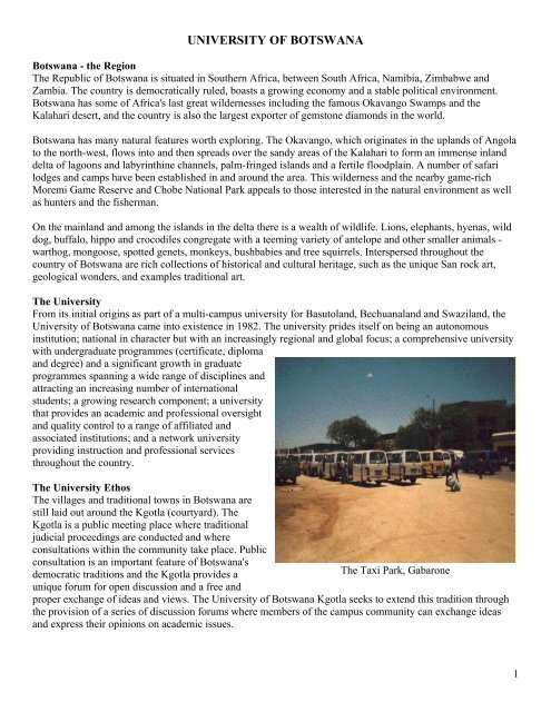
The University Ethos<br />
The villages and traditional towns in Botswana are<br />
still laid out around the Kgotla (courtyard). The<br />
Kgotla is a public meeting place where traditional<br />
judicial proceedings are conducted and where<br />
consultations within the community take place. Public<br />
consultation is an important feature of Botswana's<br />
democratic traditions and the Kgotla provides a<br />
The Taxi Park, Gabarone<br />
unique forum for open discussion and a free and<br />
proper exchange of ideas and views. The University of Botswana Kgotla seeks to extend this tradition through<br />
the provision of a series of discussion forums where members of the campus community can exchange ideas<br />
and express their opinions on academic issues.<br />
1
<strong>UNIVERSITY</strong> <strong>OF</strong> <strong>BOTSWANA</strong><br />
VISION, MISSION AND VALUES STATEMENT<br />
VISION<br />
The University of Botswana will be a leading academic center of excellence<br />
in Africa and the world.<br />
MISSION<br />
To advance the intellectual and human resource capacity of the nation<br />
and the international community.<br />
The University will fulfill this Vision and Mission by:<br />
Offering quality academic and professional programs that ensure a commitment to and<br />
a mastery of life-long learning skills as well as encouraging a spirit of critical enquiry<br />
Developing a student-centered, intellectually stimulating and technologically advanced<br />
teaching, learning and research environment<br />
Producing graduates who are independent, confident, self directed, critical thinkers,<br />
professionally competent, reflective practitioners, innovative, socially responsible and thereby<br />
marketable and competitive nationally and internationally<br />
Advancing scholarship and generating research through the discovery, integration,<br />
dissemination and application of knowledge<br />
Serving as an intellectual and cultural center that draws upon the nation's indigenous<br />
knowledge base and which promotes Botswana's social and cultural heritage as well as being a<br />
community resource for new ideas, partnerships, and collaborative effort<br />
Providing leadership in responding to the nation's cultural, economic, political<br />
scientific, social, technological and industrial needs and contributing to the qualitative<br />
development of Botswana's higher education system<br />
Extending access to higher education through the utilization of information and<br />
communication technologies, within the framework of life-long and open learning<br />
Recruiting and developing quality staff and students, recognizing and valuing the<br />
essential contribution they make, as well as rewarding excellence in the work they perform<br />
Promoting the health, social, and spiritual welfare of the University community through<br />
a range of policies and programs and a diversity of positive co-curricula activities and<br />
experiences<br />
Enhancing the teaching, learning and research environment through the provision of a<br />
proactive style of leadership and management and efficient, effective and quality driven<br />
institutional support services.<br />
2
<strong>UNIVERSITY</strong> <strong>OF</strong> <strong>BOTSWANA</strong><br />
VISION, MISSION AND VALUES STATEMENT<br />
VALUES<br />
While achieving its Vision and fulfilling its Mission, the University of Botswana values the<br />
following:<br />
Students, by creating a holistic environment which ensures that learning is their central<br />
focus and by establishing and developing a range of learning, social, cultural and recreational<br />
opportunities that will facilitate the full realization of their potential for academic and personal<br />
growth<br />
Academic Freedom, by upholding the spirit of free and critical thought and enquiry,<br />
through the tolerance of a diversity of beliefs and understanding, as well as the open exchange<br />
of ideas and knowledge<br />
Academic Integrity expressed in creativity, objective analysis, experimentation, critical<br />
appraisal, independent thought, informed debate and intellectual honesty<br />
Cultural Authenticity by ensuring that the diversity of Botswana's indigenous values<br />
and cultural heritage forms an important part of the academic and organizational life of the<br />
institution<br />
Internationalism through participation in the global world of scholarship, by being<br />
receptive and responsive to issues within the international environment as well as the<br />
recruitment of an international staff and student body<br />
Professional and Ethical Standards by upholding the highest professional and ethical<br />
behavior and through openness, honesty, tolerance and respect for the individual<br />
Social responsibility by promoting an awareness of, and providing leadership in<br />
responding to, the issues and problems facing society<br />
Equity by ensuring equal opportunity and non-discrimination on the basis of personal,<br />
ethnic, religious, gender or other social characteristics<br />
Autonomy as an institution, that is, through its self-governing structures, independent in<br />
action while being responsive to societal needs<br />
Public Accountability by ensuring transparent decision-making and open review as well<br />
as the full participation of stakeholders in the development of the institution;<br />
Productivity through the setting and rewarding of high standards of performance<br />
underpinned by a dedication to quality, efficiency and effectiveness throughout the institution.<br />
Faculties & Departments<br />
Faculty of Business<br />
The Faculty of Business was established in 1997 following the re - organisation of what was then called School<br />
of Accounting and Management Studies (SAMS) under the Faculty of Social Sciences. The Faculty comprises<br />
the Departments of Accountancy and Finance, Management, Marketing.<br />
Faculty of Engineering & Technology (FET)<br />
FET is located on a split campus that lies approximately 1.7 km from the main UB campus. It offers unique<br />
study opportunities combined with excellent career prospects for undergraduate students in the following<br />
disciplines: civil engineering, electrical & electronic engineering, mechanical engineering and technology &<br />
3
educational studies. FET aims to produce qualified engineering graduates who will be able to adapt to the<br />
changing global working environment.<br />
Faculty of Science<br />
The Faculty of Science comprises the departments of Biology, Chemistry, Mathematics, Physics,<br />
Environmental Science, Geology and Computer Science.<br />
Faculty of Social Sciences<br />
The Faculty contains departments of Demography, Economics, Law, Politics and Administration, Statistics,<br />
Social Work, Sociology and Statistics. The Faculty also serves as a centre to provide expert consulting in areas<br />
of national development, planning, administration and management.<br />
Faculty of Education<br />
The Faculty provides courses for<br />
professional education - including<br />
teaching, the development of teachers,<br />
tutors and lecturers as well as other<br />
educational personnel. Advanced study<br />
enables educators and administrators to<br />
attain academic excellence and prepare<br />
for roles of leadership.<br />
Faculty of Humanities<br />
The Faculty places an emphasis on man<br />
in Africa and the relationship to man in<br />
the wider world. Courses on offer in the<br />
numerous departments range from<br />
languages and literature, media studies<br />
to information studies, and<br />
archive/record management.<br />
University of Botswana Statistics<br />
Women at Work, Gabarone<br />
University Founded: 1982<br />
Student numbers: 12,286<br />
Staff total numbers: 2,025<br />
Academic staff numbers: 696<br />
Main Campus: 115 hectares<br />
Library: 287,000 books, 30,000 pamphlets, 1,386 periodical titles, 300 multi-media titles<br />
Student Population Statistics<br />
• Full-time 10,944; Part-time 1839<br />
• Male – 6405; Female – 6378<br />
• Undergraduate - 11,755; Post graduate – 1028; Overall total 12,783<br />
4
Botswana<br />
The history of Botswana is characterised by<br />
migrations of peoples into the country from the<br />
north and west and particularly from the east and<br />
south, as well as internal movements of groups of<br />
people. The group which eventually emerged as<br />
most numerous, and dominant, were the<br />
Batswana. Their pattern of dividing and migrating<br />
saw the formation of numerous Tswana tribes,<br />
and their eventual occupation of all areas of the<br />
country. The term "Batswana" refers to the ethnic<br />
group of people who speak the Setswana<br />
language and share the Sotho-Tswana culture,<br />
while in its common contemporary usage, it refers<br />
to all citizens of the Republic of Botswana,<br />
regardless of their ethnic background. The<br />
singular is "Motswana": a citizen of the country.<br />
"Tswana" is used as an adjective - for example<br />
"Tswana state" or "Tswana culture".<br />
The Railway Station, Gabarone<br />
First inhabitants<br />
The earliest modern inhabitants of southern Africa were the Bushman (San) and the Hottentot (Khoe) peoples.<br />
They have lived an almost unchanged lifestyle in the country since the Middle Stone Age.<br />
The physical characteristics of the Khoe and the San are similar. Both tend to have light, almost coppery skin<br />
colour, slanted, almond-shaped eyes, high cheekbones, thin lips and tufted, tightly curled hair. Both speak click<br />
languages, though there are major differences between them. Both hunted and collected wild foods and neither<br />
grew crops.<br />
Approximately 60,000 years ago, the peoples of sub-Saharan Africa were of one tribe, probably of Khoe/San<br />
type. It is believed that the Bantu-speaking people were an offshoot from the Khoe/San tribe. This occurred in<br />
the tropical rain forests of equatorial Africa about 10,000 years ago. The Bantu-speaking people gradually<br />
developed darker skin pigmentation and different physical attributes because of the different environments they<br />
eventually occupied.<br />
The origins of the Tswana tribes<br />
In Botswana, about 1,000 years ago, large chiefdoms began to emerge in the area between Sowa Pan and the<br />
Tswapong Hills. Large settlements developed on hilltops. These people are known as the "Toutswe", after the<br />
first of their capitals, which was excavated on Toutswemogala Hill. Soon these communities were eclipsed by<br />
the Great Zimbabwe Empire, which spread its domain over much of eastern Botswana.<br />
Around 1300 AD, peoples in present-day Transvaal began to coalesce into the linguistic and political groups<br />
they form today. This resulted in the emergence of three main groups: the Bakgalagadi, the Batswana and the<br />
Basotho, each of which had smaller divisions. Each group lived in small, loosely knit communities, spread<br />
widely over large areas of land. They spoke dialects of the same language and shared many cultural affinities.<br />
Two central features of the history of the Batswana are fission and fusion. Groups of people broke off from their<br />
parent tribe and moved to new land, creating a new tribe and absorbing or subjugating the people they found<br />
there. This is how a single group of Batswana living in the Magaliesberg Mountains in northern Transvaal<br />
evolved into the numerous Tswana tribes, which exist today.<br />
5
In 18 th century further movements and split-ups of the Batswana resulted in the major Tswana tribes which exist<br />
today: Bakhurutshe, Bangwato, Bakwena, Bangwaketse, Bakgatla, Batlhokwa, Barolong, Batlhaping and, much<br />
later, the Batawana. The earlier farming inhabitants of Botswana - the Bakgalagadi - also split into several<br />
groups, namely the Bakgwateng, Babolaongwe, Bangologa, Baphaleng, Bashaga and many smaller groups. This<br />
then was how the Tswana tribes came to be living in Botswana as they were until about 200 years ago.<br />
The Difaqane wars<br />
The Difaqane wars were a devastating wave of tribal wars that swept across Botswana and much of southern<br />
Africa in the early 1800s. By the early 19 th century, populations in southern Africa had expanded to such a point<br />
that most fertile land was occupied. During the 1700s, the slave and ivory trades increased rapidly in<br />
southeastern Africa - minor kings were attacking their neighbours and selling their captives to slave traders.<br />
Along the Orange River, white bandits began to terrorize people living in the east.<br />
Nguni peoples (Bantu-speaking peoples including the Zulus and Xhosas) began to form themselves into<br />
stronger units to resist these pressures. In 1816 King Shaka seized control of the Zulu chiefdom, and, by<br />
forcefully incorporating other smaller tribes, rapidly formed a powerful, war-like nation. Conquered peoples,<br />
began to move northwestwards in vast numbers (80,000 - 100,000) destroying everything in their path.<br />
Towards the end of the Difaqane wars, tribes slowly began to re-establish themselves. The chiefs, in their<br />
efforts to reconstruct, began to exchange ivory and skins for guns with European, Griqua and Rolong traders,<br />
who began to infiltrate the African interior at that time.<br />
Missionaries and traders<br />
In the 19th century numerous missionary societies were formed in Europe and<br />
America to send out proselytizers around the world. The London Missionary<br />
Society was one of the first to preach amongst the Batswana. It set up a mission<br />
station at Kuruman (near present-day Vryburg in South Africa) in 1816. The<br />
untiring Robert Moffat headed the station for 50 years. The famous Dr. David<br />
Livingstone arrived in 1841, worked out of Kuruman for about two years, and<br />
then married Moffat's daughter, Mary. Though much more interested in<br />
exploration than missionary work, and later much more involved in the<br />
abolition of the slave trade, Livingstone set up a mission station at Kolobeng<br />
amongst the Bakwena.<br />
From Kuruman, Christianity very gradually spread to the interior. Missionaries<br />
settled amongst the people, often at the invitation of the chiefs who wanted<br />
guns and knew that the presence of missionaries encouraged the traders. By<br />
1880 every major village of every tribe in Botswana had a resident missionary Dr. David Livingstone<br />
and their influence had become a permanent feature of life. The missionaries<br />
worked through the chief, recognizing that the chief's conversion was the key to the rest of the tribe. Chiefs'<br />
responses varied - from Khama's (of the Bangwato) wholehearted embrace of the faith, to Sekgoma<br />
Letsholathebe's (of the Batawana) outright rejection, which he claimed was in defence of his culture.<br />
British Rule<br />
The European colonization of Africa was at its peak. The British, French, Belgians, Germans and Portuguese<br />
were vying for power to exploit the rich natural resources of Africa - to feed their growing industrial machines<br />
at home.<br />
This competition, or “scramble for Africa” as it was called, became so intense that, had it not been for the<br />
Berlin Conference in 1884, it could have led to war. Here, without the knowledge or consent of the people<br />
already living there, the colonial powers divided up the continent for themselves.<br />
6
At about the same time, Tswana chiefs were facing another external threat. The Boers, who had ousted<br />
Mzilikazi in the northern Transvaal and had occupied eastern Tswana lands, now informed the Tswana kings<br />
that their land and people were under Boer control. Some Tswana kings resisted, but the Boers attacked their<br />
villages - burning homes, destroying crops, and taking Batswana away as slaves to work on their farms. Then<br />
Tswana kings decided to ask Britain for protection, believing that this strong colonial power could save them<br />
from Boer domination.<br />
At first the British refused, but then in the 1880s, the British Government made an abrupt about-face. The<br />
'missionary road', which ran north from South Africa through Botswana, became increasingly important. Gold<br />
had been discovered in 1866 at Tati, and in 1867 in present-day Zimbabwe. Cecil Rhodes and the missionaries,<br />
who were trying to protect the Batswana from Boer encroachment, persuaded the British Government to change<br />
its mind, and on 30 September 1885 Botswana was declared the British Protectorate of Bechuanaland.<br />
This surprised the Tswana kings, who openly queried this sudden shift in position. Whilst they agreed to their<br />
land becoming a protectorate, they also made it clear that they did not want the British to interfere with their<br />
laws and government, nor did they want any of their land to be sold. There seemed to be no clear understanding<br />
as to what this actually meant. Eventually, the protectorate status was accepted by all the Tswana kings.<br />
Botswana had been saved from Boer domination, and even inclusion into the South African Republic. But<br />
shortly thereafter, another threat was imminent. During the late 1880s early 1890s in another land scramble,<br />
concessionaires started arriving in their droves, seeking land to set up businesses. They were supported by the<br />
British Government, which wished to use them to colonize as cheaply as possible. Amongst these<br />
concessionaires was Cecil John Rhodes, the wealthy mining magnate and South African politician. He wanted<br />
to colonize Mashonaland and exploit its wealth of natural resources (hence the colony's name - Rhodesia). He<br />
also wanted to take over Bechuanaland, and incorporate it into his northern colony.<br />
Understanding Rhodes' enormous power and influence, three Tswana kings - Khama, Bathoen and Sebele -<br />
went to England in 1895 to persuade the British Government not to transfer the Protectorate. At first<br />
unsuccessful, the kings then took their case to the British public. While this contributed to the British<br />
Government's reversal of its decision, the major factor was the Jameson Raid in 1896 - a failed invasion of the<br />
Transvaal by one of Rhodes' administrators for which Rhodes was blamed and his British South Africa<br />
Company was forced out of the Protectorate.<br />
Bechuanaland faced other threats, particularly after the Union of South Africa was formed in 1910 and the<br />
intention was made known to incorporate Bechuanaland, Swaziland, Basutoland (today's Lesotho), and<br />
Rhodesia. This was met with the continual vigorous resistance of the Tswana kings - expressed both inside and<br />
outside Bechuanaland, and it was this that saved Bechuanaland from inclusion into either Rhodesia or South<br />
Africa.<br />
Botswana remained a protectorate for the next 80 years, during which time a number of autonomous but related<br />
Tswana states were forged into one country. Almost nothing was done in the realms of health, education,<br />
economics and communications. However, the majority of Batswana were spared having to undergo the<br />
mistreatment, pain and humiliation of the regimes both north and south of their territory.<br />
Independence<br />
Growing dissatisfaction with British protection and an increasing nationalism among Batswana found<br />
expression though tribal leaders, who exercised considerable power at a local level. From the 1930s, demands<br />
for self-determination were increasingly vocalised through the African Advisory Council, which often found<br />
itself in conflict with the colonial administration.<br />
7
After 80 years as a British protectorate, Bechuanaland attained self-government in 1965, becoming the<br />
independent Republic of Botswana on September 6, 1966, and maintaining a position of stability and harmony<br />
ever since. Sir Seretse Khama was elected the first president and served until his death in 1980. One of the<br />
world's most impoverished nations at the time of independence, the discovery of commercially exploitable<br />
diamonds in 1967 paved the way for economic prosperity, with Botswana becoming a shining example of an<br />
African success story.<br />
The Botswana Democratic Party (BDP) has been in power since the first democratic elections in 1966, and<br />
continues to draw support from a wide range of Botswana's population. Mr. Ketumile Masire served as<br />
Botswana's second president, taking over from the late Sir Seretse Khama in July 1980 and continuing a<br />
tradition of good governance. This eloquent former journalist ruled Botswana for 18 years, during which time it<br />
became one of the richest countries in Africa.<br />
Sir Ketumile Masire voluntarily retired from office in 1998 at the age of 72, and was succeeded by his vice<br />
president and former finance minister, Mr. Festus Mogae. Headed by President Mogae and Vice-President Ian<br />
Khama, son of the country's founder president, the ruling BDP swept to victory in the democratic election held<br />
during October 1999, securing 33 of 40 seats in the nation's Parliament.<br />
Geographical Info<br />
Botswana is a land-locked country dominated in geographical terms by the Kalahari Desert - a sand-filled basin<br />
averaging 1,100 metres above sea level. The country lies between longitudes 20 and 30 degrees east of<br />
Greenwich and between the latitudes 18 and 27 degrees approximately south of the Equator.<br />
Botswana is bordered by Zambia and Zimbabwe to the northeast, Namibia to the north and west, and South<br />
Africa to the south and southeast. At Kazungula, four countries - Botswana, Zimbabwe, Zambia and Namibia -<br />
meet at a single point mid-stream in the Zambezi River.<br />
The Chobe River runs along part of its northern boundary; the Nossob River at its southwestern boundary; the<br />
Molopo River at its southern boundary; and the Marico, Limpopo and Shashe Rivers at its eastern boundaries.<br />
With the exceptions of the Okavango and Chobe areas in the<br />
north, the country has little permanent surface water.<br />
The country is situated in the southern African region and<br />
about two-thirds of Botswana lies within the Tropics; it is<br />
bisected by the Tropic of Capricorn (the imaginary line of<br />
latitude which is 23° 30' south of Equator) just south of the<br />
town of Mahalapye (see maps). This is the most southern<br />
latitude where the sun is directly overhead at noon. This<br />
happens on December 22st, the longest day of the year in this<br />
hemisphere.<br />
The distance between the extreme north and the extreme south<br />
of Botswana is about 1,110 kilometres. It is 960 kilometres<br />
across at its widest. The area of Botswana is approximately<br />
581,730 square kilometres and is about the size of France or<br />
Kenya. It is approximately 500 km from the nearest coastline,<br />
to the southwest.<br />
The eastern hardveld, where 80% of the country's population lives and where its three largest urban centres are<br />
situated, is a wide strip of land running from the north at Ramokgwebane to the south at Ramatlabama. It has a<br />
more varied relief and geology with inselbergs (outcrops of resistant rock) and koppies (rocks that have been<br />
weathered into blocks) dotting the landscape. The south eastern hardveld also has a slightly higher and more<br />
8
eliable rainfall than the rest of the country (except Bobirwa, which is about dry as Kgalagadi); indeed the<br />
natural fertility and agricultural potential of the soils, while still low, are greater than in the Kalahari sandveld.<br />
The Kalahari Desert stretches west of the eastern hardveld, covering 84% of the country. The Kalahari extends<br />
far beyond Botswana's western borders, covering substantial parts of South Africa, Namibia and Angola.<br />
“Desert”, however, is a misnomer: its earliest travellers defined it as a 'thirstland'. Most of the Kalahari (or<br />
Kgalagadi, which is its Setswana name) is covered with vegetation<br />
including stunted thorn and scrub bush, trees and grasslands. The<br />
largely unchanging flat terrain is occasionally interrupted by gently<br />
descending valleys, sand dunes, large numbers of pans and, in the<br />
extreme northwest, isolated hills, such as Aha, Tsodilo, Koanaka and<br />
Gcwihaba. Many of the pans have dune systems on the southwest side,<br />
which vary in size and complexity. The pans fill with water during the<br />
rainy season and their hard surface layer ensures that the water<br />
remains in the pans and is not immediately absorbed. These pans are<br />
of great importance to wildlife, which obtain valuable nutrients from<br />
the salts and the grasses of the pans.<br />
The Central Market, Gabarone<br />
In the north-west, the Okavango River flows in from the highlands of<br />
Angola and soaks into the sands, forming the 15,000 sq. km network<br />
of water channels, lagoons, swamps and islands. The Okavango is the<br />
largest inland delta system in the world a bit smaller than Isreal or half<br />
of Switzerland. The northeastern region of the Kalahari Basin contains<br />
the Makgadikgadi Pans - an extensive network of salt pans and<br />
ephemeral lakes.<br />
Although Botswana has no mountain ranges to speak of, the almost uniformly flat landscape is punctuated<br />
occasionally by low hills, especially along the southeastern boundary and in the far northwest. Botswana's<br />
highest point is 1,491m Otse Mountain near Lobatse, but the three major peaks of the Tsodilo Hills, in the<br />
country's northwestern corner, are more dramatic.<br />
Climate<br />
Botswana's climate is semi-arid. Though it is hot and dry for much of the year, there is a rainy season, which<br />
runs through the summer months. Rainfall tends to be erratic, unpredictable and highly regional. Often a heavy<br />
downpour may occur in one area while 10 or 15 kilometres away there is no rain at all. Showers are often<br />
followed by strong sunshine so that a good deal of the rainfall does not penetrate the ground but is lost to<br />
evaporation and transpiration.<br />
'Pula', one of the most frequently heard words in Botswana, is not only the name of Botswana's currency, but<br />
also the Setswana word for rain. So much of what takes place in Botswana relies on this essential, frequently<br />
scarce commodity.<br />
Currency<br />
Botswana's unit of currency is the Pula (P), which is divided into 100 Thebe (t). The word 'Pula' means rain and<br />
'thebe' means shield. The shield appears on the national coat of arms. Bank notes come in denominations of<br />
P10, 20, 50 and 100, and coins in denominations of 5t, 10t, 25t, 50t, P1, P2 and P5. Major credit cards,<br />
including Visa, MasterCard, American Express and Diners Club, are accepted widely. Most hotels and lodges<br />
accept foreign currency or travellers' cheques.<br />
9