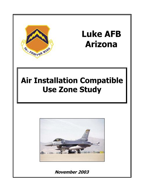
Luke AFB Arizona - Luke Air Force Base
Luke AFB Arizona - Luke Air Force Base
Luke AFB Arizona - Luke Air Force Base

Create successful ePaper yourself
Turn your PDF publications into a flip-book with our unique Google optimized e-Paper software.
November 2003<br />
<strong>Luke</strong> <strong>AFB</strong><br />
<strong>Arizona</strong><br />
<strong>Air</strong> Installation Compatible<br />
Use Zone Study
COVER SHEET<br />
Agency: U.S. <strong>Air</strong> <strong>Force</strong><br />
November 2003<br />
Action: Changes in flight operations at <strong>Luke</strong> <strong>Air</strong> <strong>Force</strong> <strong>Base</strong>, <strong>Arizona</strong>.<br />
Contacts: Mr. Cisco Pardieu, 56 CES/CECB, <strong>Base</strong> Community Planner<br />
13970 West Lightning Street,<br />
<strong>Luke</strong> <strong>Air</strong> <strong>Force</strong> <strong>Base</strong>, <strong>Arizona</strong> 85309-1149<br />
Telephone 623-856-4736<br />
Ms. Mary Jo May, 56 FW/PA, Chief of Community Relations<br />
<strong>Luke</strong> <strong>AFB</strong> Public Affairs Office<br />
14185 W. Falcon St<br />
<strong>Luke</strong> <strong>Air</strong> <strong>Force</strong> <strong>Base</strong>, <strong>Arizona</strong> 85309-1149<br />
Telephone (623) 856-5853<br />
Designation: Final, <strong>Air</strong> Installation Compatible Use Zone (AICUZ) Study<br />
Abstract: This AICUZ Study has been prepared in accordance with U.S. <strong>Air</strong><br />
<strong>Force</strong> requirements as a result of changes in flight operations at<br />
<strong>Luke</strong> <strong>AFB</strong>, located in Maricopa County, <strong>Arizona</strong>.<br />
The Study addresses safety, noise, and land use issues that must be<br />
addressed by the communities surrounding <strong>Luke</strong> <strong>AFB</strong>.<br />
AICUZ Study 2003, Volumes I and II ⎯ <strong>Luke</strong> <strong>AFB</strong>, AZ
November 2003<br />
<strong>Luke</strong> <strong>AFB</strong><br />
<strong>Arizona</strong><br />
<strong>Air</strong> Installation Compatible<br />
Use Zone Study<br />
Volume I
TABLE OF CONTENTS<br />
November 2003<br />
Table of Contents, Volume I ..............................................................................................i<br />
Table of Contents, Volume II: Appendices ......................................................................ii<br />
List of Figures ..................................................................................................................iii<br />
List of Tables....................................................................................................................iii<br />
Acronyms and Abbreviations ............................................................................................v<br />
VOLUME I<br />
1. PURPOSE AND NEED ................................................................................ 1-1<br />
1.1. Introduction.................................................................................................................. 1-1<br />
1.2. Purpose and Need ........................................................................................................ 1-1<br />
1.3. Process and Procedure ................................................................................................. 1-2<br />
1.4. Land Use Analysis Methodology................................................................................. 1-2<br />
1.5. Organization of the Document..................................................................................... 1-3<br />
2. INSTALLATION DESCRIPTION................................................................. 2-1<br />
2.1. Mission......................................................................................................................... 2-1<br />
2.2. Location ....................................................................................................................... 2-1<br />
2.3. Economic Impact ......................................................................................................... 2-1<br />
2.4. Flying Activity............................................................................................................. 2-4<br />
3. LAND USE COMPATIBILITY GUIDELINES ................................................ 3-1<br />
3.1. Introduction.................................................................................................................. 3-1<br />
3.2. The AICUZ Program ................................................................................................... 3-1<br />
3.3. Noise-<strong>Base</strong>d Constraints on Land Use......................................................................... 3-4<br />
3.1.1. <strong>Arizona</strong> Regulations ......................................................................................... 3-4<br />
3.1.2. Federal Interagency Committee on Urban Noise Guidelines ........................... 3-7<br />
3.4. Land Use Compatibility............................................................................................... 3-8<br />
3.5. Participation in the Planning Process......................................................................... 3-16<br />
4. LAND USE ANALYSIS................................................................................ 4-1<br />
4.1. Introduction.................................................................................................................. 4-1<br />
4.2. Land Use Categories .................................................................................................... 4-1<br />
4.3. Existing Land Use........................................................................................................ 4-2<br />
4.4. Current Zoning.............................................................................................................4-4<br />
4.5. Future Land Use........................................................................................................... 4-6<br />
4.6. Incompatible Land Uses............................................................................................... 4-8<br />
4.6.1. Accident Potential Zones.................................................................................. 4-8<br />
4.6.2. Noise Zones.................................................................................................... 4-10<br />
4.7. Planning Considerations ............................................................................................ 4-10<br />
5. IMPLEMENTATION ................................................................................... 5-1<br />
5.1. <strong>Air</strong> <strong>Force</strong> Responsibilities............................................................................................ 5-1<br />
5.2. Local Community Responsibilities.............................................................................. 5-2<br />
6. LIST OF PREPARERS ................................................................................ 6-1<br />
AICUZ Study 2003, Volume I ⎯ <strong>Luke</strong> <strong>AFB</strong>, AZ i
VOLUME II: APPENDICES<br />
November 2003<br />
Appendix A. The AICUZ Concept, Program, Methodology, and Policies ........ A-1<br />
A.1. Concept......................................................................................................................A-1<br />
A.2. Program......................................................................................................................A-1<br />
A.3. Methodology..............................................................................................................A-2<br />
A.4. AICUZ Land Use Development Policies...................................................................A-2<br />
A.4.1. Policy 1 ..........................................................................................................A-2<br />
A.4.2. Policy 2 ..........................................................................................................A-3<br />
A.4.3. Policy 3 ..........................................................................................................A-3<br />
A.4.4. Policy 4 ..........................................................................................................A-3<br />
A.4.5. Policy 5 ..........................................................................................................A-3<br />
A.4.6. Policy 6 ..........................................................................................................A-4<br />
A.4.7. Policy 7 ..........................................................................................................A-4<br />
A.5. Basic Land Use Compatibility...................................................................................A-5<br />
A.6. Accident Potential......................................................................................................A-5<br />
A.7. Noise..........................................................................................................................A-6<br />
Appendix B. Accident Potential Zones ............................................................ B-1<br />
B.1. Guidelines For Accident Potential.............................................................................B-1<br />
B.2. Accident Potential Analysis.......................................................................................B-1<br />
B.3. Definable Debris Impact Areas..................................................................................B-4<br />
B.4. Findings .....................................................................................................................B-4<br />
Appendix C. Description of the Noise Environment ....................................... C-1<br />
C.1. Noise Environment Descriptor ..................................................................................C-1<br />
C.2. Noise Event Descriptor..............................................................................................C-1<br />
C.3. Noise Contour Production .........................................................................................C-2<br />
C.4. Technical Information................................................................................................C-3<br />
Appendix D. Height and Obstructions Criteria ............................................... D-1<br />
D.1. Height And Obstructions Criteria..............................................................................D-1<br />
D.1.1. General...........................................................................................................D-1<br />
D.1.2. Explanation of Terms.....................................................................................D-1<br />
D.1.3. Planes and Surfaces........................................................................................D-1<br />
D.2. Height Restrictions ....................................................................................................D-2<br />
Appendix E. Noise Level Reduction Guidelines ...............................................E-1<br />
ii AICUZ Study 2003, Volume I ⎯ <strong>Luke</strong> <strong>AFB</strong>, AZ
LIST OF FIGURES<br />
November 2003<br />
Figure 2-1. Location and Vicinity of <strong>Luke</strong> <strong>AFB</strong>, <strong>Arizona</strong>......................................................... 2-2<br />
Figure 2-2. <strong>Luke</strong> <strong>AFB</strong> and Surrounding Communities.............................................................. 2-5<br />
Figure 2-3. <strong>Luke</strong> <strong>AFB</strong> Flight Tracks ......................................................................................... 2-6<br />
Figure 3-1. <strong>Luke</strong> <strong>AFB</strong> Runways and Safety Zones ................................................................... 3-2<br />
Figure 3-2. <strong>Luke</strong> <strong>AFB</strong> Noise Contours and Safety Zones ......................................................... 3-5<br />
Figure 3-3. Current Land Use with Operational and JLUS Contours........................................ 3-6<br />
Figure 4-1. Current Zoning with Operational and JLUS Contours............................................ 4-7<br />
Figure 4-2. Projected Future Land Use with Operational and JLUS Contours.......................... 4-8<br />
Figure B-1. Distribution of <strong>Air</strong> <strong>Force</strong> <strong>Air</strong>craft Accidents ..........................................................B-3<br />
Figure B-2. <strong>Air</strong> <strong>Force</strong> Accident Data (1968-1972).....................................................................B-3<br />
Figure B-3. <strong>Air</strong> <strong>Force</strong> Accident Data[Updated] (1968-1995) ....................................................B-3<br />
Figure C-1. Day-Night Average A-Weighted Sound Level .......................................................C-1<br />
Figure C-2. Sound Exposure Level ............................................................................................C-2<br />
Figure D-1. <strong>Air</strong>space Control Surface Plan ............................................................................... D-3<br />
LIST OF TABLES<br />
Table 2-1. <strong>Luke</strong> <strong>AFB</strong> Direct Non-Payroll Expenditures, Fiscal Year 2001............................. 2-4<br />
Table 3-1. Summary Comparison of <strong>Arizona</strong> Requirements and Federal Guidelines.............. 3-8<br />
Table 3-2. <strong>Arizona</strong> Land Use Compatibility Requirements, According to<br />
<strong>Arizona</strong> Revised Statute 28-8481............................................................................ 3-9<br />
Table 3-3. Federal Land Use Compatibility Guidelines ......................................................... 3-12<br />
Table B-1. Hazard Potential Location Analysis........................................................................B-2<br />
Table B-2. Accident to Area Ratio: Ratio of Percentage of Accidents to<br />
Percentage of Area (<strong>Air</strong> <strong>Force</strong> Accident Data 1968-1995) .....................................B-4<br />
Table D-1. Coordinates and Elevations, <strong>Luke</strong> <strong>AFB</strong>, <strong>Arizona</strong> .................................................. D-3<br />
AICUZ Study 2003, Volume I ⎯ <strong>Luke</strong> <strong>AFB</strong>, AZ iii
This page intentionally left blank.
ACRONYMS AND ABBREVIATIONS<br />
November 2003<br />
56 FW 56 th Fighter Wing<br />
56 FW/PA 56 th Fighter Wing/Public Affairs Office<br />
56 CES/CECB 56 th Fighter Wing/Civil Engineer Squadron, Community Planner<br />
944 FW 944 th Fighter Wing<br />
AETC <strong>Air</strong> Education and Training Command<br />
<strong>AFB</strong> <strong>Air</strong> <strong>Force</strong> <strong>Base</strong><br />
AFI <strong>Air</strong> <strong>Force</strong> Instruction<br />
AFM <strong>Air</strong> <strong>Force</strong> Manual<br />
Ag agricultural land-use category<br />
AICUZ <strong>Air</strong> Installation Compatible Use Zone<br />
APZ accident potential zone<br />
A.R.S. <strong>Arizona</strong> Revised Statutes<br />
AZ <strong>Arizona</strong><br />
BCE <strong>Base</strong> Civil Engineer<br />
BMGR Barry M. Goldwater Range<br />
C commercial land-use category<br />
CZ clear zone<br />
dB decibel<br />
dBA “A-weighted” decibel<br />
DNL day-night average sound level (see also Ldn)<br />
EA Environmental Assessment<br />
FAA Federal Aviation Administration<br />
FAR Federal Aviation Regulations<br />
FHWA Federal Highway Administration<br />
FICUN Federal Interagency Committee on Urban Noise<br />
ft feet<br />
FW fighter wing<br />
FY Fiscal Year<br />
I industrial land-use category<br />
JLUS Joint Land Use Study<br />
AICUZ Study 2003, Volume I ⎯ <strong>Luke</strong> <strong>AFB</strong>, AZ v
Ldn<br />
average sound level<br />
Leq<br />
equivalent sound level<br />
LR low density residential land-use category<br />
MAG Maricopa [County] Association of Governments<br />
metro metropolitan<br />
mph miles per hour<br />
MSA metropolitan statistical area<br />
MSL mean sea level<br />
MTR military training routes<br />
NLR noise level reduction<br />
NM nautical miles<br />
O open space land-use category<br />
P public land-use category<br />
R residential land use category<br />
Rec recreational land-use category<br />
ROI region of influence<br />
SEL Sound Exposure Level<br />
TGO touch-and-go<br />
USAF United States <strong>Air</strong> <strong>Force</strong><br />
USC/U.S.C. United States Code<br />
UFC Unified Facilities Criteria<br />
vi AICUZ Study 2003, Volume I ⎯ <strong>Luke</strong> <strong>AFB</strong>, AZ
November 2003<br />
SECTION 1. PURPOSE AND NEED<br />
1.1. Introduction<br />
This study is an update of the <strong>Luke</strong> <strong>AFB</strong> 1995 <strong>Air</strong> Installation Compatible Use Zone<br />
(AICUZ) Study, which was corrected and re-issued in 1997. The current update presents<br />
and documents the changes to the AICUZ for the period 1996 to 2003 and beyond. It<br />
reaffirms the <strong>Air</strong> <strong>Force</strong> policy of promoting public health, safety, and general welfare in<br />
areas surrounding <strong>Luke</strong> <strong>AFB</strong>. The report presents changes in flight operations since the<br />
last study and provides noise contours and compatible use guidelines for land areas<br />
surrounding the base. This information will assist local communities and serve as a tool<br />
for future planning and zoning activities to help protect the general health, safety, and<br />
welfare of people within these communities.<br />
The changes in the AICUZ are attributed to:<br />
• A change in the predominant direction of departure, with the predominant departure<br />
direction to the southwest.<br />
• A shift of some flights to nighttime, which will result in a small increase in flights<br />
occurring after 10:00 p.m.<br />
• Technical improvements to the NOISEMAP program.<br />
• Changes in <strong>Arizona</strong> land use regulations.<br />
1.2. Purpose and Need<br />
The purpose of the AICUZ program is to promote compatible land development in areas<br />
subject to aircraft noise and accident potential. Community cooperation regarding<br />
recommendations made in earlier AICUZ studies has been outstanding. As Maricopa<br />
County and nearby cities prepare and modify their land use development plans,<br />
recommendations from this updated AICUZ study should be included in the planning<br />
process to prevent incompatibility that may compromise <strong>Luke</strong> <strong>AFB</strong>’s ability to fulfill its<br />
mission requirements, which will continue to change in response to world events.<br />
Accident potential and aircraft noise should remain major considerations in the planning<br />
processes of the surrounding communities.<br />
<strong>Air</strong> <strong>Force</strong> AICUZ guidelines reflect land use recommendations for clear zones, accident<br />
potential zones I and II, and four noise zones. These guidelines have been established on<br />
the basis of studies prepared and sponsored by several federal agencies, including the<br />
Department of Housing and Urban Development, the Environmental Protection Agency,<br />
and the <strong>Air</strong> <strong>Force</strong>, as well as state and local agencies. The guidelines recommend land<br />
uses that are compatible with airfield operations while allowing maximum beneficial use<br />
of adjacent properties. The <strong>Air</strong> <strong>Force</strong> has no desire to recommend land use regulations that<br />
render property economically useless. It does, however, have an obligation to the<br />
inhabitants of the <strong>Luke</strong> <strong>AFB</strong> environs and to the citizens of the United States to point out<br />
ways to protect the people in adjacent areas as well as the public investment in the<br />
installation itself.<br />
AICUZ Study 2003, Volume I ⎯ <strong>Luke</strong> <strong>AFB</strong>, AZ 1-1
November 2003<br />
In <strong>Arizona</strong>, noise-based constraints on land use are regulated by <strong>Arizona</strong> state law and<br />
local zoning ordinances. The <strong>Arizona</strong> Revised Statutes (A.R.S.) were amended in July<br />
2001 to include provisions for regulating the effects of noise generated by aircraft in the<br />
vicinity of a military airport. These regulations are based on noise guidelines defined by<br />
the Federal Interagency Committee on Urban Noise (FICUN) for considering noise in land<br />
use planning, but include special considerations for land use within a territory in the<br />
vicinity of a military airport. Section 3 provides a summary of the <strong>Arizona</strong> regulations and<br />
FICUN Guidelines, along with specific land use constraints.<br />
1.3. Process and Procedure<br />
The AICUZ program uses the latest technology to define noise levels in areas near <strong>Air</strong><br />
<strong>Force</strong> installations. An analysis of current and expected flying operations was performed<br />
to develop the noise contours contained in this study. Department of Defense (DoD)<br />
NOISEMAP methodology and the Day-Night Average A-Weighted Sound Level (DNL)<br />
metric were used to define the noise zones for <strong>Luke</strong> <strong>AFB</strong>. <strong>Air</strong>craft flying data were<br />
collected in May-July, 2001, and land use and zoning data were collected in May-<br />
December, 2001.<br />
The <strong>Air</strong> <strong>Force</strong> NOISEMAP program uses data on aircraft operations (types of aircraft,<br />
engine settings, flight tracks (where the aircraft fly), flight profile information (how they<br />
fly), timing and direction of flights, and numbers of operations) and maintenance (ground<br />
runup information and other details). Specified locations are also entered into NOISEMAP<br />
to determine noise level information at those locations. NOISEMAP converts the data to<br />
DNL noise contours, which were plotted on area maps and overlain with clear zones and<br />
accident potential zones.<br />
Preparation and presentation of this update to <strong>Luke</strong> <strong>AFB</strong>’s AICUZ study is part of the<br />
continuing <strong>Air</strong> <strong>Force</strong> participation in the local planning process. It is recognized that, as<br />
local communities prepare land use plans and zoning ordinances, the <strong>Air</strong> <strong>Force</strong> has the<br />
responsibility to provide information on its activities relating to the community. This<br />
study is presented in the spirit of mutual cooperation and assistance by <strong>Luke</strong> <strong>AFB</strong> to aid in<br />
the local land use planning process. This study updates information on base flying<br />
activities since 1997, and provides noise contours and AICUZ maps based on the proposed<br />
action that was found to have no significant impact in the June 2002 Environmental<br />
Assessment on Proposed Changes in Flight Operations at <strong>Luke</strong> <strong>AFB</strong>, AZ. References<br />
within the document to “current contours” refer to the contours associated with the EA’s<br />
proposed action, one component of which was that 70 to 94 percent of aircraft operations<br />
would be to the southwest. This action has now been implemented.<br />
1.4. Land Use Analysis Methodology<br />
A current land use map was developed from aerial photographs taken December 17, 2000,<br />
(obtained from the Maricopa County Assessors Office website), and land use documents<br />
from local communities. Land use classifications (see Section 4.1) were derived from<br />
guidelines in the <strong>Air</strong> <strong>Force</strong> Handbook 32-7084 (AICUZ Program Manager’s Guide) and<br />
the Standard Land Use Coding Manual (SLUCM), developed by the U.S. Department of<br />
1-2 AICUZ Study 2003, Volume I ⎯ <strong>Luke</strong> <strong>AFB</strong>, AZ
November 2003<br />
Transportation. A zoning map was compiled using current zoning maps and other<br />
available information from Maricopa County, Glendale, Peoria, Surprise, El Mirage,<br />
Youngtown, Litchfield Park, Goodyear, Avondale, and Buckeye. Future land use was<br />
projected using information from Maricopa County (primarily the 2001 White Tank and<br />
Grand Avenue Plan), and land use plans from Glendale, Peoria, Surprise, El Mirage, and<br />
Goodyear.<br />
The NOISEMAP contours were overlain on maps showing current land use, zoning<br />
classifications, and projected future land use to assess potential areas of infringement on<br />
noise zones and other areas of land use incompatibility.<br />
The flight operations described in this AICUZ Study were assessed as the proposed action<br />
in the June 2002 EA. The directional component of the proposed action involved 70 to 94<br />
percent of arrivals from and departures to the southwest. Sets of contours were developed<br />
for the upper and lower “boundaries” of the action: one contour represents 94 percent of<br />
operations to the southwest; the other contour represents 70 percent of operations to the<br />
southwest. In the environmental analysis, both sets of contours were mapped to show the<br />
total land area within which impacts could occur. In the discussion within this AICUZ<br />
Study, impacts to the total area are discussed using the two sets of contours.<br />
1.5. Organization of the Document<br />
Volume I of this AICUZ Study includes the purpose and need for the study, found in<br />
Chapter1. A description of the installation is provided in Chapter 2. Land use<br />
compatibility guidelines are discussed in Chapter 3, while Chapter 4 contains an analysis<br />
of land use. Implementation of the AICUZ Study is discussed in Chapter 5.<br />
Volume II contains specialized appendices, as follows:<br />
• Appendix A, The AICUZ Concept, Program, Methodology, and Policies, contains<br />
detailed information on the development of the AICUZ program.<br />
• Appendix B, Accident Potential Zones, describes the safety zones surrounding the<br />
airfield.<br />
• Appendix C, Description of the Noise Environment, explains the descriptors used to<br />
evaluate noise impacts.<br />
• Appendix D, Height and Obstructions Criteria, describes the height constraints for<br />
structures near the airfield.<br />
• Appendix E, Noise Level Reduction Guidelines, refers the reader to other noise<br />
publications.<br />
AICUZ Study 2003, Volume I ⎯ <strong>Luke</strong> <strong>AFB</strong>, AZ 1-3
This page intentionally left blank.
November 2003<br />
SECTION 2. INSTALLATION DESCRIPTION<br />
2.1. Mission<br />
<strong>Luke</strong> <strong>AFB</strong> is the largest fighter training base in the free world. As host unit at <strong>Luke</strong> <strong>AFB</strong>,<br />
the mission of the 56th Fighter Wing (56 FW) is to train the world’s finest F-16 pilots and<br />
crew chiefs while providing agile combat support for aerospace expeditionary forces. The<br />
56 FW serves as the hub of the <strong>Air</strong> Education and Training Command’s Operation<br />
Training Development Program for fighter aircraft and is responsible for all fighter pilot<br />
and other aircrew training at <strong>Luke</strong> <strong>AFB</strong>. The wing graduates over 730 aircrew members<br />
and 1,000 maintainers each year.<br />
The installation’s importance to the United States military mission is exemplified by its<br />
assets. There are more than 200 aircraft based at <strong>Luke</strong> <strong>AFB</strong>; all are F-16 Fighters. The<br />
56 FW contains eight flying training squadrons, while the average <strong>Air</strong> <strong>Force</strong> wing contains<br />
three squadrons. The Barry M. Goldwater Range (BMGR), located southwest of the base,<br />
is of primary importance to the mission of <strong>Luke</strong> <strong>AFB</strong>. This vast 2.7 million-acre tract of<br />
desert contains eight bombing and gunnery ranges used by all branches of the military for<br />
air-to-air and air-to-surface tactical training.<br />
2.2. Location<br />
<strong>Luke</strong> <strong>AFB</strong> is located on 4,200 acres in Glendale (Maricopa County), AZ, in the western<br />
portion of the Phoenix metropolitan (“metro”) area. 1 The Phoenix metro area lies in a<br />
physiographic basin known locally as the “Valley of the Sun,” and the area surrounding<br />
<strong>Luke</strong> <strong>AFB</strong> is known as the West Valley. The impact area for this study is defined as the<br />
portion of the West Valley that includes the nine municipalities of Glendale, Peoria,<br />
Surprise, El Mirage, Youngtown, Litchfield Park, Goodyear, Avondale, and Buckeye, and<br />
the unincorporated portions of Maricopa County that lie between these incorporated areas<br />
and under the noise contours. Figure 2-1 shows the location of <strong>Luke</strong> <strong>AFB</strong>.<br />
2.3. Economic Impact<br />
The Phoenix metro area contains a diverse economy fueled by a variety of sources, and has<br />
experienced considerable growth over the past several decades. Maricopa County<br />
experienced more than a 16-fold population increase between 1940, just before <strong>Luke</strong> Field<br />
was established, and 2000. The region’s pleasant climate, modern services, and economic<br />
opportunities enticed more than 950,000 people to move into the Valley of the Sun during<br />
the 1990s.<br />
1 The Phoenix-Mesa Metropolitan Statistical Area (MSA) includes Maricopa County as well as Pinal County,<br />
which is to the southeast. Pinal County is not included as part of the region of influence for this analysis.<br />
AICUZ Study 2003, Volume I ⎯ <strong>Luke</strong> <strong>AFB</strong>, AZ 2-1
November 2003<br />
Figure 2-1. Location and Vicinity of <strong>Luke</strong> <strong>AFB</strong>, <strong>Arizona</strong><br />
2-2 AICUZ Study 2003, Volume I ⎯ <strong>Luke</strong> <strong>AFB</strong>, AZ
November 2003<br />
Phoenix, the state capital, is served by an established and expanding transportation<br />
network that includes two interstate highways, and a city transit system. Phoenix’s Sky<br />
Harbor International <strong>Air</strong>port, an ultramodern and rapidly growing facility, was the 5th<br />
busiest airport (for aircraft movements) in the world in 2002 (ACI, 2003). Amtrak serves<br />
the Phoenix metro area with a station at Maricopa, approximately 30 miles to the south.<br />
Major employment sectors within the Phoenix area include government, services,<br />
industrial, health care, and manufacturing. Additionally, the Phoenix area is attractive to<br />
retirees, as noted by the success of retirement communities such as Sun City and Sun City<br />
West, located north and northeast of <strong>Luke</strong> <strong>AFB</strong>. Similar communities are developing in<br />
the West Valley and throughout the Phoenix metro area as the number of U.S. retirees<br />
continues to increase.<br />
The West Valley has changed dramatically since 1941, when <strong>Luke</strong> Field was established in<br />
a sparsely settled area west of the city of Phoenix. In the 1940 Census, only two of the<br />
nine towns were incorporated (Glendale and Buckeye), and their combined population of<br />
6,160 made up only 3 percent of the county’s total population. In 2000, the West Valley<br />
was still less densely settled than some eastern portions of the metro area, but the nine<br />
towns had a population of nearly 434,000 and made up 14 percent of the County’s<br />
population. Growth rates during the 1990s varied among the West Valley communities,<br />
ranging from lows of 15 and 18 percent increases for Litchfield Park and Youngstown, to<br />
more than 200 and 300 percent for Goodyear and Surprise, respectively.<br />
The <strong>Luke</strong> <strong>AFB</strong> presence and mission has provided a reliable and expanding economic<br />
stimulus to the area and region. Its importance became even more apparent with the<br />
closure of Williams <strong>AFB</strong> in 1993, which left <strong>Luke</strong> <strong>AFB</strong> as the Phoenix area’s sole military<br />
installation. To support its mission of training the world’s finest fighter aircraft pilots and<br />
support personnel, <strong>Luke</strong> <strong>AFB</strong> expends considerable amounts on personnel, construction,<br />
and support contracts. As of June 2002, <strong>Luke</strong> <strong>AFB</strong> employed approximately 5,500<br />
military personnel, 1,060 federal civilian personnel, and 1,050 other civilians (<strong>Luke</strong> <strong>AFB</strong>,<br />
2002). The Maguire Company’s Economic Impact of <strong>Arizona</strong>’s Principal Military<br />
Operations (2002) estimated that payroll expenditures for Fiscal Year (FY) 2000 totaled<br />
nearly $359 million for military and civilian personnel.<br />
Military retirees tend to prefer settling near a military installation, where they have access<br />
to on-base services. Retirees are also drawn to the Phoenix area because of its climate and<br />
other amenities. The Maguire study estimated that in FY 2000 there were approximately<br />
22,000 military retirees in the local area, receiving retirement pay of almost $419 million.<br />
Expenditures by <strong>Luke</strong> <strong>AFB</strong> during FY 2001 for construction, contracts, and other types of<br />
payments exceeded $416 million. <strong>Luke</strong>’s direct expenditures are shown in Table 2-1.<br />
Re-spending of the payroll, retirement benefits, and direct expenditures within the local<br />
economy amounts to a secondary economic impact to the community that is much greater<br />
than the actual expenditure. The presence of <strong>Luke</strong> <strong>AFB</strong> results in the creation of an<br />
estimated 9,300 jobs. A conservative estimate of <strong>Luke</strong>’s overall economic impact within<br />
the base’s economic impact region is $1.4 billion, although the total impact may be<br />
somewhat higher.<br />
AICUZ Study 2003, Volume I ⎯ <strong>Luke</strong> <strong>AFB</strong>, AZ 2-3
November 2003<br />
Table 2-1.<br />
<strong>Luke</strong> <strong>AFB</strong> Direct Non-Payroll Expenditures, Fiscal Year 2001<br />
Classification Dollar Value ($)<br />
Contracts and direct spending: maintenance and operations $16,377,313<br />
Contracts: construction and building $25,693,556<br />
Purchases $195,448,684<br />
Utilities $7,694,911<br />
Education Payments $3,034,641<br />
Health Services $57,361,058<br />
Commissary and Exchange Sales $110,725,075<br />
Total $416,335,238<br />
Source: The Maguire Company, 2002. Economic Impact of <strong>Arizona</strong>’s Principal Military Operations.<br />
2.4. Flying Activity<br />
To describe the relationship between aircraft operations and land use, it is necessary to<br />
fully evaluate the exact nature of flying activities. An inventory has been made of the<br />
types of aircraft based at <strong>Luke</strong> <strong>AFB</strong>, where and how high those aircraft fly, how many<br />
times they fly over a given area, and when they operate. The F-16 Fighter (Fighting<br />
Falcon) is the principal aircraft operating at <strong>Luke</strong> <strong>AFB</strong>. As of 2001, <strong>Luke</strong>-based aircraft<br />
conducted an average of approximately 445 daily operations at the base. (An operation is<br />
defined as one departure, one approach, or half of a closed pattern. A closed pattern<br />
consists of both a departure portion and an approach portion—i.e. two operations.)<br />
<strong>Luke</strong>-based aircraft account for 97 percent of flight operations at <strong>Luke</strong>’s airfield.<br />
Transient or deployed aircraft conduct the remaining 3 percent of operations—an average<br />
of 12 per day. Transient aircraft temporarily use the <strong>Luke</strong> <strong>AFB</strong> airfield but are based<br />
elsewhere. Transient activities include using the airfield facilities while en route to another<br />
destination, transporting personnel or materiel to or from <strong>Luke</strong> <strong>AFB</strong>, and other purposes.<br />
Deployed aircraft (and support personnel) are temporarily assigned to <strong>Luke</strong> <strong>AFB</strong> from<br />
their home base to participate in training activities with <strong>Luke</strong> personnel and aircraft. For<br />
example, in FY 2001, approximately 60 fighter and trainer aircraft were deployed to <strong>Luke</strong><br />
<strong>AFB</strong> for an average stay of 13 days. Most of these aircraft were F-15 fighters. Operations<br />
from deployed and transient aircraft have been included in the calculation of the <strong>Luke</strong> <strong>AFB</strong><br />
noise contours.<br />
Figure 2-2 is a closer view of <strong>Luke</strong> <strong>AFB</strong> and the surrounding communities in the West<br />
Valley, while Figure 2-3 illustrates the basic flight patterns used by <strong>Luke</strong> <strong>AFB</strong>:<br />
• Straight-out departure.<br />
• Departures-in approach.<br />
• Departures to the west.<br />
• Approaches from the west.<br />
• Instrument flight rules (IFR) pattern.<br />
• Visual flight rules (VFR) pattern.<br />
2-4 AICUZ Study 2003, Volume I ⎯ <strong>Luke</strong> <strong>AFB</strong>, AZ
10<br />
$<br />
$<br />
White Tank<br />
Mountain<br />
Regional<br />
Park<br />
Buckeye<br />
60<br />
Surprise<br />
Perrryville Rd<br />
303<br />
Goodyear<br />
<strong>Luke</strong><br />
<strong>AFB</strong><br />
Litchfield<br />
Park<br />
November 2003<br />
Phoenix-<br />
Goodyear<br />
<strong>Air</strong>port<br />
$<br />
Sun City<br />
West<br />
Youngtown<br />
Peoria Ave<br />
Yuma Rd<br />
10<br />
Litchfield Rd<br />
El<br />
Mirage<br />
Northern Ave<br />
Camelback Rd<br />
Avondale<br />
Sun<br />
City<br />
Peoria<br />
$<br />
101<br />
Tolleson<br />
Glendale<br />
Grand Ave<br />
Glendale<br />
Municipal <strong>Air</strong>port<br />
AICUZ Study 2003, Volume I <strong>Luke</strong> <strong>AFB</strong>, AZ 2-5<br />
Phoenix<br />
Municipalities<br />
2<br />
Figure 2-2<br />
<strong>Luke</strong> <strong>AFB</strong>, AZ<br />
and Surrounding Communities<br />
<strong>Luke</strong> <strong>AFB</strong><br />
Territory in the vicinity<br />
of a military airport<br />
<strong>Air</strong>port<br />
Glendale<br />
Peoria<br />
Surprise<br />
El Mirage<br />
Youngtown<br />
Litchfield Park<br />
Goodyear<br />
Avondale<br />
Buckeye<br />
Tolleson<br />
Phoenix<br />
Unincorporated Areas<br />
N<br />
Legend<br />
Sun City<br />
Sun City West<br />
U nincorporated Maricopa County<br />
True North<br />
Magnetic North<br />
Variance 12.3 E<br />
February 2002<br />
SCALE IN MILES<br />
0 2 4<br />
Sources:<br />
U.S. Bureau of the Census, TIGER/Line Data, 2000
2-6<br />
63AO<br />
Buckeye<br />
10<br />
63AI<br />
63CD<br />
63DN / 63DR<br />
61DN / 61DR<br />
63AD<br />
$<br />
63AF<br />
$<br />
White Tank<br />
Mountain<br />
Regional<br />
Park<br />
63AO<br />
63AC<br />
63DA / 63DJ<br />
63AA<br />
61DK / 61DV<br />
$<br />
61DA / 61DJ<br />
61DF / 61DP<br />
61AA<br />
$<br />
60<br />
63DF / 63DP<br />
61DD / 61DM<br />
63CB<br />
Surprise<br />
61CB<br />
63AE<br />
Perrryville Rd<br />
63DV / 63K<br />
61AD<br />
61CA<br />
61CC<br />
$<br />
303<br />
$<br />
November 2003<br />
63DD / 63DM<br />
63CC<br />
$<br />
Litchfield<br />
Park<br />
Sun City<br />
West<br />
61AE<br />
$<br />
63DY<br />
Youngtown<br />
<strong>Luke</strong><br />
<strong>AFB</strong><br />
Peoria Ave<br />
$<br />
Yuma Rd<br />
Phoenix-<br />
Goodyear<br />
<strong>Air</strong>port<br />
Goodyear<br />
10<br />
63CA<br />
Litchfield Rd<br />
61AF<br />
61CD<br />
61AC<br />
El<br />
Mirage<br />
Northern Ave<br />
Avondale<br />
Camelback Rd<br />
61AL<br />
Sun<br />
City<br />
$<br />
101<br />
Tolleson<br />
Peoria<br />
61AO<br />
61CD<br />
61AI<br />
Glendale<br />
Grand Ave<br />
Glendale<br />
Municipal <strong>Air</strong>port<br />
Phoenix<br />
61AA<br />
Municipalities<br />
2<br />
Figure 2-3<br />
<strong>Luke</strong> <strong>AFB</strong>, AZ<br />
Flight Tracks<br />
Flight tracks<br />
<strong>Luke</strong> <strong>AFB</strong><br />
Territory in the vicinity<br />
of a military airport<br />
<strong>Air</strong>port<br />
Glendale<br />
Peoria<br />
Surprise<br />
El Mirage<br />
Youngtown<br />
Litchfield Park<br />
Goodyear<br />
Avondale<br />
Buckeye<br />
Tolleson<br />
Phoenix<br />
Unincorporated Areas<br />
N<br />
Sun City<br />
Legend<br />
Sun City West<br />
U nincorporated Maricopa County<br />
True North<br />
Magnetic North<br />
Variance 12.3 E<br />
February 2002<br />
SCALE IN MILES<br />
0 2 4<br />
Sources:<br />
U.S. Bureau of the Census, TIGER/Line Data, 2000<br />
NOISEMAP Version 6.5<br />
AICUZ Study 2003, Volume I <strong>Luke</strong> <strong>AFB</strong>, AZ
November 2003<br />
<strong>Luke</strong> <strong>AFB</strong> flight patterns have been developed based on several considerations, including:<br />
• Routing of departure patterns to avoid heavily populated areas as much as possible.<br />
• <strong>Air</strong> <strong>Force</strong> criteria governing the speed, rate of climb, and turning radius for each<br />
type of aircraft.<br />
• Efforts to control and schedule missions to keep noise levels low, especially at<br />
night.<br />
• Coordination with the Federal Aviation Administration (FAA) to minimize conflicts<br />
with civilian aircraft operations.<br />
To the maximum extent possible, engine runup locations have been established in areas<br />
that minimize noise for people on base, as well as for those in the surrounding<br />
communities. Normal base operations do not include late night engine runups, but heavy<br />
workloads or unforeseen contingencies sometimes require a limited number of these<br />
operations at night.<br />
<strong>Air</strong>field environs planning is concerned with the following primary aircraft<br />
operational/land use determinants, which are discussed in more detail later in this<br />
document:<br />
• Accident potential to land users.<br />
• <strong>Air</strong>craft noise.<br />
• Hazards to operations from land uses (e.g., height obstructions).<br />
Each of these concerns is addressed in conjunction with mission requirements and safe<br />
aircraft operation to determine the optimum flight track for each aircraft type. The flight<br />
tracks depicted in Figure 2-3 are the result of such planning.<br />
AICUZ Study 2003, Volume I ⎯ <strong>Luke</strong> <strong>AFB</strong>, AZ 2-7
This page intentionally left blank.
November 2003<br />
SECTION 3. LAND USE COMPATIBILITY GUIDELINES<br />
3.1. Introduction<br />
For <strong>Air</strong> <strong>Force</strong> installations located in <strong>Arizona</strong>, noise-based constraints on land use are<br />
regulated by <strong>Arizona</strong> state law and local zoning ordinances, rather than AICUZ guidelines.<br />
A 1988 Joint Land Use Study (JLUS) for <strong>Luke</strong> <strong>AFB</strong> resulted in a set of noise contours that<br />
the <strong>Arizona</strong> Legislature codified into law in 1995 (A.R.S Sec. 28-8462), thus stabilizing<br />
the area within which noise-based land use restrictions occur.<br />
This chapter describes the <strong>Air</strong> <strong>Force</strong>’s AICUZ program and its safety zones, summarizes<br />
the federal land use constraints, briefly discusses the <strong>Arizona</strong> regulations and land use<br />
categories, provides land use compatibility tables for both federal and <strong>Arizona</strong> criteria, and<br />
concludes with a brief discussion of <strong>Air</strong> <strong>Force</strong> participation in the local planning process.<br />
3.2. The AICUZ Program<br />
The Department of Defense (DoD) developed the <strong>Air</strong> Installation Compatible Use Zone<br />
(AICUZ) program for military airfields. Using this program, the DoD works to ensure that<br />
bases are capable of performing aircraft operations, and to assist local government officials<br />
in protecting and promoting public health, safety, and quality of life. The goal is to<br />
promote compatible land use development around military airfields by providing<br />
information on aircraft noise exposure and accident potential.<br />
AICUZ Studies describe three basic types of constraints that affect, or result from, flight<br />
operations. The first constraint involves areas that the Federal Aviation Administration<br />
(FAA) and DoD have identified for height limitations (see Height and Obstruction Criteria<br />
in Volume II, Appendix D). <strong>Air</strong> <strong>Force</strong> obstruction criteria are based upon those contained<br />
in Federal Aviation Regulations Part 77 under Subpart C.<br />
The second constraint involves noise zones, as calculated by the computerized Day-Night<br />
Average A-Weighted Sound Level (DNL) metric and the DoD NOISEMAP methodology.<br />
Using the NOISEMAP computer software, which is similar to FAA’s Integrated Noise<br />
Model, the DoD produces contours showing the noise levels generated by current aircraft<br />
operations. The contours, plotted in increments of 5 decibels (dB), range from DNL 65 dB<br />
to DNL 85+ dB. Additional information on noise methodology is contained in Volume II,<br />
Appendix C of this report.<br />
The third constraint involves accident potential zones (APZ) based on statistical analysis of<br />
past DoD aircraft accidents. This analysis has determined that the areas immediately<br />
beyond the ends of runways and along the approach and departure flight paths have<br />
significant potential for aircraft accidents. <strong>Base</strong>d on this analysis, DoD developed three<br />
zones that have high relative potential for accidents. Figure 3-1 shows the <strong>Luke</strong> <strong>AFB</strong><br />
runways and the three zones associated with each runway, along with an additional zone<br />
defined by <strong>Arizona</strong> regulations, the High Noise and Accident Potential Zone. The zones<br />
are described below.<br />
AICUZ Study 2003, Volume I ⎯ <strong>Luke</strong> <strong>AFB</strong>, AZ 3-1
N. Citrus Road<br />
W. Northern Ave<br />
W. Glendale Ave<br />
N. Perryville Road<br />
W. Cactus Road<br />
N. Cotton Lane<br />
W. Bethany Home Road<br />
High Noise or<br />
Accident Potential Zone<br />
10<br />
303<br />
303<br />
303<br />
APZ II<br />
W. Bell Road<br />
W. Greenway Road<br />
W. Waddell Road<br />
N. Sarival Road<br />
Runway 03L<br />
W. Peoria Ave<br />
APZ I<br />
N. Reems Road<br />
Runway 21R<br />
CZ<br />
CZ<br />
November 2003<br />
N. Bullard Ave<br />
W. Olive Ave<br />
10,000’ x 150’<br />
9,910’ x 150’<br />
W. Indian School Road<br />
CZ<br />
Runway 03R<br />
W. Camelback Road<br />
W. Thomas Road<br />
N. Litchfield Road<br />
APZ I<br />
W. McDowell Road<br />
10<br />
N. Dysart Road<br />
APZ II<br />
Runway 21L<br />
1<br />
Grand Ave<br />
N. El Mirage Road<br />
W. Glendale Ave<br />
<strong>Luke</strong> <strong>AFB</strong><br />
Clear Zone (CZ)<br />
Accident Potential Zones I and II (APZ)<br />
High Noise or Accident Potential Zone<br />
Runway<br />
Figure 3-1. <strong>Luke</strong> <strong>AFB</strong> Runways and Safety Zones<br />
60<br />
SCALE IN MILES<br />
0 1 2<br />
3-2 AICUZ Study 2003, Volume I <br />
<strong>Luke</strong> <strong>AFB</strong>, AZ<br />
N. 107th Ave
November 2003<br />
• The Clear Zone at <strong>Luke</strong> <strong>AFB</strong> is 3,000 feet long and wide.<br />
This zone, adjacent to either end of the runway, is the most hazardous. The overall<br />
risk is so high that DoD generally acquires this land through purchase or easement<br />
to prevent development. The dimensions of Clear Zones vary according to the type<br />
of aircraft assigned to the base. Clear Zones are to be gently graded in an area at<br />
least 1,000 feet wide along the center of the clear zone, and no aboveground<br />
structures or obstructions are allowed in this graded area. Land use is limited to<br />
open space or agricultural use without structures. Roadways are compatible within<br />
the non-graded portion of the Clear Zone, as long as they do not exceed height limit<br />
requirements. Existing structures that are not feasible to remove may be granted<br />
waivers in accordance with Unified Facilities Criteria (UFC) 3-260-01, <strong>Air</strong>field and<br />
Heliport Planning and Design. Flight support facilities such as navigation aids and<br />
weather instruments do not require a waiver if they sited in accordance with<br />
UFC3-260-01. Facilities constructed under previous standards should be<br />
documented as exemptions and programmed for replacement away from the airfield<br />
environment at the end of their normal life cycle, or when mission needs dictate<br />
earlier replacement.<br />
• Accident Potential Zone I (APZ I) extends 5,000 feet beyond the Clear Zone at<br />
either end of the runway, and maintains a width of 3,000 feet.<br />
APZ I possesses a significant potential for accidents. Land uses are generally<br />
restricted to agricultural use, limited types of manufacturing, wholesale<br />
commercial, and limited types of recreation.<br />
• Accident Potential Zone II (APZ II) extends 7,000 feet beyond APZ I at either<br />
end of the runway, and maintains the 3,000-foot width.<br />
APZ II is an area having measurable potential for accidents. While aircraft<br />
accident potential in APZs I and II does not warrant acquisition by the <strong>Air</strong> <strong>Force</strong>,<br />
land use planning and controls are strongly encouraged in these areas for the<br />
protection of the public, and land use must be limited to avoid high concentrations<br />
of populations or major obstructions from structures (see Appendix A). Land use<br />
constraints are less restrictive than for APZ I, but still exclude most residences. No<br />
new residences or expansions of existing residences are allowed under ARS<br />
Title 28 (the Federal guidelines suggest only low density developments––one to<br />
two dwellings per acre). No chemical manufacturing, hospitals, schools,<br />
restaurants, or places of assembly (such as churches or auditoriums) are permitted.<br />
Volume II, Appendix B, contains additional information on accident potential.<br />
• The <strong>Arizona</strong>-defined High Noise or Accident Potential Zone extends 30,000 feet<br />
beyond the runway to the southwest and is 4,000 feet wide.<br />
As defined by A.R.S. 28-8461, Section 8(a), this zone actually includes the Clear<br />
Zone and APZs I and II described above, but extends the zone at <strong>Luke</strong> <strong>AFB</strong> an<br />
additional 15,000 feet to the southwest, for a total distance of 30,000 feet in that<br />
direction. This zone is not found at the northeastern end of the runways. The<br />
width is defined such that it extends the APZ II width for both runways, and is<br />
therefore 4,000 feet wide rather than 3,000 feet, as shown in Figure 3-1.<br />
AICUZ Study 2003, Volume I ⎯ <strong>Luke</strong> <strong>AFB</strong>, AZ 3-3
November 2003<br />
3.3. Noise-based Constraints on Land Use<br />
In 1979, the Federal Interagency Committee on Urban Noise (FICUN) was formed to<br />
develop Federal policy and guidance on noise. The committee included the USEPA, FAA,<br />
Federal Highway Administration, DoD, Department of Housing and Urban Development,<br />
and Department of Veterans Affairs. The designations contained in the FICUN land use<br />
compatibility table do not constitute a Federal determination that any use of land covered<br />
by the program is acceptable or unacceptable under Federal, State, or local law. The<br />
responsibility for determining the acceptable and permissible land uses and the relationship<br />
between specific properties and specific noise contours rests with the local authorities.<br />
In <strong>Arizona</strong>, noise-based constraints on land use are regulated by <strong>Arizona</strong> state law and<br />
local zoning ordinances. The <strong>Arizona</strong> Revised Statutes (A.R.S.) were amended in July<br />
2001 to include provisions for regulating the effects of noise generated by aircraft in the<br />
vicinity of a military airport. These regulations are based on noise guidelines defined by<br />
the FICUN for considering noise in land use planning, but include special considerations<br />
for land use within a territory in the vicinity of a military airport. The state regulations and<br />
FICUN Guidelines are summarized below.<br />
3.3.1. <strong>Arizona</strong> Regulations<br />
A.R.S. Sec. 28-8461 defines a “territory in the vicinity of military airports,” within which<br />
the law requires disclosure to property owners that they are within the territory of a<br />
military airport, and the noise attenuation required for structures within the 65-decibel (dB)<br />
noise contour applies to the entire area. In the case of <strong>Luke</strong> <strong>AFB</strong>, the territory is defined as<br />
10 miles from the center of the runway to the north, west, and south, and 4 miles to the east<br />
(see Figure 2-2). Within this territory, land use restrictions apply only within the 65 dB<br />
contour established by the 1988 Joint Land Use Study. Figure 3-2 shows the <strong>Luke</strong> <strong>AFB</strong><br />
noise contours (including the JLUS contour) and safety zones.<br />
The JLUS contour was derived from a previous set of noise contours under which the<br />
predominant direction of operations was to the northeast, but it remains valid because the<br />
broader protection it affords would accommodate future mission changes at <strong>Luke</strong> <strong>AFB</strong>.<br />
Possible mission changes are unknown at this time, but it is reasonable to expect that these<br />
will occur as a result of changing geopolitical situations, advances in technology, and<br />
shifting priorities within the DoD and the <strong>Air</strong> <strong>Force</strong>. Figure 3-3 shows current land use in<br />
the vicinity of the noise contours, along with the 65 dB contours for the JLUS.<br />
The land use provisions promulgated in A.R.S. Sec. 28-8481 include the following<br />
constraints, summarized below and detailed in Table 3-2:<br />
• Residential. New residential structures or expansions of existing residential<br />
structures are banned within the 65 Ldn or greater contours, except for:<br />
♦ Single-family residential dwellings at a density of one dwelling per acre or less<br />
(permitted up to 79 Ldn), which are the subject of zoning approved on or before<br />
December 31, 2000, or<br />
♦ Single-family residential dwellings that are the primary residence for people<br />
engaged in agriculture (permitted up to 84 Ldn); these are referred to as<br />
agricultural residences.<br />
3-4 AICUZ Study 2003, Volume I ⎯ <strong>Luke</strong> <strong>AFB</strong>, AZ
White Tank<br />
Mountain<br />
Regional<br />
Park<br />
10<br />
65<br />
N. Perryville Road<br />
W. Greenway Road<br />
N. Citrus Road<br />
W. Northern Ave<br />
W. Camelback Road<br />
W. Indian School Road<br />
65<br />
65<br />
65<br />
W. Waddell Road<br />
W. Peoria Ave<br />
APZ I<br />
70<br />
High Noise or<br />
70<br />
Accidental<br />
Potential Zone<br />
N. Cotton Lane<br />
75<br />
APZ II<br />
N. Estrella Freeway<br />
303<br />
75<br />
N. Sarival Road<br />
80<br />
W. Cactus Road<br />
CZ<br />
80<br />
85<br />
N. Reems Road<br />
CZ<br />
W. Olive Ave<br />
65<br />
W. McDowell Road<br />
W. Van Buren St<br />
W. Yuma Road<br />
N. Bullard Ave<br />
70<br />
75<br />
85<br />
November 2003<br />
65<br />
CZ<br />
80<br />
N. Litchfield Road<br />
80<br />
APZ I<br />
75<br />
N. Dysart Road<br />
70<br />
APZ II<br />
65<br />
W. Glendale Ave<br />
W. Thomas Road<br />
10<br />
N. El Mirage Road<br />
65<br />
65<br />
Grand Ave<br />
85<br />
Figure 3-2<br />
<strong>Luke</strong> <strong>AFB</strong>, AZ<br />
Noise Contours and Safety Zones<br />
65<br />
65<br />
65<br />
1<br />
Glendale<br />
Peoria<br />
Surprise<br />
El Mirage<br />
Youngtown<br />
Cities<br />
Litchfield Park<br />
Goodyear<br />
Avondale<br />
Buckeye<br />
Phoenix<br />
Sun City<br />
Maricopa County (Unincorporated)<br />
Features<br />
Clear Zone (CZ)<br />
Accident Potential Zones I and II (APZ)<br />
High Noise or Accident Potential Zone<br />
Runways<br />
SCALE IN MILES<br />
0 1 2<br />
Sources:<br />
U.S. Bureau of the Census, TIGER/Line Data, 2000<br />
NOISEMAP Version 6.5<br />
AICUZ Study 2003, Volume I <strong>Luke</strong> <strong>AFB</strong>, AZ 3-5<br />
Legend<br />
94 Percent Noise Contours in L (PA)<br />
70 Percent Noise Contours in L (PA/IA)<br />
JLUS Noise Contours (65 L only)<br />
<strong>Luke</strong> <strong>AFB</strong><br />
N<br />
True North<br />
Magnetic North<br />
Variance 12.3 E<br />
February 2002<br />
dn<br />
dn<br />
dn
3-6<br />
W. Camelback Rd<br />
W. Indian School Rd<br />
10<br />
N. Jackrabbit Trail<br />
W. Glendale Ave<br />
W. Bethany Home Rd<br />
N. Perryville Rd<br />
65<br />
65<br />
65<br />
W. Peoria Ave<br />
W. Olive Ave<br />
W. Northern Ave<br />
N. Citrus Rd<br />
70<br />
70<br />
N. Cotton Lane<br />
W. Yuma Rd<br />
75<br />
303<br />
75<br />
W. Greenway Rd<br />
W. Waddell Rd<br />
N. Sarival Rd<br />
80<br />
W. Van Buren St<br />
80<br />
N. Reems Rd<br />
W. McDowell Rd<br />
65<br />
65<br />
75<br />
N. Bullard Ave<br />
W. Cactus Rd<br />
70<br />
75<br />
W. Thomas Rd<br />
65<br />
85 8580<br />
80<br />
N. Litchfield Rd<br />
November 2003<br />
70<br />
N. Dysart Rd<br />
65<br />
65<br />
70<br />
N. El Mirage Rd<br />
65<br />
Figure 3-3<br />
Current Land Use with<br />
Operational and JLUS Contours<br />
1<br />
65<br />
65<br />
65<br />
Residential (R)<br />
Low Density Residential (LR)<br />
Commercial (C)<br />
Industrial (I)<br />
Public (P)<br />
Runways<br />
Legend<br />
Land Use<br />
Recreation (Rec)<br />
Open Space (O)<br />
Agricultural (A)<br />
Agricultural Residence<br />
Additional Dormitories<br />
Features<br />
94 Percent Noise Contours in L (PA)<br />
70 Percent Noise Contours in L (PA/IA)<br />
JLUS Noise Contours (65 L only)<br />
<strong>Luke</strong> <strong>AFB</strong><br />
N<br />
True North<br />
Magnetic North<br />
Variance 12.3 E<br />
February 2002<br />
SCALE IN MILES<br />
0 1 2<br />
Sources:<br />
U.S. Bureau of the Census, TIGER/Line Data, 2000<br />
NOISEMAP Version 6.5<br />
Maricopa County Assessors Office, 2001<br />
AICUZ Study 2003, Volume I <strong>Luke</strong> <strong>AFB</strong>, AZ<br />
dn<br />
dn<br />
dn
November 2003<br />
• Commercial. New construction or expansion of existing structures are allowed for<br />
most commercial land uses up to 79 Ldn. Exceptions are wholesale trade, building<br />
materials, and repair establishments, which are allowed up to 84 Ldn.<br />
• Industrial. New construction or expansion of existing structures are allowed for<br />
industrial land uses up to 84 Ldn. Noise reduction must be incorporated for noisesensitive<br />
areas, such as offices.<br />
• Public/Quasi-Public. Public, medical and health, nonprofit organizations, and<br />
other public uses are limited to 74 Ldn. Correction facilities and cemeteries are<br />
allowed up to 79 Ldn.<br />
• Recreational. The restrictions on new land use for recreational uses vary between<br />
74 and 79 Ldn, depending on the type of use.<br />
• Agricultural. Agricultural land use is not restricted by noise levels.<br />
A.R.S. Sec 28-8481 requires that political subdivisions with territory in the vicinity of a<br />
military airport shall do the following:<br />
• Adopt land use plans and adopt and enforce zoning regulations to assure<br />
development compatible with the high noise and accident potential generated by<br />
military airport operations that have or may have an adverse effect on public health<br />
and safety.<br />
• Incorporate sound attenuation standards into any building code in existence on or<br />
adopted after July 1, 2001 for all development on property on which the day-night<br />
average sound level is 65 dB or higher.<br />
The A.R.S. Sec. 28-8483 requires that the state real estate department and political<br />
subdivisions with territory in the vicinity of a military airport shall request information<br />
from military airports in the state, including maps of military flight operations and a list of<br />
contact persons at each military airport who are knowledgeable about the impacts of<br />
military flight operations. This information shall be available to the public on request and<br />
shall be used to enforce the sound attenuation and public disclosure requirements of A.R.S.<br />
Sections 28-8481 and 28-8482. This AICUZ Study will assist state and local planners in<br />
their compliance with these state regulations.<br />
3.3.2. Federal Interagency Committee on Urban Noise Guidelines<br />
The FICUN guidelines consider areas with noise levels of 75 Ldn or greater as unacceptable<br />
living environments. Areas between 65-74 Ldn are considered “generally unacceptable” for<br />
noise-sensitive land uses such as residences, schools, hospitals, and public services.<br />
Houses located in areas between 65-74 Ldn may not qualify for federal mortgage insurance<br />
without additional costs associated with installing noise attenuation. In the outdoor noise<br />
environment, levels greater than 65 Ldn may be annoying to some people during<br />
communications. Generally, residential development is not recommended in areas<br />
experiencing noise levels of 65 dBA or greater. Although discouraged, residential<br />
development is compatible within the 65-69 dBA and 70-74 dBA contours, provided noise<br />
reduction levels of 25 dB and 30 dB, respectively, are achieved.<br />
Commercial/retail businesses are a compatible land use without restrictions up to 69 dBA,<br />
and up to 79 dBA provided that noise reduction levels of 25-30 dB are achieved for public<br />
AICUZ Study 2003, Volume I ⎯ <strong>Luke</strong> <strong>AFB</strong>, AZ 3-7
November 2003<br />
areas. Industrial/manufacturing, transportation, and utility companies have a high noise<br />
level compatibility, and therefore can be located within the higher noise zones.<br />
3.4. Land Use Compatibility<br />
This AICUZ Study contains both <strong>Arizona</strong> land use requirements and federal land use<br />
guidelines. Table 3-1 summarizes the major differences between the two, while Table 3-2<br />
shows land use compatibility in accordance with <strong>Arizona</strong> regulations (A.R.S. 28-8481) and<br />
Table 3-3 lists present federal land use compatibility guidance.<br />
The federal noise guidelines are essentially the same as those published by FICUN in its<br />
June 1980 publication, Guidelines for Considering Noise in Land Use Planning and<br />
Control. The U.S. Department of Transportation publication, Standard Land Use Coding<br />
Manual (SLUCM), has been used for identifying and coding land use activities. 1<br />
Table 3-1.<br />
Summary Comparison of <strong>Arizona</strong> Requirements and Federal Guidelines<br />
Land Use <strong>Arizona</strong> FICUN*<br />
Residential No residential at 65 DNL or above,<br />
except at a density of one dwelling per<br />
acre or less if the zoning for the<br />
development was approved by<br />
December 31, 2000.<br />
Allows agricultural residences up to 84<br />
DNL with noise reduction in new or<br />
expanded units.<br />
Transportation and Utilities No utilities above 79 DNL, but allows<br />
other transportation, communication, and<br />
utilities (SLUCM 49) up to 84 DNL.<br />
Cultural, Entertainment,<br />
and Recreational<br />
Allows existing outdoor music shells or<br />
amphitheaters up to 79 DNL, but does<br />
not allow new ones or expansion of<br />
existing ones<br />
Agricultural Activities Does not allow agriculture in APZ I; in<br />
other zones, building constraints and/or<br />
noise reduction requirements apply.<br />
APZ I<br />
Generally prohibits all activities in<br />
APZ I, except for a few activities in<br />
transportation, communications, utilities,<br />
and outdoor recreation.<br />
*FICUN = Federal Interagency Committee on Urban Noise<br />
Allows all residential except mobile<br />
homes up to 74 DNL with noise level<br />
reduction. Allows agricultural<br />
residences up to 74 DNL with noise<br />
reduction, but agricultural residences are<br />
not allowed above 74 DNL<br />
Utilities in 80+ DNL with noise<br />
reduction. Does not allow other<br />
transportation, communication, and<br />
utilities (SLUCM 49) above 79 DNL.<br />
Does not allow outdoor music shells or<br />
amphitheaters above 65 DNL.<br />
Allows agriculture.<br />
Allows some activities related to<br />
manufacturing, trade, services, cultural<br />
and recreation, and resource production<br />
and extraction, with restrictions on the<br />
density of people allowed.<br />
1 In 2001, the SLUCM was superceded by the Land-based Classification Standards (LBCS). The LBCS are<br />
based on an activity-oriented and functional approach rather than SLUCM’s industrial category basis.<br />
However, <strong>Air</strong> <strong>Force</strong> Instruction (AFI) 32-7063, <strong>Air</strong> Installation Compatible Use Zone Program, and AFH<br />
32-7084, AICUZ Program Manager’s Guide, have not yet been revised in accordance with the LBCS.<br />
Therefore, this AICUZ Study uses the SLUCM classifications.<br />
3-8 AICUZ Study 2003, Volume I ⎯ <strong>Luke</strong> <strong>AFB</strong>, AZ
November 2003<br />
Table 3-2.<br />
<strong>Arizona</strong> Land Use Compatibility Requirements, According to <strong>Arizona</strong> Revised Statute 28-8481<br />
Land Use APZ I<br />
Residential<br />
Residential uses other than the residential<br />
uses listed below<br />
Single family residential that is the subject of<br />
zoning approved on or before December 31,<br />
2000 that permits one dwelling unit per acre<br />
or less<br />
Single family residential that is the primary<br />
residence for persons engaging in agricultural<br />
use and ancillary residential buildings<br />
incident to the primary agricultural use<br />
Accident<br />
Potential Zones<br />
Noise Zones<br />
AICUZ Study 2003, Volume I ⎯ <strong>Luke</strong> <strong>AFB</strong>, AZ 3-9<br />
APZ<br />
II<br />
65-69 70-74 75-79 80-84 85+<br />
N N N 13 N 13 N 13 N 13 N<br />
N N 13 Y 9 Y 10 Y 11 N 13 N 13<br />
N N 13 Y 9 Y 10 Y 11 Y 12 N 13<br />
Transportation, communications, and utilities<br />
Railroad and rapid rail transit N Y 15 Y Y 5 Y 6 Y 7 N<br />
Highway and street right-of-way Y Y Y Y Y Y Y<br />
Motor vehicle parking Y Y 15 Y Y Y Y Y<br />
Communications(Noise sensitive) Y 15 Y 16 Y Y 2 Y 3 N N<br />
Utilities Y 15 Y 16 Y Y Y N N<br />
Other transportation, communications, and<br />
utilities Y 15 Y 16 Y Y 5 Y 6 Y 7 Y 8<br />
Commercial/retail trade<br />
Wholesale trade<br />
Building materials-retail<br />
N Y Y Y 5 Y 6 Y 7 N<br />
General merchandise-retail N N Y Y 1 Y 2 N N<br />
Food-retail N N Y Y 5 Y 6 N N<br />
Automotive and marine N N/Y 17 Y Y 5 Y 6 N N<br />
Apparel and accessories-retail<br />
N N Y Y 5 Y 6 N N<br />
Eating and drinking places<br />
Furniture and home furnishings-retail N N/Y 17 Y Y 5 Y 6 N N<br />
Other retail trade N N Y Y 5 Y 6 N N<br />
Personal and business services<br />
Finance, insurance and real estate<br />
Personal services<br />
Business services<br />
N Y Y Y 5 Y 6 N N<br />
Repair services N Y Y Y 5 Y 6 Y 7 N<br />
Contract construction services<br />
Indoor recreation services<br />
Other services<br />
Industrial/manufacturing<br />
Food and kindred products<br />
Textile mill products<br />
Apparel<br />
Lumber and wood products<br />
Furniture and fixtures<br />
Paper and allied products<br />
Printing and publishing<br />
Chemicals and allied products<br />
Petroleum refining and related industries<br />
N Y Y Y 5 Y 6 N N<br />
N Y 16 Y Y 5 Y 6 Y 7 N<br />
N N Y Y 5 Y 6 Y 7 N
November 2003<br />
Table 3-2.<br />
<strong>Arizona</strong> Land Use Compatibility Requirements, According to <strong>Arizona</strong> Revised Statute 28-8481<br />
Accident<br />
Potential Zones<br />
Noise Zones<br />
Land Use<br />
Rubber and miscellaneous plastic<br />
APZ I<br />
APZ<br />
II<br />
65-69 70-74 75-79 80-84 85+<br />
Stone, clay and glass products<br />
Primary metal industries<br />
Fabricated metal products<br />
N Y 16 Y Y 5 Y 6 Y 7 N<br />
Professional, scientific and controlling<br />
instruments<br />
N N Y Y 1 Y 2 N N<br />
Miscellaneous manufacturing N Y 16 Y Y 5 Y 6 Y 7 N<br />
Public and quasi-public services<br />
Government services N Y 16 Y 1 Y 2 Y 2 N N<br />
Cultural activities, including churches<br />
Medical and other health services<br />
N N Y 1 Y 2 N N N<br />
Cemeteries N Y Y 5 Y 6 Y 7 N N<br />
Nonprofit organizations N Y Y 1 Y 2 N N N<br />
Correctional facilities N Y Y 1 Y 2 Y 3 Y 4 N<br />
Other public and quasi-public services N Y 16 Y 1 Y 2 N N N<br />
Outdoor recreation<br />
Playgrounds and neighborhood parks<br />
Community and regional<br />
Y 15 Y Y Y N N N<br />
Nature exhibits N N Y N N N N<br />
Spectator sports, including arenas N N Y 13 Y 13 N N N<br />
Golf courses and riding stables Y 15 Y Y Y 5 Y6 N N<br />
Water based recreational areas N N Y Y 5 Y6 N N<br />
Resort and group camps N N Y1 Y 2 N N N<br />
Auditoriums and concert halls N N Y6 Y 7 N N N<br />
Outdoor amphitheaters and music shells N N Y13 Y 13 Y 13 N N<br />
Other outdoor recreation N N Y Y 13 Y 13 N N<br />
Resource production, extraction and open space<br />
Agriculture (except livestock)<br />
Livestock farming and animal breeding<br />
Forestry activities<br />
N Y 13 Y 9 Y 10 Y 13 Y 13 Y 13<br />
Fishing activities and related services N Y Y Y Y Y Y<br />
Mining activities N Y 16 Y Y Y Y Y<br />
Permanent open space N Y Y Y Y Y Y<br />
Water areas N N Y Y N N N<br />
LEGEND<br />
Y (Yes) - Land use and related structures compatible without restriction<br />
Y x (Yes with Restrictions) - Land use and related structures generally compatible; see notes<br />
N (No) - Land use and related structures are not compatible and should be prohibited<br />
Mfg - Manufacturing<br />
A, B, or C – Land use and related structures compatible; measures to achieve NLR of 25,30, or 35 must be<br />
incorporated into design and construction of structure<br />
Note: Where consecutive categories exhibit the same restrictions, rows have been combined to simplify the table.<br />
Source: <strong>Arizona</strong> Legislature website, 2003 (http://www.azleg.state.az.us/ars/28/08481.htm)<br />
3-10 AICUZ Study 2003, Volume I ⎯ <strong>Luke</strong> <strong>AFB</strong>, AZ
November 2003<br />
Table 3-2.<br />
<strong>Arizona</strong> Land Use Compatibility Requirements, According to <strong>Arizona</strong> Revised Statute 28-8481<br />
1. Measures to achieve an outdoor to indoor noise reduction level of twenty-five decibels pursuant to section<br />
28-8482 must be incorporated into the design and construction of all buildings and the political subdivision<br />
must make an express finding, as part of approval, that use of noise reduction level criteria will not alleviate<br />
outdoor noise.<br />
2. Measures to achieve an outdoor to indoor noise reduction level of thirty decibels must be incorporated into<br />
the design and construction of all buildings and the political subdivision must make an express finding, as<br />
part of approval, that use of noise reduction level criteria will not alleviate outdoor noise.<br />
3. Measures to achieve an outdoor to indoor noise reduction level of thirty-five decibels pursuant to section 28-<br />
8482 must be incorporated into the design and construction of all buildings.<br />
4. Measures to achieve an outdoor to indoor noise reduction level of forty decibels pursuant to section 28-8482<br />
must be incorporated into the design and construction of all buildings.<br />
5. Measures to achieve an outdoor to indoor noise reduction level of twenty-five decibels must be incorporated<br />
into the design and construction of portions of buildings where the public is received, office areas, noise<br />
sensitive areas or where normal noise level is low.<br />
6. Measures to achieve an outdoor to indoor noise reduction level of thirty decibels must be incorporated into<br />
the design and construction of portions of buildings where the public is received, office areas, noise sensitive<br />
areas or where normal noise level is low.<br />
7. Measures to achieve an outdoor to indoor noise reduction level of thirty-five decibels must be incorporated<br />
into the design and construction of portions of buildings where the public is received, office areas, noise<br />
sensitive areas or where normal noise level is low.<br />
8. Measures to achieve an outdoor to indoor noise reduction level of forty decibels must be incorporated into<br />
the design and construction of portions of buildings where the public is received, office areas, noise sensitive<br />
areas or where normal noise level is low.<br />
9. Measures to achieve an outdoor to indoor noise reduction level of twenty-five decibels must be incorporated<br />
into the design and construction of new residential buildings or expansions of existing residential buildings.<br />
10. Measures to achieve an outdoor to indoor noise reduction level of thirty decibels must be incorporated into<br />
the design and construction of new residential buildings or expansions of existing residential buildings.<br />
11. Measures to achieve an outdoor to indoor noise reduction level of thirty-five decibels must be incorporated<br />
into the design and construction of new residential buildings or expansions of existing residential buildings.<br />
12. Measures to achieve an outdoor to indoor noise reduction level of forty decibels must be incorporated into<br />
the design and construction of new residential buildings or expansions of existing residential buildings.<br />
13. No new residential buildings or expansions of existing residential buildings are permitted.<br />
14. Compatible if special sound reinforcement systems are installed.<br />
15. No aboveground buildings or structures.<br />
16. No new buildings or improvements or expansion of nonagriculture buildings or improvements for uses that<br />
result in the release of any substance into the air that would impair visibility or otherwise interfere with<br />
operating aircraft, such as any of the following:<br />
a. Steam, dust and smoke.<br />
b. Direct or indirect reflective Light emissions.<br />
c. Electrical emissions that would interfere with aircraft and air force communications or navigational<br />
aid systems or aircraft navigational equipment.<br />
d. The attraction of birds or waterfowl such as operation of sanitary landfills or maintenance of feeding<br />
stations.<br />
e. Explosives facilities or similar activities.<br />
17. If located in the extended portion of accident potential zone two in territory of a political subdivision<br />
described in section 28-8461, paragraph 8, subdivision (a).<br />
AICUZ Study 2003, Volume I ⎯ <strong>Luke</strong> <strong>AFB</strong>, AZ 3-11
November 2003<br />
SLUCM Land Use<br />
Table 3-3.<br />
Federal Land Use Compatibility Guidelines<br />
Accident Potential Zones Noise Zones<br />
No. Name CZ APZ I APZ II 65-69 70-74 75-79 80+<br />
10 Residential<br />
11 Household units<br />
11.11 Single units detached N N Y 1 A 11 B 11 N N<br />
11.12 Single units; attached row<br />
11.13 Single units; attached row<br />
11.21 Two units; side-by-side<br />
11.22 Two units; one above the other<br />
11.31 Apartments; walk up<br />
11.32 Apartments; elevator<br />
12 Group quarters<br />
13 Residential hotels<br />
N N N A 11 B 11 N N<br />
14 Mobile home parks or courts N N N N N N N<br />
15 Transient lodgings N N N A 11 B 11 C 11 N<br />
16 Other residential N N N 1 A 11 B 11 N N<br />
20 Manufacturing<br />
21 Food & kindred products; mfg<br />
22 Textile mill products; mfg<br />
23<br />
24<br />
Apparel and other finished<br />
products made from fabrics,<br />
leather, and similar materials;<br />
mfg<br />
Lumber and wood products<br />
(except furniture)<br />
25 Furniture and fixtures; mfg<br />
26 Paper & allied products; mfg<br />
27<br />
28<br />
29<br />
Printing, publishing, & allied<br />
industries<br />
Chemicals and allied products;<br />
mfg<br />
Petroleum refining and related<br />
industries<br />
N N 2 Y Y Y 12 Y 13 Y 14<br />
N N N 2 Y Y 12 Y 13 Y 14<br />
N Y 2 Y Y Y 12 Y 13 Y 14<br />
N Y 2 Y Y Y 12 Y 13 Y 14<br />
N N N 2 Y Y 12 Y 13 Y 14<br />
N N Y Y Y 12 Y 13 Y 14<br />
30 Manufacturing<br />
31<br />
Rubber & miscellaneous plastic<br />
products, mfg<br />
N N 2 N 2 Y Y 12 Y 13 Y 14<br />
32 Stone, clay and glass products mfg N N 2 Y Y Y 12 Y 13 Y 14<br />
33 Primary metal industries Y Y 12 Y 13 Y 14<br />
34 Fabricated metal products mfg N N 2 Y Y Y 12 Y 13 Y 14<br />
35<br />
Professional, scientific and<br />
controlling instruments;<br />
photographic and optical goods;<br />
watches and clocks mfg<br />
N N N 2 Y A B N<br />
39 Miscellaneous manufacturing N Y 2 Y 2 Y Y 12 Y 13 Y 14<br />
3-12 AICUZ Study 2003, Volume I ⎯ <strong>Luke</strong> <strong>AFB</strong>, AZ
November 2003<br />
SLUCM Land Use<br />
Table 3-3.<br />
Federal Land Use Compatibility Guidelines<br />
Accident Potential Zones Noise Zones<br />
No. Name CZ APZ I APZ II 65-69 70-74 75-79 80+<br />
40 Transportation, communications, and utilities<br />
41<br />
Railroad, rapid rail transit and<br />
street railroad transportation<br />
N 3 Y 4 Y Y Y 12 Y 13 Y 14<br />
42 Motor vehicle transportation N 3 Y Y Y Y 12 Y 13 Y 14<br />
43 <strong>Air</strong>craft transportation<br />
44 Marine craft transportation<br />
N 3 Y 4 Y Y Y 12 Y 13 Y 14<br />
45 Highway & street right-of-way N 3 Y Y Y Y 12 Y 13 Y 14<br />
46 Automobile parking N 3 Y 4 Y Y Y 12 Y 13 Y 14<br />
47 Communication N 3 Y 4 Y Y A 15 B 15 N<br />
48 Utilities N 3 Y 4 Y Y Y Y 12 Y 13<br />
49<br />
Other transportation<br />
communication and utilities<br />
N 3 Y 4 Y Y A 15 B 15 N<br />
50 Trade<br />
51 Wholesale trade N Y 22 Y Y Y 12 Y 13 Y 14<br />
52<br />
Retail trade-building materials,<br />
hardware and farm equipment<br />
53 Retail trade-general merchandise<br />
54 Retail trade-food<br />
55<br />
Retail-automotive marine craft<br />
aircraft & accessories<br />
56 Retail trade-apparel & accessories<br />
57<br />
57<br />
Retail trade-furniture, home<br />
furnishings & equipment<br />
Retail trade-eating & drinking<br />
establishments<br />
N Y 2 Y Y Y 12 Y 13 Y 14<br />
N N 2 Y 2 Y A B N<br />
N N N 2 Y A B N<br />
59 Other retail trade N N 2 Y 2 Y A B N<br />
60 Services<br />
61<br />
Finance, insurance and real estate<br />
services<br />
62 Personal services<br />
N N Y 6 Y A B N<br />
62.4 Cemeteries N Y 7 Y 7 Y Y 12 Y 13 Y 14,21<br />
63 Business services N Y 8 Y 8 Y A B N<br />
64 Repair services N Y 2 Y Y Y 12 Y 13 Y 14<br />
65 Professional services N N Y 6 Y A B N<br />
65.1 Hospitals, nursing homes N N N A * B * N N<br />
65.1 Other medical facilities N N N Y A B N<br />
66 Contract construction services N Y 6 Y Y A B N<br />
67 Governmental services N N Y 6 Y * A * B * N<br />
68 Educational services N N N A * B * N N<br />
69 Miscellaneous services N N 2 Y 2 Y A B N<br />
70 Cultural, entertainment & recreational<br />
71 Cultural activities (incl. churches) N N N 2 A * B * N N<br />
71.2 Nature exhibits N Y 2 Y Y * N N N<br />
AICUZ Study 2003, Volume I ⎯ <strong>Luke</strong> <strong>AFB</strong>, AZ 3-13
November 2003<br />
SLUCM Land Use<br />
Table 3-3.<br />
Federal Land Use Compatibility Guidelines<br />
Accident Potential Zones Noise Zones<br />
No. Name CZ APZ I APZ II 65-69 70-74 75-79 80+<br />
72 Public assembly N N N Y N N N<br />
72.1 Auditoriums, concert halls N N N A B N N<br />
72.11<br />
72.2<br />
Outdoor music shells,<br />
amphitheaters<br />
Outdoor sports arenas, spectator<br />
sports<br />
N N N N N N N<br />
N N N Y 17 Y 17 N N<br />
73 Amusements N N Y 8 Y Y N N<br />
74<br />
Recreational activities (including<br />
golf courses, riding stables, and<br />
water recreation)<br />
8, 9, 10<br />
N Y<br />
Y Y * A * B * N<br />
75 Resorts and group camps N N N Y * Y * N N<br />
76 Parks N Y 8 Y 8 Y ** Y * N N<br />
79<br />
Other cultural, entertainment and<br />
recreation<br />
N Y 9 Y 9 Y * Y * N N<br />
80 Resource production and extraction<br />
81 Agriculture (except livestock) Y Y Y Y 18 Y 19 Y 20 Y 20,21<br />
81.5 Livestock farming and animal<br />
81.7 Breeding N Y Y Y 18 Y 19 Y 20 20, 21<br />
Y<br />
82 Agricultural related activities N Y 5 Y Y 18 Y 19 N N<br />
83 Forestry activities related services N 5 Y Y Y 18 Y 19 Y 20 20, 21<br />
Y<br />
84 Fishing activities related services N 5 Y 5 Y Y Y Y Y<br />
85 Mining activities related services<br />
89<br />
Other resource production and<br />
extraction<br />
N Y 5 Y Y Y Y Y<br />
LEGEND<br />
SLUCM - Standard Land Use Coding Manual (U.S. Department of Transportation)<br />
Y (Yes) - Land use and related structures compatible without restriction<br />
Y x (Yes with Restrictions) - Land use and related structures generally compatible<br />
N (No) - Land use and related structures are not compatible and should be prohibited<br />
Mfg - Manufacturing<br />
NLR (Noise Level Reduction) - Noise level reduction (outdoor to indoor) to be achieved through incorporation of<br />
noise attenuation into the design and construction of the structure<br />
A, B, or C - Land use and related structures compatible; measures to achieve NLR of 25,30, or 35 must be<br />
incorporated into design and construction of structure<br />
A * , B * , or C * , - Land use generally compatible with NLR; however, measures to achieve and overall noise level<br />
reduction do not necessarily solve noise difficulties and additional evaluation is warranted<br />
*<br />
The designation of these uses as “compatible” in this zone reflects individual Federal agencies, and program<br />
consideration of general cost and feasibility factors as well as past community experiences and program<br />
objectives. Localities, when evaluating the application of these guidelines to specific situations, may have<br />
different concerns or goals to consider.<br />
Note: Where consecutive SLUCM categories share the same restrictions, rows have been combined to simplify the<br />
table.<br />
3-14 AICUZ Study 2003, Volume I ⎯ <strong>Luke</strong> <strong>AFB</strong>, AZ
November 2003<br />
Table 3-3.<br />
Federal Land Use Compatibility Guidelines<br />
NOTES<br />
1. Suggested maximum density 1-2 dwelling units per acre, possibly increased under a Planned Unit Development<br />
(PUD) where maximum lot coverage is less than 20 percent.<br />
2. Within each land use category uses exist where further definition may be needed due to the variation of<br />
densities in people and structures.<br />
3. The placing of structures, buildings, or above-ground utility lines in the clear zone is subject to certain<br />
restrictions. In a majority of the clear zones, these items are prohibited. See AFR 19-9 for specific<br />
guidance.<br />
4. No passenger terminals and no major above-ground transmission lines in APZ I.<br />
5. Factors to be considered: labor intensity, structural coverage, explosive characteristics, air pollution.<br />
6. Low-intensity office uses only. Meeting places, auditoriums, etc., not recommended.<br />
7. Excludes chapels.<br />
8. Facilities must be low intensity.<br />
9. Clubhouse not recommended.<br />
10. Small areas for people-gathering places are not recommended.<br />
11. a. Although local conditions may allow residential use, it is discouraged in DNL 65-70 and strongly<br />
discouraged in DNL 70-75. The absence of viable alternative development options should be determined<br />
and an evaluation indicating that a demonstrated community need for residential use would not be met if<br />
development were prohibited in these zones should be conducted prior to approvals.<br />
b. Where the community determines the residential uses must be allowed, measures to achieve outdoor to<br />
indoor Noise Level Reduction (NLR) of at least 25 dB (DNL 65-70) and 30 dB (DNL 70-75) should be<br />
incorporated into building codes and be considered in individual approvals. Normal construction can be<br />
expected to provide a NLR of 20 dB, thus the reduction requirements are often stated as 5, 10, or 15 dB over<br />
standard construction and normally assume mechanical ventilation and closed windows year round.<br />
Additional consideration should be given to modifying NLR levels based on peak noise levels.<br />
c. NLR criteria will not eliminate outdoor noise problems. However, building location and site planning,<br />
design and use of berms and barriers can help mitigate outdoor exposure particularly from level sources.<br />
Measures that reduce noise at a site should be used whenever practical in preference to measures which only<br />
protect interior spaces.<br />
12. Measures to achieve NLR of 25 must be incorporated into the design and construction of portions of these<br />
buildings where the public is received, office areas, noise sensitive areas or where the normal noise level is<br />
low.<br />
13. Measures to achieve NLR of 30 must be incorporated into the design and construction of portions of these<br />
buildings where the public is received, office areas, noise sensitive areas or where the normal noise level is<br />
low.<br />
14. Measures to achieve NLR of 35 must be incorporated into the design and construction of portions of these<br />
buildings where the public is received, office areas, noise sensitive areas or where the normal noise level is<br />
low.<br />
15. If noise sensitive use indicated NLR; if not, use is compatible.<br />
16. No buildings.<br />
17. Land use compatible provided special sound reinforcement systems are installed.<br />
18. Residential buildings require a NLR of 25.<br />
19. Residential buildings require a NLR of 30.<br />
20. Residential buildings not permitted.<br />
21. Land use not recommended, but if the community decides use is necessary, hearing protection devices should<br />
be worn by personnel.<br />
AICUZ Study 2003, Volume I ⎯ <strong>Luke</strong> <strong>AFB</strong>, AZ 3-15
November 2003<br />
3.5. Participation In The Planning Process<br />
As local communities prepare their land use plans, the <strong>Air</strong> <strong>Force</strong> must be ready to provide<br />
additional inputs. The <strong>Base</strong> Civil Engineer is the official liaison with the local community<br />
on all planning matters. This office is prepared to participate in the continuing discussion<br />
of zoning and other land use matters as they may affect, or may be affected by, <strong>Luke</strong> <strong>AFB</strong>.<br />
3-16 AICUZ Study 2003, Volume I ⎯ <strong>Luke</strong> <strong>AFB</strong>, AZ
November 2003<br />
SECTION 4. LAND USE ANALYSIS<br />
4.1. Introduction<br />
Land use planning and control is a dynamic process. Specific characteristics of land use<br />
determinants will always reflect, to some degree, the changing conditions of the economic,<br />
social, and physical environment of a community, as well as changing public concerns.<br />
The planning process accommodates this fluidity in that decisions are normally not based<br />
on boundary lines, but rather on more generalized area designations. NOISEMAP is a<br />
computer program developed by the <strong>Air</strong> <strong>Force</strong> to generate contours of noise levels<br />
produced by aircraft, while geographic information systems (GIS) are used by base<br />
planners and surrounding communities for land use planning purposes. These computer<br />
software programs enable <strong>Luke</strong> <strong>AFB</strong> to more precisely display its flight tracks and noise<br />
contours for land use planning purposes.<br />
The recently implemented operational changes at <strong>Luke</strong> <strong>AFB</strong> reflect a range of operations,<br />
with 70 to 94 percent of flights originating to the southwest, resulting in a shift in noise<br />
exposure from the northeast to the southwest. Two sets of contours were produced for<br />
these recently implemented changes, one set for 94 percent of operations to the southwest<br />
and 6 percent to the northeast, and one set for 70 percent of operations to the southwest<br />
and 30 percent to the northeast. The 65 Ldn contour for the 94 percent set of contours<br />
extends from the intersection of Desert Cove Road and North El Mirage Road in the city of<br />
El Mirage to just north of the intersection of West McDowell Road and North Perryville<br />
Road near Goodyear. The 65 Ldn contour for the 70 percent set of contours extends from a<br />
point about ¾ mile east and ¼ mile north of the intersection of North El Mirage Road and<br />
West Cactus Road in El Mirage, to an area northeast of the intersection of West McDowell<br />
Road and North Perryville Road near Goodyear. Both sets of contours are displayed in<br />
Figures 3-2 and 3-3.<br />
A discussion of Federal and State guidelines for community exposure to noise was<br />
provided in Section 3 and is the basis for determining potential incompatible land uses in<br />
the vicinity of <strong>Luke</strong> <strong>AFB</strong>. A.R.S. 28-8481 dictates land use constraints for APZs I and II<br />
and for the remaining High Noise and Accident Potential Zone (see Section 3.2).<br />
Additional federal guidance for compatibility within the safety zones is found in Table 3-3.<br />
4.2. Land Use Categories<br />
Current land use was primarily determined by aerial photographs taken December 17,<br />
2000, obtained from the Maricopa County Assessors Office website, and land use maps<br />
from Surprise, El Mirage, Goodyear, Buckeye, and Maricopa County. Land use categories<br />
are derived from the Standard Land Use Coding Manual (developed by the U.S.<br />
Department of Transportation), and for the purposes of this study are as follows:<br />
• Residential. Includes all types of residential activity, such as single and multifamily<br />
residences, at unit densities of greater than one per acre.<br />
• Low Density Residential. Residential development equal to or less than one<br />
dwelling per acre. The property size generally ranges from one to four acres.<br />
AICUZ Study 2003, Volume I ⎯ <strong>Luke</strong> <strong>AFB</strong>, AZ 4-1
November 2003<br />
• Commercial. Wholesale or retail establishments including offices, retail<br />
establishments, restaurants, and hotels and motels.<br />
• Industrial. Manufacturing, warehouses, and other similar uses.<br />
• Public/Quasi-Public. Publicly owned lands and lands open to public access;<br />
including military reservations, prisons, public buildings, schools, churches,<br />
cemeteries, and hospitals.<br />
• Recreational. Land designated for recreational activity, including parks, golf<br />
courses, and wildlife and nature areas.<br />
• Open. Undeveloped land.<br />
• Agricultural and Resource Extraction Land used for agricultural production<br />
including cropland, grazing lands, and livestock production. This land use includes<br />
single-family residences located within an agricultural parcel, where the residence<br />
is the primary residence for persons engaging in agricultural production. Resource<br />
extraction includes such activities as mining or quarrying.<br />
4.3. Existing Land Use<br />
<strong>Luke</strong> <strong>AFB</strong> is located in the West Valley of the Phoenix metro area’s “Valley of the Sun,”<br />
and is immediately surrounded by undeveloped areas, agricultural land, and low intensity<br />
development. <strong>Luke</strong> <strong>AFB</strong> noise or accident potential zones impact lands that fall under the<br />
jurisdiction of Maricopa County, and the cities of Glendale, Surprise, El Mirage,<br />
Goodyear, Buckeye, and, to a lesser extent, Litchfield Park and Youngtown. Of these<br />
communities, Surprise, El Mirage, and unincorporated areas of Maricopa County contain<br />
the densest development within the AICUZ noise zones.<br />
As discussed in Section 3.2, Clear Zones are an area with a high potential for aircraft<br />
accidents, and their land use is restricted. On base, there are several structures in the Clear<br />
Zones, but these are covered by waivers, or are exempt as deviations from the Clear Zone.<br />
Off base, there are two farm residences and associated buildings in the Clear Zone, north<br />
of Northern Avenue and West of Litchfield Road.<br />
Extending out from the Clear Zone are APZs I and II. APZ I is located almost entirely offbase<br />
to both the north and south. Land use is primarily agricultural, with about four<br />
residences northeast of runway 21R and five residences southwest of runway 03L. The<br />
White Tanks Cemetery is located in the south APZ I about ¼ mile north of Camelback<br />
Road near Alsup Avenue. Land use in the APZ II north of <strong>Luke</strong> <strong>AFB</strong> is agricultural, with<br />
two residences located within its boundaries. Land use in the APZ II south of <strong>Luke</strong> <strong>AFB</strong> is<br />
also agricultural, with at least one residence. A small commercial area is located within<br />
this APZ at the southwest of West Indian School Road and North Cotton Lane.<br />
As previously discussed, the recently implemented operational changes consist of a range<br />
of operations, from 70 to 94 percent to the southwest and 6 to 30 percent to the northeast.<br />
For purposes of discussion, these are referred to as the “94 percent southwest” and the “70<br />
percent southwest.” The extent of land area impacted by the 94 percent southwest is<br />
discussed first, followed by a discussion of the 70 percent Southwest.<br />
4-2 AICUZ Study 2003, Volume I ⎯ <strong>Luke</strong> <strong>AFB</strong>, AZ
November 2003<br />
The 94 percent southwest contours impact land areas of Goodyear and unincorporated<br />
Maricopa County. Towards the south of <strong>Luke</strong> <strong>AFB</strong>, the 65 Ldn noise contour for 94<br />
percent southwest extends to the intersection of West McDowell Road and North<br />
Perryville Road (near Interstate 10). Impacted land areas are generally used for<br />
agricultural purposes. Structures impacted in agricultural areas include residences, both<br />
site-built and mobile homes, of extremely low density, and buildings for farm equipment<br />
and produce. A portion of the state correctional facility north of Interstate 10 is impacted<br />
by noise levels between 65 and 69 Ldn. Part of a planned area development southeast of<br />
North Sarival Road and West Indian School Road with moderately dense residential<br />
development (about four dwellings per acre) lies within the 65 Ldn contour. A small<br />
commercial area near North Cotton Lane and West Indian School Road is within the 70 Ldn<br />
contour. Three agricultural residences are within the 75 Ldn contour and three are within<br />
the 80 Ldn contour. The 85 and above Ldn contour is entirely within <strong>Luke</strong> <strong>AFB</strong>, in the<br />
flightline area.<br />
The 70 percent southwest contours extend to about ¼ of a mile northeast of West<br />
McDowell Road and North Perryville Road and primarily impact agricultural land and<br />
associated residences. The northern edge of the state correctional facility is impacted by<br />
the 65 Ldn contour. A small commercial area near West Indian School Road and North<br />
Cotton Lane is within the 70 to 74 Ldn contour. Five residences in agricultural areas are<br />
within the 75 to 79 Ldn contour. One residence in an agricultural area is within the 80 to 84<br />
Ldn contour. The 85 and above Ldn contour is entirely on-base in the flightline area.<br />
To the west of the base, residential development increases, particularly along Sarival<br />
Avenue between Northern and Glendale Avenues and on the west side of Cotton Lane.<br />
Residences in this area include low density site-built and mobile homes. However, some<br />
areas contain residences, primarily mobile homes, that appear to exceed one dwelling unit<br />
per acre. The area of low density residential development east of North Sarival Road<br />
between West Glendale Avenue and West Northern Avenue lies within the 65 Ldn contour;<br />
the area west of Cotton Lane is just outside the 65 Ldn contour. The remaining land is used<br />
for agriculture. A church is located about c of a mile outside the 65 Ldn contour. A small<br />
area of low density residential development about ½ mile east of Sarival Road and from<br />
¼ to ½ mile south of Glendale Avenue is within the 70 to 79 Ldn noise contours.<br />
Rural land uses continue to prevail immediately north and northeast of <strong>Luke</strong> <strong>AFB</strong>. The<br />
65 Ldn contour for the 94 percent southwest extends to a low density residential area north<br />
of Peoria Avenue and west of El Mirage Road. Two churches near West Peoria Avenue<br />
and North El Mirage Road are just inside of the 65 Ldn contour. Another church is several<br />
hundred feet outside of this contour. A small area of industrial land use south of Olive<br />
Avenue and Dysart Road is partially within the 65 Ldn contour. Two public schools<br />
(Dysart High School and Dysart Middle School) are about ½ mile outside the 65 Ldn<br />
contour. Agricultural land with about seven residences (including four small ranches north<br />
of Northern Avenue and west of Litchfield Road) comprises the balance of the area under<br />
the 65 Ldn contour. Agricultural land with two residences are within the 70 Ldn contour.<br />
One residence and surrounding agricultural land are within the 75 Ldn contour. The 80 and<br />
85 Ldn contours are entirely on-base.<br />
AICUZ Study 2003, Volume I ⎯ <strong>Luke</strong> <strong>AFB</strong>, AZ 4-3
November 2003<br />
Under the 70 percent southwest set of contours, the 65 Ldn contour extends into a<br />
residential area in El Mirage north and east of El Mirage and Cactus Roads, and another<br />
residential area northeast of Peoria Avenue and El Mirage Road. A recreational vehicle<br />
community and an associated golf course east of El Mirage Road are also within the 65 Ldn<br />
contour. Most of a low density residential development (including three churches) north of<br />
Peoria Road between Dysart and El Mirage Roads is also under the 65 Ldn contour. Two<br />
small low density residential developments near Olive Avenue and Litchfield Road are<br />
also impacted. The balance of the land under the 65 Ldn contour is agricultural (with about<br />
four residences), with the exception of portions of two small industrial areas near Olive<br />
Avenue between Litchfield and Dysart Roads. The 70 Ldn contour primarily overlies<br />
agricultural land (with about 5 residences). Part of an industrial area near Dysart Road<br />
south of Olive Avenue is also impacted. The 75 Ldn contour affects agricultural land with<br />
about three residences. The 80 Ldn contour is mostly on the base, but impacts a small area<br />
of agricultural land north of Northern Avenue and west of Litchfield Road. The 85 Ldn<br />
contour is entirely on <strong>Luke</strong> <strong>AFB</strong>.<br />
The <strong>Luke</strong> <strong>AFB</strong> Family Housing area east of Litchfield Road is partially within the 65 Ldn<br />
contour for both sets of contours. The base’s dormitory areas west of Litchfield Road lie<br />
within the 65 and 70 Ldn contours and, to a small extent, the 75 Ldn contour. Other on-base<br />
areas, primarily industrial and flightline land uses, fall within higher noise levels.<br />
4.4. Current Zoning<br />
Soon after the release of <strong>Luke</strong>’s original AICUZ Study in 1976, Maricopa County adopted<br />
the 1978 Military <strong>Air</strong>port Zoning Ordinance for the Unincorporated Area of Maricopa<br />
County. The stated purpose of this ordinance is to promote public health and safety in the<br />
vicinity of military airports and to minimize exposure to overflight hazards and high noise<br />
levels generated by military aircraft operations. It established three airport zoning districts<br />
titled <strong>Air</strong>port District (AD) I, II, and III. These zones address land uses within the <strong>Air</strong><br />
<strong>Force</strong>-defined Clear Zone and APZs I and II, respectively. Residential uses are not<br />
permitted within any AD zoning district.<br />
• <strong>Air</strong>port District I corresponds to a Clear Zone area 2,000 feet wide and 3,000 feet<br />
long to the southwest and northeast of the base. Agricultural uses, exclusive of<br />
buildings and structures, are the only uses allowed within this zone. It should be<br />
noted that the Clear Zone areas at <strong>Luke</strong> <strong>AFB</strong> now measure 3,000 feet by 3,000 feet,<br />
as required for Class B runways. As such, AD I should be expanded to include the<br />
Clear Zone area in its entirety.<br />
• <strong>Air</strong>port District II corresponds with the 3,000 feet by 5,000 feet APZ I area.<br />
• <strong>Air</strong>port District III corresponds with the 3,000 feet by 7,000 feet APZ II area.<br />
In ADs II and III, limited low-intensity uses designed to minimize population<br />
concentrations are permitted. <strong>Air</strong>port District II zoning extends southwest from the<br />
Clear Zone to Camelback Road. The full extent of APZ II is not zoned as AD II;<br />
Goodyear has zoned a small portion of this area as agricultural. To the northeast of<br />
the base, AD I and II zoning does cover the extent of the Clear Zone and APZ I,<br />
respectively. Approximately the northeast one-half of APZ II has been zoned<br />
industrial by El Mirage.<br />
4-4 AICUZ Study 2003, Volume I ⎯ <strong>Luke</strong> <strong>AFB</strong>, AZ
November 2003<br />
Maricopa County Zoning Ordinances were amended January 9, 1992 to include the<br />
Westside Military <strong>Air</strong>base Overlay Zoning District. This Zoning District is composed of<br />
four airbase zones, according to noise levels derived from the JLUS Study.<br />
• <strong>Air</strong>base Zone 1 (80 Ldn and above) prohibits new residential developments and<br />
commercial uses. Industrial uses are limited to those having one employee per<br />
3,500 square feet of lot area. Buildings supporting agricultural production are<br />
allowed, but all occupied buildings must have 40 dB noise reduction.<br />
• <strong>Air</strong>base Zone 2 (75 to 79 Ldn) also prohibits residential development, but allows<br />
occupied buildings for industrial and agricultural uses. Occupied buildings must<br />
achieve noise reduction of 35 dB. Any commercial use would need to be approved<br />
as part of a plan of development.<br />
• <strong>Air</strong>base Zone 3 (70 to 74 Ldn) allows low density residential development (less<br />
than 2.5 dwelling units per acre), but these developments are strongly discouraged.<br />
Community facilities, such as medical facilities, schools, auditoriums, and outdoor<br />
amphitheaters are prohibited. Other land uses are acceptable. A noise reduction of<br />
30 dB is required for all occupied buildings.<br />
• <strong>Air</strong>base Zone 4 (65 to 69 Ldn) allows residential development at a density of less<br />
than 3.5 dwelling units per acre, but these developments are strongly discouraged.<br />
Schools and hospitals are prohibited. Other land uses are acceptable, but a noise<br />
reduction of 25 dB must be achieved for all occupied buildings.<br />
<strong>Arizona</strong> Revised Statute Title 28, Section 8481 (henceforth referred to as A.R.S. 28-8481),<br />
Planning and Zoning, Military <strong>Air</strong>port Operation Compatibility, was adopted in 2000 to<br />
assure development compatibility with the high noise and accident potential generated by<br />
military airport operations. These regulations are largely based on FICUN guidelines for<br />
noise compatibility, but differ in some respects. For example, the FICUN guidelines<br />
suggest that residential development in areas up to 74 Ldn is acceptable with noise<br />
reduction. A.R.S. 28-8481 prohibits any new construction of homes in areas of 65 Ldn or<br />
above, unless the plan was approved before December 31, 2000. An exception to this is<br />
primary residences for persons engaging in agricultural land use; new homes can be built<br />
in areas up to 84 Ldn if the required noise reduction is included. Details of other land use<br />
restrictions in accordance with A.R.S. 28-8481 are provided in Table 3-2.<br />
Land areas to the west of <strong>Luke</strong> <strong>AFB</strong> are within the jurisdiction of Maricopa County.<br />
<strong>Air</strong>base Zones 1, 2, 3, and 4 extend out to the 65 Ldn JLUS contour. Within Zones 3 and 4,<br />
there are several small areas (a total of approximately 20 acres) of mobile home residential.<br />
An area of industrial zoning extends from Cotton Lane ½ mile east and from Northern to<br />
Glendale Avenue. The southeast corner of Cotton Lane and Northern Avenue is zoned<br />
commercial, as is a small area around the intersection of Cotton Lane and Glendale<br />
Avenue. There is a special use overlay (zoning exemption) south of Northern Avenue just<br />
west of Sarival for a zoo. The remaining area is zoned R-43, allowing residential<br />
development at a density of up to one dwelling per acre.<br />
Impacted land southwest of <strong>Luke</strong> <strong>AFB</strong> falls predominantly within the jurisdiction of the<br />
city of Goodyear and is zoned almost exclusively for agricultural purposes. Residential<br />
densities are restricted to one dwelling unit per ten acres.<br />
AICUZ Study 2003, Volume I ⎯ <strong>Luke</strong> <strong>AFB</strong>, AZ 4-5
November 2003<br />
<strong>Air</strong>port District 1 corresponds with the Clear Zone of <strong>Luke</strong> <strong>AFB</strong>. There is a small area of<br />
industrial zoning on the west side of Cotton Lane just north of Indian School Road. South<br />
of McDowell Road, between Perryville Road and Cotton Lane, there are areas of<br />
industrial, low density residential, and commercial zoning. These areas are just outside of<br />
the 65 Ldn contour. To the south of <strong>Luke</strong> <strong>AFB</strong> (within the jurisdiction of Goodyear), there<br />
is a large tract identified as a Planned Unit Development that is partially impacted by the<br />
65-69 dB noise zone. Single family dwellings and a golf course are developing in this area<br />
and are generally compatible within this noise zone, especially with the incorporation of<br />
noise level reduction (NLR). Because the development plan for this area was approved<br />
before December 31, 2000, it is compatible with A.R.S. 28-8481. Also to the south of<br />
<strong>Luke</strong> <strong>AFB</strong>, just outside the 65 Ldn contour, an area of R-43 zoning extends to Camelback<br />
Road to the west of Litchfield Road. This area is under the jurisdiction of Litchfield Park<br />
and also contains a small tract of commercial land and a recently approved area for a<br />
public facility.<br />
To the north of <strong>Luke</strong> <strong>AFB</strong>, <strong>Air</strong>base Zone 1 extends nearly to Peoria Avenue, while <strong>Air</strong>base<br />
Zones 3 and 4 extend out to the 65 Ldn JLUS contour. A special use overlay for industrial<br />
is located north of Olive Avenue from ½ to one mile west of Litchfield Road. North of<br />
Peoria Avenue, an area from Litchfield Road to Bullard Avenue extending to Cactus<br />
Avenue has been zoned residential by the city of Surprise. To the northeast of the base,<br />
much of the land within the jurisdiction of El Mirage has been zoned industrial. A ½ milesquare<br />
area to the northwest of Dysart Road and Northern Avenue has been zoned as<br />
single-family residential by El Mirage. This area is well within the JLUS contours as well<br />
as the 65 Ldn contour. Further northeast, north of Peoria Avenue and east of Dysart Road,<br />
the area is primarily zoned residential, with a few areas of commercial.<br />
To the east of <strong>Luke</strong> <strong>AFB</strong>, the zoning is a mix of various intensities of residential and<br />
<strong>Air</strong>base Zones 1, 2, 3, and 4. Two small commercial zones and an industrial area are<br />
located on the south side of Glendale Avenue east of Litchfield Road. Zoning in the<br />
vicinity of <strong>Luke</strong> <strong>AFB</strong> is illustrated in Figure 4-1.<br />
4.5. Future Land Use<br />
Jurisdictions affected by flight operations from <strong>Luke</strong> <strong>AFB</strong> came together as the Maricopa<br />
Association of Governments (MAG) to adopt, in 1991, the Westside Military <strong>Air</strong>base Area<br />
Land Use Plan. This plan identified existing development and zoning within the <strong>Luke</strong><br />
<strong>AFB</strong> noise and accident potential zones and encouraged future development patterns that<br />
were compatible with airfield operations. Under this plan, residences were strongly<br />
discouraged within areas impacted by the 65-74 dB contours. Figure 4-2 illustrates future<br />
land use in the vicinity of <strong>Luke</strong> <strong>AFB</strong>.<br />
In 2000, A.R.S. 28-8481 was enacted to prohibit new residential development in areas of<br />
65 Ldn or greater, unless the development plan was approved by December 31, 2000.<br />
Noise reduction is required for dwellings within the 65 Ldn contour. Residences for<br />
agricultural land use are exempted under this rule. Restrictions in various noise zones for<br />
other land uses were also promulgated in A.R.S. 28-8481.<br />
4-6 AICUZ Study 2003, Volume I ⎯ <strong>Luke</strong> <strong>AFB</strong>, AZ
W. Camelback Rd<br />
W. Indian School Rd<br />
N. Jackrabbit Trail<br />
W. Glendale Ave<br />
W. Bethany Home Rd<br />
N. Perryville Rd<br />
AICUZ Study 2003, Volume I <strong>Luke</strong> <strong>AFB</strong>, AZ<br />
65<br />
65<br />
W. Peoria Ave<br />
W. Olive Ave<br />
W. Northern Ave<br />
N. Citrus Rd<br />
70<br />
70<br />
N. Cotton Lane<br />
W. Yuma Rd<br />
75<br />
W. Greenway Rd<br />
W. Waddell Rd<br />
N. Sarival Rd<br />
80<br />
W. Van Buren St<br />
85<br />
80<br />
N. Reems Rd<br />
85<br />
65<br />
W. McDowell Rd<br />
75<br />
N. Bullard Ave<br />
70<br />
80 75<br />
W. Thomas Rd<br />
65<br />
Peoria<br />
N. Litchfield Rd<br />
70<br />
November 2003<br />
N. Dysart Rd<br />
65<br />
65<br />
70<br />
N. El Mirage Rd<br />
65<br />
Rural-43 / Low Density Residential<br />
Single Family Residential<br />
Multiple Family Residential<br />
Commercial<br />
Industrial<br />
Agricultural<br />
<strong>Air</strong>port District 1<br />
<strong>Air</strong>port District 2<br />
<strong>Air</strong>port District 3<br />
Military<br />
Figure 4-1<br />
Current Zoning with<br />
Operational and JLUS Contours<br />
65<br />
65<br />
65<br />
1<br />
PAD Overlay<br />
Special Use<br />
<strong>Air</strong>base Zoning 1<br />
<strong>Air</strong>base Zoning 2<br />
<strong>Air</strong>base Zoning 3<br />
<strong>Air</strong>base Zoning 4<br />
Public Facility<br />
Runways<br />
Legend<br />
Zoning<br />
Features<br />
94 Percent Noise Contours in L (PA)<br />
70 Percent Noise Contours in L (PA/IA)<br />
JLUS Noise Contours (65 L only)<br />
<strong>Luke</strong> <strong>AFB</strong><br />
SCALE IN MILES<br />
0 1 2<br />
Sources:<br />
U.S. Bureau of the Census, TIGER/Line Data, 2000<br />
NOISEMAP Version 6.5<br />
Maricopa Association of Governments, 2001<br />
Maricopa County Assessors Office, 2001<br />
City of El Mirage, 2002<br />
City of Surprise, 2002<br />
City of Peoria, 2002<br />
N<br />
True North<br />
dn<br />
Magnetic North<br />
Variance 12.3 E<br />
February 2002<br />
dn<br />
dn<br />
4-7
4-8<br />
W. Camelback Rd<br />
W. Indian School Rd<br />
10<br />
N. Jackrabbit Trail<br />
W. Glendale Ave<br />
W. Bethany Home Rd<br />
N. Perryville Rd<br />
65<br />
65<br />
W. Peoria Ave<br />
W. Olive Ave<br />
W. Northern Ave<br />
N. Citrus Rd<br />
70<br />
70<br />
N. Cotton Lane<br />
W. Yuma Rd<br />
303<br />
65<br />
75<br />
W. Greenway Rd<br />
W. Waddell Rd<br />
N. Sarival Rd<br />
80<br />
W. Van Buren St<br />
80<br />
N. Reems Rd<br />
65<br />
85 85<br />
W. McDowell Rd<br />
75<br />
N. Bullard Ave<br />
70<br />
80 75<br />
W. Thomas Rd<br />
65<br />
Peoria<br />
N. Litchfield Rd<br />
November 2003<br />
70<br />
N. Dysart Rd<br />
65<br />
65<br />
70<br />
N. El Mirage Rd<br />
65<br />
Figure 4-2<br />
Projected Future Land Use with<br />
Operational and JLUS Contours<br />
1<br />
65<br />
65<br />
65<br />
Future Land Use<br />
Residential (R)<br />
Low Density Residential (LR)<br />
Commercial (C)<br />
Industrial (I)<br />
Mixed Use Employment<br />
Public (P)<br />
Open Space (O)<br />
Agricultural (A)<br />
Runways<br />
Legend<br />
Features<br />
94 Percent Noise Contours in L (PA)<br />
70 Percent Noise Contours in L (PA/IA)<br />
JLUS Noise Contours (65 L only)<br />
<strong>Luke</strong> <strong>AFB</strong><br />
N<br />
SCALE IN MILES<br />
0 1 2<br />
Sources:<br />
U.S. Bureau of the Census, TIGER/Line Data, 2000<br />
NOISEMAP Version 6.5<br />
Maricopa Association of Governments, 2001<br />
Maricopa County Assessors Office, 2001<br />
City of El Mirage, 2002<br />
City of Surprise, 2002<br />
City of Peoria, 2002<br />
AICUZ Study 2003, Volume I <strong>Luke</strong> <strong>AFB</strong>, AZ<br />
dn<br />
dn<br />
dn<br />
True North<br />
Magnetic North<br />
Variance 12.3 E<br />
February 2002
November 2003<br />
The White Tank and Grand Avenue Plan was adopted by Maricopa County in 1999. It<br />
establishes a long-range land use plan for unincorporated areas of Maricopa County in the<br />
vicinity of <strong>Luke</strong> <strong>AFB</strong>. Future land use in incorporated areas of Surprise, El Mirage,<br />
Litchfield Park, Goodyear, and Buckeye are derived from their respective land use plans.<br />
Low density residential and agricultural uses are projected within much of the <strong>Luke</strong> <strong>AFB</strong><br />
environs. Residential development is anticipated to occur to the north, northeast,<br />
southeast, and southwest of the base in areas of Surprise, El Mirage, Litchfield Park, and<br />
Goodyear (see Figure 4-2). Residential areas north of Peoria Avenue from Litchfield Road<br />
to Reems Road would encroach upon areas within the JLUS contour, potentially limiting<br />
future missions at <strong>Luke</strong> <strong>AFB</strong>. Conceptual land uses within El Mirage, Maricopa County,<br />
and Litchfield Park could increase the encroachment around <strong>Luke</strong> <strong>AFB</strong>. Vacant land areas<br />
impacted by the 65-74 dB noise zone have been identified within the El Mirage General<br />
Plan for residential uses of varying densities. However, these uses are not compatible with<br />
A.R.S. 28-8481. The northwest corner of an area northwest of Northern Ave and Dysart<br />
Road, where residential land use is planned, extends into APZ I and is within the 65 Ldn<br />
contour, and would therefore not be compatible.<br />
Other vacant land within the same general area, identified for business and office park<br />
complexes, is impacted by the 65-74 dB noise zone. While these uses may be<br />
conditionally compatible with the incorporation of NLR, alternative uses that minimize<br />
population exposure should be considered. Similarly, areas impacted by AICUZ noise<br />
zones south of the base within Maricopa County are identified for industrial uses, mixed<br />
uses (consisting of major employment centers), residences, and recreation. The residential<br />
areas would extend into an area of 65 to 69 Ldn and would not be compatible with A.R.S.<br />
28-8481. The compatibility of the mixed use area would depend upon the specific<br />
characteristics of a development plan.<br />
A proposed mixed-use areas to the west of Sarival Avenue would be impacted by noise<br />
levels from 65-79 Ldn and would generally be compatible (this area is just outside APZs I<br />
and II). To remain compatible with the Westside Military <strong>Air</strong>base Area Land Use Plan,<br />
NLR would be required for offices and other populated areas, and all development is<br />
subject to Plan of Development review and approval. Residential and industrial uses near<br />
Buckeye and Goodyear in the vicinity of Interstate 10 and Perryville Road are generally<br />
compatible with the JLUS contours and anticipated noise levels.<br />
4.6. Incompatible Land Uses<br />
Incompatible land uses under AICUZ are generally characterized in two ways: land uses<br />
within accident potential zones that exceed development or population density guidelines,<br />
and land uses that expose large numbers of residents to high levels of sound.<br />
4.6.1. Accident Potential Zones<br />
Incompatible land uses occur within the southern APZ I and within the northern Clear<br />
Zone and APZs I and II. According to <strong>Air</strong> <strong>Force</strong> guidelines, the clear zone area should be<br />
clear of all structures. On-base structures within the Clear Zones are addressed through a<br />
waivers program (see Section 3.2) under UFC3-260-01. These issues are being addressed<br />
by the base and are not discussed in detail here.<br />
AICUZ Study 2003, Volume I ⎯ <strong>Luke</strong> <strong>AFB</strong>, AZ 4-9
November 2003<br />
The northern clear zone contains one site-built home and a mobile home off-base. There<br />
are residential dwellings in both the north and south APZ I. Residential dwellings of any<br />
density are incompatible within APZ I. Residences that exceed one dwelling unit per acre<br />
are incompatible within APZ II. There are several residences within the APZ II, but these<br />
are residences in agricultural areas and are at densities of less than one dwelling per acre.<br />
An area northwest of Cotton Lane and Indian School Road is currently zoned as industrial<br />
and lies in APZ II; development there would be compatible as long as it meets A.R.S.<br />
28-8481 guidelines for potential emission of smoke and light.<br />
4.6.2. Noise Zones<br />
Noise generated from the F-16 aircraft operations at <strong>Luke</strong> <strong>AFB</strong> results in noise impacts to<br />
nearby lands. According to <strong>Arizona</strong> requirements and federal recommendations (see<br />
Tables 3-2 and 3-3), residences should not be sited within areas impacted by noise<br />
exceeding 75 dB, while residences within the 65-74 dB noise zones should contain NLR.<br />
Mobile homes, due to their inability to incorporate adequate NLR, are incompatible<br />
(according to FICUN guidelines) within any noise zone greater than DNL 65 dB. Several<br />
residences are located within the 75 to 79 and 80 to 84 Ldn contours northeast and<br />
southwest of the base. These dwellings are considered residences within agricultural lands<br />
and, as such, are acceptable under A.R.S. 28-8481, but are not recommended under federal<br />
guidelines.<br />
An area of low density residential land use near Ocotillo Road / Maryland Avenue and<br />
Alsup Avenue / Reems Road lies within 75 to 79 Ldn and is thus incompatible with Federal<br />
guidelines. Under A.R.S. 28-8481, measures to achieve noise reduction of 35 dB are<br />
required for construction of new dwellings or modifications to existing dwellings in this<br />
area. Several mobile homes are located within the 75 to 79 Ldn noise zones beyond the<br />
runway ends and west of the airfield. Additionally, under the 70 percent southwest<br />
contours, the 65-69 dB noise zone impacts the recreational vehicle community along the<br />
Agua Fria wash.<br />
4.7. Planning Considerations<br />
AICUZ noise contours describe the noise characteristics of a specific operational<br />
environment and, as such, will change if a significant operational change is made. As<br />
discussed previously, the <strong>Arizona</strong> legislature codified the 1988 JLUS contours to stabilize<br />
the area within which noise-based land use constraints exist. This codification assists<br />
developers and residents by providing continuity in requirements. It also assists the <strong>Air</strong><br />
<strong>Force</strong> by “protecting” <strong>Luke</strong> <strong>AFB</strong> from encroaching development that could limit its ability<br />
to adopt changes in its flying mission in response to world events or altered DoD needs.<br />
The <strong>Air</strong> <strong>Force</strong> recommends that AICUZ data be utilized with all other planning data.<br />
Therefore, specific land use control decisions should not be based solely on AICUZ<br />
boundaries. With these considerations in mind, <strong>Luke</strong> <strong>AFB</strong> has revised the 1995/1997<br />
AICUZ Study and has provided flight track, accident potential zone, and noise contour<br />
information in this Study that reflect the most accurate description of current aircraft<br />
activities.<br />
4-10 AICUZ Study 2003, Volume I ⎯ <strong>Luke</strong> <strong>AFB</strong>, AZ
November 2003<br />
SECTION 5. IMPLEMENTATION<br />
The implementation of the AICUZ study must be a joint effort between the <strong>Air</strong> <strong>Force</strong> and<br />
the adjacent communities. 1 The <strong>Air</strong> <strong>Force</strong>’s role is to minimize the impact on the local<br />
communities from <strong>Luke</strong> <strong>AFB</strong> operations. The role of the communities is to ensure that<br />
development in their environs is compatible with accepted planning and development<br />
principles and practices, and is consistent with <strong>Arizona</strong> regulations.<br />
5.1. AIR FORCE RESPONSIBILITIES<br />
In general, the <strong>Air</strong> <strong>Force</strong> perceives its AICUZ responsibilities as encompassing the areas of<br />
flying safety, noise abatement, and participation in the land use planning process.<br />
Well-maintained aircraft and well-trained aircrews do much to ensure that aircraft<br />
accidents are avoided. Despite the best training of aircrews and maintenance of aircraft,<br />
however, history makes it clear that accidents do occur. It is imperative that flights be<br />
routed over sparsely populated areas as much as possible to reduce the exposure of lives<br />
and property to a potential accident.<br />
By <strong>Air</strong> <strong>Force</strong> regulation, commanders are required to periodically review existing traffic<br />
patterns, instrument approaches, weather minima 2 , and operating practices, and evaluate<br />
these factors in relationship to populated areas and other local situations. This requirement<br />
is a direct result and expression of <strong>Air</strong> <strong>Force</strong> policy that all AICUZ plans must include an<br />
analysis of flying and flying-related activities designed to reduce and control the effects of<br />
such operations on surrounding land areas.<br />
Noise is generated from aircraft both in the air and on the ground. At <strong>Luke</strong> <strong>AFB</strong>, noise<br />
mitigation practices include routing flight tracks to avoid heavily populated areas,<br />
adjusting power settings and climb rates to minimize noise, and restricting nighttime<br />
engine maintenance and flight operations to a minimum.<br />
The preparation and presentation of this <strong>Luke</strong> <strong>AFB</strong> AICUZ update is one phase of the<br />
continuing <strong>Air</strong> <strong>Force</strong> participation in the local planning process. It is recognized that as<br />
the local community updates its land use plans, the <strong>Air</strong> <strong>Force</strong> must be ready to provide<br />
additional inputs.<br />
It is also recognized that the AICUZ program will be an ongoing activity even after<br />
compatible development plans are adopted and implemented. <strong>Base</strong> personnel are prepared<br />
to participate in the continuing discussion of zoning and other land use matters as they may<br />
affect, or may be affected by, <strong>Luke</strong> <strong>AFB</strong>. <strong>Base</strong> personnel will also be available to provide<br />
information, criteria, and guidelines to state, regional, and local planning bodies, civic<br />
associations, and similar groups.<br />
1 In <strong>Arizona</strong>, state regulations override some of the AICUZ recommendations (see Section 3 for a discussion<br />
and comparison of Federal guidance and <strong>Arizona</strong> requirements). However, the AICUZ guidelines may be<br />
helpful in implementing the state requirements or in addressing areas not covered by the state regulations.<br />
2 Weather minima are the minimum ceiling and visibility conditions under which a particular pilot and<br />
aircraft can operate, based on pilot rating and type of aircraft.<br />
AICUZ Study 2003, Volume I ⎯ <strong>Luke</strong> <strong>AFB</strong>, AZ 5-1
November 2003<br />
5.2. LOCAL COMMUNITY RESPONSIBILITIES<br />
The residents of the West Valley and the personnel of <strong>Luke</strong> <strong>AFB</strong> have a long history of<br />
working together for mutual benefit. The following recommendations will strengthen this<br />
relationship, increase the health and safety of the public, and help protect the integrity of<br />
the base’s flying mission:<br />
• Consider incorporating AICUZ policies and guidelines into comprehensive plans in<br />
the nearby cities and Maricopa County. Use overlay maps of the 2002 AICUZ<br />
noise contours, in conjunction with <strong>Arizona</strong> requirements and <strong>Air</strong> <strong>Force</strong> Land Use<br />
Compatibility Guidelines, to evaluate existing and future land use proposals.<br />
• Ensure that the land use policies and guidelines of the adopted Westside Military<br />
<strong>Air</strong>base Land Use Plan are adhered to by the affected governments.<br />
• Consider modifying existing zoning ordinances and subdivision regulations as<br />
necessary to support the compatible land use guidelines outlined in this study.<br />
• Ensure that height and obstruction criteria as defined by Federal Aviation<br />
Regulation (FAR) Part 77 requirements are not compromised.<br />
• Continue to enforce the requirements in A.R.S. 28-8481 pertaining to noise level<br />
reduction for new construction or modification of existing structures.<br />
• Continue to inform <strong>Luke</strong> <strong>AFB</strong> of planning and zoning actions that have the<br />
potential to affect base operations. Informational efforts could involve the<br />
development of a working group representing city planners, county planners, and<br />
base planners. Such a group could meet at regular intervals (at least quarterly is<br />
suggested) to discuss AICUZ concerns and major development proposals that could<br />
affect airfield operations.<br />
5-2 AICUZ Study 2003, Volume I ⎯ <strong>Luke</strong> <strong>AFB</strong>, AZ
November 2003<br />
SECTION 6. LIST OF PREPARERS AND CONTRIBUTORS<br />
This <strong>Air</strong> Installation Compatible Use Zone Study (and the accompanying Citizens Brochure)<br />
has been prepared by the <strong>Air</strong> <strong>Force</strong> Center for Environmental Excellence (AFCEE) and the<br />
56 th Civil Engineer Squadron (56 CES) at <strong>Luke</strong> <strong>AFB</strong> with contractual assistance from<br />
LABAT-ANDERSON INCORPORATED. The following personnel were involved in the<br />
preparation and review of this report:<br />
Cris Brownlow, 56 CES/CECB, Community Planner, <strong>Luke</strong> <strong>AFB</strong>, AZ<br />
B.A., 1992, Spanish, <strong>Arizona</strong> State University, Tempe, AZ<br />
M.S., 1996, Planning, University of <strong>Arizona</strong>, Tucson, AZ<br />
Years of Experience: 12<br />
Dean P. Converse, LABAT-ANDERSON INCORPORATED, Environmental Analyst<br />
B.S., 1998, Geography (Environmental Studies), University of Nebraska at Lincoln<br />
Years of Experience: 5<br />
Quinn Damgaard, LABAT-ANDERSON INCORPORATED, Environmental Analyst<br />
B.A., 2000, Biology (Ecological Studies), Augustana College, Sioux Falls, SD<br />
Years of Experience: 3<br />
Carmen L. Hansen, LABAT-ANDERSON INCORPORATED, Executive Administrator<br />
Years of Experience: 14<br />
JoAnn M. Leonard, LABAT-ANDERSON INCORPORATED, Administrative Assistant<br />
Years of Experience: 20<br />
Robert L. Lopez, HQ AFCEE/ECA, Contracting Officer’s Representative<br />
B.S., 1976, Biology, Texas A&M University, Corpus Christi<br />
M.S., 1998, Environmental Science, University of Texas at San Antonio<br />
Years of Experience: 18<br />
Mary Jo May, 56 FW/PA, <strong>Luke</strong> <strong>AFB</strong> Public Affairs Office, Chief of Community Relations<br />
B.A., 1995, Business Management, University of Phoenix, Phoenix, AZ<br />
Years of Experience: 29<br />
Randall G. McCart, LABAT-ANDERSON INCORPORATED, Senior Environmental Analyst<br />
B.S., 1981, Geography, University of Nebraska at Omaha<br />
M.A., 1984, Geography, University of Nebraska at Omaha<br />
B.S., 1987, Education, University of Nebraska at Omaha<br />
Years of Experience: 15<br />
Dorothy J. Miller, LABAT-ANDERSON INCORPORATED, Noise and AICUZ Consultant<br />
B.Sc., 1947, Mathematics, Ohio State University, Columbus, OH<br />
Years of Experience: 23<br />
AICUZ Study 2003, Volume I ⎯ <strong>Luke</strong> <strong>AFB</strong>, AZ 6-1
November 2003<br />
Joseph E. Milligan, LABAT-ANDERSON INCORPORATED, Director of Environmental<br />
Research, Senior Reviewer<br />
B.S., 1963, Agriculture, Rutgers University, New Brunswick, NJ<br />
M.S., 1975, Animal Science, Rutgers University<br />
Ph.D., 1979, Nutrition/Physiology, Rutgers University<br />
Years of Experience: 35<br />
William K. Ohlmeyer, LABAT-ANDERSON INCORPORATED, Senior Environmental<br />
Analyst; Former Military Command Pilot and Currently Licensed Commercial Pilot<br />
with Instrument Rating<br />
M.Arch., 1971, Construction Management, Texas A&M University, College Station<br />
B.S., 1970, Architectural Construction, Texas A&M University, College Station<br />
Years of Experience: 33<br />
Sheri A. Rivera, LABAT-ANDERSON INCORPORATED, Senior Environmental Analyst<br />
B.S., 1989, Geography, University of Nebraska at Omaha<br />
M.S., 1995, Urban Studies, University of Nebraska at Omaha<br />
Years of Experience: 15<br />
C. Jefferson Rothrock, 56 CES/CEV, Chief of Integration and Analysis Element<br />
B.A., 1984, Environmental Science, University of Virginia, Charlottesville<br />
Years of Experience: 15<br />
Larry L. Shane, LABAT-ANDERSON INCORPORATED, Environmental Consultant and<br />
Pilot (USAF, Retired)<br />
B.S., 1961, Industrial Engineering, University of North Dakota, Grand Forks<br />
M.S., 1975, Systems Management, University of Southern California, Los Angeles<br />
Years of Experience: 42<br />
Kristin L. Sutherlin, LABAT-ANDERSON INCORPORATED, Project Manager, Senior<br />
Environmental Analyst<br />
B.A., 1986, Economics, Louisiana State University in Shreveport<br />
M.A., 1988, Urban Studies (Planning), University of Maryland, College Park<br />
Years of Experience: 17<br />
Christopher R. Weber, LABAT-ANDERSON INCORPORATED, Environmental Analyst<br />
B.S., 1998, Environmental Science, Creighton University, Omaha, NE<br />
Years of Experience: 4<br />
6-2 AICUZ Study 2003, Volume I ⎯ <strong>Luke</strong> <strong>AFB</strong>, AZ
November 2003<br />
<strong>Luke</strong> <strong>AFB</strong><br />
<strong>Arizona</strong><br />
<strong>Air</strong> Installation Compatible<br />
Use Zone Study<br />
Volume II: Appendices
November 2003<br />
TABLE OF CONTENTS ⎯ Volume II: Appendices<br />
Appendix A The AICUZ Concept, Program, Methodology, and Policies ........A-1<br />
A.1. Concept......................................................................................................................A-1<br />
A.2. Program .....................................................................................................................A-1<br />
A.3. Methodology .............................................................................................................A-2<br />
A.4. AICUZ Land Use Development Policies ..................................................................A-2<br />
A.4.1. Policy 1..........................................................................................................A-2<br />
A.4.2. Policy 2..........................................................................................................A-3<br />
A.4.3. Policy 3..........................................................................................................A-3<br />
A.4.4. Policy 4..........................................................................................................A-3<br />
A.4.5. Policy 5..........................................................................................................A-3<br />
A.4.6. Policy 6..........................................................................................................A-4<br />
A.4.7. Policy 7..........................................................................................................A-4<br />
A.5. Basic Land Use Compatibility ..................................................................................A-5<br />
A.6. Accident Potential .....................................................................................................A-5<br />
A.7. Noise..........................................................................................................................A-6<br />
Appendix B Accident Potential Zones ...........................................................B-1<br />
B.1. Guidelines For Accident Potential ............................................................................ B-1<br />
B.2. Accident Potential Analysis ...................................................................................... B-1<br />
B.3. Definable Debris Impact Areas ................................................................................. B-4<br />
B.4. Findings..................................................................................................................... B-4<br />
Appendix C Description of the Noise Environment ......................................C-1<br />
C.1. Noise Environment Descriptor.................................................................................. C-1<br />
C.2. Noise Event Descriptor ............................................................................................. C-1<br />
C.3. Noise Contour Production......................................................................................... C-2<br />
C.4. Technical Information ............................................................................................... C-3<br />
Appendix D Height and Obstructions Criteria ...............................................D-1<br />
D.1. Height And Obstructions Criteria..............................................................................D-1<br />
D.1.1. General ..........................................................................................................D-1<br />
D.1.2. Explanation of Terms ....................................................................................D-1<br />
D.1.3. Planes and Surfaces. ......................................................................................D-1<br />
D.2. Height Restrictions....................................................................................................D-2<br />
Appendix E Noise Level Reduction Guidelines ............................................. E-1<br />
AICUZ Study 2003, Volume II ⎯ <strong>Luke</strong> <strong>AFB</strong>, AZ i
LIST OF FIGURES<br />
November 2003<br />
Figure B-1. Distribution of <strong>Air</strong> <strong>Force</strong> <strong>Air</strong>craft Accidents.............................................................B-3<br />
Figure B-2. <strong>Air</strong> <strong>Force</strong> Accident Data (1968-1972).......................................................................B-3<br />
Figure B-3. <strong>Air</strong> <strong>Force</strong> Accident Data [Updated] (1968-1995)......................................................B-3<br />
Figure C-1. Day-Night Average A Weighted Sound Level ..........................................................C-1<br />
Figure C-2. Sound Exposure Level...............................................................................................C-2<br />
Figure D-1. <strong>Air</strong>space Control Surface Plan...................................................................................D-3<br />
LIST OF TABLES<br />
Table B-1. Hazard Potential Location Analysis ..........................................................................B-2<br />
Table B-2. Accident to Area Ratio: Ratio of Percentage of Accidents to<br />
Percentage of Area (<strong>Air</strong> <strong>Force</strong> Accident Data 1968-1995)........................................B-4<br />
Table D-1. Coordinates and Elevations, <strong>Luke</strong> <strong>AFB</strong>, <strong>Arizona</strong>......................................................D-3<br />
ii AICUZ Study 2003, Volume I ⎯ <strong>Luke</strong> <strong>AFB</strong>, AZ
November 2003<br />
APPENDIX A ⎯<br />
THE AICUZ CONCEPT, PROGRAM, METHODOLOGY, AND POLICIES<br />
A.1. Concept<br />
Federal legislation, national sentiment, and other external forces which directly affect the<br />
United States <strong>Air</strong> <strong>Force</strong> mission have served to greatly increase the <strong>Air</strong> <strong>Force</strong>’s role in<br />
environmental and planning issues. Problems of airfield encroachment from incompatible<br />
land uses surrounding installations, as well as air and water pollution and socio-economic<br />
impact, require continued and intensified USAF involvement. The nature of these<br />
problems dictates direct USAF participation in comprehensive community and land use<br />
planning. Effective, coordinated planning that bridges the gap between the federal<br />
government and the community requires the establishment of good working relationships<br />
with local citizens, local planning officials, and state and federal officials. This planning<br />
depends upon creating an atmosphere of mutual trust and helpfulness. The <strong>Air</strong> Installation<br />
Compatible Use Zone (AICUZ) concept has been developed in an effort to:<br />
• Protect local citizens from the noise exposure and accident potential associated<br />
with flying activities.<br />
• Prevent degradation of the <strong>Air</strong> <strong>Force</strong>’s capability to achieve its mission by<br />
promoting compatible land use planning.<br />
The land use guidelines developed herein are a composite of a number of other land use<br />
compatibility studies that have been refined to fit the <strong>Luke</strong> <strong>AFB</strong> aviation environment. 1<br />
A.2. Program<br />
<strong>Base</strong> Commanders establish and maintain active programs to achieve the maximum<br />
feasible land use compatibility between air installations and neighboring communities. The<br />
program requires that all appropriate governmental bodies and citizens be fully informed<br />
whenever AICUZ or other planning matters affecting the installation are under<br />
consideration. This includes positive and continuous programs designed to:<br />
• Provide information, criteria, and guidelines to federal, state, regional, and local<br />
planning bodies, civic associations, and similar groups.<br />
• Inform such groups of the requirements of the flying activity, noise exposure,<br />
aircraft accident potential, and AICUZ plans.<br />
• Describe the noise reduction measures that are being used.<br />
• Ensure that all reasonable, economical, and practical measures are taken to reduce<br />
or control the impact of noise-producing activities. These measures include such<br />
considerations as proper location of engine test facilities, provision for sound<br />
suppressers where necessary, and adjustment of flight patterns and/or techniques<br />
to minimize the noise impact on populated areas. This must be done without<br />
jeopardizing safety or operational effectiveness.<br />
1 Note that in <strong>Arizona</strong>, state regulations override some of the AICUZ guidance and recommendations. See<br />
Section 3 for a discussion and comparison of Federal guidance and <strong>Arizona</strong> requirements. Except where<br />
noted, this Appendix describes only AICUZ recommendations.<br />
AICUZ Study 2003, Volume II ⎯ <strong>Luke</strong> <strong>AFB</strong>, AZ A-1
A.3. Methodology<br />
November 2003<br />
The AICUZ consists of land areas upon which certain land uses may obstruct the airspace<br />
or otherwise be hazardous to aircraft operations; and land areas which are exposed to the<br />
health, safety, or welfare hazards of aircraft operations. The AICUZ includes:<br />
• Accident potential zones (APZ) and clear zones (CZ) based on past <strong>Air</strong> <strong>Force</strong><br />
aircraft accidents and installation operational data (Appendix B).<br />
• Noise zones (NZ) produced by the computerized Day-Night Average A-Weighted<br />
Sound Level (DNL) metric (Appendix C).<br />
• The area designated by the Federal Aviation Administration and the <strong>Air</strong> <strong>Force</strong> for<br />
purposes of height limitations in the approach and departure zones of the base<br />
(Appendix D).<br />
The APZs, CZ, and NZs are the basic building blocks for land use planning with AICUZ<br />
data. Compatible land uses are specified for these zones, and recommendations on building<br />
materials and standards to reduce interior noise levels inside structures are provided in<br />
Appendix E.<br />
As part of the AICUZ program, the only real property acquisition for which the USAF has<br />
received congressional authorization and the base and Major Commands request<br />
appropriation are the areas designated as the clear zone (CZ). Real property interests are<br />
acquired by fee or easement giving the base control over the use of the property. Fee land<br />
so acquired may be leased out for agricultural or grazing purposes. <strong>Luke</strong> <strong>AFB</strong> has acquired<br />
land use control within its clear zones through easements. Compatible land use controls for<br />
the remaining airfield environs should be accomplished through the community land use<br />
planning processes.<br />
A.4. AICUZ Land Use Development Policies<br />
The basis for any effective land use control system is the development of, and subsequent<br />
adherence to, policies which serve as the standard by which all land use planning and<br />
control actions are evaluated. <strong>Luke</strong> <strong>AFB</strong> recommends the following policies be considered<br />
for incorporation into the comprehensive plans of agencies in the vicinity of the base<br />
environs:<br />
A.4.1. Policy 1<br />
In order to promote the public health, safety, peace, comfort, convenience, and general<br />
welfare of the inhabitants of airfield environs, it is necessary to:<br />
• Guide, control, and regulate future growth and development.<br />
• Promote orderly and appropriate use of land.<br />
• Protect the character and stability of existing land uses.<br />
• Prevent the destruction or impairment of the airfield and the public investment<br />
therein.<br />
• Enhance the quality of living in the areas affected.<br />
• Protect the general economic welfare by restricting incompatible land use.<br />
A-2 AICUZ Study 2003, Volume II ⎯ <strong>Luke</strong> <strong>AFB</strong>, AZ
A.4.2. Policy 2<br />
November 2003<br />
In furtherance of Policy 1, it is appropriate to:<br />
• Establish guidelines of land use compatibility.<br />
• Restrict or prohibit incompatible land use.<br />
• Prevent establishment of any land use which would unreasonably endanger<br />
aircraft operations and the continued use of the airfield.<br />
• Incorporate the <strong>Air</strong> Installation Compatible Use Zone concept into community<br />
land use plans, modifying them when necessary.<br />
• Adopt appropriate ordinances to implement airfield environs land use plans.<br />
A.4.3. Policy 3<br />
Within the boundaries of the Clear Zone (CZ), certain land uses are inherently<br />
incompatible. The following land uses are not in the public interest and must be restricted<br />
or prohibited:<br />
• Uses that release into the air any substance, such as steam, dust, or smoke, which<br />
would impair visibility or otherwise interfere with the operation of aircraft.<br />
• Uses that produce light emissions, either direct or indirect (reflective), which<br />
would interfere with pilot vision.<br />
• Uses that produce electrical emissions which would interfere with aircraft<br />
communication systems or navigation equipment.<br />
• Uses that attract birds or waterfowl, such as operation of sanitary landfills,<br />
maintenance or feeding stations, or growth of certain vegetation.<br />
• Uses that provide for structures within ten feet of aircraft approach-departure<br />
and/or transitional surfaces.<br />
A.4.4. Policy 4<br />
Certain noise levels of varying duration and frequency create hazards to both physical and<br />
mental health. A limited, though definite, danger to life exists in certain areas adjacent to<br />
airfields. Where these conditions are sufficiently severe, it is not consistent with public<br />
health, safety, and welfare to allow the following land uses:<br />
• Residential.<br />
• Retail business.<br />
• Office buildings.<br />
• Public buildings (schools, churches, etc.).<br />
• Recreation buildings and structures.<br />
A.4.5. Policy 5<br />
Land areas below takeoff and final approach flight paths are exposed to significant danger<br />
of aircraft accidents. The density of development and intensity of use must be limited in<br />
such areas.<br />
AICUZ Study 2003, Volume II ⎯ <strong>Luke</strong> <strong>AFB</strong>, AZ A-3
A.4.6. Policy 6<br />
November 2003<br />
Different land uses have different sensitivities to noise. Standards of land use acceptability<br />
should be adopted, based on these noise sensitivities. In addition, a system of Noise Level<br />
Reduction guidelines (Appendix E) for new construction should be implemented to permit<br />
certain uses where they would otherwise be prohibited.<br />
A.4.7. Policy 7<br />
Land use planning and zoning in the airfield environs cannot be based solely on aircraftgenerated<br />
effects. Allocation of land used within the AICUZ should be further refined by<br />
consideration of:<br />
• Physiographic factors.<br />
• Climate and hydrology.<br />
• Vegetation.<br />
• Surface geology.<br />
• Soil characteristics.<br />
• Intrinsic land use potential and constraints.<br />
• Existing land use.<br />
• Land ownership patterns and values.<br />
• Economic and social demands.<br />
• Cost and availability of public utilities, transportation, and community facilities.<br />
• Other noise sources.<br />
Each runway end at <strong>Luke</strong> <strong>AFB</strong> has a 3,000 foot by 3,000 foot clear zone and two accident<br />
potential zones (Appendix B). 2 Accident potential on or adjacent to the runway or within<br />
the clear zone is so high that the necessary land use restrictions would prohibit reasonable<br />
economic use of land. As stated previously, it is <strong>Air</strong> <strong>Force</strong> policy to request Congress to<br />
authorize and appropriate funds for the necessary real property interests in this area to<br />
prevent incompatible land uses. Clear zone easements have been acquired for each runway<br />
at <strong>Luke</strong> <strong>AFB</strong> which effectively restrict incompatible land uses.<br />
Accident potential zone I is less critical than the clear zone, but still possesses a significant<br />
risk factor. This 3,000 foot by 5,000 foot area has land use compatibility guidelines which<br />
are sufficiently flexible to allow reasonable economic use of the land, such as<br />
industrial/manufacturing, transportation, communication/utilities, wholesale trade, open<br />
space, recreation, and agriculture. However, uses that concentrate people in small areas are<br />
not acceptable.<br />
Accident potential zone II is less critical than accident potential zone I, but still possesses<br />
potential for accidents. Accident potential zone II, also 3,000 feet wide, is 7,000 feet long<br />
extending to 15,000 feet from the runway threshold. Acceptable uses include those of<br />
accident potential zone I, as well as low density single family residential, and those<br />
personal and business services and commercial/retail trade uses of low intensity or scale of<br />
2 As discussed in Section 3.2, <strong>Arizona</strong> state regulations (A.R.S. 28-8461, Section 8(a)) define a High Noise<br />
or Accident Potential Zone of 30,000 feet long by 4,000 feet wide. It includes the Clear Zone and APZs I<br />
and II described above, and extends an additional 15,000 feet to the southwest, as illustrated in Figure 3-1.<br />
A-4 AICUZ Study 2003, Volume II ⎯ <strong>Luke</strong> <strong>AFB</strong>, AZ
November 2003<br />
operation. High density functions such as multi-story buildings, places of assembly<br />
(theaters, churches, schools, restaurants, etc.), and high density office uses are not<br />
considered appropriate.<br />
High people densities should be limited to the maximum extent possible. The optimum<br />
density recommended for residential usage (where it does not conflict with noise criteria)<br />
in accident potential zone II is one dwelling per acre. For most non-residential usage,<br />
buildings should be limited to one story and the lot coverage should not exceed 20 percent.<br />
A.5. Basic Land Use Compatibility<br />
Research on aircraft accident potential, noise, and land use compatibility is ongoing at a<br />
number of federal and other agencies. These studies and all other compatibility guidelines<br />
must not be considered inflexible standards. They are the framework within which land use<br />
compatibility questions can be addressed and resolved. In each case, full consideration<br />
must be given to local conditions such as:<br />
• Previous community experience with aircraft accidents and noise.<br />
• Local building construction and development practices.<br />
• Existing noise environment due to other urban or transportation noise sources.<br />
• Time period of aircraft operations and land use activities.<br />
• Specific site analysis.<br />
• Noise buffers, including topography.<br />
These basic guidelines cannot resolve all land use compatibility questions, but they do<br />
offer a reasonable framework within which to work.<br />
A.6. Accident Potential<br />
Land use guidelines for the two APZs are based on a hazard index system which compares<br />
the relationship of accident occurrence for five areas:<br />
• On or adjacent to the runway.<br />
• Within the clear zone.<br />
• In APZ I.<br />
• In APZ II.<br />
• In all other areas within a 10 nautical mile radius of the runway.<br />
Accident potential on or adjacent to the runway or within the clear zone is so high that few<br />
uses are acceptable. The risk outside APZ I and APZ II, but within the 10 nautical mile<br />
radius area, is significant, but is acceptable if sound engineering and planning practices are<br />
followed.<br />
Land use guidelines for APZs I and II have been developed. The main objective has been<br />
to restrict all people-intensive uses because there is greater risk in these areas. The basic<br />
guidelines aim at prevention of uses that:<br />
• Have high residential density characteristics.<br />
• Have high labor intensity.<br />
AICUZ Study 2003, Volume II ⎯ <strong>Luke</strong> <strong>AFB</strong>, AZ A-5
November 2003<br />
• Involve above-ground explosive, fire, toxic, corrosive, or other hazardous<br />
characteristics.<br />
• Promote population concentrations.<br />
• Involve utilities and services required for area-wide population, where disruption<br />
would have an adverse impact (telephone, gas, etc.).<br />
• Concentrate people who are unable to respond to emergency situations, such as<br />
children, elderly, handicapped, etc.<br />
• Pose hazards to aircraft operations.<br />
There is no question that these guidelines are relative. Ideally, there should be no peopleintensive<br />
uses in either of these APZs. The free market and private property systems<br />
prevent this where there is land development demand. To go beyond these guidelines,<br />
however, substantially increases risk by placing more people in areas where there may<br />
ultimately be an aircraft accident.<br />
A.7. Noise<br />
Nearly all studies on residential aircraft noise compatibility recommend no residential uses<br />
in noise zones above DNL 75 dB. Usually, no restrictions are recommended below noise<br />
zone DNL 65 dB. Between DNL 65-75 dB there is currently no consensus. These areas<br />
may not qualify for Federal mortgage insurance in residential categories according to the<br />
Department of Housing and Urban Development (HUD) Regulation 24 CFR 51B. In many<br />
cases, HUD approval requires noise attenuation measures, the Regional Administrator’s<br />
concurrence, and an Environmental Impact Statement. The Department of Veterans Affairs<br />
also has airfield noise and accident restrictions which apply to their home loan guarantee<br />
program. Whenever possible, residential land use should be located below DNL 65 dB<br />
according to <strong>Air</strong> <strong>Force</strong> land use recommendations.<br />
Most industrial/manufacturing uses are compatible in the airfield environs. Exceptions are<br />
uses such as research or scientific activities which require lower noise levels. Noise<br />
attenuation measures are recommended for portions of buildings devoted to office use,<br />
receiving the public, or where the normal background noise level is low.<br />
The transportation, communications and utilities categories have a high noise level<br />
compatibility because they generally are not people-intensive. When people use land for<br />
these purposes, the use is generally very short in duration. Where buildings are required for<br />
these uses, additional evaluation is warranted.<br />
The commercial/retail trade, and personal and business services categories are compatible<br />
without restriction up to DNL 70 dB; however, they are generally incompatible above<br />
DNL 80 dB. Between DNLs 70-80 dB, noise level reduction measures should be included<br />
in the design and construction of buildings.<br />
The nature of most uses in the public and quasi-public services category requires a quieter<br />
environment, and attempts should be made to locate these uses below DNL 65 dB (an <strong>Air</strong><br />
<strong>Force</strong> land use recommendation), or else provide adequate noise level reduction.<br />
Although recreational use has often been recommended as compatible with high noise<br />
levels, recent research has resulted in a more conservative view. Above DNL 75 dB, noise<br />
A-6 AICUZ Study 2003, Volume II ⎯ <strong>Luke</strong> <strong>AFB</strong>, AZ
November 2003<br />
becomes a factor which limits the ability to enjoy such uses. Where the requirement to hear<br />
is a function of the use (i.e., music shell, etc.), compatibility is limited. Buildings<br />
associated with golf courses and similar uses should be noise attenuated.<br />
With the exception of forestry activities and livestock farming, uses in the resources<br />
production, extraction, and open space category are compatible almost without restrictions.<br />
AICUZ Study 2003, Volume II ⎯ <strong>Luke</strong> <strong>AFB</strong>, AZ A-7
This page intentionally left blank.
APPENDIX B ⎯<br />
ACCIDENT POTENTIAL ZONES<br />
November 2003<br />
B.1. Guidelines For Accident Potential<br />
Urban areas around airports are exposed to the possibility of aircraft accidents even with<br />
well-maintained aircraft and highly trained aircraft crews. Despite stringent maintenance<br />
requirements and countless hours of training, past history makes it clear that accidents are<br />
going to occur.<br />
When the AICUZ program began, there were no current comprehensive studies on<br />
accident potential. In support of the program, the <strong>Air</strong> <strong>Force</strong> completed a study of <strong>Air</strong> <strong>Force</strong><br />
accidents that occurred between 1968 and 1972 within 10 nautical miles of airfields. The<br />
study of 369 accidents revealed that 75 percent of aircraft accidents occurred on or<br />
adjacent to the runway (1,000 feet to each side of the runway centerline) and in a corridor<br />
3,000 feet (1,500 feet either side of the runway centerline) wide, extending from the<br />
runway threshold along the extended runway centerline for a distance of 15,000 feet.<br />
Three zones were established based on crash patterns: the clear zone, accident potential<br />
zone (APZ) I, and accident potential zone (APZ) II. 1 The clear zone starts at the end of the<br />
runway and extends outward 3,000 feet. It has the highest accident potential of the three<br />
zones. The <strong>Air</strong> <strong>Force</strong> has adopted a policy of acquiring property rights to areas designated<br />
as clear zones because of the high accident potential. APZ I extends from the clear zone an<br />
additional 5,000 feet. It includes an area of reduced accident potential. APZ II extends<br />
from APZ I an additional 7,000 feet in an area of further reduced accident potential.<br />
The <strong>Air</strong> <strong>Force</strong> research work in accident potential was the first significant effort in this<br />
subject area since 1952 when the President’s <strong>Air</strong>port Commission published “The <strong>Air</strong>port<br />
and Its Neighbors,” better known as the “Doolittle Report.” The recommendations of this<br />
earlier report were influential in the formulation of the accident potential zone concept.<br />
The risk to people on the ground of being killed or injured by aircraft accidents is small.<br />
However, an aircraft accident is a high consequence event and when a crash does occur,<br />
the result is often catastrophic. Because of this, the <strong>Air</strong> <strong>Force</strong> does not attempt to base its<br />
safety standards on accident probabilities. Instead the <strong>Air</strong> <strong>Force</strong> approaches this safety<br />
issue from a land use planning perspective.<br />
B.2. Accident Potential Analysis<br />
Military aircraft accidents differ from commercial air carrier and general aviation accidents<br />
because of the variety of aircraft used, the type of missions, and the number of training<br />
flights. In 1973, the U.S. <strong>Air</strong> <strong>Force</strong> (USAF) performed a aircraft accident hazard study in<br />
order to identify land near airfields with significant accident potential. Accidents studied<br />
occurred within ten nautical miles of airfields.<br />
1 As discussed in Section 3.2, <strong>Arizona</strong> state regulations (A.R.S. 28-8461, Section 8(a)) define a High Noise<br />
or Accident Potential Zone of 30,000 feet long by 4,000 feet wide. It includes the Clear Zone and APZs I<br />
and II described above, and extends an additional 15,000 feet to the southwest, as illustrated in Figure 3-1.<br />
AICUZ Study 2003, Volume II ⎯ <strong>Luke</strong> <strong>AFB</strong>, AZ B-1
November 2003<br />
The study reviewed 369 major USAF accidents during 1968-1972, and found that 61<br />
percent of the accidents were related to landing operations and 39 percent were takeoff<br />
related. It also found that 70 percent occurred in daylight, and that fighter and training<br />
aircraft accounted for 80 percent of the accidents.<br />
Because the purpose of the study was to identify accident hazards, the study plotted each of<br />
the 369 accidents in relation to the airfield. This plotting found that the accidents clustered<br />
along the runway and its extended centerline. To further refine this clustering, a tabulation<br />
was prepared which described the cumulative frequency of accidents as a function of<br />
distance from the runway centerline along the extended centerline. This analysis was done<br />
for widths of 2,000, 3,000, and 4,000 total feet. The location analysis found the following:<br />
Length from Both Ends of Runway<br />
Table B-1. Hazard Potential Location Analysis<br />
Width of Runway Extension<br />
2,000 feet 3,000 feet 4,000 feet<br />
Percent of Accidents<br />
On or adjacent to runway (1,000 feet to each side of runway centerline) 23 23 23<br />
0 to 3,000 feet 35 39 39<br />
3,000 to 8,000 feet 8 8 8<br />
8,000 to 15,000 feet 5 5 7<br />
Cumulative Percent of Accidents<br />
On or adjacent to runway (1,000 feet to each side of runway centerline) 23 23 23<br />
0 to 3,000 feet 58 62 62<br />
3,000 to 8,000 feet 66 70 70<br />
8,000 to 15,000 feet 71 75 77<br />
Figure B-1 indicates that the cumulative number of accidents rises rapidly from the end of<br />
the runway to 3,000 feet, rises more gradually to 8,000 feet, then continues at about the<br />
same rate of increase to 15,000 feet, where it levels off rapidly. The location analysis also<br />
indicates that the optimum width of the runway extension, which would include the<br />
maximum percentage of accidents in the smallest area, is 3,000 feet.<br />
Using the optimum runway extension width, 3,000 feet, and the cumulative distribution of<br />
accidents from the end of the runway, zones were established which minimized the land<br />
area included and maximized the percentage of accidents included. The zone dimensions<br />
and accident statistics for the 1968-1972 study are shown in Figure B-2.<br />
The original study (Figure B-2) was updated to include accidents through September 1995.<br />
The updated study now includes 838 accidents during the 1968-1995 period. Using the<br />
optimum runway extension width of 3,000 feet, the accident statistics of the updated study<br />
are shown in Figure B-3.<br />
Using the designated zones and accident data, it is possible to calculate a ratio of<br />
percentage of accidents to percentage of area size (see Table B-2). These ratios indicate<br />
that the clear zone, with the smallest area size and the highest number of accidents, has the<br />
highest ratio, followed by the runway and adjacent area, APZ I and then APZ II.<br />
B-2 AICUZ Study 2003, Volume II ⎯ <strong>Luke</strong> <strong>AFB</strong>, AZ
Cumulative % of Accidents<br />
Runway<br />
84 Accidents<br />
22.8%<br />
Runway<br />
209 Accidents<br />
24.9%<br />
100<br />
90<br />
80<br />
70<br />
60<br />
50<br />
40<br />
30<br />
20<br />
10<br />
0<br />
November 2003<br />
2,000 ft 3,000 ft 4,000 ft<br />
0 3,000 ft 8,000 ft 15,000 ft 24,000 ft<br />
Runway Extension<br />
Figure B-1. Distribution of <strong>Air</strong> <strong>Force</strong> <strong>Air</strong>craft Accidents<br />
3,000 ft 5,000 ft 7,000 ft<br />
Clear Zone<br />
144 Accidents<br />
39.0%<br />
APZ I<br />
29 Accidents<br />
7.9%<br />
Other Accidents within 10 Nautical Miles<br />
94 Accidents –– 25.4 %<br />
APZ II<br />
18 Accidents<br />
4.9%<br />
Figure B-2. <strong>Air</strong> <strong>Force</strong> Accident Data<br />
(369 Accidents –– 1968-1972)<br />
3,000 ft 5,000 ft 7,000 ft<br />
Clear Zone<br />
230 Accidents<br />
27.4%<br />
APZ I<br />
85 Accidents<br />
10.1%<br />
Other Accidents within 10 Nautical Miles<br />
267 Accidents –– 31.9 %<br />
APZ II<br />
47 Accidents<br />
5.6%<br />
Figure B-3. <strong>Air</strong> <strong>Force</strong> Accident Data [Updated]<br />
(838 Accidents –– 1968-1995)<br />
3000 ft<br />
3000 ft<br />
AICUZ Study 2003, Volume II ⎯ <strong>Luke</strong> <strong>AFB</strong>, AZ B-3
Zone Area (acres) 1<br />
November 2003<br />
Table B-2. Accident to Area Ratio:<br />
Ratio of Percentage of Accidents to Percentage of Area<br />
(<strong>Air</strong> <strong>Force</strong> Accident Data 1968-1995)<br />
Number of<br />
Accidents<br />
Accident per<br />
Acres<br />
Percent of<br />
Total Area<br />
Percent of<br />
Total<br />
Accidents<br />
Ratio:<br />
Accident to<br />
Area 3<br />
Runway Area 4 487 209 1 per 2.3 0.183 24.9 136<br />
Clear Zone 413 226 1 per 1.8 0.155 27.4 177<br />
APZ I 689 85 1 per 8.1 0.258 10.1 39<br />
APZ II 964 47 1 per 20.5 0.362 5.6 15<br />
Other 264,053 267 1 per 989 99.0425 31.9 0.3<br />
Notes:<br />
1<br />
Area includes land within 10 nautical miles of runway (total of 266,606 acres).<br />
2<br />
Total number of accidents is 838 (through 1995).<br />
3<br />
Percent total accidents divided by percent total area.<br />
4<br />
Runway dimensions are 2000 ft by 10,600 ft.<br />
B.3. Definable Debris Impact Areas<br />
The <strong>Air</strong> <strong>Force</strong> also determined which accidents had definable debris impact areas, and in<br />
what phase of flight the accident occurred. Overall, 75 percent of the accidents had<br />
definable debris impact areas, although they varied in size by type of accident. The <strong>Air</strong><br />
<strong>Force</strong> used weighted averages of impact areas, for accidents occurring only in the approach<br />
and departure phase, to determine the following average impact areas:<br />
B.4. Findings<br />
Average Impact Areas for Approach and Departure Accidents<br />
Overall Average Impact Area 5.06 acres<br />
Fighter, Trainer and Misc. <strong>Air</strong>craft 2.73 acres<br />
Heavy Bomber and Tanker <strong>Air</strong>craft 8.73 acres<br />
Designation of safety zones around the airfield and restriction of incompatible land uses<br />
can reduce the public’s exposure to safety hazards. <strong>Air</strong> <strong>Force</strong> accident studies have found<br />
that aircraft accidents near <strong>Air</strong> <strong>Force</strong> installations occurred in the following patterns:<br />
• 61% were related to landing operations.<br />
• 39% were related to takeoff operations.<br />
• 70% occurred in daylight.<br />
• 80% were related to fighter and training aircraft operations.<br />
• 25% occurred on the runway or within an area extending 1,000 feet out from each<br />
side of the runway.<br />
• 27% occurred in an area extending from the end of the runway to 3,000 feet along<br />
the extended centerline and 3,000 feet wide, centered on the extended centerline.<br />
• 15% occurred in an area between 3,000 and 15,000 feet along the extended runway<br />
centerline and 3,000 feet wide, centered on the extended centerline.<br />
B-4 AICUZ Study 2003, Volume II ⎯ <strong>Luke</strong> <strong>AFB</strong>, AZ
November 2003<br />
U.S. <strong>Air</strong> <strong>Force</strong> aircraft accident statistics revealed that 75% of aircraft accidents resulted in<br />
definable impact areas. The size of the impact areas were:<br />
• 5.1 acres overall average.<br />
• 2.7 acres for fighters and trainers.<br />
• 8.7 acres for heavy bombers and tankers.<br />
AICUZ Study 2003, Volume II ⎯ <strong>Luke</strong> <strong>AFB</strong>, AZ B-5
This page intentionally left blank.
November 2003<br />
APPENDIX C ⎯<br />
DESCRIPTION OF THE NOISE ENVIRONMENT<br />
C.1. Noise Environment Descriptor<br />
The noise contour methodology used herein is the Day-Night Average A-Weighted Sound<br />
Level (DNL) metric of describing the noise environment. Efforts to provide a national<br />
uniform standard for noise assessment have resulted in adoption by the Environmental<br />
Protection Agency of DNL as the standard noise descriptor. The <strong>Air</strong> <strong>Force</strong> uses the DNL<br />
descriptor in assessing the amount of aircraft noise exposure, and as a metric for<br />
community response to the various levels of exposure. The DNL values used for planning<br />
purposes are 65, 70, 75, and 80 dB. Land use guidelines are based on the compatibility of<br />
various land uses with these noise exposure levels.<br />
It is generally recognized that a noise environment descriptor should consider, in addition<br />
to the annoyance of a single event, the effect of repetition of such events and the time of<br />
day in which these events occur. DNL begins with a single event descriptor and adds<br />
corrections for the number of events and the time of day. Since the primary development<br />
concern is residential, nighttime events are considered more annoying than daytime events<br />
and are weighted accordingly. DNL values are computed from the single event noise<br />
descriptor, plus corrections for number of flights and time of day (Figure C-1).<br />
Single Event<br />
Noise<br />
Number of<br />
Events<br />
Time of Day<br />
DNL<br />
Figure C-1. Day-Night Average A-Weighted Sound Level<br />
As part of the extensive data collection process, detailed information is gathered on the<br />
type of aircraft, the number, and time of day of flying operations for each flight track<br />
during a typical day. This information is used in conjunction with the single event noise<br />
descriptor to produce DNL values. These values are combined on an energy summation<br />
basis to provide single DNL values for the mix of aircraft operations at the base. Equal<br />
value points are connected to form the contour lines.<br />
C.2. Noise Event Descriptor<br />
The single event noise descriptor used in the DNL system is the Sound Exposure Level<br />
(SEL). The SEL measure is an integration of an “A” weighted noise level over the period<br />
of a single event such as an aircraft flyover, in dB.<br />
Frequency, magnitude, and duration vary according to aircraft type, engine type, and<br />
power setting. Therefore, individual aircraft noise data are collected for various types of<br />
AICUZ Study 2003, Volume II ⎯ <strong>Luke</strong> <strong>AFB</strong>, AZ C-1
November 2003<br />
aircraft/engines at different power settings and phases of flight. The following diagram<br />
shows the relationship of the single event noise descriptor (the SEL) to the source sound<br />
energy.<br />
Standard vs.<br />
Slant Range<br />
Values<br />
Humidity<br />
Temperature<br />
Profile / Power<br />
Variations<br />
Figure C-2. Sound Exposure Level<br />
Localized SEL<br />
vs.<br />
Slant Range<br />
Values<br />
SEL vs. slant range values are derived from noise measurements made according to a<br />
source noise data acquisition plan developed by Bolt, Beranek, and Newman, Inc., in<br />
conjunction with the <strong>Air</strong> <strong>Force</strong>’s Armstrong Laboratory (AL) and carried out by AL. These<br />
standard day, sea level values form the basis for the individual event noise descriptors at<br />
any location and are adjusted to the location by applying appropriate corrections for<br />
temperature, humidity, and variations from standard profiles and power settings.<br />
Ground-to-ground sound propagation characteristics are used for altitudes up to 500 feet<br />
absolute with linear transition between 500 and 700 feet and air-to-ground propagation<br />
characteristics above 700 feet.<br />
In addition to the assessment of aircraft flight operations, the DNL system also<br />
incorporates noise resulting from engine/aircraft maintenance checks on the ground. Data<br />
concerning the orientation of the noise source, type of aircraft or engine, number of test<br />
runs on a typical day, power settings used and their duration, and use of suppression<br />
devices are collected for each ground run up or test position. This information is processed<br />
and the noise contribution added (on an energy summation basis) to the noise generated by<br />
flying operations to produce noise contours reflecting the overall noise environment with<br />
respect to aircraft air and ground operations.<br />
C.3. Noise Contour Production<br />
Data describing flight track distances and turns, altitudes, airspeeds, power settings, flight<br />
track operational utilization, maintenance locations, ground run-up engine power settings,<br />
and number and duration of runs by type of aircraft/engine is assembled by each individual<br />
<strong>AFB</strong>. The data is screened by the MAJCOM and HQ AFCEE/ECC. Trained personnel<br />
process the data for input into a central computer. Flight track maps are generated for<br />
verification and approval by the base/MAJCOM. After any required changes have been<br />
incorporated, DNL contours are generated by the computer using the supplied data and<br />
standard source noise data corrected to local weather conditions. These contours are<br />
plotted and prepared for photographic reproduction. A set of these contours is provided in<br />
the body of the report.<br />
C-2 AICUZ Study 2003, Volume II ⎯ <strong>Luke</strong> <strong>AFB</strong>, AZ
C.4. Technical Information<br />
November 2003<br />
Additional technical information on the DNL procedures are available in the following<br />
publications:<br />
Community Noise Exposure Resulting from <strong>Air</strong>craft Operations: Applications Guide for<br />
Predictive Procedure, AMRL-TR-73-105, November, 1974, from National<br />
Technical Information Service, 5285 Port Royal Road, Springfield, VA 22151.<br />
Information on Levels of Environmental Noise Requisite to Protect Public Health and<br />
Welfare with Adequate Margin of Safety, EPA Report 550/9-74-004, March, 1974,<br />
from Superintendent of Documents, U.S. Government Printing Office, Washington,<br />
DC 20402.<br />
Adopted Noise Regulations for California <strong>Air</strong>ports, Title 4, Register 70, No. 48-11-28-70,<br />
Subchapter 6, Noise Standards.<br />
AICUZ Study 2003, Volume II ⎯ <strong>Luke</strong> <strong>AFB</strong>, AZ C-3
This page intentionally left blank.
November 2003<br />
APPENDIX D ⎯<br />
HEIGHT AND OBSTRUCTIONS CRITERIA<br />
D.1. Height And Obstructions Criteria<br />
D.1.1. General<br />
This appendix establishes criteria for determining whether an object or structure is an<br />
obstruction to air navigation. Obstructions to air navigation are considered to be:<br />
• Natural objects or man-made structures that protrude above the planes or surfaces<br />
as defined in the following<br />
• paragraphs, and/or;<br />
• Man-made objects that extend more than 500 ft above the ground at the site of the<br />
structure.<br />
D.1.2. Explanation of Terms<br />
The following will apply (See Figure D-1):<br />
• Controlling Elevation. Whenever surfaces or planes within the obstructions<br />
criteria overlap, the controlling (or governing) elevation becomes that of the<br />
lowest surface or plane.<br />
• Runway Length. <strong>Luke</strong> <strong>AFB</strong> has two runways (10,000 ft and 9,910 ft), for a total<br />
of 19, 910 ft of pavement designed and built for sustained aircraft landings and<br />
takeoffs.<br />
• Established <strong>Air</strong>field Elevation. The elevation for <strong>Luke</strong> <strong>AFB</strong> is 1,090 ft above<br />
mean sea level (MSL).<br />
• Dimensions. All dimensions are measured horizontally unless otherwise noted.<br />
D.1.3. Planes and Surfaces.<br />
Definitions are as follows:<br />
• Primary Surface. This surface defines the limits of the obstruction clearance<br />
requirements in the immediate vicinity of the landing area. The primary surface<br />
comprises surfaces of the runway, runway shoulders, and lateral safety zones and<br />
extends 200 ft beyond the runway end. The width of the primary surface for a<br />
single class “B” runway is 2,000 ft, or 1,000 ft on each side of the runway<br />
centerline.<br />
• Clear Zone Surface. This surface defines the limits of the obstruction clearance<br />
requirements in the vicinity contiguous to the end of the primary surface. The<br />
length and width (for a single runway) of a clear zone surface at <strong>Luke</strong> <strong>AFB</strong> is<br />
3,000 ft by 3,000 ft.<br />
• Approach-Departure Clearance Surface. This surface is symmetrical about the<br />
runway centerline extended, begins as an inclined plane (glide angle) 200 ft<br />
beyond each end of the primary surface of the centerline elevation of the runway<br />
end, and extends for 50,000 ft. The slope of the approach-departure clearance<br />
surface is 50:1 along the extended runway (glide angle) centerline until it reaches<br />
AICUZ Study 2003, Volume II ⎯ <strong>Luke</strong> <strong>AFB</strong>, AZ D-1
November 2003<br />
an elevation of 500 ft above the established airfield elevation. It then continues<br />
horizontally at this elevation to a point 50,000 ft from the start of the glide angle.<br />
The width of this surface at the runway end is 2,000 ft; it flares uniformly, and the<br />
width at 50,000 ft is 16,000 ft.<br />
• Inner Horizontal Surface. This surface is a plane, oval in shape at a height of 150<br />
ft above the established airfield elevation. It is constructed by scribing an arc<br />
with a radius of 7,500 ft above the centerline at the end of the runway and<br />
interconnecting these arcs with tangents.<br />
• Conical Surface. This is an inclined surface extending outward and upward from<br />
the outer periphery of the inner horizontal surface for a horizontal distance of<br />
7,000 ft to a height of 500 ft above the established airfield elevation. The slope<br />
of the conical surface is 20:1.<br />
• Outer Horizontal Surface. This surface is a plane located 500 ft above the<br />
established airfield elevation. It extends for a horizontal distance of 30,000 ft<br />
from the outer periphery of the conical surface.<br />
• Transitional Surfaces. These surfaces connect the primary surfaces, clear zone<br />
surfaces, and approach-departure clearance surfaces to the outer horizontal<br />
surface, conical surface, other horizontal surface, or other transitional surfaces.<br />
The slope of the transitional surface is 7:1 outward and upward at right angles to<br />
the runway centerline. To determine the elevation for the beginning the<br />
transitional surface slope at any point along the lateral boundary of the primary<br />
surface, including the clear zone, draw a line from this point to the runway<br />
centerline. This line will be at right angles to the runway axis. The elevation at<br />
the runway centerline is the elevation for the beginning of the 7:1 slope.<br />
The land areas outlined by these criteria should be regulated to prevent uses which might<br />
otherwise be hazardous to aircraft operations. The following uses should be restricted<br />
and/or prohibited.<br />
• Uses which release into the air any substance which would impair visibility or<br />
otherwise interfere with the operation of aircraft (i.e. steam, dust, or smoke).<br />
• Uses which produce light emissions, either direct or indirect (reflective), which<br />
would interfere with pilot vision.<br />
• Uses which produce electrical emissions which would interfere with aircraft<br />
communications systems or navigational equipment.<br />
• Uses which would attract birds or waterfowl, including but not limited to,<br />
operation of sanitary landfills, maintenance of feeding stations, or the growing of<br />
certain vegetation.<br />
• Uses that provide for structures within ten ft of aircraft approach-departure and/or<br />
transitional surfaces.<br />
D.2. Height Restrictions<br />
City/County agencies involved with approvals of permits for construction should require<br />
developers to submit calculations which show that projects meet the height restriction<br />
D-2 AICUZ Study 2003, Volume II ⎯ <strong>Luke</strong> <strong>AFB</strong>, AZ
November 2003<br />
criteria of Federal Aviation Regulations (FAR) Part 77 as described, in part, by the<br />
information contained in this Appendix.<br />
Table D-1.<br />
Coordinates and Elevations, <strong>Luke</strong> <strong>AFB</strong>, <strong>Arizona</strong><br />
<strong>Air</strong>field Elevation 1,090 ft above Mean Sea Level (MSL)<br />
Coordinates:<br />
West Runway (03L/21R)<br />
East Runway (03R/21L)<br />
North End: Lat 33.54° N., Long 112.38° W.<br />
South End: Lat 33.52° N., Long 112.40° W.<br />
North End: Lat 33.55° N., Long 112.37° W.<br />
South End: Lat 33.53° N., Long 112.39° W.<br />
Figure D-1. <strong>Air</strong>space Control Surface Plan<br />
For a more complete description of airspace and control surfaces for Class A and Class B<br />
runways refer to FAR Part 77, Subpart C, or UFC3-260-01.<br />
AICUZ Study 2003, Volume II ⎯ <strong>Luke</strong> <strong>AFB</strong>, AZ D-3
This page intentionally left blank.
November 2003<br />
APPENDIX E ⎯<br />
NOISE LEVEL REDUCTION GUIDELINES<br />
In-depth, state-of-the-art noise level reduction guidelines can be found in Guidelines for<br />
the Sound Insulation of Residences Exposed to <strong>Air</strong>craft Operations, Wyle Research Report<br />
WR 89-7. This study was completed by Wyle Laboratories for the Naval Facilities<br />
Engineering Command and the Federal Aviation Administration in November 1989.<br />
Copies of this study are available for review, upon request, from the Civil Engineering<br />
Office at <strong>Luke</strong> <strong>AFB</strong>.<br />
AICUZ Study 2003, Volume II ⎯ <strong>Luke</strong> <strong>AFB</strong>, AZ E-1
This page intentionally left blank.
Printed on Recycled Paper