Land_Ecosystems.pdf - S?TE
Land_Ecosystems.pdf - S?TE
Land_Ecosystems.pdf - S?TE

You also want an ePaper? Increase the reach of your titles
YUMPU automatically turns print PDFs into web optimized ePapers that Google loves.
21 2 EDS SCIENCE PIN - CHAPVER S<br />
ability of weather/climate forecasts. Precipitation clima<br />
tology may come to be considered as important as are<br />
temperature anomalies in the current debate about climate<br />
change and its impact on critical human infrastructures<br />
because of those systems’ sensitivity to rapid change<br />
(Shuttleworth 1996).<br />
There are significant physical contrasts between<br />
snow- and non-snow-covered areas, but an assessment of<br />
snow properties (such as snow water equivalent [SWE]<br />
and depth) is difficult to achieve in topographically rough<br />
terrain where typical patch-length scales may be on the<br />
order of 100 m. Nonetheless, satellites have and will con<br />
tinue to play a significant role in the real-time monitoring<br />
of many cryospheric parameters. The frequency of ab<br />
normal weather patterns coupled with the volatility of the<br />
spring snow pack make cryospheric variables a sensitive<br />
and critical parameter in the context of hydrologic sci<br />
ence. More details of cryospheric factors that influence<br />
the hydrological cycle can be found in Chapter 6.<br />
Current capabilities: Until recently, data regard<br />
ing rainfall and snow accumulation were obtained<br />
primarily using networks of rain gauges and snow courses.<br />
Advanced ground-based radar systems, such as the Next<br />
Generation Weather Radar (NEXRAD) Weather Surveil<br />
lance Radar (WSR)-88D in the U.S. (Crum et al. 1993),<br />
now represent the state of the art in precipitation mea<br />
surement, and techniques for compositing the radar data<br />
with ground-level gauge data are under development.<br />
These techniques still need improvement (Smith et al.<br />
1996), particularly in mountainous terrains. Outside of<br />
the most-developed countries, existing and projected<br />
gauge and ground-based radar networks are unable to pro<br />
vide adequate coverage. For this reason satellite methods<br />
hold great promise.<br />
EQS capabilities: Remote sensing of precipitation<br />
is a key component of Earth Science Enterprise missions<br />
such as TRMJvI and EOS PM-I. Several EOS sensors such<br />
as TRMM Microwave Imager (TMI), Visible Infrared<br />
Scanner (VIRS), Precipitation Radar (PR), AMSU, and<br />
AMSR have been specifically designed for the collection<br />
of data relating to precipitation and clouds. The TRMM<br />
mission, launched in 1997 and conducted in cooperation<br />
with Japan, measures the diurnal variation of precipita<br />
tion in the tropics. Precipitation is measured at a spatial<br />
scale of 43 km using a PR (13.8 GHz) between ±30°N<br />
(220-km swath) and a 5-channel TMI (10-9 1 GHz, dual<br />
polarization) between ±38°N (760-km swath). Further, a<br />
5-channel visible/infrared imaging radiometer (VIRS)<br />
provides data at a nominal 2-km resolution at nadir and<br />
1500-km swath. The mission is expected to provide at<br />
least three years of rainfall and climatological observa<br />
tions for the tropics. These unique data Sets will facilitate<br />
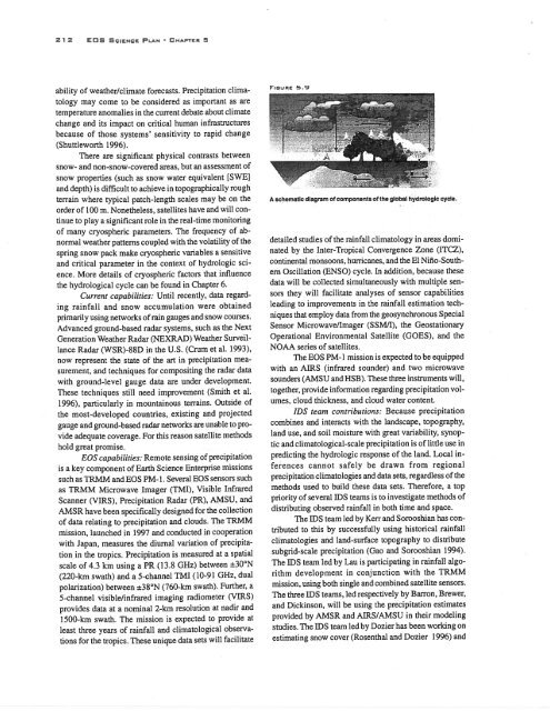
FIGuRE 5.9<br />
A schematic diagram of components of the global hydrologic cycle.<br />
detailed studies of the rainfall climatology in areas domi<br />
nated by the Inter-Tropical Convergence Zone (ITCZ),<br />
continental monsoons, hurricanes, and the El Niflo-South<br />
em Oscillation (ENSO) cycle. In addition, because these<br />
data will be collected simultaneously with multiple sen<br />
sors they will facilitate analyses of sensor capabilities<br />
leading to improvements in the rainfall estimation tech<br />
niques that employ data from the geosynchronous Special<br />
Sensor Microwaveflmager (SSM/J), the Geostationary<br />
Operational Environmental Satellite (GOES), and the<br />
NOAA series of satellites.<br />
The EOS PM-I mission is expected to be equipped<br />
with an AIRS (infrared sounder) and two microwave<br />
sounders (AMSU and HSB). These three instruments will,<br />
together, provide information regarding precipitation vol<br />
umes, cloud thickness, and cloud water content.<br />
IDS team contributions: Because precipitation<br />
combines and interacts with the landscape, topography,<br />
land use, and soil moisture with great variability, synop<br />
tic and climatological-scale precipitation is of little use in<br />
predicting the hydrologic response of the land. Local in<br />
ferences cannot safely be drawn from regional<br />
precipitation climatologies and data sets, regardless of the<br />
methods used to build these data sets. Therefore, a top<br />
priority of several IDS teams is to investigate methods of<br />
distributing observed rainfall in both time and space.<br />
The IDS team led by Kerr and Sorooshian has con<br />
tributed to this by successfully using historical rainfall<br />
climatologies and land-surface topography to distribute<br />
subgrid-scale precipitation (Gao and Sorooshian 1994).<br />
The lOS team led by Lau is participating in rainfall algo<br />
rithm development in conjunction with the TRMM<br />
mission, using both single and combined satellite sensors.<br />
The three IDS teams, led respectively by Barron, Brewer,<br />
and Dickinson, will be using the precipitation estimates<br />
provided by AMSR and AIRS/AMSU in their modeling<br />
studies. The 11)S team led by Dozier has been working on<br />
estimating snow cover (Rosenthal and Dozier 1996) and