EGNOS - Projet EuroMed Transport
EGNOS - Projet EuroMed Transport
EGNOS - Projet EuroMed Transport

Create successful ePaper yourself
Turn your PDF publications into a flip-book with our unique Google optimized e-Paper software.
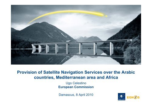
Provision of Satellite Navigation Services over the Arabic<br />
countries, Mediterranean area and Africa<br />
Ugo Celestino<br />
European Commission<br />
Damascus, 8 April 2010
Content<br />
• Benefits of GNSS services<br />
• Status of GNSS in Africa, MEDA, Arabic<br />
Peninsula
Benefits from use of GNSS<br />
• Direct economic benefits<br />
- Sales of GNSS product and<br />
services (upstream & downstream)<br />
- Cost savings (e.g. reduction in flight<br />
time, fuel usage, ILS equipment,...)<br />
• Indirect socio & economic benefits<br />
- Reduction of accidents, pollution,<br />
loss of human lives, ...<br />
- Increase in employment<br />
- Increase in economic activity<br />
Measured for EU<br />
Measured for MEDA<br />
countries (in METIS,<br />
2009)<br />
Partially<br />
measured for<br />
Africa<br />
To be evaluated<br />
for Arabic<br />
peninsula, East EU
Direct benefits: GNSS services + products<br />
• Worlwide “GNSS-enabled” market size for civil<br />
applications: around € 236 billions in 2025 per<br />
year<br />
2009<br />
€ 140 billion<br />
2025<br />
€ 236 billion<br />
Time
An opportunity for entrepreneurs<br />
• Entrepreneurs from non EU countries can already participate<br />
in FP7 Galileo R&D and the “Galileo Masters” yearly<br />
competition<br />
• Technologies to integrate in hardware and software<br />
developments, including applets and plugs-in<br />
• Standards shared with users worldwide: huge markets<br />
• Ubiquitous among ICT application domains:<br />
Tracking<br />
and tracing<br />
Mapping and<br />
cadastre<br />
<strong>Transport</strong>s<br />
Health<br />
Tourism<br />
Emergency<br />
management and<br />
humanitarian aid
Benefits from GALILEO & <strong>EGNOS</strong><br />
• As civilian systems, they<br />
- Can offer service-level-agreements,<br />
enter contractual relations via the<br />
operator (e.g. Egnos Service<br />
Provider)<br />
- Comply with ICAO, IMO standards<br />
for SoL services<br />
• <strong>EGNOS</strong> is operational, now<br />
- Certified for SoL in 2010<br />
- Will be integrated in Galileo<br />
- An immediate opportunity to gain<br />
benefits and know-how in sat nav<br />
service provision<br />
Need committed<br />
local and regional<br />
Authorities<br />
<strong>EGNOS</strong> coverage<br />
required
<strong>EGNOS</strong> coverage goes beyond EU<br />
<strong>EGNOS</strong><br />
Service Area<br />
<strong>EGNOS</strong> Satellite<br />
Footprints<br />
<strong>EGNOS</strong> satellites and central processing<br />
capability are assets that can be leveraged<br />
by all countries in the central footprint
Towards a worldwide SBAS coverage<br />
Source: Stanford University<br />
WAAS <strong>EGNOS</strong><br />
SDCM<br />
GAGAN<br />
MSAS
Benefits in aviation become higher in less<br />
equipped areas<br />
• General operational<br />
benefits<br />
• Reduction in angle of<br />
approach (direct and<br />
curved)<br />
• Better lateral guidance<br />
• <strong>EGNOS</strong> enables a<br />
reduction in the decision<br />
height<br />
<strong>EGNOS</strong> competitive space<br />
• Allows for IFR-like operation in non ILS-equipped airports<br />
• Increase in airports capacity<br />
• Increase in safety<br />
• Increase in flight capability (e.g. helicopters)<br />
• Expensive land based navaids can be avoided<br />
• Enables their long term decommissioning => lower<br />
terminal charges
Impact on Economic development and integration<br />
37% of Africa is within<br />
250km from an ILS<br />
equipped airport<br />
87% of Africa is ><br />
250km away from a<br />
main airport<br />
<strong>EGNOS</strong><br />
potential
Millions<br />
of Euro<br />
The case of <strong>EGNOS</strong> for aviation in Africa<br />
1.600<br />
1.400<br />
1.200<br />
1.000<br />
Cumulative undiscounted net benefits on a 30 years timeframe<br />
(2012-42) will amount to 1.7€b versus cost of €0.3€b<br />
800<br />
600<br />
400<br />
200<br />
0<br />
1,670<br />
50<br />
129<br />
311<br />
1,180<br />
Cumulative undis<br />
counted benefits<br />
DDC<br />
49<br />
Navaids<br />
ADS-B<br />
CFIT<br />
3<br />
171<br />
Equipage inveProcedures<br />
invInfrastructure<br />
c<br />
stments estments apex<br />
11<br />
136<br />
Infrastructure<br />
opex<br />
1.311<br />
Cumulative un<br />
discounted net<br />
benefits<br />
Discounted<br />
net benefits*<br />
>210€m<br />
Note: * 8% discount<br />
rate has been used
Technical feasibility and users’ interest<br />
A demonstration of the use of <strong>EGNOS</strong> for advanced rail traffic<br />
management, on low-density rail lines, Gauteng, South Africa 2005<br />
Temporary <strong>EGNOS</strong> reference stations installed in several African countries: Chad, Cameroon, Central African<br />
Republic, Congo, Ethiopia, Kenya, Zambia, Namibia and South Africa; flight testing took place during a East-to-<br />
West flight from Dakar to Mombasa on 19-20 May 2005
Example of <strong>EGNOS</strong> use beyond aviation:<br />
land management<br />
• Hydrographic survey<br />
• Crustal deformation monitoring<br />
• Landslides, flooding, volcanic crustal dynamics, etc<br />
• Improvement of National Geodetic Network<br />
• Cartography, cadastre and GIS data collection<br />
• Update of regional technical map, standardised cadastral<br />
surveying, georeferencing orthoimages satellite images, etc.<br />
• Structure monitoring<br />
• Bridges, dams, buildings<br />
• Civil Engineering<br />
• Support to meteorological analysis and forecasts
Overall SBAS (<strong>EGNOS</strong>) benefits in Africa<br />
• Economic opening-up of isolated regions, reduction of access<br />
costs to regional centres<br />
• Improving transport infrastructure at once by making regional<br />
airports accessible to nationally and internationally<br />
• Reducing maintenance costs, safety and security of railways<br />
• Improving dramatically air and maritime transport safety<br />
• Impacting positively agriculture, mining, energy, and land<br />
management<br />
• Reduction of costs, increased safety and greater reactivity for<br />
humanitarian interventions<br />
• Building African capacity at managing large projects<br />
• Establishing pan-African infrastructure<br />
• Training of African users and operators<br />
• Reinforcement of African academic institutions
Results of a Cost-benefits analysis<br />
The use of SBAS for Africa can bring benefits for various economic sectors<br />
Total benefits surpass 500€m over the 2012-2042 (30 years) period<br />
Millions of Euro<br />
311<br />
Total discounted<br />
net benefits<br />
(Discount rate<br />
of 8%)<br />
~ 520€m
Satellite navigation in the Africa-EU policies<br />
• SBAS in Africa is part of the First Action Plan (2008-2010) for<br />
the Implementation of the Africa-EU Strategic Partnership<br />
(Lisbon Summit, December 2007)<br />
• Reaffirmed by Vice-President Tajani at the African Union Open<br />
Day on Infrastructure (Addis Ababa, January 2009)<br />
Included in the<br />
Communication from the<br />
Commission to the European<br />
Parliament and to the Council<br />
“Partnership between the<br />
European Union and Africa.<br />
Connecting Africa and<br />
Europe: working towards<br />
strengthening transport<br />
cooperation” (COM(2009)<br />
301 final, 24 June 2009)<br />
Euro-Mediterranean<br />
Partnership and<br />
Neighbourhood Policy<br />
with<br />
North Africa<br />
Cotonou<br />
Agreement<br />
with<br />
sub-Saharan<br />
Africa<br />
Agreement on<br />
Trade,<br />
Development and<br />
Cooperation with<br />
South Africa
Africa programme implementation steps<br />
1. Preliminary studies<br />
2. Cost Benefit Analysis<br />
3. Programming<br />
(implementation and<br />
management plan)<br />
4. Governance scheme<br />
5. Political support<br />
6. Funding<br />
7. Detailed system design<br />
… - 2009<br />
2010<br />
2011<br />
8. Deployment of <strong>EGNOS</strong> across<br />
Africa<br />
2012<br />
9. Service provision and operation<br />
Main issues to be tackled<br />
1. Rationale and benefits<br />
2. Technical alternatives<br />
3. Liability policy<br />
4. Certification policy<br />
5. Industrial issues<br />
6. Training needs and capacity building<br />
7. Exploitation<br />
8. Costs<br />
9. Governance structure<br />
10. Funding options<br />
11. Project management structure
Potential <strong>EGNOS</strong> extensions<br />
<strong>EGNOS</strong><br />
Service Area<br />
MEDA Extension<br />
W. Africa<br />
S. Africa<br />
Northern-East<br />
Europe<br />
Arabic<br />
peninsula<br />
<strong>EGNOS</strong> Satellite<br />
Footprints<br />
For Middle-East & Arabic<br />
Peninsula, the key steps are to<br />
analyse the technical, political<br />
and economic rationale in view<br />
of deciding on the further<br />
implementation, allocating the<br />
necessary funds and preparing<br />
decisions<br />
Being analysed in<br />
SIRAJ project
R&D under way to study <strong>EGNOS</strong> extension<br />
EEGS (SBAS in Eastern Europe): Russian Space Agency, GMV (Spain),<br />
Ukrainian space agency, Romanian Space Agency<br />
ESESA (<strong>EGNOS</strong> Extension in South Africa): S.Africa Space Agency, FDC<br />
(France), Ecorys<br />
SIRAJ (SBAS Implementation in ACAC and ASECNA Regions): ASECNA,<br />
Telespazio (Italy), ACAC, ONDA, Pildo Labs (Spain), Navya Solutions (Spain),<br />
Senasa (Spain), Egis Avia (France)<br />
Upgrading past technical knowledge<br />
with local partners fully involved
Overview of <strong>EGNOS</strong> extension status<br />
Study Deployment<br />
Service Provision<br />
Africa - sub<br />
saharian<br />
(EU Dev Funds)<br />
North<br />
Europe<br />
Eastern Europe<br />
(EEGS)<br />
(*) pending approval<br />
South Africa<br />
(ESESA)<br />
ACAC region<br />
(SIRAJ)<br />
MEDA countries<br />
(Euromed GNSS I)<br />
MEDA countries<br />
(Euromed GNSS II)<br />
South Africa<br />
(own funds)<br />
Africa - sub<br />
saharian<br />
(EU Dev Funds)*
Conclusions<br />
<strong>EGNOS</strong> Northern-<br />
Service Area East Europe<br />
MEDA<br />
Extension<br />
W.<br />
Africa<br />
S. Africa<br />
GNSS technology bring significantly more benefits to<br />
the downstream segments<br />
• Creating direct economic opportunities<br />
• Enabling more efficient/effective public policies (e.g.<br />
in all transport modes)<br />
<strong>EGNOS</strong> is an immediate opportunity to gain such<br />
benefits and know-how in sat nav service provision<br />
• Common worldwide standard (SBAS)<br />
• Several past real life tests support the concept<br />
• Operator in place to sign service level agreements<br />
• Technical possibilities of extending geographic<br />
coverage are under study<br />
<strong>EGNOS</strong> extensions accelerate in presence of<br />
• Committed local/regional Authorities<br />
• Sound financing options:<br />
• Development funds, or<br />
• Local country contribution (e.g. S. Africa)
Thank you for your attention<br />
Further information:<br />
http://www.satellite-navigation.eu/<br />
Input and questions are welcome<br />
ugo.celestino@ec.europa.eu
BACK UP SLIDES
<strong>EGNOS</strong>: Governance<br />
Certified<br />
Service<br />
Provider<br />
Ground Segment<br />
Geostationary<br />
Transponders<br />
European Satellite<br />
Services<br />
Provider<br />
European Parliament<br />
&<br />
Council<br />
European Commission<br />
Industry<br />
SES ASTRA<br />
European<br />
Space<br />
Agency<br />
Political decisions<br />
Programme<br />
Manager<br />
Design agent