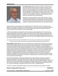
Example 2 - Skidmore College
Example 2 - Skidmore College
Example 2 - Skidmore College

You also want an ePaper? Increase the reach of your titles
YUMPU automatically turns print PDFs into web optimized ePapers that Google loves.
ABSTRACT<br />
I will analyze cosmogenic 10 Be and 26 Al nuclide activities in three grain-sizes in a<br />
2m-deep soil pit located on the Kofa Mountain Piedmont to establish the timing of<br />
deposition on a stable desert piedmont at Yuma Proving Grounds (YPG) in Yuma, AZ. I<br />
will use the resulting data to reconstruct the surface history, deposition rates, and periods<br />
of surface stability of the Kofa Mountain Piedmont. Presently, the piedmont surface is<br />
stable (neither grading nor eroding) as indicated by the presence of varnished interlocking<br />
desert pavements above an Av (vesicular) soil horizon. By deciphering the timing of<br />
deposition and surface stability, we will better understand piedmont process in relation to<br />
climate change.<br />
INTRODUCTION<br />
Alluvial, aeolian, hillslope, and biogenic processes dominate sediment transport in<br />
arid climates (Wells et al. 1995). Alluvial processes refer to erosion and deposition of<br />
sediment by water processes. Though scarce in the Sonoran Desert, water forms<br />
ephemeral channels that fill during rainstorms and move considerable amounts of<br />
sediment. Aeolian sediments that are fine-grained can travel great distances (cm to km)<br />
in the wind. Hillslope processes are responsible for generating sediment from mountain<br />
bedrock. Finally, biogenic processes refer to the flora trapping airborne sediments and<br />
fauna that mix and move sediment. By considering these processes in concert one can<br />
understand better the sediment transport in arid regions.<br />
Although sediment transport depends on many individual processes, sediment on<br />
piedmonts is dominated by alluvial processes. My study focuses on the rate and timing<br />
of alluvial processes modifying the Kofa Mountain Piedmont in the Sonoran Desert<br />
located in the arid southwestern United States (Figure 1). Much of the southwestern<br />
United States consists of mountain ranges separated by extensive drainage basins.<br />
1
Piedmonts, the low-sloping features that extend from the base of mountains, can be<br />
landforms characterized by sediment deposition and/or landforms where sediment is<br />
transported across the surface. My study will provide new insight into the long-term<br />
processes that have made the Kofa Mountain Piedmont.<br />
Setting:<br />
I am conducting my research on the Yuma Proving Grounds (YPG) in Yuma, AZ<br />
(Figure 1). The YPG is a U.S. Army installation that specializes in artillery and<br />
munitions testing. Located in southwestern Arizona, YPG contains the Kofa Mountain<br />
Range in the Sonoran Desert. Extreme temperatures (from 12 °C in the winter to 51°C in<br />
the summer), sparse vegetation (predominately consisting of Creosote Bush, White<br />
Bursage, Saguaro, Ocotillo, Thorny-Fruit Cacti, and Galleto Grasses) and low annual<br />
precipitation (approximately 91mmyr -1 ) characterize the area (Lashlee et al. 1999).<br />
The Kofa Mountain Piedmont, extending from the base of Kofa Mountain, is<br />
located in the southern Basin and Range, which consists of mountains separated by broad<br />
and gently sloping piedmonts (Lashlee et al. 1999). Sediment eroded from Kofa<br />
Mountain is transported in ephemeral channels that incise a higher stable piedmont<br />
surface. Such ephemeral channels at YPG remain dry for the majority of the year and<br />
only transport sediment during infrequent rains that cause flash floods, which entrain<br />
sediments of all sizes before depositing these same sediments simultaneously (Laronne<br />
and Reid, 1993). In order to quantify the history of one portion of the Kofa Mountain<br />
Piedmont, I collected sediment samples from a 2m-deep soil pit (Figures 2A, 2B). I am<br />
using cosmogenic 10 Be and 26 Al analyses and numeric models to determine deposition<br />
rates and periods of surface stability.<br />
2
The Kofa Mountain Piedmont exhibits several indications of surface stability.<br />
The accumulation of aeolian fines (clay and silt) results in the formation of an Av<br />
(vesicular) soil horizon and rock varnish (Liu and Broecker, 2000). Vesicles within the<br />
soil layer, formed by escaping gases after aeolian deposition, characterize Av horizons<br />
(Figure 3) (McFadden et al. 1987). Such Av horizons suggest stability because sediment<br />
transport or erosion would easily destroy this fragile soil layer. Rock varnish, a surface<br />
coating of FeO and MnO that forms on clasts exposed to aeolian clay sediments, cover<br />
surface clasts making up the desert pavement (Figure 4). Rock varnish takes at least<br />
several hundred to several thousand years to form (Liu and Broecker, 2000). The<br />
combination of varnished clasts and the formation of an Av soil horizon suggest<br />
prolonged stability of the Kofa Mountain Piedmont. Varnished clasts at my soil pit<br />
reside as part of an extensive desert pavement.<br />
Desert pavements consist of interlocking varnished gravels forming on top of Av<br />
soil horizons (Figure 5A). One model for the formation of desert pavements involves the<br />
clasts ascending through soil overburden during a “shrink-swell” process (McFadden et<br />
al. 1987, Wells et al. 1995). An alternate model suggests that aeolian sediment<br />
accumulates beneath the interlocking clasts, thus elevating the pavement gravels above<br />
the Av horizon (McFadden et al. 1987). Such a process is referred to as “born at the<br />
surface” (Wells et al. 1995). The desert pavements at my soil pit location are one clast<br />
thick with an ~8 cm thick Av horizon. There are no large clasts within the 8 cm Av<br />
horizon (Figure 5B). Thus, it is more plausible that the pavement clasts were elevated<br />
from the influx of aeolian fines (being “born at the surface) rather than rising through the<br />
soil profile. Incised ephemeral channels on the piedmont deposited the sediments that<br />
3
would inevitably become the “born at the surface” pavement around my soil pit. Thus,<br />
incised channels play an important role in the depositional history and eventual formation<br />
of desert pavement of the Kofa Mountain Piedmont. By better quantifying the timing of<br />
deposition and stability of the subsurface, one can better quantify the rate of pavement<br />
formation.<br />
Cosmogenic Nuclides:<br />
Cosmogenic nuclide analysis is a relatively new and increasingly valuable<br />
technique used in geomorphology. Aside from soil pits, cosmogenic nuclides have been<br />
measured in order to date marine terraces (Perg, 2001), landscape stability (Bierman,<br />
1994), and upland erosion (Beirman and Steig, 1996, Clapp et al., 2001). Cosmogenic<br />
10 Be and 26 Al nuclides are produced from secondary cosmic rays (particularly high-<br />
energy neutrons) that enter our atmosphere and interact with oxygen and silicon<br />
respectively. Therefore, quartz is an ideal target material. Production (within quartz<br />
grains) of these nuclides decreases exponentially with depth (Lal and Arnold 1985) and<br />
have minimal production at depths >3m from the Earth’s surface (Figure 6). At the<br />
surface of the Earth, 26 Al and 10 Be nuclides are produced at a ratio of 6:1 respectively.<br />
26 Al nuclides have a half-life of 7.0 x 10 5 years and 10 Be nuclides have a half-life of 1.5 x<br />
10 6 years. Since production is minimal at depths >3 m, decay of the nuclides is faster<br />
than production. Given sufficient time (>100,000 yrs.) the activity of 26 Al will be less<br />
(due to a shorter half-life) than the activity of 10 Be for deeply buried sediments and the<br />
26 Al/ 10 Be ratios will deviate from 6/1. Therefore, by measuring both nuclides, 26 Al/ 10 Be<br />
in quartz grains can yield the near-surface history of the quartz-bearing soils.<br />
4
The implication of different nuclide activities in varying grain sizes and surface<br />
processes is subject to debate. For example, denudation rates in tropical Puerto Rico<br />
show that 10 Be activity of sand-sized grains was higher than the activity of gravel sized<br />
grains (Brown et al. 1995) suggesting that different processes deliver different size<br />
particles. In particular, Brown et al. (1995) suspect low-dosed large grains are derived<br />
from landslides while highly dosed small grains are delivered by different slope<br />
processes. In contrast, 10 Be and 26 Al activities of sand and gravel grain sizes are constant<br />
in arid basins in the American Southwest (Clapp et al. 2000, 2002) suggesting that<br />
nuclide activity is independent of sediment delivery processes.<br />
JUSTIFICATION<br />
Much of the southwestern United States consists of expansive deserts.<br />
Understanding the processes shaping these vast areas is valuable to the study of<br />
landscape evolution. In the Sonoran Desert (at YPG), I plan to focus on the piedmont<br />
processes (deposition and stability) and the formation of desert pavements. It has been<br />
found that there is no nuclide variability in confined desert drainage basins (Clapp et al.<br />
2000, 2002) but we do not know if this grain size relationship holds for unconfined<br />
piedmont surfaces. By measuring 10 Be and 26 Al in multiple grain sizes from the upper<br />
2m of a piedmont surface I will provide new insight into long-term piedmont processes<br />
including deposition rates, periods of stability, and desert pavement formation.<br />
LITERATURE REVIEW<br />
Soil development is directly related to geomorphic processes and the geomorphic<br />
setting (Daniels and Hammer, 1992). Soil properties will alter through time and change<br />
according to climate as unique soil characteristics can commonly dictate the mechanics of<br />
5
a surficial system (Ritter et al., 1978). Since soil development is related to surficial<br />
processes, soils provide a context (or constraints) to produce quantitative piedmont-<br />
process models based cosmogenic nuclides.<br />
Cosmogenic nuclide data offers many insights to landscape evolution over the 10 3<br />
to 10 5 year time scale (Bierman, 1994). The rates at which nuclide bearing sediments are<br />
produced in drainage basins that move along desert surfaces, such as piedmonts,<br />
determines the nuclide activity within sediments upon final deposition. Most cosmogenic<br />
nuclide studies measure activities in rock to determine exposure age (Nichols et al., In<br />
prep) and bedrock erosion rates (Clapp et al., 2002). Recent studies have measured<br />
nuclide activity in sediment to determine drainage basin-wide erosion rates (Clapp et al,<br />
2001, 2002). Applying this technique to the Kofa Mountain Piedmont includes not only<br />
the sediment generation history, but also the transportation history across the piedmont to<br />
the pit location. In drainage basins, the abundance of cosmogenic nuclides in sediment<br />
exiting a basin is inversely related to the rate at which the basin is eroding (Bierman and<br />
Steig 1996), thus high erosion rates have low nuclide activities.<br />
Cosmogenic nuclide activity is used to create models of erosion rates along<br />
piedmonts and throughout drainage basins (Bierman and Steig, 1996, Nichols et al.<br />
2002). As sediment exits the basins the nuclide activity in alluvial sediments increases as<br />
the sediment is transported down the piedmont and away from the mountain (Nichols et<br />
al. 2002). After deposition, continued production of nuclides creates a unique nuclide<br />
signature at depth that can be modeled to estimate the depositional history of the<br />
piedmont (Nichols et al., 2002, Phillips et al., 1998, Perg et al., 2001, Anderson et al.,<br />
1996).<br />
6
At the Kofa Mountain Piedmont, grain size varies throughout the soil profile (fine<br />
silt and sand to cobble). Some units with large grain sizes might represent debris flow<br />
deposition while other layers with better-sorted grains might represent fluvial deposition.<br />
My study will test three grain sizes to see if depositional process dictates nuclide activity<br />
in a presently arid environment to obtain accurate timing for surface change. The<br />
implication of cosmogenic nuclide activity variation for different grain sizes is subject to<br />
debate. Research conducted in the Luquillo Experimental Forest in Puerto Rico<br />
concluded that 10 Be nuclide activity of fluvial sediments depends on the grain size tested<br />
(Brown et al. 1995) and thus the delivery process to the river. In contrast, grain size has<br />
shown not to yield different 10 Be activity in arid drainage basins (Clapp et al. 2001, 2002)<br />
and thus nuclide activity is independent of delivery process.<br />
METHODS<br />
Approximately 10 kg of soil were sampled from 11 depths of a 2m-deep pit at<br />
YPG: 0 - 8cm, 8 - 30cm, 30 - 50cm, 50 - 70cm, 70 - 100cm, 100 - 120cm, 120 - 140cm,<br />
140 - 154cm, 154 - 167cm, 167 – 185cm, and 185 - 200cm. Each sample was dry sieved<br />
into 7 different grain sizes: > 4000 µm, 1000 - 4000 µm, 841-1000 µm, 500 - 841 µm,<br />
250 - 500 µm, 125 - 250 µm, and < 125 µm. The grain size sample > 4000 µm for each<br />
of the 11 samples was crushed and sieved into > 841 µm, 250 – 841 µm, and < 250 µm.<br />
Samples > 4000 (250 - 841) µm, 500 – 841 µm, and < 125 µm for each of the 11 sample<br />
depths are being prepared at the University of Vermont for cosmogenic nuclide analysis.<br />
To eliminate any meteoric inheritance of 10 Be, samples will be etched in HF and the<br />
quartz present in the soil will be isolated. Sample targets will be analyzed by Accelerated<br />
7
Mass Spectrometry (AMS) to measure the 26 Al/ 10 Be ratios. These data will be used to<br />
construct a numerical model to quantify piedmont history at YPG.<br />
EXPECTED OUTCOMES<br />
I do not know if the analysis of different grain sizes will result in different nuclide<br />
activities. Analyzing various grain sizes for each soil section, however, will provide<br />
more information about sediment transport and deposition processes of desert piedmonts.<br />
By understanding the depositional processes and the surface stability of the Kofa<br />
Mountain Piedmont I will be able to constrain the formation and timing of desert<br />
pavements.<br />
TIMELINE<br />
- December 15-16, 2002: samples collected from McDonald pit YPG Yuma, AZ<br />
- January 28 – February 5, 2003: 11 samples (22 bags, ~1 gal) dry sieved into 7<br />
grain sizes (> 4000 µm, 1000 – 4000 µm, 841-1000 µm, 500 – 841 µm, 250 - 500<br />
µm, 125 – 250 µm, and < 125 µm)<br />
- February 6 – April 4, 2003: >4000µm from each of 11 samples crushed and then<br />
sieved into 3 new grain sizes (> 841 µm, 250 – 841 µm, and < 250 µm)<br />
- April 6, 2003: Samples > 4000 (250 - 841) µm, 500 – 841 µm, and < 125 µm for<br />
each of the 11 sample sections were submitted to UVM laboratories for HCl<br />
etching and cosmogenic 10 Be and 26 Al isotope analysis (by AMS)<br />
- Summer 2003: continue reading on piedmont process and desert pavement<br />
development<br />
- January – April 2004: model the data from analyzed soil samples<br />
- May 2004: present my findings and final report to the <strong>Skidmore</strong> <strong>College</strong> Geology<br />
Department<br />
8
REFERENCES<br />
Anderson, R.S., Repka, J.L., Dick, G.S., 1996, Explicit treatment of inheritance in<br />
dating depositional surfaces using in situ 10 Be and 26 Al: Geology, v. 24,<br />
no. 1, p. 47-51.<br />
Bierman, P.R., 1994, Using in situ produced cosmogenic isotopes to estimate rates<br />
of landscape evolution: A review from the geomorphic perspective:<br />
Journal of Geophysical Research, v. 99, no. B7, p. 13,885-13,896.<br />
Bierman, P.R., and Steig, E.J., 1996, Estimating rates of denudation using<br />
cosmogenic isotope abundances in sediment: Earth Surface Processes and<br />
Landforms, v. 21, p. 125-139.<br />
Brown, E.T., Stallard, R.F., Larsen, M.C., Raisbeck, G.M., and Yiou, F., 1995,<br />
Denudation rates determined from the accumulation of in situ-produced<br />
10 Be in the Luquillo Experimental Forest, Puerto Rico:<br />
Earth and Planetary Science Letters, v. 29, p. 193-202.<br />
Clapp, E.M., Bierman, P.R., Schick, A.P., Lekach, J., Enzel, Y., and Caffee, M.,<br />
2000, Sediment yield exceeds sediment production in arid region drainage<br />
basins: Geology, v. 28, no. 11, p. 995-998.<br />
Clapp, E.M., Bierman, P.R., Nichols, K.K., Pavich, M., and Caffee, M., 2001,<br />
Rates of Sediment Supply to Arroyos from Upland Erosion Determined<br />
Using In Situ Produced Cosmogenic 10 Be and 26 Al: Quaternary Research,<br />
v. 55, p. 235-245.<br />
Clapp, E.M., Bierman, P.R., and Caffee, M., 2002, Using 10 Be and 26 Al to determine<br />
sediment source areas in an arid region drainage basin: Geomorphology,<br />
v. 45, p. 89-104.<br />
Daniels, R.B., and Hammer, R.D., 1992, Soil Geomorphology: New York,<br />
John Wiley & Sons, Inc., p. 1-9.<br />
Lal, D., and Arnold, J.R., 1985, Tracing quartz through the environment:<br />
Earth and Planetary Science Letters, v. 94, no. 1, p. 1-5.<br />
Laronne, J.B., Reid, I., 1993, Very high rates of bedload sediment transport by<br />
emphemeral desert rivers: Nature, vol. 366, p. 148–150.<br />
Lashlee, D., Murphy, W., McDonald, E., and Briuer, F.: YPG Report.<br />
Liu, T., and Broecker, W.S., 2000, How fast does rock varnish grow?: Geology,<br />
v. 28, p. 183 - 186.<br />
10
McFadden, L.D., Wells, S.G., and Jercinovich, M.J., 1987, Influence of eolian<br />
and pedogenic processes on the origin and evolution of desert pavements:<br />
Geology, v. 15, p. 504-508.<br />
Nichols, K.K., Bierman, P.R., Hooke, R.LeB., Clapp, E.M., and Caffee, M., 2002,<br />
Quantifying sediment transport on desert piedmonts using 10 Be and 26 Al:<br />
Geomorphology, v. 45, p. 105-125.<br />
Nichols, K.K., Bierman, P.R., Eppes, M.C., Caffee, M., Finkel, R., and Larsen, J.,<br />
(In prep), Deciphering the Late Pleistocene and Holocene History of the<br />
Complex Chemehuevi Mountain Piedmont Using 10 Be and 26 Al: The<br />
American Journal of Science.<br />
Nichols, K.K., Bierman, P.R., Caffee, M., and Finkel, R., (In prep), Revisiting the<br />
age of the Blackhawk: Landslide dating using 10 Be and 26 Al: California<br />
Geology.<br />
Perg, L.A., Anderson, R.S., and Finkel, R.C., 2001, Use of a new 10 Be and 26 Al<br />
inventory method to date marine terraces, Santa Cruz, California, USA:<br />
Geology, v. 29, no. 10, p. 879-882.<br />
Phillips, W.M., McDonald, E.V., Reneau, S.L., and Poths, J., 1998, Dating soils<br />
and alluvium from the Pajarito Plateau, New Mexico, USA: Earth<br />
and Planetary Science Letters, v. 160, p. 209-223.<br />
Ritter, D.F., Kochel, R.C., and Miller, J.R. Geomorphic Significance of Soils:<br />
Process Geomorphology, McGraw Hill, 1978, p. 73.<br />
Wells, S.G., McFadden, L.D., Poths, J., and Olinger, C.T., 1995, Cosmogenic 3He<br />
surface-exposure dating of stone pavements: implications for landscape<br />
evolution in deserts: Geology, v.23, no.7, p. 613-616.<br />
FIGURE CAPTIONS<br />
Figure 1. Yuma Proving Grounds (YPG) is located in southwestern Arizona in the Basin<br />
and Range YPG is the horseshoe-shaped outline. My soil pit is located in the area<br />
marked with the small circle inside the Kofa Range.<br />
11
Figure 2A. Two meter-deep soil pit located on the Kofa Mountain piedmont. The soil pit<br />
is situated within a broad, varnished desert pavement. The presence of an incised channel<br />
in the background indicates occasional erosion down the piedmont.<br />
Figure 2B. Close-up of the soil pit showing sample locations from the 11 depth sections.<br />
Figure 3. An example of an Av (vesicular) soil horizon. Vesicles are above the white<br />
line drawn on the sample.<br />
Figure 4. The rock varnish present on the desert pavement at YPG. Varnish is the result<br />
of clay-rich aeolian sediments interacting with exposed surface clasts. Note the dark<br />
color represents top of clast exposed sub-aerially.<br />
Figure 5A. A top-down view of the desert pavement present on the Kofa Mountain<br />
piedmont. Note the darkly varnished interlocking clasts.<br />
Figure 5B. Cross-Section view of the desert pavement at my soil pit. This photograph<br />
displays the 2 cm-thick pavement formed above the 8cm Av soil horizon. Also note the<br />
absence of clasts within the 8cm-thick Av section.<br />
Figure 6. The production of cosmogenic 10 Be and 26 Al nuclides decreases exponentially<br />
with depth from the surface of the Earth.<br />
12
Soil Pit<br />
FIGURES<br />
13
Figure 2A<br />
2 m<br />
Incised<br />
Channel<br />
14
120-140cm<br />
140-154cm<br />
Figure 2B<br />
0-8 cm<br />
8-30 cm<br />
30-50 cm<br />
50-70 cm<br />
70-100cm<br />
100-120cm<br />
154-167cm 167-185cm<br />
185-200cm<br />
2 m<br />
15
Figure 3<br />
Av vesicles<br />
16
Figure 4<br />
Desert<br />
Varnish<br />
Ground<br />
Surface<br />
17
Figure 5A<br />
18
Figure 5B<br />
1 Clast (~2cm) Thick<br />
Pavement<br />
Av Soil Horizon<br />
19
Depth<br />
Production<br />
Figure 6<br />
N = P (1 – e -λt ) + B<br />
λ<br />
20