Revised Blight Study - City of Shawnee
Revised Blight Study - City of Shawnee
Revised Blight Study - City of Shawnee

Create successful ePaper yourself
Turn your PDF publications into a flip-book with our unique Google optimized e-Paper software.
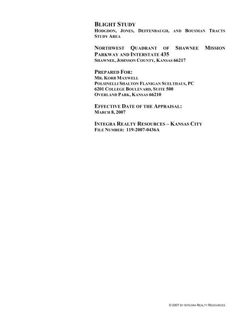
BLIGHT STUDY<br />
HODGDON, JONES, DEFFENBAUGH, AND BOUSMAN TRACTS<br />
STUDY AREA<br />
NORTHWEST QUADRANT OF SHAWNEE MISSION<br />
PARKWAY AND INTERSTATE 435<br />
SHAWNEE, JOHNSON COUNTY, KANSAS 66217<br />
PREPARED FOR:<br />
MR. KORB MAXWELL<br />
POLSINELLI SHALTON FLANIGAN SUELTHAUS, PC<br />
6201 COLLEGE BOULEVARD, SUITE 500<br />
OVERLAND PARK, KANSAS 66210<br />
EFFECTIVE DATE OF THE APPRAISAL:<br />
MARCH 8, 2007<br />
INTEGRA REALTY RESOURCES – KANSAS CITY<br />
FILE NUMBER: 119-2007-0436A<br />
© 2007 BY INTEGRA REALTY RESOURCES
NORTHWEST QUADRANT OF SHAWNEE MISSION PARKWAY AND INTERSTATE 435<br />
SHAWNEE, KANSAS
April 2, 2008<br />
Mr. Korb Maxwell<br />
Polsinelli Shalton Flanigan Suelthaus PC<br />
6201 College Boulevard, Suite 500<br />
Overland Park, Kansas 66210<br />
SUBJECT: <strong>Blight</strong> <strong>Study</strong><br />
Northwest Quadrant <strong>of</strong> <strong>Shawnee</strong> Mission Parkway and Interstate 435<br />
<strong>Shawnee</strong>, Johnson County, Kansas 66217<br />
Integra Realty Resources – Kansas <strong>City</strong> File No. 119-2007-0095<br />
Dear Mr. Maxwell:<br />
Integra Realty Resources – Kansas <strong>City</strong> is pleased to transmit the blight study <strong>of</strong> the area<br />
comprised <strong>of</strong> the Northwest Quadrant <strong>of</strong> <strong>Shawnee</strong> Mission Parkway and Interstate 435,<br />
<strong>Shawnee</strong>, Johnson County, Kansas. The purpose <strong>of</strong> this report is to make an evaluation and<br />
determination as to whether or not the area is blighted as defined in KSA Chapter 12, Article<br />
17, 12-1770a, Definitions. The facts and conclusions contained herein are presented as <strong>of</strong> the<br />
effective date <strong>of</strong> the report, March 8, 2007.<br />
This report has been performed in accordance with the Code <strong>of</strong> Pr<strong>of</strong>essional Ethics and<br />
Standards <strong>of</strong> Pr<strong>of</strong>essional Appraisal Practice <strong>of</strong> the Appraisal Institute and Uniform<br />
Standards <strong>of</strong> Pr<strong>of</strong>essional Appraisal Practice (USPAP). Supporting documentation<br />
concerning the data, reasoning, and analyses is retained in our file. The depth <strong>of</strong> discussion<br />
contained in this report is specific to the needs <strong>of</strong> the client and the intended use <strong>of</strong> the report<br />
as noted herein.<br />
The study area is comprised <strong>of</strong> 18 separate tax parcels located north <strong>of</strong> <strong>Shawnee</strong> Mission<br />
Parkway from Interstate 435 on the east to Ogg Road on the west and Johnson Drive on the<br />
north. The study area totals 310.79 acres more or less, according to public record. The area is<br />
being analyzed to determine whether or not blighting factors exist at the study area. Please<br />
note that for the purposes <strong>of</strong> this report, the term “blight” is defined by the Terms <strong>of</strong> Kansas<br />
law. The statutory definition, cited in the body <strong>of</strong> this report, does not necessarily coincide<br />
with the common definition <strong>of</strong> blight as defined in Webster’s Dictionary as: “something that<br />
frustrates plans or hopes, something that impairs or destroys a deteriorated condition .”<br />
1901 West 47 th Place, Suite 300 • Westwood, Kansas 66205-1834 • 913-236-4700 • Fax 913-236-4307 • www.irr.com
Mr. Korb Maxwell<br />
Polsinelli, Shalton, Flanigan, Suelthaus, PC<br />
April 2, 2008<br />
Page 2<br />
As explained in detail in the study that follows, it is our conclusion that the site is blighted<br />
under the criteria listed below.<br />
Factor Present<br />
A majority <strong>of</strong> the following factors:<br />
A substantial number <strong>of</strong> deteriorated or deteriorating<br />
structures.<br />
A predominance <strong>of</strong> defective or inadequate street layout. X<br />
Unsanitary or unsafe conditions. X<br />
Deterioration <strong>of</strong> site improvements. X<br />
Tax or special assessment delinquency exceeding the fair<br />
market value <strong>of</strong> the real property.<br />
Defective or unusual conditions <strong>of</strong> title including but not<br />
limited to cloudy or defective titles, multiple or unknown<br />
ownership interests in the property.<br />
Improper or obsolete platting. X<br />
The existence <strong>of</strong> conditions which endanger life or property X<br />
by fire and other causes.<br />
Conditions which create economic obsolescence. X<br />
Cause the following:<br />
Retarding the provision <strong>of</strong> housing accommodations. X<br />
Conditions which constitute an economic or social liability X<br />
Conditions which constitute a menace to the public health, safety,<br />
morals or welfare in its present condition and use<br />
Not<br />
Present<br />
If you have any questions or comments, please contact the undersigned. Thank you for the<br />
opportunity to be <strong>of</strong> service.<br />
Respectfully submitted,<br />
INTEGRA REALTY RESOURCES – KANSAS CITY<br />
Kenneth Jaggers, MAI, MRICS<br />
Managing Director<br />
Certified Real Property Appraiser<br />
Kansas Certificate No. G-969<br />
(913) 748-4704<br />
kjagger@irr.com<br />
X<br />
X<br />
X<br />
X
HODGDON, JONES, AND DEFFENBAUGH TRACTS STUDY AREA TABLE OF CONTENTS<br />
TABLE OF CONTENTS<br />
PAGE NO.<br />
SUMMARY OF SALIENT FACTS AND CONCLUSIONS............................................................. 1<br />
BLIGHTING FACTORS............................................................................................................ 2<br />
GENERAL INFORMATION ...................................................................................................... 3<br />
Identification <strong>of</strong> <strong>Study</strong> area......................................................................................... 3<br />
Purpose and Effective Date......................................................................................... 3<br />
Scope <strong>of</strong> Report........................................................................................................... 3<br />
METHOD OF ANALYSIS.......................................................................................................... 4<br />
ECONOMIC ANALYSIS ........................................................................................................... 6<br />
Johnson County, Kansas Area Analysis ..................................................................... 6<br />
Market Area Analysis ............................................................................................... 15<br />
PROPERTY ANALYSIS .......................................................................................................... 20<br />
Description and Analysis <strong>of</strong> the Land....................................................................... 20<br />
Description and Analysis <strong>of</strong> the Improvements........................................................ 24<br />
Real Estate Tax Analysis .......................................................................................... 25<br />
BLIGHT ANALYSIS ............................................................................................................... 26<br />
<strong>Blight</strong>ing Factors....................................................................................................... 26<br />
Conclusion ................................................................................................................ 39<br />
CERTIFICATION ................................................................................................................... 42<br />
ASSUMPTIONS AND LIMITING CONDITIONS....................................................................... 44<br />
ADDENDA<br />
Qualifications <strong>of</strong> Analysts ....................................................................................Addendum A<br />
Definitions.............................................................................................................Addendum B<br />
Letter <strong>of</strong> Authorization .........................................................................................Addendum C<br />
7 © 2007 BY INTEGRA REALTY RESOURCES
HODGDON, JONES, AND DEFFENBAUGH TRACTS STUDY AREA SUMMARY OF SALIENT FACTS AND CONCLUSIONS<br />
SUMMARY OF SALIENT FACTS AND CONCLUSIONS<br />
Property 18 Land Parcels. Identified by the last four digits <strong>of</strong> the<br />
Johnson County Parcel ID Number. N/w <strong>Shawnee</strong><br />
Mission Parkway from Interstate 435 east to Ogg Road<br />
and north to Johnson Drive.<br />
Date <strong>of</strong> the Report April 2, 2008.<br />
Effective Date <strong>of</strong> the Assignment March 8, 2007.<br />
Land Area 310.79 acres, more or less.<br />
Zoning Designation Agricultural District.<br />
Description <strong>of</strong> the improvements. The only commercial use in the study area is an<br />
approximately 0.25 acre plot in the central portion <strong>of</strong> the<br />
study area near Ogg Road, where a cell phone tower is<br />
constructed. Various storage and distribution buildings<br />
previously used by Hodgdon Powder, Inc. are scattered<br />
among several Hodgdon tracts. Five tracts are vacant,<br />
eight have residential improvements, and five tracts<br />
have farm outbuildings.<br />
<strong>Study</strong> # Parcel ID Address Owner <strong>of</strong> Record Acres<br />
2001 QF 241207-2001 5973 Ogg Road Jones, Wilbur L. & Susan M. 34.86<br />
2002 QF 241207-2002 6336 Lind Road Hodgdon, Robert E. et al 56.75<br />
2003 QF 241207-2003 N/A Hodgdon, Robert E. et al 15.00<br />
4004 QF 241207-4004 N/A Hodgdon, Robert E. et al 14.58<br />
4005 QF 241207-4005 6235 Lind Road Hodgdon, Robert E. et al 18.01<br />
1001 QF 241218-1001 N/A Hodgdon, Robert E. et al 4.57<br />
1002 QF 241218-1002 N/A Hodgdon, J.B. et al 26.83<br />
1003 QF 241218-1003 N/A Hodgdon, Sally J. et al 18.12<br />
1004 QF 241218-1004 Public R.O.W. Hodgdon, John 0.41<br />
1013 QF 241218-1013 N/A Hodgdon, Robert E. et al 14.70<br />
1014 QF 241218-1014 Public R.O.W. Bousman, Dorothea 1.22<br />
1019 QF 241218-1019 N/A Hodgdon, J.B. et al 0.36<br />
1020 QF 241218-1020 6336 Lind Road Hodgdon, J.B. et al 2.90<br />
3008 QF 241218-3008 Public R.O.W. Hodgdon, Robert E. et al 23.59<br />
3013 QF 241218-3013 Public R.O.W. Hodgdon, Robert E. et al 7.87<br />
2005 QF 241207-2005 18101 Johnson DrivDeffenbaugh 1.83<br />
2004 QF 241207-2004 18100 Johnson DrivDeffenbaugh 33.67<br />
4008 QF 241207-4008 N/A Deffenbaugh 35.52<br />
Total 310.79<br />
PAGE 1
HODGDON, JONES, AND DEFFENBAUGH TRACTS STUDY AREA BLIGHTING FACTORS<br />
BLIGHTING FACTORS<br />
As shown in the exhibit below and our analysis summarized herein, we find several<br />
blighting factors present at the study area.<br />
Factor Present<br />
A majority <strong>of</strong> the following factors:<br />
A substantial number <strong>of</strong> deteriorated or deteriorating<br />
structures.<br />
A predominance <strong>of</strong> defective or inadequate street layout. X<br />
Unsanitary or unsafe conditions. X<br />
Deterioration <strong>of</strong> site improvements. X<br />
Tax or special assessment delinquency exceeding the fair<br />
market value <strong>of</strong> the real property.<br />
Defective or unusual conditions <strong>of</strong> title including but not<br />
limited to cloudy or defective titles, multiple or unknown<br />
ownership interests in the property.<br />
Improper or obsolete platting. X<br />
The existence <strong>of</strong> conditions which endanger life or property X<br />
by fire and other causes.<br />
Conditions which create economic obsolescence. X<br />
Cause the following:<br />
Retarding the provision <strong>of</strong> housing accommodations. X<br />
Conditions which constitute an economic or social liability X<br />
Conditions which constitute a menace to the public health, safety,<br />
morals or welfare in its present condition and use<br />
Not<br />
Present<br />
X<br />
X<br />
X<br />
X<br />
PAGE 2
HODGDON, JONES, AND DEFFENBAUGH TRACTS STUDY AREA GENERAL INFORMATION<br />
GENERAL INFORMATION<br />
IDENTIFICATION OF STUDY AREA<br />
The study area is comprised <strong>of</strong> 18 tax parcels with seven different private owners. Parcel<br />
ID, size, and owner are cited in summary <strong>of</strong> salient facts and the property description. The<br />
total land area is 310.79 acres more or less.<br />
PURPOSE AND EFFECTIVE DATE<br />
The purpose <strong>of</strong> this report is to recognize, analyze, and report any blighting factors that<br />
may be present at the study area, pursuant to the definition <strong>of</strong> blight set forth in the KSA<br />
Chapter 12, Article 17, 12-1770a. This study has been prepared for use in conjunction<br />
with establishing the study area as a redevelopment district. The effective date <strong>of</strong> this<br />
report is March 8, 2007.<br />
INTENDED USE AND INTENDED USER<br />
This Consulting report is prepared for Mr. Korb Maxwell, Polsinelli, Shalton, Flanigan,<br />
Suelthaus, PC, 6201 College Boulevard, Suite 500, Overland Park, Kansas, to assist the<br />
client in evaluating the application for tax increment financing. It is not intended for any<br />
other use or user.<br />
SCOPE OF REPORT<br />
To perform this assignment, we took the following steps to gather, confirm, and analyze<br />
relevant data.<br />
An inspection <strong>of</strong> the study area was conducted by Kenneth Jaggers, MAI,<br />
and Matthew J. Antongiovanni on March 8, 2007.<br />
Collected factual information about the study area and the surrounding<br />
market, and confirmed that information with various sources.<br />
Reviewed and analyzed the governing statutes that apply to the site.<br />
Reviewed various site maps, zoning map, plat maps, and aerial<br />
photographs.<br />
Prepared a consulting report summarizing our analyses, opinions and<br />
conclusions.<br />
This is a consulting report that has been prepared to determine whether or not the study<br />
area is blighted as defined in KSA 12-1770a. This is not an appraisal report, and there is no<br />
opinion given to the feasibility <strong>of</strong> a proposed project or to the value <strong>of</strong> the underlying real<br />
estate. This is a summary report. The depth <strong>of</strong> discussion contained in this report is specific<br />
to the needs <strong>of</strong> the client and the intended use <strong>of</strong> the report as noted herein.<br />
PAGE 3
HODGDON, JONES, AND DEFFENBAUGH TRACTS STUDY AREA GENERAL INFORMATION<br />
METHOD OF ANALYSIS<br />
In determining whether the defined area is a blighted area, the initial responsibility is to<br />
define the term, “blighted area.” This study utilizes the definitions found in KSA Chapter<br />
12, Article 17, 12-1770a:<br />
(1) “<strong>Blight</strong>ed area”, means an area which, 1) because <strong>of</strong> the presence <strong>of</strong> a<br />
majority <strong>of</strong> the following factors, substantially impairs or arrests the<br />
development and growth <strong>of</strong> the municipality or constitutes and economic<br />
or social liability or is a menace to public health, safety, morals or welfare<br />
in its present condition and use: A) a substantial number <strong>of</strong> deteriorated or<br />
deteriorating structures; B) predominance <strong>of</strong> defective or inadequate street<br />
layout; C) unsanitary or unsafe conditions; D) deterioration <strong>of</strong> site<br />
improvements; E) tax or special assessment delinquency exceeding the<br />
fair market value <strong>of</strong> the real property; F) defective or unusual conditions<br />
<strong>of</strong> title including but not limited to cloudy or defective titles, multiple or<br />
unknown ownership interests to the property; G) improper subdivision or<br />
obsolete platting or land uses; H) the existence <strong>of</strong> conditions which<br />
endanger life or property by fire or other causes; or I) conditions which<br />
create economic obsolescence; or 2) have been identified by any state or<br />
federal environmental agency as being environmentally contaminated to<br />
an extent that requires a remedial investigation; feasibility study and<br />
remediation or other similar state or federal action; or 3) previously was<br />
found by resolution <strong>of</strong> the governing body to be a slum or a blighted area<br />
under KSA 17-472 et. Seq., and amendments thereto.<br />
<strong>Shawnee</strong>, Kansas has no additional or differing conditions to be examined to determine<br />
whether blight exists in an area.<br />
In determining whether the area under review is blighted pursuant to the definition above,<br />
the consultants have first reviewed the surrounding area and neighborhood as a whole,<br />
then the study area. In reviewing the statute we note that the governing body may<br />
determine that an area is blighted, although the blight may not necessarily affect the total<br />
area, or any particular portion <strong>of</strong> the site. It is not necessary that the property be located in<br />
what is generally known as a “slum.”<br />
PAGE 4
HODGDON, JONES, AND DEFFENBAUGH TRACTS STUDY AREA GENERAL INFORMATION<br />
The term “blighted” for purposes <strong>of</strong> this analysis requires a finding that the presence <strong>of</strong><br />
certain factors in an area “impairs or arrests the development and growth <strong>of</strong> the<br />
municipality or constitutes an economic or social liability or is a menace to the public<br />
health, safety, morals, or welfare in its present condition or use”. The statute requires that<br />
the preceding factors be caused by the predominance <strong>of</strong> one or more <strong>of</strong> the following<br />
factors:<br />
(A) A substantial number <strong>of</strong> deteriorated or deteriorating structures;<br />
(B) Predominance <strong>of</strong> defective or inadequate street layout;<br />
(C) Unsanitary or unsafe conditions;<br />
(D) Deterioration <strong>of</strong> site improvements;<br />
(E) Tax or special assessment delinquency exceeding the fair market value <strong>of</strong><br />
the real property;<br />
(F) Defective or unusual conditions <strong>of</strong> title including but not limited to cloudy<br />
or defective titles, multiple or unknown ownership interests in the<br />
property;<br />
(G) Improper subdivision or platting or land uses;<br />
(H) The existence <strong>of</strong> conditions which endanger life or property by fire or<br />
other causes; or<br />
(I) Conditions which create economic obsolescence.<br />
Identification as an environmentally contaminated site that requires state or federal<br />
remediating action is also a blighting conditions as is a property’s previous finding <strong>of</strong><br />
blight under KSA 17-4742.<br />
The consultants have inspected the site and its surrounding area, considering the elements<br />
that constitute blight by statutory definition, as well as the improvements and associated<br />
site improvements for the study area. The following sections <strong>of</strong> the study include the<br />
neighborhood description, site description, an analysis <strong>of</strong> the factors that indicate blight,<br />
and a final conclusion regarding whether the area is a “blighted area.”<br />
PAGE 5
HODGDON, JONES, AND DEFFENBAUGH TRACTS STUDY AREA JOHNSON COUNTY, KANSAS AREA ANALYSIS<br />
ECONOMIC ANALYSIS<br />
JOHNSON COUNTY, KANSAS AREA ANALYSIS<br />
An analysis <strong>of</strong> population, employment, and income trends for Johnson County and the<br />
Kansas <strong>City</strong> MSA is performed using data provided by NPA Data Services, a recognized<br />
source.<br />
POPULATION<br />
Historical and projected population trends for Johnson County are charted below:<br />
Population (1,000's)<br />
700<br />
600<br />
500<br />
400<br />
300<br />
200<br />
100<br />
0<br />
1997<br />
1998<br />
POPULATION TRENDS<br />
Johnson County<br />
1999<br />
2000<br />
2001<br />
2002<br />
2003<br />
2004<br />
2005<br />
2006<br />
2007<br />
2008<br />
Year<br />
2009<br />
2010<br />
2011<br />
2012<br />
2013<br />
2014<br />
2015<br />
2016<br />
2017<br />
The population <strong>of</strong> Johnson County increased at a compounded annual rate <strong>of</strong> 2.07%<br />
from 2002 to 2007. For the same time period, the Kansas <strong>City</strong> MSA grew at a<br />
compounded annual rate <strong>of</strong> approximately 1.05%. Over the last ten years Johnson<br />
County’s average annual compound change was 2.26%, compared to 1.12% for the<br />
Kansas <strong>City</strong> MSA.<br />
Looking ahead, both Johnson County and the Kansas <strong>City</strong> MSA are anticipated to<br />
experience continued growth, with future population estimates reflecting growth rates<br />
less than those experienced in the past. For the period 2007 to 2017, the populations <strong>of</strong><br />
Johnson County and the Kansas <strong>City</strong> MSA are expected to increase by an average<br />
annual compound rate <strong>of</strong> 1.91% and 1.05%, respectively. For the next five years, the<br />
population <strong>of</strong> Johnson County should grow faster than the ten year average.<br />
PAGE 6
HODGDON, JONES, AND DEFFENBAUGH TRACTS STUDY AREA JOHNSON COUNTY, KANSAS AREA ANALYSIS<br />
Kansas <strong>City</strong> MSA<br />
Johnson County<br />
% %<br />
Year Population (000's) Change Population (000's) Change<br />
1997 1,780.7 421.5<br />
2002 1,888.5 6.1% 475.9 12.9%<br />
Historical<br />
2003<br />
2004<br />
1,908.3<br />
1,927.2<br />
1.0%<br />
1.0%<br />
486.9<br />
496.9<br />
2.3%<br />
2.1%<br />
2005 1,947.7 1.1% 506.6 1.9%<br />
2006 1,969.5 1.1% 516.4 1.9%<br />
Current 2007 1,989.6 1.0% 527.2 2.1%<br />
2008 2,010.1 1.0% 538.0 2.1%<br />
2009 2,031.2 1.0% 549.0 2.0%<br />
2010 2,052.9 1.1% 560.3 2.1%<br />
Projected 2011 2,074.8 1.1% 571.5 2.0%<br />
2012 2,097.0 1.1% 582.6 2.0%<br />
2017 2,209.8 5.4% 637.0 9.3%<br />
Average Annual<br />
Compound Change<br />
Source: NPA Data Services, Inc.; compiled by IRR<br />
EMPLOYMENT<br />
POPULATION TRENDS COMPARISON<br />
Historical<br />
Past 5 years 1.05% 2.07%<br />
Past 10 years 1.12% 2.26%<br />
Projected<br />
Next 5 years 1.06% 2.02%<br />
Next 10 years 1.05% 1.91%<br />
Employment trends for both Johnson County and the Kansas <strong>City</strong> MSA should follow<br />
a pattern similar to the population trends for these areas, although at higher rates <strong>of</strong><br />
increase. From 2002 to 2007, Johnson County’s employment grew at an average<br />
annual compound rate <strong>of</strong> 3.25% compared to 1.58% for the Kansas <strong>City</strong> MSA. These<br />
figures indicate that Johnson County surpassed the Kansas <strong>City</strong> MSA in employment<br />
growth over the last five years. Looking back ten years, Johnson County’s<br />
employment grew at an average annual compound rate <strong>of</strong> 3.22%, compared to the<br />
Kansas <strong>City</strong> MSA’s growth rate <strong>of</strong> 1.38%.<br />
Over the next five and ten years Johnson County employment growth should exceed<br />
the Kansas <strong>City</strong> MSA growth rate. From 2007 to 2012, Johnson County should grow<br />
by a 3.77% average annual growth rate, while the long term projection, 2007 to 2017,<br />
is for a 3.25% increase. For the same periods, employment in the Kansas <strong>City</strong> MSA is<br />
expected to grow at average annual compound rates <strong>of</strong> 2.08% and 1.79%, respectively.<br />
Employment gains are a strong indicator <strong>of</strong> economic health and generally correlate<br />
with real estate demand. Historically, Johnson County has exceeded the Kansas <strong>City</strong><br />
MSA’s growth rate, suggesting that Johnson County’s relative position is<br />
strengthening.<br />
PAGE 7
HODGDON, JONES, AND DEFFENBAUGH TRACTS STUDY AREA JOHNSON COUNTY, KANSAS AREA ANALYSIS<br />
Employment trends for Johnson County and the Kansas <strong>City</strong> MSA are presented<br />
below.<br />
NON-FARM EMPLOYMENT TRENDS COMPARISON<br />
Kansas <strong>City</strong> MSA Johnson County<br />
% %<br />
Year Employment (000's) Change Employment (000's) Change<br />
1997 1,140.4 319.4<br />
2002 1,209.2 6.0% 373.8 17.0%<br />
Historical 2003 1,208.3 -0.1% 375.8 0.5%<br />
2004 1,224.6 1.3% 384.6 2.3%<br />
2005 1,250.0 2.1% 402.1 4.5%<br />
2006 1,280.9 2.5% 421.7 4.9%<br />
Current 2007 1,307.9 2.1% 438.5 4.0%<br />
2008 1,334.2 2.0% 455.3 3.8%<br />
2009 1,362.6 2.1% 472.9 3.9%<br />
Projected<br />
2010<br />
2011<br />
1,392.1<br />
1,421.3<br />
2.2%<br />
2.1%<br />
491.4<br />
509.6<br />
3.9%<br />
3.7%<br />
2012 1,449.7 2.0% 527.5 3.5%<br />
2017 1,561.0 7.7% 604.1 14.5%<br />
Average Annual<br />
Compound Change<br />
Source: NPA Data Services, Inc.; compiled by IRR<br />
Historical<br />
Past 5 years 1.58% 3.25%<br />
Past 10 years 1.38% 3.22%<br />
Projected<br />
Next 5 years 2.08% 3.77%<br />
Next 10 years 1.79% 3.25%<br />
The following chart depicts the current distribution <strong>of</strong> employment by industry. In<br />
2007, the largest employment sectors in Johnson County are:<br />
• Services (42.2%)<br />
• Retail Trade (12.2%)<br />
• FIRE (11.9%)<br />
• Transport, Info, Util (9.8%)<br />
PAGE 8
HODGDON, JONES, AND DEFFENBAUGH TRACTS STUDY AREA JOHNSON COUNTY, KANSAS AREA ANALYSIS<br />
Percentage<br />
45.0%<br />
40.0%<br />
35.0%<br />
30.0%<br />
25.0%<br />
20.0%<br />
15.0%<br />
10.0%<br />
5.0%<br />
0.0%<br />
42.2%<br />
Services<br />
Retail Trade<br />
EMPLOYMENT SECTORS 2007<br />
Johnson County<br />
12.2% 11.9% 9.8% 7.9% 5.5% 5.3% 4.8% 0.4%<br />
FIRE<br />
Transport, Info, Util<br />
Government<br />
Manufacturing<br />
Sector<br />
Wholesale Trade<br />
Construction<br />
Mining & Other<br />
By comparison, the Kansas <strong>City</strong> MSA's largest employment sectors are Services<br />
(39.9%), Government (13.0%), Retail Trade (11.4%), and FIRE (10.0%).<br />
Over the past five years, the largest meaningful percentage gains in employment within<br />
Johnson County occurred within the FIRE and Services sectors with annual average<br />
compound growth rates <strong>of</strong> 3.61% and 4.22%, respectively.<br />
For the Kansas <strong>City</strong> MSA, the largest meaningful gains in employment over the past<br />
five years occurred within the FIRE and Services sectors with annual average<br />
compound growth rates <strong>of</strong> 2.21% and 2.36%, respectively.<br />
Ten year projections for Johnson County show Mining & Other related employment<br />
leading all other sectors with Transport, Info, Util second. The forecast for the Kansas<br />
<strong>City</strong> MSA has Mining & Other related employment leading all other sectors with<br />
Services second.<br />
EMPLOYMENT SECTOR TRENDS<br />
Johnson County<br />
%<br />
Change Rate<br />
2002 2007 <strong>of</strong> Total 2012 2017 '02-'07 '07-'12 '07-'17<br />
Total Employment 373.8 438.5 100% 527.5 604.1 3.25% 3.77% 3.25%<br />
Services 150.6 185.2 42.2% 226.3 263.0 4.22% 4.10% 3.57%<br />
Retail Trade 47.9 53.7 12.2% 63.5 71.5 2.31% 3.41% 2.92%<br />
FIRE 43.7 52.2 11.9% 61.8 69.9 3.61% 3.44% 2.96%<br />
Transport, Info, Util 39.3 42.9 9.8% 55.3 66.6 1.74% 5.21% 4.50%<br />
Government 31.1 34.7 7.9% 39.9 44.4 2.17% 2.86% 2.51%<br />
Manufacturing 20.5 24.0 5.5% 26.5 27.8 3.19% 2.04% 1.47%<br />
Wholesale Trade 20.1 23.0 5.3% 28.4 33.1 2.78% 4.27% 3.69%<br />
Construction 19.1 21.1 4.8% 23.4 24.9 2.03% 2.09% 1.65%<br />
Mining & Other 1.5 1.9 0.4% 2.5 3.0 4.45% 5.41% 4.76%<br />
Ttl Non-Mfg. 353.3 414.5 94.5% 501.0 576.3 3.25% 3.86% 3.35%<br />
Ttl Office-Related* 225.4 272.0 62.0% 328.0 377.2 3.83% 3.82% 3.32%<br />
*Includes FIRE, Services and Government (Numbers in thousands (000's))<br />
PAGE 9
HODGDON, JONES, AND DEFFENBAUGH TRACTS STUDY AREA JOHNSON COUNTY, KANSAS AREA ANALYSIS<br />
EMPLOYMENT SECTOR TRENDS<br />
Kansas <strong>City</strong> MSA<br />
%<br />
Change Rate<br />
2002 2007 <strong>of</strong> Total 2012 2017 '02-'07 '07-'12 '07-'17<br />
Total Employment 1,209.2 1,307.9 100% 1,449.7 1,561.0 1.58% 2.08% 1.79%<br />
Construction 71.5 75.4 5.8% 79.4 80.9 1.07% 1.02% 0.71%<br />
FIRE 117.5 130.5 10.0% 145.5 157.2 2.12% 2.19% 1.88%<br />
Government 159.6 170.1 13.0% 186.7 200.0 1.28% 1.88% 1.63%<br />
Manufacturing 87.2 88.4 6.8% 89.6 88.0 0.28% 0.27% -0.05%<br />
Mining & Other 5.0 6.2 0.5% 7.3 8.3 4.25% 3.42% 3.01%<br />
Retail Trade 137.4 148.7 11.4% 163.6 174.7 1.60% 1.92% 1.62%<br />
Services 464.4 521.9 39.9% 590.4 647.5 2.36% 2.50% 2.18%<br />
Transport, Info, Util 110.6 110.7 8.5% 124.2 135.3 0.02% 2.32% 2.02%<br />
Wholesale Trade 56.0 56.0 4.3% 63.1 69.2 -0.01% 2.44% 2.15%<br />
Ttl Non-Mfg. 1,122.0 1,219.5 93.2% 1,360.1 1,473.1 1.68% 2.21% 1.91%<br />
Ttl Office-Related* 741.5 822.5 62.9% 922.6 1,004.7 2.09% 2.32% 2.02%<br />
*Includes FIRE, Services and Government (Numbers in thousands (000's))<br />
In the following chart, we focus on trends in two broad employment sectors: <strong>of</strong>ficerelated<br />
and manufacturing employment. For purposes <strong>of</strong> this analysis, we define <strong>of</strong>ficerelated<br />
employment as the total number <strong>of</strong> jobs in the FIRE, Services and Government<br />
sectors. While not all employment in these sectors is <strong>of</strong>fice-related, <strong>of</strong>fice employment<br />
trends tend to mirror the trends in these three categories combined. In Johnson County,<br />
<strong>of</strong>fice-related employment is growing at a much faster rate than manufacturing<br />
employment. This indicates a shift toward a more service-based economy, which is<br />
consistent with the national trend.<br />
Office Related<br />
Employment (000's)<br />
400<br />
350<br />
300<br />
250<br />
200<br />
150<br />
100<br />
50<br />
0<br />
EMPLOYMENT SECTOR TRENDS<br />
Johnson County<br />
2002 2007 2012 2017<br />
Office RelatedYear Manufacturing<br />
Johnson County accounted for approximately 28.01% <strong>of</strong> the Kansas <strong>City</strong> MSA's<br />
employment in 1997. In 2007, the ratio is 33.53% and it is projected at 38.70%<br />
through 2017. This is an indication that Johnson County is growing at a rate above that<br />
<strong>of</strong> the Kansas <strong>City</strong> MSA.<br />
Johnson County’s economy is not dependent on a particular sector. The employment<br />
base is varied, as are the major employers. Therefore, Johnson County should be less<br />
susceptible to cyclical fluctuations that have occurred in other areas dominated by a<br />
single industry. The area’s major employers are listed below.<br />
30<br />
25<br />
20<br />
15<br />
10<br />
5<br />
0<br />
Manufacturing Employment<br />
(000's)<br />
PAGE 10
2005<br />
Rank<br />
HODGDON, JONES, AND DEFFENBAUGH TRACTS STUDY AREA JOHNSON COUNTY, KANSAS AREA ANALYSIS<br />
Company<br />
TOP 50 AREA EMPLOYERS<br />
Current No.<br />
Local<br />
Employees<br />
Year<br />
Founded<br />
Nature <strong>of</strong> Operations<br />
1. Federal Government 29,724 1837 Federal operations<br />
2. Sprint Corporation 16,300 1960 State-<strong>of</strong>-the-art network technologies; all-digital, fiber-optic network and<br />
TI internet backbone<br />
3. HCA-Midwest Division 7,326 1968 Health care<br />
4. State <strong>of</strong> Missouri 6,723 1821 State government<br />
5. Ford Motor Company 5,874 1906 Car and truck manufacturing; Escape, Tribute, Hybrid Escape, F-150<br />
trucks<br />
6. Kansas <strong>City</strong>, Missouri School District 5,685 1867 Public school district<br />
7. DST Systems Inc. 5,100 1969 Information processing and computer s<strong>of</strong>tware services<br />
8. Saint Luke’s Health System 4,633 1994 Health care<br />
9. Hallmark Cards Inc. 4,500 1910 Greeting cards, personal expression products, television programming<br />
10. <strong>City</strong> <strong>of</strong> Kansas <strong>City</strong>, Missouri 4,400 1853 <strong>City</strong> government<br />
11. State <strong>of</strong> Kansas 4,184 1861 State government<br />
12. <strong>Shawnee</strong> Mission School District #512 3,851 1969 Public school district<br />
13. Johnson County, Kansas Government 3,774 1855 County government<br />
14. Olathe District Schools USD #223 3,620 1965 Public school district<br />
15. Kansas <strong>City</strong>, Kansas, Public Schools 3,500 1886 Public school district<br />
16. Children’s Mercy Hospitals and Clinics 3,417 1897 Pediatric specialty health care<br />
17. Cerner Corporation 3,165 1979 Health care IT solutions<br />
18. General Motors Fairfax Plant 3,000 1944 Automobile assembly<br />
19. University <strong>of</strong> Kansas Hospital 2,922 1998 Health care delivery<br />
20. Truman Medical Centers 2,909 1962 Health care<br />
21. University <strong>of</strong> Missouri-Kansas <strong>City</strong> 2,799 1963 Education, research and public service<br />
22. Honeywell Federal Manufacturing &<br />
Technologies<br />
2,718 1949 High-tech electronic, mechanical and engineered material components<br />
23. Blue Valley Unified School District #229 2,717 1965 Public school district<br />
24. North Kansas <strong>City</strong> School District 2,667 1913 Public school district<br />
25. Black & Veatch 2,500+ 1915 Engineering, consulting and construction in energy, water, information and<br />
government markets<br />
26. UMB Financial Corporation 2,433 1913 Commercial and retail financial services<br />
27. Commerce Bank 2,400 1865 Banking and financial services<br />
28. UPS 2,385 1971 Package delivery, specialized transportation and logistics services<br />
29. Lee’s Summit R-7 School District 2,334 1949 Public school district<br />
30. North Kansas <strong>City</strong> Hospital 2,307 1958 Acute-care facility with 351 beds; <strong>of</strong>fsite imaging center; open MRI<br />
services; open heart surgery<br />
31. University <strong>of</strong> Kansas Medical Center 2,291 1905 Schools <strong>of</strong> medicine, nursing, allied health and graduate studies<br />
32. ATK Lake <strong>City</strong> Ammunition 2,250 1941 Small-caliber ammunition production<br />
33. Yellow Roadway Corporation 2,214 1924 Freight transportation services<br />
34. Citi Cards 2,200 1986 Customer service, collections, marketing, legal, account recovery<br />
35. Carondelet Health 2,098 1997 Health care<br />
36. Unified Government <strong>of</strong> Wyandotte<br />
County/Kansas <strong>City</strong>, Kansas<br />
2,000 1861 <strong>City</strong> and county government<br />
37. Lab One Inc. 1,970 1972 Risk-assessment information services for insurance industry; diagnostic<br />
testing<br />
38. <strong>Shawnee</strong> Mission Medical Center 1,950 1962 Community hospital, specializing in cardiac/vascular services, women’s<br />
services, behavioral health<br />
39. Kansas <strong>City</strong>, Missouri, Police Department 1,938 1874 Municipal law enforcement<br />
40. Applebee’s International Inc. 1,931 1988 Casual-dining restaurants<br />
41. Blue Springs School District 1,890 1949 Public school district<br />
42. BG Service Solutions 1,750 1972 Building services contractor<br />
43. Great Plains Energy Inc. 1,710 1882 Electric utility<br />
44. Independence School District 1,700 1866 Public school district<br />
45. Deffenbaugh Industries Inc. & Affiliates 1,640 1954 Residential and commercial refuse and recycling; mining, medical waste<br />
disposal<br />
46. The Metropolitan Community Colleges 1,605 1915 Higher education<br />
47. SBC Communications Inc. 1,600 1878 Voice, data; networking and e-business services<br />
48. American Century Investments 1,540 1958 Investment manager for investment pr<strong>of</strong>essionals, institutions, corporations<br />
and individual investors<br />
49. Burns & McDonnell 1,465 1898 Engineering, construction, environmental and consulting<br />
50. J.E. Dunn Construction 1,300 1924 General construction, construction management and design/build services<br />
PAGE 11
HODGDON, JONES, AND DEFFENBAUGH TRACTS STUDY AREA JOHNSON COUNTY, KANSAS AREA ANALYSIS<br />
INCOME<br />
Personal income is a significant factor in determining the real estate demand in a given<br />
market. From 2002 to 2007, Johnson County’s income grew at an average annual<br />
compound rate <strong>of</strong> 1.42%, compared to the Kansas <strong>City</strong> MSA’s average annual<br />
compound growth rate <strong>of</strong> 1.29%. The two market areas displayed a similar pattern in<br />
per capita income growth over the last ten years. Johnson County's average annual<br />
compound growth rate was 1.88% as compared to 1.89% for the Kansas <strong>City</strong> MSA.<br />
Projections for the next five and ten year periods reflect growth rates for Johnson<br />
County that are [parallel to//greater than/less than] the anticipated gains for the Kansas<br />
<strong>City</strong> MSA. For the two time frames, 2007 to 2012 and 2007 to 2017, Johnson County<br />
is anticipated to experience 2.22% and 1.83% average annual growth rates,<br />
respectively, compared to the projected growth rates for the Kansas <strong>City</strong> MSA <strong>of</strong><br />
2.18% and 1.80%.<br />
An examination <strong>of</strong> income per household reveals that, historically, Johnson County has<br />
experienced a growth rate slightly above that <strong>of</strong> the Kansas <strong>City</strong> MSA. Future<br />
projections predict slightly faster growth for Johnson County compared to the Kansas<br />
<strong>City</strong> MSA. In absolute dollars, Johnson County’s personal income historically has been<br />
above that <strong>of</strong> the Kansas <strong>City</strong> MSA, both on per capita and per household bases.<br />
% %<br />
Year Income/Capita 1<br />
Change Income/Capita 1<br />
Kansas <strong>City</strong> MSA Johnson County<br />
Change<br />
1997 $28,079 $38,177<br />
2002 $31,745 13.1% $42,843 12.2%<br />
Historical<br />
2003<br />
2004<br />
$31,797<br />
$31,978<br />
0.2%<br />
0.6%<br />
$42,642<br />
$42,999<br />
-0.5%<br />
0.8%<br />
2005 $32,399 1.3% $43,715 1.7%<br />
2006 $32,971 1.8% $44,769 2.4%<br />
Current 2007 $33,849 2.7% $45,971 2.7%<br />
2008 $34,621 2.3% $47,046 2.3%<br />
2009 $35,473 2.5% $48,228 2.5%<br />
Projected<br />
2010<br />
2011<br />
$36,235<br />
$37,032<br />
2.1%<br />
2.2%<br />
$49,267<br />
$50,370<br />
2.2%<br />
2.2%<br />
2012 $37,698 1.8% $51,295 1.8%<br />
2017 $40,465 7.3% $55,101 7.4%<br />
Average Annual<br />
Historical<br />
Compound Change Past 5 years 1.29% 1.42%<br />
Past 10 years<br />
Projected<br />
1.89% 1.88%<br />
Next 5 years 2.18% 2.22%<br />
Next 10 years 1.80% 1.83%<br />
1 Income figures are stated in year 2000 constant dollars.<br />
Source: NPA Data Services, Inc.; compiled by IRR<br />
INCOME PER CAPITA COMPARISON<br />
PAGE 12
HODGDON, JONES, AND DEFFENBAUGH TRACTS STUDY AREA JOHNSON COUNTY, KANSAS AREA ANALYSIS<br />
% %<br />
Year Income/Household 1 Change Income/Household 1 Kansas <strong>City</strong> MSA Johnson County<br />
Change<br />
1997 $72,086 $98,911<br />
2002 $80,516 11.7% $109,482 10.7%<br />
2003 $80,471 -0.1% $108,722 -0.7%<br />
2004 $80,788 0.4% $109,424 0.6%<br />
2005 $81,706 1.1% $111,036 1.5%<br />
2006 $82,999 1.6% $113,496 2.2%<br />
Current 2007 $85,053 2.5% $116,323 2.5%<br />
2008 $86,833 2.1% $118,817 2.1%<br />
2009 $88,808 2.3% $121,569 2.3%<br />
2010 $90,549 2.0% $123,950 2.0%<br />
Projected 2011 $92,373 2.0% $126,484 2.0%<br />
2012 $93,860 1.6% $128,558 1.6%<br />
2017 $99,814 6.3% $136,771 6.4%<br />
Average Annual<br />
Compound Growth<br />
INCOME PER HOUSEHOLD COMPARISON<br />
1 Income figures are stated in year 2000 constant dollars.<br />
Source: NPA Data Services, Inc.; compiled by IRR<br />
CONCLUSION<br />
Historical<br />
Past 5 years 1.10% 1.22%<br />
Past 10 years 1.67% 1.63%<br />
Projected<br />
Next 5 years 1.99% 2.02%<br />
Next 10 years 1.61% 1.63%<br />
Overall, the economic outlook for Johnson County is positive. Total population is<br />
projected to increase slightly. More importantly, the area is projected to experience<br />
increasing employment growth. Based on this analysis, it is anticipated that Johnson<br />
County will continue to grow and prosper. The expected growth should provide an<br />
economic base that supports demand for real estate in the subject neighborhood and for<br />
the subject property. These conditions should stimulate increases in general property<br />
values within the foreseeable future.<br />
PAGE 13
HODGDON, JONES, AND DEFFENBAUGH TRACTS STUDY AREA JOHNSON COUNTY, KANSAS AREA ANALYSIS<br />
AREA MAP<br />
PAGE 14
HODGDON, JONES, AND DEFFENBAUGH TRACTS STUDY AREA MARKET AREA ANALYSIS<br />
MARKET AREA ANALYSIS<br />
BOUNDARIES<br />
The property is located in the central portion <strong>of</strong> <strong>Shawnee</strong>, Kansas. This market area is<br />
generally delineated as follows:<br />
North Johnson Drive<br />
South <strong>Shawnee</strong> Mission Parkway<br />
East I-435<br />
West K-7<br />
A map highlighting these boundaries and identifying the location <strong>of</strong> the property<br />
follows this section.<br />
ACCESS AND LINKAGES<br />
Primary access to the market area is provided by I-435 Kansas <strong>City</strong>’s circumferential<br />
interstate highway. Three <strong>of</strong> the tracts front on <strong>Shawnee</strong> Mission Parkway which is a<br />
primary trafficway from the Kansas <strong>City</strong> Country Club Plaza, west to K-7. Johnson<br />
Drive is located just north <strong>of</strong> the study area and is a primary trafficway from Mission,<br />
KS to K-7, spanning almost the entire width <strong>of</strong> Johnson County east to west. North and<br />
south access in the neighborhood is by I-435, Ogg Road, Barker Road, Woodland<br />
Road, Monticello Road, and finally K-7. Transportation in the area is predominantly<br />
the private automobile.<br />
The Kansas <strong>City</strong> Airport is located about 25 miles from the market area; travel time is<br />
about 30 to 45 minutes, depending on traffic conditions. The Kansas <strong>City</strong>, Missouri<br />
CBD and Country Club Plaza, the economic and cultural center <strong>of</strong> the region, is<br />
approximately 10 miles from the market area.<br />
DEMAND GENERATORS<br />
College Boulevard, the core <strong>of</strong> Kansas <strong>City</strong>’s 13,000,000 SF South Johnson County<br />
<strong>of</strong>fice submarket is located approximately seven miles southeast. Nearby residential<br />
communities provide a reliable source <strong>of</strong> skilled workers and demand for retail goods<br />
and services. The population within a one mile radius <strong>of</strong> the study area has increased<br />
from 1,973 in 1990 to 2,738 estimated in 2006 according to Claritas, an industry<br />
recognized source. Within a five mile radius, the population has increased by 24,837<br />
persons from 1990 to the present estimate. Anticipated population growth for the one<br />
mile radius is 14.9% from 2006 to 2011 and 7.58% for the five mile radius. This<br />
demonstrates that the population growth near the study area has been slower and that<br />
within the five mile radius (with primarily west and south). The growth is projected to<br />
be concentrated within the one mile radius <strong>of</strong> the study area as evident by the growth<br />
rate that is double that for the five mile radius. However, as suitable development sites<br />
become scarce growth will occur to the west and south.<br />
PAGE 15
HODGDON, JONES, AND DEFFENBAUGH TRACTS STUDY AREA MARKET AREA ANALYSIS<br />
The average household income for the one mile radius is $92,931 and is $79,748 for<br />
the five mile radius. This compares favorably to the Kansas <strong>City</strong> MSA, but the five<br />
mile radius, which is comprised partly <strong>of</strong> Wyandotte County, is approximately $30,000<br />
below the average for Johnson County. The average household is 2.45 persons in the<br />
one mile radius and 2.42 in the five mile radius. The housing within one mile <strong>of</strong> the<br />
study area is 57% owner occupied while it is 67% owner occupied within the five mile<br />
radius, in both instances below that for all Johnson County.<br />
MARKET AREA SERVICES AND AMENITIES<br />
Most necessary consumer goods and services are located within two miles <strong>of</strong> the study<br />
area. Major community retail attractions are west, east and south <strong>of</strong> the study area<br />
along K-7, <strong>Shawnee</strong> Mission Parkway and Midland Drive. <strong>Shawnee</strong> Mission Medical<br />
Center is located approximately five miles to the southeast. The medical center is<br />
expanding to the west <strong>of</strong> the study area with medical <strong>of</strong>fice and outpatient services at<br />
K-7 and <strong>Shawnee</strong> Mission Parkway. Schools, police and fire are all nearby. The<br />
Johnson County Government Center is located approximately 10 miles southwest <strong>of</strong><br />
the study area.<br />
LAND USE<br />
In the immediate vicinity <strong>of</strong> the study area, land uses include a mix <strong>of</strong> retail,<br />
commercial and residential. Other land use characteristics are summarized on the<br />
following page.<br />
Predominant Age <strong>of</strong> Improvements New to 20 years.<br />
Predominant Quality and Condition Average<br />
Approximate Percent Developed 25%<br />
Life Cycle Stage Growth<br />
Infrastructure/Planning Average<br />
Predominant Location <strong>of</strong> Undeveloped Land Throughout<br />
New growth is west <strong>of</strong> the<br />
Prevailing Direction <strong>of</strong> Growth<br />
neighborhood and south <strong>of</strong> the<br />
neighborhood.<br />
<strong>Study</strong> Area’s Immediate Surrounding Land Uses<br />
North The Deffenbaugh land fill site.<br />
South<br />
East<br />
West<br />
Small acreages and single family residential south <strong>of</strong> the<br />
study area.<br />
I-435, Lowes Home Improvement Center, Wal-Mart and<br />
vacant land.<br />
Small acreages and single family residential south <strong>of</strong> the<br />
study area.<br />
PAGE 16
HODGDON, JONES, AND DEFFENBAUGH TRACTS STUDY AREA MARKET AREA ANALYSIS<br />
DEVELOPMENT ACTIVITY AND TRENDS<br />
During the last five years, the area has had little in the way <strong>of</strong> development. New<br />
residential subdivisions are being developed to the west and south. Retail development<br />
has occurred along <strong>Shawnee</strong> Mission Parkway.<br />
OUTLOOK AND CONCLUSIONS<br />
The market area is in the growth stage <strong>of</strong> its life cycle. Recent development activity has<br />
been limited to residential uses. Given the history <strong>of</strong> the area and the growth trends, it<br />
is our opinion that property values will experience nominal appreciation over the<br />
foreseeable future.<br />
MARKET AREA MAP AND TRAFFIC MAP<br />
PAGE 17
HODGDON, JONES, AND DEFFENBAUGH TRACTS STUDY AREA MARKET AREA ANALYSIS<br />
SOURCE: KDOT 2004<br />
Subject<br />
PAGE 18
HODGDON, JONES, AND DEFFENBAUGH TRACTS STUDY AREA MARKET AREA ANALYSIS<br />
AERIAL<br />
PAGE 19
HODGDON, JONES, AND DEFFENBAUGH TRACTS STUDY AREA DESCRIPTION AND ANALYSIS OF THE LAND<br />
PROPERTY ANALYSIS<br />
DESCRIPTION AND ANALYSIS OF THE LAND<br />
The following description is based on our inspection <strong>of</strong> the study area as well as<br />
information provided by the Johnson County Appraiser's Office. Aerial photographs and<br />
plat maps are included later in this report.<br />
PHYSICAL FEATURES<br />
Hodgdon, Jones, Deffenbaugh, and Bousman<br />
Tracts <strong>Study</strong> Area<br />
Land Area 310.79 acres more or less.<br />
Configuration Generally rectangular. Individual parcels within the<br />
study area are rectangular or irregular in shape.<br />
Topography The topography <strong>of</strong> the study area varies<br />
Drainage<br />
Floodplain<br />
significantly. The highest part <strong>of</strong> the area is along<br />
Johnson Drive. A large retention pond exists in<br />
north central parcel. Also, there are other small<br />
ponds on the sites (aerial photograph indicates three<br />
other ponds). Without a survey or elevation map to<br />
review it is difficult to say with certainty, however<br />
the elevation change from the northeast corner <strong>of</strong><br />
the study area appears to be 100 feet or more.<br />
The site naturally drains to the south and there are<br />
several small ponds that collect surface drainage.<br />
Community Panel # Map number 20091C0070F. Dated 6/17/2002.<br />
Flood Zone Zone X. Not in the 100 year flood plain.<br />
Flood Insurance None required.<br />
Environmental Hazards<br />
An environmental assessment report was not provided for review and<br />
environmental issues are beyond our scope <strong>of</strong> expertise. Our inspection <strong>of</strong> the site<br />
did not reveal any obvious signs that there are contaminants on or near the<br />
property. Therefore, we assume the study area is not adversely affected by<br />
environmental hazards.<br />
Ground Stability<br />
A soil report was not provided for review; however, based on our inspection <strong>of</strong> the<br />
property and observation <strong>of</strong> development on nearby sites, we assume that the study<br />
area is not affected by any adverse soil conditions that would restrict it from being<br />
developed to its highest and best use.<br />
PAGE 20
HODGDON, JONES, AND DEFFENBAUGH TRACTS STUDY AREA DESCRIPTION AND ANALYSIS OF THE LAND<br />
ZONING<br />
The zoning in the study area is shown in the following exhibit. From our observation <strong>of</strong><br />
the study area, none <strong>of</strong> the tracts are presently in agricultural use. Yet, all 18 tracts<br />
comprising the study area are zoned Agricultural District.<br />
<strong>Study</strong> # Parcel ID Address Owner <strong>of</strong> Record Acres Zoning District<br />
Zoning<br />
Code Residential<br />
2001 QF 241207-2001 5973 Ogg Road Jones, Wilbur L. & Susan M. 34.86 Agriculture District AG Y<br />
2002 QF 241207-2002 6336 Lind Road Hodgdon, Robert E. et al 56.75 Agriculture District AG N<br />
2003 QF 241207-2003 N/A Hodgdon, Robert E. et al 15.00 Agriculture District AG Y<br />
4004 QF 241207-4004 N/A Hodgdon, Robert E. et al 14.58 Agriculture District AG Y<br />
4005 QF 241207-4005 6235 Lind Road Hodgdon, Robert E. et al 18.01 Agriculture District AG Y<br />
1001 QF 241218-1001 N/A Hodgdon, Robert E. et al 4.57 Agriculture District AG N<br />
1002 QF 241218-1002 N/A Hodgdon, J.B. et al 26.83 Agriculture District AG N<br />
1003 QF 241218-1003 N/A Hodgdon, Sally J. et al 18.12 Agriculture District AG N<br />
1004 QF 241218-1004 N/A Hodgdon, John 0.41 Agriculture District AG N<br />
1013 QF 241218-1013 N/A Hodgdon, Robert E. et al 14.70 Agriculture District AG N<br />
1014 QF 241218-1014 N/A Bousman, Dorothea 1.22 Agriculture District AG N<br />
1019 QF 241218-1019 N/A Hodgdon, J.B. et al 0.36 Agriculture District AG Y<br />
1020 QF 241218-1020 6336 Lind Road Hodgdon, J.B. et al 2.90 Agriculture District AG Y<br />
3008 QF 241218-3008 N/A Hodgdon, Robert E. et al 23.59 Agriculture District AG N<br />
3013 QF 241218-3013 N/A Hodgdon, Robert E. et al 7.87 Agriculture District AG N<br />
2005 QF 241207-2005 18101 Johnson DrivDeffenbaugh 1.83 Agriculture District AG Y<br />
2004 QF 241207-2004 18100 Johnson DrivDeffenbaugh 33.67 Agriculture District AG Y<br />
4008 QF 241207-4008 N/A Deffenbaugh 35.52Agriculture<br />
District AG N<br />
Totals 310.79<br />
OTHER LEGAL AND REGULATORY CONSTRAINTS<br />
UTILITIES<br />
Easements, Encumbrances, and Restrictions<br />
A title report was not provided for review and we are not aware <strong>of</strong> any<br />
easements, encumbrances, or restrictions that would adversely affect the<br />
use <strong>of</strong> the site. A title search is recommended to determine whether any<br />
adverse conditions exist. There is a high tension electric line easement that<br />
bisects the study area, in addition to various other smaller easements. This<br />
is demonstrated in exhibits in the following pages.<br />
Encroachments<br />
We were not provided a survey; however, an inspection <strong>of</strong> the site revealed<br />
no apparent encroachments. It is assumed that the property is free and clear<br />
<strong>of</strong> encroachments.<br />
Other Land Use Regulations; Development Moratoriums<br />
We are not aware <strong>of</strong> any land use regulations other than zoning that would<br />
affect the property, nor are we aware <strong>of</strong> any moratoriums on development.<br />
All public utilities are available near or at the study area tracts.<br />
PAGE 21
HODGDON, JONES, AND DEFFENBAUGH TRACTS STUDY AREA DESCRIPTION AND ANALYSIS OF THE LAND<br />
SUMMARY OF LAND DESCRIPTION<br />
The study area is in a suburban area that has seen development occur in all directions.<br />
The sizes <strong>of</strong> the parcels in the study area range from 0.36 acres to 56.75 acres. In the<br />
southwest portion <strong>of</strong> the study area one city-maintained street as well as a right-<strong>of</strong>-way<br />
that serves six tracts runs generally north/south. The study area’s topography is<br />
sloping, in some instances steeply.<br />
PLAT MAP<br />
PAGE 22
HODGDON, JONES, AND DEFFENBAUGH TRACTS STUDY AREA DESCRIPTION AND ANALYSIS OF THE LAND<br />
FLOOD PLAIN MAP<br />
PAGE 23
HODGDON, JONES, AND DEFFENBAUGH TRACTS STUDY AREA DESCRIPTION AND ANALYSIS OF THE IMPROVEMENTS<br />
DESCRIPTION AND ANALYSIS OF THE IMPROVEMENTS<br />
The following description is based on our inspection <strong>of</strong> the study area and research <strong>of</strong><br />
county records. Field measurements <strong>of</strong> the improvements were not taken due to their size<br />
and complexity. We were not provided access to the interior <strong>of</strong> the building improvements<br />
and did not have access to the all the owners <strong>of</strong> these properties for the purposes <strong>of</strong> this<br />
assignment.<br />
SITE IMPROVEMENTS<br />
The site improvements in the study area can be segregated into public and private<br />
improvements. The private improvements are typically driveways, retaining walls,<br />
fences, and ponds. The public improvements include the streets, overhead power lines.<br />
The parcel labeled study #2002 also has a cell phone tower. Private and public site<br />
improvements are in average to good condition.<br />
IMPROVEMENTS ANALYSIS<br />
Condition The single family residences and out buildings<br />
appear to be functional, adequately to well<br />
maintained and generally appear to serve their<br />
intended use. We were not provided access to<br />
any <strong>of</strong> the improvements on the site.<br />
Deferred Maintenance No deferred maintenance is visible from the<br />
street.<br />
History <strong>of</strong> Maintenance The single family residences have received<br />
adequate maintenance based on their exterior<br />
appearance. From what was apparent ins<strong>of</strong>ar as<br />
the commercial buildings, the maintenance was<br />
fair.<br />
Environmental No hazardous substances were observed during<br />
our inspection <strong>of</strong> the improvements; however,<br />
we are not qualified to detect such substances.<br />
We anticipate that given the prior use <strong>of</strong> some<br />
<strong>of</strong> the parcels, some hazardous substances may<br />
be present. However, the client is advised to<br />
engage an appropriately qualified engineer for a<br />
definitive determination.<br />
PAGE 24
HODGDON, JONES, AND DEFFENBAUGH TRACTS STUDY AREA REAL ESTATE TAX ANALYSIS<br />
REAL ESTATE TAX ANALYSIS<br />
An analysis <strong>of</strong> the study area’s valuation by Johnson County, and the assessed value and<br />
the taxes are shown below.<br />
<strong>Study</strong> # Parcel ID Owner <strong>of</strong> Record Acres<br />
2001 QF 241207-2001 Jones, Wilbur L. & Susan M. 34.86<br />
2002 QF 241207-2002 Hodgdon, Robert E. et al 56.75<br />
2003 QF 241207-2003 Hodgdon, Robert E. et al 15.00<br />
4004 QF 241207-4004 Hodgdon, Robert E. et al 14.58<br />
4005 QF 241207-4005 Hodgdon, Robert E. et al 18.01<br />
1001 QF 241218-1001 Hodgdon, Robert E. et al 4.57<br />
1002 QF 241218-1002 Hodgdon, J.B. et al 26.83<br />
1003 QF 241218-1003 Hodgdon, Sally J. et al 18.12<br />
1004 QF 241218-1004 Hodgdon, John 0.41<br />
1013 QF 241218-1013 Hodgdon, Robert E. et al 14.70<br />
1014 QF 241218-1014 Bousman, Dorothea 1.22<br />
1019 QF 241218-1019 Hodgdon, J.B. et al 0.36<br />
1020 QF 241218-1020 Hodgdon, J.B. et al 2.90<br />
3008 QF 241218-3008 Hodgdon, Robert E. et al 23.59<br />
3013 QF 241218-3013 Hodgdon, Robert E. et al 7.87<br />
2005 QF 241207-2005 Deffenbaugh 1.83<br />
2004 QF 241207-2004 Deffenbaugh 33.67<br />
4008 QF 241207-4008 Deffenbaugh 35.52<br />
Totals 310.79<br />
Assessed Total<br />
Appraised Assessed Improvement Assessed<br />
Total<br />
Value Land Value Value Value Taxes Specials Taxes<br />
$247,690 $8,023 $28,050 $36,073 $4,571 $36 $4,607<br />
$167,160 $6,780 $43,446 $50,226 $6,423 $720 $7,143<br />
$6,210 $1,869 - $1,869 $243 $576 $819<br />
$1,060 $339 - $339 $37 - $37<br />
$64,050 $4,386 $300 $4,686 $516 $504 $1,020<br />
$300 $96 -<br />
$96 $10 - $10<br />
$6,580 $1,998 $30 $2,028 $223 $324 $547<br />
$1,200 $387 - $387 $43 - $43<br />
-<br />
-<br />
- - - - -<br />
$1,280 $417 - $417 $46 - $46<br />
-<br />
-<br />
- - - - -<br />
$12,570 $1,508 - $1,508 $166 - $166<br />
$258,800 $14,177 $15,585 $29,762 $3,233 $36 $3,269<br />
-<br />
-<br />
- - - - -<br />
-<br />
-<br />
- - - - -<br />
$156,900 $5,887 $12,157 $18,044 $1,942 $36 $1,978<br />
$406,710 $20,753 $27,994 $48,747 $5,324 $72 $5,396<br />
-<br />
$923,800<br />
-<br />
$45,867<br />
-<br />
$87,411<br />
-<br />
$133,278<br />
-<br />
$17,454<br />
-<br />
$2,232<br />
-<br />
$19,686<br />
The county’s market value <strong>of</strong> the study area properties, for the entire 310.79 acres is<br />
$923800, or just $0.07 per square foot. The study area has an overall assessment rate <strong>of</strong><br />
14.4% and generates real estate taxes <strong>of</strong> just $25,082 total including special assessments.<br />
This equals just $0.0019 per square foot.<br />
PAGE 25
HODGDON, JONES, AND DEFFENBAUGH TRACTS STUDY AREA BLIGHT ANALYSIS<br />
BLIGHT ANALYSIS<br />
BLIGHTING FACTORS<br />
Our analysis will begin with looking at the first set <strong>of</strong> factors that are a cause <strong>of</strong> blight as<br />
defined in KSA 12-1770a, which is the following:<br />
A substantial number <strong>of</strong> deteriorated or deteriorating structures;<br />
Predominance <strong>of</strong> defective or inadequate street layout;<br />
Unsanitary or unsafe conditions;<br />
Deterioration <strong>of</strong> site improvements;<br />
Tax or special assessment delinquency exceeding the fair market value <strong>of</strong><br />
the real property;<br />
Defective or unusual conditions <strong>of</strong> title including but not limited to cloudy<br />
or defective titles, multiple or unknown ownership interests in the<br />
property;<br />
Improper subdivision or platting or land uses;<br />
The existence <strong>of</strong> conditions which endanger life or property by fire or<br />
other causes; or<br />
Conditions which create economic obsolescence.<br />
We then consider if a predominance <strong>of</strong> these factors “impairs or arrests the<br />
development and growth <strong>of</strong> the municipality or constitutes an economic or social<br />
liability or is a menace to the public health, safety, morals, or welfare in its present<br />
condition or use”.<br />
Each category is discussed in the following pages with demonstrative exhibits where<br />
appropriate.<br />
PAGE 26
HODGDON, JONES, AND DEFFENBAUGH TRACTS STUDY AREA BLIGHT ANALYSIS<br />
A SUBSTANTIAL NUMBER OF DETERIORATED OR DETERIORATING STRUCTURES<br />
There are deteriorating improvements at various locations within the study area.<br />
However, there is not a preponderance <strong>of</strong> the improvements (from what could be<br />
observed from public rights <strong>of</strong> way). Thus, it is our opinion that the site does not<br />
suffer from a deterioration <strong>of</strong> the existing structures.<br />
PAGE 27
HODGDON, JONES, AND DEFFENBAUGH TRACTS STUDY AREA BLIGHT ANALYSIS<br />
PREDOMINANCE OF DEFECTIVE OR INADEQUATE STREET LAYOUT<br />
PAGE 28
HODGDON, JONES, AND DEFFENBAUGH TRACTS STUDY AREA BLIGHT ANALYSIS<br />
The photographs above show the limited sight distance on Lind Road facing west. The<br />
photograph on the following page shows limited sight distance at the curve on Lind<br />
Road, located where the entrance to the former distribution and storage facility is<br />
located.<br />
These interior roads <strong>of</strong> the study area, in addition to having limited sight distances, are<br />
narrow. As such, the roads are inadequate for carrying the traffic generated by a typical<br />
residential subdivision.<br />
PAGE 29
HODGDON, JONES, AND DEFFENBAUGH TRACTS STUDY AREA BLIGHT ANALYSIS<br />
Shown below is a photograph indicating a bus stop on Ogg Road. With a sharp curve<br />
in the road to the south, hill to the north, and the narrow streets, this area is ill suited to<br />
a school bus stop.<br />
PAGE 30
HODGDON, JONES, AND DEFFENBAUGH TRACTS STUDY AREA BLIGHT ANALYSIS<br />
The aerial photograph above shows that much <strong>of</strong> the study area is not served by public<br />
road or right <strong>of</strong> way. This is uncharacteristic <strong>of</strong> large tracts near the city center. The<br />
tracts identified above all rely to varying degrees to one <strong>of</strong> two means <strong>of</strong> ingress and<br />
egress shown in green. It is our opinion that the site does suffer from a<br />
predominance <strong>of</strong> defective or inadequate street layout and that this has retarded<br />
development.<br />
PAGE 31
HODGDON, JONES, AND DEFFENBAUGH TRACTS STUDY AREA BLIGHT ANALYSIS<br />
UNSANITARY OR UNSAFE CONDITIONS<br />
Shown above is a photograph indicating a bus stop on Ogg Road. With a sharp curve<br />
in the road to the south, hill to the north, and the narrow streets, this area is ill suited to<br />
a school bus stop. Also, no street lights were observed, another safety issue.<br />
PAGE 32
HODGDON, JONES, AND DEFFENBAUGH TRACTS STUDY AREA BLIGHT ANALYSIS<br />
Shown above is close up <strong>of</strong> trash and debris found in numerous locations in study area<br />
#1003. Such conditions suggest instances <strong>of</strong> past nuisance and trespass which may<br />
invite future nuisance and trespass.<br />
As a result <strong>of</strong> each <strong>of</strong> these examples, we determine that the study area is<br />
characterized by unsafe conditions.<br />
PAGE 33
HODGDON, JONES, AND DEFFENBAUGH TRACTS STUDY AREA BLIGHT ANALYSIS<br />
DETERIORATION OF SITE IMPROVEMENTS<br />
Private site improvements viewed from the street and public site improvements do not<br />
exhibit deterioration. Thus, it is our opinion that the site is not characterized by a<br />
predominance <strong>of</strong> deteriorated site improvements.<br />
TAX OR SPECIAL ASSESSMENT DELINQUENCY EXCEEDING THE FAIR MARKET VALUE OF<br />
THE REAL PROPERTY<br />
The site is not characterized by taxes or assessments exceeding the fair market<br />
value <strong>of</strong> the real property.<br />
DEFECTIVE TITLE<br />
The site is not characterized by defective or unusual conditions <strong>of</strong> the title.<br />
IMPROPER SUBDIVISION OR OBSOLETE PLATTING<br />
A power line easement runs through tracts 2002 and 1002. It bisects the entire width <strong>of</strong><br />
the study area and compromises a significant portion <strong>of</strong> some the most developable<br />
parts <strong>of</strong> the study area.<br />
PAGE 34
HODGDON, JONES, AND DEFFENBAUGH TRACTS STUDY AREA BLIGHT ANALYSIS<br />
The aerial above shows study parcel numbers 2003, 4004, and 4005 which are land<br />
locked and cannot be accessed by a public street.<br />
In our opinion there is evidence <strong>of</strong> obsolete subdivision and platting.<br />
Furthermore, the undeveloped parts <strong>of</strong> the study area are not platted to<br />
accommodate reasonably dense suburban development.<br />
PAGE 35
HODGDON, JONES, AND DEFFENBAUGH TRACTS STUDY AREA BLIGHT ANALYSIS<br />
CONDITIONS THAT ENDANGER LIFE AND PROPERTY BY FIRE OR OTHER HAZARDS<br />
PAGE 36
HODGDON, JONES, AND DEFFENBAUGH TRACTS STUDY AREA BLIGHT ANALYSIS<br />
The preceding photographs demonstrate 1) the lack <strong>of</strong> curbs on Ogg Road (especially at a<br />
curve in the road) and 2) the lack <strong>of</strong> proper signage and traffic control at the intersection <strong>of</strong><br />
Ogg Road and Johnson Drive. The lack <strong>of</strong> proper curbs and the possibility <strong>of</strong> eroding<br />
shoulders on Ogg Road present a potential hazard. Furthermore, it seems ill advised to have<br />
a bus stop. Shown below is Ogg Road which is too narrow to accommodate modern<br />
firefighting equipment and certainly provides no room for firefighters to turn around.<br />
We note the presence <strong>of</strong> conditions that endanger life and property by fire and other<br />
hazards.<br />
PAGE 37
HODGDON, JONES, AND DEFFENBAUGH TRACTS STUDY AREA BLIGHT ANALYSIS<br />
CONDITIONS WHICH CREATE ECONOMIC OBSOLESCENCE<br />
We find that there are several conditions which contribute significantly to economic<br />
obsolescence in the study area.<br />
Portions <strong>of</strong> only three parcels are currently used for agriculture. All 18 <strong>of</strong><br />
the parcels are zoned Agricultural District, yet just three are used for<br />
agriculture. Per the <strong>City</strong> <strong>of</strong> <strong>Shawnee</strong>, the minimum lot area in an<br />
agricultural zoned area, with proper streets and planning, is five acres for<br />
single family residences. Accordingly, the study area could accommodate<br />
62 single family residences.<br />
The drastic change in elevation, an estimated 100’ or more, from north to<br />
south and the general variation and difficulty in the terrain makes the<br />
study area unlikely to be the tract chosen to meet the growing demand for<br />
commercial property in the area.<br />
<strong>Study</strong> Nos. 2003, 4004, and 4005 and are land locked parcels inaccessible<br />
from a public road.<br />
Development near the study area has slowed significantly whereas<br />
redevelopment is occurring to the west <strong>of</strong> the study area in the K-7<br />
corridor <strong>of</strong> <strong>Shawnee</strong>, to the south, and now to the north in Wyandotte<br />
County.<br />
PAGE 38
HODGDON, JONES, AND DEFFENBAUGH TRACTS STUDY AREA CONCLUSION<br />
CONCLUSION<br />
In the preceding pages we analyzed the factors that can cause blight in an area in<br />
accordance to KSA 12-1770a. The following table summarizes our findings.<br />
Factor Present<br />
A majority <strong>of</strong> the following factors:<br />
A substantial number <strong>of</strong> deteriorated or deteriorating<br />
structures.<br />
A predominance <strong>of</strong> defective or inadequate street layout. X<br />
Unsanitary or unsafe conditions. X<br />
Deterioration <strong>of</strong> site improvements. X<br />
Tax or special assessment delinquency exceeding the fair<br />
market value <strong>of</strong> the real property.<br />
Defective or unusual conditions <strong>of</strong> title including but not<br />
limited to cloudy or defective titles, multiple or unknown<br />
ownership interests in the property.<br />
Improper or obsolete platting. X<br />
The existence <strong>of</strong> conditions which endanger life or X<br />
property by fire and other causes.<br />
Conditions which create economic obsolescence. X<br />
Not<br />
Present<br />
From our analysis it becomes apparent that the study area is blighted under a<br />
preponderance <strong>of</strong> the criteria employed, and there are sometimes several instances <strong>of</strong><br />
blight for each <strong>of</strong> those criteria.<br />
The next step in our blight analysis is to determine whether the aforementioned factors<br />
present at the site contribute to “blight” by the following means:<br />
• Impairs or arrests the development and growth <strong>of</strong> the municipality;<br />
• Constituting an economic or social liability;<br />
• Being a menace to the public health, safety, morals, or welfare in its<br />
present condition and use.<br />
RETARDING THE PROVISION OF HOUSING ACCOMMODATIONS<br />
This intersection serves as the gateway to <strong>Shawnee</strong> from I-435 with some 55,200 cars<br />
per day traveling north and south. With residential and commercial development<br />
ongoing nearby and established residential and retail development south and east the<br />
study area’s immediate vicinity, it is apparent the study area has been bypassed for<br />
development in favor <strong>of</strong> other areas.<br />
Thus, we conclude that the blighting factors present impair or arrest the<br />
development and growth <strong>of</strong> the municipality.<br />
X<br />
X<br />
X<br />
PAGE 39
HODGDON, JONES, AND DEFFENBAUGH TRACTS STUDY AREA CONCLUSION<br />
CONDITIONS WHICH CONSTITUTE AN ECONOMIC OR SOCIAL LIABILITY<br />
Total <strong>Study</strong> Area - 277.7<br />
Acres Land and<br />
Improvements Total $ 185,790<br />
Per Acre $ 669<br />
Per SF $ 0.015<br />
Q P66700000 0003 - Shawne<br />
Station Target 16.05 acres<br />
land only Total $ 5,594,470<br />
Per Acre $ 348,565<br />
Per SF $ 8.00<br />
Q P66450000 0001 - Home<br />
Depot 12.86 acres land only Total $ 3,923,900<br />
Per Acre $ 305,124<br />
Per SF $ 7.00<br />
Q P55240000 0007 Prairie<br />
Lakes Apartments 22.21 acres<br />
land only Total $ 2,040,000<br />
Per Acre $ 91,851<br />
Per SF $ 2.11<br />
The study area has frontage on <strong>Shawnee</strong> Mission Parkway, Interstate 435, and Johnson<br />
Drive and is compared with two nearby commercial tracts (land only) and a nearby<br />
multifamily tract (land only). Irrespective <strong>of</strong> any variation in the tax rate or assessment<br />
ratio, the study area produces just a fraction <strong>of</strong> the tax revenue that is produced by the<br />
multi-family or commercial sites based on the county’s valuation. With this disparity in<br />
the appraised value for real estate tax purposes, we determine that the blighting<br />
factors constitute an economic and social liability to the community.<br />
CONDITIONS THAT CONSTITUTE A MENACE TO THE PUBLIC HEALTH, SAFETY, MORALS,<br />
OR WELFARE IN ITS PRESENT CONDITION AND USE<br />
Considering the density at which the study area is used, and the poor access to the<br />
interior portions <strong>of</strong> the study area, we conclude that this site does not constitute a<br />
menace to public health or safety.<br />
Our conclusions are displayed on the following page.<br />
PAGE 40
HODGDON, JONES, AND DEFFENBAUGH TRACTS STUDY AREA CONCLUSION<br />
Factor Present<br />
A majority <strong>of</strong> the following factors:<br />
A substantial number <strong>of</strong> deteriorated or deteriorating<br />
structures.<br />
A predominance <strong>of</strong> defective or inadequate street layout. X<br />
Unsanitary or unsafe conditions. X<br />
Deterioration <strong>of</strong> site improvements. X<br />
Tax or special assessment delinquency exceeding the fair<br />
market value <strong>of</strong> the real property.<br />
Defective or unusual conditions <strong>of</strong> title including but not<br />
limited to cloudy or defective titles, multiple or unknown<br />
ownership interests in the property.<br />
Improper or obsolete platting. X<br />
The existence <strong>of</strong> conditions which endanger life or property X<br />
by fire and other causes.<br />
Conditions which create economic obsolescence. X<br />
Cause the following:<br />
Retarding the provision <strong>of</strong> housing accommodations. X<br />
Conditions which constitute an economic or social liability X<br />
Conditions which constitute a menace to the public health, safety,<br />
morals or welfare in its present condition and use<br />
Not<br />
Present<br />
X<br />
X<br />
X<br />
X<br />
PAGE 41
HODGDON, JONES, AND DEFFENBAUGH TRACTS STUDY AREA CERTIFICATION<br />
CERTIFICATION<br />
We certify that, to the best <strong>of</strong> our knowledge and belief:<br />
1. The statements <strong>of</strong> fact contained in this report are true and correct.<br />
2. The reported analyses, opinions, and conclusions are limited only by the<br />
reported assumptions and limiting conditions, and are our personal, impartial,<br />
and unbiased pr<strong>of</strong>essional analyses, opinions, and conclusions.<br />
3. We have no present or prospective interest in the property that is the subject <strong>of</strong><br />
this report and no personal interest with respect to the parties involved.<br />
4. We have no bias with respect to the property that is the subject <strong>of</strong> this report<br />
or the parties involved with this assignment.<br />
5. Our engagement in this assignment was not contingent upon developing or<br />
reporting predetermined results.<br />
6. Our compensation for completing this assignment is not contingent upon the<br />
development or reporting <strong>of</strong> a predetermined value or direction in value that<br />
favors the cause <strong>of</strong> the client, the amount <strong>of</strong> the value opinion, the attainment<br />
<strong>of</strong> a stipulated result, or the occurrence <strong>of</strong> a subsequent event directly related<br />
to the intended use <strong>of</strong> this Appraisal.<br />
7. Our analyses, opinions, and conclusions were developed, and this report has<br />
been prepared, in conformity with the requirements <strong>of</strong> the Code <strong>of</strong><br />
Pr<strong>of</strong>essional Ethics and Standards <strong>of</strong> Pr<strong>of</strong>essional Appraisal Practice <strong>of</strong> the<br />
Appraisal Institute, which includes the Uniform Standards <strong>of</strong> Pr<strong>of</strong>essional<br />
Appraisal Practice (USPAP).<br />
8. Kenneth Jaggers, MAI, MRICS inspected the study area March 8, 2007.<br />
9. No one provided significant real property assistance to the person(s) signing<br />
this certification.<br />
10. We have not relied on unsupported conclusions relating to characteristics such<br />
as race, color, religion, national origin, gender, marital status, familial status,<br />
age, receipt <strong>of</strong> public assistance income, handicap, or an unsupported<br />
conclusion that homogeneity <strong>of</strong> such characteristics is necessary to maximize<br />
value.<br />
11. We have experience in analyzing properties similar to the subject and are in<br />
compliance with the Competency Rule <strong>of</strong> USPAP.<br />
12. The use <strong>of</strong> this report is subject to the requirements <strong>of</strong> the Appraisal Institute<br />
relating to review by its duly authorized representatives.<br />
PAGE 42
HODGDON, JONES, AND DEFFENBAUGH TRACTS STUDY AREA CERTIFICATION<br />
13. As <strong>of</strong> the date <strong>of</strong> this report Kenneth Jaggers, MAI, MRICS, has completed<br />
the continuing education program <strong>of</strong> the Appraisal Institute.<br />
Kenneth Jaggers, MAI, MRICS<br />
Managing Director<br />
Certified Real Property Appraiser<br />
Kansas Certificate No. G-969<br />
(913) 748-4704<br />
kjagger@irr.com<br />
PAGE 43
HODGDON, JONES, AND DEFFENBAUGH TRACTS STUDY AREA ASSUMPTIONS AND LIMITING CONDITIONS<br />
ASSUMPTIONS AND LIMITING CONDITIONS<br />
In conducting this Appraisal, we have assumed, except as otherwise noted in our report, as<br />
follows:<br />
1. The title is marketable and free and clear <strong>of</strong> all liens, encumbrances,<br />
encroachments, easements and restrictions. The property is under responsible<br />
ownership and competent management and is available for its highest and best<br />
use.<br />
2. There are no existing judgments or pending or threatened litigation that could<br />
affect the value <strong>of</strong> the property.<br />
3. There are no hidden or undisclosed conditions <strong>of</strong> the land or <strong>of</strong> the<br />
improvements that would render the property more or less valuable.<br />
Furthermore, there is no asbestos in the property.<br />
4. The revenue stamps placed on any deed referenced herein to indicate the sale<br />
price are in correct relation to the actual dollar amount <strong>of</strong> the transaction.<br />
5. The property is in compliance with all applicable building, environmental,<br />
zoning, and other federal, state and local laws, regulations and codes.<br />
6. The information furnished by others is believed to be reliable, but no warranty<br />
is given for its accuracy.<br />
Our Appraisal is subject to the following limiting conditions, except as otherwise noted in<br />
our report.<br />
1. An Appraisal is inherently subjective and represents our opinion as to the<br />
value <strong>of</strong> the property appraised.<br />
2. The conclusions stated in our report apply only as <strong>of</strong> the effective date <strong>of</strong> the<br />
report, and no representation is made as to the effect <strong>of</strong> subsequent events.<br />
3. No changes in any federal, state or local laws, regulations or codes (including,<br />
without limitation, the Internal Revenue Code) are anticipated.<br />
4. No environmental impact studies were either requested or made in<br />
conjunction with this Appraisal, and we reserve the right to revise or rescind<br />
any <strong>of</strong> the value opinions based upon any subsequent environmental impact<br />
studies. If any environmental impact statement is required by law, the<br />
Appraisal assumes that such statement will be favorable and will be approved<br />
by the appropriate regulatory bodies.<br />
5. We are not required to give testimony or to be in attendance in court or any<br />
government or other hearing with reference to the property without written<br />
contractual arrangements having been made relative to such additional<br />
employment.<br />
PAGE 44
HODGDON, JONES, AND DEFFENBAUGH TRACTS STUDY AREA ASSUMPTIONS AND LIMITING CONDITIONS<br />
6. We have made no survey <strong>of</strong> the property and assume no responsibility in<br />
connection with such matters. Any sketch or survey <strong>of</strong> the property included<br />
in this report is for illustrative purposes only and should not be considered to<br />
be scaled accurately for size. The Appraisal covers the property as described<br />
in this report, and the areas and dimensions set forth are assumed to be<br />
correct.<br />
7. No opinion is expressed as to the value <strong>of</strong> subsurface oil, gas or mineral<br />
rights, if any, and we have assumed that the property is not subject to surface<br />
entry for the exploration or removal <strong>of</strong> such materials, unless otherwise noted<br />
in our Appraisal.<br />
8. We accept no responsibility for considerations requiring expertise in other<br />
fields. Such considerations include, but are not limited to, legal descriptions<br />
and other legal matters, geologic considerations, such as soils and seismic<br />
stability, and civil, mechanical, electrical, structural and other engineering and<br />
environmental matters.<br />
9. Neither all nor any part <strong>of</strong> the contents <strong>of</strong> this report (especially any<br />
conclusions as to value, the identity <strong>of</strong> the appraisers, or any reference to the<br />
Appraisal Institute) shall be disseminated through advertising media, public<br />
relations media, news media or any other means <strong>of</strong> communication (including<br />
without limitation prospectuses, private <strong>of</strong>fering memoranda and other<br />
<strong>of</strong>fering material provided to prospective investors) without prior written<br />
consent from Integra Realty Resources.<br />
10. Information, estimates and opinions contained in this report, obtained from<br />
sources outside <strong>of</strong> the <strong>of</strong>fice <strong>of</strong> the undersigned, are assumed to be reliable<br />
and have not been independently verified.<br />
11. Any income and expense estimates contained in this Appraisal are used only<br />
for the purpose <strong>of</strong> estimating value and do not constitute predictions <strong>of</strong> future<br />
operating results.<br />
12. If the property is subject to one or more leases, any estimate <strong>of</strong> residual value<br />
contained in the Appraisal may be particularly affected by significant changes<br />
in the condition <strong>of</strong> the economy, <strong>of</strong> the real estate industry, or <strong>of</strong> the appraised<br />
property at the time these leases expire or otherwise terminate.<br />
13. No consideration has been given to personal property located on the premises<br />
or to the cost <strong>of</strong> moving or relocating such personal property; only the real<br />
property has been considered.<br />
14. The current purchasing power <strong>of</strong> the dollar is the basis for the value stated in<br />
our analysis; we have assumed that no extreme fluctuations in economic<br />
cycles will occur.<br />
15. The value found herein is subject to these and to any other assumptions or<br />
conditions set forth in the body <strong>of</strong> this report but which may have been<br />
omitted from this list <strong>of</strong> Assumptions and Limiting Conditions.<br />
PAGE 45
HODGDON, JONES, AND DEFFENBAUGH TRACTS STUDY AREA ASSUMPTIONS AND LIMITING CONDITIONS<br />
16. The analyses contained in this report necessarily incorporate numerous<br />
estimates and assumptions regarding property performance, general and local<br />
business and economic conditions, the absence <strong>of</strong> material changes in the<br />
competitive environment and other matters. Some estimates or assumptions,<br />
however, inevitably will not materialize, and unanticipated events and<br />
circumstances may occur; therefore, actual results achieved during the period<br />
covered by our analysis will vary from our estimates, and the variations may<br />
be material.<br />
17. The Americans with Disabilities Act (ADA) became effective<br />
18.<br />
January 26, 1992. We have not made a specific survey or analysis <strong>of</strong> this<br />
property to determine whether the physical aspects <strong>of</strong> the improvements meet<br />
the ADA accessibility guidelines. In as much as compliance matches each<br />
owner’s financial ability with the cost to cure the non-conforming physical<br />
characteristics <strong>of</strong> a property, we cannot comment on compliance to ADA.<br />
Given that compliance can change with each owner’s financial ability to cure<br />
non-accessibility, the value <strong>of</strong> the subject does not consider possible noncompliance.<br />
Specific study <strong>of</strong> both the owner’s financial ability and the cost to<br />
cure any deficiencies would be needed for the Department <strong>of</strong> Justice to<br />
determine compliance.<br />
This consulting report has been prepared for the exclusive benefit <strong>of</strong> Mr. Korb<br />
Maxwell, Polsinelli, Shalton, Flanigan, Suelthaus, PC, 6201 College<br />
Boulevard, Suite 500, Overland Park, Kansas 66217. It may not be used or<br />
relied upon by any other party. All parties who use or rely upon any<br />
information in this report without our written consent do so at their own risk.<br />
19. No studies have been provided to us indicating the presence or absence <strong>of</strong><br />
hazardous materials on the site or in the improvements, and our valuation is<br />
predicated upon the property being free and clear <strong>of</strong> any environment hazards.<br />
20. We have not been provided with any evidence or documentation as to the<br />
presence or location <strong>of</strong> any flood plain areas and/or wetlands. Wetlands<br />
generally include swamps, marshes, bogs, and similar areas. We are not<br />
qualified to detect such areas. The presence <strong>of</strong> flood plain areas and/or<br />
wetlands may affect the value <strong>of</strong> the property, and the value conclusion is<br />
predicated on the assumption that wetlands are non-existent or minimal.<br />
PAGE 46
HODGDON, JONES, AND DEFFENBAUGH TRACTS STUDY AREA<br />
ADDENDUM A<br />
QUALIFICATIONS OF ANALYSTS
PROFESSIONAL QUALIFICATIONS<br />
KENNETH JAGGERS, MAI, MRICS<br />
EXPERIENCE: Mr. Jaggers, Managing Director, has been with Integra Realty Resources – Kansas <strong>City</strong>, since May 1993. He<br />
started his career in commercial real estate in 1987 as an investment <strong>of</strong>ficer with a subsidiary <strong>of</strong> Metropolitan<br />
Life in Overland Park, Kansas then in the Washington D.C., and Boston, Massachusetts’s <strong>of</strong>fices. In 1991, Mr.<br />
Jaggers joined BankBoston and served as a review and field appraiser for two years. Duties included quality<br />
control over two acquired banks in Maine and Vermont.<br />
Since that time he has completed appraisals on commercial properties <strong>of</strong> all types, primarily for institutional<br />
investors and for litigation. Unique properties include the 1,140,000 SF IRS Processing facilities and the<br />
600,000 SF Overland Park Trade Center and exhibition hall. Mr. Jaggers appraised Corporate Woods in<br />
Overland Park Kansas. The largest single investor owned real estate asset in the Kansas <strong>City</strong> area, it has 21<br />
buildings totaling 2.2 million SF <strong>of</strong> Class A and B <strong>of</strong>fice space. He has also appraised the former headquarters<br />
<strong>of</strong> H&R Block, the San<strong>of</strong>i Aventis (>500,000 SF), and Town Pavilion (>900,000 SF) <strong>of</strong>fices in Kansas <strong>City</strong><br />
and finally, Branson Landing a destination mixed use project with over 400,000 SF <strong>of</strong> lifestyle retail, marina,<br />
boutique hotel, and 170 condominium units. Mr. Jaggers is a Director <strong>of</strong> IRR’s Hospitality Specialty Practice<br />
Group. A recent assignment in this capacity was the Lodge <strong>of</strong> Four Seasons at Lake Ozark, MO with over 300<br />
rooms, 146 proposed Condotel units, marina, and two golf courses.<br />
LITIGATION<br />
EXPERIENCE:<br />
QUALIFIED BEFORE<br />
COURTS AND<br />
ADMINISTRATIVE<br />
BODIES<br />
EXPERIENCE WITH<br />
MUNICIPALITIES/<br />
ADMINISTRATIVE<br />
BODIES:<br />
PROFESSIONAL<br />
ACTIVITIES:<br />
Mr. Jaggers has performed appraisal services and/or provided expert trial or deposition testimony in many legal<br />
proceedings, including the following: State <strong>of</strong> Kansas vs. Westgate, LC 04 C 214, State <strong>of</strong> Kansas v. Domino<br />
LC, and Northland LC, WD1 <strong>of</strong> Johnson County v. Highlands Group, Debra L. Miller v. Aida Oil Company<br />
etal, Moore v. United States No. 93-134 L, Illig v. United States 98-934L, <strong>City</strong> <strong>of</strong> Lenexa v. RREEF American<br />
REIT II Corp., VVV etal, Colliers v. <strong>City</strong> <strong>of</strong> Oak Grove, MO 03CV223403, Gailloyd Enterprises v<br />
Centertainment 98-CV-5115.<br />
Circuit Court <strong>of</strong> Jackson County, Missouri<br />
Kansas District Court, 7 th Judicial District<br />
Mr. Jaggers has provided expert testimony to a number <strong>of</strong> taxing authorities, city councils, boards <strong>of</strong> planning<br />
and zoning, commissioners’ hearings, and bodies providing public finance (TIF and Tax Abatement). His<br />
expertise is sought by the administrative bodies and by the private developers.<br />
Member <strong>of</strong> the Appraisal Institute, Secretary <strong>of</strong> the Kansas <strong>City</strong> Chapter<br />
Member <strong>of</strong> The Royal Institution <strong>of</strong> Chartered Surveyors<br />
Westwood <strong>City</strong> Planning Commission<br />
Lecturer – UMKC Bloch School Lewis White Real Estate Center – Hospitality Feasibility<br />
Lecturer – REATIC Forecast 2003-2008<br />
Lecturer – Blue Springs EDC – Market Trends 2006-2008<br />
Lecturer – Employee Relocation Council 2005 – The Housing Bubble<br />
STATE LICENSES: State <strong>of</strong> Iowa Certified General Real Property Appraiser (CG02446)<br />
State <strong>of</strong> Kansas Certified General Real Property Appraiser (G-969)<br />
State <strong>of</strong> Missouri Certified General Real Estate Appraiser (RA 003190)<br />
State <strong>of</strong> Nebraska Certified General Real Estate Appraiser (CG970204)<br />
State <strong>of</strong> Wyoming Certified Real Estate Appraiser (863)<br />
EDUCATION: Bachelor <strong>of</strong> Arts (1983) Chadron State College, Chadron, Nebraska<br />
Economics and Marketing, Minor in Business Administration<br />
APPRAISAL<br />
TRAINING:<br />
Mr. Jaggers has successfully completed numerous Appraisal Institute courses and attended seminars in keeping<br />
current, the educational and pr<strong>of</strong>essional work product requirements <strong>of</strong> the Appraisal Institute and states in<br />
which he is licensed.<br />
Completed 3 rd Party Multifamily Accelerated Processing (MAP), September 18, 2002.<br />
February 27, 2008<br />
1901 West 47 th Place, Suite 300 • Westwood, Kansas 66205-1834 • 913-236-4700 • Fax 913-236-4307 • www.irr.com
INVESTMENT BANKS, BANKS, S & L<br />
& MORTGAGE COMPANIES<br />
AIMCO<br />
Allen Bank & Trust<br />
Allied Irish Bank<br />
American Real Estate Group<br />
Arbor National<br />
Athena Corporation<br />
Bank <strong>of</strong> America<br />
Bank <strong>of</strong> Belton<br />
Bank <strong>of</strong> Blue Valley<br />
Bank <strong>of</strong> Boston<br />
Bank <strong>of</strong> Jacomo<br />
Bank Midwest<br />
Bank <strong>of</strong> Odessa<br />
Bank <strong>of</strong> Prairie Village<br />
Bannister Bank<br />
Bayview Financial<br />
Beneficial Finance Co.<br />
Brotherhood Bank & Trust<br />
Capitol Federal<br />
Capital <strong>City</strong> Bank<br />
Central Bank <strong>of</strong> Kansas <strong>City</strong><br />
Chase Manhattan Bank<br />
CIT Financial Savings<br />
Citigroup<br />
Citizens Bank & Trust<br />
Clay County Savings & Loan<br />
Collateral Mortgage<br />
Commerce Bancshares<br />
Commerce Bank & Trust<br />
Country Club Bank<br />
Credit Union <strong>of</strong> America<br />
CS First Boston<br />
Douglas Bank<br />
Enterprise Banking<br />
Exchange National Bank<br />
Farmers Exchange Bank<br />
Federal Employee Credit Union<br />
First Bank <strong>of</strong> Missouri<br />
First National Bank<br />
First National Bank <strong>of</strong> Chicago<br />
First National Bank <strong>of</strong> Olathe<br />
First Nationwide Bank<br />
First State Bank<br />
GMAC Commercial Mortgage<br />
Gold Bank<br />
Hillcrest Bank<br />
Household Finance Corporation<br />
Industrial State Bank<br />
Interbay Funding<br />
Intrust Bank<br />
James B. Nutter Company<br />
Johnson County Credit Union<br />
KeyBank<br />
Landmark Bank<br />
LaSalle Bank<br />
Mission Bank<br />
Missouri Bank & Trust<br />
North American Savings<br />
Old Second National Bank<br />
Peoples Bank<br />
PNC Bank<br />
Security Bank<br />
Security Financial<br />
UMB<br />
US Bank<br />
Valley View State Bank<br />
Wachovia<br />
Wells Fargo<br />
DEVELOPERS –<br />
RESIDENTIAL REALTORS<br />
Century 21<br />
Coldwell Banker Real Estate<br />
Crown Realty, Inc.<br />
Eugene D. Brown Realtors<br />
Reece & Nichols<br />
Prudential<br />
RE/MAX Realtors<br />
CLIENTS SERVED BY INTEGRA REALTY RESOURCES – KANSAS/MISSOURI/ILLINOIS, INC.<br />
DEVELOPERS –<br />
COMMERCIAL REALTORS<br />
Amresco Advisors<br />
AT&T Investment Management Co.<br />
B.A. Karbank & Company<br />
Block & Company<br />
Boylan Commercial Realty<br />
Briarcliff Development<br />
CB Commercial<br />
Cerner Redevelopment<br />
CIII Holdings<br />
Colliers, Turley, Martin<br />
Cohen-Esrey Real Estate<br />
Copaken, White & Blitt<br />
Coulson & Company<br />
Dean Realty<br />
Fishman & Company<br />
Grubb & Ellis<br />
Fremont Investments<br />
Highwoods Realty L.P.<br />
Koll<br />
La Salle Advisors<br />
Lioness Realty<br />
Management Associates<br />
Maxicare<br />
MC Real Estate<br />
Simon & Co.<br />
NOMURA<br />
North Star Development<br />
Price Brothers<br />
Property Company <strong>of</strong> America<br />
R.H. Sailors & Co.<br />
Realvest, Inc.<br />
RED Development<br />
Retirement Management Co.<br />
RH Johnson Company<br />
RHW Development Company<br />
Stephens & Company<br />
Sulgrave Development<br />
Summit<br />
Superior Bowen<br />
Tower Properties<br />
Trammell Crow<br />
Varnum/Armstrong/Deeter<br />
Zimmer Companies<br />
CORPORATIONS<br />
AMC<br />
Anheuser Busch Co., Inc.<br />
Ashgrove Cement<br />
Athena Corporation<br />
Aventis<br />
B.C. Christopher Securities<br />
Baird, Kuntz & Dobson<br />
Barclays Capital<br />
Bear Stearns & Co., Inc.<br />
Black & Veatch<br />
BP Products<br />
Burns & McDonnell<br />
Butler Manufacturing Co.<br />
Cerner Corporation<br />
Custom Color<br />
De loitte & Touche LLP<br />
Dodson Group<br />
DST Systems, Inc.<br />
Employee Relocation Council<br />
Equiva Services<br />
Farmland Industries, Inc.<br />
Ford Motor Company<br />
GE Capital<br />
General Motors Corporation<br />
George K. Baum & Company<br />
Greystone Graphics<br />
Hall Foundation<br />
Hallmark Cards, Inc.<br />
Health Midwest<br />
Hoescht Marion Roussel<br />
Hunt-Midwest<br />
J.C. Penney Company<br />
J.E. Dunn Construction Co.<br />
John Deere & Company<br />
Meara & Company<br />
KPMG, LLP<br />
Kansas <strong>City</strong> Power & Light<br />
Kansas <strong>City</strong> Southern Industries<br />
Kraft Foods<br />
Lab One<br />
The Marley Company<br />
Menorah Medical Center<br />
Merrill, Lynch, Pierce,<br />
Fenner & Smith, Inc.<br />
Merrill Lynch Relocation<br />
Michelin<br />
North KC Memorial Hospital<br />
Olathe Medical Center<br />
Olathe School District<br />
Price Waterhouse Coopers<br />
Property Tax Representatives<br />
Puritan Bennett Corporation<br />
Research Medical Center<br />
Saint Joseph Health Center<br />
St. Luke's Hospital <strong>of</strong> KC<br />
<strong>Shawnee</strong> Mission USD 512<br />
Shearson, Lehman Brothers/<br />
E.F. Hutton<br />
Shell OPUS<br />
Southwestern Bell Telephone<br />
Sprint<br />
Standard Havens, Inc.<br />
Stern Brothers & Company<br />
American Airlines<br />
Trinity Lutheran Hospital<br />
United Telecommunications, Inc.<br />
Utilicorp<br />
KU Medical Center<br />
Yellow Freight Systems, Inc.<br />
INSURANCE COMPANIES<br />
Aetna Insurance<br />
Allstate Insurance Co.<br />
American Family Insurance<br />
American Fidelity Assurance<br />
Central Life Insurance<br />
Commercial Union Insurance Co.<br />
Equitable<br />
KC Life Insurance Company<br />
Metropolitan Life<br />
Mutual <strong>of</strong> New York<br />
New York Life<br />
Northwestern Mutual Life<br />
Prudential Financial<br />
State Farm<br />
STRS <strong>of</strong> Ohio<br />
TIAA-CREF<br />
Transamerica Life Insurance<br />
Annuity Company<br />
Travelers Insurance<br />
Travelers Pension Fund<br />
Union Labor Life Insurance<br />
USF&G<br />
Zurich <strong>of</strong> America Insurance Co.<br />
STATE & FEDERAL<br />
GOVERNMENT<br />
<strong>City</strong> <strong>of</strong> Blue Springs, Missouri<br />
<strong>City</strong> <strong>of</strong> Branson, Missouri<br />
<strong>City</strong> <strong>of</strong> DeSoto, Kansas<br />
<strong>City</strong> <strong>of</strong> Fulton, Missouri<br />
<strong>City</strong> <strong>of</strong> Gardner, Kansas<br />
<strong>City</strong> <strong>of</strong> Gladstone, Missouri<br />
<strong>City</strong> <strong>of</strong> Grandview, Missouri<br />
<strong>City</strong> <strong>of</strong> Independence, Missouri<br />
<strong>City</strong> <strong>of</strong> Kansas <strong>City</strong>, Kansas<br />
<strong>City</strong> <strong>of</strong> Kansas <strong>City</strong>, Missouri<br />
<strong>City</strong> <strong>of</strong> Leawood, Kansas<br />
<strong>City</strong> <strong>of</strong> Lenexa, Kansas<br />
<strong>City</strong> <strong>of</strong> Liberty, Missouri<br />
<strong>City</strong> <strong>of</strong> Manhattan, Kansas<br />
<strong>City</strong> <strong>of</strong> Merriam, Kansas<br />
<strong>City</strong> <strong>of</strong> Olathe, Kansas<br />
<strong>City</strong> <strong>of</strong> Overland Park, Kansas<br />
<strong>City</strong> <strong>of</strong> Prairie Village, Kansas<br />
<strong>City</strong> <strong>of</strong> Raytown, Missouri<br />
<strong>City</strong> <strong>of</strong> <strong>Shawnee</strong>, Kansas<br />
<strong>City</strong> <strong>of</strong> Springfield, Missouri<br />
<strong>City</strong> <strong>of</strong> Topeka, Kansas<br />
<strong>City</strong> <strong>of</strong> Westwood, Kansas<br />
County Commissioners -<br />
Johnson County, Kansas<br />
CRIIMI MAE<br />
Department <strong>of</strong> HUD<br />
Department <strong>of</strong> the Navy<br />
Economic Development Corp.<br />
Farm Credit Services<br />
FDIC<br />
FHLMC<br />
FNMA<br />
Franklin County Commissioners<br />
GSA<br />
Internal Revenue Service -<br />
Johnson County, Kansas<br />
Johnson County District Court<br />
Johnson County Parks &<br />
Recreation<br />
Johnson County Substance<br />
Abuse Services<br />
KCCID<br />
KC Port Authority<br />
K.C. Redevelopment Authority<br />
KCMO School District<br />
Kansas Dept. <strong>of</strong> Transportation<br />
Kansas Public Employees<br />
LCRA<br />
MHDC/State <strong>of</strong> Missouri<br />
Mosers<br />
PIEA<br />
RTC<br />
University <strong>of</strong> Missouri<br />
United States Postal Service<br />
USDOJ<br />
LAW FIRMS<br />
Armstrong, Teasdale, LLP<br />
Blackwell Sanders, et al.<br />
Bryan Cave, LLP<br />
Buchalter, Nemeretol<br />
Ensz & Jester, PC<br />
Foth & Orrick, LLP<br />
Humphrey, Farrington & McClain<br />
Husch &, Eppenberger, LLC<br />
King Hershey, PC<br />
Kirkland & Woods, PC<br />
Lathrop & Gage, LC<br />
Lewis, Rice & Fingersh LC<br />
Lowe, Farmer, Bacon & Roe<br />
McAnany, Van Cleave & Phillips, PA<br />
McCormick, Adam & Long<br />
McDowell, Rice, Smith &<br />
Buchanan, PC<br />
Niewald, Waldeck & Brown, PC<br />
Norton, Hubbard, Ruzicka &<br />
Kreamer, PC<br />
Krigel & Krigel, PC<br />
Payne & Jones, Chtd.<br />
Polsinelli Shalton Welte Suelthaus<br />
Sanders Conkright & Warren, LLP<br />
Schlagel Damore & Gordon, LLC<br />
Sherman, Taff & Bangert, PC<br />
Shook, Hardy & Bacon, LLP<br />
Shughart, Thomson & Kilroy, PC<br />
Seigfreid, Bingham, Levy, Selzer &<br />
Gee, PC<br />
Sonnenschein, Nath & Rosenthal, LLP<br />
Spencer Fane, Britt & Browne, LLP<br />
Stinson, Morrison, Hecker, LLP<br />
Wallace, Saunders, et al.<br />
White Goss Bowers et al<br />
Wyrsch, Hobbs & Mirakian, PC<br />
2-27-08
CORPORATE PROFILE<br />
_______________________________________________________________________________________________________<br />
Integra Realty Resources, Inc. (IRR) with corporate <strong>of</strong>fices in New York, NY <strong>of</strong>fers the broadest and most<br />
comprehensive valuation and counseling services in North America through 56 independently owned and<br />
operated <strong>of</strong>fices located across the United States and Mexico. Each local <strong>of</strong>fice is operated by its principal<br />
who, on average, has 30 years <strong>of</strong> local service and is led by a Managing Director holding the MAI<br />
designation and having an average <strong>of</strong> 25 years <strong>of</strong> experience in commercial and investment property.<br />
Benefited by IRR’s intellectual property, standardized reports, delivery systems and certain intellectual<br />
property, each <strong>of</strong>fice operates under the philosophy “Local Expertise…Nationally.”<br />
IRR <strong>of</strong>fers a single point <strong>of</strong> contact to coordinate your assignments and communicate the unique nature <strong>of</strong><br />
the real estate and/or your special requirements. Each local <strong>of</strong>fice is licensed to use IRR’s MarketPoint and<br />
DataPoint products which provide the client with consistent applications <strong>of</strong> the most sophisticated valuation<br />
tools, access to a national database and delivery <strong>of</strong> a standardized report for ease <strong>of</strong> review and presentation.<br />
A listing <strong>of</strong> IRR’s local <strong>of</strong>fices and their Managing Directors follows:<br />
ATLANTA, GA - J. Carl Schultz, Jr., MAI, SRA, CRE MINNEAPOLIS, MN – Michael F. Amundson, MAI, CCIM<br />
ATLANTIC COAST, NJ - Anthony S. Graziano, MAI, CRE MORGANTOWN, WV – Thomas A. Motta, MAI<br />
AUSTIN, TX - Randy A. Williams, MAI, SR/WA NAPLES, FL – Thomas Tippett, MAI,<br />
BALTIMORE, MD - G. Edward Kerr, MAI NASHVILLE, TN – R. Paul Perutelli, MAI, SRA<br />
BOISE, ID - Bradford T. Knipe, MAI, ARA, CCIM NEW YORK, NY – Raymond T. Cirz, MAI, CRE<br />
BOSTON, MA - David L. Cary, MAI, SRA, CRE NORTHERN NJ – Barry J. Krauser, MAI, CRE<br />
CHARLOTTE, NC - Fitzhugh L. Stout, MAI, CRE ORANGE COUNTY, CA – Larry D. Webb, MAI<br />
CHICAGO, IL - Gary K. DeClark, MAI, CRE ORLANDO, FL – Charles J. Lentz, MAI<br />
CHICAGO, IL - Jeffrey G. Pelegrin, MAI, MRICS PHILADELPHIA, PA – Joseph D. Pasquarella, MAI, CRE<br />
CINCINNATI, OH - Gary S. Wright, MAI, SRA PHOENIX, AZ – Walter Winius, Jr., MAI, CRE<br />
COLUMBIA, SC - Michael B. Dodds, MAI, CCIM PITTSBURGH, PA – Paul D. Griffith, MAI<br />
COLUMBUS, OH – Bruce A Daubner, MAI PORTLAND, OR – Brian A. Glanville, MAI, CRE<br />
DALLAS, TX - Mark R. Lamb, MAI, CPA PROVIDENCE, RI – Gerard H. McDonough, MAI<br />
DAYTON, OH - Gary S. Wright, MAI, SRA RICHMOND, VA – Robert E. Coles, MAI, CRE<br />
DENVER, CO - Brad A. Weiman, MAI SACRAMENTO, CA – Scott Beebe, MAI<br />
DETROIT, MI - Anthony Sanna, MAI, CRE SALT LAKE CITY, UT – Darrin Liddell, MAI, CCIM<br />
FORT WORTH, TX - Donald J. Sherwood, MAI SAN ANTONIO, TX – Martyn C. Glen, MAI, CRE, FRICS<br />
GREENVILLE, SC – A. Keith Batson, MAI SAN DIEGO, CA – Jeffrey Greenwald, MAI<br />
HARTFORD, CT - Mark F. Bates, MAI, CRE SAN FRANCISCO, CA – Jan Kleczewski, MAI<br />
HOUSTON, TX - David R. Dominy, MAI SARASOTA, FL – Julian Stokes, MAI, CRE, CCIM<br />
INDIANAPOLIS, IN - Michael C. Lady, MAI, SRA, CCIM SAVANNAH, GA – J. Carl Schultz, Jr., MAI, SRA, CRE<br />
KANSAS CITY, MO/KS - Kenneth Jaggers, MAI, MRICS SEATTLE, WA – Allen N. Safer, MAI<br />
LAS VEGAS, NV - Shelli L. Lowe, MAI ST. LOUIS, MO – Roland G. H<strong>of</strong>fman, MAI, SRA<br />
LOS ANGELES, CA - John G. Ellis, MAI, CRE SYRACUSE, NY – William J. Kimball, MAI<br />
LOUISVILLE, KY - George M. Chapman, MAI, SRA, CRE TAMPA, FL – Bradford L. Johnson, MAI<br />
MEMPHIS, TN - J. Walter Allen, MAI TULSA, OK – Robert E. Gray, MAI<br />
MIAMI, FL - Michael Y. Cannon, MAI, SRA, CRE WASHINGTON, DC – Patrick C. Kerr, MAI, SRA<br />
MILWAUKEE, WI – Sean Reilly, MAI WILMINGTON, DE – Douglas Nickel, MAI<br />
IRR de Mexico – Oscar J. Franck<br />
Updated 2-27-08<br />
1133 Avenue <strong>of</strong> the Americas ▪ 27 th Floor ▪ New York, NY 10036 ▪ Phone: 212.255.7858 ▪ Fax: 646.424.1869 ▪ www.irr.com
HODGDON, JONES, AND DEFFENBAUGH TRACTS STUDY AREA<br />
ADDENDUM B<br />
DEFINITIONS
HODGDON, JONES, AND DEFFENBAUGH TRACTS STUDY AREA<br />
DEFINITIONS<br />
These definitions have been extracted, solely or in combination, from definitions and<br />
descriptions printed in:<br />
Uniform Standards <strong>of</strong> Pr<strong>of</strong>essional Appraisal Practice, 2005 Edition<br />
(USPAP)<br />
The Dictionary <strong>of</strong> Real Estate Appraisal, Fourth Edition, Appraisal<br />
Institute, Chicago, Illinois, 2002 (Dictionary)<br />
The Appraisal <strong>of</strong> Real Estate, Twelfth Edition, Appraisal Institute,<br />
Chicago, Illinois, 2001 (Twelfth Edition)<br />
Effective Date<br />
The date at which the analyses, opinions, and advice in an Appraisal, review, or<br />
consulting service apply. (Dictionary)<br />
Highest and Best Use<br />
The reasonably probable and legal use <strong>of</strong> vacant land or an improved property, which is<br />
physically possible, appropriately supported, financially feasible, and that results in the<br />
highest value. The four criteria the highest and best use must meet are legal permissibility,<br />
physical possibility, financial feasibility, and maximum pr<strong>of</strong>itability. (Dictionary)
HODGDON, JONES, AND DEFFENBAUGH TRACTS STUDY AREA<br />
ADDENDUM C<br />
LETTER OF AUTHORIZATION
February 9, 2007<br />
Korb Maxwell Via Email: kmaxwell@polsinelli.com<br />
Polsinelli Shalton Flanigan Suelthaus PC<br />
6201 College Blvd., Suite 500<br />
Overland Park, KS 66210<br />
SUBJECT: Proposal/Authorization for Consulting Services<br />
Hodgdon/Jones Tract – 200 acres + Deffenbaugh – 60 acres (the “Subject Property”)<br />
<strong>Shawnee</strong>, Johnson County, KS 66217<br />
Dear Mr. Maxwell:<br />
Integra Realty Resources – Kansas <strong>City</strong> (“Integra – Kansas <strong>City</strong>”), appreciates the opportunity to<br />
provide this proposal for consulting services to Polsinelli Shalton Flanigan Suelthaus PC (the<br />
“Client”) for the above-captioned property.<br />
It is our mutual understanding that the purpose <strong>of</strong> this report is to provide a blight study for the<br />
above referenced property. The intended use <strong>of</strong> the report is for private acquisition purposes. The<br />
report will be prepared in conformance with and subject to, the Standards <strong>of</strong> Pr<strong>of</strong>essional Practice<br />
and Code <strong>of</strong> Ethics <strong>of</strong> the Appraisal Institute and the Uniform Standards <strong>of</strong> Pr<strong>of</strong>essional Appraisal<br />
Practice (USPAP) developed by the Appraisal Standards Board <strong>of</strong> the Appraisal Foundation.<br />
Our fee for this assignment will be hourly not to exceed $7,500. We will provide three (3) copies <strong>of</strong><br />
the report; however, additional copies <strong>of</strong> the report are available at an additional cost. The current<br />
minimum cost for each additional copy is $100 per copy. The report will be completed and delivered<br />
to you within four weeks from our receipt <strong>of</strong> this fully executed engagement letter and the<br />
information requested in ATTACHMENT II.<br />
Additional fees will be charged on an hourly basis for any work which exceeds the scope <strong>of</strong> this<br />
proposal, including performing additional scenarios, additional research and conference calls or<br />
meetings with any party which exceed the time allotted for an assignment <strong>of</strong> this nature.<br />
The terms <strong>of</strong> ATTACHMENT I which apply to this engagement are hereby incorporated by<br />
reference.
Korb Maxwell<br />
Polsinelli Shalton Flanigan Suelthaus PC<br />
February 9, 2007<br />
Page 2 <strong>of</strong> 9<br />
In order to complete this assignment in the designated time, we will require as much <strong>of</strong> the available<br />
information as possible, as identified in ATTACHMENT II, within five business days after the<br />
execution <strong>of</strong> this engagement letter. Any delays in the receipt <strong>of</strong> this information or in the access to<br />
the property will automatically extend the final delivery date <strong>of</strong> the report as proposed. Furthermore,<br />
the report and conclusions therein will be predicated upon the accuracy and completeness <strong>of</strong> the<br />
information provided by the Client and set forth in Attachment II. In the absence <strong>of</strong> some <strong>of</strong> this<br />
information, the consultants will attempt to obtain this information from other sources and/or may<br />
require the use <strong>of</strong> Extraordinary Limiting Conditions and Assumptions within the report.<br />
The report will be limited by our standard Assumptions and Limiting Conditions and any<br />
Extraordinary Assumptions and Limiting Conditions, which become apparent or necessary during<br />
the course <strong>of</strong> the assignment. A copy <strong>of</strong> the standard Assumptions and Limiting Conditions is set<br />
forth in ATTACHMENT III.<br />
The purpose <strong>of</strong> the report is to provide a blight study for the <strong>City</strong> <strong>of</strong> <strong>Shawnee</strong>, Kansas, on behalf <strong>of</strong><br />
the Client as the intended users <strong>of</strong> the report. Without first obtaining our prior written consent, the<br />
use <strong>of</strong> the report by anyone other than the Client is prohibited. Accordingly, the report will be<br />
addressed to and shall be solely for the Client’s use and benefit unless we provide our prior written<br />
consent. We expressly reserve the unrestricted right to withhold our consent to your disclosure <strong>of</strong> the<br />
report (or any part there<strong>of</strong> including, without limitation, conclusions <strong>of</strong> value and our identity), to<br />
any third parties. Stated again for clarification, unless our prior written consent is obtained, no third<br />
party may rely on the report (even if their reliance was foreseeable).<br />
In the event the Client provides a copy <strong>of</strong> this report to, or permits reliance thereon by, any person or<br />
entity not authorized by Integra – Kansas <strong>City</strong>, the Client agrees to indemnify and hold harmless<br />
Integra – Kansas <strong>City</strong>, its affiliates and its shareholders, directors, <strong>of</strong>ficers and employees, from and<br />
against all damages, expenses, claims and costs, including attorneys’ fees, incurred in investigating<br />
and defending any claim arising from or in any way connected to the use <strong>of</strong>, or reliance upon, the<br />
review by any such unauthorized person or entity.<br />
If the report is referred to or included in any <strong>of</strong>fering material or prospectus, it shall be deemed<br />
referred to or included for informational purposes only and Integra – Kansas <strong>City</strong>, its employees and<br />
the consultants have no liability to such recipients. Integra – Kansas <strong>City</strong> disclaims any and all<br />
liability to any party other than the Client which retained Integra – Kansas <strong>City</strong> to prepare the report.
Korb Maxwell<br />
Polsinelli Shalton Flanigan Suelthaus PC<br />
February 9, 2007<br />
Page 4 <strong>of</strong> 9<br />
ATTACHMENT I<br />
ADDITIONAL TERMS<br />
This assignment is subject to the following terms:<br />
1. Completion Date Estimate: Integra – Kansas <strong>City</strong> agrees to use reasonable commercial efforts to complete this report as<br />
per the attached letter agreement. Said completion date is an estimate and does not take into consideration pre-trial or court<br />
time as well as delays beyond the control <strong>of</strong> Integra – Kansas <strong>City</strong> such as illness, lack <strong>of</strong> specific necessary data and/or<br />
Acts <strong>of</strong> God.<br />
2. Database/Marketing: Both parties acknowledge that real estate consulting requires current and historical market data to<br />
competently analyze the Subject Property. Accordingly, the Client agrees that: (i) the data collected by Integra – Kansas<br />
<strong>City</strong> in this assignment will remain the property <strong>of</strong> Integra – Kansas <strong>City</strong>; and (ii) with respect to any data provided by the<br />
Client, Integra – Kansas <strong>City</strong> and its partner companies may utilize, sell and include such data (either in the aggregate or<br />
individually), in their marketing materials, the Integra database and derivative products, including the identity <strong>of</strong> the Client<br />
and the Subject Property. The Client agrees that all data already in the public domain may be utilized on an unrestricted<br />
basis.<br />
3. Litigation: In the event Integra – Kansas <strong>City</strong> is called upon to provide testimony or receives a subpoena concerning any<br />
suit or proceeding or otherwise become involved in any litigation relating to this engagement or assignment, in which<br />
Integra – Kansas <strong>City</strong> is not a party, Integra – Kansas <strong>City</strong> will make every reasonable effort to assist the Client and give<br />
such testimony. The Client agrees to compensate Integra – Kansas <strong>City</strong> at its then current rates, on an hourly basis, plus<br />
reimbursement for all expenses incurred as a result <strong>of</strong> said litigation. In addition to the foregoing, the following terms are<br />
applicable:<br />
(a) Review and trial preparation (if applicable) in-<strong>of</strong>fice, will be billed at standard hourly rates; outside <strong>of</strong>fice rates<br />
may apply to conferences, depositions and testimony. Our current in-<strong>of</strong>fice rates are as follows:<br />
Kevin K. Nunnink, MAI<br />
$395 per hour<br />
Kenneth Jaggers, MAI; Rollie H<strong>of</strong>fman, MAI; Jeff Pelegrin, MAI<br />
$250 per hour<br />
Directors or Principals<br />
(Other MAIs, CPAs, CREs, and Real Estate Brokers)<br />
$125–$250 per hour<br />
Senior Analyst $150-$250 per hour<br />
Analyst $100–$175 per hour<br />
(b) All reports for which testimony is required must be disclosed prior to report authorization.<br />
(c) All fees for reports, conferences and depositions must be paid prior to hearings and trial.<br />
(d) Scheduling <strong>of</strong> casework and appearances will be made with due consideration for the time <strong>of</strong> all persons<br />
involved. Every effort to comply with reasonable requests for appearances will be made. Once an appointment,<br />
deposition or appearance is scheduled, that time is set aside. Therefore, if the appearance is canceled, or the<br />
reserved time is abandoned for whatever reason, the following cancellation charges will apply:<br />
1. More than one week No Charge<br />
2. 48 Hours prior $250.00<br />
3. Less than 48 Hours prior $600.00<br />
4. A Stand-by Charge <strong>of</strong> $250.00 per day<br />
(e) Due to the difficulty associated with accurately forecasting the number <strong>of</strong> hours which may be required with the<br />
research, hearing and/or trial preparation, deposition time, client/expert conferences, etc., we will maintain<br />
contemporaneous time and expense records and will provide you invoices on a 30 day billing cycle. The Client<br />
agrees to pay Integra – Kansas <strong>City</strong> at the time the invoice is submitted and acknowledges payment to Integra –<br />
Kansas <strong>City</strong> is not contingent upon any set outcome, result or award to the Client.
Korb Maxwell<br />
Polsinelli Shalton Flanigan Suelthaus PC<br />
February 9, 2007<br />
Page 5 <strong>of</strong> 9<br />
4. Limitations <strong>of</strong> Liability: It is expressly agreed that in any action which may be brought against Integra – Kansas <strong>City</strong>,<br />
Integra Realty Resources, Inc. or their respective <strong>of</strong>ficers, owners, managers, directors, agents, subcontractors or<br />
employees (the “Integra Parties”), arising out <strong>of</strong>, relating to, or in any way pertaining to this engagement, the report, or<br />
any estimates or information contained therein, the Integra Parties shall not be responsible or liable for an incidental or<br />
consequential damages or losses, unless the report was fraudulent or prepared with gross negligence. It is further agreed<br />
that the collective liability <strong>of</strong> the Integra Parties in any such action shall not exceed the fees paid for the preparation <strong>of</strong> the<br />
report unless the report was fraudulent or prepared with gross negligence. Finally, it is agreed that the fees charged herein<br />
are in reliance upon the foregoing limitations <strong>of</strong> liability.<br />
In the event the Client provides our work or permits reliance thereon by, any person or entity not authorized by Integra –<br />
Kansas <strong>City</strong> in writing to use or rely thereon, Client hereby agrees to indemnify and hold Integra – Kansas <strong>City</strong>, its<br />
affiliates and the respective shareholders, directors, <strong>of</strong>ficers and employees, harmless from and against all damages,<br />
expenses, claims and costs, including attorneys’ fees, incurred in investigating and defending any claim arising from or in<br />
any way connected to the use <strong>of</strong>, or reliance upon our work by any such unauthorized person or entity.<br />
You acknowledge that any opinions and conclusions expressed by pr<strong>of</strong>essionals employed by Integra – Kansas <strong>City</strong><br />
during this assignment are representations made as them as employees and not as individuals. Our responsibility is limited<br />
to you as Client, and use <strong>of</strong> our product by third parties shall be solely at the risk <strong>of</strong> you and/or third parties.<br />
5. Late Fees; Etc.: Unless arrangements are made otherwise, a late charge <strong>of</strong> 15% per annum, commencing thirty (30) days<br />
after the receipt <strong>of</strong> invoice will be charged on any balance not paid; however, in no event shall this delinquency rate <strong>of</strong><br />
interest exceed the maximum rate permitted by law. We shall also be entitled to recover our costs (including attorneys’<br />
fees), associated with collecting any amounts owed or otherwise incurred in connection with this engagement. Upon<br />
default, we shall be permitted to file a lien against the Subject Property for any amounts owed pursuant to this<br />
engagement.<br />
6. Cancellation: In the event the assignment is canceled prior to completion, an invoice will be prepared reflecting the<br />
percentage <strong>of</strong> work completed as <strong>of</strong> that date. Any credits to the Client will be promptly refunded or any remaining<br />
balances to Integra – Kansas <strong>City</strong> will be indicated on the invoice.<br />
7. Responding to Review: We agree to respond to your review <strong>of</strong> our report within five (5) business days <strong>of</strong> your<br />
communication to us. Correspondingly, you will have twenty-one (21) days from receipt <strong>of</strong> our report to communicate<br />
your review. We reserve the right to bill you for responding to your review beyond this time period.<br />
8. Special Experts: Any out-<strong>of</strong>-pocket expenses incurred during this assignment will be billed at cost and included on the<br />
invoice. Should the Client request the assistance <strong>of</strong> Integra – Kansas <strong>City</strong> in hiring a special expert to contribute to this<br />
assignment (including but not limited to, a surveyor, environmental consultant, land planner, architect, engineer, business,<br />
personal property, machinery and equipment appraiser, among others), the Client agrees to perform their own due<br />
diligence to qualify said special expert. The Client agrees and acknowledges it is solely responsible in paying for the<br />
services <strong>of</strong> said special expert. Furthermore, the Client acknowledges that Integra – Kansas <strong>City</strong> is not responsible for the<br />
actions and findings <strong>of</strong> the special expert and agrees to hold Integra – Kansas <strong>City</strong> harmless from any and all damages that<br />
may arise out <strong>of</strong> the Client’s reliance on the special expert.<br />
9. Duration <strong>of</strong> Quote: This proposal and fees quoted are valid for a period <strong>of</strong> fourteen (14) calendar days from the date<br />
here<strong>of</strong>. If not retained by the Client, the fact that we made the foregoing proposal <strong>of</strong> pr<strong>of</strong>essional services will not<br />
preclude us from performing pr<strong>of</strong>essional services for another client on the property.<br />
10. Marketpoint/Template: The Client acknowledges that IRR-Marketpoint, our templates and DataPoint s<strong>of</strong>tware is<br />
proprietary and confidential. Accordingly, the Client agrees not to use such s<strong>of</strong>tware or make such s<strong>of</strong>tware available for<br />
the use <strong>of</strong> any third party.<br />
11. Arbitration: The parties agree that any dispute relating to this letter agreement or the report shall be submitted to, and<br />
resolved exclusively pursuant to arbitration in accordance with the commercial arbitration rules <strong>of</strong> the American<br />
Arbitration Association. Such arbitration shall take place in Johnson County and shall be subject to the substantive laws <strong>of</strong><br />
the state <strong>of</strong> Kansas. Decisions pursuant to such arbitration shall be final, conclusive and binding on the parties. Upon the<br />
conclusion <strong>of</strong> the arbitration, the parties may apply to any appropriate court to enforce the decision <strong>of</strong> such arbitration.
Korb Maxwell<br />
Polsinelli Shalton Flanigan Suelthaus PC<br />
February 9, 2007<br />
Page 6 <strong>of</strong> 9<br />
ATTACHMENT II<br />
PROPERTY INFORMATION REQUEST<br />
Hodgdon/Jones Tract – 200 acres + Deffenbaugh – 60 acres<br />
Following is a list <strong>of</strong> items needed to complete our appraisal on the above referenced property.<br />
While some <strong>of</strong> the items may not be available, your assistance in gathering as much <strong>of</strong> the<br />
information as possible will be greatly appreciated. Additionally, the analyst may request<br />
additional information as needed to complete the valuation <strong>of</strong> the property. We need to receive<br />
this information no later than five (5) business days from authorization to proceed with<br />
assignment.<br />
Please contact Shannon McCollam at 913-748-4730 or smccollam@irr.com with any questions.<br />
• Copy <strong>of</strong> the last Deed <strong>of</strong> Acquisition.<br />
• Contact name & phone number for property inspection.<br />
• Current owner.<br />
• Information on any sales or transfers <strong>of</strong> title in the subject property over the past three years.<br />
At a minimum, this should include sale date, sale price, and number <strong>of</strong> lots at the time <strong>of</strong><br />
sale.<br />
• Title report or policy.<br />
• Survey or plat map.<br />
• Legal description.<br />
• Tax ID #.<br />
• Most recent tax billing and paid receipt.
Korb Maxwell<br />
Polsinelli Shalton Flanigan Suelthaus PC<br />
February 9, 2007<br />
Page 7 <strong>of</strong> 9<br />
ATTACHMENT III<br />
ASSUMPTIONS & LIMITING CONDITIONS<br />
This report is subject to the following limiting conditions, except as otherwise noted in the report.<br />
1. A consulting assignment is inherently subjective and represents our opinion as to the value <strong>of</strong> the property analyzed.<br />
2. The conclusions stated in our report apply only as <strong>of</strong> the effective date <strong>of</strong> the report, and no representation is made<br />
as to the effect <strong>of</strong> subsequent events.<br />
3. No changes in any federal, state or local laws, regulations or codes (including, without limitation, the Internal<br />
Revenue Code) are anticipated.<br />
4. No environmental impact studies were either requested or made in conjunction with this assignment, and we reserve<br />
the right to revise or rescind any <strong>of</strong> the opinions based upon any subsequent environmental impact studies. If any<br />
environmental impact statement is required by law, the report assumes that such statement will be favorable and will<br />
be approved by the appropriate regulatory bodies.<br />
5. Unless otherwise agreed to in writing, we are not required to give testimony, respond to any subpoena or attend any<br />
court, governmental or other hearing with reference to the property without compensation relative to such additional<br />
employment.<br />
6. We have made no survey <strong>of</strong> the property and assume no responsibility in connection with such matters. Any sketch<br />
or survey <strong>of</strong> the property included in this report is for illustrative purposes only and should not be considered to be<br />
scaled accurately for size. The appraisal covers the property as described in this report, and the areas and dimensions<br />
set forth are assumed to be correct.<br />
7. No opinion is expressed as to the analysis <strong>of</strong> subsurface oil, gas or mineral rights, if any, and we have assumed that<br />
the property is not subject to surface entry for the exploration or removal <strong>of</strong> such materials, unless otherwise noted<br />
in our report.<br />
8. We accept no responsibility for considerations requiring expertise in other fields. Such considerations include, but<br />
are not limited to, legal descriptions and other legal matters such as legal title, geologic considerations, such as soils<br />
and seismic stability, and civil, mechanical, electrical, structural and other engineering and environmental matters.<br />
9. Neither all nor any part <strong>of</strong> the contents <strong>of</strong> this report shall be disseminated through advertising media, public<br />
relations media, news media or any other means <strong>of</strong> communication (including without limitation prospectuses,<br />
private <strong>of</strong>fering memoranda and other <strong>of</strong>fering material provided to prospective investors) without the prior written<br />
consent <strong>of</strong> the person signing the report.<br />
10. Information, estimates and opinions contained in the report, obtained from third-party sources are assumed to be<br />
reliable and have not been independently verified.<br />
11. Any income and expense estimates contained in the report do not constitute predictions <strong>of</strong> future operating results.<br />
12. No consideration has been given to personal property located on the premises or to the cost <strong>of</strong> moving or relocating<br />
such personal property; only the real property has been considered.<br />
13. The opinions found herein is subject to these and to any other assumptions or conditions set forth in the body <strong>of</strong> this<br />
report but which may have been omitted from this list <strong>of</strong> Assumptions and Limiting Conditions.<br />
14. The analyses contained in the report necessarily incorporate numerous estimates and assumptions regarding property<br />
performance, general and local business and economic conditions, the absence <strong>of</strong> material changes in the<br />
competitive environment and other matters. Some estimates or assumptions, however, inevitably will not<br />
materialize, and unanticipated events and circumstances may occur; therefore, actual results achieved during the<br />
period covered by our analysis will vary from our estimates, and the variations may be material.
Korb Maxwell<br />
Polsinelli Shalton Flanigan Suelthaus PC<br />
February 9, 2007<br />
Page 8 <strong>of</strong> 9<br />
15. The Americans with Disabilities Act (ADA) became effective January 26, 1992. We have not made a specific survey<br />
or analysis <strong>of</strong> any property to determine whether the physical aspects <strong>of</strong> the improvements meet the ADA<br />
accessibility guidelines. In as much as compliance matches each owner’s financial ability with the cost to cure the<br />
non-conforming physical characteristics <strong>of</strong> a property, we cannot comment on compliance to ADA. Given that<br />
compliance can change with each owner’s financial ability to cure non-accessibility, the value <strong>of</strong> the subject does<br />
not consider possible non-compliance. A specific study <strong>of</strong> both the owner’s financial ability and the cost to cure any<br />
deficiencies would be needed for the Department <strong>of</strong> Justice to determine compliance.<br />
16. The report is prepared for the exclusive benefit <strong>of</strong> the Client, its subsidiaries and/or affiliates. It may not be used or<br />
relied upon by any other party. All parties who use or rely upon any information in the report without our written<br />
consent do so at their own risk.<br />
17. No studies have been provided to us indicating the presence or absence <strong>of</strong> hazardous materials on the Subject<br />
Property or in the improvements, and our valuation is predicated upon the assumption that the Subject Property is<br />
free and clear <strong>of</strong> any environment hazards including, without limitation, hazardous wastes, toxic substances and<br />
mold. No representations or warranties are made regarding the environmental condition <strong>of</strong> the Subject Property and<br />
the person signing the report shall not be responsible for any such environmental conditions that do exist or for any<br />
engineering or testing that might be required to discover whether such conditions exist. Because we are not experts<br />
in the field <strong>of</strong> environmental conditions, the appraisal report cannot be considered as an environmental assessment<br />
<strong>of</strong> the Subject Property.<br />
18. The person signing the report may have reviewed available flood maps and may have noted in the appraisal report<br />
whether the Subject Property is located in an identified Special Flood Hazard Area. We are not qualified to detect<br />
such areas and therefore do not guarantee such determinations. The presence <strong>of</strong> flood plain areas and/or wetlands<br />
may affect the value <strong>of</strong> the property, and our conclusion is predicated on the assumption that wetlands are nonexistent<br />
or minimal.<br />
19. Integra is not a building or environmental inspector. Integra does not guarantee that the Subject Property is free <strong>of</strong><br />
defects or environmental problems. Mold may be present in the Subject Property and a pr<strong>of</strong>essional inspection is<br />
recommended.<br />
20. It is expressly acknowledged that in any action which may be brought against Integra – Kansas <strong>City</strong>, Integra Realty<br />
Resources, Inc., or their respective <strong>of</strong>ficers, owners, managers, directors, agents, subcontractors or employees (the<br />
“Integra Parties”), arising out <strong>of</strong>, relating to, or in any way pertaining to this engagement, the appraisal report, or<br />
any estimates or information contained therein, the Integra Parties shall not be responsible or liable for an incidental<br />
or consequential damages or losses, unless the report was fraudulent or prepared with gross negligence. It is further<br />
acknowledged that the collective liability <strong>of</strong> the Integra Parties in any such action shall not exceed the fees paid for<br />
the preparation <strong>of</strong> the report unless the analysis was fraudulent or prepared with gross negligence. Finally, it is<br />
acknowledged that the fees charged herein are in reliance upon the foregoing limitations <strong>of</strong> liability.<br />
21. Integra – Kansas <strong>City</strong>, an independently owned and operated company shall prepare the consulting report for the<br />
specific purpose so stated elsewhere in this proposal. The intended use <strong>of</strong> the report is stated in the General<br />
Information section <strong>of</strong> the report. The use <strong>of</strong> the report by anyone other than the Client is prohibited except as<br />
otherwise provided. Accordingly, the report will be addressed to and shall be solely for the Client’s use and benefit<br />
unless we provide our prior written consent. We expressly reserve the unrestricted right to withhold our consent to<br />
your disclosure <strong>of</strong> the report (or any part there<strong>of</strong> including, without limitation, conclusions <strong>of</strong> value and our<br />
identity), to any third parties. Stated again for clarification, unless our prior written consent is obtained, no third<br />
party may rely on the report (even if their reliance was foreseeable).<br />
22. The conclusions <strong>of</strong> this report are estimates based on known current trends and reasonably foreseeable future<br />
occurrences. These estimates are based partly on property information, data obtained in public record, interviews,<br />
existing trends, buyer-seller decision criteria in the current market, and research conducted by third parties, and such<br />
data are not always completely reliable. The Integra Parties and the undersigned are not responsible for these and<br />
other future occurrences that could not have reasonably been foreseen on the effective date <strong>of</strong> this assignment.<br />
Furthermore, it is inevitable that some assumptions will not materialize and that unanticipated events may occur that<br />
will likely affect actual performance. While we are <strong>of</strong> the opinion that our findings are reasonable based on current<br />
market conditions, we do not represent that these estimates will actually be achieved, as they are subject to<br />
considerable risk and uncertainty. Moreover, we assume competent and effective management and marketing for the<br />
duration <strong>of</strong> the projected holding period <strong>of</strong> this property.
Korb Maxwell<br />
Polsinelli Shalton Flanigan Suelthaus PC<br />
February 9, 2007<br />
Page 9 <strong>of</strong> 9<br />
23. All conclusions prospective to the current date and presented in this report are estimates and forecasts which are<br />
prospective in nature and are subject to considerable risk and uncertainty. In addition to the contingencies noted in<br />
the preceding paragraph, several events may occur that could substantially alter the outcome <strong>of</strong> our estimates such<br />
as, but not limited to changes in the economy, interest rates, and capitalization rates, behavior <strong>of</strong> consumers,<br />
investors and lenders, fire and other physical destruction, changes in title or conveyances <strong>of</strong> easements and deed<br />
restrictions, etc. It is assumed that conditions reasonably foreseeable at the present time are consistent or similar<br />
with the future.<br />
As will be determined during the course <strong>of</strong> the assignment, additional extraordinary or hypothetical conditions may be<br />
required in order to complete the assignment. The report shall also be subject to those assumptions.<br />
K:\07 Engagement Letters\Hodgkin Tract Engagement Letter.Doc