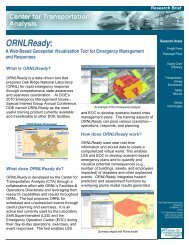
E-C158 Cover1 - Center for Transportation Analysis - Oak Ridge ...
E-C158 Cover1 - Center for Transportation Analysis - Oak Ridge ...
E-C158 Cover1 - Center for Transportation Analysis - Oak Ridge ...

You also want an ePaper? Increase the reach of your titles
YUMPU automatically turns print PDFs into web optimized ePapers that Google loves.
APPLICATIONS<br />
Commodity Flow Survey Findings in FAF2.2 Results and<br />
FAF3 Update <strong>for</strong> Phase 2 of the I-70 Dedicated Truck Lanes<br />
PROJECT DESCRIPTION<br />
BRAD DIGRE<br />
MARK BERNDT<br />
PAUL BINGHAM<br />
Wilbur Smith Associates<br />
Congestion along the four-state portion of I-70 has lead to a study of alternatives <strong>for</strong> new<br />
capacity, including truck lanes. FAF2.2 and now FAF3 analysis summaries are, in part, being<br />
used to help profile and quantify freight movements to, from, within, and across the corridor<br />
region. The context of these summaries includes the corridor region in its entirety, as well as<br />
from the context of unique metropolitan areas that intersect the I-70 corridor. These regions are<br />
defined by selected aggregations of FAF zone geographies. The flow summaries and related map<br />
output allows the visualization of directional proportional flow volumes in terms of value and<br />
tonnage, by commodity, mode, and combinations thereof. This in<strong>for</strong>mation is deemed important<br />
to better understand, visualize, and contribute to the quantification of need, capacity, and<br />
sustainability of developing and maintaining a successful dedicated truck lane system along the<br />
I-70 corridor.<br />
METHODOLOGY<br />
The 2002 CFS serves as the foundation of the FAF2.2 Commodity Origin–Destination Database<br />
and related geography. While complete data dictionaries, user guides, and documentation of<br />
methods and sources <strong>for</strong> FAF3 are <strong>for</strong>thcoming, FHWA notes that FAF3 concepts are similar to<br />
those used in FAF2.2. For the I-70 project, FAF2.2 and now FAF3 (v3.0.1) are organized into a<br />
GIS database system to measure, report, and visualize freight flows to, from, within, and across<br />
the I-70 region. The context of these measures can be shifted from a “Corridor” encompassing<br />
region of aggregation to select “Metro Area” regions of aggregation. Phase 1 of the study<br />
reported that while the metropolitan area zones are generally consistent with the defined corridor,<br />
and represent the bulk of freight movements within the corridor, several other limitations<br />
regarding the resulting FAF summaries are recognized. The coarseness of the extra-territorial<br />
“out-state” FAF geography zones (i.e., remainder of state zones) can encompass numerous small,<br />
medium and sometimes large cities and towns as well as distributed decentralized freight<br />
generating developments. Accordingly, those areas where CFS–FAF zones extend far beyond the<br />
defined corridor can be assumed to overstate tonnages and values of flows to and from the<br />
intersecting portions of the I-70 corridor.<br />
32