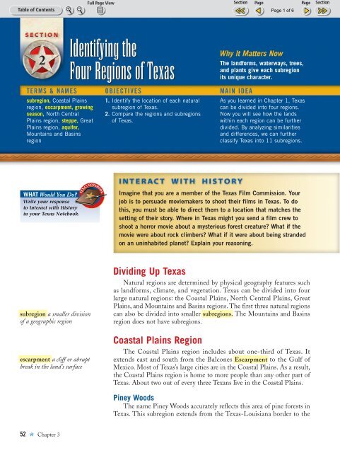
Identifying the Four Regions of Texas - Teacher
Identifying the Four Regions of Texas - Teacher
Identifying the Four Regions of Texas - Teacher

You also want an ePaper? Increase the reach of your titles
YUMPU automatically turns print PDFs into web optimized ePapers that Google loves.
TXSE_1_03_p046-067 11/21/02 4:29 PM Page 52<br />
2<br />
TERMS & NAMES OBJECTIVES MAIN IDEA<br />
subregion, Coastal Plains<br />
region, escarpment, growing<br />
season, North Central<br />
Plains region, steppe, Great<br />
Plains region, aquifer,<br />
Mountains and Basins<br />
region<br />
WHAT Would You Do?<br />
Write your response<br />
to Interact with History<br />
in your <strong>Texas</strong> Notebook.<br />
subregion a smaller division<br />
<strong>of</strong> a geographic region<br />
escarpment a cliff or abrupt<br />
break in <strong>the</strong> land’s surface<br />
52 ✯ Chapter 3<br />
<strong>Identifying</strong> <strong>the</strong><br />
<strong>Four</strong> <strong>Regions</strong> <strong>of</strong> <strong>Texas</strong><br />
1. Identify <strong>the</strong> location <strong>of</strong> each natural<br />
subregion <strong>of</strong> <strong>Texas</strong>.<br />
2. Compare <strong>the</strong> regions and subregions<br />
<strong>of</strong> <strong>Texas</strong>.<br />
Why It Matters Now<br />
The landforms, waterways, trees,<br />
and plants give each subregion<br />
its unique character.<br />
As you learned in Chapter 1, <strong>Texas</strong><br />
can be divided into four regions.<br />
Now you will see how <strong>the</strong> lands<br />
within each region can be fur<strong>the</strong>r<br />
divided. By analyzing similarities<br />
and differences, we can fur<strong>the</strong>r<br />
classify <strong>Texas</strong> into 11 subregions.<br />
Imagine that you are a member <strong>of</strong> <strong>the</strong> <strong>Texas</strong> Film Commission. Your<br />
job is to persuade moviemakers to shoot <strong>the</strong>ir films in <strong>Texas</strong>. To do<br />
this, you must be able to direct <strong>the</strong>m to a location that matches <strong>the</strong><br />
setting <strong>of</strong> <strong>the</strong>ir story. Where in <strong>Texas</strong> might you send a film crew to<br />
shoot a horror movie about a mysterious forest creature? What if <strong>the</strong><br />
movie were about rock climbers? What if it were about being stranded<br />
on an uninhabited planet? Explain your reasoning.<br />
Dividing Up <strong>Texas</strong><br />
Natural regions are determined by physical geography features such<br />
as landforms, climate, and vegetation. <strong>Texas</strong> can be divided into four<br />
large natural regions: <strong>the</strong> Coastal Plains, North Central Plains, Great<br />
Plains, and Mountains and Basins regions. The first three natural regions<br />
can also be divided into smaller subregions. The Mountains and Basins<br />
region does not have subregions.<br />
Coastal Plains Region<br />
The Coastal Plains region includes about one-third <strong>of</strong> <strong>Texas</strong>. It<br />
extends east and south from <strong>the</strong> Balcones Escarpment to <strong>the</strong> Gulf <strong>of</strong><br />
Mexico. Most <strong>of</strong> <strong>Texas</strong>’s large cities are in <strong>the</strong> Coastal Plains. As a result,<br />
<strong>the</strong> Coastal Plains region is home to more people than any o<strong>the</strong>r part <strong>of</strong><br />
<strong>Texas</strong>. About two out <strong>of</strong> every three Texans live in <strong>the</strong> Coastal Plains.<br />
Piney Woods<br />
The name Piney Woods accurately reflects this area <strong>of</strong> pine forests in<br />
<strong>Texas</strong>. This subregion extends from <strong>the</strong> <strong>Texas</strong>-Louisiana border to <strong>the</strong>
TXSE_1_03_p046-067 11/21/02 4:29 PM Page 53<br />
Subregions <strong>of</strong> <strong>Texas</strong><br />
El Paso<br />
N<br />
Guadalupe<br />
Peak<br />
High<br />
Plains<br />
G R E A T P L A<br />
Rolling<br />
Plains<br />
MOUNTAINS<br />
AND<br />
BASINS Edwards<br />
Plateau<br />
0 200 Miles<br />
0<br />
Lubbock<br />
Odessa<br />
300 Kilometers<br />
Amarillo<br />
Caprock Escarpment<br />
Midland<br />
I N S<br />
NORTH CENTRAL PLAINS<br />
Abilene<br />
Laredo<br />
Wichita Falls<br />
Cross<br />
Timbers<br />
Grand<br />
Prairie<br />
Llano<br />
Basin<br />
South<br />
<strong>Texas</strong><br />
Plain<br />
San Antonio<br />
Corpus Christi<br />
Kingsville<br />
Killeen<br />
Balcones Escarp ment<br />
Blackland<br />
Prairie<br />
Fort Worth<br />
Brownsville<br />
west for about 125 miles. It also extends from <strong>the</strong> Oklahoma state line<br />
south to where <strong>the</strong> coastal prairies begin, about 25 miles from <strong>the</strong> coast.<br />
The Piney Woods is <strong>the</strong> rainiest part <strong>of</strong> <strong>Texas</strong>, receiving about 45 to<br />
60 inches <strong>of</strong> precipitation per year. Its growing season is about 230 to<br />
265 days. Its elevation is low, only 100 to 400 feet above sea level.<br />
Post Oak Belt<br />
The Post Oak Belt is west <strong>of</strong> <strong>the</strong> Piney Woods. It is a long, narrow zone<br />
where pine trees are replaced by oak, hickory, and o<strong>the</strong>r hardwood trees.<br />
Prairie grasslands are scattered throughout <strong>the</strong> area as well. The climate in<br />
<strong>the</strong> Post Oak Belt is drier than in <strong>the</strong> Piney Woods, with<br />
about 30 to 45 inches <strong>of</strong> precipitation per year. Its growing<br />
season ranges from 230 to 280 days. The elevation is slightly<br />
higher than <strong>the</strong> Piney Woods—from 250 to 500 feet above<br />
sea level.<br />
Austin<br />
Dallas<br />
Post<br />
Oak<br />
Belt<br />
Temple<br />
Gulf Coastal Plain<br />
C O A S T A L P<br />
Blackland Prairie<br />
The Blackland Prairie, ano<strong>the</strong>r long, narrow area, from<br />
15 to 70 miles wide and nearly 300 miles long. The Blackland<br />
Prairie follows <strong>the</strong> Balcones Escarpment from near <strong>the</strong><br />
Oklahoma border down to San Antonio and beyond, to <strong>the</strong><br />
United States–Mexico border.<br />
Piney<br />
Woods<br />
L A I N S<br />
Beaumont<br />
Houston<br />
COASTAL PLAINS<br />
Piney Woods<br />
Post Oak Belt<br />
Orange<br />
Gulf Coastal Plain<br />
Blackland Prairie<br />
South <strong>Texas</strong> Plain<br />
MOUNTAINS<br />
AND<br />
BASINS<br />
GREAT<br />
PLAINS<br />
NORTH CENTRAL PLAINS GREAT PLAINS<br />
Rolling Plains<br />
Cross Timbers<br />
Grand Prairie<br />
NORTH<br />
CENTRAL<br />
PLAINS<br />
MOUNTAINS AND BASINS<br />
COASTAL<br />
PLAINS<br />
High Plains<br />
Edwards Plateau<br />
Llano Basin<br />
▲ <strong>Texas</strong>’s four natural regions can be divided into 11 subregions. The Mountains and Basins region has no subregions. ● In which subregion<br />
is Laredo located?<br />
growing season <strong>the</strong> average<br />
number <strong>of</strong> days between <strong>the</strong> last<br />
killing frost <strong>of</strong> spring and <strong>the</strong><br />
first killing frost <strong>of</strong> fall<br />
▲<br />
Caddo Lake in <strong>the</strong> Piney Woods<br />
subregion <strong>of</strong> <strong>the</strong> Coastal Plains is<br />
known for its giant cypress trees,<br />
floating lotus, and plentiful fish.<br />
It is <strong>Texas</strong>’s only natural lake. ● Why<br />
do you think this area was popular<br />
among Native Texans?<br />
<strong>Texas</strong> <strong>Regions</strong> ✯ 53
TXSE_1_03_p046-067 11/21/02 4:29 PM Page 54<br />
▲<br />
PLACE<br />
Spanish and Mexican settlers<br />
lived in <strong>the</strong> South <strong>Texas</strong> Plain<br />
before <strong>the</strong> <strong>Texas</strong> Revolution,<br />
and many families still live<br />
<strong>the</strong>re. Since <strong>the</strong>n, o<strong>the</strong>rs have<br />
continued to move in, creating<br />
a largely Hispanic population<br />
in <strong>the</strong> area. In fact, in<br />
most counties in <strong>the</strong> South<br />
<strong>Texas</strong> Plain, <strong>the</strong> population<br />
is over 75 percent Hispanic;<br />
in some counties, it is over<br />
90 percent Hispanic. ● If you<br />
were to visit South <strong>Texas</strong>,<br />
what languages would you<br />
most likely hear?<br />
Most <strong>of</strong> <strong>the</strong> North Central Plains<br />
region is relatively flat and dry.<br />
● What are <strong>the</strong> main types <strong>of</strong> vegetation<br />
in this region?<br />
54 ✯ Chapter 3<br />
The Blackland Prairie receives 30 to 45 inches <strong>of</strong> rain per year. The<br />
growing season is from 230 days in <strong>the</strong> north to 280 days in <strong>the</strong> south.<br />
Elevation ranges from 400 feet to nearly 800 feet above sea level. The soils<br />
<strong>of</strong> <strong>the</strong> Blackland Prairie are not good for growing most trees, so <strong>the</strong> vegetation<br />
is largely tall prairie grasses with a few hardwood trees.<br />
Gulf Coastal Plain<br />
The Gulf Coastal Plain forms a large arc that follows <strong>the</strong> coast <strong>of</strong><br />
<strong>the</strong> Gulf <strong>of</strong> Mexico from <strong>the</strong> Sabine River westward for about 260 miles<br />
to Kingsville. It extends inland about 30 to 60 miles. Elevations in <strong>the</strong><br />
Gulf Coastal Plain are generally below 100 feet, and <strong>the</strong> climate is<br />
humid. Rainfall varies from 50 inches near Beaumont to 25 inches in <strong>the</strong><br />
Corpus Christi area. Temperatures are warm, and <strong>the</strong> growing season is<br />
long, from 240 days near Beaumont and Orange to as much as 309 days<br />
in Corpus Christi.<br />
South <strong>Texas</strong> Plain<br />
If you were to draw an imaginary line from San Antonio to<br />
Kingsville, <strong>the</strong> South <strong>Texas</strong> Plain would fall between that line and <strong>the</strong><br />
Rio Grande. This area is about 270 miles long from north to south and<br />
about 250 miles wide from east to west. Elevations range from sea level<br />
to just under 1,000 feet above sea level. In this sou<strong>the</strong>rnmost part <strong>of</strong><br />
<strong>Texas</strong>, <strong>the</strong> climate is warm year round. The growing season ranges from<br />
265 days near San Antonio to 341 days at Brownsville. Maximum rainfall<br />
is about 30 inches per year near San Antonio. The minimum is less<br />
than 20 inches near Laredo.<br />
North Central Plains Region<br />
The North Central Plains region begins at <strong>the</strong> Balcones Escarpment<br />
and extends west as far as <strong>the</strong> Caprock Escarpment. The North Central<br />
Plains is an area <strong>of</strong> rolling plains <strong>of</strong>ten covered by small oak trees, mesquite,<br />
brush, and scattered grasses. The subregions <strong>of</strong> <strong>the</strong><br />
North Central Plains are a series <strong>of</strong> land belts extending<br />
north and south through <strong>the</strong> north-central part<br />
<strong>of</strong> <strong>the</strong> state. These subregions become increasingly<br />
drier and higher in elevation from east to west.<br />
Grand Prairie<br />
This long, narrow belt extends from near <strong>the</strong><br />
Red River southward almost to Temple and Killeen.<br />
Elevations range from 800 to 1,700 feet. The area<br />
gets about 30 inches <strong>of</strong> precipitation per year, with<br />
more rainfall in <strong>the</strong> east and less in <strong>the</strong> west. The<br />
growing season is from 230 to 260 days. Soils in <strong>the</strong><br />
Grand Prairie are not good for growing trees. The<br />
vegetation mostly consists <strong>of</strong> tall grasses and scattered<br />
hardwood trees, especially along streams in<br />
<strong>the</strong> area.
TXSE_1_03_p046-067 11/21/02 4:29 PM Page 55<br />
Cross Timbers<br />
The Cross Timbers subregion surrounds <strong>the</strong> Grand Prairie. Because<br />
<strong>of</strong> this, it is divided into <strong>the</strong> Eastern Cross Timbers and <strong>the</strong> Western<br />
Cross Timbers. The main difference between <strong>the</strong> Cross Timbers and <strong>the</strong><br />
Grand Prairie is that soils in <strong>the</strong> Cross Timbers are capable <strong>of</strong> growing<br />
trees such as post oaks, hickories, pecans, and elms. Rainfall in <strong>the</strong> Cross<br />
Timbers measures about 30 inches per year. The elevation ranges from<br />
900 to 1,500 feet, and <strong>the</strong> growing season is about 240 days.<br />
Rolling Plains<br />
The Rolling Plains is <strong>the</strong> largest subregion <strong>of</strong> <strong>the</strong> North Central<br />
Plains. It begins west <strong>of</strong> <strong>the</strong> Cross Timbers and ends at <strong>the</strong> Caprock<br />
Escarpment. Rainfall in <strong>the</strong> Rolling Plains varies as you travel east to west.<br />
The eastern areas get around 30 inches per year, but <strong>the</strong> western areas<br />
usually get less than 20 inches. Elevations range from 900 feet in <strong>the</strong> east<br />
to over 2,000 feet in <strong>the</strong> west. The growing season is about 220 days.<br />
The Rolling Plains subregion is largely a steppe. That is, <strong>the</strong> land is<br />
relatively flat and treeless. Vegetation generally consists <strong>of</strong> mixed short<br />
grasses along with mesquite and o<strong>the</strong>r brushy plants. Much <strong>of</strong> <strong>the</strong> Rolling<br />
Plains serves as grazing lands for large ranches.<br />
Great Plains Region<br />
The Great Plains region has three subregions. Two are large<br />
plateaus—<strong>the</strong> High Plains and <strong>the</strong> Edwards Plateau. The third subregion,<br />
<strong>the</strong> Llano Basin, is an area that is very different from any o<strong>the</strong>r part<br />
<strong>of</strong> <strong>Texas</strong>.<br />
Llano Basin<br />
The Llano Basin lies almost in <strong>the</strong> center <strong>of</strong> <strong>Texas</strong>. It forms an eggshaped<br />
area south <strong>of</strong> <strong>the</strong> North Central Plains and east <strong>of</strong> <strong>the</strong> Balcones<br />
Escarpment. The Llano Basin is made up <strong>of</strong> granite, a very hard rock<br />
that is formed when molten rock cools slowly under <strong>the</strong><br />
earth’s surface. The pink granite that was used to build<br />
<strong>the</strong> <strong>Texas</strong> Capitol building in Austin came from <strong>the</strong><br />
Llano Basin. The elevation <strong>of</strong> this subregion ranges<br />
between 1,000 and 1,800 feet above sea level.<br />
Precipitation averages about 30 inches per year, and <strong>the</strong><br />
growing season lasts about 230 days. The vegetation is<br />
made up <strong>of</strong> mesquite, live oak and post oak trees, and<br />
short grasses. Pecan and oak trees <strong>of</strong>ten grow in low<br />
areas and along streams.<br />
Edwards Plateau<br />
The Edwards Plateau makes up <strong>the</strong> sou<strong>the</strong>rn part <strong>of</strong><br />
<strong>the</strong> Great Plains region. It lies north and west <strong>of</strong> <strong>the</strong><br />
Balcones Escarpment. The plateau is primarily made <strong>of</strong><br />
limestone, which has dissolved in spots to form a number<br />
TEXAS PECANS<br />
The pecan tree, native to more<br />
than 150 counties in <strong>Texas</strong>,<br />
has become a major source <strong>of</strong><br />
income for <strong>the</strong> Lone Star State.<br />
It is <strong>the</strong> only nut grown in<br />
<strong>Texas</strong> for pr<strong>of</strong>it. In 1910 over<br />
5 million pounds <strong>of</strong> pecans<br />
were produced in <strong>Texas</strong>. By <strong>the</strong><br />
end <strong>of</strong> <strong>the</strong> 1990s,<br />
production topped<br />
35 million<br />
pounds and<br />
brought in<br />
more than<br />
$52 million.<br />
steppe a vast, treeless plain<br />
▲<br />
The vast, treeless High Plains subregion<br />
<strong>of</strong> <strong>the</strong> Great Plains is broken by<br />
Palo Duro Canyon (at bottom <strong>of</strong><br />
photo), which was formed by<br />
erosion. ● What challenges might<br />
farmers in this region face?<br />
<strong>Texas</strong> <strong>Regions</strong> ✯ 55
TXSE_1_03_p046-067 11/21/02 4:29 PM Page 56<br />
EDWARDS AQUIFER<br />
The Edwards Aquifer extends<br />
under parts <strong>of</strong> 10 <strong>Texas</strong><br />
counties and supplies water<br />
for communities from San<br />
Antonio to <strong>the</strong> Gulf Coast.<br />
In 1975 <strong>the</strong> San Antonio<br />
section <strong>of</strong> <strong>the</strong> aquifer was<br />
<strong>the</strong> first in <strong>the</strong> nation to be<br />
named a Sole-Source Aquifer<br />
by <strong>the</strong> Environmental Protection<br />
Agency. A Sole-Source<br />
Aquifer provides 50 percent<br />
or more <strong>of</strong> <strong>the</strong> drinking water<br />
for a particular area.<br />
aquifer an underground layer<br />
<strong>of</strong> porous rock, gravel, or sand<br />
containing water that may<br />
reach <strong>the</strong> surface through springs<br />
or wells<br />
▲<br />
The Guadalupe Mountains in <strong>the</strong><br />
Mountains and Basins Region rise<br />
high above <strong>the</strong> surrounding desert.<br />
● What kind <strong>of</strong> climate would you<br />
expect in this region?<br />
56 ✯ Chapter 3<br />
<strong>of</strong> caves and underwater streams. The Edwards Aquifer is a large bed <strong>of</strong><br />
water-bearing rock that supplies water for San Antonio and many o<strong>the</strong>r<br />
communities below <strong>the</strong> Balcones Escarpment.<br />
The Edwards Plateau is mainly between 1,000 and 3,000 feet above<br />
sea level. Precipitation ranges from about 18 to 30 inches per year. The<br />
growing season is estimated to last from 210 to 220 days each year.<br />
High Plains<br />
The High Plains, also known as <strong>the</strong> Llano Estacado, is one <strong>of</strong> <strong>the</strong><br />
flattest places on earth. It was once covered with vast stretches <strong>of</strong> short<br />
grasses, like a steppe. Today, <strong>the</strong> High Plains is a major farming area.<br />
The High Plains subregion extends west from <strong>the</strong> Rolling Plains to<br />
<strong>the</strong> Pecos River in New Mexico. The climate is dry, with precipitation<br />
amounting to less than 20 inches per year. The elevation <strong>of</strong> <strong>the</strong> High<br />
Plains ranges from 3,000 feet to over 4,000 feet above sea level. The<br />
growing season ranges from 220 days in <strong>the</strong> south to only about 180 days<br />
in <strong>the</strong> north along <strong>the</strong> Oklahoma border.<br />
Mountains and Basins Region<br />
This part <strong>of</strong> <strong>Texas</strong> is made up <strong>of</strong> tall mountains separated by large<br />
basins, or closed valleys. Most <strong>of</strong> <strong>the</strong> mountains receive enough rainfall<br />
to support forests <strong>of</strong> oak, piñon, and ponderosa pine trees. In contrast,<br />
<strong>the</strong> lower elevations and basins are desert country, with cactus, shrubs,<br />
short grasses, and o<strong>the</strong>r kinds <strong>of</strong> vegetation that can live a long time<br />
without water. Overall, this region receives litttle rain, ranging from a<br />
low <strong>of</strong> 8.8 inches per year near El Paso to almost 20 inches per year in<br />
higher areas. The growing season is usually between 220 and 245 days.<br />
Elevations in <strong>the</strong> Mountains and Basins region vary widely. For<br />
instance, this region contains <strong>the</strong> highest point in <strong>Texas</strong>—Guadalupe<br />
Peak, which stands 8,751 feet tall. On <strong>the</strong> o<strong>the</strong>r hand, some parts <strong>of</strong> this<br />
region reach an elevation <strong>of</strong> only about 2,500 feet.<br />
Summing Up <strong>Texas</strong> <strong>Regions</strong><br />
With so many plains, plateaus, and mountains, <strong>Texas</strong><br />
boasts a very diverse landscape. In fact, learning to identify<br />
<strong>the</strong> many different regions in <strong>Texas</strong> can be difficult. How<br />
can you make <strong>Texas</strong> geography a little easier to understand?<br />
One way is by generalizing, or finding common characteristics<br />
among specific areas in <strong>Texas</strong>. Different parts <strong>of</strong> <strong>the</strong><br />
state have different kinds <strong>of</strong> landforms. By making generalizations,<br />
we can simplify how we study <strong>the</strong>se landforms.<br />
One generalization you might make is that some areas<br />
have lower elevations and some have higher elevations. The<br />
Balcones Escarpment is very important because it divides<br />
<strong>the</strong> lowest parts <strong>of</strong> <strong>Texas</strong> from higher areas. The Coastal<br />
Plains areas east and south <strong>of</strong> <strong>the</strong> Balcones Escarpment
TXSE_1_03_p046-067 11/21/02 4:29 PM Page 57<br />
are all low and flat. West <strong>of</strong> <strong>the</strong> Balcones Escarpment <strong>the</strong> land is more<br />
varied. Also, <strong>the</strong> North Central Plains region is higher and hillier than<br />
<strong>the</strong> Coastal Plains. You can see <strong>the</strong> difference right away when you cross<br />
<strong>the</strong> Balcones Escarpment.<br />
The Great Plains is largely an elevated plateau. It is even flatter than<br />
<strong>the</strong> Coastal Plains, but it contains deep canyons in some areas. Steep<br />
cliffs mark part <strong>of</strong> <strong>the</strong> plateau’s edge. Only in <strong>the</strong> Llano Basin does <strong>the</strong><br />
land become hilly.<br />
The Mountains and Basins region is <strong>the</strong> only part <strong>of</strong> <strong>Texas</strong> where<br />
<strong>the</strong>re are mountains. It is a large area <strong>of</strong> land with high mountain ranges<br />
separated by broad, flat-bottomed valleys called basins. This is <strong>the</strong> most<br />
distinctive landscape in <strong>Texas</strong>.<br />
Terms & Names<br />
Identify:<br />
• subregion<br />
• escarpment<br />
•growing season<br />
• steppe<br />
• aquifer<br />
ACTIVITY<br />
Geography<br />
2<br />
Organizing Information<br />
Use a diagram like <strong>the</strong> one<br />
shown to categorize each<br />
subregion as having a relatively<br />
high elevation or low<br />
elevation. In <strong>the</strong> ovals, list<br />
<strong>the</strong> common characteristics<br />
<strong>of</strong> all <strong>the</strong> subregions<br />
contained in each box.<br />
SUBREGIONS OF TEXAS<br />
Higher Elevations Lower Elevations<br />
Critical Thinking<br />
1. Which region <strong>of</strong> <strong>Texas</strong> is<br />
least like <strong>the</strong> o<strong>the</strong>r<br />
regions <strong>of</strong> <strong>the</strong> state?<br />
Why?<br />
2. Which <strong>of</strong> <strong>the</strong> regions or<br />
subregions <strong>of</strong> <strong>Texas</strong> might<br />
be best suited for farming?<br />
for ranching? for nei<strong>the</strong>r?<br />
Why?<br />
▲<br />
At <strong>the</strong> Balcones Escarpment, <strong>the</strong><br />
Blackland Prairie breaks sharply into<br />
<strong>the</strong> Hill Country. Austin, San Antonio,<br />
and o<strong>the</strong>r cities along Interstate 35<br />
are located on or near <strong>the</strong> escarpment.<br />
● Why is <strong>the</strong> Balcones Escarpment<br />
an important physical landmark?<br />
Interact with History<br />
Review your response to<br />
Interact with History in<br />
your <strong>Texas</strong> Notebook. How<br />
would you refine your<br />
instructions to each<br />
moviemaker? Explain in<br />
detail which area <strong>of</strong> <strong>Texas</strong><br />
you would choose for each<br />
movie location and why.<br />
Determine which region you live in. Then choose a different region, and create a chart to compare <strong>the</strong><br />
regions. How are <strong>the</strong>y similar? How are <strong>the</strong>y different?<br />
<strong>Texas</strong> <strong>Regions</strong> ✯ 57