CRS Record-Keeping Guidance - Emergency Management Institute ...
CRS Record-Keeping Guidance - Emergency Management Institute ...
CRS Record-Keeping Guidance - Emergency Management Institute ...

You also want an ePaper? Increase the reach of your titles
YUMPU automatically turns print PDFs into web optimized ePapers that Google loves.
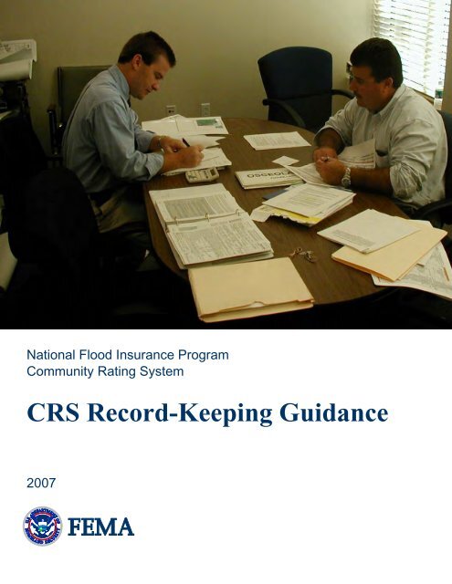
National Flood Insurance Program<br />
Community Rating System<br />
<strong>CRS</strong> <strong>Record</strong>-<strong>Keeping</strong> <strong>Guidance</strong><br />
2007
Note on this edition: This document has been revised to reflect the following 2006 and<br />
2007 changes in the <strong>CRS</strong> Coordinator’s Manual:<br />
• The following new elements have been included:<br />
310—Credit for offsite records storage;<br />
320—Partial credit for using a website or remote computer terminal;<br />
330—Credit for outreach projects that encourage the purchase of flood<br />
insurance; and<br />
510—Detailed analysis of the community’s repetitive loss areas and mitigation.<br />
• The following elements have been revised:<br />
410—Extensive revisions have been made to this activity;<br />
440—Credit for maintenance of elevation reference marks has been replaced<br />
by a different approach for benchmark maintenance;<br />
520—Credit has been added for acquiring or relocating Severe Repetitive Loss<br />
Properties; and<br />
530—Credit has been added for protecting Severe Repetitive Loss Properties<br />
and critical facilities.<br />
Examples that are included in other publications have not been repeated here, such as the<br />
forms for Activities 430 (Higher Regulatory Standards) and 540 (Drainage System<br />
Maintenance). They can be found in <strong>CRS</strong> Credit for Higher Regulatory Standards and in<br />
<strong>CRS</strong> Credit for Drainage System Maintenance.<br />
A community interested in applying for flood insurance premium credits through the<br />
Community Rating System (<strong>CRS</strong>) should have the <strong>CRS</strong> Application. The <strong>CRS</strong><br />
Coordinator’s Manual provides a more detailed explanation of the credit criteria. These<br />
and other publications on the <strong>CRS</strong> are available at no cost from<br />
Flood Publications<br />
NFIP/<strong>CRS</strong><br />
P.O. Box 501016<br />
Indianapolis, IN 46250-1016<br />
(317) 848-2898<br />
Fax: (317) 848-3578<br />
NFIP<strong>CRS</strong>@iso.com<br />
They can also be viewed and downloaded from FEMA’s website at<br />
http://training.fema.gov/EMIWeb/<strong>CRS</strong>.
Contents<br />
Section Page<br />
Introduction ..........................................................................................................1<br />
Activity Checklist.................................................................................................2<br />
310 Elevation Certificates..........................................................................2<br />
320 Map information Service ....................................................................3<br />
330 Outreach Projects................................................................................4<br />
340 Hazard Disclosure...............................................................................5<br />
350 Flood Protection Information .............................................................5<br />
360 Flood Protection Assistance ...............................................................5<br />
410 Additional Flood Data ........................................................................6<br />
420 Open Space Preservation ....................................................................6<br />
430 Higher Regulatory Standards..............................................................7<br />
430LD Land Development Criteria...........................................................8<br />
440 Flood Data Maintenance.....................................................................8<br />
450 Stormwater <strong>Management</strong>....................................................................9<br />
501 The Repetitive Loss List...................................................................10<br />
503 Repetitive Loss Area Outreach Project.............................................10<br />
510 Floodplain <strong>Management</strong> Planning....................................................10<br />
520 Acquisition and Relocation...............................................................11<br />
530 Flood Protection................................................................................11<br />
540 Drainage System Maintenance .........................................................12<br />
610 Flood Warning Program ...................................................................12<br />
620 Levee Safety .....................................................................................13<br />
630 Dam Safety .......................................................................................14<br />
Sample <strong>Record</strong>s..................................................................................................15<br />
310—Checklist for Reviewing the 2006 FEMA Elevation Certificate....15<br />
320—Map Information Service Form Letter............................................17<br />
320—Flood Insurance Purchase Requirement Handout...........................18<br />
320—Coastal Barrier Resources System Handout...................................19<br />
320—Map Inquiry Log.............................................................................20<br />
360—Handouts on Dealing with Contractors...........................................21<br />
<strong>Record</strong>-<strong>Keeping</strong> <strong>Guidance</strong> − i − Edition: 2007
[This page intentionally blank.]<br />
<strong>Record</strong>-<strong>Keeping</strong> <strong>Guidance</strong> − ii − Edition: 2007
Introduction<br />
The Community Rating System (<strong>CRS</strong>) recognizes local floodplain management activities<br />
that exceed the minimum requirements of the National Flood Insurance Program (NFIP).<br />
To receive the credits and subsequent flood insurance premium discount, communities<br />
must document that they are implementing the credited activities.<br />
Your community’s normal procedures probably already include maintaining documents<br />
and records sufficient for <strong>CRS</strong> documentation. However, you may be starting a new<br />
activity or you may need to do things differently to receive <strong>CRS</strong> credit. This guide is a<br />
primer on the records that need to be kept to maintain <strong>CRS</strong> credit. It should be viewed as<br />
an advisory checklist to help ensure that nothing is forgotten. It is not a mandate or set of<br />
federal requirements.<br />
It is assumed that you are keeping a complete copy of your application to the <strong>CRS</strong> and all<br />
the documents that were accepted during the verification visit. This publication does not<br />
discuss documents needed for your application. YOUR APPLICATION AND VERIFICATION<br />
VISIT DOCUMENTS SHOULD BE KEPT “FOREVER.” You cannot expect your community’s<br />
future <strong>CRS</strong> Coordinators to know what happened at past visits, so keeping a separate set<br />
of <strong>CRS</strong> documents will prove to be very valuable.<br />
This guide covers things that are needed for the verification and cycle verification visits<br />
and the annual recertification. Some of these papers can be archived or discarded after the<br />
ISO/<strong>CRS</strong> Specialist conducts the verification or cycle verification visit.<br />
Many community documents, including many of the documents needed for floodplain<br />
management, are vital to your community’s operations after a disaster. Starting in 2007, the<br />
<strong>CRS</strong> offers credit for maintenance of duplicate copies of your floodplain management permit<br />
records at an offsite facility. Please see Section 310.f in the Coordinator’s Manual.<br />
This guide is based on the 2007 <strong>CRS</strong> Coordinator’s Manual. The section numbers cited in<br />
this guide refer to that manual. The page numbers refer to pages in this guide.<br />
Documentation of <strong>CRS</strong> activities is essential for continued <strong>CRS</strong> credit. This problem<br />
frequently arises in communities when they change <strong>CRS</strong> Coordinators. At recertification<br />
and cycle time, the new <strong>CRS</strong> Coordinator may have difficulty documenting the activities<br />
for which the community is receiving credit. If the documentation is properly maintained<br />
from day to day, these problems are greatly reduced.<br />
This guide is organized in two parts. The first part is a checklist of the records that should<br />
be kept for each activity and element. The second part includes example forms. Readers<br />
can skip those activities that are not credited in their communities.<br />
The entire text of this document, including the example forms, is available online at<br />
http://training.fema.gov/EMIWeb/<strong>CRS</strong> (go to the “Resources” tab and find (control-F) “<strong>Record</strong>”).<br />
This document is in Adobe Acrobat (pdf) format. The text can be copied and converted to a<br />
word processing program to prepare checklists and forms tailored to your community.<br />
<strong>Record</strong>-<strong>Keeping</strong> <strong>Guidance</strong> − 1 − Edition: 2007
Activity Checklist<br />
The <strong>CRS</strong> Coordinator should keep the application and recertification records. In most<br />
cases the other records should be kept by the offices that are actually implementing the<br />
activities. The <strong>CRS</strong> Coordinator should know the location and contents of any <strong>CRS</strong> files<br />
that are kept by another office.<br />
310 Elevation Certificates<br />
This checklist should be reviewed with the building department or other office that has<br />
been assigned responsibility for this activity.<br />
____ Elevation certificates are needed for every new building or substantial<br />
improvement to a building in the Special Flood Hazard Area (SFHA) (see Section<br />
314.c of the <strong>CRS</strong> Coordinator’s Manual).<br />
____ EACH CERTIFICATE NEEDS TO BE DOUBLE CHECKED TO ENSURE THAT IT IS PROPERLY<br />
COMPLETED. Use the checklist on pages 15–16. If more than 20% of your elevation<br />
certificates are verified with errors, your community will lose the credit for this<br />
activity and you will be reclassified as a <strong>CRS</strong> Class 10.<br />
____ The elevation certificates need to be filed so they can be retrieved, copied, and<br />
provided to requestors. This can be either in a separate elevation certificate file or<br />
in files kept for each property or each permit. What counts is that they are easily<br />
retrievable by address. These records would most likely be kept by the building<br />
department. Note that if your community is requesting credit for maintaining pre-<br />
<strong>CRS</strong> or pre-FIRM (Flood Insurance Rate Map) elevation certificates (ECPO or<br />
ECPR), you need to be able to retrieve them even if your community discards or<br />
archives old permit records.<br />
____ A note or memo to the files that shows how your impact adjustments (rECPO,<br />
rECPR, rECCF, and/or rECWS) were determined is needed for the verification and<br />
cycle verification visits (see Section 314.d).<br />
____ If you are receiving credit for keeping your elevation certificates in computer<br />
format (ECCF), each elevation certificate needs to be entered into the elevation<br />
certificate software data base (see Section 314.e). The computer file needs to be<br />
maintained and updated. If you had new construction in the floodplain since the last<br />
submittal, a disk with the new data is submitted with each year’s recertification.<br />
____ If you are receiving credit for putting your elevation certificates on a website<br />
(ECWS), each elevation certificate needs to be entered. The ISO/<strong>CRS</strong> Specialist<br />
verified this by logging on to the website, so no separate records are needed.<br />
____ If you are applying for credit for off-site record storage (ORS) under Section 311.f,<br />
you must have a note or memo to the files describing the offsite storage location<br />
and arrangements for copying the records. An alternative is a receipt or other<br />
record that shows that the records were sent for storage.<br />
<strong>Record</strong>-<strong>Keeping</strong> <strong>Guidance</strong> − 2 − Edition: 2007
320 Map Information Service<br />
This checklist should be reviewed with the building department, engineer, or other office<br />
assigned responsibility for this activity.<br />
____ Keep copies of the materials you use to publicize the service each year (see Section<br />
323.a). This could be done through one of three options:<br />
● Keep a copy of each year’s letter to lenders, real estate agencies, and insurance<br />
agencies, and a copy of the mailing list used (see Section 323.c). Some<br />
communities mail undated letters. If so, note when yours was distributed each<br />
year; OR<br />
● Keep copies of the publications issued by other organizations, institutions, or<br />
agencies each year that include an article on the service; OR<br />
● Keep a copy of each year’s outreach project. If your community publicizes this<br />
service via an outreach project credited under Activity 330 (Outreach Projects),<br />
the copy could be kept in the files for Activity 330.<br />
____ Copies of the publicity materials (except for the mailing list) are submitted with<br />
each year’s recertification. Examples of publicizing the map information service<br />
are found in <strong>CRS</strong> Credit for Outreach Projects.<br />
____ You need to keep a record of delivering this service (see Section 323.d). There are<br />
three common approaches to doing this:<br />
● Keep copies of your written letters or e-mails, such as the form letter in the<br />
example on page 17; OR<br />
● Keep copies of the completed inquiry forms or “complaint” forms your<br />
community uses to record and respond to requests from citizens; OR<br />
● Keep a log of inquiries. Examples of this approach are found on page 20 of this<br />
guide and in Figure 320-5 of the Coordinator’s Manual.<br />
____ If you don’t already have a system for filing correspondence, the written responses<br />
should be kept in chronological order or by address. A copy of a recent page from<br />
one of the records is submitted with each year’s recertification.<br />
____ Make sure you are using the latest FIRM and that it is kept updated to show new<br />
subdivisions, changes in corporate limits, and all new FIRM data from flood<br />
insurance restudies, map revisions, and map amendments (see Section 323.e). This<br />
may mean plotting every Letter of Map Amendment (LOMA) and Map Revision<br />
(LOMR) or noting on the paper FIRM those sites for which LOMAs and LOMRs<br />
have been issued.<br />
You must maintain copies of old FIRMs that have been in effect since 1999 or the<br />
date you applied to the <strong>CRS</strong>, whichever is later. If you maintain a copy of every<br />
FIRM that has been published for your community, you may be eligible for credit<br />
under Activity 440 (Flood Data Maintenance).<br />
<strong>Record</strong>-<strong>Keeping</strong> <strong>Guidance</strong> − 3 − Edition: 2007
____ You should keep copies of flyers or other information on the flood insurance<br />
purchase requirement (see example on page 18). The person who responds to the<br />
requests needs to remember to include a copy of the flyer with each written<br />
response or to discuss it with each caller if the property is located in the SFHA.<br />
____ If your community has a Coastal Barrier Resources System designation on its<br />
FIRM, you should include a flyer or other information that is given to inquirers to<br />
explain the System and what it means to property owners (see example on page 19).<br />
____ If your community has a mapped coastal A Zone, you should include a flyer or<br />
other information to give to inquirers that explains what the designation means to<br />
property owners.<br />
____ If your community is receiving credit for special hazards mapping and<br />
management, you should include a flyer or other information that is given to<br />
inquirers to explain the special hazard and what it means to property owners.<br />
330 Outreach Projects<br />
For additional guidance on this activity, see <strong>CRS</strong> Credit for Outreach Projects.<br />
This checklist should be reviewed with the public information officer or other office that<br />
has been assigned responsibility for this activity.<br />
____ Keep a copy of each year’s outreach projects (see Sections 334.a, c, and e). This<br />
would include copies of newsletters, mailings to residents, and similar<br />
informational materials. The articles on flooding should be highlighted so they can<br />
be found easily. For projects like public meetings and information booths, the<br />
documentation could be copies of newspaper articles or announcements about the<br />
meetings, correspondence relating to them, or memos to the file. These are<br />
submitted with each year’s recertification. If they are not dated, make a note on<br />
them of when they were distributed.<br />
____ If you are receiving credit for outreach projects pursuant to a public information<br />
program strategy, keep all the projects’ materials, just as you do for your other<br />
outreach projects (see Section 333.b). These need to be submitted with each annual<br />
recertification, too.<br />
____ You will also need to prepare and keep an annual evaluation of your strategy (see<br />
Section 333.f). This is either a separate report or a completed AW-330-3. A blank<br />
copy of AW-330-3 is included in the <strong>CRS</strong> Activity Worksheets, found at the end of<br />
the Coordinator’s Manual, or you can make your own local version. A filled-out<br />
example is shown at the end of Activity 330 in the Coordinator’s Manual. A<br />
completed copy is submitted with each year’s recertification.<br />
<strong>Record</strong>-<strong>Keeping</strong> <strong>Guidance</strong> − 4 − Edition: 2007
340 Hazard Disclosure<br />
You do not need to maintain any special records for this activity because it is implemented<br />
by real estate offices. However, you should have current copies of all documents for<br />
which credit has been verified. This includes<br />
the real estate agents’ disclosure notices, the<br />
If any of the credited elements change,<br />
ordinance language, and real estate agents’ the materials submitted with the<br />
brochures (REB credit). You are also expected application should be changed as well. If<br />
to recertify each year that the activity is being the change involves enough points to<br />
implemented. At your cycle verification visit, change your community’s <strong>CRS</strong><br />
you will need the current versions of the<br />
classification, a modification should be<br />
submitted.<br />
documentation you used when applying for the<br />
credit.<br />
350 Flood Protection Information<br />
You do not need to maintain any special records for the library. However, you are still<br />
expected to recertify each year that the activity is being implemented and that the<br />
publications that are available are the most current.<br />
____ If you are receiving credit for putting flood protection information on a website,<br />
you must review the site each year and certify that the information and links have<br />
been updated as needed (see Section 353.c).<br />
360 Flood Protection Assistance<br />
This checklist should be reviewed with the building department, engineer, or other office<br />
that has been assigned responsibility for this activity.<br />
____ Make sure there is an outreach project each year that discusses the assistance<br />
provided. If it is part of a <strong>CRS</strong>-credited outreach project, documentation for it is<br />
submitted with each year’s Activity 330 recertification. If it is distributed<br />
separately, then it is to be included with each year’s Activity 360 documentation<br />
(see Section 363.a). Examples of publicizing the service are found in <strong>CRS</strong> Credit<br />
for Outreach Projects.<br />
____ You need to keep a record of your site visits and retrofitting advice (see Section<br />
363.e). A copy of one of the recent memos or reports is submitted with each year’s<br />
recertification.<br />
____ You should keep copies of flyers or other information that you hand out to people<br />
who have been assisted (see Section 363.d). Examples of what you can include are<br />
● An updated list (organized by area of expertise) of contractors knowledgeable,<br />
experienced, or licensed in retrofitting activities (e.g., plumbers, house movers,<br />
waterproofers, etc.); and<br />
● Information on selecting a contractor (see pages 21–22).<br />
<strong>Record</strong>-<strong>Keeping</strong> <strong>Guidance</strong> − 5 − Edition: 2007
410 Additional Flood Data<br />
This checklist should be reviewed with the engineer or other office that has been assigned<br />
responsibility for this activity. It is appropriate both for regular flood data as explained in<br />
the Coordinator’s Manual and for data on special hazards flooding as explained in the<br />
special hazards supplements. See <strong>CRS</strong> Credit for Additional Flood Data for additional<br />
guidance.<br />
____ If you have prepared and adopted new studies since the last verification visit, keep<br />
the appropriate documentation for the next cycle verification visit:<br />
● The ordinance or law language that adopts the new study for regulatory purposes<br />
or that requires site-specific flood elevation or floodway studies to be conducted<br />
at the time of permit application. The ordinance or law should either specify what<br />
standard is to be used or adopt the studies or maps for regulatory purposes (see<br />
Section 414.a).<br />
● A copy of the study or an explanation of the technique used and a licensed<br />
professional engineer’s statement that the study was based on a technique<br />
approved by FEMA; or a copy of the Flood Insurance Study pages or LOMR that<br />
show that the study has been accepted by FEMA to revise the FIRM (see Section<br />
414.b).<br />
● Documentation that shows how much of the study was paid by FEMA and how<br />
much was paid by a non-FEMA source (see Section 414.d).<br />
● Documentation that shows the relation between the study or standard and the<br />
Cooperating Technical Partner agreement (see Section 414.f).<br />
____ If your community is receiving credit for a new study (NS) under Section 411.a, at<br />
the time of the cycle verification visit you will need to provide a statement by your<br />
engineer on whether the study reflects current conditions. This statement need only<br />
address the maps that are credited by this activity (see Section 414.g). Note that<br />
you will not lose credit if the study is outdated. This documentation is for<br />
informational purposes only.<br />
____ If your floodplain areas or corporate limits change, a new Impact Adjustment Map<br />
will be needed at the next cycle verification visit (see Section 414.e).<br />
420 Open Space Preservation<br />
If your open space areas or credits do not change between verification visits, no records<br />
need to be kept other than the original documents upon which the credit is based.<br />
____ If your floodplain areas, open space areas, or corporate limits change, a new Impact<br />
Adjustment Map will be needed at the next cycle verification visit (see Section<br />
424.e).<br />
<strong>Record</strong>-<strong>Keeping</strong> <strong>Guidance</strong> − 6 − Edition: 2007
430 Higher Regulatory Standards<br />
See <strong>CRS</strong> Credit for Higher Regulatory Standards for additional guidance.<br />
This checklist should be reviewed with the planning, zoning, or building department,<br />
engineer, or other office that is responsible for this activity. The following records are<br />
typically kept with each permit file or with the records on each subdivision or other<br />
development. You will need to be able to retrieve them during the cycle verification visit<br />
(see Section 434.c).<br />
____ Elevation and floodproofing certificates, which are used to document enforcement<br />
of the following elements: freeboard (FRB), enclosure limits (ENL), manufactured<br />
home park (MHP), and coastal A-Zone regulations (CAZ). MAKE SURE YOUR<br />
RECORDS SHOW THE LOCATION OF ANY UTILITIES AND DUCTWORK THAT ARE<br />
NORMALLY LOCATED OUTSIDE THE BUILDING OR BELOW THE LOWEST FLOOR.<br />
Photographs at the time of final inspection are useful.<br />
____ If you are receiving credit for foundation protection (FDN), your building permit<br />
records need to include engineering certifications or other documentation<br />
appropriate for your credit.<br />
____ If you are receiving cumulative substantial improvement (CSI) credit or lower<br />
substantial improvement threshold (LSI) credit, the building permit records must<br />
show the value of building additions, improvements, and repairs and the building’s<br />
value. For credit, you need to keep a running total of the costs or percentages of<br />
past improvements. An example form can be found in <strong>CRS</strong> Credit for Higher<br />
Regulatory Standards.<br />
____ If you are receiving credit for protecting critical facilities (PCF), permit records for<br />
critical facilities will be needed to check that the facilities are protected according<br />
to your regulations.<br />
____ If you are receiving credit for protection of floodplain storage capacity (PSC) based<br />
on compensatory storage, permit records need to show compensatory storage<br />
calculations. Grading plans or maps that show where the cutting and filling is done<br />
are needed for subdivisions and larger developments.<br />
____ If you are receiving credit for natural and beneficial functions regulations (NBR)<br />
that require setbacks or buffer zones along watercourses, the setback areas or buffer<br />
zones should be shown on permit plans.<br />
____ If you are receiving credit for other higher standards (OHS) or special hazards<br />
regulations (SH), your permit records need to document compliance with these<br />
regulations.<br />
____ If you are receiving credit for staff training under staffing (STF), certificates of<br />
graduation are needed (see Section 434.d). If a staff member has qualified as a<br />
Certified Floodplain Manager, the credit is verified by checking the list of CFMs<br />
on the appropriate association’s website. Note that if personnel leave, you will lose<br />
<strong>Record</strong>-<strong>Keeping</strong> <strong>Guidance</strong> − 7 − Edition: 2007
the credit at the next cycle visit, unless their replacements have the same training or<br />
certification.<br />
____ If your floodplain areas or corporate limits change, a new Impact Adjustment Map<br />
will be needed at the next cycle verification visit (see Section 434.b).<br />
430LD Land Development Criteria<br />
This checklist should be reviewed with the planning, zoning, or building department,<br />
engineer, or other office that is responsible for this activity. The following records are<br />
typically kept with each permit file or with the records on each subdivision or other<br />
development built in the regulatory floodplain. You will need to be able to retrieve them<br />
during the verification and cycle verification visits (see Section 434.c).<br />
____ If your community receives credit for land development criteria (LDC) or for low<br />
density zoning (LZ), your building or zoning permit records need to include<br />
documentation appropriate to your credit.<br />
____ If your floodplain areas or corporate limits change, a new Impact Adjustment Map<br />
will be needed at the next cycle verification visit (see Section 434LD.b).<br />
440 Flood Data Maintenance<br />
This checklist should be reviewed with the engineer, geographic information system (GIS)<br />
staff, data processor, or other office that has been assigned responsibility for this activity.<br />
____ If you are receiving credit for additional map data (AMD), the permit office must<br />
routinely use the map or parcel system to obtain flood hazard information when<br />
reviewing an application for a permit in the regulatory floodplain (see Section<br />
441.a.1(a)). If the credit is for a GIS or other digitized mapping system, the permit<br />
office may either directly use the computer system or use a hard copy printout of<br />
the map.<br />
____ The map or parcel system must be updated at least once each year to reflect<br />
changes in corporate boundaries, new subdivisions, new flood data, and map<br />
revisions and amendments (LOMRs and LOMAs) (see Section 441.a.1(b)).<br />
____ If you are receiving credit for benchmark maintenance (BMM), keep your list of<br />
the qualifying benchmarks updated and available to the public (see Section<br />
441.b.1(a)(2)).<br />
____ If you are receiving credit for benchmark maintenance (BMM), make a note about<br />
any elevation reference marks that appear on your FIRM that are reported missing<br />
or inaccurate. You must report these with your annual recertification so FEMA can<br />
correct future FIRMs (see Section 444.e).<br />
____ If you are receiving credit for FIRM maintenance (FM), you must have copies of<br />
every FIRM, Flood Boundary Floodway Map, and Flood Insurance Study that has<br />
<strong>Record</strong>-<strong>Keeping</strong> <strong>Guidance</strong> − 8 − Edition: 2007
een issued for the community. The old maps and studies must be made readily<br />
available for inquirers to use (see Section 441.d).<br />
____ If your floodplain areas or corporate limits change, a new Impact Adjustment Map<br />
will be needed at the next cycle verification visit (see Section 444.b).<br />
450 Stormwater <strong>Management</strong><br />
For additional guidance on this activity, see <strong>CRS</strong> Credit for Stormwater <strong>Management</strong>.<br />
This checklist should be reviewed with the engineer, building department, or other office<br />
assigned responsibility for this activity. THESE RECORDS APPLY TO CONSTRUCTION<br />
THROUGHOUT THE COMMUNITY, NOT JUST IN THE FLOODPLAIN.<br />
____ If your community is receiving credit for stormwater management regulations or a<br />
watershed master plan (SMR or WMP), your permit records for subdivisions and<br />
other large developments need to include plans that show the locations and<br />
dimensions of retention and detention basins (see Section 454.i).<br />
____ If your community is receiving credit for public maintenance of stormwater<br />
facilities (PUB), keep copies of inspections and subsequent maintenance activities<br />
(see Section 454.i). These records should be part of your drainage system<br />
maintenance records under Activity 540. See also <strong>CRS</strong> Credit for Drainage System<br />
Maintenance.<br />
____ If your community is receiving credit for a watershed master plan (WMP) that is<br />
more than five years old, the engineer’s evaluation report should be kept (see<br />
Section 454.j).<br />
____ If your community is receiving credit for freeboard in B, C, D, and X Zones (FRX),<br />
depending on the basis for your credit, your building permit records need to either<br />
document that the lowest floor (or lowest opening) was checked and confirmed to<br />
be the correct height above the street or they need to include drainage plans for<br />
each building site (see Section 454.i).<br />
____ If your community is receiving credit for erosion and sedimentation control (ESC)<br />
or water quality regulations (WQ), your permit records and/or subdivision plans<br />
need to show how these requirements were met for each development project under<br />
the regulations’ jurisdiction (see Section 454.i).<br />
____ If your watersheds or corporate limits change, a new Impact Adjustment Map will<br />
be needed at the next cycle verification visit (see Section 444.f).<br />
<strong>Record</strong>-<strong>Keeping</strong> <strong>Guidance</strong> − 9 − Edition: 2007
501 The Repetitive Loss List<br />
____ Each year, you will receive an updated file of your repetitive loss properties and a<br />
set of AW-501 worksheets for your repetitive loss properties. You are encouraged<br />
to review these to update your database of flood problems, because they may help<br />
your flood protection planning efforts. At the time of your cycle verification, you<br />
will have to review every repetitive loss address and determine if the worksheets<br />
need to be updated. You will be required to certify that each address has been<br />
checked (see Section 501).<br />
503 Repetitive Loss Area Outreach Project<br />
____ Keep a copy of each year’s outreach project to your repetitive loss areas and the list<br />
of addresses to which the project was sent (see Sections 503.b, c, and e). These are<br />
submitted each year with your annual recertification, either as part of your Activity<br />
330 recertification or as part of the repetitive loss documentation.<br />
____ If you are a Category C community (see Section 502.a), you must keep the records<br />
required for Activity 510.<br />
510 Floodplain <strong>Management</strong> Planning<br />
For additional guidance on this activity, see Example Plans.<br />
This checklist should be reviewed with the planner, planning committee, or other office<br />
assigned responsibility for this activity.<br />
____ A progress report must be prepared each year and submitted with the annual<br />
recertification. The report must cover the five items noted in Section 514.g. Copies<br />
must be provided to your governing board and the media and made available to the<br />
public.<br />
FAILURE TO SUBMIT THIS REPORT EACH YEAR WILL RESULT IN LOSS OF CREDIT FOR<br />
THIS ACTIVITY. IF YOU ARE A CATEGORY C REPETITIVE LOSS COMMUNITY, YOU WILL<br />
BE RECLASSIFIED AS A <strong>CRS</strong> CLASS 10.<br />
____ At least every five years, your community must prepare an update to the plan, in<br />
accordance with Section 514.h. FAILURE TO ADOPT AND SUBMIT THE UPDATE WILL<br />
RESULT IN LOSS OF CREDIT FOR THIS ACTIVITY. IF YOU ARE A CATEGORY C<br />
REPETITIVE LOSS COMMUNITY, YOU WILL BE RECLASSIFIED AS A <strong>CRS</strong> CLASS 10.<br />
<strong>Record</strong>-<strong>Keeping</strong> <strong>Guidance</strong> − 10 − Edition: 2007
520 Acquisition and Relocation<br />
Between verification visits, no records need to be kept other than the original documents<br />
upon which the credit is based.<br />
____ If qualifying buildings are acquired, relocated, or otherwise removed from your<br />
floodplain, you should keep copies of the appropriate records so you can readily<br />
provide them for additional credit at your next cycle verification visit.<br />
____ If your floodplain areas or corporate limits change or new buildings are constructed<br />
in the floodplain, the impact adjustment factors are revised at the next cycle<br />
verification visit to reflect the current total number of buildings in the floodplain<br />
(see Section 524.c).<br />
____ If your credit is for acquisition or relocation of buildings located outside of your<br />
SFHA, you will need documentation at the next verification visit that shows that<br />
your community is continuing to enforce floodplain management regulations in the<br />
X Zone (see Section 524.e). Elevation certificates or similar as-built records of<br />
flood protection for new construction would be appropriate.<br />
530 Flood Protection<br />
Between verification visits, no records need to be kept other than the original documents<br />
upon which the credit is based.<br />
____ If qualifying buildings are elevated, retrofitted, or otherwise protected from<br />
flooding, you should keep copies of the appropriate records so you can readily<br />
provide them for additional credit at your next cycle verification visit.<br />
____ If your floodplain areas or corporate limits change or new buildings are constructed<br />
in the floodplain, the impact adjustment factors are revised at the next cycle<br />
verification visit to reflect the current total number of buildings in the floodplain<br />
(see Section 534.d).<br />
____ If your credit is based on flood protection provided by a structural flood control<br />
project, you will need documentation at the next verification visit that shows that<br />
● The project is being properly maintained, in accordance with the operations and<br />
maintenance plan (see Section 531.a.3(c)); and<br />
● Your community is enforcing development regulations that prevent or minimize<br />
the impact of future development on the project’s flood protection level (see<br />
Section 531.a.3(d)).<br />
____ If your credit is for protection of buildings located outside of your SFHA, you will<br />
need documentation at the next verification visit that shows that your community is<br />
continuing to enforce floodplain management regulations in the X Zone (see<br />
Section 534.e). Elevation certificates or similar as-built records of flood protection<br />
for new construction would be appropriate.<br />
<strong>Record</strong>-<strong>Keeping</strong> <strong>Guidance</strong> − 11 − Edition: 2007
540 Drainage System Maintenance<br />
For additional guidance on this activity, see <strong>CRS</strong> Credit for Drainage System<br />
Maintenance.<br />
This checklist should be reviewed with the public works department, drainage district, or<br />
other office that has been assigned responsibility for this activity.<br />
____ Copies of inspection records for ditches, streams, detention basins, and other parts<br />
of your drainage system need to be kept for the verification and cycle verification<br />
visits (see Section 544.f). A copy of a recently completed example must be sent in<br />
each year with your recertification.<br />
These records should be completed copies of the form adopted in your drainage<br />
maintenance procedures. A form should be completed for every inspection, even if<br />
follow-up maintenance is not needed. Examples of forms used by some<br />
communities are provided in <strong>CRS</strong> Credit for Drainage System Maintenance.<br />
____ If you are receiving credit for stream dumping regulations (SDR) and for<br />
publicizing the regulations with an outreach project, make sure there is an outreach<br />
project each year that discusses the regulations. If it is part of a <strong>CRS</strong>-credited<br />
outreach project, it is submitted with each year’s Activity 330 recertification. If it<br />
is distributed separately, then it is to be included with each year’s Activity 540<br />
documentation (see Section 364.d). Examples of ways to publicize the regulations<br />
can be found in <strong>CRS</strong> Credit for Outreach Projects.<br />
____ If there are changes in your drainage system, corporate limits, or the areas covered<br />
by your maintenance program, a new Impact Adjustment Map will be needed at the<br />
next cycle verification visit (see Section 544.e).<br />
610 Flood Warning Program<br />
For additional guidance on this activity, see <strong>CRS</strong> Credit for Flood Warning Programs.<br />
This checklist should be reviewed with the emergency manager or other office that has<br />
been assigned responsibility for this activity.<br />
____ A memo or other record is needed after each year’s test of the data collection,<br />
communications, and data analysis components of the flood threat recognition<br />
system (see Section 611.a.1(a)).<br />
____ If you are receiving emergency warning dissemination credit (EWD), a memo or<br />
other record is needed after each year’s test of the warning dissemination<br />
equipment and procedures (see Section 611.b.1(d)). A test is not needed if a<br />
warning was issued in response to a real threat, although there still must be a record<br />
of what happened.<br />
____ If you are receiving emergency warning dissemination credit (EWD), make sure<br />
there is an outreach project each year that discusses the warning procedures, signals<br />
<strong>Record</strong>-<strong>Keeping</strong> <strong>Guidance</strong> − 12 − Edition: 2007
used, warning times, what radio/TV stations to tune to, and flood safety. If it is part<br />
of a <strong>CRS</strong>-credited outreach project, it is submitted with each year’s Activity 330<br />
recertification. If it is distributed separately, then it is to be included with each<br />
year’s Activity 610 documentation (see Section 614.b.1(e)). Some examples of<br />
flood warning and safety publicity can be found in <strong>CRS</strong> Credit for Outreach<br />
Projects.<br />
____ If you are receiving credit for other response efforts (ORE), a description is needed<br />
of the exercise, drill, or response to an actual emergency or disaster conducted<br />
during the previous year. The description must include a list of who participated<br />
and any lessons learned from the exercise, drill, emergency, or disaster (see Section<br />
614.d). An exercise is not needed if the plan was implemented in response to a real<br />
threat, although there still must be a record of what happened.<br />
____ If you are receiving critical facilities planning credit (CFP), the information on the<br />
critical facilities needs to be updated each year (see Section 614.e).<br />
____ If your floodplain areas or corporate limits change or new buildings are constructed<br />
in the floodplain, the impact adjustment factors are revised at the next cycle<br />
verification visit to reflect the current total number of buildings in the floodplain<br />
(see Section 614.c).<br />
____ If there is a flood that damages more than 10 buildings, causes more than $50,000<br />
in damage, or causes the death of one or more persons, then a report needs to be<br />
prepared that evaluates how well the warning and response system worked (see<br />
Section 614.f). It is submitted with the annual recertification.<br />
620 Levee Safety<br />
This checklist should be reviewed with the engineer, public works department, levee<br />
district, or other office that has been assigned responsibility for this activity.<br />
____ Each year a certification by an engineer that the levee has been properly maintained<br />
in accordance with all NFIP criteria is prepared and submitted with your<br />
recertification (see Section 624.f).<br />
____ A log, memo, or other record is needed for each month’s communications check<br />
(see Section 621.c.4 and 624.g). A copy must be included with your annual<br />
recertification.<br />
____ A memo or other record is needed of each year’s inspection of emergency<br />
equipment and stockpiles (see Section 621.c.5). A copy must be included with your<br />
annual recertification.<br />
____ A memo or other record is needed after each year’s drill of the levee emergency<br />
plan (see Sections 621.c.6 and 624.g). A copy must be included with your annual<br />
recertification. A drill is not needed if the plan was implemented in response to a<br />
real threat, although there still must be a record of what happened.<br />
<strong>Record</strong>-<strong>Keeping</strong> <strong>Guidance</strong> − 13 − Edition: 2007
____ Make sure there is an outreach project each year to the properties protected by the<br />
levee (see Section 624.h). A copy must be included with your annual<br />
recertification. If it is part of a <strong>CRS</strong>-credited outreach project, it is submitted with<br />
each year’s Activity 330 recertification.<br />
____ If your floodplain areas or corporate limits change or if new buildings are<br />
constructed in the floodplain, the impact adjustment factors are revised at the next<br />
cycle verification visit to reflect the current total number of buildings in the<br />
floodplain (see Section 624.e).<br />
630 Dam Safety<br />
If you received credit only for your state’s dam safety program (SDS), you do not need to<br />
maintain any additional records. The following items are needed only if you are receiving<br />
credit for a dam failure emergency action plan (DFP). This checklist should be reviewed<br />
with the emergency manager or other office that has been assigned responsibility for this<br />
activity.<br />
____ If you are receiving credit for a dam failure emergency action plan (DFP1), a memo<br />
or other record is needed after each year’s exercise of the emergency action plan<br />
(see Sections 631.b.1(a)(3) and 634.e). Copies are submitted with your<br />
recertification and kept for review at the next cycle verification visit. An exercise is<br />
not needed if the plan was implemented in response to a real threat, although there<br />
still must be a record of what happened.<br />
____ If you are receiving credit for a dam failure emergency action plan (DFP1), you<br />
need to keep copies of the annual reports of the dam operators (see Section<br />
631.b.1(b)). Copies must be sent to the state dam safety office, submitted with your<br />
recertification, and kept for review at the next cycle verification visit.<br />
____ If you are receiving credit for a dam failure emergency action plan (DFP1), a log,<br />
memo, or other record is needed after each month’s communications check (see<br />
Sections 631.b.1(c) and 634.e). Copies are submitted with your recertification and<br />
kept for review at the next cycle verification visit.<br />
____ If you are receiving credit for a dam failure emergency action plan (DFP3), make<br />
sure there is an annual outreach project to occupants in the dam failure area that<br />
discusses the hazard, the area affected, evacuation routes, and flood safety. If it is<br />
part of a <strong>CRS</strong>-credited outreach project, it is submitted with each year’s Activity<br />
330 recertification. If it is distributed separately, then it is to be included with each<br />
year’s Activity 630 documentation (see Sections 631.b.3(c) and 634.c.2).<br />
____ If there are changes to your floodplain areas, corporate limits, or the dam failure<br />
inundation area(s), or if new buildings are constructed in the floodplain, the impact<br />
adjustment factors are revised at the next cycle verification visit to reflect the<br />
current total number of buildings in the floodplain (see Section 634.d).<br />
<strong>Record</strong>-<strong>Keeping</strong> <strong>Guidance</strong> − 14 − Edition: 2007
Sample <strong>Record</strong>s<br />
The following pages have examples of records or forms that your community may want to<br />
adapt for its own use. Some of the forms have been filled in by hand to show how they can<br />
be used.<br />
310—Checklist for Reviewing the 2006 FEMA Elevation Certificate<br />
NOTE: If any of these items are incomplete or incorrect, the ISO/<strong>CRS</strong> Specialist will<br />
adjust the credit points for that element. If more than 20% of the sampled elevation<br />
certificates have one or more of these deficiencies, the community will lose its credit for<br />
that element. Loss of credit for the first element, EC, will mean that the community will be<br />
reclassified as a Class 10.<br />
SECTION A – PROPERTY INFORMATION<br />
A2 and A3. Complete street address or property description. In either case, the city, state,<br />
and zip code must be listed.<br />
A7 Building diagram number.<br />
A8 a), b), and c). Enclosure and crawl space information for buildings that match<br />
diagrams 6, 7 or 8.<br />
A9 a), b), and c). Attached garage information. If there is no attached garage, enter “N/A”<br />
in all three spaces.<br />
SECTION B – FLOOD INSURANCE RATE MAP (FIRM) INFORMATION<br />
B1. NFIP community name/community number.<br />
B4. Map and panel number.<br />
B5. Panel number suffix.<br />
B7. FIRM panel effective/revised date.<br />
B8. Flood zone(s) in which the building is located.<br />
B9. Base flood elevation(s).<br />
B10. The source of the base flood elevation (BFE) data or base flood depth entered in B9.<br />
B11. The elevation datum used for the BFE in B9.<br />
B12. Whether the building is located in a Coastal Barrier Resources System area or<br />
Otherwise Protected Area<br />
SECTION C – BUILDING ELEVATION INFORMATION (when a survey is required)<br />
C1 Basis for building elevations. Note: “Finished construction” must be checked unless the<br />
building is still under construction.<br />
C2 Elevations. All items are required to have an entry. If the datum is different from the<br />
datum used for the BFE in Section B, the datum conversion must be recorded in this<br />
section or in Section D or G, as appropriate.<br />
Elevation items a), f), and g) must be recorded on every certificate. If an item does<br />
not apply, enter “N/A” in the fields where no data are being supplied.<br />
Items b) and c) must be completed with an elevation if they are applicable and if that<br />
letter appears on the diagram on pages 7 and 8 of the instructions.<br />
Where there is an attached garage, an elevation must be entered for item d);<br />
otherwise the entry is “N/A.” Where there is machinery and/or equipment that<br />
services the building, an elevation must be entered for item e); otherwise the entry<br />
is “N/A.”<br />
<strong>Record</strong>-<strong>Keeping</strong> <strong>Guidance</strong> − 15 − Edition: 2007
SECTION D – SURVEYOR, ENGINEER, OR ARCHITECT CERTIFICATION<br />
Certifier’s name and license number.<br />
Certifier’s signature.<br />
Date.<br />
If there is a signature and/or date in the box, there does not have to be a separate<br />
signature or date on the line.<br />
SECTION E – BUILDING ELEVATION INFORMATION (when a survey is not required in a<br />
Zone AO or a Zone A without a base flood elevation)<br />
E1. a) and b). Enter the difference between the top of the bottom floor and the highest<br />
and lowest adjacent grades.<br />
E2. For Building Diagrams 6–-8 with openings (see page 8 of the instructions), enter the<br />
difference between the top of the next higher floor and the highest adjacent grade.<br />
E3. Enter the difference between the top of the garage slab and the highest adjacent<br />
grade.<br />
E4 Enter the difference between the top of the platform for machinery or equipment and<br />
the highest adjacent grade.<br />
E5. Zone AO (only). Elevation of bottom floor complies with the ordinance (if there is no<br />
base flood depth provided).<br />
Note: If Section E is used, then Sections F or G must be completed.<br />
SECTION F – PROPERTY OWNER (OR OWNER’S REPRESENTATIVE) CERTIFICATION<br />
This section is used if Section E is completed by the owner or owner’s representative. If<br />
used, this section must include the property owner’s or representative’s name on the first<br />
line and the signature on the third line.<br />
SECTION G – COMMUNITY INFORMATION<br />
If G1 or G2 is checked, then the first and third lines after G9 (the local official’s name and<br />
signature) must be completed.<br />
NOTE: If a local official, authorized by law to complete an elevation certificate, fills out<br />
ALL the information (including elevation data), then G8, G9, and the signature block must<br />
be completed.<br />
<strong>Record</strong>-<strong>Keeping</strong> <strong>Guidance</strong> − 16 − Edition: 2007
320—Map Information Service Form Letter<br />
<strong>Record</strong>-<strong>Keeping</strong> <strong>Guidance</strong> − 17 − Edition: 2007
320—Flood Insurance Purchase Requirement Handout<br />
NOTE: This should be attached to the letter on the previous page. It can also be handed<br />
out separately by the community, real estate agents, insurance agents, and others.<br />
About the Purchase of Flood Insurance Requirement<br />
NFIP: This community participates in the National Flood Insurance Program (NFIP), which makes<br />
federally backed flood insurance available for all eligible buildings, whether they are in a floodplain or<br />
not. Flood insurance covers direct losses caused by surface flooding, including a river flowing over its<br />
banks, a lake or ocean storm, and local drainage problems.<br />
The NFIP insures buildings, including mobile homes, with two types of coverage: building and contents.<br />
Building coverage is for the walls, floors, insulation, furnace, and other items permanently attached to the<br />
structure. Contents coverage may be purchased separately, if the contents are in an insurable building.<br />
Mandatory Purchase Requirement: The Flood Disaster Protection Act of 1973 and the National Flood<br />
Insurance Reform Act of 1994 made the purchase of flood insurance mandatory for federally backed<br />
mortgages on buildings located in Special Flood Hazard Areas (SFHAs). This requirement also affects all<br />
forms of Federal or Federally related financial assistance for buildings located in SFHAs. The SFHA is the<br />
base (100-year) floodplain mapped on a Flood Insurance Rate Map (FIRM). It is shown as one or more<br />
zones that begin with the letter “A” or “V.”<br />
The mandatory purchase rule applies to secured mortgage loans from such financial institutions as<br />
commercial lenders, savings and loan associations, savings banks, and credit unions that are regulated,<br />
supervised, or insured by Federal agencies such as the Federal Deposit Insurance Corporation and the<br />
Office of Thrift Supervision. It also applies to all mortgage loans purchased by Fannie Mae or Freddie Mac<br />
in the secondary mortgage market.<br />
Federal financial assistance programs affected by the laws include loans and grants from agencies such as<br />
the Department of Veterans Affairs, Farmers Home Administration, Federal Housing Administration, Small<br />
Business Administration, and the Department of Homeland Security’s Federal <strong>Emergency</strong> <strong>Management</strong><br />
Agency (FEMA).<br />
How it Works: Lenders are required to complete a Standard Flood Hazard Determination (SFHD) form<br />
whenever they make, increase, extend, or renew a mortgage, home equity, home improvement, commercial,<br />
or farm credit loan to determine if the building or manufactured (mobile) home is in an SFHA. It is the<br />
Federal agency’s or the lender’s responsibility to check the current FIRM to determine if the building is in<br />
an SFHA. Copies of the FIRM are available for review in most local government building or planning<br />
departments. Lenders may also have copies or they use a flood zone determination company to provide the<br />
SFHD form.,<br />
If the building is in an SFHA, the Federal agency or lender is required by law to require the recipient to<br />
purchase a flood insurance policy on the building. Federal regulations require that building coverage be<br />
equal to the amount of the loan (excluding appraised value of the land) or the maximum amount of<br />
insurance available from the NFIP, whichever is less. The maximum amount of coverage available for a<br />
single-family residence is $250,000. Government-sponsored enterprises, such as Freddie Mac and Fannie<br />
Mae, have stricter requirements.<br />
The mandatory purchase requirement does not affect loans or financial assistance for items that are not<br />
covered by a flood insurance policy, such as vehicles, business expenses, landscaping, and vacant lots. It<br />
does not affect loans for buildings that are not in an SFHA, even if a portion of the lot lies within the<br />
SFHA. Although not mandated by law to do so, a lender may require a flood insurance policy as a<br />
condition of a loan for a property in any zone on a FIRM.<br />
If a person believes that an SFHD form incorrectly places the property in the SFHA, he or she may request<br />
a Letter of Determination Review from FEMA. This must be submitted within 45 days of the<br />
determination. More information can be found at http://www.fema.gov/business/nfip/sfhdform.shtm.<br />
<strong>Record</strong>-<strong>Keeping</strong> <strong>Guidance</strong> − 18 − Edition: 2007
320—Coastal Barrier Resources System Handout<br />
NOTE: This should be attached to the handout on the previous two pages or the letter on<br />
the page before. It can also be handed out separately by the community, real estate<br />
agents, insurance agents, and others.<br />
The Coastal Barrier Resources System<br />
The Coastal Barrier Resources Act of 1982 (CBRA), and the Coastal Barrier Improvement Act of<br />
1990 removed the federal government from financial involvement associated with building and<br />
development in undeveloped portions of coastal areas (including the Great Lakes). These areas were<br />
mapped and designated as units of the Coastal Barrier Resources System (CBRS) or as Otherwise<br />
Protected Areas. They are colloquially called “CBRA areas” (pronounced “cobra” but not spelled<br />
that way).<br />
Any federal program that may have the effect of encouraging development on coastal barrier islands<br />
is restricted by law. These programs include “any form of loan, grant, guarantee, insurance, payment,<br />
rebate, subsidy or any other form of direct or indirect Federal assistance” with specific and limited<br />
exceptions. For example, federal disaster assistance is limited to emergency relief in CBRA areas—<br />
there are no federal loans or grants to repair or rebuild buildings in those areas.<br />
The legislation also banned the sale of National Flood Insurance Program (NFIP) flood insurance for<br />
structures built or substantially improved on or after a specified date. For the first CBRA<br />
designations, that date is October 1, 1983. For all subsequent designations, it is the date the CBRA<br />
area was identified. CBRA areas and their identification dates are shown in the legend of Flood<br />
Insurance Rate Maps (FIRMs).<br />
If an owner of a building in a CBRA area wants to buy flood insurance, he or she needs a copy of the<br />
building permit showing that the building was properly built before the designation date and a signed<br />
statement from the floodplain ordinance administrator that it has not been substantially damaged or<br />
improved since then. The insurance agent may need to provide more documentation.<br />
The boundaries of a CBRA area cannot be revised through the Letter of Map Amendment or<br />
Revision (LOMA/LOMR) process. They can only be revised through<br />
● Congressional action,<br />
● Interpretation of boundaries by the U.S. Department of the Interior’s Fish and Wildlife<br />
Service, or<br />
● Cartographic modifications by the Department of Homeland Security’s FEMA to correct<br />
errors in the transcription of the Department of the Interior maps onto FIRMs.<br />
If an NFIP policy is issued in error in a CBRA area, it will be cancelled and the premium refunded.<br />
No claim can be paid, even if the mistake is not found until the claim is made.<br />
If a grandfathered building (i.e., a building built before the date of designation) is substantially<br />
improved or substantially damaged, its flood insurance policy will be cancelled.<br />
Lenders are required to notify borrowers if the structure is in a CBRA area and that NFIP flood<br />
insurance and/or disaster assistance may not be available . Many lenders are reluctant to lend without<br />
protecting their investment with flood insurance, and private flood insurance may not be available.<br />
<strong>Record</strong>-<strong>Keeping</strong> <strong>Guidance</strong> − 19 − Edition: 2007
320—Map Inquiry Log<br />
NOTE: If all of the map information comes from the same FIRM, the community number is<br />
not logged. The community in this example has only one FIRM based upon NGVD, so the<br />
FIRM date and datum are not included in the log. Also, the panel number logged includes<br />
the suffix. The community has all of the data required for this activity in its log.<br />
Communities that have no coastal A Zones or undeveloped coastal barriers designated on<br />
their FIRMs do not need the last column of the log. Communities receiving credit for one<br />
or more of the special flood-related hazards need to include a column on special hazards<br />
as a reminder to advise inquirers if the property is subject to that hazard.<br />
<strong>Record</strong>-<strong>Keeping</strong> <strong>Guidance</strong> − 20 − Edition: 2007
360—Handouts on Dealing with Contractors<br />
The City of ________________ requires that certain work be done only by licensed contractors.<br />
The _______________________ [name of building department or other office] has a register of<br />
licensed contractors, listed by their areas of expertise.<br />
If you have been satisfied with work done by licensed local contractors, try them first. If they<br />
cannot help you, ask them for recommendations. If you must hire a contractor you do not know,<br />
talk to several contractors before you sign anything. Reputable contractors agree that you<br />
should take the steps described below.<br />
Check on the firm’s reputation. The Better Business Bureau, Home Builders Association, and<br />
building trades council are excellent sources. Ask if the firm has had unanswered complaints<br />
filed against it.<br />
Look out for “special deals.” Be cautious when unfamiliar contractors offer “special deals”<br />
after a disaster or want to use your home as a “model home.” Ask for complete financial details<br />
in writing and for an explanation of any differences from regular prices. Sales are worthwhile<br />
and they do exist, but be sure you are getting the services and products you are paying for.<br />
Ask for proof of insurance. Worker’s compensation and general liability insurance are<br />
absolutely essential. If the contractor is not insured, you may be liable for accidents on your<br />
property.<br />
Ask for references. Contractors should be willing to provide names of previous customers.<br />
Call some of the customers and ask if they would hire the contractor again.<br />
Ask for a written estimate. Check it for thoroughness. Some contractors may charge a fee for<br />
an estimate, which is understandable when they have plenty of work to do.<br />
Ask for a contract. The contract should be complete and clearly state all the work and the<br />
costs. Never sign a blank contract or one with blank spaces. If a lot of money is involved, it<br />
may be worth your while to have the contract reviewed by a lawyer.<br />
Ask for any guarantees in writing. If the contractor provides guarantees, a written statement<br />
should include what is guaranteed, who is responsible for the guarantee (the dealer, the<br />
contractor, or the manufacturer), what is covered beyond the written guarantee, and its duration.<br />
Obtain a copy of the final signed contract. Once signed, it is binding on both you and the<br />
contractor.<br />
Cool off. Do not sign a contract when a salesperson has pressured you. Federal law requires a<br />
three-day “cooling off” period for unsolicited door-to-door sales of more than $25. If you want<br />
to cancel such a contract within three business days of signing it, send your cancellation by<br />
registered mail. Other types of sales may have contracts with varying decision clauses.<br />
Avoid cash payments. Beware if you are asked to pay cash on the spot instead of a check<br />
made out to the contracting company. A reasonable down payment is 10% to 30% of the total<br />
cost of the project.<br />
Don’t sign off before the job is finished. Wait until the work is completed to your satisfaction<br />
before signing completion papers or making the final payment. A reputable contractor will not<br />
threaten you or pressure you to sign if the job is not done.<br />
<strong>Record</strong>-<strong>Keeping</strong> <strong>Guidance</strong> − 21 − Edition: 2007
Get your permits. Most home improvements, filling, fences, and other yard work require a<br />
permit from the _________________________[name of building department or other office]. A<br />
permit is needed before the project is started to be sure that it meets code and will not cause a<br />
drainage problem on neighboring properties.<br />
Get your inspections. The ____________________________[name of building department or<br />
other office] needs to inspect electrical and plumbing lines before the walls are covered with<br />
wallboard or paneling. When the project is finished, make sure your contractor calls you and the<br />
___________________________________ [name of building department or other office] to<br />
inspect work before it is covered over. Shoddy work on sewers or basement walls will be hidden<br />
from view and you won’t know if there is a problem until the next flood.<br />
Get help. If you are a victim of fraud or have problems with a less-than-reputable contractor,<br />
the _________________[name of attorney general or other office] has a consumer protection<br />
office that can tell you what steps to take. The _______________[name of building department<br />
or other office] would also like to know of any problems in case it needs to revoke a license.<br />
For more information on the city’s building requirements, contact the _____________________<br />
[name of building department or other office] at ______________ [telephone number].<br />
NOTE: Communities are welcome to use state brochures on choosing a contractor instead of<br />
preparing and printing their own. The one below left is from California and can be found at<br />
http://www.cslb.ca.gov/ General-Information/library/guides-and-pamphlets.asp. The Florida brochure,<br />
on the right, is posted at http://www.myfloridalicense.com/dbpr/os/BrochurePage.html.<br />
<strong>Record</strong>-<strong>Keeping</strong> <strong>Guidance</strong> − 22 − Edition: 2007