Tier I - Long Range Planning Division - Santa Barbara County ...
Tier I - Long Range Planning Division - Santa Barbara County ...
Tier I - Long Range Planning Division - Santa Barbara County ...

Create successful ePaper yourself
Turn your PDF publications into a flip-book with our unique Google optimized e-Paper software.
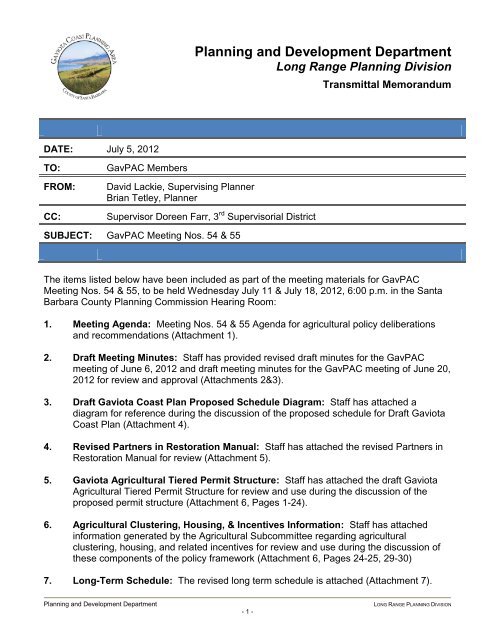
DATE: July 5, 2012<br />
TO: GavPAC Members<br />
FROM: David Lackie, Supervising Planner<br />
Brian Tetley, Planner<br />
CC: Supervisor Doreen Farr, 3 rd Supervisorial District<br />
SUBJECT: GavPAC Meeting Nos. 54 & 55<br />
<strong>Planning</strong> and Development Department<br />
<strong>Long</strong> <strong>Range</strong> <strong>Planning</strong> <strong>Division</strong><br />
Transmittal Memorandum<br />
The items listed below have been included as part of the meeting materials for GavPAC<br />
Meeting Nos. 54 & 55, to be held Wednesday July 11 & July 18, 2012, 6:00 p.m. in the <strong>Santa</strong><br />
<strong>Barbara</strong> <strong>County</strong> <strong>Planning</strong> Commission Hearing Room:<br />
1. Meeting Agenda: Meeting Nos. 54 & 55 Agenda for agricultural policy deliberations<br />
and recommendations (Attachment 1).<br />
2. Draft Meeting Minutes: Staff has provided revised draft minutes for the GavPAC<br />
meeting of June 6, 2012 and draft meeting minutes for the GavPAC meeting of June 20,<br />
2012 for review and approval (Attachments 2&3).<br />
3. Draft Gaviota Coast Plan Proposed Schedule Diagram: Staff has attached a<br />
diagram for reference during the discussion of the proposed schedule for Draft Gaviota<br />
Coast Plan (Attachment 4).<br />
4. Revised Partners in Restoration Manual: Staff has attached the revised Partners in<br />
Restoration Manual for review (Attachment 5).<br />
5. Gaviota Agricultural <strong>Tier</strong>ed Permit Structure: Staff has attached the draft Gaviota<br />
Agricultural <strong>Tier</strong>ed Permit Structure for review and use during the discussion of the<br />
proposed permit structure (Attachment 6, Pages 1-24).<br />
6. Agricultural Clustering, Housing, & Incentives Information: Staff has attached<br />
information generated by the Agricultural Subcommittee regarding agricultural<br />
clustering, housing, and related incentives for review and use during the discussion of<br />
these components of the policy framework (Attachment 6, Pages 24-25, 29-30)<br />
7. <strong>Long</strong>-Term Schedule: The revised long term schedule is attached (Attachment 7).<br />
<strong>Planning</strong> and Development Department LONG RANGE PLANNING DIVISION<br />
- 1 -
In addition to this packet, please bring the GavPAC documents binder volume III with<br />
you to the meeting.<br />
All GavPAC materials are also available for download from the following webpage:<br />
http://longrange.sbcountyplanning.org/planareas/gaviota/gaviota.php<br />
Meeting 52 Revised Minutes Review and Approval (Agenda Item No. 4)<br />
There was discussion about the content of the draft Meeting No. 52 minutes during the last<br />
GavPAC meeting. The attached revised draft Meeting No. 52 minutes (Attachment 2) include<br />
the strikeout and underline changes for your review. In addition, the revised trails policy<br />
framework is included as an addendum showing changes made to the document during<br />
Meeting No. 52, as requested by the GavPAC.<br />
GavPAC Deliberations & Recommendations: Agricultural Policy Framework<br />
(Agenda Item No. 7)<br />
The main purpose of this meeting is to continue the introduction of the Agricultural Policy<br />
Framework developed by the Agricultural Subcommittee (AS) over their 26 meetings. This and<br />
subsequent meetings will describe the key components of the framework to elicit public<br />
comments and GavPAC feedback. We intend to rollout the components in two stages as noted<br />
below. The Agricultural Policy Framework is organized into the following sections, with<br />
background information on those components yet to be discussed and status update on those<br />
components that have been discussed:<br />
1. Statement of Purpose and Intent<br />
Discussed during GavPAC meeting 53. The GavPAC discussed the Statement of<br />
Purpose and Intent briefly, and then acted to postpone consideration of revisions after<br />
the discussion of all other components of the agricultural policy framework.<br />
2. Draft Steep Slopes Standards<br />
Discussed during GavPAC meeting 53. The GavPAC discussed the draft steep slopes<br />
standards and then acted to: “adopt the AS recommendation for agricultural<br />
development on slopes of 40% or more, adding direction to staff to work out a provision<br />
for reclamation (research issues such as including enforcement and timing issues)<br />
when the agricultural operation has been abandoned (to be defined). Staff is also<br />
directed to point out to the AS to conforming changes to the grading ordinance to<br />
implement the agricultural standards for slopes over 40%.”<br />
3. Partners in Restoration Program<br />
Discussed during GavPAC meeting 53. The GavPAC discussed the Partners in<br />
Restoration Program, and then acted to table the discussion of the PIR program until<br />
the next meeting to allow Van Leer and Coates time to incorporate the final AS<br />
identified revisions into the PIR. The requested revised PIR document is attached to this<br />
packet as Attachment 5.<br />
<strong>Planning</strong> and Development Department LONG RANGE PLANNING DIVISION<br />
- 2 -
4. Agricultural Permit Streamlining Ordinance<br />
Discussed during GavPAC meeting 53. The GavPAC discussed the Agricultural Permit<br />
Streamlining Ordinance and then acted to: “adopt the AS recommendation to make the<br />
agriculture permit streamlining consistent throughout the plan area, subject to<br />
conforming to any changes necessary to conform with the permit structure.”<br />
5. Gaviota Agricultural <strong>Tier</strong>ed Permit Structure<br />
Provided in this packet for meeting 54.<br />
A key agricultural land use proposal for the Gaviota Coast is the Gaviota Agricultural<br />
<strong>Tier</strong>ed Permit Structure. The AS spent a majority of their meeting time to develop and<br />
refine the tiered permit structure. The tiered permit structure is meant to modify the<br />
existing agricultural permit process which is highly restrictive once a landowner wants to<br />
explore uses beyond agricultural cultivation or grazing. Even very limited agricultural<br />
support uses, such as limited processing of on-site agricultural products for sale (e.g.,<br />
pressing walnuts into walnut oil), are disallowed in the agricultural zone districts.<br />
Recently, agricultural markets have changed to reflect the local, organic, or slow foods<br />
movements that recognize the value of products produced in the local region and sold<br />
locally through farmer’s markets, cooperatives, or specialty shops, often at a premium.<br />
The purpose and intent of the Gaviota Agricultural permit tiers is to allow increased<br />
flexibility to support and encourage regional agriculture operations by identifying<br />
appropriate permitting requirements for various scales of specific activities. The scale of<br />
the included activities is intended to support or be compatible with agricultural activities<br />
and the natural resources on the Gaviota Coast. Several key principles guided the<br />
review of the various permittable activities and are consistently reflected, with usespecific<br />
variations as appropriate. These principles are:<br />
1. The specific use “Does not interfere with agricultural production, resources, or<br />
operations on or adjacent to the lot on which it is located.”<br />
2. Products produced locally (defined as Gaviota Coast, <strong>Santa</strong> <strong>Barbara</strong> <strong>County</strong>, or<br />
the Tri-Counties depending on the use).<br />
3. The uses on-site generate no more than 10 or 20 cumulative additional vehicle<br />
roundtrips, depending on the mix of uses.<br />
4. For exempt uses, the use does not require new structure(s) that would require a<br />
planning permit.<br />
The categories of uses addressed by the tiered permit structure are: 1) Agricultural<br />
Cultivation and Grazing, 2) Agricultural Production, 3) Agricultural Processing, 4)<br />
Agricultural Ales, 5) Educational Experiences, 6) Recreation, 7)<br />
Accommodations/Lodging, 8) Entertainment. This list of activities is not the sole list of<br />
allowed uses; all currently exempt and allowed uses shall remain. This list of activities<br />
was developed from the guiding principle of what is appropriate for the Gaviota Coast<br />
taking into account; resources, being subordinate to existing operations, as well as the<br />
<strong>Planning</strong> and Development Department LONG RANGE PLANNING DIVISION<br />
- 3 -
proposed visual policies. These activities currently have no exemptions, or have<br />
onerous permitting processes that deter permit applications for small-scale operations.<br />
Broadening of the allowable uses, particularly non-agricultural uses, implies a trend<br />
which may invite uses that have little or no relationship to agricultural crops grown on<br />
the premises. As a result, the intensification of use may impact resources and be<br />
incompatible with surrounding agricultural uses. Agritourism or quasi recreational uses<br />
are similarly restricted. Existing restrictions on agritourism uses are justified based on<br />
the protection of the rural lands from increased traffic and visitors and potential impacts<br />
to active agricultural operations, even though some of these uses are allowable with<br />
approval of a site specific Conditional Use Permit. Rural land use types that are more<br />
indirectly related to the on-site agricultural activities (e.g. recreation, educational<br />
experiences) have been reviewed with an eye toward allowing a permit reduction where<br />
appropriate while protecting the character of the land and the core agricultural<br />
operation(s) on-site.<br />
6. Agricultural Clustering, Housing, & Incentives<br />
Provided in this packet for meeting 54.<br />
Agricultural clustering has been examined as a potential tool to reduce potential impacts<br />
from the existing zoning development potential to agricultural land uses. By clustering<br />
structural development to an optimal location, maximum use of the agricultural potential<br />
of the land and minimum road and infrastructure development impacts may be realized.<br />
The general purpose of clustered development is to minimize impacts to agriculture<br />
from development and the subdivision of property while realizing financial benefits to the<br />
property owner through reduced infrastructure costs.<br />
The AS determined that the intended goal of agricultural clustering is to maximize<br />
agricultural use of the land and minimize impacts merits consideration, however<br />
implementation issues identified during their discussions remain unresolved. The AS<br />
reviewed transfer of development rights (TDR) and development agreements (DA) as<br />
potential mechanisms to facilitate cluster concepts and provided the following<br />
recommendation. The AS identified a need to identify potential receiver sites where<br />
additional density may be appropriate. In the absence of consensus regarding<br />
clustering, the AS is recommending direction to staff to develop a tool that would allow<br />
transfer development of development rights from one parcel to another to provide<br />
another primary housing unit available for generational housing without changing the<br />
zoning or creating a new for sale residential unit.<br />
Potential changes to agricultural housing policy were reviewed by the AS in order to<br />
achieve more choice in the type of units allowed and for more options for future<br />
generations to live on agricultural property. Discussions concentrated on an incentivesbased<br />
approach including voluntary actions that could merit an opportunity to either<br />
apply for a Residential Second Unit or convert an existing Guest House to a Residential<br />
Second Unit (RSU). The maximum size of the RSU allowed in agricultural zones could<br />
be tied to the size of the parcel using the following tiers:<br />
<strong>Planning</strong> and Development Department LONG RANGE PLANNING DIVISION<br />
- 4 -
Parcel Size Maximum RSU (Square Feet)<br />
10-40 Acres 1,200<br />
40–100 Acres 1,600<br />
>100 Acres 2,000<br />
The Agricultural Policy Framework is meant to provide a formal direction to staff to utilize as a<br />
framework for the agricultural land use section of the Gaviota Coast Plan. The intent is for the<br />
GavPAC to review the framework and then ask questions to then make any appropriate<br />
changes prior to a formal motion directing Staff to proceed with drafting the plan section based<br />
on the approved trails policy framework. Additional work is necessary to integrate all GavPAC<br />
deliberations, concepts, and comments into standards, policies, narrative text, and items for<br />
future action. The plan narrative will provide the purpose and intent of the GavPAC motions<br />
and more detail for each issue area.<br />
Attachments:<br />
1. Meeting 54 Agenda<br />
2. Meeting 52 Revised Draft Minutes<br />
3. Meeting 53 Draft Minutes<br />
4. Draft Gaviota Coast Plan Proposed Schedule Diagram<br />
5. Revised Partners in Restoration Manual<br />
6. Gaviota Agricultural Policy Worksheets<br />
7. <strong>Long</strong> Term Schedule<br />
<strong>Planning</strong> and Development Department LONG RANGE PLANNING DIVISION<br />
- 5 -
Notice of Public Meeting<br />
Gaviota Coast <strong>Planning</strong> Advisory Committee (GavPAC)<br />
Meeting Nos. 54 & 55<br />
Note: The meeting venue has changed. This agenda lists discussion topics for the GavPAC<br />
meetings on:<br />
Wednesday, July 11, 2012 – 6:00 p.m. and<br />
Wednesday, July 18, 2012 – 6:00 p.m.<br />
Attendees: GavPAC Members, <strong>County</strong> Staff, and Public Participants<br />
Please review: Meeting Materials Packet for Meetings on 07/11 & 07/18/12<br />
Please bring: Meeting Materials Packet for Meetings on 07/11 & 07/18/12<br />
Location: <strong>Santa</strong> <strong>Barbara</strong> <strong>County</strong> <strong>Planning</strong> Commission Hearing Room, Engineering Building, Room 17, 123 East Anapamu<br />
Street, <strong>Santa</strong> <strong>Barbara</strong><br />
Agenda Item Discussion Topics<br />
CALL TO ORDER<br />
1 Pledge of Allegiance & Roll Call<br />
2 Public Comment<br />
The Public Comment period is set aside to allow public testimony on items not on today’s agenda. The time allocated to<br />
each speaker will be set at the discretion of the Chair.<br />
3 Administrative Briefings<br />
Staff and/or committee member updates regarding local or other legislative activities, local planning decisions, or other<br />
updates of interest to the Committee.<br />
4 Meeting 52 Revised Minutes Review and Approval<br />
5 Meeting 53 Minutes Review and Approval<br />
6 Discussion of Proposed Schedule and Review Process for Draft Gaviota Coast Plan<br />
7 GAVPAC DELIBERATIONS AND RECOMMENDATIONS:<br />
Agricultural Policy Framework:<br />
a. Partners in Restoration Program<br />
b. Gaviota Agricultural <strong>Tier</strong>ed Permit Structure<br />
c. Agricultural Clustering<br />
i. Incentives<br />
d. Agricultural Housing<br />
i. Incentives<br />
e. Statement of Purpose & Intent<br />
8 Discussion of <strong>Long</strong>-Term Meeting Schedule<br />
Adjourn<br />
Questions or comments about the Gaviota Coast Plan may be directed to David Lackie at 805-934-2023 or dlackie@co.santa-barbara.ca.us and further<br />
information may be obtained on the following web site: http://longrange.sbcountyplanning.org/planareas/gaviota/gaviota.php<br />
Writings that are a public record under Government Code § 54957.5(a) and that relate to an agenda item of a regular meeting of the <strong>Planning</strong> Advisory Committee that are distributed to a majority of all of the<br />
members of the <strong>Planning</strong> Advisory Committee less than 72 hours prior to that meeting shall be available for public inspection at <strong>Santa</strong> <strong>Barbara</strong> <strong>County</strong> <strong>Planning</strong> & Development Department, 123 E. Anapamu<br />
Street, <strong>Santa</strong> <strong>Barbara</strong>, CA, and also on the <strong>County</strong>’s website at http://longrange.sbcountyplanning.org/<br />
Attendance and participation by the public is invited and encouraged. In compliance with the Americans with Disabilities Act, if you need special assistance to participate in this meeting, please contact the<br />
Hearing Support Staff (805) 568-2000. Notification at least 48 hours prior to the meeting will enable the Hearing Support Staff to make reasonable accommodations.<br />
Gaviota <strong>Planning</strong> Advisory Committee Meeting 1
1<br />
Gaviota Coast <strong>Planning</strong> Advisory Committee<br />
Gaviota Coast <strong>Planning</strong> Advisory Committee<br />
REVISED DRAFT MINUTES MEETING No. 52<br />
Thursday, June 6, 2012<br />
<strong>Planning</strong> Commission Hearing Room, <strong>Santa</strong> <strong>Barbara</strong><br />
The meeting recording may be accessed along with the materials for this meeting on the GavPAC web page<br />
using the following link:<br />
http://longrange.sbcountyplanning.org/planareas/gaviota/GavPAC.php<br />
These minutes include time markers for key locations in the meeting recording where discussion of an item,<br />
public comments and GavPAC actions may be heard. Due to technical issues, the recording for the first half of<br />
this meeting is not available.<br />
Meeting Called to Order: By Chair Kim Kimbell at 5:59 p.m.<br />
1. Roll Call<br />
GavPAC Members Present: Boise-Cossart, Bowman, Feeney (arrived at 6:10 p.m.), Kimbell,<br />
Lloyd, McKenna, McNabb, Tautrim, and Van Leer<br />
GavPAC Members Absent: McGinnis<br />
<strong>County</strong> Staff Present:<br />
David Lackie, <strong>Long</strong> <strong>Range</strong> <strong>Planning</strong>, Supervising Planner<br />
Brian Tetley, <strong>Long</strong> <strong>Range</strong> <strong>Planning</strong>, Senior Planner<br />
Bret McNulty, <strong>Long</strong> <strong>Range</strong> <strong>Planning</strong>, Planner<br />
2. Public Comment for Items Not on the Agenda:<br />
ACTION: Motion by Boise-Cossart that the GavPAC adopt a resolution thanking Jose Baer for his<br />
work on the GavPAC. Motion seconded by Van Leer and passed unanimously.<br />
3. Administrative Briefings:<br />
Tetley reviewed comment letters: 1) from Chris Shaeffer from Caltrans District 5 in response to a<br />
question from the GavPAC regarding the conversion of Highway 101 to a freeway and 2) from Dianne<br />
Vanderhave, Gaviota resident, regarding the process and use of a “blanket” policy approach to trails<br />
in the western plan area.<br />
4. Meeting 51 Minutes Review and Approval<br />
The GavPAC reviewed the draft minutes of Meeting 51 held on May 24, 2012.<br />
Deliberation:<br />
The GavPAC discussed concerns about the generic way public comments are described in the<br />
minutes. Boise-Cossart asked that minutes be revised with at least a full sentence to reflect the time<br />
and effort speakers have invested. McNabb expressed that she could not listen to MP3 format<br />
recordings and asked for more specificity in the minutes. Staff will work on capturing the essence of<br />
the main points and work to accommodate McNabb. Specific revisions were identified to the minutes<br />
and will be shown in track changes in the approved Meeting 51 minutes.<br />
Public Comments:<br />
Susan Petrovich expressed that the previous meeting minutes do not adequately express what<br />
people said and that these comments are important to the context of the GavPAC’s motions.<br />
Andy Mills, representing Hollister Ranch, expressed that he had made his comment at previous<br />
meeting in the hope it would be reflected in the minutes. He restated his comments regarding his
GavPAC Meeting #52-<br />
DRAFT Meeting Minutes<br />
concern regarding the braided trail and corridor concepts and how they would affect Hollister Ranch<br />
roads. He expressed that at least four property owners had expressed similar trail related concerns.<br />
2<br />
ACTION: Motion by Van Leer to approved the Meeting 51 minutes with revisions. Motion<br />
seconded by Lloyd and passed unanimously.<br />
5. GavPAC Deliberations and Recommendations<br />
Trails Policy Framework<br />
Tetley and Kimbell introduced the trails policy framework included in the agenda packet. The<br />
framework consists of six discrete sections (Statement of Purpose and Intent, Updated PRT Map,<br />
Siting Principles, & Criteria, Specific Criteria & Narrative for Trail Segments, General Policies, and<br />
Incentives). The Trails Policy Framework provides formal framework which staff will use to draft the<br />
trails section of the Gaviota Coast Plan.<br />
a. Statement of Purpose and Intent<br />
The GavPAC was introduced to the Gaviota Community Plan Parks, Recreational & Trails Element<br />
Statement of Purpose and Intent statement drafted by GavPAC member Mark Lloyd and distributed<br />
at the meeting. The GavPAC discussed creating a Gaviota Trails Implementation Study using<br />
language from the PRT Guidelines, the corridor concept, existing trails planning, segments, and<br />
motions from the Trails Subcommittee (TS) as modified by the GavPAC. The GavPAC considered the<br />
use of a graphic to visualize how components of the trail would relate to the Plan, development of<br />
multi-use standards, and examples of incentives in the work of the Agricultural Subcommittee (AS).<br />
The GavPAC and staff discussed the Plan structure, including the arrangement of the text narratives,<br />
policy, development standards and guidance document.<br />
The GavPAC discussed the contents of the revised policy framework, the need for brevity in the<br />
content, and the use of the framework approach in general.<br />
ACTION: Kimbell polled the GavPAC on their opinion regarding the use of the Trails Policy<br />
Framework as a formal framework for drafting the trails section of the Gaviota Coast Plan.<br />
The GavPAC members affirmed the Trails Policy Framework approach unanimously and<br />
without a formal motion.<br />
b. Updated PRT Map<br />
Tetley reviewed the revised Parks, Recreation & Trails (PRT) map hanging on the Hearing Room<br />
wall. He noted instances where the map, which is still being revised, had not yet been updated to<br />
reflect changes made by the GavPAC. These changes include the Dos Pueblos Ranch and Gaviota<br />
Terminal Site. These changes are in process and will be made in the draft PRT map that will return to<br />
the GavPAC with the trails section of the draft plan. Staff asked for input on the revised map and for<br />
confirmation that the map reflects the changes made by the GavPAC.<br />
At 6:35 p.m. the GavPAC took a break to allow the public and GavPAC an opportunity to review the<br />
updated PRT map.<br />
Deliberation: The GavPAC discussed how the braided trails concept as drafted in the framework<br />
requires dedication of three trails types. The GavPAC discussed removing the braided trails concept<br />
and the utility of using in its place the existing Trail Corridors language in the <strong>County</strong> PRT<br />
Description/Guidelines. The GavPAC considered text describing acquisition of proposed trails, the<br />
need to eliminate conflicts in the framework, and the GavPAC direction to the Trails Subcommittee<br />
(TS) when they started their work and the priorities for inland and coastal trails. Staff described how<br />
the guiding principles would be captured by the policies in the plan document. The GavPAC<br />
discussed making appropriate use options available. The GavPAC discussed the language in item 2,<br />
under General Trails Siting Principals on Page 7 of the Trails Policy Framework and specificity<br />
regarding uses.<br />
ACTION: Motion by Lloyd to strike #3, page 7 of the framework, and add in its place, the PRT<br />
Guidelines definitions for trail corridors adapted to the Gaviota Plan context.<br />
Motion seconded by Bowman and approved unanimously.<br />
Gaviota Coast <strong>Planning</strong> Advisory Committee
GavPAC Meeting #52-<br />
DRAFT Meeting Minutes<br />
3<br />
ACTION: Motion by Lloyd to Strike principle #5 on page 8 (Coastal Trail Specific Siting)<br />
should be removed. Motion seconded by Bowman and approved unanimously.<br />
Deliberation: The GavPAC discussed lines on the PRT map depicting trails outside the Plan Area<br />
and the potential for misunderstandings if a change should occur. The GavPAC and staff discussed<br />
the use of an index map with legend and diagram to help people locate maps and policies applicable<br />
to specific areas. The GavPAC and staff discussed listing formal access points including El Capitan,<br />
Refugio, and Camino Cielo along with locations that provide new access opportunities.<br />
The GavPAC discussed whether the motion for PRT line from Gaviota State Park to Jalama directed<br />
the line to be on the beach, or to retain the existing PRT line. Boise-Cossart expressed that the<br />
motion was to move the PRT line to the beach at Hollister Ranch, and Bowman expressed that the<br />
motion was to retain the concept of a continuous existing PRT line west of Gaviota. The recorded<br />
motion directs retention of the existing PRT line. Boise-Cossart expressed that the inland trail from El<br />
Capitan to Gato Canyon was too long a trail to for just day use and it should be acknowledged that<br />
water and a campsite would be required. The GavPAC discussed the importance of the map text<br />
boxes. Feeney expressed that there are nine coastal access points on the map that may be infeasible<br />
and that staff should come back with recommendations.<br />
Public Comments:<br />
Susan Petrovich expressed that the <strong>County</strong> described easement at the GTC site is actually an<br />
agreement to construct, not an easement. She reviewed the terms of the agreement.<br />
Andy Mills, representing Hollister Ranch, expressed that the in minutes reflect that the existing<br />
PRT line is described as being on the beach to 2000 feet inland. His understanding is that the PRT<br />
line is a coarse line generally following the beach and not a broad swath. as close to the beach as<br />
possible.<br />
ACTION: Motion by Van Leer to confirm the draft PRT map that incorporates the GavPAC<br />
recommended trail alignments as direction to staff to prepare a draft PRT map inclusive of<br />
the study area. Subject to inclusion of the text boxes which incorporate GavPAC motions.<br />
Motion seconded by Tautrim and approved unanimously.<br />
Van Leer confirmed that his motion adopts previous motions of the GavPAC.<br />
After a break at 8:30 p.m., the Statement of Purpose and Intent was placed on the overhead screen<br />
(Recording available starting here)<br />
Public Comment:<br />
(1:22) Susan Petrovich, expressed that the <strong>County</strong> PRT Description/Guidelines Acquisition of<br />
Proposed Trails should be revised to include the concept that trails will not disrupt agricultural<br />
operations and cite the existing Agricultural Element purpose statement since staff takes the position<br />
that the element does not apply in the Coastal Zone. She expressed that developments with existing<br />
dedications should not be required to provide additional dedications (multiple trails). She suggests<br />
that the last bullet in the Statement of Purpose and Intent be revised to say “provide responsible<br />
infrastructure maintenance and management.” She expressed that maintenance is vital to public<br />
safety and to avoid impacts to sensitive coastal resources.<br />
(5:20) Deliberation: Lackie asked for clarification regarding the idea of liability transfer, to protect<br />
private property, since it a concept that does not have traction with the <strong>County</strong>. The GavPAC<br />
discussed including “visitors” along with <strong>County</strong> residents and whether they were prioritizing trails<br />
over campgrounds and other recreation uses and whether there is a priority for the Coastal Trail<br />
among trail uses. The GavPAC discussed specific edits to the Statement of Purpose and Intent<br />
following the criteria the GavPAC and the status in the plan of policies regarding parks and<br />
recreation. The GavPAC discussed McKenna’s suggestion to use a definition of purpose and intent,<br />
whereby the purpose was to design and suggest where trails ought to go in the study area and<br />
balance the interests of the public to access their native grounds and rights of the owners to enjoy<br />
their property. The GavPAC discussed adding public and privately owned lands to the list of lands,<br />
Gaviota Coast <strong>Planning</strong> Advisory Committee
GavPAC Meeting #52-<br />
DRAFT Meeting Minutes<br />
and adding a statement regarding a vision for a vast network of trails from the ridgeline to the coast<br />
with loops. The GavPAC discussed including a statement that clarifies working with “public and<br />
private owners” and not including a statement transferring liability to the <strong>County</strong>.<br />
4<br />
(17:15) ACTION: Kimbell polled the GavPAC regarding their support for providing Statement of<br />
Purpose and Intent, as revised, to staff with direction to integrate it into the Trails Section of the<br />
plan. The GavPAC members affirmed the Statement of Purpose and Intent unanimously and<br />
without a formal motion.<br />
c. Siting Principals and Criteria<br />
(18:30) Deliberation: The GavPAC discussed how to recognize the various components of a trail,<br />
referring to a range of uses, and removing the reference to braided trails in item 2 on page 7. Boise-<br />
Cossart indicated that the TS did not use the term “braided trails” and had discussed specific uses<br />
including whether equestrian uses are appropriate along bluffs. The GavPAC discussed descriptions<br />
of trails to serve a range of users, multi-use trails, that some trails would have limitations due to site<br />
conditions and the potential when the GavPAC revisits the issue in the future for addressing a crossregion<br />
bike trail, a set of more primitive trails, and the character of trails. Lackie discussed developing<br />
the general and specific trails siting guidelines using the guidance provided by the GavPAC in the trail<br />
map and supporting narrative, including the multiplicity of trails concept. Lackie clarified that the PRT<br />
Trails Siting Guidelines would be incorporated into the Gaviota Coast Plan and adopted to give them<br />
official status. They can be included on the map as well. Lackie distributed example PRT maps to the<br />
GavPAC.<br />
(29:25) ACTION: Motion by Van Leer, Under General Siting principles, page 7, #2 – Remove “or<br />
braided,” and remove all text after “Note”. Motion seconded by McNabb and approved<br />
unanimously.<br />
(31:10) The GavPAC discussed and staff noted their specific edits and items missing from the<br />
General Siting Principles, including protection of agricultural operations, residential development,<br />
privacy, and balancing the interest of the public and land owners, and use of the words alignment<br />
instead of corridor, limiting or increasing use of the word, “shall” or “should” in policy statements and<br />
managed access. The GavPAC discussed instructing property owners about fire safe land clearing,<br />
Forest Service maintenance resource reductions, and the potential for the <strong>County</strong> to provide<br />
maintenance and clearing of trails.<br />
Public Comments:<br />
(46:00) Susan Petrovich inquired about the use of the word, “priority” in item 1 and asked that it be<br />
clarified what it means. In item 6 she asked if it should be worded, “close as feasible consistent with<br />
the other policies,” and introducing the Agricultural Element policies into the section. In item 8, she<br />
recommended that trails not be allowed to open until all the amenities were in place. In item 10 page<br />
9, the list should add owner privacy and security.<br />
<strong>County</strong> PRT Description/Guidelines<br />
(48:40) Kimbell directed the discussion toward the <strong>County</strong> PRT Description/Guidelines. Tautrim<br />
expressed his support for the guidelines. Kimbell noted the guidelines seem to be written for plan<br />
areas that don’t have a lot of public land. The first, being that they emphasize exactions more suitable<br />
to other plan areas, and the other that they need to emphasize the potential opportunities for trails on<br />
public lands. In Gaviota the unique opportunity exists to locate trails in the public corridors and needs<br />
to be reflected in the guidelines.<br />
(50:40) ACTION: Kimbell polled the GavPAC members who expressed their support for use of<br />
the <strong>County</strong> PRT Description/Guidelines in the trails section of the Plan without a motion.<br />
General Policies<br />
(51:30) The GavPAC discussed the General Policies on pages 22-23. The GavPAC provided specific<br />
edits including: clarifying or removing item 3, on page 23; general direction to remove redundancy<br />
from the policies including item 5, which may be redundant; item 2 (a), on page 22 should clarify that<br />
Gaviota Coast <strong>Planning</strong> Advisory Committee
GavPAC Meeting #52-<br />
DRAFT Meeting Minutes<br />
a trail should not be open until an entity assumes control and not rely on volunteers; “shall be<br />
encouraged” item 2 (c) should be linked to incentives; and removing item 3, on page 23, as it<br />
provides no flexibility. The GavPAC discussed item 4 on page 23 limits to the Coastal Conservancy<br />
guidelines and what that means when it comes back. The GavPAC discussed the definitions of<br />
discretionary and ministerial permits as they apply to various uses. Staff will include general<br />
information regarding the factors that are considered when requiring permits.<br />
Incentives<br />
(1:00:40) Staff and the GavPAC discussed working cooperatively with agencies and owners to<br />
achieve trails, more so than exactions from discretionary projects, and incentives as development<br />
standards or policies. The GavPAC discussed the work of the AS on incentives and putting out a call<br />
to the public for their ideas for incentives.<br />
5<br />
ACTION: Kimbell polled the GavPAC and directed staff to make edits to the General Policies and<br />
recognize in the Plan the importance of incentives as a tool and continue the discussion on<br />
incentives during the AS reportback, without motions.<br />
6. Discussion of <strong>Long</strong> Term Meeting Schedule<br />
The GavPAC will meet next at 6:00 p.m. Wednesday, June 20, 2012 at Las Cruces School.<br />
The GavPAC discussed taking the week of the July 4 th holiday off and holding back-to-back meetings<br />
on July 11 and 18, 2012.<br />
7. Adjournment<br />
Meeting adjourned by Chair Kimbell at 9:08 p.m.<br />
Meeting notes prepared by Bret McNulty.<br />
N:\GROUP\COMP\<strong>Planning</strong> Areas\GAVIOTA\Gaviota Coast Plan\GavPAC\GavPAC Meetings\Meeting No. 52\Agenda & Minutes\Draft Minutes<br />
Meeting No. 52.docx<br />
Gaviota Coast <strong>Planning</strong> Advisory Committee
GavPAC Trails Policy Framework<br />
Revised 07/05/12<br />
1
I. Statement of Purpose & Intent<br />
2
Gaviota Community Plan<br />
Parks, Recreational & Trails Element<br />
Statement of Purpose and Intent<br />
Mark Lloyd – June 5, 2012<br />
The purpose and intent of the Parks, Recreation and Trails Element (PRT) of the Plan is<br />
to create quality public recreational experiences for <strong>County</strong> residents, while preserving<br />
and protecting valuable agricultural operations, natural resources and the rural<br />
character of the plan area. The Gaviota <strong>Planning</strong> Advisory Committee (GAVPAC) has<br />
recognized that the recreational trail component is the overriding priority in crafting the<br />
PRT, acknowledging that adequate recreational park and camping opportunities<br />
currently exist in the region through Federal, State and privately owned recreational<br />
properties. The spirit in which the GavPAC addressed trail issues was one of<br />
cooperation and respect for divergent viewpoints, intending to effectively balance the<br />
interests of both the public at-large and private property owners.<br />
In order to realize the vision of creating a complimentary network of trails, linking the<br />
sea and the mountains, the PRT is comprised of a set of maps graphically depicting a<br />
network of lateral and vertical trail alignments accompanied by text guidelines<br />
explaining contextual conditions; a general policy framework for general trail siting,<br />
design and intensity of use issues; location guidelines and design standards for specific<br />
trail segments; and incentive policies and guidelines to induce completion of the<br />
network. The intent of the PRT policies and maps, therefore, is to direct the <strong>County</strong> as<br />
it incrementally implements the plan while adhering to the following principals:<br />
To establish a regional trail system that effectively meets the needs of <strong>County</strong><br />
residents;<br />
To manage the human impact on agricultural operations, natural resources,<br />
and private property and privacy;<br />
To prioritize trail locations on public lands, or on private lands of willing<br />
property owners;<br />
To respect private property rights through due process in the planning and<br />
design of trails;<br />
To provide necessary infrastructure, maintenance, responsible trail<br />
management and accept liability arising from the public’s use of trails;<br />
By following these principals while implementing the PRT, the <strong>County</strong> will, over time,<br />
establish an effective system of trails that provides the public with a superior<br />
recreational experience, protects natural resources and adjoining land uses, and<br />
preserves the rural character of the region.
II. Updated PRT Map<br />
4
Provided at meeting 52<br />
5
III. Siting Principles & Criteria<br />
6
General Trail Siting Principles<br />
1. The Gaviota Coast Plan Parks, Recreation and Trails (PRT) map identifies general trail corridors<br />
alignments and locations for planning purposes to establish a network of inland and coastal<br />
public trail opportunities within the Gaviota Coast <strong>Planning</strong> Area. Potential trails corridors on<br />
the PRT include both general and more defined trail corridor alignments which should be<br />
considered along with adopted Plan policies, development standards, and supporting Plan text.<br />
Trails described by the Plan should be prioritized for implementation of practical trail routes<br />
within the planning horizon in those areas with the highest perceived need. The Plan provides<br />
additional information regarding trail corridor alignment preferences and intent (where<br />
specified), opportunities and constraints, as well as resource, land use and ownership<br />
considerations to be addressed in all phases of trail planning, easement acquisition, and trail<br />
siting, construction, and operation. Together, the policy intent reflects the necessity for<br />
flexibility in planning the locations of proposed trails. The terrain of an area, privacy of the<br />
property owner and neighbors, safety of trail users, environmental constraints, and other<br />
factors will influence the ultimate placement of a trail.<br />
2. The basis for trails planning on the Gaviota Coast is a vision of an interconnected or “braided”<br />
system of trails linking the eastern and western coastal areas, and inland areas that identifies<br />
appropriate launching points and facilities serving a range of trail users at the appropriate<br />
intensity for each location. [Note: to be developed further indicating the braided system can be<br />
developed more fully with a rustic blufftop trail and a trail that would be for broader level of<br />
users and experiences closer to the highway]<br />
Siting of the Coastal Trail<br />
3. The Coastal Trail shall be generally located between the northerly limit of the Highway 101 rightof-way<br />
as augmented by any unused rights-of-way held by CalTrans or the county (e.g., former<br />
coast highway alignments) and the mean high tide line of the Pacific Ocean. The specific location<br />
to be sited in accordance with the siting principles stated below and the adopted Gaviota Coast<br />
Trails Siting Guidelines. In the <strong>Planning</strong> Area west of Gaviota State Park where there is no public<br />
roadway, the Coastal Trail shall be generally located between the northerly limit of the private<br />
road running parallel to the coast and the mean high tide line of the Pacific Ocean. The scope<br />
and location of the Coastal Trail may be augmented by gifts, offers, and purchase of land of<br />
willing landowners(Insert the the PRT Guidelines definitions for trail corridors adapted to the<br />
Gaviota Plan context).<br />
4. <strong>Planning</strong> for the establishment and enhancement of coastal access and trails shall recognize the<br />
multiple uses served, use intensity, and level of infrastructure along the coastline. In general,<br />
high intensity transportation uses such as cycling should be focused near the highway.<br />
Whereas, lateral and vertical hiking uses can be accommodated near the bluff or on the beach,<br />
where appropriate.<br />
7
Coastal Trail Specific Siting Principles:<br />
The following principles shall be followed with respect to the specific siting of the Coastal Trail:<br />
5. The Coastal Trail shall be a "braided trail" consisting of: 1) a Class I bike path located in proximity<br />
to, but physically separated from, Highway 101, 2) a beach/bluff trail, which shall be for hiking<br />
and equestrian use, and 3) vertical connectors and loop trails in between the bike trail and the<br />
beach/bluff trail.<br />
6. The beach/bluff trail shall be as close to, or on the beach as feasible consistent with all other<br />
planning constraintspossible and on the beach where feasible.<br />
7. The vertical connector and loop trails shall provide reasonably spaced and periodic connections<br />
between the bike trail and the beach/bluff trail.<br />
8. All trails and related facilities shall be located with consideration of the following:<br />
(a) Opportunities to establish and enhance public trails, access, and recreational<br />
opportunities shall be pursued in the following order of preference: 1) public and quasipublic<br />
lands, 2) private lands of willing landowners, and 3) lands exacted as a result of<br />
the discretionary development process, subject to prevailing law.<br />
(b) Trails shall be located to maximize the preservation of fragile coastal resources,<br />
agricultural operations, historic and cultural resources and in consideration of future sea<br />
level rise and associated bluff retreat.<br />
(c) The carrying capacity of the land traversed by the trail should be considered in order to<br />
protect existing resources as required by the Coastal Act.<br />
(d) Trailhead parking facilities should be located as close as possible to Highway 101, and<br />
sanitation and trash facilities should be provided at major trailheads, as deemed<br />
appropriate.<br />
(e) Existing informal paths that are dangerous or detrimental to the environment should be<br />
improved or closed and remediated.<br />
(f) To the extent feasible, proposed trail alignments should seek to avoid areas that are<br />
highly geologically unstable or especially prone to erosion.<br />
8
Trail Specific Siting Principles<br />
9. Trail alignments as indicated on the trails map(s) represent suggested alignments that provide<br />
visual connectivity to the planned trails system. These suggested alignments should not be<br />
construed as final trail alignments for construction due to the coarse scale of the mapping, and<br />
the lack of detailed, site-specific information. Precise trail alignments are subject to detailed<br />
review, analysis and approval at the time of any specific implementation of the Coastal Trail in<br />
accordance with the foregoing principles.<br />
10. <strong>Planning</strong> for the location and intensity of use of public trails, access, and recreational<br />
opportunities shall consider minimize impacts to agricultural, biological, and cultural resources.<br />
Trails and other recreational facilities shall be sited to minimize impacts to habitat and historic<br />
sites while allowing some public experience of these resources.<br />
11. <strong>Planning</strong> for the location and intensity of use of public trails, access, and recreational<br />
opportunities shall consider impacts such as sea level rise and accelerated bluff retreat due to<br />
climate change.<br />
12. <strong>Planning</strong> for the location and intensity of use of public trails shall consider siting and design<br />
features to keep hikers, bicyclists and equestrians on the cleared pathways, to minimize impacts<br />
to sensitive habitat areas and environmental resources, and to avoid or minimize erosion<br />
impacts and conflicts with surrounding land uses.<br />
13. For proposed <strong>County</strong> trails which extend into USFS owned lands, a Memorandum of<br />
Understanding (MOU) should be established between the <strong>County</strong> or NGO and the USFS to<br />
coordinate planning and funding of future trail implementation, environmental review,<br />
construction, and long-term maintenance.<br />
14. Establishment of a new trail or segment shall consider the appropriate uses to allow under the<br />
county’s multiple-use trail policy. Appropriate use determination will depend on the area<br />
setting, whether the trail provides a loop or connection to other trails in the system, and the<br />
terrain over which the trail crosses. Trail design shall reflect these uses. For example, trails<br />
which are expected to attract hikers, equestrians and bicyclists may require a wider trail tread or<br />
even separate trail routes and surfaces. A narrower trail tread and dirt surface may be adequate<br />
for trails which would be used primarily by hikers and equestrians. As part of the trail<br />
implementation process, <strong>County</strong> Parks Department evaluates appropriate use limitations, if any.<br />
Modifications to the county's multiple-use trail policy are considered on a case-by-case basis.<br />
[Note: Address managed access as concept to address carrying capacity or resources concerns]<br />
9
IV. Specific Criteria & Narrative for Trail<br />
Segments<br />
10
GavPAC Meeting 50, May 9, 2012<br />
Summary of GavPAC Trails Related Actions<br />
May 29, 2012<br />
Inland Trails in the Vicinity of West Camino Cielo West of Refugio Road through Young<br />
America’s Foundation Property<br />
ACTION: Motion by McKenna to adopt the TS recommendation. Motion seconded by Feeney.<br />
ACTION: Revised motion by McKenna to include clarification that end of the action refers to the<br />
alternate connection over the Dos Vistas trails and the properties to the north of the ridge line as<br />
an alternative. Revised motion seconded by Feeney.<br />
ACTION: Revised motion by McKenna, to revise the last sentence to read, “Include a narrative<br />
discussing the potential for alternative trails, including existing trail easements as an alternative.<br />
Revised motion seconded by Feeney.<br />
ACTION: Motion by McKenna to restore the section of the existing PRT line up on the ridge<br />
down Refugio Road to where the previous recommendation takes off. Motion seconded by<br />
Feeney.<br />
TS Meeting 13, March 5, 2012<br />
TS ACTION: Motion by McGinnis, seconded by Feeney, to adjust the existing ridge top PRT<br />
map line to generally follow existing boundary boundaries between the Young American’s and<br />
adjacent southern properties, primarily following the existing road and keeping to previously<br />
disturbed areas. Include a narrative discussing the potential to connect to existing trails<br />
easements as an alternative. Motion passed 3-0.<br />
Brinkman Property-San Onofre Canyon<br />
ACTION: Motion by Boise-Cossart to adopt sections of the TS recommendation to designate<br />
the westernmost exploratory trail route as a primary trail linking to the Trespass Trail and have a<br />
narrative that says that the GavPAC would support other exploratory routes in this area that<br />
respect environmental and cultural resources and private property. The other lines will be taken<br />
off the map.<br />
Kimbell summarized the motion: the westernmost exploratory trail show on the map connecting<br />
from the near the fire station up to the Trespass Trail or an analogous alignment that respects<br />
the criteria be left in place. The eastern part of the Brinkman trail extending from that junction to<br />
the east of San Onofre Canyon, other exploratory trails, and the PRT Trail through San Onofre<br />
Canyon be eliminated from the map. Boise-Cossart affirmed the summary.<br />
ACTION: Motion amended by Boise Cossart to add the route to Squat Camp suggested by<br />
Lunsford and that the PRT line south of Squat Camp be eliminated.<br />
ACTION: Motion by Lloyd that it be expressed in the policy recommendation for the previous<br />
item that the Brinkman property due to its proximity to the existing public lands and potential<br />
public lands and infrastructure should be targeted as a conservation property and that if and<br />
when acquired by the public would be the subject of additional recreational studies that would<br />
braid with the adjoining trail opportunities. Seconded by van Leer<br />
11
Deliberation: Feeney expressed agreement with the motion and the sentiment but is nervous<br />
about using the word targeted, and suggested instead that “…there may be an opportunity for<br />
future public acquisition…”.<br />
ACTION: Motion amended by Lloyd as suggested by Feeney.<br />
Nojoqui Falls PRT Line<br />
ACTION: Motion by Van Leer to accept the TS recommendation to remove the existing Nojoqui<br />
Falls PRT line from the map. Motion seconded by Boise-Cossart.<br />
Naples<br />
ACTION: Motion by Boise-Cossart to accept the TS recommendation for the Naples seal haul<br />
out area amended to clarify that the alternative is to the beach trail. Motion approved 8-0<br />
TS Meeting 15, April 5, 2012, Unapproved notes<br />
TS ACTION: Motion by Feeney, seconded by McGinnis, to add policy requiring future lateral<br />
and vertical access to be planned in such a way as to avoid the harbor seal haulout area in the<br />
proximity of Tomate Canyon, with consideration of a bluff top alignment as an alternative.<br />
Motion approved 4-0.<br />
GavPAC Meeting 49, April 25, 2012 UNAPPROVED<br />
Inland Trails in the Vicinity of West Camino Cielo West of Refugio Road through Young<br />
America’s Foundation Property<br />
ACTION: Motion by Lloyd, seconded by Van Leer to continue the matter to a later date to allow<br />
the owners additional time and that the owners contact staff to let them know when that would<br />
be.<br />
Amendment to the Motion by Lloyd, seconded by Van Leer to continue the matter to the next<br />
meeting. Motion approved 8-1, with Feeney dissenting.<br />
Initial Discussion of the Chair’s Proposed Trail Policy Framework<br />
ACTION: Restatement of the motion by Lloyd, seconded by Feeney, for staff to prepare, within<br />
four weeks, an inventory of all the policy direction to date from the GavPAC and written public<br />
comments for the full GavPAC to review with a direction to confirm, eliminate or revise as policy<br />
direction to staff for the preparation of draft inland and coastal trail policies.<br />
Amendment to the motion by Lloyd to clarify that the summary will include public comments that<br />
are consistent with the conclusions of the GavPAC. Motion, as amended, approved 8-1, with<br />
Boise-Cossart dissenting.<br />
Coastal Trails and Access<br />
San Onofre to Jalama Beach<br />
ACTION: motion by Lloyd, seconded by Bowman to adopt the TS recommendation that there<br />
be a corridor approach (from San Onofre to Gaviota State Park) and to record as a narrative<br />
text note that the tank farm property and the adjacent State Park properties will be planned<br />
cohesively, and leave the trail designations in this area except the designated <strong>County</strong> easement<br />
on the GTC property, to the future planning of the properties.<br />
12
Clarification of the motion, by Lloyd that the motion also applies to the State Parks properties<br />
adjacent to the GTC site. Motion approved as clarified 8-1, with Tautrim dissenting.<br />
ACTION: motion by Feeney, seconded by Boise-Cossart to add a narrative to stress the<br />
importance of looking at connecting the corridor (applied to the coast from San Onofre to<br />
Gaviota State Park) across the Mariposa Reina interchange to the Gaviota State Park property<br />
and look at opportunities for vertical beach access in this area. Motion approved 9-0.<br />
Hollister Ranch<br />
ACTION: Motion by Lloyd, seconded by McGinnis to accept the TS recommendation for the<br />
stretch of coast at Hollister Ranch. Motion passed 7-0 with Kimbell and Boise-Cossart<br />
abstaining.<br />
West of Hollister Ranch to Jalama <strong>County</strong> Beach<br />
ACTION: Boise-Cossart moved, Lloyd seconded, to adopt the TS recommendation applicable<br />
to the stretch of coast from the western edge of Hollister Ranch to the western plan area<br />
boundary to accept the existing PRT map lines. Recognize the unique value of the area and<br />
support negotiations between willing landowners, the county and other agencies to explore<br />
options for future trails. The motion passed unanimously.<br />
GavPAC Meeting 48, April 11, 2012<br />
Coastal Trails and Access<br />
Arroyo Quemada to Arroyo Hondo<br />
ACTION: Motion by McGinnis, seconded by Tautrim, to amend the TS recommended overlay<br />
for the area of coast between the fish hatchery and Arroyo Hondo as follows:<br />
Revise the first sentence to read, “Adopt policy to address the following issues, as applicable in<br />
the area between the coast and the northern extent of Caltrans ROW.”<br />
Revise the last bullet to read, “Beach access, trails, and bicycle routes shall be considered<br />
where feasible and existing access protected and enhanced during Caltrans’, Union Pacific’s, &<br />
State Parks’ planning to reconfigure or relocate their facilities in the plan area.”<br />
Motion approved unanimously.<br />
Tajiguas to Arroyo Hondo<br />
ACTION: Motion by Lloyd, seconded by McNabb, to approve the overlay concept, from Tajiguas<br />
to Arroyo Hondo, as a planning tool to establish the trails, with an initial priority being the<br />
alternative trail that generally lies and is mapped between the railroad and the highway,<br />
recognizing negotiations between regional agencies as required.<br />
Motion approved 9-0, Feeney abstained.<br />
All Trails<br />
ACTION: Amendment to Motion by McGinnis, seconded by Boise-Cossart “All trails shall<br />
address sensitive cultural and natural resources including wildlife corridors and both public<br />
projects and trails and physical aspects of trails, carrying capacity study of the impacts of public<br />
uses with regard to supporting infrastructure, and impacts anticipated from climate change,<br />
including sea level rise and bluff erosion.”<br />
Motion approved 9-1, Lloyd dissenting.<br />
13
Arroyo Hondo to San Onofre<br />
ACTION: Motion by Boise-Cossart, seconded by Feeney, to accept the TS overlay concept<br />
from Arroyo Hondo to San Onofre with the trail marking only indicating a continuation of the<br />
PRT line with no specific alignment.<br />
Motion approved unanimously.<br />
GavPAC Meeting 47, March 28, 2012<br />
Coastal Trails and Access<br />
El Capitan State Park to Refugio State Beach<br />
ACTION: Motion by Baer, seconded by Van Leer to adopt the TS recommendations for trails in the<br />
section of coast from El Capitan State Park to Refugio State Park, and to identify as a priority the<br />
development of a feasible, long-term solution to the repair of the damaged Refugio State Beach to El<br />
Capitan State Beach bikepath. Motion approved 10-0, with Feeney absent.<br />
Refugio State Park to Tajiguas Landfill<br />
ACTION: Motion by Lloyd, seconded by Tautrim to adopt accept the TS recommendations for trails in the<br />
section of coast from Refugio State Park to Tajiguas Landfill, including the recommended overlay concept<br />
with no priority for a specific trail alignment beyond preference for an alignment(s) south of Highway 101<br />
and to explore vertical access opportunities, where feasible, adding language to explore opportunities for<br />
vertical access, where feasible. Motion approved 10-0, with Feeney absent.<br />
Naples<br />
ACTION: Motion by Lloyd, seconded by McNabb to remand back to the TS their recommendations<br />
applicable to the Naples area and the seal haul out area for reconsideration in light of existing Policy 7.19<br />
and direct the TS to draft trails guidelines that consider issues related to siting and construction of trails,<br />
address environmental conditions, respect agriculture and private-property, and direct trails to be located<br />
on public land and land of willing owners. Motion approved 10-0, with Feeney absent.<br />
GavPAC Meeting 46, March 14, 2012<br />
Coastal Trails and Access<br />
Goleta El to Capitan State Park<br />
ACTION: Motion by Bowman, seconded by Van Leer that staff to take the overlay language and refine<br />
the text and bring the language back for further discussion by the GavPAC. Motion passed 5-2, with<br />
Feeney and McKenna dissenting, and Kimbell abstained.<br />
ACTION: Motion by Tautrim, seconded by Feeney to accept the sandy beach red line alignment, make<br />
the alignment along the south side of Highway 101 under the bridge, then west to the tunnel, the<br />
proposed primary alignment, with the alignment north of Highway 101 as an alternative, and accept the<br />
vertical trail to the beach as proposed by Las Varas Ranch. Motion approved 6-1 with McKenna<br />
dissenting, and Van Leer abstaining.<br />
ACTION: Motion by McKenna, seconded by Boise-Cossart to remand the Trails Council proposed<br />
alternative trail on Las Varas Ranch to the TS for further review of its feasibility and a recommendation.<br />
Motion approved 5-1 with Feeney dissenting, McNabb absent, and Van Leer abstaining.<br />
GavPAC Meeting 45, February 29, 2012<br />
Coastal Trails and Access<br />
Goleta El to Capitan State Park<br />
14
ACTION: Motion by Lloyd, seconded by McNabb, that the GavPAC recognize a pre-existing lateral trail<br />
access exists through the westerly end, coastal side of the highway in the Goleta Community Plan and<br />
that if and when that trail is established it would be necessary for it to connect to the easterly terminus of<br />
a trail through the Paradiso del Mare property.<br />
Motion approved unanimously.<br />
ACTION: Motion by Lloyd, seconded by Tautrim that the GavPAC update the proposed PRT map to<br />
reflect the previously approved trails, or applicant proposed trail alignments as the preferred trail<br />
alignments running east to west and south of the railroad on the <strong>Santa</strong> <strong>Barbara</strong> Ranch and Makar<br />
properties, and defer to the public planning process for these projects to finalize the trail alignments.<br />
Motion approved unanimously.<br />
ACTION: Motion by Lloyd, seconded by Tautrim, recommending that the remaining Makar property and<br />
the Naples property be considered for a trail alignment and beach access that would be located south of<br />
Highway 101 and as close to the ocean as possible during negotiations with the property owner.<br />
Clarification of the motion as read by Petrovich and clarified by Lloyd:<br />
We recommend to the Board of Supervisors that on the Makar parcel outside Paradiso del Mare, and the<br />
Naples property, owned by <strong>Santa</strong> <strong>Barbara</strong> Ranch, be considered for a trail alignment south of the<br />
highway as close to the ocean as feasible in negotiation with the property owner, and that beach access<br />
would be found somewhere along that route. Motion passed unanimously.<br />
GavPAC Meeting, 44, February 15, 2012<br />
Existing PRT line along the ridgeline in proximity to the Young American’s property (Rancho<br />
Cielo) off West Camino Cielo.<br />
ACTION: Motion by Baer, seconded by Feeney, to remand the trail section to the TS to retain a line on<br />
the PRT map that somehow connects a portion of the ridge road (Camino Cielo) west of the Reagan<br />
Ranch to the ridge road near Refugio Road. The motion passed unanimously.<br />
Inland and Interconnecting Trails<br />
San Onofre to Gaviota State Park (Western Trails Map)<br />
Add Trail Alignments<br />
1) Exploratory route from county fire station road to Brinkman jeepway.<br />
2) Brinkman jeepway from Gaviota State Park trail to San Onofre Canyon.<br />
ACTION: Motion by Lloyd, seconded by McNabb, to remand the exploratory routes to the TS for restudy<br />
of an interconnecting trail from Highway 101 near Hot Springs Trail or Gaviota Peak on public land to the<br />
western Brinkman property, along the edge of the property and remove the existing lower portion of the<br />
existing San Onofre Canyon PRT line. Motion passed 8-2, McKenna and Tautrim dissenting.<br />
Other Trails Recommendations<br />
1) Research practicality of existing PRT alignment from Brinkman to Nojoqui Falls.<br />
ACTION: Motion by McKenna, seconded by Van Leer, to remove the existing PRT map line along<br />
Refugio Road. The motion passed with Lloyd dissenting.<br />
ACTION: Motion by McGinnis, seconded by McKenna to remand the existing PRT map line between<br />
Gaviota to Nojoqui Falls for further consideration by the TS. The motion passed unanimously.<br />
GavPAC Meeting 43, February 1, 2012<br />
Inland and Interconnecting Trails<br />
Goleta to Las Flores Canyon (Eastern Trails Map)<br />
Add Trail Alignments<br />
1) From Naples through Dos Pueblos Ranch passing Condor Point through to the ridge top -<br />
lateral connector extending to east to connect with Farren Road.<br />
15
ACTION: Motion by McKenna to refer the study of this trail back to the subcommittee to review an<br />
appropriate site for the trail so that it does not negatively affect existing development and is sensitive to<br />
future development. Seconded by McGinnis.<br />
Modification to Motion: Add a TS site visit and consideration of the potential Farren Road connector<br />
route. Motion with modification approved 8-3.<br />
2) Add Trail Alignment to the Bill Wallace Trail (As indicated on draft PRT Map)<br />
Consensus: Kimbell polled the GavPAC who unanimously indicated support for the recommended<br />
alignment.<br />
3) Lateral connecting alignment between Bill Wallace trail through Forest Service lands to Las<br />
Varas Canyon PRT alignment<br />
Consensus: Kimbell polled the GavPAC who indicated support for the recommended alignment by a<br />
vote of 8-3.<br />
4) Lower link to Bill Wallace trail along State Parks road from Calle Real<br />
Consensus: Kimbell polled the GavPAC who unanimously indicated support for the recommended<br />
alignment.<br />
5) New mid-link connecting Bill Wallace trail<br />
Consensus: Kimbell polled the GavPAC who unanimously expressed support for the recommended<br />
alignment.<br />
Remove Trail Alignment<br />
2) Lower portion of Las Varas Canyon PRT trail below connection point with proposed connector<br />
on Forest Service land.<br />
ACTION: Motion by Feeney to remove the trail segment as recommended by the TS, seconded by Baer<br />
and approved unanimously.<br />
Las Flores Canyon to San Onofre (Central Trails Map)<br />
Add Trail Alignments<br />
1) Baron Ranch loop trail<br />
Consensus: Kimbell polled the GavPAC who unanimously expressed support for the recommended<br />
alignment.<br />
2) Upper Baron Ranch alignment to ridgeline<br />
Consensus: Kimbell polled the GavPAC who unanimously expressed support for the recommended<br />
alignment.<br />
3) Arroyo Hondo Preserve trail alignments<br />
Consensus: Kimbell polled the GavPAC who unanimously expressed support for the recommended<br />
alignment.<br />
Remove Trail Alignment<br />
1) Arroyo Hondo canyon alignment<br />
16
Consensus: Kimbell polled the GavPAC who unanimously expressed support for the recommended<br />
alignment.<br />
Other Recommendation<br />
1) Consider Las Flores Canyon for recreational opportunities once the energy facility is<br />
decommissioned.<br />
Consensus: Kimbell polled the GavPAC who indicated support for the recommended alignment<br />
by a vote of 8-3.<br />
Formation of Trails Subcommittee<br />
GavPAC Meeting 36, June 15, 2011<br />
GavPAC ACTION: Van Leer moved, seconded by Baer, and carried by a vote of 10-0, to create a<br />
Gaviota Trails Subcommittee including the following GavPAC members: McGinnis, Bowman, Feeney, and<br />
Boise-Cossart. The GavPAC requested that all GavPAC Committee members be noticed of the<br />
Subcommittee meetings and that the Subcommittee should engage stakeholders (Rachel Couch,<br />
California Coastal Conservancy, CRAHTAC, State Parks, <strong>County</strong> Parks, agriculturalist/ranchers,<br />
landowners, Forest Service, etc) in the planning process. The GavPAC directed the Subcommittee to<br />
discuss the following recommendations:<br />
1) Update PRT maps for the eastern and western portions of the Gaviota planning area and<br />
consider updating the PRT maps with appropriate trail linkages between inland and<br />
coastal trails, including linkages between Baron Ranch, Arroyo Hondo, and El Capitan<br />
Canyon.<br />
2) Consider incentives for trail dedication, including reducing the existing permit requirement<br />
for a trail from a CUP to a CDP/LUP<br />
3) Develop thematic scheme for trail development and consider the appropriate intensity of<br />
use for a trail and the trail audience<br />
4) Consider Policy to encourage specific plans for trail development on large landholdings<br />
5) Consider issues related to Coastal Trail planning, including the proximity of the trail to the<br />
ocean and the CCC guidelines for the Coastal Trail and Coastal access.<br />
6) Consider implications for desired infrastructure (e.g. parking) associate with trails<br />
development<br />
7) Consider potential impacts of trails development from the landowner perspective<br />
8) Consider minimizing the use of asphalt for trails<br />
9) Consider CRAHTAC adopted principles for trail development.<br />
GavPAC Meeting 35, June 7, 2011<br />
GavPAC ACTION: Feeney moved, seconded by Baer, and carried by a vote of 10-0, to agree to the<br />
formation of a GavPAC Subcommittee on trails with input from CRAHTAC and other stakeholders<br />
(including the agriculture community, State Parks, <strong>County</strong> Parks, Forest Service). That GavPAC directed<br />
the Subcommittee to consider the 11 principles created by CRAHTAC and to consider the following:<br />
1) Incentives for trail dedication<br />
2) Development of a thematic scheme for trail development<br />
3) Encouraging specific plans for trail development on large landholdings<br />
4) Issues related to Coastal Trail planning.<br />
The GavPAC directed Staff to work with <strong>County</strong> Counsel to revise existing policies to recognize limits on<br />
exaction "subject to prevailing law".<br />
17
Public Recreation<br />
Gaviota Coast <strong>Planning</strong> Worksheets<br />
Coastal Access and Trails Related Issues Areas<br />
REC-1a Provide appropriate access to and along the coast and provide public recreational<br />
opportunities; including development of improved access to the Bill Wallace Trail<br />
REC-1b Safe access for various informal coastal uses<br />
REC-2a Assess need and feasibility of trails on public & private land<br />
REC-2b Development of a California Coastal Trail (CCT)<br />
REC-2c Establishment of a Multi-Use Trail Between El Capitan and Gaviota State Parks<br />
REC-2d Maintain Multi-Use Trail Between El Capitan and Refugio State Parks<br />
REC-3 Improved & Safer Highway Access for Cyclists<br />
REC-4 Facilitate Re-Use of Disturbed Lands for Public Use (Texaco Tank Farm, Mariposa Reina)<br />
REC-5 Better coordination of recreational access among agencies<br />
REC-6 Private Recreational Uses (i.e., Equestrian Uses)<br />
REC-7 Off-road recreational vehicles (i.e. motos)<br />
Transportation, Energy and Infrastructure<br />
TEI-3 Improve Bicycle Access Along the Coast<br />
18
TS Meeting 15, April 5, 2012<br />
Summary of Trails Subcommittee Actions<br />
June 1, 2012<br />
ACTION: TS Chair Bowman will report back to the GavPAC that the TS recommend no further<br />
trails changes in the Las Varas Ranch area.<br />
ACTION: Motion by Feeney, seconded by McGinnis, to add policy requiring future lateral and<br />
vertical access to be planned in such a way as to avoid the harbor seal haulout area in the<br />
proximity of Tomate Canyon, with consideration of a bluff top alignment as an alternative.<br />
Motion approved 4-0.<br />
ACTION: Motion by Bowman, seconded by McGinnis, to maintain the existing PRT lines along<br />
the coast at Hollister Ranch and add policy narrative directing continued dialog with willing<br />
property owners to explore managed public access and recreation options.<br />
Motion approved 3-0, Boise-Cossart recused.<br />
TS Meeting 14, March 20, 2012<br />
ACTION: Motion by Bowman, seconded by McGinnis, applicable to the stretch of coast from the<br />
western boundary of Hollister Ranch property to the northwest edge of the Plan Area, to accept<br />
the existing PRT map lines. Recognize the unique value of the area and support negotiations<br />
between willing landowners, the county and other agencies to explore options for future trails.<br />
Motion passed unanimously.<br />
TS Meeting 13, March 5, 2012<br />
ACTION: Motion by Feeney, seconded by McGinnis to recommend that one additional trail route<br />
be created between El Capitan State Park and the eastern planning area boundary, with the<br />
intent of achieving one additional vertical trail to West Camino Cielo. For this trail alignment,<br />
routes on the Dos Pueblos Ranch route or the Farren Road route will be reviewed and one<br />
selected as the best achievable route. The route will generally follow along property lines<br />
between the Parsons, Dryfus and Dos Pueblos land holdings. The unused route will be<br />
abandoned from further trails planning.<br />
Remove the previously proposed trails connector between the Dos Pueblos and Farren Road<br />
routes.<br />
Add a potential trail alignment north of the highway between the western edge of <strong>Santa</strong> <strong>Barbara</strong><br />
Ranch and the plan boundary along the north side of Calle Real.<br />
ACTION: Motion by McGinnis, seconded by Feeney, to adjust the existing ridge top PRT map<br />
line to generally follow existing boundary boundaries between the Young American’s and<br />
adjacent southern properties, primarily following the existing road and keeping to previously<br />
disturbed areas. Include a narrative discussing the potential to connect to existing trails<br />
easements as an alternative. Motion passed 3-0.<br />
TS Meeting 12, February 22, 2012<br />
ACTION: Motion by Feeney, seconded by Boise-Cossart, to remove the existing Gaviota to<br />
Nojoqui Falls PRT line from the proposed trails map. The motion was approved unanimously.<br />
19
ACTION: Motion by Bowman, seconded by Feeney, designating Baron Ranch as providing<br />
vertical access, Arroyo Hondo as providing a loop trail through managed access, removing the<br />
lower San Onofre PRT line based on habitat concerns, and to designate the westernmost<br />
exploratory trail route as a primary trail linking to the Brinkman Jeepway on the west side that<br />
ties in to the Squat Camp trail and keeping on the map the previously recommended exploratory<br />
route lines located on the western Brinkman property north of the Gaviota Terminal Company<br />
(GTC). The issues related in the area around the exploratory lines will be described in a<br />
narrative. The motion was approved unanimously.<br />
TS Meeting 11, January 10, 2012<br />
Motion by Bowman, second by Boise-Cossart to forward the map as revised to the GavPAC on<br />
February 1st. Motion passed unanimously (3-0, Feeney absent).<br />
TS Meeting 9, December 6, 2011<br />
Motion, by Feeney, to remove the reference to the tunnel from the map. Seconded, by Bowman<br />
and passed 4-0.<br />
TS Meeting 8, November 21, 2011<br />
Motion by Feeney to locate the Coastal Trail alignment along the north side of Highway 101<br />
from Las Varas to El Capitan and put language in the narrative stating that it would be a nice<br />
idea to provide access through the tunnel, but it is not a priority.<br />
ACTION: Bowman revised Feeney’s motion as follows, that the TS prioritize the route of the<br />
Coastal Trail to run along the north side of Highway 101 from the Dos Pueblos interchange west<br />
to the El Capitan Campground and show the potential alignment on Las Varas Ranch south of<br />
101 on the PRT map as an alternative along with narrative addressing design issues with<br />
conflicts with the property owners and Caltrans for potential opportunities to cross under<br />
Highway to the north. The motion passed 4-0.<br />
TS Meeting 3, September 1, 2011<br />
ACTION: Boise-Cossart moved, seconded by McGinnis to direct staff to work with CRAHTAC to<br />
make revisions to the letter and forward it to Third District Supervisor Farr.<br />
TS Meeting 2, August 16, 2011<br />
Boise-Cossart moved, seconded by Bowman, to support public agency coordination for trails<br />
segments of the Gaviota Coast Plan. Motion approved unanimously.<br />
20
V. General Policies<br />
21
[Note: GavPAC direction to remove redundancies, where appropriate]<br />
1. Design Considerations: The design and maintenance of public access facilities for the Coastal<br />
Trail should emphasize low impacts and foster sustainability.<br />
(a) Public access facilities should be provided with the necessary management resources<br />
such as policing, liability management, trail maintenance, appropriate and necessary<br />
infrastructure, waste management, signage, and upkeep of parking areas.<br />
(b) Commercial visitor serving structures (such as stores, restaurants, and motels/hotels)<br />
should be limited to essential services and should be designed and sited to minimize<br />
visual and resource impacts. Necessary public visitor serving structures related to public<br />
access (such as trail signs, kiosks, interpretive exhibits, parking, and restrooms), should<br />
be encouraged although designed and sited to minimize visual and resource impacts.<br />
[Note: Will need to be reviewed to be consistent with ARC Overlay commercial visitorserving<br />
provisions under the CLUP and Article II]<br />
(c) In areas where local landowners or agencies control the scale, location, and design of<br />
public access facilities, such facilities should be built to serve the needs of local<br />
residents.<br />
(d) Vertical beach access should utilize natural topography as much as possible to avoid<br />
artificial structures. However, where necessary and appropriate, engineered solutions<br />
should be sensitive to the viewshed, existing resources, and minimize the need for<br />
periodic maintenance.<br />
2. Community Involvement. Models of community involvement for public access to the coast<br />
should be developed and encouraged with respect to coastal access.<br />
(a) Community involvement in the maintenance and interpretation of public access areas<br />
should be actively encouraged. Examples of current volunteer efforts include docent<br />
programs at Coal Oil Point and the Arroyo Hondo Preserve, the ‘Adopt a Trail Program’,<br />
trail maintenance by the Los Padres Forest Association and Sierra Club, and beach cleanup<br />
days by the Surfrider Foundation. [Note: clarify that a trail should not be open until<br />
an entity assumes control and not rely on volunteers per GavPAC direction]<br />
(b) Managed access programs have an important role on the Gaviota Coast by regulating<br />
the type, timing, and extent of public activities on both private and public land.<br />
Examples include temporary closures during plover nesting season at Coal Oil Point,<br />
trails that prohibit certain uses, curfews, and designation of areas that require advance<br />
scheduling and supervision to control the timing of visitation and the number of visitors,<br />
such as Arroyo Hondo Preserve.<br />
(c) Private property owners shall be encouraged to voluntarily offer opportunities for public<br />
access on private lands for scientific, educational, and cultural activities, such as the site<br />
visits conducted at Hollister Ranch. Such access must be consistent with the rights of<br />
private landowners to protect them from unwanted intrusion. An information<br />
clearinghouse should be created to track, and provide information to the public<br />
22
egarding, those landowners willing to participate in such programs. [Note: Should be<br />
linked to incentives per GavPAC direction]<br />
3. All opportunities for public trails within the general corridors indentified on the Parks,<br />
Recreation and Trails (PRT) map shall be protected, preserved and provided for during review<br />
and upon approval of development and/or permits requiring discretionary approval [Note:<br />
Remove or clarify per GavPAC direction].<br />
4. <strong>Planning</strong> for trails on the Gaviota Coast shall consider potential impacts of trails development<br />
from the landowner perspective. Examples include; trespassing, gates left open between<br />
ranches, the spread of diseases to agricultural crops and/or livestock, and the spreading of<br />
invasive species.<br />
5. Coastal Trail Policy Overlay [Note: add new policy describing the intent of the overlay, including<br />
the corridor concept, opportunities to work with landowners and agencies, balancing access<br />
with resources protection, and inviting feasibility studies for potential trail segments][Note:<br />
Consider removing as redundant]<br />
Coordination/Action<br />
1. The county shall adopt a new PRT map for the Gaviota Coast planning area that identifies: 1)<br />
preferred trail linkages between inland and coastal trails and, 2) appropriate policy options to<br />
address site specific constraints.<br />
2. The county shall identify incentives for trail dedications from willing landowners, including<br />
reducing the existing permit requirement for a trail from a CUP to a CDP/LUP, land swaps,<br />
additional agricultural uses, and revised development standards for properties affected by trails<br />
development.<br />
3. Consider policy to encourage specific plans for trail development on large landholdings and<br />
identify priority areas to focus future specific planning efforts.<br />
4. Identify issues and constraints related to Coastal Trail planning, including the proximity of the<br />
trail to the ocean, the California Coastal Conservancy guidelines for the Coastal Trail and Coastal<br />
access and identify preferred methods to achieve inter-jurisdictional coordination and planning.<br />
[Note: Consider and further analyze guidelines limitations]<br />
5. Consider the use of development standards for desired infrastructure (e.g. parking) associated<br />
with trails development, including low-impact methods of construction.<br />
6. Consider CRAHTAC adopted principles for trail development. [Note: Utilize GavPAC truncated<br />
list]<br />
23
VI. Incentives<br />
24
“The county shall identify incentives for trail dedications from willing landowners, including reducing the<br />
existing permit requirement for a trail from a CUP to a CDP/LUP, land swaps, additional agricultural uses,<br />
and revised development standards for properties affected by trails development.”<br />
25
Voluntary Actions on Agricultural Land that Merit Housing Incentive*<br />
Coastal Habitat, Watershed and<br />
Viewshed Enhancement<br />
Conservation and Land Use Energy and Sustainability<br />
Providing coastal access<br />
across their property<br />
Preparation of hydrological<br />
or watershed plan<br />
Prepare and implement a<br />
Resource Conservation Plan<br />
Map Endangered Species<br />
Habitat on your parcel<br />
Create habitat<br />
Restore previously disturbed<br />
habitat<br />
Map archaeological sites<br />
Protect critical viewshed by<br />
providing a viewshed<br />
easement<br />
Participation in NRCS<br />
Partners in Restoration<br />
program<br />
Provide a conservation<br />
easement or sell<br />
development rights to keep<br />
land in agricultural<br />
production in perpetuity. 1<br />
Contribute to fund used to<br />
purchase development rights<br />
Contribute to an endowment<br />
similar to CREF fund (oil<br />
industry mitigation fund)<br />
Participation in Farmland<br />
Security Act contract<br />
Restoration of building(s) of<br />
historic significance.<br />
Place overhead lines<br />
underground<br />
26<br />
LEED for primary residence<br />
Commit to a Agricultural<br />
Conservation Easement<br />
Engage in organic farming<br />
practices and obtain<br />
certification.<br />
*All improvements must be maintained in perpetuity through a bond or other suitable mechanism.<br />
1 A permanent conservation easement or deed restriction conveyed to the <strong>County</strong>, upon approval, or to a non-profit farmland<br />
trust, land trust or conservation organization whose principal purpose is to conserve farmland and open space, or other suitable<br />
entity.
1<br />
Gaviota Coast <strong>Planning</strong> Advisory Committee<br />
Gaviota Coast <strong>Planning</strong> Advisory Committee<br />
DRAFT MINUTES MEETING No. 53<br />
Wednesday, June 20, 2012<br />
Vista de Las Cruces School Auditorium<br />
The meeting recording may be accessed along with the materials for this meeting on the GavPAC web page<br />
using the following link:<br />
http://longrange.sbcountyplanning.org/planareas/gaviota/GavPAC.php<br />
These minutes include time markers for key locations in the meeting recording where discussion of an item,<br />
public comments and GavPAC actions may be heard.<br />
Meeting Called to Order: By Chair Kim Kimbell at 5:59 p.m.<br />
1. Roll Call<br />
GavPAC Members Present: Boise-Cossart, Kimbell, McGinnis, McKenna, McNabb, Tautrim,<br />
and Van Leer<br />
GavPAC Members Absent: Bowman, Feeney and Lloyd<br />
<strong>County</strong> Staff Present:<br />
Jeff Hunt, <strong>Long</strong> <strong>Range</strong> <strong>Planning</strong>, Deputy Director<br />
David Lackie, <strong>Long</strong> <strong>Range</strong> <strong>Planning</strong>, Supervising Planner<br />
Brian Tetley, <strong>Long</strong> <strong>Range</strong> <strong>Planning</strong>, Senior Planner<br />
2. Public Comment for Items Not on the Agenda: None<br />
3. Administrative Briefings:<br />
(1:35) Tetley reviewed an email submitted by Mr. Andy Mills representing Hollister Ranch, asking<br />
that the meeting 52 minutes be revised to better reflect points he made during his public<br />
comments. Tetley reviewed a notice received from Caltrans regarding a project to rehabilitate<br />
existing structures at the Gaviota Rest Stops and informed attendees that copies of the notice<br />
are available. Deputy Director Hunt informed the GavPAC that the Board of Supervisors<br />
approved a <strong>County</strong> budget that includes one-time funding for the Gaviota Coast Plan from the<br />
Coastal Resource Enhancement Fund (CREF). He noted there is direction to expedite<br />
completion of the project due to uncertainty that funding would be available during the 2013-14<br />
fiscal year. He informed the GavPAC that staff and the Chair would be setting targets. Chair<br />
Kimbell noted that he would be acting to expedite the process and begin limiting comments to<br />
three minutes, consistent with other county public hearings. He is asking staff for a framework of<br />
the plan within the next few weeks. He solicited GavPAC comments on the idea of establishing<br />
an editing committee for the draft plan.<br />
The GavPAC discussed various ways in which a review committee could function to gain<br />
efficiency and be more productive given the lack of budget and time. The GavPAC discussed<br />
assisting staff in development of the document format and presentation and providing focused,<br />
clear and concise policy language so they can concentrate on final policy not organizational and<br />
draft issues during final review. They discussed reviewing the document in sections and having<br />
an editorial subcommittee include members who worked on those sections previously. Hunt<br />
reviewed the Goleta PAC editing committee process in response to a question. The GavPAC<br />
considered having an editing committee for consistency along with a review by the subcommittee<br />
Chairs for sections worked on by a subcommittee. In response to a question, Tetley informed the<br />
GavPAC the maximum size of a subcommittee is five members and putting the item on the next
GavPAC Meeting #53<br />
DRAFT Meeting Minutes<br />
agenda. The GavPAC discussed concerns about receiving the entire draft plan at once and<br />
instead stopping the process after review of the agriculture subcommittee recommendations to<br />
provide staff time to complete drafting of the sections for which direction has already been<br />
provided. Concerns regarding issue areas not addressed during previous reviews were<br />
expressed. The GavPAC discussed catching up the drafting of previous sections prior to<br />
addressing Land Use. Staff and Chair Kimbell agreed to place review of the document outline<br />
and project schedule on the agenda for the next meeting.<br />
4. Meeting 52 Minutes Review and Approval<br />
(18:25) The GavPAC reviewed the draft minutes of Meeting 52 held on June 6, 2012.<br />
The GavPAC incorporated Andy Mills’ requested revisions and asked that staff provide track change<br />
versions of the trails policies document prior to voting on the Meeting 52 minutes.<br />
Public Comments:<br />
Susan Petrovich identified recommended revisions to the minutes and Mike Lunsford expressed<br />
concern that individual comments not be considered actions directing the location of the PRT line on<br />
the beach. The GavPAC discussed the definition of the PRT line.<br />
2<br />
ACTION: The GavPAC identified draft revisions to Meeting 52 minutes and tabled the review<br />
until the next meeting to allow time for staff to provide a track changes version of the trails<br />
policy direction provided to staff at Meeting 52.<br />
5. GavPAC Deliberations and Recommendations<br />
Agricultural Policy Framework<br />
a) Statement of Purpose and Intent<br />
(25:40) Tetley and Van Leer, as Chair of the Agriculture Subcommittee (AS), provided an overview of<br />
the policy recommendations from the AS and the methodology and process to develop them. Van<br />
Leer presented the AS Statement of Purpose and Intent and emphasized the collaborative process<br />
during 26 meetings of the AS. AS worked intently with staff and interested parties on the<br />
recommendations and modified them in consideration of Coastal Commission requirements for<br />
implementation in the Coastal Zone.<br />
Public Comments:<br />
Mike Lunsford noted the Statement of Purpose and Intent does not identify a problem or situation<br />
that requires change and recommends adding language describing why these actions are needed.<br />
Susan Petrovich suggested that the principle in first sentence of the Statement of Purpose and<br />
Intent be integrated into the bullet list in the body of the document, as the list directs the <strong>County</strong> to<br />
follow certain principles when implementing the plan.<br />
Deliberation:<br />
The GavPAC discussed simplifying the Statement of Purpose and Intent into purpose and intent<br />
paragraphs, clarifying that the principles are actually objectives, and including some of the discussion<br />
in an introduction section. The GavPAC discussed potentially tabling the discussion on the Statement<br />
of Purpose and Intent until the end of their review of the AS recommendations, so as to gain a better<br />
understanding of the issues first. The GavPAC discussed the merits of reviewing the AS<br />
recommendations prior to having a complete draft Agriculture section prior to conducting their review.<br />
Lackie expressed that the Statement of Purpose and Intent was not anticipated to be a rote document<br />
and that the document would be revised through an iterative process with the GavPAC. The GavPAC<br />
discussed the direction from the GavPAC to the AS, saving agriculture on the Gaviota Coast and<br />
addressing current agricultural realities in the Plan Area that drove AS review of these issues.<br />
ACTION: The GavPAC agreed to table discussion of the Statement of Purpose and Intent<br />
until after reviewing the AS recommendations.<br />
Gaviota Coast <strong>Planning</strong> Advisory Committee
GavPAC Meeting #53<br />
DRAFT Meeting Minutes<br />
3<br />
b) Steep Slopes Standards<br />
(40:55) Tetley reviewed steep slopes issues identified during previous GavPAC meetings. He<br />
reviewed GavPAC direction to the AS that they identify ways to address erosion and other issues<br />
related to agricultural development and avoid the necessity to rezone to the Mountainous (MT) zoning<br />
district like other plan areas. The GavPAC had previously found the MT zone approach to steep<br />
slopes as too restrictive.<br />
Tetley and Van Leer reviewed the AS recommended Steep Slopes Standards for the Gaviota Coast<br />
developed by the AS based on an avocado cultivation on steep slopes ordinance example from<br />
Ventura <strong>County</strong>. Van Leer described how, through implementation, the standards for hillside<br />
development on slopes 40% or greater would also protect lesser slopes on the same land.<br />
Deliberation: The GavPAC and staff clarified that the steep slopes regulations would apply only to<br />
agricultural development and activities and would be implemented through the existing grading permit<br />
process. This recommendation addresses the GavPAC’s direction by adding a permit requirement to<br />
the existing zone rather than rezoning land with slopes over 40% to MT. The GavPAC discussed<br />
clarifying that the permit would not apply to residential development which is reviewed using separate<br />
standards. The AS members clarified that Steep Slopes Standards address would be new regulations<br />
that addresses erosion related issues not currently regulated in the Plan Area. The AS expressed that<br />
the Steep Slopes Standards would be an innovative approach to addressing environmental problems<br />
created by current farming techniques on steep slopes and avoids the need to rezone.<br />
The GavPAC considered adding a requirement for restoration of abandoned orchards, their effect on<br />
the environment and examples from the Plan Area.<br />
Public Comment:<br />
Mike Lunsford asked whether the standards would apply throughout the <strong>County</strong>.<br />
Lackie explained that the regulations would be policy applicable only within the Plan Area and be<br />
implemented during the erosion control permit process through use of a steep slopes guidance<br />
document that supplements the permit.<br />
Susan Petrovich suggested working closely with grading staff on the Steep Slopes Standards as the<br />
current grading ordinance does not allow for a lot of this. She explained that a grading permit for<br />
anything new triggers the need for a CDP. She stated that an erosion control permit currently would<br />
not be required.<br />
Tetley discussed applying the zoning requirements only in areas where these slopes and<br />
developments occur. He discussed the difference between the MT zoning and approach<br />
recommended by the AS. Van Leer and Lackie agreed to return the Steep Slopes Standards AS<br />
when the draft is completed by staff. Tetley asked the GavPAC for direction regarding remediating<br />
abandoned orchards noting that it may be a new program. He cited similar remediation requirements<br />
in the state Surface Mining and Reclamation Act. The GavPAC discussed how orchards could appear<br />
to be abandoned, but may also be planned for conversion or replanting and discussed including a<br />
time trigger for remediation to avoid impacting on-going agricultural operations. They discussed the<br />
how the regulations could provide a chilling effect on impractical farming efforts on steep slopes. The<br />
GavPAC deliberated how time restrictions would be developed and implemented.<br />
After a break,<br />
ACTION: Motion by Kimbell to adopt the AS recommendation for agricultural development on<br />
slopes of 40% or more, adding direction to staff to work out a provision for reclamation<br />
(research issues such as including enforcement and timing issues) when the agricultural<br />
operation has been abandoned (to be defined). Staff is also directed to point out to the AS to<br />
conforming changes to the grading ordinance to implement the agricultural standards for<br />
slopes over 40%.<br />
Motion seconded by McKenna and approved unanimously.<br />
c) Partners in Restoration Program<br />
Gaviota Coast <strong>Planning</strong> Advisory Committee
GavPAC Meeting #53<br />
DRAFT Meeting Minutes<br />
(1:18:50) Tetley introduced the Partners in Restoration (PIR) Program that proposes to aggregate the<br />
various permit requirements of several agencies applicable to 18 common development related and<br />
permissible practices identified by the Natural Resources Conservation Service (NRCS) under a<br />
single permit from the CRCD. The intent of the PIR is to benefit landowners by reducing the time and<br />
costs associated with applying for separate agency permits for common land development projects<br />
that are subject to standard mitigation and land management practices. Tetley described the<br />
collaborative process between interested parties, the AS and the CRCD.<br />
Public Comments:<br />
Anne Coates of the CRCD noted that the PIR has completed environmental review and that the<br />
GavPAC meeting materials include an early draft version. Changes still need to be incorporated.<br />
Eva Turenchalk discussed revisions made at the AS that include recommended peer review for<br />
creek restorations.<br />
Mike Lunsford described his concern that the owners of avocado orchards are dewatering<br />
watersheds through the use of catchment basins to divert water from the low-flow channel of streams.<br />
He expressed his opinion that this practice is a violation of California water law as it is an<br />
unreasonable take of water that leaves no flow for downstream. He expressed that it would be<br />
appropriate to add a requirement to the PIR to not allow catchment basins as described in PIR<br />
practice 5.<br />
In response to Lunsford, AS members and Coates explained that the catchment basins were actually<br />
being used to reduce habitat loss, erosion and stabilize banks. Kimbell explained that the PIR<br />
outlined permitted practices and was not addressing the issue Lunsford cited, which is addressed in<br />
state water law.<br />
Brian Trautwein, representing the EDC, explained that the issue of water diversions was addressed<br />
extensively in the AS meetings in the context of the PIR program. He agreed the PIR practice is not<br />
the diversion Lunsford is concerned with. He does agree with Lunsford that the <strong>County</strong> must deal with<br />
the issue of the diversion of water from creeks, as the state is not dealing with them effectively. He<br />
noted that the State <strong>Division</strong> of Water Rights does not have budget for staff, enforcement or<br />
permitting. They have a backlog exemplified by the <strong>Santa</strong> Ynez River permit taking 20 years. He<br />
recommends that the GavPAC recommend that the <strong>County</strong> require a permit for water diversions. He<br />
cited knowledge of examples of this issue in the Plan Area<br />
Mr. Trautwein expressed EDC’s support for the PIR. He expressed EDC’s support for stream<br />
restoration in the Coastal Zone. He noted that some of the changes not captured in the meeting<br />
minutes made it into the PIR. He wants to review the final permit language for projects in the Coastal<br />
Zone prior to final endorsement of the PIR.<br />
Susan Petrovich expressed disagreement with the need for the <strong>County</strong> to start <strong>County</strong> permitting<br />
process for which the State Water Board, Fish and Game, National Marine Fisheries Service, and<br />
Fish and Wildlife Service already have authority. She noted the topic area is technical and did not<br />
recommend the <strong>County</strong> get involved in the issue.<br />
Brian Trautwein cited an example of a permit requirement imposed by the <strong>County</strong> on a project in the<br />
McCoy Canyon that has not been applied to other watersheds that have experienced damage. He<br />
reiterated his previous point about the lack of state action on water diversions, and a need for the<br />
<strong>County</strong> to regulate such diversions citing impacts to biodiversity on the Gaviota Coast and their<br />
exceedance of the sustainable capacity of the watersheds.<br />
Deliberation:<br />
In response to a question from Van Leer, Tetley explained that the <strong>County</strong> does require a Land Use<br />
Permit in Agricultural II zoning the Inland Areas and Minor Conditional Use Permit in the Coastal<br />
Zone for water diversions from natural stream channels that alter the natural stream channel or use<br />
other structures. He noted practice 7 for ponds in the PIR and the condition that requires only use of<br />
rainwater or sheet flow not diversions.<br />
4<br />
Gaviota Coast <strong>Planning</strong> Advisory Committee
GavPAC Meeting #53<br />
DRAFT Meeting Minutes<br />
Lackie explained that <strong>County</strong> staff has yet to conclude internal discussions on how to proceed with<br />
the PIR, in response to a question from Van Leer. McGinnis noted that the AS reviewed and reduced<br />
the number practices identified.<br />
Public Comment:<br />
Anne Coates, representing CRCD, in response to questions from the GavPAC explained the PIR<br />
permit process as it would apply in the Gaviota Coast Plan Area. She reviewed the history of <strong>County</strong><br />
review of the PIR program, the staff level exemption provided by the <strong>County</strong> for another version of the<br />
program in the inland area. She explained that the RCD would issue the permit for the 18 proposed<br />
practices subject to the agency conditions incorporated into the PIR.<br />
Brian Trautwein, representing EDC, expressed EDC’s concern with the exempted practices in the<br />
<strong>County</strong> exemption that go beyond the 18 practices in the Gaviota Coast PIR and includes<br />
environmentally harmful projects, such as chaparral clearing. He expressed EDC desire to reduce the<br />
number of exempt practices in the <strong>County</strong> exemption.<br />
5<br />
ACTION: The GavPAC agreed to table the discussion of the PIR program until the next<br />
meeting to allow Van Leer and Coates time to incorporate the final AS identified revisions into<br />
the PIR without a formal motion.<br />
d) Agricultural Permit Streamlining<br />
Tetley reviewed the agenda materials describing the Agricultural Permit Streamlining process<br />
improvement and permit downshifting effort previously approved by the <strong>County</strong>. The streamlining was<br />
adopted in the Inland area only and not attempted in the Coastal Zone. The AS is recommending that<br />
the Agricultural Permit Streamlining be adapted for the Coastal Zone. Van Leer noted that the Visual<br />
and other policies previously recommended for adoption by the GavPAC would supersede<br />
Agricultural Permit Streamlining actions.<br />
Public Comments:<br />
Chris Shaeffer, representing Caltrans, reiterated Caltrans concerns, previously expressed to the<br />
Board of Supervisors about traffic impacts to at grade crossings of Highway 101 from new vehicle<br />
trips from agricultural employee housing previously permitted through a minor conditional use permit<br />
process now being permitted through a ministerial process by the Agricultural Permit Streamlining. He<br />
asked that the GavPAC recommend not change the permit for agricultural employee housing from a<br />
discretionary to a ministerial permit and disallow comment on such projects.<br />
Mike Lunsford, asked for clarification and the GavPAC explained that the AS is recommending<br />
Agriculture Permit Streamlining, as adapted to the Plan Area being applied to the Coastal Zone.<br />
Deliberation: McGinnis expressed that the Coastal Commission (CC) would likely focus on the<br />
provisions of the Agricultural Permit Streamlining. She expressed that the CC might not agree with<br />
the square footage and thresholds being proposed and how that previous CC identified resource<br />
protections could be integrated during the process. Lackie clarified how staff would provide<br />
information regarding certain issues that might create sticking points with the CC. In response to a<br />
question from the GavPAC, Tetley explained how the <strong>County</strong> verifies appropriate habitation of<br />
employee dwellings.<br />
ACTION: Motion by Kimbell to adopt the AS recommendation to make the agriculture permit<br />
streamlining consistent throughout the plan area, subject to conforming to any changes<br />
necessary to conform with the permit tiering structure.<br />
Motion seconded by McNabb and approved unanimously.<br />
6. Discussion of <strong>Long</strong> Term Meeting Schedule<br />
The GavPAC will meet again on Wednesday, July 11, 2012 and on Wednesday July 18, 2012.<br />
The meeting venue for these two meetings will change to the <strong>Planning</strong> Commission Hearing Room<br />
located at 123 East Anapamu Street in <strong>Santa</strong> <strong>Barbara</strong>.<br />
Gaviota Coast <strong>Planning</strong> Advisory Committee
GavPAC Meeting #53<br />
DRAFT Meeting Minutes<br />
7. Adjournment<br />
Meeting adjourned by Chair Kimbell at 8:32 p.m.<br />
Meeting notes prepared by Bret McNulty.<br />
G:\GROUP\COMP\<strong>Planning</strong> Areas\GAVIOTA\Gaviota Coast Plan\GavPAC\GavPAC Meetings\Meeting No. 53\Agenda & Minutes\Draft Minutes<br />
Meeting No. 53.docx<br />
6<br />
Gaviota Coast <strong>Planning</strong> Advisory Committee
GAVIOTA COAST DRAFT PLAN TIMELINE<br />
Final GavPAC Staff Direction<br />
for Agriculture/Land Use<br />
GavPAC Mtg. Break<br />
July Aug Sept Oct Nov Dec Jan Feb Mar April May<br />
Staff Writing Draft Plan & Revisions<br />
Staff Draft: Trails & Rec, Agriculture<br />
Subcommittee Review<br />
for Trails/Agriculture<br />
Staff Draft: Trans.-Energy-Infrastructure, Visual<br />
Staff Draft: Land Use-Zoning-Housing<br />
Staff Draft: Resources Stewardship<br />
GavPAC Review and<br />
Final Recommendation<br />
June<br />
June 30 deadline for BOS<br />
initiation of Draft Gaviota<br />
Coast Plan for Environmental<br />
Review
PROCEDURES FOR COMPLYING WITH MULTIPLE PERMITS:<br />
A GUIDE FOR CONSERVATION PLANNERS IMPLEMENTING THE<br />
SANTA BARBARA COUNTY PERMIT COORDINATION PROGRAM<br />
July 2010<br />
Prepared for:<br />
USDA Natural Resources Conservation Service and<br />
Cachuma Resource Conservation District<br />
<strong>Santa</strong> Maria, CA<br />
Prepared by:<br />
Sustainable Conservation<br />
San Francisco, CA
Blank Page
Compliance Manual <strong>Santa</strong> <strong>Barbara</strong> <strong>County</strong> Permit Coordination Program<br />
TABLE OF CONTENTS<br />
SECTION PAGE<br />
1.0 Introduction ………………………………………………………………….. 1<br />
1.1 Purpose of this Manual ……………………………………………… 1<br />
1.2 Permit Coordination Background ………………………………….. 1<br />
1.2.1 The First Permit Coordination Program in Elkhorn Slough …… 1<br />
1.2.2 Evolution of Permit Coordination ………………………………... 2<br />
1.3 The <strong>Santa</strong> <strong>Barbara</strong> <strong>County</strong> Permit Coordination Program ………. 3<br />
1.4 Regulatory Agencies and Programmatic Permits Issued ………… 4<br />
1.5 Other Program Approvals Issued or Needed ……………………… 4<br />
2.0. How Landowners Qualify for the Program ………………………………… 7<br />
2.1 Location and Land Ownership ………………………………………. 7<br />
2.2 The 18 NRCS Conservation Practices, Size Limits, and<br />
Special Conditions ………………………………………………… 7<br />
2.3 Contracts and Agreements ………………………………………….. 21<br />
2.4 Accountability: Roles and Responsibilities ……………………….. 21<br />
3.0 Permit Requirements and Environmental Protection Measures ……….. 25<br />
3.1 <strong>Tier</strong>ed Environmental Protection Measures ……………………….. 25<br />
3.2 General Approach for all Projects …………………………………… 29<br />
3.3 Regulatory Permit Conditions and<br />
Environmental Protection Measures …………………………….. 29<br />
3.3.1 <strong>Planning</strong> Tools ……………………………………………………...… 30<br />
3.3.2 Site Assessment and Pre-construction Surveys ………………….... 30<br />
3.3.3 Agency Notification and Project Review …………………………… 32<br />
3.3.4 Training ………………………………………………………………... 33<br />
3.3.5 Timing ……………………………………………………………..…… 34<br />
3.3.6 Procedures to Prevent Wildfires …………………………………… 35<br />
3.3.7 Limits to Site Disturbance ………………………………….……….. 35<br />
3.3.8 Protections for Water Quality ………………………………………. 38<br />
3.3.9 Temporary Water Diversion/ Dewatering ………………………… 40<br />
3.3.10 Dust Control ………………………………………………………….. 42<br />
3.3.11 Special Conditions for Stream Bank Protection,<br />
Grade Stabilization Structures, and Stream Crossings …………. 42<br />
3.3.12 Construction Monitoring ……………………………………………. 44<br />
3.3.13 Mitigation ……………………………………………………………... 44<br />
3.3.14 Reporting ……………………………………………………………… 46<br />
4.0 <strong>Planning</strong> Requirements ………………………………………………………. 47<br />
4.1 NRCS Conservation <strong>Planning</strong> Process ……………………………… 47<br />
4.2 Incorporating Permit Conditions into the <strong>Planning</strong> Process ……... 47<br />
4.3 Contents of the Conservation Plan ………………………………….. 53<br />
4.4 Communicating with the Landowner ……………………………… 53<br />
4.5 Project Management …………………………………………………. 54<br />
5.0 Special Status Species ………………………………………………………… 55<br />
5.1 Threatened and Endangered Species, Fully Protected Species,<br />
Proposed Species, and Critical Habitat ………………………….. 55<br />
i
Compliance Manual <strong>Santa</strong> <strong>Barbara</strong> <strong>County</strong> Permit Coordination Program<br />
5.1.1 Biological Opinion for Steelhead …………………………………… 55<br />
5.2 State and Local Species of Concern …………………………………. 56<br />
5.3 Federally Listed Species Not Covered by Permits …………………. 56<br />
5.4 State Listed Species Not Covered by Permits ……………………….. 56<br />
6.0 Procedures for Complying with Corps of Engineers Regulations ………. 59<br />
6.1 Nationwide Permits and Regional General Permits ……………….. 59<br />
6.2 Regional Conditions …………………………………………………... 60<br />
6.3 Notification Procedures ……………………………………………….. 60<br />
6.4 Exemptions ……………………………………………………………... 61<br />
6.5 Memorandum of Agreement …………………………………………. 61<br />
7.0 Procedures for Non-compliance …………………………………………….. 63<br />
LIST OF TABLES<br />
Table 1. Participating Regulatory Agencies, Jurisdictions, and<br />
Programmatic Permits Issued ……………………………………….. 5<br />
Table 2. Conservation Practices that may be Considered for Inclusion<br />
in the <strong>Santa</strong> <strong>Barbara</strong> <strong>County</strong> Permit Coordination Program …….. 7<br />
Table 3. Summary of Roles and Responsibilities of NRCS/ CRCD<br />
and Participating Landowners ………………………………………. 23<br />
Table 4. Overview of How Permit Coordination Builds on the NRCS<br />
9-Step <strong>Planning</strong> Process ……………………………………………… 49<br />
LIST OF FIGURES<br />
Figure 1. <strong>Tier</strong>ed Impacts Decision Tool …………………………….……………… 27<br />
APPENDICES<br />
Appendix A. Agency Permits, Other Approvals, Contact Information,<br />
and Consultation Request to USFWS ……………………………….. Tab A<br />
Appendix B. Size Limits of the Conservation Practices …………………………… Tab B<br />
Appendix C. <strong>Planning</strong> Documents for Steelhead ………………………………….. Tab C<br />
Appendix D. A Primer on Stream and River Protection …………………………... Tab D<br />
Appendix E. California Native Plant Society (CNPS) Mitigation Guidelines …... Tab E<br />
Appendix F. State Historic Preservation Office (SHPO) Agreement …………….. Tab F<br />
Appendix G. Approved Plant List …………………………………………………… Tab G<br />
Appendix H. Sample Annual Report ………………………………………………… Tab H<br />
Appendix I. Cooperator Agreement ………………………………………………... Tab I<br />
Appendix J. Project Management Checklist ……………………………………….. Tab J<br />
Appendix K. Species Lists, Distribution Maps, and Biology Manual ……………. Tab K<br />
Appendix L. Corps of Engineers Documents ………………………………………. Tab L<br />
ii
Compliance Manual <strong>Santa</strong> <strong>Barbara</strong> <strong>County</strong> Permit Coordination Program<br />
1.0 INTRODUCTION<br />
1.1 Purpose of this Manual<br />
NRCS and CRCD employees will have primary responsibility for oversight of the <strong>Santa</strong><br />
<strong>Barbara</strong> <strong>County</strong> Permit Coordination Program (Program). This manual is designed to<br />
provide current and future staff with a guide to administering the Program successfully.<br />
Some current staff were involved with developing the Program, and therefore, are<br />
familiar with its various elements. However, due to normal staff turnover anticipated<br />
during the 10-year life of the Program, this manual is also aimed at new employees who<br />
will be involved with the Program and who may not be familiar with permit<br />
coordination. As a guidance document, it provides as much information as possible, but<br />
each individual project will have its own site-specific details and present a unique set of<br />
challenges. This manual should get people through the basics of how to comply with<br />
multiple permits but should be considered a “living document.” As a living document it<br />
can be updated as needed when new information or ways to improve Program<br />
administration become available.<br />
1.2 Permit Coordination Background<br />
The original concept of permit coordination grew out of a partnership between<br />
Sustainable Conservation, a non-profit organization, and NRCS. While working with<br />
landowners, they became aware that farmers and ranchers were facing a dilemma:<br />
while a growing number of landowners were interested in implementing small,<br />
environmentally beneficial projects on their properties, the time and complexity<br />
involved in obtaining multiple permits for each separate project, often discouraged them<br />
from moving forward with needed work (see table, below). From the landowner‟s<br />
perspective, standard agency review processes intended to protect natural resources<br />
often acted as disincentives to voluntary practices that would reduce nonpoint source<br />
pollution and enhance habitat. Consequently, because the challenges of obtaining<br />
governmental approvals exceeded the perceived benefits, most landowners continued<br />
with their current land use practices (not doing the work or doing the work without<br />
permits).<br />
Sustainable Conservation and NRCS learned that by simplifying the permitting process,<br />
agricultural landowners were more likely to implement environmentally beneficial<br />
conservation practices. The permitting process is simplified for the landowner by having<br />
regulatory agencies issue programmatic permits for a specific set of conservation practices<br />
and planning tools rather than issuing individual permits on a project-by-project basis.<br />
This was the beginning of permit coordination.<br />
1.2.1 The First Permit Coordination Program in Elkhorn Slough<br />
The pilot permit coordination program was developed in 1998 in response to very high<br />
erosion rates in the Elkhorn Slough watershed in Monterey <strong>County</strong> and its detrimental<br />
effects on water quality and wildlife habitat. Ten conservation practices recommended<br />
by the Environmental Protection Agency (EPA) and NRCS were conditioned and<br />
authorized in advance by federal, state, and local agencies through m ultiple watershedbased<br />
permits issued to the NRCS and the Monterey <strong>County</strong> RCD.<br />
1
Compliance Manual <strong>Santa</strong> <strong>Barbara</strong> <strong>County</strong> Permit Coordination Program<br />
Agency Mandates That Can Affect One Conservation Project<br />
Regulatory Mandate Agency Involved<br />
Section 404 Clean Water Act<br />
Federal Endangered Species Act<br />
2<br />
Environmental Protection Agency<br />
Army Corps of Engineers<br />
United States Fish and Wildlife Service<br />
National Marine Fisheries Service<br />
National Historic Preservation Act State Historic Preservation Office<br />
National Environmental Policy Act Federal Agencies<br />
Section 401 Clean Water Act<br />
Regional Water Quality Control Board<br />
Porter Cologne Act<br />
California Coastal Act<br />
California Coastal Commission<br />
Coastal Zone Management Act<br />
Fish and Game Code Section 1602<br />
California Department of Fish and Game<br />
California Endangered Species Act<br />
California Environmental Quality Act State and local agencies<br />
Erosion and Grading Ordinances,<br />
<strong>County</strong> government<br />
Development Standards, Environmental<br />
Protection Ordinances, and Local Coastal<br />
Plans<br />
The results of the conservation projects implemented under the Elkhorn program were<br />
dramatic. Between 1998 and 2006, 50 projects were completed, 50% more than was<br />
originally projected. More than 60,000 tons of sediment were prevented from entering<br />
the Elkhorn Slough, its tributaries, and the Monterey Bay National Marine Sanctuary,<br />
and more than two miles of stream bank and channel were restored or revegetated. In<br />
addition, the program brought NRCS into cooperation with many farmers who had not<br />
previously expressed interest in on-farm conservation. The results originally anticipated<br />
– more conservation projects, a broader range of projects, and better quality projects –<br />
were met and exceeded.<br />
1.2.2 Evolution of Permit Coordination<br />
Following the success of the Elkhorn project, similar permit coordination programs have<br />
now been established in other areas along California's coast, including the Morro Bay<br />
watershed, <strong>Santa</strong> Cruz <strong>County</strong>, Humboldt <strong>County</strong>, Alameda <strong>County</strong>, Marin <strong>County</strong>, the<br />
Salinas River watershed, the Navarro River watershed, and the upper Pajaro River<br />
watershed. The most recent programs established are for <strong>Santa</strong> <strong>Barbara</strong> <strong>County</strong> and San<br />
Luis Obispo <strong>County</strong>.<br />
While all these programs followed the same original blueprint, they all have turned out<br />
differently. The best outcome for any program is to end up with a complete set of<br />
programmatic permits from all the regulatory agencies that affect a project. In reality,<br />
this outcome is a rarity: most of the programs have had difficulties obtaining one or<br />
more permits from regulatory agencies. Reasons for inconsistencies among programs are<br />
not well understood, but seem to be related to individual staff preferences rather than a<br />
given agency‟s policy. Support from local county government is especially important<br />
because it also reflects support from the Coastal Commission. Most coastal counties<br />
have adopted Local Coastal Programs for projects implemented in the coastal zone in<br />
order to comply with the Coastal Act, but the Coastal Commission generally defers to
Compliance Manual <strong>Santa</strong> <strong>Barbara</strong> <strong>County</strong> Permit Coordination Program<br />
county recommendations. If a county is supportive of a proposal, the Coastal<br />
Commission is also generally favorable (and vice versa).<br />
1.3 The <strong>Santa</strong> <strong>Barbara</strong> <strong>County</strong> Permit Coordination Program<br />
The <strong>Santa</strong> <strong>Barbara</strong> <strong>County</strong> Program followed the lead of the programs developed<br />
previously in different California counties, as mentioned above. This has resulted in an<br />
easier process in some respects, as the Program has benefited from the experience and<br />
lessons of past efforts. In other respects, it has been more difficult as, over time, the<br />
approach to permit coordination has changed fundamentally for some regulatory<br />
agencies as well as for NRCS itself.<br />
The <strong>Santa</strong> <strong>Barbara</strong> <strong>County</strong> Program is unique in several ways:<br />
Due to a different approach from the Regional Water Quality Control Board for<br />
assessing project impacts, this is the first time the “tiered” approach was<br />
required. The tiered approach (see Section 3 for details) resulted in the “<strong>Tier</strong>ed<br />
Impacts Decision Tool” which allows placement of a project in one of four <strong>Tier</strong>s<br />
based on the level of project impacts. It remains to be seen if this approach will<br />
benefit on-the-ground project implementation.<br />
This is the first time the Corps of Engineers did not participate in Program<br />
development and did not issue a programmatic permit (also true for the San Luis<br />
Obispo Program). This could result in significant time delays because individual<br />
projects that require a Corps permit will need to undergo the typical project<br />
review process.<br />
NRCS (at the national level) decided to change its position on what constitutes a<br />
“federal nexus.” A federal nexus is required in order to consult with agencies<br />
that have jurisdiction over listed species under Section 7 of the Endangered<br />
Species Act (ESA). This would include the U.S. Fish and Wildlife Service<br />
(USFWS) and the National Marine Fisheries Services (NMFS). For past permit<br />
coordination programs, NRCS was the federal lead agency for listed species<br />
consultations for projects that were funded, approved, or carried out by NRCS.<br />
This allowed RCD projects, not receiving N RCS funding, to be covered under the<br />
federal Section 7 consultation process for listed species. With the recent policy<br />
changes, NRCS can only be the lead federal agency for projects that receive<br />
federal funding. Therefore, the resulting permits will not cover RCD projects.<br />
This situation will likely result in project delays for RCD projects where listed<br />
species could be impacted.<br />
This is the first time support from a <strong>County</strong> has been lacking. Despite lengthy<br />
negotiations and assurances, the <strong>County</strong> failed to issue a programmatic permit.<br />
This will most likely affect projects implemented in the coastal zone, where<br />
Coastal Commission approval will also be required for some projects.<br />
This is the first time that the installation of “new ponds” has been approved as<br />
one of the conservation practices. Implementation of this practice could assist in<br />
the recovery of the endangered California tiger salamander in <strong>Santa</strong> <strong>Barbara</strong><br />
<strong>County</strong>.<br />
1.4 Regulatory Agencies and Programmatic Permits Issued<br />
3
Compliance Manual <strong>Santa</strong> <strong>Barbara</strong> <strong>County</strong> Permit Coordination Program<br />
When landowners seek assistance for a project from NRCS or CRCD, and if the project<br />
meets all the Program requirements, they can take advantage of the programmatic<br />
permits already in place to move their projects forward more quickly. For the <strong>Santa</strong><br />
<strong>Barbara</strong> Program, 18 NRCS conservation practices from the Field Office Technical Guide<br />
(FOTG) have been conditioned and “pre-approved” by some of the regulatory agencies.<br />
These practices can be used for small, environmentally beneficial projects designed for<br />
erosion control, stream restoration, and wildlife habitat enhancements.<br />
Table 1 shows the participating agencies, their regulatory jurisdictions, dates permits<br />
were issued, and dates permits will expire. Four regulatory agencies participated in<br />
developing the Program; three of these have issued programmatic permits (NMFS,<br />
RWQCB, DFG). Although NRCS/ CRCD originally requested 5-year permits from all the<br />
agencies, NMFS and RWQCB issued a 10-year permit and DFG issued a 5-year<br />
agreement. CRCD has the option to request an extension to th e Streambed Alteration<br />
Agreement from DFG for an additional five years, and should do so before the expiration<br />
date of December 1, 2014.<br />
Appendix A contains each complete permit issued to date and contact information for<br />
agency staff. Also included in Appendix A is the Consultation Request (Biological<br />
Assessment) submitted to the USFWS, which contains useful information on listed<br />
plants, fish, and wildlife considered in the consultation, their distributions, critical<br />
habitat, and natural histories (this is not a permit).<br />
The U.S. Fish and Wildlife Service (USFWS) and the National Marine Fisheries Service<br />
(NMFS) both participated fully in the Program, but only NMFS has issued a biological<br />
opinion (BO) for effects to listed federally endangered species (steelhead trout) for<br />
NRCS-funded projects. Because in is unclear when the USFWS will begin its review of<br />
NRCS‟s request for consultation, NRCS cannot count on having this BO in place within<br />
the near future. This will result in having to avoid all impacts to listed species or<br />
postponing projects until the BO has been issued. As mentioned above, projects without<br />
NRCS funding that meet the requirements of the Program will still require a permit<br />
from NMFS and USFWS when listed federal species are affected (see Section 5.3 for<br />
more information).<br />
1.5 Other Program Approvals Issued or Needed<br />
California Environmental Quality Act (CEQA)<br />
CRCD is the lead agency for compliance with CEQA. As part of that process,<br />
CRCD prepared a Mitigated Negative Declaration (MN D) in which short-term,<br />
temporary impacts resulting from installation of the practices, and proposed<br />
mitigation measures, were disclosed for public review and comment. A copy of<br />
the MND is on file with CRCD and should be reviewed by CRCD/ NRCS staff<br />
involved with the Program. Some of the practice descriptions and environmental<br />
protection contained in the MND have been modified to some extent by<br />
regulatory staff in their permits; therefore, the most recent descriptions and permit<br />
conditions are contained in this manual.<br />
Table 1. Participating Regulatory Agencies, Jurisdiction,<br />
and Programmatic Permits Issued<br />
Agency Jurisdiction Approval<br />
Mechanism<br />
4<br />
Date<br />
Issued<br />
Expires
Compliance Manual <strong>Santa</strong> <strong>Barbara</strong> <strong>County</strong> Permit Coordination Program<br />
National Marine<br />
Fisheries Service<br />
(NMFS)<br />
U.S. Fish and<br />
Wildlife Service<br />
(USFWS)<br />
Central Coast<br />
Regional Water<br />
Quality Control<br />
Board (RWQCB)<br />
California<br />
Department of<br />
Fish and Game<br />
(DFG)<br />
Projects that could affect<br />
federally listed steelhead<br />
trout or critical habitat<br />
Projects that could affect<br />
federally listed plants, fish,<br />
and wildlife or critical<br />
habitat<br />
Projects subject to the<br />
Corps of Engineers‟ 404<br />
permit requirements<br />
Projects in a stream bed,<br />
channel, or bank including<br />
associated riparian habitat<br />
<strong>County</strong> <strong>Planning</strong> and Development Department<br />
Biological Opinion<br />
for projects with<br />
NRCS funding<br />
Biological Opinion<br />
for projects with<br />
NRCS funding<br />
401 Water Quality<br />
Certification<br />
Streambed<br />
Alteration<br />
Agreement<br />
5<br />
May 7,<br />
2010<br />
Not issued;<br />
Pending<br />
date not<br />
known<br />
April 27,<br />
2009<br />
April 10,<br />
2010<br />
May 7,<br />
2020<br />
April 27,<br />
2019<br />
Dec 1,<br />
2014<br />
The <strong>Santa</strong> <strong>Barbara</strong> <strong>County</strong> <strong>Planning</strong> and Development Department (P&D)<br />
participated during much of the planning phases for the Program and were set to<br />
issue a Master permit; however, P&D decided to not issue a Master permit.<br />
Not related to permit coordination, NRCS has an existing exemption from the<br />
<strong>County</strong> for projects that are funded by NRCS and that meet specific planning<br />
requirements under NEPA. This exemption can also be used for permit<br />
coordination projects. In order to increase the effectiveness of this exemption, the<br />
<strong>County</strong> issued an amendment to include projects not funded by NRCS but which<br />
follow all the procedures set forth under the original exemption. Under the<br />
amended exemption, many of the Program practices would be exempt from<br />
<strong>County</strong> grading and land use requirements, but it remains unclear which types<br />
of projects would be exempt in the coastal zone and which would require a<br />
coastal development permit. Such a determination will be made on a case-bycase<br />
basis by NRCS/ CRCD. A copy of the original exemption and the<br />
amendment can be found in Appendix A.<br />
U.S. Army Corps of Engineers<br />
A project conducted in a stream that results in placement of “fill” in Waters of<br />
the U.S. or wetlands will require a 404 permit from the U.S. Army Corps of<br />
Engineers (Corps). A draft Memorandum of Agreement (MOA) was developed<br />
with the Corps late in the process to expedite project review for Program<br />
practices; however, due to recent staff changes at the Corps, the MOA may or<br />
may not be approved. Until a decision is reached, permits from the Corps will<br />
need to be obtained on a project-by-project basis. More information on the Corps<br />
application process and related information can be found in Section 6 and<br />
Appendix L.<br />
California Endangered Species Act (CESA) Permit<br />
A California endangered species permit pursuant to CESA is required if state<br />
listed threatened or endangered species will be impacted by a project (see Section<br />
5.4 for more details).
Compliance Manual <strong>Santa</strong> <strong>Barbara</strong> <strong>County</strong> Permit Coordination Program<br />
Note:<br />
1. The Biological Opinions from NMFS and<br />
USFWS will only cover projects with<br />
NRCS funding.<br />
2. The Exemption issued by the <strong>County</strong><br />
covers projects with and without NRCS<br />
funding but may not cover all practices,<br />
especially in the coastal zone.<br />
3. The Corps did not issue a permit for the<br />
Program, so permits for each project will<br />
be needed before working in stream areas<br />
regulated by the Corps.<br />
6
Compliance Manual <strong>Santa</strong> <strong>Barbara</strong> <strong>County</strong> Permit Coordination Program<br />
2.0 HOW LANDOWNERS QUALIFY FOR THE PROGRAM<br />
Landowners may qualify to use the programmatic permits if their projects fit the<br />
parameters established for the Program and if projects are overseen by the NRCS or<br />
CRCD. The basic categories to check first to determine if a project fits the Program<br />
requirements are:<br />
location of the project and land ownership;<br />
type of conservation practices to be installed; and<br />
size of the installed practices (linear feet, area, volume of soil disturbed)<br />
2.1 Location and Land Ownership<br />
Projects may be implemented on land zoned for agriculture along waterways and<br />
adjacent uplands within the four major river basins and their associated tributaries<br />
throughout <strong>Santa</strong> <strong>Barbara</strong> <strong>County</strong> (<strong>Santa</strong> Maria, <strong>Santa</strong> Ynez, San Antonio, and South<br />
Coast watersheds). Areas within the jurisdictions of NRCS (<strong>Santa</strong> Maria office) or CRCD<br />
that fall outside of <strong>Santa</strong> <strong>Barbara</strong> <strong>County</strong> are not included in this Program (they may be<br />
eligible for the permit coordination program established for San Luis Obispo <strong>County</strong>).<br />
The Program does not include projects in any of the following areas or habitats:<br />
coastal estuaries/ sloughs<br />
dunes and coastal strand<br />
vernal pools<br />
the Channel Islands<br />
federal, State, and local public lands; most significantly:<br />
the U.S. Forest Service (Los Padres National Forest) and<br />
the Department of Defense (Vandenberg Air Force Base)<br />
2.2 The 18 NRCS Conservation Practices, Size Limits, and Special<br />
Conditions<br />
Only the following 18 NRCS conservation practices are eligible for the Program. The<br />
first column contains practices typically installed in upland situations; the second<br />
column contains practices typically installed in streams:<br />
Upland Practices Stream Practices<br />
Access Road Improvements Channel Stabilization<br />
Diversion Grade Stabilization Structure<br />
Filter Strip Limited Vegetation Removal to Minimize<br />
Erosion (Clearing and Snagging)<br />
Grassed Waterway Critical Area Planting<br />
Irrigation System and Tailwater Restoration and Management of Sensitive<br />
Recovery<br />
Habitats<br />
Pipeline Stream Bank Protection<br />
Ponds Stream Habitat Improvement and<br />
Management<br />
Sediment Basin Stream Crossing<br />
Underground Outlet Structure for Water Control<br />
Table 2 describes these 18 conservation practices in detail. The “Additional Conditions”<br />
and “Size Limitations” for each practice may be different than what usually applies for<br />
7
Compliance Manual <strong>Santa</strong> <strong>Barbara</strong> <strong>County</strong> Permit Coordination Program<br />
these practices. However, because of these additional limitations, the practices were in<br />
essence “pre-approved” by the permitting agencies. It is the responsibility of the<br />
NRCS/ CRCD project manager for each project to know what the eligible practices are,<br />
the special conditions for each practice, and the size limits for each practice. A separate<br />
table of practice size limits is provided in Appendix B.<br />
Column 1 in Table 2 references the FOTG practice standard number that may be used to<br />
implement a particular practice. For some of the practices, more than one NRCS<br />
standard may be used; this is to ensure any cost-shared contracts will be covered.<br />
Not all of the practices described in Table 2 require permits from every agency or in<br />
every land use setting. As a general rule, all of the practices that take place in streams (or<br />
on the banks of streams) will require several permits. Many of the practices installed in<br />
uplands will not require a permit unless listed species are present in the project area.<br />
Note:<br />
1) Only the practices described or referenced in<br />
Table 2 may be considered for the Program, and<br />
each practice cannot exceed any of the maximum<br />
dimensions indicated.<br />
2) Not all of the practices in Table 2 require permits<br />
from every agency or in every land use setting.<br />
3) Practices installed in the coastal zone may<br />
require a coastal development permit from the<br />
<strong>County</strong>.<br />
4) If projects exceed the size criteria, landowners<br />
may be willing to decrease the scope of their<br />
projects in order to qualify for the Program.<br />
8
Practice Name<br />
(FOTG #)<br />
Compliance Manual <strong>Santa</strong> <strong>Barbara</strong> <strong>County</strong> Permit Coordination Program<br />
Table 2. Conservation Practices that may be Considered for Inclusion in the<br />
<strong>Santa</strong> <strong>Barbara</strong> <strong>County</strong> Permit Coordination Program<br />
Practice Description, Additional Conditions, and<br />
Size Limits of the Practice Installed<br />
Practices 1-9 primarily address excessive surface erosion from cultivated or grazed land, w ith the goal<br />
of preventing sediment and other pollutants from entering w aterw ays.<br />
1. Access Road<br />
Improvements<br />
(560)<br />
Improvements to an existing access road used for moving livestock, produce,<br />
and/ or equipment for proper property management while controlling runoff to<br />
prevent erosion and maintain or improve water quality.<br />
Access road improvements typically involve multiple installations spread out over<br />
a long reach of road.<br />
This practice involves minor regrading of previously disturbed soil and might<br />
include outsloping or the addition of a rolling dip to a road so that water is less<br />
erosive as it travels across the road.<br />
Additional Conditions:<br />
This practice is used only on existing access roads, with the following<br />
exception: an existing road may be relocated away from a natural<br />
watercourse in order to plant riparian vegetation as part of a stream<br />
corridor restoration plan; the preferred location of a new road is, in<br />
decreasing order of preference: 1) outside of a 100 foot setback; or 2) as far<br />
back as possible from the watercourse within the 100 foot setback. New<br />
roads outside or within a 100-foot setback will not be placed on slopes<br />
greater that 20%.<br />
Access road improvements will be performed only on private roads that do<br />
not serve as the primary access to habitable structures, unless the private<br />
road is the only access to the farm/ ranch.<br />
This practice does not include addition of asphalt or concrete to existing<br />
roads.<br />
This practice does not include widening roads or increasing their weightbearing<br />
capacity.<br />
This practice does not include construction of all-weather roads, fire break<br />
roads, or logging roads.<br />
Road improvements are modeled on the “Handbook for Forest and Ranch<br />
Roads: A Guide for planning, designing, constructing, reconstructing,<br />
maintaining and closing wildland roads,” by Weaver and Hagens. This<br />
manual contains descriptions of methods and designs to improve and<br />
maintain rural roads to correct problems associated with poor road<br />
placement and excessive runoff and erosion.<br />
Improvements carried out under this practice will not be done for the<br />
purpose of accommodating future development or as a precursor to<br />
intensification of land use.<br />
Landowners are encouraged to consult with the NRCS on any future<br />
agriculture development as a result of improvements to existing roads.<br />
Size Limitations<br />
Length: Ave: 1 mile; Max: 4 miles<br />
Area: Ave: 2 acres; Max: 6 acres<br />
9
Compliance Manual <strong>Santa</strong> <strong>Barbara</strong> <strong>County</strong> Permit Coordination Program<br />
2. Diversion (362)<br />
Soil disturbance: Ave: 1500 cy; Max: 3000 cy<br />
Construction of an earthen channel across a slope (much like a terrace) planted<br />
with grasses, from the Approved Plant List, to slow and redirect excess surface<br />
flow.<br />
This is an upland practice primarily performed on cultivated land as part of a<br />
resource management system to break up concentrations of water on long slopes,<br />
reduce damage from runoff, and divert water away from active gullies or critically<br />
eroding areas.<br />
This practice is often used to deliver water to a sediment basin or a flat, vegetated<br />
area where flow velocities are slowed before discharging into a stream channel.<br />
Additional Conditions:<br />
This practice does not involve the diversion of water from a waterway or<br />
redirection of flow to a different waterway.<br />
This practice does not result in a change in volume of flow or flow<br />
reduction to surface waters.<br />
Diversion of upland water will not prevent entry into a wetland or convert<br />
a wetland by changing the hydrology.<br />
Each diversion must have a safe and stable outlet that conveys runoff to a<br />
point where outflow will not cause damage to a natural watercourse.<br />
Vegetative outlets or sediment basins, when required, will be installed and<br />
established prior to installation of a diversion.<br />
Size Limitations per property:<br />
Length (farmland): Ave: 5000 ft; Max: 10,000 ft;<br />
Area (farmland): Ave: 1.5 acres; Max: 2.5 acres<br />
Soil disturbance (farmland): Ave: 1500 cy; Max: 3000 cy<br />
Width: 10 ft; Depth: 2.5 ft<br />
Length (rangeland): Ave: 1000 ft: Max: 2500 ft<br />
Area (rangeland): Ave: 0.5 acre: Max: 1.25 acres<br />
Soil disturbance (rangeland): Ave: 300 cy; Max: 750 cy<br />
Width: 10 ft; Depth: 2.5 ft<br />
3. Filter Strip (393) A strip of herbaceous vegetation, planted between cropland, grazing land, or<br />
disturbed land and watercourses.<br />
This practice applies when planned as part of a conservation management system<br />
and is used at the lower edges of fields to remove sediment, organic matter, and<br />
other pollutants from runoff prior to entering streams.<br />
Filter strips are also used to provide permanent herbaceous vegetation to enhance<br />
habitat for wildlife and beneficial insects, and/ or to maintain or enhance<br />
watershed function.<br />
Additional Conditions:<br />
Filter strips may be installed within a 100 foot setback; however, existing<br />
riparian vegetation will not be removed in order to install a filter strip.<br />
Vegetation planted for a filter strip will be non -invasive species chosen<br />
from the Approved Plant List.<br />
Filter strips may contain non-native plant species within a 100 foot setback<br />
only under the following conditions: 1) existing cultivated or range land is<br />
already within the setback or at the immediate edge of the setback; 2) the<br />
filter strip will be installed outside the edge of existing riparian vegetation.<br />
10
4. Grassed<br />
Waterw ay<br />
(412)<br />
Compliance Manual <strong>Santa</strong> <strong>Barbara</strong> <strong>County</strong> Permit Coordination Program<br />
5. Irrigation<br />
System and<br />
Tailw ater<br />
Recovery (447)<br />
Native plants shall be preferred and any non-native vegetation shall come<br />
from the Approved Plant List.<br />
Size Limitations:<br />
Length: Ave: 1 mile: Max: 2 miles<br />
Area: Ave: 2 acres: Max: 3.5 acres<br />
Soil disturbance: Max: Less than 50 cy<br />
A natural or constructed earthen channel or swale established with suitable<br />
vegetation for the stable movement of excessive runoff.<br />
This practice is used to convey runoff from diversions, terraces, or other<br />
concentrated water sources, to reduce gully erosion, reduce sediment delivered to<br />
receiving waters, and improve water quality downstream.<br />
Grassed waterways are usually installed on cultivated land and field ditches<br />
adjacent to cultivated land.<br />
Additional Conditions :<br />
Grassed waterways will not divert water out of the natural sub-watershed.<br />
Rarely, grassed waterways may be installed within a 100 foot setback,<br />
however, existing riparian vegetation, if present, will not be removed in<br />
order to install a grassed waterway.<br />
Vegetation planted for a grassed waterway will be non -invasive species<br />
chosen from the Approved Plant List.<br />
Grassed waterways may contain non-native, non-invasive plant species<br />
within a 100 foot setback only under the following conditions: 1) existing<br />
cultivated or range land is already within the setback or at the immediate<br />
edge of the setback; 2) the grassed waterway will be installed outside the<br />
edge of existing riparian vegetation.<br />
Native plants shall be preferred and any non-native vegetation shall come<br />
from the Approved Plant List.<br />
Size Limitations:<br />
Length (farmland): Ave: 2500 ft; Max: 4000 ft<br />
Area (farmland): Ave: 2 acres; Max: 5 acres<br />
Soil disturbance (farmland): Ave: 3200 cy; Max: 8000 cy<br />
Width: 30 ft Depth: Ave: 1 ft; Max: 3 ft<br />
Length (in field ditches): Ave: 2500 ft; Max: 1 mile<br />
Area (in field ditches): Ave: 0.5 acre; Max: 1.5 acres<br />
Soil disturbance (in field ditches): Ave: 800 cy; Max: 2400 cy<br />
Width: Ave: 8 ft; Max: 12 ft<br />
Depth: Ave: 1 foot; Max: 3 feet<br />
A practice designed to capture excess irrigation water, provide temporary water<br />
storage, and redistribute water back to the system for reuse.<br />
This practice may be applied as part of a conservation management system to<br />
conserve irrigation water and improve offsite water quality.<br />
Additional Conditions:<br />
Nutrient management measures, pest management measures, and<br />
irrigation system management are essential components of this practice,<br />
11
Compliance Manual <strong>Santa</strong> <strong>Barbara</strong> <strong>County</strong> Permit Coordination Program<br />
and will be planned and implemented to limit chemical-laden tailwater as<br />
much as practical.<br />
This practice may include pump house structures; when required, these<br />
will not exceed 120 ft 2 .<br />
Basins and pump houses may be placed within a 100 foot setback, but only<br />
when the farmable or grazing area is already within a 100 foot setback;<br />
existing riparian vegetation will not be removed in order to install a<br />
tailwater recovery basin or pump house.<br />
All pump intakes will be screened.<br />
Storage basins will be sized to provide adequate retention time for the<br />
breakdown of chemicals contained in runoff.<br />
Seepage of chemical-laden water from a storage facility will be controlled<br />
to the extent possible by using natural soil liners, commercial liners or<br />
other approved methods.<br />
Size Limitations:<br />
Length: N/A<br />
Area of temporary storage basin: Max: 0.5 acre<br />
Soil disturbance: Max: 6500 cy<br />
6. Pipeline (516) A pipeline is used for conveying water from a source of supply to points of use to<br />
shift livestock to constructed water sources away from streams.<br />
Generally, buried pipelines are installed in upland areas. Occasionally, a pipeline<br />
may cross a stream; when this is necessary, pipelines will be buried to an<br />
appropriate depth to maintain channel and bank stability, and will minimize<br />
impacts to riparian habitat. In areas where channels are deeply incised and the<br />
substrate does not allow burying pipe easily (boulder/ cobble), pipelines may be<br />
suspended across a channel and attached to posts on the banks; posts will be<br />
placed to avoid impacts to riparian vegetation.<br />
Additional Conditions:<br />
This practice will not provide water for human consumption, recreation, or<br />
construction activities.<br />
This practice will rely on an existing source of water supply.<br />
Drafting of creek surface water is not allowed; pumping of underground<br />
water must be from a well or wells within the maximum permitted rate<br />
under a landowner‟s valid water rights permit.<br />
If booster pumps are required, pumps will not be located within a 100 foot<br />
setback, except for pumps associated with existing wells; any new pump<br />
house will not be greater than 12 feet high and will be constructed of non -<br />
reflective material.<br />
If installed in a stream, this practice will not include installation of grouted<br />
rock, headwalls or the like.<br />
Pipelines will discharge in upland area(s) which are the most ecologically<br />
degraded suitable sites, whenever feasible.<br />
Water conveyed through pipelines shall be directed to encourage cattle<br />
grazing out of sensitive riparian areas or other important habitats.<br />
Size Limitations:<br />
Length (on rangeland): Ave: 2 miles; Max: 5 miles<br />
Area (on rangeland): Ave: 0.5 acre; Max: 1 acre<br />
12
7. Ponds (378)<br />
Compliance Manual <strong>Santa</strong> <strong>Barbara</strong> <strong>County</strong> Permit Coordination Program<br />
Soil disturbance (on rangeland): Ave: 800 cy; Max: 2000 cy<br />
Width: 4 ft; Depth: 1 ft; Pipe Diameter: Max: 2 inches<br />
Length (instream/ riparian zone): Ave: 100 ft; Max: 200 ft<br />
Area (instream/ riparian zone): Ave: 100 ft 2 ; Max: 200 ft 2<br />
Soil disturbance (instream/ riparian zone): Ave: 15 cy; Max: 30 cy<br />
Width: 4 ft; Depth: 1 ft; Pipe Diameter: Max: 2 inches<br />
A water impoundment made by constructing an embankment or by excavating a<br />
pit or dugout.<br />
This practice will be used to install new ponds and to restore existing ponds;<br />
ponds serve as part of a grazing management system to provide alternative water<br />
sources for livestock away from sensitive riparian areas and to create habitat for<br />
targeted species such as California tiger salamanders, California red -legged frogs,<br />
and other protected/ rare species.<br />
Pond restoration primarily involves removing sediment and repairing spillways<br />
and embankments; occasionally this may include complete replacement of<br />
embankments. These activities do not include any increase in the original storage<br />
capacity of a pond or increases in other dimensions such as height of existing<br />
embankments. Without appropriate pond maintenance, ponds no longer serve<br />
their intended purposes, do not provide wildlife habitat and, when embankments<br />
eventually fail, large amounts of sediment are delivered to downstream receiving<br />
waters.<br />
Additional Conditions:<br />
New ponds will be installed offstream on rangeland located in upland<br />
areas; water will be supplied only from rainwater or sheet flow (no<br />
groundwater pumping); and NRCS assumes liability for proper<br />
functioning of engineered embankments and follows the NRCS review and<br />
certification process.<br />
This practice will not provide water for irrigation, human consumption,<br />
recreation, or construction activities.<br />
If excavated material is spread on adjacent uplands it will not exceed 1 foot<br />
in height.<br />
Pond construction and restoration will require a landowner have a valid<br />
water rights permit. If a landowner does not have a valid water rights<br />
permit, this practice will not be allowed u nder the Project.<br />
DFG and FWS will condition activities to avoid and minimize potential<br />
impacts to listed species; landowners assume responsibility for creating<br />
new habitat for listed species.<br />
Pond restoration will occur when the pond is dry or when stream flow is at<br />
its lowest level.<br />
During pond restoration, the maximum feasible amount and a percentage<br />
of the native vegetated shoreline of the pond will be left intact, based on<br />
how much native habitat is currently present.<br />
Pond embankments will be vegetated with native plants appropriate to site<br />
conditions if in a stream; non-invasive plants from the Approved Plant List<br />
may be used in upland areas.<br />
During pond regrading, a shallow bench/ terrace around the pond will be<br />
left intact or installed if none exists.<br />
13
Compliance Manual <strong>Santa</strong> <strong>Barbara</strong> <strong>County</strong> Permit Coordination Program<br />
8. Sediment Basin<br />
(350)<br />
The minimum grade of finished slopes for ponds will be 2:1.<br />
Native plants shall be preferred and any non-native vegetation shall come<br />
from the Approved Plant List.<br />
Size limitations (new ponds):<br />
Length: N/A<br />
Area : Ave: 0.25 acre; Max: 0.5 acre<br />
Soil disturbance : Ave: 3000 cy; Max: 6000 cy<br />
Size limitations (pond restoration):<br />
Length: N/A<br />
Area : Ave: 1 acre; Max: 1.5 acre<br />
Soil disturbance: Ave: 10,000 cy; Max: 15,000 cy<br />
A basin constructed to collect and store debris or sediment.<br />
This practice applies where physical conditions or land ownership preclude<br />
treating the sediment source by installing erosion control measures to keep soil in<br />
place.<br />
Sediment basins will trap sediment, sediment associated pollutants, and other<br />
debris and prevent undesirable deposition on bottomlands and in streams. Basins<br />
are generally located at the base of agricultural lands adjacent to a natural<br />
drainage.<br />
Additional Conditions:<br />
Sediment basins will not be constructed in a stream channel or other<br />
permanent water body.<br />
Basins near watercourses shall be located at least 100 feet from the top of<br />
creek bank or the edge of riparian habitat, whichever is further, to the<br />
maximum extent feasible.<br />
Basins may be placed within a 100 foot setback, but only when the<br />
farmable area or grazed area is already within a 100 foot setback; existing<br />
riparian vegetation will not be removed in order to install a sediment<br />
basin.<br />
Basins are usually partially below grade and embankments are planted<br />
with appropriate vegetation.<br />
Basins are designed to release water at a natural flow rate (often by<br />
installing an Underground Outlet, see below).<br />
When a basin outlets directly to a natural watercourse, appropriate energy<br />
dissipaters are installed to slow velocities and prevent scour These<br />
structures will not include grouted rock, headwalls and the like installed<br />
below the ordinary high water mark.<br />
Native plants shall be preferred and any non-native vegetation shall come<br />
from the Approved Plant List.<br />
Size Limitations:<br />
Length: N/A<br />
14
Compliance Manual <strong>Santa</strong> <strong>Barbara</strong> <strong>County</strong> Permit Coordination Program<br />
9. Underground<br />
Outlet (620)<br />
Area: Ave: 0.3 acre; Max: 0.5 acre<br />
Soil disturbance: Ave: 3500 cy; Max: 6500 cy<br />
Embankment Height: Ave: 4 ft; Max: 8 ft<br />
A conduit installed underground to collect excess surface water and carry it to a<br />
suitable outlet.<br />
This practice applies where a system is needed to dispose of excess water<br />
generated by farmland on steep slopes without causing erosion or flooding.<br />
Underground outlets are often installed as part of a water management system<br />
with upland diversions, terraces, or sediment basins to collect excess runoff and<br />
prevent erosive surface flow.<br />
Additional Conditions:<br />
Underground Outlets may be used with Diversions, Grassed Waterways,<br />
and/ or Sediment Basins to address surface erosion; see descriptions and<br />
maximum dimensions associated with those practices.<br />
When a pipe outlets directly to a natural watercourse, appropriate energy<br />
dissipaters are installed to slow velocities and prevent scour These<br />
structures will not include grouted rock, headwalls and the like installed<br />
below the ordinary high water mark.<br />
Underground outlets will only be installed in upland settings and will not<br />
be used to dewater springs, seeps or wetlands.<br />
Underground outlets shall only be used when vegetative solutions to<br />
erosion are not feasible or are not effective.<br />
Size Limitations:<br />
Length: Ave: 600 ft; Max: 1500 ft<br />
Area: Ave: 0.1 acre; Max: 0.2 acre<br />
Soil disturbance: Ave: 600 cy; Max: 1500 cy<br />
Width: 5 ft; Depth: 5 ft.<br />
Practices 10-18 primarily address excessive stream erosion and deposition, w ith the goal of<br />
maintaining or restoring natural stream corridor stability and enhancing native plant communities<br />
and fish and w ildlife populations.<br />
10. Channel<br />
Stabilization (584,<br />
410)<br />
This practice applies to stream channels undergoing damaging aggradation or<br />
degradation that cannot be reasonably controlled by upland Practices alone<br />
(establishment of vegetation, installation of bank protection, or installation of<br />
upstream water control devices).<br />
Measures that may be used to stabilize the bed or bottom of a channel include<br />
installation of instream structures such as grade stabilization structures (see Grade<br />
Stabilization Structure practice) to control large gullies caused by headcutting,<br />
limited removal of sand or sediment that have caused the channel to become<br />
plugged due to a large storm event or bank failure; and channel reshaping as<br />
needed under the Stream Habitat Improvement and Management practice.<br />
Additional Conditions:<br />
Allowable structures include loose rock checks, rock buried at grade<br />
(keyways), timbers, and willow layering.<br />
Concrete, grouted rock, and gabions are not allowed.<br />
Planting native vegetation on the banks is incorporated with this practice.<br />
Removal of accumulated sand or sediment that has caused the channel to<br />
15
Compliance Manual <strong>Santa</strong> <strong>Barbara</strong> <strong>County</strong> Permit Coordination Program<br />
11. Grade<br />
Stabilization<br />
Structure (410)<br />
become plugged will be permitted one time only at any given location<br />
when it is causing bank erosion or threatening infrastructure. Routine<br />
maintenance involving dredging of a waterway is not permitted.<br />
Minor repairs to installations that have failed, are allowed.<br />
This practice shall only be implemented when creeks are dry (i.e. no<br />
surface water present), if feasible.<br />
Size Limitations:<br />
If channel stabilization is achieved w ith grade stabilization structures –<br />
(see Grade Stabilization Structure practice for dimensions)<br />
If channel stabilization is achieved w ith sediment removal –<br />
Length: Ave: 300 ft; Max: 500<br />
Area: Ave: 0.3 acre; Max: 0.5 acre<br />
Soil disturbance: Ave: 700 cy; Max: 1000 cy<br />
A structure used to control the grade and prevent or stop headcutting.<br />
This practice applies where the concentration and flow velocity of water require<br />
structures to stabilize the grade in channels or to control gully erosion. Special<br />
attention is given to maintaining or improving stream function and wildlife<br />
habitat.<br />
Additional Conditions:<br />
This practice falls into <strong>Tier</strong> IV of the Environmental Protection Measures.<br />
Structures installed above grade will not be installed in steelhead<br />
streams. Keyways (rock buried at grade) are allowed in steelhead streams.<br />
Structures installed above grade will not be installed in the coastal zone.<br />
Keyways (rock buried at grade) are allowed in the coastal zone.<br />
Structures will not impede wildlife movement.<br />
Structures will be installed only when other channel stabilization measures<br />
are not feasible.<br />
Structures may include loose rock checks, timbers, and willow layering.<br />
Concrete, grouted rock, and gabions are not allowed.<br />
This practice incorporates planting native vegetation on channel banks.<br />
Size Limitations:<br />
Loose rock checks are the largest structures that will be installed (see<br />
dimensions, below); dimensions for wood or plant material would be<br />
smaller:<br />
Length: Ave: 3 structures per 500 ft of channel or gully;<br />
Max: 10 structures per 1000 ft of channel or gully<br />
Area: Ave: 0.2 acre; Max: 0.3 acre<br />
Soil disturbance: Ave: 900 cy (300 cy per structure*)<br />
Max: 3000 cy (300 cy per structure*)<br />
* Grading dimensions are for actual structure (max 50 cy) and temporary work<br />
in channel (250 cy)<br />
Drop height (from top of structure to downstream toe):<br />
Max: 4 ft (for 3 structures in 500 ft of channel)<br />
Max: 2 ft (for 10 structures in 1000 ft of channel)<br />
16
Compliance Manual <strong>Santa</strong> <strong>Barbara</strong> <strong>County</strong> Permit Coordination Program<br />
12. Limited<br />
Vegetation<br />
Removal to<br />
Minimize Erosion<br />
(Clearing and<br />
Snagging)<br />
(326, 500)<br />
13. Critical Area<br />
Planting (342)<br />
The practice (using NRCS standard #326) will be used to remove dead, uprooted<br />
vegetation from a channel which may accumulate in large amounts after a storm,<br />
plugging a channel or deflecting water towards banks or infrastructure; to remove<br />
fallen trees and other obstructions from a channel if these are causing detrimental<br />
bed or bank erosion; and to remove a limited amount of channel vegetation to<br />
prevent failure of a structure such as a culvert.<br />
Additional Conditions:<br />
Hand tools will be used whenever possible to remove debris or perform<br />
selective trimming. Heavy equipment in a channel will only be used to<br />
remove large objects (e.g. cars, appliances, concrete, using NRCS standard<br />
#500) when access with a crane is not possible from the top of the bank;<br />
approval by DFG of use of heavy equipment in the channel shall be<br />
required on a project-specific basis.<br />
Trimming willows, if required, will be accomplished in a way that retains a<br />
shaded tunnel-like effect.<br />
Whenever possible, willows will be limbed up into single trunk trees to<br />
reduce channel obstruction.<br />
Removed willow and cottonwood cuttings will be used on-site for erosion<br />
protection and to interplant open areas to provide shade and cover.<br />
Habitat forming elements that provide cover, food, pools, and water<br />
turbulence, when present, will be retained when not causing bank or bed<br />
erosion, or replaced in a nearby stream location where they will not cause<br />
bed or bank erosion.<br />
Size Limitations:<br />
Removing native or non-native vegetation to protect eroding bank or<br />
infrastructure:<br />
Length: Ave: 50 ft; Max: 100 ft<br />
Area: Ave: 500 ft 2 Max: 0.05 acre<br />
Soil disturbance: N/ A (no grading required)<br />
This practice is used to stabilize the soil, reduce damage from sediment and runoff<br />
to downstream areas, and improve wildlife habitat and visual resources.<br />
Typically this practice is used after installation of other practices (e.g., Stream Bank<br />
Protection) or to restore degraded sites such as gullies or deep rills or land<br />
disturbed by past oil development.<br />
Additional Conditions:<br />
Native plants characteristic of the local habitat type will be used for this<br />
practice within the stream corridor, with the following exceptions: non -<br />
persistent, non-invasive grass species such as barley grass and others from<br />
the Approved Plant List may be used as nurse crops or for temporary<br />
erosion control benefits until natives are established. Non-native plants<br />
from the Approved Plant List may be installed in upland areas to repair<br />
degraded sites.<br />
When installing or maintaining this practice above the ordinary high water<br />
mark, a filter fabric fence, fiber rolls and/ or rice or straw bales will be used,<br />
if needed, to keep sediment from flowing into the adjacent water body;<br />
when vegetation is sufficiently mature to provide erosion control, it may be<br />
appropriate to remove these structures.<br />
Native plants shall be preferred and any non-native vegetation shall come<br />
17
Compliance Manual <strong>Santa</strong> <strong>Barbara</strong> <strong>County</strong> Permit Coordination Program<br />
14. Restoration<br />
and Management<br />
of Sensitive<br />
Habitats (643, 382,<br />
614)<br />
15. Stream Bank<br />
Protection (580)<br />
from the Approved Plant List.<br />
The use of biodegradable materials and removal of non -biodegradable<br />
materials at the conclusion of the project is required.<br />
Size Limitations:<br />
Stream bank – Length: Ave: 1500 ft; Max: 2500 ft<br />
Area: Ave: 0.5 acre; Max: 1 acre<br />
Soil disturbance: N/A<br />
(Planting on stream banks is usually preceded by stabilizing the bank first;<br />
see Stream Bank Protection practice for soil disturbance limits)<br />
Upland gullies - Length: N/A<br />
Area: Ave: 3 acres; Max: 5 acres<br />
Soil disturbance: Ave: 3000 cy; Max: 6000 cy<br />
This practice is used to control invasive plant species, manage rangeland to<br />
enhance native grasslands and prevent livestock impacts to riparian and wetland<br />
habitats.<br />
Specifically, this practice includes 1) removing invasive plant species from creeks<br />
(using NRCS practice standard #643); and 2) installing cross-fencing (using NRCS<br />
practice standard #382) and stockwater systems (using NRCS practice standard<br />
#614), as part of a grazing management system designed to protect riparian habitat<br />
and native grasslands.<br />
Additional Conditions:<br />
Removal of invasive plant species will be done by hand; any use of<br />
herbicides will follow approved manufacturer protocols and limitations by<br />
regulatory agencies (see Environmental Protection Measures).<br />
Removal of exotic plant species to enhance native grasslands is covered as<br />
part of a grazing management system designed to protect native grasslands<br />
and therefore shall be allowed .<br />
Fencing for active management of cattle rotation to enhance native<br />
grasslands (i.e. increase native species diversity or percent cover) shall be<br />
considered.<br />
Size Limitations:<br />
Instream invasive plant removal –<br />
Length: Ave: 500 ft: Max: 2000 ft<br />
Area: Ave: 0.5 acre: Max: 2.5 acres<br />
Soil disturbance: N/A<br />
Cross fencing -- Length: Ave: 2 miles: Max: 5 miles<br />
Area : N/A<br />
Soil disturbance: N/A<br />
Top wire: not higher than 4 ft; Bottom wire: 15” from<br />
ground<br />
Treatments used to stabilize and protect banks of streams. This practice is used to<br />
prevent excessive loss of land where stream banks are eroding, to reduce the<br />
offsite or downstream effects of sediment resulting from bank erosion, and to<br />
18
Compliance Manual <strong>Santa</strong> <strong>Barbara</strong> <strong>County</strong> Permit Coordination Program<br />
16. Stream<br />
Habitat<br />
Improvement and<br />
Management (395,<br />
396, 410, 587, 342,<br />
391)<br />
improve or enhance the stream corridor for fish and wildlife. All treatments are<br />
designed to consider the changes that may occur in the watershed hydrology and<br />
sedimentation over the design life of the treatments.<br />
Additional Conditions:<br />
All bank protection projects are carefully analyzed for cause. Banks will be<br />
stabilized only if they are the source of excessive erosion and sediment<br />
yields to streams or to protect infrastructure such as roads, culverts, or<br />
residences.<br />
Stabilizing banks using vegetation and bioen gineering methods are the<br />
preferred options (may include toe rock as specified in Corps Regional<br />
General Permit 70); using rock above the toe may be needed in certain<br />
circumstances but will require additional agency review (see<br />
Environmental Protection Measures, <strong>Tier</strong> IV).<br />
Grouted rock and concrete are not permitted.<br />
If rock is used above the toe, native riparian vegetation grown from plants<br />
in the watershed vicinity and appropriate to the site conditions will be<br />
incorporated within and above the rock.<br />
Size Limitations:<br />
Bioengineered – Length: Ave: 1000 ft; Max: 2000 ft<br />
Area: Ave: 1 acre; Max: 2.3 acres<br />
Soil disturbance: Ave: 2000 cy; Max: 4000 cy<br />
Ungrouted rock – Length: Ave: 300 ft; Max: 500 ft<br />
Max: up to 150 feet in length without peer review, up to 250 feet in length with<br />
peer review, and if over 250 feet, not allowed under the practice.<br />
Area: Ave: 0.1 acre; Max: 0.2 acres<br />
Soil disturbance: Ave: 300 cy; Max: 500 cy<br />
Maintain, improve, or restore the physical, chemical, and biological functions of a<br />
stream.<br />
This practice applies to streams where habitat deficiencies limit survival, growth,<br />
reproduction, and/ or diversity of aquatic species in relation to the potential of the<br />
stream.<br />
This practice may include the use of component practices to 1) remove structures<br />
that are barriers to fish passage (using NRCS standard #396); 2) add habitat<br />
features for steelhead such as rock weirs, boulder clusters, or root wads (using<br />
NRCS standard #410 or #587); or 3) plant native riparian vegetation on stream<br />
banks (using NRCS standard #342 or #391).<br />
Additional Conditions:<br />
Barrier removal or modification will be designed and implemented in<br />
accordance with the California Salmonid Stream Habitat Restoration Manual<br />
and in coordination with NMFS.<br />
Size Limitations:<br />
This practice is limited to a maximum stream length of 3000 ft; within that<br />
length, the following activities may occur: barrier removal, placement of<br />
habitat structures, and planting riparian vegetation.<br />
19
17. Stream<br />
Crossing<br />
(578)<br />
Compliance Manual <strong>Santa</strong> <strong>Barbara</strong> <strong>County</strong> Permit Coordination Program<br />
Barrier removal - Length: Ave: 50 ft; Max: 100 ft<br />
Area: Ave: 0.25 acre; Max: 0.5 acre<br />
Soil disturbance: Ave: 2000 cy; Max: 4000 cy<br />
Install rock weirs – Length: Max: 3 structures per 500 ft of stream<br />
Area: Max: 0.2 acre;<br />
Soil disturbance: Max: 900 cy (300 cy per structure*)<br />
Drop height: Max: 2 ft (measured from weir to<br />
downstream toe)<br />
Jump height: Max: 1 ft (fish jump height to get<br />
upstream of structure during high flows)<br />
* Reflects actual size of structure (50 cy per structure) and temporary work area<br />
in the channel (250 cy per structure)<br />
Planting riparian vegetation - Length: Ave: 1500 ft; Max: 2500 ft<br />
Area: Ave: 0.5 acre; Max: 1 acre<br />
Soil disturbance: Ave: 850 cy; Max: 1700 cy<br />
(Soil disturbance reflects the need to reconfigure banks before planting)<br />
A stable area or structure constructed across a stream to provide access for people,<br />
livestock, equipment, or vehicles.<br />
This practice is used to improve water quality by reducing sediment, nutrient,<br />
organic, and inorganic inputs to the stream; reduce stream bank and streambed<br />
erosion; and provide access to another land unit.<br />
This practice will be used to replace or modify existing crossings only, not to<br />
construct a new stream crossing where none currently exists. Typically, this<br />
practice is used to install fish-friendly crossings and is preceded by removal of a<br />
fish passage barrier (Stream Habitat Improvement and Management, see above).<br />
Fish-friendly crossings are typically replacements of undersized or perched<br />
culverts or replacement of a ford or culvert with a bridge.<br />
Additional Conditions:<br />
This practice falls into <strong>Tier</strong> IV of the Environmental Protection Measures.<br />
In steelhead streams, bridges, bottomless arch culverts, embedded culverts,<br />
or other fish-friendly designs are required.<br />
New or replacement culverts in resident and anadromous Steelhead habitat shall<br />
incorporate “fish friendly” design pursuant to DFG or FWS (e.g., bottomless arch<br />
design, etc)<br />
Bridges will not be replaced with fords or culverts.<br />
The maximum grading limits for this practice (1000 cy), includes all<br />
placement of fill associated with bridge or culvert construction, including,<br />
but not limited to, bridge abutments/ piles, wing walls, bridge deck, rock<br />
slope protection, and minor road realignments. Actual project size for<br />
excavation and grading may be larger than 1000 cy based on the size of the<br />
barrier that requires removal prior to installing a culvert or bridge and/ or<br />
potential need for instream re-grading and/ or placement of keyways (atgrade<br />
structures for channel stabilization) up - or downstream of the<br />
crossing (see Stream Habitat Improvement and Management and Channel<br />
Stabilization practices).<br />
Culvert and bridge projects will require prior review and approval by the<br />
following <strong>County</strong> and City departments: Flood Control District, Building<br />
and Safety, appropriate Fire Departments. Any additional conditions<br />
20
Compliance Manual <strong>Santa</strong> <strong>Barbara</strong> <strong>County</strong> Permit Coordination Program<br />
18. Structure for<br />
Water Control<br />
(587)<br />
required by these departments will be incorporated into the project design.<br />
No unformed or unset concrete shall be used in structures.<br />
Size Limitations (bridge installment):<br />
Length: Max: 100 ft<br />
Area: Ave:: 0.1 acre (finished crossing footprint);<br />
Max: 0.25 acre (includes temporary work area)<br />
Soil disturbance: Max: 1000 cy<br />
A structure in an irrigation, drainage, or other water management system, that<br />
conveys water, controls the direction or rate of flow, or maintains a desired surface<br />
elevation.<br />
This practice will be used to replace, modify, or install new culverts in nonsteelhead<br />
streams and drainages such as under existing access roads.<br />
This practice also includes water control structures such as pipe drop inlets, stand<br />
pipes, and pump boxes.<br />
Additional Conditions:<br />
New culverts will not be installed in perennial streams.<br />
New culverts will only be installed in drainages that have runoff rates of<br />
80 cubic feet per second (cfs) or less for a 10 year, 24 hour storm event. If<br />
runoff rates exceed that amount, new culverts will require individual<br />
permits.<br />
Replacement of existing culverts may occur in perennial streams and may<br />
include replacing undersized, eroding culverts with properly sized<br />
culverts.<br />
Other water control structures: Pump boxes are installed within existing<br />
irrigation systems; for example, to pump water from a tailwater recovery<br />
basin back into the irrigation system.<br />
Size Limitations:<br />
New or modified culvert - Length: Ave: 50 ft; Max: 100 ft<br />
Area: Ave: 0.1 acre; Max: 0.25 acre<br />
Soil disturbance: Ave: 300 cy; Max: 1000 cy<br />
New culvert – 80 cfs or less for a 10 year, 24 hour storm<br />
2.3 Contracts and Agreements<br />
Landowners whose projects qualify for the Program must sign a Cooperator Agreement.<br />
This agreement acknowledges their responsibility for complying with all of the permit<br />
conditions and NRCS design and installation standards and specifications for the<br />
practices. The project manager is responsible for ensuring the landowner understands<br />
fully all the conditions in the Cooperator Agreement prior to obtaining signatures (see<br />
Section 4.4). If a landowner receives NRCS funding, an EQIP contract or other contract<br />
as appropriate is also required.<br />
2.4 Accountability: Roles and Responsibilities<br />
The permits and agreements that are issued by the regulatory agencies authorize<br />
activities that fall within the parameters established for the Program. While this<br />
21
Compliance Manual <strong>Santa</strong> <strong>Barbara</strong> <strong>County</strong> Permit Coordination Program<br />
coordination makes the permit process much simpler for the landowner, it places<br />
additional responsibilities on NRCS and CRCD staff to include regulatory conditions in<br />
project planning and notification, designs and specifications, monitoring for compliance,<br />
and reporting results of installed projects to the agencies, among others.<br />
Compliance with programmatic permits will take place at two levels, one with<br />
individual landowners (or organizations), who will be implementing projects on their<br />
property, and the other with CRCD as the Program sponsor. CRCD will be responsible<br />
for administering the Program with NRCS technical assistance, while NRCS will be<br />
responsible for administering actions involving federal funds. However, individual<br />
landowners will be ultimately responsible for complying with conditions of the programmatic<br />
permits.<br />
22
Compliance Manual <strong>Santa</strong> <strong>Barbara</strong> <strong>County</strong> Permit Coordination Program<br />
Blank Page<br />
23
Compliance Manual <strong>Santa</strong> <strong>Barbara</strong> <strong>County</strong> Permit Coordination Program<br />
Table 3. Summary of Roles and Responsibilities of<br />
NRCS/CRCD and Participating Landowners<br />
NRCS/CRCD Landowner (Organization)<br />
Before Construction<br />
<strong>Planning</strong> CRCD decides which projects are<br />
eligible for the Program with<br />
technical input from NRCS; NRCS<br />
and CRCD oversee planning and<br />
design<br />
Contracts Cost-share contract (if applicable) Cooperator Agreement<br />
Training Mandatory for all staff involved<br />
with the Program<br />
Notification Prepares and submits preconstruction<br />
notifications to<br />
regulatory agencies<br />
During<br />
Construction<br />
Monitoring Monitors project implementation to<br />
ensure compliance with standards<br />
and design specifications and<br />
permit conditions (other m onitors<br />
are required for listed species<br />
protection as specified in biological<br />
opinions and/ or DFG)<br />
After Construction<br />
Maintenance<br />
and Monitoring<br />
Inspects installed projects as needed<br />
during the rainy season; performs<br />
formal status reviews of projects<br />
annually for 5 years (includes status<br />
of any required revegetation)<br />
Reporting CRCD (with technical input and<br />
support from NRCS) prepares and<br />
submits annual reports to regulatory<br />
agencies<br />
24<br />
Mandatory for all landowners,<br />
managers, contractors, subcontractors,<br />
and organizations involved with the<br />
Program<br />
Responsible for compliance with plan<br />
standards and design specifications<br />
and all permit conditions<br />
Performs maintenance when required<br />
by the practice standard to ensure<br />
proper functioning of the practice,<br />
including any required revegetation
Compliance Manual <strong>Santa</strong> <strong>Barbara</strong> <strong>County</strong> Permit Coordination Program<br />
Blank Page<br />
25
Compliance Manual <strong>Santa</strong> <strong>Barbara</strong> <strong>County</strong> Permit Coordination Program<br />
3.0 PERMIT REQUIREMENTS AND ENVIRONMENTAL PROTECTION MEASURES<br />
3.1 <strong>Tier</strong>ed Environmental Protection Measures<br />
The Environmental Protection Measures have been placed into tiers based on level of<br />
impact a project may have on resources during construction. Figure 1, the <strong>Tier</strong>ed<br />
Impacts Decision Tool, shows how to decide which projects fall within which tier. Using<br />
this tool, projects are placed into one of four tiers, as follows:<br />
<strong>Tier</strong> I – Projects occurring in upland areas (generally on cultivated or grazed land),<br />
where work in streams/ riparian habitat does not occur and where no listed threatened<br />
or endangered species or critical habitat occur.<br />
<strong>Tier</strong> II -- Projects occurring in a stream and/ or riparian habitat, but with no listed<br />
threatened or endangered species or critical habitat; use of rock bank protection, g rade<br />
stabilization structures, or stream crossings are not permitted in this tier.<br />
<strong>Tier</strong> III – Projects occurring in a stream and/ or riparian habitat or in upland situations<br />
where listed threatened or endangered species or critical habitat occur; use of rock bank<br />
protection, grade stabilization structures, or stream crossings are not permitted in this<br />
tier.<br />
<strong>Tier</strong> IV – Stream projects that use rock bank protection, grade stabilization structures, or<br />
stream crossings and where listed threatened or endangered species or critical habitat<br />
may or may not occur.<br />
Note:<br />
Projects in higher tiers must incorporate<br />
protection measures contained in lower tiers, as<br />
applicable.<br />
26
Compliance Manual <strong>Santa</strong> <strong>Barbara</strong> <strong>County</strong> Permit Coordination Program<br />
Blank Page<br />
27
Compliance Manual <strong>Santa</strong> <strong>Barbara</strong> <strong>County</strong> Permit Coordination Program<br />
Project affects stream<br />
bed, channel, or bank,<br />
and/ or riparian habitat<br />
Project uses rock<br />
stream bank<br />
protection, grade<br />
stabilization structures,<br />
or replaces a barrier<br />
with fish-friendly<br />
crossing<br />
Listed species or<br />
critical habitat present<br />
Figure 1. <strong>Tier</strong>ed Impacts Decision Tool<br />
YES<br />
YES<br />
NO<br />
28<br />
YES<br />
YES<br />
NO<br />
NO<br />
YES<br />
NO<br />
NO<br />
NO<br />
TIER IV TIER III TIER II TIER I<br />
Note:<br />
Any project that has listed species onsite or could<br />
impact listed species adjacent to the site, is<br />
automatically placed in <strong>Tier</strong> III or IV.
Compliance Manual <strong>Santa</strong> <strong>Barbara</strong> <strong>County</strong> Permit Coordination Program<br />
Blank Page<br />
29
Compliance Manual <strong>Santa</strong> <strong>Barbara</strong> <strong>County</strong> Permit Coordination Program<br />
In addition to the Environmental Protection Measures, compliance with the regulatory<br />
permit conditions will be key to successful implementation of the Program. While some<br />
of the permit conditions are the same or very similar to the Environmental Protection<br />
Measures, others are in addition to the protection measures.<br />
For purposes of this handbook, the permit conditions required by the regulatory<br />
agencies have been included alongside the Program‟s Environmental Protection<br />
Measures, but have been identified in bold with the regulatory agency name in<br />
parentheses. The complete permits or approvals from each regulatory agency are<br />
provided in Appendix A.<br />
3.2 General Approach for All Projects<br />
The regulatory agencies have different jurisdictions and mandates for protecting natural<br />
and cultural resources; however, they all share a common approach mandated by their<br />
empowering legislation. This approach is based on the following strategy for resource<br />
protection, and should be incorporated into the planning process for projects<br />
implemented under the Program:<br />
Avoid Impacts. Always try to avoid an impact whenever possible. For example,<br />
use existing access and staging areas, and site and design projects to avoid<br />
impacts as much as possible to native vegetation, wetlands, and/ or protected<br />
species. This may result in a longer fence or pipeline, but will probably save time<br />
and money in the long run by keeping the project in <strong>Tier</strong> I and avoiding the need<br />
for specialists to conduct surveys and monitoring.<br />
Minimize Impacts. If sensitive resources cannot be avoided completely, site and<br />
design projects to minimize the impacts to those resources. For example, disturb<br />
the least amount of riparian vegetation possible and restrict use of “hard”<br />
structures such as rock on stream banks.<br />
Mitigate for Unavoidable Impacts. The projects implemented under the<br />
Program are generally considered to be “self-mitigating” because they will result<br />
in net environmental benefits to water quality, habitat, and/ or protected species.<br />
However, the regulatory agencies require mitigation even for short-term,<br />
temporary impacts (usually this will consist of revegetating areas that were<br />
disturbed during construction). The more a project design can avoid and<br />
minimize temporary disturbances, the less the operator w ill need to restore<br />
through revegetation and monitoring (saving time and money).<br />
If a project results in permanent impacts, more mitigation will be required.<br />
Complete loss of habitat, where revegetation is not possible, is usually<br />
considered a permanent impact (e.g., rock bank protection above the toe; concrete<br />
piers as part of a bridge project).<br />
3.3 Regulatory Permit Conditions and Environmental Protection Measures<br />
This section describes in detail the Environmental Protection Measures and permit<br />
conditions for each <strong>Tier</strong>. It is divided into a number of project components that take into<br />
account requirements before ground disturbance begins, during construction, and after<br />
construction is completed. Since <strong>Tier</strong> I projects will generally result in the fewest impacts<br />
to biological and cultural resources, fewer protection measures are required. As <strong>Tier</strong><br />
level increases, more protection measures and permit conditions are also required.<br />
30
Compliance Manual <strong>Santa</strong> <strong>Barbara</strong> <strong>County</strong> Permit Coordination Program<br />
3.3.1 <strong>Planning</strong> Tools<br />
<strong>Tier</strong> I<br />
Project design, implementation, m onitoring, and maintenance shall follow the mandated<br />
9-step NRCS planning process (see Section 4).<br />
<strong>Tier</strong> II<br />
No additional restrictions.<br />
<strong>Tier</strong> III<br />
If work is to be performed in steelhead habitat, NRCS/ CRCD shall use other<br />
appropriate planning tools such as the California Salmonid Stream Habitat Restoration<br />
Manual (DFG), Culvert Criteria for Fish Passage (DFG, April 2003), and Guidelines for<br />
Salmonid Passage at Stream Crossings (NMFS, September 2001). See Appendix C.<br />
<strong>Tier</strong> IV<br />
Evaluating stream bank protection incorporating rock, grade stabilization structures<br />
using rock, and stream crossing replacement or modification, shall include the “ Primer<br />
on Stream and River Protection” (RWQCB, San Francisco Bay Region, 2003) as an<br />
assessment tool. This evaluation includes potential effects up- and downstream, flow<br />
conditions that could result in increased erosion, deposition, or flooding, and creation of<br />
stable channel conditions appropriate to the site, among others (see Appendix D).<br />
3.3.2 Site Assessment and Pre-construction Surveys<br />
<strong>Tier</strong> I<br />
Biological Resources<br />
Initial site assessments shall be carried out by a certified conservation planner. The<br />
conservation planner shall evaluate whether characteristic habitat for special status<br />
species occurs in proposed work areas.<br />
If habitat or potential habitat for listed species is found in the project area or listed<br />
species are known to occur in the project area, conditions described in <strong>Tier</strong> III shall be<br />
implemented.<br />
If rare plant species or species of state or local concern are found in the project area, they<br />
shall be subject to protection measures outlined by DFG and/ or California Native Plant<br />
Society (CNPS) Mitigation Guidelines (see Appendix E) to avoid and/ or minimize<br />
potential impacts.<br />
Cultural Resources<br />
Trained NRCS staff (with certification to conduct initial evaluations) shall follow the<br />
protocols approved by the State Historic Preservation Office (SHPO) to protect cultural<br />
resources (see Appendix F).<br />
<strong>Tier</strong> II<br />
Breeding Bird Surveys<br />
If vegetation must be removed between March 1 st and August 15 th , a qualified<br />
biologist shall conduct surveys for nesting birds (DFG). If any active nests are found, a<br />
300-foot exclusion zone (500 feet for raptors) shall be established and maintained to<br />
protect the nest until the qualified individual verifies that birds have fledged or the nest<br />
is abandoned. NRCS/ CRCD may request exceptions to size requirements for exclusion<br />
31
Compliance Manual <strong>Santa</strong> <strong>Barbara</strong> <strong>County</strong> Permit Coordination Program<br />
zones from DFG on a case-by-case basis. Take of active nests is prohibited. If a listed<br />
bird species is found, see <strong>Tier</strong> III survey requirements (DFG).<br />
Wetlands<br />
If potential wetlands are identified in the project area, wetland delineations may need to<br />
be performed during the site evaluation stage to assist in avoiding impacts to wetlands.<br />
This information is also used later when reporting to the Corps of Engineers and other<br />
regulatory agencies on the impact of project activities.<br />
The methodology for conducting delineations, when required, will be determined with<br />
the Corps. The Corps‟ method requires more field data collection than the USDA Food<br />
Securities Act Wetland Determination method and also requires a larger scale mapping<br />
convention. NRCS/ CRCD employees performing delineations for the permit<br />
coordination program must have Reg IV training. NRCS also requires that employees<br />
doing determinations/ delineations have Food Security Act Wetland Training. For all<br />
wetland delineations, the landowner must sign the Request for Certified Wetland<br />
Delineation (form NRCS - CPA – 38) prior to conducting the delineation.<br />
<strong>Tier</strong> III<br />
If habitat for listed species is found in the project area, a qualified individual (preapproved<br />
by the USFWS, NMFS, and/ or DFG) shall complete a pre-construction survey<br />
to determine if species or habitat will be disturbed by planned activities. This individual<br />
shall use approved USFWS protocols to conduct the surveys of each site identified<br />
during the initial assessment as containing potential habitat OR assume presence of the<br />
species if representative habitat is present (in lieu of conducting protocol-level surveys).<br />
CRCD certifies by signing the Streambed Alteration Agreement that surveys for<br />
listed rare, threatened or endangered species shall be conducted as required by the<br />
USFWS, NMFS, and/or DFG. All measures described in the biological opinions<br />
issued by the USFWS and NMFS and conditions required by DFG shall be<br />
implemented to avoid and minimize impacts to rare, threatened and endangered<br />
species. If it is determined later that rare, threatened or endangered species occur<br />
within the proposed work area, or could be impacted by the work proposed, CRCD<br />
shall comply with the biological opinions or cease immediately, all activities and<br />
consult with DFG and obtain any required state and/or federal permits, and/or submit<br />
plans to avoid any impacts (DFG).<br />
All measures to avoid and minimize take of any listed species shall be implemented as<br />
described in the Biological Opinions issued by NMFS and the USFWS (see Appendix A).<br />
<strong>Tier</strong> IV<br />
No additional restrictions.<br />
3.3.3 Agency Notification and Project Review<br />
All <strong>Tier</strong>s<br />
All agencies with jurisdiction over project activities shall be notified prior to construction<br />
when required. All notifications shall reference the programmatic permit number and<br />
name of the program. Notification procedures for the Corps of Engineers can be found in<br />
Appendix L.<br />
<strong>Tier</strong> I<br />
NRCS/ CRCD shall provide electronic pre-construction notification (PCN) for each<br />
project to regulatory agencies with jurisdiction over project activities. The PCN shall<br />
include the following information:<br />
32
Compliance Manual <strong>Santa</strong> <strong>Barbara</strong> <strong>County</strong> Permit Coordination Program<br />
Project location<br />
<strong>Tier</strong> the project falls under and why<br />
Project description and purpose/ need (including environmental benefits expected)<br />
Existing condition of the project site<br />
Pre-construction color photos of the project site and adjacent areas. “Before” and<br />
“after” pictures of site conditions will be used in reports to the agencies to<br />
document the success of the conservation projects. Choose a camera angle that<br />
reveals the current problems at the site and provides an overview of the planned<br />
work area. Take a moment to describe the photos in the files you keep. This will<br />
help in preparing the annual report.<br />
As part of the NRCS/ RCD planning process you must also document existing<br />
conditions in technical field notes or through the use of a Checklist of Resource<br />
Concerns. Retain these documents in the cooperator file.<br />
Environmental setting (surrounding habitat, adjacent land uses)<br />
Approved practices to be installed and project dimensions (length, width, volume of<br />
soil disturbance, height, etc.)<br />
Copy of signed Cooperator Agreement<br />
Summary of any survey results.<br />
Work may begin 10 working days after electronic notifications have been sent, unless<br />
NRCS is unsure whether or not a listed species may be impacted by the project (and<br />
therefore, the project should be placed in <strong>Tier</strong> III). If this is the case, notifications shall be<br />
sent to the USFWS, NMFS, and/ or DFG for a determination on tier placement.<br />
Jurisdictional agencies with questions or wishing to arrange a site visit prior to ground<br />
disturbance may coordinate with NRCS/ CRCD within the 10-day review period.<br />
<strong>Tier</strong> II<br />
NRCS/ CRCD shall circulate to jurisdictional agencies a written preliminary PCN. These<br />
agencies shall provide comments or recommended revisions within 21 working days. A<br />
site visit, if desired, shall be coordinated through NRCS/ CRCD within the 21-day<br />
review period. NRCS/ CRCD shall incorporate agency recommendations into the project<br />
description and prepare and circulate a final PCN. Work may begin immediately after<br />
the final PCN is sent.<br />
PCNs shall include a description of proposed water diversions or silt controls if working<br />
in a perennial stream and flows will be isolated from the workspace.<br />
PCNs shall include specific mitigation measures proposed to mitigate effects of<br />
temporary and/or permanent impacts, and shall be implemented as proposed unless<br />
directed differently by DFG (DFG). Only plants on the Approved Plant List shall be<br />
used for revegetation (see Appendix G).<br />
If a revegetation plan is required, a plant palette shall be prepared by a biologist or<br />
restoration ecologist familiar with restoration of native plants and be included as part<br />
of the PCN (DFG).<br />
The applicant shall notify DFG, in writing, at least five days prior to initiation of<br />
construction activities and at least five days prior to completion of construction<br />
activities. Notification shall be sent to the South Coast Region office at:<br />
4949 Viewridge Avenue, San Diego, CA 92123, Attn: Streambed SAA#1600-2009-0010-<br />
R5 (DFG).<br />
33
Compliance Manual <strong>Santa</strong> <strong>Barbara</strong> <strong>County</strong> Permit Coordination Program<br />
In the event that the project scope, nature, or environmental impact is altered by<br />
subsequent permit conditions by a local, state or federal regulatory authority, the<br />
applicant shall either submit an amendment request or re-notify DFG of any project<br />
modification which conflicts with current conditions or project description (DFG).<br />
<strong>Tier</strong> III<br />
Details shall be provided in the PCN on listed species/ habitat present in relation to the<br />
work area, potential impacts to listed species/ habitat, avoidance/ minimization<br />
measures planned, including terms and conditions in the biological opinions issued by<br />
the USFWS or NMFS to be implemented in order to avoid and minimize “take.” The<br />
names, resumes, and references of proposed qualified individuals (for monitoring) shall<br />
also be provided.<br />
<strong>Tier</strong> IV<br />
Early consultation with agencies and additional time to review preliminary PCNs shall<br />
be required, as described below.<br />
Preliminary PCNs shall include alternatives considered, planning tools used for the<br />
assessment, and justification for using rock for stream bank protection or grade<br />
stabilization structures.<br />
Projects for stream bank protection requiring rock above the toe and projects requiring<br />
rock grade stabilization structures shall require review and approval on a case-by-case<br />
basis by DFG and RWQCB. All time limitations for review and approval for final PCNs<br />
for <strong>Tier</strong> II apply.<br />
3.3.4 Training<br />
<strong>Tier</strong> I<br />
All workers and persons associated with a project, including participating landowners,<br />
managers, contractors, and sub-contractors, shall attend a training session p rior to any<br />
ground-disturbing activities. Conditions of permits and agreements, roles and<br />
responsibilities of the parties, and procedures and consequences for non -compliance<br />
shall be emphasized.<br />
<strong>Tier</strong> II<br />
The applicant shall provide a copy of the Streambed Alteration Agreement to all<br />
contractors, subcontractors, and the applicant’s project supervisors. Copies of the<br />
Agreement shall be readily available at work sites at all times during periods of active<br />
work and must be presented to any DFG personnel, or personnel from another<br />
agency, upon demand. All contractors shall be familiar with its content (DFG).<br />
<strong>Tier</strong> III<br />
The training shall be conducted by a qualified individual with knowledge of special<br />
status species, and shall include information about listed and other protected species<br />
that could be encountered. At a minimum, the training shall include:<br />
The natural history of any state or federally listed or proposed species and other<br />
special status species that may occur onsite; how to recognize these species and<br />
their habitats; protection afforded listed species by the federal and state<br />
Endangered Species Acts; measures to be followed during construction and<br />
maintenance to protect these species and habitats; the necessity of strict<br />
adherence to all the conditions and requirements contained in the programmatic<br />
34
Compliance Manual <strong>Santa</strong> <strong>Barbara</strong> <strong>County</strong> Permit Coordination Program<br />
permits and the Cooperator Agreement, and penalties for non-compliance with<br />
the ESA.<br />
<strong>Tier</strong> IV<br />
No additional restrictions.<br />
3.3.5 Timing<br />
<strong>Tier</strong> I<br />
The general construction season shall be May 15 th to October 31 st . All earthmoving<br />
activities shall be completed by October 31 st (except for restoration, see below).<br />
<strong>Tier</strong> II<br />
CRCD/NRCS activities within the stream course shall be limited to the dry period of<br />
the year, from May 1 to December 1, and when the stream is not actively flowing, or<br />
at its lowest flow, and no measurable rain is forecasted within 72 hours. If<br />
measurable rain is predicted within 72 hours during construction, all activities shall<br />
cease for the season, or until storm flows have returned to pre-storm conditions, and<br />
protective measures to prevent siltation/erosion are implemented/maintained (DFG).<br />
All earthmoving activities shall be completed by October 31 st ; except revegetation,<br />
which may continue during the rainy season as specified by DFG, below.<br />
All planting (for restoration) shall be done between October 1 and April 30 to take<br />
advantage of the winter rainy season (DFG).<br />
The applicant shall not allow any vegetation removal within the site from March 1 st<br />
to August 15 th , the recognized breeding, nesting and fledging season for most bird<br />
species. If vegetation must be removed within these dates, a qualified biologist shall<br />
conduct surveys for nesting birds (see Survey requirements, above). If timing is<br />
critical in order to complete the project, an earlier start date (August 1) may be<br />
approved by DFG on a case-by-case basis (DFG).<br />
No concrete shall be poured after December 1 st , unless the structure is outside the 50foot<br />
buffer zone of the creek (DFG).<br />
<strong>Tier</strong> III<br />
Where listed species could be impacted by construction activities, work shall only be<br />
implemented during time intervals specified by the USFWS, NMFS, and/ or DFG for<br />
these species.<br />
If listed bird species such as least Bell’s vireo are found (or assumed to be present),<br />
the applicant shall not allow any activity within the site from March 1 st to September<br />
1 st (DFG).<br />
If working in a steelhead stream, all work shall be completed by December 1 st and<br />
shall not resume until May 1 st (DFG).<br />
<strong>Tier</strong> IV<br />
No additional restrictions.<br />
<strong>Tier</strong> I<br />
3.3.6 Procedures to Prevent Wildfires<br />
35
Compliance Manual <strong>Santa</strong> <strong>Barbara</strong> <strong>County</strong> Permit Coordination Program<br />
Due to the rural location of most agriculturally zoned properties, it is likely that work<br />
undertaken under the Program will occur in high fire hazard areas and construction<br />
activities could spark fires in adjacent vegetation. The following precautions shall be<br />
taken (this is a CEQA requirement):<br />
Vehicles equipped with catalytic converters shall not be parked in areas that are<br />
susceptible to fire, such as tall grass.<br />
Welding or similar types of activities shall not be used at project sites unless<br />
appropriate fire suppression equipment/ water supply is available onsite or is<br />
brought into the site.<br />
<strong>Tier</strong>s II-IV<br />
No additional requirements.<br />
3.3.7 Limits to Site Disturbance<br />
<strong>Tier</strong> I<br />
Site disturbance shall not exceed the maximum size limitations for each practice as<br />
specified in Table 2.<br />
The total project footprint (including staging and access) shall be limited to the<br />
minimum area necessary to achieve the project goals.<br />
Project activities shall utilize existing staging areas and access roads whenever possible.<br />
If no ramps are available in the immediate area, the operator may construct a ramp in<br />
the footprint of the project. Any ramp shall be removed upon completion of the<br />
project (DFG).<br />
Total staging and access area shall not exceed 0.25 acre. Staging/ storage shall avoid tree<br />
dripline to the maximum extent feasible, and shall be located outside of the<br />
stream/lake (DFG).<br />
All equipment shall be washed and free of weed seeds prior to delivery to the site<br />
(DFG).<br />
Native Habitat<br />
Native vegetation shall not be trampled, damaged or removed to locate the staging area.<br />
Native grasses that are part of a native grassland shall be avoided; patches of native<br />
grasses that are clearly isolated and not a part of a native grassland shall be avoided to<br />
the maximum extent possible; if patches of native grasses cannot be avoided completely,<br />
no more than 0.24 acre shall be disturbed for a project.<br />
Projects may be sited in oak woodlands but shall not result in habitat fragmentation, loss<br />
of canopy cover, changes in hydrology, or impairment of wildlife movement.<br />
Removal of oak trees is not permitted. Impacts to individual oak trees shall be avoided<br />
to the maximum extent possible. Where the root zone of oak trees cannot be avoided<br />
completely, no more than 20% of the root zone shall be affected by project installation.<br />
Projects shall avoid direct and indirect impacts to vernal pools, vernal pool complexes,<br />
seasonal wetlands, and other isolated wetlands. No project shall result in d ecreased<br />
water flow, topographic changes, or restricted wildlife access/ movement to or within<br />
these habitats.<br />
36
Compliance Manual <strong>Santa</strong> <strong>Barbara</strong> <strong>County</strong> Permit Coordination Program<br />
Rare plant species and species of state or local concern occurring within the project site<br />
(identified during the initial site assessment) shall be subject to protection measures<br />
defined by DFG and/ or the California Native Plant Society (CNPS) Mitigation<br />
Guidelines.<br />
Miscellaneous<br />
All trash generated at project sites shall be contained, removed, and disposed of<br />
properly at the end of each workday.<br />
Pets shall not be allowed at project sites.<br />
<strong>Tier</strong> II<br />
Finished grades shall not be steeper than 2:1 side slopes unless pre-construction<br />
condition is so steep that site conditions prohibit a 2:1 slope on the final grade.<br />
Disturbance or removal of native riparian vegetation in the bed, channel, or bank shall<br />
be avoided to the maximum extent possible, and shall not exceed the limits approved<br />
by DFG. The disturbed portions of any stream channel within the high water mark of<br />
the stream shall be restored to its original condition under the direction of DFG<br />
(DFG).<br />
The work area shall be flagged or marked to identify its limits within the stream and<br />
pond; vegetation shall not be removed or intentionally damaged beyond these limits<br />
(DFG).<br />
If native trees with a 3” dbh (or greater) need to be removed, a tree inventory by<br />
species and dbh shall be submitted to DFG prior to activities (DFG).<br />
When necessary to install practices, disturbance or removal of vegetation may occur as<br />
follows:<br />
A maximum of 0.10 acre of native riparian habitat may be removed for any given<br />
project. Where the area contains a 50/ 50 mix of native and invasive species, up to<br />
0.25 acre may be removed. If the area is >90% non-native invasive species, up to 2.5<br />
acres of vegetation may be removed.<br />
Native trees (except willows) 3” dbh or less may be trimmed or removed; willows<br />
less than 4” dbh may be trimmed or removed; exceptions may be authorized on a<br />
case-by-case basis by DFG.<br />
In areas of temporary disturbance, where vegetation must be removed, native trees<br />
and shrubs with dbh’s of 2-3”, depending on the species, shall be cut to ground<br />
level with hand operated power tools rather than by grading (DFG), unless<br />
otherwise authorized by DFG on a case-by-case basis.<br />
Non-native trees that provide habitat for special status species shall not be removed.<br />
Diseased or dead trees (native and non-native) may only be removed if causing bed<br />
or bank erosion.<br />
Only handheld equipment (loppers, weed whackers, chainsaws) shall be used to trim<br />
or remove vegetation within the channel or on the bank.<br />
Vehicles shall not be driven or equipment operated in water covered portions of a<br />
stream or lake, or where wetland vegetation, riparian vegetation, or aquatic<br />
organisms may be destroyed, except as otherwise provided for in the Streambed<br />
Alteration Agreement and as necessary to complete authorized work (DFG).<br />
37
Compliance Manual <strong>Santa</strong> <strong>Barbara</strong> <strong>County</strong> Permit Coordination Program<br />
If heavy equipment is required, it shall be operated from the top of creek banks or on<br />
terraces above the creek bed whenever possible. If access to the work site requires<br />
heavy equipment to travel across a stream once or twice, a rubber tired loader/<br />
backhoe is the preferred vehicle; tracked vehicles may be used as a last resort (DFG).<br />
No equipment shall be operated within the dripline of oaks; protective fencing or<br />
flagging shall be placed around the dripline of oaks to prevent compaction of the<br />
root zone (DFG).<br />
Vegetation removed from the stream shall not be stockpiled in the streambed or on<br />
its bank. The sites selected on which to push this material out of the stream should<br />
be selected in compliance with the other provisions of the Streambed Alteration<br />
Agreement (DFG).<br />
Permanent spoil storage sites shall not be located within a stream/lake where spoil<br />
can be washed back into a stream/lake or where it will cover aquatic or riparian<br />
vegetation (DFG).<br />
<strong>Tier</strong>s III-IV<br />
No additional restrictions.<br />
3.3.8 Protections for Water Quality<br />
<strong>Tier</strong> I<br />
Erosion control and sediment detention devices shall be incorporated into the project<br />
design and installed to prevent sediment input to streams. Sediment collected in these<br />
devices shall be disposed of away from the collection site and outside riparian areas or<br />
flood hazard areas. These devices shall be inspected before and after rain events to<br />
ensure they are functioning properly.<br />
All contaminated spoil, rubbish, creosote-treated wood, raw cement/ concrete or<br />
washings thereof, asphalt, paint or other coating material, oil or other petroleum<br />
products, or any other substances which could be hazardous to aquatic or terrestrial life,<br />
resulting from project related activities, shall be prevented from contaminating the soil<br />
and/ or entering waterbodies.<br />
Hand removal of invasive plants, rather than pesticides, shall be used whenever<br />
possible. Removal of non-natives shall employ standard Integrated Pest Management<br />
techniques, including the use of alternatives to traditional pesticides (i.e., glyphosate)<br />
when feasible.<br />
Herbicides/ fungicides/ pesticides shall be applied sparingly when needed for invasive<br />
plant removal and in such a way as to be protective of water quality, and in accordance<br />
with any local agency or manufacturer usage restrictions. Application shall be spot<br />
applied directly to vegetation and far enough away from waterbodies to prevent<br />
discharge or migration to them. Only herbicides that do not contain surfactants shall be<br />
used where there is any potential for migration into waters of the state. Herbicides shall<br />
not be applied when winds exceed 5 miles per hour or within 96 hours of forecasted<br />
rain.<br />
For upland practices that require plant establishment (e.g., Diversions and Filter Strips,<br />
see Table 2), fertilizers may be used only where poor soil structure would prevent<br />
establishment of new plantings.<br />
Erosion control measures shall be applied to all disturbed earth surfaces (RWQCB).<br />
38
Compliance Manual <strong>Santa</strong> <strong>Barbara</strong> <strong>County</strong> Permit Coordination Program<br />
Seeding of entire slope with an approved grass seed mixture and placement of<br />
erosion control blankets over seeded areas shall be implemented for slope<br />
stabilization (RWQCB).<br />
Any material stockpiled during construction shall be covered with plastic (RWQCB).<br />
All construction vehicles and equipment used on site must be well maintained and<br />
checked daily for fuel and hydraulic fluid leaks or other problems that could result in<br />
spills of toxic materials (RWQCB).<br />
The contractor must be required to have oil absorbent pads on site in case a spill<br />
occurs (RWQCB).<br />
CRCD must designate a staging area for equipment/ vehicle fueling and storage at<br />
least 100 feet away from waterways, in a location where fluid will not flow into<br />
waterways; all vehicle fueling must occur at least 100 feet away from waterways and<br />
in the designated staging area (RWQCB).<br />
CRCD must comply with all requirements of State Water Resources Control Board<br />
Order No. 99-08-DWQ National Pollutant Discharge Elimination System (NPDES)<br />
General Permit No. CAS 000002 Waste Discharge Requirements for Discharges of<br />
Storm Water Runoff Associated with Construction Activity, for all projects which<br />
disturb an acre or more of ground or which are part of a larger plan of development<br />
(RWQCB).<br />
No work shall be conducted in vernal pools or alkali sinks (RWQCB).<br />
Water Board staff must be notified if mitigations as described in the 401 Water<br />
Quality Certification application for this Project are altered by the imposition of<br />
subsequent permit conditions by any local, state, or federal regulatory authority.<br />
CRCD must inform Water Board staff of any modifications that interfere with<br />
compliance with the 401 certification (RWQCB).<br />
<strong>Tier</strong> II<br />
Except as noted below, no soil amendments shall be used in the stream bed or bank to<br />
hasten or improve the growth of critical area plantings. Soil amendments shall only be<br />
used when the establishment of new plants is prohibited by poor soil conditions. In most<br />
circumstances, organic amendments shall be used to ensure successful establishment of<br />
revegetation. In situations where organic amendments will not guarantee adequate<br />
establishment of vegetation, application rates for non -organic soil amendments shall be<br />
based on soil nutrient testing and shall utilize slow release or sp lit applications to<br />
minimize leaching or runoff into water bodies.<br />
No project shall be initiated that results in a net loss in the quality, quantity, and<br />
permanence of streambed, riparian, and wetland acreage unless it is determined by<br />
NRCS/CRCD that the placement of fill is necessary for the enhancement of resources<br />
at the site (RWQCB).<br />
Areas of disturbed soils with slopes toward a stream or lake shall be stabilized to<br />
reduce erosion potential. Planting, seeding, and mulching are conditionally<br />
acceptable. Where suitable vegetation cannot be reasonably be expected to become<br />
established, non-erodable materials, such as coconut fiber matting, shall be used for<br />
such stabilization. Any installation of non-erodable materials not described in the<br />
original project description shall be coordinated with DFG. Coordination may<br />
include the negotiation of additional Agreement provisions for this activity (DFG).<br />
39
Compliance Manual <strong>Santa</strong> <strong>Barbara</strong> <strong>County</strong> Permit Coordination Program<br />
No debris, soil, silt, sand, bark, slash, sawdust, rubbish, construction waste, cement or<br />
concrete (wet or dry) or washings thereof, asphalt, paint, oil or other petroleum<br />
products or any other substances which could be hazardous to aquatic life, or toehr<br />
organic or earthen material from any logging, construction, or other associated project<br />
related activity shall be allowed to contaminate the soil and/or inter into or laced<br />
where it may be washed by rainfall or runoff into, waters of the State. Any of these<br />
materials, placed within or where they may enter a stream or lake, by the Operator or<br />
any party working under contract, or with the permission of the Applicant, shall be<br />
removed immediately. When operations are completed, any excess materials or debris<br />
shall be removed from the work area. No rubbish shall be deposited within 150 feet<br />
of the high water mark of any stream or lake (DFG).<br />
If vacuum trucks or pumps are used to clean up any contamination, or for any other<br />
use, the vacuum hose shall be placed in a 3 to 4 square foot area, protected on all sides<br />
by exclusionary fencing to lower velocities and to prevent the uptake of any aquatic<br />
life (DFG).<br />
Stationary equipment such as motors, pumps, generators, and welders, located within<br />
or adjacent to the stream/lake shall be positioned over drip pans. If welders are used,<br />
fire suppression equipment shall be on site at all times the welder is being used<br />
(DFG).<br />
The cleanup of all spills shall begin immediately. DFG shall be notified immediately<br />
by the Operator of any spills and shall be consulted regarding cleanup procedures<br />
(DFG).<br />
No equipment shall be operated within the flowing water (DFG).<br />
Preparation shall be made so that runoff from steep, erodable surfaces will be<br />
diverted into stable areas with little erosion potential, such as the grassy swales.<br />
Frequent water checks shall be placed on dirt roads, or steep orchards to control<br />
erosion (DFG).<br />
Water containing mud, silt, or other pollutants from equipment washing or other<br />
activities, shall not be allowed to enter a lake or flowing stream or placed in locations<br />
that may be subjected to high storm flows (DFG).<br />
If a stream’s low flow channel, bed or banks/lake bed or banks have been altered,<br />
these shall be returned as nearly as possible to their original configuration and width,<br />
without creating future erosion problems (DFG).<br />
Rock, gravel, and/or other materials shall not be imported to, taken from or moved<br />
within the bed or banks of the stream, except as otherwise addressed in this<br />
Agreement (DFG).<br />
<strong>Tier</strong>s III-IV<br />
No additional restrictions.<br />
3.3.9 Temporary Water Diversion/Dewatering<br />
<strong>Tier</strong> I<br />
Not applicable: w ork in streams is not allowed for <strong>Tier</strong> I projects.<br />
<strong>Tier</strong> II<br />
If temporary or intermittent flows exist onsite, construction shall occur when the stream<br />
is dry. If groundwater seeps into the work area, the site shall be dewatered.<br />
40
Compliance Manual <strong>Santa</strong> <strong>Barbara</strong> <strong>County</strong> Permit Coordination Program<br />
If perennial flows exist onsite, the work area shall be isolated from flowing water by<br />
temporarily diverting water around the work site in a manner that maintains<br />
downstream flows during construction and minimizes siltation. Passive diversion is<br />
preferred over pumping. If pumping is used, additional requirements shall apply, as<br />
specified by DFG in the Streambed Alteration Agreement. Excavating a channel for the<br />
purpose of isolating the workspace from flowing water is not allowed.<br />
Stream diversion dams shall be constructed of sand bags wrapped in heavy plastic<br />
sheeting; sand bags shall be filled with clean gravel (RWQCB).<br />
When work in a flowing stream is unavoidable, the entire stream flow shall be<br />
diverted around the work area by a barrier, temporary culvert, new channel, or other<br />
means approved by DFG. If temporary water diversion is required, a water diversion<br />
plan shall be part of the pre-construction notification and is subject to DFG approval<br />
at that time. Construction of the barrier and/or the new channel shall normally begin<br />
in the downstream area and continue in an upstream direction, and the flow shall be<br />
diverted only when construction of the diversion is completed. Channel bank or<br />
barrier construction shall be adequate to prevent seepage into or from the work area.<br />
Diversion berms shall be constructed of onsite alluvium of low silt content,<br />
inflatable, dams, sand bags, or other approved materials. Channel banks or barriers<br />
shall not be made of earth or other substances subject to erosion unless first enclosed<br />
by sheet piling, rock riprap, or other protective material. The enclosure and the<br />
supportive material shall be removed when the work is completed and removal shall<br />
normally proceed from the downstream in an upstream direction (DFG).<br />
Flow diversions shall be done in a manner that shall prevent pollution and/or<br />
siltation and which shall provide flows to downstream reaches. Flows to downstream<br />
reaches shall be provided during all times that the natural flow would have<br />
supported aquatic life. Said flows shall be sufficient quality and quantity, and of<br />
appropriate temperature to support fish and other aquatic life below the diversion;<br />
flows shall meet or exceed baseline conditions. Baseline conditions shall be<br />
established prior to construction and monitored upstream of any w ork area. Normal<br />
flows shall be restored to the affected stream immediately upon completion of work<br />
at that location (DFG).<br />
Silty/turbid water from dewatering or other activities shall not be discharged into the<br />
stream. Such water shall be settled, filtered, or otherwise treated prior to discharge.<br />
The Operator’s ability to minimize turbidity/siltation shall be the subject of preconstruction<br />
planning and feature implementation (DFG).<br />
When operations require moving or equipment across a flowing stream, such<br />
operations shall be conducted without increasing stream turbidity. For repeated<br />
crossings, the Operator shall install a bridge, culvert, or rock-fill crossing as specified<br />
in comments above, and approved by DFG prior to placement (DFG).<br />
Any temporary dam or other artificial obstruction shall only be built from materials<br />
such as clean gravel/rock/boulders or sandbags which will cause little or no siltation,<br />
and shall be approved by DFG prior to construction (DFG).<br />
Any materials placed in seasonally dry portions of a stream or lake that could be<br />
washed downstream or could be deleterious to aquatic life shall be removed from the<br />
project site prior to inundation by high flows (DFG).<br />
<strong>Tier</strong> III<br />
Additional restrictions: See additional survey and monitoring requirements for listed<br />
species, below.<br />
41
Compliance Manual <strong>Santa</strong> <strong>Barbara</strong> <strong>County</strong> Permit Coordination Program<br />
<strong>Tier</strong> IV<br />
No additional restrictions.<br />
3.3.10 Dust Control<br />
<strong>Tier</strong> I<br />
One or more of the following protection measures shall be implemented if applicable:<br />
During clearing, grading, earth moving, excavation, or transportation of cut or fill<br />
materials, water trucks shall be used to prevent dust from leaving the site.<br />
Soil stockpiled for more than two days shall be covered, left moist, or treated with soil<br />
binders to prevent dust generation.<br />
On-site vehicle speeds shall be limited to 15 miles per hour or less.<br />
Gravel pads or similar devices shall be installed at all access points to prevent tracking<br />
of mud on to public roads.<br />
Trucks transporting fill material to and from the site shall be tarped from the point of<br />
origin.<br />
<strong>Tier</strong>s II-IV<br />
No additional restrictions.<br />
3.3.11 Special Conditions for Stream Bank Protection, Grade Stabilization<br />
Structures, and Stream Crossings<br />
<strong>Tier</strong> I<br />
Not applicable: work in streams is not allowed for <strong>Tier</strong> I projects.<br />
<strong>Tier</strong> II<br />
Bank protection methods shall be selected in the following order of decreasing preference:<br />
1) vegetation only<br />
2) bioengineering methods in which vegetation is incorporated with natural type<br />
structural components such as woody branches, natural rock, logs, natural fibers and<br />
geotextiles, and biodegradable temporary geotextiles<br />
3) bioengineering methods with incorporation of toe rock as described in the Corps‟<br />
Regional General Permit 70 (see Appendix L).<br />
Placement of rock above the toe is not allowed.<br />
Grade stabilization structures are not allowed.<br />
Replacement or modification of stream crossings is not allowed.<br />
<strong>Tier</strong> III<br />
In addition to the general Environmental Protection Measures, all terms and conditions<br />
in the biological opinions issued by the USFWS and NMFS and conditions related to<br />
state-listed species in the Streambed Alteration Agreement issued by DFG shall be<br />
implemented (see Appendix A).<br />
<strong>Tier</strong> IV<br />
Stream bank protection may incorporate rock above the toe if site conditions indicate it<br />
is required. If rock is required, the minimum amount needed to achieve the project goals<br />
42
Compliance Manual <strong>Santa</strong> <strong>Barbara</strong> <strong>County</strong> Permit Coordination Program<br />
shall be used. Use of rock shall conform to the description and limits contained in the<br />
Stream Bank Protection practice (Table 2).<br />
Rock rip-rap may be placed in areas where other methods of bank protection are not<br />
possible. Voids between the rocks shall be filled with soil to allow vegetation to<br />
grow. Revegetation shall be required within the rip-rap. The use of grouted rock or<br />
concrete bank stabilization is not authorized (DFG).<br />
Channel stabilization may require grade stabilization structures for repair of large<br />
gullies. If rock is required, the minimum amount needed to achieve the project goals<br />
shall be used. Use of rock shall conform to the description and limits contained in the<br />
Grade Stabilization Structure practice (Table 2).<br />
Replacement or modification of stream crossings is allowed and shall conform to the<br />
description and limits contained in the Stream Crossing practice (Table 2).<br />
Installation of bridges, culverts, or other structures shall be such that water flow<br />
(velocity and low flow channel width) is not impaired. Culverts and low flow<br />
crossings shall not be placed in channels that contain steelhead trout. Bottoms of<br />
temporary culverts in trout-free creeks shall be placed at or below stream channel<br />
grade. Bottoms of permanent culverts shall be placed below stream channel grade<br />
deep enough so that sediments accumulate at the bottom to mimic a natural bottom<br />
(DFG).<br />
No unformed or unset concrete or concrete sacks any cement product may be used in<br />
structures at any time under the Streambed Alteration Agreement, with the following<br />
exception:<br />
If any structure is cast in place, the area poured shall be completely bermed<br />
and isolated to contain all and any wet cement, even if water is not present.<br />
The pH of hot concrete may be as high as 13, which is toxic to wildlife. If a<br />
concrete structure is needed, such as a headwall, CRCD shall prevent any<br />
concrete or concrete water from entering creek water. Any concrete being<br />
poured after October 1 st shall contain a quick dry ingredient to ensure a dry<br />
time of less than 7 days (see Timing requirements, above) (DFG)..<br />
Any structure/culvert placed within a stream where fish do/may occur, shall be<br />
designed, constructed and maintained such that it does not constitute a barrier to<br />
upstream or downstream movement of aquatic life, or cause an avoidance reaction by<br />
fish that impedes their upstream or downstream movement. This includes but is not<br />
limited to the supply of water at an appropriate depth, temperature, and velocity to<br />
facilitate upstream and downstream fish migration (DFG).<br />
Ilf any aspect of the proposed project results in a long term reduction in fish<br />
movement, the operator shall be responsible for all future activities and expenditures<br />
necessary (as determined by the DFG) to secure passage of fish across the structure<br />
(DFG).<br />
Storm drain lines/culverts shall be adequately sized to carry peak storm flows for the<br />
drainage to one outfall structure. The storm drain lines/culverts and the outfall<br />
structure shall be properly aligned within the stream and otherwise engineered,<br />
installed and maintained, to assure resistance to washout (facing downstream) and to<br />
erosion of the stream bed, stream banks, and/or fill. Water velocity shall be dissipated<br />
at the outfall to reduce erosion (DFG).<br />
Methods pursuant to DFG shall be used to divert and dewater even if water is not<br />
present.<br />
43
Compliance Manual <strong>Santa</strong> <strong>Barbara</strong> <strong>County</strong> Permit Coordination Program<br />
3.3.12 Construction Monitoring<br />
<strong>Tier</strong> I<br />
A qualified individual shall be onsite during construction activities to ensure compliance<br />
with permit conditions. The qualified individual shall be authorized to halt work if<br />
necessary to ensure compliance and protect resources.<br />
Prior to ground disturbance, a qualified individual shall walk through the construction<br />
area each day so that wildlife present in the work area can move out of harm‟s way.<br />
Any non-compliance shall be addressed through the Procedures for Non -Compliance as<br />
detailed in Section 7 of this document.<br />
<strong>Tier</strong> II<br />
A qualified biological monitor, having the appropriate permits, shall be on site at<br />
least twice a week during operations and shall survey for species prior to<br />
construction. If any species are found in the path of construction, the monitor shall<br />
relocate the species to a safe location. Relocation areas shall be identified prior to the<br />
start of construction, and are subject to DFG approval. Exclusionary fencing shall be<br />
erected to prevent the migration into or the return of species into the work site, unless<br />
DFG is in agreement to exclude the fencing on a case-by-case basis. Exclusionary<br />
fencing (e.g., silt fencing) shall be placed across the creek from top of bank to top of<br />
bank if the project involves working in a stream. Field notes shall be kept (by the<br />
monitor) and submitted to DFG after the first week of operations and upon<br />
completion of the project (DFG).<br />
A qualified individual shall be onsite during any activities related to temporary water<br />
diversion, and shall inspect the diversion system daily to ensure proper functioning and<br />
protection of water quality and biological resources.<br />
A qualified individual shall monitor the effectiveness of breeding bird exclusion zones<br />
daily if staking and flagging is used for the exclusion, or weekly if temporary fencing is<br />
used for the exclusion.<br />
<strong>Tier</strong> III<br />
For federally and state listed species, a qualified individual shall ensure that all terms<br />
and conditions of the biological opinions issued by the USFWS and NMFS and the<br />
Streambed Alteration Agreement issued by DFG are implemented. The qualified<br />
individual shall have authority to halt work if necessary to ensure compliance and<br />
protect listed species during construction.<br />
<strong>Tier</strong> IV<br />
No additional restrictions.<br />
3.3.13 Mitigation<br />
<strong>Tier</strong> I<br />
Restoration shall include the revegetation/reseeding of stripped or exposed work<br />
areas with vegetation native to the area and/or with species on the Approved Plant<br />
List (DFG). (See Appendix G)<br />
<strong>Tier</strong> II<br />
44
Compliance Manual <strong>Santa</strong> <strong>Barbara</strong> <strong>County</strong> Permit Coordination Program<br />
NRCS/ CRCD shall design and implement revegetation plans when required to<br />
permanently restore sites to their pre-construction condition or better, with the goal of<br />
achieving a more natural state.<br />
CRCD/NRCS shall mitigate for permanent impacts to any creek channel, wetland<br />
habitats or any jurisdictional area by restoring/creating the same habitat at a 5:1 ratio<br />
(DFG). (A 5:1 ratio = restore 5 acres of habitat for every acre of habitat permanently<br />
removed). A permanent impact is one that cannot be revegetated; for example, from<br />
placement of rock riprap on a stream bank).<br />
For areas of temporary disturbance, the applicant shall mitigate with enhancement,<br />
restoration or creation of the same habitat types at a ratio of 3:1. Mitigation may<br />
include a combination of revegetation, onsite sediment control, removal of non-native<br />
invasive plants, and installation of bioswales. The location and type of the mitigation<br />
shall be approved by DFG on a case-by-case basis (DFG).<br />
Any oaks, California black walnuts, alders, and sycamores (>2” dbh), which are<br />
damaged or removed during construction, shall be replaced in kind at a 10:1 ratio.<br />
Valley oaks shall be replaced in kind at a 15:1 ratio. Elderberry and cottonwood (>3”<br />
dbh) shall be replaced at 5:1, willows at 3:1 (DFG).<br />
All planting shall have a minimum of 80% survival the first year and 100% survival<br />
thereafter and/or shall attain 75% cover after 3 years, or 5 years if planting oaks (DFG).<br />
If the survival, cover and/or other requirements described in the Streambed<br />
Alteration Agreement and in the submitted documents have not been met, the<br />
applicant is responsible for replacement planting to achieve these requirements.<br />
Replacement plants shall be monitored with the same survival and growth<br />
requirements for 3 years or 5 years if planting oaks (DFG).<br />
The applicant shall provide irrigation when natural moisture conditions are<br />
inadequate to ensure survival of plants. Irrigation shall be provided for at least 2<br />
years from planting. Irrigation shall be phased out during the fall/winter of the<br />
second year unless unusually severe conditions threaten survival of plantings (DFG).<br />
Prior to the mitigation sites being determined successful, they shall be entirely<br />
without supplemental irrigation for a minimum of 2 years, no single species shall<br />
constitute more than 50% of the vegetative cover, no woody invasive species shall be<br />
present, and herbaceous invasive species shall not exceed 5% cover (DFG).<br />
The follow ing requirement contradicts the above statement, but is in the Streambed<br />
Alteration Agreement: All plants must survive and grow for at least 3 years without<br />
supplemental water for the restoration phase of the project to be eligible for<br />
acceptance by DFG (DFG).<br />
Native plants characteristic of the local habitat type shall be the preferred alternative for<br />
revegetation. Non-native, non-persistent grass mixes (e.g., barley grass) may be used as<br />
fast establishing temporary cover for erosion control while natives are establishing.<br />
Plants chosen for revegetation shall be from the Approved Plant List (Appendix G).<br />
Any replacement tree stock which cannot be grown from cuttings or seeds, shall be<br />
obtained from a native plant nursery, be ant free and shall not be inoculated to<br />
prevent heart rot. The applicant shall provide a list of all materials which must be<br />
obtained from other than onsite sources (DFG).<br />
<strong>Tier</strong>s III-IV<br />
No additional restrictions.<br />
45
Compliance Manual <strong>Santa</strong> <strong>Barbara</strong> <strong>County</strong> Permit Coordination Program<br />
3.3.14 Reporting<br />
All <strong>Tier</strong>s - see Appendix H for a sample annual report.<br />
<strong>Tier</strong> I<br />
NRCS/ CRCD shall report the status of all projects to permitting agencies in the form of<br />
an annual post-construction report. The annual report shall be due by January 31 of each<br />
year during the term of the permit. The report shall include the following information:<br />
A list of participating landowners/ organizations; currently active projects, description<br />
of each project purpose, area affected, environmental enhancements accomplished,<br />
amounts/ volumes of cut/ fill, finish slopes, etc. It shall also list conservation benefits<br />
and any net gains in wetlands and riparian areas, describe actions taken to avoid<br />
adverse effects to habitat, and provide photo-documentation of before and after site<br />
conditions.<br />
The report shall also include any project that is dropped from the Program, following<br />
the Procedures for Non-Compliance described in Section 7 of this document.<br />
<strong>Tier</strong> II<br />
Reports shall include a revegetation plan (when required), and results of revegetation<br />
efforts. The report shall also include a review of the status of all previous habitat<br />
restoration efforts that are being monitored.<br />
<strong>Tier</strong> III<br />
The report shall include listed species survey results; species encountered during the<br />
project, if any; measures implemented for protection; any take (relocation of individuals<br />
and/ or mortality); other relevant information contained in the monitor‟s report, and the<br />
monitor‟s field notes.<br />
<strong>Tier</strong> IV<br />
No additional restrictions.<br />
46
Compliance Manual <strong>Santa</strong> <strong>Barbara</strong> <strong>County</strong> Permit Coordination Program<br />
4.0 PLANNING REQUIREMENTS<br />
4.1 NRCS Conservation <strong>Planning</strong> Process<br />
In addition to specifying the practices and conditions on their use, the agreements with<br />
the permitting agencies for the Program include a requirement that practices will be<br />
selected and designed using the NRCS <strong>Planning</strong> Process. Therefore, NRCS and CRCD<br />
must follow the NRCS Conservation <strong>Planning</strong> Process described below for all projects<br />
carried out under the Program. NRCS will maintain oversight of all projects that receive<br />
NRCS funding and serve as a technical resource to the CRCD. The NRCS 9-step<br />
Conservation <strong>Planning</strong> Process is used to customize a management plan unique to the<br />
conditions of a local property and its manager.<br />
4.2 Incorporating Permit Conditions into the <strong>Planning</strong> Process<br />
The NRCS planning steps and a sum mary of additional requirements of the Permit<br />
Coordination Program are listed below in Table 4. Not all of the planning documents<br />
(shown in parentheses in the first column) are generated anew for each property, but<br />
rather they are based on templates, which exist for each major land use or cropping<br />
system in California. Modifications to the templates and the resulting conservation plan<br />
are based on the assessment of site-specific conditions.<br />
47
Compliance Manual <strong>Santa</strong> <strong>Barbara</strong> <strong>County</strong> Permit Coordination Program<br />
Blank Page<br />
48
Compliance Manual <strong>Santa</strong> <strong>Barbara</strong> <strong>County</strong> Permit Coordination Program<br />
NRCS PLANNING<br />
STEP (and key<br />
documents used)<br />
Step 1. Identify<br />
Problems and<br />
Opportunities<br />
(Field Notes)<br />
Step 2. Determine<br />
objectives<br />
Step 3. Inventory<br />
the resources<br />
Required Forms to<br />
Complete:<br />
(Checklist of<br />
Resource Problems<br />
or Conditions)<br />
Step 4. Analyze<br />
resource data<br />
(Quality Criteria)<br />
Step 5. Formulate<br />
alternative<br />
solutions<br />
Optional Forms to<br />
Complete:<br />
Table 4. Overview of How Permit Coordination Builds on<br />
the NRCS 9-Step <strong>Planning</strong> Process<br />
ACTIVITIES<br />
Identify resource problems with the client (land operator) and<br />
other specialists.<br />
Identify, agree on, and document the client's objectives.<br />
The checklist prompts the inventory team to provide<br />
quantitative or qualitative data in several resource categories:<br />
Soils, Water, Air, Plants, Animals, and Human (social,<br />
economic, and cultural).<br />
Specific Tasks:<br />
3.a. A Certified Conservation Planner conducts a site<br />
assessment for special status species‟ habitat in the project area.<br />
Special status species include federal and state threatened and<br />
endangered (T/ E) listed species, species of state and local<br />
concern, and rare plants on the 1B list of the California Native<br />
Plant Society (CNPS). Rare habitat types include riparian<br />
woodlands, vernal pools, oak woodlands, sloughs/ estuaries,<br />
native grasslands, etc.<br />
3.b. If the Certified Conservation Planner is unsure about<br />
whether special status species habitat is present, the area<br />
biologist (or other agency-approved individual) will be<br />
contacted to perform site surveys.<br />
3.c. Conduct wetland assessment to determine if a potential<br />
wetland exists. Conduct wetland delineation if required by the<br />
Corps.<br />
3.d. Based on site assessments and/ or surveys, the planner<br />
decides which <strong>Tier</strong> the project falls under and documents<br />
reasons for that decision.<br />
3.e. NRCS conducts a preliminary cultural resources site<br />
assessment as described in the protocols approved by the State<br />
Historic Preservation Office (SHPO) (see Appendix F).<br />
All resource problems or concerns are identified. Consult<br />
quality criteria to determine if resource is significantly<br />
impaired.<br />
All significantly impaired resources are itemized in a matrix.<br />
Practices that could be used to treat each impaired resource<br />
concern are evaluated for anticipated negative or positive<br />
effects in the matrix using a three-point scale.<br />
49
Compliance Manual <strong>Santa</strong> <strong>Barbara</strong> <strong>County</strong> Permit Coordination Program<br />
NRCS PLANNING<br />
STEP (and key<br />
documents used)<br />
(Site Specific<br />
Practices Effect<br />
Worksheet)<br />
Step 6. Evaluate<br />
alternative<br />
solutions<br />
Optional Forms to<br />
Complete:<br />
(Resource<br />
Management System<br />
Guidesheet)<br />
Step 7. Client<br />
determines course<br />
of action<br />
Required Forms to<br />
Complete:<br />
(Conservation Plan<br />
and Project<br />
Specifications and<br />
Environmental<br />
Assessment (EA)<br />
Worksheet)<br />
Step 8. Client<br />
implements plan<br />
(Standards,<br />
Specifications,<br />
Practice<br />
Requirement<br />
ACTIVITIES<br />
Groups of practices („resource management systems‟) that result<br />
in a significant positive improvement in all resource problem<br />
categories are identified as alternative systems in the guide<br />
sheet. Other groups of practices are also listed as additional<br />
alternatives as long as they do not result in a negative effect on<br />
resource problems. This process is also known as an<br />
"alternatives analysis.”<br />
Assist client in selecting a system of conservation practices to<br />
maximize resource protection and enhancement. NRCS or<br />
CRCD prepares a conservation plan and specifications and<br />
project Environmental Assessment Worksheet.<br />
Once the appropriate practices have been identified in the<br />
conservation plan, NRCS or CRCD prepares the project design<br />
(and engineering if an engineered project) according to NRCS<br />
recommended design, standards, and specifications.<br />
Specific Tasks:<br />
7.a. Develop Conservation Plan with the Cooperator.<br />
7.b. Develop project designs incorporating regulatory permit<br />
conditions and environmental protection measures, as<br />
appropriate.<br />
7.c. Complete EA worksheet<br />
7.d. Complete and obtain signatures for the Cooperator<br />
Agreement.<br />
7.e. Send preliminary Pre-construction Notification to agencies.<br />
7.f. Meet with agency staff in the field for those sites they<br />
request to see. Incorporate agreed -upon changes into the<br />
project descriptions.<br />
7.g. Send revised project descriptions (final Pre-construction<br />
Notification) to the agencies if required.<br />
7.h. Deliver Project Plans and Specifications to the Cooperator.<br />
Install practices according to NRCS recommended design,<br />
standards, and specifications and with NRCS on-site technical<br />
support, as needed.<br />
Specific Tasks:<br />
8.a. A qualified individual approved by USFWS, NMFS and/ or<br />
DFG performs pre-construction surveys for listed species<br />
50
Compliance Manual <strong>Santa</strong> <strong>Barbara</strong> <strong>County</strong> Permit Coordination Program<br />
NRCS PLANNING ACTIVITIES<br />
STEP (and key<br />
documents used)<br />
Worksheet) (and/ or breeding riparian birds) when required.<br />
Step 9. Evaluation<br />
of results of plan<br />
8.b. NRCS and CRCD provide construction monitoring during<br />
critical project points to ensure practices are being installed as<br />
outlined in the Conservation Plan and project specifications.<br />
8.c. An onsite biological monitor may also be required during<br />
any activities with the potential to impact listed species or<br />
habitat.<br />
Evaluate effectiveness of plan and make adjustments as needed.<br />
Specific Tasks:<br />
9.a. Once the project is installed, NRCS or CRCD conducts postconstruction<br />
inspections to verify that the project was installed<br />
as described in the Project Plans and Specifications and is<br />
functioning as planned.<br />
9.b. Submit post-construction annual report to regulatory<br />
agencies by January 31.<br />
51
Compliance Manual <strong>Santa</strong> <strong>Barbara</strong> <strong>County</strong> Permit Coordination Program<br />
Blank Page<br />
52
Compliance Manual <strong>Santa</strong> <strong>Barbara</strong> <strong>County</strong> Permit Coordination Program<br />
4.3 Contents of the Conservation Plan<br />
It is understood by the agencies that plans created or approved by the NRCS to<br />
implement the conservation practices covered under the Program will include the<br />
following:<br />
1) A site plan that shows an overview of the project site. NRCS plans must<br />
be drawn to scale upon substantial reproducible material and must be of<br />
sufficient clarity to indicate the nature and extent of the work. The site<br />
plan includes:<br />
Location of the project with relevant structures, streams, and<br />
roads<br />
Location and coverage of the project (project footprint, including<br />
access and staging areas)<br />
Property lines and assessor parcel numbers (APNs)<br />
Locations of any easements or other restrictions applicable to the<br />
project area<br />
2) A conservation plan that includes:<br />
A design report that summarizes the project<br />
An environmental assessment worksheet (NEPA requirement)<br />
Conservation practice standards<br />
Conservation practice requirements and specifications as<br />
described in previous sections<br />
Environmental protection measures and species protection<br />
measures<br />
Maintenance schedule and requirements<br />
3) If engineering is involved, an “engineering docket” is to be created. This<br />
includes:<br />
Utility check sheet: Are there utilities underground or overhead?<br />
A soil map and description<br />
A topographical map<br />
Hydrology calculations<br />
Design computations<br />
Cost estimate<br />
Inspection plan<br />
Construction drawings including cross sections and design details<br />
4.4 Communicating with the Landowner<br />
The customer must sign a Cooperator Agreement before work can begin on the project.<br />
This agreement describes in clear terms the permits the customer is operating under and<br />
their obligations under those permits to carry out the work according to the terms of<br />
NRCS standards and specifications. The Cooperator Agreement is provided in<br />
Appendix I.<br />
53
Compliance Manual <strong>Santa</strong> <strong>Barbara</strong> <strong>County</strong> Permit Coordination Program<br />
Before meeting with the landowner, the conservation planner reviews the Cooperator<br />
Agreement and checks off the boxes that apply to the project. For example, if work will<br />
occur along a steelhead stream to install a stream bank protection practice, multiple<br />
permit coverage is triggered. At a minimum, the permit boxes for NMFS, DFG, the<br />
Corps, and RWQCB need to be checked. If work is conducted in the coastal zone,<br />
additional permits from the <strong>County</strong> may be required.<br />
Review of the Cooperator Agreement with the customer includes the p ermits/<br />
agreements that pertain to his/ her project (the boxes checked in the previous step), the<br />
landowner‟s obligations under the Program (compliance with NRCS standards,<br />
specification, environmental protection measures and permit conditions), and the<br />
procedures established for non-compliance. The project conditions are attached as a<br />
supplement to the Cooperator Agreement and the Cooperator‟s initials are obtained to<br />
confirm understanding of the conditions.<br />
It should also be made clear to the customer that the project status will be reported to the<br />
participating agencies on an annual basis in an annual report. This is a release of cooperator<br />
information and requires their approval as indicated by their signature on the<br />
Cooperator Agreement.<br />
4.5 Project Management<br />
NRCS/ CRCD may find it useful to develop a Project Management Checklist to help<br />
track the various components of a project related to compliance. Appendix J contains the<br />
checklist being used by the <strong>Santa</strong> Cruz <strong>County</strong> RCD, which can be used as a template.<br />
54
Compliance Manual <strong>Santa</strong> <strong>Barbara</strong> <strong>County</strong> Permit Coordination Program<br />
5.0 SPECIAL STATUS SPECIES<br />
This section describes the types of permits and conditions that apply to special status<br />
species. These conditions, some of which will be formalized in permits/ approvals, must<br />
also be considered and built into all stages of the NRCS planning process. NRCS is<br />
preparing a more detailed guide on protections for biological resources (Biology<br />
Manual), which will be included in Appendix K when it is completed.<br />
5.1 Threatened and Endangered Species, Fully Protected Species, Proposed<br />
Species, and Critical Habitat<br />
Threatened and endangered species are species of plants, fish, and wildlife that have<br />
been formally listed by the USFWS, NMFS, or DFG. These agencies all have provisions<br />
in their permits for how much “take” is legally permitted under the Program. “Take”<br />
means accidental death from any Program activity or handling of individuals (not<br />
resulting in death) if a permit calls for moving individuals out of harm‟s way. DFG also<br />
lists species that are fully protected. There are no “take” provisions for state fully<br />
protected species, meaning these species must be completely avoided during the course<br />
of project activities. The USFWS and NMFS may also list species that are being<br />
considered for listing, called proposed species. Generally, proposed species are afforded<br />
the same level of protection as listed species. The USFWS and NMFS also designate<br />
critical habitat for many of the federally listed species. This is a formal (legal)<br />
designation, not to be confused with habitat that is critical for a given species‟ survival<br />
in the general sense. Critical habitat, when designated, also needs to be considered<br />
during the planning process.<br />
Currently listed threatened, endangered, and fully protected species are provided in<br />
Appendix K. Maps showing the general locations of these species are also provided in<br />
Appendix K. Also see the Biological Assessment submitted to the USFWS for more<br />
details on which species are likely to be affected during project implementation<br />
(Appendix A).<br />
5.1.1 Biological Opinion for Steelhead<br />
NMFS issued a Biological Opinion (BO) pursuant to Section 7 of the ESA to NRCS for<br />
federally funded Program activities that could adversely affect endangered steelhead<br />
trout (Oncorhynchus mykiss) and its critical habitat. As part of the consultation, the BO<br />
contains an Incidental Take Statement, which provides for the legal “taking” of a<br />
specified number of steelhead during the course of Program activities (see page 31 of the<br />
BO, Appendix A). If the take limits are exceeded, NRCS m ust reinitiate consultation.<br />
To avoid and minimize take as much as possible, NMFS describes Reasonable and<br />
Prudent Measures and Terms and Conditions (see pages 31-34 of the BO). The Terms<br />
and Conditions must be implemented and integrated within all phases of the Program.<br />
The BO also contains useful information on steelhead distribution, life history, potential<br />
Program effects, NRCS responsibilities under Section 7, and related issues.<br />
5.2 State and Local Species of Concern<br />
Other protected species that need to be considered during the planning process are state<br />
species of concern, local species of concern considered to be locally rare by the <strong>County</strong>,<br />
55
Compliance Manual <strong>Santa</strong> <strong>Barbara</strong> <strong>County</strong> Permit Coordination Program<br />
and certain rare plants listed by the California Native Plant Society (CNPS list 1B). Any<br />
of these species could be encountered during site assessments. DFG has included species<br />
of concern in their Streambed Alteration Agreement issued for the Program, which can<br />
serve to alert project managers during project review. However, this list also contains<br />
state listed threatened and endangered species; presumably, the other species are species<br />
of concern.<br />
Since these lists are rather lengthy, it will be challenging to keep track of where<br />
protected species may occur relative to project sites. The following resources may be<br />
useful:<br />
DFG maintains lists of state species of concern, and descriptions of preferred<br />
habitat, natural history, and range distributions; this information can be found at:<br />
http:/ / nrm.dfg.ca.gov/ taxaquery/ Default.aspx<br />
CNPS has an interactive website that allows users to determine whether a rare<br />
plant could occur in a project area. It can be accessed at the address below. If a<br />
rare plant (on list 1B) could be in the project area, follow the protection measures<br />
for <strong>Tier</strong> I (and higher) for surveys by a qualified individual and the CNPS<br />
Mitigation Guidelines (provided in Appendix E) to avoid impacts to these plants.<br />
http:/ / cnps.web.aplus.net/ cgibin/ inv/ inventory.cgi<br />
The <strong>County</strong> (<strong>Planning</strong> and Development) may have a list of locally important<br />
species that are considered protected.<br />
Current lists of state and local species of concern and CNPS list 1B plants are provided<br />
in Appendix K. However, as these are constantly subject to change, they should not be<br />
considered definitive or complete lists. If in doubt, project managers should contact the<br />
agency responsible for the listing (the CNPS website should be adequate for 1B p lants).<br />
5.3 Federally Listed Species Not Covered by Permits<br />
Only NRCS funded projects are covered by the BOs from NMFS and the USFWS;<br />
therefore, RCD projects are not covered. In such instances, CRCD, a third party (e.g., a<br />
participating non-profit organization), or the landowner, would need to consult with<br />
these agencies under Section 10 of the Endangered Species Act. Permits issued under<br />
Section 10 are more commonly known as Habitat Conservation Plans or HCPs, and they<br />
typically require a year or two to com plete. Therefore, early coordination with the<br />
appropriate agency is essential to get this process started as soon as possible in the<br />
planning stages. The Ventura Office of the USFWS should be contacted regarding the<br />
Section 10 process.<br />
5.4 State Listed Species Not Covered by Permits<br />
There are two possible ways to comply with requirements by the state for impacts to<br />
listed species pursuant to the California Endangered Species Act (CESA). One can either<br />
obtain an actual permit from DFG pursuant to CESA or obtain a Consistency<br />
Determination. A Consistency Determination from DFG will cover state listed species<br />
that are also listed by the USFWS (and which will be covered in the BO). The Consistency<br />
Determination essentially allows the protection measures in th e BO to serve as<br />
protection measures for state listed species. Neither a permit nor a Consistency<br />
Determination has been obtained from DFG for the Program; application for a<br />
Consistency Determination cannot be started until the USFWS issues its BO.<br />
56
Compliance Manual <strong>Santa</strong> <strong>Barbara</strong> <strong>County</strong> Permit Coordination Program<br />
For state listed species that are not also federally listed, all impacts must be avoided<br />
unless a permit is obtained. Getting a Consistency Determination for these species is not<br />
an option.<br />
More information of the CESA process can be found at:<br />
http:/ / www.dfg.ca.gov/ habcon/ cesa/<br />
57
Compliance Manual <strong>Santa</strong> <strong>Barbara</strong> <strong>County</strong> Permit Coordination Program<br />
Blank Page<br />
58
Compliance Manual <strong>Santa</strong> <strong>Barbara</strong> <strong>County</strong> Permit Coordination Program<br />
6.0 PROCEDURES FOR COMPLYING WITH CORPS OF ENGINEERS REGULATIONS<br />
As mentioned earlier, the Corps did not issue a permit for the Program. However, many<br />
of the projects that will affect a stream bed will require a Corps permit to comply with<br />
Section 404 of the Clean Water Act. The Corps asserts jurisdiction over projects that<br />
result in dredged or fill material placed in Waters of the U.S. and wetlands. Waters of<br />
the U.S. are generally defined as that portion of a stream below the “ordinary high water<br />
mark” (OHWM). The OHWM is typically determined by a visible line on rocks or banks<br />
or a wrack line of debris from previous flow and is on the order of a 1.5 to 2 year flood<br />
event. For regulatory purposes, the term wetlands means "those areas that are inundated<br />
or saturated by surface or groundwater at a frequency and duration sufficient to<br />
support, and that under normal circumstances do support, a prevalence of vegetation<br />
typically adapted for life in saturated soil conditions. Wetlands generally include<br />
swamps, marshes, bogs and similar areas."<br />
More information concerning determination of the OHWM, wetland delineations, Corps<br />
jurisdiction, and the permitting process can be found at the Corps‟ Los Angeles District<br />
website at: http:/ / www.spl.usace.army.mil/ regulatory/<br />
6.1 Nationwide Permits and Regional General Permits<br />
The Corps has a Nationwide Permit program (NWP) and a Regional General Permit<br />
program (RGP) that apply to projects that generally result in minimally adverse<br />
environmental impacts.<br />
Nationwide Permits<br />
NWPs are issued nationally for specific kinds of projects. The <strong>Santa</strong> <strong>Barbara</strong> permit<br />
coordination program was designed to fit within the Corps‟ NWP program (and RGP<br />
program) because most of the practices will have only temporary impacts during<br />
construction and will result in environmental benefits in the long run.<br />
There are a total of 50 NWPs; of these, the NWPs likely to be used for projects<br />
implemented under the Program are:<br />
NWP 7 – Outfall Structures<br />
NWP 13 – Bank Stabilization<br />
NWP 27 – Stream and Wetland Restoration<br />
NWP 33 – Temporary Construction, Access, and Dewatering<br />
In order to qualify for the NWP program, projects must comply with the conditions in<br />
the NWP itself as well as 28 General Conditions. Appendix L contains a complete list<br />
and description of all NWPs and General Conditions. Also provided are two summary<br />
tables. One table (compiled by the Corps) includes size limits, notification requirements,<br />
and other requirements; a second table provides a guide to which conservation practices<br />
might apply to which NWP and other related information.<br />
Regional General Permits<br />
Another way to comply with Corps requirements is to use a Regional General Permit<br />
(RGP). RGPs are issued by Corps districts. RGPs may be used separately or together<br />
with NWPs. Two RGPs that could apply to some of the Program practices are RGP 70<br />
(Bioengineered Bank Stabilization Activities) and RGP 41 (Removal of Invasive, Exotic<br />
Plants). These are provided in Appendix L.<br />
6.2 Regional Conditions<br />
59
Compliance Manual <strong>Santa</strong> <strong>Barbara</strong> <strong>County</strong> Permit Coordination Program<br />
Local Corps district offices may add additional conditions to NWPs and RGPs to<br />
address specific circumstances in their particular geographic region. The Corps (Los<br />
Angeles District) has issued 10 Regional Conditions. For <strong>Santa</strong> <strong>Barbara</strong> <strong>County</strong>, Regional<br />
Conditions 1, 3, and 9 apply. Below is a summary of those conditions, and the complete<br />
set of Regional Conditions is provided in Appendix L:<br />
Regional Condition 1 - For coastal watersheds, all road crossings must employ a<br />
bridge crossing design that ensures passage and/ or spawning of steelhead<br />
(Oncorhynchus mykiss) is not hindered in any way. In these areas, bridge designs<br />
that span the stream or river, including designs for pier- or pile-supported spans,<br />
or designs based on use of a bottomless arch culvert simulating the natural stream<br />
bed (i.e., substrate and streamflow conditions in the culvert are similar to<br />
undisturbed stream bed channel cond itions) shall be employed unless it can be<br />
demonstrated the stream or river does not support resources conducive to the<br />
recovery of federally listed anadromous salmonids, including migration of adults<br />
and smolts, or rearing and spawning.<br />
Regional Condition 3 - For all projects proposed for authorization by nationwide or<br />
regional general permits where prior notification to the district engineer is<br />
required, applicants must provide color photographs or color photocopies of the<br />
project area taken from representative points documented on a site map. Preproject<br />
photographs and the site map would be provided with the permit<br />
application. Photographs should represent conditions typical or indicative of<br />
the resources before impacts.<br />
Regional Condition 9 - Individual permits shall be required in Gaviota Creek,<br />
Mission Creek, and Carpinteria Creek in <strong>Santa</strong> <strong>Barbara</strong> <strong>County</strong> for bank<br />
stabilization projects and grade control structures (cannot use NWPs or RGPs).<br />
6.3 Notification Procedures<br />
Some NWPs require notification to the Corps under certain conditions and others do<br />
not. Notification “thresholds” are usually based on the size of disturbance to Corps<br />
jurisdictional resources. Each NWP describes when a notification is required. In<br />
addition, General Condition 27 d escribes notification procedures and what information<br />
should be included in a notification (see Appendix L). RGPs require notification;<br />
information to include in pre-construction notifications for RGPs can be found within<br />
each RGP (see Appendix L).<br />
The Corps will not begin processing a permit application (notification) until it is deemed<br />
“complete.” Therefore, the Corps encourages applicants to schedule a pre-notification<br />
review of projects in the field before notifications are prepared. Once you are ready to<br />
begin the PCN, a useful guide that can help you prepare one is provided in Appendix L.<br />
Also provided are the Corps‟ standards for site map drawings. Attention to all these<br />
details could mean the difference between a “complete” application and an<br />
“incomplete” application. Incomplete applications will be subject to requests for<br />
additional information, which may result in project delays.<br />
6.4 Exemptions<br />
The Corps‟ regulatory program is subject to exemptions from the permitting<br />
requirements of Section 404 for certain agricultural activities. Some of the conservation<br />
practices (maintenance of installed practices, stock tank development, and new ponds)<br />
60
Compliance Manual <strong>Santa</strong> <strong>Barbara</strong> <strong>County</strong> Permit Coordination Program<br />
could be exempt from permit requirements. A list of exemptions is provided in<br />
Appendix L.<br />
6.5 Memorandum of Agreement<br />
Late in the process, Sustainable Conservation and the Corps negotiated a draft<br />
Memorandum of Agreement (MOA) that acknowledges the benefits of the Program and<br />
promises an expedited review process. As of July 2010, it is not clear whether or not the<br />
MOA will be approved; a copy of the draft MOA is included in Appendix L.<br />
Note:<br />
Some NWPs do not require notification to the Corps<br />
if certain project parameters (such as size limits of<br />
impacts to waters/wetlands) are not triggered. For<br />
example, a stream bank protection project 500 linear<br />
feet or less in length does not require an approval<br />
from the Corps as long as the operator complies with<br />
the conditions for Nationwide Permit 13 and the<br />
General Conditions for nationwide permits.<br />
Using RGP 70 for a “bio-engineered” stream bank<br />
project may be a better choice than NWP 13 because<br />
it authorizes temporary access and dewatering,<br />
limited amounts of rock riprap, and does not require<br />
compensatory mitigation for use of riprap.<br />
Project managers should carefully consider all the<br />
options available to meet Corps requirements.<br />
Always consider asking first if there is an existing<br />
exemption for practices in an agricultural setting,<br />
and document responses for the file.<br />
61
Compliance Manual <strong>Santa</strong> <strong>Barbara</strong> <strong>County</strong> Permit Coordination Program<br />
Blank Page<br />
62
Compliance Manual <strong>Santa</strong> <strong>Barbara</strong> <strong>County</strong> Permit Coordination Program<br />
7.0 PROCEDURES FOR N ON-COMPLIANCE<br />
We believe that landowners will be conscientious in complying with all of the<br />
requirements of the Program and that non-compliances will be few; however, if a<br />
landowner does not carry out work consistent with NRCS design standards and<br />
specifications, including the previously agreed upon permit conditions and<br />
environmental protection measures, the following procedures shall be followed in the<br />
order given (this procedure is also specified in the Cooperator Agreement and should be<br />
explained to the landowner):<br />
NRCS or CRCD will notify the landowner in writing about the problem and<br />
work directly with the landowner/ manager to try to resolve it;<br />
In the event the landowner still fails to conform, NRCS or CRCD will notify the<br />
landowner that their contract is cancelled; if a contract is cancelled, the<br />
landowner‟s actions are no longer covered by the Program 's permits and<br />
agreements;<br />
No later than five days after canceling a contract with a landowner, NRCS or<br />
CRCD will notify the regulatory agencies that the contract has been cancelled<br />
and will provide the agencies with the landowner‟s contact information; reason<br />
for contract cancellation shall not be provided to the agencies;<br />
The permitting agencies may follow up with the landowner directly to ascertain<br />
the reason for the cancellation and pursue any enforcement actions at their<br />
discretion. Contracts may be cancelled for reasons other than non-compliance;<br />
e.g., if a landowner changes his/ her mind about beginning a project, often due to<br />
unanticipated costs.<br />
63
Gaviota Coast Plan – Draft GavPAC Policy Review - Agriculture<br />
GavPAC Recommended<br />
Issue Areas<br />
Inland and Coastal Zone Revisions for GavPAC Consideration Issues and Considerations<br />
I. AGRICULTURE & SUBORDINATE USES<br />
TIERED PERMIT PROCESSING<br />
The purpose and intent of the Gaviota Agricultural permit tiers is to allow increased flexibility to support and encourage regional agriculture operations by identifying<br />
appropriate permitting requirements for various scales of specific activities. The scale of the included activities is intended to support or be compatible with agricultural<br />
activities on the Gaviota Coast.<br />
This list of activities is not the sole list of allowed uses; all currently exempt and allowed uses shall remain. This list of activities was developed from the guiding principle of<br />
what is appropriate for the Gaviota Coast taking into account; resources, being subordinate to existing operations, as well as the proposed visual policies. These activities<br />
currently have no exemptions, or have onerous permitting processes that deter permit applications for small-scale operations.<br />
AGRICULTURAL CULTIVATION AND GRAZING<br />
Cultivated Agriculture,<br />
Orchard, Vineyard<br />
Inland: No recommended changes<br />
Coastal: No recommended changes<br />
Grazing Inland: No recommended changes<br />
Coastal: No recommended changes<br />
Bee Keeping Inland: No recommended changes<br />
Coastal: No recommended changes<br />
Small Animal Keeping Inland: No recommended changes<br />
Coastal: No recommended changes<br />
.<br />
Agriculuture-1<br />
January 12, 2012
Gaviota Coast Plan – Draft GavPAC Policy Review - Agriculture<br />
GavPAC Recommended<br />
Issue Areas<br />
AGRICULTURAL PRODUCTION<br />
Greenhouses<br />
<strong>Tier</strong>ed Permitting<br />
Inland and Coastal Zone Revisions for GavPAC Consideration Issues and Considerations<br />
Inland: 35.21, 35.42.140 Definition 35.110<br />
Exempt tier:<br />
1) Total greenhouse or similar structure square footage for indoor growing up to 3,000 square feet, 2)<br />
Generates no more than 10 additional vehicle roundtrips, 3) Does not interfere with agricultural<br />
production, resources, or operations on or adjacent to the lot on which it is located<br />
<strong>Tier</strong> I (LUP/CDP)<br />
1) Construction of new structure over 3,000 square feet, 2) Does not interfere with agricultural<br />
production, resources, or operations on or adjacent to the lot on which it is located<br />
<strong>Tier</strong> II (CUP)<br />
Development on a scale greater than <strong>Tier</strong> I<br />
Coastal: 35-69.4.2, 35-81.6, 35-89.5, 35-90.4 Definition 35-58<br />
Exempt tier:<br />
1) Total greenhouse or similar structure square footage for indoor growing up to 3,000 square feet, 2)<br />
Generates no more than 10 additional vehicle roundtrips, 3) Does not interfere with agricultural<br />
production, resources, or operations on or adjacent to the lot on which it is located<br />
<strong>Tier</strong> I (LUP/CDP)<br />
1) Construction of new structure over 3,000 square feet, 2) Does not interfere with agricultural<br />
production, resources, or operations on or adjacent to the lot on which it is located<br />
<strong>Tier</strong> II (CUP)<br />
Development on a scale greater than <strong>Tier</strong> I<br />
.<br />
Potential conflicts with<br />
existing primary<br />
agricultural use of the<br />
land, the Plan’s proposed<br />
visual resources policies<br />
and existing greenhouse<br />
development patterns in<br />
the plan area and region<br />
were considered.<br />
Potential impacts to<br />
agricultural land and<br />
traffic were also<br />
considered.<br />
Agriculuture-2<br />
January 12, 2012
Gaviota Coast Plan – Draft GavPAC Policy Review - Agriculture<br />
GavPAC Recommended<br />
Issue Areas<br />
Product Preparation<br />
<strong>Tier</strong>ed Permitting<br />
Inland and Coastal Zone Revisions for GavPAC Consideration Issues and Considerations<br />
Inland: 35.21, 35.42.040 Definition 35.110<br />
Exempt <strong>Tier</strong>:<br />
1) Products grown within <strong>Santa</strong> <strong>Barbara</strong> <strong>County</strong>, 2) Generates no more that 10 additional vehicle<br />
roundtrips, 3) No new structures that would require a planning permit, 4) Does not interfere with<br />
agricultural production, resources, or operations on or adjacent to the lot on which it is located<br />
<strong>Tier</strong> I (LUP/CDP):<br />
1) Incremental impacts to noise & lighting, 2) 800 - 3,000 sq.ft. new structure(s), 3) Products grown<br />
within the Tri Counties, 4) Processing beyond the raw state, 5) Does not interfere with agricultural<br />
production, resources, or operations on or adjacent to the lot on which it is located<br />
<strong>Tier</strong> II (CUP)<br />
Development on a scale greater than <strong>Tier</strong> I<br />
Coastal: 35-69.4.2, 35-81.6, 35-89.5, 35-90.4 Definition 35-58<br />
Exempt <strong>Tier</strong>:<br />
1) Products grown within <strong>Santa</strong> <strong>Barbara</strong> <strong>County</strong>, 2) Generates no more that 10 additional vehicle<br />
roundtrips, 3) No new structures that would require a planning permit, 4) Does not interfere with<br />
agricultural production, resources, or operations on or adjacent to the lot on which it is located<br />
<strong>Tier</strong> I (LUP/CDP):<br />
1) Incremental impacts to noise & lighting, 2) 800 - 3,000 sq.ft. new structure(s), 3) Products grown<br />
within the Tri Counties, 4) Processing beyond the raw state, 5) Does not interfere with agricultural<br />
production, resources, or operations on or adjacent to the lot on which it is located<br />
<strong>Tier</strong> II (CUP)<br />
.<br />
Potential conflicts with<br />
existing primary<br />
agricultural use of the<br />
land, and support for<br />
agricultural viability were<br />
considered.<br />
Potential impacts to<br />
agricultural land use,<br />
conflicts with proposed<br />
visual resource policies,<br />
traffic, air quality, noise &<br />
lighting were considered.<br />
Agriculuture-3<br />
January 12, 2012
Gaviota Coast Plan – Draft GavPAC Policy Review - Agriculture<br />
GavPAC Recommended<br />
Issue Areas<br />
Aquaculture/Aquaponics<br />
<strong>Tier</strong>ed Permitting/Added Uses<br />
Inland and Coastal Zone Revisions for GavPAC Consideration Issues and Considerations<br />
Development on a scale greater than <strong>Tier</strong> I<br />
Inland: 35.21, 35.42.070 Definition 35.110<br />
Exempt <strong>Tier</strong>:<br />
1) No new structure(s) that would require planning permits, 2) Cumulative total of no more than 10<br />
roundtrips per day, 3) A closed system, 4) Does not interfere with agricultural production, resources, or<br />
operations on or adjacent to the lot on which it is located<br />
<strong>Tier</strong> I (LUP/CDP):<br />
None<br />
<strong>Tier</strong> II (CUP)<br />
Development on a scale greater than Exempt tier<br />
Coastal: 35-69.4.2, 35-81.6, 35-89.5, 35-90.4 Definition 35-58<br />
Exempt <strong>Tier</strong>:<br />
1) No new structure(s) that would require planning permits, 2) Cumulative total of no more than 10<br />
roundtrips per day, 3) A closed system, 4) Does not interfere with agricultural production, resources, or<br />
operations on or adjacent to the lot on which it is located<br />
<strong>Tier</strong> I (LUP/CDP):<br />
None<br />
<strong>Tier</strong> II (CUP)<br />
Development on a scale greater than Exempt tier<br />
.<br />
Agricultural viability and<br />
potential impacts to<br />
agricultural land use,<br />
traffic, and air & water<br />
resources and water<br />
quality were considered.<br />
Agriculuture-4<br />
January 12, 2012
Gaviota Coast Plan – Draft GavPAC Policy Review - Agriculture<br />
GavPAC Recommended<br />
Issue Areas<br />
AGRICULTURAL PROCESSING<br />
Composting Facility<br />
<strong>Tier</strong>ed Permitting/Added Uses<br />
Inland and Coastal Zone Revisions for GavPAC Consideration Issues and Considerations<br />
Inland: 35.42.100, 35.21, 35.42.070 Definition 35.110<br />
Exempt tier:<br />
1) Material originates within <strong>Santa</strong> <strong>Barbara</strong> <strong>County</strong>, 2) Cumulative total of no more than 10 roundtrips<br />
per day, 3) No new structure(s) that would require a planning permit, 4) 2,500 cubic yards or less of<br />
composting material, 5) Compost pile cannot be over 12 feet in height, 6) Does not interfere with<br />
agricultural production, resources, or operations on or adjacent to the lot on which it is located.<br />
<strong>Tier</strong> I (LUP/CDP)<br />
None<br />
<strong>Tier</strong> II (CUP)<br />
Development on a scale greater than Exempt tier<br />
Coastal: 35-69.4.2, 35-81.6, 35-89.5, 35-90.4 Definition 35-58<br />
Exempt tier:<br />
1) Material originates within <strong>Santa</strong> <strong>Barbara</strong> <strong>County</strong>, 2) Cumulative total of no more than 10 roundtrips<br />
per day, 3) No new structure(s) that would require a planning permit, 4) 2,500 cubic yards or less of<br />
composting material, 5) Compost pile cannot be over 12 feet in height, 6) Does not interfere with<br />
agricultural production, resources, or operations on or adjacent to the lot on which it is located<br />
<strong>Tier</strong> I (LUP/CDP)<br />
None<br />
<strong>Tier</strong> II (CUP)<br />
Development on a scale greater than Exempt tier<br />
.<br />
Potential conflicts with<br />
existing primary<br />
agricultural use of the<br />
land, agricultural support,<br />
and potential conflicts<br />
with the visual resources<br />
policies in the plan area<br />
were considered.<br />
Potential air and water<br />
resources and water<br />
quality impacts were also<br />
considered.<br />
Compliance with the<br />
<strong>County</strong> odor<br />
Agriculuture-5<br />
January 12, 2012
Gaviota Coast Plan – Draft GavPAC Policy Review - Agriculture<br />
GavPAC Recommended<br />
Issue Areas<br />
Drying, Freezing,<br />
Pre-cooling & Packaging<br />
<strong>Tier</strong>ed Permitting/Added<br />
Uses<br />
Inland and Coastal Zone Revisions for GavPAC Consideration Issues and Considerations<br />
Inland: 35.21 Definition 35.110<br />
Exempt <strong>Tier</strong>:<br />
1) Material originates within the Gaviota Region, 2) Cumulative total of no more than 10 roundtrips per<br />
day, 3) No new structure(s) that would require a planning permit, 4) Does not interfere with<br />
agricultural production, resources, or operations on or adjacent to the lot on which it is located<br />
<strong>Tier</strong> I (LUP/CDP)<br />
1) Activity is incidental to agricultural operations, 2) If new structure is proposed, it must be less than<br />
600 sq.ft., 3) Does not interfere with agricultural production, resources, or operations on or adjacent to<br />
the lot on which it is located, 4) Cumulative total of 20 roundtrips per day<br />
<strong>Tier</strong> II (CUP)<br />
Development on a scale greater than <strong>Tier</strong> I<br />
Coastal: 35-69.4.2, 35-81.6, 35-89.5, 35-90.4 Definition 35-58<br />
Exempt <strong>Tier</strong>:<br />
1) Material originates within the Gaviota Region, 2) Cumulative total of no more than 10 roundtrips per<br />
day, 3) No new structure(s) that would require a planning permit, 4) Does not interfere with<br />
agricultural production, resources, or operations on or adjacent to the lot on which it is located<br />
<strong>Tier</strong> I (LUP/CDP)<br />
1) Activity is incidental to agricultural operations, 2) If new structure is proposed, it must be less than<br />
600 sq.ft., 3) Does not interfere with agricultural production, resources, or operations on or adjacent to<br />
the lot on which it is located, 4) Cumulative total of 20 roundtrips per day<br />
<strong>Tier</strong> II (CUP)<br />
.<br />
Potential conflicts with<br />
existing primary<br />
agricultural use of the<br />
land, and support for<br />
agricultural viability were<br />
considered.<br />
Potential impacts to<br />
agricultural land use,<br />
conflicts with proposed<br />
visual resource policies,<br />
traffic, air quality, noise &<br />
lighting were considered.<br />
Agriculuture-6<br />
January 12, 2012
Gaviota Coast Plan – Draft GavPAC Policy Review - Agriculture<br />
GavPAC Recommended<br />
Issue Areas<br />
Milling of Flour, Feed &<br />
Grain<br />
<strong>Tier</strong>ed Permitting/Added<br />
Uses<br />
Inland and Coastal Zone Revisions for GavPAC Consideration Issues and Considerations<br />
Development on a scale greater than <strong>Tier</strong> I<br />
Inland: 35.21 Definition 35.110<br />
Exempt <strong>Tier</strong>:<br />
1) Material originates within the Gaviota Region, 2) Cumulative total of no more than 10 roundtrips per<br />
day, 3) Does not interfere with agricultural production, resources, or operations on or adjacent to the<br />
lot on which it is located, 4) Structure less than 3,000 sq. ft.<br />
<strong>Tier</strong> I (LUP/CDP)<br />
None<br />
<strong>Tier</strong> II (CUP)<br />
Development on a scale greater than <strong>Tier</strong> I<br />
Coastal: 35-69.4.2, 35-81.6, 35-89.5, 35-90.4 Definition 35-58<br />
Exempt <strong>Tier</strong>:<br />
1) Material originates within the Gaviota Region, 2) Cumulative total of no more than 10 roundtrips per<br />
day, 3) Does not interfere with agricultural production, resources, or operations on or adjacent to the<br />
lot on which it is located, 4) Structure less than 3,000 sq. ft.<br />
<strong>Tier</strong> I (LUP/CDP)<br />
None<br />
<strong>Tier</strong> II (CUP)<br />
Development on a scale greater than <strong>Tier</strong> I<br />
.<br />
Potential conflicts with<br />
existing primary<br />
agricultural use of the<br />
land, and support for<br />
agricultural viability were<br />
considered.<br />
Potential impacts to<br />
agricultural land use,<br />
conflicts with proposed<br />
visual resource policies,<br />
traffic, air quality, noise &<br />
lighting were considered.<br />
Agriculuture-7<br />
January 12, 2012
Gaviota Coast Plan – Draft GavPAC Policy Review - Agriculture<br />
GavPAC Recommended<br />
Issue Areas<br />
Tree Nut Hulling &<br />
Shelling<br />
<strong>Tier</strong>ed Permitting/Added<br />
Uses<br />
Inland and Coastal Zone Revisions for GavPAC Consideration Issues and Considerations<br />
Inland: 35.21 Definition 35.110<br />
Exempt <strong>Tier</strong><br />
1) Material originates within the Gaviota Region, 2) Cumulative total of no more than 10 roundtrips per<br />
day, 3) No new structure(s) that would require a planning permit<br />
<strong>Tier</strong> I (LUP/CDP)<br />
None<br />
<strong>Tier</strong> II (CUP)<br />
Development on a scale greater than exempt tier<br />
Coastal: 35-69.4.2, 35-81.6, 35-89.5, 35-90.4 Definition 35-58<br />
Exempt <strong>Tier</strong><br />
1) Material originates within the Gaviota Region, 2) Cumulative total of no more than 10 roundtrips per<br />
day, 3) No new structure(s) that would require a planning permit<br />
<strong>Tier</strong> I (LUP/CDP)<br />
None<br />
<strong>Tier</strong> II (CUP)<br />
Development on a scale greater than exempt tier<br />
.<br />
Potential conflicts with<br />
existing primary<br />
agricultural use of the<br />
land, and support for<br />
agricultural viability were<br />
considered.<br />
Potential impacts to<br />
agricultural land use,<br />
conflicts with proposed<br />
visual resource policies,<br />
traffic, air quality, noise &<br />
lighting were considered.<br />
Agriculuture-8<br />
January 12, 2012
Gaviota Coast Plan – Draft GavPAC Policy Review - Agriculture<br />
GavPAC Recommended<br />
Issue Areas<br />
Small Scale Processing<br />
(Beyond the Raw State)<br />
<strong>Tier</strong>ed Permitting/Added<br />
Uses<br />
Inland and Coastal Zone Revisions for GavPAC Consideration Issues and Considerations<br />
Inland: 35.21 Definition 35.110<br />
Exempt tier<br />
1) Material originates within the TriCounties, 2) Cumulative total of no more than 10 roundtrips per<br />
day, 3) No new structure(s) that would require a planning permit, 4) Required to follow appropriate<br />
Health and Safety regulations, 5) Does not interfere with agricultural production, resources, or<br />
operations on or adjacent to the lot on which it is located<br />
<strong>Tier</strong> I (LUP/CDP)<br />
1) Structure less than 3,000 square feet, 2) Does not interfere with agricultural production, resources,<br />
or operations on or adjacent to the lot on which it is located<br />
<strong>Tier</strong> II (CUP)<br />
Development on a scale greater than <strong>Tier</strong> I<br />
Coastal: 35-69.4.2, 35-81.6, 35-89.5, 35-90.4 Definition 35-58<br />
Exempt tier<br />
1) Material originates within the TriCounties, 2) Cumulative total of no more than 10 roundtrips per<br />
day, 3) No new structure(s) that would require a planning permit, 4) Required to follow appropriate<br />
Health and Safety regulations, 5) Does not interfere with agricultural production, resources, or<br />
operations on or adjacent to the lot on which it is located<br />
<strong>Tier</strong> I (LUP/CDP)<br />
1) Structure less than 3,000 square feet, 2) Does not interfere with agricultural production, resources,<br />
or operations on or adjacent to the lot on which it is located<br />
<strong>Tier</strong> II (CUP)<br />
.<br />
Potential conflicts with<br />
existing primary<br />
agricultural use of the<br />
land, and support for<br />
agricultural viability were<br />
considered.<br />
Potential impacts to<br />
agricultural land use,<br />
conflicts with proposed<br />
visual resource policies,<br />
traffic, air quality, noise &<br />
lighting were considered.<br />
Agriculuture-9<br />
January 12, 2012
Gaviota Coast Plan – Draft GavPAC Policy Review - Agriculture<br />
GavPAC Recommended<br />
Issue Areas<br />
Lumber Processing &<br />
Milling<br />
<strong>Tier</strong>ed Permitting/Added<br />
Uses<br />
Inland and Coastal Zone Revisions for GavPAC Consideration Issues and Considerations<br />
Development on a scale greater than <strong>Tier</strong> I<br />
Inland: 35.21 Definition 35.110<br />
Exempt <strong>Tier</strong><br />
1) Material originates within the TriCounties, 2) Cumulative total of no more than 10 roundtrips per<br />
day, 3) New structure(s) less than 800 square feet, 4) Must follow Agricultural Commissioner Guidelines<br />
for import and export of plant materials, 5) Does not interfere with agricultural production, resources,<br />
or operations on or adjacent to the lot on which it is located<br />
<strong>Tier</strong> I (LUP/CDP)<br />
None<br />
<strong>Tier</strong> II (CUP)<br />
Development on a scale greater than Exempt tier<br />
Coastal: 35-69.4.2, 35-81.6, 35-89.5, 35-90.4 Definition 35-58<br />
Exempt <strong>Tier</strong><br />
1) Material originates within the TriCounties, 2) Cumulative total of no more than 10 roundtrips per<br />
day, 3) New structure(s) less than 800 square feet, 4) Must follow Agricultural Commissioner Guidelines<br />
for import and export of plant materials, 5) Does not interfere with agricultural production, resources,<br />
or operations on or adjacent to the lot on which it is located<br />
<strong>Tier</strong> I (LUP/CDP)<br />
None<br />
<strong>Tier</strong> II (CUP)<br />
.<br />
Potential conflicts with<br />
existing primary<br />
agricultural use of the<br />
land, and support for<br />
agricultural viability were<br />
considered.<br />
Potential impacts to<br />
agricultural land use,<br />
conflicts with proposed<br />
visual resource policies,<br />
tree removal, traffic, air<br />
quality, noise & lighting<br />
were considered.<br />
Agriculuture-10<br />
January 12, 2012
Gaviota Coast Plan – Draft GavPAC Policy Review - Agriculture<br />
GavPAC Recommended<br />
Issue Areas<br />
Slaughtering Facility<br />
(Mobile & Stationary)<br />
<strong>Tier</strong>ed Permitting/Added<br />
Uses<br />
Inland and Coastal Zone Revisions for GavPAC Consideration Issues and Considerations<br />
Development on a scale greater than Exempt tier<br />
Inland: 35.21 Definition 35.110<br />
Exempt <strong>Tier</strong><br />
Mobile units exempted. No exemptions from permit requirements for stationary facilities.<br />
<strong>Tier</strong> I (LUP/CDP)<br />
1) Requires a Gaviota Agricultural Processing Overlay, 2) Material originates from the Gaviota Region,<br />
3) New structures less than 3,000 square feet, 4) Does not interfere with agricultural production,<br />
resources, or operations on or adjacent to the lot on which it is located<br />
<strong>Tier</strong> II (CUP)<br />
Development on a scale greater than <strong>Tier</strong> I<br />
Coastal: 35-69.4.2, 35-81.6, 35-89.5, 35-90.4 Definition 35-58<br />
Exempt <strong>Tier</strong><br />
Mobile units exempted. No exemptions from permit requirements for stationary facilities.<br />
<strong>Tier</strong> I (LUP/CDP)<br />
1) Requires a Gaviota Agricultural Processing Overlay, 2) Material originates from the Gaviota Region,<br />
3) New structures less than 3,000 square feet, 4) Does not interfere with agricultural production,<br />
resources, or operations on or adjacent to the lot on which it is located<br />
<strong>Tier</strong> II (CUP)<br />
Development on a scale greater than <strong>Tier</strong> I<br />
.<br />
Consistency with state<br />
regulations, potential<br />
conflicts with existing<br />
primary agricultural use of<br />
the land, and support for<br />
agricultural viability were<br />
considered.<br />
Potential impacts to<br />
agricultural land use,<br />
conflicts with proposed<br />
visual resource policies,<br />
traffic, air quality, noise &<br />
lighting were considered.<br />
Agriculuture-11<br />
January 12, 2012
Gaviota Coast Plan – Draft GavPAC Policy Review - Agriculture<br />
GavPAC Recommended<br />
Issue Areas<br />
AGRICULTURAL SALES<br />
Plant Nursery (where<br />
plants are exported from<br />
the property)<br />
<strong>Tier</strong>ed Permitting<br />
Inland and Coastal Zone Revisions for GavPAC Consideration Issues and Considerations<br />
Inland: 35.21 - Definition 35.110<br />
Exempt <strong>Tier</strong><br />
1) Does not interfere with agricultural production, resources, or operations on or adjacent to the lot on<br />
which it is located, 2) No plants on the Agricultural Commissioner's list of noxious or invasive species<br />
shall be cultivated or sold<br />
<strong>Tier</strong> I (LUP/CDP)<br />
1) Cumulative total of no more than 20 roundtrips per day, 2) Shade structure less than 3,000 square<br />
feet uses permeable, dark, non-reflective covering, 3) Does not interfere with agricultural production,<br />
resources, or operations on or adjacent to the lot on which it is located, 4) No plants on the Agricultural<br />
Commissioner's list of noxious or invasive species shall be cultivated or sold<br />
<strong>Tier</strong> II (CUP)<br />
Development on a scale greater than <strong>Tier</strong> I<br />
Coastal: 35-69.4.2, 35-81.6, 35-89.5, 35-90.4 Definition 35-58<br />
Exempt <strong>Tier</strong><br />
1) Does not interfere with agricultural production, resources, or operations on or adjacent to the lot on<br />
which it is located, 2) No plants on the Agricultural Commissioner's list of noxious or invasive species<br />
shall be cultivated or sold<br />
<strong>Tier</strong> I (LUP/CDP)<br />
.<br />
Potential conflicts with<br />
existing primary<br />
agricultural use of the<br />
land, and support for<br />
agricultural viability were<br />
considered.<br />
Potential impacts to<br />
agricultural land use,<br />
conflicts with proposed<br />
visual resource policies,<br />
traffic, air quality, and<br />
invasive species impacts<br />
were considered.<br />
Agriculuture-12<br />
January 12, 2012
Gaviota Coast Plan – Draft GavPAC Policy Review - Agriculture<br />
GavPAC Recommended<br />
Issue Areas<br />
Farm Stands<br />
<strong>Tier</strong>ed Permitting<br />
Inland and Coastal Zone Revisions for GavPAC Consideration Issues and Considerations<br />
1) Cumulative total of no more than 20 roundtrips per day, 2) Shade structure less than 3,000 square<br />
feet uses permeable, dark, non-reflective covering, 3) Does not interfere with agricultural production,<br />
resources, or operations on or adjacent to the lot on which it is located, 4) No plants on the Agricultural<br />
Commissioner's list of noxious or invasive species shall be cultivated or sold<br />
<strong>Tier</strong> II (CUP)<br />
Development on a scale greater than <strong>Tier</strong> I<br />
Inland: 35.21, 35.42.050 Definition 35.110<br />
Exempt <strong>Tier</strong><br />
1) Material originates within the TriCounties, 2) New or existing structure(s), or portion of existing<br />
structure(s) are less than 800 square feet, 3) Incorporate new State Farm Standards Regulations per AB<br />
2168 which will allow for sales of bottled water, sodas, and other nonhazardous products produced<br />
offsite (limited to a maximum 50 square foot area), 4) Ingress and egress to agricultural sales area shall<br />
be clearly visible, and turning movements into the premises from adjacent road rights-of-way shall not<br />
create congestion or cause unnecessary slowing at access points, 5) Accessory sales of artisanal crafts<br />
created within a close proximity are allowed, but must be subordinate to farm stands sales as<br />
determined by percent sales floor area, 6) The public has access to a maximum 10,000 square foot<br />
area, not including parking areas, 7) Does not interfere with agricultural production, resources, or<br />
operations on or adjacent to the lot on which it is located<br />
<strong>Tier</strong> I (LUP/CDP)<br />
None<br />
<strong>Tier</strong> II (CUP/DP)<br />
Development on a scale greater than exempt tier<br />
.<br />
Agriculuture-13<br />
January 12, 2012
Gaviota Coast Plan – Draft GavPAC Policy Review - Agriculture<br />
GavPAC Recommended<br />
Issue Areas<br />
Firewood Processing and<br />
Sales<br />
<strong>Tier</strong>ed Permitting/Added<br />
Uses<br />
Inland and Coastal Zone Revisions for GavPAC Consideration Issues and Considerations<br />
Coastal: 35-69.4.2, 35-81.6, 35-89.5, 35-90.4, 35-131 Definition 35-58<br />
Exempt <strong>Tier</strong><br />
1) Material originates within the TriCounties, 2) New or existing structure(s), or portion of existing<br />
structure(s) are less than 800 square feet, 3) Incorporate new State Farm Standards Regulations per AB<br />
2168 which will allow for sales of bottled water, sodas, and other nonhazardous products produced<br />
offsite (limited to a maximum 50 square foot area), 4) Ingress and egress to agricultural sales area shall<br />
be clearly visible, and turning movements into the premises from adjacent road rights-of-way shall not<br />
create congestion or cause unnecessary slowing at access points, 5) Accessory sales of artisanal crafts<br />
created within a close proximity are allowed, but must be subordinate to farm stands sales as<br />
determined by percent sales floor area, 6) The public has access to a maximum 10,000 square foot<br />
area, not including parking areas, 7) Does not interfere with agricultural production, resources, or<br />
operations on or adjacent to the lot on which it is located<br />
<strong>Tier</strong> I (LUP/CDP)<br />
None<br />
<strong>Tier</strong> II (CUP/DP)<br />
Development on a scale greater than exempt tier<br />
Inland: 35.21 Definition 35.110<br />
Exempt <strong>Tier</strong><br />
1) Material originates within the TriCounties, 2) Production limited to limbing of healthy trees and<br />
downed or diseased trees, 3) Cumulative total of no more than 10 roundtrips per day, 4) No new<br />
structure(s) that would require a planning permit, 5) Must follow Agricultural Commissioner Guidelines<br />
for import and export of plant materials, 6) Must be consistent with oak tree ordinance requirements,<br />
7) Does not interfere with agricultural production, resources, or operations on or adjacent to the lot on<br />
.<br />
Agriculuture-14<br />
January 12, 2012
Gaviota Coast Plan – Draft GavPAC Policy Review - Agriculture<br />
GavPAC Recommended<br />
Issue Areas<br />
Inland and Coastal Zone Revisions for GavPAC Consideration Issues and Considerations<br />
which it is located<br />
<strong>Tier</strong> I (LUP/CDP)<br />
None<br />
<strong>Tier</strong> II (CUP)<br />
Development on a scale greater than exempt tier<br />
Coastal: 35-69.4.2, 35-81.6, 35-89.5, 35-90.4 Definition 35-58<br />
Exempt <strong>Tier</strong><br />
1) Material originates within the TriCounties, 2) Production limited to limbing of healthy trees and<br />
downed or diseased trees, 3) Cumulative total of no more than 10 roundtrips per day, 4) No new<br />
structure(s) that would require a planning permit, 5) Must follow Agricultural Commissioner Guidelines<br />
for import and export of plant materials, 6) Must be consistent with oak tree ordinance requirements,<br />
7) Does not interfere with agricultural production, resources, or operations on or adjacent to the lot on<br />
which it is located<br />
<strong>Tier</strong> I (LUP/CDP)<br />
None<br />
<strong>Tier</strong> II (CUP)<br />
Development on a scale greater than exempt tier.<br />
.<br />
Agriculuture-15<br />
January 12, 2012
Gaviota Coast Plan – Draft GavPAC Policy Review - Agriculture<br />
GavPAC Recommended<br />
Issue Areas<br />
EDUCATIONAL EXPERIENCES<br />
Educational Experiences<br />
<strong>Tier</strong>ed Permitting/<br />
Added Uses<br />
Inland and Coastal Zone Revisions for GavPAC Consideration Issues and Considerations<br />
Inland: 35.21 Definition 35.110<br />
Exempt <strong>Tier</strong><br />
1) Activity is incidental to agricultural operations, 2) No new structure(s) that would require a planning<br />
permit, 3) Cumulative total of no more than 10 roundtrips per day, 4) Does not include commercial<br />
facilities open to the general public, 5) Does not require an expansion of urban services, 6) Less than 30<br />
people is not an event and unlimited, 31-75 people constitutes an event and limited to 20 events per<br />
year 1 , 7) Does not interfere with agricultural production, resources, or operations on or adjacent to the<br />
lot on which it is located, 8) A log of all events must be kept and presented to the county upon request<br />
<strong>Tier</strong> I (LUP/CDP)<br />
None<br />
<strong>Tier</strong> II (CUP)<br />
Development on a scale greater than exempt tier<br />
Coastal: 35-69.4.2, 35-81.6, 35-89.5, 35-90.4 Definition 35-58<br />
Exempt <strong>Tier</strong><br />
1) Activity is incidental to agricultural operations, 2) No new structure(s) that would require a planning<br />
permit, 3) Cumulative total of no more than 10 roundtrips per day, 4) Does not include commercial<br />
facilities open to the general public, 5) Does not require an expansion of urban services, 6) Less than 30<br />
people is not an event and unlimited, 31-75 people constitutes an event and limited to 20 events per<br />
year 1 , 7) Does not interfere with agricultural production, resources, or operations on or adjacent to the<br />
.<br />
1 Any events exceeding<br />
these limits would be<br />
considered a special<br />
event, see LUDC Section<br />
35.42.260. This does not<br />
include activities in the<br />
Outdoor Recreation<br />
category.<br />
Agriculuture-16<br />
January 12, 2012
Gaviota Coast Plan – Draft GavPAC Policy Review - Agriculture<br />
GavPAC Recommended<br />
Issue Areas<br />
RECREATION<br />
Campgrounds 1<br />
<strong>Tier</strong>ed Permitting<br />
Inland and Coastal Zone Revisions for GavPAC Consideration Issues and Considerations<br />
lot on which it is located, 8) A log of all events must be kept and presented to the county upon request<br />
<strong>Tier</strong> I (LUP/CDP)<br />
None<br />
<strong>Tier</strong> II (CUP)<br />
Development on a scale greater than exempt tier<br />
Inland: 35.21, 35.42.240 Definition 35.110, 35.30.140<br />
Exempt <strong>Tier</strong><br />
1) Educational Camping Experiences, 2) Does not interfere with agricultural production, resources, or<br />
operations on or adjacent to the lot on which it is located<br />
<strong>Tier</strong> I (LUP/CDP)<br />
1) Activity is incidental to agricultural operations, 2) No new structure(s) that would require a planning<br />
permit, 3) No new grading that would require a permit, 4) No new infrastructure, 5) No electricity<br />
(power), 6) No waste discharge on-site, 7) Located outside of the proposed Gaviota Critical Viewshed<br />
Corridor, 8) 15 or fewer campsites, with a maximum of 2 vehicles per site, 9) No new impervious<br />
surfaces, 10) Maximum stay of 14 days per person per year, 11) Incremental increases to noise and<br />
lighting, 12) No visitor serving services (i.e., laundry, showers, general store). A farm stand selling local<br />
produce is an acceptable visitor serving use, 13) Does not interfere with agricultural production,<br />
resources, or operations on or adjacent to the lot on which it is located<br />
<strong>Tier</strong> II (CUP)<br />
Development on a scale greater than <strong>Tier</strong> I<br />
.<br />
1 Tent, trailer, and<br />
recreational vehicle<br />
camping allowed if in<br />
compliance with all<br />
standards for each<br />
respective permit tier.<br />
Agriculuture-17<br />
January 12, 2012
Gaviota Coast Plan – Draft GavPAC Policy Review - Agriculture<br />
GavPAC Recommended<br />
Issue Areas<br />
Fishing 4<br />
<strong>Tier</strong>ed Permitting/Added Use<br />
Inland and Coastal Zone Revisions for GavPAC Consideration Issues and Considerations<br />
Coastal: 35-69.4.2, 35-81.6, 35-89.5, 35-90.4 Definition 35-58, 35-62<br />
Exempt <strong>Tier</strong><br />
1) Educational Camping Experiences, 2) Does not interfere with agricultural production, resources, or<br />
operations on or adjacent to the lot on which it is located<br />
<strong>Tier</strong> I (LUP/CDP)<br />
1) Activity is incidental to agricultural operations, 2) No new structure(s) that would require a planning<br />
permit, 3) No new grading that would require a permit, 4) No new infrastructure, 5) No electricity<br />
(power), 6) No waste discharge on-site, 7) Located outside of the proposed Gaviota Critical Viewshed<br />
Corridor, 8) 15 or fewer campsites, with a maximum of 2 vehicles per site, 9) No new impervious<br />
surfaces, 10) Maximum stay of 14 days per person per year, 11) Incremental increases to noise and<br />
lighting, 12) No visitor serving services (i.e., laundry, showers, general store). A farm stand selling local<br />
produce is an acceptable visitor serving use, 13) Does not interfere with agricultural production,<br />
resources, or operations on or adjacent to the lot on which it is located<br />
<strong>Tier</strong> II (CUP)<br />
Development on a scale greater than <strong>Tier</strong> I<br />
Inland: 35.21, 35.42.240 Definition 35.110<br />
Exempt <strong>Tier</strong><br />
1) Activity is incidental to agricultural operations, 2) No new structure(s) that would require a planning<br />
permit, 3) Legally permitted or existing offstream reservoirs, 4) Cumulative total of 10 roundtrips per<br />
day.<br />
<strong>Tier</strong> I (LUP/CDP)<br />
1) Activity is incidental to agricultural operations, 2) If new structure is proposed, it must be less than<br />
600 square feet, 3) Does not interfere with agricultural production, resources, or operations on or<br />
.<br />
4 Activities will also need<br />
to follow all appropriate<br />
State & Federal<br />
Regulations (i.e., CA DFG,<br />
US FWS, RWQCB, etc)<br />
Agriculuture-18<br />
January 12, 2012
Gaviota Coast Plan – Draft GavPAC Policy Review - Agriculture<br />
GavPAC Recommended<br />
Issue Areas<br />
Horseback Riding 5<br />
<strong>Tier</strong>ed Permitting/Added Use<br />
Inland and Coastal Zone Revisions for GavPAC Consideration Issues and Considerations<br />
adjacent to the lot on which it is located and does not adversely impact environmental resources, 4)<br />
Cumulative total of 20 roundtrips per day.<br />
<strong>Tier</strong> II (CUP)<br />
Development on a scale greater than <strong>Tier</strong> I<br />
Coastal: 35-69.4.2, 35-81.6, 35-89.5, 35-90.4 Definition 35-58<br />
Exempt <strong>Tier</strong><br />
1) Activity is incidental to agricultural operations, 2) No new structure(s) that would require a planning<br />
permit, 3) Legally permitted or existing offstream reservoirs, 4) Cumulative total of 10 roundtrips per<br />
day.<br />
<strong>Tier</strong> I (LUP/CDP)<br />
1) Activity is incidental to agricultural operations, 2) If new structure is proposed, it must be less than<br />
600 square feet, 3) Does not interfere with agricultural production, resources, or operations on or<br />
adjacent to the lot on which it is located and does not adversely impact environmental resources, 4)<br />
Cumulative total of 20 roundtrips per day.<br />
<strong>Tier</strong> II (CUP)<br />
Development on a scale greater than <strong>Tier</strong> I<br />
Inland: 35.21, 35.42.240 Definition 35.110<br />
Exempt <strong>Tier</strong><br />
1) Activity is incidental to agricultural operations, 2) No new structure(s) that would require a planning<br />
permit, 3) Cumulative total of 10 roundtrips per day, 4) Does not interfere with agricultural production,<br />
resources, or operations on or adjacent to the lot on which it is located.<br />
.<br />
5 Subject to Agricultural<br />
Commissioner's guidance<br />
for invasive species<br />
management.<br />
Agriculuture-19<br />
January 12, 2012
Gaviota Coast Plan – Draft GavPAC Policy Review - Agriculture<br />
GavPAC Recommended<br />
Issue Areas<br />
Inland and Coastal Zone Revisions for GavPAC Consideration Issues and Considerations<br />
<strong>Tier</strong> I (LUP/CDP)<br />
1) Activity is incidental to agricultural operations, 2) If new structure is proposed, it must be less than<br />
600 square feet, 3) Cumulative total of 20 roundtrips per day, 4) Does not interfere with agricultural<br />
production, resources, or operations on or adjacent to the lot on which it is located.<br />
<strong>Tier</strong> II (CUP)<br />
Development on a scale greater than <strong>Tier</strong> I.<br />
Coastal: 35-69.4.2, 35-81.6, 35-89.5, 35-90.4 Definition 35-58<br />
Exempt <strong>Tier</strong><br />
1) Activity is incidental to agricultural operations, 2) No new structure(s) that would require a planning<br />
permit, 3) Cumulative total of 10 roundtrips per day, 4) Does not interfere with agricultural production,<br />
resources, or operations on or adjacent to the lot on which it is located.<br />
<strong>Tier</strong> I (LUP/CDP)<br />
1) Activity is incidental to agricultural operations, 2) If new structure is proposed, it must be less than<br />
600 square feet, 3) Cumulative total of 20 roundtrips per day, 4) Does not interfere with agricultural<br />
production, resources, or operations on or adjacent to the lot on which it is located.<br />
<strong>Tier</strong> II (CUP)<br />
Development on a scale greater than <strong>Tier</strong> I.<br />
.<br />
Agriculuture-20<br />
January 12, 2012
Gaviota Coast Plan – Draft GavPAC Policy Review - Agriculture<br />
GavPAC Recommended<br />
Issue Areas<br />
ACCOMMODATIONS/LODGING<br />
Small Scale Guest Ranch<br />
<strong>Tier</strong>ed Permitting/Added Use<br />
Inland and Coastal Zone Revisions for GavPAC Consideration Issues and Considerations<br />
Inland: 35.21, 35.42.240 Definition 35.110<br />
Exempt <strong>Tier</strong><br />
None<br />
<strong>Tier</strong> I (LUP/CDP)<br />
A single guest ranch may be included as part of an agricultural operation on contracted land if located<br />
on a parcel of 40 acres or greater in size within the AG-II zone district, provided all of the requirements<br />
set forth below are met. Bed and breakfasts, farmstays, and homestays are included within this<br />
category of guest ranches as long as they meet the requirements established below:<br />
1) The guest ranch must be housed in a single existing legally permitted and habitable residential<br />
structure at least five years old and shall be counted toward the maximum area allowance of the<br />
development envelope, 2) The maximum number of guests accommodated shall be 15 per night and<br />
must be accommodated in six or fewer bedrooms, 3) The guest ranch shall be located on a single<br />
premise and be consistent with the compatibility guidelines set forth in section two of the Uniform<br />
Rules, 4) Food service shall only be available to registered guests. The cost of any food service shall be<br />
included in the total price for accommodation and not charged separately, 5) The guest ranch shall be<br />
located on, and be part of, a farm or ranch operation that produces agricultural products, and the<br />
guest ranch shall not constitute the principal land use of the premises, 6) Does not interfere with<br />
agricultural production, resources, or operations on or adjacent to the lot on which it is located<br />
<strong>Tier</strong> II (CUP)<br />
Development on a scale greater than <strong>Tier</strong> I<br />
.<br />
Agriculuture-21<br />
January 12, 2012
Gaviota Coast Plan – Draft GavPAC Policy Review - Agriculture<br />
GavPAC Recommended<br />
Issue Areas<br />
Inland and Coastal Zone Revisions for GavPAC Consideration Issues and Considerations<br />
Coastal: 35-69.4.2, 35-81.6, 35-89.5, 35-90.4 Definition 35-58<br />
Exempt <strong>Tier</strong><br />
None<br />
<strong>Tier</strong> I (LUP/CDP)<br />
A single guest ranch may be included as part of an agricultural operation on contracted land if located<br />
on a parcel of 40 acres or greater in size within the AG-II zone district, provided all of the requirements<br />
set forth below are met. Bed and breakfasts, farmstays, and homestays are included within this<br />
category of guest ranches as long as they meet the requirements established below:<br />
1) The guest ranch must be housed in a single existing legally permitted and habitable residential<br />
structure at least five years old and shall be counted toward the maximum area allowance of the<br />
development envelope, 2) The maximum number of guests accommodated shall be 15 per night and<br />
must be accommodated in six or fewer bedrooms, 3) The guest ranch shall be located on a single<br />
premise and be consistent with the compatibility guidelines set forth in section two of the Uniform<br />
Rules, 4) Food service shall only be available to registered guests. The cost of any food service shall be<br />
included in the total price for accommodation and not charged separately, 5) The guest ranch shall be<br />
located on, and be part of, a farm or ranch operation that produces agricultural products, and the<br />
guest ranch shall not constitute the principal land use of the premises, 6) Does not interfere with<br />
agricultural production, resources, or operations on or adjacent to the lot on which it is located.<br />
<strong>Tier</strong> II (CUP)<br />
Development on a scale greater than <strong>Tier</strong> I.<br />
.<br />
Agriculuture-22<br />
January 12, 2012
Gaviota Coast Plan – Draft GavPAC Policy Review - Agriculture<br />
GavPAC Recommended<br />
Issue Areas<br />
ENTERTAINMENT<br />
Special Events /<br />
Temporary Uses 1<br />
<strong>Tier</strong>ed Permitting/<br />
Added Use<br />
Inland and Coastal Zone Revisions for GavPAC Consideration Issues and Considerations<br />
Inland: 35.42.260 Definition 35.110<br />
Exempt <strong>Tier</strong><br />
1) The use, event and such uses and events when considered cumulatively shall be subordinate to and<br />
located on, and be a part of, a farm or ranch operation that produces agricultural products, 2) No<br />
adverse impacts to existing or potential future agricultural operations, 3) Maximum attendance of 300<br />
people, 4) Maximum of 3 event days in a row, and a total of 10 event days allowed per year, 5) Setup<br />
and cleanup days do not count as event days, 6) Does not interfere with agricultural production,<br />
resources, or operations on or adjacent to the lot on which it is located.<br />
<strong>Tier</strong> I (LUP/CDP)<br />
None<br />
<strong>Tier</strong> II (CUP)<br />
Development on a scale greater than exempt tier.<br />
Coastal: 35-137 Definition 35.110 Definition 35-58<br />
Exempt <strong>Tier</strong><br />
1) The use, event and such uses and events when considered cumulatively shall be subordinate to and<br />
located on, and be a part of, a farm or ranch operation that produces agricultural products, 2) No<br />
adverse impacts to existing or potential future agricultural operations, 3) Maximum attendance of 300<br />
people, 4) Maximum of 3 event days in a row, and a total of 10 event days allowed per year, 5) Setup<br />
and cleanup days do not count as event days, 6) Does not interfere with agricultural production,<br />
.<br />
1 A "festival permit" from<br />
the <strong>Santa</strong> <strong>Barbara</strong> <strong>County</strong><br />
Fire Department, as well<br />
as approval from the<br />
Department of Public<br />
Health, may be required.<br />
Agriculuture-23<br />
January 12, 2012
Gaviota Coast Plan – Draft GavPAC Policy Review - Agriculture<br />
GavPAC Recommended<br />
Issue Areas<br />
AGRICULTURAL<br />
HOUSING<br />
Inland and Coastal Zone Revisions for GavPAC Consideration Issues and Considerations<br />
resources, or operations on or adjacent to the lot on which it is located.<br />
<strong>Tier</strong> I (LUP/CDP)<br />
None<br />
<strong>Tier</strong> II (CUP)<br />
Development on a scale greater than exempt tier.<br />
II. AGRICULTURAL HOUSING<br />
Voluntary Actions that Merit an Opportunity to Either Apply for One Residential Second Unit or Convert<br />
an Existing Guest House to a Residential Second Unit (RSU). Tie the maximum size of the RSU allowed<br />
in agricultural zones to the size of the parcel using the following tiers:<br />
Parcel Size Maximum RSU (Square Feet)<br />
10-40 Acres 1,200<br />
40–100 Acres 1,600<br />
>100 Acres 2,000<br />
Potential for remote location for RSU: LUP process for clustered unit, CUP process for remote unit.<br />
Develop a method to weight the value of different landowner actions, including the following:<br />
Coastal Habitat, Watershed and Viewshed Enhancement<br />
• Providing coastal access across their property<br />
• Preparation of hydrological or watershed plan<br />
.<br />
1 A permanent<br />
conservation easement or<br />
deed restriction conveyed<br />
to the <strong>County</strong>, upon<br />
approval, or to a nonprofit<br />
farmland trust, land<br />
trust or conservation<br />
organization whose<br />
principal purpose is to<br />
conserve farmland and<br />
open space, or other<br />
suitable entity.<br />
2 Farmland owners are not<br />
required to sell the part of<br />
Agriculuture-24<br />
January 12, 2012
Gaviota Coast Plan – Draft GavPAC Policy Review - Agriculture<br />
GavPAC Recommended<br />
Issue Areas<br />
Inland and Coastal Zone Revisions for GavPAC Consideration Issues and Considerations<br />
• Habitat conservation plan<br />
• Identify areas to reintroduce endangered species habitat (safe harbor consideration)<br />
• Restore watershed<br />
• Protect critical viewshed<br />
Conservation and Land Use<br />
• Provide a conservation easement to keep land in agricultural production in perpetuity 1<br />
• Contribute to fund used to purchase development rights 2<br />
• Participation in NRCS Partners in Restoration program<br />
• Contribute to an endowment similar to CREF fund (oil industry mitigation fund)<br />
• Participation in Williamson Act contract<br />
• Purchase of development rights at reduced price to reduce the future tax burden on the property<br />
owner<br />
• Restoration of building(s) of historic significance<br />
Energy and Sustainability<br />
• Off-grid buildings<br />
• LEED Certified Gold Building<br />
• Commit to organic farming practices and CCOF certification in perpetuity<br />
• Prepare a Farm Plan<br />
• Multi-generational unit agreement to keep property in agricultural production in perpetuity<br />
Judgment required in valuing potential landowner actions and determinations at the staff level those<br />
actions that would clearly warrant the right to apply for an RSU. The provision of coastal access, and<br />
participation in an easement contract, and habitat preservation and restoration 3 on the short list of<br />
actions that merit an RSU. Landowner actions required as part of conditions of approval or mitigation<br />
.<br />
their property that is to<br />
become permanent<br />
agricultural open space,<br />
provided that they convey<br />
the development rights of<br />
that open space in a<br />
conservation easement<br />
prohibiting future<br />
development of this<br />
property.<br />
3 Only when coupled with<br />
maintenance provisions.<br />
Agriculuture-25<br />
January 12, 2012
Gaviota Coast Plan – Draft GavPAC Policy Review - Agriculture<br />
GavPAC Recommended<br />
Issue Areas<br />
AGRICULTURAL PERMIT<br />
STREAMLINING<br />
Inland and Coastal Zone Revisions for GavPAC Consideration Issues and Considerations<br />
for a larger project cannot county toward the RSU incentive. As such, an action must go beyond<br />
mitigating project impacts and standard conditions of project approval.<br />
III. AGRICULTURAL PERMIT STREAMLINING<br />
Desire to include recently adopted inland agricultural permit streamlined processes in the coastal area<br />
Inland: No recommended changes<br />
Coastal: Incorporate the Agricultural Permit Streamlining Ordinance Amendment adopted for the<br />
inland area on 06/01/10 into the Article II Zoning Ordinance for the coastal zone<br />
Develop a method to weight the value of different landowner actions, including the following:<br />
Agricultural Accessory Structures (AG-II Zone Only)<br />
• The amendment downshifts the permit requirement from a Land Use Permit (LUP) to a Zoning<br />
Clearance (ZC) for small agricultural structures that comply with all of the following standards:<br />
a. The gross floor area is less than 5,000 sq. ft.<br />
b. The Director determines the use of the structure is accessory to the overall agricultural<br />
use of the property and it would not impact the viability of the on-site agricultural<br />
production.<br />
c. Utilities are limited to electricity and water.<br />
d. The structure is not located within 1,000 feet of a public road or public use area (e.g.,<br />
public park or hiking trail) unless it can be demonstrated that the structure would not<br />
be visible from a public road or area.<br />
e. The project must be consistent with development standards that address<br />
protection of biological resources and visual compatibility.<br />
• If a structure does not comply with these criteria, it may still be permitted with a LUP.<br />
Entrance Gates & Livestock Loading Ramps (AG-II Zone Only)<br />
.<br />
Agriculuture-26<br />
January 12, 2012
Gaviota Coast Plan – Draft GavPAC Policy Review - Agriculture<br />
GavPAC Recommended<br />
Issue Areas<br />
Inland and Coastal Zone Revisions for GavPAC Consideration Issues and Considerations<br />
• The amendment exempts from a permit (1) all livestock loading ramps and (2) entrance gates that<br />
comply with all of the following standards:<br />
a. Height is limited to 18 feet, footprint of each gate post above 8 feet does not exceed two<br />
feet in width, and the cross member does not exceed two feet in height and thickness.<br />
b. Ornamentation allowed if appurtenant to gate.<br />
c. Signs allowed if compatible with the size and style and of the entrance gate.<br />
d. The project must be consistent with development standards that address protection of<br />
biological resources and visual compatibility.<br />
• If the entrance gate does not comply with these criteria, it may be permitted with a LUP.<br />
Housing for up to Four Agricultural Employees and Their Families (AG-I & AG-II Zones)<br />
• This amendment downshifts the permit requirement from a MCUP to a LUP for projects housing<br />
up to a maximum of four agricultural employees (including families) subject to the following<br />
standards:<br />
a. Employees must work full-time in agriculture. In the AG-I zone they must work full-time<br />
on the lot where the dwelling is located; in AG-II zone they must work a majority of the<br />
time on the lot where the dwelling is located.<br />
b. Documentation of employment & recordation of a Notice to Property Owners required.<br />
c. Structure must be sited to minimize impacts to productive agricultural land, prime soils,<br />
and adjacent agricultural operations.<br />
d. The project must be consistent with development standards that address protection of<br />
biological resources and visual compatibility.<br />
• If the proposed farm employee housing does not comply with these criteria, the project may be<br />
permitted with a MCUP.<br />
Detached Residential Second Units (AG-I-5, -10 & -20 Zones only)<br />
• The amendment shifts the permit requirement for a detached RSU from a MCUP to a LUP subject<br />
to the following standards:<br />
.<br />
Agriculuture-27<br />
January 12, 2012
Gaviota Coast Plan – Draft GavPAC Policy Review - Agriculture<br />
GavPAC Recommended<br />
Issue Areas<br />
Inland and Coastal Zone Revisions for GavPAC Consideration Issues and Considerations<br />
a. Floor area is limited to 1,200 sq. ft. size and height is limited to 16 feet.<br />
b. Structure must be sited to minimize impacts to productive agricultural land, prime soils,<br />
and adjacent agricultural operations.<br />
c. The project must be consistent with development standards that address protection of<br />
biological resources and visual compatibility.<br />
• If the proposed DRSU cannot comply with these criteria, the project may be permitted with a<br />
MCUP.<br />
Change to Development Plan Requirement (AG-II Zone only)<br />
• The amendment changes the existing the 20,000 sq. ft. threshold for all lots to one that is related<br />
to lot size. The following shows the Development Plan thresholds for agricultural structural<br />
development on AG-II zoned properties based on lot size:<br />
Lot Size (acres) Threshold (sq. ft.)<br />
Less than 40 20,000<br />
40 to less than 100 25,000<br />
100 to less than 200 30,000<br />
200 to less than 320 40,000<br />
320 or more 50,000<br />
• The ordinance also includes the following provisions:<br />
a. The floor area of exempt structures (e.g., pole barns less than 500 sq. ft., buildings less<br />
than 120 sq. ft., structures valued at less than $2,000) and up to 10,000 sq. ft. of<br />
agricultural structures having three or fewer walls (at least one long side of the<br />
structure shall be open) with no individual building exceeding 3,000 sq. ft. is not<br />
included for the purpose of determining compliance with the threshold.<br />
b. A Development Plan is required if non-agricultural structural development area exceeds a<br />
gross floor area of 15,000 sq. ft.<br />
.<br />
Agriculuture-28<br />
January 12, 2012
Gaviota Coast Plan – Draft GavPAC Policy Review - Agriculture<br />
GavPAC Recommended<br />
Issue Areas<br />
Inland and Coastal Zone Revisions for GavPAC Consideration Issues and Considerations<br />
c. Single agricultural buildings exceeding 15,000 sq. ft. would require a Development Plan;<br />
any subsequent agricultural building exceeding 10,000 sq. ft. would also require a<br />
Development Plan.<br />
d. The project must be consistent with development standards that address protection of<br />
biological resources and visual compatibility.<br />
IV. AGRICULTURAL CLUSTERING<br />
Agricultural clustering has been examined as a potential tool to reduce potential impacts from the<br />
existing zoning development potential to agricultural land uses. By clustering structural development<br />
to an optimal location, maximum use of the agricultural potential of the land and minimum road and<br />
infrastructure development impacts may be realized. The general purpose of clustered development is<br />
to minimize impacts to agriculture from development and the subdivision of property while realizing<br />
financial benefits to the property owner through reduced infrastructure costs.<br />
The AS determined that the intended goal of agricultural clustering to maximize agricultural use of the<br />
land and minimize impacts merits consideration, however implementation issues identified during their<br />
discussions remain unresolved.<br />
Transfer of Development Rights and Development Agreements<br />
The AS reviewed transfer of development rights (TDR) and development agreements (DA) as potential<br />
mechanisms to facilitate cluster concepts and provided the following recommendation. The AS<br />
identified a need to identify potential receiver sites where additional density may be appropriate.<br />
In the absence of consensus regarding clustering, the AS is recommending direction to staff to develop<br />
a tool that would allow transfer development of development rights from one parcel to another to<br />
.<br />
The AS identified issues of<br />
potential growth inducing<br />
and visual impacts,<br />
inconsistent and minimum<br />
parcel sizes, ownership<br />
considerations, and<br />
unintended agricultural<br />
impacts, that would need<br />
to be addressed by the<br />
GavPAC before an<br />
agricultural clustering tool<br />
could be a viable option in<br />
the Plan Area.<br />
The potential for TDR to<br />
provide incentives for<br />
multigenerational farm<br />
Agriculuture-29<br />
January 12, 2012
Gaviota Coast Plan – Draft GavPAC Policy Review - Agriculture<br />
GavPAC Recommended<br />
Issue Areas<br />
Inland and Coastal Zone Revisions for GavPAC Consideration Issues and Considerations<br />
provide another primary housing unit available for generational housing without changing the zoning<br />
or creating a new for sale residential unit.<br />
IV. PARTNERS IN RESTORATION<br />
PERMIT COORDINATION PROGRAM<br />
In response to direction from the GavPAC the AS and representatives from the Cachuma Resource<br />
Conservation District (CRCD) and the Environmental Defense Center addressed issues identified during<br />
GavPAC meetings on the Partners in Restoration (PIR) permit coordination program.<br />
The AS is recommending the revised PIR permit program as having addressed previously identified issues<br />
and to address any further revisions during a future meeting of the GavPAC.<br />
Under the PIR permit coordination program, regulatory agencies conditioned the practices and entered, or<br />
are in process of entering, into programmatic agreements with the NRCS and RCDs that pre-approved the<br />
18 conservation practices. The environmental protection measures and conditions associated with<br />
implementation and maintenance of any of these practices, as negotiated with permitting agencies, are<br />
specific to the resource concerns present in each county and project area. The program is designed to<br />
include follow up and monitoring by the NRCS and the RCD for each conservation project, thus resulting in<br />
high quality projects, and ensuring agency mandates for resource protection are met.<br />
The PIR programs’ pre-approved 18 conservation practices include:<br />
1. Access Road Improvements - Road drainage or location improvements to reduce erosion and runoff<br />
2. Channel Stabilization - Stabilizes the bed of a channel<br />
3. Planting - Planted vegetation (trees, shrubs, grasses) on eroding or exposed areas<br />
4. Debris Removal & Vegetation Management/Clearing & Snagging - Removes unwanted materials to<br />
.<br />
housing, and the merits of<br />
creating agricultural land<br />
with no residential<br />
development potential<br />
were considered.<br />
The PIR program<br />
addresses habitat<br />
conservation and<br />
restoration and water<br />
quality practices on<br />
agricultural land in the<br />
Plan Area.<br />
Additional issues related<br />
to stream erosion control<br />
installations may be<br />
identified and require<br />
additional GavPAC review.<br />
Agriculuture-30<br />
January 12, 2012
Gaviota Coast Plan – Draft GavPAC Policy Review - Agriculture<br />
GavPAC Recommended<br />
Issue Areas<br />
Inland and Coastal Zone Revisions for GavPAC Consideration Issues and Considerations<br />
minimize flow and fish blockages in streams or waterways<br />
5. Diversion - Slope structures to slow and redirect excessive surface flows<br />
6. Filter Strip - Vegetated strip between cropland, grazing land or other disturbed land and environmentally<br />
sensitive areas<br />
7. Grade Stabilization Structure - Structure to control erosion and prevent headcutting in channels<br />
8. Grassed Waterway - Vegetated channel for conveying surface water flow<br />
9. Irrigation System, Tailwater Recovery - Collects surface and sub-surface irrigation water for re-use or<br />
sediment capture<br />
Pipeline - Water systems in sensitive areas to improve livestock water management<br />
11. Ponds - Off-channel water impoundments for alternative water sources for livestock, away from sensitive<br />
riparian areas<br />
12. Restoration and Management of Rare or Declining Habitats - Restores stream or upland habitats which<br />
support rare natural areas<br />
13. Sediment Basins - Installed basin for capture of debris, sediment or high flows<br />
14. Stream Crossing - Improves existing crossings to prevent soil erosion, reduce pollution from entering<br />
waterway and allow fish passage<br />
15. Stream Habitat Improvement and Management - Restores streambank and stream channel habitat and<br />
function<br />
16. Streambank Protection - Planted vegetation or natural structures to stabilize and protect streambanks<br />
17. Structure for Water Control - Water control structure or system, usually a culvert or pipe, to improve<br />
drainage or flow<br />
18. Underground Outlets - Sub-surface drainage pipeline and outlet to collect surface flow and prevent<br />
erosion<br />
.<br />
Agriculuture-31<br />
January 12, 2012
Gaviota Coast Plan – Draft GavPAC Policy Review - Agriculture<br />
GavPAC Recommended<br />
Issue Areas<br />
Inland and Coastal Zone Revisions for GavPAC Consideration Issues and Considerations<br />
V. STANDARDS FOR AGRICULTURAL PRODUCTION SITES ON<br />
SLOPES 40% OR GREATER<br />
The issue of steep slopes standards for agricultural production sites arose during deliberations of the<br />
full GavPAC who directed the AS to develop standards for steep slopes to avoid a need to rezone land,<br />
except on public land where a rezone to Mountainous (MT) is being considered.<br />
The Draft Standards for Agricultural Production Sites on slopes 40% or Greater<br />
The draft agricultural production site standards for slopes 40% or greater are currently being<br />
developed by staff and the AS and are based on Ventura <strong>County</strong> standards for avocado orchards on<br />
steep slopes adapted to Gaviota.<br />
The standards include preparation of an erosion control plan that will require NRCS or RCD and <strong>County</strong><br />
review and sign off. The erosion control plan must include site specific field verifiable best<br />
management practices to ensure slope stabilization, soil conservation, and water quality control and<br />
identify preferred land clearing methods. The standards will be included in the Article II and LUDC<br />
amendments accompanying the Draft Plan for GavPAC consideration prior to initiation of the<br />
environmental phase.<br />
G:\GROUP\COMP\<strong>Planning</strong> Areas\GAVIOTA\Gaviota Coast Plan\GavPAC\Subcommittee Meetings\Agriculture\Meeting No. 26 1-17-12\Draft GCP Policy Worksheet-Agriculture.docx-<br />
.<br />
The merits of including<br />
steep slope agricultural<br />
site standards would<br />
avoid the need for<br />
multiple zoning<br />
regulations on agricultural<br />
lands in the Plan Area and<br />
address issues related to<br />
the potential loss of<br />
important soils, erosion<br />
and water quality issues.<br />
Coordination with NRCS<br />
and RCD regarding the<br />
feasibility of permit<br />
review will be conducted<br />
The GavPAC will conduct<br />
further review of the 40%<br />
slopes standards.<br />
Agriculuture-32<br />
January 12, 2012
Meeting/<br />
Workshop Type<br />
GavPAC Meeting #58<br />
GavPAC Meeting #57<br />
GavPAC Meeting #56<br />
GavPAC Meeting #55<br />
GavPAC Meeting #54<br />
GavPAC Meeting #53<br />
***COMPLETED***<br />
GavPAC Meeting #52<br />
***COMPLETED***<br />
GavPAC Meeting #51<br />
***COMPLETED***<br />
GavPAC Meeting #50<br />
***COMPLETED***<br />
GavPAC Meeting #49<br />
***COMPLETED***<br />
GavPAC Meeting #48<br />
***COMPLETED***<br />
0BGaviota Coast Plan GavPAC Meeting Schedule<br />
Meeting Dates and Discussion Topics<br />
[Meeting dates, times, and locations are subject to change]<br />
Date and<br />
Time<br />
Wednesday,<br />
August 29<br />
2012<br />
6:00 p.m.<br />
Wednesday,<br />
August 15<br />
2012<br />
6:00 p.m.<br />
Wednesday,<br />
August 1<br />
2012<br />
6:00 p.m.<br />
Wednesday, July<br />
18<br />
2012<br />
6:00 p.m.<br />
Wednesday, July<br />
11<br />
2012<br />
6:00 p.m.<br />
Wednesday, June<br />
20<br />
2012<br />
6:00 p.m.<br />
Wednesday, June<br />
6<br />
2012<br />
6:00 p.m.<br />
Thursday, May 24<br />
2012<br />
6:00 p.m.<br />
Wednesday, May<br />
9<br />
2012<br />
6:00 p.m.<br />
Wednesday, April<br />
25<br />
2012<br />
6:00 p.m.<br />
Wednesday, April<br />
11<br />
2012<br />
July 2, 2012<br />
Location Discussion Topics<br />
Vista de Las Cruces<br />
School Auditorium<br />
Vista de Las Cruces<br />
School Auditorium<br />
Vista de Las Cruces<br />
School Auditorium<br />
<strong>Santa</strong> <strong>Barbara</strong> <strong>County</strong><br />
<strong>Planning</strong> Commission<br />
Hearing Room<br />
<strong>Santa</strong> <strong>Barbara</strong> <strong>County</strong><br />
<strong>Planning</strong> Commission<br />
Hearing Room<br />
Vista de Las Cruces<br />
School Auditorium<br />
<strong>Santa</strong> <strong>Barbara</strong> <strong>County</strong><br />
<strong>Planning</strong> Commission<br />
Hearing Room<br />
Vista de Las Cruces<br />
School Auditorium<br />
Vista de Las Cruces<br />
School Auditorium<br />
Vista de Las Cruces<br />
School Auditorium<br />
<strong>Santa</strong> <strong>Barbara</strong> <strong>County</strong><br />
<strong>Planning</strong> Commission<br />
Hearing Room<br />
TBD<br />
TBD<br />
TBD<br />
Agricultural Subcommittee Report III<br />
Agricultural Subcommittee Report II<br />
Agricultural Subcommittee Report I<br />
Trails Policy Review II<br />
Trails Policy Review I<br />
Trails Subcommittee Report VIII<br />
Trails Subcommittee Report VII<br />
Trails Subcommittee Report VI
Draft - Scalability<br />
Proposed Permit Scalability for Activities on Gaviota Coast Agricultural Zoned Land<br />
Agricultural<br />
Cultivation and<br />
Grazing<br />
Activity 1,2<br />
Cultivated Agriculture,<br />
Orchard, Vineyard<br />
Grazing<br />
Existing Permit Requirements<br />
Exempt - (E)<br />
per Sec. 35.21.030<br />
Agricultural Zones of the LUDC<br />
<br />
Exempt - (E)<br />
per Sec. 35.21.030<br />
Agricultural Zones of the LUDC<br />
<br />
Gaviota Coast Plan<br />
Proposed Permit Requirements<br />
Exempt - (E) <strong>Tier</strong> I - (LUP/CDP )<br />
N/A - Activity to remain exempt N/A - Activity to remain exempt<br />
N/A - Activity to remain exempt N/A - Activity to remain exempt<br />
Bee Keeping p g<br />
Exempt - (E)<br />
per p Sec. 35.42.060 - Animal Keeping p g, , Table 4-1 of<br />
the LUDC<br />
N/A / - Activity y to remain exempt p N/A / - Activity y to remain exempt p<br />
Small Animal Keeping<br />
(i.e. chickens, rabbits,<br />
etc)<br />
Exempt - (E)<br />
per Sec. 35.42.060 - Animal Keeping , Table 4-1 of<br />
the LUDC<br />
N/A - Activity to remain exempt N/A - Activity to remain exempt<br />
rev. 10/6/11 AS<br />
Page 1
Proposed Permit Scalability for Activities on Gaviota Coast Agricultural Zoned Land<br />
Commercial Outdoor<br />
Recreation<br />
Activity 1,2<br />
Campgrounds 3<br />
Fishing 4<br />
Horseback<br />
Riding/Boarding 5<br />
Footnotes<br />
Existing Permit Requirements<br />
CUP<br />
per Sec. 35.42.240<br />
Rural Recreation of the LUDC<br />
Exempt - (E)<br />
per Sec. 35.42.060 - Animal Keeping , Table 4-1 of<br />
the LUDC<br />
Exempt - (E)<br />
per Sec. 35.42.060 - Animal Keeping , Table 4-1 of<br />
the LUDC<br />
Gaviota Coast Plan<br />
Exempt - (E) <strong>Tier</strong> I - (LUP/CDP )<br />
1) Educational Camping Experiences<br />
2) Does not interfere with agricultural<br />
production, resources, or operations on or<br />
adjacent to the lot on which it is located<br />
1) Activity is incidental to agricultural operations<br />
2) No new structure(s) that would require a<br />
planning permit<br />
3) Legally permitted or existing offstream<br />
reservoirs<br />
4) Cumulative total of 10 roundtrips per day<br />
1) Activity is incidental to agricultural<br />
operations<br />
2) No new structure(s) that would require a<br />
planning permit<br />
3) Cumulative total of 10 roundtrips per day<br />
4) Does not interfere with agricultural<br />
production, resources, or operations on or<br />
adjacent to the lot on which it is located<br />
Proposed Permit Requirements<br />
1) Activity is incidental to agricultural operations<br />
2) If new structure is proposed, it must be less than 600 square feet<br />
3) Does not interfere with agricultural production, resources, or operations on or adjacent to<br />
the lot on which it is located and does not adversely impact environmental resources<br />
4) Cumulative total of 20 roundtrips per day<br />
1) Activity is incidental to agricultural operations<br />
2) If new structure is proposed, it must be less than 600 square feet<br />
3) Cumulative total of 20 roundtrips per day<br />
4) Does not interfere with agricultural production, resources, or operations on or adjacent to<br />
the lot on which it is located<br />
1) In regards to outdoor recreation activities, motorized vehicle (i.e., trucks, ATVs, OHVs, etc) usage shall be conducted on existing ranch roads. Motorized vehicle usage shall only result in incremental increases to noise and lighting<br />
2) Activities will also need to follow the appropriate <strong>Santa</strong> <strong>Barbara</strong> <strong>County</strong> Fire Codes and receive Fire Department approval, as necessary.<br />
3) Tent, trailer, and recreational vehicle camping allowed if in compliance with all standards for each respective permit tier.<br />
4) Activities will also need to follow all appropriate State & Federal Regulations (i.e., CA DFG, US FWS, RWQCB, etc)<br />
5) Subject to Agricultural Commissioner's guidance for invasive species management.<br />
1) Activity is incidental to agricultural operations<br />
2) No new structure(s) that would require a planning permit<br />
3) No new grading that would require a permit<br />
4) No new infrastructure<br />
5) No electricity (power)<br />
6) No waste discharge on-site<br />
7) Located outside of the proposed Gaviota Critical Viewshed Corridor<br />
8) 15 or fewer campsites, with a maximum of 2 vehicles per site<br />
9) No new impervious surfaces<br />
10) Maximum stay of 14 days per person per year<br />
11) Incremental increases to noise and lighting<br />
12) No visitor serving services (i.e., laundry, showers, general store). A farm stand selling<br />
local produce is an acceptable visitor serving use<br />
13) Cumulative total of no more than 30 roundtrips per day<br />
143) Does not interfere with agricultural production, resources, or operations on or<br />
adjacent to the lot on which it is located<br />
Draft - Scalability rev. 10/6/11 AS Page 2
Draft - Scalability<br />
Proposed Permit Scalability for Activities on Gaviota Coast Agricultural Zoned Land<br />
Accommodations/<br />
Lodging<br />
Activity<br />
Small Scale Guest<br />
Ranch/Farmstay<br />
/B&B<br />
Existing Permit Requirements<br />
CUP<br />
per Sec. 35.21.030 - Agricultural Zones Allowable<br />
Land Use, Table 2-1, of the LUDC.<br />
Use is currently termed "Lodging - Guest<br />
Ranch" and is in the land use category of<br />
"Services"<br />
Gaviota Coast Plan<br />
Exempt - (E) <strong>Tier</strong> I - (LUP/CDP ) <strong>Tier</strong> II - (CUP)<br />
No exemptions from permit requirements.<br />
rev. 10/6/11 AS<br />
Proposed Permit Requirements<br />
A single guest ranch may be included as part of an agricultural operation on contracted<br />
land if located on a parcel of 40 acres or greater in size within the AG-II zone district,<br />
provided all of the requirements set forth below are met. Bed and breakfasts, farmstays,<br />
and homestays are included within this category of guest ranches as long as they meet the<br />
requirements established below:<br />
1) The guest ranch must be housed in a single existing legally permitted and habitable<br />
residential structure at least five years old and shall be counted toward the maximum area<br />
allowance of the development envelope<br />
2) The maximum number of guests accommodated shall be 15 per night and must be<br />
accommodated in six or fewer bedrooms<br />
3) The guest ranch shall be located on a single premise and be consistent with the<br />
compatibility guidelines set forth in section two of the Uniform Rules<br />
4) Food service shall only be available to registered guests. The cost of any food service<br />
shall be included in the total price for accommodation and not charged separately<br />
5) The guest ranch shall be located on, and be part of, a farm or ranch operation that<br />
produces agricultural products, and the guest ranch shall not constitute the principal land<br />
use of the premises<br />
6) Does not interfere with agricultural production, resources, or operations on or adjacent<br />
to the lot on which it is located<br />
CUP<br />
per Sec. 35.21.030 - Agricultural<br />
Zones Allowable Land Use,<br />
Table 2-1, of the LUDC.<br />
Use is currently termed<br />
"Lodging - Guest Ranch" and is<br />
in the land use category of<br />
"Services"<br />
Page 3
Proposed Permit Scalability for Activities on Gaviota Coast Agricultural Zoned Land<br />
Entertainment<br />
Activity<br />
Special Events /<br />
Temporary Uses 1<br />
Footnotes<br />
Existing Permit Requirements<br />
MCUP<br />
per Sec. 35.42.260.F.9 - Temporary Uses and<br />
Trailers, Table 4-10, of the LUDC.<br />
An event that would receive remuneration is<br />
currently termed a "Reception and similar<br />
gathering facilities (commercial)" and is in the<br />
land use category of "Temporary Events".<br />
Note: per Sec. 35.42.260.F.4, "Charitable and<br />
other noncommercial functions" are Exempt<br />
from permit requirements on a lot five gross<br />
acres or more in area when the number of<br />
persons present at the event at any one time<br />
does not exceed 300. A LUP/CDP is required<br />
when the number of persons present at the<br />
event at any one time exceeds 300.<br />
Gaviota Coast Plan<br />
Proposed Permit Requirements<br />
Exempt - (E) <strong>Tier</strong> I - (LUP/CDP )<br />
1) The use, event and such uses and events when considered cumulatively shall be<br />
subordinate to and located on, and be a part of, a farm or ranch operation that<br />
produces agricultural products.<br />
2) No adverse impacts to existing or potential future agricultural operations<br />
3) Maximum attendance of 300 people<br />
4) Maximum of 3 event days in a row, and a total of 10 event days allowed per year<br />
5) Setup and cleanup days do not count as event days<br />
6) Does not interfere with agricultural production, resources, or operations on or<br />
adjacent to the lot on which it is located 7)<br />
No new structures that would require a planning permit<br />
1 A "festival permit" from the <strong>Santa</strong> <strong>Barbara</strong> <strong>County</strong> Fire Department, as well as approval from the Department of Public Health, may be required.<br />
Draft - Scalability rev. 10/6/11 AS Page 4<br />
None
Draft - Scalability<br />
Proposed Permit Scalability for Activities on Gaviota Coast Agricultural Zoned Land<br />
Agricultural Production<br />
Activity<br />
Greenhouses<br />
(excludes seasonal or temporary<br />
shade houses and hoop structure,<br />
includes mushroom farming)<br />
Product<br />
Preparation<br />
(incidental cleaning,<br />
grading, packing, polishing,<br />
sizing or similar preparation<br />
of crops)<br />
Aquaculture/<br />
Aquaponics<br />
Existing Permit Requirements<br />
LUP/CDP<br />
per Sec. 35.42.140 - Greenhouses and Sec.<br />
35.21.030, of the LUDC.<br />
Exempt - (E)<br />
per Sec. 35.21.030<br />
Agricultural Zones of the LUDC<br />
<br />
Exempt - (E)<br />
per Sec. 35.42.060 - Animal Keeping , Table 4-1 of<br />
the LUDC<br />
Gaviota Coast Plan<br />
Exempt - (E) <strong>Tier</strong> I - (LUP/CDP )<br />
1) Total greenhouse or similar structure square<br />
footage for indoor growing up to 3,000 square<br />
feet<br />
21) Generates no more than 10 additional<br />
vehicle roundtrips<br />
32) Does not interfere with agricultural<br />
production, resources, or operations on or<br />
adjacent to the lot on which it is located<br />
43) A total of 2,000 square feet of greenhouse or<br />
similar structure may be located inside the<br />
critical viewshed, or up to 4,000 square feet<br />
outside the critical viewshed<br />
4) Subject to visual viewshed policy<br />
1) Generates no more that 10 additional vehicle<br />
roundtrips<br />
2) No new structures that would require a<br />
planning permit<br />
3) Does not interfere with agricultural<br />
production, resources, or operations on or<br />
adjacent to the lot on which it is located<br />
4) Subject to visual viewshed policy<br />
1) No new structure(s) that would require<br />
planning permits<br />
2) Cumulative total of no more than 10<br />
roundtrips per day<br />
3) A closed system<br />
4) Does not interfere with agricultural<br />
production, resources, or operations on or<br />
adjacent to the lot on which it is located<br />
4) Subject to visual viewshed policy<br />
rev. 10/6/11 AS<br />
Proposed Permit Requirements<br />
1) Construction of new structure over 4,000 square feet (no more than 4,000 square feet<br />
within the critical viewshed)<br />
2) Does not interfere with agricultural production, resources, or operations on or adjacent<br />
to the lot on which it is located<br />
3) Subject to visual viewshed policy<br />
3) No more than 4,000 square feet per parcel of new structures in the critical viewshed<br />
1) Incremental impacts to noise & lighting<br />
2) 800 - 3,000 sqft new structures<br />
3) Processing beyond the raw state<br />
4) Does not interfere with agricultural production, resources, or operations on or adjacent<br />
to the lot on which it is located<br />
5) Subject to visual viewshed policy<br />
No <strong>Tier</strong> I<br />
Page 5
Proposed Permit Scalability for Activities on Gaviota Coast Agricultural Zoned Land<br />
Agricultural Sales<br />
Activity<br />
Plant Nursery<br />
(where plants are exported<br />
from the property)<br />
Farm Stands<br />
Firewood Processing<br />
and Sales<br />
Existing Permit Requirements<br />
Exempt<br />
per Sec. 35.42.050 - Agricultural Product Sales.<br />
Sales of plants grown in containers, including<br />
imported from off-site, incidental sale of garden<br />
and landscape materials and equipment,<br />
including retail sales direct to the public<br />
provided the area to which the public has<br />
access is limited to 10,000 square feet.<br />
Including seasonal sale of imported vegetative<br />
holiday products (e.g., pumpkins, Christmas<br />
trees). Public access to areas greater than 10,000<br />
square feet triggers approval of a discretionary<br />
Development Plan<br />
Exempt - (E)<br />
per Sec. 35.21.030<br />
Agricultural Zones of the LUDC<br />
<br />
Exempt - (E)<br />
per Sec. 35.42.060 - Animal Keeping , Table 4-1 of<br />
the LUDC<br />
Gaviota Coast Plan<br />
Exempt - (E) <strong>Tier</strong> I - (LUP/CDP )<br />
1) New or existing structure(s), or portion of existing structure(s) are<br />
less than 800 square feet<br />
21) Does not interfere with agricultural production, resources, or<br />
operations on or adjacent to the lot on which it is located<br />
32) No plants on the Agricultural Commissioner's list of noxious or<br />
invasive species shall be cultivated or sold<br />
1) Material originates within the TriCounties<br />
2) New or existing structure(s), or portion of existing structure(s) are<br />
less than 800 square feet<br />
3) Incorporate new State Farm Standards Regulations per AB 2168<br />
into the LUDC which will allow for sales of bottled water, sodas,<br />
and in a limited area, potentially other nonhazardous products<br />
produced offsite (limited to a maximum 50 square foot area).<br />
4) Ingress and egress to agricultural sales area shall be clearly<br />
visible, and turning movements into the premises from adjacent<br />
road rights-of-way shall not create congestion or cause unnecessary<br />
slowing at access points<br />
5) Accessory sales of artisanal crafts created within a close proximity<br />
are allowed, but must be subordinate to farm stands sales as<br />
determined by percent sales floor area.<br />
6) The public access to a maximum of 10,000 square feet, not<br />
including parking areas<br />
7) Does not interfere with agricultural production, resources, or<br />
operations on or adjacent to the lot on which it is located<br />
1) Material originates within the TriCounties<br />
2) Production limited to limbing of healthy trees and downed or<br />
diseased trees<br />
3) Cumulative total of no more than 10 roundtrips per day<br />
4) No new structure(s) that would require a planning permit.<br />
5) Must follow Agricultural Commissioner Guidelines for import<br />
and export of plant materials<br />
6) Must be consistent with oak tree ordinance requirements<br />
7) Does not interfere with agricultural production, resources, or<br />
operations on or adjacent to the lot on which it is located<br />
Proposed Permit Requirements<br />
1) Cumulative total of no more than 20 roundtrips per day<br />
2) Shade structure less than 3,000 square feet uses permeable, dark, non-reflective<br />
covering<br />
3) No more than 10,000 square feet per parcel of total accessory structures, in the<br />
proposed critical viewshed corridor<br />
43) Does not interfere with agricultural production, resources, or operations on or adjacent<br />
to the lot on which it is located<br />
54) No plants on the Agricultural Commissioner's list of noxious or invasive species shall<br />
be cultivated or sold<br />
No <strong>Tier</strong> I. Activity is exempt or triggers the threshold for a development plan.<br />
Draft - Scalability rev. 10/6/11 AS Page 6<br />
No <strong>Tier</strong> I
Draft - Scalability<br />
Proposed Permit Scalability for Activities on Gaviota Coast Agricultural Zoned Land<br />
Agricultural<br />
Processing Existing Permit Requirements<br />
Activity<br />
Composting Facility<br />
Drying, Freezing, Precooling<br />
and Packaging<br />
Milling of Flour, Feed<br />
and Grain<br />
Tree Nut Hulling and<br />
Shelling<br />
MCUP<br />
per Sec. 35.21.030 - Agricultural Zones and<br />
Allowable Uses , Table 2-1of the LUDC. Not<br />
allowed in the Coastal Zone.<br />
Exempt - (E)<br />
per Sec. 35.42.060 - Animal Keeping , Table 4-1 of<br />
the LUDC<br />
Exempt - (E)<br />
per Sec. 35.42.060 - Animal Keeping , Table 4-1 of<br />
the LUDC<br />
Gaviota Coast Plan<br />
Exempt - (E) <strong>Tier</strong> I - (LUP/CDP )<br />
1) Material originates within <strong>Santa</strong> <strong>Barbara</strong><br />
<strong>County</strong><br />
2) Cumulative total of no more than 10<br />
roundtrips per day<br />
3) No new structure(s) that would require a<br />
planning permit<br />
4) 2,500 cubic yards or less of composting<br />
material<br />
5) Compost pile cannot be over 12 feet in height<br />
6) Does not interfere with agricultural<br />
production, resources, or operations on or<br />
adjacent to the lot on which it is located<br />
7) Operator must maintain and follow odor<br />
abatement plan per <strong>Santa</strong> <strong>Barbara</strong> <strong>County</strong> Air<br />
Pollution Control District guidance<br />
1) Material originates within <strong>Santa</strong> <strong>Barbara</strong><br />
<strong>County</strong><br />
2) Cumulative total of no more than 10 roundtrips<br />
per day<br />
3) No new structure(s) that would require a<br />
planning permit<br />
4) Does not interfere with agricultural production,<br />
resources, or operations on or adjacent to the lot<br />
on which it is located<br />
1) Material originates within <strong>Santa</strong> <strong>Barbara</strong><br />
<strong>County</strong><br />
2) Cumulative total of no more than 10 roundtrips<br />
per day<br />
3) Does not interfere with agricultural production,<br />
resources, or operations on or adjacent to the lot<br />
on which it is located<br />
4) No new structure(s) that would require a<br />
planning permit<br />
CUP<br />
with Agricultural Industry Overlay (AIO). Not<br />
allowed in the Coastal Zone.<br />
1) Material originates within <strong>Santa</strong> <strong>Barbara</strong><br />
Per Sec. 35.42.040 - Agricultural Processing and<br />
<strong>County</strong><br />
Sec. 35.21.030, of the LUDC. Use is currently<br />
2) Cumulative total of no more than 10 roundtrips<br />
termed "Agricultural Processing - Extensive."<br />
per day<br />
Agricultural processing that can be done with a<br />
3) No new structure(s) that would require a<br />
LUP/CDP is limited to a facility used for<br />
planning permit<br />
sorting, cleaning, packing, freezing, and storage<br />
of horticultural and agricultural products (other<br />
than animal) grown on the premises<br />
rev. 10/6/11 AS<br />
Proposed Permit Requirements<br />
No <strong>Tier</strong> I<br />
1) Activity is incidental to agricultural operations<br />
2) If new structure is proposed, it must be less than 3,000 square feet<br />
3) Does not interfere with agricultural production, resources, or operations on or adjacent to<br />
the lot on which it is located<br />
4) Cumulative total of 20 roundtrips per day<br />
1) Structure less than 3,000 square feet<br />
2) Does not interfere with agricultural production, resources, or operations on or adjacent to<br />
the lot on which it is located<br />
1) Structure less than 3,000 square feet<br />
2) Does not interfere with agricultural production, resources, or operations on or adjacent to<br />
the lot on which it is located<br />
Page 7
Proposed Permit Scalability for Activities on Gaviota Coast Agricultural Zoned Land<br />
Agricultural<br />
Processing Existing Permit Requirements<br />
Activity<br />
Small Scale Processing<br />
(processing beyond the<br />
raw state)<br />
Lumber Processing,<br />
Milling<br />
Slaughtering Facility<br />
(mobile and stationary)<br />
CUP<br />
with Agricultural Industry Overlay (AIO). Not<br />
allowed in the Coastal Zone.<br />
Per Sec. 35.42.040 - Agricultural Processing and<br />
Sec. 35.21.030, of the LUDC. Use is currently<br />
termed "Agricultural Processing - Extensive".<br />
Agricultural processing that can be done with a<br />
LUP/CDP is limited to a facility used for<br />
sorting, cleaning, packing, freezing, and storage<br />
of horticultural and agricultural products (other<br />
than animal) grown on the premises<br />
LUP/CDP or CUP<br />
per Sec. 35.25.030 - Industrial Zones , Table 2-20,<br />
of the LUDC. Use is currently termed "Lumber<br />
and Wood Product Manufacturing" and is in<br />
the land use category of "Industry,<br />
Manufacturing & Processing, Wholesaling"<br />
Not allowed on agriculturally zoned land.<br />
Allowed in some industrial zones with a CUP<br />
per Sec. 35.25.030 of the LUDC.<br />
Mobile Units are Exempt<br />
Gaviota Coast Plan<br />
Proposed Permit Requirements<br />
Exempt - (E) <strong>Tier</strong> I - (LUP/CDP )<br />
1) Material originates within the TriCounties<br />
2) Cumulative total of no more than 10 roundtrips<br />
per day<br />
3) No new structure(s) that would require a<br />
planning permit<br />
4) Required to follow appropriate Health and<br />
Safety regulations<br />
5) Does not interfere with agricultural production,<br />
resources, or operations on or adjacent to the lot<br />
on which it is located<br />
1) Material originates within the TriCounties<br />
2) Cumulative total of no more than 10<br />
roundtrips per day<br />
3) No new structure(s) that would require a<br />
planning permit<br />
4) Must follow Agricultural Commissioner<br />
Guidelines for import and export of plant<br />
materials<br />
5) Does not interfere with agricultural<br />
production, resources, or operations on or<br />
adjacent to the lot on which it is located<br />
Mobile units exempted<br />
No exemptions from permit requirements for<br />
stationary facilities.<br />
1) Structure less than 3,000 square feet<br />
2) Does not interfere with agricultural production, resources, or operations on or adjacent to<br />
the lot on which it is located<br />
1) Requires a Gaviota Agricultural Processing Overlay<br />
2) Livestock originates from <strong>Santa</strong> <strong>Barbara</strong> <strong>County</strong><br />
3) New structures less than 3,000 square feet<br />
4) Does not interfere with agricultural production, resources, or operations on or adjacent to<br />
the lot on which it is located<br />
Draft - Scalability rev. 10/6/11 AS Page 8
Draft - Scalability<br />
Proposed Permit Scalability for Activities on Gaviota Coast Agricultural Zoned Land<br />
Educational<br />
Experiences Existing Permit Requirements<br />
Activity<br />
Educational<br />
Experiences<br />
may require a CUP<br />
per Sec. 35.42.240 - Rural Recreation of the<br />
LUDC<br />
Gaviota Coast Plan<br />
Proposed Permit Requirements<br />
Exempt - (E) <strong>Tier</strong> I - (LUP/CDP )<br />
1) Activity is incidental to agricultural<br />
operations<br />
2) No new structure(s) that would require a<br />
planning permit<br />
3) Cumulative total of no more than 10<br />
roundtrips per day<br />
4) Does not include commercial facilities open to<br />
the general public<br />
5) Does not require an expansion of urban<br />
services<br />
6) Less than 30 people is not an event and<br />
unlimited, 31-75 people constitutes an event and<br />
limited to 20 events per year 1<br />
7) Does not interfere with agricultural<br />
production, resources, or operations on or<br />
adjacent to the lot on which it is located<br />
8) A log of all events must be kept and<br />
presented to the county when requested<br />
Footnotes<br />
Exempt - (E)<br />
per Sec. 35.42.060 - Animal Keeping , Table 4-1 of<br />
1) Any events exceeding these limits would be considered a special event, see LUDC Section 35.42.260. This does not include activities in the Outdoor Recreation category.<br />
rev. 10/6/11 AS<br />
No <strong>Tier</strong> I<br />
Page 9
Proposed Permit Scalability for Activities on Gaviota Coast Agricultural Zoned Land<br />
Gaviota Coast Plan<br />
Footnotes and Considerations for All Activities<br />
1) In regards to outdoor recreation activities, motorized vehicle (i.e., trucks, ATVs, OHVs, etc) usage shall be conducted on existing ranch roads. Motorized vehicle usage shall only result in incremental increases to noise and lighting<br />
2) Activities will also need to follow the appropriate <strong>Santa</strong> <strong>Barbara</strong> <strong>County</strong> Fire Codes and receive Fire Department approval, as necessary.<br />
3) Activities will also need to follow all appropriate State & Federal Regulations (i.e., CA DFG, US FWS, RWQCB, etc)<br />
4) All non-agricultural Outdoor Recreation, Lodging, Entertainment, Education Experiences, and Equipment Storage Activities shall be subordinate to agriculture<br />
5) All non-agricultural activities on a parcel shall have a cumulative total of no more than 10 vehicle roundtrips per day and remain exempt unless explicitly noted<br />
6) Operations do not negatively interfere with agricultural production or residential uses on or adjacent to the lot on which it is located<br />
Draft - Scalability rev. 10/6/11 AS Page 10