South Dakota Places Table of Contents - South Dakota State ...
South Dakota Places Table of Contents - South Dakota State ...
South Dakota Places Table of Contents - South Dakota State ...

You also want an ePaper? Increase the reach of your titles
YUMPU automatically turns print PDFs into web optimized ePapers that Google loves.
<strong>South</strong> <strong>Dakota</strong> <strong>Places</strong><br />
<strong>South</strong> <strong>Dakota</strong> <strong>State</strong> Historical Society Education Kit<br />
<strong>Table</strong> <strong>of</strong> <strong>Contents</strong><br />
Goals and Materials 1<br />
Teacher Resource 2-13<br />
Photograph List 14-16<br />
Worksheets<br />
Word Find 17<br />
Word Find Key 18<br />
Crossword Puzzle 19<br />
Crossword Puzzle Key 20<br />
Word Scramble 21<br />
Word Scramble Key 22<br />
Activities<br />
Reading an Object 23-24<br />
Object Identification Sheet 25-30<br />
<strong>South</strong> <strong>Dakota</strong> Road Trip 31-34<br />
Where Is That? A Map Reading Activity 35-38<br />
<strong>Places</strong> in <strong>South</strong> <strong>Dakota</strong> Lust 39-43<br />
Cave, Road, and Range: Comparing Maps 44-45<br />
Decorate the Corn Palace 46-48<br />
What Do You See? A Photo Analysis Activity 49-50<br />
Symbols <strong>of</strong> <strong>South</strong> <strong>Dakota</strong> 51<br />
Where Does <strong>South</strong> <strong>Dakota</strong> Wildlife Live? 52-53<br />
Sharing Oahe Dam Water 54-55<br />
Something Fishy 56-57<br />
Flour Fish Print example
<strong>South</strong> <strong>Dakota</strong> <strong>Places</strong><br />
<strong>South</strong> <strong>Dakota</strong> <strong>State</strong> Historical Society Education Kit<br />
Goals and Materials<br />
Goals<br />
Kit users will:<br />
• identify specific <strong>South</strong> <strong>Dakota</strong> places such as Mount Rushmore, the Badlands, the Glacial<br />
Lakes region, DeSmet, the Capitol, Corn Palace and Missouri River dams.<br />
• develop map reading skills<br />
• identify state symbols <strong>of</strong> <strong>South</strong> <strong>Dakota</strong><br />
• understand the variety <strong>of</strong> animal habitats that exist within the state<br />
• gain knowledge and experience in learning from objects<br />
Materials<br />
This kit contains:<br />
1 Wall Drug glass 1 petrified wood sample<br />
1 Mount Rushmore model 2 mammoth tusk fossil samples<br />
1 Mammoth tooth replica 1 Indian corn sample<br />
1 Crazy Horse scale model 1 SD Flag with “Sunshine <strong>State</strong>”<br />
1 hardbound copy <strong>of</strong> Little Town on the Prairie 1 SD flag with “The Mt Rushmore <strong>State</strong>”<br />
1 Northern pike fish mold 1 Wind Cave map<br />
1 Carp fish mold 1 Jewel Cave map<br />
1 Walleye fish mold 1 National Forest regional map<br />
1 Bluegill fish mold 6 SD highway maps<br />
1 Perch fish mold 27 photographs<br />
1 Rainbow trout fish mold 18 SD symbol photographs<br />
1 muskrat track mold 18 SD symbol clue cards<br />
1 pronghorn track mold 6 fish identification sheets<br />
1 mule deer track mold 7 water user cards<br />
1 turtle shell 8 habitat posters<br />
1 black-footed ferret figurine 24 water share cards<br />
1 coyote figurine 21 animal description cards<br />
1 prairie dog figurine<br />
1 porcupine figurine<br />
1 wooly mammoth figurine<br />
1 mountain lion figurine<br />
1 beaver figurine<br />
1 raccoon figurine<br />
1 badger figurine<br />
1 skunk figurine<br />
1 elk figurine<br />
1 bighorn sheep figurine<br />
1 bison figurine<br />
1 jackrabbit figurine<br />
1 white-tailed deer figurine<br />
1 red fox figurine<br />
1 cottontail rabbit figurine<br />
1 mountain goat figurine<br />
1
<strong>South</strong> <strong>Dakota</strong> <strong>Places</strong><br />
<strong>South</strong> <strong>Dakota</strong> <strong>State</strong> Historical Society Education Kit<br />
Teacher Resource Paper<br />
<strong>South</strong> <strong>Dakota</strong> has a variety <strong>of</strong> natural landscapes, places that have been changed by people’s<br />
vision and work, and sites that have been built where nothing like them existed before. All these<br />
places give the state strong claim to being, as one state slogan said, “the land <strong>of</strong> infinite variety.” This<br />
paper provides information on many <strong>of</strong> the great places in the state, but is not a complete list. Every<br />
community, county, or area in the state has great local places, from a favorite swimming hole to a<br />
local park.<br />
<strong>South</strong> <strong>Dakota</strong> Geography<br />
<strong>South</strong> <strong>Dakota</strong> is divided into east and west by the Missouri River. East river geography<br />
includes glacial lakes, rolling prairies, and rich river valleys. West river has vast grasslands, rugged<br />
badlands, and the Black Hills.<br />
Glaciers formed the landscape <strong>of</strong> eastern <strong>South</strong> <strong>Dakota</strong>. The most recent glaciers to cover the<br />
state started about 30,000 years ago and melted back about 10,000 years ago. Evidence <strong>of</strong> glaciers<br />
ranges from small scratches on rocks to major landforms such as the Coteau des Prairies. The<br />
Coteau des Prairies, a highland near the state’s eastern border, rises about 1,200 feet above the<br />
Minnesota and James River valleys on either side. The glaciers left sediments averaging 450 feet<br />
thick throughout the Coteau. Nearly all <strong>of</strong> the hills and ridges in eastern <strong>South</strong> <strong>Dakota</strong> are glacial<br />
moraines, or accumulations <strong>of</strong> sediment deposited by the ice. Glacial lakes were formed where large<br />
blocks <strong>of</strong> ice were trapped and eventually melted. 1<br />
The Missouri River flows where it does due to glaciers. The ice sheet that covered eastern<br />
<strong>South</strong> <strong>Dakota</strong> reached as far as the river. The ice blocked the Cheyenne and Bad Rivers, forcing their<br />
waters to flow along the edge <strong>of</strong> the ice sheet. When the ice retreated, the water continued to flow<br />
along this course, forming the Missouri as we know it today. 2<br />
Glacial ice sheets did not touch the land west <strong>of</strong> the Missouri River. As a result, the west river<br />
region is higher, and does not have the deep, rich topsoil <strong>of</strong> the glaciated east river area. The terrain<br />
<strong>of</strong> western <strong>South</strong> <strong>Dakota</strong> was shaped by rivers carving valleys into s<strong>of</strong>t shale. 3 The landscape has<br />
rolling plains, canyons, and steep flat-topped hills called buttes. In southwestern <strong>South</strong> <strong>Dakota</strong>, the<br />
same geological forces that created the Rocky Mountains pushed up the Black Hills. These forces<br />
caused the earth to buckle and thrust a great block upward. Erosion has worn the Hills down to their<br />
present shape. 4 The badlands, southeast <strong>of</strong> the Black Hills, were formed by a combination <strong>of</strong> geologic<br />
and climatic factors including having soil formed by sand, clay and volcanic ash, and rapid erosion by<br />
running water. 5<br />
Four Kinds <strong>of</strong> Great <strong>Places</strong><br />
For the sake <strong>of</strong> organization, this paper puts <strong>South</strong> <strong>Dakota</strong> places into one <strong>of</strong> four categories.<br />
Some <strong>of</strong> <strong>South</strong> <strong>Dakota</strong>’s great places are completely natural. These include the Black Hills, the<br />
Badlands, grasslands, glacial lakes, and landmarks like Spirit Mound and Falls Park. Other places are<br />
natural places that have been changed by the vision and work <strong>of</strong> people. These include Mount<br />
Rushmore, Crazy Horse Monument, and the Missouri River dams and reservoirs. A third category<br />
covers sites that have been completely built by people. The state Capitol, Dinosaur Park, Wall Drug<br />
1<br />
Jay P. Gilbertson, Glaciers in <strong>South</strong> <strong>Dakota</strong>, http://www.northern.edu/natsource/EARTH/Glacie1.htm.<br />
2<br />
Ibid.<br />
3<br />
Edward P. Hogan, The Geography <strong>of</strong> <strong>South</strong> <strong>Dakota</strong> (Sioux Falls: Center for Western Studies, 1998), 11.<br />
4 Ibid. 25.<br />
5 Ibid. 24.<br />
2
<strong>South</strong> <strong>Dakota</strong> <strong>Places</strong><br />
<strong>South</strong> <strong>Dakota</strong> <strong>State</strong> Historical Society Education Kit<br />
and the Corn Palace fall into this category. Events are listed in a separate category. Some <strong>South</strong><br />
<strong>Dakota</strong> events are the <strong>State</strong> Fair, Sturgis Motorcycle Rally, and Custer Buffalo roundup.<br />
Natural <strong>Places</strong><br />
Black Hills<br />
The Black Hills started to rise about 62 million years ago. By about 37 million years ago, the<br />
Hills had reached their present size and shape. The forces that formed the Hills and other mountains<br />
in central Wyoming and Montana were related to the collision <strong>of</strong> North America with the floor <strong>of</strong> the<br />
Pacific Ocean. 6 About two-thirds <strong>of</strong> the Hills are in <strong>South</strong> <strong>Dakota</strong> with the remaining third stretching<br />
into Wyoming. The area is about 120 miles long from north to south and 50 miles wide. The highest<br />
point in the Hills, and in the entire state, is Harney Peak. It reaches 7,240 feet above sea level.<br />
The Lakota called the Hills paha sapa or black hills because they looked black when viewed<br />
from a distance. Traditional hunting grounds, to the Lakota the Hills were sacred ground. Fur traders<br />
had occasionally explored the Hills, but most avoided the area. 7 The Lakota were promised<br />
ownership <strong>of</strong> the hills by the Fort Laramie Treaty <strong>of</strong> 1868. Rumors <strong>of</strong> gold in the Hills had circulated<br />
for years. The Custer Expedition <strong>of</strong> 1874, confirming the rumors <strong>of</strong> gold, brought a rush <strong>of</strong> hopeful<br />
miners to the area. Despite the efforts <strong>of</strong> the army to keep the miners out, the task was impossible. In<br />
the spring <strong>of</strong> 1875, Lakota leaders were invited to Washington to try to resolve ownership. They<br />
refused all monetary <strong>of</strong>fers. Some Lakota chiefs were forced to sign away ownership rights by the<br />
withholding <strong>of</strong> rations, but three-fourths <strong>of</strong> the adult men <strong>of</strong> the tribe never agreed. The ownership <strong>of</strong><br />
the land is still in question. 8<br />
The beauty <strong>of</strong> the Black Hills made them a natural draw for tourists. Both Needles Highway<br />
and Iron Mountain Road are part <strong>of</strong> the Peter Norbeck National Scenic Byway, which runs through<br />
the heart <strong>of</strong> the Black Hills. Peter Norbeck served as Governor <strong>of</strong> <strong>South</strong> <strong>Dakota</strong> from 1917-1921, and<br />
as Senator from 1921 until his death in 1936. A staunch conservationist, Norbeck helped preserve<br />
thousands <strong>of</strong> acres in the Hills. Needles Highway runs through a landscape <strong>of</strong> tall granite spires.<br />
When Norbeck first proposed building the road, engineers said it was impossible. 150,000 pounds <strong>of</strong><br />
dynamite proved them wrong and the road opened in 1922. Travelers pass by the Needle’s Eye, a<br />
40-foot spire with a three-foot opening at the top. Norbeck designed Iron Mountain Road to fit into the<br />
natural landscape <strong>of</strong> the Hills. The road <strong>of</strong>ten doubles back on itself in pigtail loops as it climbs the<br />
mountain. Three tunnels along the road each <strong>of</strong>fer a framed view <strong>of</strong> Mount Rushmore. The Civilian<br />
Conservation Corps built the wooden pigtail bridges in the 1930s.<br />
Wind Cave National Park<br />
Located north <strong>of</strong> Hot Springs, Wind Cave is the fourth-longest cave in the world with more than<br />
110 miles <strong>of</strong> mapped passageways. It is considered the site <strong>of</strong> origin for several American Indian<br />
tribes, including the Lakota. The cave was discovered in 1881 when Tom and Jesse Bingham heard<br />
wind whistling through a small hole in the rocks. The rushing wind sound gave the cave its name.<br />
Wind Cave has the world’s largest display <strong>of</strong> a geologic formation called boxwood – thin, honeycombshaped<br />
calcite crystals. About a million people visit Wind Cave National Park each year. 9<br />
Jewel Cave National Monument<br />
The second-longest cave in the world, Jewel Cave has more that 135 miles <strong>of</strong> mapped<br />
passageways. The cave gets its name from its calcite crystals. The crystals glitter and shine when<br />
6<br />
John Paul Gries, Roadside Geology <strong>of</strong> <strong>South</strong> <strong>Dakota</strong> (Missoula, MT: Mountain Press Publishing Company, 1996), 217.<br />
7<br />
Jim Pisarowicz, History <strong>of</strong> the Black Hills (http://www.nps.gov/wica/History_<strong>of</strong>_the_Black_Hills.htm, 2006)<br />
8<br />
Ibid.<br />
9<br />
SD Tourism, Wind Cave National Park, http://www.mediasd.com/facts/windcave.asp<br />
3
<strong>South</strong> <strong>Dakota</strong> <strong>Places</strong><br />
<strong>South</strong> <strong>Dakota</strong> <strong>State</strong> Historical Society Education Kit<br />
lighted. Located west <strong>of</strong> Custer, the cave was discovered in 1900 by Frank and Albert Michaud. Nine<br />
species <strong>of</strong> bat make their home in the cave. It houses one <strong>of</strong> the largest known colonies <strong>of</strong><br />
Townsend’s big-eared bats. 10<br />
Bear Butte <strong>State</strong> Park<br />
An isolated mountain in the northern Black Hills, Bear Butte is a volcano that never erupted.<br />
Viewed from the ground it looks like a reclining bear. Bear Butte is sacred ground to the Cheyenne<br />
and Lakota people. They go to Bear Butte to pray and meditate, <strong>of</strong>ten leaving bits <strong>of</strong> cloth or pouches<br />
<strong>of</strong> tobacco hanging in the trees and bushes as prayer gifts to the Creator. In recent years, those who<br />
hold Bear Butte sacred have united to keep out the shooting ranges, bars, and commercial<br />
campgrounds that threaten the quiet and reverence <strong>of</strong> their place <strong>of</strong> solitude.<br />
Bear Butte was named a <strong>South</strong> <strong>Dakota</strong> <strong>State</strong> Park in 1961. It was added to the National Register<br />
<strong>of</strong> Historic <strong>Places</strong> in 1973. Summit Trail takes hikers to the top <strong>of</strong> Bear Butte where they can get a<br />
view <strong>of</strong> four states.<br />
Badlands National Park<br />
Colorful buttes, gorges and spires create a unique landscape in southwestern <strong>South</strong> <strong>Dakota</strong>.<br />
The Lakota people called the area mako sica or land bad. In 1939, a portion <strong>of</strong> the Badlands became<br />
a National Monument. In 1978, an area <strong>of</strong> 244,000 acres was named a National Park. Seventy million<br />
years ago, the Badlands were covered by an ocean. Eventually the water drained and sediment<br />
settled, leaving s<strong>of</strong>t shale rock. Jungles grew up and died away. Succeeding eras <strong>of</strong> jungle, forest,<br />
and flood laid down new layers. Erosion reveals the different-colored layers – purple, yellow, tan, red<br />
and other colors. Each layer represents a period in geological history. At first glance, the Badlands<br />
may look barren, but over fifty kinds <strong>of</strong> grasses grow there. Bison, coyotes, bighorn sheep, mule deer,<br />
prairie dogs and many birds make there home in the Badlands. The area is the top reintroduction site<br />
for the black-footed ferret, the most endangered mammal in North America. 11<br />
The Missouri River<br />
The Missouri River runs about 2,500 miles from its Montana headwaters to its junction with the<br />
Mississippi River. The Missouri is one <strong>of</strong> the longest rivers in the United <strong>State</strong>s. In <strong>South</strong> <strong>Dakota</strong>, the<br />
river enters the state near Pollock and flows south. In south-central <strong>South</strong> <strong>Dakota</strong>, the river turns<br />
southeast, forming the state boundary with Nebraska. Seven major rivers and streams in the state<br />
feed the Missouri - the Grand, Moreau, Cheyenne, Bad, White, James, and Big Sioux rivers.<br />
Before being modified by dams, the Missouri was a river <strong>of</strong> shifting channels, muddy water,<br />
and floods. The "Big Muddy” floods were spectacular, causing much damage. For the river<br />
ecosystem, flooding was important because it allowed for the exchange <strong>of</strong> nutrients between the flood<br />
plain and the river. Additionally, periodic floods replenished backwaters and sandbar habitat. 12<br />
In <strong>South</strong> <strong>Dakota</strong>, four large dams hold the Missouri. The reservoirs created by the dams serve<br />
several purposes. Hydroelectric power, flood control, navigation, municipal water, irrigation, fish and<br />
wildlife habitat, and recreation are all uses <strong>of</strong> the Missouri today. Two sections <strong>of</strong> the river are part <strong>of</strong><br />
the Wild and Scenic River system. These are a 45-mile stretch below Fort Randall Dam flowing into<br />
Lewis and Clark Lake and a 58-mile section below Gavin’s Point Dam. These sections <strong>of</strong> the river<br />
retain much <strong>of</strong> their untouched beauty.<br />
10 SD Tourism, Jewel Cave National Monument, http://www.mediasd.com/facts/jewelcave.asp<br />
11 SD Tourism, Badlands National Park, http://www.mediasd.com/facts/badlands.asp<br />
12 Clifton Stone, The Missouri River, http://www.northern.edu/natsource/HABITATS/Missio1.htm.<br />
4
<strong>South</strong> <strong>Dakota</strong> <strong>Places</strong><br />
<strong>South</strong> <strong>Dakota</strong> <strong>State</strong> Historical Society Education Kit<br />
National Grasslands<br />
<strong>South</strong> <strong>Dakota</strong> has three National Grasslands in the western half <strong>of</strong> the state. Surrounding the<br />
Badlands in southwestern <strong>South</strong> <strong>Dakota</strong>, Buffalo Gap National Grassland has over 591,000 acres <strong>of</strong><br />
prairie, sage, and other semi-arid plants. It is the largest national grassland in the Rocky Mountain<br />
region. Buffalo Gap is home to prairie dogs and other small mammals, along with snakes and birds <strong>of</strong><br />
prey. Grand River National Grassland is located in northwest <strong>South</strong> <strong>Dakota</strong>. Its 155,000 acres have<br />
rolling hills, river breaks, and some badlands. Wildlife on Grand River includes deer, antelope,<br />
grouse, geese, coyotes, fox, prairie dogs, and many other species. Fort Pierre National Grassland,<br />
just south <strong>of</strong> Pierre, has 116,000 acres <strong>of</strong> mixed grass prairie. It is one <strong>of</strong> the few public land areas<br />
that have a population <strong>of</strong> greater prairie chickens. 13<br />
National Wildlife Refuges (NWR) 14<br />
The Karl E. Mundt and Lake Andes National Wildlife Refuges are located in the south-central<br />
part <strong>of</strong> the state. Karl E. Mundt NWR houses 100 to 300 bald eagles, and is one <strong>of</strong> the most important<br />
bald eagle winter roosts in the country. Ducks rely on the refuges to provide habitat for raising their<br />
young. Waterfowl are most common, but other species including pheasants, hawks, deer, and turtles<br />
also make their home on the wildlife refuges.<br />
The 16,410-acre Lacreek National Wildlife Refuge was established in Bennett County in 1935.<br />
Habitats on Lacreek NWR include sandhills, meadows, fresh-water marshes, and tallgrass and mixed<br />
grass prairies. Lacreek has one <strong>of</strong> only two nesting colonies <strong>of</strong> American white pelicans in the state.<br />
It is also the home <strong>of</strong> the high plains trumpeter swan population, which now has more than 350 birds.<br />
Sand Lake National Wildlife Refuge north <strong>of</strong> Aberdeen was also established in 1935. Its<br />
21,498 acres feature open lakes and wetlands, grasslands, woodlands, and croplands. Sand Lake<br />
NWR has been listed as one <strong>of</strong> the top fifteen birding sites in the country. Each year more than<br />
75,000 people visit Sand Lake NWR. Wildlife observation, education, photography, hunting, and<br />
fishing are all popular activities. Sand Lake NWR has over 266 bird species, 40 mammal species, and<br />
a variety <strong>of</strong> fish, reptiles, and amphibians. During spring and fall migration, millions <strong>of</strong> migratory birds<br />
rest and feed at Sand Lake NWR.<br />
"Waubay," means "a place where numbers <strong>of</strong> birds make their nests" in the <strong>Dakota</strong> language.<br />
The Waubay National Wildlife Refuge in northeastern <strong>South</strong> <strong>Dakota</strong> has 4,650 acres <strong>of</strong> wetlands,<br />
native tallgrass prairie, and bur oak forest. It provides habitat for more than 100 species <strong>of</strong> waterfowl,<br />
songbirds, and upland game birds. Mammals on the Waubay NWR include white-tailed deer, coyote<br />
and the pygmy shrew. Lake levels on Waubay NWR have risen as much as fifteen feet in recent<br />
years, changing the nature <strong>of</strong> the wetlands. Once shallow waters ringed with cattails are now openwater<br />
lakes with excellent sport fishing. American white pelicans and wood ducks are more common<br />
than the wading birds that once made the refuge their home.<br />
Glacial Lakes<br />
Between the Minnesota River valley and the James River valley along the <strong>South</strong> <strong>Dakota</strong>-<br />
Minnesota border is the Coteau des Prairies. This highland is composed <strong>of</strong> glacial sediments, left<br />
behind as glaciers moved into the area and then receded. The ice sheet entered the state from the<br />
northeast and moved as far west and south as the present Missouri River. As it moved, the great<br />
weight <strong>of</strong> the glacial ice carved into the earth. When the ice receded, it left behind great piles <strong>of</strong><br />
sediment pushed into ridges called moraines. The hills, ridges, and knolls <strong>of</strong> the glacial lakes region<br />
13<br />
U. S. Department <strong>of</strong> Agriculture, Rocky Mountain Region National Forests & Grasslands (U.S. Forest Service map,<br />
2005)<br />
14<br />
US Fish & Wildlife Service, Refuge List by <strong>State</strong>: <strong>South</strong> <strong>Dakota</strong>,<br />
http://www.fws.gov/refuges/pr<strong>of</strong>iles/By<strong>State</strong>.cfm?state=SD<br />
5
<strong>South</strong> <strong>Dakota</strong> <strong>Places</strong><br />
<strong>South</strong> <strong>Dakota</strong> <strong>State</strong> Historical Society Education Kit<br />
on the Coteau des Prairies are glacial moraines. When the glacier receded for the last time, it left<br />
behind vast amounts <strong>of</strong> water. This water filled potholes, lakebeds, and streams. There are about<br />
10,000 glacially created water basins in eastern <strong>South</strong> <strong>Dakota</strong>, ranging from large, deep lakes to<br />
small, shallow sloughs. 15 Among the lakes are Enemy Swim, Pickerel, Waubay, Kampeska, Roy, and<br />
Poinsett. The glacial lakes provide excellent waterfowl and fish habitat and good hunting and fishing.<br />
They also provide places for swimming, boating, hiking, and skiing.<br />
Sica Hollow <strong>State</strong> Park 16<br />
Fifteen miles northeast <strong>of</strong> Sisseton is a deep ravine with haunting qualities that inspired legends<br />
among the Sioux. They told <strong>of</strong> mysterious happenings in the hollow, calling it sica meaning bad or<br />
evil. Gurgling reddish bogs in the hollow were thought to be the flesh and blood <strong>of</strong> ancestors. Swamp<br />
gasses bubbling up from mud holes, stumps glowing in the dark, and gurgling waterfalls provide<br />
fodder for legends and superstitions. Sica Hollow became a state park in 1968. The park’s 807 acres<br />
<strong>of</strong> steep gullies are home to a rare hardwood forest and diverse wildlife. Sica Hollow has fifteen miles<br />
<strong>of</strong> trail for horseback riding, hiking, and cross-country skiing. A half-mile walking trail, the “Trail <strong>of</strong><br />
Spirits” was designated a Registered National Recreation Trail in 1971.<br />
Falls Park<br />
The falls that give Sioux Falls its name are located in Falls Park. The Sioux Falls formed when a<br />
glacial dam broke upstream, releasing a flood that swept away huge chunks <strong>of</strong> bedrock and creating<br />
a gorge with angular surfaces. The placid Sioux River cascades over quartzite ledges and drops<br />
more than 80 feet in less than a quarter <strong>of</strong> a mile. 17 In the early days <strong>of</strong> Sioux Falls, a flour mill and<br />
other businesses used the water power from the falls. The falls also generated a small amount <strong>of</strong><br />
electricity. Today, Falls Park is estimated to be the most visited place in Sioux Falls. 18 Floodlights<br />
highlight the cascading water. An information center with a 62-foot-high observation deck provides a<br />
panoramic view <strong>of</strong> the falls and the city.<br />
The Dells, Palisades, & Devil’s Gulch<br />
The Big Sioux River and its tributary, Split Rock Creek, have created some unusual landscapes<br />
in southeastern <strong>South</strong> <strong>Dakota</strong>. The Dells are a series <strong>of</strong> gorges and narrow valleys cut by the Big<br />
Sioux River out <strong>of</strong> quartzite south <strong>of</strong> Dell Rapids. <strong>South</strong> <strong>of</strong> the Dells, the Palisade formations formed<br />
when Split Rock Creek cut through glacial cover during the Ice Ages and entrenched itself into Sioux<br />
quartzite. 19 The 50-foot vertical cliffs formed are now part <strong>of</strong> Palisades <strong>State</strong> Park. A flour mill with a<br />
huge water wheel once perched on the bluff overlooking the park. The area was also the site <strong>of</strong> a<br />
short-lived silver rush in 1886. The ore proved to be low quality, and the miners soon pulled up<br />
stakes. Devil’s Gulch, also located along Split Rock Creek near Garretson, is part <strong>of</strong> Wild West lore.<br />
Outlaw Jesse James allegedly jumped his horse over the 20-foot gash between the sheer walls <strong>of</strong><br />
Devil’s Gulch in 1876 when a posse from Northfield, MN was close behind. A footbridge over Devil’s<br />
Gulch lets visitors get a view <strong>of</strong> the supposed jump site. 20<br />
15<br />
Dennis Unkenholz, email, 14 November 2006.<br />
16<br />
SD Game, Fish, and Parks, Sica Hollow <strong>State</strong> Park: Where Legends Come Alive,<br />
http://www.sdgfp.info/Parks/Regions/GlacialLakes/SicaHollow.htm<br />
17<br />
Gries, Roadside Geology, 34.<br />
18<br />
City <strong>of</strong> Sioux Falls, Falls on the Big Sioux River, http://www.siouxfalls.org/Parks/Parks/Falls_Park.aspx<br />
19<br />
Gries, Roadside Geology, 33.<br />
20<br />
SD Game, Fish, and Parks, Palisades <strong>State</strong> Park, http://www.sdgfp.info/Parks/Regions/Heartland/Palisades.htm.<br />
6
<strong>South</strong> <strong>Dakota</strong> <strong>Places</strong><br />
<strong>South</strong> <strong>Dakota</strong> <strong>State</strong> Historical Society Education Kit<br />
Spirit Mound<br />
Eight miles north <strong>of</strong> Vermillion stands a lone hill called Spirit Mound. In their journals, Lewis and<br />
Clark tell about climbing the hill. The Yankton people had told them about it, warning them that small<br />
devils lived on the hill. Lewis and Clark saw no devils, but did get a spectacular view <strong>of</strong> the<br />
surrounding prairie with its abundant wildlife. In 2001, Spirit Mound became a state park. The area<br />
around the mound has been restored to native prairie, and a walking trail takes visitors to the top.<br />
Natural places changed by people<br />
Mount Rushmore<br />
Carved on a granite peak named for Charles Rushmore, a mining company attorney, Mount<br />
Rushmore is one <strong>of</strong> the most recognizable monuments in the world. <strong>South</strong> <strong>Dakota</strong> historian Doane<br />
Robinson had the idea for a large rock carving as a visitor attraction in the Black Hills in 1923. The<br />
idea made little headway until Robinson convinced sculptor Gutzon Borglum to take on the project. 21<br />
Four presidential faces were carved on the mountain. George Washington led the fight to win<br />
independence from Great Britain and served as the country’s first president. Thomas Jefferson wrote<br />
the Declaration <strong>of</strong> Independence. While serving as president, Jefferson purchased the Louisiana<br />
Territory, doubling the size <strong>of</strong> the country. Abraham Lincoln held the nation together during the Civil<br />
War. Theodore Roosevelt led the nation in the early 20th century.<br />
In 1927, President Calvin Coolidge <strong>of</strong>ficially dedicated the monument. Over the next 14 years,<br />
workers chiseled and blasted over 450,000 tons <strong>of</strong> stone to form the four 60-foot faces. The noses on<br />
the faces are about 20 feet tall and the eyes are 11 feet wide. 22 Borglum used a scale model as a<br />
guide to supervise the work. Following Gutzon Borglum’s death, the faces were completed in 1941<br />
under the supervision <strong>of</strong> his son, Lincoln. Today, thousands <strong>of</strong> visitors from all over the world visit the<br />
four faces on the Shrine to Democracy.<br />
Crazy Horse Memorial<br />
A second great sculpture in the Black Hills started in 1948. One <strong>of</strong> Gutzon Borglum’s assistants,<br />
Korczak Ziolkowski, began carving a monumental sculpture <strong>of</strong> Crazy Horse on a mountain north <strong>of</strong><br />
Custer. The son <strong>of</strong> Polish immigrants, Ziolkowski was a self-taught artist. Lakota elders had chosen<br />
Crazy Horse as the subject for the carving because he symbolized American Indian spirit, pride and<br />
courage. 23<br />
Ziolkowski arrived at the site for Crazy Horse with little money. He lived in a tent while building<br />
a log cabin, digging wells, and building a 741-step staircase to the mountaintop. Ziolkowski worked<br />
alone drilling the mountain and blasting <strong>of</strong>f tons <strong>of</strong> rock. After Ziolkowski married Ruth Ross in 1950,<br />
the memorial became a family project for them and their ten children. Ziolkowski never accepted<br />
federal funding for the sculpture, depending instead on private donations. He continued carving Crazy<br />
Horse until his death in 1982. His wife and children continue the work today.<br />
Over seven million tons <strong>of</strong> rock has been removed from the mountain to reveal the 90-foot high<br />
face <strong>of</strong> Crazy Horse, completed in 1998. All four faces on Mount Rushmore would fit inside Crazy<br />
Horse’s head. When completed, Crazy Horse will be 563 feet high and 641 feet long.<br />
21 National Park Service, Mount Rushmore National Memorial, http://www.nps.gov/moru/historyculture/people.htm.<br />
22 SD Department <strong>of</strong> Tourism, Mount Rushmore National Memorial, http://www.mediasd.com/facts/mountrushmore.asp.<br />
23 SD Department <strong>of</strong> Tourism, Crazy Horse Memorial, http://www.mediasd.com/facts/crazyhorse.asp.<br />
7
<strong>South</strong> <strong>Dakota</strong> <strong>Places</strong><br />
<strong>South</strong> <strong>Dakota</strong> <strong>State</strong> Historical Society Education Kit<br />
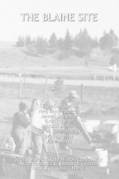
Mammoth Site 24<br />
Discovered by chance in 1974 during excavation for a housing development, the Mammoth<br />
Site is the world's largest Columbian mammoth exhibit and research center for Pleistocene studies.<br />
About 26,000 years ago, the Mammoth Site was a large sinkhole with warm artesian water and a<br />
muddy bottom. Lush vegetation grew along its banks even during cold weather. Mammoths entered<br />
the sinkhole to eat and drink. They could not climb the steep banks and were trapped. The sinkhole<br />
eventually filled up with sediment and hardened, preserving the mammoth bones. Scientists are still<br />
uncovering mammoth remains at the site. The remains <strong>of</strong> up to one hundred mammoths along with<br />
fossils other Ice Age animals may be uncovered. A climate-controlled building now covers the<br />
sinkhole.<br />
The majority <strong>of</strong> fossils at the Mammoth Site are from the North American Columbian<br />
mammoth. Columbian mammoths stood almost fourteen feet high at the shoulder and weighed up to<br />
ten tons. They ate 700 pounds <strong>of</strong> vegetation a day and could live up to eighty years. Fifty-two<br />
Columbian mammoths have been found at the Mammoth Site. The remains <strong>of</strong> three wooly<br />
mammoths have also been discovered, making the Mammoth Site the first place where both species<br />
were found together. Fossils from other Ice Age animals found at the Site include those <strong>of</strong> the camel,<br />
llama, giant short-faced bear, wolf, coyote, and prairie dog.<br />
Missouri River Dams and Reservoirs<br />
The Missouri River provided both benefits and problems for the people and communities<br />
nearby. Early transportation, from bullboats to steamboats, used the river to move people and goods.<br />
Spring floods regularly inundated the area, causing major damage. A plan to harness the river passed<br />
Congress in 1944. The Pick Sloan Plan built six dams across the Missouri to control flooding,<br />
generate electrical power and provide irrigation. Four <strong>of</strong> the great dams were built in <strong>South</strong> <strong>Dakota</strong>. 25<br />
Fort Randall Dam was the first built in the state, completed in 1954. Gavins Point Dam, near<br />
Yankton, was completed two years later. Oahe Dam, the largest <strong>of</strong> the Missouri River dams, was<br />
completed in 1962. It is one <strong>of</strong> the biggest rolled-earth dams in the world. Oahe Dam is 245 feet high<br />
with a 456-foot wide spillway. Big Bend Dam was the last <strong>of</strong> the four dams built in the state.<br />
Construction began in 1959 and the dam began operating in 1963.<br />
All four dams created large reservoirs. Walleye, sauger, smallmouth bass, white bass, channel<br />
catfish, and northern pike are some <strong>of</strong> the game fish found in the reservoirs. Building the dams has<br />
had both positive and negative effects. Millions <strong>of</strong> acres were lost to construction and the filling<br />
reservoirs. Tribal lands were especially hard hit. Some communities had to be relocated to avoid the<br />
rising water. Today, in addition to electricity, the dams provide good drinking water to many <strong>South</strong><br />
<strong>Dakota</strong> communities. Recreation along the river brings millions <strong>of</strong> dollars into the state each year.<br />
<strong>Places</strong> completely built by people<br />
Deadwood / Lead<br />
Few towns embody the spirit <strong>of</strong> the Wild West more than Deadwood. A gold strike along<br />
Whitewood Creek in 1875 brought hundreds <strong>of</strong> miners to the area. Deadwood Gulch, another stream<br />
near Whitewood, saw major mining activity as well. The area was soon called Deadwood. Two<br />
miners, Fred and Moses Manuel, began looking for the gold vein that was the source for the gold in<br />
the streams. They filed on what would become Homestake Mine in 1876. A year later, the Manuels<br />
sold their claims to George Hearst for $70,000. Hearst established Homestake Mining Company.<br />
24 Mammoth Site, The Mammoth Site <strong>of</strong> Hot Springs, SD, http://www.mammothsite.com.<br />
25 Martin Reuss and Charles Hendricks, U.S. Army Corps <strong>of</strong> Engineers Brief History,<br />
http://www.usace.army.mil/history/brief2.htm<br />
8
<strong>South</strong> <strong>Dakota</strong> <strong>Places</strong><br />
<strong>South</strong> <strong>Dakota</strong> <strong>State</strong> Historical Society Education Kit<br />
Deadwood was a wide-open mining town with a Wild West reputation fueled by gunfighting,<br />
gambling, and drinking. Notable character Wild Bill Hickok lived in Deadwood only a few weeks. A<br />
celebrated scout, lawman, and gunfighter, Hickok came to Deadwood to gamble. About a month after<br />
arriving, he was killed while playing poker in Saloon #10. 26<br />
By 1880, underground hard rock mining replaced placer or surface mining. With Homestake as a<br />
driving economic force, Lead became the second largest city in <strong>South</strong> <strong>Dakota</strong> by 1905. 27 Homestake<br />
provided the area with economic stability during the Great Depression <strong>of</strong> the 1930s. Homestake was<br />
closed entirely during World War II. Many miners left the area or joined the armed services. In turn,<br />
many businesses were forced to close and the town nearly became a ghost town. After World War II,<br />
gambling was made illegal in Deadwood.<br />
Homestake reopened following the war and economically sustained the area from 1950 to 1970.<br />
Lumbering provided economic growth as well. In the 1970s and 1980s, improved mining techniques<br />
and equipment reduced the number <strong>of</strong> workers needed to run the mine. Construction slowdowns hurt<br />
the lumber industry about the same time. Hard economic times hit Deadwood, especially during the<br />
winter months when tourism was slow.<br />
In 1986, Deadwood citizens began lobbying for legalized gaming to stimulate tourism. Two<br />
years later, <strong>South</strong> <strong>Dakota</strong> voters approved a constitutional amendment that allowed limited gambling<br />
in the city <strong>of</strong> Deadwood. The return <strong>of</strong> gambling helped Deadwood recapture some <strong>of</strong> its Wild West<br />
reputation and brightened its economic picture. The entire town <strong>of</strong> Deadwood was designated a<br />
National Historic Landmark. 28 The town’s extensive Victorian architecture is carefully preserved and<br />
stands as a link between the Wild West Deadwood <strong>of</strong> the 1800s and the community today.<br />
Dinosaur Park<br />
Today, seven dinosaurs look down on Rapid City from Dinosaur Park. The original five – the<br />
Apatosaurus (formerly called Brontosaurus), Tyrannosaurus Rex, Triceratops, Stegosaurus, and<br />
Anatotitan (formerly called Trachodon) – were built as a Works Progress Administration (WPA)<br />
project in the 1930s. The other two – the Protoceratops and the Dimetrodon – were added to the park<br />
years later. The Apatosaurus is the largest <strong>of</strong> the creatures, stretching over 80 feet. The sculptures<br />
are made <strong>of</strong> concrete on a framework <strong>of</strong> steel mesh over iron pipe.<br />
The original idea for the park came from Dr. C.C. O’Harra, president <strong>of</strong> the <strong>South</strong> <strong>Dakota</strong><br />
School <strong>of</strong> Mines and Technology in 1935. O’Harra had led early expeditions into the Badlands where<br />
dinosaur remains had been discovered. He hoped the sculptures in Dinosaur Park would help visitors<br />
connect with the prehistoric animals that had once lived in the area. 29 Dinosaur Park was placed on<br />
the National Register <strong>of</strong> Historic <strong>Places</strong> in 1990.<br />
<strong>South</strong> <strong>Dakota</strong> <strong>State</strong> Capitol<br />
<strong>South</strong> <strong>Dakota</strong> became a state in 1889. Pierre was the temporary capital. Being named the<br />
permanent capital would be an economic windfall for a community, so competition was intense.<br />
Elections were held in 1890 and again in 1904 to decide on the capital’s location. Pierre won both<br />
elections, beating out several other towns including Huron, Mitchell, and Watertown. 30<br />
26<br />
Adams Museum and House, Deadwood History: Legendary Characters & Notable People,<br />
http://www.adamsmuseumandhouse.org/answers/wildbill.html.<br />
27<br />
Bob Lee, ed., Gold, Gals, Guns, Guts: A History <strong>of</strong> Deadwood, Lead, and Spearfish, 1874-1976 (Pierre, SD: <strong>South</strong><br />
<strong>Dakota</strong> <strong>State</strong> Historical Society Press, 2004), 238.<br />
28<br />
City <strong>of</strong> Deadwood, History and Gaming & Historic Preservation, http://www.city<strong>of</strong>deadwood.com.<br />
29<br />
U.S. Department <strong>of</strong> Interior, National Register <strong>of</strong> Historic <strong>Places</strong> Application: Dinosaur Park, Section 7 Page 3.<br />
30<br />
SD <strong>State</strong> Archives, <strong>South</strong> <strong>Dakota</strong>: Land <strong>of</strong> Vision, The "Great Capitol Fight" <strong>of</strong> 1904,<br />
http://www.sdhistory.org/Exhibit4/arc_lov_capfight.htm.<br />
9
<strong>South</strong> <strong>Dakota</strong> <strong>Places</strong><br />
<strong>South</strong> <strong>Dakota</strong> <strong>State</strong> Historical Society Education Kit<br />
The permanent capitol was built between 1905 and 1910. The building is 114,000 square feet,<br />
161 feet tall, 190 feet wide and 292 feet long. Built in the Classic Revival style, it has handcrafted<br />
woodwork, brass, and stonework. The ornate rotunda dome features marble balustrades and<br />
columns, and stained-glass skylights. Artisans came from all over the world to work on the building.<br />
Italian workers laid the terrazzo tile floor. According to legend, each Italian worker was given a special<br />
blue stone to place somewhere in the capitol floor as their personal signature. Only 55 <strong>of</strong> the 66 blue<br />
stones have been found. 31 An annex was added to the north side <strong>of</strong> the capitol building in 1932.<br />
Other buildings have also been added over time. Today, there are sixteen buildings on the 115-acre<br />
capitol complex.<br />
Cultural Heritage Center<br />
The Cultural Heritage Center in Pierre houses the <strong>South</strong> <strong>Dakota</strong> <strong>State</strong> Historical Society. The<br />
center became the new home <strong>of</strong> the state museum and archives when the Soldiers’ and Sailors’<br />
Memorial Building was outgrown and environmentally inadequate to protect museum and archival<br />
collections. Planned as a project for <strong>South</strong> <strong>Dakota</strong>’s centennial in 1989, many towns lobbied to be the<br />
location for the Center. Pierre was chosen by the legislature because <strong>of</strong> its central location and the<br />
state capitol already being there. Completed in 1989, the 64,000 square foot Center’s underground<br />
design makes it very energy efficient. It features an impressive facade <strong>of</strong> Milbank granite. The<br />
Center’s grounds are covered in native prairie sod kept in its natural state.<br />
The Museum <strong>of</strong> the <strong>South</strong> <strong>Dakota</strong> <strong>State</strong> Historical Society is located in the Cultural Heritage Center.<br />
Its permanent exhibit The <strong>South</strong> <strong>Dakota</strong> Experience tells the story <strong>of</strong> <strong>South</strong> <strong>Dakota</strong> from prehistory up<br />
to modern times. Exhibit highlights include the Verendrye Plate, a lead plate buried by French-<br />
Canadian explorers in 1743 above Fort Pierre. A walk-through tipi, sod house, and 20 th -century<br />
bungalow are also featured. Visitors can listen to a creation story in Lakota, milk a model cow, watch<br />
clips from an early state fair and rodeo, and listen in on party-line telephone calls.<br />
DeSmet, the Little Town on the Prairie<br />
Author Laura Ingalls Wilder was twelve years old when her family moved to <strong>Dakota</strong> Territory<br />
from Walnut Grove, Minnesota in 1879. They moved to DeSmet, between Brookings and Huron,<br />
where Laura’s father, Charles, worked for the railroad. 32 The Ingalls homesteaded one mile south <strong>of</strong><br />
town. Five cottonwood trees that Pa Ingalls planted are still growing on the land. Several <strong>of</strong> Laura’s<br />
“Little House” books including, By the Shores <strong>of</strong> Silver Lake, Little Town on the Prairie and The Long<br />
Winter are set in DeSmet.<br />
In 1971, the Laura Ingalls Wilder Pageant Society began doing a pageant based on Laura’s<br />
books every summer. Visitors to DeSmet can tour the small surveyor’s house the family lived in<br />
during their first <strong>Dakota</strong> winter, and the Ingalls house built in 1887. The surveyor’s house went on the<br />
National Register <strong>of</strong> Historic <strong>Places</strong> in 1973. The Ingalls homestead was added to the register two<br />
years later.<br />
Petrified Wood Park<br />
Lemmon is a town with a petrified past. Located in northwestern <strong>South</strong> <strong>Dakota</strong>, the area had<br />
so much fossilized wood lying around that early residents thought little <strong>of</strong> it. A forest <strong>of</strong> huge Sequoia<br />
trees thrived in the area twenty million years ago. These trees could grow up to twenty feet in<br />
31 SD Bureau <strong>of</strong> Administration, On-Line Tour <strong>of</strong> the <strong>State</strong> Capitol,<br />
http://www.state.sd.us/state/capitol/capitol/tour/bltiles.htm<br />
32 Huron Daily Plainsman, “Laura Ingalls Wilder’s Autobiography Relates Life <strong>of</strong> S.D. Pioneers,” February 29, 1976.<br />
10
<strong>South</strong> <strong>Dakota</strong> <strong>Places</strong><br />
<strong>South</strong> <strong>Dakota</strong> <strong>State</strong> Historical Society Education Kit<br />
diameter and live hundreds <strong>of</strong> years. As the forest died, the wood in the trees gradually fused with<br />
sediment. The sediment hardened into rock, preserving the wood. 33<br />
Ole S. Quammen, an amateur geologist, began collecting pieces <strong>of</strong> petrified wood in 1919. He<br />
began building a tourist park from the wood in 1930. Men were employed hauling tons <strong>of</strong> petrified<br />
wood to the park site in Lemmon. The park eventually had over a hundred structures including a<br />
museum building, towers, castles, and pyramids. 34 The Petrified Park was added to the National<br />
Register <strong>of</strong> Historic <strong>Places</strong> in 1977.<br />
Wall Drug<br />
In 1931, Ted and Dorothy Hustead bought the drugstore in Wall on the outskirts <strong>of</strong> the Badlands.<br />
Little did they know that their store would become one <strong>of</strong> America’s top-ten tourist attractions. 35 Free<br />
ice water did the trick. In 1936, Dorothy suggested putting up signs along the highway advertising free<br />
ice water. Now thirsty travelers drink more than 5,000 free glasses <strong>of</strong> ice water a day during the<br />
summer. More than 250 people work at Wall Drug every summer, too. 36 Grown well beyond a simple<br />
drug store, Wall Drug features mechanical cowboys and a roaring Tyranosaurus Rex. Hundreds <strong>of</strong><br />
photographs line the walls. Visitors can buy western clothing, books, jewelry, and souvenirs.<br />
Corn Palace<br />
During the 1890s, Mitchell area farmers and business people wanted to attract new settlers to<br />
their area. In 1892, Mitchell built its first Corn Palace, decorated inside and out with corn, grain,<br />
grasses and straw. Mitchell also held a big fair, the Corn Belt Exposition, to show <strong>of</strong>f the Palace. It<br />
was so successful that it became an annual event. In 1905, the Exposition changed its name to the<br />
Corn Palace Festival, and a permanent building was constructed. The Moorish minarets and kiosks<br />
on the original building were restored in the 1930s. 37 Each year, the Corn Palace is redecorated with<br />
colored corn and other grains and native grasses. A theme is chosen and murals are designed to<br />
reflect that theme. The decorating starts in late May and the new murals are completed by October.<br />
Ears <strong>of</strong> corn are split in half and nailed in place to create the designs. The Corn Palace attracts about<br />
500,000 tourists each year. 38 It is also an auditorium used for sporting events, concerts, and other<br />
community events.<br />
Events<br />
Custer <strong>State</strong> Park and Buffalo Roundup<br />
Custer <strong>State</strong> Park covers 73,000 acres in the Black Hills. The park’s landscape has<br />
grasslands, foothills, and granite spires. Harney Peak, the highest point in <strong>South</strong> <strong>Dakota</strong> at 7,242<br />
feet, is located in the park. Scenic Needles Highway and Iron Mountain Road also wind through the<br />
park. The park is home to abundant wildlife including bison, pronghorn, and bighorn sheep. The<br />
park’s Wildlife Loop Road provides good animal viewing.<br />
One <strong>of</strong> Custer <strong>State</strong> Park’s most well known features is its bison herd. Started in 1914 with the<br />
purchase <strong>of</strong> 36 bison, the herd is kept to about 1,500 head today. During the park’s annual Buffalo<br />
Roundup in October, the bison are herded into corrals along Wildlife Loop Road. There, the handlers<br />
test, vaccinate, brand, and sort them. Most are released back into the park. Others are held for the<br />
33<br />
Gries, Roadside Geology, 112.<br />
34<br />
Lemmon, <strong>South</strong> <strong>Dakota</strong>, Lemmon’s Petrified Wood Park and Museum, http://www.lemmonsd.com/petrefied.html.<br />
35<br />
Ron Franscell, “Wall Drug remains a U.S. kitschy coup,” Denver Post, April 29, 2001, http://www.walldrug.com.<br />
36<br />
Ibid.<br />
37<br />
City <strong>of</strong> Mitchell, <strong>South</strong> <strong>Dakota</strong>, Corn Palace History, http://www.city<strong>of</strong>mitchell.org/palace/rent.htm.<br />
38 Ibid.<br />
11
<strong>South</strong> <strong>Dakota</strong> <strong>Places</strong><br />
<strong>South</strong> <strong>Dakota</strong> <strong>State</strong> Historical Society Education Kit<br />
annual auction in November. The roundup keeps the herd size down to a level that the park can<br />
support over the winter. 39<br />
Custer <strong>State</strong> Park is also the home to the <strong>State</strong> Game Lodge. This structure was built in 1920,<br />
and served as the “Summer White House” for President Calvin Coolidge in 1927. Another famous<br />
building in the park is the “Badger Hole”, the hand-built log cabin where Badger Clark, <strong>South</strong> <strong>Dakota</strong>’s<br />
first poet laureate lived.<br />
Sturgis Motorcycle Rally<br />
The Sturgis Motorcycle Rally is held annually in Sturgis, <strong>South</strong> <strong>Dakota</strong>. The first Rally, called the<br />
Black Hills Classic, was held in August 1938, and lasted two days. It had a lineup <strong>of</strong> only nine racers.<br />
The local motorcycle club, the Jackpine Gypsies, sponsored it. Clarence “Pappy” Hoel owned the<br />
Indian Motorcycle shop in Sturgis and is generally considered the founder <strong>of</strong> the Rally. The Rally has<br />
been held every year, except during World War II when gas rationing was in effect. The Jackpine<br />
Gypsies own the lighted short track, motocross track, field meet area, hillclimb area, clubhouse,<br />
<strong>of</strong>fice, and concession stand where Rally races are held. The Gypsies hold twelve events during the<br />
Rally including motocross racing, a 1/2 mile race, hill climbs, road tours and short track racing. 40 The<br />
Rally has grown from a simple racing event into a weeklong celebration with venders, concerts, and<br />
huge crowds. Attendance at the 2006 Rally topped 450,000. 41<br />
<strong>South</strong> <strong>Dakota</strong> <strong>State</strong> Fair<br />
Holding an annual exhibition <strong>of</strong> the agricultural products <strong>of</strong> <strong>South</strong> <strong>Dakota</strong> began even before<br />
statehood. The Territorial Legislature created a Board <strong>of</strong> Agriculture in 1885 with the purpose <strong>of</strong><br />
“forwarding the interests <strong>of</strong> agriculture, horticulture, manufacturing, and domestic arts.” 42 The fair was<br />
originally shifted between towns, with Huron, Aberdeen, Sioux Falls, Mitchell, and Yankton holding<br />
the fair between 1885 and 1905. Starting in 1905, Huron became the fair’s permanent home. The<br />
1905 fair in Huron featured political speeches, horse racing, and livestock exhibits. Over the years,<br />
many buildings on the fairgrounds were built, razed, and replaced as the fair and its exhibits grew. In<br />
1919, the first year 4-H was involved in the fair, they had 100 exhibits. The 2001 state fair had over<br />
18,000 4-H exhibits. 43<br />
Powwows<br />
A powwow or wacipi (wa-SEE-pee) in Lakota, brings people together to sing, dance, and make<br />
friends. Powwows are also a place to hold naming and honoring ceremonies and have giveaways.<br />
Drumming and dancing are at the heart <strong>of</strong> the powwow. A Drum consists <strong>of</strong> a group <strong>of</strong> men and<br />
women who sing together on a regular basis. At a powwow, a Drum can be joined by friends and the<br />
members <strong>of</strong> other Drums. Drum singing is high, with a heavy, pulsating rhythm. A good singer knows<br />
the song, keeps a steady beat, and plays the drum loud or s<strong>of</strong>t enough to mesh with the singing<br />
voices. Songs can be made up entirely <strong>of</strong> vocables, or syllables that carry the melody, or use native<br />
language words. Some songs use English words, too.<br />
Many different types <strong>of</strong> dances are performed at a powwow. Some dances have a long history,<br />
while others are recent innovations. At competition powwows, dancers compete with each other to<br />
win prize money. Four powwow dances are Men’s Traditional, Men’s Fancy Dance, Women’s<br />
39 SD Department <strong>of</strong> Game, Fish and Parks. “Tatanka: The Guide to <strong>South</strong> <strong>Dakota</strong>’s Custer <strong>State</strong> Park,” Volume 28,<br />
2007, 5. http://www.sdgfp.info/Publications/Parks/Tatanka.pdf.<br />
40 Jackpine Gypsies M/C, Jackpine Gypsies History, http://www.jackpinegypsies.com/history.htm<br />
41 67th Annual Sturgis Rally, Attendance statistics, http://www.sturgis.com/2kstats.html<br />
42 Susan Hayward, History: The <strong>South</strong> <strong>Dakota</strong> <strong>State</strong> Fair, unpublished document, December 1, 2006.<br />
43 Ibid.<br />
12
<strong>South</strong> <strong>Dakota</strong> <strong>Places</strong><br />
<strong>South</strong> <strong>Dakota</strong> <strong>State</strong> Historical Society Education Kit<br />
Traditional, and Women’s Jingle Dress Dance. Social dancing, where spectators can join in the<br />
dancing, is also part <strong>of</strong> the powwow. A Round Dance is a social dance. The <strong>Dakota</strong>, Nakota and<br />
Lakota people hold powwows throughout the year, many in the summer.<br />
Bibliography<br />
67th Annual Sturgis Rally. Attendance statistics. http://www.sturgis.com/2kstats.html.<br />
Adams Museum and House. Deadwood History: Legendary Characters & Notable People.<br />
http://www.adamsmuseumandhouse.org/answers/wildbill.html.<br />
City <strong>of</strong> Deadwood. History and Gaming & Historic Preservation. http://www.city<strong>of</strong>deadwood.com.<br />
City <strong>of</strong> Mitchell, <strong>South</strong> <strong>Dakota</strong>. Corn Palace History. http://www.city<strong>of</strong>mitchell.org/palace/rent.htm.<br />
City <strong>of</strong> Sioux Falls. Falls on the Big Sioux River. http://www.siouxfalls.org/Parks/Parks/Falls_Park.aspx.<br />
Franscell, Ron. “Wall Drug remains a U.S. kitschy coup.” Denver Post, April 29, 2001. http://www.walldrug.com.<br />
Gilbertson, Jay P. Glaciers in <strong>South</strong> <strong>Dakota</strong>. http://www.northern.edu/natsource/EARTH/Glacie1.htm.<br />
Gries, John Paul. Roadside Geology <strong>of</strong> <strong>South</strong> <strong>Dakota</strong>. Missoula, MT: Mountain Press Publishing Company, 1996.<br />
Hayward, Susan. History: The <strong>South</strong> <strong>Dakota</strong> <strong>State</strong> Fair. unpublished document, December 1, 2006.<br />
Hogan, Edward P. The Geography <strong>of</strong> <strong>South</strong> <strong>Dakota</strong>. Sioux Falls: Center for Western Studies, 1998.<br />
Huron Daily Plainsman. “Laura Ingalls Wilder’s autobiography relates life <strong>of</strong> S.D. pioneers.” February 29, 1976.<br />
Jackpine Gypsies M/C. Jackpine Gypsies History. http://www.jackpinegypsies.com/history.htm.<br />
Lee, Bob, ed. Gold, Gals, Guns, Guts: A History <strong>of</strong> Deadwood, Lead, and Spearfish, 1874-1976. Pierre, SD: <strong>South</strong> <strong>Dakota</strong><br />
<strong>State</strong> Historical Society Press, 2004.<br />
Lemmon, <strong>South</strong> <strong>Dakota</strong>. Lemmon’s Petrified Wood Park and Museum. http://www.lemmonsd.com/petrefied.html.<br />
Mammoth Site. The Mammoth Site <strong>of</strong> Hot Springs, SD. http://www.mammothsite.com.<br />
Pisarowicz, Jim. History <strong>of</strong> the Black Hills. http://www.nps.gov/wica/History_<strong>of</strong>_the_Black_Hills.htm.<br />
Reuss, Martin and Charles Hendricks. U.S. Army Corps <strong>of</strong> Engineers Brief History.<br />
http://www.usace.army.mil/history/brief2.htm.<br />
SD Bureau <strong>of</strong> Administration. On-Line Tour <strong>of</strong> the <strong>State</strong> Capitol.<br />
http://www.state.sd.us/state/capitol/capitol/tour/bltiles.htm.<br />
SD Game, Fish, and Parks. Sica Hollow <strong>State</strong> Park: Where Legends Come Alive.<br />
http://www.sdgfp.info/Parks/Regions/GlacialLakes/SicaHollow.htm.<br />
______ Palisades <strong>State</strong> Park. http://www.sdgfp.info/Parks/Regions/Heartland/Palisades.htm.<br />
______ “Tatanka: The Guide to <strong>South</strong> <strong>Dakota</strong>’s Custer <strong>State</strong> Park.” 28, (2007).<br />
http://www.sdgfp.info/Publications/Parks/Tatanka.pdf.<br />
SD <strong>State</strong> Archives. <strong>South</strong> <strong>Dakota</strong>: Land <strong>of</strong> Vision, The "Great Capitol Fight" <strong>of</strong> 1904.<br />
http://www.sdhistory.org/Exhibit4/arc_lov_capfight.htm.<br />
SD Tourism. Wind Cave National Park. http://www.mediasd.com/facts/windcave.asp.<br />
______ Jewel Cave National Monument. http://www.mediasd.com/facts/jewelcave.asp.<br />
______ Badlands National Park. http://www.mediasd.com/facts/badlands.asp.<br />
Stone, Clifton. The Missouri River. http://www.northern.edu/natsource/HABITATS/Missio1.htm.<br />
US Department <strong>of</strong> Agriculture. Rocky Mountain Region National Forests & Grasslands. U.S. Forest Service map, 2005.<br />
US Department <strong>of</strong> Interior. National Register <strong>of</strong> Historic <strong>Places</strong> Application: Dinosaur Park. Section 7.<br />
US Fish & Wildlife Service. Refuge List by <strong>State</strong>: <strong>South</strong> <strong>Dakota</strong>.<br />
http://www.fws.gov/refuges/pr<strong>of</strong>iles/By<strong>State</strong>.cfm?state=SD.<br />
13
<strong>South</strong> <strong>Dakota</strong> <strong>Places</strong><br />
<strong>South</strong> <strong>Dakota</strong> <strong>State</strong> Historical Society Education Kit<br />
Photograph List<br />
1. Needles Highway: The beauty <strong>of</strong> the Black Hills made them a natural draw for tourists. Needles<br />
Highway and Iron Mountain Road form part <strong>of</strong> the Peter Norbeck National Scenic Byway. Needles<br />
Highway runs through a landscape <strong>of</strong> tall granite spires. Workers used 150,000 pounds <strong>of</strong> dynamite<br />
to create the highway. Photo by <strong>South</strong> <strong>Dakota</strong> Tourism<br />
2. Iron Mountain Road: Peter Norbeck designed Iron Mountain Road to fit into the natural landscape<br />
<strong>of</strong> the Hills. The road doubles back on itself in pigtail loops as it climbs the mountain. Three tunnels<br />
along the road each <strong>of</strong>fer a framed view <strong>of</strong> Mount Rushmore. Photo by <strong>South</strong> <strong>Dakota</strong> Tourism<br />
3. Bear Butte: A volcano that never erupted, from the ground Bear Butte looks like a sleeping bear.<br />
Sacred ground to the Sioux and the Cheyenne, it is a site for prayer and meditation. Summit Trail<br />
takes hikers to the top <strong>of</strong> the butte where they can see four states. Photo by <strong>South</strong> <strong>Dakota</strong> Tourism<br />
4. Badlands: Erosion reveals layers <strong>of</strong> geological time in the Badlands. Each layer – red, purple,<br />
yellow – marks a different period in geological history. Although they may look barren, the Badlands<br />
are home to a wide variety <strong>of</strong> animals. The black-footed ferret has been successfully reintroduced into<br />
the wild in the Badlands. Photo by <strong>South</strong> <strong>Dakota</strong> Tourism<br />
5. Glacial Lakes: There are about 10,000 glacially created water basins in eastern <strong>South</strong> <strong>Dakota</strong>,<br />
ranging from large, deep lakes to small, shallow sloughs. They provide excellent waterfowl and fish<br />
habitat and good hunting and fishing. They also provide places for swimming, boating, hiking, and<br />
skiing. Photo by <strong>South</strong> <strong>Dakota</strong> Tourism<br />
6. Sica Hollow: In Sica Hollow, located in the northeast corner <strong>of</strong> the state, swamp gasses bubbling<br />
up from mud holes, stumps glowing in the dark, and gurgling waterfalls provide fodder for legends<br />
and superstitions. Sica Hollow became a state park in 1968. The park’s 807 acres <strong>of</strong> steep gullies are<br />
home to a rare hardwood forest and diverse wildlife. Photo by <strong>South</strong> <strong>Dakota</strong> Tourism<br />
7. Falls Park: The falls that give Sioux Falls its name are located in Falls Park. The Sioux Falls<br />
formed when a glacial dam broke upstream, releasing a flood that swept away huge chunks <strong>of</strong><br />
bedrock and creating a gorge with angular surfaces. At the falls, the Sioux River cascades over<br />
quartzite ledges and drops over 80 feet in less than a quarter <strong>of</strong> a mile. Photo by <strong>South</strong> <strong>Dakota</strong><br />
Tourism<br />
8. Devil’s Gulch: Outlaw Jesse James allegedly jumped his horse over the 20-foot gash between the<br />
sheer walls <strong>of</strong> Devil’s Gulch in 1876 when a posse from Northfield, MN was close behind. A<br />
footbridge lets visitors get a view <strong>of</strong> the supposed jump site near Garretson. <strong>South</strong> <strong>Dakota</strong> <strong>State</strong><br />
Archives<br />
9. Spirit Mound: Eight miles north <strong>of</strong> Vermillion stands a lone hill called Spirit Mound. In their<br />
journals, Lewis and Clark tell about climbing the hill. The Yankton people had told them about it,<br />
warning them that small devils lived on the hill. Lewis and Clark saw no devils, but did get a<br />
spectacular view <strong>of</strong> the surrounding prairie with its abundant wildlife. In 2001, Spirit Mound became a<br />
state park. The area around the mound has been restored to native prairie, and a walking trail takes<br />
visitors to the top. Photo by <strong>South</strong> <strong>Dakota</strong> Tourism<br />
14
<strong>South</strong> <strong>Dakota</strong> <strong>Places</strong><br />
<strong>South</strong> <strong>Dakota</strong> <strong>State</strong> Historical Society Education Kit<br />
10. Mount Rushmore: George Washington, Thomas Jefferson, Abraham Lincoln, and Theodore<br />
Roosevelt look down from the top <strong>of</strong> Mount Rushmore. Carved between 1927 and 1941, the 60-foot<br />
faces are visited by thousands <strong>of</strong> people every year. Photo by <strong>South</strong> <strong>Dakota</strong> Tourism<br />
11. Drilling on Rushmore: Jack Payne, a middleweight boxer, worked as a driller on Mount<br />
Rushmore. Here Payne works on Teddy Roosevelt’s head. Thomas Jefferson’s pr<strong>of</strong>ile is visible<br />
behind him. Photo by C. E. Bell, 1937. <strong>South</strong> <strong>Dakota</strong> <strong>State</strong> Archives<br />
12. Mount Rushmore workers: Workers pose for the camera in front <strong>of</strong> Mount Rushmore, ca. 1940.<br />
From 1927 to 1941, about 400 people worked on the project. No lives were lost during the<br />
construction. Photo by C.E. Bell, c. 1940. <strong>South</strong> <strong>Dakota</strong> <strong>State</strong> Archives<br />
13. Mammoth Site: The Mammoth Site in Hot Springs is the world’s largest Columbian mammoth<br />
exhibit. 26,000 years ago, mammoths and other animals were trapped in a sinkhole. The bones <strong>of</strong> 52<br />
Columbian mammoths have been discovered at the Mammoth Site. Photo by <strong>South</strong> <strong>Dakota</strong> Tourism<br />
14. Oahe Dam: Oahe Dam is named for the Lakota Oahe Indian Mission built in the area in 1874.<br />
The waters <strong>of</strong> Lake Oahe have covered the original mission site. Completed in 1962, Oahe Dam<br />
produces 700,000 kilowatts <strong>of</strong> electrical power. Lake Oahe is the fourth-largest manmade reservoir in<br />
the United <strong>State</strong>s. It has more than 2,250 miles <strong>of</strong> shoreline. Photo by <strong>South</strong> <strong>Dakota</strong> Tourism<br />
15. Dinosaur Park: Giant prehistoric creatures stand on a hillside overlooking Rapid City. Dinosaur<br />
Park was built in the 1930s as a WPA project. The original five dinosaurs – an Apatosaurus (formerly<br />
Brontosaurus), Tyrannosaurus Rex, Triceratops, Stegosaurus, and Anatotitan (formerly Trachadon)<br />
were joined in more recent years by a Protoceratops and a Dimetrodon. <strong>South</strong> <strong>Dakota</strong> Historic<br />
Preservation Office<br />
16. <strong>South</strong> <strong>Dakota</strong> Capitol: Completed in 1910, the <strong>South</strong> <strong>Dakota</strong> Capitol was 114,000 square feet.<br />
Its Classic Revival style included an ornate rotunda dome with stained-glass skylights. Photo by<br />
<strong>South</strong> <strong>Dakota</strong> Tourism<br />
17. Capitol: This 1911 photograph <strong>of</strong> the back <strong>of</strong> the Capitol building shows the symmetry and<br />
balance in its Classic Revival architecture. Western Architect, April 1911. <strong>South</strong> <strong>Dakota</strong> <strong>State</strong><br />
Archives<br />
18: Interior <strong>of</strong> the Capitol: In December, Christmas decorations and a Hall <strong>of</strong> Trees go up in the<br />
Capitol. Work had begun in 1977 to bring the Capitol back to its original 1910 look. Restoration was<br />
completed in 1989 for the state’s centennial. Photo by <strong>South</strong> <strong>Dakota</strong> Tourism<br />
19. Cultural Heritage Center: The Cultural Heritage Center in Pierre houses the <strong>South</strong> <strong>Dakota</strong> <strong>State</strong><br />
Historical Society. Built in 1989, the 64,000 square foot structure’s underground design makes it very<br />
energy efficient. It has facade <strong>of</strong> Milbank granite. The Center’s grounds are covered in native prairie<br />
sod. Photo by <strong>South</strong> <strong>Dakota</strong> Tourism<br />
15
<strong>South</strong> <strong>Dakota</strong> <strong>Places</strong><br />
<strong>South</strong> <strong>Dakota</strong> <strong>State</strong> Historical Society Education Kit<br />
20. DeSmet: Several <strong>of</strong> Laura Ingalls Wilder’s “Little House” books including Little Town on the<br />
Prairie and The Long Winter are set in DeSmet. The Ingalls homesteaded one mile south <strong>of</strong> town.<br />
Cottonwood trees that Pa Ingalls planted are still growing on the land. In 1971, the Laura Ingalls<br />
Wilder Pageant Society began doing a pageant based on Laura’s books every summer.<br />
Photo by <strong>South</strong> <strong>Dakota</strong> Tourism<br />
21. Mitchell Corn Palace, 1975: Decorations on the outside <strong>of</strong> the Corn Palace in 1975 focused on<br />
the fine arts. The building’s onion-shaped domes give it a unique look. <strong>South</strong> <strong>Dakota</strong> <strong>State</strong> Archives<br />
22. Corn Palace, 2003: The Corn Palace’s colorful murals on the outside <strong>of</strong> the building are changed<br />
most years. Ears <strong>of</strong> corn are split in half and nailed in place to create the designs. With a theme <strong>of</strong><br />
Scenic <strong>South</strong> <strong>Dakota</strong>, the 2003 murals included a rodeo scene, grazing cattle, and wildlife.<br />
Photo by <strong>South</strong> <strong>Dakota</strong> Tourism<br />
23. Fort Sisseton: Fort Sisseton, originally called Fort Wadsworth, was built in 1864 to watch over<br />
the Santee Sioux following the Minnesota Uprising <strong>of</strong> 1862. The army closed the fort in 1888. In<br />
recent years, Fort Sisseton became a state historical park and a National Historic Landmark. It has<br />
been restored to its 1880s frontier fort look. Photo by <strong>South</strong> <strong>Dakota</strong> Tourism<br />
24. Custer Buffalo Roundup: Every October since 1914 the buffalo in Custer <strong>State</strong> Park are<br />
rounded up. Herded into corrals, the buffalo are tested for disease, vaccinated, and branded. Most<br />
are released back into the park. Others are sold at auction. The roundup keeps the herd size to about<br />
1,500. Photo by <strong>South</strong> <strong>Dakota</strong> Tourism<br />
25. Sturgis Motorcycle Rally: Held every summer in Sturgis, the Rally draws thousands <strong>of</strong><br />
motorcycle riders from all over the world. The first Rally held in 1938 featured nine racers with a small<br />
audience to cheer them on. Today, the Rally draws over 450,000 each year. Motorcycles line the<br />
streets <strong>of</strong> Sturgis and other Black Hills towns during Rally week. Photo by <strong>South</strong> <strong>Dakota</strong> Tourism<br />
26. <strong>State</strong> Fair: In 1905, Huron became the permanent home <strong>of</strong> the <strong>South</strong> <strong>Dakota</strong> <strong>State</strong> Fair. Every<br />
summer the state fair gives 4-H members and others a forum to display projects and livestock.<br />
Midway rides and fair food add to the fun. Photo by <strong>South</strong> <strong>Dakota</strong> Tourism<br />
27. Powwow: A powwow or wacipi brings people together to sing, dance, and make friends. Many<br />
different types <strong>of</strong> dances are performed at a powwow, including fancy dances, traditional dances, and<br />
social dances. Powwows are held throughout the state each summer. Photo by <strong>South</strong> <strong>Dakota</strong><br />
Tourism<br />
16
<strong>South</strong> <strong>Dakota</strong> <strong>Places</strong><br />
<strong>South</strong> <strong>Dakota</strong> <strong>State</strong> Historical Society Education Kit<br />
Word Find<br />
Name_________________<br />
Z B L V P R Y S M B X A W U O R<br />
P I R C I Z C R A Z Y H O R S E<br />
P L O O T O K Y M P K S D K X F<br />
O R E I Z P R C M T R B E D O U<br />
S I C A H O L L O W T A V C B G<br />
Q T W U D U A N T R C D I O N E<br />
H M U B W T S K H Q B L X R M S<br />
C W H R D N R E U I Y A T N I Z<br />
U I G Y G R W X B G H N E P L E<br />
I N C A P I T O L C I D Z A B S<br />
X P U L K A S R P W O S U L A D<br />
K Y G F R Z L E M M O N Z A N O<br />
M O Z Z A P A I G Y S H Y C K Z<br />
C F O R T S I S S E T O N E E G<br />
P J Z O R N T E W A P U E F Y I<br />
X O B T W N M V R W D R F N T D<br />
D Q F A L L S P A R K E Z S D O<br />
B N C M E I W K C K E T S W I M<br />
K Z Q P M E Y P T J B O V I K S<br />
Sica Hollow<br />
Lemmon<br />
Lead<br />
Palisades<br />
Corn Palace<br />
Fort Sisseton<br />
Crazy Horse<br />
Refuges<br />
Prairie<br />
Pierre<br />
Badlands<br />
Mammoth<br />
Capitol<br />
Falls Park<br />
Milbank<br />
Sturgis<br />
17
<strong>South</strong> <strong>Dakota</strong> <strong>Places</strong><br />
<strong>South</strong> <strong>Dakota</strong> <strong>State</strong> Historical Society Education Kit<br />
Word Find Key<br />
Z B L V P R Y S M B X A W U O R<br />
P I R C I Z C R A Z Y H O R S E<br />
P L O O T O K Y M P K S D K X F<br />
O R E I Z P R C M T R B E D O U<br />
S I C A H O L L O W T A V C B G<br />
Q T W U D U A N T R C D I O N E<br />
H M U B W T S K H Q B L X R M S<br />
C W H R D N R E U I Y A T N I Z<br />
U I G Y G R W X B G H N E P L E<br />
I N C A P I T O L C I D Z A B S<br />
X P U L K A S R P W O S U L A D<br />
K Y G F R Z L E M M O N Z A N O<br />
M O Z Z A P A I G Y S H Y C K Z<br />
C F O R T S I S S E T O N E E G<br />
P J Z O R N T E W A P U E F Y I<br />
X O B T W N M V R W D R F N T D<br />
D Q F A L L S P A R K E Z S D O<br />
B N C M E I W K C K E T S W I M<br />
K Z Q P M E Y P T J B O V I K S<br />
Sica Hollow<br />
Lemmon<br />
Lead<br />
Palisades<br />
Corn Palace<br />
Fort Sisseton<br />
Crazy Horse<br />
Refuges<br />
Prairie<br />
Pierre<br />
Badlands<br />
Mammoth<br />
Capitol<br />
Falls Park<br />
Milbank<br />
Sturgis<br />
18
<strong>South</strong> <strong>Dakota</strong> <strong>Places</strong><br />
<strong>South</strong> <strong>Dakota</strong> <strong>State</strong> Historical Society Education Kit<br />
6<br />
7<br />
1<br />
5<br />
Down:<br />
1. This scenic highway winds its way<br />
through skinny rocks in the Black Hills.<br />
2. ______ Park has concrete sculptures <strong>of</strong><br />
pre-historic creatures.<br />
3. The _____River runs down the middle <strong>of</strong><br />
the state.<br />
4. ______ Mine produced more gold than<br />
any other single gold mine in the U.S.<br />
5. _____ is the state capital <strong>of</strong> SD.<br />
9<br />
Crossword Puzzle<br />
Word List:<br />
2 4<br />
8<br />
3<br />
10<br />
Name_______________<br />
Deadwood Needles Missouri Homestake Dinosaur Bear Pierre Spearfish Mitchell glacial<br />
Across:<br />
6. ____ was a “Wild West” town.<br />
7. This canyon got its name from one<br />
method the Indians used to capture fish.<br />
8. ______ is the home <strong>of</strong> the Corn Palace.<br />
9. Large ice sheets left behind____lakes.<br />
10. ____ Butte is holy ground to the<br />
Cheyenne and Sioux Indians.<br />
19
<strong>South</strong> <strong>Dakota</strong> <strong>Places</strong><br />
<strong>South</strong> <strong>Dakota</strong> <strong>State</strong> Historical Society Education Kit<br />
1<br />
N<br />
Crossword Puzzle Key<br />
E<br />
E 2 4<br />
6 D E A D W O O D H<br />
L I 3 O<br />
E N M M<br />
S O 8 M I T C H E L L<br />
5 S S S<br />
7 S P E A R F I S H T<br />
I U O A<br />
E R U K<br />
R R 10 B E A R<br />
R<br />
E<br />
9 G L A C I A L<br />
Down:<br />
1. This scenic highway winds its way<br />
through skinny rocks in the Black Hills.<br />
2. ______ park has concrete sculptures <strong>of</strong><br />
pre-historic creatures.<br />
3. The _____River runs down the middle <strong>of</strong><br />
the state.<br />
4. ______ Mine produced more gold than<br />
any other single gold mine in the U.S.<br />
5. _____ is the state capital <strong>of</strong> SD.<br />
Word List:<br />
Deadwood Needles Missouri Homestake Dinosaur Bear Pierre Spearfish Mitchell Glacial<br />
Across:<br />
6. ____ was a “Wild West” town.<br />
7. This canyon got its name from one<br />
method the Indians used to capture fish.<br />
8. ______ is the home <strong>of</strong> the Corn Palace.<br />
9. Large ice sheets left behind ____lakes.<br />
10. ____ Butte is holy ground to the<br />
Cheyenne and Sioux Indians.<br />
20
<strong>South</strong> <strong>Dakota</strong> <strong>Places</strong><br />
<strong>South</strong> <strong>Dakota</strong> <strong>State</strong> Historical Society Education Kit<br />
<strong>State</strong> Symbols Word Scramble<br />
Pasque Triceratops Black Hills Spruce Honey bee Walleye Pheasant Coyote Kuchen<br />
1. The <strong>South</strong> <strong>Dakota</strong> state flower is sometimes called the May Day flower. Its bloom is one <strong>of</strong> the first<br />
signs <strong>of</strong> springtime on the plains. S E Q A P U<br />
___ ___ ___ ___ ___ ___<br />
1<br />
2. The state dessert was “cake” to <strong>South</strong> <strong>Dakota</strong>’s German immigrants. H E N U C K<br />
___ ___ ___ ___ ___ ___<br />
2 7<br />
3. You can hear the state animal howl and yip at night, especially in the spring. E Y C O O T<br />
___ ___ ___ ___ ___ ___<br />
8<br />
4. This creature had three horns. It lived 68 million years ago. It was named state fossil in 1988.<br />
C I T R O P A S T E R<br />
___ ___ ___ ___ ___ ___ ___ ___ ___ ___ ___<br />
4<br />
5. The largest member <strong>of</strong> the perch family became state fish <strong>of</strong> <strong>South</strong> <strong>Dakota</strong> in 1982. Many anglers<br />
come to the state each year for this fish. Y E L E L A W<br />
___ ___ ___ ___ ___ ___ ___<br />
6<br />
6. <strong>South</strong> <strong>Dakota</strong> shares a state insect with several other states. It helps pollinate crops and makes<br />
honey. N E H O Y E E B<br />
___ ___ ___ ___ ___ ___ ___ ___<br />
3<br />
7. The tree that makes the Black Hills look black from a distance became our state tree in 1947.<br />
C A B L K S L I H L C E S P R U<br />
___ ___ ___ ___ ___ ___ ___ ___ ___ ___ ___ ___ ___ ___ ___ ___<br />
5<br />
Fill in the letters from the numbered spaces above to help find the answer below.<br />
8. The <strong>South</strong> <strong>Dakota</strong> state bird originated in Asia. Two farmers near Doland released some <strong>of</strong> these<br />
birds on their farms in 1908. They did so well in <strong>South</strong> <strong>Dakota</strong> they became the state bird in 1943.<br />
E P A S H N A T<br />
___ ___ ___ ___ ___ ___ ___ ___<br />
1 2 3 4 5 6 7 8<br />
21
<strong>South</strong> <strong>Dakota</strong> <strong>Places</strong><br />
<strong>South</strong> <strong>Dakota</strong> <strong>State</strong> Historical Society Education Kit<br />
<strong>State</strong> Symbols Word Scramble Key<br />
Pasque Triceratops Black Hills Spruce Honey Bee Walleye Pheasant Coyote Kuchen<br />
1. The <strong>South</strong> <strong>Dakota</strong> state flower is sometimes called the May Day flower. Its bloom is one <strong>of</strong> the first<br />
signs <strong>of</strong> springtime on the plains. S E Q A P U<br />
P A S Q U E<br />
1<br />
2. The state dessert was “cake” to <strong>South</strong> <strong>Dakota</strong>’s German immigrants. H E N U C K<br />
K U C H E N<br />
2 7<br />
3. You can hear the state animal howl and yip at night, especially in the spring. E Y C O O T<br />
C O Y O T E<br />
8<br />
4. This creature had three horns. It lived 68 million years ago. It was named state fossil in 1988.<br />
C I T R O P A S T E R<br />
T R I C E R A T O P S<br />
4<br />
5. The largest member <strong>of</strong> the perch family became state fish <strong>of</strong> <strong>South</strong> <strong>Dakota</strong> in 1982. Many anglers<br />
come to the state each year for this fish. Y E L E L A W<br />
W A L L E Y E<br />
6<br />
6. <strong>South</strong> <strong>Dakota</strong> shares a state insect with several other states. It helps pollinate crops and makes<br />
honey. N E H O Y E E B<br />
H O N E Y B E E<br />
3<br />
7. The tree that makes the Black Hills look black from a distance became our state tree in 1947.<br />
C A B L K S L I H L C E S P R U<br />
BLACK HILLS S P R U C E<br />
5<br />
Fill in the letters from the numbered spaces above to find the answer below.<br />
8. The <strong>South</strong> <strong>Dakota</strong> state bird originated in Asia. Two farmers near Doland released some <strong>of</strong> these<br />
birds on their farms in 1908. They did so well in <strong>South</strong> <strong>Dakota</strong> they became the state bird in 1943.<br />
E P A S H N A T<br />
P H E A S A N T<br />
1 2 3 4 5 6 7 8<br />
22
<strong>South</strong> <strong>Dakota</strong> <strong>Places</strong><br />
<strong>South</strong> <strong>Dakota</strong> <strong>State</strong> Historical Society Education Kit<br />
Learning from Objects<br />
Objectives:<br />
• Participants will examine objects.<br />
• Participants will draw conclusions based on direct observation.<br />
• Participants will recognize that much information can be acquired about an object from direct<br />
observation.<br />
<strong>South</strong> <strong>Dakota</strong> Social Studies Standards<br />
K 1st 2nd 3rd 4th 5th 6th<br />
K.E.1.2<br />
1.E.1.1<br />
2.US.1.2<br />
2.US.2.1<br />
2.E.1.1<br />
3.E.1.1 4.W.2.1<br />
5.US.1.1<br />
5.W.1.1<br />
6.W.1.1<br />
6.E.1.1<br />
<strong>South</strong> <strong>Dakota</strong> Communication Arts Standards<br />
K 1st 2nd 3rd 4th 5th 6th<br />
K.LVS.1.2<br />
K.LVS.1.6<br />
1.LVS.1.2<br />
1.LVS.1.6<br />
2.LVS.1.2<br />
2.LVS.1.4<br />
2.LVS.1.5<br />
2.LVS.1.6<br />
3.LVS.1.1<br />
3.LVS.1.2<br />
3.LVS.1.3<br />
3.LVS.1.4<br />
4.LVS.1.1<br />
4.LVS.1.3<br />
5.LVS.1.1<br />
5.LVS.1.2<br />
5.LVS.1.3<br />
6.LVS.1.2<br />
6.LVS.1.3<br />
<strong>South</strong> <strong>Dakota</strong> Science Standards<br />
K 1st 2nd 3rd 4th 5th 6th<br />
K.P.1.1<br />
Timeframe: 30-60 minutes<br />
Materials:<br />
Included in kit<br />
All objects<br />
Object Identification Sheet<br />
2.P.1.1<br />
3.P.1.1<br />
3.E.1.2<br />
Why Learn from Objects?<br />
There are many way to learn about the world. One way is to listen and hear information – auditory<br />
learning. Another way to get information is by reading, watching a TV or video program, or looking at<br />
photographs – visual learning. This kit lets participants learn in another important way – by handling<br />
three-dimensional objects. This develops kinesthetic skills, or learning by touch. Participants can see<br />
physically how objects are alike and how they are different. They can consider what use an object<br />
may have – is it a stand-in for something, like a live animal or a physical place? Is it an object that<br />
was made or used by people from a different culture? The kit’s written information, photographs and<br />
three-dimensional objects allow participants to practice all three learning styles.<br />
23
<strong>South</strong> <strong>Dakota</strong> <strong>Places</strong><br />
<strong>South</strong> <strong>Dakota</strong> <strong>State</strong> Historical Society Education Kit<br />
Activity Steps:<br />
1. Arrange the participants so that it is easy to pass objects from one to another. Pass the objects<br />
around one at a time, allowing the participants to handle and examine them.<br />
2. While the participants are examining the objects, use the points below to start discussion about<br />
the materials, construction and history <strong>of</strong> the objects. Encourage the participants to share the<br />
visual and tactile information they get from the objects. You may ask each participant to consider<br />
a different aspect <strong>of</strong> the object-history, material, etc. Have the participants respond so the entire<br />
group can hear and enter into the discussion.<br />
3. After an object has been examined, share the information found on the Object Identification Sheet<br />
with the group.<br />
Materials & Construction:<br />
- What material is the object made out <strong>of</strong>? (wood, paper, plastic, rubber, metal, fabric, feathers,<br />
straw)<br />
-Is the material made by man or by nature?<br />
-If it is natural, has it been changed by people? (carved, cast, molded, glued, sewed)<br />
- Is the object sturdy or fragile?<br />
- Is the object light or heavy?<br />
- Is the object hard or s<strong>of</strong>t?<br />
- How would you describe the texture <strong>of</strong> the surface <strong>of</strong> the object?<br />
History & Function:<br />
- What might be the purpose <strong>of</strong> the object?<br />
- Why might it be included in the kit? What might the object be trying to show?<br />
- Does the object look or feel like something from long ago, or is it something from recent times?<br />
- Is this object still used today?<br />
- What has changed about the object today?<br />
- Was the object used for a special task or occasion or was it an everyday item?<br />
- What questions do you have about the object?<br />
- Where could you find the answers to your questions?<br />
24
<strong>South</strong> <strong>Dakota</strong> <strong>Places</strong><br />
<strong>South</strong> <strong>Dakota</strong> <strong>State</strong> Historical Society Education Kit<br />
Object Identification Sheet<br />
Kit 1<br />
T-2007-001<br />
Wall Drug glass: Wall Drug is one <strong>of</strong> the top tourist attractions in America. In 1936, during the<br />
Great Depression, Wall Drug advertised free ice water to highway travelers. Today, it serves more<br />
than 5,000 glasses <strong>of</strong> ice water each summer day. Visitors can buy books, jewelry, and souvenirs like<br />
this glass to remember their Wall Drug stop.<br />
T-2007-003<br />
Mount Rushmore model: Mount Rushmore is one <strong>of</strong> the most recognizable monuments in<br />
the world. Carved on the granite mountain from 1927 to 1941, four U.S. presidents – George<br />
Washington, Thomas Jefferson, Abraham Lincoln, and Theodore Roosevelt – look down on<br />
thousands <strong>of</strong> visitors. Over 450,000 tons <strong>of</strong> stone was blasted and drilled to form the four 60-foot<br />
faces.<br />
T-2007-033<br />
Wooly mammoth figurine: The Mammoth Site in Hot Springs is a Columbian mammoth<br />
exhibit and research center. 26,000 years ago, the Mammoth Site was a large sinkhole that attracted<br />
mammoths with lush vegetation. They went into the sinkhole to eat, but could not climb the steep<br />
banks to get out. The sinkhole eventually filled up with sediment and hardened, preserving the<br />
mammoth bones. Scientists uncover the mammoth fossils. Most fossils are from the North American<br />
Columbian mammoth. Fossils from three wooly mammoths, like this figurine, have been found as<br />
well. The Mammoth Site was one <strong>of</strong> the first places where both species were found together.<br />
T-2007-005<br />
Mammoth tooth replica: Mammoths had four teeth, two upper and two lower. They chewed<br />
about 500 pounds <strong>of</strong> vegetation every day. As one set <strong>of</strong> teeth wore out, another would push forward<br />
and replace the worn ones. Mammoths had six sets <strong>of</strong> teeth over their lifetime. At the Mammoth Site<br />
in Hot Springs, scientists uncover and study mammoth fossils, including their teeth. This replica tooth<br />
is made from lightweight polyfoam.<br />
T-2007-063, 065<br />
Mammoth tusk fossil samples: Like an elephant’s tusks, a mammoth’s tusks grew its entire<br />
life. Tusks were made <strong>of</strong> layers <strong>of</strong> dentin. By studying how fast the tusk layers grew, scientists<br />
learned how well a mammoth was eating. Layers <strong>of</strong> tusk dentin grew thicker in the summer when<br />
food was plentiful and thinner in the winter when food was scarce. These samples are layers from<br />
tusks.<br />
T-2007-007<br />
Crazy Horse scale model: Korczak Ziolkowski began carving Crazy Horse in 1948. Lakota<br />
elders chose Crazy Horse for the carving because he symbolized American Indian spirit, pride and<br />
courage. To make Crazy Horse’s head, over seven million tons <strong>of</strong> rock had to be moved. All four <strong>of</strong><br />
the faces on Mount Rushmore would fit inside Crazy Horse’s head.<br />
25
<strong>South</strong> <strong>Dakota</strong> <strong>Places</strong><br />
<strong>South</strong> <strong>Dakota</strong> <strong>State</strong> Historical Society Education Kit<br />
T-2007-009<br />
Little Town on the Prairie book: Laura Ingalls Wilder moved to <strong>Dakota</strong> Territory in 1879,<br />
when she was twelve years old. The Ingalls family homesteaded south <strong>of</strong> DeSmet. Some <strong>of</strong> the<br />
cottonwood trees that Pa Ingalls planted still grow there. When Laura grew up, she became an author<br />
and wrote books about her childhood. Several <strong>of</strong> Laura’s “Little House” books, including Little Town<br />
on the Prairie, are set in DeSmet.<br />
Fish molds are used for the “Something Fishy” kit activity:<br />
T-2007-011<br />
Northern pike fish mold: Northern pike are a sport fish found all over <strong>South</strong> <strong>Dakota</strong>. They live<br />
in lakes, rivers, and ponds. Northerns usually eat fish, but sometimes they eat small birds and<br />
mammals, too.<br />
T-2007-013<br />
Carp fish mold: Carp were introduced to the U.S. in the 1800s as a food fish. Today, they can<br />
be found everywhere. They live in lakes and streams all over <strong>South</strong> <strong>Dakota</strong>. Carp are bottom feeders,<br />
eating insects and green plants. They can get up to 50 pounds.<br />
T-2007-015<br />
Walleye fish mold: Walleye live all over <strong>South</strong> <strong>Dakota</strong>. They are the largest member <strong>of</strong> the<br />
perch family and can get up to 15 pounds. Walleye are the state fish <strong>of</strong> <strong>South</strong> <strong>Dakota</strong>. This rubber<br />
walleye mold is used for the “Something Fishy” kit activity.<br />
T-2007-017<br />
Bluegill fish mold: Bluegill have been stocked into lakes and ponds all across <strong>South</strong> <strong>Dakota</strong>.<br />
They like standing water with lots <strong>of</strong> weeds or flooded trees in it. They eat insects, larvae, and algae.<br />
Bluegill males build nests on the sand or gravel at the bottom <strong>of</strong> a lake for the female to lay her eggs<br />
in. The males guard the eggs.<br />
T-2007-019<br />
Perch fish mold: Perch are common throughout the state. They eat small fish, insects, snails<br />
and crayfish. Fish feed in deep water, but move into shallow water during the evening. Popular with<br />
anglers, perch can get up to 2 pounds.<br />
T-2007-085<br />
Rainbow trout fish mold: Rainbow trout are not native to <strong>South</strong> <strong>Dakota</strong>. They have been<br />
stocked in the Missouri River system and Black Hills lakes and ponds. Trout are a good food fish.<br />
Most <strong>of</strong> the trout populations in the state are maintained by stocking, not by natural reproduction.<br />
26
<strong>South</strong> <strong>Dakota</strong> <strong>Places</strong><br />
<strong>South</strong> <strong>Dakota</strong> <strong>State</strong> Historical Society Education Kit<br />
Animal track molds, turtle shell, and animal figurines are used for the “Where Does <strong>South</strong> <strong>Dakota</strong><br />
Wildlife Live?” activity<br />
T-2007-021<br />
Muskrat track mold: Adult muskrats look like small beavers. They are great swimmers.<br />
Muskrats can be trapped for their fur. They live in lodges made <strong>of</strong> sticks and mud. These rubber track<br />
molds are <strong>of</strong> the front and back feet <strong>of</strong> a muskrat. The small track is the front foot.<br />
T-2007-023<br />
Pronghorn track mold: Pronghorns are the fastest animal in North America. They can run 60<br />
miles per hour. Pronghorns are brown with white rumps and bellies. If they sense danger, the white<br />
hair on their rump stands up. Pronghorns eat sagebrush and flowering plants. Their tracks are about<br />
2 ½ to 3 inches long and wider at the base than deer tracks. No dewclaws are evident.<br />
T-2007-083<br />
Mule deer track mold: Mule deer are tan with long ears like a mule. They have a distinctive<br />
jump where all four feet come down together. Mule deer can change direction in a single jump. They<br />
bed down during the day and browse on grass at night. Their ho<strong>of</strong> print looks like two paisley shapes<br />
facing one another with small "dots" <strong>of</strong> the dewclaws at the wider end <strong>of</strong> these paisleys.<br />
T-2007-080<br />
Turtle shell: <strong>South</strong> <strong>Dakota</strong> is home to a variety <strong>of</strong> turtles. In Lakota, turtles are called keya.<br />
They show up <strong>of</strong>ten in stories and beadwork. Painted turtles are found all over the state. They bask in<br />
the sun on logs or rocks. Painted turtles pull into their shells for protection. They eat aquatic plants,<br />
insects, and small fish. In winter, they bury themselves in marshy mud and hibernate.<br />
T-2007-025<br />
Black-footed ferret figurine: Once believed to be extinct, black-footed ferrets are the most<br />
endangered mammal in North America. The Badlands are the top site in the country for their<br />
reintroduction into the wild. Small but quick, ferrets eat prairie dogs. They live in prairie dog dens.<br />
T-2007-027<br />
Coyote figurine: The state animal <strong>of</strong> <strong>South</strong> <strong>Dakota</strong>, coyotes once lived west <strong>of</strong> the Missouri<br />
River. Today, they can be found all across the state. Their howls, yips and barks can be heard at<br />
night, especially in the spring. Coyotes look like bushy-tailed dogs. They will eat almost anything, but<br />
prefer rodents and rabbits.<br />
T-2007-029<br />
Prairie dog figurine: Prairie dogs are rodents that bark. They are social animals that live<br />
together in prairie dog “towns.” The towns are made up <strong>of</strong> underground tunnels. Prairie dogs groom<br />
one another and click their teeth to greet each other. They eat plants, and sometimes insects.<br />
T-2007-031<br />
Porcupine figurine: Porcupines are the second largest rodent in <strong>South</strong> <strong>Dakota</strong>. Their bodies<br />
are covered with sharp hairs called quills for protection. Porcupines aren’t fast runners, but they are<br />
good swimmers and tree climbers. Porcupines eat plants, leaves, and twigs.<br />
27
<strong>South</strong> <strong>Dakota</strong> <strong>Places</strong><br />
<strong>South</strong> <strong>Dakota</strong> <strong>State</strong> Historical Society Education Kit<br />
T-2007-035<br />
Mountain lion figurine: Mountain lions are the biggest cats in <strong>South</strong> <strong>Dakota</strong>. They are also<br />
called cougars, pumas, or panthers. They can jump 20 feet. Mountain lions eat deer, elk, mountain<br />
goats, and rabbits. Sometimes they eat livestock and pets.<br />
T-2007-037<br />
Beaver figurine: Beavers are the biggest rodents in <strong>South</strong> <strong>Dakota</strong>. They weigh between 30<br />
and 70 pounds. Beavers can hold their breath more than 10 minutes. Big orange teeth help them<br />
chew twigs and trees to make dams. Their big paddle-like tail slaps down on the water to warn <strong>of</strong><br />
approaching danger and help them swim. Beavers eat leaves, roots, and bark.<br />
T-2007-039<br />
Raccoon figurine: Raccoons live all over <strong>South</strong> <strong>Dakota</strong>. They are slow runners but are smart<br />
enough to backtrack and play tricks on hunting dogs. Raccoons can grab, carry, and fish with their<br />
five-fingered hands. They are active at night and rest during the day. They eat crayfish, insects, and<br />
greens.<br />
T-2007-041<br />
Badger figurine: Badgers are stocky, wedge-shaped animals. They have sharp claws for<br />
digging and defending themselves. Their short legs help them work underground. Badgers dig tunnel<br />
homes that they sometimes share with coyotes. They eat rodents.<br />
T-2007-043<br />
Skunk figurine: Skunks are about the size <strong>of</strong> a housecat. They defend themselves by<br />
spraying a stinky mist. It smells so bad it can turn away mountain lions. Skunks can be found all over<br />
<strong>South</strong> <strong>Dakota</strong>. They eat rodents, insects, worms and eggs.<br />
T-2007-045<br />
Elk figurine: Elk are the second largest members <strong>of</strong> the deer family. They once lived all<br />
across <strong>South</strong> <strong>Dakota</strong> but now live only in the Black Hills. They grunt, whistle, bark, and bugle to each<br />
other. They wade or lie in streams, rivers, ponds and lakes to cool <strong>of</strong>f and avoid biting insects. Elk eat<br />
shrubs, tree shoots, grasses, and mushrooms.<br />
T-2007-047<br />
Bighorn sheep figurine: Bighorn sheep live in the Badlands and the Black Hills. They have<br />
curved horns that get thicker and longer as they get older. A pair <strong>of</strong> horns can weigh 30 pounds. They<br />
are important weapons for males when they fight head-to-head. Bighorns browse on greens in<br />
summer and woody plants in winter.<br />
T-2007-049<br />
Bison figurine: American bison, usually called buffalo, are the largest animals on the Great<br />
Plains. They can weigh up to 2,000 pounds. Bison have short legs, but can run fast. At one time,<br />
there were millions <strong>of</strong> bison. Today, most live on ranches and in parks.<br />
28
<strong>South</strong> <strong>Dakota</strong> <strong>Places</strong><br />
<strong>South</strong> <strong>Dakota</strong> <strong>State</strong> Historical Society Education Kit<br />
T-2007-051<br />
Cotton-tailed rabbit figurine: Cotton-tailed rabbits live everywhere in <strong>South</strong> <strong>Dakota</strong>. They eat<br />
green leaves, shrub buds and twigs or bark. They like to nibble on garden flowers and vegetables,<br />
too. Although closely related, rabbits and hares are different animals. Rabbits are usually smaller than<br />
hares. They stay the same color year-round, too. Many hares turn white in the winter.<br />
T-2007-057<br />
Jackrabbit figurine: White-tailed jackrabbits are actually hares, not rabbits. “Jacks” can run<br />
45 miles per hour and leap 20 feet at a time. Hares have longer hind legs than rabbits, so they can<br />
make bigger jumps. They eat native grasses and avoid coyotes, foxes, and hawks. Jackrabbit fur<br />
turns white in the winter so they can hide on snowy ground.<br />
T-2007-053<br />
White-tailed deer figurine: White-tailed deer make their home all across the state. They get<br />
their name from the white underside <strong>of</strong> their tail. The tail stands up when the deer runs and waves<br />
from side to side like a white flag. White-tailed deer eat grass in the summer and tree bark and twigs<br />
in the winter.<br />
T-2007-055<br />
Red fox figurine: Red foxes look like small dogs. They are night hunters. Foxes wrap up in<br />
their bushy tails when they sleep. They eat rodents, rabbits, birds, and insects. Foxes can be found<br />
all across <strong>South</strong> <strong>Dakota</strong>.<br />
T-2007-059<br />
Mountain goat figurine: Mountain goats live in the high peaks <strong>of</strong> the Black Hills. They grow<br />
thick, long hair during the winter. This coat helps them survive very cold weather and blizzards.<br />
Mountain goats have rubbery pads on their hooves for gripping rocks on steep slopes. They eat<br />
grass, woody plants, and moss.<br />
T-2007-061<br />
Petrified wood sample: Petrified wood is wood with all its organic matter replaced by<br />
minerals. It is an example <strong>of</strong> a fossil, something that remains from a previous geologic age.<br />
In northwestern <strong>South</strong> <strong>Dakota</strong>, there is a great deal <strong>of</strong> petrified wood because a forest <strong>of</strong> giant<br />
Sequoia trees covered the area twenty million years ago. In the 1930s, Lemmon built an entire park<br />
with towers, castles, and pyramids out <strong>of</strong> petrified wood.<br />
T-2007-077<br />
Indian corn seed sample: Mitchell is the home <strong>of</strong> the Corn Palace. Most years, the murals on<br />
the outside <strong>of</strong> the Palace are changed. The murals are made from colorful Indian corn. The cobs are<br />
cut in half and nailed in place. The murals use native <strong>South</strong> <strong>Dakota</strong> grasses and seeds as well.<br />
T-2000-135<br />
SD “Sunshine <strong>State</strong>” flag: <strong>South</strong> <strong>Dakota</strong>'s original flag from 1909 had a sun on the front and<br />
the state seal on the back. In 1963, the seal and the sun's rays moved to the front <strong>of</strong> the flag with<br />
nothing on the back. In 1992, the flag changed again when the old flag words, "The Sunshine <strong>State</strong>,"<br />
were replaced with "The Mount Rushmore <strong>State</strong>.” This flag is the pre-1992 model.<br />
29
<strong>South</strong> <strong>Dakota</strong> <strong>Places</strong><br />
<strong>South</strong> <strong>Dakota</strong> <strong>State</strong> Historical Society Education Kit<br />
T-2000-138<br />
SD “The Mount Rushmore <strong>State</strong>” flag: In 1992, the state flag changed wording from “The<br />
Sunshine <strong>State</strong>” to “The Mount Rushmore <strong>State</strong>.” This flag is the current SD state flag.<br />
T-2007-073<br />
Wind Cave map: The Black Hills in <strong>South</strong> <strong>Dakota</strong> have some <strong>of</strong> the world’s longest caves.<br />
Wind Cave is the fourth-longest cave in the world. It has more than 110 miles <strong>of</strong> mapped<br />
passageways. New passages are being discovered and explored, too. This map shows the cave’s<br />
interior with different passage levels. This map is used for the “Cave, Road, and Range: Comparing<br />
Maps” activity.<br />
T-2007-075<br />
Jewel Cave map: The second-longest cave in the world, Jewel Cave has more that 135 miles<br />
<strong>of</strong> mapped passageways. It houses one <strong>of</strong> the largest known colonies <strong>of</strong> Townsend’s big-eared bats.<br />
This map is used for the “Cave, Road, and Range: Comparing Maps” activity.<br />
T-2007-071<br />
USDA National Forest regional map: National forests and grasslands are some <strong>of</strong> <strong>South</strong><br />
<strong>Dakota</strong>’s great natural places. This map shows where the national forests and grasslands in the state<br />
are found. It also shows the state’s national parks and memorials, national wildlife refuges (NWRs)<br />
and the Indian reservations. This map is used for the “Cave, Road, and Range: Comparing Maps”<br />
activity.<br />
Other kit items used for specific activities include:<br />
SD highway maps<br />
Animal description cards<br />
SD symbol clue cards<br />
Fish identification sheets<br />
Water user cards<br />
Water share cards<br />
Habitat posters<br />
30
<strong>South</strong> <strong>Dakota</strong> <strong>Places</strong><br />
<strong>South</strong> <strong>Dakota</strong> <strong>State</strong> Historical Society Education Kit<br />
<strong>South</strong> <strong>Dakota</strong> Road Trip<br />
Objectives:<br />
• Participants will locate 10 places in <strong>South</strong> <strong>Dakota</strong> using map coordinates.<br />
• Participants will solve a math problem to determine the number <strong>of</strong> miles they may drive.<br />
• Participants will calculate miles between places using the mileage numbers on the map.<br />
• Using mileage data, participants will calculate the mode, median, range and average <strong>of</strong> a series <strong>of</strong><br />
numbers.<br />
<strong>South</strong> <strong>Dakota</strong> Social Studies Standards<br />
K 1st 2nd 3rd 4th 5th 6th<br />
History<br />
Geography K.G.1.1 1.G.1.2 2.G.1.2 3.G.1.1 4.G.1.2<br />
Civics<br />
Economics K.E.1.3 1.E.1.2 2.E.1.2 4.E.1.1 6.E.1.1<br />
<strong>South</strong> <strong>Dakota</strong> Math Standards<br />
K 1 st 2 nd 3 rd 4 th 5 th 6 th<br />
2.M.1.4 3.A.2.2 4.A.3.1 5.A.3.1 6.S.1.1<br />
2.S.1.3 3.N.1.1 4.M.1.2 5.G.2.3<br />
3.N.2.1 4.N.1.1 5.M.1.2<br />
4.N.2.1 5.N.1.1<br />
4.S.1.2 5.S.1.2<br />
<strong>South</strong> <strong>Dakota</strong> Communication Arts Standards<br />
K 1st 2nd 3rd 4th 5th 6th<br />
K.LVS.1.1<br />
K.LVS.1.6<br />
1.LVS.1.1<br />
1.LVS.1.6<br />
Timeframe: 60-120 minutes<br />
2.LVS.1.1<br />
2.LVS.1.4<br />
2.LVS.1.6<br />
3.LVS.1.1<br />
4.LVS.1.1<br />
4.LVS.1.2<br />
5.LVS.1.1<br />
5.LVS.1.2<br />
5.LVS.1.3<br />
Materials:<br />
Included in kit Provided by instructor or participants<br />
6 <strong>South</strong> <strong>Dakota</strong> highway maps pencils<br />
<strong>South</strong> <strong>Dakota</strong> Road Trip worksheet masters scratch paper<br />
6.LVS.1.3<br />
Background Information:<br />
<strong>South</strong> <strong>Dakota</strong> is full <strong>of</strong> interesting places. In this activity, participants will locate 10 <strong>South</strong> <strong>Dakota</strong><br />
places on the highway map and plan a road trip to visit them. They have to figure out how many miles<br />
they can travel to visit sites and return home. Using the mileage numbers between sites, participants<br />
will practice their math skills and find the median, mode, range, and average <strong>of</strong> the number set.<br />
Activity Steps:<br />
1. Break the group into six working groups and give each a SD highway map. Give each participant a<br />
copy <strong>of</strong> <strong>South</strong> <strong>Dakota</strong> Road Trip worksheets 1 and 2.<br />
31
<strong>South</strong> <strong>Dakota</strong> <strong>Places</strong><br />
<strong>South</strong> <strong>Dakota</strong> <strong>State</strong> Historical Society Education Kit<br />
2. Working together, have the entire group solve the math problem on the worksheet to determine the<br />
number <strong>of</strong> miles they may travel.<br />
3. Have participants find the ten locations listed on the worksheet and write in the map coordinates for<br />
each place.<br />
4. Now that the groups know where each place is and how many miles they can travel, have them<br />
plan a road trip to visit some <strong>of</strong> those sites. They need to start from AND return to their school. They<br />
will add up the miles they travel between sites using the mileage numbers on the map. On the<br />
worksheet, write down the miles between each site. Remember, they have to return to the school.<br />
5. Each group will have a set <strong>of</strong> mileage numbers. Have them arrange the numbers from largest to<br />
smallest on that section <strong>of</strong> the worksheet. They can then use their number set to answer the<br />
remaining worksheet questions.<br />
6. Discuss:<br />
• Did the groups travel to some <strong>of</strong> the same places?<br />
• Did they use the same route?<br />
• Which <strong>of</strong> the 10 places would the participants most like to visit? Why?<br />
32
<strong>South</strong> <strong>Dakota</strong> <strong>Places</strong><br />
<strong>South</strong> <strong>Dakota</strong> <strong>State</strong> Historical Society Education Kit<br />
<strong>South</strong> <strong>Dakota</strong> Road Trip Worksheet 1<br />
Name_______________________<br />
How many miles?<br />
You have $70 to spend on gas for your road trip. Gas costs $2 per gallon. Your vehicle gets 30<br />
miles per gallon. How many miles can you drive before you run out <strong>of</strong> gas?<br />
________________________________________<br />
Find the following ten places on the map and write down their map coordinates:<br />
1. Mount Rushmore National Memorial ______________<br />
2. Devil’s Gulch ______________<br />
3. DeSmet ______________<br />
4. Waubay National Wildlife Refuge ______________<br />
5. Spirit Mound Historic Prairie ______________<br />
6. Petrified Wood Park ______________<br />
7. Ft. Randall Dam ______________<br />
8. Mammoth Site ______________<br />
9. Pierre (state capital) ______________<br />
10. Sica Hollow <strong>State</strong> Park ______________<br />
Hit the Road!<br />
Choose places from the list you want to visit. Start at your school and plan a road trip. Remember,<br />
you need to get back to your school! Keep track <strong>of</strong> the miles you travel between places below:<br />
_________________________ to _______________________ = ________________miles<br />
_________________________ to _______________________ = ________________miles<br />
_________________________ to _______________________ = ________________miles<br />
_________________________ to _______________________ = ________________miles<br />
________________________ to _______________________ = ________________miles<br />
_________________________ to _______________________ = ________________miles<br />
_________________________ to _______________________ = ________________miles<br />
_________________________ to _______________________ = ________________miles<br />
33
<strong>South</strong> <strong>Dakota</strong> <strong>Places</strong><br />
<strong>South</strong> <strong>Dakota</strong> <strong>State</strong> Historical Society Education Kit<br />
<strong>South</strong> <strong>Dakota</strong> Road Trip Worksheet 2<br />
Name______________________<br />
Number Fun<br />
1. Arrange the mileage numbers from worksheet 1 from LARGEST to SMALLEST<br />
_________________________<br />
_________________________<br />
_________________________<br />
_________________________<br />
_________________________<br />
_________________________<br />
_________________________<br />
_________________________<br />
2. What is the AVERAGE <strong>of</strong> the numbers? ___________________________<br />
3. What is the MEDIAN <strong>of</strong> the numbers? ___________________________<br />
4. What is the RANGE <strong>of</strong> the numbers? ___________________________<br />
5. What is the MODE <strong>of</strong> the numbers in the 10s column? _________________<br />
34
<strong>South</strong> <strong>Dakota</strong> <strong>Places</strong><br />
<strong>South</strong> <strong>Dakota</strong> <strong>State</strong> Historical Society Education Kit<br />
Where Is That? A Map Reading Activity<br />
Objectives:<br />
• Participants will use map coordinates to locate specific places on a SD highway map<br />
• Participants will identify 10 different places within the state.<br />
• Participants will find the coordinates for 10 specific places.<br />
<strong>South</strong> <strong>Dakota</strong> Social Studies Standards<br />
K 1st 2nd 3rd 4th 5th 6th<br />
K.G.1.1<br />
1.G.1.2<br />
1.C.1.1<br />
2.G.1.2<br />
3.G.1.1<br />
3.G.1.2<br />
4.G.1.2<br />
5.G.1.1<br />
5.G.1.2<br />
<strong>South</strong> <strong>Dakota</strong> Communication Arts Standards<br />
K 1st 2nd 3rd 4th 5th 6th<br />
K.LVS.1.1<br />
K.LVS.1.6<br />
1.LVS.1.1<br />
1.LVS.1.6<br />
2.LVS.1.1<br />
2.LVS.1.4<br />
2.LVS.1.6<br />
3.LVS.1.1<br />
4.LVS.1.1<br />
4.LVS.1.2<br />
5.LVS.1.1<br />
5.LVS.1.3<br />
6.LVS.1.3<br />
<strong>South</strong> <strong>Dakota</strong> Mathematics Standards<br />
K 1st 2nd 3rd 4th 5th 6th<br />
K.A.4.2<br />
K.N.1.1<br />
1.A.2.1<br />
1.G.2.1<br />
1.N.1.1<br />
2.A.2.1<br />
2.A.4.2<br />
2.N.2.1<br />
3.A.2.2<br />
4.A.3.1<br />
4.N.3.1<br />
5.G.2.3<br />
5.N.3.1<br />
Timeframe: 30-60 minutes<br />
Materials:<br />
Included in kit Provided by instructor or participants<br />
Where Is That? worksheet master Pencil or pen<br />
Where Is That? worksheet key<br />
<strong>Places</strong> in SD master list<br />
6 SD highway maps<br />
Background Information:<br />
<strong>South</strong> <strong>Dakota</strong> is full <strong>of</strong> interesting places, from museums to state parks to the geographical center <strong>of</strong><br />
the United <strong>State</strong>s. Over 180 <strong>of</strong> these places are identified on the state highway map in red. In this<br />
activity, participants will find at least 10 <strong>of</strong> these places and record the map coordinates for each.<br />
They will also find the map coordinates for 10 specific places listed on the activity worksheet.<br />
Activity Steps:<br />
1. Break the group up into 6 working groups and give each a SD highway map. Give each group a<br />
Where Is That? worksheet.<br />
2. Decide what part <strong>of</strong> the map the participants will examine for places. You can have them look at<br />
the entire state, a particular area such as west river, or any defined area <strong>of</strong> the state you choose. You<br />
can have each group look at a different part <strong>of</strong> the state if you choose.<br />
3. Once the area has been chosen, have each group look for 10 different places identified in red<br />
within that area. On the worksheet, have them write down both the place and the map coordinates,<br />
the intersection <strong>of</strong> the letter and number along the edge <strong>of</strong> the map, for that place.<br />
35
<strong>South</strong> <strong>Dakota</strong> <strong>Places</strong><br />
<strong>South</strong> <strong>Dakota</strong> <strong>State</strong> Historical Society Education Kit<br />
4. Have participants look over the map for the 10 places listed on the worksheet and write down the<br />
map coordinates for each place.<br />
5. Discuss:<br />
• What were some <strong>of</strong> the places each group found?<br />
• Did some areas <strong>of</strong> the map have more red places than others? Why might that be the case?<br />
• Which red place would participants like to visit? Why?<br />
36
<strong>South</strong> <strong>Dakota</strong> <strong>Places</strong><br />
<strong>South</strong> <strong>Dakota</strong> <strong>State</strong> Historical Society Education Kit<br />
Where Is That?<br />
Name_____________________<br />
Find 10 places marked in red on the map and write down the place name and its map coordinates.<br />
The coordinates are the number and letter along the edge <strong>of</strong> the map.<br />
Place Map Coordinates<br />
1.________________________________________________ _____________________<br />
2.________________________________________________ _____________________<br />
3.________________________________________________ _____________________<br />
4.________________________________________________ _____________________<br />
5.________________________________________________ _____________________<br />
6.________________________________________________ _____________________<br />
7.________________________________________________ _____________________<br />
8.________________________________________________ _____________________<br />
9.________________________________________________ _____________________<br />
10._______________________________________________ _____________________<br />
Write down the map coordinates for the following places. The places are written in red on the map.<br />
1. E. R. O. S. ______________________<br />
2. North/<strong>South</strong> Continental Divide ______________________<br />
3. Hugh Glass Monument ______________________<br />
4. Jewel Cave ______________________<br />
5. Flandreau Indian Reservation ______________________<br />
6. Geographical Center <strong>of</strong> USA ______________________<br />
7. International Vinegar Museum ______________________<br />
8. Lake Andes Nat’l Wildlife Refuge ______________________<br />
9. Sioux Indian Museum ______________________<br />
10. Adams Homestead and Nature Preserve ______________________<br />
37
<strong>South</strong> <strong>Dakota</strong> <strong>Places</strong><br />
<strong>South</strong> <strong>Dakota</strong> <strong>State</strong> Historical Society Education Kit<br />
Name_____________________<br />
Where Is That? Worksheet Key<br />
Find 10 places marked in red on the map and write down the place name and its map coordinates.<br />
The coordinates are the number and letter along the edge <strong>of</strong> the map.<br />
Place Map Coordinates<br />
1.________________________________________________ _____________________<br />
2.________________________________________________ _____________________<br />
3.________________________________________________ _____________________<br />
4.________________________________________________ _____________________<br />
5.________________________________________________ _____________________<br />
6.________________________________________________ _____________________<br />
7.________________________________________________ _____________________<br />
8.________________________________________________ _____________________<br />
9.________________________________________________ _____________________<br />
10._______________________________________________ _____________________<br />
Write down the map coordinates for the following places. They are red on the map.<br />
1. E. R. O. S. F 18<br />
2. North/<strong>South</strong> Continental Divide A 17<br />
3. Hugh Glass Monument A 8<br />
4. Jewel Cave D 2<br />
5. Flandreau Indian Reservation E 18<br />
6. Geographical Center <strong>of</strong> U. S. A 2<br />
7. Int’l Vinegar Museum B 16<br />
8. Lake Andes Nat’l Wildlife Refuge G 15<br />
9. Sioux Indian Museum G 10<br />
10. Adams Homestead and Nature Preserve H 18<br />
38
<strong>South</strong> <strong>Dakota</strong> <strong>Places</strong><br />
<strong>South</strong> <strong>Dakota</strong> <strong>State</strong> Historical Society Education Kit<br />
<strong>Places</strong> in <strong>South</strong> <strong>Dakota</strong><br />
PLACE MAP COORDINATES<br />
Custer Nat'l Forest A 6<br />
Grand River Nat'l Grassland A 7<br />
Shadehill Dam A 8<br />
Petrified Wood Park A 8<br />
Liewellyn John's Mem. St. Rec. Area A 8<br />
Shadehill Res. St. Rec. Area A 8<br />
Hugh Glass Monument A 8<br />
West Pollock St. Rec. Area A 11<br />
Pocasse N. W. R. A 11<br />
Shaw Creek A 11<br />
Leavenworth Mon. A 11<br />
Eureka Pioneer Museum A 12<br />
Sand Lake Nat'l Wildlife Refuge A 15<br />
Sica Hollow St. Park A 16<br />
Ft. Sisseton St. Hist. Park A 16<br />
Roy Lake St. Park A 16<br />
Slim Buttes 30 Battle Sites (1876) B 6<br />
Custer Nat'l Forest B 6<br />
Little Moreau St. Rec. Area B 10<br />
Walth Bay B 11<br />
Indian Creek St. Rec. Area B 11<br />
Thomas Bay B 11<br />
Swan Creek St. Rec. Area B 11<br />
Cathedral on the Prairie B 12<br />
Lake Hiddenwood St. Rec. Area B 12<br />
Bangor Mon. B 12<br />
Prayer Rock B 13<br />
Richmond Lake St. Rec. Area B 14<br />
Mina Lake St. Rec. Area B 14<br />
Northern <strong>State</strong> University B 14<br />
Amdsen Dam B 15<br />
Pickerel Lake St. Rec. Area B 16<br />
Int'l Vinegar Museum B 16<br />
Waubay Nat. Wildlife Refuge B 16<br />
Blue Dog Fish Hatchery B 16<br />
Sisseton-Wahpeton Comm. College B 17<br />
Agency Village B 17<br />
Hartford Beach St. Park B 17<br />
Blue Cloud Abbey B 17<br />
39
<strong>South</strong> <strong>Dakota</strong> <strong>Places</strong><br />
<strong>South</strong> <strong>Dakota</strong> <strong>State</strong> Historical Society Education Kit<br />
North/<strong>South</strong> Continental Divide B 17<br />
Big Stone Is. Nature Area B 18<br />
Inkapa-Du-Ta B 18<br />
Rocky Point St. Rec. Area C 5<br />
Orman Dam C 5<br />
Geographical Center <strong>of</strong> USA C 5<br />
Government Experimental Farm C 6<br />
Ben Ash Mon. C 7<br />
Cheyenne River Community College C 10<br />
Foster Bay C 10<br />
Minneconjou C 10<br />
Dodge Draw C 11<br />
West Whitlock St. Rec. Area C 11<br />
East Whitlock C 11<br />
Bob's Landing C 11<br />
Little Bend C 11<br />
Fort Sully Game Refuge C 11<br />
Sutton Bay C 11<br />
Bush's Landing C 11<br />
The Pickler Mansion C 13<br />
Abbie Gardner 1843-1921 C 14<br />
Fisher Grove St. Park C 15<br />
Sandy Shore St. Rec. Area C 16<br />
Pelican L. St. Rec. Area C 17<br />
Pleasant Valley C 18<br />
Cochrane L. St. Rec. Area C 18<br />
McNenny Fish Hatchery D 5<br />
Black Hills <strong>State</strong> Univ. D 5<br />
Black Hills Passion Play (summer) D 5<br />
D.C. Booth Hist. Fish Hatchery D 5<br />
Theodore Roosevelt D 5<br />
Preacher Smith D 5<br />
Spearfish Canyon Scenic Byway D 5<br />
Terry Pk. D 5<br />
Deer Mtn. D 5<br />
Deerfield Dam D 5<br />
Bear Butte St. Park D 6<br />
VA Hospital D 6<br />
Black Hills Nat'l Cemetary D 6<br />
Fort Meade Vet. Admin. Res. D 6<br />
Takini D 9<br />
Spring Creek D 11<br />
Peoria Flats D 11<br />
40
<strong>South</strong> <strong>Dakota</strong> <strong>Places</strong><br />
<strong>South</strong> <strong>Dakota</strong> <strong>State</strong> Historical Society Education Kit<br />
East Shore D 11<br />
West Shore D 11<br />
Oahe Downstream St. Rec. Area D 11<br />
Ft. Pierre (1832) D 11<br />
Okobojo Point St. Rec. Area D 11<br />
Cow Creek St. Rec. Area D 11<br />
Oahe Dam D 11<br />
Farm Island St. Rec. Area D 11<br />
Antelope Creek D 11<br />
<strong>State</strong>. Mus. D 11<br />
Chantier Creek D 11<br />
Verendrye Mon. D 11<br />
Ft. George D 12<br />
DeGrey D 12<br />
Rose Hill D 14<br />
Sunshine Bible Acad. D 14<br />
Lake Louise St. Rec. Area D 14<br />
<strong>Dakota</strong>land Museum D 15<br />
Huron Univ. D 15<br />
Little Town on the Prairie D 16<br />
Lake Thompson St. Rec. Area D 16<br />
Lake Poinsett St. Rec. Area D 17<br />
Oakwood Lakes St. Park D 17<br />
S.D. <strong>State</strong> Univ. D 17<br />
Harney Peak 7242 Highest Pt. in S.Dak. E 5<br />
Jewel Cave Nat'l Mon. E 5<br />
Crazy Horse Mon. E 5<br />
Ellsworth AF Base E 6<br />
Custer <strong>State</strong> Park E 6<br />
Mt. Rushmore Nat'l Mem. E 6<br />
Cleghorn Springs <strong>State</strong> Fish Hatchery E 6<br />
S.D. School <strong>of</strong> Mines & Technology E 6<br />
Badlands Nat'l Park E 8<br />
Badlands Loop Scenic Byway E 8<br />
Prairie Homestead E 8<br />
Fort Pierre National Grassland E 11<br />
North Bend E 12<br />
West Bend St. Rec. Area E 12<br />
Fate Dam E 12<br />
North Bend E 12<br />
Native American Scenic Byway E 12<br />
Ft. Defiance (1842) E 12<br />
Joe Creek E 12<br />
41
<strong>South</strong> <strong>Dakota</strong> <strong>Places</strong><br />
<strong>South</strong> <strong>Dakota</strong> <strong>State</strong> Historical Society Education Kit<br />
Ft. Kiowa (1842) E 13<br />
Big Bend Dam E 13<br />
Noble Monument E 15<br />
Lake Campbell Resort E 17<br />
<strong>Dakota</strong> St. Univ. E 17<br />
Walkers Pt. St. Rec. Area E 17<br />
Lake Herman St. Park E 17<br />
Buffalo Trading Post E 17<br />
Dells <strong>of</strong> the Sioux E 18<br />
Flandreau Ind. Res. E 18<br />
Mammoth Site F 5<br />
Cascade Falls F 5<br />
Angostura Dam F 6<br />
Angostura St. Rec. Area F 6<br />
Wind Cave Nat'l Park F 6<br />
Wildlife Loop F 6<br />
Cold Brook Res. Rec. Area F 6<br />
Badlands Nat'l Park F 7<br />
Visitor's Center F 7<br />
Oglala Lakota College F 8<br />
Badlands Nat'l Park Headquarters & Visitors Center Campground F 8<br />
Sinte Gleska Univ. F 11<br />
Dude Ranch F 13<br />
Elm Creek F 13<br />
Buryanek St. Rec. Area F 13<br />
Snake Creek St. Rec. Area F 13<br />
West Bridge F 13<br />
Stratosphere Balloon Landed (1935) F 14<br />
Platte Creek St. Rec. Area F 14<br />
Prehistoric Indian Village F 15<br />
Corn Palace F 15<br />
<strong>Dakota</strong> Wesleyan Univ. F 15<br />
Pumpkin Center F 17<br />
Lake Vermillion St. Rec. Area F 17<br />
E.R.O.S. F 18<br />
Devils Gulch F 18<br />
Palisades St. Park F 18<br />
Big Sioux St. Rec. Area F 18<br />
Beaver Cr. Nature Area F 18<br />
Buffalo Gap Nat'l Grassland G 5<br />
Wounded Knee Massacre Site G 8<br />
LaCreek National Wildlife Refuge G 9<br />
Sioux Indian Museum G 10<br />
42
<strong>South</strong> <strong>Dakota</strong> <strong>Places</strong><br />
<strong>South</strong> <strong>Dakota</strong> <strong>State</strong> Historical Society Education Kit<br />
Burke Lake St. Rec. Area G 13<br />
North Wheeler St. Rec. Area G 14<br />
Whetstone Bay G 14<br />
Pease Creek St. Rec. Area G 14<br />
White Swan G 14<br />
North Point St. Rec. Area G 14<br />
Ft. Randall Dam G 14<br />
Randall Creek St. Rec. Area G 14<br />
Ft. Randall Hist. Restoration G 14<br />
Karl E. Mundt Nat'l Wildlife Refuge G 14<br />
Joe Day Bay G 14<br />
<strong>South</strong> Scalp Creek G 14<br />
<strong>South</strong> Wheeler G 14<br />
Lake Andes Nat'l Wildlife Refuge G 15<br />
Yankton Treaty Mon. G 15<br />
Springfield <strong>State</strong> Prison G 16<br />
Springfield St. Rec. Area G 16<br />
Sand Creek G 16<br />
Tabor G 16<br />
Lewis & Clark St. Rec. Area G 16<br />
Pierson Ranch St. Rec. Area G 16<br />
Gavins Point Dam G 16<br />
Chief White Crane St. Rec. Area G 16<br />
Mt. Marty College G 16<br />
Spirit Mound Historic Prairie G 17<br />
Union Grove St. Park G 18<br />
Newton Hills St. Park G 18<br />
Clay County H 17<br />
Univ. <strong>of</strong> S.D. H 17<br />
Adams Homestead and Nature Preserve H 18<br />
Graham Field H 18<br />
43
<strong>South</strong> <strong>Dakota</strong> <strong>Places</strong><br />
<strong>South</strong> <strong>Dakota</strong> <strong>State</strong> Historical Society Education Kit<br />
Cave, Road, and Range: Comparing Maps<br />
Objectives:<br />
• Participants will compare three different maps <strong>of</strong> <strong>South</strong> <strong>Dakota</strong> places.<br />
• Participants will identify the legend and scale on each map and state what two <strong>of</strong> the legend<br />
symbols on each map mean.<br />
• Participants will determine whether or not the maps show some <strong>of</strong> the same places.<br />
<strong>South</strong> <strong>Dakota</strong> Social Studies Standards<br />
K 1st 2nd 3rd 4th 5th 6th<br />
K.G.1.1 2.G.1.2<br />
3.G.1.1<br />
3.G.1.2<br />
4.G.1.2 5.G.1.2<br />
<strong>South</strong> <strong>Dakota</strong> Communication Arts Standards<br />
K 1st 2nd 3rd 4th 5th 6th<br />
K.LVS.1.1<br />
K.LVS.1.6<br />
1.LVS.1.1<br />
1.LVS.1.6<br />
2.LVS.1.1<br />
2.LVS.1.4<br />
2.LVS.1.6<br />
3.LVS.1.1<br />
4.LVS.1.1<br />
4.LVS.1.2<br />
5.LVS.1.1<br />
5.LVS.1.2<br />
5.LVS.1.3<br />
6.LVS.1.3<br />
Timeframe: 30-60 minutes<br />
Materials:<br />
Included in kit Provided by instructor<br />
SD highway map Blackboard space for writing notes<br />
Wind Cave map<br />
Jewel Cave map<br />
Forest Service map<br />
Background Information:<br />
A map is a picture <strong>of</strong> a place. Maps are a good way <strong>of</strong> sharing graphic information about places with<br />
others. Some maps help people find places and others show where certain underground things are<br />
found. There can be many different maps <strong>of</strong> the same place. One map cannot show everything about<br />
a place. Maps use symbols such as points, lines, area patterns and colors to convey information. A<br />
thin line may mean something different from a thick one. The map’s legend tells what the symbols or<br />
pictures on a map mean. The map scale tells the user how distances are shown on the map. Largescale<br />
maps show lots <strong>of</strong> detail and small features. A small-scale map only shows large features. A<br />
map’s scale can be written out – one inch equals 10 miles, for example. Scale can also be shown<br />
using a bar that has been marked to show distances. In this activity, participants will compare three<br />
different types <strong>of</strong> maps – a highway map, a grasslands map, and a cave map. They will decide what<br />
symbols used in the map legends mean and whether or not any <strong>of</strong> the maps show some <strong>of</strong> the same<br />
<strong>South</strong> <strong>Dakota</strong> places.<br />
44
<strong>South</strong> <strong>Dakota</strong> <strong>Places</strong><br />
<strong>South</strong> <strong>Dakota</strong> <strong>State</strong> Historical Society Education Kit<br />
Activity Steps:<br />
1. Arrange the group so everyone can see the SD highway map, one <strong>of</strong> the cave interior maps, and<br />
the rangeland map. Divide the blackboard space into three parts, one for each map.<br />
2. Share the background information with the group.<br />
3. Under each map space on the blackboard, have the group answer the following questions. The<br />
instructor may write out the answers as participants provide them, or have participants do the writing.<br />
• Identify the purpose <strong>of</strong> each map<br />
• Identify the legend on each map. Write out what at least two <strong>of</strong> the legend symbols for each<br />
map mean<br />
• Determine whether the map is large-scale (shows lots <strong>of</strong> detail and small features [the cave<br />
map]) or small-scale (shows only large features [the highway and grassland maps]).<br />
• Decide if any <strong>of</strong> the maps show some <strong>of</strong> the same places. List some <strong>of</strong> the things the maps<br />
show in common (highways, lakes, rivers, reservations, national forest, etc.)<br />
4. Discuss:<br />
• How are the maps alike and how are they different?<br />
• If participants were making a map <strong>of</strong> <strong>South</strong> <strong>Dakota</strong> what features would they include? Why?<br />
• What features would participants include in a map <strong>of</strong> their school? Why? What could be one<br />
purpose for making a map <strong>of</strong> the school?<br />
45
<strong>South</strong> <strong>Dakota</strong> <strong>Places</strong><br />
<strong>South</strong> <strong>Dakota</strong> <strong>State</strong> Historical Society Education Kit<br />
Decorate the Corn Palace<br />
Objectives:<br />
• Participants will explain how the exterior <strong>of</strong> the Corn Palace is decorated.<br />
• Participants will identify materials used to decorate the Corn Palace.<br />
• Participants will design and decorate their own Corn Palace art piece.<br />
<strong>South</strong> <strong>Dakota</strong> Social Studies Standards<br />
K 1st 2nd 3rd 4th 5th 6th<br />
3.US.1.1 4.US.1.1<br />
1.C.1.1<br />
2.US.1.2<br />
2.US.2.1<br />
3.US.2.2<br />
3.W.1.1<br />
4.W.2.1<br />
4.G.2.1<br />
6.W.2.4<br />
6.E.1.1<br />
3.E.1.1 4.E.1.1<br />
<strong>South</strong> <strong>Dakota</strong> Communication Arts Standards<br />
K 1st 2nd 3rd 4th 5th 6th<br />
K.LVS.1.1<br />
K.LVS.1.6<br />
1.LVS.1.1<br />
1.LVS.1.6<br />
2.LVS.1.1<br />
2.LVS.1.4<br />
2.LVS.1.6<br />
3.LVS.1.1<br />
3.LVS.1.2<br />
3.LVS.1.4<br />
4.LVS.1.1<br />
4.LVS.1.2<br />
5.LVS.1.1<br />
5.LVS.1.2<br />
5.LVS.1.3<br />
6.LVS.1.3<br />
<strong>South</strong> <strong>Dakota</strong> Visual Art Standards<br />
K 1 2 3 4 5 6<br />
Std. 1: Using traditional materials in art, benchmark 2 X X X X X X X<br />
Std. 2: Visual arts as communication, benchmarks 1-3 X X X X X X X<br />
Std. 3: Relationship <strong>of</strong> art and history/culture, benchmarks 1-3 X X X X X X X<br />
Timeframe: 30-60 minutes<br />
Materials:<br />
Included in kit Provided by instructor or participants<br />
Corn Palace outline master Colored pencils or crayons<br />
Photos 21 and 22 Beans, colored toothpicks, pipecleaners, cloth scraps, other<br />
decorative materials<br />
Glue<br />
Cardboard or poster board for backing outlines<br />
Background Information:<br />
During the 1890s, Mitchell area farmers and business people wanted to attract new settlers to their<br />
area. In 1892, Mitchell built its first Corn Palace, decorated inside and out with corn, grain, grasses<br />
and straw. Mitchell also held a big fair, the Corn Belt Exposition, to show <strong>of</strong>f the Palace. It was so<br />
successful that it became an annual event. In 1905, the Exposition changed its name to the Corn<br />
Palace Festival. The Corn Palace on Main Street in Mitchell today has Moorish domes. The colorful<br />
murals on the outside <strong>of</strong> the building are changed most years. Ears <strong>of</strong> corn are split in half and nailed<br />
in place to create the designs. The Corn Palace is an auditorium used for sporting events, concerts,<br />
and other community events.<br />
46
<strong>South</strong> <strong>Dakota</strong> <strong>Places</strong><br />
<strong>South</strong> <strong>Dakota</strong> <strong>State</strong> Historical Society Education Kit<br />
Activity Steps:<br />
1. Share the background information with the group.<br />
2. Examine the Corn Palace photos and discuss:<br />
• What kind <strong>of</strong> materials can participants see on the Palace (corn, grass, seeds)<br />
• What changes are there between the two Corn Palace photos? Has the building changed or is<br />
it the same in both photos?<br />
3. Give each participant a Corn Palace outline. They may either color the Corn Palace or glue on<br />
decorative materials to create their own Corn Palace. (Note: If gluing items to the outline, it will work<br />
best to mount the outline on poster board first). While the real Corn Palace is decorated using natural<br />
materials, participants may use any decorative material they want.<br />
4. Have your own “Corn Palace Festival” and have participants show their Palaces to the group.<br />
47
<strong>South</strong> <strong>Dakota</strong> <strong>Places</strong><br />
<strong>South</strong> <strong>Dakota</strong> <strong>State</strong> Historical Society Education Kit<br />
48
<strong>South</strong> <strong>Dakota</strong> <strong>Places</strong><br />
<strong>South</strong> <strong>Dakota</strong> <strong>State</strong> Historical Society Education Kit<br />
What Do You See?<br />
A Photograph Analysis Activity<br />
Objectives:<br />
• Participants will analyze a photograph for distinguishing features.<br />
• Participants will point out four visible elements in a photograph.<br />
• Participants will create their own story using a photograph for inspiration.<br />
<strong>South</strong> <strong>Dakota</strong> Communication Arts Standards<br />
K 1st 2nd 3rd 4th 5th 6th<br />
K.W.1.1<br />
K.LVS.1.1<br />
K.LVS.1.6<br />
K.LVS.1.7<br />
1.W.1.1<br />
1.W.1.2<br />
1.LVS.1.1<br />
1.LVS.1.6<br />
2.W.1.1<br />
2.LVS.1.4<br />
2.LVS.1.5<br />
2.LVS.1.6<br />
3.W.1.3<br />
3.LVS.1.1<br />
3.LVS.1.3<br />
3.LVS.1.4<br />
4.W.1.2<br />
4.LVS.1.1<br />
4.LVS.1.2<br />
4.LVS.1.3<br />
4.LVS.1.4<br />
5.W.1.1<br />
5.LVS.1.1<br />
5.LVS.1.2<br />
5.LVS.1.3<br />
5.LVS.1.4<br />
6.W.1.1<br />
6.LVS.1.2<br />
6.LVS.1.3<br />
<strong>South</strong> <strong>Dakota</strong> Visual Art Standards<br />
K 1 2 3 4 5 6<br />
Std. 1: Visual arts as communication, benchmark 2 X X X X X X X<br />
Timeframe: 30-60 minutes. Can also be set up as an individual activity center unit.<br />
Materials:<br />
Included in kit: Provided by Participants:<br />
All photographs Writing paper and pencil<br />
What Do You See? worksheet master Drawing paper, crayons (optional)<br />
Background Information:<br />
Photographs provide much information about <strong>South</strong> <strong>Dakota</strong> places. Every photograph contains<br />
different visual elements – some are <strong>of</strong> people, some are <strong>of</strong> animals, some are <strong>of</strong> landscape. This<br />
activity lets participants practice photo analysis skills. They will provide written details about a photo,<br />
and then use a photo as inspiration to create their own original story.<br />
Activity Steps:<br />
1. Set the photos in a place where participants can easily access them. Give each participant a copy<br />
<strong>of</strong> the What Do You See? worksheet.<br />
2. Have participants choose one photograph to analyze. If more than one participant wants to use the<br />
same photo, arrange their working space so both can see the photo easily.<br />
3. Participants view their photograph closely and complete the worksheet.<br />
4. Have participants write an original story about their photograph. It should be a minimum <strong>of</strong> eight<br />
sentences. Have them consider the following:<br />
• What is the setting for their story? Is it a particular place or an event?<br />
• Who is their main character? Is it a person? An animal? A tree?<br />
• How does their main character feel? Are they happy? Sad? Scared? Upset?<br />
• What are the story’s characters doing? How are they acting?<br />
Encourage participants to use active verbs and descriptive language.<br />
5. If desired, participants can illustrate their story with an original drawing.<br />
6. Have participants share their stories and drawings with the group.<br />
49
<strong>South</strong> <strong>Dakota</strong> <strong>Places</strong><br />
<strong>South</strong> <strong>Dakota</strong> <strong>State</strong> Historical Society Education Kit<br />
What Do You See?<br />
Photo Analysis Worksheet<br />
Name_______________________<br />
Choose one photograph and study it for a few minutes. Answer the following questions:<br />
1. Was the photograph taken inside or outdoors? ________________________________________<br />
2. Can you tell from the photograph what the weather was like on the day it was taken? If so, describe<br />
the weather.<br />
________________________________________________________________________________<br />
________________________________________________________________________________<br />
________________________________________________________________________________<br />
3. List four things you can see in the photograph.<br />
________________________________________________________________________________<br />
________________________________________________________________________________<br />
________________________________________________________________________________<br />
________________________________________________________________________________<br />
4. Are there people in the photograph? _______________________________<br />
5. If yes, what do you think they might be doing?<br />
________________________________________________________________________________<br />
________________________________________________________________________________<br />
________________________________________________________________________________<br />
6. Are they wearing any special clothing or using any special equipment? Describe it.<br />
________________________________________________________________________________<br />
________________________________________________________________________________<br />
________________________________________________________________________________<br />
7. What kind <strong>of</strong> action is taking place in the photograph? Describe it.<br />
________________________________________________________________________________<br />
________________________________________________________________________________<br />
________________________________________________________________________________<br />
8. Does the photograph look like it was taken recently or sometime in the past? How can you tell?<br />
________________________________________________________________________________<br />
________________________________________________________________________________<br />
________________________________________________________________________________<br />
9. What do you think the photographer was trying to show in the photo? Why might they have wanted<br />
to show it?<br />
________________________________________________________________________________<br />
________________________________________________________________________________<br />
________________________________________________________________________________<br />
________________________________________________________________________________<br />
50
<strong>South</strong> <strong>Dakota</strong> <strong>Places</strong><br />
<strong>South</strong> <strong>Dakota</strong> <strong>State</strong> Historical Society Education Kit<br />
Symbols <strong>of</strong> <strong>South</strong> <strong>Dakota</strong><br />
Objectives:<br />
• Participants will identify 18 <strong>of</strong>ficial <strong>South</strong> <strong>Dakota</strong> symbols.<br />
• Participants will correctly match symbols to written clues.<br />
• Participants will read information and recall two facts about each symbol.<br />
<strong>South</strong> <strong>Dakota</strong> Communication Arts Standards<br />
K 1st 2nd 3rd 4th 5th 6th<br />
K.LVS.1.6<br />
1.LVS.1.3<br />
1.LVS.1.6<br />
2.LVS.1.3<br />
2.LVS.1.4<br />
2.LVS.1.5<br />
2.LVS.1.6<br />
3.LVS.1.1<br />
4.LVS.1.1<br />
4.LVS.1.2<br />
4.LVS.1.3<br />
5.LVS.1.1<br />
5.LVS.1.2<br />
5.LVS.1.3<br />
Timeframe: 30-60 minutes. Can also be set up as an individual activity center unit.<br />
Materials:<br />
Included in kit Provided by participants<br />
18 <strong>South</strong> <strong>Dakota</strong> symbol clue cards pencil and paper<br />
18 symbol photographs<br />
6.LVS.1.3<br />
Background Information:<br />
Chapter 1-6 <strong>of</strong> <strong>South</strong> <strong>Dakota</strong>’s Codified Laws deals with <strong>of</strong>ficial state emblems. As new symbols <strong>of</strong><br />
the state are approved, they are added to the statute. Symbols <strong>of</strong> the state include the state seal,<br />
flag, animal, bird, tree, and many others. In this activity, participants will use written clues to identify<br />
eighteen <strong>South</strong> <strong>Dakota</strong> symbols. The clues, a photograph, and written descriptions about each<br />
symbol give participants enough information to recall at least two facts about each symbol.<br />
Activity Steps:<br />
1. Assemble the group so everyone will be able to hear the clues and see the photographs.<br />
2. The instructor can read each clue card aloud to the group and have them guess what symbol the<br />
clues describe. Open the card and read the written information about the symbol. Show the group the<br />
photo <strong>of</strong> each symbol as it is described aloud. Have participants write down each symbol and its<br />
category – animal, fish, tree, etc. If preferred, the instructor can pass out the clue cards to the group<br />
and have participants read the clues and information aloud.<br />
3. After hearing about the symbols, have a group discussion where participants share two facts<br />
about each symbol. Have participants write down two facts they recall about each symbol.<br />
4. Discuss:<br />
• Which state symbol did participants like the best?<br />
• What makes something a good symbol <strong>of</strong> the state?<br />
• What other things do participants think would make good state symbols? Why?<br />
51
<strong>South</strong> <strong>Dakota</strong> <strong>Places</strong><br />
<strong>South</strong> <strong>Dakota</strong> <strong>State</strong> Historical Society Education Kit<br />
Where Does <strong>South</strong> <strong>Dakota</strong> Wildlife Live?<br />
Objectives:<br />
• Participants will identify at least 15 animals found in <strong>South</strong> <strong>Dakota</strong>.<br />
• Participants will identify 8 different animal habitats.<br />
• Participants will match animals with their habitats.<br />
<strong>South</strong> <strong>Dakota</strong> Communication Arts Standards<br />
K 1st 2nd 3rd 4th 5th 6th<br />
K.W.1.1<br />
K.LVS.1.6<br />
1.W.1.2<br />
1.LVS.1.3<br />
1.LVS.1.6<br />
2.R.2.2<br />
2.LVS.1.3<br />
2.LVS.1.4<br />
2.LVS.1.6<br />
3.R.2.2<br />
3.LVS.1.1<br />
3.LVS.1.2<br />
3.LVS.1.4<br />
4.LVS.1.1<br />
4.LVS.1.2<br />
4.LVS.1.3<br />
5.LVS.1.1<br />
5.LVS.1.2<br />
5.LVS.1.3<br />
6.LVS.1.3<br />
<strong>South</strong> <strong>Dakota</strong> Science Standards<br />
K 1st 2nd 3rd 4th 5th 6th<br />
K.P.1.1<br />
K.L.1.1<br />
1.L.1.3<br />
1.L.3.1<br />
2.P.1.1<br />
2.L.1.2<br />
2.L.3.1<br />
2.L.3.2<br />
2.L.3.3<br />
3.P.1.1<br />
3.L.1.2<br />
3.L.1.3<br />
3.L.2.1<br />
3.L.3.1<br />
3.L.3.2<br />
3.L.3.3<br />
4.L.2.1<br />
4.L.2.2<br />
5.P.1.1<br />
5.L.3.1<br />
5.L.3.3<br />
6.E.1.1<br />
6.S.2.1<br />
<strong>South</strong> <strong>Dakota</strong> Visual Art Standards<br />
K 1 2 3 4 5 6<br />
Std. 1: Visual arts as communication, benchmark 2 X X X X X<br />
Std. 1: Visual arts as communication, benchmark 3 X X<br />
Timeframe: 60 minutes<br />
Materials:<br />
Included in kit Provided by instructor or participants<br />
17 animal figurines crayons<br />
3 animal track sets drawing paper<br />
1 turtle shell<br />
21 animal description cards<br />
8 habitat posters<br />
Background Information:<br />
<strong>South</strong> <strong>Dakota</strong> has great places not just for people, but also for many different animals. Animal<br />
habitats in the state include wetlands or sloughs, different types <strong>of</strong> prairie, the rugged Badlands, and<br />
the Black Hills. Some animals live in just one habitat while others can make their homes in many<br />
different habitats. In this activity, participants will identify some <strong>of</strong> <strong>South</strong> <strong>Dakota</strong>’s animals and match<br />
animals to their habitats.<br />
52
<strong>South</strong> <strong>Dakota</strong> <strong>Places</strong><br />
<strong>South</strong> <strong>Dakota</strong> <strong>State</strong> Historical Society Education Kit<br />
Activity Steps:<br />
1. Set the animal figures, track sets, and turtle shell in a place where the group can see them. Line up<br />
the 8 habitat posters so they can be easily seen.<br />
2. Share the background information with the group.<br />
3. The instructor can plan to read the animal description cards aloud to the group or distribute the<br />
description cards to the participants and have them do the reading.<br />
4. The instructor or participants will read their animal description cards aloud to the group. After the<br />
description is read, have a participant go to the animal figures, tracks, and shell and find the animal<br />
item that corresponds with the description.<br />
5. As a group, discuss which habitat the animal belongs in. Some will belong in more than one. Set<br />
the animal figure, track, or shell by the habitat poster for that animal.<br />
6. Discuss:<br />
• What do animals need from their habitat? (food, protection from the weather and predators, a<br />
safe place to have their babies)<br />
• How are the habitats different from each other? Are any <strong>of</strong> them similar to each other?<br />
• Is there one habitat that many different animals can live in? Why might that be the case?<br />
• What kind <strong>of</strong> animal habitats are there in your area?<br />
7. Have participants draw a picture <strong>of</strong> their favorite <strong>South</strong> <strong>Dakota</strong> animal in its environment.<br />
53
<strong>South</strong> <strong>Dakota</strong> <strong>Places</strong><br />
<strong>South</strong> <strong>Dakota</strong> <strong>State</strong> Historical Society Education Kit<br />
Sharing Oahe Dam Water<br />
Objectives:<br />
• Participants will explain three effects the dams have had on the Missouri River.<br />
• Participants will identify seven groups that use Oahe dam water.<br />
• Participants will work as a group to decide how to share the water resources.<br />
<strong>South</strong> <strong>Dakota</strong> Social Studies Standards<br />
K 1st 2nd 3rd 4th 5th 6th<br />
3.US.1.1 4.US.1.1<br />
1.C.1.1<br />
2.US.1.2<br />
2.US.2.1<br />
3.US.2.2<br />
3.W.1.1<br />
4.W.2.1<br />
4.G.2.1<br />
6.W.2.4<br />
6.E.1.1<br />
3.E.1.1 4.E.1.1<br />
<strong>South</strong> <strong>Dakota</strong> Communication Arts Standards<br />
K 1st 2nd 3rd 4th 5th 6th<br />
K.LVS.1.1<br />
K.LVS.1.2<br />
K.LVS.1.6<br />
1.LVS.1.1<br />
1.LVS.1.2<br />
1.LVS.1.3<br />
1.LVS.1.6<br />
Timeframe: 30-60 minutes<br />
Materials:<br />
Included in kit<br />
7 water user description cards<br />
24 water resource share cards<br />
2.LVS.1.2<br />
2.LVS.1.3<br />
2.LVS.1.4<br />
2.LVS.1.6<br />
3.LVS.1.1<br />
3.LVS.1.2<br />
3.LVS.1.4<br />
4.LVS.1.1<br />
4.LVS.1.3<br />
5.LVS.1.1<br />
5.LVS.1.2<br />
5.LVS.1.3<br />
6.LVS.1.2<br />
6.LVS.1.3<br />
Background Information:<br />
The Missouri was once a wild river. Heavy spring run<strong>of</strong>fs flooded the towns and farms along its<br />
banks. Tons <strong>of</strong> sediment darkened the water <strong>of</strong> the “Big Muddy” as it made its way downstream to the<br />
Mississippi River.<br />
A plan to control the river was implemented starting in the 1940s. The Pick-Sloan Plan<br />
dammed the river. The plan’s goals were to control flooding, provide electric power and make water<br />
available for irrigation. Between 1940 and 1963, seven dams were constructed, four <strong>of</strong> them in <strong>South</strong><br />
<strong>Dakota</strong>. Fort Randall Dam was completed near Pickstown in 1952. Three years later Gavins Point<br />
Dam went up near Yankton. The largest <strong>of</strong> the Missouri River dams, Oahe, was built near Pierre in<br />
1958. Big Bend Dam near Ft. Thompson was completed in 1963.<br />
The dams and their large reservoirs have had both good and bad effects. The state’s Indian<br />
reservations lost millions <strong>of</strong> acres when the reservoirs flooded. Entire towns had to be relocated.<br />
Much wildlife habitat was lost as well, and species that depended on the wild river suffered. Widespread<br />
irrigation never developed. On the plus side, flooding is largely under control. The great<br />
reservoir lakes behind the dams provide fishing, boating, and other recreation opportunities. The<br />
tamed river provides drinking water via underground pipelines to many <strong>of</strong> the state’s residents. The<br />
dams are a major source for electricity.<br />
54
<strong>South</strong> <strong>Dakota</strong> <strong>Places</strong><br />
<strong>South</strong> <strong>Dakota</strong> <strong>State</strong> Historical Society Education Kit<br />
For this activity, participants will decide how to split up the water from the Oahe dam to meet a<br />
variety <strong>of</strong> user needs. Every user group cannot have all the water they would like, so the participants<br />
will need to work together and compromise to reach some agreement. Everyone may not be happy<br />
with the end result.<br />
Activity Steps:<br />
1. Share the background information on the Missouri River and the dams with the group.<br />
2. Have participants verbally share some <strong>of</strong> the effects building the dams had on the river.<br />
3. Divide participants into 7 groups. Give each group one user description card and two water<br />
resource share cards. The instructor holds on to the remaining ten water resource cards. Each user<br />
group ideally needs four water shares. Groups may voluntarily give up one <strong>of</strong> their two shares during<br />
the course <strong>of</strong> the discussion, but every group must hold on to at least one water share.<br />
4. Read the user description card for each water user group aloud to the entire group.<br />
5. Set a discussion time limit, moderate discussion and have the entire group consider:<br />
• Which users do they think should get more water? Why? If consensus is reached, give<br />
additional water share cards as determined by the group.<br />
• Are some groups willing to give one <strong>of</strong> their water cards to another group?<br />
• Does the group think some water needs are more important than others? Why?<br />
• Four is the ideal number <strong>of</strong> water shares each user group needs. Are some groups willing to<br />
settle for less than the ideal? Three cards instead <strong>of</strong> four?<br />
6. When time is up, discuss:<br />
• Was the group able to come to a consensus on how to divide up the water?<br />
• Did some groups get all the water they wanted? Why or why not?<br />
• Was it easy to make decisions about who get the water?<br />
• Were all the participants happy with the final outcome?<br />
• What did participants learn from this activity?<br />
55
<strong>South</strong> <strong>Dakota</strong> <strong>Places</strong><br />
<strong>South</strong> <strong>Dakota</strong> <strong>State</strong> Historical Society Education Kit<br />
Something Fishy<br />
Objectives:<br />
• Participants will identify six common fish found in <strong>South</strong> <strong>Dakota</strong>.<br />
• Participants will compare fish illustrations and molds and indicate three differences between<br />
fish.<br />
• Participants will use a fish mold to create a flour fish print.<br />
<strong>South</strong> <strong>Dakota</strong> Communication Arts Standards<br />
K 1st 2nd 3rd 4th 5th 6th<br />
K.LVS.1.1<br />
K.LVS.1.6<br />
K.LVS.1.7<br />
1.LVS.1.4<br />
1.LVS.1.6<br />
2.LVS.1.3<br />
2.LVS.1.4<br />
2.LVS.1.6<br />
3.LVS.1.1<br />
3.LVS.1.2<br />
3.LVS.1.4<br />
4.LVS.1.1<br />
4.LVS.1.3<br />
5.LVS.1.1<br />
5.LVS.1.2<br />
5.LVS.1.3<br />
6.LVS.1.2<br />
6.LVS.1.3<br />
<strong>South</strong> <strong>Dakota</strong> Science Standards<br />
K 1st 2nd 3rd 4th 5th 6th<br />
K.P.1.1 1.P.1.1<br />
2.P.1.1<br />
2.L.1.2<br />
3.P.1.1<br />
3.L.1.2<br />
<strong>South</strong> <strong>Dakota</strong> Visual Art Standards<br />
K 1 2 3 4 5 6<br />
Std. 1: Visual arts as communication, benchmark 3 X X X X X X X<br />
Timeframe: 60 minutes<br />
Materials:<br />
Included in kit Provided by instructor or participants<br />
6 rubber fish molds Brown paper bags or brown wrapping paper<br />
6 fish identification sheets Crayons or markers<br />
Clear sealing tape OR clear contact paper<br />
Flour (1-2 cups)<br />
Newspaper or dropcloth<br />
transparent tape<br />
Background Information:<br />
<strong>South</strong> <strong>Dakota</strong> has many watery places. There are rivers, streams, lakes, ponds, and reservoirs.<br />
These places are home to over 100 fish species. Some species can be found all over the state while<br />
others are found only in the Missouri River reservoirs or Black Hills streams. In this activity,<br />
participants will identify six fish – carp, bluegill, walleye, perch, northern pike, and rainbow trout. They<br />
will listen to a description <strong>of</strong> each fish’s habitat and diet. Participants will compare physical aspects <strong>of</strong><br />
the fish using colored illustrations and rubber fish molds. Finally, they will create their own flour fish<br />
print.<br />
56
<strong>South</strong> <strong>Dakota</strong> <strong>Places</strong><br />
<strong>South</strong> <strong>Dakota</strong> <strong>State</strong> Historical Society Education Kit<br />
Activity Steps:<br />
1. Before the class meets, set up a workspace with the newspaper or dropcloth to catch stray flour. If<br />
using clear contact paper, cut squares large enough to cover the fish mold and have a wide border.<br />
Clear sealing tape needs to be cut long enough to cover the fish mold and made into a 3-4 piece wide<br />
strip by slightly overlapping strips <strong>of</strong> tape. The contact paper or sealing tape will pick up the flour from<br />
the mold and create the print.<br />
2. Share the background information with the group. Read the description <strong>of</strong> each fish and hold up<br />
the fish mold for that species. After all six descriptions have been read, have participants explain<br />
differences they see between the species. They can use the fish molds, illustrations, and<br />
descriptions. Differences can be noted in coloring, fins. mouth, or eyes.<br />
3. Give each participant a large piece <strong>of</strong> paper bag or brown wrapping paper big enough to fit the<br />
largest fish mold. Have participants make a fish habitat on the paper with crayons or markers.<br />
4. Six fish prints can be made at one time using the six fish molds. On the newspaper or dropcloth,<br />
have participants dust the mold with flour, working it into the face and fins so the details show. Don’t<br />
cover the mold so completely that you cannot see any details in the fish. Once floured, participants<br />
should firmly press their square <strong>of</strong> contact paper or clear sealing tape onto the flour-covered mold. Be<br />
sure to press against the face, fins and tail to get the details. Then press the fish print onto the<br />
prepared background. If the fish print doesn’t stick well, use transparent tape to keep the print in<br />
place. Hang the prints up to create a fish habitat in the room.<br />
5. Discuss:<br />
• Have participants name the six fish species used for this activity<br />
• Have them explain in their own words some <strong>of</strong> the differences between the fish species<br />
• If they have ever fished, have participants tell about their experience.<br />
57
<strong>South</strong> <strong>Dakota</strong> <strong>Places</strong><br />
Photographs
<strong>South</strong> <strong>Dakota</strong> <strong>Places</strong><br />
Water Uses
Shippers<br />
Photo courtesy <strong>of</strong> www.transportcafe.co.uk<br />
We need water flowing down the lower Missouri to keep our barges<br />
afloat. This requires 4 shares <strong>of</strong> Oahe water.<br />
Electricity Users<br />
Photo courtesy <strong>of</strong> DHD Multi-media Gallery: mirror-us-ga1.gallery.hd.org/<br />
We rely on water flowing through the dam’s powerhouse for<br />
electricity. We need 4 shares <strong>of</strong> Oahe water.
Recreationists<br />
Photo courtesy <strong>of</strong> <strong>South</strong> Whitlock Resort, Gettysburg, SD<br />
We like to boat, fish, and waterski on Lake Oahe. To provide for our<br />
recreational needs, our group needs 4 shares <strong>of</strong> Oahe water.<br />
Irrigators<br />
Photo courtesy <strong>of</strong> National Jointed Goatgrass Research Program<br />
We want water for our crops, to “bloom the prairie.” Our group<br />
needs 4 shares <strong>of</strong> Oahe water.
Floodplain Residents<br />
Photo courtesy <strong>of</strong> scijinks.jpl.nasa.gov/weather/<br />
We live in fear <strong>of</strong> floods. We need the dam to prevent them. We<br />
need 4 shares <strong>of</strong> Oahe water.
Fish & Wildlife<br />
Photo courtesy <strong>of</strong> National Fish Habitat: fishhabitat.org/<br />
Fish and wildlife need natural seasonal flows that create nesting<br />
and spawning habitats. To provide the best habitats our group<br />
needs 4 shares <strong>of</strong> Oahe water.<br />
Water Users<br />
Photo courtesy <strong>of</strong> Drinking-water.com<br />
We rely on river and reservoir for safe, reliable drinking water. To<br />
provide such water our group needs 4 shares <strong>of</strong> Oahe water.
<strong>South</strong> <strong>Dakota</strong> <strong>Places</strong><br />
Habitat Posters
Badlands<br />
• Badlands are formed from eroded clay. The slopes show many bands <strong>of</strong> color.<br />
• This area may look like a wasteland, but many animals use this habitat. Bats and rodents make their homes here.<br />
• Bigger animals can be found climbing the steep cliffs and browsing on the plants that grow here.
Black Hills<br />
• An area <strong>of</strong> bare granite spires, heavily-forested slopes, and rolling meadows.<br />
• Annual precipitation is about 20 inches.<br />
• Supports a wide variety <strong>of</strong> animal and plant life not found anywhere else in the state.
• Most <strong>of</strong> the prairie in <strong>South</strong> <strong>Dakota</strong> is this type.<br />
• Grasses can grow between 2 and 4 feet high.<br />
• Average annual rainfall is 20-30 inches per year.<br />
Mixed grass Prairie
Shortgrass Prairie<br />
• Small pockets <strong>of</strong> shortgrass prairie are found in the mixed grass prairie. Larger areas are found in the Badlands.<br />
• Grasses grow less than 2 feet high.<br />
• Average annual rainfall is less than 15 inches
Tallgrass Prairie<br />
• Flat or rolling land<br />
• Average rainfall 30-40 inches<br />
• Tallgrass prairie grasses can grow over 5 feet tall<br />
• 10,000 acres preserved in small areas in eastern <strong>South</strong> <strong>Dakota</strong>
Wetlands<br />
• Land where the water table is usually near the surface or the ground is covered by shallow water.<br />
• Commonly called marshes, sloughs, swamps, and potholes. Many wetlands are actually dry for much <strong>of</strong> the year.<br />
• Wetlands provide habitat for more than 200 wildlife species in <strong>South</strong> <strong>Dakota</strong>.
Woody Draw<br />
• Areas along drainages in the prairie where trees like cottonwoods find enough moisture to live.<br />
• Provide protection from both extreme heat and extreme cold.<br />
• Important habitat for birds as well as mammals.
Aquatic<br />
• Lakes, ponds, reservoirs, rivers, creeks, and stock dams all provide aquatic habitat.<br />
• Aquatic habitats can be found in all parts <strong>of</strong> <strong>South</strong> <strong>Dakota</strong>.<br />
• Water habitats support a wide variety <strong>of</strong> fish, amphibians, and reptiles. Some mammals also depend on this habitat.