Gaviotia layout 4 - PM 7.0 - Ocean and Coastal Policy Center ...
Gaviotia layout 4 - PM 7.0 - Ocean and Coastal Policy Center ...
Gaviotia layout 4 - PM 7.0 - Ocean and Coastal Policy Center ...

Create successful ePaper yourself
Turn your PDF publications into a flip-book with our unique Google optimized e-Paper software.
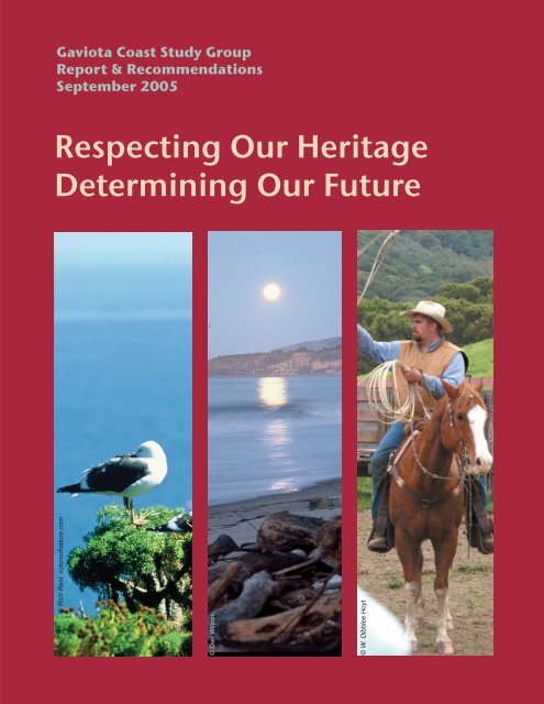
Gaviota Coast Study Group<br />
Report & Recommendations<br />
September 2005<br />
Respecting Our Heritage<br />
Determining Our Future<br />
© Rich Reid, colorsofnature.com<br />
© Dan Wilson<br />
© W. Dibblee Hoyt
We, the undersigned, are participants of the Gaviota Coast Study Group.<br />
Although as individuals we may not agree with every item contained in this<br />
document, as a group we have reached consensus on it. We submit it as a<br />
compelling <strong>and</strong> comprehensive guide for the future of the Gaviota Coast.<br />
Voting Members<br />
Greg Archbald Jose Baer<br />
Charlie Eckberg<br />
John Buttny<br />
Michael Feeney<br />
Carla Frisk<br />
Art Cisneros<br />
Eric P. Hvolboll<br />
Ariana Katovich Kim Kimbell Mark Lloyd<br />
Michael V. McGinnis, PhD Phil McKenna Monty Parsons<br />
Jim Poett<br />
Non-Voting Members<br />
Monte R. Ward
Table of Contents<br />
Introduction<br />
Gaviota Coast Study Group<br />
Mission <strong>and</strong> Goals<br />
Executive Summary<br />
Recommendations<br />
Keeping Agriculture on the L<strong>and</strong><br />
Stewarding the L<strong>and</strong> <strong>and</strong> Resources<br />
Developing L<strong>and</strong> Use <strong>Policy</strong> with Equity <strong>and</strong> Ecology<br />
Creating Public Access on the Coast<br />
Providing Effective Local Governance <strong>and</strong> Finance<br />
Leadership is the Key<br />
Map of the Gaviota Coast<br />
○ ○ ○ ○ ○ ○ ○ ○ ○ ○ ○ ○ ○ ○ ○ ○ ○ ○ ○ ○ ○ ○ ○ ○ ○ ○ ○ ○ ○ ○ ○ ○ ○ ○ ○ ○ ○ ○ ○ ○<br />
○ ○ ○ ○ ○ ○ ○ ○ ○ ○ ○ ○ ○ ○ ○ ○ ○ ○ ○ ○ ○ ○ ○ ○ ○ ○ ○ ○ ○<br />
○ ○ ○ ○ ○ ○ ○ ○ ○ ○ ○ ○ ○ ○ ○ ○ ○ ○ ○ ○ ○ ○ ○ ○ ○ ○ ○ ○ ○ ○ ○ ○ ○ ○ ○<br />
○ ○ ○ ○ ○ ○ ○ ○ ○ ○ ○ ○ ○ ○ ○ ○ ○ ○ ○ ○ ○ ○ ○ ○ ○ ○ ○ ○ ○ ○ ○ ○ ○ ○ ○<br />
○ ○ ○ ○ ○ ○ ○ ○ ○ ○ ○ ○ ○ ○ ○ ○ ○ ○ ○ ○ ○ ○ ○ ○ ○ ○<br />
○ ○ ○ ○ ○ ○ ○ ○ ○ ○ ○ ○ ○ ○ ○ ○ ○ ○ ○ ○ ○ ○ ○<br />
Additional copies of this report may be obtained from these web sites:<br />
www.sbl<strong>and</strong>trust.org/links.html<br />
www.msi.ucsb.edu/msilinks/OCPC/OCPCtexts/ocpc.html<br />
© Rich Reid, colorsofnature.com<br />
○ ○ ○ ○ ○ ○ ○ ○ ○ ○ ○ ○<br />
○ ○ ○ ○ ○ ○ ○ ○ ○ ○ ○ ○ ○ ○ ○ ○ ○ ○ ○ ○ ○ ○<br />
○ ○ ○ ○ ○ ○ ○ ○ ○ ○ ○ ○ ○ ○<br />
○ ○ ○ ○ ○ ○ ○ ○ ○ ○ ○ ○ ○ ○ ○ ○ ○ ○ ○ ○ ○ ○ ○ ○ ○ ○ ○ ○ ○ ○ ○ ○ ○ ○<br />
○ ○ ○ ○ ○ ○ ○ ○ ○ ○ ○ ○ ○ ○ ○ ○ ○ ○ ○ ○ ○ ○ ○ ○ ○ ○ ○ ○ ○ ○ ○<br />
2<br />
4<br />
5<br />
7<br />
8<br />
14<br />
22<br />
28<br />
34<br />
40<br />
41
Introduction<br />
p <br />
Introduction<br />
In recent years, public attention has become increasingly focused on the l<strong>and</strong> use <strong>and</strong><br />
resources of “The Gaviota Coast” — the last largely undeveloped stretch of coastline in<br />
Southern California. With more than 100,000 acres of coastline, ranch <strong>and</strong> forest l<strong>and</strong><br />
between the City of Goleta <strong>and</strong> V<strong>and</strong>enberg Air Force Base, the region has been widely<br />
recognized for its tremendous <strong>and</strong> unique beauty, extraordinary ecological importance,<br />
<strong>and</strong> agricultural <strong>and</strong> cultural heritage.<br />
In 1999-2003, the U.S. National Park Service conducted a feasibility study for a national<br />
seashore or similar federal presence. In a report to Congress in March 2004, the Park<br />
Service found the Gaviota Coast suitable for inclusion in the National Park System, but it<br />
did not find its inclusion to be feasible. Still, the genie was out of the bottle.<br />
A growing, vocal constituency began calling for increased Gaviota planning <strong>and</strong> conservation,<br />
believing that without some intervention, the region would succumb to growth pressure<br />
<strong>and</strong> urbanization. Southern California’s coastal history, local politics <strong>and</strong> a few high profile<br />
coastal development projects fueled that concern. Environmental groups launched<br />
campaigns to “Save the Gaviota Coast,” while public <strong>and</strong> private financial support grew for<br />
the voluntary purchase of l<strong>and</strong> <strong>and</strong> agricultural conservation easements, as well as for<br />
cooperative projects to restore creeks <strong>and</strong> watersheds.<br />
Meanwhile, people who owned l<strong>and</strong> <strong>and</strong> made their livelihood on the coast became<br />
increasingly alarmed about government interference. New laws <strong>and</strong> regulations were passed<br />
at each level of government, dem<strong>and</strong>ing that agricultural l<strong>and</strong>owners plan <strong>and</strong> pay for<br />
protecting creeks, water quality, <strong>and</strong> endangered wildlife on their property. Environmental<br />
groups <strong>and</strong> elected officials were advocating l<strong>and</strong> use controls, habitat restoration <strong>and</strong><br />
public access trails. Wary of more regulation <strong>and</strong> coastal access requirements <strong>and</strong> weary<br />
of public meetings <strong>and</strong> hearings, l<strong>and</strong>owners organized to resist outside intervention <strong>and</strong><br />
more government controls.<br />
In the midst of this growing conflict, a group of Gaviota l<strong>and</strong>owners began talking about<br />
how local people <strong>and</strong> organizations could determine the future of Gaviota, based on a<br />
shared set of goals, rather than just arm wrestling in endless public debates <strong>and</strong> campaigns.<br />
The discussion exp<strong>and</strong>ed to include people with a broad range of interests, <strong>and</strong> in late<br />
2001, the Gaviota Coast Study Group was formed.<br />
The Study Group is self-selected <strong>and</strong> is not aligned with any organization. People were<br />
invited to participate who were willing to listen, contribute <strong>and</strong> try to work out differences.<br />
This included a balanced representation from Gaviota ranch, farm <strong>and</strong> l<strong>and</strong>owner interests,<br />
local environmental <strong>and</strong> conservation interests, staff observers from local, state <strong>and</strong> elected<br />
officials, <strong>and</strong> occasional public or private advisors. Twice a month for more than three<br />
years, we met privately <strong>and</strong> declined media attention as we explored ways the Gaviota<br />
Coast could be understood, planned <strong>and</strong> managed, by private <strong>and</strong> public interests, for the<br />
benefit of all.
We believe there is a broad community obligation to Gaviota that can be fulfilled – based<br />
on local determination; better underst<strong>and</strong>ing <strong>and</strong> communication between urban <strong>and</strong> rural;<br />
the integration of ecology <strong>and</strong> economy; <strong>and</strong> mindful, sustainable stewardship of the<br />
agricultural, environmental, cultural <strong>and</strong> recreational resources.<br />
This report is the product of our efforts. The Gaviota Coast Study Group has no official<br />
sanction; rather, our sole authority is the weight of the ideas we present. We believe that<br />
enough people care to motivate private <strong>and</strong> public leaders to rise to the challenge of<br />
protecting, based on principles of ecology <strong>and</strong> of equity, Gaviota’s tremendous resources<br />
for generations to come.<br />
We Only Have One Gaviota Coast<br />
By Art Cisneros, Chumash Descendent<br />
We only have one <strong>Ocean</strong>, one water, <strong>and</strong> it is the life blood<br />
of our Mother Earth, of all life. Our mutual responsibility is<br />
to take care of all water, beginning with our creeks, which<br />
flow into the ocean <strong>and</strong> complete the cycle of water.<br />
We only have one Air, one wind, the source of the breath<br />
of all life <strong>and</strong> the spirit in each of us. Our mutual<br />
responsibility is to take care of the air, each breath, <strong>and</strong> to<br />
be mindful of the spirit in each one of us.<br />
We only have one Earth, the body of our Mother, the womb of all life. Our mutual<br />
responsibility is to take care of the l<strong>and</strong> as we would our own Mother.<br />
We only have one Fire, one spark that exists in the Sun, the center of the Earth in<br />
every atom <strong>and</strong> in our hearts. Our responsibility is to take care of fire in all its forms<br />
<strong>and</strong> to not abuse or mish<strong>and</strong>le it, or else we may begin a wildfire, a chain reaction<br />
that cannot be extinguished. Everything <strong>and</strong> everyone exists together,<br />
interdependent, not separate. Everything we think, say <strong>and</strong> do affects everyone.<br />
Our mutual responsibility is to be mindful of seven generations to come in everything<br />
we do.<br />
We only have one Gaviota Coast, one community. Our mutual responsibility is to<br />
take care of our mutual homel<strong>and</strong>. We ask <strong>and</strong> pray that you will share our mutual<br />
responsibility <strong>and</strong> participate with us in the continuous process of taking care of our<br />
home. We welcome your participation, support, expertise, passion, energy, <strong>and</strong><br />
resources. All our work is necessary for our mutual vision to be fulfilled.<br />
Introduction<br />
p
Gaviota Coast Study Group<br />
Participants in the study group, while representative of the range of Gaviota Coast stakeholder<br />
interests, are participating as individuals <strong>and</strong> not as representatives of any specific<br />
organizations. Affiliations are given only to show the breadth of experience of the members.<br />
Greg Archbald<br />
• Retired attorney<br />
• Founding board member <strong>and</strong> former<br />
general counsel, Trust for Public L<strong>and</strong><br />
• Former director of volunteer development<br />
<strong>and</strong> conservation projects, Golden Gate<br />
National Parks Association<br />
Jose Baer<br />
• President/Manager, Rancho La Vina<br />
• Foreman, Rancho Arbolado<br />
• Trustee, Vista Del Mar Union School<br />
District<br />
Art Cisneros<br />
• Local Chumash descendent —<br />
Barbareno Chumash, Infinite Hoop<br />
Foundation<br />
Charlie Eckberg<br />
• Real estate developer <strong>and</strong> rural l<strong>and</strong><br />
manager<br />
• Past Ranch Manager, Hollister Ranch<br />
• Dean’s Council, Bren School of<br />
Environmental Science <strong>and</strong> Management<br />
• Board Member, Get Oil Out<br />
• Past President, Community Environmental<br />
Council<br />
• Past Board Member, The Sustainability<br />
Project<br />
Michael Feeney<br />
• Executive Director, The L<strong>and</strong> Trust for<br />
Santa Barbara County<br />
Eric P. Hvolboll<br />
• Manager, La Paloma Ranch, Gaviota<br />
Ariana Katovich<br />
• Former Conservation Organizer, Sierra<br />
Club Gaviota Coast Campaign<br />
• Former Director, Isla Vista Recreation &<br />
Park District<br />
Kim Kimbell<br />
• Partner, Allen & Kimbell law firm<br />
• Member, Dean’s Council, Bren School of<br />
Environmental Science <strong>and</strong> Management<br />
• Member, California Advisory Board, Trust for<br />
Public L<strong>and</strong><br />
• Board Member & Past President,<br />
Community Environmental Council<br />
• Past President, Hollister Ranch Owners’<br />
Association<br />
• Past President, Goleta Valley Historical<br />
Society<br />
Mark Lloyd<br />
• President, L&P Consultants – L<strong>and</strong> planning,<br />
surveying & engineering consultant<br />
Michael V. McGinnis, PhD<br />
• Director, <strong>Ocean</strong> <strong>and</strong> <strong>Coastal</strong> <strong>Policy</strong> <strong>Center</strong>,<br />
Marine Science Institute, UCSB<br />
• Principal consultant, Bioregional Planning<br />
Association<br />
Phil McKenna<br />
• Self-employed financial consultant<br />
• Member of the Board of Directors, Gaviota Coast<br />
Conservancy<br />
Monty Parsons<br />
• L<strong>and</strong>owner <strong>and</strong> Ranch Manager, Eagle Canyon<br />
Ranch<br />
Jim Poett<br />
• Manager, Rancho San Julian<br />
• Former Vice-Chair, Santa Barbara County<br />
Agricultural Advisory Committee<br />
Monte R. Ward<br />
• L<strong>and</strong>owner <strong>and</strong> Gaviota Coast resident, Hollister<br />
Ranch<br />
• Director of Special Projects <strong>and</strong> Strategic<br />
Advisor for the Orange County Transportation<br />
Authority<br />
• Past Board member, Vista Del Mar Union School<br />
District<br />
At times, representatives of U.S. Representative Lois Capps, former State Senator Jack<br />
O’Connell, former Assemblymember Hannah-Beth Jackson, <strong>and</strong> former Supervisor Gail Marshall<br />
participated. We would like especially to acknowledge Carla Frisk, former District Director for<br />
Senator O’Connell <strong>and</strong> current consultant to the Trust for Public L<strong>and</strong>, <strong>and</strong> John Buttny,<br />
former Executive Assistant to Supervisor Marshall. Both attended consistently <strong>and</strong> helped us<br />
underst<strong>and</strong> state <strong>and</strong> local policies, find solutions to our differences by highlighting our<br />
commonalities, <strong>and</strong> craft meaningful <strong>and</strong> practical recommendations.<br />
Introduction<br />
p
The purpose of the Gaviota Coast Study Group is to discuss <strong>and</strong> develop a l<strong>and</strong> planning<br />
process <strong>and</strong> strategies that can preserve the character <strong>and</strong> the values inherent in public <strong>and</strong><br />
private l<strong>and</strong> on the Gaviota Coast in a manner that is acceptable to both property owners <strong>and</strong><br />
the community as a whole.<br />
Goals:<br />
1. To provide a local vision for lasting protection of rural agricultural, recreational,<br />
residential, cultural, spiritual, ecosystem, viewshed <strong>and</strong> open space values while<br />
respecting the rights <strong>and</strong> needs of property owners <strong>and</strong> the community as a whole.<br />
2. To maximize local determination of l<strong>and</strong> use <strong>and</strong> protection of the environment.<br />
3. To facilitate the continuation <strong>and</strong> viability of agriculture.<br />
Mission <strong>and</strong> Goals<br />
4. To provide alternatives to l<strong>and</strong> speculation through fair economic mechanisms as a<br />
way for l<strong>and</strong>owners to maintain <strong>and</strong>/or realize the value of their l<strong>and</strong>.<br />
5. To develop economic incentives that, to the greatest degree possible, encourage<br />
private voluntary protection of agricultural, environmental <strong>and</strong> open space l<strong>and</strong><br />
values.<br />
6. To promote increased public <strong>and</strong> private resources for protection of habitat <strong>and</strong><br />
open space l<strong>and</strong> values.<br />
7. To develop recommendations to minimize adverse human impacts on public <strong>and</strong><br />
private l<strong>and</strong>s.<br />
8. To develop recommendations for management structures which accomplish the<br />
above goals.<br />
S. Wright<br />
Introduction<br />
p
Introduction<br />
p <br />
Executive Summary<br />
The Gaviota Study Group offers its key recommendations <strong>and</strong> policy concepts in five areas<br />
in this report: protecting agriculture, stewarding the l<strong>and</strong>, developing l<strong>and</strong> use policy, creating<br />
public access, <strong>and</strong> providing effective local governance. As you read the report, we ask<br />
that you keep in mind several themes that are central to our thinking:<br />
■ While there may be a fair degree of consensus about the kind of future most people<br />
envision for Gaviota, it must be recognized that a high level of mistrust <strong>and</strong><br />
misinformation pervades our community. It will be difficult, but necessary, to overcome<br />
the polarization <strong>and</strong> fear that has characterized our past, <strong>and</strong> to bring together<br />
agricultural, environmental <strong>and</strong> governmental interests.<br />
■ These recommendations work together as a package, not as a menu. No member of<br />
the group agrees with all positions or recommendations in the report, yet all members<br />
endorse the complementary framework of ideas <strong>and</strong> policies. Taken together <strong>and</strong><br />
implemented effectively, the elements of this report fairly address the needs <strong>and</strong><br />
concerns of all the interests represented. We urge readers to reserve their judgment<br />
on the broad framework of this report when they encounter isolated elements not to<br />
their liking.<br />
■ New <strong>and</strong> better policies <strong>and</strong> tools are needed to protect the character <strong>and</strong> values<br />
inherent in public <strong>and</strong> private l<strong>and</strong> on the Gaviota Coast. These policies <strong>and</strong> tools<br />
must assure l<strong>and</strong>owners <strong>and</strong> residents that they will have a significant role in determining<br />
their own future, <strong>and</strong> at the same time must foster confidence within the larger community<br />
that agreed upon protection strategies will be implemented <strong>and</strong> maintained over time.<br />
■ No single agency, nor government alone, can provide what is needed to preserve all<br />
the important values of the Gaviota Coast. Rather, a well conceived, locally determined<br />
set of efforts, both public <strong>and</strong> private, is needed using effective voluntary, regulatory<br />
<strong>and</strong> financial mechanisms.<br />
■ We must integrate equity to Gaviota l<strong>and</strong>owners with ecological health. This can in<br />
part be achieved by building trust <strong>and</strong> commitment through collaborative, l<strong>and</strong>ownerled<br />
watershed alliances, aided by technical assistance, public funding, <strong>and</strong> streamlined<br />
permitting for good stewardship practices <strong>and</strong> restoration projects.<br />
■ The County Local <strong>Coastal</strong> Plan <strong>and</strong> General Plan, zoning ordinances <strong>and</strong> agricultural<br />
regulations should comprise the primary governmental authority for the Gaviota area.<br />
These local measures need to be updated as soon as possible to promote the<br />
continuation of viable agriculture; improved watershed <strong>and</strong> natural resource<br />
management; <strong>and</strong> appropriate, well-managed public access along the coast.<br />
■ Hostile condemnation will not be used to acquire easements or sites.
Executive Summary<br />
■ Public resources agencies should provide permit streamlining, technical assistance<br />
<strong>and</strong> grant funds to promote natural resource enhancement projects on private l<strong>and</strong>.<br />
Funding from both existing <strong>and</strong> new sources must be made available as a priority for<br />
conservation <strong>and</strong> enhancement of agriculture, wildlife habitat <strong>and</strong> resource protection,<br />
<strong>and</strong> appropriately sited <strong>and</strong> well managed public access locations.<br />
■ There is broad support for ensuring that urban growth <strong>and</strong> non-agricultural development<br />
does not consume or fragment Gaviota ranches <strong>and</strong> important wildlife habitat. Local<br />
l<strong>and</strong> use policies <strong>and</strong> conservation programs keep productive ranch <strong>and</strong> farm operations<br />
on the l<strong>and</strong>. The Study Group advocates creation of a voter-approved rural planning<br />
area to create certainty that Gaviota is not subject to inappropriate development pressure.<br />
■ To keep working farms <strong>and</strong> ranches viable, regulation of agricultural l<strong>and</strong> use <strong>and</strong><br />
activities needs to be simplified <strong>and</strong> streamlined. Agricultural l<strong>and</strong> should be buffered<br />
from non-agricultural development. Agricultural production should be the priority for<br />
agricultural zoned l<strong>and</strong>, integrated with clear, practical resource management practices<br />
for mountainous <strong>and</strong> environmentally sensitive habitat areas. The county should make<br />
it easier for farm <strong>and</strong> ranch owners to provide housing for their employees.<br />
■ Under the current plans <strong>and</strong> zoning, there is significant potential for new residential<br />
development on the Gaviota Coast. An array of tools needs to be used to reduce<br />
development potential or to direct it away from viable agriculture <strong>and</strong> environmentally<br />
sensitive areas. Such tools could include voluntary conservation easements that<br />
compensate l<strong>and</strong>owners for giving up some building rights, policies to allow transfer of<br />
existing development rights within or between Gaviota properties, <strong>and</strong> areas subject to<br />
special zoning overlays.<br />
■ Voluntary alliances of l<strong>and</strong>owners, <strong>and</strong> non-profit organizations such as l<strong>and</strong> trusts,<br />
have a key role to play in the formation of watershed management, conservation <strong>and</strong><br />
stewardship programs that can successfully integrate agricultural <strong>and</strong> environmental<br />
goals <strong>and</strong> objectives. Local determination requires the active participation of l<strong>and</strong>owners,<br />
public l<strong>and</strong> <strong>and</strong> private ranch managers, recreational users, environmental specialists<br />
<strong>and</strong> resource agencies. Pilot watershed management projects in a few Gaviota<br />
watersheds can provide models <strong>and</strong> streamline the process for others to follow.<br />
■ Regulatory agencies should assert st<strong>and</strong>ards that retain or enhance the environmental<br />
quality of the coast <strong>and</strong> its rural/agricultural character, water <strong>and</strong> air quality, <strong>and</strong> scenic<br />
views consistent with l<strong>and</strong>owner rights. This can be accomplished through the use of<br />
design <strong>and</strong> development st<strong>and</strong>ards <strong>and</strong> effective resource management practices, with<br />
regulatory relief <strong>and</strong> streamlined approval for those who use them.<br />
■ Creating the kind of future for the Gaviota Coast that works well for all of us will require<br />
an extraordinary level of leadership, commitment <strong>and</strong> collaboration among pubic officials,<br />
private l<strong>and</strong>owners <strong>and</strong> non-governmental organizations. Introduction<br />
p
Agriculture<br />
p <br />
Keeping Agriculture<br />
on the L<strong>and</strong><br />
The Gaviota Coast is not just a beautiful stretch of open space For many of<br />
its residents it is a source of livelihood a working rural l<strong>and</strong>scape that has<br />
sustained <strong>and</strong> been sustained by generations of farmers <strong>and</strong> ranchers But<br />
like many places around the world the vitality of the agricultural industry<br />
on the Gaviota Coast is threatened Many factors contribute to this tension<br />
including rising property values <strong>and</strong> l<strong>and</strong> use practices that allow for building<br />
residential neighborhoods in the midst of farml<strong>and</strong><br />
As a major contributor to Santa Barbara County’s economy we cannot afford<br />
losses to this sector of our community We must realize that agriculture on<br />
the Gaviota Coast is not a temporary or interim l<strong>and</strong> use — it is a longterm<br />
commitment<br />
© W. Dibblee Hoyt
Key Recommendation<br />
If our local agricultural industry is to thrive, not<br />
just survive, we must value <strong>and</strong> seek to<br />
encourage its contributions — to our economy,<br />
our l<strong>and</strong>scape, our history, <strong>and</strong> our environment.<br />
We must work together to encourage<br />
constructive communication, fostering a sense<br />
of underst<strong>and</strong>ing <strong>and</strong> stewardship between<br />
urban <strong>and</strong> agricultural communities.<br />
<strong>Policy</strong> Recommendations<br />
Federal estate tax<br />
1. Local decision makers should be encouraged to lobby to abolish the federal estate tax<br />
on agricultural l<strong>and</strong>. This federal tax law has made it very difficult for families to pass on<br />
viable agricultural operations to future generations who may wish to continue running<br />
them.<br />
L<strong>and</strong> use policies<br />
© Rich Reid, colorsofnature.com<br />
2. The Gaviota Coast’s productive farml<strong>and</strong> is a valuable, limited natural resource. L<strong>and</strong><br />
use policies should encourage protection of viable agricultural l<strong>and</strong>s.<br />
a. Agricultural production should be the priority on Ag zoned l<strong>and</strong>. Non-agricultural<br />
development should be directed to those areas least desirable for agriculture.<br />
b. Proven l<strong>and</strong> conservation tools that create protection boundaries should be<br />
encouraged, such as the agricultural preserve program (Williamson Act<br />
contracts), Farml<strong>and</strong> Security Zone contracts, agricultural conservation<br />
easements, <strong>and</strong> TDRs (transfer of development rights). These compensate<br />
owners who agree to keep their l<strong>and</strong> in agriculture, while also providing a<br />
growth boundary.<br />
c. Investments in infrastructure improvements should not be used to position<br />
agricultural l<strong>and</strong>s for eventual development.<br />
d. The County should make it easier for ranch <strong>and</strong> farm owners to develop <strong>and</strong><br />
maintain housing for farm workers <strong>and</strong> their families.<br />
Agriculture<br />
p
Agriculture<br />
p <br />
Memories of a Farm Family<br />
By Elizabeth Erro Hvolboll<br />
My family has owned <strong>and</strong> farmed l<strong>and</strong> in Santa<br />
Barbara County since 1840 <strong>and</strong> on the Gaviota coast<br />
since 1866. I grew up in an old wooden farmhouse<br />
overlooking Refugio Beach <strong>and</strong> lived there until I was<br />
20 in 1950. Our family has worked with other coastal<br />
ranching families, the Ortegas, Hollisters, Alegrias,<br />
Rutherfords, Dotys, Parks, Freemans, Pedottis <strong>and</strong><br />
others for up to six generations.<br />
© W. Dibblee Hoyt When my husb<strong>and</strong> <strong>and</strong> I had our children, they spent<br />
most of their growing-up years on our ranch, working<br />
with cows, raising orphan calves, riding horses, fixing<br />
fences. They learned about the natural world <strong>and</strong> about how they fit into the whole<br />
system, raising animals <strong>and</strong> food. As farmers <strong>and</strong> ranchers, they underst<strong>and</strong> much<br />
about the cycle of life because they are part of it.<br />
I remember vividly when the California highway department took the entire<br />
homestead from our ranch at Refugio. It was taken by eminent domain to widen the<br />
freeway <strong>and</strong> build the beach entrance. They brought in bulldozers <strong>and</strong> destroyed<br />
the farmhouse, garages, barn, blacksmith shop, granary, corrals <strong>and</strong> dozens of<br />
trees. My son, then 13, did save our old pepper tree, persuading the state not to<br />
bulldoze it. It is the largest in California. My daughter <strong>and</strong> I had nightmares about<br />
the rest of our ranch being bulldozed <strong>and</strong> replaced by condos <strong>and</strong> shopping centers.<br />
Our experience has taught us that our family legacy of farming could be threatened<br />
in ways that we didn’t expect. And it made us realize how important it is to our<br />
family to keep our l<strong>and</strong> in farming. Although we couldn’t stop the highway department,<br />
we could stop private development. So when The L<strong>and</strong> Trust for Santa Barbara<br />
County approached us several years ago, we listened to its ideas. It offered a way<br />
to keep our l<strong>and</strong> as a farm by paying us to give up our “development rights” <strong>and</strong><br />
putting the l<strong>and</strong> into an agricultural conservation easement. The easement<br />
guarantees the l<strong>and</strong> will never be developed for urban uses <strong>and</strong> can remain a<br />
working farm in private ownership. They call it a “working l<strong>and</strong>scape” — which is an<br />
accurate term.<br />
There are three newer generations of my family now, <strong>and</strong> I think about when the<br />
youngest will be my age 70 years from now. I feel good knowing they will be able to<br />
st<strong>and</strong> here in Venadito Canyon <strong>and</strong> see it much as it has been for hundreds of<br />
years. Gaviota is the last working coastal l<strong>and</strong>scape in Southern California. There<br />
is nothing like it.
Agricultural regulations<br />
3. To survive, agriculture needs to respond quickly to changing conditions <strong>and</strong> markets.<br />
Agriculture requires regulations appropriate to its needs, not the imposition of urban<br />
planning st<strong>and</strong>ards on rural areas. Rather than unnecessarily restrict agricultural<br />
operations, as some current County ordinances <strong>and</strong> regulations do, regulatory<br />
structure should allow flexibility for <strong>and</strong> encourage agricultural operations.<br />
a. County regulations should not unduly restrict the use of agricultural l<strong>and</strong> such as<br />
crops that may be grown, agricultural buildings <strong>and</strong> structures, equipment in<br />
view, or how production may occur.<br />
b. While siting <strong>and</strong> design st<strong>and</strong>ards for agricultural structures are needed to<br />
protect important scenic, environmental, <strong>and</strong> cultural values, a wide definition of<br />
agricultural uses should be allowed in agricultural areas to permit growers to<br />
adapt to changing markets. This recognizes greenhouses, shade structures,<br />
hoop houses, <strong>and</strong> similar structures as legitimate agricultural methods in a highly<br />
competitive market. (See page 26 of the L<strong>and</strong> Use section for further discussion.)<br />
c. Through zoning <strong>and</strong> appropriate<br />
infrastructure, the County <strong>and</strong> cities should<br />
continue to support related businesses in<br />
adjoining areas such as packing houses,<br />
chemical distribution facilities, <strong>and</strong> tractor<br />
<strong>and</strong> irrigation supply companies, which are<br />
critical for the agricultural industry.<br />
d. The County should hire a planner with<br />
expertise in agricultural operations to<br />
administer agricultural permits <strong>and</strong><br />
© W. Dibblee Hoyt<br />
regulation. Staff working on agricultural l<strong>and</strong><br />
use planning <strong>and</strong> regulation should have<br />
training <strong>and</strong> experience with rural planning <strong>and</strong> agriculture. A separate division or<br />
office to h<strong>and</strong>le ministerial permit processing for agricultural l<strong>and</strong> use may be<br />
necessary.<br />
e. The permitting process for agricultural uses should be clarified <strong>and</strong> streamlined<br />
so that l<strong>and</strong>owners know what to expect <strong>and</strong> are not frustrated by bureaucracy.<br />
To build trust, regulators must contain regulatory inspections on agricultural l<strong>and</strong><br />
to single issues.<br />
f. Low-impact non-agricultural uses should be allowed on agricultural l<strong>and</strong> to<br />
provide additional income, as long as they are compatible with <strong>and</strong> subordinate<br />
to agricultural l<strong>and</strong> uses <strong>and</strong> consistent with other policies found in this<br />
document.<br />
Agriculture<br />
p
Agriculture<br />
p <br />
Agricultural buffers <strong>and</strong> boundaries<br />
4. Often when a conflict arises between an agricultural operation <strong>and</strong> a neighboring<br />
urban use, it can result in restraints on the grower. One solution is to create buffers<br />
that protect agriculture operations from neighboring uses.<br />
a. County policies should create <strong>and</strong> maintain buffers between agricultural l<strong>and</strong>s<br />
<strong>and</strong> urban uses. The responsibility for the buffer rests with the encroaching urban<br />
uses, not the preexisting agricultural use. Buffers can include physical separators<br />
— such as setbacks <strong>and</strong> vegetative barriers — as well as transitional zoning,<br />
restrictions, <strong>and</strong> conditions on the encroacher.<br />
b. Where buffers do not exist or are infeasible, the grower should be compensated<br />
for any loss of production <strong>and</strong>/or value due to the interfering non-agricultural use.<br />
c. The County should maintain the urban limit line that currently exists between<br />
Goleta <strong>and</strong> the Gaviota Coast. (See page 24 of the L<strong>and</strong> Use <strong>Policy</strong> section for<br />
further discussion.)<br />
Community awareness<br />
© Rich Reid, colorsofnature.com<br />
5. Develop ways to foster better community awareness of the local agricultural<br />
economy <strong>and</strong> rural l<strong>and</strong> management, needs, <strong>and</strong> practices. This awareness will<br />
eventually lead to greater community support.<br />
a. Educational programs should be developed that advance awareness of local<br />
agriculture <strong>and</strong> teach respect for others, including l<strong>and</strong> owners. One example is<br />
the Farm Bureau’s “agriculture in the classroom” program.
. Re-establish <strong>and</strong> strengthen the presence of the UC Cooperative Extension on<br />
the Gaviota Coast. This could take the form of a local office that focuses on<br />
proactive outreach to the rural community.<br />
c. Encourage greater public awareness of <strong>and</strong> support for Gaviota agriculture as a<br />
business, through education programs in county schools, community supported<br />
agriculture, farmers’ markets, ranch <strong>and</strong> farm tours, <strong>and</strong> other means.<br />
d. Encourage cooperative marketing of agricultural products to the local consumers.<br />
Permanent venues could be established to create a fixed local presence in the<br />
community for locally produced goods.<br />
Conserving <strong>and</strong> sustaining agriculture<br />
6. Maintaining a viable local agricultural industry is essential for a self-sufficient society<br />
<strong>and</strong> a strong rural economy. To ensure the future of agriculture on the Gaviota Coast,<br />
recognize <strong>and</strong> improve sustainable agricultural practices.<br />
a. County policies should not discourage sustainable farming practices such as<br />
conservation, integrated pest management, <strong>and</strong> water <strong>and</strong> soil conservation.<br />
b. The County <strong>and</strong> Resource Conservation Districts should create programs that<br />
allow farmers to use a simple, one stop permit shopping process for conservation<br />
projects on their l<strong>and</strong>.<br />
c. Where access is desired on ranches or farms for resource conservation or<br />
restoration activities, consider using l<strong>and</strong> leases or temporary easements, rather<br />
than outright purchase of ranch <strong>and</strong> farm l<strong>and</strong>. This approach can promote<br />
conservation <strong>and</strong> reward cooperative private l<strong>and</strong> stewardship, while keeping<br />
l<strong>and</strong> in agricultural production.<br />
© Elizabeth Hvolboll<br />
Agriculture<br />
p
Stewardship<br />
p <br />
Stewarding the L<strong>and</strong><br />
<strong>and</strong> Resources<br />
The cultural heritage of the coast began more than years ago with<br />
the ancestors of the current Chumash community who established significant<br />
historical settlements throughout the region <strong>and</strong> who were the first stewards<br />
of the l<strong>and</strong> The historically recent European settlers displaced the Chumash<br />
establishing cultural <strong>and</strong> l<strong>and</strong> use patterns that persist to this day Many of<br />
the current stewards of the l<strong>and</strong> are descendants of those settlers who also<br />
love the l<strong>and</strong> <strong>and</strong> resources of Gaviota All of these cultures contributed to<br />
the rural l<strong>and</strong>scape that we enjoy today<br />
When we take this bird’s eye view we see the Gaviota Coast as more than<br />
lines on a map It is an interconnection of plants people <strong>and</strong> wildlife — a<br />
region rich with history It is also the largest relatively undeveloped remnant<br />
of the Southern California Mediterranean environment with coastal<br />
ecosystems that are of both local <strong>and</strong> global importance This place deserves<br />
a renewed commitment to sustainable l<strong>and</strong> use <strong>and</strong> environmental<br />
management practices<br />
© Rich Reid, colorsofnature.com
Key Recommendation<br />
Protecting the cultural, agricultural <strong>and</strong> natural heritage of the Gaviota Coast<br />
requires taking an integrated <strong>and</strong> comprehensive approach. We can encourage<br />
ecological health, for example, by maintaining <strong>and</strong> connecting large habitat<br />
areas. We can improve water quality by planning at the “watershed level.” For<br />
this to be successful, we must build stronger, more respectful relationships<br />
among all users of the coast, including rural l<strong>and</strong>owners, recreational users, the<br />
Chumash <strong>and</strong> the urban community. We must also provide regulatory relief <strong>and</strong><br />
other incentives to those l<strong>and</strong>owners <strong>and</strong> agriculturists who lead the way in<br />
protecting <strong>and</strong> restoring natural resources.<br />
<strong>Policy</strong> Recommendations<br />
Cultural resources of Gaviota<br />
1. A neutral, non-governmental organization<br />
should be identified to enhance community<br />
awareness of the Chumash <strong>and</strong> the ranching<br />
<strong>and</strong> farming cultures of Gaviota.<br />
a. This group might facilitate the establishment<br />
of a cultural center for gatherings, a<br />
museum to house artifacts that are currently<br />
kept elsewhere, <strong>and</strong> a community building<br />
<strong>and</strong> healing center for residents of the<br />
region.<br />
b. This group might also coordinate voluntary<br />
access to cultural sites, sacred sites, <strong>and</strong><br />
places to gather plants for ceremonial purposes.<br />
Working at a watershed level<br />
© Frank Magallanes & Althea Edwards<br />
2. By viewing the Gaviota Coast as a series of interconnected living watersheds, our<br />
region can address <strong>and</strong> plan for long-term ecological <strong>and</strong> economic needs, such as<br />
improving water resource management.<br />
a. L<strong>and</strong>owners should integrate the protection of watersheds into the economic<br />
uses of their l<strong>and</strong> through voluntary, l<strong>and</strong>owner-led, watershed-based<br />
Stewardship<br />
p
Stewardship<br />
p <br />
partnerships. In exchange for their efforts, they should receive regulatory relief,<br />
technical assistance, <strong>and</strong> streamlined certification <strong>and</strong> permitting. (See the<br />
sidebar on the next page for further discussion.)<br />
3. Scientifically-based watershed plans should be developed that contain clear,<br />
measurable goals.<br />
© Mike Muths<br />
a. Watershed plans should include comprehensive<br />
biological inventories, which are critical to<br />
developing broader ecosystem-based<br />
assessments.<br />
b. A scientific advisory panel should be created to<br />
assist in watershed planning efforts. This panel<br />
should include members from public agencies,<br />
university scientists, conservation experts,<br />
l<strong>and</strong>owners, <strong>and</strong> l<strong>and</strong> managers who hold<br />
practical local knowledge <strong>and</strong> scientific<br />
expertise of ecosystems <strong>and</strong> watersheds.<br />
c. The plans should include clear, measurable commitments from l<strong>and</strong>owners.<br />
They should employ agricultural <strong>and</strong> l<strong>and</strong> management practices that<br />
improve coastal watersheds <strong>and</strong> the general health <strong>and</strong> ecological integrity of<br />
the l<strong>and</strong> <strong>and</strong> nearshore marine environment.<br />
d. The plans should include clear performance measures to monitor the<br />
progress toward achieving the protection of watershed health <strong>and</strong> other<br />
goals, such as sustainable agricultural use.<br />
4. Watershed planning should be done in a spirit of open exchange of information <strong>and</strong><br />
collaboration, to help restore a level of trust between l<strong>and</strong>owners, conservationists<br />
<strong>and</strong> government agencies that is sorely lacking. Information collected in the<br />
watershed planning process is not to be used to preclude l<strong>and</strong>owners from the legal<br />
<strong>and</strong> customary use of their l<strong>and</strong>.<br />
a. An information exchange — such as a watershed information network —<br />
should be created to provide access to credible, informed sources for<br />
watershed planning <strong>and</strong> management. Information should come from public<br />
<strong>and</strong> private sources, including independent scientific advisors <strong>and</strong> regional<br />
l<strong>and</strong> managers with practical experience <strong>and</strong> local knowledge.<br />
b. Pilot projects in a few important coastal watersheds can provide the<br />
community with models for collaboration, while also avoiding the cost <strong>and</strong><br />
bureaucratic burden of trying to create many plans at the same time.
How watershed-scale planning could work<br />
Watershed planning efforts on the Gaviota Coast could include these elements:<br />
■ Pilot projects. While it is desirable that watershed-based planning be undertaken<br />
across the entire Gaviota Coast region over time, pilot projects can be developed<br />
more quickly than trying to plan for the entire region, <strong>and</strong> successes at<br />
implementing the plans can be models for other watersheds to follow.<br />
■ Streamlined certification. County, state, <strong>and</strong> federal regulatory agencies should<br />
collaborate to develop criteria for a streamlined method to certify these watershed<br />
plans. Criteria need to address large-scale ecosystem issues, as well as site<br />
specific matters, means of tracking performance of planning activities, streamlining<br />
regulatory review, <strong>and</strong> monitoring the implementation of watershed plans.<br />
■ Regulatory relief. L<strong>and</strong>owners who participate in developing watershed plans<br />
<strong>and</strong> implement conservation <strong>and</strong> enhancement practices should be given<br />
meaningful relief from government regulatory <strong>and</strong> permit processes. Exemptions<br />
or blanket permits for appropriate management practices <strong>and</strong> restoration activities<br />
are needed to make it less threatening <strong>and</strong> costly for l<strong>and</strong>owners to provide<br />
environmental benefits as part of their operations.<br />
■ Government support. Farmers <strong>and</strong> ranchers should be encouraged to utilize<br />
the services of existing entities. These include the Cachuma Resource<br />
Conservation District <strong>and</strong> the USDA National Resource Conservation Service,<br />
which can attract <strong>and</strong> manage grants <strong>and</strong> provide technical <strong>and</strong> financial support<br />
for watershed planning, conservation measures, <strong>and</strong> enhancement projects.<br />
■ Public support. Watershed planning, conservation <strong>and</strong> restoration efforts on<br />
private l<strong>and</strong>s should receive direct financial support from the public. Private<br />
l<strong>and</strong>owners should not be expected to shoulder all the burden of protecting <strong>and</strong><br />
enhancing watershed health to provide a public benefit.<br />
■ Long term commitment. Watershed-based planning is not a short-term remedy<br />
to resource protection. It requires partnerships that are committed to long-term<br />
protection of watershed ecosystems <strong>and</strong> associated biodiversity. Funding <strong>and</strong><br />
other resources will be required to strengthen watershed-based planning <strong>and</strong><br />
policy development that can protect, <strong>and</strong> where needed, restore the health <strong>and</strong><br />
integrity of the Gaviota's diverse watersheds.<br />
Stewardship<br />
p
Stewardship<br />
p <br />
What a ‘watershed information network’ should do:<br />
▼<br />
▼<br />
▼<br />
▼<br />
▼<br />
Provide a neutral forum for discussion <strong>and</strong> partnership in collaborative watershedbased<br />
planning <strong>and</strong> general ecosystem-based protection;<br />
Aid in gathering <strong>and</strong> synthesis of important economic <strong>and</strong> ecological information;<br />
Strengthen the baseline information on the ecology <strong>and</strong> economics of the coast;<br />
Improve the ecological <strong>and</strong> cultural underst<strong>and</strong>ing of the watersheds of the Gaviota<br />
coast, especially those that include habitat for wild southern steelhead recovery<br />
projects; <strong>and</strong><br />
Establish a Scientific Advisory Panel that is made up of both social <strong>and</strong> physical<br />
scientists with regional expertise (the Scientific Advisory Panel will assist the Gaviota<br />
watershed plan development <strong>and</strong> implementation effort).<br />
Real-life examples of local watershed planning:<br />
Two local examples exist. The first is the San Antonio Creek Coordinated Resource<br />
Management Plan — prepared by the Cachuma Resource Conservation District<br />
(RCD) in December 2003. The second is the Southern San Luis Obispo <strong>and</strong> Santa<br />
Barbara Counties Agricultural Watershed Coalition — a joint initiative by the Central<br />
Coast Regional Water Quality Control Board <strong>and</strong> several local agricultural<br />
organizations, including the County Farm Bureau. The purpose of the program is to<br />
assist owners <strong>and</strong> operators of cultivated agricultural l<strong>and</strong> to comply with federal<br />
clean water requirements for their agricultural runoff water, through training <strong>and</strong><br />
assistance to develop farm water quality plans <strong>and</strong> implement best management<br />
practices. Contact info for the program may be obtained at: http://<br />
www.waterboards.ca.gov/centralcoast/AGWaivers/Index.htm.<br />
Conserving <strong>and</strong> protecting natural resources<br />
5. Control, <strong>and</strong> where possible, eliminate invasive plants <strong>and</strong> replace with natives.<br />
a. Efforts should be funded to monitor <strong>and</strong> control the priority invasive plant species<br />
that threaten the diversity <strong>and</strong> sustainability of native floral <strong>and</strong> faunal<br />
communities.<br />
6. Restore <strong>and</strong> renovate degraded habitats in a manner consistent with continued<br />
agricultural use of the l<strong>and</strong>. In particular, improve water quality <strong>and</strong> watershed health<br />
where it has been degraded by human activity.<br />
a. Local, state <strong>and</strong> federal agencies should work together to streamline the<br />
permitting process <strong>and</strong> provide permit exemptions to make it easier for<br />
l<strong>and</strong>owners to undertake restoration activities.
We are All Connected<br />
By Mike McGinnis<br />
Early one evening I was driving to my home in the Santa<br />
Ynez Mountains, into the range that sets the stage for<br />
the region. I saw a large bobcat lying in the middle of<br />
the street, <strong>and</strong> pulled over to the side of the road. The<br />
© Robin Klein<br />
bobcat was still panting <strong>and</strong> breathing. I cautiously petted<br />
his thick fur coat. His ears, teeth, paws <strong>and</strong> eyes<br />
were large for hunting small prey. I thought of the bobcat looming in the shadows of<br />
the brush, waiting for the appropriate time to cross the road.<br />
The young bobcat died. I took the bobcat into the hills of its origin to bury it under<br />
an old oak tree, near coyote brush, monkey flower, <strong>and</strong> coastal sage. The bobcat<br />
is now part of the soil <strong>and</strong> oak tree.<br />
The soil, bobcat <strong>and</strong> oak tree are linked. They are part of the breath of this l<strong>and</strong>scape.<br />
The bobcat reminds us that we are not far removed from the wildness of<br />
this region, place, <strong>and</strong> community. Santa Barbara is still close to the earth. The soil<br />
is made up of the flesh <strong>and</strong> bones of every creature that shares this place with us.<br />
The presence of animals, plants <strong>and</strong> soils are the gifts of this coastal bioregion. It<br />
is up to us who are alive now to translate this information into something more than<br />
memory.<br />
b. Public agencies <strong>and</strong> private l<strong>and</strong>owners should remove culverts, debris dams<br />
<strong>and</strong> other obstacles to improve access for steelhead <strong>and</strong> to enhance aquatic<br />
biodiversity. These projects should be a priority for grant funding.<br />
7. Identify wildlife corridors between mountain habitats <strong>and</strong> the sea. Such corridors<br />
require significant ecological buffer areas to support the linkage between habitat<br />
areas. They should not preclude l<strong>and</strong>owners from the legal <strong>and</strong> customary use of<br />
their l<strong>and</strong>.<br />
a. Appropriate buffer areas should be integrated into the biological thresholds of the<br />
County. The scale of protection should focus on the relationships between the<br />
Santa Ynez range, foothills, valleys, riparian areas, coastal processes (such as<br />
wetl<strong>and</strong>s), <strong>and</strong> the nearshore marine area.<br />
b. Proposed future agricultural expansion or residential development should be<br />
reviewed in terms of new biological thresholds that support watershed-based<br />
planning.<br />
Stewardship<br />
p
Stewardship<br />
p <br />
8 Santa Barbara County should promote use of the open space preserve program<br />
under the Williamson Act on private l<strong>and</strong> with high natural resource value.<br />
9. Due to the dynamic ecological conditions <strong>and</strong> scientific uncertainties associated with<br />
the coast, we do not support the use of Habitat Conservation Plans because they<br />
often fail to adequately protect habitats <strong>and</strong> species.<br />
General Plan <strong>and</strong> Local <strong>Coastal</strong> Plan update<br />
10. The County Board of Supervisors should initiate an update to the General Plan (GP)<br />
<strong>and</strong> Local <strong>Coastal</strong> Plan (LCP) for the Gaviota Coast, with a focus on the protection of<br />
the ecological relationships <strong>and</strong> linkages that exist between the coastal <strong>and</strong> marine<br />
ecosystems of the area. The updates should:<br />
© Rich Reid, colorsofnature.com<br />
a. Embrace the development of policies <strong>and</strong><br />
st<strong>and</strong>ards that rely, in part, on the work <strong>and</strong><br />
results produced by voluntary watershed-based<br />
partnerships. If no voluntary pilot projects arise,<br />
the County should develop stronger policies to<br />
promote or require improved watershed<br />
management practices as part of the GP <strong>and</strong><br />
LCP updates.<br />
b. Be consistent with federal <strong>and</strong> state initiatives<br />
that support ecosystem-based planning <strong>and</strong><br />
watershed protection.<br />
c. Use the best available scientific information for<br />
the coastal <strong>and</strong> marine ecosystems of the area.<br />
11. The public process for updating these planning documents <strong>and</strong> associated<br />
management elements should be collaborative, involving l<strong>and</strong>owners <strong>and</strong><br />
stakeholders.<br />
12. The current “biological thresholds” that have been established by the County that<br />
relate to riparian, native grassl<strong>and</strong>, oak savannah, coastal sage scrub <strong>and</strong> other<br />
protected habitat areas should be revised to focus on ecosystem-based protection<br />
measures.<br />
a. The protection of important integrated ecological core areas should be better<br />
recognized in the County LCP <strong>and</strong> GP policies for Gaviota. During the<br />
amendment process, scientific information <strong>and</strong> biological inventories of<br />
significant ecological core areas should be identified <strong>and</strong> used. These important<br />
ecological core areas, such as riparian areas, native grassl<strong>and</strong>s, <strong>and</strong> oak forests,<br />
should be protected while respecting the rights of the l<strong>and</strong>owner.
The ecological importance of the Gaviota Coast<br />
The Gaviota Coast has been through many changes — Chumash village, rancho,<br />
lemon <strong>and</strong> avocado orchard, oil development, urban <strong>and</strong> suburban development,<br />
<strong>and</strong> tourist destination. But always it has remained a rich region of wilderness <strong>and</strong><br />
an essential ecological core to the coastal ecosystems of southern California. Some<br />
of its more significant aspects are:<br />
■ The Gaviota Coast is considered one of the top 15 hot spots for biodiversity<br />
in the world. More than 1,400 plant <strong>and</strong> animal species depend on the Gaviota,<br />
including 60 species of fish <strong>and</strong> 195 species of birds. However, that biodiversity<br />
is threatened. The area contains 24 federally- or state-listed threatened or<br />
endangered plant <strong>and</strong> animal species <strong>and</strong> another 60 species of rare <strong>and</strong> special<br />
concern (including proposed endangered, threatened, c<strong>and</strong>idate, <strong>and</strong> sensitive). 1<br />
■ It is the only place in the nation that features an ecological transition zone<br />
between northern <strong>and</strong> southern Mediterranean plant communities. Many northern<br />
plant species reach their southern geographic limits north of the Santa Ynez<br />
Mountains, <strong>and</strong> many southern species reach their geographic limits south of<br />
the mountains. 2<br />
■ Gaviota also borders a biologically diverse marine transition zone attributed to<br />
the confluence of two major oceanic currents <strong>and</strong> the shape of the continental<br />
shelf at Point Conception. Its marine <strong>and</strong> terrestrial ecosystems work together<br />
in a large-scale system of relationships where biophysical processes of l<strong>and</strong>,<br />
water <strong>and</strong> wind form unique species <strong>and</strong> habitats of the Southern California<br />
Bight. 3<br />
■ It is uniquely connected to the northern Channel Isl<strong>and</strong>s. This region’s animals<br />
<strong>and</strong> plants depend on ecological relationships among mountains (the Santa Ynez,<br />
San Rafael <strong>and</strong> Sierra Madre Ranges), the Santa Ynez River, urban <strong>and</strong> rural<br />
areas, vernal pools <strong>and</strong> coastal wetl<strong>and</strong>s, <strong>and</strong> the marine environment —<br />
including the Santa Barbara Channel <strong>and</strong> the Channel Isl<strong>and</strong>s. 4<br />
■ Gaviota contains 34 watersheds, each a symbol of the link between the activities<br />
of human beings <strong>and</strong> the general health of the coast <strong>and</strong> marine environment. 5<br />
1 Gaviota Coast Feasibility Study, National Park Service, U.S. Department of the Interior, March 5, 2004<br />
2 Wayne Ferren <strong>and</strong> Kathy Rindlaub, Museum of Systematics <strong>and</strong> Ecology, Department of Ecology, Evolution, <strong>and</strong><br />
Marine Biology, University of California, Santa Barbara<br />
3 Michael McGinnis, A Recommended Study Area for the CINMS Management Planning Process: Ecological Linkages in<br />
the Marine Ecology from Point Sal to Point Magu, including the Marine Sanctuary. US Department of Commerce<br />
NOAA. http://www.cinms.nos.noaa.gov/manplan/pdf/McGinnis.pdf<br />
4 Michael McGinnis, op cit., http://www.cinms.nos.noaa.gov/manplan/pdf/McGinnis.pdf<br />
5 Gaviota Coast Feasibility Study<br />
Stewardship<br />
p
L<strong>and</strong> Use<br />
p <br />
Developing L<strong>and</strong> Use <strong>Policy</strong><br />
with Equity <strong>and</strong> Ecology<br />
The most important tools we have for determining the immediate future of<br />
the Gaviota Coast are our local l<strong>and</strong> use policies <strong>and</strong> regulations When carried<br />
out in an objective <strong>and</strong> reasonable way they can provide a map for<br />
implementing our community’s vision for this region<br />
And yet the very mechanisms that could preserve the Gaviota Coast can also<br />
polarize it To be successful we must create <strong>and</strong> carry out l<strong>and</strong> use policies<br />
that integrate property owners’ rights the area’s longst<strong>and</strong>ing agricultural<br />
traditions <strong>and</strong> the protection of the region’s natural <strong>and</strong> cultural resources<br />
The potential for new residential development on the Gaviota Coast becomes<br />
significant when subdivision of large ranches is added to the number of<br />
existing undeveloped parcels Any changes in county l<strong>and</strong> use policy should<br />
not increase the overall residential development potential on the Gaviota<br />
Coast compared to the potential that exists today<br />
© R. Skillin
Key Recommendation<br />
The Gaviota Coast needs a lasting, local process to retain its rural character <strong>and</strong><br />
unique resources. To be successful, County l<strong>and</strong> use policies should be combined<br />
with other measures that conserve natural resources <strong>and</strong> support agriculture.<br />
Together these policies must incorporate both ecological principles <strong>and</strong><br />
equity to l<strong>and</strong>owners. Because the region is unique within the County, special<br />
programs <strong>and</strong> regulations should be developed to preserve its rural character,<br />
encourage agriculture, <strong>and</strong> protect resources.<br />
<strong>Policy</strong> Recommendations<br />
Voter approved rural planning area<br />
1. The County Board of Supervisors should place<br />
a voter referendum on the ballot for a<br />
countywide vote to establish a rural planning<br />
area for the Gaviota Coast. The ballot measure<br />
should limit l<strong>and</strong> use <strong>and</strong> zoning to rural l<strong>and</strong><br />
uses for a period of 30 years, after which time<br />
voters would have an opportunity to renew,<br />
modify, or terminate it.<br />
a. The ballot measure should preserve the existing urban limit line.<br />
© Rich Reid, colorsofnature.com<br />
b. Planning <strong>and</strong> zoning designations for agriculture (AG-I, AG-II, residential ranchette),<br />
resource management, mountainous area, open space <strong>and</strong> other rural l<strong>and</strong> uses<br />
may be made or modified by the County Board of Supervisors.<br />
c. Any change in l<strong>and</strong> use designation from rural to urban use (non-agricultural<br />
commercial <strong>and</strong> industrial, <strong>and</strong> high density residential) requires approval of the<br />
majority of voters countywide.<br />
d. Any subdivision which creates new legal parcels smaller than 100 acres in size<br />
requires approval of the voters, unless the subdivision results in no net increase in<br />
developable legal parcels in the Gaviota rural planning area. “No net increase” can<br />
be achieved by the l<strong>and</strong>owner seeking such subdivision through:<br />
• merger of existing legal parcels on the property;<br />
• transferring development rights from other existing, developable parcels within<br />
the Gaviota rural planning area; or<br />
• extinguishing development rights by funding the purchase of a conservation<br />
easement on another property within the Gaviota rural planning area.<br />
L<strong>and</strong> Use<br />
p
L<strong>and</strong> Use<br />
p <br />
e. Limit for a period of 30 years any lot line adjustments that do not increase<br />
development potential.<br />
General Plan <strong>and</strong> Local <strong>Coastal</strong> Plan update<br />
2. The County Board of Supervisors should immediately initiate an update to the<br />
General Plan <strong>and</strong> Local <strong>Coastal</strong> Plan for the Gaviota Coast.<br />
a. This update is needed to incorporate the rural planning district, l<strong>and</strong> use policies,<br />
<strong>and</strong> resource conservation programs necessary to promote locally-determined<br />
rural l<strong>and</strong>, agricultural, <strong>and</strong> resource management into the future.<br />
b. Pending completion of the updates, policy changes that are critical to protecting<br />
the character of the coast may need to be addressed through amendments.<br />
3. The County Board of Supervisors should appoint a Gaviota Coast General Plan<br />
Advisory Committee to foster l<strong>and</strong>owner <strong>and</strong> community participation in the plan<br />
update <strong>and</strong> implementation of the rural planning area if it is approved by the voters.<br />
A fair <strong>and</strong> consistent process<br />
4. In order to protect Gaviota’s resources — whether they be agricultural, habitat,<br />
scenic, archaeological or cultural — a more innovative <strong>and</strong> flexible l<strong>and</strong> use planning<br />
approach is needed that integrates the interests <strong>and</strong> values of property owners with<br />
the ecological <strong>and</strong> agricultural integrity of the l<strong>and</strong>.<br />
a. L<strong>and</strong> use planning for the area should be based on a flexible “planned use<br />
overlay,” intended to direct impacts of allowed development away from high<br />
resource value l<strong>and</strong> <strong>and</strong> toward lower resource value locations.<br />
b. The County should take a more clear <strong>and</strong> predictable approach to evaluating the<br />
subdivision of large rural properties that incorporates agricultural productivity,<br />
watershed-level planning, <strong>and</strong> natural, scenic <strong>and</strong> cultural resource protection.<br />
c. The County should implement the transfer of development rights between<br />
Gaviota properties, or policies to allow multiple dwelling units on a single parcel<br />
in exchange for eliminating development rights on other parcels through merger<br />
of lots or conservation easements, with no net increase in development potential.<br />
If a transfer of development rights program is established on a regional basis,<br />
then properties in the Gaviota rural planning area should be considered as<br />
eligible “sender” sites.<br />
d. The County should encourage the purchase of development rights from willing<br />
sellers through conservation easement programs from the highest resource value<br />
properties. The County should also investigate the concept of conservation<br />
leases.
© Rich Reid, colorsofnature.com<br />
5. Property designated for agriculture should be subject to adopted development<br />
st<strong>and</strong>ards <strong>and</strong> exemptions that allow <strong>and</strong> encourage agricultural use <strong>and</strong> activities.<br />
6. The County should continue its long-st<strong>and</strong>ing policy of recognizing the right to apply<br />
for residential, agricultural or other allowed development on existing, legal l<strong>and</strong><br />
parcels, subject to adopted health, safety <strong>and</strong> environmental laws <strong>and</strong> regulations.<br />
7. There should be clear, predictable <strong>and</strong> consistently applied resource protection<br />
policies or management measures that apply to mountainous <strong>and</strong> environmentally<br />
sensitive habitat areas.<br />
a. When l<strong>and</strong>owners participate in watershed management plans or other<br />
demonstrations of the use of sound resource management practices, the County<br />
<strong>and</strong> other government agencies should help them integrate such measures with<br />
agricultural operations, <strong>and</strong> streamline the regulatory <strong>and</strong> permit process.<br />
8. L<strong>and</strong>owners should be able to underst<strong>and</strong> <strong>and</strong> pursue the benefits of legally allowable<br />
residential <strong>and</strong> agricultural use of their property without facing undue delay,<br />
bureaucracy <strong>and</strong> uncertainty.<br />
a. Policies, st<strong>and</strong>ards, regulations <strong>and</strong> requirements must be applied in a consistent<br />
manner that objectively evaluates development proposals <strong>and</strong> any resulting<br />
impacts.<br />
b. L<strong>and</strong>owners should not have to spend extraordinary amounts of time <strong>and</strong> money<br />
to confirm their ability to use their property for uses allowed by county zoning.<br />
c. The process for securing permits to build a home, employee housing <strong>and</strong><br />
agricultural improvements allowed by zoning should be streamlined.<br />
L<strong>and</strong> Use<br />
p
L<strong>and</strong> Use<br />
p <br />
Wild steelhead: a totem species<br />
Two species of salmon once swam the creeks of this region. The ghost Chinook or<br />
King salmon today exists only in our memories <strong>and</strong> our natural history. Only the wild<br />
southern steelhead remain — a resilient fish that survived the Ice Age <strong>and</strong> adapted<br />
to a turbulent Mediterranean climate of floods, fires <strong>and</strong> major storm events. Considered<br />
genetically distinct from their more numerous northern cousins, these fish are<br />
considered the gr<strong>and</strong>fathers of all existing steelhead, <strong>and</strong> were once a significant<br />
part of the diet of the Chumash.<br />
Statewide, steelhead have been reduced by approximately 50 percent in the last 30<br />
years. Southern steelhead, which contain runs from northern Santa Barbara County<br />
to San Diego County, are the most threatened of all, with a 99 percent decline in<br />
population over the same period. How we treat <strong>and</strong> relate to the last remaining wild<br />
southern steelhead is a test of our willingness to be responsible members of this<br />
maritime community.<br />
Design st<strong>and</strong>ards<br />
9. The County should develop design st<strong>and</strong>ards for new residential development in the<br />
Gaviota Coast rural planning area to protect the scenic beauty, rural character,<br />
agricultural productivity, <strong>and</strong> ecological integrity of the coast. These st<strong>and</strong>ards would:<br />
a. Address the size, bulk, scale, <strong>and</strong> visual impact of new residential development<br />
so as to retain the rural <strong>and</strong> agricultural character of the coast.<br />
b. Integrate watershed management <strong>and</strong> measures to protect air quality, water<br />
quality, <strong>and</strong> scenic public views.<br />
c. Require residential buildings to be designed to cause minimal impact on their<br />
natural setting both visually <strong>and</strong> physically. This includes minimizing reflective<br />
surfaces <strong>and</strong> addressing shape <strong>and</strong> color so that buildings blend in with their<br />
natural surroundings.<br />
10. Where feasible, the County should promote the use of sustainable building materials,<br />
diffused <strong>and</strong> filtering surface drainage systems, <strong>and</strong> passive <strong>and</strong> active renewable<br />
energy generation in the rural planning area.
Protecting resources = protecting value<br />
A key theme of the deliberations of the Gaviota Study Group has been the concept<br />
of providing equity for development potential value to the l<strong>and</strong>owners while<br />
benefiting the greater public by enhancing protection of Gaviota’s natural<br />
resources <strong>and</strong> open space. We feel that protection of the resources also enhances<br />
l<strong>and</strong>owner value.<br />
It is no accident that the Santa Barbara County South Coast has some of the<br />
most valuable real estate in the world, owing to the superb climate <strong>and</strong> natural<br />
beauty of the area. The protection of the area’s resources, initially by l<strong>and</strong> owners<br />
<strong>and</strong> later embodied in various city, county <strong>and</strong> state ordinances, has served to<br />
preserve the attractiveness of the region. While those protections have restricted<br />
owners seeking to develop their property, they have helped to sustain the desirable<br />
rural character of the area, which supports the high property values from which<br />
l<strong>and</strong> owners eventually benefit. The key to permanently preserving this rural<br />
character is creating fair <strong>and</strong> objective opportunities for l<strong>and</strong> owners to realize<br />
the value of their property while providing a superior level of resource protection.<br />
Each section of this report contains fair, equitable <strong>and</strong> objective measures to<br />
protect <strong>and</strong> preserve natural resources, l<strong>and</strong> owner property rights, <strong>and</strong> public<br />
access. This L<strong>and</strong> Use <strong>Policy</strong> section recommends progressive measures to<br />
ensure that the rural l<strong>and</strong> use character continues, that property rights <strong>and</strong> l<strong>and</strong><br />
values can be translated through purchase or dedication of conservation<br />
easements, purchase or transfer of development rights, <strong>and</strong> implementation of<br />
thoughtful zoning <strong>and</strong> development rules that allow development to occur were<br />
its effects are the least impacting. We believe that this formula of sustaining the<br />
area’s rural character <strong>and</strong> protecting its natural resources will uniquely benefit<br />
l<strong>and</strong>owners, the environment <strong>and</strong> the public interest.<br />
○ ○ ○ ○ ○ ○ ○ ○ ○ ○ ○ ○ ○ ○ ○ ○ ○ ○ ○ ○ ○ ○ ○ ○ ○ ○ ○ ○ ○ ○ ○ ○ ○ ○ ○ ○ ○ ○ ○ ○ ○ ○ ○ ○ ○ ○ ○ ○<br />
“One of the most important parts of the [National Park Service] study<br />
revealed that the citizens <strong>and</strong> local governments of Santa Barbara County<br />
are already engaged in a wide array of local l<strong>and</strong> protection efforts that<br />
have set a fine example for other parts of the country. These efforts have<br />
produced an outst<strong>and</strong>ing record of locally based environmental protection<br />
by private individuals, organizations <strong>and</strong> local public agencies.”<br />
— Office of the Secretary, Department of the Interior, March 5, 2004<br />
L<strong>and</strong> Use<br />
p
Public Access<br />
p <br />
Creating Public Access<br />
on the Coast<br />
In order to underst<strong>and</strong> <strong>and</strong> appreciate the Gaviota Coast we need<br />
opportunities to experience it We need to hike its sagelined trails explore<br />
its beaches <strong>and</strong> breathe its salt air This is how we connect with a place <strong>and</strong><br />
in time how we build support for its longterm care<br />
At the same time public access can cause conflicts among those sharing the<br />
same space <strong>and</strong> can damage the very resources we all care about Our<br />
community must be mindful of these dangers <strong>and</strong> strive to ensure that<br />
education direct public involvement stewardship <strong>and</strong> adequate financial<br />
resources are part of any public access plan<br />
© R. Skillin
Key Recommendation<br />
Public, non-commercial access should be<br />
developed <strong>and</strong> maintained in a manner that is<br />
mindful of l<strong>and</strong>owner concerns <strong>and</strong> environmental<br />
issues by adopting policies that manage the<br />
human impact on the environment <strong>and</strong> respect<br />
the privacy <strong>and</strong> rights of l<strong>and</strong>owners. If our<br />
community is to be successful in this, all interests<br />
— both public <strong>and</strong> private — must cooperate. This<br />
includes agriculturalists, environmental<br />
preservationists, recreationalists, l<strong>and</strong>owners<br />
(including public agencies), <strong>and</strong> the public at<br />
large.<br />
<strong>Policy</strong> Recommendations<br />
L<strong>and</strong>owner considerations<br />
© Rich Reid, colorsofnature.com<br />
1. In considering the acquisition <strong>and</strong> development of additional public access,<br />
l<strong>and</strong>owners should be treated fairly <strong>and</strong> with consideration. When contemplating the<br />
use of private l<strong>and</strong>, planners should be especially respectful of these points:<br />
a. Public access <strong>and</strong> facilities should be placed on publicly owned l<strong>and</strong>s <strong>and</strong> rights<br />
of way, or on voluntarily-granted public access easements or rights of way on<br />
private l<strong>and</strong>. If done properly <strong>and</strong> in a manner that considers the use of<br />
neighboring properties, new opportunities for legal public access could reduce<br />
incidences of trespassing.<br />
b. Hostile condemnation should not be used to acquire easements or sites for<br />
public facilities. In acquiring easements through permit conditions, the policy <strong>and</strong><br />
practice should be to observe existing constraints under California case law with<br />
respect to exactions for public access easements.<br />
c. Planning for public access should identify stakeholders <strong>and</strong> provide as much<br />
notice as possible to the public <strong>and</strong> all l<strong>and</strong>owners in the broad vicinity of the<br />
proposed action. The location of planned trails <strong>and</strong> associated facilities in public<br />
planning documents should be specified in as much detail as possible.<br />
Public Access<br />
p
Public Access<br />
p <br />
Environmental considerations<br />
2. Public access should avoid or minimize damage to environmental resources.<br />
a. Access on public l<strong>and</strong>s should be consistent with the environmental “carrying<br />
capacity” of the l<strong>and</strong> as determined <strong>and</strong> recommended through appropriate<br />
objective analysis.<br />
b. Public access <strong>and</strong> facilities should be sited <strong>and</strong> designed to minimize negative<br />
impacts on resource values. For example:<br />
• Trails should avoid degrading sensitive habitats.<br />
• Beach access should be designed to avoid degrading the coastal bluffs.<br />
• Parking facilities should be sited close to major existing roads to avoid the<br />
construction of new access roads.<br />
• Ample sanitation <strong>and</strong> trash facilities should be provided <strong>and</strong> maintained at<br />
all public access points.<br />
c. To provide increased beach access, additional trails on public l<strong>and</strong> or easements<br />
on private l<strong>and</strong>s should be sited to manage <strong>and</strong> direct access <strong>and</strong> eliminate<br />
damage to public <strong>and</strong> private l<strong>and</strong>. Environmentally destructive, illegal, or<br />
dangerous beach access should be improved or closed. This will increase public<br />
safety, reduce resource damage, <strong>and</strong> eliminate conflicts with private property<br />
owners.<br />
Design considerations<br />
3. The design <strong>and</strong> maintenance of public access facilities should emphasize low<br />
impacts <strong>and</strong> foster sustainability.<br />
a. Public access should be provided with the necessary management capability <strong>and</strong><br />
resources such as policing, liability management, trail maintenance, appropriate<br />
<strong>and</strong> necessary facilities, waste management, signs, <strong>and</strong> upkeep of parking<br />
areas.<br />
b. Commercial visitor serving structures (such as stores, restaurants, <strong>and</strong> motels/<br />
hotels) should be prohibited or limited to essential services <strong>and</strong> should be<br />
designed <strong>and</strong> sited to minimize visual <strong>and</strong> resource impacts. Public visitor<br />
serving structures, necessary <strong>and</strong> related to public access (such as trail signs,<br />
kiosks, interpretive exhibits, parking, <strong>and</strong> restrooms), should also be designed<br />
<strong>and</strong> sited to minimize visual <strong>and</strong> resource impacts.<br />
c. In areas where local owners or agencies control the design, public access<br />
facilities should be built on a scale sufficient to serve the needs of the Central<br />
Coast region.
Musings by a City Boy<br />
By Phil McKenna<br />
© Rich Reid, colorsofnature.com<br />
I was raised in Burbank when the air was thick <strong>and</strong><br />
the pastures were a distant memory. My father<br />
routinely took me to the “wild l<strong>and</strong>s” surrounding<br />
the San Fern<strong>and</strong>o Valley, especially the Santa<br />
Monica Mountains. I discovered the marvels of<br />
geology at the top of a ridge with an ocean view,<br />
where my father showed me the fossils embedded<br />
in the rocks we were sitting on <strong>and</strong> described the<br />
forces that created our perch. We discovered a<br />
mountain lion long after it had perceived us; the reality of a lion in our domain thrilled<br />
me then <strong>and</strong> now. My father showed me tadpoles in the creek <strong>and</strong> we visited the<br />
pond for a month observing the transformation to frog. I learned the value of patient<br />
observation.<br />
So I was a city boy, but because I had access to natural l<strong>and</strong>scapes (<strong>and</strong> a wonderful<br />
teacher), I became an armchair naturalist. I camped, fished, hiked, biked, learned to<br />
marvel at the common <strong>and</strong> ordinary.<br />
I have passed on my father’s gift to me by introducing my children to the natural world<br />
<strong>and</strong> I advocate for public access to that natural world so the same opportunity is not<br />
lost to others. Without the direct experience of nature one is a “tenant” on earth,<br />
without pride of ownership; a poor steward of our fragile home. So I will argue for the<br />
broadest possible public access to the Gaviota region, consistent with the preservation<br />
<strong>and</strong> restoration of our natural heritage. And there is the rub.<br />
We are part of nature. We belong in wild l<strong>and</strong>scapes, but we change them. The vision<br />
of a static nature, pure in form, finished <strong>and</strong> complete, is a myth. We bring many of<br />
the trappings of society with us when we enter uncivilized l<strong>and</strong>scapes. This is perceived<br />
as being negative, <strong>and</strong> it sometimes is. But, we can contribute to the preservation of<br />
nature through our underst<strong>and</strong>ing of the living earth, gained best from direct<br />
experience.<br />
Citizens of our complex <strong>and</strong> increasingly crowded society are divorced from the natural<br />
processes that support them. It is quite possible to intellectually underst<strong>and</strong> these<br />
forces. However, that underst<strong>and</strong>ing is incomplete without the imprint of direct<br />
experience. Appropriate public access provides the stage for this direct experience.<br />
Public Access<br />
p
Public Access<br />
p <br />
Community involvement<br />
4. Models of community involvement in issues of public access should be developed<br />
<strong>and</strong> encouraged.<br />
a. Community involvement in the maintenance <strong>and</strong> interpretation of public access<br />
areas should be actively encouraged. Examples of current volunteer efforts<br />
include docent programs at Coal Oil Point <strong>and</strong> Arroyo Hondo, trail maintenance<br />
by the Los Padres Forest Association <strong>and</strong> Sierra Club, <strong>and</strong> beach clean-up days<br />
by the Surfrider Foundation.<br />
b. Managed access programs can play an important role on the Gaviota Coast by<br />
regulating the type, timing, <strong>and</strong> extent of public activities on both private <strong>and</strong><br />
public l<strong>and</strong>. Examples include temporary closures during plover nesting season<br />
at Coal Oil Point, trails that prohibit certain uses, or areas that require advance<br />
scheduling to control the timing of visitation <strong>and</strong> the number of visitors, such as<br />
Arroyo Hondo Preserve.<br />
c. Voluntary public access on private l<strong>and</strong>s for scientific, educational, <strong>and</strong> cultural<br />
activities should be encouraged, such as that conducted at Hollister Ranch. Such<br />
access needs to be consistent with the rights of private l<strong>and</strong>owners to protect<br />
them from unwanted intrusion. An information clearinghouse could be created to<br />
track those l<strong>and</strong>owners willing to participate. (See page 15 of the Stewardship<br />
section for further discussion.)<br />
© Rich Reid, colorsofnature.com<br />
d. Consistent with “c.” above, Chumash cultural<br />
sites should be protected <strong>and</strong> access to publicly<br />
recognized sites should be managed <strong>and</strong><br />
supervised to ensure respectful visitation. (See<br />
page 15 of the Stewardship section for further<br />
discussion.)<br />
Public use<br />
5. The establishment of a lateral east/west trail<br />
with a limited number of vertical access trails to<br />
both the coast <strong>and</strong> the crest of the Santa Ynez<br />
Mountains (ie, the “front country”) should be<br />
encouraged.<br />
a. Additional public trails to provide access <strong>and</strong> loop trails within the front country<br />
are appropriate if sited on public l<strong>and</strong> or easements, or on l<strong>and</strong> engaged in<br />
managed access programs. In addition to current sites for potential front country
© Rich Reid, colorsofnature.com<br />
trails, a limited number of inl<strong>and</strong> trail sites should be considered. Potential trail<br />
links could start from:<br />
• Arroyo Hondo Preserve;<br />
• The County of Santa Barbara’s Baron Ranch;<br />
• El Capitan State Park;<br />
• Jalama County Beach Park ; <strong>and</strong><br />
• Refugio Road public right of way.<br />
b. Modest addition of vehicle camping is appropriate on public parkl<strong>and</strong> or private<br />
campgrounds. Serious consideration should be given to relocating Gaviota State<br />
Park campground to an alternate location <strong>and</strong> restoring the historical estuary <strong>and</strong><br />
steelhead habitat.<br />
c. Limited primitive walk-in campsites could be developed in the trail system on<br />
public l<strong>and</strong>.<br />
d. Specific trail <strong>and</strong> camping priorities, locations, design <strong>and</strong> management should<br />
be addressed as part of Local <strong>Coastal</strong> Plan <strong>and</strong> General Plan updates. In<br />
addition, some form of ongoing public process will be needed to resolve conflicts<br />
among trail users <strong>and</strong> address any problems with resource <strong>and</strong> property<br />
protection in a timely manner.<br />
e. Currently, state law m<strong>and</strong>ates the creation of a California <strong>Coastal</strong> Trail or federal<br />
De Anza trail. However, the community is divided as to its implementation. If such<br />
a trail is to be created within the Gaviota Coast area, it should be planned,<br />
implemented <strong>and</strong> managed according to policy recommendations outlined in<br />
l<strong>and</strong>owner, environmental, design, <strong>and</strong> community involvement sections of this<br />
document.<br />
Public Access<br />
p
Governance<br />
p <br />
Providing Effective Local<br />
Governance & Finance<br />
There is no silver bullet for protecting the Gaviota Coast No single agency<br />
governance approach or funding mechanism can provide what is needed to<br />
preserve all that we cherish Rather it will take a mix of efforts — both<br />
public <strong>and</strong> private both voluntary <strong>and</strong> regulatory from both existing <strong>and</strong><br />
new sources<br />
But one thing is clear: the future of the Gaviota Coast must be locally<br />
determined <strong>and</strong> residents <strong>and</strong> l<strong>and</strong>owners must trust that they will play a<br />
significant role in determining that future In fact rebuilding <strong>and</strong> fostering<br />
a sense of trust among all interests — agricultural environmental <strong>and</strong><br />
governmental — is the backbone to creating a healthy future for this region<br />
© R. Parsons
Key Recommendation<br />
Protecting the character <strong>and</strong> value of public<br />
<strong>and</strong> private l<strong>and</strong>s on the Gaviota Coast can<br />
best be accomplished through local<br />
governance. The region should be primarily<br />
governed by County ordinances — aspects of<br />
which need to be simplified — with important<br />
roles for non-profit organizations <strong>and</strong> state <strong>and</strong><br />
federal agencies. It is essential that all entities<br />
work in a spirit of cooperation, <strong>and</strong> that we<br />
develop ways to measure their success <strong>and</strong><br />
ensure accountability.<br />
<strong>Policy</strong> Recommendations<br />
Interagency clearinghouse<br />
© Rich Reid, colorsofnature.com<br />
1. Federal, state <strong>and</strong> local governments have primary authority on the Gaviota Coast.<br />
An interagency clearinghouse process should be created for agencies to meet <strong>and</strong><br />
confer on proposed public works projects, watershed management, l<strong>and</strong> use, <strong>and</strong><br />
regulatory programs affecting the Gaviota Coast.<br />
a. An inter-governmental task force should be created to extend lines of<br />
communication, coordinate projects, <strong>and</strong> streamline regulatory procedures for<br />
resource enhancement. Such a task force should include representatives of<br />
Santa Barbara County Parks, Santa Barbara County Planning <strong>and</strong><br />
Development, California State Parks, the U.S. Forest Service, Caltrans, <strong>and</strong><br />
others. Models of such cooperation exist at Big Sur <strong>and</strong> Elkhorn Slough. (See<br />
box on page 36.)<br />
2. Voluntary public <strong>and</strong> private cooperative efforts, such as that between the<br />
Agricultural Watershed Coalition <strong>and</strong> the Regional Water Quality Control Board<br />
regarding irrigation waste discharge, should be encouraged. (See Stewardship<br />
section for further discussion.)<br />
Governance<br />
p
Governance<br />
p <br />
Monterey County Program for Big Sur<br />
By Kim Kimbell<br />
© Rich Reid, colorsofnature.com<br />
In the early 1980s, Monterey County was faced with<br />
growing pressure to “federalize” the Big Sur Coast<br />
by establishing a National Seashore. Many felt the<br />
action would have led to the destruction of the vibrant<br />
community of artists, authors, nonconformists, <strong>and</strong><br />
others who lived in the canyons <strong>and</strong> on the hills of<br />
Big Sur.<br />
The threat galvanized locals, who successfully turned<br />
back the federal effort <strong>and</strong> adopted a realistic but<br />
strong Local <strong>Coastal</strong> Plan (LCP) as required by the<br />
<strong>Coastal</strong> Act of 1976. As a result, development over<br />
the past 25 years has continued in a way that allows the community to retain its<br />
character. Public access opportunities abound, private property rights have been<br />
respected, <strong>and</strong> no federal funds were required. This is a classic example of how a<br />
local community can resist outside pressure <strong>and</strong> protect its resources in a holistic<br />
<strong>and</strong> meaningful way.<br />
Some of the principles in Big Sur’s LCP include:<br />
• Scenic values are being protected. All structures within view of Highway 1<br />
are required to blend into their natural background.<br />
• Equity to l<strong>and</strong>owners. When new restrictions removed potential development<br />
rights within view of Highway 1, l<strong>and</strong>owners are granted twice the development<br />
potential they lose along the highway corridor, so long as that development<br />
takes place out of view of the highway.<br />
• L<strong>and</strong> trust. A l<strong>and</strong> trust was incorporated to serve as a vehicle to assemble<br />
funds from governmental <strong>and</strong> private sources <strong>and</strong> to purchase development<br />
rights <strong>and</strong> conservation easements. The l<strong>and</strong> trust has preserved more than<br />
20,000 acres along the Big Sur Coast.<br />
• Voluntary intergovernmental council. All government agencies with activities<br />
along the coast are represented, <strong>and</strong> any development project by any of those<br />
agencies has to be reviewed by the council prior to implementation. While the<br />
County does not have authority to dictate to State or Federal agencies, the fact<br />
that all agencies participate has significantly reduced the number of projects<br />
that could have a negative impact on the conservation values of Big Sur.
Primary governmental authority<br />
3. The Local <strong>Coastal</strong> Plan, the General Plan (particularly its agricultural element),<br />
zoning ordinances, <strong>and</strong> agricultural regulations should comprise the primary<br />
governmental authority for the Gaviota Coast.<br />
a. A General Plan <strong>and</strong> Local <strong>Coastal</strong> Plan update for the Gaviota Coast is overdue.<br />
The County should budget for this needed update <strong>and</strong> appoint a General Plan<br />
Advisory Committee (GPAC) to provide for l<strong>and</strong>owner <strong>and</strong> other stakeholder<br />
participation throughout the update process. The GPAC should continue after the<br />
update is completed to advise the Planning Commission <strong>and</strong> Board of<br />
Supervisors on implementing Gaviota Coast plans <strong>and</strong> policies.<br />
County government<br />
© Mike McGinnis<br />
4. The County’s approach to regulating agriculture should be simplified to facilitate the<br />
continued viability of farming <strong>and</strong> ranching, <strong>and</strong> streamlined for activities that<br />
increase environmental protection.<br />
a. The role of the Cachuma Resource Conservation District should be exp<strong>and</strong>ed to<br />
help plan <strong>and</strong> carry out improved environmental resource <strong>and</strong> agricultural<br />
management measures on Gaviota Coast ranches.<br />
b. County staff working on agricultural l<strong>and</strong> use planning <strong>and</strong> regulation should<br />
have training <strong>and</strong> experience with rural planning <strong>and</strong> agriculture. (See page 11 of<br />
the Agriculture section for further discussion.)<br />
c. The County should seek approval for a rural planning area for the Gaviota Coast<br />
— followed by implementing ordinances <strong>and</strong> design st<strong>and</strong>ards to protect the<br />
rural, scenic beauty, agricultural productivity, watershed health <strong>and</strong> ecological<br />
integrity of the coast. (See the L<strong>and</strong> Use section for further discussion.)<br />
Governance<br />
p
Governance<br />
p <br />
5. The County should encourage the creation of a process for the Chumash community<br />
to gain voluntarily-granted managed access to cultural <strong>and</strong> sacred sites on public<br />
<strong>and</strong> private l<strong>and</strong>. (See the Stewardship section for further discussion.)<br />
State <strong>and</strong> Federal government<br />
6. The state government (a Gaviota Coast l<strong>and</strong>owner that oversees state parks, state<br />
beaches, highways <strong>and</strong> tidel<strong>and</strong>s) <strong>and</strong> the federal government (a Gaviota Coast<br />
l<strong>and</strong>owner that oversees Los Padres National Forest) are important stakeholders<br />
that should be involved in the planning of regional watershed programs, resource<br />
management <strong>and</strong> public access.<br />
a. In addition to their regulatory roles, State agencies such as the California <strong>Coastal</strong><br />
Commission, State L<strong>and</strong>s Commission, Department of Fish & Game, <strong>and</strong> the<br />
Central Coast Regional Water Quality Control Board should continue to be<br />
involved in locally determined programs, especially by providing needed<br />
expertise <strong>and</strong> grant funding for conservation measures.<br />
b. In addition to its regulatory role (such as overseeing the Endangered Species Act<br />
<strong>and</strong> Clean Water Act), the federal government should carry out its responsibilities<br />
as a manager of existing public l<strong>and</strong>, <strong>and</strong> should provide grants <strong>and</strong> voluntary<br />
programs through entities such as the U.S. Department of Agriculture Natural<br />
Resource Conservation Service.<br />
Non-governmental organizations<br />
7. Designate or create alliances to promote cooperative, l<strong>and</strong>owner-led watershed<br />
protection <strong>and</strong> management programs. (See the Stewardship section for further<br />
discussion.)<br />
a. Watershed organizations are most successful when they are decentralized <strong>and</strong><br />
formed <strong>and</strong> led by l<strong>and</strong>owners, with the cooperation of participating government<br />
agencies, scientists <strong>and</strong> environmental interest groups.<br />
b. As watershed alliances are formed, the government should make available<br />
grants <strong>and</strong> technical assistance to help l<strong>and</strong>owners develop <strong>and</strong> carry out<br />
management plans.<br />
8. Improve coordination <strong>and</strong> communication among the public <strong>and</strong> non-profit entities<br />
that purchase, negotiate, hold <strong>and</strong> manage agricultural <strong>and</strong> open space conservation<br />
l<strong>and</strong>, easements <strong>and</strong> leases.<br />
a. Non-profit l<strong>and</strong> trusts can play an important part in retaining the natural <strong>and</strong><br />
agricultural l<strong>and</strong>scapes of Gaviota, through the negotiated purchase or donation
of conservation easements <strong>and</strong>, where appropriate, l<strong>and</strong> for public purposes such<br />
as wildlife preserves, beach access, <strong>and</strong> trails.<br />
Funding initiatives<br />
9. Generate new public <strong>and</strong> private funding sources for Gaviota Coast l<strong>and</strong> <strong>and</strong> resource<br />
conservation <strong>and</strong> enhancement programs. For example:<br />
a. County voters should be given the opportunity to vote on a local ballot measure<br />
to increase funding for conservation of<br />
natural resource, agricultural <strong>and</strong> open<br />
© Rich Reid, colorsofnature.com<br />
space l<strong>and</strong>. The geographic extent, specific<br />
type of tax or fees proposed, <strong>and</strong> timing of<br />
such a measure needs to be carefully<br />
developed, with input from all stakeholders.<br />
b. The County should continue to give priority<br />
to using its <strong>Coastal</strong> Resource Enhancement<br />
Fund (CREF) <strong>and</strong> available state grants to<br />
support local efforts by non-profit <strong>and</strong><br />
l<strong>and</strong>owner-based organizations to<br />
implement watershed management <strong>and</strong><br />
natural resource conservation programs <strong>and</strong><br />
projects.<br />
c. Our elected representatives should work to ensure that a share of federal, state<br />
<strong>and</strong> local government revenue generated from extractive industries that affect the<br />
Gaviota Coast (i.e. oil <strong>and</strong> gas) are returned to the region through conservation<br />
grants.<br />
d. Public funds for Gaviota l<strong>and</strong> <strong>and</strong> resource conservation should be used only for<br />
transactions with willing l<strong>and</strong>owners. Conservation funding decisions should<br />
avoid driving up agricultural l<strong>and</strong> values or removing significant agricultural l<strong>and</strong><br />
from productive use.<br />
e. Technical assistance should be made available to help interested l<strong>and</strong>owners<br />
apply for available funding from federal grant programs including USDA Natural<br />
Resource Conservation Service programs, L<strong>and</strong> <strong>and</strong> Water Conservation Fund,<br />
<strong>and</strong> Farml<strong>and</strong> Protection Program.<br />
f. Private charitable giving by individuals <strong>and</strong> foundations should be sought for<br />
Gaviota Coast conservation, restoration <strong>and</strong> public access programs.<br />
Governance<br />
p
Summary<br />
p <br />
Leadership is the Key<br />
This report represents only one step in a process of local determination for the future of the<br />
Gaviota. Our ideas <strong>and</strong> recommendations are not perfect or complete. Our goal is to present<br />
a locally-determined platform that can be discussed, improved upon <strong>and</strong> hopefully<br />
implemented over time, with the private l<strong>and</strong>owners, public agencies <strong>and</strong> community<br />
interests all fairly represented in that work.<br />
The members of the Gaviota Coast Study Group are committed to keep working — with<br />
many others — to build community, political <strong>and</strong> financial support for the public <strong>and</strong> private<br />
actions we recommend. We feel there is a window of opportunity now to work with the<br />
current l<strong>and</strong>owners to achieve lasting protection of the agricultural, rural residential, natural<br />
<strong>and</strong> cultural resources, <strong>and</strong> public recreational values of the Gaviota Coast.<br />
We challenge the County of Santa Barbara, with full community participation, to initiate a<br />
Gaviota General Plan <strong>and</strong> Local <strong>Coastal</strong> Plan update to develop new <strong>and</strong> revised l<strong>and</strong> use<br />
policies <strong>and</strong> tools that address the principles <strong>and</strong> issues raised in this report. We do not<br />
accept that lack of government money is a reason for inaction. Because the Gaviota Coast<br />
is a region of ecological importance, it may be possible to attract public or private grants to<br />
support new planning <strong>and</strong> program initiatives. We are willing to help seek such funding.<br />
We also challenge the other Gaviota stakeholders – public <strong>and</strong> private l<strong>and</strong>owners <strong>and</strong><br />
residents of the coast, interested non-profit community groups, <strong>and</strong> state <strong>and</strong> federal<br />
government officials – to engage positively in a process to create lasting protection <strong>and</strong><br />
public benefit while respecting the rights <strong>and</strong> needs of property owners.<br />
The Gaviota Study Group acknowledges the support of:<br />
Kim Kimbell <strong>and</strong> Diana Burkhart, Allen & Kimbell LLP<br />
For hosting our meetings <strong>and</strong> keeping us organized<br />
Sigrid Wright<br />
For editing <strong>and</strong> designing the report<br />
The L<strong>and</strong> Trust for Santa Barbara County <strong>and</strong><br />
The John S. Kiewit Memorial Foundation<br />
For financial <strong>and</strong> administrative support for our work<br />
Althea Edwards, Dibblee Hoyt, Elizabeth Hvolboll, Robin Klein, Frank Magallanes,<br />
Mike McGinnis, Mike Muths, R. Parsons, Rich Reid, Rick Skillin, Dan Wilson <strong>and</strong> the<br />
Gaviota Coast Conservancy<br />
For use of photographs<br />
The many Gaviota stakeholders<br />
Ranchers, farmers, conservationists, public officials <strong>and</strong> concerned citizens who attended<br />
our community briefings <strong>and</strong> provided valuable insight <strong>and</strong> ideas
The area addressed by the Gaviota Coast Study Group spans from Devereux on the West to Jalama on the East.<br />
Courtesy of the Conception Coast Project
© Rich Reid, colorsofnature.com<br />
We are here to remind each other, to remember,<br />
that we are all descendents of the first Earth People;<br />
people who are aware that we all have the same Mother, Earth.<br />
We were taught how to walk gently upon our Mother,<br />
with awareness <strong>and</strong> respect <strong>and</strong> reverence for the life force,<br />
the energy that She provides for our health <strong>and</strong> happiness.<br />
No one is excluded from enjoying the beauty of her gifts<br />
in the air, water, food, medicine <strong>and</strong> resources for clothing, shelter<br />
<strong>and</strong> our way of life.<br />
However, many have taken more than they need<br />
<strong>and</strong> almost everyone has forgotten the necessity of giving back the<br />
thanks <strong>and</strong> gratitude necessary<br />
to maintain the balance of energy.<br />
Our responsibility is to teach our children how to walk gently<br />
<strong>and</strong> they will teach the next generation.<br />
— Art Cisneros