Mission Canyon Community Plan EIR - Long Range Planning ...
Mission Canyon Community Plan EIR - Long Range Planning ...
Mission Canyon Community Plan EIR - Long Range Planning ...

Create successful ePaper yourself
Turn your PDF publications into a flip-book with our unique Google optimized e-Paper software.
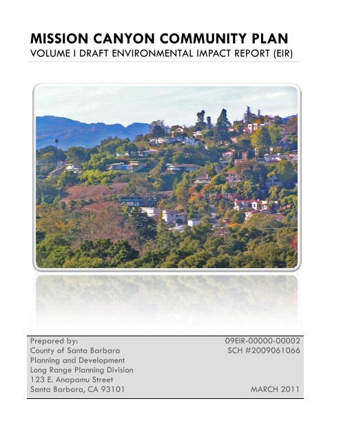
MISSION CANYON COMMUNITY PLAN<br />
VOLUME I DRAFT ENVIRONMENTAL IMPACT REPORT (<strong>EIR</strong>)<br />
Prepared by:<br />
09<strong>EIR</strong>-00000-00002<br />
County of Santa Barbara<br />
SCH #2009061066<br />
<strong>Plan</strong>ning and Development<br />
<strong>Long</strong> <strong>Range</strong> <strong>Plan</strong>ning Division<br />
123 E. Anapamu Street<br />
Santa Barbara, CA 93101 MARCH 2011
<strong>Mission</strong> <strong>Canyon</strong> <strong>Community</strong> <strong>Plan</strong><br />
Draft Environmental Impact Report<br />
Volume I: <strong>EIR</strong><br />
Prepared by:<br />
County of Santa Barbara<br />
<strong>Plan</strong>ning and Development<br />
<strong>Long</strong> <strong>Range</strong> <strong>Plan</strong>ning Division<br />
123 E. Anapamu Street<br />
Santa Barbara, CA 93101<br />
Contacts:<br />
Jeff Hunt, Director<br />
June Pujo, Supervising <strong>Plan</strong>ner<br />
Rosie Dyste, <strong>Plan</strong>ner<br />
(805) 568-3532<br />
March 2011<br />
SANTA BARBARA COUNTY MARCH 2011 DRAFT
MISSION CANYON COMMUNITY PLAN <strong>EIR</strong> TABLE OF CONTENTS<br />
TABLE OF CONTENTS<br />
EXECUTIVE SUMMARY ....................................................................................................................................... 1<br />
1.0 INTRODUCTION ...................................................................................................................................... 1-1<br />
1.1 PROJECT BACKGROUND ..................................................................................................................................... 1-1<br />
1.2 PURPOSE AND LEGAL AUTHORITY ........................................................................................................................ 1-2<br />
1.3 SCOPE AND CONTENT ........................................................................................................................................ 1-3<br />
1.4 LEAD, RESPONSIBLE AND TRUSTEE AGENCIES ......................................................................................................... 1-5<br />
2.0 PROJECT DESCRIPTION ........................................................................................................................... 2-1<br />
2.1 PROJECT LOCATION .......................................................................................................................................... 2-1<br />
2.2 PROJECT OBJECTIVES AND OVERVIEW ................................................................................................................... 2-1<br />
2.3 PROJECT CHARACTERISTICS................................................................................................................................. 2-5<br />
2.4 MAJOR POLICY SUMMARY ................................................................................................................................. 2-5<br />
2.5 PROJECT BUILDOUT ASSUMPTIONS ...................................................................................................................... 2-9<br />
2.6 DECISION-MAKER ACTIONS REQUIRED ................................................................................................................ 2-15<br />
3.0 ENVIRONMENTAL SETTING ..................................................................................................................... 3-1<br />
3.1 LOCAL GEOGRAPHY .......................................................................................................................................... 3-1<br />
3.2 REGIONAL CLIMATE .......................................................................................................................................... 3-1<br />
3.3 DEMOGRAPHICS ............................................................................................................................................... 3-1<br />
3.4 GENERAL DEVELOPMENT PATTERNS ..................................................................................................................... 3-1<br />
3.5 REGIONAL AND LOCAL ACCESS ............................................................................................................................ 3-3<br />
3.6 PUBLIC SERVICE AND UTILITIES PROVIDED FOR THE PLAN AREA .................................................................................. 3-3<br />
3.7 CUMULATIVE DEVELOPMENT .............................................................................................................................. 3-4<br />
4.0 ENVIRONMENTAL IMPACT ANALYSIS ...................................................................................................... 4-1<br />
4.1 AESTHETICS/VISUAL RESOURCES ......................................................................................................................... 4-3<br />
4.2 AIR QUALITY ................................................................................................................................................. 4-13<br />
4.2.1 Ambient Air Quality ......................................................................................................................... 4-13<br />
4.2.2 Global Climate Change .................................................................................................................... 4-25<br />
4.3 BIOLOGICAL RESOURCES .................................................................................................................................. 4-35<br />
4.4 CULTURAL AND HISTORIC RESOURCES ................................................................................................................ 4-99<br />
4.5 ENERGY ...................................................................................................................................................... 4-119<br />
4.6 FIRE PROTECTION ......................................................................................................................................... 4-121<br />
4.7 GEOLOGIC PROCESSES ................................................................................................................................... 4-163<br />
4.8 NOISE ........................................................................................................................................................ 4-175<br />
4.9 PUBLIC FACILITIES ......................................................................................................................................... 4-179<br />
4.10 TRAFFIC AND CIRCULATION ........................................................................................................................ 4-187<br />
4.11 WATER RESOURCES, DRAINAGE AND FLOODING ............................................................................................ 4-233<br />
5.0 POLICY CONSISTENCY ANALYSIS ............................................................................................................. 5-1<br />
5.1 INTRODUCTION ................................................................................................................................................ 5-1<br />
5.2 POLICY CONSISTENCY ANALYSIS ........................................................................................................................... 5-1<br />
6.0 ALTERNATIVES ....................................................................................................................................... 6-1<br />
6.1 ALTERNATIVES CONSIDERED BUT REJECTED ........................................................................................................... 6-2<br />
6.2 ALTERNATIVE 1: NO PROJECT ALTERNATIVE ...................................................................................................... 6-3<br />
6.3 ALTERNATIVE 2: REDUCED BUILDOUT .............................................................................................................. 6-8<br />
6.4 ENVIRONMENTALLY SUPERIOR ALTERNATIVE ....................................................................................................... 6-14<br />
SANTA BARBARA COUNTY I MARCH 2011 DRAFT
MISSION CANYON COMMUNITY PLAN <strong>EIR</strong> TABLE OF CONTENTS<br />
7.0 OTHER CEQA REQUIRED DISCUSSIONS .................................................................................................... 7-1<br />
7.1 GROWTH INDUCING EFFECTS .............................................................................................................................. 7-1<br />
7.2 SIGNIFICANT UNAVOIDABLE EFFECTS .................................................................................................................... 7-2<br />
7.3 SIGNIFICANT IRREVERSIBLE ENVIRONMENTAL EFFECTS ............................................................................................. 7-3<br />
7.4 ISSUES FOUND NOT TO BE SIGNIFICANT ................................................................................................................ 7-4<br />
8.0 REFERENCES ........................................................................................................................................... 8-1<br />
LIST OF FIGURES<br />
FIGURE 2- 1 VICINITY MAP ........................................................................................................................................ 2-3<br />
FIGURE 2- 2 EXISTING SETTING ......................................................................................................................................... 2-4<br />
FIGURE 2- 3 NEIGHBORHOODS ........................................................................................................................................ 2-12<br />
FIGURE 2- 4 BUILDOUT MAP .......................................................................................................................................... 2-13<br />
FIGURE 4.3- 1 VEGETATION AND HABITATS ....................................................................................................................... 4-39<br />
FIGURE 4.3- 2 ENVIRONMENTALLY SENSITIVE HABITAT OVERLAY........................................................................................... 4-46<br />
FIGURE 4.3- 3 SALMONID BARRIERS ................................................................................................................................ 4-55<br />
FIGURE 4.3- 4 FISH PASSAGE RESTORATION LOCATIONS ...................................................................................................... 4-57<br />
FIGURE 4.6- 1 JESUSITA FIRE DAMAGE ........................................................................................................................... 4-124<br />
FIGURE 4.6- 2 FIRE HAZARD SEVERITY ZONE ................................................................................................................... 4-132<br />
FIGURE 4.6- 3 PROPOSED SPOT IMPROVEMENTS .............................................................................................................. 4-149<br />
FIGURE 4.6- 4 EVACUATION TRAVEL TIME WITH RECOMMENDED IMPROVEMENTS ................................................................. 4-152<br />
FIGURE 4.6- 5 RECOMMENDED IMPROVEMENTS FOR EVACUATION ...................................................................................... 4-155<br />
FIGURE 4.6- 6 EVACUATION TRAVEL TIME WITH OPTIMIZED TRAFFIC CONTROL ..................................................................... 4-157<br />
FIGURE 4.7- 1 GEOLOGIC FEATURES .............................................................................................................................. 4-165<br />
FIGURE 4.10- 1 ANALYZED INTERSECTIONS AND ROADWAY SEGMENTS ................................................................................ 4-188<br />
FIGURE 4.10- 2 EXISTING TRAFFIC VOLUMES ................................................................................................................... 4-194<br />
FIGURE 4.10- 3 EXISTING PEAK HOUR TRAFFIC VOLUMES .................................................................................................. 4-198<br />
FIGURE 4.10- 4 AVERAGE ROAD RIGHT-OF-WAY WIDTHS ................................................................................................. 4-204<br />
FIGURE 4.10- 5 BUILDOUT AVERAGE DAILY TRAFFIC VOLUMES ........................................................................................... 4-211<br />
FIGURE 4.10- 6 BUILDOUT PEAK HOUR TRAFFIC VOLUMES ................................................................................................ 4-212<br />
FIGURE 4.10- 7 CUMULATIVE AVERAGE DAILY TRAFFIC VOLUMES ....................................................................................... 4-216<br />
FIGURE 4.10- 8 CUMULATIVE PEAK HOUR TRAFFIC VOLUMES ............................................................................................ 4-217<br />
FIGURE 4.11- 1 WATERSHEDS ...................................................................................................................................... 4-235<br />
FIGURE 4.11- 2 FLOOD HAZARD OVERLAY ...................................................................................................................... 4-237<br />
FIGURE 4.11- 3 WATER PRESSURE ZONES ...................................................................................................................... 4-248<br />
LIST OF TABLES<br />
TABLE ES- 1: SUMMARY OF IMPACTS AND MITIGATION MEASURES ............................................................................................ 7<br />
TABLE 2- 1: MISSION CANYON COMMUNITY PLAN BUILDOUT SUMMARY ............................................................................... 2-11<br />
TABLE 2- 2: BUILDOUT SUMMARY BY NEIGHBORHOOD ........................................................................................................ 2-11<br />
TABLE 2- 3: BUILDOUT UNITS BY LOT SIZE ........................................................................................................................ 2-14<br />
TABLE 4.2- 1: CURRENT FEDERAL AND STATE AMBIENT AIR QUALITY STANDARDS ................................................................... 4-14<br />
TABLE 4.2- 2: AMBIENT AIR QUALITY AT SANTA BARBARA – EAST CANON PERDIDO MONITORING STATION ................................. 4-15<br />
TABLE 4.2- 3: CLEAN AIR PLAN POPULATION FORECAST ..................................................................................................... 4-20<br />
TABLE 4.2- 4: SBCAG COUNTYWIDE POPULATION FORECAST .............................................................................................. 4-20<br />
TABLE 4.2- 5: ESTIMATED OPERATIONAL EMISSIONS ASSOCIATED WITH THE MISSION CANYON COMMUNITY PLAN BUILDOUT (LBS/DAY)<br />
....................................................................................................................................................................... 4-24<br />
TABLE 4.2- 6: INTERIM SIGNIFICANCE GUIDELINES ............................................................................................................. 4-29<br />
TABLE 4.2- 7: ESTIMATED OPERATIONAL GHG EMISSIONS FROM BUILDOUT PER YEAR ............................................................ 4-30<br />
TABLE 4.2- 8: CO2E BUILDOUT EMISSIONS PER SERVICE POPULATION/YEAR .......................................................................... 4-30<br />
SANTA BARBARA COUNTY II MARCH 2011 DRAFT
MISSION CANYON COMMUNITY PLAN <strong>EIR</strong> TABLE OF CONTENTS<br />
TABLE 4.3- 1: DOCUMENTED OCCURRENCES OF SPECIAL STATUS PLANT SPECIES WITHIN OR NEAR PLAN AREA ............................. 4-49<br />
TABLE 4.3- 2: DOCUMENTED OCCURRENCES OF SPECIAL STATUS BIRDS WITHIN MISSION CANYON. ........................................... 4-58<br />
TABLE 4.3- 3: ENVIRONMENTALLY SENSITIVE HABITAT ACRES .............................................................................................. 4-69<br />
TABLE 4.3- 4: BUILDOUT PARCELS AND PERCENT ESH ........................................................................................................ 4-69<br />
TABLE 4.4- 1: MISSION CANYON RECORDED ARCHAEOLOGICAL SITES ................................................................................. 4-103<br />
TABLE 4.4- 2: HISTORIC ARCHITECTURAL SITES ................................................................................................................ 4-105<br />
TABLE 4.4- 3: COUNTY DESIGNATED LANDMARKS IN MISSION CANYON ............................................................................... 4-106<br />
TABLE 4.6- 1: SANTA BARBARA COUNTY FIRE FLOW CRITERIA ........................................................................................... 4-128<br />
TABLE 4.6- 2: FIRE FLOW RESULTS ............................................................................................................................... 4-128<br />
TABLE 4.6- 3: SYSTEMWIDE TRAVEL STATISTICS RESULTS FOR EVACUATION SCENARIOS .......................................................... 4-151<br />
TABLE 4.9-1: SANITARY SEWER CONCEPTUAL DESIGN STUDY FOR TUNNEL ROAD AREA .......................................................... 4-180<br />
TABLE 4.9-2: SANITARY SEWER CONCEPTUAL DESIGN STUDY FOR PALOMINO ROAD .............................................................. 4-180<br />
TABLE 4.9-3: POTENTIAL GENERATION OF LONG-TERM OPERATIONAL WASTE ..................................................................... 4-185<br />
TABLE 4.10- 1: ROADWAY CLASSIFICATIONS ................................................................................................................... 4-191<br />
TABLE 4.10- 2: ROADWAY DESIGN AND ACCEPTABLE CAPACITY ......................................................................................... 4-192<br />
TABLE 4.10- 3: EXISTING (2009) ROADWAY SEGMENT OPERATING CONDITIONS .................................................................. 4-195<br />
TABLE 4.10- 4: EXISTING (2009) STATE ROUTE 192 SEGMENT OPERATING CONDITIONS ....................................................... 4-196<br />
TABLE 4.10- 5: EXISTING (2009) INTERSECTION OPERATING CONDITIONS ........................................................................... 4-200<br />
TABLE 4.10- 6: TRIP GENERATION RATES AND ESTIMATES ................................................................................................ 4-210<br />
TABLE 4.10- 7: FUTURE (2030) ROADWAY SEGMENT IMPACT ANALYSIS ............................................................................. 4-219<br />
TABLE 4.10- 8: FUTURE (2030) STATE ROUTE 192 SEGMENT IMPACT ANALYSIS .................................................................. 4-221<br />
TABLE 4.10- 9: FUTURE (2030) WITH PROJECT INTERSECTION IMPACT ANALYSIS .................................................................. 4-222<br />
TABLE 4.10- 10: INTERSECTION MITIGATION ANALYSIS .................................................................................................... 4-229<br />
TABLE 4.11- 1: MISSION CREEK AND OUTLET POLLUTANTS (303(D) LIST) ............................................................................ 4-240<br />
TABLE 4.11- 2: WATER QUALITY DATA (ENTIRE LENGTH OF MISSION CREEK) ....................................................................... 4-242<br />
TABLE 4.11- 3: WATER DEMAND FACTORS FOR ADDITIONAL UNITS.................................................................................... 4-247<br />
TABLE 4.11- 4: MISSION CANYON MAXIMUM DAY DEMAND PROJECTIONS .......................................................................... 4-247<br />
TABLE 4.11- 5: HYDRAULIC EVALUATION OF MISSION CANYON AREA .................................................................................. 4-249<br />
TABLE 5- 1: POLICY CONSISTENCY ANALYSIS ....................................................................................................................... 5-1<br />
TABLE 6.1- 1: NO PROJECT ALTERNATIVE EMISSIONS ............................................................................................................ 6-5<br />
TABLE 6.2- 1: POTENTIAL ZONE DISTRICTS FOR DOWNZONING .............................................................................................. 6-9<br />
TABLE 6.2- 2: SLOPE DENSITY FORMULA ............................................................................................................................ 6-9<br />
TABLE 6.2- 3: SLOPE DENSITY FORMULA RESULTS ............................................................................................................. 6-10<br />
TABLE 6.2- 4: REDUCED BUILDOUT ALTERNATIVE IN COMPARISON TO THE PROPOSED PLAN ...................................................... 6-10<br />
APPENDICES<br />
(bound under separate cover)<br />
APPENDIX A NOP and Response Letters<br />
APPENDIX B Buildout Table<br />
APPENDIX C Cumulative Development Tables<br />
APPENDIX D GHG Worksheets and Substantial Evidence<br />
APPENDIX E Supplemental Biological Resources Study<br />
APPENDIX F Hydraulic Analysis<br />
APPENDIX G Traffic Simulation for Fire Evacuation<br />
APPENDIX H Traffic Study<br />
SANTA BARBARA COUNTY III MARCH 2011 DRAFT
MISSION CANYON COMMUNITY PLAN <strong>EIR</strong> TABLE OF CONTENTS<br />
THIS PAGE INTENTIONALLY LEFT BLANK<br />
SANTA BARBARA COUNTY IV MARCH 2011 DRAFT
MISSION CANYON COMMUNITY PLAN <strong>EIR</strong> EXECUTIVE SUMMARY<br />
Executive Summary<br />
This section summarizes the characteristics of the proposed project, alternatives,<br />
environmental impacts, mitigation measures, and residual impacts associated with the<br />
proposed project.<br />
Project Applicant/Lead Agency<br />
County of Santa Barbara<br />
<strong>Plan</strong>ning and Development Department<br />
<strong>Long</strong> <strong>Range</strong> <strong>Plan</strong>ning Division<br />
123 E. Anapamu Street<br />
Santa Barbara, CA 93101<br />
Contacts:<br />
Jeff Hunt, Director<br />
June Pujo, Supervising <strong>Plan</strong>ner<br />
Rosie Dyste, Senior <strong>Plan</strong>ner<br />
(805) 568‐3380<br />
Project Location<br />
<strong>Mission</strong> <strong>Canyon</strong> is an unincorporated community located in the South Coast area of Santa<br />
Barbara County, adjacent to and north of the City of Santa Barbara. The <strong>Mission</strong> <strong>Canyon</strong> plan<br />
area (plan area) is located mostly within the <strong>Mission</strong> Creek watershed in the foothills of the<br />
Santa Ynez Mountains. State Route 192 (Foothill Road) is the only main regional transportation<br />
route that traverses the plan area. The plan area is within the City of Santa Barbara’s Sphere of<br />
Influence but there are no current proposals to annex the plan area to the City.<br />
Background<br />
The project is an update to the <strong>Mission</strong> <strong>Canyon</strong> Area Specific <strong>Plan</strong> which was originally adopted<br />
in 1984. Since the Specific <strong>Plan</strong>’s adoption over 25 years ago, approximately 52 new homes<br />
were built and many others were remodeled and expanded, approximately half of the existing<br />
residences were converted from septic to sanitary sewer service, the Santa Barbara Botanic<br />
Garden acquired more acreage and the existing County Landmark designation in the garden<br />
was expanded to include several parcels and more features, new Very High Fire Hazard Severity<br />
Zone designations were adopted by the State for State and Local Responsibility Areas, and<br />
wildfires in 2008 and 2009 resulted in evacuation orders and devastated the upper canyon<br />
resulting in the loss of approximately 70 homes and native habitat. These changes have<br />
occurred while the existing infrastructure, particularly roads, remained the same as when they<br />
were originally laid out.<br />
SANTA BARBARA COUNTY ES-1 MARCH 2011 DRAFT
MISSION CANYON COMMUNITY PLAN <strong>EIR</strong> EXECUTIVE SUMMARY<br />
In recognition of the need to develop updated planning guidelines and standards and to<br />
address ongoing and new issues in <strong>Mission</strong> <strong>Canyon</strong>, the County Board of Supervisors initiated<br />
an update to the 1984 Specific <strong>Plan</strong> to be replaced by the <strong>Mission</strong> <strong>Canyon</strong> <strong>Community</strong> <strong>Plan</strong><br />
when adopted.<br />
Project Description and Objectives<br />
The plan area encompasses approximately 1,120 acres and contains 1,140 parcels. Currently,<br />
there are 1,014 residential units and several public/institutional buildings including Fire Station<br />
15, Santa Barbara Woman’s Club, County Parks Department’s administrative buildings at Rocky<br />
Nook County Park, and Santa Barbara Botanic Garden buildings and structures. There are no<br />
changes proposed to land use and zoning and the draft <strong>Mission</strong> <strong>Canyon</strong> <strong>Community</strong> <strong>Plan</strong><br />
calculated 157 new residential units at buildout.<br />
The project objectives are as follows:<br />
1. Replace the 1984 <strong>Mission</strong> <strong>Canyon</strong> Area Specific <strong>Plan</strong> with a <strong>Community</strong> <strong>Plan</strong> that reflects<br />
community goals as articulated by the <strong>Mission</strong> <strong>Canyon</strong> <strong>Plan</strong>ning Advisory Committee in<br />
the Vision Statement of the draft <strong>Mission</strong> <strong>Canyon</strong> <strong>Community</strong> <strong>Plan</strong> (see below).<br />
2. Adopt <strong>Community</strong> <strong>Plan</strong> policies, development standards and actions to plan for the<br />
buildout of the plan area using existing Land Use densities and primary Zone District<br />
designations compatible with community character, with adequate services and<br />
infrastructure for public health and safety.<br />
3. Adopt Residential Design Guidelines to articulate and implement the community’s<br />
desire to preserve neighborhood character and charm.<br />
4. Amend the Land Use and Development Code to implement applicable policies,<br />
development standards and action items from the <strong>Mission</strong> <strong>Canyon</strong> <strong>Community</strong> <strong>Plan</strong>.<br />
The draft <strong>Mission</strong> <strong>Canyon</strong> <strong>Community</strong> <strong>Plan</strong> goals reflect the community’s desire to enhance fire<br />
safe practices, improve pedestrian and bicyclist circulation, and assure the compatibility of new,<br />
remodeled, or rebuilt structures with existing development. The <strong>Mission</strong> <strong>Canyon</strong> <strong>Plan</strong>ning<br />
Advisory Committee articulated key goals for the plan as follows:<br />
• Maintain and enhance existing community qualities, including <strong>Mission</strong><br />
<strong>Canyon</strong>’s natural scenic beauty and charm;<br />
• Improve fire safe practices including vegetation management, defensible<br />
space, hydrants and water supply, road safety, and emergency ingress and<br />
egress;<br />
• Protect public views of the ocean, mountains, and scenic corridors;<br />
• Provide for the reasonable use of property and limited additional<br />
development that is compatible with the natural terrain and with the scale<br />
and character of existing structures in the area;<br />
SANTA BARBARA COUNTY ES-2 MARCH 2011 DRAFT
MISSION CANYON COMMUNITY PLAN <strong>EIR</strong> EXECUTIVE SUMMARY<br />
Alternatives<br />
• Assure that development does not exceed availability of adequate services<br />
and infrastructure to provide for public health and safety;<br />
• Develop plans for possible post-disaster recovery and reconstruction that<br />
balances the likely conflict between the desire for rapid recovery and the<br />
competing desire to rebuild a community more resistant to future disaster;<br />
• Protect sensitive habitats and other biological resources;<br />
• Protect watershed function, groundwater and surface water quality, and<br />
prevent flooding and erosion;<br />
• Provide safe and efficient circulation systems and improve pedestrian and<br />
bicyclist access and safety;<br />
• Promote water conservation, resource recovery, green building practices,<br />
and energy conservation and generation;<br />
• Preserve open space;<br />
• Protect historic and cultural resources; and<br />
• Improve aesthetics through the application of Residential Design Guidelines.<br />
As required by CEQA Guidelines Section 15126.6, this <strong>EIR</strong> examines a reasonable range of<br />
alternatives to the proposed project that potentially minimize environmental impacts while<br />
achieving most of the main project objectives. The alternatives assessed in this <strong>EIR</strong> include:<br />
No Project Alternative assumes that buildout would follow the existing zoning and land use<br />
designations; however, an additional 36 Residential Second Units are presumed under this<br />
alternative because a proposed policy to limit second units would not be adopted. The No<br />
Project Alternative also assumes that the new policies, development standards and actions<br />
from the proposed plan would not be implemented.<br />
Reduced Buildout Alternative would reduce the residential buildout potential on parcels large<br />
enough to support a lot split by increasing the required minimum lot area for development of a<br />
single family home. The methods analyzed to reduce buildout included downzoning i.e.,<br />
rezoning single family residential zones to require larger minimum lot and building site areas for<br />
example from 1-E-1 (1 acre gross minimum lot and building site area) to 5-E-1 (5 acres gross<br />
minimum lot and building site area) or application of a slope density formula i.e., increase<br />
minimum lot area by 1.5 – 3.0 times depending on the percent of average slope. These<br />
methods would reduce buildout by approximately 47% by downzoning and 34% using a slope<br />
density formula.<br />
The analysis finds that the Reduced Buildout Alternative is environmentally superior to both the<br />
Project and to the No Project Alternative as it would maximize reductions in potentially<br />
significant impacts while attaining the <strong>Plan</strong>’s objectives.<br />
SANTA BARBARA COUNTY ES-3 MARCH 2011 DRAFT
MISSION CANYON COMMUNITY PLAN <strong>EIR</strong> EXECUTIVE SUMMARY<br />
Required Actions and Approvals to Implement the Project<br />
The County Board of Supervisors must take the following actions to implement the Draft<br />
<strong>Mission</strong> <strong>Canyon</strong> <strong>Community</strong> <strong>Plan</strong> and its implementing document, the <strong>Mission</strong> <strong>Canyon</strong><br />
Residential Design Guidelines.<br />
1. Replace the 1984 <strong>Mission</strong> <strong>Canyon</strong> Area Specific <strong>Plan</strong> with the <strong>Mission</strong> <strong>Canyon</strong><br />
<strong>Community</strong> <strong>Plan</strong>.<br />
2. Amend the Santa Barbara County General <strong>Plan</strong> by adopting text and map<br />
amendments to the <strong>Mission</strong> <strong>Canyon</strong> <strong>Community</strong> <strong>Plan</strong>.<br />
3. Approve map amendments to the County of Santa Barbara Zoning Map to incorporate<br />
the new <strong>Mission</strong> <strong>Canyon</strong> <strong>Plan</strong> Overlay.<br />
4. Approve text amendments to the Santa Barbara County Code, Chapter 35, Land Use and<br />
Development code to incorporate the new <strong>Mission</strong> <strong>Canyon</strong> <strong>Plan</strong> Overlay, Outdoor<br />
Lighting Regulations and other amendments.<br />
5. Approve the <strong>Mission</strong> <strong>Canyon</strong> Residential Design Guidelines.<br />
6. Certify the Final Environmental Impact Report for the <strong>Mission</strong> <strong>Canyon</strong> <strong>Community</strong> <strong>Plan</strong>.<br />
7. Adopt findings of overriding considerations for any environmental impacts which have<br />
been determined to not be mitigated to less-than-significant levels with implementation<br />
of the project.<br />
Environmental Analysis<br />
This <strong>EIR</strong> addresses all potentially significant environmental impacts associated with the<br />
proposed <strong>Plan</strong> as determined in the County Initial Study (IS), responses to the Notice of<br />
Preparation (NOP) and input at the <strong>EIR</strong> scoping meeting. Potentially significant impacts on the<br />
following environmental resources are addressed in detail:<br />
• Aesthetics/Visual Resources<br />
• Air Quality<br />
• Biological Resources<br />
• Cultural and Historic Resources<br />
• Energy<br />
• Fire Protection<br />
• Geologic Processes<br />
SANTA BARBARA COUNTY ES-4 MARCH 2011 DRAFT
MISSION CANYON COMMUNITY PLAN <strong>EIR</strong> EXECUTIVE SUMMARY<br />
• Noise<br />
• Public Facilities<br />
• Transportation and Circulation<br />
• Water Resources, Flooding, Drainage and Water Supply<br />
Summary of Impacts and Mitigation Measures<br />
Table ES-1 presents a summary of potential environmental effects identified in this <strong>EIR</strong>.<br />
SANTA BARBARA COUNTY ES-5 MARCH 2011 DRAFT
MISSION CANYON COMMUNITY PLAN <strong>EIR</strong> EXECUTIVE SUMMARY<br />
THIS PAGE INTENTIONALLY LEFT BLANK<br />
SANTA BARBARA COUNTY ES-6 MARCH 2011 DRAFT
MISSION CANYON COMMUNITY PLAN <strong>EIR</strong> EXECUTIVE SUMMARY<br />
Table ES- 1: Summary of Impacts and Mitigation Measures<br />
CLASS I — POTENTIALLY SIGNIFICANT AND UNAVOIDABLE<br />
Impact Mitigation Measure Significance After<br />
Mitigation<br />
IMPACT BIO-2: <strong>Plan</strong> buildout could<br />
significantly impact<br />
environmentally sensitive plant<br />
communities and habitat.<br />
BIOLOGICAL RESOURCES<br />
MM-BIO-2.1: Incorporate proposed land use and biological<br />
resource goals, policies, development standards and actions (or<br />
functional equivalent) from the draft <strong>Mission</strong> <strong>Canyon</strong> <strong>Community</strong><br />
<strong>Plan</strong> into the final <strong>Mission</strong> <strong>Canyon</strong> <strong>Community</strong> <strong>Plan</strong>.<br />
MM-BIO-2.2: Revise Environmentally Sensitive Habitat mapping<br />
(additions underlined).<br />
Policy BIO-MC-3: The following biological resources and<br />
habitats, as identified and generally described by the <strong>Plan</strong> shall<br />
be presumed to be “environmentally sensitive,” provided that<br />
the biological resource(s) or habitat(s) actually present on a<br />
project site satisfy one or more of the criteria listed in Policy BIO-<br />
MC-2. These resources and habitats shall be identified on a<br />
<strong>Mission</strong> <strong>Canyon</strong> <strong>Community</strong> <strong>Plan</strong> Environmentally Sensitive<br />
Habitat (ESH) Overlay Map to the extent that their general or<br />
specific locations are known:<br />
• Habitats containing Nuttall’s scrub oak or other special<br />
status animal or plant species or rare natural communities;<br />
Under a reasonable<br />
worst-case scenario,<br />
project impacts to<br />
sensitive plant<br />
communities and habitat<br />
would not be fully<br />
mitigated and would<br />
remain a Class I,<br />
significant and<br />
unavoidable impact.<br />
SANTA BARBARA COUNTY ES-7 MARCH 2011 DRAFT
MISSION CANYON COMMUNITY PLAN <strong>EIR</strong> EXECUTIVE SUMMARY<br />
CLASS I — POTENTIALLY SIGNIFICANT AND UNAVOIDABLE<br />
Impact Mitigation Measure Significance After<br />
Mitigation<br />
• Central and Southern Coast Live Oak Riparian Forest and<br />
Woodland;<br />
• Coast Live Oak Woodland and Forest;<br />
• California Sycamore Riparian Forest;<br />
• Coast Live Oak/Olive Riparian Woodland<br />
• Central Coast Arroyo Willow Riparian Forest;<br />
• Wetland Habitats<br />
• Native grasslands or other habitats with understory<br />
dominated by native grass species.<br />
The scale of the overlay map precludes complete accuracy<br />
in the mapping of habitat areas. In some cases, the precise<br />
location of habitat areas is not known and is therefore not<br />
mapped. In addition, the migration of species or discovery of<br />
new habitats may result in the designation of new areas, or sitespecific<br />
reviews may indicate different habitat designations. As<br />
new information becomes available, <strong>Plan</strong>ning & Development<br />
will periodically update the boundaries of the designations.<br />
Where proposed development could impact environmentally<br />
sensitive habitat present on site, a biological report, prepared by<br />
a County approved biologist shall be required. The report shall<br />
follow the County’s and CDFG’s most current guidelines as<br />
determined by <strong>Plan</strong>ning & Development.<br />
Action BIO-MC-1.1: The Land Use & Development Code shall<br />
be amended to include an Environmentally Sensitive Habitat<br />
overlay district for the <strong>Mission</strong> <strong>Canyon</strong> area (ESH-MC). Location<br />
of biological resources/habitat areas shall be depicted on the<br />
SANTA BARBARA COUNTY ES-8 MARCH 2011 DRAFT
MISSION CANYON COMMUNITY PLAN <strong>EIR</strong> EXECUTIVE SUMMARY<br />
CLASS I — POTENTIALLY SIGNIFICANT AND UNAVOIDABLE<br />
Impact Mitigation Measure Significance After<br />
Mitigation<br />
ESH-MC overlay map as amended by the July 2009 <strong>Mission</strong><br />
<strong>Canyon</strong> Supplemental Biological Resources Assessment.<br />
MM-BIO-2.3: Clarify permit requirements for ve g e t a t i o n removal<br />
i n d e s i g n a t e d e n v i r o n m e n t a l l y s e n s i t i v e h a b i t a t . E x i s t i n g<br />
Development Standard in the draft plan shall be revised as an<br />
action to amend the zoning ordinance as follows (additions<br />
underlined, deletions struck through):<br />
DevStd BIO-MC-2.2: Except for vegetation management plans<br />
approved by Santa Barbara County Fire Department, a Land Use<br />
Permit shall be required for the following activities:<br />
a. The removal of native vegetation, for purposes other than<br />
vegetation clearance for fuel management consistent<br />
with DevStd BIO-MC-2.1, along 50 liner feet or more of a<br />
creek bank or removal that, when added to the previous<br />
removal of native vegetation within the affected habitat<br />
on the site, would total 50 or more linear feet of native<br />
vegetation along a creek bank.<br />
Action BIO-MC-4.2: Amend the zoning ordinance to: 1)<br />
regulate and provide criteria for the removal of vegetation and<br />
mature native trees in designated Environmentally Sensitive<br />
Habitat areas and 2) identify activities that are exempt from<br />
permits, in addition to other existing permit review provisions<br />
and policy.<br />
1. The intent of the exemptions is to allow for compliance with<br />
SANTA BARBARA COUNTY ES-9 MARCH 2011 DRAFT
MISSION CANYON COMMUNITY PLAN <strong>EIR</strong> EXECUTIVE SUMMARY<br />
CLASS I — POTENTIALLY SIGNIFICANT AND UNAVOIDABLE<br />
Impact Mitigation Measure Significance After<br />
Mitigation<br />
State and local Defensible Space laws while protecting<br />
environmentally sensitive habitat. Exempted activities shall<br />
not involve any grading or use of heavy equipment within<br />
riparian areas. Exempt activities include:<br />
• Removal of non-native trees or immature native trees.<br />
• Removal of surface debris.<br />
• Removal of exotic or invasive species as shown on a Countyapproved<br />
list.<br />
• Removal of vegetation in non-riparian oak woodland or forest<br />
within the minimum Defensible Space area from permitted or<br />
non-conforming buildings or other structures as defined in<br />
the ordinance.<br />
• Selective limbing of mature trees for required Defensible<br />
Space as defined in the ordinance.<br />
• Thinning, pruning or mowing of vegetation (except trees) to<br />
no less than that required to meet fuel modification criteria<br />
(in no case less than a 4 inch stubble) and leaving the roots<br />
intact.<br />
2. A Land Use Permit shall be required for:<br />
• Removal of mature native trees.<br />
• Removal of riparian vegetation.<br />
• Removal of oak woodland or forest understory vegetation not<br />
within the minimum area of Defensible Space as defined in<br />
the ordinance.<br />
SANTA BARBARA COUNTY ES-10 MARCH 2011 DRAFT
MISSION CANYON COMMUNITY PLAN <strong>EIR</strong> EXECUTIVE SUMMARY<br />
CLASS I — POTENTIALLY SIGNIFICANT AND UNAVOIDABLE<br />
Impact Mitigation Measure Significance After<br />
Mitigation<br />
3. A Minor Conditional Use Permit shall be required for:<br />
• Removal of riparian vegetation for a distance of 500 feet or<br />
more along a creek that disturbs the habitat.<br />
• Removal of 1 acre or more of vegetation within an oak<br />
woodland or forest habitat, exclusive of the minimum area<br />
required for Defensible Space, as defined in the ordinance.<br />
4. The amendment shall include the following definitions:<br />
Riparian Vegetation, Mature Native Tree, Defensible Space,<br />
Fuel Modification, Limbing, Heavy Equipment and Vegetation<br />
Removal.<br />
LUDC Ordinance Addition: Amend the <strong>Mission</strong> <strong>Canyon</strong><br />
Environmentally Sensitive Habitat Overlay Zone permit and<br />
processing requirements as initiated to clarify intent and<br />
terminology for Land Use Permits for native vegetation removal.<br />
MM-BIO-2.4: Increase riparian habitat buffer. The proposed<br />
revision would be as follows (deletions struck through, additions<br />
underlined):<br />
DevStd BIO-MC-1.3: Development shall be required to include<br />
the following buffer areas from the boundaries of<br />
Environmentally Sensitive Habitat (ESH), unless it would preclude<br />
development of a parcel to such extent that an unconstitutional<br />
deprivation of property occurs:<br />
SANTA BARBARA COUNTY ES-11 MARCH 2011 DRAFT
MISSION CANYON COMMUNITY PLAN <strong>EIR</strong> EXECUTIVE SUMMARY<br />
CLASS I — POTENTIALLY SIGNIFICANT AND UNAVOIDABLE<br />
Impact Mitigation Measure Significance After<br />
Mitigation<br />
• Creeks and Steelhead critical habitat streams — 50 feet from<br />
the geologic top of creek bank.<br />
• Central and Southern Coast Live Oak Riparian Forest and<br />
Woodland, Coast Live Oak/Olive Riparian Woodland,<br />
California Sycamore Riparian Forest and Central Coast Arroyo<br />
Willow Riparian Forest — 50 feet, as measured from the<br />
geologic top of creek bank. When this habitat extends<br />
beyond the geologic top of creek bank, the buffer shall<br />
extend an additional 25 50 feet from the outside edge of the<br />
Central and Southern Coast Live Oak Riparian Forest and<br />
California Sycamore Riparian Forest canopy.<br />
• Coast Live Oak Woodland and Forest — 25 feet from edge of<br />
canopy.<br />
• Habitats containing Nuttall’s scrub oak or other special status<br />
animal or plant species or natural communities — 25 feet<br />
minimum, full extent to be determined on a case-by-case<br />
basis.<br />
• Wetland Habitats —50 feet from edge of wetland habitat.<br />
• Buffer areas from other types of ESH shall be determined on<br />
a case-by-case basis.<br />
These buffers areas may be adjusted upward or downward on a<br />
case-by-case basis given site specific conditions. Adjustment of<br />
the buffer shall be based on site-specific conditions such as<br />
slopes, biological resources, and erosion potential, as evaluated<br />
and determined by <strong>Plan</strong>ning & Development and other the<br />
County agencies, such as Environmental Health Services and the<br />
Flood Control District. Buffer areas may be adjusted to avoid<br />
SANTA BARBARA COUNTY ES-12 MARCH 2011 DRAFT
MISSION CANYON COMMUNITY PLAN <strong>EIR</strong> EXECUTIVE SUMMARY<br />
CLASS I — POTENTIALLY SIGNIFICANT AND UNAVOIDABLE<br />
Impact Mitigation Measure Significance After<br />
Mitigation<br />
precluding development of a parcel to such extent that an<br />
unconstitutional deprivation of property occurs.<br />
DevStd BIO-MC-4.1: Vegetation clearance for fuel management<br />
Fuel modification for defensible space within ESH and ESH<br />
buffers shall maintain the habitat’s structural integrity and<br />
ecological functions that physically support species (i.e., stream<br />
bank stabilization, erosion control and water quality, shading<br />
effects of tree canopies).<br />
Policy BIO-MC-8: Native riparian vegetation, including trees, shall<br />
be protected as part of a stream or creek development buffer.<br />
New Development shall be setback a minimum of fifty [50] feet<br />
from the geologic top of bank of any stream or creek or outside<br />
edge of riparian vegetation, whichever is greater. When the<br />
riparian habitat extends beyond the geologic top of bank, the<br />
buffer shall extend an additional 25 feet from the outside edge of<br />
the riparian canopy. Buffer areas may be adjusted upward or<br />
downward on a case-by-case basis given site-specific conditions<br />
Adjustment of the buffer shall be based on site-specific<br />
conditions such as slopes, biological resources, and erosion<br />
potential, as evaluated and determined by the County. <strong>Plan</strong>ning<br />
& Development and other County agencies, such as<br />
Environmental Health Services and the Flood Control District.<br />
Buffer areas may be adjusted to avoid precluding reasonable<br />
primary use development of a parcel to such extent that an<br />
unconstitutional deprivation of property occurs. Public or<br />
privately initiated restoration of degraded riparian areas to their<br />
SANTA BARBARA COUNTY ES-13 MARCH 2011 DRAFT
MISSION CANYON COMMUNITY PLAN <strong>EIR</strong> EXECUTIVE SUMMARY<br />
CLASS I — POTENTIALLY SIGNIFICANT AND UNAVOIDABLE<br />
Impact Mitigation Measure Significance After<br />
Mitigation<br />
former state shall be encouraged.<br />
MM-BIO-2.5: Revise Development Standard for Environmentally<br />
Sensitive Habitat areas (deletions struck through, additions<br />
underlined):<br />
DevStd BIO-MC-1.8: New development on parcels entirely<br />
covered with ESH shall be subject to the following development<br />
standards. Development of a parcel shall not be precluded to an<br />
extent that an unconstitutional deprivation of property occurs:<br />
1. The area of permitted ground disturbance for development,<br />
inclusive of defensible space area required for vegetation<br />
clearance, shall be proportional to the size of the parcel.<br />
1. The main structure and accessory structures All permitted<br />
development and uses, including structures, roadways,<br />
landscaping, and agricultural uses, shall be clustered in one<br />
contiguous area to avoid fragmenting the habitat.<br />
2. Development shall be located adjacent to existing access roads<br />
and infrastructure to avoid fragmenting the habitat. subject to<br />
the requirements of “1” and “2” listed above.<br />
3. If impacts to ESH are greater than 0.5 acres, restoration of<br />
degraded native habitat shall be required at a 2:1 ratio. For<br />
parcels impacts less than 0.5 acres, enhancement (e.g.,<br />
invasive species removal) of on-site adjacent ESH shall be<br />
required at a minimum 2:1 ratio.<br />
SANTA BARBARA COUNTY ES-14 MARCH 2011 DRAFT
MISSION CANYON COMMUNITY PLAN <strong>EIR</strong> EXECUTIVE SUMMARY<br />
CLASS I — POTENTIALLY SIGNIFICANT AND UNAVOIDABLE<br />
Impact Mitigation Measure Significance After<br />
Mitigation<br />
IMPACT BIO-5: Buildout of the plan<br />
area could directly and indirectly<br />
impact Special Status animal and<br />
plant species and habitats.<br />
MM-BIO-5.1: Incorporate proposed visual resource policy and<br />
development standard (or functional equivalent) from the draft<br />
<strong>Mission</strong> <strong>Canyon</strong> <strong>Community</strong> <strong>Plan</strong> into the final <strong>Mission</strong> <strong>Canyon</strong><br />
<strong>Community</strong> <strong>Plan</strong>.<br />
MM-BIO-5.2: Require a Mitigation and Monitoring <strong>Plan</strong> for<br />
projects that affect Special Status species and nesting birds.<br />
(additions underlined).<br />
Policy BIO-MC-11: Development shall include provisions to<br />
minimize impacts to special status animals and nesting birds<br />
protected under the Migratory Bird Treaty Act (MBTA).<br />
DevStd BIO-MC-11.1: When special status animal species<br />
are found on or near a site during biological review for projects,<br />
or if the project may affect nesting birds protected under the<br />
Migratory Bird Treaty Act (MBTA), the applicant shall submit to<br />
the County a mitigation and monitoring plan that details<br />
protections to be implemented for identified species during<br />
project construction and development. The plan shall include<br />
compensatory habitat mitigation, if applicable. The mitigation<br />
plan shall contain the following elements:<br />
Under a reasonable<br />
worst-case scenario,<br />
project impacts to Special<br />
Status animal and plant<br />
species and habitat would<br />
not be fully mitigated and<br />
would remain a Class I,<br />
significant and<br />
unavoidable impact.<br />
SANTA BARBARA COUNTY ES-15 MARCH 2011 DRAFT
MISSION CANYON COMMUNITY PLAN <strong>EIR</strong> EXECUTIVE SUMMARY<br />
CLASS I — POTENTIALLY SIGNIFICANT AND UNAVOIDABLE<br />
Impact Mitigation Measure Significance After<br />
Mitigation<br />
• Pre-construction surveys (including nesting bird surveys);<br />
• Project avoidance and/or minimization measures,<br />
including work window restrictions;<br />
• Methods to avoid individuals and allow them to leave the<br />
site on their own, along with exclusionary measures to<br />
prevent individuals from returning to the work area. If<br />
avoidance does not work, include a species removal and<br />
relocation plan in compliance with the federal Endangered<br />
Species Act and California Fish and Game Code for the<br />
handling and relocation of listed species;<br />
• Worker environmental training;<br />
• On-site biological monitoring;<br />
• Habitat protective measures, such as buffer area fencing,<br />
spill prevention, sedimentation and erosion control measures,<br />
and trash containment guidelines;<br />
• Minimization measures to avoid the introduction and<br />
establishment of non-native species;<br />
• Revegetation plans for temporary impacts to significant<br />
habitat areas using native species; and<br />
• A compensatory mitigation (on- or off-site habitat<br />
preservation, enhancement or creation) plan, if the County<br />
determines that significant habitat areas used by special<br />
status animal species will permanently be impacted.<br />
MM-BIO-5.3: Include new Action and Development Standard for<br />
protection of wildlife corridors. The plan shall be revised and the<br />
following added (additions underlined):<br />
SANTA BARBARA COUNTY ES-16 MARCH 2011 DRAFT
MISSION CANYON COMMUNITY PLAN <strong>EIR</strong> EXECUTIVE SUMMARY<br />
CLASS I — POTENTIALLY SIGNIFICANT AND UNAVOIDABLE<br />
Impact Mitigation Measure Significance After<br />
Mitigation<br />
Action BIO-MC-10.1: If a wildlife corridor is identified in the plan<br />
area by a County approved biologist during the biological review<br />
process, it shall be indicated on all development plans. <strong>Plan</strong>ning<br />
and Development should develop and maintain a database of<br />
known wildlife corridors in the plan area.<br />
DevStd BIO-MC-10.2: Development shall not interrupt major<br />
wildlife travel corridors and linkages. Typical wildlife corridors<br />
include, but are not limited to, riparian habitats, streams and<br />
floodplains, and unfragmented areas of grassland and oak<br />
woodland.<br />
MM-BIO-5.4: Include a Policy to address Special Status Animal<br />
and <strong>Plan</strong>t Species surveys and mitigation (additions underlined).<br />
Policy BIO-MC-10: Where sensitive plant species and sensitive<br />
animal species are found pursuant to the review of a<br />
discretionary project, efforts shall be made to preserve the<br />
habitat in which they are located to the maximum extent<br />
feasible. For the purpose of this policy, sensitive plant species<br />
are those species that are officially listed under the State or<br />
Federal Endangered Species Act, Native <strong>Plan</strong>t Protection Act, and<br />
the California Fish and Game Code, or those that appear on List<br />
1B of the California Native <strong>Plan</strong>t Society’s Inventory of<br />
Endangered Vascular <strong>Plan</strong>ts of California. Additional species of<br />
local concern may be considered if the biological report indicates<br />
such is warranted. Sensitive animal species are those listed as<br />
endangered, threatened, or candidate species by the California<br />
Department of Fish and Game and the U.S. Fish and Wildlife<br />
SANTA BARBARA COUNTY ES-17 MARCH 2011 DRAFT
MISSION CANYON COMMUNITY PLAN <strong>EIR</strong> EXECUTIVE SUMMARY<br />
CLASS I — POTENTIALLY SIGNIFICANT AND UNAVOIDABLE<br />
Impact Mitigation Measure Significance After<br />
Mitigation<br />
Service, and those considered to be Species of Special Concern<br />
(CSC) by the CDFG pursuant to the most recent statewide list<br />
IMPACT BIO-6: Cumulative impacts<br />
on biological resources.<br />
IMPACT CR-2: <strong>Plan</strong> buildout would<br />
potentially impact cultural and<br />
historical resources.<br />
maintained by that agency.<br />
No feasible additional mitigation measures are available to<br />
reduce cumulative impacts to biological resources below a level<br />
of significance.<br />
CULTURAL AND HISTORIC RESOURCES<br />
MM-CR-1.1: Incorporate proposed history and archaeology and<br />
visual resource policies, development standards and actions (or<br />
functional equivalent) from the draft <strong>Community</strong> <strong>Plan</strong> into the<br />
final <strong>Mission</strong> <strong>Canyon</strong> <strong>Community</strong> <strong>Plan</strong>.<br />
MM-CR-1.2: Revise development standards to improve<br />
treatment of historical resources (additions underlined, deletions<br />
struck through):<br />
The <strong>Community</strong> <strong>Plan</strong>’s<br />
cumulative impacts to<br />
biological resources in the<br />
<strong>Mission</strong> <strong>Canyon</strong><br />
watershed would remain<br />
Class I, significant and<br />
unavoidable, and no<br />
mitigation measures are<br />
available to fully address<br />
this impact.<br />
The residual impact on<br />
archaeological resources<br />
from buildout would<br />
remain significant and<br />
unavoidable (Class I), as<br />
no procedurally feasible<br />
mitigation to address the<br />
potential impact on<br />
unknown, subsurface<br />
archaeological resources<br />
is available.<br />
SANTA BARBARA COUNTY ES-18 MARCH 2011 DRAFT
MISSION CANYON COMMUNITY PLAN <strong>EIR</strong> EXECUTIVE SUMMARY<br />
CLASS I — POTENTIALLY SIGNIFICANT AND UNAVOIDABLE<br />
Impact Mitigation Measure Significance After<br />
Mitigation<br />
DevStd HA-MC-1.1: A Phase 1 archaeological survey shall be<br />
performed when identified as necessary by a cCounty<br />
archaeologist or contract archaeologist using the best available<br />
resources. or if a county archaeological sensitivity map identifies<br />
the need for a study. The survey shall include all areas of<br />
projects that would result in ground disturbances. If the<br />
archaeologist performing the Phase I report, after conducting a<br />
site visit, determines that the likelihood of an archaeology site<br />
presence is extremely low, a short-form Phase I report may be<br />
submitted. The content, format, and length of the Phase 1<br />
survey report shall be consistent with the size of the project and<br />
findings of the study. If archaeological remains are identified and<br />
cannot be avoided through project redesign, the proponent shall<br />
fund a Phase 2 study to determine the significance of the<br />
resource prior to issuance of any permit for development.<br />
DevStd HA-MC-1.2: All feasible proposed mitigation<br />
recommendations of an archaeological report resulting from the<br />
Phase 1 or Phase 2 study, including completion of additional<br />
archaeological analyses (Phase 2, Phase 3) and/or project<br />
redesign, shall be incorporated into any permit issued for<br />
development.<br />
DevStd HA-MC-2.1: No permits shall be issued for any<br />
development or activity that would adversely affect the historic<br />
value of the properties listed in Table 12 integrity of officially<br />
designated Historic Landmarks and Structures of Merit, historical<br />
SANTA BARBARA COUNTY ES-19 MARCH 2011 DRAFT
MISSION CANYON COMMUNITY PLAN <strong>EIR</strong> EXECUTIVE SUMMARY<br />
CLASS I — POTENTIALLY SIGNIFICANT AND UNAVOIDABLE<br />
Impact Mitigation Measure Significance After<br />
Mitigation<br />
resources eligible for the California Register of Historic<br />
Resources, or identified historical districts unless a professional<br />
evaluation of the proposal has been performed pursuant to the<br />
County’s most current Regulations Governing Archaeological and<br />
Historical Projects., reviewed and approved by <strong>Plan</strong>ning and<br />
Development All such professional studies shall be reviewed and<br />
approved by <strong>Plan</strong>ning and Development and all feasible<br />
mitigation measures shall be have been incorporated into any<br />
permit issued for development. the proposal.<br />
MM-CR-1.3: Add policy and action to the final <strong>Mission</strong> <strong>Canyon</strong><br />
<strong>Community</strong> <strong>Plan</strong> to protect Cultural Resources (additions<br />
underlined).<br />
IMPACT FIRE-2: <strong>Plan</strong> area buildout<br />
would potentially expose people or<br />
structures to a significant risk of<br />
wildland fires.<br />
Policy HA-MC-3: Traditional cultural, historical, and spiritual sites<br />
of concern to the Chumash Indians shall be protected and<br />
preserved to the maximum extent feasible.<br />
Action HA-MC-3.1: The County, Chumash representatives, and<br />
community should work together to ensure appropriate tribal<br />
access to traditional cultural, historical, and spiritual sites while<br />
still respecting the rights and privileges of private property<br />
owners.<br />
FIRE PROTECTION<br />
MM-FIRE-1.1: Incorporate proposed land use and fire protection<br />
goals, policies, actions and development standards (or functional<br />
equivalent) from the draft <strong>Mission</strong> <strong>Canyon</strong> <strong>Community</strong> <strong>Plan</strong> into<br />
the final <strong>Mission</strong> <strong>Canyon</strong> <strong>Community</strong> <strong>Plan</strong>.<br />
Due to the existing<br />
extreme high fire hazard,<br />
impacts would remain<br />
significant and<br />
unavoidable (Class I).<br />
SANTA BARBARA COUNTY ES-20 MARCH 2011 DRAFT
MISSION CANYON COMMUNITY PLAN <strong>EIR</strong> EXECUTIVE SUMMARY<br />
CLASS I — POTENTIALLY SIGNIFICANT AND UNAVOIDABLE<br />
Impact Mitigation Measure Significance After<br />
Mitigation<br />
MM-FIRE-1.2: Revise draft <strong>Mission</strong> <strong>Canyon</strong> <strong>Community</strong> <strong>Plan</strong><br />
Action FIRE-MC-1.1 to provide more direction on the process for<br />
this action (deletions struck through, additions underlined):<br />
Action FIRE-MC-1.1: The County shall prepare a plan and adopt a<br />
Resolution of Intention to fund work with <strong>Mission</strong> <strong>Canyon</strong><br />
residents to prepare a feasibility study for developing a Wildland<br />
Fire Benefit Assessment District to provide additional fire<br />
prevention services to reduce the damage and severity of<br />
wildfires. Additional services may include: improvement of<br />
evacuation routes; defensible space inspection and assistance;<br />
development of on-street parking turnouts and fire hydrants<br />
where needed; and vegetation management programs.<br />
The plan shall specify the funding mechanism for the program by<br />
means of a Benefit Assessment District or Special Tax. If<br />
required, an Engineer’s Report shall be prepared that contains a<br />
description of the improvements to be financed, the proposed<br />
district boundaries, and a description of the special benefit that<br />
each parcel would receive as a result of the assessment. Fire<br />
prevention services may include:<br />
• Implementation of the goals outlined in the <strong>Mission</strong> <strong>Canyon</strong><br />
<strong>Community</strong> Wildfire Protection <strong>Plan</strong> (i.e., reducing hazardous<br />
fuels on public and private lands, increase education and<br />
awareness, and improve and protect critical evacuation<br />
routes);<br />
• Water infrastructure upgrades for firefighting purposes; and<br />
• Actions to improve emergency ingress and egress.<br />
SANTA BARBARA COUNTY ES-21 MARCH 2011 DRAFT
MISSION CANYON COMMUNITY PLAN <strong>EIR</strong> EXECUTIVE SUMMARY<br />
CLASS I — POTENTIALLY SIGNIFICANT AND UNAVOIDABLE<br />
Impact Mitigation Measure Significance After<br />
Mitigation<br />
IMPACT FIRE-3: Buildout of the<br />
plan area would potentially impact<br />
emergency ingress and egress and<br />
limit emergency responder’s ability<br />
to provide optimal protection to<br />
the citizens of <strong>Mission</strong> <strong>Canyon</strong><br />
MM-FIRE-1.3: Incorporate a new action in the draft <strong>Mission</strong><br />
<strong>Canyon</strong> <strong>Community</strong> <strong>Plan</strong> to consider red flag warning closures<br />
and parking prohibitions at the trailhead on Tunnel Road.<br />
Action FIRE-MC-2.7: The County shall coordinate with the City<br />
of Santa Barbara, the Front Country Trails Multi-Jurisdictional<br />
Task Force and the California Highway Patrol to consider a plan to<br />
invoke fire closure of the Tunnel Road trailhead and a prohibition<br />
of parking on Tunnel Road when a Red Flag Warning is in effect.<br />
The plan shall include an educational program to inform<br />
residents and visitors of any proposed closures and potential<br />
enforcement actions that could occur.<br />
MM-FIRE-2.1: Incorporate proposed fire protection policies and<br />
development standards (or functional equivalent) from the draft<br />
<strong>Community</strong> <strong>Plan</strong> into the final <strong>Mission</strong> <strong>Canyon</strong> <strong>Community</strong> <strong>Plan</strong><br />
and implement proposed Land Use and Development Code<br />
amendments for additional findings regarding roadway<br />
evacuation.<br />
MM-FIRE-2.2: Integrate Residential Parking Strategy policies,<br />
actions and development standard recommendations into the<br />
draft <strong>Mission</strong> <strong>Canyon</strong> <strong>Community</strong> <strong>Plan</strong> (additions underlined,<br />
deletions struck through):<br />
Mitigation measures<br />
require funding and<br />
coordination with Caltrans<br />
and the City of Santa<br />
Barbara and therefore it is<br />
unknown if they are<br />
feasible or will be<br />
implemented. Therefore,<br />
impacts remain significant<br />
(Class I).<br />
SANTA BARBARA COUNTY ES-22 MARCH 2011 DRAFT
MISSION CANYON COMMUNITY PLAN <strong>EIR</strong> EXECUTIVE SUMMARY<br />
CLASS I — POTENTIALLY SIGNIFICANT AND UNAVOIDABLE<br />
Impact Mitigation Measure Significance After<br />
Mitigation<br />
Policy CIRC-MC-7: Parking shall be prohibited on roads where<br />
it could encroach into the 10 foot vehicle travel lane or interfere<br />
with emergency ingress or egress, Fire Department access to fire<br />
fighting facilities, and safe pedestrian passage as determined by<br />
County Public Works or the Fire Department, in accordance with<br />
the California Vehicle Code. The outside perimeter of travel<br />
lanes shall be delineated by a white stripe (fog line). Parking shall<br />
be allowed to the right of the fog line provided it does not<br />
interfere with adequate sight distance and safe pedestrian<br />
passage. Parking areas in the public right-of-way shall not be<br />
reserved and/or posted for the sole use of the adjacent property<br />
owner and shall not be used for long term parking of boats,<br />
trailers or recreational vehicles.<br />
Action CIRC-MC-7.1: The County shall seek funding to paint and<br />
maintain fog line striping on public roads in <strong>Mission</strong> <strong>Canyon</strong><br />
where appropriate to implement Policy CIRC-MC-7. Public<br />
outreach will be conducted prior to new fog line striping to seek<br />
public input on road striping placement. The County shall<br />
coordinate timing and implementation of new road striping with<br />
the California Highway Patrol to ensure public awareness of<br />
Vehicle Code enforcement.<br />
Policy CIRC-MC-8: Encroachments in the public right-of-way<br />
shall generally be discouraged. Encroachment of structures,<br />
fences, walls, landscaping, etc., into existing road rights-of-way<br />
shall be subject to an encroachment permit and may be<br />
SANTA BARBARA COUNTY ES-23 MARCH 2011 DRAFT
MISSION CANYON COMMUNITY PLAN <strong>EIR</strong> EXECUTIVE SUMMARY<br />
CLASS I — POTENTIALLY SIGNIFICANT AND UNAVOIDABLE<br />
Impact Mitigation Measure Significance After<br />
Mitigation<br />
approved only when all of the following conditions are met: (a)<br />
the encroachment preserves an unobstructed minimum distance<br />
of 7 feet from edge of pavement; (b) the encroachment would<br />
widen the right-of-way area usable by the public (e.g., pedestrian<br />
and bicycle passage) or add public parking spaces; and (c) the<br />
encroachment would be consistent with the semi-rural character<br />
of <strong>Mission</strong> <strong>Canyon</strong>. BAR approval shall be required for any<br />
encroachment that requires a Land Use Permit under the LUDC.<br />
DevStd CIRC-MC-8.1: Board of Architectural Review (BAR)<br />
approval shall be required for any encroachment that requires a<br />
Land Use Permit under the LUDC. All new landscaping and<br />
hardscape within and immediately adjacent to public rights-ofway<br />
(ROW) shall be consistent with the continued use and<br />
availability of the ROW for its eventual intended use. No<br />
landscaping or hardscape shall be planted within the public road<br />
ROW without an encroachment permit.<br />
DevStd CIRC-MC-8.2: All new residential development on<br />
parcels located along State Route 192 that have or could include<br />
fixed objects within the State right-of-way shall be forwarded to<br />
Caltrans for comment prior to BAR review.<br />
Policy PDR-MC-2: During reconstruction of damaged and<br />
destroyed structures, the County shall regain require removal of<br />
encroachments in the public right- of-way (e.g., remove<br />
encroachments such as walls, fences, and landscaping) along key<br />
ingress and egress roads (<strong>Mission</strong> <strong>Canyon</strong>, Tunnel, Cheltenham,<br />
SANTA BARBARA COUNTY ES-24 MARCH 2011 DRAFT
MISSION CANYON COMMUNITY PLAN <strong>EIR</strong> EXECUTIVE SUMMARY<br />
CLASS I — POTENTIALLY SIGNIFICANT AND UNAVOIDABLE<br />
Impact Mitigation Measure Significance After<br />
Mitigation<br />
and Tye Roads) within the <strong>Canyon</strong>, unless an encroachment<br />
permit is obtained. Regained rights-of-way shall be for the<br />
purpose of meeting minimum Public Works road width standards<br />
and to improve pedestrian and bicyclist circulation providing<br />
adequate sight distance, creating a clear zone to provide pull<br />
over spaces in emergencies, and to ensure access and safety for<br />
pedestrians and bicyclists.<br />
MM-FIRE-2.3: Revise draft <strong>Mission</strong> <strong>Canyon</strong> <strong>Community</strong> <strong>Plan</strong><br />
circulation actions to consider emergency turnout zones at<br />
critical locations to allow additional evacuation traffic capacity<br />
(deletions struck through, additions underlined):<br />
Action CIRC-MC-1.2: The County shall coordinate with Caltrans<br />
to ensure improvements along State Route 192/Foothill Road are<br />
developed in a manner consistent with bicycle and pedestrian<br />
safety and should be designed for improved bicycle access.<br />
Roadway shoulder improvements shall, whenever feasible, be<br />
designed to provide emergency turnout zones and improved<br />
pedestrian and bicycle access.<br />
Action CIRC-MC-7.2: The County shall coordinate with the City<br />
of Santa Barbara to evaluate the need for improvements to the<br />
southbound segment of Los Olivos Street between Mountain<br />
Drive and Alameda Padre Serra to allow for drivable shoulders or<br />
bicycle/pedestrian paths that could be used for cars in an<br />
emergency with the aid of traffic control. The feasibility of<br />
constructing any identified improvements would include funding,<br />
historic evaluation by the City’s Historic Landmarks Commission,<br />
SANTA BARBARA COUNTY ES-25 MARCH 2011 DRAFT
MISSION CANYON COMMUNITY PLAN <strong>EIR</strong> EXECUTIVE SUMMARY<br />
CLASS I — POTENTIALLY SIGNIFICANT AND UNAVOIDABLE<br />
Impact Mitigation Measure Significance After<br />
Mitigation<br />
and engineering requirements.<br />
Action VIS-MC-3.2: <strong>Plan</strong>ning & Development Department shall<br />
work with Public Works, Parks Department, the City of Santa<br />
Barbara, and area residents to seek grants and other funding<br />
sources to design and implement the Phase II Streetscape <strong>Plan</strong><br />
for the <strong>Mission</strong> <strong>Canyon</strong> Scenic Corridor The streetscape plan<br />
should include, but is not limited to, the following programs:<br />
• Designation of on-street and off-street pedestrian trails;<br />
• Consideration of dual purpose pedestrian trails/emergency<br />
vehicle turnout zones in appropriate locations;<br />
• Investigation and removal of encroachments into pedestrian<br />
trails;<br />
• Safe pedestrian access between the Old <strong>Mission</strong> and the<br />
Santa Barbara Museum of Natural History;<br />
• A signage plan;<br />
• Landscaping recommendations; and<br />
• A utility undergrounding program.<br />
MM-FIRE-2.4: Implement Optimized Traffic Control <strong>Plan</strong> during<br />
an evacuation.<br />
This <strong>Plan</strong> is intended to provide a “menu” for the Unified<br />
Command Team to choose from and combine when responding<br />
to fire evacuation scenarios, depending on the timing and<br />
location of a fire, the weather conditions, and the traffic control<br />
equipment and staff resources that could be provided jointly by<br />
the County, Caltrans and the City of Santa Barbara.<br />
Implementation of the traffic control plan would require<br />
SANTA BARBARA COUNTY ES-26 MARCH 2011 DRAFT
MISSION CANYON COMMUNITY PLAN <strong>EIR</strong> EXECUTIVE SUMMARY<br />
CLASS I — POTENTIALLY SIGNIFICANT AND UNAVOIDABLE<br />
Impact Mitigation Measure Significance After<br />
Mitigation<br />
coordination of the State, County and City law enforcement<br />
team, Caltrans, and both County and City Public Works and<br />
Traffic Divisions.<br />
MM-FIRE-2.5: Develop new or alternate access routes.<br />
IMPACT FIRE-5: Cumulative risk of<br />
wildfire impacts and emergency<br />
ingress and egress.<br />
IMPACT TC-1: Buildout of the plan<br />
area would contribute additional<br />
Potential extension of private roadways to allow secondary<br />
alternative access could be considered for upper <strong>Mission</strong> <strong>Canyon</strong><br />
if feasible. For example, extension of Holly Road to connect to<br />
San Roque Road may be beneficial for fire protection planning<br />
and may improve the evacuation travel time for upper <strong>Mission</strong><br />
<strong>Canyon</strong> area and relieve the traffic congestion on <strong>Mission</strong> <strong>Canyon</strong><br />
Road. Any such proposal would need to be coordinated with<br />
private landowners and the City of Santa Barbara. Note that per<br />
the <strong>Mission</strong> <strong>Canyon</strong> <strong>Community</strong> Wildfire Protection <strong>Plan</strong>,<br />
continuous vegetation clearance and maintenance is scheduled<br />
for this unofficial secondary evacuation corridor west of Holly<br />
road to the Laurel Reservoir.<br />
No feasible additional mitigation measures are available to<br />
reduce cumulative impacts to fire protection below a level of<br />
significance.<br />
TRAFFIC AND CIRCULATION<br />
MM-TC-1: Monitor and plan for traffic flow improvements on<br />
<strong>Mission</strong> <strong>Canyon</strong> Road south of Foothill Road. The following new<br />
The <strong>Plan</strong>’s cumulative<br />
impacts to fire protection<br />
in <strong>Mission</strong> <strong>Canyon</strong> would<br />
remain Class I, significant<br />
and unavoidable, and no<br />
mitigation measures are<br />
available to fully address<br />
this impact.<br />
It is unknown if the<br />
mitigation strategy would<br />
SANTA BARBARA COUNTY ES-27 MARCH 2011 DRAFT
MISSION CANYON COMMUNITY PLAN <strong>EIR</strong> EXECUTIVE SUMMARY<br />
CLASS I — POTENTIALLY SIGNIFICANT AND UNAVOIDABLE<br />
Impact Mitigation Measure Significance After<br />
vehicle trips to roadway segments<br />
that could exceed circulation<br />
element capacities.<br />
action is proposed for the draft <strong>Mission</strong> <strong>Canyon</strong> <strong>Community</strong> <strong>Plan</strong><br />
(additions underlined):<br />
Action CIRC-MC-6.1: The County shall regularly monitor traffic<br />
on <strong>Mission</strong> <strong>Canyon</strong> Road between Foothill Road and Mountain<br />
Drive. If average daily traffic volumes approach Level of Service<br />
D (defined as 90% of Design Capacity) for this segment, the<br />
County shall prepare a plan for design changes, spot widening,<br />
intersection improvements or other measures to improve traffic<br />
flow. Improvement plans for this roadway shall consider the<br />
historic and scenic value of this roadway and incorporate traffic<br />
patterns generated by special events at the Santa Barbara<br />
Museum of Natural History and the Woman’s Club.<br />
Mitigation<br />
be effective in reducing<br />
impacts to the identified<br />
segment given the<br />
potential policy conflicts<br />
between roadway<br />
improvements and<br />
preservation of historic<br />
and scenic resources.<br />
Therefore, the <strong>Plan</strong>’s<br />
contribution to the<br />
roadway impact would<br />
remain significant (Class<br />
I).<br />
SANTA BARBARA COUNTY ES-28 MARCH 2011 DRAFT
MISSION CANYON COMMUNITY PLAN <strong>EIR</strong> EXECUTIVE SUMMARY<br />
CLASS II — POTENTIALLY SIGNIFICANT BUT MITIGABLE<br />
Impact Mitigation Measure Significance After<br />
Mitigation<br />
IMPACT AES-2: Buildout of the<br />
plan area could potentially obstruct<br />
scenic vistas or views or change the<br />
visual character of the area.<br />
IMPACT AQ-1: Incremental shortterm<br />
construction activity<br />
associated with buildout of the plan<br />
area would potentially generate<br />
significant air pollutant emissions.<br />
AESTHETICS<br />
MM-AES-1: Incorporate proposed land use and visual resource<br />
goals, policies, development standards, and actions (or the<br />
functional equivalent) from the draft <strong>Mission</strong> <strong>Canyon</strong> <strong>Community</strong><br />
<strong>Plan</strong> into the final <strong>Mission</strong> <strong>Canyon</strong> <strong>Community</strong> <strong>Plan</strong>.<br />
MM-AES-2: Amend proposed Scenic Corridor Development<br />
Standards in the LUDC to prevent impacts to visual character and<br />
public views.<br />
An amendment to the proposed LUDC development standards<br />
for the <strong>Mission</strong> <strong>Canyon</strong> Scenic Corridor Overlay is proposed to<br />
ensure that secondary front setbacks on corner lots are treated<br />
the same as primary front setbacks (i.e., the primary and<br />
secondary front setback of any portion of a lot facing <strong>Mission</strong><br />
<strong>Canyon</strong> Road would be 80 feet from road centerline and 55 feet<br />
from right-of-way) and 2) the fence and wall height standard<br />
applies to the secondary front setback area adjacent to <strong>Mission</strong><br />
<strong>Canyon</strong> Road (i.e., shall not exceed 3.5 feet in height).<br />
AIR QUALITY<br />
MM-AQ-1: Fugitive Dust (PM10) Control. Fugitive dust control<br />
shall include measures designed to reduce particulate matter<br />
(PM10) emissions from project construction. Controls shall<br />
include, but not be limited to, the following measures:<br />
• During construction, use water trucks or sprinkler systems to<br />
keep all areas of vehicle movement damp enough to prevent<br />
dust from leaving the site. At a minimum, this should include<br />
wetting down such areas in the late morning and after work is<br />
completed for the day. Increased watering frequency should<br />
Impact would be less than<br />
significant with<br />
mitigation.<br />
Impact would be less than<br />
significant with<br />
mitigation.<br />
SANTA BARBARA COUNTY ES-29 MARCH 2011 DRAFT
MISSION CANYON COMMUNITY PLAN <strong>EIR</strong> EXECUTIVE SUMMARY<br />
CLASS II — POTENTIALLY SIGNIFICANT BUT MITIGABLE<br />
Impact Mitigation Measure Significance After<br />
Mitigation<br />
be required whenever the wind speed exceeds 15 mph.<br />
Reclaimed water should be used whenever possible, but<br />
should not be used in or around crops for human<br />
consumption.<br />
• Minimize amount of disturbed area and reduce on site vehicle<br />
speeds to 15 miles per hour or less.<br />
• Gravel pads must be installed at all access points to prevent<br />
tracking of mud on to public roads.<br />
• If importation, exportation and stockpiling of fill material are<br />
involved, soil stockpiled for more than two days shall be<br />
covered, kept moist, or treated with soil binders to prevent<br />
dust generation. Trucks transporting fill material to and from<br />
the site shall be tarped from the point of origin.<br />
• After clearing, grading, earth moving or excavation is<br />
completed, treat the disturbed area by watering, or revegetating,<br />
or by spreading soil binders until the area is paved<br />
or otherwise developed so that dust generation will not occur.<br />
• The contractor or builder shall designate a person or persons<br />
to monitor the dust control program and to order increased<br />
watering, as necessary, to prevent transport of dust offsite.<br />
Their duties shall include holiday and weekend periods when<br />
work may not be in progress. The name and telephone<br />
number of such persons shall be provided to the Air Pollution<br />
Control District prior to land use clearance for map<br />
recordation and land use clearance for finish grading for the<br />
structure.<br />
• Prior to land use clearance, the applicant shall include, as a<br />
note on a separate informational sheet to be recorded with<br />
SANTA BARBARA COUNTY ES-30 MARCH 2011 DRAFT
MISSION CANYON COMMUNITY PLAN <strong>EIR</strong> EXECUTIVE SUMMARY<br />
CLASS II — POTENTIALLY SIGNIFICANT BUT MITIGABLE<br />
Impact Mitigation Measure Significance After<br />
Mitigation<br />
map, these dust control requirements. All requirements shall<br />
be shown on grading and building plans.<br />
IMPACT BIO-1: Replacement of the<br />
1984 Specific <strong>Plan</strong> with the<br />
proposed <strong>Community</strong> <strong>Plan</strong>.<br />
BIOLOGICAL RESOURCES<br />
MM-BIO-1: Revise native tree protection policy to protect nonnative<br />
trees that have a biological or ecological function and for<br />
consistency with proposed environmentally sensitive habitat<br />
standards.<br />
(deletions strike through, additions underlined).<br />
Policy BIO-MC-6: Native trees shall be preserved where<br />
appropriate protected within environmentally sensitive habitat<br />
areas and retained outside of environmentally sensitive habitat<br />
areas to the maximum extent feasible. A “native protected tree”<br />
is at least six inches in diameter (largest diameter for non-round<br />
trunks) as measured 4.5 feet above level ground (or as measured<br />
on the uphill side where sloped). Native trees found in <strong>Mission</strong><br />
<strong>Canyon</strong> area include, but are not limited to: coastal live oak<br />
(Quercus agrifolia), Western sycamore (Platanus racemosa),<br />
California bay (Umbellularia californica), Bigleaf maple (Acer<br />
macrophyllum), White alder (Alnus rhombifolia) and California<br />
black walnut (Juglans californica).<br />
Non-native trees that provide nesting habitat or cover shall be<br />
preserved where appropriate. A “non-native protected tree” has<br />
a biological or ecological function (i.e., it provides nesting habitat<br />
or cover) and is at least six inches in diameter (largest diameter<br />
for non-round trunks) as measured 4.5 feet above level ground<br />
(or as measured on the uphill side where sloped).<br />
Impact would be less than<br />
significant with<br />
mitigation.<br />
SANTA BARBARA COUNTY ES-31 MARCH 2011 DRAFT
MISSION CANYON COMMUNITY PLAN <strong>EIR</strong> EXECUTIVE SUMMARY<br />
CLASS II — POTENTIALLY SIGNIFICANT BUT MITIGABLE<br />
Impact Mitigation Measure Significance After<br />
Mitigation<br />
IMPACT BIO-3: Buildout of the plan<br />
area could introduce invasive plant<br />
species into sensitive habitat areas.<br />
IMPACT BIO-4: Buildout of the plan<br />
area could directly and indirectly<br />
impact Southern California<br />
steelhead trout and other aquatic<br />
species habitat.<br />
If it is determined by <strong>Plan</strong>ning & Development the County that<br />
native tree removal cannot feasibly be avoided, removed trees<br />
shall be relocated or replaced onsite to the extent feasible<br />
provided the relocated or replaced trees can be accommodated<br />
in a location and manner that does not conflict with defensible<br />
space clearance requirements. Replacement for native trees<br />
should be propagated from onsite or nearby specimens.<br />
MM-BIO-3: Revise Development Standards for landscaping.<br />
Development Standards in the draft plan shall be revised as<br />
follows (additions underlined):<br />
DevStd BIO-MC-5.1: Development requiring a landscape plan<br />
should use only non-invasive, fire resistant species (examples<br />
listed in Appendix E). <strong>Plan</strong>ts listed on the most recent California<br />
Invasive <strong>Plan</strong>t Council (Cal IPC) Invasive <strong>Plan</strong>t Inventory and<br />
Undesirable <strong>Plan</strong>t Species listed in Appendix E shall not be<br />
included in any landscape plan for new development.<br />
MM-BIO-4.1: Incorporate proposed biological policy and<br />
development standards (or functional equivalent) from the draft<br />
<strong>Community</strong> <strong>Plan</strong> into the final <strong>Mission</strong> <strong>Canyon</strong> <strong>Community</strong> <strong>Plan</strong>.<br />
MM-BIO-4.2: Revise draft <strong>Mission</strong> <strong>Canyon</strong> <strong>Community</strong> <strong>Plan</strong><br />
policy and development standards for activities permitted in<br />
stream corridors to provide enhanced protection of steelhead<br />
habitat (additions underlined, deletions struck through):<br />
Impact is less than<br />
significant with mitigation<br />
Impact is less than<br />
significant with<br />
mitigation.<br />
SANTA BARBARA COUNTY ES-32 MARCH 2011 DRAFT
MISSION CANYON COMMUNITY PLAN <strong>EIR</strong> EXECUTIVE SUMMARY<br />
CLASS II — POTENTIALLY SIGNIFICANT BUT MITIGABLE<br />
Impact Mitigation Measure Significance After<br />
Mitigation<br />
Policy BIO-MC-7: Natural stream channels corridors shall be<br />
maintained in an undisturbed state to the maximum extent<br />
feasible in order to protect water quality and banks from erosion,<br />
enhance wildlife passageways, and provide natural greenbelts.<br />
“Hardbank” channelization (e.g., use of concrete, riprap, gabion<br />
baskets) of stream channels or corridors shall be prohibited,<br />
except where it has been demonstrated that no other method for<br />
protecting existing habitable structures or infrastructure in the<br />
floodplain is feasible and where such protection is necessary for<br />
public safety or to necessary to protect existing habitable<br />
structures (existing habitable structures and infrastructure shall<br />
be as of the <strong>Community</strong> <strong>Plan</strong> adoption date). Where hardbank<br />
channelization is required, the material and design used shall be<br />
the least environmentally damaging alternative and site<br />
restoration on or adjacent to the stream channel shall be<br />
required, subject to a Restoration <strong>Plan</strong>.<br />
DevStd BIO-MC-8.2: When activities permitted in stream<br />
corridors would require removal of native riparian plants and<br />
non-native invasive species, no herbicide use shall occur within a<br />
15-foot wide exclusion zone at the top of creek bank, on the<br />
creek bank, or in the creek bed. Herbicide use in the creek<br />
channel shall be approved by CDFG, and shall be of materials<br />
approved for aquatic use and conducted in accordance with a<br />
site specific revegetation/restoration plan prepared in<br />
consultation with a County approved biologist.<br />
Revegetation/restoration with local native plants, obtained from<br />
seed and rootstock within as close proximity to the site as<br />
SANTA BARBARA COUNTY ES-33 MARCH 2011 DRAFT
MISSION CANYON COMMUNITY PLAN <strong>EIR</strong> EXECUTIVE SUMMARY<br />
CLASS II — POTENTIALLY SIGNIFICANT BUT MITIGABLE<br />
Impact Mitigation Measure Significance After<br />
Mitigation<br />
feasible shall be required. Native seed and rootstock shall come<br />
from as close as possible to the site within the <strong>Mission</strong> Creek<br />
watershed, or, if not available, from within the South Coast<br />
(Gaviota to Rincon Creek) in order to protect local native plant<br />
genetics.<br />
DevStd BIO-MC-8.3: No structures shall be located within a<br />
stream corridor except: public trails that would not adversely<br />
affect existing habitat, flood control projects where no other<br />
method for protecting existing habitable structures in the<br />
floodplain is feasible and where such protection is necessary for<br />
public safety or to protect existing habitable structures<br />
development (existing habitable structures shall be as of the<br />
<strong>Community</strong> <strong>Plan</strong> adoption date), and other development where<br />
the primary function is for the improvement of fish and wildlife<br />
habitat. All Development within a stream corridor shall require a<br />
biological assessment prepared by a County approved biologist<br />
with steelhead experience according to current County and/or<br />
CDFG guidelines and shall otherwise incorporate the best<br />
mitigation measures feasible to minimize the any negative<br />
impacts to the greatest extent.<br />
DevStd BIO-MC-9.1: Development activity involving road<br />
construction, bridge construction, bridge replacement,<br />
streambank restoration, and/or culvert removal or installation<br />
that requires ground disturbance in or within 250 feet of<br />
ephemeral (dry except during and immediately after rainfall), or<br />
intermittent (seasonal) or perennial streams and creeks, and<br />
SANTA BARBARA COUNTY ES-34 MARCH 2011 DRAFT
MISSION CANYON COMMUNITY PLAN <strong>EIR</strong> EXECUTIVE SUMMARY<br />
CLASS II — POTENTIALLY SIGNIFICANT BUT MITIGABLE<br />
Impact Mitigation Measure Significance After<br />
Mitigation<br />
associated riparian vegetation shall require a biological<br />
assessment prepared by a County approved biologist with<br />
steelhead experience according to current County and/or CDFG<br />
guidelines and shall be subject to all applicable permit<br />
requirements of the California Department of Fish and Game, the<br />
National Marine Fisheries Service, and the U.S. Army Corps of<br />
Engineers.<br />
MM-BIO-4.3: Add fish passage measures to the final <strong>Mission</strong><br />
<strong>Canyon</strong> <strong>Community</strong> <strong>Plan</strong> (additions underlined):<br />
DevStd BIO-MC-9.3: Any modification (i.e., reconstruction of<br />
existing bridges or in-stream aprons) to existing (as of<br />
<strong>Community</strong> <strong>Plan</strong> adoption date) manmade barriers to fish<br />
passage (as identified in the <strong>Mission</strong> <strong>Canyon</strong> <strong>Community</strong> <strong>Plan</strong><br />
Supplemental Biological Resources Assessment) shall include<br />
improvements to allow enhanced fish passage in accordance with<br />
all applicable permit requirements of the California Department<br />
of Fish and Game, the National Marine Fisheries Service, and the<br />
U.S. Army Corps of Engineers.<br />
Action BIO-MC-9.4: As fish passage restoration projects are<br />
completed downstream of the plan area, the County should<br />
coordinate with the City of Santa Barbara and other appropriate<br />
entities and seek funding to create and implement plans to<br />
restore fish passage within the upstream reaches of <strong>Mission</strong> and<br />
Rattlesnake Creek where feasible.<br />
Action BIO-MC-9.5: Development proposals that include<br />
SANTA BARBARA COUNTY ES-35 MARCH 2011 DRAFT
MISSION CANYON COMMUNITY PLAN <strong>EIR</strong> EXECUTIVE SUMMARY<br />
CLASS II — POTENTIALLY SIGNIFICANT BUT MITIGABLE<br />
Impact Mitigation Measure Significance After<br />
Mitigation<br />
rezones, major conditional use permits, subdivisions, or<br />
development plans and that could have significant impacts on<br />
steelhead habitat shall, in addition to required mitigation,<br />
contribute funding to study of off-site fish passage barrier<br />
removal in <strong>Mission</strong> <strong>Canyon</strong>.<br />
IMPACT CUL-4: Cumulative impacts<br />
on historic buildings.<br />
IMPACT FIRE-4: Buildout could<br />
impact existing fire flow and pump<br />
station capacity deficiencies.<br />
IMPACT GEO-2: Buildout of<br />
the plan area could<br />
potentially expose<br />
CULTURAL AND HISTORIC RESOURCES<br />
Mitigation measures CR-1.2 and CR 1.3 would help ensure that<br />
new facilities and improvements are sited and developed in ways<br />
that reduce the potential for significant impacts.<br />
FIRE PROTECTION<br />
MM-FIRE-3: Ensure that fire flow infrastructure meets minimum<br />
standards for new development.<br />
A new development standard is proposed to clarify that new<br />
projects must be served by fire hydrants that meet minimum<br />
flow and pressure requirements (additions underlined):<br />
DevStd FIRE-MC-2.3: New development shall ensure that fire<br />
suppression hydrant infrastructure is adequate to meet the<br />
project’s fire fighting needs.<br />
Action FIRE-MC-1.1: As stated earlier in MM-FIRE-1.2.<br />
GEOLOGIC PROCESSES<br />
MM-GEO-1: Incorporate proposed geologic hazard policies and<br />
development standards (or functional equivalent) from the draft<br />
<strong>Mission</strong> <strong>Canyon</strong> <strong>Community</strong> <strong>Plan</strong> into the final <strong>Mission</strong> <strong>Canyon</strong><br />
Impacts are less than<br />
significant with<br />
mitigation.<br />
Impacts are less than<br />
significant with mitigation<br />
Impacts are less than<br />
significant with<br />
mitigation.<br />
SANTA BARBARA COUNTY ES-36 MARCH 2011 DRAFT
MISSION CANYON COMMUNITY PLAN <strong>EIR</strong> EXECUTIVE SUMMARY<br />
Impact<br />
CLASS II — POTENTIALLY SIGNIFICANT BUT MITIGABLE<br />
Mitigation Measure Significance After<br />
Mitigation<br />
structures to unstable earth <strong>Community</strong> <strong>Plan</strong>.<br />
conditions.<br />
IMPACT GEO-3: Buildout of the<br />
plan area may result in the<br />
potential for geological and soil<br />
instability and hazards, including<br />
excessive grading, expansive soils<br />
and erosion.<br />
IMPACT PF-2: Buildout of the plan<br />
area would cumulatively increase<br />
short- and long-term operational<br />
waste to Tajiguas Landfill.<br />
IMPACT TC-2: Buildout of the plan<br />
area would contribute additional<br />
vehicle trips that would increase<br />
V/C ratios at one intersection<br />
adjacent to the plan area.<br />
MM-GEO-2: Incorporate proposed hillside and watershed<br />
protection policies (or functional equivalent) from the draft<br />
<strong>Mission</strong> <strong>Canyon</strong> <strong>Community</strong> <strong>Plan</strong> into the final <strong>Mission</strong> <strong>Canyon</strong><br />
<strong>Community</strong> <strong>Plan</strong>.<br />
PUBLIC FACILITIES<br />
MM-PF-1: Incorporate proposed waste reduction goal, policy,<br />
development standard and action (or functional equivalent) from<br />
the draft <strong>Mission</strong> <strong>Canyon</strong> <strong>Community</strong> <strong>Plan</strong> into the final <strong>Mission</strong><br />
<strong>Canyon</strong> <strong>Community</strong> <strong>Plan</strong>.<br />
TRANSPORTATION AND CIRCULATION<br />
MM-TC-2: Consider signal control at Intersection #6 <strong>Mission</strong><br />
<strong>Canyon</strong> Road (south)/E Los Olivos Street & Mountain Drive<br />
(additions underlined):<br />
Action CIRC-MC-2.1: The County shall coordinate with the City<br />
to actively monitor the intersection on the southern border of<br />
the plan area at <strong>Mission</strong> <strong>Canyon</strong> Road (south)/E. Los Olivos Street<br />
and Mountain Drive. If a determination is made that a traffic<br />
signal is warranted and required, the County shall enter into an<br />
agreement with the City to fund its fair share cost of the<br />
intersection signal design and installation. Due to the proximity<br />
of this location to the proposed <strong>Mission</strong> <strong>Canyon</strong> Scenic Corridor<br />
and the City’s El Pueblo Viejo Landmark District, a proposed<br />
traffic signal should be reviewed by the County Historic<br />
Impacts are less than<br />
significant with<br />
mitigation.<br />
Impact is less than<br />
significant with<br />
mitigation.<br />
Impact is less than<br />
significant with<br />
mitigation.<br />
SANTA BARBARA COUNTY ES-37 MARCH 2011 DRAFT
MISSION CANYON COMMUNITY PLAN <strong>EIR</strong> EXECUTIVE SUMMARY<br />
CLASS II — POTENTIALLY SIGNIFICANT BUT MITIGABLE<br />
Impact Mitigation Measure Significance After<br />
Mitigation<br />
Landmarks Advisory Commission and City Historic Landmarks<br />
IMPACT TC-3: Buildout of the MCCP<br />
would result in an increased parking<br />
demand that would impact the<br />
capacity of the street system.<br />
IMPACT TC-4: Cumulative impacts<br />
on traffic and circulation.<br />
IMPACT WR-2. Buildout of the plan<br />
area could potentially expose some<br />
properties to flood hazards.<br />
Commission.<br />
MM-TC-3: Incorporate proposed residential parking action (or<br />
functional equivalent) from the draft <strong>Community</strong> <strong>Plan</strong> into the<br />
final <strong>Mission</strong> <strong>Canyon</strong> <strong>Community</strong> <strong>Plan</strong>.<br />
The plan’s contribution to cumulative impacts on traffic and<br />
circulation are potentially significant for intersections. Impacts of<br />
cumulative growth are incorporated into the analysis and MM-<br />
TC-2 above is the mitigation measure for the impacted<br />
intersection.<br />
WATER RESOURCES DRAINAGE AND FLOODING<br />
MM-WR-1.1: Incorporate proposed flood hazard policy (or<br />
functional equivalent) from the draft <strong>Mission</strong> <strong>Canyon</strong> <strong>Community</strong><br />
<strong>Plan</strong> into the final <strong>Mission</strong> <strong>Canyon</strong> <strong>Community</strong> <strong>Plan</strong>.<br />
MM-WR-1.2: Add additional Development Standard for flood<br />
hazards (additions underlined):<br />
DevStd FLD-MC-1.1: Development shall not be allowed within<br />
floodways except in conformance with Chapters 15A and 15B of<br />
the County Code, any other applicable statutes or ordinances,<br />
and all applicable policies of the Comprehensive <strong>Plan</strong>, including<br />
but not limited to policies regarding biological resources and<br />
safety.<br />
Impact is less than<br />
significant with mitigation<br />
Impact is less than<br />
significant with<br />
mitigation.<br />
Impact is less than<br />
significant with<br />
mitigation.<br />
SANTA BARBARA COUNTY ES-38 MARCH 2011 DRAFT
MISSION CANYON COMMUNITY PLAN <strong>EIR</strong> EXECUTIVE SUMMARY<br />
CLASS II — POTENTIALLY SIGNIFICANT BUT MITIGABLE<br />
Impact Mitigation Measure Significance After<br />
IMPACT WR-3: Buildout of the plan<br />
area could potentially cause<br />
temporary water quality impacts<br />
due to erosion and sedimentation<br />
from construction activities.<br />
MM-WR-2.1: Incorporate proposed erosion control policy and<br />
development standards (or functional equivalent) from the draft<br />
<strong>Mission</strong> <strong>Canyon</strong> <strong>Community</strong> <strong>Plan</strong> into the final <strong>Mission</strong> <strong>Canyon</strong><br />
<strong>Community</strong> <strong>Plan</strong>.<br />
MM-WR-2.2: Revise flooding and drainage Policy and<br />
Development Standards. Proposed MCCP Policy FLD-MC-2 and<br />
Development Standards FLD-MC-2.1 and FLD-MC-2.2 in the draft<br />
plan shall be combined and revised as follows (additions<br />
underlined, deletions struck through):<br />
Policy FLD-MC-2: Erosion associated with construction and<br />
the resulting development shall be minimized. Erosion of soils<br />
and movement of sediment into natural and man-made<br />
drainages shall be minimized during construction activities until<br />
the site is stabilized.<br />
DevStd FLD-MC-2.1: Development shall incorporate<br />
sedimentation traps or other effective measures to minimize the<br />
erosion of soils into natural and man-made drainages, where<br />
feasible. Development adjacent to stream channels shall be<br />
required to install check dams or other erosion control measures<br />
deemed appropriate by Flood Control and <strong>Plan</strong>ning and<br />
Development to minimize channel down-cutting and erosion. To<br />
the maximum extent feasible, all such structures shall be<br />
designed to avoid impacts to riparian vegetation.<br />
DevStd FLD-MC-2.2: Grading and drainage plans shall be<br />
Mitigation<br />
Impact is less than<br />
significant with<br />
mitigation.<br />
SANTA BARBARA COUNTY ES-39 MARCH 2011 DRAFT
MISSION CANYON COMMUNITY PLAN <strong>EIR</strong> EXECUTIVE SUMMARY<br />
CLASS II — POTENTIALLY SIGNIFICANT BUT MITIGABLE<br />
Impact Mitigation Measure Significance After<br />
Mitigation<br />
submitted with any application for development that would<br />
potentially increase total runoff from the site and/or<br />
substantially alter drainage patterns on the site or in its vicinity.<br />
The purpose of such plan(s) shall be to avoid or minimize hazards<br />
including but not limited to flooding, erosion, landslides, and soil<br />
creep. Appropriate temporary and permanent measures such as<br />
energy dissipaters, silt fencing, straw bales, sand bags, and<br />
sediment basins shall be used in conjunction with other basic<br />
design methods to prevent erosion on slopes and siltation of<br />
creek channels. Such plan(s) shall be reviewed and approved by<br />
both County Flood Control and <strong>Plan</strong>ning & Development.<br />
DevStd FLD-MC-2.1: An Erosion and Sediment Control <strong>Plan</strong><br />
(ESCP) shall be submitted with any application for development<br />
that increases runoff rates and volumes on the site or<br />
substantially alters drainage patterns in the vicinity. The ESCP<br />
shall show best management practices designed to avoid or<br />
minimize hazards including but not limited to erosion, landslides,<br />
and soil creep.<br />
Appropriate erosion control measures include:<br />
• Offsite diversion of storm water around disturbed areas;<br />
• Velocity dissipation devices to protect erosion at the<br />
outlet of pipe or channel;<br />
• Mulching and hydroseeding, geotextile and mats; and<br />
• On steeper slopes, temporary pipe drains to direct surface<br />
runoff or groundwater into a stabilized watercourse or stabilized<br />
area away from slope areas to protect cut or fill slopes. and<br />
SANTA BARBARA COUNTY ES-40 MARCH 2011 DRAFT
MISSION CANYON COMMUNITY PLAN <strong>EIR</strong> EXECUTIVE SUMMARY<br />
CLASS II — POTENTIALLY SIGNIFICANT BUT MITIGABLE<br />
Impact Mitigation Measure Significance After<br />
Mitigation<br />
streambank stabilization.<br />
IMPACT WR-4: Buildout of the plan<br />
area could potentially cause longterm<br />
water quality and storm water<br />
runoff impacts to the <strong>Mission</strong> Creek<br />
watershed.<br />
Appropriate sediment control measures include:<br />
• Silt fencing (installed per spec);<br />
• Sediment basin or trap;<br />
• Check dams, fiber rolls, gravel bag berms, or sandbag barriers.<br />
Straw bales shall only be used as a linear sediment control<br />
structure to pond sheet flow runoff from slopes less than 10%, to<br />
allow sediment to settle out, and shall not be used for an<br />
extended time.<br />
Other non-structural measures such as scheduling of operations,<br />
protected staging, preservation of existing vegetation, daily<br />
street sweeping/vacuuming, will also be shown in the plans.<br />
Additional non-storm water and material management best<br />
management practices will be identified to prevent impacts<br />
associated with dewatering, paving, cutting and grinding,<br />
concrete, plaster, paint, etc. Such plan(s) shall be reviewed and<br />
approved by <strong>Plan</strong>ning and Development.<br />
MM-WR-3.1: Incorporate proposed wastewater policy and<br />
development standards (or functional equivalent) from the draft<br />
<strong>Mission</strong> <strong>Canyon</strong> <strong>Community</strong> <strong>Plan</strong> into the final <strong>Mission</strong> <strong>Canyon</strong><br />
<strong>Community</strong> <strong>Plan</strong>.<br />
MM-WR-3.2: Add a new policy and development standard to<br />
establish Low Impact Development measures for all new<br />
Impact is less than<br />
significant with<br />
mitigation.<br />
Impact is less than<br />
significant with<br />
SANTA BARBARA COUNTY ES-41 MARCH 2011 DRAFT
MISSION CANYON COMMUNITY PLAN <strong>EIR</strong> EXECUTIVE SUMMARY<br />
CLASS II — POTENTIALLY SIGNIFICANT BUT MITIGABLE<br />
Impact Mitigation Measure Significance After<br />
development in <strong>Mission</strong> <strong>Canyon</strong> and a new action to apply<br />
quantitative runoff controls as the County adopts<br />
hydromodification criteria (additions underlined).<br />
Policy FLD-MC-3: Impacts to the <strong>Mission</strong> Creek watershed<br />
from development shall be minimized through site design and<br />
onsite management of storm water to the maximum extent<br />
practicable.<br />
DevStd FLD-MC-3.1: New development shall ensure that postdevelopment<br />
runoff rates, volumes, and flow duration do not<br />
exceed pre-development runoff rates, volumes, and flow<br />
duration through the application of Low Impact Development<br />
(LID) measures. Development shall be conditioned to require<br />
implementation of a minimum of one measure from each LID<br />
group listed below, identified on site plans or otherwise<br />
described in the application. If a geotechnical or civil engineering<br />
hydraulic report determines significant site specific risks that<br />
could render individual LID measures technically infeasible, then<br />
the report shall develop feasible alternatives to reduce, capture<br />
and/or treat storm water runoff.<br />
• Group 1: Site Layout / Setting. Reduce overall disturbance<br />
by conserving and protecting natural areas, drainages, topsoils,<br />
and vegetation and minimizing overall impervious area.<br />
Measures include: roadway / sidewalk / driveway design, lot<br />
layout, parking, clustering units, onsite storm water reuse,<br />
vegetated roof, permeable paving, etc. Development within the<br />
Mitigation<br />
mitigation.<br />
SANTA BARBARA COUNTY ES-42 MARCH 2011 DRAFT
MISSION CANYON COMMUNITY PLAN <strong>EIR</strong> EXECUTIVE SUMMARY<br />
CLASS II — POTENTIALLY SIGNIFICANT BUT MITIGABLE<br />
Impact Mitigation Measure Significance After<br />
Mitigation<br />
established development envelope is also an acceptable measure<br />
for Group 1.<br />
• Group 2: Disconnect Impervious. Safely distribute runoff<br />
from impervious surfaces (e.g. roof downspouts, driveways,<br />
roads, etc.) to a variety of onsite pervious areas (e.g. open space,<br />
landscape, permeable pavement with base, etc.) Measures<br />
include: Roof downspout to swale or landscaping, filter strips,<br />
curb-cuts, planter box / foundation planting, driveways /<br />
roadways with runoff directed to landscape, etc.<br />
• Group 3: Rate/Volume/Duration. Slow and reduce runoff<br />
using infiltration, evapotranspiration, detention, and/or<br />
rainwater reuse. Measures include: infiltration trench, infiltration<br />
basin, drywell, vegetated swales, bioretention (rain garden),<br />
buffer strips, landscape planter box, amended soils, deep-rooted<br />
large trees, permeable paving with storage, cisterns, rain barrels,<br />
dry wells, detention basins, etc.<br />
Action FLD-MC-3.2: The County shall continue to participate<br />
with the Central Coast Water Quality Control Board (Water<br />
Board) in the regional joint effort to develop hydromodification<br />
control criteria for storm water flow rate, duration and volume to<br />
meet the Water Board’s storm water regulations for new<br />
development and redevelopment. Local landscape conditions<br />
shall be considered in the development of resulting criteria for<br />
the South Coast, including <strong>Mission</strong> <strong>Canyon</strong>. <strong>Mission</strong> <strong>Canyon</strong><br />
development standards and ordinances shall be revised as<br />
SANTA BARBARA COUNTY ES-43 MARCH 2011 DRAFT
MISSION CANYON COMMUNITY PLAN <strong>EIR</strong> EXECUTIVE SUMMARY<br />
CLASS II — POTENTIALLY SIGNIFICANT BUT MITIGABLE<br />
Impact Mitigation Measure Significance After<br />
Mitigation<br />
necessary to implement the County’s hydromodification criteria<br />
when adopted.<br />
CLASS III —ADVERSE BUT LESS THAN SIGNIFICANT<br />
Impact Mitigation Measure Significance After<br />
Mitigation<br />
IMPACT AES-3: Cumulative impacts<br />
to visual resources.<br />
IMPACT AQ-2: <strong>Plan</strong> buildout would<br />
potentially increase operational air<br />
pollutant emissions to significant<br />
levels.<br />
IMPACT AQ-3: <strong>Plan</strong> buildout would<br />
potentially contribute cumulatively<br />
significant greenhouse gas<br />
emissions.<br />
IMPACT GEO-4: Cumulative<br />
geologic hazard impacts.<br />
AESTHETICS<br />
Due to the moderate scale of potential new development<br />
facilitated by the proposed project together with adherence to<br />
required policies and development standards that address visual<br />
resources and conservation principles for defensible space, the<br />
cumulative impact is less than significant and no mitigation<br />
measures are required.<br />
AIR QUALITY<br />
Estimated operational air pollutant emissions would not exceed<br />
APCD thresholds. Therefore, the operational emissions effect on<br />
long-term air quality is less than significant, and no mitigation<br />
measures are required.<br />
Project GHG emissions would not exceed the applicable<br />
significance guidelines of 6.6 MT CO2e/SP/yr. The project<br />
therefore does not contribute cumulatively considerable GHG<br />
emissions and the impact is adverse but less than significant.<br />
GEOLOGIC PROCESSES<br />
Projects within the plan area would be required to adhere to<br />
policies and development standards contained in the <strong>Community</strong><br />
<strong>Plan</strong>, as well as seismic standards contained in the Uniform<br />
Building Code, the California Building Code, and Santa Barbara<br />
Adverse, but less than<br />
significant.<br />
Adverse, but less than<br />
significant.<br />
Adverse, but less than<br />
significant.<br />
Adverse, but less than<br />
significant.<br />
SANTA BARBARA COUNTY ES-44 MARCH 2011 DRAFT
MISSION CANYON COMMUNITY PLAN <strong>EIR</strong> EXECUTIVE SUMMARY<br />
CLASS III —ADVERSE BUT LESS THAN SIGNIFICANT<br />
Impact Mitigation Measure Significance After<br />
Mitigation<br />
County Building Codes and Ordinances. Hence, the <strong>Community</strong><br />
<strong>Plan</strong>’s contribution to cumulative geologic hazards would be less<br />
than significant.<br />
I M P A C T N O I S E-1 : B u i l d o u t of t h e<br />
p l a n a r e a could result in exposure of<br />
n o i s e-s e n s i t i v e r e c e p t o r s to noise<br />
l e ve l s e x c e e d i n g C o u n t y t h r e s h ol d s .<br />
IMPACT PF-1: <strong>Plan</strong> area buildout<br />
could increase demand for Police<br />
Services, Schools and Parks.<br />
IMPACT PF-3: <strong>Plan</strong> area buildout<br />
would increase wastewater<br />
collection to the El Estero<br />
Wastewater Treatment <strong>Plan</strong>t.<br />
NOISE<br />
Increased traffic that would result from the potential Adverse, but less than<br />
construction of up to 157 new residential units may increase<br />
noise incrementally on roads throughout the plan area.<br />
Temporary noise impacts may result from construction of<br />
individual units. However, due to the dispersed nature of the<br />
potential development, noise impacts would not be expected to<br />
exceed the County noise threshold. Standard conditions and<br />
noise attenuation requirements should reduce impacts to less<br />
than significant. In addition, proposed Policy LU-MC-3 and<br />
DevStd LU-MC-3.1 would further reduce potential noise impacts<br />
to less than significant levels (see RM-NOISE-1 below).<br />
PUBLIC FACILITIES<br />
significant.<br />
The new units projected at buildout would incrementally increase Adverse, but less than<br />
demand for police services, schools and parks. However, the<br />
projected population growth is consistent with forecasted<br />
regional population increases and is not anticipated to have a<br />
significant impact.<br />
significant.<br />
None required Adverse, but less than<br />
significant.<br />
SANTA BARBARA COUNTY ES-45 MARCH 2011 DRAFT
MISSION CANYON COMMUNITY PLAN <strong>EIR</strong> EXECUTIVE SUMMARY<br />
CLASS III —ADVERSE BUT LESS THAN SIGNIFICANT<br />
Impact Mitigation Measure Significance After<br />
Mitigation<br />
IMPACT WR-5: Buildout of the plan<br />
area would increase demand from<br />
existing water sources.<br />
IMPACT WR-6: Cumulative water<br />
resources impacts.<br />
WATER RESOURCES, DRAINAGE AND FLOODING<br />
Deliveries from the available surface water sources is already<br />
accounted for and limited by existing regulations and<br />
agreements. The increase in water demand associated with<br />
buildout would not significantly impact the supply of surface<br />
water to serve the area. See recommended measures RM-WR-1, 2.1<br />
and 2.2 below.<br />
The plan’s contribution to cumulative water resources impacts<br />
are adverse but not significant for long-term hydrological impacts<br />
and water supply.<br />
Adverse, but less than<br />
significant.<br />
Adverse, but less than<br />
significant<br />
SANTA BARBARA COUNTY ES-46 MARCH 2011 DRAFT
MISSION CANYON COMMUNITY PLAN <strong>EIR</strong> EXECUTIVE SUMMARY<br />
CLASS IV —BENEFICIAL<br />
Impact Beneficial Measures<br />
Replacement of the 1984 Specific <strong>Plan</strong> with the <strong>Mission</strong> <strong>Canyon</strong> <strong>Community</strong> <strong>Plan</strong>.<br />
AESTHETICS Proposed <strong>Community</strong> <strong>Plan</strong> has more policies to protect visual resources than the Specific <strong>Plan</strong>,<br />
including adoption of Residential Design Guidelines, an Outdoor Lighting Ordinance and a<br />
Scenic Corridor Overlay.<br />
BIOLOGICAL RESOURCES Proposed <strong>Community</strong> <strong>Plan</strong> includes identification and mapping of Environmentally Sensitive<br />
Habitat and numerous policies, development standards and actions to protect sensitive plant<br />
and animal species.<br />
CULTURAL AND HISTORIC<br />
Proposed <strong>Community</strong> <strong>Plan</strong> includes new policies, standards and actions to protect cultural<br />
RESOURCES<br />
and historic resources, including the <strong>Mission</strong> Santa Barbara aqueduct.<br />
ENERGY Proposed <strong>Community</strong> <strong>Plan</strong> includes new green building, recycling and water conservation<br />
measures, all of which serve to reduce energy use.<br />
FIRE Proposed <strong>Community</strong> <strong>Plan</strong> includes many fire protection measures including fuel<br />
modification, fire hydrants, road shoulder improvements, utility undergrounding and<br />
prohibition of most Residential Second Units.<br />
GEOLOGIC PROCESSES Proposed <strong>Community</strong> <strong>Plan</strong> includes grading standards, erosion control measures, and<br />
provisions for geotechnical investigations that are more protective than the Specific <strong>Plan</strong>.<br />
WATER RESOURCES Proposed <strong>Community</strong> <strong>Plan</strong> includes more policies to protect water resources than the Specific<br />
<strong>Plan</strong>.<br />
RECOMMENDED MEASURES<br />
Recommended measures are presented when they would further benefit the resource area where potential adverse impacts were<br />
identified as not significant or mitigated to less than significant levels, and further mitigation is not required.<br />
AIR QUALITY<br />
RM-AQ-2: Incorporate proposed policies, development standards, and actions (or functional equivalents) from the draft <strong>Mission</strong><br />
<strong>Canyon</strong> <strong>Community</strong> <strong>Plan</strong> that serve to reduce GHG emissions into the final <strong>Mission</strong> <strong>Canyon</strong> <strong>Community</strong> <strong>Plan</strong>.<br />
NOISE<br />
RM-NOISE-1: Incorporate proposed land use policy and development standard (or the functional equivalent) from the draft <strong>Mission</strong><br />
SANTA BARBARA COUNTY ES-47 MARCH 2011 DRAFT
MISSION CANYON COMMUNITY PLAN <strong>EIR</strong> EXECUTIVE SUMMARY<br />
RECOMMENDED MEASURES<br />
<strong>Canyon</strong> <strong>Community</strong> <strong>Plan</strong> into the final <strong>Mission</strong> <strong>Canyon</strong> <strong>Community</strong> <strong>Plan</strong>.<br />
WATER RESOURCES<br />
RM-WR-1: Incorporate proposed water efficiency policy, actions and development standard (or functional equivalent) from the<br />
draft <strong>Mission</strong> <strong>Canyon</strong> <strong>Community</strong> <strong>Plan</strong> into the final <strong>Mission</strong> <strong>Canyon</strong> <strong>Community</strong> <strong>Plan</strong>.<br />
RM-WR-2.1: Revise action and proposed <strong>Mission</strong> <strong>Canyon</strong> Overlay Ordinance for Landscape <strong>Plan</strong> Water Conservation Development<br />
Standards from the draft <strong>Mission</strong> <strong>Canyon</strong> <strong>Community</strong> <strong>Plan</strong> to Comply with the State Water Conservation in Landscaping Act.<br />
DevStd PS-MC-2.2: Landscape plans shall include appropriate water-conserving features in compliance with the State model<br />
water efficient landscape ordinance and County adoption of local ordinance amendments tailored to local<br />
conditions.<br />
Action PS-MC-2.3: Santa Barbara County Land Use and Development Code Section 35.28.210 shall be amended to require<br />
water conservation development standards for development requiring a landscape plan in the <strong>Mission</strong><br />
<strong>Canyon</strong> <strong>Community</strong> <strong>Plan</strong> area.<br />
RM-WR-2.2: Include a new development standard in the <strong>Mission</strong> <strong>Canyon</strong> <strong>Community</strong> <strong>Plan</strong> to require applications for Land Use<br />
Permits to include conditions for interior water conservation.<br />
DevStd PS-MC-2.3: Development shall be required to include standard interior water conservation conditions set by the City of<br />
Santa Barbara in the intent to serve letter.<br />
SANTA BARBARA COUNTY ES-48 MARCH 2011 DRAFT
MISSION CANYON COMMUNITY PLAN <strong>EIR</strong> SECTION 1- INTRODUCTION<br />
1.0 INTRODUCTION<br />
This document is the Draft Environmental Impact Report (<strong>EIR</strong>) for the proposed <strong>Mission</strong> <strong>Canyon</strong><br />
<strong>Community</strong> <strong>Plan</strong> (<strong>Community</strong> <strong>Plan</strong>), which would provide specific planning guidance, replace<br />
the existing <strong>Mission</strong> <strong>Canyon</strong> Specific <strong>Plan</strong> and supplement the existing Santa Barbara County<br />
Comprehensive <strong>Plan</strong>. The proposed <strong>Community</strong> <strong>Plan</strong> is described in detail in Section 2.0,<br />
Project Description. This section describes: 1) the general background of the <strong>Community</strong> <strong>Plan</strong>;<br />
2) the purpose and legal authority for the <strong>EIR</strong>; 3) the scope of content of the <strong>EIR</strong>; and 4) lead,<br />
responsible, and trustee agencies.<br />
1.1 Project Background<br />
The <strong>Mission</strong> <strong>Canyon</strong> Area Specific <strong>Plan</strong> was originally adopted in 1984. Since that time, the<br />
<strong>Mission</strong> <strong>Canyon</strong> plan area has not been comprehensively reviewed and policies and<br />
development standards have not been updated. The 1984 Specific <strong>Plan</strong> was an outgrowth of a<br />
Wastewater Facilities <strong>Plan</strong> that divided the planning area into two distinct areas: a County<br />
service area proposed for connection to the City of Santa Barbara’s El Estero Wastewater<br />
Treatment <strong>Plan</strong>t; and a maintenance area within which current and future septic tank systems<br />
would be permitted. Following certification of the Environmental Impact Report (<strong>EIR</strong>) for the<br />
Wastewater Facilities <strong>Plan</strong> in 1983, the City of Santa Barbara expressed concern that if the City<br />
agreed to provide contract sewer services, it would have no control over future building<br />
density, which had previously been limited by septic system capacity, and future development<br />
could in turn impact wastewater treatment plant capacity. Thus, a Supplemental <strong>EIR</strong> was<br />
prepared which identified a joint agency Specific <strong>Plan</strong> as feasible mitigation for environmental<br />
effects related to potential growth inducement. The <strong>Mission</strong> <strong>Canyon</strong> Specific <strong>Plan</strong> was then<br />
subsequently prepared and adopted by both the County and City of Santa Barbara.<br />
In recognition of the need to develop updated planning guidelines and standards to address<br />
new and ongoing planning issues in <strong>Mission</strong> <strong>Canyon</strong>, the County Board of Supervisors initiated<br />
an update to the 1984 <strong>Mission</strong> <strong>Canyon</strong> Specific <strong>Plan</strong> in 2006. The update was to focus on traffic<br />
and circulation, natural hazards and other issues as well as to address architectural design with<br />
the preparation of Residential Design Guidelines. Although the project was initiated as an<br />
update to the Specific <strong>Plan</strong>, the County determined early in the process to convert the Specific<br />
<strong>Plan</strong> into a <strong>Community</strong> <strong>Plan</strong> to follow the County’s established <strong>Community</strong> <strong>Plan</strong> policy<br />
framework with area goals, policies, development standards and action items. When the<br />
<strong>Mission</strong> <strong>Canyon</strong> <strong>Community</strong> <strong>Plan</strong> is adopted by the County, it will replace the 1984 <strong>Mission</strong><br />
<strong>Canyon</strong> Area Specific <strong>Plan</strong>.<br />
Citizen involvement in the preparation of a community plan is required by State law, and is one<br />
of the cornerstones of the community plan process. In 2006, the Board of Supervisors<br />
appointed a nine (9) member <strong>Mission</strong> <strong>Canyon</strong> <strong>Plan</strong>ning Advisory Committee (MCPAC) to work<br />
with County staff to draft Residential Design Guidelines and the <strong>Community</strong> <strong>Plan</strong>. Through a<br />
series of extensively noticed public meetings, the MCPAC, County staff, and interested<br />
SANTA BARBARA COUNTY 1-1 MARCH 2011 DRAFT
MISSION CANYON COMMUNITY PLAN <strong>EIR</strong> SECTION 1- INTRODUCTION<br />
community members discussed land use and planning issues in the region and prepared goals<br />
and recommendations. City of Santa Barbara staff participated by attending meetings and<br />
presenting information on City resources for the MCPAC.<br />
On October 7, 2008, the Board of Supervisors initiated the draft <strong>Mission</strong> <strong>Canyon</strong> <strong>Community</strong><br />
<strong>Plan</strong> for environmental review.<br />
1.2 Purpose and Legal Authority<br />
This <strong>EIR</strong> is an informational document for use in the County of Santa Barbara’s review and<br />
consideration of the proposed <strong>Mission</strong> <strong>Canyon</strong> <strong>Community</strong> <strong>Plan</strong>. Santa Barbara County<br />
<strong>Plan</strong>ning and Development Department is the Lead Agency under the California Environmental<br />
Quality Act (CEQA) for preparation and approval of the proposed <strong>Community</strong> <strong>Plan</strong> <strong>EIR</strong>.<br />
This <strong>EIR</strong> has been prepared in accordance with the requirements of CEQA and the State CEQA<br />
Guidelines. In accordance with Section 15121(a) of the State CEQA Guidelines, the purpose of<br />
an <strong>EIR</strong> is to:<br />
• Inform decision-makers and the public of the potential environmental impacts of the<br />
proposed project;<br />
• Identify measures that can mitigate or avoid potential impacts; and<br />
• Identify reasonable alternatives to the project that can reduce potentially significant<br />
environmental impacts.<br />
While CEQA requires that major consideration be given to avoiding environmental impacts, the<br />
lead agency and other responsible agencies (agencies that have discretionary approval or<br />
permitting authority over the proposed project) must balance adverse environmental effects<br />
against other public directives, including economic and social goals, in determining whether and<br />
in what manner a project should be approved.<br />
This <strong>EIR</strong> evaluating the <strong>Mission</strong> <strong>Canyon</strong> <strong>Community</strong> <strong>Plan</strong> is a Program <strong>EIR</strong> as defined in CEQA<br />
Section 15168, because it addresses a series of actions that can be characterized as one large<br />
project. Use of a Program <strong>EIR</strong> provides the County (as Lead Agency) the opportunity to<br />
consider broad policy alternatives and program-wide mitigation measures. It also provides the<br />
lead agency with greater flexibility to address environmental issues and/or cumulative impacts<br />
on a comprehensive basis.<br />
This Program <strong>EIR</strong> evaluates the overall environmental impacts of potential development<br />
throughout the <strong>Mission</strong> <strong>Canyon</strong> plan area relative to the existing level of development. “<strong>Plan</strong><br />
Buildout” refers to the total expected amount of development, measured in number of<br />
residential units, if every parcel in the <strong>Mission</strong> <strong>Canyon</strong> plan area were completely developed.<br />
Sufficient detail of buildout is presented to provide members of the general public and County<br />
decision-makers with a clear idea of the plan’s overall impacts. Secondary and cumulative<br />
effects are analyzed at a less intensive level of detail as mandated by CEQA Section 15146.<br />
SANTA BARBARA COUNTY 1-2 MARCH 2011 DRAFT
MISSION CANYON COMMUNITY PLAN <strong>EIR</strong> SECTION 1- INTRODUCTION<br />
1.3 Scope and Content<br />
Section 15125 of CEQA mandates that the <strong>EIR</strong> evaluate potential impacts on the physical<br />
environment as it exists at the time the Notice of Preparation (NOP) is published. The<br />
environmental setting constitutes the baseline physical conditions by which a lead agency<br />
determines whether an impact is significant. As a result, this <strong>EIR</strong> evaluates the effects that<br />
residential development contemplated under the <strong>Community</strong> <strong>Plan</strong> could have on the<br />
environment. This <strong>EIR</strong> addresses the issues areas determined to create the potential for<br />
significant impacts to the environment by County staff, the NOP and responses to the NOP, and<br />
input at the <strong>EIR</strong> scoping meeting.<br />
Pursuant to the provision of Section 15082 of the CEQA Guidelines, the County of Santa Barbara<br />
prepared and circulated a NOP to public agencies and members of the public requesting input<br />
on the scope and content of the environmental information to be included in the <strong>EIR</strong>. During<br />
the NOP review period, between June and July 2009, the County held an <strong>EIR</strong> public scoping<br />
meeting to gather additional public and agency input on the scope and content of the <strong>EIR</strong>.<br />
Appendix A contains responses to the NOP and input provided at the scoping meeting which<br />
were considered in preparing this <strong>EIR</strong>.<br />
Issues addressed in this <strong>EIR</strong> include:<br />
• Aesthetics/Visual Resources<br />
• Air Quality (including greenhouse gas emissions and global climate change)<br />
• Biological Resources<br />
• Cultural and Historic Resources<br />
• Energy<br />
• Fire Protection (including potential impacts to emergency evacuation)<br />
• Geologic Processes<br />
• Noise<br />
• Public Facilities<br />
• Transportation/Circulation<br />
• Water Resources, Drainage and Flooding<br />
A discussion of each resource is provided in Chapter 4, organized into the following sections:<br />
• Existing Setting — describes the existing physical conditions for each environmental<br />
resource evaluated in the <strong>EIR</strong>. This provides the context for assessing potential<br />
environmental impacts resulting from implementation of the proposed <strong>Community</strong><br />
<strong>Plan</strong>.<br />
• Regulative Setting — lists federal, state and local regulations pertinent to the subject<br />
area.<br />
SANTA BARBARA COUNTY 1-3 MARCH 2011 DRAFT
MISSION CANYON COMMUNITY PLAN <strong>EIR</strong> SECTION 1- INTRODUCTION<br />
• Thresholds of Significance — criteria used to evaluate the intensity or degree of<br />
significance of each impact. These criteria include adopted thresholds from the<br />
County’s Environmental Thresholds and Guidelines Manual (revised September 2008).<br />
• Project and Cumulative Impacts — describes potential consequences to each resource<br />
that may result from implementation of the project, both individually and cumulatively.<br />
• Mitigation Measures — measure designed to reduce the environmental impact to a less<br />
than significant level.<br />
• Significance After Mitigation — identifies the significance level of impacts which remain<br />
after all available mitigation measures have been applied.<br />
The <strong>EIR</strong> addresses the issues referenced above and identifies potentially significant<br />
environmental impacts, including both project-specific and cumulative impacts, in accordance<br />
with the provisions of CEQA and the CEQA Guidelines. The analysis of cumulative impacts will<br />
include direct impacts of the implementation of the <strong>Community</strong> <strong>Plan</strong> along with impacts<br />
associated with other nearby and regional development, such as development within the City<br />
of Santa Barbara.<br />
The following categories for impact significance are used in this analysis:<br />
• Class I – Significant impact that cannot be reduced to a less than significant level with<br />
implementation of mitigation measures.<br />
• Class II – Significant impacts that can be reduced to a less than significant level with<br />
implementation of mitigation measures.<br />
• Class III – Less than significant impacts. Mitigation measures are not required but may<br />
be recommended.<br />
• Class IV – Beneficial impacts.<br />
In addition, the <strong>EIR</strong> recommends feasible mitigation measures that would reduce or eliminate<br />
adverse environmental effects. Mitigation measures identified in the <strong>EIR</strong> are compiled in a<br />
Mitigation Monitoring and Reporting Program (MMRP).<br />
Two alternatives were analyzed in Section 7 of the <strong>EIR</strong>. These include:<br />
1. No Project Alternative, which corresponds to buildout under the policies and development<br />
standards in the existing 1984 <strong>Mission</strong> <strong>Canyon</strong> Area Specific <strong>Plan</strong>.<br />
2. Reduced Density Alternative, which would evaluate a density reduction by downzoning<br />
and/or increasing minimum lot area.<br />
These alternatives will be evaluated for their potential impacts in comparison with the<br />
proposed <strong>Community</strong> <strong>Plan</strong>, but at a lower level of detail. As required by CEQA, Section 7 also<br />
identifies the “environmentally superior” alternative among the options selected.<br />
SANTA BARBARA COUNTY 1-4 MARCH 2011 DRAFT
MISSION CANYON COMMUNITY PLAN <strong>EIR</strong> SECTION 1- INTRODUCTION<br />
1.4 Lead, Responsible and Trustee Agencies<br />
The CEQA Guidelines require identification of “lead,” “responsible,” and “trustee” agencies.<br />
The County of Santa Barbara, Office of <strong>Long</strong> <strong>Range</strong> <strong>Plan</strong>ning is the lead agency for the project.<br />
“Responsible Agencies” are other agencies that are responsible for carrying out or approving<br />
components of the draft <strong>Mission</strong> <strong>Canyon</strong> <strong>Community</strong> <strong>Plan</strong>. “Trustee Agencies” are any state<br />
agency having jurisdiction by law over natural resources affected by a project that are held in<br />
trust for the people of the State of California.<br />
The City of Santa Barbara is a responsible agency in accordance with the 1984 Joint Powers<br />
Agreement for Wastewater Collection, Treatment and Disposal in the <strong>Mission</strong> <strong>Canyon</strong> Area<br />
between the County of Santa Barbara and the City of Santa Barbara. The City also provides<br />
water to canyon residents and the Implementation <strong>Plan</strong> in the <strong>Mission</strong> <strong>Canyon</strong> Area Specific<br />
<strong>Plan</strong> specifies that all Land Use Permits applications are forwarded to the City for information<br />
purposes. Other responsible agencies include the Regional Water Quality Control Board<br />
(RWQCB) for review of National Pollutant Discharge Elimination Systems (NPDES) permit<br />
requests and review of septic systems subject to RWQCB permitting, the County Flood Control<br />
District for flood control projects and development within the Flood Hazard Area, and the<br />
County Fire Department for development within the High Fire Hazard Area.<br />
The California Department of Fish and Game (DFG) is a trustee agency that has jurisdiction over<br />
biological resources, including waters of the State and rare and endangered species, and may<br />
have approval authority over components of individual projects that could be accommodated<br />
under the <strong>Community</strong> <strong>Plan</strong>. Federal Agencies such as the U.S. Fish and Wildlife Service and the<br />
U.S. Army Corps of Engineers have jurisdiction over certain projects and activities that may<br />
affect federally-protected species or waters of the United States<br />
SANTA BARBARA COUNTY 1-5 MARCH 2011 DRAFT
MISSION CANYON COMMUNITY PLAN <strong>EIR</strong> SECTION 1- INTRODUCTION<br />
THIS PAGE INTENTIONALLY LEFT BLANK<br />
SANTA BARBARA COUNTY 1-6 MARCH 2011 DRAFT
MISSION CANYON COMMUNITY PLAN <strong>EIR</strong> SECTION 2-PROJECT DESCRIPTION<br />
2.0 PROJECT DESCRIPTION<br />
This section describes the proposed <strong>Mission</strong> <strong>Canyon</strong> <strong>Community</strong> <strong>Plan</strong> (MCCP), including the<br />
project location, objectives and overview, buildout assumptions and decision-maker actions<br />
required.<br />
2.1 Project Location<br />
The <strong>Mission</strong> <strong>Canyon</strong> <strong>Community</strong> <strong>Plan</strong> area is located in the South Coast of Santa Barbara County<br />
within the First Supervisorial District, north of and adjacent to the City of Santa Barbara.<br />
<strong>Mission</strong> <strong>Canyon</strong>’s 1,120 acres support low to high density residential development, some<br />
recreational areas and undeveloped open space. The plan area includes 1,140 parcels and the<br />
following land uses: 1,014 residential units, one institution/government facility (Fire Station<br />
15), Rocky Nook County Park, and the Santa Barbara Botanic Garden. Figure 2-1 shows the<br />
<strong>Community</strong> <strong>Plan</strong> boundary and plan area’s regional location within Santa Barbara County and<br />
Figure 2-2 provides a larger scale map of the <strong>Plan</strong>ning Area.<br />
2.2 Project Objectives and Overview<br />
State CEQA Guidelines require that the <strong>EIR</strong> project description include a statement of objectives<br />
sought by the proposed project. The purpose of the MCCP is to replace the 1984 <strong>Mission</strong><br />
<strong>Canyon</strong> Area Specific <strong>Plan</strong> and provide new policy direction and development standards for<br />
issues and development trends in the plan area. The update is necessary to manage current<br />
conditions, facilitate proper and informed planning, and accurately reflect the prevailing vision<br />
and goals of the area’s residents.<br />
The project objectives are as follows:<br />
1. Replace the 1984 <strong>Mission</strong> <strong>Canyon</strong> Area Specific <strong>Plan</strong> with a <strong>Community</strong> <strong>Plan</strong> that reflects<br />
community goals as articulated by the <strong>Mission</strong> <strong>Canyon</strong> <strong>Plan</strong>ning Advisory Committee in<br />
the Vision Statement of the draft <strong>Mission</strong> <strong>Canyon</strong> <strong>Community</strong> <strong>Plan</strong> (see below).<br />
2. Adopt <strong>Community</strong> <strong>Plan</strong> policies, development standards and actions to plan for the<br />
buildout of the plan area using existing Land Use densities and primary Zone District<br />
designations compatible with community character, with adequate services and<br />
infrastructure for public health and safety.<br />
3. Adopt Residential Design Guidelines to articulate and implement the community’s<br />
desire to preserve neighborhood character and charm.<br />
4. Amend the Land Use and Development Code to implement applicable policies,<br />
development standards and action items from the <strong>Mission</strong> <strong>Canyon</strong> <strong>Community</strong> <strong>Plan</strong>.<br />
SANTA BARBARA COUNTY 2-1 MARCH 2011 DRAFT
MISSION CANYON COMMUNITY PLAN <strong>EIR</strong> SECTION 2-PROJECT DESCRIPTION<br />
The primary intent of the <strong>Mission</strong> <strong>Canyon</strong> <strong>Community</strong> <strong>Plan</strong> is to articulate and implement the<br />
community’s expressed desire to preserve neighborhood character and charm and protect and<br />
enhance the quality of life enjoyed by residents and visitors. The <strong>Community</strong> <strong>Plan</strong>’s Goals,<br />
Policies, Development Standards and Actions are designed to accomplish this intent by<br />
enhancing fire safe practices, improving parking, pedestrian and bicyclist circulation, and<br />
assuring the compatibility of new, remodeled, or rebuilt structures with existing development.<br />
The <strong>Mission</strong> <strong>Canyon</strong> <strong>Plan</strong>ning Advisory Committee articulated key goals for the plan as follows:<br />
• Maintain and enhance existing community qualities, including <strong>Mission</strong><br />
<strong>Canyon</strong>’s natural scenic beauty and charm;<br />
• Improve fire safe practices including vegetation management, defensible<br />
space, hydrants and water supply, road safety, and emergency ingress and<br />
egress;<br />
• Protect public views of the ocean, mountains, and scenic corridors;<br />
• Provide for the reasonable use of property and limited additional<br />
development that is compatible with the natural terrain and with the scale<br />
and character of existing structures in the area;<br />
• Assure that development does not exceed availability of adequate services<br />
and infrastructure to provide for public health and safety;<br />
• Develop plans for possible post-disaster recovery and reconstruction that<br />
balances the likely conflict between the desire for rapid recovery and the<br />
competing desire to rebuild a community more resistant to future disaster;<br />
• Protect sensitive habitats and other biological resources;<br />
• Protect watershed function, groundwater and surface water quality, and<br />
prevent flooding and erosion;<br />
• Provide safe and efficient circulation systems and improve pedestrian and<br />
bicyclist access and safety;<br />
• Promote water conservation, resource recovery, green building practices,<br />
and energy conservation and generation;<br />
• Preserve open space;<br />
• Protect historic and cultural resources; and<br />
• Improve aesthetics through the application of Residential Design Guidelines.<br />
SANTA BARBARA COUNTY 2-2 MARCH 2011 DRAFT
MISSION CANYON COMMUNITY PLAN <strong>EIR</strong> SECTION 2-PROJECT DESCRIPTION<br />
Figure 2- 1 Vicinity Map<br />
SANTA BARBARA COUNTY 2-3 MARCH 2011 DRAFT
MISSION CANYON COMMUNITY PLAN <strong>EIR</strong> SECTION 2-PROJECT DESCRIPTION<br />
Figure 2- 2 Existing Setting<br />
SANTA BARBARA COUNTY 2-4 MARCH 2011 DRAFT
MISSION CANYON COMMUNITY PLAN <strong>EIR</strong> SECTION 2-PROJECT DESCRIPTION<br />
2.3 Project Characteristics<br />
The proposed project is the <strong>Mission</strong> <strong>Canyon</strong> <strong>Community</strong> <strong>Plan</strong>, Residential Design Guidelines and<br />
Land Use & Development Code amendments for the <strong>Mission</strong> <strong>Canyon</strong> plan area. The <strong>Mission</strong><br />
<strong>Canyon</strong> <strong>Community</strong> <strong>Plan</strong> <strong>EIR</strong> evaluates the physical consequences of the total expected amount<br />
of urban residential development in number of residential units (buildout) that could be<br />
constructed under the proposed <strong>Community</strong> <strong>Plan</strong>. The existing land use and primary zoning<br />
designations in <strong>Mission</strong> <strong>Canyon</strong> will be retained in the plan area. Below is a brief description of<br />
the project components, more detailed information is presented in the draft <strong>Community</strong> <strong>Plan</strong>,<br />
Residential Design Guidelines and proposed Land Use and Development Code amendments.<br />
<strong>Mission</strong> <strong>Canyon</strong> <strong>Community</strong> <strong>Plan</strong><br />
The <strong>Mission</strong> <strong>Canyon</strong> <strong>Community</strong> <strong>Plan</strong> is intended to direct all aspects of preservation and<br />
development, including both policy and regulatory elements used in evaluating future<br />
development projects. The <strong>Community</strong> <strong>Plan</strong> contains goals, policies, development standards<br />
and actions intended to regulate and guide future development and improvements. A<br />
summary of major new policies, development standards and actions is included below.<br />
The <strong>Community</strong> <strong>Plan</strong> proposes no land use or primary zone designation changes in the plan<br />
area. The plan however does propose two new overlay zones: 1) Environmentally Sensitive<br />
Habitat – <strong>Mission</strong> <strong>Canyon</strong> (ESH-MC) Overlay and 2) <strong>Mission</strong> <strong>Canyon</strong> <strong>Community</strong> <strong>Plan</strong> area<br />
overlay which includes the designation of a Scenic Corridor as well as Scenic Corridor<br />
Development Standards, Agricultural Grading permit requirements, and Landscape <strong>Plan</strong> Water<br />
Conservation Development Standards.<br />
Residential Design Guidelines<br />
The <strong>Mission</strong> <strong>Canyon</strong> Residential Design Guidelines are intended to provide reasonable, practical<br />
and objective guidance to assist homeowners, developers and designers in identifying the<br />
components that define the character of a neighborhood and use when designing new or<br />
remodeled homes. The Residential Design Guidelines will provide the tools needed for staff<br />
and the County’s South Board of Architectural Review to evaluate development proposals<br />
effectively.<br />
Land Use & Development Code Amendments<br />
The proposed amendments to the Land Use & Development Code would implement applicable<br />
policies, development standards and action items from the <strong>Mission</strong> <strong>Canyon</strong> <strong>Community</strong> <strong>Plan</strong>.<br />
2.4 Major Policy Summary<br />
The subsections below summarize the major policies, development standards and actions<br />
proposed in the draft <strong>Community</strong> <strong>Plan</strong> which are designed to mitigate the potential<br />
environmental impacts of future development in the plan area.<br />
SANTA BARBARA COUNTY 2-5 MARCH 2011 DRAFT
MISSION CANYON COMMUNITY PLAN <strong>EIR</strong> SECTION 2-PROJECT DESCRIPTION<br />
Land Use<br />
<strong>Mission</strong> <strong>Canyon</strong> <strong>Community</strong> <strong>Plan</strong> Land Use policy recognizes that <strong>Mission</strong> <strong>Canyon</strong> is a<br />
constrained community with respect to fire hazards, parking and circulation, flooding and<br />
drainage, wastewater and geology, and hillsides and topography. While the community did not<br />
recommend any land use or primary zoning designation changes in the plan area, it voiced a<br />
concern about the potential for increased residential density due to the approval of residential<br />
second units (RSUs) in the canyon. Thus, a policy and action were proposed to amend the Land<br />
Use and Development Code to limit RSUs in <strong>Mission</strong> <strong>Canyon</strong> unless special conditions can be<br />
met, summarized as:<br />
• The project application involves two contiguous legal lots under one<br />
ownership and at least one lot is vacant;<br />
• The owner has submitted an offer to dedicate a Covenant of Easement over<br />
the vacant lot (preventing construction of a primary residence) as long as the<br />
RSU is maintained on the developed lot; and<br />
• The vacant lot is deemed residentially developable.<br />
Based on a review of the Assessor’s Office database ownership records (2007), prior to the<br />
proposed amendment to the LUDC a theoretical 836 residential second units could be built in<br />
<strong>Mission</strong> <strong>Canyon</strong> based on lot size and zoning. Realistically, based on past permit history, it was<br />
estimated that 36 RSUs could be permitted by 2030. With implementation of the proposed<br />
amendment, the development potential is significantly lower and approximately fifteen parcels<br />
could meet the conditions summarized above to potentially allow a RSU. However, the fifteen<br />
potential RSUs are not included in the total buildout table because vacant parcels that could<br />
meet the conditions for a RSU as described above were already assumed to be developed with<br />
a primary unit in the buildout calculation.<br />
<strong>Plan</strong>ning for Post-Disaster Recovery and Reconstruction<br />
This community recognized a need to adopt policies and take action to plan for post-disaster<br />
recovery and reconstruction to balance the need for rapid recovery while maintaining and<br />
enhancing the community’s aesthetic qualities and creating a safer community better able to<br />
resist future disasters. Towards the goal of rebuilding to survive a future natural disaster while<br />
maintaining community character and charm, the plan includes an action to direct the County<br />
to work with the community to develop a Post-Disaster Reconstruction <strong>Plan</strong> to provide a vision<br />
for decision makers and some framework by which decisions are made and facilitate recovery<br />
in the event of a disaster. Policy is proposed to recover public right-of-way (require removal of<br />
unpermitted encroachments) during reconstruction of damaged or destroyed structures along<br />
key ingress and egress routes to improve emergency access as well as pedestrian and bicyclist<br />
circulation.<br />
Fire Protection/Hazards<br />
One of the significant challenges within <strong>Mission</strong> <strong>Canyon</strong> is how to mitigate fire hazards<br />
associated with excess vegetation and limited emergency access within an established<br />
community that developed prior to current building safety and Fire Department development<br />
SANTA BARBARA COUNTY 2-6 MARCH 2011 DRAFT
MISSION CANYON COMMUNITY PLAN <strong>EIR</strong> SECTION 2-PROJECT DESCRIPTION<br />
standards. As noted above, the plan proposes to amend the LUDC to limit residential second<br />
units due to the high fire hazard. While this action serves to limit residential density for<br />
ministerial permits, new policy is proposed to mitigate the impacts of new construction and<br />
increases in intensity of use of discretionary development. The policy directs that new<br />
discretionary development shall not significantly contribute, individually or cumulatively, to the<br />
existing deficiency in roadway evacuation capacity from the plan area. A companion<br />
Development Standard FIRE-MC-4.1 requires two routes of ingress and egress for discretionary<br />
development unless waived by the Fire Department.<br />
To address much needed physical improvements for improved fire safety, the draft <strong>Community</strong><br />
<strong>Plan</strong> includes an action to direct the County to consider a feasibility study for a Wildland Fire<br />
Benefit Assessment District to fund additional fire prevention services such as improvement of<br />
evacuation routes, defensible space inspection and assistance, on-street parking turn-outs,<br />
additional fire hydrants where needed and comprehensive vegetation management. The plan<br />
also includes a development standard to require reasonable half width road frontage<br />
improvements in accordance with the Santa Barbara County Fire Department standards, 1 or to<br />
the maximum extent allowable by easement, on private roads in order to provide emergency<br />
turn out areas and improve pedestrian access.<br />
Circulation and Parking<br />
Goals for circulation and parking include: achieving safe roadways and improving pedestrian<br />
and bicyclist passage; providing adequate access for emergency vehicles and safe emergency<br />
egress for residents and visitors; and providing adequate on-site parking for occupants and<br />
guests. The current setting includes many roadways and driveways built prior to current<br />
roadway width and access standards. Especially problematic are the narrow, winding and often<br />
steep roadways in the upper canyon north of Foothill Road, where access is further constrained<br />
by on-street parking.<br />
The draft <strong>Community</strong> <strong>Plan</strong> proposes an amendment and update to the Circulation Element by<br />
applying definitions, roadway designations, and capacity standards used in all other <strong>Community</strong><br />
<strong>Plan</strong>s; however, the proposed level of service (LOS) is consistent with the area’s semi-rural<br />
character. Draft <strong>Community</strong> <strong>Plan</strong> policy establishes LOS B as the minimally acceptable level<br />
with the exception of <strong>Mission</strong> <strong>Canyon</strong> Road south of Foothill where LOS C is acceptable.<br />
Other policy, development standard and action directives are proposed towards the goal of<br />
achieving safe roadways better able to handle emergency ingress and egress. To address the<br />
issue of narrow public roads, the plan proposes half width road frontage improvements in the<br />
public right-of-way to provide space for emergency turn outs and pedestrian access. Action<br />
CIRC-MC-3.5 proposes to amend the LUDC to increase the required number of onsite parking<br />
spaces per dwelling unit in the R-1\E-1 zone districts (89% of the parcels in the plan area) from<br />
2 to 3 spaces.<br />
1 Santa Barbara County Fire Department Development Standard #1 states that Fire Department access roads shall be provided<br />
and maintained in accordance with the California Fire Code.<br />
SANTA BARBARA COUNTY 2-7 MARCH 2011 DRAFT
MISSION CANYON COMMUNITY PLAN <strong>EIR</strong> SECTION 2-PROJECT DESCRIPTION<br />
Public Services: Water, Resource Recovery, and Green Building & Design<br />
<strong>Mission</strong> <strong>Canyon</strong> residents have expressed a desire that new development incorporate sound<br />
environmental principles, including solar access and protection of watersheds. Towards this<br />
goal, the <strong>Community</strong> <strong>Plan</strong> promotes use of green building technique and water efficient design<br />
and technology in all development.<br />
Wastewater<br />
Prior to the creation of a County Service Area by which the County now provides wastewater<br />
collection services to lower <strong>Mission</strong> <strong>Canyon</strong>, the area had a long history of problems related to<br />
the use of septic systems. The problems result from a combination of unfavorable soils and<br />
subsoil characteristics, steep slopes, relatively dense residential development in some areas,<br />
and lack of routine septic system maintenance by individual homeowners. The Board of<br />
Supervisors designated <strong>Mission</strong> <strong>Canyon</strong> as a Special Problem Area in 1978 due in part to<br />
problems related to the use of septic systems. To meet the stated goal of protecting the quality<br />
of surface and ground water from degradation, the draft <strong>Community</strong> <strong>Plan</strong> requires two<br />
disposals fields to be built for each new septic system with an additional third expansion area<br />
set aside where no development can occur. The plan also proposes future action items to<br />
require septic system inspections every four years and development of a Wastewater<br />
Management <strong>Plan</strong> to define areas where septic systems continue to be feasible and where<br />
extending public sewer service and infrastructure may be appropriate and feasible.<br />
Biological Resources<br />
The goal for biological resources is to protect, preserve and enhance the native and created<br />
biological diversity of the canyon. Because <strong>Mission</strong> <strong>Canyon</strong> is a State-designated Very High Fire<br />
hazard area containing both created landscapes, such as in the residential neighborhoods and<br />
the Botanic Garden, and areas of significant native habitat, one of the key policy issues is how<br />
to balance the protection of sensitive habitat with the need to carry out State-mandated fuel<br />
modification for defensible space. As such, this section contains a wide variety of policies and<br />
development standards to protect these resources while complying with fire safety mandates.<br />
One of the more important developments in the draft <strong>Community</strong> <strong>Plan</strong> is the mapping of<br />
vegetation and habitats and identification of special status species in the plan area. Based on<br />
the mapping and policy which sets forth general criteria to determine which resources and<br />
habitats are identified as environmentally sensitive, the following biological resources and<br />
habitats shall be identified and the LUDC amended to include a <strong>Mission</strong> <strong>Canyon</strong> <strong>Community</strong><br />
<strong>Plan</strong> Environmentally Sensitive Habitat (ESH) Overlay Map (to the extent that their general or<br />
specific locations are known):<br />
• Habitats containing Nuttall’s scrub oak or other special status animal or<br />
special status plant species or rare natural communities;<br />
• Central and Southern Coast Live Oak Riparian Forest and Woodland;<br />
• Coast Live Oak Woodland and Forest;<br />
• California Sycamore Riparian Forest;<br />
SANTA BARBARA COUNTY 2-8 MARCH 2011 DRAFT
MISSION CANYON COMMUNITY PLAN <strong>EIR</strong> SECTION 2-PROJECT DESCRIPTION<br />
• Central Coast Arroyo Willow Riparian Forest;<br />
• Wetland Habitats; and<br />
• Native grasslands or other habitats with understory dominated by native<br />
grass species.<br />
The plan proposes to amend the LUDC to provide an Environmentally Sensitive Habitat Area –<br />
(ESH-MC) Overlay Zone to the sensitive resources and habitats identified above. The purpose<br />
of the overlay zone is to protect and preserve specified areas in which plant or animal life or<br />
their habitats are either rare or especially valuable because of their role in the ecosystem, and<br />
which could be easily disturbed or degraded by human activities and development. The intent<br />
of the overlay district is to ensure that any and all development permitted in such areas is<br />
designed and carried out in a manner that will provide maximum protection to sensitive habitat<br />
areas.<br />
Additional biological resource policies and development standards are proposed with a focus<br />
on methods to avoid disturbing the habitat and buffer areas where new construction is<br />
proposed. Policies and development standards are proposed to address fuel modification<br />
measures for defensible space in ESH and ESH buffer areas. As more residents comply with the<br />
minimum 100 feet of defensible space fuel modification requirements, the end result<br />
throughout the canyon will be a more park-like appearance, with thinning of dense vegetation,<br />
trees limbed, well-spaced trees and shrubs, and dead materials removed.<br />
Visual and Aesthetic Resources<br />
<strong>Mission</strong> <strong>Canyon</strong> is a highly scenic area of the County and residents have a strong interest in<br />
protecting its character and natural features including public views and the quality of the<br />
nighttime sky. This section of the <strong>Community</strong> <strong>Plan</strong> contains several proposed new directives to<br />
preserve and enhance visual resources.<br />
The gateway entrance into the canyon on <strong>Mission</strong> <strong>Canyon</strong> Road from Rocky Nook Park to<br />
Foothill Road, designated in the <strong>Community</strong> <strong>Plan</strong> as the <strong>Mission</strong> <strong>Canyon</strong> Road Scenic Corridor,<br />
was recognized by the community as an important viewshed that should be preserved and<br />
protected. The <strong>Community</strong> <strong>Plan</strong> proposes an amendment to the LUDC to apply a <strong>Mission</strong><br />
<strong>Canyon</strong> <strong>Community</strong> <strong>Plan</strong> Overlay with specific development standards to protect the <strong>Mission</strong><br />
<strong>Canyon</strong> Road Scenic Corridor. Action VIS-MC-3.2 is the second phase in the scenic corridor<br />
program to be completed when funding becomes available. Phase II includes design and<br />
implementation of a streetscape plan, coordination with the City of Santa Barbara and Santa<br />
Barbara Museum of Natural History to improve pedestrian access, a signage and landscaping<br />
plan, and pursuit of a utility undergrounding program.<br />
2.5 Project Buildout Assumptions<br />
The plan area currently contains 1,014 primary residential units. Although 67 primary<br />
residential units were destroyed in the Jesusita Fire of May 2009, it is presumed that they will<br />
be rebuilt and the number will remain approximately the same. Under the proposed plan,<br />
SANTA BARBARA COUNTY 2-9 MARCH 2011 DRAFT
MISSION CANYON COMMUNITY PLAN <strong>EIR</strong> SECTION 2-PROJECT DESCRIPTION<br />
buildout would result in a potential additional 157 residential units if every parcel in the<br />
<strong>Mission</strong> <strong>Canyon</strong> plan area were completely developed based on existing land use and zoning<br />
designations.<br />
The methodology for determining buildout was based on the County Assessor’s Office database<br />
dated August 2007. The number of existing dwelling units is recorded in the database and<br />
potential additional residential units were calculated by assuming that the majority of vacant<br />
residential or agricultural zoned parcels have the potential for at least one residential unit, as<br />
long as the parcel meets the County’s minimum lot area and width for its zone district. If an<br />
already developed or vacant parcel could be subdivided under the minimum lot size regulations<br />
of the land use designation, then the number of potential additional units that the parcel could<br />
support was recorded in the database. Finally, all of the potential additional units for each<br />
parcel were summed.<br />
Some notable exceptions, listed below, were made to the buildout calculation based on current<br />
land use and reasonably foreseeable development in the future.<br />
1. The County of Santa Barbara owns four parcels bisected by <strong>Mission</strong> Creek in upper<br />
<strong>Mission</strong> <strong>Canyon</strong>. The land use designation and zoning is residential but the parcels are<br />
used by the Flood Control District as a debris dam on upper <strong>Mission</strong> Creek. Due to this<br />
use, it is not reasonably foreseeable that they would be developed with a residential<br />
unit in the future and they were eliminated for residential development in the buildout<br />
calculation.<br />
2. Recreation zoning allows for one caretaker dwelling per parcel. The buildout potential<br />
for parcels zoned for recreation in the Santa Barbara Botanic Garden and Rocky Nook<br />
Park was determined based on considering the reasonably foreseeable development of<br />
one caretaker dwelling per use. Thus, for Rocky Nook Park, which consists of three<br />
recreation zoned parcels and currently does not contain a caretaker dwelling, one unit<br />
was presumed for buildout. The Botanic Garden owns 20 parcels, 16 of which are zoned<br />
for recreation and three of which currently have units on them. Taken as an ownership<br />
group, the buildout calculation included the potential for one additional caretaker unit<br />
on the recreation zoned parcels in the Botanic Garden. The other Botanic Garden<br />
owned parcels zoned residential and agricultural were presumed to have future<br />
buildout potential based on zoning and lot size.<br />
3. The Los Padres National Forest boundary (shown on Figure 2-3), bisects a number of<br />
properties in the Upper <strong>Mission</strong> <strong>Canyon</strong> area. A total of eight bisected parcels are under<br />
the same ownership as the adjacent developed parcel. Although there are separate<br />
assessor parcel numbers assigned to these parcels within the forest boundary for tax<br />
assessment purposes, they are not considered to have buildout potential and were<br />
eliminated for residential development in the buildout calculation.<br />
SANTA BARBARA COUNTY 2-10 MARCH 2011 DRAFT
MISSION CANYON COMMUNITY PLAN <strong>EIR</strong> SECTION 2-PROJECT DESCRIPTION<br />
The base method for calculating potential buildout did not account for limiting factors such as<br />
lot configuration, access, environmentally sensitive habitat or other physical constraints.<br />
Because slope was determined to be the most severe constraining factor, the potential for<br />
additional units (other than a primary unit) on parcels with mostly 30% or greater slopes was<br />
eliminated. Slope was estimated based on a review of the <strong>Mission</strong> <strong>Canyon</strong> <strong>Community</strong> <strong>Plan</strong><br />
slope map produced by <strong>Plan</strong>ning & Development. The slope map is for illustrative purposes<br />
and site-specific mapping would be required to assess slope on an individual parcel accurately.<br />
Table 2-1 summarizes the buildout information for the plan area, Table 2-2 provides a buildout<br />
summary by neighborhood and Table 2-3 shows the buildout units by lot size. Figure 2-3 is a<br />
neighborhood map to show how the neighborhoods are determined (Upper <strong>Mission</strong> <strong>Canyon</strong><br />
and Upper Tunnel Road are both depicted as “Upper <strong>Mission</strong> <strong>Canyon</strong>” in the figure) and Figure<br />
2-4 is a buildout map that shows where the additional units would be located. Appendix B<br />
includes a detailed buildout analysis by zoning and land use designation.<br />
Table 2- 1: <strong>Mission</strong> <strong>Canyon</strong> <strong>Community</strong> <strong>Plan</strong> Buildout Summary<br />
No. of Existing Potential Additional Total Units at<br />
Units<br />
Units<br />
Buildout<br />
1,140 1,014 157 1,171<br />
Parcels 2<br />
Table 2- 2: Buildout Summary by Neighborhood<br />
Neighborhood Existing Units Potential<br />
Additional<br />
Units<br />
Total Houses at<br />
Buildout<br />
Upper <strong>Mission</strong> <strong>Canyon</strong> 105 36 141<br />
Upper Tunnel Road 149 36 185<br />
<strong>Mission</strong> <strong>Canyon</strong> Heights 527 48 575<br />
South Foothill 233 37 270<br />
TOTAL 1,014 157 1,171<br />
2 “Parcels” are based on Assessor Parcels, not legal lots for which a Certificate of Compliance or Conditional Certificate of<br />
Compliance has been recorded.<br />
SANTA BARBARA COUNTY 2-11 MARCH 2011 DRAFT
MISSION CANYON COMMUNITY PLAN <strong>EIR</strong> SECTION 2-PROJECT DESCRIPTION<br />
Figure 2- 3 Neighborhoods<br />
SANTA BARBARA COUNTY 2-12 MARCH 2011 DRAFT
MISSION CANYON COMMUNITY PLAN <strong>EIR</strong> SECTION 2-PROJECT DESCRIPTION<br />
Figure 2- 4 Buildout Map<br />
SANTA BARBARA COUNTY 2-13 MARCH 2011 DRAFT
MISSION CANYON COMMUNITY PLAN <strong>EIR</strong> SECTION 2-PROJECT DESCRIPTION<br />
Table 2- 3: Buildout Units by Lot Size<br />
Neighborhood Additional<br />
Units Less<br />
than 1 acre<br />
Additional<br />
Units 1 - 10<br />
acres<br />
Additional Units<br />
Greater than 10<br />
Acres<br />
Total<br />
Buildout<br />
Units<br />
Upper <strong>Mission</strong><br />
<strong>Canyon</strong><br />
22 44 6 73<br />
<strong>Mission</strong> <strong>Canyon</strong><br />
Heights<br />
41 7 0 48<br />
South Foothill 21 16 0 37<br />
TOTAL 84 67 6 157<br />
Upper <strong>Mission</strong> <strong>Canyon</strong><br />
Upper <strong>Mission</strong> <strong>Canyon</strong> has the highest number of vacant parcels and the most undeveloped<br />
acreage. Many of the large vacant parcels in Upper <strong>Mission</strong> <strong>Canyon</strong> are currently undeveloped<br />
because they have significant constraints in terms of slope, access and septic system suitability.<br />
Nonetheless, the buildout calculation does anticipate the potential for at least one unit on each<br />
parcel based on current land use and zoning.<br />
In May 2009 the Jesusita Fire severely impacted the Upper <strong>Mission</strong> <strong>Canyon</strong> plan area.<br />
Approximately 700 acres of the plan area are included within the Jesusita Fire burn perimeter,<br />
not taking into account spot fires or islands of unburned areas inside the perimeter. In this<br />
area, 61 primary residential units were destroyed in the fire.<br />
<strong>Mission</strong> <strong>Canyon</strong> Heights<br />
The <strong>Mission</strong> <strong>Canyon</strong> Heights neighborhood is nearly built out with only 14 vacant parcels<br />
(totaling 4 acres) remaining. All the vacant and underdeveloped parcels are accessible by<br />
existing roads and driveways. In this neighborhood, 6 primary residential units were destroyed<br />
in the fire.<br />
South of Foothill<br />
South of Foothill is mostly fully developed but it does have a number of vacant or<br />
underdeveloped parcels scattered throughout. All of the vacant and underdeveloped parcels<br />
are accessible by existing roads and driveways. This area was not directly affected by the<br />
Jesusita Fire.<br />
SANTA BARBARA COUNTY 2-14 MARCH 2011 DRAFT
MISSION CANYON COMMUNITY PLAN <strong>EIR</strong> SECTION 2-PROJECT DESCRIPTION<br />
2.6 Decision-maker Actions Required<br />
Approval of the proposed project (or any of the alternatives except the “No Project”<br />
Alternative) would entail the following legislative actions by the Santa Barbara County Board of<br />
Supervisors, following recommendation by the Santa Barbara County <strong>Plan</strong>ning Commission.<br />
• Replacement of the 1984 <strong>Mission</strong> <strong>Canyon</strong> Specific <strong>Plan</strong> with the <strong>Mission</strong> <strong>Canyon</strong><br />
<strong>Community</strong> <strong>Plan</strong>;<br />
• Certification of the Final Environmental Impact Report;<br />
• Adoption of the <strong>Mission</strong> <strong>Canyon</strong> <strong>Community</strong> <strong>Plan</strong> and Residential Design Guidelines; and<br />
• Adoption of Zoning Ordinance Amendments to the County Land Use & Development<br />
Code.<br />
In addition, approval of the proposed project may entail the following actions by the City of<br />
Santa Barbara in the manner set forth in the Joint Powers Agreement:<br />
• A City resolution approving the <strong>Mission</strong> <strong>Canyon</strong> <strong>Community</strong> <strong>Plan</strong> because the plan’s<br />
wastewater provisions are in compliance with the City’s agreement to provide<br />
wastewater collection, treatment and disposal in the <strong>Mission</strong> <strong>Canyon</strong> area.<br />
• City findings that the environmental document is adequate, including responsible<br />
agency review of proposed <strong>EIR</strong> and mitigations in accordance with CEQA Guidelines<br />
Section 15096.<br />
SANTA BARBARA COUNTY 2-15 MARCH 2011 DRAFT
MISSION CANYON COMMUNITY PLAN <strong>EIR</strong> SECTION 2-PROJECT DESCRIPTION<br />
THIS PAGE INTENTIONALLY LEFT BLANK<br />
SANTA BARBARA COUNTY 2-16 MARCH 2011 DRAFT
MISSION CANYON COMMUNITY PLAN <strong>EIR</strong> SECTION 3-ENVIRONMENTAL SETTING<br />
3.0 ENVIRONMENTAL SETTING<br />
This section describes the general environmental conditions of <strong>Mission</strong> <strong>Canyon</strong> and surrounding<br />
area. It also discusses cumulative development in the vicinity of the <strong>Mission</strong> <strong>Canyon</strong> plan area.<br />
More detailed descriptions of the setting for individual issue areas are found in the discussions<br />
in Section 4.0 Environmental Impact Analysis.<br />
3.1 Local Geography<br />
The <strong>Mission</strong> <strong>Canyon</strong> plan area is located in the Santa Barbara foothill areas of the Santa Ynez<br />
Mountains. The topography ranges from gently rolling to steep with elevations from 250 to<br />
1,075 feet above mean sea level. The area south of Foothill has generally 0-20% slopes; north<br />
of Foothill the upper canyon has many slopes over 40%. Several creeks drain the mountainous<br />
area and eventually pass through the City of Santa Barbara to the Pacific Ocean.<br />
3.2 Regional Climate<br />
<strong>Mission</strong> <strong>Canyon</strong> is within the South Central Air Basin which includes Santa Barbara, Ventura and<br />
San Luis Obispo counties. The climate is characterized by the semi-permanent high-pressure<br />
center over the Pacific Ocean near Hawaii. It creates cool summers, mild winters, and<br />
infrequent rainfall. Winds in the area display several characteristic regimes. During the day,<br />
especially in summer, winds are from the south in the morning and from the west in the<br />
afternoon. At night, especially in winter, the land is cooler than the ocean and an offshore wind<br />
of 3-5 miles per hour develops. The occasional high pressure system over the western United<br />
States can bring hot, dry and gusty Santa Ana winds. Annual rainfall is about 18 inches, with<br />
nearly all precipitation occurring between October and April.<br />
3.3 Demographics<br />
The plan area is 1,120 gross acres (including public roads and rights-of-way) and contains 1,140<br />
parcels. 3 The total population is 2,610 based on the 2000 Census for the <strong>Mission</strong> <strong>Canyon</strong><br />
Census Designated Place, which is slightly larger than the plan area boundary. The average<br />
household size is 2.44 persons and approximately 78% of residents are homeowners and 22%<br />
are renters.<br />
3.4 General Development Patterns<br />
<strong>Mission</strong> <strong>Canyon</strong> is designated urban but is generally semi-rural in character. There is an eclectic<br />
mix of residential styles, dark nighttime skies, and narrow winding roads without curbs,<br />
sidewalks or traffic lights. Existing structures include 1,014 housing units, County Fire Station<br />
3 Parcels are based on Assessor Parcel Numbers and do not necessarily represent all legal lots.<br />
SANTA BARBARA COUNTY 3-1 MARCH 2011 DRAFT
MISSION CANYON COMMUNITY PLAN <strong>EIR</strong> SECTION 3-ENVIRONMENTAL SETTING<br />
15, 30 structures on the Santa Barbara Botanic Garden property including employee residences,<br />
library, herbarium, storage sheds and visitor services kiosk, the Santa Barbara Woman’s Club<br />
used for meetings and special events, and Rocky Nook County Park which includes the County<br />
Parks Department administration building.<br />
The Capital Improvement <strong>Plan</strong> (CIP) for Santa Barbara County (2010 – 2015) includes two<br />
projects in the <strong>Mission</strong> <strong>Canyon</strong> plan area: 1) replacement of Fire Station 15 with a 6,800 square<br />
foot station at the current site on <strong>Mission</strong> <strong>Canyon</strong> Road because it is inadequate to support<br />
current staffing and operations and does not meet building requirements for fire facilities and<br />
2) Rocky Nook Park Administration Building seismic upgrade and remodel. Both projects are<br />
currently unfunded. The City of Santa Barbara’s Capital Program (2010 – 2015) includes a<br />
project to design and construct a pedestrian connection from the Santa Barbara <strong>Mission</strong> to the<br />
Museum of Natural History, adjacent to the <strong>Mission</strong> <strong>Canyon</strong> plan area. This project is also<br />
unfunded at this time.<br />
The <strong>Mission</strong> <strong>Canyon</strong> <strong>Community</strong> <strong>Plan</strong> separates <strong>Mission</strong> <strong>Canyon</strong> into three distinct<br />
neighborhoods based on lot size, density and topographic features: Upper <strong>Mission</strong> <strong>Canyon</strong>,<br />
<strong>Mission</strong> <strong>Canyon</strong> Heights and South of Foothill (refer to Figure 2-3).<br />
Upper <strong>Mission</strong> <strong>Canyon</strong>, with 332 parcels, has the highest number of vacant parcels (79) and the<br />
most undeveloped acreage. Many of the large vacant parcels in Upper <strong>Mission</strong> <strong>Canyon</strong> are<br />
currently undeveloped because they have significant constraints in terms of slope, access and<br />
septic system suitability. With the exception of about 22 parcels on lower <strong>Mission</strong> <strong>Canyon</strong> and<br />
Tunnel Roads, the majority of this area is on septic systems. In May 2009 the Jesusita Fire<br />
severely impacted the Upper <strong>Mission</strong> <strong>Canyon</strong> plan area and approximately 60 homes were<br />
destroyed.<br />
<strong>Mission</strong> <strong>Canyon</strong> Heights, with 550 parcels, has the smallest lot sizes and is the most densely<br />
developed neighborhood; it is nearly built out with only 23 vacant parcels (totaling 5 acres)<br />
remaining. This area is steeply sloped and most parcels have municipal wastewater connection.<br />
Approximately 6 homes in this neighborhood were destroyed in the Jesusita Fire.<br />
South of Foothill has 258 parcels and is mostly fully developed but it does have 25 vacant<br />
parcels scattered throughout. The terrain is relatively flat and most parcels have municipal<br />
wastewater connections.<br />
According to recent permit history (2000 – 2007), most development in the <strong>Mission</strong> <strong>Canyon</strong><br />
area is occurring as remodels and additions. A total of 19 permit applications were submitted<br />
for new single family homes between 2000 and 2007. The only major discretionary project at<br />
this time is a proposal to revise the Botanic Garden’s existing Conditional Use Permit and<br />
approve a Development <strong>Plan</strong>. This plan (the Vital <strong>Mission</strong> <strong>Plan</strong>), approved by the Board of<br />
Supervisors in June 2010, proposes 13 new structures with a combined floor area of 26,576<br />
square feet, and operational changes including closures during Red Flag Warning days and use<br />
restrictions between May 1 and November 30 and caps on annual visitation and special events.<br />
SANTA BARBARA COUNTY 3-2 MARCH 2011 DRAFT
MISSION CANYON COMMUNITY PLAN <strong>EIR</strong> SECTION 3-ENVIRONMENTAL SETTING<br />
3.5 Regional and Local Access<br />
U.S. Highway 101 is the primary regional artery connecting the cities of Santa Barbara County to<br />
one another and connecting the County to points north and south. There are no direct<br />
connections to Highway 101 in the plan area. The primary roadways serving the plan area<br />
include Foothill Road (State Route 192), <strong>Mission</strong> <strong>Canyon</strong> Road, Tunnel Road, Las Canoas Road<br />
and Cheltenham Road. Transit service is provided by the Santa Barbara Metropolitan Transit<br />
District (MTD). The only fixed transit line is Route 22 which provides weekday service (until<br />
5:30 pm) to the Museum of Natural History and weekend service on request to the Botanic<br />
Garden. No roads in <strong>Mission</strong> <strong>Canyon</strong> are designated or signed/striped for Class II bike lanes or<br />
Class III bike routes. There are a few informal pedestrian paths on road shoulders and a trail<br />
through Rocky Nook Park to Foothill Road but in all other areas, bicycles and pedestrians must<br />
share the road with vehicles.<br />
3.6 Public Service and Utilities Provided for the plan area<br />
The City of Santa Barbara is the public water purveyor in the plan area under a 1912 water<br />
services agreement.<br />
County Service Area No. 12 (same boundary as the plan area) provides collection of sewage<br />
effluent and inspection of septic tanks. The City of Santa Barbara accepts and treats flow from<br />
the County’s collection system by contract. As of 2010, 766 parcels are on sewer comprising<br />
809 sewer connections and 235 parcels are on septic systems. Public sewer lines currently<br />
serve the lower canyon south of Foothill Road, the Tornoe Road and <strong>Mission</strong> <strong>Canyon</strong> Lane area<br />
extending northeast to Tunnel Road, and the area immediately north of Foothill Road known as<br />
<strong>Mission</strong> <strong>Canyon</strong> Heights.<br />
The County’s Public Works Department maintains public street inlets and road gutters to<br />
prevent unnecessary flooding and drainage related problems. A <strong>Mission</strong> <strong>Canyon</strong> Debris Basin is<br />
maintained on <strong>Mission</strong> Creek approximately 2,000 feet upstream from the Botanic Garden. The<br />
basin was built in 1964 after the Coyote Fire burned a large percentage of the watershed. The<br />
basin is designed to trap 15,000 cubic yards of flood debris and is maintained by the Santa<br />
Barbara Flood Control District.<br />
The County Public Works Department Resource Recovery & Waste Management (RRWM)<br />
Division is responsible for planning and implementing waste collection and recycling programs.<br />
The Division contracts with private waste haulers to provide waste collection services. Solid<br />
waste, green waste and recyclable materials in <strong>Mission</strong> <strong>Canyon</strong> are collected by MarBorg<br />
Industries.<br />
There are no schools located within the plan area. <strong>Mission</strong> <strong>Canyon</strong> is within the Roosevelt<br />
Elementary School, Santa Barbara Junior High and Santa Barbara High School district<br />
boundaries, located within the City of Santa Barbara.<br />
SANTA BARBARA COUNTY 3-3 MARCH 2011 DRAFT
MISSION CANYON COMMUNITY PLAN <strong>EIR</strong> SECTION 3-ENVIRONMENTAL SETTING<br />
<strong>Mission</strong> <strong>Canyon</strong> Lighting District is located south of Foothill Road and north to <strong>Mission</strong> <strong>Canyon</strong><br />
Heights just above Kenmore Place, Dorking Place and the Tunnel/<strong>Mission</strong> <strong>Canyon</strong> Road “Y”.<br />
The District provides street lighting to the lower portion of <strong>Mission</strong> <strong>Canyon</strong>. The upper canyon<br />
has no street lights.<br />
Police protection in the unincorporated portion of Santa Barbara County is provided by the<br />
Santa Barbara County Sheriff’s Department. The City of Santa Barbara provides police services<br />
if needed under a mutual aid agreement. The California Highway Patrol is responsible for<br />
roadway safety issues including vehicle code enforcement, accidents, and illegal parking. Fire<br />
protection service is provided by County Fire Station 15, located at the intersection of Foothill<br />
Road and <strong>Mission</strong> <strong>Canyon</strong> Road north.<br />
Recreation opportunities include Rocky Nook County Park and the privately owned Santa<br />
Barbara Botanic Garden as well as hiking opportunities in the Los Padres National Forest at the<br />
end of Tunnel Road. Several city parks are nearby including the parks and historical elements<br />
around <strong>Mission</strong> Santa Barbara just south of the plan area and Skofield Park is within 0.5 miles to<br />
the east off Las Canoas Road. The privately owned Santa Barbara Museum of Natural History is<br />
just outside the plan area southern boundary in the City of Santa Barbara.<br />
3.7 Cumulative Development<br />
Cumulative impacts are defined in CEQA as two or more individual effects which, when<br />
considered together, are considerable or which compound or increase other environmental<br />
impacts. Cumulative impacts are the changes in the environment that result from the<br />
incremental impact of the development of a proposed project and other nearby projects. For<br />
example, traffic impacts of two nearby projects may be inconsequential when analyzed<br />
separately, but could have a substantial impact when analyzed together.<br />
As a <strong>Community</strong> <strong>Plan</strong>, cumulative impacts are treated somewhat differently than would be the<br />
case for a project-specific development. CEQA Guidelines Section 15130 provides appropriate<br />
direction for the discussion of cumulative impacts in a <strong>Community</strong> <strong>Plan</strong>:<br />
Impacts should be based on a summary of projections contained in an adopted<br />
general plan or related planning document, or in a prior environmental document<br />
which has been adopted or certified, which described or evaluated regional or<br />
area-wide conditions contributing to the cumulative impact.<br />
By its nature, the <strong>Community</strong> <strong>Plan</strong> considers cumulative development within the plan area.<br />
However, the <strong>EIR</strong> cumulative impact analysis also considers a number of community and<br />
regional plans that govern development in various surrounding areas, including the General<br />
<strong>Plan</strong>s for the City of Santa Barbara and Goleta and the <strong>Long</strong> <strong>Range</strong> Development <strong>Plan</strong> for the<br />
University of California Santa Barbara. Depending on the environmental issue area, the analysis<br />
of cumulative impacts may involve consideration of other projects or actions resulting from the<br />
implementation of these other plans. Certain issues, such as traffic and air quality, are more<br />
SANTA BARBARA COUNTY 3-4 MARCH 2011 DRAFT
MISSION CANYON COMMUNITY PLAN <strong>EIR</strong> SECTION 3-ENVIRONMENTAL SETTING<br />
regional in nature, and cumulative impacts may consider data outside the plan area’s<br />
boundaries.<br />
For example, the discussion of cumulative air quality impacts considers County-wide<br />
development as contained in the Santa Barbara County Clean Air <strong>Plan</strong> (CAP). The cumulative<br />
impacts analysis also considers any regional transportation improvements planned or<br />
programmed in the Santa Barbara County Association of Governments (SBCAG) Regional<br />
Transportation <strong>Plan</strong> (RTP). Cumulative water quality impacts are considered on a watershed<br />
basis for <strong>Mission</strong> Creek watershed.<br />
The proposed <strong>Community</strong> <strong>Plan</strong> must also be analyzed for its consistency with other broader<br />
plans that pertain to the plan area. Related plans and their relevance are described below and<br />
discussed in greater detail in Section 6.0, Policy Consistency.<br />
• Santa Barbara County Comprehensive <strong>Plan</strong>. The Comprehensive <strong>Plan</strong> is a longrange<br />
plan to serve as a guide for the physical development of Santa Barbara<br />
County. It includes goals, policies, and implementation measures that provide a<br />
general framework for countywide development. Within the Comprehensive <strong>Plan</strong><br />
are a number of <strong>Community</strong> <strong>Plan</strong>s, including the Goleta <strong>Community</strong> <strong>Plan</strong> and the<br />
Montecito <strong>Community</strong> <strong>Plan</strong>.<br />
• Regional Transportation <strong>Plan</strong> (RTP). The RTP, adopted by the Santa Barbara<br />
County Association of Governments (SBCAG) in 2003, is a 20-year plan of regional<br />
transportation needs and goals. The plan provides countywide guidance<br />
regarding public policy decisions relating to transportation expenditures and<br />
financing.<br />
• Santa Barbara County Clean Air <strong>Plan</strong> (CAP). The CAP, adopted by the Santa<br />
Barbara County Air Pollution Control District (SBCAPCD) in 2007, sets forth a<br />
series of policies and measures to manage air quality with the goal of meeting<br />
state and federal air quality standards.<br />
The impacts of the <strong>Plan</strong>, including buildout, would be combined with cumulative impacts<br />
resulting from development contemplated in the Santa Barbara General <strong>Plan</strong> and the UCSB<br />
<strong>Long</strong> <strong>Range</strong> Development <strong>Plan</strong>. The City of Santa Barbara is currently in the process of updating<br />
their General <strong>Plan</strong> called <strong>Plan</strong> Santa Barbara. The project, a set of draft policy amendments<br />
that would provide the basis for updating the City General <strong>Plan</strong>, was initiated for environmental<br />
review in late 2008. As provided in the Draft <strong>EIR</strong> Project Description, General <strong>Plan</strong> buildout in<br />
the City of Santa Barbara would result in approximately 2,800 additional residential units<br />
comprised mostly of multiple-family units and 2 million square feet (sf) of new commercial<br />
development (AMEC 2010). Excluding existing development, buildout under the City of<br />
Goleta’s General <strong>Plan</strong> will result in 3,880 new residential units and 2,081 new sf of commercial<br />
and industrial development (City of Goleta 2006). The University of California Santa Barbara<br />
(UCSB) is updating their <strong>Long</strong> <strong>Range</strong> Development <strong>Plan</strong> (LRDP) to the year 2025. The plan<br />
SANTA BARBARA COUNTY 3-5 MARCH 2011 DRAFT
MISSION CANYON COMMUNITY PLAN <strong>EIR</strong> SECTION 3-ENVIRONMENTAL SETTING<br />
anticipates a net increase of 5,000 in student enrollment and 1,700 faculty/staff positions; 4.3<br />
million new sf of academic space; 5,443 net additional bed spaces; 239 additional student<br />
family housing units; and 1,874 additional faculty/staff housing units (UCSB 2008).<br />
In addition to growth from buildout projections of the <strong>Plan</strong> and similar buildout projections<br />
from other jurisdictions near <strong>Mission</strong> <strong>Canyon</strong>, a few projects, programs, or initiatives would<br />
have the potential for additional growth in or near <strong>Mission</strong> <strong>Canyon</strong>: for example, the Santa<br />
Barbara Botanic Garden Vital <strong>Mission</strong> <strong>Plan</strong> within the plan area, Cottage Hospital Workforce<br />
Housing, and other approved residential projects in the City of Santa Barbara.<br />
Other programs, initiatives, and projects of regional significance were considered and either<br />
included or excluded in the cumulative impacts analysis. County policy initiatives and programs<br />
considered along with the proposed program are listed in Appendix C Table C.1 as “Tier 1”<br />
projects. Discretionary and ministerial projects are classified as “Tier 2” projects in Table C.2.<br />
Specific major pending and potential projects, including proposed annexations and large urban<br />
developments are listed as “Tier 3” projects in Table C.3. A brief discussion of each project’s<br />
potential to contribute to cumulative effects is provided in each of the tables.<br />
Not all known projects are included in the tables. The main determinant for purposes of<br />
inclusion and evaluation in this analysis is whether an individual project, program, policy<br />
initiative, or conceptual future project is considered a closely related project with respect to the<br />
proposed <strong>Mission</strong> <strong>Canyon</strong> <strong>Community</strong> <strong>Plan</strong>. Criteria used to decide whether to include or<br />
exclude a particular policy, program, project, annexation, or other listed item (public or private)<br />
follow.<br />
Tier 1 programs included in the <strong>Community</strong> <strong>Plan</strong> cumulative impact analysis include:<br />
• County policy initiatives and ordinance amendments which are funded and<br />
included in a Board of Supervisors adopted work program;<br />
• County policy initiatives and ordinance amendments which are “geographically”<br />
related to the <strong>Mission</strong> <strong>Canyon</strong> <strong>Community</strong> <strong>Plan</strong> <strong>EIR</strong> ;<br />
• County policy initiatives and ordinance amendments which cause related<br />
impacts to resources evaluated in the <strong>Mission</strong> <strong>Canyon</strong> <strong>Community</strong> <strong>Plan</strong> <strong>EIR</strong>;<br />
• County policy initiatives and ordinance amendments which are not procedural in<br />
nature; and<br />
• A County policy initiative or ordinance amendment project description which is<br />
specified, certain and defined. This criterion would apply to programs which<br />
have undergone or are undergoing environmental review or have been formally<br />
initiated by the Board of Supervisors.<br />
Tier 2 – Discretionary and Ministerial projects (e.g., pending and approved development) of 3 or<br />
more units/lots and/or building size of 10,000 sf and above or public projects included in the<br />
Cumulative Projects list because they are geographically related to the project area.<br />
SANTA BARBARA COUNTY 3-6 MARCH 2011 DRAFT
MISSION CANYON COMMUNITY PLAN <strong>EIR</strong> SECTION 3-ENVIRONMENTAL SETTING<br />
Tier 3 – Pending and Potential Future Annexations and Large Projects or Programs included in<br />
the <strong>Mission</strong> <strong>Canyon</strong> <strong>Community</strong> <strong>Plan</strong> cumulative impact analysis with a project description<br />
which is specified, certain and defined. This criterion would apply to: 1) projects which have<br />
submitted a formal application to the respective jurisdiction, and\or 2) projects which have<br />
been formally initiated or discussed by the respective jurisdiction\decision-maker at a publicly<br />
noticed meeting.<br />
Projects that are excluded from the cumulative analysis are listed in Tables C.4 to C.6<br />
SANTA BARBARA COUNTY 3-7 MARCH 2011 DRAFT
MISSION CANYON COMMUNITY PLAN <strong>EIR</strong> SECTION 3-ENVIRONMENTAL SETTING<br />
.<br />
THIS PAGE INTENTIONALLY LEFT BLANK<br />
SANTA BARBARA COUNTY 3-8 MARCH 2011 DRAFT
MISSION CANYON COMMUNITY PLAN <strong>EIR</strong> SECTION 4-IMPACT ANALYSIS<br />
4.0 ENVIRONMENTAL IM P A AN C A T L Y S I<br />
This section discusses the possible environmental effects of the proposed project for the<br />
specific issues areas that were identified through the Initial Study process as having the<br />
potential to experience significant impacts.<br />
“Significant effect” is defined by the State CEQA Guidelines §15382 as “a substantial, or<br />
potentially substantial, adverse change in any of the physical conditions within the area<br />
affected by the project including land, air, water, minerals, flora, fauna, ambient noise, and<br />
objects of historic or aesthetic significance. An economic or social change by itself shall not be<br />
considered a significant effect on the environment, but may be considered in determining<br />
whether the physical change is significant.”<br />
Following each environmental effect discussion is a listing of programmatic mitigation<br />
measures, which are goals, policies, development standards and actions from the draft <strong>Mission</strong><br />
<strong>Canyon</strong> <strong>Community</strong> <strong>Plan</strong> that serve to reduce impacts, followed by recommended mitigation<br />
measures (if required) and the residual effects or level of significance remaining after the<br />
implementation of the measures. The impact analysis concludes with a discussion of<br />
cumulative effects, which evaluates the impacts associated with the proposed <strong>Community</strong> <strong>Plan</strong><br />
in conjunction with other future development in the area.<br />
Please refer to the Executive Summary of this <strong>EIR</strong>, which clearly summarizes all impacts and<br />
mitigation measures that apply to the proposed <strong>Community</strong> <strong>Plan</strong>.<br />
The following issue areas were determined to have less than significant or no impact during the<br />
Initial Study process and are not addressed separately.<br />
Agricultural Resources. There is no prime agricultural land in <strong>Mission</strong> <strong>Canyon</strong> nor does the<br />
project propose to impair agricultural land productivity or convert agricultural land to nonagricultural<br />
use. In addition, no changes are proposed to the small portions of the plan area<br />
that are designated by the Department of Conservation as Unique Farmland, defined by the<br />
nature of the crops (avocado and olive orchards).<br />
Land Use. Existing land use includes mostly residential neighborhoods, areas of agriculture,<br />
several institutional facilities, and recreation. There are no commercial or industrial land uses.<br />
The project does not propose any land use or primary zone changes. The buildout of single<br />
family homes would be compatible with existing land use and would not result in land use<br />
conflicts.<br />
Hazardous Materials. The <strong>Mission</strong> <strong>Canyon</strong> plan area is comprised of mainly residential uses<br />
and does not contain industrial or a significant amount of agricultural uses that involve the<br />
handing and storage of potentially hazardous materials. Hazardous materials are not<br />
transported on the transportation routes through <strong>Mission</strong> <strong>Canyon</strong> and there are no chemical or<br />
SANTA BARBARA COUNTY 4-1 MARCH 2011 DRAFT
MISSION CANYON COMMUNITY PLAN <strong>EIR</strong> SECTION 4-IMPACT ANALYSIS<br />
industrial land use activities. There are no identified superfund, state response, voluntary<br />
cleanup or hazardous waste sites in <strong>Mission</strong> <strong>Canyon</strong>. Therefore, it is not anticipated that future<br />
single family developments would be exposed to hazards associated with any major<br />
contaminated sites and there is no chemical or industrial activity or oil and gas pipelines or oil<br />
well facilities in the project area. The impact of the project on emergency evacuation is<br />
discussed separately in the Fire Protection section of the D<strong>EIR</strong>.<br />
SANTA BARBARA COUNTY 4-2 MARCH 2011 DRAFT
MISSION CANYON COMMUNITY PLAN <strong>EIR</strong> SECTION 4.1 – AESTHETICS AND VISUAL RESOURCES<br />
4.1 Aesthetics/Visual Resources<br />
This section discusses impacts to aesthetic and visual resources that could result from buildout<br />
of the plan area. This section also identifies policies and development standards that would<br />
serve to reduce potential aesthetic and visual resource impacts.<br />
Existing Setting<br />
The project is located in the foothills of the Santa Ynez Mountains adjacent to the City of Santa<br />
Barbara. Views of <strong>Mission</strong> <strong>Canyon</strong> are prominent from adjacent locations in the City of Santa<br />
Barbara such as <strong>Mission</strong> Park, the Mesa, the north slopes of the Riviera, Foothill Road and the<br />
San Roque neighborhood. Major view corridors within <strong>Mission</strong> <strong>Canyon</strong> include <strong>Mission</strong> <strong>Canyon</strong>,<br />
Tunnel, Las Canoas and Foothill Roads. Public and private roads and private residences in<br />
<strong>Mission</strong> <strong>Canyon</strong> Heights and Upper <strong>Mission</strong> <strong>Canyon</strong> neighborhoods have spectacular views of<br />
the City of Santa Barbara out to the Channel Islands. Street lighting is minimal for an urban<br />
area and views of the nighttime sky are well preserved. In view of the canyon’s mature<br />
landscaping, varied topography, native habitats, creek corridors, historic resources and<br />
architectural styles, this is a highly scenic area.<br />
<strong>Mission</strong> <strong>Canyon</strong> Road is heavily traveled and represents a “gateway entrance” into the canyon<br />
that physically and visually differentiates <strong>Mission</strong> <strong>Canyon</strong> from the City of Santa Barbara. The<br />
road is frequented by residents and visitors alike and is designated a scenic corridor in the draft<br />
<strong>Community</strong> <strong>Plan</strong>. Development in the scenic corridor deserves special consideration to ensure<br />
it does not detract from the historic character, natural surroundings, and aesthetics of the<br />
neighborhood. Protection of visual resources in this area merits a heightened level of design<br />
review.<br />
The visual character is also influenced by the design of the built environment. Eclectic<br />
architectural styles and design elements provide a unique community identity. Outside of<br />
riparian corridors, the lush landscaping is largely a result of deliberate plantings as revealed by<br />
photographs of <strong>Mission</strong> <strong>Canyon</strong> Heights from the 1950s that show largely grassy hills. Some of<br />
the roads are lined with cut sandstone walls and bridges that provide visual character and a<br />
historic context.<br />
Beginning on May 5, 2009, the visual character of Upper <strong>Mission</strong> <strong>Canyon</strong>, as well as much of the<br />
Santa Ynez Mountains front county range north of the City of Santa Barbara, was significantly<br />
altered by the Jesusita Fire. The mountainous backdrop has changed from verdant green to<br />
charred hillsides showing prominent rock outcroppings once hidden by chaparral. Homes that<br />
survived the fire and were once hidden by vegetation are now visible on ridgelines. As<br />
damaged and destroyed homes are rebuilt, they may be more visible from some locations until<br />
new landscaping can grow to provide visual relief. However, the lush ornamental landscaping<br />
that previously characterized this area may never be fully replaced as residents will be more<br />
aware of the dangers of overplanting ornamental vegetation and the Fire Department<br />
continues to enforce defensible space regulations.<br />
SANTA BARBARA COUNTY 4-3 MARCH 2011 DRAFT
MISSION CANYON COMMUNITY PLAN <strong>EIR</strong> SECTION 4.1 – AESTHETICS AND VISUAL RESOURCES<br />
Night Lighting and Glare. The prevailing residential development pattern and presence of<br />
mature vegetation throughout the plan area generates very little night lighting. There is only<br />
minimal street lighting in lower <strong>Mission</strong> <strong>Canyon</strong> along major roadways.<br />
Vegetation. The project area contains complex landforms with extensive tree and shrub cover.<br />
As noted above, prior to the Jesusita Fire, the visual quality of the area included the presence of<br />
large trees and dense vegetation along the riparian corridors and approximately 170 acres of<br />
chaparral and scrub in Upper <strong>Mission</strong> <strong>Canyon</strong> interspersed with small areas of olive and<br />
avocado orchards. Upper <strong>Mission</strong> <strong>Canyon</strong> includes the highest number of large vacant parcels<br />
with native vegetation, <strong>Mission</strong> <strong>Canyon</strong> Heights is largely comprised of denser residential<br />
development and ornamental vegetation, and South Foothill is a mix of live oak riparian forest<br />
and developed parcels including ornamental vegetation within the California sycamore riparian<br />
forest canopy. Most of <strong>Mission</strong> <strong>Canyon</strong> Heights and areas South of Foothill were not affected<br />
by the Jesusita Fire.<br />
Within this context, the current visual setting also includes required minimum 100 feet of<br />
defensible space from buildings and structures. Fuel modification on a private parcel and along<br />
public and private roads is a commonly observed and required condition in <strong>Mission</strong> <strong>Canyon</strong>.<br />
Regulatory Setting<br />
1984 <strong>Mission</strong> <strong>Canyon</strong> Specific <strong>Plan</strong><br />
The 1984 <strong>Mission</strong> <strong>Canyon</strong> Specific <strong>Plan</strong> included application of the D-Design Control Overlay,<br />
implemented on the zoning maps, to require Board of Architectural Review (BAR) approval for<br />
all new structures and alterations which require a building permit. The <strong>Plan</strong> also notes that the<br />
<strong>Mission</strong> <strong>Canyon</strong> Architectural and Design Review Committee may be allowed courtesy<br />
architectural review prior to BAR consideration. In the case of grading not involving the<br />
issuance of structural permits, grading standards and design guidelines were imposed to<br />
mitigate the visual impacts of grading.<br />
Thresholds of Significance<br />
The Environmental Thresholds and Guidelines Manual Published October 2008 (hereinafter<br />
referred to as Environmental Thresholds Manual), identifies four types of areas that are<br />
especially important in terms of visibility: coastal and mountainous areas, the urban fringe, and<br />
travel corridors. All views addressed in the guidelines are public, not private views. Significant<br />
visual resources as noted in the Comprehensive <strong>Plan</strong> Open Space Element include:<br />
• Scenic highway corridors;<br />
• Parks and recreational areas;<br />
• Views of coastal bluffs, streams, lakes, estuaries, rivers, watersheds, mountains and<br />
cultural resource sites; and<br />
• Scenic areas.<br />
SANTA BARBARA COUNTY 4-4 MARCH 2011 DRAFT
MISSION CANYON COMMUNITY PLAN <strong>EIR</strong> SECTION 4.1 – AESTHETICS AND VISUAL RESOURCES<br />
The Environmental Thresholds Manual provides that a project may have the potential to create<br />
a significant adverse aesthetic impact if (among other potential effects) it would impact<br />
important visual resources of mountainous areas, public parks, urban fringe or scenic travel<br />
corridors, if it would obstruct public views, remove significant amounts of vegetation, would<br />
cause extensive grading visible from public areas, cause incompatibility with surrounding uses,<br />
structures, or intensity of development, or substantially alter natural character.<br />
Impacts and Mitigation Measures<br />
IMPACT AES-1: Replacement of the 1984 Specific <strong>Plan</strong> with the <strong>Mission</strong> <strong>Canyon</strong> <strong>Community</strong><br />
<strong>Plan</strong>.<br />
With the adoption of the proposed <strong>Mission</strong> <strong>Canyon</strong> <strong>Community</strong> <strong>Plan</strong>, the ‘D’ Design Control<br />
Overlay in the Land Use and Development Code will continue to apply to the plan area. In<br />
addition, Residential Design Guidelines would be adopted to promote area-wide and<br />
neighborhood compatibility. The 1984 Specific <strong>Plan</strong> general design guidelines for grading are<br />
carried forward in the draft <strong>Mission</strong> <strong>Canyon</strong> <strong>Community</strong> <strong>Plan</strong> DevStd GEO-MC-2.1 <strong>Mission</strong><br />
<strong>Canyon</strong> Architectural and Design Review Committee project review is discussed as an option in<br />
the proposed Residential Design Guidelines and in the County’s Permit Process Procedures<br />
Manual. The proposed <strong>Community</strong> <strong>Plan</strong> includes more policies to protect visual resources than<br />
the Specific <strong>Plan</strong>; thus impacts are beneficial (Class IV).<br />
IMPACT AES-2: Buildout of the plan area could potentially obstruct scenic vistas, public<br />
views or change the visual character of the area.<br />
Buildout of the project area could potentially obstruct public views if the new residential units<br />
were built on ridgelines or hillsides. The additional residential units also have to potential to<br />
change the visual character of the area due to the introduction of incompatible structures or<br />
from grading and vegetation removal.<br />
New units on ridgelines and hillsides have the highest potential for obstructing scenic vistas or<br />
public views. However, all projects must be found consistent with the following existing County<br />
policies in order to be approved:<br />
County Land Use Element Hillside and Watershed Protection Policies: Policy 1 requires<br />
minimization of cut and fill operations and Policy 2 requires all developments to fit the site<br />
topography, be oriented so that grading and other site preparation is kept to an absolute<br />
minimum and natural features, landforms and native vegetation shall be preserved to the<br />
maximum extent feasible.<br />
County Land Use Element Visual Resources Policy 3 requires new structures to be in<br />
conformance with the scale and character of the existing community.<br />
SANTA BARBARA COUNTY 4-5 MARCH 2011 DRAFT
MISSION CANYON COMMUNITY PLAN <strong>EIR</strong> SECTION 4.1 – AESTHETICS AND VISUAL RESOURCES<br />
County Land Use and Development Code (LUDC) Ridgeline and Hillside Development Guidelines<br />
allows a maximum height of 25 feet wherever there is a 16 foot drop in elevation within 100<br />
feet of the proposed structure’s location and discourages development on ridgelines if other<br />
suitable alternative locations are available on the lot. 4<br />
Design Review: The D-Design Control Overlay Zone is applied to all parcels in <strong>Mission</strong> <strong>Canyon</strong><br />
except those zoned for Recreation. <strong>Plan</strong>s for new and altered structures in this zone require<br />
Design Review. The intent is to ensure well designed development and to protect scenic<br />
qualities, property values, and neighborhood character. 5<br />
While existing County policies and development standards policies would minimize impacts to<br />
public views and the visual character of the area, further buildout of the project area could<br />
incrementally obstruct public views and change the visual character, a potentially significant<br />
but mitigable impact (Class II).<br />
Mitigation Measures<br />
Programmatic Mitigation<br />
MM-AES-1: Incorporate proposed land use and visual resource goals, policies, development<br />
standards, and actions (or the functional equivalent) from the draft <strong>Mission</strong> <strong>Canyon</strong><br />
<strong>Community</strong> <strong>Plan</strong> into the final <strong>Mission</strong> <strong>Canyon</strong> <strong>Community</strong> <strong>Plan</strong>.<br />
The following goals, policies and development standards are included in the proposed<br />
<strong>Community</strong> <strong>Plan</strong> and would decrease the potential aesthetic impacts from buildout:<br />
GOAL LU-MC-2: Protect the semi-rural quality of life by encouraging excellence in<br />
architectural and landscape design. Promote area-wide and<br />
neighborhood compatibility and protect residential privacy and public<br />
views.<br />
DevStd LU-MC-2.1: The <strong>Mission</strong> <strong>Canyon</strong> Residential Design Guidelines shall be used to<br />
guide development subject to review and approval by the Board of<br />
Architectural Review.<br />
GOAL VIS-MC-1: Protect the character and natural features of <strong>Mission</strong> <strong>Canyon</strong>,<br />
including public views of the mountains and ocean and the quality of<br />
the nighttime sky.<br />
4 Santa Barbara County Land Use and Development Code Section 35.62.040.<br />
5 Santa Barbara County Land Use and Development Code, Section 35.28.080.<br />
SANTA BARBARA COUNTY 4-6 MARCH 2011 DRAFT
MISSION CANYON COMMUNITY PLAN <strong>EIR</strong> SECTION 4.1 – AESTHETICS AND VISUAL RESOURCES<br />
Policy VIS-MC-1: Development shall be sited and designed to protect public views.<br />
DevStd VIS-MC-1.1: Development shall be sited and designed to minimize the obstruction<br />
or degradation of public views.<br />
DevStd VIS-MC-1.2: Development and grading shall be sited and designed to avoid or<br />
minimize hillside and mountain scarring and minimize the bulk of<br />
structures visible from public viewing areas. Measures may be<br />
required to achieve this goal, including but not limited to increased<br />
setbacks, reduced structure size and height, reductions in grading,<br />
extensive landscaping, low intensity lighting, and the use of narrow or<br />
limited length roads/driveways.<br />
DevStd VIS-MC-1.3: Development shall not occur on ridgelines if suitable alternative<br />
locations are available on the property. When there is no other<br />
suitable alternative location, structures shall not intrude into the<br />
skyline or be conspicuously visible from public viewing places.<br />
Additional measures such as an appropriate landscape plan and<br />
limiting the height of the building may be required in these cases.<br />
Policy VIS-MC-2: The night sky of <strong>Mission</strong> <strong>Canyon</strong> shall be protected from excessive and<br />
unnecessary light associated with new development and<br />
redevelopment.<br />
DevStd VIS-MC-2.1: All new development and redevelopment in the plan area shall be<br />
subject to the requirements of the <strong>Mission</strong> <strong>Canyon</strong> Outdoor Lighting<br />
Ordinance.<br />
GOAL VIS-MC-2: Protect the visual and aesthetic value of gateway roads, stone walls,<br />
and other scenic portions of the plan area roadways.<br />
Policy VIS-MC-3: In recognition of the special character, history, and appeal of <strong>Mission</strong><br />
<strong>Canyon</strong>, in particular <strong>Mission</strong> <strong>Canyon</strong> Road and adjacent properties<br />
from Rocky Nook Park to the intersection with Foothill, this area shall<br />
be designated as the “<strong>Mission</strong> <strong>Canyon</strong> Scenic Corridor” and all plans<br />
for new or altered buildings and structures shall be subject to the<br />
<strong>Mission</strong> <strong>Canyon</strong> <strong>Community</strong> <strong>Plan</strong> Overlay development standards.<br />
Action VIS-MC-3.1: The County shall amend the Land Use and Development Code to apply<br />
a <strong>Mission</strong> <strong>Canyon</strong> <strong>Community</strong> <strong>Plan</strong> Overlay with specific development<br />
standards to protect the <strong>Mission</strong> <strong>Canyon</strong> Scenic Corridor.<br />
Action VIS–MC-3.2: <strong>Plan</strong>ning & Development Department shall work with Public Works,<br />
Parks Department, the City of Santa Barbara, and area residents to<br />
SANTA BARBARA COUNTY 4-7 MARCH 2011 DRAFT
MISSION CANYON COMMUNITY PLAN <strong>EIR</strong> SECTION 4.1 – AESTHETICS AND VISUAL RESOURCES<br />
seek grants and other funding sources to design and implement the<br />
Phase II Streetscape <strong>Plan</strong> for the <strong>Mission</strong> <strong>Canyon</strong> Scenic Corridor The<br />
streetscape plan should include, but is not limited to, the following<br />
programs:<br />
• Designation of on-street and off-street pedestrian trails;<br />
• Investigation and removal of encroachments into pedestrian trails;<br />
• Safe pedestrian access between the Old <strong>Mission</strong> and the Santa<br />
Barbara Museum of Natural History;<br />
• A signage plan;<br />
• Landscaping recommendations; and<br />
• A utility undergrounding program.<br />
Action VIS-MC-3.3: The County shall investigate the feasibility of establishing a utility<br />
undergrounding program along other scenic roads in <strong>Mission</strong> <strong>Canyon</strong><br />
based on the most current California Public Utilities Commission’s Rule<br />
20 criteria for eligibility.<br />
GOAL VIS-MC-3: Maintain and enhance the aesthetic qualities of the community in all<br />
aspects of residential development and landscaping.<br />
Policy VIS-MC-4: Development shall be sited, designed, and scaled to be compatible<br />
with neighborhood character, to protect resources such as sensitive<br />
habitat and visual resources, and to respect site constraints such as<br />
steep slopes.<br />
DevStd VIS-MC-4.1: Development, including houses, roads and driveways, and accessory<br />
buildings shall be sited, designed, and scaled to be compatible with<br />
and subordinate to significant natural features such as major rock<br />
outcroppings, mature trees and woodlands, drainage courses, visually<br />
prominent slopes, and hilltops and ridgelines.<br />
DevStd VIS-MC-4.2: Grading for development, including primary and accessory structures,<br />
access roads (public and private) and driveways, and vegetation<br />
clearance for fire safety purposes shall be kept to a minimum and shall<br />
be performed in a way that:<br />
• Minimizes scarring; and<br />
• Maintains to the maximum extent feasible the natural appearance<br />
of ridgelines and hillsides.<br />
DevStd VIS-MC-4.3: All plans for new or altered buildings and other structures should be<br />
reviewed by the <strong>Mission</strong> <strong>Canyon</strong> Architectural and Development<br />
Review Committee (ADRC) prior to plan submittal to the County.<br />
SANTA BARBARA COUNTY 4-8 MARCH 2011 DRAFT
MISSION CANYON COMMUNITY PLAN <strong>EIR</strong> SECTION 4.1 – AESTHETICS AND VISUAL RESOURCES<br />
MM-AES-2: Amend proposed Scenic Corridor Development Standards in the LUDC to prevent<br />
impacts to visual character and public views<br />
As noted above, the MCCP proposes a scenic corridor designation for <strong>Mission</strong> <strong>Canyon</strong> Road<br />
from Rocky Nook Park to Foothill Road. Scenic Corridor development standards are<br />
implemented with a proposed Scenic Corridor overlay in the Land Use and Development Code<br />
(LUDC). The proposed development standard increases the required front setback for all<br />
development on lots adjacent to the Scenic Corridor from 50 feet from road centerline and 20<br />
feet from right-of-way to 80 feet from road centerline and 55 feet from right-of-way. The<br />
standards also specify height and materials for fences, gates, gateposts and walls in the front<br />
setback area. The purpose is to prevent the introduction of incompatible structures that could<br />
significantly impact visual character and public views. In addressing only primary front<br />
setbacks, the proposed standards however neglected to consider that structures on several<br />
corner lots face side roads rather than <strong>Mission</strong> <strong>Canyon</strong> Road and structures in the secondary<br />
front setback may be incompatible with the visual character of the rest of the corridor.<br />
Therefore, an amendment to the draft Land Use and Development Code development standard<br />
is proposed to 1) ensure that secondary front setbacks on corner lots are treated the same as<br />
primary front setbacks (i.e., the primary and secondary front setback of any portion of a lot<br />
facing <strong>Mission</strong> <strong>Canyon</strong> Road would be 80 feet from road centerline and 55 feet from right-ofway)<br />
and 2) the fence and wall height standard applies to the secondary front setback area<br />
adjacent to <strong>Mission</strong> <strong>Canyon</strong> Road (i.e., shall not exceed 3.5 feet in height).<br />
<strong>Plan</strong> Requirements and Timing: The proposed ordinance amendment would be included in the<br />
final ordinance amendments in the Land Use and Development Code for the <strong>Mission</strong> <strong>Canyon</strong><br />
Overlay.<br />
Significance After Mitigation<br />
Implementation of the proposed goals, policies, development standards and actions, as<br />
required by the proposed <strong>Community</strong> <strong>Plan</strong>, and the proposed <strong>Mission</strong> <strong>Canyon</strong> Overlay<br />
ordinance amendment would ensure that any impacts to aesthetic and visual resources are<br />
less than significant with mitigation (Class II).<br />
SANTA BARBARA COUNTY 4-9 MARCH 2011 DRAFT
MISSION CANYON COMMUNITY PLAN <strong>EIR</strong> SECTION 4.1 – AESTHETICS AND VISUAL RESOURCES<br />
IMPACT AES-3: Cumulative impacts to visual resources.<br />
Development within the plan area and adjacent foothill areas in the City of Santa Barbara is<br />
anticipated to occur at a low intensity with incremental conversion of vacant urban land to<br />
residential housing. The infill development of homes would not likely substantially contribute<br />
to changing the region’s visual character. Most development would be subject to design<br />
review, which would help to ensure compatibility with the visual character of the area.<br />
Similarly, most residences lost in the Jesusita Fire will be rebuilt like-for-like, or if not, would<br />
trigger design review.<br />
The most notable incremental visual change would likely be due to increased fuel modification<br />
associated with buildout, as both state law and County Fire Department regulations require a<br />
minimum of 100 feet of defensible space clearance around homes and structures in <strong>Mission</strong><br />
<strong>Canyon</strong>. 6 This includes select removal of flammable trees and shrubs, limbing of oak trees and<br />
removal of dense understory plants. While the recent Jesusita Fire (May 2009) burned much of<br />
the vegetation in Upper <strong>Mission</strong> <strong>Canyon</strong>, much of this vegetation is expected to recover, and<br />
defensible space clearance activities will continue and/or resume in this area.<br />
Under the California Environmental Quality Act (CEQA) Section 15304, Minor Alterations to<br />
Land, fuel management activities within 100 feet of a structure are determined not to have a<br />
significant effect on the environment, and are therefore exempt from CEQA, provided that the<br />
activities will not result in the taking of endangered, rare or threatened plant or animal species<br />
or significant erosion and sedimentation of surface waters. When the State adopted the<br />
Defensible Space regulations in 2005 authorized under Senate Bill (SB) 1369, impacts to the<br />
aesthetic setting were considered but determined to be less than significant due to the<br />
development of fuel hazard reduction prescriptions, including guidelines to incorporate<br />
screening elements via leaving well spaced vegetation and continuous overstory canopies,<br />
while meeting the hazard reduction objective (California State Board of Forestry and Fire<br />
Protection 2005).<br />
These modifications to the landscaping at any specific location are not expected to significantly<br />
affect public views of <strong>Mission</strong> <strong>Canyon</strong>’s aesthetic landscape. In fact, it should be noted that<br />
vegetation thinning can be perceived as visually pleasing and in some cases it will improve the<br />
public viewshed of attractive homes and scenic travel corridors.<br />
Development and defensible space clearance on hillsides in Upper <strong>Mission</strong> <strong>Canyon</strong> that may be<br />
visible from public roads and distant viewing points from the City of Santa Barbara would have<br />
6 Public Resources Code 4291 requires all structures on State Responsibility Area lands to maintain 100 feet of defensible space.<br />
Within the County of Santa Barbara, 100 feet of defensible space is also enforced on unincorporated Local Responsibility Area<br />
lands such as those south of Foothill Road.<br />
SANTA BARBARA COUNTY 4-10 MARCH 2011 DRAFT
MISSION CANYON COMMUNITY PLAN <strong>EIR</strong> SECTION 4.1 – AESTHETICS AND VISUAL RESOURCES<br />
the potential for the greatest change in the visual setting. However, cumulative vegetation<br />
removal is not considered a significant visual impact for of the following reasons:<br />
1. Most of the vacant and underdeveloped hillside parcels are large (and<br />
thus able to retain existing vegetation outside of fuel modification for<br />
defensible space) and are not highly visible from public views due to the<br />
complex topography of this area.<br />
2. As noted in the City of Santa Barbara Wildland Fire <strong>Plan</strong> Final<br />
Environmental Impact Report (City of Santa Barbara 2004), distant views<br />
of parcels in the Extreme Foothill Zone (which is comparable to Upper<br />
<strong>Mission</strong> <strong>Canyon</strong>) from the coastal plain (e.g., from the center of the City<br />
of Santa Barbara) are generally hazy or “washed out” and thus<br />
incremental fuel modification in this area is not highly visible from distant<br />
viewing points.<br />
3. Where public fuel modification projects take place, they are guided by<br />
the <strong>Mission</strong> <strong>Canyon</strong> <strong>Community</strong> Wildfire Protection <strong>Plan</strong> (December<br />
2008), which, in accordance with State guidelines for fuel modification,<br />
includes vegetation management prescriptions and conservation<br />
principles that allow for an aesthetically pleasing landscape that is firesafe.<br />
4. The gradual change in the landscape would be consistent with the<br />
current visual setting (baseline) because fuel modification for defensible<br />
space on private parcels is a required and commonly observed condition<br />
in this area.<br />
In summary, due to the moderate scale of potential new development facilitated by the<br />
proposed project together with adherence to required policies and development standards that<br />
address visual resources and conservation principles for defensible space, the cumulative<br />
impact is less than significant (Class III).<br />
SANTA BARBARA COUNTY 4-11 MARCH 2011 DRAFT
MISSION CANYON COMMUNITY PLAN <strong>EIR</strong> SECTION 4.1 – AESTHETICS AND VISUAL RESOURCES<br />
THIS PAGE INTENTIONALLY LEFT BLANK<br />
SANTA BARBARA COUNTY 4-12 MARCH 2011 DRAFT
MISSION CANYON COMMUNITY PLAN <strong>EIR</strong> SECTION 4.2 – AIR QUALITY<br />
4.2 Air Quality<br />
This section discusses impacts to local and regional air quality and greenhouse gas emissions.<br />
Both temporary impacts relating to construction of individual projects and long-term impacts<br />
associated with development facilitated by the proposed <strong>Community</strong> <strong>Plan</strong> are discussed.<br />
4.2.1 Ambient Air Quality<br />
Existing Setting<br />
The 2007 Clean Air <strong>Plan</strong> (CAP) for Santa Barbara County describes the air quality setting for the<br />
County in detail, including the local climate and meteorology, current and projected air quality,<br />
and the regulatory framework for the management of air quality. The 2007 CAP is incorporated<br />
by reference and is available for review at the Santa Barbara County Air Pollution Control<br />
District (APCD) web site, www.sbcapcd.org. The air quality setting for the region is summarized<br />
below.<br />
Local Climate and Meteorology<br />
<strong>Mission</strong> <strong>Canyon</strong> is within the South Central Coast Air Basin which includes Santa Barbara,<br />
Ventura and San Luis Obispo counties. The climate is characterized by the semi-permanent<br />
high-pressure center over the Pacific Ocean near Hawaii. It creates cool summers, mild winters,<br />
and infrequent rainfall. Winds in the area display several characteristic regimes. During the<br />
day, especially in summer, winds are from the south in the morning and from the west in the<br />
afternoon. At night, especially in winter, the land is cooler than the ocean and an offshore wind<br />
of 3-5 miles per hour develops. The occasional high pressure system over the western United<br />
States can bring hot, dry and gusty Santa Ana winds. The net effect of the wind pattern on air<br />
quality is that locally generated emissions are carried offshore at night and toward inland Santa<br />
Barbara County during the day. Both summer and winter air quality in the project area is<br />
generally very good.<br />
Regulatory Setting<br />
Baseline Ambient Air Quality<br />
Ambient air quality standards have been established to represent the levels of air quality<br />
considered sufficient, with an adequate margin of safety, to protect public health and welfare.<br />
They are designed to protect the segment of the public most susceptible to respiratory distress,<br />
such as children under 14 and elderly over 65; persons engaged in strenuous work or exercise;<br />
and people with cardiovascular and chronic respiratory diseases. Sensitive receptors include<br />
residences, schools, daycare centers, playgrounds or medical facilities.<br />
Depending on whether or not air quality standards are met or exceeded, an air basin is<br />
classified as being in “attainment” or “nonattainment”. In most cases, California’s air quality<br />
standards are more protective of health than the federal standards (see Table 4.2-1). Santa<br />
Barbara County is in attainment for the federal 1-hour and 8-hour ozone standard and the State<br />
SANTA BARBARA COUNTY 4-13 MARCH 2011 DRAFT
MISSION CANYON COMMUNITY PLAN <strong>EIR</strong> SECTION 4.2 – AIR QUALITY<br />
1-hour ozone standard. The State recently adopted a new 8-hour ozone standard that went<br />
into effect in 2006. The County does not meet the State 8-hour standard. In addition, portions<br />
of the County violate the particulate matter less than 10 microns in diameter (PM10) 24-hour<br />
and annual standards. Currently, not enough data exists to determine the County’s attainment<br />
standard for either federal or State particulate matter less than 2.5 microns in diameter (PM2.5)<br />
standard.<br />
Table 4.2- 1: Current Federal and State Ambient Air Quality Standards<br />
Pollutant Federal Standards California Standards<br />
Ozone (O3)<br />
0.09 ppm (1-hr)<br />
0.075 ppm (8-hr) 0.07 ppm (8-hr)<br />
Respirable Particulate 150 µg/m<br />
Matter (PM10)<br />
3 (24-hr avg) 50 µg/m 3 (24-hr avg)<br />
20 µg/m 3 (annual avg)<br />
Fine Particulate Matter 35 µg/m<br />
(PM2.5)<br />
3 (24-hr avg)<br />
15 µg/m 3 No separate state 24-hr standard<br />
(annual avg) 35 µg/m 3 (annual avg)<br />
Carbon Monoxide (CO) 9 ppm (8-hr avg) 9 ppm (8-hr avg)<br />
35 ppm (1-hr avg) 20 ppm (1-hr avg)<br />
Nitrogen Dioxide (NO2) 0.053 ppm (annual avg) 0.030 ppm (annual avg)<br />
Sulfur Dioxide (SO2) 0.14 ppm (24-hr avg) 0.04 ppm (24-hr avg)<br />
Lead 1.5 µg/m 3 (calendar qtr) 1.5 µg/m 3 (30 day avg)<br />
Source: California Air Resources Board (11/17/08)<br />
Current Ambient Air Quality<br />
The APCD is required to monitor air pollutant levels to assure that the air quality standards are<br />
met, and if they are not met, to develop strategies to meet the standards. A network of 17<br />
monitoring stations measures air pollutant levels throughout the County. Some pollutants,<br />
such as ozone, are measured continuously, other pollutants are sampled periodically. The<br />
stations fall into two main categories: (1) State and local air monitoring stations (SLAMS) and<br />
(2) Prevention of Significant Deterioration (PSD) stations. The seven SLAMS, five of which are<br />
operated by the APCD and two of which are operated by the California Air Resources Board<br />
(CARB), measure urban and regional air quality. The 13 PSD stations are used to determine the<br />
impacts of specific operations, such as large oil and gas facilities.<br />
As indicated in Table 4.2-2 below, several violations of the State standards for ozone and PM10<br />
occurred from 2006 to 2008. Ozone is a secondary pollutant that is not produced directly by a<br />
source, but rather it is formed by a reaction between nitrogen oxides (NOx) and reactive<br />
organic gases (ROG) in the presence of sunlight. Reductions in ozone concentrations are<br />
dependent on reducing the amount of these precursors. The major sources of ozone precursor<br />
emissions in Santa Barbara County are motor vehicles, the petroleum industry, and solvent<br />
usage (paint, consumer products, and certain industrial processes). The major sources of PM10<br />
in the County are mineral quarries, grading, demolition, agricultural tilling, road dust, and<br />
vehicle exhaust.<br />
SANTA BARBARA COUNTY 4-14 MARCH 2011 DRAFT
MISSION CANYON COMMUNITY PLAN <strong>EIR</strong> SECTION 4.2 – AIR QUALITY<br />
Table 4.2- 2: Ambient Air Quality at Santa Barbara – East Canon Perdido Monitoring Station<br />
Pollutant<br />
Ozone 1-hour<br />
2006 2007 2008<br />
Highest 1-hour observation 0.075 0.079 0.076<br />
Number of days exceeding 0 0 0<br />
State 1-hour standard<br />
Ozone 8-hour<br />
Highest 8-hour observation 0.062 0.071 0.064<br />
Number of days exceeding 0 1 0<br />
State 8-hour standard<br />
Number of days exceeding<br />
National 8-hour average<br />
PM2.5<br />
Number of days exceeding<br />
National 24-hour standard<br />
0 0 0<br />
0 0 6.1<br />
High National 24-hour standard 27.9 23.5 44.2<br />
High State 24-hour average 27.9 23.5 44.2<br />
PM10<br />
Number of days exceeding<br />
State 24-hour standard<br />
12.7 26.7 No data<br />
High State 24-hour average 107.7 399.7 109<br />
Source: California Air Resources Board Data Statistics (2009)<br />
Effects of Air Pollution<br />
Air pollution is potentially hazardous to human health, and can diminish the production and<br />
quality of many agricultural crops, reduce visibility, degrade soils and materials, and damage<br />
vegetation. Human health effects are the key determinant in the establishment of the above<br />
listed primary air quality standards. The following provides a summary of the pollutants for<br />
which the South Central Coast Air Basin is in non-attainment.<br />
Ozone is a gas created when nitrogen oxides (NOx) and volatile organic compounds (VOC) react<br />
chemically in the presence of sunlight and heat. Santa Barbara County’s ozone season is<br />
typically from April to October. Ozone is pungent and colorless with potential health effects on<br />
humans, including respiratory and eye irritation and possible changes in lung function.<br />
Scientists have been studying the effects of ozone on human health for some time. They have<br />
found that ozone mainly affects the respiratory system and one out of three people in the<br />
United States are at risk for experiencing ozone-related health effects. When people breathe<br />
ozone air pollution, the lining of the lungs becomes inflamed and irritated. Problem symptoms<br />
include coughing, wheezing, pain when taking a deep breath and breathing difficulties during<br />
exercise or outdoor activities. Ozone can reduce lung function, make it more difficult to<br />
breathe deeply and vigorously, and make asthma symptoms worse.<br />
SANTA BARBARA COUNTY 4-15 MARCH 2011 DRAFT
MISSION CANYON COMMUNITY PLAN <strong>EIR</strong> SECTION 4.2 – AIR QUALITY<br />
Four groups of people are particularly sensitive to ozone when they are active outdoors,<br />
because physical activity causes people to breathe faster and more deeply. Sensitive groups<br />
include:<br />
• Children: active children are the group at highest risk from ozone exposure. Children<br />
are also more likely to have asthma or other respiratory illness and children’s lungs,<br />
which are still developing, can be harmed by ozone in the development process.<br />
• Adults who are active outdoors: healthy adults of all ages who exercise or work<br />
vigorously outdoors are considered a sensitive group because they have a higher level<br />
of exposure to ozone. Healthy adults can experience a 15 – 20% reduction in lung<br />
function from prolonged exposure to low levels of ozone and damage to lung tissue<br />
may be caused by repeated exposure to ozone.<br />
• People with respiratory diseases, such as asthma. Asthma or other chronic<br />
respiratory disease makes the lungs more vulnerable to ozone’s effects.<br />
• People with unusual susceptibility to ozone. Some healthy people are more sensitive<br />
to ozone than others. These people may experience more health effects from ozone<br />
than the average person.<br />
Particulate matter refers to small, airborne particles that can be inhaled by humans and other<br />
animals. The two categories of particulate matter of greatest concern are PM10 and PM2.5.<br />
PM10 is small particulate matter measuring no more than 10 microns in diameter, while PM2.5 is<br />
fine particulate matter measuring no more than 2.5 microns in diameter. Suspended<br />
particulates are mostly dust particles, nitrates, and sulfates, and are a by-product of fuel<br />
combustion and wind erosion of soil and unpaved roads. Suspended particulates are also<br />
created in the atmosphere through chemical reactions. The characteristics, sources, and<br />
potential health effects associated with PM10 and PM2.5 can be very different. PM10 generally<br />
comes from windblown dust, dust kicked up from mobile sources, and dust created by crushing,<br />
grinding, or abrading surfaces during grading operations or other means by which large<br />
particles are broken into smaller ones. PM2.5 is generally associated with combustion processes<br />
and motor vehicle exhaust, especially from diesel engines. It can also be formed in the<br />
atmosphere as a secondary pollutant through chemical reactions.<br />
According to recent community epidemiological studies, adverse health effects associated with<br />
both short-term and long-term exposure to fine particles include increased premature deaths,<br />
primarily in the elderly and those with heart or lung disease; aggravation of respiratory and<br />
cardiovascular illness, leading to increased hospital visits; lung function problems and<br />
symptoms similar to chronic bronchitis especially in children and asthmatics; increased work<br />
and school absences, and alteration in lung tissue structure and respiratory tract defense<br />
mechanisms.<br />
Toxic Air Contaminants (TAC) are air pollutants, identified in regulation by the CARB, which may<br />
cause or contribute to an increase in deaths or in serious illness, or which may pose a present<br />
or potential hazard to human health. TACs are considered under a different regulatory process<br />
SANTA BARBARA COUNTY 4-16 MARCH 2011 DRAFT
MISSION CANYON COMMUNITY PLAN <strong>EIR</strong> SECTION 4.2 – AIR QUALITY<br />
(California Health and Safety Code Section 39650 et seq.) than pollutants subject to California<br />
Air Quality Standards. Health effects due to TACs may occur at extremely low levels, and it is<br />
typically difficult to identify levels of exposure that do not produce adverse health effects, such<br />
as cancer or reproductive harm.<br />
Some classifications of projects are more likely than others to emit toxic pollutants. Such<br />
projects involve commercial or industrial activities such as oil and gas processing, gasoline<br />
dispensing, dry cleaning, electronic and parts manufacturing, medical equipment sterilization,<br />
freeways, rail yards, etc. The impacts on air quality from these pollutants are often localized<br />
near the source of emissions.<br />
The California Air Resources Board Air Quality and Land Use Handbook: A <strong>Community</strong> Health<br />
Perspective (CARB 2005) addresses the importance of considering health risk issues when siting<br />
sensitive land uses including residential development within the vicinity of intensive air quality<br />
emission sources including: freeways on high traffic roads; distribution centers; ports;<br />
petroleum refineries; chrome plating operations; dry cleaners; and gasoline dispensing<br />
facilities. The Handbook provides abundant evidence that truck traffic generating diesel<br />
particulates poses a health risk to sensitive receptors, particularly children. The numerous<br />
studies cited in the Handbook identify a health risk within 500 feet of a freeway. <strong>Mission</strong><br />
<strong>Canyon</strong>, located at least one mile from US 101, should not be at risk of health effects from<br />
freeways.<br />
Neighborhood commercial land use operations including dry cleaners and very large gas<br />
stations can potentially include stationary sources that emit one or more of the 244 substances<br />
that have either been recognized by the CARB as TACs in California or are known or suspected<br />
to be emitted in California and have potential adverse health effects, as identified by the CARB<br />
TAC Identification Program (CARB “List,” 1999 [and continually updated]). <strong>Mission</strong> <strong>Canyon</strong> does<br />
not have existing or proposed commercial land use operations and therefore TACs would not<br />
be expected to pose a health risk for residents.<br />
Air Quality Regulation and <strong>Plan</strong>ning<br />
The Santa Barbara County Air Pollution Control District Clean Air <strong>Plan</strong> (CAP) provides an<br />
overview of air quality and sources of pollution, and identifies the pollution-control measures<br />
needed to meet clean air standards. The 2001 CAP meets the requirements of the Federal<br />
Clean Air Act in addition to State requirements and is in effect for federal standards. The 2004<br />
CAP (three-year update for California Clean Air Act) shows how the County will make progress<br />
towards meeting the State one-hour ozone standard. The 2007 CAP was prepared to address<br />
both federal and State requirements. The federal requirements pertain to provisions in the<br />
Federal Clean Air Act that apply to the County’s designation as an attainment area for the<br />
federal 8-hour ozone standard. The 2007 CAP also provides a three-year update to the 2004<br />
CAP. The APCD is currently working on the 2010 CAP to show how the County plans to meet<br />
the State eight-hour ozone standard.<br />
SANTA BARBARA COUNTY 4-17 MARCH 2011 DRAFT
MISSION CANYON COMMUNITY PLAN <strong>EIR</strong> SECTION 4.2 – AIR QUALITY<br />
Thresholds of Significance<br />
The analysis of air quality impacts follows the guidance provided by the Santa Barbara County<br />
Air Pollution Control District’s Scope and Content of Air Quality Sections in Environmental<br />
Documents (updated June 2008) and the County’s Environmental Thresholds and Guidelines<br />
Manual (published October 2008). The Environmental Thresholds Manual states that a<br />
significant adverse air quality impact may occur when air pollutant emissions associated with a<br />
project, individually or cumulatively:<br />
• Interfere with progress toward the attainment of the ozone standard by<br />
releasing emissions which equal or exceed the established long-term<br />
quantitative thresholds for nitrogen oxides (NOx) and reactive organic<br />
compounds (ROC).<br />
• Equal or exceed the State or federal ambient air quality standards for any criteria<br />
pollutant (as determined by modeling).<br />
Cumulative air quality impacts and consistency with the policies and measures in the Air Quality<br />
Supplement of the Comprehensive <strong>Plan</strong>, other general plans, and the Clean Air <strong>Plan</strong> (CAP)<br />
should be determined for all projects (i.e., whether the project exceeds the CAP emission<br />
projections or growth assumptions).<br />
The following issues should be discussed only if they are applicable to the project:<br />
• Emissions which may affect sensitive receptors (e.g., children, elderly or acutely<br />
ill);<br />
• Toxic or hazardous air pollutants in amounts which may increase cancer risk for<br />
the affected population; or<br />
• Odor or another air quality nuisance problem impacting a considerable number<br />
of people.<br />
Quantitative Emission Thresholds<br />
CEQA requires that the significance of a project's direct and indirect emissions be determined<br />
for both short-term (construction) and long-term (operational) impacts. If a project's air quality<br />
impacts are found to be significant, then mitigation measures will be required. Numeric<br />
emission thresholds of significance have been established for the ozone precursors NOx and<br />
ROC. In order to determine if a project exceeds these quantitative thresholds, the expected<br />
emissions of these pollutants from the project must be calculated. The APCD has developed<br />
screening tools to identify projects not likely to exceed the thresholds. These sizes of projects<br />
are based on simple calculations that show the relationship between the size of a project and<br />
potential emissions.<br />
Short-term/Construction Emissions: No quantitative threshold has been established for shortterm,<br />
construction-related PM10 (which is 50 percent of total dust). As a result of the County’s<br />
status of non-attainment for PM10 and to minimize emissions of diesel particulate matter and<br />
SANTA BARBARA COUNTY 4-18 MARCH 2011 DRAFT
MISSION CANYON COMMUNITY PLAN <strong>EIR</strong> SECTION 4.2 – AIR QUALITY<br />
ozone precursors, construction mitigation measures are required for all projects involving<br />
earth-moving activities, regardless of size or duration.<br />
<strong>Long</strong>-term/Operational Emission Thresholds: <strong>Long</strong>-term air quality impacts occur during<br />
project operation and include emissions from any equipment or process used in the project<br />
(e.g., residential water heaters, engines, boilers, and operations using paints or solvents) and<br />
motor vehicle emissions associated with the project. These emissions must be summed in order<br />
to determine the significance of the project's long-term impact on air quality.<br />
Ozone Precursors (NOx and ROC). A proposed project will not have a significant air quality<br />
effect on the environment, if operation of the project will:<br />
• Emit (from all project sources, mobile and stationary), less than the daily trigger<br />
for offsets set in the APCD New Source Review Rule, for any pollutant (i.e., 55<br />
pounds/day for ROC or NOx; and 80 lbs/day for PM10. There is no daily<br />
operational threshold for CO; it is an attainment pollutant 7 );<br />
• Emit less than 25 pounds per day of NOx or ROC from motor vehicle trips only;<br />
• Not cause or contribute to a violation of any California or National Ambient Air<br />
Quality Standard (except ozone);<br />
• Not exceed the APCD health risk public notification thresholds adopted by the<br />
APCD Board; and<br />
• Be consistent with the latest adopted federal and State air quality plans for Santa<br />
Barbara County.<br />
Clean Air <strong>Plan</strong> Consistency<br />
The 2007 Clean Air <strong>Plan</strong> (CAP) goal is to reduce ozone precursor emissions from a wide variety<br />
of stationary and mobile sources. The 2007 CAP focuses on the State 1-hour ozone standard<br />
and the associated planning requirements mandated by the 1988 California Clean Air Act. Per<br />
Santa Barbara County thresholds, a project would have a significant impact if it were<br />
inconsistent with the adopted federal and State air quality plans of Santa Barbara County. The<br />
APCD further describes consistency with the CAP as meaning that a project’s direct and indirect<br />
emissions are accounted for in the growth assumptions of the CAP and that a project is<br />
consistent with the policies in the CAP (Santa Barbara County APCD 2007). The 2007 CAP is<br />
based on growth projections contained in the 2002 Santa Barbara County Association of<br />
Governments’ (SBCAG) Regional Growth Forecast, which utilized a number of assumptions<br />
regarding land development patterns to obtain future forecasts. These population projections<br />
are shown in Tables 4.2-3 and 4.2-4.<br />
7 Due to the relatively low background ambient CO levels in Santa Barbara County, localized CO impacts associated with<br />
congested intersections are not expected to exceed the CO health-related air quality standards. Therefore, CO “hotspot”<br />
analyses are not required (Santa Barbara County Air Pollution Control District 2008).<br />
SANTA BARBARA COUNTY 4-19 MARCH 2011 DRAFT
MISSION CANYON COMMUNITY PLAN <strong>EIR</strong> SECTION 4.2 – AIR QUALITY<br />
Table 4.2- 3: Clean Air <strong>Plan</strong> Population Forecast<br />
Year Population<br />
2010 462,000<br />
2015 488,000<br />
2020 505,000<br />
Source: Clean Air <strong>Plan</strong> 2007, based on SBCAG Regional Growth Forecast 2002.<br />
Table 4.2- 4: SBCAG Countywide Population Forecast<br />
Year Population<br />
2005 417,500<br />
2010 430,200<br />
2015 444,990<br />
2020 459,600<br />
2025 473,400<br />
2030 481,400<br />
2035 487,000<br />
2040 492,800<br />
Source: SBCAG Regional Growth Forecast 2007.<br />
As shown above, SBCAG’s most recent Regional Growth Forecast (2007) forecasts a smaller<br />
population growth rate than the previous 2002 Forecast, upon which the 2007 Clean Air <strong>Plan</strong><br />
was based. It can be assumed that the next revision to the CAP will reflect the more updated<br />
population forecast figures, as shown in Table 4.2-4.<br />
<strong>Plan</strong> Buildout<br />
As discussed above, the 2007 CAP calculations are based on the SBCAG’s 2002 Regional Growth<br />
Forecast. Neither of these plans provides population statistics for growth within the plan area<br />
specifically, as they are County-wide documents. However, the population projections for the<br />
unincorporated South Coast Subregion in SBCAG’s 2000-2030 regional growth forecast could be<br />
compared to the estimated population increase that would result from the <strong>Mission</strong> <strong>Canyon</strong><br />
<strong>Community</strong> <strong>Plan</strong>. In the year 2030, the unincorporated South Coast Subregion was forecast to<br />
have a population of 115,700. Since the CAP and SBCAG population forecasts are based on<br />
buildout assumptions under current land use and zoning designations found in the County’s<br />
existing Comprehensive <strong>Plan</strong>, the <strong>Mission</strong> <strong>Canyon</strong> <strong>Community</strong> <strong>Plan</strong>’s consistency with CAP<br />
population projections can be assessed by whether or not the population anticipated under the<br />
proposed <strong>Mission</strong> <strong>Canyon</strong> <strong>Community</strong> <strong>Plan</strong> exceeds the population anticipated under the 1984<br />
<strong>Mission</strong> <strong>Canyon</strong> Area Specific <strong>Plan</strong>.<br />
Development under the proposed <strong>Community</strong> <strong>Plan</strong> is estimated to generate a buildout total of<br />
157 additional primary residential units in the plan area. Based on the 2000 Census date<br />
average <strong>Mission</strong> <strong>Canyon</strong> household size of 2.44 persons per dwelling unit, buildout under the<br />
SANTA BARBARA COUNTY 4-20 MARCH 2011 DRAFT
MISSION CANYON COMMUNITY PLAN <strong>EIR</strong> SECTION 4.2 – AIR QUALITY<br />
proposed <strong>Plan</strong> would result in 383 new residents in total. Under the <strong>Mission</strong> <strong>Canyon</strong><br />
<strong>Community</strong> <strong>Plan</strong>, no land use or primary zoning changes are proposed, thus the population is<br />
not expected to exceed the population that was incorporated into the CAP’s buildout<br />
assumptions.<br />
Vehicle use and emissions are directly related to population (more people means more vehicle<br />
use). Populations that remain within CAP and SBCAG forecasts are accounted for with regards<br />
to APCD emissions inventories. When population growth exceeds these forecasts, emission<br />
inventories could be surpassed, affecting attainment status. The plan area population increase<br />
under the proposed <strong>Plan</strong> would be the same as under the existing Comprehensive <strong>Plan</strong>, and<br />
hence is consistent with the current CAP.<br />
Impacts and Mitigation Measures<br />
The impact analysis evaluates programmatic impacts associated with buildout of the plan area.<br />
Project-specific analysis would still be needed for applicable individual future projects proposed<br />
under the <strong>Community</strong> <strong>Plan</strong>.<br />
IMPACT AQ-1: Incremental short-term construction activity associated with buildout of the<br />
plan area would potentially generate significant air pollutant emissions.<br />
Construction activities would generate emissions of ozone precursors ROC and NOx as well as<br />
fugitive dust, which contain both PM10 and PM2.5. Emissions would be generated by a variety of<br />
specific activities, including site grading, use of heavy construction equipment, construction<br />
worker trips, application of architectural coatings, and paving of roads and other areas. Santa<br />
Barbara County has not established construction emission thresholds. However, as the County<br />
violates the State standard for PM10, dust control measures are required for projects involving<br />
grading. In addition, dust can adversely affect sensitive receptors (such as residences,<br />
hospitals, nursing homes and schools) in close proximity.<br />
Buildout of the plan area would result in the development potential of 157 new residential<br />
units. Construction activity would cause temporary, short-term emissions of various air<br />
pollutants. Particulate matter, designated by CARB as a toxic air contaminant, is a component<br />
of diesel exhaust emitted by on- and off-road diesel vehicles and equipment during<br />
construction. In addition, NOx would be emitted by the operation of construction equipment,<br />
while fugitive dust (PM10 and PM2.5) would be emitted by activities that disturb the soil, such as<br />
grading and excavation, road construction and building construction.<br />
Information regarding specific development projects, soil types, and the locations of receptors<br />
would be needed in order to quantify the level of impact associated with construction activity.<br />
Taken individually, construction activities are not generally considered to have significant air<br />
quality impacts because of their short-term and temporary nature along with the application of<br />
standard dust control measures. However, given the amount of development that the <strong>Mission</strong><br />
<strong>Canyon</strong> <strong>Community</strong> <strong>Plan</strong> would accommodate at buildout, it is reasonable to conclude that<br />
SANTA BARBARA COUNTY 4-21 MARCH 2011 DRAFT
MISSION CANYON COMMUNITY PLAN <strong>EIR</strong> SECTION 4.2 – AIR QUALITY<br />
some significant construction activity could be occurring at any given time throughout the<br />
community. Although the impact cannot be quantified, the dust and ozone precursors<br />
generated from construction activities is considered to be potentially significant, because Santa<br />
Barbara County violates the state standards for ozone and PM10 and these emissions would<br />
contribute to a violation of California air quality standards. Therefore, overall at a program<br />
level, construction related air quality impacts are considered Class II, potentially significant but<br />
mitigable.<br />
Mitigation Measures<br />
Measures included in the Scope and Content of Air Quality Sections in Environmental<br />
Documents (Santa Barbara County APCD 2008) to reduce construction-related emissions would<br />
apply to construction activity associated with <strong>Mission</strong> <strong>Canyon</strong> <strong>Community</strong> <strong>Plan</strong> buildout. These<br />
include measures to limit fugitive dust (PM10) as identified below. Subsequent analysis of<br />
future individual projects implemented under the <strong>Mission</strong> <strong>Canyon</strong> <strong>Community</strong> <strong>Plan</strong> should<br />
include all of the relevant mitigation measures identified below to reduce construction-related<br />
emissions to less than significant levels.<br />
MM-AQ-1: Fugitive Dust (PM10) Control. Fugitive dust control shall include measures designed<br />
to reduce particulate matter (PM10) emissions from project construction. Controls shall include,<br />
but not be limited to, the following measures:<br />
• During construction, use water trucks or sprinkler systems to keep<br />
all areas of vehicle movement damp enough to prevent dust from<br />
leaving the site. At a minimum, this should include wetting down<br />
such areas in the late morning and after work is completed for the<br />
day. Increased watering frequency should be required whenever<br />
the wind speed exceeds 15 mph. Reclaimed water should be used<br />
whenever possible, but should not be used in or around crops for<br />
human consumption.<br />
• Minimize amount of disturbed area and reduce on site vehicle<br />
speeds to 15 miles per hour or less.<br />
• Gravel pads must be installed at all access points to prevent<br />
tracking of mud on to public roads.<br />
• If importation, exportation and stockpiling of fill material are<br />
involved, soil stockpiled for more than two days shall be covered,<br />
kept moist, or treated with soil binders to prevent dust generation.<br />
Trucks transporting fill material to and from the site shall be<br />
tarped from the point of origin.<br />
• After clearing, grading, earth moving or excavation is completed,<br />
treat the disturbed area by watering, or re-vegetating, or by<br />
spreading soil binders until the area is paved or otherwise<br />
developed so that dust generation will not occur.<br />
SANTA BARBARA COUNTY 4-22 MARCH 2011 DRAFT
MISSION CANYON COMMUNITY PLAN <strong>EIR</strong> SECTION 4.2 – AIR QUALITY<br />
• The contractor or builder shall designate a person or persons to<br />
monitor the dust control program and to order increased<br />
watering, as necessary, to prevent transport of dust offsite. Their<br />
duties shall include holiday and weekend periods when work may<br />
not be in progress. The name and telephone number of such<br />
persons shall be provided to the Air Pollution Control District prior<br />
to land use clearance for map recordation and land use clearance<br />
for finish grading for the structure.<br />
• Prior to land use clearance, the applicant shall include, as a note<br />
on a separate informational sheet to be recorded with map, these<br />
dust control requirements. All requirements shall be shown on<br />
grading and building plans.<br />
<strong>Plan</strong> Requirements and Timing: P&D shall review grading and building plans for all project<br />
components prior to grading and construction.<br />
Significance After Mitigation<br />
With implementation of the above measure, impacts would be less than significant (Class II).<br />
IMPACT AQ-2: <strong>Plan</strong> buildout would potentially increase operational air pollutant emissions<br />
to significant levels.<br />
Buildout of the plan area would result in an increase in air pollutant emissions within the Santa<br />
Barbara County portion of the South Central Coast Air Basin. <strong>Long</strong> term/operational emissions<br />
associated with <strong>Plan</strong> buildout are those associated with motor vehicle trips and stationary<br />
sources that may require permits from the APCD. Examples of stationary emission sources<br />
include gas stations, auto body shops, dry cleaners, and water treatment facilities. Other<br />
stationary sources such as residential heating and cooling equipment, wood burning stoves and<br />
fireplaces, or other individual appliances are known as “area sources”.<br />
The APCD does not require quantified analysis of construction or operational air contaminant<br />
emission impacts for program-level evaluations, such as for the <strong>Mission</strong> <strong>Canyon</strong> <strong>Community</strong><br />
<strong>Plan</strong>. As operational emissions are taken into account in the County’s Clean Air <strong>Plan</strong>, the CAP<br />
consistency analysis above is the method for determining whether the program’s impact to<br />
regional air quality would be significant. In addition, the end of this section discusses the <strong>Plan</strong>’s<br />
contribution to cumulative greenhouse gas emissions.<br />
Though not required, this analysis provides quantitative estimates of air pollutant emissions<br />
associated with the full <strong>Plan</strong> buildout. The modeling was based on a buildout estimate of 158<br />
SANTA BARBARA COUNTY 4-23 MARCH 2011 DRAFT
MISSION CANYON COMMUNITY PLAN <strong>EIR</strong> SECTION 4.2 – AIR QUALITY<br />
residential units. 8 Air quality emissions associated with long-term buildout were analyzed<br />
based on land use. In addition to the 1,512 daily trips generated by the project, increased<br />
electricity and natural gas would be consumed by additional development. As such, project<br />
operation would increase emissions of air pollutants that contribute to the degradation of<br />
regional air quality.<br />
The URBEMIS 2007 Version 9.2.4 model was used to calculate emissions associated with the<br />
<strong>Mission</strong> <strong>Canyon</strong> <strong>Community</strong> <strong>Plan</strong> based on land use and the number of trips generated by the<br />
new development. Estimates of project emissions are identified below in Table 4.2-5. The net<br />
increase in long-term emissions associated with the plan area includes those emissions<br />
associated with vehicle trips (mobile emissions) and the use of natural gas and landscaping<br />
maintenance equipment (area emissions) upon buildout of the project.<br />
Table 4.2- 5: Estimated Operational Emissions Associated with the <strong>Mission</strong> <strong>Canyon</strong> <strong>Community</strong><br />
<strong>Plan</strong> Buildout (lbs/day)<br />
Emission Source ROG NOx CO SO2 PM10 PM2.5<br />
AREA 16.05 2.41 25.37 0.05 3.34 3.23<br />
MOBILE 12.99 17.21 147.95 0.11 18.90 3.62<br />
TOTAL lbs/yr 29.04 19.62 173.32 0.16 22.25 6.85<br />
Threshold (mobile) 25 25 n/a n/a n/a n/a<br />
Threshold exceeded? No No n/a n/a n/a n/a<br />
Threshold<br />
mobile)<br />
(area + 55 55 n/a n/a 80 n/a<br />
Threshold exceeded? No No n/a n/a No n/a<br />
As indicated in Table 4.2-5, the estimated emissions would not exceed APCD thresholds.<br />
Therefore, the operational emissions effect on long-term air quality is a Class III impact, less<br />
than significant, and no mitigation measures are required.<br />
8 One extra unit was erroneously counted in the buildout numbers. This would not make a significant difference in<br />
the data calculation as no thresholds are triggered.<br />
SANTA BARBARA COUNTY 4-24 MARCH 2011 DRAFT
MISSION CANYON COMMUNITY PLAN <strong>EIR</strong> SECTION 4.2 – AIR QUALITY<br />
4.2.2 Global Climate Change<br />
Environmental Setting<br />
Climate change is an alteration in the average weather that a given region experiences<br />
measured in variations of temperature, wind patterns, precipitation and storms. Global Climate<br />
Change (GCC) means change in the earth’s climate as a whole. The baseline by which these<br />
changes are measured originates in historical and prehistoric records identifying temperatures<br />
that have occurred in the past, such as during previous ice ages. The global climate<br />
continuously changes, as evidenced by repeated episodes of substantial warming and cooling<br />
documented in the geologic record. The rate of change has typically been incremental, with<br />
warming or cooling trends occurring over the course of thousands of years. The past 10,000<br />
years have been marked by a period of incremental warming, as glaciers have steadily retreated<br />
across the globe. However, scientists have observed acceleration in the rate of warming during<br />
the past 150 years.<br />
Gases that trap heat in the atmosphere are often called greenhouse gases (GHG), analogous to<br />
the way in which a greenhouse retains heat. Naturally occurring climate change pollutants,<br />
primarily water vapor, carbon dioxide (CO2), methane (CH4), and nitrous oxide (N2O), absorb<br />
heat radiated from the Earth’s surface. As the atmosphere warms, it in turn radiates heat back<br />
to the surface to create the greenhouse effect. Without the natural heat trapping effect of<br />
GHG, the earth’s surface would be about 34° C (61° F) cooler than it is now. However, it is<br />
believed that emissions from human activities, particularly the consumption of fossil fuels for<br />
electricity production and transportation, have elevated the concentration of these gases in the<br />
atmosphere beyond the level of naturally occurring concentrations.<br />
GCC is a documented effect, with the degree to which the change is caused by anthropogenic<br />
(man-made) sources under study. The increase in warming has coincided with the Industrial<br />
Revolution, which has seen the widespread reduction of forests to accommodate urban centers<br />
and agriculture and the use of fossil fuels, primarily burning of coal, oil, and natural gas for<br />
energy. Per the United Nations Intergovernmental Panel on Climate Change (IPCC 2007), there<br />
is very high confidence that the net effect of human activities since 1750 has been one of<br />
warming. Most of the observed increase in global average temperatures since the mid-20th<br />
century is very likely due to the observed increase in anthropogenic GHG concentrations (IPCC<br />
2007).<br />
While there is some disagreement by individual scientists with some of the findings of the IPCC,<br />
the overwhelming majority of scientists working on climate change agree with the main<br />
conclusions, as do the vast majority of major scientific societies and national academies of<br />
science. The current state of knowledge is substantially in favor of GCC warming, with eleven of<br />
the last twelve years (1995-2006) ranking among the twelve warmest years in the instrumental<br />
record of global surface temperature since 1850 (IPCC 2007). In addition, the majority of<br />
scientists agree that anthropogenic sources are a main, if not primary, contributor to the GCC<br />
warming.<br />
SANTA BARBARA COUNTY 4-25 MARCH 2011 DRAFT
MISSION CANYON COMMUNITY PLAN <strong>EIR</strong> SECTION 4.2 – AIR QUALITY<br />
Greenhouse Gas Inventory - State of California. California is a substantial contributor of global<br />
GHGs as it produces 1.4% of the worlds and 6.2% of the total United States greenhouse gases.<br />
Based upon the 2006 GHG inventory data (the latest year available), California produced 479<br />
million metric tons total net emissions of carbon dioxide equivalent (CDE). 9 The major source<br />
of GHG in California is transportation, contributing 39% of the state’s total GHG emissions.<br />
Electricity generation is the second largest source, contributing 22% of the state’s GHG<br />
emissions (California Air Resources Board 2009).<br />
Po te n ti a l E f f e c ts o f Glo b a l C lim a t e C ha ng e<br />
GCC has the potential to affect numerous environmental resources through potential impacts<br />
related to future air temperatures and precipitation patterns. Scientific modeling predicts that<br />
continued GHG emissions at or above current rates would induce more extreme climate<br />
changes during the 21st century than were observed during the 20th century. A warming of<br />
about 0.2°C (0.36°F) per decade is projected, and there are identifiable signs that global<br />
warming could be taking place, including substantial ice loss in the Arctic (IPCC 2007).<br />
According to the ARB, potential impacts in California of global warming may include loss in<br />
snow pack, sea level rise, more extreme heat days per year, more high ozone days, more large<br />
forest fires, and more drought years. Below is a summary of some of the potential effects<br />
reported by an array of studies that could be experienced in California as a result of global<br />
warming and climate change. These studies incorporate the latest and most definitive science<br />
regarding global climate change and help form the basis of and rationale for measures<br />
identified to reduce GHG emissions and the associated impact on climate change.<br />
Air Quality. Higher temperatures, conducive to air pollution formation, could worsen air quality<br />
in California. Climate change may increase the concentration of ground-level ozone, but the<br />
magnitude of the effect, and therefore its indirect effects, are uncertain. If higher<br />
temperatures are accompanied by drier conditions, the potential for large wildfires could<br />
increase, which, in turn, would further worsen air quality. However, if higher temperatures are<br />
accompanied by wetter, rather than drier conditions, the rains would tend to temporarily clear<br />
the air of particulate pollution and reduce the incidence of large wildfires, thus ameliorating the<br />
pollution associated with wildfires. Additionally, severe heat accompanied by drier conditions<br />
and poor air quality could increase the number of heat-related deaths, illnesses, and asthma<br />
attacks throughout the State (California Energy Commission 2006).<br />
Hydrology and Water Supply. Uncertainty remains with respect to the overall impact of global<br />
climate change on future water supplies in California. According to the California Department<br />
9 Carbon dioxide equivalent (CDE) is a quantity that describes, for a given mixture and amount of GHGs, the amount of CO2<br />
(usually in metric tons; million metric tons = MMTCO2E) that would have the same global warming potential (GWP) when<br />
measured over a specified timescale (generally, 100 years).<br />
SANTA BARBARA COUNTY 4-26 MARCH 2011 DRAFT
MISSION CANYON COMMUNITY PLAN <strong>EIR</strong> SECTION 4.2 – AIR QUALITY<br />
of Water Resources, historic hydrologic patterns cannot be solely relied upon to predict the<br />
future and precipitation and runoff patterns are changing, increasing the uncertainty for water<br />
supply. The average early spring snowpack in the Sierra Nevada Mountains has decreased by<br />
about 10 percent during the last century. During the same time, sea level rose seven inches<br />
along the California coast. Flood patterns have changed as well, with peak natural flows<br />
increasing on many of the State’s rivers during the last 50 years. At the other extreme, many<br />
cities in Southern California have experienced their lowest recorded annual precipitation rate<br />
twice within the past decade (California Department of Water Resources 2008).<br />
Potential effects of climate change from impacts on water resources include the potential loss<br />
of 5 million acre-feet or more of average annual water storage in the State’s snowpack;<br />
increased storm intensity, flooding and droughts; changes in watershed vegetation and<br />
increased incidence of wildfires; increased salinity intrusion into the Sacramento-San Joaquin<br />
River Delta and increased potential for Delta levee failure due to sea level rise; possible critical<br />
effects on endangered species due to increased water temperatures; and changes in water<br />
demand (California Department of Water Resources 2006).<br />
Agriculture. California has a $30 billion agricultural industry that produces half of the country’s<br />
fruits and vegetables. Higher CO2 levels can stimulate plant production and increase plant<br />
water-use efficiency. However, if temperatures rise and drier conditions prevail, water demand<br />
could increase; crop yield could be threatened by a less reliable water supply; and greater<br />
ozone pollution could render plants more susceptible to pest and disease outbreaks. Climate<br />
change may shift the ranges of invasive plants and weeds and new or different weed species<br />
may occur. In addition, temperature increases could change the time of year certain crops,<br />
such as wine grapes, bloom or ripen, and thus affect their quality (California Climate Change<br />
Center 2006).<br />
Ecosystems and Wildlife. Increases in global temperatures and the potential resulting changes<br />
in weather patterns could have ecological effects on a global and local scale. If temperatures<br />
rise into a medium warming range (temperature rise of 5.5 – 8° F), the risk of large wildfires<br />
could increase by as much as 55 percent. Warmer temperatures in northern California are<br />
expected to shift dominant forest species from fir to madrone and oaks. As noted in<br />
Agriculture, invasive plants and weeds could alter competition patterns with native plants that<br />
wildlife depends on. Overall, recent projections suggest that continued global warming could<br />
adversely affect the health and productivity of California’s forests (California Climate Change<br />
Center 2006).<br />
Regulatory Setting<br />
Global Warming Solutions Act of 2006 (AB 32). In the fall of 2006, Governor Schwarzenegger<br />
signed AB 32, the “Global Warming Solutions Act of 2006,” into law. AB 32 requires the<br />
California Air Resources Board (CARB) to have adopted regulations by January 1, 2008 to<br />
require reporting and verification of statewide GHG emissions. While this did not occur by<br />
January 2008, CARB adopted the Climate Change Scoping <strong>Plan</strong> in December 2008. The plan<br />
SANTA BARBARA COUNTY 4-27 MARCH 2011 DRAFT
MISSION CANYON COMMUNITY PLAN <strong>EIR</strong> SECTION 4.2 – AIR QUALITY<br />
indicates how emission reductions will be achieved from significant GHG sources via<br />
regulations, market mechanisms, and other actions. In addition, this law requires CARB to<br />
adopt regulations by January 1, 2010 to implement the early action GHG emission reduction<br />
measures. The bill requires achievement by 2020 of a statewide GHG emissions limit<br />
equivalent to 1990 emissions (essentially a 25% reduction below 2005 emission levels), and the<br />
adoption of rules and regulations to achieve the maximum technologically feasible and costeffective<br />
GHG emissions reductions.<br />
Low Carbon Fuel Standard Program; Executive Order S-01-07, issued in January 2007, mandates<br />
that a statewide goal be established to reduce the carbon intensity of California’s<br />
transportation fuels by at least 10% by 2020. In addition, a Low Carbon Fuel Standard for<br />
transportation fuels is to be established for California.<br />
CEQA and Greenhouse Gas Emissions: Senate Bill (SB) 97, signed in August 2007, acknowledges<br />
that climate change is an important environmental issue that requires analysis under CEQA.<br />
This bill directs the California Office of <strong>Plan</strong>ning and Research (OPR) to prepare, develop, and<br />
transmit to the Resources Agency guidelines for the feasible mitigation of GHG emissions or the<br />
effects of GHG emissions. In April 2009, OPR submitted its proposed amendments to the State<br />
CEQA Guidelines to the Resources Agency. The Resources Agency is required to certify or adopt<br />
those guidelines by January 1, 2010. The CEQA Guidelines amendments were adopted on<br />
March 18, 2010 and, among other things, require lead agencies to evaluate and determine the<br />
significance of GHG emissions from CEQA projects.<br />
Sustainable Communities Strategies: Senate Bill (SB) 375, signed in August 2008, requires<br />
metropolitan planning organizations to prepare Sustainable Communities Strategies linking<br />
regional transportation plans to regional housing needs allocations. . The bill requires the Air<br />
Resources Board to develop regional greenhouse gas emission reduction targets to be achieved<br />
from the automobile and light truck sectors for 2020 and 2035. The law requires final regional<br />
targets to be set by September 2010.<br />
Global Climate Change Methodology<br />
The County’s methodology to address Global Climate Change in CEQA documents is evolving.<br />
The County is currently working to develop an inventory of GHG emissions and a Climate Action<br />
Strategy and Climate Action <strong>Plan</strong> based on this data. Until County-specific data becomes<br />
available and significance thresholds applicable to GHG emissions are developed and formally<br />
adopted, the County will follow an interim approach to evaluation of GHG emissions. This<br />
approach will look to significance criteria adopted by the Bay Area Air Quality Management<br />
District (BAAQMD), and interim measures summarized in Table 4.2-6 below, for guidance on<br />
determining significance of GHG emissions. Appendix D contains the supporting evidence for<br />
use of BAAQMD standards.<br />
SANTA BARBARA COUNTY 4-28 MARCH 2011 DRAFT
MISSION CANYON COMMUNITY PLAN <strong>EIR</strong> SECTION 4.2 – AIR QUALITY<br />
Table 4.2- 6: Interim Significance Guidelines<br />
GHG Emission Source Category Operational Emissions<br />
Non-stationary Source 1,100 Metric Tons (MT) of CO2e/yr<br />
OR<br />
4.6 MT CO2e/Service Population (SP)/yr (residents<br />
+ employees)<br />
Stationary Sources 10,000 MT/yr<br />
<strong>Plan</strong>s 6.6 MT CO2e/SP/yr (residents + employees)<br />
The BAAQMD does not suggest any standards for construction-related emissions. If emissions<br />
fall below the stated significance criteria, the project does not create the potential for<br />
significant impacts as a result of GHG emissions. If a project would generate emissions in<br />
excess of the BAAQMD levels, it should be considered to have a cumulatively considerable and<br />
therefore significant impact. Where a cumulative impact as a result of GHG emissions is<br />
significant, the CEQA Guidelines require consideration of feasible mitigation. Feasible<br />
mitigation measures should be applied that would, where possible, reduce GHG emissions<br />
below the level of significance.<br />
Impacts and Mitigation Measures<br />
URBEMIS Model<br />
Direct GHG emissions were quantified using the California Air Resource Board’s URBEMIS 2007<br />
(version 9.2.4) computer model. The URBEMIS model does not contain emission factors for<br />
GHGs other than CO2. URBEMIS does not calculate other GHG emissions associated with offsite<br />
waste disposal, wastewater treatment, or emissions associated with goods and services<br />
consumed by the residents and workers supported by a project. Nor does URBEMIS calculate<br />
indirect GHG emissions associated with consumption of energy produced off-site. Indirect<br />
emissions from this source are calculated based on average household electrical usage. For<br />
most projects, the main contribution of GHG emissions is from motor vehicles and the total<br />
vehicles miles traveled (VMT). The VMT and direct emissions generated by URBEMIS are used<br />
as a reasonable and conservative estimate.<br />
IMPACT AQ-3: <strong>Plan</strong> buildout would potentially contribute cumulatively significant<br />
greenhouse gas emissions.<br />
Table 4.2-7 below quantifies estimated project emissions per year in Carbon Dioxide Equivalent<br />
(CO2e).<br />
SANTA BARBARA COUNTY 4-29 MARCH 2011 DRAFT
MISSION CANYON COMMUNITY PLAN <strong>EIR</strong> SECTION 4.2 – AIR QUALITY<br />
Table 4.2- 7: Estimated Operational GHG Emissions from Buildout Per Year<br />
Source CO2e (metric tons) Per Year<br />
Operational Emissions<br />
Vehicles 1,631<br />
Natural Gas 509<br />
Electricity 267<br />
Total Estimated GHG Operational<br />
Emissions<br />
2,407<br />
Because the project is a <strong>Community</strong> <strong>Plan</strong> that includes estimates of future buildout, within the<br />
<strong>Community</strong> <strong>Plan</strong> area, the applicable significance criterion for plans from Table 4.2-6 of 6.6<br />
metric tons of carbon dioxide equivalent per service population per year (CO2e/SP/yr) applies.<br />
Table 4.2-8 below shows the calculation from total metric tons CO2e per year at buildout to<br />
CO2e emissions per person. Appendix D provides detailed calculations.<br />
Table 4.2- 8: CO2e Buildout Emissions per Service Population/Year<br />
Total GHG at Buildout in<br />
MT/yr<br />
Service Population CO2e/SP/yr<br />
2,407 386 6.2<br />
Project GHG emissions would not exceed the applicable significance guidelines of 6.6 MT<br />
CO2e/SP/yr. The project therefore does not contribute cumulatively considerable GHG<br />
emissions and the impact is adverse but less than significant (Class III).<br />
Recommended Measure<br />
The draft <strong>Mission</strong> <strong>Canyon</strong> <strong>Community</strong> <strong>Plan</strong> enumerates an extensive list of programmatic<br />
mitigation measures in response to the underlying intent of CEQA to mitigate potentially<br />
significant impacts to the greatest degree feasible. In 2009, the Board of Supervisors directed<br />
County staff to initiate work on a climate action strategy program as a County-wide policy<br />
initiative in response to the provisions of AB 32 and SB 375. The Climate Action Strategy (CAS)<br />
will provide a summary of policies, programs and projects that the County can implement to<br />
reduce GHG emissions. The policy options outlined in the CAS will then be developed into a<br />
Climate Action <strong>Plan</strong> (CAP) which will implement GHG reduction strategies in the County.<br />
Although mitigation is not required, adoption of the following policies, development standards<br />
and actions from the draft <strong>Community</strong> <strong>Plan</strong> would be beneficial to reduce GHG emissions.<br />
SANTA BARBARA COUNTY 4-30 MARCH 2011 DRAFT
MISSION CANYON COMMUNITY PLAN <strong>EIR</strong> SECTION 4.2 – AIR QUALITY<br />
RM-AQ-2: Incorporate proposed policies, development standards, and actions (or functional<br />
equivalents) from the draft <strong>Mission</strong> <strong>Canyon</strong> <strong>Community</strong> <strong>Plan</strong> that serve to reduce GHG<br />
emissions into the final <strong>Mission</strong> <strong>Canyon</strong> <strong>Community</strong> <strong>Plan</strong>.<br />
The draft MCCP incorporates several policies, actions and development standards that would<br />
reduce GHG emissions generated by plan buildout. As described in the Existing Setting, the<br />
issue of global climate change involves multiple aspects of the environment, not solely air<br />
quality. Accordingly, policies and standards established for other issue areas would also<br />
contribute to the <strong>Plan</strong> reduction of GHG emissions.<br />
Programmatic Mitigation<br />
The following development standards and actions and included in the proposed <strong>Community</strong><br />
<strong>Plan</strong> and would improve pedestrian access, thus reducing vehicle trips and GHG emissions<br />
generated by plan buildout:<br />
DevStd CIRC-MC-1.3: Safe pedestrian pathways are encouraged within the County road<br />
right-of-ways. A clear zone for providing and protecting safe<br />
pedestrian passage shall be provided when the County grants<br />
encroachment permits.<br />
Action CIRC-MC-1.4: The County shall actively pursue siting a pedestrian on-road trail<br />
adjacent to <strong>Mission</strong> <strong>Canyon</strong> Road from the intersection with Mountain<br />
Drive to the Santa Barbara Botanic Garden. Trail design and siting<br />
shall be consistent with the semi-rural neighborhood character along<br />
<strong>Mission</strong> <strong>Canyon</strong> Road.<br />
Action CIRC-MC-1.5: The County shall work with the City of Santa Barbara to provide a<br />
network of pedestrian pathways for residents and visitors to safely<br />
access <strong>Mission</strong> Santa Barbara, Rocky Nook Park, Santa Barbara<br />
Museum of Natural History, and local neighborhoods within and<br />
adjacent to the <strong>Mission</strong> <strong>Canyon</strong> Scenic Corridor.<br />
Action PRT-MC-1.6: The County shall actively pursue acquisition of interconnecting usable<br />
public trails within designated trail corridors through negotiation with<br />
property owners for purchase, through exchange for surplus County<br />
property as available, or through acceptance of gifts and other<br />
voluntary dedications of easements.<br />
Action PRT-MC-1.8: The County shall coordinate with adjoining property owners regarding<br />
the feasibility of siting an off road trail which would extend north from<br />
the Tunnel Road/<strong>Mission</strong> <strong>Canyon</strong> Road “Y” area to Tunnel Trail.<br />
The following policy, actions and development standard address green building techniques.<br />
SANTA BARBARA COUNTY 4-31 MARCH 2011 DRAFT
MISSION CANYON COMMUNITY PLAN <strong>EIR</strong> SECTION 4.2 – AIR QUALITY<br />
Policy PS-MC-1: The County shall encourage developers and homeowners to<br />
incorporate green building techniques into new, remodeled, and<br />
rebuilt structures, to the greatest extent feasible. This can be<br />
achieved, in part, through continued promotion of the incentives and<br />
design expertise available to property owners through such programs<br />
as the Innovative Building Review Program.<br />
DevStd PS-MC-1.1: <strong>Mission</strong> <strong>Canyon</strong> Residential Design Guidelines - Green Design<br />
Guidelines should be incorporated as part of development proposals,<br />
to the maximum extent feasible. Energy conserving designs and/or<br />
techniques shall be encouraged, including but not limited to:<br />
• Energy efficient and low-emission residential water and space<br />
heaters;<br />
• Heat transfer modules in furnaces;<br />
• Solar panels;<br />
• Passive solar cooling/heating;<br />
• Natural lighting; and<br />
• Energy efficient appliances and lighting.<br />
For solid waste, the following development standard and action facilitates the enhancement of<br />
recycling programs in <strong>Mission</strong> <strong>Canyon</strong>.<br />
Policy PS-MC-3: Resource conservation and recovery shall be implemented in <strong>Mission</strong><br />
<strong>Canyon</strong> to reduce solid waste generation and to divert the waste<br />
stream from area landfills to the maximum extent feasible. Diversion<br />
shall be maximized through source reduction, recycling and<br />
composting.<br />
DevStd PS-MC-3.1: Recycling bins shall be provided at all construction sites to facilitate the<br />
recovery of all currently accepted recyclable construction materials.<br />
Adequate and accessible enclosures and/or areas shall be provided for<br />
the temporary storage of recyclable materials in appropriate<br />
containers.<br />
Action PS-MC-3.2: The County shall work with the local waste hauler to continue<br />
education programs which provide residents information on<br />
conservation, recycling, and composting techniques.<br />
For water conservation and efficiency measures, the new state model water efficient landscape<br />
ordinance is effective in Santa Barbara County. The County is also preparing to adopt a County<br />
ordinance to tailor the model ordinance to local rules and development processes, including<br />
SANTA BARBARA COUNTY 4-32 MARCH 2011 DRAFT
MISSION CANYON COMMUNITY PLAN <strong>EIR</strong> SECTION 4.2 – AIR QUALITY<br />
applicability to all <strong>Community</strong> plans. See Section 4.11 Water Resources Drainage and Flooding<br />
for draft <strong>Mission</strong> <strong>Canyon</strong> <strong>Community</strong> <strong>Plan</strong> water conservation development standards and<br />
recommended mitigation to amend the language to comply with the Water Conservation in<br />
Landscaping Act.<br />
<strong>Plan</strong> Requirements and Timing: The policies, development standards and actions would be<br />
included in the final <strong>Mission</strong> <strong>Canyon</strong> <strong>Community</strong> <strong>Plan</strong>.<br />
SANTA BARBARA COUNTY 4-33 MARCH 2011 DRAFT
MISSION CANYON COMMUNITY PLAN <strong>EIR</strong> SECTION 4.2 – AIR QUALITY<br />
THIS PAGE INTENTIONALLY LEFT BLANK<br />
SANTA BARBARA COUNTY 4-34 MARCH 2011 DRAFT
MISSION CANYON COMMUNITY PLAN <strong>EIR</strong> SECTION 4.3 – BIOLOGICAL RESOURCES<br />
4.3 Biological Resources<br />
This section assesses the effects of the <strong>Mission</strong> <strong>Canyon</strong> <strong>Community</strong> <strong>Plan</strong> on biological<br />
resources. The analysis is based on fieldwork and a literature search conducted by Santa<br />
Barbara County <strong>Plan</strong>ning and Development for the <strong>Mission</strong> <strong>Canyon</strong> <strong>Community</strong> <strong>Plan</strong> as well as a<br />
Supplemental Biological Resources Assessment prepared by Rincon Consultants in July 2009<br />
(included in Appendix E-1). Additional resources used for site characterization include aerial<br />
photography, U.S. Geological Survey topographic maps and field surveys. Rincon completed<br />
fourteen Rapid Assessments using California Native <strong>Plan</strong>t Society protocol to characterize the<br />
vegetation in the area. In addition, site specific bird surveys were conducted at five locations:<br />
(1) Palomino Road; (2) <strong>Mission</strong> <strong>Canyon</strong> Road North; (3) Rocky Nook Park; (4) Santa Barbara<br />
Botanic Garden; and (5) Las Canoas Road.<br />
Existing Setting<br />
<strong>Mission</strong> <strong>Canyon</strong> extends from the foothills of the Santa Ynez Mountains to the border of the<br />
City of Santa Barbara at the middle range of <strong>Mission</strong> Creek. The plan area is approximately<br />
1,120 acres. Prior to the Jesusita Fire in May 2009, <strong>Mission</strong> <strong>Canyon</strong> contained roughly 435 acres<br />
of relatively undisturbed habitat. Upper <strong>Mission</strong> <strong>Canyon</strong> had the largest areas of natural<br />
habitat, including chaparral, riparian forest, and oak woodland. This area also includes the<br />
“landscaped” coast live oak woodland of the Santa Barbara Botanic Garden.<br />
The South of Foothill area contains significant habitat resources in Rocky Nook Park with its<br />
relatively dense oak woodland canopy and the <strong>Mission</strong> Creek stream corridor. Outside of the<br />
stream corridor, South of Foothill has a considerable area of “developed” riparian and<br />
woodland forest canopy, where homes are interspersed with oaks and sycamores. <strong>Mission</strong><br />
<strong>Canyon</strong> Heights is largely developed and does not contain stream corridors or significant areas<br />
of undisturbed natural habitat.<br />
Creeks and Watersheds<br />
The <strong>Mission</strong> <strong>Canyon</strong> plan area includes two main watersheds: <strong>Mission</strong> Creek for the majority of<br />
the plan area and Arroyo Burro for a small portion of the upper northwest of the canyon.<br />
<strong>Mission</strong> Creek, originating at the crest of the Santa Ynez Mountains, drains the <strong>Mission</strong> Creek<br />
watershed via two main tributaries: the main stem that begins 3,975 feet above the Botanic<br />
Garden and Las Canoas and Rattlesnake Creeks, which converge near Foothill Road. Within the<br />
plan area, the creek banks are mainly in a natural condition (i.e., boulders and riparian habitat)<br />
with just a few small areas of concrete aprons where creeks pass under roads.<br />
<strong>Mission</strong> Creek Watershed<br />
<strong>Mission</strong> Creek extends approximately 7.5 miles from the Santa Ynez Mountains to the ocean<br />
and drains a 7,589-acre watershed. About 47% of the watershed is in the Los Padres National<br />
Forest and 15% is under County jurisdiction. <strong>Mission</strong> Creek is characterized by large cobble,<br />
boulder, and exposed bedrock substrates. Canopy cover is extensive with 85% native<br />
SANTA BARBARA COUNTY 4-35 MARCH 2011 DRAFT
MISSION CANYON COMMUNITY PLAN <strong>EIR</strong> SECTION 4.3 – BIOLOGICAL RESOURCES<br />
vegetation. Relatively undisturbed stretches of contiguous oak woodland, scrub, and grassland<br />
habitats support a high diversity of plants and wildlife, including special-status species within<br />
the upper watershed. Rattlesnake <strong>Canyon</strong> provides boulder pool habitat for a wide variety of<br />
birds and mammals. The relatively dense oak woodland along <strong>Mission</strong> Creek through Rocky<br />
Nook Park supports a diversity of reptiles, amphibians, and birds.<br />
The <strong>Mission</strong> Creek Rocky Nook Park USGS gage station (USGS 2005) notes no flows at times in<br />
most years over its 14 year record of operation. Given the high gradient of the watershed and<br />
the periodic nature of rainfall, flows vary considerably in response to rainfall events. Peak<br />
instantaneous discharge at Rocky Nook Park on <strong>Mission</strong> Creek from the available USGS records<br />
was 1,080 cubic feet per sec (December 31, 2004).<br />
Arroyo Burro Watershed<br />
The Arroyo Burro watershed encompasses only about 10% of the northwest portion of the plan<br />
area. The entire Arroyo Burro watershed is approximately 5,630 acres with about 10% under<br />
County jurisdiction. A small portion of San Roque Creek, which is a tributary to Arroyo Burro<br />
Creek and constitutes about 48% of the overall watershed, also flows in the plan area.<br />
Vegetative cover is high in the upper portions of this watershed, and native tree cover<br />
comprises about 65% of the total in upper San Roque Creek. The watershed does not currently<br />
support a salmonid population, but habitat conditions in upper San Roque Creek could support<br />
a self-sustaining population of rainbow trout and anadromous steelhead if migratory access<br />
were provided at downstream barriers (City of Santa Barbara 2005).<br />
Effects of Jesusita Fire<br />
On May 5, 2009, the Jesusita Fire began in the Cathedral Peak area of Santa Barbara. A total of<br />
8,733 acres burned as a result of the fire. 10 The fire burned almost two-thirds of the plan area<br />
(704.5 acres not taking into account spot fires or islands of unburned areas inside the fire<br />
perimeter) and almost the entire Upper <strong>Mission</strong> <strong>Canyon</strong> neighborhood except for the<br />
confluence area of <strong>Mission</strong>, Rattlesnake, and Las Canoas Creeks. Moving west to east, the<br />
southern burn boundary extends from Vista Elevada on the west side of the plan area to<br />
Edgemound Drive and the intersection of <strong>Mission</strong> <strong>Canyon</strong> and Las Canoas Roads in the middle<br />
of the plan area, south along the lowest reach of Rattlesnake Creek, and then exits the eastern<br />
plan area boundary near Las Canoas Lane. At the time surveys were completed for this <strong>EIR</strong>,<br />
most of the vegetation previously mapped by <strong>Plan</strong>ning & Development in the <strong>Mission</strong> <strong>Canyon</strong><br />
<strong>Community</strong> <strong>Plan</strong> (MCCP) for the Upper <strong>Mission</strong> <strong>Canyon</strong> neighborhood (predominantly within<br />
Los Padres National Forest) had burned and was unidentifiable, except for what remains of the<br />
woodlands and riparian forests.<br />
10<br />
County of Santa Barbara Jesusita Fire Statistics available at: http://www.countyofsb.org/recovery.<br />
SANTA BARBARA COUNTY 4-36 MARCH 2011 DRAFT
MISSION CANYON COMMUNITY PLAN <strong>EIR</strong> SECTION 4.3 – BIOLOGICAL RESOURCES<br />
Fire Succession after the Jesusita Fire<br />
Fire succession is a gradual ascendance of long-lived species present in the pre-fire stand<br />
(Hanes 1971). Succession of the plant communities within the MCCP area will vary depending<br />
upon the severity of the burn, the environmental conditions of the landscape on which the<br />
plant communities are regenerating, and the pre-fire stand structure. It is anticipated that the<br />
annual grassland within the plan area will succeed back to its full extent within two years after<br />
the May 2009 Jesusita Fire. Many grassland propagules are fire resistant or are protected from<br />
heat underground or below an organic layer on the soil surface. In addition, neighboring shrubs<br />
and overstory trees are now burned, diminishing much of the competition for sun, water, and<br />
nutrients, and thereby allowing for quicker and robust growth of grassland species. Often the<br />
soil becomes fertilized by the ash layer resulting from a burn and this can stimulate growth as<br />
well. Coastal sage scrub is likely to be in a succession state for approximately five years before<br />
demonstrating pre-fire structural diversity and species richness. Chaparral stands will take up<br />
to 20 years to naturally succeed back to pre-fire conditions, assuming no other fires preclude<br />
such growth. Oak woodland and sycamore riparian forest canopies are burned or scorched;<br />
however, these tree species and the typical understory tree species are adapted to fire and can<br />
recover from such burns by repair or re-sprouting within about four years.<br />
<strong>Plan</strong>t and Animal Communities/Conditions<br />
Vegetation and Habitats<br />
After the Initiation Draft MCCP was prepared, the County contracted with Rincon Consultants<br />
to prepare a supplemental biological resource assessment to verify, update and provide<br />
additional data for the analysis of impacts in this <strong>EIR</strong>. Rincon received from the County GIS<br />
mapping files that were prepared as Figure 17 for the MCCP (Vegetation and Habitats Map) and<br />
overlaid the files on a 2008 one-foot resolution aerial photograph provided by the County.<br />
After completion of the field verification, the existing GIS map prepared for Figure 17 of the<br />
MCCP was modified based on the rapid assessment data collected in the field and aerial<br />
photographic interpretation. Unmapped vegetation was generally classified into one of the<br />
existing natural community types, and all developed areas within the MCCP area were mapped.<br />
The updated Vegetation and Habitats described below are presented on Figure 4.3-1. The<br />
following account of plant communities is from the Supplemental Biological Resources<br />
Assessment prepared by Rincon Consultants in July 2009.<br />
SANTA BARBARA COUNTY 4-37 MARCH 2011 DRAFT
MISSION CANYON COMMUNITY PLAN <strong>EIR</strong> SECTION 4.3 – BIOLOGICAL RESOURCES<br />
Riparian Woodland/Forest<br />
California Sycamore Riparian Forest (48 acres, 4% of the plan area) is dominated by California<br />
sycamore (Platanus racemosa), which is a winter-deciduous tree with smooth pale bark and<br />
large, palmate leaves. California sycamore is a common tree occurring along stream banks and<br />
in canyons at elevations below 6,560 feet (Hickman 1993). Associate species observed<br />
contributing to this habitat include: arroyo willow (Salix lasiolepis), California bay laurel<br />
(Umbellularia californica), big-leaf maple (Acer macrophyllum), poison oak (Toxicodendron<br />
diversilobum), and white alder (Alnus rhombifolia). This plant community is proposed to be<br />
Environmentally Sensitive Habitat in the <strong>Mission</strong> <strong>Canyon</strong> <strong>Community</strong> <strong>Plan</strong> (MCCP).<br />
Central/Southern Coast Live Oak Riparian Forest (52 acres, 5% of the plan area) is dominated<br />
by coast live oak (Quercus agrifolia), which is a broad-leaved, evergreen, wide-topped tree with<br />
furrowed, dark gray bark and spine-toothed, dark green leaves. Coast Live Oak Riparian Forest<br />
occurs predominantly on steep slopes and on raised stream banks and terraces at elevations<br />
below 3,935 feet (Sawyer and Keeler-Wolf 1995). In the study area, it forms a continuous 98foot-tall<br />
canopy, growing over an understory of occasional shrubs and an herbaceous ground<br />
layer. This plant community typically requires sandstone or shale-derived soils. Associate<br />
species observed in this plant community include: California sycamore, toyon (Heteromeles<br />
arbutifolia), coffeeberry (Rhamnus californica), and blue elderberry (Sambucus mexicanus).<br />
This plant community is proposed to be Environmentally Sensitive Habitat in the MCCP.<br />
Coast Live Oak/Olive Riparian Woodland (3 acres, 0.3% of the plan area) is co-dominated by<br />
coast live oak (Quercus agrifolia) and European olive (Olea europaea), which is native to the<br />
warm temperatures of west Asia. It occurs in disturbed sites at elevations below 655 feet. This<br />
plant community is very similar to Central/Southern Coast Live Oak Riparian Forest; however,<br />
this type includes escaped ornamental olive in the understory of the coast live oaks. It is<br />
mapped in the headwaters of <strong>Mission</strong> <strong>Canyon</strong>. This woodland plant community consists of an<br />
intermittent canopy of approximately 70 percent cover. Associate species observed include<br />
those similar to those observed for Coast Live Oak Riparian Forest.<br />
Arroyo Willow Riparian Woodland (0.5 acres, 0.04% of the plan area) is dominated by arroyo<br />
willow (Salix lasiolepis), which is a winter-deciduous tree with shiny, dark green leaves. This is<br />
an abundant species on shores, marshes, meadows, springs, and bluffs (Hickman 1993). The<br />
Salix lasiolepis alliance occurs in seasonally flooded or saturated, fresh water, wetland habitats,<br />
such as floodplains and low-gradient depositions along rivers and streams, at elevations below<br />
5,905 feet (Sawyer and Keeler-Wolf 1995). Associate species contributing to this plant<br />
community include: mulefat (Baccharis salicifolia) and mugwort (Artemisia douglasiana). This<br />
plant community is proposed to be Environmentally Sensitive Habitat in the MCCP.<br />
SANTA BARBARA COUNTY 4-38 MARCH 2011 DRAFT
MISSION CANYON COMMUNITY PLAN <strong>EIR</strong> SECTION 4.3 – BIOLOGICAL RESOURCES<br />
Figure 4.3- 1 Vegetation and Habitats<br />
SANTA BARBARA COUNTY 4-39 MARCH 2011 DRAFT
MISSION CANYON COMMUNITY PLAN <strong>EIR</strong> SECTION 4.3 – BIOLOGICAL RESOURCES<br />
SANTA BARBARA COUNTY 4-40 MARCH 2011 DRAFT
MISSION CANYON COMMUNITY PLAN <strong>EIR</strong> SECTION 4.3 – BIOLOGICAL RESOURCES<br />
Upland Woodland/Forest<br />
Coast Live Oak Woodland (94 acres, 8% of the plan area) is dominated by coast live oak<br />
(Quercus agrifolia), but unlike the riparian type described above, this type is mapped in the<br />
upland areas of the MCCP area. Stands of upland coast live oak are classified as Coast Live Oak<br />
Woodland if they form an intermittent canopy between 30 and 80 percent cover over various<br />
upland shrubs and herbs. Associate native plant species observed contributing to this plant<br />
community include: California bay laurel, toyon, coffeeberry, blue elderberry, and poison oak.<br />
This plant community is proposed to be Environmentally Sensitive Habitat in the MCCP.<br />
Coast Live Oak Forest (28 acres, 2% of the plan area) is also an upland oak plant community,<br />
but is classified as Coast Live Oak Forest because these stands form a closed canopy with at<br />
least 90 percent cover over understory trees, shrubs, and vines associated with upland habitats.<br />
Associate species observed contributing to this plant community include those similar to Coast<br />
Live Oak Woodland. This plant community is proposed to be Environmentally Sensitive Habitat<br />
in the <strong>Plan</strong>.<br />
Eucalyptus Woodland (24 acres, 2% of the plan area) is dominated by species of Eucalyptus,<br />
such as Tasmanian blue gum Eucalyptus (Eucalyptus globulus). This introduced, aromatic tree<br />
has a smooth straight trunk and is native to southeastern Australia. Eucalyptus Woodland<br />
forms a continuous canopy, of less than 165 feet tall, with few other species present except<br />
infrequent shrubs growing over a sparse ground layer (Sawyer and Keeler-Wolf 1995). This<br />
series occurs on all slopes, typically on disturbed areas, at elevations below 985 feet. Associate<br />
species observed contributing to this plant community include annual grasses and weedy<br />
species.<br />
Non-Native Woodland (3 acres, 0.2% of the plan area) includes tree stands of various<br />
unidentified ornamental species associated with residential areas that were not accessible in<br />
the field for identification and verification.<br />
Unknown Woodland (2 acres, 0.2% of the plan area) includes tree stands of unidentified<br />
species that were not accessible in the field for verification. Their status as either native or<br />
ornamental is also unknown.<br />
Chaparral/Scrub<br />
Scrub Oak Chaparral (0.2 acres, 0.02% of the plan area) is dominated by Nuttall’s scrub oak<br />
(Quercus dumosa) and/or scrub oak (Quercus berberidifolia). Only small stands of this type are<br />
mapped within the plan area, and its distribution in the region is poorly documented. Associate<br />
native species observed contributing to this plant community include coast live oak, redberry<br />
(Rhamnus crocea), poison oak, and toyon. Quercus dumosa is a CNPS List 1B species and is very<br />
difficult to distinguish from Quercus berberidifolia, particularly since hybrids between the two<br />
are known in this area. The community type is mapped in general based on the presence of<br />
SANTA BARBARA COUNTY 4-41 MARCH 2011 DRAFT
MISSION CANYON COMMUNITY PLAN <strong>EIR</strong> SECTION 4.3 – BIOLOGICAL RESOURCES<br />
either species. Careful review and definitive species identification is required in this plant<br />
community.<br />
Big Pod Ceanothus Chaparral (136 acres, 12% of the plan area) forms tall dense stands that are<br />
dominated by big pod ceanothus (Ceanothus megacarpus). Big pod ceanothus is an evergreen<br />
shrub (to 13 feet tall) with gray twigs, white flowers, and reddish-green fruits. Big pod<br />
ceanothus occurs on sunny dry slopes and in canyons near the coast (Hickman 1993). Big pod<br />
Ceanothus Chaparral typically forms a continuous tall shrub canopy, consisting of few associate<br />
species, growing over a sparsely vegetated ground layer. This plant community occurs on xeric<br />
upland slopes, usually fairly near the coast, growing in shallow, rocky, poorly differentiated soils<br />
(Holland 1986), and it occurs at elevations between 330 and 2,460 feet above mean sea level.<br />
Most stands of this plant community were burned in the fire and no associate species were<br />
identifiable at the time of the supplemental surveys.<br />
Unknown Chaparral (23 acres, 2% of the plan area) includes chaparral stands of unidentified<br />
shrub species that were not accessible in the field for verification or that burned and could not<br />
be field verified by the supplemental study. These stands undoubtedly have a substantial<br />
component of big pod ceanothus; however, due to different slope aspects, the exact extent of<br />
big pod ceanothus is unknown. Specifically, these areas were not expected to consist of the 60<br />
percent big pod ceanothus needed to be classified as Big Pod Ceanothus Chaparral.<br />
California Sagebrush Scrub (20 acres, 2% of the plan area) is dominated by coastal sagebrush<br />
(Artemisia californica), which is a native, aromatic, slender-stemmed shrub with thread-like,<br />
soft, greenish-gray leaves, and is a typical shrub of Coastal Sage Scrub in xeric foothills,<br />
especially near the coast (Hickman 1993). This plant community occurs in shallow alluvial- or<br />
colluvial-derived soils, on steep south-facing slopes of infrequently flooded, low-gradient,<br />
alluvial floodplain deposits, at elevations below 3,935 feet (Sawyer and Keeler-Wolf 1995).<br />
Associate species contributing to this plant community likely include black sage (Salvia<br />
mellifera), poison oak, giant wildrye (Leymus condensatus), and coyote brush (Baccharis<br />
pilularis).<br />
Herbaceous<br />
Freshwater Marsh (0.7 acres, 0.06% of the plan area) is typically predominated by water loving<br />
plant species, including narrowleaf cattail (Typha domingensis) and/or sedges (Scirpus,<br />
Schoenoplectus spp.) and rushes (Juncus spp.). Freshwater Marsh is mapped at the mouth of<br />
the Lauro Reservoir on the west side of the MCCP area. This plant community forms variable<br />
herbaceous scrubby covers (continuous to open) less than 13 feet tall, and occurs in peaty soils<br />
of variably-flooded freshwater habitats, at elevations below 6,990 feet. As a potential wetland,<br />
this plant community is proposed to be Environmentally Sensitive Habitat in the <strong>Plan</strong>.<br />
Ruderal Grassland (9 acres, 1% of the plan area, formerly mapped by the MCCP as Non-Native<br />
Annual Grassland) is a plant community that is typically in early successional stages as a result<br />
of a severe and/or recurrent disturbance by natural or human causes. Ruderal Grassland is<br />
SANTA BARBARA COUNTY 4-42 MARCH 2011 DRAFT
MISSION CANYON COMMUNITY PLAN <strong>EIR</strong> SECTION 4.3 – BIOLOGICAL RESOURCES<br />
predominated by introduced annual grasses (brome species) and annual and perennial, nonnative<br />
(often invasive) pioneering plants (e.g., black mustard, tocalote, Italian thistle) that<br />
readily colonize disturbed ground. This anthropogenic plant community thrives in disturbed<br />
areas commonly associated with waste areas, roadsides, agriculture, farming or similarly<br />
disturbed by human activity. Ruderal Grassland typically does not provide functional habitat for<br />
wildlife species of the area.<br />
Non-Native Annual Grassland was not used as a mapping unit in this study as the three mapped<br />
polygons mapped in the MCCP area appeared to be associated with direct and adjacent human<br />
influences/activities and are significantly and/or frequently disturbed. Instead, Ruderal<br />
Grassland was used.<br />
Developed<br />
Developed California Sycamore Riparian Forest (3 acres, 0.3% of the plan area) is similar to<br />
California Sycamore Riparian Forest described above; however, these mapped stands occur<br />
within and amongst residential and commercial development.<br />
Developed Central/Southern Coast Live Oak Riparian Forest (17 acres, 1% of the plan area) is<br />
similar to Central/Southern Coast Live Oak Riparian Forest described above; however, these<br />
mapped stands occur within and amongst residential and commercial development.<br />
Developed Coast Live Oak Woodland (151 acres, 13% of the plan area) is similar to Coast Live<br />
Oak Woodland described above; however, these mapped stands occur within and amongst<br />
residential and commercial development.<br />
Landscaped Coast Live Oak Woodland (30 acres, 3% of the plan area) is similar to Coast Live<br />
Oak Woodland described above; however, these mapped stands occur within and amongst<br />
landscaped areas predominantly associated with the Santa Barbara Botanic Garden, its parking<br />
lot, and adjacent landscapes.<br />
Agriculture (89 acres, 8% of the plan area) includes all cultivated areas, such as land that has<br />
been plowed, manipulated, and planted for farming purposes, or to produce yields from its<br />
crops. Agricultural Crops typically includes irrigated crops, dryland crops, and orchards.<br />
Areas mapped as Developed (386 acres, 34% of the plan area) include all areas that have largely<br />
been cleared of natural vegetation and have structures. These mapped units typically include<br />
associate plant species including blue gum eucalyptus, European olive, coast redwood (Sequoia<br />
sempervirens), Mexican fan palm (Washingtonia robusta), pines (Pinus spp.), toyon, and<br />
coffeeberry.<br />
Proposed Environmentally Sensitive Habitat<br />
SANTA BARBARA COUNTY 4-43 MARCH 2011 DRAFT
MISSION CANYON COMMUNITY PLAN <strong>EIR</strong> SECTION 4.3 – BIOLOGICAL RESOURCES<br />
As discussed above, the <strong>Plan</strong> proposes to designate certain of the above communities as<br />
Environmentally Sensitive Habitat (ESH), and applies standards for protection of and/or<br />
development within or near such habitats.<br />
Several different criteria can be used to define “Environmentally Sensitive Habitat“. In general,<br />
and following the criteria discussed in Dixon (2003), such areas can be designated because:<br />
• An animal or plant that is known or likely to be present in the habitat is rare,<br />
threatened, or endangered; or the habitat itself is rare;<br />
• The habitat is particularly valuable as it serves a critical ecological function (wetlands,<br />
for example); and<br />
• The habitat or its functions can be easily disrupted or disturbed by human intrusion.<br />
Additional criteria that can be considered include unique, pristine examples of common<br />
habitats; habitats that, while more common elsewhere, are limited in distribution within the<br />
County; habitats that contain concentrated breeding, feeding, resting, or migratory space (such<br />
as migration corridors); and particular biological resources that are of superior scientific value<br />
because they represent an extreme or unusual variation in a population or community.<br />
Another important criterion is existing policies and goals as elucidated through the County<br />
General <strong>Plan</strong>.<br />
The existing GIS map prepared for Figure 18 of the MCCP (Environmentally Sensitive Habitats<br />
Map) was modified based on the above considerations with respect to ESH definitions, field<br />
investigations, the County definitions and inclusions of ESH (provided below), steelhead habitat<br />
suitability, locally sensitive habitats, and buffers needed to protect such resources.<br />
ESH Definitions and Inclusions<br />
Policy BIO-MC-2 of the MCCP uses the following general criteria to determine which plant<br />
communities in the plan area are identified as environmentally sensitive habitats (ESH):<br />
• Unique, rare, or fragile communities which should be preserved to ensure their survival<br />
in the future;<br />
• Habitats of rare and endangered species as protected by State and/or federal law;<br />
• Outstanding representative natural communities that have values ranging from<br />
particularly rich flora and fauna to an unusual diversity of species;<br />
• Specialized wildlife habitats which are vital to species survival;<br />
• Areas structurally important in protecting natural landforms that physically support<br />
species (e.g., riparian vegetation protecting stream banks from erosion, shading effects<br />
of tree canopies);<br />
• Critical connection between separate habitat areas and/or migratory species routes;<br />
and<br />
SANTA BARBARA COUNTY 4-44 MARCH 2011 DRAFT
MISSION CANYON COMMUNITY PLAN <strong>EIR</strong> SECTION 4.3 – BIOLOGICAL RESOURCES<br />
• Areas with outstanding educational values that should be protected for scientific<br />
research and educational uses now and in the future, the continued existence of which<br />
is demonstrated to be unlikely unless designated and protected.<br />
Policy BIO-MC-3 of the MCCP states that the following biological resources and habitats shall be<br />
presumed to be “environmentally sensitive” (provided that the biological resource(s) actually<br />
present on a project site satisfy one or more of the criteria listed in Policy BIO-MC-2):<br />
• Habitats containing Nuttall’s scrub oak or other special-status animals, plants, or rare<br />
natural communities;<br />
• Central and Southern Coast Live Oak Riparian Forest and Woodland;<br />
• Coast Live Oak Woodland and Forest;<br />
• California Sycamore Riparian Forest;<br />
• Central Coast Arroyo Willow Riparian Forest;<br />
• Wetland habitats; and<br />
• Native grasslands or other habitats with understory dominated by native grass species.<br />
ESH Verification and Identification<br />
The Initiation Draft MCCP mapped ESH to include approximately 217 acres and included all<br />
mapping units of the following habitats:<br />
• California Sycamore Riparian Forest<br />
• Central/Southern Coast Live Oak Riparian Forest<br />
• Arroyo Willow Riparian Woodland<br />
• Freshwater Marsh<br />
• Coast Live Oak Woodland<br />
• Coast Live Oak Forest<br />
The supplemental biological study verified most of the previously mapped ESH by the County;<br />
however, the mapping was somewhat refined to exclude some areas where development was<br />
prominent and to include some areas that had not been previously mapped. The amount of<br />
ESH mapped for this supplemental study totals approximately 224 acres, and includes all<br />
habitats previously considered except for one small area of Arroyo Willow Riparian Woodland.<br />
Rincon recommended that ESH also include Coast Live Oak-Olive Riparian Woodland. The<br />
revised ESH mapping based on the supplemental study is shown in Figure 4.3-2. In general, ESH<br />
was narrowed at the southern and northern end of <strong>Mission</strong> Creek due to the development<br />
within these portions of Central/Southern Coast Live Oak Riparian Forest. ESH area was added<br />
in the northwestern portion of the plan area where Coast Live Oak Woodland was not<br />
previously mapped.<br />
SANTA BARBARA COUNTY 4-45 MARCH 2011 DRAFT
MISSION CANYON COMMUNITY PLAN <strong>EIR</strong> SECTION 4.3 – BIOLOGICAL RESOURCES<br />
Figure 4.3- 2 Environmentally Sensitive Habitat Overlay<br />
SANTA BARBARA COUNTY 4-46 MARCH 2011 DRAFT
MISSION CANYON COMMUNITY PLAN <strong>EIR</strong> SECTION 4.3 – BIOLOGICAL RESOURCES<br />
Special Status Species<br />
Special-Status Species Definitions<br />
Special status species are those animal or plant species (or subspecies) that are offered varying<br />
levels of regulatory protection. Listed species are those taxa that are formally listed as<br />
endangered or threatened by the federal government (i.e., U.S. Fish and Wildlife Service<br />
[USFWS]), pursuant to the federal Endangered Species Act (FESA), or as endangered,<br />
threatened, or rare (for plants only) by the State of California (i.e., California Fish and Game<br />
Commission), pursuant to the California Endangered Species Act (CESA) or the California Native<br />
<strong>Plan</strong>t Protection Act.<br />
In general, special status plant species are those that may not be formally listed but they meet<br />
the CEQA guidelines (Section 15380) definition of “Rare.” In general, this includes all the species<br />
on the California Native <strong>Plan</strong>t Society’s “List 1B.” Additional plant species may be considered<br />
rare (but not formally listed) or species to be “watched” (a watch list) by local or Statewide<br />
organizations and the scientific community (e.g., Santa Barbara Botanic Garden List of Species<br />
of Local Concern; CNPS Lists 3 and 4; U.S. Forest Service sensitive species lists).<br />
In general, special status animals are those that may not be formally listed as Endangered or<br />
Threatened, but they are considered “species of special concern” by the California Dept. of Fish<br />
and Game, or they may be candidates for formal listing by either CDFG or USFWS. Other<br />
organizations with biological interests and expertise (e.g., Audubon Society, The Wildlife<br />
Society) maintain additional lists.<br />
The following provides the specific definitions from the federal Endangered Species Acts (ESA)<br />
of 1973 and the California Endangered Species Act and the California Fish and Game Code.<br />
Federal ESA Definitions (USFWS or NMFS):<br />
Endangered (E): Any species which is in danger of extinction throughout all or a significant<br />
portion of its range.<br />
Threatened (T): Any species which is likely to become an endangered species within the<br />
foreseeable future throughout all or a significant portion of its range.<br />
Proposed: Any species of fish, wildlife, or plant that is proposed in the Federal Register to be<br />
listed under Section 4 of the Act.<br />
California ESA Definitions<br />
Endangered: “Endangered species” means a native species or subspecies of a bird, mammal,<br />
fish, amphibian, reptile, or plant which is in serious danger of becoming extinct throughout all,<br />
or a significant portion, of its range due to one or more causes, including loss of habitat, change<br />
SANTA BARBARA COUNTY 4-47 MARCH 2011 DRAFT
MISSION CANYON COMMUNITY PLAN <strong>EIR</strong> SECTION 4.3 – BIOLOGICAL RESOURCES<br />
in habitat, overexploitation, predation, competition, or disease. Any species determined by the<br />
commission as “endangered” on or before January 1, 1985, is an “endangered species.”<br />
Threatened: “Threatened species” means a native species or subspecies of a bird, mammal,<br />
fish, amphibian, reptile, or plant that, although not presently threatened with extinction, is<br />
likely to become an endangered species in the foreseeable future in the absence of the special<br />
protection and management efforts required by this chapter. Any animal determined by the<br />
commission as “rare” on or before January 1, 1985, is a “threatened species.”<br />
Candidate: “Candidate species” means a native species or subspecies of a bird, mammal, fish,<br />
amphibian, reptile, or plant that the commission has formally noticed as being under review by<br />
the department for addition to either the list of endangered species or the list of threatened<br />
species, or a species for which the commission has published a notice of proposed regulation to<br />
add the species to either list.<br />
Other Regulatory Categories<br />
CDFG Species of Special Concern, as mentioned above, are animals not listed under the federal<br />
or State ESAs, but nonetheless are declining at a rate that could result in listing, or historically<br />
occurred in low numbers and known threats to their persistence currently exist.<br />
The American Bird Conservancy (ABC) Green List contains all the highest priority birds for<br />
conservation in the continental United States and Canada. It builds on the species assessments<br />
conducted for many years by Partners in Flight (PIF) for land birds and expands it to include<br />
shorebirds, waterbirds and waterfowl.<br />
The California Native <strong>Plan</strong>t Society Inventory of Rare and Endangered Vascular <strong>Plan</strong>ts of<br />
California (CNPS 2001, 2008, and online) 11 categorizes rare California plants into one of five lists<br />
(1A, 1B, 2, 3, and 4) representing five levels of species status, one of which is assigned to a<br />
sensitive species to indicate its status of rarity or endangerment and distribution. Most taxa<br />
also receive a threat code extension following the List (e.g., 1B.1, 2.3), which replaces the R-E-D<br />
Code previously used by CNPS. The CNPS Inventory is used as a tool by CDFG to help identify<br />
those plants that may qualify for listing under the CESA. The State’s formal list of special plants<br />
is maintained by CDFG (Special Vascular <strong>Plan</strong>ts, Bryophytes and Lichens List, updated annually).<br />
As stated above, under CEQA Section 15380, a species that is not formally listed can be<br />
considered to be rare for purposes of CEQA, if it can be shown that it meets the definition of<br />
“rare.” All plant species on CNPS List 1B meet this definition and thus are to be considered in<br />
CEQA analysis.<br />
11 Changes to Inventory as published on CNPS website:<br />
http://www.cnps.org/programs/Rare_<strong>Plan</strong>t/inventory/changes/changes_accepted.htm.<br />
SANTA BARBARA COUNTY 4-48 MARCH 2011 DRAFT
MISSION CANYON COMMUNITY PLAN <strong>EIR</strong> SECTION 4.3 – BIOLOGICAL RESOURCES<br />
<strong>Mission</strong> <strong>Canyon</strong> Special-Status Species<br />
The MCCP includes a list of special status plant and animal species that could potentially occur<br />
in the plan area based upon a review of the above lists, CNDDB records, previous studies in the<br />
vicinity, and knowledge of the area. For this <strong>EIR</strong> and during development of the MCCP, the<br />
CNDDB was queried for special status records within the United States Geological Survey<br />
(USGS) quadrangles for Goleta, Santa Barbara, Carpinteria, and White Ledge Peak. The results<br />
of this query and field investigation are shown Appendix E-2 and E-3. Table 4.3-1 below shows<br />
documented occurrences of special status plants.<br />
Special-Status <strong>Plan</strong>t Species<br />
Table 4.3-1 shows the documented occurrences of Special Status (CNPS 1B) plant species from<br />
the MCCP Initiation Draft (shown as numbers in the Table and on Figure 4.3-2) and the<br />
Biological Resources Supplemental Study (shown as letters in the Table and on Figure 4.3-2).<br />
These species were observed within the study area, and are discussed below.<br />
Table 4.3- 1: Documented Occurrences of Special Status <strong>Plan</strong>t Species Within or Near <strong>Plan</strong> area<br />
Figure<br />
4.3-2<br />
Reference<br />
ID<br />
1 -/-/1B<br />
SBBG<br />
2 -/-/1B<br />
3 -/-/1B<br />
4 -/-/1B<br />
5 -/-/1B<br />
6 -/-/1B<br />
7 -/-/1B<br />
Status<br />
Fed/State/CNPS<br />
Species Documented Locality<br />
Santa Barbara<br />
honeysuckle (Lonicera<br />
subspicata<br />
subspicata).<br />
var.<br />
Nuttall’s Scrub Oak<br />
(Quercus dumosa)<br />
Nuttall’s Scrub Oak<br />
(Quercus dumosa)<br />
Nuttall’s Scrub Oak<br />
(Quercus dumosa)<br />
Nuttall’s Scrub Oak<br />
(Quercus dumosa)<br />
Nuttall’s Scrub Oak<br />
(Quercus dumosa)<br />
Nuttall’s Scrub Oak<br />
(Quercus dumosa)<br />
Observed on vacant parcel on Palomino Road south of<br />
1116 Palomino Road. Coastal sage scrub habitat. M.<br />
Mooney February 2008 field visits for <strong>Mission</strong> <strong>Canyon</strong><br />
<strong>Community</strong> <strong>Plan</strong>.<br />
Rattlesnake <strong>Canyon</strong> (mouth), n. of City of Santa<br />
Barbara (SBBG #100141; UCSB) Pollard 1957.<br />
Elevation 1100 ft<br />
(Just E. of study area): Mountain Drive between<br />
<strong>Mission</strong> <strong>Canyon</strong> and Sheffield Reservoir (SBBG<br />
#58971, 58978) Holt 1940. Elevation 700 ft.<br />
<strong>Mission</strong> <strong>Canyon</strong>: Tunnel Road, Santa Barbara;<br />
Hoffman 1927 (SBBG # 59009, 1314). (Most likely<br />
corresponds to CNDDB Occ #33, “<strong>Mission</strong> <strong>Canyon</strong>”).<br />
Elevation 850 ft.<br />
<strong>Mission</strong> <strong>Canyon</strong>: Botanic Garden along Pritchett Trail,<br />
<strong>Mission</strong> <strong>Canyon</strong>; Smith 1943, 1944 (SBBG #88286,<br />
1316). Elevation 850 ft. (Most likely corresponds to<br />
CNDDB Occ #33, “<strong>Mission</strong> <strong>Canyon</strong>”).<br />
<strong>Mission</strong> <strong>Canyon</strong>: 1265 Tunnel Road east of SBBG. M.<br />
Mooney, September 12, 2000. Specimen confirmed by<br />
Steve Junak. Site visit for development project;<br />
located at sharp bend in the road, south of Holly<br />
Road. Co-occurs with Cercocarpus betuloides,<br />
Heteromeles arbutifolia. Elevation 850 ft.<br />
<strong>Mission</strong> <strong>Canyon</strong>: Observed on upper Palomino Road<br />
near 1159 Palomino. M. Mooney. February 2008 field<br />
visits for <strong>Mission</strong> <strong>Canyon</strong> <strong>Community</strong> <strong>Plan</strong>. Elevation<br />
SANTA BARBARA COUNTY 4-49 MARCH 2011 DRAFT
MISSION CANYON COMMUNITY PLAN <strong>EIR</strong> SECTION 4.3 – BIOLOGICAL RESOURCES<br />
Figure<br />
4.3-2<br />
Reference<br />
ID<br />
8 -/-/1B<br />
A -/-/4<br />
B -/-/1B<br />
C -/-/1B<br />
Not<br />
mapped<br />
Status<br />
Fed/State/CNPS<br />
-/-/1B<br />
Species Documented Locality<br />
Nuttall’s Scrub Oak<br />
(Quercus dumosa)<br />
Southern California<br />
Black Walnut (Juglans<br />
californica)<br />
Santa Barbara<br />
honeysuckle (Lonicera<br />
subspicata var.<br />
subspicata).<br />
Santa Barbara<br />
honeysuckle (Lonicera<br />
subspicata var.<br />
subspicata).<br />
Nuttall’s Scrub Oak<br />
(Quercus dumosa)<br />
750 ft. Ridge between Lauro <strong>Canyon</strong> and Alamar<br />
<strong>Canyon</strong>.<br />
Upper <strong>Mission</strong> <strong>Canyon</strong>: Observed on Spyglass Ridge<br />
between San Roque Creek and Lauro <strong>Canyon</strong>. M.<br />
Mooney. February 2008 field visits for <strong>Mission</strong> <strong>Canyon</strong><br />
<strong>Community</strong> <strong>Plan</strong>. Elevation 1050 ft. (May be same as<br />
Tucker, 1941, UCD #45826).<br />
Observed by C. Batchelor, Rincon Consultants, Inc.<br />
Jun 3 2009 during supplemental site visits for MCCP.<br />
Observed in <strong>Mission</strong> <strong>Canyon</strong> on west side of Palomino<br />
Road at the road’s end on a north facing slope in oak<br />
woodland.<br />
Observed by C. Batchelor, Rincon Consultants, Inc.<br />
Jun 3 2009 during supplemental site visits for MCCP.<br />
Observed on west side of Palomino Road at the road’s<br />
end below Nuttall’s scrub oak.<br />
Observed by C. Batchelor, Rincon Consultants, Inc.<br />
Jun 2 2009 during supplemental site visits for MCCP.<br />
Observed on east side of <strong>Mission</strong> <strong>Canyon</strong> Road Bridge<br />
on east bank of <strong>Mission</strong> <strong>Canyon</strong> creek in California<br />
sycamore riparian forest.<br />
• Rattlesnake <strong>Canyon</strong> (Outside study area): Las<br />
Canoas Road [uphill from] on e/ side of<br />
Rancheros Tract (SBBG # 36685) Pollard<br />
1959.<br />
• Rattlesnake <strong>Canyon</strong>: Skofield Property, Las<br />
Canoas Road (SBBG #58980) Holt 1940.<br />
Elevation 800 ft. Most likely within Skofield<br />
Park, owned by City of Santa Barbara.<br />
• West of <strong>Mission</strong> <strong>Canyon</strong>: Calle Palo Colorado,<br />
0.4 mi. N. of Lauro <strong>Canyon</strong> Road (UCSB). John<br />
Tucker #220, May 20, 1941. Elevation 900 ft.<br />
UCSB specimen. (Possibly extirpated?)<br />
A total of 30 special-status plant species are reported or known to occur within the<br />
<strong>Mission</strong>/Rattlesnake area by local herbaria, on record in the Consortium, tracked by CDFG’s<br />
CNDDB, and/or were observed by field investigations. 12 All 30 special-status plant species and<br />
their respective occurrences within the plan area are presented in Appendix E-2. The three<br />
observed species are briefly discussed below.<br />
12 The special-status plant species tracked by CNDDB within the four quadrangles encompassing the MCCP area that were<br />
excluded from this analysis (due to a lack of suitable habitat within the <strong>Plan</strong> area and/or because they are known outside of<br />
the <strong>Plan</strong> area boundaries) include: Ventura marsh milk-vetch, salt marsh bird’s beak, Contra Costa goldfields, estuary<br />
seablite, southern tarplant, pale-yellow layia, and black-flowered figwort.<br />
SANTA BARBARA COUNTY 4-50 MARCH 2011 DRAFT
MISSION CANYON COMMUNITY PLAN <strong>EIR</strong> SECTION 4.3 – BIOLOGICAL RESOURCES<br />
Santa Barbara Honeysuckle (Lonicera subspicata var. subspicata). Santa Barbara honeysuckle is<br />
an evergreen shrub that is native and endemic to California found in chaparral, woodland and<br />
coastal scrub at elevations ranging from 115 – 3,280 feet.<br />
Nuttall’s Scrub Oak (Quercus dumosa). Nuttall’s scrub oak is a native evergreen shrub from 3 to<br />
9 feet in height found in coastal chaparral with relatively open canopy. It is native to California<br />
and Baja California and generally occurs on sandy soils near the coast at elevations less than<br />
660 feet. It provides important food and cover for numerous species in its range, including deer<br />
and small rodents. The acorns are eaten by many birds and mammals. Because of its dense,<br />
extensive root system, it can aid in preventing soil erosion on some sites. The acorns were once<br />
a staple in the diet of Native Americans (U.S. Forest Service 2009).<br />
Southern California Black Walnut (Juglans californica). Southern Californian black walnut is a<br />
native, deciduous tree that grows from 20 to 49 feet and is endemic to California. It generally<br />
occurs in sites with deep alluvial soils with high water-holding capacity on north slopes,<br />
creekbeds, and canyon bottoms, usually from 500 to 2,500 feet in elevation. Walnut forests<br />
and woodlands provide favorable habitat for a number of vertebrates and invertebrates and<br />
many rodents eat the nuts. Larger trees provide excellent cover for deer, nesting birds and<br />
rodents. The Chumash ate the walnuts and used the nutshells for dice (U.S. Forest Service<br />
2009).<br />
Many occurrences of special-status plant species were likely burned in the Jesusita Fire.<br />
However, many plants may have survived due to fire adaptations. Nuttall’s scrub oak is a<br />
stump sprouter, and will likely recover easily. Rare lilies have underground corms/bulbs that<br />
would likely survive and re-sprout. Recovery of special-status plant species known or<br />
documented within the plan area would be expected for species such as Santa Barbara<br />
honeysuckle, Hoffman’s sanicula, Fish’s milkwort, Santa Barbara bedstraw, Plummer’s<br />
baccharis, and bitter gooseberry (Dieter Wilken, pers. comm. June 5 and 6, 2009).<br />
Special-Status Wildlife Species<br />
A total of 20 special-status wildlife species are reported or known to occur within the<br />
<strong>Mission</strong>/Rattlesnake area as reported by the Santa Barbara Museum of Natural History<br />
Vertebrate Zoology database and/or tracked by CDFG’s CNDDB four-quad search. 13. All 20<br />
wildlife species and their respective occurrences within the plan area are presented in Appendix<br />
E-3 of this report. The federally endangered Southern California Steelhead has designated<br />
critical habitat within the plan area.<br />
13 Salt marsh and other coastal-dependent species tracked by CNDDB in the four-quad search are not included in this analysis<br />
due to the lack of suitable habitat in the <strong>Plan</strong> area, including western snowy plover, tidewater goby, Belding’s savannah<br />
sparrow, Coast <strong>Range</strong> newt, sandy beach tiger beetle, globose dune beetle, light-footed clapper rail, and mimic tryonia.<br />
SANTA BARBARA COUNTY 4-51 MARCH 2011 DRAFT
MISSION CANYON COMMUNITY PLAN <strong>EIR</strong> SECTION 4.3 – BIOLOGICAL RESOURCES<br />
Fish: Southern California Steelhead Trout<br />
The Fish and Wildlife Service and the National Marine Fisheries Service have duties under the<br />
Endangered Species Act to designate critical habitat for listed species. When a species is listed<br />
or critical habitat designated, the Endangered Species Act requires Federal agencies to ensure<br />
that activities they authorize, fund, or carry out are not likely to jeopardize the continued<br />
existence of the species or destroy or adversely modify its critical habitat. In 2005, a final<br />
critical habitat designation for the Southern California Steelhead was issued. 14 The designation<br />
includes the <strong>Mission</strong> Hydrologic Sub-area (<strong>Mission</strong> and Rattlesnake creeks) in the mapped<br />
extents of streams as critical habitat. The textual descriptions of critical habitat contained in<br />
the Federal Register is the definitive source for determining critical habitat boundaries, the<br />
mapped designation is provided for general guidance. Due to the importance of this area to<br />
critical recovery actions, Rincon’s biological report included a detailed account of habitat needs,<br />
occurrence, barriers to migration and downstream fish passage restoration projects. The full<br />
report is in Appendix E-1, below is a report summary.<br />
Occurrence in the plan area<br />
Steelhead, an ocean-run (anadromous) variety of rainbow trout (Oncorhyncus mykiss), are<br />
known to have historically inhabited many of the smaller coastal watersheds in southern Santa<br />
Barbara County between the Santa Ynez River and the Ventura River. While historic estimates<br />
of adult steelhead run size do not exist for these smaller streams, their combined annual run<br />
size was likely in the thousands based on comparisons of the combined quantity of these many<br />
streams and the quantity of stream miles in larger river systems in the region. Since the<br />
beginning of the century it is estimated that steelhead populations have been reduced to less<br />
than 1% of their former population size in southern California (NMFS 2005; Stoecker et al.<br />
2002).<br />
<strong>Mission</strong> Creek Watershed is the only watershed draining through the City of Santa Barbara that<br />
has extensive historical records of steelhead presence. <strong>Mission</strong> Creek contains moderate to<br />
high quality steelhead habitat within the MCCP area. The reach below its confluence with<br />
Rattlesnake Creek is in the mapped extents for steelhead critical habitat (NMFS, NOAA 2005;<br />
see Figure 4.3-2). High to extremely high quality habitat conditions exist in the upper watershed<br />
(outside of the MCCP area), but steelhead have not been observed in recent history upstream<br />
of a 6-foot-tall “high severity” natural boulder cascade located near the confluence of <strong>Mission</strong><br />
Creek and Rattlesnake <strong>Canyon</strong> Creek (Stoecker et al. 2002).<br />
Rattlesnake Creek contains high quality habitat conditions for steelhead from its confluence<br />
with <strong>Mission</strong> Creek just downstream of the boulder cascade, extending upstream beyond the<br />
eastern MCCP area boundary (Stoecker et al. 2002). The high quality habitat conditions<br />
continue beyond the eastern MCCP area boundary upstream to the Las Canoas Road bridge.<br />
14 Federal Register, Vol. 70, No 170, September 2, 2005.<br />
SANTA BARBARA COUNTY 4-52 MARCH 2011 DRAFT
MISSION CANYON COMMUNITY PLAN <strong>EIR</strong> SECTION 4.3 – BIOLOGICAL RESOURCES<br />
Beyond this bridge, the creek provides extremely high habitat conditions upstream to the<br />
identified natural limit.<br />
Barriers to Migration<br />
Steelhead occupy a variety of stream habitats from the headwaters to the mouth, as both<br />
migratory corridors and habitat for rearing and spawning. Barriers to migration between these<br />
habitats have proved grievous to steelhead populations throughout their range (Stoecker et al.<br />
2002). Barriers lead directly to the fragmentation of steelhead habitat and may completely<br />
eliminate anadromous steelhead from accessing a stream to spawn. Types of barriers include<br />
dams, culverts, diversions, flood control channels, flow variability and velocities, water quality,<br />
and natural features such as waterfalls. While the natural dynamics of a creek can cause<br />
natural barriers and isolate upstream populations from time to time through rockfalls,<br />
alterations in rock formations, and debris flows, <strong>Mission</strong> and Rattlesnake Creeks have sustained<br />
impacts by multiple manmade barriers that are currently considered partially impassable to<br />
completely impassable barriers.<br />
<strong>Mission</strong> Creek Barriers<br />
High to extremely high quality habitat conditions exist in the upper watershed (outside of the<br />
MCCP area), but steelhead have not been observed in recent history upstream of a 6-foot tall<br />
“high severity” natural boulder cascade (Barrier #10 [B10] - refer to Figure 4.3-3 for all barriers<br />
discussed in this section) 25 feet upstream from its confluence with Rattlesnake Creek. This<br />
cascade feature appears to be preventing colonization of upper <strong>Mission</strong> Creek, as no rainbow<br />
trout were observed upstream during extensive surveys by Stoecker et al. (2002). However,<br />
while smaller salmonids appear to be unable to migrate upstream of this structure due to jumpheight<br />
limitations, adult steelhead could potentially migrate upstream of this structure with a<br />
high degree of difficulty during moderate to high stream flows. As long as adequate access<br />
exists through barriers downstream, adult steelhead may be able to re-colonize upper <strong>Mission</strong><br />
Creek.<br />
Several manmade barriers exist downstream of the MCCP area that also impede or prevent<br />
access to the moderate to high quality habitat that exists upstream of the cascade barrier. The<br />
first barriers steelhead encounter during their <strong>Mission</strong> Creek ascent is a moderate severity<br />
concrete channelization feature (B1) at the Chapala Street crossing and an extremely high to<br />
impassable concrete channelization from Castillo bridge to upstream of Arrellaga bridge (B2).<br />
Two low to moderate severity grade control structures (B3 & B4) are encountered at the<br />
Pedregosa Street bridge, and then another extremely high to impassable concrete<br />
channelization stretches downstream of <strong>Mission</strong> Street bridge to Los Olivos Street (B5). These<br />
channelized reaches (B2 & B5) create extremely high to impassable barriers to steelhead just<br />
one mile upstream of the <strong>Mission</strong> Creek rivermouth. One of the last barriers s encountered<br />
prior to entering the MCCP area was the extremely high to impassable Tallant Road bridge<br />
grade control structure (B6) (removed as of October 2010), and the moderate severity grade<br />
control structure adjacent to the Santa Barbara Museum of Natural History (B7)(Stoecker et al.<br />
2002)<br />
SANTA BARBARA COUNTY 4-53 MARCH 2011 DRAFT
MISSION CANYON COMMUNITY PLAN <strong>EIR</strong> SECTION 4.3 – BIOLOGICAL RESOURCES<br />
If steelhead are capable of migrating past B7 and actually enter the MCCP area, the first MCCP<br />
area fish barrier is the moderate severity <strong>Mission</strong> <strong>Canyon</strong> Road bridge and apron (B8). The next<br />
major constraint to upstream passage within the MCCP area is the extremely high to<br />
impassable Highway 192 bridge and apron (grade control structure) at the southern end of the<br />
<strong>Mission</strong> <strong>Canyon</strong> plan area (B9). The grade control structure also protects a water main<br />
operated by the Cachuma Operation and Maintenance Board (COMB) that runs below the<br />
creek. COMB has plans to replace the water line and has agreed to use fish passage plans to<br />
restore the creek. The natural boulder cascade discussed above (B10) is the next barrier, and if<br />
the steelhead are strong enough and conditions are sufficient to allow passage over the<br />
cascade, another <strong>Mission</strong> <strong>Canyon</strong> Road bridge and apron barrier (B11) presents another high<br />
severity passage constraint, which is followed by a moderate severity manmade pipe crossing<br />
grade control structure (B12) just downstream from the Santa Barbara Botanic Garden. Finally,<br />
their upstream migration would cease at the impassable Old <strong>Mission</strong> Dam at the Santa Barbara<br />
Botanic Garden (B13). Although steelhead would not be able to pass the B13 barrier, four<br />
additional barriers also exist upstream from B13 (within the MCCP area), and include: an<br />
impassable debris basin dam (B14), a high severity natural bedrock chute (B15), a moderate<br />
severity manmade stone dam (B16), and an extremely high to impassable natural bedrock<br />
waterfall (B17) (Stoecker et al. 2002).<br />
Rattlesnake Creek Barriers<br />
Due to the manmade barriers presented to steelhead in the downstream reaches of <strong>Mission</strong><br />
Creek (discussed above and presented in Figure 4.3-3), it is unlikely that they would currently<br />
be capable of entering Rattlesnake Creek. As barriers are removed, and if steelhead are<br />
capable of entering Rattlesnake Creek, three manmade barriers in the reach of Rattlesnake<br />
Creek within the MCCP area limit their use of the area: a pipe crossing grade control structure<br />
of moderate severity approximately 150 feet upstream from the creek confluence (B18); an<br />
extremely high to impassable section of riprap channelization feature (B19); and a bridge and<br />
apron (B20). Beyond these three barriers, outside of the MCCP area, is a low severity manmade<br />
barrier, and then a series of moderate to impassable manmade and natural barriers continuing<br />
upstream to the identified natural limit (Stoecker et al. 2002).<br />
SANTA BARBARA COUNTY 4-54 MARCH 2011 DRAFT
MISSION CANYON COMMUNITY PLAN <strong>EIR</strong> SECTION 4.3 – BIOLOGICAL RESOURCES<br />
Figure 4.3- 3 Salmonid Barriers<br />
SANTA BARBARA COUNTY 4-55 MARCH 2011 DRAFT
MISSION CANYON COMMUNITY PLAN <strong>EIR</strong> SECTION 4.3 – BIOLOGICAL RESOURCES<br />
Fish Passage Restoration Projects<br />
Figure 4.3-4 shows proposed <strong>Mission</strong> Creek fish passage projects that the City of Santa Barbara<br />
is currently working on or assisting. The following summarizes the three projects indicated in<br />
Figure 4.3-4 (George Johnson, pers. communication June 9, 2009 and July 20, 2009):<br />
Highway 192 Bridge - This fish passage project is to be constructed by Cachuma Operations and<br />
Maintenance Board (COMB) as part of replacing the South Coast conduit water line. The<br />
project will include removal of the concrete apron downstream of the bridge and<br />
reconstruction of the creek bed and channel banks using large rock, cobble, and gravel to<br />
create a stable bed with pools that will allow adult steelhead trout to migrate upstream.<br />
Construction for this fish passage restoration project is scheduled to commence the summer of<br />
2011.<br />
Tallant Road Bridge - This fish passage project was completed by the City of Santa Barbara in<br />
October 2010. The project included removal of the concrete apron downstream of the bridge,<br />
relocation of an existing sewer line, and reconstruction of the creek bed and channel banks<br />
using large rock, cobble, and gravel to create a stable bed with pools that will allow adult<br />
steelhead trout to migrate upstream.<br />
Caltrans Channels - This fish passage project is to be constructed by the City of Santa Barbara.<br />
The concrete flood control channels were built by Caltrans, but are owned and maintained by<br />
the Santa Barbara County Flood Control District. The project will include cutting out a low flow<br />
channel within the floor of the concrete in order to provide the proper depths, flow rates, and<br />
resting areas to allow adult steelhead trout to migrate upstream. This project is scheduled to<br />
be constructed over summers 2011 and 2012 (pending funding).<br />
SANTA BARBARA COUNTY 4-56 MARCH 2011 DRAFT
MISSION CANYON COMMUNITY PLAN <strong>EIR</strong> SECTION 4.3 – BIOLOGICAL RESOURCES<br />
Figure 4.3- 4 Fish Passage Restoration Locations<br />
SANTA BARBARA COUNTY 4-57 MARCH 2011 DRAFT
MISSION CANYON COMMUNITY PLAN <strong>EIR</strong> SECTION 4.3 – BIOLOGICAL RESOURCES<br />
Birds<br />
Table 4.3-2 below shows the documented occurrences of Special Status bird species as<br />
observed by Rincon Consultants for the supplemental biological resources study in June 2009,<br />
followed by a brief description of each species.<br />
Table 4.3- 2: Documented Occurrences of Special Status Birds Within <strong>Mission</strong> <strong>Canyon</strong>.<br />
Species Status<br />
Fed/State/CDFG/Other<br />
Documented Locality<br />
Oak titmouse -/-/-/ABC WLBCC Observed by S. Hongola from Rincon Consultants during bird<br />
(Baeolophus<br />
surveys June 3 and 4, 2009.<br />
inomatus)<br />
1. End of Palomino Road (Rapid Assessment Location 13)<br />
2. <strong>Mission</strong> <strong>Canyon</strong> Road north in Oak-Olive Riparian<br />
Woodland (Rapid Assessment Location 14)<br />
3. Rocky Nook Park in riparian woodland along <strong>Mission</strong><br />
Creek<br />
4. Santa Barbara Botanic Garden<br />
5. Las Canoas Road, Rattlesnake <strong>Canyon</strong><br />
Yellow warbler -/-/CSC/ Observed by S. Hongola from Rincon Consultants during bird<br />
(Dendroica<br />
surveys June 4, 2009<br />
petechia<br />
1. Rocky Nook Park in riparian woodland along <strong>Mission</strong><br />
brewsteri)<br />
Creek<br />
2. Santa Barbara Botanic Garden<br />
3. Las Canoas Road, Rattlesnake <strong>Canyon</strong><br />
Nuttall’s<br />
-/-/-/ABC WLBCC Observed by S. Hongola from Rincon Consultants during bird<br />
woodpecker<br />
surveys June 4, 2009<br />
(Picoides nuttalii)<br />
1. Palomino Road<br />
2. <strong>Mission</strong> <strong>Canyon</strong> Road north<br />
3. Rocky Nook Park<br />
4. Las Canoas Road<br />
Cooper’s hawk -/-/-/IUCN LC<br />
Observed by S. Hongola from Rincon Consultants during bird<br />
(Accipiter cooperii) Local Concern<br />
surveys June 3, 2009<br />
1. End of Palomino Road (Rapid Assessment Location 13).<br />
ABC WLBCC = American Bird Conservancy Watch List; CSC = CDFG Species of Special Concern; IUCN LC =<br />
International Union of Concerned Scientists Least Concern.<br />
The descriptions of the following special status birds documented in the plan area is from the<br />
Cornell Lab of Ornithology website (Cornell Lab of Ornithology 2009).<br />
Oak Titmouse (Baeolophus inomatus). Oak titmouse is a small grey bird found primarily in oak<br />
or oak-pine woodlands. It nests in tree cavities or in dense foliage and mates for life.<br />
Yellow Warbler (Dendroica petechia brewsteri). Yellow warbler is a small songbird with<br />
underparts bright yellow on both male and female. It occurs in open woodland habitat and<br />
nests in upright forks of shrubs or trees.<br />
Nuttall’s Woodpecker ((Picoides nuttalii). Nuttall’s woodpecker is a small woodpecker confined<br />
primarily to the oak woodlands of California. It nests in tree cavities.<br />
SANTA BARBARA COUNTY 4-58 MARCH 2011 DRAFT
MISSION CANYON COMMUNITY PLAN <strong>EIR</strong> SECTION 4.3 – BIOLOGICAL RESOURCES<br />
Cooper’s Hawk (Accipiter cooperii). Cooper’s hawk is a medium size hawk that lives in wooded<br />
habitats from deep forests to leafy subdivisions and backyards. They build nests in pines, oaks,<br />
Douglas firs and other tree species, often about two-thirds of the way up a tree in a crotch or a<br />
horizontal branch. Potentially suitable nesting habitat for Cooper’s hawk as well as and redshouldered<br />
hawk, exists at all five survey locations shown in Table 4.3-2.<br />
Other special status bird species that could occur but were not documented in the recent bird<br />
survey include Southern California rufous-crowned sparrow (Aimophila ruficeps canescens),<br />
mountain plover (Charadruis montanus), yellow-breasted chat (Icteria virens) and Allen’s<br />
hummingbird (Selasphorus sasin). The Southern California rufous-crowned sparrow has a low<br />
potential to occur in the plan area but they could occur in coastal sage scrub and chaparral<br />
habitats. The mountain plover was last documented in <strong>Mission</strong> <strong>Canyon</strong> in 1962 and currently<br />
has a low potential to occur in the plan area. Yellow-breasted chat also was last documented in<br />
the early 1960s and is considered to have a low potential to occur. Allen’s hummingbird<br />
inhabits riparian and oak woodlands and has a moderate potential to occur in the plan area<br />
although the last documented record was in 1922.<br />
Bird Habitat Summary<br />
Portions of the plan area contain moderate to good quality habitat for birds. Specifically, areas<br />
with native oak woodland or riparian habitat are expected to support the highest species<br />
diversity. Areas that have been urbanized or developed generally support lower species<br />
diversity. Qualitatively, the highest quality habitat of the five bird survey locations was present<br />
within Rocky Nook Park.<br />
Based on qualitative observations, the plan area is comparable to other nearby areas in terms<br />
of diversity and sensitive species occurrence. All of the common species observed would be<br />
expected to occur in similar habitat types (oak woodland, riparian, non-native woodland) in the<br />
region. The sensitive species that were observed (oak titmouse, Nuttall’s woodpecker, yellow<br />
warbler, Cooper’s hawk) are all low on the sensitivity scale as they are not listed under either<br />
the federal or State Endangered Species Acts, and these species would also be expected to<br />
occur in similar nearby habitats. Therefore, native habitat within the plan area is not<br />
particularly sensitive or significant in comparison to nearby areas. The plan area has a low<br />
potential to support threatened and/or endangered species, such as least Bell’s vireo or<br />
southwestern willow flycatcher, with other areas of the region that contain larger and denser<br />
stands of willow riparian habitat considered more suitable for such species.<br />
The highest species diversity (common and sensitive) occurred where there was a mix of<br />
different native habitat types, such as at Rocky Nook Park which contained coast live oak<br />
woodland and willow riparian habitat. Therefore, with regard to birds in the plan area, these<br />
types of habitat-intergrades are the most sensitive. Areas containing a single native habitat<br />
type are moderately sensitive, and areas containing non-native habitats are not sensitive.<br />
SANTA BARBARA COUNTY 4-59 MARCH 2011 DRAFT
MISSION CANYON COMMUNITY PLAN <strong>EIR</strong> SECTION 4.3 – BIOLOGICAL RESOURCES<br />
Amphibians and Reptiles<br />
Special status amphibians and reptiles that occur within or near the project area include arroyo<br />
toad (Anaxyrus californicus), California red-legged frog (Rana draytonii), coast horned lizard<br />
(Phrynosoma coronatum), Southwestern pond turtle (Actinemys marmorata pallid) and twostriped<br />
garter snake (Thamnophis hammondii). Arroyo toad is not likely to be present in the<br />
plan area because it typically occupies dry sandy stream beds in the interior of the County, and<br />
not coastal streams. California red-legged frog has a low potential to occur in the plan area; its<br />
closest documented location, Montecito Creek, is more than 3 miles away, and pond breeding<br />
habitat is not typically present in the steep reaches of <strong>Mission</strong> and Rattlesnake Creeks. Coast<br />
horned lizard has a moderate potential to occur in the chaparral or coastal sage scrub portions<br />
of the plan area with the closest documented occurrence in Rattlesnake <strong>Canyon</strong>. Southwestern<br />
pond turtle inhabits permanent or nearly permanent water bodies and has a moderate<br />
potential to occur in the plan area. The two-striped gartersnake is found in or near permanent<br />
fresh water and riparian growth and has a moderate potential to occur with the closest<br />
documented occurrence also in Rattlesnake <strong>Canyon</strong>.<br />
Mammals<br />
In total about 50 mammals species could occur in <strong>Mission</strong> <strong>Canyon</strong> including bats, rodents, deer,<br />
bobcat, mountain lion, coyote and even black bear. Three special status mammals could occur<br />
in the plan area including ringtail (Bassariscus astutus), hoary bat (Lasiurus cinereus) and big<br />
free-tailed bat (Nyctinomops macrotis). The ringtail is a mammal of the raccoon family typically<br />
found in rocky area or riparian habitat. It has a low occurrence to occur but was last<br />
documented in the plan area in 1982. Hoary bat prefers open habitats with access to trees for<br />
cover and has a moderate potential to occur. Big free-tailed bat needs high cliffs or rocky<br />
outcrops for roosting sites and has a low potential to occur.<br />
Invertebrates<br />
The special status Monarch butterfly (Danaus plexippus) has been observed and could occur<br />
throughout the plan area. The potential to occur is considered low due to distance from the<br />
coast and high relative elevations and no known roost sites occur within the plan area.<br />
Regulatory Setting<br />
Several existing federal, state and local regulations apply to biological resources in Santa<br />
Barbara County. A few key regulations are summarized below.<br />
Federal<br />
Endangered Species Act<br />
The Endangered Species Act (ESA) protects federally listed threatened and endangered species.<br />
Consultation with the USFWS is required under ESA Section 7 if a listed species would be<br />
SANTA BARBARA COUNTY 4-60 MARCH 2011 DRAFT
MISSION CANYON COMMUNITY PLAN <strong>EIR</strong> SECTION 4.3 – BIOLOGICAL RESOURCES<br />
adversely affected by a federal action. ESA Section 9 prohibits the taking of a listed species<br />
without authorization from the USFWS. ESA Section 10 provides an exception to the “take”<br />
prohibition for private parties, provided a USFWS incidental take permit is obtained. USFWS<br />
defines "take" to include the harassment, harming, pursuing, hunting, shooting, wounding,<br />
killing, trapping, capturing, or collecting, or the attempt to engage in such conduct. Harm can<br />
include habitat modification or degradation that kills or injures wildlife (USFWS 2004).<br />
The ESA Section 10 process provides protection and habitat conservation of listed species from<br />
non-Federal development and activities where a Federal permit is not required. It provides a<br />
mechanism for ensuring economic development does not “appreciably reduce the likelihood of<br />
the survival and recovery of species in the wild.” The Section 10 process requires submittal of a<br />
Habitat Conservation <strong>Plan</strong> (HCP) that includes:<br />
• Impacts likely to result from the proposed taking of species for which permit coverage<br />
is requested;<br />
• Measures the applicant will undertake to monitor, minimize, and mitigate such<br />
impacts;<br />
• Funding that will be made available to undertake such measures and for procedures to<br />
deal with unforeseen circumstances;<br />
• Alternative actions which the applicant considered that would not result in take, and<br />
the reasons why such alternatives are not being utilized; and<br />
• Additional measures USFWS may require as necessary or appropriate for purposes of<br />
the plan.<br />
The purpose of an HCP is designed to offset any harmful effects a proposed activity might have<br />
on a federally listed species. The HCP process allows development to proceed while promoting<br />
listed species conservation. No HCP has been developed for a project within or adjacent to the<br />
plan area.<br />
Federal Clean Water Act<br />
The Clean Water Act (CWA) was enacted to restore and maintain the chemical, physical, and<br />
biological integrity of the Nation’s waters through the elimination of discharges of pollutants.<br />
Among other things, the CWA provided that continuing (point-source) pollutant discharges<br />
could not occur unless specifically authorized by permit, and established permit programs for<br />
various forms of discharges, including the discharge of dredged materials.<br />
CWA Section 401. Section 401 Certification is required to demonstrate that discharges of<br />
dredged or fill material into waters of the U.S. comply with state water quality standards for<br />
actions within state waters. Compliance with Section 401 is provided by approval of a Water<br />
Quality Certification or waiver from the State Water Resources Control Board or Regional Water<br />
Quality Control Board (SWRCB and RWQCB, respectively), and is a condition for issuance of a<br />
Section 404 permit discussed below.<br />
SANTA BARBARA COUNTY 4-61 MARCH 2011 DRAFT
MISSION CANYON COMMUNITY PLAN <strong>EIR</strong> SECTION 4.3 – BIOLOGICAL RESOURCES<br />
CWA Section 402. Section 402 requires that permitted projects comply with National Pollutant<br />
Elimination Discharge System (NPDES) requirements. The state is required to establish waste<br />
discharge standards for all state waters, under Section 301 of the CWA. Compliance with<br />
Section 402 is provided by approval of a NPDES permit from the SWRCB and RWQCB.<br />
CWA Section 404. Section 404 addresses permits required for discharge of dredged or fill<br />
material. It establishes guidelines for the discharge of dredged or fill materials and for the<br />
prevention of such discharges, individually or in combination with other activities, from having<br />
unacceptable adverse impacts on the ecosystem.<br />
The U.S. Army Corps of Engineers (USACE) has the legal authority to regulate, through the<br />
issuance of a Section 404 permit, the discharge of dredged or fill material in waters of the U.S.<br />
Migratory Bird Treaty Act<br />
The Migratory Bird Treaty Act (MBTA) governs the taking, killing, possession, transportation,<br />
and importation of migratory birds, their eggs, parts, and nests. The take of all migratory birds<br />
is governed by the MBTA's regulation of taking migratory birds for educational, scientific, and<br />
recreational purposes and requiring harvest to be limited to levels that prevent overuse. The<br />
MBTA also prohibits the take, possession, import, export, transport, selling, purchase, barter, or<br />
offering for sale, purchase or barter, any migratory bird, their eggs, parts, and nests, except as<br />
authorized under a valid permit (50 CFR 21.11). Certain individuals, including Department of the<br />
Interior employees enforcing the MBTA, employees of federal agencies, state game department<br />
staff, municipal game farms or parks employees, public museum, public zoological park,<br />
accredited institutional members of the American Association of Zoological Parks and<br />
Aquariums (now called the American Zoo and Aquarium Association), and public scientific or<br />
educational institution staff are exempted from this statute.<br />
Executive Order 13186 (effective January 10, 2001), outlines the responsibilities of federal<br />
agencies to protect migratory birds, in accordance with the MBTA, the Bald and Golden Eagle<br />
Protection Acts, the Fish and Wildlife Coordination Act, ESA, and NEPA. This order specifies the<br />
following:<br />
• The USFWS as the lead for coordinating and implementing EO 13186;<br />
• Requires federal agencies to incorporate migratory bird protection measures into their<br />
activities; and<br />
• Requires federal agencies to obtain permits from USFWS before any “take” occurs,<br />
even when the agency intent is not to kill or injure migratory birds.<br />
Active nests of most bird species, including those not otherwise listed, are also protected under<br />
California Fish and Game Code and the Migratory Bird Treaty Act.<br />
SANTA BARBARA COUNTY 4-62 MARCH 2011 DRAFT
MISSION CANYON COMMUNITY PLAN <strong>EIR</strong> SECTION 4.3 – BIOLOGICAL RESOURCES<br />
State<br />
Endangered Species Act, California Native <strong>Plan</strong>t Protection Act<br />
The California Department of Fish and Game (CDFG) is a trustee agency for biological resources<br />
throughout the state under the California Environmental Quality Act (CEQA), and also has direct<br />
jurisdiction under the California Fish and Game Code for resources protected by the State of<br />
California under the California Endangered Species Act (CESA). Under the State and federal<br />
Endangered Species Acts, the CDFG and the United States Fish and Wildlife Service (USFWS)<br />
have direct regulatory authority over species formally listed as threatened, endangered or<br />
candidates for listing. The CDFG maintains lists of special status plants, animals, natural<br />
communities and other habitats with the California Natural Diversity Database (CNDDB). CDFG<br />
staff makes recommendations to the Fish and Game Commission regarding which species<br />
should be formally listed.<br />
Local<br />
Land Use Element<br />
The Land Use Element of the County Comprehensive <strong>Plan</strong> includes biological protection<br />
policies, which currently apply to applicable projects in <strong>Mission</strong> <strong>Canyon</strong>. For example, Land Use<br />
Element Hillside and Watershed Protection and Stream and Creeks Policies require preservation<br />
of natural features, landforms, and native vegetation, such as trees, to the maximum extent<br />
feasible and all permitted construction and grading within stream corridors shall be carried out<br />
as to minimize impacts from increased runoff, sedimentation, biochemical degradation, or<br />
thermal pollution.<br />
County Ordinance Code<br />
County code contains several ordinances protective of biological resources as follows:<br />
• Chapter 9A – Brush Removal, Southerly Coastal Area regulates the removal of native<br />
brush, shrubs, trees and roots to prevent erosion damage, floods hazards and soil loss.<br />
• Chapter 14 – Grading Code applies to all new grading, excavations, fills etc. where the<br />
transported amount of material exceeds 50 cubic yards. The code sets forth local storm<br />
water requirements to avoid pollution of water courses and drainage ways with<br />
sediments or other pollutants.<br />
• Chapter 15B- Development Along Watercourses prohibits development within 50 feet of<br />
the top of bank of any watercourse unless specific findings can be met.<br />
1984 <strong>Mission</strong> <strong>Canyon</strong> Area Specific <strong>Plan</strong><br />
The 1984 Specific <strong>Plan</strong> includes tree preservation development standards. These include<br />
avoiding the removal of native and specimen ornamental trees. The trees listed as deserving<br />
special protection include oaks, sycamores, California bays, alders, willows, and maples. This<br />
standard has been carried forward with some modifications to the draft <strong>Mission</strong> <strong>Canyon</strong><br />
<strong>Community</strong> <strong>Plan</strong> as Policy BIO-MC-4.<br />
SANTA BARBARA COUNTY 4-63 MARCH 2011 DRAFT
MISSION CANYON COMMUNITY PLAN <strong>EIR</strong> SECTION 4.3 – BIOLOGICAL RESOURCES<br />
Thresholds of Significance<br />
The County’s Environmental Thresholds Manual contains criteria for determining the<br />
significance of an impact to biological resources. The manual references CEQA guidance for<br />
biological impact assessment, and per CEQA Appendix G, a project will normally have a<br />
significant effect on the environment if it will:<br />
• Conflict with adopted environmental plans and goals of the community where it<br />
is located;<br />
• Substantially affect a rare or endangered species of animal, plant or the habitats<br />
of the species;<br />
• Interfere substantially with the movement of any resident or migratory fish or<br />
wildlife species; and<br />
• Substantially diminish habitat for fish, wildlife or plants.<br />
The following specific thresholds of significance are provided in the Thresholds Manual. The<br />
evaluation of project impacts as detailed in the manual calls for an assessment of both short-<br />
and long-term impacts. Significant impacts to species or habitats are those that substantially<br />
impact significant resources in the following ways:<br />
1. Substantially reduce or eliminate species diversity or abundance.<br />
2. Substantially reduce or eliminate quantity or quality of nesting areas.<br />
3. Substantially limit reproductive capacity through losses of individuals or habitat.<br />
4. Substantially fragment, eliminate, or otherwise disrupt foraging areas and/or<br />
access to food sources.<br />
5. Substantially limit or fragment range and movement (geographic distribution or<br />
animals and/or seed dispersal routes).<br />
6. Substantially interfere with natural processes, such as fire or flooding, upon<br />
which the habitat depends.<br />
Instances in which project impacts would be less than significant include:<br />
1. Small acreages of non-native grassland if wildlife values are low.<br />
2. Individuals or stands of non-native trees if not used by important animal species<br />
such as raptors or monarch butterflies.<br />
3. Areas of historical disturbance such as intensive agriculture.<br />
4. Small pockets of habitats already significantly fragmented or isolated, and<br />
degraded or disturbed.<br />
5. Areas of primarily ruderal species resulting from pre-existing man-made<br />
disturbance.<br />
Additional County guidelines are provided for specific biological communities. These are used<br />
in conjunction with the general impact assessment guidelines described above.<br />
SANTA BARBARA COUNTY 4-64 MARCH 2011 DRAFT
MISSION CANYON COMMUNITY PLAN <strong>EIR</strong> SECTION 4.3 – BIOLOGICAL RESOURCES<br />
Wetlands. Based on the County guidelines, the following types of project-created impacts may<br />
be considered significant:<br />
a. Projects that result in a net loss of important wetland area or wetland habitat<br />
value, either through direct or indirect impacts to wetland vegetation,<br />
degradation of water quality, or would threaten the continuity of wetlanddependant<br />
animal or plant species are considered to have a potentially<br />
significant effect on the environment.<br />
b. Wildlife access, use, and dispersal in wetland habitats are key components of<br />
their ecosystem value. Projects that substantially interrupt wildlife access,<br />
use and dispersal in wetland areas would typically be considered to have<br />
potentially significant impacts.<br />
c. The hydrology of wetlands systems must be maintained if their function and<br />
values are to be preserved. Therefore, maintenance of hydrological<br />
conditions, such as the quantity and quality of runoff, must be assessed in<br />
project review.<br />
Vernal Pools. Based on the County guidelines, the following types of project-related impacts<br />
may be considered significant:<br />
a. Direct removal of a vernal pool or vernal pool complex;<br />
b. Direct or indirect adverse hydrologic changes such as altered freshwater<br />
input, changes in the watershed area or runoff quantity and/or quality,<br />
substantial increase in sedimentation, introduction of toxic elements or<br />
alteration of ambient water temperature;<br />
c. Disruption of a larger plant community (e.g., grassland) within which a vernal<br />
pool(s) occur;<br />
d. Isolation or fragmentation of contiguous habitat which would disrupt animal<br />
movement patterns or seed dispersal routes;<br />
e. Activities that would increase the chance of exotic plant invasion;<br />
f. Activities that would increase the vulnerability of species to local extirpation.<br />
Riparian Habitats. Based on the County guidelines, the following types of project-related<br />
impacts may be considered significant:<br />
a. Direct removal of riparian vegetation;<br />
b. Disruption of riparian wildlife habitat, particularly animal dispersal corridors<br />
and or understory vegetation;<br />
c. Intrusion within the upland edge of the riparian canopy (generally within 50<br />
feet in urban areas, within 100 feet in rural areas, and within 200 feet of<br />
major rivers), leading to potential disruption of animal migration, breeding,<br />
etc., through increased noise, light and glare, and human or domestic animal<br />
intrusion;<br />
d. Disruption of a substantial amount of adjacent upland vegetation where such<br />
vegetation plays a critical role in supporting riparian-dependent wildlife<br />
species (e.g., amphibians), or where such vegetation aids in stabilizing steep<br />
SANTA BARBARA COUNTY 4-65 MARCH 2011 DRAFT
MISSION CANYON COMMUNITY PLAN <strong>EIR</strong> SECTION 4.3 – BIOLOGICAL RESOURCES<br />
slopes adjacent to the riparian corridor, which reduces erosion and<br />
sedimentation potential; and<br />
e. Construction activity that disrupts critical time periods (e.g., nesting,<br />
breeding) for fish and other wildlife species.<br />
Native Grasslands. Native grasslands are defined as an area where native grassland species<br />
comprise 10% or more of the total relative cover. Based on the County guidelines, the<br />
following types of project-related impacts may be considered significant:<br />
a. Removal or severe disturbance to a patch or patches of native grasses greater<br />
than ¼ acre; or<br />
b. Removal or severe disturbance to native grassland patches that are part of a<br />
larger significant native grassland.<br />
Oak Woodlands and Forests. Based on the County guidelines, project-created impacts on oak<br />
woodlands and forests may be considered significant due to changes in habitat value and<br />
species composition such as the following:<br />
a. Habitat fragmentation;<br />
b. Removal of understory;<br />
c. Alteration to drainage patterns;<br />
d. Disruption of the canopy; or<br />
e. Removal of a significant number of trees that would cause a break in the<br />
canopy or disruption in animal movement in and through the woodland.<br />
Individual Native Trees. Based on the County guidelines, the following types of project-related<br />
impacts may be considered significant:<br />
a. Impacts to native specimen trees, regardless of size. Specimen trees are<br />
defined as mature trees that are healthy and structurally sound and have<br />
grown into the natural stature particular to the species;<br />
b. Impacts to rare native trees, which are very low in number or isolated in<br />
distribution; or<br />
c. The loss of 10% or more of the trees of biological value on a project site.<br />
Other Rare Habitat Types. The Environmental Thresholds Manual recognizes that not all<br />
habitat-types found in Santa Barbara County are addressed by the habitat-specific guidelines.<br />
Impacts to other habitat types or species may be considered significant, based on substantial<br />
evidence in the record, if they substantially:<br />
a. Reduce or eliminate species diversity or abundance;<br />
b. Reduce or eliminate the quality of nesting areas;<br />
c. Limit reproductive capacity through losses of individuals or habitat;<br />
d. Fragment, eliminate, or otherwise disrupt foraging areas and/or access to<br />
food sources;<br />
e. Limit or fragment range and movement; or<br />
f. Interfere with natural processes, such as fire or flooding, upon which the<br />
habitat depends.<br />
SANTA BARBARA COUNTY 4-66 MARCH 2011 DRAFT
MISSION CANYON COMMUNITY PLAN <strong>EIR</strong> SECTION 4.3 – BIOLOGICAL RESOURCES<br />
Impacts and Mitigation Measures<br />
The analysis of biological resources impacts within the plan area is based on reconnaissance<br />
level field surveys conducted by <strong>Plan</strong>ning & Development staff in February 2008 and by Rincon<br />
in June 2009, in addition to a search of available biological databases, and a review of literature<br />
and maps. No focused or protocol-level surveys were conducted for this analysis.<br />
IMPACT BIO-1: Replacement of the 1984 Specific <strong>Plan</strong> with the proposed <strong>Community</strong> <strong>Plan</strong>.<br />
The only biological resource standard from the 1984 Specific <strong>Plan</strong> is a native and specimen<br />
ornamental tree preservation standard, requiring that all development avoid removal to the<br />
maximum extent feasible. This standard has been carried forward with some modifications to<br />
the draft <strong>Mission</strong> <strong>Canyon</strong> <strong>Community</strong> <strong>Plan</strong> as Policy BIO-MC-4. Replacement of the Specific<br />
<strong>Plan</strong> with the <strong>Community</strong> <strong>Plan</strong> would have a Class IV beneficial impact for biological resources<br />
due to Environmentally Sensitive Habitat identification and mapping and other protective<br />
policies. However, unlike the Specific <strong>Plan</strong>, the proposed <strong>Community</strong> <strong>Plan</strong> Policy BIO-MC-4<br />
does not specifically protect non-native trees, which can have biological and ecological<br />
functions in the landscape, for example, many raptors and other birds nest in non-native<br />
ornamental trees. The policy also requires revisions to make it consistent with proposed tree<br />
protection policies specific to environmentally sensitive habitat areas. The impact of not<br />
continuing the protective policy is potentially significant but mitigable (Class II).<br />
Mitigation Measure<br />
MM-BIO-1: Revise native tree protection policy to protect non-native trees that have a<br />
biological or ecological function and for consistency with proposed environmentally sensitive<br />
habitat standards.<br />
The draft <strong>Mission</strong> <strong>Canyon</strong> <strong>Community</strong> <strong>Plan</strong> Policy BIO-MC-4 shall be revised as follows<br />
(deletions strike through, additions underlined).<br />
Policy BIO-MC-6: Native trees shall be preserved where appropriate protected within<br />
environmentally sensitive habitat areas and retained outside of<br />
environmentally sensitive habitat areas to the maximum extent<br />
feasible. A “native protected tree” is at least six inches in diameter<br />
(largest diameter for non-round trunks) as measured 4.5 feet above<br />
level ground (or as measured on the uphill side where sloped). Native<br />
trees found in <strong>Mission</strong> <strong>Canyon</strong> area include, but are not limited to:<br />
coastal live oak (Quercus agrifolia), Western sycamore (Platanus<br />
racemosa), California bay (Umbellularia californica), Bigleaf maple<br />
(Acer macrophyllum), White alder (Alnus rhombifolia) and California<br />
black walnut (Juglans californica).<br />
SANTA BARBARA COUNTY 4-67 MARCH 2011 DRAFT
MISSION CANYON COMMUNITY PLAN <strong>EIR</strong> SECTION 4.3 – BIOLOGICAL RESOURCES<br />
Non-native trees that provide nesting habitat or cover shall be<br />
preserved where appropriate. A “non-native protected tree” has a<br />
biological or ecological function (i.e., it provides nesting habitat or<br />
cover) and is at least six inches in diameter (largest diameter for nonround<br />
trunks) as measured 4.5 feet above level ground (or as<br />
measured on the uphill side where sloped).<br />
If it is determined by the County <strong>Plan</strong>ning & Development that tree<br />
removal cannot feasibly be avoided, removed trees shall be relocated<br />
or replaced onsite to the extent feasible provided the relocated or<br />
replaced trees can be accommodated in a location and manner that<br />
does not conflict with defensible space clearance requirements.<br />
Replacement for native trees should be propagated from onsite or<br />
nearby specimens.<br />
<strong>Plan</strong> Requirements and Timing: The revised policy would be included in the final <strong>Mission</strong><br />
<strong>Canyon</strong> <strong>Community</strong> <strong>Plan</strong>.<br />
Significance After Mitigation<br />
Mitigation measure BIO-1 would continue the policy of protecting non-native trees with<br />
biological or ecological function and would mitigate the potential impact of replacing the<br />
Specific <strong>Plan</strong> policy with the <strong>Community</strong> <strong>Plan</strong> thus the impact is less than significant with<br />
mitigation (Class II).<br />
IMPACT BIO-2: <strong>Plan</strong> buildout could significantly impact environmentally sensitive plant<br />
communities and habitat.<br />
The <strong>Mission</strong> <strong>Canyon</strong> <strong>Community</strong> <strong>Plan</strong> (MCCP) anticipates plan buildout under existing primary<br />
zoning and land use designations. The impact analysis evaluates impacts of buildout of 157<br />
primary residential units on the baseline biological conditions (i.e., conditions on the ground at<br />
the time of the Notice of Preparation – June 2009). Buildout would occur according to policies<br />
and standards contained within the MCCP, which emphasize protection of natural habitats and<br />
sensitive biological resources. The MCCP also includes several policies and development<br />
standards that could have a beneficial effect on special status plant and animal communities as<br />
shown below.<br />
• A prohibition of most residential second units thus reducing additional development<br />
potential;<br />
• Mapping of approximately 217 acres of Environmentally Sensitive Habitat (ESH) and<br />
application of protective development standards;<br />
• Stringent standards for septic systems and best management practices to protect water<br />
quality; and<br />
SANTA BARBARA COUNTY 4-68 MARCH 2011 DRAFT
MISSION CANYON COMMUNITY PLAN <strong>EIR</strong> SECTION 4.3 – BIOLOGICAL RESOURCES<br />
• A lighting ordinance to reduce the impacts of outdoor artificial night lighting on sensitive<br />
species.<br />
While much of the residential buildout would occur in already developed urban neighborhoods,<br />
a portion of the residential buildout potential (approximately 68 of the 157 new residential<br />
units), would occur on parcels that contain special status plants and sensitive or rare natural<br />
communities which are proposed to be designated ESH. These habitats include oak, sycamore<br />
and arroyo willow riparian forests and woodlands and wetlands. Impacts to biological<br />
resources in these areas are expected within the building footprints for the residences and<br />
associated structures.<br />
Table 4.3-3 shows ESH vegetation in acres, percent of plan area proposed to be designated ESH,<br />
and acres of ESH on vacant and underdeveloped buildout parcels. Table 4.3-4 shows the<br />
percentage of ESH on vacant and underdeveloped parcels. In terms of potential disturbance to<br />
sensitive vegetation from buildout, many of the units may be able to avoid ESH but depending<br />
on the size of the parcel and the amount of ESH present, there may be unavoidable building<br />
envelope encroachment and disturbance to ESH and/or ESH buffers. Assuming 10,000 sf. of<br />
vegetation disturbance per unit 15 , at a worst case scenario there could be approximately 16<br />
acres of ESH habitat or buffer removal, or about 7% of total ESH. However, as shown in Table<br />
4.3-4, approximately half the parcels identified for buildout units have 0.1 to 49% ESH overlay<br />
on them and thus development may be able to completely avoid ESH and ESH buffers.<br />
Table 4.3- 3: Environmentally Sensitive Habitat Acres<br />
ESH Vegetation Description Acres % of <strong>Plan</strong> Area Acres of ESH on<br />
Vacant and<br />
Central Coast Arroyo Willow 0.5 0.05<br />
Underdeveloped<br />
Parcels<br />
0<br />
Riparian Woodland<br />
Central/Southern Coast Live Oak<br />
Riparian Forest<br />
52.0 4.63 3.4<br />
Coast Live Oak Forest 28.1 2.51 11.8<br />
Coast Live Oak Olive Riparian<br />
Woodland<br />
3.4 0.30 0.8<br />
Coast Live Oak Woodland 94.5 8.42 31.5<br />
California Sycamore Riparian 47.7 4.26 16.9<br />
Forest<br />
Freshwater Marsh 0.7 0.06 0.4<br />
TOTAL 226.8 20.22 64.8<br />
Table 4.3- 4: Buildout Parcels and Percent ESH<br />
15 Including building footprint, defensible space clearance, and access driveways or roads.<br />
SANTA BARBARA COUNTY 4-69 MARCH 2011 DRAFT
MISSION CANYON COMMUNITY PLAN <strong>EIR</strong> SECTION 4.3 – BIOLOGICAL RESOURCES<br />
Vacant Buildout Parcels with Environmentally Sensitive Habitat Designation<br />
Number of<br />
Vacant Parcels<br />
with Buildout<br />
Potential<br />
Number of<br />
Buildout<br />
Units<br />
Total<br />
Acres of<br />
ESH<br />
Number of<br />
Parcels with 0.1<br />
- 49.9% ESH<br />
Number of<br />
Parcels with 50 -<br />
100% ESH<br />
34 38 28.8 14 20<br />
Underdeveloped Buildout Parcels with Proposed ESH Designation<br />
Number of Number of Total Number of Number of<br />
Underdeveloped Buildout Acres of Parcels with 0.1 Parcels with 50 -<br />
Parcels<br />
Buildout<br />
Potential<br />
with Units ESH - 49.9% ESH 100% ESH<br />
21 30 34.5 10 11<br />
The majority (76%) of the buildout parcels within proposed ESH overlay are in Upper <strong>Mission</strong><br />
<strong>Canyon</strong> where development could result in an increase in the amount of the plan area that can<br />
only support species adapted to human occupation and disturbance. Additional development<br />
in these areas could also contribute to the conversion of native communities to those<br />
dominated by non-native species, and could also alter or interfere with existing corridors for<br />
species’ dispersal and habitat connectivity. The proposed <strong>Plan</strong> contains numerous policies and<br />
development standards that seek to prevent new development, remodels, and additions from<br />
impacting native habitats and ESH. Nevertheless, with the development of new primary<br />
residences, a reduction in the amount of native vegetation and environmentally sensitive<br />
habitats could occur.<br />
In terms of physical development, in addition to the building footprint, each proposed new unit<br />
would require at least 100 feet (or more depending on site-specific conditions) of defensible<br />
space around homes and structures. 16 To comply with this requirement, defensible spaces<br />
clearance is required by the County Fire Department prior to occupancy. The requirements for<br />
fuel modification are ongoing and include removal of dead vegetation, litter, vegetation that<br />
might grow into overhead power lines, certain ground and ladder fuels, and tree pruning.<br />
Depending on the size of the parcel and proposed development, the defensible space area may<br />
encroach into ESH and/or proposed buffers from ESH (generally 25 or 50 feet depending on<br />
habitat type). Under the California Environmental Quality Act (CEQA) Section 15304, Minor<br />
Alterations to Land, fuel management activities are exempt from CEQA provided that the<br />
activities will not result in the taking of endangered, rare or threatened plant or animal species<br />
or significant erosion and sedimentation of surface waters. The project does not increase the<br />
16 In 2005, the State Board of Forestry adopted provisions now contained in California Public Resources Code Section 4291 that<br />
require all structures on State Responsibility Area (SRA) lands to maintain 100 feet of defensible space. The County Fire<br />
Department is the authority having jurisdiction to ensure minimum defensible space is maintained within the unincorporated<br />
areas of the County located within both State and Local Responsibility areas. The 100-foot defensible space is a guideline; the<br />
Fire Department can require more distance when necessary.<br />
SANTA BARBARA COUNTY 4-70 MARCH 2011 DRAFT
MISSION CANYON COMMUNITY PLAN <strong>EIR</strong> SECTION 4.3 – BIOLOGICAL RESOURCES<br />
requirement for fuel modification beyond that already required by county and state<br />
regulations. Fuel modification for defensible space at any one parcel is not likely to create a<br />
significant loss of native habitat because it does not require complete removal of healthy native<br />
plants, only the reduction in plant biomass that contributes to a fire hazard and removal of<br />
dead and dying vegetation.<br />
Careful review of new development proposals in compliance with proposed policies and<br />
programs would reduce impacts but may not completely avoid the conversion of areas<br />
containing special status plant communities, or environmentally sensitive habitat, if, for<br />
example, such development were located entirely within ESH or ESH buffer Thus,<br />
implementation of the plan would result in a potentially significant impact, (Class I) to riparian<br />
habitats, woodlands and possibly other rare natural communities.<br />
Mitigation Measures<br />
MM-BIO-2.1: Incorporate proposed land use and biological resource goals, policies,<br />
development standards and actions (or functional equivalent) from the draft <strong>Mission</strong> <strong>Canyon</strong><br />
<strong>Community</strong> <strong>Plan</strong> into the final <strong>Mission</strong> <strong>Canyon</strong> <strong>Community</strong> <strong>Plan</strong>.<br />
The following goals, policies and development standards are included in the proposed<br />
<strong>Community</strong> <strong>Plan</strong> and would decrease the potential biological resource impacts from buildout:<br />
Programmatic Mitigation<br />
Policy LU-MC-2: Residential second units shall be prohibited in the <strong>Mission</strong> <strong>Canyon</strong> <strong>Plan</strong><br />
Area unless:<br />
• The project application involves two contiguous legal lots under<br />
one ownership, at least one of which is vacant;<br />
• The owner has submitted an offer to dedicate a Covenant of<br />
Easement over the vacant lot so long as a residential second unit is<br />
maintained on the developed lot; and<br />
• The vacant lot is otherwise residentially developable.<br />
GOAL BIO-MC-1: The native and created biological diversity of the <strong>Canyon</strong> is an<br />
important asset that shall be protected, preserved, and enhanced.<br />
Policy BIO-MC-1: Environmentally sensitive biological resources and habitat areas shall<br />
be protected and, where appropriate, enhanced.<br />
Policy BIO-MC-2: The following general criteria are used to determine which resources<br />
and habitats in the <strong>Mission</strong> <strong>Canyon</strong> plan area are identified as<br />
environmentally sensitive:<br />
SANTA BARBARA COUNTY 4-71 MARCH 2011 DRAFT
MISSION CANYON COMMUNITY PLAN <strong>EIR</strong> SECTION 4.3 – BIOLOGICAL RESOURCES<br />
• Unique, rare or fragile communities which should be preserved to<br />
ensure their survival in the future;<br />
• Habitats of rare and endangered species as protected by State<br />
and/or federal law;<br />
• Outstanding representative natural communities that have values<br />
ranging from particularly rich flora and fauna to an unusual<br />
diversity of species;<br />
• Specialized wildlife habitats which are vital to species survival;<br />
• Areas structurally important in protecting natural landforms that<br />
physically support species (e.g., riparian vegetation protecting<br />
stream banks from erosion, shading effects of tree canopies);<br />
• Critical connection between separate habitat areas and/or<br />
migratory species routes; and<br />
• Areas with outstanding educational values that should be<br />
protected for scientific research and educational uses now and in<br />
the future, the continued existence of which is demonstrated to be<br />
unlikely unless designated and protected.<br />
Policy BIO-MC-3: The following biological resources and habitats, as identified and<br />
generally described by the <strong>Plan</strong> shall be presumed to be<br />
“environmentally sensitive,” provided that the biological resource(s) or<br />
habitat(s) actually present on a project site satisfy one or more of the<br />
criteria listed in Policy BIO-MC-2. These resources and habitats shall<br />
be identified on a <strong>Mission</strong> <strong>Canyon</strong> <strong>Community</strong> <strong>Plan</strong> Environmentally<br />
Sensitive Habitat (ESH) Overlay Map to the extent that their general or<br />
specific locations are known:<br />
• Habitats containing Nuttall’s scrub oak or other special status<br />
animal or plant species or rare natural communities;<br />
• Central and Southern Coast Live Oak Riparian Forest and<br />
Woodland;<br />
• Coast Live Oak Woodland and Forest;<br />
• California Sycamore Riparian Forest;<br />
• Central Coast Arroyo Willow Riparian Forest;<br />
• Wetland Habitats<br />
• Native grasslands or other habitats with understory dominated by<br />
native grass species.<br />
The scale of the overlay map precludes complete accuracy in the<br />
mapping of habitat areas. In some cases, the precise location of<br />
habitat areas is not known and is therefore not mapped. In addition,<br />
the migration of species or discovery of new habitats may result in the<br />
designation of new areas, or site-specific reviews may indicate<br />
SANTA BARBARA COUNTY 4-72 MARCH 2011 DRAFT
MISSION CANYON COMMUNITY PLAN <strong>EIR</strong> SECTION 4.3 – BIOLOGICAL RESOURCES<br />
different habitat designations. As new information becomes available,<br />
<strong>Plan</strong>ning & Development will periodically update the boundaries of the<br />
designations.<br />
Action BIO-MC-1.1: The Land Use & Development Code shall be amended to include an<br />
Environmentally Sensitive Habitat overlay district for the <strong>Mission</strong><br />
<strong>Canyon</strong> area (ESH-MC). Location of biological resources/habitat areas<br />
shall be depicted on the ESH-MC overlay map.<br />
DevStd BIO-MC-1.2: The process for delineating the exact boundary of the ESH occurs<br />
during an application for development. New areas of ESH that meet<br />
the criteria listed in Policy BIO-MC-2 and which are identified through<br />
the biological review process but are not currently mapped shall be<br />
considered ESH. Boundaries of mapped and unmapped ESH shall be<br />
confirmed on a site-specific basis by a County approved biologist based<br />
on a site visit during the permit review process, and shall be precisely<br />
shown on all development plans.<br />
DevStd BIO- MC-1.3 Development shall be required to include the following buffer areas<br />
from the boundaries of Environmentally Sensitive Habitat (ESH), unless<br />
it would preclude development of a parcel to such extent that an<br />
unconstitutional deprivation of property occurs:<br />
• Central and Southern Coast Live Oak Riparian Forest and<br />
Woodland and California Sycamore Riparian Forest — 50 feet, as<br />
measured from the geologic top of creek bank. When this habitat<br />
extends beyond the geologic top of creek bank, the buffer shall<br />
extend an additional 25 feet from the outside edge of the Central<br />
and Southern Coast Live Oak Riparian Forest and California<br />
Sycamore Riparian Forest canopy.<br />
• Coast Live Oak Woodland and Forest — 25 feet from edge of<br />
canopy.<br />
• Habitats containing Nuttall’s scrub oak or other special status<br />
animal or plant species or natural communities — 25 feet<br />
minimum, full extent to be determined on a case-by-case basis.<br />
• Creeks and Steelhead critical habitat streams — 50 feet, as<br />
measured from the geologic top of creek bank.<br />
• Central Coast Arroyo Willow Riparian Forest —50 feet, as<br />
measured from edge of riparian canopy.<br />
• Wetland Habitats —50 feet, as measured from edge of wetland<br />
habitat.<br />
• Buffer areas from other types of ESH shall be determined on a<br />
case-by-case basis.<br />
SANTA BARBARA COUNTY 4-73 MARCH 2011 DRAFT
MISSION CANYON COMMUNITY PLAN <strong>EIR</strong> SECTION 4.3 – BIOLOGICAL RESOURCES<br />
These buffers areas may be adjusted upward or downward on a caseby-case<br />
basis given site specific conditions. Adjustment of the buffer<br />
shall be based on site-specific conditions such as slopes, biological<br />
resources, and erosion potential, as evaluated and determined by<br />
<strong>Plan</strong>ning & Development and other County agencies, such as<br />
Environmental Health Services and the Flood Control District. Buffer<br />
areas may be adjusted to avoid precluding development of a parcel to<br />
such extent that an unconstitutional deprivation of property occurs.<br />
DevStd BIO-MC-1.4: Where development cannot be sited to avoid ESH, development in ESH<br />
and ESH buffer areas shall be designed and carried out in a manner<br />
that protects the sensitive habitat areas to the maximum extent<br />
feasible without precluding development of a parcel to such extent<br />
that an unconstitutional deprivation of property occurs.<br />
DevStd BIO-MC-1.5: Development proposed within areas zoned with the ESH-MC Overlay<br />
shall be subject to the applicable regulations and permit requirements<br />
contained in the County Zoning Ordinance ESH-MC Overlay<br />
regulations.<br />
DevStd BIO-MC-1.6: Development shall be sited and designed at an appropriate scale (size<br />
of main structure footprint, size and number of accessory<br />
structures/uses, and total areas of paving, motor courts and<br />
landscaping) to avoid disruption and fragmentation of biological<br />
resources in ESH areas, avoid or minimize removal of significant native<br />
vegetation and trees, preserve wildlife corridors, and minimize fugitive<br />
lighting into ESH areas to the maximum extent feasible without<br />
precluding development of a parcel to such extent that an<br />
unconstitutional deprivation of property occurs. Where appropriate,<br />
development envelopes and/or other mapping tools shall be used to<br />
protect the resources.<br />
DevStd BIO-MC-1.7: For existing structures in any zone district located within designated<br />
ESH or ESH buffer areas, structural additions shall be designed to<br />
minimize ground disturbance to protect the ESH resource to the<br />
maximum extent feasible. Site design and appropriate scale of the<br />
addition shall conform to the following guidelines:<br />
1. Second-story additions should be encouraged as a design<br />
alternative to avoid ground disturbance, subject to approval by the<br />
South Board of Architectural Review and general compliance with<br />
the <strong>Mission</strong> <strong>Canyon</strong> Residential Design Guidelines.<br />
SANTA BARBARA COUNTY 4-74 MARCH 2011 DRAFT
MISSION CANYON COMMUNITY PLAN <strong>EIR</strong> SECTION 4.3 – BIOLOGICAL RESOURCES<br />
2. Where an existing structure is located only partially inside an ESH<br />
or ESH buffer area, dwelling unit additions should be located on<br />
those portions of the structure located outside or away from the<br />
ESH or ESH buffer area.<br />
3. Where the structural addition cannot avoid significant ESH, a<br />
biological assessment may be required to determine the location of<br />
the addition that will result in the least disruption to the ESH.<br />
4. Where the structural addition cannot avoid the ESH or ESH buffer<br />
areas, restoration or enhancement of the ESH resource may be<br />
required to offset the increased area of disturbance. Restoration or<br />
enhancement shall be contained in a Restoration <strong>Plan</strong> prepared by<br />
a County-approved biologist and approved by <strong>Plan</strong>ning and<br />
Development.<br />
DevStd BIO-MC-1.8: New development on parcels entirely covered with ESH shall be subject<br />
to the following development standards. Development of a parcel shall<br />
not be precluded to an extent that an unconstitutional deprivation of<br />
property occurs:<br />
1. The area of permitted ground disturbance for development,<br />
inclusive of defensible space area required for vegetation<br />
clearance, shall be proportional to the size of the parcel.<br />
2. The main structure and accessory structures and uses, including<br />
roadways, landscaping, and agricultural uses, shall be clustered in<br />
one contiguous area to avoid fragmenting the habitat.<br />
3. Development shall be located adjacent to existing access roads and<br />
infrastructure to avoid fragmenting the habitat, subject to the<br />
requirements of “1” and “2” listed above.<br />
4. If impacts to ESH are greater than 0.5 acres, restoration shall be<br />
required at a 2:1 ratio. For parcels less than 0.5 acres,<br />
enhancement of adjacent ESH shall be required at a minimum 2:1<br />
ratio.<br />
DevStd BIO-MC-1.9: All construction activity, including but not limited to staging areas,<br />
storage of equipment and building materials, and employee vehicles,<br />
shall avoid disturbance to the ESH and ESH buffer areas.<br />
DevStd BIO-MC-1.10: Public trails shall be sited and designed to avoid or minimize impacts to<br />
environmentally sensitive habitat, areas of steep slopes, and/or highly<br />
SANTA BARBARA COUNTY 4-75 MARCH 2011 DRAFT
MISSION CANYON COMMUNITY PLAN <strong>EIR</strong> SECTION 4.3 – BIOLOGICAL RESOURCES<br />
erosive soils. Proposed trail routes should be surveyed and re-routed<br />
where necessary to avoid sensitive species, subject to final approval by<br />
<strong>Plan</strong>ning and Development and the Parks Department.<br />
Policy BIO-MC-4: Fuel modification for defensible space shall adhere to standards and<br />
guidelines specified in the California Fire Code, County of Santa<br />
Barbara Fire Prevention Code, and <strong>Mission</strong> <strong>Canyon</strong> <strong>Community</strong><br />
Wildfire Protection <strong>Plan</strong>, and their successors to the extent feasible and<br />
consistent with other provisions of this plan.<br />
DevStd BIO-MC-4.1: Vegetation clearance for fuel management within ESH shall maintain<br />
the habitat’s structural integrity and ecological functions that<br />
physically support species (i.e., stream bank stabilization, erosion<br />
control and water quality, shading effects of tree canopies).<br />
DevStd BIO-MC-4.2: Except for vegetation management plans approved by Santa Barbara<br />
County Fire Department, a Land Use Permit shall be required for the<br />
following activities:<br />
a. The removal of native vegetation, for purposes other than<br />
vegetation clearance for fuel management consistent with DevStd<br />
BIO-MC-2.1, along 50 linear feet or more of a creek bank or<br />
removal that, when added to the previous removal of native<br />
vegetation within the affected habitat on the site, would total 50<br />
or more linear feet of native vegetation along a creek bank.<br />
DevStd BIO-MC-4.3: To the extent feasible, fuel modification practices involving mature oak<br />
and other native trees shall be limited to removing dead trees and<br />
materials, proper pruning, mowing the understory, and limbing up the<br />
branches. Fuel modification practices shall not result in the removal or<br />
substantial risk of loss of, protected, mature, healthy oak and other<br />
native trees.<br />
Policy BIO-MC-5: Landscaping for development shall use appropriate plant species to<br />
ensure compatibility with and preservation of sensitive resources.<br />
Property owners are encouraged to remove existing non-native<br />
flammable or invasive exotic species and replace them with noninvasive,<br />
fire- resistant varieties.<br />
DevStd BIO-MC-5.1: Development requiring a landscape plan should use only non-invasive,<br />
fire resistant species (see firewise garden example species listed in<br />
Appendix E). Undesirable <strong>Plan</strong>t Species listed in Appendix E shall not<br />
be included in any landscape plan for new development.<br />
SANTA BARBARA COUNTY 4-76 MARCH 2011 DRAFT
MISSION CANYON COMMUNITY PLAN <strong>EIR</strong> SECTION 4.3 – BIOLOGICAL RESOURCES<br />
Policy BIO-MC-6: Native trees shall be preserved where appropriate to the maximum<br />
extent feasible. A “native protected tree” is at least six inches in<br />
diameter (largest diameter for non-round trunks) as measured 4.5 feet<br />
above level ground (or as measured on the uphill side where sloped).<br />
Native trees found in <strong>Mission</strong> <strong>Canyon</strong> area include, but are not limited<br />
to: coastal live oak (Quercus agrifolia), Western sycamore (Platanus<br />
racemosa), California bay (Umbellularia californica), Bigleaf maple<br />
(Acer macrophyllum), White alder (Alnus rhombifolia) and California<br />
black walnut (Juglans californica). If it is determined by <strong>Plan</strong>ning &<br />
Development that native tree removal cannot feasibly be avoided,<br />
removed trees shall be relocated or replaced onsite provided the<br />
relocated or replaced trees can be accommodated in a location and<br />
manner that does not conflict with defensible space clearance<br />
requirements. Replacement for native trees should be propagated<br />
from onsite or nearby specimens.<br />
Policy BIO-MC-7: Natural stream channels shall be maintained in an undisturbed state<br />
to the maximum extent feasible in order to protect water quality and<br />
banks from erosion, enhance wildlife passageways, and provide<br />
natural greenbelts. “Hardbank” channelization (e.g., use of concrete,<br />
riprap, gabion baskets) of stream channels shall be prohibited, except<br />
where necessary to protect existing structures. Where hardbank<br />
channelization is required, the material and design used shall be the<br />
least environmentally damaging alternative and site restoration on or<br />
adjacent to the stream channel shall be required, subject to a<br />
Restoration <strong>Plan</strong>.<br />
Policy BIO-MC-8: Native riparian vegetation shall be protected as part of a stream or<br />
creek development buffer. New development shall be setback a<br />
minimum fifty [50] feet from the geologic top of bank of any stream or<br />
creek. When the riparian habitat extends beyond the geologic top of<br />
bank, the buffer shall extend an additional 25 feet from the outside<br />
edge of the riparian canopy. Buffer areas may be adjusted upward or<br />
downward on a case-by-case basis given site-specific conditions.<br />
Adjustment of the buffer shall be based on site-specific conditions such<br />
as slopes, biological resources, and erosion potential, as evaluated and<br />
determined by <strong>Plan</strong>ning & Development and other County agencies,<br />
such as Environmental Health Services and the Flood Control District.<br />
Buffer areas may be adjusted to avoid precluding development of a<br />
parcel to such extent that an unconstitutional deprivation of property<br />
occurs. Public or privately initiated restoration of degraded riparian<br />
areas to their former state shall be encouraged.<br />
SANTA BARBARA COUNTY 4-77 MARCH 2011 DRAFT
MISSION CANYON COMMUNITY PLAN <strong>EIR</strong> SECTION 4.3 – BIOLOGICAL RESOURCES<br />
DevStd BIO-MC-8.1: The native riparian buffer area shall be indicated on all site and<br />
grading plans. All ground disturbance and vegetation removal shall be<br />
minimized in the buffer area to the maximum extent feasible, except<br />
for appropriate vegetation fuel modification for defensible space for<br />
existing development and public trails that would not adversely affect<br />
existing habitat.<br />
DevStd BIO-MC-8.2: When activities permitted in stream corridors would require removal of<br />
native riparian plants and non-native invasive species,<br />
revegetation/restoration with local native plants, obtained from seed<br />
and rootstock within as close proximity to the site as feasible shall be<br />
required. Native seed and rootstock shall come from as close as<br />
possible to the site within the <strong>Mission</strong> Creek watershed or , if not<br />
available, from within the South Coast (Gaviota to Rincon Creek) in<br />
order to protect local native plant genetics.<br />
The policies, development standards and actions listed above and contained in the draft plan<br />
will help to minimize impacts to biological resources. The following mitigation measures are<br />
recommended to increase the protection of environmentally sensitive habitats within the plan<br />
area.<br />
MM-BIO-2.2: Revise Environmentally Sensitive Habitat mapping<br />
The MCCP includes Figure 17, Vegetation and Habitats, which forms the basis for Figure 18,<br />
Environmentally Sensitive Habitat Overlay. The Supplemental Biological Resources Assessment<br />
prepared by Rincon Consultants revised the mapping to exclude some areas where<br />
development was prominent and to include some areas that had not been previously mapped.<br />
The amount of ESH mapped for this supplemental study totals 223.77 acres, and includes all<br />
habitats previously considered except for one small area of Arroyo Willow Riparian Woodland,<br />
which was changed to a new classification based on field verification. ESH also now includes<br />
Coast Live Oak-Olive Riparian Woodland because this habitat, dominated by coast live oaks with<br />
escaped ornamental olives in the understory, was determined to meet the ESH criteria.<br />
Accordingly, the draft <strong>Community</strong> <strong>Plan</strong> actions for ESH mapping shall be revised as follows<br />
(additions underlined):<br />
Policy BIO-MC-3: The following biological resources and habitats, as identified and<br />
generally described by the <strong>Plan</strong> shall be presumed to be<br />
“environmentally sensitive,” provided that the biological resource(s)<br />
or habitat(s) actually present on a project site satisfy one or more of<br />
the criteria listed in Policy BIO-MC-2. These resources and habitats<br />
shall be identified on a <strong>Mission</strong> <strong>Canyon</strong> <strong>Community</strong> <strong>Plan</strong><br />
Environmentally Sensitive Habitat (ESH) Overlay Map to the extent<br />
that their general or specific locations are known:<br />
SANTA BARBARA COUNTY 4-78 MARCH 2011 DRAFT
MISSION CANYON COMMUNITY PLAN <strong>EIR</strong> SECTION 4.3 – BIOLOGICAL RESOURCES<br />
• Habitats containing Nuttall’s scrub oak or other special status<br />
animal or plant species or rare natural communities;<br />
• Central and Southern Coast Live Oak Riparian Forest and<br />
Woodland;<br />
• Coast Live Oak Woodland and Forest;<br />
• California Sycamore Riparian Forest;<br />
• Coast Live Oak/Olive Riparian Woodland<br />
• Central Coast Arroyo Willow Riparian Forest;<br />
• Wetland Habitats<br />
• Native grasslands or other habitats with understory dominated by<br />
native grass species.<br />
The scale of the overlay map precludes complete accuracy in the<br />
mapping of habitat areas. In some cases, the precise location of<br />
habitat areas is not known and is therefore not mapped. In addition,<br />
the migration of species or discovery of new habitats may result in the<br />
designation of new areas, or site-specific reviews may indicate<br />
different habitat designations. As new information becomes available,<br />
<strong>Plan</strong>ning & Development will periodically update the boundaries of<br />
the designations. Where proposed development could impact<br />
environmentally sensitive habitat present on site, a biological report,<br />
prepared by a County approved biologist shall be required. The report<br />
shall follow the County’s and CDFG’s most current guidelines as<br />
determined by <strong>Plan</strong>ning & Development.<br />
Action BIO-MC-1.1: The Land Use & Development Code shall be amended to include an<br />
Environmentally Sensitive Habitat overlay district for the <strong>Mission</strong><br />
<strong>Canyon</strong> area (ESH-MC). Location of biological resources/habitat areas<br />
shall be depicted on the ESH-MC overlay map as amended by the July<br />
2009 <strong>Mission</strong> <strong>Canyon</strong> Supplemental Biological Resources Assessment.<br />
MM-BIO-2.3: C l a r i f y p e r m i t r e q ui r e m e n ts fo r vegetation removal i n d e s i g n a t e d e n v i r o n m e n t a l l y<br />
sensitive habitat.<br />
Draft <strong>Mission</strong> <strong>Canyon</strong> <strong>Community</strong> <strong>Plan</strong> Development Standard BIO-MC-2.2 and proposed LUDC<br />
ordinance amendments for the <strong>Mission</strong> <strong>Canyon</strong> Environmentally Sensitive Habitat Overlay Zone<br />
includes a list of activities that require a Land Use Permit, including vegetation removal along<br />
creek banks, unless proposed as part of a vegetation management plan approved by the County<br />
Fire Department. For new structures, as part of the permit application process, the County Fire<br />
Department requires defensible space inspection and approval prior to final occupancy. New<br />
structures within or near sensitive habitat would also be subject to setbacks and other<br />
development standards to minimize impacts to sensitive vegetation to the extent feasible.<br />
SANTA BARBARA COUNTY 4-79 MARCH 2011 DRAFT
MISSION CANYON COMMUNITY PLAN <strong>EIR</strong> SECTION 4.3 – BIOLOGICAL RESOURCES<br />
For existing buildings and structures, a property owner is not currently required to secure a<br />
permit or develop a vegetation management plan to comply with defensible space<br />
requirements. Rather, the Fire Department conducts annual visual inspections of each property<br />
and then notifies property owners who have failed to create or maintain defensible space, with<br />
follow up enforcement and administrative fines for those who do not comply.<br />
While the standard and ordinance amendments were intended to protect sensitive habitat with<br />
exemptions for fuel management to comply with the required defensible space regulations, as<br />
written they do not clarify what types of fuel modification activities would qualify for an<br />
exemption from permit requirements. In addition, the removal of mature native trees, which<br />
could potentially have the greatest impact on sensitive riparian habitat and creeks, would<br />
currently not trigger permit review.<br />
The intent of the proposed mitigation measure is to provide for property owner ongoing<br />
compliance with State and local Defensible Space laws while clarifying what activities qualify for<br />
a permit exemption. Exempt activities would include selective limbing, thinning, pruning and<br />
mowing of vegetation but not complete removal of native plants and roots. The proposed<br />
definitions will clarify the types of vegetation management actions and equipment use would<br />
qualify for a permit exemption as well as providing criteria for permitting regulations. Overall,<br />
the amendments are proposed to maintain sensitive habitat’s structural integrity and ecological<br />
function such as stream bank stabilization, erosion control, shade and water quality by<br />
protecting mature native trees and riparian and understory vegetation. Lastly, the mitigation<br />
measure would change the development standard to an action to amend the zoning ordinance<br />
to appropriately implement <strong>Community</strong> <strong>Plan</strong> policy within the <strong>Mission</strong> <strong>Canyon</strong> <strong>Community</strong> <strong>Plan</strong><br />
Environmentally Sensitive Habitat overlay section of the Land Use and Development Code.<br />
Therefore, the development standard shall be deleted and a new action shall be proposed as<br />
follows (deletions strike through, additions underlined):<br />
DevStd BIO-MC-2.2: Except for vegetation management plans approved by Santa Barbara<br />
County Fire Department, a Land Use Permit shall be required for the<br />
following activities:<br />
a. The removal of native vegetation, for purposes other than<br />
vegetation clearance for fuel management consistent with DevStd<br />
BIO-MC-2.1, along 50 liner feet or more of a creek bank or removal<br />
that, when added to the previous removal of native vegetation within<br />
the affected habitat on the site, would total 50 or more linear feet of<br />
native vegetation along a creek bank.<br />
Action BIO-MC-4.2: Amend the zoning ordinance to: 1) regulate and provide criteria for<br />
the removal of vegetation and mature native trees in designated<br />
Environmentally Sensitive Habitat areas and 2) identify activities that<br />
are exempt from permits, in addition to other existing permit review<br />
provisions and policy.<br />
SANTA BARBARA COUNTY 4-80 MARCH 2011 DRAFT
MISSION CANYON COMMUNITY PLAN <strong>EIR</strong> SECTION 4.3 – BIOLOGICAL RESOURCES<br />
1. The intent of the exemptions is to allow for compliance with State<br />
and local Defensible Space laws while protecting environmentally<br />
sensitive habitat. Exempted activities shall not involve any grading<br />
or use of heavy equipment within riparian areas. Exempt activities<br />
include:<br />
• Removal of non-native trees or immature native trees.<br />
• Removal of surface debris.<br />
• Removal of exotic or invasive species as shown on a Countyapproved<br />
list.<br />
• Removal of vegetation in non-riparian oak woodland or forest<br />
within the minimum Defensible Space area from permitted or nonconforming<br />
buildings or other structures as defined in the<br />
ordinance.<br />
• Selective limbing of mature trees for required Defensible Space as<br />
defined in the ordinance.<br />
• Thinning, pruning or mowing of vegetation (except trees) to no<br />
less than that required to meet fuel modification criteria (in no<br />
case less than a 4 inch stubble) and leaving the roots intact.<br />
2. A Land Use Permit shall be required for:<br />
• Removal of mature native trees.<br />
• Removal of riparian vegetation.<br />
• Removal of oak woodland or forest understory vegetation not within<br />
the minimum area of Defensible Space as defined in the ordinance.<br />
3. A Minor Conditional Use Permit shall be required for:<br />
• Removal of riparian vegetation for a distance of 500 feet or more<br />
along a creek that disturbs the habitat.<br />
• Removal of 1 acre or more of vegetation within an oak woodland or<br />
forest habitat, exclusive of the minimum area required for Defensible<br />
Space, as defined in the ordinance.<br />
4. The amendment shall include the following definitions: Riparian<br />
Vegetation, Mature Native Tree, Defensible Space, Fuel Modification,<br />
Limbing, Heavy Equipment and Vegetation Removal.<br />
LUDC Ordinance Addition: Amend the <strong>Mission</strong> <strong>Canyon</strong> Environmentally Sensitive Habitat<br />
Overlay Zone permit and processing requirements as initiated to clarify intent and terminology<br />
for Land Use Permits for native vegetation removal.<br />
SANTA BARBARA COUNTY 4-81 MARCH 2011 DRAFT
MISSION CANYON COMMUNITY PLAN <strong>EIR</strong> SECTION 4.3 – BIOLOGICAL RESOURCES<br />
MM-BIO-2.4: Increase riparian habitat buffer.<br />
Per County Code Chapter 15B and proposed <strong>Mission</strong> <strong>Canyon</strong> <strong>Community</strong> <strong>Plan</strong> policy, the<br />
standard creek setback is 50 feet from geologic top of bank of any watercourse. In addition, the<br />
draft <strong>Community</strong> <strong>Plan</strong> contains environmentally sensitive habitat buffer policies to extend the<br />
setback as needed to further protect sensitive resources. For example, when the riparian<br />
habitat extends beyond top of bank, an additional 25 feet from the outside edge of the riparian<br />
canopy is required although it may be adjusted upward or downward on a case-by-case basis.<br />
The process for determining the exact boundary of the environmentally sensitive habitat and<br />
appropriate creek and riparian habitat setbacks occurs during an application for development.<br />
The planner requests a site visit by the County biologist during the permit review process to<br />
confirm the boundary of mapped and unmapped ESH and the appropriate buffer area needed<br />
to protect the habitat.<br />
Mitigation is proposed to increase the required riparian habitat buffer from 25 to 50 feet from<br />
outside edge of the riparian habitat. This would provide additional protection to sensitive creek<br />
habitat by providing: 1) at least a 50 foot setback from top of bank and 2) the potential for an<br />
additional 50 foot setback from the creek where the riparian habitat extends beyond top of<br />
bank, as well as providing the additional buffer for required defensible space clearance from<br />
buildings and structures. In accordance with the County’s Defensible Space Standards, the first<br />
30 feet radius (zone 1) from the structure is where vegetation must be well maintained; large<br />
trees or other vegetation may be retained but plants should be low growing, irrigated plants. In<br />
the 70 foot zone (zone 2), vegetation is retained but spaced to reduce plant-to-plant, plant-totree,<br />
and tree-to-tree transfer. If the buffer is increased to 50 feet from the edge of riparian<br />
habitat, then fuel modification activities within zone 1, as well as other impacts of<br />
development, would occur further from the creek zone and riparian habitat. Also, this<br />
amendment would align the <strong>Mission</strong> <strong>Canyon</strong> <strong>Community</strong> <strong>Plan</strong> riparian setback policy with the<br />
already existing policies for similar urban areas in the Toro <strong>Canyon</strong> Area <strong>Plan</strong> and the Goleta<br />
<strong>Community</strong> <strong>Plan</strong>.<br />
The draft <strong>Community</strong> <strong>Plan</strong> development standards and policy for riparian habitat buffers shall<br />
be revised as follows (deletions struck through, additions underlined):<br />
DevStd BIO-MC-1.3: Development shall be required to include the following buffer areas<br />
from the boundaries of Environmentally Sensitive Habitat (ESH),<br />
unless it would preclude development of a parcel to such extent that<br />
an unconstitutional deprivation of property occurs:<br />
• Creeks and Steelhead critical habitat streams — 50 feet from the<br />
geologic top of creek bank.<br />
• Central and Southern Coast Live Oak Riparian Forest and<br />
Woodland, Coast Live Oak/Olive Riparian Woodland, California<br />
Sycamore Riparian Forest and Central Coast Arroyo Willow<br />
SANTA BARBARA COUNTY 4-82 MARCH 2011 DRAFT
MISSION CANYON COMMUNITY PLAN <strong>EIR</strong> SECTION 4.3 – BIOLOGICAL RESOURCES<br />
Riparian Forest — 50 feet, as measured from the geologic top of<br />
creek bank. When this habitat extends beyond the geologic top of<br />
creek bank, the buffer shall extend an additional 25 50 feet from<br />
the outside edge of the Central and Southern Coast Live Oak<br />
Riparian Forest and California Sycamore Riparian Forest canopy.<br />
• Coast Live Oak Woodland and Forest — 25 feet from edge of<br />
canopy.<br />
• Habitats containing Nuttall’s scrub oak or other special status<br />
animal or plant species or natural communities — 25 feet<br />
minimum, full extent to be determined on a case-by-case basis.<br />
• Wetland Habitats —50 feet from edge of wetland habitat.<br />
• Buffer areas from other types of ESH shall be determined on a<br />
case-by-case basis.<br />
These buffers areas may be adjusted upward or downward on a caseby-case<br />
basis given site specific conditions. Adjustment of the buffer<br />
shall be based on site-specific conditions such as slopes, biological<br />
resources, and erosion potential, as evaluated and determined by<br />
<strong>Plan</strong>ning & Development and other the County agencies, such as<br />
Environmental Health Services and the Flood Control District. Buffer<br />
areas may be adjusted to avoid precluding development of a parcel to<br />
such extent that an unconstitutional deprivation of property occurs.<br />
DevStd BIO-MC-4.1: Vegetation clearance for fuel management Fuel modification for<br />
defensible space within ESH and ESH buffers shall maintain the<br />
habitat’s structural integrity and ecological functions that physically<br />
support species (i.e., stream bank stabilization, erosion control and<br />
water quality, shading effects of tree canopies).<br />
Policy BIO-MC-8: Native riparian vegetation, including trees, shall be protected as part<br />
of a stream or creek development buffer. New Development shall be<br />
setback a minimum of fifty [50] feet from the geologic top of bank of<br />
any stream or creek or outside edge of riparian vegetation, whichever<br />
is greater. When the riparian habitat extends beyond the geologic top<br />
of bank, the buffer shall extend an additional 25 feet from the outside<br />
edge of the riparian canopy. Buffer areas may be adjusted upward or<br />
downward on a case-by-case basis given site-specific conditions<br />
Adjustment of the buffer shall be based on site-specific conditions<br />
such as slopes, biological resources, and erosion potential, as<br />
evaluated and determined by the County. <strong>Plan</strong>ning & Development<br />
and other County agencies, such as Environmental Health Services and<br />
the Flood Control District. Buffer areas may be adjusted to avoid<br />
precluding reasonable primary use development of a parcel to such<br />
extent that an unconstitutional deprivation of property occurs. Public<br />
SANTA BARBARA COUNTY 4-83 MARCH 2011 DRAFT
MISSION CANYON COMMUNITY PLAN <strong>EIR</strong> SECTION 4.3 – BIOLOGICAL RESOURCES<br />
or privately initiated restoration of degraded riparian areas to their<br />
former state shall be encouraged.<br />
MM-BIO-2.5: Revise Development Standard for Environmentally Sensitive Habitat areas.<br />
A revision to the draft <strong>Community</strong> <strong>Plan</strong> development standard for ESH is proposed to improve<br />
protection of sensitive habitat and natural communities by clarifying standards for<br />
development on parcels entirely within ESH. The draft <strong>Community</strong> <strong>Plan</strong> development standard<br />
shall be revised as follows (deletions struck through, additions underlined):<br />
DevStd BIO-MC-1.8: New development on parcels entirely covered with ESH shall be<br />
subject to the following development standards. Development of a<br />
parcel shall not be precluded to an extent that an unconstitutional<br />
deprivation of property occurs:<br />
1. The area of permitted ground disturbance for development,<br />
inclusive of defensible space area required for vegetation<br />
clearance, shall be proportional to the size of the parcel.<br />
1.The main structure and accessory structures All permitted<br />
development and uses, including structures, roadways,<br />
landscaping, and agricultural uses, shall be clustered in one<br />
contiguous area to avoid fragmenting the habitat.<br />
2. Development shall be located adjacent to existing access roads<br />
and infrastructure to avoid fragmenting the habitat., subject to the<br />
requirements of “1” and “2” listed above.<br />
3. If impacts to ESH are greater than 0.5 acres, restoration of<br />
degraded native habitat shall be required at a 2:1 ratio. For parcels<br />
impacts less than 0.5 acres, enhancement (e.g., invasive species<br />
removal) of on-site adjacent ESH shall be required at a minimum<br />
2:1 ratio.<br />
<strong>Plan</strong> Requirements and Timing: The proposed and revised policies, development standards and<br />
actions would be included in the final <strong>Mission</strong> <strong>Canyon</strong> <strong>Community</strong> <strong>Plan</strong>.<br />
Significance After Mitigation<br />
Implementation of the above policies, development standards and actions, as required by the<br />
proposed <strong>Community</strong> <strong>Plan</strong>, would reduce biological resources impacts. Mitigation Measure 2.1<br />
would adopt policies and development standards protective of biological resources, 2.2 would<br />
result in additional acreage of ESH and require biological reports for projects potentially<br />
impacting ESH. MM 2.3 would clarify procedures and permit exemptions for vegetation<br />
SANTA BARBARA COUNTY 4-84 MARCH 2011 DRAFT
MISSION CANYON COMMUNITY PLAN <strong>EIR</strong> SECTION 4.3 – BIOLOGICAL RESOURCES<br />
removal in sensitive riparian habitat, MM 2.4 would increase riparian habitat setbacks from 25<br />
to 50 feet to buffer creeks from development impacts such as noise and lighting and potentially<br />
reduce sensitive vegetation loss, including that from fuel modification for defensible space and<br />
MM 2.5 would clarify a development standard to potentially reduce impacts to ESH. However,<br />
under a reasonable worst-case scenario, project impacts to sensitive plant communities and<br />
habitat would not be fully mitigated and would remain Class I, significant and unavoidable<br />
impact.<br />
IMPACT BIO-3: Buildout of the plan area could introduce invasive plant species into sensitive<br />
habitat areas.<br />
Native habitat is vulnerable to the introduction of invasive plants, particularly if they are used in<br />
adjacent ornamental landscaping. Construction often results in disturbed soils, which provide<br />
resting places for wind-blown seed from invasive plants, especially if these areas are not<br />
immediately planted. Invasive ornamentals can increase fire fuel loads, clog creeks, and<br />
significantly degrade wildlife habitat. Buildout of the plan area would include additional<br />
grading, clearing of native vegetation, construction of residential units, and installation of<br />
ornamental landscaping in areas in and adjacent to riparian habitat and woodlands. Riparian<br />
areas of high quality could be negatively impacted by the introduction of invasive plants into<br />
areas where they did not previously exist. The draft <strong>Mission</strong> <strong>Canyon</strong> <strong>Community</strong> <strong>Plan</strong> includes<br />
Development Standard BIO-MC-3.1 that prohibits undesirable plant species as included in<br />
Appendix F in any landscape plan for new development, but this list is limited to highly<br />
flammable species and does not include plant species that can impact natural areas, sometimes<br />
called “wildland weeds”. Thus, implementation of the plan would result in a potentially<br />
significant but mitigable impact, (Class II) to sensitive habitat areas.<br />
Mitigation Measures<br />
The following mitigation measure is required to reduce the potential impact of introducing<br />
invasive plant species into native habitat.<br />
MM-BIO-3: Revise Development Standard for landscaping.<br />
The plan includes provisions for reducing impacts of human activities on sensitive resources but<br />
more specificity is needed to ensure invasive plant species are not included in landscape plans.<br />
The draft <strong>Mission</strong> <strong>Canyon</strong> <strong>Community</strong> <strong>Plan</strong> development standard shall be revised as follows<br />
(additions underlined):<br />
DevStd BIO-MC-5.1: Development requiring a landscape plan should primarily use noninvasive,<br />
fire resistant species (see firewise garden examples listed in<br />
Appendix E). <strong>Plan</strong>ts listed on the most recent California Invasive <strong>Plan</strong>t<br />
Council (Cal IPC) Invasive <strong>Plan</strong>t Inventory and Undesirable <strong>Plan</strong>t<br />
Species listed in Appendix E shall not be included in any landscape<br />
plan for development.<br />
SANTA BARBARA COUNTY 4-85 MARCH 2011 DRAFT
MISSION CANYON COMMUNITY PLAN <strong>EIR</strong> SECTION 4.3 – BIOLOGICAL RESOURCES<br />
<strong>Plan</strong> Requirements and Timing: The revised development standard would be included in the<br />
final <strong>Mission</strong> <strong>Canyon</strong> <strong>Community</strong> <strong>Plan</strong>.<br />
Significance After Mitigation<br />
Other plan policies and standards would require restoration of graded sites. These policies, in<br />
addition to the above mitigation revising the development standard for invasive plants, would<br />
reduce potentially significant impacts to less than significant (Class II).<br />
IMPACT BIO-4: Buildout of the plan area could directly and indirectly impact Southern<br />
California steelhead trout and other aquatic species habitat.<br />
Of the twenty listed special status animal species in the plan area, the Southern California<br />
steelhead trout is the only one with designated critical habitat (<strong>Mission</strong> and Rattlesnake Creeks)<br />
and previous surveys have documented occurrences of steelhead in both <strong>Mission</strong> and<br />
Rattlesnake Creeks.<br />
Rattlesnake Creek contains high quality habitat conditions for steelhead from its confluence<br />
with <strong>Mission</strong> Creek just downstream of a boulder cascade, extending upstream beyond the<br />
eastern plan area boundary. <strong>Mission</strong> Creek also contains moderate to high quality steelhead<br />
habitat within the plan area. High to extremely high quality habitat conditions exist in the<br />
upper watershed (outside and north of the plan area) but steelhead have not been observed in<br />
recent history upstream of a natural boulder cascade 25 feet upstream from its confluence with<br />
Rattlesnake Creek. As noted earlier in this section, several manmade barriers exist downstream<br />
of the plan area that impede or prevent access to moderate to high quality habitat that exists<br />
upstream of the cascade barrier.<br />
Regardless, potential direct and indirect impacts to steelhead habitat could occur. Indirect<br />
impacts would include construction activities that could introduce sediment and storm water<br />
pollutant runoff, including insecticides and herbicides, to creeks. Fire results in erosion of<br />
burned slopes and this can result in significant amounts of sediment. Groundwater extraction<br />
can eliminate surface flow and de-water pools in drainages (NMFS, NOAA 2009). Certain<br />
pesticides (which include insecticides and herbicides) are known to result in decreased<br />
biodiversity in aquatic communities (Relyea 2005), and it is believed that this is due to direct<br />
toxicity. Herbicide risk assessments specific to steelhead have been conducted by the U.S. EPA<br />
(Turner 1993a, 1993b), with results varying based on the specific herbicide and its location of<br />
use (e.g., irrigation canals, roads rights-of-way, citrus groves). Use of herbicides to selectively<br />
remove invasive exotic plants along creek corridors could result in adverse impacts to fish and<br />
wildlife.<br />
Direct impacts would include direct removal of riparian vegetation and/or construction<br />
activities directly in a creek corridor. Road density, including roads in close proximity to creeks,<br />
and passage barriers, consistently rank as “Severe to Very Severe” threat sources. <strong>Plan</strong> impacts<br />
SANTA BARBARA COUNTY 4-86 MARCH 2011 DRAFT
MISSION CANYON COMMUNITY PLAN <strong>EIR</strong> SECTION 4.3 – BIOLOGICAL RESOURCES<br />
to steelhead habitat would be Class II, potentially significant and mitigable. The following<br />
mitigation measures would reduce these impacts.<br />
Mitigation Measures<br />
MM-BIO-4.1: Incorporate proposed biological policy and development standards (or<br />
functional equivalent) from the draft <strong>Community</strong> <strong>Plan</strong> into the final <strong>Mission</strong> <strong>Canyon</strong><br />
<strong>Community</strong> <strong>Plan</strong>.<br />
The following policy and development standards are included in the proposed draft <strong>Community</strong><br />
<strong>Plan</strong> and would decrease the potential for impacts to steelhead trout and other species that are<br />
dependent on stream corridor habitat:<br />
Programmatic Mitigation<br />
DevStd BIO-MC-8.3: No structures shall be located within a stream corridor except: public<br />
trails that would not adversely affect existing habitat, flood control<br />
projects where no other method for protecting existing structures in<br />
the floodplain is feasible and where such protection is necessary for<br />
public safety or to protect existing development, and other<br />
development where the primary function is for the improvement of fish<br />
and wildlife habitat. All development shall incorporate the best<br />
mitigation measures feasible to minimize the negative impact to the<br />
greatest extent.<br />
Policy BIO-MC-9: Southern California steelhead trout is a federally listed endangered<br />
species which, if identified in the plan area, shall be protected.<br />
DevStd BIO-MC-9.1: Development activity that requires ground disturbance on parcels<br />
containing ephemeral (dry except during and immediately after<br />
rainfall) or intermittent (seasonal) streams and creeks, and associated<br />
riparian vegetation shall be subject to all applicable permit<br />
requirements of the California Department of Fish and Game and the<br />
U.S. Army Corps of Engineers.<br />
DevStd BIO-MC-9.2: Stream crossing projects shall refer to the “Guidelines for Salmonid<br />
Passage at Stream Crossing”, or its successor, prepared by the<br />
National Marine Fisheries Service (see Appendix F). Projects that<br />
require creek and riparian habitat restoration shall also refer to the<br />
California Department of Fish and Game “California Salmonid Stream<br />
Habitat Restoration Manual”, or its successor, for project design and<br />
implementation methods.<br />
SANTA BARBARA COUNTY 4-87 MARCH 2011 DRAFT
MISSION CANYON COMMUNITY PLAN <strong>EIR</strong> SECTION 4.3 – BIOLOGICAL RESOURCES<br />
Indirect Impacts from Construction Activities<br />
The Water Resources Section 4.11 of this <strong>EIR</strong> contains mitigation measures to minimize water<br />
quality impacts from short term construction activities including erosion control measures and<br />
sedimentation traps to minimize the erosion of soils and movement of sediment into natural<br />
and man-made drainages. Similarly, long-term water quality impacts from storm water<br />
pollutants are addressed in mitigation measures requiring best management practices and low<br />
impact development measures to reduce the volume, rate and duration of storm water runoff.<br />
Compliance with existing National Pollutant Discharge Elimination System General Permit<br />
requirements, the County’s Grading Code and implementation of the <strong>Community</strong> <strong>Plan</strong> policies<br />
and development standards would reduce short- and long-term water quality impacts to<br />
steelhead habitat to less than significant levels.<br />
MM-BIO-4.2: Revise draft <strong>Mission</strong> <strong>Canyon</strong> <strong>Community</strong> <strong>Plan</strong> policy and development<br />
standards for activities permitted in stream corridors to provide enhanced protection of<br />
steelhead habitat.<br />
Indirect Impacts from Herbicide Use<br />
Certain activities permitted in stream corridors, such as habitat restoration, flood management<br />
or fuel modification to reduce fire hazards, may include herbicide use to remove exotic invasive<br />
plants. An amendment is proposed to development standard BIO-MC-6.2 to minimize the<br />
potential indirect impact to aquatic species of herbicide use in stream corridors.<br />
<strong>Mission</strong> <strong>Canyon</strong> <strong>Community</strong> <strong>Plan</strong> draft development standard BIO-MC-6.2 shall be<br />
amended as follows (additions underlined):<br />
DevStd BIO-MC-8.2: When activities permitted in stream corridors would require removal<br />
of native riparian plants and non-native invasive species, no herbicide<br />
use shall occur within a 15-foot wide exclusion zone at the top of<br />
creek bank, on the creek bank, or in the creek bed. Herbicide use in<br />
the creek channel shall be approved by CDFG, and shall be of materials<br />
approved for aquatic use and conducted in accordance with a site<br />
specific revegetation/restoration plan prepared in consultation with a<br />
County approved biologist. Revegetation/restoration with local native<br />
plants, obtained from seed and rootstock within as close proximity to<br />
the site as feasible shall be required. Native seed and rootstock shall<br />
come from as close as possible to the site within the <strong>Mission</strong> Creek<br />
watershed, or, if not available, from within the South Coast (Gaviota to<br />
Rincon Creek) in order to protect local native plant genetics.<br />
SANTA BARBARA COUNTY 4-88 MARCH 2011 DRAFT
MISSION CANYON COMMUNITY PLAN <strong>EIR</strong> SECTION 4.3 – BIOLOGICAL RESOURCES<br />
Direct Impacts to Stream Corridors<br />
While it is the policy of the <strong>Community</strong> <strong>Plan</strong> to protect steelhead trout, more specificity is<br />
needed for activities in stream corridors and a biological assessment should be conducted for<br />
any activity in stream corridors to ensure there is no impact on identified steelhead habitat.<br />
<strong>Mission</strong> <strong>Canyon</strong> <strong>Community</strong> <strong>Plan</strong> policy and draft development standards shall be revised as<br />
follows (deletions struck through, additions underlined):<br />
Policy BIO-MC-7: Natural stream channels corridors shall be maintained in an<br />
undisturbed state to the maximum extent feasible in order to protect<br />
water quality and banks from erosion, enhance wildlife passageways,<br />
and provide natural greenbelts. “Hardbank” channelization (e.g., use<br />
of concrete, riprap, gabion baskets) of stream channels or corridors<br />
shall be prohibited, except where it has been demonstrated that no<br />
other method for protecting existing habitable structures or<br />
infrastructure in the floodplain is feasible and where such protection is<br />
necessary for public safety or to necessary to protect existing<br />
habitable structures (existing habitable structures and infrastructure<br />
shall be as of the <strong>Community</strong> <strong>Plan</strong> adoption date). Where hardbank<br />
channelization is required, the material and design used shall be the<br />
least environmentally damaging alternative and site restoration on or<br />
adjacent to the stream channel shall be required, subject to a<br />
Restoration <strong>Plan</strong>.<br />
DevStd BIO-MC-8.3: No structures shall be located within a stream corridor except: public<br />
trails that would not adversely affect existing habitat, flood control<br />
projects where no other method for protecting existing habitable<br />
structures in the floodplain is feasible and where such protection is<br />
necessary for public safety or to protect existing habitable structures<br />
development (existing habitable structures shall be as of the<br />
<strong>Community</strong> <strong>Plan</strong> adoption date), and other development where the<br />
primary function is for the improvement of fish and wildlife habitat.<br />
All Development within a stream corridor shall require a biological<br />
assessment prepared by a County approved biologist with steelhead<br />
experience according to current County and/or CDFG guidelines and<br />
shall otherwise incorporate the best mitigation measures feasible to<br />
minimize the any negative impacts to the greatest extent.<br />
DevStd BIO-MC-9.1 Development activity involving road construction, bridge construction,<br />
bridge replacement, streambank restoration, and/or culvert removal<br />
or installation that requires ground disturbance in or within 250 feet<br />
of ephemeral (dry except during and immediately after rainfall), or<br />
intermittent (seasonal) or perennial streams and creeks, and<br />
associated riparian vegetation shall require a biological assessment<br />
SANTA BARBARA COUNTY 4-89 MARCH 2011 DRAFT
MISSION CANYON COMMUNITY PLAN <strong>EIR</strong> SECTION 4.3 – BIOLOGICAL RESOURCES<br />
prepared by a County approved biologist with steelhead experience<br />
according to current County and/or CDFG guidelines and shall be<br />
subject to all applicable permit requirements of the California<br />
Department of Fish and Game, the National Marine Fisheries Service,<br />
and the U.S. Army Corps of Engineers.<br />
Improvements for Steelhead Passage<br />
The draft <strong>Mission</strong> <strong>Canyon</strong> <strong>Community</strong> <strong>Plan</strong> does not include standards to improve fish passage<br />
in the event that existing manmade barriers to fish passage are modified and/or downstream<br />
barriers (outside the plan area) are removed. Thus, the draft <strong>Community</strong> <strong>Plan</strong> should be<br />
revised to include a new development standard and actions to address fish passage concerns.<br />
MM-BIO-4.3: Add fish passage measures to the final <strong>Mission</strong> <strong>Canyon</strong> <strong>Community</strong> <strong>Plan</strong>.<br />
The draft plan shall be revised to include the following additional development standard and<br />
actions (additions underlined).<br />
DevStd BIO-MC-9.3: Any modification (i.e., reconstruction of existing bridges or in-stream<br />
aprons) to existing (as of <strong>Community</strong> <strong>Plan</strong> adoption date) manmade<br />
barriers to fish passage (as identified in the <strong>Mission</strong> <strong>Canyon</strong><br />
<strong>Community</strong> <strong>Plan</strong> Supplemental Biological Resources Assessment) shall<br />
include improvements to allow enhanced fish passage in accordance<br />
with all applicable permit requirements of the California Department<br />
of Fish and Game, the National Marine Fisheries Service, and the U.S.<br />
Army Corps of Engineers.<br />
Action BIO-MC-9.4: As fish passage restoration projects are completed downstream of the<br />
plan area, the County should coordinate with the City of Santa Barbara<br />
and other appropriate entities and seek funding to create and<br />
implement plans to restore fish passage within the upstream reaches<br />
of <strong>Mission</strong> and Rattlesnake Creek where feasible.<br />
Action BIO-MC-9.5: Development proposals that include rezones, major conditional use<br />
permits, subdivisions, or development plans and that could have<br />
significant impacts on steelhead habitat shall, in addition to required<br />
mitigation, contribute funding to a study of off-site fish passage<br />
barrier removal in <strong>Mission</strong> <strong>Canyon</strong>.<br />
<strong>Plan</strong> Requirements and Timing: The proposed and revised policy, development standards and<br />
actions would be included in the final <strong>Mission</strong> <strong>Canyon</strong> <strong>Community</strong> <strong>Plan</strong>.<br />
SANTA BARBARA COUNTY 4-90 MARCH 2011 DRAFT
MISSION CANYON COMMUNITY PLAN <strong>EIR</strong> SECTION 4.3 – BIOLOGICAL RESOURCES<br />
Significance After Mitigation<br />
The proposed <strong>Plan</strong> contains numerous policies and development standards that seek to prevent<br />
new development from impacting native habitats and special status species. Careful review of<br />
new development proposals to ensure consistency with existing and proposed policies and<br />
programs as specified above would likely reduce impacts to steelhead habitat and impacts are<br />
less than significant with mitigation (Class II).<br />
IMPACT BIO-5: Buildout of the plan area could directly and indirectly impact Special Status<br />
animal and plant species and habitats.<br />
Special Status Animals<br />
Twenty special status animal species occur or potentially could occur in the plan area (Appendix<br />
E). Of these, 4 are federally listed as threatened or endangered. These species include the<br />
Least Bell’s vireo, California red-legged frog, southern steelhead (discussed above), and arroyo<br />
toad. Least Bell’s vireo is not likely to be affected because its closest known distribution is on<br />
the upper Santa Ynez River area and it has a low potential to occur in the plan area. California<br />
Red-Legged Frog is not likely to be affected because the closest known location, Montecito<br />
Creek, is more than 3 miles away, and pond breeding habitat is not typically present in the<br />
steep reaches of <strong>Mission</strong> and Rattlesnake Creeks. Arroyo toad is not likely to be affected<br />
because it typically occupies dry sandy stream beds in the interior of the County rather than the<br />
coastal streams that occur in the plan area. Of the listed species, the southern steelhead has a<br />
moderate potential to occur in the plan area, there is currently designated critical habitat for<br />
this species on <strong>Mission</strong> and Rattlesnake Creeks and previous surveys have documented<br />
occurrences of steelhead within the plan area.<br />
Two species are listed by the State as threatened or endangered species, including the Least<br />
Bell’s vireo (mentioned above) and the bank swallow. The bank swallow would not be affected<br />
because suitable habitat (i.e., vertical, eroding river banks) is not present in the plan area and it<br />
is no longer breeding in Santa Barbara County.<br />
Other special-status species included in the list of California Department of Fish and Game<br />
Species of Special Concern have a moderate to high potential to occur in the plan area including<br />
coast horned lizard, southwestern pond turtle, two-striped garter snake, Allen’s hummingbird,<br />
and hoary bat. Cooper’s hawk, oak titmouse, yellow warbler, and Nuttall’s woodpecker have<br />
recent documented occurrences in the plan area. Impacts to the special status animals include<br />
direct and indirect impacts over short-and long-term periods. Overall, buildout and the<br />
implementation of the plan would result in some loss of habitat and continued fragmentation.<br />
Direct mortality due to construction activities can occur through grading that would kill<br />
subterranean or less mobile species, as well as vehicular strikes due to increased traffic levels.<br />
Indirect impacts during construction include noise and other disturbance that could interrupt<br />
breeding, foraging and nesting activities. Conversion of undeveloped areas to residential would<br />
result in the long-term loss of wildlife corridors and suitable habitat areas. Most of the special<br />
SANTA BARBARA COUNTY 4-91 MARCH 2011 DRAFT
MISSION CANYON COMMUNITY PLAN <strong>EIR</strong> SECTION 4.3 – BIOLOGICAL RESOURCES<br />
status animal species that can occur in the plan area are not able to utilize areas that are<br />
converted to these types of land uses. <strong>Long</strong>-term direct impacts of the <strong>Plan</strong> include increased<br />
mortality due to vehicle strikes from increased traffic levels, and predation from domestic dogs<br />
and cats or animals associated with human occupation such as raccoons. <strong>Long</strong>-term indirect<br />
impacts include interference with critical behaviors such as nesting, breeding and foraging due<br />
to human activity, excessive night lighting, and rodenticide use. Research on insects, turtles,<br />
birds, fish, reptiles, and other wildlife species shows that light pollution can alter behaviors,<br />
foraging areas, and breeding cycles (Chepesiuk 2009).<br />
Wildlife corridors have not been specifically identified in the plan area but even in urban areas,<br />
drainages and riparian areas are generally regarded as providing safe corridors for wildlife<br />
movement. <strong>Mission</strong> and Rattlesnake Creeks, which retain their natural character from the top<br />
of the canyon to the vicinity of Rocky Nook Park, can facilitate the movement of wildlife,<br />
especially for birds and mammals. It should be noted that animal movements, especially large<br />
mammals such as deer and coyote, are not confined to riparian areas and drainages. The<br />
habitat resources of the Botanic Garden and surrounding area, and Las Canoas Creek tributary<br />
drainage to the east are important in local movement and migration (Envicom 2009). Further<br />
buildout of the plan area has the potential to disrupt existing wildlife corridors, particularly if<br />
projects were to substantially disrupt wildlife habitat.<br />
Special Status <strong>Plan</strong>ts<br />
Thirty special status plant species occur or potentially in the plan area. Of the 30 species, the<br />
Santa Ynez false lupine is listed by the state as rare, the remaining are listed by the California<br />
Native <strong>Plan</strong>t Society or in Santa Barbara Botanic Garden List of Species of Local Concern. The<br />
three special status plant species observed during the biological resources survey include:<br />
• Nuttall’s scrub oak (Quercus dumosa – CNPS List 1B.1)<br />
• Santa Barbara honeysuckle (Lonicera subspicata var. subspicata – CNPS List 1B.2)<br />
• Southern California black walnut (Juglans California – CNPS List 4.2)<br />
About 40% of listed plants have a low potential to occur in the plan area due to lack of suitable<br />
habitat or the closest documented localities are outside the plan area. Other species have prior<br />
documented occurrences in the plan area but were not located during the field surveys. Many<br />
occurrences of special status plant species were likely burned in the Jesusita Fire. Recovery of<br />
special status plant species known or documented within the plan area would be expected for<br />
species such as Santa Barbara honeysuckle, Hoffman’s sanicula, Fish’s milkwort, Santa Barbara<br />
bedstraw, Plummer’s baccharis, and bitter gooseberry.<br />
Direct mortality of special status plants could occur with grading and construction and clearing<br />
of vegetation for fire protection. Indirect impacts to habitat could occur by landscaping with<br />
invasive plants.<br />
The proposed <strong>Plan</strong> contains numerous policies and development standards that seek to prevent<br />
new development from impacting native habitats and special status species. Careful review of<br />
SANTA BARBARA COUNTY 4-92 MARCH 2011 DRAFT
MISSION CANYON COMMUNITY PLAN <strong>EIR</strong> SECTION 4.3 – BIOLOGICAL RESOURCES<br />
new development proposals to ensure consistency with existing and proposed policies and<br />
programs would reduce impacts to special status species. <strong>Plan</strong> impacts to sensitive wildlife and<br />
plant species would be Class I, potentially significant.<br />
Mitigation Measures<br />
MM-BIO-5.1: Incorporate proposed visual resource policy and development standard (or<br />
functional equivalent) from the draft <strong>Mission</strong> <strong>Canyon</strong> <strong>Community</strong> <strong>Plan</strong> into the final <strong>Mission</strong><br />
<strong>Canyon</strong> <strong>Community</strong> <strong>Plan</strong>.<br />
The proposed draft <strong>Mission</strong> <strong>Canyon</strong> <strong>Community</strong> <strong>Plan</strong> policies and development standards<br />
enumerated above for impact BIO 1 and 3 would also serve to minimize impacts to sensitive<br />
wildlife species. In addition, the Visual and Aesthetic Resources section of the draft <strong>Mission</strong><br />
<strong>Canyon</strong> <strong>Community</strong> <strong>Plan</strong> includes the following policy and development standard for outdoor<br />
lighting. The new outdoor lighting ordinance is intended to preserve and protect the nighttime<br />
environment of <strong>Mission</strong> <strong>Canyon</strong> by regulating unnecessary and excessive outdoor lighting. The<br />
new requirement for fully shielded outdoor lighting would reduce the impacts of excessive<br />
night lighting on sensitive species.<br />
Programmatic Mitigation<br />
Policy VIS-MC-2: The night sky of <strong>Mission</strong> <strong>Canyon</strong> shall be protected from excessive and<br />
unnecessary light associated with new development and<br />
redevelopment.<br />
DevStd VIS-MC-2.1: All new development and redevelopment in the plan area shall be<br />
subject to the requirements of the <strong>Mission</strong> <strong>Canyon</strong> Outdoor Lighting<br />
Ordinance.<br />
While the draft <strong>Community</strong> <strong>Plan</strong> includes numerous policies and development standards to<br />
protect environmentally sensitive habitat, water quality, and steelhead habitat, additional<br />
measures should be included to ensure that development does not significantly impact wildlife<br />
corridors and nesting migratory birds.<br />
MM-BIO-5.2: Require a Mitigation and Monitoring <strong>Plan</strong> for projects that affect Special Status<br />
species and nesting birds.<br />
The following policy and development standard shall be added to the final <strong>Mission</strong> <strong>Canyon</strong><br />
<strong>Community</strong> <strong>Plan</strong> to minimize impacts to special status animals and nesting birds protected<br />
under the Migratory Birds Treaty Act (additions underlined):<br />
Policy BIO-MC-11: Development shall include provisions to minimize impacts to special<br />
status animals and nesting birds protected under the Migratory Bird<br />
Treaty Act (MBTA).<br />
SANTA BARBARA COUNTY 4-93 MARCH 2011 DRAFT
MISSION CANYON COMMUNITY PLAN <strong>EIR</strong> SECTION 4.3 – BIOLOGICAL RESOURCES<br />
DevStd BIO-MC-11.1: When special status animal species are found on or near a site during<br />
biological review for projects, or if the project may affect nesting birds<br />
protected under the Migratory Bird Treaty Act (MBTA), the applicant<br />
shall submit to the County a mitigation and monitoring plan that<br />
details protections to be implemented for identified species during<br />
project construction and development. The plan shall include<br />
compensatory habitat mitigation, if applicable. The mitigation plan<br />
shall contain the following elements:<br />
• Pre-construction surveys (including nesting bird surveys);<br />
• Project avoidance and/or minimization measures, including work<br />
window restrictions;<br />
• Methods to avoid individuals and allow them to leave the site on<br />
their own, along with exclusionary measures to prevent individuals<br />
from returning to the work area. If avoidance does not work,<br />
include a species removal and relocation plan in compliance with<br />
the federal Endangered Species Act and California Fish and Game<br />
Code for the handling and relocation of listed species;<br />
• Worker environmental training;<br />
• On-site biological monitoring;<br />
• Habitat protective measures, such as buffer area fencing, spill<br />
prevention, sedimentation and erosion control measures, and<br />
trash containment guidelines;<br />
• Minimization measures to avoid the introduction and<br />
establishment of non-native species;<br />
• Revegetation plans for temporary impacts to significant habitat<br />
areas using native species; and<br />
• A compensatory mitigation (on- or off-site habitat preservation,<br />
enhancement or creation) plan, if the County determines that<br />
significant habitat areas used by special status animal species will<br />
permanently be impacted.<br />
MM-BIO-5.3: Include new action and development standard for protection of wildlife<br />
corridors.<br />
The following action and development standard shall be added to the final <strong>Mission</strong> <strong>Canyon</strong><br />
<strong>Community</strong> <strong>Plan</strong> (additions underlined):<br />
Action BIO-MC-10.1: If a wildlife corridor is identified in the plan area by a County approved<br />
biologist during the biological review process, it shall be indicated on<br />
all development plans. <strong>Plan</strong>ning and Development should develop<br />
and maintain a database of known wildlife corridors in the plan area.<br />
SANTA BARBARA COUNTY 4-94 MARCH 2011 DRAFT
MISSION CANYON COMMUNITY PLAN <strong>EIR</strong> SECTION 4.3 – BIOLOGICAL RESOURCES<br />
DevStd BIO-MC-10.2: Development shall not interrupt major wildlife travel corridors and<br />
linkages. Typical wildlife corridors include, but are not limited to,<br />
riparian habitats, streams and floodplains, and unfragmented areas of<br />
grassland and oak woodland.<br />
MM-BIO-5.4: Include a policy to address Special Status Animal and <strong>Plan</strong>t Species surveys and<br />
mitigation.<br />
The draft plan does not contain provisions for animal Species of Special Concern that are listed<br />
by the state. The following policy shall be added to the final <strong>Mission</strong> <strong>Canyon</strong> <strong>Community</strong> <strong>Plan</strong><br />
(additions underlined):<br />
Policy BIO-MC-10: Where sensitive plant species and sensitive animal species are found<br />
pursuant to the review of a discretionary project, efforts shall be made<br />
to preserve the habitat in which they are located to the maximum<br />
extent feasible. For the purpose of this policy, sensitive plant species<br />
are those species that are officially listed under the State or Federal<br />
Endangered Species Act, Native <strong>Plan</strong>t Protection Act, and the<br />
California Fish and Game Code, or those that appear on List 1B of the<br />
California Native <strong>Plan</strong>t Society’s Inventory of Endangered Vascular<br />
<strong>Plan</strong>ts of California. Additional species of local concern may be<br />
considered if the biological report indicates such is warranted.<br />
Sensitive animal species are those listed as endangered, threatened,<br />
or candidate species by the California Department of Fish and Game<br />
and the U.S. Fish and Wildlife Service, and those considered to be<br />
Species of Special Concern (CSC) by the CDFG pursuant to the most<br />
recent statewide list maintained by that agency.<br />
<strong>Plan</strong> Requirements and Timing: These proposed and new development standards, policies,<br />
and actions would be included in the final <strong>Mission</strong> <strong>Canyon</strong> <strong>Community</strong> <strong>Plan</strong>.<br />
Significance After Mitigation<br />
<strong>Plan</strong> policies and development standards requiring protection of riparian vegetation and<br />
natural stream channels would help reduce these impacts. In addition, MM 5.2 would require a<br />
Mitigation Monitoring <strong>Plan</strong> including avoidance of special status species and worker training<br />
during construction of development projects, which would reduce impacts. MM 5.3 would add<br />
protection for wildlife linkages, and MM 5.4 would add a specific policy requiring preservation<br />
of habitat for special status species that are found pursuant to the review of discretionary<br />
projects. These measures would help to minimize impacts, but impacts would remain<br />
significant (Class I).<br />
SANTA BARBARA COUNTY 4-95 MARCH 2011 DRAFT
MISSION CANYON COMMUNITY PLAN <strong>EIR</strong> SECTION 4.3 – BIOLOGICAL RESOURCES<br />
IMPACT BIO-6: Cumulative impacts on biological resources.<br />
This assessment of the significance of the cumulative impacts to biological resources is based<br />
upon:<br />
• The cumulative contribution of the impacts from other approved and proposed<br />
development to biological resources in general in the plan area vicinity;<br />
• The loss of special status habitats and species;<br />
• Fragmentation and isolation of natural habitats and plant and animal populations within<br />
the plan area by future projects in the vicinity.<br />
Impacts of the plan, including buildout, would be combined with cumulative impacts resulting<br />
from development contemplated within the Santa Barbara Botanic Garden as well as relevant<br />
projects in the adjacent areas within the City of Santa Barbara’s jurisdiction.<br />
Regarding discretionary projects (3 or more units/lots) approved or pending within the City of<br />
Santa Barbara, none are in areas of significant biological resources and no cumulative impacts<br />
are anticipated.<br />
Project impacts for the Santa Barbara Botanic Garden Vital <strong>Mission</strong> <strong>Plan</strong> include:<br />
• Impacts to special-status plants;<br />
• Direct impacts to oak woodlands;<br />
• Removal of individual coast live oak trees;<br />
• Impacts to wetlands and riparian habitat; and<br />
• Impacts to special-status wildlife species and wildlife movement.<br />
The Santa Barbara Botanic Garden Vital <strong>Mission</strong> <strong>Plan</strong> Final Environmental Impact Report<br />
(Envicom 2009) proposes a series of mitigation measures for the identified impacts,<br />
implementation of which on a project level and as contributions to cumulative impacts, would<br />
be reduced to less than significant.<br />
As discussed above, a number of policies and development standards are proposed as part of<br />
the <strong>Community</strong> <strong>Plan</strong> to minimize impacts to biological resources in the plan area. Mitigation<br />
measures have been included to further reduce these impacts. Impacts to biological resources<br />
from the areas outside of the plan area would add to the impacts expected in the plan area,<br />
which were determined to be significant on a program level in the following categories:<br />
impacts on sensitive plant communities and habitat, including riparian and woodlands and<br />
impacts to special status animal and plant species and habitats over short-and long-term<br />
periods. The combined effect of cumulative development is anticipated to result in significant<br />
and unavoidable cumulative impacts to biological resources. Due to the amount of<br />
SANTA BARBARA COUNTY 4-96 MARCH 2011 DRAFT
MISSION CANYON COMMUNITY PLAN <strong>EIR</strong> SECTION 4.3 – BIOLOGICAL RESOURCES<br />
development that the <strong>Mission</strong> <strong>Canyon</strong> <strong>Community</strong> <strong>Plan</strong> would facilitate, the <strong>Plan</strong>’s contribution<br />
to this impact would be considered on a cumulative basis.<br />
Mitigation Measures<br />
As discussed above, a number of policies and development standards are proposed as part of<br />
the draft <strong>Community</strong> <strong>Plan</strong> to minimize biological resources impacts in the plan area. In<br />
addition, mitigation measures have been designated herein to further reduce these impacts.<br />
However, given the diminishing habitat for plants and animals that is occurring regionally as a<br />
result of development, along with water quality impacts associated with the introduction of<br />
impervious surfaces, cumulative impacts on biological resources due to regional development<br />
are considered significant. This is exacerbated by the recent Jesusita Fire which damaged or<br />
destroyed significant areas of native vegetation and plant communities in the general vicinity of<br />
the project site, providing habitat for wildlife as well as water quality and general watershed<br />
benefits. The project’s significant impacts identified above are also considered a significant<br />
contribution to these cumulative impacts (Class I).<br />
Significance After Mitigation<br />
The draft <strong>Mission</strong> <strong>Canyon</strong> <strong>Community</strong> <strong>Plan</strong>’s contribution to cumulative impacts to biological<br />
resources in the <strong>Mission</strong> <strong>Canyon</strong> watershed would remain Class I, significant and unavoidable,<br />
and no mitigation measures are available to fully address this impact.<br />
SANTA BARBARA COUNTY 4-97 MARCH 2011 DRAFT
MISSION CANYON COMMUNITY PLAN <strong>EIR</strong> SECTION 4.3 – BIOLOGICAL RESOURCES<br />
THIS PAGE INTENTIONALLY LEFT BLANK<br />
SANTA BARBARA COUNTY 4-98 MARCH 2011 DRAFT
MISSION CANYON COMMUNITY PLAN <strong>EIR</strong> SECTION 4.4 – CULTURAL AND HISTORIC RESOURCES<br />
4.4 Cultural and Historic Resources<br />
This section assesses the effects of the <strong>Mission</strong> <strong>Canyon</strong> <strong>Community</strong> <strong>Plan</strong> on cultural and historic<br />
resources. The analysis is based on record searches and prior cultural resources studies<br />
conducted in the plan area.<br />
Existing Setting<br />
Prehistoric and Historic Setting<br />
Santa Barbara County is one of California’s richest areas for archaeological resources. Current<br />
research indicates that the mainland was inhabited at least 9,000 years ago, with evidence for<br />
habitation on the Channel Islands at least 10,000 years ago, representing some of California’s<br />
earliest coastal populations. At one time there were hundreds of separate Native American<br />
villages, temporary camps, fishing and hunting sites, and ceremonial sites throughout the area,<br />
dating from the Prehistoric to post-<strong>Mission</strong> Periods. Some were as large as towns, while others<br />
were small activity areas such as hunting camps or bedrock mortars for plant food processing.<br />
Sites could be multi-component, spanning several time periods, or could represent a single<br />
period of time. Researchers have divided the prehistory of the Santa Barbara Channel area into<br />
Early, Middle and Late Periods, based on changes in artifact types, subsistence practices, social<br />
organization and settlement patterns.<br />
At the time of European contact in 1542, the plan area was occupied by the Barbareno<br />
Chumash. The Chumash had a rich and complex culture with villages as large as 1,000<br />
inhabitants, a well-developed technology, complex trade network, hierarchical social<br />
organization and a money economy. Much of what we know about the Chumash culture is<br />
derived from the records kept by early explorers. The October 1542 arrival of the Cabrillo<br />
expedition in the Santa Barbara Channel marks the beginning of the 227-year period of limited,<br />
direct European contact referred to as the Protohistoric Period. The Historic Period begins with<br />
the 1769 Portolá expedition and the establishment of Spanish military and mission settlements<br />
in Southern California. The first permanent Spanish settlement in the Channel area was the<br />
Santa Barbara Presidio, founded in 1782. This time of mission activity (<strong>Mission</strong> Period) lasted<br />
until secularization of mission holdings by the Mexican government, which took place in 1834 in<br />
the Santa Barbara area. This is followed by the Mexican Rancho Period (A.D. 1834 to 1849) and<br />
the American Period (beginning A.D. 1849).<br />
Chumash Culture<br />
Santa Barbara County lies in the ethnographic territory of the Chumash, one of the most<br />
populous and socially complex native groups in California. The Chumash homeland<br />
encompasses the coastal and inland areas from present-day San Luis Obispo 250 miles south to<br />
Malibu <strong>Canyon</strong>, and includes the Santa Barbara Channel Islands (Grant 1978a:505). The<br />
Chumash spoke at least six related languages, each corresponding to a regionally based group.<br />
To the west of the mouth of <strong>Mission</strong> Creek, the village of Syuxtun was the main historic-period<br />
settlement in Santa Barbara. The settlement was noted by Juan Rodriguez Cabrillo who spent<br />
SANTA BARBARA COUNTY 4-99 MARCH 2011 DRAFT
MISSION CANYON COMMUNITY PLAN <strong>EIR</strong> SECTION 4.4 – CULTURAL AND HISTORIC RESOURCES<br />
three days at Syuxtun where the Chumash helped supply his ship with wood and water. Later,<br />
in 1769, the Portolá expedition camped near the settlement (Gamble 2008). While camping,<br />
the Portolá expedition received a visit from Indians from another village, Xana’yan, which was<br />
located in <strong>Mission</strong> <strong>Canyon</strong>. This was the only other village besides Mismatuk known to have<br />
existed in Santa Barbara away from the coast during the Spanish period (Johnson 1986).<br />
Chumash social organization was remarkably complex, with society stratified into three general<br />
levels: the elites, craft specialists, and commoners. Among the elites, the political leader of the<br />
village was the chief or wot (Gibson 1991:48). Leadership was hereditary, although the<br />
legitimacy of the chief required approval of the members of the village. The influence of some<br />
chiefs extended over several villages, indicating a simple chiefdom level of social organization<br />
(Arnold 1992; Johnson 1988; Parker 2005). The chief was assisted in his duties by a ceremonial<br />
leader or paxa, who presided over rites and other religious events (Gibson 1991:57). In<br />
addition, dances and ceremonies were performed by a powerful elite cult organization whose<br />
members were referred to as ‘antap (Blackburn 1975).<br />
Exchange within Chumash society was based on differences in resource availability and<br />
abundance among the geographic regions of each community. There is evidence that trade<br />
resulted in the movement of marine resources to the interior (Colten 1994; Hildebrandt 1999;<br />
Macko 1983), while goods such as acorns and deer flowed from inland groups to coastal and<br />
island groups (Gibson 1991:43). As early as 1000 B.P., the Chumash economy had developed a<br />
shell bead monetary system and craft specialists produced beads, headdresses, tobacco, nets,<br />
baskets, canoes, and other products (Gibson 1991:43). The exchange network extended<br />
outside Chumash territory; traders bartered beads, fish, and other local goods for steatite from<br />
the neighboring Gabrieliño Indians and obsidian from the eastern Sierra Nevada (Gibson<br />
1991:44).<br />
Local and Regional History<br />
<strong>Mission</strong> Period<br />
The arrival of European settlers in the area brought the complex Chumash culture to the brink<br />
of extinction in the late eighteenth century. The establishment of the Spanish Presidio, or<br />
military fort, in Santa Barbara and five Franciscan missions in Chumash territory produced<br />
significant disruptions in social, economic, and political organization. The introduction of<br />
domestic plants and animals as well as European wild grasses caused irreversible changes to<br />
the local environment. Native Californians had limited resistance to European diseases, which<br />
caused considerable population reduction among the Chumash. Nonetheless, many people of<br />
Chumash ancestry still live in the region today, and strive to retain their cultural traditions.<br />
Just to the south of <strong>Mission</strong> <strong>Canyon</strong> within the City of Santa Barbara is the location of the tenth<br />
Spanish colonial mission founded in California. The <strong>Mission</strong> Santa Barbara was founded on<br />
December 4, 1786 by Father Fermín Francisco de Lasuén on the feast day of Saint Barbara. The<br />
first chapel was a palisaded log building with a grass roof and earthen floor constructed in 1787.<br />
After the great Santa Barbara earthquake of December 21, 1812, construction of the current<br />
SANTA BARBARA COUNTY 4-100 MARCH 2011 DRAFT
MISSION CANYON COMMUNITY PLAN <strong>EIR</strong> SECTION 4.4 – CULTURAL AND HISTORIC RESOURCES<br />
<strong>Mission</strong> began. The present church is the fourth at the site, constructed by Canalino Indians<br />
under the supervision of Mexican master stone mason Jose Antonio Ramirez. The original dam<br />
for the aqueduct system is located in the present day Santa Barbara Botanic Garden (National<br />
Park Service n.d.).<br />
American Period<br />
California became a state in 1850, but the population of Southern California remained relatively<br />
low through the 1860s and 1870s. The region was considered a remote and relatively lawless<br />
place, and cattle ranching continued as the principal economic activity; the historic ranchos<br />
remained relatively unchanged during this time. However, a period of drought and expensive<br />
land title defense cases in U.S. courts resulted in the sale of many of the ranches to Euro-<br />
Americans.<br />
The extension of transportation systems into the region was a precursor to more intensive<br />
settlement. The arrival of the Coast Line stagecoach in 1861, connecting San Francisco and<br />
Yuma, Arizona, and completion of the Santa Ynez Turnpike over San Marcos Pass (originally a<br />
Chumash route over the mountains) in 1869 led to greater interest in the region by agricultural<br />
developers. After annexation of California, Anglo settlers began acquiring property in the<br />
<strong>Mission</strong> <strong>Canyon</strong> area. First, land was used for farming and dairies to supply the growing<br />
population of Santa Barbara. Later, the serenity of the area with its creeks and hiking trails<br />
made it a popular excursion site.<br />
Early arrivals to the <strong>Canyon</strong> included the Mr. and Mrs. Rowald Hazard, who bought land just<br />
north of the <strong>Mission</strong> to build their home, <strong>Mission</strong> Hill. Mrs. Hazard founded the Museum of<br />
Comparative Oology, which later became the Santa Barbara Museum of Natural History. Other<br />
early residents include Christopher Tornoe, a Danish craftsman for whom Tornoe Road was<br />
named, and Mr. and Mrs. Herman L. Eddy, the founder of County National Bank. The land that<br />
later became Rocky Nook County Park was owned by the Olivers, who lived in their rustic home<br />
named “Rocky Nook” from 1882 to 1927. The original Rocky Nook residence no longer exists<br />
(Nellis 2009).<br />
Other notable residents included William Leon Dawson, the first director of the Museum of<br />
Natural History and Caroline Hazard, the former president of Wellesley College. Lockwood de<br />
Forest, a respected landscape architect who with Beatrix Farrand designed the Santa Barbara<br />
Botanic Garden, lived in <strong>Mission</strong> <strong>Canyon</strong>. Around the turn of the twentieth century,<br />
Christopher Tornoe built Glendessary, the grandest and only landmarked home in <strong>Mission</strong><br />
<strong>Canyon</strong>. It was built for Mr. and Mrs. Robert Cameron Rogers. Mr. Rogers was a newspaper<br />
publisher who bought The Morning Press, the primary Santa Barbara newspaper at the time<br />
(Nellis 2009).<br />
Lower <strong>Mission</strong> <strong>Canyon</strong> also includes the Santa Barbara Woman’s Club, known as Rockwood. It<br />
is a 1928 Spanish Revival building designed by Joseph Plunkett on the former site of the<br />
Rockwood Inn hotel and rooming house, which was destroyed by fire in 1927. The landscape<br />
SANTA BARBARA COUNTY 4-101 MARCH 2011 DRAFT
MISSION CANYON COMMUNITY PLAN <strong>EIR</strong> SECTION 4.4 – CULTURAL AND HISTORIC RESOURCES<br />
architect was Lockwood de Forest and today Rockwood is a popular site for parties and<br />
weddings (Nellis 2009).<br />
In the early years of settlement, <strong>Mission</strong> <strong>Canyon</strong> had its own school built in 1885 on land where<br />
Fire Station 15 sits today. It remained an independent school until 1925 when it was annexed<br />
to the Santa Barbara School District. The school was destroyed by fire in 1927 and the 20<br />
enrolled students were transferred to the newly built Roosevelt School in the City of Santa<br />
Barbara (Nellis 2009).<br />
Based on tract map information, it appears that <strong>Mission</strong> <strong>Canyon</strong> Heights was subdivided in the<br />
late 1920s and South of Foothill area was subdivided between late 1890s and 1950s.<br />
Information was not available for Upper <strong>Mission</strong> <strong>Canyon</strong> but it appears to be mostly part of the<br />
<strong>Mission</strong> Ranchos Tract. A review of aerial photographs shows that development of homes in<br />
<strong>Mission</strong> <strong>Canyon</strong> Heights and Upper <strong>Mission</strong> <strong>Canyon</strong> neighborhoods occurred most rapidly after<br />
the late 1950s. The majority of homes presently existing, both north and south of Foothill<br />
Road, were constructed in the 1950 – 1970 time period. By the 1980s, there were<br />
approximately 960 homes in <strong>Mission</strong> <strong>Canyon</strong> and in 2007, there were an estimated 1,012 single<br />
family homes. Presently, the growth rate is about three new homes per year.<br />
Prior Cultural Resources Studies and Recorded Cultural Sites<br />
A record search conducted at the University of California, Santa Barbara’s Central Coast<br />
Information Center of the California Archaeological Inventory (CCIC) on January 28, 2008<br />
identified 26 previous cultural resource surveys and 23 recorded archaeological sites within the<br />
<strong>Mission</strong> <strong>Canyon</strong> plan area.<br />
Several of the previous surveys were large-scale investigations that identified cultural resources<br />
both within and beyond the <strong>Mission</strong> <strong>Canyon</strong> plan area. A pedestrian survey of a proposed<br />
pipeline route from <strong>Mission</strong> Tunnel to Lauro Reservoir discovered two sites in the plan area<br />
along Laurel <strong>Canyon</strong> (Craig 1981). The Cultural Resources Sensitivity Assessment for the <strong>Mission</strong><br />
<strong>Canyon</strong> Wastewater Disposal Project recorded 15 new sites within the South of Foothill and<br />
<strong>Mission</strong> <strong>Canyon</strong> Heights neighborhoods (Wilcoxon and King 1983, Wilcoxon 1984). A flood<br />
control study for <strong>Mission</strong> Creek and vicinity identified five new sites (Macko 1985). Several of<br />
these studies also clarified the location of CA-SBA-22, identified in 1929 by D.B. Rogers as the<br />
possible location of the Chumash village Kashwa. Additional sites in the plan area have been<br />
recorded as a result of surveys conducted for private development.<br />
The 23 recorded archaeological sites in the plan area are described in Table 4.4-1, below. The<br />
sites vary widely in their nature and time of use or occupation, including at least eight<br />
prehistoric Native American archaeological sites dated to the Early, Middle and Late Periods;<br />
historic sites associated with the Santa Barbara <strong>Mission</strong> (<strong>Mission</strong> dam, aqueduct sections); 19 th<br />
century adobe structures and other settlements; a concentration of plants culturally important<br />
to local Native Americans (with associated artifacts); late 19 th and early 20 th century rock quarry<br />
areas; and features associated with historic State Route 192.<br />
SANTA BARBARA COUNTY 4-102 MARCH 2011 DRAFT
MISSION CANYON COMMUNITY PLAN <strong>EIR</strong> SECTION 4.4 – CULTURAL AND HISTORIC RESOURCES<br />
Despite extensive development in and around these sites, many retain a high degree of<br />
integrity and thus retain their cultural resource value. The distribution of mapped prehistoric<br />
sites is concentrated in areas along and above drainages, including creek intersections, bluffs,<br />
knolls and ridges. Analysis of the patterning of these resources within the City of Santa Barbara<br />
indicates that with a few exceptions, prehistoric archaeological sites are primarily located<br />
within 300 feet of drainages, bluffs and estuaries (City of Santa Barbara 2002, Appendix A). This<br />
information is also important to keep in mind when planning work in the adjacent plan area.<br />
Significantly, surveys conducted to date have not covered all of the plan area, nor have they<br />
covered all of the areas identified, based on the distribution pattern of existing sites, as having<br />
a high potential to contain such resources.<br />
Table 4.4- 1: <strong>Mission</strong> <strong>Canyon</strong> Recorded Archaeological Sites<br />
Site Number Description Period NRHP/CRHR Status<br />
CA-SBA-22 Village and cemetery Native American<br />
(Kashwa?)<br />
1 Not evaluated (likely<br />
eligible)<br />
CA-SBA-1572H <strong>Mission</strong> Aqueduct <strong>Mission</strong> Not evaluated (likely<br />
eligible)<br />
CA-SBA-1573 H <strong>Mission</strong> Mill Aqueduct <strong>Mission</strong> Not evaluated (likely<br />
Segments 1-7<br />
eligible)<br />
CA-SBA-1714 H Ranch/homestead, may have Possible Mexican Not evaluated<br />
post <strong>Mission</strong> Native<br />
Rancho, Early<br />
American component American<br />
CA-SBA-1715 Concentration of native<br />
plants of Chumash cultural<br />
significance; chipped stone<br />
tools; shell scatter<br />
Native American Not evaluated<br />
CA-SBA-1848 Shell midden, lithic scatter,<br />
cemetery<br />
Native American Not evaluated<br />
CA-SBA-1849 Bedrock mortars, associated<br />
ground stone, shell midden<br />
Native American Not evaluated<br />
CA-SBA-1850 Shell scatter, trace large land<br />
mammal bone, mortar<br />
fragments, reports of burials<br />
Native American Not evaluated<br />
CA-SBA-1851 Low density lithic artifact<br />
scatter, ground stone, trace<br />
shellfish, mammal bone<br />
Native American Not evaluated<br />
CA-SBA-1852 H <strong>Mission</strong> Aqueduct sections 1- <strong>Mission</strong> Not evaluated (likely<br />
9<br />
eligible)<br />
CA-SBA-1854 H Guiterrez Adobe (1840) Mexican Rancho Not evaluated<br />
CA-SBA-1950 Petroglyph Native American Not evaluated<br />
SANTA BARBARA COUNTY 4-103 MARCH 2011 DRAFT
MISSION CANYON COMMUNITY PLAN <strong>EIR</strong> SECTION 4.4 – CULTURAL AND HISTORIC RESOURCES<br />
Site Number Description Period NRHP/CRHR Status<br />
CA-SBA-1953 H Boulder w/ plaque dedicated<br />
to Maj. Gen. William Lassiter<br />
American Not evaluated<br />
CA-SBA-1959 H Sandstone quarrying loci <strong>Mission</strong> to American Not evaluated<br />
CA-SBA-1960 H Rockshelter w/ mortar, <strong>Mission</strong>, Mexican Not evaluated<br />
crucifix petroglyph,<br />
sandstone quarry site,<br />
<strong>Mission</strong> Dam Aqueduct<br />
section<br />
Rancho<br />
CA-SBA-1963 H Dam for <strong>Mission</strong> water <strong>Mission</strong> Not evaluated for NRHP<br />
supply, constructed of<br />
(likely eligible); SB Co.<br />
sandstone blocks by Indian<br />
Historical Landmark No.<br />
neophytes in 1806<br />
24; CA State Historic<br />
Landmark No. 309<br />
CA-SBA-2070 H Portions of <strong>Mission</strong> Water<br />
Company’s diversion facilities<br />
to provide water via pipeline<br />
to reservoir located east of<br />
<strong>Mission</strong> (ca. 1885 – 1905)<br />
American Not evaluated<br />
CA-SBA-2310 H Horno (Native American<br />
oven)<br />
Pre-1912 Not evaluated<br />
CA-SBA-2311 H Rectangular earthen<br />
platform with cobble<br />
retaining wall and wedge-cut<br />
boulder<br />
unknown Not evaluated<br />
CA-SBA-2312 Bedrock mortar, shell scatter,<br />
not in situ, previously<br />
incorrectly mapped location<br />
of SBA-22<br />
Native American Not evaluated<br />
CA-SBA-2314 H Adobe structure (Hill 70<br />
Adobe) w/ sparse shell<br />
scatter<br />
<strong>Mission</strong> Not evaluated<br />
CA-SBA-3755 Sandstone culvert box & American Evaluated, (eligibility<br />
associated features (State<br />
Route 192)<br />
unknown)<br />
CA-SBA-3756 American Evaluated, (eligibility<br />
unknown)<br />
1<br />
Native American period ranges from prehistory to protohistoric (post-contact with Europeans).<br />
SANTA BARBARA COUNTY 4-104 MARCH 2011 DRAFT
MISSION CANYON COMMUNITY PLAN <strong>EIR</strong> SECTION 4.4 – CULTURAL AND HISTORIC RESOURCES<br />
Historic Architectural Sites<br />
In conjunction with the cultural resources study completed for the <strong>Mission</strong> <strong>Canyon</strong> wastewater<br />
facilities project (Wilcoxon 1984), a separate architectural survey of the project area was<br />
conducted to identify any building which were considered potentially eligible for inclusion on<br />
the National Register of Historic Places. Historic architectural sites are standing structures and<br />
cultural features which have not yet decayed to the point where they are only identified as<br />
archaeological sites. Architectural sites dating from the Early American Era (1850 – 1910)<br />
through the period of the early years of the great depression (1929-1930) were present within<br />
the project area. The eleven recorded sites are shown in Table 4.4-2 below.<br />
Table 4.4- 2: Historic Architectural Sites<br />
Site Name and Address Description Significance Status<br />
Edelweiss (c. 1930)<br />
2638 Dorking Place<br />
Christopher Tornoe<br />
Home (c. 1910)<br />
989 Tornoe Road<br />
MacKay Residence (c.<br />
1915)<br />
890 Tornoe Road<br />
Curtis Residence (c.<br />
1920)<br />
850 Tornoe Road<br />
Weldon Residence (c.<br />
1900-1910)<br />
Residence at 875<br />
Cheltenham Road (c.<br />
1925)<br />
Glendessary Mansion<br />
(1899)<br />
2620 Glendessary Lane<br />
Stone Boulder with<br />
Plaque (1909)<br />
One-story residence built by John<br />
C. Rezzonico, stone cutter.<br />
Residence representative of a<br />
period in which natural materials<br />
were emphasized as building<br />
materials.<br />
One-story residence built by<br />
Christopher Tornoe, master<br />
craftsman.<br />
Two-story bungalow built by<br />
Christopher Tornoe and Thomas<br />
M. George.<br />
1920 home largely made with<br />
rough cut stone.<br />
Two residences built by<br />
Christopher Tornoe.<br />
Two and one-half story residence<br />
with stone foundation, gabled<br />
roof, and short corner tower.<br />
Three-story half-timbered<br />
residence constructed by<br />
Christopher Tornoe.<br />
Large natural granite boulder with<br />
metal plate dated 1909 with lines<br />
of poetry concerning the canyon<br />
area.<br />
Does not exhibit architectural<br />
significance as defined by<br />
National Register criteria.<br />
Does not exhibit architectural<br />
significance as defined by<br />
National Register criteria.<br />
Does not exhibit architectural<br />
significance as defined by<br />
National Register criteria.<br />
Does not exhibit architectural<br />
significance as defined by<br />
National Register criteria.<br />
Does not exhibit architectural<br />
significance as defined by<br />
National Register criteria.<br />
Does not exhibit architectural<br />
significance as defined by<br />
National Register criteria.<br />
Meets criteria for listing in the<br />
National Register and was<br />
designated a County<br />
Landmark in 1981.<br />
Does not exhibit criteria of<br />
significance as defined by<br />
National Register.<br />
SANTA BARBARA COUNTY 4-105 MARCH 2011 DRAFT
MISSION CANYON COMMUNITY PLAN <strong>EIR</strong> SECTION 4.4 – CULTURAL AND HISTORIC RESOURCES<br />
Site Name and Address Description Significance Status<br />
The Orchard (c. 1915)<br />
715 <strong>Mission</strong> <strong>Canyon</strong><br />
Road<br />
Rockwood Inn – Santa<br />
Barbara Woman’s Club<br />
(1928)<br />
670 <strong>Mission</strong> <strong>Canyon</strong><br />
Road<br />
Oliver Trough (1910)<br />
Intersection of Mountain<br />
Drive and <strong>Mission</strong><br />
<strong>Canyon</strong> Road<br />
Two-story California bungalow<br />
with wood shingles, gently pitched<br />
gables, exterior birch chimney and<br />
outdoor sun porch.<br />
Two-story structure designed by<br />
Edwards, Plunkett, and Howell,<br />
one of the two top architectural<br />
firms in Santa Barbara and an<br />
excellent example of Spanish-<br />
Colonial architecture.<br />
Water trough carved of natural<br />
sandstone bearing a metal plaque<br />
dedicated to the memory of<br />
George Stuart Johannot Oliver,<br />
“who loved this canon.”<br />
Does not exhibit architectural<br />
significance as defined by<br />
National Register criteria.<br />
May be eligible for listing in<br />
the National Register.<br />
Does not exhibit criteria of<br />
significance as defined by<br />
National Register.<br />
Santa Barbara County Landmarks and Places of Historic Merit<br />
The rich history of <strong>Mission</strong> <strong>Canyon</strong> has included a number of important structures and historic<br />
resources. The County has two categories of protection for historic structures and sites: Place<br />
of Historic Merit or Landmark. Designation as a Place of Historic Merit officially recognizes the<br />
building or site as having historic, aesthetic or cultural value but does not restrict demolition,<br />
removal, alteration or use. A designated Landmark is a higher level of recognition that includes<br />
conditions restricting its demolition, removal, alteration or use. The Santa Barbara Historic<br />
Landmarks Advisory Commission has designated two places in <strong>Mission</strong> <strong>Canyon</strong> as County<br />
Landmarks, listed in Table 4.4-3.<br />
Table 4.4- 3: County Designated Landmarks in <strong>Mission</strong> <strong>Canyon</strong><br />
APN Address Historic Resource<br />
023-221-042 2620 Glendessary Lane Santa Barbara County Landmark #15<br />
Designated in 1968<br />
023-340-013,<br />
023-340-014 &<br />
023-340-015<br />
English Tudor Mansion<br />
1212 <strong>Mission</strong> <strong>Canyon</strong> Road Santa Barbara County Landmark #24<br />
Designated in 1983 and expanded in 2003:<br />
<strong>Mission</strong> Dam, Aqueduct, Campbell Bridge,<br />
Entry Steps, Indian Steps, Blaksley Library,<br />
Caretaker’s Cottage, Information Kiosk and<br />
the entirety of Assessors Parcels -013, -014<br />
and -015.<br />
Glendessary, County Landmark #15, is an English Tudor mansion designed by Samuel Isley and<br />
built in 1900 for Robert Cameron Rogers. The resolution recommending declaration of the<br />
SANTA BARBARA COUNTY 4-106 MARCH 2011 DRAFT
MISSION CANYON COMMUNITY PLAN <strong>EIR</strong> SECTION 4.4 – CULTURAL AND HISTORIC RESOURCES<br />
landmark noted that the home has great historical significance and is a reminder of pioneer<br />
days in Santa Barbara County.<br />
The following information about the Santa Barbara Botanic Gardens County Landmark #24 is<br />
from the Santa Barbara Botanic Garden Vital <strong>Mission</strong> <strong>Plan</strong> Final <strong>EIR</strong> (Envicom 2009).<br />
• The <strong>Mission</strong> Dam and Aqueduct, located in the northwestern portion of the Botanic<br />
Garden property, pre-date the Garden itself and were built in 1807 by Native Americans<br />
under the authority of the Franciscan padres and are part of the original <strong>Mission</strong><br />
Waterworks system that brought water to Santa Barbara <strong>Mission</strong>. The <strong>Mission</strong> Dam is<br />
currently listed in the National Register of Historic Places and is also listed on the<br />
California Register.<br />
• The Campbell Bridge was built in 1941 and is located in the northwestern portion of the<br />
Garden. It spans <strong>Mission</strong> Creek uniting both sides of the Campbell Trail. Note that the<br />
Campbell Bridge was destroyed in the recent Jesusita Fire but is proposed to be rebuilt.<br />
• The Entry Steps were built in 1948 as a pedestrian entrance from <strong>Mission</strong> <strong>Canyon</strong> Road<br />
through the new parking lot. They were designed by landscape architects Beatrix<br />
Farrand and Lockwood de Forest and built in memory of Clara Small Smith.<br />
• The Indian Steps are located in the area of the original Hill Trail (noted on a 1930 map).<br />
These stone steps bring one down into the canyon and to the dam area. It is thought<br />
this path may have been the one taken by the Native Americans who built the dam.<br />
• The Blaksley Library, built in 1942, is a simple rectangular building designed by Lutah<br />
Riggs. A corner sandstone chimney and a large, well-proportioned glass door topped by<br />
a transom dominate the building’s main façade on the north. The Blaksley Library was<br />
funded by Mrs. Mildred Bliss, daughter of Anna B. Bliss. . While only the original Library<br />
is included in the Historic Landmark #24 designation, both the Library and the Library<br />
Additions qualify as a significant historic resource at the high (3) level of significance for<br />
integrity and architectural style and at the Exceptional (E) level for architect (SAIC 2001).<br />
• The Caretaker’s Cottage, built in 1926, is a one-story residence constructed of rounded<br />
tongue and-groove. The Cottage was relocated in 1942 to make space for the Blaksley<br />
Library. The Cottage retains integrity of location, materials, and workmanship and is<br />
considered to have good (2) significance (SAIC 2001).<br />
• The Information Kiosk, built in 1937, was designed by Lockwood de Forest and was<br />
installed slightly northwest of the Blaksley Boulder. The kiosk was to be built for the<br />
display of information on material and points of interests throughout the Garden. The<br />
Information Kiosk retains integrity of location, setting, and materials and is considered<br />
to have good (2) significance (SAIC 2001). Note that the kiosk sustained fire damage<br />
during the Jesusita Fire but will be restored.<br />
SANTA BARBARA COUNTY 4-107 MARCH 2011 DRAFT
MISSION CANYON COMMUNITY PLAN <strong>EIR</strong> SECTION 4.4 – CULTURAL AND HISTORIC RESOURCES<br />
In addition to these specific historic structures and features, Landmark #24 also identifies the<br />
historic design intent and historic use of the Garden. Based on the Historic Resources<br />
Assessment of the entire 78-acre Garden property (Historic Resources Group 2009), a portion<br />
of the Garden property (5 parcels including approximately 35 acres) appears to meet the<br />
criteria for significance as a historic designed landscape (Historic Resources Group 2008).<br />
<strong>Mission</strong> <strong>Canyon</strong> also has an array of additional resources including sandstone walls, bridges and<br />
aqueduct traces and numerous historic and architecturally significant homes that may be<br />
eligible as County Landmarks or Places of Historic Merit. In 2008, the Historic Landmarks<br />
Advisory Commission contracted a historian to conduct a survey to identify potentially historic<br />
elements in the lower <strong>Mission</strong> <strong>Canyon</strong> area south of Foothill Road. The Historical Survey of<br />
Lower <strong>Mission</strong> <strong>Canyon</strong> (Nellis 2009) is part of a continuing series of similar surveys used to build<br />
a database of potentially historic elements identified throughout Santa Barbara County.<br />
Directly adjacent to the southern boundary of the plan area, the City of Santa Barbara identifies<br />
all property within one thousand feet of Part II of the El Pueblo Viejo Landmark District (around<br />
<strong>Mission</strong> Santa Barbara) as the <strong>Mission</strong> Area Special Design District. Applications for building<br />
permits to construct, alter or add to the exterior of a single-family residence or related<br />
accessory structure in this district are referred for design review to the City’s Single Family<br />
Design Board. For continuity with the City’s standards, initiated amendments to the Land Use<br />
and Development Code in the <strong>Mission</strong> <strong>Canyon</strong> <strong>Community</strong> <strong>Plan</strong> Overlay for the <strong>Mission</strong> <strong>Canyon</strong><br />
Scenic Corridor area require advisory level review by the County’s Historic Landmarks Advisory<br />
Committee of Land Use Permits within the context of the historic setting which includes<br />
<strong>Mission</strong> Santa Barbara, Santa Barbara Museum of Natural History, Glendessary House and<br />
Rockwood (the Santa Barbara Woman’s Club). <strong>Mission</strong> Santa Barbara is a City Landmark as well<br />
as a State Historic Landmark and is on the National Register. The Santa Barbara Museum of<br />
Natural History is designated by the City of Santa Barbara as a Structure of Merit.<br />
Regulatory Setting<br />
Criteria for assessing what types of activities would constitute an adverse effect on significant<br />
historical resources are identified in CEQA Section 15064.5. Historical resources are defined as<br />
any resource listed in, or determined to be eligible by the State Historical Resources<br />
Commission, for listing in the California Register of Historical Resources (CRHR), including<br />
prehistoric archaeological sites, historic archaeological sites, historic buildings and structures,<br />
traditional cultural properties important to a tribe or other ethnic group, cultural districts and<br />
landscapes, and a variety of other property types. Resources included in a local register of<br />
historical resources (pursuant to Section 5020.1(k) of the Public Resources Code), or identified<br />
as significant in an historical resources survey (meeting the criteria in Section 5024.1(g) of the<br />
Public Resources Code), also are considered “historical resources” for the purposes of CEQA.<br />
The fact that a resource is not listed in, or determined to be eligible for listing in the CRHR, not<br />
included in a local register of historical resources, or identified in an historical resources survey,<br />
SANTA BARBARA COUNTY 4-108 MARCH 2011 DRAFT
MISSION CANYON COMMUNITY PLAN <strong>EIR</strong> SECTION 4.4 – CULTURAL AND HISTORIC RESOURCES<br />
does not preclude a lead agency from determining that the resource may be an historical<br />
resource as defined in Public Resources Code Sections 5020.1(j) or 5024.1.<br />
A significant impact on historical resources would occur if the proposed project would cause<br />
demolition, destruction, relocation, or alteration of the character-defining features of a<br />
significant historical resource. In practice, actions that would cause the loss of integrity, causing<br />
a historical resource to lose its significance, would be considered adverse.<br />
Codes Governing Human Remains. Section 15064.5 of CEQA also assigns special importance to<br />
human remains and specifies procedures to be used when Native American remains are<br />
discovered. The disposition of human remains is governed by Section 7050.5 of the California<br />
Health and Safety Code and Sections 5097.94 and 5097.98 of the Public Resources Code, and<br />
falls within the jurisdiction of the Native American Heritage Commission (NAHC). If human<br />
remains are discovered, the County Coroner must be notified within 48 hours and there should<br />
be no further disturbance to the site where the remains were found. If the remains are<br />
determined by the coroner to be Native American, the coroner is responsible for contacting the<br />
NAHC within 24 hours. The NAHC, pursuant to Section 5097.98, will immediately notify those<br />
persons it believes to be most likely descended from the deceased Native Americans so they<br />
can inspect the burial site and make recommendations for treatment or disposal.<br />
1984 <strong>Mission</strong> <strong>Canyon</strong> Area Specific <strong>Plan</strong><br />
The Specific <strong>Plan</strong> requires all Land Use Permit applications for projects involving grading or<br />
other land alterations to be referred to the County Resource Management Department’s<br />
Environmental Review Division (now Development Review) for an assessment of<br />
archaeological/historical resource sensitivity and formulation of any mitigation measures. The<br />
Specific <strong>Plan</strong> also recommended that a Phase I archaeological and historical sites survey should<br />
be conducted by a qualified Consulting Archaeologist within the Septic System Maintenance<br />
Area. This recommendation was not funded or implemented although a Phase I survey may be<br />
required for individual projects as deemed necessary by <strong>Plan</strong>ning & Development.<br />
Thresholds of Significance<br />
The County’s Thresholds Manual provides guidelines for implementing CEQA’s provisions<br />
pertaining to sites of archaeological, historical, or ethnic importance. A project is judged to<br />
have a significant effect on the environment if it may cause a substantial adverse change in the<br />
characteristics of a historical resource that convey its significance or justify its eligibility for<br />
inclusion in the CRHR or a local register, either through demolition, destruction, relocation,<br />
alteration, or other means (CEQA Guidelines, §15064.5(b)). Direct impacts may occur by:<br />
• Physically damaging, destroying, or altering all or part of the resource;<br />
• Altering characteristics of the surrounding environment that contribute to the resource’s<br />
significance;<br />
• Neglecting the resource to the extent that it deteriorates or is destroyed; or<br />
• The incidental discovery of cultural resources without proper notification.<br />
SANTA BARBARA COUNTY 4-109 MARCH 2011 DRAFT
MISSION CANYON COMMUNITY PLAN <strong>EIR</strong> SECTION 4.4 – CULTURAL AND HISTORIC RESOURCES<br />
Removal, demolition, or alteration of historical resources can directly impact their value by<br />
destroying the historic fabric of an archaeological site, structure, or historic district. Direct<br />
impacts can be assessed by identifying the types and locations of proposed development,<br />
determining the exact locations of cultural resources within the project area, assessing the<br />
significance of the resources that may be affected, and determining the appropriate mitigation.<br />
Indirect impacts result primarily from the effects of project-induced population growth. Such<br />
growth can result in increased construction as well as increased recreational activities that can<br />
disturb or destroy cultural resources. Due to their nature, indirect impacts are much harder to<br />
assess and quantify.<br />
Archaeological Resources<br />
Under County standards, an “important archaeological resource” can be defined by one of<br />
several criteria. An archaeological site is considered significant for the purposes of CEQA if it<br />
demonstrates one or more of the following:<br />
• Is associated with an event or person of recognized significance in California or American<br />
history or recognized scientific importance in prehistory;<br />
• Can provide information that is of demonstrable public interest and is useful in<br />
addressing scientifically consequential and reasonable research questions;<br />
• Has a special or particular quality such as oldest, best example, largest or last surviving<br />
example of its kind;<br />
• Is at least 100 years old and possesses substantial stratigraphic integrity; or<br />
• Involves important research questions that historical research has shown can be<br />
answered only with archaeological methods.<br />
CEQA provides guidelines for mitigating impacts on archaeological resources. The following<br />
factors shall be considered for a project involving such an archaeological site:<br />
(A) Preservation in place (avoidance) is the preferred manner of mitigating impacts to<br />
archaeological sites. Preservation in place maintains the relationship between artifacts and the<br />
archaeological context. Preservation may also avoid conflict with religious or cultural values of<br />
groups associated with the site.<br />
(B) Preservation in place may be accomplished by, but is not limited to, the following:<br />
• <strong>Plan</strong>ning construction to avoid archaeological sites;<br />
• Incorporation of sites within parks, greenspace, or other open space;<br />
• Covering the archaeological sites with a layer of chemically stable soil before building<br />
tennis courts, parking lots, or similar facilities on the site.<br />
• Deeding the site into a permanent conservation easement.<br />
SANTA BARBARA COUNTY 4-110 MARCH 2011 DRAFT
MISSION CANYON COMMUNITY PLAN <strong>EIR</strong> SECTION 4.4 – CULTURAL AND HISTORIC RESOURCES<br />
(C) When data recovery through excavation is the only feasible mitigation, a data recovery<br />
plan, which makes provision for adequately recovering the scientifically consequential<br />
information from and about the historical resource, shall be prepared and adopted prior to any<br />
excavation being undertaken. Such studies shall be deposited with the California Historical<br />
Resources Regional Information Center. Archaeological sites known to contain human remains<br />
shall be treated in accordance with the provisions of Section 7050.5 Health and Safety Code.<br />
(D) Data recovery shall not be required for an historical resource if the lead agency<br />
determines that testing or studies already completed have adequately recovered the<br />
scientifically consequential information from and about the archaeological or historical<br />
resource, provided that the determination is documented and that the studies are deposited<br />
with the California Historical Resources Regional Information Center.<br />
Historical Resources<br />
A list of significance criteria for historical resources is found in the Historic Element of the<br />
County Guidelines, which state that a building, structure, or site may be historically significant if<br />
it possesses integrity, is at least 50 years old, and meets one or more of the following criteria:<br />
• Is associated with an event, movement, organization, or person that/who has made an<br />
important contribution to the community, state, or nation;<br />
• Was designed or built by an architect, engineer, builder, artists, or other designer who<br />
has made an important contribution to the community, state, or nation;<br />
• Is associated with a particular architectural style or building type important to the<br />
community, state, or nation;<br />
• Embodies elements demonstrating outstanding attention to design, detail,<br />
craftsmanship, or outstanding use of a particular structural material, surface material,<br />
or method of construction or technology;<br />
• Is associated with a traditional way of life important to an ethnic, national, racial, or<br />
social group, or to the community at large;<br />
• Illustrates broad patterns of cultural, social, political, economic, or industrial history;<br />
• Is a feature or a cluster of features which convey a sense of time and place that is<br />
important to the community, state, or nation;<br />
• Is able to yield information important to the community or is relevant to the scholarly<br />
study of history, historical archaeology, ethnography, folklore, or cultural geography.<br />
The level of significance for these criteria are established by rating each significant attribute of<br />
the resource according to the following scale:<br />
E= exceptional<br />
3 = high; very good<br />
2 = good<br />
1 = little<br />
SANTA BARBARA COUNTY 4-111 MARCH 2011 DRAFT
MISSION CANYON COMMUNITY PLAN <strong>EIR</strong> SECTION 4.4 – CULTURAL AND HISTORIC RESOURCES<br />
The assignment of significance level rating for Integrity, Age, and Association are contained in<br />
the Thresholds Manual.<br />
For architectural resources, maintenance, repair, stabilization, restoration, preservation,<br />
conservation, or reconstruction in a manner consistent with the Secretary of the Interior’s<br />
Standards and Guidelines (Weeks and Grimmer 1995) generally will constitute mitigation of<br />
impacts to a less-than-significant level. Documentation of historic buildings and structures,<br />
including documentation to the standards of the Historic American Buildings Survey or Historic<br />
American Engineering Record (HABS/HAER), may lessen impacts but may not reduce them to<br />
less-than-significant levels.<br />
Ethnic Resources<br />
Appendix G of CEQA defines the need for evaluating the impacts a project may have on a<br />
community, ethnic, or social group. A project will normally have a significant effect on the<br />
environment if it will cause one of the following:<br />
• Disrupt of adversely affect a prehistoric or historical archaeological site or a property or<br />
historical or cultural significance to a community or ethnic or social group.<br />
• Conflict with established recreational, educational, religious or scientific uses of the<br />
area.<br />
In order to evaluate these potential impacts, the County requires that appropriate<br />
representatives of affected community groups be contacted to assess their concerns and<br />
viewpoints concerning measures to mitigate those impacts.<br />
Impacts and Mitigation Measures<br />
The impact analysis evaluates programmatic impacts associated with the <strong>Plan</strong> which include<br />
buildout of the project area, policy changes, and programs proposed as part of the <strong>Mission</strong><br />
<strong>Canyon</strong> <strong>Community</strong> <strong>Plan</strong>. Project-specific analysis would still be needed for any individual<br />
future projects proposed under the plan.<br />
IMPACT CR-1: Replacement of the 1984 Specific <strong>Plan</strong> with the proposed <strong>Community</strong> <strong>Plan</strong>.<br />
The 1984 Specific <strong>Plan</strong> cultural resource policy is carried forward in the proposed <strong>Community</strong><br />
<strong>Plan</strong> DevStd HA-MC-1.1 which requires a Phase I archaeological survey when identified as<br />
necessary. The proposed <strong>Community</strong> <strong>Plan</strong> includes more policies to protect cultural and<br />
historic resources than the Specific <strong>Plan</strong>; thus impacts are beneficial (Class IV).<br />
IMPACT CR-2: <strong>Plan</strong> buildout would potentially impact cultural and historical resources.<br />
The buildout of the plan area would result in 157 new single-family homes. This represents an<br />
approximate 15% increase in residential units compared to existing conditions (1,014 units).<br />
SANTA BARBARA COUNTY 4-112 MARCH 2011 DRAFT
MISSION CANYON COMMUNITY PLAN <strong>EIR</strong> SECTION 4.4 – CULTURAL AND HISTORIC RESOURCES<br />
The resulting construction of homes and the necessary infrastructure to support them may<br />
produce potentially significant impacts on historic or cultural resources through damage to or<br />
destruction of significant structures or sites, or by diminishing the integrity of the context and<br />
setting of such resources.<br />
The proposed plan, along with mitigation measures proposed below, provides policies and<br />
development standards that would ensure impacts to cultural and historic resources (including<br />
archaeological sites, traditionally important properties, and historic buildings) are taken into<br />
consideration and reduced or minimized to the extent feasible. For example, impacts to<br />
archaeological resources may be reduced to less than significant levels through avoidance, data<br />
recovery excavation, or other measures. Loss of significant archaeological and historic<br />
resources however may not be fully mitigable because no economically feasible mitigation may<br />
be available to consistently ensure the professional assessment and, if necessary, mitigation of<br />
unknown prehistoric and historic resources during incremental ministerial buildout. This would<br />
be economically infeasible because intensive archaeological surveys would be required on<br />
properties located in areas of high archaeological sensitivity, and if necessary, subsurface<br />
excavations to determine the likelihood of buried prehistoric or historic-era cultural deposits<br />
(extended Phase I investigations). Overall, the potential impact on cultural and historic<br />
resources under buildout conditions would be Class I, significant and unavoidable.<br />
Mitigation Measures<br />
MM-CR-1.1: Incorporate proposed history and archaeology and visual resource policies,<br />
development standards and actions (or functional equivalent) from the draft <strong>Community</strong> <strong>Plan</strong><br />
into the final <strong>Mission</strong> <strong>Canyon</strong> <strong>Community</strong> <strong>Plan</strong>.<br />
The following policies, actions and development standards are included in the proposed<br />
<strong>Mission</strong> <strong>Canyon</strong> <strong>Community</strong> <strong>Plan</strong> and are intended to help meet the goal of preserving and<br />
protecting significant cultural, historical, and archaeological resources in the plan area:<br />
Programmatic Mitigation<br />
Policy HA-MC-1: Archaeological resources shall be protected and preserved to the<br />
maximum extent feasible.<br />
DevStd HA-MC-1.1: A Phase I archaeological survey shall be performed when identified as<br />
necessary by a County archaeologist or contract archaeologist or if a<br />
County archaeological sensitivity map identifies the need for a study.<br />
The survey shall include all areas of projects that would result in<br />
ground disturbances. If the archaeologist performing the Phase I<br />
report, after conducting a site visit, determines that the likelihood of<br />
an archaeology site presence is extremely low, a short-form Phase I<br />
report may be submitted.<br />
SANTA BARBARA COUNTY 4-113 MARCH 2011 DRAFT
MISSION CANYON COMMUNITY PLAN <strong>EIR</strong> SECTION 4.4 – CULTURAL AND HISTORIC RESOURCES<br />
DevStd HA-MC-1.2: All feasible recommendations of an archaeological report including<br />
completion of additional archaeological analyses (Phase 2, Phase 3)<br />
and/or project redesign shall be incorporated into any permit issued<br />
for development.<br />
Action HA-MC-1.3: The County shall work with qualified archaeologists and historians to<br />
identify, survey, and map parcels that potentially contain portions or<br />
traces of the <strong>Mission</strong> Santa Barbara Aqueduct. The County shall<br />
coordinate with the Historic Landmarks Advisory Committee to develop<br />
a program for protection of the aqueduct features.<br />
Policy HA-MC-2: Historic resources shall be protected and preserved to the maximum<br />
extent feasible.<br />
DevStd HA-MC-2.1: No permits shall be issued for any development or activity that would<br />
adversely affect the historic value of the properties listed in Table 12<br />
unless a professional evaluation of the proposal has been performed<br />
pursuant to the County’s most current Regulations Governing<br />
Archaeological and Historical Projects, reviewed and approved by<br />
<strong>Plan</strong>ning and Development and all feasible mitigation measures have<br />
been incorporated into the proposal.<br />
Action HA-MC-2.2: The County and the community should work to identify structures and<br />
places that qualify for nomination to Place of Historic Merit or<br />
Landmark status and forward these requests to the Historic Landmarks<br />
Advisory Commission.<br />
Action HA-MC-2.3: The County shall pursue funding from federal, state and local sources<br />
to conduct historic resources surveys of <strong>Mission</strong> <strong>Canyon</strong> with<br />
consultation from the Historic Landmarks Advisory Commission, and<br />
citizen resources such as the <strong>Mission</strong> <strong>Canyon</strong> Association, Pearl Chase<br />
Society, Santa Barbara Historical Society and other relevant entities.<br />
Action HA-MC-2.4: The County shall consider adopting the State Mills Act program to offer<br />
property tax abatement incentives to qualified historic properties.<br />
Policy VIS-MC-3: In recognition of the special character, history, and appeal of <strong>Mission</strong><br />
<strong>Canyon</strong>, in particular <strong>Mission</strong> <strong>Canyon</strong> Road and adjacent properties<br />
from Rocky Nook Park to the intersection with Foothill, this area shall<br />
be designated as the “<strong>Mission</strong> <strong>Canyon</strong> Scenic Corridor” and all plans<br />
for new or altered buildings and structures shall be subject to the<br />
<strong>Mission</strong> <strong>Canyon</strong> <strong>Community</strong> <strong>Plan</strong> Overlay development standards.<br />
SANTA BARBARA COUNTY 4-114 MARCH 2011 DRAFT
MISSION CANYON COMMUNITY PLAN <strong>EIR</strong> SECTION 4.4 – CULTURAL AND HISTORIC RESOURCES<br />
Action VIS-MC-3.1: The County shall amend the Land Use and Development Code to apply<br />
a <strong>Mission</strong> <strong>Canyon</strong> <strong>Community</strong> <strong>Plan</strong> Overlay with specific development<br />
standards to protect the <strong>Mission</strong> <strong>Canyon</strong> Scenic Corridor.<br />
The draft Ordinance Amendments to implement Action VIS-MC-3.1 requires all projects<br />
requiring a Land Use Permit undergo advisory level review by the Historic Landmarks Advisory<br />
Committee within the context of the historic setting that includes <strong>Mission</strong> Santa Barbara, Santa<br />
Barbara Museum of Natural History, “Glendessary House” (a County Landmark), and<br />
“Rockwood” (the Santa Barbara Woman’s Club).<br />
In addition, the proposed Trail Siting Guidelines included in the Draft <strong>Community</strong> <strong>Plan</strong> would<br />
reduce potential impacts to archaeological resources:<br />
Trail Siting Guideline I D. County Parks should monitor trails for potential impacts such as<br />
vandalism, impacts to archaeological/historical sites, intensity of use, erosion, etc., and<br />
when/where necessary, recommend temporary trail closures to alleviate or remedy the<br />
problem.<br />
Trail Siting Guideline VI A. Trails should be sited and designed to avoid impacts to significant<br />
cultural, archaeological, and historical resources to the maximum extent feasible. This may<br />
involve re-alignment of the trail corridor, signage, fencing, and/or installation of access control<br />
barriers in certain sensitive areas.<br />
Trail Siting Guidelines VI B. A Phase 1 archaeological survey may be required prior to<br />
implementing proposed trail corridors.<br />
The policies, development standards and actions presented above and contained in the draft<br />
plan will help to minimize impacts to historic resources. However, certain standards should be<br />
revised to add clarity and consistence with current County guidelines and professional best<br />
practices. In addition to the above policies from the plan, the following mitigation measures<br />
are required to ensure that treatment of historical resources within the plan area is consistent<br />
with the <strong>Plan</strong>ning and Development Department’s Environmental Thresholds and Guidelines<br />
Manual and State CEQA Guidelines.<br />
MM-CR-1.2: Revise development standards to improve treatment of historical resources.<br />
Development Standards in the draft <strong>Community</strong> <strong>Plan</strong> shall be revised as follows (additions<br />
underlined, deletions struck through):<br />
DevStd HA-MC-1.1: A Phase 1 archaeological survey shall be performed when identified as<br />
necessary by a cCounty archaeologist or contract archaeologist using<br />
the best available resources. or if a county archaeological sensitivity<br />
map identifies the need for a study. The survey shall include all areas<br />
of projects that would result in ground disturbances. If the<br />
SANTA BARBARA COUNTY 4-115 MARCH 2011 DRAFT
MISSION CANYON COMMUNITY PLAN <strong>EIR</strong> SECTION 4.4 – CULTURAL AND HISTORIC RESOURCES<br />
archaeologist performing the Phase I report, after conducting a site<br />
visit, determines that the likelihood of an archaeology site presence is<br />
extremely low, a short-form Phase I report may be submitted. The<br />
content, format, and length of the Phase 1 survey report shall be<br />
consistent with the size of the project and findings of the study. If<br />
archaeological remains are identified and cannot be avoided through<br />
project redesign, the proponent shall fund a Phase 2 study to<br />
determine the significance of the resource prior to issuance of any<br />
permit for development.<br />
DevStd HA-MC-1.2: All feasible proposed mitigation recommendations of an<br />
archaeological report resulting from the Phase 1 or Phase 2 study,<br />
including completion of additional archaeological analyses (Phase 2,<br />
Phase 3) and/or project redesign, shall be incorporated into any<br />
permit issued for development.<br />
DevStd HA-MC-2.1: No permits shall be issued for any development or activity that would<br />
adversely affect the historic value of the properties listed in Table 12<br />
integrity of officially designated Historic Landmarks and Structures of<br />
Merit, historical resources eligible for the California Register of<br />
Historic Resources, or identified historical districts unless a<br />
professional evaluation of the proposal has been performed pursuant<br />
to the County’s most current Regulations Governing Archaeological<br />
and Historical Projects., reviewed and approved by <strong>Plan</strong>ning and<br />
Development All such professional studies shall be reviewed and<br />
approved by <strong>Plan</strong>ning and Development and all feasible mitigation<br />
measures shall be have been incorporated into any permit issued for<br />
development. the proposal.<br />
MM-CR-1.3: Add policy and action to the final <strong>Mission</strong> <strong>Canyon</strong> <strong>Community</strong> <strong>Plan</strong> to protect<br />
Cultural Resources.<br />
The draft plan shall be revised to include the following additional policy and action (additions<br />
underlined):<br />
Policy HA-MC-3: Traditional cultural, historical, and spiritual sites of concern to the<br />
Chumash Indians shall be protected and preserved to the maximum<br />
extent feasible.<br />
Action HA-MC-3.1: The County, Chumash representatives, and community should work<br />
together to ensure appropriate tribal access to traditional cultural,<br />
historical, and spiritual sites while still respecting the rights and<br />
privileges of private property owners.<br />
SANTA BARBARA COUNTY 4-116 MARCH 2011 DRAFT
MISSION CANYON COMMUNITY PLAN <strong>EIR</strong> SECTION 4.4 – CULTURAL AND HISTORIC RESOURCES<br />
<strong>Plan</strong> Requirements and Timing: The proposed, revised and new policies, actions and<br />
development standards would be included in the final <strong>Mission</strong> <strong>Canyon</strong> <strong>Community</strong> <strong>Plan</strong>.<br />
Significance After Mitigation<br />
The mitigation measures above will ensure that historical and cultural resources, including<br />
archaeological sites, sites important to tribal or ethnic groups, and historic buildings and<br />
structures, are treated according to CEQA requirements and County standards and guidelines.<br />
Application of these policies and development standards would ensure that potential impacts<br />
of future development are identified and avoided in advance, or are mitigated to the fullest<br />
extent possible. However, the residual impact on archaeological resources from buildout would<br />
remain significant and unavoidable (Class I), as no procedurally feasible mitigation to address<br />
the potential impact on unknown, subsurface archaeological resources is available.<br />
IMPACT CUL-3: Cumulative impacts on cultural and historical resources.<br />
Cumulative impacts on cultural and historic resources would result from the increases in<br />
population in <strong>Mission</strong> <strong>Canyon</strong>, increased development and construction throughout the plan<br />
area, as well as regional cumulative impacts resulting from relevant projects in the adjacent<br />
areas within the City of Santa Barbara’s jurisdiction. In most cases, buildout of the plan area is<br />
not expected to directly adversely affect any historic or archaeological resources, though with<br />
any development there is the potential to disrupt or destroy unknown resources, especially<br />
given the large number of known sites within the <strong>Mission</strong> <strong>Canyon</strong> area. However, the ability to<br />
completely avoid impacts on all archaeological sites through project redesign or specifications is<br />
unlikely. Given the small portion of the plan area that has been systematically investigated for<br />
archaeological resources, the potential for plan buildout to impact unknown subsurface<br />
resources is considered potentially significant. Therefore, related future development is<br />
considered to have a Class I, potentially significant cumulative impact on archaeological<br />
resources.<br />
Mitigation Measures<br />
As discussed in this impact discussion as well as in Impact CR-1 above, a number of policies,<br />
standards, and actions within the proposed <strong>Community</strong> <strong>Plan</strong> would reduce the potentially<br />
significant impact on cultural and historical resources within <strong>Mission</strong> <strong>Canyon</strong>. Additionally,<br />
mitigation measures CR-1.2 and CR 1.3 would help ensure that new facilities and improvements<br />
are sited and developed in ways that reduce the potential for significant impacts.<br />
Significance After Mitigation<br />
The plan area buildout includes a substantial number of ministerial projects located throughout<br />
<strong>Mission</strong> <strong>Canyon</strong> in the proximity of potentially significant archaeological resources. A number<br />
of mitigative policies are proposed to reduce the impact, nonetheless, buildout in the plan area<br />
would contribute to the cumulative potential impact to unknown prehistoric and historical<br />
SANTA BARBARA COUNTY 4-117 MARCH 2011 DRAFT
MISSION CANYON COMMUNITY PLAN <strong>EIR</strong> SECTION 4.4 – CULTURAL AND HISTORIC RESOURCES<br />
archaeological resources. Therefore, the plan’s contribution to cumulative impacts on<br />
archaeological resources would be cumulatively considerable (Class I).<br />
IMPACT CUL-4: Cumulative impacts on historic buildings.<br />
Regarding historic buildings, County permit review processes that involve the assessment of<br />
potential structures over 50 years of age for significance by a County-qualified historian would<br />
be applied to minimize the potential effects on potentially important historical resources.<br />
Careful review of design and siting, and compliance with proposed policies and programs would<br />
reduce potentially significant cumulative impacts related to historic buildings to Class II,<br />
potentially significant and mitigable.<br />
Mitigation Measures<br />
As discussed in this impact discussion as well as in Impact CR-1 above, a number of policies,<br />
standards, and actions within the proposed <strong>Community</strong> <strong>Plan</strong> would reduce the potentially<br />
significant impact on cultural and historical resources within <strong>Mission</strong> <strong>Canyon</strong>. Additionally,<br />
mitigation measures CR-1.2 and CR 1.3 would help ensure that new facilities and improvements<br />
are sited and developed in ways that reduce the potential for significant impacts.<br />
Significance After Mitigation<br />
The plan area buildout includes a substantial number of ministerial projects located throughout<br />
<strong>Mission</strong> <strong>Canyon</strong> in the proximity of potentially significant historic buildings. Due to the<br />
mitigative policies proposed to reduce the impact and the extensive historical resource surveys<br />
that have been conducted, buildout in the plan area is not anticipated to significantly<br />
contribute to the cumulative potential impact to historical buildings. Therefore, the plan’s<br />
contribution to cumulative impacts on historical resources would be Class II, potentially<br />
significant and mitigable.<br />
SANTA BARBARA COUNTY 4-118 MARCH 2011 DRAFT
MISSION CANYON COMMUNITY PLAN <strong>EIR</strong> SECTION 4.5 – ENERGY<br />
4.5 Energy<br />
This section addresses potential impacts to energy in <strong>Mission</strong> <strong>Canyon</strong>.<br />
Existing Setting<br />
The project area consists of 1,014 residential units and a small number of institutional and<br />
recreational uses. There are no public energy generating facilities in <strong>Mission</strong> <strong>Canyon</strong>.<br />
Electricity is provided by the Southern California Edison Company and natural gas is provided by<br />
Southern California Gas Company.<br />
Regulatory Setting<br />
Energy issues are addressed in adopted County, State and Federal plans, policies and<br />
regulations. The County promotes energy efficient buildings via the Innovative Building Review<br />
Program that provides expert design review for energy efficiency, expedited plan check and a<br />
reduction on the energy plan check fee for development that meets energy efficiency<br />
standards.<br />
The County recently adopted the Elective Municipal Program to Optimize Water, Energy and<br />
Renewables for Santa Barbara County (emPowerSBC) to promote retrofits to residential and<br />
commercial property throughout the region. The emPowerSBC program is voluntary and allows<br />
property owners to finance eligible improvements through an assessment levied against their<br />
property. In July 2010, federal lending regulators released communication to banks outlining<br />
concerns regarding Property Assessed Clean Energy (PACE) programs like emPowerSBC and as a<br />
result the County is waiting to accept and approve applications until federal issues are resolved.<br />
Thresholds of Significance<br />
The County Environmental Thresholds Manual does not have specific significance thresholds for<br />
energy. Appendix G of the CEQA guidelines considers potentially significant impacts if the<br />
project:<br />
• Would result in substantial increase in demand, especially during peak periods, upon<br />
existing sources of energy and<br />
• Would require the development or extension of new sources of energy.<br />
Impacts and Mitigation Measures<br />
IMPACT E-1: Replacement of the 1984 Specific <strong>Plan</strong> with the proposed <strong>Community</strong> <strong>Plan</strong>.<br />
The project would not require the development or extension of new energy sources. The<br />
additional population that would be accommodated by the potential new units is within County<br />
SANTA BARBARA COUNTY 4-119 MARCH 2011 DRAFT
MISSION CANYON COMMUNITY PLAN <strong>EIR</strong> SECTION 4.5 – ENERGY<br />
and regional population projections that form the basis of regional planning. Moreover, the<br />
size and scale of residential development that would be permitted in the project area would<br />
not require large amounts of energy warranting a substantial increase in demand during peak<br />
hours or the development or extension of new energy sources.<br />
With the following proposed energy-conserving features from the draft <strong>Mission</strong> <strong>Canyon</strong><br />
<strong>Community</strong> <strong>Plan</strong> and Residential Design Guidelines, potential energy impacts would be<br />
beneficial (Class IV):<br />
Dev Std PS-MC-1.1: Energy conserving designs and/or techniques shall be incorporated<br />
into development, including, but not limited to:<br />
• Energy efficient and low-emission residential water and space<br />
heaters;<br />
• Heat transfer modules in furnaces;<br />
• Solar panels;<br />
• Passive solar cooling/heating;<br />
• Natural lighting; and<br />
• Energy efficient appliances and lighting.<br />
Policy PS-MC-2: The County shall encourage developers and homeowners to<br />
incorporate green building techniques into new, remodeled, and<br />
rebuilt structures, to the greatest extent feasible. This can be<br />
achieved, in part, through continued promotion of the incentives and<br />
design expertise available to property owners through the Innovative<br />
Building Review Program.<br />
DevStd PS-MC-1.3: <strong>Mission</strong> <strong>Canyon</strong> Residential Design Guidelines - Green Design<br />
Guidelines should be incorporated as part of all new residential<br />
development, to the maximum extent feasible.<br />
Draft <strong>Mission</strong> <strong>Canyon</strong> Residential Design Guidelines<br />
• Green Design Guidelines 4.01 – 4.03 encourage the use of energy-conserving<br />
features.<br />
• Solar Access and Solar Energy System Guidelines 4.04 – 4.07 encourage<br />
structure siting and design to maximize the potential for passive and active<br />
solar energy use.<br />
SANTA BARBARA COUNTY 4-120 MARCH 2011 DRAFT
MISSION CANYON COMMUNITY PLAN <strong>EIR</strong> SECTION 4.6 – FIRE PROTECTION<br />
4.6 Fire Protection<br />
This section assess the effects of the draft <strong>Mission</strong> <strong>Canyon</strong> <strong>Community</strong> <strong>Plan</strong> buildout on fire<br />
protection, including structural and wildland fires, water pressure and fire hydrant flows and<br />
emergency ingress and egress. The analysis is based on input from County Fire Department and<br />
data from special studies including a hydraulic evaluation and an evacuation simulation study.<br />
Existing Setting<br />
Wildland fire hazard has always threatened the <strong>Mission</strong> <strong>Canyon</strong> area. The east-west trending<br />
Santa Ynez Mountain range dominates the area and makes the Santa Barbara front country<br />
prone to local Santa Ana and Sundowner wind conditions. Terrain is steep, rocky, and covered<br />
with chaparral vegetation that has adapted over millions of years with fire part of its natural<br />
ecosystem. The chaparral is highly flammable and designed to burn. Landscape vegetation also<br />
covers much of the developed canyon. The area where residential structures and fire-prone<br />
wildlands intermix is called the wildland-urban interface. The topography, amount of native<br />
and ornamental vegetation, and residential development makes the canyon a prime example of<br />
a wildland-urban interface area. 17<br />
The Healthy Forest Initiative (HFI) and the Healthy Forests Restoration Act (HFRA) define a<br />
“community at risk” from wildland fire as one that:<br />
• Is a group of homes and other structures with basic infrastructure and services (such<br />
as utilities and collectively maintained transportation routes) in or adjacent to<br />
federal land;<br />
• Has conditions conducive to large-scale wildland fire; and<br />
• Faces a significant threat to human life or property as a result of a wildland fire.<br />
Based on the definition above, <strong>Mission</strong> <strong>Canyon</strong> is a community at risk. It is also defined as a<br />
wildland-urban interface area with inadequate emergency ingress and egress. The basic road<br />
network geometry was established in the 1930s and has changed little since. The roads are<br />
narrow, and have few turnouts and not enough vegetation clearance. In addition, there are<br />
numerous private roads serving multiple residences that do not meet current Fire Department<br />
standards for width and turnarounds. Driveways are often steep and difficult to access by fire<br />
apparatus or other emergency vehicles. There are few areas where firefighters can work safely<br />
to protect this area in a major fire event and even fewer areas that meet the recognized<br />
standards for Firefighter Safety Zones (<strong>Mission</strong> <strong>Canyon</strong> <strong>Community</strong> Wildfire Protection <strong>Plan</strong><br />
2008).<br />
17 Defined as a geographical area identified by the state as a “Fire Hazard Severity Zone” in accordance with the Public<br />
Resources Code Sections 4201 – 4204 and Government Code Sections 51175 – 51189. Chapter 49 of the California Fire Code<br />
and Chapter 7A of the Building Code sets forth requirements for wildland-urban interface areas.<br />
SANTA BARBARA COUNTY 4-121 MARCH 2011 DRAFT
MISSION CANYON COMMUNITY PLAN <strong>EIR</strong> SECTION 4.6 – FIRE PROTECTION<br />
Fire History<br />
In 1964, the Coyote Fire began three miles east of <strong>Mission</strong> <strong>Canyon</strong> and burned portions of<br />
Upper <strong>Mission</strong> <strong>Canyon</strong>. Prior to that, several unnamed fires occurred in the area including a fire<br />
in 1917 that also affected Upper <strong>Mission</strong> <strong>Canyon</strong>. In 1990, the Painted Cave Fire started several<br />
miles to the west of the plan area and rapidly spread from the top of San Marcos Pass/Highway<br />
154 to at least 5 miles downhill jumping the 6-lane Highway 101. In total, 5,000 acres were<br />
burned and 440 homes, 28 apartment complexes, and 30 other structures were lost.<br />
Fire history changed dramatically beginning in 2007 after a relatively long period without<br />
wildfires near the plan area. A large portion of the Santa Barbara backcountry (375 square<br />
miles of Los Padres National Forest) burned in the Zaca Fire during the summer of 2007. This<br />
fire was the County’s largest acreage wildlife in recorded history and prompted evacuation<br />
orders in the Santa Ynez Valley area and continued to burn over several weeks. In July 2008,<br />
the Gap Fire started in the Los Padres National Forest in the West Camino Cielo area above<br />
Goleta. This fire burned approximately 9,000 acres and prompted evacuation orders and<br />
warnings in the Goleta and West Camino Cielo area but only destroyed 4 outbuildings.<br />
Starting in late 2008, two wildfires directly impacted the plan area including significant<br />
evacuation orders and loss of homes and structures. On the evening of November 13 2008, the<br />
Tea Fire broke out in Montecito near Hot Springs Road. By 6:00 p.m., a mandatory evacuation<br />
was issued using Reverse 911® calls and <strong>Mission</strong> <strong>Canyon</strong> Road at Foothill Road was closed. Due<br />
to the timing and fast-moving nature of this fire, a traffic choke point was observed at <strong>Mission</strong><br />
<strong>Canyon</strong> Road (north) due to the large number of people evacuating from east to west from<br />
Montecito and Gibraltar Road, including equestrian and large vehicle evacuations, and lack of<br />
law enforcement directing traffic at the time (MCPAC Meeting Minutes of July 22, 2009).<br />
Subsequent mandatory evacuation orders included <strong>Mission</strong> <strong>Canyon</strong> residents north of Highway<br />
192 to <strong>Mission</strong> <strong>Canyon</strong> Road, both sides of Tunnel Road above Montrose and the east side of<br />
Tunnel Road below Montrose. By November 15, most of the mandatory evacuation orders<br />
were lifted. In total, the Tea Fire burned 1,940 acres and destroyed 210 residences directly east<br />
of the plan area near Las Canoas Road.<br />
In May 2009, <strong>Mission</strong> <strong>Canyon</strong> suffered significant fire damage from the Jesusita Fire, which<br />
started at approximately 1:45 pm on May 5. Within approximately 45 minutes, a Unified<br />
Command was established by the Los Padres National Forest and Santa Barbara County and City<br />
Fire Departments. Shortly thereafter road closures were in place on roads leading into <strong>Mission</strong><br />
<strong>Canyon</strong>. By early evening the first mandatory evacuation orders were issued for all <strong>Mission</strong><br />
<strong>Canyon</strong> locations north of Foothill Road and Reverse 911® was activated. In contrast to the Tea<br />
Fire, the initial evacuation went smoothly because the fire response was rapid and people<br />
responded to the evacuation orders (MCPAC Meeting Minutes of July 22, 2009).<br />
By the afternoon of May 6, the mandatory evacuation orders extended to many other areas<br />
including the <strong>Mission</strong> <strong>Canyon</strong> neighborhoods south of Foothill Road. Red Cross evacuation<br />
centers were set up and emergency shelter locations for large and small animals were<br />
SANTA BARBARA COUNTY 4-122 MARCH 2011 DRAFT
MISSION CANYON COMMUNITY PLAN <strong>EIR</strong> SECTION 4.6 – FIRE PROTECTION<br />
arranged. All roads leading into <strong>Mission</strong> <strong>Canyon</strong> above Foothill Road/Hwy192 were closed as<br />
well as many City streets north of State Street. By May 8, approximately 12,204 properties<br />
were under mandatory evacuation orders affecting over 30,000 people. By the evening of May<br />
10, many mandatory evacuation areas were downgraded to warnings and <strong>Mission</strong> <strong>Canyon</strong><br />
residents were allowed to return home. By May 14, all evacuation orders and warnings were<br />
lifted.<br />
The fire burned 8,733 acres and was declared 100% contained on May 20, 2009. In total, 158<br />
structures were destroyed and 18 structures damaged. Within the plan area, 67 primary<br />
residential units were destroyed (Figure 4.6-1).<br />
The Jesusita Fire perimeter encompasses the northern half of the plan area including the Santa<br />
Barbara Botanic Garden, Tunnel Road, <strong>Mission</strong> <strong>Canyon</strong> Road, Palomino Road, Holly Road, Las<br />
Canoas Road, Paseo del Ocaso, Orange Grove and other private roads and driveways.<br />
Structures were also destroyed and damaged in <strong>Mission</strong> <strong>Canyon</strong> Heights along Montrose Place<br />
and Williams Way. The Santa Barbara Botanic Garden also sustained significant damage.<br />
The Jesusita Fire changed the vegetation regime in Upper <strong>Mission</strong> <strong>Canyon</strong>. Much of the dense<br />
stands of chaparral and oak and riparian woodlands were burned during the fire, significantly<br />
reducing the fuel loads in this area. However, it is likely that much of this vegetation will<br />
return. It is anticipated that area residents and the Fire Department may be more rigorous in<br />
their implementation of fuel modification for defensible space and maintenance of fuel breaks<br />
in the future.<br />
Climate Change and Fire Impacts<br />
Climate change projection scenarios indicate that California should expect overall hotter and<br />
drier conditions. The impacts assessments show that extreme weather events, such as<br />
wildfires, are likely to be some of the earliest climate impacts experienced. Wildfire frequency<br />
and intensity is expected to grow as temperatures increase and vegetation dries due to longer<br />
dry seasons. Currently, over 48 million acres, or nearly half the state, is at a high to extreme<br />
level of fire threat. An increase in wildfire intensity and extent will increase public safety risks,<br />
property damage, fire suppression and emergency response costs to government, watershed<br />
and water quality impacts, vegetation conversions and habitat fragmentation (California<br />
Natural Resources Agency 2009).<br />
SANTA BARBARA COUNTY 4-123 MARCH 2011 DRAFT
MISSION CANYON COMMUNITY PLAN <strong>EIR</strong> SECTION 4.6 – FIRE PROTECTION<br />
Figure 4.6- 1 Jesusita Fire Damage<br />
SANTA BARBARA COUNTY 4-124 MARCH 2011 DRAFT
MISSION CANYON COMMUNITY PLAN <strong>EIR</strong> SECTION 4.6 – FIRE PROTECTION<br />
Wildfire Response and Evacuation <strong>Plan</strong>ning<br />
In the event of a wildfire emergency, the first responder to the incident becomes the Incident<br />
Commander, or the individual who is responsible for all incident activities. As more officials<br />
respond, a chain of command is established for the responsibility of Incident Commander. If<br />
the incident involves a multiple agency jurisdiction response, then Unified Command is<br />
established. The Incident Commander has the authority to authorize resident notification of<br />
the emergency using the Reverse911® system which has the ability to send a recorded message<br />
to homes on local phone lines within minutes. All residents with “landline” service are in the<br />
Reverse911® database. County residents can also register their cell phones and email<br />
addresses to the system using the County Sheriff’s Department online Self Registration Portal.<br />
The Incident Commander can either issue an evacuation warning or an evacuation order. An<br />
evacuation warning means that residents should be prepared to leave immediately if their area<br />
is upgraded to an order. An evacuation order means that residents are being directed to leave<br />
their homes immediately. Ideally, a warning is issued before an order; however, if there is<br />
eminent danger, law enforcement can order evacuations on the spot. With an evacuation<br />
order, law enforcement can stop civilian traffic at designated traffic closure points.<br />
After the series of recent fires, the County mapped the unincorporated areas of the South Coast<br />
into evacuation zones based on an area that could be notified to evacuate in 45 – 75 minutes<br />
using Reverse911® and evacuation teams knocking on doors. <strong>Mission</strong> <strong>Canyon</strong> has two zones,<br />
split approximately from <strong>Mission</strong> <strong>Canyon</strong> road to the east and Tunnel Road to the west.<br />
Because each emergency situation is unique and can change rapidly, the Office of Emergency<br />
Services and the Fire Department have not prescribed fixed emergency evacuation routes.<br />
Instead, standard protocol is for residents to tune into local media for evacuation instructions<br />
when emergency personnel determine that evacuation is necessary. As part of controlling<br />
access to and from an evacuation area, nearby roadways will be closed by law enforcement<br />
agencies to inbound traffic with the exception for public safety vehicles. The closed roads or<br />
traffic closure points are identified in the Santa Barbara I-Zone Major Incident Preplan<br />
(Wildland Interface Mitigation and Evacuation <strong>Plan</strong>ning Task Force 2001), although they are<br />
evaluated and identified on a case-by-case basis and subject to change. For eastbound traffic,<br />
the closure points would be at the following locations:<br />
• Foothill Road at Alamar Road<br />
• Foothill Road at 2600 <strong>Mission</strong> <strong>Canyon</strong> Road<br />
For westbound traffic, the traffic closure points would be at the following locations:<br />
• Foothill Road at Mountain Road<br />
• Foothill Road at <strong>Mission</strong> <strong>Canyon</strong> Road (at Fire Station #15)<br />
At the advice of the Fire Safe Council, an evacuation drill was conducted in <strong>Mission</strong> <strong>Canyon</strong><br />
Heights (approximately 200 residents) in 2005. The drill informed emergency responders and<br />
SANTA BARBARA COUNTY 4-125 MARCH 2011 DRAFT
MISSION CANYON COMMUNITY PLAN <strong>EIR</strong> SECTION 4.6 – FIRE PROTECTION<br />
residents of the inherent problems of evacuating large numbers of people from the <strong>Canyon</strong> at<br />
one time. The drill also was the test run for the County’s use of the new Reverse 911®<br />
community notification system.<br />
According to the After Action Report (Governor’s Office of Emergency Services 2007), the<br />
primary objective of the drill was to exercise existing evacuation plans. The overall results<br />
found that existing plans are more than adequate to meet the needs of this type of response<br />
and allow for flexibility to anticipate, react and respond to dynamic incidents. Another primary<br />
concern tested by the drill was traffic congestion. Prior to the drill, a great deal of effort went<br />
into identifying evacuation routes, manning traffic control points, and monitoring traffic. No<br />
traffic problems were encountered during the exercise, and many agency comments indicated<br />
that this was the result of an extensive public information campaign such that participants<br />
anticipated needs and avoided potential drawbacks by being prepared, leaving early, or simply<br />
leaving the area prior to the exercise to avoid the congestion.<br />
Animal Evacuation<br />
Residents are often concerned about the safety of pets and large animals during an evacuation<br />
situation. According to the Animal Disaster Preparedness and Response <strong>Plan</strong>ning Guide<br />
(January 1999), 10-25% of individuals will refuse to evacuate, or attempt to return to evacuated<br />
areas because of their animals. Additionally, the evacuation of large animals using trailers can<br />
further congest roads during an emergency. It is unknown how many large animals (i.e., mainly<br />
horses, donkeys and mules) are kept in <strong>Mission</strong> <strong>Canyon</strong> but if the lot is large enough (generally<br />
at least 20,000 square feet) the keeping of a least one hoofed animal is exempt from permit<br />
requirements in residential zones and one animal per 20,000 square feet may be kept per lot in<br />
the agricultural zones.<br />
In the event of an emergency evacuation, Santa Barbara County Animal Services is deployed to<br />
the Emergency Operations Center, or if needed, they will open a Department Operations<br />
Center to open shelters, call in additional staff, and notify the media of a telephone hotline for<br />
information. If the situation requires additional assistance for large animal evacuations, Animal<br />
Services calls upon the Santa Barbara Equine Assistance and Evacuation Team (Equine Evac), a<br />
volunteer organization to assist residents in transporting and handling of animals during<br />
emergencies. Animal Services has also purchased a mobile command post to assist staff in field<br />
operations and conducted disaster training drills. Generally, small animals are brought to the<br />
Humane Society in Goleta and large animals to Earl Warren Showgrounds in Santa Barbara. If<br />
the showgrounds are not available, other options include Ventura County Showgrounds and<br />
some private property owners have also agreed to provide safe haven for large animals.<br />
During the Jesusita Fire, 147 horses were brought in to shelter at the Earl Warren Showgrounds<br />
in addition to mules, pigs, lamas, goats and other animals. One of the biggest problems faced<br />
by Equine Evac is the ability to get trailers up during an emergency and lack of room to access a<br />
property and turn the trailers around (Gene Granaroli, Equine Evac, personal communication<br />
May 4, 2010).<br />
SANTA BARBARA COUNTY 4-126 MARCH 2011 DRAFT
MISSION CANYON COMMUNITY PLAN <strong>EIR</strong> SECTION 4.6 – FIRE PROTECTION<br />
Roads<br />
The road system, including public and private streets and driveways, have a significant effect on<br />
emergency response and evacuation and the ability to safely evacuate the public when<br />
necessary. Typically a standard residential road should have 12 foot wide travel lanes on each<br />
side and, if on-street parking is allowed, an 8 foot wide shoulder for a total width of 40 feet.<br />
According to County Public Works data for <strong>Mission</strong> <strong>Canyon</strong>, only 6 roads have an average road<br />
width of 40 feet or greater and they are all private roads. Average road width on the public<br />
roads range from 18 to 30 feet, and many public roads do not prohibit on-street parking. The<br />
average public right-of-way is typically much wider, ranging from 25 to 60 feet, but irregular<br />
parcel surveys and incremental encroachment of landscaping, walls, fences and utilities has<br />
occurred because the paved roadway was used incorrectly as a guide to establish property<br />
boundaries. Thus, the narrow, winding and often steep roadways can constrain emergency<br />
access and evacuation.<br />
Water Supply and Pressure for Firefighting<br />
The City of Santa Barbara operates the water distribution system that serves the plan area. The<br />
water distribution system is divided into six different pressure zones which are explained in<br />
greater detail in the Water Resources section 4.11. The County and City of Santa Barbara jointly<br />
funded a hydraulic model evaluation to identify any deficiencies in the existing water<br />
distribution system and evaluate the impacts of buildout. Full details are contained in Appendix<br />
F.<br />
In addition to serving most of the City’s water service area, the Cater Water Treatment <strong>Plan</strong>t<br />
provides domestic water supplies to Tunnel Reservoir, which has a one-million gallon capacity.<br />
Tunnel Reservoir serves the Upper Tunnel Pressure Zone via a hydro-pneumatic pressure tank<br />
that is equipped with an emergency generator and 60-hour fuel tank. El Cielito Reservoir has a<br />
one-million gallon capacity and receives flows from the two 6.5 million gallon Sheffield<br />
Reservoirs via the El Cielito Pump Station, which is equipped with an emergency generator.<br />
Reservoir operating levels are pre-determined by distribution staff and are controlled by an<br />
electronic control system known as SCADA. SCADA allows for the water system to<br />
automatically respond to changing water demands throughout the entire water distribution<br />
system. This ensures that there is ample water flow and pressure for domestic and fire fighting<br />
purposes throughout the distribution system, in accordance with American Water Works<br />
Association (AWWA) recommendations and United States Environmental Protection Agency<br />
(USEPA) regulations.<br />
The hydraulic study modeled fire hydrant flow criteria in accordance with Santa Barbara County<br />
Fire Department requirements, shown below on Table 4.6-1. Note that fire hydrants are<br />
designed to meet structural fire suppression needs for traditional fire attack tactics for fires<br />
occurring within residential areas. Water flow from public water systems are sometimes able<br />
to protect structures during wildfire and can supplement attack and defense operations,<br />
however it cannot be expected that flow from fire hydrants could be effective in stopping the<br />
advance of a major wildland fire. The amount of water needed to be stored for such an event<br />
SANTA BARBARA COUNTY 4-127 MARCH 2011 DRAFT
MISSION CANYON COMMUNITY PLAN <strong>EIR</strong> SECTION 4.6 – FIRE PROTECTION<br />
would create water quality problems related to stagnant water, particularly the formation of<br />
disinfection by-products that are strictly regulated by the California Public Health Department.<br />
Table 4.6- 1: Santa Barbara County Fire Flow Criteria<br />
Land Use Type Required Fire Flow<br />
(gpm)<br />
Required<br />
Residual<br />
Pressure (psi)<br />
Minimum Allowable 750 20 2<br />
Urban and Rural Developed<br />
Neighborhood<br />
750 20 2<br />
Commercial 1,250 20 2<br />
Required Duration<br />
(hr)<br />
Fire Flow Analysis<br />
A fire flow analysis was performed using the hydraulic model to determine the available fire<br />
flows for existing and buildout conditions, and what impact the additional units have on the<br />
available fire flows. Fire flows of 750 gpm were assigned to all fire flow nodes serving only<br />
single-family residential or multi-family residential land uses, and fire flows of 1,250 gpm were<br />
assigned to all fire flow nodes serving commercial land uses. A total of 126 nodes were<br />
included for this analysis; however, this number does not indicate the actual number of existing<br />
hydrants in the <strong>Mission</strong> <strong>Canyon</strong> area, as some hydrant locations were tested at two or more<br />
nodes for comprehensiveness based on the proximities of the nodes within the model in<br />
relation to actual hydrant locations. Fire flow simulations were run under peak hour demand 18<br />
for the Upper Tunnel Road Zone since it is a hydropneumatic zone, while the fire flow<br />
simulations for the remaining zones were run under maximum day demand. 19 A summary of the<br />
fire flow results under existing and build-out conditions can be found in Table 4.6-2.<br />
Table 4.6- 2: Fire Flow Results<br />
Existing Buildout<br />
No.<br />
No.<br />
Available FF Nodes Percentage Available FF Nodes Percentage<br />
≥ 1250 gpm 117 93% ≥ 1250 gpm 116 92%<br />
< 1,250 gpm 7 6% < 1,250 gpm 8 6%<br />
< 750 gpm 2 2% < 750 gpm 2 2%<br />
< 500 gpm 0 0% < 500 gpm 0 0%<br />
Totals 126 100% 126 100%<br />
The majority of nodes in the <strong>Mission</strong> <strong>Canyon</strong> area were found to have sufficient available fire<br />
flows; however, existing available fire flows less than 750 gpm were identified at two separate<br />
18 Values based on a peaking factor of 2.47. Actual peak hour demands under extended period simulations will vary based on<br />
hydraulic model diurnal patterns.<br />
19 Calculated by multiplying average day demand by a factor of 1.8.<br />
SANTA BARBARA COUNTY 4-128 MARCH 2011 DRAFT
MISSION CANYON COMMUNITY PLAN <strong>EIR</strong> SECTION 4.6 – FIRE PROTECTION<br />
nodes (Note 193 and 195), both within the Tunnel/El Cielito Pressure Zone. The available fire<br />
flows for both of these locations will decrease slightly if additional demands are introduced<br />
under buildout. Both of the nodes have relatively high elevations for this pressure zone, which<br />
corresponds to a lower available static pressure, and as a result, a lower available fire flow.<br />
Node 193 is located along Holly Road at the top of the Tunnel/El Cielito pressure zone<br />
boundary. According to City field data, the hydrant does not meet the County fire flow<br />
requirement; however, there is an adjacent hydrant 20 feet away that is connected to the<br />
Upper Tunnel Road Zone that can provide 1,095 gpm of fire flow to this location. The adjacent<br />
hydrant was installed to supplement the fire flow availability at this location due to the low<br />
flow capacity of the Tunnel/El Cielito hydrant. The hydrant at node 193 has been kept in the<br />
system at the request of the City Fire Department for the sole purpose of filling fire trucks, since<br />
the hydrant is supplied water via an uninterruptible gravity flow from Tunnel Reservoir.<br />
Therefore, node 193 does not require upgrades to meet the minimum required fire flow.<br />
Node 195 is located at the end of a dead-end stretch of pipeline along Las Canoas Road. The<br />
primary reason for the low fire flow at this location is due to the high elevation and that it is<br />
being served from a dead end main. The hydraulic model results and City field data indicate<br />
that node 195 is unable to meet the minimum required fire flow for existing and buildout<br />
conditions.<br />
Pump Stations<br />
The capacity of existing pump stations serving <strong>Mission</strong> <strong>Canyon</strong> was evaluated by RBF Consulting<br />
using a hydraulic model that used a criterion of maximum day demand plus the required fire<br />
flow, or peak hour demand, whichever is greater, with the largest pump out of service. The<br />
results of the water model indicated that if the largest pump was out of service during a fire<br />
condition, there would be deficiencies in the Sheffield and Upper Tunnel Road water pressure<br />
zones (see Figure 4-11-4 in the Water Resources section), both under existing and buildout<br />
conditions. The Sheffield Pump Station can provide the ultimate required capacity, however<br />
when one pump is out of service, the pump station cannot meet the maximum required<br />
capacity for a fire condition. This deficiency is considered insignificant because there is a<br />
redundant water supply to the pressure zone, and the zone also includes a large amount of<br />
water storage, access to other zone supplies through three pressure reducing stations, and an<br />
additional reservoir connection through an additional pressure reducing station.<br />
The Tunnel Road Pump Station is the sole supply to the Upper Tunnel Road water pressure<br />
zone. The pump station has two small pumps for domestic water use and one larger fire pump<br />
that is used to meet fire flow requirements (i.e., provide sufficient water supply and pressure to<br />
hydrants for fighting structural fires). The pump station is adequately sized to meet the<br />
average day, maximum day and peak hour demands. However, the pump station analysis<br />
indicated that both the total capacity and the firm capacity (assumes the largest pump is out of<br />
service) do not meet required criteria. The pump station is supplied with a hydropneumatic<br />
tank that can provide a small amount of backup supply and operational flexibility. Also, the fire<br />
pump is rated for 550 gallons per minute (gpm), which does not meet the current criteria of 750<br />
SANTA BARBARA COUNTY 4-129 MARCH 2011 DRAFT
MISSION CANYON COMMUNITY PLAN <strong>EIR</strong> SECTION 4.6 – FIRE PROTECTION<br />
gpm for this area. With all pumps operating, the pump station has adequate capacity to meet<br />
the fire flow requirement. Assuming the fire pump is out of service results in a deficiency for<br />
the zone. Under such circumstances, a portable water pumper would be brought to the site to<br />
provide the required pumping capacity.<br />
Pump station upgrades are programmed by the City of Santa Barbara for the El Cielito/Tunnel<br />
water pressure zone, which serves both City and <strong>Mission</strong> <strong>Canyon</strong> residents. The Distribution<br />
Pump Station Rehabilitation Project would replace aging pump station equipment in Rocky<br />
Nook Park and El Cielito and would upgrade fire fighting capabilities in the foothills (City of<br />
Santa Barbara 2004). These improvements are planned in the City’s Capital Program FY 2009-<br />
2010 to FY 2014-2015. Emergency generators are also proposed to be installed by late 2011 at<br />
the El Cielito Pump Station. The Tunnel Road Pump Station is currently programmed for<br />
upgrades in the City’s five-year Capital Improvement Program.<br />
Defensible Space<br />
Defensible space is the area surrounding a building or structure where basic wildfire protection<br />
practices are implemented. The area is characterized by the establishment of fuel modification<br />
measures, where the volume of flammable vegetation is reduced providing reduced fire<br />
intensity and duration. In 2005, California Public Resources Code (PRC) 4291 was amended to<br />
expand defensible space clearance requirement maintained around structures from 30 feet to a<br />
distance of 100 feet. Proper clearance to 100 feet dramatically increases the chance of a house<br />
surviving a wildfire. This same defensible space also provides for firefighter safety when<br />
protecting homes during a wildland fire. The 100-foot defensible space area is state law and<br />
adopted County Fire Department standard. The County Fire Department has jurisdiction to<br />
ensure the minimum defensible space is maintained for all buildings and structures within the<br />
unincorporated areas of the county. In some instances the Fire Department will require more<br />
than the minimum defensible space area due to the location of the structure on a slope or<br />
because of the vegetative fuel loading surrounding a structure.<br />
For new structures, as part of the permit application process, the County Fire Department<br />
requires a defensible space inspection prior to occupancy. The inspection will include removal<br />
of dead vegetation, litter, and vegetation that might grow into overhead power lines or<br />
overhang chimneys and roads, trimming of ground fuels and ladder fuels, as well as the limbing<br />
and thinning of live trees. The Fire Department also implements an annual fuel hazard<br />
abatement program beginning in May, which includes drive by inspections of every property in<br />
<strong>Mission</strong> <strong>Canyon</strong>. Those who fail the initial inspection are provided with a notice to abate fire<br />
nuisance and are provided approximately three weeks to meet the requirements for defensible<br />
space clearance, or face citations, costs for clearance and administrative fees.<br />
Since 2000, grant funds have been used to decrease the amount of vegetation encroaching on<br />
roadways needed for evacuation purposes in <strong>Mission</strong> <strong>Canyon</strong>. The Santa Barbara Botanic<br />
Garden was awarded a grant to clear roadways along their property boundaries and additional<br />
vegetation reduction in identified areas. The <strong>Mission</strong> <strong>Canyon</strong> Association (MCA) has been<br />
awarded California Fire Safe Council grants to maintain previous vegetation reduction projects<br />
SANTA BARBARA COUNTY 4-130 MARCH 2011 DRAFT
MISSION CANYON COMMUNITY PLAN <strong>EIR</strong> SECTION 4.6 – FIRE PROTECTION<br />
as well as establish new clear areas. Areas that have been cleared include upper Tunnel Road<br />
trailhead area, Spyglass Road, the olive grove on the east side of <strong>Mission</strong> <strong>Canyon</strong> Road, and<br />
Cheltenham Road. The MCA also organizes annual brush clean up days when residents can<br />
bring brush to a designated area for chipping and disposal. The grant funding sources have<br />
indicated that a consistent and sustainable source of funding should be pursued because grant<br />
opportunities and funding sources fluctuate year to year and do not allow for a systematic<br />
approach to project completion and maintenance due to funding uncertainty.<br />
Regulatory Setting<br />
Fire Protection Areas and Agencies<br />
The State Board of Forestry designates fire protection responsibility areas for federal, state, and<br />
local agencies. Federal agencies such as the U.S. Forest Service have responsibility to provide<br />
wildland resource fire protection on all Federal Responsibility Area (FRA) lands, including the<br />
Los Padres National Forest. To more efficiently provide protection over a more contiguous land<br />
base, federal agencies trade protection areas with the California Department of Forestry and<br />
Fire Protection (CAL FIRE). The resulting lands are called State Direct Protection Areas or<br />
Federal Direct Protection Areas.<br />
State Responsibility Area (SRA) lands are designated by the State Board of Forestry. The state<br />
assumes financial responsibility for protecting natural resources on these lands from damage by<br />
fire. CAL FIRE has legal responsibility to provide wildland resource fire protection on all SRA<br />
lands, including the financial responsibility for preventing and suppressing fires. Santa Barbara<br />
County is one of six “contract counties” that executed a contract with the State of California to<br />
provide wildland fire protection on SRAs. As such, the County Fire Department functionally<br />
operates as a unit of CAL FIRE. SRA lands within <strong>Mission</strong> <strong>Canyon</strong> are located north of Foothill<br />
Road and encompass approximately 870 acres. South of Foothill Road, there are an additional<br />
160 acres of Local Responsibility Area (LRA) within <strong>Mission</strong> <strong>Canyon</strong> where fire protection is<br />
under the jurisdiction of the Santa Barbara County Fire Department.<br />
CAL FIRE has adopted Fire Hazard Severity Zone maps for areas of California where the state<br />
has fiscal responsibility for fire suppression efforts. CAL FIRE also prepares mapping<br />
information for local agencies to designate fire hazard severity zones by ordinance. The County<br />
has designated all of <strong>Mission</strong> <strong>Canyon</strong> in a High Fire Hazard Area via Building Code Ordinance<br />
4683 (Figure 4.6-2).<br />
SANTA BARBARA COUNTY 4-131 MARCH 2011 DRAFT
MISSION CANYON COMMUNITY PLAN <strong>EIR</strong> SECTION 4.6 – FIRE PROTECTION<br />
Figure 4.6- 2 Fire Hazard Severity Zone<br />
County Fire Department<br />
County Fire Department Station No. 15 is located at 2491 Foothill Road and is the primary<br />
station serving <strong>Mission</strong> <strong>Canyon</strong>. Station No. 15 is staffed by 3 firefighters on a 24-hour basis.<br />
Available ground equipment includes: one Type 1 Engine, and one Type 3 Brush Truck. All of<br />
the firefighters have Emergency Medical Technician training (EMT-1) and provide first response<br />
medical services. Paramedic and ambulance service is provided by American Medical Response<br />
under contract to the County of Santa Barbara. The Fire Station is programmed for<br />
replacement at the current site because it is inadequate to support current staffing and<br />
operations and does not meet building requirements for fire facilities but the project is<br />
currently unfunded.<br />
The Fire Department actively participates in the land development application review process<br />
for all new development within the <strong>Mission</strong> <strong>Canyon</strong> Special Problem Area. This provides the<br />
opportunity to review development early in the process and address emergency access, water<br />
supply, vegetation management, and fire protection systems (e.g. sprinklers, fire hydrants,<br />
SANTA BARBARA COUNTY 4-132 MARCH 2011 DRAFT
MISSION CANYON COMMUNITY PLAN <strong>EIR</strong> SECTION 4.6 – FIRE PROTECTION<br />
etc.). Through this process, older structures are progressively made more fire safe as permit<br />
applications for remodels and additions meet current building and fire codes.<br />
County Fire Department Development Standards<br />
County Fire Department enforces standards for the following developments:<br />
• Private roads and driveways: includes standards for minimum widths, turnouts,<br />
turnarounds, access roads, surfaces, street name signs and addresses, and vegetation<br />
clearance along roads;<br />
• Hydrant spacing and flow rates: includes flow rates, spacing policy, hydrant<br />
requirements;<br />
• Stored water fire protection systems: includes standards for residential units outside of<br />
a water purveyor’s district;<br />
• Automatic fire sprinkler systems: includes standards for fire sprinkler plans;<br />
• Automatic alarm systems: includes standards for alarm system plans when required by<br />
law;<br />
• Defensible Space: provides standards for fuel modification measures for buildings and<br />
structures, driveways and roadways and continuous tree canopies and;<br />
• Access gates: outlines the requirements for gates on private roads and driveway access<br />
points.<br />
As noted earlier, a County Fire Department representative reviews all proposed development<br />
applications for building and structures and may recommend any and all reasonable conditions<br />
of approval considered necessary to mitigate present and anticipated problems.<br />
County Building Regulations and Fire Code Requirements<br />
The County’s Building Regulations Chapter 10, Article XII. - High Fire Hazard Areas sets<br />
standards for building construction in the designated high fire hazard areas including criteria for<br />
roof coverings, eaves, exterior walls, wood columns, unenclosed underfloor protection, roof<br />
structures and appendages, exterior glazing, attic ventilation, rafter space ventilation, and<br />
under floor ventilation.<br />
In July 2010, the State of California adopted the 2010 California Fire Code, which incorporates<br />
the 2009 edition of the International Fire Code with California amendments. The Code allows<br />
local jurisdictions to establish more restrictive and reasonably necessary differences to the<br />
code, as was done by the County when it adopted the 2010 California Fire Code with<br />
amendments in December 2010. A key component to the new California Fire code is the<br />
addition of residential fire sprinklers in all new one and two family and town-home<br />
construction.<br />
Although residential fire sprinkler systems are a life safety device designed for interior fires and<br />
not exterior fires, a functioning sprinkler system could help prevent a small house fire from<br />
spreading and becoming a wildfire. In addition, some insurance companies may reduce rates<br />
SANTA BARBARA COUNTY 4-133 MARCH 2011 DRAFT
MISSION CANYON COMMUNITY PLAN <strong>EIR</strong> SECTION 4.6 – FIRE PROTECTION<br />
for homes with fire sprinklers. Thus, the new requirement should be a positive benefit for fire<br />
protection in <strong>Mission</strong> <strong>Canyon</strong>.<br />
<strong>Community</strong> Wildfire Protection <strong>Plan</strong><br />
The Healthy Forests Restoration Act directs federal agencies to collaborate with communities in<br />
developing a <strong>Community</strong> Wildfire Protection <strong>Plan</strong> (CWPP), which includes the identification and<br />
prioritization of areas needing hazardous fuels treatment. With a CWPP in place, community<br />
groups can apply for federal grants to treat hazardous fuels and address special concerns to<br />
reduce the risk of catastrophic loss as a result of wildland fire. Santa Barbara County Fire<br />
Department prepares a Santa Barbara County CWPP to incorporate the wildfire hazard element<br />
of the Multi-Jurisdiction Hazard Mitigation <strong>Plan</strong> required by the Disaster Mitigation Act of 2000.<br />
The <strong>Mission</strong> <strong>Canyon</strong> CWPP (Santa Barbara County 2008a) was completed in cooperation<br />
between the <strong>Mission</strong> <strong>Canyon</strong> Association, County Fire, City of Santa Barbara Fire Department,<br />
and the USDA Forest Service to outline the priorities, strategies and action plans for fuels<br />
reduction treatments in the <strong>Mission</strong> <strong>Canyon</strong> wildland urban interface and vicinity. Grant funds<br />
are used to decrease the amount of vegetation encroaching on roadways needed for<br />
evacuation purposes and to clear vegetation on large privately owned parcels in key locations.<br />
Natural Resources Conservation Service Watersheds Initiative (Fuel Management <strong>Plan</strong>ning on<br />
Non-Federal Lands).<br />
Since 2004, the Natural Resources Conservation Service (NRCS) has funded fuel reduction<br />
activities throughout the forested mountain communities in Riverside, San Bernardino and San<br />
Diego Counties. A subsequent inventory of high priority projects in at-risk forest and shrublands<br />
was conducted that included Santa Barbara County. The objective is to mobilize a<br />
collaborative, interagency effort and prepare a uniform fuel treatment project inventory in the<br />
seven participating counties (Los Angeles, Orange, Riverside, San Bernardino, San Diego, Santa<br />
Barbara and Ventura) that if implemented, would reduce risk to agriculture, communities and<br />
wildlife. With partner agencies including Santa Barbara County Fire Safe Council and Santa<br />
Barbara County Flood Control Department, 26 projects were identified in Santa Barbara County<br />
totaling 73,329 acres of fuel management treatment. Several fuel management projects were<br />
identified in and around the <strong>Mission</strong> <strong>Canyon</strong> plan area but it is unknown when they will be<br />
completed.<br />
Red Flag Alert <strong>Plan</strong><br />
The County’s Red Flag Alert <strong>Plan</strong> (Santa Barbara County 2008b) uses Fire Department, fire<br />
agencies, citizens groups and news media to inform the public of high fire danger, the potential<br />
for a major wildfire, and the need to be aware of and exercise fire safe practices during these<br />
periods. The program is implemented during Red Flag weather conditions as predicted by the<br />
National Weather Service, when Red Flag indices reach or exceed local plan levels, when<br />
suppression and prevention force availability is severely depleted due to emergency activity<br />
and other incidents, and when other unusual circumstances dictate the need to implement Red<br />
Flag activities. The Santa Barbara County Fire Chief may enact a Red Flag Alert. A Red Flag Alert<br />
may be initiated in the Santa Barbara Front Country when the temperature is greater than or<br />
SANTA BARBARA COUNTY 4-134 MARCH 2011 DRAFT
MISSION CANYON COMMUNITY PLAN <strong>EIR</strong> SECTION 4.6 – FIRE PROTECTION<br />
equal to 85°, the winds are greater than or equal to 15 miles per hour, and the relative humidity<br />
is less than or equal to 20%.<br />
When a Red Flag Alert is called, the County Fire Department will place in service Red Flag Alert<br />
signs, four of which are located in <strong>Mission</strong> <strong>Canyon</strong> at Tye and Foothill Road, Cheltenham and<br />
Foothill Road, on <strong>Mission</strong> <strong>Canyon</strong> Road and on Tunnel Road. Other activities can include fire<br />
closure on private and public lands, additional fire agency and sheriff patrol units, and news<br />
media contact.<br />
Santa Barbara County Multi-Jurisdictional Hazard Mitigation <strong>Plan</strong><br />
The Hazard Mitigation <strong>Plan</strong> is used as a tool for all stakeholders to increase public awareness of<br />
local hazards and risks, while at the same time providing information about options and<br />
resources available to reduce risks. The plan is also prepared to make the County eligible for<br />
funding and technical assistance from state and federal hazard mitigation programs. For<br />
wildland fire, the plan includes and prioritizes a series of implementing actions such as updating<br />
fire hazard zone mapping and the County Wildfire Management <strong>Plan</strong>. The plan is valid for five<br />
years from the approval date and as it was last approved in 2005, the County is in the process<br />
of updating the plan.<br />
Seismic Safety and Safety Element<br />
The Seismic Safety and Safety Element (Safety Element) is intended to guide land use planning<br />
by providing data regarding geologic, soil, seismic, fire and flood hazards. In summer 2010, the<br />
County updated the Safety Element to comply with new state laws and provide updated<br />
information. The update includes goals, policies and implementation measures adopted by the<br />
County which demonstrate compliance with fire prevention and protection requirements, such<br />
as implementing Fire Code specifications and standards for fire safety and prevention, as<br />
outlined in state law.<br />
1984 <strong>Mission</strong> <strong>Canyon</strong> Area Specific <strong>Plan</strong><br />
The 1984 Specific <strong>Plan</strong> noted fire hazards associated with high fuel loading and serious<br />
emergency access problems. At the time, <strong>Mission</strong> <strong>Canyon</strong> Road above Foothill, Tunnel Road,<br />
Las Canoas Road and Holly Road were considered particularly overgrown with vegetation. In<br />
addition, the Fire Department cited a lack of safety zones where emergency vehicles could park<br />
in the event of a major fire, many driveways had gradients too steep for emergency vehicles,<br />
and residences could not be located due to poor address markings. Flow to the water tank at<br />
the end of Tunnel Road was considered unreliable and there were problems with the pump<br />
station capacity behind Fire Station #15. The Specific <strong>Plan</strong> development regulations included<br />
incorporating the entire plan area into the County’s High Fire Hazard Zone in order to ensure<br />
that existing and new development compliance with High Fire Hazard Zone code requirements<br />
and formulation of a fuel management plan with a particular focus on roadside fuel<br />
management.<br />
SANTA BARBARA COUNTY 4-135 MARCH 2011 DRAFT
MISSION CANYON COMMUNITY PLAN <strong>EIR</strong> SECTION 4.6 – FIRE PROTECTION<br />
Thresholds of Significance<br />
The County’s Environmental Thresholds Manual does not include specific significance<br />
thresholds for wildland fires. Therefore, based upon Appendix G of the CEQA Guidelines,<br />
impacts are considered significant if project implementation would:<br />
• Expose people or structures to a significant risk of loss, injury, or death involving<br />
wildland fires, including where wildlands are adjacent to urbanized areas or where<br />
residences are intermixed with wildlands; and<br />
• Buildout development in a high fire hazard areas and constraints on infrastructure<br />
would substantially limit the Fire Department’s ability to provide optimal protection to<br />
the citizens of <strong>Mission</strong> <strong>Canyon</strong>.<br />
The County Fire Department standards typically used to determine if a significant impact on fire<br />
protection would occur are as follows:<br />
• Buildout results in populations that would exceed a ratio of one firefighter for every<br />
4,000 residents in the service area; or<br />
• Buildout would occur beyond a 5-minute response time from the nearest fire station.<br />
Evacuation Simulation<br />
Because <strong>Mission</strong> <strong>Canyon</strong> has been identified as an area with existing infrastructure constraints<br />
that could affect orderly evacuation, a traffic simulation model was used to identify bottlenecks<br />
and choke points during the evacuation process under existing conditions and with future<br />
buildout. Areas adjacent to the plan area and cumulative traffic conditions were also<br />
considered in the evacuation scenarios, taking into account the experiences learned from the<br />
recent Jesusita and Tea Fires. Appendix G contains the full results of the simulation model<br />
prepared by Fehr & Peers. The project impacts section summarizes the findings.<br />
Impacts and Mitigation Measures<br />
IMPACT FIRE-1: Replacement of the 1984 Specific <strong>Plan</strong> with the <strong>Mission</strong> <strong>Canyon</strong> <strong>Community</strong><br />
<strong>Plan</strong>.<br />
The 1984 Specific <strong>Plan</strong> action to include the entire Specific <strong>Plan</strong> area within the County’s High<br />
Fire Hazard Zone is carried forward by County Ordinance and special building code regulations<br />
are implemented through the building permit process. The Special Problems Committee will<br />
continue to review projects and can require necessary site-specific measures for fire safety.<br />
The proposed <strong>Community</strong> <strong>Plan</strong> includes more policies for fire protection than the 1984 Specific<br />
<strong>Plan</strong>; thus impacts are beneficial (Class IV).<br />
SANTA BARBARA COUNTY 4-136 MARCH 2011 DRAFT
MISSION CANYON COMMUNITY PLAN <strong>EIR</strong> SECTION 4.6 – FIRE PROTECTION<br />
IMPACT FIRE-2: <strong>Plan</strong> area buildout would potentially expose people or structures to a<br />
significant risk of wildland fires.<br />
Potential future build out of the plan area would occur in the high fire hazard urban-wildland<br />
interface area. Recent fire events that reduced the fuel load may have temporarily diminished<br />
the hazard for Upper <strong>Mission</strong> <strong>Canyon</strong> but vegetation cover is still heavy in the <strong>Mission</strong> <strong>Canyon</strong><br />
Heights and the neighborhood South of Foothill Road and the vegetation is expected to return<br />
throughout the canyon. In addition, climate change is predicted to potentially increase<br />
wildland fire frequency over time.<br />
Extensive federal, state and local plans are in place for responding to wildland fires. The County<br />
enforces Fire Code building standards and active fuels management. The Special Problems<br />
Committee review of development projects provides the opportunity for Fire Department staff<br />
to specifically require standards to improve fire safety. Evacuation planning and improving<br />
emergency response is an on-going process. The County Sheriff’s Reverse 911® system, which<br />
went online in 2005, is used to enhance emergency preparedness and facilitate urgent and<br />
necessary notifications to citizens during emergency events. In February 2010, the County held<br />
a groundbreaking ceremony to herald the beginning of construction for the County’s new<br />
Emergency Operations Center (EOC) to be built off Cathedral Oaks Road near the County Fire<br />
Department Headquarters. The EOC serves as a single focal point for the management of<br />
information, policy making and resource support and allocation during all phases of a local<br />
emergency. The new EOC will enhance the County’s ability to fulfill the overall objective of<br />
emergency management. The Red Flag Warning <strong>Plan</strong> provides a procedure to inform the public<br />
of high fire danger and to be aware of and to exercise fire safe practices during these periods.<br />
The County Fire Department standard 5-minute response time incorporates one minute for<br />
turnout time and 4 minutes or less for the arrival of the first engine company. The entire plan<br />
area is within the 5-minute response time of Fire Station 15. The response time does not<br />
change at potential build out (Captain Martin Johnson, pers. comm.., October 16, 2008).<br />
<strong>Mission</strong> <strong>Canyon</strong> residents are suitably aware of the wildlife hazards faced in their community<br />
and special attention was paid to drafting policies and development standards in the <strong>Mission</strong><br />
<strong>Canyon</strong> <strong>Community</strong> <strong>Plan</strong> (MCCP) to reduce the risk. The MCCP also includes several policies<br />
and development standards that would have a beneficial effect on fire protection including:<br />
• A prohibition of most residential second units thus reducing additional development<br />
potential;<br />
• Support for cooperative fuels management and developing a Wildland Fire Benefit<br />
Assessment District to provide additional fire prevention services to reduce the damage<br />
and severity of wildfires; and<br />
• Policies and development standards to address defensible space, parking prohibitions<br />
and road improvements for emergency ingress and egress.<br />
SANTA BARBARA COUNTY 4-137 MARCH 2011 DRAFT
MISSION CANYON COMMUNITY PLAN <strong>EIR</strong> SECTION 4.6 – FIRE PROTECTION<br />
Careful review of development proposals in compliance with Fire Department development<br />
standards, High Fire Hazard Area building codes and the proposed <strong>Community</strong> <strong>Plan</strong> policies and<br />
development standards would reduce impacts but may not entirely reduce the risk of wildland<br />
fires. Thus, implementation of the plan would result in a potentially significant Class I impact.<br />
Mitigation Measures<br />
MM-FIRE-1.1: Incorporate proposed land use and fire protection goals, policies, actions and<br />
development standards (or functional equivalent) from the draft <strong>Community</strong> <strong>Plan</strong> into the<br />
final <strong>Mission</strong> <strong>Canyon</strong> <strong>Community</strong> <strong>Plan</strong>.<br />
The following goals, policies, actions and development standards are included in the proposed<br />
<strong>Community</strong> <strong>Plan</strong> and would reduce the potential risk of wildland fire from buildout:<br />
Programmatic Mitigation<br />
GOAL LU-MC-1: Assure that development does not exceed the availability of adequate<br />
services and infrastructure to provide for public health and safety<br />
within an area with limited ingress and egress.<br />
Policy LU-MC-1: The County shall recognize that the <strong>Mission</strong> <strong>Canyon</strong> <strong>Community</strong> <strong>Plan</strong><br />
area is a constrained community with respect to fire hazard, parking<br />
and circulation, flooding and drainage, wastewater and geology,<br />
hillsides and topography, and shall require that future development is<br />
adequately served by existing services and infrastructure.<br />
GOAL FIRE-MC-1: Maximize effective and appropriate prevention measures to reduce<br />
wildfire damage to human and animal life, property, and the <strong>Canyon</strong><br />
ecosystem.<br />
Policy FIRE-MC-1: Support collaborative fuel management projects between County<br />
<strong>Plan</strong>ning and Development, Fire and Public Works, the City of Santa<br />
Barbara, and <strong>Mission</strong> <strong>Canyon</strong> residents to encourage fire hazard<br />
reduction and protection of natural resources.<br />
Action FIRE-MC-1.1: The County shall work with <strong>Mission</strong> <strong>Canyon</strong> residents to prepare a<br />
feasibility study for developing a Wildland Fire Benefit Assessment<br />
District to provide additional fire prevention services to reduce the<br />
damage and severity of wildfires. Additional services may include:<br />
improvement of evacuation routes; defensible space inspection and<br />
assistance; development of on-street parking turnouts and fire<br />
hydrants where needed; and vegetation management programs.<br />
SANTA BARBARA COUNTY 4-138 MARCH 2011 DRAFT
MISSION CANYON COMMUNITY PLAN <strong>EIR</strong> SECTION 4.6 – FIRE PROTECTION<br />
Action FIRE-MC-1.2: The <strong>Plan</strong>ning and Development Department shall coordinate with the<br />
County Fire Department to develop educational materials and<br />
enhanced programs for properties along creeks and with<br />
environmentally sensitive habitat to ensure that fuel modification<br />
activities and practices achieve a balance between habitat values and<br />
fire hazard risk.<br />
Policy FIRE-MC-2: Fire hazards in the <strong>Mission</strong> <strong>Canyon</strong> plan area shall be minimized to<br />
reduce the cost and need for increased fire protection services and to<br />
protect natural resources.<br />
DevStd FIRE-MC-2.1: Along access roads and driveways, limbing of native tree branches<br />
shall be allowed to meet the minimum vertical clearance requirements<br />
of the California Fire Code and Santa Barbara County Fire Department<br />
development standards. To the maximum extent feasible, fuel<br />
management practices shall not result in the removal or substantial<br />
risk of loss of mature, healthy, native trees.<br />
DevStd FIRE-MC-2.2: Fire hydrants shall be required on both sides of a roadway whenever:<br />
1) the roadway represents a main route out of the <strong>Mission</strong> <strong>Canyon</strong><br />
area; or 2) if the Fire Chief, or his designated representative,<br />
determines the use of fire hydrants on the opposite side of the<br />
roadway may prove operationally difficult, or may create unsafe<br />
working conditions.<br />
DevStd FIRE-MC-2.5: Development shall demonstrate compliance with State Defensible<br />
Space requirements (i.e., a minimum of 100 feet of fuel modification<br />
from buildings and structures).<br />
Action FIRE-MC-2.6: The County shall investigate the feasibility of establishing a utility<br />
undergrounding program throughout <strong>Mission</strong> <strong>Canyon</strong> for the purpose<br />
of fire hazard reduction.<br />
Policy FIRE-MC-3: Ensure that adequate fire facilities and staffing are available to meet<br />
the needs of both existing and new development in <strong>Mission</strong> <strong>Canyon</strong>.<br />
The policies, development standards and actions presented above and contained in the draft<br />
plan will help to minimize impacts to fire protection. However, Action Fire-MC-1.1 should be<br />
revised to clarify the process and types of projects that should be considered for additional fire<br />
prevention purposes.<br />
MM-FIRE-1.2: Revise draft <strong>Mission</strong> <strong>Canyon</strong> <strong>Community</strong> <strong>Plan</strong> Action FIRE-MC-1.1 to provide<br />
more direction on the process for this action.<br />
SANTA BARBARA COUNTY 4-139 MARCH 2011 DRAFT
MISSION CANYON COMMUNITY PLAN <strong>EIR</strong> SECTION 4.6 – FIRE PROTECTION<br />
Action FIRE-MC-1.1 from the draft <strong>Community</strong> <strong>Plan</strong> shall be amended as follows (deletions<br />
struck through, additions underlined):<br />
Action FIRE-MC-1.1: The County shall prepare a plan and adopt a Resolution of Intention to<br />
fund work with <strong>Mission</strong> <strong>Canyon</strong> residents to prepare a feasibility study<br />
for developing a Wildland Fire Benefit Assessment District to provide<br />
additional fire prevention services to reduce the damage and severity<br />
of wildfires. Additional services may include: improvement of<br />
evacuation routes; defensible space inspection and assistance;<br />
development of on-street parking turnouts and fire hydrants where<br />
needed; and vegetation management programs.<br />
The plan shall specify the funding mechanism for the program by<br />
means of a Benefit Assessment District or Special Tax. If required, an<br />
Engineer’s Report shall be prepared that contains a description of the<br />
improvements to be financed, the proposed district boundaries, and a<br />
description of the special benefit that each parcel would receive as a<br />
result of the assessment. Fire prevention services may include:<br />
• Implementation of the goals outlined in the <strong>Mission</strong> <strong>Canyon</strong><br />
<strong>Community</strong> Wildfire Protection <strong>Plan</strong> (i.e., reducing hazardous fuels<br />
on public and private lands, increase education and awareness,<br />
and improve and protect critical evacuation routes);<br />
• Water infrastructure upgrades for firefighting purposes; and<br />
• Actions to improve emergency ingress and egress.<br />
<strong>Plan</strong> Requirements and Timing: The proposed and revised goals, policies, development<br />
standards and actions would be included in the final <strong>Mission</strong> <strong>Canyon</strong> <strong>Community</strong> <strong>Plan</strong>.<br />
MM-FIRE-1.3: Incorporate a new action in the draft <strong>Mission</strong> <strong>Canyon</strong> <strong>Community</strong> <strong>Plan</strong> to<br />
consider red flag warning closures and parking prohibitions at the trailhead on Tunnel Road.<br />
The end of Tunnel Road provides public parking and access through property owned by the City<br />
of Santa Barbara to Tunnel and Jesusita trails. The residents of <strong>Mission</strong> <strong>Canyon</strong> rated this area<br />
as experiencing the most severe parking problems in the canyon and there is a great concern<br />
that the presence of potentially over a hundred extra cars and people in the forest area and<br />
parked on the roads could increase the risk of a wildfire and pose significant public safety risks,<br />
particularly during a red flag warning period. The County’s Red Flag Warning <strong>Plan</strong> and the<br />
California Fire Code provides the authority to invoke fire closures on private and public lands<br />
and roadways when a Red Flag Warning is called. However, coordination would be necessary<br />
to ensure that residents and visitors are made aware of proposed closures and enforcement is<br />
available. Therefore, a new action is proposed to coordinate such an effort (additions<br />
underlined).<br />
SANTA BARBARA COUNTY 4-140 MARCH 2011 DRAFT
MISSION CANYON COMMUNITY PLAN <strong>EIR</strong> SECTION 4.6 – FIRE PROTECTION<br />
Action FIRE-MC-2.7 The County shall coordinate with the City of Santa Barbara, the Front<br />
Country Trails Multi-Jurisdictional Task Force and the California<br />
Highway Patrol to consider a plan to invoke fire closure of the Tunnel<br />
Road trailhead and a prohibition of parking on Tunnel Road when a<br />
Red Flag Warning is in effect. The plan shall include an educational<br />
program to inform residents and visitors of any proposed closures and<br />
potential enforcement actions that could occur.<br />
Significance After Mitigation<br />
With the incorporation of the proposed policies, actions and development standards, County<br />
Fire Department development standards and Building Code requirements, and fuel reduction<br />
projects, risk posed by wildland fire to additional residential development would be reduced.<br />
Additionally, the proposed new action to consider trail closures and parking restrictions on Red<br />
Flag Warning days could reduce the risk of wildland fire and to public health and safety. While<br />
this will help mitigate the situation somewhat, wildland fires also start on non-red flag warning<br />
days when there could be significant numbers of extra people in the forest lands and cars<br />
parked on Tunnel Road. Therefore, due to the existing extreme high fire hazard and the<br />
significant risks to public health and safety, impacts would remain significant and unavoidable<br />
(Class I).<br />
IMPACT FIRE-3: Buildout of the plan area would potentially impact emergency ingress and<br />
egress and limit emergency responder’s ability to provide optimal protection to the citizens<br />
of <strong>Mission</strong> <strong>Canyon</strong>.<br />
Emergency ingress and egress in <strong>Mission</strong> <strong>Canyon</strong> is limited due to the existing road<br />
configurations. Upper <strong>Mission</strong> <strong>Canyon</strong> in particular has limited exits for an evacuation. Tunnel<br />
Road and <strong>Mission</strong> <strong>Canyon</strong> Road are the two main roads for egress to the south. Las Canoas can<br />
be used to the east but it is a narrow, winding road that continues into the foothills.<br />
Cheltenham Road to Tye and Glen Albyn is another means of evacuating <strong>Mission</strong> <strong>Canyon</strong><br />
Heights to the south but it is a narrow, winding road with many driveways and few shoulders<br />
for cars to pull over. There are no paved exit roads to the west until Foothill Road. The number<br />
of existing residential units that would rely on these roads to evacuate is 779. South of Foothill<br />
has more options including <strong>Mission</strong> <strong>Canyon</strong> Road to the south and Puesta del Sol to the west.<br />
The number of existing units that would rely on these roads to evacuate is 233.<br />
Many of the roadways and driveways serving <strong>Mission</strong> <strong>Canyon</strong> were built prior to current<br />
roadway and access standards. The narrow, steep and often winding roads constrain<br />
emergency ingress and egress. On-street parking on most public roads creates traffic flow<br />
problems by reducing the effective travel lane area often down to a single lane width.<br />
Several independent studies have noted potential evacuation vulnerability in this area. The<br />
Vehicle Intelligence & Transportation Laboratory and Department of Geography at University of<br />
California Santa Barbara (UCSB) study (Church and Sexton 2002) presented a micro-scale traffic<br />
SANTA BARBARA COUNTY 4-141 MARCH 2011 DRAFT
MISSION CANYON COMMUNITY PLAN <strong>EIR</strong> SECTION 4.6 – FIRE PROTECTION<br />
simulation model analysis and concluded that without special evacuation plans in place, the<br />
neighborhood may not be able to evacuate in a timely manner during a wildfire. A second<br />
study (Cova 2005) suggests that <strong>Mission</strong> <strong>Canyon</strong> scores poorly against a set of “egress<br />
standards” due to too many homes relying on two exit routes that are lined with too much<br />
vegetation. These studies point to the fact that existing emergency ingress and egress<br />
conditions are problematic, particularly north of Foothill Road.<br />
A micro-scale traffic simulation model was developed by Fehr & Peers to identify the<br />
bottlenecks and choke points and evacuation times during the evacuation process under<br />
existing conditions and with future buildout of the <strong>Community</strong> <strong>Plan</strong>. The purpose was to<br />
understand current problems and identify recommendations for traffic control strategies and<br />
potential infrastructure improvements to improve traffic flow conditions. The full report is<br />
provided in Appendix G. Note that although evacuation impacts and procedures were focused<br />
on wildfires, other emergencies such as earthquakes, floods, and release of hazardous materials<br />
release could also require evacuation although the time frames to leave the plan area may be<br />
different.<br />
The following fire evacuation scenarios were developed and analyzed for the evacuation<br />
simulation:<br />
1. Existing Scenario/Moderate Intensity (fire in Upper <strong>Mission</strong> <strong>Canyon</strong> area): average trip<br />
generation rate of 0.5 vehicles per household inbound and 1 vehicles per household<br />
outbound with existing development.<br />
2. Existing Scenario/High Intensity (major fire in Upper <strong>Mission</strong> <strong>Canyon</strong> expanded to the<br />
Upper Las Canoas area): average trip generation rate of 0.5 vehicles inbound and 2<br />
vehicles outbound, plus additional traffic from Upper Las Canoas neighborhoods and full<br />
occupancy events at local venues.<br />
3. Buildout Scenario/Moderate Intensity: the above assumptions plus buildout and<br />
cumulative traffic growth.<br />
4. Buildout Scenario/High Intensity: the above assumptions plus buildout and cumulative<br />
traffic growth.<br />
Note that the scenarios presented above assume that a certain number of vehicles would be<br />
allowed back into the plan area to retrieve people, pets or possessions and therefore<br />
represents the worst case scenario. If an evacuation order were called, any allowance for<br />
inbound vehicles would be made on a case by case basis and may require a Sheriff’s escort.<br />
For existing conditions in the moderate intensity fire scenario, it was found that the majority of<br />
households could leave their houses within 45 minutes and be directed to safe destinations<br />
within two hours. For the purposes of the simulation scenarios, the safe destination was<br />
assumed to be major intersections just south of the City/County boundary. In an actual<br />
evacuation event, the safe destination would vary from situation to situation but would more<br />
likely be further towards the coast to school grounds or Earl Warren Showgrounds at Highway<br />
101 and Las Positas.<br />
SANTA BARBARA COUNTY 4-142 MARCH 2011 DRAFT
MISSION CANYON COMMUNITY PLAN <strong>EIR</strong> SECTION 4.6 – FIRE PROTECTION<br />
Existing Conditions: Moderate vs. High Intensity Evacuation Scenarios<br />
The moderate intensity existing condition scenario found that the majority of vehicles could be<br />
evacuated within two hours but approximately 2% of the vehicles (105 vehicles comprising both<br />
<strong>Mission</strong> <strong>Canyon</strong> residents and background commute traffic) could still be travelling on the roads<br />
after the two hour evacuation analysis period. 20 Under the high intensity fire condition, the<br />
majority of residents could be evacuated during the analysis period but almost 730 vehicles<br />
(which could be a mix of <strong>Mission</strong> <strong>Canyon</strong> residents, background commute traffic, and traffic<br />
evacuated from event venues) could still be on the roads after 2 hours.<br />
Buildout Conditions: Moderate vs. High Intensity Evacuation Scenarios<br />
With the buildout of the plan area and anticipated regional traffic growth over the next 20<br />
years, an additional 1,000 vehicles would need to be evacuated in the plan area under the<br />
moderate intensity assumption. The majority of residents could leave their houses within 45<br />
minutes and arrive at safe destinations within two hours. The overall traffic congestion,<br />
average travel speed and vehicle hours of delay would be worse than existing conditions<br />
Scenario 1, and better than existing conditions, Scenario 2 of High Intensity. If a high intensity<br />
fire occurred under buildout, approximately 80 percent of the vehicles could be evacuated and<br />
rerouted within two hours. However, about 785 vehicles would remain traveling on the roads<br />
to exit the plan area after the two hour evacuation period.<br />
Optimized Traffic Control <strong>Plan</strong><br />
Based on a review of the systemwide performance for fire evacuation Scenarios 1 and 2 under<br />
existing and 2030 MCCP buildout conditions 21 and visual inspection of the bottlenecks in each<br />
scenario, an initial set of traffic control strategies and potential infrastructure improvements<br />
were developed by Fehr & Peers to improve the traffic flow conditions. The initial<br />
recommendations were analyzed using the VISSIM models and were refined through multiple<br />
iterations.<br />
Current traffic control strategies were evaluated and additional traffic control strategies to<br />
improve traffic flow during a fire evacuation were developed consistent with proposed <strong>Mission</strong><br />
<strong>Canyon</strong> <strong>Community</strong> <strong>Plan</strong> and existing Comprehensive <strong>Plan</strong> policies. The traffic control<br />
strategies may not fully mitigate the potentially significant ingress/egress and emergency<br />
access impacts relating to Fire Protection, Risk of Upset and Transportation/Circulation as<br />
stated in the Initial Study for the MCCP based on a threshold of introducing buildout<br />
development in a high fire hazard area, but would reduce or compensate for potentially<br />
significant traffic impacts of the theoretical buildout of MCCP.<br />
20 The 2-hour analysis was intended to capture peak background commute traffic and generally covers staggered arrive and<br />
departures of multiple neighborhood zones within and adjacent to the <strong>Plan</strong> area.<br />
21 The evacuation scenarios are based on assumptions that may or may not represent real evacuation situations, this is not an<br />
operations plan for real evacuation situations.<br />
SANTA BARBARA COUNTY 4-143 MARCH 2011 DRAFT
MISSION CANYON COMMUNITY PLAN <strong>EIR</strong> SECTION 4.6 – FIRE PROTECTION<br />
Depending on the intensity and location of a fire, the number of vehicles that could be allowed<br />
to enter the study area could change significantly. Based on a review of the VISSIM simulation<br />
models, general traffic control strategies were developed and were included in the proposed<br />
“Optimized Traffic Control <strong>Plan</strong>.”<br />
As previous studies and simulation data has shown, existing conditions are not ideal for<br />
evacuating the plan area in the event of an emergency. New policies and development<br />
standards have been developed for the proposed <strong>Community</strong> <strong>Plan</strong> to improve the situation to<br />
the extent feasible while retaining the semi-rural ambiance that attracts people to live in<br />
<strong>Mission</strong> <strong>Canyon</strong>. Careful review of development proposals in compliance with Fire Department<br />
development standards and the proposed <strong>Community</strong> <strong>Plan</strong> policies and development standards<br />
would reduce impacts but may not entirely reduce the risk of wildland fires. Thus,<br />
implementation of the plan would result in potentially significant Class I impact for emergency<br />
ingress and egress.<br />
Mitigation Measures<br />
MM-FIRE-2.1: Incorporate proposed fire protection policies and development standards (or<br />
functional equivalent) from the draft <strong>Community</strong> <strong>Plan</strong> into the final <strong>Mission</strong> <strong>Canyon</strong><br />
<strong>Community</strong> <strong>Plan</strong> and implement proposed Land Use and Development Code amendments for<br />
additional findings regarding roadway evacuation.<br />
The proposed <strong>Mission</strong> <strong>Canyon</strong> <strong>Community</strong> <strong>Plan</strong> includes policies, actions and development<br />
standards intended to improve emergency ingress and egress. The policies are focused on<br />
actions to create clear roadways and improvements to the public right-of-way.<br />
Programmatic Mitigation<br />
DevStd FIRE-MC-2.4: Development on private roads shall require reasonable half width road<br />
frontage improvements, or other applicable measures to provide space<br />
for emergency turn out zones, pedestrian access and appropriate<br />
landscaping and hardscaping, to incorporate applicable County Fire<br />
Department and State Fire Code private road and driveway standards<br />
to the extent allowable by publicly or privately owned easements.<br />
DevStd CIRC-MC-1.6: Development on public roads shall require reasonable half width road<br />
frontage improvements, or other applicable measures to provide space<br />
for emergency turn out zones, pedestrian access and appropriate<br />
landscaping and hardscaping, to meet current public road standards to<br />
the extent allowable in the public right-of-way. Development on State<br />
Route 192/Foothill Road shall be referred to Caltrans for input and<br />
determination on road frontage improvements and encroachment<br />
permit policies to meet State Highway standards.<br />
SANTA BARBARA COUNTY 4-144 MARCH 2011 DRAFT
MISSION CANYON COMMUNITY PLAN <strong>EIR</strong> SECTION 4.6 – FIRE PROTECTION<br />
Policy FIRE-MC-4: New discretionary development, including new construction and<br />
increases in intensity of use, shall not significantly contribute,<br />
individually or cumulatively, to the existing deficiency in roadway<br />
evacuation capacity from the <strong>Mission</strong> <strong>Canyon</strong> plan area.<br />
DevStd FIRE-MC-4.1: The County shall require two routes of ingress and egress for<br />
discretionary development unless the Fire Department waives\modifies<br />
the requirement and documents finding(s) for the waiver\modification<br />
based upon substantial evidence that public safety will not be<br />
compromised.<br />
Policy CIRC-MC-11: Any temporary construction in a roadway which involves the closure of<br />
one or both traffic lanes shall be carefully coordinated with County Fire<br />
Department to ensure emergency access to and egress from the<br />
<strong>Canyon</strong> are available at all times.<br />
DevStd CIRC-MC-3.1: All access roads and driveways to new dwelling units shall be designed<br />
and built to allow emergency vehicle access. In addition, new<br />
development shall provide adequate off street parking for residents<br />
and guests, especially where “No Parking” restrictions exist on<br />
adjacent roads and/or where roads are narrow, winding, and/or steep.<br />
Land Use and Development Code Amendments<br />
Proposed amendments to the LUDC impose additional findings regarding roadway evacuation<br />
for 1) Temporary Uses and Events within the plan area, 2) Conditional Use Permits (other than<br />
those submitted in compliance with Chapter 35.38 Sign Standards), 3) Preliminary or Final<br />
Development <strong>Plan</strong>s, and 4) Zoning Map Amendments.<br />
MM-FIRE-2.2: Integrate Residential Parking Strategy policies, actions and development<br />
standard recommendations into the final <strong>Mission</strong> <strong>Canyon</strong> <strong>Community</strong> <strong>Plan</strong>.<br />
Just prior to initiation of the proposed <strong>Community</strong> <strong>Plan</strong> for environmental review, the County<br />
Board of Supervisors approved funding to implement the following action from the draft<br />
<strong>Community</strong> <strong>Plan</strong>:<br />
Action CIRC-MC-3.2: <strong>Plan</strong>ning & Development Department shall work with Public Works,<br />
County Fire Department, and area residents to develop an<br />
implementation strategy for residential parking to ensure safe<br />
emergency ingress and egress within <strong>Mission</strong> <strong>Canyon</strong>.<br />
After four community meetings and extensive public input, the <strong>Mission</strong> <strong>Canyon</strong> <strong>Plan</strong>ning<br />
Advisory Committee proposed a set of recommended policies, development standards as well<br />
SANTA BARBARA COUNTY 4-145 MARCH 2011 DRAFT
MISSION CANYON COMMUNITY PLAN <strong>EIR</strong> SECTION 4.6 – FIRE PROTECTION<br />
as revisions to existing policies and development standards. The final report from this project is<br />
on file in <strong>Plan</strong>ning and Development Department. The recommendations are proposed for<br />
inclusion in the final <strong>Mission</strong> <strong>Canyon</strong> <strong>Community</strong> <strong>Plan</strong> to mitigate the potential impacts of<br />
traffic flow constraints (additions underlined, deletions struck through):<br />
Policy CIRC-MC-7: Parking shall be prohibited on roads where it could encroach into the<br />
10 foot vehicle travel lane or interfere with emergency ingress or<br />
egress, Fire Department access to fire fighting facilities, and safe<br />
pedestrian passage as determined by County Public Works or the Fire<br />
Department, in accordance with the California Vehicle Code. The<br />
outside perimeter of travel lanes shall be delineated by a white stripe<br />
(fog line). Parking shall be allowed to the right of the fog line provided<br />
it does not interfere with adequate sight distance and safe pedestrian<br />
passage. Parking areas in the public right-of-way shall not be reserved<br />
and/or posted for the sole use of the adjacent property owner and<br />
shall not be used for long term parking of boats, trailers or<br />
recreational vehicles.<br />
Action CIRC-MC-7.1: The County shall seek funding to paint and maintain fog line striping<br />
on public roads in <strong>Mission</strong> <strong>Canyon</strong> where appropriate to implement<br />
Policy CIRC-MC-7. Public outreach will be conducted prior to new fog<br />
line striping to seek public input on road striping placement. The<br />
County shall coordinate timing and implementation of new road<br />
striping with the California Highway Patrol to ensure public awareness<br />
of Vehicle Code enforcement.<br />
Policy CIRC-MC-8: Encroachments in the public right-of-way shall generally be<br />
discouraged. Encroachment of structures, fences, walls, landscaping,<br />
etc., into existing road rights-of-way shall be subject to an<br />
encroachment permit and may be approved only when all of the<br />
following conditions are met: (a) the encroachment preserves an<br />
unobstructed minimum distance of 7 feet from edge of pavement; (b)<br />
the encroachment would widen the right-of-way area usable by the<br />
public (e.g., pedestrian and bicycle passage) or add public parking<br />
spaces; and (c) the encroachment would be consistent with the semirural<br />
character of <strong>Mission</strong> <strong>Canyon</strong>. Board of Architectural Review<br />
(BAR) approval shall be required for any encroachment that requires a<br />
Land Use Permit under the LUDC.<br />
DevStd CIRC-MC-8.1: Board of Architectural Review (BAR) approval shall be required for any<br />
encroachment that requires a Land Use Permit under the LUDC. All<br />
new landscaping and hardscape within and immediately adjacent to<br />
public rights-of-way (ROW) shall be consistent with the continued use<br />
SANTA BARBARA COUNTY 4-146 MARCH 2011 DRAFT
MISSION CANYON COMMUNITY PLAN <strong>EIR</strong> SECTION 4.6 – FIRE PROTECTION<br />
and availability of the ROW for its eventual intended use. No<br />
landscaping or hardscape shall be planted within the public road ROW<br />
without an encroachment permit.<br />
DevStd CIRC-MC-8.2: All new residential development on parcels located along State Route<br />
192 that have or could include fixed objects within the State right-ofway<br />
shall be forwarded to Caltrans for comment prior to BAR review.<br />
Policy PDR-MC-2: During reconstruction of damaged and destroyed structures, the<br />
County shall regain require removal of encroachments in the public<br />
right- of-way (e.g., remove encroachments such as walls, fences, and<br />
landscaping) along key ingress and egress roads (<strong>Mission</strong> <strong>Canyon</strong>,<br />
Tunnel, Cheltenham, and Tye Roads) within the <strong>Canyon</strong>, unless an<br />
encroachment permit is obtained. Regained rights-of-way shall be for<br />
the purpose of meeting minimum Public Works road width standards<br />
and to improve pedestrian and bicyclist circulation providing adequate<br />
sight distance, creating a clear zone to provide pull over spaces in<br />
emergencies, and to ensure access and safety for pedestrians and<br />
bicyclists.<br />
<strong>Plan</strong> Requirements and Timing: The proposed, new and revised policies, action and<br />
development standards would be included in the final <strong>Mission</strong> <strong>Canyon</strong> <strong>Community</strong> <strong>Plan</strong>.<br />
MM-FIRE-2.3: Revise draft <strong>Mission</strong> <strong>Canyon</strong> <strong>Community</strong> <strong>Plan</strong> circulation actions to consider<br />
emergency turnout zones at critical locations to allow additional evacuation traffic capacity.<br />
Application of such strategies, if feasible, would affect capacity of those evacuation routes, and<br />
eventually result in different evacuation time estimates for the plan area. Under 2030 MCCP<br />
Buildout conditions, if a high intensity fire scenario occurs, deployment of the "Optimized<br />
Traffic Control <strong>Plan</strong>" 22 may not be fully sufficient to evacuate the entire <strong>Mission</strong> <strong>Canyon</strong><br />
residents and the Upper Las Canoas neighborhoods within 45 minutes. Additional roadway<br />
spot improvements could be considered as part of the infrastructure improvements in the area<br />
and would require consultation with the adjacent City of Santa Barbara. These spot<br />
improvements could reduce the traffic congestion bottlenecks observed in the previous Jesusita<br />
and Tea Fire evacuation experiences. The proposed spot improvements locations are shown on<br />
Figure 4.6-3 and include:<br />
• Foothill Road and <strong>Mission</strong> <strong>Canyon</strong> Road/Tornoe Road intersection: Improve the east<br />
and south legs of the intersection to allow drivable shoulders and bike/pedestrian paths<br />
22<br />
The Optimized Traffic Control <strong>Plan</strong> is a set of general traffic control strategies intended to provide a menu for the Unified<br />
Command Team to choose from and combine when responding to fire evacuation scenarios. Further detail is included in the<br />
MM-FIRE -2.4.<br />
SANTA BARBARA COUNTY 4-147 MARCH 2011 DRAFT
MISSION CANYON COMMUNITY PLAN <strong>EIR</strong> SECTION 4.6 – FIRE PROTECTION<br />
to be used for cars in an emergency with aid of traffic control. This may require removal<br />
of existing vegetation in the public right-of-way on these facilities.<br />
• Los Olivos Street between Mountain Drive and Alameda Padre Serra: Improve this<br />
segment of Los Olivos Street in the southbound direction between both intersections to<br />
allow drivable shoulders and bike/pedestrian paths to be used for cars in an emergency<br />
with aid of traffic control, or consider other traffic flow improvements such as a<br />
roundabout.<br />
SANTA BARBARA COUNTY 4-148 MARCH 2011 DRAFT
MISSION CANYON COMMUNITY PLAN <strong>EIR</strong> SECTION 4.6 – FIRE PROTECTION<br />
Figure 4.6- 3 Proposed Spot Improvements<br />
Traffic simulation was also performed under 2030 MCCP buildout conditions assuming a highintensity<br />
(Scenario 2) fire evacuation to measure the effectiveness of combining an additional<br />
traffic control deployments and the two proposed spot widening projects. The systemwide<br />
travel statistics results summarized in Table 4.6-2 show that the proposed spot widening<br />
project would increase system efficiency and allow an additional 400 vehicles to exit the study<br />
SANTA BARBARA COUNTY 4-149 MARCH 2011 DRAFT
MISSION CANYON COMMUNITY PLAN <strong>EIR</strong> SECTION 4.6 – FIRE PROTECTION<br />
area within two hours. The travel time map shown in Figure 4.6-3 also suggests additional<br />
travel time improvements by 10 to 15 minutes for several zones in <strong>Mission</strong> <strong>Canyon</strong> Heights.<br />
The Los Olivos Street segment is within the City of Santa Barbara and adjacent to <strong>Mission</strong> Santa<br />
Barbara. The southbound direction of this segment has a curb and unimproved dirt shoulders<br />
within the right-of-way adjacent to a historic stone wall in front of Saint Mary’s Retreat House.<br />
The dirt shoulder is sometimes used for parking during special events at the <strong>Mission</strong> and could<br />
be used in an emergency for vehicle turnouts. Any improvements would require coordination<br />
with the City and may be infeasible considering the significant historic resources around the<br />
<strong>Mission</strong> and <strong>Mission</strong> Historical Park and the El Pueblo Viejo Landmark District.<br />
In addition, roadway shoulder improvements could be considered on <strong>Mission</strong> <strong>Canyon</strong> Road in<br />
the plan area, where feasible, to provide a turnout zone for emergency vehicles to pass general<br />
traffic. Potential locations for consideration include:<br />
• <strong>Mission</strong> <strong>Canyon</strong> (south)/Tornoe Road/Foothill Road<br />
• <strong>Mission</strong> <strong>Canyon</strong> Road (south) & Las Encinas Road<br />
There is approximately 500 feet of existing space for emergency turnouts (in the unimproved<br />
right-of-way) in discontinuous segments on the west side of <strong>Mission</strong> <strong>Canyon</strong> Road between<br />
Foothill and Las Encinas. Occasional mature trees and grade changes preclude turnouts in<br />
some locations. The east side has approximately 550 feet unimproved right-of-way available<br />
for turnouts in front of Rocky Nook Park and the Women’s Club but right-of-way<br />
encroachments preclude turnout space on the east side north of the Women’s Club. Note that<br />
parking is prohibited and any turnouts would just be temporary.<br />
As the Foothill Road/State Route 192 is a Caltrans facility, any improvement on the intersection<br />
of <strong>Mission</strong> <strong>Canyon</strong> (south)/Tornoe Road would require collaboration between the County and<br />
Caltrans. Implementation of MM-FIRE-MC-1.1 revised and new policies for road right-of-way<br />
encroachments may over time improve the situation to the extent that a clear zone is created<br />
that allows space for vehicle turnouts.<br />
SANTA BARBARA COUNTY 4-150 MARCH 2011 DRAFT
MISSION CANYON COMMUNITY PLAN <strong>EIR</strong> SECTION 4.6 – FIRE PROTECTION<br />
Table 4.6- 3: Systemwide Travel Statistics Results for Evacuation Scenarios<br />
Land Use<br />
Scenarios Existing (2009) Future (2030) Buildout<br />
Scenario Scenario<br />
Scenario Scenario<br />
1:<br />
2:<br />
Scenario 2: 1:<br />
2:<br />
Scenario 2:<br />
Fire Evacuation Moderate High High Moderate High High<br />
Scenarios Intensity Intensity Intensity Intensity Intensity Intensity<br />
Traffic Control<br />
Scenarios<br />
Number of<br />
Vehicles Arrive<br />
Destinations<br />
within 2 hours<br />
(from 5 P.M. to<br />
Minimum Minimum Optimized Minimum Minimum Optimized<br />
7 P.M.)<br />
Number of<br />
Vehicles Remain<br />
Traveling in the<br />
<strong>Plan</strong> area after 2<br />
4,530 5,245 5,735 5,450 6,265 6,150<br />
hours<br />
Vehicle Miles<br />
105 730<br />
130 130 785<br />
475<br />
Traveled (VMT)<br />
Vehicle Hours<br />
8,745 9,192 9,870 10,575 11,570 10,625<br />
Traveled (VHT)<br />
Vehicles Hours<br />
1,030 2,281 1,680 1,230 2,900 2,380<br />
of Delay (VHD)<br />
Average Speed<br />
690 1,925 1,280 860 2,440 1,960<br />
[mph]<br />
8.7 4.2<br />
5.8 8.4 4.0<br />
5.9<br />
Optimized<br />
+ Spot<br />
Widening<br />
SANTA BARBARA COUNTY 4-151 MARCH 2011 DRAFT<br />
6,650<br />
50<br />
11,520<br />
1,800<br />
1,340<br />
6.4
MISSION CANYON COMMUNITY PLAN <strong>EIR</strong> SECTION 4.6 – FIRE PROTECTION<br />
Figure 4.6- 4 Evacuation Travel Time with Recommended Improvements<br />
SANTA BARBARA COUNTY 4-152 MARCH 2011 DRAFT
MISSION CANYON COMMUNITY PLAN <strong>EIR</strong> SECTION 4.6 – FIRE PROTECTION<br />
It is further recommended that if the right-of-way were to be improved for pedestrian/bicyclist<br />
access on Foothill Road and <strong>Mission</strong> <strong>Canyon</strong> Road between Foothill and Rocky Nook Park as<br />
part of a Streetscape <strong>Plan</strong> for the <strong>Mission</strong> <strong>Canyon</strong> Scenic Corridor (draft MCCP <strong>Plan</strong> Action VIS-<br />
MC-3.2), improvements should allow for dual purpose emergency turnout zones. In addition, if<br />
overhead utilities are undergrounded as recommended along this corridor, additional space will<br />
be created for vehicle turnouts.<br />
Revisions to proposed draft MCCP Action CIRC-MC-1.2 and Action VIS-MC-3.2 and a new Action<br />
CIRC-MC-7.2 would ensure that emergency turnout zones are considered in conjunction with<br />
road shoulder and streetscape improvements. The draft plan shall be revised as follows<br />
(deletions struck through, additions underlined):<br />
Action CIRC-MC-1.2: The County shall coordinate with Caltrans to ensure improvements<br />
along State Route 192/Foothill Road are developed in a manner<br />
consistent with bicycle and pedestrian safety and should be designed<br />
for improved bicycle access. Roadway shoulder improvements shall,<br />
whenever feasible, be designed to provide emergency turnout zones<br />
and improved pedestrian and bicycle access.<br />
Action CIRC-MC-7.2: The County shall coordinate with the City of Santa Barbara to evaluate<br />
the need for improvements to the southbound segment of Los Olivos<br />
Street between Mountain Drive and Alameda Padre Serra to allow for<br />
drivable shoulders or bicycle/pedestrian paths that could be used for<br />
cars in an emergency with the aid of traffic control. The feasibility of<br />
constructing any identified improvements would include funding,<br />
historic evaluation by the City’s Historic Landmarks Commission, and<br />
engineering requirements.<br />
Action VIS-MC-3.2: <strong>Plan</strong>ning & Development Department shall work with Public Works,<br />
Parks Department, the City of Santa Barbara, and area residents to<br />
seek grants and other funding sources to design and implement the<br />
Phase II Streetscape <strong>Plan</strong> for the <strong>Mission</strong> <strong>Canyon</strong> Scenic Corridor The<br />
streetscape plan should include, but is not limited to, the following<br />
programs:<br />
• Designation of on-street and off-street pedestrian trails;<br />
• Consideration of dual purpose pedestrian trails/emergency vehicle<br />
turnout zones in appropriate locations;<br />
• Investigation and removal of encroachments into pedestrian trails;<br />
• Safe pedestrian access between the Old <strong>Mission</strong> and the Santa<br />
Barbara Museum of Natural History;<br />
• A signage plan;<br />
• Landscaping recommendations; and<br />
• A utility undergrounding program.<br />
SANTA BARBARA COUNTY 4-153 MARCH 2011 DRAFT
MISSION CANYON COMMUNITY PLAN <strong>EIR</strong> SECTION 4.6 – FIRE PROTECTION<br />
<strong>Plan</strong> Requirements and Timing: The revised actions would be included in the final <strong>Mission</strong><br />
<strong>Canyon</strong> <strong>Community</strong> <strong>Plan</strong>.<br />
MM-FIRE-2.4: Implement Optimized Traffic Control <strong>Plan</strong> during an evacuation.<br />
This <strong>Plan</strong> is intended to provide a “menu” for the Unified Command Team to choose from and<br />
combine when responding to fire evacuation scenarios, depending on the timing and location<br />
of a fire, the weather conditions, and the traffic control equipment and staff resources that<br />
could be provided jointly by the County, Caltrans and the City of Santa Barbara. Implementation<br />
of the traffic control plan would require coordination of the State, County and City law<br />
enforcement team, Caltrans, and both County and City Public Works and Traffic Divisions.<br />
Figure 4.6-4 illustrates the locations of recommendations.<br />
The Optimized Traffic Control <strong>Plan</strong>, given adequate incident staffing, may include the following<br />
items:<br />
1. Set up cordoned traffic check points to meter the traffic entering the plan area at:<br />
<strong>Mission</strong> <strong>Canyon</strong> Road south of Mountain Drive (at Rocky Nook) and at Alameda Padre<br />
Serra (APS), Alamar Avenue at Puesta del Sol to meter northbound traffic, and Foothill<br />
Road at San Roque Road to meter eastbound traffic.<br />
2. Redirect traffic along Foothill Road in the plan area to Alamar Avenue, <strong>Mission</strong> <strong>Canyon</strong><br />
Road (south), and Mountain Drive (west).<br />
3. Position law enforcement at Foothill Road at Alamar Avenue to facilitate the outbound<br />
traffic flow from Foothill Road to access Alamar southbound or to continue westbound<br />
on Foothill. Alternatively, an emergency signal timing plan for this location could be<br />
developed jointly by County, City and Caltrans staff and be activated during fire<br />
evacuation to allow a split phase for the westbound movement to provide additional<br />
green time to decrease congestion for westbound left-turning and through vehicles (by<br />
reducing green time for Alamar Avenue southbound approach and Foothill Road<br />
eastbound through movement).<br />
4. Deploy law enforcement to facilitate the traffic flow at the following choke points<br />
resulting from current intersection stop controls:<br />
• Foothill Road at <strong>Mission</strong> <strong>Canyon</strong> Road (north).<br />
• Foothill Road at <strong>Mission</strong> <strong>Canyon</strong> Road (south)/Tornoe Road<br />
• <strong>Mission</strong> <strong>Canyon</strong> Road (north) at Tunnel Road<br />
• <strong>Mission</strong> <strong>Canyon</strong> Road (north) at Las Canoas Road<br />
• <strong>Mission</strong> <strong>Canyon</strong> Road (south) at Mountain Drive<br />
• Los Olivos Road at Alameda Padre Serra (APS)<br />
• Tunnel Road at Montrose Place<br />
SANTA BARBARA COUNTY 4-154 MARCH 2011 DRAFT
MISSION CANYON COMMUNITY PLAN <strong>EIR</strong> SECTION 4.6 – FIRE PROTECTION<br />
Figure 4.6- 5 Recommended Improvements for Evacuation<br />
SANTA BARBARA COUNTY 4-155 MARCH 2011 DRAFT
MISSION CANYON COMMUNITY PLAN <strong>EIR</strong> SECTION 4.6 – FIRE PROTECTION<br />
The evacuation plan should be flexible to manage the inbound and outbound flow to allow as<br />
many as possible of the residents to return to their homes to pick up their children, elderly,<br />
special needs residents, pets, possessions, etc., without impacting exiting vehicles. With limited<br />
roadway capacity, the traffic control deployment would focus on maximizing system-wide<br />
performance and facilitating both the inbound and outbound traffic demand flow at the key<br />
bottlenecks. However, vehicles exiting the area should be granted priority to relieve congestion<br />
in the Upper <strong>Mission</strong> <strong>Canyon</strong> area and the adjacent Upper Las Canoas neighborhoods due to<br />
their proximity to a potential fire. For example, traffic control at the intersection of <strong>Mission</strong><br />
<strong>Canyon</strong> Road (north) at Tunnel Road would focus on maximizing the southbound flow<br />
(outbound traffic), but would also allow some northbound movement so that residents can<br />
return home. Real-time communication between these traffic control stations would facilitate<br />
the continuous outbound flow along <strong>Mission</strong> <strong>Canyon</strong> Road and other evacuation paths in the<br />
northern and middle <strong>Mission</strong> <strong>Canyon</strong> Heights neighborhoods, but also allow limited inbound<br />
movement to help residents evacuate from their homes.<br />
To measure the effectiveness of the traffic controls mentioned above along <strong>Mission</strong> <strong>Canyon</strong><br />
Road (north and south) and Foothill Road, a VISSIM traffic simulation model was developed for<br />
Scenario 2 of the High Intensity conditions under the existing and future 2030 MCCP Buildout<br />
conditions. The systemwide results are summarized in Table 4.6-2 and the estimated travel<br />
time data is presented in 4.6-5 for 2030 MCCP Buildout conditions.<br />
The implementation of additional traffic control would improve the overall travel time and<br />
vehicle hours of delay by 30 percent under existing conditions and by almost 20 percent under<br />
future 2030 MCCP buildout conditions. Under 2030 conditions, evacuation travel time of the<br />
Upper <strong>Mission</strong> <strong>Canyon</strong> residents could be reduced to an average of less than 45 minutes<br />
(several households in the <strong>Mission</strong> <strong>Canyon</strong> Heights may still take 60 minutes to arrive at safe<br />
destinations). Implementing the traffic control plan would increase traffic volumes and<br />
congestion on <strong>Mission</strong> <strong>Canyon</strong> Road and Alamar Avenue in the Lower Foothill area and impact<br />
access and travel time to and from the Lower Foothill neighborhoods. However, since the<br />
Lower Foothill neighborhoods are further away from the fire location, and have relatively more<br />
access points, they could be rerouted with additional traffic control.<br />
Furthermore, if additional staff and traffic control equipment are available, the following five<br />
locations should also be considered as part of the traffic control program to facilitate traffic<br />
movement in the northern and middle parts of the <strong>Mission</strong> <strong>Canyon</strong> Heights area:<br />
• Palomino Road at Williams Way/Vista Elevada<br />
• Cheltenham Road at Kenmore Place<br />
• Cheltenham Road at Williams Way<br />
• Cheltenham Road at Tye Road<br />
If a high-intensity fire occurs while special events are being held at the Natural History<br />
Museum, the Woman’s Club, and the Botanic Garden, additional traffic control teams may be<br />
needed to facilitate turning movements in the vicinity of these driveway locations.<br />
SANTA BARBARA COUNTY 4-156 MARCH 2011 DRAFT
MISSION CANYON COMMUNITY PLAN <strong>EIR</strong> SECTION 4.6 – FIRE PROTECTION<br />
Figure 4.6- 6 Evacuation Travel Time with Optimized Traffic Control<br />
SANTA BARBARA COUNTY 4-157 MARCH 2011 DRAFT
MISSION CANYON COMMUNITY PLAN <strong>EIR</strong> SECTION 4.6 – FIRE PROTECTION<br />
MM-FIRE-2.5: Develop new or alternate access routes.<br />
Potential extension of private roadways to allow secondary alternative access could be<br />
considered for upper <strong>Mission</strong> <strong>Canyon</strong> if feasible. For example, extension of Holly Road to<br />
connect to San Roque Road may be beneficial for fire protection planning and may improve the<br />
evacuation travel time for upper <strong>Mission</strong> <strong>Canyon</strong> area and relieve the traffic congestion on<br />
<strong>Mission</strong> <strong>Canyon</strong> Road. Any such proposal would need to be coordinated with private<br />
landowners and the City of Santa Barbara. Note that per the <strong>Mission</strong> <strong>Canyon</strong> <strong>Community</strong><br />
Wildfire Protection <strong>Plan</strong>, continuous vegetation clearance and maintenance is scheduled for<br />
this unofficial secondary evacuation corridor west of Holly road to the Laurel Reservoir.<br />
Significance After Mitigation<br />
Implementation of the above policies, development standards and actions, as required by the<br />
proposed <strong>Community</strong> <strong>Plan</strong>, would reduce impacts to emergency ingress and egress. The fog<br />
line striping should improve circulation and evacuation times from the areas north of Foothill<br />
Road but the program is currently unfunded and it is unknown when it will be implemented.<br />
With new encroachment policies, over time the public rights-of-way should include clear zones<br />
that will further provide space for emergency turnouts. Other improvements require funding<br />
and coordination with Caltrans and the City of Santa Barbara and therefore it is unknown if they<br />
are feasible or will be implemented. Therefore, impacts remain significant (Class I).<br />
IMPACT FIRE-4: Buildout could impact existing fire flow and pump station capacity<br />
deficiencies.<br />
As noted in the Hydraulic Evaluation of the <strong>Mission</strong> <strong>Canyon</strong> Area by RBF Consulting (Appendix<br />
F), overall the existing water distribution system that provides service to the <strong>Mission</strong> <strong>Canyon</strong><br />
area is adequately sized to meet additional daily demands at buildout. Two fire flow<br />
deficiencies were identified: water pressure to an existing fire hydrant node and the Upper<br />
Tunnel Road Pump Station where the capacity does not meet required criteria for fire flow. The<br />
deficiencies would incrementally worsen with buildout if the new unit(s) were dependent on<br />
the existing infrastructure for fire protection purposes. Regarding fire hydrants, out of 126<br />
nodes analyzed, there were two instances of pressures below the minimum criteria and where<br />
existing fire hydrants do not meet the County Fire Department’s minimum flow requirements,<br />
one of which is immediately adjacent to a hydrant that exceeds standards and is therefore not<br />
considered significant. The evaluation also concludes that the Tunnel Road Pump Station<br />
should be evaluated for increased capacity and upgrading to ensure reliability. Due to the<br />
extreme high fire hazard, it is critical for the infrastructure to supply adequate water pressure<br />
and flows to the plan area. The plan’s contribution to this impact is considered Class II,<br />
potentially significant but mitigable.<br />
Fire Flow<br />
As recommended by RBF, the deficient node (195) was tested by City staff at 9:00 am on<br />
January 27, 2010 and the existing available flow was 664 gpm—slightly higher than the model<br />
SANTA BARBARA COUNTY 4-158 MARCH 2011 DRAFT
MISSION CANYON COMMUNITY PLAN <strong>EIR</strong> SECTION 4.6 – FIRE PROTECTION<br />
flow of 600.38 and sufficient by the County Fire Department’s standards for rural areas, but<br />
below the required 750 gpm flow for residential areas. A second test was conducted during the<br />
high use summer months, and the flow rate for node 195 was similar to the initial January test.<br />
The ability to provide improved flow to this dead end node location will need to be balanced<br />
with water quality issues that occur as a result of disinfection byproducts (DBPs), the levels of<br />
which are regulated in drinking water by the Environmental Protection Agency (EPA). DBPs<br />
form when disinfectants used to treat drinking water react with naturally occurring materials in<br />
the water, and DBP formation is exacerbated with time. Therefore, increasing the size of a<br />
pipeline for improved fire flows may also introduce water quality issues by having surplus water<br />
sitting in the system too long. In 2012, the City will be adding ozone as a pretreatment process<br />
at the Cater Water Treatment <strong>Plan</strong>t to comply with the EPA’s upcoming State 2 Disinfectants<br />
and Disinfection Byproduct Rule. Depending on how well the ozone performs with reducing the<br />
DBP levels, additional improvements may be required in the distribution system to avoid<br />
violating water quality regulations.<br />
Pump Stations<br />
The Tunnel Road Pump Station serves the Upper Tunnel Road water pressure zone (see Figure<br />
4.11-4 in the Water Resources section). The pump station has two small pumps for domestic<br />
water use and one larger fire pump that is used to meet fire flow requirements (i.e., provide<br />
sufficient water supply and pressure to hydrants for fighting structural fires). According to the<br />
American Water Works Association (AWWA) Manual M32, pump stations should be sized at a<br />
minimum to meet maximum day demands with the largest pump out of service and may be<br />
sized for maximum day demands plus the required fire flow. The Tunnel Road Pump Station<br />
analysis indicated that the capacity (total capacity and assuming the largest pump is out of<br />
service) do not meet the required criteria. Also, the fire pump is rated for 550 gpm, which does<br />
not meet the criteria for 750 gpm for this area. With all pumps operating, the analysis<br />
concludes that the pump station has adequate capacity to meet the fire flow demand<br />
requirement. Assuming the fire pump is out of service results in a deficiency for this zone.<br />
The recommended improvements at the Tunnel Road Pump Station include:<br />
• Increase the overall pumping capacity by 500 gpm (by installing an additional pump or<br />
increasing the capacity of existing pumps) or increase the fire pump capacity by 200<br />
gpm; and<br />
• Evaluate the existing emergency back-up power in conjunction with pump<br />
improvements.<br />
The pump station was constructed in 1975 and an assessment of the condition of the pump<br />
station should also be conducted prior to constructing any improvements due to the age of the<br />
facility. Electrical system, emergency backup power and other upgrades may need to be<br />
conducted in order to handle increased pump capacity.<br />
The City of Santa Barbara is financially responsible for providing reliable water service to<br />
<strong>Mission</strong> <strong>Canyon</strong>. Costs relating to supplying water, fire hydrants, and related appurtenances<br />
installed for the purpose of extinguishing a fire in <strong>Mission</strong> <strong>Canyon</strong> are the responsibility of the<br />
SANTA BARBARA COUNTY 4-159 MARCH 2011 DRAFT
MISSION CANYON COMMUNITY PLAN <strong>EIR</strong> SECTION 4.6 – FIRE PROTECTION<br />
Santa Barbara County <strong>Mission</strong> <strong>Canyon</strong> Fire Protection District. This includes upgrades of the<br />
Tunnel Road fire pump as its sole purpose is to pump water for fire protection to <strong>Mission</strong><br />
<strong>Canyon</strong> residents.<br />
Mitigation Measures<br />
MM-FIRE-3: Ensure that fire flow infrastructure meets minimum standards for new<br />
development.<br />
A new development standard is proposed to clarify that new projects must be served by fire<br />
hydrants that meet minimum flow and pressure requirements (additions underlined):<br />
DevStd FIRE-MC-2.3: New development shall ensure that fire suppression hydrant<br />
infrastructure is adequate to meet the project’s fire fighting needs.<br />
The Tunnel Road Pump Station is programmed for improvements in the City’s five-year Capital<br />
Improvement Program. The City will coordinate with the County for funding improvements<br />
related to the fire pump and supporting electrical and mechanical equipment at the pump<br />
station. Any improvements to the fire pump at the Pump Station would serve both existing<br />
units and new development and funding would need to be identified to carry out such<br />
improvements. Therefore, mitigation measure MM-FIRE-1.2, revised Action FIRE-MC-1.1 (as<br />
listed in IMPACT FIRE-2 and repeated below) is proposed to direct the County to develop a<br />
mechanism for assessing parcel specific improvement cost, including the necessary pump<br />
station upgrades.<br />
Action FIRE-MC-1.1: The County shall prepare a plan and adopt a Resolution of Intention to<br />
fund work with <strong>Mission</strong> <strong>Canyon</strong> residents to prepare a feasibility study<br />
for developing a Wildland Fire Benefit Assessment District to provide<br />
additional fire prevention services to reduce the damage and severity<br />
of wildfires. Additional services may include: improvement of<br />
evacuation routes; defensible space inspection and assistance;<br />
development of on-street parking turnouts and fire hydrants where<br />
needed; and vegetation management programs.<br />
The plan shall specify the funding mechanism for the program by<br />
means of a Benefit Assessment District or Special Tax. If required, an<br />
Engineer’s Report shall be prepared that contains a description of the<br />
improvements to be financed, the proposed district boundaries, and a<br />
description of the special benefit that each parcel would receive as a<br />
result of the assessment. Fire prevention services may include:<br />
• Implementation of the goals outlined in the <strong>Mission</strong> <strong>Canyon</strong><br />
<strong>Community</strong> Wildfire Protection <strong>Plan</strong> (i.e., reducing hazardous fuels<br />
on public and private lands, increase education and awareness,<br />
and improve and protect critical evacuation routes);<br />
SANTA BARBARA COUNTY 4-160 MARCH 2011 DRAFT
MISSION CANYON COMMUNITY PLAN <strong>EIR</strong> SECTION 4.6 – FIRE PROTECTION<br />
• Water infrastructure upgrades for firefighting purposes; and<br />
• Actions to improve emergency ingress and egress.<br />
<strong>Plan</strong> Requirements and Timing: The new development standard and revised action would be<br />
included in the final <strong>Mission</strong> <strong>Canyon</strong> <strong>Community</strong> <strong>Plan</strong>.<br />
Significance After Mitigation<br />
For new development at buildout, the proposed new Development Standard FIRE-MC-2.3<br />
would require new projects to ensure that fire flows meet County standards. The<br />
recommended Tunnel Road Pump Station improvements are currently programmed in the<br />
City’s five-year Capital Improvement Program. The proposed revised Action item directs the<br />
County to develop a funding mechanism for future upgrades. Given the intention to evaluate<br />
the need and funding for future upgrades, the project’s contribution to the impact is less than<br />
significant after mitigation (Class II).<br />
IMPACT FIRE-5: Cumulative risk of wildfire impacts and emergency ingress and egress.<br />
Development within the plan area along with other development within the surrounding City of<br />
Santa Barbara and on the South Coast could incrementally increase population potentially<br />
exposed to wildfire hazards. According to the <strong>Plan</strong> Santa Barbara Draft <strong>EIR</strong> (AMEC 2010) by the<br />
year 2030, development within High Fire Hazard Areas could likely gradually add up to dozens<br />
of new homes and hundreds of fire rebuilds and major remodel/expansions. Existing City<br />
policies and regulations are included in the City’s Fire Master <strong>Plan</strong> and the Wildland Fire <strong>Plan</strong>.<br />
The City is also proposing to limit new development in High Fire Hazard Areas by offering<br />
incentives and/or an option to transfer development rights to urban areas, resulting in an<br />
incremental decrease in potential residential densities. Like the draft <strong>Mission</strong> <strong>Canyon</strong><br />
<strong>Community</strong> <strong>Plan</strong>, the City is proposing to restrict second units in High Fire Hazard Areas. The<br />
City has also initiated a Wildland Fire Suppression Assessment District that has reduced<br />
flammable vegetation, particularly in the areas surrounding <strong>Mission</strong> <strong>Canyon</strong> known as the<br />
Extreme Foothill Zone.<br />
In October 2009, the County <strong>Plan</strong>ning Commission approved the Santa Barbara Botanic<br />
Garden’s plan to upgrade and expand Garden facilities (Vital <strong>Mission</strong> <strong>Plan</strong>). Several appeals<br />
were filed on this decision and in June 2010 the Board of Supervisors denied the appeals and<br />
approved the project subject to Conditions of Approval as revised at the hearing of June 1,<br />
2010. The required Fire Protection <strong>Plan</strong> (FPP) for the project sets forth site-specific<br />
requirements for water supply, fuel modification, access, building ignition and fire resistance,<br />
fire protection systems, defensible space, and other criteria for fire protection In particular,<br />
upgrades to the water system which includes construction of a 12-inch main line connecting the<br />
main lines on Tunnel Road and Las Canoas Road would enhance water flows and maintain<br />
necessary water pressure to the Garden and the entire El Cielito/Tunnel Pressure Zone. The<br />
Conditions of Approval requires the Botanic Garden to construct the water infrastructure<br />
upgrades and have them tested to confirm compliance with Fire Department standards<br />
SANTA BARBARA COUNTY 4-161 MARCH 2011 DRAFT
MISSION CANYON COMMUNITY PLAN <strong>EIR</strong> SECTION 4.6 – FIRE PROTECTION<br />
(currently 1,250 gpm at 20 psi residual pressure) as the first phase of construction, prior to<br />
constructing new buildings. Although the upgrade is specific to this project, it will also benefit<br />
the surrounding neighborhoods.<br />
As detailed in the FPP, specific operational elements including closure of the Garden to the<br />
public, including special events, on all Red Flag Warning days as issued by the National Weather<br />
Service and restrictions on special events between May 1 and November 30 including 1) no<br />
more than one special event per month, and 2) the use of shuttle buses to transport guests for<br />
any event exceeding 80 guests. The approval also limited the population at the Garden to no<br />
more than 205 people at any one time during the high fire season and not more than 255<br />
people at any one time during the low fire season and capping overall annual attendance at<br />
110,000 visitors and annual special event attendance at 1,983 guests.<br />
Existing and proposed fire prevention and response policies and regulations would address the<br />
potential for limited additional growth and population in <strong>Mission</strong> <strong>Canyon</strong> and surrounding City<br />
of Santa Barbara High Fire Hazard Areas. Although the potential risk from wildland fires would<br />
not substantially change, the buildout of <strong>Mission</strong> <strong>Canyon</strong> when considered with surrounding<br />
development remains a significant cumulative Class I risk of exposing people or structures to a<br />
significant risk of loss, injury, or death involving wildland fires, including where wildlands are<br />
adjacent to urbanized areas or where residences are intermixed with wildlands, which cannot<br />
be fully mitigated.<br />
SANTA BARBARA COUNTY 4-162 MARCH 2011 DRAFT
MISSION CANYON COMMUNITY PLAN <strong>EIR</strong> SECTION 4.7 – GEOLOGIC PROCESSES<br />
4.7 Geologic Processes<br />
This section discusses potential significant impacts relating to seismic and other geologic<br />
hazards.<br />
Existing Setting<br />
The topography of <strong>Mission</strong> <strong>Canyon</strong> ranges from gently rolling to steep with elevations from 250<br />
feet to 1,075 feet above mean sea level. <strong>Mission</strong> <strong>Canyon</strong> is in the Santa Barbara coastal plain,<br />
which extends from the Santa Ynez Mountains on the north to the Santa Barbara Channel on<br />
the south. Numerous active and potentially active folds and partly buried thrust faults of the<br />
Santa Barbara fold and fault belt underlie the coastal plain. Strong earthquakes occurred in the<br />
region in 1925 (6.8 magnitude) and 1978 (5.1 magnitude). Young landslide deposits along the<br />
steep lower flank of the Santa Ynez Mountains indicate the potential for slope failure and mass<br />
movements (U.S. Geological Survey 2006).<br />
Three geologic features in the area are considered problematic: impermeable bedrock, faults<br />
and landslides. The bedrock is for the most part of marine origin and is in a constant state of<br />
uplift. The bedrock is overlain by surficial deposits of alluvium and debris flows in the low-lying<br />
parts of <strong>Mission</strong> <strong>Canyon</strong>. Bedrock is close to the surface in mountainous areas, where the lack<br />
of permeable surface deposits can limit the area available for effluent absorption from septic<br />
systems.<br />
Earthquakes and Faults<br />
<strong>Mission</strong> <strong>Canyon</strong> is in a zone of high seismic activity and potentially serious earthquakes, similar<br />
to most of California. The area could be subject to shaking from earthquakes on numerous<br />
faults, ranging from the San Andreas fault to local potentially active faults such as the More<br />
Ranch and <strong>Mission</strong> Ridge faults (Figure 4.7-1). For the purposes of this section, “active” faults<br />
are defined as those that have ruptured the surface during the Holocene Epoch (about the last<br />
11,000 years). This definition is consistent with that provided in Special Publication 42 of the<br />
California Geological Survey. “Potentially Active” faults are defined as those that have ruptured<br />
the surface during the Quaternary Period (about the last 1.6 to 2 million years), but have not<br />
ruptured during the Holocene. Where the age of last displacement on a fault cannot be<br />
determined with confidence, the fault is considered to be potentially active.<br />
The Alquist-Priolo Earthquake Fault Zoning Act of 1972 prohibits the construction of buildings<br />
used for human occupancy on active faults. There are no faults in the plan area currently<br />
included within an Alquist-Priolo Earthquake Fault Zone designated by the State of California.<br />
Existing County regulations require development to be set back from known active and<br />
potentially active fault lines and require all structures to be designed to earthquake standards<br />
of the Uniform Building Code Seismic Zone 4 requirements (Zone 4 having the highest seismic<br />
potential) incorporated into the Building Code adopted by the County. These building design<br />
standards have been found adequate to address this regional geologic hazard.<br />
SANTA BARBARA COUNTY 4-163 MARCH 2011 DRAFT
MISSION CANYON COMMUNITY PLAN <strong>EIR</strong> SECTION 4.7 – GEOLOGIC PROCESSES<br />
Slope Stability<br />
Slope stability is a site-specific issue that can affect proposed development projects on or<br />
adjacent to moderate and steep slopes. Much of <strong>Mission</strong> <strong>Canyon</strong> north of Foothill Road has a<br />
high landslide potential rating. Slopes in this area are naturally unstable and subject to failure<br />
even in the absence of development activities due to the weakness of rocks in moderately<br />
steep terrain. 23<br />
Slope instability also results from saturation of soils during intense rain or water from irrigation<br />
or line breaks. Site-specific geotechnical investigations may be required as part of the Land Use<br />
Permit process to identify unstable slopes. Engineering measures adequate to allow access<br />
roads and buildings to meet standards of stability are required to be incorporated into any<br />
approved project. Alternatively, some projects can be redesigned to avoid unstable slopes;<br />
however, some projects may be denied if slope stability issues cannot be resolved through<br />
engineering measures or redesign. For the purposes of determining slope stability, there is no<br />
distinction made between natural and man-made slopes, and policies or development<br />
standards apply to all slopes, even if altered or disturbed in the past.<br />
Radon Gas<br />
The Rincon Shale formation, found at the top of <strong>Mission</strong> <strong>Canyon</strong> Heights and around the<br />
Palomino Road area, is typically composed of marine claystone and siltstone. These rocks have<br />
high uranium content which decays and releases radon, a radioactive gas. The Rincon Shale<br />
formation in Santa Barbara is classified by the Environmental Protection Agency as having the<br />
“highest” potential for radon (greater than 4-pico Curies per liter). 24 Radon gas seeps upward<br />
through rock and soil layers, eventually reaching the ground surface. The gas may seep from<br />
the soil into buildings through cracks or other openings in floors or basements, potentially<br />
increasing in concentration once inside the building. If radon is known to have entered a home,<br />
it may be removed through proper ventilation and filters.<br />
23<br />
California Division of Mines and Geology, Landslide Inventory Map of Southeastern Santa Barbara County, (2000).<br />
24 Santa Barbara Botanic Garden Final Environmental Impact Report (July 2009).<br />
SANTA BARBARA COUNTY 4-164 MARCH 2011 DRAFT
MISSION CANYON COMMUNITY PLAN <strong>EIR</strong> SECTION 4.7 – GEOLOGIC PROCESSES<br />
Figure 4.7- 1 Geologic Features<br />
SANTA BARBARA COUNTY 4-165 MARCH 2011 DRAFT
MISSION CANYON COMMUNITY PLAN <strong>EIR</strong> SECTION 4.7 – GEOLOGIC PROCESSES<br />
SANTA BARBARA COUNTY 4-166 MARCH 2011 DRAFT
MISSION CANYON COMMUNITY PLAN <strong>EIR</strong> SECTION 4.7 – GEOLOGIC PROCESSES<br />
Soils<br />
According to the Soil Survey of Santa Barbara County, there are eighteen different soil units in<br />
<strong>Mission</strong> <strong>Canyon</strong>. South of Foothill Road, the soil is mostly Ballard series comprised of alluvial<br />
fans with medium runoff and light erosion hazard. <strong>Mission</strong> <strong>Canyon</strong> Heights is mainly Zaca Clay<br />
with some portions of Milpitas series soils where runoff is rapid and erosion hazard is high.<br />
Upper <strong>Mission</strong> <strong>Canyon</strong> has small areas of Ayar Clay, Gaviota Sandy Loam, Milpitas series and<br />
Maymen Rock Outcrop complex and larger areas of Todos series and Lodo-Sespe Complex.<br />
With the exception of Todos Clay Loam and Ballard Variant, which are rated as medium runoff<br />
potential and light to moderate erosion hazard, the remaining soils have rapid runoff potential<br />
and high to very high erosion hazard.<br />
In terms of building site development, most of the soils in <strong>Mission</strong> <strong>Canyon</strong> are rated by the Soil<br />
Conservation Service as severe, which indicates that one or more soil properties or site features<br />
could require special construction and design efforts or intensive maintenance. Conformance<br />
with the County’s Grading and Building Codes is generally satisfactory with respect to soil<br />
hazards but site-specific investigations may be required on sites adjacent to faults, landslides,<br />
or other geologic hazards or in any case where development is proposed in areas with a slope<br />
of 20% or greater. Due to slope, depth to bedrock and slow percolation, soils in <strong>Mission</strong><br />
<strong>Canyon</strong> are known to be severely constrained for septic effluent disposal. Any new<br />
development to be served by a septic system would have to demonstrate adequate<br />
performance and compliance with current Regional Water Quality Control Board Basin <strong>Plan</strong><br />
standards.<br />
Geologic hazards that may affect new development include fault surface rupture, ground<br />
shaking during earthquakes, landslides, soil creep, accelerated erosion, and radon gas. While<br />
earthquake hazards can affect the entire area, the problems relating to landslides and erosion<br />
are usually related to development in steeply sloping foothill areas. Approximately 80% of the<br />
land north of Foothill Road is on slopes exceeding 20%, while south of Foothill Road, most land<br />
is on slopes of less than 20%. Much of <strong>Mission</strong> <strong>Canyon</strong> north of Foothill Road has a high<br />
landslide potential rating. Slopes in this area are naturally unstable and subject to failure even<br />
in the absence of development activities due to the weakness of rocks in moderately steep<br />
terrain.<br />
Special Problem Area<br />
Santa Barbara County Ordinance No. 3665 provides for the delineation of “Special Problem<br />
Areas” for certain areas of the county where physical constraints affect development and<br />
building activity. Development proposals within a Special Problem Area require additional<br />
discretionary review by a committee of representatives of Public Works, Roads Division, County<br />
Flood Control, <strong>Plan</strong>ning and Development Department, Environmental Health Services, and<br />
County Fire Department. For the protection of property from damage, and public health and<br />
safety, the committee may impose any and all reasonable and necessary conditions to prevent<br />
or mitigate present or potential problems that might result from the development proposal.<br />
The Board of Supervisors designated <strong>Mission</strong> <strong>Canyon</strong> as a Special Problem Area in 1978 due in<br />
SANTA BARBARA COUNTY 4-167 MARCH 2011 DRAFT
MISSION CANYON COMMUNITY PLAN <strong>EIR</strong> SECTION 4.7 – GEOLOGIC PROCESSES<br />
part to problems related to the use of septic systems, as well as geologic and soil constraints,<br />
steep slopes, and local drainage problems.<br />
Septic system performance in <strong>Mission</strong> <strong>Canyon</strong> has been, and will continue to be a problem.<br />
Property owners need to sustain proactive maintenance to extend the operational life of<br />
existing systems. <strong>Mission</strong> <strong>Canyon</strong> received a Medium-High Problem rating in the 2003 Septic<br />
System Sanitary Survey for Santa Barbara County due to the combination of very difficult soilgeologic<br />
conditions in most areas, the large number of older systems, the moderate number of<br />
failures and problems reported, and proximity to <strong>Mission</strong> Creek. Septic systems in many areas<br />
of the canyon continue to function well, while Las Canoas Road and Palomino Road experience<br />
a higher problem rating.<br />
The <strong>Mission</strong> <strong>Canyon</strong> <strong>Community</strong> <strong>Plan</strong> seeks to address long-term wastewater treatment needs<br />
by imposing additional septic system standards which focus on dual disposal areas and advance<br />
treatment systems for drywells. The plan also recommends development of a Wastewater<br />
Management <strong>Plan</strong> to tailor wastewater treatment systems for specific areas of the canyon, and<br />
mandatory inspection and maintenance of septic systems.<br />
Regulatory Setting<br />
The Alquist-Priolo Earthquake Fault Zoning Act of 1972 prohibits the construction of buildings<br />
used for human occupancy on active faults. There are no faults in the plan area currently<br />
included within an Alquist-Priolo Earthquake Fault Zone designated by the State of California.<br />
The Uniform Building Code (UBC) defines different regions of the United States and ranks them<br />
according to their seismic hazard potential. There are four seismic zones, with zone 1 having<br />
the least seismic potential and Zone 4 having the highest. Santa Barbara County is within<br />
Seismic Zone 4; accordingly any future development is required to comply with Seismic Zone 4<br />
design standards.<br />
1984 <strong>Mission</strong> <strong>Canyon</strong> Area Specific <strong>Plan</strong>. The Specific <strong>Plan</strong> found that problematic soils and<br />
poorly consolidated geologic formations presents a difficulty in the <strong>Mission</strong> <strong>Canyon</strong> area in<br />
terms of residential development and hazards. The Specific <strong>Plan</strong> directs that all development,<br />
including grading, shall be avoided on slopes of 30% or more unless this would preclude all<br />
reasonable development of the parcel. It also requires avoidance of grading on slopes of 20%<br />
or more, except in special instances where such prohibition would preclude any reasonable,<br />
other permitted use of a legal parcel. Grading Design Guidelines are included to provide<br />
direction to the grading design that will be applicable in most cases. Lastly, the Special<br />
Problems Committee reviews all project applications and can require any engineering geology<br />
and/or fault investigations which it determines to be necessary for any particular project.<br />
SANTA BARBARA COUNTY 4-168 MARCH 2011 DRAFT
MISSION CANYON COMMUNITY PLAN <strong>EIR</strong> SECTION 4.7 – GEOLOGIC PROCESSES<br />
Thresholds of Significance<br />
The County’s Environmental Thresholds Manual states that impacts are potentially significant<br />
with regard to geology if the proposed development activity, including all proposed mitigation<br />
measures, could result in substantially increased erosion, landslides, soil creep, mudslides, and<br />
unstable slopes. In addition, impacts are considered significant when people or structures<br />
would be exposed to major geologic hazards upon implementation of the project. If the project<br />
involves any of the following, impacts related to geology are potentially significant:<br />
• The project site of any part of the project is located on land having<br />
substantial geologic constraints, as determined by <strong>Plan</strong>ning & Development<br />
or Public Works. Areas constrained by geology include parcels located near<br />
active or potentially active faults and property underlain by rock types<br />
associated with compressible/collapsible soils or susceptible to landslides or<br />
severe erosion. Special problem areas designated by the Board of<br />
Supervisors have been established due to geologic constraints, flood hazards<br />
and other physical limitations to development;<br />
• The project results in potentially hazardous geologic conditions such as the<br />
construction of cut slopes exceeding a grade of 1.5 horizontal to 1 vertical;<br />
• The project proposes construction of a cut slope over 15 feet in height as<br />
measured from the lowest finished grade; and<br />
• The project is located on slopes exceeding 20% grade.<br />
Impacts and Mitigation Measures<br />
IMPACT GEO-1: Replacement of the 1984 Specific <strong>Plan</strong> with the <strong>Mission</strong> <strong>Canyon</strong> <strong>Community</strong><br />
<strong>Plan</strong>.<br />
The 1984 Specific <strong>Plan</strong> grading standards for slopes are carried forward in the draft <strong>Mission</strong><br />
<strong>Canyon</strong> <strong>Community</strong> <strong>Plan</strong> DevStd GEO-MC-1.1. In addition, DevStd GEO-MC-3.1 requires sitespecific<br />
geologic investigations on sites on or adjacent to faults, landslides or other geologic<br />
hazards. The Special Problems Committee will continue to review projects and can require<br />
necessary site-specific engineering geology or fault investigations. The proposed <strong>Community</strong><br />
<strong>Plan</strong> includes more policies to protect structures from geologic processes than the 1984 Specific<br />
<strong>Plan</strong>; thus impacts are beneficial (Class IV).<br />
IMPACT GEO-2: Buildout of the plan area could potentially expose structures to<br />
unstable earth conditions.<br />
<strong>Mission</strong> <strong>Canyon</strong> is in a zone of high seismic activity and potentially serious earthquakes could<br />
occur. Slope stability is an issue and much of <strong>Mission</strong> <strong>Canyon</strong> north of Foothill has a high<br />
landslide potential rating (California Division of Mines and Geology 2000). According to the<br />
SANTA BARBARA COUNTY 4-169 MARCH 2011 DRAFT
MISSION CANYON COMMUNITY PLAN <strong>EIR</strong> SECTION 4.7 – GEOLOGIC PROCESSES<br />
Seismic Safety and Safety Element of the County’s Comprehensive <strong>Plan</strong>, <strong>Mission</strong> <strong>Canyon</strong> has a<br />
low rating for liquefaction, moderate rating for high groundwater, low to moderate rating for<br />
compressible-collapsible soils, low to high rating for expansive soils, slope stability, landslides,<br />
and soil creep potential, low-moderate to severe rating on the geologic problems index, and<br />
high rating for seismic and tectonic. Thus, the areas that could accommodate new single family<br />
homes would require close review for potential geologic problems. All future development<br />
would be subject to the applicable provisions of the Uniform Building Code and geologic<br />
constraints would be evaluated by the Special Problems Committee who could recommend<br />
conditions of approval necessary to mitigate present or anticipated problems. The expose of<br />
people and structures to potentially unstable earth conditions is a potentially significant but<br />
mitigable impact (Class II).<br />
Mitigation Measures<br />
MM-GEO-1: Incorporate proposed geologic hazard policies and development standards (or<br />
functional equivalent) from the draft <strong>Mission</strong> <strong>Canyon</strong> <strong>Community</strong> <strong>Plan</strong> into the final <strong>Mission</strong><br />
<strong>Canyon</strong> <strong>Community</strong> <strong>Plan</strong>.<br />
The draft <strong>Mission</strong> <strong>Canyon</strong> <strong>Community</strong> <strong>Plan</strong> contains the following policy and development<br />
standards to reduce the potential for exposing development to geologic hazards:<br />
Programmatic Mitigation<br />
Policy GEO-MC-4: Development shall be sited and designed to minimize the potential for<br />
geologic hazards, including but not limited to, seismic, soil, or slope<br />
hazards.<br />
DevStd GEO-MC-3.1: The County shall require site-specific geologic and/or geotechnical<br />
investigation(s), prepared as appropriate by a Professional Geologist,<br />
Certified Engineering Geologist, and/or licensed Geotechnical Engineer,<br />
on sites that are on or adjacent to faults, landslides, or other geologic<br />
hazards or in any case where development is proposed in areas where<br />
the slope is 20% or greater. Where applicable, the measures<br />
recommended to avoid or mitigate geologic hazards shall be<br />
incorporated into the proposed development in a manner that avoids<br />
or minimizes any potential adverse effects of such measures (for<br />
example, hillside scarring). Potential subdivisions shall demonstrate all<br />
areas for feasible building sites and access on less than 20% slopes.<br />
DevStd GEO-MC-3.2: Structures shall be prohibited within fifty feet of an Active or<br />
Potentially Active fault. All structures shall be built according to<br />
Uniform Building Code Seismic Zone 4 standards or such other<br />
standards as may be in effect.<br />
SANTA BARBARA COUNTY 4-170 MARCH 2011 DRAFT
MISSION CANYON COMMUNITY PLAN <strong>EIR</strong> SECTION 4.7 – GEOLOGIC PROCESSES<br />
<strong>Plan</strong> Requirements and Timing: The policy and development standards would be included in<br />
the final <strong>Mission</strong> <strong>Canyon</strong> <strong>Community</strong> <strong>Plan</strong>.<br />
Significance After Mitigation<br />
With implementation of the above policy and development standards, as required by the<br />
proposed <strong>Community</strong> <strong>Plan</strong>, including Uniform Building Code requirements, evaluation and<br />
recommendations from the Special Problems Committee for geologic constraints, and<br />
recommendations from site-specific geologic and/or geotechnical investigations, impacts of<br />
unstable geologic conditions would be less than significant, Class II.<br />
IMPACT GEO-3: Buildout of the plan area may result in the potential for geological and soil<br />
instability and hazards, including excessive grading, expansive soils and erosion.<br />
Buildout of the project area is expected to involve grading of building pads for individual single<br />
family homes that would typically involve minor topographic changes. It would also include<br />
grading for private roads and driveways to serve parcels in Upper <strong>Mission</strong> <strong>Canyon</strong> that are not<br />
currently accessible by existing roads or driveways. The configuration and amount of grading<br />
that would be required for new private roads and driveways is unknown at this time.<br />
Santa Barbara County <strong>Plan</strong>ning & Development (P&D) has identified levels of ground<br />
disturbance that represents the minimal amount that P&D would readily find consistent with<br />
County policy on slopes of less than 16%. Depending on the lot size and slope gradient, this<br />
amount ranges from ≤450 cubic yards on lots less than 1 acre, ≤550 – 600 cubic yards for lots of<br />
1-10 acres, and ≤650 – 750 cubic yards on lots greater than 10 acres.<br />
Nonetheless, whether it is a building pad, an access road or minor road widening, development<br />
must be found consistent with County minimization of grading policies to be approved,<br />
including the following Hillside and Watershed Protection policies of the Land Use Element:<br />
1. <strong>Plan</strong>s for development shall minimize cut and fill operations. <strong>Plan</strong>s requiring<br />
excessive cutting and filling may be denied if it is determined that the<br />
development could be carried out with less alteration of the natural terrain.<br />
2. All developments shall be designed to fit the site topography, soils, geology,<br />
hydrology, and any other existing conditions and be oriented so that grading and<br />
other site preparation is kept to an absolute minimum. Natural features,<br />
landforms, and native vegetation, such as trees, shall be preserved to the<br />
maximum extent feasible. Areas of the site which are not suited to development<br />
because of known soil, geologic, flood, erosion or other hazards shall remain in<br />
open space.<br />
SANTA BARBARA COUNTY 4-171 MARCH 2011 DRAFT
MISSION CANYON COMMUNITY PLAN <strong>EIR</strong> SECTION 4.7 – GEOLOGIC PROCESSES<br />
Development that exceeds 50 cubic yards of transported material or where the cut or fill<br />
exceeds three feet in vertical distance to the natural contour of the land would be subject to<br />
the requirements of the County Grading Ordinance, which sets grading standards and<br />
limitations to which all projects would adhere. 25 The ordinance states that no person shall<br />
cause or allow a significant environmental impact to occur as a result of new grading, including<br />
grading that is otherwise exempt from the ordinance regulations. In accordance with the<br />
ordinance, all graded surfaces and materials shall be wetted, protected or contained in such a<br />
manner as to prevent dust. In addition, an erosion and sediment control plan that incorporates<br />
applicable best management practices is required as part of the grading plan and permit<br />
requirements. The potential for geological and soil instability hazards as a result of buildout is a<br />
potentially significant but mitigable impact (Class II).<br />
Mitigation Measures<br />
MM-GEO-2: Incorporate proposed hillside and watershed protection policies (or functional<br />
equivalent) from the draft <strong>Mission</strong> <strong>Canyon</strong> <strong>Community</strong> <strong>Plan</strong> into the final <strong>Mission</strong> <strong>Canyon</strong><br />
<strong>Community</strong> <strong>Plan</strong>.<br />
The draft <strong>Mission</strong> <strong>Canyon</strong> <strong>Community</strong> <strong>Plan</strong> includes several measures relating to preserving<br />
hillside and watershed areas from excessive grading and other geologic impacts as follows:<br />
Programmatic Mitigation<br />
GOAL GEO-MC-1: Protect the public health, safety and welfare by preserving hillside and<br />
watershed areas in the most natural state feasible.<br />
Policy GEO-MC-1: Hillside and watershed areas shall be protected to the maximum<br />
extent feasible to avoid adverse geologic impacts and to preserve<br />
watershed function.<br />
DevStd GEO-MC-1.1: Development, including grading, shall be prohibited on natural and<br />
man-made slopes greater than 30% unless this would preclude<br />
development of a parcel to such an extent that an unconstitutional<br />
deprivation of property occurs. In areas of unstable soils, highly<br />
erosive soils, or on slopes 20% or greater, development shall not be<br />
allowed unless an evaluation by a qualified professional (e.g.,<br />
geotechnical engineer, engineering geologist, etc.) establishes that the<br />
proposed project will not result in unstable slopes or severe erosion, or<br />
unless this would preclude development of a parcel to such an extent<br />
that an unconstitutional deprivation of property occurs. Grading and<br />
25 Santa Barbara County Code, Chapter 14 Grading, Erosion and Sediment Control.<br />
SANTA BARBARA COUNTY 4-172 MARCH 2011 DRAFT
MISSION CANYON COMMUNITY PLAN <strong>EIR</strong> SECTION 4.7 – GEOLOGIC PROCESSES<br />
other site preparation shall be minimized to the maximum extent<br />
feasible.<br />
DevStd GEO-MC-1.2: In order to minimize erosion, landscape plans shall be required for<br />
development on slopes 20% or greater and for any project requiring a<br />
grading permit. Such plans shall include revegetation of graded areas<br />
with appropriate firewise planting designed to blend with the natural<br />
terrain and stabilize slopes. Landscape plans will be subject to review<br />
and approval by the South Board of Architectural Review.<br />
Policy GEO-MC-2: Grading shall be designed to minimize scars in topography and avoid<br />
the potential for earth slippage, erosion and other safety risks.<br />
DevStd GEO-MC-2.1: The shape, height and grade of any cut or fill slope shall be developed<br />
to blend with existing contours and scale of the natural terrain as<br />
follows.<br />
1. Natural stream channels shall be maintained wherever possible.<br />
2. The angle of the graded slope shall be gradually adjusted to the<br />
angle of the natural terrain.<br />
3. Graded slopes shall be concealed wherever possible, and<br />
revegetation of those slopes with firewise plantings shall be<br />
required.<br />
4. The toe and crest of any slope in excess of 10 feet vertical height,<br />
excepting the toe of any slope within 25 feet of a dwelling, shall be<br />
rounded with vertical curves of radii no less than five feet and<br />
designed in proportion to the total height of the slope. Any<br />
manufactured slope bank in excess of the 10 feet vertical shall have<br />
variable gradients.<br />
5. Where cut and fill slopes more than three feet are created, a<br />
detailed landscape and irrigation plan shall be prepared.<br />
DevStd GEO-MC-2.2: Temporary erosion control measures, as determined by <strong>Plan</strong>ning and<br />
Development using Best Management Practices, shall be used to<br />
minimize on- and off-site erosion related to construction.<br />
DevStd GEO-MC-2.3: Where feasible, development on previously cleared slopes that show<br />
scarring or significant disturbance shall include plans for appropriate<br />
revegetation of the affected areas.<br />
DevStd GEO-MC-2.4: Revegetation and/or landscaping of project sites shall be accomplished<br />
as soon as is feasible following grading/vegetation clearing in order to<br />
hold soils in place.<br />
SANTA BARBARA COUNTY 4-173 MARCH 2011 DRAFT
MISSION CANYON COMMUNITY PLAN <strong>EIR</strong> SECTION 4.7 – GEOLOGIC PROCESSES<br />
Policy GEO-MC-3: Excessive grading for the sole purpose of creating or enhancing views<br />
shall not be permitted. Typically, grading should not place more than<br />
five (5) feet of fill above natural grade under a structure.<br />
In addition, a proposed Land Use and Development Code amendment to the <strong>Mission</strong> <strong>Canyon</strong><br />
<strong>Community</strong> <strong>Plan</strong> Overlay disallows the agricultural grading exception in the <strong>Mission</strong> <strong>Canyon</strong><br />
<strong>Community</strong> <strong>Plan</strong> area and requires the Special Problems Area Committee to review all grading<br />
permit applications, including those for agricultural grading.<br />
The draft <strong>Mission</strong> <strong>Canyon</strong> Residential Design Guidelines provides grading guidelines for<br />
development that stress siting new buildings, additions and associated infrastructure in<br />
locations that would minimize filling or placement or earth materials and avoid major<br />
modifications that would change the character of an existing landform, maintain the existing<br />
grade to the extent feasible and limit grading to the footprint of the structure and its adjacent<br />
usable exterior space and naturalize contours to eliminate abrupt edges.<br />
<strong>Plan</strong> Requirements and Timing: The goal, policies and development standards would be<br />
included in the final <strong>Mission</strong> <strong>Canyon</strong> <strong>Community</strong> <strong>Plan</strong>.<br />
Significance After Mitigation<br />
Implementation of the goal, policies and development standards, as required by the proposed<br />
<strong>Community</strong> <strong>Plan</strong>, would reduce impacts to soil and geologic features to a less than significant<br />
level (Class II).<br />
IMPACT GEO-4: Cumulative geologic hazard impacts.<br />
The impacts of the <strong>Plan</strong> would be combined with cumulative impacts resulting from<br />
development contemplated in the City of Santa Barbara, which proposes under the <strong>Plan</strong> Santa<br />
Barbara General <strong>Plan</strong> Update a buildout of 2,795 residential units and 2 million square feet of<br />
commercial development.<br />
Such development would alter landforms in the plan area and would expose new residents and<br />
property to seismic, erosion and soil-stability related hazards that exist in the area. Future<br />
housing projects would incrementally contribute to these cumulative impacts. However,<br />
grading and seismic issues would be addressed on a case-by-case basis to mitigate impacts<br />
resulting from individual projects. Development projects within the City of Santa Barbara would<br />
be subject to seismic standards contained in the Uniform Building Code, the California Building<br />
Code, and mitigative policies within the General <strong>Plan</strong>. Projects within the plan area would be<br />
required to adhere to policies and development standards contained in the <strong>Community</strong> <strong>Plan</strong>, as<br />
well as seismic standards contained in the Uniform Building Code, the California Building Code,<br />
and Santa Barbara County Building Codes and Ordinances, and the additional mitigation<br />
measures provided. Hence, the <strong>Community</strong> <strong>Plan</strong>’s contribution to cumulative geologic hazards<br />
would be Class III, less than significant and no mitigation measures are required.<br />
SANTA BARBARA COUNTY 4-174 MARCH 2011 DRAFT
MISSION CANYON COMMUNITY PLAN <strong>EIR</strong> SECTION 4.8 – NOISE<br />
4.8 Noise<br />
This section addresses the potential noise impacts that would result from the buildout of the plan<br />
area.<br />
Existing Setting<br />
In Santa Barbara County, as in most areas, transportation facilities are by far the most<br />
significant sources of noise, both in terms of the magnitude of noise produced and the number<br />
of people affected. To determine the extent of noise impact, the County estimated Day-Night<br />
Average Sound Level contours to illustrate the dispersion of noise from its source. The County’s<br />
Noise Element Map (revised Dec 1993) shows a <strong>Community</strong> Noise Equivalent Level (CNEL) of<br />
65-69 decibels (dB) approximately 50 feet from road centerline on both sides of Foothill Road.<br />
The rest of <strong>Mission</strong> <strong>Canyon</strong> is considered relatively quiet.<br />
The most recent noise measurements in the plan area were made for the Santa Barbara<br />
Botanic Garden Vital <strong>Mission</strong> <strong>Plan</strong> Final Environmental Impact Report (F<strong>EIR</strong>) (Envicom 2009) to<br />
record existing baseline levels in the Botanic Garden area. Short-term on-site noise<br />
measurements were conducted on a Friday and Saturday in August 2006 at 12 locations within<br />
the garden. The results showed that the highest noise levels were measured closest to <strong>Mission</strong><br />
<strong>Canyon</strong> Road and were 54.1 and 42.3 dB. The interior of the garden is relatively quiet. The<br />
D<strong>EIR</strong> also measured existing conditions along the two busiest road segments, <strong>Mission</strong> <strong>Canyon</strong><br />
Road and Foothill Road. The dBA for the 24-hour noise descriptor, CNEL, at 50 feet from road<br />
centerline on <strong>Mission</strong> <strong>Canyon</strong> Road ranged from 49.7 to 64.6 dB and was 63.2 on Foothill Road,<br />
within the expected range for roadway segments in this area.<br />
R e g u l a t o r y S e t t i n g<br />
An interior CNEL of 45 dB is mandated for residential dwellings in Title 24 of the California Code<br />
of Regulations. Santa Barbara County requires a 45 dB(A) Ldn/CNEL interior standard for all<br />
residential occupancies. Because typical noise attenuation within residential structures with<br />
closed windows is about 20dB, an exterior noise exposure of 65 dB CNEL is generally the<br />
noise/land use compatibility guideline for new residential dwelling units in California.<br />
1984 <strong>Mission</strong> <strong>Canyon</strong> Area Specific <strong>Plan</strong>. The 1984 Specific <strong>Plan</strong> contains no policies for noise<br />
attenuation.<br />
Thresholds of Significance<br />
According to the County’s Environmental Thresholds Manual, a proposed development that<br />
would generate noise levels in excess of 65 dB(A) CNEL and could affect sensitive receptors<br />
would generally be presumed to have a significant impact. A project will generally have a<br />
significant effect on the environment if it will increase substantially the ambient noise levels for<br />
noise-sensitive receptors in adjoining areas. In addition, noise from grading and construction<br />
SANTA BARBARA COUNTY 4-175 MARCH 2011 DRAFT
MISSION CANYON COMMUNITY PLAN <strong>EIR</strong> SECTION 4.8 – NOISE<br />
activity proposed within 1600 feet of sensitive receptors, including schools, residential<br />
development, commercial lodging facilities, hospitals or care facilities, would generally result in<br />
a potentially significant impact.<br />
Im pa c ts a n d M it ig a t ion Measures<br />
I M P A C T N O I S E-1 : B u i l d o u t o f t h e p la n a r e a could result in exposure of noise-sensitive recep t o r s<br />
to noise levels exceeding County thresholds.<br />
Projected buildout of the project area is single family residential and the project area is<br />
surrounded by residential development; thus there is no proposal that would result in longterm<br />
exposure to noise levels exceeding County thresholds. Residential uses, by their nature,<br />
would not general noise exceeding County thresholds. Increased traffic that would result from<br />
the potential construction of up to 157 new residential units may increase noise incrementally<br />
on roads throughout the plan area. However, due to the dispersed nature of the potential<br />
development and the relatively low level of traffic in <strong>Mission</strong> <strong>Canyon</strong>, the noise increases<br />
should be imperceptible.<br />
Temporary noise impacts may result from construction of individual units. However, due to the<br />
dispersed nature of the potential development, noise impacts would not be expected to exceed<br />
the County noise threshold. Where construction noise impacts may occur, the County’s<br />
standard condition limiting construction hours between 7:00 am and 4:00 pm, Monday through<br />
Friday, is used. Further, noise from grading and construction activity proposed within 1,600<br />
feet of sensitive receptors, including residential development, is mitigated by limiting<br />
construction hours to weekdays between 8:00 and 5:00 pm only. The County may also require<br />
noise attenuation barriers and muffling of grading equipment. Thus, impacts are adverse but<br />
less than significant (Class III). Although mitigation is not required, adoption of the following<br />
proposed policy and development standard from the draft <strong>Mission</strong> <strong>Canyon</strong> <strong>Community</strong> <strong>Plan</strong><br />
would be beneficial.<br />
RM-NOISE-1: Incorporate proposed land use policy and development standard (or the<br />
functional equivalent) from the draft <strong>Mission</strong> <strong>Canyon</strong> <strong>Community</strong> <strong>Plan</strong> into the final <strong>Mission</strong><br />
<strong>Canyon</strong> <strong>Community</strong> <strong>Plan</strong>.<br />
The following policy and development standard is included in the proposed <strong>Community</strong> <strong>Plan</strong><br />
and would decrease the potential noise impacts:<br />
Programmatic Mitigation<br />
Policy LU-MC-3: The public shall be protected from continuous noise that could<br />
jeopardize health and welfare.<br />
SANTA BARBARA COUNTY 4-176 MARCH 2011 DRAFT
MISSION CANYON COMMUNITY PLAN <strong>EIR</strong> SECTION 4.8 – NOISE<br />
DevStd LU-MC-3.1: Stationary equipment, such as air conditioning units, pumps, and<br />
generators, that could generate noise exceeding 65 dB(A) at property<br />
boundaries shall be shielded to <strong>Plan</strong>ning and Development’s<br />
satisfaction, and shall be located a minimum of two hundred (200)<br />
feet, unless demonstrated infeasible, from offsite sensitive receptors.<br />
<strong>Plan</strong> Requirements and Timing: The policy and development standard would be included in<br />
the final <strong>Mission</strong> <strong>Canyon</strong> <strong>Community</strong> <strong>Plan</strong>.<br />
Significance After Mitigation<br />
Implementation of the above policy and development standard, as required by the proposed<br />
<strong>Community</strong> <strong>Plan</strong>, would ensure that any impacts to noise are less than significant (Class III).<br />
SANTA BARBARA COUNTY 4-177 MARCH 2011 DRAFT
MISSION CANYON COMMUNITY PLAN <strong>EIR</strong> SECTION 4.8 – NOISE<br />
THIS PAGE INTENTIONALLY LEFT BLANK<br />
SANTA BARBARA COUNTY 4-178 MARCH 2011 DRAFT
MISSION CANYON COMMUNITY PLAN <strong>EIR</strong> SECTION 4.9 – PUBLIC FACILITIES<br />
4.9 Public Facilities<br />
This section addresses potential impacts to police services, schools, parks, solid waste, and<br />
wastewater services in <strong>Mission</strong> <strong>Canyon</strong>. Domestic water service is included in Section 4.11,<br />
Water Resources.<br />
Existing Setting<br />
Police and Health Care Services<br />
Police protection in the unincorporated portion of Santa Barbara County is primarily provided<br />
by the Santa Barbara County Sheriff Department. The City of Santa Barbara provides police<br />
services if needed under a mutual aid agreement. The California Highway Patrol is responsible<br />
for roadway safety issues including vehicle code enforcement, accidents, and illegal parking.<br />
Typically 2-3 Sheriff officers are assigned to the <strong>Mission</strong> <strong>Canyon</strong> area on any given shift<br />
(Commander Meyer, personal communication 8/29/07).<br />
Schools<br />
<strong>Mission</strong> <strong>Canyon</strong> is within the Roosevelt Elementary School, Santa Barbara Junior High and Santa<br />
Barbara High School district boundaries.<br />
Parks and Recreation<br />
Recreation in the plan area is provided by the 19-acre Rocky Nook County Park along the banks<br />
of <strong>Mission</strong> Creek. Just outside the plan area boundary in the City of Santa Barbara are a variety<br />
of public parks and open spaces including the <strong>Mission</strong> Historical Park and A.C. Postel Rose<br />
Garden to the south and Skofield Park to the east. Tunnel Trail in the Los Padres National<br />
Forest is accessed from the plan area at the end of Tunnel Road, while the Rattlesnake trailhead<br />
is just outside the plan area on Las Canoas Road. Rocky Nook Park has an existing off-road trail<br />
which leads from the park entrance to Foothill Road at the intersection with <strong>Mission</strong> <strong>Canyon</strong><br />
Road east.<br />
Solid Waste<br />
The Public Works Department Resource Recovery & Waste Management (RRWM) Division is<br />
responsible for planning and implementing waste collection and recycling programs. The<br />
Division contracts with private waste haulers to provide waste collection services. Solid waste,<br />
green waste and recyclable materials in <strong>Mission</strong> <strong>Canyon</strong> are collected by MarBorg Industries.<br />
Tajiguas Landfill, located on the Gaviota Coast, is the landfill serving the project area. Tajiguas<br />
is currently permitted to accept up to 1,500 tons of waste per day. The landfill is estimated to<br />
reach its capacity in the year 2022. One of the primary goals of the County’s Resource Recovery<br />
and Waste Management Division (RRWMD) is to divert recyclable waste from County landfills.<br />
The current countywide diversion rate is 69%, including both short-term construction and<br />
demolition debris and long-term operational waste (Santa Barbara County Resource Recovery<br />
and Waste Management Division, 2008). This exceeds the 50% requirement of the Integrated<br />
Waste Management Act.<br />
SANTA BARBARA COUNTY 4-179 MARCH 2011 DRAFT
MISSION CANYON COMMUNITY PLAN <strong>EIR</strong> SECTION 4.9 – PUBLIC FACILITIES<br />
Sewer System<br />
The County provides sewer service to portions of <strong>Mission</strong> <strong>Canyon</strong> as County Service Area No.<br />
12. The City of Santa Barbara accepts and treats wastewater flow from the County’s collection<br />
system under a 1984 Joint Powers Agreement for Wastewater Collection, Treatment and<br />
Disposal. As of 2010, 766 parcels are on sewer comprising 809 sewer connections. Public<br />
sewer lines currently serve the lower canyon south of Foothill Road, the Tornoe Road and<br />
<strong>Mission</strong> <strong>Canyon</strong> Lane area extending northeast to Tunnel Road, and the area immediately north<br />
of Foothill Road known as <strong>Mission</strong> <strong>Canyon</strong> Heights.<br />
The County prepared two Sanitary Sewer Conceptual Design Studies to consider the feasibility<br />
of replacing septic systems with a public wastewater collection service for portions of <strong>Mission</strong><br />
<strong>Canyon</strong>. The first study in 2003 assessed the feasibility of extending service up Tunnel Road,<br />
starting at the northern extent of existing sewer service at 1159 Tunnel Road. Four alternatives<br />
were analyzed, each starting at the same point and expanding the service area north and west<br />
to serve more parcels, as shown in Table 4.9-2.<br />
Table 4.9-1: Sanitary Sewer Conceptual Design Study for Tunnel Road Area<br />
Alternative Extent/# of Parcels Served Cost per Updated cost per<br />
parcel 2003 parcel 2007 26<br />
1 1,958 lineal feet, 11 parcels $55,000 $65,090<br />
2 4,106 lineal feet, 26 parcels $46,000 $55,124<br />
3 7,886 lineal feet, 56 parcels $39,000 $46,736<br />
4 12,323 lineal feet, 101 parcels $35,000 $41,942<br />
The second study in 2009 looked at the feasibility of replacing septic systems with a public<br />
wastewater collection service to serve 49 parcels on Palomino Road. This study reviewed<br />
service to a consistent number of parcels but analyzed four alternatives for connecting to the<br />
public sewer system downstream of the study area. The cost to abandon existing septic<br />
systems and connect to the public sewer would vary depending on specific circumstances at<br />
each property; therefore, the study provided both a best case and worse case cost estimates as<br />
shown in Table 4.9-3.<br />
Table 4.9-2: Sanitary Sewer Conceptual Design Study for Palomino Road<br />
Alternative Description Cost per<br />
parcel best<br />
case<br />
A 8” diameter gravity sewer<br />
collection system<br />
Cost per parcel<br />
worse case.<br />
$87,669 $100,219<br />
B Gravity and pumped flow, public $73,480 $86,030<br />
26 Staff updated costs in 2007 using the Los Angeles Construction Cost Index.<br />
SANTA BARBARA COUNTY 4-180 MARCH 2011 DRAFT
MISSION CANYON COMMUNITY PLAN <strong>EIR</strong> SECTION 4.9 – PUBLIC FACILITIES<br />
Alternative Description Cost per<br />
parcel best<br />
pump located at low point of<br />
Palomino Road.<br />
C Gravity and pumped flow, public<br />
pump located at low point of<br />
overall study area.<br />
D A force main collection system<br />
pressurized by individual private<br />
pumps.<br />
SANTA BARBARA COUNTY 4-181 MARCH 2011 DRAFT<br />
case<br />
Cost per parcel<br />
worse case.<br />
$87,209 $99,759<br />
$45,628 $58,178<br />
After the studies were complete, the perspective rate payers were asked for input to determine<br />
if there was sufficient interest to pursue moving forward. In both instances, the rate payers<br />
voted not to pursue the concept further.<br />
Regulatory Setting<br />
Public Schools<br />
Operating revenue provided to school districts is generated by local property taxes accrued at<br />
the state level and then allocated to each school district based on average daily student<br />
attendance. Because state funding for capital improvements has historically lagged behind<br />
enrollment growth, physical improvements to accommodate new students are funded primarily<br />
by fees assessed on development projects. In 1990, School Facilities Legislation (California<br />
Government Code § 65995) was enacted to generate revenue for school districts for capital<br />
acquisitions and improvements. This fee is divided between the primary and secondary schools<br />
and is termed a Level One fee, or basic fee.<br />
Solid Waste<br />
In September 1989, the California Integrated Solid Waste Management Act (also known as AB<br />
939) was enacted into law. It required that each municipality in the state to divert at least 50<br />
percent of its solid waste from landfill disposal through source reduction, recycling, and<br />
composting by 2000. This 50 percent requirement also includes the waste stream that comes<br />
exclusively through construction and demolition (C&D) of buildings and homes in the County,<br />
which accounts for 31 percent of all waste generated by residents of Santa Barbara County.<br />
<strong>Long</strong> range waste management and recycling plans are prepared by the Division in accordance<br />
with State mandates. The California Integrated Waste Management <strong>Plan</strong> of 1989 requires<br />
Counties and Cities to produce a number of documents outlining current and future waste<br />
management and recycling programs. These documents describe the programs and policies<br />
that jurisdictions will employ to meet waste management and recycling goals.
MISSION CANYON COMMUNITY PLAN <strong>EIR</strong> SECTION 4.9 – PUBLIC FACILITIES<br />
1984 <strong>Mission</strong> <strong>Canyon</strong> Area Specific <strong>Plan</strong><br />
The 1984 Specific <strong>Plan</strong> includes septic tank development standards whereby new septic<br />
systems are allowed only within the Maintenance Area where the creation of new lots smaller<br />
than one acre is prohibited. The siting and design of all septic systems in this area are reviewed<br />
by the Special Problems Committee.<br />
Thresholds of Significance<br />
Police Services<br />
The County of Santa Barbara Environmental Thresholds and Guidelines Manual does not<br />
include specific significance thresholds for impacts to police protection services. Santa Barbara<br />
County Sheriff’s Department, however, considers one law enforcement officer per 1,200<br />
residents to be “optimal” and strives for a maximum response time to emergency calls of 5<br />
minutes. With respect to service ratios, according to Appendix G of the CEQA guidelines, a<br />
significant impact would occur if a proposed project would decrease adopted service ratios<br />
such that it would require new or physically altered facilities, the construction of which could<br />
cause significant environmental impacts.<br />
Schools<br />
According to the County’s Environmental Thresholds Manual, a significant level of school<br />
impacts is generally considered to occur when a project would generate sufficient students to<br />
require an additional classroom. This threshold is to be applied in those school districts which<br />
are currently approaching, or are exceeding their current capacity.<br />
Parks and Recreation<br />
The Land Use Element establishes a minimum countywide standard of 4.7 acres of<br />
recreational/open space per 1,000 residents. The projected population of <strong>Mission</strong> <strong>Canyon</strong> at<br />
buildout is approximately 2,857 persons (total 1,171 units x 2.44 persons per household),<br />
resulting in a minimum need of 13 acres.<br />
S o l i d W a s t e<br />
Construction and Demolition. Any construction, demolition or remodeling project of a<br />
commercial, industrial or residential development that is projected to create more than 350<br />
tons of construction and demolition debris is considered to have a significant impact on public<br />
services.<br />
Landfill Capacity. A project is considered to result in significant impacts to landfill capacity if it<br />
would generate 5% or more of the expected average annual increase in waste generation (196<br />
tons per year). If a proposed project generates 196 or more tons per year after reduction and<br />
recycling efforts, impacts would be considered significant and unavoidable. Projects with a<br />
specific impact of 196 tons/year or more would also be considered cumulatively significant, as<br />
the project specific threshold of significance is based on a cumulative growth scenario.<br />
However, as landfill space is already extremely limited, any increase of one percent or more of<br />
SANTA BARBARA COUNTY 4-182 MARCH 2011 DRAFT
MISSION CANYON COMMUNITY PLAN <strong>EIR</strong> SECTION 4.9 – PUBLIC FACILITIES<br />
the estimated increase accounted for in the Source Reduction and Recycling Element (SRRE),<br />
would be considered an adverse contribution to regional cumulative solid waste impacts. One<br />
percent of the SRRE project increase in solid waste equates to 40 tons per year. To reduce<br />
adverse cumulative impacts, and to be consistent with the SRRE, mitigation should be<br />
recommended for projects which generate between 40 and 196 tons or more of solid waste per<br />
year.<br />
Wastewater Services<br />
A project is considered to result in significant impacts to wastewater services if it would require<br />
the need for new or altered sewer system facilities (sewer lines, lift-stations, etc.).<br />
Impacts and Mitigation Measures<br />
IMPACT PF-1: <strong>Plan</strong> area buildout could increase demand for Police Services, Schools and<br />
Parks.<br />
Police Services<br />
The 157 new units projected at buildout would incrementally increase demand for police<br />
protection. However, this level of new development would foster population growth within the<br />
study area consistent with the forecasted regional population increase of the County and would<br />
not fundamentally alter the demographic character of the study area or create the need for<br />
new or expanded police or facilities. Therefore, impacts would be less than significant (Class<br />
III).<br />
Schools<br />
Based on generation rates of 0.4 elementary school students/household, 0.1 middle school<br />
students/household and 0.2 high school students/household, the development of 157 housing<br />
units at buildout could add an estimated 63 elementary school students, 16 middle school<br />
students and 32 high school students to the Santa Barbara School District. According to the<br />
2007 Santa Barbara County Association of Governments Regional Growth Forecast, between<br />
2000 – 2006 school enrollment declined by 10.2% in the South Coast. The Department of<br />
Finance forecast to 2014 shows a leveling off through 2010 with a slight increase to 2015. The<br />
projected increase in students based on buildout of the <strong>Mission</strong> <strong>Canyon</strong> plan area would not<br />
generate students that would exceed school capacity. In addition, pursuant to Section 65995<br />
(3)(h) of the California Government Code, the continued collection of state-mandated fees<br />
would reduce impacts to public schools to a less than significant level (Class III).<br />
Parks<br />
The plan area is well supplied with public parks and recreational opportunities. Rocky Nook<br />
Park, at 19 acres, meets County standards and is supplemented by additional parkland and<br />
hiking trails available to residents immediately adjacent to the plan area. In addition, the draft<br />
<strong>Mission</strong> <strong>Canyon</strong> <strong>Community</strong> <strong>Plan</strong> updates the Parks, Recreation, and Trails map (PRT-3) to<br />
include the addition of two proposed on-road trail segments along <strong>Mission</strong> <strong>Canyon</strong> Road: from<br />
Foothill Road south to <strong>Mission</strong> Creek, and from Las Canoas Road north to the Santa Barbara<br />
SANTA BARBARA COUNTY 4-183 MARCH 2011 DRAFT
MISSION CANYON COMMUNITY PLAN <strong>EIR</strong> SECTION 4.9 – PUBLIC FACILITIES<br />
Botanic Garden entrance. Identifying trails on the PRT map provides the opportunity to protect<br />
public trails and requires consultation with the County Parks Department prior to issuing any<br />
right-of-way encroachment permits. The proposed MCCP includes further actions to increase<br />
the quality and quantity of recreational opportunities in the plan area. There are no impacts to<br />
Parks.<br />
Solid Waste<br />
IMPACT PF-2: Buildout of the plan area would cumulatively increase short- and long-term<br />
operational waste to Tajiguas Landfill.<br />
Solid waste impacts can be divided into two categories: 1) short-term waste generated from<br />
construction and demolition projects, and 2) long-term waste generated during project<br />
occupancy.<br />
Short-Term Construction and Debris Waste<br />
Generation of construction waste per cubic foot varies widely depending on the type and<br />
location of the project. Per the Environmental Thresholds Manual, a general guideline of 15<br />
pounds per square foot for a new single family home is used based on the U.S. Environmental<br />
Protection Agency’s 1998 construction and demolition study and data gathered by the San Luis<br />
Obispo Integrated Waste Management Authority in 2005 and 2006. According to the County’s<br />
Resource Recovery and Waste Management Division, new homes in Santa Barbara County<br />
typically generate less than 5 pounds per square foot of construction waste and an assumed<br />
construction waste diversion rate of 75% can be used. (Carlyle Johnston, Santa Barbara County<br />
Public Works Resource Recovery and Waste Management Division, personal communication,<br />
May 4, 2009).<br />
The size of existing homes in <strong>Mission</strong> <strong>Canyon</strong> vary widely from less than 1,000 to more than<br />
7,000 square feet. The potential square foot size of homes to be built under the buildout<br />
scenario is unknown and it would be too speculative to determine short term construction<br />
waste on a programmatic level using the Environmental Threshold Manual’s guideline of 15<br />
pounds per square foot for new single family homes. In addition, based on permit history from<br />
2000 – 2007, the rate of development averages only about 3 new homes per year which, after<br />
recycling of construction waste as required in proposed <strong>Mission</strong> <strong>Canyon</strong> <strong>Community</strong> <strong>Plan</strong><br />
Development Standard PS-MC-3.1 (detailed below), would only add an small increment of<br />
short-term construction waste to the landfill annually.<br />
<strong>Long</strong>-Term Waste Generation<br />
Based on an average of 2.44 persons per household (South Coast Housing Market Area) and an<br />
average annual solid waste generation rate of 0.95 tons of solid waste per person (Santa<br />
Barbara County Thresholds and Guidelines Manual 2008) the 157 potential residences at<br />
buildout would generate an estimated 364 tons of solid waste per year (Table 4.9-1). In<br />
September 1989, the California Integrated Solid Waste Management Act was enacted into law.<br />
It required each municipality in the state to divert at least 50% of its solid waste from landfill<br />
SANTA BARBARA COUNTY 4-184 MARCH 2011 DRAFT
MISSION CANYON COMMUNITY PLAN <strong>EIR</strong> SECTION 4.9 – PUBLIC FACILITIES<br />
disposal through source reduction, recycling and composting by 2000. As of 2004, 63% of all<br />
solid waste generated in the unincorporated areas of the County was diverted for recycling or<br />
re-use. Assuming a continued diversion rate of 63%, at total buildout an increase of<br />
approximately 135 tons of waste would be sent to Tajiguas landfill annually.<br />
Table 4.9-3: Potential Generation of <strong>Long</strong>-Term Operational Waste<br />
Land Use S o l i d W a s t e<br />
G e n e r a t i o n R a t e<br />
157<br />
Residential<br />
U n i t s<br />
2.44 pe r s on s /u ni t<br />
x . 9 5<br />
tons/person/year<br />
S o l i d W a s t e<br />
Generated at<br />
Buildout<br />
Total Solid Waste with<br />
6 3 % D i v e r s i o n R a t e<br />
364 T o n s / y e a r 135<br />
The impact of increased short- and long-term operational waste due to plan area buildout is<br />
potentially significant but mitigable (Class II).<br />
MM-PF-1: Incorporate proposed waste reduction goal, policy, development standard and<br />
action (or functional equivalent) from the draft <strong>Mission</strong> <strong>Canyon</strong> <strong>Community</strong> <strong>Plan</strong> into the<br />
final <strong>Mission</strong> <strong>Canyon</strong> <strong>Community</strong> <strong>Plan</strong>.<br />
The draft <strong>Mission</strong> <strong>Canyon</strong> <strong>Community</strong> <strong>Plan</strong> includes several measures to improve resource<br />
conservation and recovery as follows:<br />
Programmatic Mitigation<br />
GOAL PS-MC-2: Provide community-wide resource recovery (recycling) opportunities to<br />
promote a sustainable community.<br />
Policy PS-MC-3: Resource conservation and recovery shall be implemented in <strong>Mission</strong><br />
<strong>Canyon</strong> to reduce solid waste generation and to divert the waste<br />
stream from area landfills to the maximum extent feasible. Diversion<br />
shall be maximized through source reduction, recycling and<br />
composting.<br />
DevStd PS-MC-3.1: Recycling bins shall be provided by the applicant or contractor at all<br />
construction sites to facilitate the recovery of all currently accepted<br />
recyclable construction materials. Adequate and accessible enclosures<br />
and/or areas shall be provided for the temporary storage of recyclable<br />
materials in appropriate containers.<br />
SANTA BARBARA COUNTY 4-185 MARCH 2011 DRAFT
MISSION CANYON COMMUNITY PLAN <strong>EIR</strong> SECTION 4.9 – PUBLIC FACILITIES<br />
Action PS-MC-3.2: The County shall work with the local waste hauler to continue<br />
education programs which provide residents information on<br />
conservation, recycling, and composting techniques.<br />
<strong>Plan</strong> Requirements and Timing: The goal, policy, development standard and action would be<br />
included in the final <strong>Mission</strong> <strong>Canyon</strong> <strong>Community</strong> <strong>Plan</strong>.<br />
Significance After Mitigation<br />
Implementation of the above goal, policy, development standard and action, as required by the<br />
proposed <strong>Community</strong> <strong>Plan</strong>, will mitigate the potential cumulative impacts of short- and longterm<br />
solid waste disposal. The impact is less than significant with mitigation (Class II).<br />
Wastewater Services<br />
IMPACT PF-3: <strong>Plan</strong> area buildout would increase wastewater collection to the El Estero<br />
Wastewater Treatment <strong>Plan</strong>t.<br />
More than half of the new units at buildout (88) would be located in the sewer service area<br />
served by public sewer with the remaining units (70) in the maintenance area served by septic<br />
systems. The City of Santa Barbara ran a preliminary sewer modeling scenario assuming full<br />
buildout with slightly more than half of the homes on septic systems (Upper <strong>Mission</strong> <strong>Canyon</strong>).<br />
Based on the remaining 88 homes at buildout proposed in the service area using 300 gallons<br />
per day per household, 26,400 gallons per day of effluent would be generated which is within<br />
the available capacity of the local sewer line system and the treatment plant.<br />
The additional units at buildout in the service area should not require new or altered sewer<br />
system facilities beyond that already accounted for when sewer service was first provided to<br />
this area under a 1984 Joint Powers Agreement (JPA) between the City of Santa Barbara and<br />
the County for Wastewater Collection, Treatment and Disposal in the <strong>Mission</strong> <strong>Canyon</strong> Area.<br />
The JPA states: the “City shall provide wastewater treatment and disposal for all existing and<br />
future buildings requiring sewers in the Public Sewer Service Area, subject to the requirements<br />
and limitations of said [1984] Specific <strong>Plan</strong>.” Because buildout calculations were based on<br />
accommodating additional units via existing land use and zoning provisions and the draft<br />
<strong>Community</strong> <strong>Plan</strong> proposes to eliminate the potential for most residential second units (the<br />
“worst case” buildout scenario in the 1984 Specific <strong>Plan</strong> calculated that all existing residences<br />
south of Foothill Road may add second units), impacts to sewer system facilities would be<br />
considered less than significant (Class III).<br />
SANTA BARBARA COUNTY 4-186 MARCH 2011 DRAFT
MISSION CANYON COMMUNITY PLAN <strong>EIR</strong> SECTION 4.10 – TRAFFIC AND CIRCULATION<br />
4.10 Traffic and Circulation<br />
This section presents the traffic and circulation analysis for the proposed <strong>Mission</strong> <strong>Canyon</strong><br />
<strong>Community</strong> <strong>Plan</strong> (MCCP). The analysis focuses on potential impacts to key roadways and<br />
intersections in the <strong>Mission</strong> <strong>Canyon</strong> <strong>Community</strong> <strong>Plan</strong> area under both Existing and Future<br />
Conditions. The full technical analysis, prepared by Fehr & Peers, is on file in the <strong>Plan</strong>ning and<br />
Development Department office.<br />
The following scenarios were evaluated as part of the analysis:<br />
• Existing (2009) Conditions<br />
• Future (2030) with MCCP Conditions<br />
A No Project analysis was also conducted, the results of which are detailed in Section 6.0<br />
Alternatives. The No Project analysis assumed that the <strong>Community</strong> <strong>Plan</strong> is not adopted and<br />
buildout occurs under the 1984 Specific <strong>Plan</strong> with no new Circulation goals, policies,<br />
development standards and actions. Full information about this analysis is included in the<br />
Appendix H.<br />
The traffic impact analysis was conducted to identify any adverse traffic impacts due to the<br />
theoretical maximum buildout potential of the MCCP over existing conditions and potential<br />
mitigation measures, where necessary.<br />
Existing Setting<br />
The assessment of existing conditions relevant to this study includes an inventory of the street<br />
system, traffic volumes on these facilities, and geometry and lane configurations at the study<br />
intersections and roadway segments. The project study area, study intersections and roadway<br />
segments are illustrated on Figure 4.10-1.<br />
SANTA BARBARA COUNTY 4-187 MARCH 2011 DRAFT
MISSION CANYON COMMUNITY PLAN <strong>EIR</strong> SECTION 4.10 – TRAFFIC AND CIRCULATION<br />
Figure 4.10- 1 Analyzed Intersections and Roadway Segments<br />
SANTA BARBARA COUNTY 4-188 MARCH 2011 DRAFT
MISSION CANYON COMMUNITY PLAN <strong>EIR</strong> SECTION 4.10 – TRAFFIC AND CIRCULATION<br />
Local Roadway Network<br />
Primary regional access to the study area is provided by U.S. Highway 101 (U.S. 101) and State<br />
Route 192 (SR 192). The U.S. 101 generally runs in the north-south direction throughout the<br />
State of California; however, in the Santa Barbara County area, it runs in the east-west<br />
direction. The U.S. 101 is located about 2 miles south of <strong>Mission</strong> <strong>Canyon</strong>. Local access to the<br />
MCCP area is comprised of several two-lane roads providing principal access to residential areas<br />
and connecting streets.<br />
Foothill Road (SR 192) is a two-lane state route that traverses the Santa Barbara foothills and<br />
provides an alternate east-west travel route to access SR 154 and U.S. 101 to the west, and<br />
Montecito and Carpinteria to the east. One travel lane is provided in each direction, divided by<br />
a double yellow centerline. For safety reasons, Caltrans recently completed a project to<br />
underground the drainage ditches on the roadway shoulder between Cheltenham and Tye.<br />
This area now has widened paved shoulders, curbs and drains and designated parking spaces.<br />
The remaining unimproved roadway has limited shoulders and no curbs, gutters, or sidewalks.<br />
Foothill Road has multiple curb cuts directly serving the residential driveways in the study area.<br />
The posted speed limit along Foothill Road is 35 miles per hour (mph).<br />
<strong>Mission</strong> <strong>Canyon</strong> Road (north) is a north-south oriented collector north of Foothill Road that<br />
serves the upper canyon neighborhoods. <strong>Mission</strong> <strong>Canyon</strong> Road (north) extends from Foothill<br />
Road to Tunnel Road, Las Canoas Road, and the Santa Barbara Botanic Garden. <strong>Mission</strong> <strong>Canyon</strong><br />
Road (north) is generally narrow and has no shoulders, curbs, gutters, or sidewalks. The average<br />
roadway width varies from 18 to 24 feet. The speed limit along <strong>Mission</strong> <strong>Canyon</strong> Road is 35 mph,<br />
with advised speed of 15 mph for several locations with visibility issues due to the horizontal<br />
curve or significant grade changes. The proposed MCCP will update the Circulation Element and<br />
designate this portion of <strong>Mission</strong> <strong>Canyon</strong> Road as a Secondary 3 (roadways designed to<br />
primarily serve residential with small to medium lots).<br />
<strong>Mission</strong> <strong>Canyon</strong> Road (south) is a north-south oriented two-lane collector south of Foothill<br />
Road. It is divided by double yellow centerline. <strong>Mission</strong> <strong>Canyon</strong> Road provides direct access to<br />
the <strong>Mission</strong> <strong>Canyon</strong> area from downtown Santa Barbara, providing a scenic thoroughfare. It<br />
has no curbs and gutters but there is an informal walking path in the shoulder along the east<br />
side until just past Rocky Nook Park, then continuing on the west side. The average roadway<br />
width varies from 25 to 29 feet. The speed limit along <strong>Mission</strong> <strong>Canyon</strong> Road from the City limits<br />
to Foothill was officially designated by the County Board of Supervisors in November 2009 as 35<br />
mph. The proposed MCCP will update the Circulation Element and designate this portion of<br />
<strong>Mission</strong> <strong>Canyon</strong> Road as a Secondary 1 (roadways designed to primarily serve non-residential<br />
development and large lot residential development with well spaced driveways).<br />
Las Canoas Road is an east-west collector road serving the northeastern portion of the <strong>Mission</strong><br />
<strong>Canyon</strong> area. It is a two-lane road divided by double yellow centerline, and it provides major<br />
access to the Las Canoas community and Rattlesnake <strong>Canyon</strong>. There are no shoulders, curbs,<br />
gutters, or sidewalks. The speed limit along Las Canoas Road is officially designated as 30 mph.<br />
SANTA BARBARA COUNTY 4-189 MARCH 2011 DRAFT
MISSION CANYON COMMUNITY PLAN <strong>EIR</strong> SECTION 4.10 – TRAFFIC AND CIRCULATION<br />
The proposed MCCP will update the Circulation Element and designate this portion of Las<br />
Canoas as a Secondary 3.<br />
Tunnel Road is a local north-south collector road running adjacent to the <strong>Mission</strong> <strong>Canyon</strong><br />
Heights neighborhood. It is a two-lane road divided by a double yellow centerline. Similar to<br />
<strong>Mission</strong> <strong>Canyon</strong> Road (north), Tunnel Road is generally narrow and does not have paved<br />
shoulders, gutters, curbs or sidewalks. The average roadway width ranges between 20 to 24<br />
feet. The speed limit along Tunnel Road is 25 mph, with an advised speed of 15 mph for<br />
locations with visibility issues due to the horizontal curve or significant grade changes. The<br />
proposed MCCP will update the Circulation Element and designate this portion of <strong>Mission</strong><br />
<strong>Canyon</strong> Road as a Secondary 3.<br />
Cheltenham Road is a narrow winding Collector Road that provides direct access to Foothill<br />
Road for residents in the <strong>Mission</strong> <strong>Canyon</strong> Heights neighborhood. It does not have paved<br />
shoulders, gutters, curbs or sidewalks. Cheltenham ranges between 25 to 29 feet wide from<br />
Foothill Road to Kenmore Place and narrows down to 20 to 24 feet wide from Kenmore Place to<br />
Montrose Place. The proposed MCCP will update the Circulation Element and designate<br />
Cheltenham Road as a Secondary 3.<br />
Tye Road is a short segment that connects Cheltenham Road and Foothill Road in the <strong>Mission</strong><br />
<strong>Canyon</strong> Heights neighborhood. It does not have paved shoulders, gutters, curbs or sidewalks.<br />
The proposed MCCP will update the Circulation Element and designate Tye Road as a Secondary<br />
3.<br />
Alamar Avenue is located immediately adjacent to the MCCP area in the City of Santa Barbara.<br />
It is classified as a collector north of State Street and a local street south of State Street based<br />
on the City of Santa Barbara roadway classification. Alamar Avenue runs north-south oriented<br />
and is located just west of <strong>Mission</strong> <strong>Canyon</strong> area. It is a two-lane road divided by a double<br />
yellow centerline. The only traffic signal adjacent to the <strong>Mission</strong> <strong>Canyon</strong> area is located at the<br />
intersection of Foothill Road and Alamar Avenue. The speed limit along Alamar Avenue is 35<br />
mph.<br />
Proposed Roadway Classifications<br />
The draft MCCP identifies roadway classifications that will supersede the roadway<br />
classifications and traffic impact thresholds of the County’s Circulation Element (Adopted 1980,<br />
Republished May 2009). 27 The new system of roadway classifications and traffic impact<br />
thresholds are only applicable within the <strong>Mission</strong> <strong>Canyon</strong> plan area. The County of Santa<br />
Barbara utilizes a "Level of Service" (LOS) grading system to evaluate traffic operations for<br />
roadways and intersections. Roadway levels of service are calculated based on the roadway<br />
classification and corresponding design and acceptable capacities established by the County.<br />
27<br />
The Circulation Element did not assign specific roadway classifications to roads in <strong>Mission</strong> <strong>Canyon</strong> <strong>Community</strong> <strong>Plan</strong> area.<br />
SANTA BARBARA COUNTY 4-190 MARCH 2011 DRAFT
MISSION CANYON COMMUNITY PLAN <strong>EIR</strong> SECTION 4.10 – TRAFFIC AND CIRCULATION<br />
Service levels range from LOS A indicating free flow operations to LOS F indicating congested<br />
operations.<br />
The roadway classification system is divided into two main designations, Primary and Secondary<br />
roadways. Each of these designations is further subdivided into three subclasses, dependent<br />
upon roadway size, function, and surrounding uses. The MCCP roadways classification is<br />
comprised of a select number of Secondary roadways, as described in Table 4.10-1.<br />
Table 4.10- 1: Roadway Classifications<br />
Classification Purpose and Design Factors Design Capacity<br />
2 Lane 4 Lane<br />
Secondary 1 (S-1) Roadways designed primarily to serve nonresidential<br />
development and large lot<br />
residential development with well spaced<br />
driveways. Roadways would be 2 lanes with<br />
infrequent driveways. Signals would<br />
generally occur at intersections with primary<br />
roads.<br />
Secondary 2 (S-2) Roadways designed to serve residential and<br />
non-residential land uses. Roadways would<br />
be 2 lanes with close to moderately spaced<br />
driveways.<br />
Secondary 3 (S-3) Roadways designed primarily to serve<br />
residential with small to medium lots.<br />
Roadways are 2 lanes with more frequent<br />
driveways.<br />
11,600 NA<br />
9,100 NA<br />
7,900 NA<br />
Design capacity is determined by the County Public Works Department and is defined as the<br />
maximum daily traffic volume that a given roadway can accommodate. Design capacity usually<br />
equates to LOS E/F. Acceptable capacity for a given roadway is expressed as a percent of the<br />
design capacity based on the LOS threshold to reflect the specific roadway conditions in the<br />
study area (such as narrow pavement, roadway grade, slopes, presence of curves, sight<br />
distance, and prevalence of driveways and intersections or other access points that produce<br />
substantial turning movement conflicts in the study area, or prevalence of on-street parking).<br />
The <strong>Mission</strong> <strong>Canyon</strong> <strong>Community</strong> <strong>Plan</strong> (MCCP) establishes the roadway classification which then<br />
provides the acceptable LOS for evaluating traffic operations. Due to the area’s semi-rural<br />
nature and roadway conditions, the MCCP establishes the S-3 classification and LOS B (V/C ratio<br />
equal to 0.7 or less) as the minimum acceptable level of service for most roadways in the plan<br />
area. These roadways are comprised of <strong>Mission</strong> <strong>Canyon</strong> Road north of Foothill Road, Tunnel<br />
Road (entire length), Las Canoas east of <strong>Mission</strong> <strong>Canyon</strong> Road, and Cheltenham and Tye Roads<br />
in <strong>Mission</strong> <strong>Canyon</strong> Heights. The exception is a segment of <strong>Mission</strong> <strong>Canyon</strong> Road (south of<br />
SANTA BARBARA COUNTY 4-191 MARCH 2011 DRAFT
MISSION CANYON COMMUNITY PLAN <strong>EIR</strong> SECTION 4.10 – TRAFFIC AND CIRCULATION<br />
Foothill Road) which is classified as a S-1 roadway where LOS C (V/C ratio equal to 0.8 or less) is<br />
the acceptable capacity. The reason for a different classification is that this segment of <strong>Mission</strong><br />
<strong>Canyon</strong> Road has fewer roadway condition factors than north of Foothill (e.g., it is wider, has<br />
lower slopes, fewer curves etc.) and existing traffic volumes already exceed LOS B for a S1<br />
roadway. This information is presented in Table 4.10-2.<br />
In addition to the aforementioned facilities, Foothill Road (SR 192) is under the jurisdiction of<br />
the California Department of Transportation (Caltrans). The levels of service for the<br />
unsignalized segments on SR 192 were computed based on the Highway Capacity Manual<br />
(HCM) two-lane highway operations method. This method focuses on peak hour volumes,<br />
along with average speeds and the ability to pass, to determine levels of service for the<br />
roadway segment. The acceptable level of service for Foothill Road is considered to be LOS D<br />
(Route Concept Report - Route 192 in Santa Barbara County, Caltrans District 5, 1990).<br />
Table 4.10- 2: Roadway Design and Acceptable Capacity<br />
Roadway Segment Classification<br />
<strong>Mission</strong><br />
<strong>Canyon</strong> Road<br />
(south)<br />
<strong>Mission</strong><br />
<strong>Canyon</strong> Road<br />
(north)<br />
Design<br />
Capacity<br />
(2-Lane)<br />
South of<br />
Foothill Road S-1 11,600<br />
North of<br />
Foothill Road S-3 7,900<br />
Tunnel Road Entire Length<br />
East of<br />
S-3 7,900<br />
Las Canoas <strong>Mission</strong><br />
Road<br />
Cheltenham<br />
<strong>Canyon</strong> Road S-3 7,900<br />
Road Entire Length S-3 7,900<br />
Tye Road Entire Length S-3 7,900<br />
Acceptable<br />
Capacity<br />
(LOS)<br />
9,280<br />
(LOS C)<br />
5,530<br />
(LOS B)<br />
5,530<br />
(LOS B)<br />
5,530<br />
(LOSB)<br />
5,530<br />
(LOS B)<br />
5,530<br />
(LOS B)<br />
Intersection LOS Standards<br />
A total of 10 intersections within both the County of Santa Barbara and City of Santa Barbara<br />
jurisdictions were selected for analysis. Levels of service for stop- controlled intersections were<br />
calculated using the unsignalized operations methodology (Highway Capacity Manual, Special<br />
Report 209). According to the HCM, the level of service for an unsignalized intersection is<br />
determined by the computed or measured control delay, which is defined for each minor<br />
movement. For a two-way stop-controlled intersection, the worst case delay values and level<br />
of service for the intersection approaches are reported. For an all-way stop-controlled<br />
SANTA BARBARA COUNTY 4-192 MARCH 2011 DRAFT
MISSION CANYON COMMUNITY PLAN <strong>EIR</strong> SECTION 4.10 – TRAFFIC AND CIRCULATION<br />
intersection, the average delay and level of service for the intersection is reported. It should be<br />
noted that the delay experienced by a motorist is made up of a number of factors that relate to<br />
control, geometrics, traffic and incidents.<br />
Two of the 10 analyzed intersections are located in the City of Santa Barbara, including Alamar<br />
Avenue & Foothill Road and <strong>Mission</strong> <strong>Canyon</strong> Road/East Los Olivos Street & Mountain Drive.<br />
Levels of service for the City’s signalized location was calculated based on the City’s adopted<br />
Intersection Capacity Utilization (ICU) method. The two-way stopped intersection of <strong>Mission</strong><br />
<strong>Canyon</strong> Road/East Los Olivos Street & Mountain Drive was analyzed based on the unsignalized<br />
operations methodology (Highway Capacity Manual, Special Report 209) and applying the City<br />
of Santa Barbara General <strong>Plan</strong> Circulation Element (October 1998) standards. The City has a<br />
minimum acceptable LOS C (with V/C ratio less than 0.77) for signalized intersections and a<br />
minimum acceptable LOS of C with less than 22 seconds of delay for unsignalized intersections.<br />
Existing Roadway Operations<br />
A total of 14 roadway segments were selected for analysis, as shown in Table 4.10-3 and 4.10-4.<br />
These segments are illustrated in Figure 4.10-2. Existing conditions were assessed for the<br />
roadway system using traffic counts collected in December 2009, traffic data contained in the<br />
Santa Barbara Botanic Garden Vital <strong>Mission</strong> <strong>Plan</strong> F<strong>EIR</strong> (July 2009), and the data on file with<br />
County of Santa Barbara. Detailed traffic count data sheets are in kept on file in <strong>Plan</strong>ning and<br />
Development and available online.<br />
For the County’s roadways, segment level of service is calculated based on the proposed<br />
roadway classifications, design capacities, and acceptable capacity. Analysis of the existing<br />
daily volumes (shown in Table 4.10-3) indicate that <strong>Mission</strong> <strong>Canyon</strong> roadways are operating at<br />
an acceptable LOS C or better, meeting the County’s thresholds for daily roadway volumes in<br />
the plan area.<br />
Two of the 14 study segments, Glen Albyn Drive and Tornoe Road, are unclassified roadways in<br />
the Santa Barbara County Circulation Element (Adopted 1980, Republished May 2009) and in<br />
the draft MCCP. Both streets currently carry fairly low volumes to the <strong>Mission</strong> <strong>Canyon</strong> Heights<br />
neighborhood.<br />
Foothill Road (SR 192) is a Caltrans jurisdiction highway. The level of service for SR 192 was<br />
computed based on the HCM two-lane highway operations method. This method focuses on<br />
peak hour volumes, along with average speeds and the ability to pass, to determine levels of<br />
service for the roadway segment. Detailed peak hour LOS worksheets are on file in <strong>Plan</strong>ning<br />
and Development. As shown in Table 4.10-4, the segments on Foothill Road currently operate<br />
at LOS C or better during both morning and afternoon peak hours, which exceeds the Caltrans<br />
standards for a rural two-lane highway.<br />
SANTA BARBARA COUNTY 4-193 MARCH 2011 DRAFT
MISSION CANYON COMMUNITY PLAN <strong>EIR</strong> SECTION 4.10 – TRAFFIC AND CIRCULATION<br />
Figure 4.10- 2 Existing Traffic Volumes<br />
SANTA BARBARA COUNTY 4-194 MARCH 2011 DRAFT
MISSION CANYON COMMUNITY PLAN <strong>EIR</strong> SECTION 4.10 – TRAFFIC AND CIRCULATION<br />
Table 4.10- 3: Existing (2009) Roadway Segment Operating Conditions<br />
1<br />
Roadway<br />
<strong>Mission</strong> <strong>Canyon</strong> Rd (south)<br />
north of Las Canoas Rd<br />
Proposed<br />
Roadway<br />
Classification<br />
[a]<br />
Design<br />
Capacity<br />
[a]<br />
Acceptable<br />
Capacity<br />
(LOS) [a]<br />
Existing (2009) Conditions<br />
Daily<br />
Traffic<br />
Volume<br />
[b]<br />
Volume<br />
over<br />
Design<br />
Capacity<br />
Ratio LOS<br />
S-3 7,900 5,530 B 728 0.092 A<br />
2 <strong>Mission</strong> <strong>Canyon</strong> Rd (north)<br />
between Andante Rd and Las<br />
Canoas Rd<br />
S-3 7,900 5,530 B 1,477 0.187 A<br />
3 <strong>Mission</strong> <strong>Canyon</strong> Rd (north) S-3 7,900 5,530 B 3,324 0.421 A<br />
between<br />
Tunnel Rd<br />
Foothill Rd and<br />
4 <strong>Mission</strong> <strong>Canyon</strong> Rd (south)<br />
south of Foothill Rd<br />
S-1 11,600 9,280 C 8,762 0.755 C<br />
5 <strong>Mission</strong> <strong>Canyon</strong> Rd (south)<br />
north of Mountain Drive<br />
S-1 11,600 9,280 C 8,983 0.774 C<br />
Cheltenham Rd north of<br />
6 Foothill Rd S-3 7,900 5,530 B 1,000 0.127 A<br />
7<br />
Tunnel Rd north of Montrose<br />
Pl S-3 7,900 5,530 B 844 0.107 A<br />
8 Tye Rd north of Foothill Rd S-3 7,900 5,530 B 1,959 0.248 A<br />
9<br />
10<br />
Las Canoas Rd east of <strong>Mission</strong><br />
<strong>Canyon</strong> Rd (north)<br />
Glen Albyn Dr north of Foothill<br />
Rd<br />
S-3 7,900 5,530 B 850 0.108 A<br />
Unclassified [c] [c] 210 [c]<br />
11 Tornoe Rd north of Foothill Rd Unclassified [c] [c] 227 [c]<br />
Notes:<br />
[a] Source: Roadway classification, Design Capacity and Acceptable Capacity were determined based on the Initiation Draft <strong>Mission</strong><br />
<strong>Canyon</strong> <strong>Community</strong> <strong>Plan</strong> (May 2009) and consultation with the County of Santa Barbara <strong>Plan</strong>ning Department and Public Works,<br />
Transportation Division (February 2010). Acceptable Capacity is expressed as a percent of Design Capacity to reflect the special<br />
roadway conditions in the study area (such as narrow pavement, roadway grade, slopes, presence of curves, sight distance, and<br />
prevalence of driveways and intersections which produce substantial turning movement conflicts in the study area, etc.).<br />
[b] Daily traffic volume data was obtained from traffic counts conducted in December 2009, except that traffic counts for <strong>Mission</strong><br />
<strong>Canyon</strong> Road (north) between Foothill Road and Tunnel Road and Foothill Road between <strong>Mission</strong> <strong>Canyon</strong> Road (north) and<br />
<strong>Mission</strong> <strong>Canyon</strong> Road (south) were obtained from the Santa Barbara Botanic Garden Vital <strong>Mission</strong> <strong>Plan</strong> Final <strong>EIR</strong> (July 2009).<br />
[c] Glen Albyn Drive and Tornoe Road are unclassified roadways in the Santa Barbara County Circulation Element (May 2009) and<br />
are not required for the CEQA impact analysis. Both streets carry relatively low volumes to the <strong>Mission</strong> <strong>Canyon</strong> Heights<br />
neighborhood. Traffic volumes were presented in the table for information only.<br />
SANTA BARBARA COUNTY 4-195 MARCH 2011 DRAFT
MISSION CANYON COMMUNITY PLAN <strong>EIR</strong> SECTION 4.10 – TRAFFIC AND CIRCULATION<br />
Table 4.10- 4: Existing (2009) State Route 192 Segment Operating Conditions<br />
SR 192 (Foothill Road) Segments Terrain<br />
12<br />
13<br />
Foothill Rd east of <strong>Mission</strong><br />
Oaks Ln<br />
Foothill Rd between <strong>Mission</strong><br />
<strong>Canyon</strong> Rd (north) and<br />
<strong>Mission</strong> <strong>Canyon</strong> Rd (south)<br />
Rural<br />
Rural<br />
Daily<br />
Traffic<br />
Volumes<br />
[a] Period<br />
2,780<br />
6,359<br />
Existing (2009) Conditions<br />
Peak<br />
Hour<br />
Volume<br />
[a] V/C<br />
SANTA BARBARA COUNTY 4-196 MARCH 2011 DRAFT<br />
AM<br />
PM<br />
AM<br />
PM<br />
LOS<br />
[b]<br />
235 0.11 A<br />
279 0.14 A<br />
481 0.18 A<br />
500 0.19 B<br />
AM 779 0.29 B<br />
14 Foothill Rd west of <strong>Mission</strong> Rural 7,100<br />
<strong>Canyon</strong> Rd (south)<br />
PM 790 0.3 C<br />
Notes:<br />
[a] Existing daily traffic volumes for Foothill Road between <strong>Mission</strong> <strong>Canyon</strong> Road (north) and <strong>Mission</strong> <strong>Canyon</strong> Road<br />
(west) were obtained from the Santa Barbara Botanic Garden Vital <strong>Mission</strong> <strong>Plan</strong> Final <strong>EIR</strong> (July 2009). Existing daily<br />
volume count for Foothill Road west of <strong>Mission</strong> <strong>Canyon</strong> (south) was obtained from <strong>Mission</strong> <strong>Canyon</strong> CURE Project<br />
Mitigated Negative Declaration (SCH#2004071078, Caltrans, September 2004). Existing daily volume data for<br />
Foothill Road between <strong>Mission</strong> <strong>Canyon</strong> Road (north) and <strong>Mission</strong> <strong>Canyon</strong> Road (south) and peak hour volumes for<br />
above three locations were obtained from December 2009 counts.<br />
[b] Foothill Road (State Route 192) is a Caltrans jurisdiction highway. The levels of service for SR 192 were<br />
computed based on the Highway Capacity Manual two-lane highway operations method. This method focuses on<br />
peak hour volumes, along with average speeds and the ability to pass, to determine levels of service for the roadway<br />
segment. Detailed peak hour LOS worksheet is included in the Technical Appendix.
MISSION CANYON COMMUNITY PLAN <strong>EIR</strong> SECTION 4.10 – TRAFFIC AND CIRCULATION<br />
Existing Intersection Operations<br />
A total of 10 intersections within both the County of Santa Barbara and City of Santa Barbara<br />
jurisdictions were selected for analysis. These are shown in Figure 4.10-3. Weekday morning<br />
(7:00-9:00 AM) and afternoon (4:00-6:00 PM) peak period traffic counts were collected in<br />
December 2009 at the 10 study intersections. The one-hour period containing the highest<br />
volume of traffic at each intersection is considered the peak hour, and hence was evaluated in<br />
this analysis. The existing intersection traffic volumes are also illustrated in Figure 4.10-3. The<br />
traffic count data sheets are on file in <strong>Plan</strong>ning and Development.<br />
All of the analyzed intersections located within the MCCP study area are unsignalized, with the<br />
exception of the intersection at Alamar Avenue & Foothill Road. For stop-controlled<br />
intersections, the Highway Capacity Manual 2000 (HCM 2000) (Transportation Research Board,<br />
2000) methodology was used to determine the LOS based on delay. For signalized intersections<br />
and determination of impacts, the ICU method was used to determine the level of service<br />
based on the volume/capacity (V/C) ratio. The existing level of service at the study<br />
intersections is summarized in Table 4.10-5.<br />
The data presented in Table 4.10-5 shows that all 10 study intersections located in the vicinity<br />
of the MCCP area currently operate at LOS C or better during the typical commute peak hours,<br />
meeting the minimum acceptable LOS standards for the County, the City and Caltrans.<br />
For the purposes of this study it should be noted that Caltrans District 5 recently (2009)<br />
completed the <strong>Mission</strong> <strong>Canyon</strong> Clean Up the Roadside Environment (CURE) project along<br />
Foothill Road (between Tye Road and Cheltenham Road). This was a safety project to eliminate<br />
roadside hazards, primarily the drainage ditches along the north and south sides of the road.<br />
The ditches were replaced with an underground storm drain. The project also added paved<br />
shoulders (4 to 5 feet in width) next to the existing travel lanes. Portions of the newly paved<br />
shoulders include designated parking areas. This project now allows vehicles to merge out of<br />
the general purpose travel lane to avoid conflict with emergency vehicles.<br />
SANTA BARBARA COUNTY 4-197 MARCH 2011 DRAFT
MISSION CANYON COMMUNITY PLAN <strong>EIR</strong> SECTION 4.10 – TRAFFIC AND CIRCULATION<br />
Figure 4.10- 3 Existing Peak Hour Traffic Volumes<br />
SANTA BARBARA COUNTY 4-198 MARCH 2011 DRAFT
MISSION CANYON COMMUNITY PLAN <strong>EIR</strong> SECTION 4.10 – TRAFFIC AND CIRCULATION<br />
Figure 4.10-3<br />
SANTA BARBARA COUNTY 4-199 MARCH 2011 DRAFT
MISSION CANYON COMMUNITY PLAN <strong>EIR</strong> SECTION 4.10 – TRAFFIC AND CIRCULATION<br />
Table 4.10- 5: Existing (2009) Intersection Operating Conditions<br />
Intersection<br />
Alamar Ave & Foothill Rd<br />
Jurisdiction [c]<br />
[a] City/Caltrans<br />
Control<br />
[d]<br />
Peak<br />
Hour<br />
Existing (2009)<br />
Conditions<br />
Delay or<br />
V/C LOS<br />
1.<br />
AM 0.574 A<br />
Signal PM 0.579 A<br />
2.<br />
Glen Albyn Dr & Foothill Rd<br />
[b] County/Caltrans OWSC AM 12.0 sec B<br />
PM 12.3 sec B<br />
3. Tye Rd & Foothill Rd<br />
County/Caltrans OWSC<br />
AM<br />
PM<br />
12.5 sec<br />
11.9 sec<br />
B<br />
B<br />
4.<br />
Cheltenham Rd & Foothill<br />
Rd [b] County/Caltrans OWSC AM 14.9 sec B<br />
5. <strong>Mission</strong> <strong>Canyon</strong><br />
Rd(south)/Tornoe Rd &<br />
Foothill Rd [b] [e]<br />
6. <strong>Mission</strong> <strong>Canyon</strong> Rd (south)/<br />
E Los Olivos St & Mountain<br />
Dr [b]<br />
County/Caltrans AWSC<br />
City OWSC<br />
PM 14.7 sec B<br />
AM 12.9 sec B<br />
PM 13.4 sec B<br />
AM 20.4 sec C<br />
PM 20.3 sec C<br />
7.<br />
Tunnel Rd & Montrose Pl<br />
[b] County OWSC AM 8.7 sec A<br />
PM 8.6 sec A<br />
8. <strong>Mission</strong> <strong>Canyon</strong> Rd (north)<br />
& Las Canoas Rd [b]<br />
County OWSC<br />
AM<br />
PM<br />
9.0 sec<br />
8.9 sec<br />
A<br />
A<br />
9. <strong>Mission</strong> <strong>Canyon</strong><br />
Tunnel Rd [b]<br />
Rd &<br />
County TWSC<br />
AM<br />
PM<br />
2.1 sec<br />
2.1 sec<br />
A<br />
A<br />
10. <strong>Mission</strong> <strong>Canyon</strong> Rd(north)<br />
& Foothill Rd [b]<br />
County/Caltrans AWSC<br />
Notes:<br />
[a] Intersection is signalized. ICU methodology was used for analysis.<br />
AM 8.7 sec A<br />
PM 8.7 sec A<br />
[b] Intersection is controlled by stop signs and uses HCM unsignalized methodology. Average vehicular delay in seconds<br />
is reported rather than V/C ratio. For one-way or two-way stop-controlled intersections, the average vehicle delay is<br />
reported for the worst-case approach. For an all-way stop-controlled intersection, the vehicle delay was averaged by<br />
total vehicles from all four approaches.<br />
[c] County: County of Santa Barbara. City: City of Santa Barbara<br />
[d] OWSC: one approach is controlled by a stop sign. TWSC: two approaches are controlled by stop signs. AWSC: All<br />
approaches are controlled by stop signs.<br />
[e] A functional northbound right turn lane from <strong>Mission</strong> <strong>Canyon</strong> Road to Foothill Road eastbound was<br />
assumed in the analysis.<br />
SANTA BARBARA COUNTY 4-200 MARCH 2011 DRAFT
MISSION CANYON COMMUNITY PLAN <strong>EIR</strong> SECTION 4.10 – TRAFFIC AND CIRCULATION<br />
Multi-Modal Transportation<br />
Transit Service<br />
Santa Barbara Metropolitan Transit District (MTD) provides the general public with fixed route<br />
service. Route 22, the Old <strong>Mission</strong> line, serves as the only fixed-route transit line in <strong>Mission</strong><br />
<strong>Canyon</strong>, linking the major commercial areas of downtown Santa Barbara and the historic and<br />
cultural destination points of <strong>Mission</strong> Santa Barbara and the Museum of Natural History. On<br />
weekends, Line 22 also provides an on-request bus service to the Santa Barbara Botanic<br />
Garden. Bus riders traveling to and from the Botanic Garden and downtown on the weekend<br />
can use the MTD courtesy phones located at the bus stop or use the MTD bus request phone<br />
numbers to request service at the Botanic Garden.<br />
Carpool/ Ridesharing<br />
Based on the 2000 Census (US Census Bureau 2009) 28 , the average car ownership in the MCCP<br />
area is approximately 1.64 vehicles per household. Commute information gathered as part of<br />
the 2000 Census found that percentage of MCCP commuters that use carpools was 8.7%, lower<br />
than the Santa Barbara County average of 14.9%.<br />
In the study area, the Santa Barbara Museum of Natural History (2559 Puesta del Sol) arranges<br />
shuttle services to and from the City of Santa Barbara downtown parking lots and coordinates<br />
off-site parking with local churches, local county clubs and school during special events. In<br />
addition, the Santa Barbara Botanic Garden (1212 <strong>Mission</strong> <strong>Canyon</strong> Road) currently implements<br />
a transportation and parking management plan for all events anticipated to generate parking<br />
demand in excess of the Garden’s parking capacity. The Garden obtains off-site parking and<br />
provides free shuttle service when special events are expected to result in more than 130<br />
vehicles traveling to the Botanic Garden. 29 The off-site parking is often located at the Women’s<br />
Club (670 <strong>Mission</strong> <strong>Canyon</strong> Road), the Old <strong>Mission</strong> (2201 Laguna Street), St. Anthony’s (2300<br />
Garden Street), the Riviera Business Park (2020 Alameda Padre Serra), and/or the Church of<br />
Latter Day Saints (2107 Santa Barbara Street).<br />
Bicycle/ Pedestrian Facilities<br />
Because of <strong>Mission</strong> <strong>Canyon</strong>’s scenic views and hiking trails, the area attracts many outdoor<br />
enthusiasts including cyclists, horseback riders, and hikers. None of the roads in <strong>Mission</strong><br />
<strong>Canyon</strong> are designated or signed/striped for bicycle or pedestrian use. As a result, bicyclists<br />
and pedestrians must share the road with motorists. In certain areas such as Tunnel and<br />
<strong>Mission</strong> <strong>Canyon</strong> Roads, narrow roadways and bridges and other constraints within the road<br />
shoulder right-of-way (ROW) make sharing the road difficult for bicyclists and pedestrians.<br />
However, there are a few bike facilities located in the vicinity of the MCCP area in the adjacent<br />
City of Santa Barbara:<br />
28 The 2010 Census information will not be available until 2011.<br />
29 Santa Barbara Botanic Garden Vital <strong>Mission</strong> <strong>Plan</strong> Final <strong>EIR</strong> (July 2009).<br />
SANTA BARBARA COUNTY 4-201 MARCH 2011 DRAFT
MISSION CANYON COMMUNITY PLAN <strong>EIR</strong> SECTION 4.10 – TRAFFIC AND CIRCULATION<br />
• Class II Bike Lane on Alamar Avenue just south of Foothill Road to Chapala Street in the<br />
City of Santa Barbara<br />
• Bike route on East Los Olivos Street, continuing along Laguna Street in the City of Santa<br />
Barbara<br />
• Bike route on Mountain Drive from <strong>Mission</strong> <strong>Canyon</strong> Road to Foothill Road.<br />
• Bike route on Puesta del Sol from Alamar Avenue to <strong>Mission</strong> <strong>Canyon</strong> Road<br />
• Bike route on Foothill Road west of Alamar Avenue in the City of Santa Barbara.<br />
Within the MCCP area, the County has previously designated Foothill Road, Tunnel Road,<br />
<strong>Mission</strong> <strong>Canyon</strong> Road (north) to Las Canoas, and Las Canoas Road as proposed on-road trails.<br />
The draft MCCP proposes extending the on-road trail to <strong>Mission</strong> <strong>Canyon</strong> Road north to the<br />
Botanic Garden and south from Foothill to Rocky Nook Park as a new proposed on-road trail.<br />
Foothill Road is in Caltrans jurisdiction and the functional classification of the road for bike<br />
movement would be determined by Caltrans.<br />
Parking and Emergency Access<br />
Many of the roadways and driveways serving <strong>Mission</strong> <strong>Canyon</strong> were built prior to current<br />
roadway and access standards. While data indicates the average right-of-way (ROW) widths<br />
range from 25 to 60 feet (as shown in Figure 4.10-4), the actual paved travel lanes for many<br />
roadways are 20 feet or less. This situation is due in part to irregular parcel surveys of the public<br />
ROW. Over time, incremental encroachment of landscaping, walls, fences, and utilities within<br />
the actual ROW occurred because the paved roadway was used incorrectly as a guide to<br />
establish property boundaries. Access to these areas can be further constrained by on-street<br />
parking.<br />
On-street parking constraints affect only certain areas of <strong>Mission</strong> <strong>Canyon</strong>. The majority of the<br />
on-street parking congestion is located in the western portion of <strong>Mission</strong> <strong>Canyon</strong> throughout<br />
neighborhoods in <strong>Mission</strong> <strong>Canyon</strong> Heights, as well as the upper reaches of Tunnel Road. In<br />
addition to resident and guest parking, the limited right-of-way is often used to park boats,<br />
motor homes/recreational vehicles, and trailers. On-street parking creates traffic flow<br />
problems by reducing the effective travel area, often down to a single lane width. Another<br />
concern is the heavily used public trail at the end of Tunnel Road. The upper reach of Tunnel<br />
Road becomes highly constrained as trail users park along the pavement edge to access this<br />
popular trail. The County installed “No Parking” signage and edge striping with “Park to the<br />
Edge of Right Stripe” signs to improve the situation, but the continued high trail use can often<br />
lead to a deficit of places to park on busy weekends and illegal parking along the road.<br />
Residential parking solutions are necessary not only to address residential parking needs, but<br />
more importantly to allow unconstrained emergency vehicle access and maintain vital egress<br />
routes out of the <strong>Canyon</strong>.<br />
Due to the importance of maintaining clear travel lanes for emergency access, the County<br />
worked with the <strong>Mission</strong> <strong>Canyon</strong> <strong>Plan</strong>ning Advisory Committee (MCPAC) to develop residential<br />
parking strategy options. In November 2009, the MCPAC recommended a set of new policies<br />
SANTA BARBARA COUNTY 4-202 MARCH 2011 DRAFT
MISSION CANYON COMMUNITY PLAN <strong>EIR</strong> SECTION 4.10 – TRAFFIC AND CIRCULATION<br />
and policy revisions to implement the “Safer Streets Initiative” project, the most significant of<br />
which is a policy to paint white “fog lines” on public streets to demarcate parking areas outside<br />
of the travel lanes.<br />
SANTA BARBARA COUNTY 4-203 MARCH 2011 DRAFT
MISSION CANYON COMMUNITY PLAN <strong>EIR</strong> SECTION 4.10 – TRAFFIC AND CIRCULATION<br />
Figure 4.10- 4 Average Road Right-of-Way Widths<br />
SANTA BARBARA COUNTY 4-204 MARCH 2011 DRAFT
MISSION CANYON COMMUNITY PLAN <strong>EIR</strong> SECTION 4.10 – TRAFFIC AND CIRCULATION<br />
Regulatory Setting<br />
Santa Barbara County Land Use Element<br />
Land Use Element Policy 4 requires the County to make findings prior to issuance of a<br />
development permit that adequate public or private services and resources (i.e., water, sewer,<br />
roads, etc.) are available to serve the proposed development. The MCCP proposed Policy CIRC-<br />
MC-5 states that project consistency with the <strong>Mission</strong> <strong>Canyon</strong> <strong>Community</strong> <strong>Plan</strong> circulation<br />
section shall constitute a determination of project consistency with Land Use Element Policy 4<br />
with regard to roadway and intersection capacity.<br />
Circulation Element<br />
The Circulation Element identifies key roadway links throughout the County and guides<br />
decisions regarding new development. The Element also provides traffic capacity guidelines<br />
that are intended to maintain acceptable levels of service on the County’s roadways and<br />
intersections. The Element applies to all roadways and intersections within the unincorporated<br />
area of the County, with the exception of those roadways and intersections located within an<br />
adopted community or area plan. The MCCP proposes new roadway classifications which will<br />
supersede the Circulation Element standards when adopted.<br />
Congestion Management Program<br />
Santa Barbara County Association of Governments (SBCAG) is the Congestion Management<br />
Agency for the County. The Congestion Management Program (CMP) is prepared to address<br />
the problem of increasing congestion on regional highways and principal arterials. The street<br />
network established for the CMP includes all state freeways and highways. In <strong>Mission</strong> <strong>Canyon</strong>,<br />
this includes State Route 192 (Foothill Road). SBCAG and local agencies selected a minimum<br />
acceptable LOS “D” for intersections and roadways in the CMP network. If any facilities are<br />
found to be operating below this standard, a deficiency plan must be prepared. According to<br />
the CMP, the segment of State Route 192 through <strong>Mission</strong> <strong>Canyon</strong> currently operates at LOS D<br />
in the p.m. peak hour (SBCAG 2009).<br />
County Bicycle Master <strong>Plan</strong><br />
The County’s Bicycle Master <strong>Plan</strong> (Santa Barbara County 2005) identifies transportation<br />
infrastructure improvements needed to enhance conditions for bicycling. The plan is also<br />
intended to complement SBCAG’s efforts to develop a Regional Bikeway Master <strong>Plan</strong>. The<br />
Bicycle Master <strong>Plan</strong> does not propose any new bikeway projects in <strong>Mission</strong> <strong>Canyon</strong>.<br />
1984 <strong>Mission</strong> <strong>Canyon</strong> Specific <strong>Plan</strong><br />
The 1984 <strong>Mission</strong> <strong>Canyon</strong> Specific <strong>Plan</strong> acknowledges traffic and circulation problems due to<br />
line of sight, roadway width, steep grades and traffic safety. At the time, it was felt that<br />
circulation network capacities may or may not be adequate to handle major traffic increases in<br />
the area. No specific policies or development standards were developed for traffic and<br />
circulation although the plan did recommend the County initiate a road improvement fee<br />
program to be used for transportation improvements within <strong>Mission</strong> <strong>Canyon</strong>. The County<br />
collects off-site road improvement fees based on the number of peak hour traffic trips<br />
SANTA BARBARA COUNTY 4-205 MARCH 2011 DRAFT
MISSION CANYON COMMUNITY PLAN <strong>EIR</strong> SECTION 4.10 – TRAFFIC AND CIRCULATION<br />
generated for discretionary projects but there are currently no transportation fees for new<br />
single family dwellings in <strong>Mission</strong> <strong>Canyon</strong>.<br />
Thresholds of Significance<br />
CEQA guidelines state that a project will ordinarily have a significant effect on the environment<br />
if it will "cause an increase in traffic which is substantial in relation to the existing traffic load<br />
and capacity of the street system." The following thresholds assume that an increase in traffic<br />
that creates a need for road improvements is "substantial in relation to the existing traffic load<br />
and capacity of the street system."<br />
State Highway Significant Impact Criteria<br />
Foothill Road is part of SR 192 in the MCCP area between Andorra Road to east of Alamar<br />
Avenue and is included in the Santa Barbara County Congestion Management Program (CMP)<br />
system (June 2009). A significant traffic impact on a State Highway occurs if a project adds 100<br />
peak hour trips to an intersection at LOS D or 50 trips to an intersection currently operating at<br />
LOS E or F.<br />
County of Santa Barbara Roadway Significant Impact Criteria<br />
The MCCP updates the current adopted Circulation Element for the planning area. This<br />
<strong>Community</strong> <strong>Plan</strong> identifies a new system of roadway classifications and project levels of service<br />
standards applicable within the <strong>Mission</strong> <strong>Canyon</strong> area. These supersede the County’s Circulation<br />
Element (Adopted 1980, Republished May 2009) classifications and Santa Barbara County<br />
Public Works Department Roadway Design Capacities (June 2006) for purposes of impact<br />
significance.<br />
Based on the MCCP and County’s Circulation Element a significant traffic impact occurs on a<br />
roadway segment when the project’s daily volume exceeds the acceptable capacity or when a<br />
roadway does not meet the minimum LOS threshold.<br />
County of Santa Barbara Intersection Significant Impact Criteria<br />
The County of Santa Barbara has established threshold criteria that determine whether a<br />
project has a significant traffic impact at a specific intersection. Under the County’s Circulation<br />
Element guidelines, a significant traffic impact occurs when:<br />
SANTA BARBARA COUNTY 4-206 MARCH 2011 DRAFT
MISSION CANYON COMMUNITY PLAN <strong>EIR</strong> SECTION 4.10 – TRAFFIC AND CIRCULATION<br />
a. The addition of project traffic to an intersection increases the V/C ratio by the<br />
value provided below or the number of trips listed below:<br />
Intersection Conditions Project-related<br />
with Project Traffic<br />
Increase<br />
A In V/C greater than 0.20<br />
B In V/C greater than 0.15<br />
C In V/C greater than 0.10<br />
Or the addition of:<br />
D 15 peak hour trips<br />
E 10 peak hour trips<br />
F 5 peak hour trips<br />
b. The project’s access to a major road or arterial road would require a driveway<br />
that would create an unsafe situation or a new traffic signal or major revisions to<br />
an existing traffic signal.<br />
c. The project adds traffic to a roadway that has design features (e.g., narrow<br />
width, road side ditches, sharp curves, poor sight distance, inadequate pavement<br />
structure) or receives use that would be incompatible with substantial increase<br />
in traffic (e.g., rural roads with use by farm equipment, livestock, horseback<br />
riding, or residential roads) with heavy projected future peak hour traffic<br />
conditions for the related projects and construction at the peak of construction<br />
activity.<br />
d. Project traffic would utilize a substantial portion of an intersection’s capacity<br />
where the intersection is currently operating at acceptable levels of service, but<br />
with cumulative traffic would degrade to or approach LOS D (V/C 0.81 or lower).<br />
Substantial is defined as a minimum change of 0.03 for intersections that would<br />
operate from 0.80 to 0.85 and a change of 0.02 for intersections that would<br />
operate from 0.86 to 0.90, and 0.01 for intersections operating at a lower LOS.<br />
The County of Santa Barbara’s cumulative impact thresholds are determined based on<br />
increases in V/C ratios calculated for signalized intersections. However, the level of service for<br />
an unsignalized intersection is determined by the computed or measured control delay and not<br />
V/C ratios. Based on consultation with County staff, for purposes of determining cumulative<br />
impacts for the unsignalized study intersections, the same traffic impact thresholds indicated in<br />
[a] above (i.e., sends at least 5, 10, or 15 trips to intersections operating at LOS F, E or D,<br />
respectively) were used.<br />
SANTA BARBARA COUNTY 4-207 MARCH 2011 DRAFT
MISSION CANYON COMMUNITY PLAN <strong>EIR</strong> SECTION 4.10 – TRAFFIC AND CIRCULATION<br />
City of Santa Barbara Intersection Significant Impact Criteria<br />
Two of the 10 analyzed intersections are located in the City of Santa Barbara. The intersection<br />
of Alamar Avenue & Foothill Road is also part of SR 192 and was analyzed applying the<br />
thresholds stated in the City of Santa Barbara General <strong>Plan</strong> Circulation Element (October 1998)<br />
and Caltrans standards. Another intersection under the City’s jurisdiction (<strong>Mission</strong> <strong>Canyon</strong><br />
Road/East Los Olivos Street & Mountain Drive) was analyzed using the City’s adopted<br />
thresholds. Based on the City of Santa Barbara Circulation Element, signalized intersections are<br />
considered impacted if they exceed the City’s LOS goal of C, with a V/C ratio of 0.80. However,<br />
for the purposes of CEQA in the City of Santa Barbara, a signalized intersection is considered<br />
impacted if a project results in the V/C ratio exceeding 0.77. The City also has a minimum<br />
acceptable LOS C threshold with less than 22 seconds of delay for unsignalized intersections.<br />
Therefore, under the City’s guidelines, a significant traffic impact occurs when:<br />
1. The addition of project traffic to a signalized intersection in any peak hours<br />
causes an signalized intersection to exceed a V/C ratio of 0.77<br />
2. Contributes traffic to a signalized intersection already exceeding a V/C ratio of<br />
0.77<br />
3. Contributes traffic to an unsignalized intersection already exceeding 22 seconds<br />
of delay.<br />
Congestion Management Significance Criteria<br />
The Santa Barbara County Association of Governments (SBCAG) administers the Congestion<br />
Management Program (CMP). The CMP criteria apply to development projects, not long range<br />
plans such as the MCCP. Future developments within <strong>Mission</strong> <strong>Canyon</strong> would be required to<br />
address potential impacts to the CMP roadway network.<br />
Traffic Forecasting Methodology<br />
Traffic forecasts were developed for a 2030 horizon year. Future 2030 roadway and<br />
intersection volume forecasts were developed using the City of Santa Barbara’s <strong>Plan</strong> Santa<br />
Barbara Travel Demand Model. The City’s model, developed in the TransCAD Transportation<br />
Geographic Information System (GIS) software, was successfully calibrated and validated to<br />
existing conditions for the entire City of Santa Barbara and sphere of influence (including the<br />
MCCP area). 30 This development was based on County land use assumptions and the preferred<br />
<strong>Plan</strong> Santa Barbara development 31 in the City of Santa Barbara based on Santa Barbara County<br />
Association of Governments (SBCAG) forecasts.<br />
30<br />
For details regarding the model development, including calibration and validation statistics, please refer to <strong>Plan</strong> Santa<br />
Barbara Travel Demand Model Overview (Fehr & Peers, March 2009).<br />
31 For details regarding the <strong>Plan</strong> Santa Barbra Development, please refer to <strong>Plan</strong> Santa Barbara Program D<strong>EIR</strong>, City of Santa<br />
Barbara (March 2010 Draft). Based on the D<strong>EIR</strong>, <strong>Plan</strong> Santa Barbara is “a set of draft General <strong>Plan</strong> amendments to update<br />
goals, policies, and growth management tools to guide development in the city of Santa Barbara through the year 2030 ” .<br />
“Only a small increment of additional growth is projected to gradually occur over the next two decades under the proposed<br />
<strong>Plan</strong> Santa Barbara policies. This would include up to an estimated 2,795 additional residential units and a limitation of no more<br />
than 2.0 million square feet of non-residential growth”. The D<strong>EIR</strong> also evaluates full build-out of the proposed <strong>Plan</strong> Santa<br />
SANTA BARBARA COUNTY 4-208 MARCH 2011 DRAFT
MISSION CANYON COMMUNITY PLAN <strong>EIR</strong> SECTION 4.10 – TRAFFIC AND CIRCULATION<br />
The MCCP area currently includes 1,014 housing units and serves a population of approximately<br />
2,610 residents according to year 2000 Census data. Related residential and non-residential<br />
development projects in the study area and immediate vicinity were identified by County staff<br />
and included in the 2030 model forecasts. These related projects consist of previously<br />
approved five single-family residences (in the study area), two single-family residences adjacent<br />
to the study area, a proposed 71,000 square foot commercial office project on SR 192 just east<br />
of SR 154, and the proposed addition of 8 residential dwelling units and expansion of the<br />
current Botanic Garden Facility in the Santa Barbara Botanic Garden. 32 A detailed description of<br />
each cumulative project is contained in the appendices to the traffic study prepared by Fehr &<br />
Peers, available on file in <strong>Plan</strong>ning and Development and online.<br />
<strong>Mission</strong> <strong>Canyon</strong> <strong>Community</strong> <strong>Plan</strong> Trip Generation<br />
According to the County’s 2030 Buildout Analysis under the Existing Land Use and Zoning codes,<br />
the MCCP area could include an additional development potential of 157 residential units,<br />
resulting in a total of 1,171 dwelling units in the MCCP area. No land uses or zone designation<br />
changes are proposed in the MCCP. As shown in Table 4.10-6, the additional residential units<br />
would result in a net increase of 1,531 daily trips over the existing conditions, of which 120 trips<br />
would occur in the AM peak hour and 162 trips would occur in the PM peak hour. 33<br />
The City’s travel model was used to estimate the distribution of the potential new trips<br />
generated by the 158 residences. This distribution was then used in conjunction with Institute<br />
of Transportation Engineers (ITE) estimates of trip generation for 158 single-family units to<br />
estimate the daily and peak hour traffic contribution of the MCCP, as shown in Figures 4.10-5<br />
and 4.10-6.<br />
Barbara General <strong>Plan</strong> and analyzes commercial/institutional growth of up to three million square feet and residential growth of<br />
up to 8,620 units over the next 40 years.<br />
32 Source: Santa Barbara Botanic Garden Vital <strong>Mission</strong> <strong>Plan</strong> Final <strong>EIR</strong> (July 2009)<br />
33 One extra unit was erroneously calculated in buildout. This does not significantly change the calculation.<br />
SANTA BARBARA COUNTY 4-209 MARCH 2011 DRAFT
MISSION CANYON COMMUNITY PLAN <strong>EIR</strong> SECTION 4.10 – TRAFFIC AND CIRCULATION<br />
Table 4.10- 6: Trip Generation Rates and Estimates<br />
TRIP GENERATION RATES [a]<br />
A.M. Peak P.M. Peak<br />
Land Use ITE# Rate Daily<br />
Out<br />
In % Out % Total In % % Total<br />
Single-Family<br />
Detached<br />
Housing<br />
Residential<br />
210 per Dwelling Unit 9.57 25% 75% 0.75 63% 37% 1.01<br />
Secondary<br />
Units<br />
220 per Dwelling Unit 6.65 20% 80% 0.51 65% 35% 0.62<br />
TRIP GENERATION ESTIMATES<br />
Total Residential<br />
A.M. Peak P.M. Peak<br />
Scenarios ITE# Units within MCCP Daily<br />
Area<br />
In Out Total In Out Total<br />
Existing<br />
Conditions<br />
210 1,012 Dwelling<br />
Future with<br />
Units<br />
9,685 190 569 759 256 766<br />
1,022<br />
Project<br />
(MCCP)<br />
Conditions [c]<br />
210 1,172 Dwelling<br />
Units<br />
11,197 220 658 878 296 888 1,182<br />
Change from Existing to 2030 with MCCP 1,512 30 89 119 40 120 160<br />
[a] Source: Trip Generation, 8th Edition (ITE, 2008).<br />
[b] The County of Santa Barbara Office of <strong>Long</strong> <strong>Range</strong> <strong>Plan</strong>ning estimated buildout of the currently approved <strong>Mission</strong> <strong>Canyon</strong> <strong>Community</strong><br />
<strong>Plan</strong> could add an additional development potential of 158 Single-Family Detached Housing Units and 36 Secondary Residential Units<br />
over existing conditions in the MCCP area.<br />
[c] With the proposed MCCP, the County of Santa Barbara Office of <strong>Long</strong> <strong>Range</strong> <strong>Plan</strong>ning estimated additional development potential of<br />
158 Single-Family Detached Housing Units in the MCCP area.<br />
SANTA BARBARA COUNTY 4-210 MARCH 2011 DRAFT
MISSION CANYON COMMUNITY PLAN <strong>EIR</strong> SECTION 4.10 – TRAFFIC AND CIRCULATION<br />
Figure 4.10- 5 Buildout Average Daily Traffic Volumes<br />
SANTA BARBARA COUNTY 4-211 MARCH 2011 DRAFT
MISSION CANYON COMMUNITY PLAN <strong>EIR</strong> SECTION 4.10 – TRAFFIC AND CIRCULATION<br />
Figure 4.10- 6 Buildout Peak Hour Traffic Volumes<br />
SANTA BARBARA COUNTY 4-212 MARCH 2011 DRAFT
MISSION CANYON COMMUNITY PLAN <strong>EIR</strong> SECTION 4.10 – TRAFFIC AND CIRCULATION<br />
Figure 4.10-6<br />
Continued<br />
SANTA BARBARA COUNTY 4-213 MARCH 2011 DRAFT
MISSION CANYON COMMUNITY PLAN <strong>EIR</strong> SECTION 4.10 – TRAFFIC AND CIRCULATION<br />
Draft MCCP Traffic and Circulation Policies and Development Standards<br />
The draft MCCP’s policies for traffic and circulation focus mainly on improving existing<br />
roadways for safety and multi-modal access. The community prefers to retain the semi-rural<br />
character of the roads which includes the narrow widths and mature landscaping as well as<br />
existing stone bridges and sandstone culverts and no traffic signals. The main goals of the<br />
traffic and circulation section in the <strong>Mission</strong> <strong>Canyon</strong> <strong>Community</strong> <strong>Plan</strong> are 1) achieve safe<br />
roadways and improve pedestrian and bicycle passage, while maintaining community character<br />
and aesthetic qualities, 2) provide adequate access for emergency vehicles and safe emergency<br />
egress for residents and visitors and 3) reduce on-street parking to the maximum extent<br />
feasible.<br />
Future (2030) with Buildout of MCCP Conditions<br />
The potential new trips associated with the theoretical maximum development of additional<br />
160 units 34 were assigned to the roadway network within the plan area and were added to<br />
future without MCCP traffic volumes to represent future with MCCP traffic conditions, as<br />
illustrated in Figures 4.10-7 for daily traffic conditions and 4.10-8 for intersection peak hour<br />
turning movements.<br />
Segments<br />
As shown in Table 4.10-7, due to potential new residential traffic to and from the MCCP area,<br />
two study segments on <strong>Mission</strong> <strong>Canyon</strong> Road (south) are projected to exceed the County’s<br />
minimum LOS C threshold under 2030 with Buildout of MCCP conditions:<br />
• #4. <strong>Mission</strong> <strong>Canyon</strong> Road (south) south of Foothill Road (LOS E) to Las Encinas Road<br />
• #5. <strong>Mission</strong> <strong>Canyon</strong> Road (south) Las Encinas Road to Mountain Drive (LOS F)<br />
The study segments on Foothill Road, as shown in Table 4.10-8, would continue operating at<br />
LOS C or better, meeting the Caltrans minimum threshold of LOS D.<br />
Intersections<br />
Table 4.10-9 summarizes the peak hour intersection LOS analysis. With potential new<br />
residential traffic related to the MCCP area, nine of the ten study intersections are projected to<br />
operate at LOS C or better during the peak hour, meeting the LOS standards of the County and<br />
Caltrans. The one exception is:<br />
• #6. <strong>Mission</strong> <strong>Canyon</strong> Road/East Los Olivos Street & Mountain Drive: LOS D in both peak<br />
hours (City of Santa Barbara intersection).<br />
34 The number of theoretical units at buildout has since been refined to 157 units; however, three fewer units do<br />
not significantly change the results.<br />
SANTA BARBARA COUNTY 4-214 MARCH 2011 DRAFT
MISSION CANYON COMMUNITY PLAN <strong>EIR</strong> SECTION 4.10 – TRAFFIC AND CIRCULATION<br />
It should be noted that this intersection is stop-controlled on the minor approach (Mountain<br />
Drive). The potential new residential development in MCCP would create additional delay for<br />
the motorists along <strong>Mission</strong> <strong>Canyon</strong> Road that intend to enter and exit Mountain Drive.<br />
Non-Motorized Circulation and Transit<br />
It is unknown how many trips from buildout would be made using non-motorized circulation<br />
and transit. Both the County and City of Santa Barbara encourage employees to reduce drive<br />
alone commuting by offering various incentives. It is assumed more residents in the plan area<br />
may increase demand for safe pedestrian and bicyclist passage and transit; however, the steep<br />
topography of <strong>Mission</strong> <strong>Canyon</strong>, particularly above Foothill, may preclude many residents and<br />
visitors from using non-motorized circulation other than for recreational purposes. It is<br />
unknown if there is enough demand to increase transit use in the plan area.<br />
SANTA BARBARA COUNTY 4-215 MARCH 2011 DRAFT
MISSION CANYON COMMUNITY PLAN <strong>EIR</strong> SECTION 4.10 – TRAFFIC AND CIRCULATION<br />
Figure 4.10- 7 Cumulative Average Daily Traffic Volumes<br />
SANTA BARBARA COUNTY 4-216 MARCH 2011 DRAFT
MISSION CANYON COMMUNITY PLAN <strong>EIR</strong> SECTION 4.10 – TRAFFIC AND CIRCULATION<br />
Figure 4.10- 8 Cumulative Peak Hour Traffic Volumes<br />
SANTA BARBARA COUNTY 4-217 MARCH 2011 DRAFT
MISSION CANYON COMMUNITY PLAN <strong>EIR</strong> SECTION 4.10 – TRAFFIC AND CIRCULATION<br />
Figure 4.10-8 Continued<br />
SANTA BARBARA COUNTY 4-218 MARCH 2011 DRAFT
MISSION CANYON COMMUNITY PLAN <strong>EIR</strong> SECTION 4.10 – TRAFFIC AND CIRCULATION<br />
Table 4.10- 7: Future (2030) Roadway Segment Impact Analysis<br />
1<br />
Roadway<br />
<strong>Mission</strong> <strong>Canyon</strong> Rd<br />
north of Las Canoas<br />
Rd<br />
2 <strong>Mission</strong> <strong>Canyon</strong> Rd<br />
between Andante<br />
3<br />
Rd and Las Canoas<br />
Rd<br />
<strong>Mission</strong> <strong>Canyon</strong> Rd<br />
between Foothill Rd<br />
and Tunnel Rd<br />
4 <strong>Mission</strong> <strong>Canyon</strong> Rd<br />
south of Foothill Rd<br />
5 <strong>Mission</strong> <strong>Canyon</strong> Rd<br />
north of Mountain<br />
Dr<br />
6 Cheltenham Rd<br />
7<br />
north of Foothill Rd<br />
Tunnel Rd north of<br />
Montrose Pl<br />
8 Tye Rd north of<br />
9<br />
Foothill Rd<br />
Las Canoas Rd east<br />
of <strong>Mission</strong> <strong>Canyon</strong><br />
Rd<br />
Existing (2009) Conditions Future (2030) with Buildout of MCCP Conditions<br />
Volume<br />
Volume<br />
Daily Traffic<br />
Proposed<br />
over<br />
over<br />
Change from<br />
Roadway Design Acceptable Daily Design<br />
Design<br />
Existing to<br />
Classification Capacity Capacity Volumes Capacity<br />
Daily Capacity<br />
2030 with Adverse<br />
[a]<br />
[a] (LOS) [a] [b] ratio LOS Volumes ratio LOS MCCP Impact?<br />
S-3 7,900 5,530 B 728 0.092 A 1,380 0.175 A 652 NO<br />
S-3 7,900 5,530 B 1,477 0.187 A 2,523 0.319 A 1,046 NO<br />
S-3 7,900 5,530 B 3,324 0.421 A 4,724 0.598 B 1,400 NO<br />
S-1 11,600 9,280 C 8,762 0.755 C 10,998 0.948 E 2,236 YES<br />
S-1 11,600 9,280 C 8,983 0.774 C 11,690 1.008 F 2,707 YES<br />
S-3 7,900 5,530 B 1,000 0.127 A 1,223 0.155 A 223 NO<br />
S-3 7,900 5,530 B 844 0.107 A 1,139 0.144 A 295 NO<br />
S-3 7,900 5,530 B 1,959 0.248 A 2,119 0.268 A 160 NO<br />
S-3 7,900 5,530 B 850 0.108 A 1,258 0.159 A 408 NO<br />
SANTA BARBARA COUNTY 4-219 MARCH 2011 DRAFT
MISSION CANYON COMMUNITY PLAN <strong>EIR</strong> SECTION 4.10 – TRAFFIC AND CIRCULATION<br />
Roadway<br />
10 Glen Albyn Dr north<br />
of Foothill Rd<br />
11 Tornoe Rd north of<br />
Foothill Rd<br />
Roadway<br />
Classification<br />
[a]<br />
Unclassified<br />
[c]<br />
Unclassified<br />
[c]<br />
Design<br />
Capacity<br />
[a]<br />
TABLE 4.10-7 (Continued)<br />
Future (2030) Roadway Segment Impact Analysis<br />
Acceptable<br />
Capacity<br />
(LOS) [a]<br />
Existing (2009) Conditions Future (2030) with Buildout of MCCP Conditions<br />
Daily<br />
Volumes<br />
[b]<br />
Volume<br />
over<br />
Design<br />
Capacity<br />
ratio LOS<br />
Daily<br />
Volume<br />
s<br />
Volume<br />
over<br />
Design<br />
Capacity<br />
ratio LOS<br />
Daily Traffic<br />
Change from<br />
Existing to<br />
2030 with<br />
MCCP<br />
SANTA BARBARA COUNTY 4-220 MARCH 2011 DRAFT<br />
Adverse<br />
Impact?<br />
[c] 210 [c] 249 [c] 39 [c]<br />
[c] 227 [c] 303 [c] 76 [c]<br />
Notes:<br />
[a] Source: Roadway classification, Design Capacity and Acceptable Capacity were determined based on the Initiation Draft <strong>Mission</strong> <strong>Canyon</strong> <strong>Community</strong> <strong>Plan</strong> (May 2009) and<br />
consultation with the County of Santa Barbara <strong>Plan</strong>ning Department and Public Works, Transportation Division (February 2010). Acceptable Capacity is expresses as a percent of Design<br />
Capacity to reflect the special roadway conditions in the study area (such as narrow pavement, roadway grade, slopes, presence of curves, sight distance, and prevalence of driveways<br />
and intersections which produce substantial turning movement conflicts in the study area, etc.).<br />
[b] Daily traffic volume data was obtained from traffic counts conducted in December 2009, except that traffic counts for <strong>Mission</strong> <strong>Canyon</strong> Road (north) between Foothill Road and<br />
Tunnel Road and Foothill Road between <strong>Mission</strong> <strong>Canyon</strong> Road (north) and <strong>Mission</strong> <strong>Canyon</strong> Road (south) were obtained from the Santa Barbara Botanical Garden Vital <strong>Mission</strong> <strong>Plan</strong><br />
Final <strong>EIR</strong> (July 2009).<br />
[c] Glen Albyn Drive and Tornoe Road are unclassified roadways in the Santa Barbara County Comprehensive General <strong>Plan</strong> Circulation Element (May 2009) and are not required for the<br />
CEQA impact analysis. Both streets carry relatively low volumes to the <strong>Mission</strong> <strong>Canyon</strong> Height neighborhood. Traffic volumes were presented in the table for information only.
MISSION CANYON COMMUNITY PLAN <strong>EIR</strong> SECTION 4.10 – TRAFFIC AND CIRCULATION<br />
Table 4.10- 8: Future (2030) State Route 192 Segment Impact Analysis<br />
State Highway Segment [a]<br />
12<br />
13<br />
14<br />
Foothill Rd east of<br />
<strong>Mission</strong> Oaks Ln<br />
Foothill Rd between<br />
<strong>Mission</strong> <strong>Canyon</strong> Rd<br />
(north) and <strong>Mission</strong><br />
<strong>Canyon</strong> Rd (south)<br />
Foothill Rd west of<br />
<strong>Mission</strong> <strong>Canyon</strong> Rd<br />
(south)<br />
Period<br />
Existing (2009)<br />
Conditions<br />
Volume V/C LOS<br />
Future (2030) with<br />
Buildout of MCCP<br />
Conditions<br />
Volume V/C LOS<br />
Daily Traffic Volume<br />
Change from<br />
Existing to 2030<br />
with MCCP<br />
Significant<br />
Impact? [b]<br />
AM 235 0.11 A 291 0.14 A 56 NO<br />
PM 279 0.14 A 334 0.17 A 55 NO<br />
ADT 2,780 - - 4,349 - - 1,569 -<br />
AM 481 0.18 A 651 0.24 B 170 NO<br />
PM 500 0.19 B 717 0.28 B 217 NO<br />
ADT 6,359 - - 8,757 - - 2,398 -<br />
AM 779 0.29 B 925 0.34 C 146 NO<br />
PM 790 0.30 C 1,016 0.36 C 226 NO<br />
ADT 7,100 - - 10,398 - - 3,298 -<br />
Notes:<br />
[a] Foothill Road (SR 192) is a Caltrans jurisdiction highway. The levels of service for SR 192 were computed based on the Highway Capacity<br />
Manual two-lane highway operations method. This method focuses on peak hour volumes, along with average speeds and the ability to pass,<br />
to determine levels of service for the roadway segment. Detailed peak hour LOS worksheet is included in the Technical Appendix.<br />
[b] Foothill Road in the MCCP area is part of the State Route 192 and State 192 between Andorra Rd to East of Alamar Road is included in the<br />
Santa Barbara County Congestion Management Program (CMP) system (June 2009). The significant traffic impacts for a State Highway occurs if<br />
a project adds 100 peak hours to a LOS D intersection or 50 trips to a LOS E/F intersection.<br />
SANTA BARBARA COUNTY 4-221 MARCH 2011 DRAFT
MISSION CANYON COMMUNITY PLAN <strong>EIR</strong> SECTION 4.10 – TRAFFIC AND CIRCULATION<br />
Table 4.10- 9: Future (2030) with Project Intersection Impact Analysis<br />
Intersection<br />
1. Alamar Ave & Foothill<br />
Rd [a]<br />
2. Glen Albyn Dr &<br />
Foothill Rd [b]<br />
3. Tye Rd & Foothill Rd<br />
[b]<br />
4. Cheltenham Rd &<br />
Foothill Rd [b]<br />
5. <strong>Mission</strong> <strong>Canyon</strong><br />
Rd(south)/Tornoe Rd<br />
& Foothill Rd [b] [g]<br />
6. <strong>Mission</strong> <strong>Canyon</strong> Rd<br />
(south)/ E Los Olivos<br />
St & Mountain Dr [b]<br />
Jurisdiction<br />
[c]<br />
Existing (2008)<br />
Conditions<br />
Future (2030) with<br />
Buildout of MCCP<br />
Conditions<br />
Control Peak<br />
[d] Hour Delay or V/C* LOS Delay or V/C* LOS<br />
MCCPrelated<br />
Increase in<br />
V/C over<br />
Existing<br />
Significance<br />
Threshold [e]<br />
SANTA BARBARA COUNTY 4-222 MARCH 2011 DRAFT<br />
Significant<br />
Impact?<br />
Caltrans Signal AM 0.574 A 0.669 B 0.095 LOS D NO<br />
PM 0.579 A 0.781 C 0.202 LOS D NO<br />
Caltrans OWSC AM 12.0 sec B 14.1 sec B<br />
PM 12.3 sec B 16.4 sec C<br />
AM 0.421 0.434 0.013 LOS D NO<br />
PM 0.397 0.467 0.070 LOS D NO<br />
Caltrans OWSC AM 12.5 sec B 14.5 sec B<br />
PM 11.9 sec B 14.1 sec B<br />
AM 0.468 0.519 0.051 LOS D NO<br />
PM 0.411 0.496 0.085 LOS D NO<br />
Caltrans OWSC AM 14.9 sec B 17.7 sec C<br />
PM 14.7 sec B 18.5 sec C<br />
AM 0.406 0.458 0.052 LOS D NO<br />
PM 0.372 0.456 0.084 LOS D NO<br />
Caltrans AWSC AM 12.9 sec B 20.1 sec C<br />
PM 13.4 sec B 23.5 sec C<br />
AM 0.620 0.713 0.093 LOS D NO<br />
PM 0.590 0.740 0.150 LOS D<br />
Final Delay ><br />
NO<br />
City OWSC AM 20.4 sec C 27.8 sec D 7.4 sec 22 sec<br />
Final Delay ><br />
YES<br />
PM 20.3 sec C 37.1 sec E 16.8 sec 22 sec YES
MISSION CANYON COMMUNITY PLAN <strong>EIR</strong> SECTION 4.10 – TRAFFIC AND CIRCULATION<br />
Intersection<br />
7. Tunnel Rd &<br />
Montrose Pl [b]<br />
8. <strong>Mission</strong> <strong>Canyon</strong><br />
Rd (north) & Las<br />
Canoas Rd [b]<br />
9. <strong>Mission</strong> <strong>Canyon</strong><br />
Rd (north) &<br />
Tunnel Rd [b]<br />
10. <strong>Mission</strong> <strong>Canyon</strong><br />
Rd(north) &<br />
Foothill Rd [b]<br />
TABLE 4.10-9 (Continued)<br />
Future (2030) With Project Intersection Impact Analysis<br />
Future (2030) with<br />
Jurisdiction Control Peak<br />
Existing (2008)<br />
Conditions<br />
Delay or<br />
Buildout of MCCP<br />
Conditions<br />
Delay or<br />
MCCP-related<br />
Increase in V/C<br />
over Existing<br />
Significance<br />
Threshold<br />
[e]<br />
Significant<br />
Impact?<br />
[c]<br />
[d] Hour V/C [b] LOS V/C [b] LOS<br />
County OWSC AM 8.7 sec A 9.1 sec A<br />
PM 8.6 sec A 9.1 sec A<br />
AM 0.219 0.224 0.005 > 0.2 NO<br />
PM 0.164 0.196 0.032 > 0.2 NO<br />
County OWSC AM 9.0 sec A 9.6 sec A<br />
PM 8.9 sec A 9.8 sec A<br />
AM 0.188 0.221 0.033 > 0.2 NO<br />
PM 0.152 0.238 0.086 > 0.2 NO<br />
County TWSC AM 2.1 sec A 3.1 sec A<br />
PM 2.1 sec A 4.3 sec A<br />
AM 0.234 0.289 0.055 > 0.2 NO<br />
PM 0.218 0.331 0.113 > 0.2 NO<br />
Caltrans AWSC AM 8.7 sec A 9.8 sec A<br />
PM 8.7 sec A 10.6 sec B<br />
AM 0.372 0.434 0.062 LOS D NO<br />
PM 0.347 0.459 0.112 LOS D NO<br />
Notes:<br />
[a] Intersection is signalized. ICU methodology was used for analysis.<br />
[b] Intersection is controlled by stop signs and uses HCM unsignalized methodology. Average vehicular delay in seconds is reported to determine the LOS. For one-way or two-way stop-controlled<br />
intersections, the average vehicle delay is reported for the worst-case approach to determine the LOS for the minor approach. For an all-way stop-controlled intersection, the vehicle delay was<br />
averaged by total vehicles from all four approaches. For the purpose of the impact analysis, a V/C ratio was calculated for stop-controlled intersections as if two-phase signal operation were<br />
implemented.<br />
[c] County: County of Santa Barbara. City: City of Santa Barbara.<br />
[d] OWSC: one approach is controlled by a stop sign. TWSC: two approaches are controlled by stop signs. AWSC: All approaches are controlled by stop signs.<br />
[e]<br />
County of Santa Barbara Significant Impact Criteria applied to County intersections based on County of Santa Barbara <strong>Plan</strong>ning and Department Environmental Thresholds and Guidelines Manual<br />
(May 2009). City of Santa Barbara Intersection Significant Criteria was applied to <strong>Mission</strong> <strong>Canyon</strong> Road (West)/East Los Olivos Street & Mountain Drive. Foothill Road in the MCCP area is part of<br />
the SR 192. The significant traffic impacts for a State Highway occurs if a project adds 100 peak hours to a LOS D intersection or 50 trips to a LOS E/F intersection.<br />
[f] Buildout of the MCCP may potentially increase peak hour volumes at this location by 5 trips in the AM peak hour and 4 trips in the PM peak hour.<br />
[g] A functional northbound right turn lane from <strong>Mission</strong> <strong>Canyon</strong> Road to Foothill Road eastbound was assumed in the analysis.<br />
SANTA BARBARA COUNTY 4-223 MARCH 2011 DRAFT
MISSION CANYON COMMUNITY PLAN <strong>EIR</strong> SECTION 4.10 – TRAFFIC AND CIRCULATION<br />
Impacts and Mitigation Measures<br />
IMPACT TC-1: Buildout of the plan area would contribute additional vehicle trips to roadway<br />
segments that could exceed circulation element capacities.<br />
Future (2030) with MCCP volumes (Figure 4.10-7) were analyzed to determine the LOS for the<br />
analyzed roadway segments as shown in Table 4.10-7 for County roadways and Table 4.10-8 for<br />
SR 192. The roadway impact analysis indicated that cumulative traffic levels and the potential<br />
traffic generated by the additional residential units would result in adverse project impacts on<br />
two of the study roadways segments:<br />
• #4. <strong>Mission</strong> <strong>Canyon</strong> Road south of Foothill Road to Las Encinas Road (LOS E)<br />
• #5. <strong>Mission</strong> <strong>Canyon</strong> Road from Las Encinas Road to Mountain Drive (LOS F)<br />
Both segments of <strong>Mission</strong> <strong>Canyon</strong> Road are projected to operate at LOS E or F in 2030 with<br />
buildout of the MCCP, exceeding the County’s policy thresholds on roadway operating<br />
conditions. Based on the project consistency standards set for the Secondary-1 and<br />
Secondary-3 facilities in the proposed MCCP, any future individual project development can be<br />
consistent with the proposed MCCP policy if it contributes a set number of trips to a roadway<br />
segment that is above acceptable capacity, but whose roadway segment has not reached the<br />
design capacity. Mitigation measures for individual projects would not be necessary until the<br />
segment reaches/approaches design capacity, which is 11,600 average daily trips. If a future<br />
development project results in a final daily traffic volumes exceeding the design capacity, that<br />
project is responsible to contribute to the County’s Transportation Improvement Program (TIP)<br />
to offset the project impacts.<br />
According to a sensitivity test run by Fehr & Peers, the anticipated cumulative development in<br />
the plan area (including the Botanic Garden) and adjacent jurisdiction (City of Santa Barbara)<br />
triggers the impact before including <strong>Mission</strong> <strong>Canyon</strong> buildout. If there were no traffic growth<br />
generated either by current uses in the plan area or by an increase in area traffic, the analysis<br />
concludes that up to 73 of the buildout units could be built before triggering the impact. Thus,<br />
implementation of the plan at full buildout would result in a considerable contribution to the<br />
potentially significant Class I impact for this roadway segment.<br />
Mitigation Measure<br />
MM-TC-1: Monitor and plan for traffic flow improvements on <strong>Mission</strong> <strong>Canyon</strong> Rd south of<br />
Foothill Road.<br />
To mitigate the significant project and cumulative traffic impact on <strong>Mission</strong> <strong>Canyon</strong> Road<br />
between Foothill and Mountain Drive, a partial widening from a two-lane road to a three-lane<br />
roadway (one northbound and two southbound lanes) should be considered. In order for this<br />
measure to be implemented, a combination of new roadway width, with ROW acquisition,<br />
SANTA BARBARA COUNTY 4-224 MARCH 2011 DRAFT
MISSION CANYON COMMUNITY PLAN <strong>EIR</strong> SECTION 4.10 – TRAFFIC AND CIRCULATION<br />
signage, and space for on-road trail for pedestrians and bicyclists, and lane restriping would be<br />
required.<br />
Implementation of this partial widening project is expected to improve the roadway segment<br />
from LOS E to acceptable LOS C or better, meeting both the County and the City’s thresholds.<br />
However, the recommendation may not be feasible because it would require the widening of<br />
the segment, thus necessitating further exploration with the County’s Engineering Design<br />
Team. In addition, widening would conflict with draft MCCP policies for this roadway which<br />
include preservation of gateway roads, stone walls and other scenic portions of the plan area<br />
roadways (GOAL VIS-MC-2) and the designation of this segment of <strong>Mission</strong> <strong>Canyon</strong> Road as a<br />
Scenic Corridor (Policy VIS-MC-3). Thus, initiating a program to monitor and survey the road<br />
segment and develop a traffic flow improvement plan is proposed as the mitigation measure.<br />
The following new action is proposed for the draft <strong>Mission</strong> <strong>Canyon</strong> <strong>Community</strong> <strong>Plan</strong> (additions<br />
underlined):<br />
Action CIRC-MC-6.1: The County shall regularly monitor traffic on <strong>Mission</strong> <strong>Canyon</strong> Road<br />
between Foothill Road and Mountain Drive. If average daily traffic<br />
volumes approach Level of Service D (defined as 90% of Design<br />
Capacity) for this segment, the County shall prepare a plan for design<br />
changes, spot widening, intersection improvements or other measures<br />
to improve traffic flow. Improvement plans for this roadway shall<br />
consider the historic and scenic value of this roadway and incorporate<br />
traffic patterns generated by special events at the Santa Barbara<br />
Museum of Natural History and the Woman’s Club.<br />
<strong>Plan</strong> Requirements and Timing: The new action would be included in the final <strong>Mission</strong> <strong>Canyon</strong><br />
<strong>Community</strong> <strong>Plan</strong>.<br />
Significance After Mitigation<br />
Implementation of the above action, as required by the proposed <strong>Community</strong> <strong>Plan</strong>, would<br />
require the County to monitor and respond to projected roadway segment congestion.<br />
However, it is unknown if the mitigation strategy would be effective in reducing impacts to the<br />
identified segment given the potential policy conflicts between roadway improvements and<br />
preservation of historic and scenic resources. Therefore, the <strong>Plan</strong>’s contribution to the roadway<br />
impact would remain significant (Class I).<br />
IMPACT TC-2: Buildout would contribute additional vehicle trips that would increase V/C<br />
ratios at one intersection adjacent to the plan area.<br />
Future (2030) with MCCP peak hour traffic volumes, illustrated in Figure 4.10-8, were analyzed<br />
to determine the LOS for the study intersections in 2030 with the buildout of the proposed<br />
MCCP. These are summarized in Table 4.10-9.<br />
SANTA BARBARA COUNTY 4-225 MARCH 2011 DRAFT
MISSION CANYON COMMUNITY PLAN <strong>EIR</strong> SECTION 4.10 – TRAFFIC AND CIRCULATION<br />
Application of the County’s, the City’s and Caltrans traffic impact assessment thresholds to<br />
buildout of the proposed MCCP may result in significant impacts at one intersection during the<br />
peak hour:<br />
• #6. <strong>Mission</strong> <strong>Canyon</strong> Road/East Los Olivos Street & Mountain Drive: AM and PM impacts,<br />
with LOS D (28 seconds) in the AM peak hour and LOS E (37 seconds) in the PM peak<br />
hour<br />
The plan’s contribution to the impact at this location is considered to be potentially significant<br />
but mitigable (Class II).<br />
MM-TC-2: Consider signal control at Intersection #6 <strong>Mission</strong> <strong>Canyon</strong> Road (south)/E Los<br />
Olivos Street & Mountain Drive.<br />
Monitoring the intersection to determine the need for a signal control is proposed as the<br />
mitigation measure. According to a sensitivity test run by Fehr & Peers, the anticipated<br />
cumulative development in the plan area (the Botanic Garden) and adjacent jurisdiction (City of<br />
Santa Barbara) triggers the impact before including <strong>Mission</strong> <strong>Canyon</strong> buildout. If there were no<br />
traffic growth generated either by current uses in the plan area or by an increase in area traffic,<br />
the analysis concludes that up to 73 of the buildout units could be built before triggering the<br />
impact. This location is currently operating as a side-street stop-controlled intersection under<br />
the City of Santa Barbara’s jurisdiction. Existing lane geometry would be maintained.<br />
In order for this mitigation measure to be implemented, a combination of signal installation,<br />
detectors, and signage would be required. Installation of a traffic signal would allow access to<br />
and from Mountain Drive and improve the current horizontal sight distance issues for traffic<br />
turning from Mountain Drive to <strong>Mission</strong> <strong>Canyon</strong> Road (south). This signal, if implemented, can<br />
provide priority to the traffic on <strong>Mission</strong> <strong>Canyon</strong> Drive and provide actuated green time for<br />
Mountain Drive depending on the vehicular demand. If there is no vehicle waiting on Mountain<br />
Drive, this signal would not stop the north/south traffic on <strong>Mission</strong> <strong>Canyon</strong> Road. A signal<br />
warrant analysis was conducted for this location and the traffic to and from Mountain Drive<br />
resulted in satisfying the warrant under Future 2030 with MCCP conditions during both the AM<br />
and PM peak hours. 35 Due to the proximity of this location to the proposed <strong>Mission</strong> <strong>Canyon</strong><br />
Scenic Corridor and the City’s El Pueblo Viejo Landmark District, a proposed traffic signal should<br />
35<br />
The signal warrant analysis was intended to examine the general correlation between the planned level of future buildout<br />
of MCCP conditions and the need to install new traffic signals. It estimates future traffic related to the MCCP development<br />
compared against a sub-set of the standard traffic signal warrants recommended in the Federal Highway Administration<br />
Manual on Uniform Traffic Control Devices and associated State guidelines. This analysis should not serve as the only basis for<br />
deciding whether and when to install a signal. To reach such a decision, the full set of warrants should be investigated based on<br />
field-measured, rather than forecast, traffic data and a thorough study of traffic and roadway conditions by an experienced<br />
engineer. Furthermore, the decision to install a signal should not be based solely upon the warrants, since the installation of<br />
signals can lead to certain types of collisions. The County of Santa Barbara and the City of Santa Barbara should undertake<br />
regular monitoring of actual traffic conditions and accident data, and timely re-evaluation of the full set of warrants in order to<br />
prioritize and program intersections for signalization.<br />
SANTA BARBARA COUNTY 4-226 MARCH 2011 DRAFT
MISSION CANYON COMMUNITY PLAN <strong>EIR</strong> SECTION 4.10 – TRAFFIC AND CIRCULATION<br />
be reviewed by the County Historic Landmarks Advisory Commission and City Historic<br />
Landmarks Commission.<br />
The following new action is proposed for the draft <strong>Mission</strong> <strong>Canyon</strong> <strong>Community</strong> <strong>Plan</strong> to<br />
effectuate this measure (additions underlined)<br />
Action CIRC-MC-2.1: The County shall coordinate with the City to actively monitor the<br />
intersection on the southern border of the plan area at <strong>Mission</strong><br />
<strong>Canyon</strong> Road (south)/E. Los Olivos Street and Mountain Drive. If a<br />
determination is made that a traffic signal is warranted and required,<br />
the County shall enter into an agreement with the City to fund its fair<br />
share cost of the intersection signal design and installation. Due to<br />
the proximity of this location to the proposed <strong>Mission</strong> <strong>Canyon</strong> Scenic<br />
Corridor and the City’s El Pueblo Viejo Landmark District, a proposed<br />
traffic signal should be reviewed by the County Historic Landmarks<br />
Advisory Commission and City Historic Landmarks Commission.<br />
<strong>Plan</strong> Requirements and Timing: The new action would be included in the final <strong>Mission</strong> <strong>Canyon</strong><br />
<strong>Community</strong> <strong>Plan</strong>.<br />
Significance After Mitigation<br />
Table 4.10-10 summarizes the effectiveness of the proposed traffic signal mitigation measures<br />
according to the jurisdictions’ impact criteria and indicates that the plan’s contribution to this<br />
impact can be mitigated to less than significant (Class II).<br />
IMPACT TC-3: Buildout of the MCCP may result in an increased parking demand that could<br />
impact the capacity of the street system.<br />
Buildout of the potential 157 resident dwelling units could generate additional parking demand<br />
in the MCCP area, affecting both on-street and off-street parking conditions and potentially the<br />
traffic flow and emergency access to and from the study area. This is a potentially significant<br />
but mitigable impact (Class II).<br />
MM-TC-3: Incorporate proposed residential parking action (or functional equivalent) from<br />
the draft <strong>Community</strong> <strong>Plan</strong> into the final <strong>Mission</strong> <strong>Canyon</strong> <strong>Community</strong> <strong>Plan</strong>.<br />
The maximum theoretical <strong>Mission</strong> <strong>Community</strong> <strong>Plan</strong> buildout could result in an increased onstreet<br />
parking demand that may impact the available parking supply. To mitigate the on-street<br />
parking impacts, the <strong>Community</strong> <strong>Plan</strong> has proposed an amendment to the Land Use and<br />
Development Code for the <strong>Mission</strong> <strong>Canyon</strong> plan area to require three off-street parking spaces<br />
be provided for most new residential use constructed in the plan area. This is aimed at<br />
accommodating the parking demand for both residents and visitors.<br />
SANTA BARBARA COUNTY 4-227 MARCH 2011 DRAFT
MISSION CANYON COMMUNITY PLAN <strong>EIR</strong> SECTION 4.10 – TRAFFIC AND CIRCULATION<br />
Programmatic Mitigation<br />
Action CIRC-MC-3.5: Santa Barbara County Land Use and Development Code shall be<br />
amended to increase the required parking spaces per dwelling unit in<br />
the R-1\E-1 zone districts from 2 to 3 spaces in <strong>Mission</strong> <strong>Canyon</strong>.<br />
Further measures have been developed to reduce on-street parking on public roads as detailed<br />
in the Fire Protection Section 4.6, mitigation measures MM-FIRE-2.2.<br />
<strong>Plan</strong> Requirements and Timing: The action would be included in the final <strong>Mission</strong> <strong>Canyon</strong><br />
<strong>Community</strong> <strong>Plan</strong>.<br />
Significance After Mitigation<br />
Implementation of the above action, as required by the proposed <strong>Community</strong> <strong>Plan</strong>, would<br />
ensure that parking impacts are less than significant (Class II).<br />
SANTA BARBARA COUNTY 4-228 MARCH 2011 DRAFT
MISSION CANYON COMMUNITY PLAN <strong>EIR</strong> SECTION 4.10 – TRAFFIC AND CIRCULATION<br />
Table 4.10- 10: Intersection Mitigation Analysis<br />
Intersection<br />
6. <strong>Mission</strong> <strong>Canyon</strong> Rd<br />
(south)/E Los Olivos<br />
St & Mountain Dr<br />
Future (2030) with Future (2030) with Buildout<br />
Existing (2009) Buildout of MCCP<br />
of MCCP<br />
Conditions<br />
Conditions plus Mitigation Conditions<br />
Jurisdiction Control<br />
Peak<br />
Hour Delay LOS Delay LOS Measures V/C LOS<br />
City OWSC AM 20.4 sec C 27.8 sec D<br />
Residual<br />
Impact?<br />
0.525 A NO (If Implemented)<br />
PM 20.3 sec C 37.1 sec E Signalization 0.503 A NO (If Implemented)<br />
SANTA BARBARA COUNTY 4-229 MARCH 2011 DRAFT
MISSION CANYON COMMUNITY PLAN <strong>EIR</strong> SECTION 4.10 – TRAFFIC AND CIRCULATION<br />
IMPACT TC-4: Cumulative impacts on traffic and circulation.<br />
According to the County’s 2030 Buildout Analysis under the existing Land Use and Zoning codes,<br />
application of the proposed <strong>Mission</strong> <strong>Canyon</strong> <strong>Community</strong> <strong>Plan</strong> could include an additional<br />
development potential of 157 residential units, resulting in a total of 1,171 dwelling units in the<br />
MCCP area. The proposed MCCP would reduce the residential development intensity over<br />
2030 No Project Conditions by 36 secondary attached residential units.<br />
The analysis of traffic impacts of the 20-year buildout of the MCCP considers the effects of both<br />
background growth in the region as well as the projected growth in traffic under the No Project<br />
alternative (i.e., continuation of the policies and circulation elements of the currently adopted<br />
Specific <strong>Plan</strong>). Consequently, impacts of cumulative growth are already incorporated into the<br />
analysis and are equivalent to those indicated for Future with MCCP conditions, as shown in<br />
Table 4.10-7 and Table 4.10-8 for the analyzed roadway segments and in Table 4.10-10 for<br />
analyzed intersections.<br />
As shown in Tables 4.10-7 through 4.10-9, projected cumulative traffic could result in<br />
potentially significant impacts at two roadway segments and one intersection where increases<br />
in traffic would cause levels of service to exceed the acceptable levels of service required by the<br />
County of Santa Barbara and the adjacent jurisdictions. These identified roadway segment<br />
impacts and intersection impacts are the same as the ones identified under 2030 with MCCP<br />
conditions.<br />
Based on Table 4.10-7 and 4.10-8, cumulative segment impacts were identified at these two<br />
locations:<br />
• #4. <strong>Mission</strong> <strong>Canyon</strong> Road south of Foothill Road to Las Encinas Road<br />
• #5. <strong>Mission</strong> <strong>Canyon</strong> Road at Las Encinas Road to north of Mountain Drive<br />
Based on Table 4.10-9, cumulative intersection impacts could occur at one intersection:<br />
• #6. <strong>Mission</strong> <strong>Canyon</strong> Road/East Los Olivos Street & Mountain Drive: AM and PM impacts,<br />
with LOS D (28 seconds) in the AM peak hour and LOS E (37 seconds) in the PM peak<br />
hour<br />
The majority of the three impacted facilities currently carry significant amounts of regional and<br />
local traffic and currently operate at acceptable levels of service. The projected future traffic<br />
demand increase associated with future growth and pass-through traffic generated by the<br />
cumulative developments from neighboring jurisdictions may significantly deteriorate the LOS<br />
at these locations.<br />
SANTA BARBARA COUNTY 4-230 MARCH 2011 DRAFT
MISSION CANYON COMMUNITY PLAN <strong>EIR</strong> SECTION 4.10 – TRAFFIC AND CIRCULATION<br />
Mitigation Measures<br />
As discussed in this impact discussion, impacts of cumulative growth are already incorporated<br />
into the analysis and are equivalent to those indicated for Future with MCCP conditions. The<br />
identified roadway segment impacts and intersection impacts are the same as the ones<br />
identified under 2030 with MCCP conditions<br />
Significance After Mitigation<br />
The plan’s contribution to cumulative impacts on traffic and circulation are Class I, significant<br />
for roadway segments and Class II, potentially significant and mitigable for intersections.<br />
SANTA BARBARA COUNTY 4-231 MARCH 2011 DRAFT
MISSION CANYON COMMUNITY PLAN <strong>EIR</strong> SECTION 4.10 – TRAFFIC AND CIRCULATION<br />
THIS PAGE INTENTIONALLY BLANK<br />
SANTA BARBARA COUNTY 4-232 MARCH 2011 DRAFT
MISSION CANYON COMMUNITY PLAN <strong>EIR</strong> SECTION 4.11 – WATER RESOURCES<br />
4.11 Water Resources, Drainage and Flooding<br />
This section discusses the effects of the <strong>Mission</strong> <strong>Canyon</strong> <strong>Community</strong> <strong>Plan</strong> on surface drainage,<br />
surface and groundwater quality, flooding and water supply. It is a summary of information<br />
provided by the County Public Works Department Water Resources Division and the Hydraulic<br />
Evaluation of the <strong>Mission</strong> <strong>Canyon</strong> Area prepared by RBF Consulting and is intended to provide<br />
sufficient background material to allow consideration of the potential impacts to hydrology and<br />
water quality of anticipated plan buildout.<br />
Existing Setting<br />
Watershed and Surface Drainage<br />
The <strong>Mission</strong> <strong>Canyon</strong> plan area includes two main watersheds: <strong>Mission</strong> Creek for the majority of<br />
the plan area and Arroyo Burro Creek at the upper northwest portion. <strong>Mission</strong> Creek<br />
watershed encompasses about 7,786 acres and extends from the ridge of the Santa Ynez<br />
Mountains to the ocean. The two main tributaries are <strong>Mission</strong> Creek and Rattlesnake Creek.<br />
There is also a small tributary called Las Canoas Creek branching out from Rattlesnake Creek.<br />
Rattlesnake <strong>Canyon</strong>, a major sub-watershed within <strong>Mission</strong> Creek watershed, feeds into<br />
<strong>Mission</strong> Creek just north of Foothill Road and receives drainage from Rattlesnake Creek and the<br />
smaller Las Canoas drainage. Arroyo Burro Creek watershed encompasses about 6,217 acres<br />
and extends about seven miles from the ridge of the Santa Ynez Mountains to the ocean. Lauro<br />
<strong>Canyon</strong> Creek is located within the Arroyo Burro Creek Watershed and occupies a relatively<br />
small area in the westerly portion of the plan area south of Spy Glass Ridge (Figure 4.11-1).<br />
<strong>Mission</strong> Creek, originating at the crest of the Santa Ynez Mountains, drains the <strong>Mission</strong> Creek<br />
watershed to the Pacific Ocean by way of East Beach and is capable of producing between<br />
5,800 and 7,500 cubic feet per second (cfs) during a 100-year flow event. The upper portions of<br />
the drainage have very to moderately steep slopes. The <strong>Mission</strong> Creek drainage area includes<br />
other secondary and tertiary drainage and small watersheds that drain north to south. Las<br />
Canoas Creek drains an area of approximately 0.36 square miles or 230 acres. To the south of<br />
Las Canoas Creek an unnamed swale (0.036 square miles or 22.73 acres) drains towards<br />
Rattlesnake Creek. These three drainages (Las Canoas Creek, Rattlesnake Creek, and the<br />
unnamed ephemeral drainage) empty into <strong>Mission</strong> Creek (Envicom 2009). There are no<br />
significant areas of creek channelization or hard bank stabilization of the creeks within the<br />
<strong>Mission</strong> <strong>Canyon</strong> plan area.<br />
Groundwater Occurrence and Quality<br />
Groundwater is present in the younger and older alluvium formations under and near the<br />
project area and to a lesser degree within bedrock formations. The project area is within Santa<br />
Barbara (Storage Unit I, below Foothill Road) and the Foothill Groundwater Basins.<br />
Groundwater flow is generally towards the south, following the topography, and locally is<br />
controlled by channel deposits within <strong>Mission</strong> and Rattlesnake Creeks (Envicom 2009). The City<br />
of Santa Barbara maintains a water well system and pumping occurs in Storage Unit I and the<br />
Foothill Basin. Project conditions of the State Water Project (SWP) require the City to use SWP<br />
SANTA BARBARA COUNTY 4-233 MARCH 2011 DRAFT
MISSION CANYON COMMUNITY PLAN <strong>EIR</strong> SECTION 4.11 – WATER RESOURCES<br />
water to offset any demonstrated groundwater basin overdraft. Under the City’s <strong>Long</strong>-Term<br />
Water Supply Program, the City uses groundwater conjunctively with surface supplies, such that<br />
significant groundwater use only occurs when surface supplies are reduced. Basins are rested<br />
following periods of heavy pumping to allow water levels to recover. The perennial yield<br />
exceeds average annual pumping and groundwater basins are in long-term balance with no<br />
overdraft projected (City of Santa Barbara 2009).<br />
Santa Barbara County Water Agency (SBCWA 2005) cited the total dissolved solid (TDS)<br />
concentrations as ranging from 610 to 1,000 ppm in seven wells in the Foothill Basin. Analyses<br />
of data from seven public supply wells show an average TDS of 828 mg/L in the basin with a<br />
range from 554 to 1,118 mg/L. Chloride concentrations in this basin are relatively low (44 to<br />
130 ppm) in the seven wells. An eighth well sampled produced poor quality water; however<br />
this well is known to produce water from bedrock aquifers below the sediments that comprise<br />
the Foothill Basin. Two of the wells monitored by United States Geological Survey in the basin<br />
exceeded the primary maximum contaminant level (MCL) of 10 mg/L for nitrate-nitrogen.<br />
Nitrate-nitrogen concentration ranged from less than 0.1 to 12 mg/L in wells. High sulfate<br />
levels were also found in six wells (California’s Department of Water Resources Groundwater<br />
Bulletin 118 last update 2/27/04). Analytical results reflect TDS concentrations (610 to 1,000<br />
mg/L) and chloride concentrations (44 to 130 mg/L) in seven alluvial wells and one bedrock well<br />
(TDS 1,900 mg/L, chloride 360 mg/L). These concentrations represent fair to poor<br />
characteristics for drinking water.<br />
Other than an existing on-site well in the Botanic Garden, private use of groundwater is not<br />
known or anticipated in the plan area. Per County Land Use and Development Code, within<br />
urban areas, new development other than for agricultural purposes shall be served by the<br />
appropriate water district if such service is available, and no private wells would be allowed for<br />
residential use. Private water wells for agricultural purposes require a permit from<br />
Environmental Health Services, the suitability of which is determined on a case-by-case basis.<br />
Due to steep slopes and generally poor soil, no additional agricultural use beyond what<br />
currently exists is anticipated and therefore, no new wells are expected in the plan area.<br />
SANTA BARBARA COUNTY 4-234 MARCH 2011 DRAFT
MISSION CANYON COMMUNITY PLAN <strong>EIR</strong> SECTION 4.11 – WATER RESOURCES<br />
Figure 4.11- 1 Watersheds<br />
Flooding<br />
Two major indicators of potential flooding are the presence of a floodplain as defined by the<br />
Federal Emergency Management Agency (FEMA), and a Flood Hazard Area as defined in the<br />
Environmental Resources Management Element (ERME) of the Santa Barbara County<br />
Comprehensive <strong>Plan</strong>. FEMA defines a floodplain as the area of land adjacent to the water<br />
course that may be submerged by flood water during a 100-year storm. Flood Hazard Areas are<br />
coincident with the FEMA 100-year flood plain and indicate areas where flooding could<br />
adversely affect urban development.<br />
Rattlesnake Creek and the lower portion of <strong>Mission</strong> Creek are the only water courses within the<br />
plan area that have an associated 100-year floodplain and Flood Hazard Area Overlay (Figure<br />
4.11-2). These creeks generally experience periodic floods only during heavy storms, especially<br />
those that follow in close succession once the ground has been saturated. Storm water runoff<br />
passes through existing storm drainage facilities before discharging in the City of Santa Barbara,<br />
east of State Street and Strearns Wharf at East Beach.<br />
The County’s Public Works Department maintains public street inlets and road gutters to<br />
prevent unnecessary flooding and drainage related problems. A <strong>Mission</strong> <strong>Canyon</strong> debris basin is<br />
maintained on <strong>Mission</strong> Creek approximately 2,000 feet upstream from the Botanic Garden. The<br />
basin was built in 1964 after the Coyote Fire burned a large percentage of the watershed. The<br />
SANTA BARBARA COUNTY 4-235 MARCH 2011 DRAFT
MISSION CANYON COMMUNITY PLAN <strong>EIR</strong> SECTION 4.11 – WATER RESOURCES<br />
basin is designed to trap 15,000 cubic yards of flood debris and is maintained by the Santa<br />
Barbara Flood Control District.<br />
Local drainage problems exist in some isolated areas of the canyon; notably within the Tye<br />
Road and Cheltenham Road neighborhoods north of Foothill Road. The very small residential<br />
lots throughout <strong>Mission</strong> <strong>Canyon</strong> Heights were developed in the 1950s and 1960s on very steep<br />
slopes and without the benefit of a master drainage plan for the entire sub-watershed. In fall<br />
2009, the County approved plans and specifications for the Cheltenham Storm Drain project to<br />
install new storm drain pipe along Cheltenham Road and tie into a newly constructed Caltrans<br />
storm drain on Foothill Road. This project should improve the existing drainage system in the<br />
area.<br />
The May 2009 Jesusita Fire burned 69% of the <strong>Mission</strong> Creek and 67% of the Rattlesnake<br />
watersheds, which could exacerbate the potential for flooding during the rainy season as debris<br />
and sediment will more likely be washed into local creek channels due to the absence of<br />
vegetation that reduces runoff and other erosive forces. In response, the Jesusita Fire<br />
Emergency Watershed Response <strong>Plan</strong> (Santa Barbara County Public Works 2009) identified a<br />
number of measures to reduce the adverse impacts of the fire including:<br />
• Aerial mulching;<br />
• Preparation of downstream creek channels and cleaning of existing debris basins;<br />
• Installation of debris racks; and<br />
• Coordination of efforts and information among responding and responsible agencies.<br />
SANTA BARBARA COUNTY 4-236 MARCH 2011 DRAFT
MISSION CANYON COMMUNITY PLAN <strong>EIR</strong> SECTION 4.11 – WATER RESOURCES<br />
Figure 4.11- 2 Flood Hazard Overlay<br />
SANTA BARBARA COUNTY 4-237 MARCH 2011 DRAFT
MISSION CANYON COMMUNITY PLAN <strong>EIR</strong> SECTION 4.11 – WATER RESOURCES<br />
Erosion and Sedimentation<br />
Estimated annual sediment yield from <strong>Mission</strong> Creek watershed is provided in a study from<br />
University of California Santa Barbara (UCSB). The study indicates that 8,700 kilograms of<br />
sediment per hectare are generated (approximately 5,670 pounds of sediment per acre) for just<br />
the <strong>Mission</strong> Creek drainage. The UCSB study (2000) suggests that natural geologic and<br />
topographic conditions within <strong>Mission</strong> Creek are less conducive to sheet, rill, gulley, stream<br />
bank, and channel erosion than for other creeks in neighboring portions of the south slope of<br />
the Santa Ynez Mountains (Envicom 2009).<br />
In Spring 2009, just prior to the Jesusita Fire, Masters students from the UCSB Bren School of<br />
Environmental Science and Management prepared a study of post-fire sedimentation and flood<br />
risk potential in the <strong>Mission</strong> Creek watershed. The study found that every storm and fire<br />
scenario would create flooding in some part of <strong>Mission</strong> Creek, some potentially causing<br />
discharges larger than any in recorded history. Sediment delivery estimates were calculated<br />
and the results suggest a serious risk of sediment accumulation and enhanced overbank<br />
flooding along lower <strong>Mission</strong> Creek in post-fire floods (UCSB 2009). The County’s Jesusita Fire<br />
Emergency Watershed Response <strong>Plan</strong> (June 2009) implements many of the recommendations<br />
from the UCSB study to reduce the risk of flooding including clearing of stream channels,<br />
excavating and preparing existing debris basins to full capacity, and stabilizing hill slopes with<br />
hydromulching. Thus far, no significant post-fire flooding problems have emerged despite<br />
record high rainfall totals in December 2010.<br />
Surface Water Quality<br />
The U.S. Environmental Protection Agency (EPA) has identified urban surface runoff as a<br />
significant cause of water pollution in the United States. Two main impacts result from<br />
development: changes in surface water runoff patterns and changes in water quality.<br />
When the channel forming process of streams are constrained or when a watershed contains<br />
highly modified drainage patterns and/or significant amount of impervious surfaces,<br />
hydromodification occurs. The United States Environmental Protection Agency (USEPA) defines<br />
hydromodification as the “alteration of the hydrologic characteristic of coastal and non-coastal<br />
waters, which in turn could cause degradation of water resources”. Hydromodification is a<br />
leading source of water quality impairment for water bodies in the United States (USEPA 2009).<br />
According to the State Water Resources Control Board nonpoint source encyclopedia,<br />
hydromodification effectively reduces base-flow (groundwater flow into streams) and increases<br />
overland or storm-flow which causes reduced groundwater recharge and increased peak<br />
discharge rates into streams and rivers. Hydromodification may result in stream channel<br />
instability and streambank or shoreline erosion which in turn modifies the streams natural<br />
water temperatures and flow.<br />
Changes in water quality result from those pollutants most frequently associated with urban<br />
storm water runoff, including sediment, nutrients, bacteria, oxygen-demanding substances, oil<br />
and grease, heavy metals, other toxic chemicals, and floatables. The primary sources of the<br />
SANTA BARBARA COUNTY 4-238 MARCH 2011 DRAFT
MISSION CANYON COMMUNITY PLAN <strong>EIR</strong> SECTION 4.11 – WATER RESOURCES<br />
pollutants include automobiles and automobile use, poor housekeeping and landscaping<br />
practices, construction sites, accidental spills, illegal dumping and illegal connections to the<br />
storm drain system.<br />
Under Section 303(d) of the federal Clean Water Act, states are required to develop a list of<br />
impaired water bodies such as creeks. A water body is listed as “impaired” when it does not<br />
meet water quality standards. The law requires that states establish a priority ranking for<br />
waters on the list, calculate Total Daily Maximum Loads (TMDLs) to achieve water quality<br />
standards and develop action plans to improve water quality. Each state must submit an<br />
updated list, called the 303(d) list, to the US EPA every two years. The State Water Resources<br />
Control Board initiates the process to update the list by soliciting data and information from the<br />
public. In 2009, the Central Coast Regional Water Quality Control Board approved updates to<br />
the list, which must be finalized by the EPA before becoming effective. Therefore, until the<br />
2010 report is approved by the EPA, the 2006 303(d) list is the current and active list.<br />
Based on the 2006 303(d) list, <strong>Mission</strong> Creek is identified as an impaired water body for<br />
“pathogens” and “toxicity” from unknown sources (Table 4.11-1). Also, the Pacific Ocean at the<br />
mouth of <strong>Mission</strong> Creek is listed for “fecal coliform” and “total coliform,” which are two<br />
common indicators of the presence of pathogens. The proposed updates to the list, shown in<br />
Table 4.11-1, approved at the State level and likely to be approved by the EPA, indicate an<br />
expanded list of pollutants and water quality problems for <strong>Mission</strong> Creek. <strong>Mission</strong> Creek is the<br />
only impaired water body in the plan area listed on the current and proposed 303(d) list.<br />
SANTA BARBARA COUNTY 4-239 MARCH 2011 DRAFT
MISSION CANYON COMMUNITY PLAN <strong>EIR</strong> SECTION 4.11 – WATER RESOURCES<br />
Table 4.11- 1: <strong>Mission</strong> Creek and Outlet Pollutants (303(d) list)<br />
Water Body<br />
Name<br />
Pollutant Potential Pollution Source Proposed<br />
TMDL<br />
Completion<br />
Date<br />
2006 303(d) List of Impaired Water Bodies<br />
<strong>Mission</strong> Creek Pathogens • Urban Runoff/Storm Sewers<br />
• Transient encampments<br />
2015<br />
Unknown<br />
Toxicity<br />
• Urban Runoff/Storm Sewers 2019<br />
Pacific Ocean at Fecal Coliform • Source Unknown 2013<br />
East Beach Total Coliform • Agriculture<br />
2013<br />
(mouth of<br />
• Nonpoint Source<br />
<strong>Mission</strong> Creek)<br />
• Unknown Nonpoint Source<br />
• Urban Runoff/Storm Sewers<br />
2008 Updates to the 303(d) list<br />
<strong>Mission</strong> Creek E. Coli • Habitat Modification<br />
• Hydromodification<br />
• Transient encampments<br />
• Urban Runoff/Storm Sewers<br />
2013<br />
Fecal Coliform • Habitat Modification<br />
• Hydromodification<br />
• Transient encampments<br />
• Urban Runoff/Storm Sewers<br />
2013<br />
Low Dissolved • Habitat Modification<br />
2021<br />
Oxygen • Hydromodification<br />
• Removal of Riparian Vegetation<br />
• Source Unknown<br />
Unknown<br />
Toxicity<br />
• Urban Runoff/Storm Sewers 2021<br />
Pacific Ocean at Entercoccus • Source Unknown 2013<br />
East Beach<br />
(mouth of<br />
<strong>Mission</strong> Creek)<br />
Source: Central Coast Regional Water Quality Control Board, EPA approved June 2007. Central Coast Regional<br />
Water Quality Control Board, Recommended Changes to the List of Impaired Waterbodies, 2008.<br />
SANTA BARBARA COUNTY 4-240 MARCH 2011 DRAFT
MISSION CANYON COMMUNITY PLAN <strong>EIR</strong> SECTION 4.11 – WATER RESOURCES<br />
Water Quality Testing and Results<br />
The <strong>Mission</strong> Creek watershed has a “water contact recreation (REC-1)” beneficial use<br />
designation in the Basin <strong>Plan</strong>. It is defined as recreational uses involving water contact, such as<br />
swimming, surfing, fishing etc. where ingestion of water is possible. The Basin <strong>Plan</strong> includes a<br />
numeric water quality standard for fecal coliform for waters for waters with a REC-1<br />
designation as follows:<br />
The concentration [of fecal coliform], based on a minimum of not less than 5<br />
samples for any 30-day period, shall not exceed a long mean of 200/100 ml, nor<br />
shall more than 10% of total samples during any 30-day period exceed 400/100<br />
ml.<br />
<strong>Mission</strong> Creek is one of the South Coast’s most urban creeks and has the highest bacteria levels<br />
of any creeks in the City of Santa Barbara. The South Coast Watershed Characterization Study<br />
(URS Greiner Woodward-Clyde 1999) was initiated by the Santa Barbara County Public Health<br />
Department to characterize the water quality of several South Coast streams within four<br />
watersheds, including <strong>Mission</strong> Creek. The study collected water samples from the minimum of<br />
ten locations along each creek during four sampling events: August and October 1998 (dry<br />
weather sampling), November 1998, after first rainfall, and January and March 1999 during the<br />
middle and end of the winter runoff period.<br />
In general, the study found that water quality for minerals, nutrients, or physical conditions<br />
generally exhibited low to very low levels in all four watersheds and overall water quality<br />
appears to be representative of coastal streams in Southern California. All watersheds exhibit<br />
elevated levels of bacteria that exceed state health standards for water contact beaches and<br />
the concentration of bacteria varies considerable due to site-specific variability in bacteria<br />
sources, creek conditions and possible sampling errors. <strong>Mission</strong> Creek exhibits increasing<br />
bacteria concentrations from top to bottom of the watershed.<br />
Related water quality investigations conducted by Santa Barbara County, City of Carpinteria and<br />
City of Santa Barbara, called Project Clean Water, included an intensive field investigation of<br />
seven South Coast Creeks in October – December 1998 to identify sources of bacterial<br />
contamination and actions that can be implemented to reduce beach closures. Project Clean<br />
Water collected water samples along each creek, four times a week for 4 to 5 weeks and tested<br />
them for coliform, fecal coliform and enterococcus. Subsequent Project Clean Water sampling<br />
efforts did not include <strong>Mission</strong> Creek sample sites. A summary of the Project Clean Water<br />
conclusions about bacterial pollution in <strong>Mission</strong> Creek from 1998 are presented below:<br />
• Bacteria are the principal pollutants of concern;<br />
• Much of the uppermost watershed (above State Street and throughout the plan area)<br />
has acceptable levels of bacteria;<br />
• Storm drains and homeless encampments by the creek are probable sources of high<br />
bacteria levels in the middle portions of the watershed;<br />
SANTA BARBARA COUNTY 4-241 MARCH 2011 DRAFT
MISSION CANYON COMMUNITY PLAN <strong>EIR</strong> SECTION 4.11 – WATER RESOURCES<br />
• Storm drains and lagoon fauna (such as birds) are probable sources of high bacteria<br />
levels in the lower watershed;<br />
• There is no established direct link between septic systems and beach closures; and<br />
• Storm water carries several times the low flow levels of bacteria.<br />
Surface water quality data for physical conditions and general/mineral constituents in <strong>Mission</strong><br />
Creek were also measured in 1998/99 during the same sampling events mentioned above for<br />
the South Coast Watershed Characterization Study. These data include the mean, median and<br />
maximum values for all constituents except bacteria, shown in Table 4.11-2. In general, the<br />
data did not indicate any water quality problems. Metals were either not detected or were<br />
measured at very low levels. Nutrient levels were also very low, particularly ammonia-nitrogen.<br />
No water quality objectives with a numeric value were exceeded along <strong>Mission</strong> Creek.<br />
Table 4.11- 2: Water Quality Data (Entire Length of <strong>Mission</strong> Creek)<br />
Constituents Concentrations<br />
Mean Value (mg/l) Median Value (mg/l) Maximum Value<br />
(mg/l)<br />
BOD (Biochemical<br />
Oxygen Demand)<br />
6.36 5.60 20<br />
COD (Chemical 48.23 41.00 140<br />
Oxygen Demand)<br />
Total Cadmium 0 0 0<br />
Total Lead 0 0 0<br />
Total Copper 0.01 0 0.02<br />
Total Zinc 0.04 0.04 0.09<br />
TKN (Total Kjeldahl<br />
Nitrogen)<br />
0.92 0.80 2.1<br />
NO2, N, NO3, N<br />
(Nitrates/Nitrites)<br />
0.97 0 5.7<br />
Total Phosphorous 0.50 0.43 2.50<br />
Dissolved<br />
Phosphorous<br />
0.11 0.14 0.80<br />
Source: URS Greiner Woodward-Clyde, South Coast Watershed Characterization Study, 1999.<br />
<strong>Mission</strong> Creek has been further studied by the City of Santa Barbara Creeks Division with results<br />
presented in five year and annual Water Quality Monitoring Program Reports. The Creeks<br />
Division monitoring program began in May 2001 and since then has collected extensive data on<br />
indicator bacteria and water quality parameters. The <strong>Mission</strong> Creek watershed is sampled from<br />
the outlet lagoon at the Pacific Ocean up to the upper watershed at <strong>Mission</strong> <strong>Canyon</strong> Road and<br />
Rattlesnake Creek near Skofield Park. The Creeks Division tracks indicator bacteria problems<br />
with the goal to reduce beach warnings and decrease the risk to human health from swimming<br />
at the beach.<br />
SANTA BARBARA COUNTY 4-242 MARCH 2011 DRAFT
MISSION CANYON COMMUNITY PLAN <strong>EIR</strong> SECTION 4.11 – WATER RESOURCES<br />
Key findings from the 2001 – 2006 report include that <strong>Mission</strong> Creek has persistently higher<br />
indicator bacteria values than Arroyo Burro, Laguna Channel and Sycamore Creek. Indicator<br />
values typically increase from the upper watershed to the urban corridor, and then decrease in<br />
the lowermost reaches and/or lagoons. Analysis of physicochemical parameters in <strong>Mission</strong><br />
Creek show that dissolved oxygen and temperature are within guidelines for cold aquatic<br />
habitats, with the exception of the lower reaches of <strong>Mission</strong> Creek. Storm monitoring has led<br />
to identifying pollutants of concern including dissolved copper, Methylene-Blue active<br />
Substances (MBAS [a class of surfactants]), oil and grease, sediment, and indicator bacteria.<br />
The most recent Water Quality Monitoring Report (Fiscal Year July 1, 2009 – June 30, 2010)<br />
found that during the first flush rainfall, the following pollutants of concern exceeded water<br />
quality criteria, total copper at <strong>Mission</strong> Creek at Montecito Street (downstream of the plan<br />
area), MBAS, and total sodium. Levels of synthetic pyrethroid insecticides were also found in<br />
<strong>Mission</strong> Creek at Montecito Street, however there are no official criteria at this time. East<br />
Beach at <strong>Mission</strong> Creek exhibited high frequencies of beach warnings based on indicator<br />
bacteria levels. High indicator bacteria levels are likely due to increased sediment runoff from<br />
the Jesusita Fire and the continuous status of the lagoon being open.<br />
The pollutants of concern can be problematic for water quality and present significant<br />
environmental pollution problems. Copper is a micronutrient for both plants and animals at<br />
low concentrations; however, it may become toxic to some forms of aquatic life at elevated<br />
concentrations. MBAS surfactants, originating from soap products and detergents, may form a<br />
surface film in aquatic environments and reduce oxygen transfer at the water surface. Some<br />
surfactants may be acutely toxic to aquatic organisms. Pyrethroids are primarily used to<br />
control termites and are highly toxic to aquatic invertebrates, this is an emerging pollutant of<br />
concern. Salts and other substances affect the quality of water and also have a critical<br />
influence on aquatic biota, and every organism has a typical salinity range it can tolerate.<br />
These pollutants are transported by rain, over-watering and irrigation, and other types of runoff<br />
that carry the contaminants to local streams. Examples include lawn and garden chemicals<br />
transported by storm water or irrigation runoff; household and automotive care products<br />
dumped onto streets and into gutters; fertilizers, pesticides, and sediment transported from<br />
agricultural lands and residential lots; sediment transported from construction and<br />
undeveloped or disturbed land; and various air particulates that are deposited from the<br />
atmosphere.<br />
Septic System Sanitary Survey<br />
In 2001, the County conducted a Septic System Sanitary Survey (Questa Engineering<br />
Corporation 2003) to collect and consolidate pertinent data regarding onsite sewage disposal<br />
systems, assess the associated impact on public health and water quality and develop<br />
recommendations. The study covered the entire county and also focused on identified Special<br />
Problem Areas including <strong>Mission</strong> <strong>Canyon</strong>. At time of the study, there were 253 septic systems<br />
in <strong>Mission</strong> <strong>Canyon</strong>. Septic systems in this area pose a potential hazard for pollution to <strong>Mission</strong><br />
Creek, which is listed as an impaired water body. Water quality sampling was initiated for the<br />
SANTA BARBARA COUNTY 4-243 MARCH 2011 DRAFT
MISSION CANYON COMMUNITY PLAN <strong>EIR</strong> SECTION 4.11 – WATER RESOURCES<br />
Sanitary Survey over a 14-week period in winter and spring of 2002, starting in January and<br />
extending into May. Six full sampling runs were conducted during the study period. Four<br />
sample locations were established on <strong>Mission</strong> and Rattlesnake Creeks, all north of Foothill<br />
Road. In contrast with Project Clean Water, the sampling program was designed to avoid<br />
sampling during rainfall-runoff periods, in order to avoid collection of storm water runoff<br />
pollutants from other sources. The study found no exceedance of E. coli criteria at any time but<br />
there were three exceedances of the single value criterion for enterococcus. Overall, <strong>Mission</strong><br />
Creek was assigned a “low” rating for bacteriological impacts during the study period.<br />
Water Supply<br />
Public water is supplied to <strong>Mission</strong> <strong>Canyon</strong> by the City of Santa Barbara under a 1912 water<br />
services agreement, whereby the City of Santa Barbara is obligated to supply to the <strong>Mission</strong><br />
<strong>Canyon</strong> Area an amount of water commensurate with their continuing demand for such<br />
water. 36 The City of Santa Barbara has developed five different sources for water supply: local<br />
surface water, local groundwater, State Water, desalinated seawater, and recycled water.<br />
Typically, the City’s demand is met by local surface water reservoirs and recycled water,<br />
augmented as necessary by local groundwater and State Water. The desalination facility is<br />
currently off-line.<br />
The City’s local surface water comes from Gibraltar Reservoir and Lake Cachuma, both of which<br />
are located in the upper Santa Ynez River watershed. The inflow to these reservoirs is<br />
rainwater, so rainfall data is important for water supply management purposes.<br />
According to the City of Santa Barbara’s <strong>Long</strong> Term Water Supply Program (LTWSP) adopted in<br />
1994, 37 the City’s long term available supply is 18,200 acre-feet per year (AFY) including a 10%<br />
safety margin to account for unanticipated changes in supply or demand. The City’s General<br />
<strong>Plan</strong> Update report (2005) examined existing conditions associated with water supply and<br />
determined that there were no existing anticipated deficiencies for the next 20-year planning<br />
period based on a growth rate of 0.7% per year. The assumptions and projections contained in<br />
the LTWSP were updated for the <strong>Plan</strong> Santa Barbara draft <strong>EIR</strong> (March 2010) based on new<br />
studies and currently available data. According to recent updates, the City’s typical nondrought<br />
water supply is 17,064 AFY including the 10% safety margin. The estimated current<br />
demand is 14,000 AFY. The <strong>Plan</strong> Santa Barbara draft <strong>EIR</strong> estimates that potential future<br />
development and population growth could increase citywide water demand to 14,971 AFY,<br />
below the City’s conservatively estimated 15,358 AFY average for existing supplies available<br />
during a normal water year, after adjusting downward to provide a 10% safety margin.<br />
Water supply has been impacted by recent events including a statewide drought declared by<br />
Governor Schwarzenegger in 2009 in response to below average rainfall and very low snowmelt<br />
runoff, and significant court-ordered restrictions on water transfers that affected all of<br />
36 Santa Barbara County <strong>Plan</strong>ning & Development, <strong>Mission</strong> <strong>Canyon</strong> Area Specific <strong>Plan</strong> (1984).<br />
37 Currently being updated in conjunction with the <strong>Plan</strong> Santa Barbara process.<br />
SANTA BARBARA COUNTY 4-244 MARCH 2011 DRAFT
MISSION CANYON COMMUNITY PLAN <strong>EIR</strong> SECTION 4.11 – WATER RESOURCES<br />
California. The City’s water supply only depends on State Water to a limited extent. The 2009<br />
Water Year (October 1, 2008 through September 30, 2009) was the third consecutive year of<br />
below average precipitation for the state. Statewide precipitation improved in 2010 and an<br />
above average precipitation for the month of January helped bring the 2010 water year average<br />
total above normal (Department of Water Resources 2010). The City’s water supply is planned<br />
to meet 100% of demand in most years and no less than 90% of demand during a 5-year period<br />
of below average rainfall that defines a “critical drought period” (City of Santa Barbara 2009).<br />
In the long-term, climate change is identified as a key consideration in planning for the state’s<br />
future water management. For the State Water Project, climate change has the potential to<br />
affect the availability of source water and the ability to convey water. Climate change experts<br />
believe that the timing and quantity of available water supplies in the coming decades may be<br />
less predictable due to changing climatic conditions (California Department of Water Resources<br />
2008).<br />
Another important development is the 2009 adoption of Senate Bill 7 that modifies the State<br />
Water Code to require reductions in urban water use in compliance with the Governor’s goal of<br />
20% reduction by the year 2020. Comprehensive implementation of all feasible conservation<br />
measures by water customers will be necessary to meet this target.<br />
Other significant supply issues are discussed briefly below (summarized from the City of Santa<br />
Barbara Water Supply Management Report 2008 - 2009 Water Year):<br />
Cachuma Project Water Rights Hearing: Members of the Cachuma Project are awaiting a<br />
decision by the State Water Resources Control Board (SWRCB) following a major hearing on the<br />
Cachuma Project’s water rights completed in 2003. The issue has been made more complex by<br />
the endangered species listing of the steelhead trout and the hearings considered the<br />
incorporation of protective management actions for steelhead trout including downstream flow<br />
requirements and water releases to maintain the improve the habitat. The eventual ruling has<br />
the potential for significant impacts on the water rights for the Cachuma Project, the largest<br />
single source of supply for the City. The SWRCB ruling has been repeatedly delayed pending<br />
completion of the necessary environmental documents, with a decision possible by 2010.<br />
Gibraltar Reservoir Pass Through Operations: The Zaca Fire burned approximately 60% of the<br />
Gibraltar Reservoir watershed, normally the source of about 35% of the City’s water supply. In<br />
addition to historic siltation, the reservoir’s storage capacity has now been reduced by an<br />
additional 1,500 acre feet (AF), leaving a storage volume of 5,303 AF. In 1989, the City entered<br />
into the Upper Santa Ynez River Operations Agreement (the “Pass Through Agreement”) with<br />
other members of the Cachuma Project. The City agreed to defer its planned enlargement of<br />
Gibraltar Reservoir in exchange for provisions that would allow the City to “pass through” a<br />
portion of its Gibraltar water to Lake Cachuma for delivery through Cachuma Project facilities.<br />
The City has elected to commence this phase of operations and is working with the U.S. Bureau<br />
of Reclamation to negotiate a “Warren Act” contract, as required by federal law to allow such<br />
SANTA BARBARA COUNTY 4-245 MARCH 2011 DRAFT
MISSION CANYON COMMUNITY PLAN <strong>EIR</strong> SECTION 4.11 – WATER RESOURCES<br />
use of the Cachuma Project. The Pass Through option will allow the City to maintain its<br />
historical deliveries as the reservoir continues to silt in.<br />
State Water Project/Delta Smelt Decision. In August 2007, U.S. District Judge Oliver Wanger<br />
ordered a major decrease in the amount of water pumped out of the Sacramento/San Joaquin<br />
Delta. The ruling came in a suit involving the endangered Delta smelt. The decision has resulted<br />
in a 30% reduction (and potentially as much as 50% in some dry years) in SWP deliveries to<br />
entities south of the Delta until improvements are in place.<br />
Persistent 2010 spring storms will allow the Department of Water Resources (DWR) to increase<br />
its 2010/2011 allocation of State Water Project deliveries to 40% from the originally estimated<br />
5%. 38 In 2009, the State Water Project actual delivery was 40% of customer requests. The<br />
average of State Water project deliveries over the past 10 years is 68% of the amount<br />
requested by the 29 public agencies with long-term contracts to buy SWP water. 39 The City<br />
relies on State Water to a limited extent and does not expect significant impacts on the coming<br />
year based on the reduced allocation. .<br />
<strong>Mission</strong> <strong>Canyon</strong> Water Demand and Supply<br />
In 2009, the City of Santa Barbara and the County contracted with RBF Consulting to conduct a<br />
hydraulic evaluation of the <strong>Mission</strong> <strong>Canyon</strong> area. The study, which evaluated existing<br />
conditions and buildout, considered water demand, fire hydrant flow, reservoir storage<br />
capacity, pump station capacity, and pipelines internal pressure, velocity and headloss criteria.<br />
The following summarizes the report data, the full report in contained in Appendix F.<br />
Water Demand<br />
RBF Consulting developed water demand factors based on actual <strong>Mission</strong> <strong>Canyon</strong> water usage<br />
data from June 2008 – May 2009. From this data, <strong>Mission</strong> <strong>Canyon</strong> was found to have 1,032<br />
metered connections and an average water consumption of 17,487 hundred cubic feet (hcf) per<br />
month, which translates to about 480 acre feet per year (AFY) in total. This equates to an<br />
average consumption of 417 gallons per metered connection per day. It should be noted that<br />
this value is per metered connection, not per dwelling unit, and the data includes all user types<br />
(single family, multi-family and commercial), although a majority of the users are single family<br />
residences. To project the demand of additional units at buildout, RBF Consulting used a<br />
slightly more conservative average day demand factor of 430 gallons per day per dwelling unit<br />
(gpd/DU). A summary of the demand factors used for the hydraulic calculations, as well as<br />
demand allocation within the hydraulic model is found in Table 4.11-3.<br />
38<br />
California Department of Water Resources<br />
(http://www.water.ca.gov/news/newsreleases/2010/04012010allocationupdate.pdf)<br />
39<br />
California Department of Water Resources<br />
(http://www.water.ca.gov/news/newsreleases/2010/04012010allocationupdate.pdf)<br />
SANTA BARBARA COUNTY 4-246 MARCH 2011 DRAFT
MISSION CANYON COMMUNITY PLAN <strong>EIR</strong> SECTION 4.11 – WATER RESOURCES<br />
Table 4.11- 3: Water Demand Factors for Additional Units<br />
Demand Condition Demand<br />
gpd/DU Factor<br />
Average Day 430 1.00<br />
Maximum Day 774 1.80<br />
Peak Hour 1,912 2.47<br />
Additional Water Demand<br />
City water demand is expected to increase with the construction of the additional single-family<br />
units. The locations of these units are spread throughout the <strong>Mission</strong> <strong>Canyon</strong> area and span six<br />
pressure zones (Figure 4.11-4). Note that since RBF completed the analysis, the number of<br />
additional units was refined downward from 179 to 157 units. Table 4.11-4 summarizes the<br />
additional demand updated for 157 additional units.<br />
Table 4.11- 4: <strong>Mission</strong> <strong>Canyon</strong> Maximum Day Demand Projections<br />
Pressure<br />
Zone<br />
Existing<br />
Maximum<br />
Day<br />
Demand<br />
(MDD)<br />
(gpm)<br />
Number of<br />
Additional<br />
Units<br />
MDD Water<br />
Demand<br />
Factor<br />
(gpm/DU)<br />
Additional<br />
MDD (gpm)<br />
Buildout<br />
MDD (gpm)<br />
Tunnel/El<br />
Cielito<br />
846.28 35 0.54 18.9 865.18<br />
Lauro 2145.16 2 0.54 1.08 2146.24<br />
<strong>Mission</strong><br />
<strong>Canyon</strong><br />
Heights<br />
187 37 0.54 19.98 206.98<br />
<strong>Mission</strong><br />
Ranchos<br />
18.73 4 0.54 2.16 20.89<br />
Sheffield 1538.59 56 0.54 30.24 1568.83<br />
Upper<br />
Tunnel Road<br />
47.08 23 0.54 12.42 59.5<br />
TOTALS 4782.84 157 84.78 4867.62<br />
1<br />
Based on existing hydraulic model data.<br />
2<br />
MDD Water Demand Factor = Average Day Demand (ADD) Water Demand Factor (0.30 gpm/DU) x 1.8.<br />
3<br />
Additional MDD = No. Additional Units x MDD Water Demand Factor.<br />
4 Build-out MDD = Existing MDD + Additional MDD.<br />
The total projected average day demand of the 157 additional units is 47 gpm, 68,256 gpd and<br />
76.4 acre foot per year (AFY). The total projected maximum day demand is 85 gpm, 122,861<br />
SANTA BARBARA COUNTY 4-247 MARCH 2011 DRAFT
MISSION CANYON COMMUNITY PLAN <strong>EIR</strong> SECTION 4.11 – WATER RESOURCES<br />
gpd and 137.5 AFY. The projected maximum day projected corresponds to approximately 1.8%<br />
of the total demand for all <strong>Mission</strong> <strong>Canyon</strong> pressure zones.<br />
Figure 4.11- 3 Water Pressure Zones<br />
SANTA BARBARA COUNTY 4-248 MARCH 2011 DRAFT
MISSION CANYON COMMUNITY PLAN <strong>EIR</strong> SECTION 4.11 – WATER RESOURCES<br />
Hydraulic Model Evaluation<br />
A hydraulic model evaluation was conducted to identify impacts to the existing distribution<br />
system cause by the increase in demands, identify any system deficiencies, and to evaluate<br />
recommended improvements. Model simulations were performed under existing and buildout<br />
maximum day demand conditions for 24-hour periods. In order to document systems impacts<br />
from buildout, a baseline run of results was established under existing maximum day demand<br />
conditions. Focus was placed on pipeline velocities and headlosses, reservoir water levels and<br />
cycling, pump operating points, and flows from critical pressure reducing valves (PRV). Table<br />
4.11-5 summarizes the results of the hydraulic model.<br />
Table 4.11- 5: Hydraulic Evaluation of <strong>Mission</strong> <strong>Canyon</strong> Area<br />
Area of Analysis Baseline Results Buildout Results Conclusion<br />
Pressure <strong>Range</strong>s Upper Tunnel Road<br />
zone below desired<br />
pressure level.<br />
Reservoir Levels No critical reservoir<br />
issues identified<br />
Pump Stations Flows at Sheffield<br />
pumps exceed listed<br />
runout flows but not<br />
a concern.<br />
Pressure<br />
Operating at a flow<br />
Reducing Stations rate less than<br />
intermittent capacity.<br />
Pipelines Tunnel/El Cielito and<br />
Sheffield Zones<br />
headloss deficiency.<br />
Fire Flow Fire flows less than<br />
750 gpm identified at<br />
2 nodes in Tunnel/El<br />
Cielito Zone.<br />
Pump Station<br />
Capacity<br />
Deficiencies identified<br />
at Sheffield and<br />
Upper Tunnel Road<br />
Zones:<br />
Sheffield zone supply<br />
Same Upper Tunnel Road zone<br />
reading likely due to hilly<br />
terrain. No<br />
improvements identified.<br />
Negligible impact on No impact on reservoir<br />
reservoir operation<br />
operation<br />
Same No significant impact on<br />
pump operation.<br />
Same No deficiencies identified.<br />
Same Existing pipeline<br />
deficiencies were found<br />
not to be excessive and<br />
additional demands have<br />
little impact. No pipeline<br />
improvements are<br />
Available fire flow<br />
decreases slightly at<br />
the 2 nodes.<br />
Same with slightly<br />
higher deficiencies<br />
needed at this time.<br />
Perform immediate fire<br />
flow tests at 9:00 am to<br />
confirm fire flow.<br />
Perform identical test at<br />
9:00 am during summer<br />
months.<br />
• Conduct assessment<br />
of the condition of the<br />
Tunnel Road Pump<br />
Station<br />
• Increase pumping<br />
SANTA BARBARA COUNTY 4-249 MARCH 2011 DRAFT
MISSION CANYON COMMUNITY PLAN <strong>EIR</strong> SECTION 4.11 – WATER RESOURCES<br />
Area of Analysis Baseline Results Buildout Results Conclusion<br />
Reservoir<br />
Capacity<br />
Regulatory Setting<br />
is redundant due to<br />
other sources<br />
available.<br />
Upper Tunnel Road is<br />
deficient when the<br />
fire pump is out of<br />
service.<br />
Surplus in storage<br />
capacity.<br />
capacity by 500 gpm<br />
or increase fire pump<br />
capacity by 200 gpm<br />
• Evaluate emergency<br />
back-up power in<br />
conjunction with<br />
pump improvements.<br />
Same No improvements<br />
identified.<br />
Federal and State Regulations<br />
The Federal Water Pollution Prevention and Control Act (i.e., the Clean Water Act or CWA)<br />
requires that discharges do not substantially degrade the physical, chemical or biological<br />
integrity of the nation’s waters. Specifically, Section 402 established the National Pollutant<br />
Discharge Elimination System (NPDES) Regulations for wastewater and other pollutant<br />
discharges. Congress amended the CWA in 1987 to require the implementation of a twophased<br />
program to address storm water discharges. Phase I, promulgated by the U.S.<br />
Environmental Protection Agency (EPA) in November 1990, requires NPDES permits for storm<br />
water discharges from municipal separate storm sewer systems (MS4s) serving populations of<br />
100,000 or greater, construction sites disturbing greater than 5 acres of land, and ten<br />
categories of industrial activities.<br />
Despite the comprehensiveness of the NPDES Phase I program, the EPA recognized that smaller<br />
construction projects (disturbing less than 5 acres) and small municipal separate storm sewers<br />
(MS4s) 40 were also contributing substantially to pollutant discharges nationwide. Therefore, in<br />
order to further improve storm water quality, the EPA promulgated the NPDES Phase II<br />
program. The Phase II regulations became effective on February 7, 2000, and require NPDES<br />
permits for storm water discharges from regulated small MS4s and for construction sites<br />
disturbing more than 1 acre of land. The Phase II regulations published by the EPA designated<br />
the urbanized areas 41 of Santa Barbara County as a regulated small MS4.<br />
In California, implementation of the NPDES Phase II program falls under the jurisdiction of the<br />
State Water Resources Control Board (SWRCB), a state regulatory agency whose purpose is to<br />
protect surface and ground water for beneficial uses. The SWRCB issued a Construction<br />
General Permit and a Municipal General Permit to regulate discharges of both storm water and<br />
non-storm water runoff.<br />
40 Those generally serving less than 100,000 people and located in an urbanized area as defined by the Bureau of the Census.<br />
41 An urbanized area is a land area comprising one or more places (central place(s)) and the adjacent densely settled<br />
surrounding area (the urban fringe) that together have a residential population of at least 50,000 and an overall population<br />
density of at least 1,000 people per square mile.<br />
SANTA BARBARA COUNTY 4-250 MARCH 2011 DRAFT
MISSION CANYON COMMUNITY PLAN <strong>EIR</strong> SECTION 4.11 – WATER RESOURCES<br />
All construction projects disturbing one or more acres are subject to NPDES Phase II permit<br />
regulations (2009-0009 DWQ Construction General Permit, effective July 1, 2010), which<br />
require preparation of a Storm Water Pollution Prevention <strong>Plan</strong> (SWPPP) to control the<br />
discharge of pollutants, including sediment, into local surface water drainages. Implementation<br />
of a SWPPP minimizes water quality degradation through established BMPs, sets erosion and<br />
sediment control measures, and effects spill prevention and containment measures.<br />
Performance is tracked through monitoring.<br />
All municipalities that own and operate a separate storm sewer system are subject to the<br />
NPDES Phase II permit regulations (Water Quality Order No. 2003-0005-DWQ Municipal<br />
General Permit), which require implementation of a Storm Water Management Program<br />
(SWMP) to control the discharge of pollutants into local surface water drainages. The SWMP is<br />
to be implemented over the five-year permit term. Santa Barbara County falls within the<br />
jurisdiction of the Central Coast Regional Board, which approved the County’s Storm Water<br />
Management Program in July 2006. In addition, the Regional Board develops water quality<br />
objectives through the Water Quality Control <strong>Plan</strong> for the local basin (Basin <strong>Plan</strong>), based on the<br />
designated beneficial uses for a particular surface water or groundwater basin.<br />
County Water Quality Protection Policies<br />
Policies regarding the protection of water quality in the unincorporated areas of Santa Barbara<br />
County are provided in the Comprehensive <strong>Plan</strong> Land Use Element, various <strong>Community</strong> <strong>Plan</strong>s,<br />
and the Local Coastal <strong>Plan</strong>. The overarching policy which applies to both construction and postconstruction<br />
is Land Use Element Hillside and Watershed Protection Policy 7, which states:<br />
Degradation of the water quality of groundwater basins, nearby streams, or<br />
wetlands shall not result from development of the site. Pollutants, such as<br />
chemicals, fuels, lubricants, raw sewage, and other harmful waste shall not be<br />
discharged into or alongside coastal streams or wetlands either during or after<br />
construction.<br />
Project approvals require a finding of consistency with this and all other applicable water<br />
quality policies in the Comprehensive and <strong>Community</strong> <strong>Plan</strong>s.<br />
County Storm Water Management Program<br />
Since March 2003, Santa Barbara County has been subject to federal National Pollutant<br />
Discharge Elimination System (NPDES) Phase II storm water regulations. As per Attachment 4<br />
of the Municipal General Permit, applicable types of projects, listed below, require controls to<br />
be in place to prevent or minimize water quality impacts. Development standards and Best<br />
Management Practices (BMPs) have been adopted by the County, and incorporated in the<br />
development review process for discretionary projects through Standard Conditions of<br />
Approval and Standard Mitigation Measures.<br />
SANTA BARBARA COUNTY 4-251 MARCH 2011 DRAFT
MISSION CANYON COMMUNITY PLAN <strong>EIR</strong> SECTION 4.11 – WATER RESOURCES<br />
As required by the County’s Storm Water Management Program, the following types of<br />
development and redevelopment would be required to prepare and implement a Storm Water<br />
Quality Management <strong>Plan</strong> (SWQMP):<br />
1. Residential subdivisions with 10 or more dwelling units.<br />
2. Commercial development of 0.5 acres or greater.<br />
3. Parking lots of 5,000 square feet or more or that have 25 or more parking spaces<br />
and are potentially exposed to storm water runoff.<br />
4. Automobile repair shops.<br />
5. Retail gasoline outlets.<br />
6. Restaurants.<br />
7. Single-family residences located on slopes of 20 percent or greater.<br />
8. Any new development or redevelopment exceeding one acre.<br />
The County requires that each SWQMP include the following:<br />
• Identification of potential pollutant sources that may affect the quality of the<br />
discharges to storm water;<br />
• The proposed design and placement of structural and non-structural BMPs to<br />
address identified pollutants.<br />
• A proposed inspection and maintenance program; and<br />
• A method of ensuring maintenance of all BMPs over the life of the project.<br />
When applicable, Best Management Practices (BMPs) are applied in the following order of<br />
preference to minimize water quality impacts associated with new development in urban and<br />
rural areas:<br />
• Site planning to avoid, protect, and restore sensitive area (e.g. wetlands and riparian<br />
corridors);<br />
• Minimizing impervious surfaces and directed connected impervious surfaces, using<br />
existing natural features to allow for on-site infiltration of water;<br />
• Vegetative treatment (e.g., bioswale, vegetation buffers, constructed or artificial<br />
wetlands); and<br />
• Mechanical or structural treatment (e.g., storm drain filters and inserts).<br />
As noted above, the County-adopted Standard Conditions of Approval and Standard Mitigation<br />
Measures include both non-structural and structural BMPs. Non-structural, site-based BMPs<br />
may include buffer strip and riparian zone preservation, minimization of disturbance and<br />
imperviousness, and maximization of open space. Structural BMPs may include storm water<br />
retention/detention (including gathering runoff in wet ponds, dry basins, or multi-chamber<br />
catch basins), infiltration (including basins/trenches, dry wells, and porous pavement), and<br />
vegetative BMPs (landscaping features such as grassy swales, filter strips, artificial wetlands,<br />
and rain gardens).<br />
SANTA BARBARA COUNTY 4-252 MARCH 2011 DRAFT
MISSION CANYON COMMUNITY PLAN <strong>EIR</strong> SECTION 4.11 – WATER RESOURCES<br />
Currently, the County is participating in a regional joint effort with the Central Coast Water<br />
Quality Control Board (Water Board) to develop hydromodification control criteria for storm<br />
water flow rate, duration, and volume. Participation in the joint effort, combined with<br />
concurrent Low Impact Development (LID) implementation, is an alternative to the current<br />
Phase II Municipal Permit requirement for developing interim criteria. The regional approach<br />
will address the physical, chemical, and biological function of watersheds with the goal to<br />
protect and restore those functions that have been subject to degradation. As required by<br />
participation, the County commits to requiring BMPs which advance implementation of LID,<br />
and application of the hydromodification municipality-specific criteria using Water Board<br />
approved methodology once the regional approach is completed, scheduled for fall/winter<br />
2012.<br />
Grading<br />
The Grading Code (Santa Barbara County Code Chapter 14) addresses drainage, erosion and<br />
sediment control for projects equal to and often smaller in disturbance than the SWQMP<br />
disturbance threshold of one acre. The Grading Code, administered under the Building and<br />
Safety Division of <strong>Plan</strong>ning and Development, requires a grading permit and an Erosion and<br />
Sediment Control <strong>Plan</strong> for all new grading, excavations, fills, cuts, borrow pits, stockpiling,<br />
compaction of fill, and land reclamation projects where the transported amount of materials<br />
exceeds 50 cubic yards or the cut or fill exceeds three feet in vertical distance to the natural<br />
contour of the land. For example, grading six inches of earth over an area of 2,700 square feet<br />
(0.06 acres) would result in a project that would require a grading permit and Erosion and<br />
Sediment Control <strong>Plan</strong>. In addition, a master drainage plan is required as part of the grading<br />
plan for all grading permit applications.<br />
Every Erosion and Sediment Control <strong>Plan</strong> must address the following goals:<br />
• Fit development to the terrain;<br />
• Time grading and construction to minimize soil exposure;<br />
• Retain existing vegetation wherever feasible;<br />
• Vegetate and mulch denuded areas;<br />
• Divert runoff away from denuded areas;<br />
• Minimize length and steepness of slopes;<br />
• Keep runoff velocities low;<br />
• Prepare drainage ways and outlets to handle concentrated or increased runoff;<br />
• Trap sediment on site; and<br />
• Inspect and maintain erosion control measures during construction.<br />
In accordance with grading permit requirements, the erosion and sediment control plan would<br />
describe BMPs to be implemented during grading and construction to minimize water quality<br />
degradation. <strong>Plan</strong>ning and Development recognizes the following documents as appropriate<br />
guidance for use, installation and maintenance of BMPs:<br />
SANTA BARBARA COUNTY 4-253 MARCH 2011 DRAFT
MISSION CANYON COMMUNITY PLAN <strong>EIR</strong> SECTION 4.11 – WATER RESOURCES<br />
1. Caltrans Construction Site Best Management Practices (BMPs) Manual and the<br />
Stormwater Pollution Prevention <strong>Plan</strong> (SWPPP) and Water Pollution Control Program<br />
(WPCP) Preparation Manual.<br />
2. San Francisco Regional Water Quality Control Board Erosion and Sediment Control Field<br />
Manual.<br />
3. California Stormwater Quality Association, California Stormwater Best Management<br />
Practice Handbooks – Construction.<br />
The manuals offer a wide range of choices for selection and implementation of BMPs for<br />
varying project types.<br />
Flood Control<br />
The Flood Control District operates under the regulatory authority of County Ordinance No.<br />
3095 and Ordinance No. 3898. 42 Ordinance No. 3095 does not allow any development within<br />
50 feet of the top of bank of any watercourse and 200 feet from the top of bank of any of the<br />
County’s four major rivers. Ordinance No. 3898 requires the finished floor elevation of all<br />
habitable structures to be a minimum of two feet above the 100-year flood elevation.<br />
Ordinance No. 3898 regulates proposed development in the floodplain and in the floodway.<br />
Flood Control District maintenance activities are implemented according to the Santa Barbara<br />
County Flood Control and Water Conservation District Annual Maintenance <strong>Plan</strong> (Annual<br />
Maintenance <strong>Plan</strong>). District maintenance activities are typically designed to remove obstructive<br />
vegetation and/or sediment deposits that could either cause flooding, significant erosion, or<br />
plugging of downstream culverts and bridges.<br />
Illegal Dumping/Discharges<br />
The Solid Waste Division of the Public Works Department enforces dumping violation under the<br />
authority of County Code Chapter 17, Ordinance No. 4188, which prohibits unauthorized<br />
dumping of solid waste. The Solid Waste Division relies heavily on local residents to report any<br />
illegal dumping in rivers, streams, and creeks. The Water Resources Division of Public Works<br />
Department enforces County Code Chapter 29 which prohibits the discharge of pollutants to<br />
the storm drain system. This code requires violators to clean up and abate any discharges<br />
promptly, or risk administrative fines. And finally, Environmental Health Services of Public<br />
Health Department enforces the State Health and Safety Code, which prohibits the discharge of<br />
liquid wastes, including septage.<br />
Roads<br />
In addition to the Flood Control District and the Solid Waste Division, the Public Works Roads<br />
Division is charged with maintaining public street inlets and road gutters to prevent<br />
unnecessary flooding and drainage related problems. The roads division also monitors culverts<br />
and drainage ditches along public roads for debris and blockages.<br />
42 Codified as chapters 15A and 15B of the County Code.<br />
SANTA BARBARA COUNTY 4-254 MARCH 2011 DRAFT
MISSION CANYON COMMUNITY PLAN <strong>EIR</strong> SECTION 4.11 – WATER RESOURCES<br />
1984 <strong>Mission</strong> <strong>Canyon</strong> Area Specific <strong>Plan</strong><br />
The <strong>Mission</strong> <strong>Canyon</strong> Area Specific <strong>Plan</strong> did not include development regulations for flooding<br />
and drainage as it was determined that the existing County Flood Control and Water<br />
Conservation District’s regulations were sufficient. The regulations for water supply requires<br />
project applicants seeking City water service to submit certified title information to the City as<br />
proof that the property proposed for development is included under agreements whereby the<br />
City provides water service. When applying for a Land Use Permit, the applicant shall submit a<br />
“Can and Will Serve” letter from the City Public Works Department.<br />
County Service Area Number 12, <strong>Mission</strong> <strong>Canyon</strong> Area Water Conservation <strong>Plan</strong>.<br />
State and Federal Clean Water Grants Program funds that were used to construct the sewer<br />
project in <strong>Mission</strong> <strong>Canyon</strong> required a Water Conservation <strong>Plan</strong> for the area served by the<br />
project. Adopted in 1985 and updated in 1998, the Water Conservation <strong>Plan</strong> for County Service<br />
Area Number 12 - <strong>Mission</strong> <strong>Canyon</strong> area includes support of water conservation education,<br />
water bill rebates for installing low flow shower heads and toilet tanks, agency support of water<br />
conservation and requirements for installation of water saving devices.<br />
Thresholds of Significance<br />
Water Quality<br />
The County’s Environmental Thresholds Manual contains guidelines for assessing projectspecific<br />
and cumulative water quality impacts. The assessment of impacts must account for<br />
construction-related impacts (i.e., vegetation removal, erosion, use of construction materials on<br />
the site, and staging of construction activities) and post-construction (or post-development)<br />
impacts (i.e., increases in impervious surfaces and increased runoff, entrainment of pollutants,<br />
and effects of discharges on aquatic habitats and biota).<br />
A significant water quality impact is presumed to occur on a project-level if the project:<br />
• Is located within an urbanized area of the County and the project construction or<br />
redevelopment individually or as a part of a larger common plan of development or sale<br />
would disturb one (1) or more acres of land.<br />
• Increases the amount of impervious surfaces on a site by 25 percent or more;<br />
• Results in channelization or relocation of a natural drainage channel;<br />
• Results in removal or reduction of riparian vegetation or other vegetation<br />
(excluding non-native vegetation removed for restoration projects) from the<br />
buffer zone of any streams, creeks, or wetlands;<br />
• Is an industrial facility that falls under one or more of categories of industrial<br />
activity regulated under the NPDES Phase I industrial storm water regulations<br />
(facilities with effluent limitation; manufacturing; mineral, metal, oil and gas,<br />
hazardous waste, treatment or disposal facilities; landfills; recycling facilities;<br />
steam electric plants; transportation facilities; treatment works; and light<br />
industrial activity);<br />
SANTA BARBARA COUNTY 4-255 MARCH 2011 DRAFT
MISSION CANYON COMMUNITY PLAN <strong>EIR</strong> SECTION 4.11 – WATER RESOURCES<br />
• Discharges pollutants that exceed the water quality standards set forth in the<br />
applicable NPDES permit, the Regional Water Quality Control Board’s (RWQCB)<br />
Basin <strong>Plan</strong> or otherwise impairs the beneficial uses of a receiving waterbody;<br />
• Results in a discharge of pollutants into an “impaired” waterbody that has been<br />
designated as such by the State Water Resources Control Board or the RWQCB<br />
under Section 303 (d) of the Federal Water Pollution Prevention and Control Act<br />
(i.e., the Clean Water Act); or<br />
• Results in a discharge of pollutants of concern to a receiving waterbody, as<br />
identified in by the RWQCB.<br />
The following land uses and projects are generally presumed to have a less than significant<br />
project-specific water quality impact. These include;<br />
• Redevelopment projects that do not increase the amount of impervious surfaces on the<br />
site nor change the land use or potential pollutants;<br />
• New development and redevelopment projects that incorporate into the project design<br />
construction BMPs for erosion, sediment and construction waste control and<br />
incorporate post-construction BMPs to protect sensitive riparian or wetland resources,<br />
reduce the quantity of runoff, and treat runoff generated by the project to pre-project<br />
levels;<br />
• Lot line adjustments that do not alter the development potential of the lots involved;<br />
and<br />
• Development of a single family dwelling (and associated accessory uses including but<br />
not limited to roads and driveways, septic systems, guesthouse, pool, etc.) disturbing<br />
less than one acre on existing legal lot.<br />
Cumulative Impact: All discretionary projects (except those that do not result in a physical<br />
change to the environment) within the urbanized area whose contributions are cumulatively<br />
considerable must implement one or more best management practices to reduce their<br />
contribution to the cumulative impact.<br />
The County’s Thresholds Manual does not include significance criteria to assess water quality<br />
impacts on a plan level. The following threshold from the CEQA Guidelines, Appendix G,<br />
Environmental Checklist is used to provide the basis for determining the significant of water<br />
quality impacts from plan area buildout.<br />
The project would have a significant impact on water quality if it would result in the following:<br />
• A violation of water quality standards or waste discharge requirements or otherwise<br />
substantially degrade water quality;<br />
• Substantially alter the existing drainage pattern of the site or area in a manner which<br />
would result in substantial erosion or siltation on- or off-site; or<br />
• Create or contribute runoff water which would provide substantial additional sources of<br />
polluted runoff.<br />
SANTA BARBARA COUNTY 4-256 MARCH 2011 DRAFT
MISSION CANYON COMMUNITY PLAN <strong>EIR</strong> SECTION 4.11 – WATER RESOURCES<br />
Drainage and Flooding<br />
The County’s Thresholds Manual does not include significance criteria to assess drainage and<br />
flooding impacts. The following thresholds are from the CEQA Guidelines, Appendix G,<br />
Environmental Checklist, used provide the basis for determining the significance of<br />
draining/flooding impacts from plan area buildout.<br />
The project would have a significant impact on drainage/flooding if it would result in the<br />
following:<br />
• Placement of housing within a 100-year flood hazard area, as mapped on a federal Flood<br />
Hazard Boundary or Flood Insurance Rate Map, or other flood hazard delineation map;<br />
• Place within a 100-year flood hazard area structures that would impede or redirect flood<br />
flow;<br />
• Substantially alter the existing drainage pattern of the site or area, including through the<br />
alteration of the course of a stream or river, or substantially increase the rate or amount<br />
of surface runoff in a manner that would result in flooding on-or off-site; or<br />
• Create or contribute runoff that would exceed the capacity of existing or planned storm<br />
water drainage systems or increase runoff into naturally drained areas without storm<br />
drains.<br />
Groundwater<br />
According to the Environmental Thresholds Manual, the groundwater threshold of significance<br />
is the point at which a project’s estimated contribution to the overuse of groundwater in an<br />
alluvial basin or other aquifer is considered significantly adverse. The thresholds apply to all<br />
discretionary projects in the County.<br />
Because the above threshold is specific to individual discretionary projects, the following<br />
threshold from the CEQA Guidelines, Appendix G, Environmental Checklist, is used provide the<br />
basis for determining the significance of groundwater impacts from plan area buildout.<br />
The project would have a significant impact on groundwater if it would result in the following:<br />
• Substantially deplete groundwater supplies or interfere substantially with groundwater<br />
recharge such that there would be a net deficit in aquifer volume or a lowering of the<br />
local groundwater table level.<br />
Water System Infrastructure<br />
The following significance criteria are based on CEQA Guidelines, Appendix G, Environmental<br />
Checklist Form. The project would have a significant impact on water system infrastructure if it<br />
would:<br />
• Require or result in the construction of a new or expanded water infrastructure or water<br />
treatment facility.<br />
SANTA BARBARA COUNTY 4-257 MARCH 2011 DRAFT
MISSION CANYON COMMUNITY PLAN <strong>EIR</strong> SECTION 4.11 – WATER RESOURCES<br />
• Result in a substantial reduction in the amount of water otherwise available for public<br />
water supplies.<br />
Impacts and Mitigation Measures<br />
The impact analysis evaluates programmatic impacts associated with <strong>Plan</strong> buildout as well as<br />
cumulative impacts. Project-specific analysis would be required for any individual future<br />
projects.<br />
IMPACT WR-1: Replacement of the 1984 Specific <strong>Plan</strong> with the <strong>Mission</strong> <strong>Canyon</strong> <strong>Community</strong><br />
<strong>Plan</strong>.<br />
In general, the proposed <strong>Community</strong> <strong>Plan</strong> includes more policies to protect water resources<br />
than the Specific <strong>Plan</strong> and impacts are beneficial (Class IV). The process for project applicants<br />
requesting City water service is not outlined in the draft <strong>Mission</strong> <strong>Canyon</strong> <strong>Community</strong> <strong>Plan</strong> as it is<br />
in the Specific <strong>Plan</strong> but it is outlined in the <strong>Mission</strong> <strong>Canyon</strong> Area Supplement, which must<br />
accompany all <strong>Plan</strong>ning & Development applications for projects within this area. It is<br />
recommended that as the supplement is updated when the <strong>Community</strong> <strong>Plan</strong> is adopted, the<br />
City water service process continue to be outlined in the application supplement (see<br />
Recommended Measures at the end of this section).<br />
IMPACT WR-2: Buildout of the plan area could potentially expose some properties to flood<br />
hazards.<br />
As shown on Figure 4.11-2, approximately 27 parcels are partially or wholly within the flood<br />
hazard overlay, several of which are currently undeveloped. Impacts associated with 100-year<br />
flooding within the floodplain could include inundation of structures not constructed above the<br />
100-year flood elevation, heavy siltation, destruction of landscaping, restriction of access, and<br />
other water damage. Placing residential structures within the 100-year flood hazard area is<br />
considered a potentially significant impact and could pose a threat to inhabitants of the<br />
structures. Flood hazard impacts are therefore, Class II, potentially significant but mitigable.<br />
MM-WR-1.1: Incorporate proposed flood hazard policy (or functional equivalent) from the<br />
draft <strong>Mission</strong> <strong>Canyon</strong> <strong>Community</strong> <strong>Plan</strong> into the final <strong>Mission</strong> <strong>Canyon</strong> <strong>Community</strong> <strong>Plan</strong>.<br />
Existing flood hazard area policies require that finished floor elevations be established two feet<br />
above the 100-year flood elevation and construction within the floodway is subject to strict<br />
criteria in the County’s Floodplain Management Ordinance. 43 In addition, the following policy<br />
from the draft <strong>Mission</strong> <strong>Canyon</strong> <strong>Community</strong> <strong>Plan</strong> is designed to avoid exposing new<br />
development to flood hazards:<br />
43 Chapter 15A Floodplain Management, Sec. 15A-16. Standards of construction.<br />
SANTA BARBARA COUNTY 4-258 MARCH 2011 DRAFT
MISSION CANYON COMMUNITY PLAN <strong>EIR</strong> SECTION 4.11 – WATER RESOURCES<br />
Programmatic Mitigation<br />
Policy FLD-MC-1: Flood risks shall be minimized through appropriate design and land use<br />
controls.<br />
MM-WR-1.2: Add additional Development Standard for flood hazards.<br />
The following mitigation measure is proposed to further reduce the risks of flood damage for<br />
new development (additions underlined):<br />
DevStd FLD-MC-1.1: Development shall not be allowed within floodways except in<br />
conformance with Chapters 15A and 15B of the County Code, any<br />
other applicable statutes or ordinances, and all applicable policies of<br />
the Comprehensive <strong>Plan</strong>, including but not limited to policies<br />
regarding biological resources and safety.<br />
<strong>Plan</strong> Requirements and Timing: The policy and new development standard would be included<br />
in the final <strong>Mission</strong> <strong>Canyon</strong> <strong>Community</strong> <strong>Plan</strong>.<br />
Significance After Mitigation<br />
Implementation of the above policy and development standard, as required by the proposed<br />
<strong>Community</strong> <strong>Plan</strong>, would insure that flood hazard impacts are less than significant (Class II).<br />
IMPACT WR-3: Buildout of the plan area could potentially cause temporary water quality<br />
impacts due to erosion and sedimentation from construction activities.<br />
Buildout under the plan would result in 157 new residential units. Construction activity that<br />
would occur over time could cause temporary, short-term impacts to water quality. As<br />
discussed previously, <strong>Mission</strong> Creek is an impaired water body. If uncontrolled construction<br />
grading occurred during the rainy season or in heavy storms, soils from the site could be<br />
eroded, and transported to drainages within and adjacent to the site, and eventually enter<br />
<strong>Mission</strong> Creek or other drainages and could be considered a significant impact to water quality.<br />
These impacts could be compounded by the Jesusita Fire, which resulted in exposed slopes<br />
more prone to erosion and associated water quality impacts. The effects from the Jesusita Fire<br />
will, however, be a short-term problem until vegetation reestablishes itself, thereby providing a<br />
natural erosion control measure.<br />
While an individual development or redevelopment project of one acre or greater would be<br />
subject to preparation of a SWQMP and associated erosion control measures, most projects<br />
would not be of this size in <strong>Mission</strong> <strong>Canyon</strong> and the location and size of individual new<br />
development projects cannot be predicted with any certainty. Projects disturbing less than one<br />
acre but with greater than 50 cubic yards of disturbance would be subject to the Grading Code<br />
SANTA BARBARA COUNTY 4-259 MARCH 2011 DRAFT
MISSION CANYON COMMUNITY PLAN <strong>EIR</strong> SECTION 4.11 – WATER RESOURCES<br />
erosion control measures (i.e., Erosion and Sediment Control <strong>Plan</strong>). However, the potential<br />
exists for new residential projects to contribute to construction-related erosion and on- and offsite<br />
sedimentation of creeks if they are not required by County Code to prepare a SWQMP<br />
and/or Erosion and Sediment Control <strong>Plan</strong>.<br />
The <strong>Mission</strong> <strong>Canyon</strong> <strong>Community</strong> <strong>Plan</strong> proposes new development standards applicable to most<br />
projects regardless of size or type, described below as programmatic mitigation, to reduce this<br />
impact. However, further mitigation is required to update and clarify <strong>Community</strong> <strong>Plan</strong> policy<br />
and development standards to ensure consistency with County objectives and further reduce<br />
potential temporary water quality impacts (MM-WR-2.2). Impacts would therefore be Class II,<br />
potentially significant but mitigable.<br />
MM-WR-2.1: Incorporate proposed erosion control policy and development standards (or<br />
functional equivalent) from the draft <strong>Mission</strong> <strong>Canyon</strong> <strong>Community</strong> <strong>Plan</strong> into the final <strong>Mission</strong><br />
<strong>Canyon</strong> <strong>Community</strong> <strong>Plan</strong>.<br />
The following policies and development standards are included in the proposed <strong>Community</strong><br />
<strong>Plan</strong> and would minimize temporary impacts to water quality from construction associated with<br />
buildout of the plan area to the extent feasible<br />
Programmatic Mitigation<br />
Policy FLD-MC-2: Erosion associated with construction and the resulting development<br />
shall be minimized.<br />
DevStd FLD-MC-2.1: Development shall incorporate sedimentation traps or other effective<br />
measures to minimize the erosion of soils into natural and man-made<br />
drainages, where feasible. Development adjacent to stream channels<br />
shall be required to install check dams or other erosion control<br />
measures deemed appropriate by Flood Control and <strong>Plan</strong>ning and<br />
Development to minimize channel down-cutting and erosion. To the<br />
maximum extent feasible, all such structures shall be designed to avoid<br />
impacts to riparian vegetation.<br />
DevStd FLD-MC-2.2: Grading and drainage plans shall be submitted with any application for<br />
development that would potentially increase total runoff from the site<br />
and/or substantially alter drainage patterns on the site or in its<br />
vicinity. The purpose of such plan(s) shall be to avoid or minimize<br />
hazards including but not limited to flooding, erosion, landslides, and<br />
soil creep. Appropriate temporary and permanent measures such as<br />
energy dissipaters, silt fencing, straw bales, sand bags, and sediment<br />
basins shall be used in conjunction with other basic design methods to<br />
prevent erosion on slopes and siltation of creek channels. Such plan(s)<br />
SANTA BARBARA COUNTY 4-260 MARCH 2011 DRAFT
MISSION CANYON COMMUNITY PLAN <strong>EIR</strong> SECTION 4.11 – WATER RESOURCES<br />
shall be reviewed and approved by both County Flood Control and<br />
<strong>Plan</strong>ning & Development.<br />
DevStd FLD-MC-2.4: Excavation and grading for development shall be limited to the dry<br />
season of the year (i.e., April 15th to November 1st), unless an<br />
approved erosion control plan is in place and all measures therein are<br />
in effect, in accordance with the County Grading Ordinance.<br />
DevStd GEO-MC-2.4: Revegetation and/or landscaping of project sites shall be accomplished<br />
as soon as is feasible following grading/vegetation clearing in order to<br />
hold soils in place.<br />
The policy and development standard presented above and contained in the draft plan will help<br />
minimize temporary water quality impacts from construction activities. However, certain<br />
standards should be revised to reduce redundancy, add clarity for applicants and planners, and<br />
ensure consistency with best practices.<br />
MM-WR-2.2: Revise flooding and drainage Policy and Development Standards. Proposed<br />
MCCP Policy FLD-MC-2 shall be revised and Development Standards FLD-MC-2.1 and FLD-MC-<br />
2.2 in the draft plan shall be combined and revised as follows (additions underlined, deletions<br />
struck through):<br />
Policy FLD-MC-2: Erosion associated with construction and the resulting development<br />
shall be minimized. Erosion of soils and movement of sediment into<br />
natural and man-made drainages shall be minimized during<br />
construction activities until the site is stabilized.<br />
DevStd FLD-MC-2.1: An Erosion and Sediment Control <strong>Plan</strong> (ESCP) shall be submitted with<br />
any application for development that increases runoff rates and<br />
volumes on the site or substantially alters drainage patterns in the<br />
vicinity. The ESCP shall show best management practices designed to<br />
avoid or minimize hazards including but not limited to erosion,<br />
landslides, and soil creep.<br />
Appropriate erosion control measures include:<br />
• Offsite diversion of storm water around disturbed areas;<br />
• Velocity dissipation devices to protect erosion at the outlet of pipe<br />
or channel;<br />
• Mulching and hydroseeding, geotextile and mats; and<br />
• On steeper slopes, temporary pipe drains to direct surface runoff<br />
or groundwater into a stabilized watercourse or stabilized area<br />
away from slope areas to protect cut or fill slopes. and streambank<br />
stabilization.<br />
SANTA BARBARA COUNTY 4-261 MARCH 2011 DRAFT
MISSION CANYON COMMUNITY PLAN <strong>EIR</strong> SECTION 4.11 – WATER RESOURCES<br />
Appropriate sediment control measures include:<br />
• Silt fencing (installed per spec);<br />
• Sediment basin or trap;<br />
• Check dams, fiber rolls, gravel bag berms, or sandbag barriers.<br />
Straw bales shall only be used as a linear sediment control structure to<br />
pond sheet flow runoff from slopes less than 10%, to allow sediment<br />
to settle out, and shall not be used for an extended time.<br />
Other non-structural measures such as scheduling of operations,<br />
protected staging, preservation of existing vegetation, daily street<br />
sweeping/vacuuming, will also be shown in the plans. Additional nonstorm<br />
water and material management best management practices<br />
will be identified to prevent impacts associated with dewatering,<br />
paving, cutting and grinding, concrete, plaster, paint, etc. Such plan(s)<br />
shall be reviewed and approved by <strong>Plan</strong>ning and Development.<br />
DevStd FLD-MC-2.1: Development shall incorporate sedimentation traps or other effective<br />
measures to minimize the erosion of soils into natural and man-made<br />
drainages, where feasible. Development adjacent to stream channels<br />
shall be required to install check dams or other erosion control<br />
measures deemed appropriate by Flood Control and <strong>Plan</strong>ning and<br />
Development to minimize channel down-cutting and erosion. To the<br />
maximum extent feasible, all such structures shall be designed to<br />
avoid impacts to riparian vegetation.<br />
DevStd FLD-MC-2.2: Grading and drainage plans shall be submitted with any application for<br />
development that would potentially increase total runoff from the site<br />
and/or substantially alter drainage patterns on the site or in its<br />
vicinity. The purpose of such plan(s) shall be to avoid or minimize<br />
hazards including but not limited to flooding, erosion, landslides, and<br />
soil creep. Appropriate temporary and permanent measures such as<br />
energy dissipaters, silt fencing, straw bales, sand bags, and sediment<br />
basins shall be used in conjunction with other basic design methods to<br />
prevent erosion on slopes and siltation of creek channels. Such plan(s)<br />
shall be reviewed and approved by both County Flood Control and<br />
<strong>Plan</strong>ning & Development.<br />
<strong>Plan</strong> Requirements and Timing: The revised policy and development standard would be<br />
included in the Final <strong>Mission</strong> <strong>Canyon</strong> <strong>Community</strong> <strong>Plan</strong>.<br />
SANTA BARBARA COUNTY 4-262 MARCH 2011 DRAFT
MISSION CANYON COMMUNITY PLAN <strong>EIR</strong> SECTION 4.11 – WATER RESOURCES<br />
Significance After Mitigation<br />
Compliance with existing County requirements and implementation of the above policy and<br />
development standard would reduce short term water quality impacts to less than significant<br />
levels (Class II).<br />
IMPACT WR-4: Buildout of the plan area could potentially cause long-term water quality and<br />
storm water runoff impacts to the <strong>Mission</strong> Creek watershed.<br />
Buildout under the proposed <strong>Community</strong> <strong>Plan</strong> could result in 157 new residential units.<br />
Development increases pollutant concentrations under post-construction conditions as<br />
compared to existing conditions. Storm water runoff picks up pollutants as it flows over<br />
rooftops, driveways, roads, and parking areas, which are then carried to receiving waters. A<br />
potentially significant impact would result if storm water pollutants are not properly managed.<br />
As noted earlier, applicable projects determined to have a potentially significant impact on<br />
long-term water quality would be required to prepare a Storm Water Quality Management <strong>Plan</strong><br />
(SWQMP), including Low Impact Development measures. This requirement however would not<br />
apply to most new single family homes in <strong>Mission</strong> <strong>Canyon</strong>.<br />
Septic systems pose a potential hazard for water pollution of <strong>Mission</strong> Creek and other<br />
environmentally sensitive drainage areas, although studies have found no direct link between<br />
septic systems and bacterial pollution in <strong>Mission</strong> Creek. Buildout under the proposed<br />
<strong>Community</strong> <strong>Plan</strong> includes about 44% of potential new units in the “Maintenance” area served<br />
by septic systems. Overall, <strong>Mission</strong> <strong>Canyon</strong> received a Medium-High problem rating in the<br />
Sanitary Survey due to the combination of very difficult soil-geologic conditions in most areas,<br />
the large number of older systems, the moderate number of failures and problems reported,<br />
and proximity to <strong>Mission</strong> Creek. Two studies have assessed the feasibility of extending public<br />
wastewater collection service into upper <strong>Mission</strong> <strong>Canyon</strong> (detailed in the Public Facilities<br />
section) but due to prohibitive costs, potential rate payers were unwilling to proceed with<br />
further public agency coordination. In accordance with general recommendations based on the<br />
Sanitary Survey and in order to mitigate potential impacts to water quality, the proposed<br />
<strong>Community</strong> <strong>Plan</strong> seeks to address long-term wastewater treatment needs by imposing<br />
additional septic system standards which focus on dual disposal areas and advance treatment<br />
for drywells. The plan also recommends mandatory inspection and maintenance of septic<br />
systems.<br />
The proposed <strong>Community</strong> <strong>Plan</strong> contains policies and programs which seek to minimize storm<br />
water runoff impacts that could result from anticipated single family home development.<br />
Although most individual new single family homes would not meet the County’s existing criteria<br />
for requiring Low Impact Development (LID) measures, due to unique conditions in <strong>Mission</strong><br />
<strong>Canyon</strong> (i.e., slope, small lot sizes, erosion potential, downstream impacts to <strong>Mission</strong> Creek), a<br />
new policy and development standard is proposed to minimize potential impacts to the <strong>Mission</strong><br />
Creek watershed from increased storm water runoff. A follow up new action item is also<br />
proposed to ensure quantitative runoff controls are developed for the <strong>Mission</strong> <strong>Canyon</strong> water<br />
SANTA BARBARA COUNTY 4-263 MARCH 2011 DRAFT
MISSION CANYON COMMUNITY PLAN <strong>EIR</strong> SECTION 4.11 – WATER RESOURCES<br />
basin area. The new policy and development standard would apply to projects that would<br />
increase storm water runoff rates, volumes and flow duration as compared to existing predevelopment<br />
conditions. Potential impacts are therefore Class II, significant but mitigable.<br />
Mitigation Measures<br />
MM-WR-3.1: Incorporate proposed wastewater policy and development standards (or<br />
functional equivalent) from the draft <strong>Mission</strong> <strong>Canyon</strong> <strong>Community</strong> <strong>Plan</strong> into the final <strong>Mission</strong><br />
<strong>Canyon</strong> <strong>Community</strong> <strong>Plan</strong>.<br />
The following policy and development standards are included in the proposed <strong>Community</strong> <strong>Plan</strong><br />
and would minimize potential water quality impacts from septic systems associated with<br />
buildout of the plan area to the extent feasible.<br />
Programmatic Mitigation<br />
Policy WW-MC-1: Development and infrastructure shall achieve a high level of<br />
wastewater treatment in order to best serve the public health and<br />
welfare.<br />
DevStd WW-MC-1.1: Development requiring private sewage disposal shall use gravity flow<br />
of wastewater to the septic tank and disposal field to minimize<br />
mechanical failure, which may cause surfacing of effluent. For new or<br />
expanded systems where gravity flow of effluent is unavailable,<br />
pumping may be allowed. For new subdivisions where gravity flow to<br />
the septic tank and disposal field is unavailable, pumping may be<br />
allowed only if lift stations and grinder pumps are maintained and<br />
operated by a public agency.<br />
DevStd WW-MC-1.2: To reduce the possibility of prolonged effluent daylighting, two<br />
disposal fields shall be built to serve each septic system, as required by<br />
Environmental Health Services, so the additional field can immediately<br />
be put into use when one field begins to fail. An additional disposal<br />
field shall be installed when an existing septic system must be enlarged<br />
or when septic system repairs are required due to failure. An<br />
additional third expansion area shall be set aside where no<br />
development can occur, except for driveways on constrained sites as<br />
provided in DevStd WW-MC-1.3 (1). If either of the developed disposal<br />
fields fails, the third expansion area shall be developed with a disposal<br />
field approved by Environmental Health Services.<br />
DevStd WW-MC-1.3: Where feasible, measures to decrease the amount of nitrates filtering<br />
through soil to groundwater shall be included as required by<br />
Environmental Health Services:<br />
SANTA BARBARA COUNTY 4-264 MARCH 2011 DRAFT
MISSION CANYON COMMUNITY PLAN <strong>EIR</strong> SECTION 4.11 – WATER RESOURCES<br />
1. Shallow-rooted non-invasive plants (maximum root depth of four<br />
feet) shall be planted above all leach fields to encourage<br />
evapotranspiration of effluent and uptake of nitrates. Impervious<br />
surfaces, such as paved driveways, shall not be constructed above<br />
leach fields. Turf block or other suitable pervious surface shall be<br />
used if site constraints require a driveway to be located above a<br />
leach field.<br />
2. Advanced treatment for the removal of nitrates shall be required<br />
for new septic systems using drywells as the disposal field. Existing<br />
septic systems that use drywells that have failed, or that need to be<br />
modified, shall also install advanced treatment.<br />
DevStd WW-MC-1.4: Septic systems shall be setback from streams and other bodies of<br />
water in accordance with the State Regional Water Quality Control<br />
Board Prohibitions. Required modifications to existing septic systems<br />
shall meet current setbacks to the maximum extent feasible.<br />
DevStd WW-MC-1.5: Development shall not be approved where individual or cumulative<br />
impacts of septic systems for new development would cause pollution<br />
of impaired water bodies unless this would preclude development of a<br />
parcel to such an extent that an unconstitutional deprivation of<br />
property occurs.<br />
Action WW-MC-1.6: The County shall require that each septic system be inspected at least<br />
every four years by a registered septic tank pumper. Property owners<br />
shall be notified by Environmental Health Services to complete any<br />
repairs or other maintenance identified in the service report and shall<br />
be given a specified length of time to complete any needed<br />
maintenance and submit a clearance report.<br />
MM-WR-3.2: Add a new policy and development standard to establish Low Impact<br />
Development measures for all new development in <strong>Mission</strong> <strong>Canyon</strong> and a new action to<br />
apply quantitative runoff controls as the County adopts hydromodification criteria.<br />
The following mitigation measure is proposed to add a new policy and development standard<br />
from the draft <strong>Mission</strong> <strong>Canyon</strong> <strong>Community</strong> <strong>Plan</strong> to improve site design and onsite management<br />
of storm water to the maximum extent practicable (additions underlined):<br />
Policy FLD-MC-3: Impacts to the <strong>Mission</strong> Creek watershed from development shall be<br />
minimized through site design and onsite management of storm water<br />
to the maximum extent practicable.<br />
SANTA BARBARA COUNTY 4-265 MARCH 2011 DRAFT
MISSION CANYON COMMUNITY PLAN <strong>EIR</strong> SECTION 4.11 – WATER RESOURCES<br />
DevStd FLD-MC-3.1: New development shall ensure that post-development runoff rates,<br />
volumes, and flow duration do not exceed pre-development runoff<br />
rates, volumes, and flow duration through the application of Low<br />
Impact Development (LID) measures. Development shall be<br />
conditioned to require implementation of a minimum of one measure<br />
from each LID group listed below, identified on site plans or otherwise<br />
described in the application. If a geotechnical or civil engineering<br />
hydraulic report determines significant site specific risks that could<br />
render individual LID measures technically infeasible, then the report<br />
shall develop feasible alternatives to reduce, capture and/or treat<br />
storm water runoff.<br />
• Group 1: Site Layout / Setting. Reduce overall disturbance by<br />
conserving and protecting natural areas, drainages, topsoils, and<br />
vegetation and minimizing overall impervious area. Measures include:<br />
roadway / sidewalk / driveway design, lot layout, parking, clustering<br />
units, onsite storm water reuse, vegetated roof, permeable paving,<br />
etc. Development within the established development envelope is<br />
also an acceptable measure for Group 1.<br />
• Group 2: Disconnect Impervious. Safely distribute runoff from<br />
impervious surfaces (e.g. roof downspouts, driveways, roads, etc.) to a<br />
variety of onsite pervious areas (e.g. open space, landscape,<br />
permeable pavement with base, etc.) Measures include: roof<br />
downspout to swale or landscaping , filter strips, curb-cuts, planter<br />
box / foundation planting, driveways / roadways with runoff directed<br />
to landscape, etc.<br />
• Group 3: Rate/Volume/Duration. Slow and reduce runoff using<br />
infiltration, evapotranspiration, detention, and/or rainwater reuse.<br />
Measures include: infiltration trench, infiltration basin, drywell,<br />
vegetated swales, bioretention (rain garden), buffer strips, landscape<br />
planter box, amended soils, deep-rooted large trees, permeable<br />
paving with storage, cisterns, rain barrels, dry wells, detention basins,<br />
etc.<br />
Action FLD-MC-3.2: The County shall continue to participate with the Central Coast Water<br />
Quality Control Board (Water Board) in the regional joint effort to<br />
develop hydromodification control criteria for storm water flow rate,<br />
duration and volume to meet the Water Board’s storm water<br />
regulations for new development and redevelopment. Local<br />
landscape conditions shall be considered in the development of<br />
resulting criteria for the South Coast, including <strong>Mission</strong> <strong>Canyon</strong>.<br />
<strong>Mission</strong> <strong>Canyon</strong> development standards and ordinances shall be<br />
SANTA BARBARA COUNTY 4-266 MARCH 2011 DRAFT
MISSION CANYON COMMUNITY PLAN <strong>EIR</strong> SECTION 4.11 – WATER RESOURCES<br />
revised as necessary to implement the County’s hydromodification<br />
criteria when adopted.<br />
<strong>Plan</strong> Requirements and Timing: The new policy, development standard and action would be<br />
included in the final <strong>Mission</strong> <strong>Canyon</strong> <strong>Community</strong> <strong>Plan</strong>.<br />
Significance After Mitigation<br />
Compliance with proposed the <strong>Community</strong> <strong>Plan</strong> policy and development standards for septic<br />
systems would address long-term wastewater treatment requirements and potential water<br />
quality impacts to impaired water bodies. The new policy and development standard described<br />
above would require all development to implement measures to reduce and/or manage storm<br />
water runoff on site to the maximum extent feasible. The proposed new action would<br />
implement the criteria needed to quantify and capture or treat storm water runoff as new<br />
hydromodification control criteria is development on a regional basis. This would reduce<br />
potentially significant impacts to a less than significant level (Class II).<br />
IMPACT WR-5: Buildout of the plan area would increase demand from existing water<br />
sources.<br />
The City of Santa Barbara supplies domestic water service to <strong>Mission</strong> <strong>Canyon</strong> residents. The<br />
City’s <strong>Long</strong>-Term Water Supply Program (LTWSP) was adopted in 1994. While it is the current<br />
strategic plan for the City’s water supply, the City will be updating the LTWSP in conjunction<br />
with an ongoing <strong>Plan</strong> Santa Barbara update of the General <strong>Plan</strong>. The <strong>Mission</strong> <strong>Canyon</strong><br />
<strong>Community</strong> <strong>Plan</strong> proposes no new land use or primary zone district changes and thus the<br />
buildout used to project the amount of water to be supplied to the <strong>Mission</strong> <strong>Canyon</strong> plan area is<br />
the same for the prior LTWSP projections.<br />
As noted earlier, the total projected maximum day demand of 157 units is 137 AFY which<br />
equates to about 0.86 AFY per dwelling unit. The projected additional demand corresponds to<br />
approximately 1.8 % of the total demand for all <strong>Mission</strong> <strong>Canyon</strong> pressure zones. In projecting<br />
water supply and demand including water service agreements with unincorporated areas such<br />
as <strong>Mission</strong> <strong>Canyon</strong>, the City of Santa Barbara’s <strong>Plan</strong> Santa Barbara draft <strong>EIR</strong> used a weighted<br />
average demand of 0.19 acre-feet per year (AFY) per dwelling unit but this includes a mix of<br />
approximately 13% single family units and 87% multi-family units (AMEC 2010). The City also<br />
prepared updated (2009) values for indoor and outdoor water use based on water use during<br />
2006 and 2007 and further broken down by lot size. This provided a demand factor that is<br />
intended as an indicator of typical water use by various land use categories. Using the average<br />
aggregate factor of 0.40 AFY for single family residential use, the 157 additional units would use<br />
SANTA BARBARA COUNTY 4-267 MARCH 2011 DRAFT
MISSION CANYON COMMUNITY PLAN <strong>EIR</strong> SECTION 4.11 – WATER RESOURCES<br />
approximately 63 AFY, or 0.4% of conservatively estimated 15,358 AFY 44 average for existing<br />
supplies that are available during a normal water year, after adjusting downward to provide a<br />
10% safety margin (1,706 AFY).<br />
Deliveries from the available surface water sources is already accounted for and limited by<br />
existing regulations and agreements. The increase in water demand associated with buildout<br />
would not significantly impact the supply of surface water to serve the area. The impact is<br />
therefore considered adverse but not significant (Class III).<br />
Although mitigation is not required, the City of Santa Barbara, as the water purveyor to this<br />
area, has requested that the <strong>Mission</strong> <strong>Canyon</strong> <strong>Community</strong> <strong>Plan</strong> include policies and development<br />
standards that correspond to measures the City requires to reduce water use. The proposed<br />
<strong>Community</strong> <strong>Plan</strong> contains water efficiency policy and action, shown as programmatic mitigation<br />
below, that serve to mitigate impacts. Additional mitigation is recommended to ensure that<br />
similar water conservation standards are required for <strong>Mission</strong> <strong>Canyon</strong> project applicants<br />
requesting City services.<br />
Recommended Mitigation Measures<br />
RM-WR-1: Incorporate proposed water efficiency policy and action (or functional equivalent)<br />
from the draft <strong>Mission</strong> <strong>Canyon</strong> <strong>Community</strong> <strong>Plan</strong> into the final <strong>Mission</strong> <strong>Canyon</strong> <strong>Community</strong><br />
<strong>Plan</strong>.<br />
Although mitigation is not required, the following policy and action are included in the<br />
proposed <strong>Community</strong> <strong>Plan</strong> and would reduce buildout impacts to existing water sources.<br />
Programmatic Mitigation<br />
Policy PS-MC-2: Development in <strong>Mission</strong> <strong>Canyon</strong> shall incorporate water efficient<br />
design, technology, and landscaping.<br />
Action PS-MC-2.1: The County Water Agency shall work with the City of Santa Barbara to<br />
promote educational programs that encourage efficient water use in<br />
<strong>Mission</strong> <strong>Canyon</strong>.<br />
<strong>Plan</strong> Requirements and Timing: The proposed policy and action would be included in the final<br />
<strong>Mission</strong> <strong>Canyon</strong> <strong>Community</strong> <strong>Plan</strong>.<br />
44 Actual water supplies are approximately 17,000 AFY in a typical water year. The reduced figure of 15,358 AFY accounts for<br />
the 10% of total supply safety margin that is mandated by City policy. If sedimentation reduces the City’s Cachuma entitlement<br />
by 300 AFY, conservation water supply estimates would still substantially exceed demand.<br />
SANTA BARBARA COUNTY 4-268 MARCH 2011 DRAFT
MISSION CANYON COMMUNITY PLAN <strong>EIR</strong> SECTION 4.11 – WATER RESOURCES<br />
RM-WR-2.1: Revise action and proposed <strong>Mission</strong> <strong>Canyon</strong> Overlay Ordinance for Landscape<br />
<strong>Plan</strong> Water Conservation Development Standards from the draft <strong>Mission</strong> <strong>Canyon</strong> <strong>Community</strong><br />
<strong>Plan</strong> to comply with the State Water Conservation in Landscaping Act.<br />
In 2006 California adopted the Water Conservation in Landscaping Act (AB 1881) for the<br />
purpose of implementing landscape maintenance practices that foster long-term landscape<br />
water conservation that include initial landscape plan design, performing routine irrigation<br />
system repair and adjustment, conducting water audits and prescribing the amount of water<br />
applied per landscape acre. In adopting the Act, the policy of the state is to promote the<br />
conservation and efficient use of water and to prevent the waste of this valuable resource. To<br />
implement this policy, in 2009 the Department of Water Resources developed a model water<br />
efficient landscape ordinance for use by local agencies throughout the state. As of January 1,<br />
2010, the model ordinance became effective in each local agency unless that agency had<br />
adopted their own water efficient landscape ordinance that is at least as effective in conserving<br />
water as the model ordinance and had documented their action with the Department of Water<br />
Resources.<br />
The draft Land Use and Development Code amendments for <strong>Mission</strong> <strong>Canyon</strong> referencing<br />
Landscape <strong>Plan</strong> Water Conservation Development Standards was proposed prior to the<br />
effective date of the model ordinance. As of January 2010, the state model ordinance is<br />
effective in Santa Barbara County for new and rehabilitated landscape projects associated with<br />
certain development proposals as defined under the model ordinance. The County is currently<br />
tracking projects and conditioning, where appropriate, for completion of the landscape plan,<br />
irrigation schedule and monitoring provisions of the model ordinance, including filing the<br />
appropriate documentation with local water purveyors. However, the County is also drafting a<br />
new County ordinance to tailor the model ordinance to local rules and development review<br />
processes for both coastal and inland areas, including applicability to all <strong>Community</strong> <strong>Plan</strong>s. The<br />
ordinance will be reviewed by the <strong>Plan</strong>ning Commission(s) before adoption by the Board of<br />
Supervisors, anticipated in 2011. Therefore, the following amendments are proposed for<br />
consistency with AB 1881 and the County’s proposed action (deletions struck through,<br />
additions underlined).<br />
DevStd PS-MC-2.2: Landscape plans shall include appropriate water-conserving features<br />
in compliance with the State model water efficient landscape<br />
ordinance and County adoption of local ordinance amendments<br />
tailored to local conditions.<br />
Action PS-MC-2.3: Santa Barbara County Land Use and Development Code Section<br />
35.28.210 shall be amended to require water conservation<br />
development standards for development requiring a landscape plan in<br />
the <strong>Mission</strong> <strong>Canyon</strong> <strong>Community</strong> <strong>Plan</strong> area.<br />
SANTA BARBARA COUNTY 4-269 MARCH 2011 DRAFT
MISSION CANYON COMMUNITY PLAN <strong>EIR</strong> SECTION 4.11 – WATER RESOURCES<br />
RM-WR-2.2: Include a new development standard in the <strong>Mission</strong> <strong>Canyon</strong> <strong>Community</strong> <strong>Plan</strong> to<br />
require applications for Land Use Permits to include conditions for interior water<br />
conservation.<br />
In addition, the following new development standard is recommended to ensure that the City<br />
of Santa Barbara, as the water purveyor for <strong>Mission</strong> <strong>Canyon</strong>, can impose interior water saving<br />
measures, equivalent to City customers, in <strong>Mission</strong> <strong>Canyon</strong> (additions underlined).<br />
DevStd PS-MC-2.3: Development shall be required to include standard interior water<br />
conservation conditions set by the City of Santa Barbara in the intent<br />
to serve letter.<br />
<strong>Plan</strong> Requirements and Timing: The new development standards would be included in the<br />
final <strong>Mission</strong> <strong>Canyon</strong> <strong>Community</strong> <strong>Plan</strong>.<br />
IMPACT WR-6: Cumulative water resources impacts.<br />
Short Term<br />
Temporary water quality impacts to Rattlesnake, Las Canoas and <strong>Mission</strong> Creeks from<br />
construction activities would include projects contemplated under plan area buildout and the<br />
Santa Barbara Botanic Garden Vital <strong>Mission</strong> <strong>Plan</strong> proposal combined with cumulative<br />
downstream impacts resulting from development contemplated in the Santa Barbara General<br />
<strong>Plan</strong>. No significant development is anticipated upstream in the Los Padres National Forest.<br />
General <strong>Plan</strong> buildout in the City of Santa Barbara would result in approximately 2,800<br />
additional residential units and 2 million sf. of new commercial development. However, for<br />
both the <strong>Community</strong> <strong>Plan</strong> and Santa Barbara General <strong>Plan</strong>, the location and size of individual<br />
new development projects cannot be predicted with certainty. The Santa Barbara Botanic<br />
Garden Vital <strong>Mission</strong> <strong>Plan</strong> would result in 16 new structures, disturbing approximately 4 acres<br />
of land associated with project development. The impact of this development in the watershed<br />
would be compounded by the Jesusita Fire, which resulted in exposed slopes more prone to<br />
erosion and associated water quality impacts. This however is a short-term problem until<br />
vegetation reestablishes itself, thereby providing a natural erosion control measure.<br />
If construction grading occurs during the rainy season or in the event of heavy storms, soils<br />
from development sites could be entrained, eroded, and transported to drainage within and<br />
adjacent to the site, or eventually enter <strong>Mission</strong> Creek. Grading operations not subject to an<br />
Erosion and Sediment Control <strong>Plan</strong> (i.e., less than 50 cubic yards of disturbance) could<br />
potentially increase erosion and sedimentation to drainages. Uncontrolled discharges of<br />
sediment are considered a significant impact to water quality. The <strong>Plan</strong>’s contribution to<br />
cumulative temporary water quality impacts in the <strong>Mission</strong> <strong>Canyon</strong> area would therefore be<br />
Class II, potentially significant but mitigable.<br />
SANTA BARBARA COUNTY 4-270 MARCH 2011 DRAFT
MISSION CANYON COMMUNITY PLAN <strong>EIR</strong> SECTION 4.11 – WATER RESOURCES<br />
<strong>Long</strong> Term<br />
To determine the potential increase in impermeable surfaces due to incremental buildout<br />
development of the plan area, the existing amount of impermeable surface in the plan area was<br />
compared to assumed new impermeable surfaces. The existing amount was estimated by<br />
assuming 2,300 square feet 45 for the average size home multiplied by 1,014 existing singlefamily<br />
dwelling units totaling approximately 53 acres. Including roads 46 and the Santa Barbara<br />
Botanic Garden in the estimate, existing impermeable surfaces cover at least 80 acres, or 7% of<br />
the 1,120 acre plan area. The 157 new residences at full plan area buildout could add about 13<br />
additional acres of impermeable surfaces, or 1.2% of additional impermeable surface area<br />
throughout the plan area. 47<br />
Development of each new residential unit in and adjacent to the plan area would cumulatively<br />
contribute to increased impermeable surfaces and associated peak storm water discharge,<br />
volumes of runoff, and changes in drainage characteristics to the <strong>Mission</strong> Creek watershed.<br />
This could impact watercourses on and adjacent to development sites by increasing<br />
erosion/sedimentation and the quantity of flood water to <strong>Mission</strong> Creek, which eventually<br />
could impact downstream areas in the City of Santa Barbara. At this time the County does not<br />
have quantitative criteria for runoff control. The upcoming County adoption of<br />
hydromodification criteria noted earlier will provide the methodology for assessing site-specific<br />
criteria for storm water flow rate, duration, and volume, tailored to specific conditions of the<br />
receiving water basin. In the absence of measures to control peak storm runoff volumes, the<br />
project’s contribution to cumulative long-term hydrologic impacts is considerable.<br />
Residential development would also result in an increase in pollutant concentrations under<br />
post-construction conditions as compared to existing conditions. Storm water runoff picks up<br />
pollutants as it flows over rooftops, driveways, and roads, which are carried to receiving waters.<br />
A potentially significant impact would result if storm water pollutant concentrations are not<br />
properly controlled and/or filtered. However, Santa Barbara County requires preparation of a<br />
Storm Water Quality Management <strong>Plan</strong> (SWQMP) for discretionary projects determined to<br />
have a potentially significant impact on long-term water quality. Septic systems also have the<br />
potential to increase bacterial pollutants in streams and creeks if not properly sited and<br />
maintained. However, existing programs by Environmental Health Services and proposed new<br />
septic system siting, design and maintenance development standards and actions contained in<br />
the draft <strong>Community</strong> <strong>Plan</strong> should reduce the potential for significant impacts.<br />
45<br />
This assumes 1,900 sf. average house size in <strong>Mission</strong> <strong>Canyon</strong> based on the Assessor parcel system database plus 400 sf. of<br />
driveway and other impermeable surfaces.<br />
46<br />
The length of all public roads in <strong>Mission</strong> <strong>Canyon</strong> is 50,407 feet and 21.5 feet is the average road width. The length of private<br />
roads is unknown and not included in this calculation.<br />
47<br />
For the buildout calculation, new homes are assumed to be approximately 3,285 sf. based on average house size of new<br />
home permit applications in <strong>Mission</strong> <strong>Canyon</strong> between 2001-2008 plus 400 sf. of driveway and other impermeable surfaces.<br />
SANTA BARBARA COUNTY 4-271 MARCH 2011 DRAFT
MISSION CANYON COMMUNITY PLAN <strong>EIR</strong> SECTION 4.11 – WATER RESOURCES<br />
For those projects not captured by the County’s Storm Water Management Program, which<br />
would include most new single family homes in <strong>Mission</strong> <strong>Canyon</strong>, proposed mitigation MM-WR-<br />
3 proposes new policy and development standard for Low Impact Development measures to<br />
ensure that post-development runoff rates, volumes, and flow duration do not exceed predevelopment<br />
runoff rates, volumes, and flow duration. A new action is also proposed to ensure<br />
that as hydromodification control criteria is developed, it is implemented as appropriate in<br />
<strong>Mission</strong> <strong>Canyon</strong>. Due to the slow rate of development in <strong>Mission</strong> <strong>Canyon</strong> (approximately three<br />
permit applications for new homes per year) and the anticipated adoption of hydromodification<br />
control criteria in late 2012, the control criteria should be in place for most new home<br />
development in <strong>Mission</strong> <strong>Canyon</strong>. Therefore, the project’s contribution to long-term impacts<br />
would be Class II, potentially significant but mitigable.<br />
Water Supply<br />
Cumulative impacts on water supply would result from buildout of the plan area in conjunction<br />
with buildout in the City of Santa Barbara. According to the City’s <strong>Plan</strong> Santa Barbara draft <strong>EIR</strong><br />
(March 2010), various growth scenarios account for between 510 – 958 additional acre feet per<br />
year (AFY) in water use. Given that the City is the water purveyor for <strong>Mission</strong> <strong>Canyon</strong>,<br />
cumulative water demand should be accounted for in the long-range water supply plan. Future<br />
growth within the region together with potential substantial variability in the reliability of local<br />
and State water sources, which other regional users depend on, could result in increased<br />
regional demand for potable water supply. Future demand under <strong>Mission</strong> <strong>Canyon</strong> buildout<br />
would incrementally contribute to a cumulative demand for water from the Santa Ynez river<br />
system. However, existing County policies and City water management practices and proposed<br />
draft <strong>Mission</strong> <strong>Canyon</strong> <strong>Community</strong> <strong>Plan</strong> policies would address new water demand associated<br />
with growth. In addition, water conservation is expected to get an added emphasis from recent<br />
State legislation establishing a 20% reduction in per capita water use statewide by 2020.<br />
Therefore, <strong>Mission</strong> <strong>Canyon</strong>’s contribution to regional water supply impacts would not be<br />
cumulatively considerable. Pursuant to compliance with existing requirements and the<br />
proposed policies, impacts would be Class III, less than significant.<br />
Mitigation Measures<br />
The proposed policies and development standards included in the <strong>Community</strong> <strong>Plan</strong>, along with<br />
mitigation measures WR-2.2 and 3, would reduce impacts for projects that are otherwise not<br />
currently required to prepare a SWQMP and/or Erosion and Sediment Control <strong>Plan</strong>. The plan’s<br />
contribution to short- and long-term cumulative impacts are less than significant with<br />
mitigation and no additional mitigation is required.<br />
Significance After Mitigation<br />
The plan’s contribution to cumulative water resources impacts are Class II, potentially<br />
significant and mitigable.<br />
SANTA BARBARA COUNTY 4-272 MARCH 2011 DRAFT
MISSION CANYON COMMUNITY PLAN <strong>EIR</strong> SECTION 5.0 – POLICY CONSISTENCY ANALYSIS<br />
5.1 Introduction<br />
5.0 POLICY CONSISTENCY AN A L Y S I S<br />
California Environmental Quality Act (CEQA) Guidelines section 15125(d) requires that a project<br />
be evaluated to determine potential inconsistencies with applicable adopted general plans,<br />
policies and goals of the community where it is located, as well as any regional plans that may<br />
apply (e.g., habitat conservation plans, air quality attainment plans, etc.). Since the <strong>Community</strong><br />
<strong>Plan</strong> applies to a certain geographic area within the County and serves as an implementing<br />
component of the County’s Comprehensive <strong>Plan</strong>, the policies, programs, development<br />
standards and actions in the <strong>Community</strong> <strong>Plan</strong> must be consistent with the Comprehensive <strong>Plan</strong>.<br />
In addition, the <strong>Community</strong> <strong>Plan</strong> incorporates by reference the relevant policies of the<br />
Comprehensive <strong>Plan</strong>. The <strong>Community</strong> <strong>Plan</strong>’s consistency with the Comprehensive <strong>Plan</strong> is<br />
analyzed in this section; however, it is recognized that many of the policies in the <strong>Community</strong><br />
<strong>Plan</strong> are refinements of the Comprehensive <strong>Plan</strong> as it pertains to the plan area and set forth<br />
specifically targeted objectives that help implement the Comprehensive <strong>Plan</strong>.<br />
5.2 Policy Consistency Analysis<br />
The following section provides a preliminary evaluation of the proposed <strong>Community</strong> <strong>Plan</strong>’s<br />
consistency with applicable County policies. The final determination of the proposed<br />
<strong>Community</strong> <strong>Plan</strong>’s consistency will be made by the Board of Supervisors, with<br />
recommendations from staff.<br />
This evaluation is done at the programmatic level. A finding of consistency with County policies<br />
for the program as a whole does not ensure that individual projects developed in conformance<br />
with the proposed <strong>Community</strong> <strong>Plan</strong> will necessarily be found consistent as well. Such<br />
determinations will be made on a project-specific basis. Table 5-1 below presents the policy<br />
consistency evaluation.<br />
Table 5- 1: Policy Consistency Analysis<br />
POLICY CONSISTENCY ANALYSIS<br />
Land Use Element<br />
Land Use Development Policy 3: No<br />
urban development shall be permitted<br />
beyond boundaries of land designated for<br />
urban uses except in neighborhoods in<br />
rural areas.<br />
Land Use Development Policy 4: Prior to<br />
issuance of a development permit, the<br />
County shall make the finding, based on<br />
County of Santa Barbara Comprehensive <strong>Plan</strong><br />
Potentially Consistent. The Land Use Element<br />
designated the <strong>Mission</strong> <strong>Canyon</strong> plan area as an<br />
urban area. The draft <strong>Mission</strong> <strong>Canyon</strong><br />
<strong>Community</strong> <strong>Plan</strong> maintains the existing urban<br />
boundary line location and focuses buildout as<br />
urban infill.<br />
Potentially Consistent. Buildout of land uses<br />
proposed in the draft <strong>Community</strong> <strong>Plan</strong> could<br />
result in the need for public services such as<br />
SANTA BARBARA COUNTY 5-1 MARCH 2011 DRAFT
MISSION CANYON COMMUNITY PLAN <strong>EIR</strong> SECTION 5.0 – POLICY CONSISTENCY ANALYSIS<br />
POLICY CONSISTENCY ANALYSIS<br />
information provided by environmental<br />
documents, staff analysis, and the<br />
applicant, that adequate public or private<br />
services and resources (i.e., water, sewer,<br />
roads, etc.) are available to serve the<br />
proposed development. The applicant<br />
shall assume full responsibility for costs<br />
incurred in service extensions or<br />
improvements that are required as a result<br />
of the proposed project. Lack of available<br />
public or private services or resources shall<br />
be grounds for denial of the project or<br />
reduction in the density otherwise<br />
indicated in the land use plan. Affordable<br />
housing projects proposed pursuant to the<br />
Affordable Housing Overlay regulations,<br />
special needs housing projects or other<br />
affordable housing projects which include<br />
at least 50% of the total number of units<br />
for affordable housing or 30% of the total<br />
number of units affordable at the very low<br />
income level shall be presumed to be<br />
consistent with this policy if the project<br />
has, or is conditioned to obtain all<br />
necessary can and will serve letters at the<br />
time of final map recordation, or if no<br />
map, prior to issuance of land use permits.<br />
Land Use Development Policy 5: Within<br />
designated urban areas, new development<br />
other than that for agricultural purposes<br />
shall be serviced by the appropriate public<br />
sewer and water district or an existing<br />
mutual water company, if such service is<br />
available.<br />
Hillside and Watershed Protection<br />
Policies:<br />
Policy 1: <strong>Plan</strong>s for development shall<br />
minimize cut and fill operations. <strong>Plan</strong>s<br />
requiring excessive cutting and filling may<br />
water line or sewer extensions or new private<br />
roads and driveways. Individual development<br />
projects would be processed through the<br />
appropriate permit established under the zoning<br />
ordinance, which would necessitate consistency<br />
with these policies prior to approval of the<br />
permit.<br />
Potentially Consistent. Water service to the<br />
entire <strong>Mission</strong> <strong>Canyon</strong> plan area is provided by<br />
the City of Santa Barbara. Public sewer service is<br />
provided to the <strong>Mission</strong> <strong>Canyon</strong> Service Area to<br />
768 parcels in the lower canyon south of Foothill<br />
Road, the Tornoe Road and <strong>Mission</strong> <strong>Canyon</strong> Lane<br />
area extending northeast to Tunnel Road and<br />
<strong>Mission</strong> <strong>Canyon</strong> Heights. Upper <strong>Mission</strong> <strong>Canyon</strong><br />
remains on septic systems.<br />
Potentially Consistent with Policies 1 thru 8. The<br />
County-wide Hillside and Watershed Protection<br />
policies would apply to any development within<br />
the plan area. The draft <strong>Mission</strong> <strong>Canyon</strong><br />
<strong>Community</strong> <strong>Plan</strong> includes numerous standards<br />
protective of hillsides and watersheds including<br />
SANTA BARBARA COUNTY 5-2 MARCH 2011 DRAFT
MISSION CANYON COMMUNITY PLAN <strong>EIR</strong> SECTION 5.0 – POLICY CONSISTENCY ANALYSIS<br />
POLICY CONSISTENCY ANALYSIS<br />
be denied if it is determined that the<br />
development could be carried out with<br />
less alteration of the natural terrain.<br />
Policy 2: All development shall be<br />
designed to fit the site topography, soils,<br />
geology, hydrology, and any other existing<br />
conditions and be oriented so that grading<br />
and other site preparation is kept to an<br />
absolute minimum. Natural features,<br />
landforms, and native vegetation, such as<br />
trees, shall be preserved to the maximum<br />
extent feasible. Areas of the site which are<br />
not suited to development because of<br />
known soil, geologic, flood, erosion or<br />
other hazards shall remain in open space.<br />
Policy 3: For necessary grading operations<br />
on hillsides, the smallest practical area of<br />
land shall be exposed at any one time<br />
during development, and the length of<br />
exposure shall be kept to the shortest<br />
practicable amount of time. The clearing of<br />
land should be avoided during the winter<br />
rainy season and all measures for<br />
removing sediments and stabilizing slopes<br />
should be in place before the beginning of<br />
the rainy season.<br />
Policy 4: Sediment basins (including debris<br />
basins, desilting basins, or silt traps) shall<br />
be installed on the project site in<br />
conjunction with the initial grading<br />
operations and maintained through the<br />
development process to remove sediment<br />
from runoff waters. All sediment shall be<br />
retained on-site unless removed to an<br />
appropriate dumping location.<br />
Policy 5: Temporary vegetation, seeding,<br />
mulching, or other suitable stabilization<br />
methods shall be used to protect soils<br />
GEO-MC-1.1 which prohibits development and<br />
grading on slopes greater than 30% (unless it<br />
would preclude development to an extent that<br />
an unconstitutional deprivation of property<br />
occurs) and requires professional evaluation for<br />
development on slopes between 20-30%,<br />
consistent with Environmental Resource<br />
Management Element (ERME) factors<br />
recommending prohibition of urbanization on<br />
slopes 30% or greater and prohibition except in<br />
relatively few special instances on slopes 20-<br />
30%. Proposed policy GEO-MC-2.1 is consistent<br />
with hillside protection policies 1 and 2 because<br />
it requires cut and fill slopes to be developed to<br />
blend with existing contours and the scale of the<br />
natural terrain.<br />
Furthermore, standards for grading require<br />
design of erosion control measures and<br />
maintenance of existing drainage ways. A<br />
number of measures in the Biological Resources<br />
section of the plan provide for protection of<br />
native vegetation and the Flooding and Drainage<br />
section addresses runoff and water quality.<br />
SANTA BARBARA COUNTY 5-3 MARCH 2011 DRAFT
MISSION CANYON COMMUNITY PLAN <strong>EIR</strong> SECTION 5.0 – POLICY CONSISTENCY ANALYSIS<br />
POLICY CONSISTENCY ANALYSIS<br />
subject to erosion that have been<br />
distributed during grading or<br />
development. All cut and fill slopes shall be<br />
stabilized as rapidly as possible with<br />
planting of native grasses and shrubs,<br />
appropriate non-native plants, or with<br />
accepted landscaping practices.<br />
Policy 6: Provisions shall be made to<br />
conduct surface water to storm drains or<br />
suitable watercourse to prevent erosion.<br />
Drainage devices shall be designed to<br />
accommodate increased runoff resulting<br />
from modified soil and surface conditions<br />
as a result of development. Water runoff<br />
shall be retained onsite whenever possible<br />
to facilitate groundwater recharge.<br />
Policy 7: Degradation of the water quality<br />
of groundwater basins, nearby streams, or<br />
wetlands shall not result from<br />
development of the site. Pollutants, such<br />
as chemicals, fuels, lubricants, raw sewage,<br />
and other harmful waste, shall not be<br />
discharged into or alongside coastal<br />
streams or wetlands either during or after<br />
construction.<br />
Policy 8: On any lands not Comprehensive<br />
<strong>Plan</strong>ned and zoned for agriculture, grading<br />
and “brushing” shall require a permit.<br />
Exceptions shall be grading of 50 cubic<br />
yards or less and “brushing” within a<br />
radius of 100 yards of a residential<br />
structure for fire purposes.<br />
Stream and Creeks Policy 1: All permitted<br />
construction and grading within stream<br />
corridors shall be carried out in such a<br />
manner as to minimize impacts from<br />
increased runoff, sedimentation,<br />
biochemical degradation, or thermal<br />
pollution.<br />
Potentially Consistent. The draft <strong>Mission</strong><br />
<strong>Canyon</strong> <strong>Community</strong> <strong>Plan</strong> includes specific<br />
policies and development standards, including<br />
Goal FLD-MC-2, DevStd FLD-MC-3.1 and DevStd<br />
BIO-MC-6.3 that would limit development within<br />
stream corridors and otherwise incorporate best<br />
management practices to reduce pollutants in<br />
SANTA BARBARA COUNTY 5-4 MARCH 2011 DRAFT
MISSION CANYON COMMUNITY PLAN <strong>EIR</strong> SECTION 5.0 – POLICY CONSISTENCY ANALYSIS<br />
POLICY CONSISTENCY ANALYSIS<br />
Flood Hazard Area Policy 1: All<br />
development, including construction,<br />
excavation, and grading, except for flood<br />
control projects and non-structural<br />
agricultural uses, shall be prohibited in the<br />
floodway unless off-setting improvements<br />
in accordance with HUD regulations are<br />
provided. If the proposed development<br />
falls within the floodway fringe,<br />
development may be permitted, provide<br />
creek setback requirements are met and<br />
finish floor elevations are above the<br />
projected 100-year flood elevation, as<br />
specified in the Flood Plain Management<br />
Ordinance.<br />
Flood Hazard Area Policy 2: Permitted<br />
development shall not cause or contribute<br />
to flood hazards or lead to expenditure of<br />
public funds for flood control works, i.e.,<br />
dams, stream channelization, etc.<br />
Historic and Archaeological Sites Policy 1:<br />
All available measures, including purchase,<br />
tax relief, purchase of development rights,<br />
etc., shall be explored to avoid<br />
development on significant historic,<br />
prehistoric, archaeological, and other<br />
classes of cultural sites.<br />
Historic and Archaeological Sites Policy 2:<br />
When developments are proposed for<br />
parcels where archaeological or other<br />
cultural sites are located, project design<br />
shall be required which avoids impacts to<br />
such cultural sites if possible.<br />
Historic and Archaeological Sites Policy 3:<br />
When sufficient planning flexibility does<br />
not permit avoiding construction on<br />
archaeological or other types of cultural<br />
water runoff. These measures would ensure<br />
consistency with this policy.<br />
Potentially Consistent with Policies 1 and 2.<br />
Several existing undeveloped parcels lie within<br />
the 100-year flood zone mapped on the FEMA<br />
Flood Insurance Rate Maps. The County’s Flood<br />
Control Ordinance requires mitigation and finish<br />
floor elevations in accordance with the Flood<br />
Hazard Area Policy. In addition, draft <strong>Mission</strong><br />
<strong>Canyon</strong> <strong>Community</strong> <strong>Plan</strong> Policy FLD-MC-1<br />
requires minimization of flood risks and an<br />
additional development standard is proposed as<br />
Mitigation Measure MM-WR-1.1 to further<br />
reduce the risks of flood damage for new<br />
development.<br />
Potentially Consistent with Policies 1 thru 5. The<br />
draft <strong>Mission</strong> <strong>Canyon</strong> <strong>Community</strong> <strong>Plan</strong> contains<br />
Policy HA-MC-1 to protect and preserve<br />
archaeological resources to the maximum extent<br />
feasible. Additional <strong>EIR</strong> measures MM-CR-1.1<br />
and MM-CR-1.2 clarify development standards<br />
and add new policies to protect cultural<br />
resources.<br />
All other existing archaeological site policies<br />
would continue to apply to the plan area.<br />
SANTA BARBARA COUNTY 5-5 MARCH 2011 DRAFT
MISSION CANYON COMMUNITY PLAN <strong>EIR</strong> SECTION 5.0 – POLICY CONSISTENCY ANALYSIS<br />
POLICY CONSISTENCY ANALYSIS<br />
sites, adequate mitigation shall be<br />
required. Mitigation shall be designed to<br />
accord with guidelines of the State Office<br />
of Historic Preservation and the State of<br />
California Native American Heritage<br />
Commission.<br />
Historic and Archaeological Sites Policy 4:<br />
Off-road vehicle use, unauthorized<br />
collection of artifacts, and other activities<br />
other than development which could<br />
destroy or damage archaeological or<br />
cultural sites shall be prohibited.<br />
Historic and Archaeological Sites Policy 5:<br />
Native Americans shall be consulted when<br />
development proposals are submitted<br />
which impact significant archaeological or<br />
cultural sites.<br />
Parks/Recreation Policy 1: Bikeways shall<br />
be provided where appropriate for<br />
recreational and commuting use.<br />
Parks/Recreation Policy 4: Opportunities<br />
for hiking and equestrian trails should be<br />
preserved, improved, and expanded<br />
wherever compatible with surrounding<br />
uses.<br />
Visual Resource Policy 3: In areas<br />
designated as urban on the land use plan<br />
maps and in designated rural<br />
neighborhoods, new structures shall be in<br />
conformance with the scale and character<br />
of the existing community. Clustered<br />
development, varied circulation patterns,<br />
and diverse housing types shall be<br />
Potentially Consistent with Policies 1 and 4 The<br />
draft <strong>Mission</strong> <strong>Canyon</strong> <strong>Community</strong> <strong>Plan</strong> includes<br />
specific policies, development standards and<br />
action items (Action CIRC-MC-1.2, DevStd CIRC-<br />
MC-1.3, Action CIRC-MC-1.4, Action CIRC-MC-1.5<br />
Action PRT-MC-1.4 and Action PRT-MC-1.5) that<br />
would require protection of pedestrian pathways<br />
and widen the right-of-way area useable by the<br />
public for pedestrian and bicycle passage when<br />
the County grants encroachment permits and<br />
directs the County to actively pursue pedestrian<br />
on- and off- road trails on <strong>Mission</strong> <strong>Canyon</strong> Road<br />
and Tunnel Road. The plan area has sufficient<br />
park facilities to accommodate residential<br />
buildout.<br />
Potentially Consistent with Policies 3 and 5. The<br />
draft <strong>Mission</strong> <strong>Canyon</strong> <strong>Community</strong> <strong>Plan</strong> includes<br />
new policies, development standards and actions<br />
in the Visual and Aesthetic Resources section to<br />
protect the character and natural features of<br />
<strong>Mission</strong> <strong>Canyon</strong> including a new <strong>Mission</strong> <strong>Canyon</strong><br />
Scenic Corridor Overlay (Policy VIS-MC-3 and<br />
Action VIS-MC-3.1), the development and<br />
SANTA BARBARA COUNTY 5-6 MARCH 2011 DRAFT
MISSION CANYON COMMUNITY PLAN <strong>EIR</strong> SECTION 5.0 – POLICY CONSISTENCY ANALYSIS<br />
encouraged.<br />
POLICY CONSISTENCY ANALYSIS<br />
Visual Resource Policy 5: Utilities,<br />
including television, shall be placed<br />
underground in new developments in<br />
accordance with the rules and regulations<br />
of the California Public Utilities<br />
Commission, except where cost of<br />
undergrounding would be so high as to<br />
deny service.<br />
Air Quality Supplement To Land Use<br />
Element<br />
Air Quality Policy A: Direct new urban<br />
development to areas within existing<br />
urbanized areas without endangering<br />
environmentally sensitive areas or open<br />
space resources.<br />
Measure A-3: Within each Housing Market<br />
Area, the County should encourage infill<br />
and an equitable balance between the<br />
production of housing and jobs generated<br />
by the economic sector consistent with<br />
population growth policies, the availability<br />
of services, and environmental concerns.<br />
Air Quality Policy C: Increase the<br />
attractiveness of bicycling, walking, transit,<br />
and ridesharing.<br />
Circulation Element<br />
Policy A. The roadway classifications,<br />
intersection levels of service, and capacity<br />
levels adopted in this Element shall apply<br />
to all roadways and intersections within<br />
the unincorporated area of the County,<br />
with the exception of those roadways and<br />
intersections located within an area<br />
included in an adopted community or area<br />
plan. Roadway classifications, intersection<br />
levels of service, and capacity levels<br />
adoption of Residential Design Guidelines<br />
(Action-LU-MC-2.1), and Action VIS-MC-3.3 to<br />
investigate the feasibility of establishing a utility<br />
undergrounding program along scenic roads.<br />
Additionally, Development Standard VIS-MC-2.1<br />
proposes that all new development and<br />
redevelopment shall be subject to an outdoor<br />
lighting ordinance in order to preserve the night<br />
sky.<br />
Potentially Consistent with Policies A and C and<br />
Measure A-3. The draft <strong>Mission</strong> <strong>Canyon</strong><br />
<strong>Community</strong> <strong>Plan</strong> does not include extending the<br />
existing urban/rural boundary line, and instead<br />
continues infill within a designated urban area.<br />
As noted in the Land Use Element<br />
Parks/Recreation Policy consistency analysis, the<br />
<strong>Community</strong> <strong>Plan</strong> contains policies to ensure that<br />
encroachments do not obstruct the public’s<br />
ability to walk safely in the right-of-way.<br />
Potentially Consistent with Policies A, B, and E.<br />
The draft <strong>Mission</strong> <strong>Canyon</strong> <strong>Community</strong> <strong>Plan</strong> would<br />
update the roadway classifications and project<br />
consistency standards of the Santa Barbara<br />
County Circulation Element for the<br />
unincorporated community of <strong>Mission</strong> <strong>Canyon</strong>.<br />
As a result, the draft <strong>Mission</strong> <strong>Canyon</strong> <strong>Community</strong><br />
<strong>Plan</strong> would include a new system of roadway<br />
classifications and project consistency standards<br />
that would replace the classifications and<br />
SANTA BARBARA COUNTY 5-7 MARCH 2011 DRAFT
MISSION CANYON COMMUNITY PLAN <strong>EIR</strong> SECTION 5.0 – POLICY CONSISTENCY ANALYSIS<br />
POLICY CONSISTENCY ANALYSIS<br />
adopted as part of any community or area<br />
plan subsequent to the adoption of this<br />
Element shall supersede any standards<br />
included as part of this Element.<br />
Policy B. Individual community and area<br />
plans adopted subsequent to this Element<br />
shall strive to achieve a balance between<br />
designated land uses and roadway and<br />
intersection capacity. These community<br />
and area plans shall identify areas where<br />
increased traffic may create noise levels<br />
that could potentially exceed the policies<br />
and standards of the Noise Element of the<br />
Comprehensive <strong>Plan</strong> and to the extent<br />
feasible, include policies, land use changes<br />
and other mitigations to reduce these<br />
impacts to insignificance.<br />
Policy E. A determination of project<br />
consistency with the standards and<br />
policies of this Element shall constitute a<br />
determination of project consistency with<br />
the Land Use Element’s Land Use<br />
Development Policy #4 with regard to<br />
roadway and intersection capacity.<br />
Noise Element<br />
Recommended Noise Policy 1: In the<br />
planning of land use, 65 dB Day-Night<br />
Average Sound Level should be regarded<br />
as the maximum exterior noise exposure<br />
compatible with noise-sensitive uses<br />
unless noise mitigation features are<br />
included in project designs.<br />
standards used in the current Circulation<br />
Element. The new classifications would maintain<br />
a balance between designated land uses and<br />
roadway and intersection capacity.<br />
Potentially Consistent. The County’s Noise<br />
Element Map shows a <strong>Community</strong> Noise<br />
Equivalent Level of 65-69 dB approximately 50<br />
feet from road centerline on both sides of<br />
Foothill Road. The rest of <strong>Mission</strong> <strong>Canyon</strong> is<br />
considered relatively quiet. An interior CNEL of<br />
45 dB is mandated for residential dwellings and<br />
noise mitigation features are included in project<br />
designs. In addition, Development Standard LU-<br />
MC-3.1. requires shielding of stationary<br />
equipment that could generate noise exceeding<br />
65 DB(A) at property boundaries.<br />
SANTA BARBARA COUNTY 5-8 MARCH 2011 DRAFT
MISSION CANYON COMMUNITY PLAN <strong>EIR</strong> SECTION 5.0 – POLICY CONSISTENCY ANALYSIS<br />
POLICY CONSISTENCY ANALYSIS<br />
2003 – 2008 Housing Element<br />
Policy 1.9: The county shall promote<br />
moderate to higher density residential or<br />
mixed use development on in-fill sites<br />
within the urban boundaries of the county<br />
to encourage efficient use of land and<br />
existing infrastructure.<br />
Policy 5.1: The county shall encourage<br />
compatibility of new construction,<br />
rehabilitation or renovation of existing<br />
housing units with surrounding structures<br />
and their setting in an effort to maintain or<br />
enhance harmony and balance in the<br />
community.<br />
Policy 5.2: The county shall promote<br />
quality residential design standards to<br />
guide residential development<br />
countywide.<br />
Policy 5.3: The county shall encourage<br />
well-designed, energy efficient units in<br />
new residential development that will<br />
minimize maintenance costs over time. All<br />
projects shall comply with the<br />
Development Standard at right [see<br />
below].<br />
Development Standard 5.3.1: All fixtures,<br />
mechanical components, roofing, and<br />
siding utilized in all newly constructed<br />
units shall meet the standards of the<br />
Uniform Building Code as adopted by the<br />
county and shall meet the standards of<br />
Title 24 for energy conservation.<br />
Policy 5.5: The county shall continue to<br />
encourage development within existing<br />
urban boundaries of the county and the<br />
preservation and/or protection of rural<br />
land uses outside the urban boundaries.<br />
Potentially Consistent. The <strong>Mission</strong> <strong>Canyon</strong><br />
plan area is a mostly built out community of<br />
single family homes. The remaining buildout<br />
potential is infill development of single family<br />
homes on vacant and underdeveloped lots. Due<br />
to the Special Problems Area and extreme high<br />
fire hazard area designations, Housing Element<br />
Policies encouraging higher density and multifamily<br />
developments cannot be applied to<br />
<strong>Mission</strong> <strong>Canyon</strong>. The <strong>Mission</strong> <strong>Canyon</strong><br />
<strong>Community</strong> <strong>Plan</strong> is however potentially<br />
consistent with Housing Element Policies 1.9,<br />
5.1, 5.2, 5.3 and 5.5 because it maintains in-fill<br />
development within the urban boundary and<br />
includes Residential Design Guidelines and<br />
energy efficiency standards (Action LU-MC-2.1,<br />
Policy PS-MC-1 and Development Standard PS-<br />
MC-1.1).<br />
SANTA BARBARA COUNTY 5-9 MARCH 2011 DRAFT
MISSION CANYON COMMUNITY PLAN <strong>EIR</strong> SECTION 5.0 – POLICY CONSISTENCY ANALYSIS<br />
POLICY CONSISTENCY ANALYSIS<br />
Open Space Element<br />
The Open Space Element addresses open<br />
space for public health and safety, the<br />
managed production of resources, outdoor<br />
recreation and the preservation of natural<br />
resources. This Element relates closely to<br />
the Seismic/Safety Element and the<br />
Conservation Element, and they are all<br />
synthesized in the Environmental<br />
Resources Management Element.<br />
Consistency with these elements is<br />
discussed elsewhere in this section.<br />
The Open Space Element discusses <strong>Mission</strong><br />
<strong>Canyon</strong> in the context of active faults,<br />
severe geologic problems, steep slopes<br />
and flooding and recommends limiting<br />
development in the upper reaches of the<br />
canyon. It also notes high fire hazards<br />
north of Foothill Road.<br />
2007 Clean Air <strong>Plan</strong><br />
The 2007 Clean Air <strong>Plan</strong> (CAP) is prepared<br />
by the Santa Barbara County Air Pollution<br />
Control District and is a comprehensive<br />
planning document that is required by<br />
federal and state law to show how the<br />
county will reduce ozone air pollution to<br />
meet health standards. The 2007 CAP<br />
meets the three year update as required<br />
by the California Clean Air Act. The CAP<br />
contains a set of transportation control<br />
measures, including ridesharing,<br />
employee-based transportation systems<br />
management programs, bicycling, motor<br />
vehicle improvements, and alternative<br />
work schedules.<br />
Potentially Consistent. The draft <strong>Mission</strong> <strong>Canyon</strong><br />
<strong>Community</strong> <strong>Plan</strong> includes specific policies and<br />
development standards that would provide<br />
protection for open space areas. The draft<br />
<strong>Mission</strong> <strong>Canyon</strong> <strong>Community</strong> <strong>Plan</strong> does not<br />
propose to extend the existing urban/rural<br />
boundary, and would include measures including<br />
Dev Std GEO-MC-1.1, Policy GEO-MC-4, Dev Std<br />
GEO-MC-3.1 and Dev Std GEO-MC-3.2 to address<br />
development on steep slopes and geologic<br />
hazards.<br />
Potentially Consistent. Consistency between the<br />
2007 Clean Air <strong>Plan</strong> and the 2010 <strong>Plan</strong> Update<br />
means that stationary and vehicle emissions<br />
associated with the existing and future land use<br />
development and resulting population and traffic<br />
increases are accounted for in the 2007 Clean Air<br />
<strong>Plan</strong>'s emissions growth assumptions. The 2007<br />
Clean Air <strong>Plan</strong> relies on the land use and<br />
population projections provided in the 2002<br />
Santa Barbara County Association of<br />
Governments' Regional Growth Forecast (RGF).<br />
The Regional Growth Forecast is generally<br />
consistent with the local plans; therefore, the<br />
2007 <strong>Plan</strong> is generally consistent with local<br />
general plans. No land use and zoning changes<br />
are proposed for the plan area and therefore the<br />
draft <strong>Mission</strong> <strong>Canyon</strong> <strong>Community</strong> <strong>Plan</strong> is<br />
potentially consistent with the 2007 CAP.<br />
SANTA BARBARA COUNTY 5-10 MARCH 2011 DRAFT
MISSION CANYON COMMUNITY PLAN <strong>EIR</strong> SECTION 5.0 – POLICY CONSISTENCY ANALYSIS<br />
POLICY CONSISTENCY ANALYSIS<br />
Congestion Management <strong>Plan</strong><br />
The Santa Barbara County Association of<br />
Governments (SBCAG) is responsible for<br />
the development and implementation of<br />
the county-wide CMP required in all urban<br />
counties. The CMP is a comprehensive<br />
program designed to reduce auto-related<br />
congestion through capital improvements,<br />
travel demand management, and<br />
coordinated land use planning among all<br />
jurisdictions. The Congestion Management<br />
<strong>Plan</strong> provides a regional planning<br />
document that identifies and addresses<br />
congestion on designated roadways in the<br />
County. The Congestion Management <strong>Plan</strong><br />
sets level of service standards for<br />
designated roadways in the County, and<br />
identifies the responsibilities of local<br />
jurisdictions in implementing the policies<br />
in the Congestion Management <strong>Plan</strong>.<br />
Potentially Consistent. Consistency is examined<br />
as part of development projects, not long range<br />
plans such as the draft <strong>Mission</strong> <strong>Canyon</strong><br />
<strong>Community</strong> <strong>Plan</strong>. Future discretionary<br />
development projects within <strong>Mission</strong> <strong>Canyon</strong><br />
would be assessed relative to the CMP roadway<br />
network capacities and policies.<br />
SANTA BARBARA COUNTY 5-11 MARCH 2011 DRAFT
MISSION CANYON COMMUNITY PLAN <strong>EIR</strong> SECTION 5.0 – POLICY CONSISTENCY ANALYSIS<br />
THIS PAGE INTENTIONALLY LEFT BLANK<br />
SANTA BARBARA COUNTY 5-12 MARCH 2011 DRAFT
MISSION CANYON COMMUNITY PLAN <strong>EIR</strong> SECTION 6.0 – ALTERNATIVES<br />
6.0 ALTERNATIVES<br />
As required by Section 15126(d) of the State CEQA Guidelines, this <strong>EIR</strong> examines a range of<br />
reasonable alternatives to the proposed project that could feasibly achieve similar objectives.<br />
Section 15126.6(a) states:<br />
An <strong>EIR</strong> shall describe a range of reasonable alternatives to the project, or to the<br />
location of the project, which would feasibly attain most of the basic objectives of<br />
the project but would avoid or substantially lessen any of the significant effects of<br />
the project, and evaluate the comparative merits of the alternatives. An <strong>EIR</strong> need<br />
not consider every conceivable alternative to a project. Rather it must consider a<br />
reasonable range of potentially feasible alternatives that will foster informed<br />
decision making and public participation. An <strong>EIR</strong> is not required to consider<br />
alternatives which are infeasible. The lead agency is responsible for selecting a<br />
range of project alternatives for examination and must publicly disclose its<br />
reasoning for selecting those alternatives. There is no ironclad rule governing the<br />
nature or scope of the alternatives to be discussed other than the rule of reason.<br />
If there is an “environmentally superior” alternative to the proposed project, it must be<br />
identified. Analysis of the “No Project” alternative, assuming the reasonable future use of the<br />
project area if the <strong>Mission</strong> <strong>Canyon</strong> <strong>Community</strong> <strong>Plan</strong> was not approved, is also required. If the<br />
environmentally superior alternative is the No Project Alternative, the <strong>EIR</strong> must identify an<br />
additional “environmentally superior” choice among the other project alternatives.<br />
The alternatives evaluated below address this reasonable range of alternatives that strive to<br />
minimize potentially significant environmental impacts associated with implementation of the<br />
<strong>Mission</strong> <strong>Canyon</strong> <strong>Community</strong> <strong>Plan</strong>. In addition to the required No Project Alternative, one other<br />
alternative is evaluated in this <strong>EIR</strong> to minimize potentially significant environmental effects<br />
associated with the <strong>Mission</strong> <strong>Canyon</strong> <strong>Community</strong> <strong>Plan</strong>. The <strong>Mission</strong> <strong>Canyon</strong> <strong>Community</strong> <strong>Plan</strong><br />
objectives are listed below:<br />
The project objectives are as follows:<br />
1. Replace the 1984 <strong>Mission</strong> <strong>Canyon</strong> Area Specific <strong>Plan</strong> with a <strong>Community</strong> <strong>Plan</strong> that reflects<br />
community goals as articulated by the <strong>Mission</strong> <strong>Canyon</strong> <strong>Plan</strong>ning Advisory Committee in<br />
the Vision Statement of the draft <strong>Mission</strong> <strong>Canyon</strong> <strong>Community</strong> <strong>Plan</strong> (see below).<br />
2. Adopt <strong>Community</strong> <strong>Plan</strong> policies, development standards and actions to plan for the<br />
buildout of the plan area using existing Land Use densities and primary Zone District<br />
designations compatible with community character, with adequate services and<br />
infrastructure for public health and safety.<br />
3. Adopt Residential Design Guidelines to articulate and implement the community’s<br />
desire to preserve neighborhood character and charm.<br />
SANTA BARBARA COUNTY 6-1 MARCH 2011 DRAFT
MISSION CANYON COMMUNITY PLAN <strong>EIR</strong> SECTION 6.0 – ALTERNATIVES<br />
4. Amend the Land Use and Development Code to implement applicable policies,<br />
development standards and action items from the <strong>Mission</strong> <strong>Canyon</strong> <strong>Community</strong> <strong>Plan</strong>.<br />
The draft <strong>Mission</strong> <strong>Canyon</strong> <strong>Community</strong> <strong>Plan</strong> goals reflect the community’s desire to enhance fire<br />
safe practices, improve pedestrian and bicyclist circulation, and assure the compatibility of new,<br />
remodeled, or rebuilt structures with existing development. The <strong>Mission</strong> <strong>Canyon</strong> <strong>Plan</strong>ning<br />
Advisory Committee articulated key goals for the plan as follows:<br />
• Maintain and enhance existing community qualities, including <strong>Mission</strong> <strong>Canyon</strong>’s natural<br />
scenic beauty and charm;<br />
• Improve fire safe practices including vegetation management, defensible space,<br />
hydrants and water supply, road safety, and emergency ingress and egress;<br />
• Protect public views of the ocean, mountains, and scenic corridors;<br />
• Provide for the reasonable use of property and limited buildout of existing lots,<br />
compatible with the natural terrain and with the scale and character of existing<br />
structures in the area;<br />
• Assure that development does not exceed availability of adequate services and<br />
infrastructure to provide for public health and safety;<br />
• Develop plans for possible post-disaster recovery and reconstruction that balances the<br />
likely conflict between the desire for rapid recovery and the competing desire to rebuild<br />
a community more resistant to future disaster;<br />
• Protect sensitive habitats and other biological resources;<br />
• Protect watershed function, groundwater and surface water quality, and prevent<br />
flooding and erosion;<br />
• Provide safe and efficient circulation systems and improve pedestrian and bicyclist<br />
access and safety;<br />
• Promote water conservation, resource recovery, green building practices, and energy<br />
conservation and generation;<br />
• Preserve open space;<br />
• Protect historic and cultural resources; and<br />
• Improve aesthetics through the application of Residential Design Guidelines.<br />
Recent court cases have upheld a lead agency’s reliance on project objectives both to narrow<br />
the scope of alternatives analyzed in an <strong>EIR</strong> and, ultimately, to reject those alternatives as<br />
infeasible if there is substantial evidence that an alternative will inhibit the agency’s ability to<br />
achieve most of the basic objectives of the project. Any alternatives considered in the <strong>Mission</strong><br />
<strong>Canyon</strong> <strong>Community</strong> <strong>Plan</strong> <strong>EIR</strong> would, therefore, need to be consistent with the objectives listed<br />
above.<br />
6.1 Alternatives Considered but Rejected<br />
The primary purpose of alternatives analysis in <strong>EIR</strong>s is to consider alternatives that reduce or<br />
eliminate the potentially significant adverse environmental impacts of a project, while attaining<br />
SANTA BARBARA COUNTY 6-2 MARCH 2011 DRAFT
MISSION CANYON COMMUNITY PLAN <strong>EIR</strong> SECTION 6.0 – ALTERNATIVES<br />
most of the key project objectives. The following additional alternatives were considered, but<br />
were rejected from further consideration because they do not meet the basic project<br />
objectives.<br />
Adopt the new <strong>Community</strong> <strong>Plan</strong> and retain the 1984 Specific <strong>Plan</strong>. This alternative would<br />
essentially retain the Specific <strong>Plan</strong> adopted by County Ordinance and City of Santa Barbara<br />
Resolution in October 1984 while also adopting a new <strong>Mission</strong> <strong>Canyon</strong> <strong>Community</strong> <strong>Plan</strong>. While<br />
this alternative would not change impact levels, it was rejected because it would add an extra<br />
layer of process that would be confusing for both applicants and planners to implement and it<br />
would retain outdated Specific <strong>Plan</strong> development regulations that have been updated and<br />
restated in the new <strong>Community</strong> <strong>Plan</strong>. Also, this alternative fails to achieve the basic objective<br />
of replacing the Specific <strong>Plan</strong> with the new <strong>Community</strong> <strong>Plan</strong>.<br />
Expand the plan area Boundary. Early in the plan process, the <strong>Mission</strong> <strong>Canyon</strong> <strong>Plan</strong>ning<br />
Advisory Committee (MCPAC) considered expanding the plan area boundary to include<br />
approximately seven unincorporated parcels (to the north and east of the plan area boundary)<br />
that use public roads in <strong>Mission</strong> <strong>Canyon</strong> for access. All but one of the parcels considered for<br />
inclusion in the boundary are designated rural (and the current plan area is designated urban).<br />
This option was not recommended by the MCPAC because 1) they felt there was no compelling<br />
need to expand the urban boundary and 2) the affected landowners were opposed to the<br />
inclusion. This option is not considered a feasible alternative because there are no changes<br />
proposed to land use and primary zoning and if rural lands were included in the boundary, the<br />
proposed <strong>Community</strong> <strong>Plan</strong> goals, policies, development standards and actions would need to<br />
be reevaluated to ensure that those standard suitable for urban areas do not conflict with rural<br />
lands policies. Therefore, this alternative was removed from consideration from the range of<br />
project alternatives.<br />
Two alternatives were identified as feasible alternatives and evaluated, as follows:<br />
1. No Project (buildout under existing Policies and Development Standards in the 1984<br />
<strong>Mission</strong> <strong>Canyon</strong> Area Specific <strong>Plan</strong> and no new Parking Strategy Policies); and<br />
2. Reduced Buildout:<br />
a. Downzoning<br />
b. Slope Density<br />
For the purposes of comparative analysis, as was done for the environmental analysis of the<br />
proposed <strong>Plan</strong>, buildout under each alternative is analyzed in terms of the environmental<br />
impacts such buildout conditions would present. For each alternative, an evaluation of<br />
whether or not it achieves the basic objectives of the <strong>Community</strong> <strong>Plan</strong> is included.<br />
6.2 ALTERNATIVE 1: No Project Alternative<br />
Description<br />
SANTA BARBARA COUNTY 6-3 MARCH 2011 DRAFT
MISSION CANYON COMMUNITY PLAN <strong>EIR</strong> SECTION 6.0 – ALTERNATIVES<br />
This option assumes that the 1984 <strong>Mission</strong> <strong>Canyon</strong> Specific <strong>Plan</strong> is not updated and policy<br />
direction for the plan area is not changed. The projected buildout under the existing policies<br />
would result in a small increase in allowable residential second units, and none of the policies,<br />
development standards, and actions of the proposed plan would be implemented, including the<br />
policies drafted for the Residential Parking Strategy Safer Streets Initiative.<br />
Table 6.1-1 depicts a comparison between buildout of the plan area under the No Project<br />
Alternative and buildout under the proposed plan. The primary residential buildout is the same<br />
in both scenarios. Buildout under the No Project Alternative could result in additional<br />
residential second units (RSUs) because a proposal in the <strong>Community</strong> <strong>Plan</strong> would amend the<br />
Land Use and Development Code to significantly limit second units in <strong>Mission</strong> <strong>Canyon</strong> due to<br />
the very high and high fire hazard severity designation of <strong>Mission</strong> <strong>Canyon</strong>. Under the proposal,<br />
RSUs would only be approved in limited circumstances including a project application involving<br />
two contiguous legal lots under one ownership, at least one of which is vacant and other<br />
criteria as enumerated in the LUDC Chapter 35.42. There are approximately 14 known<br />
contiguous parcels under one ownership that also have the zoning and lot size that would allow<br />
for a residential second unit. These units however are not included in the buildout calculation<br />
because it was assumed that the vacant parcel would be built with a primary, rather than a<br />
secondary unit. Theoretically, without the limitation on RSUs, a total of 836 RSUs could be<br />
permitted based on zoning and lot size. However, for the purposes of a 20 year realistic<br />
planning horizon, it is assumed that for the No Project Alternative, 36 additional RSUs could be<br />
permitted in the plan area based on past (5 year) permit history of 1.8 permit applications for<br />
Residential Second Units per year. 48<br />
Table 6.1- 1: Buildout of the No Project Alternative in Comparison to the Proposed <strong>Plan</strong><br />
Land Use No Project<br />
Alternative<br />
Proposed <strong>Plan</strong> Net Difference<br />
Additional Primary<br />
Residential Units<br />
157 157 0<br />
Additional Residential 36 Approximately 14 but 36<br />
Second Units<br />
already accounted for<br />
in buildout.<br />
The No Project Alternative also would not include the numerous policies, developments<br />
standards and actions proposed in the <strong>Community</strong> <strong>Plan</strong> and the Residential Design Guidelines.<br />
In particular, the Scenic Corridor and Environmentally Sensitive Habitat Overlays would not be<br />
applied, an additional on-site parking space would not be required and the No Project<br />
Alternative would not explicitly include new County policy measures, development standards,<br />
and actions seeking improvements in water and wastewater supply and treatment, flooding<br />
and drainage, aesthetics, biological and cultural resources and emergency ingress and egress.<br />
48 Note: permit history for second units in <strong>Mission</strong> <strong>Canyon</strong> includes 2 applications to legalize as-built units.<br />
SANTA BARBARA COUNTY 6-4 MARCH 2011 DRAFT
MISSION CANYON COMMUNITY PLAN <strong>EIR</strong> SECTION 6.0 – ALTERNATIVES<br />
Impact Analysis<br />
Aesthetics/Visual Resources<br />
The goals, policies, development standards and actions in the proposed <strong>Community</strong> <strong>Plan</strong> serve<br />
to improve aesthetics and visual resources in and adjacent to the plan area. In particular, the<br />
proposed Residential Design Guidelines were prepared to ensure that development is sited,<br />
designed and scaled to be compatible with neighborhood character and to protect visual<br />
resources. Thus, potential impacts on aesthetics/visual resources from the No Project<br />
Alternative would be increased relative to those resulting from the project.<br />
Air Quality<br />
In terms of Air Quality, the No Project Alternative would increase emissions but not trigger the<br />
County significant impact thresholds for operational emissions as shown below in Table 6.1-1.<br />
Table 6.1- 1: No Project Alternative Emissions<br />
Estimated Emissions Associated with the No Project Alternative<br />
(lbs/day)<br />
Emission Source ROG NOx CO SO2 PM10 PM2.5<br />
AREA 19.89 3.01 31.56 0.05 4.16 4.00<br />
MOBILE 16.11 21.37 183.56 0.11 23.45 4.49<br />
TOTAL lbs/yr 36.00 24.38 215.12 0.16 27.62 8.49<br />
Threshold (mobile) 25 25 n/a n/a n/a n/a<br />
Threshold exceeded? No No n/a n/a n/a n/a<br />
Threshold (area + mobile) 55 55 n/a n/a 80 n/a<br />
Threshold exceeded? No No n/a n/a No n/a<br />
In terms of Greenhouse Gas Emissions (GHGs), the additional development under the No <strong>Plan</strong><br />
Alternative would slightly increase the projected overall CO2e emissions calculated under the<br />
project but would not exceed the applicable significance guidelines of 6.6 metric tons CO2e per<br />
service population per year.<br />
Biological Resources<br />
The No Project Alternative would include 36 additional RSUs than proposed in the <strong>Community</strong><br />
<strong>Plan</strong>. If each RSU was built to the maximum size of 1,200 square feet (sf), potentially nearly 1<br />
additional acre of land could be disturbed. The No Project Alternative would also not include<br />
policies and actions to identify Environmentally Sensitive Habitat (ESH) and/or ESH buffers, as<br />
well as <strong>Mission</strong> <strong>Canyon</strong> ESH Overlay amendments to the LUDC to clarify procedures to qualify<br />
for a permit exemption for fuel modification for defensible space. Therefore, the No Project<br />
Alternative impacts on biological resources would be greater than the project. The No Project<br />
Alternative would not eliminate Class I impacts to biological resources.<br />
SANTA BARBARA COUNTY 6-5 MARCH 2011 DRAFT
MISSION CANYON COMMUNITY PLAN <strong>EIR</strong> SECTION 6.0 – ALTERNATIVES<br />
Cultural and Historic Resources<br />
As with biological resources, the No Project Alternative would include additional ground<br />
disturbance with the potential for impacts to cultural, historic and ethnic resources. Proposed<br />
new policies and development standards protective of cultural resources would not be<br />
adopted. Therefore, the No Project Alternative impacts on cultural and historic resources<br />
would be greater than the project. The No Project Alternative would not eliminate Class I<br />
impacts to archaeological resources.<br />
Energy<br />
Under the No Project Alternative, the beneficial impacts of proposed energy-conserving<br />
features from the draft <strong>Mission</strong> <strong>Canyon</strong> <strong>Community</strong> <strong>Plan</strong> and Residential Design Guidelines<br />
would not be adopted. The No Project Alternative energy demand would be slightly greater<br />
than the project.<br />
Fire Protection<br />
The No Project Alternative would include additional Residential Second Units in the high fire<br />
hazard area. This would increase the numbers of structures and vehicles in the plan area which<br />
increases impacts to Fire Protection and could result in slightly longer times to evacuate the<br />
plan area. The No Project Alternative would also increase on-street parking because it would<br />
delete an action to amend the LUDC to increase the required number of parking spaces per<br />
dwelling unit in the R-1/E-1 zone districts from 2 to 3 spaces. It would also not include other<br />
policies to improve ingress and egress such as establishing minimum 10 foot travel lanes in each<br />
direction, striping public roads with a fog line and discouraging encroachments in the public<br />
right-of-way. Without this action, public safety could be compromised by cars parking and<br />
encroachments such as walls, fences and landscaping in the public rights-of-way thus narrowing<br />
the available travel lanes. The No Project Alternative impact on Fire Protection would be<br />
greater than the project. The No Project Alternative would not eliminate Class I impacts to fire<br />
protection.<br />
Geologic Processes<br />
The No Project Alternative would have greater impacts to geologic processes because it would<br />
not include the programmatic mitigation measures from the draft <strong>Community</strong> <strong>Plan</strong> to reduce<br />
impacts related to grading, erosion, seismic, soil and slope hazards.<br />
Land Use<br />
As stated above, the No Project Alternative would not amend the LUDC to significantly limit<br />
residential second units. It would also not include an action to adopt Residential Design<br />
Guidelines, which could impact neighborhood compatibility, residential privacy and public<br />
views. The No Project Alternative would have greater impacts on land use relative to the<br />
proposed <strong>Plan</strong>.<br />
SANTA BARBARA COUNTY 6-6 MARCH 2011 DRAFT
MISSION CANYON COMMUNITY PLAN <strong>EIR</strong> SECTION 6.0 – ALTERNATIVES<br />
Noise<br />
With additional second units, the No Project Alternative would have slightly greater impacts on<br />
Noise. The overall incremental impacts on noise are considered to be similar to the project.<br />
Public Facilities<br />
With the additional second units, at 1.5 persons per unit, approximately 54 more people would<br />
reside in the plan area with slightly greater but not significant impacts to police and health care<br />
services and schools. <strong>Long</strong>-term solid waste would increase from 136 tons/year to 155<br />
tons/year (assuming a 63% diversion rate), an increase of 14%. In terms of sewer service, 300<br />
gallons per day per household of effluent was estimated for <strong>Community</strong> <strong>Plan</strong> buildout.<br />
Assuming half that amount for a second unit, an additional 5,400 gallons per day of effluent<br />
would be generated, an increase of 20%. Overall, the No Project Alternative would result in<br />
similar impacts to public facilities as the project.<br />
Transportation and Circulation<br />
The No Project Alternative would continue roadway classifications from the County’s<br />
Circulation Element and not apply the proposed new roadway classifications and traffic impact<br />
thresholds within the plan area. Generally, the No Project Alternative would generate more<br />
vehicle trips and traffic congestion than under the proposed <strong>Plan</strong>. The studies prepared for the<br />
Traffic and Circulation section analyzed future conditions under the No Project Alternative. The<br />
full information about this alternative is available in the Traffic and Circulation study prepared<br />
by Fehr & Peers, on file in <strong>Plan</strong>ning and Development. Following is a summary of the findings:<br />
With the addition of 160 new residential units 49 and 36 second units, development under the<br />
No Project Alternative would result in a net increase of 1,771 daily trips, of which 138 would<br />
occur in the AM peak hour and 194 in the pm peak hour when compared to existing conditions.<br />
The intersection operating conditions and roadway segment impact analyses show that two<br />
study segments on <strong>Mission</strong> <strong>Canyon</strong> Road (south) are projected to exceed the County’s<br />
minimum LOS C threshold:<br />
• #4 <strong>Mission</strong> <strong>Canyon</strong> Road south of Foothill Road (LOS E)<br />
• #5 <strong>Mission</strong> <strong>Canyon</strong> Road north of Mountain Drive (LOS F)<br />
The stop-controlled intersection of <strong>Mission</strong> <strong>Canyon</strong> Road at Los Olivos Street and Mountain<br />
Drive (located in the City of Santa Barbara) is projected to exceed the City’s thresholds for LOS<br />
and delay for an unsignalized intersection. The resulting LOS is as follows:<br />
• #6 <strong>Mission</strong> <strong>Canyon</strong> Road/East Los Olivos Street & Mountain Drive: LOS D (28 seconds) in<br />
the AM peak hour and LOS E (38 seconds) in the PM peak hour.<br />
49 Theoretical buildout has since been reduced to 157 units; however, three fewer units do not significantly change<br />
the results.<br />
SANTA BARBARA COUNTY 6-7 MARCH 2011 DRAFT
MISSION CANYON COMMUNITY PLAN <strong>EIR</strong> SECTION 6.0 – ALTERNATIVES<br />
It should be noted that this intersection is stop-controlled on the minor approach (Mountain<br />
Drive). The increased cumulative development traffic along <strong>Mission</strong> <strong>Canyon</strong> Road would create<br />
additional delay for the motorists entering and exiting Mountain Drive.<br />
The impacts listed above were also found to result from the project. Thus, the No Project<br />
Alternative would represent similar impacts to transportation and circulation as the project.<br />
Water Resources, Drainage and Flooding<br />
The No Project Alternative would theoretically include 36 additional residential second units<br />
than proposed under the <strong>Community</strong> <strong>Plan</strong>. If the units were built to the maximum size of 1,200<br />
square feet, an additional one acre of land could be covered in impermeable surfaces thus<br />
increasing the risk of flooding and drainage problems. Also, the No Project Alternative would<br />
not include a development standard to ensure that post-development runoff volumes do not<br />
exceed pre-development runoff volumes through the application of low impact development<br />
measure and development standards for best management practices. The No Project<br />
Alternative is estimated to increase overall water demand by about 8% due to the addition of<br />
36 residential second units. Therefore, the No Project Alternative would result in greater<br />
impacts on water resources.<br />
Achievement of Proposed Objectives<br />
The No Project Alternative fails to achieve the basic objectives because it would not replace the<br />
1984 <strong>Mission</strong> <strong>Canyon</strong> Area Specific <strong>Plan</strong> with a <strong>Community</strong> <strong>Plan</strong>, it would not adopt Residential<br />
Design Guidelines and it would not amend the Land Use and Development Code. It would also<br />
not achieve the key goals articulated for the <strong>Community</strong> <strong>Plan</strong> to maintain community qualities,<br />
improve fire safe practices, protect sensitive habitats and watershed function and provide a<br />
safe and efficient circulation system. The No Project Alternative would not eliminate any Class I<br />
impacts nor reduce Class II or III impacts. Therefore, the No Project Alternative is considered<br />
less environmentally superior relative to the project.<br />
6.3 ALTERNATIVE 2: Reduced Buildout<br />
Description<br />
The Reduced Buildout Alternative analyzes the reduction of buildout potential through the use<br />
of two methods: A) downzoning or B) slope density formulas to increase minimum lot size.<br />
A. The option for downzoning was analyzed for zone districts where it was determined that<br />
parcel sizes were large enough to support a potential lot split and additional build out<br />
potential was identified. The zone districts not included in the downzone analysis (shown in<br />
Table 6.2-1 below) had no lot split potential based on existing zoning and lot size. The 1-E-1<br />
(1-acre gross minimum lot area) to 5-E-1 (5 acres gross minimum lot area) analysis was done<br />
only north of Foothill Road because a lot size increase in this area would be compatible with<br />
SANTA BARBARA COUNTY 6-8 MARCH 2011 DRAFT
MISSION CANYON COMMUNITY PLAN <strong>EIR</strong> SECTION 6.0 – ALTERNATIVES<br />
surrounding zoning, which includes 5 and 10-acre lot size minimums and recreation parcels,<br />
rather than south of Foothill, which is zoned for smaller lot sizes. Table 6.2-1 summarizes<br />
the data analysis.<br />
Table 6.2- 1: Potential Zone Districts for Downzoning<br />
Existing Zone<br />
District<br />
Existing Buildout<br />
Potential<br />
Alternative 2 A.<br />
Proposed New<br />
Zone District<br />
(Downzone)<br />
RMZ-100 1 N/A 1<br />
REC 2 N/A 2<br />
AG-1-40 2 N/A 2<br />
AG-1-10 4 N/A 4<br />
RR-10 2 N/A 2<br />
RR-5 15 RR-10 12<br />
1-E-1 (north of<br />
Foothill)<br />
46 5-E-1 26<br />
1-E-1 (south of<br />
Foothill)<br />
3 N/A 3<br />
20-R-1, 10-R-1<br />
and 7-R-1<br />
82<br />
1-E-1 30<br />
TOTALS 157 82<br />
Alternative 2 A.<br />
New Zone<br />
District Buildout<br />
Potential<br />
B. The slope density option would consider adopting a new slope density formula in<br />
<strong>Mission</strong> <strong>Canyon</strong> to increase minimum lot size and therefore reduce building density in<br />
highly sloped areas. The City of Santa Barbara Zoning Ordinance includes a factor to<br />
increase minimum lot areas as follows in Table 6.2-2 (with the exception of parcels<br />
having frontage on the Pacific Ocean):<br />
Table 6.2- 2: Slope Density Formula<br />
Average Slope of the Parcel Increase in Minimum Lot Size<br />
0.0 – 9.9% No increase in minimum lot size<br />
10 – 20% 1.5 times minimum lot size<br />
20 – 30% 2 times minimum lot size<br />
30+ % 3 times minimum lot size<br />
Source: City of Santa Barbara Zoning Ordinance Section 28.15.080 Lot Area and Frontage Requirements.<br />
To determine if the slope density formula given above would result in an appreciable difference<br />
in building density, a list was generated of parcels with buildout potential of at least one<br />
additional unit with a lot split. Note as described in Section 2 - Project Buildout Assumptions,<br />
the project buildout calculation eliminated the potential for additional units (other than a<br />
SANTA BARBARA COUNTY 6-9 MARCH 2011 DRAFT
MISSION CANYON COMMUNITY PLAN <strong>EIR</strong> SECTION 6.0 – ALTERNATIVES<br />
primary unit) on parcels with mostly 30% or greater slopes. Vacant parcels with buildout<br />
potential of one unit were not included in the calculation because it is assumed that at least<br />
one unit could be built, regardless of slope, in order to avoid precluding development potential<br />
to an extent that an unconstitutional deprivation of property would occur.<br />
To calculate average slope, a Digital Elevation Model (DEM) was generated from the contour<br />
data in Flood Control topographic maps created in 1997. From the DEM, a slope grid was<br />
generated and each parcel’s average slope was calculated by computing the average slope<br />
value that falls within each parcel. The results of applying the slope density formula are shown<br />
in Table 6.2-3. Note that the results obtained in Table 6.2-3 are for illustrative purposes and<br />
actual slope density calculations for individual parcels may provide different outcomes.<br />
Existing Zone<br />
District<br />
Table 6.2- 3: Slope Density Formula Results<br />
Existing Buildout<br />
Potential<br />
RMZ-100 1 1<br />
REC 2 2<br />
AG-1-40 2 2<br />
AG-1-10 4 4<br />
RR-10 2 2<br />
RR-5 15 12<br />
1-E-1 49 29<br />
20-R-1, 10-R-1<br />
and 7-R-1<br />
82<br />
51<br />
TOTALS 157 103<br />
Alternative 2 B.<br />
Buildout<br />
Potential<br />
Applying Slope<br />
Density Formula<br />
Table 6.2-4 shows a summary of the Reduced Buildout Alternative in comparison the plan area<br />
buildout.<br />
Table 6.2- 4: Reduced Buildout Alternative in Comparison to the Proposed <strong>Plan</strong><br />
Buildout Method Total # of Buildout<br />
Units<br />
Proposed Project 157<br />
Alternative 2 A.<br />
82<br />
Reduced Density via<br />
downzoning<br />
Alternative 2 B.<br />
103<br />
Reduced Density via<br />
slope density formula<br />
SANTA BARBARA COUNTY 6-10 MARCH 2011 DRAFT
MISSION CANYON COMMUNITY PLAN <strong>EIR</strong> SECTION 6.0 – ALTERNATIVES<br />
The Reduced Density Alternative would reduce the estimated buildout number between 35-<br />
48%, depending on which method is used. It should be noted that the projected buildout of<br />
lots large enough for a lot split assumed for the project based on existing zoning is speculative<br />
and there are many limiting factors (e.g., septic system suitability, environmentally sensitive<br />
habitat, landowner preference for a larger lot etc.) not taken into account in the calculation<br />
that would limit the ultimate buildout of <strong>Mission</strong> <strong>Canyon</strong> and thus the percent reduction may<br />
not be as high as this estimate.<br />
Impact Analysis<br />
Aesthetics/Visual Resources<br />
The goals, policies, development standards and actions in the proposed <strong>Community</strong> <strong>Plan</strong> serve<br />
to improve aesthetics and visual resources in and adjacent to the plan area. In particular, the<br />
proposed Residential Design Guidelines were prepared to ensure that development is sited,<br />
designed and scaled to be compatible with neighborhood character and to protect visual<br />
resources. Thus, as this alternative would incorporate the protective policies, the Class II and III<br />
potential impacts on aesthetics/visual resources from the Reduced Buildout Alternative would<br />
be the same as those resulting from the project.<br />
Air Quality<br />
The Reduced Buildout Alternative would decrease emissions but as the County’s significant<br />
impact thresholds for operational emissions were not triggered by the project, the potential<br />
impact to Air Quality would be the same. In terms of Greenhouse Gas Emissions (GHGs), the<br />
lower level of development under the Reduced Buildout Alternative decreases the projected<br />
overall CO2e emissions calculated under the project. As the significance guidelines for GHG<br />
emissions were not triggered by the project, the potential impact for GHG emissions would be<br />
the same.<br />
Biological Resources<br />
The Reduced Buildout Alternative would potentially reduce impacts to biological resources due<br />
to fewer buildings resulting in less land disturbance overall. In terms of Class I impacts<br />
identified for biological resources under the project, although the Reduced Buildout Alternative<br />
might lesson the potentially significant impacts, it unknown precisely how case-by-case siting<br />
and lot build-out would affect site specific impacts. Namely, depending on where the<br />
additional units are sited (i.e., within an already developed neighborhood or adjacent to<br />
environmentally sensitive habitat), the remaining units that could be built with the Reduced<br />
Buildout Alternative, particularly a primary unit on a vacant lot, may have similar impacts to<br />
biological resources as those under the project. Therefore it cannot be conclusively stated that<br />
the Reduced Buildout Alternative would substantially reduce or eliminate the Class I impacts.<br />
Cultural and Historic Resources<br />
The Reduced Buildout Alternative would include less overall ground disturbance. However, as<br />
the location of sensitive resources prior to intensive archaeological resource surveys is<br />
SANTA BARBARA COUNTY 6-11 MARCH 2011 DRAFT
MISSION CANYON COMMUNITY PLAN <strong>EIR</strong> SECTION 6.0 – ALTERNATIVES<br />
unknown, it cannot be conclusively stated that the Reduced Buildout Alternative substantially<br />
reduces or eliminates Class I impacts to archaeological resources.<br />
Energy<br />
As with the proposed project, the impacts of the Reduced Buildout Alternative would be<br />
beneficial due to proposed energy-conserving features in the draft <strong>Community</strong> <strong>Plan</strong> and<br />
Residential Design Guidelines.<br />
Fire Protection<br />
The Reduced Buildout Alternative would decrease the numbers of structures and vehicles in the<br />
plan area which decreases the impact of exposing people or structures to a significant risk of<br />
wildland fire and could result in slightly shorter times to evacuate the plan area. With both the<br />
project and Alternative 2 A. and B., buildout units would be scattered throughout the plan area<br />
rather than concentrated in any one location, and therefore it is difficult to determine where a<br />
density reduction would improve evacuation times. Extrapolating from the fire evacuation<br />
analysis conducted for the Fire Protection Section, for the Reduced Density Alternative the<br />
number of vehicles remaining traveling in the plan area after 2 hours in the high intensity fire<br />
evacuation scenario would fall somewhere in between 730 (existing setting) and 785 (proposed<br />
project) vehicles. Because the existing setting has known wildland fire risks and existing<br />
emergency ingress and egress limitations, and there is no quantified significance level for<br />
wildland fires and evacuation impacts, it is not expected that the Reduced Buildout Alternative<br />
would eliminate Class I impacts to fire protection.<br />
Geologic Processes<br />
The Reduced Buildout Alternative would have similar less than significant impacts to geologic<br />
processes as the project due to the proposed programmatic mitigation measures from the draft<br />
<strong>Community</strong> <strong>Plan</strong> to reduce impacts related to grading, erosion, seismic, soil and slope hazards.<br />
Noise<br />
The overall incremental impacts on noise with the Reduced Buildout Alternative are considered<br />
to be similar to the project.<br />
Public Facilities<br />
Impacts to police services, schools, parks and wastewater services were determined to be less<br />
than significant for the project and thus the Reduced Buildout Alternative would also result in<br />
less than significant impacts. Impacts on long-term solid waste, which were less than significant<br />
with programmatic mitigation, would be similar to the project. Overall, the Reduced Buildout<br />
Alternative would result in slightly lower impacts to public facilities than the project.<br />
Transportation and Circulation<br />
The Reduced Buildout Alternative would generate fewer vehicle trips than under the proposed<br />
<strong>Plan</strong>. The traffic study conducted by Fehr & Peers concluded potentially significant but<br />
mitigable impacts with the project at one intersection and significant impacts in two roadway<br />
segments. A sensitivity test was conducted by Fehr & Peers to determine what level of buildout<br />
SANTA BARBARA COUNTY 6-12 MARCH 2011 DRAFT
MISSION CANYON COMMUNITY PLAN <strong>EIR</strong> SECTION 6.0 – ALTERNATIVES<br />
triggers both the adverse and the potentially significant impacts. The test found that the<br />
roadway segments and intersection impact is triggered by anticipated cumulative project<br />
development both in the plan area and in the City of Santa Barbara, before considering adding<br />
any of the buildout of the <strong>Mission</strong> <strong>Canyon</strong> plan area. Thus, the Reduced Buildout Alternatives 2<br />
A. and 2 B., at 82 and 103 units respectively, also trigger the impact. Overall, the Reduced<br />
Buildout Alternative would result in similar impacts as the project.<br />
Water Resources, Drainage and Flooding<br />
The Reduced Buildout Alternative would result in less land covered in impermeable surfaces<br />
thus reducing the risk of flooding and drainage problems. With fewer structures, there would<br />
also be a decreased water demand. As potential project impacts to water resources including<br />
flood hazards and water quality were determined less than significant with mitigation, and<br />
impacts to water supply is adverse but less than significant, the Reduced Buildout Alternative<br />
would also result in less than significant impacts.<br />
Achievement of Proposed Objectives<br />
Other than the change in residential buildout, no policy changes are presented by this<br />
alternative. Hence, the mitigative effect of the proposed policies, development standards, and<br />
actions of the proposed <strong>Community</strong> <strong>Plan</strong> would not be changed in this alternative. In general,<br />
given the reduction in residential development, some reduction in potentially significant<br />
impacts could occur in the Reduced Buildout Alternative. In terms of Class I impacts identified<br />
for biological resources, cultural resources, fire protection and traffic and circulation with the<br />
project, although the Reduced Buildout Alternative might somewhat lessen the potentially<br />
significant impacts, it is unknown precisely which level of development or where the impact is<br />
triggered and therefore it cannot be conclusively stated that the Reduced Buildout Alternative<br />
would reduce the impacts to less than significant level.<br />
The Reduced Density alternative does not meet the basic objective of the project to plan for the<br />
buildout of the plan area using existing Land Use densities and primary Zone District<br />
designations because it would require major zone district changes and zoning ordinance<br />
amendments for implementation. The proposed <strong>Community</strong> <strong>Plan</strong>, Residential Design<br />
Guidelines and Land Use and Development Code additions and amendments were crafted to<br />
accommodate buildout of the plan area per the stated goals, rather than change existing plan<br />
area density.<br />
SANTA BARBARA COUNTY 6-13 MARCH 2011 DRAFT
MISSION CANYON COMMUNITY PLAN <strong>EIR</strong> SECTION 6.0 – ALTERNATIVES<br />
6.4 Environmentally Superior Alternative<br />
As discussed above, the No Project Alternative would generally have an increased number and<br />
severity of significant environmental impacts than the proposed <strong>Mission</strong> <strong>Canyon</strong> <strong>Community</strong><br />
<strong>Plan</strong> largely in part due to protective policies that are provided in the draft <strong>Mission</strong> <strong>Canyon</strong><br />
<strong>Community</strong> <strong>Plan</strong>. The No Project Alternative also assumes up to approximately 36 new<br />
residential second units in <strong>Mission</strong> <strong>Canyon</strong>. The higher number of units would increase impacts<br />
to biological resources, cultural and historic resources, transportation and circulation, fire<br />
protection, and water resources. The No Project Alternative fails to achieve several project<br />
objectives including replacement of the 1984 Specific <strong>Plan</strong> with a <strong>Community</strong> <strong>Plan</strong>, adoption of<br />
Residential Design Guidelines, and amending the Land Use and Development Code to<br />
implement new policies, actions and development standards from the <strong>Mission</strong> <strong>Canyon</strong><br />
<strong>Community</strong> <strong>Plan</strong>.<br />
The Reduced Density Alternative would reduce buildout of underdeveloped lots by<br />
approximately 35 – 48% depending on whether the downzoning or slope density method was<br />
used. As a result, potentially significant environmental impacts resulting from the buildout<br />
could be somewhat reduced, but not eliminated, when compared to the project. The Reduced<br />
Buildout Alternative meets some, but not all, of the basic project objectives. Although the<br />
Reduced Buildout Alternative may somewhat reduce impacts, the impact reduction would not<br />
be substantial enough to eliminate Class I impacts.<br />
Procedurally, reduced density by the downzoning method would result in creating a large<br />
number of non-conforming parcels, for example rezoning entire zone districts such as 7-R-1, 10-<br />
R-1 and 20-R-1 to 1-E-1 could result in creating approximately 95% non-conforming parcels as<br />
to size (692 non-conforming parcels out of 721). Furthermore, although the slope density<br />
calculation results in a lower number of buildout units than under the project, there are<br />
proposed protective development standards for slopes in the <strong>Mission</strong> <strong>Canyon</strong> <strong>Community</strong> <strong>Plan</strong><br />
that could result in the equivalent lower number in buildout units on slopes 20% or greater. For<br />
example, draft <strong>Community</strong> <strong>Plan</strong> development standard GEO-MC-1.1 requires any development<br />
on slopes 20% or greater to be evaluated by a qualified professional and established that the<br />
project would not cause geologic hazards. For potential subdivisions, it requires building site<br />
and access on less than 20% slopes. Although this alternative would result in reduced impacts<br />
for most resource areas, it fails to achieve a basic project objective to plan for the buildout of<br />
the plan area using existing Land Use densities and primary Zone District designations.<br />
In summary, the proposed project achieves all the stated objectives and provides case-by-case<br />
protections that could provide the functional equivalent of reducing buildout. Therefore, this<br />
analysis finds that the Project is environmentally superior to the No Project Alternative and the<br />
Reduced Buildout Alternative.<br />
SANTA BARBARA COUNTY 6-14 MARCH 2011 DRAFT
MISSION CANYON COMMUNITY PLAN <strong>EIR</strong> SECTION 7.0 – OTHER CEQA REQUIRED DISCUSSIONS<br />
7.0 OTHER C E Q A RE Q U I R E D DISCUSSIONS<br />
This section discusses other issues for which CEQA requires analysis in addition to the specific<br />
issue areas discussed in Section 4.0, Environmental Impact Analysis. These additional issues<br />
include: (1) the potential to induce growth, including the removal of obstacles to growth; (2)<br />
significant unavoidable impacts, and (3) irreversible impacts on the environment.<br />
In addition, pursuant to CEQA Guidelines Section 15128, this section includes a brief discussion<br />
of possible significant effects of a project that were determined not to be significant and were<br />
therefore not discussed in detail in the <strong>EIR</strong>.<br />
7.1 Growth Inducing Effects<br />
CEQA Guidelines require a discussion of the ways in which a project could foster economic or<br />
population growth, or the construction of additional housing, either directly or indirectly, in the<br />
surrounding environment. Included in this is a discussion of project characteristics which<br />
encourage and/or facilitate other activities that, individually or cumulatively, could have<br />
significant environmental effects.<br />
Generally, a project may be considered growth inducing if it results in one of the following<br />
conditions identified below:<br />
• Induces population growth;<br />
• Induces economic growth;<br />
• Establishes a precedent setting action (e.g., an innovation, a radical change in zoning or<br />
general plan designation);<br />
• Results in development or encroachment in an isolated or adjacent area of open space<br />
(i.e., being distinct from “infill” development);<br />
• Removes an impediment to growth (e.g., the establishment of an essential public<br />
service or the provision of new access to an area).<br />
The impacts identified below are based on estimated buildout of the proposed <strong>Community</strong><br />
<strong>Plan</strong>.<br />
Population Growth<br />
The proposed <strong>Community</strong> <strong>Plan</strong> maintains the current land use and base zoning district<br />
designations in the plan area. As discussed in Section 2.0, Project Description, plan area<br />
buildout is estimated to generate a total of 157 additional primary residential units. Based on<br />
an average household size of 2.44 persons per dwelling unit, plan area buildout would result in<br />
383 new residents. There is no increase in population growth anticipated under the proposed<br />
plan and the potential population increase is not significant on a County-wide basis. The<br />
projected population is also consistent with the population estimate in Santa Barbara County<br />
SANTA BARBARA COUNTY 7-1 MARCH 2011 DRAFT
MISSION CANYON COMMUNITY PLAN <strong>EIR</strong> SECTION 7.0 – OTHER CEQA REQUIRED DISCUSSIONS<br />
Council of Governments Regional Growth Forecast which was based on buildout assumptions<br />
under current land use and zoning.<br />
Economic Growth<br />
No commercial or mixed-use development exists or is proposed in the plan area and there<br />
would be no significant impact on economic growth.<br />
Precedent Setting Action<br />
The proposed <strong>Community</strong> <strong>Plan</strong> maintains current land use and base zoning designations.<br />
Overall, the proposed <strong>Community</strong> <strong>Plan</strong> provides direction on the type and intensity of new<br />
development in the plan area, and includes a number of policies and standards to protect<br />
environmental resources. The intent of the <strong>Community</strong> <strong>Plan</strong> is to provide a framework of<br />
policies, standards, and actions that preserve the character and uniqueness of the plan area.<br />
Thus, the proposed <strong>Community</strong> <strong>Plan</strong> would not set any precedents for growth.<br />
Development of Open Space/Vacant Land<br />
Development of open space is considered growth-inducing when it occurs outside urban<br />
boundaries or in isolated locations instead of infill areas. The proposed <strong>Community</strong> <strong>Plan</strong><br />
maintains the urban-rural boundary and does not include any development outside the urban<br />
area and there would be no significant impacts due to development of open space or vacant<br />
rural land. Because surrounding open space/vacant land (scattered individual lots in City of<br />
Santa Barbara to the east and west and Los Padres National Forest to the North) has similar<br />
zoning, high fire hazard designations and/or physical constraints as <strong>Mission</strong> <strong>Canyon</strong>, there is no<br />
anticipated growth inducing effect in the surrounding environment.<br />
Removal of an Impediment to Growth<br />
The primary impediments to growth in the plan area are due to existing physical constraints<br />
including slopes, high fire hazards, Special Problems Area overlay, septic system constraints,<br />
narrow roads and biological resources. The proposed <strong>Community</strong> <strong>Plan</strong> does not include any<br />
policies or development standards that would remove the existing impediments to growth in<br />
the area.<br />
7.2 Significant Unavoidable Effects<br />
Pursuant to Section 15126.2(b) of the CEQA guidelines, an <strong>EIR</strong> must identify those significant<br />
impacts that cannot be feasibly mitigated with the application of mitigation measures.<br />
Implementation of the proposed <strong>Community</strong> <strong>Plan</strong> would result in significant, unavoidable<br />
impacts to the following resources:<br />
• Biological Resources<br />
• Cultural Resources<br />
• Fire Protection<br />
• Traffic and Circulation<br />
SANTA BARBARA COUNTY 7-2 MARCH 2011 DRAFT
MISSION CANYON COMMUNITY PLAN <strong>EIR</strong> SECTION 7.0 – OTHER CEQA REQUIRED DISCUSSIONS<br />
These resources are examined in depth in Section 4 of this <strong>EIR</strong> and residual Class I impacts are<br />
summarized in the Executive Summary.<br />
Proposed mitigation measures that address impacts related to the <strong>Community</strong> <strong>Plan</strong> are<br />
identified in this <strong>EIR</strong> and would limit the extent of significant and unavoidable impacts on these<br />
resources. Existing regulations and requirements applied to individual development projects<br />
would also help to ensure that resource impacts are minimized. The <strong>Community</strong> <strong>Plan</strong> is<br />
proposed notwithstanding these potential impacts because it would update the 1984 <strong>Mission</strong><br />
<strong>Canyon</strong> Area Specific <strong>Plan</strong> and provide a planning framework that maintains and preserves the<br />
area’s unique setting. Furthermore, neither the No Project Alternative nor any of the other<br />
alternatives discussed in Section 6.0 would be able to completely eliminate the above<br />
referenced unavoidable impacts.<br />
7.3 Significant Irreversible Environmental Effects<br />
CEQA Guidelines Section 15126.2(c) requires a discussion of any significant irreversible<br />
environmental changes that would be caused by the proposed project. Such significant<br />
irreversible environmental changes may include the following:<br />
• Use of nonrenewable resources during the initial and continued phases of the project<br />
which would be irreversible because a large commitment of such resources makes<br />
removal or non-use likely.<br />
• Primary impacts and, particularly secondary impacts (such as highway improvement that<br />
provides access to a previously inaccessible area), which generally commit future<br />
generations to similar uses.<br />
• Irreversible damage that may result from environmental accidents associated with the<br />
project.<br />
The buildout of the plan area would result in the commitment of nonrenewable resources (e.g.,<br />
energy, water, construction materials) throughout the buildout period. Although single family<br />
home construction would not necessarily commit future generations to similar uses, it is<br />
anticipated that those uses would continue. No environmental accidents are expected as a<br />
result of the provisions of the proposed <strong>Community</strong> <strong>Plan</strong>. It should be noted that buildout<br />
under the proposed plan would not result in a substantially different environment than under<br />
buildout of the existing Specific <strong>Plan</strong>. Moreover, the proposed <strong>Community</strong> <strong>Plan</strong> includes<br />
several new policies that seek to protect environmental resources and limit impacts of buildout,<br />
such that irreversible changes would be reduced. However, irreversible environmental effects<br />
cannot be completely avoided.<br />
Construction activity that would be accommodated under buildout would involve the use of<br />
building materials and energy, some of which are non-renewable resources. Consumption of<br />
these resources would occur with any development in the County and are not unique to the<br />
plan area. The addition of new residential development in the plan area under buildout<br />
SANTA BARBARA COUNTY 7-3 MARCH 2011 DRAFT
MISSION CANYON COMMUNITY PLAN <strong>EIR</strong> SECTION 7.0 – OTHER CEQA REQUIRED DISCUSSIONS<br />
conditions would irreversibly increase local demand for non-renewable energy resources such<br />
as petroleum and natural gas. Increasingly efficient building fixtures and automobiles, as well<br />
as implementation of policies included in the proposed <strong>Plan</strong>, are expected to offset the demand<br />
to some degree. It is not anticipated that growth accommodated under the <strong>Community</strong> <strong>Plan</strong><br />
would significantly affect local or regional energy supplies.<br />
Growth accommodated under any land use scenario would require an irreversible commitment<br />
of additional wastewater treatment capacity, water supply and solid waste disposal services.<br />
Impacts to cultural resources, biological resources and fire protection were similarly<br />
determined to be significant and unavoidable under buildout conditions. These also represent<br />
irreversible environmental effects.<br />
The additional vehicle trips associated with growth under the full buildout conditions would<br />
incrementally increase local traffic and noise levels and regional air pollutant emissions. As<br />
discussed in Section 4.8, Noise, continued implementation of MCCP policies could reduce noise<br />
impacts associated with future growth. As discussed in Section 4.10, Transportation and<br />
Circulation, proposed intersection and roadway segment level of service performance<br />
standards could be met with implementation of recommended circulation improvements and<br />
<strong>Community</strong> <strong>Plan</strong> policies and actions. These improvements, however, would represent<br />
irreversible changes to the built environment.<br />
7.4 Issues Found Not to be Significant<br />
Pursuant to CEQA Guidelines Section 15128, this section discusses those factors determined to<br />
be adverse but less than significant that do not require detailed analysis in this <strong>EIR</strong>. The reasons<br />
these issues were found not to be significant in the project Initial Study are briefly described<br />
below.<br />
Agricultural Resources<br />
<strong>Mission</strong> <strong>Canyon</strong> is not considered a productive agricultural region. The lands zoned for<br />
agriculture are on steep slopes and the soil is generally poor. No changes are proposed for the<br />
existing agricultural land use and zoning designations and there are no proposals to convert<br />
prime agricultural land to non-agricultural uses. Impacts would be less than significant (Class<br />
III).<br />
Hazardous Materials/Risk of Upset<br />
The plan area is residential and does not contain industrial or agricultural uses that involve<br />
handling and storage of potentially hazardous materials. There are no designated<br />
transportation routes for hazardous materials in the plan area. The two identified leaking<br />
underground tanks in the plan area have completed cleanup operations. There are no known<br />
contamination sites in <strong>Mission</strong> <strong>Canyon</strong>. Impacts are less than significant (Class III).<br />
Land Use<br />
SANTA BARBARA COUNTY 7-4 MARCH 2011 DRAFT
MISSION CANYON COMMUNITY PLAN <strong>EIR</strong> SECTION 7.0 – OTHER CEQA REQUIRED DISCUSSIONS<br />
Existing land use is mostly residential with a few small areas of agriculture, several institutional<br />
facilities, recreation and undeveloped open space. The proposed <strong>Community</strong> <strong>Plan</strong> proposes no<br />
land use changes and no additional population growth is anticipated. Buildout of the plan area<br />
would be compatible with existing land use. Impacts are less than significant (Class III).<br />
SANTA BARBARA COUNTY 7-5 MARCH 2011 DRAFT
MISSION CANYON COMMUNITY PLAN <strong>EIR</strong> SECTION 7.0 – OTHER CEQA REQUIRED DISCUSSIONS<br />
THIS PAGE INTENTIONALLY LEFT BLANK<br />
SANTA BARBARA COUNTY 7-6 MARCH 2011 DRAFT
MISSION CANYON COMMUNITY PLAN <strong>EIR</strong> SECTION 8.0 – REFERENCES<br />
8.0 REFERENCES<br />
AMEC Earth and Environmental, Inc., 2010. Draft Program Environmental Impact Report for the<br />
<strong>Plan</strong> Santa Barbara General <strong>Plan</strong> Update. March 2010.<br />
California Air Pollution Control Officers Association (CAPCOA) January 2008. CEQA and Climate<br />
Change: Evaluating and Addressing Greenhouse Gas Emissions from Projects Subject to the<br />
California Environmental Quality Act.<br />
California Air Resources Board (CARB). 2005. Air Quality and Land Use Handbook: A<br />
<strong>Community</strong> Health Perspective. http://www.arb.ca.gov/chlhandbook.pdf<br />
California Air Resources Board, California’s GHG Inventory 2000 – 2006 – by Category as<br />
Defined in the Scoping <strong>Plan</strong>. Online, last updated: March 13, 2009.<br />
http://www.arb.ca.gov/cc/inventory/data/tables/ghg_inventory_scopingplan_2009-03-13.pdf<br />
California Climate Change Center, 2006. Our Changing Climate Assessing the Risks to California.<br />
California Department of Water Resources, 2006. Progress on Incorporating Climate Change<br />
into Management of California’s Water Resources. July 2006 Technical Memorandum<br />
Report.<br />
California Department of Water Resources, 2008. Managing an Uncertain Future Climate<br />
Change Adaptation Strategies for California’s Water. October 2008.<br />
California Department of Water Resources, 2010. California’s Drought Update. Online March<br />
1, 2010.<br />
(http://www.water.ca.gov/news/newsreleases/2010/04012010allocationupdate.pdf)<br />
California Energy Commission, December 2006. Inventory of California Greenhouse Gas<br />
Emissions and Sinks: 1990 – 2004. Staff Final Report. CEC-600-2006-013-SF.<br />
California Native <strong>Plan</strong>t Society (CNPS). 2001. Inventory of Rare and Endangered <strong>Plan</strong>ts of<br />
California. Sixth edition. (Special Publication No. 1.) September. Rare <strong>Plan</strong>t Scientific<br />
Advisory Committee, David Tibor, Convening Editor, Sacramento, California.<br />
CNPS. 2008. Inventory of Rare and Endangered <strong>Plan</strong>ts of California. Sixth edition. Rare <strong>Plan</strong>t<br />
Scientific Advisory Committee, David Tibor, Convening Editor, Sacramento, California.<br />
September. Changes to the Inventory as published on CNPS website<br />
(http://www.cnps.org/programs/Rare_<strong>Plan</strong>t/inventory/changes/changes_accepted.htm).<br />
California Natural Resources Agency. 2009 California Climate Adaptation Strategy. 2009.<br />
SANTA BARBARA COUNTY 8-1 MARCH 2011 DRAFT
MISSION CANYON COMMUNITY PLAN <strong>EIR</strong> SECTION 8.0 – REFERENCES<br />
California State Board of Forestry and Fire Protection. 2005. Initial Statement of Reasons,<br />
Defensible Space, 2005. Published October 28, 2005.<br />
Central Coast Regional Water Quality Control Board, USEPA Approval Date June, 28, 2007.<br />
http://www.waterboards.ca.gov/water_issues/programs/tmdl/docs/303dlists2006/epa/r3<br />
_06_303d_reqtmdls.pdf<br />
Chepesiuk, R. 2009. Missing the Dark: Health Effects of Light Pollution, Environmental Health<br />
Perspectives 117: A20-A27. Online January 2009<br />
http://ehsehplp03.niehs.nih.gov/home.action.<br />
City of Goleta 2006. Final Goleta General <strong>Plan</strong>/Coastal Land Use <strong>Plan</strong> Environmental Impact<br />
Report. Prepared by Jones & Stokes. September 2006.<br />
City of Santa Barbara. 2005. <strong>Mission</strong> Creek and Arroyo Burro Watersheds Existing Conditions<br />
Study, August 2005 Draft.<br />
City of Santa Barbara 2002. The Santa Barbara City Master Environmental Assessment,<br />
Guidelines for Archaeological Resources and Historic Structures and Sites.<br />
City of Santa Barbara 2004. Final Program Environmental Impact Report Wildland Fire <strong>Plan</strong>.<br />
February 2004. .<br />
City of Santa Barbara 2006. Water Quality Monitoring Program Report 2001-2006. City of<br />
Santa Barbara Creeks Restoration and Water Quality Improvement Division.<br />
City of Santa Barbara 2009. Water Supply Management Report 2009 Water Year, Draft<br />
December 2009.<br />
Cornell Lab of Ornithology. Online 2009. http://www.allaboutbirds.org.<br />
Envicom. 2009. The Santa Barbara Botanic Garden Vital <strong>Mission</strong> <strong>Plan</strong> Final Environmental<br />
Impact Report. Prepared for Santa Barbara County <strong>Plan</strong>ning and Development. Agoura<br />
Hills, California. July 2009.<br />
Gamble, Lynn H. 2008. The Chumash World at European Contact: Power, Trade and Feasting<br />
among Complex Hunter-Gatherers. University of California Press, Berkeley and Los<br />
Angeles, California.<br />
Governor’s Office of Emergency Services 2007. Standardized Emergency Management System<br />
After Action Report. “Safe <strong>Canyon</strong>” Exercise – April 30, 2005.<br />
SANTA BARBARA COUNTY 8-2 MARCH 2011 DRAFT
MISSION CANYON COMMUNITY PLAN <strong>EIR</strong> SECTION 8.0 – REFERENCES<br />
Hanes, T.L. 1971. Succession after Fire in the Chaparral of Southern California. Ecological<br />
Monographs: Vol. 41, No. 1, pp. 27-52. doi: 10.2307/1942434. Ecological Monographs,<br />
Ecological Society of America.<br />
Hickman, J.C. 1993. The Jepson Manual: Higher <strong>Plan</strong>ts of California. University of California<br />
Press, Berkeley.<br />
Holland, R.F. 1986. Preliminary Descriptions of the Terrestrial Natural Communities of<br />
California. California Department of Fish and Game, Sacramento.<br />
Intergovernmental Panel on Climate Change (IPCC). 2007. Working Group I. Climate Change<br />
2007: The Physical Science Basis, Summary for Policymakers.<br />
Johnson, John R. 1986. The Chumash History of <strong>Mission</strong> Creek. Santa Barbara Historical Society<br />
Noticias, Vol. XXXii, No. 2. Summer 1986.<br />
Macko, Michael 1985. Final Technical Synthesis Report, Cultural Resource Survey Results,<br />
Proposed <strong>Mission</strong> Creek and Vicinity Flood Control Study Request No. DACW09-85-Q-0011.<br />
Document on File, Central Coast Information Center, University of California Santa Barbara<br />
(E-471).<br />
National Marine Fisheries Service (NMFS), National Oceanic and Atmospheric Administration<br />
(NOAA), September 2, 2005. Critical Habitat for Seven Evolutionarily Significant Units<br />
(ESUs) of Salmon (Oncorhynchus spp.) in California. Federal Register 70: 52488 - 52627.<br />
National Marine Fisheries Service (NMFS), National Oceanic and Atmospheric Administration<br />
(NOAA). July 2009. Draft Steelhead Recovery <strong>Plan</strong>.<br />
National Park Service National Register Travel Itineraries. Online, n.d.<br />
http://www.nps.gov/nr/travel/ca/ca20.htm).<br />
Nellis, Michel. 2009. Historical Survey of the Lower <strong>Mission</strong> <strong>Canyon</strong>.<br />
Questa Engineering Corporation. Septic System Sanitary Survey for Santa Barbara County.<br />
March 2003.<br />
Rincon Consultants. 2009. Santa Ynez Valley <strong>Community</strong> <strong>Plan</strong> Final <strong>EIR</strong>. County of Santa<br />
Barbara Office of <strong>Long</strong> <strong>Range</strong> <strong>Plan</strong>ning and Rincon Consultants, Inc. March 2009.<br />
Santa Barbara County Air Pollution Control District (APCD), 2008, Scope and Content of Air<br />
Quality Sections in Environmental Documents, Updated June 2008.<br />
Santa Barbara County Air Pollution Control District (APCD), 2007. 2007 Clean Air <strong>Plan</strong>.<br />
SANTA BARBARA COUNTY 8-3 MARCH 2011 DRAFT
MISSION CANYON COMMUNITY PLAN <strong>EIR</strong> SECTION 8.0 – REFERENCES<br />
Santa Barbara County Association of Governments (SBCAG), 2002. Regional Growth Forecast<br />
2000-2030.<br />
Santa Barbara County Association of Governments (SBCAG), 2007. Regional Growth Forecast<br />
2005-2040.<br />
Santa Barbara County Association of Governments (SBCAG), 2009. Santa Barbara County<br />
Congestion Management Program. Approved June 18, 2009.<br />
Santa Barbara County Public Works, 2009. Jesusita Fire Emergency Watershed Response <strong>Plan</strong>.<br />
June 2009.<br />
Santa Barbara County, 2005. Bicycle Master <strong>Plan</strong>. January 2005.<br />
Santa Barbara County, 2008a. <strong>Mission</strong> <strong>Canyon</strong> <strong>Community</strong> Wildfire Protection <strong>Plan</strong>. December<br />
18, 2008.<br />
Santa Barbara County, 2008b. Red Flag Alert <strong>Plan</strong>. Revised April 4, 2008.<br />
Sawyer, J.O. and T. Keeler-Wolf. 1995. A Manual of California Vegetation. California Native<br />
<strong>Plan</strong>t Society, Sacramento.<br />
Science Applications International Corporation (SAIC), 2001. Phase I Historical Resources<br />
Report, Library and Auxiliary Buildings, Santa Barbara Botanic Garden, Santa Barbara,<br />
California. February 2001.<br />
Stoecker and Conception Coast Project. 2002. Steelhead Assessment and Recovery<br />
Opportunities in Southern Santa Barbara County, California.<br />
Historic Resources Group 2008 (Revised June 2009).Technical Report, Historic Resources<br />
Assessment, Santa Barbara Botanic Garden. September 2008 (Revised June 2009).<br />
Weeks, Day D. and Anne E. Grimmer, 1995. The Secretary of the Interior’s Standards for<br />
Treatment of Historic Properties, with Guidelines for Preserving, Rehabilitating, Restoring &<br />
Reconstructing Historic Buildings. U.S. Department of the Interior, National Park Service,<br />
Cultural Resource Stewardship and Partnerships Heritage Preservation Section,<br />
Washington D.C.<br />
Wilcoxon, Larry, 1984. The Results of an Intensive Cultural Resources Survey for the <strong>Mission</strong><br />
<strong>Canyon</strong> Wastewater Facilities Project, Santa Barbara County. Document on file, Central<br />
Coast Information Center, University of California, Santa Barbara (E-466).<br />
SANTA BARBARA COUNTY 8-4 MARCH 2011 DRAFT
MISSION CANYON COMMUNITY PLAN <strong>EIR</strong> SECTION 8.0 – REFERENCES<br />
Wilcoxon, Larry and G. King, 1983. A Cultural Resources Sensitivity Assessment for the <strong>Mission</strong><br />
<strong>Canyon</strong> Wastewater Disposal Project, Santa Barbara, CA. Document on File, Central Coast<br />
Information Center, University of California, Santa Barbara (E-469)<br />
United States Environmental Protection Agency (USEPA). 2009. Modeling the Impacts of<br />
Hydromodification on Water Quantity and Quality.<br />
United States Geological Survey (USGS). 2005. Water Data Report CA-2005 – 11119745 <strong>Mission</strong><br />
Creek at Rocky Nook Park, at Santa Barbara, California.<br />
University of California Santa Barbara (UCSB) 2008. <strong>Long</strong> <strong>Range</strong> Development <strong>Plan</strong> Draft <strong>EIR</strong>,<br />
March 2008.<br />
URS Greiner Woodward-Clyde, 1999. South Coast Watershed Characterization Study, An<br />
Assessment of Water Quality Conditions in Four South Coast Creeks. August 1999.<br />
Wildland Interface Mitigation and Evacuation <strong>Plan</strong>ning Task Force. 2001. Santa Barbara I-Zone<br />
Major Incident Preplan, July 2001.<br />
PERSONAL COMMUNICATIONS<br />
Johnson, George. June 9, 2009 and July 20, 2009. City of Santa Barbara, Creeks Supervisor.<br />
Email correspondence regarding current steelhead restoration projects within the <strong>Mission</strong><br />
<strong>Canyon</strong> area.<br />
Wilken, Dieter. June 5 and 6, 2009. Santa Barbara Botanic Garden, Vice President Programs &<br />
Collections. Email correspondence regarding local documented occurrences of sensitive<br />
plant species within the <strong>Mission</strong> <strong>Canyon</strong>/Rattlesnake <strong>Canyon</strong> area..<br />
Johnson, Martin. October 16, 2008. Santa Barbara County Fire Captain. Phone conversation.<br />
SANTA BARBARA COUNTY 8-5 MARCH 2011 DRAFT