

pdf - Coordinates
pdf - Coordinates
pdf - Coordinates

Create successful ePaper yourself
Turn your PDF publications into a flip-book with our unique Google optimized e-Paper software.
CONFERENCE<br />
Conference<br />
connects GIS users<br />
worldwide<br />
2009 ESRI International User Conference draws more than 12,000 attendees<br />
“Thank you for attending this year,”<br />
said President Jack Dangermond,<br />
ESRI, as he welcomed attendees at<br />
the 2009 ESRI International User<br />
Conference (ESRI UC). “Many things<br />
have taken place over the last year,<br />
and I’m particularly grateful you are<br />
here with us today. I know some of<br />
you came on your own money and<br />
traveled halfway around the world–I<br />
can’t say how much I appreciate that.”<br />
Despite tight budgets and a bad<br />
economy, more than 12,000 members<br />
of the ESRI user community traveled<br />
to the San Diego Convention Center<br />
in California, July 13–17, for the<br />
ESRI UC–the largest geographic<br />
information system (GIS) conference<br />
in the world–to learn about the latest<br />
developments in GIS and network with<br />
colleagues. The conference theme was<br />
GIS–Designing Our Future, and the<br />
activities kicked off with an impressive<br />
Plenary Session that highlighted<br />
advances in GIS and the remarkable<br />
work going on in the GIS community.<br />
Before thousands of attendees,<br />
Dangermond honored the Special<br />
Achievement in GIS (SAG) Award<br />
winners and presented distinguished<br />
awards for exceptional use of GIS<br />
technology. Dangermond presented<br />
the Making a Difference Award to Dr.<br />
K. Kasturirangan, member (science),<br />
Planning Commission, Government<br />
of India, for his groundbreaking use<br />
of GIS in India’s space program. “He<br />
makes a difference because of the<br />
integration of remote sensing into<br />
GIS and also the tremendous focus<br />
he’s created on applications,” said<br />
Dangermond. CenterPoint Energy, Inc.,<br />
received the Enterprise Application<br />
Award for the organization’s<br />
remarkable response to those affected<br />
by Hurricane Ike, and Governor Martin<br />
O’Malley of Maryland was awarded<br />
14 | <strong>Coordinates</strong> October 2009<br />
the coveted ESRI President’s Award.<br />
Dangermond then shared his vision for<br />
ESRI. Staff showcased the capabilities<br />
available in ArcGIS 9.3.1 and offered<br />
a sneak preview of the soon-to-bereleased<br />
ArcGIS 9.4 highlighting<br />
its performance and usability<br />
enhancements. ESRI’s Christophe<br />
Charpentier took the audience on a<br />
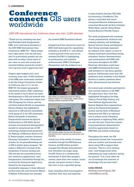
ESRI president Jack Dangermond presents the 'Making a<br />
Difference' Award to Dr. K. Kasturirangan, member (science),<br />
Planning Commission, Government of India.<br />
ESRI community members from more than 100 countries<br />
showcased their work in both print and virtual formats in the<br />
Map Gallery.<br />
virtual tour of the wealth of content<br />
available through ArcGIS Resource<br />
Centers. ArcGIS Online product<br />
manager Rob Shanks demonstrated<br />
how attendees can begin using<br />
ArcGIS Online as a collaborative<br />
mechanism to find other people’s<br />
content, share their own content, create<br />
groups, and grant access to those<br />
who want to join a specified group.<br />
Later, attendees were encouraged to<br />
volunteer their time and expertise<br />
to help students develop GIS skills<br />
by becoming a GeoMentor. The<br />
plenary concluded with muchanticipated<br />
Keynote Addresses from<br />
economist Hernando de Soto, biologist<br />
Willie Smits, and the United States<br />
Census Bureau’s Timothy Trainor.<br />
The week progressed with hundreds<br />
of user presentations, technical and<br />
industry sessions, and workshops.<br />
Special Interest Group and Regional<br />
User Group meetings organized<br />
by industry, field, region, or area of<br />
interest facilitated networking among<br />
attendees. Product demonstrations<br />
and conversations with ESRI staff<br />
took place throughout the ESRI<br />
Showcase. Attendees could meet<br />
with ESRI’s Professional Services<br />
staff members to talk about specific<br />
projects. Additionally, more than 300<br />
exhibitors were available in the Exhibit<br />
Pavilion to answer questions about<br />
their advancements and solutions.<br />
As in years past, attendee participation<br />
was a pivotal element in the ESRI<br />
UC experience. User work was<br />
highlighted throughout the Map<br />
Gallery, Virtual Map Gallery, and<br />
User Software Application Fair.<br />
Special displays from organizations<br />
such as the National Geographic<br />
Society and the State of Maryland<br />
illustrated how GIS is an essential<br />
tool in today’s world. Attendees<br />
participated in Lightning Talks, which<br />
are new this year. These five-minutelong<br />
presentations demonstrated<br />
inventive applications based on<br />
ESRI Web and mobile technology.<br />
Throughout the week, the GIS<br />
community formed new connections<br />
with one another and learned more<br />
about using GIS to support their<br />
activities. “This is a very exciting<br />
time,” said Dangermond when<br />
addressing the large audience during<br />
the plenary. “It is a time when we<br />
can all leverage that reservoir of<br />
knowledge that you have built.”<br />
Caitlyn Mitchell<br />
Marketing Communications, ESRI<br />
cmitchell@esri.com


