SECTION 3 - New Times Media Corporation
SECTION 3 - New Times Media Corporation
SECTION 3 - New Times Media Corporation

You also want an ePaper? Increase the reach of your titles
YUMPU automatically turns print PDFs into web optimized ePapers that Google loves.
Section 3<br />
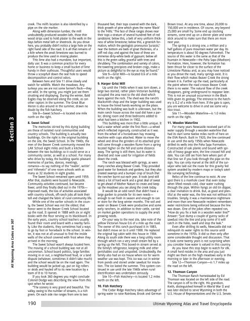
All Wyoming Area Codes are 307<br />
creek. The mill’s location is also identified by a<br />
pipe on the site marker.<br />
Along with dimension lumber, the mill<br />
undoubtedly produced wooden lath, those thin<br />
wood strips used to hold plaster to the walls in the<br />
days before metal lath or sheetrock. As you drove<br />
here, you probably didn’t notice a large hole on the<br />
right hand side of the road. It is all that remains of<br />
a kiln where the area’s limestone was burned to<br />
produce the lime used in mixing plaster.<br />
This lime also had a mundane, but important,<br />
daily use: It was a common practice for every<br />
home or business to keep a small bucket of lime<br />
handy in their outhouse. Thoughtful users would<br />
throw a scoopfull down the seat hole to speed<br />
decomposition and control odors.<br />
Between here and Site 11 drive slowly and<br />
watch for wildlife. Watch the meadows. Any<br />
turkeys you see are not some farmer’s flock—they<br />
are wild. In the spring, you might just see them<br />
strutting and displaying. During the winter, Bald<br />
Eagles may be observed along the creek, as can<br />
other raptors in the summer. The Great Blue<br />
Heron is also around in the summer, drawn no<br />
doubt by the fish hatchery.<br />
Site 8—Sweet School—is located one mile<br />
north on the right.<br />
8. Sweet School<br />
The memories stirred by this dying building<br />
are those of isolated rural communities and<br />
country schools. The building is actually two<br />
buildings. On the right is the original building<br />
on the site, the Sweet School. In the 1940s, the<br />
men of the Beaver Creek community moved the<br />
LAK School eight miles and built a kitchen<br />
between the two buildings so it could serve as a<br />
community center, as well as a school. For many<br />
who drive by today, the building sparks pleasant<br />
memories of parties, dances, meetings,<br />
romance—to say nothing of the “readin’, writin’<br />
and ‘rithmetic” of one room schools with as<br />
many as 32 students in eight grades.<br />
The Sweet School remained open until 1959.<br />
After that, students were bussed to <strong>New</strong>castle.<br />
Community activities continued, but became<br />
fewer, until they finally died out in the 1970s—<br />
improved roads, the loss of activities associated<br />
with country schools, off-ranch jobs all took their<br />
toll and changed the fabric of rural community life.<br />
While one of the earlier schools in the county,<br />
the Sweet School was not the oldest; that<br />
honor went to the Beaver Creek School located<br />
up the road. It opened in 1888 with six or eight<br />
books with the floor serving as its blackboard. In<br />
the early years, country school teachers usually<br />
found their room and board with a nearby family.<br />
Like the students, they sometimes had a ways<br />
to go by foot or horseback to the school. In winter,<br />
it was not at all unusual to find the inside<br />
walls of the school covered with frost when they<br />
arrived in the morning.<br />
The Sweet School wasn’t always located here.<br />
The moving of a school building was not at all<br />
uncommon. School board politics, large families<br />
moving in or out, a neighborhood feud, or a land<br />
dispute (whatever, sometimes it didn’t take much)<br />
and the school would be on the road again. The<br />
building would be jacked up, put on log rollers<br />
or skids and hauled off to its new location by a<br />
team of 8 to 10 horses.<br />
If you look 360 degrees you might conclude<br />
Colonel Dodge was describing the view from this<br />
spot when he wrote:<br />
“The scenery is very grand and beautiful. The<br />
valley, owing to the number of streams, is a rich<br />
green. On each side rise ranges from one to two<br />
190<br />
thousand feet, their tops covered with the dark,<br />
thick growth of pine which gives the name ‘Black’<br />
to the ‘Hills.’ The face of these ranges shows near<br />
their tops a stratum of several hundred feet of red<br />
sandstone; below this, a belt of very uniform thickness<br />
of white limestone; below this, a greenish formation,<br />
which the geologists pronounce ‘Jurassic;’<br />
near the bottom are beds of great thickness, of a<br />
stiff red clay; and against the base of these are<br />
immense dirty-white beds of gypsum; below all<br />
this is the green valley, graceful with trees and<br />
shrubbery. The combination and variety of colors,<br />
the towering precipices and broken crags, make a<br />
picture as delightful to the eye as may be found.”<br />
Site 9—Grist Mill—is located 0.6 of a mile<br />
north on the right.<br />
9. Harper Grist Mill<br />
Up until the 1940s when it was torn down, a<br />
large two storied, rather plain Victorian building<br />
occupied the area next to the old shed which<br />
leans against the rock. The shed was the ranch’s<br />
blacksmith shop and the larger building was used<br />
to house the hired hands working on the place.<br />
When the building was built is unknown, but the<br />
main ranch house across the road did have a parlor,<br />
dining room and three bedrooms added to<br />
what had been a kitchen in 1902.<br />
This building was more than a little unique. It<br />
had a water wheel under the first floor—a wheel<br />
which reflected ingenuity, constructed as it was<br />
from the wheel of a horsedrawn hay mowing<br />
machine with cups attached. Water to move the<br />
wheel and drive the grinders of its attached grist<br />
mill came through a wooden flume from a spring<br />
located higher on the hill and some distance<br />
away. The spring is still there, but its water is<br />
diverted and now used for irrigation of fields<br />
down the creek.<br />
The ranch was blessed with springs, as were<br />
many ranches along Beaver Creek. They provided<br />
good water for livestock and gardens, but they also<br />
created swamps and a bumper crop of brush that<br />
the rancher burnt out each year. It took (and still<br />
takes) a lot of hard work and a great deal of sweat<br />
to get ahead of Mother Nature to create and keep<br />
up the meadows you see along the creek today.<br />
It would be an odd ranch that didn’t have a<br />
large garden to provide for its own needs—<br />
enough to eat fresh in season and enough to can<br />
or store for the long winter months. The soil and<br />
water on Beaver Creek were productive and some<br />
early ranchers, in addition to their cattle, carried<br />
on market garden operations to supply the area’s<br />
growing needs.<br />
On your way to the next site, take note of the<br />
yellow Victorian house 0.6 of a mile up the road.<br />
The owner of this ranch purchased it in 1883,<br />
but didn’t move on to it until 1900. He replaced<br />
the original log cabin with this house in 1904.<br />
Along its south side there was a long utility room<br />
through which ran a very small stream fed by a<br />
spring up the hill. This boxed-in stream served as<br />
the family’s refrigerator, keeping milk and other<br />
perishables cool and unspoiled. Undoubtedly, the<br />
family also had an ice house where ice for warm<br />
weather use was kept. This ice was cut in winter<br />
from ponds and stored under sawdust for insulation.<br />
The ice lasted the summer. This system continued<br />
in use until the late 1940s when rural<br />
electrification was undertaken seriously.<br />
Site 10—Fish Hatchery—is located 1.2 miles<br />
north on the left.<br />
10. Fish Hatchery<br />
The Cedar Ridge Hatchery takes advantage of<br />
spring water to raise Rainbow, Brook and German<br />
Brown trout. At any one time, about 20,000 to<br />
150,000 are in residence. Of course, any beyond<br />
25,000 are small fry. Some end up stocking<br />
streams, some end up on a dinner plate and some<br />
stick around to make sure that there are more<br />
next year.<br />
The spring is a strong one, a million and a<br />
half gallons of pure mountain water per day. Its<br />
temperature is about 50 degrees Fahrenheit. The<br />
source of this water is the same as that of the<br />
fountain in <strong>New</strong>castle—the Paha Sapa (Madison)<br />
Formation. Here, however, the formation has<br />
been thrust far closer to the surface of the<br />
Limestone Plateau and, as you may have noticed<br />
as you drove the road, many springs exist. It is<br />
their flow which makes Beaver Creek the strong<br />
stream it is. Farther up the road, particularly at<br />
the point where the road crosses Beaver Creek<br />
there is no water. The natural flow of the creek<br />
disappears, going underground to reappear later.<br />
This is not an unusual occurrence in the Black<br />
Hills given its geology. The entrance to the hatchery<br />
is 0.2 of a mile from here. If the gate is open,<br />
you are welcome to drive in and see some very<br />
nice trout.<br />
Site 11—Wooden Waterline—is 1.0 miles<br />
north on the right.<br />
11. Wooden Waterline<br />
For many years <strong>New</strong>castle received part of its<br />
water supply through a wooden waterline that<br />
had its start some twelve miles north of here on<br />
the EVA Ranch. Built in 1920, the line continued<br />
in use until the early 1950s when <strong>New</strong>castle<br />
drilled its wells into the Paha Sapa Formation.<br />
Constructed of oak planks and bound with spirals<br />
of heavy gauge wire, the line crossed hill and<br />
dale. You can still see from here where part of<br />
that line ran if you look through the pipe on the<br />
sign. You can only marvel at the skill of the surveyor<br />
who laid out the route for this gravity fed<br />
system unaided by modern maps or today’s satellite<br />
surveying technology.<br />
Relics of the line continue to exist. At one<br />
spot there is a manhole cover that even today<br />
when lifted reveals cold, clear water rushing<br />
through the pipe. Within hangs an old tin dipper,<br />
a clear invitation to drink. But, as good and plentiful<br />
as the water was, the line was not without its<br />
troubles. Simply, it was a maintenance nightmare<br />
and more than one <strong>New</strong>castle resident remembers<br />
water restrictions being enforced because the line<br />
was down. One of the jokes often repeated ran,<br />
“How do you fix a leak in a wooden water line?”<br />
Answer: “Just dump a couple of gunny sacks of<br />
sawdust into the line and pray some of it will<br />
catch in the holes, swell and stop the leak.”<br />
Even after drilling its wells, <strong>New</strong>castle did not<br />
relinquish its water rights to this source until<br />
sometime in the 1970s. It did so then only after<br />
some considerable thought and discussion. That<br />
it took some twenty years is not surprising when<br />
you consider how water is valued in this country.<br />
As you leave this stop begin to watch for elk.<br />
A small herd resides in the area and you just<br />
might see them on the high meadows early in the<br />
morning or later in the afternoon or evening.<br />
Site 12—Thomson Canyon—is 1.7 miles up<br />
the road on the left.<br />
12. Thomson Canyon<br />
The Thomson Ranch homesteaded by Ed<br />
Thomson was located on the left side of the road.<br />
The canyon is off to the right. His grandson,<br />
Keith, distinguished himself in World War II and<br />
was later elected to serve Wyoming in both the<br />
U.S. House of Representatives and the U.S. Senate.<br />
Ultimate Wyoming Atlas and Travel Encyclopedia