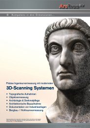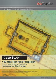
Arctron 3 D 3D Scanning Systems
Arctron 3 D 3D Scanning Systems
Arctron 3 D 3D Scanning Systems

You also want an ePaper? Increase the reach of your titles
YUMPU automatically turns print PDFs into web optimized ePapers that Google loves.
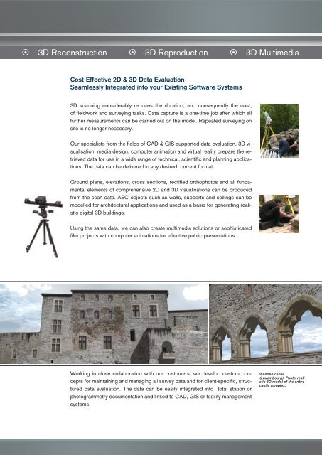
� <strong>3D</strong> Reconstruction � <strong>3D</strong> Reproduction � <strong>3D</strong> Multimedia<br />
Cost-Effective 2D & <strong>3D</strong> Data Evaluation<br />
Seamlessly Integrated into your Existing Software <strong>Systems</strong><br />
<strong>3D</strong> scanning considerably reduces the duration, and consequently the cost,<br />
of fieldwork and surveying tasks. Data capture is a one-time job after which all<br />
further measurements can be carried out on the model. Repeated surveying on<br />
site is no longer necessary.<br />
Our specialists from the fields of CAD & GIS-supported data evaluation, <strong>3D</strong> visualisation,<br />
media design, computer animation and virtual reality prepare the retrieved<br />
data for use in a wide range of technical, scientific and planning applications.<br />
The data can be delivered in any desired, current format.<br />
Ground plans, elevations, cross sections, rectified orthophotos and all fundamental<br />
elements of comprehensive 2D and <strong>3D</strong> visualisations can be produced<br />
from the scan data. AEC objects such as walls, supports and ceilings can be<br />
modelled for architectural applications and used as a basis for generating realistic<br />
digital <strong>3D</strong> buildings.<br />
Using the same data, we can also create multimedia solutions or sophisticated<br />
film projects with computer animations for effective public presentations.<br />
Working in close collaboration with our customers, we develop custom concepts<br />
for maintaining and managing all survey data and for client-specific, structured<br />
data evaluation. The data can be easily integrated into total station or<br />
photogrammetry documentation and linked to CAD, GIS or facility management<br />
systems.<br />
Vianden castle<br />
(Luxembourg). Photo-realistic<br />
<strong>3D</strong> model of the entire<br />
castle complex.