Water Protection Activities in Washtenaw County
Water Protection Activities in Washtenaw County
Water Protection Activities in Washtenaw County

Create successful ePaper yourself
Turn your PDF publications into a flip-book with our unique Google optimized e-Paper software.
<strong>Water</strong> <strong>Protection</strong> <strong>Activities</strong> <strong>in</strong><br />
<strong>Washtenaw</strong> <strong>County</strong><br />
<strong>Washtenaw</strong> <strong>County</strong> Department of Plann<strong>in</strong>g and Environment<br />
<strong>Washtenaw</strong> <strong>County</strong> Office of the Dra<strong>in</strong> Commissioner<br />
January 2008
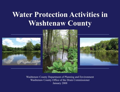
Cover Photos<br />
Left: Huron River at Hudson Mills Metropark, Dexter Township<br />
Center: Atch<strong>in</strong>son Dra<strong>in</strong>, Salem Township<br />
Right: Mill Pond on River Rais<strong>in</strong>, City of Sal<strong>in</strong>e<br />
<strong>Washtenaw</strong> <strong>County</strong><br />
Department of Plann<strong>in</strong>g & Environment<br />
Environmental Services Division<br />
705 N. Zeeb Rd., P.O. Box 8645<br />
Ann Arbor, MI 48107-8645<br />
(734) 222-3800<br />
www.e<strong>Washtenaw</strong>.org
Acknowledgements<br />
<strong>Water</strong> <strong>Protection</strong> <strong>Activities</strong><br />
<strong>in</strong><br />
<strong>Washtenaw</strong> <strong>County</strong><br />
January 2008<br />
<strong>Washtenaw</strong> <strong>County</strong> would like to acknowledge the contributions of the follow<strong>in</strong>g people who aided <strong>in</strong> the completion of the <strong>Water</strong><br />
<strong>Protection</strong> <strong>Activities</strong> <strong>in</strong> <strong>Washtenaw</strong> <strong>County</strong> Report.<br />
Michael Gebhard Angela Parsons Anthony VanDerworp Marshall Labadie<br />
M. Paul Lippens Thomas W<strong>in</strong>ebrenner Harry Sheehan David Simon<br />
In addition, <strong>Washtenaw</strong> <strong>County</strong> extends appreciation to those who participated <strong>in</strong> provid<strong>in</strong>g <strong>in</strong>put dur<strong>in</strong>g development of the report.<br />
Marcia Van Fossen, Trustee<br />
Salem Township<br />
Mike Gaber<br />
Lois Elliot Graham<br />
Susan A. Lackey, Executive Director<br />
<strong>Washtenaw</strong> Land Trust<br />
Michigan Department of Environmental Quality <strong>Water</strong> Bureau Staff:<br />
Anita Ladouceur<br />
Rich Overmyer<br />
Thank you for your cont<strong>in</strong>ued <strong>in</strong>terest <strong>in</strong> the welfare of <strong>Washtenaw</strong> <strong>County</strong>.<br />
Dick Fleece<br />
Environmental Health Division Director<br />
<strong>Washtenaw</strong> <strong>County</strong> – Plann<strong>in</strong>g and Environment<br />
705 N. Zeeb Road, Ann Arbor, MI 48107-8645<br />
(734) 222-3800<br />
fleecer@ewashtenaw.org<br />
iii<br />
Molly Wade, <strong>Water</strong> Quality Manager<br />
City of Ann Arbor<br />
David DeYoung<br />
James McEwan<br />
Janis Bobr<strong>in</strong><br />
Dra<strong>in</strong> Commissioner<br />
<strong>Washtenaw</strong> <strong>County</strong> – Office of the Dra<strong>in</strong> Commissioner<br />
705 N. Zeeb Road, Ann Arbor, MI 48107-8645<br />
(734) 222-6860<br />
bobr<strong>in</strong>j@ewashtenaw.org
Forward<br />
This report represents a first step <strong>in</strong> develop<strong>in</strong>g a periodic report on water and water quality <strong>in</strong> <strong>Washtenaw</strong> <strong>County</strong>.<br />
The <strong>in</strong>tent of this document is to provide <strong>in</strong>formation of general <strong>in</strong>terest to the public. While not <strong>in</strong>tended to be a comprehensive<br />
technical report, much of the <strong>in</strong>formation and many l<strong>in</strong>ks to the <strong>in</strong>formation conta<strong>in</strong>ed here will aid readers <strong>in</strong> determ<strong>in</strong><strong>in</strong>g where their<br />
dr<strong>in</strong>k<strong>in</strong>g water comes from, what steps are be<strong>in</strong>g taken to assure it’s safe, what major bodies of water are <strong>in</strong> their area, what threats to<br />
water quality exist, how they are be<strong>in</strong>g addressed and recommended next steps.<br />
This report does not <strong>in</strong>clude all of the activities, organizations and programs that play a vital role <strong>in</strong> the protection and enjoyment of<br />
water resources of <strong>Washtenaw</strong> <strong>County</strong>. It is a foundation that will be improved upon, both <strong>in</strong> content and format <strong>in</strong> future iterations.<br />
We encourage you to contact us with your comments, suggestions, additions or deletions so that future reports will be more<br />
comprehensive.<br />
iv
Executive Summary<br />
Introduction<br />
The <strong>in</strong>tent of the <strong>Washtenaw</strong> <strong>County</strong> <strong>Water</strong> <strong>Protection</strong><br />
<strong>Activities</strong> <strong>in</strong> <strong>Washtenaw</strong> <strong>County</strong> Report (WPA) is to provide a<br />
s<strong>in</strong>gle source of <strong>in</strong>formation for <strong>in</strong>dividuals <strong>in</strong>terested <strong>in</strong><br />
potential sources of contam<strong>in</strong>ation to groundwater and surface<br />
water <strong>in</strong> the <strong>County</strong>, and to highlight the protection activities<br />
designed to address those concerns. The report further<br />
identifies sources of dr<strong>in</strong>k<strong>in</strong>g water and the underly<strong>in</strong>g geology<br />
that affects those sources. The report is the product of<br />
collaboration between the <strong>Washtenaw</strong> <strong>County</strong> Dra<strong>in</strong><br />
Commissioner’s Office and the Plann<strong>in</strong>g and Environment<br />
Department. The protective actions identified <strong>in</strong> the report<br />
feature programs adm<strong>in</strong>istered or most frequently referenced<br />
by the two offices. It is recognized this is not an exhaustive<br />
list<strong>in</strong>g of all of the actions be<strong>in</strong>g taken to protect, preserve or<br />
restore water quality <strong>in</strong> the <strong>County</strong>.<br />
Groundwater<br />
Historic <strong>in</strong>formation regard<strong>in</strong>g the quantity and quality of<br />
groundwater was gathered primarily from databases ma<strong>in</strong>ta<strong>in</strong>ed<br />
by <strong>Washtenaw</strong> <strong>County</strong> Plann<strong>in</strong>g and Environment (WCPE),<br />
and the Michigan Department of Environmental Quality<br />
(MDEQ). Those records were utilized to determ<strong>in</strong>e that<br />
generally the groundwater <strong>in</strong> the area is plentiful, of a high<br />
quality, and serves as the source of dr<strong>in</strong>k<strong>in</strong>g water for over<br />
50% of the residents and bus<strong>in</strong>esses <strong>in</strong> the <strong>County</strong>. The<br />
programs <strong>in</strong> place to address groundwater protection have been<br />
highly successful. However, there are still challenges to the<br />
<strong>County</strong>’s groundwater, <strong>in</strong>clud<strong>in</strong>g:<br />
v<br />
Arsenic<br />
Naturally occurr<strong>in</strong>g arsenic exceed<strong>in</strong>g dr<strong>in</strong>k<strong>in</strong>g water standards<br />
has been detected <strong>in</strong> approximately 10% of the <strong>in</strong>dividual<br />
dr<strong>in</strong>k<strong>in</strong>g water wells tested <strong>in</strong> the <strong>County</strong>. To address this<br />
issue, WCPE now requires test<strong>in</strong>g of all new wells,<br />
replacement wells, and residential wells at time of property<br />
transfer. Treatment or replacement of the wells are options to<br />
address this issue.<br />
Quantity<br />
Individuals <strong>in</strong> some parts of southeast <strong>Washtenaw</strong> <strong>County</strong> have<br />
had difficulty <strong>in</strong> obta<strong>in</strong><strong>in</strong>g a reliable, high-quality dr<strong>in</strong>k<strong>in</strong>g<br />
water well. The comb<strong>in</strong>ation of hydrogen sulfide and lowyield<strong>in</strong>g<br />
upper aquifer formations have been particularly<br />
challeng<strong>in</strong>g <strong>in</strong> Augusta Township. To address this need,<br />
municipal water was extended to approximately 30 miles of the<br />
Township <strong>in</strong> the mid 1990’s. Well test<strong>in</strong>g occurs <strong>in</strong> the<br />
southeast portion of the <strong>County</strong> and <strong>in</strong> ten other isolated<br />
locations throughout the <strong>County</strong> to assure adequate water can<br />
be obta<strong>in</strong>ed before issu<strong>in</strong>g a construction permit for new<br />
homes. Additional storage is often <strong>in</strong>stalled <strong>in</strong> homes to<br />
compensate for low produc<strong>in</strong>g wells.<br />
1,4-dioxane<br />
The groundwater <strong>in</strong> areas of Scio Township and the City of<br />
Ann Arbor is contam<strong>in</strong>ated with 1,4-dioxane, a suspected<br />
carc<strong>in</strong>ogen. The contam<strong>in</strong>ation plume, which is currently<br />
estimated as three miles long and one mile wide, is the result of<br />
manufactur<strong>in</strong>g practices by Gelman Sciences (now Pall Life<br />
Sciences) from 1968 - 1986. The risks, methods and degree of<br />
remediation of the contam<strong>in</strong>ation have sparked scientific<br />
debate, public activism, government resolutions, and lawsuits.<br />
Due to the nature of the contam<strong>in</strong>ant and the complex geology<br />
<strong>in</strong> the area, the problem will likely cont<strong>in</strong>ue for years to come.
Other sites of 1,4-dioxane groundwater contam<strong>in</strong>ation <strong>in</strong><br />
<strong>Washtenaw</strong> <strong>County</strong> <strong>in</strong>clude the North Staebler Road Site and<br />
the City of Ann Arbor landfill.<br />
Surface <strong>Water</strong><br />
Surface water is subject to contam<strong>in</strong>ation from a variety of<br />
sources such as humans, wildlife, permitted and non-permitted<br />
discharges, soil erosion, and pesticide and fertilizer runoff.<br />
Mak<strong>in</strong>g an assessment of the quality of the surface water <strong>in</strong><br />
<strong>Washtenaw</strong> <strong>County</strong> is limited due to the lack of monitor<strong>in</strong>g<br />
data for most of the waters of the <strong>County</strong>, the variability of<br />
water quality at any given time, and the vast area surface water<br />
covers <strong>in</strong> the <strong>County</strong>.<br />
Twenty segments of waterways or entire waterways have been<br />
identified as fail<strong>in</strong>g to meet water quality standards established<br />
by MDEQ and the U.S Environmental <strong>Protection</strong> Agency<br />
(EPA). These range from bacterial counts <strong>in</strong> stretches of the<br />
Huron and Sal<strong>in</strong>e Rivers to high phosphorus <strong>in</strong> Ford Lake. In<br />
addition, PCB, Mercury, low dissolved oxygen, and low levels<br />
of fish and macro<strong>in</strong>vetebrates have all been identified <strong>in</strong> waters<br />
of the <strong>County</strong>.<br />
For the most part, surface water contam<strong>in</strong>ation <strong>in</strong> the <strong>County</strong> is<br />
not the result of po<strong>in</strong>t source discharges, but rather from runoff.<br />
The largest contributor to runoff is land development and land<br />
change activities. As more impervious surfaces are built,<br />
uncontrolled water runs off at an <strong>in</strong>creased rate and results<br />
bacterial, chemical and physical contam<strong>in</strong>ants enter<strong>in</strong>g rivers,<br />
lakes and streams. This <strong>in</strong>creased rate of runoff also contributes<br />
to soil and bank erosion. These f<strong>in</strong>d<strong>in</strong>gs are not surpris<strong>in</strong>g and<br />
are typical of urban watersheds.<br />
vi<br />
Programs, organizations, and volunteers have worked together<br />
to develop watershed plans to prevent water pollution and<br />
remediate water quality problems. A summary of Best<br />
Management Practices (BMPs) identified <strong>in</strong> <strong>Washtenaw</strong><br />
<strong>County</strong> watershed plans is <strong>in</strong>cluded <strong>in</strong> this report. These BMPs<br />
have been <strong>in</strong>corporated <strong>in</strong> many of the land use regulations<br />
adopted locally. Other regulatory efforts designed to address<br />
surface water quality <strong>in</strong>clude:<br />
● The Michigan Dra<strong>in</strong> Code and <strong>Washtenaw</strong> <strong>County</strong><br />
Dra<strong>in</strong> Commissioner’s Stormwater System Design<br />
Standards<br />
● Clean <strong>Water</strong> Act<br />
● Inland Lake Level Act<br />
● National Pollution Discharge Elim<strong>in</strong>ation Permits<br />
● Beach Monitor<strong>in</strong>g<br />
Additionally, public <strong>in</strong>formation and stewardship programs<br />
have been utilized as a means to <strong>in</strong>volve the public <strong>in</strong> projects<br />
focused on prevention, preservation and restoration of surface<br />
waters <strong>in</strong> the county. Programs aimed at protect<strong>in</strong>g and<br />
improv<strong>in</strong>g the surface waters of <strong>Washtenaw</strong> <strong>County</strong> <strong>in</strong>clude:<br />
● Community Partners for Clean Streams<br />
● <strong>Water</strong>shed Management Plann<strong>in</strong>g<br />
● <strong>Water</strong> Quality Stewardship Program<br />
● <strong>Water</strong>shed Council Programs (<strong>in</strong>clud<strong>in</strong>g Adopt-a-<br />
Stream)<br />
● Riversafe Homes
Local <strong>Water</strong> Quality Information<br />
The report conta<strong>in</strong>s a section that provides general water<br />
quality <strong>in</strong>formation with<strong>in</strong> political boundaries. This<br />
<strong>in</strong>formation <strong>in</strong>cludes:<br />
● Geological groundwater formations<br />
● Dr<strong>in</strong>k<strong>in</strong>g water <strong>in</strong>formation, <strong>in</strong>clud<strong>in</strong>g sources of<br />
dr<strong>in</strong>k<strong>in</strong>g water and water test<strong>in</strong>g results<br />
● Major surface water features<br />
● Potential sources of water contam<strong>in</strong>ation with<strong>in</strong> local<br />
government boundaries, such as:<br />
○ National Pollution Discharge Elim<strong>in</strong>ation<br />
System (NPDES) Permits<br />
○ Total Maximum Daily Load (TMDL) Sites<br />
○ Aboveground Storage Tank (AST) Sites<br />
○ Leak<strong>in</strong>g underground Storage Tank (LUST)<br />
Sites<br />
○ Oil and Gas Sites (Public Act 451 – Part 615)<br />
○ Sites of Known Environmental Contam<strong>in</strong>ation<br />
(Public Act 451 – Part 201)<br />
○ Solid and Hazardous Waste Sites<br />
Residents can use this section of the report to review the<br />
characteristics that comprise their local groundwater and<br />
surface water, and to determ<strong>in</strong>e the location of potential<br />
contam<strong>in</strong>ation sources <strong>in</strong> their area.<br />
vii
Page Intentionally Left Blank<br />
viii
TABLE OF CONTENTS<br />
Section Page # Section Page #<br />
1.0 Introduction 1 • Activity #14 Lake Management 39<br />
2.0 Groundwater 3 • Activity #15 <strong>Water</strong>shed Management Plann<strong>in</strong>g 39<br />
2.1 Conditions and Trends 5 • Activity #16 Natural River Designation 42<br />
2.2 <strong>Protection</strong> <strong>Activities</strong> 7 • Activity #17 Fish Advisories 42<br />
• Activity #1 Time of Sale Regulation 7 • Activity #18 Beach Monitor<strong>in</strong>g 42<br />
• Activity #2 Pollution Prevention Regulation 7 • Activity #19 Natural Resource Environmental <strong>Protection</strong> Act 43<br />
• Activity #3 Well Regulation 7 • Activity #20 Illicit Discharge Elim<strong>in</strong>ation 43<br />
• Activity #4 Well Restricted Areas 7 • Activity #21 Home Toxics Reduction Program 43<br />
• Activity #5 Wellhead <strong>Protection</strong> 9 • Activity #22 Waste Knot Program 43<br />
• Activity #6 Privately Owned Community Sewer Systems 9 • Activity #23 <strong>Water</strong> Quality Stewardship Program 43<br />
• Activity #7 Onsite Sewage Regulation 9 • Activity #24 <strong>Water</strong> Monitor<strong>in</strong>g 44<br />
• Activity #8 Groundwater Withdrawal Disputes 11 3.3 Challenges and Responses 45<br />
• Activity #9 Brownfield Redevelopment 11 • Challenge # 9 Excess Nutrients 46<br />
• Activity #10 Michigan Safe Dr<strong>in</strong>k<strong>in</strong>g <strong>Water</strong> Act (Act 399) 12 • Challenge # 10 Sediments 48<br />
2.3 Challenges and Responses 13 • Challenge # 11 Toxic Compounds 50<br />
• Challenge # 1: Arsenic 14 • Challenge # 12 Pathogens and Bacteria 52<br />
• Challenge # 2: Nitrates 16 • Challenge # 13 Temperature, Volume, and Rate 54<br />
• Challenge # 3: Volatile Organic Compounds 18 • Challenge # 14 Pharmaceuticals 56<br />
• Challenge # 4: Part 201 Sites 19 • Challenge # 15 Po<strong>in</strong>t Sources Discharges 57<br />
• Challenge # 5: Landfills 21 • Challenge # 16 Community Wastewater Systems 59<br />
• Challenge # 6: Leak<strong>in</strong>g Underground Storage Tanks 23 3.4 Organizations 60<br />
• Challenge # 7: Gelman Sciences Inc. 1,4-Dioxane 24 3.5 Local Tools 63<br />
• Challenge # 8: Ground <strong>Water</strong> Quantity 26<br />
2.4 Organizations 27<br />
2.5 Local Tools 28 APPENDICES Page #<br />
3.0 Surface <strong>Water</strong> 29 A – Local Unit of Government <strong>Water</strong> Quality Indicators 65<br />
3.1 Conditions and Trends 31 B – <strong>Water</strong>shed Plans and Best Management Practices 129<br />
3.2 <strong>Protection</strong> <strong>Activities</strong> 34 C – Acronyms and Abbreviations 163<br />
• Activity #11 Clean <strong>Water</strong> Act 34 D – References 164<br />
• Activity #12 Michigan Dra<strong>in</strong> Code 37<br />
• Activity #13 Inland Lake Level Act 39<br />
ix
Page Intentionally Left Blank<br />
x
MAPS, FIGURES, AND TABLES<br />
Map # Title Page # Figure # Title Page #<br />
Map 1<br />
Drift Aquifer Characteristics and<br />
Groundwater Recharge Areas<br />
4 Figure 1 Commercial Groundwater Use <strong>in</strong> Michigan 11<br />
Map 2<br />
Municipal <strong>Water</strong> Services and Wells First<br />
Areas<br />
6 Figure 2 Heavy Metal Contam<strong>in</strong>ants - Chromium 19<br />
Map 3 Wellhead <strong>Protection</strong> Areas 8 Figure 3 Armen Cleaners Response - Soil Sampl<strong>in</strong>g 20<br />
Map 4<br />
Municipal Sewer Services and Septic<br />
Suitability Areas<br />
10 Figure 4 City of Ann Arbor Landfill 21<br />
Map 5 Groundwater Arsenic Distribution 15 Figure 5 LUST Removal 23<br />
Map 6 Groundwater Nitrate Distribution 17 Figure 6 Overlay District 28<br />
Map 7 Gelman Sciences Inc. 1,4-Dioxane Plumes 25 Figure 7 CWA Flowchart 34<br />
Map 8 <strong>Water</strong>sheds and <strong>Water</strong> Features 30 Figure 8 CWA Timel<strong>in</strong>e 36<br />
Map 9 <strong>County</strong> Dra<strong>in</strong>s and <strong>Water</strong>sheds 38 Figure 9 Storm <strong>Water</strong> Runoff 46<br />
Figure 10 Phosphorus Load<strong>in</strong>g 47<br />
Table # Title Page # Figure 11 Sedimentation at Swift Run 49<br />
Table 1 <strong>Water</strong>shed Area 29 Figure 12 Home Toxic Program Drop-off Station 50<br />
Table 2 Michigan Designated Uses (DU) 31 Figure 13 E. coli 53<br />
Table 3 TMDL Schedule 33 Figure 14 Pharmaceutical Waste 56<br />
Table 4 BMP Examples 40 Figure 15 Surface <strong>Water</strong> Organizations 60<br />
xi
Page Intentionally Left Blank<br />
xii
1.0 Introduction<br />
Background<br />
In September of 2004, <strong>Washtenaw</strong> <strong>County</strong> adopted a<br />
comprehensive plan entitled the “A Comprehensive Plan for<br />
<strong>Washtenaw</strong> <strong>County</strong>: A Sense of Place, a Susta<strong>in</strong>able Future.”<br />
The Plan, developed by <strong>Washtenaw</strong> <strong>County</strong> staff and <strong>in</strong>formed<br />
by an <strong>in</strong>tensive public engagement process, <strong>in</strong>cludes<br />
recommendations for preserv<strong>in</strong>g <strong>Washtenaw</strong> <strong>County</strong>’s<br />
character and natural resources. One of the recommendations<br />
of the Plan calls for an annual <strong>Water</strong> Quality Report to gauge<br />
the progress <strong>in</strong> meet<strong>in</strong>g water quality enhancement goals. This<br />
Report represents the first step <strong>in</strong> meet<strong>in</strong>g that<br />
recommendation. This Report addresses:<br />
● Dr<strong>in</strong>k<strong>in</strong>g water sources<br />
● Dr<strong>in</strong>k<strong>in</strong>g water quality<br />
● Groundwater facts<br />
● Surface <strong>Water</strong> facts<br />
● Conditions and challenges that threaten water quality<br />
● Programs and activities designed to protect and<br />
preserve water resources<br />
● Next steps to address current challenges<br />
This Report is designed to promote the follow<strong>in</strong>g objectives<br />
conta<strong>in</strong>ed <strong>in</strong> the Comprehensive Plan:<br />
● WCCP Objective 1: Protect and improve the quality of<br />
our water resources through a comprehensive approach<br />
to plann<strong>in</strong>g, ma<strong>in</strong>tenance, retrofit, and new<br />
development best management practices<br />
● WCCP Objective 2: Preserve wetlands, woodlands,<br />
floodpla<strong>in</strong>s and other natural features through resource<br />
assessments, model regulations and leverag<strong>in</strong>g open<br />
space and trail programs<br />
1<br />
● WCCP Objective 3: Increase awareness and use of best<br />
management techniques through an aggressive public<br />
education program<br />
The goal of this Report is to provide accurate and accessible<br />
water quality <strong>in</strong>formation for the county. Its objectives are:<br />
● To assess the exist<strong>in</strong>g conditions and uses of<br />
<strong>Washtenaw</strong> <strong>County</strong> water resources<br />
● To catalogue activities be<strong>in</strong>g taken to preserve, protect<br />
or remediate <strong>Washtenaw</strong> <strong>County</strong> water resources<br />
● To def<strong>in</strong>e the potential challenges to <strong>Washtenaw</strong><br />
<strong>County</strong> water resources and assess the steps be<strong>in</strong>g taken<br />
to respond to these challenges<br />
● To develop recommendations for additional programs<br />
and activities that will address the results of the<br />
assessment and improve the health of <strong>Washtenaw</strong><br />
<strong>County</strong> water resources<br />
Organization:<br />
The <strong>in</strong>formation conta<strong>in</strong>ed <strong>in</strong> this report has been divided <strong>in</strong>to<br />
two sections; groundwater quality and surface water quality.<br />
● Groundwater Quality – exam<strong>in</strong>es the quality of water<br />
located beneath the ground surface <strong>in</strong> the soil pore<br />
spaces.<br />
○ Residents <strong>in</strong>teract with groundwater resources<br />
when they need dr<strong>in</strong>k<strong>in</strong>g water wells or <strong>in</strong>stall a<br />
septic system.<br />
○ Local units of government may use groundwater<br />
as a dr<strong>in</strong>k<strong>in</strong>g water source for process<strong>in</strong>g at a<br />
water treatment plant.
● Surface <strong>Water</strong> Quality – exam<strong>in</strong>es the quality of water<br />
that flows above ground.<br />
○ Residents <strong>in</strong>teract with surface water resources<br />
recreationally by swimm<strong>in</strong>g, fish<strong>in</strong>g, boat<strong>in</strong>g and<br />
canoe<strong>in</strong>g.<br />
○ Local units of government may also draw dr<strong>in</strong>k<strong>in</strong>g<br />
water from rivers and reservoirs to be processed at a<br />
water treatment plant.<br />
Each of the above sections presents <strong>in</strong>formation with<strong>in</strong> a<br />
format of Conditions and Trends, <strong>Protection</strong> <strong>Activities</strong>, and<br />
Challenges and Responses.<br />
● Conditions and Trends – describes the known<br />
conditions of the <strong>County</strong>’s water resources: uses of<br />
water, water quality standards, water quality criteria,<br />
monitor<strong>in</strong>g, and future projections.<br />
● <strong>Protection</strong> <strong>Activities</strong> – describes the regulation process<br />
for water resources: wells first, Clean <strong>Water</strong> Act, Phase<br />
II Storm <strong>Water</strong> Permit, etc.<br />
● Challenges and Responses – describes the known<br />
challenges to the <strong>County</strong>’s water resources: po<strong>in</strong>t<br />
source pollution, non-po<strong>in</strong>t source pollution, common<br />
pollutants. Also <strong>in</strong>cludes an assessment of how the<br />
protection activities address the challenge.<br />
Also <strong>in</strong>cluded is <strong>in</strong>formation about organizations that<br />
contribute to water resource management, and tools that<br />
municipal units can implement to protect water quality.<br />
2<br />
This report conta<strong>in</strong>s four appendices, A though D. Of particular<br />
<strong>in</strong>terest is Appendix A, Local Units of Government <strong>Water</strong><br />
Quality Indicators, and Appendix B, <strong>Water</strong>shed Plans and Best<br />
Management Practices, a summary of exist<strong>in</strong>g plans and<br />
recommendations.<br />
This report can be accessed via the <strong>Washtenaw</strong> <strong>County</strong> website:<br />
http://www.ewashtenaw.org
2.0 Groundwater<br />
Groundwater is a vital natural resource <strong>in</strong> <strong>Washtenaw</strong> <strong>County</strong>.<br />
It is used <strong>in</strong> <strong>in</strong>dustry and agriculture, and provides virtually<br />
100% of the dr<strong>in</strong>k<strong>in</strong>g water supply <strong>in</strong> the rural parts of the<br />
<strong>County</strong>.<br />
What is Groundwater?<br />
In the simplest terms<br />
groundwater is water<br />
that comes from the<br />
ground. More<br />
specifically,<br />
groundwater is water<br />
that fills cracks and<br />
spaces between<br />
particles of soil and<br />
rocks. When water fills<br />
all the pores and open<br />
spaces, it’s called the<br />
Groundwater Facts…<br />
Over 50% of <strong>Washtenaw</strong> <strong>County</strong><br />
residents rely on groundwater as<br />
their primary source of dr<strong>in</strong>k<strong>in</strong>g<br />
water.<br />
Approximately one-fifth of the<br />
earth’s fresh water is conta<strong>in</strong>ed<br />
<strong>in</strong> the Great Lakes bas<strong>in</strong>.<br />
Most of <strong>Washtenaw</strong> <strong>County</strong>’s<br />
dr<strong>in</strong>k<strong>in</strong>g water comes from drift<br />
aquifers.<br />
saturated zone. The divid<strong>in</strong>g l<strong>in</strong>e between the saturated zone<br />
and overly<strong>in</strong>g unsaturated rock or sediment is called the water<br />
table. Contrary to what many believe, groundwater doesn’t<br />
generally consist of underground lakes or streams, but rather<br />
fills the irregular space with<strong>in</strong> the rock fractures or between<br />
particles of sand, gravel or clay. Then as the water moves<br />
through the ground, it dissolves some of the naturally occurr<strong>in</strong>g<br />
m<strong>in</strong>erals it contacts. These dissolved m<strong>in</strong>erals give the<br />
groundwater its chemical characteristics, affect<strong>in</strong>g such th<strong>in</strong>gs<br />
as taste and hardness. The most common dissolved m<strong>in</strong>eral<br />
substances are sodium, calcium, magnesium, potassium,<br />
chloride, bicarbonate and sulfate.<br />
When surface water percolates from land areas or streams<br />
through permeable soils <strong>in</strong>to water-hold<strong>in</strong>g rocks that provide<br />
underground storage, it is called groundwater recharge<br />
3<br />
(Map 1). Groundwater can be recharged from ra<strong>in</strong> water that<br />
<strong>in</strong>filtrates from woodlands and surface water features like<br />
wetlands, lakes, and streams. Woodlands, wetlands and<br />
floodpla<strong>in</strong>s provide a filter<strong>in</strong>g system for groundwater recharge<br />
areas. When water bear<strong>in</strong>g soil or rock yield significant<br />
amounts of water to wells or spr<strong>in</strong>gs, it is called an aquifer. An<br />
aquifer may be a layer of gravel or sand, a layer of sandstone or<br />
limestone, or even a large body of massive rock such as<br />
fractured granite. Aquifers can be conf<strong>in</strong>ed or unconf<strong>in</strong>ed.<br />
Conf<strong>in</strong>ed aquifers have water-bear<strong>in</strong>g layers bound by<br />
impermeable soil barriers above and below. <strong>Water</strong> <strong>in</strong> these<br />
aquifers is under pressure; therefore, when a well is <strong>in</strong>stalled <strong>in</strong><br />
a conf<strong>in</strong>ed aquifer, the water level <strong>in</strong> the well cas<strong>in</strong>g rises<br />
above the top of the aquifer. Unconf<strong>in</strong>ed aquifers or water table<br />
aquifers are the saturated portions of soil profile open to the<br />
atmosphere through permeable material located above an<br />
impermeable soil barrier.<br />
The primary source for groundwater <strong>in</strong> <strong>Washtenaw</strong> <strong>County</strong><br />
comes from drift aquifers (Map 1). Drift aquifers exist <strong>in</strong> sand<br />
and gravel formations that were deposited dur<strong>in</strong>g periods of<br />
cont<strong>in</strong>ental glaciation known as the Ice Ages. The drift aquifers<br />
exist above the bedrock aquifers. Bedrock aquifers <strong>in</strong><br />
<strong>Washtenaw</strong> <strong>County</strong> are conta<strong>in</strong>ed <strong>in</strong> the consolidated sandstone<br />
and limestone sedimentary bedrocks that were deposited<br />
millions of years ago. The quality of groundwater <strong>in</strong> the<br />
bedrock can vary dramatically from potable dr<strong>in</strong>k<strong>in</strong>g water to<br />
unusable water that conta<strong>in</strong>s high levels of salt, methane gas,<br />
hydrogen sulfide, and other dissolved m<strong>in</strong>erals. Bedrock<br />
aquifers are typically only explored <strong>in</strong> <strong>Washtenaw</strong> <strong>County</strong><br />
when there is no acceptable drift aquifer present. The most<br />
dependable bedrock aquifer <strong>in</strong> <strong>Washtenaw</strong> <strong>County</strong> exists <strong>in</strong> the<br />
western part of the <strong>County</strong> <strong>in</strong> the Marshall Sandstone bedrock<br />
formations.
Map 1: Drift Aquifer Characteristics and Groundwater Recharge Areas<br />
4
2.1 Conditions and Trends<br />
The primary use of groundwater <strong>in</strong> <strong>Washtenaw</strong> <strong>County</strong> is to<br />
supply dr<strong>in</strong>k<strong>in</strong>g water. Well water is the only water source<br />
available to <strong>County</strong> residents that do not fall <strong>in</strong>to a community<br />
water system. With the exception of the service are of Ann<br />
Arbor, which draws approximately 15% of its water from the<br />
ground and the portions of the <strong>County</strong> served by the City of<br />
Detroit <strong>Water</strong> and Sewer Department, all of <strong>Washtenaw</strong><br />
<strong>County</strong>’s community water systems are sourced by<br />
groundwater. See Section 4.0 for <strong>in</strong>formation on the <strong>in</strong>dividual<br />
water systems (Figures 2 and 3).<br />
Groundwater <strong>in</strong> <strong>Washtenaw</strong> <strong>County</strong> has many components<br />
other than H2O. Some are naturally occurr<strong>in</strong>g, like iron and<br />
calcium (“Hardness”), and some are the result of<br />
contam<strong>in</strong>ation, like Volatile Organic Compounds (VOCs)<br />
which are typically components of petroleum products. In<br />
addition, there are some substances that can be found <strong>in</strong> the<br />
water supply that may be both naturally occurr<strong>in</strong>g or the result<br />
of contam<strong>in</strong>ation, such as nitrates and heavy metals.<br />
Some of the substances found <strong>in</strong> the water pose no health risk,<br />
but are a nuisance because of their taste, sight, or smell. Iron,<br />
for <strong>in</strong>stance, will sta<strong>in</strong> plumb<strong>in</strong>g fixtures. Hardness, tann<strong>in</strong>s,<br />
and manganese do not cause health effects but may have other<br />
effects that are undesirable; hardness causes scal<strong>in</strong>g of water<br />
fixtures and soap scum, tann<strong>in</strong>s cause a yellow discoloration,<br />
and manganese causes a bad taste and can sta<strong>in</strong> cloth<strong>in</strong>g.<br />
5<br />
Some substances that may pose a health risk are virtually<br />
undetectable by taste, sight and smell. Nitrates, arsenic, and<br />
lead are all examples of dangerous substances that may be <strong>in</strong><br />
<strong>Washtenaw</strong> <strong>County</strong> well water that are physically undetectable.<br />
There are other substances that may pose a health risk that are<br />
more likely to be detected because of an adverse smell or taste.<br />
Methane and hydrogen sulfide gas, heavy metals, and VOCs<br />
may all be physically detectable and could pose a health risk.<br />
Bacteria can also possess an odor; however, it is not likely to<br />
be detectable <strong>in</strong> small amounts.<br />
Well owners with questions regard<strong>in</strong>g their dr<strong>in</strong>k<strong>in</strong>g water are<br />
encouraged to contact the <strong>Washtenaw</strong> <strong>County</strong> Department of<br />
Plann<strong>in</strong>g and Environment Development Services Division at<br />
(734) 222-3800. A sanitarian can provide specific <strong>in</strong>formation<br />
on well test<strong>in</strong>g services available and make suggestions for<br />
tests that address issues unique to each home owner’s well.
Map 2: Municipal <strong>Water</strong> Services and Wells First Areas<br />
6
2.2 Groundwater <strong>Protection</strong> <strong>Activities</strong><br />
The follow<strong>in</strong>g activities are undertaken <strong>in</strong> <strong>Washtenaw</strong> <strong>County</strong><br />
to protect groundwater resources. <strong>Washtenaw</strong> <strong>County</strong><br />
Government manages several of the regulations, policies, and<br />
programs that contribute to groundwater protection.<br />
Activity #1 Time of Sale Regulation<br />
The <strong>Washtenaw</strong> <strong>County</strong> Time of Sale Program aids <strong>in</strong> the<br />
protection of surface and ground water through an <strong>in</strong>spection<br />
program that identifies deficiencies <strong>in</strong> wells and septic systems<br />
and requires those deficiencies to be corrected prior to transfer<br />
of property.<br />
This program mandates homes that have wells and or septic<br />
systems must have <strong>in</strong>spections to determ<strong>in</strong>e whether the water<br />
is safe, the septic system is function<strong>in</strong>g properly, and any wells<br />
that are not <strong>in</strong> use are properly sealed to make sure they cannot<br />
serve as a conduit for contam<strong>in</strong>ation. Test<strong>in</strong>g is conducted for<br />
bacteria, arsenic, nitrates, and other contam<strong>in</strong>ants. Corrections<br />
to these systems are required if significant problems are found.<br />
The program <strong>in</strong>itiated <strong>in</strong> 2000 and has resulted <strong>in</strong> over 5,000<br />
wells and septic systems be<strong>in</strong>g <strong>in</strong>spected, with corrections to<br />
nearly 1,000 potentially hazardous conditions. Some of the<br />
conditions observed <strong>in</strong>clude: direct sewage discharge to creeks<br />
or fields, fail<strong>in</strong>g septic systems, improperly abandoned out-ofuse<br />
dr<strong>in</strong>k<strong>in</strong>g water wells, and unsafe dr<strong>in</strong>k<strong>in</strong>g water wells.<br />
Activity #2 Pollution Prevention Regulation<br />
This program requires companies that use or store hazardous<br />
materials to report their <strong>in</strong>ventory annually. The <strong>County</strong><br />
<strong>in</strong>spects approximately 1,500 facilities. <strong>County</strong> representatives<br />
<strong>in</strong>spect these facilities and assure chemicals are properly<br />
stored, secondary conta<strong>in</strong>ment is <strong>in</strong> place, and spill response<br />
plans have been developed to keep unwanted chemicals from<br />
contam<strong>in</strong>at<strong>in</strong>g groundwater and surface water.<br />
7<br />
Activity #3 Well Regulation<br />
The <strong>County</strong> Well Regulation mandates a permit be obta<strong>in</strong>ed<br />
prior to drill<strong>in</strong>g a groundwater well. The permit stipulates<br />
isolation requirements from contam<strong>in</strong>ation, construction<br />
techniques, sampl<strong>in</strong>g requirements, logg<strong>in</strong>g of geological strata<br />
encountered, seal<strong>in</strong>g the area around the well cas<strong>in</strong>g to prevent<br />
contam<strong>in</strong>ation of the groundwater, and proper abandonment of<br />
wells when taken out of service.<br />
Activity #4 Well Restricted Areas<br />
<strong>Washtenaw</strong> <strong>County</strong> well restricted areas are areas where a<br />
build<strong>in</strong>g permit is prohibited without first prov<strong>in</strong>g there is a<br />
susta<strong>in</strong>able supply of high quality groundwater to feed the well<br />
for the duration of its use. Commonly called “Well First” areas,<br />
there are 11 such areas spread throughout the <strong>County</strong> (Map 2).<br />
Well First areas essentially limit new construction based on the<br />
availability of a viable water supply. There can be a number of<br />
reasons to implement a Well First area.<br />
● <strong>Water</strong> Quantity: There may be areas that yield low<br />
volumes of groundwater. New wells <strong>in</strong> such areas may<br />
have <strong>in</strong>sufficient groundwater available to service a<br />
modest residential home.<br />
● <strong>Water</strong> Quality – Natural: There may be areas where<br />
there are naturally occurr<strong>in</strong>g high levels of metals or<br />
gases that pose a health risk, <strong>in</strong>clud<strong>in</strong>g arsenic, barium,<br />
hydrogen sulfide, or methane.<br />
● <strong>Water</strong> Quality – Contam<strong>in</strong>ants: There may be areas of<br />
known environmental contam<strong>in</strong>ation where<br />
groundwater may be unsuitable for dr<strong>in</strong>k<strong>in</strong>g water<br />
purposes.
Map 3: Wellhead <strong>Protection</strong> Areas<br />
8
Activity #5 Wellhead <strong>Protection</strong><br />
Clean and safe water can be protected for public water systems<br />
by implement<strong>in</strong>g a wellhead protection or source water<br />
protection program. Wellhead and source water protection<br />
plann<strong>in</strong>g is a process designed to protect public water systems<br />
from groundwater contam<strong>in</strong>ants. Much like watershed<br />
plann<strong>in</strong>g, wellhead protection is geared toward design<strong>in</strong>g<br />
responsible land use practices for all of the land and<br />
groundwater recharge areas that contribute to the groundwater<br />
that supplies the public water system. All of the municipalities<br />
<strong>in</strong> the <strong>County</strong> that provide water have a designated wellhead<br />
protection or source water protection program (Map 3).<br />
Activity #6 Privately Owned Community Sewer Systems<br />
Privately owned community sewer systems, sometimes<br />
referred to as small community systems, are sewage systems<br />
serv<strong>in</strong>g more than two properties that are owned and operated<br />
by a private <strong>in</strong>dividual or organization as opposed to a<br />
municipal sewage system. These systems are typically<br />
proposed for a residential development to allow greater density<br />
than would otherwise be available through onsite sewage<br />
systems serv<strong>in</strong>g <strong>in</strong>dividual homes. These systems have the<br />
potential to treat sewage to a higher quality effluent, result<strong>in</strong>g<br />
<strong>in</strong> a lower risk to surface and ground water with the added<br />
feature of assur<strong>in</strong>g monitor<strong>in</strong>g and ma<strong>in</strong>tenance take place.<br />
Due to a legal decision that removes the requirement for local<br />
units of government to assume the responsibility for the system<br />
should it fail, these systems are likely to become more<br />
prevalent <strong>in</strong> the future and represent a potential change to<br />
common development practices <strong>in</strong> the <strong>County</strong>. Challenges to<br />
these proposals <strong>in</strong>clude concern over the perpetual f<strong>in</strong>anc<strong>in</strong>g of<br />
the required monitor<strong>in</strong>g and ma<strong>in</strong>tenance, legal challenges to<br />
local zon<strong>in</strong>g, proper sit<strong>in</strong>g and construction, and the greater<br />
volume of sewage that would be released should the system<br />
fail. Various efforts are underway at the state and local level to<br />
address these concerns.<br />
9<br />
Activity #7 Onsite Sewage Regulation<br />
<strong>Washtenaw</strong> <strong>County</strong>’s Onsite Sewage Program seeks to ensure<br />
septic systems are located, constructed, and ma<strong>in</strong>ta<strong>in</strong>ed <strong>in</strong> a<br />
manner that m<strong>in</strong>imizes contam<strong>in</strong>ation of surface and ground<br />
water. Inadequate treatment of sewage from septic systems can<br />
lead to groundwater and surface water pollution. Prior to<br />
issu<strong>in</strong>g a permit to <strong>in</strong>stall a septic system, the proposed site is<br />
evaluated to determ<strong>in</strong>e the distance to surface and ground<br />
water, the soil’s structure, and its ability to treat and transport<br />
effluent safely. Septic tanks are required to be leak proof and<br />
construction materials are required to be able to withstand<br />
decades of use. Inspections are conducted to assure the system<br />
is constructed <strong>in</strong> accordance with an approved plan and<br />
specifications. Educational materials on how to ma<strong>in</strong>ta<strong>in</strong> the<br />
septic system is also provided. The county has historically<br />
issued approximately 800 residential sewage permits each year.
Map 4: Municipal Sewer Services and Septic Suitability Areas<br />
10
Activity #8 Groundwater Withdrawal Disputes<br />
Groundwater withdrawal has been a public concern <strong>in</strong><br />
Michigan (Figure 1), highlighted <strong>in</strong> recent years by<br />
construction of a large water bottl<strong>in</strong>g plant <strong>in</strong> Mecosta <strong>County</strong>,<br />
large agricultural irrigation <strong>in</strong> Sag<strong>in</strong>aw <strong>County</strong>, and the impact<br />
of m<strong>in</strong><strong>in</strong>g operations <strong>in</strong> Monroe <strong>County</strong> and parts of<br />
<strong>Washtenaw</strong> <strong>County</strong>.<br />
These concerns have led to legislation aimed at protect<strong>in</strong>g<br />
property owners from disruption <strong>in</strong> their dr<strong>in</strong>k<strong>in</strong>g water supply.<br />
Part 317, the Aquifer <strong>Protection</strong> and Dispute Resolution Act,<br />
2003 PA 177 (Act 177), was added to the Natural Resources<br />
and Environmental <strong>Protection</strong> Act, 1994 PA 451. Part 317<br />
became effective statewide on July 1, 2004. For more<br />
<strong>in</strong>formation visit: http://www.michigan.gov/deq/0,1607,7-135-<br />
3313_3675_3694-103304--,00.html<br />
Activity #9 Brownfield Redevelopment<br />
The <strong>Washtenaw</strong> <strong>County</strong> Brownfield Redevelopment Authority<br />
is a designated agency that is authorized by the State to<br />
adm<strong>in</strong>ister Brownfield Redevelopment funds, <strong>in</strong>clud<strong>in</strong>g<br />
issuance of bonds, grant management, sub grant<strong>in</strong>g, and<br />
plann<strong>in</strong>g activities. Brownfield redevelopment is characterized<br />
by two primary <strong>in</strong>terests; environmental remediation or<br />
conta<strong>in</strong>ment, and economic development. This tool can be used<br />
to clean up, or limit the exposure pathways, of sites that pose a<br />
risk to groundwater by the migration of contam<strong>in</strong>ants like<br />
petroleum or perchloroethylene <strong>in</strong>to the aquifers.<br />
11<br />
2.65<br />
Figure 1: Commercial Groundwater use <strong>in</strong> Michigan<br />
(Million Gallons per Day)<br />
1.18<br />
1.16<br />
0.819<br />
0.578<br />
2.34<br />
0.2<br />
3.39<br />
5.56<br />
Chemical Processes (5.56 MGD)<br />
Pharmaceutical Production<br />
Paper Production<br />
Beverage Bottlers<br />
Concrete Construction<br />
Fruit & Vegetable Canners<br />
Sugar Production<br />
Dairy Process<strong>in</strong>g<br />
Baby Food Production (0.2 MGD)
Activity #10 Michigan Safe Dr<strong>in</strong>k<strong>in</strong>g <strong>Water</strong> Act (Act 399)<br />
The Michigan Safe Dr<strong>in</strong>k<strong>in</strong>g <strong>Water</strong> Act sets safe dr<strong>in</strong>k<strong>in</strong>g<br />
water standards and requires all community water suppliers to<br />
generate an annual water quality summary or Consumer<br />
Confidence Report (CCR) for their customers. The report<br />
follows guidel<strong>in</strong>es set by the United States Environmental<br />
<strong>Protection</strong> Agency (USEPA) and the Michigan Department of<br />
Environmental Quality (MDEQ). The purpose of the Consumer<br />
Confidence report is to provide residents with current and<br />
accurate <strong>in</strong>formation, allow<strong>in</strong>g them to make <strong>in</strong>formed<br />
decisions about their dr<strong>in</strong>k<strong>in</strong>g water. The report lists the<br />
parameters tested and <strong>in</strong>dicate how well the water supplier is<br />
do<strong>in</strong>g <strong>in</strong> meet<strong>in</strong>g those standards.<br />
The water is tested for many different contam<strong>in</strong>ants such as<br />
lead, sodium and arsenic. The water must meet the standards<br />
established for the particular samples be<strong>in</strong>g analyzed or notice<br />
to the users must be given. In some cases a “Boil <strong>Water</strong><br />
Advisory” is issued until the water supply returns to<br />
compliance. The level and frequency of exceed<strong>in</strong>g a standard<br />
dictates what action is necessary. The presence of these<br />
contam<strong>in</strong>ants does not necessarily pose a health risk.<br />
Contam<strong>in</strong>ants can enter water from a variety of sources. As<br />
water travels over the land or through the ground, it dissolves<br />
naturally-occurr<strong>in</strong>g m<strong>in</strong>erals, and <strong>in</strong> some cases, radioactive<br />
materials. <strong>Water</strong> can also pick up substances result<strong>in</strong>g from<br />
animal or human activity. Contam<strong>in</strong>ants that may be present <strong>in</strong><br />
source water <strong>in</strong>clude:<br />
● Microbial contam<strong>in</strong>ants, such as viruses and bacteria,<br />
which may come from sewage treatment plants, septic<br />
systems, agricultural livestock operations, and wildlife.<br />
● Inorganic contam<strong>in</strong>ants, such as salts and metals,<br />
which can be naturally occurr<strong>in</strong>g, or result from urban<br />
storm water runoff and residential uses.<br />
12<br />
● Organic chemical contam<strong>in</strong>ants, <strong>in</strong>clud<strong>in</strong>g synthetic<br />
and volatile organic chemicals, which are byproducts of<br />
<strong>in</strong>dustrial processes and petroleum production and can<br />
also come from gas stations, septic systems, and urban<br />
or agricultural runoff (i.e., pesticides and herbicides).<br />
● Radioactive contam<strong>in</strong>ants, which can be naturally<br />
occurr<strong>in</strong>g or the result of oil and gas production and<br />
m<strong>in</strong><strong>in</strong>g activities.<br />
The Safe Dr<strong>in</strong>k<strong>in</strong>g <strong>Water</strong> Act classifies different k<strong>in</strong>ds of<br />
dr<strong>in</strong>k<strong>in</strong>g water service providers as well as sets the report<strong>in</strong>g<br />
standards for service providers based on their water usage.<br />
● Type I Community <strong>Water</strong> Systems – Large municipal<br />
service providers must annually produce a Consumer<br />
Confidence report.<br />
● Type II Community Systems – Systems servic<strong>in</strong>g more<br />
than 25 units must also meet requirement to produce an<br />
annual Consumer Confidence report.<br />
● Type III Onsite <strong>Water</strong> Supplies – Individual Wells –<br />
sites serv<strong>in</strong>g less than 25 units or <strong>in</strong>dividual residential<br />
wells are not required to produce annual reports that<br />
outl<strong>in</strong>e the water quality.
2.3 Groundwater Challenges and Response<br />
Groundwater can become contam<strong>in</strong>ated from a variety of<br />
sources <strong>in</strong>clud<strong>in</strong>g po<strong>in</strong>t source pollution, nonpo<strong>in</strong>t source<br />
pollution, and naturally occurr<strong>in</strong>g sources. Po<strong>in</strong>t source<br />
pollution is pollution where the source can be determ<strong>in</strong>ed.<br />
Wastewater treatment plants, landfills, and gas stations are<br />
common examples of po<strong>in</strong>t source pollution. Po<strong>in</strong>t sources are<br />
often legally permitted to discharge a certa<strong>in</strong> amount of a<br />
substance; however, there are also illicit pollutant discharges<br />
from non-permitted sources. In contrast, nonpo<strong>in</strong>t source<br />
pollution is pollution where the source cannot be easily<br />
identified or located. Like nonpo<strong>in</strong>t source contam<strong>in</strong>ants,<br />
naturally occurr<strong>in</strong>g substances, <strong>in</strong>clud<strong>in</strong>g arsenic, heavy<br />
metals, tann<strong>in</strong>s, hardness, and odor, often do not have an easily<br />
identifiable source.<br />
Naturally Occurr<strong>in</strong>g and Nonpo<strong>in</strong>t Source Pollution<br />
Nonpo<strong>in</strong>t source pollution is a little more difficult to regulate<br />
than po<strong>in</strong>t source pollution. In the case of po<strong>in</strong>t source<br />
pollution, the disposal of substances can be regulated by<br />
permitt<strong>in</strong>g procedures. However, when the polluter cannot be<br />
identified, or when the problem results from the behaviors and<br />
activities of residents, control becomes difficult to adm<strong>in</strong>ister.<br />
Arsenic, nitrates, and VOCs are commonly occurr<strong>in</strong>g<br />
groundwater issues.<br />
● Challenge # 1 – Arsenic<br />
● Challenge # 2 – Volatile Organic Compounds<br />
● Challenge # 3 – Nitrates<br />
13<br />
Po<strong>in</strong>t Source Pollution<br />
Po<strong>in</strong>t source pollution poses a relatively serious threat to<br />
<strong>Washtenaw</strong> <strong>County</strong>’s groundwater resources. Many of the<br />
significant po<strong>in</strong>t source problems <strong>in</strong> <strong>Washtenaw</strong> <strong>County</strong> are<br />
historical and require environmental cleanup and remediation.<br />
Environmental contam<strong>in</strong>ation sites - like Armen Cleaners,<br />
Landfills, Part 201 Listed sites, LUST sites, and Gelman<br />
Sciences Inc. (Pall Life Sciences), are examples of po<strong>in</strong>t source<br />
problems that present a threat to <strong>Washtenaw</strong> <strong>County</strong>’s<br />
Groundwater.<br />
● Challenge # 4 – Part 201 Listed Sites<br />
● Challenge # 5 – Landfills<br />
● Challenge # 6 – Leak<strong>in</strong>g Underground Storage Tanks<br />
● Challenge # 7 – Gelman Sciences 1,4-dioxane (Pall<br />
Life Science)<br />
● Challenge # 8 – Ground <strong>Water</strong> Quantity
Challenge # 1: Arsenic<br />
Arsenic is a naturally occurr<strong>in</strong>g element found <strong>in</strong> <strong>Washtenaw</strong><br />
<strong>County</strong> and throughout the earth’s crust. For residents, it may<br />
pose a threat <strong>in</strong> groundwater. High concentrations of <strong>in</strong>organic<br />
arsenic <strong>in</strong> groundwater can<br />
cause health problems when<br />
the water is consumed,<br />
especially over long periods<br />
of time. A significant number<br />
of wells <strong>in</strong> <strong>Washtenaw</strong><br />
<strong>County</strong> have arsenic levels<br />
exceed<strong>in</strong>g the Michigan Safe<br />
Dr<strong>in</strong>k<strong>in</strong>g <strong>Water</strong> Act standard<br />
of 10 parts per billion (ppb)<br />
What protection<br />
activities address the<br />
challenge of arsenic?<br />
Time of Sale<br />
Well Regulation<br />
Michigan Safe Dr<strong>in</strong>k<strong>in</strong>g<br />
<strong>Water</strong> Act (Act 399)<br />
(See Map 5). As a result <strong>in</strong>dividuals have drilled new wells or<br />
<strong>in</strong>stalled treatment devises to lower the arsenic concentration to<br />
a safe level.<br />
Based on studies <strong>in</strong> other countries, long term exposure to high<br />
arsenic levels (generally greater than 30 ppb) <strong>in</strong> dr<strong>in</strong>k<strong>in</strong>g water<br />
cause serious health problems <strong>in</strong>clud<strong>in</strong>g sk<strong>in</strong> disorders, various<br />
cancers, numbness <strong>in</strong> limbs, stomach pa<strong>in</strong>, nausea and diarrhea.<br />
The Safe Dr<strong>in</strong>k<strong>in</strong>g <strong>Water</strong> Act was amended <strong>in</strong> 2001 to require<br />
all public water systems to comply with a maximum<br />
contam<strong>in</strong>ant level (MCL) of 10 ppb for arsenic by January 23,<br />
2006. The State of Michigan adopted the new 10 ppb standard,<br />
which <strong>Washtenaw</strong> <strong>County</strong> adheres to by local code. The<br />
previous standard for arsenic was 50 ppb.<br />
Arsenic Response Objective:<br />
M<strong>in</strong>imize the exposure and consumption of water with elevated<br />
levels of arsenic <strong>in</strong> <strong>Washtenaw</strong> <strong>County</strong>.<br />
14<br />
Arsenic Response Results:<br />
Arsenic has been found <strong>in</strong> well samples <strong>in</strong> every township <strong>in</strong><br />
<strong>Washtenaw</strong> <strong>County</strong>; however, samples exceed<strong>in</strong>g 50 ppb have<br />
only been recorded <strong>in</strong> 5 townships; Sal<strong>in</strong>e, Dexter, Webster,<br />
Sylvan, and Pittsfield. Of the 2,502 well sample records to<br />
date, only 252 or 10.2% exceed the current level of 10 ppb.<br />
Over 5,000 wells have been tested through the time of sale<br />
program s<strong>in</strong>ce 2000. Through 2005, 141 well owners have<br />
taken corrective actions due to high levels of arsenic.<br />
100% of new wells are tested for arsenic through well<br />
regulation. If arsenic is found exceed<strong>in</strong>g the dr<strong>in</strong>k<strong>in</strong>g water<br />
standard new wells are drilled or a treatment system is<br />
implemented.<br />
Type I systems must test for arsenic and <strong>in</strong>clude the detectable<br />
results <strong>in</strong> a Consumer Confidence Report (CCR). Type II<br />
systems that serve at least 25 persons must sample once every<br />
six years or annually if <strong>in</strong> an area of known contam<strong>in</strong>ation.<br />
Three Type I systems (Harbor Cove Apartments, Northfield<br />
Place Nurs<strong>in</strong>g home, and St. Louis Center) are under an<br />
Adm<strong>in</strong>istrative Consent Order (ACO) to address arsenic<br />
concentrations exceed<strong>in</strong>g the dr<strong>in</strong>k<strong>in</strong>g water standard.<br />
Corrective actions <strong>in</strong>clud<strong>in</strong>g <strong>in</strong>stallation of either treatment or<br />
replacement wells are <strong>in</strong> progress for all three systems, with<br />
compliance required by July 2008.<br />
Next Steps:<br />
Encourage <strong>in</strong>dividual well owners that have not previously<br />
tested for arsenic to have their water tested. Treatment options<br />
exist that can lower the level of arsenic <strong>in</strong> <strong>in</strong>dividual wells for a<br />
relatively small cost. Consider develop<strong>in</strong>g an educational<br />
program on the risks associated with arsenic, test<strong>in</strong>g, and the<br />
relative ease of <strong>in</strong>stall<strong>in</strong>g arsenic treatment options. Notify<br />
neighbors when unusually high concentrations are found.
Map 5: Groundwater Arsenic Distribution<br />
15
Challenge # 2: Nitrates<br />
Nitrates are nitrogen-oxygen chemical units. Routes nitrate can<br />
enter groundwater is through fail<strong>in</strong>g or improperly <strong>in</strong>stalled<br />
septic systems and improper application of fertilizers and<br />
agricultural run-off. <strong>County</strong> <strong>in</strong>vestigations of nitrate<br />
contam<strong>in</strong>ated wells have po<strong>in</strong>ted to manure run-off and long<br />
term agricultural land-use as primary sources of nitrates. Ra<strong>in</strong><br />
causes the nitrates from the fertilizer to absorb <strong>in</strong>to the<br />
groundwater supply. Nitrates deplete oxygen supply <strong>in</strong> the<br />
bloodstream and can cause methemogob<strong>in</strong>emia, or “blue baby”<br />
syndrome. There are only two sections <strong>in</strong> <strong>Washtenaw</strong> <strong>County</strong><br />
with exceedances of the current State maximum contam<strong>in</strong>ant<br />
level for nitrates <strong>in</strong> dr<strong>in</strong>k<strong>in</strong>g water of 10 parts per million<br />
(ppm) (Map 6).<br />
Nitrate Response Objective<br />
M<strong>in</strong>imize the exposure and consumption of water with elevated<br />
levels of Nitrates <strong>in</strong> <strong>Washtenaw</strong> <strong>County</strong>.<br />
Nitrate Response Results<br />
Nitrates have been found <strong>in</strong> a very small percentage of wells <strong>in</strong><br />
<strong>Washtenaw</strong> <strong>County</strong>. Of 12,107 samples collected from wells<br />
and analyzed for nitrates between 1984 and 2005, 135 of<br />
samples (1.12%) exceeded 5 ppm and 44 samples (0.36%)<br />
exceeded the maximum contam<strong>in</strong>ant level of 10 ppm.<br />
Over 5,000 wells have been tested through the time of sale<br />
program s<strong>in</strong>ce 2000. Less than 10 recommendations have been<br />
made to implement corrective actions for nitrate.<br />
16<br />
Onsite sewage regulation requires that new and repaired septic<br />
systems be properly located, constructed, and ma<strong>in</strong>ta<strong>in</strong>ed, to<br />
protect dr<strong>in</strong>k<strong>in</strong>g water supplies. The onsite sewage regulation<br />
program has been successful <strong>in</strong> prevent<strong>in</strong>g septic <strong>in</strong>stallation <strong>in</strong><br />
unsuitable areas.<br />
100% of new wells are tested for nitrates through well<br />
regulation. If nitrate is found exceed<strong>in</strong>g the dr<strong>in</strong>k<strong>in</strong>g water<br />
standard new wells are drilled or a treatment system is<br />
implemented.<br />
Type I systems must test for nitrate and <strong>in</strong>clude the detectable<br />
results <strong>in</strong> a Consumer Confidence Report. Type II systems that<br />
serve at least 25 persons must sample once every six years or<br />
annually if <strong>in</strong> an area of known contam<strong>in</strong>ation. There were no<br />
health-based nitrate violations <strong>in</strong> the 2004, 2005 and 2006<br />
CCRs.<br />
Next Steps:<br />
Cont<strong>in</strong>ue nitrate test<strong>in</strong>g for new wells and at time of sale to<br />
determ<strong>in</strong>e the extent of the nitrate problem <strong>in</strong> wells. If data<br />
<strong>in</strong>dicates a problem, determ<strong>in</strong>e the source and take action to<br />
correct.<br />
What protection<br />
activities address the<br />
challenge of nitrate?<br />
Time of Sale<br />
Well Regulation<br />
Onsite Sewage<br />
Regulation<br />
Michigan Safe Dr<strong>in</strong>k<strong>in</strong>g<br />
<strong>Water</strong> Act (Act 399)
Map 6: Groundwater Nitrate Distribution<br />
17
Challenge # 3: Volatile Organic Compounds<br />
Volatile organic compounds (VOCs) are compounds found <strong>in</strong><br />
items such as fuels, solvents, cleaners and degreasers that are<br />
known to evaporate easily from liquids to air at warm<br />
temperatures. They are often associated with po<strong>in</strong>t sources like<br />
leak<strong>in</strong>g underground storage tanks (LUST). However, nonpo<strong>in</strong>t<br />
sources such as the improper disposal of petroleum<br />
products and the run off of storm water from impervious<br />
surfaces can also cause these substances to enter <strong>in</strong>to the<br />
groundwater. Exposure to VOCs may harm the central nervous<br />
system, liver, kidneys, or cause sk<strong>in</strong> irritation. Prolonged<br />
exposure to VOCs that are known carc<strong>in</strong>ogens may cause<br />
cancer.<br />
Small or localized spills may f<strong>in</strong>d pathways though a deep ra<strong>in</strong><br />
or snowmelt to groundwater and well water. The number of<br />
these <strong>in</strong>stances is difficult to quantify. However, the taste or<br />
odor of gas or solvents <strong>in</strong> dr<strong>in</strong>k<strong>in</strong>g water should <strong>in</strong>dicate an<br />
immediate need for test<strong>in</strong>g.<br />
Through the identification of contam<strong>in</strong>ation sites, exposure can<br />
be m<strong>in</strong>imized by tak<strong>in</strong>g local groundwater conditions <strong>in</strong>to<br />
consideration before dr<strong>in</strong>k<strong>in</strong>g water wells are constructed. The<br />
well permit process, or more specifically, the regulatory<br />
process, is a tool that helps to m<strong>in</strong>imize the exposure to VOC<br />
contam<strong>in</strong>ants that may be harmful to health.<br />
VOC Response Objective:<br />
M<strong>in</strong>imize the exposure to and consumption of water with<br />
elevated levels of VOCs <strong>in</strong> <strong>Washtenaw</strong> <strong>County</strong>.<br />
VOC Response Results:<br />
Pollution Prevention requires report<strong>in</strong>g and <strong>in</strong>spection of<br />
facilities that use or store hazardous materials on an annual<br />
basis. Of the approximately 1,500 facilities that use or store<br />
hazardous materials, only 17 of those store more than 1,500<br />
gallons of hazardous substances.<br />
18<br />
The <strong>County</strong> Well Regulation<br />
establishes buffer distances between<br />
new wells and known areas of<br />
contam<strong>in</strong>ation. Buffer distances<br />
range from 300 to 800 feet, or can<br />
be expressed relatively, like “the<br />
maximum possible distance”.<br />
Community wells must test for<br />
VOCs and <strong>in</strong>clude the detectable<br />
results <strong>in</strong> a Consumer Confidence<br />
Report (CCR). Non-community<br />
wells (that serve at least 25 persons)<br />
must sample once every six years or<br />
What protection<br />
activities address the<br />
challenge of VOCs?<br />
Pollution Prevention<br />
Well Regulation<br />
Wellhead <strong>Protection</strong><br />
Michigan Safe Dr<strong>in</strong>k<strong>in</strong>g<br />
<strong>Water</strong> Act (Act 399)<br />
Brownfield<br />
Redevelopment<br />
LUST Program<br />
annually if <strong>in</strong> an area of known contam<strong>in</strong>ation. There were no<br />
health based violations for VOCs <strong>in</strong> the 2004, 2005, and 2006<br />
CCRs.<br />
The <strong>Washtenaw</strong> <strong>County</strong> Brownfield Redevelopment Authority<br />
has received a grant of $200,000 to assess sites for petroleum<br />
contam<strong>in</strong>ation. Five (5) sites have been assessed. Grant fund<strong>in</strong>g<br />
will allow 25-30 additional sites to be assessed.<br />
S<strong>in</strong>ce the <strong>in</strong>ception of the LUST program <strong>in</strong> 1985 (creation of<br />
the Office of Underground Storage Tanks <strong>in</strong> the EPA), 381<br />
sites <strong>in</strong> <strong>Washtenaw</strong> <strong>County</strong> have been closed, or have been<br />
remediated to the applicable cleanup standard.<br />
Next Steps:<br />
While progress has been made to identify, remediate and<br />
prevent VOC contam<strong>in</strong>ation, particularly through the federally<br />
mandated, State of Michigan adm<strong>in</strong>istered Part 213 LUST and<br />
Part 201 programs, monitor<strong>in</strong>g needs to cont<strong>in</strong>ue and diligent<br />
enforcement actions are needed to ensure the protection of<br />
groundwater.
Challenge # 4: Part 201 Sites<br />
Part 201 of the Natural Resources and Environmental<br />
<strong>Protection</strong> Act, 1994 PA 451 as amended (NREPA), regulates<br />
sites of environmental contam<strong>in</strong>ation <strong>in</strong> Michigan. Part 201 (as<br />
we refer to the law <strong>in</strong> this report) replaced the Michigan<br />
Environmental Response Act, known as Act 307, enacted <strong>in</strong><br />
1982.<br />
The Part 201 cleanup program is adm<strong>in</strong>istered by the Michigan<br />
Department of Environmental Quality. Part 201 Sites are sites<br />
that have been identified as hav<strong>in</strong>g environmental<br />
contam<strong>in</strong>ation above applicable cleanup criteria, exclud<strong>in</strong>g<br />
Leak<strong>in</strong>g Underground Storage Tank (LUST) sites. Cleanup of<br />
LUST sites is controlled by Part 213 of NREPA.<br />
An example contam<strong>in</strong>ant from a Part 201 site is heavy metals<br />
like cadmium and chromium. Cadmium and chromium are<br />
metals that are used <strong>in</strong> certa<strong>in</strong> <strong>in</strong>dustrial processes, and can be<br />
found near contam<strong>in</strong>ant sites. <strong>Washtenaw</strong> <strong>County</strong> has 63 listed<br />
Part 201 sites as of November 2007.<br />
What protection activities<br />
address the challenge of<br />
Part 201 Sites?<br />
Pollution Prevention<br />
Well Regulation<br />
Well Restricted Areas<br />
Wellhead <strong>Protection</strong><br />
Brownfield Redevelopment<br />
19<br />
Figure 2: Heavy Metal Contam<strong>in</strong>ants - Chromium<br />
Source: http://jchemed.chem.wisc.edu/JCESoft/CCA/CCA4/MAINPT/CmCz_elt/Cr.HTM; May 2005<br />
Part 201 Response Objective:<br />
M<strong>in</strong>imize the exposure to and consumption of water with<br />
contam<strong>in</strong>ation caused by Part 201 sites <strong>in</strong> <strong>Washtenaw</strong> <strong>County</strong>.<br />
Part 201 Response Results:<br />
Pollution Prevention requires report<strong>in</strong>g and <strong>in</strong>spection of<br />
facilities that use or store hazardous materials on an annual<br />
basis. Of the approximately 1,500 facilities that use or store<br />
hazardous materials, only 17 of those store more than 1,500<br />
gallons of hazardous substances.<br />
The <strong>County</strong> Well Regulation requires that permits be acquired<br />
for the <strong>in</strong>stallation of new groundwater wells and that the wells<br />
must be located the maximum possible distance from Part 201<br />
sites.
Well restricted areas or well first areas can be implemented to<br />
assure that new wells are not affected by contam<strong>in</strong>ation plumes<br />
associated with some Part 201 sites. Creat<strong>in</strong>g these prohibition<br />
zones is one way to limit the exposure pathways. The well<br />
prohibition areas <strong>in</strong> <strong>Washtenaw</strong> <strong>County</strong> are shown on Map 2.<br />
By the end of 2008, the Michigan Department of<br />
Environmental Quality is projected to deplete the $1.3 billion<br />
raised <strong>in</strong> two bond issues approved by voters <strong>in</strong> the last 20<br />
years, which fund the Part 201 contam<strong>in</strong>ated site cleanup and<br />
response activities. Unless a new source of fund<strong>in</strong>g is made<br />
available, the cleanup and response efforts at exist<strong>in</strong>g Part 201<br />
contam<strong>in</strong>ation sites are <strong>in</strong> jeopardy of be<strong>in</strong>g phased out.<br />
Next Steps:<br />
Depleted fund<strong>in</strong>g jeopardizes the groundwater <strong>in</strong> <strong>Washtenaw</strong><br />
<strong>County</strong> and elsewhere. Steps should be taken to secure the<br />
future fund<strong>in</strong>g for Part 201 response activities.<br />
Figure 3: Armen Cleaners Response - Soil Sampl<strong>in</strong>g<br />
20<br />
Part 201 Response Example: Armen Cleaners<br />
Armen Cleaners is an Ann Arbor based dry-clean<strong>in</strong>g<br />
company that has been provid<strong>in</strong>g services <strong>in</strong> Ann Arbor<br />
s<strong>in</strong>ce the 1950’s. Historic on-site disposal of<br />
perchloroethylene (PERC) lead to it becom<strong>in</strong>g a Part 201<br />
site. Their ma<strong>in</strong> location <strong>in</strong> downtown Ann Arbor has a<br />
plume of PERC that results from the prior releases of the<br />
contam<strong>in</strong>ant onsite. While research conducted by the EPA<br />
<strong>in</strong> conjunction with State and local government suggests<br />
that <strong>in</strong>door air quality is the primary challenge faced by<br />
the Armen PERC plume, this site is a noteworthy example<br />
of the level of attention and site evaluation that has been<br />
conducted with areas of known or perceived<br />
contam<strong>in</strong>ation.<br />
<strong>Washtenaw</strong> <strong>County</strong> partnered with the City of Ann Arbor,<br />
the State of Michigan, and the EPA to collect data and<br />
conduct research regard<strong>in</strong>g the possible exposure<br />
pathways associated with Armen Cleaner’s PERC plume.<br />
The results of this evaluation determ<strong>in</strong>ed that there is<br />
m<strong>in</strong>imal immediate risk posed by the groundwater<br />
contam<strong>in</strong>ation. In September 2005, the MDEQ authorized<br />
$525,000 to address contam<strong>in</strong>ation from the dry clean<strong>in</strong>g<br />
operation at Armen Cleaners. This money is part of a $3<br />
million appropriation for work at this site.
Challenge # 5: Landfills<br />
The rules and regulations that control solid waste management<br />
<strong>in</strong> the State of Michigan are outl<strong>in</strong>ed <strong>in</strong> Part 115 of NREPA,<br />
which creates a permitt<strong>in</strong>g system for the operation of landfills.<br />
In 2004, Part 115 was amended to prohibit the disposal of<br />
certa<strong>in</strong> k<strong>in</strong>ds of waste <strong>in</strong> landfills. Items currently prohibited<br />
from disposal <strong>in</strong>clude: medical waste, beverage conta<strong>in</strong>ers,<br />
used oil, lead-acid batteries, yard clipp<strong>in</strong>gs, low level<br />
radioactive waste, hazardous waste, liquid waste, sewage,<br />
asbestos, and PCBs.<br />
There is only one operational Part 115 landfill <strong>in</strong> <strong>Washtenaw</strong><br />
<strong>County</strong>, the Veolia ES (formerly ONYX) Arbor Hills solid<br />
waste landfill <strong>in</strong> Salem Township. The City of Ann Arbor<br />
operated a landfill that has s<strong>in</strong>ce been closed (see Landfill<br />
Response Example). Other<br />
noteworthy closed<br />
municipal landfills <strong>in</strong><br />
<strong>Washtenaw</strong> <strong>County</strong> <strong>in</strong>clude<br />
the City of Chelsea landfill<br />
<strong>in</strong> Lyndon Township, the<br />
Arkona Road landfill <strong>in</strong><br />
Augusta Township, and the<br />
City of Plymouth landfill <strong>in</strong><br />
Salem Township.<br />
What protection<br />
activities address the<br />
challenge of landfills?<br />
Well Regulation<br />
Wellhead <strong>Protection</strong><br />
Solid Waste Plan<br />
Home Toxics Program<br />
Landfill Response Objective:<br />
M<strong>in</strong>imize the potential for the contam<strong>in</strong>ation of groundwater<br />
result<strong>in</strong>g from landfill seepage and disposal of waste.<br />
21<br />
Figure 4: City of Ann Arbor Landfill<br />
Source:http://www.a2gov.org/PublicServices/FieldOperations/SolidWaste/education/rrc/rrc.html; May 2005<br />
Landfill Response Assessment:<br />
The <strong>County</strong> Well Regulation requires that permits be acquired<br />
for the <strong>in</strong>stallation of new groundwater wells and that the wells<br />
must not be located with<strong>in</strong> a distance of 800 feet from landfills.<br />
Wellhead protection allows municipal jurisdiction to control<br />
land uses with<strong>in</strong> the land area that contributes to a public water<br />
supply. Land uses like waste disposal facilities and other<br />
<strong>in</strong>dustrial uses can be restricted <strong>in</strong> such areas. All eight (8)<br />
municipal water supplies <strong>in</strong> <strong>Washtenaw</strong> <strong>County</strong> have<br />
designated wellhead protection or source water protection<br />
areas.
The <strong>Washtenaw</strong> <strong>County</strong> Solid Waste Plan addresses concerns<br />
associated with storage of waste <strong>in</strong> landfills.<br />
The Home Toxics Reduction Program is designed to keep<br />
hazardous materials out of the landfills, thereby reduc<strong>in</strong>g<br />
potential for future contam<strong>in</strong>ant seepage. The Home Toxics<br />
Reduction Program has collected approximately 365 tons or<br />
730,000 pounds of toxic waste between 1994 and 2004, which<br />
may otherwise have been diverted to landfills.<br />
In addition, any new landfill would be required to be<br />
constructed with a double l<strong>in</strong>er system to m<strong>in</strong>imize the<br />
potential of landfill leakage.<br />
Next Steps:<br />
Cont<strong>in</strong>ue facilitat<strong>in</strong>g successful programs like the Home<br />
Toxics Reduction Program. Work to implement the<br />
recommendations of the Solid Waste Plan.<br />
22<br />
Landfill Response Example: Ann Arbor Landfill<br />
The City of Ann Arbor Landfill is located <strong>in</strong> the<br />
southwest corner of Ellsworth and Platt Roads. Phase I of<br />
the landfill has been leak<strong>in</strong>g, creat<strong>in</strong>g a groundwater<br />
contam<strong>in</strong>ation plume migrat<strong>in</strong>g northeast. The ma<strong>in</strong><br />
contam<strong>in</strong>ants of concern are 1,4-dioxane and v<strong>in</strong>yl<br />
chloride. Other contam<strong>in</strong>ants detected <strong>in</strong> the leachate are<br />
benzene, chloroform, methyl chloride, z<strong>in</strong>c and 1,2dichlorethane.<br />
Phase I operated between 1940 and 1984,<br />
collect<strong>in</strong>g waste ma<strong>in</strong>ly from municipal sources, but it<br />
may have also accepted <strong>in</strong>dustrial wastes. The landfill is<br />
divided <strong>in</strong>to segments, some of which are unl<strong>in</strong>ed.<br />
There is concern that the landfill’s contam<strong>in</strong>ants will f<strong>in</strong>d<br />
their way <strong>in</strong>to the groundwater, or the Huron River via<br />
Swift Run Dra<strong>in</strong>. To prevent further contam<strong>in</strong>ation, a<br />
slurry wall was <strong>in</strong>stalled to halt the flow of groundwater<br />
<strong>in</strong>to the landfill, and three purge wells were <strong>in</strong>stalled to<br />
collect the leachate. The leachate is collected and<br />
discharged to the wastewater treatment plant, where it is<br />
comb<strong>in</strong>ed with other wastewater. The effluent that is<br />
discharged from the plant has a 1,4-dioxane content<br />
between 1 and 2 parts per billion (ppb), although the<br />
<strong>in</strong>fluent receives no specific treatment for 1,4-dioxane.<br />
The effluent is discharged to the Huron River,<br />
downstream of the city’s dr<strong>in</strong>k<strong>in</strong>g water <strong>in</strong>take.<br />
The contam<strong>in</strong>ation collection system and discharge to the<br />
wastewater system is permitted by MDEQ and meets<br />
State requirements. The City of Ann Arbor is currently<br />
evaluat<strong>in</strong>g treatment technologies to further reduce the<br />
concentration of 1,4-dioxane and v<strong>in</strong>yl chloride <strong>in</strong> the<br />
leachate before discharg<strong>in</strong>g it to the wastewater or<br />
groundwater.
Challenge # 6: Leak<strong>in</strong>g Underground Storage Tanks<br />
Underground storage tanks (UST) hold various chemicals,<br />
from gasol<strong>in</strong>e at service stations to waste oil at automotive oil<br />
change facilities. Leak<strong>in</strong>g underground storage tanks (LUST)<br />
are tanks that are damaged and have leaked VOCs <strong>in</strong>to the<br />
groundwater surround<strong>in</strong>g<br />
the site. <strong>Washtenaw</strong><br />
<strong>County</strong> currently has 153<br />
LUST sites and a total of<br />
232 active facilities or<br />
locations were regulated<br />
underground storage tanks<br />
are operational. An<br />
additional 514 facilities<br />
exist were regulated<br />
underground storage tanks<br />
have been properly closed<br />
to the applicable standard.<br />
What protection activities<br />
address the challenge of<br />
LUSTs?<br />
Well Regulation<br />
Well Restricted Areas<br />
Wellhead <strong>Protection</strong><br />
Substandard Underground<br />
Storage Tank<br />
Brownfield Redevelopment<br />
LUST Program<br />
LUST Response Objective:<br />
M<strong>in</strong>imize the exposure to and consumption of water with<br />
elevated levels of petroleum <strong>in</strong> <strong>Washtenaw</strong> <strong>County</strong>.<br />
LUST Response Assessment:<br />
The <strong>County</strong> Well Regulation requires that permits be acquired<br />
for the <strong>in</strong>stallation of new groundwater wells and that the wells<br />
must not be located with<strong>in</strong> a distance of 300 feet from known<br />
UST sites. LUST sites may be evaluated under a case by case<br />
basis, consideration may be given to the directional flow of the<br />
contam<strong>in</strong>ant plume; however, as with part 201 sites, a<br />
maximum possible distance from the contam<strong>in</strong>ant source will<br />
apply.<br />
23<br />
A total of 381 LUST sites have been closed or corrective<br />
actions have been completed to meet the appropriate standard<br />
through State programs (Part 213). The State of Michigan<br />
Substandard Underground Storage Tank program aids <strong>in</strong><br />
updat<strong>in</strong>g underground storage tanks, <strong>in</strong>clud<strong>in</strong>g removal,<br />
replacement or <strong>in</strong>stallation of cathodic protection <strong>in</strong> older<br />
tanks. Approximately 90% of tanks have been updated<br />
statewide.<br />
The <strong>Washtenaw</strong> <strong>County</strong> Brownfield Redevelopment Authority<br />
has received a grant of $200,000 to assess sites for petroleum<br />
contam<strong>in</strong>ation. Five (5) sites have been assessed. Grant fund<strong>in</strong>g<br />
will allow 25-30 additional sites to be assessed.<br />
Next Steps:<br />
Cont<strong>in</strong>ue to support the mandatory updat<strong>in</strong>g of substandard<br />
underground storage tanks and work with State to assure<br />
implementation <strong>in</strong> <strong>Washtenaw</strong> <strong>County</strong>. Cont<strong>in</strong>ue to support site<br />
assessment through the <strong>Washtenaw</strong> <strong>County</strong> Brownfield<br />
Redevelopment Authority and other programs.<br />
Figure 5: LUST Removal<br />
Source: http://www.epa.gov/reg/reg5rcra/wptdiv/r5lust.html; May 2005
Challenge # 7: Gelman Sciences Inc. 1,4-dioxane<br />
Between 1968 and 1986, Gelman Sciences, Inc., (sold to New<br />
York-based Pall Corp. <strong>in</strong> 1997, now known locally as Pall Life<br />
Sciences) discharged hundreds of thousands of pounds of 1,4dioxane<br />
<strong>in</strong>to the local environment at their facility near Liberty<br />
and Wagner Roads <strong>in</strong> Scio Township. 1,4-dioxane is suspected<br />
of caus<strong>in</strong>g health problems and is classified by the U.S.<br />
Environmental <strong>Protection</strong> Agency (EPA) as a probable human<br />
carc<strong>in</strong>ogen. The persistent pollutant was discharged <strong>in</strong>to<br />
lagoons, wetlands and unl<strong>in</strong>ed pits. It was also dispersed<br />
through spray irrigation and deep-well <strong>in</strong>jection. 1,4-dioxane<br />
was released <strong>in</strong> comb<strong>in</strong>ation with other compounds used <strong>in</strong> the<br />
manufactur<strong>in</strong>g of medical filters.<br />
In 1987, although the company had halted its use and discharge<br />
of 1,4-dioxane, it was discovered that a large underground<br />
storage tank had been leak<strong>in</strong>g. The contam<strong>in</strong>ation percolated<br />
down <strong>in</strong>to the aquifer northwest of Ann Arbor (Map 7). The<br />
plume of 1,4-dioxane headed east <strong>in</strong> the general direction of<br />
the Huron River and directly underneath the City of Ann<br />
Arbor.<br />
Approximately 124 private water supply wells have been<br />
connected to the City of Ann Arbor water supply as a result of<br />
the contam<strong>in</strong>ation. State fund<strong>in</strong>g provided s<strong>in</strong>ce 1995 has<br />
allowed for the monitor<strong>in</strong>g of<br />
dr<strong>in</strong>k<strong>in</strong>g water wells affected<br />
or threatened by groundwater<br />
contam<strong>in</strong>ation from this site<br />
and others. <strong>Washtenaw</strong><br />
<strong>County</strong> was the first county<br />
<strong>in</strong> the State to participate <strong>in</strong><br />
this program.<br />
What protection<br />
activities address the<br />
challenge of<br />
Pall Life Sciences?<br />
Pollution Prevention<br />
Well Restricted Areas<br />
24<br />
The plume of contam<strong>in</strong>ation has lead to the court-ordered<br />
creation of a groundwater use restriction area, or “Prohibition<br />
Zone” (PZ), <strong>in</strong> which dr<strong>in</strong>k<strong>in</strong>g water wells are prohibited from<br />
be<strong>in</strong>g drilled and exist<strong>in</strong>g wells are required to be properly<br />
abandoned (Map 7). Additionally, one municipal water supply<br />
well, the City of Ann Arbor’s Northwest Supply Well, has been<br />
taken out of service after a 2001 positive test result for 1,4dioxane.<br />
As part of the remediation effort, Pall Life Sciences has treated<br />
and discharged nearly 3 billion gallons of groundwater s<strong>in</strong>ce<br />
1997. The groundwater is collected at extraction wells and<br />
pumped to a treatment center. The treatment uses ozone and<br />
hydrogen peroxide (H2O2) to reduce the levels of 1,4-dioxane<br />
to below the limits of acceptable criteria. Treatment removes at<br />
least 99% of the contam<strong>in</strong>ant and discharges water with a 1,4dioxane<br />
concentration of less than 10 parts per billion. The<br />
treated water is released <strong>in</strong>to a tributary of Honey Creek, which<br />
discharges <strong>in</strong>to the Huron River. This discharge is upstream of<br />
the City of Ann Arbor’s ma<strong>in</strong> water <strong>in</strong>take at Barton Pond.<br />
Currently, the health risk to residents is m<strong>in</strong>imized due to<br />
ongo<strong>in</strong>g remediation and monitor<strong>in</strong>g stations. However, the<br />
1,4-dioxane plume of impacted groundwater has spread to an<br />
area nearly three miles long by one mile wide and cont<strong>in</strong>ues to<br />
threaten dr<strong>in</strong>k<strong>in</strong>g water supplies.<br />
Gelman Science Inc. 1,4-dioxane Response Objective:<br />
M<strong>in</strong>imize the exposure to and consumption of water with<br />
elevated levels of 1,4-dioxane <strong>in</strong> <strong>Washtenaw</strong> <strong>County</strong>.
Gelman Sciences Inc. 1,4-dioxane Response Assessment:<br />
A court-ordered Prohibition Zone has been established <strong>in</strong> a<br />
portion of the identified plume area and areas where the plume<br />
is expected to travel toward the Huron River <strong>in</strong> the future.<br />
Residents with<strong>in</strong> the Prohibition Zone must disclose the<br />
presence of 1,4-dioxane beneath their properties, as well as the<br />
groundwater use restrictions, to perspective home buyers.<br />
<strong>Washtenaw</strong> <strong>County</strong>, the City of Ann Arbor, the Townships of<br />
Scio and Ann Arbor, and the State of Michigan have worked<br />
diligently with residents and Pall Life Sciences to assure that<br />
the contam<strong>in</strong>ation issue is addressed. The PZ is a tool <strong>in</strong>tended<br />
to reduce potential exposure to the plume, as it prevents the<br />
drill<strong>in</strong>g of new wells. In addition, 124 homes previously served<br />
by well water have been connected to the City of Ann Arbor<br />
water supply. Despite these efforts, due to disputes over<br />
responsibilities and methods, cleanup has taken over 20 years<br />
and will likely require decades of cont<strong>in</strong>ued oversight.<br />
Next Steps:<br />
Cont<strong>in</strong>ue to actively treat 1,4-dioxane. Carry on monitor<strong>in</strong>g the<br />
remediation efforts and provide <strong>in</strong>put to MDEQ. Advocate for<br />
additional, properly designed and located monitor<strong>in</strong>g wells,<br />
which are needed to more accurately identify plumes and track<br />
plume migration. In cooperation with MDEQ, cont<strong>in</strong>ue to<br />
monitor dr<strong>in</strong>k<strong>in</strong>g water wells affected or threatened by 1,4dioxane.<br />
If State fund<strong>in</strong>g is not replaced for this program,<br />
monitor<strong>in</strong>g of affected or threatened dr<strong>in</strong>k<strong>in</strong>g water wells will<br />
likely end after 2008. Work with stakeholders to assure best<br />
management practices and technologies are employed <strong>in</strong> the<br />
effort, and that action is taken <strong>in</strong> the most expeditious manner.<br />
25<br />
Map 7: Gelman Sciences Inc. 1, 4-dioxane Plumes
Challenge # 8: Ground <strong>Water</strong> Quantity<br />
For the most part, <strong>Washtenaw</strong> <strong>County</strong> has an abundance of<br />
high quality groundwater available for dr<strong>in</strong>k<strong>in</strong>g. However, <strong>in</strong><br />
the southeast portion of the <strong>County</strong>, primarily Augusta and<br />
York Townships, the ability to obta<strong>in</strong> reliable, aesthetically<br />
acceptable water has been a challenge.<br />
Ground <strong>Water</strong> Quantity Response Objective:<br />
Protect and promote the susta<strong>in</strong>able use of groundwater <strong>in</strong><br />
<strong>Washtenaw</strong> <strong>County</strong>.<br />
Ground <strong>Water</strong> Quantity Response Assessment:<br />
Municipal water supplies have, and can cont<strong>in</strong>ue to be,<br />
extended to meet grow<strong>in</strong>g residential demand.<br />
The Time of Sale program requires that all residences served<br />
by well water be evaluated to ensure a safe and adequate<br />
supply of clean dr<strong>in</strong>k<strong>in</strong>g water exists prior to property<br />
transfers.<br />
The <strong>County</strong>’s Well Regulation requires that permits be<br />
acquired for the <strong>in</strong>stallation of new groundwater wells and the<br />
groundwater quantity is susta<strong>in</strong>able to service the new well. A<br />
Michigan criterion for subsurface disposal addresses wells <strong>in</strong><br />
subdivisions. Pump tests are conducted to assure adequate<br />
water supply <strong>in</strong> subdivisions and test wells must provide water<br />
at a rate of 10 gallons per<br />
m<strong>in</strong>ute (gpm).<br />
Additionally, municipal<br />
water supplies have, and<br />
can cont<strong>in</strong>ue to be,<br />
extended to meet grow<strong>in</strong>g<br />
residential demand.<br />
What protection activities<br />
address the challenge of<br />
ground water quantity?<br />
Time of Sale<br />
Well Regulation<br />
Well Restricted Areas<br />
Wellhead <strong>Protection</strong><br />
26<br />
<strong>Water</strong> Quantity Case Study:<br />
In 1996, after years of liv<strong>in</strong>g with low volume wells and<br />
wells go<strong>in</strong>g dry, Augusta Township was successful <strong>in</strong><br />
obta<strong>in</strong><strong>in</strong>g federal fund<strong>in</strong>g to aid <strong>in</strong> provid<strong>in</strong>g municipal<br />
water to over 200 homes. This project, which <strong>in</strong>cluded over<br />
33 miles of water l<strong>in</strong>e, was the result of residents and the<br />
Township work<strong>in</strong>g together for a common cause. In addition<br />
to the ma<strong>in</strong> water extension, the group was able to secure<br />
over $3.5 million <strong>in</strong> FHA grants and low <strong>in</strong>terest loans to aid<br />
homeowners <strong>in</strong> connect<strong>in</strong>g to the system.<br />
Well restricted areas or well first areas can be implemented to<br />
assure that new wells are not drilled <strong>in</strong> areas with limited<br />
ground water quantity.<br />
Wellhead protection plann<strong>in</strong>g is a tool that allows municipal<br />
jurisdictions to plan for the wise management of land use<br />
with<strong>in</strong> the recharge area of a public water supply. This tool can<br />
be used to protect groundwater sources from potential threats<br />
that would cause dim<strong>in</strong>ished quantity.<br />
The State of Michigan has passed legislation to protect ground<br />
water aquifers that provide dr<strong>in</strong>k<strong>in</strong>g water from large threats<br />
like m<strong>in</strong><strong>in</strong>g and <strong>in</strong>dustrial uses <strong>in</strong> an effort to resolve<br />
withdrawal disputes. The law is limited <strong>in</strong> scope to high<br />
volume withdrawals of greater than 100,000 gallons per day.<br />
Next Steps:<br />
Cont<strong>in</strong>ue to support, create and implement programs that<br />
protect groundwater resources <strong>in</strong> <strong>Washtenaw</strong> <strong>County</strong>. Support<br />
efforts to extend municipal water <strong>in</strong> areas where the reliability<br />
of supply is <strong>in</strong> question. Perform analysis on the feasibility of<br />
regulatory changes to permit use of hauled water for residential<br />
supply.
2.4 Groundwater Organizations<br />
Leadership & Education<br />
<strong>Washtenaw</strong> <strong>County</strong> provides several services to <strong>County</strong><br />
residents relat<strong>in</strong>g to groundwater, <strong>in</strong>clud<strong>in</strong>g: water sample<br />
bottles, onsite sewage and well services, <strong>in</strong>formation on<br />
groundwater contam<strong>in</strong>ation areas, and <strong>in</strong>formation on what<br />
homeowners can do to protect groundwater resources. Please<br />
contact the Department of Plann<strong>in</strong>g and Environment with<br />
questions.<br />
<strong>Washtenaw</strong> <strong>County</strong><br />
Department of Plann<strong>in</strong>g and Environment<br />
705 North Zeeb Rd, P.O. Box 8645<br />
Ann Arbor, MI 48107-8645<br />
Phone: (734) 222-3800<br />
http://www.ewashtenaw.org<br />
Leadership & Education<br />
The Ecology Center <strong>in</strong> Ann Arbor also provides educational<br />
materials about groundwater issues. The center has a course<br />
available for middle school age children entitled “Groundwater<br />
and You.” In the class, students can learn about groundwater<br />
by work<strong>in</strong>g with models. For more <strong>in</strong>formation visit:<br />
http://www.ecocenter.org<br />
27<br />
Advocacy<br />
There are also some local organizations that organize around<br />
groundwater issues. Scio Residents for Safe <strong>Water</strong> (SRSW) is<br />
an organization of residents concerned with groundwater<br />
issues, specifically the 1,4-dioxane plume associated with<br />
Gelman Sciences Inc.(facility now owned by Pall Life<br />
Science). Information and updates from SRSW can be found<br />
at: http://www.hvcn.org/<strong>in</strong>fo/srsw/home.html<br />
Advocacy<br />
The Michigan Groundwater Stewardship Program is a State<br />
sponsored program dedicated to provid<strong>in</strong>g <strong>in</strong>formation and<br />
assessment tools regard<strong>in</strong>g responsible use of pesticides and<br />
fertilizers. For more <strong>in</strong>formation visit:<br />
http://www.michigan.gov/mda/0,1607,7-125-<br />
1567_1599_1608---,00.html
2.5 Local Tools<br />
Groundwater resources can be protected locally though the<br />
adoption of ord<strong>in</strong>ances like a groundwater protection overlay<br />
district (Figure 7). A groundwater overlay district can be used<br />
to restrict or even prohibit any of the follow<strong>in</strong>g types of land<br />
uses that may pose a threat to groundwater quality.<br />
● Automobile body/repair shop<br />
● Gas station<br />
● Fleet/truck<strong>in</strong>g/bus term<strong>in</strong>al<br />
● Dry cleaner<br />
● Electrical/electronic manufactur<strong>in</strong>g facility<br />
● Mach<strong>in</strong>e shop<br />
● Metal plat<strong>in</strong>g/f<strong>in</strong>ish<strong>in</strong>g/fabricat<strong>in</strong>g facility<br />
● Chemical process<strong>in</strong>g/storage facility<br />
● Wood preserv<strong>in</strong>g/treat<strong>in</strong>g facility<br />
● Junk/scrap/salvage yard<br />
● M<strong>in</strong>es/gravel pit<br />
● Irrigated nursery/greenhouse stock<br />
● Conf<strong>in</strong>ed animal feed<strong>in</strong>g operations<br />
● Land divisions result<strong>in</strong>g <strong>in</strong> high density (>1 unit/acre)<br />
septic systems<br />
● Equipment ma<strong>in</strong>tenance/fuel<strong>in</strong>g areas<br />
● Injection wells/dry wells/sumps, except for s<strong>in</strong>glefamily<br />
residences direct<strong>in</strong>g gutter downspouts to a<br />
drywell<br />
● Underground storage tanks, (except those with spill,<br />
overfill, and corrosion protection requirements <strong>in</strong> place)<br />
● All other facilities <strong>in</strong>volv<strong>in</strong>g the collection, handl<strong>in</strong>g,<br />
manufacture, use, storage, transfer or disposal of any<br />
solid or liquid material or waste hav<strong>in</strong>g potentially<br />
harmful impact on groundwater quality. 1<br />
1 Source: http://www.storm watercenter.net/; Nov 2005.<br />
28<br />
Figure 6: Overlay District<br />
Source: http://www.plann<strong>in</strong>g.org/thecommissioner/19952003/w<strong>in</strong>ter01.htm; June, 2005
3.0 Surface <strong>Water</strong><br />
Surface water is another of the major components of the water cycle.<br />
Surface water is the water that most affects residents’ lives because of<br />
recreational uses like boat<strong>in</strong>g, fish<strong>in</strong>g and swimm<strong>in</strong>g. Residents can<br />
also be negatively impacted by flood<strong>in</strong>g dur<strong>in</strong>g extreme weather. Like<br />
groundwater, surface water is also a dr<strong>in</strong>k<strong>in</strong>g water source. Surface<br />
water flows down gradients via creeks, streams, and rivers <strong>in</strong>to larger<br />
bodies of water, like the Great Lakes or the Detroit River. Systems of<br />
tributaries and the land that contributes water to them are called<br />
watersheds (Table 1 & Map 8).<br />
<strong>Water</strong>sheds can be exam<strong>in</strong>ed on various scales; for <strong>in</strong>stance, one could<br />
look at all the area that dra<strong>in</strong>s to Lake Erie, or a subcomponent of that<br />
system, like the Huron River. On a local scale, some communities <strong>in</strong><br />
<strong>Washtenaw</strong> <strong>County</strong> have also looked at watersheds at the creek level,<br />
such as the two square mile Miller Creek watershed.<br />
<strong>Washtenaw</strong> <strong>County</strong> is located <strong>in</strong> the watersheds of two Great Lakes:<br />
Erie and Michigan. Five of the six watersheds <strong>in</strong> the <strong>County</strong> dra<strong>in</strong><br />
toward Lake Erie. Only the Grand River Bas<strong>in</strong>, 1% of the <strong>County</strong>’s<br />
land area, dra<strong>in</strong>s west to Lake Michigan. Ranked by dra<strong>in</strong>age area, the<br />
six major bas<strong>in</strong>s are: the Huron River, the Rais<strong>in</strong> River, Stony Creek,<br />
the Rouge River, the Grand River, and Swan Creek (Table 1).<br />
There are 1,743 lakes with<strong>in</strong>, or partially with<strong>in</strong>, <strong>Washtenaw</strong> <strong>County</strong><br />
that are 5 acres or larger. In addition, there are over 51,000 acres of<br />
wetlands rema<strong>in</strong><strong>in</strong>g <strong>in</strong> the <strong>County</strong>, about the size of two townships.<br />
29<br />
Table 1: <strong>Water</strong>shed Area<br />
River<br />
<strong>Water</strong>shed<br />
Acreage<br />
% of<br />
<strong>County</strong><br />
Huron 255,998 55<br />
Rais<strong>in</strong>/Sal<strong>in</strong>e 132,194 28<br />
Stony Creek 45,109 10<br />
Rouge 21,076 5<br />
Grand 6,518 1<br />
Swan Creek 3,631 1<br />
Total 464,526<br />
Receiv<strong>in</strong>g<br />
<strong>Water</strong>/<br />
Location<br />
Lake Erie @<br />
Brownstown<br />
Lake Erie @<br />
Monroe<br />
Lake Erie @<br />
Frenchtown<br />
Twp.<br />
Detroit River<br />
@ Detroit<br />
Lake Michigan<br />
@ Grand<br />
Haven<br />
Lake Erie @<br />
Monroe
Map 8: <strong>Water</strong>sheds and <strong>Water</strong> Features<br />
30
Table 2: Michigan’s Designated Uses (DU)<br />
What Does Designated Use Really Mean?<br />
DU <strong>Activities</strong> Protected<br />
Agriculture<br />
Navigation<br />
Industrial<br />
<strong>Water</strong><br />
Supply<br />
Public<br />
<strong>Water</strong><br />
Supply<br />
Fisheries<br />
Other<br />
Indigenous<br />
Aquatic<br />
Life and<br />
Wildlife<br />
Recreation<br />
<strong>Water</strong> Quality Standards for<br />
water used by farmers for<br />
irrigation of crops<br />
<strong>Water</strong> Quality Standards for<br />
water used for travel<strong>in</strong>g<br />
<strong>Water</strong> Quality Standards for<br />
water used by <strong>in</strong>dustry <strong>in</strong><br />
manufactur<strong>in</strong>g<br />
<strong>Water</strong> Quality Standards for<br />
water used by public for dr<strong>in</strong>k<strong>in</strong>g<br />
water, both for treated and<br />
untreated<br />
<strong>Water</strong> Quality Standards for<br />
water used by residents and<br />
bus<strong>in</strong>esses for fish<strong>in</strong>g as a food<br />
source<br />
<strong>Water</strong> Quality Standards for<br />
water that is the habitat for<br />
aquatic life, both for cold water<br />
and warm water species<br />
<strong>Water</strong> Quality Standards for<br />
water used by residents for<br />
recreational purposes, standards<br />
can be for non contact, partial<br />
contact, or short term and longterm<br />
contact<br />
31<br />
3.1 Conditions and Trends<br />
Eighty-three percent of <strong>Washtenaw</strong> <strong>County</strong> dra<strong>in</strong>s to either the<br />
Huron River or the Rais<strong>in</strong>/Sal<strong>in</strong>e Rivers. These two waterways<br />
reflect the chang<strong>in</strong>g character of the landscape <strong>in</strong> <strong>Washtenaw</strong><br />
<strong>County</strong>. Historically, the landscape was dom<strong>in</strong>ated by<br />
agriculture. The Huron and Rais<strong>in</strong> ma<strong>in</strong>ta<strong>in</strong>ed a largely rural<br />
character with stable banks and an <strong>in</strong>tact floodpla<strong>in</strong>. Mill ponds<br />
are scattered across the county. From Barton Pond to the<br />
eastern county l<strong>in</strong>e, the Huron River was dammed for<br />
hydroelectric power.<br />
The <strong>County</strong>’s agricultural land is be<strong>in</strong>g transformed <strong>in</strong>to lowdensity<br />
residential landscape often referred to as ‘exurban.’<br />
The exurban development pattern is auto oriented, consum<strong>in</strong>g<br />
more acreage for park<strong>in</strong>g, roads, driveways, and rooftops per<br />
capita than urban and sub-urban landscapes.<br />
The impervious surfaces associated with exurban development<br />
disrupt the water cycle by prevent<strong>in</strong>g ra<strong>in</strong>fall from enter<strong>in</strong>g the<br />
ground. <strong>Water</strong> is <strong>in</strong>stead channeled to the nearest lake, stream<br />
or river. The result is an <strong>in</strong>crease <strong>in</strong> the rate and amount of<br />
runoff and decrease <strong>in</strong> the amount of water reta<strong>in</strong>ed <strong>in</strong> the<br />
wetlands, vegetation, and soils, or recharged to the<br />
underground aquifer. Runoff is <strong>in</strong>creased by the removal of<br />
natural vegetation and soil compaction that accompanies land<br />
development. Consequently, rivers, lakes and streams are<br />
chemically, physically and biologically altered.<br />
In Michigan all waters have seven designated uses (Table 2):<br />
1. Agriculture<br />
2. Navigation<br />
3. Industrial <strong>Water</strong> Supply<br />
4. Public <strong>Water</strong> Supply<br />
5. Fisheries<br />
6. Other Indigenous Aquatic Life and Wildlife<br />
7. Recreation
When there are problems identified with water quality that<br />
could pose a public health threat, measures are taken to<br />
properly <strong>in</strong>form the public. For <strong>in</strong>stance, when fish are found to<br />
have levels of contam<strong>in</strong>ants higher than levels deemed safe by<br />
the Michigan Department of Community Health, a fish<br />
advisory is issued. Similarly, if contam<strong>in</strong>ant levels <strong>in</strong> water are<br />
higher than the designated level for recreational use beach<br />
monitor<strong>in</strong>g may result <strong>in</strong> beach clos<strong>in</strong>g or prohibition of full<br />
body contact sports like swimm<strong>in</strong>g.<br />
Currently, there are 20 <strong>Washtenaw</strong> <strong>County</strong><br />
waterways and segments of waterways that<br />
have been specifically identified as not<br />
meet<strong>in</strong>g the m<strong>in</strong>imum state <strong>Water</strong> Quality<br />
Standards (WQS) associated with<br />
designated uses (Table 3). Many of the<br />
problems result from storm water runoff,<br />
<strong>in</strong>clud<strong>in</strong>g high Escherichia coli (E. coli)<br />
levels from illicit connections of sanitary<br />
waste to storm waste, and from pets waste<br />
and urban wildlife; phosphorus from<br />
erosion and lawn fertilizer; heavy metals,<br />
oil and grease, and mercury deposition<br />
from airborne particles. All of these<br />
contam<strong>in</strong>ants are washed <strong>in</strong>to waterways<br />
from our <strong>in</strong>creas<strong>in</strong>gly paved environment.<br />
Of equal concern are <strong>in</strong>creas<strong>in</strong>g flood<br />
frequencies and flashy stream flows that<br />
threaten downstream property and degrade<br />
habitat, lead<strong>in</strong>g to reduced aquatic and<br />
wildlife diversity.<br />
More detail regard<strong>in</strong>g<br />
water quality measurements<br />
can be found at:<br />
HRWC Adopt-a-Stream<br />
http://www.hrwc.org<br />
HRWC Sampl<strong>in</strong>g<br />
http://www.hrwc.org<br />
Stony Creek<br />
http://www.emich.edu/wrc/stonycreek<br />
Rais<strong>in</strong> River<br />
http://www.riverrais<strong>in</strong>.org<br />
Rouge River<br />
http://www.therouge.org<br />
Ann Arbor Dr<strong>in</strong>k<strong>in</strong>g <strong>Water</strong> Plant<br />
http://www.a2gov.org<br />
DEQ NPDES<br />
http://www.michigan.gov/deqnpdes<br />
USGS Real-Time Gauges<br />
http://water.usgs.gov<br />
32<br />
There are two k<strong>in</strong>ds of monitor<strong>in</strong>g criteria evaluated to<br />
determ<strong>in</strong>e if a water body is meet<strong>in</strong>g the <strong>Water</strong> Quality<br />
Standards: Biological and Numeric.<br />
● Biological Criteria – the biological health of a water<br />
body <strong>in</strong> comparison to a reference site. Look<strong>in</strong>g at the<br />
species diversity and the presence of sensitive species<br />
like mayflies, stoneflies, and dobson flies or<br />
hellgrammites, <strong>in</strong>dicates the overall<br />
biological health. These criteria can be<br />
used to rate streams qualitatively <strong>in</strong>to<br />
categories like excellent, good,<br />
acceptable, or poor.<br />
● Numeric Criteria – the level of<br />
pollutants <strong>in</strong> comparison to set<br />
standards. Chemical pollutants, like<br />
arsenic, mercury, phosphorus, or<br />
pathogens (E. coli) all have maximum<br />
contam<strong>in</strong>ant levels that are associated<br />
with each designated use. The EPA<br />
recommends standards for designated<br />
uses and publishes this <strong>in</strong>formation for<br />
each state. 2<br />
S<strong>in</strong>ce it is not feasible to collect<br />
numeric data for every body of water,<br />
biological sampl<strong>in</strong>g can be used to<br />
<strong>in</strong>dicate areas that need further study.<br />
2 See: http://www.epa.gov/waterscience/criteria/wqcriteria.html
Table 3: Total Maximum Daily Load Schedule<br />
WATER BODY<br />
TMDL<br />
SCHEDULE<br />
TMDL<br />
APPROVED<br />
LOCATION SIZE PROBLEM<br />
Allen Creek 2004<br />
Included <strong>in</strong><br />
Huron River<br />
Geddes Pond Dam upstream to<br />
Geddes Avenue<br />
2 Miles<br />
WQS exceedances of E. coli.,<br />
pathogens (Rule100)<br />
Barton Pond<br />
(Huron River)<br />
2010 no<br />
Impoundment of Huron River <strong>in</strong><br />
vic<strong>in</strong>ity of Barton<br />
210 Acre FCA-PCBs<br />
Ford Lake 2003 Nov 2004 Ypsilanti, upstream of Belleville Lake<br />
975 Acre 2<br />
Miles<br />
Nuisance algal growths, phosphorus<br />
Ford/Belleville Lake 2010 no<br />
Impoundments of the Huron River<br />
located <strong>in</strong> the vic<strong>in</strong>ity of Ypsilanti<br />
2245 Acre FCA-PCBs, Mercury<br />
Four Mile Lake 2011 no West of Dexter and NE of Chelsea 256 Acre Fish Tissue-Mercury<br />
Honey Creek 2009 no<br />
Confluence of Huron River at Wagner<br />
Rd<br />
0.5 Miles Pathogens (Rule 100)<br />
Horseshoe Lake Dra<strong>in</strong> 2009 no<br />
Barker Road at the Horseshoe Lake<br />
outlet.<br />
1.4 Miles<br />
Macro<strong>in</strong>vertebrate community rated<br />
poor<br />
Huron River<br />
(Geddes Pond)<br />
2000 Sept 2001<br />
Geddes Pond Dam upstream to<br />
Geddes Avenue<br />
From the confluence with the Walled<br />
2 Miles Pathogens (Rule 100)<br />
Johnson Creek 2007 Aug 2007 lake branch upstream to 5 Mile rd.<br />
West of Currie Rd.<br />
7 Miles WQS exceedances for D.O.<br />
Letts Creek 2004 REMOVED<br />
Fish and macro<strong>in</strong>vertebrate communities<br />
rated poor<br />
Malletts Creek 2004 Sept 2004<br />
Huron River confluence at Packard<br />
Road<br />
2 Miles<br />
Fish and macro<strong>in</strong>vertebrate<br />
communities rated poor<br />
Pa<strong>in</strong>t Creek 2005 no R6E, T3S, Sec. 12 at Ypsilanti 4.6 Miles<br />
D.O.; Fish kills; Pathogens (Rule<br />
100)<br />
Portage Lake 2011 no SE of P<strong>in</strong>ckney 644 Acre Mercury Lake<br />
Sal<strong>in</strong>e River 2000 Nov 2002<br />
Near Mooreville, Section 28, York<br />
Township<br />
1 Miles<br />
Untreated sewage discharge,<br />
pathogens (Rule 100)<br />
Second Sister Lake 2011 no W. of Ann Arbor 8 Acre Fish Tissue-Mercury<br />
South Lake 2011 no N. of Lyndon Center 197 Acre Fish Tissue-Mercury<br />
Swift Run Creek 2004 Jan 2005<br />
Huron River confluence at Ellsworth<br />
Road.<br />
3.7 Miles<br />
Macro<strong>in</strong>vertebrate community rated<br />
poor<br />
Unnamed Lake 2011 no<br />
S. of Ford Lake <strong>in</strong> the NE corner of<br />
Sec. 26, T3S,<br />
2 Acre FCA-PCBs; Fish Tissue-Mercury<br />
Whitmore Lake 2010 no Vic<strong>in</strong>ity of Whitmore Lake 677 Acre FCA-PCBs<br />
Willow Run Creek 2000 REMOVED WQS exceedances for PCBs<br />
33
3.2 <strong>Protection</strong> <strong>Activities</strong><br />
<strong>Washtenaw</strong> <strong>County</strong> is implement<strong>in</strong>g programs under Federal<br />
law and has adopted several regulations that contribute to<br />
surface water protection.<br />
Activity #11 Clean <strong>Water</strong> Act<br />
Section 303(d) of the Federal <strong>Water</strong> Pollution Control Act of<br />
1972, commonly called the Clean <strong>Water</strong> Act (CWA) requires<br />
each state to identify surface waters with<strong>in</strong> its boundaries that<br />
are not meet<strong>in</strong>g, or expected to meet, water quality standards<br />
(WQS) (Figure 8). The law further requires the states to<br />
prioritize their listed waters for development of Total<br />
Maximum Daily Loads (TMDLs) to protect the seven<br />
designated uses described <strong>in</strong> Table 2.<br />
Each one of the uses has associated water quality standards.<br />
<strong>Water</strong> bodies that meet or exceed the associated water quality<br />
standards are <strong>in</strong> atta<strong>in</strong>ment of the standard set by the CWA. A<br />
policy of antidegredation is applied to these water bodies. All<br />
water bodies that are not meet<strong>in</strong>g WQS for a designated use are<br />
<strong>in</strong> non-atta<strong>in</strong>ment and scheduled for TMDL development.<br />
A TMDL can be best described as a budget for pollutant <strong>in</strong>flux<br />
to a watercourse (TMDL locations on Map 8). This “budget”<br />
must account for all of the potential factors for the water body<br />
not meet<strong>in</strong>g the WQS. A TMDL requires development of a<br />
system-wide strategy that will lead to atta<strong>in</strong>ment.<br />
Twenty <strong>Washtenaw</strong> <strong>County</strong> waterways have been identified as<br />
be<strong>in</strong>g <strong>in</strong> non-atta<strong>in</strong>ment of the WQS (Table 3). Eight have<br />
plans and are <strong>in</strong> the process of implementation to achieve the<br />
TMDL. Two have reached atta<strong>in</strong>ment and have been removed<br />
from the list. The Allen Creek TMDL is comb<strong>in</strong>ed with the<br />
Huron River TMDL. The rema<strong>in</strong><strong>in</strong>g n<strong>in</strong>e that do not meet the<br />
WQS are scheduled to develop plans by 2011.<br />
34<br />
FIGURE 7: Clean <strong>Water</strong> Act Flowchart<br />
Source: http://www.epa.gov/watertra<strong>in</strong>/cwa/bigpic.htm, Dec, 2005.<br />
There are several policy tools and programs that the CWA<br />
establishes to help to implement TMDL strategies outl<strong>in</strong>ed for<br />
a water body <strong>in</strong> non atta<strong>in</strong>ment.<br />
● National Pollution Discharge Elim<strong>in</strong>ation System<br />
(NPDES) – A permitt<strong>in</strong>g system designed to regulate<br />
all po<strong>in</strong>t source discharges <strong>in</strong>to waterways. An NPDES<br />
permit generally sets effluent limits for specific<br />
pollutants to be released over a specific time period. In<br />
the mid 1980’s, this program was extended to <strong>in</strong>clude<br />
storm water. The NPDES prescribes programs and<br />
strategies to reduce these nonpo<strong>in</strong>t sources of pollution<br />
<strong>in</strong> an attempt to regulate the threats they pose to water<br />
quality.
● CWA Section 319 Grants – Section 319 is designed to<br />
address nonpo<strong>in</strong>t source pollution. Approximately 40%<br />
of all water bodies on the 303d list are affected solely<br />
by nonpo<strong>in</strong>t source pollution 3 . Section 319 funds<br />
programs aimed at reduc<strong>in</strong>g the negative effect of<br />
nonpo<strong>in</strong>t source pollution on water quality. The 319<br />
program grew from its <strong>in</strong>itial fund<strong>in</strong>g <strong>in</strong> 1987 of $38<br />
million to $238 million <strong>in</strong> 2004.<br />
● Section 401 – Section 401 gives the state authority to<br />
certify that all federal permits granted with<strong>in</strong> its borders<br />
are consistent with the goals outl<strong>in</strong>ed <strong>in</strong> the Clean<br />
<strong>Water</strong> Act. The 401 permit program is implemented by<br />
MDEQ with EPA oversight. This right of certification<br />
is also granted to all states that are downstream of any<br />
federal permit, and whose water quality may also be<br />
affected by the federal permit application.<br />
● Section 404 – Section 404 prohibits the placement of<br />
fill, sediment, and dredged materials <strong>in</strong>to any waters of<br />
the United States. This section is most commonly<br />
applied to wetlands. The federal government def<strong>in</strong>es<br />
wetlands as: "Those areas that are <strong>in</strong>undated or<br />
saturated by surface or ground water at a frequency and<br />
duration sufficient to support, and that under normal<br />
circumstances do support, a prevalence of vegetation<br />
typically adapted for life <strong>in</strong> saturated soil.”<br />
[33CFR328.3(b)]. Michigan is one of only two States <strong>in</strong><br />
the Country that is authorized to implement a permit<br />
program under section 404 at the state level.<br />
3 Source: http://www.epa.gov/watertra<strong>in</strong>/cwa/cwa52.htm, December, 2005.<br />
35<br />
● State Revolv<strong>in</strong>g Loan Fund – The Clean <strong>Water</strong> State<br />
Revolv<strong>in</strong>g Loan Fund (CWSRF) is another grant<br />
program that supports localized water quality projects.<br />
The program provides low <strong>in</strong>terest loans and requires<br />
state match<strong>in</strong>g funds. Projects implemented under this<br />
program <strong>in</strong>clude waste water treatment plant<br />
construction and improvements, wetland protection,<br />
clean up activities, and storm water treatment facilities.
FIGURE 8: CWA Timel<strong>in</strong>e<br />
1974 Safe Dr<strong>in</strong>k<strong>in</strong>g<br />
<strong>Water</strong> Act (SDWA)<br />
enacted<br />
36<br />
1990’s<br />
Late 1980’s and Early<br />
1990’s Phase I<br />
Late 1990’s Phase II
Activity #12 Michigan Dra<strong>in</strong> Code<br />
Most waterways <strong>in</strong> <strong>Washtenaw</strong> <strong>County</strong> are “<strong>Water</strong>s of the<br />
State” mean<strong>in</strong>g they are under State jurisdiction. However,<br />
there are over 600 creek segments and constructed storm water<br />
management systems or dra<strong>in</strong>s that are with<strong>in</strong> the <strong>County</strong><br />
Dra<strong>in</strong> Commissioner’s jurisdiction (Map 9).<br />
A county dra<strong>in</strong> may be an open ditch, stream, underground<br />
pipe, retention pond or swale that conveys storm water. These<br />
dra<strong>in</strong>s become designated as “county dra<strong>in</strong>s” through a petition<br />
process where either property owners or a local municipality<br />
petitions the Dra<strong>in</strong> Commissioner to establish a county dra<strong>in</strong>.<br />
Dra<strong>in</strong>s are systems that are designed to provide storm water<br />
management, dra<strong>in</strong>age, flood prevention and stream protection<br />
for urban and agricultural lands. The Dra<strong>in</strong> Commissioner also<br />
develops standards and design criteria for management of<br />
storm water runoff <strong>in</strong> new developments, with a goal of<br />
protect<strong>in</strong>g private property and natural resources.<br />
<strong>County</strong> dra<strong>in</strong>s were orig<strong>in</strong>ally established to create arable land,<br />
prevent local flood<strong>in</strong>g, and to protect the public from mosquito<br />
borne diseases. Once a dra<strong>in</strong> is established, the Dra<strong>in</strong><br />
Commissioner is required to ma<strong>in</strong>ta<strong>in</strong> it and remove<br />
obstructions that may impede flow. Ma<strong>in</strong>tenance work is then<br />
charged to the landowners of the dra<strong>in</strong>age district, and the<br />
governmental jurisdictions <strong>in</strong> which the dra<strong>in</strong>age district is<br />
located, as a special assessment. Most of the dra<strong>in</strong>s and<br />
dra<strong>in</strong>age districts established over the last 15-20 years were<br />
designed for flood prevention and storm water conveyance and<br />
are more often associated with suburban development than<br />
agricultural uses.<br />
37<br />
The State Dra<strong>in</strong> Code limits m<strong>in</strong>or dra<strong>in</strong> ma<strong>in</strong>tenance projects<br />
to a maximum expenditure of $2,500 per mile of dra<strong>in</strong>. M<strong>in</strong>or<br />
ma<strong>in</strong>tenance is often <strong>in</strong>itiated by request from landowners or<br />
municipalities. These ‘service requests’ are followed up by<br />
county staff. In an average year, 200+ service requests are<br />
handled by <strong>Washtenaw</strong> <strong>County</strong>. Pro-active ma<strong>in</strong>tenance, such<br />
as mow<strong>in</strong>g and brush cutt<strong>in</strong>g, is conducted on an annual<br />
schedule.<br />
Major dra<strong>in</strong> projects (generally def<strong>in</strong>ed as those with costs <strong>in</strong><br />
excess of $2,500 per mile) are <strong>in</strong>itiated by residents or<br />
municipalities through a petition process. Costs are recovered<br />
through special assessments levied on private properties, local<br />
governments, county roads, railroads, and state highways.<br />
Not all storm dra<strong>in</strong>s are county dra<strong>in</strong>s. Many dra<strong>in</strong>age ways,<br />
<strong>in</strong>clud<strong>in</strong>g roadside ditches, pipes, bridges and culverts located<br />
adjacent to state and county roads may not be designated as<br />
county dra<strong>in</strong>s. These types of dra<strong>in</strong>s are ma<strong>in</strong>ta<strong>in</strong>ed by the<br />
<strong>Washtenaw</strong> <strong>County</strong> Road Commission. Still other private<br />
dra<strong>in</strong>s exist that are not under the jurisdiction of any<br />
governmental body.<br />
Although the Dra<strong>in</strong> Code was not orig<strong>in</strong>ally designed as a<br />
water quality protection measure, it has been used as such <strong>in</strong><br />
<strong>Washtenaw</strong> <strong>County</strong>. The Code provides a legal basis to<br />
conduct programs rang<strong>in</strong>g from illicit discharge elim<strong>in</strong>ation to<br />
the construction of storm water facilities designed to reduce<br />
pollutant load<strong>in</strong>gs.
MAP 9: <strong>County</strong> Dra<strong>in</strong>s and <strong>Water</strong>sheds<br />
38
Activity #13 Inland Lake Level Act<br />
Orig<strong>in</strong>ally enabled by the Inland Lake Level Act, PA 146 of<br />
1961, and now part of NREPA (Part 307 of Act 451), the Dra<strong>in</strong><br />
Commissioner may be required to ma<strong>in</strong>ta<strong>in</strong> lake levels<br />
established by order of a circuit court. In <strong>Washtenaw</strong> <strong>County</strong>,<br />
there are six bodies of water with established lake levels:<br />
● Four Mile Lake<br />
● Horseshoe Lake<br />
● Iron Lake<br />
● Hiland Cha<strong>in</strong> of Lakes<br />
● Whitmore Lake<br />
● Portage-Basel<strong>in</strong>e Lakes<br />
Hiland Cha<strong>in</strong> of Lakes, Whitmore Lake and Portage-Basel<strong>in</strong>e<br />
Lakes are <strong>in</strong>tercounty lake level projects, jo<strong>in</strong>tly adm<strong>in</strong>istered<br />
by the <strong>Washtenaw</strong> and Liv<strong>in</strong>gston <strong>County</strong> Dra<strong>in</strong><br />
Commissioner.<br />
Activity #14 Lake Management<br />
<strong>Washtenaw</strong> <strong>County</strong> conducts a lake management program<br />
designed to assess and promote the health of lakes that have<br />
specific threats and management concerns. Currently, this<br />
program has focused on Whitmore Lake; however, a<br />
management plan is <strong>in</strong> the development process for Sugarloaf<br />
Lake.<br />
The Whitmore Lake Improvement Project is a three year lake<br />
management project coord<strong>in</strong>ated by the <strong>Washtenaw</strong> <strong>County</strong><br />
Board of Public Works on behalf of Northfield and Green Oak<br />
Townships. The project <strong>in</strong>volves yearly fishery, vegetation and<br />
water quality studies. The data obta<strong>in</strong>ed from the studies is<br />
utilized to determ<strong>in</strong>e the types of control measures needed to<br />
stop the proliferation of <strong>in</strong>vasive species and to improve the<br />
overall health of the lake.<br />
39<br />
The 2006 Lake Management Report for Whitmore Lake<br />
provides details to the f<strong>in</strong>d<strong>in</strong>gs of the fisheries, vegetation and<br />
water quality studies as well as the results of the 2005 control<br />
measures. The report is available onl<strong>in</strong>e at:<br />
http://www.ewashtenaw.org/government/departments/plann<strong>in</strong>g<br />
_environment/dpw<br />
Activity #15 <strong>Water</strong>shed Management Plann<strong>in</strong>g<br />
<strong>Water</strong>shed management plann<strong>in</strong>g aims to develop<br />
comprehensive strategies to protect and restore a waterway and<br />
its support<strong>in</strong>g watershed. <strong>Water</strong>shed plann<strong>in</strong>g and<br />
implementation of these plans is one important way for<br />
residents to become <strong>in</strong>volved <strong>in</strong> local water quality issues. The<br />
follow<strong>in</strong>g watershed plans are reviewed on the com<strong>in</strong>g pages<br />
and cover the major bas<strong>in</strong>s <strong>in</strong> <strong>Washtenaw</strong> <strong>County</strong><br />
● Plan 1: Upper Grand River <strong>Water</strong>shed<br />
● Plan 2 : Huron Cha<strong>in</strong> of Lakes<br />
● Plan 3: Mill Creek Subwatershed Management Plan<br />
● Plan 4: <strong>Water</strong>shed Plan for the Huron River <strong>in</strong> the Ann<br />
Arbor – Ypsilanti Metropolitan Area<br />
● Plan 5: Middle One Rouge River Subwatershed<br />
Management Plan<br />
● Plan 6: Lower One Rouge River Subwatershed<br />
Management Plan<br />
● Plan 7: River Rais<strong>in</strong> <strong>Water</strong>shed Management Plan,<br />
Phase 1<br />
● Plan 8 : Stony Creek <strong>Water</strong>shed Management Plan<br />
The <strong>Water</strong>shed Plan for the Huron River <strong>in</strong> the Ann Arbor<br />
Ypsilanti Area <strong>in</strong>cludes as appendices creek or sub bas<strong>in</strong> plans<br />
for Malletts, Flem<strong>in</strong>g, and Allen’s Creek, and Ford Lake and<br />
Buhr Park. A plan for Millers Creek has also been developed<br />
and will be <strong>in</strong>cluded <strong>in</strong> the revision scheduled for completion<br />
by the end of 2007.
Most of the watershed management plans recommend us<strong>in</strong>g<br />
best management practices (BMPs) to address threats to the<br />
watershed health. Table 4 shows 29 commonly recommended<br />
BMPs (Plans that recommend a particular strategy are<br />
marked “”). More detailed watershed plan summaries and a<br />
comprehensive list of BMP recommendations can be found <strong>in</strong><br />
Appendix B.<br />
Table 4: BMP Examples<br />
BMP Recommended For<br />
<strong>County</strong> Wide Implementation<br />
Phosphorus reduction ord<strong>in</strong>ance<br />
Native plant landscap<strong>in</strong>g ord<strong>in</strong>ance<br />
Private roads ord<strong>in</strong>ance<br />
40<br />
Plan #<br />
BMP Description BMP Outcome 1 2 3 4 5 6 8<br />
Regulate selection, use, storage and disposal<br />
of fertilizers<br />
Encourage use of plants adapted to this<br />
geographic area<br />
Allows for roads to be narrower than county<br />
standards<br />
Storm water management ord<strong>in</strong>ance Regulations to guide property development<br />
Local wetlands ord<strong>in</strong>ance<br />
Enhance site plan requirements<br />
Reduce directly connected<br />
impervious surface area<br />
High powered street and paved area<br />
sweep<strong>in</strong>g<br />
Improve protection of stream and<br />
riparian habitats through alternative<br />
dra<strong>in</strong> practices<br />
Initiate hydrologic study and<br />
hydraulic study<br />
Investigate opportunities for<br />
recreation areas<br />
Ord<strong>in</strong>ance for wetlands not currently<br />
regulated by state or federal authorities<br />
Review floodpla<strong>in</strong>, soil types, landmark<br />
trees, groundwater recharge areas, etc.<br />
Direct<strong>in</strong>g flows from roof dra<strong>in</strong>s and paved<br />
areas to stabilized vegetated areas<br />
A management measure that <strong>in</strong>volves<br />
pavement clean<strong>in</strong>g on a regular basis<br />
Look for opportunities to correct old<br />
dra<strong>in</strong>age practices like tiled agricultural land<br />
Comprehensive hydrology and hydraulic<br />
study <strong>in</strong> the watershed<br />
Increase opportunities for people to access<br />
water resources<br />
Reduction of nutrients enter<strong>in</strong>g watershed reduc<strong>in</strong>g<br />
algal blooms and fish kills<br />
Improved storm water <strong>in</strong>filtration , soil stabilization<br />
and habitat<br />
Reduction of impervious surface area m<strong>in</strong>imiz<strong>in</strong>g<br />
runoff to watershed<br />
Protects watershed regard<strong>in</strong>g water quality, quantity<br />
and biological <strong>in</strong>tegrity<br />
<br />
<br />
<br />
<br />
<strong>Protection</strong> of small and isolated wetlands <br />
Assures environmental responsible development <br />
Reduction <strong>in</strong> storm water peak discharges, runoff<br />
volume and erosion<br />
Reduction of sediment debris and pollutant export to<br />
receiv<strong>in</strong>g waters<br />
Restores hydrologic function <br />
Understand<strong>in</strong>g precipitation, <strong>in</strong>filtration, surface<br />
runoff, flow rates and storage & better understand<strong>in</strong>g<br />
of velocity, flow depth, flood elevation, channel<br />
erosion<br />
Increase <strong>in</strong> number of persons <strong>in</strong>terested <strong>in</strong> protection<br />
of water resources
Table 4: BMP Examples (Cont<strong>in</strong>ued) Plan #<br />
BMP Recommended For<br />
<strong>County</strong> Wide Implementation<br />
Create and ma<strong>in</strong>ta<strong>in</strong> grassed<br />
waterways<br />
Install and ma<strong>in</strong>ta<strong>in</strong> vegetated filter<br />
strips<br />
Install and ma<strong>in</strong>ta<strong>in</strong> riparian buffers<br />
Install and ma<strong>in</strong>ta<strong>in</strong> bioretention<br />
systems<br />
Install grassed swales<br />
Practice crop rotation w/ cover and<br />
mulch<br />
Restore wetlands<br />
Install ra<strong>in</strong> gardens<br />
Install and ma<strong>in</strong>ta<strong>in</strong> vegetated roofs<br />
Install grade stabilization culverts<br />
Install and ma<strong>in</strong>ta<strong>in</strong> catch bas<strong>in</strong><br />
<strong>in</strong>serts<br />
Install and ma<strong>in</strong>ta<strong>in</strong> sediment<br />
trapp<strong>in</strong>g devices<br />
Repair misaligned/obstructed<br />
culverts<br />
Stabilize road/bridge surfaces<br />
BMP Description BMP Outcome 1 2 3 4 5 6 8<br />
Natural or constructed channels on farm<br />
lands established with suitable vegetation<br />
Strips of grass or other permanent vegetation<br />
designed to treat sheet flow<br />
Streamside ecosystems managed for the<br />
enhancement of water quality<br />
Landscap<strong>in</strong>g features <strong>in</strong> developed areas<br />
adapted to provide onsite treatment<br />
Open channel management practices<br />
designed to treat and attenuate storm water<br />
runoff<br />
Employ agricultural techniques that limit<br />
impacts on water quality<br />
Rehabilitation of dra<strong>in</strong>ed or degraded<br />
wetlands<br />
Vegetated depression typically near an<br />
impervious surface to <strong>in</strong>tercept storm water<br />
runoff<br />
Structural addition of plants/soil over a<br />
traditional roof system<br />
Install structures to control the grade and<br />
head cutt<strong>in</strong>g <strong>in</strong> channels (mostly<br />
agricultural)<br />
Installation of additional sump chambers to<br />
enhance collection of solids<br />
Barriers, bas<strong>in</strong>s and other devise designed to<br />
remove sediment from runoff<br />
Coord<strong>in</strong>ate townships and <strong>County</strong> efforts to<br />
address dra<strong>in</strong>age problems<br />
Alter grad<strong>in</strong>g practices and exam<strong>in</strong>e surface<br />
options on unpaved roads and bridges<br />
41<br />
Treatment of sheet flow, improved <strong>in</strong>filtration,<br />
reduced erosion<br />
Slower runoff velocities, better <strong>in</strong>filtration, sediment<br />
and nutrient filtration<br />
Slower runoff velocities, <strong>in</strong>filtration, sediment and<br />
nutrient filtration<br />
Sediment and nutrient filtration, slower runoff<br />
velocities<br />
Slower runoff, sediment and nutrient filtration,<br />
improved <strong>in</strong>filtration<br />
<br />
<br />
<br />
<br />
<br />
Reduced sedimentation, and nutrient load<strong>in</strong>gs <br />
Treatment, settl<strong>in</strong>g and storage of storm water.<br />
Aesthetic value/habitat<br />
Slower runoff velocities, <strong>in</strong>filtration, nutrient filtration <br />
Improved energy efficiency, reduction of storm water<br />
runoff<br />
<br />
<br />
Reduces erosion and sedimentation <br />
Reduction of sediment <strong>in</strong> storm water <br />
Reduction of sediment <strong>in</strong> storm water <br />
Addresses changes <strong>in</strong> hydrology and ma<strong>in</strong>tenance <br />
Reduce sediment pollution
Activity #16 Natural River Designation<br />
S<strong>in</strong>ce 1970, the Country-Scenic Natural Rivers Designation has<br />
been enabled by the Natural Rivers Act, now known as Part<br />
305 of PA 451 of 1994. The designation was established for the<br />
Huron River from Portage Lake to the Ann Arbor city limits <strong>in</strong><br />
1977. Natural River Designation is <strong>in</strong>tended to preserve the<br />
natural quality of a stream corridor via overlay zon<strong>in</strong>g. It is the<br />
only such designation of this type <strong>in</strong> southeast Michigan. The<br />
townships <strong>in</strong>volved <strong>in</strong> this area of the river are Dexter,<br />
Webster, Scio, and Ann Arbor.<br />
Along this portion of the Huron River homes cannot be built<br />
with<strong>in</strong> 100 feet of the banks, and brush cannot be cut with<strong>in</strong> 25<br />
feet from the banks. Stream cross<strong>in</strong>gs are highly restricted.<br />
More <strong>in</strong>formation regard<strong>in</strong>g Natural River designation can be<br />
found on the Michigan Department of Natural Resources web<br />
site. For more <strong>in</strong>formation visit: www.michigan.gov/dnr<br />
Activity #17 Fish Advisories<br />
The issues surround<strong>in</strong>g fish consumption advisories are<br />
important to understand if you plan on eat<strong>in</strong>g fish from local<br />
water bodies. Low levels of tox<strong>in</strong>s <strong>in</strong> the ambient environment<br />
accumulate <strong>in</strong> fat and muscle tissue of fish. These same tox<strong>in</strong>s<br />
also accumulate <strong>in</strong> people. Some tox<strong>in</strong>s are potentially<br />
hazardous <strong>in</strong> repeated doses, especially <strong>in</strong> young children and<br />
women who may become pregnant.<br />
Certa<strong>in</strong> types of fish found <strong>in</strong> <strong>Washtenaw</strong> <strong>County</strong>, like black<br />
crappie, walleye, channel catfish, large and smallmouth bass,<br />
bullhead, northern pike, white sucker, and carp, may conta<strong>in</strong><br />
elevated levels of tox<strong>in</strong>s, <strong>in</strong>clud<strong>in</strong>g polychlor<strong>in</strong>ated biphenyls<br />
(PCBs) and mercury. These tox<strong>in</strong>s are suspected of caus<strong>in</strong>g<br />
neurological and developmental disorders, cancers, endocr<strong>in</strong>e<br />
disruption, reproductive disorders and other serious health<br />
problems.<br />
42<br />
The Michigan Department of Community Health (MDCH) has<br />
issued a statewide mercury advisory for all <strong>in</strong>land lakes,<br />
reservoirs and impoundments. All of <strong>Washtenaw</strong> <strong>County</strong>’s<br />
lakes are <strong>in</strong>cluded. The general population is advised to limit<br />
consumption of the species <strong>in</strong>cluded <strong>in</strong> the advisory to one<br />
meal per week. Children under age 15 and women of<br />
childbear<strong>in</strong>g age should eat no more than one fish meal per<br />
month. Barton Pond and Ford Lake are the only water bodies <strong>in</strong><br />
the county with advisories for PCBs.<br />
Older and larger fish tend to conta<strong>in</strong> the highest percentages of<br />
tox<strong>in</strong>s and are given an elevated warn<strong>in</strong>g level. By limit<strong>in</strong>g<br />
consumption of high tox<strong>in</strong> fish such as large carp, pike and<br />
catfish, it is safe to <strong>in</strong>clude local fish <strong>in</strong> a diet. People can<br />
protect themselves and their children by:<br />
● Eat<strong>in</strong>g smaller and younger fish.<br />
● Limit<strong>in</strong>g consumption of fish that eat other fish.<br />
● Trimm<strong>in</strong>g and cook<strong>in</strong>g fish <strong>in</strong> ways that reduce the<br />
amount of fat <strong>in</strong>gested.<br />
● Follow<strong>in</strong>g the recommended consumption of fish found<br />
<strong>in</strong> the Michigan Department of Community Health’s<br />
(MDCH) 2004 Fish Consumption Guide. 4<br />
Activity #18 Beach Monitor<strong>in</strong>g<br />
<strong>Washtenaw</strong> <strong>County</strong> Environmental Services Division staff<br />
collects water samples from public beaches throughout the<br />
county from Memorial Day through September. To protect<br />
public health and to prevent the spread of disease, the samples<br />
are analyzed for various water quality parameters, <strong>in</strong>clud<strong>in</strong>g<br />
bacteria levels. Beaches are closed if samples are deemed<br />
unsafe to public health.<br />
4 http://www.michigan.gov/documents/FishAdvisory03_67354_7.pdf
Public Beaches Tested <strong>in</strong> <strong>Washtenaw</strong> <strong>County</strong>:<br />
● Bru<strong>in</strong> Lake Beach, Lyndon Township<br />
● Half Moon Lake Beach, Dexter Township<br />
● Independence Lake Beach, Webster Township<br />
● Silver Lake Beach, Dexter Township<br />
● Sugarloaf Lake Beach, Lyndon Township<br />
In addition to public beaches, many other rivers and streams<br />
runn<strong>in</strong>g through the <strong>County</strong> are sampled by local<br />
environmental organizations <strong>in</strong> order to determ<strong>in</strong>e current<br />
water quality and to recognize trends over time. Environmental<br />
surveys are conducted to evaluate possible pollution sources,<br />
safety hazards, depth drop-offs, currents, and hazardous<br />
objects.<br />
Activity #19 Natural Resource Environmental <strong>Protection</strong> Act<br />
(NREPA)<br />
The State of Michigan’s primary rules for protect<strong>in</strong>g and<br />
preserv<strong>in</strong>g water quality are outl<strong>in</strong>ed <strong>in</strong> the NREPA. The<br />
NREPA conta<strong>in</strong>s guidel<strong>in</strong>es for <strong>in</strong>land lake and stream<br />
preservation, wetland protection, construction erosion and<br />
sedimentation control, natural area preservation, etc.<br />
Activity #20 Illicit Discharge Elim<strong>in</strong>ation<br />
The <strong>Washtenaw</strong> <strong>County</strong> Dra<strong>in</strong> Commissioner, as part of the<br />
Phase II Storm <strong>Water</strong> Permit, conducts <strong>in</strong>spections of all<br />
<strong>County</strong> Dra<strong>in</strong>s and identifies possible discharges from sources<br />
that should be connected to sanitary sewer, as well as other<br />
illegal sources. In 2005, over 150 dra<strong>in</strong>s were <strong>in</strong>spected and 17<br />
illicit connections were identified and corrected.<br />
43<br />
Activity #21 Home Toxics Reduction Program<br />
The <strong>Washtenaw</strong> <strong>County</strong> Home Toxics Reduction Program<br />
provides residents with a disposal option for flammable,<br />
poisonous, toxic and corrosive materials. The program<br />
addresses the environmental and public health effects result<strong>in</strong>g<br />
from improper handl<strong>in</strong>g and disposal of home toxics, and is<br />
committed to reduc<strong>in</strong>g the use of home toxics and keep<strong>in</strong>g<br />
citizens <strong>in</strong>formed about the choices and responsibilities<br />
associated with purchas<strong>in</strong>g, handl<strong>in</strong>g and dispos<strong>in</strong>g of toxic<br />
substances.<br />
Activity #22 Waste Knot Program<br />
The <strong>Washtenaw</strong> <strong>County</strong> Waste Knot program aims to develop<br />
relationships with<strong>in</strong> the <strong>Washtenaw</strong> <strong>County</strong> bus<strong>in</strong>ess<br />
community to support waste reduction and recycl<strong>in</strong>g activities.<br />
The program provides community-wide recognition and<br />
organization-based technical assistance along with value-added<br />
education to organizations that exhibit leadership <strong>in</strong> waste<br />
reduction and recycl<strong>in</strong>g.<br />
Activity #23 <strong>Water</strong> Quality Stewardship Program<br />
<strong>Water</strong> Quality Stewardship Programs <strong>in</strong>clud<strong>in</strong>g Community<br />
Partners for Clean Streams, Homeowners Programs, and the<br />
new Riversafe Home Program (implemented <strong>in</strong> March/April<br />
2007), are all designed to help bus<strong>in</strong>ess, residential and other<br />
land owners to evaluate how their activities affect surface<br />
water quality, and to develop strategic action plans designed to<br />
reduce nonpo<strong>in</strong>t source pollution. These programs provide both<br />
technical assistance and community recognition.
Activity #24 <strong>Water</strong> Monitor<strong>in</strong>g<br />
There is no comprehensive surface water monitor<strong>in</strong>g program<br />
<strong>in</strong> <strong>Washtenaw</strong> <strong>County</strong> due to a lack of f<strong>in</strong>ancial resources.<br />
Governments do not have the money, and grant programs<br />
rarely pay for systematic data gather<strong>in</strong>g. <strong>Water</strong> monitor<strong>in</strong>g has<br />
been conducted sporadically by different organizations for<br />
various projects and plann<strong>in</strong>g efforts. There has also been some<br />
monitor<strong>in</strong>g conducted as a part of Storm <strong>Water</strong> Permit<br />
Programs. The lack of a comprehensive and strategic program<br />
greatly <strong>in</strong>hibits the overall assessment of water quality <strong>in</strong><br />
<strong>Washtenaw</strong> <strong>County</strong>.<br />
44
3.3 Challenges and Responses<br />
Surface water of <strong>Washtenaw</strong> <strong>County</strong> is threatened by both<br />
po<strong>in</strong>t source and nonpo<strong>in</strong>t source pollution. Po<strong>in</strong>t source<br />
pollution is pollution and/or waste that is discharged directly<br />
<strong>in</strong>to a water body from a s<strong>in</strong>gle po<strong>in</strong>t such as municipal waste<br />
water treatment plants or <strong>in</strong>dustrial discharge. Nonpo<strong>in</strong>t source<br />
pollution, unlike pollution from <strong>in</strong>dustrial discharges and<br />
sewage treatment plants, comes from many sources. It occurs<br />
when ra<strong>in</strong>fall or snowmelt flows over the ground and carries<br />
away natural and manmade pollutants that eventually f<strong>in</strong>d their<br />
way <strong>in</strong>to surface water and groundwater. Substances like<br />
fertilizers from farms and residences; oils, grease, and toxic<br />
chemicals from cars and trucks; salt from roads; and bacteria<br />
and nutrients from pet and urban wildlife waste are examples<br />
of nonpo<strong>in</strong>t source pollution. Both po<strong>in</strong>t source pollution and<br />
nonpo<strong>in</strong>t source pollution contribute to the degradation of<br />
surface water quality <strong>in</strong> <strong>Washtenaw</strong> <strong>County</strong>.<br />
Nonpo<strong>in</strong>t Source Pollution<br />
One way to th<strong>in</strong>k about nonpo<strong>in</strong>t source pollution is the<br />
collective environmental impact of people on the ecosystem.<br />
As <strong>Washtenaw</strong> <strong>County</strong> becomes <strong>in</strong>creas<strong>in</strong>gly urbanized the<br />
effects of nonpo<strong>in</strong>t source pollution on the <strong>County</strong>’s water<br />
quality have become more and more evident. A watershed that<br />
has less than 8-10% impervious surfaces such as roads,<br />
rooftops, and driveways, will most likely have good water<br />
quality. Once a threshold of 8-10% impervious surfaces is<br />
reached studies show that nonpo<strong>in</strong>t source runoff is likely to<br />
have a negative effect on stream water quality and habitat. This<br />
is primarily due to <strong>in</strong>creased volumes and velocities of runoff,<br />
as well as the array of pollutants associated with urban land<br />
use.<br />
45<br />
The major categories of nonpo<strong>in</strong>t source pollutants, their<br />
general sources, and their specific impacts are discussed <strong>in</strong> this<br />
section:<br />
● Challenge # 9 – Excess Nutrients<br />
● Challenge # 10 – Sediments<br />
● Challenge # 11 – Toxic Compounds<br />
● Challenge # 12 – Pathogens and Bacteria<br />
● Challenge # 13 – Temperature, Volume, and Rate<br />
There is also an emerg<strong>in</strong>g issue that is be<strong>in</strong>g discovered as<br />
water quality test<strong>in</strong>g and monitor<strong>in</strong>g technologies advance:<br />
● Challenge # 14 – Pharmaceuticals<br />
Many of these challenges are addressed by the Clean <strong>Water</strong><br />
Acts National Pollution Elim<strong>in</strong>ation Discharge System<br />
(NPDES) program that was extended to regulate the discharge<br />
of storm water pollution. It is only one of many response<br />
activities that address the challenges presented by nonpo<strong>in</strong>t<br />
source pollution.<br />
Po<strong>in</strong>t Source Pollution<br />
Po<strong>in</strong>t source pollutants come from readily identifiable <strong>in</strong>puts<br />
where waste is discharged to the receiv<strong>in</strong>g waters from a pipe<br />
or dra<strong>in</strong>. After treatment, <strong>in</strong>dustrial facilities and wastewater<br />
treatments plants discharge to rivers and streams. This section<br />
addresses the general challenge of po<strong>in</strong>t source discharges and<br />
provides <strong>in</strong>formation on the emerg<strong>in</strong>g issues associated with<br />
community wastewater systems:<br />
● Challenge # 15 – Po<strong>in</strong>t Sources Discharges<br />
● Challenge # 16 – Community Wastewater Systems
Challenge #9 Excess Nutrients<br />
It is natural for nutrients to be present <strong>in</strong> the water column or <strong>in</strong><br />
bottom sediments of our rivers, lakes and streams. Michigan’s<br />
limestone rich soils are a natural source of calcium and<br />
phosphorus, and decay<strong>in</strong>g plants and animals provide other<br />
nutrients such as nitrogen and potassium. Nutrients are the<br />
build<strong>in</strong>g blocks for all plant and animal life <strong>in</strong> the aquatic<br />
environment.<br />
Human activity can<br />
cause over-nutrification<br />
and affect water<br />
quality, especially <strong>in</strong><br />
slow mov<strong>in</strong>g or<br />
stagnant water. A<br />
nutrient-rich lake can<br />
often be subject to<br />
frequent and severe<br />
What protection activities<br />
address the challenge of<br />
excess nutrients?<br />
Clean <strong>Water</strong> Act<br />
Michigan Dra<strong>in</strong> Code<br />
<strong>Water</strong>shed Management Plans<br />
Illicit Discharge Elim<strong>in</strong>ation<br />
NREPA<br />
nuisance algal blooms, low transparency and hypoxia (low<br />
oxygen). Lakes with very high nutrient concentrations and<br />
biological activity are termed hypereutrophic. Some causes of<br />
high nutrient concentrations are:<br />
● Pav<strong>in</strong>g over land (prevents <strong>in</strong>filtration and causes<br />
erosion)<br />
● Construction site erosion<br />
● Excessive or <strong>in</strong>appropriate fertilization<br />
● Improper manure management<br />
● Septic system failures<br />
● Pet waste and urban wildlife<br />
● Sanitary sewer overflows<br />
Nutrient Response Objective<br />
Limit nutrient delivery to waterways from stormwater runoff,<br />
agricultural activities, and sanitary overflows.<br />
46<br />
Nutrient Response Results<br />
Nutrients are often bound <strong>in</strong> sediments. As a result, the erosion<br />
control regulations mentioned <strong>in</strong> the ‘Sediments’ discussion<br />
(Challenge #10) apply to nutrients. Both the Federal Clean<br />
<strong>Water</strong> Act NPDES program and the Michigan Natural<br />
Resource Environmental <strong>Protection</strong> Act (NREPA) regulate<br />
activities that disturb more than one acre of land, or any<br />
acreage with<strong>in</strong> 500 feet of a waterway.<br />
Figure 9: Storm <strong>Water</strong> Runoff<br />
Source: <strong>County</strong> Dra<strong>in</strong> Commissioners Office, December 2005<br />
These same laws require primary and secondary treatment of<br />
wastewater before be<strong>in</strong>g discharged to rivers, lakes or streams.<br />
Septic systems are regulated under NREPA and <strong>County</strong> codes.<br />
A Total Maximum Daily Load (TMDL) has been established<br />
for phosphorus for the middle Huron River. A TMDL is a<br />
pollutant budget that limits the amount of phosphorus that can<br />
be delivered to the river by human activity. S<strong>in</strong>ce 1994,<br />
the Huron River <strong>Water</strong>shed Council has managed the<br />
17-community “Middle Huron River <strong>Water</strong>shed Initiative”, a<br />
comprehensive strategy to meet the Phosphorus TMDL.
The Rules of the <strong>Washtenaw</strong> <strong>County</strong> Dra<strong>in</strong> Commissioner<br />
were updated <strong>in</strong> 1994 to enhance pollution removal. The Rules<br />
require water quality treatment for runoff from new<br />
construction and reconstruction. Best Management Practices<br />
(BMPs) such as stormwater detention, <strong>in</strong>filtration systems,<br />
stream buffers, and more, help to cleanse stormwater runoff<br />
before it leaves the site. These rules apply to most construction<br />
activity, but not all. The rules have been adopted by many local<br />
municipalities and are widely applied. The rules will appear <strong>in</strong><br />
an updated version <strong>in</strong> early 2008.<br />
Stream bank stabilization projects designed to reduce erosion<br />
and sediment delivery, are be<strong>in</strong>g conducted <strong>in</strong> the Huron River,<br />
and various creeks: Johnson, Traver, Mill and Miller.<br />
<strong>Water</strong>shed plans <strong>in</strong> the Huron, Stony, Rouge, and soon the<br />
River Rais<strong>in</strong> and Sal<strong>in</strong>e, call for improved BMPs that promote<br />
a wide range of BMP’s (see Appendix B). Special Projects<br />
have been completed to reduce nutrient discharges:<br />
● Olson Park and Stormwater Demonstration – a City of<br />
Ann Arbor park located on Pontiac Trail and Dhu<br />
Varren Road that <strong>in</strong>corporates and <strong>in</strong>terprets a variety<br />
of water quality BMPs: biodetention, porous pavement,<br />
ra<strong>in</strong> gardens, wetland treatment, etc.<br />
● With county assistance, thirty ra<strong>in</strong> gardens have been<br />
<strong>in</strong>stalled at various homes and bus<strong>in</strong>esses and more are<br />
planned. These sunken gardens capture and <strong>in</strong>filtrate<br />
stormwater, allow<strong>in</strong>g the plants to absorb nutrients.<br />
Many other ra<strong>in</strong> gardens have been <strong>in</strong>stalled by private<br />
landowners and local governments.<br />
● Illicit discharges, improper sanitary discharges to storm<br />
sewers, are be<strong>in</strong>g identified and removed. In 2005,<br />
150 dra<strong>in</strong>s were <strong>in</strong>spected and 17 illicit connections<br />
were identified and corrected. Local Cities and Villages<br />
are pursu<strong>in</strong>g similar programs.<br />
47<br />
● Septic systems are <strong>in</strong>spected at the time of home sale,<br />
and fail<strong>in</strong>g systems are corrected.<br />
● A 15 acre wetland treatment area is be<strong>in</strong>g constructed at<br />
Mary Beth Doyle Park along Malletts Creek, <strong>in</strong> the City<br />
of Ann Arbor. This system will reduce phosphorus by<br />
50% with<strong>in</strong> the Mallets Creek subwatershed.<br />
Next Steps<br />
The scope of the problem suggests that current responses are<br />
<strong>in</strong>adequate. Future development and redevelopment sites must<br />
<strong>in</strong>filtrate stormwater similar to the natural landscape. The next<br />
generation of <strong>County</strong> storm water regulations will prescribe<br />
such practices. Additional regulation of lawn care chemicals<br />
and wide public education also will be pursued.<br />
Figure 10: Phosphorus Load<strong>in</strong>g<br />
Source: http://v<strong>in</strong>cejtremante.tripod.com/cycles/phosphours.htm, May 2006
Challenge #10 Sediments<br />
Runoff from ra<strong>in</strong>storms and snowmelt is the most significant<br />
source of water pollution today. Sediment from construction<br />
sites, agricultural activities, and urban landscapes, is a pr<strong>in</strong>cipal<br />
constituent of polluted runoff. In addition, sediment from<br />
stream bank and channel erosion, result<strong>in</strong>g from excessive<br />
stormwater volumes and flows rush<strong>in</strong>g <strong>in</strong>to local waterways, is<br />
another major source of sediment deposition. Sediment is a<br />
physical concern; it can clog catch bas<strong>in</strong>s, culverts and stream<br />
channels, caus<strong>in</strong>g flood<strong>in</strong>g, imped<strong>in</strong>g navigation and<br />
recreational uses, and requir<strong>in</strong>g expensive dredg<strong>in</strong>g. It can<br />
smother habitat and spawn<strong>in</strong>g areas. In addition, because of the<br />
range of pollutants, <strong>in</strong>clud<strong>in</strong>g nutrients and toxic chemicals,<br />
some of which can b<strong>in</strong>d with soil, it is also a source of<br />
chemical pollution, result<strong>in</strong>g <strong>in</strong> nuisance aquatic weed growth<br />
and algal blooms.<br />
Sediment Response Objective<br />
M<strong>in</strong>imize sediment delivery to waterways from storm water<br />
runoff, and reduce stream channel erosion. Limit impact of <strong>in</strong>lake<br />
sediment through management practice.<br />
Sediment Response Results<br />
<strong>Washtenaw</strong> <strong>County</strong> and local units of local government can<br />
control construction erosion under Part 91 of Michigan Public<br />
Act 451 of 1994 (NREPA). All construction sites of 1 acre or<br />
more or with<strong>in</strong> 500 feet of an <strong>in</strong>land lake or stream must<br />
develop and implement an approved soil erosion and<br />
sedimentation control plan. Such plans are also required under<br />
the federal Clean <strong>Water</strong> Act. The law requires that a log be<br />
kept at every construction site, and that all erosion control<br />
measures be <strong>in</strong>spected and ma<strong>in</strong>ta<strong>in</strong>ed after any significant ra<strong>in</strong><br />
event.<br />
48<br />
Habitat Total Maximum Daily Loads, under Section 303(d) of<br />
the Clean <strong>Water</strong> Act, are <strong>in</strong> place for local streams <strong>in</strong>clud<strong>in</strong>g<br />
Malletts and Swift Run, mandat<strong>in</strong>g a plan of action for<br />
sediment reduction.<br />
The Rules of the<br />
<strong>Washtenaw</strong> <strong>County</strong> Dra<strong>in</strong><br />
Commissioner require that<br />
storm water be collected and<br />
managed prior to leav<strong>in</strong>g a<br />
developed site at a regulated<br />
rate, thereby reduc<strong>in</strong>g the<br />
high velocities that lead to<br />
channel erosion.<br />
What protection activities<br />
address the challenge of<br />
sediments?<br />
Clean <strong>Water</strong> Act<br />
Michigan Dra<strong>in</strong> Code<br />
<strong>Water</strong>shed Management Plans<br />
Illicit Discharge Elim<strong>in</strong>ation<br />
NREPA (Part 91, Soil Erosion<br />
and Sedimentation Control)<br />
<strong>Water</strong>shed plans <strong>in</strong> urban areas call for retrofitt<strong>in</strong>g and<br />
ma<strong>in</strong>ta<strong>in</strong><strong>in</strong>g BMPs, such as storm water ponds, to provide<br />
better flow control and sediment removal. Close to $4 million<br />
is be<strong>in</strong>g spent along Malletts Creek (Mary Beth Doyle Wetland<br />
Preserve) to advance these objectives. Riparian buffer<br />
ord<strong>in</strong>ances are also under development and/or implementation.<br />
These natural areas can filter runoff and keep sediment out of<br />
waterways.<br />
Stream bank stabilization projects have been conducted<br />
throughout the <strong>County</strong>. Johnson Creek, a tributary with<strong>in</strong> the<br />
Arboretum, and Traver Creek are some of the waterways where<br />
projects have been implemented. Others are underway on Mill<br />
and Miller Creeks.<br />
Rout<strong>in</strong>e dra<strong>in</strong> ma<strong>in</strong>tenance conducted under the Michigan<br />
Dra<strong>in</strong> Code provides for sediment removal from stream<br />
channels, culverts, and stormwater structures.
Ra<strong>in</strong> gardens have been <strong>in</strong>stalled on 30 <strong>in</strong>dividual properties<br />
with f<strong>in</strong>ancial assistance through the <strong>County</strong>. These help<br />
capture and <strong>in</strong>filtrate storm water flows, trapp<strong>in</strong>g sediment and<br />
reduc<strong>in</strong>g volume and velocity of runoff. The program has been<br />
extended <strong>in</strong>to 2008-2009.<br />
A program is be<strong>in</strong>g piloted for management of Ford Lake,<br />
designed to reduce the impact of nutrient-rich <strong>in</strong>-lake<br />
sediments or water quality. Professor John Lehman of<br />
University of Michigan, operat<strong>in</strong>g with a Federal Clean <strong>Water</strong><br />
Grant, has demonstrated that lake management techniques can<br />
mitigate the effects of <strong>in</strong>-lake phosphorus and reduce algae<br />
blooms. For more <strong>in</strong>formation see:<br />
http://www.umich.edu/~hrstudy<br />
Next Steps<br />
Rapid land use change makes control of erosion and<br />
sedimentation from construction sites a challenge. Visual<br />
<strong>in</strong>spections <strong>in</strong>dicate that more enforcement would benefit all<br />
Part 91 programs. Enforcement agencies are meet<strong>in</strong>g <strong>in</strong> a<br />
<strong>County</strong>-wide forum. This may be an opportunity for resourceshar<strong>in</strong>g<br />
and program improvement.<br />
The Huron River <strong>Water</strong>shed Council is work<strong>in</strong>g with local<br />
governments on Stream Buffer programs that can provide a<br />
model for implementation by communities throughout the<br />
<strong>County</strong>.<br />
In 2007, revised Rules of the <strong>Washtenaw</strong> <strong>County</strong> Dra<strong>in</strong><br />
Commissioner were published, call<strong>in</strong>g for <strong>in</strong>filtration of storm<br />
water where possible, and support<strong>in</strong>g more <strong>in</strong>novative BMPs<br />
that can ref<strong>in</strong>e on-site water management. Local governments<br />
generally follow these <strong>County</strong> standards. The Rules target new<br />
development and some redevelopment. However, runoff<br />
volumes from developed areas also must be reduced.<br />
49<br />
Expansion of ra<strong>in</strong> garden and BMP <strong>in</strong>stallation/retrofit<br />
programs is recommended. Allen Creek will be the focus of an<br />
urban retrofit study <strong>in</strong> 2007.<br />
Comprehensive and proactive dra<strong>in</strong> ma<strong>in</strong>tenance can<br />
substantially reduce sediment delivery. Dra<strong>in</strong> Code statutory<br />
spend<strong>in</strong>g limits ($2500 per mile of dra<strong>in</strong> per year) limit what<br />
can be accomplished. State Dra<strong>in</strong> Code amendments are<br />
recommended.<br />
Institutionally follow-up on the <strong>in</strong>novative lake management<br />
program for Ford Lake is recommended to reduce the impact of<br />
<strong>in</strong>-place sediments. By prevent<strong>in</strong>g lake “turnover”, it appears<br />
that algae blooms and weed growth can be reduced<br />
significantly.<br />
Figure 11: Sedimentation at Swift Run<br />
Source: Huron River <strong>Water</strong>shed Council
Challenge # 11 Toxic Compounds<br />
Sources of toxic compounds <strong>in</strong>clude pesticides, motor vehicles,<br />
<strong>in</strong>dustrial activities, atmospheric deposition, spills, and illicit<br />
dump<strong>in</strong>g.<br />
Toxic substances lower dissolved oxygen, stress sensitive flora<br />
and fauna, enter the aquatic food cha<strong>in</strong>, and may degrade the<br />
appearance of water surfaces. Periodically elevated<br />
concentrations of<br />
toxic compounds<br />
may be responsible<br />
for the paucity of<br />
aquatic species<br />
diversity found <strong>in</strong> the<br />
Huron River’s urban<br />
tributaries and<br />
slightly impaired<br />
populations of the<br />
Huron ma<strong>in</strong> stem.<br />
What protection activities<br />
address the challenge of<br />
toxic compounds?<br />
Home Toxics Program<br />
Pollution Prevention<br />
Community Partners for<br />
Clean Streams<br />
Hazardous Waste Regulations<br />
Metals found <strong>in</strong> surface waters and bottom sediments <strong>in</strong> the<br />
project area <strong>in</strong>clude lead, arsenic, z<strong>in</strong>c, cadmium, manganese<br />
and barium. Some sediment samples from Geddes Pond, for<br />
example, were found to be "heavily polluted" with arsenic and<br />
lead, accord<strong>in</strong>g to U.S. EPA standards.<br />
Toxic Compounds Response Objective:<br />
Ma<strong>in</strong>ta<strong>in</strong> or atta<strong>in</strong> water quality standards and m<strong>in</strong>imize the<br />
exposure to and consumption of water with elevated levels of<br />
toxic compounds <strong>in</strong> <strong>Washtenaw</strong> <strong>County</strong>.<br />
Toxic Compounds Response Assessment:<br />
There are no TMDL plans under implementation that <strong>in</strong>volve<br />
toxics; however, lack of water quality monitor<strong>in</strong>g data makes<br />
quantitative assessment for toxic compounds impossible.<br />
50<br />
<strong>Washtenaw</strong> <strong>County</strong> manages a Home Toxics Reduction<br />
Program designed to assist residents <strong>in</strong> the proper disposal of<br />
toxic materials commonly used <strong>in</strong> homes. The Home Toxics<br />
Reduction Program collected over 729 thousand pounds of<br />
toxic materials between 1994 and 2004. Substances <strong>in</strong>cluded<br />
flammables, oil-based pa<strong>in</strong>ts, pesticides, batteries, mercury,<br />
and more.<br />
Figure 12: Home Toxics Drop-off Station<br />
Source http://www.ewashtenaw.org/government/departments/plann<strong>in</strong>g_environment/dpw/<br />
hhw_location_html, May 2006<br />
The <strong>County</strong>’s Pollution Prevention Program ensures that<br />
chemicals are properly handled and stored. It also provides for<br />
source control by reduc<strong>in</strong>g the amount of toxic substances<br />
used. In addition, the <strong>County</strong> has a “Polluter Pay” regulation <strong>in</strong><br />
place to respond to <strong>in</strong>stances of toxic dump<strong>in</strong>g.
The Community Partners for Clean Streams program produces<br />
educational materials that provide guidance on toxic<br />
compounds. The program emphasizes utiliz<strong>in</strong>g the “least toxic<br />
option” when purchas<strong>in</strong>g products like cleaners and pa<strong>in</strong>ts. The<br />
program also provides tips for reduction of use, and for proper<br />
storage and disposal of these items.<br />
Hazardous waste regulations enable the <strong>County</strong>’s Emergency<br />
Management department to have a hazardous material response<br />
team (HAZMAT). The <strong>County</strong> also has 24-hour response to<br />
spills and releases coord<strong>in</strong>ated with the MDEQ.<br />
Next Steps:<br />
There is an opportunity to prevent toxics from becom<strong>in</strong>g a<br />
widespread water quality issue <strong>in</strong> the <strong>County</strong>. This will require<br />
cont<strong>in</strong>ued and expanded support for successful activities like<br />
the Home Toxics Reduction Program. <strong>Water</strong> quality<br />
monitor<strong>in</strong>g is needed to determ<strong>in</strong>e and catalog the extent to<br />
which toxics maybe a problem <strong>in</strong> the water system.<br />
51
Challenge # 12 Pathogens and Bacteria<br />
The source of pathogens and bacteria can be traced to animal<br />
waste, fail<strong>in</strong>g septic systems, illicit sewer connections and<br />
sewage treatment overflows. Increased pathogen levels can<br />
pose health risks and close or restrict the use of recreational<br />
areas. Samples taken from the <strong>County</strong> waterways and storm<br />
dra<strong>in</strong>s after ra<strong>in</strong>storms<br />
have demonstrated that<br />
concentrations of<br />
pathogens rout<strong>in</strong>ely<br />
exceed federal water<br />
quality standards for full<br />
body contact. Pathogen<br />
levels <strong>in</strong> excess of total<br />
body contact limits have<br />
also been found <strong>in</strong> the<br />
Huron's tributary<br />
waterways. Problems<br />
are predom<strong>in</strong>antly wet<br />
weather related.<br />
What protection activities<br />
address the challenge of<br />
pathogens and bacteria?<br />
Clean <strong>Water</strong> Act<br />
Time of Sale Program<br />
Michigan Dra<strong>in</strong> Code<br />
Illicit Discharge Elim<strong>in</strong>ation<br />
Pet Waste Ord<strong>in</strong>ances<br />
Beach Monitor<strong>in</strong>g<br />
Pathogens and Bacteria Response Objective:<br />
Ma<strong>in</strong>ta<strong>in</strong> or atta<strong>in</strong> <strong>Water</strong> Quality Standards and m<strong>in</strong>imize the<br />
exposure to and consumption of water with elevated levels of<br />
pathogens and bacteria <strong>in</strong> <strong>Washtenaw</strong> <strong>County</strong>.<br />
Pathogens and Bacteria Response Assessment:<br />
Total Maximum Daily Loads for pathogens, bacteria, and/or<br />
E. coli have been established and are under implementation for<br />
stretches of Allen’s Creek, the Huron River, and the Sal<strong>in</strong>e<br />
River. Similar TMDLs are scheduled to be developed for<br />
Honey Creek and Pa<strong>in</strong>t Creek.<br />
52<br />
An Illicit Discharge Elim<strong>in</strong>ation Program is <strong>in</strong> place and<br />
ongo<strong>in</strong>g. Results of limited DNA test<strong>in</strong>g suggest that<br />
contam<strong>in</strong>ation is largely from urban wildlife and pet waste<br />
rather than human sources. The DNA-typ<strong>in</strong>g <strong>in</strong>formation<br />
demonstrates that atta<strong>in</strong><strong>in</strong>g total body contact levels <strong>in</strong> urban<br />
areas may not be possible, as such sources cannot be<br />
controlled.<br />
E. coli and pathogen TMDLs are <strong>in</strong> full implementation with<br />
Storm <strong>Water</strong> Permit activities as the strategies for pathogen<br />
and bacteria reduction <strong>in</strong> urban areas. However, because the<br />
Federal Storm <strong>Water</strong> Permit is only required <strong>in</strong> areas that meet<br />
the U.S. Census Bureau def<strong>in</strong>ition of “urban areas”,<br />
fragmentation of program implementation occurs and<br />
underm<strong>in</strong>es the effectiveness of the activities; it is not an<br />
ecosystem based approach. Further, because water quality<br />
monitor<strong>in</strong>g is sporadic and limited, it is difficult to track<br />
overall progress outside of the stormwater permit area.<br />
The Time of Sale program requires that all residences served<br />
by well water be tested for excess pathogens and bacteria prior<br />
to property transfers.<br />
The <strong>County</strong> Dra<strong>in</strong> Commissioner’s Rules (design standards)<br />
set buffers around waters designated as <strong>County</strong> Dra<strong>in</strong>s,<br />
<strong>in</strong>clud<strong>in</strong>g many streams and storm water ponds. Natural buffers<br />
and landscap<strong>in</strong>g can be utilized to reduce nuisance geese<br />
populations around these features.<br />
The Illicit Discharge Elim<strong>in</strong>ation Program aims to f<strong>in</strong>d and<br />
elim<strong>in</strong>ate illegal and/or unknown po<strong>in</strong>t source discharges <strong>in</strong>to<br />
stormwater systems. In 2005, 150 dra<strong>in</strong>s were <strong>in</strong>spected and 17<br />
illicit discharge connections were identified and corrected.
Most, if not all, of the local units of government <strong>in</strong> <strong>Washtenaw</strong><br />
<strong>County</strong> have pet waste ord<strong>in</strong>ances. These ord<strong>in</strong>ances require<br />
pet owners to properly cleanup and dispose of waste produced<br />
by their pets. Enforcement of these ord<strong>in</strong>ances may go a long<br />
way to address<strong>in</strong>g this challenge. In addition, public education<br />
efforts are be<strong>in</strong>g stepped-up. The Humane Society of Huron<br />
Valley estimates some 60,000 feral cats <strong>in</strong> <strong>Washtenaw</strong> <strong>County</strong>.<br />
Spay and neuter<strong>in</strong>g programs are ongo<strong>in</strong>g.<br />
Beach monitor<strong>in</strong>g makes sure that all public swimm<strong>in</strong>g<br />
beaches report<strong>in</strong>g elevated levels of pathogens or bacteria,<br />
<strong>in</strong>clud<strong>in</strong>g E. coli, are closed until <strong>in</strong> atta<strong>in</strong>ment with water<br />
quality standards.<br />
Next Steps:<br />
Through DNA test<strong>in</strong>g the <strong>County</strong> has identified pets and urban<br />
wildlife, like raccoons, skunks, and cats, as a major contributor<br />
to the E. coli challenge. Education is key to mitigat<strong>in</strong>g this<br />
problem, focus<strong>in</strong>g on pet waste cleanup/reduction, monitor<strong>in</strong>g<br />
and controll<strong>in</strong>g pets and/or secur<strong>in</strong>g them <strong>in</strong>doors,<br />
removal/secur<strong>in</strong>g of outdoor trash and food waste storage and<br />
compost.<br />
Cont<strong>in</strong>ue the ongo<strong>in</strong>g efforts of the Illicit Discharge<br />
Elim<strong>in</strong>ation Program. Work to <strong>in</strong>corporate the results of DNA<br />
test<strong>in</strong>g <strong>in</strong>to planned strategies for the reduction of pathogen<br />
and bacteria contam<strong>in</strong>ants <strong>in</strong> the water system. Work toward<br />
develop<strong>in</strong>g an ecosystem based as opposed to an urban area<br />
based approach to confront this challenge.<br />
53<br />
Figure 13: E. coli<br />
Source: http://www.organicovertune.com/pathogens.html, Oct. 2006
Challenge # 13 Temperature, Volume and Rate<br />
The source of high surface water temperatures can be traced to<br />
impervious surfaces, land clear<strong>in</strong>g, land use alterations and soil<br />
compaction. Impervious and compacted surfaces prevent<br />
ra<strong>in</strong>fall and snowmelt from percolat<strong>in</strong>g <strong>in</strong>to the ground.<br />
Instead, storm water accumulates and is discharged off-site as<br />
surface runoff. This fundamentally alters the balance between<br />
surface and ground water feed<strong>in</strong>g lakes and streams.<br />
Groundwater enters streams at a relatively constant<br />
temperature (between 49 and 54 degrees Fahrenheit) regardless<br />
of the season. Surface water is much closer to the ambient air<br />
temperature. As a watershed develops, its lakes and streams<br />
receive a much greater proportion of warm surface water<br />
runoff, and less cold groundwater. Higher summer<br />
temperatures alter <strong>in</strong>-stream habitat for fish, <strong>in</strong>vertebrates and<br />
other aquatic life. Not only is the water warmer, but also its<br />
capacity to store oxygen is lower. As temperatures rise,<br />
sensitive species, those not able to adapt to their warmer<br />
environment, decl<strong>in</strong>e and disappear altogether.<br />
Excessive flow and volume issues can also be traced to<br />
impervious surfaces, land clear<strong>in</strong>g, land use alterations and soil<br />
compaction. Precipitation prevented from percolat<strong>in</strong>g <strong>in</strong>to the<br />
soil accumulates and is discharged as surface water runoff. As<br />
a creekshed develops, runoff volumes <strong>in</strong>crease and water is<br />
delivered to receiv<strong>in</strong>g waters at a much faster rate. The<br />
cumulative impact of urban development throughout the<br />
watershed can be measured <strong>in</strong> the receiv<strong>in</strong>g waterways. Instream<br />
hydraulics and stream channel structure, or<br />
morphology, are altered <strong>in</strong> fundamental ways.<br />
Temperature, Volume, and Rate Response Objective:<br />
M<strong>in</strong>imize behaviors and activities that <strong>in</strong>crease the volume and<br />
velocity of storm water runoff and create negative impacts on<br />
the aquatic life and habitat <strong>in</strong> <strong>Washtenaw</strong> <strong>County</strong>.<br />
54<br />
Temperature, Volume, and Rate Response Assessment:<br />
Most urban streams and many urbaniz<strong>in</strong>g streams show the<br />
negative impacts of <strong>in</strong>creased flows. The Adopt-a-Stream<br />
program is conduct<strong>in</strong>g some monitor<strong>in</strong>g for flow; the<br />
rema<strong>in</strong>der is be<strong>in</strong>g conducted with<strong>in</strong> the scope of specific<br />
projects. No trend <strong>in</strong>formation is available. However, it is<br />
realistic to assume that the<br />
rapid <strong>in</strong>crease <strong>in</strong> impervious<br />
surface <strong>in</strong> the county is<br />
unlikely to be fully mitigated<br />
by current BMPs. Site<br />
design and storm water<br />
management standards that<br />
better mimic natural systems<br />
must be put <strong>in</strong>to place at an<br />
accelerated pace. We have<br />
little local data regard<strong>in</strong>g the<br />
effectiveness of our current<br />
BMPs.<br />
What protection activities<br />
address the challenge<br />
of temperature, volume<br />
and rate?<br />
Michigan Dra<strong>in</strong> Code<br />
<strong>Water</strong>shed Management<br />
Plann<strong>in</strong>g<br />
Local Ord<strong>in</strong>ances<br />
Open Space Acquisition<br />
NREPA<br />
The <strong>County</strong> Dra<strong>in</strong> Commissioner’s Rules (design standards)<br />
set specific temperature criteria for certa<strong>in</strong> watersheds when<br />
thermal impacts are of paramount concern. New standards will<br />
also promote the <strong>in</strong>filtration of smaller storm events, and are<br />
expected to substantially improve stream channel protection.<br />
The rules also control the rate of storm water flow from all new<br />
developments. More aggressive approaches to low impact<br />
development are needed through local plann<strong>in</strong>g, zon<strong>in</strong>g, and<br />
site design criteria.
<strong>Water</strong>shed Management Plans outl<strong>in</strong>e steps necessary to<br />
address temperature, volume, and rate issues through the<br />
implementation of BMPs. This <strong>in</strong>cludes ra<strong>in</strong> gardens, storm<br />
water <strong>in</strong>filtration techniques, and natural feature protection,<br />
among other recommendations. The problem rema<strong>in</strong>s however,<br />
that low impact design and <strong>in</strong>novative stormwater management<br />
approaches are not rout<strong>in</strong>ely part of new land use proposals.<br />
Local Ord<strong>in</strong>ances for storm water, wetlands, setbacks, and<br />
natural features protection help with runoff reduction and flow<br />
management. Local governments <strong>in</strong> <strong>Washtenaw</strong> <strong>County</strong><br />
require that new developments adhere to the Dra<strong>in</strong><br />
Commissioner’s rules or standards for storm water system<br />
design. Several are look<strong>in</strong>g at more aggressive ord<strong>in</strong>ances<br />
promot<strong>in</strong>g <strong>in</strong>filtration.<br />
Open space acquisition is currently be<strong>in</strong>g undertaken by the<br />
<strong>Washtenaw</strong> <strong>County</strong> Parks Department and is focused on<br />
plac<strong>in</strong>g a priority on riparian corridors. Ann Arbor’s Greenbelt<br />
program is also preserv<strong>in</strong>g farmland and open space.<br />
NREPA PA 457 of 1994 requires many proactive surface water<br />
protection measures <strong>in</strong>clud<strong>in</strong>g protection of <strong>in</strong>land lakes and<br />
streams, wetland protection, construction sedimentation and<br />
erosion control, and more.<br />
Next Steps:<br />
Develop a strategy to implement development standards that<br />
will better mimic natural systems. Focus efforts not only on<br />
new development but also on retrofitt<strong>in</strong>g and remov<strong>in</strong>g old<br />
impervious surfaces. Lead by example and look to implement<br />
new standards on public right of ways. Work with the Adopt-a-<br />
Stream program to expand flow monitor<strong>in</strong>g. Look for<br />
opportunities to l<strong>in</strong>k effort with specific project monitor<strong>in</strong>g.<br />
55
Challenge # 14 Pharmaceuticals<br />
Pharmaceuticals and related chemicals are an emerg<strong>in</strong>g issue <strong>in</strong><br />
water quality. Historically, water treatment plants have not<br />
been required to test or treat for these substances so they<br />
traveled from home disposal <strong>in</strong>to the water supply without<br />
treatment or removal. With pharmaceutical use on the rise,<br />
coupled with <strong>in</strong>creased development patterns, the effect of<br />
pharmaceutical<br />
waste on water<br />
quality could<br />
potentially become<br />
a major challenge<br />
to preserv<strong>in</strong>g and<br />
atta<strong>in</strong><strong>in</strong>g <strong>Water</strong><br />
Quality Standards.<br />
What protection activities<br />
address the challenge of<br />
pharmaceuticals?<br />
Educational Materials<br />
Pharmaceuticals “take back”<br />
program under development<br />
Pharmaceutical Response Objective:<br />
M<strong>in</strong>imize the exposure to and consumption of water with<br />
elevated levels of pharmaceuticals <strong>in</strong> <strong>Washtenaw</strong> <strong>County</strong>.<br />
Pharmaceutical Response Assessment:<br />
<strong>Washtenaw</strong> <strong>County</strong> has developed educational materials for<br />
residents on the disposal of pharmaceuticals and the possible<br />
effects of improper disposal. The <strong>County</strong> is currently work<strong>in</strong>g<br />
to develop and expand “take back” programs, where<br />
pharmacies can receive for disposal (and <strong>in</strong> some cases, reuse)<br />
unused prescription drugs. However, study shows that<br />
excretion accounts for approximately 90% of the problem.<br />
There is no current strategy to address this concern.<br />
56<br />
FIGURE 14: Pharmaceutical Waste<br />
Source: http://www.roadsafeeurope.com/cl<strong>in</strong>ical.htm, May 2006<br />
Next Steps:<br />
Cont<strong>in</strong>ue to research and report on the effects of<br />
pharmaceuticals <strong>in</strong> the waste stream. Encourage water<br />
monitor<strong>in</strong>g and sampl<strong>in</strong>g for pharmaceuticals. Cont<strong>in</strong>ue to<br />
develop and distribute educational materials that can<br />
potentially mitigate a downward trend from develop<strong>in</strong>g.
Challenge # 15 Po<strong>in</strong>t Source Discharges<br />
Po<strong>in</strong>t source waste discharges to surface water s are regulated<br />
by the Clean <strong>Water</strong> Act via the National Pollutant Discharge<br />
Elim<strong>in</strong>ation System (NPDES). Municipal NPDES permits<br />
specify the quality and quantity of treated wastewater permitted<br />
to be discharged at a particular location. There are 47 NPDES<br />
permits for surface water discharges <strong>in</strong> <strong>Washtenaw</strong> <strong>County</strong>.<br />
Information can be found at the follow<strong>in</strong>g sites:<br />
● EPA Envirofacts Data Warehouse<br />
○ http://www.epa.gov/enviro/<strong>in</strong>dex_java.html<br />
● DEQ NPDES<br />
○ http://www.michigan.gov/deqnpdes<br />
Po<strong>in</strong>t Sources Discharges Response Objective:<br />
Control the discharge of regulated pollutants, to ma<strong>in</strong>ta<strong>in</strong> or<br />
atta<strong>in</strong> WQS <strong>in</strong> <strong>Washtenaw</strong> <strong>County</strong>, and to m<strong>in</strong>imize public<br />
exposure to waters with elevated levels of contam<strong>in</strong>ants<br />
result<strong>in</strong>g from pipe discharges.<br />
Po<strong>in</strong>t Source Discharges Response Assessment:<br />
The NPDES permitt<strong>in</strong>g system is <strong>in</strong> place and effectively<br />
regulates po<strong>in</strong>t source pollutant discharges to surface waters. It<br />
is the primary response to po<strong>in</strong>t source discharges and has<br />
historically been used effectively.<br />
What protection activities<br />
address the challenge of<br />
po<strong>in</strong>t source pollution?<br />
Clean <strong>Water</strong> Act<br />
<strong>Water</strong> Monitor<strong>in</strong>g<br />
Illicit Discharge Elim<strong>in</strong>ation<br />
57<br />
The Illicit Discharge Elim<strong>in</strong>ation Program is <strong>in</strong> place and<br />
ongo<strong>in</strong>g to f<strong>in</strong>d and remediate those discharges that<br />
accidentally or <strong>in</strong>tentionally evade the permitt<strong>in</strong>g program. In<br />
2005, 150 dra<strong>in</strong>s were <strong>in</strong>spected and 17 illicit discharges<br />
connections were identified and corrected<br />
The Huron River has a Total Maximum daily Load (TMDL)<br />
for Phosphorus upstream of Ford and Bellville Lakes.<br />
Po<strong>in</strong>t source dischargers to the Huron River between Portage<br />
Lake and Belleville Lake are implement<strong>in</strong>g voluntary limits<br />
below permit levels for phosphorus. This effort is part of an<br />
overall strategy to reduce the occurrence of algae blooms <strong>in</strong><br />
Ford and Belleville Lakes. See the Middle Huron Initiative at:<br />
http://www.hrwc.org/program/mid.htm<br />
Po<strong>in</strong>t Source – Wastewater Treatment Plants<br />
Wastewater treatment plants are an example of regulated<br />
pollutant discharge. In <strong>Washtenaw</strong> <strong>County</strong> there are eleven<br />
municipal wastewater treatment plants (WWTP), also known<br />
as Publicly Owned Treatment Works (POTWs). POTWs have<br />
a significant effect on water quality because they discharge<br />
treated wastewater primarily <strong>in</strong>to rivers and to a lesser extent<br />
the groundwater. The wastewater discharged at these facilities<br />
receives physical, biological and chemical treatment, yet still<br />
conta<strong>in</strong>s various contam<strong>in</strong>ants. POTWs are not able to treat all<br />
<strong>in</strong>dustrial chemicals, so <strong>in</strong>dustries that are permitted to<br />
discharge chemicals to a POTW must meet specific<br />
requirements through an Industrial Pretreatment Program. For<br />
all these various reasons, POTWs are closely monitored at the<br />
Federal, State and <strong>County</strong> level.
Monitor<strong>in</strong>g of po<strong>in</strong>t source discharges is performed by permit<br />
holders, and <strong>in</strong> isolated areas, sporadically by the MDEQ.<br />
There is no comprehensive ongo<strong>in</strong>g surface water quality<br />
monitor<strong>in</strong>g program. Without systematic and strategic water<br />
monitor<strong>in</strong>g a complete assessment is not possible.<br />
Next Steps:<br />
Successful programs like the NPDES permitt<strong>in</strong>g program<br />
should cont<strong>in</strong>ue to be implemented and enforced; however,<br />
given the difficulty of monitor<strong>in</strong>g and implement<strong>in</strong>g TMDLs<br />
an effort should be made to regulate new discharges and hold<br />
new use allocations to a more str<strong>in</strong>gent set of criteria than<br />
currently used.<br />
58
Challenge # 16 Community Wastewater Systems<br />
Community wastewater systems (CWWS) are any system that<br />
treats and disposes of sewage and is privately owned.<br />
Typically, CWWS are proposed to allow greater density, create<br />
open space, provide for more economical means of treatment,<br />
or overcome site conditions. These systems can be small <strong>in</strong><br />
terms of number of users to large servic<strong>in</strong>g thousands of users.<br />
Smaller systems – less than 70 homes, are typically proposed<br />
as a large septic system. Larger ones are similar to municipal<br />
sewage treatment plants and often discharge to surface water<br />
via NPDES permit.<br />
Once built, ownership most frequently is turned over to a<br />
homeowner association represent<strong>in</strong>g the users who are<br />
responsible for the operation and ma<strong>in</strong>tenance.<br />
Challenges to groundwater can come from poor site selection,<br />
poor design, poor construction, and lack of monitor<strong>in</strong>g and<br />
ma<strong>in</strong>tenance. Each element can contribute to improperly<br />
treated sewage contam<strong>in</strong>at<strong>in</strong>g groundwater and surface water.<br />
Community Wastewater Systems Response Objective:<br />
Assure CWWS are properly located, designed, and ma<strong>in</strong>ta<strong>in</strong>ed<br />
to prevent groundwater and surface water contam<strong>in</strong>ation.<br />
What protection activities<br />
address the challenge of<br />
community wastewater<br />
systems?<br />
Clean <strong>Water</strong> Act<br />
<strong>Water</strong> Monitor<strong>in</strong>g<br />
59<br />
Community Wastewater Systems Response Assessment:<br />
CWWS have not proliferated <strong>in</strong> the past due to a prerequisite<br />
by MDEQ that the local unit of government pass a resolution<br />
accept<strong>in</strong>g liability <strong>in</strong> the event of failure. Recent Court<br />
decisions and State regulation has removed that requirement<br />
and the number of proposals has escalated.<br />
In an attempt to address the issue, <strong>Washtenaw</strong> <strong>County</strong><br />
government and several <strong>Washtenaw</strong> <strong>County</strong> townships have<br />
enacted ord<strong>in</strong>ances and regulations to address these critical<br />
po<strong>in</strong>ts.<br />
Next Steps:<br />
Regulations that assure CWWS are properly located and<br />
operated should be enacted and enforced. Educational efforts to<br />
assure <strong>in</strong>dividual users are aware of the type of systems they<br />
are connected to and the dos and don’ts of how their actions<br />
can impact the system operation should be provided.<br />
Monitor<strong>in</strong>g to assure systems are meet<strong>in</strong>g design parameters<br />
must be a part of any CWWS. State legislation requir<strong>in</strong>g prior<br />
zon<strong>in</strong>g approval should be enacted.
FIGURE 15: Surface <strong>Water</strong>r<br />
Organizationss<br />
Hur ron River <strong>Water</strong>shhed<br />
Counccil<br />
60<br />
3.4 OOrganizationns<br />
Leaderrship,<br />
Educationn<br />
& Advocacy<br />
Washttenaw<br />
<strong>County</strong> provides severaal<br />
services to Coounty<br />
residennts<br />
relat<strong>in</strong>g to suurface<br />
water, <strong>in</strong>cclud<strong>in</strong>g:<br />
home ttoxics<br />
dispossal,<br />
provision of f <strong>in</strong>formation onn<br />
surface water ppollution<br />
and itss<br />
sources, handss-on<br />
technical asssistance,<br />
and edducational<br />
prograams.<br />
Washttenaw<br />
<strong>County</strong> haas<br />
been consideered<br />
a leader stattewide<br />
<strong>in</strong><br />
watersshed<br />
protection pplann<strong>in</strong>g<br />
and prrogram<br />
implemeentation.<br />
The <strong>County</strong><br />
manages a number of proograms<br />
as a partt<br />
of Phase<br />
II commpliance<br />
with Seection<br />
402 of thee<br />
Clean <strong>Water</strong> AAct.<br />
Althouugh<br />
the urban poortion<br />
of <strong>Washtenaw</strong><br />
<strong>County</strong> is<br />
under the Phase II NPPDES<br />
storm watter<br />
permit progr<br />
of the programs beloww<br />
predate permitt<br />
regulations an<br />
been eemulated<br />
throughout<br />
the state:<br />
5<br />
s regulated<br />
am, many<br />
d have<br />
●<br />
●<br />
●<br />
●<br />
●<br />
●<br />
●<br />
●<br />
●<br />
●<br />
●<br />
●<br />
●<br />
●<br />
●<br />
●<br />
Technical Asssistance<br />
to Locall<br />
Governments<br />
The Washtenaaw<br />
<strong>County</strong> Commprehensive<br />
Plann<br />
GIS Mapp<strong>in</strong>g and Informationn<br />
Community Paartners<br />
for Cleann<br />
Streams<br />
Adopt-a-Streaam<br />
Rules of the DDra<strong>in</strong><br />
Commissiooner<br />
Illicit Dischargge<br />
Elim<strong>in</strong>ation<br />
Allen’s Creek Ra<strong>in</strong> Gardens<br />
Malletts Creekk<br />
Restoration Pllan<br />
Waste Knot<br />
Environmentaal<br />
Excellence Awwards<br />
Signage – Streeam<br />
Cross<strong>in</strong>g<br />
Homeowners HHandbook<br />
Pollution Prevvention<br />
Soil Erosion aand<br />
Sedimentatioon<br />
Control<br />
Time of Sale WWell<br />
and Septic Inspection<br />
5<br />
For desscription<br />
of the Clean W<strong>Water</strong><br />
Act see Section 3. 4.
● Home Toxics Reduction Program<br />
● “Issues of the Environment” Radio Program<br />
● “Your World” Newspaper Articles<br />
● Creek Groups<br />
Contact Information:<br />
<strong>Washtenaw</strong> <strong>County</strong> Department of Plann<strong>in</strong>g and Environment<br />
Environmental Services Division<br />
705 N. Zeeb Rd.<br />
P.O. Box 8645<br />
Ann Arbor, MI 48107<br />
Phone: (734) 222-3800<br />
http://www.ewashtenaw.org<br />
<strong>Washtenaw</strong> <strong>County</strong> Dra<strong>in</strong> Commissioner<br />
705 N. Zeeb Rd.<br />
P.O. Box 8645<br />
Ann Arbor, MI 48107<br />
Phone: (734) 222-6833<br />
http://dra<strong>in</strong>.ewashtenaw.org<br />
Leadership, Education & Advocacy<br />
The River Rais<strong>in</strong> <strong>Water</strong>shed Council (RRWC) is an<br />
organization <strong>in</strong>volved <strong>in</strong> activities to protect and preserve water<br />
quality <strong>in</strong> the River Rais<strong>in</strong> watershed. Here are some of the<br />
activities that the RRWC has sponsored:<br />
● Distributed approximately 3,000 watershed activity<br />
books to <strong>Washtenaw</strong> <strong>County</strong> students.<br />
● Donated more than 2,000 maps of the River Rais<strong>in</strong><br />
<strong>Water</strong>shed.<br />
● Distributes a newsletter.<br />
● Provides <strong>in</strong>formation to countless <strong>in</strong>dividuals and<br />
agencies <strong>in</strong> <strong>Washtenaw</strong> <strong>County</strong>.<br />
● Develop<strong>in</strong>g a watershed management plan.<br />
61<br />
Contact Information:<br />
1042 Sutton Road, Suite 3<br />
Adrian, MI 49221<br />
Phone: (517) 265-5599<br />
Advocacy & Leadership<br />
The Rais<strong>in</strong> Valley Land Trust is an organization located <strong>in</strong><br />
the River Rais<strong>in</strong> <strong>Water</strong>shed dedicated to protect<strong>in</strong>g open space,<br />
preserv<strong>in</strong>g natural features, and reduc<strong>in</strong>g future<br />
imperviousness.<br />
Contact Information:<br />
1042 Sutton Road, Suite 3<br />
Adrian, MI 49221<br />
Phone: (517) 265-5599<br />
Leadership, Education & Advocacy<br />
The Huron River <strong>Water</strong>shed Council (HRWC) is a very<br />
active local organization that works to protect the Huron River<br />
watershed. They are <strong>in</strong>volved <strong>in</strong> activities that range from<br />
watershed plann<strong>in</strong>g, to stream and river monitor<strong>in</strong>g, to event<br />
plann<strong>in</strong>g. In the past, the HRWC has partnered with residents<br />
and governmental units, <strong>in</strong>clud<strong>in</strong>g <strong>Washtenaw</strong> <strong>County</strong>, to<br />
provide services that promote water quality preservation <strong>in</strong> the<br />
Huron River bas<strong>in</strong>. Here are some examples of programs<br />
supported by the HRWC:<br />
• Creek Groups<br />
• Dr<strong>in</strong>k<strong>in</strong>g <strong>Water</strong> <strong>Protection</strong><br />
• Land Information Access Association<br />
• Stewardship Network<br />
• Wetland Identification<br />
Contact Information:<br />
1100 N. Ma<strong>in</strong>, Suite 210<br />
Ann Arbor, MI 48104<br />
Phone: (734) 769-5123<br />
http://www.hrwc.org
Leadership, Education & Advocacy<br />
Trout Unlimited is an organization that supports water quality<br />
preservation and works to protect the habitat of local fish and<br />
aquatic life. They are a local chapter of a nationwide<br />
movement for coldwater fishery protection. They have been<br />
<strong>in</strong>volved <strong>in</strong> a variety of activities from host<strong>in</strong>g a political<br />
luncheon <strong>in</strong> Lans<strong>in</strong>g to discuss Michigan’s water resources, to<br />
jo<strong>in</strong><strong>in</strong>g <strong>in</strong> Huron River Day by provid<strong>in</strong>g a fish<strong>in</strong>g experience<br />
for children.<br />
Contact Information:<br />
Mike Moran<br />
Phone: (734) 414-0865<br />
Leadership, Education & Advocacy<br />
Friends of the Rouge is an organization that promotes<br />
restoration and stewardship of the Rouge River <strong>Water</strong>shed.<br />
Here is a sample of some of the programs they manage:<br />
• Watchfrogs<br />
• The Rouge Education Project<br />
• Rouge Rescue/River Day<br />
• School Yard Habitat<br />
Contact Information:<br />
4901 Evergreen Road, 220 ASC<br />
Dearborn, MI 48128<br />
http://www.therouge.org<br />
62<br />
Advocacy & Leadership<br />
<strong>Washtenaw</strong> Land Trust is dedicated to protect<strong>in</strong>g natural<br />
areas and work<strong>in</strong>g farms <strong>in</strong> <strong>Washtenaw</strong> <strong>County</strong> and its<br />
neighbor<strong>in</strong>g counties. They work to purchase land and/or<br />
development rights for places of natural significance or<br />
agricultural viability that are threatened by economic pressures<br />
of alternate uses.<br />
Contact Information:<br />
1100 N. Ma<strong>in</strong> Street<br />
Ann Arbor, MI. 48104<br />
Phone: (734) 302-5263<br />
http://www.washtenawlandtrust.org
3.5 Local Tools<br />
There are many ord<strong>in</strong>ances that municipalities can enact to<br />
help protect the surface water quality of their region.<br />
<strong>Washtenaw</strong> <strong>County</strong> has been recognized as a leader <strong>in</strong> illicit<br />
discharge reduction for develop<strong>in</strong>g an ord<strong>in</strong>ance designed to<br />
prevent septic leach<strong>in</strong>g by requir<strong>in</strong>g onsite <strong>in</strong>spection at<br />
property transfer. 6 The follow<strong>in</strong>g are examples of the types of<br />
ord<strong>in</strong>ances that can be implemented, as well as their general<br />
application to water quality issues.<br />
● Wetlands ord<strong>in</strong>ances can be established to further<br />
protect wetland areas that are protected under the Clean<br />
<strong>Water</strong> Act (CWA) as well as protect wetland areas that<br />
are not protected by the CWA.<br />
● Soil erosion and sediment control ord<strong>in</strong>ances can be<br />
established to help prevent the soil erosion and<br />
sedimentation of vulnerable water body areas dur<strong>in</strong>g<br />
times when land is disturbed, such as dur<strong>in</strong>g build<strong>in</strong>g<br />
construction and site preparation.<br />
● Post construction control can be established to help<br />
regulate other features of a construction project that<br />
contribute to the degradation of water quality, <strong>in</strong>clud<strong>in</strong>g<br />
the <strong>in</strong>clusion of excessive amounts of impervious<br />
features or failure to mitigate for the impact of<br />
impervious features.<br />
● Stormwater ord<strong>in</strong>ances can be established to create<br />
criteria for the evaluation of storm water runoff from<br />
site specific projects and public works projects, like<br />
road construction.<br />
6 Source: http://www.epa.gov/owow/nps/ord<strong>in</strong>ance/discharges.htm, December 2005.<br />
63<br />
● Phosphorus reduction ord<strong>in</strong>ances can be established<br />
to target this specific threat to water quality. A<br />
phosphorus reduction ord<strong>in</strong>ance can be used to create<br />
BMP criteria.<br />
● Stream and waterway buffer ord<strong>in</strong>ances can be<br />
established to limit the disturbance of waterways with<strong>in</strong><br />
a certa<strong>in</strong> number of feet. This k<strong>in</strong>d of ord<strong>in</strong>ance can be<br />
tiered. For <strong>in</strong>stance, a no-build zone could be<br />
implemented over 100ft while a non-disturb zone is<br />
implemented over 50ft.<br />
● Floodpla<strong>in</strong> management ord<strong>in</strong>ances can be established<br />
to regulate the naturally occurr<strong>in</strong>g floodpla<strong>in</strong> zones that<br />
surround waterways and water bodies.<br />
● Open space creation ord<strong>in</strong>ances can be established to<br />
support the creation of open space by provid<strong>in</strong>g<br />
<strong>in</strong>centives to local residents and developers to set aside<br />
land for natural feature preservation or for parks and<br />
recreational activities.
Page Intentionally Left Blank<br />
64
APPENDIX A:<br />
Local Unit of Government <strong>Water</strong> Quality<br />
Indicators<br />
Page<br />
#<br />
Appendix A: Introduction & CCR TABLE (65-71)<br />
A1 Ann Arbor Township; Map & Text 72<br />
A2 Augusta Township; Map & Text 74<br />
A3 Bridgewater Township; Map & Text 76<br />
A4 Dexter Township; Map & Text 78<br />
A5 Freedom Township; Map & Text 80<br />
A6 Lima Township; Map & Text 82<br />
A7 Lodi Township; Map & Text 84<br />
A8 Lyndon Township; Map & Text 86<br />
A9 Manchester Township; Map & Text 88<br />
A10 Northfield Township; Map & Text 90<br />
A11 Pittsfield Township; Map & Text 92<br />
A12 Salem Township; Map & Text 94<br />
A13 Sal<strong>in</strong>e Township; Map & Text 96<br />
A14 Scio Township; Map & Text 98<br />
A15 Sharon Township; Map & Text 100<br />
A16 Superior Township; Map & Text 102<br />
A17 Sylvan Township; Map & Text 104<br />
A18 Webster Township; Map & Text 106<br />
A19 York Township; Map & Text 108<br />
A20 Ypsilanti Township; Map & Text 110<br />
A21 Ann Arbor City; Map & Text 112<br />
A22 Barton Hills Village; Map & Text 114<br />
A23 Chelsea Village; Map & Text 116<br />
A24 Dexter Village; Map & Text 118<br />
A25 Manchester Village; Map & Text 120<br />
A26 Milan City; Map & Text 122<br />
A27 Sal<strong>in</strong>e City; Map & Text 124<br />
A28 Ypsilanti City; Map & Text 126<br />
APPENDIX A:<br />
Local Unit of Government <strong>Water</strong> Quality Indicators<br />
Introduction:<br />
This section is <strong>in</strong>tended to provide <strong>in</strong>formation on sites that can be<br />
considered <strong>in</strong>dicators of local water quality. For each municipal<br />
district <strong>in</strong> <strong>Washtenaw</strong> <strong>County</strong>, there is a <strong>Water</strong> Quality Indicator map<br />
and companion text. Included <strong>in</strong> the text is general <strong>in</strong>formation about<br />
the current state of the groundwater composition and a list of major<br />
surface water features with photographs. Information about dr<strong>in</strong>k<strong>in</strong>g<br />
water sources and quality, <strong>in</strong>clud<strong>in</strong>g consumer confidence report<br />
summaries and well <strong>in</strong>formation is also <strong>in</strong>cluded. The maps compile<br />
11 <strong>in</strong>dicator data sets and well first areas. Local <strong>in</strong>dicator data is<br />
discussed for each governmental unit.<br />
Surface <strong>Water</strong> Features<br />
Surface water features <strong>in</strong>clude prom<strong>in</strong>ent lakes and large ponds. A list<br />
of the more significant water features as well as a photograph and a<br />
small description of recreational opportunities is provided for each<br />
governmental unit.<br />
65
DDr<strong>in</strong>k<strong>in</strong>g<br />
<strong>Water</strong> r: Consumer CConfidence<br />
Repoort<br />
Summaries<br />
IIncluded<br />
for eac ch local unit of ggovernment<br />
is a summary of the<br />
i<strong>in</strong>formation<br />
ava ailable <strong>in</strong> the Consumer<br />
Confideence<br />
Report<br />
( (CCR) for that area’s a dr<strong>in</strong>k<strong>in</strong>g wwater<br />
service prrovider.<br />
Dr<strong>in</strong>k<strong>in</strong>ng<br />
wwater<br />
treatment plants produce consumer confiidence<br />
reports<br />
tthat<br />
conta<strong>in</strong> <strong>in</strong>fo ormation regard<strong>in</strong>g<br />
the water soources,<br />
ppopulation<br />
serve ed, additives, annd<br />
trace chemicaal<br />
amounts. Thee<br />
CCCRs<br />
present lists<br />
of the regulaated<br />
contam<strong>in</strong>annts<br />
that the CWSS<br />
( (Community <strong>Water</strong><br />
System) detected<br />
<strong>in</strong> the treeated<br />
water and<br />
tthe<br />
levels at whi ich they were foound<br />
for the preced<strong>in</strong>g<br />
calendarr<br />
yyear.<br />
Unregulate ed contam<strong>in</strong>antss<br />
detected dur<strong>in</strong>ng<br />
monitor<strong>in</strong>g arre<br />
tto<br />
be reported an nd their significcance<br />
identified. . A contact<br />
pphone<br />
number for f the service prrovider<br />
is <strong>in</strong>cludded<br />
<strong>in</strong> this<br />
ssummary.<br />
CCR <strong>in</strong>formation is aavailable<br />
for muunicipal<br />
water<br />
sservice<br />
areas and<br />
some smaller localized commmunity<br />
water<br />
pproviders<br />
(See CCR C Table pagees<br />
72-73).<br />
DDr<strong>in</strong>k<strong>in</strong>g<br />
<strong>Water</strong> r: Well Informaation<br />
MMuch<br />
of Washte enaw <strong>County</strong> geets<br />
it dr<strong>in</strong>k<strong>in</strong>g wwater<br />
directly<br />
ffrom<br />
the ground dwater resource via on-site wellls.<br />
To help<br />
uunderstand<br />
the extent e this resouurce<br />
is used, the report <strong>in</strong>cludes<br />
a total for the nu umber of wells ddrilled<br />
between 1968 and 1992. .<br />
DData<br />
about the number n of new aand<br />
replacemennt<br />
wells betweenn<br />
tthe<br />
years 2000 and a 2005 is alsoo<br />
provided. The average well<br />
ddepth<br />
and the ra ange of well deppths<br />
are also <strong>in</strong>clluded.<br />
LLocal<br />
Indicator r Data Totals<br />
AAs<br />
mentioned ea arlier, the maps on the follow<strong>in</strong>ng<br />
pages conta<strong>in</strong>n<br />
ccompilation<br />
data a for 11 k<strong>in</strong>ds of<br />
sites that can hhelp<br />
to <strong>in</strong>dicate<br />
llocal<br />
water qual lity. On the folloow<strong>in</strong>g<br />
pages is a description of<br />
eeach<br />
of the <strong>in</strong>dic cators <strong>in</strong>cluded on these maps. Due to space<br />
cconstra<strong>in</strong>ts<br />
and the t density of data<br />
<strong>in</strong> certa<strong>in</strong> arreas,<br />
the<br />
i<strong>in</strong>dividual<br />
sites have not been laabeled.<br />
Rather, a total of the<br />
nnumber<br />
of each data set for each<br />
jurisdiction haas<br />
been tallied <strong>in</strong>n<br />
tthe<br />
legend.<br />
66<br />
Local Indicator Data Descriptions:<br />
Seeptage<br />
Disposall<br />
Sites:<br />
Septagge<br />
disposal sitess<br />
are sites that acccept<br />
waste thatt<br />
has been<br />
removved<br />
from septic ttanks.<br />
There aree<br />
three septage ddisposal<br />
sites <strong>in</strong>n<br />
<strong>Washtenaw</strong> <strong>County</strong>,<br />
located <strong>in</strong><br />
the townshipss<br />
of Dexter,<br />
Lyndoon<br />
and Sylvan. TThe<br />
sites are 30, , 107, and 50 acrres<br />
respecctively<br />
and all haave<br />
a water table<br />
depth of at leaast<br />
five<br />
feet. AAll<br />
three are mannaged<br />
by privatee<br />
sanitation servvice<br />
providders.<br />
For more <strong>in</strong>nformation<br />
abouut<br />
septage dispoosal<br />
issues<br />
see thee<br />
Time of Sale RRegulation<br />
(Actiivity<br />
#1) on pagge<br />
7 and the<br />
On-Sitte<br />
Sewage Regulation<br />
(Activityy<br />
#7) on page 9.<br />
NPPDES<br />
Storm W<strong>Water</strong><br />
Permit HHolders:<br />
Nationnal<br />
Pollution Discharge<br />
Elim<strong>in</strong>aation<br />
System (NNPDES)<br />
storm water permit hoolders<br />
are facilitties<br />
that are requuired<br />
to<br />
employ<br />
best managemment<br />
practices too<br />
ensure that harrmful<br />
pollutaants<br />
do not migrrate<br />
off site duri<strong>in</strong>g<br />
ra<strong>in</strong> events. There are<br />
78 succh<br />
sites <strong>in</strong> <strong>Washtenaw</strong><br />
<strong>County</strong>. MMost<br />
of these siites<br />
are<br />
<strong>in</strong>dustrrial<br />
facilities likke<br />
automotive pllants,<br />
and plat<strong>in</strong>ng,<br />
mill<strong>in</strong>g,<br />
pr<strong>in</strong>t<strong>in</strong>ng<br />
companies. SSome<br />
of these sittes<br />
are services that<br />
managge<br />
large vehicle fleets, transporttation<br />
services, ppostal<br />
servicees<br />
or municipal services. For mmore<br />
<strong>in</strong>formationn<br />
about<br />
NPDEES<br />
storm water ppermit<br />
issues seee<br />
the Clean Watter<br />
Act<br />
(Activvity<br />
#11) on page<br />
36.
NPDES Poi <strong>in</strong>t Source Disccharge<br />
Permit HHolders:<br />
NNational<br />
Polluti ion Discharge EElim<strong>in</strong>ation<br />
Systeem<br />
(NPDES)<br />
ppo<strong>in</strong>t<br />
source discharge<br />
permit hholders<br />
are sites that have<br />
ppermits<br />
to disch harge waste direcctly<br />
<strong>in</strong>to surfacee<br />
waters. The<br />
ppermit<br />
will stipu ulate what k<strong>in</strong>dss<br />
of waste are peermitted<br />
as welll<br />
aas<br />
the quantity and/or a rate of the<br />
waste that cann<br />
be discharged.<br />
TThere<br />
are 47 suc ch sites <strong>in</strong> Washhtenaw<br />
<strong>County</strong>. Most of these<br />
ssites<br />
are <strong>in</strong>dustri ial facilities andd<br />
municipal servvice<br />
providers.<br />
FFor<br />
more <strong>in</strong>form mation about NPPDES<br />
po<strong>in</strong>t sourrce<br />
discharge<br />
ppermit<br />
issues see<br />
the Clean <strong>Water</strong><br />
Act (Activityy<br />
#11) on<br />
ppage<br />
36 or Po<strong>in</strong>t<br />
Sources Dischharges<br />
(Challengge<br />
#16) on pagee<br />
558.<br />
TMDL Site es:<br />
TTotal<br />
Maximum m Daily Load (TMDL)<br />
sites are water bodies<br />
tthat<br />
have been identified<br />
to exceed<br />
a water quaality<br />
standard<br />
( (WQS) establish hed for any of MMichigan’s<br />
proteected<br />
designatedd<br />
uuses.<br />
Problems identified i <strong>in</strong> Waashtenaw<br />
Countty<br />
<strong>in</strong>clude<br />
mmercury<br />
<strong>in</strong> fish tissue, PCB’s, ppathogens,<br />
poor species<br />
ddiversity,<br />
E. col li, Dissolved Oxxygen<br />
(DO) and Phosphorus.<br />
TThere<br />
are 20 TM MDL sites identiified<br />
<strong>in</strong> Washtennaw<br />
<strong>County</strong>;<br />
hhowever,<br />
only five f have compleeted<br />
plans. Of thhe<br />
rema<strong>in</strong>der,<br />
ttwo<br />
have been removed r because<br />
the issues havve<br />
been resolvedd<br />
aand<br />
13 are sched duled to be deveeloped<br />
between 2006 and 2011.<br />
TThe<br />
identified TMDLs T often coover<br />
WQS exceeedances<br />
of<br />
mmultiple<br />
ecologi ical threats. Forr<br />
<strong>in</strong>stance, a watter<br />
body may<br />
hhave<br />
a TMDL th hat regulates phhosphorus,<br />
E. coli,<br />
DO, and<br />
ttemperature.<br />
Du ue to lack of watter<br />
quality moniitor<strong>in</strong>g,<br />
it is<br />
ddifficult<br />
to asses ss if the TMDL program is an eeffective<br />
i<strong>in</strong>dicator<br />
of actu ual WQS exceeddances<br />
<strong>in</strong> the Coounty.<br />
For moree<br />
i<strong>in</strong>formation<br />
abo out TMDL’s seee<br />
the Clean Wateer<br />
Act (Activity<br />
# #11) on page 36 6.<br />
67<br />
ASST<br />
Sites:<br />
Abovee<br />
Ground Storagge<br />
Tanks (AST) are sites that arre<br />
permittted<br />
and registerred<br />
by the MDEEQ<br />
to ma<strong>in</strong>ta<strong>in</strong> aand<br />
operate<br />
a chemmical<br />
storage tannk<br />
located abovee<br />
the ground. Inn<br />
Washttenaw<br />
<strong>County</strong> thhere<br />
are AST’s tthat<br />
conta<strong>in</strong> the follow<strong>in</strong>g<br />
substaances:<br />
FL, CL, CCNG,<br />
LPG, LP, , JET-A, AVGAAS,<br />
Diesel,<br />
Gasoli<strong>in</strong>e,<br />
Jet Fuel, and<br />
Oil. There aree<br />
116 AST sites <strong>in</strong><br />
Washttenaw<br />
<strong>County</strong>. FFor<br />
more <strong>in</strong>formmation<br />
about AST<br />
responnses<br />
see the Cleaan<br />
<strong>Water</strong> Act (AActivity<br />
#11) onn<br />
page 36.<br />
USST<br />
Sites:<br />
Underr<br />
Ground Storage<br />
Tanks (UST) are sites that aree<br />
permitted<br />
and registered<br />
by the MMDEQ<br />
to ma<strong>in</strong>nta<strong>in</strong><br />
and operatee<br />
a<br />
chemiccal<br />
storage tankk<br />
buried below thhe<br />
surface levell.<br />
In<br />
Washttenaw<br />
<strong>County</strong> thhe<br />
great majorityy<br />
of UST sites aare<br />
for<br />
vehiclee<br />
fuel<strong>in</strong>g. Washhtenaw<br />
<strong>County</strong> hhas<br />
232 active fa facilities or<br />
locatioons<br />
were regulatted<br />
undergroundd<br />
storage tanks aare<br />
operattional.<br />
An additiional<br />
514 facilities<br />
or locations exist were<br />
regulaated<br />
undergroundd<br />
storage tanks have been propeerly<br />
closedd.<br />
For more <strong>in</strong>forrmation<br />
about UUST<br />
responses ssee<br />
the<br />
Wellheead<br />
<strong>Protection</strong> ( (Activity #5) onn<br />
page 9.<br />
LUUST<br />
Sites:<br />
Leak<strong>in</strong>ng<br />
Under Grounnd<br />
Storage Tankks<br />
(LUST) are siites<br />
that<br />
have bbeen<br />
permitted aand<br />
registered byy<br />
the MDEQ to ma<strong>in</strong>ta<strong>in</strong><br />
and opperate<br />
a chemicaal<br />
storage tank bburied<br />
below thee<br />
surface<br />
level, aand<br />
a leak of thee<br />
substance connta<strong>in</strong>ed<br />
<strong>in</strong> the tannk<br />
has<br />
causedd<br />
an environmenntal<br />
impact. As tthe<br />
UST list woould<br />
<strong>in</strong>dicatte,<br />
the majority of documented LUST sites havve<br />
resulted<br />
from ppetroleum<br />
leaks. . There are 153 LUST sites <strong>in</strong> W<strong>Washtenaw</strong><br />
<strong>County</strong>y.<br />
For more <strong>in</strong>foormation<br />
about LUST issues seee<br />
LUSTs<br />
(Challenge<br />
#6) on pagge<br />
24.
615 Sites:<br />
PPart<br />
615, Superv visor of Wells aand<br />
the Adm<strong>in</strong>isstrative<br />
Rules off<br />
11996,<br />
outl<strong>in</strong>es ru ules that governn<br />
the oil and gas <strong>in</strong>dustry.<br />
SSpecifically,<br />
Par rt 615 sets standdards<br />
for the drill<strong>in</strong>g,<br />
operation,<br />
mma<strong>in</strong>tenance<br />
and d permitt<strong>in</strong>g of oil and gas wellls.<br />
In <strong>Washtenaw</strong>w<br />
C<strong>County</strong><br />
there are e four Part 615 Sites, all <strong>in</strong> Saleem<br />
Township.<br />
WWhen<br />
spills occ cur at such sites they are reporteed.<br />
Between<br />
11991<br />
and 1996 there t were four spills that occurrred<br />
at these<br />
ssites.<br />
For more <strong>in</strong>formation i aboout<br />
Part 615 spilll<br />
responses see<br />
tthe<br />
Clean <strong>Water</strong> r Act (Activity # #11) on page 366.<br />
201 Sites:<br />
PPart<br />
201 sites ar re sites that havee<br />
identified enviironmental<br />
ccontam<strong>in</strong>ation<br />
above a applicablee<br />
cleanup criteriia,<br />
exclud<strong>in</strong>g<br />
LLeak<strong>in</strong>g<br />
Underg ground Storage TTank<br />
sites. Wasshtenaw<br />
<strong>County</strong>y<br />
hhas<br />
63 listed 201<br />
Sites. These sites<br />
are greatly cconcentrated<br />
<strong>in</strong><br />
W<strong>Washtenaw</strong><br />
Cou unty’s urbanizedd<br />
areas, <strong>in</strong>clud<strong>in</strong>ng<br />
the cities of<br />
AAnn<br />
Arbor, Che elsea, Ypsilanti, and the borderi<strong>in</strong>g<br />
townships of<br />
AAnn<br />
Arbor, Pitts sfield, Scio, andd<br />
Ypsilanti, amoong<br />
others. For<br />
mmore<br />
<strong>in</strong>formatio on about Part 2001<br />
issues see Parrt<br />
201 Sites<br />
( (Challenge #4) on o page 20.<br />
68<br />
1115<br />
Sites:<br />
Part 1115<br />
outl<strong>in</strong>es the rrules<br />
and regulaations<br />
for solid wwaste<br />
managgement<br />
for the SState<br />
of Michigaan.<br />
Part 115 Sitees<br />
are<br />
permittted<br />
solid waste landfills that caan<br />
legally acceptt<br />
househhold<br />
trash and oother<br />
waste mateerials<br />
for landfilll<br />
applicaation.<br />
There is oone<br />
open Type III<br />
landfill <strong>in</strong> Waashtenaw<br />
<strong>County</strong>y,<br />
the Veolia ESS<br />
Arbor Hills faacility,<br />
located <strong>in</strong>n<br />
Salem<br />
Townsship.<br />
For more i<strong>in</strong>formation<br />
on 1115<br />
responses see<br />
Landfi fills (Challenge # 5) on Page 22. .<br />
11 11 Sites:<br />
Part 11 11 outl<strong>in</strong>es the rrules<br />
and regulaations<br />
for hazarddous<br />
waste<br />
managgement<br />
for the SState<br />
of Michigaan.<br />
Part 111 Sitees<br />
are<br />
permittted<br />
to manage hhazardous<br />
wastee.<br />
These sites arre<br />
frequeently<br />
<strong>in</strong>dustrial ffacilities<br />
that creeate,<br />
or use, hazzardous<br />
materiials<br />
as a part of a manufactur<strong>in</strong>gg<br />
process. Theree<br />
are eight<br />
111 Siites<br />
<strong>in</strong> Washtenaaw<br />
<strong>County</strong>, locaated<br />
<strong>in</strong> the citiess<br />
of Ann<br />
Arbor, , Sal<strong>in</strong>e and Ypssilanti,<br />
as well aas<br />
Scio Townshiip.<br />
For<br />
more i<strong>in</strong>formation<br />
on 1111<br />
responses see<br />
Toxic Compoounds<br />
(Challenge<br />
# 11) on PPage<br />
52.
Page Intentionally Left Blank<br />
69
CCR Table Page I<br />
70
CCR Table cont<strong>in</strong>ued<br />
71
A1: Ann Arbor Township<br />
The Ann Arbor Township groundwater resource is very diverse<br />
with a complex geology consist<strong>in</strong>g of the Fort Wayne and<br />
Defiance Mora<strong>in</strong>es and glacial outwash deposits. Gravel and<br />
sand deposits exist at vary<strong>in</strong>g depths and thickness.<br />
The land surface of the Township is 26% sandy textured soils,<br />
while 15% is hydrous soil. Hydrous soils have a seasonal<br />
groundwater table that reaches the ground surface. The<br />
identification of groundwater recharge areas <strong>in</strong> the Township is<br />
difficult because of the diversity of soil types.<br />
Dr<strong>in</strong>k<strong>in</strong>g <strong>Water</strong>: Well Information<br />
From 1968 through 1992 there have been 468 water wells<br />
drilled <strong>in</strong> Ann Arbor Township. Between the years 2000 to<br />
2005 there were 88 new wells drilled and 75 wells were<br />
replaced. The average depth is 104 feet. However, average<br />
well depth has little statistical significance <strong>in</strong> Ann Arbor<br />
Township as well depths vary greatly. The range of well<br />
depths is 34 feet to 318 feet.<br />
Dr<strong>in</strong>k<strong>in</strong>g <strong>Water</strong>: Consumer Confidence Report Summary<br />
Ann Arbor Charter Township: See city of Ann Arbor.<br />
Surface <strong>Water</strong> Features: Malletts Creek, Geddes Pond<br />
Geddes Pond is located adjacent to Gallup Park off Huron<br />
River Drive and Fuller/Geddes Road. Gallup Park is a 69-acre<br />
recreation area located along the Huron River. The park<br />
features a walk<strong>in</strong>g path that connects to an island, and two<br />
playgrounds, a canoe livery, picnic areas, open field for play,<br />
and over three miles of asphalt trails that are popular for<br />
bik<strong>in</strong>g, rollerblad<strong>in</strong>g, walk<strong>in</strong>g and runn<strong>in</strong>g. Gallup Park is one<br />
of <strong>Washtenaw</strong> <strong>County</strong>’s most utilized recreation areas.<br />
72<br />
Ann Arbor Twp. – Geddes Pond<br />
Source: http://3rdhouseparty.typepad.com/blog/daytoday_th<strong>in</strong>gs/, Oct, 2006.<br />
Local Indicator Data<br />
Ann Arbor Township has one TMDL site <strong>in</strong> place at Geddes<br />
Pond for pathogens. It has two Part 201 Sites, one of which has<br />
petroleum contam<strong>in</strong>ation and is also classified as a LUST site.<br />
It has one NPDES permit for storm water. The Ann Arbor<br />
Wastewater Treatment is also located <strong>in</strong> the Township and<br />
possesses an NPDES pollutant discharge permit.
A2: Augusta Township<br />
Challeng<strong>in</strong>g groundwater quality and quantity and a seasonal<br />
high groundwater table <strong>in</strong> some areas are factors that have<br />
limited growth <strong>in</strong> this largely rural township. This is due to the<br />
glacial geology of the township, which consists ma<strong>in</strong>ly of<br />
clay-rich lake pla<strong>in</strong> deposits. Aquifers capable of produc<strong>in</strong>g<br />
high volumes of potable water are not present because of this<br />
lake sediment geology, which does not <strong>in</strong>clude significant<br />
layers of coarse sands and gravels capable of hold<strong>in</strong>g large<br />
volumes of water. Aquifers <strong>in</strong> some areas are comprised of<br />
th<strong>in</strong> layers of f<strong>in</strong>e sand, which frequently yield limited<br />
amounts of water for domestic purposes.<br />
Underly<strong>in</strong>g the glacial deposits is Coldwater Shale and<br />
Limestone bedrock. These formations are encountered <strong>in</strong><br />
approximately 60% of the drilled wells. Coldwater Shale<br />
predom<strong>in</strong>ates to the north and limestone of the Detroit<br />
formation is encountered <strong>in</strong> the south. The average depth to<br />
bedrock is over 200 feet. However, the southern portion to<br />
the Township has only 60-120 feet of drift. Groundwater<br />
supplies <strong>in</strong> the southern part of Augusta Township are<br />
especially difficult to obta<strong>in</strong> because of the absence of drift<br />
aquifers below 25 feet and the presence of a limestone aquifer<br />
that has high levels of hydrogen sulfide <strong>in</strong> many areas.<br />
Methane gas and hydrogen sulfide gas make the groundwater<br />
undesirable for domestic use.<br />
Of note is the presence of little or no iron, and high levels of<br />
chloride and sodium <strong>in</strong> some wells. Wells term<strong>in</strong>ated <strong>in</strong> or<br />
near bedrock exhibit higher levels of chloride and sodium.<br />
Compound<strong>in</strong>g water quality problems is the presence of<br />
naturally occurr<strong>in</strong>g manganese and barium. Manganese can<br />
cause black sta<strong>in</strong><strong>in</strong>g of plumb<strong>in</strong>g fixtures, jewelry, and other<br />
metals.<br />
74<br />
Augusta Twp. – Township Hall<br />
Source: http://www.augustatownship.org/<strong>in</strong>dex.php/, Oct. 2006.<br />
Dr<strong>in</strong>k<strong>in</strong>g <strong>Water</strong>: Well Information<br />
From 1968 through 1992 there have been 734 water wells<br />
drilled <strong>in</strong> Augusta Township by licensed well drillers.<br />
Between the years 2000 to 2005 there were 62 new wells<br />
drilled and 52 wells were replaced. The average well depth <strong>in</strong><br />
the Township is 114 feet. Wells range <strong>in</strong> depth from 25 feet<br />
to 255 feet.<br />
Dr<strong>in</strong>k<strong>in</strong>g <strong>Water</strong>: Consumer Confidence Report Summary<br />
Augusta Township: See Ypsilanti (YCUA)<br />
Surface <strong>Water</strong> Features: Stony Creek<br />
Local Indicator Data<br />
Augusta Township has no TMDL sites. It has one Part 201<br />
Site, which is the closed Arkona Road Landfill. It has two<br />
NPDES permits for storm water. Augusta Township has 19<br />
UST sites and 6 LUST sites.
A3: Bridgewater Township<br />
The clay rich Fort Wayne and Defiance mora<strong>in</strong>es provide for<br />
groundwater protection as most supplies are found beneath<br />
thick layers of clay. Bedrock is not a primary source of potable<br />
water <strong>in</strong> the Township as the Coldwater Shale found <strong>in</strong> the area<br />
often conta<strong>in</strong>s excess amounts of dissolved m<strong>in</strong>erals.<br />
Rural homes served by shallow wells (i.e. less than 50 feet<br />
deep) could be threatened with nitrate contam<strong>in</strong>ation from<br />
commercial agriculture or fail<strong>in</strong>g septic systems. In 2006, a<br />
municipal sewer system was under construction with<strong>in</strong> the<br />
Hamlet of Bridgewater. Owners of shallow wells <strong>in</strong><br />
agricultural areas should test for nitrates, especially when<br />
children less than 18 months <strong>in</strong> age are consum<strong>in</strong>g the water.<br />
Dr<strong>in</strong>k<strong>in</strong>g <strong>Water</strong>: Well Information<br />
From 1968 through 1992 there have been 211 wells drilled <strong>in</strong><br />
Bridgewater Township. The average well depth <strong>in</strong> the<br />
township is 98 feet. Between the years 2000 to 2005 there<br />
were 51 new wells drilled and 31 wells were replaced.<br />
Dr<strong>in</strong>k<strong>in</strong>g <strong>Water</strong>: Consumer Confidence Report Summary<br />
None.<br />
Surface <strong>Water</strong> Features: River Rais<strong>in</strong>, Sal<strong>in</strong>e River, Josl<strong>in</strong><br />
Lake, Schasser Lake, Columbia Lake.<br />
76<br />
Bridgewater Twp. – Township Hall<br />
Local Indicator Data<br />
Bridgewater Township has no TMDL sites. It has no Part 201<br />
sites. It has one NPDES permit for storm water and two<br />
NPDES pollutant discharge permits. Bridgewater Township<br />
has no UST sites and no LUST sites but does have one AST<br />
site.
A4: Dexter Township<br />
As determ<strong>in</strong>ed from the <strong>Washtenaw</strong> <strong>County</strong> Soil Survey<br />
conducted by the U.S. Soil Conservation Service, 42% of the<br />
land surface <strong>in</strong> Dexter Township has sandy coarse textured<br />
soils and 20% has soils that are hydrous or have a seasonal<br />
high water table that reaches the ground surface. 7.5% of<br />
Dexter Township is surface water.<br />
Adequate quantities of potable water are difficult to f<strong>in</strong>d <strong>in</strong><br />
areas west of Dexter-P<strong>in</strong>ckney Road and near the Huron River.<br />
This is also true for areas along Flemm<strong>in</strong>g and Island Lake<br />
Roads.<br />
Dr<strong>in</strong>k<strong>in</strong>g <strong>Water</strong>: Well Information<br />
From 1968 through 1992 there have been 862 water wells<br />
drilled <strong>in</strong> Dexter Township. Between the years 2000 to 2005<br />
there were 328 new wells drilled and 197 wells were replaced.<br />
The average well depth <strong>in</strong> the township is 89 feet.<br />
Dr<strong>in</strong>k<strong>in</strong>g <strong>Water</strong>: Consumer Confidence Report Summary<br />
None.<br />
Surface <strong>Water</strong> Features: Portage Lake, Silver Lake, Half<br />
Moon Lake, Riker Lake, North Lake, West Lake, Hiland<br />
Lake, Crooked Lake, Four Mile Lake, Huron River.<br />
78<br />
Dexter Twp. – Huron River at Hudson Mills Metropark<br />
Local Indicator Data<br />
Dexter Township has one TMDL site for mercury at Portage<br />
Lake. It has no Part 201 Sites. It has no NPDES permits for<br />
storm water and one NPDES pollutant discharge permit for the<br />
Multi Lakes Sewer authority on North Territorial Road. It also<br />
has one septage disposal site. Dexter Township has 8 UST sites<br />
but no LUST or AST sites.
A5: Freedom Township<br />
Subsurface coarse sand and gravel layers are common to the<br />
geology of Freedom Township. Aquifers are typically found<br />
from 25-100 feet. Many of these aquifers are naturally<br />
protected by clay layers that average 26 feet <strong>in</strong> thickness.<br />
These clay layers are present over much of the Township. This<br />
is due <strong>in</strong> part to the clay-rich Fort Wayne mora<strong>in</strong>es.<br />
There are several sand and gravel m<strong>in</strong><strong>in</strong>g operations <strong>in</strong> the<br />
Township. Sand and gravel m<strong>in</strong><strong>in</strong>g operations have the<br />
potential to impact groundwater resources <strong>in</strong> several ways.<br />
These operations use fuels and petroleum-based lubricants<br />
which when improperly ma<strong>in</strong>ta<strong>in</strong>ed can lead to contam<strong>in</strong>ation.<br />
Sand and gravel m<strong>in</strong><strong>in</strong>g operations can <strong>in</strong>volve de-water<strong>in</strong>g or<br />
hydraulic m<strong>in</strong><strong>in</strong>g below the water table. When these<br />
operations occur, area water supplies have the potential to be<br />
affected.<br />
Freedom Township has the largest storage facilities for<br />
petroleum found <strong>in</strong> <strong>Washtenaw</strong> <strong>County</strong>. At full capacity this<br />
facility will store up to 11 million gallons of gasol<strong>in</strong>e and other<br />
petroleum based fuels. The facility was built with groundwater<br />
protection measures <strong>in</strong> place.<br />
Dr<strong>in</strong>k<strong>in</strong>g <strong>Water</strong>: Well Information<br />
From 1968 through 1992 there have been 249 water wells<br />
drilled. Between the years 2000 to 2005 there were 40 new<br />
wells drilled and 42 wells were replaced. The average well<br />
depth <strong>in</strong> the township is 90 feet.<br />
80<br />
Freedom Twp. – Township Hall<br />
Dr<strong>in</strong>k<strong>in</strong>g <strong>Water</strong>: Consumer Confidence Report Summary<br />
None.<br />
Surface <strong>Water</strong> Features: Pleasant Lake, Silver Lake.<br />
Local Indicator Data<br />
Freedom Township has no TMDL sites. It has one Part 201<br />
site. It has one NPDES permit for storm water and one NPDES<br />
pollutant discharge permit. Freedom Township has 5 AST sites<br />
and one UST but no LUST sites.
A6: Lima Township<br />
Obta<strong>in</strong><strong>in</strong>g adequate water supplies <strong>in</strong> sections 4, 5, 6, 8, 9, and<br />
10 can be difficult <strong>in</strong> Lima Township. These sections are "well<br />
first" and it is required that a well with at least 7 gallons per<br />
m<strong>in</strong>ute capacity be obta<strong>in</strong>ed prior to build<strong>in</strong>g a home.<br />
Some residents have found tannic acids <strong>in</strong> their water supplies.<br />
Tann<strong>in</strong>s enter groundwater as the water travels through soil<br />
high <strong>in</strong> organic matter. The presence of tannic acids <strong>in</strong>dicates<br />
that the large wetland areas <strong>in</strong> the Township act as aquifer<br />
recharge areas. The surface soils are a mix of heavy clay and<br />
sandy soils. Approximately 20% of the land surface area is<br />
covered by sandy soil and 28% is hydrous or muck soils high<br />
<strong>in</strong> organic matter. <strong>Water</strong> covers 2.94% of the Township's<br />
surface area.<br />
Dr<strong>in</strong>k<strong>in</strong>g <strong>Water</strong>: Well Information<br />
Between 1968 and 1992, 500 wells were drilled <strong>in</strong> Lima<br />
Township. Between the years 2000 to 2005 there were 161 new<br />
wells drilled and 57 wells were replaced. Depths range from<br />
30-213 feet with an average of 77 feet. Most wells draw water<br />
from aquifers rang<strong>in</strong>g from 50-100 feet deep.<br />
Dr<strong>in</strong>k<strong>in</strong>g <strong>Water</strong>: Consumer Confidence Report Summary<br />
Thornton Farms: <strong>Water</strong> is drawn from two groundwater<br />
wells. Contact: (734) 464-7979<br />
82<br />
Lima Twp. – Four Mile Lake<br />
Surface <strong>Water</strong> Features: Four Mile Lake, Nordman Lake,<br />
Sutton Lake, Mill Creek.<br />
Local Indicator Data<br />
Lima Township has one TMDL site for mercury at Four Mile<br />
Lake. It has three Part 201 Sites. It has four NPDES permits for<br />
storm water and one NPDES pollutant discharge permit. Lima<br />
Township has 7 UST sites and 2 LUST but no AST sites.
A7: Lodi Township<br />
Groundwater supplies adequate for residential homes are found<br />
over most of Lodi Township. Due to dry holes and low yield<br />
wells, sections 1, 2, 3, 10, 11, 12, 13, and 24 are "well first". In<br />
these areas, a well that yields at least 7 gallons per m<strong>in</strong>ute of<br />
potable water must be drilled prior to construct<strong>in</strong>g a new home.<br />
The major glacial feature of the Township is the Fort Wayne<br />
Mora<strong>in</strong>e and its clay-rich soils. Coarse textured surface soils<br />
are found <strong>in</strong> both the northwest and southeast portions of the<br />
Township and comprise 17.5% of the land surface. Because the<br />
mora<strong>in</strong>e covers most of the Township, clays predom<strong>in</strong>ate.<br />
However, an analysis of the clays found <strong>in</strong> the top 40 feet of<br />
soil reveals that <strong>in</strong> most of the Township, the percentage of<br />
clay is below 50%. This shows vulnerability of deeper<br />
groundwater supplies through connections with shallow sand<br />
and gravel deposits.<br />
Dr<strong>in</strong>k<strong>in</strong>g <strong>Water</strong>: Well Information<br />
From 1968 through 1992 there have been 929 water wells<br />
drilled <strong>in</strong> Lodi Township. Between the years 2000 to 2005<br />
there were 223 new wells drilled and 62 wells were replaced.<br />
The average well depth <strong>in</strong> the Township is 99 feet.<br />
Dr<strong>in</strong>k<strong>in</strong>g <strong>Water</strong>: Consumer Confidence Report Summary<br />
Orchard Grove Manufactured Hous<strong>in</strong>g Community:<br />
<strong>Water</strong> is drawn from two groundwater wells. Contact:<br />
(734) 662-1900<br />
84<br />
Lodi Twp. – Township Hall<br />
Surface <strong>Water</strong> Features: Arnold Lake, Deppmann Lake.<br />
Local Indicator Data<br />
Lodi Township has no TMDL or Part 201 sites. It has two<br />
NPDES permits for storm water and four NPDES pollutant<br />
discharge permits. Lodi Township has 8 UST sites, 2 LUST<br />
and 3 AST sites.
A8: Lyndon Township<br />
The geology of Lyndon Township is variable with 62.6% of the<br />
land is made up of soils that are sandy <strong>in</strong> nature. The presence<br />
of highly permeable soils allows for significant groundwater<br />
recharge. Nearly half (41%) of all wells did not encounter a<br />
conf<strong>in</strong><strong>in</strong>g clay layer of 10 feet or greater. Therefore, the<br />
potential for groundwater contam<strong>in</strong>ation from land use is higher<br />
<strong>in</strong> these areas. Lakes are a prom<strong>in</strong>ent feature, as 5-6% of the<br />
land surface <strong>in</strong> the township is comprised of small and medium<br />
sized lakes and water bodies.<br />
Dr<strong>in</strong>k<strong>in</strong>g <strong>Water</strong>: Well Information<br />
Lyndon Township has had 464 dr<strong>in</strong>k<strong>in</strong>g water wells drilled<br />
from 1968 through 1992. Between the years 2000 to 2005 there<br />
were 113 new wells drilled and 84 wells were replaced. The<br />
average well depth is 85 feet. Fifty-five wells were drilled less<br />
than 50 feet deep. The majority (280 wells) are 50-100 feet<br />
deep. Thirty wells were drilled deeper than 150 feet. Many of<br />
these did not yield a suitable quantity of water.<br />
Dr<strong>in</strong>k<strong>in</strong>g <strong>Water</strong>: Consumer Confidence Report Summary<br />
None.<br />
Surface <strong>Water</strong> Features: South Lake, Bru<strong>in</strong> Lake, Josl<strong>in</strong><br />
Lake, Green Lake, and Sugarloaf Lake.<br />
P<strong>in</strong>ckney Recreation Area, located <strong>in</strong> Lyndon and Dexter<br />
Townships, is known for its extensive trail system and cha<strong>in</strong> of<br />
excellent fish<strong>in</strong>g lakes. This 11,000-acre park has a wide<br />
variety of activities for backpackers, mounta<strong>in</strong> bikers, anglers<br />
and other recreation enthusiasts. Twenty-six miles of multi-use<br />
trail with remote campsites afford a backcountry experience.<br />
86<br />
Lyndon Twp. – South Lake <strong>in</strong> P<strong>in</strong>ckney Recreation Area<br />
Local Indicator Data<br />
Lyndon Township has no TMDL sites. It has two Part 201<br />
Sites. It has no NPDES permits for storm water and no NPDES<br />
pollutant discharge permits. It has one septage disposal site.<br />
Lyndon Township has one AST site, one UST and no LUST<br />
sites.
A9: Manchester Township<br />
The geology of Manchester Township is characterized by<br />
sandy and gravelly clay till underla<strong>in</strong> by a predom<strong>in</strong>antly<br />
Marshall Sandstone bedrock with some layers of shale. Sand<br />
and gravel deposits <strong>in</strong> the Township are extensive. Thus,<br />
aquifers are very prevalent throughout the Township.<br />
Nearly 50% of all the wells drilled <strong>in</strong> the Township are drilled<br />
through a 10 foot layer of clay. However, because there are frequent<br />
layers of sand, this clay is very likely to provide most<br />
aquifers little or no protection from area land use.<br />
Dr<strong>in</strong>k<strong>in</strong>g <strong>Water</strong>: Well Information<br />
From 1968 through 1992 there have been 303 dr<strong>in</strong>k<strong>in</strong>g water<br />
wells drilled <strong>in</strong> Manchester Township. Of these, 217 have been<br />
added to the <strong>Washtenaw</strong> <strong>County</strong> Groundwater Database.<br />
Between the years 2000 to 2005, there were 209 new wells<br />
drilled and 53 wells were replaced. The average well depth is<br />
105 feet deep.<br />
Dr<strong>in</strong>k<strong>in</strong>g <strong>Water</strong>: Consumer Confidence Report Summary<br />
None.<br />
Surface <strong>Water</strong> Features: Iron Mill Pond, Lower Lake, River<br />
Rais<strong>in</strong>, Tw<strong>in</strong> Lake, Wheton Lake, Halfmoon Lake,<br />
Cranberry Lake, Hudson Lake, Smalley Lake.<br />
88<br />
Manchester Twp. – Township Hall<br />
Local Indicator Data<br />
Manchester Township has no TMDL sites. It has no Part 201<br />
Site. It has one NPDES permit for storm water. It has no<br />
NPDES pollutant discharge permits. Manchester Township has<br />
no AST sites, no UST and no LUST sites.
A10: Northfield Township<br />
Aquifers yield<strong>in</strong>g sufficient quantities of water are found <strong>in</strong><br />
most areas of Northfield Township. However, the northeast<br />
quarter of the township and an area of the southeast corner are<br />
designated as "well first" due to low yield well locations be<strong>in</strong>g<br />
encountered.<br />
Dr<strong>in</strong>k<strong>in</strong>g <strong>Water</strong>: Well Information<br />
From 1968 through 1992 there have been 935 dr<strong>in</strong>k<strong>in</strong>g water<br />
wells drilled <strong>in</strong> Northfield Township. This number of wells is<br />
high for a rural community. However, the Whitmore Lake area<br />
is not served by a municipal water system. Between the years<br />
2000 to 2005, there were 194 new wells drilled and 103 wells<br />
were replaced. The average well depth <strong>in</strong> the township is 78<br />
feet.<br />
Dr<strong>in</strong>k<strong>in</strong>g <strong>Water</strong>: Consumer Confidence Report Summary<br />
Northfield Estates: <strong>Water</strong> comes from six groundwater wells<br />
with<strong>in</strong> the community boundaries. Contact: (734) 449-8555<br />
Westbrook Apartments: <strong>Water</strong> drawn from two groundwater<br />
wells. Contact: (734) 449-4213<br />
Harbor Cove Apartments: Two groundwater wells, each at a<br />
depth of approximately 160 feet. Currently under an<br />
Adm<strong>in</strong>istrative Consent Order (ACO) to address arsenic<br />
concentrations exceed<strong>in</strong>g the dr<strong>in</strong>k<strong>in</strong>g water standard.<br />
Corrective actions are <strong>in</strong> progress which <strong>in</strong>cludes the<br />
<strong>in</strong>stallation of replacement wells, with compliance required by<br />
July of 2008. Contact: (734) 449-5520<br />
Northfield Place Nurs<strong>in</strong>g Home: Currently under an<br />
Adm<strong>in</strong>istrative Consent Order (ACO) to address arsenic<br />
concentrations exceed<strong>in</strong>g the dr<strong>in</strong>k<strong>in</strong>g water standard.<br />
90<br />
Northfield Twp. – Aerial of the South Side of Whitmore Lake<br />
Corrective actions are <strong>in</strong> progress which <strong>in</strong>cludes the<br />
<strong>in</strong>stallation of replacement wells, with compliance required by<br />
July of 2008. Contact: (734) 449-4431<br />
Village At Eagle Garden: <strong>Water</strong> drawn from two groundwater<br />
wells. Contact: (734) 449-0466<br />
Surface <strong>Water</strong> Features Whitmore Lake, Horseshoe Lake,<br />
Dead Lake, Tob<strong>in</strong> Lake, Lawton Lake.<br />
Local Indicator Data<br />
Northfield Township has two TMDL sites, one for poor<br />
macro<strong>in</strong>vertebrate communities at Horseshoe Lake and one for<br />
PCBs at Whitmore Lake. It has no Part 201 Sites. It has three<br />
NPDES permits for storm water and no NPDES pollutant<br />
discharge permits. Northfield Township has four AST sites, 28<br />
UST and 11 LUST sites.
A11: Pittsfield Township<br />
The western portion of Pittsfield Township consists of glacial<br />
outwash soil formations. The Ann Arbor Municipal well field<br />
is located <strong>in</strong> this area and draws its water from the Steer Farm<br />
Aquifer. This aquifer is the only named aquifer <strong>in</strong> <strong>Washtenaw</strong><br />
<strong>County</strong>. This aquifer is rated at 5.2 million gallons per day.<br />
Approximately 22% of the land surface of the Township has<br />
surface soils that are sandy or coarse textured and 22% of the<br />
land surface has hydrous soils or soils <strong>in</strong> which the seasonal<br />
high water table comes up to the ground surface. <strong>Water</strong> covers<br />
2.91% of the Township's land surface.<br />
Groundwater protection <strong>in</strong> Pittsfield Township is critical for a<br />
variety of reasons <strong>in</strong>clud<strong>in</strong>g:<br />
• The resource is vulnerable due to the presence of coarse<br />
textured soils and probable <strong>in</strong>ter-connections between<br />
shallow and deep aquifer systems.<br />
• The presence of an aquifer system that is currently<br />
be<strong>in</strong>g used as a municipal water source.<br />
• An ever expand<strong>in</strong>g land use of residential<br />
subdivisions and commercial facilities.<br />
Dr<strong>in</strong>k<strong>in</strong>g <strong>Water</strong>: Well Information<br />
From 1968 through 1992 there have been 658 water wells<br />
drilled <strong>in</strong> Pittsfield Township. Between the years 2000 to 2005<br />
there were 146 new wells drilled and 63 wells were replaced.<br />
The average well depth for the Township is 105 feet.<br />
92<br />
Pittsfield Twp. – Township Hall<br />
Dr<strong>in</strong>k<strong>in</strong>g <strong>Water</strong>: Consumer Confidence Report Summary<br />
Pittsfield Township: See Ypsilanti (YCUA)<br />
Surface <strong>Water</strong> Features Swift Dra<strong>in</strong>, Koch Warner Dra<strong>in</strong>,<br />
Millers Creek.<br />
Local Indicator Data<br />
Pittsfield Township has no TMDL sites. It has three Part 201<br />
Sites. It has seven NPDES permits for storm water and no<br />
NPDES pollutant discharge permits. Pittsfield Township has 21<br />
AST sites, 83 UST and 10 LUST sites.
A12: Salem Township<br />
Dry holes have occurred <strong>in</strong> many sections of Salem Township<br />
and the entire township has been identified as "well first.” This<br />
requires that wells be drilled first prior to construct<strong>in</strong>g any new<br />
homes.<br />
A review of the surface soils of the Township shows that 23% of<br />
the land is covered by sandy soils. 28% of the land surface is<br />
hydrous or has a seasonal high water table that comes to the<br />
surface. <strong>Water</strong> features cover 3.14% of the Township.<br />
Groundwater supplies are threatened by the presence of two<br />
landfills, the Salem Township landfill that is capped and <strong>in</strong>active<br />
and the active Veolia ES landfill, which is among the largest<br />
<strong>in</strong> Southeast Michigan. Both are listed by the Michigan<br />
Department of Environmental Quality as P.A. 451, Part 201<br />
Sites or sites of known or suspected groundwater<br />
contam<strong>in</strong>ation.<br />
Dr<strong>in</strong>k<strong>in</strong>g <strong>Water</strong>: Well Information<br />
From 1968 through 1992, 695 dr<strong>in</strong>k<strong>in</strong>g water wells were drilled<br />
<strong>in</strong> Salem Township. Of these, 525 have been added to the<br />
<strong>Washtenaw</strong> <strong>County</strong> Groundwater Database. Between the years<br />
2000 to 2005 there were 255 new wells drilled and 76 wells<br />
were replaced. The average depth <strong>in</strong> the Township is 110 feet.<br />
This number is very mislead<strong>in</strong>g because of the great range of<br />
well depths <strong>in</strong> the Township. Sections 14, 17, 18, 19, 20, 30,<br />
and 36 have an average well depth of over 150 feet. Sections<br />
19, 20, and 36 have well depths far deeper, with average<br />
depths of 251, 195, and 234 feet.<br />
94<br />
Salem Twp. – Town Hall<br />
Dr<strong>in</strong>k<strong>in</strong>g <strong>Water</strong>: Consumer Confidence Report Summary<br />
None.<br />
Surface <strong>Water</strong> Features: Flem<strong>in</strong>g Creek, Johnson Creek,<br />
Walker Creek/Dra<strong>in</strong>, Ingall Dra<strong>in</strong>, Wagner Dra<strong>in</strong>.<br />
Local Indicator Data<br />
Salem Township has one TMDL site for poor dissolved oxygen<br />
at Johnson Creek, from the confluence with the Walled lake<br />
branch upstream to 5 Mile rd. West of Currie Rd. It has three<br />
Part 201 sites. It has four NPDES permits for storm water and<br />
two NPDES pollutant discharge permits. Salem Township has<br />
four UST sites, and no AST or LUST sites.
A13: Sal<strong>in</strong>e Township<br />
The Fort Wayne Mora<strong>in</strong>e, the predom<strong>in</strong>ant glacial feature <strong>in</strong><br />
Sal<strong>in</strong>e Township, is underla<strong>in</strong> with clay till soil formations<br />
with an aggregate thickness of over 100 feet. Aquifers found<br />
under the clay till provide water of good quality and quantity.<br />
The surface soils of the township are 20% sandy. The land<br />
surface has 23% hydrous soil, or soil with seasonal high water<br />
table that comes up to the surface. <strong>Water</strong> covers 1.4% of the<br />
Township's land surface.<br />
Dr<strong>in</strong>k<strong>in</strong>g <strong>Water</strong>: Well Information<br />
From 1968 through 1992, 181 dr<strong>in</strong>k<strong>in</strong>g water wells have been<br />
drilled <strong>in</strong> Sal<strong>in</strong>e Township. Between the years 2000 to 2005,<br />
there were 49 new wells drilled and 26 wells were replaced.<br />
Wells range <strong>in</strong> depth from 31 to 278 feet, with the average<br />
be<strong>in</strong>g 125 feet deep.<br />
Dr<strong>in</strong>k<strong>in</strong>g <strong>Water</strong>: Consumer Confidence Report Summary<br />
None.<br />
Surface <strong>Water</strong> Features: Sal<strong>in</strong>e River, Macon Creek.<br />
96<br />
Sal<strong>in</strong>e Twp. – Township Hall<br />
Local Indicator Data<br />
Sal<strong>in</strong>e Township has no TMDL sites. It has no Part 201 Sites.<br />
It has no NPDES permits for storm water and one NPDES<br />
pollutant discharge permit. Sal<strong>in</strong>e Township has four UST<br />
sites, one AST and no LUST sites.
A14: Scio Township<br />
The glacial geology of Scio Township is made up of End<br />
Mora<strong>in</strong>e, Ground Mora<strong>in</strong>e, Kames and Outwash. Adequate<br />
groundwater supplies can be obta<strong>in</strong>ed <strong>in</strong> most areas.<br />
Approximately 22% of the land surface is covered by soils<br />
that are sandy, and 24% of the land is covered by hydrous soil,<br />
or soils that have a seasonal high water table elevation that<br />
comes up to the surface. <strong>Water</strong> features cover 3.45% of the<br />
Township's surface.<br />
Dr<strong>in</strong>k<strong>in</strong>g <strong>Water</strong>: Well Information<br />
From 1969 through 1992 there have been 1,647 water wells<br />
drilled <strong>in</strong> Scio Township. Of these, 1, 152 have been added to<br />
the <strong>Washtenaw</strong> <strong>County</strong> Groundwater Database. Between the<br />
years 2000 to 2005 there were 224 new wells drilled and 144<br />
wells were replaced. The number of wells drilled <strong>in</strong> Scio<br />
Township is the highest of any <strong>Washtenaw</strong> <strong>County</strong> township.<br />
However, groundwater contam<strong>in</strong>ation <strong>in</strong> the Jackson Road<br />
area has resulted <strong>in</strong> large areas of Scio Township receiv<strong>in</strong>g<br />
municipal water extensions. The average well depth <strong>in</strong> the<br />
Township is 97 feet.<br />
Dr<strong>in</strong>k<strong>in</strong>g <strong>Water</strong>: Consumer Confidence Report Summary<br />
Scio Township: See City of Ann Arbor or Dexter Village.<br />
Contact: (734) 665-2606<br />
Loch Alp<strong>in</strong>e Sanitary Authority: Drawn from three<br />
underground wells. <strong>Water</strong> pumped through a filter to remove<br />
iron. Then chlor<strong>in</strong>ated and stored <strong>in</strong> elevated tank for use by<br />
residents. Contact: (734) 426-4545<br />
98<br />
Scio Twp. – Huron River at Historic East Delhi Bridge<br />
Surface <strong>Water</strong> Features: Huron River, Honey Creek, Third<br />
Sister Lake, Green Oak Lake.<br />
Local Indicator Data<br />
Scio Township has one TMDL site for pathogens <strong>in</strong> Honey<br />
Creek. It has eleven Part 201 Sites. It has ten NPDES permits<br />
for storm water and seven NPDES pollutant discharge permits.<br />
Scio Township has one AST, 47 UST sites, and n<strong>in</strong>e LUST<br />
sites.
A15: Sharon Township<br />
Coarse textured glacial outwash, end-mora<strong>in</strong>es, and till dom<strong>in</strong>ate<br />
the sediment types of Sharon Township. The presence of the<br />
very coarse textured soil is cause for the shallow unconf<strong>in</strong>ed<br />
aquifers to be very susceptible to contam<strong>in</strong>ation from surface<br />
land use. Thick clay layers capable of protect<strong>in</strong>g groundwater<br />
aquifers from surface contam<strong>in</strong>ation are virtually nonexistent<br />
through most of the Township.<br />
Two bedrock types, the Marshall Sandstone and the Coldwater<br />
Shale, characterize the bedrock of the Township. Most of the<br />
wells drilled <strong>in</strong>to bedrock are completed <strong>in</strong> the Marshall<br />
Sandstone because of superior water quantity and quality as<br />
compared to Coldwater Shale.<br />
Because the soils and subsurface sediments are porous and<br />
permeable, large areas of the Township are conducive to<br />
groundwater recharge. Areas which have a great potential for<br />
aquifer recharge are the most vulnerable to groundwater<br />
contam<strong>in</strong>ation from land use activities.<br />
Dr<strong>in</strong>k<strong>in</strong>g <strong>Water</strong>: Well Information<br />
From 1968 through 1992, 253 wells were drilled <strong>in</strong> the<br />
Township. Of these wells, 62 were term<strong>in</strong>ated <strong>in</strong> bedrock<br />
and 191 were <strong>in</strong> "drift" or sand and gravel formations. The<br />
thickness of glacial or "drift" deposits above bedrock range from<br />
75 feet to 200 feet <strong>in</strong> thickness. Between the years, 2000 to<br />
2005, there were 96 new wells drilled and 29 wells were<br />
replaced.<br />
100<br />
Sharon Twp. – Sharon Mills Park at River Rais<strong>in</strong><br />
Source: http://www.ewashtenaw.org/government/departments/parks_recreation/sharonphotos<br />
Dr<strong>in</strong>k<strong>in</strong>g <strong>Water</strong>: Consumer Confidence Report Summary<br />
None.<br />
Surface <strong>Water</strong> Features: River Rais<strong>in</strong>, Mill Creek.<br />
Local Indicator Data<br />
Sharon Township has no TMDL sites. It has no Part 201 Sites.<br />
It has no NPDES permits for storm water and no NPDES<br />
pollutant discharge permits. Sharon Township has 14 UST<br />
sites, four AST and no LUST sites.
101
A16: Superior Township<br />
Many portions of Superior Township have groundwater<br />
supplies that are of <strong>in</strong>sufficient quantity for residential use, so<br />
the entire Township is designated “well first.” A well with at least<br />
seven gallons per m<strong>in</strong>ute of potable water must be permitted<br />
and drilled prior to construct<strong>in</strong>g a residential home.<br />
Groundwater supply problems are associated with the f<strong>in</strong>egra<strong>in</strong>ed<br />
lake pla<strong>in</strong> geology of the eastern portions of the<br />
Township.<br />
Approximately 8.5% of the water wells that have been drilled <strong>in</strong><br />
the township encountered bedrock. A large percent of the wells<br />
drilled <strong>in</strong>to bedrock did not yield sufficient quantity of water and<br />
no pump was <strong>in</strong>stalled. The predom<strong>in</strong>ant bedrock type<br />
encountered is blue, black and gray Coldwater Shale.<br />
It is projected that aquifer recharge is occurr<strong>in</strong>g at a higher<br />
rate <strong>in</strong> the areas with sandy surface soils. Also, these areas<br />
have a higher probability that shallow unconf<strong>in</strong>ed water table<br />
aquifers are connected hydraulically to deeper aquifer<br />
systems. Land use <strong>in</strong> these sandy areas should be regulated to<br />
help prevent or m<strong>in</strong>imize those activities which negatively<br />
impact groundwater.<br />
Dr<strong>in</strong>k<strong>in</strong>g <strong>Water</strong>: Well Information<br />
From 1968 through 1992, there have been 803 water wells<br />
drilled <strong>in</strong> Superior Township. Between the years 2000 to 2005<br />
there were 266 new wells drilled and 95 wells were replaced.<br />
The average well depth of 123 feet is the deepest <strong>in</strong> the<br />
<strong>County</strong>.<br />
102<br />
Superior Twp. – Parker Mill at Flem<strong>in</strong>g Creek<br />
Dr<strong>in</strong>k<strong>in</strong>g <strong>Water</strong>: Consumer Confidence Report Summary<br />
Superior Township: See Ypsilanti (YCUA) for most of the<br />
water district or for those residents <strong>in</strong> the far western portion of<br />
the water district see Ann Arbor Township<br />
Surface <strong>Water</strong> Features: Flem<strong>in</strong>g Creek, Huron River, Fra<strong>in</strong><br />
Lake, Murray Lake.<br />
Local Indicator Data<br />
Superior Township has no TMDL sites. It has one Part 201<br />
Site. It has no NPDES permits for storm water and one NPDES<br />
pollutant discharge permit for its Municipal Separate Storm<br />
Sewer System. Superior Township has n<strong>in</strong>e UST sites, three<br />
AST and three LUST sites.
103
A17: Sylvan Township<br />
The geology of Sylvan Township consists of a mixture of<br />
coarse textured soils of Kame Mora<strong>in</strong>e, Ground Mora<strong>in</strong>e, and<br />
Outwash. The Township’s groundwater resource varies<br />
considerably from the rest of <strong>Washtenaw</strong> <strong>County</strong>, <strong>in</strong> that<br />
approximately 40% of the wells <strong>in</strong> the Township are<br />
term<strong>in</strong>ated <strong>in</strong> bedrock. This occurrence is due to the presence<br />
of the Marshall Sandstone formation which underlies much of<br />
the Township.<br />
Some wells <strong>in</strong> Sylvan Township have experienced problems<br />
with tannic acid. This is most likely to occur <strong>in</strong> wells less than<br />
50 feet deep <strong>in</strong> areas that have substantial wetlands act<strong>in</strong>g as<br />
groundwater recharge areas. Tannic acid does not represent a<br />
health threat and is treatable us<strong>in</strong>g a charcoal or activated<br />
carbon type filter to remove the "yellowish" color tann<strong>in</strong>s<br />
cause.<br />
Dr<strong>in</strong>k<strong>in</strong>g <strong>Water</strong>: Well Information<br />
From 1968 through 1992 there have been 580 dr<strong>in</strong>k<strong>in</strong>g water<br />
wells drilled <strong>in</strong> Sylvan Township. Between the years, 2000 to<br />
2005, there were 99 new wells drilled and 65 wells were<br />
replaced. The average well depth is 87 feet.<br />
Dr<strong>in</strong>k<strong>in</strong>g <strong>Water</strong>: Consumer Confidence Report Summary<br />
Sylvan Township <strong>Water</strong> and Sewer Authority: <strong>Water</strong><br />
drawn from two underground wells, each at a depth of<br />
approximately 120 feet, and meets or exceeds State standards.<br />
Contact: (734) 433-5470<br />
St. Louis Center: Drawn from two underground wells, each<br />
over 100 feet deep. Currently under an Adm<strong>in</strong>istrative Consent<br />
Order (ACO) to address arsenic concentrations exceed<strong>in</strong>g the<br />
dr<strong>in</strong>k<strong>in</strong>g water standard. Corrective actions <strong>in</strong>clud<strong>in</strong>g<br />
<strong>in</strong>stallation of a treatment system is under way, with<br />
compliance required by July of 2008.<br />
104<br />
Sylvan Twp. – Mill Lake Observation Deck<br />
Surface <strong>Water</strong> Features: Mill Lake, Crooked Lake,<br />
Cavanaugh Lake, Cedar Lake, Goose Lake, Lehman Lake,<br />
Spr<strong>in</strong>g Lake, Doyle Lake, Fisk Lake, Walsh Lake.<br />
<strong>Water</strong>loo Recreation Area, the largest park <strong>in</strong> the Lower<br />
Pen<strong>in</strong>sula, is located <strong>in</strong> Sylvan and Lyndon Townships. The<br />
park is more than 20,000 acres, and has a variety of amenities,<br />
<strong>in</strong>clud<strong>in</strong>g: modern campgrounds, a rustic campground, an<br />
equestrian campground, a swimm<strong>in</strong>g beach, several picnic<br />
sites, 11 excellent fish<strong>in</strong>g lakes, eight boat launches, 12 miles<br />
of <strong>in</strong>terpretive nature trails, 47 miles of hik<strong>in</strong>g trails, and the<br />
Gerald E. Eddy Discovery Center.<br />
Local Indicator Data<br />
Sylvan Township has no TMDL sites. It has no Part 201 sites.<br />
It has one septage disposal site. It has no NPDES permits for<br />
storm water and one NPDES pollutant discharge permit.<br />
Sylvan Township has 37 UST sites, three LUST, and three<br />
AST sites.
105
A18: Webster Township<br />
Areas <strong>in</strong> sections 2, 3, 6, 7, 10, 11, 18, 19, and 30 of Webster<br />
Township have limited amounts of potable groundwater. All<br />
these areas are currently "well first" because of potential<br />
difficulties <strong>in</strong> locat<strong>in</strong>g a dr<strong>in</strong>k<strong>in</strong>g water source supply<strong>in</strong>g<br />
adequate quantities.<br />
Dr<strong>in</strong>k<strong>in</strong>g <strong>Water</strong>: Well Information<br />
From 1968 through 1992 there have been 813 dr<strong>in</strong>k<strong>in</strong>g water<br />
wells drilled <strong>in</strong> Webster Township. Between the years, 2000 to<br />
2005, there were 402 new wells drilled and 86 wells were<br />
replaced. The average well depth <strong>in</strong> the Township is 91 feet<br />
deep.<br />
Dr<strong>in</strong>k<strong>in</strong>g <strong>Water</strong>: Consumer Confidence Report Summary<br />
None.<br />
Surface <strong>Water</strong> Features: Independence Lake, Parks Lake,<br />
Base L<strong>in</strong>e Lake, Mud Lake, Huron River, Arms Creek.<br />
Local Indicator Data<br />
Webster Township has no TMDL sites. It has no Part 201 sites.<br />
It has two NPDES permits for storm water, one for the Webster<br />
Township Municipal Separate Storm Sewer System, and one<br />
<strong>in</strong>dustrial storm water permit. It has no NPDES pollutant<br />
discharge permits. Webster Township has no UST sites, one<br />
LUST site, and no AST sites.<br />
106<br />
Webster Twp. – Historic Township Hall
107
A19: York Township<br />
Adequate quantities of potable water can be difficult to f<strong>in</strong>d <strong>in</strong><br />
many areas of York Township. Dry holes have occurred <strong>in</strong><br />
many of the sections <strong>in</strong> the township. These dry holes are due<br />
to the presence of f<strong>in</strong>e-gra<strong>in</strong>ed lake pla<strong>in</strong> sediment which is not<br />
an aquifer material.<br />
The entire Township has been designated as "well first"<br />
because of the groundwater supply problems that have been<br />
encountered. This requires that a well capable of at least seven<br />
gallons per m<strong>in</strong>ute of potable water must be permitted and<br />
drilled prior to construct<strong>in</strong>g a residential home.<br />
Approximately 25% of the Township is covered by sandy soils<br />
and 20% has soils which are hydrous or have a seasonal high<br />
water table that comes to the surface. Surface water covers<br />
1.9% of the land surface.<br />
Dr<strong>in</strong>k<strong>in</strong>g <strong>Water</strong>: Well Information<br />
From 1968 through 1992 there have been 1,133 water wells<br />
drilled <strong>in</strong> York Township. Between the years, 2000 to 2005,<br />
there were 574 new wells drilled and 62 wells were replaced.<br />
The average well depth is 114 feet.<br />
Dr<strong>in</strong>k<strong>in</strong>g <strong>Water</strong>: Consumer Confidence Report Summary<br />
None.<br />
108<br />
York Twp. – Township Hall<br />
Surface <strong>Water</strong> Features: Sal<strong>in</strong>e River, Buck Creek, Spr<strong>in</strong>g<br />
Brook, Ella Lee Lake.<br />
Local Indicator Data<br />
York Township has one TMDL site for untreated sewer<br />
discharge and pathogens <strong>in</strong> the Sal<strong>in</strong>e River. It has no Part 201<br />
sites. It has no NPDES permits for storm water and one<br />
NPDES pollutant discharge permit. York Township has seven<br />
UST sites, no LUST sites, and seven AST sites.
109
A20: Ypsilanti Township<br />
The predom<strong>in</strong>ant glacial feature <strong>in</strong> Ypsilanti Township is<br />
glacial lake pla<strong>in</strong>, compris<strong>in</strong>g over 80% of the land surface.<br />
The rema<strong>in</strong>der of the Township consists of the <strong>in</strong>ner Defiance<br />
mora<strong>in</strong>e. Glacial lake pla<strong>in</strong>s are characterized by f<strong>in</strong>ely<br />
textured "lake sediment" soil.<br />
Glacial lake pla<strong>in</strong> soil is typically not a good aquifer material.<br />
This is evidenced by the presence of many low yield (less than<br />
7 gallons per m<strong>in</strong>ute) wells and several locations identified as<br />
dry holes. Sections 25, 26, 29, and 31 through 36, have been<br />
identified as “Well First.” A well with at least seven gallons per<br />
m<strong>in</strong>ute of potable water must be permitted and drilled prior<br />
to construct<strong>in</strong>g a residential home <strong>in</strong> “Well First” areas.<br />
Approximately 41% of the land surface of the Township is<br />
covered by sandy soils, while another 24% of the land surface<br />
is covered by soils <strong>in</strong> which the seasonal water table comes to<br />
the surface. Surface water covers 2.8% of the Township.<br />
Dr<strong>in</strong>k<strong>in</strong>g <strong>Water</strong>: Well Information<br />
From 1968 through 1992 there have been 276 water wells<br />
drilled <strong>in</strong> Ypsilanti Township. Between the years, 2000 to<br />
2005, there were 37 new wells drilled and 27 wells were<br />
replaced. The average well depth is 97 feet.<br />
Dr<strong>in</strong>k<strong>in</strong>g <strong>Water</strong>: Consumer Confidence Report Summary<br />
Ypsilanti Township: See Ypsilanti City (YCUA)<br />
110<br />
Ypsilanti Twp. – Ford Lake<br />
Surface <strong>Water</strong> Features: Ford Lake, Pa<strong>in</strong>t Creek, Huron<br />
River.<br />
Local Indicator Data<br />
Ypsilanti Township has five TMDL sites, <strong>in</strong>clud<strong>in</strong>g two at<br />
Ford Lake for phosphorus and nuisance algae, and two at<br />
Ford/Belleville Lake for mercury and PCBs. It has twelve Part<br />
201 sites. It has n<strong>in</strong>e NPDES permits for storm water and five<br />
NPDES pollutant discharge permits. Ypsilanti Township has<br />
104 UST sites, 28 LUST, and 27 AST sites.
111
A21: Ann Arbor City<br />
Dr<strong>in</strong>k<strong>in</strong>g <strong>Water</strong>: Well Information<br />
None.<br />
Dr<strong>in</strong>k<strong>in</strong>g <strong>Water</strong>: Consumer Confidence Report Summary<br />
Approximately eighty-five percent of Ann Arbor's dr<strong>in</strong>k<strong>in</strong>g<br />
water comes from the Huron River, with the rema<strong>in</strong>der com<strong>in</strong>g<br />
from wells south of the city. Both water supplies are pumped to<br />
the water treatment plant, where it is blended, treated and<br />
pumped to customers.<br />
The water is treated by lime soften<strong>in</strong>g to remove hardness<br />
(calcium, magnesium), particles, and organic material. The<br />
water is further treated with:<br />
• Ozone for dis<strong>in</strong>fection and mak<strong>in</strong>g the water taste better<br />
• Carbon/sand filtration to remove particles and other<br />
compounds<br />
• Chloram<strong>in</strong>e (chlor<strong>in</strong>e and ammonia) dis<strong>in</strong>fection for the<br />
distribution system<br />
• Fluoride addition for dental health<br />
The water treatment plant processes 6 billion gallons of water a<br />
year and services approximately 120,000 permanent residents.<br />
Contact: (734) 994-2840<br />
Email: water@a2gov.org<br />
Surface <strong>Water</strong> Features: First Sister Lake, Second Sister<br />
Lake, Huron River, Barton Pond, Traver Creek, Malletts<br />
Creek, and Millers Creek.<br />
112<br />
Ann Arbor City - Dolph Park Observation Deck<br />
Local Indicator Data<br />
The City of Ann Arbor has five TMDL sites, <strong>in</strong>clud<strong>in</strong>g four <strong>in</strong><br />
the Huron River and its sub-bas<strong>in</strong>s, deal<strong>in</strong>g with E. coli,<br />
phosphorus, pathogens, poor macro<strong>in</strong>vertebrate communities,<br />
and PCBs. It has twelve Part 201 Sites. It has n<strong>in</strong>e NPDES<br />
permits for storm water and n<strong>in</strong>e NPDES pollutant discharge<br />
permits. The City of Ann Arbor has 191 UST sites, 47 LUST,<br />
and 16 AST sites.
113
A22: Barton Hills Village<br />
Dr<strong>in</strong>k<strong>in</strong>g <strong>Water</strong>: Well Information<br />
None.<br />
Dr<strong>in</strong>k<strong>in</strong>g <strong>Water</strong>: Consumer Confidence Report Summary<br />
Barton Hills Village: Two primary wells as well as two backup<br />
wells provide the water from a depth of 55 feet. State of<br />
Michigan source water susceptibility to contam<strong>in</strong>ation rat<strong>in</strong>g<br />
“low”. Contact: (734) 663-1284<br />
Surface <strong>Water</strong> Features: Barton Pond, Huron River.<br />
Local Indicator Data<br />
Barton Hills Village has no local <strong>in</strong>dicator data sites.<br />
114<br />
Barton Hills Village – Barton Pond
115
A23: Chelsea City<br />
Dr<strong>in</strong>k<strong>in</strong>g <strong>Water</strong>: Well Information<br />
None.<br />
Dr<strong>in</strong>k<strong>in</strong>g <strong>Water</strong>: Consumer Confidence Report Summary<br />
City of Chelsea: <strong>Water</strong> comes from five wells rang<strong>in</strong>g<br />
between forty and sixty feet deep. All five wells have an<br />
overly<strong>in</strong>g clay layer that acts as a natural barrier aga<strong>in</strong>st<br />
contam<strong>in</strong>ants. A new water treatment plant removes<br />
manganese and softens the water us<strong>in</strong>g a Reverse Osmosis<br />
technique. The water is aerated and potassium permanganate is<br />
added as an oxidizer. Chlor<strong>in</strong>e is added as a dis<strong>in</strong>fectant.<br />
Fluoride is added for dental health.<br />
Contact: (734) 475-8298<br />
Surface <strong>Water</strong> Features: Letts Creek, Pierce Lake.<br />
Local Indicator Data<br />
Chelsea City had one TMDL site for Letts Creek for fish and<br />
macro<strong>in</strong>vertebrate communities rated poor but it has been<br />
removed from the TMDL schedule. It has three Part 201 Sites.<br />
It has five NPDES permits for storm water and one NPDES<br />
pollutant discharge permit. Chelsea City has 31 UST sites,<br />
seven LUST, and five AST sites.<br />
116<br />
Chelsea City – Historic Chelsea Railway Depot
117
A24: Dexter Village<br />
Dr<strong>in</strong>k<strong>in</strong>g <strong>Water</strong>: Well Information<br />
None.<br />
Dr<strong>in</strong>k<strong>in</strong>g <strong>Water</strong>: Consumer Confidence Report Summary<br />
Dexter Village: <strong>Water</strong> comes from three wells, each at a depth of<br />
approximately 200 feet. All wells are located with<strong>in</strong> the community<br />
boundaries. <strong>Water</strong> is pumped to the Village’s iron removal plant where<br />
it is aerated, filtered and dis<strong>in</strong>fected. Then it is pumped <strong>in</strong>to the water<br />
tower where it is ready to be used by the public. No fluoride is added<br />
as it occurs naturally <strong>in</strong> the water. Contact: (734) 426-4572<br />
Surface <strong>Water</strong> Features Huron River, Mill Creek.<br />
Local Indicator Data<br />
Dexter Village has no TMDL sites. It has two Part 201 Sites. It has<br />
five NPDES permits for storm water and two NPDES pollutant<br />
discharge permits. Dexter Village has four UST sites, six LUST, and<br />
one AST sites.<br />
118<br />
Dexter Village - Mill Pond
119
A25: Manchester Village<br />
Dr<strong>in</strong>k<strong>in</strong>g <strong>Water</strong>: Well Information<br />
None.<br />
Dr<strong>in</strong>k<strong>in</strong>g <strong>Water</strong>: Consumer Confidence Report Summary<br />
Manchester Village: Drawn from three wells at depths<br />
rang<strong>in</strong>g from 60 to 110 feet and pumped to the iron removal<br />
plant. At the plant water is aerated and filtered to remove iron.<br />
Fluoride and chlor<strong>in</strong>e are then added. Susceptibility of source<br />
water to contam<strong>in</strong>ation is rated “moderately high” by the State<br />
of Michigan. Contact: (734) 428-7877<br />
Surface <strong>Water</strong> Features: River Rais<strong>in</strong>.<br />
Local Indicator Data<br />
Manchester Village has no TMDL sites. It has two Part 201 Sites.<br />
It has one NPDES permit for storm water and one NPDES<br />
pollutant discharge permit. Manchester Village has five UST sites,<br />
two LUST sites, and no AST sites.<br />
120<br />
Manchester Village - River Rais<strong>in</strong>
121
A26: Milan City<br />
Dr<strong>in</strong>k<strong>in</strong>g <strong>Water</strong>: Well Information<br />
None.<br />
Dr<strong>in</strong>k<strong>in</strong>g <strong>Water</strong>: Consumer Confidence Report Summary<br />
Milan City: <strong>Water</strong> drawn from three wells each between 80<br />
and 100 feet is pumped to the city’s water treatment plant<br />
where air is <strong>in</strong>troduced to oxidize iron and then filtered to<br />
remove iron. The water is dis<strong>in</strong>fected and stored <strong>in</strong> elevated<br />
storage tanks. Contact: (734) 439-1780<br />
Surface <strong>Water</strong> Features: Sal<strong>in</strong>e River.<br />
Local Indicator Data<br />
Milan City has no TMDL sites. It has two Part 201 Sites. It has no<br />
NPDES permits for storm water and no NPDES pollutant discharge<br />
permits. Milan City has six UST sites, three LUST, and two AST<br />
sites.<br />
122<br />
Milan City – Sal<strong>in</strong>e River
123
A27: Sal<strong>in</strong>e City<br />
Dr<strong>in</strong>k<strong>in</strong>g <strong>Water</strong>: Well Information<br />
None.<br />
Dr<strong>in</strong>k<strong>in</strong>g <strong>Water</strong>: Consumer Confidence Report Summary<br />
Sal<strong>in</strong>e City: Draws water from five wells, each 120 feet deep. <strong>Water</strong> is<br />
remnant of glacial deposits. Susceptibility of source water to<br />
contam<strong>in</strong>ation is rated “moderately high” by the State of Michigan.<br />
Contact: (734) 429-4907, Ext. 225<br />
Surface <strong>Water</strong> Features: Sal<strong>in</strong>e River.<br />
Local Indicator Data<br />
Sal<strong>in</strong>e City had no TMDL sites. It has two Part 201 Sites. It has five<br />
NPDES permits for storm water and four NPDES pollutant discharge<br />
permits. Sal<strong>in</strong>e City has 34 UST sites, four LUST, and two AST sites.<br />
124<br />
Sal<strong>in</strong>e City – Mill Pond on the Sal<strong>in</strong>e River
125
A28: Ypsilanti City<br />
Dr<strong>in</strong>k<strong>in</strong>g <strong>Water</strong>: Well Information<br />
None.<br />
Dr<strong>in</strong>k<strong>in</strong>g <strong>Water</strong>: Consumer Confidence Report Summary<br />
YCUA: The Ypsilanti Community Utilities Authority<br />
(YCUA) provides its customers with dr<strong>in</strong>k<strong>in</strong>g water from the<br />
Detroit water system. It is purified at the Southwest and Spr<strong>in</strong>g<br />
Wells <strong>Water</strong> Treatment Plants and delivered to YCUA for<br />
distribution. Contact: (734) 484-4600<br />
Surface <strong>Water</strong> Features: Huron River, Pa<strong>in</strong>t Creek, Ford<br />
Lake.<br />
Local Indicator Data<br />
Ypsilanti City had no TMDL sites. It has five Part 201 Sites. It has<br />
six NPDES permits for storm water and two NPDES pollutant<br />
discharge permits. Ypsilanti City has 51 UST sites, n<strong>in</strong>e LUST,<br />
and n<strong>in</strong>e AST sites.<br />
126<br />
Ypsilanti City – Historic <strong>Water</strong> Tower
127
Page Intentionally Left Blank<br />
128
APPENDIX B: <strong>Water</strong>shed Plans and Best<br />
Management Practices<br />
Appendix B: Introduction (129)<br />
Page #<br />
B1 Plan 1: Upper Grand River Plan 130<br />
B1 Upper Grand Area Map 130<br />
B2 Plan 2: Huron Cha<strong>in</strong> of Lakes Plan 131<br />
B2 Huron Cha<strong>in</strong> of Lakes Area Map 131<br />
B3 Plan 3: Mill Creek Plan 132<br />
B3 Mill Creek Area Map 133<br />
B4 Huron Arbor-Ypsilanti Area Map 133<br />
B4 Plan 4: Huron Arbor-Ypsilanti Plan 134<br />
B5 Plan 5: Middle One Rouge Plan 135<br />
B5 Middle One Rouge Area Map 136<br />
B6 Lower One Rouge Area Map 136<br />
B6 Plan 6: Lower One Rouge Plan 137<br />
B7 River Rais<strong>in</strong> Area Map 137<br />
B7 Plan 7: River Rais<strong>in</strong> Plan 138<br />
B8 Plan 8: Stony Creek Plan 139<br />
B8 Stony Creek Area Map 140<br />
B9 BMP Introduction 140<br />
B9 Comprehensive BMP Table 141<br />
129<br />
APPENDIX B:<br />
<strong>Water</strong>shed Plans and Best Management<br />
Practices<br />
<strong>Water</strong>shed management plann<strong>in</strong>g is one of the most useful<br />
tools to support water quality protection. A brief description of<br />
this protection activity is provided <strong>in</strong> Section 3.2. This<br />
appendix elaborates on how watershed management plann<strong>in</strong>g<br />
has been utilized <strong>in</strong> <strong>Washtenaw</strong> <strong>County</strong> across jurisdictional<br />
l<strong>in</strong>es <strong>in</strong> the major watershed areas <strong>in</strong>clud<strong>in</strong>g:<br />
● Upper Grand River <strong>Water</strong>shed Management Plan<br />
● Huron Cha<strong>in</strong> of Lakes Management Plan<br />
● Mill Creek Subwatershed Management Plan<br />
● <strong>Water</strong>shed Plan for the Huron River <strong>in</strong> the Ann Arbor –<br />
Ypsilanti Metropolitan Area<br />
● Middle One Rouge River Subwatershed Management<br />
Plan<br />
● Lower One Rouge River Subwatershed Management<br />
Plan<br />
● River Rais<strong>in</strong> <strong>Water</strong>shed Management Plan, Phase 1<br />
● Stony Creek <strong>Water</strong>shed Management Plan<br />
Many of the <strong>County</strong>’s subwatersheds, like Malletts, Millers,<br />
Allen’s, and Flemm<strong>in</strong>g creeks have plans <strong>in</strong> place that have not<br />
been summarized <strong>in</strong> this edition of the <strong>Water</strong> <strong>Protection</strong><br />
<strong>Activities</strong> <strong>in</strong> <strong>Washtenaw</strong> <strong>County</strong> Report.<br />
Also <strong>in</strong>cluded <strong>in</strong> this appendix is a table that summarizes all of<br />
the BMP recommendations <strong>in</strong>cluded <strong>in</strong> the summarized plans.
B1 - Plan 1: Upper Grand River <strong>Water</strong>shed Management Plan<br />
Plan Date: December 1, 2003<br />
The majority of the Upper Grand River <strong>Water</strong>shed (UGRW)<br />
lies with<strong>in</strong> Jackson <strong>County</strong> with the rema<strong>in</strong><strong>in</strong>g portions <strong>in</strong><br />
Ingham, Eaton, Hillsdale and <strong>Washtenaw</strong> Counties. The<br />
UGRW covers a total of approximately 700 square miles<br />
(447,923 acres) and is divided <strong>in</strong>to seven sub-bas<strong>in</strong>s. Only<br />
relatively small, “headwaters” portions of the Portage River<br />
sub-bas<strong>in</strong> (106,441 acres) and the Center, Grass and Wolf Lake<br />
sub-bas<strong>in</strong> (49,465 acres) are located <strong>in</strong> Lyndon and Sylvan<br />
Townships <strong>in</strong> <strong>Washtenaw</strong> <strong>County</strong>. Dra<strong>in</strong>age is <strong>in</strong> a<br />
southwesterly direction out of <strong>Washtenaw</strong> <strong>County</strong>.<br />
Total Maximum Daily Load (TMDL) allocations were<br />
prepared <strong>in</strong> 2003 for sections of the Grand River and Portage<br />
River to address issues of low dissolved oxygen (D.O.),<br />
pathogens and <strong>Water</strong> Quality Standards violations. Additional<br />
TMDLs for the UGRW are scheduled <strong>in</strong> the future (2007-<br />
2011) for mercury, pathogens, low dissolved oxygen, fish<br />
consumption advisories, polychlor<strong>in</strong>ated biphenyls and <strong>Water</strong><br />
Quality Standards violations. None of the water bodies<br />
identified for future TMDL allocation are located <strong>in</strong><br />
<strong>Washtenaw</strong> <strong>County</strong>.<br />
In the Portage River sub-bas<strong>in</strong> approximately 50 percent of the<br />
land is agricultural <strong>in</strong> use, eight percent is urban residential and<br />
one percent is urban commercial/<strong>in</strong>dustrial. Issues of concern<br />
<strong>in</strong>clude nitrate/nitrite load<strong>in</strong>g, elevated erosion rates and<br />
encroachment on floodpla<strong>in</strong>s and riparian buffers.<br />
The Center, Grass and Wolf Lake sub-bas<strong>in</strong> is predom<strong>in</strong>antly<br />
agricultural with approximately 15 percent of the area urbanresidential.<br />
This sub-bas<strong>in</strong> exhibits high potential for stream<br />
130<br />
bank and shorel<strong>in</strong>e erosion due to high levels of overland<br />
runoff and relatively high “off-field” erosion.<br />
Recommended BMPs <strong>in</strong>clude the use of buffers/filter strips,<br />
grassed swales, grassed waterways, conservation tillage,<br />
cover/green manure crop, terraces, stream bank stabilization,<br />
bio-retention areas, constructed wetlands, nutrient<br />
management, live stock fenc<strong>in</strong>g and wet ponds.<br />
B1 Map:
B2 - Plan 2: Huron Cha<strong>in</strong> of Lakes <strong>Water</strong>shed Management<br />
Plan<br />
Plan Date: November 2005<br />
The Huron Cha<strong>in</strong> of Lakes <strong>Water</strong>shed (HCLW) covers 253<br />
square miles (161,919 acres), represent<strong>in</strong>g 28% of the Huron<br />
River watershed. The majority of the watershed lies with<strong>in</strong><br />
Liv<strong>in</strong>gston <strong>County</strong>, with the eastern portions <strong>in</strong> southwest<br />
Oakland <strong>County</strong> and the southern most areas <strong>in</strong> Dexter,<br />
Webster, Northfield and Salem townships <strong>in</strong> <strong>Washtenaw</strong><br />
<strong>County</strong>. With<strong>in</strong> this watershed area, the Huron River flows<br />
southwest for 27 miles through a series of wetlands and lakes<br />
prior to cont<strong>in</strong>u<strong>in</strong>g south through <strong>Washtenaw</strong> <strong>County</strong>.<br />
While the HCLW conta<strong>in</strong>s several areas of high quality natural<br />
habitat, aquatic ecosystems, and recreational opportunities,<br />
analysis of exist<strong>in</strong>g data <strong>in</strong>dicate that the HCLW also has<br />
stretches of medium and low quality waterways that require<br />
mitigation of exist<strong>in</strong>g impairments. Identified impairments<br />
<strong>in</strong>clude: high nutrient load<strong>in</strong>g, altered hydrology,<br />
sedimentation, soil erosion, pathogens, salts, organic<br />
compounds, heavy metals, elevated water temperature and<br />
debris/litter. Additionally, three TMDLs for phosphorus have<br />
been established <strong>in</strong> the watershed for Brighton, Strawberry, and<br />
Ore Lakes. Six TMDLs for other pollutants are scheduled for<br />
future (2007-2013) establishment <strong>in</strong> the watershed. One TMDL<br />
is scheduled for 2009 <strong>in</strong> <strong>Washtenaw</strong> <strong>County</strong> for a “poor macro<br />
<strong>in</strong>vertebrate population” <strong>in</strong> the Horseshoe Lake Outlet Dra<strong>in</strong>.<br />
A total of 96 Best Management Practices (BMPs) are identified<br />
<strong>in</strong> the action plan to mitigate these impairments. Included are<br />
Managerial Actions (ord<strong>in</strong>ances, policies, studies, education,<br />
illicit discharge elim<strong>in</strong>ation, fund<strong>in</strong>g), Vegetative Management<br />
Alternatives (wetlands, buffers, grassed swales, habitat<br />
131<br />
restoration, soil stabilization) and Structural Management<br />
Alternatives (storm water retention/detention bas<strong>in</strong>s,<br />
<strong>in</strong>filtration trenches, culvert ma<strong>in</strong>tenance/repair, grade<br />
stabilization, sediment trapp<strong>in</strong>g). Not all BMPs apply to, or<br />
have been implemented by, all cities, villages and townships<br />
with<strong>in</strong> the HCLW.<br />
B2 Map:
B3 - Plan 3: Mill Creek Subwatershed Management Plan<br />
Plan Date: September 2003<br />
The Mill Creek Subwatershed (MCSW) (92,600 acres) is<br />
located <strong>in</strong> Lyndon, Dexter, Webster, Sylvan, Lima, Scio,<br />
Sharon, Freedom and Lodi townships <strong>in</strong> <strong>Washtenaw</strong> <strong>County</strong><br />
and also <strong>in</strong>cludes the City of Chelsea and the western portion<br />
of the Village of Dexter. Only the extreme western-most<br />
portions of the MCSW are located <strong>in</strong> Jackson <strong>County</strong>. There<br />
are approximately 15,400 acres of wetland rema<strong>in</strong><strong>in</strong>g <strong>in</strong> the<br />
MCSW. The MCSW dra<strong>in</strong>s through two ma<strong>in</strong> channels (North<br />
Fork and South Branch) <strong>in</strong>to the Middle Huron subwatershed.<br />
The MCSW area is experienc<strong>in</strong>g <strong>in</strong>creas<strong>in</strong>g development<br />
pressures from a grow<strong>in</strong>g economy and urban sprawl. The<br />
MCSW plan def<strong>in</strong>es the major threats to the system based on<br />
both the state designated uses and desired uses. The major<br />
threats outl<strong>in</strong>ed <strong>in</strong> the plan are: land use changes, high storm<br />
water peak flows, erosion and sedimentation, excess nutrients,<br />
threat of loss of natural features, uncontrolled sources of<br />
bacteria, need for public awareness and action, need for<br />
adm<strong>in</strong>istrative support and <strong>in</strong>stitutional and f<strong>in</strong>ancial<br />
arrangements, and the need for monitor<strong>in</strong>g programs and data<br />
collection. Additionally, the MCSW is believed to contribute<br />
approximately 25% of the phosphorus received by Ford and<br />
Belleville Lakes. Both of these lakes are listed by the State as<br />
impaired. As a result, a TMDL for phosphorus was established<br />
<strong>in</strong> Mill Creek and the communities <strong>in</strong> the MCSW are under<br />
mandate to reduce phosphorus load<strong>in</strong>g to the river by 50%.<br />
The <strong>Water</strong> Quality Assessment notes that monitor<strong>in</strong>g data for<br />
the area is limited. The plan attempts to assess the conditions<br />
by divid<strong>in</strong>g the total area <strong>in</strong>to n<strong>in</strong>e dist<strong>in</strong>ct catch bas<strong>in</strong>s. For<br />
each of these areas there are few chemical monitor<strong>in</strong>g reports;<br />
132<br />
much of what does exist dates back to the 1980’s. There were<br />
observations of sensitive macro <strong>in</strong>vertebrate populations <strong>in</strong> five<br />
of the n<strong>in</strong>e bas<strong>in</strong>s. The <strong>in</strong>fluence of Mill creek on the<br />
phosphorus and nitrate load<strong>in</strong>g problem <strong>in</strong> the Huron River is<br />
evidenced by monitor<strong>in</strong>g that occurs both upstream and<br />
downstream of the Mill Creek confluence with the ma<strong>in</strong> branch<br />
of the Huron River.<br />
The plan outl<strong>in</strong>es several strategies and BMPs that can help to<br />
address the major threats to the watershed and work toward<br />
preserv<strong>in</strong>g the higher quality areas and mitigat<strong>in</strong>g the areas of<br />
greater concern. Among the strategies discussed are: Wetland<br />
& Natural Feature Restoration/Ord<strong>in</strong>ances, In-stream Structure<br />
Removal, Bio Retention, Infiltration, Ra<strong>in</strong> Gardens, Green<br />
Roofs, Riparian Buffers, Sediment Traps, Culvert<br />
Replacement, Nutrient Management, Illicit Connection<br />
Correction, Stream Habitat Restoration, Monitor<strong>in</strong>g Programs,<br />
Volunteer Programs, Public Education, Site Plan Review<br />
Enhancement, Low Impact Design, Purchased Development<br />
Rights, and the Establishment of a Mill Creek Subwatershed<br />
Task Force.
B3 Map:<br />
133<br />
B4 Map:
B4 - Plan 4: <strong>Water</strong>shed Plan for the Huron River <strong>in</strong> the Ann<br />
Arbor – Ypsilanti Metropolitan Area<br />
Plan Date: Updated March 2000<br />
The <strong>Washtenaw</strong> <strong>County</strong> Office of the Dra<strong>in</strong> Commissioner<br />
manages and updates the <strong>Water</strong>shed Plan for the Huron River<br />
<strong>in</strong> the Ann Arbor – Ypsilanti Metropolitan Area. This plan was<br />
orig<strong>in</strong>ally prepared <strong>in</strong> 1994 by the <strong>Washtenaw</strong> <strong>County</strong> Office<br />
of the Dra<strong>in</strong> Commissioner and the Huron River <strong>Water</strong>shed<br />
Council. The plan was revised <strong>in</strong> 2000 and is scheduled for<br />
further revision <strong>in</strong> 2007. The plan covers the middle portion of<br />
the Huron River <strong>in</strong>clud<strong>in</strong>g all or portions of Salem, Scio, Ann<br />
Arbor, Superior, Pittsfield, and Ypsilanti Townships and the<br />
Cities of Ann Arbor and Ypsilanti. The follow<strong>in</strong>g Huron River<br />
Sub-bas<strong>in</strong>s/Creeksheds are covered: Flem<strong>in</strong>g, Traver, Honey,<br />
Allen, Miller, Malletts, Swift Run, and Ford Lake. The plan<br />
covers an area of approximately 73,300 acres.<br />
The plan identifies major impairments to the watershed area<br />
and describes associated sources and impacts. Identified<br />
impairments <strong>in</strong>clude: excess nutrients, sedimentation, toxic<br />
compounds, pathogens, E. coli, litter and debris, temperature,<br />
and flow issues. A description of each of these impairments is<br />
provided. There are 10 Total Maximum Daily Loads (TMDLs)<br />
currently <strong>in</strong> place or scheduled for development <strong>in</strong> this<br />
watershed to address problems with phosphorus, E. coli, fish<br />
consumption advisories, polychlor<strong>in</strong>ated biphenyls, pathogens,<br />
poor fish and macro <strong>in</strong>vertebrate communities, and elevated<br />
mercury <strong>in</strong> fish tissue.<br />
The plan describes watershed management activities <strong>in</strong>tended<br />
to mitigate the impairments and lists them <strong>in</strong> three categories<br />
as: “completed”, “ongo<strong>in</strong>g”, or a “recent <strong>in</strong>itiative”. On-go<strong>in</strong>g<br />
programs <strong>in</strong>clude “Adopt-a-Stream” and “Community Partners<br />
134<br />
for Clean Streams”. The recent <strong>in</strong>itiatives section of the plan<br />
describes many programs <strong>in</strong>clud<strong>in</strong>g the Middle Huron<br />
Phosphorus Reduction Initiative, the Malletts Creek<br />
Restoration Project, and the “Time of Sale” on-site well and<br />
septic <strong>in</strong>spection program.<br />
The plan also conta<strong>in</strong>s a list of recommendations that aim to<br />
protect the Michigan designated uses that are threatened, and<br />
<strong>in</strong>cludes an additional designated use based on local concern –<br />
Recreation and Urban Amenity Opportunities. The<br />
recommendations are grouped <strong>in</strong>to the follow<strong>in</strong>g categories:<br />
Best Management Practices (BMPs), Education and<br />
Community Involvement, Plann<strong>in</strong>g Regulations and Policy,<br />
Monitor<strong>in</strong>g and Data Collection, and Interagency Coord<strong>in</strong>ation.<br />
BMPs recommended <strong>in</strong>clude but are not limited to: storm<br />
water capital improvements, flow management, catch bas<strong>in</strong><br />
retrofits, stream bank stabilization, and dye-test<strong>in</strong>g for illicit<br />
discharges.<br />
Appendices to this plan <strong>in</strong>clude a detailed physical and<br />
biological assessment for each of the tributaries <strong>in</strong> the study<br />
area conducted under a contract with the <strong>Washtenaw</strong> <strong>County</strong><br />
Soil Conservation District with additional volunteer work<br />
conducted though the Adopt-a-Stream program. Also <strong>in</strong>cluded<br />
are watershed management plans for Flem<strong>in</strong>g Creek, Malletts<br />
Creek, Ford Lake, and Allen’s Creek, as well as a storm water<br />
management plan for Buhr Park. Future updates of this plan<br />
will <strong>in</strong>clude the Miller Creek plan that was completed <strong>in</strong> 2004.
B5 - Plan 5: Middle One Rouge River Subwatershed<br />
Management Plan<br />
Plan Date: April 2001<br />
The Middle One Rouge River (MORR) Subwatershed (51,514<br />
acres) makes up approximately 20% of the Rouge River<br />
watershed, the most heavily populated and <strong>in</strong>dustrialized<br />
watershed <strong>in</strong> the state. The MORR is located <strong>in</strong> western Wayne<br />
<strong>County</strong>, eastern <strong>Washtenaw</strong> <strong>County</strong> and southern Oakland<br />
<strong>County</strong>. A relatively small, “headwaters” section (9,323 acres)<br />
of the MORR subwatershed is located <strong>in</strong> Salem Township <strong>in</strong><br />
<strong>Washtenaw</strong> <strong>County</strong>. Dra<strong>in</strong>age <strong>in</strong> Salem Township is <strong>in</strong> an<br />
easterly direction out of <strong>Washtenaw</strong> <strong>County</strong>.<br />
<strong>Water</strong> quality monitor<strong>in</strong>g <strong>in</strong> the Rouge River <strong>Water</strong>shed<br />
suggests the follow<strong>in</strong>g impairments to the MORR: elevated<br />
bacteria levels, high storm water peak flows, sedimentation and<br />
soil erosion, high nutrient load, and threats to macro<strong>in</strong>vertebrate<br />
populations. TMDL allocations were prepared <strong>in</strong><br />
2000 for the Middle Branch of the Rouge River from the<br />
confluence of the Ma<strong>in</strong> Branch up to and <strong>in</strong>clud<strong>in</strong>g Phoenix<br />
Lake for “fish consumption advisories” (PCBs). TMDL<br />
allocations were prepared <strong>in</strong> 2002 for the Middle Branch of the<br />
Rouge River upstream to Eight Mile Road for comb<strong>in</strong>ed<br />
sewage overflows, pathogens, D.O., and poor rat<strong>in</strong>g of fish and<br />
macro<strong>in</strong>vertebrate communities. TMDL allocations are<br />
scheduled for 2007 for Tonquish Creek, a tributary to the<br />
Middle Branch of the Rouge upstream to Joy Road, for the<br />
poor rat<strong>in</strong>g of the macro<strong>in</strong>vertebrate communities. None of the<br />
water bodies identified for future TMDL allocation are located<br />
<strong>in</strong> <strong>Washtenaw</strong> <strong>County</strong>.<br />
The MORR subwatershed management plan describes different<br />
projects and organizations that have been developed to improve<br />
water quality <strong>in</strong> the Rouge River watershed.<br />
135<br />
The Rouge River National Wet Weather Demonstration<br />
Project, which began <strong>in</strong> 1992, is funded through grants from<br />
the United States Environmental <strong>Protection</strong> Agency and is<br />
managed by Wayne <strong>County</strong>. In addition to spearhead<strong>in</strong>g subwatershed<br />
plans throughout the Rouge, this comprehensive<br />
program deals with the problems of comb<strong>in</strong>ed sewer<br />
overflows, polluted storm water runoff and various other nonpo<strong>in</strong>t<br />
source pollutants. Also <strong>in</strong>cluded is an <strong>in</strong>tensive<br />
monitor<strong>in</strong>g/sampl<strong>in</strong>g program, model<strong>in</strong>g and geographic<br />
<strong>in</strong>formation systems and public outreach.<br />
The MORR subwatershed group developed best management<br />
practices (BMPs) for manag<strong>in</strong>g water quality <strong>in</strong> the various<br />
urban and rural communities. Individual subwatershed<br />
advisory groups then developed community-based “Action<br />
Plans” and “Stormwater Pollution Prevention Initiatives”<br />
which are a required component of the Michigan Voluntary<br />
General Stormwater Permit. Common long term goals to<br />
improve water quality were identified. A total of 45 BMPs to<br />
address the goals listed above are recommended <strong>in</strong> the plan.<br />
Not all BMPs apply to, or have been implemented by all cities,<br />
villages and townships with<strong>in</strong> the MORR.<br />
In 2003, the Rouge River <strong>Water</strong>shed Local Management<br />
Assembly (Assembly of Rouge Communities) formed to<br />
cont<strong>in</strong>ue the restoration of the Rouge River <strong>Water</strong>shed. The<br />
Assembly of Rouge Communities is a volunteer organization<br />
of the local units of government (e.g. cities, townships and<br />
villages) and Counties (e.g. Wayne, Oakland and <strong>Washtenaw</strong>)<br />
located <strong>in</strong> part or totally with<strong>in</strong> the watershed of the Rouge.
B5 Map:<br />
136<br />
B6 Map:
B6 - Plan 6: Lower One Rouge River Subwatershed<br />
Management Plan<br />
Plan Date: April 2001<br />
The majority of the Lower One Rouge River (LORR)<br />
Subwatershed (39,785 total acres) lies with<strong>in</strong> Wayne <strong>County</strong><br />
with smaller, “headwaters” sections located <strong>in</strong> Salem Township<br />
(1,015 acres), Superior Township (10,371) and Ypsilanti<br />
Township (1,097 acres) <strong>in</strong> eastern <strong>Washtenaw</strong> <strong>County</strong>. The<br />
LORR area is approximately 20% of the total Rouge River<br />
<strong>Water</strong>shed. LORR dra<strong>in</strong>age is <strong>in</strong> an easterly direction out of<br />
<strong>Washtenaw</strong> <strong>County</strong>.<br />
<strong>Water</strong> quality monitor<strong>in</strong>g <strong>in</strong> the Rouge River <strong>Water</strong>shed<br />
suggests the follow<strong>in</strong>g impairments to the LORR: elevated<br />
bacteria levels, high storm water peak flows, sedimentation and<br />
soil erosion, high nutrient load, elevated water temperatures<br />
and threats to macro-<strong>in</strong>vertebrates, fish and wildlife. Total<br />
Maximum Daily Load (TMDL) allocations were prepared <strong>in</strong><br />
2000 for the Lower Branch of the Rouge River from the<br />
confluence of the Ma<strong>in</strong> Branch upstream for a “fish<br />
consumption advisory” (polychlor<strong>in</strong>ated biphenyls). Additional<br />
TMDLs were allocated <strong>in</strong> 2002 for the Lower Branch of the<br />
Rouge River from the confluence of the Ma<strong>in</strong> Branch upstream<br />
to I-275 for pathogens, fail<strong>in</strong>g to meet water quality standards<br />
for dissolved oxygen, and poorly rated fish and macro<br />
<strong>in</strong>vertebrate populations. Data collected from the United States<br />
Geological Survey <strong>in</strong>dicate that peak flows <strong>in</strong> the river are<br />
<strong>in</strong>creas<strong>in</strong>g <strong>in</strong> volume and frequency.<br />
The LORR subwatershed management plan describes different<br />
projects and organizations also described <strong>in</strong> the MORR review<br />
<strong>in</strong>clud<strong>in</strong>g the Rouge River National Wet Weather<br />
Demonstration project.<br />
137<br />
B7 Map:<br />
The LORR subwatershed group developed best management<br />
practices (BMPs) for manag<strong>in</strong>g water quality <strong>in</strong> the various<br />
urban and rural communities. The same process described <strong>in</strong><br />
the MORR review was used to identify a total of 45 BMPs. Not<br />
all BMPs apply to, or have been implemented by all cities,<br />
villages and townships with<strong>in</strong> the LORR.<br />
The Rouge River <strong>Water</strong>shed Local Management Assembly<br />
(Assembly of Rouge Communities) mentioned <strong>in</strong> the MORR<br />
review is also a key component to the LORR plan.
B7 - Plan 7: River Rais<strong>in</strong> <strong>Water</strong>shed Management Plan<br />
(Phase 1)<br />
Plan Date: April 2006<br />
The <strong>Washtenaw</strong> <strong>County</strong> portion of the River Rais<strong>in</strong> <strong>Water</strong>shed<br />
exists <strong>in</strong> the South-central and Southwestern part of the<br />
<strong>County</strong>. It has the second largest dra<strong>in</strong>age area <strong>in</strong> the county,<br />
rank<strong>in</strong>g beh<strong>in</strong>d the Huron. The watershed starts <strong>in</strong> the north at<br />
Sharon, Freedom, Lodi, and Pittsfield townships and extends<br />
south <strong>in</strong>to the townships of Manchester, Bridgewater, Sal<strong>in</strong>e<br />
and York. Additionally, portions of Manchester Village, and<br />
Sal<strong>in</strong>e and Milan cities also dra<strong>in</strong> to the River Rais<strong>in</strong><br />
<strong>Water</strong>shed. The <strong>Water</strong>shed Starts to the west of <strong>Washtenaw</strong><br />
<strong>County</strong> <strong>in</strong> Hillsdale <strong>County</strong> and runs eastward through Jackson<br />
<strong>County</strong> <strong>in</strong>to <strong>Washtenaw</strong>. South of <strong>Washtenaw</strong> <strong>County</strong> the<br />
River Rais<strong>in</strong> and the watershed areas that feed it cont<strong>in</strong>ue on<br />
through Lenawee and Monroe <strong>County</strong> and eventually dra<strong>in</strong> to<br />
Lake Erie. The Rais<strong>in</strong> <strong>Water</strong>shed is approximately 1074 square<br />
miles and extends <strong>in</strong>to Ohio <strong>in</strong> its southern reaches. A TMDL<br />
for pathogens and untreated sewage discharge exists <strong>in</strong> the<br />
Sal<strong>in</strong>e River, <strong>in</strong> York Township.<br />
The River Rais<strong>in</strong> <strong>Water</strong>shed Management Plan - Phase 1 is a<br />
University of Michigan School of Natural Resources and<br />
Environment (SNRE) student project that was <strong>in</strong>itiated <strong>in</strong><br />
cooperation with the River Rais<strong>in</strong> <strong>Water</strong>shed Council<br />
(RRWC). It is part of the $277,000 Section 319 grant to<br />
develop and implement a formal <strong>Water</strong>shed Management Plan.<br />
The SNRE plans to follow this student project with another,<br />
presumably Phase 2.<br />
The plan focuses on three areas: water quality, conservation of<br />
natural areas, and laws and ord<strong>in</strong>ances. The water quality<br />
section conta<strong>in</strong>ed an assessment based on eight sampl<strong>in</strong>g<br />
138<br />
locations along three tributaries <strong>in</strong> the watershed: Hazen Creek,<br />
Evans Creek, and River Rais<strong>in</strong>. Each sampl<strong>in</strong>g location was<br />
tested three times, once <strong>in</strong> August and November of 2005, then<br />
aga<strong>in</strong> <strong>in</strong> March of 2006. Analysis was conducted on the<br />
samples for Total Phosphorus (TP), Soluble Reactive<br />
Phosphorus (SRP), Ammonia, Nitrate, and Total Suspended<br />
Matter. TP results ranged from approximately 20 - 175 µg/L,<br />
while SRP range from 1 - 35 µg/L. Nitrate results ranged from<br />
approximately 0.2 – 5 mg/L.<br />
The plan recommends expand<strong>in</strong>g the riparian buffers as a<br />
primary method for address<strong>in</strong>g elevated nutrient levels, not<strong>in</strong>g<br />
that more than 60% of the stream corridors sampled have<br />
buffers of less than 16 meters. It further recommends<br />
<strong>in</strong>tegrat<strong>in</strong>g the analysis and recommendations of the Phase 1<br />
study <strong>in</strong>to a comprehensive Rive Rais<strong>in</strong> <strong>Water</strong>shed<br />
Management Plan.<br />
NOTE:<br />
“The River Rais<strong>in</strong> <strong>Water</strong>shed Management Plan - Phase 1”<br />
is a University of Michigan student research project that is<br />
<strong>in</strong>tended to <strong>in</strong>form the development of a State approved<br />
watershed management plan. It is NOT a watershed<br />
management plan. The River Rais<strong>in</strong> <strong>Water</strong>shed Council is<br />
currently work<strong>in</strong>g to develop a formal watershed<br />
management plan for the Rais<strong>in</strong>.
B8 - Plan 8: Stony Creek <strong>Water</strong>shed Management Plan<br />
Plan Date: June 2005<br />
The <strong>Washtenaw</strong> <strong>County</strong> portion of the Stony Creek <strong>Water</strong>shed<br />
is located <strong>in</strong> the Southeastern corner of the <strong>County</strong>. The area<br />
the watershed covers consists of the majority of Augusta<br />
Township and large portions Ypsilanti, Pittsfield and York<br />
Townships. Additionally, portions of Ann Arbor, Ypsilanti and<br />
Milan Cities also dra<strong>in</strong> to the Stony Creek <strong>Water</strong>shed. South of<br />
<strong>Washtenaw</strong> <strong>County</strong> the Stony Creek and the watershed areas<br />
that feed it cont<strong>in</strong>ue on through Monroe <strong>County</strong>. The<br />
<strong>Water</strong>shed is approximately 32 miles long and up to 8 miles<br />
wide.<br />
The <strong>Water</strong> Quality Assessment of the Stony Creek <strong>Water</strong>shed<br />
<strong>in</strong>dicates that the headwater areas <strong>in</strong> <strong>Washtenaw</strong> <strong>County</strong> are<br />
problem areas. Macro-<strong>in</strong>vertebrate monitor<strong>in</strong>g <strong>in</strong> these<br />
urbanized and develop<strong>in</strong>g areas shows little presence of<br />
sensitive species, however, some species were identified<br />
downstream <strong>in</strong> Monroe <strong>County</strong>. Chemical monitor<strong>in</strong>g for<br />
nutrients suggests potential problem areas for both phosphorus<br />
and nitrates. Additional problem areas were identified for<br />
dissolved oxygen, elevated temperature, elevated conductivity<br />
and pH. A TMDL for dissolved oxygen, pathogens, and fish<br />
kills exists <strong>in</strong> Pa<strong>in</strong>t Creek <strong>in</strong> Ypsilanti Township.<br />
The plan also catalogues areas of <strong>in</strong>adequate riparian buffers,<br />
<strong>in</strong>stances of bank and road cross<strong>in</strong>g erosion due to flow issues,<br />
areas of sedimentation, algae blooms, bacterial and oil sheen,<br />
and litter and debris. These problems are also occurr<strong>in</strong>g more<br />
significantly <strong>in</strong> the portions of the watershed that lie with<strong>in</strong><br />
<strong>Washtenaw</strong> <strong>County</strong>.<br />
139<br />
The plan outl<strong>in</strong>es goals that aim to protect the designated uses<br />
that are threatened by these conditions. To achieve these goals<br />
the plan suggests implement<strong>in</strong>g an array of BMPs <strong>in</strong>clud<strong>in</strong>g:<br />
storm water management, low impact development, enhanced<br />
site plan review, open space easements, natural features and<br />
wetlands ord<strong>in</strong>ances, bio-retention and <strong>in</strong>filtration systems,<br />
disconnect impervious surfaces, ra<strong>in</strong> gardens, green roofs,<br />
street sweep<strong>in</strong>g, native species restoration, and illicit<br />
connection correction, among others.<br />
To achieve these outcomes the plan recommends the<br />
development of a Stony Creek <strong>Water</strong>shed Council.
B8 Map:<br />
140<br />
B9 - BMP Introduction<br />
The follow<strong>in</strong>g pages conta<strong>in</strong> a Comprehensive Best<br />
Management Practices Table. This table provides a summary<br />
of every BMP recommended <strong>in</strong> all of the watershed plans<br />
reviewed <strong>in</strong> this section. The columns <strong>in</strong> the table describe the<br />
follow<strong>in</strong>g <strong>in</strong>formation:<br />
● Column 1: <strong>Water</strong>shed Plan – Title of the plan <strong>in</strong> which<br />
the BMP is recommended<br />
● Column 2: BMP Title – The Title of the BMP as it<br />
appears <strong>in</strong> the watershed plan<br />
● Column 3: BMP Description –Summary of the<br />
steps/actions needed to implement the BMP<br />
● Column 4: BMP Outcome – Summary of the desired<br />
effect result<strong>in</strong>g from the implementation of the BMP<br />
The compilation of this <strong>in</strong>formation is <strong>in</strong>tended to provide a<br />
resource for comparison of the recommendations across<br />
watershed boundaries county-wide. This table can also serve as<br />
a reference for develop<strong>in</strong>g <strong>County</strong>wide BMP<br />
recommendations.
B9: Comprehensive Best Management Practice Table<br />
<strong>Water</strong>shed Plan BMP Title BMP Description BMP Outcome<br />
Huron Cha<strong>in</strong> of Lakes Phosphorus reduction ord<strong>in</strong>ance Regulate selection, use, storage and disposal of fertilizers<br />
141<br />
Reduction of nutrients enter<strong>in</strong>g watershed reduc<strong>in</strong>g algal blooms and<br />
fish kills<br />
Huron Cha<strong>in</strong> of Lakes Native plant landscap<strong>in</strong>g ord<strong>in</strong>ance Encourage use of plants adapted to this geographic area Improved storm water <strong>in</strong>filtration , soil stabilization and habitat<br />
Huron Cha<strong>in</strong> of Lakes No dump<strong>in</strong>g ord<strong>in</strong>ance Regulate dump<strong>in</strong>g <strong>in</strong>to surface water and wetlands<br />
Education and enforcement regard<strong>in</strong>g pet waste<br />
Improved storm water <strong>in</strong>filtration , soil stabilization and habitat<br />
Huron Cha<strong>in</strong> of Lakes Pet waste ord<strong>in</strong>ance<br />
management Reduction of E. coli, pathogens and nutrients enter<strong>in</strong>g watershed<br />
Reduction of impervious surface area m<strong>in</strong>imiz<strong>in</strong>g runoff to<br />
Huron Cha<strong>in</strong> of Lakes Private roads ord<strong>in</strong>ance Allows for roads to be narrower than county standards watershed<br />
Development rights purchase Allows organizations to purchase property development<br />
Huron Cha<strong>in</strong> of Lakes ord<strong>in</strong>ance<br />
rights Limits development, protection of sensitive natural features<br />
Protects watershed regard<strong>in</strong>g water quality, quantity and biological<br />
Huron Cha<strong>in</strong> of Lakes Storm water management ord<strong>in</strong>ance Regulations to guide property development<br />
Ord<strong>in</strong>ance for wetlands not currently regulated by state<br />
<strong>in</strong>tegrity<br />
Huron Cha<strong>in</strong> of Lakes Local wetlands ord<strong>in</strong>ance<br />
or federal authorities <strong>Protection</strong> of small and isolated wetlands<br />
Septic system time-of-sale<br />
Regulation for <strong>in</strong>spection and ma<strong>in</strong>tenance of septic<br />
Huron Cha<strong>in</strong> of Lakes ord<strong>in</strong>ance<br />
systems Identification of failed septic systems<br />
Adopt overlay zon<strong>in</strong>g for riparian More protective ord<strong>in</strong>ance than state or federal law,<br />
Huron Cha<strong>in</strong> of Lakes corridor<br />
reflects community priorities<br />
Review floodpla<strong>in</strong>, soil types, landmark trees,<br />
<strong>Protection</strong> of important local natural resources<br />
Huron Cha<strong>in</strong> of Lakes Enhance site plan requirements groundwater recharge areas, etc.<br />
Plann<strong>in</strong>g and management practices to mimic pre-<br />
Assures environmental responsible development<br />
Huron Cha<strong>in</strong> of Lakes Low impact development pr<strong>in</strong>ciples development runoff conditions<br />
Reduce <strong>in</strong>tentional and accidental litter<strong>in</strong>g through<br />
Maximize <strong>in</strong>filtration, m<strong>in</strong>imize erosion and runoff volume<br />
Huron Cha<strong>in</strong> of Lakes Enforcement of litter laws<br />
enforcement <strong>in</strong> likely areas Reduction of impact of litter and debris on water resources<br />
Enforcement of soil erosion policies Regular <strong>in</strong>spection of construction/post construction<br />
Huron Cha<strong>in</strong> of Lakes & sediment control policies storm water BMPs &sediment control BMPs Reduction of erosion and sediment <strong>in</strong> storm water<br />
Review & revise soil erosion Regular review of construction/post construction storm<br />
Huron Cha<strong>in</strong> of Lakes policies & sediment control policies water BMPs Reduction of erosion and sediment <strong>in</strong> storm water<br />
Enforcement of construction site Regular enforcement of construction/post construction<br />
Huron Cha<strong>in</strong> of Lakes <strong>in</strong>spections<br />
storm water BMPs Reduction of erosion and sediment <strong>in</strong> storm water<br />
M<strong>in</strong>imize total impervious surface<br />
Reduction <strong>in</strong> storm water peak discharges, runoff volumes and<br />
Huron Cha<strong>in</strong> of Lakes area Reduce street widths, driveway widths, park<strong>in</strong>g areas erosion<br />
Open space preservation <strong>in</strong> zon<strong>in</strong>g Amend zon<strong>in</strong>g maps to <strong>in</strong>crease protection for water<br />
Huron Cha<strong>in</strong> of Lakes ord<strong>in</strong>ance<br />
resources Preserve open, undeveloped land, m<strong>in</strong>imize impervious surface area<br />
Revise grad<strong>in</strong>g and land clear<strong>in</strong>g Restrict grad<strong>in</strong>g and clear<strong>in</strong>g to area required for build<strong>in</strong>g<br />
Huron Cha<strong>in</strong> of Lakes practices<br />
footpr<strong>in</strong>t and construction Retention of natural hydrology, m<strong>in</strong>imal erosion<br />
Revise park<strong>in</strong>g standards for new Reduce park<strong>in</strong>g requirements and dimensions, reduce<br />
Huron Cha<strong>in</strong> of Lakes development<br />
impervious surfaces Increase storm water <strong>in</strong>filtration, m<strong>in</strong>imize impervious surface area<br />
Management standards for pond Guidel<strong>in</strong>es for shorel<strong>in</strong>e buffer plant<strong>in</strong>gs to discourage<br />
Huron Cha<strong>in</strong> of Lakes landscap<strong>in</strong>g<br />
nuisance geese Reduce E. coli and erosion, improve storm water <strong>in</strong>filtration<br />
Huron Cha<strong>in</strong> of Lakes<br />
Incorporate plann<strong>in</strong>g <strong>in</strong>to local<br />
ord<strong>in</strong>ances<br />
Provide local implementation of conservation analysis<br />
and regional environmental plans<br />
Local ord<strong>in</strong>ances and plann<strong>in</strong>g efforts can protect and preserve<br />
priority areas
<strong>Water</strong>shed Plan BMP Title BMP Description BMP Outcome<br />
Reduce directly connected<br />
Direct<strong>in</strong>g flows from roof dra<strong>in</strong>s and paved areas to<br />
Huron Cha<strong>in</strong> of Lakes impervious surface area<br />
stabilized vegetated areas Reduction <strong>in</strong> storm water peak discharges, runoff volume and erosion<br />
High powered street and paved area Management measure that <strong>in</strong>volves pavement clean<strong>in</strong>g<br />
Huron Cha<strong>in</strong> of Lakes sweep<strong>in</strong>g<br />
Provide pet waste bags <strong>in</strong> parks and<br />
on a regular basis Reduction of sediment debris and pollutant export to receiv<strong>in</strong>g waters<br />
Huron Cha<strong>in</strong> of Lakes public areas Provides bags for cleanup of pet waste Reduction of E. coli enter<strong>in</strong>g surface waters<br />
Increase numbers of refuse<br />
Provides refuse conta<strong>in</strong>ers <strong>in</strong> appropriate numbers and<br />
Huron Cha<strong>in</strong> of Lakes conta<strong>in</strong>ers<br />
Improve protection of stream and<br />
locations Reduction of litter and trash <strong>in</strong> surface waters<br />
riparian habitats through alternative Look for opportunities to correct old dra<strong>in</strong>age practices<br />
Huron Cha<strong>in</strong> of Lakes dra<strong>in</strong> practices<br />
like tiled agricultures Restores hydrologic function<br />
Warn<strong>in</strong>g label that storm dra<strong>in</strong> <strong>in</strong>lets discharge<br />
Increased awareness that water/waste enter<strong>in</strong>g the dra<strong>in</strong> enters<br />
Huron Cha<strong>in</strong> of Lakes Mark storm dra<strong>in</strong>s and catch bas<strong>in</strong>s water/waste to surface water<br />
surface water<br />
Reduce use of conventional road Consider alternatives to sodium chloride such as calcium<br />
Huron Cha<strong>in</strong> of Lakes de-ices<br />
chloride, calibrate spreaders Reduction of sodium chloride enter<strong>in</strong>g watershed<br />
Develop and implement monitor<strong>in</strong>g Establish dataset for water quality parameters, flow<br />
Huron Cha<strong>in</strong> of Lakes strategy<br />
volumes and biotic <strong>in</strong>dicators Provides data for a better understand<strong>in</strong>g of conditions <strong>in</strong> watershed<br />
Huron Cha<strong>in</strong> of Lakes<br />
Huron Cha<strong>in</strong> of Lakes<br />
Huron Cha<strong>in</strong> of Lakes<br />
Huron Cha<strong>in</strong> of Lakes<br />
Initiate hydrologic study and<br />
hydraulic study<br />
Inventory and stabilize erod<strong>in</strong>g<br />
stream banks<br />
Inventory storm water areas for<br />
retrofit opportunities<br />
Investigate opportunities for<br />
recreation areas<br />
Huron Cha<strong>in</strong> of Lakes Municipal mapp<strong>in</strong>g of wetlands<br />
Comprehensive hydrology and hydraulic study <strong>in</strong> the<br />
watershed<br />
Reduce the force of flow<strong>in</strong>g water or <strong>in</strong>crease the<br />
resistance of the bank to erosion<br />
F<strong>in</strong>d opportunities for onsite detention retrofits for older<br />
dra<strong>in</strong> projects<br />
Increase opportunities for people to access water<br />
resources<br />
Creation of current wetlands maps and assessment of<br />
wetlands that appear on maps<br />
Inventory natural features and state and federally listed<br />
plants and animals <strong>in</strong> watershed<br />
Educational materials regard<strong>in</strong>g proper operation and<br />
ma<strong>in</strong>tenance of septic systems<br />
Educate residents regard<strong>in</strong>g local watersheds, <strong>in</strong>clud<strong>in</strong>g<br />
142<br />
Understand<strong>in</strong>g precipitation, <strong>in</strong>filtration, surface runoff, flow rates<br />
and storage & better understand<strong>in</strong>g of velocity, flow depth, flood<br />
elevation, channel erosion<br />
<strong>Protection</strong> of stream banks and lake shore l<strong>in</strong>es, reduced erosion and<br />
sediment<br />
Reduce the storm water enter<strong>in</strong>g the system and allow for onsite<br />
<strong>in</strong>filtration<br />
Increase <strong>in</strong> number of persons <strong>in</strong>terested <strong>in</strong> protection of water<br />
resources<br />
Improves <strong>in</strong>formation about size, type and del<strong>in</strong>eation to assess<br />
future impacts<br />
Provides <strong>in</strong>formation to assist with survival and susta<strong>in</strong>ability of<br />
these species<br />
Reduction <strong>in</strong> number of failed systems and pathogens enter<strong>in</strong>g<br />
watershed<br />
Huron Cha<strong>in</strong> of Lakes Conduct natural features <strong>in</strong>ventory<br />
Homeowner education about septic<br />
Huron Cha<strong>in</strong> of Lakes systems<br />
Provide watershed education to<br />
Huron Cha<strong>in</strong> of Lakes residents<br />
impacts and protection activities Foster a community <strong>in</strong>volvement and environmental stewardship<br />
Trash management <strong>in</strong>formation and Provide educational materials regard<strong>in</strong>g proper trash<br />
Huron Cha<strong>in</strong> of Lakes education<br />
disposal Reduction of litter and trash <strong>in</strong> surface waters<br />
Yard, lawn care, native landscape Provide educational materials regard<strong>in</strong>g yard, lawn care<br />
Huron Cha<strong>in</strong> of Lakes education<br />
Promote county extension service<br />
and native landscap<strong>in</strong>g Reduction <strong>in</strong> fertilizer use and erosion, habitat improvement<br />
Huron Cha<strong>in</strong> of Lakes soil test<strong>in</strong>g Evaluation of lawn and garden nutrient requirements Reduction of unnecessary fertilizer application<br />
Education regard<strong>in</strong>g pet waste Provide educational materials regard<strong>in</strong>g proper pet waste<br />
Huron Cha<strong>in</strong> of Lakes disposal<br />
disposal Reduction of E. coli enter<strong>in</strong>g surface waters<br />
Information and education program Provide materials regard<strong>in</strong>g chemical application and soil<br />
Huron Cha<strong>in</strong> of Lakes for farmers<br />
erosion Proper fertilizer and pesticide application, reduced soil erosion<br />
Recreational vehicle waste disposal Provide educational materials regard<strong>in</strong>g proper waste<br />
Huron Cha<strong>in</strong> of Lakes education<br />
disposal Reduction <strong>in</strong> number of illicit discharges from recreational vehicles
<strong>Water</strong>shed Plan BMP Title BMP Description BMP Outcome<br />
Regular storm water related Education materials reach more residents by diversify<strong>in</strong>g<br />
Huron Cha<strong>in</strong> of Lakes <strong>in</strong>formation on T.V.<br />
<strong>in</strong>formation mediums Foster a community <strong>in</strong>volvement and environmental stewardship<br />
<strong>Water</strong>shed related articles <strong>in</strong> Education materials reach more residents by diversify<strong>in</strong>g<br />
Huron Cha<strong>in</strong> of Lakes community newsletters<br />
<strong>in</strong>formation mediums Foster a community <strong>in</strong>volvement and environmental stewardship<br />
<strong>Water</strong>shed related <strong>in</strong>formation on Education materials reach more residents by diversify<strong>in</strong>g<br />
Huron Cha<strong>in</strong> of Lakes websites<br />
<strong>in</strong>formation mediums Foster a community <strong>in</strong>volvement and environmental stewardship<br />
Develop and distribute low impact Provide decision makers with <strong>in</strong>formation on LID and Ensure that decision makers have the most up to date resources<br />
Huron Cha<strong>in</strong> of Lakes design materials<br />
land use<br />
available<br />
Report<strong>in</strong>g system for illicit<br />
Promote public identification and report<strong>in</strong>g of illicit<br />
Huron Cha<strong>in</strong> of Lakes discharges<br />
discharges Reduction of E. coli, pathogens and nutrients enter<strong>in</strong>g watershed<br />
Household hazardous waste Provide opportunity for proper disposal of household<br />
Huron Cha<strong>in</strong> of Lakes collection site/day<br />
hazardous waste Reduce volume of hazardous waste enter<strong>in</strong>g the environment<br />
reduce sediment, debit ,and nutrient load<strong>in</strong>g through storm water<br />
Huron Cha<strong>in</strong> of Lakes Yard waste collection and recycl<strong>in</strong>g Collect yard waste and encourage residential recycl<strong>in</strong>g system<br />
<strong>Water</strong>shed and river cross<strong>in</strong>g Similar to border signage, place signs on major corridors<br />
Huron Cha<strong>in</strong> of Lakes signage<br />
mark<strong>in</strong>g watershed ecology<br />
Conduct visual <strong>in</strong>spection, confirm sources and map<br />
Create a community knowledge and identity with the ecosystem<br />
Huron Cha<strong>in</strong> of Lakes Conduct outfall screen<strong>in</strong>g program locations of all outfalls<br />
Place smoke/dye <strong>in</strong>to suspect locations, storm/sanitary<br />
Identification of outfalls potentially conta<strong>in</strong><strong>in</strong>g illicit discharges<br />
Huron Cha<strong>in</strong> of Lakes Perform smoke/dye test<strong>in</strong>g program<br />
Develop a report<strong>in</strong>g<br />
dra<strong>in</strong>s to confirm proper isolation Identification of illicit discharge sources<br />
program/follow-up for illicit Make sure that identified illicit connection are corrected<br />
Huron Cha<strong>in</strong> of Lakes connections<br />
by develop<strong>in</strong>g a system for action<br />
Conduct storm water sampl<strong>in</strong>g program and <strong>in</strong>spections<br />
Ensure the enforcement and correction of illicit discharges<br />
Huron Cha<strong>in</strong> of Lakes Trace illicit connections<br />
to trace illicit connections Identification of illicit discharge sources<br />
Enforcement for non-correction of Enforcement action may be required to <strong>in</strong>sure timely<br />
Huron Cha<strong>in</strong> of Lakes illicit discharges<br />
removal of illicit connections Timely disconnection of illicit connections<br />
Tra<strong>in</strong> staff to identify illicit<br />
Tra<strong>in</strong> staff to properly <strong>in</strong>terpret lab results and conduct<br />
Huron Cha<strong>in</strong> of Lakes discharges<br />
onsite <strong>in</strong>spections Identification of illicit discharge sources<br />
M<strong>in</strong>imize seepage from sanitary Confirm <strong>in</strong>tegrity of sanitary sewers through TV<br />
Huron Cha<strong>in</strong> of Lakes sewers<br />
<strong>in</strong>spection or smoke/dye test Identification of illicit discharge from sanitary sewer<br />
M<strong>in</strong>imize seepage from onsite Develop septic <strong>in</strong>spection programs, encourage voluntary<br />
Huron Cha<strong>in</strong> of Lakes sewage disposal systems<br />
residential <strong>in</strong>spections<br />
Identify new or changes <strong>in</strong> outfall areas and/or dra<strong>in</strong>age<br />
Identifies discharges and reduces nitrate and bacterial migration<br />
Huron Cha<strong>in</strong> of Lakes Update outfall and/or dra<strong>in</strong>age maps projects and conduct necessary mapp<strong>in</strong>g updates Ensures up-to-date and accurate <strong>in</strong>formation<br />
Track outfalls from new<br />
Develop a method to identify and <strong>in</strong>spect for new Ensures responsible construction practices are employed and helps to<br />
Huron Cha<strong>in</strong> of Lakes construction<br />
construction outfalls<br />
track success of construction standards<br />
Establish a committee to implement Set standards and recruit members for an implementation<br />
Huron Cha<strong>in</strong> of Lakes plan<br />
committee Ensures implementation and cross-jurisdictional cooperation<br />
Establish priorities research costs and fund<strong>in</strong>g<br />
Creates a methodology for plan implementation based on diverse<br />
Huron Cha<strong>in</strong> of Lakes Conduct work sessions<br />
mechanisms<br />
<strong>in</strong>terests<br />
Ensure consistency of ord<strong>in</strong>ances Provide regional oversight and guidance to LUGs on Ensures similar standards and regulatory measure are implemented<br />
Huron Cha<strong>in</strong> of Lakes among LUGs<br />
effect<strong>in</strong>g transparent policy<br />
F<strong>in</strong>d opportunities to improve communication and<br />
throughout watershed<br />
Improve dra<strong>in</strong> ma<strong>in</strong>tenance<br />
coord<strong>in</strong>ation between Dra<strong>in</strong> Offices, Road Commissions,<br />
Huron Cha<strong>in</strong> of Lakes coord<strong>in</strong>ation<br />
and MDOT Enables a coord<strong>in</strong>ated effort to foster<strong>in</strong>g alternative dra<strong>in</strong> practices<br />
143
<strong>Water</strong>shed Plan BMP Title BMP Description BMP Outcome<br />
Huron Cha<strong>in</strong> of Lakes<br />
Promote collaboration <strong>in</strong> watershed<br />
management<br />
F<strong>in</strong>d partnership opportunities - Schools, Bus<strong>in</strong>ess, Creates a community responsibility and stake <strong>in</strong> water resource<br />
Institutions<br />
Recognize need to expand fund<strong>in</strong>g for staff, programs,<br />
protection<br />
and commitments; and act Ensures the communities ability to fund desired improvements<br />
Huron Cha<strong>in</strong> of Lakes Seek alternative fund<strong>in</strong>g sources<br />
Secure fund<strong>in</strong>g to establish<br />
Huron Cha<strong>in</strong> of Lakes monitor<strong>in</strong>g program Possible grant programs, or storm water fee assessments Monitor<strong>in</strong>g will help to direct water resource conservation efforts<br />
Create a fund<strong>in</strong>g source for land<br />
Directed land/rights acquisition will preserves identified priority<br />
Huron Cha<strong>in</strong> of Lakes acquisition Possible transfer or purchase of development rights<br />
F<strong>in</strong>es for violations can fund both illicit discharge and<br />
areas<br />
Create legal penalties to illicit related water quality programs, fees can be assessed<br />
Huron Cha<strong>in</strong> of Lakes discharges for revenue generation based on mitigation costs and/or punitive assessments Provides opportunity to create and direct new revenue stream<br />
Structural practices similar to wet ponds that <strong>in</strong>corporate Treatment, settl<strong>in</strong>g and storage of storm water. Aesthetic<br />
Huron Cha<strong>in</strong> of Lakes Construct storm water wetlands wetland plants <strong>in</strong>to the design<br />
value/habitat<br />
Create and ma<strong>in</strong>ta<strong>in</strong> grassed Natural or constructed channels on farm lands established<br />
Huron Cha<strong>in</strong> of Lakes waterways<br />
with suitable vegetation Treatment of sheet flow, improved <strong>in</strong>filtration, reduced erosion<br />
Install and ma<strong>in</strong>ta<strong>in</strong> vegetated filter Strips of grass or other permanent vegetation designed to Slower runoff velocities, better <strong>in</strong>filtration, sediment and nutrient<br />
Huron Cha<strong>in</strong> of Lakes strips<br />
treat sheet flow<br />
Streamside ecosystems managed for the enhancement of<br />
filtration<br />
Huron Cha<strong>in</strong> of Lakes Install and ma<strong>in</strong>ta<strong>in</strong> riparian buffers water quality Slower runoff velocities, <strong>in</strong>filtration, sediment and nutrient filtration<br />
Install and ma<strong>in</strong>ta<strong>in</strong> bioretention Landscap<strong>in</strong>g features <strong>in</strong> developed areas adapted to<br />
Huron Cha<strong>in</strong> of Lakes systems<br />
provide onsite treatment<br />
Open channel management practices designed to treat<br />
Sediment and nutrient filtration, slower runoff velocities<br />
Huron Cha<strong>in</strong> of Lakes Install grassed swales<br />
and attenuate storm water runoff Slower runoff, sediment and nutrient filtration, improved <strong>in</strong>filtration<br />
Replacement of turf grass with native tall grasses and Discourage geese- reduce E. coli, slower runoff, sediment & nutrient<br />
Huron Cha<strong>in</strong> of Lakes Install pond buffer native plant<strong>in</strong>gs flower<strong>in</strong>g plants<br />
filtration<br />
Practice agricultural conservation Establish and ma<strong>in</strong>ta<strong>in</strong> vegetative cover, used primarily<br />
Huron Cha<strong>in</strong> of Lakes cover<br />
on agricultural lands Slower runoff velocities, improved <strong>in</strong>filtration, reduced erosion<br />
Practice crop rotation w/ cover and Employ agricultural techniques that limit impacts on<br />
Huron Cha<strong>in</strong> of Lakes mulch<br />
water quality Reduced sedimentation, and nutrient load<strong>in</strong>gs<br />
Treatment, settl<strong>in</strong>g and storage of storm water. Aesthetic<br />
Huron Cha<strong>in</strong> of Lakes Restore wetlands Rehabilitation of dra<strong>in</strong>ed or degraded wetlands<br />
Vegetated depression typically near an impervious<br />
value/habitat<br />
Huron Cha<strong>in</strong> of Lakes Install ra<strong>in</strong> gardens<br />
surface to <strong>in</strong>tercept storm water runoff Slower runoff velocities, <strong>in</strong>filtration, nutrient filtration<br />
Replace turf grass with shrubs and Use native grasses, shrubs and trees to create attractive<br />
Huron Cha<strong>in</strong> of Lakes trees<br />
boarders Improved <strong>in</strong>filtration, slower runoff, nutrient filtration<br />
Evaluate areas for <strong>in</strong>-stream Installation and ma<strong>in</strong>tenance of <strong>in</strong>-stream structures to<br />
Huron Cha<strong>in</strong> of Lakes restoration<br />
improve fish and wildlife habitat<br />
Physical or vegetative control measures to prevent or<br />
Improved habitat<br />
Huron Cha<strong>in</strong> of Lakes Stabilization of soils and slopes reduce soil erosion Reduced soil erosion, improved surface dra<strong>in</strong>age<br />
Promote storm water <strong>in</strong>filtration and A storm water device or system collect<strong>in</strong>g runoff and<br />
Huron Cha<strong>in</strong> of Lakes detention<br />
discharg<strong>in</strong>g it <strong>in</strong>to the ground Improved <strong>in</strong>filtration, sediment collection and nutrient filtration<br />
Install and ma<strong>in</strong>ta<strong>in</strong> <strong>in</strong>filtration A rock filled trench with no outlet that receives storm<br />
Huron Cha<strong>in</strong> of Lakes trenches<br />
water runoff Reduced soil erosion, improved <strong>in</strong>filtration<br />
Huron Cha<strong>in</strong> of Lakes Install and ma<strong>in</strong>ta<strong>in</strong> vegetated roofs Structural addition of plants/soil over a traditional roof system Improved energy efficiency, reduction of storm water runoff<br />
Huron Cha<strong>in</strong> of Lakes<br />
Reduce nutrients at permitted po<strong>in</strong>t<br />
sources<br />
Use best available technology (BAT) to remove<br />
pollutants from po<strong>in</strong>t source effluent Prevention of pollutants from enter<strong>in</strong>g the watershed<br />
144
<strong>Water</strong>shed Plan BMP Title BMP Description BMP Outcome<br />
Huron Cha<strong>in</strong> of Lakes Install grade stabilization culverts<br />
Install structures to control the grade and head cutt<strong>in</strong>g <strong>in</strong><br />
channels (mostly agricultural) Reduces erosion and sedimentation<br />
Install and ma<strong>in</strong>ta<strong>in</strong> catch bas<strong>in</strong> Installation of additional sump chambers to enhance<br />
Huron Cha<strong>in</strong> of Lakes <strong>in</strong>serts<br />
collection of solids Reduction of sediment <strong>in</strong> storm water<br />
Install and ma<strong>in</strong>ta<strong>in</strong> porous<br />
Modular pav<strong>in</strong>g blocks with open<strong>in</strong>gs filled with sand or<br />
Huron Cha<strong>in</strong> of Lakes pavement<br />
soil<br />
Two-chambered collection device consist<strong>in</strong>g of a settl<strong>in</strong>g<br />
Reduction of surface runoff, improved nutrient filtration<br />
Huron Cha<strong>in</strong> of Lakes Install and ma<strong>in</strong>ta<strong>in</strong> media filters chamber and filter bed Reduction of sediment <strong>in</strong> storm water<br />
Install and ma<strong>in</strong>ta<strong>in</strong> sediment Barriers, bas<strong>in</strong>s and other devise designed to remove<br />
Huron Cha<strong>in</strong> of Lakes trapp<strong>in</strong>g devices<br />
sediment from runoff Reduction of sediment <strong>in</strong> storm water<br />
Repair misaligned/obstructed Coord<strong>in</strong>ate townships and <strong>County</strong> efforts to address<br />
Huron Cha<strong>in</strong> of Lakes culverts<br />
dra<strong>in</strong>age problems<br />
Alter grad<strong>in</strong>g practices and exam<strong>in</strong>e surface options on<br />
Addresses changes <strong>in</strong> hydrology and ma<strong>in</strong>tenance<br />
Huron Cha<strong>in</strong> of Lakes Stabilize road/bridge surfaces unpaved roads and bridges Reduce sediment pollution<br />
Mill Creek Restore wetlands Rehabilitation of dra<strong>in</strong>ed or degraded wetlands<br />
Ord<strong>in</strong>ance for wetlands not currently regulated by state<br />
Treatment, settl<strong>in</strong>g and storage of storm water. Aesthetic value/habitat<br />
Mill Creek Implement local wetland ord<strong>in</strong>ances or federal authorities <strong>Protection</strong> of small and isolated wetlands<br />
Initiate hydrologic study and Comprehensive hydrology and hydraulic study <strong>in</strong> the<br />
Understand<strong>in</strong>g precipitation, <strong>in</strong>filtration, surface runoff, flow rates<br />
and storage & better understand<strong>in</strong>g of velocity, flow depth, flood<br />
Mill Creek<br />
hydraulic study<br />
watershed<br />
elevation, channel erosion<br />
Remove <strong>in</strong> stream structures and Removal of Dams and other obstructions like sediment<br />
Mill Creek<br />
obstruction<br />
islands, log jams, branches/trees Can solve soil erosion and flood<strong>in</strong>g problems<br />
Implement natural features<br />
Protect local natural resources and direct development to Can be more protective than federal & state law to reflect local<br />
Mill Creek<br />
ord<strong>in</strong>ances<br />
suitable areas<br />
priority<br />
Implement storm water & water<br />
Protects watershed regard<strong>in</strong>g water quality, quantity and biological<br />
Mill Creek<br />
resource protection ord<strong>in</strong>ances Regulations to guide property development<br />
<strong>in</strong>tegrity<br />
Construct and ma<strong>in</strong>ta<strong>in</strong> storm water Manage storm water treatment onsite or per regional Reduce sediment, nutrient and flow issues associated with<br />
Mill Creek<br />
detention/ retention<br />
tributary area<br />
unmanaged storm water<br />
Construct/ma<strong>in</strong>ta<strong>in</strong> wet detention Manage storm water treatment onsite or per regional Reduce sediment, nutrient and flow issues associated with<br />
Mill Creek<br />
ponds<br />
tributary area & create wetland<br />
unmanaged storm water<br />
Install and ma<strong>in</strong>ta<strong>in</strong> bioretention Landscap<strong>in</strong>g features <strong>in</strong> developed areas adapted to<br />
Mill Creek<br />
systems<br />
Construct and ma<strong>in</strong>ta<strong>in</strong> <strong>in</strong>filtration<br />
provide onsite treatment Sediment and nutrient filtration, slower run-off velocities<br />
Mill Creek<br />
trenches Diverts storm water <strong>in</strong>to a trench with no outlet Stores storm water runoff and allows for soil <strong>in</strong>filtration<br />
Install storm water<br />
Diverts storm water <strong>in</strong>to a trench, bas<strong>in</strong>, permeable<br />
Mill Creek<br />
retention/<strong>in</strong>filtration devices pavement for absorption <strong>in</strong>to soil<br />
Open channel management practices designed to treat<br />
Stores storm water runoff and allows for soil <strong>in</strong>filtration<br />
Mill Creek Install grassed swales<br />
and attenuate storm water runoff Slower runoff, sediment and nutrient filtration, improved <strong>in</strong>filtration<br />
Reduce directly connected<br />
Direct<strong>in</strong>g flows from roof dra<strong>in</strong>s and paved areas to<br />
Mill Creek<br />
impervious surface area<br />
stabilized vegetated areas Reduction <strong>in</strong> storm water peak discharges, runoff volume and erosion<br />
Install and ma<strong>in</strong>ta<strong>in</strong> extended wet Manage storm water treatment onsite or per regional Reduce sediment, nutrient and flow issues associated with<br />
Mill Creek<br />
detention ponds<br />
tributary area & create wetland<br />
unmanaged storm water<br />
Mill Creek Install and ma<strong>in</strong>ta<strong>in</strong> ra<strong>in</strong> gardens<br />
Vegetated depression typically near an impervious<br />
surface to <strong>in</strong>tercept storm water runoff Slower runoff velocities, <strong>in</strong>filtration, nutrient filtration<br />
145
<strong>Water</strong>shed Plan BMP Title BMP Description BMP Outcome<br />
Mill Creek Install and ma<strong>in</strong>ta<strong>in</strong> vegetated roofs<br />
Structural addition of plants/soil over a traditional roof<br />
system Improved energy efficiency, reduction of storm water runoff<br />
Mill Creek Implement private roads ord<strong>in</strong>ance Allows for roads to be narrower than county standards Reduction of impervious surface area m<strong>in</strong>imiz<strong>in</strong>g runoff to watershed<br />
Establish flow limits <strong>in</strong> storm water NPDES could/should limit flow for permit holders no<br />
Mill Creek<br />
permits<br />
limit is currently established Limits will reduce hydrology damage associated with excess flow<br />
Implement alternative dra<strong>in</strong> Look for opportunities to correct old dra<strong>in</strong>age practices<br />
Mill Creek<br />
practices and rehab<br />
like tiled agricultures Restores hydrologic function<br />
Implement stream bank stabilization Improve stream bank structurally through eng<strong>in</strong>eers, Improves stream health if flow and erosion issues are addressed prior<br />
Mill Creek<br />
measures<br />
bioeng<strong>in</strong>eered, or biotechnical stabilization<br />
Streamside ecosystems managed for the enhancement of<br />
to implementation<br />
Mill Creek Install and ma<strong>in</strong>ta<strong>in</strong> riparian buffers water quality Slower runoff velocities, <strong>in</strong>filtration, sediment and nutrient filtration<br />
Create and ma<strong>in</strong>ta<strong>in</strong> grassed Natural or constructed channels on farm lands established<br />
Mill Creek<br />
waterways<br />
with suitable vegetation<br />
Install structures to control the grade and head cutt<strong>in</strong>g <strong>in</strong><br />
Treatment of sheet flow, improved <strong>in</strong>filtration, reduced erosion<br />
Mill Creek Install grade stabilization culverts channels (mostly agricultural)<br />
Plant permanent vegetation cover on properties with<br />
Reduces erosion and sedimentation<br />
Mill Creek Utilize conservation cover<br />
exposed soil (primarily agricultural) Reduces soil/sediment run off and nutrient/nitrate issues/load<strong>in</strong>gs<br />
Practice crop rotation w/ cover and Employ agricultural techniques that limit impacts on<br />
Mill Creek<br />
mulch<br />
water quality Reduced sedimentation, and nutrient load<strong>in</strong>gs<br />
Install and ma<strong>in</strong>ta<strong>in</strong> sediment Barriers, bas<strong>in</strong>s and other devise designed to remove<br />
Mill Creek<br />
trapp<strong>in</strong>g devices<br />
sediment from runoff Reduction of sediment <strong>in</strong> storm water<br />
Install and ma<strong>in</strong>ta<strong>in</strong> catch bas<strong>in</strong> Installation of additional sump chambers to enhance<br />
Mill Creek<br />
<strong>in</strong>serts<br />
collection of solids Reduction of sediment <strong>in</strong> storm water<br />
Mill Creek Control soil erosion Stabilize slopes and soils Prevents or reduces erosion due to storm water run off.<br />
Mill Creek<br />
Mill Creek<br />
Mill Creek<br />
Construct and ma<strong>in</strong>ta<strong>in</strong> media/sand<br />
and organic filters<br />
High powered street and paved area<br />
sweep<strong>in</strong>g<br />
Repair misaligned/obstructed<br />
culverts<br />
Mill Creek Stabilize road/bridge surfaces<br />
Mill Creek Practice nutrient management<br />
Construct and ma<strong>in</strong>ta<strong>in</strong> waste<br />
Mill Creek<br />
storage facilities<br />
Mill Creek<br />
Mill Creek<br />
Install and ma<strong>in</strong>ta<strong>in</strong> livestock use<br />
exclusion<br />
Install and ma<strong>in</strong>ta<strong>in</strong> vegetated filter<br />
strips<br />
Construct variety of filters - usually two chambered sand<br />
or sand/peat mix Removes pollutants and particulates from storm water<br />
A management measure that <strong>in</strong>volves pavement clean<strong>in</strong>g<br />
on a regular basis Reduction of sediment debris and pollutant export to receiv<strong>in</strong>g waters<br />
Coord<strong>in</strong>ate townships and <strong>County</strong> efforts to address<br />
dra<strong>in</strong>age problems Addresses changes <strong>in</strong> hydrology and ma<strong>in</strong>tenance<br />
Alter grad<strong>in</strong>g practices and exam<strong>in</strong>e surface options on<br />
unpaved roads and bridges Reduce sediment pollution<br />
Employ Generally Accepted Agricultural Management<br />
Practices (GAAMPs) on agricultural land<br />
Construct barriers, embankments, and temporary waste<br />
storage facilities for agricultural uses<br />
Construct barriers like fences to keep livestock 25 feet<br />
from banks<br />
Strips of grass or other permanent vegetation designed to<br />
treat sheet flow<br />
146<br />
Controls or limits potential pollutant/nutrient exposures from<br />
agricultural land use<br />
Reduces exposure pathways prior to land application of<br />
nutrients/fertilizers<br />
Protects riparian vegetation and banks from animals, limits waste<br />
exposure pathways<br />
Slower runoff velocities, better <strong>in</strong>filtration, sediment and nutrient<br />
filtration
<strong>Water</strong>shed Plan BMP Title BMP Description BMP Outcome<br />
Mill Creek<br />
Mill Creek<br />
Mill Creek<br />
Mill Creek<br />
Implement native landscap<strong>in</strong>g<br />
ord<strong>in</strong>ance Encourage use of plants adapted to this geographic area Improved storm water <strong>in</strong>filtration , soil stabilization and habitat<br />
Native vegetation restoration<br />
program<br />
Identify and elim<strong>in</strong>ate illicit<br />
discharges<br />
Implement golf course nutrient<br />
management<br />
Mill Creek<br />
Implement phosphorus fertilizer<br />
reduction ord<strong>in</strong>ances Regulate selection, use, storage and disposal of fertilizers<br />
Require regular <strong>in</strong>spection, ma<strong>in</strong>tenance, and repair of<br />
Mill Creek Implement septic system ord<strong>in</strong>ances septic systems by ord<strong>in</strong>ance.<br />
Mill Creek<br />
Mill Creek<br />
Mill Creek<br />
Mill Creek<br />
Mill Creek<br />
Mill Creek<br />
Mill Creek<br />
Mill Creek<br />
Mill Creek<br />
Mill Creek<br />
Mill Creek<br />
Mill Creek<br />
Implement natural features<br />
ord<strong>in</strong>ances<br />
Utilize <strong>in</strong> stream habitat restoration<br />
techniques<br />
Construct and ma<strong>in</strong>ta<strong>in</strong> media/sand<br />
and organic filters<br />
Install and ma<strong>in</strong>ta<strong>in</strong> oil and grease<br />
traps<br />
Reduce directly connected<br />
impervious surface area<br />
Provide technical consultation and study, locate,<br />
coord<strong>in</strong>ate, and implement native landscap<strong>in</strong>g projects Reestablishes native species and restores riparian habitat<br />
Conduct storm water sampl<strong>in</strong>g program and <strong>in</strong>spections<br />
to trace illicit connections Identification of illicit discharge sources<br />
Practice turf management, wetland restoration,<br />
watercourse buffers and environmentally sensitive<br />
purchas<strong>in</strong>g and nutrient management - Certification is<br />
available through MSU Extensions Reduces negative effects of golf courses on local watersheds<br />
Protect local natural resources and direct development to<br />
suitable areas<br />
147<br />
Reduction of nutrients enter<strong>in</strong>g watershed reduc<strong>in</strong>g algal blooms and<br />
fish kills<br />
Prevents, detects, and controls spills, leaks, overflows, and seepage<br />
of septic systems<br />
Can be more protective than federal & state law to reflect local<br />
priority<br />
Create channel blocks, boulder clusters, covered logs,<br />
tree cover, bank cribs, and other restoration techniques Corrects and improves fish and wildlife deficiencies<br />
Construct variety of filters - usually two chambered sand<br />
or sand/peat mix Removes pollutants and particulates from storm water<br />
Install oil and grease traps for <strong>in</strong>dustrial, ma<strong>in</strong>tenance,<br />
vehicle wash<strong>in</strong>g, and restaurants<br />
Direct<strong>in</strong>g flows from roof dra<strong>in</strong>s and paved areas to<br />
stabilized vegetated areas<br />
Removes high concentration of petroleum products, grease, and grit,<br />
by gravity and coalesc<strong>in</strong>g plates<br />
Reduction <strong>in</strong> storm water peak discharges, run-off volume and<br />
erosion<br />
Construct and ma<strong>in</strong>ta<strong>in</strong> <strong>in</strong>filtration<br />
trenches Diverts storm water <strong>in</strong>to a trench with no outlet Stores storm water run-off and allows for soil <strong>in</strong>filtration<br />
Install and ma<strong>in</strong>ta<strong>in</strong> bioretention<br />
systems<br />
Landscap<strong>in</strong>g features <strong>in</strong> developed areas adapted to<br />
provide onsite treatment Sediment and nutrient filtration, slower runoff velocities<br />
Implement municipal well field<br />
protection Complete implementation of wellhead protections plans Protects dr<strong>in</strong>k<strong>in</strong>g water resources<br />
Monitor for water quality, quantity,<br />
biota<br />
Survey species of concern<br />
distribution and management<br />
Increase watershed education and<br />
ethic<br />
Implement a coord<strong>in</strong>ated<br />
<strong>in</strong>formation campaign<br />
Mill Creek Enhance site plan requirements<br />
Collect a consistent dataset of water quality parameters,<br />
biotic <strong>in</strong>dicators, and stream flow Establishes a basel<strong>in</strong>e for implement<strong>in</strong>g recommended BMPs<br />
Conduct study to exam<strong>in</strong>e condition of plant and animal<br />
species of concern like freshwater mussels<br />
Many activities <strong>in</strong>clude: Adopt-a-stream, school<br />
education, stewardship network<br />
Target nonpo<strong>in</strong>t source pollution prevention through<br />
traditional market<strong>in</strong>g methods<br />
Species can serve as bellwether for progress on watershed<br />
management<br />
Identifies responsible parties, promotes community ownership,<br />
identifies problems/solutions, <strong>in</strong>tegrates public feedback<br />
Prevents pollution from enter<strong>in</strong>g system by motivat<strong>in</strong>g behavioral<br />
modifications<br />
Review floodpla<strong>in</strong>, soil types, landmark trees,<br />
groundwater recharge areas, etc. Assures environmental responsible development
<strong>Water</strong>shed Plan BMP Title BMP Description BMP Outcome<br />
Mill Creek<br />
Mill Creek<br />
Mill Creek<br />
Mill Creek<br />
Mill Creek<br />
Mill Creek<br />
Huron Ann Arbor-Ypsi<br />
Huron Ann Arbor-Ypsi<br />
Huron Ann Arbor-Ypsi<br />
Huron Ann Arbor-Ypsi<br />
Huron Ann Arbor-Ypsi<br />
Huron Ann Arbor-Ypsi<br />
Huron Ann Arbor-Ypsi<br />
Implement low-impact design<br />
plann<strong>in</strong>g<br />
Study opportunities for recreational<br />
trail or enhancement<br />
Integrate storm water management<br />
<strong>in</strong>to regional plann<strong>in</strong>g<br />
Implement purchase of development<br />
rights ord<strong>in</strong>ance<br />
Implement a subwatershed task<br />
force<br />
Implement creative f<strong>in</strong>ancial<br />
solutions<br />
Dye-test<strong>in</strong>g and illicit connection<br />
removal<br />
Execute capital improvements to<br />
enhance storm water structures<br />
Construct flow management devices<br />
<strong>in</strong> areas not served by storm water<br />
detention; construct regional<br />
detention and water quality<br />
treatment where appropriate<br />
Prioritize and execute <strong>in</strong>frastructure<br />
repairs to dra<strong>in</strong>s and tributaries;<br />
remove sediment islands; stabilize<br />
road cross<strong>in</strong>gs<br />
Establish management /ma<strong>in</strong>tenance<br />
authority for waterways not<br />
currently under appropriate<br />
jurisdiction; undertake necessary<br />
repairs and remediation<br />
Stabilize and restore stream banks<br />
and lakeshores through<br />
eng<strong>in</strong>eer<strong>in</strong>g/bioeng<strong>in</strong>eer<strong>in</strong>g projects<br />
Installation/retrofit of catch bas<strong>in</strong><br />
sumps; ma<strong>in</strong>ta<strong>in</strong><br />
Identify LID plann<strong>in</strong>g area, analyze and develop<br />
recommendations<br />
Increase opportunities for people to access water<br />
resources<br />
Include environmental protection goals <strong>in</strong> new plann<strong>in</strong>g<br />
processes, as well as revisions and updates<br />
Identify areas to be protected as well as areas targeted for<br />
development<br />
148<br />
Utilizes small scale design techniques to reduce storm water run-off,<br />
volume, and frequency<br />
Increase <strong>in</strong> number of persons <strong>in</strong>terested <strong>in</strong> protection of water<br />
resources<br />
Allows decision makers to consider water resource protection as a<br />
priority<br />
Direct growth away from environmental resources and toward<br />
targeted growth sectors<br />
Create manageable tributary groups to implement actions<br />
at a subwatershed level Allows for local coord<strong>in</strong>ation with a regional watershed organization<br />
Research opportunities and make efforts to secure new<br />
fund<strong>in</strong>g sources<br />
Test all new construct, property changes hands, or when<br />
evidence shows illicit connections, reroute discharges to<br />
sanitary systems.<br />
Retrofit exist<strong>in</strong>g county dra<strong>in</strong>s and private storm water<br />
ponds to deta<strong>in</strong> first flush and bank full events; remove<br />
sediment; reduce nuisance geese and fecal contam<strong>in</strong>ation<br />
Construct new facilities on public land, easements or<br />
acquisitions<br />
Incorporate water quality treatment of storm water runoff<br />
and flow <strong>in</strong>to ongo<strong>in</strong>g ma<strong>in</strong>tenance programs<br />
Br<strong>in</strong>g "New" dra<strong>in</strong>s under <strong>County</strong> Dra<strong>in</strong> and MDEQ<br />
regulatory authority<br />
Ensures that money is available to fund new staff, projects, and<br />
commitments<br />
Locates improper plum<strong>in</strong>g connection reduces associated<br />
contam<strong>in</strong>ation<br />
Reduces flow and allows for upstream <strong>in</strong>filtration, reduces fecal<br />
contam<strong>in</strong>ation<br />
Reduces downstream flood<strong>in</strong>g, and improves storm water<br />
management <strong>in</strong> areas that predate current regulations<br />
Protects channel stability and bank wast<strong>in</strong>g, prevents erosion and<br />
sedimentation<br />
Ensures that critical ma<strong>in</strong>tenance needs, sediment and debris<br />
removal, bank stabilization<br />
Recontour and revegetate streams that have been<br />
mitigated for flow or armor<strong>in</strong>g and rip-rap Reduces erosive run off that underm<strong>in</strong>es stream systems<br />
Incorporate sump clean out <strong>in</strong>to normal ma<strong>in</strong>tenance of<br />
storm dra<strong>in</strong>s<br />
Offers critical water quality treatment serv<strong>in</strong>g roads, lawns and<br />
park<strong>in</strong>g lots
<strong>Water</strong>shed Plan BMP Title BMP Description BMP Outcome<br />
Huron Ann Arbor-Ypsi<br />
Huron Ann Arbor-Ypsi<br />
Huron Ann Arbor-Ypsi<br />
Huron Ann Arbor-Ypsi<br />
Huron Ann Arbor-Ypsi<br />
Huron Ann Arbor-Ypsi<br />
Huron Ann Arbor-Ypsi<br />
Huron Ann Arbor-Ypsi<br />
Expand use of oil and grit removal<br />
devices, or other treatment devices<br />
at <strong>in</strong>dustrial sites, automotive<br />
service areas and large park<strong>in</strong>g lots;<br />
monitor effectiveness Install where evidence of high level contam<strong>in</strong>ants exist<br />
149<br />
Offers critical water quality treatment serv<strong>in</strong>g roads, lawns and<br />
park<strong>in</strong>g lots for treat<strong>in</strong>g high contam<strong>in</strong>ant areas<br />
Expand community partners for<br />
clean streams program Expand program to entire <strong>County</strong> Fosters watershed stewardship and BMP implementation<br />
Construct BMP demonstration sites<br />
on public and private land<br />
Construct appropriate recreational<br />
access po<strong>in</strong>ts to protect banks and<br />
shorel<strong>in</strong>es<br />
Initiate new outreach programs to<br />
homeowners, homeowners<br />
associations, landscapers and lawn<br />
care practitioners<br />
Ma<strong>in</strong>ta<strong>in</strong> and expand mass media I<br />
& E program to <strong>in</strong>form<br />
Cont<strong>in</strong>ued outreach to elected<br />
officials, local government staff,<br />
developers and eng<strong>in</strong>eers; promote<br />
low impact site design standards<br />
and guidel<strong>in</strong>es<br />
Revise/adopt ord<strong>in</strong>ances and<br />
standards to better manage storm<br />
water runoff, provide source control<br />
and protect natural features<br />
F<strong>in</strong>d opportunities for demonstration on municipal owed<br />
areas<br />
Engage livery and mar<strong>in</strong>a operations no wake zones and<br />
similar BMPs<br />
Provide education, technical assistance, demonstration<br />
projects, and recognition for participation<br />
Expand programs to alternate media & avenues of<br />
<strong>in</strong>formation dissem<strong>in</strong>ation (signage); coord<strong>in</strong>ate with<br />
phase I and phase II<br />
Integrate BMPs <strong>in</strong>to site plan reviews - focus on water<br />
quality mitigation <strong>in</strong> addition to flow control<br />
Develop and/or implement ord<strong>in</strong>ances and/or regulations<br />
at county, municipal, and townships<br />
Provides a venue for outreach to decision makers, developers, and<br />
contractors<br />
Reduce impacts and erosion associated with uncontrolled access<br />
po<strong>in</strong>ts<br />
Removes barriers to implementation of BMPs & encourages<br />
community responsibility<br />
Removes barriers to implementation of BMPs & encourages<br />
community responsibility<br />
Educates decision makers regard<strong>in</strong>g LID m<strong>in</strong>imize nonpo<strong>in</strong>t source<br />
impacts<br />
Can address many issues <strong>in</strong>clud<strong>in</strong>g natives, natural features, storm<br />
water management, imperviousness, etc.<br />
Huron Ann Arbor-Ypsi Convene pre-plan review meet<strong>in</strong>gs<br />
Strengthen enforcement of soil<br />
Communities <strong>in</strong> the study area encouraged to convene<br />
plan review meet<strong>in</strong>gs Broadens discussion to consider watershed and subwatershed impacts<br />
erosion and sediment control<br />
Reduces nonpo<strong>in</strong>t source load<strong>in</strong>g of sediments and phosphorus<br />
Huron Ann Arbor-Ypsi regulation regulations Monitor and enforce exist<strong>in</strong>g erosion control regulations dur<strong>in</strong>g unstabilized construction phases<br />
Incorporate higher level of storm Implement susta<strong>in</strong>able design features <strong>in</strong>to new road<br />
water management associated with construction and <strong>in</strong>stall treatment systems dur<strong>in</strong>g<br />
Huron Ann Arbor-Ypsi road projects<br />
improvement projects Limits contam<strong>in</strong>ation associated with run off on ROW<br />
Upgrade street sweep<strong>in</strong>g equipment Mitigate impacts of surface runoff by <strong>in</strong>creas<strong>in</strong>g<br />
Huron Ann Arbor-Ypsi and ma<strong>in</strong>tenance schedule<br />
Preserve land provid<strong>in</strong>g critical<br />
sweep<strong>in</strong>g and efficiency Reduces impacts of phosphorus, heavy metals and peak flows<br />
storm water management function; Support land conservancies and sponsor programs like<br />
Huron Ann Arbor-Ypsi acquisition, easement<br />
Purchased Development Rights (PDRs) Preserve riparian habitat and stream structure/quality
<strong>Water</strong>shed Plan BMP Title BMP Description BMP Outcome<br />
Huron Ann Arbor-Ypsi<br />
Huron Ann Arbor-Ypsi<br />
Huron Ann Arbor-Ypsi<br />
Huron Ann Arbor-Ypsi<br />
Develop programs for remov<strong>in</strong>g<br />
debris along county dra<strong>in</strong>s and other<br />
waterways<br />
Establish program to monitor<br />
pollutant removal efficiency of<br />
BMPs<br />
Cont<strong>in</strong>ue water quality sampl<strong>in</strong>g<br />
and biomonitor<strong>in</strong>g<br />
Establish and ma<strong>in</strong>ta<strong>in</strong> GIS<br />
database to assist hydraulic,<br />
hydrologic, and water quality<br />
monitor<strong>in</strong>g<br />
Huron Ann Arbor-Ypsi Conduct natural features surveys<br />
Huron Ann Arbor-Ypsi<br />
Huron Ann Arbor-Ypsi<br />
Huron Ann Arbor-Ypsi<br />
Huron Ann Arbor-Ypsi<br />
Cont<strong>in</strong>ue implementation of the<br />
middle Huron <strong>in</strong>itiative<br />
Implement the Malletts creek<br />
restoration strategy; develop<br />
restoration strategies for other<br />
creeksheds<br />
Encourage dam removal where<br />
opportunities exist<br />
Cont<strong>in</strong>ue collaborative efforts<br />
between citizen based creekshed<br />
groups, the HRWC, the Dra<strong>in</strong><br />
Commissioner’s Office, and other<br />
<strong>Washtenaw</strong> <strong>County</strong> and local<br />
government agencies <strong>in</strong>volved <strong>in</strong><br />
land use decision mak<strong>in</strong>g and<br />
implementation activities<br />
Increase community cleanup days, education, use of<br />
community service workers Enhance aesthetic value and <strong>in</strong>creases stewardship<br />
Monitor<strong>in</strong>g BMP efficiency can lead future efforts by<br />
track<strong>in</strong>g success <strong>in</strong> vary<strong>in</strong>g conditions Enhance efforts to employ effective BMPs <strong>in</strong> the plann<strong>in</strong>g area<br />
Track and publicize <strong>in</strong>formation on water quality and Results <strong>in</strong>fluence decision makers and supports need for new<br />
other trends; identify chemicals threaten<strong>in</strong>g water programs<br />
Make data available to stakeholders and foster<br />
environmentally sensitive land use decisions<br />
Identify and assess critical natural features to storm water<br />
management<br />
Use middle-Huron <strong>in</strong>itiative as multi-jurisdictional<br />
agency to implement plan recommendations and<br />
facilitate multi-government cooperation<br />
150<br />
More efficiently manage storm water throughout all phases of<br />
plann<strong>in</strong>g and development process<br />
Allows for protection of natural features perform<strong>in</strong>g critical storm<br />
water management functions though establishment of ord<strong>in</strong>ances<br />
Promote consideration of watershed-wide goals and standards, and<br />
means of assess<strong>in</strong>g watershed impacts of local plans and<br />
development<br />
Support the Malletts creak implementation and<br />
Encourages a watershed based approach to repair<strong>in</strong>g urban stream<br />
encourage development of similar plans <strong>in</strong> other areas<br />
Operate dams as run of the river and research long term<br />
corridors<br />
removal options Remediate negative impacts of dams<br />
Provide technical assistance and facilitation to watershed<br />
groups<br />
Leverages community resources and fosters community<br />
identification and responsibility for water resources<br />
Upper Grand River<br />
<strong>Water</strong>shed Management<br />
Plan (Portage River) Buffers/Filter Strips Create a vegetative buffer to parallel to stream corridor Reduces negative impacts of sediment, run off, and nutrients<br />
Upper Grand River<br />
<strong>Water</strong>shed Management<br />
Plan (Portage River) Grassed Swales<br />
Construct vegetated, open-channel management "swales"<br />
designed specifically to treat and attenuate storm water<br />
runoff for a specified water quality volume Reduces negative impacts of sediment, run off, and nutrients<br />
Upper Grand River<br />
<strong>Water</strong>shed Management<br />
Plan (Portage River) Grassed <strong>Water</strong>ways Create grassed channels where natural waterways occur Reduces negative impacts of sediment, run off, and nutrients
<strong>Water</strong>shed Plan BMP Title BMP Description BMP Outcome<br />
Upper Grand River<br />
<strong>Water</strong>shed Management<br />
Plan (Portage River) Conservation Tillage<br />
Upper Grand River<br />
<strong>Water</strong>shed Management<br />
Plan (Portage River) Cover/Green Manure Crop<br />
Upper Grand River<br />
<strong>Water</strong>shed Management<br />
Plan (Portage River) Terraces<br />
Upper Grand River<br />
<strong>Water</strong>shed Management<br />
Plan (Portage River) Nutrient Management<br />
Upper Grand River<br />
<strong>Water</strong>shed Management<br />
Plan (Portage River) Livestock Fenc<strong>in</strong>g<br />
Upper Grand River<br />
<strong>Water</strong>shed Management<br />
Plan (Portage River) Wetland Restoration/Preservation<br />
Upper Grand River<br />
<strong>Water</strong>shed Management<br />
Plan (Portage River) Stream Bank Stabilization<br />
Utilize a number of strategies and techniques for<br />
establish<strong>in</strong>g crops <strong>in</strong> the previous crop's residues, which<br />
are purposely left on the soil surface Reduces negative impacts of sediment<br />
Utilize Cover crops like grasses, legumes, or forbs, or use<br />
Green Manure, for seasonal coverage to reduce the<br />
potential of erosion Reduces negative impacts of sediment<br />
Construct earthen embankments or ridge and channel<br />
systems that hold moisture and help trap sediments,<br />
m<strong>in</strong>imiz<strong>in</strong>g sediment-laden runoff Reduces negative impacts of sediment<br />
Conduct responsible management of nutrients, such as<br />
fertilizers, to significantly reduce polluted runoff Reduces nutrient load<strong>in</strong>g<br />
Construct fences to prevent negative impacts of livestock<br />
on waterways Reduces nutrient load<strong>in</strong>g<br />
Create or restore wetlands, additional acreage improves<br />
surface and groundwater quality Reduces nutrient load<strong>in</strong>g<br />
Plant trees, shrubs, and grasses, bank cover, riprap, etc, to<br />
ma<strong>in</strong>ta<strong>in</strong> stream channel capacity and protect bank<br />
structure Reduces negative impacts of sediment<br />
Upper Grand River<br />
<strong>Water</strong>shed Management<br />
Plan (Center, Grass, and<br />
Wolf Lake<br />
Subwatershed) Buffers/Filter Strips Create a vegetative buffer to parallel to stream corridor Reduces negative impacts of sediment, run off, and nutrients<br />
Upper Grand River<br />
<strong>Water</strong>shed Management<br />
Plan (Center, Grass, and<br />
Wolf Lake<br />
Subwatershed) Grassed Swales<br />
Construct vegetated, open-channel management "swales"<br />
designed specifically to treat and attenuate storm water<br />
runoff for a specified water quality volume Reduces negative impacts of sediment, run off, and nutrients<br />
Upper Grand River<br />
<strong>Water</strong>shed Management<br />
Plan (Center, Grass, and<br />
Wolf Lake<br />
Subwatershed) Grassed <strong>Water</strong>ways Create grassed channels where natural waterways occur Reduces negative impacts of sediment, run off, and nutrients<br />
151
<strong>Water</strong>shed Plan BMP Title BMP Description BMP Outcome<br />
Upper Grand River<br />
<strong>Water</strong>shed Management<br />
Plan (Center, Grass, and<br />
Wolf Lake<br />
Subwatershed) Conservation Tillage<br />
Upper Grand River<br />
<strong>Water</strong>shed Management<br />
Plan (Center, Grass, and<br />
Wolf Lake<br />
Subwatershed) Cover/Green Manure Crop<br />
Upper Grand River<br />
<strong>Water</strong>shed Management<br />
Plan (Center, Grass, and<br />
Wolf Lake<br />
Subwatershed) Terraces<br />
Upper Grand River<br />
<strong>Water</strong>shed Management<br />
Plan (Center, Grass, and<br />
Wolf Lake<br />
Subwatershed) Stream Bank Stabilization<br />
Upper Grand River<br />
<strong>Water</strong>shed Management<br />
Plan (Center, Grass, and<br />
Wolf Lake<br />
Subwatershed) Bioretention Areas<br />
Upper Grand River<br />
<strong>Water</strong>shed Management<br />
Plan (Center, Grass, and<br />
Wolf Lake<br />
Subwatershed) Constructed Wetlands<br />
Upper Grand River<br />
<strong>Water</strong>shed Management<br />
Plan (Center, Grass, and<br />
Wolf Lake<br />
Subwatershed) Wet Ponds<br />
Stony Creek <strong>Water</strong>shed<br />
Management Plan<br />
Develop Stony Creek <strong>Water</strong>shed<br />
Council<br />
Utilize a number of strategies and techniques for<br />
establish<strong>in</strong>g crops <strong>in</strong> the previous crop's residues, which<br />
are purposely left on the soil surface Reduces negative impacts of sediment<br />
Utilize Cover crops like grasses, legumes, or forbs, or use<br />
Green Manure, for seasonal coverage to reduce the<br />
potential of erosion Reduces negative impacts of sediment<br />
Construct earthen embankments or ridge and channel<br />
systems that hold moisture and help trap sediments,<br />
m<strong>in</strong>imiz<strong>in</strong>g sediment-laden runoff Reduces negative impacts of sediment<br />
Plant trees, shrubs, and grasses, bank cover, riprap, etc, to<br />
ma<strong>in</strong>ta<strong>in</strong> stream channel capacity and protect bank<br />
structure Reduces erosion and sedimentation<br />
Construct ra<strong>in</strong> gardens or other landscap<strong>in</strong>g features<br />
provide on-site treatment of storm water runoff<br />
Create wetlands, additional acreage improves surface and<br />
groundwater quality<br />
Construct bas<strong>in</strong>s that have a permanent pool of water<br />
throughout the year to treat <strong>in</strong>com<strong>in</strong>g storm water runoff<br />
by allow<strong>in</strong>g particles to settle and algae to take up<br />
nutrients.<br />
152<br />
Reduces negative impacts of sediment, nutrients, and provides runoff<br />
detention<br />
Reduces negative impacts of sediment, nutrients, and provides runoff<br />
detention<br />
Reduces negative impacts of sediment, nutrients, and provides runoff<br />
detention<br />
Discuss issues related to Stony Creek <strong>in</strong>clud<strong>in</strong>g plan<br />
implementation Encourages cont<strong>in</strong>ued cooperation between jurisdictional
<strong>Water</strong>shed Plan BMP Title BMP Description BMP Outcome<br />
Stony Creek <strong>Water</strong>shed<br />
Management Plan<br />
Stony Creek <strong>Water</strong>shed<br />
Management Plan<br />
Hydrological Study of Entire<br />
<strong>Water</strong>shed<br />
Implement Consistent Storm water<br />
Management Standards<br />
Conduct comprehensive hydrology study, ref<strong>in</strong>e<br />
<strong>in</strong>formation regard<strong>in</strong>g velocity, discharge, flood<br />
elevations, channel erosion, storm dra<strong>in</strong>s, bridges and<br />
culverts Addresses problems of altered hydrology<br />
Stony Creek <strong>Water</strong>shed<br />
Management Plan First Flush and Bank Full Treatment Deta<strong>in</strong> and treat bank full and first flush events on site<br />
Stony Creek <strong>Water</strong>shed<br />
Management Plan<br />
Low Impact Design Roundtable<br />
discussion<br />
Stony Creek <strong>Water</strong>shed<br />
Management Plan Enhance site plan review<br />
Stony Creek <strong>Water</strong>shed<br />
Management Plan<br />
Review jurisdictional storm water regulations and<br />
develop standard list for cross-jurisdictional<br />
implementation Addresses <strong>in</strong>consistency <strong>in</strong> storm water regulations<br />
Encourages officials to implement LID strategies <strong>in</strong><br />
regulation and site design<br />
Revise site plan review to <strong>in</strong>clude more strict application<br />
of natural feature preservation<br />
Local Open Space (Natural Areas)<br />
Easement Create opportunities for onsite <strong>in</strong>filtration<br />
Stony Creek <strong>Water</strong>shed<br />
Management Plan Natural Features Ord<strong>in</strong>ance<br />
Stony Creek <strong>Water</strong>shed<br />
Management Plan Wetlands Ord<strong>in</strong>ance<br />
Stony Creek <strong>Water</strong>shed<br />
Management Plan<br />
Stony Creek <strong>Water</strong>shed<br />
Management Plan<br />
Construct and ma<strong>in</strong>ta<strong>in</strong> storm water<br />
detention/ retention<br />
Construct/ma<strong>in</strong>ta<strong>in</strong> wet detention<br />
ponds<br />
Stony Creek <strong>Water</strong>shed<br />
Management Plan Bioretention Systems<br />
Protect local natural resources and direct development to<br />
suitable areas<br />
153<br />
Reduces the most polluted storm water from enter<strong>in</strong>g the stream<br />
corridor<br />
Reduces impacts of older design practices not designed with water<br />
quality goals as the primary focus<br />
Reduces negative effects of development on ecosystem<br />
(sedimentation, erosion, etc)<br />
Reduces pollution of surface water and helps susta<strong>in</strong> groundwater<br />
levels<br />
Can be more protective than federal & state law to reflect local<br />
priority<br />
Ord<strong>in</strong>ance for wetlands not currently regulated by state<br />
or federal authorities <strong>Protection</strong> of small and isolated wetlands<br />
Manage storm water treatment onsite or per regional<br />
tributary area<br />
Manage storm water treatment onsite or per regional<br />
tributary area & create wetland<br />
Reduce sediment, nutrient and flow issues associated with<br />
unmanaged storm water<br />
Reduce sediment, nutrient and flow issues associated with<br />
unmanaged storm water<br />
Landscap<strong>in</strong>g features <strong>in</strong> developed areas adapted to<br />
provide onsite treatment Sediment and nutrient filtration, slower runoff velocities<br />
Stony Creek <strong>Water</strong>shed<br />
Management Plan Infiltration Systems Diverts storm water <strong>in</strong>to a trench with no outlet Stores storm water runoff and allows for soil <strong>in</strong>filtration
<strong>Water</strong>shed Plan BMP Title BMP Description BMP Outcome<br />
Stony Creek <strong>Water</strong>shed<br />
Management Plan Infiltration bas<strong>in</strong>s<br />
Stony Creek <strong>Water</strong>shed<br />
Management Plan Grassed/vegetative Swales<br />
Stony Creek <strong>Water</strong>shed<br />
Management Plan<br />
Stony Creek <strong>Water</strong>shed<br />
Management Plan<br />
Stony Creek <strong>Water</strong>shed<br />
Management Plan Green Roofs<br />
Disconnect Directly Connected<br />
Impervious Areas<br />
Municipal and Residential Ra<strong>in</strong><br />
Gardens<br />
Diverts storm water <strong>in</strong>to a trench, bas<strong>in</strong>, permeable<br />
pavement for abortion <strong>in</strong>to soil Stores storm water runoff and allows for soil <strong>in</strong>filtration<br />
Open channel management practices designed to treat<br />
and attenuate storm water run-off Slower run-off, sediment and nutrient filtration, improved <strong>in</strong>filtration<br />
Direct<strong>in</strong>g flows from roof dra<strong>in</strong>s and paved areas to<br />
stabilized vegetated areas<br />
Stony Creek <strong>Water</strong>shed<br />
Management Plan Alternative Road Specifications Allows for roads to be narrower than county standards<br />
Stony Creek <strong>Water</strong>shed<br />
Management Plan<br />
Stony Creek <strong>Water</strong>shed<br />
Management Plan Sand and Organic Filters<br />
Stony Creek <strong>Water</strong>shed<br />
Management Plan Street Sweep<strong>in</strong>g<br />
154<br />
Reduction <strong>in</strong> storm water peak discharges, run-off volume and<br />
erosion<br />
Vegetated depression typically near an impervious<br />
surface to <strong>in</strong>tercept storm water runoff Slower run-off velocities, <strong>in</strong>filtration, nutrient filtration<br />
Structural addition of plants/soil over a traditional roof<br />
system Improved energy efficiency, reduction of storm water run-off<br />
Reduction of impervious surface area m<strong>in</strong>imiz<strong>in</strong>g run-off to<br />
watershed<br />
Soil Erosion and Sedimentation<br />
Control Enforcement Stabilize slopes and soils Prevents or reduces erosion due to storm water run-off<br />
Stony Creek <strong>Water</strong>shed<br />
Management Plan Golf Course Nutrient Management<br />
Stony Creek <strong>Water</strong>shed<br />
Management Plan<br />
Native vegetation restoration<br />
program<br />
Stony Creek <strong>Water</strong>shed<br />
Management Plan Illicit Connection Correction<br />
Stony Creek <strong>Water</strong>shed<br />
Management Plan<br />
Inventory Agricultural Conservation<br />
Practices<br />
Construct variety of filters - usually two chambered sand<br />
or sand/peat mix Removes pollutants and particulates from storm water<br />
Management measure that <strong>in</strong>volves pavement clean<strong>in</strong>g<br />
on a regular basis Reduction of sediment debris and pollutant export to receiv<strong>in</strong>g waters<br />
Practice turf management, wetland restoration,<br />
watercourse buffers and environmentally sensitive<br />
purchas<strong>in</strong>g and nutrient management - Certification is<br />
available through MSU Extensions Reduces negative effects of golf courses on local watersheds<br />
Provide technical consultation and study, locate,<br />
coord<strong>in</strong>ate, and implement native landscap<strong>in</strong>g projects Reestablishes native species and restores riparian habitat<br />
Conduct storm water sampl<strong>in</strong>g program and <strong>in</strong>spections<br />
to trace illicit connections Identification of illicit discharge sources<br />
Determ<strong>in</strong>e what practices are be<strong>in</strong>g used and where<br />
practices can provide a benefit to water quality Reduces nutrient load<strong>in</strong>g and sedimentation
<strong>Water</strong>shed Plan BMP Title BMP Description BMP Outcome<br />
Stony Creek <strong>Water</strong>shed<br />
Management Plan Riparian Buffer<br />
Stony Creek <strong>Water</strong>shed<br />
Management Plan Grassed <strong>Water</strong>ways<br />
Stony Creek <strong>Water</strong>shed<br />
Management Plan Grade Stabilization Structures<br />
Stony Creek <strong>Water</strong>shed<br />
Management Plan Conservation Cover<br />
Stony Creek <strong>Water</strong>shed<br />
Management Plan<br />
Conservation Crop Rotation with<br />
cover crop and mulch/no-till<br />
Stony Creek <strong>Water</strong>shed<br />
Management Plan Nutrient Management<br />
Stony Creek <strong>Water</strong>shed<br />
Management Plan Waste Storage Facility<br />
Stony Creek <strong>Water</strong>shed<br />
Management Plan Livestock Use Exclusion<br />
Stony Creek <strong>Water</strong>shed<br />
Management Plan Vegetative Filter Strips<br />
Stony Creek <strong>Water</strong>shed<br />
Management Plan<br />
Purchase/acquisition of<br />
development rights<br />
Stony Creek <strong>Water</strong>shed<br />
Management Plan Road/bridge surface stabilization<br />
Stony Creek <strong>Water</strong>shed<br />
Management Plan<br />
Soil stabilization at road cross<strong>in</strong>g<br />
embankments<br />
Stony Creek <strong>Water</strong>shed<br />
Management Plan Culvert replacements<br />
Stony Creek <strong>Water</strong>shed<br />
Management Plan Bank restabilization<br />
Streamside ecosystems managed for the enhancement of<br />
water quality Slower runoff velocities, <strong>in</strong>filtration, sediment and nutrient filtration<br />
Natural or constructed channels on farm lands established<br />
with suitable vegetation Treatment of sheet flow, improved <strong>in</strong>filtration, reduced erosion<br />
Install structures to control the grade and head cutt<strong>in</strong>g <strong>in</strong><br />
channels (mostly agricultural) Reduces erosion and sedimentation<br />
Plant permanent vegetation cover on properties with<br />
exposed soil (primarily agricultural) Reduces soil/sediment run off and nutrient/nitrate issues/load<strong>in</strong>gs<br />
Employ agricultural techniques that limit impacts on<br />
water quality Reduced sedimentation, and nutrient load<strong>in</strong>gs<br />
Employ Generally Accepted Agricultural Management<br />
Practices (GAAMPs) on agricultural land<br />
Construct barriers, embankments, and temporary waste<br />
storage facilities for agricultural uses<br />
Construct barriers like fences to keep livestock 25 feet<br />
from banks<br />
Strips of grass or other permanent vegetation designed to<br />
treat sheet flow<br />
Identify areas to be protected as well as areas targeted for<br />
development<br />
Alter grad<strong>in</strong>g practices and exam<strong>in</strong>e surface options on<br />
unpaved roads and bridges Reduce sediment pollution<br />
Stabilize road cross<strong>in</strong>g embankments, conduct hydrology<br />
study to identify source of <strong>in</strong>crease flow and erosion Reduces sedimentation<br />
155<br />
Controls or limits potential pollutant/nutrient exposures from<br />
agricultural land use<br />
Reduces exposure pathways prior to land application of<br />
nutrients/fertilizers<br />
Protects riparian vegetation and banks from animals, limits waste<br />
exposure pathways<br />
Slower runoff velocities, better <strong>in</strong>filtration, sediment and nutrient<br />
filtration<br />
Direct growth away from environmental resources and toward<br />
targeted growth sectors<br />
Conduct hydrology study to determ<strong>in</strong>e the proper size of<br />
culverts that are caus<strong>in</strong>g pond<strong>in</strong>g/<strong>in</strong>creased flow<br />
velocities due to be<strong>in</strong>g undersized Reduces flow and erosion/sedimentation<br />
Plant trees, shrubs, and grasses, bank cover, riprap, etc, to<br />
ma<strong>in</strong>ta<strong>in</strong> stream channel capacity and protect bank<br />
structure Reduces negative impacts of sediment
<strong>Water</strong>shed Plan BMP Title BMP Description BMP Outcome<br />
Stony Creek <strong>Water</strong>shed<br />
Management Plan<br />
Stony Creek <strong>Water</strong>shed<br />
Management Plan<br />
Stony Creek <strong>Water</strong>shed<br />
Management Plan<br />
Lower One Rouge River<br />
Subwatershed<br />
Management Plan<br />
Lower One Rouge River<br />
Subwatershed<br />
Management Plan<br />
Lower One Rouge River<br />
Subwatershed<br />
Management Plan<br />
Lower One Rouge River<br />
Subwatershed<br />
Management Plan<br />
Lower One Rouge River<br />
Subwatershed<br />
Management Plan<br />
Lower One Rouge River<br />
Subwatershed<br />
Management Plan<br />
Lower One Rouge River<br />
Subwatershed<br />
Management Plan<br />
Lower One Rouge River<br />
Subwatershed<br />
Management Plan<br />
Lower One Rouge River<br />
Subwatershed<br />
Management Plan<br />
Implement alternative dra<strong>in</strong><br />
practices and rehabilitation<br />
Look for opportunities to correct old dra<strong>in</strong>age practices<br />
like tiled agricultures Restores hydrologic function<br />
Ash tree removal and restoration <strong>in</strong><br />
floodpla<strong>in</strong>s Remove <strong>in</strong>fected trees prior to dy<strong>in</strong>g/fall<strong>in</strong>g <strong>in</strong>to streams Reduces potential log jamm<strong>in</strong>g/flood<strong>in</strong>g, bank destabilization<br />
I&E: Yard care, native landscap<strong>in</strong>g,<br />
septic system ma<strong>in</strong>tenance, vehicle<br />
ma<strong>in</strong>tenance and oil disposal<br />
Expand programs to alternate media and avenues of<br />
<strong>in</strong>formation dissem<strong>in</strong>ation (signage)<br />
Storm water and <strong>Water</strong> Resource<br />
<strong>Protection</strong> Ord<strong>in</strong>ances Regulations to guide property development<br />
156<br />
Removes barriers to implementation of BMPs & encourages<br />
community responsibility<br />
Protects watershed regard<strong>in</strong>g water quality, quantity and biological<br />
<strong>in</strong>tegrity<br />
Land Use Plann<strong>in</strong>g and<br />
Management Promote LID though land use plann<strong>in</strong>g Reduces impacts of development (sedimentation, erosion, flow, etc,)<br />
Reduce directly connected<br />
impervious surface area<br />
Slow Storm water runoff <strong>in</strong> Urban<br />
areas<br />
Install/ma<strong>in</strong>ta<strong>in</strong> storm water<br />
retention/<strong>in</strong>filtration bas<strong>in</strong>s and<br />
other <strong>in</strong>filtration devices<br />
Construct/ma<strong>in</strong>ta<strong>in</strong> wet detention<br />
ponds and/or constructed wetlands<br />
Direct<strong>in</strong>g flows from roof dra<strong>in</strong>s and paved areas to<br />
stabilized vegetated areas<br />
Reduction <strong>in</strong> storm water peak discharges, run-off volume and<br />
erosion<br />
Ma<strong>in</strong>ta<strong>in</strong>/Update/Install underground storage <strong>in</strong> urban<br />
areas Slows storm water load<strong>in</strong>g to the system, reduces flood<strong>in</strong>g and flow<br />
Diverts storm water <strong>in</strong>to a trench, bas<strong>in</strong>, permeable<br />
pavement for absorption <strong>in</strong>to soil Stores storm water run-off and allows for soil <strong>in</strong>filtration<br />
Construct bas<strong>in</strong>s that have a permanent pool of water<br />
throughout the year to treat <strong>in</strong>com<strong>in</strong>g storm water run-off<br />
by allow<strong>in</strong>g particles to settle and algae to take up<br />
nutrients.<br />
Reduces negative impacts of sediment, nutrients, and provides runoff<br />
detention<br />
Construct/ma<strong>in</strong>ta<strong>in</strong> Dry<br />
retention/detention ponds Ponds reta<strong>in</strong> storm water and release over time Allows pollutants to settle/<strong>in</strong>filtrate prior to release to the system<br />
Install/ma<strong>in</strong>ta<strong>in</strong> In-l<strong>in</strong>e storm sewer<br />
treatment devices Install catch bas<strong>in</strong> <strong>in</strong>serts or swirl separators<br />
Support Environmental Friendly<br />
Residential and commercial lawn<br />
and garden ma<strong>in</strong>tenance<br />
Lower One Rouge River<br />
Subwatershed<br />
Management Plan Street and paved area sweep<strong>in</strong>g<br />
Manage to address proper use, selection, application,<br />
storage, and disposal of fertilizers Reduces nutrient load<strong>in</strong>g<br />
Perform primary treatment to remove grit, sediment and floatable<br />
material from storm sewer flows<br />
A management measure that <strong>in</strong>volves pavement clean<strong>in</strong>g<br />
on a regular basis Reduction of sediment debris and pollutant export to receiv<strong>in</strong>g waters
<strong>Water</strong>shed Plan BMP Title BMP Description BMP Outcome<br />
Lower One Rouge River<br />
Subwatershed<br />
Management Plan Control soil erosion Stabilize slopes and soils Prevents or reduces erosion due to storm water run-off.<br />
Lower One Rouge River<br />
Subwatershed<br />
Management Plan<br />
Perform storm sewer system<br />
clean<strong>in</strong>g<br />
Remove pollutants and assure that pipes can carry there<br />
designed loads Reduces pollutants from enter<strong>in</strong>g the waterways<br />
Lower One Rouge River<br />
Subwatershed<br />
Management Plan Perform catch bas<strong>in</strong> clean<strong>in</strong>g Regularly clean catch bas<strong>in</strong>s Removes pollutants and particulates from storm water<br />
Lower One Rouge River<br />
Subwatershed<br />
Management Plan<br />
Lower One Rouge River<br />
Subwatershed<br />
Management Plan<br />
Lower One Rouge River<br />
Subwatershed<br />
Management Plan<br />
Lower One Rouge River<br />
Subwatershed<br />
Management Plan<br />
Lower One Rouge River<br />
Subwatershed<br />
Management Plan<br />
Lower One Rouge River<br />
Subwatershed<br />
Management Plan<br />
Lower One Rouge River<br />
Subwatershed<br />
Management Plan<br />
Lower One Rouge River<br />
Subwatershed<br />
Management Plan<br />
Lower One Rouge River<br />
Subwatershed<br />
Management Plan<br />
Construct/ma<strong>in</strong>ta<strong>in</strong> media/sand<br />
filters<br />
Implement stream bank stabilization<br />
measures<br />
Prevent and remove stream<br />
obstructions<br />
Utilize soil stabilization measures<br />
for construction activities<br />
Construct variety of filters - usually two chambered sand<br />
or sand/peat mix Removes pollutants and particulates from storm water<br />
Plant trees, shrubs, and grasses, bank cover, riprap, etc, to<br />
ma<strong>in</strong>ta<strong>in</strong> stream channel capacity and protect bank<br />
structure Reduces erosion and sedimentation<br />
Detect and remove stream blockages caused by debris,<br />
log jams, sediment islands, and branches or fallen trees Reduces flow, erosion, and flood<strong>in</strong>g problems<br />
Utilize physical and vegetative methods to stabilize soil<br />
dur<strong>in</strong>g construction Reduces or prevents soil erosion<br />
Install/Ma<strong>in</strong>ta<strong>in</strong> Sediment Trapp<strong>in</strong>g<br />
Devices Install and ma<strong>in</strong>ta<strong>in</strong> sediment trapp<strong>in</strong>g devices<br />
Identify and elim<strong>in</strong>ate illicit<br />
discharges<br />
Identify and elim<strong>in</strong>ate fail<strong>in</strong>g<br />
OSDSs<br />
157<br />
Barriers, bas<strong>in</strong>s and other devise designed to remove sediment from<br />
run-off<br />
Conduct storm water sampl<strong>in</strong>g program and <strong>in</strong>spections<br />
to trace illicit connections Identification of illicit discharge sources<br />
Institute program to identify and elim<strong>in</strong>ate fail<strong>in</strong>g septic<br />
systems (like Time of Sale_ Reduces nitrates and bacteria, etc.<br />
Facilitate agricultural manure<br />
management practices Employ GAAMPS on small horse/livestock farms Reduces bacteria and nitrates (E. coli, etc)<br />
Perform septic tank/sanitary sewer<br />
ma<strong>in</strong>tenance<br />
Lower One Rouge River<br />
Subwatershed<br />
Management Plan Reduce Excessive geese populations<br />
Ma<strong>in</strong>ta<strong>in</strong> systems dur<strong>in</strong>g dry and wet weather, identify<br />
<strong>in</strong>flow and <strong>in</strong>filtration issues Reduces nutrient load<strong>in</strong>g and pathogen load<strong>in</strong>gs<br />
Utilize public education, landscap<strong>in</strong>g and egg<br />
replacement to control nuisance pollutions Reduces bacterial problems associated with geese waste
<strong>Water</strong>shed Plan BMP Title BMP Description BMP Outcome<br />
Lower One Rouge River<br />
Subwatershed<br />
Management Plan Ma<strong>in</strong>ta<strong>in</strong> <strong>in</strong>frastructure Inspect pipes to locate blockages or pipe failures Elim<strong>in</strong>ates a source of illicit discharges/cross connections<br />
Lower One Rouge River<br />
Subwatershed<br />
Management Plan<br />
Lower One Rouge River<br />
Subwatershed<br />
Management Plan<br />
Lower One Rouge River<br />
Subwatershed<br />
Management Plan<br />
Lower One Rouge River<br />
Subwatershed<br />
Management Plan<br />
Lower One Rouge River<br />
Subwatershed<br />
Management Plan<br />
Lower One Rouge River<br />
Subwatershed<br />
Management Plan<br />
Identify areas for recreational<br />
enhancement<br />
Cont<strong>in</strong>ue and expand litter and<br />
debris cleanup<br />
Conduct natural features <strong>in</strong>ventory<br />
and assessments<br />
Implement natural features<br />
protection ord<strong>in</strong>ances<br />
Preserve and Enhance exist<strong>in</strong>g<br />
wetlands<br />
Preserve, enhance, and support<br />
wetland mitigation bank<strong>in</strong>g<br />
Lower One Rouge River<br />
Subwatershed<br />
Management Plan Construct and Restore wetlands<br />
Lower One Rouge River<br />
Subwatershed<br />
Management Plan<br />
Lower One Rouge River<br />
Subwatershed<br />
Management Plan<br />
Lower One Rouge River<br />
Subwatershed<br />
Management Plan<br />
Lower One Rouge River<br />
Subwatershed<br />
Management Plan<br />
Lower One Rouge River<br />
Subwatershed<br />
Management Plan<br />
Utilize <strong>in</strong> stream habitat restoration<br />
techniques<br />
Conduct household hazardous waste<br />
management<br />
Install/ma<strong>in</strong>ta<strong>in</strong> oil and grease trap<br />
devices<br />
Public participation/education<br />
programs<br />
Highlight watershed issues <strong>in</strong> the<br />
media<br />
Increase opportunities for people to access water<br />
resources Fosters watershed stewardship and BMP implementation<br />
Create programs like adopt-a-stream to raise local<br />
awareness and control litter problems<br />
Inventory natural features and state and federally listed<br />
plants and animals <strong>in</strong> watershed<br />
Protect local natural resources and direct development to<br />
suitable areas<br />
158<br />
Reduces litter and debris and fosters watershed stewardship and BMP<br />
implementation<br />
Provides <strong>in</strong>formation to assist with survival and susta<strong>in</strong>ability of<br />
these species<br />
Can be more protective than federal & state law to reflect local<br />
priority<br />
preserve & enhance wetlands, additional acreage<br />
improves surface and groundwater quality Reduces nutrient load<strong>in</strong>g/preserves habitat and ecology<br />
Replace wetlands that have been destroyed or filled <strong>in</strong> the<br />
same watershed Reduces nutrient load<strong>in</strong>g/preserves habitat and ecology<br />
Create or restore wetlands, additional acreage improves<br />
surface and groundwater quality Reduces nutrient load<strong>in</strong>g/preserves habitat and ecology<br />
Utilize techniques like creat<strong>in</strong>g <strong>in</strong> stream structures to<br />
correct/improve fish and wildlife habitat Improves habitat conditions<br />
Encourage proper use and disposal of household toxic<br />
materials, discourage purchas<strong>in</strong>g of such materials<br />
Install oil and grease traps for <strong>in</strong>dustrial, ma<strong>in</strong>tenance,<br />
vehicle wash<strong>in</strong>g, and restaurants<br />
Expand programs to alternate media & avenues of<br />
<strong>in</strong>formation dissem<strong>in</strong>ation (signage)<br />
Expand programs to alternate media & avenues of<br />
<strong>in</strong>formation dissem<strong>in</strong>ation (signage)<br />
M<strong>in</strong>imize the amount of these materials that enter the groundwater<br />
and surface water supplies<br />
Removes high concentration of petroleum products, grease, and grit,<br />
by gravity and coalesc<strong>in</strong>g plates<br />
Removes barriers to implementation of BMPs & encourages<br />
community responsibility<br />
Removes barriers to implementation of BMPs & encourages<br />
community responsibility
<strong>Water</strong>shed Plan BMP Title BMP Description BMP Outcome<br />
Lower One Rouge River<br />
Subwatershed<br />
Management Plan<br />
Lower One Rouge River<br />
Subwatershed<br />
Management Plan<br />
Lower One Rouge River<br />
Subwatershed<br />
Management Plan<br />
Implement creative f<strong>in</strong>ancial<br />
solutions<br />
Implement <strong>in</strong>stitutional framework<br />
to carry out watershed actions<br />
Integrate storm water management<br />
<strong>in</strong>to community plann<strong>in</strong>g<br />
Lower One Rouge River<br />
Subwatershed<br />
Management Plan Increase enforcement capacities<br />
Middle One Rouge<br />
River Subwatershed<br />
Management Plan<br />
Middle One Rouge<br />
River Subwatershed<br />
Management Plan<br />
Middle One Rouge<br />
River Subwatershed<br />
Management Plan<br />
Middle One Rouge<br />
River Subwatershed<br />
Management Plan<br />
Middle One Rouge<br />
River Subwatershed<br />
Management Plan<br />
Middle One Rouge<br />
River Subwatershed<br />
Management Plan<br />
Middle One Rouge<br />
River Subwatershed<br />
Management Plan<br />
Middle One Rouge<br />
River Subwatershed<br />
Management Plan<br />
Middle One Rouge<br />
River Subwatershed<br />
Management Plan<br />
Research opportunities and make efforts to secure new<br />
fund<strong>in</strong>g sources<br />
Institute a framework to implement programs across<br />
watershed boundaries rather than <strong>in</strong>stitutional<br />
Include environmental protection goals <strong>in</strong> new plann<strong>in</strong>g<br />
processes, as well as revisions and updates<br />
159<br />
Ensures that money is available to fund new staff, projects, and<br />
commitments<br />
Promote consideration of watershed-wide goals and standards, and<br />
means of assess<strong>in</strong>g watershed impacts of local plans and<br />
development<br />
Allows decision makers to consider water resource protection as a<br />
priority<br />
Provide careful and regular <strong>in</strong>spection dur<strong>in</strong>g design and<br />
construction phases of development Ensures that ord<strong>in</strong>ance requirements are be<strong>in</strong>g followed appropriately<br />
Storm water and <strong>Water</strong> Resource<br />
<strong>Protection</strong> Ord<strong>in</strong>ances Regulations to guide property development<br />
Protects watershed regard<strong>in</strong>g water quality, quantity and biological<br />
<strong>in</strong>tegrity<br />
Land Use Plann<strong>in</strong>g and<br />
Management Promote LID though land use plann<strong>in</strong>g Reduces impacts of development (sedimentation, erosion, flow, etc.)<br />
Reduce directly connected<br />
impervious surface area<br />
Slow storm water run-off <strong>in</strong> Urban<br />
areas<br />
Install/ma<strong>in</strong>ta<strong>in</strong> storm water<br />
retention/<strong>in</strong>filtration bas<strong>in</strong>s and<br />
other <strong>in</strong>filtration devices<br />
Construct/ma<strong>in</strong>ta<strong>in</strong> wet detention<br />
ponds and/or constructed wetlands<br />
Direct<strong>in</strong>g flows from roof dra<strong>in</strong>s and paved areas to<br />
stabilized vegetated areas<br />
Reduction <strong>in</strong> storm water peak discharges, run-off volume and<br />
erosion<br />
Ma<strong>in</strong>ta<strong>in</strong>/Update/Install underground storage <strong>in</strong> urban<br />
areas Slows storm water load<strong>in</strong>g to the system, reduces flood<strong>in</strong>g and flow<br />
Diverts storm water <strong>in</strong>to a trench, bas<strong>in</strong>, permeable<br />
pavement for absorption <strong>in</strong>to soil Stores storm water run-off and allows for soil <strong>in</strong>filtration<br />
Construct bas<strong>in</strong>s that have a permanent pool of water<br />
throughout the year to treat <strong>in</strong>com<strong>in</strong>g storm water runoff<br />
by allow<strong>in</strong>g particles to settle and algae to take up Reduces negative impacts of sediment, nutrients, and provides runoff<br />
nutrients.<br />
detention<br />
Construct/ma<strong>in</strong>ta<strong>in</strong> dry<br />
retention/detention ponds Ponds reta<strong>in</strong> storm water and release over time Allows pollutants to settle/<strong>in</strong>filtrate prior to release to the system<br />
Install/ma<strong>in</strong>ta<strong>in</strong> <strong>in</strong>-l<strong>in</strong>e storm sewer<br />
treatment devices Install catch bas<strong>in</strong> <strong>in</strong>serts or swirl separators<br />
Support environmental friendly<br />
residential and commercial lawn<br />
and garden ma<strong>in</strong>tenance<br />
Manage to address proper use, selection, application,<br />
storage, and disposal of fertilizers Reduces nutrient load<strong>in</strong>g<br />
Perform primary treatment to remove grit, sediment and floatable<br />
material from storm sewer flows
<strong>Water</strong>shed Plan BMP Title BMP Description BMP Outcome<br />
Middle One Rouge<br />
River Subwatershed<br />
Management Plan Street and paved area sweep<strong>in</strong>g<br />
A management measure that <strong>in</strong>volves pavement clean<strong>in</strong>g<br />
on a regular basis Reduction of sediment debris and pollutant export to receiv<strong>in</strong>g waters<br />
Middle One Rouge<br />
River Subwatershed<br />
Management Plan Control soil erosion Stabilize slopes and soils Prevents or reduces erosion due to storm water run-off.<br />
Middle One Rouge<br />
River Subwatershed<br />
Management Plan<br />
Perform storm sewer system<br />
clean<strong>in</strong>g<br />
Remove pollutants and assure that pipes can carry there<br />
designed loads Reduces pollutants from enter<strong>in</strong>g the waterways<br />
Middle One Rouge<br />
River Subwatershed<br />
Management Plan Perform catch bas<strong>in</strong> clean<strong>in</strong>g Regularly clean catch bas<strong>in</strong>s Removes pollutants and particulates from storm water<br />
Middle One Rouge<br />
River Subwatershed<br />
Management Plan<br />
Middle One Rouge<br />
River Subwatershed<br />
Management Plan<br />
Middle One Rouge<br />
River Subwatershed<br />
Management Plan<br />
Middle One Rouge<br />
River Subwatershed<br />
Management Plan<br />
Middle One Rouge<br />
River Subwatershed<br />
Management Plan<br />
Middle One Rouge<br />
River Subwatershed<br />
Management Plan<br />
Middle One Rouge<br />
River Subwatershed<br />
Management Plan<br />
Middle One Rouge<br />
River Subwatershed<br />
Management Plan<br />
Middle One Rouge<br />
River Subwatershed<br />
Management Plan<br />
Construct/ma<strong>in</strong>ta<strong>in</strong> media/sand<br />
filters<br />
Implement stream bank stabilization<br />
measures<br />
Prevent and remove stream<br />
obstructions<br />
Utilize soil stabilization measures<br />
for construction activities<br />
Construct variety of filters - usually two chambered sand<br />
or sand/peat mix Removes pollutants and particulates from storm water<br />
Plant trees, shrubs, and grasses, bank cover, riprap, etc, to<br />
ma<strong>in</strong>ta<strong>in</strong> stream channel capacity and protect bank<br />
structure Reduces erosion and sedimentation<br />
Detect and remove stream blockages caused by debris,<br />
log jams, sediment islands, and branches or fallen trees Reduces flow, erosion, and flood<strong>in</strong>g problems<br />
Utilize physical and vegetative methods to stabilize soil<br />
dur<strong>in</strong>g construction Reduces or prevents soil erosion<br />
Install/Ma<strong>in</strong>ta<strong>in</strong> Sediment Trapp<strong>in</strong>g<br />
Devices Install and ma<strong>in</strong>ta<strong>in</strong> sediment trapp<strong>in</strong>g devices<br />
Identify and elim<strong>in</strong>ate illicit<br />
discharges<br />
Identify and elim<strong>in</strong>ate fail<strong>in</strong>g<br />
OSDSs<br />
160<br />
Barriers, bas<strong>in</strong>s and other devise designed to remove sediment from<br />
runoff<br />
Conduct storm water sampl<strong>in</strong>g program and <strong>in</strong>spections<br />
to trace illicit connections Identification of illicit discharge sources<br />
Institute program to identify and elim<strong>in</strong>ate fail<strong>in</strong>g septic<br />
systems like Time of Sale Reduces nitrates and bacteria, etc<br />
Facilitate agricultural manure<br />
management practices Employ GAAMPS on small horse/livestock farms Reduces bacteria and nitrates (E. coli, etc)<br />
Perform septic tank/sanitary sewer<br />
ma<strong>in</strong>tenance<br />
Ma<strong>in</strong>ta<strong>in</strong> systems dur<strong>in</strong>g dry and wet weather, identify<br />
<strong>in</strong>flow and <strong>in</strong>filtration issues Reduces nutrient load<strong>in</strong>g and pathogen load<strong>in</strong>gs
<strong>Water</strong>shed Plan BMP Title BMP Description BMP Outcome<br />
Middle One Rouge<br />
River Subwatershed<br />
Management Plan Reduce Excessive geese populations<br />
Utilize public education, landscap<strong>in</strong>g and egg<br />
replacement to control nuisance populations Reduces bacterial problems associated with geese waste<br />
Middle One Rouge<br />
River Subwatershed<br />
Management Plan Ma<strong>in</strong>ta<strong>in</strong> <strong>in</strong>frastructure Inspect pipes to locate blockages or pipe failures Elim<strong>in</strong>ates a source of illicit discharges/ cross connections<br />
Middle One Rouge<br />
River Subwatershed<br />
Management Plan<br />
Middle One Rouge<br />
River Subwatershed<br />
Management Plan<br />
Middle One Rouge<br />
River Subwatershed<br />
Management Plan<br />
Middle One Rouge<br />
River Subwatershed<br />
Management Plan<br />
Middle One Rouge<br />
River Subwatershed<br />
Management Plan<br />
Middle One Rouge<br />
River Subwatershed<br />
Management Plan<br />
Identify areas for recreational<br />
enhancement<br />
Cont<strong>in</strong>ue and expand litter and<br />
debris cleanup<br />
Conduct natural features <strong>in</strong>ventory<br />
and assessments<br />
Implement natural features<br />
protection ord<strong>in</strong>ances<br />
Preserve and Enhance exist<strong>in</strong>g<br />
wetlands<br />
Preserve, enhance, and support<br />
wetland mitigation bank<strong>in</strong>g<br />
Middle One Rouge<br />
River Subwatershed<br />
Management Plan Construct and restore wetlands<br />
Middle One Rouge<br />
River Subwatershed<br />
Management Plan<br />
Middle One Rouge<br />
River Subwatershed<br />
Management Plan<br />
Middle One Rouge<br />
River Subwatershed<br />
Management Plan<br />
Utilize <strong>in</strong> stream habitat restoration<br />
techniques<br />
Conduct household hazardous waste<br />
management<br />
Install/ma<strong>in</strong>ta<strong>in</strong> oil and grease trap<br />
devices<br />
Increase opportunities for people to access water<br />
resources Fosters watershed stewardship and BMP implementation<br />
Create programs like Adopt-a-Stream to raise local<br />
awareness and control litter problems<br />
Inventory natural features and state and federally listed<br />
plants and animals <strong>in</strong> watershed<br />
Protect local natural resources and direct development to<br />
suitable areas<br />
161<br />
Reduces litter and debris and fosters watershed stewardship and BMP<br />
implementation<br />
Provides <strong>in</strong>formation to assist with survival and susta<strong>in</strong>ability of<br />
these species<br />
Can be more protective than federal & state law to reflect local<br />
priority<br />
preserve & enhance wetlands, additional acreage<br />
improves surface and groundwater quality Reduces nutrient load<strong>in</strong>g/preserves habitat and ecology<br />
Replace wetlands that have been destroyed or filled <strong>in</strong> the<br />
same watershed Reduces nutrient load<strong>in</strong>g/preserves habitat and ecology<br />
Create or restore wetlands, additional acreage improves<br />
surface and groundwater quality Reduces nutrient load<strong>in</strong>g/preserves habitat and ecology<br />
Utilize techniques like creat<strong>in</strong>g <strong>in</strong> stream structures to<br />
correct/improve fish and wildlife habitat Improves habitat conditions<br />
Encourage proper use and disposal of household toxic<br />
materials, discourage purchas<strong>in</strong>g of such materials<br />
Install oil and grease traps for <strong>in</strong>dustrial, ma<strong>in</strong>tenance,<br />
vehicle wash<strong>in</strong>g, and restaurants<br />
M<strong>in</strong>imize the amount of these materials that enter the groundwater<br />
and surface waste supplies<br />
Removes high concentration of petroleum products, grease, and grit,<br />
by gravity and coalesc<strong>in</strong>g plates
<strong>Water</strong>shed Plan BMP Title BMP Description BMP Outcome<br />
Middle One Rouge<br />
River Subwatershed<br />
Management Plan<br />
Middle One Rouge<br />
River Subwatershed<br />
Management Plan<br />
Middle One Rouge<br />
River Subwatershed<br />
Management Plan<br />
Middle One Rouge<br />
River Subwatershed<br />
Management Plan<br />
Middle One Rouge<br />
River Subwatershed<br />
Management Plan<br />
Public participation/education<br />
programs<br />
Highlight watershed issues <strong>in</strong> the<br />
media<br />
Implement creative f<strong>in</strong>ancial<br />
solutions<br />
Implement <strong>in</strong>stitutional framework<br />
to carry out watershed actions<br />
Integrate storm water management<br />
<strong>in</strong>to community plann<strong>in</strong>g<br />
Middle One Rouge<br />
River Subwatershed<br />
Management Plan Increase enforcement capacities<br />
Expand programs to alternate media & avenues of<br />
<strong>in</strong>formation dissem<strong>in</strong>ation (signage)<br />
Expand programs to alternate media & avenues of<br />
<strong>in</strong>formation dissem<strong>in</strong>ation (signage)<br />
Research opportunities and make efforts to secure new<br />
fund<strong>in</strong>g sources<br />
Institute a framework to implement programs across<br />
watershed boundaries rather than <strong>in</strong>stitutional<br />
Include environmental protection goals <strong>in</strong> new plann<strong>in</strong>g<br />
processes, as well as revisions and updates<br />
162<br />
Removes barriers to implementation of BMPs & encourages<br />
community responsibility<br />
Removes barriers to implementation of BMPs & encourages<br />
community responsibility<br />
Ensures that money is available to fund new staff, projects, and<br />
commitments<br />
Promote consideration of watershed-wide goals and standards, and<br />
means of assess<strong>in</strong>g watershed impacts of local plans and<br />
development<br />
Allows decision makers to consider water resource protection as a<br />
priority<br />
Provide careful and regular <strong>in</strong>spection dur<strong>in</strong>g design and<br />
construction phases of development Ensures that ord<strong>in</strong>ance requirements are be<strong>in</strong>g followed appropriately
APPENDIX C:<br />
Acronyms and Abbreviations<br />
AST Aboveground Storage Tank<br />
BMP Best Management Practice<br />
CCR Consumer Confidence Report<br />
CPCS Community Partners for Clean Streams<br />
CWA Clean <strong>Water</strong> Act<br />
CWS Community <strong>Water</strong> System<br />
CWSRLF Clean <strong>Water</strong> State Revolv<strong>in</strong>g Loan Fund<br />
DO Dissolved Oxygen<br />
DU Designated Use<br />
EPA Environmental <strong>Protection</strong> Agency<br />
gpm Gallons Per M<strong>in</strong>ute<br />
HRWC Huron River <strong>Water</strong>shed Council<br />
LUST Leak<strong>in</strong>g Underground Storage Tank<br />
MCL Maximum Contam<strong>in</strong>ant Level<br />
MDCH Michigan Department of Community Health<br />
MDEQ Michigan Department of Environmental Quality<br />
mg/L Milligrams Per Liter<br />
µg/L Micrograms Per Liter<br />
MS4 Municipal Separate Sanitary and Stormwater Systems<br />
163<br />
NPDES National Pollution Discharge Elim<strong>in</strong>ation System<br />
NREPA Natural Resource and Environmental <strong>Protection</strong> Act<br />
PA Public Act<br />
PCB Polychlor<strong>in</strong>ated Biphenyls<br />
PERC Perchloroethylene<br />
POTW Publicly Owned Treatment Works<br />
ppb Parts Per Billion<br />
ppm Parts Per Million<br />
RRWC River Rais<strong>in</strong> <strong>Water</strong>shed Council<br />
SDWA Safe Dr<strong>in</strong>k<strong>in</strong>g <strong>Water</strong> Act<br />
TMDL Total Maximum Daily Load<br />
USEPA United States Environmental <strong>Protection</strong> Agency<br />
UST Underground Storage Tank<br />
VOC Volatile Organic Compound<br />
WPA <strong>Water</strong> <strong>Protection</strong> <strong>Activities</strong> <strong>in</strong> <strong>Washtenaw</strong> <strong>County</strong><br />
WQS <strong>Water</strong> Quality Standards<br />
WWTP Waste <strong>Water</strong> Treatment Plant<br />
YCUA Ypsilanti Community Utilities Authority
APPENDIX D:<br />
References<br />
City of Ann Arbor. 2004. 2004 Dr<strong>in</strong>k<strong>in</strong>g <strong>Water</strong> Quality Report. Ann<br />
Arbor, MI.<br />
City of Ann Arbor. 2004. State of Our Environment. Ann Arbor, MI.<br />
Gastler, G., Hanson, R., Ratcliffe, M., Wolman, H., Coleman, S.,<br />
Freihage, J. 2001. Wrestl<strong>in</strong>g Sprawl to the Ground: Def<strong>in</strong><strong>in</strong>g<br />
and Measur<strong>in</strong>g an Elusive Concept. Hous<strong>in</strong>g Policy Debate,<br />
Volume 12, Issue 4. Fanny Mae Foundation. Wash<strong>in</strong>gton,<br />
DC.<br />
Huron River <strong>Water</strong>shed Council. 2003. The Middle Huron River<br />
<strong>Water</strong>shed Initiative. Ann Arbor, MI.<br />
Jaques, D. 1991. Review of <strong>Water</strong> Quality Reports concern<strong>in</strong>g the<br />
Huron River <strong>in</strong> the Ann Arbor-Ypsilanti Urban Area.<br />
<strong>Washtenaw</strong> <strong>County</strong> Dra<strong>in</strong> Commissioner. Ann Arbor, MI.<br />
Kentucky Environmental Quality Commission. 2001. State of<br />
Kentucky’s Environment. Frankfort, Ky.<br />
Liv<strong>in</strong>gston <strong>County</strong>. 2002. Environmental Awareness Handbook.<br />
Howell, MI.<br />
Lehman, John T. 2006. Adaptive Management for Improved <strong>Water</strong><br />
Quality <strong>in</strong> Multi-Use <strong>Water</strong>sheds. Technical Report. EPA<br />
Grant Number: R830653<br />
Public Employees for Environmental Responsibility (PEER). 2000.<br />
Ingham <strong>County</strong>: The Story of <strong>Water</strong> Resources at Work.<br />
Wash<strong>in</strong>gton. D.C.<br />
U.S. Department of the Interior. 2000. Ground-<strong>Water</strong> Quality Atlas<br />
of Oakland <strong>County</strong> Michigan. Lans<strong>in</strong>g, MI.<br />
164<br />
U.S. Department of the Interior. 2000. <strong>Water</strong> Quality Resources <strong>in</strong> a<br />
Rapidly Grow<strong>in</strong>g Region - Oakland <strong>County</strong> Michigan.<br />
Reston, VA.<br />
U.S. Environmental <strong>Protection</strong> Agency. 2002. State of the <strong>Water</strong>s<br />
2002: Region 5. Chicago, IL.<br />
The <strong>Water</strong> Resources Consortium & the Institute for Community and<br />
Regional Development. 2005. Stony Creek <strong>Water</strong>shed<br />
Management Plan. Eastern Michigan University. Ypsilanti,<br />
MI.<br />
<strong>Washtenaw</strong> <strong>County</strong>. 2004. A Comprehensive Plan for <strong>Washtenaw</strong><br />
<strong>County</strong>. Ann Arbor, MI.<br />
<strong>Washtenaw</strong> <strong>County</strong>. 1994. <strong>Washtenaw</strong> <strong>County</strong> Groundwater Atlas.<br />
Ann Arbor, MI.<br />
<strong>Washtenaw</strong> <strong>County</strong> Dra<strong>in</strong> Commissioner. 1999. Imperviousness<br />
Reduction and Mitigation <strong>in</strong> Tributaries of the Huron River.<br />
Ann Arbor, MI.<br />
<strong>Washtenaw</strong> <strong>County</strong>. 1993. Fragile Lands. Ann Arbor, Mi.<br />
<strong>Washtenaw</strong> <strong>County</strong> Dra<strong>in</strong> Commissioner. 2000. <strong>Water</strong>shed Plan for<br />
the Huron River <strong>in</strong> the Ann Arbor- Ypsilanti Metropolitan<br />
Area. Ann Arbor, MI.<br />
<strong>Washtenaw</strong> <strong>County</strong> Dra<strong>in</strong> Commissioner. 1994. The Physical and<br />
Biological Description of the Huron River, its <strong>Water</strong>sheds<br />
and Tributaries <strong>in</strong> the Ann Arbor-Ypsilanti Area. Ann Arbor,<br />
MI.<br />
Western Michigan University, 1981. Hydrogeologic Atlas of<br />
Michigan. Department of Geology, College of Arts and<br />
Sciences, Kalamazoo, MI.<br />
Wyckoff, M., Mann<strong>in</strong>g, M., Olson, K., Riggs, E., 2003. How Much<br />
Development is Too Much? Plann<strong>in</strong>g & Zon<strong>in</strong>g Center, Inc.<br />
& Huron River <strong>Water</strong>shed Council. Ann Arbor, Mi.,<br />
Lans<strong>in</strong>g, MI
pr<strong>in</strong>ted on recycled paper<br />
July 2008
<strong>Washtenaw</strong> <strong>County</strong><br />
Department of Plann<strong>in</strong>g & Environment<br />
Environmental Services Division<br />
705 N. Zeeb Rd., P.O. Box 8645<br />
Ann Arbor, MI 48107-8645<br />
(734) 222-3800<br />
www.e<strong>Washtenaw</strong>.org