

Lower Snake River Wind Energy Project Lower Snake River Wind ...
Lower Snake River Wind Energy Project Lower Snake River Wind ...
Lower Snake River Wind Energy Project Lower Snake River Wind ...

You also want an ePaper? Increase the reach of your titles
YUMPU automatically turns print PDFs into web optimized ePapers that Google loves.
Final October October 2009 2009<br />
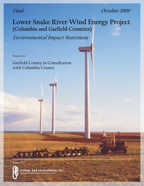
<strong>Lower</strong> <strong>Snake</strong> <strong>River</strong> <strong>Wind</strong> <strong>Energy</strong> <strong>Project</strong><br />
(Columbia and Garfield Counties)<br />
Environmental Impact Statement<br />
Prepared for:<br />
Garfield County in Consultation<br />
with Columbia County<br />
Prepared by:<br />
&<br />
ecology and environment, inc.<br />
International Specialists in the Environment
Final Environmental Impact Statement<br />
FACT SHEET<br />
Title <strong>Lower</strong> <strong>Snake</strong> <strong>River</strong> <strong>Wind</strong> <strong>Energy</strong> <strong>Project</strong>, Final Environmental<br />
Impact State (FEIS)<br />
Brief Description of Applicant proposes to construct and operate approximately 795<br />
Proposed Action wind turbines that would generate approximately 1,432 megawatts<br />
(MW) of wind power in Garfield and Columbia Counties. The<br />
proposed project would occupy approximately 124,000 acres.<br />
<strong>Wind</strong> turbines will generally be located along ridge tops to use<br />
winds that typically come from the southwest. Supporting<br />
infrastructure will include access roads, underground and overhead<br />
electric collection system lines, substations, transmission lines,<br />
microwave communications, meteorological towers, operations and<br />
maintenance centers, and temporary construction access and staging<br />
areas. The project will be built in four or more stages.<br />
Location South of Pomeroy, north of the Pataha Creek, between the Pataha<br />
Creek and Tucannon <strong>River</strong> and south of Tucannon <strong>River</strong> and State<br />
Route 261. Detailed maps and tax parcel numbers are available for<br />
review at the Garfield County Public Works office listed below.<br />
Applicant Puget Sound <strong>Energy</strong>, Inc.<br />
Proposed<br />
Implementation Date<br />
Construction activities are expected to start during 2010 and last<br />
approximately five years. The start of construction depends on the<br />
date Garfield County issues a CUP for this project and whether<br />
there any appeals associated with the CUP’s issuance.<br />
SEPA Lead Agency Garfield County Public Works Department<br />
P.O. Box 160<br />
Pomeroy, WA 99347<br />
(509) 843-1301<br />
Responsible Official Walter Grant Morgan, P.E.<br />
Garfield County Engineer<br />
Public Works Director<br />
Contact Person Garfield County Public Works Department, Planning Division<br />
PO Box 160<br />
Pomeroy, WA 99347<br />
Required Approvals<br />
and Certifications<br />
(509) 843-1301<br />
Clean Water Act Section 404<br />
Permit<br />
Clean Water Act Section 401<br />
Water Quality Certification<br />
National Pollutant Discharge<br />
Elimination System (NPDES)<br />
Construction General Permit<br />
(and State Stormwater<br />
Construction General Permit)<br />
U.S. Army Corps of Engineers<br />
(USACE) – Walla Walla<br />
District<br />
WA Department of Ecology<br />
WA Department of Ecology
Authors and Principal<br />
Contributors<br />
Date of Issuance of<br />
the FEIS<br />
Final EIS Adequacy<br />
Appeal Deadline<br />
Sand and Gravel General Permit<br />
– Portable Facilities (NPDES<br />
and State Waste Discharge<br />
General Permit)<br />
Hydraulic <strong>Project</strong><br />
Approval/Joint Aquatic<br />
Resource Permit Application<br />
Well Construction and<br />
Operator’s License<br />
WA Department of Ecology<br />
WA Department of Fish and<br />
Wildlife<br />
WA Department of Ecology<br />
Federal Aviation Administration Federal Aviation Administration<br />
(FAA) Form 7460: Notice of<br />
Proposed Construction or<br />
Alteration<br />
General Order of Approval for WA Department of Ecology,<br />
Concrete Batch Plants<br />
Eastern Regional Office<br />
General Order of Approval for WA Department of Ecology<br />
Portable Rock Crushers<br />
Highway Access Permit WA Department of<br />
Transportation<br />
Archaeological Excavation WA Department of Archaeology<br />
Permit<br />
and Historic Preservation<br />
Building Permit Garfield County Public Works;<br />
Columbia County Public Works<br />
Conditional Use Permit Garfield County Public Works;<br />
Columbia County Planning<br />
Department<br />
Right of Way Permit (includes Columbia County Public Works<br />
both access and use)<br />
Right of Way Use Permit Garfield County Public Works<br />
Right of Way Approach Permit Garfield County Public Works<br />
Haul Road Agreement Garfield County Public Works<br />
Franchise Agreement/Bonding Columbia County Public Works<br />
Critical Areas<br />
Review/Determination<br />
Garfield County Public Works;<br />
Columbia County Planning<br />
Department<br />
WA Department of Natural<br />
Surface Mining Reclamation<br />
Permit<br />
Resources<br />
Ecology and Environment, Inc. is the principal author of the FEIS.<br />
SWCA Environmental Consultants prepared the cultural resources<br />
inventory and the wetlands and water determination for the<br />
proposed project. WEST, Inc. prepared the wildlife baseline studies<br />
for the proposed project. Mark Bastasch of CH2M Hill prepared the<br />
noise analysis for the proposed project.<br />
October 7, 2009<br />
October 21, 2009
Appeal Period You may appeal the adequacy of the Final EIS by filing a notice of<br />
appeal; the contents of the appeal as outlined in Section 7.3(3)(b) of<br />
the Garfield County SEPA Ordinance (No. 13870); and a $200<br />
filing fee plus cost of transcription and actual cost fees (defined as<br />
all costs incurred by the County in receiving, reviewing, and<br />
processing the appeal), within 14 days after the issue date of this<br />
Final EIS. All notices of appeal must be received by the SEPA<br />
Date Final Action is<br />
Planned<br />
Subsequent<br />
Environmental<br />
Review<br />
Cost of FEIS Copy to<br />
the Public<br />
Previous<br />
Environmental<br />
Documents<br />
Location of<br />
Background<br />
Information<br />
Responsible Official by 5pm on October 21, 2009.<br />
After Garfield County Public Works deliberates on the Applicant’s<br />
CUP application and the EIS contents, it will send a<br />
recommendation to the Garfield County Hearing Examiner to<br />
approve or deny the project (expected in November 2009).<br />
Garfield County Hearing Examiner Hearing<br />
JARPA Application Review<br />
Bonneville Power Administration’s NEPA environmental review<br />
process for its new Central Ferry Substation<br />
Columbia County will conduct its own environmental review<br />
process as it deems appropriate at such time as an application for<br />
development of a wind energy facility is sought by Applicant in<br />
Columbia County<br />
Further environmental review of the specific wind turbine locations<br />
will be done during the proposed project’s micrositing phase<br />
There will be no cost for obtaining a CD containing an electronic<br />
copy of the FEIS; however, if a hard copy is requested, the cost is<br />
$50.00.<br />
<strong>Lower</strong> <strong>Snake</strong> <strong>River</strong> <strong>Wind</strong> <strong>Energy</strong> <strong>Project</strong> (Columbia and Garfield<br />
Counties) Draft Environmental Impact Statement, August 17, 2009<br />
You may access this FEIS and find additional information about the<br />
project on the Garfield County’s website at www.co.garfield.wa.us.<br />
CDs containing the FEIS are available free of charge at the Garfield<br />
County Public Works Department and the Columbia County<br />
Planning Department. You may also request a hard copy of the<br />
FEIS for the cost noted above at either of these two locations.<br />
Hard copies of the FEIS are also available for review at the<br />
following locations: the Garfield County Public Works Department<br />
Office (19 th and Arlington, Pomeroy, WA), the Garfield County<br />
Library (856 Arlington, Pomeroy, WA), the Garfield County<br />
Auditor’s Office (PO Box 278, Pomeroy, WA), the Offices of the<br />
Garfield County Commissioners (Garfield County Courthouse), the<br />
Columbia County Planning Department (11 S.2d St., Dayton, WA),<br />
and the Columbia County Library (111 S.3 rd Street, Dayton, WA).
©2009 Ecology and Environment, Inc.<br />
FINAL Environmental Impact<br />
Statement<br />
<strong>Lower</strong> <strong>Snake</strong> <strong>River</strong><br />
<strong>Wind</strong> <strong>Energy</strong> <strong>Project</strong><br />
October 2009<br />
Prepared for:<br />
Garfield County<br />
P.O. Box 160<br />
Pomeroy, WA 99347<br />
Prepared by:<br />
ECOLOGY AND ENVIRONMENT, INC.<br />
720 Third Avenue, Suite 1700<br />
Seattle, WA 98104<br />
.1te002764.RE11.02
T able of Contents<br />
Section Page<br />
Executive Summary...................................................................................1<br />
1 Environmental Impact Statement Summary ...........................1-1<br />
1.1 How to Use this Document .............................................................................. 1-1<br />
1.2 Purpose of the FEIS.......................................................................................... 1-2<br />
1.2.1 Overview of the review process ..................................................... 1-2<br />
1.2.2 Purpose of the FEIS........................................................................ 1-4<br />
1.3 Summary of Public Involvement, Consultation, and Coordination ................. 1-4<br />
1.4 Significant Unavoidable Adverse Impacts....................................................... 1-6<br />
1.4.1 Visual Impacts................................................................................ 1-6<br />
2 Revisions to the DEIS ...............................................................2-1<br />
Executive Summary................................................................................................... 2-1<br />
2.1 Chapter 1 – Draft Environmental Impact Statement Summary ....................... 2-1<br />
2.2 Chapter 2 – Affected Environment and Impacts.............................................. 2-3<br />
2.2.1 Impact Assessment Overview ........................................................ 2-3<br />
2.2.2 Geology .......................................................................................... 2-4<br />
2.2.3 Soils................................................................................................ 2-4<br />
2.2.4 Water Resources............................................................................. 2-7<br />
2.2.5 Wetlands....................................................................................... 2-18<br />
2.2.6 Aquatic Habitat, Fish Species, and Wildlife ................................ 2-22<br />
2.2.7 Bird and Bat Resources ................................................................ 2-25<br />
2.2.8 Vegetation .................................................................................... 2-27<br />
2.2.9 Visual Resources .......................................................................... 2-31<br />
2.2.10 Noise............................................................................................. 2-32<br />
2.2.11 Climate and Air Quality ............................................................... 2-35<br />
2.2.12 Public Services and Utilities ........................................................ 2-36<br />
2.2.13 Traffic and Transportation ........................................................... 2-36<br />
2.2.14 Land Use and Recreation ............................................................. 2-37<br />
2.2.15 Socioeconomics............................................................................ 2-37<br />
2.2.16 Health and Safety ......................................................................... 2-37<br />
2.2.17 Cultural Resources ....................................................................... 2-38<br />
2.3 Chapter 3 - Required Permits and Consultation............................................. 2-43<br />
2.4 Chapter 4 - List of Preparers .......................................................................... 2-49<br />
2.5 Chapter 5 – References .................................................................................. 2-50<br />
v
Table of Contents (cont.)<br />
Figure Page<br />
3 Comments to DEIS and Responses ........................................3-1<br />
3.1 Introduction ...................................................................................................... 3-1<br />
3.2 Organization of this Section............................................................................. 3-1<br />
3.3 Responses to Comments................................................................................... 3-3<br />
A FEIS Distribution List............................................................... A-1<br />
C WEST’S Baseline Studies for the <strong>Lower</strong> <strong>Snake</strong> <strong>River</strong><br />
<strong>Wind</strong> Resource Area Columbia and Garfield Counties,<br />
Washington............................................................................... A-1<br />
E Visual Simulations ................................................................... A-1<br />
J SWCA’s <strong>Lower</strong> <strong>Snake</strong> <strong>River</strong> <strong>Wind</strong> <strong>Energy</strong> <strong>Project</strong> Rare<br />
Plant Survey Report Garfield and Columbia Counties,<br />
Washington............................................................................... A-1<br />
K SWCA’s Technical Memorandum: Cultural Resources<br />
Methodology............................................................................. A-1<br />
Appendices<br />
A Final FEIS Distribution List ......................................A-1<br />
C WEST’s Baseline Studies for the <strong>Lower</strong> <strong>Snake</strong> <strong>River</strong> <strong>Wind</strong><br />
Resource Area Columbia and Garfield Counties,<br />
Washington............................................................C-1<br />
E Visual Simulations.................................................. E-1<br />
J SWCA’s <strong>Lower</strong> <strong>Snake</strong> <strong>River</strong> <strong>Wind</strong> <strong>Energy</strong> <strong>Project</strong> Rare Plant<br />
Survey Report Garfield and Columbia Counties,<br />
Washington.............................................................J-1<br />
K SWCA’s Technical Memorandum: Cultural Resources<br />
Methodology..........................................................K-1<br />
10:002764_RE11_02 vi<br />
Hot COPY LSR FEIS October 2.doc-10/05/09
L ist of Tables<br />
Table Page<br />
Table FES-1 Summary of Impacts and Mitigation for the Preferred Alternative.........................5<br />
Table F2-12 Unaltered/Undisturbed Streams Present in Tucannon Environmental<br />
Permitting Corridors ............................................................................................ 2-9<br />
Table F2-13 Unaltered/Undisturbed Streams Present in Kuhl Ridge Environmental<br />
Permitting Corridors .......................................................................................... 2-12<br />
Table F2-15 Unaltered/Undisturbed Streams Present in Oliphant Ridge Environmental<br />
Permitting Corridors .......................................................................................... 2-13<br />
Table F2-17 Wetland Characteristics of Identified Wetlands within the Environmental<br />
Permitting Corridors by WRA........................................................................... 2-19<br />
Table 3-1 Permits and Consultation that May be Required for the <strong>Project</strong> ....................... 2-44<br />
Table F3-1 List of DEIS Commenters and Assigned Comment Submission Numbers......... 3-2<br />
vii
L ist of Figures<br />
Figure Page<br />
Figure F2-2a <strong>Project</strong> Area Prime Farmland Soils.................................................................. 2-6<br />
Figure F2-3 Tucannon WRA Surface Waters ...................................................................... 2-8<br />
Figure F2-4 Kuhl Ridge WRA Surface Waters ................................................................. 2-11<br />
Figure F2-5 Dutch Flats WRA Surface Waters ................................................................. 2-14<br />
Figure F2-6 Oliphant Ridge WRA Surface Waters ........................................................... 2-15<br />
Figure F2-7 <strong>Project</strong> Area Surface Water Features, Impaired Waters, and Wellhead<br />
Protection Areas............................................................................................. 2-16<br />
Figure F2-8 <strong>Project</strong> Area Impacted Wetlands.................................................................... 2-21<br />
Figure F2-21 Cumulative Zone of Visual Influence within 8 Miles..................................... A-2<br />
viii
L ist of Abbreviations and Acronyms<br />
Term Definition<br />
APE Area of Potential Effect<br />
APLIC Avian Power Line Interaction Committee<br />
Audubon National Audubon Society Inc.<br />
AWEA American <strong>Wind</strong> <strong>Energy</strong> Association<br />
BLM Bureau of Land Management<br />
BMPs best management practices<br />
BPA Bonneville Power Administration<br />
CanWEA Canadian <strong>Wind</strong> <strong>Energy</strong> Association<br />
CAO Critical Areas Ordinances<br />
CPE Columbia Plateau Ecoregion<br />
CRMMIPD Cultural Resources Monitoring, Mitigation and Inadvertent Discovery<br />
Plan<br />
CRP Conservation Reserve Program<br />
CTUIR Confederate Tribes of the Umatilla Indian Reservation<br />
CUP Conditional Use Permit<br />
DAHP Department of Archaeology and Historic Preservation<br />
dB Decibels<br />
DEIS Draft EIS<br />
Ecology Washington State Department of Ecology<br />
EDNA environmental designation for noise abatement<br />
EFSEC <strong>Energy</strong> Facility Site Evaluation Council<br />
EIS Environmental Impact Statement<br />
ESA Endangered Species Act<br />
ESCP erosion and sediment control plan<br />
FAA Federal Aviation Administration<br />
FDCP Fugitive Dust Control Plan<br />
10:002764_RE11_02 ix<br />
Hot COPY LSR FEIS October 2.doc-10/5/2009
List of Abbreviations and Acronyms (cont.)<br />
FEIS Final EIS<br />
FHWA Federal Highway Administration<br />
GIS Geographic Information System<br />
HF high-frequency<br />
HPCRSIT Historic Properties of Cultural and Religious Significance to Indian Tribes<br />
Hz Hertz<br />
IRP Integrated Resource Plan<br />
JARPA Joint Aquatic Resources Permit Application<br />
kV Kilovolts<br />
LF low-frequency<br />
LSRWEP <strong>Lower</strong> <strong>Snake</strong> <strong>River</strong> <strong>Wind</strong> <strong>Energy</strong> <strong>Project</strong><br />
mph miles per hour<br />
MW Megawatts<br />
NAP National Academies Press<br />
NHPA National Historic Preservation Act<br />
NOI Notice of Intent<br />
NPDES National Pollutant Discharge Elimination System<br />
NRC National Research Council<br />
NRHP National Register of Historic Places<br />
O&M operations and maintenance<br />
OSHA Occupational Safety and Health Administration<br />
Phase I ESA Phase I Environmental Site Assessment<br />
<strong>Project</strong> <strong>Lower</strong> <strong>Snake</strong> <strong>River</strong> <strong>Wind</strong> <strong>Energy</strong> <strong>Project</strong><br />
PSE Puget Sound <strong>Energy</strong> Inc.<br />
QA/QC Quality Assurance/Quality Control<br />
RCW Revised Code of Washington<br />
ROW Right-of-way<br />
SEPA State Environmental Policy Act<br />
SR State Route<br />
SWPPP Storm Water Pollution Prevention Plan<br />
TAC Technical Advisory committee<br />
x
List of Abbreviations and Acronyms (cont.)<br />
USACE U.S. Army Corps of Engineers<br />
USFS United States Forest Service<br />
USFWS U.S. Fish and Wildlife Service<br />
WAC Washington Administrative Code<br />
WDFW Washington Department of Fish and Wildlife<br />
WDNR Washington Department of Natural Resources<br />
WIRHS Wildlife Incident Reporting and Handling System<br />
WRAs <strong>Wind</strong> Resource Areas<br />
WSDOT Washington State Department of Transportation<br />
ZOR zone of risk<br />
ZVI Zone of Visual Influence<br />
xi
Executive Summary<br />
ES.1 Introduction<br />
In February 2009, Garfield County initiated the environmental review of the<br />
<strong>Lower</strong> <strong>Snake</strong> <strong>River</strong> <strong>Wind</strong> <strong>Energy</strong> <strong>Project</strong> (<strong>Project</strong>) proposed by Puget Sound<br />
<strong>Energy</strong> Inc. (PSE). The application was originally submitted by Blue Sky, LLC, a<br />
subsidiary of RES Americas (RES) and PSE. Since the application was filed, PSE<br />
has acquired the entire interest in the <strong>Project</strong>. For this reason, references to the<br />
“Applicant” in this document refer solely to PSE. The <strong>Project</strong> is a commercial<br />
wind farm capable of generating approximately 1,432 megawatts (MW) of<br />
electricity proposed for development in Columbia and Garfield Counties on<br />
approximately 124,000 acres.<br />
This environmental review process, performed under the authority of Ch. 43.21C<br />
RCW (State Environmental Policy Act or SEPA), was triggered when the<br />
Applicant submitted a Conditional Use Permit (CUP) application to Garfield<br />
County on January 26, 2009. At such time when the Applicant seeks to develop<br />
portions of the <strong>Project</strong> in Columbia County, that county will conduct its own<br />
permitting process and associated environmental review.<br />
On February 12, 2009, Garfield County issued a SEPA determination of<br />
significance, indicating the County’s intention to prepare an Environmental<br />
Impact Statement (EIS) to describe the environmental impacts of the <strong>Project</strong> in<br />
both Garfield and Columbia Counties.<br />
On February 12 and 26, 2009, Garfield County began a scoping process to solicit<br />
input from the public on the issues that should be addressed in the environmental<br />
review. Fifty-nine comment letters were received and considered. The County<br />
prepared a draft EIS that was issued for public comment on August 17, 2009. The<br />
County accepted comments postmarked through September 16, 2009. These<br />
comments, received, from Tribes, local and state agencies, and the public were<br />
considered in the preparation of this FEIS.<br />
An EIS is an informational and evaluative tool. It does not mandate approval or<br />
disapproval of a project, but informs the public and decision-makers as to the<br />
potential substantial adverse impacts to both the built and natural environment,<br />
and suggests to decision-makers the means by which those impacts could be<br />
avoided or reduced through mitigation.<br />
1
2<br />
Executive Summary<br />
This environmental review evaluates approximately 1,000 wind turbine locations<br />
in the <strong>Project</strong> area. After applying mitigation measures, best management<br />
practices (BMPs), and micrositing of the individual <strong>Project</strong> features,<br />
approximately 795 turbine locations will be chosen for installation at the <strong>Project</strong>.<br />
This FEIS is organized as follows.<br />
Chapter 1 describes the purpose of this FEIS in the context of the analyses<br />
conducted by Garfield County, in cooperation with Columbia County, to comply<br />
with SEPA. Refinements to the proposed action, along with a summary of<br />
coordination activities conducted with agencies and tribes, are also included.<br />
Chapter 2 of the FEIS provides updates and text revisions to the analysis<br />
described in Chapters 2 and 3 of the Draft EIS.<br />
Chapter 3 of the FEIS includes copies of written comments submitted to Garfield<br />
County, as well as responses to those comments prepared by the FEIS authors.<br />
The remaining chapters and appendices of the FEIS provide updated supporting<br />
information for the EIS, as required by SEPA.<br />
The draft EIS, and this FEIS, make up the complete Environmental Impact<br />
Statement for this <strong>Project</strong>.<br />
ES.2 <strong>Project</strong> Objectives, Purpose and Need<br />
As stated in the draft EIS, the <strong>Project</strong> objective is to develop and construct a<br />
commercial wind energy facility in Garfield and Columbia Counties in Southeast<br />
Washington that is commercially viable and meets the energy needs of the region.<br />
The Applicant is subject to the requirements of the Washington <strong>Energy</strong><br />
Independence Act, Chapter 19.285 RCW, and needs to obtain mandatory<br />
minimum amounts of its energy supply from eligible renewable energy resources.<br />
The Applicant’s integrated resource plan relies heavily on the increased use of<br />
wind power as a principal component of its future generation portfolio. The<br />
combination of economic growth and expiring energy supply contracts means that<br />
PSE faces large electricity resource needs in the years ahead. This <strong>Project</strong><br />
addresses the objectives and purposes stated above, and contributes to meeting the<br />
needs of PSE and its customer base.<br />
ES.3 <strong>Project</strong> Alternatives and Review<br />
As stated in the draft EIS, this document evaluates two alternatives: the Preferred<br />
Alternative (the <strong>Project</strong>) and the No Action Alternative. Several potential<br />
alternatives were considered during the development of this EIS, but were not<br />
analyzed in detail because they were not deemed reasonable, or they did not meet<br />
the <strong>Project</strong> objectives.
3<br />
Executive Summary<br />
The direct and indirect <strong>Project</strong> impacts are addressed, as well as the cumulative<br />
impacts of other reasonably foreseeable projects in the two-county area. Impacts<br />
of the <strong>Project</strong> are evaluated for the construction, project facilities’ operations and<br />
maintenance, and end of design life stages of the <strong>Project</strong>.<br />
One of the results of environmental review is the development of potential<br />
mitigation measures whose implementation may avoid or reduce impacts to the<br />
built and natural environment, as well as help identify significant unavoidable<br />
impacts that cannot be mitigated.<br />
Mitigation measures recommended in an EIS are one tool the Applicant uses to<br />
refine the ultimate selection of individual turbine locations. Additional processes<br />
that are applied to the final site-specific decisions necessary to reduce the project<br />
to a final footprint of approximately 795 turbines include both mitigation<br />
measures that are inherent in the design of a wind project, and the process of<br />
micrositing.<br />
Mitigation measures that are inherent in a wind project design include standards<br />
that are applied to the entire <strong>Project</strong>. An example of a mitigation measure inherent<br />
in a wind project design is siting all project elements to avoid sensitive resource<br />
areas such as wetlands, streams, or known cultural resource sites. This principle is<br />
applied to the specific streams present in the <strong>Project</strong> area and informs the design<br />
engineer of locations where no <strong>Project</strong> elements can be placed. This reduces the<br />
ultimate number of turbines that can be sited.<br />
Micrositing is the final process of assessing site-specific attributes in order to<br />
determine the final locations of wind turbine generators, below-ground electrical<br />
cables, and above-ground electrical transmission towers. This process occurs after<br />
comprehensive environmental and permit review and prior to actual construction.<br />
During micrositing, technical and engineering factors, including limitations posed<br />
by the terrain, wind data, (e.g., speed, wind shear), wake effects of the turbines,<br />
feasibility of access, geotechnical considerations (subsurface conditions),<br />
environmental restrictions (avoidance of sensitive habitat), cultural/archeological<br />
restrictions (avoidance of cultural resources sites), telecommunications<br />
constraints, Federal Aviation Administration (FAA) requirements, and other sitespecific<br />
criteria are assessed. Based on these site-specific results, further<br />
refinement is made to yield a final layout of approximately 795 turbines.<br />
ES.4 Significant Areas of Interest and Issues that Were<br />
Considered in the Analysis<br />
Public scoping identified the following significant areas of interest to be<br />
considered in this DEIS: impacts to land uses in the area; socioeconomic impacts<br />
to the community and the public services afforded the area’s citizens; avian and<br />
wildlife impacts; visual impacts; and noise impacts. The draft EIS considered the<br />
following significant issues to be resolved through environmental and permit<br />
review: whether the <strong>Project</strong> would have significant adverse impacts to wildlife
4<br />
Executive Summary<br />
populations and hunting uses; whether there would be continued viability of<br />
agricultural activities; the level of demands placed on public services; calculation<br />
and timing of new revenues to taxing districts and the private sector; whether the<br />
<strong>Project</strong> could be sited to meet Washington’s adopted noise level standards; and<br />
how the <strong>Project</strong> will affect the viewscape in the <strong>Project</strong> vicinity.<br />
ES.5 Mitigation Measures and Significant Impacts that are<br />
Unavoidable<br />
The draft EIS presented a summary table of all recommended mitigation<br />
measures. This table has been revised and updated to reflect additional mitigation<br />
measures suggested by the EIS authors to mitigate for the impacts presented in the<br />
draft EIS, and otherwise raised in the comments received. As in the draft EIS,<br />
major mitigation measures discussed here are reasonably calculated to reduce, at<br />
times eliminate, and in several instances, enhance the impacts of the <strong>Project</strong> to the<br />
built and natural environment.<br />
The mitigation measures presented in this analysis have been summarized in<br />
Table FES-1. The mitigation measures listed in Table FES-1 are both inherent in<br />
project design and for reduction of impacts. Revisions to existing mitigation<br />
measures or new mitigation measures are indicated in this table using the<br />
following formatting:<br />
Deletions are indicated by text that has been stricken (for example “deleted”)<br />
Additions are indicated by underlining the new text (for example “new text”).<br />
As described in the draft EIS, avoidance will continue to be utilized to prevent<br />
many types of impacts from occurring in the first instance, and Best Management<br />
Practices will be applied to minimize impacts where appropriate. Application of<br />
all of these measures, following the micrositing of the <strong>Project</strong> elements within<br />
permitting corridors, will limit and in most instances, eliminate the adverse<br />
impacts of the <strong>Project</strong>.
Table FES-1 Summary of Impacts and Mitigation for the Preferred Alternative<br />
Resource<br />
Geology<br />
Impact Topics Addressed Mitigation Measures<br />
• Impacts associated with • <strong>Project</strong> facilities (turbines, roads, collection systems, and associated facilities) will be sited<br />
seismic effects and volcanic to avoid potential geologic hazard areas, to the maximum extent practicable, including those<br />
activity<br />
identified in the Counties’ Critical Areas Ordinances (“CAO”), slopes greater than 30%, and<br />
• Potential for <strong>Project</strong> to streamside incision or erosion points. The Counties’ CAO standards and any other<br />
contribute to slope<br />
applicable state and/or federal regulations will be complied with if geologic hazard areas<br />
instability, topographic cannot be avoided.<br />
alterations, and erosion • <strong>Project</strong> features will be designed and constructed to comply with the performance standards<br />
for geologic hazardous areas as specified in Counties’ CAOs, seismic design codes, slope<br />
protection measures, and BMPs.<br />
• Roads will be designed by a certified engineer and constructed to ensure stability and to<br />
reduce wind erosion (including use of a minimum of 15 cm of gravel surface for temporary<br />
roads).<br />
• <strong>Project</strong> will comply with specifications and BMPs contained in its NPDES permit and<br />
Stormwater Pollution Prevention Plan (SWPPP) to reduce erosion potential.<br />
• Blasting activities will be conducted by professionally trained and certified explosive experts<br />
and will employ industry-standard techniques.<br />
• When possible, roads, collector lines, cabling trenches, and communication lines will share<br />
construction corridors to minimize ground disturbance.<br />
• During the first year following construction and/or until vegetation has been established in<br />
disturbed soil, the <strong>Project</strong> site will be monitored on a regular basis following large rainfall<br />
and snow events, and corrective action will be taken if any erosion occurs.<br />
• Maintain widened existing roads and new roads through <strong>Project</strong>’s life to limit erosion.<br />
• When <strong>Project</strong> facilities are removed, restoration activities could include reclaiming roads,<br />
recontouring slopes, grading, ripping compacted areas, filling, excavating, and<br />
replanting/reseeding as applicable. Footings and foundations will be removed to a level of 3<br />
feet below the ground surface.<br />
• Applicant will obtain reclamation permit from WA DNR as applicable, if reclamation is<br />
requested by landowner.<br />
• Any <strong>Project</strong> mitigation should be planned for and implemented for each developmental<br />
phase of the <strong>Project</strong> and not post-construction of the entire <strong>Project</strong>. (Note: This mitigation<br />
measure applies to each element of the environment; however, for purposes of this Table,<br />
will only be listed once.)<br />
5<br />
Executive Summary<br />
Significant and<br />
Unavoidable Adverse<br />
Impacts<br />
• Mitigation measures<br />
inherent in <strong>Project</strong><br />
design and identified in<br />
the EIS, result in no<br />
significant unavoidable<br />
adverse impacts
6<br />
Table FES-1 Summary of Impacts and Mitigation for the Preferred Alternative<br />
Resource<br />
Soils<br />
Impact Topics Addressed Mitigation Measures<br />
• Temporary and permanent • <strong>Project</strong> will limit soil disturbance by: (1) using existing roads wherever feasible, rather than<br />
soil disturbance<br />
building new roads; (2) clearly identifying work areas; (3) minimizing vegetation removal;<br />
• Soil compaction and<br />
and (4) during construction of O&M facilities, limit the disturbed area to the size of the<br />
erosion<br />
O&M yard.<br />
• Conversion of natural soils • Applicant will site supporting infrastructure so that adjacent WRAs share facilities to the<br />
to artificial surfaces<br />
maximum extent feasible, thereby reducing the total number of facilities constructed within<br />
• Soil contamination<br />
the <strong>Project</strong> as a whole.<br />
• Applicant will properly engineer any cut-and-fill slopes.<br />
• Applicant will restore temporary staging areas and temporary shoulders and turn-around<br />
areas to pre-<strong>Project</strong> condition following construction.<br />
• <strong>Project</strong> will install and apply appropriate erosion control measures during and following<br />
construction, including silt fences, straw bales, reseeding, water trucks for dust control,<br />
monitoring, etc.<br />
• <strong>Project</strong> will install appropriate roadway drainage to control and disperse runoff.<br />
• Applicant will require contractors to use BMPs for handling materials to help prevent spills.<br />
• Applicant will keep soils covered in construction zones, use dust abatement measures (such<br />
as watering trucks) and tackifiers, or timely revegetate disturbed areas to allow for optimal<br />
seed germination to prevent erosion.<br />
• BMPs will be developed to comply with the Ecology Construction Stormwater NPDES<br />
permit from Ecology before construction.<br />
• See mitigation measures listed for Geology.<br />
Water Resources<br />
• Stormwater runoff effects<br />
on water quality<br />
• Streambed and stream bank<br />
disturbance<br />
• Water quality impacts from<br />
spills<br />
• Water consumption for<br />
<strong>Project</strong> construction and<br />
operation<br />
• Sedimentation and erosion<br />
effects on water quality<br />
• To the maximum extent possible, <strong>Project</strong> will avoid surface water and groundwater<br />
identified during micrositing.<br />
• To the maximum extent possible, <strong>Project</strong> will adhere to stream buffers and surface water<br />
buffers.<br />
• Culverts will be installed to facilitate road crossings/road widenings.<br />
• <strong>Project</strong> will adhere to Ecology’s Stormwater Management Manual for Eastern Washington.<br />
• Applicant will prepare an Erosion and Sediment Control Plan (ESCP), including details and<br />
locations of BMPs to be implemented.<br />
• Applicant will prepare a Stormwater Pollution Prevention Plan (SWPPP) for construction<br />
and operation of the <strong>Project</strong>.<br />
• <strong>Project</strong>’s stormwater drainage systems and structural BMPs will be designed to prevent<br />
infiltration of liquid contaminants or contaminated runoff into underlying aquifers.<br />
6<br />
Executive Summary<br />
Significant and<br />
Unavoidable Adverse<br />
Impacts<br />
• With mitigation<br />
measures identified in<br />
the EIS, and mitigation<br />
measures inherent in<br />
<strong>Project</strong> design, the<br />
<strong>Project</strong> will have no<br />
significant unavoidable<br />
adverse impacts<br />
• With mitigation<br />
measures identified in<br />
the EIS, and mitigation<br />
measures inherent in<br />
<strong>Project</strong> design, the<br />
<strong>Project</strong> will have no<br />
significant unavoidable<br />
adverse impacts
7<br />
Table FES-1 Summary of Impacts and Mitigation for the Preferred Alternative<br />
Resource<br />
Wetlands<br />
Impact Topics Addressed Mitigation Measures<br />
• If work in streams or their buffers can not be avoided, any work in streams or their riparian<br />
buffers will only be designed and conducted in accordance with applicable local, state, and<br />
federal regulations.<br />
• <strong>Project</strong> will comply with Garfield County CAO requirements and Garfield County Health<br />
District for wellhead protection areas/critical aquifer recharge areas.<br />
• <strong>Project</strong> will install and implement sediment and erosion control measures, including, but not<br />
limited to, straw mulching and vegetating disturbed surfaces; retaining original vegetation<br />
wherever possible; directing surface runoff away from denuded areas; minimizing<br />
constructed slope steepness and length to keep runoff velocities low; and maintaining<br />
vegetative buffer strips between the affected areas and any nearby waterways.<br />
• Excavated materials will be retained for backfilling post-construction and disturbed areas<br />
will be brought to natural grade and re-seeded with a native seed mix.<br />
• Rock crushers will operate with BMP measures for water runoff.<br />
• <strong>Project</strong> site will be monitored on a regular basis for erosion and corrective action taken as<br />
necessary per the <strong>Project</strong>’s NPDES permit requirements.<br />
• See mitigation measures listed for Geology and Soils.<br />
• Impacts to wetlands and • Using existing developed water sources for construction.<br />
Waters of the United States • To the maximum extent possible, Applicant will locate construction staging areas,<br />
• Impacts to wetland<br />
stormwater management facilities, roads, underground cables, turbine foundations,<br />
vegetation<br />
transmission poles, and other associated infrastructure outside wetlands and their associated<br />
buffers.<br />
• If wetlands and their buffers cannot be avoided, Applicant will comply with applicable local,<br />
state, and federal regulations.<br />
• Applicant will complete a final wetland delineation after completion of micrositing process<br />
and consult with the appropriate state and federal agencies if determination that<br />
jurisdictional wetlands may be impacted.<br />
• Applicant will minimize the number of stream crossings to the maximum extent possible.<br />
• Applicant will conduct a thorough geotechnical analysis of each turbine foundation prior to<br />
construction.<br />
• <strong>Project</strong>’s clearing and grading activities will be at least 200 feet from all wetlands in the<br />
<strong>Project</strong> area to the maximum extent feasible.<br />
• Applicant will evaluate shallow groundwater and impacts thereto and adjust tower locations<br />
to avoid impacts when locating <strong>Project</strong> facilities within the proximity of wetlands.<br />
• See mitigation measures listed for Water Resources.<br />
7<br />
Executive Summary<br />
Significant and<br />
Unavoidable Adverse<br />
Impacts<br />
• With mitigation<br />
measures identified in<br />
the EIS, and mitigation<br />
measures inherent in<br />
<strong>Project</strong> design, the<br />
<strong>Project</strong> will have no<br />
significant unavoidable<br />
adverse impacts
8<br />
Table FES-1 Summary of Impacts and Mitigation for the Preferred Alternative<br />
Resource Impact Topics Addressed Mitigation Measures<br />
Aquatic Habitat, Fish Species, And Wildlife<br />
• Impacts to aquatic habitat<br />
• Loss of habitat<br />
• Wildlife mortality<br />
• Streambed and stream bank<br />
disturbances<br />
• Loss of riparian vegetation<br />
• Temporary displacement of<br />
big game<br />
Bird And Bat Resources<br />
• Temporary and permanent<br />
loss of habitat<br />
• Disturbance and/or<br />
displacement of avian and<br />
bat species<br />
• Avian/bat mortality<br />
• To the maximum extent feasible, <strong>Project</strong> facilities will be located at least 250 feet from the<br />
banks of fish-bearing streams.<br />
• Where avoidance of riparian corridors is not possible, stabilized rock construction access<br />
roads will be used or other structures designed to be in compliance with local, state, and<br />
federal requirements.<br />
• Applicant will restore temporarily impacted habitat and <strong>Project</strong> facility footprints after<br />
decommissioning to minimize permanent impacts to wildlife.<br />
• <strong>Project</strong> facilities will be constructed in phases to minimize the amount of area impacted by<br />
construction thereby minimizing impacts to burrowing wildlife.<br />
• Applicant will implement proper drainage, erosion control plans, and stormwater<br />
management practices during the operation of the <strong>Project</strong>, avoiding impacts on fish and fish<br />
habitat downstream of the <strong>Project</strong> area.<br />
• In areas documented as winter range habitat for big game species, the maximum amount of<br />
heavy construction, including road and foundation construction and blasting, will occur<br />
between April 15 and November 15, outside the critical winter periods.<br />
• WDFW and the permitting authority will be consulted and involved with respect to<br />
managing the big game populations in the <strong>Project</strong> area during the construction and<br />
operations of the <strong>Project</strong>.<br />
• Consultation with Columbia and Garfield Counties to ensure compliance with their<br />
respective CAOs.<br />
• Establish a Technical Advisory Committee (TAC) for the <strong>Project</strong> to formulate and review<br />
the results of wildlife monitoring data and formulate recommendations for adaptive<br />
management. as described in Bird and Bat Resources mitigation.<br />
• Applicant will implement appropriate recommendations provided in the WDFW <strong>Wind</strong><br />
Power Guidelines (April 2009).<br />
• See mitigation measures listed for Water Resources, Wetlands, and Bird and Bat Resources.<br />
• Establish a Technical Advisory Committee (TAC) for the <strong>Project</strong> to formulate and review<br />
the results of wildlife monitoring studies.<br />
• The TAC (referenced in the Aquatic Habitat, Fish Species, And Wildlife element of the<br />
environment above) above will formulate and review the results of avian and bat monitoring<br />
data and formulate recommendation for adaptive management.<br />
• The duration and scope of the post-construction monitoring program will be recommended<br />
to the appropriate permitting authority by the TAC through consultation with a qualified<br />
8<br />
Executive Summary<br />
Significant and<br />
Unavoidable Adverse<br />
Impacts<br />
• With mitigation<br />
measures identified in<br />
the EIS, and mitigation<br />
measures inherent in<br />
<strong>Project</strong> design, the<br />
<strong>Project</strong> will have no<br />
significant unavoidable<br />
adverse impacts<br />
• With mitigation<br />
measures identified in<br />
the EIS, and mitigation<br />
measures inherent in<br />
<strong>Project</strong> design, the<br />
<strong>Project</strong> will have no<br />
significant unavoidable
9<br />
Table FES-1 Summary of Impacts and Mitigation for the Preferred Alternative<br />
Resource<br />
Vegetation<br />
Impact Topics Addressed Mitigation Measures<br />
biology consultant familiar with the impacts on birds and bats at wind energy projects.<br />
• A raptor nesting survey will be conducted in the appropriate season prior to each phase of<br />
construction to identify active raptor nest sites in the vicinity of the <strong>Project</strong>. Disturbance will<br />
be minimized during construction in accordance with the maximum setbacks recommended<br />
by local regulations through applicable CAO’s and other applicable state and federal<br />
agencies’ recommendations regarding construction activity setbacks from active raptor<br />
nests.<br />
• Construction personnel will avoid driving over or otherwise disturbing areas outside the<br />
designated construction areas.<br />
• Applicant will designate an environmental monitor during construction to monitor<br />
construction activities and ensure compliance with mitigation measures.<br />
• Applicant will implement a wildlife incident reporting and handling system (WIRHS),<br />
which will be modeled after the system in place at the Hopkins Ridge project.<br />
• Implement the appropriate recommendations for impact avoidance and minimization<br />
provided in the Washington Department of Fish and Wildlife <strong>Wind</strong> Power Guidelines (April<br />
2009).<br />
• The Applicant will use un-guyed permanent meteorological towers to minimize adverse<br />
avian impacts from these structures, as recommended by the 2009 WDFW <strong>Wind</strong> Power<br />
Guidelines.<br />
• <strong>Project</strong> powerlines will be designed and operated to meet PSE avian protection and the<br />
Avian Power Line Interaction Committee (APLIC) standards. At riparian crossings, line<br />
protection can include markers and other protection devices to increase visibility of lines to<br />
birds.<br />
• Introduction/increase in • Consultation with county weed management authorities for the development of a <strong>Project</strong><br />
noxious weed species vegetation management plan prior to construction and implementation of construction weed<br />
• Vegetation removal and management and revegetation activities to prevent weed spread and the introduction of new<br />
habitat loss<br />
weed populations.<br />
• Integrated Weed Management control techniques appropriate to individual species and<br />
specific sites within areas impacted by the <strong>Project</strong> will be developed and employed in<br />
consultation with the appropriate county Weed Coordinators.<br />
• Applicant will monitor known weed populations and check for new introductions within<br />
restored areas on a regular schedule throughout post-construction growing seasons.<br />
• Application of the mitigation ratios contained in the WDFW <strong>Wind</strong> Power Guidelines (April<br />
2009) will be imposed post-construction.<br />
• Studies will be completed prior to <strong>Project</strong> ground disturbance activities to identify sensitive<br />
9<br />
Executive Summary<br />
Significant and<br />
Unavoidable Adverse<br />
Impacts<br />
adverse impacts<br />
• With mitigation<br />
measures identified in<br />
the EIS, and mitigation<br />
measures inherent in<br />
<strong>Project</strong> design, the<br />
<strong>Project</strong> will have no<br />
significant unavoidable<br />
adverse impacts
10<br />
Table FES-1 Summary of Impacts and Mitigation for the Preferred Alternative<br />
Resource Impact Topics Addressed Mitigation Measures<br />
and special status species to be avoided by <strong>Project</strong> design and micrositing.<br />
• The Applicant will implement post-construction weed management, including eradication of<br />
incipient weed populations, suppression of existing populations, and restoration of<br />
temporarily disturbed existing plant communities.<br />
Visual Resources<br />
• Permanently changed views<br />
from residential,<br />
recreational, and roadway<br />
viewpoints<br />
• Light and glare impacts<br />
• Cumulative visual impacts<br />
of wind energy in the<br />
region<br />
Noise<br />
• Noise impacts from the<br />
construction and operation<br />
of the <strong>Project</strong><br />
• Most of <strong>Project</strong>’s collector systems will be buried underground; however, where this is not<br />
feasible, portions may be carried overhead.<br />
• Sensors and switches will be used to keep lights off on <strong>Project</strong> facilities when not required.<br />
• Mitigation for <strong>Project</strong> lighting will be determined through consultation with FAA during the<br />
micrositing process. An effort will be made to limit or minimize the visual effects of<br />
lighting, to the maximum extent possible in compliance with FAA requirements.<br />
• <strong>Project</strong> lights typically used to meet FAA requirements will to some extent be shielded from<br />
ground level view due to a constrained (3-5 degree) vertical beam.<br />
• Turbine towers will be painted white with anti-reflective paint to avoid daytime lighting and<br />
reduce glare of the wind turbines.<br />
• Implement work-hour controls so that noise-generating activities occur between 7 a.m. and<br />
10 p.m., to the maximum extent possible<br />
• Minimize the number of heavy-duty haul trucks traveling through the area during nighttime<br />
hours.<br />
• Do not allow haul trucks to park and idle within 100 feet of a residential dwelling.<br />
• Maintain equipment in good working order and use adequate mufflers and engine<br />
enclosures.<br />
• Coordinate construction vehicle travel to reduce the number of passes by sensitive receivers.<br />
• Compliance with Garfield and Columbia Counties’ setback standards<br />
• The Applicant shall comply with State of Washington noise standards (WAC Chapter 173-<br />
60). The Applicant has also voluntarily agreed to meet a residential EDNA standard of 50<br />
dBA at any existing residential receptors of non-participating land owners unless noise<br />
easements are obtained.<br />
10<br />
Executive Summary<br />
Significant and<br />
Unavoidable Adverse<br />
Impacts<br />
• No mitigation<br />
measures are available<br />
which would minimize<br />
or eliminate significant<br />
unavoidable adverse<br />
impacts (refer to<br />
Section 2.10 for further<br />
discussion)<br />
• With mitigation<br />
measures identified in<br />
the EIS, and mitigation<br />
measures inherent in<br />
<strong>Project</strong> design, the<br />
<strong>Project</strong> will have no<br />
significant unavoidable<br />
adverse impacts
11<br />
Table FES-1 Summary of Impacts and Mitigation for the Preferred Alternative<br />
Resource Impact Topics Addressed Mitigation Measures<br />
Climate And Air Quality<br />
• Construction and<br />
operational impacts on air<br />
quality (i.e.,<br />
particulates/fugitive dust<br />
and vehicle emissions)<br />
• Greenhouse gas emissions<br />
Public Services And Utilities<br />
• Increase in demand for<br />
public services (police,<br />
emergency services,<br />
medical services,<br />
education)<br />
• Increased response time for<br />
emergency services<br />
• Impacts related to<br />
• Development of a dust control plan (FDCP) identifying all fugitive dust sources and dust<br />
control methods and compliances with FDCP’s requirements.<br />
• Construction to be completed in phases, minimizing disturbed areas.<br />
• Stockpiles of soil will be covered managed with wind-impervious fabric to prevent airborne<br />
dust using impervious fabric covers, the application of a tackifier, or other appropriate<br />
measures.<br />
• All vehicles used during construction will comply with applicable federal and state air<br />
quality regulations for tailpipe emissions.<br />
• Carpooling among construction workers will be encouraged.<br />
• When in operation, vehicles will limit engine idling time and equipment will be shut down<br />
when not in use.<br />
• Limit traffic speeds to the posted speed limits to minimize the generation of dust.<br />
• Add surface gravel to reduce the source of dust emission.<br />
• Encourage the use of alternate, paved roads, where available.<br />
• Water or dust palliatives to be applied as necessary to control road dust from construction<br />
vehicles within 500 feet of residences and also to temporary access roads and cleared areas.<br />
• Adherence to county dust abatement processes and use of locally approved dust suppressant<br />
chemicals. Excessive and repeated applications of dust suppressant chemicals will be<br />
avoided, and the application of such chemicals will be timed to avoid or minimize their<br />
wash-off by rainfall or irrigation.<br />
• Maintaining permanent graveled access roads in compliance with county regulations.<br />
• Compliance with fugitive dust control plans and BMPs for concrete batch plants and<br />
portable rock crushers.<br />
• <strong>Project</strong> will obtain Temporary Air Quality Permits for concrete batch plants.<br />
• See mitigation measures in Geology and Soils.<br />
• Facility personnel will complete regular emergency response and safety training.<br />
• Preventative safety measures will be employed to reduce the risk of fires or to safely contain<br />
a fire if one should occur. Lightning protection systems will be installed in all turbines and<br />
towers to reduce the risk of a lightning-caused fire.<br />
• Discussions with local fire districts prior to construction for ongoing fire protection services<br />
during construction and operation of the <strong>Project</strong>.<br />
• Preparation of onsite emergency plans, including an Emergency Action Plan, a Fire<br />
Prevention Plan, and an Operational Safety Program. Measures in these plans might include:<br />
11<br />
Executive Summary<br />
Significant and<br />
Unavoidable Adverse<br />
Impacts<br />
• With mitigation<br />
measures identified in<br />
the EIS, and mitigation<br />
measures inherent in<br />
<strong>Project</strong> design, the<br />
<strong>Project</strong> will have no<br />
significant unavoidable<br />
adverse impacts<br />
• With mitigation<br />
measures identified in<br />
the EIS, and mitigation<br />
measures inherent in<br />
<strong>Project</strong> design, the<br />
<strong>Project</strong> will have no<br />
significant unavoidable<br />
adverse impacts
12<br />
Table FES-1 Summary of Impacts and Mitigation for the Preferred Alternative<br />
Resource Impact Topics Addressed Mitigation Measures<br />
wastewater and solid waste<br />
generation<br />
providing detailed maps to local fire and emergency services districts showing all <strong>Project</strong><br />
access roads, use of spark arrestors on all power equipment during extremely dry conditions<br />
when the wildfire risk is elevated; carrying fire extinguishers in construction and<br />
maintenance vehicles; and maintaining a water supply or water tender at one or more<br />
locations on-site to improve the effectiveness of fire fighting. Such plans will comply with<br />
Counties’ development standards.<br />
• <strong>Project</strong> will provide its own onsite security to be present during construction and operations.<br />
• Junction boxes will be constructed with a graveled footprint for fire protection and<br />
maintenance.<br />
• Sanitary wastes will be collected in portable toilets during construction. Disposal of sanitary<br />
wastes will be managed through a contract with a portable toilet waste vendor.<br />
• Onsite septic systems will be installed at O&M facilities as required by applicable<br />
regulations. The Applicant will consult with the appropriate County Health Department and<br />
obtain any required permits prior to construction.<br />
• Hazardous materials will be disposed of in accordance with all applicable state and federal<br />
laws and regulations.<br />
• A private contractor will be hired to transport construction debris to a regional landfill for<br />
disposal.<br />
• If <strong>Project</strong> is decommissioned, waste material will be recycled, disposed of onsite, or taken to<br />
a regional facility for disposal.<br />
• See mitigation measures listed for Health and Safety.<br />
12<br />
Executive Summary<br />
Significant and<br />
Unavoidable Adverse<br />
Impacts
13<br />
Table FES-1 Summary of Impacts and Mitigation for the Preferred Alternative<br />
Resource Impact Topics Addressed Mitigation Measures<br />
Traffic And Transportation<br />
• Impacts related to<br />
additional traffic trips<br />
generated by <strong>Project</strong><br />
• Impacts on roadways<br />
related to construction and<br />
delivery of oversized loads<br />
• Impacts related to road<br />
maintenance and public<br />
access<br />
• Damage to roadways<br />
• Prior to construction, required road agreements (including Haul and Franchise Agreements)<br />
will be prepared in consultation with local and state agencies to address impacts from<br />
transporting large equipment to the site. Additionally any bonding requirements will be met<br />
prior to construction.<br />
• Pilot cars will be used as WSDOT dictates, depending on load size and weight.<br />
• Where construction may occur near the roadway, one travel lane shall be maintained at all<br />
times.<br />
• Provision for advance notification to emergency providers, and hospitals when public roads<br />
may be partially or completely closed.<br />
• Development of protocols for passage of emergency vehicles.<br />
• Coordination of traffic control requests through the WSDOT South Central Region’s Traffic<br />
Engineer.<br />
• Compliance with seasonal road restrictions as instituted by Garfield and Columbia Counties.<br />
• Adherence to FAA guidelines for a wind turbine and meteorological tower lighting and<br />
warning system.<br />
• New road construction and upgrades to existing roads will be done according to Garfield and<br />
Columbia county ordinances and through approval of the respective county engineers and<br />
public works directors.<br />
• Applicant will develop a Site Access Plan that directs construction and maintenance workers<br />
to use existing roads wherever possible.<br />
• Access to new, <strong>Project</strong>-related roads will be solely from county and private roads and not<br />
from U.S. Route 12.from state highways will be minimized to the maximum extent feasible.<br />
• During construction of temporary access roads, the topsoil will be stripped and stockpiled<br />
for restoration once construction is complete.<br />
• Develop a Haul and Approach Route in coordination with and approved by the appropriate<br />
jurisdictional authorities.<br />
• New road construction and improvements to existing roads will be done according to county<br />
ordinances and through approval of the county engineers.<br />
• Restoration of all temporary roads, temporary shoulders, and disturbed areas to their original<br />
condition upon completion of construction.<br />
• Implement traffic controls to minimize traffic delays to recreation users.<br />
• Permanent roads will be maintained for the life of the <strong>Project</strong>.<br />
• Restrict use by tracked vehicles and heavy trucks to prevent damage to road surface and<br />
base.<br />
13<br />
Executive Summary<br />
Significant and<br />
Unavoidable Adverse<br />
Impacts<br />
• With mitigation<br />
measures identified in<br />
the EIS, and mitigation<br />
measures inherent in<br />
<strong>Project</strong> design, the<br />
<strong>Project</strong> will have no<br />
significant unavoidable<br />
adverse impacts
14<br />
Table FES-1 Summary of Impacts and Mitigation for the Preferred Alternative<br />
Resource Impact Topics Addressed Mitigation Measures<br />
Land Use And Recreation<br />
• Impacts related to land<br />
disturbance<br />
• Temporary curtailment of<br />
hunting in <strong>Project</strong> area<br />
• Temporary access delays to<br />
recreation sites<br />
• Agricultural land impacts<br />
• <strong>Project</strong>’s consistency with<br />
existing zoning regulations<br />
Socioeconomics<br />
• Increases in population<br />
growth<br />
• Increases in employment<br />
opportunities and<br />
wage/payroll impacts<br />
• Long-term positive revenue<br />
growth with some potential<br />
for short-term reduction in<br />
state equality payments for<br />
schools<br />
• Changes to the tax base<br />
• Agricultural impacts<br />
Health And Safety<br />
• Fire/explosion risk due to<br />
construction and/or<br />
operation of <strong>Project</strong><br />
• Spill potential during<br />
<strong>Project</strong> construction<br />
• Acts of vandalism on<br />
• Establishment of a hunting program similar to other existing programs (i.e., Hopkins Ridge<br />
and Wild Horse). Rules may include prohibiting access within 300 feet of wind turbines or<br />
substations, restriction of vehicle traffic to normally travelled county roads, adherence to<br />
WDFW Game Rules and Regulations.<br />
• Encourage landowners within the <strong>Project</strong> area to continue to allow hunting in the <strong>Project</strong><br />
area by assisting with the development of written agreements to be signed with interested<br />
hunters, and the development of maps depicting property boundaries, <strong>Project</strong><br />
facilities/improvements, and suggested hunting buffer zones around <strong>Project</strong><br />
facilities/improvements.<br />
• Work with WDFW and landowners within the <strong>Project</strong> area to add opportunities for hunting.<br />
• Cooperatively work with WDFW on managing big game populations in the <strong>Project</strong>.<br />
• Coordinate with landowners regarding co-location of facilities on farmland thereby leading<br />
to better placement and beneficial impacts for farmland.<br />
• Coordinate with landowners to address restoration of land for agricultural production.<br />
• See mitigation measures in Traffic and Transportation.<br />
• Coordination between the Applicant and counties and school district officials will be<br />
maintained so that the counties and school districts are aware of the likely dates of <strong>Project</strong><br />
phase completion when the assets are commissioned and become part of the tax rolls so that<br />
the districts may plan for levy time and rates in order to address the added assets.<br />
• <strong>Project</strong> components will be sited in compliance with applicable County setback requirements<br />
for residences, property lines, and roads.<br />
• Applicant will prepare a <strong>Project</strong> Health and Safety Plan, which guides responses in the case<br />
of a medical emergency and other structural and behavioral issues related to safety.<br />
• Applicant will prepare an Emergency Response Plan and a Fire Mitigation Plan.<br />
• The turbines include several inherent safety features (i.e., to fully independent braking<br />
14<br />
Executive Summary<br />
Significant and<br />
Unavoidable Adverse<br />
Impacts<br />
• With mitigation<br />
measures identified in<br />
the EIS, and mitigation<br />
measures inherent in<br />
<strong>Project</strong> design, the<br />
<strong>Project</strong> will have no<br />
significant unavoidable<br />
adverse impacts<br />
• With mitigation<br />
measures identified in<br />
the EIS, and mitigation<br />
measures inherent in<br />
<strong>Project</strong> design, the<br />
<strong>Project</strong> will have no<br />
significant unavoidable<br />
adverse impacts<br />
• With mitigation<br />
measures identified in<br />
the EIS, and mitigation<br />
measures inherent in<br />
<strong>Project</strong> design, the<br />
<strong>Project</strong> will have no
15<br />
Table FES-1 Summary of Impacts and Mitigation for the Preferred Alternative<br />
Resource Impact Topics Addressed Mitigation Measures<br />
<strong>Project</strong> site<br />
• Increased traffic accidents<br />
as a result of construction<br />
• Risks associated with<br />
Tower structure failure and<br />
ice-throw<br />
• Health risks associated with<br />
electromagnetic fields,<br />
shadow flicker and other<br />
health-related concerns<br />
Cultural Resources<br />
• Disturbance of<br />
archaeological or historical<br />
sites<br />
• Inadvertent discovery of<br />
cultural resources during<br />
construction<br />
systems) that provide increased fire protection and reduce the possibility of health and safety<br />
risks.<br />
• Applicant will prepare of a Spill Prevention, Control, and Countermeasures Plan, which<br />
ensures that the risk of an accidental release of hazardous materials remains low throughout<br />
<strong>Project</strong> construction and operation.<br />
• Applicant will complete a Phase I Environmental Site Assessment (ESA) for the <strong>Project</strong> site.<br />
If the ESA reveals the presence or potential presence of any environmental contamination on<br />
the <strong>Project</strong> site that exceed Ecology cleanup levels, the Applicant will coordinate with<br />
Ecology to determine the measures to be taken.<br />
• Applicant will prepare a site security plan to limit access and prevent vandalism.<br />
• The wind turbines will meet international design and manufacturing safety standards for<br />
tower, blade, and generator design, and be certified by a professional engineer. Quality<br />
Assurance/Quality Control (QA/QC) inspections will be conducted.<br />
• Training of staff to recognize the hazards of ice throw.<br />
• Turbines will be shut down at speeds exceeding 56 mph.<br />
• See mitigation measures listed for Traffic and Transportation.<br />
• A pedestrian survey (inventory) of the environmental permitting corridors should be<br />
conducted prior to any ground disturbance associated with the <strong>Project</strong> to document all<br />
archaeological sites located in the <strong>Project</strong> area. Avoidance of archaeological sites is the<br />
preferred method of mitigation; sites that cannot be avoided must be evaluated for eligibility<br />
to be listed on the NRHP. The DAHP and local tribes must be consulted on appropriate<br />
mitigation for sites that cannot be avoided.<br />
• A cultural resources sensitivity training for personnel working on <strong>Project</strong> construction<br />
should be conducted.<br />
• During <strong>Project</strong> construction all sites that have been determined to be eligible for the NRHP<br />
must be avoided; coordination of avoidance will be by onsite environmental manager<br />
knowledgeable of the resource boundaries.<br />
• Upon the discovery of human remains, work within 200 feet of the discovery will cease; the<br />
local law enforcement and county coroner will be notified. If the remains are determined to<br />
be associated with an archaeological site, the DAHP, and affected tribes will be notified.<br />
Appropriate measures will be taken to ensure the site is protected from further disturbance<br />
until a treatment plan is agreed upon by all involved parties.<br />
• Upon the discovery of previously unrecorded cultural resources all work in the area will stop<br />
within 200 feet of the discovery. DAHP and the affected tribes will be notified within 24<br />
hours of the find.<br />
15<br />
Executive Summary<br />
Significant and<br />
Unavoidable Adverse<br />
Impacts<br />
significant unavoidable<br />
adverse impacts<br />
• With mitigation<br />
measures identified in<br />
the EIS, and mitigation<br />
measures inherent in<br />
<strong>Project</strong> design, the<br />
<strong>Project</strong> will have no<br />
significant unavoidable<br />
adverse impacts)
16<br />
Table FES-1 Summary of Impacts and Mitigation for the Preferred Alternative<br />
Resource Impact Topics Addressed Mitigation Measures<br />
• Applicant will encourage participation of the Confederate Tribes of the Umatilla Reservation<br />
(CTUIR) and the Nez Perce Tribes in the cultural resources inventory. Tribes will be<br />
updated on the status of <strong>Project</strong> on a mutually agreed upon interval.<br />
• A pedestrian survey of the APE will be conducted prior to any ground disturbance<br />
associated with the <strong>Project</strong>. The APE is defined to include environmental permitting<br />
corridors and the final APE will include any additional areas of ground disturbance<br />
identified through micrositing.<br />
• The survey will conform to the Cultural Resources Survey Methodology, Appendix J of the<br />
final Environmental Impact Statement (EIS) unless any changes are discussed with DAHP.<br />
• The Applicant will submit Archeological Site Inventory Forms to the DAHP and<br />
Smithsonian Trinomials will be obtained prior to submittal of the final survey report.<br />
• The Applicant will provide the final cultural resources survey report to the respective<br />
County, DAHP and the affected Tribes at least 60 days prior to any ground disturbing<br />
activity on the project. The survey report will contain the appropriate Smithsonian numbers.<br />
The Applicant will provide both complete and redacted versions of the report in order to<br />
protect confidential information in accordance with RCW 27.53.070.<br />
• Additional surveys performed during micrositing will conform to the Cultural Resources<br />
Survey Methodology, Appendix J of the Final EIS unless any changes are discussed with<br />
DAHP. Additional shovel probes will be conducted in High Probability Areas surveyed<br />
during micrositing. If additional cultural resources are identified after the final cultural<br />
resources survey is provided according to the fourth measure above, but prior to ground<br />
disturbance, then that information and, if appropriate, mitigation measures directed toward<br />
those further resources will also be provided to DAHP, affected Tribes and the respective<br />
counties prior to ground disturbance activities.<br />
• If the Applicant identifies an archaeological resource, the Applicant will make<br />
recommendations regarding the following: (1) is the resource assessed as eligible for listing<br />
or not on the National Register of Historic Places, (i.e. is it significant); (2) is it an<br />
archaeological site or an isolate; and (3) is it a cairn or grave of a Native Indian, or a glyptic<br />
or painted record of any Tribe or peoples, or human remains.<br />
• Avoidance of archaeological sites is the preferred method of mitigation.<br />
16<br />
Executive Summary<br />
Significant and<br />
Unavoidable Adverse<br />
Impacts
17<br />
Table FES-1 Summary of Impacts and Mitigation for the Preferred Alternative<br />
Resource Impact Topics Addressed Mitigation Measures<br />
• The DAHP and affected Tribes must be consulted on appropriate mitigation for sites that<br />
cannot be avoided.<br />
• Resources that cannot be avoided will be evaluated for eligibility to be listed on the NRHP.<br />
If any cultural resources cannot be avoided, the Applicant will submit the appropriate<br />
Determination of Eligibility forms to DAHP for concurrence prior to any ground disturbing<br />
activity that would affect those cultural resources, regardless of the Applicant’s<br />
recommendation for eligibility. A Determination of Eligibility form will be submitted to<br />
DAHP for Site WBS004. The Applicant will need to obtain concurrence with the<br />
recommendation from DAHP prior to any ground disturbing activity that would affect<br />
WBS004.<br />
• Under Chapter 27.53 RCW, all precontact archaeological resources are protected.<br />
Significance, or eligibility, is not a requirement for protection. All historic resources should<br />
be considered potentially eligible and protected until eligibility has been determined.<br />
• If DAHP concurs or determines that the resource is eligible or potentially eligible for listing<br />
on the National Register of Historic Places (NRHP), whether it is a site or an isolate, then<br />
the Applicant will obtain the appropriate archaeological excavation permit from DAHP prior<br />
to disturbing the resource if the resource cannot be avoided.<br />
• If an archaeological resource is recommended as not eligible for NRHP listing, the<br />
Applicant will need to obtain concurrence on this recommendation from DAHP. Avoidance<br />
of the resource by the Applicant would not be required if DAHP concurs with the<br />
recommendation that the archaeological resource is not eligible or insignificant.<br />
• If DAHP concurs or determines the resource is identified as a cairn or grave of a Native<br />
Indian, or a glyptic or painted record of any Tribe or people, or human remains, then the<br />
Applicant will not knowingly disturb the resource without a permit.<br />
• A cultural resources sensitivity training for personnel working on <strong>Project</strong> construction will<br />
be conducted. The purpose of this training will be to instruct <strong>Project</strong> personnel on the<br />
sensitivity of cultural resources in the <strong>Project</strong> area, and introduce them to the Tribe’s<br />
perspective on potential impacts. DAHP staff and individuals from the Confederated Tribes<br />
of the Umatilla Indian Reservation (CTUIR) and the Nez Perce will be invited to contribute<br />
to this training.<br />
17<br />
Executive Summary<br />
Significant and<br />
Unavoidable Adverse<br />
Impacts
18<br />
Table FES-1 Summary of Impacts and Mitigation for the Preferred Alternative<br />
Resource Impact Topics Addressed Mitigation Measures<br />
• An on-site environmental manager will coordinate the protection of cultural resources that<br />
were identified through pre-construction surveys and that are to be avoided. The on-site<br />
environmental manager will know the precise boundaries of the resources. The location of<br />
all cultural resources will remain confidential.<br />
• The Applicant, in consultation with DAHP and affected Tribes, will prepare a Cultural<br />
Resources Monitoring, Mitigation and Inadvertent Discovery Plan (CRMMIDP) prior to the<br />
beginning of any earth moving activities at the project site. The CRMMIDP will address the<br />
monitoring of construction activities and will guide responses to discoveries during ground<br />
disturbance activities. The CRMMIDP will include but not be limited to the following<br />
provisions:<br />
• Upon the discovery of human remains, work within 200 feet of the discovery will<br />
cease, the local law enforcement, and county coroner would be notified in the most<br />
expeditious manner possible (Chapters 27.44, 68.50, and 68.60 RCW). Efforts would<br />
be taken to protect the area of the find from further disturbance. If the remains are<br />
determined to be non-forensic, the DAHP, and affected Tribes will be notified.<br />
Appropriate measures will be taken to ensure the site is protected from further<br />
disturbance until a treatment plan is agreed upon by all involved parties.<br />
• Upon the discovery of previously unrecorded cultural resources all work in the area<br />
must stop within 200 feet of the discovery. DAHP and the affected Tribes will be<br />
notified within 24 hours of the find.<br />
• The Applicant has invited members of the Nez Perce Tribe and CTUIR to participate in the<br />
cultural resources inventory. The Applicant will ensure that the Tribes are updated on the<br />
status of the <strong>Project</strong> on a mutually agreed upon interval.<br />
18<br />
Executive Summary<br />
Significant and<br />
Unavoidable Adverse<br />
Impacts
ES.6 Major Conclusions<br />
19<br />
Executive Summary<br />
Based on the analyses presented in the draft EIS, and with the updated and revised<br />
information presented in this FEIS, the following major conclusions have been<br />
drawn by the authors of this environmental impact analysis.<br />
This <strong>Project</strong> will utilize an abundant renewable energy resource to generate up to<br />
1,432 megawatts of electricity for consumers. In doing so, it will also contribute<br />
to the Applicant’s need to meet the requirements of the Washington <strong>Energy</strong><br />
Independence Act. Operation of the <strong>Project</strong> will avoid the consumption of fossil<br />
fuels used in the generation of equivalent energy through thermal-based power<br />
generation systems, and defers the depletion of non-renewable resources.<br />
The <strong>Project</strong> will generate significant revenues to taxing districts over the life of<br />
the <strong>Project</strong> while avoiding significant demands being placed on the delivery of<br />
public services. New sources of revenue will be generated for the private sector<br />
through increased sales and use of services, and the creation of an additional<br />
source of income for the <strong>Project</strong>’s landowners.<br />
The <strong>Project</strong> will have nominal effects on water, wetland and fisheries resources;<br />
soils, geology, vegetation; climate and air quality; public services, health and<br />
safety, land use patterns, and cultural resources. To the extent permissive hunting<br />
has traditionally been allowed on private property within the <strong>Project</strong>, the<br />
Applicant’s development of a hunting program fosters continued recreational<br />
hunting while supporting appropriate big game management. Well over ninetynine<br />
percent of the counties’ actively farmed land will remain under cultivation.<br />
The <strong>Project</strong> will cause avian and bat mortality, although in the context of what is<br />
known about those populations, the impacts are not deemed to be significant on<br />
total populations of those species. The <strong>Project</strong> will be subject to continued<br />
adaptive wildlife management review, providing monitoring data that may<br />
improve wildlife mitigation measures for this <strong>Project</strong> and future wind farm<br />
development.<br />
<strong>Project</strong> facilities can be sited and operated to meet the applicable Washington<br />
State noise standards and, as such, noise impacts from the <strong>Project</strong> are not<br />
expected to be significant.<br />
Significant impacts on the area’s visual resources cannot be avoided or mitigated.<br />
Numerous turbines will be visible from various locations throughout the region.<br />
With the exception of impacts to visual resources, implementation of major<br />
mitigation measures to the <strong>Project</strong> will avoid nearly all significant adverse<br />
impacts to the built and natural environment.
1<br />
Environmental Impact Statement<br />
Summary<br />
1.1 How to Use this Document<br />
This document is an abbreviated FEIS. This document, with the draft EIS,<br />
constitutes the ‘Environmental Impact Statement” prepared by Garfield County<br />
for the <strong>Project</strong>. Columbia County has been a cooperating agency throughout this<br />
environmental analysis process.<br />
Rather than repeating the extensive analyses presented in the draft EIS, this<br />
document presents the updated and revised information to complete the<br />
environmental analyses presented in the draft EIS. This document is organized as<br />
follows:<br />
Chapter 1 summarizes the environmental review process conducted to date.<br />
Chapter 1 describes the purpose of this FEIS in the context of the analyses<br />
conducted by Garfield and Columbia Counties to comply with SEPA.<br />
Refinements to the proposed action, along with a summary of coordination<br />
activities conducted with agencies and tribes, are also included.<br />
Chapter 2 of the FEIS provides updates and text revisions to the analysis of<br />
environmental impacts presented for 16 elements of the natural and human<br />
environment described in Chapters 2 (Sections 2.2 through 2.17) and the list of<br />
potentially required permits and approvals described in Chapter 3 of the draft EIS.<br />
These sections update or revise: the descriptions of the affected environment, or<br />
current conditions in the <strong>Project</strong> area; the impact analyses which describe the<br />
effects associated with the <strong>Project</strong>; and direct, indirect, and cumulative impacts<br />
assessed for construction, operation, and end of design life of the <strong>Project</strong>.<br />
Mitigation measures that can reduce or eliminate identified impacts are presented<br />
within each resource section.<br />
An updated summary table of mitigation measures is included in the Executive<br />
Summary.<br />
Chapter 3 of the FEIS includes copies of written comments submitted to Garfield<br />
County, as well as responses to those comments prepared by the FEIS authors.<br />
The remaining chapters and appendices of the FEIS provide updated supporting<br />
information for the EIS, as required by SEPA.<br />
1-1
1.2 Purpose of the FEIS<br />
1.2.1 Overview of the review process<br />
1. Environmental Impact Statement Summary<br />
Purpose of the FEIS<br />
As described in the draft EIS, Section 1.2, the <strong>Project</strong> was proposed by the<br />
Applicant, Blue Sky <strong>Wind</strong> LLC and Puget Sound <strong>Energy</strong> Inc. (PSE). Since filing<br />
the application, PSE has acquired the entire interest in the <strong>Project</strong> that is the<br />
subject of this application and in this document reference to the Applicant means<br />
reference to PSE.<br />
The Applicant has elected to proceed with local government review and permits<br />
to construct the wind farm, rather than to seek approval from the <strong>Energy</strong> Facility<br />
Site Evaluation Council (EFSEC). This Environmental Impact Statement (EIS)is,<br />
therefore, being prepared pursuant to Chapter 43.21C RCW and WAC Chapter<br />
197-11 and not the EFSEC SEPA rules found in WAC Chapter 463-47. While the<br />
<strong>Project</strong> includes proposed wind turbine locations in both Garfield County and<br />
Columbia County, the first conditional use permit has been filed for turbines in<br />
Garfield County. For that reason, Garfield County has assumed lead agency status<br />
pursuant to WAC 197-11-050. Columbia County agrees that Garfield County is<br />
the appropriate SEPA Lead Agency. Columbia County has been a cooperating<br />
agency throughout the development, review, and finalization of the EIS.<br />
Pursuant to those SEPA rules, the Applicant is conducting an environmental<br />
review of approximately 1,000 wind turbine locations in the <strong>Lower</strong> <strong>Snake</strong> <strong>River</strong><br />
<strong>Project</strong> area. After applying mitigation measures, best management practices<br />
(BMPs), and site-specific micrositing, approximately 795 turbine locations will be<br />
chosen in an area of approximately 124,000 acres under the Applicant’s control in<br />
Columbia and Garfield Counties. The <strong>Project</strong> will have a total capacity of<br />
approximately 1,432 megawatts (MW).<br />
SEPA provides a way to identify possible environmental impacts that may result<br />
from governmental decisions, such as the Garfield County Conditional Use<br />
Permit (CUP) for the <strong>Project</strong>. The SEPA process typically begins when an<br />
application is submitted to an agency for the construction of a private project (see<br />
DEIS Figure 1-1). This environmental review was triggered by the Applicant’s<br />
submittal of a CUP application to Garfield County on January 26, 2009, which<br />
was deemed complete on February 9, 2009. The Applicant requested that Garfield<br />
County, as lead agency, issue a Determination of Significance and prepare an EIS<br />
including cumulative impacts associated with other identifiable wind energy<br />
development in the proposed <strong>Project</strong> area. At such time when the Applicant seeks<br />
to develop any wind energy facilities in Columbia County, as described in this<br />
document, Columbia County will conduct its own permitting process and<br />
associated SEPA review. It is anticipated that Columbia County will consider the<br />
information contained in this EIS as part of its environmental review for<br />
Columbia County permits.<br />
1-2
1. Environmental Impact Statement Summary<br />
Purpose of the FEIS<br />
SEPA requires evaluation of probable significant adverse impacts of a proposal<br />
such as this wind farm project. For projects of this scope, SEPA requires<br />
preparation of a draft and final environmental impact statement (DEIS and FEIS,<br />
respectively). Public scoping is an integral part of the SEPA process, and is done<br />
to assist in identifying key issues for evaluation in the EIS. Scoping for the<br />
<strong>Project</strong> was conducted to obtain public and agency comments on the significant<br />
environmental aspects of this <strong>Project</strong>. In addition to a period for submittal of<br />
written comments, informational public open house meetings were held on March<br />
4 and 5, 2009, in Pomeroy and Dayton, Washington, respectively.<br />
Following the review of the scoping comments received, Garfield County issued a<br />
letter on April 23, 2009 to the EIS contractor, that summarized the significant EIS<br />
scope issues. In addition to those issues, all other statutory elements of the built<br />
and natural environment were considered in the DEIS.<br />
On August 17, 2009, the DEIS was issued with public notice of availability and<br />
the comment period appearing in local newspapers. Notice of its availability was<br />
also mailed to all adjacent property owners within 500 feet of the <strong>Project</strong><br />
boundary and those who submitted scoping comments and requested notice. Hard<br />
copies of the DEIS were sent to all agencies with jurisdiction and the<br />
Confederated Tribes of the Umatilla Indian Reservation and the Nez Perce Tribe.<br />
Duly noticed public open houses were held on September 9 and September 10,<br />
2009, in Pomeroy and Dayton, Washington respectively. County officials,<br />
applicant representatives, and key EIS consultants and section authors were<br />
present and available to respond to public questions. DEIS comment sheets were<br />
provided to attendees. A copy of the DEIS, including public notices and<br />
comment sheets, were also made available on the Garfield County website. The<br />
DEIS comment period closed on September 16, 2009.<br />
In addition to the SEPA-related public processes described above, Garfield<br />
County made the Applicant’s application, and the DEIS available for public<br />
review at the following locations:<br />
• Garfield County Public Works Department Office<br />
19 th and Arlington, Pomeroy, WA<br />
• Garfield County Library<br />
856 Arlington, Pomeroy, WA<br />
• Garfield County Auditor’s Office<br />
P.O. Box 278, Pomeroy, WA<br />
• Offices of the Garfield County Commissioners<br />
Garfield County Courthouse<br />
1-3
1. Environmental Impact Statement Summary<br />
Summary of Public Involvement, Consultation, and Coordination<br />
• Columbia County Planning Department<br />
11 S. 2 nd Street, Dayton, WA<br />
• Columbia County Library<br />
111 S. 3 rd Street, Dayton, WA<br />
1.2.2 Purpose of the FEIS<br />
In accordance with WAC 197-11-560, FEIS response to comments, Garfield<br />
County, in collaboration with Columbia County, has prepared this FEIS. The<br />
FEIS authors have considered the comments to the DEIS and have responded<br />
using one or more of the following means:<br />
(a) Modify alternatives including the proposed action.<br />
(b) Develop and evaluate alternatives not previously given detailed consideration<br />
by the agency.<br />
(c) Supplement, improve, or modify the analysis.<br />
(d) Make factual corrections.<br />
(e) Explain why the comments do not warrant further agency response, citing the<br />
sources, authorities, or reasons that support the agency's response and, if<br />
appropriate, indicate those circumstances that would trigger agency reappraisal or<br />
further response.<br />
The comments to the DEIS and the corresponding responses are included as<br />
Chapter 3 of this FEIS.<br />
This EIS, in combination with the DEIS, make up the complete EIS for this<br />
<strong>Project</strong>.<br />
1.3 Summary of Public Involvement, Consultation, and<br />
Coordination<br />
As noted above, Garfield and Columbia Counties have solicited public input<br />
regarding this <strong>Project</strong> through numerous means. In addition, the Counties and the<br />
Applicant have solicited comments from local, state and Tribal agencies and<br />
representatives and, when requested, have participated in meetings.<br />
The Applicant has been communicating and meeting with agencies, Indian Tribes,<br />
the public, and nongovernmental organizations throughout the development of the<br />
proposed <strong>Project</strong> and through the EIS process. Local, state, and federal agencies<br />
and Tribal representatives the Applicant has consulted with including the<br />
following:<br />
Local Agencies<br />
Alan Gould, Pomeroy Mayor<br />
1-4
1. Environmental Impact Statement Summary<br />
Summary of Public Involvement, Consultation, and Coordination<br />
Alesia Ruchert, Southeast Washington Economic Development Association<br />
Charlie Button, Columbia County Health System<br />
Chris Miller, Columbia County Assessor<br />
Clay Barr, Garfield County Fire District #1/Emergency Management<br />
Colleen Ledgerwood, Garfield County Assessor<br />
Craig George, Dayton Mayor<br />
David Bragg, WSU Extension Agent and Weed Board member<br />
Dick Rubenser, Starbuck Fire Chief<br />
Donna Deal, Garfield County Auditor<br />
Doug Johnson, Dayton School Superintendent<br />
Andrew Craige, Garfield Hospital District CEO<br />
Jennie Dickinson, Columbia County Port Manager<br />
Jim McKerinen, Weed Board<br />
Julie Himmelberger, Columbia County/Walla Walla County FSA Director<br />
Karen Rubenser, Starbuck School Administrator<br />
Kim Spacek, Pomeroy School Superintendent<br />
Larry Bowles, Garfield County Sheriff<br />
Larry Bunch, Garfield County Fire Chief<br />
Lisa Ronneburg, Southeast Washington Economic Development Association<br />
Melissa Cummins, Washington State FSA Environmental Coordinator<br />
Nick Waldher, Garfield County FSA Director<br />
Lora Brazel, Port of Garfield<br />
Reggie Waldher, Weed Board<br />
Rick Turner, Columbia County Fire Chief<br />
State Agencies<br />
Mike Ritter, Washington Department of Fish and Wildlife<br />
Tom Schirm, Washington Department of Fish and Wildlife<br />
Milt Johnston, Washington Department of Natural Resources<br />
Mark Bohnet, Washington Department of Natural Resources<br />
Ryan Cloud, Washington Department of Natural Resources<br />
Stephenie Kramer, DAHP<br />
Russel Holter, DAHP<br />
Gretchen Kahler, DAHP<br />
Federal Agencies<br />
Mellissa Cummins, USDA Farm Service Agency - Washington State Office<br />
Rod Hamilton, FSA USDA Farm Service Agency - Washington State Office<br />
Tribal<br />
Armand Minthorn (CTUIR)<br />
Daniel Jim (CTUIR)<br />
Brooklyn D. Baptiste, Nez Perce Tribal Executive Committee Chairman<br />
McCoy Oatman, Nez Perce Tribal Executive Committee Vice Chairman<br />
Julia A. Davis-Wheeler, Committee Member<br />
Joanna F. Marek, Committee Member<br />
1-5
Tonia Garcia, Committee Member<br />
Vera Sonneck, CRC Program Director<br />
Patrick Baird, Tribal Historic Preservation Officer<br />
1. Environmental Impact Statement Summary<br />
Significant Unavoidable Adverse Impacts<br />
1.4 Significant Unavoidable Adverse Impacts<br />
As described in the DEIS, and summarized in Table FES-1, the Applicant will<br />
provide mitigation for a number of impacts associated with the proposed action.<br />
Some of these measures will be incorporated into the design of the <strong>Project</strong>, and<br />
others will be implemented during construction and operation phases. However,<br />
even with implementation of mitigation measures proposed by the Applicant, in<br />
conjunction with additional mitigation included in this EIS, the following have<br />
been identified as potential significant unavoidable adverse impacts of the<br />
proposed action.<br />
1.4.1 Visual Impacts<br />
The <strong>Project</strong> will have probable significant adverse impacts on visual resources<br />
that cannot be avoided. Numerous turbines will be visible from various locations<br />
throughout the region.<br />
1-6
2<br />
Revisions to the DEIS<br />
This section presents revisions to sections within Chapters 1 through 3 of the<br />
DEIS. These revisions are based on the following information:<br />
• New or updated information presented in the comments to the DEIS.<br />
• Additional and updated information or corrections provided by the<br />
Applicant or Garfield and Columbia Counties.<br />
• Additional information received from agencies that have been consulted<br />
throughout the SEPA review process.<br />
Revisions and updates are presented by chapter in the sequence that they appeared<br />
in the DEIS.<br />
Executive Summary<br />
The changes made to Table FES-1 have been provided on Section ES5 –<br />
Mitigation Measures and Significant Impacts that are Unavoidable.<br />
2.1 Chapter 1 – Draft Environmental Impact Statement<br />
Summary<br />
The following text on page 1-5 of the DEIS, second paragraph, has been revised<br />
as follows:<br />
Micrositing is the process of assessing site-specific attributes in order to<br />
determine the final locations of wind turbine generators, below-ground electrical<br />
cables, and above-ground electrical transmission towers. This process occurs after<br />
comprehensive environmental and permit review and prior to actual construction.<br />
All final locations must be within the environmental permitting corridors and<br />
study areas reviewed and approved by the counties. During micrositing, the<br />
applicant will typically balance a number of technical and engineering factors,<br />
including limitations posed by the terrain, wind data (speed, wind sheer, and so<br />
forth), wake effects of the turbines, feasibility of access, setbacks (internally<br />
established or based on permit requirements), geotechnical considerations<br />
(subsurface conditions), environmental restrictions (avoidance of sensitive<br />
habitat), cultural/archeological restrictions (avoidance of cultural resources sites),<br />
telecommunications constraints (line-of-sight microwave paths), Federal Aviation<br />
Administration (FAA) requirements, and other site-specific criteria that are not<br />
fully resolved until final engineering is completed.<br />
2-1
2-2<br />
2. Revisions to the Draft EIS<br />
Micrositing is the final process of assessing site-specific attributes in order to<br />
determine the final locations of wind turbine generators, below-ground electrical<br />
cables, and above-ground electrical transmission towers. This process occurs after<br />
comprehensive environmental and permit review and prior to actual construction.<br />
Micrositing will occur for each phase of <strong>Project</strong> construction.<br />
During micrositing, technical and engineering factors, including limitations posed<br />
by the terrain, wind data, (e.g., speed, wind sheer), wake effects of the turbines,<br />
feasibility of access, geotechnical considerations (subsurface conditions),<br />
environmental restrictions (avoidance of sensitive habitat), cultural/archeological<br />
restrictions (avoidance of cultural resources sites), telecommunications<br />
constraints, Federal Aviation Administration (FAA) requirements, and other sitespecific<br />
criteria are assessed. Based on these site-specific results, further<br />
refinement is made to yield a final layout of approximately 795 turbines.<br />
Locations of <strong>Project</strong> facilities that require temporary or permanent ground<br />
disturbance at each phase of construction will be finalized. If any ground<br />
disturbance is located in an area that has not yet been surveyed for a specific<br />
resource, the appropriate surveys will be conducted. For purposes of this<br />
discussion these are referred to as “micrositing surveys.” For example, if the new<br />
area of ground disturbance involves work in a stream buffer, and it has not yet<br />
been surveyed for cultural sources, both the stream buffer will be assessed and a<br />
cultural resources survey will be conducted.<br />
The micrositing surveys will be conducted according to the methodologies set out<br />
and used for the surveys documented in this FEIS. The survey results will be<br />
summarized in a report consistent with the level of detail in the original survey<br />
report. If adverse impacts are anticipated to the protected resource(s) identified,<br />
mitigation measures will be applied according to the methodologies and<br />
requirements presented in Table FES-1 below and in the mitigation section of<br />
each resource section included in Chapter 2 of this document.<br />
The County(ies), and as appropriate to the resource, other regulatory agencies,<br />
will review the survey results and the proposed mitigation measures for<br />
consistency with local, state and federal regulations and the mitigation measures<br />
presented in this EIS. The ground disturbance activity will only proceed once<br />
their approval is obtained.<br />
For example, with respect to cultural resources, any new areas identified during<br />
the micrositing process that will require ground disturbance and that were not<br />
previously surveyed and documented, will be surveyed according to the<br />
methodology described in Appendix J of this FEIS. Because these new areas are<br />
proposed for the ground disturbance activities, they will be incorporated into the<br />
<strong>Project</strong>’s “Area of Potential Effect” as defined in Appendix J of this FEIS. If any<br />
cultural resources are found they will be documented, assessed for eligibility,<br />
reported, and mitigation of the resources addressed in coordination with the
2-3<br />
2. Revisions to the Draft EIS<br />
respective County, DAHP and the affected Tribes as described in the mitigation<br />
measures included in Section 2.17.3.1, “Mitigation.” These actions will occur<br />
before any ground disturbance occurs in this newly identified area.<br />
2.2 Chapter 2 – Affected Environment and Impacts<br />
2.2.1 Impact Assessment Overview<br />
The following text on pages 1-1 and 1-2 of the DEIS has been changed as<br />
follows:<br />
This EIS is, therefore, being prepared pursuant to Chapter 43.21C RCW, and<br />
WAC Chapter 197-11, and Garfield County’s SEPA Ordinance and not the<br />
EFSEC SEPA rules found in WAC Chapter 463-47.<br />
The following text on page 1-27 of the DEIS has been changed as follows:<br />
Final turbine selection may not occur until a few months prior to construction of<br />
each <strong>Project</strong> phase.<br />
The following text on page 1-39 of the DEIS has been changed as follows:<br />
Access to the <strong>Project</strong> will be provided by U.S. Route 12, State Routes (SRs) 127<br />
and 261, and a combination of existing private and County roads, as well as by<br />
new roads constructed for <strong>Project</strong> access (see DEIS Figure 1-16). New road<br />
construction and upgrades to existing roads will be done according to Garfield<br />
and Columbia County ordinances and through approval of the respective County<br />
engineers and public works directors. To the extent that the final project layout<br />
has not been finalized, PSE will be required to obtain the appropriate easements<br />
and undergo any additional required environmental review if any new access<br />
roads need to be constructed outside of the identified project boundary.<br />
The following text on page 1-51 of the DEIS has been changed as follows:<br />
The majority of the collector system will be direct buried cable placed in a trench<br />
or constructed overhead. Trenching for underground cabling will include trenches<br />
3 to 4 feet deep and 3 feet wide per cable. The trench may be excavated with a<br />
trenching machine if ground conditions permit. If competent rock is encountered<br />
at shallow depth, it may be necessary to jack hammer rock locally or drill and<br />
blast sections so a trench can be opened up. A backhoe is typically used in more<br />
confined spaces adjacent to towers where several underground circuits are run<br />
parallel. Selected fill will be used to protect the buried cables. A fiber optic cable<br />
will be installed in the trench for the wind turbine SCADA system.<br />
The following paragraph on page 1-53 of the DEIS has been deleted and replaced<br />
with the following:
2-4<br />
2. Revisions to the Draft EIS<br />
Decommissioning will be carried out in compliance with the requirements of the<br />
Garfield and Columbia Counties’ zoning ordinances and the conditions of<br />
approval in the CUPs issued by both counties. Decommissioning typically<br />
involves deconstructing the turbines and removing foundations, as requested by<br />
the landowner, to a depth required by the respective jurisdictions. Following<br />
decommissioning, properties will be returned to agricultural use.<br />
Both counties have adopted decommissioning requirements in their respective<br />
wind development standards. In compliance therewith, prior to commercial<br />
operations, Applicant shall submit decommissioning plans addressing the<br />
dismantling and removal of above-ground <strong>Project</strong> facilities as requested by the<br />
underlying Landowner, and shall remove footings to County-required sub-surface<br />
depths. Applicant shall repair any damage resulting from such removal and<br />
restore the site as is reasonably possible to its pre-<strong>Project</strong> condition. Applicant<br />
must comply with the requirements of each County to ensure there is adequate<br />
financial security to discharge future decommissioning obligations.<br />
2.2.2 Geology<br />
The following text on page 2-15 of the DEIS has been changed as follows:<br />
Mitigation<br />
As the <strong>Project</strong> is unlikely to have significant impacts on geologic resources, no<br />
specific mitigation measures beyond those described above developed for the<br />
protection of other resources and/or included in the SWPPP are proposed. The<br />
<strong>Project</strong> will incorporate into the final engineering design, plans, BMPs, and<br />
specifications the performance standards for geologic hazardous areas as specified<br />
in the CAOs for project facilities. To the extent possible micrositing prior to<br />
construction will avoid any potential geologic hazard areas, including those<br />
identified in the CAOs. If siting facilities in geologically hazardous areas can not<br />
be avoided, the facilities will be designed to comply with the counties’ critical<br />
area ordinances and applicable state and federal requirements. The final<br />
engineering plans and specifications will be submitted to Columbia and Garfield<br />
counties for review and approval prior to construction, as required by the CAOs.<br />
After the conclusion of construction, quarry reclamation permits will be obtained<br />
from the Washington State Department of Natural Resources if required.<br />
2.2.3 Soils<br />
The following text on page 2-22 of the DEIS has been added after the first<br />
complete paragraph as follows:<br />
Soils identified as prime farmland or soils of statewide importance are recognized<br />
as having the greatest productivity for crop growth. According to the NRCS,<br />
prime farmland is land that has the best combination of physical and chemical<br />
characteristics for producing food, feed, forage, fiber, and oilseed crops, and is<br />
also available for these uses (7 CFR 657). In general, prime farmland has an
2-5<br />
2. Revisions to the Draft EIS<br />
adequate and dependable water supply, a favorable temperature and growing<br />
season, and other acceptable soil factors such as proper acidity or alkalinity,<br />
proper salt and sodium content, few or no rocks and are permeable to water and<br />
air. Soils of statewide importance have the proper soil quality, growing season,<br />
and moisture supply needed to produce economically sustained high yield crops<br />
when treated and managed according to acceptable farming practices. Prime<br />
farmland and soils of statewide importance are not excessively erodible or<br />
saturated with water for a long period of time, and they either do not flood<br />
frequently or are protected from flooding.<br />
Approximately 10,113 acres (8%) of soils in the <strong>Project</strong> area are considered to be<br />
Prime Farmland Soils (NRCS 2006a, NRCS 2006, WDOE 2008). Of the<br />
approximate 600 acres permanently disturbed by the <strong>Project</strong>, 559 acres are prime<br />
farmland soils. Prime farmland soils in the project area are shown on Figure F2-<br />
2a.<br />
The following text on page 2-19 of the DEIS has been changed as follows:<br />
Due to their fine texture, the presence of steep slopes, and the area’s climate,<br />
<strong>Project</strong> area soils may be susceptible to wind erosion. <strong>Wind</strong> erosion can displace<br />
topsoil and make revegetation efforts difficult. Based on NRCS soil surveys,
© Ecology & Environment, Inc. GIS Department <strong>Project</strong>#<br />
\SEANAS1\<strong>Project</strong>sR:\EDMS-<strong>Project</strong>s\lower_snake_riv_wind_farm\figure f2-2a prime farmland soils.mxd 10/1/2009<br />
s Gulch<br />
rings<br />
Legend<br />
City<br />
Turbine Location<br />
Transmission Line<br />
US and State Highways<br />
State and County Highways<br />
Local Rural Road<br />
County Lines<br />
Source Information:<br />
Kellog Creek<br />
McKa y Creek<br />
Starbuck<br />
Th<br />
PRIME FARMLAND<br />
<strong>Project</strong> Area<br />
Smith Hollow<br />
Tucannon WRA<br />
Whetstone Hollow<br />
Pataha Creek<br />
Tucannon <strong>River</strong><br />
Johnson Hollow<br />
Oliphant WRA<br />
Miller Gulch<br />
D ry H ollow<br />
Willow Creek<br />
Chard Gulch<br />
Pataha Creek<br />
<strong>Lower</strong> <strong>Snake</strong> <strong>River</strong> <strong>Wind</strong> <strong>Energy</strong> <strong>Project</strong><br />
Columbia & Garfield Counties<br />
Washington<br />
Dry Gulch<br />
Garfield<br />
County<br />
Kuhl Ridge<br />
WRA<br />
Dutch<br />
Flat<br />
WRA<br />
Pomeroy<br />
P 83<br />
A 18<br />
Figure F2-2a<br />
<strong>Project</strong> Area Prime Farmland Soils<br />
0 1 2 4 6 8<br />
Scale 1:140,000<br />
Miles<br />
US<br />
12<br />
2-6
2-7<br />
2. Revisions to the Draft EIS<br />
<strong>Project</strong> area soils have moderate to low wind erosivity under natural conditions.<br />
Furthermore, the potential for wind erosion can be minimized by keeping soils<br />
covered in construction zones, using dust abatement measures (such as watering<br />
trucks) and tackifiers, and or timely revegetating disturbed areas to allow for<br />
optimal seed germination.<br />
The following text on page 2-23 of the DEIS has been changed as follows:<br />
Soil erosion and offsite sedimentation is expected to be moderate, and will be<br />
controlled through implementation of erosion control measures to reduce<br />
unnecessary impacts and to comply with the appropriate regulations. BMPs will<br />
be implemented in conjunction with applicable guidelines. These BMPs will be<br />
identified in the SWPPP and in a developed to comply with the Construction<br />
Stormwater NPDES permit from Ecology before construction.<br />
2.2.4 Water Resources<br />
The following text, under the Tucannon WRA heading, on pages 2-47 and 2-48 of<br />
the DEIS have been changed.<br />
Stream Crossings<br />
Six One streams in this WRA (unnamed streams CTS2, CTS712, CTS711, CTS9,<br />
CTS5, and CTS1001) may intersect a new roads and may require a culverts (see<br />
Figure F2-3).<br />
Installation of the new overhead 230-kV transmission line will require 10<br />
overhead riparian crossings. Kellogg Creek, Smith Hollow, and Willow Creek<br />
will be crossed to facilitate the connections between <strong>Project</strong> substations (see<br />
Figure 2-3). The riparian areas of six 25 unnamed streams will also be crossed:<br />
CTS20 (tributary of Kellogg Creek), CTS602, CTS601, CTS14, CTS605, CTS16<br />
and CTS9, CTS607, CTS1004, CTS1007, CTS1010, CTS714, CTS713, CTS726,<br />
CTS725, CTS722, CTS708, CTS736, CTS737, CTS738, CTS744, CTS1002,<br />
CTS750, CTS751, and CTS752 (see Figure F2-3). In addition, to connect the<br />
Tucannon WRA with the Oliphant Ridge WRA, a crossing of the Tucannon <strong>River</strong><br />
will be necessary for the installation of a new overhead 230-kV transmission line<br />
(see Figure F2-3).<br />
The collector lines that will connect individual turbine strings will be installed<br />
parallel to the road system. These lines will be buried underground in a trench<br />
approximately 3 feet wide and 3 to 4 feet deep. In addition, required construction<br />
ROWs will contribute to additional disturbed areas. If the lines cannot be installed<br />
through boring beneath the drainages, the lines will be brought overhead. The
© Ecology & Environment, Inc. GIS Department <strong>Project</strong>#<br />
\SEANAS1\<strong>Project</strong>sR:\EDMS-<strong>Project</strong>s\lower_snake_riv_wind_farm\figure f2-3 tucannon wra area surface water_rev1.mxd 6/16/2009<br />
Legend<br />
Turbine Location<br />
City<br />
Laydown<br />
Smith Hollow<br />
Fields Gulch<br />
Colville Springs<br />
Operations & Maintenance<br />
Substation<br />
Met Towners<br />
Spring Location<br />
Source Information:<br />
Streams<br />
County Lines<br />
35 kV Transmission Line<br />
230 kV Transmission Line<br />
Existing Roads<br />
New Roads<br />
Existing Roads to be Upgraded<br />
Kellog Creek<br />
McKay C reek<br />
Special Flood Hazard Area (SFHA)<br />
FEMA Special Flood Hazard Area (SFHA)<br />
<strong>Project</strong> Area<br />
Wetlands - Streams<br />
SWCA Observed Streams<br />
SWCA Observed Wetlands<br />
CTS711<br />
CTS13<br />
T64<br />
T66<br />
Oliphant WRA<br />
T65 T68<br />
T67 T71<br />
T69 T72<br />
T70 T73<br />
A1<br />
T74<br />
T170<br />
A2<br />
T75<br />
T171<br />
T217<br />
T76<br />
T172<br />
T219<br />
T77<br />
T173<br />
T218 T220<br />
T78<br />
A93<br />
T174<br />
T133<br />
T221<br />
T84 T85<br />
T80<br />
A94<br />
T175<br />
T222<br />
T79<br />
T176<br />
T134 T135<br />
T86 T87<br />
T81<br />
A95<br />
T136<br />
T1<br />
T177<br />
T2<br />
T137<br />
T89<br />
T82<br />
T178<br />
T138<br />
T90<br />
T83<br />
T3T4<br />
T88<br />
T6<br />
T223<br />
T179<br />
T91 A58 A59<br />
T5 T7<br />
T224<br />
T180<br />
T8 T9<br />
T92 A60<br />
T225<br />
T181<br />
T139 T140<br />
T93 A61<br />
CTS729<br />
T10<br />
T226<br />
T182<br />
A21<br />
CTS600 T94<br />
CTS728 T11<br />
T227<br />
T183<br />
T142<br />
T13<br />
A22<br />
T144<br />
CTS726A<br />
T184<br />
T95<br />
T12 T14<br />
T185<br />
T141<br />
T145 T146 Tucannon WRA<br />
T15<br />
T20<br />
T228<br />
T186<br />
T143<br />
T148<br />
T21<br />
T16<br />
T229<br />
CTS701 T147 T149<br />
A53<br />
A62<br />
T22<br />
T17<br />
T230<br />
T187<br />
A54 CTS4<br />
A63<br />
T23<br />
CTS726A T18<br />
T231<br />
T188<br />
A23 A26<br />
T24<br />
CTS3<br />
T19<br />
T232<br />
T189<br />
A24 A27<br />
CTS752 T25 T26<br />
A96<br />
T190<br />
A25 A29<br />
CTS2<br />
T96<br />
T28<br />
A97<br />
T191<br />
A28 T150<br />
T97<br />
CTS750<br />
CTS702<br />
CTS15<br />
T29<br />
CTS722<br />
T233<br />
A55<br />
CTS736<br />
T192 T194<br />
T27<br />
T151<br />
CTS726<br />
A56<br />
CTS751<br />
T30<br />
T234<br />
CTS708<br />
CTS1<br />
A64<br />
T193 T195<br />
T152 T153<br />
T235<br />
CTS602<br />
A65 A66<br />
CTS741<br />
T196<br />
T154<br />
T98<br />
T31<br />
T236<br />
A57<br />
A68<br />
T197<br />
CTS725<br />
CTS737 CTW1 CTW8 CTS703<br />
CTS14 T99<br />
T32 T34<br />
T237<br />
T198<br />
A67<br />
A71<br />
CTW10<br />
US<br />
T33<br />
T238<br />
T100<br />
A69 A72<br />
T35<br />
T199<br />
12<br />
T36<br />
CTS738<br />
CTW2<br />
T112<br />
CTS20<br />
CTW4<br />
A70 A73<br />
T37<br />
A3<br />
A30<br />
A33<br />
T113<br />
CTS740 CTS742<br />
T155 CTS745 CTS744<br />
T114<br />
CTS604<br />
CTW9<br />
CTS746<br />
T38<br />
A4<br />
A31<br />
A74<br />
CTW3<br />
CTS739<br />
CTW11 T200<br />
T157<br />
T115 CTS605<br />
T39<br />
A5<br />
A32<br />
A75<br />
T201<br />
T158<br />
T116<br />
CTS747<br />
A76 T40<br />
CTS5<br />
CTS707<br />
T202<br />
T156<br />
A78<br />
A6<br />
T159<br />
CTS706<br />
CTS603<br />
CTS1002<br />
A77 A79 T41<br />
T203<br />
T117<br />
CTS9<br />
CTS721<br />
T257<br />
T239 A14<br />
T204<br />
T118<br />
T205<br />
T258<br />
T240 A15<br />
CTS704<br />
T119<br />
CTS731<br />
CTS11<br />
T206<br />
CTS601<br />
T259 A7<br />
T241 A16<br />
T120<br />
T207<br />
T260<br />
A8<br />
A82<br />
T242<br />
T42<br />
CTS705 T208 T210<br />
T261<br />
A9<br />
T243<br />
A17<br />
T43<br />
T211<br />
T121<br />
T244<br />
T209<br />
A83<br />
CTS1001<br />
T44<br />
A10<br />
A18<br />
T212<br />
T122<br />
T47<br />
T245<br />
T123<br />
T101 A80<br />
T48<br />
A86 A88<br />
T45 CTS719<br />
T246<br />
CTS715<br />
T124<br />
T102 A81<br />
T51<br />
A87<br />
T46<br />
T262<br />
T247<br />
A34<br />
T103<br />
T248<br />
T49<br />
CTW6, 12<br />
T125<br />
T52<br />
A89<br />
T263<br />
T251<br />
A35<br />
T104<br />
T50<br />
T249<br />
T213<br />
T126<br />
T105<br />
A84<br />
T253<br />
T214 CTS716<br />
CTS16<br />
T53 T54<br />
A90<br />
T250<br />
T254<br />
T160<br />
T127<br />
T106<br />
A91<br />
T215 CTW7<br />
T55<br />
T255<br />
T161<br />
T128<br />
T107<br />
T252<br />
A92<br />
T216<br />
T56<br />
T162<br />
T129<br />
T108<br />
A36<br />
A46<br />
T256<br />
T163<br />
A47<br />
T130<br />
T109<br />
CTS1005<br />
CTS718<br />
A37<br />
T110<br />
T164<br />
A48<br />
T131<br />
T57<br />
T276<br />
T264<br />
A38<br />
T111<br />
T60<br />
CTS1009<br />
CTS607<br />
T58 T61 CTS718<br />
T277<br />
T265<br />
T165<br />
A49<br />
T132<br />
A39<br />
CTW5<br />
T59<br />
T278<br />
T266<br />
T166 A50<br />
CTS1003<br />
T62<br />
T280<br />
T267<br />
T167 A51<br />
T271<br />
T63<br />
T268<br />
T274<br />
T279<br />
T168 A52<br />
CTS1004<br />
T169<br />
CTS732<br />
CTS717 A85<br />
T281<br />
T282<br />
A40<br />
T269<br />
T273<br />
A41 A42<br />
CTS1006<br />
T287<br />
T283 T270<br />
CTS1007<br />
CTS709<br />
T275<br />
T288<br />
T284<br />
T272<br />
T289<br />
CTS714<br />
A43<br />
CTS1010<br />
A11<br />
CTS713<br />
T285<br />
A44<br />
A12<br />
A13<br />
T286<br />
CTS710 CTS712<br />
A19<br />
A20<br />
A45<br />
Thorn Hollow<br />
Smith Hollow<br />
Whetstone Hollow<br />
Pataha Creek<br />
<strong>Lower</strong> <strong>Snake</strong> <strong>River</strong> <strong>Wind</strong> <strong>Energy</strong> <strong>Project</strong><br />
Columbia & Garfield Counties<br />
Washington<br />
Tucannon <strong>River</strong><br />
Johnson Hollow<br />
Patit Creek<br />
Miller Gulch<br />
Dry Hollow<br />
Willow Creek<br />
Chard Gul<br />
Figure F2-3<br />
Tucannon WRA Surface Water<br />
0 0.5 1 2 3 4 5<br />
Scale 1:95,000<br />
Miles<br />
Pataha Creek<br />
Dry Gulch<br />
2-8
2-9<br />
2. Revisions to the Draft EIS<br />
location of the collector system has not been finalized; the layout will be finalized<br />
when the geotechnical analysis and final engineering drawings are available.<br />
Additional analyses may be needed to determine site-specific impacts to water<br />
resources.<br />
In addition to the streams discussed above, there are also 20 49 other streams<br />
which are present in the environmental permitting corridor; however, they will not<br />
be altered or disturbed under the proposed layouts. These features are listed in<br />
Table F2-12 below, and should be taken into consideration during micrositing.<br />
Table F2-12 Unaltered/Undisturbed Streams Present in Tucannon Environmental<br />
Permitting Corridors<br />
Stream Location Description<br />
CTS6 Flows along western boundary of environmental permitting corridor, west of<br />
T231 near Kellogg Creek<br />
CTS609A Flows within environmental permitting corridor, west of T163<br />
CTS608 Flows within environmental permitting corridor, west of T163<br />
CTS610 Flows within environmental permitting corridor, west of T163<br />
CTS701 Ephemeral stream within environmental permitting corridor, south of T144<br />
CTS12/13 Within environmental permitting corridor in the northeastern corner of the WRA<br />
CTS600 Within environmental permitting corridor, west of T93<br />
CTS603 Flows parallel to eastern boundary of environmental permitting corridor, south of<br />
A57<br />
CTS4 Flows adjacent to a new road, parallel to the road, east of A56, A57<br />
CTS3 Within environmental permitting corridor and south of the new road, east of A56,<br />
A57<br />
CTS15 Flows into environmental permitting corridor northwest of T98 and the<br />
transmission line<br />
CTS604 Within environmental permitting corridor on eastern side, east of T116<br />
CTS607 (same as Smith Hollow) flows across corridor, southwest of T128<br />
CTS15 Within corridor, northeast of transmission line and T127<br />
CTS14 Within corridor, flows along western boundary of corridor, northeast of T127<br />
CTS18 Flows down the center of the corridor, northeast of T127 and west of U.S. Route<br />
12<br />
CTS11 Within corridor, east of U.S. Route 12<br />
CTS10 Within corridor, east of U.S. Route 12<br />
CTS11 (same as Willow Creek) flows across corridor<br />
CTS719 Within corridor; immediately adjacent to T46 and new road<br />
CTS718 Intermittent stream along environmental permitting corridor; immediately<br />
adjacent to new road south of A92; another segment located northeast of T61<br />
along corridor boundary<br />
CTS717 Within corridor, south of T60<br />
CTS 732 Along corridor boundary, southwest of T111<br />
CTS1003 Within corridor, south of T130<br />
CTS1006 Within corridor, east of A52<br />
CTS1005 Within corridor, east of A52<br />
CTS710 Within corridor, south of T284
2-10<br />
2. Revisions to the Draft EIS<br />
Table F2-12 Unaltered/Undisturbed Streams Present in Tucannon Environmental<br />
Permitting Corridors<br />
Stream Location Description<br />
CTS709 Within corridor, east of A11<br />
CTS715 Within corridor, south of T212<br />
CTS716 Perennial stream, portions on corridor boundary, east of T215<br />
CTS721 Ephemeral stream within corridor, south of A79<br />
CTS745 Within corridor, south of T154<br />
CTS746 Ephemeral stream within corridor, south of T30<br />
CTS747 Ephemeral stream within corridor, south of T30<br />
CTS729 Ephemeral stream within corridor, south of T8<br />
CTS702 Ephemeral stream within corridor, south of A25<br />
CTS707 Ephemeral stream within corridor, northeast of T239<br />
CTS739 Ephemeral stream within corridor, east of A5<br />
CTS740 Ephemeral stream within corridor, east of A5<br />
CTS706 Ephemeral stream within corridor, northeast of A14<br />
CTS705 Within corridor, northeast of A14<br />
CTS704 Within corridor, northeast of A14<br />
CTS703 Ephemeral stream within corridor, east of T199<br />
CTS741 Ephemeral stream within corridor, west of T198<br />
CTS742 Ephemeral stream within corridor, west of T198<br />
CTS745 Ephemeral stream within corridor, south of T154<br />
CTS731 Ephemeral stream within corridor, northeast of T123<br />
CTS605 Within corridor, east of T116<br />
Siting of above-ground <strong>Project</strong> facilities will not occur within any existing<br />
springs.<br />
The following text, under the Kuhl Ridge WRA heading, on pages 2-49 and 2-50<br />
of the EIS have been changed.<br />
Stream Crossings<br />
Construction of new roads and alterations to existing roads may result in the<br />
alteration of the natural drainage course of Dry Gulch, New York Gulch, and<br />
Weimer Creek (see Figure F2-4). Culverts may be installed to facilitate road<br />
crossings.<br />
In addition, the natural drainage course of several unnamed streams identified by<br />
SWCA may be altered due to construction of new roads and alterations to existing<br />
roads, including unnamed streams GKS720, GKS20A, GKS13A, GKS9E,<br />
GKS14A, and GKS4A – C (see Figure F2-4).<br />
Installation of the new overhead 230-kV transmission line will require 17 riparian<br />
crossings. Pataha Creek, Dry Gulch, and New York Gulch, all perennial streams,<br />
will each be crossed twice to facilitate the connections between <strong>Project</strong><br />
substations (see Figure F2-7). In addition, several 24 unnamed streams identified
© Ecology & Environment, Inc. GIS Department <strong>Project</strong>#<br />
\SEANAS1\<strong>Project</strong>sR:\EDMS-<strong>Project</strong>s\lower_snake_riv_wind_farm\ffigure f2-4 kuhl ridge wra area surface water_rev1.mxd 6/16/2009<br />
Willo w Creek<br />
Legend<br />
Turbine Location<br />
City<br />
Laydown<br />
Operations & Maintenance<br />
Substation<br />
Met Towners<br />
Spring Location<br />
Source Information:<br />
Hanger Gulc h<br />
Browns Gulch<br />
Streams<br />
County Lines<br />
Whitman<br />
County<br />
Columbia<br />
County<br />
35 kV Transmission Line<br />
230 kV Transmission Line<br />
Existing Roads<br />
New Roads<br />
Existing Roads to be Upgraded<br />
Chard Gulch<br />
Miller Gulch<br />
Oliphant WRA<br />
Dry Hollow<br />
Tucannon <strong>River</strong><br />
GKS912a, b<br />
GKS911<br />
GKS910 GKS907<br />
GKS27<br />
GKS701<br />
GKS25<br />
GKS26<br />
GKS09<br />
GKS710<br />
GKS708<br />
GKS909<br />
GKS711<br />
A1<br />
T92<br />
T1<br />
T93<br />
T2<br />
GKS712<br />
T94 GKS709<br />
T3<br />
T95<br />
GKS12A<br />
T5<br />
T96<br />
T6<br />
T9<br />
T97<br />
T4<br />
GKS913<br />
T7<br />
T10<br />
T98<br />
GKS600<br />
T8<br />
T11<br />
T99 T100<br />
A2<br />
T12<br />
GKS901 T101<br />
T13<br />
T102 GKS301<br />
GKS25A<br />
T14<br />
A18 T103<br />
GKS725<br />
T15<br />
GKS1A<br />
A20 T104<br />
GKS1<br />
A15 A17<br />
A4<br />
T105<br />
A19<br />
GKS715<br />
A5<br />
GKS2A<br />
A3<br />
A6<br />
A16 A21<br />
T107<br />
GKS714<br />
T17<br />
A7<br />
GKS902<br />
T106 T108 T111<br />
GKS713 T16 T18 A8<br />
T109 T112<br />
GKS3A<br />
T113<br />
T19<br />
A9<br />
T110 T115<br />
T20 T22 A10<br />
GKS602<br />
T23<br />
A11<br />
T116<br />
T114<br />
T21<br />
T24<br />
A12<br />
T117<br />
T25<br />
A13<br />
T118<br />
T149<br />
T26<br />
A14<br />
T119<br />
T147 T150<br />
T120<br />
T27<br />
T148<br />
T151 T153<br />
T28<br />
T152 T154<br />
T121<br />
T30<br />
T31<br />
T156 T155<br />
T122<br />
T29<br />
GKS905<br />
T123<br />
T32<br />
T158 T162<br />
A22<br />
T33 T34<br />
GKS603<br />
T163<br />
T157<br />
T159<br />
A23<br />
T35<br />
T164<br />
T36<br />
T160<br />
T165<br />
T37<br />
GKS903 T161<br />
T166<br />
T167<br />
GPS6A<br />
T168<br />
T38<br />
T39<br />
T40<br />
T41<br />
T42<br />
GKS906 T169<br />
T170<br />
T172<br />
T171 T175<br />
T173<br />
T174<br />
T176<br />
T177<br />
GKS716<br />
T43 T46<br />
T48 T49<br />
T44<br />
Garfield<br />
T45<br />
T51<br />
T47 A24<br />
T54 A25<br />
T50<br />
GKW2<br />
T56<br />
GKS12D<br />
T52<br />
GKS5G<br />
County<br />
T53<br />
T57<br />
T68<br />
T178<br />
T55<br />
T58<br />
T60 T61<br />
T69<br />
T179<br />
A28<br />
A35 T59<br />
GKW2<br />
T180<br />
A29<br />
T181<br />
Kuhl Ridge<br />
T182<br />
T124<br />
A36 A26<br />
A30<br />
GKS706<br />
GKS23A<br />
A37 A27<br />
T70<br />
WRA<br />
GKS9A<br />
T184<br />
T126<br />
A38<br />
GKS7B<br />
GKS9B<br />
T71<br />
T185 T186<br />
T129<br />
A31<br />
T183<br />
T127<br />
A39 GKS9C<br />
T72<br />
A32<br />
GKS7A<br />
T188<br />
T132<br />
A40<br />
T73<br />
T74<br />
T125<br />
T133<br />
A41<br />
A34<br />
A33<br />
T187<br />
T128<br />
GKS5C<br />
T189<br />
T190<br />
T75<br />
T130<br />
T134 T137<br />
A42<br />
GKS705 T191<br />
GKS707<br />
GKS9D<br />
T131<br />
T139<br />
A43<br />
T76<br />
T193<br />
T135<br />
GKS8A<br />
T140<br />
A44<br />
T77<br />
T192 T194<br />
T136<br />
T142<br />
GKW3<br />
GKS8B<br />
GKS703<br />
T78<br />
T195<br />
T138 T141 T143<br />
A45<br />
GKS11<br />
A46<br />
T79<br />
GKS10<br />
T197 GKS705 GKS704<br />
GKS24A<br />
GKS5B<br />
T198<br />
A47<br />
T62<br />
T80<br />
T196<br />
GKS5A<br />
T199<br />
T144<br />
T81<br />
T145<br />
T63<br />
T200<br />
T65<br />
T82<br />
T146<br />
T201 T204<br />
T64 T66<br />
A52<br />
T83<br />
T206T207<br />
T67<br />
A48<br />
T84<br />
T202<br />
T211<br />
T209<br />
GKS13A<br />
A53<br />
A49<br />
A54 GKS9E<br />
T85<br />
T203<br />
A50<br />
T87<br />
T205<br />
T212<br />
A55 GKS9F<br />
A51<br />
T88<br />
T208<br />
T213<br />
T215<br />
A56<br />
T86 T89<br />
GKS20<br />
GKS721<br />
GKS302<br />
T210 T214 T216<br />
A57<br />
GKS20B<br />
T90<br />
T91<br />
GKS717 GKS718<br />
T217<br />
A58<br />
T218<br />
GKS14A<br />
GKS21A GKS19A T219<br />
GKS20A<br />
GKS14B<br />
T220<br />
GKS719<br />
T221<br />
GKS4A<br />
T222<br />
GKS720<br />
GKW6<br />
T223<br />
GKS4B<br />
GKS720<br />
A59<br />
T224<br />
GKS306<br />
A60<br />
GKS305<br />
A61<br />
GKS4C<br />
GKS18A<br />
A62<br />
GKS17A<br />
GKS18B<br />
GKS307<br />
A63 A65<br />
GKS15A<br />
A66<br />
GKS16A A64<br />
GKS304<br />
GKS303<br />
New York Gulch<br />
Phalen Gulch<br />
Special Flood Hazard Area (SFHA)<br />
FEMA Special Flood Hazard Area (SFHA)<br />
<strong>Project</strong> Area<br />
Wetlands - Streams<br />
SWCA Observed Streams<br />
SWCA Observed Wetlands<br />
Dry Gulch<br />
Willow Gulch<br />
<strong>Lower</strong> <strong>Snake</strong> <strong>River</strong> <strong>Wind</strong> <strong>Energy</strong> <strong>Project</strong><br />
Columbia & Garfield Counties<br />
Washington<br />
Brea kdown Gulch<br />
Mea dow Creek<br />
Linville Gulch<br />
Tatman Gulch<br />
GPS1A<br />
GDS17<br />
Weimer Creek<br />
Coyote Canyon<br />
Geiger G ulch<br />
Heaton Gulch<br />
Deadman Creek<br />
Pataha Creek<br />
Ben Day Gulch<br />
Pomeroy<br />
Dutch<br />
Flat<br />
WRA<br />
Benjamin Gulch<br />
South Deadman Gulch<br />
Brown Gulch<br />
Blachly Gulch<br />
North Deadman Creek<br />
Bihmaiser Gulch<br />
North Meadow Creek<br />
South Meadow Creek<br />
Figure F2-4<br />
Kuhl Ridge WRA Surface Water<br />
0 0.5 1 2 3 4 5<br />
Scale 1:94,000<br />
Miles<br />
Rickman Gulch<br />
2-11<br />
Smith G
2-12<br />
2. Revisions to the Draft EIS<br />
by SWCA will be crossed: GKS2A, GKS12A, GKS1-1A, GKS719, GKS603,<br />
GKS701, GKS711, GKS712, GKS725, and GKS716, GKS304, GKS305,<br />
GKS306, GKS303, GKS302, GKS912a,b, GKS913, GKS301, GKS901, GKS902,<br />
GKS906, GKS905 (see Figure F2-4).<br />
Please refer to the collector line discussion under the Tucannon WRA.<br />
In addition to the streams discussed above, there are also eight 12 other streams<br />
which are present in the environmental permitting corridor; however, they will not<br />
be altered or disturbed under the proposed layouts. These features are listed in<br />
Table F2-13 below, and should be taken into consideration during micrositing.<br />
Siting of above-ground <strong>Project</strong> facilities will not occur within any existing<br />
springs.<br />
Table F2-13 Unaltered/Undisturbed Streams Present in Kuhl Ridge Environmental<br />
Permitting Corridors<br />
Stream Location Description<br />
GKS721 Ephemeral stream within corridor on the eastern side, east of A51<br />
GKS720 Flows across the corridor, perpendicular to the corridor, west of T221<br />
GKS717 Ephemeral stream in corridor west of road, and east of T211<br />
GKS24a Flows across the eastern boundary of the corridor north of T144<br />
GKS703 Ephemeral stream, flows across eastern corridor boundary, south of T134<br />
GKS707 Ephemeral stream, flows across corridor east of T190<br />
GKS706 Ephemeral stream, flows across corridor west of T124<br />
GKS708 Ephemeral stream within the corridor, northeast of T1<br />
GKS307 Ephemeral stream within the corridor, southwest of T224<br />
GKS911 Ephemeral stream within the corridor, northwest of T1<br />
GKS901 Ephemeral stream within the corridor, north of A19<br />
GKS905 Ephemeral stream within the corridor, south of T152<br />
The following text, under the Oliphant Ridge WRA heading, on pages 2-51 and 2-<br />
52 of the EIS have been changed.<br />
Stream Crossings<br />
Improvements to existing roads may result in alterations to Dry Hollow, an<br />
ephemeral stream (see Figure 2-6). In addition, three unnamed streams (GOS21A,<br />
COS806, and COS812) may be crossed by the construction of a new roads west<br />
of T123 (see Figure F2-6).<br />
In addition, road widening may alter five unnamed streams identified by SWCA:<br />
GOS6A, GOS5D, GOS17C, GOS708, and COS702 (see Figure F2-6).<br />
Installation of the new overhead 230-kV transmission line will require two<br />
riparian crossings of Dry Hollow to facilitate the connections between <strong>Project</strong>
2-13<br />
2. Revisions to the Draft EIS<br />
substations (see Figure F2-6). In addition, to connect this WRA with the Kuhl<br />
Ridge WRA, there will be three crossings of Pataha Creek, which are discussed<br />
above under that WRA heading (see Figure F2-6). In addition, seven 18 unnamed<br />
streams will each be crossed once by the transmission line: GOS704, GOS15A,<br />
GOS718, GOS719, GOS720, COS702, GOS13, and GOS715, COS807, COS813,<br />
COS814, COS815, COS901, COS808, COS809, COS811, COS810, and COS807<br />
(see Figures F2-4 and F2-6 for the locations of these streams).<br />
In addition, several unnamed streams will be crossed by the overhead 230-kV<br />
transmission line which will connect the Oliphant Ridge and Dutch Flats WRAs<br />
(see Figures F2-5 and F2-6).<br />
Please refer to the collector line discussion under the Tucannon WRA.<br />
In addition to the streams discussed above, there are also12 19 other streams<br />
which are present in the environmental permitting corridor; however, they will not<br />
be altered or disturbed under the proposed layouts. These features are listed in<br />
Table F2-15 below, and should be taken into consideration during micrositing.<br />
Table F2-15 Unaltered/Undisturbed Streams Present in Oliphant Ridge Environmental<br />
Permitting Corridors<br />
Stream Location Description<br />
GOS3A Crosses the edge of the eastern environmental permitting corridor boundary, east<br />
of A144<br />
GOS4A Crosses the edge of the eastern environmental permitting corridor boundary, east<br />
of A144<br />
GOS701 Ephemeral stream within corridor, east of A116<br />
GOS702 Ephemeral stream within corridor, east of A114<br />
GOS14 Within corridor, north of A108<br />
COS701 Farm swale within corridor, northwest of substation<br />
COS703 Ephemeral stream, south of T122<br />
GOS20 In corridor, west of A54<br />
GOS712 Within corridor, parallel to eastern corridor boundary, east of A55<br />
GOS714 Ephemeral stream flowing perpendicular to the corridor, east of A74<br />
GOS22a Ephemeral stream flowing perpendicular to the corridor, east of A74<br />
GOS24 Flows within corridor, west of T133<br />
COS800 Ephemeral stream in corridor, south of T93<br />
COS801 Ephemeral stream in corridor, south of T91<br />
COS802 Ephemeral stream in corridor, south of T90<br />
COS804 Ephemeral stream in corridor, immediately adjacent to a new road near T109<br />
COS805 Ephemeral stream in corridor, west of T118<br />
COS902 Ephemeral stream east of A78<br />
COS903 Ephemeral stream flowing perpendicular to corridor, east of T48<br />
COS1 Grassed waterway within corridor near A94.
© Ecology & Environment, Inc. GIS Department <strong>Project</strong>#<br />
\SEANAS1\<strong>Project</strong>sR:\EDMS-<strong>Project</strong>s\lower_snake_riv_wind_farm\figure f2-5 dutch flats wra area surface water_rev1.mxd 6/16/2009<br />
GDS903<br />
Legend<br />
GDW6<br />
GKS802<br />
GDS902<br />
GDS17<br />
Turbine Location<br />
City<br />
Laydown<br />
Operations & Maintenance<br />
Substation<br />
Met Towners<br />
Spring Location<br />
County Lines<br />
Streams<br />
35 kV Transmission Line<br />
230 kV Transmission Line<br />
GKW4<br />
GDS17<br />
GDS901<br />
GDS801<br />
GDS28<br />
GDS800<br />
GDS16<br />
Kuhl Ridge WRA<br />
GDS702<br />
GDS14A<br />
GDS701<br />
GDS301<br />
Existing Roads<br />
New Roads<br />
Existing Roads to be Upgraded<br />
<strong>Project</strong> Area<br />
Special Flood Hazard Area (SFHA)<br />
FEMA Special Flood Hazard Area<br />
Wetlands - Streams<br />
SWCA Observed Streams<br />
SWCA Observed Wetlands<br />
GDS13C<br />
GDS7D<br />
GDS13A<br />
GKS721<br />
GDS25<br />
GKS4A,B<br />
GDS27<br />
GKS4C<br />
T57<br />
T58<br />
GDS26 GDS9A<br />
T59<br />
T60<br />
T62<br />
T63<br />
T64<br />
T61<br />
GDS8A<br />
T65<br />
A1<br />
T66<br />
T67<br />
T27<br />
T68<br />
T28<br />
T29<br />
T30<br />
T31<br />
T32<br />
T34<br />
GDS22<br />
GDS7A<br />
T54<br />
GDS24<br />
T33<br />
T55<br />
GDS23<br />
T69<br />
T70<br />
T71<br />
Pomeroy<br />
GDS11A<br />
GDS10A<br />
<strong>Lower</strong> <strong>Snake</strong> <strong>River</strong> <strong>Wind</strong> <strong>Energy</strong> <strong>Project</strong><br />
Wellhead Protection Areas<br />
Wellhead Protection Area (6 month)<br />
Wellhead Protection Area (5 year)<br />
Wellhead Protection Area (10 year)<br />
T35<br />
T56<br />
T36<br />
Columbia & Garfield Counties<br />
Washington<br />
T72<br />
T37<br />
T38<br />
GDS6B<br />
GDW5<br />
GDS6C<br />
GDS12A<br />
Dutch Flat WRA<br />
T39<br />
T40<br />
T41<br />
T73<br />
T74<br />
T75<br />
T76<br />
T42<br />
GDS20<br />
T43<br />
GDW4<br />
T9<br />
T77<br />
T78<br />
GDS21<br />
T10<br />
T44<br />
T11<br />
T45<br />
T12<br />
T46<br />
GDS6A<br />
GDS2A<br />
GDW3<br />
T79<br />
T47<br />
T80<br />
T81<br />
GDS2B<br />
GDW1<br />
T48<br />
T49<br />
T82<br />
T83<br />
A12<br />
T50<br />
A7<br />
A8<br />
A13<br />
T51<br />
A14<br />
A15<br />
GDS3A<br />
GDS4D<br />
GDS4<br />
GDS5C<br />
T52<br />
A9<br />
A16<br />
A10<br />
T1<br />
GDS5O<br />
T53<br />
T21<br />
A11<br />
A17<br />
A18<br />
T22<br />
T2<br />
T3<br />
T4<br />
A22<br />
T23<br />
T26<br />
GDS5D<br />
GDS5E<br />
T5<br />
T6<br />
T13<br />
T14<br />
T24<br />
T15<br />
T25<br />
T16<br />
T17<br />
T7<br />
T18<br />
A19<br />
A20<br />
A21<br />
A23<br />
T19<br />
T20<br />
GDW2<br />
A24<br />
T8<br />
GDS18<br />
GDS19<br />
Figure F2-5<br />
Dutch Flat WRA Surface Water<br />
0 0.2 0.4 0.8 1.2<br />
Scale 1:43,000<br />
Miles<br />
2-14
© Ecology & Environment, Inc. GIS Department <strong>Project</strong>#<br />
\SEANAS1\<strong>Project</strong>sR:\EDMS-<strong>Project</strong>s\lower_snake_riv_wind_farm\figure f2-6 oliphant ridge wra area surface water_rev1.mxd 6/16/2009<br />
Smit h Hollow<br />
Legend<br />
Turbine Location<br />
City<br />
Laydown<br />
Operations & Maintenance<br />
Substation<br />
Met Towners<br />
Spring Location<br />
Source Information:<br />
Tucannon WRA<br />
Streams<br />
County Lines<br />
35 kV Transmission Line<br />
230 kV Transmission Line<br />
Existing Roads<br />
New Roads<br />
Existing Roads to be Upgraded<br />
GPS6A<br />
GOS720<br />
GOS718<br />
GOS720<br />
GPS5A GOS716<br />
GOS719<br />
GOS716<br />
COS801<br />
GOS709<br />
GOS717<br />
GOS716<br />
COS800<br />
GOS711<br />
GOS710<br />
GOS12A<br />
GOS11A<br />
COS802<br />
GOS16A<br />
GOS21B<br />
COS803<br />
GOS712<br />
COS804<br />
COS818<br />
GOS20<br />
GOS10A<br />
GOS13<br />
GOS10B<br />
GOS5Y<br />
GOS712<br />
GOS18A<br />
COS805<br />
COS702 GOS713<br />
GOS23A<br />
GOS23B<br />
COS703 GOS5Z<br />
COS806<br />
COS701<br />
GOS813<br />
GOS7A<br />
GOS21A<br />
GOS5X GOS715<br />
GOS5V<br />
GOS6B<br />
GOS5U<br />
GOS5R<br />
GOS24<br />
GOS5S<br />
GOS5T GOS6A<br />
COS807 COS808<br />
COS811<br />
GOS22A<br />
GOS714<br />
COS810<br />
COS809<br />
COS902<br />
GPS4A<br />
COS903<br />
COS701 COS1<br />
GPS3A<br />
GOS19C<br />
GPS2B<br />
GOS19D<br />
GPS2A<br />
GOS15A<br />
GOS15B GOS19A<br />
US<br />
12<br />
GOS701<br />
GOS14 GOS704<br />
GOS1A<br />
GOS708<br />
GOS702<br />
GOS707<br />
GOS701<br />
GOS803<br />
GOS706<br />
GOS705<br />
GDS15A<br />
GD901<br />
GD902<br />
GD903<br />
GOS3A<br />
GOS4A<br />
GOS7A<br />
T1<br />
T2<br />
T3 T4<br />
T7<br />
T6<br />
T8<br />
T5<br />
GPS6A<br />
T9 GOS720<br />
GOS718<br />
T10 T12<br />
T13<br />
T17 T18<br />
T11<br />
GOS720<br />
T19 GPS5A GOS716<br />
T16 GOS719<br />
T20<br />
T14<br />
T21<br />
GOS716<br />
T54 T15<br />
T22<br />
A34 A35<br />
A38<br />
T23<br />
T51<br />
T55<br />
GOS709<br />
A36 A39 T24 GOS717<br />
A37<br />
T52<br />
T56<br />
A40 A43 GOS716 T25<br />
T57<br />
T53<br />
GOS711<br />
T26<br />
A41<br />
T64<br />
A42<br />
T59<br />
GOS710<br />
T27<br />
T65<br />
T28<br />
T101<br />
T58 T60<br />
GOS12A<br />
T92<br />
T104 T108<br />
T68 T70<br />
T88 T90<br />
T72<br />
T29<br />
T102 T106<br />
GOS11A<br />
T109<br />
T94<br />
T110<br />
T63 T66 T69 T71<br />
T61<br />
T73<br />
A45<br />
T95<br />
T67<br />
T30<br />
T111<br />
T89<br />
T62<br />
A44 A46<br />
GOS16A<br />
T91<br />
T103<br />
A54<br />
T74<br />
T31<br />
T112<br />
A55<br />
T93<br />
GOS21B<br />
A47 T32<br />
T99<br />
T113<br />
T114 A52<br />
T78<br />
A53<br />
A48 T33<br />
T96<br />
T100 T105<br />
A51<br />
T97<br />
T107<br />
T115<br />
T121<br />
T75<br />
T80 T81<br />
A49<br />
GOS712<br />
T34<br />
T76 T79<br />
T83 T84 T35<br />
A1 A3<br />
T98<br />
T116<br />
T77<br />
T122<br />
GOS20<br />
T82<br />
T85<br />
GOS10A<br />
T86 T36<br />
A2 A4<br />
A7<br />
T117<br />
A50 GOS13<br />
GOS10B<br />
T118<br />
GOS5Y<br />
T87 T37<br />
T123<br />
GOS712<br />
GOS18A<br />
T38<br />
A5<br />
A9 A10<br />
T119<br />
COS702 GOS713<br />
GOS23A<br />
A6<br />
A57 GOS9D<br />
A8<br />
A12 A14<br />
T120<br />
A56<br />
GOS9D<br />
GOS23B<br />
T39<br />
COS703 GOS5Z<br />
GOS9C<br />
GOS8B<br />
A11<br />
A15<br />
GOS8B<br />
A58<br />
A13<br />
A17<br />
COS701<br />
GOS8A<br />
T40<br />
A64<br />
A61<br />
A16<br />
GOS7A<br />
A20 A21<br />
A59<br />
A66<br />
A62<br />
GOS5X<br />
T41<br />
COS701<br />
T124<br />
T45<br />
A18<br />
A22<br />
A29 A65 A67 A60<br />
A63 GOS715<br />
T42<br />
T126<br />
T43<br />
A19<br />
A28<br />
T129<br />
T46<br />
A23 A30<br />
A31 COS813<br />
T125<br />
T44<br />
A72 T128<br />
GOS5V<br />
GOS6B<br />
T47<br />
A24<br />
A32<br />
A68<br />
A75<br />
GOS5U<br />
T133<br />
T127<br />
T48<br />
A26<br />
T134<br />
A69<br />
A74 T131<br />
GOS5R<br />
T50<br />
A25<br />
A33<br />
GOS24<br />
GOS5S T49<br />
A27<br />
T135 GOS5T GOS6A<br />
A70<br />
A73 T130 T132<br />
A77 A80<br />
A71<br />
GOS22A A76<br />
A81<br />
A83 A84<br />
A78<br />
A90<br />
GOS714<br />
A87<br />
A91<br />
A79<br />
A88<br />
A82<br />
A92<br />
A85<br />
A86<br />
A89<br />
GPS4A<br />
A93<br />
A95<br />
A94<br />
A96<br />
Kuhl Ridge<br />
WRA<br />
Garfield<br />
County<br />
GPS3A<br />
GOS19C<br />
GPS2B<br />
GPS2A<br />
GOS19D<br />
GPS1A<br />
Oliphant WRA<br />
GOS15A<br />
GOS15B GOS19A<br />
A99<br />
COS2<br />
COS3<br />
CTS3 A97<br />
GOS701<br />
A101<br />
GOS14 GOS704<br />
A108<br />
A98 A109<br />
GOS1A<br />
A111<br />
A110 A112<br />
A114<br />
A113<br />
GOS708<br />
A115<br />
A100<br />
A102<br />
A103<br />
A104<br />
A105<br />
A106<br />
A107<br />
GOS702<br />
GDS17<br />
GDS702<br />
GDS701<br />
GOS707<br />
A116<br />
A117<br />
A119<br />
A118<br />
A120 GOS701<br />
GDS28<br />
GDS14A<br />
Columbia<br />
County<br />
A122<br />
A121 A123<br />
GOS706 A124<br />
GOS705<br />
A125<br />
A126<br />
A132 A127<br />
GDS15A<br />
A133 A128<br />
A129<br />
GDS16<br />
A134<br />
A135<br />
A136 A130 A131<br />
A142<br />
A137<br />
A143<br />
A139<br />
A138<br />
A144<br />
A141<br />
A140<br />
GOS3A<br />
GOS4A<br />
A145<br />
A146<br />
A147<br />
A148 A149<br />
A150<br />
A151 A152<br />
A153<br />
A154<br />
A155<br />
A156<br />
Whetstone H ollow<br />
Special Flood Hazard Area (SFHA)<br />
Mil ler Gulch<br />
FEMA Special Flood Hazard Area (SFHA)<br />
<strong>Project</strong> Area<br />
Wetlands - Streams<br />
SWCA Observed Streams<br />
SWCA Observed Wetlands<br />
COS814<br />
Chard Gulch<br />
Dry Hollo w<br />
COS815<br />
COS901<br />
GOS807<br />
Willow Creek<br />
COS812<br />
T154<br />
<strong>Lower</strong> <strong>Snake</strong> <strong>River</strong> <strong>Wind</strong> <strong>Energy</strong> <strong>Project</strong><br />
Columbia & Garfield Counties<br />
Washington<br />
Dry Gulch<br />
Tucannon <strong>River</strong><br />
New York Gulch<br />
Pataha Creek<br />
Linville G ulch<br />
Weimer Creek<br />
Coyote Canyon<br />
Geiger Gul ch<br />
Tatm an Gulch<br />
Heaton Gulch<br />
Meadow Creek<br />
Figure F2-6<br />
Oliphant WRA Surface Water<br />
Ben Day Gulch<br />
Dutch<br />
Flat<br />
WRA<br />
0 0.5 1 2 3 4 5 6<br />
Scale 1:100,000<br />
Miles<br />
Brown Gulch<br />
Benjamin Gulch<br />
2-15<br />
Bihmaiser Gulch<br />
A<br />
A
© Ecology & Environment, Inc. GIS Department <strong>Project</strong>#<br />
\SEANAS1\<strong>Project</strong>sR:\EDMS-<strong>Project</strong>s\lower_snake_riv_wind_farm\figure f2-7 project area surface water_rev1.mxd 6/12/2009<br />
F ields Gulch<br />
S mith Hollow<br />
Colville S prings<br />
261<br />
Starbuck<br />
McKay C reek<br />
Alkali Flat Creek<br />
Kell og Creek<br />
Long Hol<br />
orghum Hollow<br />
Whitman<br />
County<br />
Tucannon WRA<br />
Whetstone Hollow<br />
T horn H ollow<br />
Tucannon <strong>River</strong><br />
Dayton<br />
Hanger Gulch<br />
US<br />
12<br />
US<br />
12<br />
Johnson Hollow<br />
Patit Creek<br />
Oliphant WRA<br />
Willow Creek<br />
Mustard Hollow<br />
Legend<br />
Turbine Location<br />
Spring Location<br />
<strong>Project</strong> Area<br />
Special Flood Hazard Area (SFHA)<br />
Impaired Waters (Washington Department of Ecology 303d list) FEMA Special Flood Hazard Area (SFHA)<br />
City<br />
Wellhead Protection Areas<br />
Streams<br />
Wellhead Protection Area (6 month)<br />
SWCA Observed Streams Wellhead Protection Area (5 year)<br />
County Lines<br />
Wellhead Protection Area (10 year)<br />
Smith Hollow<br />
Source Information: Federal Emergency Management Administration (FEMA) Floodplain Management.<br />
Rock Gulch<br />
Flagpole Gulch<br />
Browns Gulch<br />
Miller Gulc h<br />
Chard Gulch<br />
Phalen Gu lch<br />
Dry Hollow<br />
Columbia<br />
County<br />
Dry Gulch<br />
West Patit Creek<br />
New York Gulch<br />
127<br />
<strong>Lower</strong> <strong>Snake</strong> <strong>River</strong> <strong>Wind</strong> <strong>Energy</strong> <strong>Project</strong><br />
Columbia & Garfield Counties<br />
Washington<br />
W illow Gulch<br />
North Patit Creek<br />
Breakd own G ulch<br />
Meadow Creek<br />
Kuhl Ridge WRA<br />
Garfield<br />
County<br />
Linville Gulch<br />
Weimer Creek<br />
Cummings Creek<br />
Coyote Canyon<br />
Geiger Gulch<br />
Tatman Gulch<br />
Tumalum Creek<br />
Heaton Gulch<br />
Deadman Creek<br />
<strong>Lower</strong> Deadman Rd<br />
Ben Day Gulch<br />
Gould City Mayview Rd<br />
Pomeroy Pataha Creek<br />
Brown Gulch<br />
Dutch Flats WRA<br />
Benjamin Gulch<br />
128<br />
Bihmaiser Gulch<br />
Dry Pat aha Creek<br />
Blachly Gul ch<br />
South Meadow C reek<br />
North Deadm an Creek<br />
South Deadman Gulch<br />
North Meadow C reek<br />
Rickman Gulch<br />
Smith Gulch<br />
Kirby Mayview Rd<br />
US<br />
12<br />
Sweeney Gulch<br />
Spring Gulch<br />
Kidwell Gulch<br />
Alp owa Creek<br />
South Fork Deadman Gulch<br />
Ledgerwood Rd<br />
Megginson G<br />
Pinetree Canyon<br />
Robinson Gulch<br />
Pow Wah Kee Gulch<br />
Driscoll Gulch<br />
Figure F2-7<br />
<strong>Project</strong> Area Surface Water Features,<br />
Impaired Waters, and Wellhead Protection Areas<br />
0 1 2 4 6 8<br />
Scale 1:160,000<br />
Miles<br />
2-16<br />
Palmer Cany
2-17<br />
2. Revisions to the Draft EIS<br />
Siting of above-ground <strong>Project</strong> facilities will not occur within any existing<br />
springs.<br />
The following text on Page 2-53 of the DEIS has been changed as follows:<br />
Transmission and Collector Lines<br />
Operation of the new 230-kV overhead transmission lines or the collection system<br />
will not affect any surface water. To the extent possible, the overhead<br />
transmission lines will be installed at least 250 feet from the banks of fish-bearing<br />
streams and 200 feet from the banks of any from non-fish-bearing stream, and<br />
operation of those lines will not affect any crossed streams. Any work in streams<br />
or their riparian buffers will only be conducted in accordance with applicable<br />
local, state and federal regulations. Operation of the collection system installed in<br />
the trench will not affect any crossed streams. No discharge will result from the<br />
operation of the lines; thus, no water quality issues will result.<br />
The following text on Page 2-55 of the DEIS has been changed as follows:<br />
Adherence to Stream Buffers. To the extent possible, construction related to the<br />
overhead transmission line will be at least 200 feet from the stream bank on either<br />
side, and no heavy equipment will be used in the stream bed or riparian corridor<br />
for construction, where avoidance is feasible. Any work in streams or their<br />
riparian buffers will only be conducted in accordance with applicable local, state<br />
and federal regulations. BMPs will also be implemented onsite to prevent runoff<br />
into surface waters. Where avoidance of the riparian corridor is not possible, rock<br />
construction access roads will be used, and wheels and tracks will be kept above<br />
the ordinary highwater mark (OHW). Existing crossings (County road and farm<br />
road crossings) will be used to the maximum extent practicable.<br />
The following text on Page 2-57 of the DEIS has been changed as follows:<br />
A detailed Construction SWPPP will be developed for the <strong>Project</strong> to minimize the<br />
potential for discharge of pollutants from the site during construction activities.<br />
The SWPPP will be based on Ecology’s Stormwater Management Manual for<br />
Eastern Washington. The SWPPP will also be prepared to meet the conditions of<br />
the Construction Stormwater General Permit (NPDES and State Waste Discharge<br />
General Permit for Stormwater Discharges Associated with Construction<br />
Activity) and the State Sand and Gravel Permit - Portable Facilities Industrial<br />
Stormwater General Permit (NPDES and State Waste Discharge Permit for<br />
Stormwater Discharges Associated with Industrial Activities). Water quality<br />
monitoring and reporting will be conducted in compliance with permit<br />
requirements.<br />
The following text on Page 2-58 of the DEIS has been changed as follows:
2-18<br />
2. Revisions to the Draft EIS<br />
Construction Mitigation Measures – Stream Buffers<br />
To the extent possible, <strong>Project</strong>-related facilities will be located outside of the<br />
County-specified stream buffers; refer to DEIS Table 2-4 for a listing of these<br />
buffers. If project facilities must be located within stream buffers, they will be<br />
designed and constructed in accordance with the applicable County CAO.<br />
2.2.5 Wetlands<br />
Changes to the Wetland Section of the LSR DEIS<br />
The following table on Page 2-64 of the DEIS has been changed.
2-19<br />
2. Revisions to the Draft EIS<br />
Table F2-17 Wetland Characteristics of Identified Wetlands within the Environmental<br />
Permitting Corridors by WRA<br />
Wetland<br />
ID<br />
Area* NWI<br />
Mapping 1<br />
Cowardin<br />
Class 2<br />
HGM<br />
Class 3<br />
The following text on Page 2-64, second paragraph, of the DEIS has been<br />
changed.<br />
Wetland Rating / Buffer 4<br />
Tucannon WRA<br />
ctw1 807 SF R4SBC PEM/PSS RFT Category III / 100 Feet<br />
ctw2 279 SF* None PEM S Category III / 100 Feet<br />
ctw3 56 SF None PEM S Category IV / 50 Feet<br />
ctw4 7 SF None PEM S Category IV / 50 Feet<br />
ctw5 1,598 SF PEM1A PEM S Category IV / 50 Feet<br />
ctw6 14 SF None PEM S Category III / 100 Feet<br />
ctw7 234 SF None PEM S Category IV / 50 Feet<br />
ctw8 9 SF None PEM S Category IV / 50 Feet<br />
ctw9 1,060 SF* None PEM S Category IV / 50 Feet<br />
ctw10 131 SF* R4SBC PEM S/RFT Category IV / 50 Feet<br />
ctw11 10 SF None PEM S Category IV / 50 Feet<br />
ctw12 96 SF None PEM D Category III / 100 Feet<br />
Dutch Flats WRA<br />
gdw1 136 SF None PEM S Category III / 50 Feet<br />
gdw2 2,791 SF* None PEM S Category IV / 25 Feet<br />
gdw3 289 SF None PEM D Category III / 50 Feet<br />
gdw4 427 SF* PFO1A PFO S/RFT Category III / 50 Feet<br />
gdw5 782 SF* PFO1A PFO RFT Category II / 100 Feet<br />
gdw6 151 SF* None PEM S Category III / 50 Feet<br />
Kuhl Ridge WRA<br />
gkw1 553 SF None PEM S Category IV / 25 Feet<br />
gkw2 60 SF* None PEM S/RFT Category III / 50 Feet<br />
gkw3 436 SF* PFO1A PFO S/RFT Category II / 100 Feet<br />
gkw4 67 SF* None PEM S Category IV / 25 Feet<br />
gkw5 409 SF None PEM S Category IV / 25 Feet<br />
NOTES:<br />
* Indicates that wetland extends offsite; wetland acreage is within permitting corridor only.<br />
1 NWI Classifications<br />
- PEM1A (Palustrine persistent emergent temporarily flooded)<br />
- PFO1A (Palustrine forested broad-leaved deciduous temporarily flooded)<br />
- R4SBC (<strong>River</strong>ine intermittent streambed seasonally flooded)<br />
2 Cowardin Classifications<br />
- PEM (Palustrine emergent)<br />
- PSS (Palustrine scrub-shrub)<br />
- PFO (Palustrine forested)<br />
3 HGM Classifications<br />
- D (Depressional)<br />
- RFT (<strong>River</strong>ine Flow Through)<br />
- S (Slope)<br />
4 Columbia County buffers are assumed for high intensity land use, as project roads and other development footprints<br />
may be considered high intensity.
2-20<br />
2. Revisions to the Draft EIS<br />
Four Twelve small wetlands, ranging from 0.001 to 0.06 acres 7 to 1,598 square<br />
feet, occur in the environmental permitting corridor at the Tucannon WRA. Three<br />
Five wetlands, ranging from 0.002 to 0.75 acres 67 to 553 square feet, occur in<br />
the environmental permitting corridor at the Kuhl Ridge WRA. Two wetlands,<br />
0.93 and 0.11 acres, occur in the Oliphant WRA. No wetlands occur in the<br />
Oliphant WRA. Four Six wetlands, ranging from 0.04 to 1.05 acres 0.136 to 2,791<br />
square feet, occur in the Dutch Flat WRA.<br />
The following text on Page 2-67 of the DEIS has been changed as follows:<br />
To the extent possible, the majority of the clearing and grading activities<br />
associated with the <strong>Project</strong> will be at least 200 feet from all wetlands in the<br />
<strong>Project</strong> area, which exceeds all required buffer widths under the Garfield County<br />
CAO and all but the Category I wetland buffers under the Columbia County<br />
CAO. No Category I wetlands occur in the <strong>Project</strong> area. If project facilities must<br />
be located within stream buffers, they will be designed and constructed in<br />
accordance with the applicable CAO.<br />
The following text on Page 2-68, first paragraph, of the DEIS has been changed.<br />
Tucannon, Kuhl Ridge, and Oliphant WRAs<br />
Construction of the <strong>Project</strong> will not permanently disturb or fill any wetlands in<br />
these WRAs during site clearing and grading activities; installation of the<br />
electrical collector system in underground trenches; construction of new roads and<br />
upgrades to existing roads; construction/installation of the turbines; and the<br />
construction of transmission lines. Furthermore, no permanent structures will be<br />
placed within wetlands or their designated buffers in these WRAs.<br />
Kuhl Ridge WRA<br />
Four wetlands will be potentially disturbed as a result of this <strong>Project</strong>. A portion of<br />
the 553-square foot wetland (GKW1) wetland, 60-square foot wetland (GKW2),<br />
436-square foot wetland (GKW3) and 67-square foot wetland (GKW4) may be<br />
filled as part of the road upgrades (see Figure F2-8).<br />
The following text on Page 2-68, second paragraph, of the DEIS has been<br />
changed.<br />
Dutch Flats WRA<br />
Two Three wetlands will be potentially disturbed as a result of this <strong>Project</strong>. The<br />
first is the 1.05-acre 2,791-square foot wetland (GDW2) northwest of turbine T-<br />
23 (see Figure 2-8). A portion of this wetland may be filled as part of the road<br />
development and culvert installation from turbines T-23 to T-20. The second and
© Ecology & Environment, Inc. GIS Department <strong>Project</strong>#<br />
\SEANAS1\<strong>Project</strong>sR:\EDMS-<strong>Project</strong>s\lower_snake_riv_wind_farm\figure f2-8 project area impacted wetlands_rev1.mxd 6/12/2009<br />
Legend<br />
Turbine Location<br />
City<br />
Laydown<br />
Operations & Maintenance<br />
Substation<br />
Met Towners<br />
County Lines<br />
35 kV Transmission Line<br />
230 kV Transmission Line<br />
Existing Roads<br />
New Roads<br />
Existing Roads to be Upgraded<br />
Source Information: SWCA Environmental Consultants field team.<br />
CTW1<br />
CTW2<br />
CTW11<br />
Tucannon WRA<br />
CTW8<br />
<strong>Project</strong> Area<br />
SWCA Observed Wetlands<br />
CTW10 CTW3<br />
CTW6<br />
CTW4<br />
CTW12<br />
CTW5<br />
CTW7<br />
Whitman<br />
County<br />
US<br />
12<br />
US<br />
12<br />
CTW9<br />
Oliphant WRA<br />
Columbia<br />
County<br />
127<br />
<strong>Lower</strong> <strong>Snake</strong> <strong>River</strong> <strong>Wind</strong> <strong>Energy</strong> <strong>Project</strong><br />
Columbia & Garfield Counties<br />
Washington<br />
GKW5<br />
Kuhl Ridge WRA<br />
GDW6<br />
GKW3<br />
GDW5<br />
GKW2<br />
See Inset<br />
GKW4<br />
Garfield<br />
County<br />
GKW1<br />
GDW4<br />
GDW5<br />
<strong>Lower</strong> Deadman Rd<br />
Pomeroy<br />
GDW3<br />
Gould City Mayview Rd<br />
Dutch Flats WRA<br />
128<br />
GDW1<br />
GDW2<br />
Figure F2-8<br />
<strong>Project</strong> Area Impacted Wetlands<br />
0 1 2 4 6 8<br />
Scale 1:160,000<br />
See Inset<br />
Miles<br />
GKW3<br />
GKW2<br />
GKW1<br />
Kirby Mayview Rd<br />
US<br />
12<br />
Ledgerwood Rd<br />
2-21
2-22<br />
2. Revisions to the Draft EIS<br />
third wetlands, a 0.07-acre 289-square foot wetland (GDW3) and 782-square foot<br />
wetland (GDW5), may be filled as a result of the widening of the Dutch Flat Road<br />
and/or installation of a culvert.<br />
The following text on Page 2-69 of the DEIS has been changed as follows:<br />
There are a limited number of Category III and IV wetlands within the <strong>Project</strong><br />
area (SWCA 2009); however, to the extent possible, the majority of the <strong>Project</strong><br />
facilities will be located greater than 200 feet from these critical areas to prevent<br />
any impacts. If project facilities must be located within stream buffers, they will<br />
be designed and constructed in accordance with the applicable County critical<br />
areas ordinance. During the design of the <strong>Project</strong>, <strong>Project</strong> facilities, including<br />
access roads, transmission lines, and turbine strings, were intentionally laid out to<br />
avoid, or at least minimize, disturbances to the limited wetland features in each<br />
WRA.<br />
2.2.6 Aquatic Habitat, Fish Species, and Wildlife<br />
The following text on Page 2-78 of the DEIS has been changed as follows:<br />
Mitigation Measures Inherent in <strong>Project</strong> Design<br />
Implementation of BMPs which include measures to reduce erosion and include<br />
set backs from fish bearing streams will be implemented where possible.<br />
Measures include but are not limited to use of existing roads,; minimizing the<br />
number of stream crossings,; to the extent possible, staying 250 feet from the<br />
banks of fish bearing streams, and where avoidance of the riparian corridor is not<br />
possible, stabilized rock construction access roads will be used. If project<br />
facilities must be located within stream buffers, they will be designed and<br />
constructed in accordance with the applicable CAO. Additionally, the appropriate<br />
state and local agencies will be consulted on the appropriate permit requirements<br />
and associated mitigation measures which pertain to stormwater management,<br />
invasive weed management, and hazardous materials. These measures in addition<br />
to those discussed in this chapter will reduce or eliminate potential impacts to<br />
aquatic habitat and fish species.<br />
The following text on Page 2-79 of the DEIS has been changed as follows:<br />
As currently proposed and to the extent possible, no <strong>Project</strong> facility, except road<br />
crossings, will be located closer than 250 feet from the onsite fish-bearing streams<br />
(i.e., Tucannon <strong>River</strong>, Pataha Creek, Meadow Creek, and Brown Gulch) (refer to<br />
Section 2.4 Water Resources for a discussion of potential impacts to streams). If<br />
project facilities must be located within stream buffers, they will be designed and<br />
constructed in accordance with the applicable CAO.<br />
The following text on Page 2-81 under the Tucannon WRA has been changed as<br />
follows:
2-23<br />
2. Revisions to the Draft EIS<br />
Although no fish-bearing streams may be disturbed in this WRA, the crossing of<br />
an several unnamed, non fish-bearing streams (CTS2), CTS712, CTS711, CTS9,<br />
CTS5, and CTS1001 east of turbines A56 and A57 may occur to facilitate the<br />
construction of a new roads and may require a 40-foot culverts (see Figure F2-3).<br />
Indirect impacts to aquatic habitats may occur from road crossings over this these<br />
non-fish-bearing streams.<br />
Installation of the new overhead 230-kV transmission line will require 10<br />
overhead riparian crossings. The riparian areas of 25 unnamed streams will also<br />
be crossed: CTS20 (tributary of Kellogg Creek), CTS602, CTS601, CTS14,<br />
CTS605, CTS16, CTS9, CTS607, CTS1004, CTS1007, CTS1010, CTS714,<br />
CTS713, CTS726, CTS725, CTS722, CTS708, CTS736, CTS737, CTS738,<br />
CTS744, CTS1002, CTS750, CTS751, and CTS752 (see Figure F2-3). In<br />
addition, to connect the Tucannon WRA with the Oliphant Ridge WRA, a<br />
crossing of the Tucannon <strong>River</strong> will be necessary for the installation of a new<br />
overhead 230-kV transmission line.<br />
Collector lines will be installed parallel to the road system, where possible.<br />
Trenching during installation of these lines will occur outside the 250-foot buffer<br />
of the Tucannon <strong>River</strong>, to the extent possible, avoiding degrading this fishbearing<br />
stream. If project facilities must be located within stream buffers, they<br />
will be designed and constructed in accordance with the applicable County CAO.<br />
The following text on Page 2-82 of the DEIS under the Kuhl Ridge WRA has<br />
been changed as follows:<br />
Although no fish-bearing streams will be disturbed in the Kuhl Ridge WRA, the<br />
crossing of several unnamed streams (GKS720, GKS20A, GKS13A, GKS9E,<br />
GKS14A, and GKS4A-C) which may intersect a new roads south of turbine T221<br />
or alterations to existing roads, have has the potential to impact habitat.<br />
Installation of the new overhead 230-kV transmission line will require four<br />
riparian crossings over Pataha Creek, three to Oliphant WRA and one offsite, to<br />
facilitate the connections between <strong>Project</strong> substations (see Figure 2-4). An<br />
additional 20 unnamed streams are each crossed once by the transmission line.<br />
These streams include: GKS719, GKS603, GKS701, GKS711, GKS712,<br />
GKS725, and GKS716, GKS304, GKS305, GKS306, GKS303, GKS302,<br />
GKS912a,b, GKS913, GKS301, GKS901, GKS902, GKS906, GKS905 (see<br />
Figure F2-4).<br />
.<br />
Collector lines will be installed parallel to the road system, where possible.<br />
Trenching during installation of these lines will occur outside the 250-foot buffer<br />
of Pataha Creek, to the extent possible, avoiding degrading this fish-bearing<br />
stream. If project facilities must be located within stream buffers, they will be<br />
designed and constructed in accordance with the applicable CAO.
2-24<br />
2. Revisions to the Draft EIS<br />
The text on Pages 2-83 and 2-84 of the DEIS under the Oliphant Ridge WRA<br />
have been changed as follows:<br />
The construction of a new roads, west of turbine T123 has have the potential to<br />
result in habitat impacts associated with three unnamed streams, GOS21A,<br />
COS806, and COS812 (see Figure F2-6). Dry Hollow, an ephemeral, non-fishbearing<br />
stream may also be impacted by construction activities. Road<br />
improvements have the potential to directly impact three unnamed streams,<br />
identified by SWCA (see Figure F2-6). Streams GOS6A and GOS5D may<br />
intersect road widening needed for Oliphant Road and may require culverting.<br />
Stream GOS5D flows through the center of the environmental permitting corridor<br />
in this area. Additionally, stream GOS17C may need culverting due to the<br />
widening of West Oliphant Road. Stream GOS708, an ephemeral stream, may be<br />
crossed by the road widening west of turbine A114. Stream COS702 may be<br />
crossed by the road widening northwest of turbine A97.<br />
Connecting the Oliphant Ridge WRA with the Kuhl Ridge WRA will require<br />
installation of a new overhead 230-kV transmission line. This line system will<br />
include three crossings of Pataha Creek, which are discussed above (“Kuhl Ridge<br />
WRA”). In addition, 7 18 unnamed streams will each be crossed once by the<br />
transmission line: GOS704, GOS15A, GOS718, GOS719, GOS720, COS702,<br />
GOS13, and GOS715, COS807, COS813, COS814, COS815, COS901, COS808,<br />
COS809, COS811, COS810, and COS807 (see Figures F2-4 and F2-6 for the<br />
locations of these streams).<br />
In addition, several unnamed streams will be crossed by the overhead 230-kV<br />
transmission line which will connect the Oliphant Ridge and Dutch Flats WRAs<br />
(see Figures F2-6 and F2-5).<br />
Construction related to the overhead transmission line will be at least 250 feet<br />
from Pataha Creek, to the extent possible, and no heavy equipment will be used in<br />
the stream bed or riparian corridor for construction. Collector lines will be<br />
installed parallel to the road system. The same BMPs for road installation will<br />
protect downstream aquatic habitat at Pataha Creek and the unnamed streams<br />
during the line installation. If project facilities must be located within stream<br />
buffers, they will be designed and constructed in accordance with the applicable<br />
County critical areas ordinance.<br />
The following text on Page 2-85 has been changed as follows:<br />
These potential impacts will be minimized through the following ways:<br />
• Siting all O&M facilities, turbines, and roads 250 feet from existing fishbearing<br />
streams, to the extent possible and if project facilities must be<br />
located within stream buffers, they will be designed and constructed in<br />
accordance with the applicable County CAO;
2-25<br />
2. Revisions to the Draft EIS<br />
• Implementation of proper drainage, erosion control plans, and stormwater<br />
management practices during the operation of the <strong>Project</strong>, avoiding<br />
impacts on fish and fish habitat downstream of the <strong>Project</strong> area; and<br />
• <strong>Project</strong> operations facilities will be built and operated in accordance with<br />
applicable local and state water use and wastewater regulatory<br />
requirements.<br />
2.2.7 Bird and Bat Resources<br />
The following text on Page 2-91, fourth paragraph, of the DEIS has been changed.<br />
Passerines represented the most abundant avian group, accounting for 65% 80.6%<br />
of all observations. Raptors were the second most consistently observed, ranging<br />
from 8% to 16% seasonally. Upland game birds contributed up to 5% of avian<br />
observations and waterfowl contributed 2% in the winter.<br />
The following text on Page 2-92, fourth paragraph, of the DEIS has been changed.<br />
Upland Gamebirds<br />
Upland gamebirds such as chukar (Alectoris chukar), ring-necked pheasant<br />
(Phasianus colchicus), and California quail (Callipepla californica) had the<br />
highest use in spring and comprised 5% 6% or less of all bird use across all<br />
seasons (Appendix C Table 4.3).<br />
The following text on Page 2-92, fifth paragraph, of the DEIS has been changed.<br />
Passerines<br />
Passerines had the highest use by any bird type during all four seasons, with<br />
abundance highest in the winter primarily due to most observations being large<br />
flocks. Horned lark was the most common passerine and most common bird<br />
observed onsite (Appendix C Table 4.3). Passerines made up 52.0% of all bird<br />
composition at the <strong>Project</strong> site in the fall, and more than 65% of all bird<br />
composition across all the remaining seasons.<br />
The following text on Page 2-92, seventh paragraph, and page 2-93, first<br />
paragraph, of the DEIS has been changed.<br />
Bird Flight Height and Exposure Index<br />
Flight height characteristics were estimated for both individual bird species and<br />
bird types (Appendix C Tables 4.4 and 4.5). Percentages of observations below,<br />
within, and above the likely zone of risk (ZOR) of 82 to 410 feet (~25 to 125 m)<br />
above ground level were reported. Forty-nine eight species were observed flying<br />
within the likely ZOR. Observations for most species were uncommon and<br />
consisted of only one, two, or three groups of flying birds for all seasons,<br />
providing little information about the propensity of species to be exposed to<br />
turbine rotors. Twenty-nine seven species were observed flying in the likely ZOR<br />
for at least 50% or greater of the observations. The remaining twenty-one species
2-26<br />
2. Revisions to the Draft EIS<br />
were observed flying in the likely ZOR for less than 50% of the observations.<br />
Overall, 18.7% of the bird types observed flying were recorded within the ZOR,<br />
80.3% were below the ZOR, and 1.0% were flying above the ZOR.<br />
The following text on Page 2-97, second paragraph, of the DEIS has been<br />
changed.<br />
Bald eagle nesting habitat consists of large trees among stands near open water<br />
for efficient foraging. In Washington, nearly all bald eagle nests (99%) are within<br />
one mile of a lake, river, or marine shoreline (WDFW 2007). Migration occurs<br />
from early March to late May (Buehler 2000). No active bald eagle nests were<br />
observed in the <strong>Project</strong> study area during field surveys, however a total of seven<br />
three individuals were observed (see Appendix C).<br />
The following text on Page 2-97, fifth paragraph, of the DEIS has been changed.<br />
The two inactive nesting sites (see Appendix C) and the predicted habitat are<br />
located within the Tucannon, Oliphant, and Kuhl Ridge <strong>Project</strong> boundaries<br />
(WDFW 1997). Migration occurs from late February to mid-June, and from early<br />
August to late November (Bechard and Schmutz 1995). Migrating individuals<br />
may pass through the <strong>Project</strong> area en route to southern wintering grounds. No<br />
active ferruginous hawk nests were observed in the <strong>Project</strong> study area during field<br />
surveys, and one two individuals was were observed in-flight (see Appendix C).<br />
The following text on Page 2-98, third paragraph, of the DEIS has been changed.<br />
Merlins are present throughout most of North America. This species prefers open<br />
to semi-open areas. Merlins usually nest near forest openings, and often near<br />
water (Warkentin et al. 2005). No confirmed breeding sites or predicted habitat<br />
are located in or near the <strong>Project</strong> area (WDFW 1997). This species winters in<br />
much of the western U.S., and migration through the <strong>Project</strong> area is likely<br />
(Warkentin et al. 2005). Migration to breeding areas occurs from early February<br />
to early May, with peak migration in early April. Return migration occurs from<br />
early August to early November (Warkentin et al. 2005). No active merlin nests<br />
were observed in the study area during field surveys, although one three<br />
individuals was were observed (see Appendix C).<br />
The following text on Page 2-103, Table 2-22 of the DEIS has been changed.<br />
(PROVIDED BY WEST, PENDING FINAL REPORT)<br />
The following text on Page 2-103, second paragraph, of the DEIS has been<br />
changed.<br />
Acoustic bat surveys were conducted at two fixed stations within each of the four<br />
wind resource areas within the <strong>Project</strong>. Bat activity was monitored at eight<br />
sampling locations on a total of 185 nights during the period April 30 to October
2-27<br />
2. Revisions to the Draft EIS<br />
31, 2008 (DEIS Appendix C Figure 4.3). Overall all sampling nights an average<br />
of 1.21 1.08 bat passes were recorded per detector-night.<br />
The following text on Page 2-103, third paragraph, of the DEIS has been changed.<br />
Bat activity was highest at Station 2 in the Oliphant WRA, which recorded 5.13<br />
bat passes per detector night (64.5% of all bat passes). Bat activity across the<br />
other stations in the <strong>Project</strong> area was similar, ranging from 0.33 to 0.62 0.86 bat<br />
passes per detector night. Activity levels were highest from early-June through<br />
late-August, then decreased to lower levels through September and October.<br />
Overall, more activity was recorded from high-frequency (HF) bats than lowfrequency<br />
(LF) bats throughout the year (66% to 44%, respectively).<br />
The following text on Page 2-116 of the DEIS has been changed as follows:<br />
4. A raptor nesting survey will be conducted in the appropriate season prior<br />
to each phase of construction to identify active raptor nest sites in the<br />
vicinity of the <strong>Project</strong>. The Applicant will minimize disturbance during<br />
construction in the vicinity of any active federal or state threatened or<br />
endangered raptor nest. A qualified avian biologist will be contracted to<br />
determine what measures are appropriate for minimization of impacts.<br />
These recommendations will be presented to the County permitting<br />
authority prior to initiation of <strong>Project</strong> construction phase activities. The<br />
County will impose mitigation measures in accordance with its wind<br />
development standards, its CAO, and any applicable state and federal<br />
guidelines. in the case of an identified Federal or State threatened or<br />
endangered active raptor nest identification within 1/4 mile of proposed<br />
construction activities.<br />
2.2.8 Vegetation<br />
The following text on Page 2-122, first paragraph, has been changed.<br />
The <strong>Project</strong> area lies within the extensive Intermountain Semidesert Province<br />
ecoregion (Bailey 1995). This province includes the plains and tablelands of the<br />
Columbia-<strong>Snake</strong> <strong>River</strong> Plateaus and the Wyoming Basin. The Columbia Plateau<br />
ecoregion, which includes the area in eastern Washington and eastern Oregon<br />
bounded by the Cascade, Okanogan, Blue, and Rocky Mountains (WDNR 2007,<br />
Franklin and Dyrness 1988). It lies in the Cascade Mountains rain shadow and is<br />
the driest ecoregion in Washington.<br />
Prior to modification by human activities, this region was dominated by sagebrush<br />
steppe, comprising sagebrush (primarily Artemisia tridentata) or shadscale<br />
(Atriplex spp.) interspersed with short bunch grasses, including Idaho fescue<br />
(Festuca idahoensis), bluebunch wheatgrass (Agropyron spicatum), and Sandberg<br />
bluegrass (Poa sandbergii). These dominant shrubs are replaced by greasewood<br />
(Sarcobatus vermiculatus) in more mesic, alkaline flats. More mesic upland areas
2-28<br />
2. Revisions to the Draft EIS<br />
in the Columbia <strong>River</strong> Basin give way to open cover dominated by the<br />
bunchgrasses. Stream corridors are lined with willows (Salix spp.), other riparian<br />
shrubs such as snowberry (Symphoricarpos albus) and Wood’s rose (Rosa<br />
woodsii) and herbaceous, sedge-dominated (Carex spp.) wetlands.<br />
The following text on Page 2-122, third paragraph, has been changed.<br />
Agricultural Land – Winter Wheat<br />
Winter wheat cropland is the most extensive vegetation type in the <strong>Project</strong> area<br />
(55% to 76% total area of the <strong>Project</strong> WRAs). These areas are seeded as<br />
monocultures of non-irrigated winter wheat (Triticum aestivum) with few fence<br />
rows. Fallow fields often support invasive annual grasses and forbs such as<br />
cheatgrass (Bromus tectorum), yellow starthistle (Centaurea solstitialis), Russianthistle<br />
(Salsola kali), and other non-native and invasive weed species.<br />
The following text on Page 2-126, second paragraph, has been changed.<br />
CRP Grassland<br />
A very small area of the Kuhl Ridge WRA (1.4 percent) has been seeded under<br />
Conservation Reserve Program (CRP) contracts. This grassland includes fields of<br />
non-irrigated perennial, non-native bunchgrasses such as crested wheatgrass<br />
(Agropyron cristatum) and intermediate wheatgrass (Agropyron intermedium) or<br />
related species. While these plantings do prevent soil erosion and weed invasion,<br />
they provide little habitat for native plant species.<br />
The following text on Page 2-126, third paragraph, has been changed.<br />
Disturbed Annual Grassland<br />
Areas dominated by annual grasslands have experienced surface disturbance to<br />
such a degree that exotic species such as the annual cheatgrass (Bromus tectorum)<br />
have been favored during revegetation and has are now established as a dominant<br />
cover type. These areas typically support less than 10 percent cover by native<br />
grasses and lack a native forb component. In addition to cheatgrass, disturbed<br />
grassland areas are dominated by ripgut brome (Bromus rigidus), jointed<br />
goatgrass (Aegilops cylindrica), volunteer rye (Secale cereale), yellow starthistle,<br />
Russian thistle, prickly lettuce (Lactuca serriola), tumble mustard (Sisymbrium<br />
altissimum), redstem stork’s bill (Erodium cicutarium), hairy vetch (Vicia<br />
villosa), and bristly fiddleneck (Amsinckia tessellata). areas also support exotic<br />
forbs as well, including tall tumblemustard (Sisymbrium altissimum) and Russianthistle<br />
(Salsola australis). These areas provide little habitat for native plant or<br />
wildlife species. Disturbed annual grasslands are the second-most extensive<br />
vegetation type in the Oliphant and Kuhl Ridge WRAs, and represent 5.6 percent<br />
of the Tucannon WRA and are not present in the Dutch Flats WRA.<br />
The following text on Page 2-126, fourth and fifth paragraphs, has been changed.
2-29<br />
2. Revisions to the Draft EIS<br />
Native Bunchgrass Grassland<br />
Native bunchgrass grasslands, including characterized by stands of bluebunch<br />
wheatgrass, rough fescue (Festuca scabrella), Idaho fescue and Sandberg<br />
bluegrass, occur in small, unplowed areas in all but the Tucannon WRA. A sparse<br />
but diverse forb component includes gaura (Gaura coccinea), scarlet globe<br />
mallow (Sphaeralcea coccinea), salsify (Tragopogon dubius), prairie-turnip<br />
(Psoralidium tenuiflorum), locoweeds (Oxytropis spp.), milk vetches (Astragalus<br />
spp), woolly plantain (Plantago patagonica), serrate balsamroot (Balsamorhiza<br />
serrata), large-fruited biscuitroot (Lomatium macrocarpum), and purple tansy<br />
aster (Macaeranthera pinnatifida). This community also includes sparsely<br />
distributed green rabbitbrush (Chrysothamnus viscidiflorus) and blue rabbitbrush<br />
(C. nauseosus) shrubs on drier south-facing slopes and pockets of Douglas<br />
hawthorn (Crataegus douglasii), Wood’s rose, chokecherry (Prunus virginiana),<br />
creeping barberry (Mahonia repens), and snowberry on more-mesic, north-facing<br />
slopes.<br />
This native bunchgrass grassland provides habitat for native plants and wildlife.<br />
However, the species-carrying capacity of this type of habitat is reduced due to<br />
the very small size of these areas and relatively large edge-effect of nearby<br />
modified vegetation types.<br />
Sagebrush Steppe<br />
Sagebrush steppes are dominated by sagebrush (Artemisia tridentata.) and<br />
rabbitbrush (Chrysothamnus nauseosus), with a grass-dominated herbaceous<br />
component similar to the native bunchgrass grassland described above. These<br />
very small areas occur along the side-slopes of drainages or ravines with sandy<br />
soils, and usually have north aspects. These steppes grade into riparian areas<br />
along the bottoms of more mesic drainages, with perennial surface water flow.<br />
The Tucannon WRA does not support any of this steppe community, the Kuhl<br />
Ridge WRA has less than two percent cover by this type. The Dutch Flats WRA<br />
contains over 12 percent, and it comprises almost 19 percent of the Oliphant<br />
WRAs. This steppe community provides habitat for native plants.<br />
Steppe habitat (which includes native bunchgrass grassland) is a Washington<br />
State Priority 2 Habitat (WDFW 2008) because the vast majority of native<br />
grassland habitat in the region has been eliminated or highly modified by a variety<br />
of human activities, including conversion to croplands, livestock management<br />
practices, habitat fragmentation, and invasion by nonnative plants (Johnson and<br />
O’Neil 2001).<br />
The following text on Page 2-127, fifth paragraph, has been changed.<br />
Special Status Plant Species<br />
Based on a review of occurrence databases, a number of special status plant<br />
species have the potential to occur within the <strong>Project</strong> area. Only those listed by<br />
the USFWS under the Endangered Species Act (ESA) as endangered, threatened,<br />
or candidate species receive regulatory protection. Those species known to occur
2-30<br />
2. Revisions to the Draft EIS<br />
in eastern Washington are contained in Appendix D hereto, although no known<br />
populations of these species occur in the <strong>Project</strong> area.<br />
However, Based on review of habitat requirements and known locations, it was<br />
determined that the <strong>Project</strong> area contains potential habitat (native bunchgrass<br />
grassland, and sagebrush steppe, and riparian/wetland communities) that could<br />
support one two of these plants species (SWCA 2009 – Appendix J). could exist<br />
in the <strong>Project</strong> area, based on review of habitat requirements and known locations.<br />
These species include Ute ladies’ tresses and Spalding’s catchfly (Silene<br />
spaldingii) was listed as a threatened species on October 10, 2001 (USFWS<br />
2001). This species is an herbaceous perennial plant in the pink family<br />
(Caryophyllaceae) that occurs predominantly in bunchgrass grasslands and<br />
sagebrush-steppe, and occasionally in open pine communities, in eastern<br />
Washington, northeastern Oregon, west-central Idaho, western Montana, and<br />
barely extending into British Columbia, Canada. This species inhabits open,<br />
mesic (moist) grassland communities or sagebrush-steppe communities.<br />
Spalding’s catchfly is most often associated with Idaho fescue, bluebunch<br />
wheatgrass, and rough fescue. It occurs at elevations ranging from 1,200 to 5,300<br />
feet (365 to 1,615 meters) in deep, productive loess soils. Plants are generally<br />
found in swales or on northwest-to-northeast-facing slopes where soil moisture is<br />
relatively higher (USFWS 2007).<br />
Surveys for this species were conducted in suitable potential habitat within the<br />
<strong>Project</strong> area in July and August, 2009. No populations of Spalding’s catchfly were<br />
located (SWCA 2009 – Appendix J).<br />
Surveys of appropriate habitat for these species are being conducted at this time.<br />
The following text on Page 2-129, second paragraph, has been changed.<br />
Construction Impacts<br />
All Four WRAs<br />
There will be approximately 2,750 acres of temporarily disturbed land during the<br />
construction of the <strong>Project</strong> and approximately 600 acres of permanent conversion<br />
of vegetation due to the construction of <strong>Project</strong> facilities.<br />
No special-status plant species occur within the <strong>Project</strong> area. Therefore, no<br />
mitigation for impacts will be required for this resource. Studies will be<br />
completed prior to <strong>Project</strong> construction to identify sensitive and special status<br />
species to be avoided by <strong>Project</strong> design and micrositing. Restorative measures and<br />
monitoring contained in the <strong>Project</strong> vegetation management plan will be<br />
implemented and no permanent impacts to special status species are anticipated.<br />
The following text on Page 2-130, third paragraph, has been changed.
2-31<br />
2. Revisions to the Draft EIS<br />
No special-status plant species occur within the <strong>Project</strong> area. Therefore, no<br />
mitigation for impacts will be required for this resource. Studies will be<br />
completed prior to <strong>Project</strong> ground disturbance activities to identify sensitive and<br />
special status species to be avoided by <strong>Project</strong> design and micrositing. Restorative<br />
measures and monitoring contained in the <strong>Project</strong> vegetation management plan<br />
will be implemented and no permanent impacts to special status species are<br />
anticipated.<br />
The following text on Page 2-131, last paragraph, has been changed.<br />
Special Status Plant Species<br />
While i It is not known whether Ute ladies’-tresses and Spalding’s catchfly or<br />
other federally listed special-status plant species are likely to occur, or are present,<br />
within the larger cumulative impacts area. However, because no special status<br />
plant species occur within the <strong>Project</strong> area, there will be no impacts to this<br />
resource from the <strong>Project</strong> cumulative to potential impacts in the larger analysis<br />
area. all potential projects should either completely avoid any located populations<br />
or undertake Section 7 consultation with USFWS, to enable avoiding any impacts<br />
to these species.<br />
2.2.9 Visual Resources<br />
The following text on page 2-137 of the DEIS, under Distance Zones has been<br />
added:<br />
A Zone of Visual Influence (ZVI) map is a tool that is used to identify and<br />
eliminate those areas where a visual item cannot be seen, and enables a visual<br />
assessor to focus efforts where there might be views. Multiple variables affect<br />
visibility of an object. ZVI maps do not indicate the effect of distance on the<br />
visual appearance of items, (they fail to address the magnitude of the visual<br />
impact because they do not distinguish between areas where turbines are in the<br />
background view or in the foreground) nor do they take into account any<br />
landscape artifacts such as trees, woodland or buildings, etc. As such, ZVI maps<br />
are not used to show the actual visibility of an object. Shown on the ZVI maps are<br />
the approximate numbers of turbines visible from any one point in the<br />
surrounding landscape. Last, a ZVI map does not depict whether a view is likely<br />
to be viewed by several views or not, and fails to account for the duration of view.<br />
Consequently, such maps tend to exaggerate the actual visual effect of the wind<br />
farm, and are difficult for non-specialists to interpret. A ZVI map is a tool that can<br />
be used in the beginning of a visual assessment. It is not a final product and<br />
should not be construed as a demonstration of impact.<br />
If a ZVI map is used, it is used to eliminate areas that need not be assessed<br />
because turbines cannot be seen. From there, observation points that might have a<br />
view of a project can be selected. To select viewpoints, the visual sensitivity of<br />
the viewpoint, the visual contrast seen from a viewpoint and the distance from the<br />
viewpoint to the <strong>Project</strong> component is assessed. The types of viewpoints from
2-32<br />
2. Revisions to the Draft EIS<br />
which a project can be seen include areas where people recreate, reside and<br />
through which they travel or work. In addition, cultural sites may also be<br />
included. Within the residential sector, key observation areas can include both<br />
urban and rural settings. A cross-section of each type of viewpoint should be<br />
selected from which to conduct a visual impact assessment. A visual assessment<br />
can generate various visual figures, including “wireframe” representations of the<br />
topography and wire framed turbines superimposed thereon. With more work,<br />
actual replications of wind turbines can be superimposed on photomontages that<br />
show the view from the viewpoint after the <strong>Project</strong> is built.<br />
These photomontages are then used through the application of one or more<br />
recognized methodologies to assess the visual impact. The National Academies<br />
Press (“NAP”) recognizes that professional judgment is involved in making<br />
decisions regarding weighting of visual effects. Moreover, the NAP recognizes<br />
that more than one methodology may apply to a visual assessment. The BLM<br />
methodology is used by a land management agency that has vast tracts of<br />
undeveloped and relatively unforested public lands (as opposed to forested areas<br />
generally managed by the United States Forest Service and to which a USFS<br />
methodology might be more applicable). The land use patterns in Garfield and<br />
Columbia Counties present similar open expanses of low density structural<br />
development similar to BLM-type lands, although there is considerable<br />
agricultural activity. The FHWA methodology addresses viewscapes seen from<br />
roads, and which presents a different duration of view than what might be<br />
experienced from dwellings.<br />
A ZVI map has been added to Appendix E (Figure F2-21) in response to a request<br />
in a DEIS comment letter. The map is not a good indicator of overall visual<br />
impacts because it does not address visual sensitivity of viewpoints, does not<br />
factor the distance zones from sensitive viewpoints, and does not assess visual<br />
contrast levels. Its use of an 8-mile study area follows guidance published in the<br />
National Academies Press literature, and guidance published by the Bureau of<br />
Land Management Visual Resource Management manuals, as well as results from<br />
conducting several other wind energy visual impact assessments. It is often shown<br />
that turbines visible at the 8- mile distance or greater have diminished overall<br />
visibility due to the inability to perceive details of the turbines from distant<br />
viewpoints. Viewpoint selection was based on several factors outlined on page 2-<br />
137 of the DEIS.<br />
2.2.10 Noise<br />
On page 2-151, the following text is added after the last paragraph:<br />
Another weighted scale of noise measurement is the dBC-weighted scale. The<br />
dBC scale measures low-frequency ranges that the ear does not detect well. Low<br />
frequency noise is generally associated with sources such as compressors, pumps<br />
and diesel engines. Very high levels of low frequency noise may result in noise<br />
induced vibrations that can generate secondary noise such as window rattling. It is
2-33<br />
2. Revisions to the Draft EIS<br />
not uncommon for dBC and dBA levels to vary. The difference between dBC and<br />
dBA levels within an office building may be 20 dB (for example, 40 dBA and 60<br />
dBC). As discussed in more detail in Section 2.10.2.1 <strong>Project</strong> Impacts, wind<br />
turbines are not a source of significant low-frequency noise.<br />
Additional text is added to the FEIS on page 2-153 after the last paragraph in<br />
Sections 2.10 to read as follows:<br />
A noise source reflected off a wall (the so-called “canyon effect”) could result in<br />
some increase in decibel level. For example, a perfect reflection would result in a<br />
3 dBA increase (i.e., as if there were two sources of the same level, 40 dBA direct<br />
+ 40 dBA reflected = 43 dBA overall). However, perfect reflections do not exist<br />
when evaluating vertical hard concrete noise walls used along highways and<br />
would also not exist in sloping, grass-covered terrain, such as the project site<br />
characteristics. Therefore, any expected increase in noise level from a single<br />
source due to reflection will be less than 3 dBA.<br />
The model sums the contribution from each source at each receptor and these<br />
calculations automatically address the potential for closely spaced point sources to<br />
result in a geometric attenuation rate of 3 dB per doubling of distance. Once the<br />
project micrositing occurs and final turbine layout and turbine model are arrived<br />
at, additional noise modeling will occur to ensure the project complies with the<br />
standards discussed in the DEIS. Regardless of the model results, the Applicant<br />
must and will ensure that maximum noise levels will meet permit conditions.<br />
Under section 2.10.1 Affected Environment, the text on page 2-154 of the DEIS<br />
has been revised as follows:<br />
The total noise that can be perceived is a logarithmic sum of background and<br />
projected wind turbine noise. At residences in or near any project proposed for<br />
development, there is no single, consistent background noise level. Ambient noise<br />
levels are highly variable, and there is no means to accurately depict actual<br />
conditions at all times. This is because the factors that contribute to background<br />
noise may vary between project areas. Ambient noise is the result of a number of<br />
factors including weather, wind conditions and the presence of other noise sources<br />
(including, without limitation, agricultural equipment operations, irrigation pumps<br />
and equipment, livestock, road, rail and air traffic, wildlife (birds, insects) dogs<br />
and routine human activities). Ambient levels may vary between receptors and the<br />
level at a single site may vary from one day to the next. This is borne out by<br />
measurements made in similar rural areas, which documented a wide range in<br />
existing levels, from below 20 dBA to over 40 dBA in areas remote from<br />
transportation corridors. In areas closer to transportation corridors, noise levels<br />
extended into the mid-60’s dBA (Kittitas Valley <strong>Wind</strong> Power <strong>Project</strong>, 2007 and<br />
Golden Hills <strong>Wind</strong> <strong>Project</strong> 2007). The increased noise level resulting from the<br />
operation of any project, including those that emit a constant level, will vary as a<br />
result of the varying ambient noise levels. For a wind project, the project’s noise<br />
level also varies with wind speed at the turbines. For example, when the winds are
2-34<br />
2. Revisions to the Draft EIS<br />
calm the turbines emit very little noise compared to stronger wind conditions<br />
when the turbines generate their highest noise levels. A wind project’s noise level<br />
at a particular receptor is primarily determined by the wind speed occurring at the<br />
turbine and the distance to the closest turbines. The Washington Department of<br />
Ecology has adopted maximum permissible noise levels that apply to differing<br />
types of noise generators and receivers (e.g., residential, commercial and<br />
industrial) which are described in Section 2.10.1.1.<br />
An additional paragraph is added to the DEIS on page 2-155 immediately<br />
preceding the last sentence in Section 2.10.1.1 to read as follows:<br />
Levels associated with hearing loss are much higher than the 50 dBA nighttime<br />
standard in Washington. The Occupational Safety and Health Administration<br />
(OSHA) has developed noise standards designed to address worker health and<br />
safety risks associated with noise exposure and the potential for noise-induced<br />
hearing loss. Action levels under these OSHA standards are 85 dBA. Exposure to<br />
sound in excess of this standard requires the employer to initiate a noise<br />
conservation program to evaluate the exposure, its duration, possible engineering<br />
controls to reduce noise and the provision of hearing protection to employees.<br />
The decibel levels covered by the state standards in WAC 173-60-110 are well<br />
below OSHA hearing impact standards. As described on page 2-156 through 2-<br />
158 of the DEIS, turbines will be sited to meet or exceed the WAC standards at<br />
the project boundaries.<br />
Table ES-1 on page 11 of the DEIS, last bullet is revised to read as follows:<br />
• The Applicant shall comply with State of Washington noise standards<br />
(WAC Chapter 173-60). The Applicant has also voluntarily agreed to meet<br />
a residential EDNA standard of 50 dBA at any existing residential<br />
receptors of non-participating landowners unless noise easements are<br />
obtained.<br />
At Section 2.10.1.1, Regulatory Standards and Guidance, just prior to the last<br />
sentence of this section add the following paragraph:<br />
The A-weighted scale is used for the state standards in WAC 173-60-110 because<br />
that standard characterizes the frequency sensitive to the human ear. Those<br />
jurisdictions that have a C-weighted scale standard do not apply that standard to<br />
wind turbines. There is no Washington State standard associated with the Cweighted<br />
scale for low-frequency noise because the C-weighted scale is primarily<br />
used as an indicator of low frequency induced noise vibrations. <strong>Wind</strong> turbines are<br />
not a significant emitter of low frequency noise (Hessler et al. 2008; Hessler<br />
2009) and, therefore, a C-weighted scale evaluation is not necessary or<br />
appropriate for this <strong>Project</strong>.
2-35<br />
2. Revisions to the Draft EIS<br />
At Section 2.10.2.1, Preferred Alternative, <strong>Project</strong> facility Impacts, All WRAs,<br />
the first full paragraph on page 2-158 is replaced with the following:<br />
An acoustical model will be used to simulate the outdoor propagation of sound<br />
generated during operation of the <strong>Project</strong> based on the final <strong>Project</strong> layout, turbine<br />
model selected and location and size of ancillary facilities (substations). The<br />
modeling algorithms are based on the International Organization for<br />
Standardization 9613-2, which is coded into several computational packages<br />
including CADNA/A, the software used in this analysis. This software and<br />
computational methods are routinely used by acoustical professionals to develop<br />
sound level predictions from a variety of complex industrial sources, including<br />
wind turbines. All calculations are carried out on a frequency basis for the nine<br />
standard octave bands ranging from 31.5 Hz to 8000 Hz, and as such, the model<br />
calculations are based on a broader set of frequency calculations than either an Aweighted<br />
scale or C-weighted scale alone.<br />
Text on page 2-167 of the DEIS, just prior to End of Design Life Impacts, add<br />
the following paragraph:<br />
Information regarding potential impacts from exposure to low frequency noise is<br />
inconclusive. There are several scientific articles suggesting that low frequency<br />
noise does not pose a health risk (Broner 2007; Leventhall 2006). Work by Dr.<br />
Nina Pierpont suggests the contrary. That work has not been peer reviewed by<br />
any independent group of scientific experts as of the date of publication of this<br />
FEIS and is only available through Dr. Pierpont’s website. In addition, studies<br />
regarding low-frequency noise emissions from wind turbines have determined<br />
that the low-frequency noise is more a function of the wind itself, rather than the<br />
wind turbines (Hessler et al. 2008; Hessler 2009). The “swoosh” of the turbines,<br />
sometimes mistakenly identified as low frequency noise, is actually within the<br />
audible range (typically 500-1000 dBA) and, therefore, is not considered lowfrequency<br />
noise (Leventhall 2006).<br />
There may, however, be some correlation between an individual receptor’s<br />
psychological sensitivity to the noise source (like or dislike for the noise source)<br />
and complaints regarding discomfort from that noise source. These are sometimes<br />
associated with complaints regarding sleep disturbance. Because sensitivity to<br />
noise can be influenced by such psychological factors and can be deemed<br />
significant by an affected individual, regardless of frequency or level, it is<br />
difficult to quantify these impacts or to impose mitigation (Fields 1993).<br />
Discussion regarding potential health and safety impacts from low frequency<br />
noise and other sources associated with wind turbine operation is also discussed in<br />
Section 2.16 Health and Safety, on page 2-290-302.<br />
2.2.11 Climate and Air Quality<br />
Text on page 2-180 of the DEIS is revised as follows:
2-36<br />
2. Revisions to the Draft EIS<br />
Stockpiles of soil will be managed covered with wind-impervious fabric to<br />
prevent airborne dust, using impervious fabric covers, the application of a<br />
tackifier, or other appropriate measures (Ecology 2003).<br />
2.2.12 Public Services and Utilities<br />
Text before the first full paragraph on page 2-188 of the DEIS is revised as<br />
follows:<br />
The Columbia County Health System serves the entire County and includes<br />
Dayton General Hospital, a fully-accredited Critical Access Hospital with 25<br />
combined acute and swing patient beds (Button Pers. Comm. 2009). The<br />
hospital’s Trauma Center includes one emergency room, and cannot<br />
accommodate multiple patients at once. On occasion, it is necessary for the<br />
Columbia County Hospital to direct emergency patients to other regional facilities<br />
when the Columbia County emergency room is occupied, and mutual aid<br />
agreements are in place with other regional providers to receive these overflow<br />
patients. There is a proposed project to construct a second emergency room at the<br />
hospital; however, funds have not been appropriated for this project (Button Pers.<br />
Comm. 2009).<br />
2.2.13 Traffic and Transportation<br />
The text on page 2-208 of the DEIS has been revised as follows.<br />
Construction Impacts<br />
All Four WRAs<br />
New Permanent Roads<br />
The Applicant will prepare a site access plan that designates roads and directs<br />
construction and maintenance workers to use existing roads wherever possible.<br />
Approximately 120 miles of new permanent roads will be constructed for the<br />
entire <strong>Project</strong>. In areas where existing roads do not provide access, new graveled<br />
roads will be needed. Generally, these new roads will be 20 feet wide, with<br />
additional 5-foot permanent shoulders on each side. An additional 5-foot<br />
temporary shoulder on each side may be needed during construction. The<br />
temporary shoulders will be reclaimed upon completion of construction and<br />
returned to their original use. During construction, some roads may need<br />
additional temporary shoulders for turn-around areas for larger vehicles. These<br />
areas will also be reclaimed upon completion of construction. New roads will be<br />
constructed and maintained in compliance with state and County regulations and<br />
with approval of the Garfield and Columbia County engineers. The final roads<br />
layout will be provided once the final engineering drawings are complete and will
2-37<br />
2. Revisions to the Draft EIS<br />
be submitted to Garfield and Columbia counties with the appropriate permit<br />
applications. In particular, access to new, <strong>Project</strong> phase-related roads will solely<br />
be from county and private roads and would not be from U.S. Route 12. Access to<br />
new <strong>Project</strong>-related roads would primarily be from County and private roads.<br />
New access from state highways will be minimized.<br />
2.2.14 Land Use and Recreation<br />
There are no changes to this section.<br />
2.2.15 Socioeconomics<br />
The text on page 2-276 of the DEIS has been revised as follows.<br />
Aerial Applications<br />
Comments were received concerning the <strong>Project</strong>’s potential to interfere with<br />
aerial applications of chemicals in support of agriculture. According to crop<br />
consultants in Columbia County (Dayton area), it has been observed that aerial<br />
applicators continue to fly and work within the operating wind project areas.<br />
Generally, air applicators apply insecticides and herbicides prior to harvest. When<br />
crops are small, chemicals are usually applied by ground equipment. This is<br />
usually more timely, cost-efficient, and effective than aerial application. But when<br />
crops are tall, ground applications are difficult. Timing is critical when applying<br />
chemicals. Weather can be a big factor. It varies from year to year and affects the<br />
decision on the type of application to be used. Additional safety protocols are<br />
needed when the aerial applicators fly near the towers, but they are similar when<br />
flying near any structure or wires. Having more structures in an area could<br />
increase the risks to the applicator and decrease their efficiency. Aerial<br />
application of chemicals occurs at a height of less than 300 feet, which makes the<br />
application less effective than ground application. Standard ground application is<br />
usually 20 inches from ground level (Tornberg Takemura Pers. Comm. 2009).<br />
2.2.16 Health and Safety<br />
The text on page 2-298 of the DEIS has been revised as follows.<br />
Shadow flicker frequency is related to the rotor speed and number of blades on<br />
the rotor, which can be translated into a “blade pass frequency” measured in<br />
alternations per second, or hertz (Hz). Although in some instances the flickering<br />
of light can induce epileptic seizures in people who are photosensitive (about 3-<br />
5% of the 1% of Americans who are epileptic are photosensitive), shadow flicker<br />
from wind turbines is too slow to induce epileptic seizures. Whether light flicker<br />
will provoke a reaction depends on its frequency, light intensity, visual area,<br />
image pattern, and color (Epilepsy Foundation 2009). Flicker frequency due to a<br />
turbine is on the order of the rotor frequency, i.e., 0.6-1.0 Hz (NRC/NAS 2007).<br />
The flicker frequency that provokes seizures in photosensitive individuals is 5-30<br />
Hz, well above the maximum of approximately 1 Hz for wind turbines. In accord,
2-38<br />
2. Revisions to the Draft EIS<br />
there is no scientific data or peer-reviewed studies that suggest a link between<br />
epileptic seizures and rotor blade alternatives alternations.<br />
The following text is added on page 2-298 of the DEIS under Other Health and<br />
Safety Issues:<br />
A recent theory on adverse health consequences from wind turbines has been<br />
propounded by a pediatrician, Dr. Nina Pierpont. The information has not been<br />
peer-reviewed by independent scientific experts and is only available through Dr.<br />
Pierpont's website. The conclusions in Dr. Pierpont’s work have not generally<br />
been accepted by the scientific community. See, e.g., Leventhal 2006. The<br />
American <strong>Wind</strong> <strong>Energy</strong> Association (AWEA) and the Canadian <strong>Wind</strong> <strong>Energy</strong><br />
Association (CanWEA), in representing the North American wind energy<br />
industry, have established a multidisciplinary scientific advisory panel comprised<br />
of medical doctors, audiologists, and acoustical professionals to conduct a review<br />
of current scientific literature available on the issue of perceived health effects of<br />
wind turbines. Pers. Comm. Bastasch 2009.<br />
Kamperman and James’ opinions recommending setbacks in excess of 2 km, as<br />
well as their 2008 publication, have not appeared in a scientifically peer-reviewed<br />
journal. Kamperman and James’ concerns appear to be based primarily on lowfrequency<br />
noise, and, therefore are not applicable to the Proposed <strong>Project</strong>, since<br />
wind turbines do not generate significant amounts of low-frequency noise. In<br />
France, the Agence Française de Sécurité Sanitaire de l’Environnement et du<br />
Travail, addressed a similar request for 1.5 km setbacks in their “CONTEXT<br />
AND OPINION RELATED TO THE HEALTH EFFECTS OF NOISE<br />
GENERATED BY WIND TURBINES”, Afsset reference number 2006–005,<br />
which states that “A review of the data on noise measured in proximity to<br />
windmills, sound propagation simulations and field surveys demonstrates that<br />
permanent definition of a minimum 1,500 m installation distance from homes,<br />
even when limited to windmills of more than 2.5 MW, does not reflect the reality<br />
[sic] exposure to noise and does not seem relevant.”<br />
Additional discussion regarding low-frequency noise and wind turbines is found<br />
in the revisions to Section 2.2.10, above.<br />
2.2.17 Cultural Resources<br />
The text on page 3-305 of the DEIS has been revised as follows.<br />
Nez Perce<br />
In the early 1860s, gold was discovered on Nez Perce lands and, in violation of<br />
the 1855 treaty, Euro-American settlers rushed in and laid claim to key lands and<br />
minerals. These settlers and their supporters soon began pressuring the U.S.<br />
government to open more tribal territory for mining and settlement. In 1863, the<br />
Nez Perce were approached Governor Stevens again approached the Nez Perce
2-39<br />
2. Revisions to the Draft EIS<br />
about giving up more tribal lands. Although many Nez Perce leaders refused to<br />
negotiate, several others signed a new treaty. This treaty reduced the Nez Perce<br />
reservation to 780,000 acres, and the Nez Perce lost their claim to many important<br />
traditional areas (Walker 1998).<br />
Upon the death of Old Chief Joseph in 1871, his son, Young Chief Joseph, took<br />
over leadership of the Wallowa band. In 1873, the government tried to create a<br />
Wallowa reservation for Joseph’s band, but abandoned the attempt two years<br />
later. Representing his people in a meeting with General Oliver Howard at the<br />
Lapwai Council of 1876, Chief Joseph refused to honor the 1863 treaty. The<br />
following year, the government gave the tribe 30 days to vacate the Wallowa<br />
Valley and move to a reservation near Lapwai, Idaho. Before the move could<br />
begin, some young warriors attacked and killed a group of white ranchers, and the<br />
U.S. Cavalry was called in, marking the beginning of the Nez Perce War of 1877.<br />
Eventually, Chief Joseph and the Nez Perce surrendered to the U.S. Cavalry and<br />
lost the Wallowa lands (Walker 1998:434–435). The Wallowa Band of the Nez<br />
Perce were ordered to move to the Nez Perce Reservation as defined by the 1863<br />
Treaty. During the move, a conflict occurred between the U.S. Calvary, a group<br />
of white ranchers, and some young Nez Perce warriors. This is considered as the<br />
beginning of the Nez Perce War of 1877. Eventually, Chief Joseph and the Nez<br />
Perce surrendered to the U.S. Cavalry (Walker 1998:434–435).<br />
Palouse (or Palus)<br />
During historic times the Palouse (also spelled Palus) territory centered around<br />
the Palouse and <strong>Snake</strong> rivers between their confluences with the Columbia <strong>River</strong><br />
to the west and the Clearwater <strong>River</strong> to the east. In the western portion of their<br />
territory, they shared land and access rights with the Wanapam; in the eastern<br />
portion, they shared overlapping territories with the Nez Perce. The Palouse spoke<br />
a northeastern Sahaptin dialect of the Sahaptian Penutian language family. They<br />
cooperatively fished and gathered with neighboring tribes such as the Walla<br />
Walla, Yakima, Umatilla, Cayuse, Nez Perce, Spokane, and Coeur d’Alene<br />
(Sprague 1998).<br />
The mitigation measures on page 2-318 through 2-319 have been revised as<br />
follows.<br />
Mitigation<br />
The following mitigation measures are to be imposed for all four WRAs.<br />
• A pedestrian survey (inventory) of the environmental permitting corridors<br />
should be conducted prior to any ground disturbance associated with the<br />
<strong>Project</strong>. The intent of the inventory will be to document all archaeological<br />
sites located in the <strong>Project</strong> area. Avoidance of archaeological sites is the<br />
preferred method of mitigation; however sites that cannot be avoided must<br />
be evaluated for eligibility to be listed on the NRHP. The DAHP and local
2-40<br />
2. Revisions to the Draft EIS<br />
tribes must be consulted on appropriate mitigation for sites that cannot be<br />
avoided.<br />
• A cultural resources sensitivity training for personnel working on <strong>Project</strong><br />
construction should be conducted. The purpose of this training will be to<br />
instruct <strong>Project</strong> personnel on the sensitivity of cultural resources in the<br />
<strong>Project</strong> area, and introduce them to the tribe’s perspective on potential<br />
impacts. Individuals from the Confederate Tribes of the Umatilla Indian<br />
Reservation (CTUIR), the Nez Perce, and DAHP will be invited to<br />
contribute to this training.<br />
• During <strong>Project</strong> construction all sites that have been determined to be<br />
eligible for the NRHP must be avoided. This will be coordinated by an onsite<br />
environmental manager who will know the precise boundaries of the<br />
resources. All site locations will remain confidential.<br />
• Upon the discovery of human remains, work within 200 feet of the<br />
discovery will cease, the local law enforcement, and county coroner would<br />
be notified in the most expeditious manner possible (Chapters 27.44,<br />
68.50, and 68.60 RCW). Efforts would be taken to protect the area of the<br />
find from further disturbance. If the remains are determined to be<br />
associated with an archaeological site, the DAHP, and affected tribes will<br />
be notified. Appropriate measures will be taken to ensure the site is<br />
protected from further disturbance until a treatment plan is agreed upon by<br />
all involved parties.<br />
• Upon the discovery of previously unrecorded cultural resources all work<br />
in the area must stop within 200 feet of the discovery. DAHP and the<br />
affected tribes will be notified within 24 hours of the find.<br />
• The Confederate Tribes of the Umatilla Indian Reservation (CTUIR) and<br />
the Nez Perce Tribes have requested to be involved in the identification<br />
and treatment of cultural resources associated with the <strong>Project</strong>. The<br />
Applicant has invited members of both tribes to participate in the cultural<br />
resources inventory. The Applicant will ensure that the tribes are updated<br />
on the status of the <strong>Project</strong> on a mutually agreed upon interval.<br />
• The direct Area of Potential Effect (APE) is defined to include the<br />
environmental permitting corridors, which contain the proposed wind<br />
turbine strings, access roads, utility lines, borrow pits, laydown and<br />
staging areas, and other associated infrastructure. The environmental<br />
permitting corridors also include the overall footprint of all the “final”<br />
proposed ground disturbing activities defined during the micrositing<br />
processes. A pedestrian survey of the APE will be conducted prior to any<br />
ground disturbance associated with the <strong>Project</strong>.
2-41<br />
2. Revisions to the Draft EIS<br />
• The intent of the survey will be to document all historical and<br />
archaeological resources located in the <strong>Project</strong> area. The survey will<br />
generally conform to the Cultural Resources Survey Methodology,<br />
Appendix J of the final Environmental Impact Statement (EIS).<br />
• The Applicant will submit Archeological Site Inventory Forms to the<br />
DAHP and Smithsonian Trinomials will be obtained prior to submittal of<br />
the final survey report.<br />
• The Applicant will provide the final cultural resources survey report to the<br />
respective County, DAHP, and the affected Tribes at least 60 days prior to<br />
any ground disturbing activity on the project. The survey report will<br />
contain the appropriate Smithsonian numbers. The Applicant will provide<br />
both complete and redacted versions of the report in order to protect<br />
confidential information in accordance with RCW 27.53.070.<br />
• Additional surveys performed during micrositing will conform to the<br />
Cultural Resources Survey Methodology, Appendix J of the FEIS unless<br />
any changes are discussed with DAHP. Additional shovel probes will be<br />
conducted in High Probability Areas surveyed during micrositing. If<br />
additional cultural resources are identified after the final cultural resources<br />
survey is provided according to the fourth measure above, but prior to<br />
ground disturbance, then that information and, if appropriate, mitigation<br />
measures directed toward those further resources will also be provided to<br />
DAHP, affected Tribes and the respective counties prior to ground<br />
disturbance activities.<br />
• If the Applicant identifies an archaeological resource, the Applicant will<br />
make recommendations regarding the following: (1) is the resource<br />
assessed as eligible for listing or not on the National Register of Historic<br />
Places, (i.e. is it significant); (2) is it an archaeological site or an isolate;<br />
and (3) is it a cairn or grave of a Native Indian, or a glyptic or painted<br />
record of any tribe or peoples, or human remains.<br />
• Avoidance of archaeological sites is the preferred method of mitigation.<br />
• The DAHP and local Tribes must be consulted on appropriate mitigation<br />
for sites that cannot be avoided.
2-42<br />
2. Revisions to the Draft EIS<br />
• Resources that cannot be avoided will be evaluated for eligibility to be<br />
listed on the NRHP. If any cultural resources cannot be avoided, the<br />
Applicant will submit the appropriate Determination of Eligibility forms<br />
to DAHP for concurrence prior to any ground disturbing activity that<br />
would affect those cultural resources, regardless of the Applicant’s<br />
recommendation for eligibility. A Determination of Eligibility form will<br />
be submitted to DAHP for Site WBS004. The Applicant will need to<br />
obtain concurrence with the recommendation from DAHP prior to any<br />
ground disturbing activity that would affect WBS004.<br />
• Under Chapter 27.53 RCW, all precontact archaeological resources are<br />
protected. Significance, or eligibility, is not a requirement for protection.<br />
All historic resources should be considered potentially eligible and<br />
protected until eligibility has been determined.<br />
• If DAHP concurs or determines that the resource is eligible or potentially<br />
eligible for listing on the National Register of Historic Places (NRHP),<br />
whether it is a site or an isolate, then the Applicant will obtain the<br />
appropriate archaeological excavation permit from DAHP prior to<br />
disturbing the resource if the resource cannot be avoided. This DAHP<br />
archaeological excavation permit allows the Applicant to conduct site<br />
testing or data recovery of the archaeological resource prior to its<br />
disturbance by pending construction.<br />
• If an archaeological resource is recommended as not eligible for NRHP<br />
listing, the Applicant will need to obtain concurrence on this<br />
recommendation from DAHP. Avoidance of the resource by the Applicant<br />
would not be required if DAHP concurs with the recommendation that the<br />
archaeological resource is not eligible or significant.<br />
• If DAHP concurs or determines the resource is identified as a cairn or<br />
grave of a Native Indian, or a glyptic or painted record of any tribe or<br />
people, or human remains, then the Applicant will not knowingly disturb<br />
the resource without a permit.<br />
• A cultural resources sensitivity training for personnel working on <strong>Project</strong><br />
construction will be conducted. The purpose of this training will be to<br />
instruct <strong>Project</strong> personnel on the sensitivity of cultural resources in the<br />
<strong>Project</strong> area, and introduce them to the tribe’s perspective on potential<br />
impacts. DAHP staff and individuals from the Confederated Tribes of the<br />
Umatilla Indian Reservation (CTUIR) and the Nez Perce will be invited to<br />
contribute to this training.<br />
• An on-site environmental manager will coordinate the protection of<br />
cultural resources that were identified through pre-construction surveys
2-43<br />
2. Revisions to the Draft EIS<br />
and that are to be avoided. The on-site environmental manager will know<br />
the precise boundaries of the resources. The location of all cultural<br />
resources will remain confidential.<br />
• The Applicant, in consultation with DAHP and Tribes, will prepare a<br />
Cultural Resources Monitoring, Mitigation and Inadvertent Discovery<br />
Plan (CRMMIDP) prior to the beginning of any earth moving activities at<br />
the project site. The CRMMIDP will address the monitoring of<br />
construction activities and will guide responses to discoveries during<br />
ground disturbance activities. The CRMMIDP will include but not be<br />
limited to the following provisions:<br />
o Upon the discovery of human remains, work within 200 feet of the<br />
discovery will cease, the local law enforcement, and County<br />
coroner would be notified in the most expeditious manner possible<br />
(Chapters 27.44, 68.50, and 68.60 RCW). Efforts will be taken to<br />
protect the area of the find from further disturbance. If the remains<br />
are determined to be non-forensic, the DAHP, and affected Tribes<br />
will be notified. Appropriate measures will be taken to ensure the<br />
site is protected from further disturbance until a treatment plan is<br />
agreed upon by all involved parties.<br />
o Upon the discovery of previously unrecorded cultural resources all<br />
work in the area must stop within 200 feet of the discovery. DAHP<br />
and the affected Tribes will be notified within 24 hours of the find.<br />
• The Confederate Tribes of the Umatilla Indian Reservation (CTUIR) and<br />
the Nez Perce Tribe have requested to be involved in the identification and<br />
treatment of cultural resources associated with the <strong>Project</strong>. The Applicant<br />
has invited members of both Tribes to participate in the cultural resources<br />
inventory. The Applicant will ensure that the Tribes are updated on the<br />
status of the <strong>Project</strong> on a mutually agreed upon interval.<br />
2.3 Chapter 3 - Required Permits and Consultation<br />
Table 3-1 of the DEIS provides a list of those permits and approvals that may be<br />
required for the <strong>Project</strong>. The following revisions have been made to this table:
Table 3-1 Permits and Consultation that May be Required for the <strong>Project</strong><br />
Permit/Consultation Agency Activity<br />
Clean Water Act Section<br />
404 Permit<br />
Clean Water Act Section<br />
401 Water Quality<br />
Certification<br />
National Pollutant<br />
Discharge Elimination<br />
System (NPDES)<br />
Construction General<br />
Permit (and State<br />
Stormwater Construction<br />
General Permit)<br />
Sand and Gravel General<br />
Permit – Portable Facilities<br />
(NPDES and State Waste<br />
Discharge General Permit)<br />
U.S. Army Corps of<br />
Engineers (USACE) –<br />
Walla Walla District<br />
WA Department of<br />
Ecology<br />
WA Department of<br />
Ecology<br />
WA Department of<br />
Ecology<br />
Discharge/impacts to<br />
jurisdictional wetlands<br />
and/or other waters of the<br />
U.S. (i.e., excavation, fill)<br />
Discharges/impacts to<br />
jurisdictional wetlands<br />
and/or other waters of the<br />
U.S.<br />
Ground disturbance<br />
exceeding 1 acre<br />
Wastewater discharges,<br />
including industrial storm<br />
water and process water,<br />
associated with portable<br />
concrete batch plants,<br />
asphalt batch plants, and<br />
rock crushers<br />
2-44<br />
2. Revisions to the Draft EIS<br />
Before Before<br />
Construction Operation Notes<br />
Yes Yes Detailed project drawings, including the<br />
location of the project in relation to<br />
wetlands, and other waterbodies are<br />
required with application submittal.<br />
Yes Yes If applicable, mitigation plans, operation<br />
and maintenance plans, stormwater site<br />
plans and restoration plans may need to be<br />
submitted along with the application.<br />
Yes Yes Complete and submit a Notice of Intent<br />
(NOI) at least 30 days prior to commencing<br />
construction activities. Storm Water<br />
Pollution Prevention Plan (SWPPP) must<br />
be prepared prior to construction activities.<br />
SWPPP must include at a minimum: site<br />
description, site map, and a narrative<br />
description of BMPs that will be<br />
implemented before, during, and after<br />
construction.<br />
Yes N/A Need to include a list identifying the major<br />
components of the portable operation with<br />
application. Permit coverage cannot be<br />
issued to a new facility unless applicable<br />
State Environmental Policy Act<br />
requirements have been satisfied.
Table 3-1 Permits and Consultation that May be Required for the <strong>Project</strong><br />
2-45<br />
2. Revisions to the Draft EIS<br />
Before Before<br />
Permit/Consultation Agency Activity<br />
Construction Operation Notes<br />
Hydraulic <strong>Project</strong> WA Department of Activities that use, divert, Yes N/A A complete application package for an HPA<br />
Approval/Joint Aquatic Fish and Wildlife obstruct, or change the<br />
must include a completed Joint Aquatic<br />
Resource Permit<br />
natural flow or bed of any<br />
Resource Permit Application (JARPA)<br />
Application<br />
water in the state<br />
form, general plans for the overall project,<br />
and complete plans and specifications of the<br />
proposed work within the ordinary high<br />
water line in fresh waters of the state,<br />
complete plans and specifications for the<br />
proper protection of fish life, and notice of<br />
compliance with any applicable<br />
requirements of the State Environmental<br />
Policy Act (SEPA).<br />
Well Construction and WA Department of Construction of water<br />
Yes N/A A Notice of Intent to construct a well must<br />
Operator’s License Ecology<br />
wells, monitoring wells,<br />
be submitted to Ecology at least 72 hours<br />
geotechnical soil borings<br />
prior to well construction.<br />
Section 106 of National Department of Construction activities that Yes – may N/A Consultations with DAHP and any affected<br />
Historic Preservation Act Archaeology and may disrupt or<br />
include<br />
tribes must be undertaken<br />
Historic Preservation destroy cultural or historic potential<br />
(DAHP)<br />
resources<br />
surveys<br />
Endangered Species Act – NOAA Fisheries; U.S. <strong>Project</strong>s requiring Federal Yes N/A USFWS consultation required; potentially<br />
Section 7 Consultations Fish and Wildlife 404 permit or with the<br />
conduct biological surveys and prepare a<br />
Service<br />
potential to adversely affect<br />
federally-listed species or<br />
their habitat<br />
Biological Assessment<br />
Federal Aviation Federal Aviation Erecting structures greater Yes N/A Latitude and longitude need to be provided<br />
Administration (FAA) Administration than 200 feet tall<br />
for each wind turbine tower, as well as<br />
Form 7460: Notice of<br />
Proposed Construction or<br />
Alteration<br />
ground elevation
Table 3-1 Permits and Consultation that May be Required for the <strong>Project</strong><br />
Permit/Consultation Agency Activity<br />
General Order of Approval<br />
for Concrete Batch Plants<br />
General Order of Approval<br />
for Portable Rock Crushers<br />
WA Department of<br />
Ecology, Eastern<br />
Regional Office<br />
WA Department of<br />
Ecology<br />
Highway Access Permit WA Department of<br />
Transportation<br />
Building Permit Garfield County<br />
Public Works;<br />
Columbia County<br />
Public Works<br />
Conditional Use Permit Garfield County<br />
Public Works;<br />
Columbia County<br />
Right of Way Permit<br />
(includes both access and<br />
use)<br />
Planning Department<br />
Columbia County<br />
Public Works<br />
Right of Way Use Permit Garfield County<br />
Public Works<br />
Right of Way Approach Garfield County<br />
Permit<br />
Public Works<br />
Operation of temporary<br />
onsite concrete batch plant<br />
Operation of temporary<br />
onsite portable rock<br />
crushers<br />
Any private access to U.S.<br />
12 or SR 127<br />
Development and facility<br />
construction<br />
Construction of a wind<br />
energy facility in<br />
agriculturally zoned area<br />
Placement of utilities<br />
within County right of way<br />
and<br />
construction/modification<br />
of an approach to a County<br />
road<br />
Placement of utilities<br />
within County right of way<br />
Construction or<br />
modification of an<br />
approach to a County road<br />
2-46<br />
Before Before<br />
Construction Operation Notes<br />
Yes N/A<br />
Yes N/A<br />
2. Revisions to the Draft EIS<br />
Yes N/A Site plan, vehicle trips generated, drainage<br />
plan, and property owner information are<br />
required with the permit application<br />
Yes N/A Including other necessary County<br />
development approvals, such as water,<br />
septic, addressing, etc.<br />
Yes N/A<br />
Yes N/A Requires the submittal of a site plan<br />
showing the site location and location of<br />
utilities to be installed in relation to the<br />
road, as well as right of way limits<br />
Yes N/A Requires the submittal of a site plan<br />
showing right of way limits and a plan view<br />
Yes N/A Requires the submittal of a site plan<br />
showing right of way limits and a plan view
Table 3-1 Permits and Consultation that May be Required for the <strong>Project</strong><br />
2-47<br />
2. Revisions to the Draft EIS<br />
Before Before<br />
Permit/Consultation Agency Activity<br />
Construction Operation Notes<br />
Haul Road Agreement Garfield County Hauling operations Yes N/A Requires the completion of a Road Use plan<br />
Public Works<br />
which designates which County roads are to<br />
be used, vehicle trips/day, hours and dates<br />
of travel, gross weight loadings, vehicle<br />
types, etc.<br />
Franchise<br />
Agreement/Bonding<br />
Critical Areas<br />
Review/Determination<br />
Archaeological Excavation<br />
Permit<br />
Columbia County<br />
Public Works<br />
Garfield County<br />
Public Works<br />
Garfield County<br />
Public Works;<br />
Columbia County<br />
Planning Department<br />
Department of<br />
Archaeology &<br />
Historic Preservation<br />
Hauling<br />
operations/roadway usage<br />
Occupancy and Use<br />
Agreement<br />
Working in or near critical<br />
areas<br />
Excavating, altering,<br />
defacing, or removing<br />
archaeological objects or<br />
resources or Native Indian<br />
graves, cairns, or glyptic<br />
records per statutory<br />
requirements<br />
Yes<br />
Yes<br />
N/A<br />
N/A<br />
Yes N/A<br />
No haul road agreement exists in Columbia<br />
County; instead, a bonding requirement is<br />
placed. The franchise agreement/bonding<br />
are addressed in the CUP.<br />
Requires a fully executed Franchise<br />
Agreement as per Garfield and Columbia<br />
counties’ accommodation of utilities<br />
policies.<br />
Yes N/A Provide clear maps and graphics with<br />
application.
Table 3-1 Permits and Consultation that May be Required for the <strong>Project</strong><br />
Permit/Consultation Agency Activity<br />
Surface Mining<br />
Reclamation Permit<br />
WA Department of<br />
Natural Resources<br />
A reclamation permit is<br />
required for quarries that:<br />
(1) results in more than 3<br />
acres of mine-related<br />
disturbance, or (2) has a<br />
high-wall that is both<br />
higher than 30 feet and<br />
steeper than 45 degrees<br />
2-48<br />
Before<br />
Construction<br />
Before<br />
Operation Notes<br />
2. Revisions to the Draft EIS<br />
N/A Yes The Applicant must submit an<br />
application for a surface mining<br />
reclamation permit, including a<br />
reclamation plan, and the Surface<br />
Mining Reclamation Permit Checklist.
2.4 Chapter 4 - List of Preparers<br />
2-49<br />
2. Revisions to the Draft EIS<br />
Name Role<br />
Bill Richards, E & E <strong>Project</strong> Manager<br />
Katie Dixon, E & E Assistant <strong>Project</strong> Manager<br />
Water Resources<br />
Land Use and Recreation<br />
Tom Dildine, E & E Visual Resources<br />
Ashley LaForge, E & E Geology/Soils<br />
Cameron Fisher, E & E<br />
Wetlands<br />
Aquatic Resources, Fish and Wildlife<br />
Stacy Benjamin, SWCA Wetlands<br />
Vegetation<br />
Peter Feinberg, E & E<br />
David Young, WEST<br />
Birds and Bats<br />
Maureen O’Shea-Stone, E & E Vegetation<br />
Tom Seiner, E & E<br />
Mark Bastasch, CH2M Hill<br />
Noise<br />
Jessica Forbes, E & E<br />
Climate and Air Quality<br />
Public Services and Utilities<br />
Gulsum Rustemoglu, E & E Traffic and Transportation<br />
Ian Miller, E & E Socioeconomics<br />
Stephanie Buss, E & E Health and Safety<br />
Sandra Petney, E & E<br />
Stephanie Butler, SWCA<br />
Cultural Resources<br />
Al Hanson, E & E GIS analyses and figure development<br />
Anita Wahler, E & E Editor<br />
April Showers, E & E Graphic Artist
2.5 Chapter 5 – References<br />
Chapter 1<br />
2-50<br />
2. Revisions to the Draft EIS<br />
The following references were incomplete at the time of publishing the DEIS, or<br />
were added to address comments or other changes to the FEIS.<br />
<strong>Energy</strong> Information Administration. 2009. Figure ES1. U.S. Electric Power<br />
Industry Net Generation, 2007. Available at:<br />
http://www.eia.doe.gov/cneaf/electricity/epa/figes1.html<br />
White et al. 1999. Scott. W. White and Gerald L. Kulcinski, Birth to Death<br />
Analysis of the <strong>Energy</strong> Payback Ratio and CO2 Gas Emission rates form<br />
Coal, Fission, <strong>Wind</strong> and DT Fusion Electrical Power Plants, March 1998,<br />
Presented at the 6th IAEA Meeting on Fusion Power Plant Design and<br />
technology, Cultham, England, March 23-27, 1998. (Revised February<br />
1999).<br />
<strong>Wind</strong> Power Maps, 2009.<br />
http://www.windpowermaps.org/pdf/WAwindpower50.pdf, last accessed<br />
September 23, 2009.<br />
Soils<br />
The following references are new references for this section for the FEIS.<br />
USDA. Natural Resource Conservation Service. 2006a. Soil Survey Geographic<br />
(SSURGO) Database for Columbia County Area, Washington. Fort<br />
Worth, Texas. http://SoilDataMart.nrcs.usda.gov. (accessed April 9,<br />
2009).<br />
USDA. Natural Resource Conservation Service. 2006b. Soil Survey Geographic<br />
(SSURGO) Database for Garfield County Area, Washington. Fort Worth,<br />
Texas. http://SoilDataMart.nrcs.usda.gov. (accessed April 9, 2009).<br />
Washington State Department of Ecology (WDOE). 2008. Washington Farm Soil<br />
Maps. Pullman, WA.<br />
http://www.ecy.wa.gov/services/gis/maps/county/soils/soils.htm<br />
(accessed June 9, 2009).<br />
Bird and Bat Resources<br />
The following references were incomplete at the time of publishing the DEIS.<br />
Baker, B.W., B.C. Cade, W.L. Mangus, and J.L. McMillen. 1995. Spatial<br />
Analysis of Sandhill Crane Nesting Habitat. Journal of Wildlife<br />
Management 59: 752-758.
2-51<br />
2. Revisions to the Draft EIS<br />
Bechard, M.J. and J.K. Schmutz. 1995. Ferruginous Hawk (Buteo regalis). The<br />
Birds of North America Online. A Poole, ed. Cornell Lab of Orinthology.<br />
Ithaca, New York. Retrieved from the Birds of North America Online:<br />
http://bna.birds.cornell.edu/bna/species/172<br />
Buehler, D.A. 2000. Bald Eagle (Haliaeetus leucocephalus). The Birds of North<br />
America Online. A. Poole, ed. Cornell Lab of Orinthology. Ithaca, New<br />
York. Retrieved from the Birds of North America Online:<br />
http://bna.birds.cornell.edu/bna/species 506<br />
Cassidy, K. 2003. BirdWeb and Birds of Washington Maps. Seattle Audubon<br />
Society, Seattle, Washington.<br />
Houston, C.S., D.G. Smith, and C. Rohner. 1998. Great Horned Owl (Bubo<br />
virginianus). The Birds of North America Online. A. Poole, ed. Cornell<br />
Lab of Ornithology. Ithaca, New York. Retrieved from the Birds of North<br />
America Online: http://bna.birds.cornell.edu/bna/species/372<br />
Jones, S.L. and J.E. Cornely. 2002. Vesper Sparrow (Pooecetes gramineus). The<br />
Birds of North America Online. A. Poole, ed. Cornell Lab of Ornithology.<br />
Ithaca, New York. Retrieved from the Birds of North America Online:<br />
http://bna.birds.cornell.edu/bna/species/624<br />
Knopf et al. 2004. American White Pelican (Pelecanus erythrorhynchos). The<br />
Birds of North America Online, 57: 1-20. Accessed [DATE] May 06,<br />
2009 at http://bna.birds.cornell.edu/bna/species/057.<br />
Knopf, F.L. and R.M. Evans. 2004. American White Pelican (Pelecanus<br />
erythrorhynchos). The Birds of North America Online. A. Poole, ed.<br />
Cornell Lab of Ornithology. Ithaca, New York. Retrieved from the Birds<br />
of North America Online: http://bna.birds.cornell.edu/bna/species/057<br />
Kramer, G.W., B. Conant, G. Kaiser, C.D. Littlefield, R.W. Schlorff, and D.E.<br />
Timm. 1983. Pacific Flyway Management Plan for the Pacific Flyway<br />
Population of Lesser Sandhill Cranes. Pacific Flyway Council, US Fish<br />
and Wildlife Service (USFWS), Migratory Bird Management Office,<br />
Portland, Oregon. 19 pp.<br />
Pogson, T.H. and S.M. Lindstedt. 1991. Distribution and Abundance of Large<br />
Sandhill Cranes, Grus canadensis, Wintering in California's Central<br />
Valley. Condor 93: 266-278.<br />
Preston, C.R. and R.D. Beane. 2009. Red-Tailed Hawk (Buteo jamaicensis). The<br />
Birds of North America Online. A. Poole, ed. Cornell Lab of Ornithology.<br />
Ithaca, New York. Retrieved from the Birds of North America Online:<br />
http://bna.birds.cornell.edu/bna/species/052
2-52<br />
2. Revisions to the Draft EIS<br />
Price, J.T. and P.L. Glick. 2004. A Birdwatcher’s Guide to Global Warming.<br />
National Wildlife Federation and American Bird Conservancy.<br />
Rich, T. 1980. Nest Placement in Sage Thrashers, Sage Sparrows and Brewer’s<br />
Sparrows. Wilson Bulletin 92: 362-368.<br />
Safina, C. 1993. Population Trends, Habitat Utilization, and Outlook for the<br />
Future of the Sandhill Crane in North America: a Review and Synthesis.<br />
Bird Populations 1: 1-27.<br />
Terres, J.K. 1996. The Audubon Society Encyclopedia of North American Birds.<br />
Wings Books, Random House, New York, New York.<br />
Towry, R.K. 1987. Wildlife Habitat Requirements. In: Managing Forested Lands<br />
for Wildlife. R. L. Hoover and D. L. Wills, eds. Colorado Division of<br />
Wildlife, Denver, Colorado. Pp. 73-210.<br />
Warkentin, I.G., N.S. Sodhi, R.H.M. Espie, A.F. Poole, L.W. Oliphant, and P.C.<br />
James. 2005. Merlin (Falco columbarius). The Birds of North America<br />
Online. A. Poole, ed. Cornell Lab of Ornithology. Ithaca, New York.<br />
Retrieved from the Birds of North America Online:<br />
http://bna.birds.cornell.edu/bna/species/044<br />
Washington Department of Fish and Wildlife (WDFW). 1997. Washington Gap<br />
Analysis Program.<br />
———. 2002. Species of Concern in Washington State. June 2002.<br />
http://www.wa.gov/wdfw/wlm/diversity/soc/soc.htm<br />
———. 2007. Status Report for the Bald Eagle. October 2007. Available at:<br />
http://wdfw.wa.gov/wlm/diversty/soc/status/baldeagle/index.htm<br />
Young, D.P. Jr., W.P. Erickson, J. Jeffrey, and V.K. Poulton. 2007. Puget Sound<br />
<strong>Energy</strong> Hopkins Ridge <strong>Wind</strong> <strong>Project</strong> Phase 1 Post-Construction Avian and<br />
Bat Monitoring First Annual Report, January - December 2006. Technical<br />
report for Puget Sound <strong>Energy</strong>, Dayton, Washington and Hopkins Ridge<br />
<strong>Wind</strong> <strong>Project</strong> Technical Advisory Committee, Columbia County,<br />
Washington. Western EcoSystems Technology, Inc. (WEST) Cheyenne,<br />
Wyoming, and Walla Walla, Washington. 25 pp.<br />
Young, D.P. Jr., J. Jeffrey, K. Bay, and JR Boehrs. 2009a. Wildlife Baseline<br />
Studies for the <strong>Lower</strong> <strong>Snake</strong> <strong>River</strong> <strong>Wind</strong> Resource Area Columbia and<br />
Garfield Counties, Washington Final Report April 2007 – January 2009.<br />
Technical report for Puget Sound <strong>Energy</strong>. Western EcoSystems<br />
Technology, Inc. (WEST) Cheyenne, Wyoming.
The following are new references for the FEIS.<br />
2-53<br />
2. Revisions to the Draft EIS<br />
Avian Power Line Interaction Committee (APLIC). 2006. Suggested practices for<br />
avian protection on power lines; the state of the art in 2006, Edison<br />
Electric Institute, APLIC, and the California <strong>Energy</strong> Commission,<br />
Washington, D.C. and Sacramento, CA.<br />
Bureau of Land Management (BLM). 2005. Final Programmatic Environmental<br />
Impact Statement on <strong>Wind</strong> <strong>Energy</strong> Development on BLM-Administered<br />
Lands in the Western United States, Appendix F: Ecoregions of the 11<br />
Western States and Distribution by Ecoregion of <strong>Wind</strong> <strong>Energy</strong> Resources<br />
on BLM-Administered Lands Within Each State. Available at:<br />
http://windeis.anl.gov/documents/fpeis/maintext/Vol2/appendices/appendix_f/Vol<br />
2AppF_1.pdf<br />
Young, Jr., D.P., J.D. Jeffrey, K. Bay, and W.P. Erickson. 2009. Puget Sound<br />
<strong>Energy</strong> Hopkins Ridge <strong>Wind</strong> <strong>Project</strong> Phase I Columbia County,<br />
Washington, Post-Construction Avian and Bat Monitoring Second Annual<br />
Report. January-December 2008. Prepared for Puget Sound <strong>Energy</strong> and<br />
the Hopkins Ridge <strong>Wind</strong> <strong>Project</strong> Technical Advisory Committee.<br />
Vegetation<br />
The following references have been added in preparation of the FEIS.<br />
Franklin, J.F. and C.T. Dyrness. 1988. Natural vegetation of Oregon and<br />
Washington. Oregon State University. Press, Corvallis, Oregon. 452 pp.<br />
Kormondy, E.J. 1969. Concepts of Ecology. Prentice-Hall, Inc. Englewood Cliffs,<br />
NJ.<br />
U.S. Fish and Wildlife Service (USFWS). 2001. Endangered and threatened<br />
wildlife and plants; final rule to list Silene spaldingii (Spalding’s catchfly)<br />
as threatened. Federal Register 66:51598-51606.<br />
U.S. Fish and Wildlife Service (USFWS). 2007. Recovery Plan for Silene<br />
spaldingii (Spalding’s Catchfly). U.S. Fish and Wildlife Service, Portland,<br />
Oregon.<br />
Washington Department of Natural Resources (WDNR). 2007. Natural Heritage<br />
Plan. Available at:<br />
http://www1.dnr.wa.gov/nhp/refdesk/plan/plan07_5e.pdf<br />
Washington Department of Fish and Wildlife (WDFW). 2008. Priority Habitat<br />
and Species List. Olympia, Washington.
Noise<br />
The following references are new references for the FEIS.<br />
2-54<br />
2. Revisions to the Draft EIS<br />
Bastasch, Mark. 2009. Personal communication to Garfield County and Puget<br />
Sound <strong>Energy</strong>, September 29, 2009.<br />
Broner. 2007. Effects of Infrasound, Low-frequency Noise and ultrasound of<br />
People. Handbook of Noise and Vibration Control, Malcolm J. Crocker,<br />
ed. 2007<br />
Fields, J.M. 1993. Effects of Personal and Situational Variables on Noise<br />
Annoyance in Residential Areas. Journal of Acoustical Society of<br />
America, 93(5)2753-2763, 1993.<br />
Hessler, G., D. Hessler, P. Brandstatt, and K. Bay. 2008. Experimental Study to<br />
Determine <strong>Wind</strong>-Induced Noise and <strong>Wind</strong>screen Attenuation Effects on<br />
Microphone Response for Environmental <strong>Wind</strong> Turbine and Other<br />
Applications. Journal of Noise Control Engineering, 56(4) July-August<br />
2008. Pages 300309.<br />
Hessler, D. 2009. <strong>Wind</strong> Tunnel Testing of Microphone <strong>Wind</strong>screen Performance<br />
Applied to Field Measurements of <strong>Wind</strong> Turbines, as presented at the<br />
Third International Meeting on <strong>Wind</strong> Turbine Noise, Aalborg, Denmark,<br />
June 17-19, 2009.<br />
Leventhall, Geoff. "Infrasound from wind turbines: fact, fiction or deception."<br />
Canadian Acoustics, Vol34, 29 – 32, 2006<br />
Climate and Air Quality<br />
The following references were incomplete at the time of publishing the DEIS.<br />
eGrid. 2007. Year 2004 State Resource Mix, eGrid2006 Version 2.1, April 2007.<br />
Available at: http://www.epa.gov/cleanenergy/energyresources/egrid/index.html<br />
Public Services and Utilities<br />
The following is a new reference for the FEIS.<br />
Fox, Chris. 2009. Hospital visit information from HR and Marengo construction:<br />
personal communication from Chris Fox, RES-Americas, Sept. 24, 2009.
Socioeconomics<br />
The following revision has been made:<br />
2-55<br />
2. Revisions to the Draft EIS<br />
Tornberg Takemura. 2009. Email correspondence from Jay Takemura, PSE, to<br />
Katie Dixon and Ian Miller, Ecology & Environment Inc., July 7, 2009.<br />
The following references were incomplete at the time of publishing the DEIS:<br />
Washington State Office of Financial Management (OFM). 2007. 2007 Data<br />
Book, County Profiles. Available at:<br />
http://www.ofm.wa.gov/databook/county/default.asp<br />
American <strong>Wind</strong> <strong>Energy</strong> Association (AWEA). 2007. U.S. <strong>Wind</strong> <strong>Energy</strong> <strong>Project</strong>s.<br />
Available at: http://www.awea.org/projects
3<br />
Comments to DEIS and<br />
Responses<br />
3.1 Introduction<br />
The Draft Environmental Impact Statement (EIS) for the <strong>Project</strong> was issued on<br />
August 17, 2009. Garfield County invited written comments to the DEIS. The<br />
deadline for receipt of comments was a postmark by September 16, 2009.<br />
During the comment period, Garfield County received comments from tribes,<br />
agencies, organizations, and individuals. Comments were submitted in letters, on<br />
comment sheets made available at the open houses, via the Garfield County website<br />
and by e-mail. Together, these are called “comment submissions” throughout this<br />
FEIS. A list of those who commented on the DEIS is provided in Table F3-1 at the<br />
end of this section. At the end of the DEIS comment period, Garfield County had<br />
received a total of 23 comment submissions.<br />
3.2 Organization of this Section<br />
This section contains the comment submissions and corresponding responses to<br />
the comments. Each comment submission – whether a letter or email – has been<br />
assigned a number (see list of comment submissions in Table F3-1). Within each<br />
comment submission, comments on specific issues have been designated using a<br />
line and a number in the margin. In most cases, a single comment submission<br />
contains numerous comments addressing a variety of topics.<br />
As described in Washington Administrative Code (WAC) 197-11-560, possible<br />
options for responding to comments on a DEIS include modifying the alternatives<br />
or developing new alternatives, improving or modifying the analysis, making<br />
factual corrections, or explaining why the comments do not warrant further<br />
agency response citing the sources, authorities, or reasons that support the<br />
agency's response and, if appropriate, indicate those circumstances that would<br />
trigger agency reappraisal or further response.<br />
In this regard, for each numbered comment we have provided additional<br />
information or elaboration on a topic previously discussed in the DEIS; noted how<br />
the Environmental Impact Statement (EIS) text has been revised to incorporate<br />
new information or factual corrections; referred the reader, when appropriate, to<br />
another comment response; explained why the comment does not warrant further<br />
response; or simply thanked the commenter when the commenter was stating an<br />
opinion.<br />
3-1
3. Comments to the Draft EIS and Responses<br />
Table F3-1 List of DEIS Commenters and Assigned Comment<br />
Submission Numbers<br />
Name Submission Number<br />
Tribal<br />
Nez Perce Tribe, Vera Sonneck SON1-29<br />
State and Local Agencies<br />
Department of Archeology and DAHP1-12<br />
Historic Preservation, Stephenie<br />
Kramer<br />
Washington Department of Fish RIT1-6<br />
and Wildlife, Michael Ritter<br />
Washington Department of CLO1-4<br />
Natural Resources, Ryan K. Cloud<br />
Columbia County Health System, BUT1-2<br />
Charles Button<br />
Individuals and Organizations<br />
Merle Jackson JAC1<br />
James L. Peterson<br />
PET1-24<br />
Laura M. Peterson<br />
Larabee Miller MIL1-5<br />
Karla Boggs BOG1<br />
Warren Talbott TAL1<br />
Gary L. Troyer TRO1-6<br />
Richard Ducharme<br />
DUC1-46<br />
Vicki Ducharme<br />
Candy Jones JON1-15<br />
Cecil Bramhall BRA1<br />
Jennie Dickinson DIC1<br />
Donald Howard HOW1<br />
Bob Hutchens HUT1<br />
Jim Kime KIM1<br />
Norm Passmore, D.D.S. PAS1<br />
Val Woodworth WOD1<br />
Eric Thorn ETHO1-5<br />
Elizabeth Thorn ELTH1-18<br />
3-2
3.3 Responses to Comments<br />
3. Comments to the Draft EIS and Responses<br />
Following each letter are the corresponding responses prepared by the EIS authors.<br />
Each response is numbered to correspond to its applicable comment.<br />
3-3
3. Comments to the Draft EIS and Responses<br />
3-4
3. Comments to the Draft EIS and Responses<br />
3-5
Comment Responses:<br />
3. Comments to the Draft EIS and Responses<br />
SON1: Historic Properties of Cultural and Religious Significance to Indian Tribes<br />
(HPCRSITs) (NHPA 1992) concerns information that is sensitive and confidential<br />
to the Tribe. The Applicant and the Counties are willing to work with the Tribe to<br />
address this concern.<br />
SON2: As noted in the previous response, through the consideration of<br />
HPCRSITs, the Applicant and the Counties will work with the Tribe to<br />
understand the appropriate cultural context.<br />
3-6
SON3: See comment responses SON4 through SON29.<br />
3. Comments to the Draft EIS and Responses<br />
SON4: The EIS authors recognize the concept of Traditional Cultural Property.<br />
There may also be Traditional Cultural Places.<br />
SON5: The author did not intend to imply that only "identified and documented"<br />
historical properties are significant. At DEIS 2-303, reference was made to<br />
DAHP's definition of cultural resources.<br />
SON6: Comment noted; the mitigation measures at page 2-319 have been revised<br />
to require that a redacted cultural resources report be submitted to local and state<br />
agencies to ensure the protection of sensitive information.<br />
SON7: The DEIS addresses environmental review by Garfield and Columbia<br />
Counties under the Washington State Environmental Policy Act. BPA remains<br />
responsible for its own Section 106 compliance activities.<br />
SON8: Comment noted. See the response to DAHP comment DAHP3 above<br />
regarding the timing of the submittal of the report. See the response to SON6<br />
regarding the protection of sensitive information.<br />
SON9: The cultural context contained in the DEIS was written based upon a<br />
review of the literature available to the public. See, also, response to Nez Perce<br />
comment SON2 above.<br />
SON10: As stated in the DEIS at 2-303, for purposes of analysis the APE for<br />
archaeological resources was expanded to include the environmental permitting<br />
corridors. The direct APE therefore consists of the environmental permitting<br />
corridors, which contain the proposed wind turbine strings, access roads, utility<br />
lines, borrow pits, lay down and staging areas, and other associated infrastructure.<br />
These are shown on DEIS Figure 1-7. The indirect APE of 1.5 miles from the<br />
proposed turbine strings was defined for the assessment of visual impacts to<br />
cultural resources. As discussed in the Methodology Technical Memorandum,<br />
Appendix J, any new areas added through the micrositing process will be<br />
incorporated into the APE for purposes of survey and mitigation.<br />
SON11: Visual impacts for the purposes of the cultural resources assessment in<br />
the DEIS were assessed based on the topographical characteristics of the area and<br />
took into consideration the physical characteristics of the landforms (rolling hills<br />
with deep gulches restricting further views, except directionally along the<br />
alignment of creeks and rivers, draws, and seasonal streams) and the diminishing<br />
impact upon the viewshed of wind turbines beyond 1.5 miles. This 1.5 mile radius<br />
distance has been recommended by DAHP for another project in the same area<br />
and has also been used by consultants on similar wind power siting projects in<br />
Washington state.<br />
3-7
3. Comments to the Draft EIS and Responses<br />
SON12: Comment noted and this information will be considered.<br />
SON13: See response to Nez Perce comment SON2 and SON 9 above.<br />
SON14: The comment is correct; the DEIS has been corrected.<br />
SON15: The comment is correct; the DEIS has been corrected.<br />
SON16: The comment is correct; the DEIS has been corrected.<br />
SON17: Comment noted; the statement in the DEIS is based on the published<br />
literature; we understand that Tribal interpretation of the stated events may differ.<br />
SON18: Comment noted; the statement in the DEIS is based on the published<br />
literature; we understand that Tribal interpretation of the stated events may differ.<br />
SON19: Comment noted; the language in the DEIS has been corrected.<br />
SON20: As noted in the previous response, through the consideration of<br />
HPCRSITs, the Applicant will work with the Tribe to ensure that an appropriate<br />
description of Indian use of the project area during the Reservation Era is<br />
developed.<br />
SON21: A field survey of the direct APE will determine if these trails or roads<br />
are still in existence. Please see the DEIS page 2-308.<br />
SON22: In DEIS Table 2-67, there is not a difference in meaning between "not<br />
visible from aerial" and "no longer visible on aerial". The text throughout the<br />
table will be revised to "not visible from aerial".<br />
SON23: Comment noted and as noted previously the Applicant will work with<br />
the Tribe to understand cultural context.<br />
SON24: The Applicant shall comply with the regulations of DAHP and any local<br />
historic preservation commission as well as the requirements of any subsequent<br />
permit. See also response to DAHP11.<br />
SON25: Comment noted. A survey methodology has been included as Appendix<br />
J to the FEIS. It clarifies that all types of cultural resources were inventoried.<br />
SON26: Comment noted. Applicant shall consult with DAHP and comply with<br />
DAHP requirements.<br />
SON27: The inconsistency reported has been corrected. See responses to DAHP<br />
comments DAHP1, and DAHP6 above.<br />
3-8
3. Comments to the Draft EIS and Responses<br />
SON28: Comment noted; the procedure in Section 2.17.3 has been revised to<br />
correspond to the discussion in Section 2.17.2.4.<br />
SON29: As noted in the previous response, through the consideration of<br />
HPCRSITs, the Applicant will work with the Tribe to ensure that appropriate<br />
information is developed.<br />
3-9
3. Comments to the Draft EIS and Responses<br />
3-10
Comment Responses:<br />
3. Comments to the Draft EIS and Responses<br />
DAHP1: The mitigation measures presented on page 2-319 of the DEIS have<br />
been revised to include a requirement to request concurrence from DAHP on the<br />
eligibility of any resource that may impacted prior to any site disturbance.<br />
DAHP2: Comment noted; the methodology has been included as Appendix J to<br />
the FEIS.<br />
3-11
3. Comments to the Draft EIS and Responses<br />
DAHP3: The mitigation measures presented on page 2-319 of the DEIS have<br />
been revised to include a requirement to submit the cultural resources report at<br />
least 60 days prior to any ground disturbing activity on the project. The report is<br />
to be submitted to the respective County, DAHP and affected Tribes.<br />
DAHP4: The definition of the APE on page 2-303 has been revised to include all<br />
areas of temporary and permanent disturbance.<br />
DAHP5: The mitigation measures presented on page 2-319 of the DEIS have<br />
been revised to include the requirements to seek a Determination of Eligibility for<br />
site WBSOO4 prior to any ground disturbing activity that would affect WBS004.<br />
DAHP6: The mitigation measures presented on page 2-319 of the DEIS have<br />
been revised to include a requirement to request concurrence from DAHP on the<br />
eligibility of any resource that may impacted prior to any site disturbance.<br />
DAHP7: Comment noted; while we are not able to provide the cultural resource<br />
report in this FEIS, as noted in a previous response, a mitigation measure has been<br />
added to ensure that the report will be submitted 60 days prior to any ground<br />
disturbing activities for the project. Mitigation measures have also been revised to<br />
include a requirement for submittal of the Archeological site inventory forms to<br />
DAHP in advance of the submittal of the final report, and that the Smithsonian<br />
numbers be incorporated into the report text.<br />
DAHP8: The mitigation measure appearing in the DEIS has been revised to<br />
include invitation of DAHP to contribute to the sensitivity training.<br />
DAHP9: DEIS Table 3-1 has been revised to include the DAHO Excavation<br />
Permit.<br />
DAHP10: Thank you for the comment. The Applicant must satisfy the statutory<br />
and regulatory requirements of Department of Archaeological and Historic<br />
Preservation regarding its Historic Property Inventory Database applicable to the<br />
<strong>Project</strong>.<br />
DAHP11: Thank you for the comment. The Applicant must satisfy the statutory<br />
and regulatory requirements of Department of Archaeological and Historic<br />
Preservation regarding its Historic Property Inventory Database applicable to the<br />
<strong>Project</strong>. In response to this comment from DAHP, the Applicant and the County<br />
consulted the Pomeroy Historic Preservation Commission, which in a letter dated<br />
September 28, 2009, stated that “the proposed setback requirements were deemed<br />
sufficient to mitigate any perception of ‘looming’ towers/blades along the ridges<br />
bordering the northern and southern boundaries of the Historic District. While it<br />
was expected that turbines would be visible at a distance, especially from the east<br />
or west viewpoint, it was agreed that the visual impact would be acceptable.<br />
Visual simulations provided in Volume 2 of the <strong>Lower</strong> <strong>Snake</strong> <strong>River</strong> <strong>Wind</strong> <strong>Energy</strong><br />
<strong>Project</strong> Environmental Impact Statement have been reviewed and made available<br />
3-12
3. Comments to the Draft EIS and Responses<br />
at City Hall. The Pomeroy Historic Preservation Commission has not received<br />
any negative feedback regarding the simulations and is in agreement with the<br />
turbine placement as agreed to by the Garfield County SEPA Official.”<br />
DAHP12: Comment noted; this document is prepared to comply with<br />
Washington State Environmental Policy Act. This <strong>Project</strong> is not subject to Section<br />
106 review because it is not federally-funded.<br />
3-13
3. Comments to the Draft EIS and Responses<br />
3-14
Comment Responses:<br />
3. Comments to the Draft EIS and Responses<br />
RIT1: Comment has been noted. The DEIS acknowledges the importance of<br />
maintaining hunting access for wildlife management. The Applicant is proposing<br />
to implement a hunting program at the LSRWEP, similar to the one’s<br />
implemented at its other wind projects. Details on continued access for hunting<br />
and management are provided in the DEIS at pages 2-230, 2-235, and 2-245.<br />
RIT2: WDFW and Blue Mountain Audubon Society expressed to the applicant<br />
and the County their interest in gathering more data regarding nocturnal passerine<br />
3-15
3. Comments to the Draft EIS and Responses<br />
migratory habits in the Blue Mountain region of Garfield and Columbia Counties.<br />
PSE is willing to participate in such a research study and will coordinate with<br />
WDFW and other appropriate agencies/parties in regards to appropriate scope and<br />
timing of such research.<br />
Phasing of <strong>Project</strong> mitigation is discussed at RIT5.<br />
RIT3: Comment has been noted. The Applicant and Counties shall continue to<br />
use the 2009 WDFW <strong>Wind</strong> Power Guidelines to avoid, minimize, and mitigate for<br />
impacts to natural resources.<br />
RIT4: Comment noted. As noted in the DEIS in various sections, the Applicant<br />
has sited a majority of the <strong>Project</strong> on agricultural lands and has committed to<br />
minimizing temporary and permanent impacts to native habitat and to animal<br />
species according to the 2009 WDFW <strong>Wind</strong> Power Guidelines.<br />
RIT5: PSE agrees that any <strong>Project</strong> mitigation should be planned for and<br />
implemented for each developmental phase of the <strong>Project</strong> and not postconstruction<br />
of the entire <strong>Project</strong>.<br />
RIT6: Figure 2-9 of the DEIS identifies the WDFW priority habitat for mule deer<br />
in Garfield and Columbia Counties. Potential impacts to large game are also<br />
discussed on DEIS page 2-86. The DEIS did not identify probable significant<br />
adverse impacts to the mule deer populations. The Applicant, however, is willing<br />
to explore topics related to mule deer and other big game populations with<br />
WDFW as noted in the comment letter.<br />
3-16
3. Comments to the Draft EIS and Responses<br />
3-17
3. Comments to the Draft EIS and Responses<br />
3-18
Comment Responses:<br />
CLO1: Comment has been noted.<br />
3. Comments to the Draft EIS and Responses<br />
CLO2: See response to comment PET6. Garfield County, like Columbia County,<br />
has established setbacks through its local legislative process, which are imposed<br />
as development standards upon a wind turbine facility project in any conditional<br />
use permit.<br />
CLO3: Comment noted. As explained in DEIS Section 2.8.2.1, page 2-129, the<br />
Applicant will provide noxious weed management and re-vegetation actions to<br />
mitigate impacts to vegetation as a result of the <strong>Project</strong> construction and<br />
operation. In addition, both Garfield and Columbia Counties address<br />
decommissioning requirements under their ordinances regulating the development<br />
of wind energy projects. Section 1.05.080(8) of the Garfield County Zoning<br />
Ordinance requires the Applicant to submit a decommissioning plan prior to the<br />
beginning of construction.<br />
3-19
3. Comments to the Draft EIS and Responses<br />
Each section of Chapter 2 of the DEIS discusses the <strong>Project</strong>’s end of design life<br />
impacts, including decommissioning. The appropriate permitting authorities’ shall<br />
be consulted regarding development of decommissioning and reclamation plans.<br />
CLO4: Comments noted. Both Garfield and Columbia Counties have<br />
requirements for the provision of financial instruments to ensure that monies are<br />
available for decommissioning of the <strong>Project</strong> at the end of its lifetime. See also<br />
response to comment DUC6.<br />
3-20
3. Comments to the Draft EIS and Responses<br />
3-21
Comment Response:<br />
BUT1: Comment has been noted.<br />
3. Comments to the Draft EIS and Responses<br />
BUT2: Following receipt of this comment, data was reviewed from the two-year<br />
construction period of three wind projects in Columbia County, including the<br />
Hopkins <strong>Wind</strong> <strong>Energy</strong> Facility, and the Marengo I and II projects (Fox, 2009).<br />
During this two-year period, 114 turbines were installed for an approximate 205<br />
MW. During that time, there were 7 total work-related injury incidents. Of these<br />
seven incidents, six of the events resulted in a trip to the Dayton Convenient Care<br />
Clinic, and one reported to the Dayton Hospital Emergency Room. Using this<br />
data, it is anticipated that the construction of each of the phases for the LSRWEP<br />
could result in approximately the same number of incidents. Assuming that four<br />
2-year/250 MW phases will be staggered over a five-year period, it is estimated<br />
that approximately 28 incidents could occur over the entire construction period<br />
for the <strong>Project</strong>. Assuming the worst-case and all incidents result in trips to the<br />
Dayton Hospital Emergency Room, this could result in an average of 6 trips per<br />
3-22
3. Comments to the Draft EIS and Responses<br />
year over the five-year construction period. Given these assumptions, the <strong>Project</strong><br />
is unlikely to have any adverse impact on the hospital district's ability to deliver<br />
emergency medical services that needs to be mitigated.<br />
The DEIS at 2-299 includes the requirement that the <strong>Project</strong> Applicant develop a<br />
<strong>Project</strong> Emergency Response Plan and Fire and Mitigation Plan in coordination<br />
with emergency care responders. The site-specific plans will be coordinated with<br />
the local emergency response organizations.<br />
An additional paragraph is added to the FEIS at page 2-193: “Columbia County<br />
Health System operates a facility that includes a single emergency room suite. On<br />
occasion, it is necessary for the Columbia County Hospital to direct emergency<br />
patients to other regional facilities when the Columbia County emergency room is<br />
occupied, and mutual aid agreements are in place with other regional providers to<br />
receive these overflow patients.”<br />
Also, the DEIS at Table 2-62 estimates Year 1 and steady state (at full build-out)<br />
tax revenues to the hospital district as a result of construction of the LSR in<br />
Columbia County. Considering the projected $350,000 capital cost of the addition<br />
of an emergency room, the projected revenues to the hospital district as a result of<br />
the LSR <strong>Project</strong> should be adequate to service the debt on any necessary bond to<br />
construct the new addition.<br />
3-23
Comment Response:<br />
JAC1: Comment has been noted.<br />
3. Comments to the Draft EIS and Responses<br />
3-24
3. Comments to the Draft EIS and Responses<br />
3-25
3. Comments to the Draft EIS and Responses<br />
3-26
Comment Responses:<br />
3. Comments to the Draft EIS and Responses<br />
PET1: The DEIS recognizes that there may be state funding short falls in the<br />
short-term at page 2-283. However, the school districts have the ability to modify<br />
levies to cover short-term losses and recognize long-term gains.<br />
Levy equalization funding is a resource provided to districts that have very low<br />
assessed land valuation base. When turbines come on-line, the county assessed<br />
value rises, such that the district no longer meets the criteria for levy equalization<br />
funding. The gap in funding can be planned for and appropriately addressed to<br />
ensure neither a reduction in funding or an inequitable distribution of<br />
responsibility for those amounts. <strong>Project</strong> proponent should work with district<br />
administration to schedule and coordinate amounts in levy that are run such that<br />
rates/schedules can be set in advance to account for the impending addition of<br />
revenue from increased assessed valuation of the project. This reduces the actual<br />
amount of levy borne by existing assessed land. PSE will rapidly become the<br />
largest single taxpayer in both Columbia and Garfield Counties as a result of the<br />
LSR <strong>Project</strong>.<br />
3-27
3. Comments to the Draft EIS and Responses<br />
Furthermore, during the EIS scoping period and during development of the DEIS,<br />
both Pomeroy and Dayton School Administrators were directly involved in<br />
discussions regarding anticipated short-term funding short falls. Through<br />
coordination between school districts, the Counties, and the Applicant, all parties<br />
agree that an on-going effort will be made to reduce these impacts by appropriate<br />
planning and timing of project assessments and valuation. Because these impacts<br />
are viewed by the school districts to be minimal and short-term, no requests for<br />
funding those gaps were made.<br />
PET2: See comment response PET1.<br />
PET3: Sales tax exemption of renewable energy-related equipment is a matter<br />
reserved for the Washington Legislature and is not within the jurisdiction of<br />
Garfield County. See RCW 82.08.02567.<br />
PET4: Under the central assessment method, the Department of Revenue<br />
determines the taxable value of the utility’s entire portfolio of operating assets<br />
within the State. The taxable value of a particular piece of equipment within a<br />
particular county is determined by an apportionment process. In its simplest<br />
form, the taxable value of the portfolio is assigned to each asset by the following<br />
ratio: gross cost of the piece of equipment over the gross cost of the portfolio.<br />
Then, the taxable value of the portfolio is multiplied by the ratio to determine the<br />
taxable value of the piece of equipment. As this process indicates, the<br />
idiosyncrasies of the particular piece of equipment (e.g. age, life, repair history,<br />
location, etc.) do not factor into the taxable value in any direct fashion.<br />
On a year-to-year basis, the ratio can fluctuate, but some taxable value will<br />
always be assigned to the piece of equipment by virtue of the formula. With plant<br />
upgrades and retrofits, new assets put in place and construction work in progress<br />
being completed within and without the county, the taxable basis within a given<br />
county will fluctuate on a year-to-year basis. However, the value of the tax basis<br />
to the county will not fall linearly according to a straight line depreciation of that<br />
taxable basis. This is because of the central assessment method that considers the<br />
utility’s entire portfolio of assets across the entire state and dynamic changes.<br />
This effectively means that the turbine value (portion of personal property with<br />
the ad valorem tax basis) remains more constant over time (see tables below), and<br />
will not be reduced in an accelerated or straight line fashion, but will continue to<br />
generate a more constant stream of annual assessed value to the county (both<br />
personal and real property) until the assets are completely disposed of in some<br />
fashion (i.e., dismantled or decommissioned).<br />
It should be noted that if the turbine is dismantled the owners of the land would<br />
still pay property taxes on the real property owned<br />
3-28
Table PET 4aExample of <strong>Project</strong> Value Assessment For a Company Regulated by the Washington State Department of<br />
Revenue (DOR) - Central Assessment<br />
Note: All values in Millions of dollars.<br />
Year 0 - Prior to <strong>Project</strong> Construction Year 1 of <strong>Project</strong> Tax Assessment Year 12 of <strong>Project</strong> Tax Assessment Year 25 of <strong>Project</strong> Tax Assessment<br />
* Add $20M wind farm in County C<br />
DOR appraisal $ 500 DOR appraisal $ 520<br />
3-29<br />
* Assumed to be the half way point for wind<br />
farm depreciation * $20M wind farm is fully depreciated<br />
DOR<br />
appraisal $ 510 DOR appraisal<br />
Gross cost $ 900 Gross cost $ 920 Gross cost $ 920 Gross cost<br />
Gross cost<br />
County A $ 450<br />
County B $ 450<br />
Fair<br />
Market<br />
Value<br />
Allocated<br />
$<br />
Gross cost<br />
250 County A $ 450<br />
$<br />
250 County B $ 450<br />
County C $ - $ -<br />
$<br />
County C $ 20<br />
Total Company $ 900 500 Total Company $ 920<br />
Fair Market<br />
Value<br />
Allocated<br />
$<br />
Gross cost<br />
Fair Market<br />
Value<br />
Allocated<br />
254.3<br />
$<br />
County A $ 450 $ 249.5 County A<br />
254.3<br />
$<br />
County B $ 450 $ 249.5 County B<br />
11.3 County C $ 20 $ 11.1 County C<br />
$<br />
Total<br />
520<br />
Company $ 920 $ 510 Total Company<br />
Table PET4b: Example of <strong>Project</strong> Value Assessment for a Company only Regulated by the Local Government - Local County<br />
Assessment<br />
Note: All values in Millions of dollars.<br />
LOCAL ASSESSMENT FOR COUNTY C<br />
Year 0 - Prior to <strong>Project</strong> Construction Year 1 of <strong>Project</strong> Tax Assessment Year 12 of <strong>Project</strong> Tax Assessment Year 25 of <strong>Project</strong> Tax Assessment<br />
* Add $20M wind farm in County C<br />
* Assumed to be the half way point for wind<br />
farm depreciation<br />
Gross cost n/a Gross cost $ 20 Gross cost $ 20 Gross cost<br />
Accumulated<br />
depreciation n/a<br />
Accumulated<br />
depreciation $ -<br />
County appraisal n/a County appraisal $ 20<br />
Accumulat<br />
ed<br />
depreciatio<br />
n $ 10<br />
$<br />
500<br />
$<br />
920<br />
Gross<br />
cost<br />
$<br />
450<br />
$<br />
450<br />
$<br />
20<br />
$<br />
920<br />
Fair<br />
Market<br />
Value<br />
Allocate<br />
d<br />
$<br />
244.6<br />
$<br />
244.6<br />
$<br />
10.9<br />
$<br />
500<br />
* $20M wind farm is fully depreciated<br />
and its value is basically 0<br />
Accumulated<br />
depreciation<br />
County<br />
appraisal $ 10 County appraisal<br />
$<br />
20<br />
$<br />
20<br />
$<br />
-
This page intentionally left blank.<br />
3-30<br />
3. Comments to the Draft EIS and Responses
PET5: See comment response PET4.<br />
3. Comments to the Draft EIS and Responses<br />
PET6: Setbacks in Columbia County are established by county code as developed<br />
through the local legislative process and are imposed as development standards<br />
upon a <strong>Project</strong> in any conditional use permit.<br />
PET7: The Department of Ecology noise regulations at WAC Chapter 173-60<br />
apply to noise emission entering another property. OSHA noise standards address<br />
safe work exposure limits. The OSHA standards triggering action or response are<br />
higher (85 dBA) than the state standards in WAC Chapter 173-60 that will be<br />
applied to the project as the mitigation standard. A new paragraph has been<br />
added to the FEIS at p. 2-298 that describes why wind turbines are not a<br />
significant generator of low-frequency noise and, therefore, low-frequency noise<br />
measurements, the C-weighted scale and development of a low-frequency noise<br />
standard not appropriate for wind energy facility projects (Hessler et al. 2008;<br />
Hessler 2009).<br />
PET8: <strong>Wind</strong> turbines produce noise. Ambient measurements are not necessary to<br />
acknowledge or establish that fact. Further, as described in the DEIS at page 2-<br />
154, ambient noise levels can vary greatly at the same location, depending on<br />
wind and weather conditions, adjacent agricultural activity and other factors. As<br />
described in the DEIS at page 2-158, the modeling uses the maximum turbine<br />
sound power level specifications and assumes wind from all directions to predict<br />
the distance at which applicable noise standards will not be exceeded in any<br />
direction from the turbine. In reality, the wind will more typically be from more<br />
limited direction. In addition, the applicable standard in Washington (WAC<br />
Chapter 173-60) is not dependent on existing ambient levels. Washington State’s<br />
noise regulations, which Garfield and Columbia Counties have adopted, require<br />
compliance with maximum noise limits, not ambient noise levels. These state<br />
standards must be met regarding ambient noise levels.<br />
PET9: Comment noted. The <strong>Project</strong> is required to comply with FAA<br />
requirements for lighting. See discussion in DEIS at page 2-148 through 2-149.<br />
PET10: Regarding the impacts to property values, the DEIS concludes that there<br />
will be no significant impacts. See page 2-273 of the DEIS and the discussion of<br />
the literature review conducted as part of the DEIS.<br />
Insofar as shadow flicker, see response to comments JON13 and DUC30. See<br />
also DEIS pages 2-297 and 2-298. In addition, please see comments PET24 and<br />
JON13 for the impacts of shadow flicker and noise on health.<br />
Regarding noise, please see comments PET7 and PET8.<br />
3-31
3. Comments to the Draft EIS and Responses<br />
The DEIS at page 2-137 discusses the factors that contributed to the viewpoints<br />
selected for simulation. These viewpoints represent a range of sensitivities,<br />
distances and impacts.<br />
Consistent with the recommendations of the National Academies Press (and as<br />
discussed in the DEIS at 2-136 through 2-137), the viewpoints contain an<br />
adequate range of representative views likely to be encountered by an observer<br />
when viewing the project. These viewpoints were selected in consultation with<br />
and at the direction of the lead agency’s SEPA responsible official, as well as<br />
consultation with the Columbia County planning director. As noted in the DEIS at<br />
2-136, the views selected for photo montage simulation are principally moderate<br />
to highly sensitive viewpoints, which analyze the maximum impact potential. As<br />
also noted in the DEIS at page 2-141, in some areas the <strong>Project</strong> will be visible<br />
within the proximate foreground distance zone, where the <strong>Project</strong> facilities will<br />
dominate the view and be impossible to ignore. The DEIS acknowledges that the<br />
<strong>Project</strong> is likely to have significant unavoidable adverse impacts to visual<br />
resources. The Washington State Environmental Policy Act recognizes that not all<br />
impacts can be mitigated. The DEIS recognizes that the visual impacts of this<br />
<strong>Project</strong> cannot be minimized or eliminated. Trees do not effectively screen the<br />
<strong>Project</strong> turbines.<br />
PET11: Figure 1 in Appendix E to the DEIS depicts turbines viewed from this<br />
general area. As noted in the response to PET10, the DEIS acknowledges there<br />
are many areas where the <strong>Project</strong> facilities will dominate the view and be<br />
impossible to ignore.<br />
PET12: There are many factors that can lead to the fluctuation of bird presence at<br />
a specific location, including, but not limited to, seasonal migration patterns,<br />
selection of different nesting sites because of changes in habitat or availability of<br />
prey, predation by other wild species, or the incidence of diseases causing<br />
mortality. Human use of the environment can also contribute to the death of<br />
raptors through poaching, accidental poisoning, collisions with vehicles and<br />
structures and predation by domestic animals. The combination of all of these<br />
factors leads to a variability in bird populations over time and would need to be<br />
considered if one was to scientifically assess changes in bird populations in the<br />
area.<br />
Section 2.7.2.1 of the DEIS discusses the potential impact of wind turbines on<br />
bird mortality, including raptors. On page 2-111, the DEIS compares the predicted<br />
mortality rate to the rates now actually measured at other projects in the region,<br />
including the Hopkins Ridge project. After several years of operation of these<br />
wind projects in the Eastern Columbia Plateau region, there has not been any<br />
evidence of a wind project exterminating or displacing entire bird populations in<br />
its immediate vicinity.<br />
3-32
3. Comments to the Draft EIS and Responses<br />
The DEIS also cites recent scientific studies estimating the total population of<br />
birds in the Columbia Plateau Ecoregion (which includes the LSR <strong>Project</strong> area),<br />
which conclude that the number of birds present greatly outweigh the number of<br />
birds killed by wind farms. For example, page 2-118 of the DEIS notes that 22<br />
American kestrel and 14 red tail hawk fatalities have been recorded for all wind<br />
projects within the Columbia Plateau Ecoregion. The breeding populations for<br />
these species are estimated at 170,000 and 77, 000 individuals respectively.<br />
Assuming that one-quarter of fatalities occur during the breeding season, these<br />
impacts would be a minor or immeasurable percent of the breeding populations in<br />
the CPE. Cumulative impacts to other avian species are also addressed on pages<br />
2-117 and 2-118 of the DEIS.<br />
PET13: The number of individual raptor sightings at the LSR area<br />
(approximately 1500 individuals observed over many days of field surveys)<br />
reported by WEST does not represent the total number of raptors present at, and<br />
using, the entire <strong>Project</strong> area at any one time, or during an entire year. The<br />
number of raptors potentially present in the <strong>Project</strong> area will fluctuate depending<br />
on the timing of migration cycles, and other factors. The exposure of these birds<br />
to striking wind turbines will therefore also vary.<br />
Please refer to comment PET12 regarding the commenter’s statement that the<br />
LSR will cause the extermination of local raptor species. Data collected and<br />
analyzed for the <strong>Project</strong> area by WEST was used to predict raptor collision<br />
mortality in the <strong>Lower</strong> <strong>Snake</strong> <strong>River</strong> <strong>Wind</strong> Resource Areas and yields an estimated<br />
fatality rate of 0.09 raptors/MW/year, or nine raptor fatalities per year for each<br />
100 megawatts of wind-energy development. WEST has concluded that overall,<br />
results of the studies to date do not suggest that a wind development at the<br />
proposed <strong>Project</strong> site would have significant impacts to avian and bat species.<br />
PET14: Micrositing of turbines will integrate topographic components, streams,<br />
rivers and other features into the considerations necessary to locate the turbines to<br />
utilize the wind resource while minimizing adverse impacts. Raptor nest surveys<br />
will be conducted to locate active nests prior to construction.<br />
PET15: PSE will follow the 2009 Washington State Department of Fish and<br />
Wildlife <strong>Wind</strong> Power Guidelines. These guidelines address the form and function<br />
of a Technical Advisory Committee (TAC). The TAC functions as a postconstruction<br />
advisory committee to the project owner and the permitting<br />
authority. The TAC is responsible for reviewing results of post-construction<br />
monitoring data and making suggestions to the project owner and permitting<br />
authority regarding the need to adjust mitigation and post-construction monitoring<br />
requirements based on results of monitoring and other relevant data. Postconstruction<br />
monitoring data focuses on whether the mortality observed at the<br />
project is consistent with the mortality that was predicted as a result of preconstruction<br />
surveys. If actual mortality numbers were significantly higher than<br />
the predicted rates, the TAC could recommend a number of response measures,<br />
3-33
3. Comments to the Draft EIS and Responses<br />
including potentially re-visiting the original bird counts. In the case of the<br />
Hopkins Ridge <strong>Project</strong>, this was not deemed appropriate. TACs generally<br />
function for the duration of the operational monitoring period – at least two years<br />
per the 2009 WDFW <strong>Wind</strong> Power Guidelines. However, a TAC may reconvene to<br />
address an unforeseen circumstance outside the originally required minimum<br />
monitoring schedule. Per federal regulations, all avian casualties found during the<br />
life of Hopkins Ridge must be reported. The wildlife baseline studies performed<br />
for this <strong>Project</strong> included fixed-point bird use surveys of the <strong>Project</strong> area. See<br />
DEIS at page 2-91 through 2-93; see also Appendix C.<br />
Similarly, the Applicant will conduct avian and bat monitoring at the proposed<br />
<strong>Project</strong> and form a TAC. Given the number of phases involved in the <strong>Project</strong>,<br />
monitoring will continue in excess of two years, exact length of time to be<br />
determined by the TAC. As with the Hopkins Ridge project, all avian casualties<br />
found during the <strong>Project</strong>'s lifetime will be reported to comply with federal<br />
regulations.<br />
PET16: See responses to Comments PET12 through PET15. Avian mortality is a<br />
function of many factors. The increased reported mortality rate of all birds and<br />
bats for 2008 as compared to 2007 at Hopkins Ridge is not reflective of actual<br />
increased mortality rates. Adjustments were made to the 2008 mortality figures to<br />
reflect searcher efficiencies and more accurately projected scavenger removal<br />
rates (Young et al. 2009).<br />
PET17: The Applicant will conduct surveys in accordance with the<br />
recommendations found in the 2009 WDFW <strong>Wind</strong> Power Guidelines. Monitoring<br />
data is reviewed by the TAC for adaptive management recommendations. See<br />
also the response to comment DUC26.<br />
PET18: Appendix C in the FEIS contains the WEST Final Report on the Baseline<br />
Wildlife Studies for the <strong>Lower</strong> <strong>Snake</strong> <strong>River</strong> <strong>Wind</strong> Resource Area, Columbia and<br />
Garfield Counties, Washington. This final report updates the draft report<br />
contained in the DEIS but does not change any of the conclusions made in the<br />
DEIS.<br />
PET19: See the response to PET18 above. The final WEST report has resulted in<br />
the same conclusions that were reported in Section 2.7.2.1 of the DEIS and were<br />
made available for public comment.<br />
PET20: The commenter is correct that the turbines consume power at the same<br />
time that they operate to produce power. The <strong>Project</strong>, however, will not constitute<br />
a "drain" on the electrical grid. In fact, studies have demonstrated that three<br />
Midwestern wind farms generated between 17 and 39 times as much energy as<br />
was used to both construct and operate them (White et a. 1999).<br />
3-34
3. Comments to the Draft EIS and Responses<br />
PET21: Please see response to comment PET20. A detailed analysis of the<br />
operational power requirements for the <strong>Project</strong> is beyond the scope of the analysis<br />
required under SEPA. Moreover, neither Garfield County nor Columbia County<br />
has the authority or jurisdiction to review the power requirements of the wind<br />
facility equipment selected by the Applicant.<br />
PET 22: See response to comment PET11.<br />
PET 23: See response to comment PET10.<br />
PET24: The DEIS describes the phenomenon of shadow flicker at pages 2-297<br />
and 2-298. Shadow flicker has been identified as potentially causing annoyance to<br />
people who perceive it within their surroundings. As stated in the DEIS, the<br />
frequency of shadow flicker is too slow to induce epileptic seizures. Shadow<br />
flicker is not known to cause health effects.<br />
The impact of shadow flicker on a receptor is eliminated as a result of the<br />
Counties' setback requirements.<br />
3-35
Comment Responses:<br />
3. Comments to the Draft EIS and Responses<br />
MIL1: See DEIS at page 2-154. Ambient levels are highly variable. Ambient<br />
noise is the result of a number of factors, including, wind conditions, and the<br />
presence of other noise sources such as agricultural equipment operations,<br />
irrigation pumps and equipment, livestock, road, rail and air traffic, wildlife, birds<br />
and insects, dogs and routine human activities. There is no way to accurately<br />
depict ambient background noise levels at all times. In addition, the applicable<br />
standard in Washington (WAC Chapter 173-60) is not dependent on existing<br />
3-36
3. Comments to the Draft EIS and Responses<br />
ambient levels. Washington state noise regulations, which Garfield and Columbia<br />
Counties have adopted, require compliance with maximum noise limits, not<br />
ambient noise levels.<br />
MIL2: The commenter is correct. A model is used (see, e.g., DEIS Figures 2-13,<br />
2-14, 2-15 and 2-16), which is the standard for predicting noise from any new<br />
development be it a highway, gas fired power plant or a wind energy project. The<br />
Washington State noise standard for noise emissions in an agricultural area is 70<br />
dBA. To depict the worst case impacts to potential noise receptors, the model<br />
used to prepare the figures identified above included the most conservative<br />
assumptions, including multi-direction wind and no topographic attenuation.<br />
Once the <strong>Project</strong>’s micrositing occurs and final turbine layout and turbine model<br />
are selected, additional noise modeling will be completed to ensure the <strong>Project</strong><br />
complies with Washington State’s noise regulations. The Applicant has<br />
voluntarily agreed to meet a residential EDNA standard of 50 dBA at any existing<br />
residential receptors of non-participating land owners unless noise easements are<br />
obtained.<br />
MIL3: At page 2-158, the DEIS explains that the models used to estimate <strong>Project</strong><br />
noise levels at a location include the impacts of all of the <strong>Project</strong>’s turbines.<br />
Turbines from other existing projects will also be included in the modeling. At<br />
page 2-154, the DEIS also states that "A wind project’s noise level at a particular<br />
receptor is primarily determined by the wind speed occurring at the turbine and<br />
the distance to the closest turbines." At DEIS page 2-153, it is stated that when<br />
two sound levels are the same, the increase is 3 dBA. When the difference<br />
between the two levels is greater than 10 dBA, the increase is zero. Therefore, the<br />
maximum increase resulting from a cumulative assessment from the summation<br />
of two projects (i.e., this <strong>Project</strong> and the existing 27 turbines referenced) is 3 dBA<br />
above the greater of the existing project or this <strong>Project</strong>’s level. Once the <strong>Project</strong>’s<br />
micrositing occurs and final turbine layout and turbine model are arrived at,<br />
additional noise modeling will incorporate turbines from other existing projects to<br />
ensure the Washington State noise standards discussed in the DEIS are complied<br />
with.<br />
MIL4: The comment writer suggests that there is acoustic amplification greater<br />
than the normal mechanics of sound travel due to the funneling effect of noise<br />
reflecting off the <strong>Project</strong> area’s valley walls. This acoustic amplification effect is<br />
not supported by acoustic principles.<br />
Additional text has been added to the DEIS at page 2-153 discussing acoustical<br />
amplification.<br />
MIL5: The DEIS states that there are significant impacts on visual resources as a<br />
result of the <strong>Project</strong> that cannot be mitigated.<br />
3-37
Comment Response:<br />
3. Comments to the Draft EIS and Responses<br />
BOG1: Garfield County and Columbia County have full oversight responsibility<br />
with regard to this EIS's development and Garfield County used contracted land<br />
use, SEPA, and legal professionals for consultation and review during all facets of<br />
the EIS development thereby ensuring full compliance with SEPA and other land<br />
use regulations. The County has required detailed, expert information on all areas<br />
of the environment as required by WAC 197-11-400, 197-11-402, and 197-11-<br />
440(6). Based on this information, the County has imposed appropriate mitigation<br />
conditions. Moreover, the Applicant is required to comply with all federal, state,<br />
and local regulations, as well as all permits, approvals, and conditions as set forth<br />
by the appropriate and applicable jurisdictions. See also, Table 3-1 to the DEIS,<br />
which provides a list of those permits and approvals anticipated for the project.<br />
3-38
3. Comments to the Draft EIS and Responses<br />
3-39
Comment Response:<br />
TAL1: Comments have been noted.<br />
3. Comments to the Draft EIS and Responses<br />
3-40
3. Comments to the Draft EIS and Responses<br />
3-41
3. Comments to the Draft EIS and Responses<br />
3-42
3. Comments to the Draft EIS and Responses<br />
3-43
3. Comments to the Draft EIS and Responses<br />
3-44
3. Comments to the Draft EIS and Responses<br />
3-45
3. Comments to the Draft EIS and Responses<br />
3-46
Comment Responses:<br />
TRO1: See responses to comments ETHO4 and TRO3.<br />
3. Comments to the Draft EIS and Responses<br />
TRO2: The <strong>Project</strong> objective and its purpose, need, and resource planning are<br />
addressed at the DEIS at pages 1-6 through 1-11. The purpose is to build a<br />
commercially viable wind energy facility to meet future energy demands in the<br />
Pacific Northwest and to help meet the requirements of the Washington <strong>Energy</strong><br />
Independence Act, Chapter 19.285 RCW. The Applicant’s Integrated Resource<br />
Plan (IRP) includes a combination of resources that will meet the energy needs of<br />
the Applicant over the next 20 years. <strong>Wind</strong> is a component of the Applicant’s<br />
IRP.<br />
TRO3: Comment has been noted. The success of conservation programs in<br />
Washington State and efficiency are beyond the scope of the analysis required<br />
under SEPA for this <strong>Project</strong>. SEPA requires evaluation of impacts from this<br />
<strong>Project</strong> at the location proposed. Neither Garfield County nor Columbia County<br />
have jurisdiction to evaluate or regulate decisions regarding energy efficiency of<br />
the utility industry.<br />
It is correct that this <strong>Project</strong> will not generate its rated electrical capacity of 1.8 -<br />
2.3 MW at all times because the wind resource is not available all the time, or the<br />
wind speed is lower than the required to reach the turbine's rated generation<br />
capacity. However, Garfield County and Columbia County do not have<br />
jurisdiction to evaluate or regulate the type of wind energy equipment selected by<br />
the <strong>Project</strong> proponent provided the <strong>Project</strong> meets applicable permit conditions.<br />
The Counties also do not have jurisdiction to evaluate the relative merit of the<br />
renewable energy source being proposed. Please refer to response to comment<br />
ETH04 regarding the quality of the wind resource in the <strong>Project</strong> area.<br />
TRO4: Comment is noted; however, it is outside the scope of the DEIS. Neither<br />
Garfield County nor Columbia County has jurisdiction to regulate the cost of<br />
wind power or electricity and its effect on ratepayers.<br />
TRO5: In response to this comment, the authors have verified the acreages in<br />
DEIS tables. Disturbed area calculations include access roads and turbine pads.<br />
<strong>Project</strong> roads can provide farms with additional access that could prove to be<br />
useful to the landowner. The location of access roads will be designed in<br />
coordination with the landowner to minimize impacts from potential<br />
fragmentation. For further discussion, see DEIS pages 2-234 and 2-235. Both<br />
Garfield and Columbia Counties have adopted, through their respective legislative<br />
processes, zoning provisions that conditionally allow renewable energy uses to be<br />
3-47
3. Comments to the Draft EIS and Responses<br />
co-located on actively farmed land provided projects are conditioned to comply<br />
with wind energy facility development standards adopted by each county.<br />
TRO6: Comment noted. <strong>Energy</strong> delivery is beyond the scope of the analysis<br />
required under SEPA for this <strong>Project</strong>. Power generated by wind projects<br />
throughout areas east of the Cascade range is successfully delivered to end users.<br />
All power transmission lines experience line losses regardless of the power source<br />
of the electricity generated. As a transmission provider, the BPA has already<br />
conducted its own programmatic environmental impact statement on its business<br />
plan for construction of new transmission lines to create new transmission<br />
capacity for the entire region.<br />
3-48
3. Comments to the Draft EIS and Responses<br />
3-49
3. Comments to the Draft EIS and Responses<br />
3-50
3. Comments to the Draft EIS and Responses<br />
3-51
3. Comments to the Draft EIS and Responses<br />
3-52
3. Comments to the Draft EIS and Responses<br />
3-53
3. Comments to the Draft EIS and Responses<br />
3-54
3. Comments to the Draft EIS and Responses<br />
3-55
3. Comments to the Draft EIS and Responses<br />
3-56
3. Comments to the Draft EIS and Responses<br />
3-57
3. Comments to the Draft EIS and Responses<br />
3-58
3. Comments to the Draft EIS and Responses<br />
3-59
3. Comments to the Draft EIS and Responses<br />
3-60
3. Comments to the Draft EIS and Responses<br />
3-61
3. Comments to the Draft EIS and Responses<br />
3-62
3. Comments to the Draft EIS and Responses<br />
3-63
3. Comments to the Draft EIS and Responses<br />
3-64
3. Comments to the Draft EIS and Responses<br />
3-65
3. Comments to the Draft EIS and Responses<br />
3-66
3. Comments to the Draft EIS and Responses<br />
3-67
3. Comments to the Draft EIS and Responses<br />
3-68
3. Comments to the Draft EIS and Responses<br />
3-69
3. Comments to the Draft EIS and Responses<br />
3-70
3. Comments to the Draft EIS and Responses<br />
3-71
Comment Responses:<br />
3. Comments to the Draft EIS and Responses<br />
DUC1: Washington State regulations dictate the construction exemption for wind<br />
farms, and is, therefore, outside the control of either Garfield County and<br />
Columbia County. Nevertheless, costs of construction, to the extent there are<br />
services provided during construction, are addressed by the State of Washington’s<br />
business and occupation tax structure at Chapter 82.04 RCW, not the sales tax<br />
structure at RCW 82.08.02567. <strong>Wind</strong> energy project-related services are not<br />
afforded an exemption under the B&O tax regime.<br />
DUC2: Levy equalization funding is a resource provided to school districts that<br />
have very low assessed land value base. When turbines come online, the county<br />
assessed value rises such that the district no longer meets the criteria for levy<br />
equalization funding. The gap in funding can be planned for and appropriately<br />
addressed to ensure that a reduction in funding is avoided and to avoid an<br />
inequitable distribution of responsibility for those amounts.<br />
DUC3: We acknowledge your comment reflecting disagreement with Washington<br />
State’s required method of tax assessment for wind farms. Tax structures,<br />
exemptions thereto and matters of assessment are established by the Washington<br />
Legislature and to a lesser degree, local taxing authorities.<br />
DUC4: Comment is noted. An evaluation of federal energy subsidies and the<br />
relative merit of the renewable energy source being proposed is outside the scope<br />
of this EIS, which is limited to evaluation of environmental impacts from siting<br />
the proposed wind energy facility at the location proposed. Neither Garfield<br />
3-72
3. Comments to the Draft EIS and Responses<br />
County nor Columbia County has jurisdiction to evaluate or regulate decisions<br />
regarding energy subsidies.<br />
DUC5: An evaluation of the cost of wind power and impacts on electricity rates<br />
is outside the scope of this EIS, which is limited to evaluation of impacts from<br />
siting the proposed wind energy facility at the location proposed.<br />
DUC6: Both Garfield and Columbia Counties development standards require<br />
decommissioning security for the <strong>Project</strong>. Both Counties require that prior to<br />
operations in their respective jurisdictions, the Applicant submit a<br />
decommissioning plan. The cost of decommissioning in Year 25 of operations,<br />
reduced to present value, shall be included in the plan along with a credit for<br />
salvage value. Within one year of the start of operations, the Applicant must<br />
provide each of the Counties with a form of security device identified by each<br />
county to be a satisfactory mechanism to ensure available funds for the costs of<br />
decommissioning.<br />
DUC7: See response to Jim Peterson/Laura Peterson comment PET7. As the<br />
DEIS notes at 2-154, Washington's noise standards in WAC 173-60-040 address<br />
environmental noise levels. Environmental noise levels limits are established to<br />
minimize, not eliminate, the potential subjective impacts of annoyance, nuisance<br />
and dissatisfaction. The <strong>Project</strong> must comply with the Washington’s applicable<br />
noise standards. See also DEIS at 2-152. For example under Washington State<br />
noise regulations, Class A EDNA designations apply to lands where people reside<br />
and sleep and Class B EDNA designations apply to lands requiring protection<br />
against noise interference with speech. Health impacts due to noise emissions are<br />
regulated through OSHA regulations. These are the regulations that protect<br />
against hearing loss in intensive noise environments. The low frequency noise<br />
comments are addressed at the response to comment PET7. Additionally, the<br />
World Health Organization publication "Guidelines for Community Noise"<br />
evaluates community noise such as rail, road, air and traffic, industry,<br />
construction, public works, and the neighborhood. The report does not examine<br />
noise from wind turbines.<br />
As noted in response to comment PET7 regarding low frequency noise, wind<br />
turbines do not emit significant amounts of low frequency noise.<br />
The World Health Organization study cited by the commentor does not examine<br />
noise from wind turbines. As noted in response to comment PET7, "wind turbines<br />
are widely, but mistakenly, believed to be significant sources of low frequency<br />
noise" (Hessler et al. 2008; Hessler 2009; see above).<br />
An additional paragraph has been added to the FEIS at 2-151, bottom of the page,<br />
to read as follows:<br />
3-73
3. Comments to the Draft EIS and Responses<br />
Another weighted scale of noise measurement is the dBC-weighted scale. The<br />
dBC scale measures low-frequency ranges that the ear does not detect well. Low<br />
frequency noise is generally associated with sources such as compressors, pumps<br />
and diesel engines. Very high levels of low frequency noise may result in noise<br />
induced vibrations that can generate secondary noise such as window rattling. It<br />
is not uncommon for dBC and dBA levels to vary. The difference between dBC<br />
and dBA levels within an office building may be 20 dB (for example, 40 dBA and<br />
60 dBC). As discussed in more detail in Section 2.10.2.1 <strong>Project</strong> Impacts, wind<br />
turbines are not a source of significant low-frequency noise.<br />
DUC8: Environmental noise is most commonly measured using the A-weighted<br />
scale (dBA) because it reflects the human ear’s response to sound and high levels<br />
(generally 85 dBA or greater) are considered indicators for noise induced hearing<br />
loss. Other metrics, such as C-weighted (dBC) may be appropriate when the<br />
noise contains significant low frequency components. However, as discussed in<br />
the response to comment PET7, wind turbines do not generate significant amounts<br />
of low frequency noise.<br />
An additional paragraph is added to the FEIS at 2-155 immediately preceding the<br />
ultimate sentence in Section 2.10.1.1 to read as follows:<br />
Levels associated with hearing loss are much higher than the 50 dBA nighttime<br />
standard in State Washington. The Occupational Safety and Health<br />
Administration (OSHA), has developed noise standards designed to address<br />
worker health and safety risks associated with noise exposure and the potential for<br />
noise-induced hearing loss. Action levels under these OSHA standards are 85<br />
dBA. Exposure to sound in excess of this standard requires the employer to<br />
initiate a noise conservation program to evaluate the exposure, its duration,<br />
possible engineering controls to reduce noise and the provision of hearing<br />
protection for employees. The decibel levels covered by the state standards in<br />
WAC 173-60-110 are well below OSHA hearing impact standards. As described<br />
at p. 2-156 through 2-158 of the DEIS, turbines will be sited to meet or exceed the<br />
WAC standards at the project boundaries.<br />
While several states do have regulations that specifically regulate low frequency<br />
noise (either in terms of specific frequency bands or using the overall dBC rating),<br />
the levels stated typically indicate that exceedences of 65 dBC may indicate there<br />
is a potential low frequency concern. For example - Division 404‚ Regulation 1‚<br />
Section 802 of the Colorado Code of Regulations (CCR) establishes allowable<br />
noise levels for oil and gas facilities. These limits are similar to those in WAC<br />
173-60, including 50 dBA nighttime at residential uses. However, given that oil<br />
and gas facilities may generate significant levels of low frequency noise, 802 (d)<br />
also establishes a low-frequency noise limit that triggers additional low-frequency<br />
noise evaluation for those sources. Since wind turbines are not a source of<br />
significant low-frequency noise, the low-frequency noise standard in the Colorado<br />
regulations is not relevant to this wind turbine project.<br />
3-74
3. Comments to the Draft EIS and Responses<br />
The potential swishing noise associated with the rotation of turbine blades is often<br />
mistaken for low frequency noise. The frequency content of the swish is typically<br />
within the 500 to 1000 Hz range, which is within the audible range and<br />
appropriately characterized by the A-weighting used by the Washington<br />
Department of Ecology in WAC Chapter 173-60, which is the standard because it<br />
characterizes the frequency sensitive of the human ear. The scientific peer<br />
reviewed journals do not support the hypothesis that there are harmful levels of<br />
low frequency noise from wind turbines (Hessler et al. 2008; Hessler 2009).<br />
AWEA and CanWEA have convened a panel of experts to conduct a scientific<br />
literature review of this issue to provide additional information regarding low<br />
frequency noise from wind energy facilities.<br />
DUC9: The sound pressure levels that will be modeled for the <strong>Project</strong> will<br />
correspond to the specific turbine model used for this <strong>Project</strong>, which may be<br />
different from that at Hopkins Ridge. Insofar as the line of sight downwind from<br />
multiple turbine sites, the modeling used assesses the cumulative impacts of<br />
multiple wind turbines at a location. Regardless of the model results, the<br />
Applicant must ensure that the <strong>Project</strong> complies with the Washington State’s<br />
applicable noise standards. The Applicant has voluntarily agreed to meet a<br />
residential EDNA standard of 50 dBA at any existing residential receptors of nonparticipating<br />
land owners unless noise easements are obtained.<br />
DUC10: As noted in response to comment PET7, wind turbines do not generate<br />
significant amounts of low frequency noise. In the case cited by the comment<br />
writer, a farmer offered his opinion that wind turbines 40 meters from his goats<br />
kept them awake, and they ultimately expired from terminal insomnia, i.e.,<br />
exhaustion. The Taiwanese Secretary of Agriculture agreed the farmer's theory<br />
may be plausible. To the author's knowledge, it is not known whether this theory<br />
has been subjected to any epidemiological or empirical testing or review. Our<br />
research has revealed no study or results to support this conclusion. <strong>Wind</strong> energy<br />
facility operations are widespread, and the author has identified no other similar<br />
occurrences in either domestic or wild animal populations.<br />
DUC11: Noise levels emitted from the wind turbine is primarily determined by<br />
wind speed. See DEIS discussion at p. 2-154. The state standards for noise are<br />
not based on ambient noise levels at the receptors, particularly since ambient<br />
levels at the receptors can vary significantly from time to time. Given the<br />
variability in levels at a particular residence, the degree of audibility will vary<br />
depending on the residential noise level occurring at that particular instance. It is<br />
important to note, however, that how much a receptor might notice the noise is<br />
not the standard. WAC 173-60-040 sets the permissible noise level at 70 dBA for<br />
agricultural areas. For residential areas, the permissible daytime noise level is 60<br />
dBA. At night, that noise level is reduced by 10 dBA to 50 dBA. The Applicant<br />
has voluntarily agreed to meet a residential EDNA standard of 50 dBA at any<br />
existing residential receptors of non-participating land owners unless noise<br />
3-75
3. Comments to the Draft EIS and Responses<br />
easements are obtained. Also see response to comment PET7. <strong>Wind</strong> turbines do<br />
not emit significant amounts of low frequency noise.<br />
DUC12: See responses to comment PET8 regarding request for ambient noise<br />
studies and applicable noise levels. See also, DEIS discussion regarding ambient<br />
noise at p. 2-154. Moreover, regardless of the ambient background levels of<br />
noise at any receptor at any time, the Washington State noise standards<br />
established in WAC Chapter 173-60 must be met by this <strong>Project</strong>. The DEIS has<br />
correctly noted that the <strong>Project</strong> is likely to increase existing ambient noise levels,<br />
but will not be permitted to exceed state noise standards.<br />
DUC13: Decibel noise levels are not directly added to each other as a linear<br />
function. See DEIS at 2-153: "It is also important to note that decibels cannot be<br />
directly added, that is, 50 dBA + 50 dBA does not equal 100 dBA. When two<br />
sources of equal level are added together, the result will always be 3 dB greater;<br />
that is, 50 dBA + 50 dBA = 53 dBA and 70 dBA + 70 dBA = 73 dBA. If the<br />
difference between the two sources is 10 dBA, the level will not increase, that is,<br />
40 dBA + 50 dBA = 50 dBA and 60 dBA + 70 dBA = 70 dBA".<br />
DUC14: The noise contour maps (DEIS Figures 2-13 through 2-16) depict where<br />
the noise levels are expected to meet 50 dBA. The contours are illustrative based<br />
on conservative inputs (e.g., maximum turbine sound power level and no<br />
topographic attenuation). An additional conservative assumption used in this<br />
analysis is that of an omni-directional wind assuming downwind conditions from<br />
all turbines simultaneously. Therefore, the contours will only shrink in the<br />
upwind direction and will not expand beyond the omni-directional downwind<br />
condition which is presented in these figures. The Applicant has voluntarily<br />
agreed to meet a residential EDNA standard of 50 dBA at any existing residential<br />
receptors of non-participating land owners unless noise easements are obtained<br />
See also, response to comment PET7 about the C-weighted scale.<br />
DUC15: All of the <strong>Project</strong>'s potential turbines have been included in the analysis<br />
presented (including DEIS Figures 2-13 through 2-16). The model used for the<br />
DEIS analysis takes into account multiple turbine noise sources. Additional text<br />
has been added to the DEIS at p. 2-153 regarding the modeling. See also,<br />
responses to comments DUC9 and DUC13 about cumulative noise, dBC scale<br />
(PET7), and Washington State noise regulations (PET7).<br />
DUC16: Comment noted. Washington State noise standards require that noise<br />
generators in agricultural zones not exceed 70 dBA at the property lines of an<br />
adjacent property owner. See WAC Chapter 173-60. In contrast, Washington<br />
State noise standards limit noise generators in residential zones to 60 dBA during<br />
the day and 50 dBA at night. Washington State noise standards do not limit dBC<br />
emissions in any zone. Id. This <strong>Project</strong> is located within an agricultural zone and<br />
is therefore subject to Washington’s 70 dBA noise limit; however, the Applicant<br />
has voluntarily agreed to meet a residential EDNA standard of 50 dBA at any<br />
3-76
3. Comments to the Draft EIS and Responses<br />
existing residential receptors of non-participating land owners unless noise<br />
easements are obtained. See also responses to comment PET7 regarding dBA and<br />
dBC scales and Washington State noise regulations.<br />
DUC17: The preliminary assessment of noise impacts has begun and is depicted<br />
in the DEIS in Figures 2-13 through 2-16. As the second paragraph on DEIS page<br />
1-5 notes, a variety of factors in addition to noise inform the final location of<br />
turbines. Those factors are assessed through micrositing. The Applicant has<br />
voluntarily agreed to meet a residential EDNA standard of 50 dBA at any existing<br />
residential receptors of non-participating land owners unless noise easements are<br />
obtained.<br />
DUC18: The modeling of potential noise impacts has already begun. The same<br />
model used to develop Figures 2-13 through 2-16 will be used in the micrositing<br />
process. Regardless of any model's results, the Applicant has voluntarily agreed to<br />
meet a residential EDNA standard of 50 dBA at any existing residential receptors<br />
of non-participating land owners unless noise easements are obtained.<br />
An additional paragraph discussing the <strong>Project</strong>’s noise modeling software is<br />
added to the FEIS at 2-158 immediately following the first sentence of the first<br />
complete paragraph, to read as follows:<br />
An acoustical model will be used to simulate the outdoor propagation of sound<br />
generated during operation of the <strong>Project</strong> based on the final <strong>Project</strong> layout, turbine<br />
model selected and location and size of ancillary facilities (substations). The<br />
modeling algorithms are based on the International Organization for<br />
Standardization 9613-2 which is coded into several computational packages<br />
including CADNA/A, the software used in this analysis. This software and<br />
computational methods are routinely used by acoustical professionals to develop<br />
sound level predictions from a variety of complex industrial sources, including<br />
wind turbines. All calculations are carried out on a frequency basis for the nine<br />
standard octave bands ranging from 31.5 Hz to 8000 Hz and as such the model<br />
calculations are based on a broader set of frequency calculations than either an Aweighted<br />
scale or C-weighted scale alone.<br />
DUC19: The <strong>Project</strong> must be designed and operated in compliance with<br />
Washington State’s noise standards regardless of the make/model or sound power<br />
level of the turbine ultimately selected. This will address the issues raised by<br />
reference to Paper #14 of the 3 rd International Conference on <strong>Wind</strong> Turbine<br />
Noise. The Applicant has voluntarily agreed to meet a residential EDNA standard<br />
of 50 dBA at any existing residential receptors of non-participating land owners<br />
unless noise easements are obtained. Selection of wind turbine models takes into<br />
consideration a variety of factors, a decision that is proprietary to the Applicant<br />
provided that the <strong>Project</strong> meets the applicable <strong>Project</strong> conditions.<br />
3-77
3. Comments to the Draft EIS and Responses<br />
DUC20: Studies regarding health impacts from wind turbine noise (at levels<br />
below state standard or, from low-frequency noise) are inconclusive. In addition,<br />
as discussed in the revisions to DEIS at p.2-298, recent studies suggest that wind<br />
turbines are not a significant source of low-frequency noise.<br />
DUC21: The discrepancies between modeled and measured levels noted by Van<br />
den Berg in 2003 occurred because the turbines’ maximum sound power levels<br />
were not used in the calculations or modeling. These pitfalls have been and will<br />
be avoided by using the turbines’ maximum sound power levels when evaluating<br />
compliance with Washington State noise standards for this <strong>Project</strong> because the<br />
modeling used in DEIS Figures 2-13 through 2-16 and to be used in micrositing<br />
assume maximum sound power levels. Regardless of any model's results, the<br />
Applicant has voluntarily agreed to meet a residential EDNA standard of 50 dBA<br />
at any existing residential receptors of non-participating land owners unless noise<br />
easements are obtained.<br />
DUC22: Comment noted. The Special Status Species Observations are described<br />
at page 2-94 and in Table 2-20 of the DEIS. Although swan species are afforded<br />
protection under the Migratory Bird Treaty Act, and may be protected under state<br />
and federal laws and regulations, they are not listed by WDFW as occurring in the<br />
<strong>Project</strong> area. Please also reference the WEST Final Report on the Baseline<br />
Wildlife Studies for the <strong>Lower</strong> <strong>Snake</strong> <strong>River</strong> <strong>Wind</strong> Resource Area, Columbia and<br />
Garfield Counties, which is Appendix C in this FEIS. In the second annual<br />
Hopkins Ridge Post-Construction Avian and Bat Monitoring Report (January –<br />
December 2008), 21 casualties of nocturnal migrants are reported. The estimated<br />
number of nocturnal migrant fatalities per turbine per year and associated 90%<br />
confidence limits for second year of study was 2.45 (1.30, 4.82), or 1.36<br />
fatalities/MW/year. The percentages of birds quoted in the comment (37-43%)<br />
for the Hopkins Ridge <strong>Project</strong> represents all migratory birds, including passerines,<br />
and not just waterfowl. The impacts to waterfowl are addressed on page 55 of<br />
Appendix C, which states that these species are unlikely to be affected by the<br />
proposed wind energy facility either directly or indirectly because of their low use<br />
of the area.<br />
DUC23: PSE has an Avian Protection Program and staff that work closely with<br />
state and federal agencies on these issues. <strong>Project</strong> powerlines will be designed to<br />
meet PSE avian protection and the Avian Power Line Interaction Committee<br />
(APLIC) standards (APLIC 2006). PSE will incorporate APLIC’s suggested<br />
practices into the design and operation of the facilities as recommended by the<br />
2009 WDFW <strong>Wind</strong> Power Guidelines. At riparian crossings, line protection can<br />
include markers and other protection devices to increase the visibility of lines to<br />
birds. As described on page 1-34 of the DEIS, PSE will use un-guyed permanent<br />
meteorological towers to minimize adverse avian impacts from these structures,<br />
as recommended by WDFW <strong>Wind</strong> Power Guidelines. There have been no known<br />
avian mortalities at the permanent meteorological towers at the Hopkins Ridge<br />
<strong>Project</strong>. Crossings located within shorelines of the state or other critical areas will<br />
3-78
3. Comments to the Draft EIS and Responses<br />
be designed to comply with the applicable local, state or federal development<br />
standards.<br />
DUC24: Studies by WEST as reported in the DEIS and appended to this FEIS as<br />
Appendix C state that eighty-nine unique bird species were observed over the<br />
course of all fixed-point bird use surveys in the <strong>Project</strong> area. Table 4.2 of the<br />
Final Report, Appendix C, specifically lists information on doves/pigeons and<br />
their distribution by season.<br />
DUC25: The County will impose mitigation measures relating to raptor nests in<br />
accordance with its wind development standards, its critical areas ordinance, and<br />
any applicable state and federal guidelines.<br />
DUC26: Acoustic bat surveys were conducted (see WEST study report, Appendix<br />
C to this FEIS) to estimate the seasonal and spatial use of the <strong>Project</strong> area by bats.<br />
Bat activity was monitored using Anabat SD-1 ultrasonic detectors at eight<br />
sampling locations on a total of 185 nights during the period April 30 to October<br />
31, 2008. A total of 1,472 bat passes were recorded during 1,219 detector nights.<br />
Activity levels for bat passes peaked in mid-July to mid-August, with another<br />
smaller peak occurring in September. The mean number of bat passes per<br />
detector per night was compared to existing data at six wind energy facilities<br />
where both bat activity and mortality levels have been measured. The level of bat<br />
activity documented at the <strong>Lower</strong> <strong>Snake</strong> <strong>River</strong> <strong>Wind</strong> Resource Areas was lower<br />
than activity observed at facilities in Minnesota and Wyoming, where bat<br />
mortality was relatively low, and was much lower than activity recorded at<br />
facilities in West Virginia, Iowa, and Tennessee, where bat mortality was highest.<br />
Assuming there is a relationship between bat activity and bat mortality, relatively<br />
low levels of bat mortality can be expected to occur in the <strong>Project</strong> area. For more<br />
information see the WEST report appended herein as Appendix C.<br />
DUC27: The EIS identifies potential adverse impacts to avian populations and<br />
recommends mitigation where identified as necessary. In addition, technical<br />
advisory committees are recommended in the 2009 WDFW <strong>Wind</strong> Power<br />
Guidelines as post-construction advisory committees to review monitoring data<br />
and make adaptive management recommendations to project owners and<br />
permitting authorities for mitigation and monitoring adjustments as needed. They<br />
are also a repository of data that can be accessed by WDFW to inform the agency<br />
of potential areas requiring modification when it periodically reviews and revises<br />
its WDFW <strong>Wind</strong> Power Guidelines, which were most recently updated in 2009.<br />
See also response to comment PET12.<br />
DUC28: The EIS identifies potential adverse impacts to bat populations and<br />
recommends mitigation where identified as necessary. In addition, as noted in<br />
DUC27, the <strong>Project</strong> technical advisory committee will review monitoring data<br />
and make adaptive management recommendations. See also comment response<br />
DUC26.<br />
3-79
3. Comments to the Draft EIS and Responses<br />
DUC29: This DEIS projects mortality rates at this <strong>Project</strong>. There is a TAC that<br />
will review data collected at this <strong>Project</strong>. The Applicant will comply with the<br />
2009 WDFW <strong>Wind</strong> Power Guidelines. The methodology used for this <strong>Project</strong> was<br />
tailored to be appropriate to these WRAs. The project to which the comment<br />
writer refers is in Klickitat County and is comprised of habitat specific to that<br />
project area.<br />
DUC30: The DEIS describes the phenomenon of shadow flicker at pages 2-297<br />
and 2-298. Shadow flicker has been identified as potentially causing annoyance to<br />
people who perceive it within their surroundings. As stated in the DEIS, the<br />
frequency of shadow flicker is too slow to induce epileptic seizures. Shadow<br />
flicker is not known to cause health effects.<br />
Shadow flicker effects only occur when a receptor is within the line of sight and<br />
oriented towards a turbine, and the sun is located low in the sky without any<br />
weather conditions that obscure it. The County setbacks applicable to this <strong>Project</strong><br />
are reasonably calculated to prevent any shadow flicker issues.<br />
DUC31: OSHA standards will regulate <strong>Project</strong> workers' health and safety,<br />
including noise exposure limits. The DEIS, at 2-152 through 153, discusses the<br />
difference between sound power level and sound pressure level (noise). As the<br />
comment writer notes, the anticipated sound power level for individual turbines is<br />
projected to be 104 to 108 dBA. Sound power is not the same as sound pressure<br />
(noise). Sound power level is analogous to the wattage of a light bulb. Sound<br />
pressure level (noise one hears or measures) is analogous to the brightness or<br />
intensity of light experienced at a specific distance from a source and is measured<br />
directly with a sound level meter. See also responses to comments PET7, PET8,<br />
and DUC7. See also response to comment PET7 citing Hessler et al. 2008 and<br />
Hessler 2009. Meeting Washington State noise standards for the receptors (WAC<br />
Chapter 173-60) plus OSHA standards for workers will address potential noise<br />
impacts from the <strong>Project</strong>.<br />
DUC32: Turbines have been operating in the United States for many years. In<br />
the Pacific Northwest, the Stateline <strong>Project</strong> has been operational since 2001.<br />
Additional discussion regarding noise impacts has been added to the DEIS at page<br />
2-167. The Kamperman, Pierpont and Hanning articles cited by the comment<br />
writer, have not been published in a peer-reviewed scientific journal. Negative<br />
perception (annoyance) and sleep disturbance have been noted to increase with<br />
increasing sound level; however, sleep disturbance was not distinguished by<br />
source and was indicated in a self-reporting questionnaire if it occurred once per<br />
month. Annoyance was also noted to be moderated by attitudinal factors towards<br />
the source and the environment. See, e.g., Field 1993.<br />
DUC33: Comment noted. See response to DUC30 and DUC31.<br />
3-80
3. Comments to the Draft EIS and Responses<br />
DUC34: Comment noted. The Applicant will provide subsequent monitoring data<br />
regarding avian and bat populations to the TAC for review and recommendations<br />
relating to adaptive management. Please also refer to the response to comments,<br />
such as PET17.<br />
DUC35: The purpose of SEPA is to identify whether there are probable<br />
significant adverse unavoidable impacts. This conclusion can be reached using a<br />
variety of methods, possibly including Zone of Visual Influence (ZVI) maps or<br />
application of visual impact assessment methodologies like those used in the<br />
DEIS. The DEIS has concluded that visual impacts are significant and unmitigatable.<br />
The visual analysis contained in the DEIS conforms to the criteria recommended<br />
by the National Academy of Sciences. See DEIS at 2-135 through 139, which<br />
explains the three models used for visual assessment, the utility and application<br />
for each, and applied discussion of the usefulness of each on this <strong>Project</strong> site. The<br />
elements comprising visual sensitivity, visual contrast, and distance from the<br />
viewpoint to the closest <strong>Project</strong> component are defined. These elements are<br />
combined to assess visual impact. The weighting assigned to each element is<br />
explained by the FEIS author in accordance with the recommendations of the<br />
National Academy of Sciences. The FEIS author’s analysis of each of these<br />
factors is set forth in table, narrative, wireframe, and photo montage forms in<br />
Chapter 2.2.9 of the FEIS.<br />
DUC36: Photographic views of the <strong>Project</strong> represent a 56 degree viewing angle,<br />
which is equivalent to the human perspective without turning one’s head. One<br />
panoramic viewpoint was developed due to the expansive viewing opportunity<br />
from the Pomeroy Historic District (DEIS Figures 19 and 20). The DEIS author<br />
agrees that there may be locations within the <strong>Project</strong> area that could have 180<br />
degree views of turbines. This does not alter the author’s conclusions as to the<br />
impacts to visual resources: the DEIS concludes that there are probable significant<br />
adverse impacts that cannot be mitigated as a result of this <strong>Project</strong>.<br />
Views from the Wenaha Tucannon Wilderness Area already contain views of the<br />
existing wind farms. The Tucannon WRA would be the next closest element of<br />
the <strong>Project</strong> visible from the wilderness area. Turbines would appear smaller than<br />
existing wind farms in the area due to their planned location further form the<br />
wilderness area.<br />
A ZVI map is attached hereto in response in a DEIS comment letter. It is not a<br />
good indicator of overall visual impacts because it does not address visual<br />
sensitivity of viewpoints, does not factor the distance zones from sensitive<br />
viewpoints, or assess visual contrast levels. Its use of an 8-mile study area follows<br />
guidance published in the National Academies Press literature, and guidance<br />
published by the Bureau of Land Management Visual Resource Management<br />
manuals, as well as results from conducting several other wind energy visual<br />
3-81
3. Comments to the Draft EIS and Responses<br />
impact assessments. It is often shown that turbines visible at the 8-mile distance<br />
or greater have diminished overall visibility due to the inability to perceive details<br />
of the turbines from distant viewpoints. Viewpoint selection was based on several<br />
factors outlined on page 2-137 of the DEIS under Analysis, including input from<br />
the SEPA officials of both Garfield County and Columbia County.<br />
DUC37: Cumulative impacts are addressed in DEIS Section 2.9.2.4. There will<br />
be areas within the <strong>Project</strong> area where the <strong>Project</strong> and the other two existing wind<br />
farms would be seen together from one viewpoint. An example of cumulative<br />
impacts simulation is included at DEIS Figure 16, Appendix E.<br />
See also DIES Figure 2-1, which indicates the location of the existing Hopkins<br />
Ridge and Marengo projects, and their proximity to this <strong>Project</strong>.<br />
DUC38: The DEIS describes the methodologies used for the visual analysis, why<br />
they are recognized methodologies for conducting visual impact assessments (see<br />
page 2-135) and consistent with the National Academy of Science’s<br />
recommendations.<br />
The methodology used includes the consideration of duration of view (DEIS page<br />
2-136); panoramic views (see DEIS Figures 19 and 20, Appendix E); focal points<br />
(see DEIS Figures 1, 2, 4, 8, 13, 14, and 18 in Appendix E); and number of<br />
observers (see DEIS 2-136 and figures of viewpoints completed from high use<br />
roadways in the <strong>Project</strong> area, Appendix E).<br />
As noted in the comment above, the DEIS author acknowledges that turbines will<br />
be visible within the proximate foreground distance zone where they may<br />
dominate the view and be impossible to ignore.<br />
DUC39: See response to comment DUC38. A factor in calculation of visual<br />
sensitivity includes duration of view. A higher visual sensitivity is assigned to<br />
long duration views from residential and recreational areas; a moderate visual<br />
sensitivity is assigned to views from highways and local roads where the duration<br />
of view is short to moderate, and many of the viewers are frequent users of the<br />
travel route. A low visual sensitivity is assigned to views where the duration of<br />
the view is short. The DEIS includes application of visual sensitivity related to<br />
view duration at pages 2-141 through 2-148.<br />
DUC40: See discussion of ZVI maps above in response to comment DUC36.<br />
DUC41: Photographic views of the <strong>Project</strong> represent a 56 degree viewing angle,<br />
which is equivalent to the human perspective without turning one’s head. One<br />
panoramic viewpoint was developed due to the expansive viewing opportunity<br />
from the Pomeroy Historic District (DEIS Figures 19 and 20). Most if not all of<br />
the viewpoints used in the DEIS visual analysis are constrained by topography<br />
typically found throughought the <strong>Project</strong> area and region. Selecting specific<br />
3-82
3. Comments to the Draft EIS and Responses<br />
vantage points with 180 degree views is difficult given the location/distribution of<br />
sensitive viewpoints in the <strong>Project</strong> area.<br />
DUC42: See response to comment DUC38. Different viewpoints users have<br />
different expectations about the scenic nature of the view. For example, in areas<br />
seen from a resident’s front porch, and considering the long duration of that view,<br />
the expectation of a consistent view is elevated. Drivers traveling on a road may<br />
have a different expectation of scenic view, and a hiker on a trail may yet have a<br />
different expectation. These different expectations and viewer attitudes toward<br />
scenic view comprise an element of visual sensitivity. See DEIS as page 2-136 for<br />
further discussion.<br />
DUC43: See response to comment DUC38. Viewpoints with focal points were<br />
developed and utilized in the visual analysis contained within the DEIS. Focal<br />
points were found to occur in canyon-type topographic areas where the views<br />
were constrained and focused. See Appendix E, DEIS Figures 1, 2, 4, 8, 13, 14,<br />
and 18.<br />
DUC44: See response to comment DUC38. The DEIS visual analysis included<br />
use volume in its consideration of visual sensitivity. See DEIS page 2-136.<br />
Furthermore, several visual simulations were completed from various high-use<br />
<strong>Project</strong> roadways in the <strong>Project</strong> area (see DEIS Appendix E, Figures 4-8).<br />
DUC45: Comment noted. Expanded distance zones would yield the same<br />
conclusion about significant adverse visual impacts as is drawn in the EIS.<br />
DUC46: Comment noted. The Columbia Plateau Ecoregion, which covers about<br />
32,100 mi 2 (83,139 km 2 ), occurs in portions of Idaho, Oregon, and Washington.<br />
The study cited to in the DEIS is the most up-to-date assessment of the impact of<br />
cumulative wind energy project development in the Pacific Northwest region<br />
(BLM 2005).<br />
3-83
3. Comments to the Draft EIS and Responses<br />
3-84
3. Comments to the Draft EIS and Responses<br />
3-85
Comment Responses:<br />
JON1: See comment response PET19.<br />
JON2: See comment response PET6.<br />
JON3: See comment response PET4.<br />
JON4: See comment response PET1.<br />
JON5: See comment responses PET7 and PET8.<br />
JON6: See comment responses MIL1.<br />
3. Comments to the Draft EIS and Responses<br />
JON7: Given the height of the <strong>Project</strong>’s turbines and their proposed siting on<br />
ridgetops in order to capture the wind resource, it is impossible to effectively<br />
screen the view of turbines by trees or any other method.<br />
JON8: The DEIS, at 2-230 and at 2-277 through 2-280, addresses the Applicant’s<br />
hunting programs at its other wind projects, and mitigation measures are<br />
contained in the DEIS and this FEIS to implement a hunting program at this<br />
<strong>Project</strong>. At the DEIS 2-277 through 280, it is noted that evidence regarding<br />
existing wind farms demonstrates that they do not deter, and in some instances,<br />
attract and promote tourism and associated activities. The <strong>Project</strong> is not expected<br />
to be visible from the city of Dayton.<br />
JON9: See comment response to PET14.<br />
JON10: See comment response to PET15.<br />
JON11: See comment response to PET16.<br />
3-86
JON12: See comment response to PET17.<br />
3. Comments to the Draft EIS and Responses<br />
JON13: As the DEIS notes at 2-154, Washington's noise standards in WAC 173-<br />
60-040 address environmental noise levels. Environmental noise levels limits are<br />
established to minimize, not eliminate, the potential subjective impacts of<br />
annoyance, nuisance and dissatisfaction. The <strong>Project</strong> must comply with<br />
Washington State noise standards. As discussed in the DEIS on page 2-157, it is<br />
anticipated that 50dBA would be achieved within approximately 1500 feet of<br />
turbines, which is generally consistent with County setback requirements. One<br />
mile setbacks are not required to meet state noise standards. See also responses to<br />
comments PET7 and DUC7. As discussed in the DEIS at 2-148, the <strong>Project</strong> will<br />
be constructed and operated in accordance with FAA regulations for turbine<br />
lighting, locations and height. Lights typically used to meet FAA requirements<br />
would be to some extent to shielded from ground level view due to a constrained<br />
(3-5 degree) vertical beam. Daytime lighting of the turbines will not be necessary<br />
if the turbines are painted white. See also response to JON14 below. In regards to<br />
shadow flicker, please see discussion in DEIS 2-297 and 2-298 and response to<br />
comment DUC30.<br />
JON14: Comment noted. The <strong>Project</strong> must comply with the respective county's<br />
setback standards, which were determined through the local legislative process.<br />
As described in the DEIS at p. 2-158, the preliminary noise modeling, assuming<br />
maximum wind conditions and maximum turbine noise per the equipment<br />
specifications identifies the expected location of the 50 dBA noise contours and<br />
how state standards are expected to be achieved at the project boundaries, taking<br />
into consideration the existing setbacks in local regulations.<br />
JON15: See response to JON13. Conditions imposed by EFSEC are developed<br />
in response to the particular facts of individual projects brought before it based on<br />
EFSEC’s SEPA rules and other substantive authority. EFSEC’s project-specific<br />
conditions do not constitute state regulations. See also discussion of shadow<br />
flicker at DEIS pages 2-297 and 2-298.<br />
3-87
Comment Response:<br />
BRA1: Comment has been noted.<br />
3. Comments to the Draft EIS and Responses<br />
3-88
3. Comments to the Draft EIS and Responses<br />
3-89
3. Comments to the Draft EIS and Responses<br />
3-90
Comment Response:<br />
DIC1: Comments have been noted.<br />
3. Comments to the Draft EIS and Responses<br />
3-91
3. Comments to the Draft EIS and Responses<br />
3-92
Comment Response:<br />
HOW1: Comment has been noted.<br />
3. Comments to the Draft EIS and Responses<br />
3-93
3. Comments to the Draft EIS and Responses<br />
3-94
Comment Response:<br />
HUT1: Comment has been noted.<br />
3. Comments to the Draft EIS and Responses<br />
3-95
Comment Response:<br />
KIM1: Comment has been noted.<br />
3. Comments to the Draft EIS and Responses<br />
3-96
Comment Response:<br />
PAS1: Comment has been noted.<br />
3. Comments to the Draft EIS and Responses<br />
3-97
3. Comments to the Draft EIS and Responses<br />
3-98
Comment Response:<br />
3. Comments to the Draft EIS and Responses<br />
WOD1: Aerial crop dusting routinely occurs in and around agricultural lands that<br />
include wind turbines. Safety protocols for aerial crop dusting in wind turbine<br />
areas are similar to safety measures in other areas with structures (see DEIS at<br />
page 2-276). Property values are addressed in the DEIS at page 2-273. Appendix<br />
H, at page 44, contains an analysis of the peer-reviewed studies to date, which<br />
3-99
3. Comments to the Draft EIS and Responses<br />
conclude that proximity to wind turbines in rural communities does not cause a<br />
diminution in property values.<br />
3-100
3. Comments to the Draft EIS and Responses<br />
3-101
3. Comments to the Draft EIS and Responses<br />
3-102
Comment Responses:<br />
3. Comments to the Draft EIS and Responses<br />
ETHO1: Comment noted. Garfield and Columbia Counties are the appropriate<br />
regulatory agencies to establish setbacks within their respective jurisdictions. This<br />
<strong>Project</strong> shall comply with the setbacks established by the local legislative<br />
processes of both counties.<br />
ETHO2: Land capability classification is a system of grouping soils primarily on<br />
the basis of their capability to produce common cultivated crops and pasture<br />
plants without deteriorating over a long period of time. In addition to land<br />
capability classification, NRCS also has a classification system for soils,<br />
including a designation of “prime farmlands.” See FEIS discussion in Section<br />
2.2.3 and FEIS Figure F2-2a. Section 2.14.2.1 of the DEIS acknowledges the loss<br />
of 600 acres of productive agricultural areas in the <strong>Project</strong> area. Of the 600 acres,<br />
93% is designated as prime farmlands. This small amount of permanently<br />
impacted prime farmland will not have a significant adverse impact on<br />
agricultural land use in either of the counties.<br />
ETHO3: See comment response ETHO2.<br />
ETHO4: The commenter is correct that wind turbines produce different amounts<br />
of power at different wind speeds. As described in the DEIS at Section 1.5.3.1,<br />
the turbines will begin to generate electricity at winds speeds of approximately 9<br />
miles per hour (mph). Electricity generation will increase with wind speed (as<br />
illustrated in a typical power curve as being referred to by the commenter (AWEA<br />
2005)) until the turbine reaches it rated capacity. Although it is difficult to see in<br />
3-103
3. Comments to the Draft EIS and Responses<br />
the map depicted in DEIS Figure 1-4, average wind speeds in the <strong>Project</strong> area<br />
actually range from 14.5 through 17.9 mph.<br />
ETHO5: See comment responses DUC1 and DUC3.<br />
3-104
3. Comments to the Draft EIS and Responses<br />
3-105
3. Comments to the Draft EIS and Responses<br />
3-106
3. Comments to the Draft EIS and Responses<br />
3-107
3. Comments to the Draft EIS and Responses<br />
3-108
3. Comments to the Draft EIS and Responses<br />
3-109
3. Comments to the Draft EIS and Responses<br />
3-110
3. Comments to the Draft EIS and Responses<br />
3-111
3. Comments to the Draft EIS and Responses<br />
3-112
3. Comments to the Draft EIS and Responses<br />
3-113
3. Comments to the Draft EIS and Responses<br />
3-114
3. Comments to the Draft EIS and Responses<br />
3-115
3. Comments to the Draft EIS and Responses<br />
3-116
3. Comments to the Draft EIS and Responses<br />
3-117
Comment Responses:<br />
3. Comments to the Draft EIS and Responses<br />
ELTH1: Please see responses to comments DUC7, DUC16, and DUC19<br />
regarding Washington State noise standards. Please see responses to comments<br />
DUC8, DUC13, DUC14, and DUC15 regarding noise emissions limits for this<br />
<strong>Project</strong>. Please see responses to comments DUC32 regarding the Kamperman and<br />
James study. Please also see responses to comments PET6, CLO2, and JON14<br />
3-118
3. Comments to the Draft EIS and Responses<br />
regarding setbacks. The impacts of noise from multiple turbines are addressed in<br />
response to comment MIL3.<br />
ELTH2: The Washington State noise regulations are not guidelines or minimum<br />
standards; they are state requirements that must be met. As demonstrated in<br />
Section 2.10.1.1 (page 2-155 of the DEIS) and Section 2.10.2 (page 2-157 of the<br />
DEIS), the Applicant has voluntarily agreed to meet a residential EDNA standard<br />
of 50 dBA at any existing residential receptors of non-participating land owners<br />
unless noise easements are obtained.<br />
ELTH3: Please see response to comment DUC20 regarding sleep deprivation and<br />
health effects. Additional information has been added regarding these topics in<br />
FEIS Section 2.2.16. Please see response to comment PET24 regarding shadow<br />
flicker. Cumulative noise impacts are addressed in response to comments DUC9,<br />
DUC13, DUC15, and MIL3. Additional discussion regarding cumulative noise<br />
impacts has been added to FEIS Section 2.2.10.<br />
ELTH4: The purpose of the SEPA environmental review process is to disclose<br />
the probable environmental impacts of a project. Garfield and Columbia Counties<br />
have complied with the public participation provisions of SEPA by making the<br />
DEIS available for public comment and by conducting open houses on September<br />
9 th and 10 th in Pomeroy and Dayton in order to provide an additional opportunity<br />
for the submittal of public comments. This EIS discloses the impacts associated<br />
with noise and shadow flicker. See discussion in DEIS Sections 2.10 and 2.16 and<br />
FEIS Sections 2.2.10 and 2.2.16.<br />
ELTH5: The comment writer seeks a condition that would force the Applicant to<br />
buy out non-participating landowners if, after the <strong>Project</strong> is built, the nonparticipant<br />
landowners are dissatisfied with the <strong>Project</strong>. Code enforcement is the<br />
appropriate county mechanism for addressing future assertions of <strong>Project</strong> noncompliance<br />
with <strong>Project</strong> conditions. Please also see discussion of this <strong>Project</strong>’s<br />
potential impact on property values at DEIS page 2-273 and Appendix H to the<br />
DEIS, page 44 and following.<br />
ELTH6: The Washington State noise standards do not rely on the measurement<br />
of ambient noise levels, but instead require compliance with maximum noise<br />
levels. The respective counties have code enforcement authority to address<br />
assertions of <strong>Project</strong> non-compliance with the Washington State noise standards..<br />
ELTH7: See the response to PET 12 and PET13 regarding bird population<br />
numbers and the potential obliteration of raptor populations in the <strong>Project</strong> area.<br />
The impacts of noise on wildlife, especially big game were considered at DEIS<br />
pages 2-80 and 2-85 through 2-86 for construction and <strong>Project</strong> operation activities<br />
respectively. As noted in the discussion, recent studies and anecdotal observations<br />
have shown that some avoidance behavior by big game can be observed,<br />
3-119
3. Comments to the Draft EIS and Responses<br />
especially in the vicinity of more heavily travelled roads. However, the impacts of<br />
noise are more directly associated with the presence of human activity in general.<br />
Noise impacts to birds are still not very well understood. Appendix C to the DEIS<br />
identified that there is still a lack of understanding in the scientific community as<br />
to all of the causes of bat mortality from wind power projects (see page 58 of<br />
Appendix C to the FEIS also). This appendix also cites the study to which the<br />
commenter is referring, “Barotrauma is a significant cause of bat fatalities at wind<br />
turbines” (Baerwald et al., 2008), the stydy hypothesized that that bats are killed<br />
by barotrauma caused by rapid air-pressure reduction near moving turbine blades.<br />
Barotrauma involves tissue damage to air-containing structures caused by rapid or<br />
excessive pressure change; pulmonary barotrauma is lung damage due to<br />
expansion of air in the lungs that is not accommodated by exhalation. The study<br />
authors reported the first evidence that barotrauma is the cause of death in a high<br />
proportion of bats found at wind energy facilities. They found that 90% of bat<br />
fatalities involved internal hemorrhaging consistent with barotrauma, and that<br />
direct contact with turbine blades only accounted for about half of the fatalities.<br />
Air pressure change at turbine blades is an undetectable hazard and helps explain<br />
high bat fatality rates. The authors suggested that one reason why there are fewer<br />
bird than bat fatalities is that the unique respiratory anatomy of birds is less<br />
susceptible to barotrauma than that of mammals. Residents in the vicinity of the<br />
<strong>Project</strong> will not be exposed to the specific conditions that might cause barotrauma<br />
in bats, and there is no evidence that such conditions will affect human<br />
physiology.<br />
ELTH8: The methodologies used to assess the use of the area by wildlife species<br />
(including avian species) are consistent with the 2009 WDFW <strong>Wind</strong> Power<br />
Guidelines and other wildlife biology analysis standards. Sections 2.6.1.2 and<br />
2.7.1.1 of the DEIS specifically identify wildlife and avian species that are<br />
protected under state and federal laws and regulations. The DEIS considers the<br />
potential impacts to each of these species if the species has the potential to occur<br />
in the <strong>Project</strong> area. Protection is typically afforded to these species as a result of<br />
low population numbers.<br />
ELTH9: Please refer to the response to comment PET20 regarding the amount of<br />
energy produced by a wind project related to the amount of energy needed to<br />
construct and operate it. The commentor’s disagreement with the discussion about<br />
climate change is noted. As described on page 2-179 of the DEIS, the State of<br />
Washington has passed several regulations requiring reduction of GHG emissions,<br />
including a statute requiring large utilities, such as PSE, to obtain 15% of their<br />
electricity from new renewable energy sources, such as this <strong>Project</strong>. <strong>Wind</strong> energy<br />
forms a component of the Applicant’s Integrated Resource Plan.<br />
ELTH10: Comment noted. Please refer to response to comment ETH04<br />
regarding the viability of the wind power resource in the <strong>Project</strong> areas. There is a<br />
diversity of generation sources within the region to integrate wind power and<br />
3-120
3. Comments to the Draft EIS and Responses<br />
other new generation sources into the power transmission system. The “costeffectiveness”<br />
of wind power is outside the scope of this EIS because Garfield<br />
County does not have the authority or jurisdiction to regulate the cost of energy<br />
production.<br />
ELTH11: Comment noted. Please see response to comment DUC1 and DUC3<br />
regarding wind energy subsidies.<br />
ELTH12: The commenter is correct. According to the <strong>Energy</strong> Information<br />
Administration, in 2007 1.6% of the electricity generated in the U.S. was from<br />
petroleum products, both produced within the U.S. or imported. Regardless of<br />
whether the U.S. is dependent on foreign oil or not PSE must comply with the<br />
Washington State Renewable Portfolio Standard, and must produce 15% of its<br />
electricity for sale to its customers from renewable sources (<strong>Energy</strong> Information<br />
Administration 2009).<br />
ELTH13: The commenter is correct that once delivered to the electrical<br />
transmission system, the power generated at the <strong>Project</strong> will not necessarily be<br />
used locally. However, PSE is required to meet its growing demand for electricity<br />
in its service area. PSE’s strategy to accomplish this includes increasing demandside<br />
resources, and acquiring new generation sources such as wind power<br />
facilities and gas-fired generation. The commenter is also correct that at this stage<br />
of environmental review the expected energy production is based on the expected<br />
capacity of the <strong>Project</strong>. Nevertheless, the data available at this stage is sufficiently<br />
representative to allow a reasonable prediction of the potential generation capacity<br />
of the <strong>Project</strong>. Also see the response to comment TRO6.<br />
ELTH14: Comment noted. The DEIS discusses the potential for the creation of<br />
fragmentation when developing <strong>Project</strong> components. However, coordination with<br />
landowners regarding the co-location of facilities on farmland can lead to better<br />
placement and beneficial impacts. This coordination is a proposed mitigation<br />
measure for the <strong>Project</strong>. See DEIS page 2-235 for a complete discussion.<br />
ELTH15: Comment noted. See response to comment PET1.<br />
ELTH16: See response to comments DUC35, DUC36, DUC37, DUC38, DUC39,<br />
DUC40, DUC41, DUC42, DUC43, DUC44, and DUC45.<br />
ELTH17: Comment noted. As noted on page 2-137 of the DEIS, several types of<br />
viewpoints were selected for representative assessment and visual simulation.<br />
These types of viewpoints were selected based on the viewers being<br />
representative of individuals or groups particularly focused on changes to the<br />
aesthetics of the <strong>Project</strong> area or the surrounding area. Appendix E of the DEIS<br />
presents these simulations. DEIS Figure 14 is representative of a view from a<br />
recreational area (the Patit Campsite), and Figure 16 is representative of a view<br />
where cumulative impacts of new and existing turbines would be seen.<br />
3-121
3. Comments to the Draft EIS and Responses<br />
ELTH18: The commenter’s request for an in-depth study and call to a specific<br />
action on this <strong>Project</strong> by decision makers are noted. The DEIS and this FEIS have<br />
considered the short- and long-term economic impacts to the community (see<br />
Appendix H of the DEIS), whether wind projects are being subsidized (see<br />
response to comments DUC1 and DUC3), setbacks (see responses to comments<br />
PET6, JON2, and CLO2), impacts to agricultural lands (see responses to<br />
comments TRO5 and ETHO3), impacts to birds and wildlife (see Sections 2.6,<br />
2.7, and 2.8 of the DEIS and multiple responses to comments in Chapter 3 of the<br />
FEIS), and finally to compliance with Garfield and Columbia Counties<br />
comprehensive plans (see Section 2.14 of the DEIS).<br />
3-122