
Create successful ePaper yourself
Turn your PDF publications into a flip-book with our unique Google optimized e-Paper software.
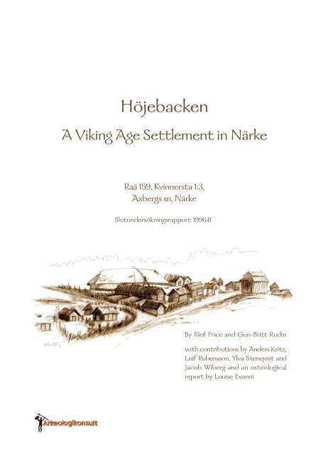
<strong>Höjebacken</strong><br />
A Viking Age Settlement in Närke<br />
Raä 159, Kvinnersta 1:3,<br />
Axbergs sn, Närke<br />
Slutundersökningsrapport 1996:8<br />
By Neil Price and Gun-Britt Rudin<br />
with contributions by Anders Kritz,<br />
Leif Rubensson, Ylva Stenqvist and<br />
Jacob Wiberg and an osteological<br />
report by Louise Evanni
Arkeologikonsult AB in collaboration with The Institute of Archaeology, Uppsala University, 1996<br />
Design editing: Julijana Radakovits<br />
CAD- and GIS-graphics: Per-Olof Fredman, Julijana Radakovits and Gun-Britt Rudin<br />
Artefact illustrations: Jonas Wikborg<br />
Translations: Ylva Bäckström and Neil Price<br />
Allmänt kartmaterial: ©Lantmäteriverket Gävle 2007. Medgivande I 2007/2184.
Slutundersökningsrapporter från Arkeologikonsult AB<br />
1996:8<br />
<strong>Höjebacken</strong><br />
A Viking Age Settlement in Närke<br />
Raä 159, Kvinnersta 1:3<br />
Axbergs sn, Närke<br />
By Neil Price and Gun-Britt Rudin<br />
with contributions by<br />
Anders Kritz, Leif Rubensson, Ylva Stenqvist and Jacob Wiberg<br />
and an osteological report by Louise Evanni
List of figures<br />
Acknowledgements<br />
Summary<br />
Sammanfattning på svenska<br />
Contents<br />
1. Introduction - Neil Price<br />
The <strong>Höjebacken</strong> archaeological project<br />
Evaluations at <strong>Höjebacken</strong><br />
Raä 159<br />
Recommendations from the evaluations<br />
2. Topography and geology - Gun-Britt Rudin<br />
3. The cultural environment of <strong>Höjebacken</strong> - Gun-Britt Rudin & Jacob Wiberg<br />
The Mesolithic (c. 7000-4200 BC)<br />
The Neolithic (c. 4200-1800 BC)<br />
A Neolithic find from the evaluations - Anders Kritz<br />
The Bronze Age (c. 1800-500 BC)<br />
The Iron Age (c. 500 BC - AD 1050)<br />
4. The investigations - Neil Price & Gun-Britt Rudin<br />
Specifications for the development area<br />
Strategy and method<br />
5. The settlement: a Viking Age riverside community<br />
Structures in the central area - Neil Price & Gun-Britt Rudin<br />
The main longhouse<br />
Building phases in the longhouse<br />
Alternative interpretations of the longhouse postholes<br />
Evidence for outbuildings<br />
Occupation deposits and other features in the central area<br />
Evidence for metalworking<br />
Ritual activity - Neil Price<br />
A horse sacrifice<br />
A foundation offering in the longhouse?<br />
Possible structures in the northern area - Neil Price<br />
Possible structures by the Lutabäcken stream - Neil Price<br />
Artefactual and ecofactual evidence - Neil Price<br />
Pottery<br />
Vessels in rubbish pit A21<br />
Vessels in foundation offering pit A76<br />
Miscellaneous body sherds<br />
Summary<br />
Loomweight<br />
Slag and iron<br />
Animal bones<br />
1
Dating - Neil Price<br />
Artefactual and typological dating<br />
14 C analysis<br />
Dating the settlement<br />
Discussion<br />
The situation of the settlement - Gun-Britt Rudin<br />
<strong>Höjebacken</strong> and Viking Age rural settlement in the Mälar valley - Neil Price<br />
Närke<br />
The eastern Mälar provinces<br />
Conclusions<br />
Tekniska och administrativa uppgifter<br />
References<br />
Appendix 1. Context list<br />
Appendix 2. Finds list<br />
Appendix 3. Osteologisk analys - Louise Evanni<br />
List of figures (abbreviated captions)<br />
1.1 Detail from topographic map sheet 10F NV with the investigation area marked.<br />
2.1 View of Raä 159 looking south from near the rail crossing over riksväg 60.<br />
2.2 View looking south over the fields adjacent to Raä 159 on the opposite side of the existing railway.<br />
3.1 Map of central Sweden at the period of the Litorina Sea’s maximum extent during the Mesolithic.<br />
3.2 Map of the Käglan area during the Mesolithic.<br />
3.3 Map showing the Käglan area during the early Neolithic.<br />
3.4 Fragment of shafted stone axe found unstratified on ground surface at Raä 158.<br />
3.5 Sacrificial hoard from Hassle in Glanshammar parish, Närke.<br />
3.6 Cemetery Raä 5 on <strong>Höjebacken</strong>.<br />
3.7 Stone-settings from the late Iron Age in the <strong>Höjebacken</strong> cemetery (Raä 5).<br />
3.8a Viking Age finds from the Jägerbacken cemetery in Örebro city.<br />
3.8b Viking Age finds from the Jägerbacken cemetery in Örebro city.<br />
3.9 Detail from economic map sheet 105 63 showing registered ancient monuments and the<br />
Mälarbanan route.<br />
4.1 The development corridor for the Mälarbanan at Raä 159, Axberg parish, Närke.<br />
4.2 General plan of trenches from the evaluations and excavations at Raä 159 and up to highway 60.<br />
5.1 Plan showing all excavated features at <strong>Höjebacken</strong>.<br />
5.2 Features in the central area, showing possible structural postholes in the hypothetical longhouse.<br />
5.3 Postholes with stone packings or stone supports.<br />
5.4 Centimetre depths of postholes in the central area.<br />
5.5 The suggested longhouse plan and posts from rebuilding phases.<br />
5.6 Plans and profiles of features interpreted as remains of the longhouse.<br />
5.7 Plans and profiles of features interpreted as representing additional phases of longhouse<br />
construction.<br />
5.8 Postholes east and west of the longhouse.<br />
5.9 Plans and profiles of features interpreted as remains of outbuildings.<br />
5.10 Distribution of finds by type in the the central area of the site.<br />
5.11 Plans and profiles of non-structural features in the central area.<br />
5.12 Plan and profile of ironworking pit A116.<br />
5.13 Two Danish examples of horse cranium burial of comparable form to that in pit A116 at<br />
<strong>Höjebacken</strong>.<br />
2
5.14 Two reconstructed horse-hide offering scaffolds of late Iron Age type at the Historical-<br />
Archaeological Experimental Centre in Lejre, Denmark.<br />
5.15 Plan and profile of A76.<br />
5.16 Plans and profiles of postholes A100 and 101.<br />
5.17 Plans and profiles of features A16, 65 & 66.<br />
5.18 Distribution of finds at <strong>Höjebacken</strong> by type, including unstratified artefacts from the plough-soil.<br />
5.19 Rim sherds from rubbish pit A21.<br />
5.20 Rim sherds from the foundation offering pit A76.<br />
5.21 Loomweight from posthole A100.<br />
5.22 Distribution of animal bones in the central area of the excavations.<br />
5.23 Viking Age rural settlements with excavated structures known from the Mälar valley.<br />
5.24 Plan of the 30m-long Viking Age hall at Aspbacken, Tortuna parish, Västmanland.<br />
5.25 The late Viking Age phase at Sanda.<br />
5.26 An artist’s reconstruction of the 11th-century phase at Sanda.<br />
5.27 Plan and preliminary reconstruction of the longhouse at Granby-Hyppinge.<br />
5.28 Reconstructed view of the Granby-Hyppinge stormansgård.<br />
5.29 A reconstruction of the Viking Age longhouse at Gredelby.<br />
Acknowledgements<br />
At Arkeologikonsult, thanks are due to Ola Nilsson for his assistance with the description of the metalworking<br />
evidence and for his general discussions concerning the interpretation of the site, and to Jonas Wikborg for his<br />
help in locating published parallels for the ritual features at <strong>Höjebacken</strong>. Kerstin Engdahl of Statens Historiska<br />
Museum kindly provided information on the horse cranium from Riksantikvarieämbetet UV-Mitt’s 1992-93<br />
excavations at Säby (Norrsunda parish, Uppland).<br />
3
Summary<br />
This report presents the results of archaeological investigations at a settlement site from the Viking Age at<br />
<strong>Höjebacken</strong> (monument Raä 159) in Axberg parish, Närke province, Sweden. Excavations were carried out at<br />
<strong>Höjebacken</strong> in 1993 by Arkeologikonsult AB, in advance of the Mälarbanan rail development. The site was<br />
situated on clay soils in open fields at approximately 35m above sea level, sloping gently to the south towards the<br />
Lutabäcken stream. It is probable that the settlement can be associated with registered monument Raä 5, a<br />
cemetery of at least 30 stone-set graves of late Iron Age type located on the <strong>Höjebacken</strong> ridge, 800m south-east<br />
of the site on the opposite side of Lutabäcken.<br />
A single 1560m 2 trench was opened up and over 120 features were recorded, consisting primarily of posthole<br />
scatters, hearths and pits. All the archaeological deposits had been severely truncated by ploughing, but despite<br />
this some of the cut features had survived remarkably well, with postholes up to 0.6m deep with substantial stone<br />
packings. The majority of the features were cut into the natural clay subsoil and lay directly beneath the plough<br />
zone, but in one area of the site a 22m 2 deposit of homogenous occupation layers was preserved. This deposit was<br />
cut by later features, thus providing a short vertical stratigraphic sequence which was of great assistance in<br />
determining the phasing and interpretation of the site.<br />
In the centre of the excavated area were the remains of a post-built, three-aisled longhouse, of which the northwestern<br />
gable postholes cut the occupation deposit. The exact dimensions of the structure are uncertain since not<br />
all its postholes survived, but the building was originally at least 19m in length and 5.5-6m wide, with indications<br />
of several phases of construction and refurbishment. There appear to have been post-built structures immediately<br />
adjacent to both long sides of the building, but no coherent plans could be established from the meagre posthole<br />
scatter that was preserved. The south-western of these possible structures - cut, like the longhouse, into the<br />
occupation deposit - may have been a smithy on the evidence of a metalworking pit found there, together with<br />
quantities of slag and melted iron. The area around the longhouse and its probable outbuildings revealed several<br />
pits for cooking and rubbish disposal, and a number of hearths.<br />
There was some evidence for additional buildings both north of the longhouse complex and further south on the<br />
banks of the Lutabäcken stream’s earlier course. Several deeply-cut, stone-lined postholes were found here, and<br />
the substantial character of these features suggests that they were structural in some way. Unfortunately, these<br />
areas of the site had been particularly badly damaged by ploughing and no more detailed interpretation was<br />
possible.<br />
Several features of ritual character could be identified, including an apparent foundation offering in the form of<br />
a shallow pit inside the longhouse, containing jawbones of a cow and pig overlying rim fragments from two<br />
different pottery vessels. A second ritual deposit was found in the metalworking pit referred to above, where a<br />
horse’s cranium had been placed in a layer of clay used to seal the pit after it had gone out of use. On the basis<br />
of parallels with similar finds on other sites, notably Oxie in Skåne, it is possible that the horse’s head was<br />
originally attached to the skin of the animal, and had been set up on a scaffold before being dismantled and buried<br />
in the pit; there are also detailed documentary sources describing such sacrifices, which may have been a form of<br />
curse.<br />
The settlement’s economy was probably mixed, with both arable farming and animal husbandry. An area of<br />
prehistoric field systems a short distance to the west of the settlement may mark the location of its crops. The<br />
animal bone assemblage was small, but indicated that cattle, pigs and sheep or goats were all part of <strong>Höjebacken</strong>’s<br />
economy. The presence of crania and other non food-rich parts of the animals suggests that they were slaughtered<br />
on-site, having been either reared there or brought on the hoof.<br />
The settlement site was dated to the Viking period by pottery of Selling’s type AIV:3a1 and AIV:4a/b found in<br />
the pitfills, and by domestic ceramics of general late Iron Age type from the postholes and occupation deposit.<br />
The pottery was found in features distributed evenly over the site, including postholes from all the structural<br />
groups, thus implying that all the buildings on the site were broadly contemporary; a disc-form loomweight, also<br />
from the Iron Age, was recovered from a posthole fill. One radiocarbon sample was obtained from charcoal in a<br />
4
posthole, producing a calibrated date of AD 780-982. A Viking Age date for <strong>Höjebacken</strong> is also supported by<br />
the ritual offerings, which both have numerous parallels from sites of this period. It is likely that there was some<br />
activity at <strong>Höjebacken</strong> before the Viking Age, since small quantities of residual early Iron Age ceramics were<br />
found in the occupation layer, and charcoal from a hearth cut into this deposit produced a 14 C date in the Roman<br />
Iron Age. It was not possible to identify any structures from this early period, and there is no indication of what<br />
kinds of activities were carried out there before the Viking Age settlement was founded.<br />
<strong>Höjebacken</strong> is the first Viking Age rural settlement to have been found in Närke province - and only the twelfth<br />
from the whole Mälar valley - and it is in this that we may locate its importance. Our first glimpse of a Viking<br />
period rural community from the western Mälar provinces compares well with what we know of the rest of the<br />
region, despite the relative paucity of the surviving evidence from <strong>Höjebacken</strong>. Among the ten known sites from<br />
Uppland, <strong>Höjebacken</strong>’s apparent settlement form can be paralleled with those found at Sanda, Granby-<br />
Hyppinge, Gredelby and Farsta. The only site so far located in Västmanland, at Aspbacken, also shows close<br />
affinities with <strong>Höjebacken</strong>. This would seem to imply that the settlement type focused upon a single main<br />
longhouse with outbuildings, either situated alone in the landscape or in multiples, was a constant across eastern<br />
central Sweden in the Viking Age. However, we cannot yet determine how representative this may be of the<br />
general settlement pattern in the region at this time.<br />
5
Sammanfattning<br />
översättning av Ylva Bäckström<br />
I föreliggande rapport redovisas resultaten från de arkeologiska undersökningarna av en vikingatida boplats vid<br />
<strong>Höjebacken</strong> (Raä 159) i Axberg sn, Närke. Undersökningarna företogs 1993 av Arkeologikonsult AB med<br />
anledning av byggnationen av Mälarbanan. Boplatsen var belägen ungefär 35 m över havet på lerig åkermark, som<br />
sluttade svagt söderut mot Lutabäcken. Det är sannolikt att boplatsen kan kopplas samman med den registerade<br />
fornlämningen Raä 5, ett gravfält med åtminstone 30 stensättningar av yngre järnålderstyp, som ligger på en<br />
höjdrygg 800 m sydöst om boplatsen och på den motsatta sidan av Lutabäcken.<br />
Ett enda, 1560 m 2 stort, schakt öppnades och över 120 anläggningar registrerades, huvudsakligen bestående av<br />
spridda stolphål, härdar och gropar. I allmänhet hade anläggningarna blivit svårt skadade av plöjning, men trots<br />
detta hade några av de snittade anläggningarna bevarats förvånansvärt väl, t ex förekommer stolphål som är upp<br />
till 0,6 m djupa och försedda med rejäla stenskoningar. De flesta av anläggningarna var nedgrävda i den sterila<br />
leran och påträffades direkt under ploglagret, men ett 22 m 2 stort homogent kulturlager hade bevarats. Detta var<br />
genomskuret av yngre anläggningar, vilket gav möjlighet till att skapa en kort stratigrafisk serie som var till stor<br />
hjälp vid tolkningen av de olika faserna och av platsen som helhet.<br />
Centralt på den undersökta ytan påträffades resterna av ett treskeppigt långhus, där den nordvästra gavelns<br />
stolphål hade skurit genom kulturlagret. Byggnadens exakta dimensioner är osäkra eftersom inte alla stolphål<br />
finns bevarade, men den var ursprungligen åtminstone 19 m lång och 5,5-6 m bred, med spår av olika<br />
byggnadsfaser och reparationer. Det förefaller som att stolpförsedda konstruktioner har funnits direkt intill<br />
byggnadens bägge långsidor, men inga tydliga mönster kunde urskiljas utifrån det fåtal spridda stolphål som<br />
fanns bevarade. Den sydvästra av dessa möjliga byggnader, som liksom långhuset har anläggningar som skurit in<br />
i det underliggande kulturlagret, kan ha varit en smedja. Detta kan antas eftersom en smidesgrop samt stora<br />
kvantiteter av slagg och smält järn hittades där. Området omkring långhuset och de förmodade uthusen<br />
uppvisade ett flertal kok- och avfallsgropar samt ett antal härdar.<br />
Spår efter ytterligare byggnader fanns både norr om långhuskomplexet och längre söderut utefter Lutabäckens<br />
tidigare sträckning. Ett flertal djupt nedgrävda, stenskodda stolphål hittades där, och deras kraftiga karaktär<br />
antyder att de har utgjort delar av en byggnad. Olyckligtvis hade denna del av det undersökta området blivit<br />
särskilt svårt skadat av plöjning och ingen mer detaljerad tolkning var möjlig.<br />
Några anläggningar av rituell karaktär kunde identifieras. Bl a ett husoffer i en grund grop inuti långhuset, som<br />
innehöll käkben från en ko och en gris placerade ovanpå mynningsbitar från två olika keramikkärl. Ytterligare ett<br />
offerfynd hittades i smidesgropen, där lerlagret som förseglat gropen innehöll ett hästkranium. Utifrån paralleller<br />
med liknande fynd från andra boplatser, t ex Oxie i Skåne, är det troligt att detta hästkranium ursprungligen hade<br />
suttit kvar i huden. Innan det blev nedtaget och begravt i gropen hade det från början varit uppsatt på en ställning.<br />
Det finns även detaljerade historiska källor som beskriver denna typ av offer, vilka kan ha fungerat som en form<br />
av besvärjelse.<br />
Den vikingatida gårdens ekonomi var troligen en blandning av både åkerbruk och boskapsskötsel. Ett område<br />
med fossila åkersystem en liten bit väster om boplatsen kan höra till gården. Djurbensmaterialet var litet, men<br />
visar att uppfödning av nötboskap, grisar och får och/eller getter var delar av <strong>Höjebacken</strong>s ekonomi. Närvaron<br />
av kranier och andra köttfattiga ben antyder att djuren slaktades på platsen.<br />
Bosättningen har daterats till vikingatid utifrån keramik av Sellings typ AIV:3a1 och AIV:4a/b som hittades i<br />
groparnas fyllning, och genom keramik av vanlig yngre järnålderstyp från stolphål och kulturlager. Keramiken<br />
hittades i anläggningar jämnt fördelade över hela ytan, exempelvis i stolphål från samtliga byggnadstyper, vilket<br />
kan innebär att samtliga byggnader på platsen var uppförda under en relativt kort tid. En diskformad vävtyngd<br />
från järnålder hittades i fyllningen till ett stolphål. Ett C14-prov har tagits i ett av stolphålen och har resulterat<br />
i en kalibrerad datering till 780-982 e Kr. En datering av <strong>Höjebacken</strong> till vikingatid stöds även av offren, som har<br />
ett flertal paralleller daterade till denna period. Det är troligt att det pågick någon typ av verksamhet på<br />
<strong>Höjebacken</strong> innan vikingatid, eftersom små mängder av äldre järnålderskeramik hittades i kulturlagret.<br />
Dessutom gav kol från en härd som genomskar kulturlagret en C14-datering till romersk järnålder. Det var inte<br />
6
möjligt att identifiera några byggnader från denna tidiga period, och det finns inga handfasta spår efter aktiviteter<br />
som pågick innan den vikingatida bosättningen grundades.<br />
<strong>Höjebacken</strong> är den första vikingatida boplatsen som har hittats i Närke, och endast den tolfte från hela<br />
Mälardalen. Det är i detta sammanhang som vi kanske kan förstå boplatsens betydelse. Vår första glimt av ett<br />
vikingatida ruralt samhälle i de västra mälarlandskapen är fullt jämförbar med det vi vet om resten av regionen.<br />
Av de tio kända boplatserna i Uppland liknar <strong>Höjebacken</strong> mest de som har hittats i Sanda, Granby-Hyppinge,<br />
Gredelby och Farsta. Den enda boplats som hittills har hittats i Västmanland, Aspbacken, uppvisar också stora<br />
likheter med <strong>Höjebacken</strong>. Detta skulle kunna innebära att gårdstypen bestående av ett enstaka långhus med<br />
tillhörande uthus var vanligt i de centrala delarna av östra Sverige under vikingatiden, antingen som ensamgårdar<br />
eller tillsammans i bystrukturer. Däremot kan vi inte ännu avgöra hur karaktäristiskt detta är för<br />
bebyggelsemönstret i denna region vid denna tid.<br />
7
Fig. 1.1 Detail from topographic map sheet 10F NV with the investigation area marked.<br />
8
The <strong>Höjebacken</strong>archaeological project<br />
This report presents the results of archaeological excavations undertaken in 1993 by Arkeologikonsult AB and the<br />
Institute of Archaeology at Uppsala university on the site of a settlement from the later Iron Age at <strong>Höjebacken</strong><br />
in Axbergs parish, Närke. The investigation area lay in open fields of heavy, postglacial clay within the property<br />
Kvinnersta 1:3 in Örebro county and district (fig. 1.1).<br />
The investigations were carried out in conjunction with the construction of the so-called Mälarbanan, a highspeed<br />
rail link between Stockholm and the north-western Mälar towns. The project was commissioned by the<br />
developers, Mälarbanans Intressenter AB (MIAB), who funded all aspects of the archaeological work in<br />
accordance with the ancient monuments legislation (ch. 2, para. 12-14). Arkeologikonsult would like to thank<br />
the land-owners and MIAB for their co-operation during our work at <strong>Höjebacken</strong>. The excavations were directed<br />
in the field by Ola Nilsson and Leif Rubensson; a full list of the project staff will be found in the Technical and<br />
Administration section at the end of the report.<br />
The following chapters summarise the results of the evaluations on the site, and contain detailed descriptions of<br />
the main excavations and their interpretation. This material is presented against background studies of the area’s<br />
cultural environment. Although the excavated settlement dates to the Iron Age, the Neolithic artefacts found<br />
during the evaluations are also discussed in the section on the cultural environment of the site.<br />
Evaluations at <strong>Höjebacken</strong><br />
The development corridor for the Mälarbanan at <strong>Höjebacken</strong> formed part of sub-section 12.07 within the<br />
Arboga-Örebro line section, itself 36km in length. The evaluation for this section has been published elsewhere<br />
(Stenqvist & Rubensson 1995), but in summary consisted of desk-top assessments and fieldwalking, with<br />
geochemical reconaissance in the form of phosphate mapping, and test trenching within the entire development<br />
area. Among several sites located during these evaluations was the later Iron Age settlement at <strong>Höjebacken</strong>,<br />
subsequently registered with the Central Board for National Antiquities as ancient monument Raä 159.<br />
Raä 159<br />
The site was located between riksväg 60 in the north-west and Lutabäcken to the south-south-west, at point<br />
34,8km on the line. During fieldwalking in this area, a fragment of a Neolithic stone axe was found in the fields<br />
300m to the south-west of <strong>Höjebacken</strong> (the find-spot was registered as Raä 158); the axe is described in chapter<br />
3 below. Test trenching at <strong>Höjebacken</strong> located 6 postholes, 2 hearths, a pit and truncated remains of occupation<br />
deposits, leading to the registration of the site as Raä 159. Pottery of Iron Age type was recovered from the<br />
ploughsoil in association with these features, together with burnt clay, iron fragments, slag and bone (Stenqvist<br />
& Rubensson 1995, 3).<br />
The features and finds material recovered in the utredning therefore suggested that prehistoric settlement remains<br />
survived at Raä 159, provisionally dated to the Iron Age. The stray finds of Neolithic axes also suggested the<br />
possibility of locating later Stone Age activity in the area.<br />
Recommendations from the evaluations<br />
1. Introduction<br />
by Neil Price<br />
Due to the unequivocal nature of the settlement remains at Raä 159, by agreement with länsstyrelsen in Örebro<br />
län the site was recommended for further archaeological investigation by slutundersökning (final excavation)<br />
directly, bypassing large-scale trial trenching as unnecessary in this instance.<br />
Features and finds recovered during the evaluation fieldwork are presented together with the main excavations<br />
below.<br />
9
2. Topography and geology<br />
by Gun-Britt Rudin<br />
Axberg parish lies in a transitional zone between the tree-clad Kilsberg hills, the Bergslag forest and the Närke<br />
plain. The terrain is characterised partly by ridges covered by trees or with exposed bedrock in places where<br />
moraine is the predominant soil type, and partly by fields situated on the low-lying sediments with clay as the<br />
principal soil. This builds a picture of a typical central Swedish landscape, and the area therefore lies between two<br />
types of land-use constrained by topographic and geological factors - namely agricultural settlement and mining<br />
(Sporrong 1975, 17).<br />
Fig. 2.1 View of Raä 159 looking south from near the rail crossing over riksväg 60. The site of the Viking Age settlement<br />
lies in the middle of the picture, in the cornfield adjacent to the railway. The trees at the extreme left of the picture mark<br />
the slopes of the <strong>Höjebacken</strong> ridge with the late Iron Age cemetery Raä 5. Photo: Ola Nilsson.<br />
The settlement at Raä 159 is situated at an altitude of 35m on heavy, postglacial clay which slopes gently down<br />
to the Lutabäcken stream in the south. The area emerged from the sea around 2500 BC, during the postglacial<br />
isostatic shore displacements. The precise location of the settlement consists of flat, tilled ground with no rock<br />
outcrops in the immediate vicinity. Portions of the fields in Axberg parish have at times been very marshy and the<br />
Lången lake, which lies c. 2km west of the settlement area and west of Lutabäcken, was once much larger but has<br />
been comprehensively drained since the middle of the 19th century (Waldén 1960, 81). In 1923 Sven-Harry<br />
Larsson wrote a description of the area which also supports this: ”As a final point concerning the great Kvinnersta<br />
fields and the whole valley where the railway now runs, and where springs were previously located, it should be clearly<br />
noted that the entire area was once a lake. In the soil of the Kvinnersta fields there still grow water reeds, horsetail and<br />
other lakeside plants, and in the springtime large parts of the fields are usually flooded. In recent years, to make farming<br />
the land easier, large areas have been drained and dikes have been cut.” (Larsson 1923, 17; translation by Neil Price).<br />
With this in mind, it is possible that the area around the <strong>Höjebacken</strong> settlement at Raä 159 was also partially<br />
characterised by water meadows, and could have been a suitable area for hay fields.<br />
10
Fig. 2.2 View looking south over the fields adjacent to Raä 159 on the opposite side of the existing railway, where the<br />
Viking Age settlement probably continues. The excavation area can be seen in the left of the picture, in the cornfield.<br />
Photo: Ola Nilsson.<br />
11
3. The cultural environment of <strong>Höjebacken</strong><br />
by Gun-Britt Rudin and Jacob Wiberg<br />
with contributions by Leif Rubensson and Ylva Stenqvist<br />
Beyond the standard inventories of ancient monuments for registration in the national SMR(fornminnesregistret),<br />
no more comprehensive archaeological investigations have ever been carried out in Axberg parish. Indeed, by<br />
comparison with other Mälar provinces it can be noted that Närke as a whole has relatively few registered<br />
monuments, as observed by Sune Lindqvist as early as 1930 (56). The SMR survey of 1980-82 in Närke recorded<br />
c. 5000 monuments at 200 locations (Löthman 1985).<br />
Fig. 3.1 Map of central Sweden at the period of the Litorina Sea’s maximum extent during the Mesolithic, with a sea level 62m above<br />
the modern shoreline. The Käglan archipelago is marked. After Munthe 1940, plate XII.<br />
The Mesolithic (c. 7000-4200 BC)<br />
During the Mesolithic the highland areas of Axberg parish formed islands in a bay of the Litorina Sea. The<br />
contemporary shoreline lay at c. 50-60m above modern sea level. The Käglan area appeared as an archipelago<br />
landscape with good potential for a subsistence livelihood based on hunting and fishing (Reisborg 1992, 9). The<br />
climate was somewhat warmer and damper than today, with a mean temperature a couple of degrees higher than<br />
12
Fig. 3.2 Map of the Käglan area during the Mesolithic, appearing as an archipelago with a shoreline 55m over modern sea level.<br />
<strong>Höjebacken</strong>, which was still underwater at that time, is marked together with known Mesolithic settlements.<br />
at present (Liljegren & Lagerås 1993, 32). Birch forests grew on the higher ground together with pine, elm and<br />
hazel (Welinder 1984, 16).<br />
Remains from the Mesolithic are rare in this part of Närke, but a settlement of the so-called Lithult Culture has<br />
been excavated at Vallby in Kils parish, immediately west of Axberg parish (Andersson 1989, 36). Two temporary<br />
camps have been found east of <strong>Höjebacken</strong> at Skumparberget in Glanshammar parish (Apel in press) and at<br />
Lysinge in Lillkyrka parish (Artursson in press). In addition, a few round-section axes (trindyxor) have been found<br />
in the Käglan area to the east, which are also of Mesoltihic date. The current dearth of finds and settlements from<br />
the Mesolithic should not necessarily imply that the area was uninhabited, and it may indeed have been relatively<br />
well-settled by nomadic bands. These people may have moved between more-or-less temporary encampments<br />
and hunting/fishing stations which have left little trace. Eastern central Sweden nevertheless possesses a<br />
compartively high number of finds of stone axes and settlements with worked quartz. The difficulty of<br />
researching the latter material may go some way towards explaining the general neglect of the Mesoltihc in Närke<br />
as a topic for detailed study (see, for example, Welinder 1977 and Amreus 1991).<br />
The Neolithic (c. 4200-1800 BC)<br />
During the Neolithic the water level steadily sank from 50m down to around 25m over modern sea level. The<br />
climate also began to change around 3000 BC and although warm summers continued the winters became<br />
markedly colder (Liljegren & Lagerås 1993, 37). The practice of agriculture and animal husbandry made<br />
successive inroads in large parts of Scandinavia, bringing a more stable character to human settlement. Arable<br />
farming did not take place on a large scale, however, and the early farmers concentrated on stock-rearing of<br />
domesticated cattle, sheep, goats and pigs (see Burenhult 1991a & b).<br />
In parallel with the continuing shore displacement, the Axberg islands and peninsular joined with the Käglan<br />
islands and it was during this period that the archaeological investigation area became dry land. The emerging<br />
fertile clay soils generated a rich flora and fauna which offered great opportunites for the first settlers of the area.<br />
Sweden’s first farmers belonged to the so-called Funnel Beaker Culture, and three settlements from this time have<br />
been investigated along the sandy ridge between Ekersby and Kil, in Kils parish c. 9km west of <strong>Höjebacken</strong>. Two<br />
hoards from the same period have also been found in the area, consisting of thin-necked axes of greenstone and<br />
flint (Jennbert-Spång 1980, 149).<br />
13
Fig. 3.3 Map showing the Käglan area during the early Neolithic, with a shoreline 35m above the modern sea level.<br />
<strong>Höjebacken</strong> is marked together with excavated settlements of the Pitted Ware and Funnel Beaker cultures.<br />
A number of Neolithic settlements from the so-called Pitted Ware Culture have also been located in the Käglan<br />
area, at Körartorpet, Sjömo and Urvalla (Nyberg 1987). In north-eastern central Sweden the settlements of the<br />
Pitted Ware Culture are concentrated in the inner archipelago, by inland lakes and navigable waterways; this is<br />
in marked contrast to the situation in Södermanland and Östergötland where they are primarily situated in the<br />
outer archipelago (Nyberg 1987, 61). Similarities that have been noted between the different finds assemblages<br />
of the Pitted Ware Culture north of the (Neolithic) Mälar bay have been interpreted as evidence for the existence<br />
of a number of local groups or bands, with close connections to each other and perhaps membership of a collective<br />
social network (Hallgren 1993, 81f). In this context it is interesting to note the Stone Age pottery found in a bog<br />
at Gottsätter in Axberg parish, 2km west of the investigation area (Lindqvist 1912, 75). The pottery may be<br />
connected to the Pitted Ware Culture settlement recorded in the SMR (Raä 107) at the same spot; a thin-necked<br />
granite axe has also been found in the same area (Raä 104).<br />
Finds of axes from the so-called Battle Axe Culture have been made south of Käglan. The Battle Axe people are<br />
usually seen as primarily agriculturalists and stock-rearers, co-existing with the Pitted Ware people living as<br />
hunter-gatherers. It should be emphasised here that these cultural terms are hypothetical constructions created by<br />
modern researchers, and in recent years a growing number of scholars have argued for considerably fewer<br />
differences between the two cultures in question (e.g. Browall 1991).<br />
Towards the end of the Stone Age, when the water level had lowered to around 30m above the modern shoreline,<br />
Lake Hjälmaren became separated from Mälaren, which was then part of the Litorina Sea. More land than ever<br />
14
efore could be utilised for settlement. The late Neolithic in north-west Närke is not strongly represented by<br />
settlement evidence but a great number of stray finds have been recorded. Simple shafted axes of local granite are<br />
the most common among these finds, but sickles and daggers of flint have also been found. These artefact types,<br />
not least the axes, were also in use during the Bronze Age. A shafted axe (Raä 105) has been found in Axberg<br />
parish, 1500m south-west of the investigation area, and near Gyxtatorp in the same parish, c. 5km north of<br />
<strong>Höjebacken</strong>, a number of thin-necked and shafted stone axes have been discovered (Kilsberger 1994, 14). Southwest<br />
of Axberg in Eker parish, a flint dagger has been found and in Glanshammar parish to the east have been<br />
found isolated shafted axes and flint daggers. Despite the numerous stray finds, it seems that northern Närke was<br />
a peripheral area at the end of the Neolithic, in contrast to the central part of the province where cist burials of<br />
a type typical for the period are relatively common.<br />
A Neolithic find from the evaluations - description by Anders Kritz<br />
One notable artefact from the Neolithic was found during the evaluations, as mentioned above in chapter 1,<br />
consisting of a fragmentary stone axe from Raä 158. The axe was a stray find observed on the surface during<br />
fieldwalking of the rail corridor. A second fragment, found at <strong>Höjebacken</strong> itself and registered in the evaluation<br />
report as a mid-fragment of a similar axe (Stenqvist & Rubensson 1995, 7 & appendix 4), was interpreted during<br />
post-excavation analysis as a slightly polished but otherwise natural stone.<br />
At the end of the evaluations the axe fragment led the<br />
excavation team to hope that Neolithic remains might exist<br />
within the investigation area, but no finds earlier than the<br />
Iron Age were found at Raä 159. Clearly, few conclusions can<br />
be drawn from the axe beyond its obvious interpretation as<br />
evidence for the presence of people in the area during the<br />
Neolithic. Despite this, the axe fragment is an important find<br />
in its own right and for this reason is illustrated and briefly<br />
discussed here.<br />
Fig. 3.4 Fragment of shafted stone axe found unstratified on<br />
ground surface at Raä 158. Fnr 2. Scale 1:2. Drawing:Jonas<br />
Wikborg.<br />
The fragment is from the rear section of a middle Neolithic<br />
battle-axe, and is broken along the axis of the shaft hole. The<br />
axe has been fashioned from grey metamorphous stone, possibly amphibiolite, with inclusions of black grains up<br />
to 3mm in length. The fragment’s length, width and thickness are all c. 50mm. Due to the degree of<br />
fragmentation it is impossible to estimate how far along the axe’s original length the hole had been made, but the<br />
distance between the hole and the back of the axe is only c. 40mm. The cross-section by the break is almost round.<br />
The axe lacks a terminal at the rear, but has a 1-2mm high socket around the hole. Only one third of the hole’s<br />
original circumference survives so the diameter is difficult to calculate, but it seems to have been around 20mm.<br />
The technique used to make the hole is equally hard to identify, but it may be significant the the diameter of the<br />
hole seems to have been c. 20mm at both ends but c. 17mm in the middle of the axe. Together with the absence<br />
of the characteristic parallel striations across the axis of the hole which result from rotary drilling (Malmer 1975,<br />
93f), these measurements strongly imply that the axe was drilled from both sides with a solid bore (the hole profile<br />
resmbles that in Malmer 1975, 174, fig. 65:1). It should be noted, however, that drill striations could have been<br />
removed by secondary filing along the hole.<br />
The form of the axe’s rear section and the proximity of the hole to the back of the axe resembles Malmer’s Type<br />
E2 (Vellinge 2; Malmer 1975, 176, fig. 67). The <strong>Höjebacken</strong> cross-section is also similar to this type, although<br />
the E2 axe has a more triangular shape. By contrast the <strong>Höjebacken</strong> axe lacks a rear terminal and has a smaller<br />
socket flange than the E2 type. Malmer gives the E2 axes a late date within the framework of his chronology<br />
(1975, 96ff). However, the use of a solid bore on the <strong>Höjebacken</strong> axe might suggest an earlier date (Malmer 1975,<br />
94), but the small size of the fragment reduces the possibility to place the axe securely within Malmer’s<br />
chronology. Nevertheless, the axe can be confidently dated in general terms to the middle Neolithic and<br />
interpreted as an artefact of the Battle-Axe Culture.<br />
15
The Bronze Age (c. 1800-500 BC)<br />
During the Bronze Age the shoreline gradually fell from 25 to<br />
15m above its modern level. Monuments of types typical for the<br />
period (for example larger cairns and mounds, stone settings and<br />
small cairns, burnt mounds, cup mark surfaces and hoards) are<br />
very sparsely represented in Närke generally, but especially in the<br />
north-eastern part of the province. This is particularly true for<br />
funerary cairns and rock carvings (Löthman 1985, 31).<br />
The shining exception to this picture is the Hassle hoard from<br />
Glanshammar parish (c. 8km east of <strong>Höjebacken</strong>) - one of the<br />
most spectacular and famous Swedish archaeological finds from<br />
the period, and which reflects the area’s connections with<br />
southern and central Europe in the late Bronze Age (fig. 3.5). The<br />
hoard consists of a large bronze cauldron of probable Greek<br />
origin, containing two Italian bronze brooches, two Hallstatt<br />
swords from central Europe and 12 bronze discs with concentric<br />
decoration (Stenberger 1979, 281ff; Burenhult 1991b, 176f).<br />
The Bronze Age in the area is also represented by a few stray finds<br />
of bronze and stone axes.<br />
It has been suggested by Lars Löthman that the meagre material<br />
from the Bronze Age in eastern Närke and around Hjälmaren<br />
does not reflect the true situation in the area, in that the region<br />
”has been afflicted by unusually intensive deep ploughing, and<br />
visible monuments such as stone-set graves of the more diffuse,<br />
early types cannot be seen and thus remain anonymous” (Löthman 1985, 31; translation by Neil Price).<br />
The Iron Age (c. 500 BC - AD 1050)<br />
Around 500 BC a further climatic change began in Sweden, creating generally colder and damper conditions.<br />
The great forests of oak, elm and ash began to retreat as spruce trees gradually established themselves in Sweden<br />
from the north-east, but the original woodland survived on the damper, more clayey soils. The water meadows<br />
were ever more intensively used for grazing and in particular for the production of hay (Liljegren & Lagerås 1993,<br />
41).<br />
Earlier research on the Iron Age of Närke has principally focused on the cultural orientation of monuments<br />
towards the spheres of one or other of the two main peoples of early Sweden, and it has been argued that the Svart<br />
river can be seen as a boundary between the Svea to the north-east and the Götar to the south, where the<br />
connection with Västergötland is strongest (Schortz 1983, 5ff). Some of the more recent research has<br />
concentrated upon settlement patterns in the area, attempting to isolate site catchment areas from such evidence<br />
as cemeteries.<br />
Two main models of Närke’s Iron Age settlement structure have been put forward. The province has on the one<br />
hand been characterised as an area first properly colonised during the Middle Ages, with only sparse and scattered<br />
farms during the preceeding centuries. The alternative view is almost the complete opposite, and proposes that<br />
Närke was densely settled during the Iron Age and enjoyed a developed administrative system linking large<br />
numbers of settlements.<br />
The first of these hypotheses derives primarily from comparisons with the monument patterning in Uppland<br />
province. Over 140,000 ancient monuments have been registered in Uppland in contrast to the 4751 known<br />
from Närke. The numbers have changed slightly following supplementary surveys but the disparity remains<br />
unaltered in relative terms. These calculations include the total numbers of ancient monuments, i.e. including<br />
those dating from earliest prehistory to the 19th century, but even if only monuments from the Iron Age are<br />
16<br />
Fig. 3.5 Sacrificial hoard from Hassle in<br />
Glanshammar parish, Närke, c. 8km east of<br />
<strong>Höjebacken</strong>. Photo: ATA.
considered the picture is little changed: the density of Uppland monuments is approximately ten times as great<br />
as that in Närke (Klang 1984, 60ff).<br />
In contrast to the model derived from monument density, a study of the place-name evidence suggests a different<br />
interpretation. In the vicinity of the investigation area at <strong>Höjebacken</strong> we can find nine farms or small villages with<br />
names which are conventionally held to be of Iron Age origin. These include settlements with names which<br />
include the elements -sta, -by, -torp and -tuna (see Wahlberg 1988, 12; Pamp 1974, 36ff) as in Kvinnersta,<br />
Hässleby, Brunstorp and Sigtuna. The names Lund and Kumla may also be of prehistoric date, but later<br />
foundations are also known with these name forms. Even if a number of the names from the <strong>Höjebacken</strong> area are<br />
discounted, the picture persists of a somewhat well-populated area. All over Sweden the Iron Age has been seen<br />
as a period of settlement expansion, and it would appear that Närke was no exception to this.<br />
Four main areas with high densities of ancient monuments can be distinguished in Närke: the western part of the<br />
province containing the parishes Edsberg, Hackvad, Hardemo, Knista and Viby; eastern Närke to southern<br />
Hjälmarbygden with Ekeby, Kumla, Sköllersta and Stora Mellösa parishes; northern Hjälmarbygden with<br />
Glanshammar, Lillkyrka and Rinkaby parishes; the Fellingsbro area with Fellingsbro parish (Andersson 1989,<br />
97).<br />
The approximately 4500 graves known from Närke are overwhelmingly of early Iron Age type. Several cemeteries<br />
contain graves from both the early and later Iron Ages. In general the cemeteries can be seen to be situated on<br />
ridges or other types of high ground, and are usually small in size. More than half the cemteries contain less than<br />
ten graves (Hansson 1987, 322). The burials of the early Iron Age are characterised by a variety of monument<br />
types, dominated by stone settings of different sizes and shapes. In the later Iron Age the cemeteries contain<br />
mainly small earthern mounds.<br />
Fig. 3.6 Cemetery Raä 5 on <strong>Höjebacken</strong>, probably dating to the late Iron Age and associated with the Vendel and Viking<br />
Age settlement. Photo: Ola Nilsson.<br />
North of Lake Hjälmaren lie a number of cemeteries, one of which is located in Axberg parish c. 800m south-west<br />
of the investigation area, on the <strong>Höjebacken</strong> ridge which gives the excavated settlement its name. This cemetery,<br />
Raä 5, probably formed the burial ground for the settlement’s inhabitants and consists of one mound and 29<br />
stone-settings (figs. 3.6 & 3.7). The latter are of types which in the Mälar valley are dated to the later Iron Age<br />
(i.e. AD 550-1050), but can also be of earlier Iron Age date. In the immediate vicinity of Raä 5, and possibly<br />
associated with it, are a hollow way and an artificial terrace upon which a building may have stood.<br />
17
A further hollow way (Raä 83) and a number of clearence cairns (Raä 10 & 72) are situated nearby, and it is<br />
possible that at least Raä 10 may represent field areas associated with the <strong>Höjebacken</strong> settlement. Several<br />
monuments once thought to be graves have now been resurveyed and found to be clearence cairns (e.g. Raä 6),<br />
but there remain a number of features on the <strong>Höjebacken</strong> ridge which may be either graves or cairns (Raä 4, 7-<br />
9, 12, 50-51, 82); if these obscure features are graves, they most resemble monuments of the later Iron Age. An<br />
early dry-stone field boundary (stensträng) also runs across <strong>Höjebacken</strong> (Raä 8), and may form another part of the<br />
settlement’s territorial system.<br />
Fig. 3.7 Stone-settings from the late Iron Age in the <strong>Höjebacken</strong> cemetery (Raä 5). Photo: Ola Nilsson.<br />
On the Stora Hästhultet hill, less than 2km north-east of the investigation area, is a large stone-setting (Raä 142)<br />
with a kerb construction, situated on the crown of the slope. Further away in the north of Axberg parish in an area<br />
south of the Dylta river, 6-7km north of <strong>Höjebacken</strong>, lie some 25 Iron Age graves. At Annelund a large<br />
rectangular stone-setting has been registered together with a triangular setting, and further stone-setting shave<br />
been found at Gyxtatorp. By Norra Dylta in the same area is another Iron Age cemetery with 15 monuments,<br />
principally stone-settings but also one confirmed and one uncertain Iron Age stone circle (domarring) (Kilsberger<br />
1994, 14ff). Four km south of <strong>Höjebacken</strong> at Förlunda in Hovsta parish is an Iron Age cemetery with 25 circular<br />
stone-settings, partly damaged by gravel quarrying, but dated to the Vednel and Viking periods by excvaations<br />
there in the 1930s. In 1939 another grave was found during gardening work c. 750m east of Hovsta church,<br />
interpreted as a woman’s burial from the 9th century (Raä 3). In the Kårsta and Tjuse areas of the same parish,<br />
3-4km south-west of the investigation area, are further stone-settings and a mound. A number of stone-settings<br />
have also been registered by Nävesta, to the west of Lake Lången, c. 3½km west of the <strong>Höjebacken</strong> excavations<br />
(Kilsberger 1994, 17).<br />
Although situated 10km south of the investigation area, we should also note the Viking Age cemetery at<br />
Jägerbacken in Örebro town, one of the few Iron Age grave-fields to be published from Närke. Pär Hansson’s<br />
report (1983) of the excavations carried out there in 1896 and 1937 describe some 20 burials with rich gravegoods<br />
in the form of weapons and female jewellery (fig. 3.8), suggesting that a settlement of high status was<br />
situated in the vicinity from the Vednel period until at least the 10th century and perhaps later.<br />
18
Fig. 3.8a. Viking Age finds from the Jägerbacken cemetery in Örebro city,<br />
including two swords and an axe from grave 6B, jewellery from grave 15.<br />
After Hansson 1983.<br />
19
From a cultural geographic perspective the investigation area at <strong>Höjebacken</strong> can be seen as being at the periphery<br />
of a central zone, perhaps as an outpost towards the highland mining areas. As discussed above, this interpretation<br />
is based solely on the evdience of cemeteries and individual graves since the settlements themselves have not been<br />
excavated or studied in any numbers. The exception is Sörby in Norrbyås parish (Raä 16), a settleemnt dating to<br />
the Roman Iron Age and Migration period (Hedman 1978) and Skävi in Viby parish (Raä 222) which dates from<br />
the later Bronze Age to the Migration period (Bergold & Holm 1994). During work for the Mälarbanan a further<br />
Iron Age settlement was located at Raä 160 a few hundred metres north-east of <strong>Höjebacken</strong>, but excavations<br />
revealed only a disturbed area of cultural deposits and a few pits of uncertain function. Pär Hansson has studied<br />
iron production in Närke in the Viking Age and early Medieval period, and on the basis of his conclusions it again<br />
seems that Axberg parish is situated either between or wholly outside a central zone (Hansson 1989).<br />
Fig. 3.8b. Viking Age finds from the Jägerbacken cemetery in Örebro city: stirrups from the graves collectively designated<br />
”14 and others”. After Hansson 1983.<br />
20
Fig. 3.9 Detail from economic map sheet 105 63 showing registered ancient monuments and the route of the<br />
Mälarbanan.<br />
21
Registered ancient monuments in the vicinity of the development area, Axberg parish<br />
Note: question marks indicate that the monument is listed in the SMR as uncertain<br />
Raä no. quantity type<br />
4 1 area with stone settings?<br />
5 1 cemetery; 1 mound, 29 stone-settings, 1 hollow way, 1 terrace<br />
6 1 mound?<br />
7 1 stone-setting?<br />
8 3 stone-setting?<br />
9 3 stone-setting?<br />
10 1 area with clearence cairns; two uncertain stone-settings<br />
11 1 trapping pit?<br />
12 1 stone-set feature<br />
16 1 mound-like feature<br />
50 1 stone-setting?<br />
51 1 stone-setting?<br />
52 1 natural formation<br />
72 1 area with clearence cairns<br />
74 1 old farmstead<br />
81 1 dry-stone field boundary<br />
82 1 stone-setting?<br />
83 1 hollow way<br />
105 1 findspot: part of stone axe<br />
158 1 findspot: part of stone axe<br />
159 1 Iron Age settlement<br />
160 1 Iron Age settlement<br />
22
4. The investigations<br />
by Neil Price and Gun-Britt Rudin<br />
Specifications for the development area (fig. 4.1)<br />
The Mälarbanan route follows the existing track northwards up to the 35km point along the development<br />
corridor. The line therefore passes through Raä 158, the find-spot for the stone axe decribed above, which was<br />
found beside the railway line. From the 35km point the Mälarbanan line curves to the north-east. The<br />
<strong>Höjebacken</strong> settlement at Raä 159 lies directly within the path of the line at the 35.15km point. At a point 550m<br />
north-east of its divergence from the route of the existing railway, the Mälarbanan will cross highway 60 by means<br />
of a new bridge and thereafter will continue in a north-easterly direction to the Olmbrotorp road and a second<br />
bridge.<br />
The width of the rail corridor at the point where it transects the <strong>Höjebacken</strong> settlement varies from 17-46m.<br />
Strategy and method<br />
During the evaluations a total of eight trenches were excavated within the area between Lutabäcken and the path<br />
from Åby to <strong>Höjebacken</strong> (trenches nos. 21-28), of which three trenches (nos. 21, 22, 26) produced archaeological<br />
remains. On the basis of these features the area for the main excavations at <strong>Höjebacken</strong> could be defined as an area<br />
of 1560 m 2 . Between the path from Åby to <strong>Höjebacken</strong> and highway 60 a further 37 test trenches were excavated<br />
(nos. 29-66), but no archaeological deposits were found (fig. 4.2).<br />
The excavation area was exposed by machine, followed by shovel scraping and cleaning. For the most part no<br />
stratigraphy survived on the site, with features revealed cutting the natural clay sub-soil, but a small area with<br />
preserved cultural deposits was also found. All features were cleaned, defined, and recorded. Traditional Swedish<br />
methods of box-section recording were employed, with written descriptions coupled to plan and section<br />
drawings; a photographic record was also made. Within the area of preserved cultural deposits, A104, a grid of<br />
17 1x1m squares was imposed within which finds were recorded for greater precision of provenancing. Although<br />
environmental samples were taken from the site, preservation conditions were poor for the retrieval of such data<br />
within the parameters of the project budget and no analyses were undertaken. Wherever possible, carbon samples<br />
were retrieved for potential 14 C analysis.<br />
Surveying of features and finds was carried out with the help of a totalstation EDM, with the results logged in the<br />
TIGRIS program and graphically manipulated in the MicroStation CAD system. During post-excavation<br />
analysis the written records and finds descriptions were entered into the in-house developed AIS (Archaeological<br />
Information System) Paradox database, and the drawn records digitised in GeoKart/AK DARK for insertion into<br />
the CAD-generated site plans. All report text was produced in WordPerfect, with Adobe PhotoShop and Aldus<br />
PageMaker employed for DTP design and editing.<br />
23
5. The settlement:<br />
a Viking Age riverside community<br />
The area of which Raä 159 forms a part has been particularly badly damaged by ploughing, since these fields have<br />
been used as a training ground for an agricultural college for over 50 years. The land here was deep-ploughed<br />
earlier than is usual in this part of Sweden, and shows the consequences of a wide range of experimental<br />
agricultural techniques practised by the farming students over the years. The archaeological effects of these<br />
practices are hard to quantify precisely, but there is no doubt that all the remains on the site have been very severely<br />
truncated, leaving only small parts of the structural features intact (see below in the discussion on the buildings<br />
of the settlement).<br />
A total of 50 features were found during the <strong>Höjebacken</strong> excavations, consisting of 36 postholes, 5 cooking- and<br />
rubbish-pits, 1 metalworking pit, 5 hearths, 2 modern drainage ditches and a single layer of occupation deposits.<br />
The majority of the features were located within a relatively small area - referred to below as the central area - but<br />
isolated postholes, hearths and pits were also found to both the north and south.<br />
The archaeology of the site is discussed below by area and theme, focusing initially on the three areas with<br />
structural remains, in the centre, north and south sections of the excavated area. Artefactual evidence is discussed<br />
with the buildings in terms of its implications for function and behaviour, and in a more detailed manner in the<br />
section following the structures. The dating of <strong>Höjebacken</strong> is reviewed in the next section, covering both<br />
artefactual and scientific dating methods, and the chapter concludes with a general discussion of the settlement.<br />
Structures in the central area - Neil Price & Gun-Britt Rudin<br />
The central part of the excavated area revealed a tightly packed cluster of postholes, pits and hearths, some of<br />
which cut a 22m 2 area of surviving cultural deposits. Several of the postholes had sturdily constructed stonepackings<br />
in the fills and were up to 0.6m deep even after truncation: these were clearly remains of structural<br />
timbers, probably marking the site of roof-bearing uprights. There is no doubt therefore that the central area of<br />
the site preserved the remains of at least one and possibly more substantial buildings.<br />
The main longhouse<br />
It is not easy to distinguish clear building plans within the posthole patterns, since there is no doubt that the<br />
majority of features associated with the structure(s) have been completely destroyed by ploughing (see above).<br />
However, we can isolate the postholes of at least three clear pairs of roof-bearing timbers (A19-20, A82-97, A69-<br />
98), with a possible association to five further postholes marking additional roof-supports (A77, 80/85 [one post<br />
replaces the other], 102, 103, 120), though none of these are paired. From this evidence a three-aisled longhouse<br />
can be reconstructed, 12.5-15m in length and aligned north-west/south-east. On this model, four postholes to<br />
the north-east of the structure and parallel with its long side may represent remains of the building’s wall line (A<br />
81, 90, 94, 96) and the posthole A18 to the south-west of the structure may mark the gable corner at this point.<br />
Allowing for the increased dimension given to the building by these additional posts, the original dimensions of<br />
the longhouse could be estimated at 15.5-19m in length and 5-6m in width. No remains of floor surfaces were<br />
found, and it is likely that the building was truncated to a depth of at least 0.1m and probably more below the<br />
contemporary ground level (fig. 5.2).<br />
The finds in the posthole fills enable no relative sequence to be determined amongst them - only the features’<br />
spatial distributions, and to a lesser extent the constructional details which give evidence of their function, can<br />
be used to sort the different building remains (figs. 5.3 and 5.4).<br />
On this basis, we would suggest that only ten postholes can be confidently incorporated in the central longhouse:<br />
A19, 20, 69, 77, 82, 97, 98, 102, 103, 120 (fig. 5.5) - all forming part of the two parallel rows of roof supports,<br />
though not all distributed in pairs due to differential survival of features along the building’s length. Of the<br />
26
postholes originally considered to be part of the building, A80/85 seem too far out of line with the proposed<br />
north-east row of roof supports to have been part of the row, although the depth of A85 is certainly sufficient to<br />
have fulfilled this function. The line formed by (in sequence south-north) A96, 94, 81, 90 similarly diverges from<br />
the longitudinal axis of the structure, particularly at the north-western end of the row with A90, but it is<br />
nevertheless possible that at least A94 or A96 may have been part of the wall. The postulated gable post A18 is<br />
hard to interpret but appears to be too far from the last trestle (A19-20) to fit as the corner of the building.<br />
This model would give a length of 15m between the roof-bearing posts at each end of the building, to which must<br />
be added perhaps a metre or a little more at each end to take account of the gable walls, with a similar distance<br />
added laterally across the trestles to take account of the side walls. A total length of 16-17m is therefore proposed<br />
for the longhouse, with a width of no more than 5.5m. The length must be regarded as strictly provisional, since<br />
plough damage may have completely removed one or both ends of the structure.<br />
Building phases in the longhouse<br />
When the longhouse postholes are taken out of the picture, a total of 21 remaining postholes are left in the central<br />
part of the site (A70, 73, 78- 81, 85-91, 94-96, 114, 115, 117-119); nine of these have stone-packed fills. Among<br />
the ”non-longhouse” postholes only those features originally postulated as remains of the longhouse wall-line<br />
build any clear pattern either of form or alignment. It would seem likely therefore that the suggested ”wall-line”<br />
features in fact represent an earlier or later phase of the longhouse, rebuilt on the same alignment but slightly<br />
shifted in location. Into this group of postholes we can place the alignment A96, 94, 81, 90, and perhaps a second<br />
line including A86, 85, 80. Postholes A78, 87 & 88 may once have been part of one or more of the successive<br />
longhouses (see fig. 5.5).<br />
A19<br />
POSTHOLE, 0.5m diameter, 0.45m deep<br />
Co-ordinates: X467010,3 Y582139,9<br />
Irregularly circular cut into natural clay subsoil. Clear packing with 0.16-0.4m stones. Rounded base with near-vertical sides.<br />
Fill of dark clay with charcoal fragments.<br />
Finds: none.<br />
A20<br />
POSTHOLE, 0.4m diameter, 0.4m deep<br />
Co-ordinates: X467012,6 Y582141,2<br />
Circular cut into natural clay subsoil. Remains of packing with 0.1-0.6m stones. Pointed base with sloping sides. Fill of dark<br />
clay with soot flecks.<br />
Finds: unburnt bone.<br />
A69<br />
POSTHOLE, 0.4m diameter, 0.5m deep<br />
Co-ordinates: X467007,8 Y582146,3<br />
Circular cut with uncertain edges, excavated into natural clay subsoil. Flat base and vertical sides. Remains of packing with<br />
0.08m stones. Fill of dark clay with wood fragments.<br />
Finds: burnt daub, unburnt bone.<br />
A77<br />
POSTHOLE, 0.26m diameter, 0.28m deep<br />
Co-ordinates: X467006,0 Y582149,2<br />
Circular cut into natural clay subsoil. Remains of packing with 0.4-0.6m stones. Rounded base with near vertical sides. Cut<br />
extended towards the north-west. Fill of dark clay.<br />
Finds: burnt bone.<br />
A82<br />
POSTHOLE, 0.4m diameter, 0.5m deep<br />
Co-ordinates: X467008,8 Y582144,3<br />
Circular cut into natural clay subsoil. Flat base with near vertical sides. Clear packing with 0.08-0.14m stones, mostly firecracked.<br />
Fill of dark clay with wood fragments.<br />
Finds: unburnt bone.<br />
29
Fig. 5.6 Plans and profiles of features interpreted as remains of the longhouse.<br />
A97<br />
POSTHOLE, 0.3m diameter, 0.14m deep<br />
Co-ordinates: X467010,54 Y582145,23<br />
Circular cut into natural clay subsoil. Irregular base with vertical sides, broadening towards the base. Remains of packing with<br />
0.08-0.14m stones. Fill of dark clay.<br />
Finds: unburnt bone.<br />
A98<br />
POSTHOLE, 0.3m diameter, 0.1m deep<br />
Co-ordinates: X467009,90 Y582146,79<br />
Circular cut with uncertain edges, excavated into natural clay subsoil. Bowl-shaped with gently sloping sides. Fill of dark clay,<br />
containing 0.1-0.3m stones.<br />
Finds: none.<br />
A102<br />
POSTHOLE, 0.4m diameter, 0.6m deep<br />
Co-ordinates: X467005,93 Y582153,70<br />
Circular cut into cultural deposit A104. Rounded base with vertical sides. Clear packing of 0.04-0.08m stones. Fill of dark<br />
clay with charcoal fragments.<br />
Finds: slag, burnt daub, unburnt bone.<br />
A103<br />
POSTHOLE, 0.35m diameter, 0.22m deep<br />
Co-ordinates: X467008,94 Y582148,66<br />
Irregualrly circular cut with uncertain edges, excavated into natural clay subsoil. Irregularly sloping sides, vertical in the east,<br />
with a sharply rounded base. Fill of dark clay.<br />
Finds: none.<br />
A120<br />
POSTHOLE, 0.5m diameter, 0.22m deep<br />
Co-ordinates: X467004,37 Y582153,3<br />
Irregularly shaped cut into cultural deposit A104. Rounded base with vertical sides. Remains of packing of 0.05-0.08m<br />
stones. Fill of dark clay with charcoal fragments.<br />
Finds: burnt daub, unburnt bone.<br />
33
Fig. 5.7 Plans and profiles of features interpreted as representing additional phases of longhouse<br />
construction.<br />
A78<br />
POSTHOLE, 0.54m diameter, 0.2m deep<br />
Co-ordinates: X467008,2 Y582149,1<br />
Circular cut with uncertain edges, excavated into natural clay subsoil. Pointed base and steeply sloping sides. Remains of<br />
packing with 0.1m stones. Fill of dark clay with occasional wood fragments.<br />
Finds: unburnt bone.<br />
A80<br />
POSTHOLE, 0.6m diameter, 0.35m deep<br />
Co-ordinates: X467007,8 Y582151,8<br />
Cut with uncertain edges, either cuts or is cut by A85. Rounded base and sloping sides. Remains of packing with 0.1-0.2m<br />
stones. Fill of dark clay.<br />
Finds: none.<br />
A81<br />
POSTHOLE, 0.4m diameter, o.35m deep<br />
Co-ordinates: X467009,9 Y582150,4<br />
Circular cut with uncertain edges, excavated into natural clay subsoil. Flat base with steeply sloping sides, inclined to the east.<br />
Remains of packing with 0.7m stones. Fill of dark clay.<br />
Finds: burnt bone.<br />
A85<br />
POSTHOLE, 0.4m diameter, 0.54m deep<br />
Co-ordinates: X467008,0 Y582151,2<br />
Cut with uncertain edges, either cuts or is cut by A85. Rounded base with near vertical sides. Remains of packing with 0.05-<br />
0.08m stones. Fill of dark clay.<br />
Finds: unburnt bone.<br />
A86<br />
POSTHOLE, 0.24m diameter, 0.22m deep<br />
Co-ordinates: X467010,6 Y582146,6<br />
Circular cut into natural clay subsoil. Flat base and vertical sides. Fill of dark clay.<br />
Finds: burnt daub, unburnt bone.<br />
34
A87<br />
POSTHOLE, 0.35m diameter, 0.28m deep<br />
Co-ordinates: X467009,0 Y582152,2<br />
Irregularly circular cut with uncertain edges, excavated into natural clay subsoil. Flat base with sloping sides. Remains of<br />
packing with 0.04-0.06m stones. Fill of dark clay with charcoal fragments.<br />
Finds: none.<br />
A88<br />
POSTHOLE, 0.3m diameter, 0.2m deep<br />
Co-ordinates: X467008,8 Y582151,1<br />
Circular cut with uncertain edges, excavated into natural clay subsoil. Rounded base with sloping sides. Fill of dark clay.<br />
Finds: none.<br />
A90<br />
POSTHOLE, 0.5m diameter, 0.35m deep<br />
Co-ordinates: X467008,4 Y582153,5<br />
Oval cut into natural clay subsoil. Rounded base with steeply sloping sides. Clear packing with 0.06m stones, heavily firecracked.<br />
Fill of dark clay with fragments of charcoal and wood.<br />
Finds: none.<br />
A94<br />
POSTHOLE, 0.2m diameter, 0.12m deep<br />
Co-ordinates: X467010,6 Y582148,8<br />
Circular cut into natural clay subsoil. Rounded base with sloping sides. Fill of dark clay.<br />
Finds: none.<br />
A96<br />
POSTHOLE, 0.3m diameter, 0.28m deep<br />
Co-ordinates: X467011,0 Y582147,5<br />
Circular cut into natural clay subsoil. Rounded base with near vertical sides. Fill of dark clay.<br />
Finds: burnt daub, unburnt bone.<br />
Alternative interpretations of the longhouse postholes<br />
It should be noted that the three post-pairs A19-20, 82-97 & 69-98 could also be interpreted not as part of a threeaisled<br />
longhouse but instead as a triple-bayed building (tresättare) similar to, for example, structures from Skåne<br />
cited by Tesch (1993, 185). Such a suggestion is unlikely due to the unequal distance betwene the four posts A69,<br />
82, 97 & 98 and the third post-pair A19-20, since tresättare are usually constructed of equidistant posts (see<br />
Hulth & Norr in press, ch. 1.3); however, a building erected simply around the former four posts in a square<br />
frame is possible (cf. the structures from Stenåldersgatan in Badelunda parish, Västmanland: Göthberg et al 1995,<br />
238-239). The latter alternative would leave room for more structures of similar type in the central area at<br />
<strong>Höjebacken</strong>.<br />
Despite the possibilities raised by the tresättare or four-poster alternatives, neither of these is considered a<br />
particularly probable reconstruction of the <strong>Höjebacken</strong> structure(s) on the grounds that the two north-west/<br />
south-east aligned rows formed by the pairs A19-20, 82-97 & 69-98 can be so exactly extended to match the<br />
positions of at least six postholes further to the north-east. This strongly implies that the posts were all originally<br />
part of a single structure, which is most feasibly interpreted as a three-aisled longhouse.<br />
The group of four posts A69, 82, 97 & 98 also resembles a particular form of ”box-like” square construction<br />
commonly found as a design element in longhouses from the late Roman Iron Age and Migration period. The<br />
approximate 2 x 2m dimensions of the <strong>Höjebacken</strong> ”box” matches those of constructions at the eastern end of<br />
buildings at Uppsala (Tillberga parish, Västmanland: structures Ua1 and Ua5) and Kärsta (Björksta parish,<br />
Västmanland: structure Kä4; see Hulth & Norr in press, ch. 1.3.5 & 1.3.3.). Similar design features are found<br />
in the mid-sections of the longhouses at Lunda D in Badelunda ( Västmanland: Ulväng 1992) and Brogård in<br />
Halland (hus II i delområde V; Carlie 1992, s24). However, although such parallels appear promising - especially<br />
since they have dating implications for the <strong>Höjebacken</strong> longhouse - we must guard against over-interpretation<br />
and the superficial comparison between relatively complete structural plans recovered from one site and a clearly<br />
incomplete posthole scatter at another: in the case of <strong>Höjebacken</strong> we have simply too few surviving features to be<br />
35
able to make any firm reconstructions. It is therefore unwise to lay too much stress on an apparent four-post ”box”<br />
construction when a restoration of the missing parts of the longhouse could easily demonstrate that such a feature<br />
never existed.<br />
Evidence for outbuildings<br />
The dimension and construction of the postholes not interpreted as forming a part of the longhouse or its<br />
refurbishments suggests a function as major load-bearing supports, implying that these postholes also represent<br />
structures (see figs. 5.3 & 5.4 showing stone packings and depths of the postholes). The features cover an area<br />
approximately 10 x 15m - a distribution which suggests that the postholes derive from more than one structure.<br />
From the posthole locations it is possible that up to three buildings could have been contemporary: in the most<br />
generous interpretation of the evidence there are three spatially distinct groups of postholes, consisting of the<br />
longhouse (including its rebuilds, since these represent only one structure standing at any time) and one group<br />
either side of the longhouse’s long walls. The western group consists of features A114-115 & 117-119, while the<br />
eastern group includes postholes A70, 73, 79, 89, 91 & 95. Posthole A18 is isolated and does not fit easily into<br />
any spatial grouping (fig. 5.8).<br />
Having established the potential existence of outbuildings near the longhouse, it must be acknowledged that no<br />
coherent plan or form can be found in the patterning of the postholes in question. However, we have already seen<br />
that the plough damage to the site as a whole has been extensive enough to have easily reduced such structures,<br />
if they existed, to the fragmentary state which the postholes may represent. We should further note that the<br />
posthole evidence, though puzzling, is certainly substantial enough to confirm that there were buildings<br />
”somewhere in the central area” in addition to the longhouse, and that these structures may well have been<br />
contemporary with it.<br />
The suggestion of an outbuilding either side of the longhouse must remain highly speculative, but the notion of<br />
additional structures so close to the main building is not without parallel, even considering the lack of obvious<br />
topographical restrictions on a more open spacing. At the Viking Age village of Pollista (Övergrans parish,<br />
Uppland) some contemporary structures seem to have been built as little as 0.2m apart (Arén 1995; see also<br />
Hållans 1987 and Ulväng 1992), and a similar situation was found at Sanda (Fresta parish, Uppland; Åqvist &<br />
Flodin 1992), also dating to the Viking period.<br />
A18<br />
POSTHOLE, 0.3m diameter, 0.3m deep<br />
Co-ordinates: X467009,5 Y582137,3<br />
Fig. 5.9 Plans and profiles of features interpreted as remains of outbuildings or possible parts of the<br />
longhouse.<br />
37
Circular cut into natural clay subsoil. Flat base with near vertical sides. Remains of packing with 0.05-0.06m stones. Fill of<br />
dark clay with wood fragments and flecks of soot. Finds: unburnt bone.<br />
A70<br />
POSTHOLE, 0.4m diameter, 0.12m deep<br />
Co-ordinates: X467016,2 Y582153,7<br />
Circular cut with uncertain edges, excavated into natural clay subsoil. Flat base with sloping sides. Fill of dark clay.<br />
Finds: burnt daub, unburnt bone.<br />
A73<br />
POSTHOLE, 0.4m diameter, 0.3m deep<br />
Co-ordinates: X467015,7 Y582152,3<br />
Oval cut with uncertain edges, excavated into natural clay subsoil. Pointed base with sloping sides. Fill of dark clay.<br />
Finds: burnt daub, burnt and unburnt bones.<br />
A79<br />
POSTHOLE, 0.2m diameter, 0.16m deep<br />
Co-ordinates: X467014,1 Y582147,7<br />
Oval cut with uncertain edges, excavated into natural clay subsoil. Flat base with vertical sides. Fill of dark clay.<br />
Finds: unburnt bone.<br />
A89<br />
POSTHOLE, 0.58m diameter, 0.4m deep. Post-pipe 0.2m diameter, 0.3m deep<br />
Co-ordinates: X467012,0 Y582150,7<br />
Semi-circular cut into natural clay subsoil. Rounded base with steeply sloping sides. Remains of packing with 0.12m stones.<br />
Post-pipe with obliquely sloping base and vertical sides. Fill of dark clay with fragments of charcoal.<br />
Finds: slag, burnt daub, burnt bone.<br />
A91<br />
POSTHOLE, 0.35m diameter, 0.4m deep<br />
Co-ordinates: X467013,0 Y582149,9<br />
Circular cut into natural clay subsoil. Rounded base with near vertical sides. Remains of packing with 0.16-0.6m stones. Fill<br />
of dark clay with fragments of charcoal.<br />
Finds: pottery, unburnt bone.<br />
A95<br />
POSTHOLE, 022m diameter, 0.1m deep<br />
Co-ordinates: X467012,9 Y582148,2<br />
Circular cut into natural clay subsoil. Bowl-shaped base with sloping sides. Fill of dark clay with charcoal fragments.<br />
Finds: none.<br />
A114<br />
POSTHOLE, 0.2m diameter, 0.12m deep<br />
Co-ordinates: X467002,32 Y582150,22<br />
Elongate cut into cultural deposit A104. Irregularly sloping sides to pointed base. Fill of dark clay with fragments of charcoal<br />
and wood.<br />
Finds: none.<br />
A115<br />
POSTHOLE, 0.24m diameter, 0.22m deep<br />
Co-ordinates: X467003,45 Y582149,76<br />
Circular cut into cultural deposit A104. Pointed base with sloping sides. Fill of dark clay.<br />
Finds: burnt daub, unburnt bone.<br />
A117<br />
POSTHOLE, 0.28m diameter, 0.16m deep.<br />
Co-ordinates: X467003,79 Y582148,37<br />
Circular cut into natural clay subsoil. Irregularly sloping sides to pointed base. Fill of dark clay.<br />
Finds: none.<br />
Records for A118 missing<br />
38
A119<br />
POSTHOLE, 0.35m diameter, 0.26m deep<br />
Co-ordinates: X467004,19 Y582149,93<br />
Elongate cut into cultural deposit A104. Rounded base with sloping sides. Remains of packing with 0.1m stones. Fill of dark<br />
clay with flecks of soot.<br />
Finds: burnt and unburnt bones.<br />
Occupation deposits and other features in the central area<br />
Immediately to the north-west of the longhouse - or perhaps under its north-east gable (see below) - was the only<br />
surviving occupation deposit on the site, A104, a layer of homogenous trampled clay measuring 22m 2 in area. As<br />
noted above, finds distributions in the deposit were charted according to a grid of 1m squares. The layer<br />
contained mixed artefactual material, including quantities of burnt clay, a few fragments of unidentified iron<br />
objects and pottery of both early and late Iron Age types. Deposit A104 also contained numerous fragments of<br />
slag, like the other finds concentrated in the southern and eastern peripheries of the layer (fig. 5.10).<br />
The deposit was cut by the postholes A102 & 120, suggested above as either the northernmost - or the<br />
northernmost surviving - post-pair in the longhouse. The question as to whether these posts formed part of the<br />
building is important in this context, as it determines whether the occupation deposits are either unequivocally<br />
stratigraphically earlier than the longhouse or else located to the north-west of the building with no stratigraphic<br />
connection between them. The south-western corner of the deposit was also cut by the postholes A114, 115 &<br />
119, discussed above with the ”western” group of structural remains.<br />
In addition to the postholes, deposit A104 was also cut by a single hearth, A113. This was an irregular feature<br />
0.8m in diameter and truncated to within a few centimetres of its base. No finds were present in the fill, but 14 C<br />
analysis of charcoal fragments produced a calibrated date in the Roman Iron Age (this sample is discussed below<br />
in the section on dating, and compared with the artefactual dating from the layer cut by the hearth).<br />
Three more hearths were found in the central area, two to the north and north-west of the longhouse and one to<br />
the south. Further to the north and outside the area of surviving occupation deposits were two hearths, A92 &<br />
99, respectively 2.5m and 7.5m from the postulated end of the longhouse. Both were irregular in form and under<br />
1m in diameter with fills of clay, charcoal and fire-cracked stone. A92 contained one sherd of black ware pottery<br />
of late Iron Age date; no other finds were recovered from the features. The southern hearth, A17, was quite small<br />
and shallow (0.4m in diameter and truncated to only 0.1m in depth), with a fill of ash and clay; it contained no<br />
finds.<br />
Two cooking pits were found in the central area, A15 & 67, respectively north-west and south-west of the<br />
longhouse. A15 was 0.8m in diameter and had been severely truncated; its fill of charcoal and clay contained no<br />
finds. A67, located 7m from the main building, was of similar dimensions to A15 but had survived to a depth of<br />
0.28m. The pit had been partially consolidated with a stone lining, and contained large quantities of charcoal and<br />
burnt clay. A single shoulder- or rim-sherd of Iron Age pottery was found in the fill.<br />
Two rubbish pits were also excavated on the site, A71 & 21. The former feature was located immediately adjacent<br />
to the south-west longside of the longhouse, but the finds of animal and burnt clay contained in the pit fill are<br />
not sufficient to establish whether or not the pit was contemporary with the building. Although severely<br />
truncated, A71 could be seen to have been circular in form and 0.75m in diameter, and contained dark clay with<br />
fragments of wood. The other rubbish pit, A21, was situated 22m north-east of the longhouse near the periphery<br />
of the excavated area. The pit was scoop-formed, 0.8m in diameter and 0.38m deep, with evidence of a stone<br />
packing around the sides in some places. Its fill of dark clay contained fragments of rim sherds of Viking Age type<br />
(see below), together with burnt clay and animal bone.<br />
A15<br />
COOKING PIT, 0.8m diameter, 0.08m deep<br />
Co-ordinates: X466997,9 Y582156,8<br />
Oval cut into natural clay subsoil. Flat base with vertical sides, severely truncated to the east. Fill of charcoal, fire-cracked stone<br />
and dark clay.<br />
Finds: none.<br />
39
Fig. 5.11 Plans and profiles of non-structural features in the central area.<br />
A17<br />
HEARTH, 0.4m diameter, 0.1m deep<br />
Co-ordinates: X467007,9 Y582135,6<br />
Irregular cut into natural clay sub-soil. Bowl-formed with rounded base. Fill of dark clay with charcoal, soot and fire-cracked<br />
stone.<br />
Finds: none.<br />
A21<br />
PIT, 0.8m diameter, 0.38m deep<br />
Co-ordinates: X467027,6 Y582162,1<br />
Circular cut into natural clay subsoil. Bowl-fomred with sloping sides and extended edge towards the west. Remains of lining<br />
with 0.6m stones. Fill of dark clay with fragments of charcoal and wood.<br />
Finds: pottery, burnt daub, burnt and unburnt bones.<br />
A67<br />
COOKING PIT, 0.7m diameter, 0.28m deep<br />
Co-ordinates: X467003,9 Y582134,8<br />
Circular cut into natural clay subsoil. Bowl-formed with rounded base. Remains of lining with 0.06m stones. Fill of dark clay<br />
with large quantities of charcoal.<br />
Finds: pottery, burnt daub, unburnt bone.<br />
A71<br />
PIT, 0.75m diameter, 0.14m deep<br />
Co-ordinates: X467007,6 Y582143,4<br />
Irregularly circular cut into natural clay sub-soil. Rounded base and sloping sides. Fill of dark clay including a 0.02m layer<br />
of compacted clay and wood chips.<br />
Finds: burnt daub, burnt and unburnt bones.<br />
A92<br />
HEARTH, 0.75m diameter, 0.14m deep<br />
Co-ordinates: X467003,9 Y582156,6<br />
Irregularly circular cut into natural clay subsoil. Bowl-formed with gently sloping sides. Fill of dark clay with large quantities<br />
of fire-cracked stone.<br />
Finds: pottery, burnt bone.<br />
A99<br />
HEARTH, 0.4m diameter, 0.14m deep<br />
Co-ordinates: X467008,19 Y582160,87<br />
Oval cut into natural clay subsoil. Rounded base with sloping sides. Fill of dark clay with fire-cracked stone and charcoal<br />
fragments.<br />
Finds: unburnt bone.<br />
41
A104<br />
CULTURAL DEPOSIT, 6 x 4m in area, 0.3m thick<br />
Co-ordinates: X467004,18 Y582151,61<br />
Homogenous dark clay deposit with occasional small stones.<br />
Finds: pottery, slag, iron, burnt daub, burnt and unburnt bones.<br />
A113<br />
HEARTH, 0.8m diameter, 0.06m deep<br />
Co-ordinates: X467004,55 Y582154,38<br />
Irregularly circular cut into cultural deposit A104. Flat base but with sides severely disturbed by truncation. Fill of dark clay<br />
with fragments of charcoal and fire-cracked stone.<br />
Finds: none.<br />
Evidence for metalworking<br />
In addition to the postholes and hearth, one other feature was cut into deposit A104. Approximately 2m from<br />
the south-west wall of the longhouse a pit, A116, had been cut into the clay occupation deposits, measuring 0.6m<br />
in diameter but truncated to a depth of only 0.06m. The pit had been constructed with a broad, flat base and<br />
shallowly sloping sides, and was filled with dark clay with flecks of burnt material. The sides of the pit had been<br />
packed with stone, all of which was fire-cracked.<br />
The pit contained quantities of burnt clay daub, with impressions of wooden rods and profiles indicating some<br />
kind of strongly curved construction. A further find in the uppermost fill was fragments of a horse cranium,<br />
discussed in more detail below. In addition to the burnt clay and animal bone, the fill also contained more than<br />
200g of slag, which had cooled in piles and of which some fragments still preserved small impressions of charcoal<br />
pins. Large quantities of burnt clay adhered to the slag. Outside the pit itself, the whole occupation deposit A104,<br />
into which pit A116 was cut, produced finds of slag - more than 60g in total, mostly distributed in the eastern<br />
edge of the layer. Posthole A102, also cut into A104 and located 5m to the north-east of the pit, contained a small<br />
quantity of slag, and a further 29g of the material was found unstratified 2m south of the A116. Posthole A89 also<br />
contained a small amount of slag.<br />
During the evaluations at Raä 159, some 22g of slag had been found in the ploughsoil in the vicinity of where<br />
the pit was later excavated, together with a lump of melted iron weighing almost three kilograms. In the area<br />
immediately south of the eventual excavation trenches, on the bank of the Lutabäcken stream, evaluation test pits<br />
located an uncommon source of naturally-occuring iron oxides (röd jord) which could have formed a useful<br />
resource for metalworking at <strong>Höjebacken</strong>.<br />
Taken together, the evidence from the A116 pit, the finds from its fills and from the surrounding area combine<br />
to suggest that ironworking was carried out at <strong>Höjebacken</strong>. The burnt clay from A116 implies that perhaps some<br />
kind of clay cupola shielded the pit, and that the feature represents some kind of metalworking installation. The<br />
location of the feature in the midst of the ”western” group of non-longhouse postholes suggests further that the<br />
metalworking may have taken place inside a structure situated adjacent to the main building. As noted above in<br />
the discussion on buildings in this location, we have insufficient evidence to recosntruct the form of such<br />
structures if they existed, and it may be that the metalworking area was surrounded merely by a screen of some<br />
kind. Whatever its external appearence, there is little doubt that the settlement included a smithy.<br />
A116<br />
METALWORKING PIT, 0.6m diameter, 0.06m deep<br />
Co-ordinates: X467003,45 Y582148,93<br />
Circular pit cut into cultural deposit A104. Flat base with gently sloping sides. Fill of dark<br />
clay with fire-cracked stone.<br />
Finds: slag, burnt daub, unburnt bone.<br />
Fig. 5.12 Plan and profile of ironworking pit A116.<br />
42
Ritual activity - Neil Price<br />
A horse sacrifice<br />
In addition to its evidence for ironworking activities on the site, pit A116 also contained material of probable<br />
ritual character. In the upper levels of its fill were found the compacted remains of the lower jaw of an adult horse,<br />
together with quantities of other bone material too decayed to identify but which may have represented the rest<br />
of the skull. The condition of the bones was extremely poor and the deposit had been damaged by truncation of<br />
the pit; the find could therefore only be excavated as a concentration of bone fragments, for which reason no<br />
coherent plan could be made. No other horse bones were found at <strong>Höjebacken</strong> and they are relatively rare finds<br />
on Viking rural settlements in general.<br />
Horse burials are known from a number of late Iron Age sites, and form a distinct category of ritual behaviour<br />
of the period (these burials should not be confused with the interment of horses in human graves). Müller-Wille’s<br />
study of horse ritual in the early Medieval period focuses on northern Continental Europe and southern<br />
Scandinavia, and isolates a concentration of offerings of this type in eastern Denmark (1972, 180ff); horse<br />
sacrifices are most often found in association with watercourses and marshy areas (see Ström 1985, 60-62).<br />
Except in very rare cases, such as the 8th-century burial of a complete horse in a pit under the defensive rampart<br />
of Münster (Winkelmann 1966), only selected parts of the animal are usually found. The most commonly<br />
discovered combinations are found in burials of the cranium alone, the cranium and feet (sometimes with the<br />
tail), and the feet alone.<br />
Horse cranium burials of the <strong>Höjebacken</strong> type are known from several Viking Age sites, of which the best<br />
preserved Swedish example has come from the excavations at Oxie in Skåne, where a horse cranium was found<br />
in a pit dug at the entrance to an enclosure. The cranium had been covered with red ochre, and was accompanied<br />
by a single sherd of Slavic pottery of type AII:3a1, dating to the late Viking Age (Thörn 1994 & 1995). The use<br />
of red ochre for ritual purposes is known from many cultures and time periods, and it has been suggested that in<br />
a Viking Age context the pigment may represent a demarcation of boundaries with the unknown (Thörn 1995,<br />
15); the presence of pottery sherds is also a common theme in such burials, and has its own parallel at <strong>Höjebacken</strong>,<br />
discussed below. Another recent example has been excavated at the settlement of Säby (Norrsunda parish,<br />
Uppland: report in preparation, UV-Mitt), where a horse cranium was found in a pit which also contained a large<br />
fire-steel amulet ring, the latter dating the deposit to the Viking Age.<br />
Fig. 5.13 Two Danish examples of horse cranium burial of comparable form to that in pit A116 at <strong>Höjebacken</strong>. The<br />
offerings shown were excavated at Sorte Muld on Bornholm (pit 3), dated c. AD 400, and at Vestervig on Jylland, dated<br />
to the early Roman Iron Age. After Thörn 1995, 19 and Klindt-Jensen 1957 & 1968.<br />
43
The most common form of horse burial is that of the cranium and foot bones, a combination which probably<br />
represents a horse hide with the head and hooves attached. The most spectacular examples of horse hide pit-burial<br />
date to the Roman Iron Age (Thörn 1995, 17-20), from the Danish sites of Vestervig in northern Jylland (Klindt-<br />
Jensen 1968, 143) and Sorte Muld on Bornholm (Klindt-Jensen 1957, 83f, 175; Møhl 1957); the latter example<br />
was buried together with pot sherds and bones from cattle, sheep, pig and dog (see fig. 5.13). The hides<br />
represented by these types of offerings are thought to have been set up on wooden frames prior to their burial, as<br />
known from ethnographic studies of Siberian and southern European nomad peoples (summary descriptions and<br />
further references are given by Thörn 1995, 24); the ceremonies associated with such offerings were often of long<br />
duration and involved the consumption of the flesh of the sacrificed animal. In a Viking Age example, the Arab<br />
traveller Ibn Fadlan (well-known for his description of a Viking ship burial on the Volga) details a horse sacrifice<br />
of exactly this kind which he witnessed during his stay among the Oguz nomads in what is now Kazakstan (Togan<br />
1939, 27). Informative reconstructions of horse-hide scaffolds have been erected at the Historical-Archaeological<br />
Experimental Centre at Lejre, on Sjælland in Denmark (fig. 5.14).<br />
In some instances, such as the Oxie example, the finds of horse crania alone have also been interpreted as<br />
indicating use of the kind of hide scaffold offering described above (Thörn 1995, 33). On this basis, we can<br />
suggest the presence of a similar sacrificial scaffold at <strong>Höjebacken</strong>, perhaps set up south of the pit closer to<br />
Lutabäcken.<br />
Fig. 5.14 Two reconstructed horse-hide offering scaffolds of late Iron Age type at the Historical-<br />
Archaeological Experimental Centre in Lejre, Denmark. On the evidence from pit A116, a similar<br />
scaffold may have been erected at <strong>Höjebacken</strong> and the head later buried. Photo © Historisk-Arkæologisk<br />
Forsøgscenter.<br />
In addition to their burial in pits, remains of horse sacrifices have also been found in bogs, presumably where they<br />
have been deposited (or into which they collapsed if they had been previously set up on scaffolds). Spectacular<br />
examples of this type of offering have been found in the excavations at Valmossen in southern Jylland, dated to<br />
the 4th-5th centuries (Ferdinand 1962), and at the Roman Iron Age site of Skedemosse on Öland (Hagberg 1967;<br />
Boessneck et al 1968). The latter site has been suggested as the locality for feasts held on the shore of a lake, the<br />
name of the place deriving from skeið, meaning either a horse-fight or horse-race (Hagberg 1967, 70ff; Davidson<br />
1993, 91).<br />
44
The meaning of horse offerings of these kinds is obscure, and most of our descriptive information comes from<br />
the prose sections of the Medieval Icelandic sagas - a source that must be treated with extreme caution, especially<br />
by archaeologists unversed in saga research. There is nevertheless substantial evidence of a horse-cult in Viking<br />
Age society, the animal being often associated with the darker side of magical power and portrayed as an<br />
instrument of death or destruction (see references to witchcraft in Landnámabók and Eyrbyggja saga and<br />
discussion in Davidson 1964, 121-2). Horses were also linked to the worship of Freyr, the god of fertility, and<br />
Vatnsdoela saga, Hrafnkels saga, and Flateyjarbók all contain elaborate - though contentious - references to equine<br />
rituals and sacrifices associated with the god (cf. Davidson 1964, 97-8 and 1993, 104-5, with references therein).<br />
Of direct relevance to the <strong>Höjebacken</strong> find is a curious episode from Egils saga, in which a horse’s head is exposed<br />
as part of a ritual invoking a curse:<br />
”Then they got ready to sail, and when they were on the point of sailing, Egil went up<br />
on the island. He took in his hand a hazel pole and climbed on to a rock that jutted out<br />
in the direction of the land. Then he took a horse’s head and thrust it on the pole. Then<br />
he uttered this curse saying, ’Here I erect a Mocking Pole. And I turn this mockery<br />
towards King Eirik and Queen Gunnhild’ - he turned the horse’s head in towards the<br />
land - ’I turn this mockery against the spirits who guard this land so that they may all<br />
wander astray, none reaching nor finding his home until they drive King Eirik and<br />
Queen Gunnhild from the land.’ Then he thrust the pole into a cleft in the rock and let<br />
it stand there. He turned the head towards the land, and he carved runes on the pole and<br />
spoke the full curse. After that Egil went to his ship.”<br />
(Egils saga 57; tr. Fell 1975, 100.)<br />
An interpretation of religious overtones in the presence of the horse skull in pit A116 at <strong>Höjebacken</strong> gains added<br />
support from its association with evidence of metalworking. The manufacture of metal was of vital importance<br />
to late Iron Age societies, and there are indications from Norse mythology, mortuary behaviour and<br />
contemporary graphic depictions that the transformation of ore into worked metal was an activity charged with<br />
supernatural power. If the activities associated with ironworking were regarded as spiritually dangerous, the<br />
burial of the horse’s head when the pit was sealed may have been intended to somehow ward off this threat.<br />
A foundation offering in the longhouse?<br />
As noted above, no evidence of floor surfaces or other internal features were found in association with the<br />
<strong>Höjebacken</strong> longhouse, due to the extreme truncation of the site. However, one feature of unusual character was<br />
discovered in the central area, which by its location may once have been part of the longhouse. Immediately<br />
south-east of posthole A82, near the ”middle” of the building if our estimates of its original length are correct,<br />
was a circular, bowl-formed pit, A76; the feature was 0.75m in diameter and had been truncated to only 0.1m<br />
in depth. On the base of the pit had been placed several rim sherds of distinctive Viking Age pottery (described<br />
below), over which had been lain the lower jawbones of a cow and pig. Among these objects was a 48mm-long<br />
unworked but heavily water-rolled fragment of quartzite veined with feldspar and mica; this type of stone is<br />
naturally occuring in Närke but not in the immediate vicinity of <strong>Höjebacken</strong>, and must have been brought to the<br />
site.<br />
Although these artefacts could conceiveably be seen as rubbish, their selective nature (animal jaws and rim<br />
sherds), the care with which they had been positioned, the lack of any evidence for other rubbish disposal or<br />
burning in the pit, and the feature’s location in relation to the longhouse postholes all point towards an<br />
interpretation as a ritual offering. The piece of quartzite may be just a coincidental inclusion in the pit fill, but<br />
may also have had some special significance.<br />
Pits of this kind, probably created in conjunction with the construction and foundation of the building, are a<br />
relatively common discovery on Viking Age sites (see Paulsson 1993; Thörn 1995, 21-23), and also occur in<br />
earlier periods. An almost exact parallel to the <strong>Höjebacken</strong> pit has been excavated at Bern in Switzerland, where<br />
three lower jaws from cattle were buried under a wall-line of a building dated to 57-52 BC (Müller-Beck 1963,<br />
490ff).<br />
45
A76<br />
PIT, 0.75m diameter, 0.1m deep<br />
Co-ordinates: X467009,5 Y582143,8<br />
Irregularly circular cut into natural clay sub-soil. Rounded base with gently sloping sides. Fill<br />
of dark clay.<br />
Finds: pottery, fragment of unworked quartzite, unburnt bone.<br />
Fig. 5.15 Plan and profile of A76.<br />
Possible structures in the northern area - Neil Price<br />
A possible structure to the north of the longhouse complex is indicated by the two postholes A100 & 101, located<br />
c. 14m from the cultural deposit A104. Although only consisting of two features, both postholes were very<br />
sturdily constructed (they are among the most substantial excavated on the site) with heavy stone packings; both<br />
post were erected with a significant incline to the south-west, implying that they may have been supporting<br />
buttresses for a structure. With reservations for the limitations of the evidence, but acknowledging the drastic and<br />
uneven effects that agricultural activities have had on archaeological preservation, it is possible that a building<br />
once stood to the north of the longhouse.<br />
Fig. 5.16 Plans and profiles of postholes A100 and<br />
101.<br />
A100<br />
POSTHOLE, 0.4m diameter, 0.4m deep. Post-pipe<br />
0.2m diameter, 0.3m deep<br />
Co-ordinates: X467010,37 Y582166,69<br />
Circular cut into natural clay subsoil. Flat base with<br />
steeply sloping sides,with post-pipe with flat base and<br />
steeply sloping side, both inclined to the south-west.<br />
Clear packing with 0.1m stones. Fill of dark clay with<br />
fragments of wood.<br />
Finds: loomweight, burnt daub.<br />
A101<br />
POSTHOLE, 0.6m diameter, 0.4m deep. Post-pipe 0.28m diameter, 0.3m deep<br />
Co-ordinates: X467011,99 Y582166,84<br />
Circular cut into natural clay subsoil. Rounded base with steeply sloping sides to west and vertical to east, against which is<br />
a post-pipe with vertical sides and rounded base, both inclined to the south-west. Clear packing with 0.1-0.18m stones. Fill<br />
of dark clay with large quantities of fire-cracked stone; post-pipe contains remains of wood.<br />
Finds: burnt daub.<br />
The fills of both postholes contained very small quantities of burnt clay, but A100 also contained a fragment of<br />
a ring-formed loomweight of clay (Fnr 242). The loomweight is of Iron Age type, but a more precise dating is not<br />
possible (see below).<br />
Possible structures by the Lutabäcken stream - Neil Price<br />
Three features were excavated south of the central area at the south-eastern edge of the development corridor: two<br />
postholes A65 & 66, and a hearth A16. Although the modern, canalised course of the Lutabäcken stream runs<br />
some 30m south of the excavation area, it is estimated from geological observations made during the evaluation<br />
trenching that in the past the water flowed just below the line of the 35m contour. If this is correct, the<br />
southernmost features on the <strong>Höjebacken</strong> site could have been originally situated only 10-15m from the water.<br />
46
Postholes A65 & 66 were respectively 0.6 and 0.4m in diameter and both survived to a depth of 0.2m; the former<br />
had a packing of stone. Both posts are of a dimension and depth as to be potentially structural. As with the two<br />
postholes in the northern area described above, the features south of the longhouse are not sufficient to suggest<br />
any detailed interpretation. However, like their northern counterparts they are also positive indicators of activity<br />
by the water’s edge, and probably of the existence of structure(s) there. The postholes contained no finds other<br />
than animal bone fragments and a single piece of burnt, unworked flint from the fill of A66. Hearth A16 was<br />
irregular in plan and approximately 1.2 x 0.5m in size, truncated to a depth of 0.1m, and filled with fire-cracked<br />
stone and fire debris. The hearth contained small quantities of burnt clay.<br />
A16<br />
HEARTH, 1.2 x 0.5m in area, 0.1m deep<br />
Co-ordinates: X466995,8 Y582118,8<br />
Irregularly shaped cut, elognated north-south, cut into natural clay subsoil. Flat base with irregular sides. Fill of dark clay with<br />
fire-cracked stone.<br />
Finds: burnt daub, burnt and unburnt bones.<br />
A65<br />
POSTHOLE, 0.6m diameter, 0.2m deep<br />
Co-ordinates: X466991,9 Y582117,3<br />
Irregularly circular cut into natural clay subsoil. Sloping sides to a pointed base. Remains of packing with 0.2-0.6m stones.<br />
Fill of dark clay with soot and wood fragments.<br />
Finds: burnt daub, burnt bone.<br />
A66<br />
POSTHOLE, 0.4m diameter, 0.2m deep<br />
Co-ordinates: X466994,6 Y582120,0<br />
Roughly square cut with uncertain edges, cut into natural clay subsoil. Bowl-formed with rounded base. Fill of dark clay with<br />
wood fragments.<br />
Finds: burnt daub, burnt flint.<br />
Stray finds from the southern area show a marked concentration of pottery of Iron Age type, all the more<br />
noticeable since only two other ceramic clusters were found at <strong>Höjebacken</strong> - one in the central longhouse area and<br />
a smaller group in the north-east of the site by pit A21. The southern pottery cluster falls somewhere between the<br />
other two in terms of size, and indicates either primary activity here or perhaps rubbish dumping near the water.<br />
Other finds from the southern area include indeterminate scatters of burnt clay and fragments of two unidentified<br />
iron objects.<br />
Artefactual and ecofactual evidence - Neil Price<br />
Pottery<br />
Fig. 5.17 Plans and profiles of features A16, 65 & 66.<br />
A total of 81 sherds of pottery was recovered from <strong>Höjebacken</strong>, including 5 sherds found during the evaluations,<br />
weighing 147g; a full list will be found in Appendix 2. All the pottery was undecorated. In addition to the 5<br />
47
unstratified sherds, the pottery was excavated from 6 contexts, as follows:<br />
A21 Rubbish pit 12 sherds 36g<br />
A67 Cooking pit 1 sherd 3g<br />
A76 Ritual deposit? 6 sherds 16g<br />
A91 Posthole 23 sherds 14g<br />
A92 Hearth 1 sherd 5g<br />
A104 Cultural deposit 33 sherds 65g<br />
Rim sherds were recovered from two contexts, A21 & A76; no base sherds were found.<br />
Vessels in rubbish pit A21<br />
Of the sherds in A21, eight can be fitted into rims and four are loose body sherds. The rims represent two vessels,<br />
seven sherds in one and a single fragment of the other. It is not possible to definitely assign the body sherds into<br />
any specific vessel, but the three sherds of Fnr 209b match the fabric of rim Fnr 207, while the single body sherd<br />
Fnr 208 matches the fabric of the rim group Fnr 205/206/209a.<br />
The first of the two vessels represented by the rims, with sherd groups Fnr 205/206/209a, is light-mid brown in<br />
clour on the surfaces, with grey margins and core. The fabric is coarse with inclusions of sand, quartz feldspar and<br />
mica, with a maximum particle size of 2mm. No slip or glaze has been used. The vessel is of a uniform thickness<br />
of 8mm, clearly inturned at the rim, the top edge of which is markedly flattened (fig. 5.19). No more than the<br />
upper 29mm of the vessel survives on any of the rim sherds. The rim seems to fit best with the flatter forms of<br />
Selling’s type AIV:3a1 - one of the commonest forms of domestic pottery from the Viking Age; the form also<br />
continues into the twelfth century but is most frequently found in late 9th- and 10th-century contexts (Selling<br />
1955, 166-174). Pottery of AIV:3a1 type has been found in large numbers in the Birka graves, and examples have<br />
been published from elsewhere in Uppland, Södermanland, Östergötland, Småland, Skåne and Gotland; at least<br />
one vessel of this type is known from Närke, in an inhumation at Odensbacken in Asker parish (Selling 1955,<br />
168). Rim sherds Fnr 205/206/209a also resemble Selling’s type AII:3a1 in form, but the inclusions are not<br />
typical for this fabric.<br />
The second vessel from A21, represented by a single rim sherd Fnr 207, is of relatively fine quality clay, although<br />
with coarse inclusions of quartz up to 1mm in particle size. Both interior and exterior surfaces, together with both<br />
margins and core, are a uniform pale orange indicating a longer firing period than the other vessel in A21. The<br />
rim sherd is 7mm thick, but only 20mm survives from the top of the vessel. The rim is inturned, with a faint lip<br />
on the interior edge and rounded in profile. The small size of the fragment makes typological determination<br />
difficult, but like the other vessel from A21 this fits best with Selling’s AIV:3a1.<br />
Fig. 5.19 Rim sherd Fnr 205 (rim sherds Fnr 206 & 209 from the same vessel are not illustrated) and rim sherd Fnr<br />
207, both from rubbish pit A21. Scale 1:1. Drawing: Jonas Wikborg.<br />
Vessels in foundation offering pit A76<br />
The rims from A76, the probable foundation offering, comprise all the pottery recovered from that feature; the<br />
sherds lay directly beneath the jawbones of a cow and pig, as discussed above. Five of the sherds can be re-fitted,<br />
while the sixth is from a different vessel.<br />
49
Both vessels represented by the sherds in A76 have a light brown interior and exterior surface, but black cores and<br />
margins. The fabric is coarse with inclusions of quartz, feldspar, mica and granite rock fragments with an average<br />
particle size of 2mm, although one quartzite fragment 12mm across is present in Fnr 221. No slip or glaze has<br />
been used.<br />
The first vessel from A76, with the five sherds collectively numbered Fnr 221, survives as the top 55mm of the<br />
pot, including a 37mm circumferential section of the mouth and rim (fig. 5.20). The rim is pointed in crosssection<br />
and curves inwards slightly, leading down into a very gently bowed profile. The sherd is 4mm thick at the<br />
rim, broadening to 11mm in the body. Although little of the vessel survives, the rim form is consistent with<br />
Selling’s type AIV:3a1, described above.<br />
The second vessel from A76, represented by a single rim sherd 7mm thick (Fnr 222), rounded in cross-section,<br />
curving inward with a slight lip on the interior edge (see fig. 5.20). Only 20mm of the vessel’s circumference<br />
survives , but the rim appears closest to Selling’s type AIV:4a or b (1955, 196-203). This form dates to the 9th<br />
and 10th centuries, and has been found at Birka and on many sites in Uppland, Södermanland, Västmanland,<br />
Småland, Västergötland and Gotland; numerous examples have been found in Närke in cremations on the site<br />
of Karlshult in Längbro parish (Selling 1955, 197-199).<br />
Fig. 5.20 Rim sherds Fnr 221 & 222 from the foundation offering pit A76. Scale 1:1. Drawing: Jonas Wikborg.<br />
Miscellaneous body sherds<br />
Body sherds were recovered from four contexts in addition to those discussed above from A21, plus 5 sherds<br />
recovered from three find-spots during the evaluations.<br />
The cooking pit A67 produced one sherd, fragmented axially so that only one surface of the pot has survived. The<br />
surface is light brown, growing darker towards the margin and core, with inclusions of small granite chips and<br />
feldspar; the finish is very smooth, and may be slightly burnished. What remains of the sherd is 4mm thick. The<br />
fragment is of Iron Age type, but no closer dating can be reached.<br />
Posthole A91, in the ”western group” of possible outbuildings, contained 23 body sherds, all highly fragmented.<br />
Only one sherd retained both the interior and exterior surfaces, measuring 10mm in thickness with inclusions of<br />
quartz and feldspar; one surface is light orange in colour while the margins, core and other surface are all black.<br />
The other sherds are of identical fabric, with similar colour, finish and inclusions. The fabric of all the sherds is<br />
so coarse as to suggest an Iron Age date, and the very close similarity to that found in the dated pottery from the<br />
pits A21 & 76 argues for the later part of the period.<br />
A single body sherd was found in hearth A92, and is of different type to other ceramics from the site. Only one<br />
surface of the sherd survives, but the surface, margin and core are a uniform dark grey; 5mm of the sherd’s original<br />
thickness remains. The finish is very smooth, although unburnished, and very fine clay has been used. Quartz and<br />
mica inclusions can be seen, mostly of less than 1mm particle size but a single quartz particle 3mm across can be<br />
seen. A few thin grass impressions can be seen on the surface. The sherd appears to be earlier than the other pottery<br />
50
from <strong>Höjebacken</strong>, and may be from the early Iron Age; alternatively it may represent a fragment of a later<br />
imported vessel, but this cannot be determined.<br />
The largest number of sherds from any single context on the site was recovered from the cultural deposit A104.<br />
No rims were found, but 33 body sherds were excavated, distributed between six of the grid squares into which<br />
the deposit was divided for more precise finds location. Although sometimes large in size (up to 53mm across),<br />
the majority of the sherds were highly fragmented and preserved only one, or none, of their surfaces; where both<br />
surfaces were present, a thickness of 10mm could be measured. One of the sherds was markedly curved, although<br />
preserving only one surface, and may be part of either a shoulder or perhaps a badly-fragmented base. Inclusions<br />
of quartz, mica, feldspar and granite chips up to 1.5mm in size could be observed in most of the pieces, and colour<br />
varied from dark orange to black. As for the finds in posthole A91, the coarseness of the fabric for all these sherds<br />
suggests a late Iron Age date. Four of the sherds are of a finer clay, resembling the sherd described above from<br />
hearth A92, and can be similarly dated.<br />
The five unstratified sherds recovered during the evaluations are of the same type as the bulk of the body sherds<br />
from A104, and are also of (late?) Iron Age date.<br />
Summary<br />
The following list summarises the analysis of the <strong>Höjebacken</strong> pottery, detailing the ceramics assemblages by<br />
context, probable number of vessels represented, their type and dating:<br />
A21 1 vessel (7 rims, ?1 body) Selling AIV:3a1 9th-12th centuries<br />
1 vessel (1 rim, ?3 body) Selling AIV:3a1? 9th-12th centuries<br />
A67 1 vessel (1 body) - Iron Age<br />
A76 1 vessel (5 rims) Selling AIV:3a1 9th-12th centuries<br />
1 vessel (1 rim) Selling AIV:4a or b 9th-10th centuries<br />
A91 ?1 vessel (23 body) - (late?) Iron Age<br />
A93 1 vessel (1 body) - (early?) Iron Age<br />
A104 unknown no. of vessels - (late?) Iron Age<br />
(33 body) + 4 (early?) Iron Age<br />
unstratified unknown no. of vessels - Iron Age<br />
(5 body)<br />
It may be seen that at remains of at least 3 vessels of Selling type AIV:3a1 and one vessel of type AIV:4a or b are<br />
present on the site; the vessels represented by the body sherds may be the same as those from the dateable vessels,<br />
or may alternatively represent an unspecified further number of vessels. It is important to note that the pottery<br />
in the ritual pit A76 seems to have been deliberately deposited as sherds, not as a whole vessel which has since been<br />
disturbed or lost.<br />
We should acknowledge that the typological determination of the AIV:3a1 vessels is not without its problems,<br />
but there is nevertheless considerable variation within this type concerning the exact rim profiles. The<br />
<strong>Höjebacken</strong> pottery determined to be of this type is consistent with the examples of AIV:3a1 ceramics that exist,<br />
and the utilitarian function of this pottery poses no interpretational problem in view of the apparent character<br />
of the settlement. Pottery of this type is also known from Närke, and the <strong>Höjebacken</strong> material is further consistent<br />
in its location.<br />
The <strong>Höjebacken</strong> pottery thus presents a consistent and unremarkable picture both in terms of function and<br />
51
dating, comprising for the most part everyday utility vessels from the Viking Age with a general spread of ceramics<br />
of generic late Iron Age type. The role of the pottery in dating the site is discussed below.<br />
Loomweight<br />
A single fragmentary loomweight was found at <strong>Höjebacken</strong>, recovered from the fill of posthole A100 in the north<br />
of the site (fig. 5.21). The object was of the flattened disc type, weighed 108 g, was 46mm in cross section and<br />
measured 35mm across the face of the disc surface; the original diameter could not be determined.<br />
Fig. 5.21 Loomweight from posthole A100. Scale 1:2. Drawing:<br />
Jonas Wikborg.<br />
Loomweights began to appear in the Nordic countries at the<br />
juncture of the early and late Roman Iron Ages, with the first<br />
examples being of pyramid form (Jørgensen 1984, 14;<br />
Stjernquist 1951, 103). Weights of the disk type such as that<br />
from <strong>Höjebacken</strong> appear to have gradually replaced the<br />
pyramid form at the end of the Roman Iron Age and the<br />
beginning of the Migration period, continuing thereafter<br />
into the Middle Ages (Stjernquist 1951; Stenberger 1955;<br />
Hoffmann 1974). On the Continent the disk-form weights<br />
appear slightly earlier than in Scandinavia, in the main part of<br />
the later Roman Iron Age (Zimmerman 1982, 131).<br />
The only single treatment of loomweights in Sweden (Ljungkvist in press) has discussed 61 separate structures<br />
containing these types of finds, together with isolated finds of the same. The broad typological dating for<br />
Scandinavia has been found to similarly fit the specifically Swedish material. In the overwhelming majority of<br />
instances the loomweights can be connected to a building of economic function, separate from the main dwelling<br />
house on the site - an interesting observation in that the <strong>Höjebacken</strong> weight was found in a posthole tentatively<br />
interpreted as part of a structure north of the central longhouse. Although no closer dating can be obtained, the<br />
loomweight from A100 does confirm that the site was in use sometime in the later Iron Age.<br />
Slag and iron<br />
A total of 321.5g of slag was recovered from the excavations at <strong>Höjebacken</strong>, with a further 22g found unstratified<br />
during the evaluations (a detailed provenancing of the finds will be found in Appendix 2). The majority of the<br />
excavated slag came from in and around the metalworking pit A116, as discussed above.<br />
All the finds are of similar type, consisting of coagulated clusters containing very small quantities of actual slag,<br />
with large amounts of air bubbles, by-products and vitrified clay. Most of the clusters from the fill of A116 itself<br />
have flat fragments of burnt clay adhering to them, and the largest slag fragment has preserved fine impressions<br />
of charcoal pins. The slag all represents debris from a smithy, confirming that iron production took place at<br />
<strong>Höjebacken</strong>. Slag of this type is not intrinsically dateable, and is of a kind produced from the Iron Age through<br />
to post-Medieval times. However, the context of the <strong>Höjebacken</strong> finds, being recovered from deposits containing<br />
late Iron Age and Viking pottery, confirms that the slag is prehistoric.<br />
Apart from a horseshoe fragment recovered as an unstratified stray find south-west of pit A21, the excavations<br />
produced only two unidentifiable fragments of iron, both from the cultural deposit A104. During the<br />
evaluations, a lump of melted iron weighing 2927g was found in the ploughsoil near the site of the metalworking<br />
pit A116 and a total of 88.2g of iron fragments were found at various points over the area of Raä 159. It is not<br />
possible to date any of these finds, but the melted iron may also derive from the late Iron Age smithy.<br />
52
Animal bones<br />
A descriptive osteological report on the <strong>Höjebacken</strong> animal bones is presented below as Appendix 3, but a<br />
summary of the material can be given here.<br />
The fills of the majority of cut features on the site contained bones, but on the whole the osteological assemblage<br />
from the site was small, consisting of only 623g of burnt and unburnt bone in 618 fragments. In view of the<br />
statistically invalid sample which so small an assemblage represented, only a summary analysis was carried out in<br />
order to gauge roughly what kinds of livestock or food remains had been present in the settlement. Species could<br />
be determined for 406g (125 frags.) of the total, leaving 217g (493 fragments) undetermined.<br />
Cattle bones predominated in the small assemblage both in terms of weight and fragment count (326g, 60 frags.),<br />
followed in weight by horse (35g), sheep/goat (25g) and pig (19g). In fragment count alone, cattle were followed<br />
by pig (32 frags.), horse (20 frags.) and sheep/goat (12 frags.). No discernable pattern could be identified either<br />
by distribution of the bones in the excavated features, or by the type and parts of the species represented. Burnt<br />
and unburnt bones frequently occured in the same contexts, and again no pattern could be discerned in this<br />
respect (see fig. 5.22).<br />
With the exception of two legs of lamb, all the bones were of adult animals. Most of the bones exhibited butchery<br />
marks. Although any conclusions drawn from so few bones should be treated with caution, the preponderence<br />
of crania and bones from the extremities (see Appendix 3) implies that at least cattle and pig were slaughtered onsite,<br />
having been either reared there or brought to the settlement on the hoof. The general lack of bones<br />
representing food remains may mean that garbage was disposed of in an area of the site outside the excavation<br />
trench, but alternatively may imply that meat was processed on the site and then transported away for<br />
consumption somewhere else - a suggestion of a provisioning network which unfortunately cannot be confirmed<br />
from the minimal sample available.<br />
Dating - Neil Price<br />
The artefactual and typological dating for the site is summarised below, and the results of 14 C analyses carried out<br />
on carbon samples from <strong>Höjebacken</strong> are presented. The dating evidence is then discussed in the specific<br />
archaeological context of the settlement.<br />
Artefactual and typological dating<br />
With a proviso for the intrinsically undateable material such as the daub and slag, all the dated artefacts from the<br />
site are from the Iron Age. Finds such as the single loomweight can be assigned no more specific date than this,<br />
but the most secure dating comes from the pottery, among which at least four of the vessels represented are<br />
definitely from the Viking Age, with their characteristic inward-curving rims. Although one fragment of pottery<br />
from A92 and four sherds from the A104 deposit appear to be from the early part of the Iron Age, the fabric of<br />
the majority of the body sherds matches that from the Viking Age rim sherds. This suggests that the greater part<br />
of the ceramic assemblage from <strong>Höjebacken</strong> dates to the end of the later Iron Age. The iron fragments and the<br />
evidence for ironworking can be dated to the Iron Age or later, with the archaeological context of the<br />
metalworking pit A116 arguing for a date in the Viking period (see below).<br />
Although all the finds from the site represent simply terminus post quem dating, in the absence of any material<br />
unequivocally later than the end of the Viking period we must conclude that the artefacts provide a more-or-less<br />
accurate reflection of the date of the features in which they are found, naturally subject to context-specific<br />
considerations such as residuality and intrusion.<br />
Very little typological dating can be derived from the fragmentary remains of the longhouse, as not enough<br />
survives of the building to be able to even firmly establish its plan, let alone to date its form with any security. In<br />
the light of the uniformly Iron Age profile of the finds and the dating of features possibly associated with the<br />
53
longhouse itself (such as pit A76, see below), we can nevertheless note that the plan - such as we have it - is not<br />
inconsistent with an Iron Age date. The possible outbuildings in the central area, and the suggested structures<br />
north and south of the longhouse, are too poorly preserved to enable any form of typological dating to be applied.<br />
14 C analysis<br />
Two samples of charcoal were submitted for 14 C analysis at Uppsala University’s Tandem Laboratory. The<br />
samples were taken from the hearth A113, cut into cultural deposit A104, and from charcoal in the fill of posthole<br />
A90, interpreted above as part of either the north-eastern wall of the longhouse or one of its other phases of<br />
construction.<br />
The results of the analysis were as follows:<br />
Lab. no. Context 14 C-years BP Cal. 1 sigma Cal. 2 sigma<br />
Ua-10039 A90, posthole 1160 ± 60 AD 780 - 982 AD 692 - 1017<br />
Ua-10040 A113, hearth 1645 ± 80 AD 263 - 537 AD 238 - 616<br />
The samples were analysed by Göran Possnert and Maud Söderman at Uppsala University, and calibrated by<br />
Oscar Törnqvist of Arkeologikonsult, using the program developed by the Quaternary Isotope Laboratory at the<br />
University of Washington, incorporating the calibration curve of Stuiver and Becker (1993). The implications<br />
of the 14 C datings are discussed below in the context of the settlement.<br />
Dating the settlement<br />
The settlement evidence from <strong>Höjebacken</strong> consists primarily of the longhouse and the remains of rebuilds and<br />
outbuildings in the central area, with equivocal indications of further structures to the north and south; to these<br />
may be added the small number of pits and hearths in and around the cultural deposit A104.<br />
Three features could conceiveably be dated to the early part of the Iron Age on the basis of artefactual or scientific<br />
analyses: hearth A92 with early Iron Age pottery, cultural deposit A104 with four sherds of the same ware, and<br />
hearth A113 with a 14 C date in the Roman Iron Age. Although both the pottery and - arguably - the radiocarbon<br />
date suggest at least some activity on the site in the early Iron Age, we have no firm grounds for reconstructing<br />
such a settlement. A single 14 C date is insufficient for any kind of secure dating, and the four sherds of early pottery<br />
from A104 must be viewed as clearly residual given that the same layer also contains 29 sherds of apparently late<br />
Iron Age ceramics. Since the only surviving occupation deposit on the site contains finds of predominantly late<br />
Iron Age type, the carbon date from hearth A113, which cuts A104, must be regarded as particularly suspect.<br />
Only the third feature with early material, hearth A92, remains as a possible early feature.<br />
With the exception of this single hearth, the greater part of the excavated features can be most plausibly<br />
interpreted as belonging to the later Iron Age. We may firstly consider the longhouse, and in particular the ritual<br />
pit A76. If this cut is a foundation sacrifice as suggested above, then its connection with the longhouse would seem<br />
secure through its location; the firm pottery dating to the Viking period, and its interpreted context as a<br />
foundation offering, would therefore suggest a similar date for the building. This interpretation is strengthened<br />
by the stratigraphic relationship of the structure’s north-western gable with the occupation deposit A104, which<br />
is cut by postholes A102 & 120.<br />
Deposit A104 contained finds of slag over most of its area, doubtless deriving from the metalworking pit A116.<br />
This finds distribution suggests that the period during which the pit was in operation probably represents the<br />
time in which the layer was last in use as an open surface. On the basis of the ritual deposition of a horse’s head,<br />
pit A116 can be most feasibly interpreted as of Viking Age date. This dating, when extended to the whole of layer<br />
A104, also links with the suggested date of the longhouse.<br />
If the postholes of the ”western group” outside the longhouse have been correctly interpreted as part of a structure<br />
associated with the manufacture of iron, this posthole group may also belong to the Viking period. The postholes<br />
55
of the ”eastern group” of possible outbuildings contain both slag and late Iron Age pottery, implying that these<br />
too are broadly contemporary with the main features of the central area. Furhtermore, the radiocarbon sample<br />
from posthole A90 produced a date in the Viking Age (though we must acknowledge a similar degree of caution<br />
about this isolated dating as for that from hearth A113). While we have no way of confirming the exact<br />
chronology of the rebuilding work around the <strong>Höjebacken</strong> longhouse, the finds enable us to establish at least a<br />
general late Iron Age continuity among these features, with a marked emphasis on the Viking Age. This<br />
approximate dating can be extended to the other features of the central area such as the cooking pits A15 and A67,<br />
both with late Iron Age ceramics, and the rubbish pit A21 with Viking Age pottery.<br />
Outside the central area, the plough-soil surrounding the southern postholes A65 & 66 and hearth A16 also<br />
produced several sherds of late Iron Age pottery, suggesting a similar dating to the central area. The two northern<br />
postholes A100 & 101 contained no ceramics, but the Iron Age loomweight fits the general picture.<br />
In summary, the excavated features from <strong>Höjebacken</strong> can be dated as follows:<br />
Occupation layer A104 Viking Age contains late Iron Age pottery; finds indicate<br />
contemporaneity with pit A116<br />
Metalworking pit A104 Viking Age late Iron Age pottery; horse’s head burial of Viking<br />
Age type<br />
Longhouse Viking Age Viking pottery in foundation offering; cuts A104<br />
”Western group” postholes late Iron Age cut A104; may be associated with pit A116<br />
”Eastern group” postholes late Iron Age / Viking late Iron Age pottery; Viking Age 14 C date<br />
Northern postholes Iron Age loomweight<br />
Southern postholes late Iron Age late Iron Age pottery<br />
Outlying features (pits etc.) late Iron Age / Viking late Iron Age and Viking pottery<br />
Although the dating evidence for <strong>Höjebacken</strong> is not substantial, this is a common feature of rural excavations on<br />
truncated open field sites. With this in mind, we can nevertheless conclude - within the limitations of the material<br />
- that the settlement dates primarily to the Viking period, with antecedants stretching back to perhaps the Roman<br />
Iron Age. This interpretation is supported by the site’s close proximity to the late Iron Age stone-settings in the<br />
nearby cemetery (Raä 5) on the <strong>Höjebacken</strong> ridge itself.<br />
Discussion - Neil Price & Gun-Britt Rudin<br />
The situation of the settlement<br />
The localisation of prehistoric rural settlements in relation to topography and geology has been a subject of<br />
considerable debate in Sweden, and a number of regional patterns have been proposed. The cultural geographer<br />
Mats Widgren (1983, 120) has suggested that settlements of the early Iron Age were usually established on<br />
poorly-drained ground, often in the vicinity of wetlands. He further argues that during the later Iron Age a<br />
movement can be distinguished towards better-drained land, perhaps in connection with an increased emphasis<br />
on agricultural cultivation at the expense of large-scale cattle economies (1983, 121).<br />
A brief survey of settlements in Närke reveals that the topographic situation of <strong>Höjebacken</strong> is quite different to<br />
that of other sites in the area. The Raä 16 settlement at Kvismaren in Norrbyås parish is located at the north-west<br />
end of a ridge (Hedman 1978, 9), while the site at Skävi, Raä 222 in Viby parish south of Lake Viby also<br />
supported a settlement on relatively well-drained ground (Bergold & Holm 1994). Until the early 90s sites such<br />
as <strong>Höjebacken</strong>, situated on the flat clays without any direct association with rock outcrops, were almost unknown<br />
from central Sweden. In the last few years however, a number of settlements of exactly this kind have been<br />
discovered, such as the early Iron Age sites of Kärsta (Björksta parish, Västmanland) and Lundbacken (Tillinge<br />
parish, Uppland: both sites Hulth & Norr in press), and a Viking Age longhouse at Aspbacken (Tortuna parish,<br />
Västmanland: Price & Wikborg in press). Although no other sites like this have been found in Närke, this<br />
56
situation may soon change as new evaluation and desk-top assessment methodologies lead to more such<br />
discoveries. The <strong>Höjebacken</strong> settlement would therefore seem to be not an exception, but rather one of a growing<br />
number of perhaps rather typical sites situated on the clay plains.<br />
<strong>Höjebacken</strong> and Viking Age rural settlement in the Mälar valley<br />
In discussing the excavations at <strong>Höjebacken</strong> it is first necessary to acknowledge that the archaeological remains<br />
are generally meagre, and provide us with - at best - a severely limited view of the settlement of which they once<br />
formed a part. The excavated area of the site seems to have consisted of a central longhouse, rebuilt or altered<br />
several times on the same spot; a foundation offering seems to have been made in a pit near the centre of the<br />
structure. Remains of two further buildings were found, one either side of the main longhouse. One of these<br />
outbuildings was probably a smithy, in which a pit for metalworking was later used for the probably ritual burial<br />
of a horse’s head. Posthole evidence, albeit limited, suggests additional structures both north of the longhouse and<br />
also to the south, by the ancient course of Lutabäcken. The area between the buildings was used for rubbish<br />
dumping, food preparation in cooking pits, and open air hearths. We have no way of knowing if the settlement<br />
was much larger, or if the ”empty” areas within the excavations once contained structures which have been<br />
ploughed away. In this context it should be emphasised that if we accept the settlement’s association with the<br />
cemetery on <strong>Höjebacken</strong> ridge (Raä 5) and the field systems at Raä 10, then the spatial extent of the site’s<br />
catchment area is considerable.<br />
Despite the limitations of the material from <strong>Höjebacken</strong>, the site is invested with a considerable degree of<br />
importance by virtue of the extreme scarcity of Viking Age rural settlements in central Sweden. Although much<br />
work has been devoted to the distribution of cemeteries from the later Iron Age, and the consequent patterns of<br />
settlement that can arguably be inferred from them (cf. Ambrosiani 1964; Hyenstrand 1974; Broberg 1990), very<br />
little hard data has been gathered through the excavation of settlement sites themselves. The excavations at<br />
<strong>Höjebacken</strong> have little to contribute to the debate on the contrasting Iron Age settlement models based on the<br />
isolated farmstead or nucleated village respectively (see Fallgren 1993), and the discussion here will concentrate<br />
on more direct parallels for the site among the known Viking Age settlements of eastern Svealand.<br />
Närke<br />
Hansson has estimated Närke’s population in the Viking Age to have been between 9600 and 16100, using<br />
figures based on the ledung ship levy with variation for average ship’s crew sizes of 25-42 men (Hansson 1989,<br />
59). Using the median figure of 11 people per farmstead (see Hansson 1989, 59-60 for a discussion of the<br />
calculations) this would give a settlement pattern of around 870-1460 Viking Age farms in the province.<br />
Before the excavation of <strong>Höjebacken</strong>, a Viking Age rural settlement had never been found before in Närke.<br />
Indeed, the province’s general dearth of registered monuments referred to above in chapter 3 is such that in<br />
Riksantikvarieämbetet’s recent publication of their national database of prehistoric structures, not a single<br />
excavated building from any prehistoric period is registered in Närke (Göthberg et al 1995); one of the editors of<br />
this Hus och gård volume also notes that of the 600 structures entered in the database it is those from the Viking<br />
Age which form the smallest minority (Göthberg et al 1995, 13).<br />
Even beyond the category of settlements, the paucity of Viking Age non-funerary remains of any kind in Närke<br />
is shown by Hansson’s careful cataloguing of all known ironworking sites in the province. The total of 67<br />
localities from the Iron Age and early Medieval period includes only a handful of Viking Age ovens and<br />
ironworking sites, found at Stadsäga 1897 in Kumla parish, Lunna 2:17 in Hammar parish, Läggesta 3:2 and<br />
Stadsäga 42 in Askersund parish, Våglyckan 1:2 in Viby parish, and Tjugesta 3:2 in Glanshammars parish<br />
(Hansson 1989, 122-128). All the features were dated by 14 C analysis, including several questionable samples<br />
taken from charcoal found in the overlying plough-soil. None of the sites produced any identifiable settlement<br />
remains, although several were found near late Iron Age graves, which may be expected to indicate settlement in<br />
the vicinity.<br />
The <strong>Höjebacken</strong> settlement’s connection with the Raä 5 cemetery on the ridge of the same name is interesting in<br />
several respects. A footpath connects the <strong>Höjebacken</strong> ridge and cemetery with the settlement, a track which is<br />
57
known from the earliest map records in the 17th century and which may be several centuries older. The same path<br />
continues past the site of the settlement and up to Åby church, an early Medieval foundation and the oldest<br />
known church from the tract. The grave-field is by far the largest known from the Iron Age in the area, and its<br />
juxtaposition with the oldest church, all located at the later parish centre, may imply that the <strong>Höjebacken</strong><br />
settlement was of considerable importance in the Viking Age. Hansson’s study of Örebro härad, in which Axberg<br />
parish and <strong>Höjebacken</strong> are situated, suggests that it was created in the Middle Ages from up to four earlier härad;<br />
Axberg lies together with Kil, Hovsta and Eker parishes in the northern conjectural Viking Age härad (Hansson<br />
1989, 48-49).<br />
Since <strong>Höjebacken</strong> stands alone in Närke at our present state of knowledge, we must turn to sites in the other<br />
Mälar provinces for our comparisons.<br />
The eastern Mälar provinces<br />
In many ways the picture generated by Pär Hansson’s work in Närke is repeated in the other provinces of eastern<br />
central Sweden, where the overwhelming majority of Viking Age remains consist simply of insubstantial and<br />
uninterpretable scatters of pits and hearths, sometimes with a few postholes, dated by an isolated 14 C sample or<br />
finds. Few conclusions can be drawn from such material, and it is not even certain that these sites represent<br />
settlements at all (as opposed to areas of general activity), quite apart from providing any information as to their<br />
character.<br />
To date, only 11 confirmed Viking Age settlement sites with remains of structures have been found in eastern<br />
central Sweden (fig. 5.23). Ten of these have been found in Uppland, one in Västmanland and none at all in<br />
Södermanland - a distribution which mostly reflects the routes of the E18 and related roads, in conjunction with<br />
the construction and periodic alteration of which many of the sites have been discovered. <strong>Höjebacken</strong> is thus the<br />
twelfth Viking period settlement to have been found in the Mälar valley, and the first from the province of Närke.<br />
Two of the settlements are of a markedly different character from <strong>Höjebacken</strong>, and are coincidentally the only<br />
two of the sites to have been fully reported: Birka and Helgö. The terrace-built longhouse near the so-called<br />
rampart at Birka (Holmquist Olausson 1993, ch.7), must be seen in the context of the development of the trading<br />
centre on Björkö. It is possible that the longhouse buildings at Helgö (see Holmqvist 1961; 1964 & 1970 as<br />
interpreted in Reisborg 1994) may have been spatially organised in a similar fashion to what appears to have been<br />
the case at <strong>Höjebacken</strong>, but as yet the overall pattern and chronology of occupation at Helgö is poorly understood<br />
(see Herschend’s 1995 critique). In particular it is uncertain whether the site represents a small trading emporium<br />
or one or more wealthy farms which moved around the island over time (see Carlsson 1988; Lamm 1988).<br />
Perhaps the closest parallel to <strong>Höjebacken</strong> is another site of which only a narrow corridor has been excavated,<br />
coincidently also as part of the Mälarbanan project. At Aspbacken in Tortuna parish, Västmanland, a hitherto<br />
unknown settlement was found in the form of a 30m-long post-built hall, the largest and best-preserved building<br />
of the period known so far from central Sweden (fig. 5.24). Although no other contemporary structures were<br />
found, the topographical situation of the hall suggests a similar settlement structure at Aspbacken to the<br />
<strong>Höjebacken</strong> - a large, central building with surrounding ancilliary structures, located near a watercourse. A<br />
cremation cemetery of comparable size to that at Raä 5 on the <strong>Höjebacken</strong> ridge was also excavated at Aspbacken,<br />
producing exceptionally rich material giving us a valuable insight into the inhabitants of a stormannagård in<br />
central Sweden (Price & Wikborg in press).<br />
Four of the other sites, all in Uppland, also have parallels with what we know of <strong>Höjebacken</strong> in terms of the<br />
apparent spatial organisation of the settlement: a focal longhouse with adjacent outbuildings and, perhaps,<br />
additional structures some distance away. However, the sites at Sanda (Fresta parish), Granby-Hyppinge<br />
(Orkesta parish), Gredelby (Knivsta parish) and Farsta (Gustavsberg parish) are situated differently in the<br />
landscape, with the longhouse being constructed on an artificial terrace and (at all the sites except Gredelby) in<br />
the vicinity of rock outcrops.<br />
Although none of these sites have been fully published, it is possible to reconstruct their general forms of<br />
settlement. The most complete is the settlement at Sanda, located on what was in the Viking Age a small island<br />
58
north-east of Birka in Lake Mälaren (see Åqvist & Flodin 1992 and Åqvist 1995; Hagberg 1991). The Sanda<br />
settlement occupied a low outcrop with close proximity to water. A series of longhouse structures had been<br />
erected from the 6th century onwards, grouped parallel or at right angles to one another, with at least five<br />
longhouses in use simultaneously by the 8th century. In the late 9th century the organisation of the settlement<br />
changed, with a decrease in the number of longhouses and a growth in small ancilliary structures. By the end of<br />
the Viking Age, only one large hall building remained, surrounded by smaller outbuildings (figs. 5.25 & 5.26).<br />
At our present state of knowledge it would appear that this later phase is the settlement type that most resembles<br />
the <strong>Höjebacken</strong> complex, focusing as it does on a single longhouse on a raised terrace overlooking several smaller<br />
structures. However, as yet we know too little of the <strong>Höjebacken</strong> settlement to rule out the presence of several<br />
quite large buildings to the north and south of the<br />
site. The settlement at Sanda continued in<br />
occupation well into the Middle Ages, unlike<br />
<strong>Höjebacken</strong> which seems to have been abandoned<br />
at the end of the VIking period.<br />
61<br />
Fig. 5.25 The late Viking Age phase at Sanda,<br />
dating to the eleventh century, showing the main<br />
longhouse with open spaces bordered by smaller<br />
ancilliary structures. After Åqvist 1995, 36, with<br />
Medieval structures removed.<br />
Fig. 5.26 An artist’s reconstruction of the 11th-century phase at Sanda, shown in fig. 5.25. Drawing by Håkan Ljung,<br />
after Åqvist 1995, 34.<br />
The site at Granby-Hyppinge is less-extensively researched than Sanda, excavated in 1989 by amateur volunteers<br />
in association with Stockholm University, RAÄ and local societies (see Carlsson 1989; Hedman 1989; Hagberg<br />
1989). The site was only partially investigated as one element in a wider landscape study, but slot trenching on<br />
a low hill revealed a single main longhouse terrace, with smaller buildings grouped around on the lower levels of<br />
the rock. Only a very small area of the longhouse was investigated (fig. 5.27) - a pattern repeated over the rest of<br />
the site - and little is known of the exact character of the rest of the settlement. Surveys of the outcrop and finds<br />
material from the keyhole trenches have enabled a basic reconstruction to be made (fig. 5.28).
At Gredelby the settlement was more topographically similar to <strong>Höjebacken</strong>, and also focused on a single main<br />
longhouse with outbuildings. Excavated in 1985, the site produced settlement remains from the early Iron Age<br />
to the Viking Age, together with cemeteries and stone string systems (see Svensson 1985; Andersson &<br />
Summanen 1987). The buildings of the Migration period were overlain by a large terrace structure similar to that<br />
at Granby-Hyppinge, supporting a 19m longhouse with a subsidiary construction to the west (fig. 5.29). The<br />
buildings were enclosed by fenced fields.<br />
62<br />
Fig. 5.27 Plan and preliminary reconstruction<br />
of the longhouse at Granby-Hyppinge, showing<br />
the limited extent of the excavated area. After<br />
Carlsson 1989, 51.<br />
Fig. 5.28 Reconstructed view of the Granby-Hyppinge stormansgård. Note the grouping of the buildings around<br />
exposed rock faces, the central one of which has an elaborate runic inscription. Drawing by Anders Hedman after<br />
Hagberg 1989, 30.<br />
The fourth of the sites with terraced longhouses has been found at Farsta, in Stockholm’s inner archipelago<br />
(Backe 1994; Price & McCracken 1995). Although only evaluations have been carried out on the site, a 20m-long<br />
terrace-built longhouse was located, with 14 C datings to the Viking Age. The terrace was surrounded by rock<br />
outcrops, in the spaces between which seem to lie structures, as at Sanda and Granby-Hyppinge. Interestingly,<br />
when the higher Viking Age water level is taken into account it appears that the Farsta settlement was situated on<br />
a small peninsular, forming a discrete boundary to the site. On an island a few tens of metres to the north was the<br />
settlement’s cemetery, similar in form to that at <strong>Höjebacken</strong>.<br />
This spatial relationship between the settlement and cemetery has a parallel at <strong>Höjebacken</strong>, where we may note<br />
that the Viking Age people seem to have been willing to cross the Lutabäcken stream to bury their dead. Whether<br />
this can be explained by simple topographic factors or by something deeper, such as religious belief, is a matter<br />
for conjecture. It is nevertheless interesting to consider the possible importance attached to the presence of<br />
running water between the living and the dead.<br />
The remaining four sites, at Pollista (Övergran parish), Hässleby (Börje parish), Skäggesta (Litslena parish) and<br />
Bålsta (Yttergran parish) - again all in Uppland - exhibit a more compact settlement form than what we currently
know of <strong>Höjebacken</strong>, but the small size of the sample at the latter site makes such comparisons difficult. The<br />
settlements seem to have been composed of small groups of 1-4 longhouses tightly grouped at angles to one<br />
another or around some kind of central space as at the other sites cited above; Pollista has a number of rock<br />
outcrops betwen the buildings as at Granby-Hyppinge and Farsta. However, further comparisons are at present<br />
impossible since all four sites have been published in - at best - interim form and the available reports concentrate<br />
on the longhouse architecture rather than the sites in context (Cf. Göthberg et al 1995). The well-preserved<br />
longhouse from Hässelby has been published only in the Uppsala student journal Fjölnir (Knutsson 1982;<br />
Forsåker 1982 & 1984a; Landell 1988) with a short additional summary (Forsåker 1984b), and discussed by<br />
Herschend (1989); the long-houses excavated at Skäggesta and Bålsta have been reported only in summary<br />
(Göthberg & Söderberg 1987 and Göthberg 1989 for Skäggesta; Karlenby 1987 and Göthberg 1989 for Bålsta).<br />
One of the Skäggesta longhouses, over 40m long and at first thought to be from the Viking Age but later<br />
radiocarbon-dated to the Vendel period, has been impressively reconstructed at full-scale in the Open Air<br />
Museum at Vallby, near Västerås. Pollista has been published in slightly more comprehensive form, but only<br />
sketch plans have appeared (cf. Svensson 1987; Hållans 1987), with a generalised discussion (Åqvist & Flodin<br />
1992). In the case of all four sites, the location of activity areas, functional differentiation and the spatial<br />
organisation of the settlements cannot be readily determined from the available material.<br />
Conclusions<br />
Fig. 5.29 A reconstruction of the Viking Age longhouse at Gredelby. Drawing by Anders Eide,<br />
after Andersson & Summanen 1987, fig.8.<br />
As this brief survey of the evidence from eastern central Sweden has shown, the <strong>Höjebacken</strong> settlement is of an<br />
exceptionally rare variety. Although poorly preserved, it gives us our first look at a Viking Age community in<br />
Närke. The apparent settlement form of a main longhouse with ancilliary buildings, including a smithy, situated<br />
near water and with a small cemetery nearby, is in general accordance with the picture of other contemporary<br />
settlements in the Mälar valley. The foundation offering and horse sacrifice give us a glimpse of the religious<br />
thought-world of the <strong>Höjebacken</strong> people, again in forms typical for the period and the region. Clearly, if any<br />
future opportunities arise for further excavation at <strong>Höjebacken</strong> the site must be prioritised. In a wider context,<br />
more research and rescue investigations are urgently needed in the Mälar provinces, especially those other than<br />
Uppland, if we are to broaden our understanding of Viking Age rural settlement in the kingdom of the Svear.<br />
63
Tekniska och administrativa uppgifter<br />
Administrativa uppgifter<br />
Länsstyrelsens beslutsnummer: 220-06040-94<br />
Arkeologikonsults projektnummer: MBM502<br />
Riksantikvarieämbetets diarienummer: 2166/93<br />
Uppdragsgivare: MIAB (Mälarbanans Intressenter AB)<br />
Belägenhet<br />
Fastighet: Kvinnersta 1:3<br />
Socken: Axberg<br />
Kommun: Örebro<br />
Län: Örebro<br />
Landskap: Närke<br />
Ekonomiskt kartblad: 105 63<br />
Koordinater: Sydväst - X 466996,412 Y 582111,677<br />
Fornlämningsnummer: Raä 159<br />
Personal<br />
Ansvarig grävledare: Ola Nilsson och Leif Rubensson<br />
Arkeologer: Mikael Brandt, Nicholas Nilsson, Cecilia Ring, Gun-Britt Rudin<br />
och Ylva Stenqvist<br />
Undersökningen<br />
Undersökningstyp: Slutundersökning<br />
Utförandetid: 930901-930914<br />
Arkeologtimmar: 320<br />
Maskintimmar: 80<br />
Undersökt yta: 1560 m²<br />
Koordinatsystem: Rikets<br />
Höjdsystem: RH00(RH90)<br />
Förvaring av fynd och dokumentation<br />
Fynd: Statens Historiska Museum<br />
Fotografier: Arkeologikonsult AB<br />
Ritningar och övrig dokumentation: ATA<br />
64
References<br />
Abbreviations KSVAH Kungl. Svenska Vetenskapsakademiens Handlingar<br />
KVHAA Kungl. Vitterhets Historie och Antikvitets Akademien<br />
RAÄ Riksantikvarieämbetet<br />
SHM Statens Historiska Museer<br />
Published sources<br />
Ambrosiani, B. 1964. Fornlämningar och bebyggelse: studier i Attundalands och Södertörns förhistoria. KVHAA,<br />
Stockholm.<br />
Amreus, L. 1991. Den andra boplatskulturen. C-uppsats i arkeologi. Institutionen för arkeologi, Uppsala<br />
universitet.<br />
Andersson, C. & Summanen, M. 1987. Gredelby - en bytomtsundersökning i Uppland. Arkeologi i Sverige 1985,<br />
s. 7-28.<br />
Andersson, L. 1989. Forntiden. Från bergslag och bondebygd 40.<br />
Apel, J-E. (ed.). In press. Skumparberget 1 och 2. En mesolitisk aktivitetsyta och tidigneolitiska trattbägarlokaler vid<br />
Skumparberget i Glanshammar sn, Örebro län, Närke. Arkeologikonsult AB, Upplands Väsby.<br />
Arén, E. 1995. What can we learn from the reconstruction of prehistoric buildings? In Benjamin, D. & Stea, D.<br />
(eds.) The Home: words, interpretations, meanings and environments. Avebury, Aldershot.<br />
Artursson, M. (ed.). In press. Lysinge: två mesolitiska boplatser i östra Mellansverige. Arkeologikonsult AB,<br />
Upplands Väsby.<br />
Backe, M. 1994. En vikingatida boplats vid Farsta. Stockholms läns museum rapport 1994:4, Stcokholm.<br />
Boessneck, J., von den Driesch-Karpf, A. & Gejvall, N-G. 1968. The archaeology of Skedemosse. III. Die<br />
Knochenfunde von Säugetieren und von Menschen. KVHAA, Stockholm.<br />
Broberg, A. 1990. Bönder och samhälle i statsbildningstid. En bebyggelse arkeologisk studie av agrarsamhället i Norra<br />
Roden 700-1350. Uppsala.<br />
Browall, H. 1991. Om förhållandet mellan trattbägarkultur och gropkeramisk kultur. In Browall, H. et al (eds.).<br />
Västsvenska stenåldersstudier. Gotarc serie C. Arkeologiska skrifter. No 8. Institutionen för arkeologi,<br />
Göteborgs universitet.<br />
Burenhult, G. 1991a. Arkeologi i Sverige 1. Fångstfolk och herdar. 2nd edition. Wiken, Höganäs.<br />
Burenhult, G. 1991b. Arkeologi i Sverige 2. Bönder och bronsgjutare. 2nd edition. Wiken, Höganäs.<br />
Carlie, L. 1992. Brogård - ett brons- och järnålderskomplex i södra Halland. Dess kronologi och struktur. Hallands<br />
länsmuséers skriftserie nr 6.<br />
Carlsson, A. 1989. Granby-Hyppinge i Orkesta. Arkeologiska iakttagelser kring ett gårdskomplex från järnålder,<br />
vikingatid och tidig medeltid i Uppland. I Damell, D. (red.). Mänsklighet genom millennier - en<br />
vänbok till Åke Hyenstrand. RAÄ, Stockholm, s. 43-54.<br />
Carlsson, D. 1988. Helgö - central place or farmstead? I Lundström, A. (red.). Thirteen studies on Helgö. SHM,<br />
Stockholm, s. 42-50.<br />
Davidson, H.E. 1964. Gods and myths of northern Europe. Pelican, Harmondsworth.<br />
Davidson, H.E. 1993. The lost beliefs of northern Europe. Routledge, London.<br />
Fallgren, J-H. 1993. The concept of the village in Swedish archaeology. Current Swedish Archaeology 1, 59-86.<br />
Fell, C. (ed. & tr.). 1975. Egils saga. Dent, London.<br />
Ferdinand, J. & K. 1962. Jernalderofferfund i Valmose ved Rislev. Kuml 1962.<br />
Forsåker, A-L. 1982. Lägesrapport från Hässelby 1982. Fjölnir 1982/4.<br />
Forsåker, A-L. 1984a. Hässelby-rapporten. Fjölnir 1984/2.<br />
Forsåker, A-L. 1984b. Järnåldersgården och -gravfältet. Hässelby, Börje sn. In Upplands Museum (ed.) Arkeologi<br />
i Uppland. Konferens i Uppsala den 10 maj 1983. Upplands museum rapport 6, Uppsala.<br />
Göthberg, H. 1989. Järnåldershus i sydvästra Uppland. Tor 22, s. 61-78.<br />
Göthberg, H., Khylberg, O. & Vinberg, A. (eds.). 1995. Hus och gård i det förurbana samhället. Katalogdel. RAÄ,<br />
Stockholm.<br />
Göthberg, H. & Söderberg, S. 1987. Skäggesta. Tor 21, s. 29-37.<br />
65
Hagberg, U. 1989. Det bodde rikt folk på Granby i Vallentuna. Populär Arkeologi 7/4, s. 30-31.<br />
Hagberg, U. 1991. Sanda vikingatida by, i nutida Kalvhagen, där folk bott i 1000 år. Populär Arkeologi 9/3, s. 26-<br />
28.<br />
Hagberg, U-E. 1967. The archaeology of Skedemosse. II. KVHAA, Stockholm.<br />
Hallgren, F. 1993. Bosättningsmönster i gränsland - Gästriklands stenålder. C-uppsats i arkeologi. Institutionen för<br />
arkeologi, Uppsala universitet.<br />
Hansson, P. 1983. Jägerbacken (Borrarbacken): ett gravfält från yngre järnålder. Örebro kulturnämnd, Örebro.<br />
Hansson, P. 1987. Närke. In Janson, S. & Lundberg, E.B. (eds.). Med arkeologen Sverige runt. Forum,<br />
Stockholm.<br />
Hansson, P. 1989. Samhälle och järn i Sverige under järnåldern och äldre medeltiden - exemplet Närke. Aun 13.<br />
Uppsala.<br />
Hedman, A. 1978. Fornlämning 16, boplats. Norrbyås sn, Närke. RAÄ/SHM rapport 1978:32. Stockholm.<br />
Hedman, A. 1989. Stormansgårdar eller? Ett samarbetsprojekt kring bebyggelse och samhällsförändring under<br />
yngsta järnålder. Ledungen - Aktuellt från Stockholms läns hembygdsförbund.<br />
Herschend, F. 1989. Changing houses: early Medieval house types in Sweden 500 to 1100 AD. Tor 22, s. 79-104.<br />
Herschend, F. 1995. Hus på Helgö. Fornvännen 1995/4, 221-228.<br />
Hoffmann, M. 1974. The warp-weighted loom. Oslo.<br />
Holmquist Olausson, L. 1993. Aspects on Birka: investigations and surveys 1976-1989. Arkeologiska<br />
Forskningslaboratoriet, Stockholms Universitet, Stockholm.<br />
Holmqvist, W. (red.). 1961. Excavations at Helgö I: report for 1954-1956. KVHAA, Stockholm.<br />
Holmqvist, W. (red.). 1964. Excavations at Helgö II: report for 1957-1959. KVHAA, Stockholm.<br />
Holmqvist, W. (red.). 1970. Excavations at Helgö III: report for 1960-1964. KVHAA, Stockholm.<br />
Hulth, H. & Norr, S. (eds.). In press. Fyra järnåldersboplatser längs Mälarbanan. Arkeologikonsult AB, Upplands<br />
Väsby.<br />
Hyenstrand, Å. 1974. Centralbygd-Randbygd. Stockholms universitet, Stockholm.<br />
Hållans, A-M. 1987. Pollista, en vikingatida gård. Tor 21, 38-44.<br />
Jennbert-Spång, K. 1980. Natur, människor och levnadsförhållanden utifrån undersökningar av<br />
stenåldersboplatser i Valby och Hjulberga. Från bergslag och bondebygd 34. Kumla.<br />
Jørgensen, L.B. 1984. North European textile production and trade in the first millenium AD - a research project.<br />
Journal of Danish Archaeology 3, 124-134.<br />
Karlenby, L. 1987. Bålsta, en boplats från tidig vikingatid. Tor 21, s. 48-53.<br />
Kilsberger, C-E. 1994. Vad döljer stenröset borti backen? Historia ur fornlämningar med Axberg och Hovsta<br />
socknar som undersökningsområde. In Axberg-Hovsta Hembygdsförening (ed.). Gammelgården II.<br />
En femtonårsskrift.<br />
Klang, L. 1984. Förhistoriska gravar i Närkes centralbygd som bebyggelsehistoriskt källmaterial. Arkeologi i<br />
Sverige 1981, 60-115. RAÄ, Stockholm.<br />
Klindt-Jensen, O. (ed.). 1957. Bornholm i folkvandringstiden. National Museum, København.<br />
Klindt-Jensen, O. 1968. Hoved og hove. Kuml 1968, 143-149.<br />
Knutsson, K. 1982. Seminariegrävningarna i Hässelby 1978-81. Fjölnir 1982/1.<br />
Lamm, K. 1988. Helgö - international trading centre, local market or farming community? I Lundström, A.<br />
(red.). Thirteen studies on Helgö. SHM, Stockholm, s. 89-99.<br />
Landell, P. 1988. Hässelby 1988 - en forntida gård reser sig ur famnen på de doda. Fjölnir 1988/2.<br />
Larsson, S-H. 1923. Axberg socken och dess minnen I. Örebro.<br />
Liljegren, R. & Lagerås, P. 1993. Från mammutstäpp till kohage: djurens historia i Sverige. Lund.<br />
Lindqvist, S. 1912. Från Nerikes sten och bronsålder. Meddelanden från föreningen Örebro läns museum. Örebro.<br />
Lindqvist, S. 1930. De första närkingarna. Örebro.<br />
Ljungkvist, J. In press. Vävtyngder: kända men outredda. In Hulth, H. & Norr, S. (eds.). Fyra järnåldersboplatser<br />
längs Mälarbanan. Arkeologikonsult AB, Upplands Väsby.<br />
Löthman, L. 1985. Kulturminneskartläggningen i östra Närke och västra Västmanland 1982. Arkeologi i Sverige<br />
1982-83. RAÄ, Uppsala.<br />
Malmer, M.P. 1975. Stridsyxekulturen i Sverige och Norge. Lund.<br />
Müller-Beck, H. 1963. Grabungen auf der Engehalbinsel bei Bern 1961 und 1962. Jahrbuch des Bernischen<br />
Historischen Museums in Bern 41/42, 488-503.<br />
Müller-Wille, M. 1972. Pferdegrab und Pferdeopfer im frühen Mittelalter. Berichten van de Rijksdienst voor het<br />
Oudheidkundig Bodemonderzoek 20/21, 119-248.<br />
66
Munthe, H. 1940. Om Nordens, framst Baltikums, senkvartära utveckling och stenåldersbebyggelse. KSVAH 3:19:1,<br />
Stockholm.<br />
Møhl, U. 1957. Zoologisk gennemgang af knoglematerialet fra jernalderbopladserne Dalshøj og Sorte Muld,<br />
Bornholm. In Klindt-Jensen, O. (ed.) Bornholm i folkvandringstiden. National Museum,<br />
København, 279-318.<br />
Nyberg, E, 1987. Körartorpet - en gropkeramisk lokal i nordöstra mellansverige. C-uppsats i arkeologi. Institutionen<br />
för arkeologi, Uppsala universitet.<br />
Pamp, B. 1974. Ortnamnen i Sverige. Lund.<br />
Paulsson, T. 1993. Huset och luckan. En studie i byggnadsoffer från nordisk järnålder och medletid. C-uppsats i<br />
arkeologi, Arkeologiska institutionen, Lunds universitet.<br />
Price, N.S. & McCracken, J.S. 1995. Farsta: en vikingatida boplats i Stockholms inre skärgård. Arkeologikonsult<br />
AB, Upplands Väsby.<br />
Price, N.S. & Wikborg, J. In press. Excavations at Aspbacken: a Viking Age settlement and cemetery on the Öster Åby<br />
plain. Öster Åby: the archaeological investigation of a deserted Medieval village and its landscape.<br />
Vol. 3. Arkeologikonsult AB, Upplands Väsby.<br />
Reisborg, S. 1994. Excavations at Helgö XII: Building groups 1, 4 and 5 - structures and finds. KVHAA, Stockholm.<br />
Selling, D. 1955. Wikingerzeitliche und frühmittelalterliche Keramik in Schweden. Stockholm.<br />
Sporrong, U. 1975. Utsikt över Närke. Svenska Turistföreningens Årsskrift 1975. Nacka.<br />
Stenberger, M. (ed.). 1955. Vallhagar: a Migration period settlement on Gotland, Sweden. Part II. Copenhagen.<br />
Stenberger, M. 1979. Det forntida Sverige. 3rd edition. Awe/Gebers, Lund.<br />
Stenqvist, Y. & Rubensson, L. 1995 Mälarbanans sträckning Arboga-Örebro, delsträcka 12.07, Axbergs sn, Närke.<br />
Arkeologisk utredningsrapport 1995:25. Arkeologikonsult AB, Upplands Väsby.<br />
Stjernquist, B. 1951. Vä under järnåldern. Lund.<br />
Ström, F. 1985. Nordisk hedendom: tro och sed i förkristnen tid. 3rd edition. Akademiförlaget, Lund.<br />
Stuiver, M. & Becker, B. 1993. High precision calibration of the radiocarbon time scale AD 1950 - 6000 BC.<br />
Radiocarbon 35, 35-65.<br />
Svensson, K. 1985. En vikingatida gård i Uppland. Populär Arkeologi 3/1, s. 4-7.<br />
Svensson, K. 1987. En bondgård på 900-talet. Populär Arkeologi 5/3, s. 20-23.<br />
Tesch, S. 1993. Houses, farmsteads and long-term change: a regional study of prehistoric settlements in the Köpinge<br />
area, Scania, southern Sweden. Uppsala universitet, Uppsala.<br />
Thörn, R. 1994. Kv. Bystenen, Oxie. Rapport över arkeologisk slutundersökning. Malmö Museum, Malmö.<br />
Thörn, R. 1995. Vikingatida hästoffer i Oxie by. Elbogen 1995, 11-36.<br />
Togan, A.Z.V. 1939. Ibn Fadlan’s Reisebericht. Deutsche Morgenländische Gesellschaft, Leipzig.<br />
Ulväng, G. 1992. Mälardalens hustyper: en studie av hustyper i Mälardalen under sten, brons och järnålder. CDuppsats<br />
i arkeologi. Institutionen för arkeologi, Uppsala universitet.<br />
Wahlberg, M. 1988. Ortnamnen i Västmanlands län, del 5:1. Hedeby kommun, norra delen: bebyggelsenamn.<br />
Uppsala.<br />
Waldén, B. 1960. Axbergs socken. In Erixon, S. (ed.). Sveriges bebyggelse. Landsbygden i Örebro län. Svensk<br />
statistisk-topografisk uppslagsbok. Uddevalla.<br />
Welinder, S. 1977. The Mesolithic Stone Age of Eastern Middle Sweden. Antikvariskt Arkiv 65. KVHAA,<br />
Stockholm.<br />
Welinder, S. 1984. Karbenning före skrifthistorisk tid. I Karbenning - en bergslagssocken. Norbergs kommun,<br />
Norberg.<br />
Widgren, M. 1983. Settlements and farming systems in the early Iron Age. Stockholm studies in human geography<br />
3. Stockholms universitet, Stockholm.<br />
Winkelmann, W. 1966. Ausgrabungen auf dem Domhof in Münster. In Schröer, A. (ed.). Monasterium.<br />
Festschrift zum siebenhundertjährigen Weihegedächtnis des Paulus-Domes zu Münster. Regensberg,<br />
Münster, 25-54.<br />
Zimmerman, W.H. 1982. Archäologische Befunde frühmittelalterlicher Webhäuser. Ein Beitrag zum Gewicht<br />
Webstuhl. Jahrbuch der Männer vom Morgenstern 61.<br />
Åqvist, C. 1995. Sagans hall blev kvar i Sanda. Populär Arkeologi 13/3, s. 34-36.<br />
Åqvist, C. & Flodin, L. 1992. Pollista and Sanda - two thousand-year-old settlements in the Mälaren region. In<br />
Ersgård, L. et al (eds.). Rescue and research: reflections of society in Sweden 700-1700 AD. RAÄ,<br />
Stockholm.<br />
67
Unpublished sources<br />
Bergold, H. & Holm, J. 1994. Skävi: från grymtande stenåldersjägare till nutidens bönder på Skävi gård.<br />
Manuscript.<br />
Reisborg, S. 1992. Särskild utredning, byråinventering, Arboga-Örebro. Manuscript. Arkeologikonsult AB,<br />
Upplands Väsby.<br />
Schortz, K. 1983. Mellan Svear och Göter. Närke och omvärlden under yngre järnålder-tidig medeltid. Seminar<br />
paper. Arkeologiska institutionen, Stockholms universitet.<br />
Other sources<br />
Fornlämningsregistret. Riksantikvarieämbetet Stockholm.<br />
Geologkartan SGU Ser. Ae nr 6.<br />
Lantmäteriverket. Gävle.<br />
68
Appendix 3. Osteologisk analys<br />
Av Louise Evanni<br />
Följande analys är utförd på ett benmaterial som påträffades i samband med en arkeologisk slutundersökning av<br />
en boplats från yngre järnålder vid <strong>Höjebacken</strong> (Raä 159, Axbergs sn, Närke). Undersökningen utfördes av<br />
Arkeologikonsult AB under sommaren 1993.<br />
Benmaterialet omfattar totalt 623 gram eller 618 st brända och obrända ben. Av dessa kunde 405 gram eller 124<br />
st artbestämmas medan resten, 218 gram eller 494 st var obestämbart.<br />
Det analyserade benmaterialet bestod uteslutande av djurben och följande arter fanns representerade; nöt, svin,<br />
häst och får eller get.<br />
Den djurart som dominerar är nöt, både vad gäller fragmentantal och viktberäkning (60 st fragment eller 326<br />
gram) följt av häst (35 gram), får/get (25 gram) och svin (19 gram). Ser man till fragmentantalet följs nöt av svin<br />
(32 st fragment), häst (20 st) och slutligen får/get (12 st fragment). I detta sammanhang bör dock nämnas att<br />
benen bitvis var kraftigt fragmenterade, förmodligen p g a uttorkning i samband med utgrävningen och således<br />
är fragmentberäkningarna ej så representativa.<br />
Benen uppvisar enstaka slakt- och styckspår.<br />
De flesta benen härrör från vuxna individer, förutom två ben som kommer från ett eller två lamm.<br />
Då benmaterialet är förhållandevis litet bör inga slutsatser dras av resultatet. Dock bör noteras den förhållandevis<br />
höga andelen häst.<br />
Benlista<br />
Anl 16, Fnr 201<br />
17 fragm obest obr 1 gram<br />
7 fragm obest bränt 1 gram<br />
Anl 18, Fnr 203<br />
1 fragm obest obr 1 gram<br />
Anl 20, Fnr 204<br />
8 fragm mandibula Bos taurus obr 16 gram<br />
Anl 21, Fnr 210<br />
4 dentesfragm Sus domesticus obr 2 gram<br />
1 ” Ovis/Capra obr 1 gram<br />
1 Pm ” obr 3 gram<br />
1 M ” obr 6 gram<br />
1 phalanx III ” obr 1 gram<br />
1 os zygomaticum (orbita)Sus domesticus obr 5 gram<br />
36 obest obr 18 gram<br />
21 obest brända 3 gram<br />
1 phalanx III Ovis/Capra bränt 1 gram<br />
Anl 65, Fnr 211<br />
2 obest brända 1 gram<br />
69
Anl 67, Fnr 213<br />
17 dentesfragm Bos taurus obr 32 gram<br />
3 scapulafragm, Bos taurus obr 29 gram<br />
(antagl 1dx och 1 sin)<br />
1 MC Ovis/Capra obr 4 gram<br />
24 obest obr 12 gram<br />
Anl 69, Fnr 216<br />
1 obest obr 1 gram<br />
Anl 70, Fnr 217<br />
1 obest obr 2 gram<br />
Anl 71, Fnr 218<br />
1 obest obr 1 gram<br />
3 obest brända 1 gram<br />
Anl 73, Fnr 219<br />
3 dentesfragm Sus domesticus obr 1 gram<br />
1 femur sin/dx? Ovis/Capra obr 2 gram<br />
5 obest obr 2 gram<br />
2 obest brända/svedda 1 gram<br />
Anl 76, Fnr 220:Antagligen är alla ben från samma ben (underkäke)<br />
20 mandibula Bos taurus obr 46 gram<br />
9 dentesfragm ” obr 2 gram<br />
3 Pm ” obr 36 gram<br />
74 obest obr 24 gram<br />
Anl 76, Fnr 224<br />
18 dentesfragm Sus domesticus obr 7 gram<br />
6 mandibulafragm ” obr 4 gram<br />
17 obest obr 3 gram<br />
Anl 77, Fnr 225<br />
1 obest bränt 1 gram<br />
Anl 78, Fnr 226<br />
1 obest obr 1 gram<br />
Anl 79, Fnr 227<br />
9 obest obr 5 gram<br />
Anl 81, Fnr 228<br />
1 obest bränt 1 gram<br />
Anl 82, Fnr 229<br />
41 obest (ev coxae och vertebrae obest) obr 42 gram<br />
1 dentesfragm obr 1 gram<br />
Anl 85, Fnr 231<br />
5 obest obr 1 gram<br />
Anl 86, Fnr 231<br />
2 obest obr 1 gram<br />
70
Anl 89, Fnr 233<br />
5 obest brända 1 gram<br />
Anl 91, Fnr 236<br />
1 M Bos taurus obr 29 gram<br />
3 dentesfragm obr 1 gram<br />
4 obest obr 2 gram<br />
Anl 92, Fnr 237<br />
1 obest bränt 1 gram<br />
Anl 96, Fnr 239<br />
8 obest obr 4 gram<br />
2 dentesfragm obr 1 gram<br />
Anl 97, Fnr 240<br />
2 obest (ev kranium) obr 1 gram<br />
Anl 99, Fnr 241<br />
2 obest (costae?) obr 1 gram<br />
Anl 102, Fnr 244<br />
16 obest obr 2 gram<br />
Anl 115, Fnr 245<br />
2 obest obr 1 gram<br />
Anl 116, Fnr 246<br />
1 Pm uk Equus caballus obr 15 gram<br />
4 fragm mandibula Eq caballus? obr 13 gram<br />
15 dentesfragm Eq caballus obr 7 gram<br />
54 obest obr 14 gram<br />
Anl 119, Fnr 249<br />
2 dentesfragm obr 1 gram<br />
1 obest obr 1 gram<br />
Anl 120, Fnr 250<br />
1 dentesfragm obr 1 gram<br />
Anl 104, Ruta A, Fnr 251<br />
12 obest obr 4 gram<br />
Anl 104, Ruta E, Fnr 254<br />
3 dentesfragm obr 1 gram<br />
5 obest obr 3 gram<br />
7 obest bränt 2 gram<br />
Anl 104, Ruta M, Fnr 256<br />
1 tibia sin Bos taurus obr 19 gram<br />
2 ” ” ” obr 17 gram<br />
33 obest obr 20 gram<br />
Anl 104, Ruta N, Fnr 259<br />
1 talus sin (i sex delar) Bos taurus obr 37 gram<br />
71
9 dentesfragm ” obr 5 gram<br />
6 obest brända 3 gram<br />
3 obest bränt 1 gram<br />
Anl 104, Ruta O, Fnr 262<br />
4 dentes obr 1 gram<br />
5 obest obr 1 gram<br />
Anl 104, Ruta P, Fnr 264<br />
5 MT Bos taurus obr 26 gram<br />
7 os coxae Bos taurus obr 26 gram<br />
4 dentesfragm Ovis/Capra obr 3 gram<br />
18 obest obr 11 gram<br />
1 obest bränt 1 gram<br />
Anl 104, Ruta Q, Fnr 267<br />
1 talus dx Ovis/Capra juvenil obr 4 gram<br />
1 Pm ” ” obr 1 gram<br />
3 dentesfragm Bos taurus obr 6 gram<br />
12 obest obr 12 gram<br />
3 obest brända 1 gram<br />
72