NISYROS - Welcome to the Greek Geological Institute Web page ...
NISYROS - Welcome to the Greek Geological Institute Web page ...
NISYROS - Welcome to the Greek Geological Institute Web page ...

You also want an ePaper? Increase the reach of your titles
YUMPU automatically turns print PDFs into web optimized ePapers that Google loves.
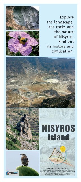
Explore<br />
<strong>the</strong> landscape,<br />
<strong>the</strong> rocks and<br />
<strong>the</strong> nature<br />
of Nisyros.<br />
Find out<br />
its his<strong>to</strong>ry and<br />
civilisation.<br />
<strong>NISYROS</strong><br />
island<br />
PROJECT: DESIGNATION<br />
OF GEOSITES - GEOPARKS, CONTRIBUTION<br />
TO SUSTAINABLE DEVELOPMENT
BACKGROUND ON THE AREA<br />
Nisyros is one of <strong>the</strong> islands in <strong>the</strong><br />
Sou<strong>the</strong>rn Aegean Sea. It is essentially<br />
a cone, rising approximately 700 m<br />
above sea level. The cone clearly<br />
denotes <strong>the</strong> island’s identity: it is <strong>the</strong><br />
youngest large active volcano in <strong>the</strong><br />
Aegean. The volcano is not just <strong>the</strong><br />
Stefanos crater, which dominates <strong>the</strong><br />
centre of <strong>the</strong> island. The whole island<br />
is a large volcanic structure. Every<br />
s<strong>to</strong>ne on <strong>the</strong> island is of volcanic origin,<br />
every one of <strong>the</strong> hundreds layers of<br />
rocks that form <strong>the</strong> island has been<br />
deposited by one of <strong>the</strong> numerous<br />
volcanic eruptions. The great variety<br />
in <strong>the</strong> composition and <strong>the</strong> forms of<br />
<strong>the</strong> rocks that make up <strong>the</strong> island, <strong>the</strong><br />
extensive and easily accessible natural<br />
sections and <strong>the</strong> excellent climate<br />
This package contains 12 cards: <strong>the</strong> first<br />
5 cards are general in content, with<br />
information on <strong>the</strong> geology, <strong>the</strong> rocks,<br />
<strong>the</strong> nature and <strong>the</strong> civilization of <strong>the</strong><br />
island of Nisyros. The following 7 cards<br />
provide a brief description of <strong>the</strong> 10<br />
most interesting geotrails of <strong>the</strong> island,<br />
based on <strong>the</strong> geological features of <strong>the</strong><br />
area. Maps of <strong>the</strong> cards are indicative<br />
and simplified. Next <strong>to</strong> <strong>the</strong> trails<br />
marked on <strong>the</strong> map, <strong>the</strong>re are numbers<br />
and letters. On <strong>the</strong> card containing <strong>the</strong><br />
commentary for each trail, <strong>the</strong> letters<br />
correspond <strong>to</strong> <strong>the</strong> description of <strong>the</strong><br />
trail, whereas <strong>the</strong> numbers correspond<br />
HOW TO USE THE CARDS<br />
3rd COMMUNITY SUPPORT FRAMEWORK<br />
PROGRAMME (2000-2006)<br />
OPERATIONAL PROGRAMME “COMPETITIVENESS”<br />
CO-FINANCED BY THE EUROPEAN COMMUNITY<br />
render <strong>the</strong> island of Nisyros an openair<br />
geological museum. Fur<strong>the</strong>rmore,<br />
Nisyros is <strong>the</strong> only active volcano in<br />
<strong>the</strong> Aegean Sea, which boasts such<br />
low and high vegetation and, hosts<br />
a wealth of fauna. The crystal-clear<br />
blue waters allow visi<strong>to</strong>rs <strong>to</strong> see <strong>the</strong><br />
beautiful, rich sea floor, underlining <strong>the</strong><br />
continuity between land and sea. The<br />
island of Nisyros has been inhabited<br />
continuously ever since prehis<strong>to</strong>ric<br />
times and is home <strong>to</strong> a really large<br />
number of great cultural monuments.<br />
It is a heaven, not just for geologists,<br />
but for every visi<strong>to</strong>r who loves and<br />
respects nature, and tries <strong>to</strong> draw<br />
lessons from <strong>the</strong> eternal wisdom of its<br />
actions and <strong>to</strong> put <strong>the</strong>m in use in <strong>the</strong>ir<br />
own infinitesimally brief existence.<br />
<strong>to</strong> <strong>the</strong> description of <strong>the</strong> particular<br />
sights in <strong>the</strong> area. In order for you <strong>to</strong><br />
hike safely, it is necessary <strong>to</strong> carry a<br />
1:25,000 scale map of <strong>the</strong> area, with <strong>the</strong><br />
corresponding trails. You can download<br />
<strong>the</strong> map from www\nisyrosvolcano.<br />
com. You can also download <strong>the</strong><br />
trails in digital form, so that you can<br />
load <strong>the</strong>m <strong>to</strong> your satellite compass<br />
(GPS). It’s better if you carry also thw<br />
feological map of <strong>the</strong> island. Before<br />
you set off on each trail, read carefully<br />
<strong>the</strong> commentary on <strong>the</strong> cards and<br />
follow <strong>the</strong> instructions in <strong>the</strong> “Code of<br />
conduct of <strong>the</strong> responsible hiker”.<br />
INSTITUTE OF GEOLOGY & MINERAL EXPLORATION<br />
DEPARTMENT OF GENERAL GEOLOGY & GEOLOGICAL MAPPING<br />
Spyros Louis 1, Olympic Village, Entrance C, 136 77 Acharnai, Attica<br />
Tel.: +30 210 2413175 • FAX: +30 210 2413448 • www.igme.gr<br />
The series “Geotrails in Greece” is a pilot publication of <strong>the</strong> <strong>Greek</strong> <strong>Institute</strong> of Geology and<br />
Mineral Exploration (IGME) with funding by <strong>the</strong> 3rd CSF for <strong>the</strong> project: “Designation of geosites-geoparks,<br />
contribution <strong>to</strong> sustainable development” and <strong>the</strong> sub-project: “Creating interpretative<br />
material for promotion, marketing and community awareness on geosites-geoparks”.<br />
The trails were traced in 2008, within <strong>the</strong> scope of <strong>the</strong> sub-project “Planning of walking and<br />
mo<strong>to</strong>ring geotrails for potential geoparks”. During <strong>the</strong> planning of <strong>the</strong> series “Geotrails", several<br />
similar attempts were used as reference, such as <strong>the</strong> series Landscapes from s<strong>to</strong>ne, a joint<br />
publication by <strong>the</strong> <strong>Geological</strong> Survey of Nor<strong>the</strong>rn Ireland and <strong>the</strong> <strong>Geological</strong> Survey of Ireland,<br />
ProGEO Croatia brochures for <strong>the</strong> Island of Rab, and relevant printed material.<br />
FIELD RESEARCH, TEXTS, PHOTOGRAPHS: Giorgis Vougioukalakis, IGME, gvoug@igme.gr<br />
PROJECT COORDINATION, TEXTS, EDITING, DESIGN: I. Theodossiou, IGME, ren@igme.gr<br />
Department of General Geology and <strong>Geological</strong> Mapping, dggx@igme.gr<br />
Direc<strong>to</strong>r of <strong>the</strong> Department: P. Tsombos<br />
DESIGN, EDITING, PRODUCTION: Kaleidoscope publications, www.kaleidoscope.gr<br />
ISBN 978-960-98903-1-1 © Copyright IGME, Geotrails 2009
MAP OF THE AREA OF INTEREST<br />
WITH THE SUGGESTED GEOTRAILS<br />
1. Caldera-Lakki • • • 2. Diavatis-Νyfios<br />
3. Argos • • • 4. Hohlakoi-Kanoni<br />
5. Nikia-Fylakio-Parletia • • • 6. Nikia-Αvlaki<br />
7. Κateros • • • 8. Paloi-Lies<br />
9. Evangelistra-Emporio • • • 10. Circum navigation*<br />
The geotrails suggested and<br />
described here should not be<br />
considered as <strong>the</strong> most beautiful<br />
on <strong>the</strong> island. It is difficult <strong>to</strong><br />
select this or that area, in a place<br />
where every spot is worth visiting.<br />
The choice has been made on <strong>the</strong><br />
basis of criteria such as geological<br />
formation representativity, satisfac<strong>to</strong>ry<br />
visibility of <strong>the</strong> rocks and<br />
accessibility for a hiker who is<br />
adequately fit.<br />
It is assumed that <strong>the</strong> visi<strong>to</strong>r<br />
explores <strong>the</strong> island on foot, but<br />
many of <strong>the</strong> trails can be easily<br />
completed on mountain bikes or<br />
mo<strong>to</strong>rcycles. However, <strong>the</strong> relationship<br />
that hikers develop with<br />
nature is unique, because <strong>the</strong>y can<br />
observe <strong>the</strong> landscape and <strong>the</strong><br />
rocks, and <strong>the</strong>y can also enjoy <strong>the</strong><br />
sounds, fragrances and images of<br />
<strong>the</strong> land and <strong>the</strong> sea, <strong>the</strong> plants<br />
and <strong>the</strong> animals.<br />
The necessary equipment for<br />
a safe walk around <strong>the</strong> island<br />
include appropriate shoes (light<br />
walking boots), hat and sunglasses:<br />
<strong>the</strong> sunlight is really harsh here. It<br />
is also necessary <strong>to</strong> carry enough<br />
water (more than one litre per<br />
person) and light snacks (fruit,<br />
2nuts, bread and cheese). One of<br />
<strong>the</strong> people in <strong>the</strong> group should<br />
carry at all times a small first aid<br />
kit in <strong>the</strong>ir backpack.<br />
The ideal time for hikes is in <strong>the</strong><br />
spring (April-June) and in <strong>the</strong> autumn<br />
(September-Oc<strong>to</strong>ber).<br />
Of course, this does not mean<br />
that <strong>the</strong> hikes cannot be undertaken<br />
at o<strong>the</strong>r times of <strong>the</strong><br />
year. In <strong>the</strong> summer, heat is not a<br />
serious problem because <strong>the</strong>re is<br />
nearly always a pleasant breeze on<br />
<strong>the</strong> island of Nisyros. But you can<br />
also choose <strong>to</strong> hike in Nisyros in<br />
<strong>the</strong> winter, as <strong>the</strong> only month with<br />
heavy rains is December and<br />
<strong>the</strong> average daily temperature<br />
rarely falls below 10° C, even<br />
during <strong>the</strong> coldest month of <strong>the</strong><br />
year, February.<br />
* During <strong>the</strong> Circum navigation,<br />
we pass by several sites we also<br />
meet during our geotrails on <strong>the</strong><br />
island, e.g. site 1 corresponds <strong>to</strong> site<br />
1 of Geotrail 4. Due <strong>to</strong> this, on <strong>the</strong><br />
Circum navigation card, site 1 is<br />
marked as (1)/4(1).
CODE OF CONDUCT OF THE RESPONSIBLE HIKER<br />
When you hike along a trail, keep in mind that this is a, public or private,<br />
protected area. The environment is a source of knowledge, fitness, pleasure<br />
and recreation on condition that you treat it with care. It is, <strong>the</strong>refore,<br />
desirable <strong>to</strong> follow some basic rules.<br />
Car in good condition,<br />
preferably 4 x 4.<br />
Park carefully, so that you do<br />
not obstruct entry <strong>to</strong> or exit<br />
from a place.<br />
Do not damage<br />
fences or walls.<br />
Avoid aimlessly collecting<br />
minerals or fossils.<br />
Mineral and fossils are more<br />
valuable when encountered in<br />
<strong>the</strong>ir natural context.<br />
Use <strong>the</strong> geologist's<br />
hammer<br />
wisely.<br />
Be careful<br />
when lighting fires!<br />
If you see fire burning,<br />
call <strong>the</strong> fire brigade (199)<br />
immediately.<br />
Do not leave any waste<br />
material behind.<br />
Wear clothing that is<br />
appropriately warm or cool,<br />
depending on <strong>the</strong> time of<br />
year. Use walking footwear<br />
(preferably hiking boots).<br />
If an accident occurs, notify<br />
emergency services (166)<br />
immediately.<br />
WARNING<br />
Hikers who wish <strong>to</strong> cover <strong>the</strong> trails that we propose should know that <strong>the</strong>y are doing so<br />
at <strong>the</strong>ir own risk. IGME will bear no responsibility for any events that might occur.<br />
For information, publications, studies and maps on <strong>the</strong> geology of Greece or of specific<br />
<strong>Greek</strong> regions, contact INSTITUTE OF GEOLOGY AND MINERAL EXPLORATION OF GREECE.<br />
Evaluation form of this publication is <strong>to</strong> be found at http://www.igme.gr<br />
Your opinion will be very helpful for its improvement.
ΤHE EVER-MOVING AEGEAN SEA.<br />
CREATION OF THE ACTIVE VOLCANOES AND OF <strong>NISYROS</strong><br />
Schematic section on <strong>the</strong> Aegean lithosphere and its active volcanoes<br />
3<br />
General information<br />
Five million years before present,<br />
Aegeis land, an alpine mountain<br />
range located at <strong>the</strong> place of <strong>the</strong><br />
present-day Aegean Sea, started<br />
disintegrating <strong>to</strong> fragments and<br />
sinking in<strong>to</strong> <strong>the</strong> waters of <strong>the</strong> sea.<br />
The pressure of <strong>the</strong> tec<strong>to</strong>nic plate<br />
of Turkey – which slides along <strong>the</strong><br />
fault of Nor<strong>the</strong>rn Ana<strong>to</strong>lia – and<br />
<strong>the</strong> ascending warm currents created<br />
by <strong>the</strong> subducting African<br />
lithosphere wore thin and large<br />
blocks of <strong>the</strong> continental crust and<br />
made <strong>the</strong>m sink in<strong>to</strong> <strong>the</strong> Aegean<br />
Sea. At <strong>the</strong> same time, volcanoes<br />
also joined that battle of <strong>the</strong> land<br />
against <strong>the</strong> sea. The magma forming<br />
underneath <strong>the</strong> sou<strong>the</strong>rn Aegean<br />
Sea, due <strong>to</strong> <strong>the</strong> subduction of <strong>the</strong><br />
African lithosphere, found outlets<br />
at Saronikos gulf, creating Soussaki<br />
volcano, as well as <strong>the</strong> largest<br />
part of <strong>the</strong> island of Aegina and<br />
<strong>the</strong> Methana peninsula. In <strong>the</strong> central<br />
Aegean, it created <strong>the</strong> insular<br />
groups of Milos and San<strong>to</strong>rini, and,<br />
finally, in <strong>the</strong> eastern Aegean Sea,<br />
where it created <strong>the</strong> island of Nisyros<br />
and its surrounding islets, as<br />
wells as part of western Kos.<br />
At <strong>the</strong> eastern edge of <strong>the</strong> volcanic<br />
arc, <strong>the</strong> volcanic activity started<br />
adding new volcanic land <strong>to</strong> sou<strong>the</strong>rn<br />
Kos and creating <strong>the</strong> small<br />
islands in <strong>the</strong> South of Kos, such<br />
as Pyrgoussa and Pachia, 3.4 million<br />
years ago. An enormous eruption<br />
marked <strong>the</strong> end of volcanicity in<br />
Kos, 161,000 years ago. It was <strong>the</strong><br />
largest eruption in <strong>the</strong> eastern<br />
Mediterranean Sea. The eruption<br />
spewed hundreds of billions <strong>to</strong>ns<br />
of rock, which was spread like volcanic<br />
tephra <strong>to</strong> <strong>the</strong> whole area; at<br />
present, it covers half of <strong>the</strong> island<br />
of Kos and also occurs in Kalimnos<br />
and Tilos islands, as well as in <strong>the</strong><br />
nearby coasts of Minor Asia. After<br />
that event, eruptions went on occurring<br />
fur<strong>the</strong>r in <strong>the</strong> South, building<br />
up <strong>the</strong> island of Nisyros, as well<br />
as <strong>the</strong> islands of Stroggyli and Yali.<br />
Nisyros is <strong>the</strong> most recent of <strong>the</strong><br />
large active volcanoes in Greece.<br />
The earliest rocks that appear<br />
here date back <strong>to</strong> a little later than<br />
160,000 years ago, while <strong>the</strong> most<br />
recent rocks are almost prehis<strong>to</strong>rical,<br />
dating back <strong>to</strong> approximately<br />
20,000 years ago.<br />
We don’t know exactly when <strong>the</strong><br />
creation of <strong>the</strong> underwater foundations<br />
of Nisyros started. A few tens<br />
of thousands years of underwater<br />
volcanic activity were definitely
necessary for <strong>the</strong> first peak of <strong>the</strong><br />
island <strong>to</strong> emerge from <strong>the</strong> waters<br />
of <strong>the</strong> Aegean Sea, approximately<br />
150,000 years ago.<br />
After emerging from <strong>the</strong> sea, <strong>the</strong><br />
volcano started creating a cone of<br />
land. Over <strong>the</strong> next 100,000 years, a<br />
large volcanic cone was built above<br />
sea level, formed by successive layers<br />
of tephra and lava. Its diameter<br />
is estimated <strong>to</strong> be approximately 7<br />
km and its maximum height 700 m.<br />
The first large destructive eruption<br />
<strong>to</strong>ok place on <strong>the</strong> island approximately<br />
50,000 years ago. Within a<br />
few days, billions of <strong>to</strong>n of molten<br />
rock were spewed in<strong>to</strong> <strong>the</strong> atmosphere,<br />
producing huge volumes of<br />
pumice and ash. The peak of <strong>the</strong><br />
volcano collapsed in <strong>the</strong> void space<br />
created underneath <strong>the</strong> island, due<br />
<strong>to</strong> <strong>the</strong> spewing of <strong>the</strong> magma and<br />
<strong>the</strong> first caldera of <strong>the</strong> island of<br />
Nisyros was created.<br />
After <strong>the</strong> eruption, <strong>the</strong> highly viscous<br />
molten rock built large lava<br />
domes near <strong>the</strong> eastern rim of <strong>the</strong><br />
first caldera and covered <strong>the</strong> sou<strong>the</strong>astern<br />
slopes of <strong>the</strong> volcano with<br />
very thick lava flows at <strong>the</strong> place<br />
where Nikia is built <strong>to</strong>day.<br />
The period of<br />
calmness that<br />
followed was<br />
interrupted<br />
after <strong>the</strong> seconddestructive<br />
eruption<br />
of <strong>the</strong> island<br />
of Nisyros,<br />
approximately<br />
45,000 years<br />
ago, when<br />
new layers of<br />
pumice were<br />
added <strong>to</strong> <strong>the</strong><br />
island and<br />
<strong>the</strong> present<br />
caldera of<br />
Nisyros was<br />
created. After<br />
that large<br />
eruption, magma<br />
flowed out<br />
calmly for several thousands of years,<br />
creating <strong>the</strong> “post-caldera domes”,<br />
<strong>the</strong> high hills that fill approximately<br />
2/3 of <strong>the</strong> caldera, as well as <strong>the</strong><br />
Karaviotis dome, outside <strong>the</strong> caldera.<br />
This is how <strong>the</strong> island of Nisyros<br />
came <strong>to</strong> acquire its present form.<br />
None of <strong>the</strong> successive eruptions of<br />
<strong>the</strong> volcano, which were recorded<br />
in his<strong>to</strong>rical times, produced<br />
molten rock. All of <strong>the</strong>m were<br />
hydro<strong>the</strong>rmal eruptions caused<br />
by <strong>the</strong> presence of overheated<br />
vapour in <strong>the</strong> subsoil of <strong>the</strong> island.<br />
Sea water and rain water penetrate<br />
<strong>the</strong> rocks of <strong>the</strong> island, accumulate<br />
in deep horizons and are heated<br />
by magma. The water turns <strong>to</strong><br />
overheated vapour and tremendous<br />
pressure builds up. When <strong>the</strong><br />
pressure exceeds <strong>the</strong> weight and<br />
cohesion of <strong>the</strong> overlying rocks,<br />
it blows <strong>the</strong>m in <strong>the</strong> air, causing a<br />
hydro<strong>the</strong>rmal eruption.<br />
All <strong>the</strong> eruptions recorded on<br />
<strong>the</strong> island of Nisyros in his<strong>to</strong>rical<br />
times belong <strong>to</strong> this type. At <strong>the</strong><br />
sou<strong>the</strong>rn part of <strong>the</strong> caldera floor<br />
<strong>the</strong>re are traces of 20 such craters.<br />
Ten of <strong>the</strong>m are well preserved and<br />
each one has its own name.<br />
Schematic representation of Nisyros volcano interior
Mythology<br />
Even nowadays, we do not know<br />
precisely when <strong>the</strong> molten rock<br />
started oozing at <strong>the</strong> Nisyros area<br />
for <strong>the</strong> first time. The ancient <strong>Greek</strong>s,<br />
however, had very clear ideas both<br />
about <strong>the</strong> time and <strong>the</strong> way <strong>the</strong> island<br />
was created:<br />
“Polybotes, hunted by Neptune in <strong>the</strong><br />
middle of <strong>the</strong> sea, reached <strong>the</strong> island of<br />
Kos. But Neptune grabbed a piece of<br />
<strong>the</strong> island and threw it on him. It was <strong>the</strong><br />
island of Nisyros”.<br />
It is a wonderful myth, which reveals<br />
that our ances<strong>to</strong>rs knew that <strong>the</strong><br />
island of Nisyros is a volcano and<br />
that its rocks are similar <strong>to</strong> those of<br />
southwestern Kos. They also knew<br />
or felt that <strong>the</strong> frequent earthquakes<br />
in <strong>the</strong> area were connected with <strong>the</strong><br />
mechanism of <strong>the</strong> island’s creation.<br />
The trapped energy of <strong>the</strong> molten<br />
rock and <strong>the</strong> overheated vapour<br />
under <strong>the</strong> island of Nisyros became<br />
Polybotes, one of <strong>the</strong> Giants,<br />
who sighs and stirs because he is<br />
imprisoned beneath <strong>the</strong> island.<br />
His<strong>to</strong>ry and civilisation<br />
The his<strong>to</strong>ry of <strong>the</strong> island of Nisyros<br />
dates back <strong>to</strong> many centuries ago.<br />
There are traces of Neolithic<br />
settlements dating back <strong>to</strong> <strong>the</strong> 5th<br />
millennium B.C. and life has gone on<br />
uninterruptedly on <strong>the</strong> island ever<br />
since. The island flourished in <strong>the</strong><br />
4th century B.C. and in <strong>the</strong> 12th-13th<br />
centuries A.D. At <strong>the</strong> end of <strong>the</strong> 19th<br />
century <strong>the</strong>re were approximately<br />
5,000 inhabitants on <strong>the</strong> island.<br />
Ever since <strong>the</strong>n, <strong>the</strong> number of <strong>the</strong><br />
inhabitants started falling. Farming,<br />
fishing and s<strong>to</strong>ck raising were no<br />
longer sufficient, so <strong>the</strong> inhabitants of<br />
<strong>the</strong> island started moving away from<br />
<strong>the</strong> island.<br />
Consecration horns in <strong>the</strong> Nyfios<br />
Minoan shrine on <strong>the</strong> peak<br />
Poseidon battle with<br />
Giant Polyvotis (Polybotes)<br />
Nisyros silver coin<br />
4<br />
The earliest findings of human<br />
presence in <strong>the</strong> wider area date<br />
back <strong>to</strong> <strong>the</strong> Neolithic period; <strong>the</strong>y<br />
consist of ruins of settlements on<br />
Giali islet and at some sites, mainly<br />
in northwestern Nisyros. There<br />
are scarce traces of <strong>the</strong> Minoan<br />
and Mycenaean presence, such as<br />
corn-shaped flakes, vase fragments<br />
and “Cyclopean” walls. The Preclassical<br />
and Classical periods (10th-<br />
4th century B.C.) are represented<br />
mainly by <strong>the</strong> marvelous<br />
Paleokastro, a host of sculptures<br />
and fragments from ancient temples,<br />
and <strong>the</strong> settlements in <strong>the</strong> Argos<br />
area. There are some extensions<br />
and additions <strong>to</strong> classical buildings<br />
dating back <strong>to</strong> <strong>the</strong> Hellenistic period,<br />
as well as numerous “fryk<strong>to</strong>ries”<br />
(watch<strong>to</strong>wers), both on <strong>the</strong> island of<br />
Nisyros and on Pyrgoussa islet. As a<br />
matter of fact, <strong>the</strong> name Pyrgoussa<br />
(<strong>the</strong> <strong>Greek</strong> word for “<strong>to</strong>wer is<br />
“pyrgos”) owes its name <strong>to</strong> <strong>the</strong>se<br />
<strong>to</strong>wers.<br />
The Roman period left sculptures<br />
and bath ruins on <strong>the</strong> islands. Some<br />
of <strong>the</strong>se can be seen at present<br />
outside Paloi. During <strong>the</strong> early
Byzantine times numerous big and<br />
small churches were built; <strong>the</strong> ruins<br />
of some churches can still be seen.<br />
From <strong>the</strong> 11th <strong>to</strong> <strong>the</strong> 15th century,<br />
<strong>the</strong> island of Nisyros is under <strong>the</strong><br />
rule of Western Europeans, <strong>the</strong><br />
Venetians, at first, and <strong>the</strong> knights<br />
of Saint John later. It was <strong>the</strong>m<br />
who built <strong>the</strong> castle at Kastro,<br />
Mandraki, as well as numerous o<strong>the</strong>r<br />
fortifications.<br />
After <strong>the</strong> capture of Constantinople,<br />
<strong>the</strong> island of Nisyros became prey<br />
<strong>to</strong> incursions by pirates and <strong>the</strong><br />
Turks.<br />
The island of Nisyros is on <strong>the</strong><br />
eastern migra<strong>to</strong>ry corridor of Asian<br />
bird species. It is <strong>the</strong> most important<br />
route on <strong>the</strong>ir way <strong>to</strong> Greece<br />
and Minor Asia. Due <strong>to</strong> its fertile<br />
volcanic soil, <strong>the</strong> flora of <strong>the</strong> island is<br />
very varied.<br />
Its 450 flora recorded species, 85<br />
bird species, 7 species of reptiles<br />
and <strong>the</strong> presence of Monachus-<br />
Monachus seals on its coasts<br />
designate <strong>the</strong> island of Nisyros as<br />
a site worthy of special protection<br />
and study.<br />
The lush herbaceous vegetation is<br />
a pleasant obstacle that hikers off<br />
<strong>the</strong> marked paths are bound <strong>to</strong><br />
encounter. Because of <strong>the</strong> abundance<br />
of trees, <strong>the</strong> island of Nisyros can<br />
be characterised as <strong>the</strong> only “green”<br />
active volcano in <strong>the</strong> Aegean Sea.<br />
The fauna of <strong>the</strong> island is just as<br />
varied and diverse as <strong>the</strong> flora.<br />
Fur<strong>the</strong>rmore, <strong>the</strong>re are numerous<br />
free-range animals, such as goats,<br />
pigs and cows.<br />
Nisyros flora and fauna ><br />
Paleokastro<br />
Flora and fauna<br />
At <strong>the</strong> end of <strong>the</strong> 15th century <strong>the</strong><br />
island was completely deserted<br />
and in 1522 it surrendered <strong>to</strong> <strong>the</strong><br />
Ot<strong>to</strong>mans, who ruled it until 1912,<br />
when <strong>the</strong> island passed under<br />
Italian rule. The Ot<strong>to</strong>mans granted<br />
special status <strong>to</strong> <strong>the</strong> Dodecanese,<br />
which allowed a powerful and active<br />
local government <strong>to</strong> flourish; as a<br />
result, <strong>the</strong>re was a great deal of<br />
development in Nisyros at <strong>the</strong> time.<br />
A wealth of churches dating back<br />
<strong>to</strong> that period testify <strong>to</strong> <strong>the</strong> relative<br />
prosperity and <strong>the</strong> busy social life of<br />
<strong>the</strong> island.
VOLCANOES, LAVA AND TEPHRA<br />
Volcanoes can be found ei<strong>the</strong>r<br />
on land or underwater; <strong>the</strong>y are<br />
natural structures and <strong>the</strong>y usually<br />
have <strong>the</strong> appearance of a hill or<br />
a mountain. Volcanoes are created<br />
at places where magma, <strong>the</strong><br />
molten rock deep inside <strong>the</strong> earth,<br />
manages <strong>to</strong> find an outlet <strong>to</strong>wards<br />
<strong>the</strong> surface. When magma escapes<br />
<strong>to</strong> <strong>the</strong> surface, it cools and becomes<br />
solid lava.<br />
The creation and escape of magma<br />
<strong>to</strong> <strong>the</strong> surface of <strong>the</strong> Earth is generally<br />
encountered in tec<strong>to</strong>nically<br />
disturbed areas. Magma leaves <strong>the</strong><br />
magma chamber, reaches <strong>the</strong> surface<br />
through volcanic conduits or<br />
dykes and ends up in <strong>the</strong> volcanic<br />
vent, which is usually a bell-shaped<br />
cavity, like a crater. In <strong>the</strong> intervals<br />
between volcanic eruptions, <strong>the</strong><br />
only evidence of volcanic activity is<br />
<strong>the</strong> emission of fumaroles, i.e. hot<br />
gasses and vapours from cavities in<br />
<strong>the</strong> ground.<br />
Volcanic activity can range between<br />
two extremes: in <strong>the</strong> first<br />
type, magma does not contain a<br />
great quantity of gasses; it reaches<br />
<strong>the</strong> surface slowly and flows out<br />
5<br />
of <strong>the</strong> volcanic vent, creating lava<br />
flows, when its viscosity is low, or<br />
lava domes, when it highly viscous.<br />
In <strong>the</strong> o<strong>the</strong>r type, gas-rich magma<br />
triggers eruptions. Then <strong>the</strong> lava is<br />
blown in fragments from <strong>the</strong> volcanic<br />
vent, in <strong>the</strong> form of tephra.<br />
Tephra is also named pyroclasts;<br />
<strong>the</strong> most fine-grained part of<br />
tephra is called volcanic ash or<br />
simply ash. Some volcanoes are in<br />
constant activity for long periods<br />
of time, such as <strong>the</strong> Stromboli volcano,<br />
in <strong>the</strong> Aeolian islands, which<br />
has been constantly active for <strong>the</strong><br />
last 3-4,000 years.<br />
However, most volcanoes<br />
present brief episodes of activity,<br />
which last from a few days<br />
<strong>to</strong> a few years and between, and<br />
<strong>the</strong>n become dormant for tens,<br />
hundreds or thousands of years.<br />
Dormant volcanoes can present<br />
no sign of activity or emit gasses<br />
and vapours, which reveal its active<br />
status. Nowadays, active volcanoes<br />
are defined as volcanoes that have<br />
shown activity in <strong>the</strong> last 10,000<br />
years and are located in tec<strong>to</strong>nically<br />
active areas.
Rocks of <strong>the</strong> island of Nisyros<br />
The island of Nisyros is formed<br />
exclusively by volcanic rocks.<br />
The magma feeding <strong>the</strong> volcanic<br />
activity is initially calc-alkaline<br />
basalt: a fluid made up of oxides<br />
of silica, aluminium, magnesium,<br />
iron, calcium.<br />
The mineral crystals encountered<br />
in <strong>the</strong> rocks of <strong>the</strong> island of Nisyros<br />
are:<br />
• Feldspars, translucent white<br />
crystals.<br />
• Pyroxenes, dark green <strong>to</strong> black<br />
crystals.<br />
• Hornblendes, dark green <strong>to</strong><br />
grey crystals.<br />
• Olivines, translucent honey-coloured<br />
<strong>to</strong> green-gray crystals.<br />
Gasses also play an important role<br />
in <strong>the</strong> final form of volcanic rocks.<br />
A fluid basaltic or andesitic magma<br />
which contains many gasses gives<br />
rocks with spongy texture and<br />
characteristic black or dark red<br />
colour, called scoriae.<br />
A highly viscous dacitic or rhyolitic<br />
magma, rich in gasses, produces<br />
pumice, a white rock which is<br />
formed from “blown” glass with<br />
some crystals. There are very<br />
frequent occurrences of andesite<br />
inclusions in <strong>the</strong> dacites and <strong>the</strong><br />
rhyolites: it is a new basaltic magma<br />
that comes in<strong>to</strong> <strong>the</strong> magma<br />
chamber and mixes with <strong>the</strong> acidic<br />
magma in it.<br />
A group of rocks that is specific <strong>to</strong><br />
<strong>the</strong> island of Nisyros is<br />
altered rocks. They are encountered<br />
mainly in <strong>the</strong> Ramos area,<br />
as this is where <strong>the</strong> most intense<br />
hydro<strong>the</strong>rmal activity, which is in<br />
<strong>the</strong>ir origin, takes place. Finally, a<br />
special and and quite rare rock,<br />
which geologists call skarn, is<br />
found between <strong>the</strong> fragments<br />
spewed from <strong>the</strong> bowels of <strong>the</strong><br />
Earth by large eruptions.<br />
Its colour ranges from light<br />
green <strong>to</strong> dark olive green or<br />
from ruddy <strong>to</strong> black, depending on<br />
<strong>the</strong> crystals it is formed by<br />
(pyroxenes, olivines, epidotes,<br />
spinels and garnets). Skarn is<br />
formed at <strong>the</strong> contact zone, when<br />
<strong>the</strong> molten rock penetrates in<br />
limes<strong>to</strong>nes and marbles.<br />
The rocks on <strong>the</strong> island of<br />
Nisyros provide its inhabitants<br />
with a wonderful material on<br />
which <strong>the</strong>y can build and base<br />
<strong>the</strong>ir economic activity.<br />
Paleokastro has been constructed<br />
entirely with basaltic andesite,<br />
one of <strong>the</strong> hardest rocks in <strong>the</strong><br />
world.<br />
The island of Nisyros has been<br />
well-known ever since ancient<br />
times for its marvelous grinds<strong>to</strong>nes<br />
and its hand querns,<br />
which are made mainly by basalt<br />
and andesite and are exported <strong>to</strong><br />
<strong>the</strong> whole surrounding area.<br />
Pumice is <strong>the</strong> rock that has been<br />
exploited <strong>the</strong> most in <strong>the</strong> area; it<br />
has been an important fac<strong>to</strong>r for<br />
<strong>the</strong> economy of <strong>the</strong> island in <strong>the</strong><br />
last few decades.<br />
The sulphur lodging within <strong>the</strong><br />
altered rocks of <strong>the</strong> Ramos area<br />
(sulphur soils), especially near<br />
<strong>the</strong> hydro<strong>the</strong>rmal craters has also<br />
been exploited at intervals.<br />
Miles<strong>to</strong>ne of Classical age Sulfur crystals
A. The trail begins at <strong>the</strong> junction<br />
of <strong>the</strong> roadway leading <strong>to</strong> Nikia<br />
with <strong>the</strong> road descending <strong>to</strong>wards<br />
Lakki. At <strong>the</strong> beginning of <strong>the</strong><br />
trail, from <strong>the</strong> nor<strong>the</strong>rn rim of <strong>the</strong><br />
caldera, <strong>the</strong>re is a wonderful view<br />
of <strong>the</strong> large eruptive funnel and<br />
<strong>the</strong> post-caldera domes (1).<br />
Then, one can observe <strong>the</strong> old formations<br />
of Nisyros, at <strong>the</strong> sections<br />
of <strong>the</strong> road lying on <strong>the</strong> slopes of<br />
<strong>the</strong> caldera. Observe <strong>the</strong> massive<br />
or laminar, due <strong>to</strong> flowing, lava<br />
flows and <strong>the</strong> tephra layers (2)<br />
<strong>the</strong>y are intercalated by. At some<br />
points, lava flows penetrate <strong>the</strong><br />
sediments of small ponds, lying in<br />
<strong>the</strong> craters of that time, and characteristically<br />
mix with sediments.<br />
At some o<strong>the</strong>r points you can see<br />
large volcanic ejecta (bombs) (3)<br />
which penetrate and deform <strong>the</strong><br />
layers of ash, clearly revealing <strong>the</strong><br />
traces of <strong>the</strong> direction of <strong>the</strong>ir fall<br />
and, thus, providing us with valuable<br />
info on <strong>the</strong> position of <strong>the</strong><br />
vent <strong>the</strong>y were emitted from.<br />
GEOTRAIL 1 Caldera – Lakki<br />
6B. At <strong>the</strong> second segment of <strong>the</strong><br />
road descending <strong>to</strong> Lakki, <strong>the</strong>re<br />
are two large dykes (4) within<br />
<strong>the</strong> first dacitic lavas on <strong>the</strong> island<br />
of Nisyros. A little fur<strong>the</strong>r down,<br />
you will see <strong>the</strong> fine-grained<br />
pumice (5) originating from <strong>the</strong><br />
last large eruption of Yali island<br />
deposited on <strong>the</strong> scree covering<br />
<strong>the</strong> cliffs of <strong>the</strong> caldera.<br />
Distance: 6 km • Height: 90-320 m • Time: 3.5 hours<br />
C. At <strong>the</strong> third part of <strong>the</strong> road,<br />
which is flat and leads <strong>to</strong> Lakki,<br />
you will initially encounter <strong>the</strong> Boriatiko<br />
lavas (6), one of <strong>the</strong> most<br />
recent post-caldera domes of <strong>the</strong><br />
island of Nisyros. Then, you can<br />
observe <strong>the</strong> layers of block and<br />
ash flows deposited by collapsing<br />
parts of <strong>the</strong> Visternia dome (7)<br />
and, a little fur<strong>the</strong>r below, <strong>the</strong> fumaroles<br />
on <strong>the</strong> eastern slopes of<br />
Lofos dome (8).<br />
D. After a refreshment at Lefteris’s<br />
kiosk, follow <strong>the</strong> path <strong>to</strong> Stefanos<br />
and head down, <strong>to</strong>wards <strong>the</strong> crater<br />
floor. Admire <strong>the</strong> sulphur crystals
formed at <strong>the</strong> fumaroles. Do not<br />
try <strong>to</strong> collect <strong>the</strong>m: <strong>the</strong>y crumble<br />
immediately and you rob visi<strong>to</strong>rs<br />
after you of <strong>the</strong> possibility of seeing<br />
<strong>the</strong>m. Listen for <strong>the</strong> hum of <strong>the</strong><br />
geo<strong>the</strong>rmal fluid as it comes up <strong>to</strong><br />
<strong>the</strong> surface.<br />
Beware! Do not let your clo<strong>the</strong>s<br />
and equipment come in<strong>to</strong> contact<br />
with <strong>the</strong> rocks and <strong>the</strong> fluids because<br />
<strong>the</strong>y quickly disintegrate.<br />
If you visit <strong>the</strong> crater during <strong>the</strong><br />
time of <strong>the</strong> rainfalls, you will enjoy<br />
<strong>the</strong> view of <strong>the</strong> boiling mud, as <strong>the</strong><br />
largest part of Stefanos floor turns<br />
in<strong>to</strong> a mud pot.<br />
E. Then, follow <strong>the</strong> path <strong>to</strong> Alexandros<br />
(9), Mikros (Little) Poly-<br />
Volcanic bomb sag (site 3)<br />
Stefanos crater fumaroles<br />
votis (10) and Megalos (Large)<br />
Polyvotis (11) craters, as well<br />
as <strong>to</strong> all <strong>the</strong> o<strong>the</strong>r craters in <strong>the</strong><br />
Lofos area. It is worth descending<br />
in<strong>to</strong> Megalos Polyvotis (taking<br />
extra care as this is meant for<br />
competent climber only), <strong>to</strong> admire<br />
<strong>the</strong> thin-layered sediments of<br />
<strong>the</strong> lake that used <strong>to</strong> be in <strong>the</strong>re,<br />
before <strong>the</strong> 1871-1873 eruptions, as<br />
well as its numerous fumaroles.<br />
Avoid descending <strong>to</strong> <strong>the</strong> bot<strong>to</strong>m<br />
of Polyvotis if <strong>the</strong>re is not<br />
enough wind. The accumulation<br />
of carbon dioxide, which is heavier<br />
than <strong>the</strong> air, makes this a dangerous<br />
place <strong>to</strong> be if air supply is not<br />
adequately renewed.
GEOTRAIL 2 Diavatis – Nyfioς<br />
A. It is probably <strong>the</strong> most interesting<br />
path and it leads <strong>to</strong> <strong>the</strong> highest<br />
peak of <strong>the</strong> island of Nisyros<br />
(altitude 698 m). Make sure you<br />
set off early in <strong>the</strong> morning and<br />
be prepared for a some climbing.<br />
There is a roadway up until Evangelistra<br />
monastery. The hiking begins<br />
at Evangelistra monastery and <strong>the</strong><br />
time <strong>to</strong> <strong>the</strong> <strong>to</strong>p is approximately<br />
one hour of normal walking without<br />
s<strong>to</strong>ps. At <strong>the</strong> beginning, you will<br />
walk for a few minutes on <strong>the</strong> path<br />
bordering <strong>the</strong> sou<strong>the</strong>rn cliffs of <strong>the</strong><br />
caldera, where you can observe<br />
<strong>the</strong> andesitic lava flows and <strong>the</strong><br />
scoriae of <strong>the</strong> intermediate<br />
andesitic lavas (1).<br />
As soon as you reach <strong>the</strong> spot<br />
where <strong>the</strong> Profitis Ilias dome<br />
lavas (2) <strong>to</strong>uch <strong>the</strong> caldera, turn<br />
left and start going up on <strong>the</strong><br />
dacites of <strong>the</strong> last volcanic<br />
eruption of <strong>the</strong> island. Observe<br />
<strong>the</strong> rocks carefully. Within <strong>the</strong><br />
ash rose dacites, you will see<br />
numerous rounded pieces of a<br />
darker, purple rock. It is an andesite<br />
that penetrated in<strong>to</strong> <strong>the</strong> magma<br />
chamber of <strong>the</strong> dacite and <strong>the</strong>y<br />
came up <strong>to</strong> <strong>the</strong> surface <strong>to</strong>ge<strong>the</strong>r.<br />
The first part of <strong>the</strong> path is easy and<br />
<strong>the</strong> path can be easily discerned, but<br />
between 450-500 m in<strong>to</strong> it, you will<br />
7need <strong>to</strong> pay attention so as not <strong>to</strong><br />
miss <strong>the</strong> path.<br />
Distance: 6.5 km • Height: 260-698 m • Time: 4 hours<br />
B. Sixty metres below <strong>the</strong> <strong>to</strong>p,<br />
after you cross <strong>the</strong> kermes oaks<br />
forest which cover <strong>the</strong> northwestern<br />
slope of <strong>the</strong> dome, at a height<br />
of 638 m, you will come across<br />
Diavatis (3) “hanging garden”. It is<br />
an oasis of tall trees – walnut trees,<br />
fig trees, pear trees, etc. – on a flat,<br />
round surface limited by a tall s<strong>to</strong>ne<br />
fence. This circular structure is a<br />
collapse crater of <strong>the</strong> Profitis<br />
Ilias dome, a usual structure for<br />
domes, created at <strong>the</strong> final stage of<br />
<strong>the</strong> eruption, when <strong>the</strong> magma is<br />
cooling. At <strong>the</strong> entrance of Diavatis,<br />
<strong>the</strong>re is a small white house with a<br />
lava cistern bearing <strong>the</strong> date 1749.<br />
The church behind <strong>the</strong> house is<br />
called Panagia Diavatiani (Galak<strong>to</strong>trofoussa)<br />
and boasts impressive<br />
frescoes, possibly dating back <strong>to</strong><br />
<strong>the</strong> 17th century. Across <strong>the</strong> church<br />
<strong>the</strong>re is a number of small cells in<br />
a bad state; <strong>the</strong>y used <strong>to</strong> host <strong>the</strong><br />
nuns of <strong>the</strong> monastery.<br />
C. Keep on walking on <strong>the</strong> path, <strong>to</strong>wards<br />
<strong>the</strong> left, up until <strong>the</strong> easternmost<br />
site, where you will admire <strong>the</strong><br />
entire sou<strong>the</strong>ast island of Nisyros<br />
and, in particular, <strong>the</strong> caldera and its<br />
hydro<strong>the</strong>rmal craters (4).
Diavatis “hanging garden” (site 3)<br />
D. Now, move <strong>to</strong>wards <strong>the</strong> West.<br />
In a few minutes, you will reach <strong>the</strong><br />
peak of Profitis Ilias (5), with <strong>the</strong><br />
chapel dedicated <strong>to</strong> Prophet Elias,<br />
at 698 m above sea level. The view<br />
<strong>to</strong>wards <strong>the</strong> West from here is<br />
unique.<br />
E. The seasoned hikers among you<br />
might want <strong>to</strong> move in <strong>the</strong> South<br />
of Profitis Ilias and admire, on <strong>the</strong><br />
mountain saddle before Trapezina, <strong>the</strong><br />
chapel of Agios Pandeleimonas.<br />
F. We suggest you return through<br />
<strong>the</strong> impressive Nifios plateau. On<br />
<strong>the</strong> first part of <strong>the</strong> path, admire <strong>the</strong><br />
dome lava spines (6) on your left.<br />
G. On <strong>the</strong> Nyfios plateau are<br />
conserved <strong>the</strong> only indications for<br />
a Minoan shrine on <strong>the</strong> peak, with<br />
horns of consecration and <strong>the</strong><br />
remnants of<br />
a settlement.<br />
The carved<br />
caves where<br />
<strong>the</strong> church<br />
of Agios<br />
Ioannis Kalivitis<br />
and a<br />
monastery<br />
with interesting<br />
frescoes,<br />
dedicated<br />
<strong>to</strong> Nymfios<br />
Chris<strong>to</strong>s<br />
(Christ Bride<br />
groom) are <strong>to</strong> be found <strong>to</strong>day,<br />
might have been a shrine <strong>to</strong> <strong>the</strong><br />
Nymphs in <strong>the</strong> past (which would<br />
explain <strong>the</strong> origin of <strong>the</strong> name<br />
Nyfios).<br />
H. You can return form Nyfios by<br />
walking 30 minutes downwards ei<strong>the</strong>r<br />
on a path <strong>to</strong> Evangelistra or on<br />
a path <strong>to</strong> Lakki. At <strong>the</strong> junction <strong>the</strong>re<br />
are impressive fronts of <strong>the</strong> lava<br />
flows fed by <strong>the</strong> Boriatiko dome<br />
(7). On <strong>the</strong> way down, you will see<br />
a characteristic neck of andesitic<br />
lava (8) rising up on <strong>the</strong> foot of <strong>the</strong><br />
nor<strong>the</strong>rn cliff of <strong>the</strong> caldera. At Evangelistra,<br />
make a s<strong>to</strong>p at <strong>the</strong> monastery,<br />
have some fresh water from <strong>the</strong><br />
cistern in <strong>the</strong> yard and enjoy <strong>the</strong> cool<br />
breeze under <strong>the</strong> branches of <strong>the</strong><br />
enormous turpentine tree.<br />
The hydro<strong>the</strong>rmal craters view from Profitis Ilias (site 4)
A. The trail begins from a dirt<br />
road that can be travelled by car<br />
on <strong>the</strong> western slopes of <strong>the</strong> island<br />
of Nisyros, at <strong>the</strong> place where<br />
Karaviotis and Trapezina domes<br />
meet. You can also reach this spot<br />
on foot from Mandraki. The first<br />
place <strong>to</strong> visit is Siones. It is a small<br />
temple on <strong>the</strong> western slopes of<br />
<strong>the</strong> caldera; it is dedicated <strong>to</strong> <strong>the</strong><br />
birth of Madonna and is richly<br />
decorated, as it was renovated by<br />
monk Ionas in 1733.<br />
B. Leave <strong>the</strong> dirt road between<br />
Karaviotis and Trapezina domes<br />
and follow <strong>the</strong> path unravelling<br />
mainly in <strong>the</strong> archaeological site<br />
of Argos, which has not been<br />
explored. You will come across a<br />
number of settlement remnants<br />
from <strong>the</strong> Neolithic (?) period (1,<br />
2) <strong>to</strong> <strong>the</strong> last century. The “tavles”<br />
(cultivating terraces), with <strong>the</strong>ir<br />
high retaining walls built exclusively<br />
from <strong>the</strong> remnants of andesite,<br />
GEOTRAIL 3 Argos<br />
8which was quarried for <strong>the</strong><br />
renowned grinds<strong>to</strong>nes of <strong>the</strong><br />
island of Nisyros, are a particularly<br />
impressive sight.<br />
Distance: 8.5 km • Height: 0-350 m • Time: 4 hours<br />
C. The last part of <strong>the</strong> path unfolds<br />
between impressive occurrences<br />
of andesitic lava flows<br />
and scoriae (3). This area is full<br />
of galleries, dug in<strong>to</strong> <strong>the</strong> ground,<br />
which extend tens of metres in<br />
length and a few metres in depth.<br />
They were probably shelters, built<br />
by <strong>the</strong> inhabitants of <strong>the</strong> island<br />
ever since ancient years, so that<br />
<strong>the</strong>y could hide in <strong>the</strong> event of<br />
pirate incursions. The path ends at<br />
Agia Irini, where you can see <strong>the</strong><br />
ruins of <strong>the</strong> sulphur processing<br />
plant (4), built in 1879 by A. Rallis;<br />
<strong>the</strong> plant was operative for just 10<br />
years.<br />
D. A path from Argos area leads<br />
<strong>to</strong> Drakospilo (5), <strong>the</strong> sou<strong>the</strong>rnmost<br />
“fryk<strong>to</strong>ria” (watch<strong>to</strong>wer<br />
meant <strong>to</strong> observe <strong>the</strong> sea) of <strong>the</strong>
island of Nisyros. Underneath<br />
<strong>the</strong> ruins of <strong>the</strong> watch<strong>to</strong>wer is<br />
conserved <strong>the</strong> cave that was probably<br />
used as living quarters by <strong>the</strong><br />
guards. The last part of <strong>the</strong> trail<br />
is extremely difficult, as it unfolds<br />
on <strong>the</strong> sharp Karaviotis lava fragments,<br />
as <strong>the</strong>re is virtually no<br />
traced path.<br />
E. On <strong>the</strong> way back <strong>to</strong> Stavros<br />
monastery from Agia Irini, approximately<br />
after <strong>the</strong> first half of <strong>the</strong><br />
dirt road, ano<strong>the</strong>r path leads <strong>to</strong><br />
Piria (6), an area of hot vapour<br />
emissions, used ever since ancient<br />
times as a place of treatment, for<br />
vapour inhalation and as natural<br />
Right: Red andesitic scoriae layers<br />
on <strong>the</strong> Argos lavas<br />
(site 3)<br />
Bellow: Andesitic lava flow<br />
at Agia Irini<br />
Argos lavas<br />
sauna. Along this path <strong>the</strong>re are<br />
very nice outcrops of <strong>the</strong> Lower<br />
pumice formation: <strong>the</strong>y are fall<br />
horizons and pyroclastic flows of<br />
pumice, dating back <strong>to</strong> <strong>the</strong> first<br />
destructive eruption on <strong>the</strong> island.<br />
The area is ideal for <strong>the</strong> collection<br />
of beautiful skarn samples, on<br />
condition that we <strong>the</strong>y lie on <strong>the</strong><br />
ground.<br />
F. The trail ends at Stavros monastery,<br />
which is built on <strong>the</strong> sou<strong>the</strong>rn<br />
rim of <strong>the</strong> caldera. This is where<br />
one of <strong>the</strong> five castles of <strong>the</strong><br />
Templar Knights of Rhodes used<br />
<strong>to</strong> stand; its few ruins are hardly<br />
visible <strong>to</strong>day.
GEOTRAIL 4 Hohlakoi – Kanoni<br />
A. The trail begins within Mandraki,<br />
from Tavla Gialou, under <strong>the</strong><br />
cliffs from which <strong>the</strong> church of<br />
Panagia Spiliani hangs. This is <strong>the</strong><br />
place where can observe <strong>the</strong> oldest<br />
lavas of <strong>the</strong> volcano: tens of<br />
“pillows” of greyish basaltic andesite<br />
(1) with a diameter ranging<br />
from 0.5 <strong>to</strong> ten metres, from here<br />
<strong>to</strong> Hohlakoi bay, <strong>the</strong> beach of<br />
Mandraki, with impressive black<br />
pebbles, created by <strong>the</strong> marine<br />
erosion of <strong>the</strong> submarine lavas.<br />
B. Keep moving along <strong>the</strong> coast,<br />
<strong>to</strong>wards cape Kanoni. After hopping<br />
briefly on <strong>to</strong>p of large basaltic<br />
andesite lava blocks – used <strong>to</strong> build<br />
Paleokastro, which is on <strong>to</strong>p of<br />
<strong>the</strong> steep coast – you will reach<br />
<strong>the</strong> second steep valley. Once you<br />
get <strong>the</strong>re and climb for a while,<br />
you will come across layers of old<br />
pebbles and sand (2), deposited<br />
on <strong>the</strong> lavas by <strong>the</strong> sea, when <strong>the</strong><br />
former where under <strong>the</strong> surface of<br />
<strong>the</strong> latter. Amid <strong>the</strong>se layers you<br />
will see a whitish-grey sand, glittering<br />
strangely under <strong>the</strong> sun.<br />
Do not <strong>to</strong>uch it! Your hands will<br />
be filled with tiny needles, resembling<br />
<strong>the</strong> prickles of <strong>the</strong> prickly<br />
9pears. They are millions of silicon<br />
prickles, <strong>the</strong> skele<strong>to</strong>ns of <strong>the</strong><br />
sponges living in <strong>the</strong> sea at that<br />
time.<br />
Overall, <strong>the</strong>se are <strong>the</strong> deposits of<br />
Kastro conglomerate layers which<br />
show that this place used <strong>to</strong> be<br />
until recently below <strong>the</strong> surface of<br />
<strong>the</strong> sea.<br />
Distance: 5.5 km • Height: 0-160 m • Time: 3 hours<br />
C. Then, you can climb up (climbing<br />
is a little difficult, due <strong>to</strong> <strong>the</strong><br />
presence of terraces and <strong>the</strong> fact<br />
that <strong>the</strong> path is not marked),<br />
across <strong>the</strong> slope. If you look up on<br />
your right, you will see <strong>the</strong> fronts<br />
of andesitic lava flows (3).<br />
D. When you get near <strong>the</strong> heliport,<br />
you can follow <strong>the</strong> path <strong>to</strong><br />
Kanoni, <strong>the</strong> western cape of <strong>the</strong><br />
island. There, you can se impressive<br />
fronts of andesitic lava and<br />
columnar jointing lava structures<br />
(4).<br />
E. From Kanoni, move eastwards,<br />
in<strong>to</strong> a path, which is not very<br />
clearly traced. Walk on <strong>the</strong> mud<br />
flows covering <strong>the</strong> lower pumice<br />
tephra deposits of Nisyros, <strong>the</strong><br />
first large destructive eruption of<br />
<strong>the</strong> volcano.
F. From here, you can ei<strong>the</strong>r follow<br />
<strong>the</strong> path back North, or walk<br />
outside <strong>the</strong> path for a while, until<br />
you come across <strong>the</strong> dirt road<br />
and, <strong>the</strong>n, visit <strong>the</strong> church of<br />
Panagia Faneromeni, a cruciform<br />
church with a dome.<br />
There are remnants of frescoes<br />
on <strong>the</strong> sanctuary, possibly dating<br />
back <strong>to</strong> <strong>the</strong> 14th-15th century,<br />
while <strong>the</strong> wealth of scattered<br />
marble members testifies <strong>to</strong> an<br />
ancient temple previously built on<br />
<strong>the</strong> exact same spot.<br />
There are more ruins of temples<br />
in <strong>the</strong> surrounding area, as well<br />
Pillow lavas at Tavla <strong>to</strong>u Gialou (site 1)<br />
as s<strong>to</strong>ne buildings, possibly used<br />
as <strong>the</strong> living quarters<br />
of <strong>the</strong> monks.<br />
G. The dirt road on <strong>the</strong> way back<br />
turns in<strong>to</strong> a paved road after <strong>the</strong><br />
heliport and leads <strong>to</strong> Paleokastro<br />
on <strong>the</strong> left and <strong>to</strong> Mandraki on<br />
<strong>the</strong> right. This is where <strong>the</strong> path<br />
<strong>to</strong> Mandraki begins. If you have<br />
not visited Paleokastro, don’t miss<br />
it. Within <strong>the</strong> castle, apart from<br />
Classical, Hellenistic and Byzantine<br />
remnants, you will also see <strong>the</strong><br />
andesite mining quarries (5),<br />
used <strong>to</strong> build <strong>the</strong> castle.<br />
Columnar jointing of andesitic lavas at Cape Kanoni (site 4)
GEOTRAIL 5 Nikia – Fylakio – Parletia<br />
Distance: 06 km • Height: 120-420 m • Time: 3.5 hours<br />
The trail moves along <strong>the</strong> eastern<br />
slopes of <strong>the</strong> caldera, starting from<br />
Nikia and ending at Fylakio, or <strong>the</strong><br />
o<strong>the</strong>r way round. The middle part<br />
of <strong>the</strong> path is not marked and not<br />
very well traced. If you don’t feel<br />
like searching for <strong>the</strong> path, you can<br />
cover just <strong>the</strong> first part at Fylakio<br />
(A) and <strong>the</strong>n re-enter it form<br />
Nikia <strong>to</strong> Parletia (B).<br />
From a geological point of view, this<br />
path presents interesting flow and<br />
ramp structures of <strong>the</strong> Nikia<br />
lava (1), which prevails in <strong>the</strong> first<br />
half of <strong>the</strong> trail, as well as large<br />
flows of andesitic lava (2), which<br />
have built <strong>the</strong> steep slopes, near<br />
<strong>the</strong> end of <strong>the</strong> path, under Fylakio.<br />
At <strong>the</strong> beginning of <strong>the</strong> trail, you<br />
will se <strong>the</strong><br />
Agios Ioannis<br />
Theologos<br />
monastery,<br />
with a very<br />
interesting<br />
bell <strong>to</strong>wer<br />
made<br />
up from<br />
sculpted lava. In mid-trail, <strong>the</strong><br />
main sight is <strong>the</strong> lava neck which<br />
creates Parletia hill (3), one of <strong>the</strong><br />
Medieval castles on <strong>the</strong> island of<br />
Nisyros; some ruins and basins are<br />
still visible. At Nikia, you can visit<br />
<strong>the</strong> Volcanological Museum of<br />
Nisyros, which is hosted in <strong>the</strong><br />
ancient primary school of <strong>the</strong><br />
village. The small coffee shops in<br />
<strong>the</strong> single square of Nikia offer<br />
rest and pleasure, and a walk in <strong>the</strong><br />
alleys of <strong>the</strong> village will uncover its<br />
interesting architecture.<br />
C. Ano<strong>the</strong>r interesting route is<br />
<strong>the</strong> one on <strong>the</strong> old path linking<br />
Nikia <strong>to</strong> Lakki, by crossing <strong>the</strong><br />
entire slope of <strong>the</strong> eastern caldera.<br />
The biggest part of <strong>the</strong> path has<br />
been recently renovated and it is a<br />
pleasure <strong>to</strong> cross it, walking on <strong>the</strong><br />
old s<strong>to</strong>ne paved structure.<br />
< Parletia lava neck (site 4)
A. The trail begins from Nikia and<br />
initially crosses <strong>the</strong> sou<strong>the</strong>rn rim<br />
of <strong>the</strong> caldera. In <strong>the</strong> first part of<br />
<strong>the</strong> wonderfully preserved cobbled<br />
path, which begins at <strong>the</strong><br />
western edge of <strong>the</strong> village, next<br />
<strong>to</strong> <strong>the</strong> cemetery, we come across<br />
characteristic farmhouses, built<br />
with “sugar s<strong>to</strong>ne” (Nikia perlite<br />
lava). A small junction in <strong>the</strong> South<br />
leads <strong>to</strong> Kokkinos Milos peak<br />
(1), where <strong>the</strong>re is a windmill. The<br />
Kokkinos Milos hill is composed of<br />
Argos rhyolites, covered by layers<br />
of grey-red scoriae form <strong>the</strong> Kyra<br />
eruptions, as well as by layers of<br />
pumice from <strong>the</strong> first destructive<br />
eruption. The main path lines <strong>the</strong><br />
inner rim of <strong>the</strong> caldera and offers<br />
a unique view of <strong>the</strong> hydro<strong>the</strong>rmal<br />
craters, <strong>the</strong> lava neck and <strong>the</strong><br />
ramp structures of <strong>the</strong> Argos<br />
lavas (2). Then, it goes down, like<br />
<strong>the</strong> Kailia path, and joins <strong>the</strong> dirt<br />
road leading <strong>to</strong> Lakki, or <strong>to</strong> Mandraki,<br />
across <strong>the</strong> western slopes of<br />
<strong>the</strong> volcano.<br />
B. Go back <strong>to</strong> Nikia and follow<br />
<strong>the</strong> path that leads <strong>to</strong> Avlaki, <strong>the</strong><br />
sou<strong>the</strong>rn bay of <strong>the</strong> island of Nisyros,<br />
where <strong>the</strong>re used <strong>to</strong> be a village<br />
with several families and <strong>the</strong>rmal<br />
spas. In <strong>the</strong> first part of <strong>the</strong> path,<br />
GEOTRAIL 6 Nikia – Avlaki<br />
Distance: 9.5 km • Height: 0-420 m • Time: 4 hours<br />
we come across church ruins. After<br />
<strong>the</strong> short part which coincides with<br />
<strong>the</strong> roadway, <strong>the</strong> path moves downward<br />
once more, on <strong>the</strong> Nikia lavas,<br />
and ends up in <strong>the</strong> Agios Pandeleimonas<br />
monastery, above Avlaki. As<br />
you approach Avlaki, <strong>the</strong> path runs<br />
near a man-made hill, Koumouli<br />
(3). It is unknown whe<strong>the</strong>r it is an<br />
ancient vaulted <strong>to</strong>mb or just an<br />
area for depositing <strong>the</strong> abrasions<br />
from quarrying and producing <strong>the</strong><br />
grinds<strong>to</strong>nes. At Avlaki bay, look<br />
for <strong>the</strong> waters of <strong>the</strong> warm spring<br />
in <strong>the</strong> shallow sea, in front of <strong>the</strong><br />
last house of <strong>the</strong> abandoned village.<br />
Observe <strong>the</strong> beautiful layers<br />
of black scoriae, which become red<br />
on <strong>to</strong>p and <strong>the</strong> impressive andesitic<br />
lava flow which forms <strong>the</strong> Avlaki<br />
cape. After you get some rest in<br />
<strong>the</strong> cool yard of Agios Pandeleimonas<br />
monastery, you can set off<br />
on <strong>the</strong> return trip.
11<br />
At Kateros, <strong>the</strong>re are farmhouses<br />
A. This path lines <strong>the</strong> western<br />
slopes of <strong>the</strong> volcano and leads <strong>to</strong><br />
Kateros bay, a unique place, isolated<br />
from every recent human<br />
activity; up until <strong>the</strong> middle of <strong>the</strong><br />
20th century <strong>the</strong> bay was<br />
cultivated by <strong>the</strong> inhabitants of<br />
Mandraki. The trail is very interesting,<br />
as at <strong>the</strong> beginning comes<br />
across andesitic lava flows and <strong>the</strong><br />
oldest tephra horizons on <strong>the</strong><br />
island of Nisyros (1).<br />
B. Then, <strong>the</strong> path turns upwards,<br />
<strong>to</strong>wards <strong>the</strong> more recent lavas<br />
of <strong>the</strong> volcano, <strong>the</strong> Karaviotis<br />
dome rhyolites (2).<br />
GEOTRAIL 7 Kateros<br />
Distance: 6.5 km • Height: 50-160 m • Time: 4 hours<br />
Lava spines at Karaviotis dome (site 2)<br />
and churches; <strong>the</strong> traces of ancient<br />
settlements are also visible.<br />
Numerous shards of ancient vases<br />
used <strong>to</strong> transport wine testify <strong>to</strong><br />
<strong>the</strong> intense vine cultivation and<br />
<strong>the</strong> serious production of wine,<br />
during Classical and Hellenistic<br />
times. This path is scarcely marked<br />
and its middle part is not easily<br />
discernible. Therefore, hikers<br />
who are not equipped with GPS<br />
and <strong>the</strong> corresponding file (which<br />
ca be downloaded from <strong>the</strong> site<br />
www.nisyrosvolcano.com) should<br />
be extremely careful.
A. The trail from Paloi <strong>to</strong> Lies is<br />
extremely rich; it concentrates on<br />
<strong>the</strong> area around Katsouni, reached<br />
ei<strong>the</strong>r through <strong>the</strong> roadway or<br />
through <strong>the</strong> path that lines <strong>the</strong> sea.<br />
At <strong>the</strong> edge of <strong>the</strong> picturesque<br />
Paloi village, you can visit Panagia<br />
Thermiani church, built on <strong>the</strong><br />
ruins of <strong>the</strong> Roman baths, and <strong>the</strong><br />
<strong>the</strong>rmal spring (1) <strong>the</strong> church<br />
is named after. On <strong>the</strong> way <strong>to</strong><br />
cape Katsouni, you come across<br />
<strong>the</strong> grey and black tephra of <strong>the</strong><br />
Kyra last eruptions and <strong>the</strong> last<br />
basaltic andesite lava flows from<br />
<strong>the</strong> first terrestrial cone (2).<br />
B. Leave <strong>the</strong> roadway behind you<br />
and follow <strong>the</strong> beach <strong>to</strong>wards<br />
Katsouni. The path is almost interrupted<br />
by <strong>the</strong> ramp lava front (3).<br />
As soon as you go past <strong>the</strong> cape,<br />
you will see a wonderful section<br />
on <strong>the</strong> steep coast. At its base,<br />
<strong>the</strong>re is lava and tephra from <strong>the</strong><br />
last eruptions of <strong>the</strong> terrestrial<br />
cone (4); <strong>the</strong>y are covered by red<br />
solid soil which developed on <strong>to</strong>p<br />
of <strong>the</strong>m (paleosoil). Then, you will<br />
see <strong>the</strong> layers of pumice from <strong>the</strong><br />
first destructive eruption, next, a<br />
second paleosoil and, finally, <strong>the</strong><br />
layers of pumice from <strong>the</strong> second<br />
destructive eruption. The waves of<br />
GEOTRAIL 8 Paloi – Lies<br />
Distance: 13 km • Height: 0-40 m • Time: 4 hours<br />
<strong>the</strong> ash layers bear <strong>the</strong> traces of <strong>the</strong><br />
impetus of <strong>the</strong> ardent clouds, which<br />
transferred <strong>the</strong> volcanic ash here.<br />
C. Resume your trail, walking back<br />
<strong>to</strong>wards Lies. Along <strong>the</strong> coast, it is<br />
possible <strong>to</strong> come across free-range<br />
cows. Your presence will probably<br />
worry <strong>the</strong> european rollers<br />
(Kyanos).<br />
D. At <strong>the</strong> sou<strong>the</strong>rn edge of <strong>the</strong><br />
large beach, <strong>the</strong> road ends. Take <strong>the</strong><br />
path leading <strong>to</strong> <strong>the</strong> tephra layers<br />
from <strong>the</strong> Kyra eruptions (5). Observe<br />
<strong>the</strong> white layers of ash, impressive<br />
traces of <strong>the</strong> fall of volcanic<br />
bombs. At <strong>the</strong> highest point of <strong>the</strong><br />
path, you will come across layers<br />
of black andesite scoriae. Collect a<br />
few beautiful pieces of skarn – do<br />
not tear <strong>the</strong>m away from <strong>the</strong> formation:<br />
<strong>the</strong> best pieces are already<br />
scattered on <strong>the</strong> ground due <strong>to</strong> <strong>the</strong><br />
erosion – and enjoy <strong>the</strong> Pachia Ammos<br />
beach at <strong>the</strong> end of <strong>the</strong> path,<br />
before you go back.
GEOTRAIL 9 Evangelistra – Emporio<br />
12<br />
A. This path begins at Evangelistra<br />
and lines <strong>the</strong> nor<strong>the</strong>rn rim of <strong>the</strong><br />
caldera. The geological formation<br />
structuring <strong>the</strong> NW (1) and <strong>the</strong><br />
nor<strong>the</strong>rn (2) slopes of <strong>the</strong> caldera<br />
are interesting.<br />
The sequence of andesitic lava<br />
flows with horizons of ash-grey<br />
and red scoriae are an eloquent<br />
indication of <strong>the</strong> structure of a<br />
typical stra<strong>to</strong>volcano.<br />
Distance: 8 km • Height: 120-340 m • Time: 4 hours<br />
es, as well as <strong>the</strong> Volcanological<br />
Observa<strong>to</strong>ry, which is hosted<br />
in <strong>the</strong> old primary school of <strong>the</strong><br />
village.<br />
D. From <strong>the</strong> centre of Emporio,<br />
a nice path leads <strong>to</strong> Lakki.<br />
B. Then, we come across <strong>the</strong><br />
impressive forms of Aeolian<br />
erosion of <strong>the</strong> Akimaronas<br />
dome dacitic lavas (3).<br />
C. The path ends up in Emporio,<br />
a place which deserves a visit for<br />
its particular architecture.<br />
Visit <strong>the</strong> ruins of <strong>the</strong> Medieval<br />
castle (Pandoniki), <strong>the</strong> Taxiarhis<br />
and Metamorphosis Sotira church-<br />
E. We suggest you return<br />
<strong>to</strong> Evangelistra through <strong>the</strong> path<br />
which links <strong>the</strong> Boriatiko and<br />
Visternia domes.<br />
You will observe <strong>the</strong> lava flows and<br />
spines of <strong>the</strong> last volcanic activity<br />
on <strong>the</strong> island of Nisyros, as well as<br />
an impressive lava neck in <strong>the</strong><br />
nor<strong>the</strong>rn slopes of <strong>the</strong> caldera.<br />
Left: Aeolic erosion structures at Akimaronas lavas (site 3)<br />
Right: Lava neck at <strong>the</strong> north caldera cliffs (E)
GEOTRAIL 10 Circum navigation<br />
A. The trail starts at Mandraki and<br />
heads <strong>to</strong> <strong>the</strong> South. First, you will<br />
see <strong>the</strong> submarine lavas (1)/4(1)<br />
and, <strong>the</strong>n, <strong>the</strong> subaerial lava<br />
flows (2)/4(3) which cover <strong>the</strong>m;<br />
<strong>the</strong> oldest rocks of <strong>the</strong> volcano<br />
which are currently found above<br />
sea level. At cape Kanoni, <strong>the</strong>re<br />
are impressive prisms of andesitic<br />
lava (3)/4(4).<br />
B. After Kardia valley, <strong>the</strong> realm<br />
of Karaviotis sets in. Thick dacite<br />
flows, starting from <strong>the</strong> only postcaldera<br />
dome which developed<br />
outside <strong>the</strong> caldera, create steep<br />
coasts and unique natural sculptures<br />
due <strong>to</strong> <strong>the</strong> erosion of<br />
<strong>the</strong> air and <strong>the</strong> sea on <strong>the</strong> lava<br />
(4)/7(2). If <strong>the</strong> wea<strong>the</strong>r is good, you<br />
have enough time and <strong>the</strong> guide<br />
is knowledgeable enough, you can<br />
make an interesting and relatively<br />
easy visit <strong>to</strong> Drakospilo (5)/3(5).<br />
C. From Lefkos bay <strong>to</strong> Agia Irini,<br />
<strong>the</strong> most important thing <strong>to</strong> see<br />
is a layer of red scoriae (6)/3(3)<br />
crowning <strong>the</strong> beach; <strong>the</strong> layer<br />
originates from <strong>the</strong> last Kyra eruptions.<br />
At Agia Irini bay, you can see<br />
Distance: 28 km • Time: 3 hours<br />
<strong>the</strong> skele<strong>to</strong>n of <strong>the</strong> sulphur soil<br />
processing plant (7)/3(4), dating<br />
back <strong>to</strong> 1879.<br />
D. From here <strong>to</strong> Avlaki, <strong>the</strong>re are<br />
mainly thick Argos rhyolitic lava<br />
flow fronts (8).<br />
E. After Avlaki, you enter <strong>the</strong><br />
realm of <strong>the</strong> Nikia lavas: spectacular<br />
thick frons with visible folds<br />
of consecutive laminates of <strong>the</strong><br />
highly-viscous magma (9)/5(1).<br />
F. After Pachia Ammos and <strong>the</strong> tephra<br />
layers from <strong>the</strong> first large<br />
eruptions of Nisyros (10)/8(5),<br />
<strong>the</strong> coast becomes smooth. The<br />
geological sections and <strong>the</strong> view<br />
from <strong>the</strong> coasts of <strong>the</strong> Katsouni<br />
area (11)/8(3) are also unique.<br />
The andesitic lava flows here are<br />
crowned by <strong>the</strong> tephra from <strong>the</strong><br />
large destructive eruptions.<br />
G. On <strong>the</strong> way back <strong>to</strong> Mandraki,<br />
you will see <strong>the</strong> impressive building<br />
of Pandelides Spas (12)/8(1),<br />
at <strong>the</strong> edge of <strong>the</strong> picturesque<br />
Paloi village, as well as <strong>the</strong> Public<br />
Spas (13) at Thermia, a little before<br />
<strong>the</strong> harbour of Mandraki.