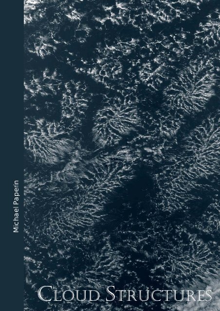
CLOUD STRUCTURES - Brockmann Consult
CLOUD STRUCTURES - Brockmann Consult
CLOUD STRUCTURES - Brockmann Consult

Create successful ePaper yourself
Turn your PDF publications into a flip-book with our unique Google optimized e-Paper software.
Michael Paperin<br />
<strong>CLOUD</strong> <strong>STRUCTURES</strong>
Michael Paperin<br />
<strong>Brockmann</strong> <strong>Consult</strong><br />
Cloud Structures<br />
2010<br />
Since the beginning of the XIX century basic cloud structures observed<br />
from the earth surfaces have been classified by the Englishman Luke<br />
Howard.<br />
In this book an attempt is made to classify clouds seen from above using<br />
ENVISAT MERIS Level 1 RGB images.<br />
The work is concentrating on clouds above the ocean, and the clouds<br />
have been structured according to its visual characteristic features. The<br />
commonalities in their physical characteristics could be established, and<br />
also their occurrence can be linked to certain specific geographical regions<br />
and seasons in many cases. Co-existence as well as metamorphoses<br />
of cloud structures was observed.<br />
© 2009 <strong>Brockmann</strong> <strong>Consult</strong> (BC)<br />
Copy or any reproduction of the materials of this PDF-book: satellites images, diagrams, maps and text requires<br />
written permission by BC beforehand for approval (http://www.brockmann-consult.de/).
Contents<br />
Introdiction . . . . 12<br />
"Convective Cells" Structures<br />
• "Close Cells" Structures (CCS)<br />
- 16 -<br />
• "Open Cells" Structure (OCS)<br />
- 30 -<br />
• "Actinoform" Structure (AFS)<br />
- 41 -<br />
• "Karman Vortex" Structure (KVS)<br />
- 52 -<br />
• "Ship Trails" Structure (STS)<br />
- 59 -<br />
• "Convective Cells" Structures (CUS)<br />
- 67 -<br />
So full of frost, of storm, and cloudiness?<br />
William Shakespeare, "Much Ado About Nothing", Act V, Scene IV
• "Dragon-Looking Cloud"<br />
Structures (DLCS)<br />
- 68 -<br />
• "Hokusai" Phenomenon (HP)<br />
- 73 -<br />
• "Cutting" Phenomenon (CP)<br />
-77 -<br />
• "Convective Cells Streets"<br />
Phenomenon (CCSP)<br />
- 80 -<br />
• "Coast Vortex" Phenomenon<br />
(CVP)<br />
- 85 -<br />
• "Wave over" Phenomenon (WOP)<br />
- 88 -<br />
• Travelling Convective Cells (TCC)<br />
- 91 -<br />
• "Black Hole" Phenomenon (BHP)<br />
- 97 -
• "Outflow Boundary" Structure<br />
(OBS), A Shelf Cloud<br />
• "Cloud Arc" Structure (CAS)<br />
• "Cloud Arc Chain" Structure (CAS)<br />
• "Mesoscale Convective" System<br />
(MCS)<br />
• "Cloud Torch" Structure (CTS)<br />
• "Tropical Cyclone" (TCS)<br />
• "Extratropical Cyclone" Structure<br />
(ETCS)
• "Convection Streets" Structure<br />
(CSS)<br />
• "Peacock Feather Looking"<br />
Structure (CLS)<br />
• "Gravity Waves Cloud" (GWCS)<br />
• "Kelvin Helmholtz Instability"<br />
Cloud Structure (KHICS)<br />
• "Orographic Clouds" (OC)<br />
• Other Interesting Cloud Forms<br />
• Cloud Provinces<br />
Literature
In 2002 ESA launched the ENVISAT satellite equipped with many devices including<br />
MERIS (medium-spectral resolution, imaging spectrometer).<br />
While making visual archive fort this sensor I have happened to witness tens of<br />
thousands of circuits since then. I make 14-15 full turns around the Earth daily and see<br />
the land, seas and oceans as well as the sky with its clouds.<br />
Observing the cloudy cover regularly I noticed that in large areas clouds form structures,<br />
of which appearance and properties may depend on geographic and seasonal elements.<br />
That was how the idea occurred to me to try to somehow systemize what I‘d seen,<br />
especially because I did not manage to find comprehensive papers containing<br />
description of large-scale cloudy structures.<br />
The project “Cloud Structures” was started in 2006 during the preparation period for<br />
the ENVISAT Symposium in Montreux. Using the huge amount of accumulated<br />
information it became possible to single out some over-the-ocean cloud structures and<br />
bring together the available data in a web-page, which saw the light in May, 2007. The<br />
said web-page contains description, a version of origin and a lot a examples for each<br />
cloud structure.<br />
The Cloud Structures project is a dynamic one, meaning that there appear additional<br />
examples of the structures that have already been revealed as well as even new structures<br />
and phenomena.<br />
The picture of the cloudy cover is changeable and never repeats itself. Practically every<br />
circuit allows to discover either some remarkable examples or some new formations. It<br />
is hard to refrain from including such images in the existing collection!<br />
Because cloud structures correlate with atmospheric processes they help to study the<br />
latter, whether already known or new. Thus the efforts to compile a catalogue of cloud<br />
structures are also aimed at arousing scientists’ interest in still incomprehensible<br />
phenomena and providing researchers with examples to facilitate finding explanations.<br />
I am convinced that the picture of the cloudy cover along with a set of cloud structures<br />
defines the Earth to the same extent as the planet is defined by its size, atmospheric<br />
parameters (thickness and chemical composition) and underlying surface. It is even<br />
possible that it defines the current state of the planet’s climate, the 3-cell structure of the<br />
atmosphere (the Hadley cell, the Ferrel cell and the Polar cell), the Earth’s rotating velocity,<br />
slope of axis, etc.<br />
And undoubtedly, to study сloud structures may be important not only for scientific<br />
purposes but also from the point of view of esthetics.<br />
This book (in the PDF format) is based on the existing web-page. Each cloud structure<br />
is illustrated with only several (no more than a dozen) images selected from many tens.<br />
In some cases there are commentaries.<br />
To conclude, I’d like to express my gratitude to my chief Dr. Carsten <strong>Brockmann</strong>, who<br />
made it possible for me to be engaged in this project.<br />
Michael Paperin, Hamburg, Germany<br />
May 2007-August 2009
Introduction 12<br />
Introduction<br />
Hamlet<br />
Do you see yonder cloud that's almost in shape of a camel?<br />
Polonius<br />
By the mass, and 'tis like a camel indeed.<br />
Hamlet<br />
Methinks it is like a weasel.<br />
Polonius<br />
It is backed like a weasel.<br />
Hamlet<br />
Or like a whale.<br />
Polonius<br />
Very like a whale.<br />
William Shakespeare: Hamlet, Prince of Denmark: ACT III. Scene II<br />
Clouds are the most mobile and changeable structure in the aspect of our live planet. Approaching the Earth it is<br />
impossible to look over their deversity, complexity and striking beauty.<br />
The following work is to describe some cloud formations over the ocean as well as present examples of some of<br />
the most frequently found cloud structures.<br />
The work includes the analysis of the notion "a cloud structure" (also known as "a cloud pattern"), the<br />
description of these structures, some of inherent physical parameters thereof, the statistics on allocation and a<br />
wide range of images.<br />
The data that was received during many years from the MERIS - a programmable, medium-spectral resolution,<br />
imaging spectrometer installed on the ESA's satellite ENVISAT served as the source material; the Software<br />
BEAM VISAT developed by the <strong>Brockmann</strong> <strong>Consult</strong>, Germany, was used as the basic tool.<br />
The work was conducted at the <strong>Brockmann</strong> <strong>Consult</strong>, Germany, within the framework of the "Image of the Day"<br />
project.<br />
The Cloud Structures (CS)<br />
While observing the Earth from the height of 500-5000 km it is possible to notice that the cloudy envelope of<br />
the planet is a ranked rather than a chaotic accumulation of clouds as far as it concerns their forms. These forms<br />
either repeat themselves or differ but in any event they reflect definite process taking place in the atmosphere.<br />
The outward appearance of CS remains invariable within a year and on the whole does not depend on their<br />
geographical location.<br />
All this allows to try to unify them on the base of appropriate criteria and thus to speak about the cloud<br />
structures and systemize them.<br />
In this work a "cloud structure" means a compact cloud formation of a distinct spatial form with the dimensions<br />
of more than 10-20 km and reflecting a definite state of the atmosphere and the underlying surface.<br />
Very often some CSs may be associated to these or that geographic realities. Formation and expansion of CSs<br />
also depend on the season. Some CSs consolidate in large mega structures (MCS). Most of CSs are so large, that<br />
to observe them from the surface of the Earth or from one side, for example from the board of an airplane,<br />
means to obtain an incomplete picture.<br />
<strong>Brockmann</strong> <strong>Consult</strong> © 2010
Introduction 13<br />
Observation from above, namely from a satellite, may give the information only about the top layer of the<br />
structure, but at the same time to cover the whole object. To see CSs from all sides would be, of course, the<br />
perfect choice.<br />
The Distinction between Cloud Structures and Clouds<br />
A Cloud Structure usually differs from the clouds that constitute it.<br />
This difference concerns:<br />
the dimensions (a CS is much larger)<br />
the way of interacting with the environment (the CSs effect on the processes in the atmosphere and the<br />
ocean is much more profound than the one of the clouds)<br />
Besides:<br />
CSs may transform in other CSs<br />
the processes taking place within a SC may change its looks in different spots whereas it still keeps its<br />
integrity and houses various kinds of clouds<br />
different CSs may include identical types of clouds.<br />
The clouds constituting CS may serve as markers (an indicator) of the air mass movement. Being structurally<br />
unified they themselves influence the atmospheric phenomena.<br />
Methods<br />
The <strong>Brockmann</strong> <strong>Consult</strong> is one of the receivers of the ESA satellite ENVISAT information.<br />
Since 2002 the MERIS data has been transmitted to the firm and then distributed to the ESA consumers worldwide.<br />
The software developed by <strong>Brockmann</strong> <strong>Consult</strong> processes and collects all arriving fresh data and visualizes<br />
it in real resolution (1120 pixels width, pixel Size 1040m x 1200m), so that the data could be studied just after it<br />
had arrived.<br />
In 2003 an Internet project "Image of the Day" was launched.<br />
According to the said project the whole body of MERIS level 1 data (covering already more than 27000 orbits) is<br />
examined in order to discover interesting nature phenomena, and is then represented as RGB colour pictures.<br />
These colours have near resemblance to natural ones.<br />
Thus certain weather events and cloud structures arrested special attention and were stored as RGB pictures.<br />
In 2006 the systematization of the new as well as of the already existing cloud data started.<br />
As the result the data was stored as JPG pictures and grouped pursuant to its types.<br />
The BEAM VISAT software developed on the <strong>Brockmann</strong> <strong>Consult</strong> allows visualizing and processing both the<br />
MERIS level 1 satellite data and supplementary information.<br />
Fragments of interest will be cut out from whole orbit and visualized e.g. from the TOA radiance band 1<br />
MERIS channel (wavelength: 412.691nm, range 9.937nm) (where the clouds are easily recognized).<br />
They are first possibly contrasted and geographically referenced and then stored, possibly along with the<br />
additional information. The name of the stored file contains the date and the orbit number of the fragment.<br />
The BEAM VISAT software allows to observe the MERIS level 2 data as well.<br />
The values of Cloud top pressure, Cloud albedo and Cloud type index, contained in the MERIS level 2 data, are<br />
important as cloud characteristics.<br />
The Cloud top height can be calculated by the formula<br />
h [km] = -8 * LOGS (cloud_top_press [hPa]/1013).<br />
The type of the clouds contained in a cloud structure is indicated in the ESA Cloud type index table.<br />
Optical thickness<br />
Pressure (hPa)<br />
0 - 3.6 3.6 - 23 23 - 379<br />
50 - 440 135 (Cirrus) Ci 136 (Cirrostratus) Cs 137 (Deep convection) Cb<br />
440 - 680 132 (Altocumulus) Ac 133 (Altostratus) As 134 (Nimbostratus) Ns<br />
680 - 1000 129 (Cumulus) Cu 130 (Stratocumulus) Cs 131 (Stratus) St<br />
<strong>Brockmann</strong> <strong>Consult</strong> © 2010
Introduction 14<br />
An example of the "of the Morning Glory" Cloud<br />
Structure of 2007.02.08, orbit 25836:<br />
• RGB image in the visual 412,691 Nm channel,<br />
• Cloud top height with the Scale in [km],<br />
• Cloud type index with the Scale.<br />
The BEAM VISAT software allows the whole orbit to be projected on the world map (in the case in question<br />
the geographical projection is used). Therefore each cloud structure revealed can be interactively superposed on<br />
the map of the world and geographically referenced. Using the daily MERIS data (14 orbits per day) it is possible<br />
to make up the picture of the global occurrence, season changes and theobservation frequencies of different<br />
cloud structures. This does not only help to describe the cloud structure, but also enables to better understand<br />
the Earth's climate processes.<br />
Examples of observation frequency diagrams (the statistic work is carried on the period of 04.2006-10.06 and<br />
02.07). The darker the point is, the more often observations were made.<br />
"Close Cells" observation diagram for 06.06 "Enhanced Cumulus" observation diagram for 10.06<br />
<strong>Brockmann</strong> <strong>Consult</strong> © 2010
Introduction 15<br />
Data Presentation<br />
To present the most of structures the following data will be offered:<br />
The MERIS level 2 data<br />
Cloud top height [km]<br />
Cloud albedo<br />
Cloud type (the clouds, which are contained in structure)<br />
Statistic data<br />
Global Occurrence<br />
Diagram Observation Diagrams (for some structures)<br />
The physical explanation for a structure emergent<br />
Because the origin and developing of structures is sometimes unclear, the explanation of the<br />
physical nature of a structure emergent is offered only as basis for a discussion.<br />
Pictures of corresponding structure for the time period (mostly) 2006-2009<br />
MERIS level 1 RGB or black-and-white with or without geographical references<br />
The MERIS level 2 can be attached:<br />
cloud top height false colour images<br />
albedo false colour images<br />
cloud type index false colour images<br />
cloud optical thickness false colour images<br />
Cloud anaglyph image (in some cases)<br />
<strong>Brockmann</strong> <strong>Consult</strong> © 2010
Close Cells 16<br />
'Close Cell' Cloud Structure<br />
Convective Cells<br />
‘Close Cell’ Structure (CCS)<br />
<strong>Brockmann</strong> <strong>Consult</strong> © 2010<br />
I tell the day, to please him thou art bright,<br />
And dost him grace when clouds do blot the heaven...<br />
William Shakespeare, Sonnet XXVIII<br />
Some of the CCS are polygonal, round or oval, the others are often stay close to each other and form large fields<br />
up to more than a million square kilometers in size. Occasionally single cells may be discovered. The larger the<br />
cell is, the clearer its borders are (seen as thin lines). Through these lines the sea surface can be watched.<br />
The area extent of an individual cell unit is from several kilometers to one hundred or even more kilometers.<br />
The Cloud top heigh is normally from several hundred meters up to 2÷2.5 km., sometimes 1÷2 km., rarely up to<br />
3÷3.5 km. Albedo is 0.7÷0.8 (up to 0.9).<br />
The 'Close Cell' Cloud Structure may shape:<br />
above areas situated in middle latitudes where the temperature<br />
difference between the sea surface and the troposphere is<br />
little,<br />
at the edge of cyclones vortices in middle latitudes,<br />
above polar seas<br />
The latter structure is the prevailing type. .<br />
It is found (depending on the season) in the latitude of > 30° and
Close Cells 17<br />
<strong>Brockmann</strong> <strong>Consult</strong> © 2010
Close Cells 18<br />
<strong>Brockmann</strong> <strong>Consult</strong> © 2010
Close Cells 19<br />
<strong>Brockmann</strong> <strong>Consult</strong> © 2010
Close Cells 20<br />
<strong>Brockmann</strong> <strong>Consult</strong> © 2010
Close Cells 21<br />
<strong>Brockmann</strong> <strong>Consult</strong> © 2010
Close Cells 22<br />
<strong>Brockmann</strong> <strong>Consult</strong> © 2010
Close Cells 23<br />
<strong>Brockmann</strong> <strong>Consult</strong> © 2010
Close Cells 24<br />
<strong>Brockmann</strong> <strong>Consult</strong> © 2010
Close Cells 25<br />
<strong>Brockmann</strong> <strong>Consult</strong> © 2010
Close Cells 26<br />
<strong>Brockmann</strong> <strong>Consult</strong> © 2010
Close Cells 27<br />
<strong>Brockmann</strong> <strong>Consult</strong> © 2010
Close Cells 28<br />
<strong>Brockmann</strong> <strong>Consult</strong> © 2010
Close Cells<br />
Observation diagrams<br />
29<br />
(the darker the point is, the more often observations were made)<br />
Observation diagram for April 2006 Observation diagram for May 2006<br />
Observation diagram for June 2006 Observation diagram for July 2007<br />
Observation diagram for August 2006 Observation diagram for September 2007<br />
Observation diagram for October 2006 Observation diagram for February 2007<br />
<strong>Brockmann</strong> <strong>Consult</strong> © 2010
Open Cells 30<br />
'Open Cell' Cloud Structure<br />
Convective Cells<br />
‘Open Cell’ Structure (OCS)<br />
<strong>Brockmann</strong> <strong>Consult</strong> © 2010<br />
The clouds methought would open and show riches<br />
Ready to drop upon me; that, when I wak'd ...<br />
William Shakespeare, "The Tempest", Act III, Scene II<br />
An open cell consists of convective clouds, which top reaches only the lower layers of the troposphere.<br />
Within the cell vertical circulation takes place: the streams of the air go up in the zone close to its vertical<br />
borders (the cell sides) and then go down in an "empty place" (in the middle of the cell where there are almost no clouds).<br />
Seen from above, an open cell ideally looks like a hexagon with the sides formed by rising clouds.<br />
However, a separate cell can be found quite seldom; they usually make up fields that ideally look (from above)<br />
like honeycomb and in reality resemble chain amour.<br />
The size of a cell is up to 70 km (not rarely up to 100 km).<br />
The cloud top height of a cell is 1.5-2.5 km, (sometimes up to 3 km).<br />
The cloud top height of Enhanced Cumulus Clouds is up to 4-6 km,<br />
(rather often up to 7 km).<br />
Accordingly albedo increases from ~0.5 to ~0.8 (and even to 0.85).<br />
Space pictures often enable to see open and close cells sharing one<br />
and the same cloud field.<br />
Open cells are present in convection cells cloud streets that in most<br />
cases emerge as the result of strong cold wind blowing over polar seas.<br />
The Enhanced Cumulus Clouds represent a particular kind of the open sells.<br />
They form above polar seas and seas in the middle latitudes as the season may be.<br />
The cold air moving over the sea surface heats from below as its temperature is lower than that one of the water.<br />
As the result of this heating there appears instability in the surrounding atmosphere and the warm masses of the<br />
air go up, cooling.<br />
The condensation goes with the release of latent heat that<br />
holds the vertical streams. Owing to the cooling of the air<br />
that is being raised this support is accompanied with the<br />
enhancement of condensation. From the upper layers of<br />
the atmosphere the cold dry air is going down towards the<br />
rising stream. That is why the movement upward is limited<br />
in the convective cells and in some time there appears the<br />
balance between the rising and descending streams of the<br />
air. As the result large fields of cold cells emerge often<br />
causing a great amount of precipitation.<br />
In the upper level of outlet channel inside cold air masses following the cold front under strong wind caused by<br />
the instability in the atmosphere the sides of the cell perpendicular to the direction of the wind become higher<br />
and (when seen from above) thicker. Not seldom such an effect occurs in the cold areas on the backside of large<br />
cyclone swirls.<br />
Examples.
Open Cells 31<br />
<strong>Brockmann</strong> <strong>Consult</strong> © 2010
Open Cells 32<br />
<strong>Brockmann</strong> <strong>Consult</strong> © 2010
Open Cells 33<br />
<strong>Brockmann</strong> <strong>Consult</strong> © 2010
Open Cells 34<br />
<strong>Brockmann</strong> <strong>Consult</strong> © 2010
Open Cells 35<br />
<strong>Brockmann</strong> <strong>Consult</strong> © 2010
Open Cells 36<br />
<strong>Brockmann</strong> <strong>Consult</strong> © 2010
Open Cells 37<br />
<strong>Brockmann</strong> <strong>Consult</strong> © 2010
Open Cells 38<br />
<strong>Brockmann</strong> <strong>Consult</strong> © 2010
Open Cells 39<br />
<strong>Brockmann</strong> <strong>Consult</strong> © 2010
Open Cells<br />
Observation diagrams<br />
(the darker the point is, the more often observations were made)<br />
40<br />
Observation diagram for April 2006 Observation diagram for May 2006<br />
Observation diagram for June 2006 Observation diagram for July 2007<br />
Observation diagram for August 2006 Observation diagram for September 2007<br />
Observation diagram for October 2006 Observation diagram for February 2007<br />
<strong>Brockmann</strong> <strong>Consult</strong> © 2010
Actinoform 41<br />
'Actinoform' Cloud Structure<br />
"Convective Cells"<br />
"Actinoform" Structure (AFS)<br />
<strong>Brockmann</strong> <strong>Consult</strong> © 2010<br />
Clouds and eclipses stain both moon and sun,<br />
And loathsome canker lives in sweetest bud.<br />
William Shakespeare, Sonnet XXXV<br />
The Actinoform Structure (named after the Greece actinos, a beam) may have two forms:<br />
• round or oval cloud formation where there appear to be radial symmetry and sometimes even helical<br />
motion. These formations, when seen from high above, resemble veins of a leaf. In this case the dimension<br />
of the structure is from 80 to 400 km (seldom more).<br />
• long (up to thousands of kilometres)<br />
bands that consist of "accrete" cells.<br />
When seen from above this structure looks<br />
like a huge centipede with well-marked spine<br />
and multiple ribs.<br />
In this event the width of the band is 70-120<br />
km, and the length is from several hundreds<br />
to 1-1.5 thousand (or even more) km.<br />
The cloud top height is from 0.6 - to 2 km,<br />
seldom to 2.5.<br />
It is interesting to note that according to the<br />
new MERIS Level 2 data the cloud top<br />
height in the centre of round structures (as well as the "spine" of the band structures) is always 300-700 m lower<br />
than the cloud top height of the clouds located in the periphery of the structures.<br />
The Actinoform Structure emerges at the border of the fields of the open and close convective cells using the<br />
open convective cells as the substrate.<br />
Large (from ~200 km) round/oval structures may attract<br />
neighbouring closed convective cells. Segregating they may<br />
later on form isolated (located outside the fields that have<br />
created them) vast elements in which the general<br />
circulation seems to be similar to that one that takes place<br />
in open convective cells. Such structures often separate<br />
from the convective cells that have created them and exist<br />
on its own, sometimes revolving around its own centre,<br />
even forming an "eye".<br />
On their part the band structures also demonstrate<br />
sufficient stability and segregate along the low-level<br />
streams of the air most often in parallel with the equator.<br />
The Actinoform Structure mainly consists of stratocumulus<br />
clouds; quite often there are stratus clouds along the ridge of the "ribs" and small cumulus - in their<br />
periphery.
Actinoform 42<br />
Actinoform Structures are not seen frequently, though they can be seen quite often.<br />
They can be observed where there are large fields of open and close convective cells: mostly over East Pacific<br />
not far from the Peruvian cost, as well as not far from the Atlantic coast of Brazil and above the Indian Ocean<br />
close to the coast of Western Australia.<br />
According to some weather reports the clouds of these structures are the source of drizzle.<br />
Not often it is possible to watch large (up to 600 - 700 km) cloud structures bearing some similarities to the<br />
Actinoform structure and undergoing dissociation (possibly the increase of the dimension causes the structural<br />
instability). It is hard to say exactly if such enormous formations belong to the Actinoform structure, because<br />
there is no valid physical description of this structure yet.<br />
Examples.<br />
<strong>Brockmann</strong> <strong>Consult</strong> © 2010
Actinoform 43<br />
<strong>Brockmann</strong> <strong>Consult</strong> © 2010
Actinoform 44<br />
<strong>Brockmann</strong> <strong>Consult</strong> © 2010
Actinoform 45<br />
<strong>Brockmann</strong> <strong>Consult</strong> © 2010
Actinoform 46<br />
<strong>Brockmann</strong> <strong>Consult</strong> © 2010
Actinoform 47<br />
<strong>Brockmann</strong> <strong>Consult</strong> © 2010
Actinoform 48<br />
<strong>Brockmann</strong> <strong>Consult</strong> © 2010
Actinoform 49<br />
<strong>Brockmann</strong> <strong>Consult</strong> © 2010
Actinoform 50<br />
<strong>Brockmann</strong> <strong>Consult</strong> © 2010
Actinoform 51<br />
<strong>Brockmann</strong> <strong>Consult</strong> © 2010
Karman Vortex 52<br />
'Karman Vortex' Cloud Structure<br />
"Convective Cells"<br />
"Karman Vortex" Cloud Structure (KVS)<br />
<strong>Brockmann</strong> <strong>Consult</strong> © 2010<br />
But out, alack, he was but one hour mine,<br />
The region cloud hath mask'd him from me now.<br />
William Shakespeare, Sonnet XXXIII<br />
The clouds of this structure look like a set of organized turbulences within the layer of "Close Cells" structure<br />
that normally consist of Stratocumulus and<br />
Stratus clouds.<br />
Each swirl turns (seen from above) in the<br />
clockwise direction on the left side of the<br />
thereby formed cloud street and against the<br />
clockwise direction on the right side.<br />
This structure emerges usually above the sea<br />
surface if the temperature of the cold air<br />
gradually rises.<br />
This leads to the strong flowing constant wind, which blows on the lower level.<br />
If the wind has a significant barrier in the wind direction (normally a hilly island with the summit that raises<br />
some of meter more highly than the cloud top height of the surrounding cloud layer), can a turbulence street<br />
form.<br />
The further away the barrier the turbulences spread, the<br />
bigger they appear.<br />
Cloud top height and the other parameters do not differ<br />
from parameters of the surrounding convective cloud<br />
structure.<br />
This phenomenon is well-known as Karman vortex or<br />
Karman turbulences. (Theodore von Kármán [1881-1963] was<br />
a Hungarian engineer. He is considered as a pioneer of the<br />
modern aerodynamics and the aviation research.)<br />
During the observation period this structure was seen only<br />
in few places: at most above Canarias, Cabo Verde islands<br />
and over Aleutian and Kuril islands, in addition, above<br />
Cheju, Guadalupe, January Mayen, Alexander Selkirk, Heard and some other islands.
Karman Vortex<br />
Examples.<br />
53<br />
<strong>Brockmann</strong> <strong>Consult</strong> © 2010
Karman Vortex 54<br />
<strong>Brockmann</strong> <strong>Consult</strong> © 2010
Karman Vortex 55<br />
<strong>Brockmann</strong> <strong>Consult</strong> © 2010
Karman Vortex 56<br />
<strong>Brockmann</strong> <strong>Consult</strong> © 2010
Karman Vortex 57<br />
<strong>Brockmann</strong> <strong>Consult</strong> © 2010
Karman Vortex 58<br />
<strong>Brockmann</strong> <strong>Consult</strong> © 2010
Ship Trails 59<br />
'Ship Trails' Cloud Structure<br />
"Convective Cells"<br />
<strong>Brockmann</strong> <strong>Consult</strong> © 2010<br />
But to the brightest beams<br />
Distracted clouds give way...<br />
William Shakespeare, Alls Well That Ends Well, Act V, Scene III<br />
"Ship Trails" Structure (STS)<br />
"Ship trails" cloud structure consists of stratocumulus (and at its<br />
edge of low cumulus) cloud lines.<br />
Clouds of this structure, embedded in a layer of small and low<br />
stratus and stratocumulus clouds (which build a convective cells<br />
structure), can be observed above a sea areas.<br />
The dimension of such cloud lines reaches as much as 30 km<br />
width (sometimes up to 50 km) and up to 1000 km (and more)<br />
length.<br />
Cloud top height does not exceed the height of 1-2km, and the<br />
albedo is in the range 0.3-0.6.<br />
It is supposed that this structure has an artificial origin, because it is connected with the navigation of vessels.<br />
In the image of visible range it has the higher brightness than the surrounding low clouds, however it can not be<br />
recognized in the infrared picture, because the cloud top height are low.<br />
The moving ships give off the fine particles (also called aerosols) and warm exhaust steam.<br />
In a cool and humid atmospheric layer, which is connected with a high-pressure system, these particles become a<br />
condensation nucleus of clouds, absorb the humidity and produce the bright clouds. Those consist of the small<br />
droplets.<br />
The small droplets reflect more lights (within the visible<br />
range) than large droplets, therefore the clouds of "Ship<br />
trails" structure have the higher brightness than the<br />
surrounding convective cells clouds.<br />
However within the infrared range they can be only badly<br />
recognized, because the cloud top height is low and<br />
accordingly warm.<br />
The "Ship trails" cloud structure can be observed mostly<br />
over North Pacific (close to the west coast of the USA,<br />
Aleuts, Kamchatka and northeast coast of Japan) as well as<br />
over North Atlantic (west coast of Europe, east coast of<br />
Newfoundland), rarely - not far from the Peruvian and<br />
Chile coast, coast of Namibia, Tasman Sea.
Ship Trails<br />
Examples.<br />
60<br />
<strong>Brockmann</strong> <strong>Consult</strong> © 2010
Ship Trails 61<br />
<strong>Brockmann</strong> <strong>Consult</strong> © 2010
Ship Trails 62<br />
<strong>Brockmann</strong> <strong>Consult</strong> © 2010
Ship Trails 63<br />
<strong>Brockmann</strong> <strong>Consult</strong> © 2010
Ship Trails 64<br />
<strong>Brockmann</strong> <strong>Consult</strong> © 2010
Ship Trails 65<br />
<strong>Brockmann</strong> <strong>Consult</strong> © 2010
Ship Trails 66<br />
<strong>Brockmann</strong> <strong>Consult</strong> © 2010
Cloud Curls 67<br />
'Cloud Curls' Cloud Structure<br />
<strong>Brockmann</strong> <strong>Consult</strong> © 2010<br />
Agrippa<br />
He has a cloud in's face<br />
William Shakespeare,<br />
The Tragedy of Antony and Cleopatra, Act III, Scene II<br />
"Convective Cells"<br />
"Cloud Curls" Structure (CUS)<br />
Cloud Structures tentatively called Cloud Curls occur rather seldom and mainly above circumpolar waters, most<br />
often above the waters situated close to the Antarctic.<br />
Cloud Curls emerge within cloud fields from Stratus and/or Stratocumulus clouds. They usually appear in<br />
groups. The size of each curl varies from 40 to 80 km, rarely from 20-30 km to 120-140 km. Quite often the<br />
Cloud Curls top is a little bit lower than the surrounding cloud field top, and the curls themselves have an outer<br />
border which is well marked and clearly seen. An interesting peculiarity of this structure is that the top of the<br />
curls' center is often lower than the top of their bulk (forming some kind of a funnel-like relief) and has a greater albedo.<br />
The types of cloudiness within cloud curls (according to the values resulted from the processed MERIS level 2<br />
data) are usually Stratocumulus (on the rims) and Stratus<br />
(toward the centre of the structure).<br />
The nature of the rise of such a structure is not clear.<br />
It is possible to assume that the discrepancy in the<br />
temperature of the sea surface beneath the cloud cover<br />
may stipulate for the initiation of local winds. These winds<br />
interacting with the prevailing mesoscale wind and<br />
experiencing the Coriolis effect (the cloud curls twist in<br />
one and the same direction depending on the hemisphere,<br />
and there are no swirls less than 15-20 km in size), which<br />
becomes stronger as the cloud approaches the Poles, may<br />
form swirls.<br />
The cold air is drawn out from upper atmosphere layers<br />
into these swirls, cooling them.<br />
As the result the swirls go down compared with the surrounding cloud field. Cold heavy air that amasses in the<br />
center of the funnel cools the remaining clouds, besides the reduction of pressure leads to the rise of the icepoint,<br />
so that ice crystals appear (which is accompanied by the increase of their albedo), and pushes them more downward.
Dragon-looking Clouds 68<br />
'Dragon-looking Cloud' Structure<br />
<strong>Brockmann</strong> <strong>Consult</strong> © 2010<br />
Puck<br />
For night's swift dragons cut the clouds full fast...<br />
William Shakespeare,<br />
A Midsummer Night's Dream , Act III, Scene II<br />
"Dragon-Looking Cloud" Structure (DLCS)<br />
The "Dragon Eye" structure was so called because I discovered this name on the NASA Visible Earth web page.<br />
It would be natural to suppose that the warm streams of air go upward, "breaching" a layer of stratocumulus<br />
clouds, where ice crystals fluffy cloud with great albedo further (increasing in the height) appear.<br />
At the same time the cold dry air moves downward, surrounding the warm "column" along its perimeter and<br />
breaching the layer of stratocumulus clouds from above, driving away clouds.<br />
However the MERIS Level 2 data show that the upper board of the clouds (the so called 'eye"), is not located<br />
over the upper boarder of the surrounding cloud field.<br />
It has been tried to solve this problem studying the shadows as the Sun in polar latitudes is not too high in the<br />
sky and objects cast long shadows. Unfortunately it did not bring good results, though no long shadows was<br />
seen.<br />
While exploring the structures tentatively called "Cloud<br />
Curls" (and later "Dragon Eye") by means of the<br />
processed MERIS Level 2 data I paid my attention to<br />
the unusual configuration of the upper board of the<br />
curls.<br />
As the MERIS Level 2 shows, the structures are downdirected<br />
funnels and the clouds located in center and<br />
underneath have great albedo.<br />
The examples are as follows:<br />
Part "Cloud Curls"<br />
20061224_25182.jpg<br />
20060201_20514.jpg<br />
So it may be assumed that<br />
the situation is not always<br />
covered with the model<br />
used to develop Level 2<br />
data in which case the data<br />
do not reflect the reality.<br />
On the other hand, if it<br />
works in the right way, it<br />
is hard to explain the<br />
phenomena I told you<br />
about. And I myself am<br />
not completely satisfied
Dragon-looking Clouds 69<br />
with these reasons of my own explanations.<br />
Studying the "Dragon-Looking Cloud - Dragon Eye" structures I discovered the same situation.<br />
Here are the examples:<br />
Part "Dragon-Looking Cloud"<br />
20050105_14904.jpg<br />
20070205_25798.jpg<br />
The structure could be rare observed above sea surface in Polar Regions.<br />
The "Dragon Looking Cloud" Structures tentatively was called like this, because they are often the neighbours of<br />
"Dragon Eye" structures. In addition this kind of cloud<br />
with its chaotic, turbulent, irregular shape can remind of<br />
dragon. Of course it is a very free definition, which does<br />
not base on certain physical phenomenon.<br />
The structure could be observed above cold water in Polar<br />
Regions.<br />
The Coriolis Effect works relatively strongly in these<br />
widths. Vertical air flows can be formed above the warm<br />
sea areas. In cooperation with local winds many small<br />
vortices from small convective cloud cells can develop<br />
there.<br />
The neighbours of "Dragon Looking Cloud" Structures are<br />
quite often spacious layers of stratocumulus clouds and<br />
"Cloud Curls" Structures.<br />
"Dragon Looking Cloud" Structures are not seen frequently, though they can be seen quite often.<br />
20061224_25182<br />
<strong>Brockmann</strong> <strong>Consult</strong> © 2010
Dragon-looking Clouds 70<br />
20060201_20514<br />
<strong>Brockmann</strong> <strong>Consult</strong> © 2010
Dragon-looking Clouds 71<br />
20050105_14904<br />
<strong>Brockmann</strong> <strong>Consult</strong> © 2010
Dragon-looking Clouds 72<br />
20070205_25798<br />
<strong>Brockmann</strong> <strong>Consult</strong> © 2010
'Hokusaj' Phenomenon 73<br />
'Hokusai' Phenomenon<br />
"Convective Cells"<br />
<strong>Brockmann</strong> <strong>Consult</strong> © 2010<br />
Someone passes,<br />
And while I wonder<br />
if it is he,<br />
The midnight moon<br />
is covered with clouds.<br />
Murasaki Shikibu (974-1031), translation by D. Russell<br />
"Hokusai" Phenomenon (HP)<br />
The pictures, where the phenomenon can be observed, remind me of some works of famous Japanese painter<br />
K.Hokusai (Katsushika Hokusai (1760-1849)). Therefore the phenomenon was tentatively called after his name.<br />
The vertical layers with irregular arc-like edges are characteristic for this phenomenon.<br />
It can be assumed that the phenomenon is connected with cold air currents sinking downward.<br />
Above maritime stratokumulus clouds a cold inversion layer lies. The cold air sinks from this layer downward<br />
through the underlying borders between convective close cells and produces sharp picturesque "Hokusai" edges.<br />
Although the vertical coexisted layers have often different albedo, its cloud top height (within the given methods<br />
accuracy and device resolution) remains the same. This phenomenon can be rarely observed over polar seas.
'Hokusaj' Phenomenon 74<br />
<strong>Brockmann</strong> <strong>Consult</strong> © 2010
'Hokusaj' Phenomenon 75<br />
<strong>Brockmann</strong> <strong>Consult</strong> © 2010
'Hokusaj' Phenomenon 76<br />
<strong>Brockmann</strong> <strong>Consult</strong> © 2010
'Cutting' Phenomenon 77<br />
'Cutting' Phenomenon<br />
"Convective Cells"<br />
<strong>Brockmann</strong> <strong>Consult</strong> © 2010<br />
In the summer night<br />
The evening still seems present,<br />
But the dawn is here.<br />
To what region of the clouds<br />
Has the wandering moon come home?<br />
Kiyohara no Fukayabu<br />
"Cutting" Phenomenon (CP)<br />
This phenomenon looks (seen from above) like a sharp border between the field of convective close cells and<br />
usually cloudless sky.<br />
The border is more often a straight line, sometimes a bend-like one.<br />
As a result large close cells are often cut off like a solid substance in the middle.<br />
It can be supposed that the phenomenon is caused by the movement of the inversion layer.<br />
The straight-line or curved front of cold inversion layers will be printed downward and prevents the existence of<br />
the cloud cells. Cold air flows downward.<br />
The mentioned downward pressure can be affected by a high-pressure area or by a low frequencies oscillation in<br />
inversion layer.<br />
The phenomenon could be usually observed above cold waters of south and west Pacific and south Atlantic<br />
where there are close cells fields, but not often.<br />
It could be observed also over the land.
'Cutting' Phenomenon 78<br />
<strong>Brockmann</strong> <strong>Consult</strong> © 2010
'Cutting' Phenomenon 79<br />
<strong>Brockmann</strong> <strong>Consult</strong> © 2010
'Convection Cell Streets' Phenomenon 80<br />
'Convection Cells Streets' Phenomenon<br />
"Convective Cells"<br />
<strong>Brockmann</strong> <strong>Consult</strong> © 2010<br />
See how clear and bright<br />
Is the moonlight finding ways<br />
Through the riven clouds<br />
That, with drifting autumn wind,<br />
Gracefully float in the sky.<br />
Sakyo no Daibu Akisuke<br />
"Convection Cells Streets" Cloud Phenomenon (CCSP)<br />
The organization of the clouds in "streets" can be<br />
explained by the existence of the horizontal role<br />
turbulences in the boundary layer.<br />
The clouds are formed in the upper layer of this roll<br />
system.<br />
If outbreaks of the continental cold dry air spread<br />
above a neighbouring relatively warm ocean, the<br />
cloud streets can be seen.<br />
This takes place frequently behind a cold front.<br />
If the cool air leaves the land or ice surface, its<br />
properties changes by vertical transfer of the heat<br />
and humidity of the underlying water surface.<br />
An inversion layer is formed and its basis rises with the<br />
distance from the coast.<br />
The transformation of air mass leads finally to the<br />
formation of the clouds, that, under certain circumstances,<br />
the shape of the cloud streets assumes, and develops<br />
approximately parallel to the wind direction.<br />
Further the streets develop to the three-dimensional<br />
opened cells.<br />
Near the upper-trough the convection is enhanced and<br />
Enhanced Cumulus becomes to form.<br />
These structures can be often observed in spring and<br />
winter above polar waters, in addition, above cold water of<br />
middle latitudes (s. illustration below).
'Convection Cell Streets' Phenomenon 81<br />
<strong>Brockmann</strong> <strong>Consult</strong> © 2010
'Convection Cell Streets' Phenomenon 82<br />
<strong>Brockmann</strong> <strong>Consult</strong> © 2010
'Convection Cell Streets' Phenomenon 83<br />
<strong>Brockmann</strong> <strong>Consult</strong> © 2010
'Convection Cell Streets' Phenomenon 84<br />
<strong>Brockmann</strong> <strong>Consult</strong> © 2010
'Coast Vortex' Phenomenon 85<br />
'Coast Vortex' Phenomenon<br />
"Convective Cells"<br />
<strong>Brockmann</strong> <strong>Consult</strong> © 2010<br />
As banked clouds<br />
are swept apart by the wind,<br />
at dawn the sudden cry<br />
of the first wild geese<br />
winging across the mountains.<br />
Saigyo (1118-1190), translated by S. Hiroaki<br />
"Coast Vortex" Phenomenon (CVP)<br />
The phenomenon, which was tentatively called "coast vortex", can be observed in the form of medium sized<br />
(20-150km) low cloud eddies over the water in the frontier "sea-country".<br />
During the observations of "coast vortex" phenomena it was noticed that over the neighbouring country is<br />
nearly always clear. This could refer to high pressure area.<br />
It is (in cases of "coast vortex") not rare that the neighbouring country has rather mountainous coast area.<br />
The cause of the emergence "coast vortex" phenomena could be the following.<br />
In a high pressure area above a land (not rare - above a high land) the mass of dry air sinks toward the earth's<br />
surface and flow finally apart.<br />
There are hardly large convective cloud cells above the<br />
neighbouring sea area.<br />
If in this area the winds in the land direction occur, they<br />
force to move the clouds in same direction.<br />
However it is obstructed by conditions dominant over the<br />
country. The eddy can appear by air friction.<br />
It could be the other reason: cold land air masses heat up<br />
over the water and rise.<br />
The wind over the water affects the upward rise. The<br />
Coriolis Effect veers the clouds into appropriate direction.<br />
The phenomenon is to be observed rarely and only in<br />
certain places with mostly more highly coastal area.<br />
Sometimes it occurs above large bays, where developing<br />
eddies flows the coastal line around.
'Coast Vortex' Phenomenon 86<br />
<strong>Brockmann</strong> <strong>Consult</strong> © 2010
'Coast Vortex' Phenomenon 87<br />
<strong>Brockmann</strong> <strong>Consult</strong> © 2010
'Wave over' Phenomenon 88<br />
'Wave over' Phenomenon<br />
"Convective Cells"<br />
<strong>Brockmann</strong> <strong>Consult</strong> © 2010<br />
Let the winds of heaven<br />
Blow through the paths among the clouds<br />
And close their gates.<br />
Then for a while I could detain<br />
These messengers in maiden form.<br />
Sojo Henjo<br />
"Wave over" Phenomenon (WOP)<br />
The wavelike convective close cells structures were tentatively defined as "Wave over" structures.<br />
The "gravity waves" can appear when the relatively stable and stratified air masses are disturbed by a vertical<br />
trigger from the overlying (or underlying) environment.<br />
The inversion layer (sudden increase of the temperature with the height), which lies a little bit higher than<br />
convective close cells field, and is affected by gravity waves, has an effect on the underlying calm layer of<br />
convective clouds in such a way that those reflect the wave picture.<br />
The wave front shows often arc-like or nearly straight-line structures.<br />
The "Wave over" structures are not seen frequently.<br />
They can be observed mostly over Southeast Atlantic close to the West Africa coast, around the sound coast of<br />
South America, over North Atlantic and Northwest of Indian Ocean.
'Wave over' Phenomenon 89<br />
<strong>Brockmann</strong> <strong>Consult</strong> © 2010
'Wave over' Phenomenon 90<br />
<strong>Brockmann</strong> <strong>Consult</strong> © 2010
Travelling Convective Cells 91<br />
Travelling Convective Cells<br />
"Convective Cells"<br />
<strong>Brockmann</strong> <strong>Consult</strong> © 2010<br />
The “Cloud-Bird”<br />
Maya Emblem Glyph<br />
http://decipherment.wordpress.com/page/2/<br />
"Travelling Convective Cells" (TCC)<br />
The clouds of this structure emerge probably from “Close Cell” cloud structure.<br />
If the assumption is correct, these cloud form demonstrate certain stability, while they depart from with the<br />
wind Close Cells field.<br />
It is not clear, whether there are only the clouds back of convective cells, or the whole convective cells travels<br />
also. In any case some metamorphoses, which happen with clouds, are to be observed.<br />
The large (up to 300 km) separate (if they are emerged from the CCS) cells, which are outlasted the dissolution<br />
process, are usually covered with the ravines.<br />
It could be accepted that they developed from the cold air flows, which flow downward from the summit of the<br />
cloud form.<br />
Cold dry air drives the water vapour out to lower warmer layers, so that the ravines become finally deep enough<br />
and the clouds among them disappear completely.<br />
The remnants in form of mountain combs “live” still longer, after that they will smaller and finally dissolve.<br />
Elements of this structure are seasonally observed as single, but also in groups. Sometimes they go more than<br />
thousands of kilometres away from their sources.<br />
They are observed over the warm latitudes.<br />
In east Pacific in a strip of ±40° above equator,<br />
In west Pacific above [+15°, +40°] and [- 15°, - 40°],<br />
In Atlantic above [+5°, +40°] and [+2°, -40°],<br />
In Indian ocean above [- 2°, -40°].<br />
Sometimes it is nevertheless very difficult to say, where<br />
they came from, which field of “Close Cell” cloud could be<br />
the source for it.<br />
This refers to the fact that some travel cells can have<br />
another origin than “Close Cell” cloud structure.<br />
In this sense the “Mid-Atlantic Amazon Cloud Province”<br />
[in a rectangle with coordinates top-left (+30°, -55°) ÷<br />
down-right (+5°, -40°)] is particularly interesting.<br />
There the “travel cells” are seasonally observed as the knots of a regular net. They are relatively small (starting<br />
from 30 km), have a star-like shape and dissolve fast. It is not clear, where they are come from.<br />
The “travel convective cells” form also the season-conditioned “Coral Sea Cloud Province”.
Travelling Convective Cells 92<br />
<strong>Brockmann</strong> <strong>Consult</strong> © 2010
Travelling Convective Cells 93<br />
<strong>Brockmann</strong> <strong>Consult</strong> © 2010
Travelling Convective Cells 94<br />
<strong>Brockmann</strong> <strong>Consult</strong> © 2010
Travelling Convective Cells 95<br />
<strong>Brockmann</strong> <strong>Consult</strong> © 2010
Travelling Convective Cells 96<br />
Observation diagrams<br />
Observation diagram for April-May 2006 Observation diagram for June-August 2006<br />
Observation diagram for September-October 2006 Observation diagram for February 2007<br />
Observation diagram for all mentioned months<br />
<strong>Brockmann</strong> <strong>Consult</strong> © 2010
'Black Hole' Phenomenon 97<br />
'Black Hole' Phenomenon<br />
"Convective Cells"<br />
<strong>Brockmann</strong> <strong>Consult</strong> © 2010<br />
Miranda<br />
The sky, it seems, would pour down stinking pitch,<br />
But that the sea, mounting to th' welkin's cheek,<br />
Dashes the fire out.<br />
William Shakespeare, The Tempest, Act I, Scene II<br />
"Black Holel" Phenomenon (BHP)<br />
The absence of cloudiness within Convective Close Cells structures was tentatively defined as a "Cloud Black<br />
Hole" phenomenon.<br />
Such cloudlessness may be explained by anticyclone developments (which is proved by the near surface wind<br />
direction around the "black hole").<br />
Such phenomenon may occur in the area above masses of cold water where cold dry air rushes out from the<br />
upper layers of the atmosphere, driving away the cloud cells in its way.<br />
The holes are usually round or oval, but their shape is often irregular, "lacerated".<br />
This phenomenon mainly emerges within low small-cells convective cells structures in the circumpolar regions<br />
above water surface, mostly above the waters situated close to the Antarctic.<br />
The edges of black holes usually make up small closed convective cells, nearly dissolved in the air.<br />
The holes may be several dozens of kilometres in size or much larger - up to several hundreds of km.<br />
Cloud black holes do not emerge often in the atmosphere.
'Black Hole' Phenomenon 98<br />
<strong>Brockmann</strong> <strong>Consult</strong> © 2010
'Black Hole' Phenomenon 99<br />
<strong>Brockmann</strong> <strong>Consult</strong> © 2010
'Black Hole' Phenomenon 100<br />
<strong>Brockmann</strong> <strong>Consult</strong> © 2010