A Sourcebook for the Use of the FGAN Tracking and Imaging Radar ...
A Sourcebook for the Use of the FGAN Tracking and Imaging Radar ...
A Sourcebook for the Use of the FGAN Tracking and Imaging Radar ...

Create successful ePaper yourself
Turn your PDF publications into a flip-book with our unique Google optimized e-Paper software.
A <strong>Sourcebook</strong> <strong>for</strong> <strong>the</strong> <strong>Use</strong> <strong>of</strong> <strong>the</strong> <strong>FGAN</strong><br />
<strong>Tracking</strong> <strong>and</strong> <strong>Imaging</strong> <strong>Radar</strong> <strong>for</strong> Satellite <strong>Imaging</strong><br />
Version <strong>of</strong> 2012-04-22<br />
Additional material <strong>for</strong> this sourcebook would be welcome.<br />
Please send it to thomsona@flash.net
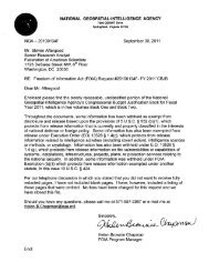
Welcome to FHR<br />
http://www.fhr.fgan.de/fhr/fhr_en.html<br />
The <strong>FGAN</strong> Research Institute <strong>for</strong> High Frequency Physics <strong>and</strong> <strong>Radar</strong> Techniques (FHR) is located on<br />
<strong>the</strong> sou<strong>the</strong>rn boundary <strong>of</strong> North Rhine-Westphalia, on <strong>the</strong> slopes <strong>of</strong> <strong>the</strong> Wachtberg near Bonn. Its<br />
conspicuous characteristic is <strong>the</strong> "Kugel" (ball), <strong>the</strong> world´s largest radome with a diameter <strong>of</strong> 49<br />
metres, which houses <strong>the</strong> space observation radar TIRA (tracking <strong>and</strong> imaging radar).<br />
The <strong>FGAN</strong> premises in Wachtberg near Bonn<br />
At <strong>the</strong> institute, concepts, methods <strong>and</strong> systems <strong>of</strong> electromagnetic sensors are developed, particularly<br />
in <strong>the</strong> field <strong>of</strong> radar, jointly with novel signal processing methods <strong>and</strong> innovative technology from <strong>the</strong><br />
microwave to <strong>the</strong> lower Terahertz region.<br />
The institute´s competency, which is manifested by <strong>the</strong> highly complex experimental systems<br />
developed <strong>and</strong> maintained in-house, covers almost every aspect <strong>of</strong> modern radar techniques. Thus it<br />
secures <strong>the</strong> national counseling <strong>and</strong> judgment ability in <strong>the</strong> field <strong>of</strong> military technology.<br />
In view <strong>of</strong> <strong>the</strong> changes in politics <strong>and</strong> society, <strong>the</strong> institute is setting itself up <strong>for</strong> opening also to<br />
civilian applications <strong>of</strong> electromagnetic sensors. FHR is preparing to accept orders from <strong>the</strong> civilian<br />
sector.
At <strong>the</strong> end <strong>of</strong> 2004, FHR had 157 employees, 56 <strong>of</strong> which were scientists with a university degree. The<br />
annual budget at present is about 11 million Euro, discounting <strong>the</strong> partial costs <strong>for</strong> <strong>FGAN</strong><br />
administration.<br />
With its TIRA facility, several anechoic chambers <strong>for</strong> measuring electromagnetic fields, extensive<br />
technology centres <strong>for</strong> analogue <strong>and</strong> digital printed circuit boards, <strong>and</strong> RF measurement capability up<br />
to 600 GHz, <strong>the</strong> institute <strong>of</strong>fers excellent possibilities not only <strong>for</strong> developing modern electromagnetic<br />
sensor systems, but also <strong>for</strong> training technical <strong>and</strong> scientific personnel.<br />
FHR is cooperating with universities <strong>and</strong> colleges; scientists <strong>of</strong> <strong>the</strong> institute hold teaching positions,<br />
doctoral <strong>and</strong> diploma <strong>the</strong>ses covering topics <strong>of</strong> <strong>the</strong> institute are written <strong>and</strong> supervised here. The<br />
cooperation with universities aids in positioning <strong>the</strong> institute on <strong>the</strong> cutting edge <strong>of</strong> research <strong>and</strong> helps<br />
in recruiting qualified personnel.<br />
Head:<br />
Pr<strong>of</strong>. Dr.-Ing. Joachim Ender<br />
Address:<br />
<strong>FGAN</strong>-FHR<br />
Neuenahrer Str. 20<br />
53343 Wachtberg<br />
Germany<br />
Tel.: +49 228 9435-227<br />
Fax: +49 228 9435-627<br />
E-Mail: fhr@fgan.de
http://www.fgan.de/fgan/<br />
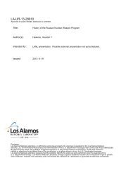
Das <strong>FGAN</strong>-Gelände in Wachtberg bei Bonn
http://www.fgan.de/fgan/fgan_c13_en.html
Google Earth Image<br />
Dome Coordinates 50.6165 N, 7.1295 E
http://www.fhr.fgan.de/fhr/fhr_c589_en.html<br />
The High Power <strong>Radar</strong> System TIRA<br />
The TIRA system (photo montage)<br />
The <strong>Tracking</strong> & <strong>Imaging</strong> <strong>Radar</strong> (TIRA) system serves as <strong>the</strong> central experimental facility <strong>for</strong> <strong>the</strong><br />
development <strong>and</strong> investigation <strong>of</strong> radar techniques <strong>for</strong> <strong>the</strong> detection <strong>and</strong> reconnaissance <strong>of</strong> objects in<br />
space, <strong>and</strong> to a certain degree also <strong>of</strong> air targets. <strong>Radar</strong> techniques, suited to space reconnaissance, are<br />
required <strong>for</strong> <strong>the</strong> verification <strong>of</strong> orbital systems, <strong>the</strong> assessment <strong>of</strong> <strong>the</strong> orbital debris situation <strong>and</strong> its<br />
physical characterisation as well as <strong>for</strong> risk assessment <strong>of</strong> reentering satellites.<br />
The neccessary reconnaissance capabilities are established through high resolution in range <strong>and</strong><br />
Doppler frequency, by radar image generation <strong>and</strong> interpretation, polarimetric techniques, <strong>and</strong> o<strong>the</strong>rs.<br />
Specific problems in <strong>the</strong> signal processing are <strong>of</strong>ten caused by extreme target ranges, complex intrinsic<br />
target motion, <strong>and</strong> generally by insufficient models describing <strong>the</strong> scattering behaviour <strong>of</strong> targets.
Drawing <strong>of</strong> <strong>the</strong> High Power <strong>Radar</strong> System TIRA<br />
The TIRA system gains radar data at 22.5 cm (L-b<strong>and</strong>) <strong>and</strong> 1.8 cm (Ku-b<strong>and</strong>) wavelengths. These <strong>for</strong>m<br />
<strong>the</strong> data basis <strong>for</strong> <strong>the</strong> development <strong>of</strong> image <strong>and</strong> feature based classification <strong>and</strong> identification<br />
algorithms.<br />
Based on radar data <strong>of</strong> space objects <strong>and</strong> techniques developed at RWA, characteristic target features<br />
like orbital elements, intrinsic motion parameters, orbital lifetime, target shape <strong>and</strong> size, ballistic<br />
coefficient, mass <strong>and</strong> material properties can be determined.<br />
TIRA consists <strong>of</strong> three major subsystems:<br />
● The antenna system with a 34-m parabolic reflector movable in azimuth <strong>and</strong> elevation,<br />
● a narrowb<strong>and</strong>, fully coherent monopulse tracking radar <strong>of</strong> high pulse power at L-b<strong>and</strong> (1.333 GHz)<br />
frequency,<br />
● <strong>and</strong> a wideb<strong>and</strong> (currently 800 MHz) imaging radar at Ku-b<strong>and</strong> frequency (16.7 GHz), allowing<br />
high target resolution.<br />
All systems are under steady development due to <strong>the</strong> increasing reconnaissance capability dem<strong>and</strong>s.
NATIONAL AERONAUTICS AND SPACE ADMINISTRATION<br />
SPACE SHUTTLE MISSION STS-53<br />
PRESS KIT<br />
DECEMBER 1992<br />
NINTH DEDICATED DEPARTMENT OF DEFENSE MISSION<br />
(NOTE: GRAPHICS NOT INCLUDED)<br />
[EXCERPTS]<br />
RELEASE: 92-185 December 1992<br />
DISCOVERY TO FLY CLASSIFIED DEFENSE PAYLOAD<br />
The newly-refurbished <strong>and</strong> modified Space Shuttle Discovery is scheduled to make its 15th orbital<br />
flight this month on a dedicated Department <strong>of</strong> Defense (DoD) mission. The STS-53 primary payload,<br />
designated DoD-1, is classified <strong>and</strong> represents <strong>the</strong> last major military payload currently planned <strong>for</strong> <strong>the</strong><br />
Shuttle fleet.<br />
"Nine DoD primary payloads have been carried into space by <strong>the</strong> Shuttle since 1985," said NASA<br />
Administrator Daniel S. Goldin.<br />
"The fact that complex mutual objectives have been achieved by two federal organizations, chartered<br />
with <strong>of</strong>ten-divergent goals, is a wonderful <strong>and</strong> remarkable demonstration <strong>of</strong> interagency cooperation at<br />
its best."<br />
"STS-53 marks a milestone in our long <strong>and</strong> productive partnership with NASA. We have enjoyed<br />
outst<strong>and</strong>ing support from <strong>the</strong> Shuttle program. Although this is <strong>the</strong> last dedicated Shuttle payload, we<br />
look <strong>for</strong>ward to continued involvement with <strong>the</strong> program with DoD secondary payloads," added Martin<br />
C. Faga, Assistant Secretary <strong>of</strong> <strong>the</strong> Air Force (Space).<br />
[deletia]<br />
Orbital Debris <strong>Radar</strong> Calibration System (ODERACS)<br />
The Orbital Debris <strong>Radar</strong> Calibration System (ODERACS) experiment will release six calibration<br />
spheres from Discovery. The spheres -- two 6-inches in diameter, two 4-inches in diameter<br />
<strong>and</strong> two 2-inches in diameter -- will be placed in a 175 nautical- mile-high (377 kilometer) orbit when<br />
<strong>the</strong>y are ejected from <strong>the</strong> Shuttle's cargo bay.<br />
The primary objective <strong>of</strong> <strong>the</strong> ODERACS experiment is to provide a source <strong>for</strong> fine-tuning <strong>of</strong> <strong>the</strong><br />
Haystack <strong>Radar</strong>, located in Tyngsboro, Mass., <strong>and</strong> operated by <strong>the</strong> Lincoln Laboratory at <strong>the</strong><br />
Massachusetts Institute <strong>of</strong> Technology <strong>for</strong> <strong>the</strong> Air Force. NASA uses in<strong>for</strong>mation from <strong>the</strong> radar as<br />
part <strong>of</strong> <strong>the</strong> inputs ga<strong>the</strong>red to measure <strong>the</strong> amount <strong>of</strong> debris in Earth orbit. The Haystack radar<br />
can observe objects as small as 1 centimeter in diameter at ranges greater than 620 nautical miles<br />
(1,000 kilometers).
The six spheres are planned to be ejected from Discovery on its 31st orbit <strong>and</strong> will be tracked by a<br />
number <strong>of</strong> radar facilities, including <strong>the</strong> Haystack <strong>Radar</strong> as well as several telescopes. Facilities around<br />
<strong>the</strong> world that will track <strong>the</strong> spheres include Millstone <strong>Radar</strong>, Kwajalein <strong>Radar</strong>, <strong>the</strong> Eglin <strong>Radar</strong> in<br />
Florida <strong>and</strong> <strong>the</strong> <strong>FGAN</strong> radar in Germany. Optical facilities that will track <strong>the</strong> spheres include <strong>the</strong><br />
worldwide GEODDS telescope network, <strong>the</strong> NASA/Johnson Space Center telescope in Houston <strong>and</strong><br />
<strong>the</strong> Super-RADOT telescope facility in <strong>the</strong> South Pacific.<br />
The spheres will help <strong>the</strong>se facilities <strong>and</strong> o<strong>the</strong>rs to better characterize <strong>the</strong>ir instruments by allowing<br />
<strong>the</strong>m to home in on objects whose size, composition, reflectivity <strong>and</strong> electromagnetic scattering<br />
properties are well known.<br />
The four-inch spheres' useful life is about 70 days <strong>and</strong> <strong>the</strong>y will reenter <strong>the</strong> atmosphere after<br />
approximately 120 days. The 2- inch <strong>and</strong> 6-inch spheres have a useful life <strong>of</strong> about 45 days <strong>and</strong><br />
will reenter after approximately 65 days. When <strong>the</strong>y reenter <strong>the</strong> atmosphere, <strong>the</strong> spheres will be<br />
destroyed be<strong>for</strong>e <strong>the</strong>y reach <strong>the</strong> ground.<br />
STS-53 Mission Specialist Michael Clif<strong>for</strong>d will control <strong>the</strong> operation <strong>of</strong> <strong>the</strong> ODERACS Ejection<br />
System using a h<strong>and</strong>-held encoder to send comm<strong>and</strong>s to <strong>the</strong> Shuttle's Autonomous Payload Control<br />
System. Clif<strong>for</strong>d will verify <strong>the</strong> ejection <strong>of</strong> all six spheres. Video <strong>and</strong> radar coverage will determine<br />
<strong>the</strong> actual ejection time <strong>and</strong> velocity. The velocity data will be used to update <strong>the</strong> computers that will<br />
calculate <strong>the</strong> spheres' locations to assist <strong>the</strong> telescope <strong>and</strong> radar systems in initially locating <strong>the</strong>m.<br />
ODERACS Hardware<br />
The ODERACS Ejection System is contained in a st<strong>and</strong>ard 5- cubic-foot cylindrical canister, called<br />
a Get-Away Special container. The ejection system has four subsystem elements<br />
consisting <strong>of</strong> release pins, ejection springs, electrical batteries <strong>and</strong> motor <strong>and</strong> structural support.<br />
The calibration spheres <strong>the</strong>mselves are made to precise specifications. The 2-inch spheres are made<br />
<strong>of</strong> solid stainless steel <strong>and</strong> weigh 1.17 lbs (0.532 kg); <strong>the</strong> 4-inch spheres, also solid stainless steel,<br />
weigh 9.36 lbs (4.256 kg); <strong>and</strong> <strong>the</strong> 6-inch spheres, made <strong>of</strong> solid aluminum, weigh 11 lbs (5 kg).
http://www.esa.int/esapub/bulletin/bullet109/chapter16_bul109.pdf<br />
TIRA radar image <strong>of</strong> ADEOS with overlayed wiregrid model <strong>and</strong><br />
<strong>the</strong> results <strong>of</strong> intrinsic motion <strong>and</strong> damage analysis
http://www.aee.odu.edu/img/aerosystems/jpg/49_adeos_ii_satellite.jpg<br />
Artist's depiction <strong>of</strong> ADEOS II with properly deployed solar panel
http://www.jaxa.jp/press/2003/10/20031031_midori2-01_e.html<br />
Image <strong>of</strong> Midori-II taken by <strong>the</strong> radar <strong>of</strong> FHR <strong>of</strong> <strong>FGAN</strong><br />
(Oct. 28, 2003 06:01 JST)<br />
Artist's depicition <strong>of</strong> Midori-II
http://www.fhr.fgan.de/fhr/fhr_c630_de.html<br />
FHR bestätigt JAXA: <strong>Radar</strong>antenne PALSAR des Satelliten ALOS erfolgreich ausgefahren<br />
27.01.2006<br />
Großradaranlage des FHR unterstützte auch im zweiten Teil der Initialisierungsphase erfolgreich die<br />
japanische Weltraumagentur JAXA bei der Satellitenmission ALOS (Advanced L<strong>and</strong> Observing<br />
Satellite).<br />
Nachdem am Donnerstagmorgen wie geplant die <strong>Radar</strong>antenne PALSAR (Phased Array Type L-b<strong>and</strong><br />
Syn<strong>the</strong>tic Aperture <strong>Radar</strong>) ausgefahren wurde, erzeugte die Großradaranlage TIRA (<strong>Tracking</strong> <strong>and</strong><br />
<strong>Imaging</strong> <strong>Radar</strong>) des FHR erneut Abbildungen des Satelliten ALOS. Zur Zufriedenheit der<br />
Weltraum<strong>for</strong>scher der JAXA konnten die Wissenschaftler des FHR auch hier das korrekte Entfalten der<br />
<strong>Radar</strong>antenne bestätigen. Damit sind nun alle Antennen und Panels des Satelliten erfolgreich in Betrieb<br />
genommen worden.<br />
ISAR-Abbildung des Satelliten ALOS vom 26.1.2006 mit ausgefahrener <strong>Radar</strong>antenne PALSARDie
Zum Vergleich: ISAR-Abbildung des Satelliten ALOS vom 24.1.2006 ohne <strong>Radar</strong>antenne PALSAR<br />
Vertreter der JAXA bedankten sich beim FHR - insbesondere beim Leiter der Abteilung<br />
„<strong>Radar</strong>verfahren für Weltraumaufklärung“ Dr. Ludger Leushacke - für die gute Zusammenarbeit.<br />
Ansprechpartner:<br />
Dr. Ludger Leushacke<br />
Tel. +49 228 9435-200<br />
Fax +49 228 9435-656<br />
email: leushacke@fgan.de
http://spacespin.org/images/articles/jaxa-alos-launched_2.jpg<br />
Artist's depiction <strong>of</strong> ALOS
http://www.esa.int/esaEO/SEMR9DWLDMD_index_1.html<br />
Envisat is in orbit at an altitude <strong>of</strong> 800 km - much too far <strong>for</strong> any astronaut to ever come visiting. But to<br />
glimpse what Europe's environmental satellite looks like in space, <strong>the</strong> German Research Establishment<br />
<strong>for</strong> Applied Science <strong>FGAN</strong> has used its <strong>Tracking</strong> <strong>and</strong> <strong>Imaging</strong> <strong>Radar</strong> (TIRA). It consists <strong>of</strong> a 34-metre<br />
parabolic antenna system with a narrowb<strong>and</strong> L-b<strong>and</strong> tracking radar <strong>and</strong> wideb<strong>and</strong> Ku-b<strong>and</strong> imaging<br />
radar providing high target resolution. The TIRA system is also used to image meteoroids <strong>and</strong> space<br />
debris.
http://icesat4.gsfc.nasa.gov/missions/envisat.html<br />
Artist's depiction <strong>of</strong> Envisat
http://www.aip.de/groups/xray/abrixas/abrixas_<strong>FGAN</strong>.html<br />
ABRIXAS, an <strong>Imaging</strong> Telescope <strong>for</strong> an X-ray All-Sky Survey in <strong>the</strong> 0.5-10 keV B<strong>and</strong><br />
Latest ABRIXAS news from <strong>FGAN</strong><br />
The <strong>Tracking</strong> <strong>and</strong> <strong>Imaging</strong> <strong>Radar</strong> (TIRA) <strong>of</strong> <strong>the</strong> Research Institute <strong>for</strong> High Frequency Physics <strong>and</strong><br />
<strong>Radar</strong> Techniques (FHR) at <strong>FGAN</strong> has measured several passages <strong>of</strong> ABRIXAS on 31.04., 08.06., <strong>and</strong><br />
11.06.1999. The TIRA system which is operated by <strong>the</strong> division <strong>Radar</strong> Techniques <strong>for</strong> Space<br />
Reconnaissance (RWA) consists <strong>of</strong> a narrowb<strong>and</strong> tracking radar <strong>and</strong> a high resolution imaging radar<br />
supported by a large parabolic antenna with an aperture <strong>of</strong> 34 m.<br />
The analysis <strong>of</strong> radar cross section signatures <strong>and</strong> series <strong>of</strong> highly resolved radar images with 25 cm<br />
resolution yields that ABRIXAS is rotating with a period <strong>of</strong> approximately 180 seconds. It is assumed<br />
that <strong>the</strong> axis <strong>of</strong> rotation is perpendicular to <strong>the</strong> solar panel. The orientation <strong>of</strong> <strong>the</strong> vector <strong>of</strong> rotation in<br />
space is <strong>the</strong> topic <strong>of</strong> fur<strong>the</strong>r analysis.<br />
The following sequence <strong>of</strong> six radar images shows <strong>the</strong> intrinsic motion <strong>of</strong> ABRIXAS <strong>for</strong> a time interval<br />
<strong>of</strong> 45 seconds (time step between images 9 seconds). To simplify analysis <strong>and</strong> interpretation a three<br />
dimensional wire grid model <strong>of</strong> ABRIXAS is added to <strong>the</strong> images.
Image in<strong>for</strong>mation:<br />
image range [km] range rate [km/s] azimuth [Grad] elevation [Grad]<br />
1 1863 -6,1 228 11<br />
2 1807 -6,1 227 12<br />
3 1753 -6,0 227 13<br />
4 1698 -5,9 226 14<br />
5 1645 -5,9 225 15<br />
6 1591 -5.8 224 16<br />
--------------------------------------------------------------------------------<br />
Dr.-Ing. Christian Czeslik (<strong>FGAN</strong>): czeslik@fgan.de<br />
last changed: 21-Jun-1999
http://www.mpe.mpg.de/xray/wave/abrixas/mission/tech/images/abrixas_ohb_cover.jpg<br />
Artist's depiction <strong>of</strong> ABRIXAS
The Soviet space station Salyut 7 with attached Cosmos 1686 module<br />
about 16 hrs be<strong>for</strong>e reentry on February 7, 1991<br />
Artist's depiction <strong>of</strong> Salut 7 <strong>and</strong> Cosmos 1686
ONERA Processing <strong>of</strong> TIRA Data
http://www.esa.int/esapub/bulletin/bullet109/chapter16_bul109.pdf<br />
TIRA <strong>Radar</strong> Image <strong>of</strong> <strong>the</strong> Mir Space Station
http://spaceflight.nasa.gov/gallery/images/shuttle/sts-91/lores/91707060.jpg<br />
MIR space station as photographed from <strong>the</strong> shuttle Discovery, June 1998
http://wave.xray.mpe.mpg.de/rosat/calendar/2002/jan<br />
ROSAT - <strong>Radar</strong> image <strong>and</strong> wire grid model<br />
Wire grid model <strong>and</strong> radar image <strong>of</strong> ROSAT taken with <strong>the</strong> <strong>Tracking</strong> <strong>and</strong> <strong>Imaging</strong> <strong>Radar</strong> System<br />
(TIRA) <strong>of</strong> <strong>the</strong> <strong>FGAN</strong>-Forschungsinstitut für Hochfrequenzphysik und <strong>Radar</strong>technik (<strong>FGAN</strong>-FHR).<br />
Date: June 27, 2000 at 21.01 o'clock, distance: 3040 km, direction: north, elevation: 6.7 degree, image<br />
resolution: 25 cm×25 cm.
http://www.dlr.de/dlr/desktopdefault.aspx/tabid-10212/332_read-1779/<br />
ROSAT über Golf von Bengalen in Erdatmosphäre eingetreten<br />
Dienstag, 25. Oktober 2011<br />
Der Satellit ROSAT am 20. Oktober 2011<br />
Unattributed image, most likely from <strong>FGAN</strong><br />
Der deutsche Forschungssatellit ROSAT ist am 23. Oktober 2011 um 3.50 Uhr Mitteleuropäischer Sommerzeit<br />
(1.50 Uhr UTC) über dem Golf von Bengalen wieder in die Erdatmosphäre eingetreten. Ob Teile die<br />
Erdoberfläche erreicht haben, ist nicht bekannt. Die Bestimmung des Wiedereintrittsortes erfolgte auf Basis und<br />
nach Auswertung der von den internationalen Partnern, insbesondere den USA, zur Verfügung gestellten Daten.
http://www.fhr.fraunh<strong>of</strong>er.de/fhr/fhr_c747_de.html<br />
Fraunh<strong>of</strong>er-Forscher beobachten den Wiedereintritt des Satelliten ROSAT<br />
in die Erdatmosphäre<br />
21.10.2011<br />
In den kommenden Tagen werden große Teile des 2,4 Tonnen schweren, ausgedienten deutschen<br />
Röntgensatelliten ROSAT auf die Erde abstürzen. Um Ort und Zeit des Wiedereintritts möglichst gut schätzen<br />
zu können, sind vor allem hochgenaue In<strong>for</strong>mationen über seine Bahn er<strong>for</strong>derlich. Ein weltweites Netz von<br />
Messstationen sammelt dafür Daten. Mit dabei ist die Wissenschaftlergruppe »Sicherheit und Weltraum« des<br />
Fraunh<strong>of</strong>er-Instituts für Hochfrequenzphysik und <strong>Radar</strong>technik FHR in Wachtberg.<br />
Dort steht die in Europa einzigartige Großradaranlage TIRA »<strong>Tracking</strong> <strong>and</strong> <strong>Imaging</strong> <strong>Radar</strong>«. Mit ihrer Hilfe<br />
wird die Umlaufbahn von ROSAT vermessen und es werden Abbildungen berechnet, das heißt, das Team kann<br />
erkennen, ob Teile bereits abgebrochen sind oder sich die Taumelbewegung des Satelliten verändert. Beides hat<br />
Auswirkungen auf die Bahn des Satelliten und damit auf Ort und Zeit des Absturzes.<br />
<strong>Radar</strong>abbildung des Satelliten ROSAT erzeugt durch die Großradaranlage TIRA<br />
Seit Beginn der Weltraumfahrt hat die Anzahl menschengemachter Objekte, die die Erde umkreisen, rasant<br />
zugenommen. Die wenigsten davon werden aktuell genutzt: Man zählt heute etwa 900 aktive Satelliten. Um ein
Vielfaches höher ist die Zahl der Raumfahrttrümmer: Ausgebrannte Raketenstufen, Bruchstücke von<br />
explodierten Raumfahrtobjekten oder ausgediente Satelliten wie ROSAT. Diese etwa 20 000 Gegenstände mit<br />
einer Mindestgröße von zehn Zentimetern bewegen sich in der Erdumlaufbahn und gefährden nicht nur die<br />
aktiven Satelliten im Weltraum: Wie im Fall des 2,4 Tonnen schweren Ex-Satelliten können Teile, die nicht in<br />
der Atmosphäre verglühen, auf die Erde auftreffen.<br />
Um den Weltraumschrott und seine Auswirkungen zu beobachten, haben sich die wichtigsten<br />
Raumfahrtorganisationen im Inter-Agency Space Debris Coordination Committee (IADC) vernetzt. Hier werden<br />
Messdaten von allen Stationen, die es weltweit gibt, zusammengetragen und ausgewertet. In Europa ist die<br />
Großradaranlage TIRA mit einem Spiegeldurchmesser von 34 Metern als einziges Instrument in der Lage mit<br />
seinem Verfolgungs- und Abbildungsradar die Wiedereintrittsphase des Satelliten zu erfassen und zu vermessen.<br />
Mit dem Verfolgungsradar kann ROSAT tageslicht- und wetterunabhängig entdeckt und beobachtet werden.<br />
Zudem erkennen die Forscher anh<strong>and</strong> der <strong>Radar</strong>bilder und -videos, ob sich bereits Teile gelöst haben oder sich<br />
die Taumelbewegung geändert hat. Denn Änderungen von Größe oder Gewicht sowie eine <strong>and</strong>ere<br />
Eigenbewegung wirken sich auf Flugbahn des Satelliten aus. Die vom Team am FHR berechneten Bahndaten<br />
sowie aus <strong>Radar</strong>abbildungen gewonnene In<strong>for</strong>mationen fließen in die weltweite Datensammlung ein und dienen<br />
als Grundlage für die Wiedereintrittsprognose.<br />
Das deutsche Zentrum für Luft- und Raumfahrt DLR war für die Mission von ROSAT verantwortlich und<br />
begleitet auch jetzt den Wiedereintritt. Mit diesem ist nach aktuellen Schätzungen am kommenden Wochenende,<br />
22./23. Oktober, zu rechnen - zwischen Samstag Morgen 5 Uhr und Sonntag Abend 23 Uhr.<br />
»Wo genau der Satellit abstürzt, ist aber noch völlig unklar« erklärt Dr. Klemens Letsch vom FHR. »Denn<br />
obwohl es weltweit Mess- und Beobachtungstationen gibt, fehlen noch viele Daten und das Wissen über<br />
Ursachen und Wirkungen bei so einem Wiedereintritt. Es spielen viele Faktoren dabei eine Rolle. Zum einen<br />
umkreist er in nur 90 Minuten die Erde, das heißt im vorgegebenen Zeitraum sind das noch etwa 28<br />
Umrundungen. Außerdem beeinflussen Eigenbewegung und Größe des Satelliten die Wiedereintrittsbahn ebenso<br />
wie die Sonnenaktivität. Man weiß etwa 6 bis 10 Stunden vor dem Auftreffen, welche Bahn die Trümmer<br />
nehmen und kann dann eine Reihe von Orten mit hoher Wahrscheinlichkeit ausschließen. Das<br />
Wiedereintrittsgebiet lässt sich aber erst etwa 60-90 Minuten vorher ausreichend genau bestimmen. Die Daten,<br />
die wir jetzt ermitteln, können zur weiteren Verbesserung der Prognoseverfahren genutzt werden«.<br />
Das Fraunh<strong>of</strong>er FHR <strong>for</strong>scht schon seit Jahrzehnten auf dem Gebiet der Weltraumbeobachtung mit <strong>Radar</strong>. Die<br />
Expertise der Wissenschaftler und die Großradaranlage sind weltweit gefragt. So war das Fraunh<strong>of</strong>er FHR 2001<br />
maßgeblich bei der Überwachung des Wiedereintritts der russischen Raumstation MIR beteiligt, ebenso wie<br />
beim Absturz des amerikanischen Satelliten UARS in den Pazifik am 23. September 2011.
http://www.spacenews.com/civil/100421-europe-eye-orbital-debris.html<br />
Europe Keeping Increasingly Capable Eye on Orbital Debris<br />
By Peter B. de Selding<br />
04/21/10 03:45 PM ET<br />
PARIS — Germany’s five SAR-Lupe radar reconnaissance satellites in 2009 faced more than 800 close<br />
encounters with orbital junk or o<strong>the</strong>r operating satellites, including 32 passes at less than one kilometer from<br />
ano<strong>the</strong>r SAR-Lupe spacecraft <strong>and</strong> one that required a collision-avoidance maneuver, <strong>the</strong> head <strong>of</strong> <strong>the</strong> new<br />
German Space Situational Awareness Center (GSSAC) said.<br />
Controllers <strong>of</strong> France’s Helios optical reconnaissance spacecraft, which operate in a different orbit, also were<br />
obliged to per<strong>for</strong>m an avoidance maneuver in 2009 following an imminent-collision warning by <strong>the</strong> U.S. Space<br />
Surveillance Network, a French government <strong>of</strong>ficial said.<br />
The vulnerability <strong>of</strong> SAR-Lupe is one reason why <strong>the</strong> German army created <strong>the</strong> space-surveillance unit in<br />
Uedem, a facility that is expected to be exp<strong>and</strong>ed in <strong>the</strong> next three years as Germany <strong>and</strong> o<strong>the</strong>r nations in Europe<br />
create <strong>the</strong>ir own space-monitoring capability.<br />
Speaking at <strong>the</strong> Milspace 2010 conference organized by <strong>the</strong> SMi Group here April 20, Col. Harald Borst,<br />
GSSAC’s director, said German authorities are becoming concerned that even small, relatively poor nations are<br />
now able to af<strong>for</strong>d <strong>the</strong>ir own satellites, making space-traffic management, particularly in low Earth orbit, an<br />
increasing necessity.<br />
The five SAR-Lupe satellites fly in three orbital planes in near-polar orbits at about 500 kilometers in altitude.<br />
Germany’s defense <strong>for</strong>ces, in a rare move, have invested cash in a European Space Agency-led program to<br />
design a European space surveillance system starting with ground-based radars already existing in Germany <strong>and</strong><br />
France.<br />
In parallel, Germany in 2009 inaugurated <strong>the</strong> GSSAC facility, which Borst said should increase in size to a<br />
permanent staff <strong>of</strong> 15 in 2011 from today’s three-person team.<br />
Germany <strong>and</strong> France in 2009 carried out an initial series <strong>of</strong> coordination exercises called TIGRA using <strong>the</strong><br />
existing German TIRA tracking radar <strong>and</strong> <strong>the</strong> French Graves surveillance radar. The Graves system is used <strong>for</strong><br />
initial in<strong>for</strong>mation about an object flying overhead. This data is <strong>the</strong>n sent to Germany <strong>for</strong> analysis by <strong>the</strong> TIRA<br />
radar, which is able to zoom in to identify at least some large low-orbiting objects.<br />
Borst said he regretted that <strong>the</strong> NATO alliance “is lagging a little behind” in seizing <strong>the</strong> space-surveillance<br />
initiative, as it has generally in <strong>the</strong> use <strong>of</strong> space by alliance members. He said <strong>the</strong> GSSAC data, which relies<br />
heavily on data from <strong>the</strong> U.S. Air Force Space Surveillance Network, would be made available to international<br />
bodies.<br />
The U.S. data <strong>for</strong>med <strong>the</strong> basis <strong>of</strong> <strong>the</strong> assessments by <strong>the</strong> German Aerospace Center, DLR, in 2009 that<br />
caused one <strong>of</strong> <strong>the</strong> SAR-Lupe satellites to be moved to avoid a collision.<br />
Similarly, U.S. authorities in<strong>for</strong>med <strong>the</strong> French Defense Ministry in August 2009 that a Helios optical<br />
reconnaissance satellite, orbiting in near-polar orbit at 700 kilometers in altitude, was facing a collision.
Helios flight controllers at <strong>the</strong> French space agency, CNES, had not seen <strong>the</strong> danger in looking at <strong>the</strong> lessaccurate<br />
U.S. Space Surveillance Network data published on <strong>the</strong> Internet, but reacted to <strong>the</strong> U.S. warning by<br />
moving <strong>the</strong> Helios satellite’s orbit, CNES President Yannick d’Escatha said.<br />
On a second occasion less than two weeks later, CNES Helios controllers read <strong>the</strong> available data <strong>and</strong> feared<br />
that a fresh collision-avoidance maneuver would be required. They asked <strong>the</strong> U.S. Air Force <strong>for</strong> confirmation<br />
<strong>and</strong> were assured that <strong>the</strong> object would come no closer than 1.5 kilometers from Helios. An avoidance<br />
maneuver, which uses precious satellite fuel, was avoided.<br />
On this second occasion, CNES also asked German authorities to deploy <strong>the</strong> TIRA radar to assess <strong>the</strong><br />
situation, d’Escatha said.<br />
U.S. <strong>and</strong> European authorities have begun to discuss how Europe’s fledgling space-surveillance ef<strong>for</strong>t might<br />
be used with <strong>the</strong> existing U.S. system.<br />
In addition to <strong>the</strong> 18-nation European Space Agency (ESA), a civil agency that is increasingly interested in<br />
dual-use space systems, <strong>the</strong> European Defence Agency (EDA) is also tackling space situational awareness.<br />
European Union defense agencies recently submitted to EDA a list <strong>of</strong> requirements <strong>for</strong> a military spacesurveillance<br />
network, according to Rodolphe Paris, <strong>the</strong> defense agency’s project manager <strong>for</strong> satellite<br />
telecommunications, space situational awareness <strong>and</strong> radio frequency.<br />
The military requirements were adopted March 26 by <strong>the</strong> European Defence Agency’s Steering Board.<br />
Addressing <strong>the</strong> Milspace conference here, Paris said one <strong>of</strong> <strong>the</strong> military specifications <strong>of</strong> a future European<br />
space-surveillance system is that it reduce <strong>the</strong> likelihood <strong>of</strong> a collision with a European military satellite in low<br />
Earth orbit by 90 percent.<br />
The European Defence Agency <strong>and</strong> ESA are scheduled to begin discussions <strong>of</strong> how a dual civil-military<br />
space-surveillance system should be created, <strong>and</strong> <strong>the</strong> rules under which it will operate.<br />
Paris said European defense authorities are promoting <strong>the</strong> idea that any imaging <strong>of</strong> in-orbit objects should be<br />
“a 100 percent military” function, <strong>and</strong> that “European Union military representation at all levels” <strong>of</strong> <strong>the</strong> future<br />
system also be required.<br />
Paris said <strong>the</strong> fact that European defense authorities have become fully involved with <strong>the</strong> future spacesurveillance<br />
system has made it easier to develop a trans-Atlantic dialogue on future cooperation.
http://www.spaceflightnow.com/news/n1204/21envisat/<br />
This radar image showing <strong>the</strong> Envisat satellite in orbit was produced April 10 [2012] by <strong>the</strong><br />
ground-based tracking <strong>and</strong> imaging radar, TIRA, <strong>of</strong> <strong>the</strong> Fraunh<strong>of</strong>er Institute <strong>for</strong> High<br />
Frequency Physics <strong>and</strong> <strong>Radar</strong> Techniques in Wachtberg, Germany. Credit: Fraunh<strong>of</strong>er FHR
Appendix A<br />
TIRA images <strong>of</strong> <strong>the</strong> US Space Shuttle extracted from an animated GIF movie at<br />
http://www.fas.org/spp/military/program/track/shuttle_movie.gif<br />
The red bar at <strong>the</strong> bottom left <strong>of</strong> <strong>the</strong> images is unidentified, but may represent <strong>the</strong> projection <strong>of</strong> <strong>the</strong><br />
electric vector <strong>of</strong> <strong>the</strong> radar signal onto <strong>the</strong> plane <strong>of</strong> <strong>the</strong> image.
Appendix B<br />
Development <strong>of</strong> <strong>Radar</strong> Satellite <strong>Imaging</strong> Techniques<br />
at MIT Lincoln Laboratory<br />
Although it does not deal with <strong>the</strong> TIRA radar, this<br />
article provides an excellent overview <strong>of</strong> <strong>the</strong> development<br />
<strong>of</strong> <strong>the</strong> techniques TIRA uses in producing satellite images
http://www.haystack.mit.edu/obs/haystack/LincolnUpgrade.pdf<br />
Haystack Upgrade Program<br />
Massachusetts Institute <strong>of</strong> Technology (MIT) has recently initiated a major upgrade <strong>of</strong> <strong>the</strong> Haystack<br />
<strong>Radar</strong>in Tyngsborough, Massachusetts. The upgrade program is jointly sponsored by <strong>the</strong> United States<br />
Air Force<strong>and</strong> <strong>the</strong> Defense Advanced Research Projects Agency <strong>and</strong> is being executed by Lincoln<br />
Laboratory, a federally funded research <strong>and</strong> development center <strong>of</strong> MIT.<br />
MIT Lincoln Laboratory developed <strong>the</strong> Haystack facility in <strong>the</strong> 1960s as a step in <strong>the</strong> technological<br />
evolution <strong>of</strong> high-per<strong>for</strong>mance microwave systems. Haystack is now used <strong>for</strong> two purposes. Part <strong>of</strong> <strong>the</strong><br />
yearit is used by <strong>the</strong> MIT Haystack Observatory as a radio-telescope to conduct research <strong>and</strong> <strong>for</strong><br />
education activities. As a radio-telescope, <strong>the</strong> Haystack antenna is used to conduct single-dish radio<br />
astronomy in<strong>the</strong> 22-25 GHz, 35-50 GHz <strong>and</strong> 85-115 GHz frequency b<strong>and</strong>s, <strong>and</strong> <strong>for</strong> Very Long<br />
Baseline Interferometry experiments. The Haystack research facilities are also used in various<br />
education programs <strong>for</strong> graduate, undergraduate, <strong>and</strong> pre-college students. The pre-college outreach<br />
programs <strong>for</strong> <strong>the</strong> local middle <strong>and</strong> high school students enhance <strong>the</strong>ir interest in science, engineering,<br />
<strong>and</strong> ma<strong>the</strong>matics, <strong>and</strong> contribute to <strong>the</strong> neighboring towns, <strong>the</strong> Commonwealth, <strong>and</strong> <strong>the</strong> Nation.<br />
Haystack is also used by MIT Lincoln Laboratory as a radar which acts as a contributing sensor to <strong>the</strong><br />
United States Space Surveillance Network <strong>and</strong> as a radar technology testbed. The Haystack <strong>Radar</strong><br />
utilizes <strong>the</strong> 37 m Haystack antenna to generate radar images <strong>of</strong> satellites orbiting <strong>the</strong> Earth. These<br />
images are used by <strong>the</strong> United States Strategic Comm<strong>and</strong> to assess satellite structure, mission, <strong>and</strong><br />
status. The radar is also used to collect data on orbiting space debris. Orbiting debris could be a threat<br />
to <strong>the</strong> International Space Station, <strong>the</strong> Space Shuttle, <strong>and</strong> o<strong>the</strong>r satellites. The Haystack <strong>Radar</strong> has been<br />
<strong>the</strong> major contributor to underst<strong>and</strong>ing <strong>the</strong> space debris environment in <strong>the</strong> 1-10 cm size regime.<br />
The Haystack <strong>Radar</strong> currently operates in <strong>the</strong> 9.5 GHz to 10.5 GHz frequency b<strong>and</strong>. As part <strong>of</strong> <strong>the</strong><br />
upgrade, a millimeter-wave radar that operates in <strong>the</strong> 92 GHz to 100 GHz frequency b<strong>and</strong> will be added<br />
to <strong>the</strong> system. The new radar will use an innovative transmitter design <strong>and</strong> signal processing to achieve<br />
image resolution that is about 10 times better than what is currently available. The existing 37 meter<br />
(120 foot) antenna will be replaced by a new dish, accurate to 0.1 millimeter (0.004 inch) over its entire<br />
surface, which is a factor <strong>of</strong> 3 better than at present. The new antenna will permit <strong>the</strong> Haystack radiotelescope<br />
to operate in <strong>the</strong> 150 GHz range or higher, making it a premier radio-astronomy facility. L-3<br />
ESSCO <strong>of</strong> Concord, MA, has been selected to design, fabricate, <strong>and</strong> install <strong>the</strong> new antenna.<br />
The upgrade program is currently in <strong>the</strong> design stage <strong>and</strong> will be completed in 2009. In 2006, <strong>the</strong> 150<br />
foot diameter Haystack radome will be temporarily lifted <strong>and</strong> set aside to permit <strong>the</strong> removal <strong>of</strong> <strong>the</strong><br />
existing antenna <strong>and</strong> <strong>the</strong> installation <strong>of</strong> <strong>the</strong> new antenna. The new radar transmitter <strong>and</strong> processing<br />
system will be integrated <strong>and</strong> tested in 2007-2009. The final testing <strong>of</strong> <strong>the</strong> new radar will be completed<br />
in 2009. These modifications <strong>and</strong> upgrades will dramatically advance <strong>the</strong> state <strong>of</strong> <strong>the</strong> art in space<br />
surveillance technology <strong>and</strong> will allow Haystack to remain at <strong>the</strong> <strong>for</strong>efront <strong>of</strong> radio astronomy research<br />
facilities.