

Proposed Ballyboghil LAP - Text - Fingal County Council
Proposed Ballyboghil LAP - Text - Fingal County Council
Proposed Ballyboghil LAP - Text - Fingal County Council

Create successful ePaper yourself
Turn your PDF publications into a flip-book with our unique Google optimized e-Paper software.
Comhairle Contae Fhine Gall<br />
<strong>Fingal</strong> <strong>County</strong> <strong>Council</strong><br />
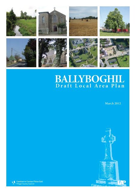
BALLYBOGHIL<br />
Draft Local Area Plan<br />
March 2012
Comhairle Contae Fhine Gall<br />
<strong>Fingal</strong> <strong>County</strong> <strong>Council</strong><br />
BALLYBOGHIL<br />
Draft Local Area Plan<br />
DAVID O’CONNOR<br />
<strong>County</strong> Manager<br />
GILBERT POWER<br />
Director of Planning<br />
& Strategic Infrastructure<br />
Department<br />
PETER BYRNE<br />
Senior Planner<br />
MARJORIE O’SHEE<br />
Senior Executive Planner
Comhairle Contae Fhine Gall<br />
<strong>Fingal</strong> <strong>County</strong> <strong>Council</strong><br />
TABLE OF CONTENTS<br />
MARCH 2012<br />
Planning & Strategic<br />
Infrastructure Department<br />
BALLYBOGHIL<br />
Draft Local Area Plan<br />
EXECUTIVE SUMMARY 01<br />
SECTION 1 INTRODUCTION 04<br />
SECTION 2 PLANNING CONTEXT 07<br />
SECTION 3 EXISTING ENVIRONMENTAL CONSTRAINTS AND OPPORTUNITIES 12<br />
SECTION 4 DEVELOPMENT STRATEGY FOR THE VILLAGE 15<br />
SECTION 5 DEVELOPMENT PARAMETERS FOR DEVELOPMENT AREAS 20<br />
SECTION 6 RESIDENTIAL MIX 28<br />
SECTION 7 SERVICES IN THE VILLAGE 29<br />
SECTION 8 COMMUNITY AND EDUCATIONAL PROVISION 31<br />
SECTION 9 GREEN INFRASTRUCTURE 33<br />
SECTION 10 OPEN SPACE AND RECREATION 36<br />
SECTION 11 ARCHITECTURAL AND ARCHAEOLOGICAL HERITAGE 39<br />
SECTION 12 WATER SERVICES 42<br />
SECTION 13 TRANSPORTATION 46<br />
SECTION 14 SUSTAINABILITY 48<br />
SECTION 15 WASTE MANAGEMENT 50<br />
SECTION 16 DEVELOPMENT CONSTRAINTS, PHASING AND CHECK LIST FOR<br />
PLANNING APPLICATIONS 51<br />
APPENDIX SEA SCREENING STATEMENT 53<br />
i
BALLYBOGHIL<br />
Draft Local Area Plan<br />
ii<br />
Planning & Strategic<br />
Infrastructure Department<br />
Comhairle Contae Fhine Gall<br />
<strong>Fingal</strong> <strong>County</strong> <strong>Council</strong><br />
MARCH 2012
Comhairle Contae Fhine Gall<br />
<strong>Fingal</strong> <strong>County</strong> <strong>Council</strong><br />
EXECUTIVE SUMMARY<br />
MARCH 2012<br />
Planning & Strategic<br />
Infrastructure Department<br />
BALLYBOGHIL<br />
Draft Local Area Plan<br />
Purpose of the Local Area Plan<br />
The Local Area Plan is a legal document and a public statement of planning policies and objectives for the development<br />
of the village. It sets out a framework for the proper planning and sustainable development of the village. It includes<br />
measures for the protection of the environment and the economic, social and cultural development of the village. Its<br />
preparation involves consultation with the local community to get their ideas as to how they would like to see their<br />
village develop. It is valid for six years from the date of adoption by the <strong>Council</strong>. It’s validity may be extended, in year 5<br />
of the <strong>LAP</strong> for a further 5 years, if deemed appropriate by a resolution of the <strong>Council</strong>.<br />
Public Consultation<br />
Written submissions on the pre-draft consultation phase were invited from members of the public to be made to <strong>Fingal</strong><br />
<strong>County</strong> <strong>Council</strong> between the 27 April 2010 and 25 May 2010. Seven submissions were received. The opinions expressed<br />
in these submissions were taken account of in the making of the Draft Local Area Plan.<br />
Existing Settlement<br />
The plan area covers an area of approximately 56 Hectares. There are circa 110 residential units in the village which has a<br />
current population of around 360 persons. Future development will comprise mainly residential development and small<br />
scale local shops and services in the village centre.<br />
Strategic Location and Description of the Locality<br />
The village of <strong>Ballyboghil</strong>, a small rural village located approximately 20 km. north of Dublin City Centre and 8 km.<br />
north of Swords. The village is a part of a network of villages in <strong>Fingal</strong> which function as small local service centres for<br />
their immediate agricultural hinterlands. It is situated at the junction of the R108 and the R129 regional roads and has<br />
developed in a north-south direction from the original village core, which is centered on the church and school.<br />
Development Strategy for the Village<br />
‘To promote <strong>Ballyboghil</strong> as an attractive and vibrant village, ensuring its sustainable expansion and development<br />
at a level appropriate to and integrated with the existing village, to meet the socio-economic and civic aspirations of<br />
the community, whilst at the same time affording maximum environmental protection and preserving the village’s<br />
distinctive character, heritage, amenity and local identity.’<br />
Key Objectives of the <strong>LAP</strong><br />
The <strong>LAP</strong> outlines key objectives for the sustainable development of the village in relation to: housing, design, natural<br />
and built heritage, employment opportunities, retail/ commercial, public open space and recreation, community and<br />
social facilities, vehicular and pedestrian access and infrastructural requirements.<br />
Village Development Framework Plan and Design Guidance (VDFP)<br />
To determine the best design approach for <strong>Ballyboghil</strong> village, the <strong>Council</strong> commissioned ‘ICON Architecture | Urban<br />
Design | Conservation’ and Cummins + Voortman Sustainable Architecture and Urban Design to prepare the Village<br />
Development Framework Plan and Design Guidance (VDFP) for the village. This Village Development Framework Plan<br />
is a guidance document appended to this Statutory Local Area Plan. The framework plan represents a long term strategy<br />
for achieving the sustainable development of the village with a diversity and mix of uses and to create a place where a<br />
balance is achieved between the natural and built environment. It is a General Objective of this Local Area Plan that the<br />
appended Village Design Framework Plan (VDFP) is the principal guidance document for the physical development of<br />
<strong>Ballyboghil</strong> Village.<br />
Development Areas<br />
The <strong>LAP</strong> map identifies 12 Development Areas within the village.<br />
Residential Densities within the Village and Potential Development Yield<br />
There are circa 110 existing residential units. The existing pattern of development in <strong>Ballyboghil</strong> comprises predominantly<br />
individual houses [mostly single storey or dormer bungalows] with some small low density housing schemes.<br />
01
BALLYBOGHIL<br />
Draft Local Area Plan<br />
There are existing outstanding permissions for 119 additional residential units in <strong>Ballyboghil</strong>.<br />
Planning & Strategic<br />
Infrastructure Department<br />
Comhairle Contae Fhine Gall<br />
<strong>Fingal</strong> <strong>County</strong> <strong>Council</strong><br />
The VDFP proposes 190 additional residential units [this figure includes 20 serviced sites and 16 houses suitable for the<br />
elderly].It is anticipated that these housing units would be delivered over a long term horizon up to 25 years.<br />
The likely number of additional residential units in the long term in <strong>Ballyboghil</strong> village will be between 190 and 230<br />
depending on the implementation of existing planning permissions.<br />
While the density of development proposed is higher than the density of existing development within the village, the<br />
recommended densities are considered appropriate, proportionate and compatible with existing development and will<br />
help to consolidate the future sustainable development of the village.<br />
This is in accordance with Sustainable Residential Development in Urban Areas - Guidelines for Planning Authorities (May<br />
2009) which states inter alia the following: ‘…..The scale of new residential development schemes should be in proportion<br />
to the pattern and grain of existing development’.<br />
Education<br />
The existing permanent primary school in <strong>Ballyboghil</strong> was opened in 2005. The <strong>LAP</strong> provides for the development of<br />
additional school accommodation to support the needs of this expanding community as required.<br />
Community<br />
The <strong>LAP</strong> provides for the extension of the community centre in the centre of the village as required.<br />
Retail /Commercial Development<br />
The <strong>Council</strong> will promote and provide for the development of additional retail and commercial services within the<br />
village centre at a level appropriate to serve the residents of <strong>Ballyboghil</strong> and its rural hinterland. This will ensure that the<br />
village can serve as a key local service centre for the village and its rural hinterland.<br />
Employment opportunities<br />
The <strong>LAP</strong> provides for the retention and expansion of employment uses within the village at two locations [the site<br />
occupied by Keelings juices and within Development Area 9]. This will facilitate in the longer term employment<br />
generating opportunities for people living in the village and the catchment area.<br />
Green Infrastructure<br />
The term ‘Green Infrastructure’ is increasingly being used to describe the interconnected networks of land and water all<br />
around us that sustain environmental quality and enrich our quality of life.<br />
This <strong>LAP</strong> includes objectives for the protection and enhancement of Green Infrastructure in <strong>Ballyboghil</strong> under the<br />
following headings:<br />
Landscape Character<br />
Biodiversity<br />
Open Space and Recreation<br />
Archaeological and Built Heritage<br />
Sustainable Water Management<br />
Open Space and Recreation<br />
The <strong>LAP</strong> provides for extended and improved recreational facilities for existing and future residents together with those<br />
living in the villages’ rural hinterland, and in particular provides for the following:<br />
02<br />
• Developing a village park adjoining the <strong>Ballyboghil</strong> River on the west side of the Main Street.<br />
• Extending and developing the linear park along the <strong>Ballyboghil</strong> River.<br />
MARCH 2012
Comhairle Contae Fhine Gall<br />
<strong>Fingal</strong> <strong>County</strong> <strong>Council</strong><br />
Low Carbon Community<br />
The <strong>LAP</strong> promotes the development of this village as a Low Carbon Community.<br />
MARCH 2012<br />
Planning & Strategic<br />
Infrastructure Department<br />
BALLYBOGHIL<br />
Draft Local Area Plan<br />
Infrastructure and Services<br />
The <strong>LAP</strong> outlines specific objectives for Water Quality, Surface Water Management, Flood Risk management, Foul<br />
Drainage and Waste Water Treatment..<br />
In 2007 an interim upgrade of the <strong>Ballyboghil</strong> Wastewater Treatment Plant was completed increasing its capacity to<br />
cater for a maximum Population Equivalent (PE) of 1000. The future population in the village in the long term will not<br />
exceed approximately 900- 1000.<br />
No development shall be permitted to proceed in the village, pending the completion of a study to investigate the extent<br />
of surface water infiltration into the WWTP and recommend appropriate improvement measures. New development<br />
will only be permitted to connect to the foul drainage network following on from the implementation of the appropriate<br />
improvement measures .<br />
Development that would increase demand above the capacity of the WWTP (i.e. PE>1000) will not be permitted until<br />
the capacity is increased.<br />
The key consideration for the Planning Authority will be the need to ensure that there is no adverse impact on the<br />
receiving water quality of the <strong>Ballyboghil</strong> River.<br />
Phasing of Development<br />
It is anticipated that the level of development proposed will be developed over a significantly longer time relative to the<br />
lifetime of this <strong>LAP</strong> (6 years or any extended period). This <strong>LAP</strong> outlines the optimal sustainable development strategy<br />
for the village over a longer time period in tandem with the timely delivery of the necessary physical infrastructure, in<br />
particular the improvements to water services. Furthermore, in the interests of controlling the pace of development<br />
and ensuring that the new development is well integrated with existing development and in tandem with the necessary<br />
physical and social infrastructure, it is an objective of this <strong>LAP</strong> that individual planning applications shall be submitted<br />
for each of the proposed development areas .All planning applications shall be based on the guidance outlined in the<br />
<strong>Ballyboghil</strong> Village Development Framework Plan and Design Guidance (VDFP).<br />
<strong>Proposed</strong> Amendments to the existing RV Boundary<br />
A small reduction in the RV zoning boundary is proposed at the northern edge of the village.<br />
03
BALLYBOGHIL<br />
Draft Local Area Plan<br />
SECTION 1 : INTRODUCTION<br />
1.0 Why a Local Area Plan for the Village<br />
The first <strong>LAP</strong> for <strong>Ballyboghil</strong> was adopted on 8 March 2004. It has expired since 8 March 2009.<br />
<strong>Ballyboghil</strong> is zoned as a rural village - ‘RV’. This zoning objective seeks to:<br />
Planning & Strategic<br />
Infrastructure Department<br />
Comhairle Contae Fhine Gall<br />
<strong>Fingal</strong> <strong>County</strong> <strong>Council</strong><br />
‘Protect and promote the character of the Rural Village and promote a vibrant community in accordance with an approved<br />
Local Area Plan, and the availability of physical and community infrastructure’.<br />
There is therefore a requirement to prepare a statutory <strong>LAP</strong> for the subject lands.<br />
Purpose of the Local Area Plan<br />
The Local Area Plan is a legal document and a public statement of planning policies and objectives for the future<br />
development of the village. It sets out the agreed development strategy for the future proper planning and sustainable<br />
development of <strong>Ballyboghil</strong> which is located in the rural part of <strong>Fingal</strong>. It sets out the parameters/ requirements for<br />
future development on these lands in terms of layout; urban design; density; vehicular access, pedestrian and cycle<br />
routes; infrastructural requirements, public open space, and supporting community, commercial and social facilities.<br />
The <strong>LAP</strong> identifies the potential for and the extent and type of development that is appropriate to this village, including<br />
the provision of private serviced sites which will provide an alternative to ‘one-off ’ housing in the countryside. The <strong>LAP</strong><br />
includes measures for the protection of the environment, heritage and the economic, social and cultural development of<br />
the village. Its preparation involves consultation with the local community to get their ideas as to how they would like<br />
to see their village develop. The <strong>LAP</strong> is valid for six years from the date of adoption by the <strong>Council</strong>. Its validity may be<br />
extended, in year 5 of the <strong>LAP</strong> for a further 5 years, if deemed appropriate by a resolution of the <strong>Council</strong>.<br />
1.2 Public Consultation<br />
Under the Planning & Development Act 2000 the Planning Authority<br />
shall take whatever steps it considers necessary to consult the public. The<br />
intention to prepare a Local Area Plan for <strong>Ballyboghil</strong> was advertised<br />
in 2010. At the same time, a booklet, prepared by the <strong>Council</strong> was<br />
delivered to households in the village. This booklet set out what the<br />
<strong>Council</strong> considered to be the main development issues facing the village<br />
and invited the local community and businesses to submit their views<br />
regarding which planning and development matters should be included in<br />
the new plan for the village.<br />
Written submissions on the pre-draft consultation phase were invited<br />
from members of the public to be made to <strong>Fingal</strong> <strong>County</strong> <strong>Council</strong> between<br />
the 27 April 2010 and 25 May 2010. A total of 7 no. submissions were<br />
received. These submissions were taken account of in the making of the<br />
Draft Local Area Plan.<br />
1.3 Screening – Strategic Environmental Assessment and Appropriate Assessment<br />
A screening exercise was carried out in relation to whether a Strategic Environmental Assessment is required for the<br />
Local Area Plan (Directive 2001/42/EC). In addition, screening for the necessity of an Appropriate Assessment regarding<br />
the potential impact of the Plan on any Natura 2000 sites, was carried out (required under the EU Habitats Directive).<br />
These were sent to the relevant government departments and the Environmental Protection Agency. The screening<br />
exercises for both the SEA and AA concluded that neither an Environmental Report nor Appropriate Assessment was<br />
required. The SEA Screening Statement is attached in appendix 1. The AA Screening Report is published at the same<br />
time as this Draft <strong>LAP</strong>.<br />
04<br />
MARCH 2012
Comhairle Contae Fhine Gall<br />
<strong>Fingal</strong> <strong>County</strong> <strong>Council</strong><br />
MARCH 2012<br />
Planning & Strategic<br />
Infrastructure Department<br />
BALLYBOGHIL<br />
Draft Local Area Plan<br />
1.4 Location and General Characteristics.<br />
The village is a part of a network of villages in <strong>Fingal</strong> which function as small local service centres for their immediate<br />
agricultural hinterlands. It is situated at the junction of the R108 and the R129 regional roads and has developed in a<br />
north-south direction from the original village core, which is centered on the church and school.<br />
The village of <strong>Ballyboghil</strong> has an elongated linear form, extending for approximately 1.5km along the R108 regional<br />
road. The village core is situated just north of the intersection of the R108 and R129, within which the national school,<br />
church, local pub and community centre are located. Two Protected Structures, the Catholic Church [the Church of the<br />
Assumption] and the ruinous church and graveyard, are located within the RV boundary.<br />
A mix of housing type and tenure, ranging from two storey terraces to large detached two storey and dormer dwellings,<br />
together with single storey bungalows are located throughout the village.<br />
There are circa 110 residential units in the village. Two unfinished estates, Cnoc Dubh and The Grange present immediate<br />
challenges for the village and need to be given priority.<br />
Community facilities include the national school, community hall, the Church of the Assumption, the graveyard, a<br />
G.A.A. pitch and a Pitch and Putt course. The <strong>Council</strong>’s mobile library service visits the village on a fortnightly basis.<br />
Commercial facilities in the village include a newsagents/grocer’s; takeaway; hairdresser; general grocer cum post office<br />
with petrol filling station and O’Connor’s’ public house. A number of other businesses also operate in the village.<br />
<strong>Ballyboghil</strong> village is surrounded by low lying lands mainly in agricultural use .The village is located within designated<br />
Low Lying Landscape Character Type in the <strong>County</strong> Development Plan.<br />
This is an area characterised by a mix of pasture and arable farming on low lying land comprising large fields with few<br />
tree belts and low roadside hedges and few protected views or prospects.<br />
05
BALLYBOGHIL<br />
Draft Local Area Plan<br />
Planning & Strategic<br />
Infrastructure Department<br />
Comhairle Contae Fhine Gall<br />
<strong>Fingal</strong> <strong>County</strong> <strong>Council</strong><br />
1.5 History<br />
<strong>Ballyboghil</strong> (Town of the Staff) was the name given to the town in the twelfth century, when Ceallach, Archbishop of<br />
Armagh built the church (now ruinous on the northern fringe of the village) and made grants of land around <strong>Ballyboghil</strong><br />
for the protection of the ‘Bachall Iosa’, so called as it was believed that the Staff had been given by Jesus to Saint Patrick.<br />
In 1173 Strongbow removed the Staff to Christchurch where it was destroyed during the Reformation. John Rocque’s<br />
map of 1760 shows <strong>Ballyboghil</strong> as a small settlement around a crossroads.<br />
The origins of the village derive from the church lands which were established in mediaeval times on the farmlands<br />
associated with St Mary’s Abbey in Dublin.<br />
Aerial Photo 2009 First OS Map 1839 - 46 OS Map 1910<br />
The 2009 aerial map shows how little the field boundaries have changed in 170 years, (although many fields have been<br />
enlarged) The old church, established in mediaeval times on the farmlands of St Mary’s Abbey in Dublin, circled in<br />
white, was the first step in the gradual development of the village.<br />
06<br />
MARCH 2012
Comhairle Contae Fhine Gall<br />
<strong>Fingal</strong> <strong>County</strong> <strong>Council</strong><br />
SECTION 2 : PLANNING CONTEXT<br />
MARCH 2012<br />
Planning & Strategic<br />
Infrastructure Department<br />
BALLYBOGHIL<br />
Draft Local Area Plan<br />
2.0 Introduction<br />
This <strong>LAP</strong> is guided by the EU Directives, The National Development Plan, and Regional Planning Guidelines and<br />
by the <strong>County</strong> Development Plan in addition to various Government policy documents and guidelines. The need to<br />
promote “sustainable development” is paramount. This term refers to “development that meets the needs of the present<br />
without compromising the ability of future generations to meet their own needs”. This is the underlying principle for<br />
development in the <strong>Ballyboghil</strong> Local Area Plan.<br />
2.1 National Spatial Strategy, 2002 – 2020<br />
The National Spatial Strategy is a 20 year planning framework designed to achieve a better balance of social, economic,<br />
physical development and population growth between the regions in Ireland. The NSS sets out policies for small<br />
towns and villages in the context of the Dublin and Mid-East Region. The Strategy for this region is to consolidate the<br />
metropolitan area of Dublin and concentrate development into major centres or ‘development centres’ in the hinterland.<br />
These centres will be separated from each other by areas identified as ‘Strategic Rural Assets’ within the Dublin and Mid<br />
East Region. <strong>Ballyboghil</strong> is located within the ‘Strategic Rural Assets’ area.<br />
The Strategy stipulates that, within such areas, new development in a village must take<br />
account of and respect the established character of the village. In addition, the NSS states<br />
that development of urban generated housing in such areas, which can be accommodated<br />
in nearby urban areas, should be minimised and the attributes of these rural areas<br />
should be harnessed to attract visitors and local business and generate local employment<br />
opportunities.<br />
2.2 Regional Planning Guidelines 2010 – 2022<br />
The Regional Planning Guidelines aim to implement the policies and objectives of the National<br />
Spatial Strategy at a regional level. The Regional Planning Guidelines for the Greater Dublin<br />
Area (GDA) provides a strategic planning framework for the development of the Dublin and<br />
the mid-east region. These guidelines distinguish the Metropolitan area from the Hinterland<br />
area with distinct development strategies for each area. <strong>Ballyboghil</strong> village is located within the<br />
Hinterland area. The Regional Planning Guidelines for the Greater Dublin Area categorized the<br />
rural villages in the GDA into two sub types: Commuter Villages and Key Villages. <strong>Ballyboghil</strong><br />
is considered to be a key local service centre for the village and its rural hinterland. The RPGs<br />
recommend that the future development of villages such as <strong>Ballyboghil</strong> as a key local centre for<br />
services and local enterprise development should be supported, without resulting in growth<br />
beyond local need or creating unsustainable commuting patterns.<br />
The 2010 Planning and Development Act requires all <strong>County</strong> Development Plans to set out a Core Strategy indicating<br />
how the <strong>County</strong>’s population allocation is consistent with the Regional Planning Guidelines. All <strong>LAP</strong>s shall be consistent<br />
with the Core Strategy.<br />
The Core Strategy in the <strong>Fingal</strong> Development Plan for 2011-2017, indicates that 19,990 housing units are required to<br />
meet the designated population targets for the <strong>County</strong> up to 2017, split between the Metropolitan area (16,992 units)<br />
and the Hinterland area (2998 units).There is a requirement to provide a minimum of 50% of the units within the<br />
Hinterland in the designated towns i.e. Balbriggan, Lusk and Rush leaving a maximum of approximately 1500 units<br />
for Skerries, the villages and the rural ‘one-offs’. Within the Hinterland, there is sufficient land zoned to accommodate<br />
approximately 660 units within the villages in the long term, that is, post 2020. However, the estimated number of units<br />
07
BALLYBOGHIL<br />
Draft Local Area Plan<br />
Planning & Strategic<br />
Infrastructure Department<br />
Comhairle Contae Fhine Gall<br />
<strong>Fingal</strong> <strong>County</strong> <strong>Council</strong><br />
deliverable up to 2017 is indicated in the Core Strategy as 330 units. The likely number of additional residential units<br />
in <strong>Ballyboghil</strong> village in the long term will be between circa 190-230 . This yield would only be realisable over a period<br />
significantly longer than the statutory time period of the <strong>LAP</strong> and <strong>County</strong> Development Plan . This proposed level of<br />
development is consistent with the Core Strategy and the RPGs 2010-2022.<br />
It is an objective to monitor the number of residential units built over the period of the plan.<br />
2.3 Rural Development Programme for Ireland (2007-2013)<br />
<strong>Fingal</strong> LEADER Partnership is the new company formed as a result of the recent amalgamation of Co-operation <strong>Fingal</strong><br />
and Rural Dublin LEADER Company. <strong>Fingal</strong> LEADER Partnership has the remit to deliver local and rural development<br />
in East <strong>Fingal</strong> (all areas east of the N2).<br />
Programmes delivered by the Partnership are broad and diverse with local social inclusion programmes developed<br />
under three measures, namely Services for the Unemployed, Community Development and Community Based Youth<br />
Initiatives. Supports to individuals and communities in the rural areas under the Rural Development Programme 2007-<br />
2013 include village renewal and development, diversification into non-agricultural activities, support for business<br />
creation and tourism activities as well as training and information support.<br />
Programmes are delivered in response to identified need, through a community-led approach, working in partnership<br />
with other service providers and statutory agencies, leading to a better quality of life for all.<br />
2.4 Sustainable Residential Development in Urban Areas - Guidelines for Planning Authorities<br />
(May 2009)<br />
The guidelines are focused on creating sustainable communities by incorporating the highest design standards and<br />
providing a coordinated approach to the delivery of essential infrastructure and services for residential development<br />
not only in the larger urban areas but also in small towns and villages. The main objectives of the guidelines for small<br />
towns and villages are:<br />
• Development must be plan led either through an adopted Local Area Plan or Village Design Statements.<br />
• The strengthening of small towns/villages will provide an alternative to urban generated rural housing;<br />
• New development should contribute to maintaining compact towns and villages. “Leap-frogging” of<br />
development at some distance from the existing built-up area should be avoided. Overall expansion<br />
should proceed on the basis of a number of well integrated sites within and around the urban centre<br />
rather than focusing on rapid growth driven by one very large site.<br />
• The scale of new residential development schemes should be in proportion to the pattern and grain of<br />
existing development, and such development should provide for easy connectivity, especially by<br />
pedestrians and cyclists, to existing facilities; and<br />
• The design, layout and character of new development should successfully relate to the local character<br />
and heritage of the existing small town or village.<br />
2.5 Delivering Homes, Sustaining Communities and Quality Housing for Sustainable Communities<br />
(2007)<br />
‘Delivering Homes, Sustaining Communities’ sets out a range of actions aimed primarily at building sustainable<br />
communities and responding effectively to housing need as well as more effective delivery of housing programmes. The<br />
guidelines identify the principles and criteria that are important in the design of housing.<br />
‘Quality Housing for Sustainable Communities’ assists in the implementation of the policies set out in the above<br />
document and makes practical recommendations on more specific design issues, such as layout and orientation of new<br />
homes through to more detailed design elements.<br />
08<br />
MARCH 2012
Comhairle Contae Fhine Gall<br />
<strong>Fingal</strong> <strong>County</strong> <strong>Council</strong><br />
MARCH 2012<br />
Planning & Strategic<br />
Infrastructure Department<br />
BALLYBOGHIL<br />
Draft Local Area Plan<br />
2.6 The National Climate Change Strategy 2007-2012<br />
This strategy builds on Ireland’s first Climate Change Strategy and its purpose is to show clearly the measures by which<br />
Ireland will meet its 2008-2012 Kyoto Protocol commitment; and to show how these measures position us for the post-<br />
2012 period, and to identify the areas in which further measures are being researched and developed to enable us meet<br />
our 2020 commitment. The <strong>LAP</strong> includes objectives in relation to the management of water supply, drainage services<br />
and energy efficiency.<br />
2.7 <strong>Fingal</strong> <strong>County</strong> Development Plan, 2011 - 2017<br />
The <strong>Fingal</strong> <strong>County</strong> Development Plan 2011 - 2017 is the statutory framework for the county. The Local Area Plan has<br />
had due regard to all relevant policies set out in the Plan. In the settlement hierarchy of the <strong>County</strong> Development Plan,<br />
<strong>Ballyboghil</strong> is zoned as a rural village - ‘RV’. This zoning objective seeks to:<br />
‘Protect and promote the character of the Rural Village and promote a vibrant community in accordance with an<br />
approved Local Area Plan, and the availability of physical and community infrastructure’.<br />
The Vision Statement for the RV zones is:<br />
‘Protect and promote established villages within the rural landscape where people can settle and have access to<br />
community services. The villages are areas within the rural landscape where housing needs can be satisfied with<br />
minimal harm to the countryside and surrounding environment.<br />
The villages will serve their rural catchment, provide local services and smaller scale rural enterprises. Levels of growth<br />
will be managed through Local Area Plans to ensure that a critical mass for local services is encouraged without<br />
providing for growth beyond local need and unsustainable commuting patterns’.<br />
Section 8.3 of the CDP recognizing the importance of the rural villages in the <strong>County</strong> states inter alia the following:<br />
‘….The Rural Villages are a distinctive and valuable asset within the rural area with opportunities for the establishment<br />
of sustainable rural communities. Development Plan objectives enhance this particular community aspect and spirit<br />
by building upon unique and key strengths. A particular focus is to promote key infrastructure which delivers life and<br />
vitality to these established rural communities. The villages also provide an area where those who wish to live in a rural<br />
settlement but do not accord with the provisions of the Rural Settlement Strategy as it applies to the open countryside<br />
can live…’.<br />
It is an Objective of <strong>Fingal</strong> <strong>County</strong> <strong>Council</strong> to ensure that rural villages provide local access to the essential services for<br />
living including community, social, employment and retailing services [Objective RV0]<br />
The CDP further states:<br />
‘…. Settlement within the designated Rural Villages will be open to all. This<br />
policy will promote the vitality of the villages and facilitate the provision of<br />
appropriate facilities. This policy recognizes the low levels of growth in many<br />
of the villages over recent years. At the same time, the level of growth within<br />
villages will be managed. Rapid expansion will not be permitted as it would<br />
put undue pressure on services and the environment and encourage higher<br />
levels of commuting……. Sustainable development of the Rural Villages is to<br />
be managed through the Local Area Plan [ <strong>LAP</strong>] process…’<br />
09
BALLYBOGHIL<br />
Draft Local Area Plan<br />
Planning & Strategic<br />
Infrastructure Department<br />
Comhairle Contae Fhine Gall<br />
<strong>Fingal</strong> <strong>County</strong> <strong>Council</strong><br />
Adjoining Zoning<br />
The lands surrounding the village are zoned ‘RU’ with the objective ‘ to protect and promote in a balanced way, the<br />
development of agriculture and rural related enterprise, biodiversity, the rural landscape and the built and cultural heritage’.<br />
Landscape Character<br />
The village is located within designated Low Lying Landscape Character Type in the <strong>County</strong> Development Plan. This is<br />
an area characterised by a mix of pasture and arable farming on low lying land comprising large fields with few tree belts<br />
and low roadside hedges and few protected views or prospects. The northern part of the village is located in designated<br />
highly sensitive landscape.<br />
2.8 Protected Structures and Recorded Monuments<br />
The <strong>County</strong> Development Plan includes two protected structures of architectural and historical interest within the RV<br />
village boundary. These are the Church of the Assumption [154] 19th century catholic church and Church (in ruins) &<br />
Graveyard [155 and RMP reference number DU007-01001 +-01002 ]. These comprise the remains of a large medieval<br />
church & graveyard which is still in use.<br />
There are other Protected Structures and Recorded monuments located outside the RV Zone but in close proximity to<br />
the village as follows:<br />
10<br />
156: Enclosure site [earthwork], Naul Road – RMP reference number DU 007 011<br />
150: Ringfort site [ Earthwork], Drishoge lane – RMP reference number DU 007-014;<br />
151: The Grange, thatched dwelling Drishoge lane.<br />
RMP reference number DU 007 009: enclosure possible site<br />
MARCH 2012
Comhairle Contae Fhine Gall<br />
<strong>Fingal</strong> <strong>County</strong> <strong>Council</strong><br />
MARCH 2012<br />
Planning & Strategic<br />
Infrastructure Department<br />
BALLYBOGHIL<br />
Draft Local Area Plan<br />
2.9 ‘Connecting People, Places and Prosperity - An Economic Strategy for <strong>Fingal</strong> 2006- 2011’<br />
(<strong>Fingal</strong> Development Board)<br />
This strategy calls for a coherent economic response to the opportunities and challenges arising from the changing face<br />
of <strong>Fingal</strong>. This Strategy sets out a vision for economic development that ‘seeks to ensure that all <strong>Fingal</strong> residents, existing<br />
and new, will enjoy an enhanced quality of life in the <strong>County</strong>’. One of the key initiatives of the strategy is to maximise the<br />
tourism, leisure and recreational potential of <strong>Fingal</strong> by developing and expanding the range of facilities and services to<br />
attract tourists. The <strong>LAP</strong> for <strong>Ballyboghil</strong> presents an opportunity to investigate the recreational potential of the village<br />
to serve both <strong>Ballyboghil</strong> and the wider rural hinterland and to promote and facilitate the development of such facilities<br />
in the village .<br />
11
BALLYBOGHIL<br />
Draft Local Area Plan<br />
Planning & Strategic<br />
Infrastructure Department<br />
Comhairle Contae Fhine Gall<br />
<strong>Fingal</strong> <strong>County</strong> <strong>Council</strong><br />
SECTION 3 : EXISTING ENVIRONMENTAL CONSTRAINTS AND OPPORTUNITIES<br />
3.1 Topography<br />
The <strong>Ballyboghil</strong> River flows through the village in west to east direction. The <strong>LAP</strong> lands are low lying lands. North of<br />
the river ground levels rise in a northerly direction from circa 28 to 45 metres OD. South of the river ground levels vary<br />
between circa 28 and 34 metres OD.<br />
12<br />
3.2 Trees and hedgerows<br />
The <strong>LAP</strong> lands are characterised by the mature<br />
vegetation along the River and the strong vegetative<br />
field boundaries. Hedgerows throughout the village<br />
contribute strongly to its unique character and charm<br />
and link the village with the adjoining agricultural<br />
landscape. As well as contributing significantly to the<br />
character, setting and amenity of <strong>Ballyboghil</strong>, they<br />
provide important wildlife habitats. It is an objective<br />
of this <strong>LAP</strong> to retain as much of these high quality<br />
hedgerows as is practicable in any future development.<br />
3.3 Existing Vernacular Buildings<br />
There are a number of Vernacular Buildings [Non<br />
Protected Structures] in the village which help define<br />
the village character. They add an historical vernacular<br />
layer to the village thereby enriching the quality of the<br />
historic environment of the village .It is an objective<br />
of this <strong>LAP</strong> to seek the retention and refurbishment<br />
as appropriate of these structures which are important<br />
defining elements in the townscape and to promote<br />
new uses in these structures as appropriate in order to<br />
sustain their future use over time.<br />
3.4 Unfinished Housing Estates<br />
A key issue to be addressed in this <strong>LAP</strong> is determining<br />
the future development of 2 key sites in the centre of<br />
the village which comprise unfinished housing estates<br />
at ‘The Grange’ and ‘Cnoc Dubh’. It is an objective of<br />
this <strong>LAP</strong> to seek the satisfactory phased completion of<br />
appropriate scaled development at both locations.<br />
MARCH 2012
Comhairle Contae Fhine Gall<br />
<strong>Fingal</strong> <strong>County</strong> <strong>Council</strong><br />
MARCH 2012<br />
Planning & Strategic<br />
Infrastructure Department<br />
BALLYBOGHIL<br />
Draft Local Area Plan<br />
3.5 Water Services<br />
In 2007 an interim upgrade of the <strong>Ballyboghil</strong> Wastewater Treatment Plant was completed increasing its capacity to cater<br />
for a maximum Population Equivalent (PE) of 1000.<br />
There is a problem with surface water infiltrating into the drainage network and the WWTP, at times of heavy rainfall.<br />
Prior to the commencement of any development in the village, the <strong>Council</strong> will carry out a study to investigate the<br />
extent of surface water infiltration into the WWTP. The <strong>LAP</strong> provides that new development will only be permitted to<br />
connect to the foul drainage network following on from the implementation of the appropriate improvement measures.<br />
Development that would increase demand above the capacity of the WWTP (i.e. PE>1000) will not be permitted until<br />
the capacity is increased.<br />
The key consideration for the Planning Authority will be the need to ensure that there is no adverse impact on the<br />
receiving water quality of the <strong>Ballyboghil</strong> River.<br />
3.6 Surface water<br />
In order to reduce surface water run-off and to minimise the risk of flooding, the <strong>LAP</strong> lands shall be developed in<br />
accordance with SUDS principles in compliance with the ‘Greater Dublin Strategic Drainage Study’.<br />
3.7 Flood catchment areas<br />
The River <strong>Ballyboghil</strong> crosses through <strong>Ballyboghil</strong> village in a west to east direction dividing the subject lands into two<br />
parts. There are historical incidents of fluvial flooding in the village around the <strong>Ballyboghil</strong> Bridge.<br />
This River has been surveyed as part of the FEM-FRAMS study and draft flood risk maps for this river have been<br />
prepared for the 1% (1 in 100yr) and 0.1%(1 in 1000yr) probability of flooding . These draft flood catchment areas are<br />
shown on the <strong>LAP</strong> map and it should be noted that these have yet to be finalised.<br />
There is an opportunity as part of this <strong>LAP</strong> to extend and develop the linear open space along the <strong>Ballyboghil</strong> River to<br />
provide for improved recreational amenities.<br />
3.8 Road network<br />
The <strong>LAP</strong> proposes measures along Main Street to help reduce traffic speeds in the village.<br />
3.9 Pedestrian and cycle links<br />
The <strong>LAP</strong> will promote the development of pedestrian and cycle links within and around <strong>Ballyboghil</strong> connecting the<br />
village to its rural hinterland .<br />
3.10 East West HVDC interconnector<br />
The proposed East West HVDC interconnector between Ireland and Great Britain passes through <strong>Ballyboghil</strong>.<br />
13
BALLYBOGHIL<br />
Draft Local Area Plan<br />
14<br />
Planning & Strategic<br />
Infrastructure Department<br />
Comhairle Contae Fhine Gall<br />
<strong>Fingal</strong> <strong>County</strong> <strong>Council</strong><br />
3.11 Open space and recreational facilities<br />
Public open space within the village is limited to a<br />
small memorial park and an attractive linear area along<br />
the river. There is an opportunity as part of this <strong>LAP</strong><br />
to extend and develop the linear open space along the<br />
<strong>Ballyboghil</strong> River to provide for improved recreational<br />
amenities. The <strong>LAP</strong> provides for a village park to be<br />
developed on the west side of the Main Street as the<br />
main recreational focal point in the village and for<br />
extending the linear park along the River on the east<br />
side of Main Street.<br />
MARCH 2012
Comhairle Contae Fhine Gall<br />
<strong>Fingal</strong> <strong>County</strong> <strong>Council</strong><br />
SECTION 4 : DEVELOPMENT STRATEGY FOR THE VILLAGE<br />
MARCH 2012<br />
Planning & Strategic<br />
Infrastructure Department<br />
BALLYBOGHIL<br />
Draft Local Area Plan<br />
4.0 Vision Statement<br />
‘To promote <strong>Ballyboghil</strong> as an attractive and vibrant village, ensuring its sustainable expansion and<br />
development at a level appropriate to and integrated with the existing village, to meet the socio-economic and civic<br />
aspirations of the community, whilst at the same time affording maximum environmental protection and preserving<br />
the village’s distinctive character, heritage, amenity and local identity.’<br />
4.1 Key Objectives of the <strong>LAP</strong>:<br />
Housing<br />
Design<br />
• Consolidate and strengthen the built form of <strong>Ballyboghil</strong>.<br />
• Provide for a viable housing alternative to the open countryside for members of the rural community.<br />
• Promote the provision of a choice of dwelling types, tenure and size to reflect the changing needs in<br />
this expanding community.<br />
• Ensure that developers shall take suitable and adequate measures to minimise adverse impacts<br />
including noise, dust and traffic during construction phases.<br />
• To seek the satisfactory phased completion of appropriate scaled development at the two unfinished<br />
estates at The Grange and Cnoc Dubh.<br />
• Provide a strong set of general design guidelines and objectives for future development within the village.<br />
• Provide a specific set of design objectives, guidelines and principles relating to specified development<br />
sites and areas within the village boundary.<br />
• Ensure that new development is physically, visually and functionally integrated with existing<br />
development and amenities in the village.<br />
• Ensure that all new development is subject to strict development control standards to ensure the<br />
protection and enhancement of existing residential and public amenities.<br />
Employment Opportunities<br />
• Facilitate and promote the expansion of appropriate employment opportunities in the village at 2 key<br />
areas [site occupied by Keelings and Development area 9] .<br />
• Co-operate with <strong>Fingal</strong> LEADER Partnership Company and all State Agencies to encourage local<br />
employment in the village.<br />
Retail/Commercial / Community and other Services<br />
• Promote the development of retail, service, commercial and community facilities in the village at a<br />
level appropriate to meet the demands of the expanding population and its rural hinterland.<br />
Environment<br />
• Retain, protect and manage significant trees, hedgerows, groups of trees within the <strong>LAP</strong> lands.<br />
• Extend the riparian corridor along the Ballyboughal River to provide for improved recreational<br />
amenities in the centre of the village.<br />
• Promote and develop opportunities for biodiversity.<br />
• Promote and implement sustainable urban drainage solutions within the <strong>LAP</strong> lands.<br />
• Promote and facilitate environmental improvements in the village.<br />
15
BALLYBOGHIL<br />
Draft Local Area Plan<br />
Heritage<br />
Planning & Strategic<br />
Infrastructure Department<br />
Comhairle Contae Fhine Gall<br />
<strong>Fingal</strong> <strong>County</strong> <strong>Council</strong><br />
• Protect the archaeological and built heritage within the village.<br />
• Promote the retention and reuse of existing vernacular buildings within the village to sustain their use<br />
over time.<br />
• Promote the conservation, enhancement, public access and enjoyment of the natural heritage as<br />
important elements in the long-term development of the village.<br />
Public Open Space and Recreation<br />
• Provide for improved recreational facilities and amenities including walking routes around the village .<br />
• Provide for the development of new public open space areas and recreational facilities to meet the<br />
growing recreational needs of residents and those living in the rural hinterland and to act as a<br />
visitor attractor.<br />
• Provide for a new village park .<br />
Sustainability<br />
• Promote the development of a low carbon community.<br />
• Promote proper planning and sustainable development, the use of renewable energy systems and<br />
energy conservation measures in buildings.<br />
• Promote and develop opportunities for biodiversity.<br />
• Provide for a high quality sustainable environment with a high degree of legibility and permeability for<br />
cyclists and pedestrians.<br />
• Promote well-designed quality residential development.<br />
Infrastructure and Services<br />
• To provide improvements to the existing physical infrastructure/services serving <strong>Ballyboghil</strong>.<br />
• To protect and improve water quality in <strong>Ballyboghil</strong> River and ground water quality.<br />
4.2 Village Development Framework Plan<br />
and Design Guidance (VDFP)<br />
To determine the best design approach for the village<br />
the <strong>Council</strong> commissioned ‘ICON Architecture | Urban<br />
Design | Conservation’ and Cummins + Voortman<br />
Sustainable Architecture + Urban Design to prepare<br />
the Village Development Framework Plan and Design<br />
Guidance (VDFP) for <strong>Ballyboghil</strong>. The framework plan<br />
identifies the character of the village, and establishes<br />
existing functions and opportunities for the village. It<br />
develops general design principles for key development<br />
sites showing indicative site layout, bulk, massing,<br />
elevation treatment and materials. It also covers the<br />
treatment of open spaces and the public realm between<br />
these sites and places them in an overall framework that<br />
is appropriate to the development of the entire village. The framework plan represents a long term strategy to achieve<br />
the sustainable development of the village, with a diversity and mix of uses as well as creating a place where a balance is<br />
achieved between the natural and built environment. The Framework Plan is proposed as the guidance document for<br />
the future form of development in the village. All development proposals shall have regard to the guidelines set out in<br />
the Village Development Framework Plan and Design Guidance (VDFP).<br />
16<br />
MARCH 2012
Comhairle Contae Fhine Gall<br />
<strong>Fingal</strong> <strong>County</strong> <strong>Council</strong><br />
MARCH 2012<br />
Planning & Strategic<br />
Infrastructure Department<br />
BALLYBOGHIL<br />
Draft Local Area Plan<br />
4.3 New Development in the Village<br />
It is policy of <strong>Fingal</strong> <strong>County</strong> <strong>Council</strong> to ensure that new development shall enhance, strengthen and develop the built<br />
form and character of <strong>Ballyboghil</strong>. Development of the <strong>LAP</strong> lands is likely to occur over a longer period than the lifetime<br />
of this <strong>LAP</strong>. Development shall contribute to the consolidation of the village making it a strong, compact, attractive place<br />
to live and enjoy. The <strong>LAP</strong> through its objectives and together with the Village Development Framework prepared in<br />
tandem with this <strong>LAP</strong> will guide the sustainable development of the village into the future. The strengthening of this<br />
village will also provide an alternative to urban generated rural housing.<br />
The scale of new development for the village shall be proportionate, and ensure that new development is physically, visually<br />
and functionally integrated with and improves the character of the existing settlement of <strong>Ballyboghil</strong>. The <strong>LAP</strong> and the<br />
Village Development Framework Plan and Design Guidance (VDFP) both have regard to the DOEHLG’s: ‘Sustainable<br />
Residential Development in Urban Areas - Guidelines for Planning Authorities’, 2009 regarding the development of<br />
small towns and villages and the Department of Transport’s policy document, “Smarter Travel: A Sustainable Transport<br />
Future” 2009-2020.<br />
Currently there are circa 110 existing residential units in the village. The VDFP proposes 190 additional residential units.<br />
In the long term there is potential in Ballyboghal village for approximately 190-230 new residential units increasing the<br />
population from circa 360 to circa 900-1000.<br />
4.4 Development Areas within the Village<br />
This <strong>LAP</strong> identifies 12 no. development areas within the village,<br />
proposing mainly residential development as well as some<br />
commercial, employment, recreational and amenity uses. Circa<br />
190 new residential units are proposed within the village boundary.<br />
It is an objective of this plan that development within each of these<br />
development areas shall take place in a coordinated manner. In order<br />
to achieve this objective, it will be necessary for some landowners to<br />
co-operate with one another. The Village Development Framework<br />
Plan forms the blueprint for the future development of these areas,<br />
the development of which shall also adhere to the development<br />
parameters set out for each development area in Section 5. Single<br />
planning applications / applications for planning consents shall be<br />
made in respect of proposed development in each of the identified<br />
development areas.<br />
4.5 Extensions to RV boundary<br />
A small reduction in the RV zoning boundary is proposed at the<br />
northern edge of the village.<br />
4.6 Village Design<br />
The <strong>LAP</strong> seeks, through careful attention to design, to enhance<br />
and improve the character and heritage of the village through the<br />
promotion of a range of design principles. By encouraging good<br />
design and careful attention of its unique heritage and character,<br />
it is intended to enhance the village of <strong>Ballyboghil</strong> as an attractive<br />
and vibrant place to live and enjoy.<br />
17
BALLYBOGHIL<br />
Draft Local Area Plan<br />
Planning & Strategic<br />
Infrastructure Department<br />
Comhairle Contae Fhine Gall<br />
<strong>Fingal</strong> <strong>County</strong> <strong>Council</strong><br />
4.7 General Village Design Principles<br />
<strong>Proposed</strong> development shall be undertaken strictly in accordance with the following design principles:<br />
• Provide high quality development having regard to the DoEHLG Planning Guidelines on Sustainable<br />
Residential Development; the <strong>County</strong> Development Plan development standards; the design principles<br />
set out in this Local Area Plan; and the Village Development Framework Plan and Design Guidance<br />
[VDFP].<br />
• A ‘Site Design Statement’ shall accompany all planning applications within the village boundary, the<br />
components which are detailed in the VDFP for the village.<br />
• Provide for an appropriate relationship between proposed development and the <strong>Ballyboghil</strong> River.<br />
• Promote the retention and reuse of existing vernacular buildings within the village to sustain their use<br />
over time.<br />
• All new street and estate names shall be in Irish or bilingual and shall reflect meaningful local names or<br />
references.<br />
• Suburban type development shall be avoided.<br />
• All new development shall protect the archaeological heritage of the area.<br />
• Private and public areas shall be clearly delineated. Private areas shall be protected from undue<br />
overlooking and public areas shall be easily accessible and overlooked.<br />
• The public realm shall be formed by quality buildings and paving and landscaping shall be<br />
characterised by a high standard of quality finishes and treatments.<br />
• New development shall provide for good permeability for pedestrians and cyclists alike.<br />
• High quality boundary treatment shall be required in all development proposals, including the<br />
retention of existing trees and hedgerows where practicable and the use of natural stone where<br />
appropriate.<br />
• Existing trees and hedgerows which are of amenity value shall be retained in so far as is practicable.<br />
• All development shall be carried out in accordance with the highest environmental standards, having<br />
regard to water and air quality, noise standards and the protection of flora and fauna.<br />
4.8 Village Improvements<br />
The <strong>LAP</strong> also proposes a number of objectives relating to the overall improvements of the physical fabric and attractiveness<br />
of the village. The achievement of these improvements will require the attention and co-operation of property owners,<br />
the Community <strong>Council</strong> and <strong>Fingal</strong> <strong>County</strong> <strong>Council</strong>.<br />
The <strong>LAP</strong> proposes a number of village improvements including the following:<br />
Public realm improvements<br />
A number of public realm improvements are suggested at the following locations:<br />
18<br />
• Providing for a new civic space in the form of a village square at the junction of Main Street and<br />
Ballough road.<br />
• Providing a new civic space outside the school.<br />
• Providing a paved platform with pedestrian crossings at the junction of Main Street / <strong>Ballyboghil</strong><br />
Road/ Oldtown Road.<br />
• Providing a paved platform with pedestrian crossing at petrol station at south end of Main street.<br />
MARCH 2012
Comhairle Contae Fhine Gall<br />
<strong>Fingal</strong> <strong>County</strong> <strong>Council</strong><br />
MARCH 2012<br />
Planning & Strategic<br />
Infrastructure Department<br />
BALLYBOGHIL<br />
Draft Local Area Plan<br />
New Village Park: It is an objective of this <strong>LAP</strong> to develop public open spaces along the river east and west of <strong>Ballyboghil</strong><br />
Bridge. A village park circa 1 hectare in area, is provided for west of <strong>Ballyboghil</strong> Bridge. It is intended that this area shall<br />
be a key focal point within the village core and provide for passive recreational uses.<br />
Floodlighting: It is an objective of this <strong>LAP</strong> to promote floodlighting of the Church of the Assumption, <strong>Ballyboghil</strong><br />
Bridge and the old ruinous church at the northern end of the village.<br />
Overhead wires: It is an objective of this <strong>LAP</strong> to promote the placing of all overhead wires underground.<br />
Relocate bins: It is an objective of this <strong>LAP</strong> to relocate the existing ‘Bring Bank’ facility to a less prominent location in<br />
the village.<br />
19
BALLYBOGHIL<br />
Draft Local Area Plan<br />
Planning & Strategic<br />
Infrastructure Department<br />
Comhairle Contae Fhine Gall<br />
<strong>Fingal</strong> <strong>County</strong> <strong>Council</strong><br />
SECTION 5 : DEVELOPMENT PARAMETERS FOR DEVELOPMENT AREAS<br />
5.0 Introduction<br />
There are 12 identified development areas within the <strong>LAP</strong> lands<br />
and these are shown on the <strong>LAP</strong> map.This section of the <strong>LAP</strong><br />
sets out the appropriate development parameters, for each of the<br />
identified development areas within the village, in the interests<br />
of promoting the proper planning and sustainable development<br />
of the village.<br />
The ‘Village Development Framework Plan and Design<br />
Guidance [VDFP] is a guidance document for development<br />
within Ballyboghal and forms the blue print for the future<br />
development of these areas.<br />
In the interests of controlling the pace of development and<br />
ensuring that new development is well integrated with existing<br />
development and in tandem with the necessary physical and<br />
social infrastructure, it is an objective of this <strong>LAP</strong> that individual<br />
planning applications / applications for planning consents shall<br />
be submitted for each of the entire 12 proposed development<br />
areas, and the phasing of future development within each<br />
such area shall be clearly indicated as part of the planning<br />
applications/consents.<br />
5.1 North side of village, north of Ballyboghal River<br />
Development area 1 [2.8 hectares in area]<br />
This is a key development area in the heart of the village. This<br />
area comprises lands located on the west side of the Main Street,<br />
north of the river <strong>Ballyboghil</strong>. These lands adjoin the graveyard,<br />
the Pitch and putt course and the Catholic Church. A small<br />
part of this development area is located within the flood risk<br />
catchment areas for <strong>Ballyboghil</strong> River. <strong>Proposed</strong> development<br />
in this Development Area will comprise mainly residential<br />
development [circa 20 residential units are proposed], allotments<br />
and a design yard/ business units. The reuse of the existing stone<br />
vernacular building and the adjoining lands will be promoted<br />
by <strong>Fingal</strong> <strong>County</strong> <strong>Council</strong>. This area may also provide for a<br />
Community garden, a playground and a small hard surfaced<br />
multi use games area.<br />
The following requirements shall be complied with in the future development of this area:<br />
20<br />
• New residential development shall overlook the pitch and putt course and proposed Village Park.<br />
• Development shall protect the residential amenities of adjoining residents by minimising overlooking,<br />
overshadowing and visual intrusion.<br />
• Promote the retention and reuse of the existing stone vernacular building north of the church in order<br />
to sustain its future use over time.[it might be used for example for business units/ craft workshop<br />
/shop/ café ]. The lands adjacent might accommodate new development associated with the retention<br />
of the vernacular building [ Note : A planning application may be made in respect of this development<br />
ahead of the planning application for the entire development area].<br />
MARCH 2012
Comhairle Contae Fhine Gall<br />
<strong>Fingal</strong> <strong>County</strong> <strong>Council</strong><br />
Development area 2 [4.26 hectares]<br />
MARCH 2012<br />
Planning & Strategic<br />
Infrastructure Department<br />
BALLYBOGHIL<br />
Draft Local Area Plan<br />
• To provide for a sensitively designed extension to<br />
the community centre as required.<br />
• Allotments shall be provided for in the northern<br />
part of this site adjoining the graveyard and the<br />
western boundary of the <strong>LAP</strong> lands. No<br />
residential development shall be provided in the<br />
area reserved for allotments.<br />
• Vehicular access to all these lands shall be<br />
provided onto Main Street north of the Pitch and<br />
putt course.<br />
• Existing hedgerows within this development area<br />
shall be retained where practicable.<br />
• Future development shall protect the integrity and<br />
setting of the Catholic Church which is a<br />
Protected Structure.<br />
• Pedestrian and cycle links shall be provided<br />
through this area and connect to the proposed<br />
village park in DA 12 [Note : this is the Start of a<br />
looped walk along the river and up to The Grange<br />
and back to village].<br />
• A Community garden may be provided.<br />
• A playground may be provided.<br />
• A small hard surfaced multi use games area may<br />
be provided.<br />
This large development site is located in a key location in the centre of the village with substantial road frontages both<br />
onto the Main Street and the Ballough Road .The unfinished unsightly development at Cnoc Dubh is located on this<br />
site. Planning permission exists for a mixed use development comprising 88 residential units and retail and commercial<br />
space and crèche on these lands. Only 11 residential units have been built to date out of 88 permitted units. In addition<br />
partially built structures and floor slabs have been constructed. Development has now ceased on this site leaving a very<br />
unsightly development. A site resolution plan has been prepared by <strong>Fingal</strong> <strong>County</strong> <strong>Council</strong> in order to secure and clean<br />
up this site.<br />
The <strong>LAP</strong> proposes a less intensive development on this site, which it is considered is a more appropriate scale for this<br />
key site in the village core and which responds to the changed market conditions. Circa 57 residential units [including<br />
10 serviced sites] are proposed within this area together with small retail and commercial services around a new civic<br />
square. It is an objective of this <strong>LAP</strong> to seek the satisfactory phased completion of appropriate scaled development .In<br />
the meantime, <strong>Fingal</strong> will seek to have the site cleaned up , secured and screened and the footpath along Main Street<br />
extended along the site boundary to the junction with Ballough Road.<br />
The following requirements shall be complied with in the future development of this area:<br />
• Private serviced sites shall be provided for in the north- western and south -eastern parts of the site.<br />
• Vehicular access shall be provided off Main Street and the Ballough Road. Only one vehicular access<br />
road may be provided off Main Street.<br />
21
BALLYBOGHIL<br />
Draft Local Area Plan<br />
22<br />
• Building heights shall be restricted to 2 storeys.<br />
Planning & Strategic<br />
Infrastructure Department<br />
Comhairle Contae Fhine Gall<br />
<strong>Fingal</strong> <strong>County</strong> <strong>Council</strong><br />
• A hard landscaped village square incorporating planting and car parking shall be provided at the<br />
junction of Main Street and Ballough Road. The design of this area shall be prepared in conjuction with<br />
the treatment of the public realm at the junction.<br />
• Retail and commercial services shall be provided around the village square.<br />
• Three areas of public open space area shall be provided as follows: a linear public open space inside the<br />
northern site boundary; a central public open space area and a smaller area adjoining Ballough road<br />
and houses shall be located to overlook these spaces.<br />
• Appropriate screen planting shall be provided along the northern boundary of this Development Area.<br />
• The existing hedgerow along the Ballough Road shall be retained and reinforced in so far as is practicable.<br />
• Pedestrian and cycle links connecting Main Street and the Ballough Road shall be provided within the<br />
linear public open space located inside the northern site boundary.<br />
Development area 3 [ 0.5 hectares]<br />
This area comprises a small infill site fronting onto the Ballough Road., to the east of O’Connor’s public house and north<br />
of the housing at Ballyboughal Square. Circa 6 residential units are proposed within this area.<br />
The following requirements shall be complied with in the future development of this area:<br />
• A single vehicular access shall be provided to serve this site from Ballough Road.<br />
• The access road shall be aligned to the rear of the road side hedgerow which shall be retained in so far<br />
as is practicable.<br />
• The existing hedgerows along the site boundaries shall be retained in so far as is practicable.<br />
• Development shall protect the residential amenities of existing adjoining residents to the south by<br />
minimising overlooking; overshadowing and visual intrusion.<br />
• Building heights shall be restricted to 2 storeys.<br />
Development Areas 12 [1 ha.]<br />
This area is reserved as a proposed village park. It is<br />
intended that this area shall be a key focal point within<br />
the village core and provide for passive recreational uses.<br />
Future development within development area 1 shall<br />
provide for an appropriate relationship with the village<br />
park and shall provide a degree of informal supervision of<br />
this public space. The proposed village park may provide<br />
for a Community garden, a playground and a small hard<br />
surfaced multi use games area. The proposed riverside<br />
looped walk linking the village, the memorial close to<br />
junction with Drishogue Lane; the Grange and back to<br />
the village [through Development Area 7] goes through<br />
the proposed village park.<br />
MARCH 2012
Comhairle Contae Fhine Gall<br />
<strong>Fingal</strong> <strong>County</strong> <strong>Council</strong><br />
5.2 South side of village, south of Ballyboghal River<br />
Development area 4 [0.56 hectares]<br />
MARCH 2012<br />
Planning & Strategic<br />
Infrastructure Department<br />
BALLYBOGHIL<br />
Draft Local Area Plan<br />
This development area is located at the junction of <strong>Ballyboghil</strong> Road and Main Street adjoining <strong>Ballyboghil</strong> River to the<br />
south. Part of these lands is located within the flood risk catchment areas of this river. Existing residential development<br />
adjoins the site to the east and south.<br />
The <strong>LAP</strong> proposes a more appropriate form and density for the lands within Development Area 4 than development<br />
proposals tabled to date, having regard to flood risk areas; protecting and enhancing the village character; consolidating<br />
the village core and particularly in the context of the changed economic climate and market conditions.<br />
Development on this key site shall likely comprise circa 5 detached residential units and shall provide for an extension<br />
of the existing riverside park.<br />
The following requirements shall be complied with in the future development of this area:<br />
• A single vehicular access shall be provided to serve this site from Main Street.<br />
• The existing hedgerows along the site boundaries shall be retained in so far as is practicable.<br />
• Development shall protect the residential amenities of existing adjoining residents to the south and east<br />
by minimising overlooking; overshadowing and visual intrusion.<br />
• Building heights shall be restricted to 2 storeys.<br />
• Public open space shall comprise an extension of the existing riverside park.<br />
Development area 5 [0 .84 hectares]<br />
This small infill development area comprises part of the large rear gardens attached to the five detached houses fronting<br />
onto the Oldtown road. 5 detached residential units are proposed with a separate shared road off the Main Street.<br />
The following requirements shall be complied with in the future development of this area:<br />
• A single access shall be provided to serve this site from Main Street.<br />
• The existing hedgerows along the site boundaries shall be retained in so far as is practicable.<br />
• Development shall protect the residential amenities of existing adjoining residents by minimising<br />
overlooking; overshadowing and visual intrusion.<br />
• Building heights shall be restricted to 2 storeys.<br />
Development area 6 [ 3.8 hectares]<br />
This site has a significant frontage onto Main Street. A predominantly residential area with some mixed uses is proposed.<br />
Planning permission exists for a residential scheme at this location.<br />
The <strong>LAP</strong> proposes development on this site, which it is considered will more sensitively integrate with Main Street and<br />
thereby contribute to the character and consolidation of the village.<br />
<strong>Proposed</strong> development in this area will comprise circa 35 residential units [including 5 single storey homes] and possibly<br />
some retail and commercial use.<br />
A cluster of vernacular farm buildings in poor condition on the southern section of this development area suggests that<br />
conservation may not be an option for the entire cluster. It is an objective to retain built elements within this cluster if<br />
possible and to ensure that any proposed new structures at this location shall have regard to and respect the location,<br />
layout, and building form of the existing buildings within this cluster. Any new structures might accommodate a guest<br />
house or other appropriate commercial / retail / recreational development .<br />
23
BALLYBOGHIL<br />
Draft Local Area Plan<br />
The following requirements shall be complied with in the future development of this area:<br />
Planning & Strategic<br />
Infrastructure Department<br />
Comhairle Contae Fhine Gall<br />
<strong>Fingal</strong> <strong>County</strong> <strong>Council</strong><br />
• Development shall protect the residential amenities of existing adjoining residents to the north and<br />
south by minimising overlooking; overshadowing and visual intrusion.<br />
• Building heights shall be restricted to 2 storeys.<br />
• 2 vehicular access points may be provided.<br />
• Existing trees and hedgerows within the site, particularly the tree/ hedge line located inside the<br />
roadside boundary shall be retained in so far as is practicable.<br />
• Retail / commercial uses may be developed adjacent to the petrol station [Note: A planning application<br />
may be made in respect of this development ahead of the planning application for the entire<br />
development area].<br />
• Retain the existing vernacular buildings if possible .Any new development which proposes to replace<br />
any of these buildings shall have regard to and respect the location, layout and building form of the<br />
existing buildings within this cluster. This area might be appropriate for the development of a guest<br />
house or other appropriate commercial / retail / recreational development [Note : A planning<br />
application may be made in respect of this development ahead of the planning application for the<br />
entire development area] .<br />
• Public open space and recreational facilities shall be overlooked by proposed development.<br />
Development area 7 [ 1.7 ha] ‘The Grange’<br />
The unfinished development at ‘The Grange’ is located on this site. Located adjoining Keelings to the south , it is a<br />
large site on which only two large houses have been built out of a total of 18 permitted dwellings. Development on this<br />
site has ceased for some time. This development is located to the rear of existing development which fronts onto Main<br />
Street and apart from the access road the site is not visible from the Main Street. <strong>Proposed</strong> development in this area will<br />
comprise circa 18 additional houses and possibly some limited retail and/or commercial use fronting onto Main Street<br />
opposite the existing petrol station and shop . It is an objective of this <strong>LAP</strong> to seek the early satisfactory completion of<br />
development within this key development area. In the meantime, <strong>Fingal</strong> will seek to have the site cleaned up .<br />
The following requirements shall be complied with in the future development of this area:<br />
24<br />
• Access shall be via the existing access road off Main Street.<br />
• The existing hedgerows along the site boundaries shall be retained in so far as is practicable.<br />
• Development shall protect the residential amenities of existing and future adjoining residents by<br />
minimising overlooking; overshadowing and visual intrusion.<br />
• Public open space shall be overlooked by proposed development.<br />
• Building heights shall be restricted to 2 storeys.<br />
• Retail and/or commercial uses may be developed fronting onto Main Street opposite the petrol station<br />
[Note: A separate planning application may be made in respect of this development ahead of<br />
the planning application for the entire development area] .<br />
• Pedestrian and cycle links shall be provided through this site to link in with the proposed looped walk<br />
[ i.e. that proposed from village park to monument ; to Grange café and back to the village through<br />
this site].<br />
MARCH 2012
Comhairle Contae Fhine Gall<br />
<strong>Fingal</strong> <strong>County</strong> <strong>Council</strong><br />
Development area 8 [ 1.9 ha.]<br />
MARCH 2012<br />
Planning & Strategic<br />
Infrastructure Department<br />
BALLYBOGHIL<br />
Draft Local Area Plan<br />
This development area is located on the lands to the south of ‘The Grange’ and to the west of existing houses fronting<br />
onto Main Street. <strong>Proposed</strong> development in this area will comprise circa 18 residential units accessed from Main Street.<br />
Future development shall provide for the protection of the residential amenities of adjoining residents.<br />
The following requirements shall be complied with in the future development of this area:<br />
• A single access shall be provided to serve these houses off Main Street.<br />
• The existing hedgerows along the site boundaries shall be retained in so far as is practicable.<br />
• Development shall protect the residential amenities of adjoining residents by minimising overlooking;<br />
overshadowing and visual intrusion.<br />
• Public open space shall be overlooked by proposed development.<br />
• Building heights shall be restricted to 2 storeys.<br />
Development Areas 9 [2.7 ha]<br />
This development area has a significant road frontage onto Main Street. It accommodates a warehouse; an<br />
outdoor storage compound area and a single house. Collins farm machinery adjoins this site to the south. This<br />
development area shall be reserved to accommodate future additional business/ industrial units should they be<br />
required. <strong>Proposed</strong> development in this area shall comprise employment uses for the most part and two private<br />
serviced residential sites to the rear. Access to the business/ industrial units shall be from the Main Street and<br />
access to the two private serviced sites shall be from the adjoining residential road to the north. The development<br />
of this site shall help to redefine the Main Street at this location.<br />
The following requirements shall be complied with in the future development of this area:<br />
• Development shall provide an attractive street elevation onto Main Street.<br />
• Access to the proposed business/ industrial units shall be via the existing entrance from Main Street<br />
• Two private serviced sites may be developed and access shall be from the adjoining residential road<br />
to the north [Note: A planning application may be made in respect of this development ahead of the<br />
planning application for the entire development area] .<br />
• Existing hedgerows along the site boundaries shall be retained in so far as is practicable.<br />
• New screen planting shall be undertaken to screen business/ industrial units from existing and<br />
proposed residential development.<br />
Development Areas 10 [ 2.9 ha.]<br />
This development area is located opposite the cottages in the crescent. <strong>Proposed</strong> development in this area will<br />
comprise circa 17 residential units including 5 private serviced sites and 2 single storey dwellings. A single vehicular<br />
access off Main Street shall be provided to serve proposed development. Residential development adjoining the<br />
Main Street shall be arranged to form a crescent enclosing an area of public open space, to mirror the existing<br />
development opposite. The development of this site in time will improve the streetscape in the village and help<br />
define the southern entrance to <strong>Ballyboghil</strong>.<br />
The following requirements shall be complied with in the development of this area:<br />
• A single vehicular access shall be provided to serve these houses off Main Street.<br />
25
BALLYBOGHIL<br />
Draft Local Area Plan<br />
Planning & Strategic<br />
Infrastructure Department<br />
Comhairle Contae Fhine Gall<br />
<strong>Fingal</strong> <strong>County</strong> <strong>Council</strong><br />
• The existing hedgerows along the site boundaries shall be retained in so far as is practicable.<br />
• Development shall protect the residential amenities of adjoining residents to the south.<br />
• Building heights shall be restricted to 2 storeys.<br />
• Residential development adjoining the Main Street shall be arranged to form a crescent which shall<br />
overlook an area of public open space to mirror the development opposite.<br />
• The private serviced sites shall be provided on the western part of the development area.<br />
Development Areas 11 [ 0.6 ha.]<br />
This small infill development area is located immediately south of the existing cottages in the crescent .<strong>Proposed</strong><br />
development in this area will comprise 3 private serviced residential sites.<br />
The following requirements shall be complied with in the development of this area:<br />
• Existing trees and hedgerows along road frontage shall be retained and maintained where practicable.<br />
• A single access shall be provided to serve these sites.<br />
• Development shall protect the residential amenities of adjoining residents by minimising overlooking;<br />
overshadowing and visual intrusion.<br />
• Building heights shall be restricted to 2 storeys.<br />
Residential Densities within the Village and Potential Development Yield<br />
Planning Authorities must take account of the wider development context in preparing <strong>LAP</strong>s for towns and villages.<br />
<strong>Fingal</strong>’s rural villages are a resource for the local community and its surrounding hinterland and provide an alternative<br />
location for those who wish to live in a rural settlement but do not accord with the provisions of the Rural Settlement<br />
Strategy as it applies to the open countryside can live.<br />
The <strong>County</strong> Development Plan objective for the RV zoned villages is to:<br />
‘Protect and promote the character of the Rural Village and promote a vibrant community in accordance with an<br />
approved Local Area Plan, and the availability of physical and community infrastructure’.<br />
The future appropriate scale of development proposed for <strong>Ballyboghil</strong> was considered having regard to an assessment<br />
of the village in terms of its existing population ,services and facilities ,the amount of available development land within<br />
the village envelope , the appropriate ‘absorption capacity’ of the village and the need to strengthen and develop the<br />
village in terms of providing for additional integrated residential development and services and amenities so that it’s<br />
role as a key local centre for services and local enterprise/ development is supported in the future without resulting in<br />
growth beyond local need or creating unsustainable commuting patterns.<br />
This <strong>LAP</strong> proposes a range of densities and house types for each of the identified development sites. Whilst these are<br />
lower than the generic densities suggested in the DOEHLG guidelines, the recommended densities are considered<br />
appropriate for the village of <strong>Ballyboghil</strong> having regard to the existing density of development in the village and the<br />
detailed site assessment undertaken as part of the Village Development Framework Plan and Design Guidance (VDFP) .<br />
There are circa 110 existing residential units in the village.The VDFP proposes 190 additional residential units.<br />
Having regard to existing outstanding permissions the likely number of additional residential units in the long term in<br />
<strong>Ballyboghil</strong> village will likely be 190-230, increasing the total number of units within the <strong>LAP</strong> lands to circa 300 - 340<br />
units and increasing the population from circa 360 to circa 900-1000.<br />
26<br />
MARCH 2012
Comhairle Contae Fhine Gall<br />
<strong>Fingal</strong> <strong>County</strong> <strong>Council</strong><br />
Area 1:<br />
(2.8 Ha) Potential density: 10 units/<br />
Ha<br />
- Allotments on 0.84 Ha<br />
- potential yield of 17 residential<br />
units<br />
- potential yield of 3 homes for the<br />
elderly<br />
- design yard/business units<br />
Area 2:<br />
(4.26 Ha) Potential density: 13.8<br />
units/ Ha<br />
- potential yield of 42 residential<br />
units<br />
- potential yield of 5 homes for the<br />
elderly<br />
- potential yield of 10 serviced sites<br />
- Retail/Commercial<br />
Area 3:<br />
(0.5 Ha) Potential density: 12 units/<br />
Ha<br />
- potential yield of 5 residential<br />
units<br />
- potential yield of 1 home for the<br />
elderly<br />
Area 4:<br />
(0.56 Ha) Potential density: 8.9 units/<br />
Ha<br />
- River Park area<br />
- potential yield of 5 residential units<br />
Phasing of Development<br />
MARCH 2012<br />
Area 5:<br />
(0.84 Ha) Potential density: 5.9 units/<br />
Ha<br />
- potential yield of 5 residential units<br />
Area 6:<br />
(3.80 Ha) Potential density: 9.2 units/<br />
Ha<br />
- potential yield of 30 residential<br />
units<br />
- potential yield of 5 homes for the<br />
elderly<br />
- retail / commercial<br />
Area 7:<br />
(1.7 Ha) Potential density: 11.7 units/<br />
Ha<br />
- potential yield of 18 new<br />
residential units<br />
- retail/commercial<br />
Area 8:<br />
(1.9 Ha) Potential density: 9.4 units/<br />
Ha<br />
- potential yield of 18 residential<br />
units<br />
Area 9:<br />
(2.70 Ha) Potential density: 5.8 units/<br />
Ha<br />
- potential yield of 2 serviced sites<br />
- business/ employment<br />
Planning & Strategic<br />
Infrastructure Department<br />
BALLYBOGHIL<br />
Draft Local Area Plan<br />
This level of development is unlikely to be developed over the lifetime of this <strong>LAP</strong> (6 years, unless extended by resolution<br />
of the <strong>Council</strong> to a maximum of 10 years) rather it outlines the optimal sustainable development strategy for the village<br />
over a longer time period and can only be developed in tandem with the timely delivery of the necessary physical<br />
infrastructure, in particular improvements to the water services infrastructure.<br />
In the interest of controlling the pace of development and ensuring that the new development is well integrated with<br />
existing development and provided in tandem with the necessary physical and social infrastructure, it is an objective<br />
of this <strong>LAP</strong> that single planning applications/ applications for planning consent shall be submitted for each of the<br />
proposed development areas.<br />
Planning applications shall be based on the guidance outlined in the Village Development Framework Plan and Design<br />
Guidance (VDFP)<br />
Specific requirements in relation to phasing are stated in section 16 below.<br />
Area 10:<br />
(2.9 Ha) Potential density: 5.8 units/<br />
Ha<br />
- potential yield of 10 residential<br />
units<br />
- potential yield of 2 homes for the<br />
elderly<br />
- potential yield of 5 serviced sites<br />
Area 11:<br />
(0.6 Ha) Potential density: 5 units/ Ha<br />
- potential yield of 3 serviced sites<br />
Area 12: (1.0 Ha)<br />
- <strong>Proposed</strong> village Park<br />
27
BALLYBOGHIL<br />
Draft Local Area Plan<br />
SECTION 6 : RESIDENTIAL MIX<br />
Residential Mix<br />
Planning & Strategic<br />
Infrastructure Department<br />
Comhairle Contae Fhine Gall<br />
<strong>Fingal</strong> <strong>County</strong> <strong>Council</strong><br />
The <strong>LAP</strong> proposes a variety of house types comprising mainly a mix of single and two-storey detached, semi-detached,<br />
and terraced, housing, including houses tailored for the elderly of the community which are incorporated at different<br />
locations within the various residential areas of the village. Proposals for sheltered housing will also be considered.<br />
Private Serviced-Sites<br />
Clusters of private serviced sites are proposed for the development of individual serviced house sites at low densities.<br />
A total of 20 serviced sites are proposed in development areas 2, 9, 10 and 11. It is intended that these sites will provide<br />
people with a real alternative option to building houses in the countryside in accordance with the provisions of the CDP.<br />
However, the <strong>Council</strong> will facilitate the development of additional Private Serviced Sites within other residential<br />
development areas as deemed appropriate.<br />
All development proposals shall have regard to the requirements laid down in Section 5 of this plan and the guidelines<br />
set out in the Village Development Framework Plan for the village.<br />
Houses shall be connected to mains drainage where possible.<br />
Homes for the Elderly of the Community<br />
The <strong>LAP</strong> proposes a number [16] of single storey homes interspersed within the development to suit the different<br />
accommodation needs within the community including the needs of the aging population who may wish to trade<br />
down to a smaller house, or for those who wish to relocate from rural areas to live closer to services in <strong>Ballyboghil</strong>. The<br />
specified locations do not preclude the development of this type of dwelling elsewhere in the development.<br />
Social and Affordable Housing<br />
<strong>Fingal</strong> <strong>County</strong> <strong>Council</strong> own 5 social houses in Ballyboughal Square.<br />
The <strong>Council</strong> will secure the provision of a satisfactory level of social and affordable housing within the plan area as set<br />
out in the <strong>Fingal</strong> <strong>County</strong> <strong>Council</strong>, Housing Strategy for the <strong>County</strong>.<br />
28<br />
MARCH 2012
Comhairle Contae Fhine Gall<br />
<strong>Fingal</strong> <strong>County</strong> <strong>Council</strong><br />
SECTION 7 : SERVICES IN THE VILLAGE<br />
MARCH 2012<br />
Planning & Strategic<br />
Infrastructure Department<br />
BALLYBOGHIL<br />
Draft Local Area Plan<br />
7.0 Introduction<br />
Community facilities include the national school,<br />
community hall, the Church of the Assumption, the<br />
graveyard, a G.A.A. pitch and a Pitch and Putt course.<br />
The <strong>Council</strong>’s mobile library service visits the village on<br />
a fortnightly basis. Commercial facilities in the village<br />
include a newsagents/grocer’s; takeaway; hairdresser;<br />
general grocer cum post office with petrol filling station<br />
and O’Connor’s’ public house.A number of other<br />
businesses also operate in the village.<br />
7.1 Future services<br />
It is an objective of <strong>Fingal</strong> <strong>County</strong> <strong>Council</strong> to promote and<br />
encourage the provision of retail, service, community uses<br />
as well as incubator, workshops and /or business starter<br />
units for appropriate small to medium sized businesses in<br />
order to create a sustainable balance between residential,<br />
service and employment uses in <strong>Ballyboghil</strong>.<br />
<strong>Fingal</strong> <strong>County</strong> <strong>Council</strong> will encourage the development<br />
of retail and commercial services and facilities at a level<br />
appropriate to the village to meet the needs of the existing<br />
and future population and the rural hinterland.<br />
7.2 Employment<br />
<strong>Fingal</strong> <strong>County</strong> <strong>Council</strong> will promote and facilitate the establishment of additional small businesses within the village.<br />
To facilitate economic development and the promotion of sustainable employment in this area , the <strong>LAP</strong> provides for the<br />
retention and expansion of employment uses within the village at two locations : within Development Area 9 adjacent<br />
to the Collins premises, and on the site occupied by Keelings juices. This will facilitate in the longer term employment<br />
generating opportunities for people living in the village and the catchment area.<br />
<strong>Fingal</strong> <strong>County</strong> <strong>Council</strong> will co-operate with state and semi-state employment agencies and local entrepreneurs in<br />
encouraging appropriate indigenous innovation, in supporting appropriate small and medium enterprise, and promoting<br />
the establishment of new employment opportunities in <strong>Ballyboghil</strong>.<br />
29
BALLYBOGHIL<br />
Draft Local Area Plan<br />
Planning & Strategic<br />
Infrastructure Department<br />
Comhairle Contae Fhine Gall<br />
<strong>Fingal</strong> <strong>County</strong> <strong>Council</strong><br />
7.3 Retention and reuse of vernacular buildings [non Protected Structures]<br />
It is an objective of <strong>Fingal</strong> <strong>County</strong> <strong>Council</strong> to seek the retention and refurbishment [as appropriate] of existing<br />
vernacular buildings which are important defining elements in the townscape and to promote new uses as appropriate<br />
in these buildings in order to sustain their future use over time. Future uses will not be confined to residential and may<br />
include business or commercial uses. These buildings are identified on the <strong>LAP</strong> map.<br />
7.4 Broadband<br />
Broadband connectivity is considered a necessity for any village in attracting new businesses and new residents. The<br />
<strong>Council</strong> will support the expansion and rollout of broadband services in the village.<br />
30<br />
MARCH 2012
Comhairle Contae Fhine Gall<br />
<strong>Fingal</strong> <strong>County</strong> <strong>Council</strong><br />
SECTION 8 : COMMUNITY and EDUCATIONAL PROVISION<br />
8.0 Existing facilities<br />
Existing community facilities in the village include the following:<br />
• GAA club;<br />
• Community Hall;<br />
• Church;<br />
• National School.<br />
• Graveyard;<br />
• Post Office;<br />
MARCH 2012<br />
Planning & Strategic<br />
Infrastructure Department<br />
BALLYBOGHIL<br />
Draft Local Area Plan<br />
The nearest garda station is in Swords. <strong>Ballyboghil</strong> is serviced by Clonmethan Health centre in Oldtown.The <strong>Council</strong>’s<br />
mobile library service visits the village on a fortnightly basis. Limited passive public open space areas are located along<br />
the river east and west of the <strong>Ballyboghil</strong> bridge.<br />
8.1 Built Community Facilities<br />
St. Patricks Hall, formerly the national school is an<br />
attractive vernacular building located in the heart of the<br />
village. It is well used by a number of community groups<br />
including the scouts, whist club and the senior citizens<br />
club. A playgroup also operates in the hall, Monday to<br />
Thursday mornings. The community also use the assembly<br />
hall in the national school when required.<br />
There is a need to provide for additional space within St.<br />
Patricks Hall to accommodate the existing needs of the<br />
community. <strong>Fingal</strong> will promote the development of a<br />
sensitively designed extension to St. Patricks Hall to accommodate the needs of the community.<br />
Any additional community needs may be met by the reuse of some of the disused vernacular buildings in the village.<br />
8.2 Educational Provision<br />
The National School in <strong>Ballyboghil</strong> is located in the heart of the village on a site circa 2.2 acres. It is a relatively new<br />
school which opened in September 2005. It is a 6 Class teacher school which accommodates 173 pupils [2011-2012].<br />
Its serves mainly the parish catchment area [circa 5/6 miles from village] but includes some pupils from areas further<br />
away [ e.g.Knocksedan]<br />
The school’s recreational facilities include: a school garden at side; a junior play area ; a basketball court and a grassed<br />
area used for football . The school Hall is well used for after school activities and by the community during evenings<br />
and at week ends.<br />
31
BALLYBOGHIL<br />
Draft Local Area Plan<br />
Planning & Strategic<br />
Infrastructure Department<br />
Comhairle Contae Fhine Gall<br />
<strong>Fingal</strong> <strong>County</strong> <strong>Council</strong><br />
As part of this <strong>LAP</strong> process consultation took place between <strong>Fingal</strong> <strong>County</strong> <strong>Council</strong> and the Department of Education<br />
and Science. Based on the future projected housing yield and the future population in the village there is likely to be a<br />
demand for 3 additional mainstream classrooms.<br />
It is an objective of this <strong>LAP</strong> to provide for expansion of the existing school in the future on the existing site and on the<br />
adjoining lands to the east as required.<br />
8.3 Childcare facilities<br />
There are 2 Childcare Facilities in the village, one operating in the Community hall and one in the GAA clubhouse. It is<br />
an objective of this <strong>LAP</strong> that childcare facilities shall be provided in accordance with the DoEHLGs’ Childcare Facilities<br />
- Guidelines for Planning Authorities.<br />
8.4 Home-Based Economic Activity<br />
Small-scale and appropriate home-based economic activity will be promoted and encouraged where the proposal does<br />
not adversely affect existing residential amenity and does not alter the primary use of the dwelling as a residence.<br />
32<br />
MARCH 2012
Comhairle Contae Fhine Gall<br />
<strong>Fingal</strong> <strong>County</strong> <strong>Council</strong><br />
SECTION 9 : GREEN INFRASTRUCTURE<br />
MARCH 2012<br />
Planning & Strategic<br />
Infrastructure Department<br />
BALLYBOGHIL<br />
Draft Local Area Plan<br />
9.0 Green Infrastructure<br />
The term Green infrastructure is increasingly being used to describe the interconnected networks of land and water all<br />
around us that sustain environmental quality and enrich our quality of life. This includes the nature conservation areas,<br />
parks, open space, rivers, floodplains, wetlands, woodlands, farmland and coastal areas found throughout <strong>Fingal</strong> and<br />
which surround and are threaded through our villages, towns and urban areas.<br />
The key themes which encompass green infrastructure are:<br />
• Landscape Character<br />
• Biodiversity<br />
• Open Space and Recreation<br />
• Archaeological and Built Heritage<br />
• Sustainable Water Management<br />
This <strong>LAP</strong> proposes objectives for the protection and enhancement of green infrastructure in <strong>Ballyboghil</strong>.<br />
9.1 Landscape Character<br />
The village is located within designated Low Lying Landscape Character Type in the <strong>County</strong> Development Plan. This<br />
is an area characterised by a mix of pasture and arable farming on low lying land comprising large fields with few tree<br />
belts and low roadside hedges and few protected views or prospects. The <strong>LAP</strong> lands are characterised by the mature<br />
vegetation along the River and the strong vegetative field boundaries. Hedgerows throughout the village contribute<br />
strongly to its unique character and charm and link the village with the adjoining agricultural landscape.<br />
Part of the village is located in a designated highly sensitive landscape.<br />
33
BALLYBOGHIL<br />
Draft Local Area Plan<br />
Planning & Strategic<br />
Infrastructure Department<br />
Comhairle Contae Fhine Gall<br />
<strong>Fingal</strong> <strong>County</strong> <strong>Council</strong><br />
9.2 Landscape Character Objecties<br />
• To protect existing trees and hedging which contribute to the character of the village and prohibit<br />
proposals necessitating the removal of extensive amounts of trees and hedgerows.<br />
• Ensure that future development proposals incorporate existing trees and hedgerows in so far as is<br />
practicable.<br />
9.3 Biodiversity<br />
Biodiversity refers to the diversity of ecosystems and individual species of flora and fauna. It is an important part of the<br />
landscape in which we live and which gives each local area its sense of place. There are many elements of flora and fauna<br />
in the village and the surrounding areas which are all part of the interrelated natural fabric of the landscape, namely<br />
the trees and hedgerows. They function as ecological “corridors” or ‘stepping stones’ which enable species to move from<br />
place to place.<br />
The <strong>Fingal</strong> <strong>County</strong> Development Plan though it policies and objectives is committed to the protection and enhancement<br />
of the county’s biodiversity. The <strong>Fingal</strong> Heritage Plan 2005-2010 provides for practical actions to enhance our<br />
understanding and enjoyment of heritage including our natural heritage and to better protect and manage it. The <strong>Fingal</strong><br />
Biodiversity Plan sets out the <strong>Council</strong>’s objectives for biodiversity conservation for the next 20 years with a particular<br />
emphasis on the first five years (2010-2015). A major element of the <strong>Fingal</strong> Biodiversity Plan is the development of the<br />
<strong>Fingal</strong> Ecological Network.<br />
The <strong>Ballyboghil</strong> River Crosses through the centre of the village eastwards to the Rogerstown Estuary. This river shall be<br />
protected and maintained for its biodiversity and amenity value including surface water management. In order to protect<br />
, improve and enhance the natural character of this watercourse , the culverting of this River shall not be permitted<br />
and the river shall be retained within a riparian corridor which shall widen out into proposed public open space areas.<br />
9.4 Biodiversity Objectives<br />
• Promote the conservation and enhancement of biodiversity having regard to the polices/objectives of<br />
the <strong>Fingal</strong> <strong>County</strong> Development Plan, the <strong>Fingal</strong> Heritage Plan 2005-2010 and the <strong>Fingal</strong> Biodiversity<br />
Plan, while allowing for appropriate development, access and recreational activity.<br />
34<br />
• Conserve, protect and enhance existing trees and hedgerows, within the <strong>LAP</strong> lands which form wildlife<br />
corridors and link habitats, providing the ‘stepping stones’ necessary for wildlife to flourish, while also<br />
protecting and enhancing surface water and groundwater resources in the area.<br />
• Developers shall submit proposals for the protection and management of local biodiversity features in<br />
any future development proposals.<br />
• Developer’s shall identify, protect and conserve, in co-operation with the relevant statutory authorities<br />
and other groups, vulnerable, rare and threatened species or wild flora and fauna and their habitats.<br />
These include plant and animal species afforded protection under the Wildlife Acts and the EU Habitats<br />
& Birds Directives.<br />
• In all future planning applications, developers shall submit a full ecological assessment by a suitably<br />
qualified professional including measures to avoid or minimise the loss to local biodiversity<br />
which would potentially have a negative impact on the local biodiversity of the area.<br />
• To protect the integrity of the <strong>Ballyboghil</strong> River for its biodiversity and amenity value including surface<br />
water management, a riparian corridor shall be provided along the river free from new development.<br />
• To promote and facilitate public access along the <strong>Ballyboghil</strong> River by [1] providing for public open<br />
spaces including a new village park along the river and [2] promoting the development of a riverside<br />
walk from the village park to the memorial beside the junction with Drishogue Lane which over time<br />
might be extended to Oldtown village.<br />
• Integrate provision for biodiversity with public open space provision and sustainable water<br />
management measures (including SuDs) where possible and appropriate.<br />
MARCH 2012
Comhairle Contae Fhine Gall<br />
<strong>Fingal</strong> <strong>County</strong> <strong>Council</strong><br />
MARCH 2012<br />
Planning & Strategic<br />
Infrastructure Department<br />
BALLYBOGHIL<br />
Draft Local Area Plan<br />
9.5 Trees and Hedgerows.<br />
In terms of natural heritage, hedgerows throughout the village contribute strongly to its unique character and charm and<br />
link the village with the adjoining agricultural landscape. The significance of hedgerows in the village and surrounding<br />
area is celebrated by the <strong>Ballyboghil</strong> Hedgerow Society. As well as contributing significantly to the character, setting<br />
and amenity of <strong>Ballyboghil</strong>, the hedgerows provide important wildlife habitats. It is an objective of this plan to retain as<br />
much of these high quality hedgerows as is practicable in any development proposals.<br />
9.6 Trees and Hedgerows Objectives<br />
• To protect existing trees and hedgerows within the <strong>LAP</strong> lands which are of amenity or biodiversity<br />
value and contribute to the landscape character in so far as is practicable. These are identified on the<br />
<strong>LAP</strong> map. Future development proposals shall provide for their protection and management into the<br />
future in so far as is practicable.<br />
35
BALLYBOGHIL<br />
Draft Local Area Plan<br />
SECTION 10 OPEN SPACE AND RECREATION<br />
Planning & Strategic<br />
Infrastructure Department<br />
Comhairle Contae Fhine Gall<br />
<strong>Fingal</strong> <strong>County</strong> <strong>Council</strong><br />
10.1 Existing Open Space:<br />
<strong>Ballyboghil</strong> G.F.C. grounds and the Pitch and Putt course are located in the northern section of the village and It is an<br />
objective to retain these in recreational use.<br />
The only public open space within the village is a landscaped linear walkway along the <strong>Ballyboghil</strong> River east of<br />
<strong>Ballyboghil</strong> bridge and the small memorial park west of the bridge .<br />
10.2 Future required public open space to support new residential development<br />
High quality public and private open space areas shall be provided in accordance with the provisions of the CDP.<br />
Developers within the <strong>LAP</strong> lands shall provide a minimum public open space of 6.2 acres [2.5 hectares] per 1000<br />
populations.<br />
The likely number of additional residential units in the long term in Ballyboghal village will be between 190 and 230.<br />
Based on these numbers of houses the <strong>LAP</strong> would have a population for Public Open space purposes of between circa<br />
665 [190 x no. 3 bed houses @ 3.5 persons units = 665] and 805 [230 x no. 3 bed houses @ 3.5 persons units = 805].<br />
Applying the above standards, this population will generate a demand for between circa 1.6 hectares [ 4 acres] and 2<br />
hectares [4.9 acres] of public open space.<br />
10.3 Green Corridor along the <strong>Ballyboghil</strong> River<br />
Green corridors are required along all watercourses in the interests of bio-diversity protection, amenity value, flood<br />
control and surface water management. The <strong>LAP</strong> provides for a Green corridor along the <strong>Ballyboghil</strong> River. This riparian<br />
corridor shall be kept free of development and retained as strategic open space as it forms part of the <strong>Fingal</strong> Ecological<br />
Network. This riparian corridor shall widen out into new public open spaces along the river. It should be noted that<br />
in accordance with Development Plan Objective OS 23, that the area of land provided for the Green corridor within<br />
the <strong>LAP</strong> lands shall not be included for the purposes of the calculation of the required public open space to support<br />
additional development and it is additional to the Development Plan public open space requirements.<br />
36<br />
MARCH 2012
Comhairle Contae Fhine Gall<br />
<strong>Fingal</strong> <strong>County</strong> <strong>Council</strong><br />
MARCH 2012<br />
Planning & Strategic<br />
Infrastructure Department<br />
BALLYBOGHIL<br />
Draft Local Area Plan<br />
10.4 New designated Public Open Space lands adjoining the <strong>Ballyboghil</strong> River<br />
It is an objective of this <strong>LAP</strong> to develop public open spaces along the river east and west of <strong>Ballyboghil</strong> Bridge. A village<br />
park [1 hectare in area] is provided for west of <strong>Ballyboghil</strong> Bridge. It is intended that this area shall be a key focal point<br />
within the village core and provide for passive recreational uses. Future development within development area 1 shall<br />
provide for an appropriate relationship with the village park and shall provide a degree of informal supervision of this<br />
public space. East of <strong>Ballyboghil</strong> Bridge, the existing riverside public open space shall be extended.<br />
37
BALLYBOGHIL<br />
Draft Local Area Plan<br />
Planning & Strategic<br />
Infrastructure Department<br />
Comhairle Contae Fhine Gall<br />
<strong>Fingal</strong> <strong>County</strong> <strong>Council</strong><br />
10.5 <strong>Proposed</strong> network of new pedestrian and cycle routes<br />
It is an objective of <strong>Fingal</strong> <strong>County</strong> <strong>Council</strong> in association with landowners, the local community and other stakeholders<br />
to promote the development of a number of new pedestrian and cycle routes around <strong>Ballyboghil</strong> village.<br />
The <strong>LAP</strong> map shows an indicative alignment for a proposed pedestrian and cycle route between the proposed village<br />
park [Development Area 12] as far as the memorial close to the junction with Drishogue Lane. This route is located<br />
north of the Oldtown Road along the narrow piece of land which runs between the roadside hedging and the river. This<br />
route then extends southwards to the Grange Café and then eastwards back to the village through Development Area 8.<br />
This route could potentially provide a very attractive ‘greenway’ linking the village park; the two memorials, The Grange<br />
Café and back to the village.<br />
Over time, it is an objective of <strong>Fingal</strong> <strong>County</strong> <strong>Council</strong> in association with landowners, the local community and other<br />
stakeholders to promote the extension of this pedestrian and cycle route linking Oldtown and <strong>Ballyboghil</strong> villages along<br />
the <strong>Ballyboghil</strong> River.<br />
10.6 New ‘Civic Spaces’ outside the national<br />
school.<br />
A new Civic Area is proposed outside the national school<br />
opposite the church. This area has the potential to become<br />
an important civic space for the expanding community<br />
located in the ‘heart’ of village beside school. This<br />
proposed new civic space would be of great benefit to both<br />
the school and the church.<br />
The proposal is to provide more space in front of the school<br />
directly opposite the church, by modifying the position<br />
of the school boundary wall, maintaining a footpath and<br />
existing trees and paving the new area as a mini village<br />
square with seating and lighting. This area could become<br />
a civic focus for the village. The paving would extend across the road as a traffic calming measure. This proposed new<br />
civic space will benefit both the school and the Church. This arrangement will benefit the school by giving more space<br />
to parents collecting children and by taking the pedestrian ‘footfall’ to school away from traffic exiting staff car park and<br />
Ballyboughal Square . In addition it will provide an over spill area for those attending funerals, weddings and Sunday<br />
Mass in the Church.<br />
10.7 Allotments<br />
An area of land, south of the existing graveyard within Development area 1 is reserved for Allotments. Car parking and<br />
communal storage areas shall be provided as an integral part of the development of this area.<br />
10.8 Community Garden<br />
A community garden may be provided in either development Area 1 or 12 [The Village park]<br />
10.9 Other facilities<br />
A small hard surfaced multi use games area and a playground shall be provided in either development Area 1 or 12 [The<br />
Village park]<br />
38<br />
MARCH 2012
Comhairle Contae Fhine Gall<br />
<strong>Fingal</strong> <strong>County</strong> <strong>Council</strong><br />
SECTION 11 : ARCHITECTURAL AND ARCHAEOLOGICAL HERITAGE<br />
MARCH 2012<br />
Planning & Strategic<br />
Infrastructure Department<br />
BALLYBOGHIL<br />
Draft Local Area Plan<br />
The <strong>County</strong> Development Plan includes two protected structures of architectural and historical interest within the RV<br />
village boundary. These are the Church of the Assumption [154] 19th century Catholic church and Church (in ruins) &<br />
Graveyard [155 and RMP reference number DU007-01001 +-01002 ]. These comprise the remains of a large medieval<br />
church & graveyard which is still in use.<br />
There are other Protected Structures and Recorded monuments located outside the RV Zone but in close proximity to<br />
the village as follows:<br />
• 156: Enclosure site [earthwork], Naul Road – RMP reference number DU 007 011<br />
• 150: Ringfort site [ Earthwork], Drishoge lane – RMP reference number DU 007-014;<br />
• 151: The Grange, thatched dwelling Drishoge lane.<br />
• RMP reference number DU 007 009: enclosure possible site<br />
The National Monuments Act 1930-2004 sets out the legislative procedure for protection of all known archaeological<br />
monuments. Section 12 of the National Monuments (Amendment) Act, 1994 relates specifically to the establishment<br />
and maintenance of a statutory inventory of sites called the Record of Monument and Places (RMP). Monuments of<br />
National significance are identified and listed for protection by the National Monuments Section of the DoEHLG. The<br />
Record of Monuments and Places (RMP) is the principal mechanism for protecting sites of archaeological importance.<br />
The churches and graveyard are important structures of architectural and historical interest within the village. Future<br />
development in the village shall protect the integrity and setting of both churches and graveyard and ensure that there<br />
is no adverse impact on these Protected Structures and national monuments.<br />
Village Character Protection Zone<br />
A Village Character Protection Zone is proposed in the centre of the village and this is identified on the <strong>LAP</strong> map. This<br />
is an area of special character comprising the attractive parklands adjoining the river; the pitch and putt club as well<br />
as several distinctive buildings including the Catholic Church [a Protected Structure] and traditional vernacular farm<br />
buildings .These lands together with these structures contribute to the unique and local distinctiveness of <strong>Ballyboghil</strong><br />
village. It is an objective to retain and sustain these valuable landscape features and buildings into the future.<br />
39
BALLYBOGHIL<br />
Draft Local Area Plan<br />
Vernacular Architecture<br />
Planning & Strategic<br />
Infrastructure Department<br />
Comhairle Contae Fhine Gall<br />
<strong>Fingal</strong> <strong>County</strong> <strong>Council</strong><br />
An inventory of vernacular buildings in a number of rural villages in <strong>Fingal</strong> including <strong>Ballyboghil</strong> was prepared on<br />
behalf of <strong>Fingal</strong> <strong>County</strong> <strong>Council</strong> by Lotts architecture and urbanism [ January 2011]<br />
Existing vernacular structures are identified on the <strong>LAP</strong> map. These Structures are not ‘Protected Structures’, but they<br />
do have a particular value in defining the character of the village and the Main Street. They add an historical vernacular<br />
layer to the village thereby enriching the quality of the historic environment of the village. It is an objective to seek<br />
the retention and refurbishment [if appropriate] of these structures which are important defining elements in the<br />
townscape and to promote new uses as appropriate in order to sustain their future use over time. If these structures<br />
can not be retained any new structures should have regard to and respect the location, layout, building form and the<br />
relationship of existing structures to the street.<br />
Archaeological and Architectural Heritage Objectives<br />
40<br />
• To protect Protected Structures and their settings within the village. In this regard future development<br />
in the village shall protect the integrity and setting of both churches and graveyard ensuring that there<br />
is no adverse impact on these Structures.<br />
• To protect as yet undiscovered archaeological sites or features that survive subsurface in accordance<br />
with the National Monuments Legislation, developer’s shall make provision to allow for and fund ,<br />
whatever archaeological work may be needed on site if any remains are noted following topsoil<br />
removal. Any and all required additional archaeological investigations including monitoring during<br />
removal of topsoil and during construction phase, shall be carried out under licence<br />
and in consultation with the DoEHLG, by a suitably qualified archaeologist under licence from<br />
the DoEHLG and the National Museum of Ireland, at the developer’s expense.<br />
• To promote the floodlighting of the Church of the Assumption, <strong>Ballyboghil</strong> Bridge and the old ruinous<br />
church.<br />
MARCH 2012
Comhairle Contae Fhine Gall<br />
<strong>Fingal</strong> <strong>County</strong> <strong>Council</strong><br />
MARCH 2012<br />
Planning & Strategic<br />
Infrastructure Department<br />
BALLYBOGHIL<br />
Draft Local Area Plan<br />
• To seek the retention of identified vernacular structures which are important defining elements in the<br />
townscape and to promote new uses as appropriate, in order to sustain their future use over time.<br />
• To retain stone walling in the village where practicable.<br />
• To retain identified landscape features and buildings of value within the ‘Village Character Protection<br />
Zone’ into the future.<br />
41
BALLYBOGHIL<br />
Draft Local Area Plan<br />
SECTION 12 : WATER SERVICES<br />
Planning & Strategic<br />
Infrastructure Department<br />
Comhairle Contae Fhine Gall<br />
<strong>Fingal</strong> <strong>County</strong> <strong>Council</strong><br />
12.1 Foul Drainage and Wastewater Treatment<br />
The <strong>Council</strong> aims to protect the environment including local water bodies by ensuring adequate collection, treatment<br />
and discharge of domestic, industrial and other wastewater in <strong>Ballyboghil</strong> , in accordance with the Urban Waste Water<br />
Directive. In addition, it aims to anticipate and provide for future demands in the area whilst continuing to protect the<br />
environment.<br />
In 2007 an interim upgrade of the <strong>Ballyboghil</strong> Wastewater Treatment Plant was completed increasing its capacity to<br />
cater for a maximum Population Equivalent (PE) of 1000. The future long term population of <strong>Ballyboghil</strong> will be circa<br />
900-1000 .The plant receives wastewater from the village environs through a 225mm diameter gravity sewer. Treated<br />
effluent is then discharged to the <strong>Ballyboghil</strong> River.<br />
Currently, surface water infiltrates into the drainage network and the WWTP, at times of heavy rainfall. It is proposed<br />
that a study will be undertaken by <strong>Fingal</strong> <strong>County</strong> <strong>Council</strong> to further investigate the extent of surface water infiltration<br />
into the foul network.<br />
The <strong>Council</strong> will carry out a study to investigate the extent of surface water infiltration into the WWTP and<br />
recommend appropriate improvement measures. No development shall be permitted to proceed in the village, pending<br />
the completion of this study to investigate the extent of surface water infiltration into the WWTP and recommend<br />
appropriate improvement measures.<br />
New development will only be permitted to connect to the foul drainage network following on from the implementation<br />
of the appropriate improvement measures .<br />
Development that would increase demand above the capacity of the WWTP (i.e. PE>1000) will not be permitted until<br />
the capacity is increased.<br />
The key consideration for the Planning Authority will be the need to ensure that there is no adverse impact on the<br />
receiving water quality.<br />
The <strong>LAP</strong> map shows the 100 metre buffer zone around the WWTP.<br />
One-off Dwellings/ serviced sites<br />
• The north, south east and west extremities of the <strong>LAP</strong> lands do not presently have the facility to<br />
connect to the foul drainage system and would require either the construction of new foul mains by a<br />
developer/water services or the provision of on-site treatment<br />
• All proposed on site treatment systems should be assessed and designed in accordance with the EPA<br />
Code of Practice for Treatment and Disposal Systems Serving Single Houses(October 2009).<br />
Furthermore a minimum site area of 0.2Ha is required for an on site treatment system to be deemed<br />
acceptable.<br />
• Group treatment systems serving more than one dwelling are not acceptable.<br />
• Systems designed to cater for a population equivalent in excess of 10PE should be accompanied by<br />
a complete Hydrogeological Assessment of the site as well as the necessary EPA Site Suitability<br />
Assessment to ensure there is no risk of contamination to groundwater.<br />
• The foul drainage for all new development must be in compliance with the Greater Dublin Regional<br />
Code of Practice for Drainage Works (Version 6.0 FCC April 2006).<br />
12.2 Water Supply<br />
The water supply for the majority of the <strong>Fingal</strong> area including Swords is derived from the Leixlip water treatment plant.<br />
The proposed upgrade of the Leixlip Water Treatment Plant has a planned completion date of 2014, at the earliest.<br />
A new 300mm diameter Ductile Iron water main has recently been constructed to Ballyboughil, as far as the Cnoc Dubh<br />
Development, from a branch off the Swords bypass trunk main. This is capable of catering for future developments in<br />
the area.<br />
42<br />
MARCH 2012
Comhairle Contae Fhine Gall<br />
<strong>Fingal</strong> <strong>County</strong> <strong>Council</strong><br />
MARCH 2012<br />
Planning & Strategic<br />
Infrastructure Department<br />
BALLYBOGHIL<br />
Draft Local Area Plan<br />
There are no particular constraints in terms of supplying water to future development within the <strong>LAP</strong> lands.<br />
In order to limit unnecessary water usage, leaks and excessive consumption it will be necessary to submit and adhere to<br />
a water management and conservation plan detailing how best practice in water conservation shall be applied in respect<br />
of future development within this <strong>LAP</strong> area.<br />
12.3 Flood Risk Management<br />
<strong>Fingal</strong> <strong>County</strong> <strong>Council</strong>, along with Meath <strong>County</strong> <strong>Council</strong> and the Office of Public<br />
Works (OPW) are currently carrying out the <strong>Fingal</strong> East Meath Flood Risk Assessment<br />
and Management Study(FEM FRAMS). This is a catchment-based flood risk assessment<br />
and management study of 19 rivers and streams and their catchments within the <strong>Fingal</strong><br />
East Meath area. The core objectives of the <strong>Fingal</strong> East Meath Flood Risk Assessment and<br />
Management Study (FEM-FRAMS) include:<br />
• the development of maps for the existing and potential flood hazard and risk<br />
areas within the study area,<br />
• the development of an economically, socially and environmentally appropriate<br />
long- term strategy (a Flood Risk Management Plan) for the <strong>Fingal</strong> and East<br />
Meath study area and associated SEA,<br />
• setting out the measures and policies based on the core objectives including<br />
guidance on appropriate development that should be pursued by the Local<br />
Authorities.<br />
The River <strong>Ballyboghil</strong> crosses through <strong>Ballyboghil</strong> village . There are historical incidents of fluvial flooding in the village<br />
around the Ballyboughil Bridge. This River has been surveyed as part of the FEM-FRAMS study and draft flood risk<br />
maps for this river have been prepared for the 1% (1 in 100yr) and 0.1%(1 in 1000yr) probability of flooding . These<br />
draft flood catchment areas [ it should be noted that these have yet to be finalised] are shown on the <strong>LAP</strong> map and affect<br />
a significant amount of existing Greenfield land east and west of <strong>Ballyboghil</strong> bridge.<br />
The Department of Environment, Heritage and Local Government and the OPW have jointly published a comprehensive<br />
guidance document for the management of flood risk entitled “The Planning System and Flood Risk Management<br />
Guidelines (November 2009) ” are aimed at ensuring a consistent, rigorous and systematic approach to fully incorporate<br />
flood risk assessment and management into the planning system. The Guidelines require the incorporation of flood risk<br />
management in the plan-making and development management processes. <strong>Fingal</strong> <strong>County</strong> <strong>Council</strong> must have regard to<br />
the planning and development principles outlined in the national flood risk management guidelines when considering<br />
development proposals.<br />
12.4 Surface Water<br />
There are limited public surface water drainage sewers serving small areas of <strong>Ballyboghil</strong> at present, however the surface<br />
water drainage system does not have spare capacity. The majority of runoff from hard standing areas either infiltrates<br />
to ground through private soakaways or is discharged to the <strong>Ballyboghil</strong> River through a series of drainage ditches and<br />
culverts and also infiltrates to the WWTP, particularly at times of heavy rainfall.<br />
The <strong>Ballyboghil</strong> River flows through the centre of the village and the Draft flood catchment areas as identified in the<br />
FemFrams study are shown on the <strong>LAP</strong> map. In order to protect , improve and enhance the natural character of this<br />
watercourse , the culverting of this River shall not be permitted and a riparian corridor, to be agreed with <strong>Fingal</strong> <strong>County</strong><br />
<strong>Council</strong>, shall be maintained. This riparian corridor shall widen out into proposed public open space areas.<br />
In order to reduce surface water run-off and to minimise the risk of flooding, the <strong>LAP</strong> lands shall be developed in<br />
accordance with SUDS principles and in compliance with the ‘Greater Dublin Strategic Drainage Study’ .This approach<br />
using Sustainable Drainage Systems (SuDS) can best be summarised as offering a “total” solution to rainwater<br />
management. Water is either infiltrated or conveyed more slowly to the drainage system and ultimately to water courses<br />
using for example permeable paving, swales, green roofs, rain water harvesting, detention basins, ponds and wetlands.<br />
These facilities are designed to prevent pollution of streams and rivers and to slow down runoff from sites, thereby<br />
helping to prevent downstream flooding and improve water quality. A “treatment train” approach is required to mimic<br />
natural catchment processes as closely as possible. The storm water management plan should comprise of a series<br />
43
BALLYBOGHIL<br />
Draft Local Area Plan<br />
Planning & Strategic<br />
Infrastructure Department<br />
Comhairle Contae Fhine Gall<br />
<strong>Fingal</strong> <strong>County</strong> <strong>Council</strong><br />
of features which incrementally reduce pollution, flow rates and volumes of runoff. Further information on SuDS is<br />
available at www.suds.com.<br />
The GDSDS (Greater Dublin Strategic Drainage Study) policy document, adopted by <strong>Fingal</strong> <strong>County</strong> <strong>Council</strong> includes<br />
a set of drainage criteria which aims to minimise the impact of urbanisation. One objective of this document is to<br />
ensure that all new development incorporates a storm water management plan, with the aim of replicating the runoff<br />
characteristics of the Greenfield site. Sustainable Urban Drainage Systems (SUDS) require that surface water be separated<br />
from foul flows and controlled on site, with the view to minimising the discharge of storm water from the site as well as<br />
improving water quality.<br />
A storm water management system, following the principle of Sustainable Urban Drainage and in compliance with the<br />
‘Greater Dublin Strategic Drainage Study’ must be incorporated into all new developments to minimise the storm water<br />
run off and the risk of water pollution. To mimic natural catchment processes as closely as possible, a “treatment train”<br />
approach is required. The storm water management plan should comprise of a series of features which incrementally<br />
reduce pollution, flow rates and volumes of runoff.<br />
No construction will be permitted within the plan lands without a comprehensive surface water drainage plan.<br />
The surface water system for the proposed site shall be designed and constructed in accordance with the Greater Dublin<br />
Regional Code of Practice for Drainage works and should comply with the Greater Dublin Strategic Drainage Study<br />
(GDSDS).<br />
It is important to note that drainage ditches (whether dry or not) are considered watercourses under the 1977&1990<br />
Water Pollution Acts.<br />
The exact details of this system will be decided at planning application stage and will be in accordance with best practice<br />
and the requirements of <strong>Fingal</strong> <strong>County</strong> <strong>Council</strong>.<br />
12.5 Water Quality<br />
The <strong>Council</strong> is responsible for maintaining, improving and enhancing the environmental and ecological quality of our<br />
waters by implementation of pollution control measures, licensing of effluent discharges, implementing and monitoring<br />
compliance with environmental legislation and drawing up pollution contingency measures on a local and regional level.<br />
The Water Framework Directive (WFD), ‘establishing a framework for community action in the field of water policy’,<br />
became effective in 2000. The overall objective of the Directive is to prevent deterioration in the status of any waters and<br />
achieve at least ‘good status’, by 2015. Further information is available at www.wfdireland.ie.<br />
The WFD requires that all member states adopt a comprehensive integrated river-basin based approach to water<br />
management. Its aims include expanding the scope of protection to include surface waters, ground waters, transitional<br />
and coastal waters, achieving ‘good status’, for all waters by 2015, basing water management on river-basin districts and<br />
getting the public involved in water management. All of <strong>Fingal</strong> is within the Eastern River Basin District (ERBD). The<br />
background to the processes and the reports of the ERBD are available at www.erbd.ie<br />
The Ballyboughil River flows through the village of Ballyboughil, and eastwards before entering the Rogerstown<br />
Estuary. The <strong>Ballyboghil</strong> WMU has been assigned ‘poor’ status by the EPA under the Water Framework Directive.<br />
The Rogerstown Estuary has been designated as ‘moderate status’ by the EPA under the Water Framework Directive.<br />
The onus is on <strong>Fingal</strong> <strong>County</strong> <strong>Council</strong> to ‘restore’ any water bodies in this WMU to ‘good status’ by 2015. Further<br />
information is available in the ERBD River Basin Management Plan 2009-2015 at www.erbd.ie.<br />
In 2009, a Programme of Measures was established for each Water Management Unit (WMU) within the river basin<br />
district as part of the ERBD River Basin Management Plan 2009-2015. This is aimed at addressing those pressures which<br />
threaten the water environment and put water bodies at risk of not achieving ‘good status’ by 2015. Each local authority<br />
must implement this Programme of Measures. For the purpose of effective management of water resources <strong>Fingal</strong> is<br />
divided into 7 water management units [ WMU’s]. The proposed development lands at <strong>Ballyboghil</strong> are located within<br />
the <strong>Ballyboghil</strong> WMU. The full Programme of Measures document is available at www.erbd.ie.<br />
<strong>Fingal</strong>’s Water Pollution Control Section, Water Services Department operate a policy of issuing Trade Effluent Discharge<br />
Licences during the construction phase under the 1977&1990 Water Pollution Acts to all companies involved in<br />
44<br />
MARCH 2012
Comhairle Contae Fhine Gall<br />
<strong>Fingal</strong> <strong>County</strong> <strong>Council</strong><br />
MARCH 2012<br />
Planning & Strategic<br />
Infrastructure Department<br />
BALLYBOGHIL<br />
Draft Local Area Plan<br />
development. This is to ensure all discharges to surface waters do not compromise water quality in the receiving waters.<br />
In relation to waterbodies within or adjacent to <strong>LAP</strong> lands, it is imperative that any works during construction/<br />
development phases do not impact negatively on the Rivers or any tributaries.<br />
12.6 Groundwater Vulnerability and Protection<br />
The Geological Survey of Ireland (GSI) has recently completed Ground Water Mapping for <strong>Fingal</strong>. This Mapping<br />
indicates that a significant portion of the site is impacted by a Source Protection Zoning, low vulnerability locally<br />
important acquifer (bedrock that is moderately productive only in local zones].<br />
Groundwater and water catchment areas have an inherent ecological and economic value and are a major resource that<br />
needs to be protected. Groundwater contributes to rivers, lakes and therefore influences its amenity and recreational<br />
value. The <strong>Council</strong> is responsible for the protection of all waters including rivers, lakes, and groundwater sources. The<br />
responsibilities include : implementation of pollution control measures, licensing of effluent discharges, implementing<br />
and monitoring compliance with environmental regulations, the drawing up of pollution contingency measures.<br />
It is an objective to protect existing ground water sources from pollution during construction/development works.<br />
45
BALLYBOGHIL<br />
Draft Local Area Plan<br />
SECTION 13 : TRANSPORTATION<br />
13.1 Accessing new development<br />
The <strong>LAP</strong> map shows indicative vehicular access points serving the identified development areas.<br />
46<br />
Planning & Strategic<br />
Infrastructure Department<br />
Comhairle Contae Fhine Gall<br />
<strong>Fingal</strong> <strong>County</strong> <strong>Council</strong><br />
13.2 Traffic Management<br />
In order to reduce traffic speeds along the Main Street,<br />
it is an objective to put in place measures including the<br />
following as required:<br />
• Traffic speed readers at north and south<br />
entrances to the village.<br />
• New speed ramps at the north and south<br />
entrances to the village.<br />
• New pedestrian crossing points;<br />
• A paved platform with pedestrian crossing<br />
points at the junction of Main Street /<br />
<strong>Ballyboghil</strong> Road/ Oldtown Road.<br />
13.3 Public realm improvements<br />
The proposed additional public realm improvements described in section 4 above will enhance the character of the<br />
Main street as well as helping to reduce traffic speeds along the Main Street .<br />
13.4 Public Transport<br />
Public transport service for the village is limited to the<br />
‘Nifti’ Rural Bus service established as part of the Rural<br />
Transport Programme. This service provides bus transport<br />
for rural residents supporting communities in Garristown,<br />
Ballyboughal, Oldtown, The Naul and Rolestown to<br />
access public services, employment, training, health,<br />
social facilities and other services. The Rural Transport<br />
Programme provides an invaluable service. Increasing the<br />
frequency of the service would provide the local community<br />
with alternative means of transport .<br />
MARCH 2012
Comhairle Contae Fhine Gall<br />
<strong>Fingal</strong> <strong>County</strong> <strong>Council</strong><br />
MARCH 2012<br />
Planning & Strategic<br />
Infrastructure Department<br />
BALLYBOGHIL<br />
Draft Local Area Plan<br />
<strong>Fingal</strong> <strong>County</strong> <strong>Council</strong> will support and encourage public transport providers to enhance the provision of public<br />
transportation services in the village and to support and facilitate rural community transport initiatives where possible,<br />
aimed at providing new services through the village, enhancing and expanding existing services.<br />
13.5 Pedestrian and Cycle Routes<br />
It is an objective of this plan that provision shall be made for direct and attractive pedestrian and cycle linkages<br />
throughout the village.<br />
It is an objective of <strong>Fingal</strong> <strong>County</strong> <strong>Council</strong> in association with landowners, local community and other stakeholders to<br />
promote the development of a number of new pedestrian and cycle routes around <strong>Ballyboghil</strong> village.<br />
13.6 Car-Parking<br />
Car parking shall be provided in accordance with CDP standards.<br />
47
BALLYBOGHIL<br />
Draft Local Area Plan<br />
Planning & Strategic<br />
Infrastructure Department<br />
Comhairle Contae Fhine Gall<br />
<strong>Fingal</strong> <strong>County</strong> <strong>Council</strong><br />
SECTION 14 : SUSTAINABILITY – PROMOTING A LOW CARBON COMMUNITY<br />
14.0 Introduction<br />
<strong>Fingal</strong> <strong>County</strong> <strong>Council</strong> in association with all stakeholders [community; landowners; SEAI ] will promote the<br />
development of a Low Carbon Community incorporating environmental sustainability in existing and future<br />
development in <strong>Ballyboghil</strong>.<br />
<strong>Fingal</strong> <strong>County</strong> <strong>Council</strong> is committed as a priority to encourage and promote more sustainable development through<br />
energy end use efficiency in building design; increasing the use of renewable energy and developing an appropriate<br />
urban form.<br />
14.1 Environmental Sustainability and the <strong>LAP</strong><br />
The <strong>LAP</strong> promotes Environmental Sustainability as follows:<br />
48<br />
• Promoting the efficiency and energy performance for all buildings [both existing and new build].<br />
• Making the best use of land – a finite resource though consolidation of the village.<br />
• Promoting use of renewable energy including solar and wind power;<br />
• Promoting walking and cycling by providing for safe, attractive pedestrian and cycling routes.<br />
• Promoting biodiversity by conserving existing indigenous hedgerows and trees and introducing ‘green’<br />
pathways through the village.<br />
• Providing for opportunities for food production through the development of allotments and a<br />
community garden. Allotments are proposed within Development Area 1 and a community<br />
garden may be developed within either Development Areas 1 or 12 [ the proposed village park].<br />
• Promoting waste reduction by providing a convenient, well-maintained recycling area in the village.<br />
Efficiency and Energy Performance for Buildings<br />
New building design in the <strong>LAP</strong> lands shall reflect the need to ensure that development occurs in a sustainable and<br />
sensitive manner giving due recognition to the necessity to produce a design which accords with national sustainability<br />
and energy conservation policies and contributes to the creation of appropriate urban form.<br />
The energy and environmental performance required for new buildings under the Building Regulations is expected to<br />
improve rapidly over the course of the <strong>LAP</strong> with a Government policy target of carbon neutral by 2013.<br />
<strong>Fingal</strong> <strong>County</strong> <strong>Council</strong> seeks to ensure that all development in the <strong>LAP</strong> lands will contribute positively towards reduced<br />
energy consumption and the associated carbon footprint. It will achieve this by:<br />
• Ensuring that development proposals demonstrate reduced energy consumption in their design and<br />
construction.<br />
• Ensuring that development proposals incorporate where possible alternate energy technologies.<br />
• Promoting the retrofitting of existing housing to reduce energy demands.<br />
• All buildings in the plan area should incorporate environmentally sustainable design principles in their<br />
design and construction. New buildings shall strive to reduce the energy and water demand through<br />
measures which include the following :<br />
- Careful consideration of building orientation, form, massing and fenestration to make the most<br />
of passive solar gain for space heating.<br />
- Maximization of natural daylight.<br />
- Maximization of passive solar gain for solar thermal water heating and electricity production.<br />
[For example solar panels and ground mounted photovoltaic panels].<br />
- maximizing the potential for incorporating wind energy [For example wind turbines and wind<br />
spires].<br />
MARCH 2012
Comhairle Contae Fhine Gall<br />
<strong>Fingal</strong> <strong>County</strong> <strong>Council</strong><br />
MARCH 2012<br />
Planning & Strategic<br />
Infrastructure Department<br />
BALLYBOGHIL<br />
Draft Local Area Plan<br />
- Use of insulation to reduce heat loss from draughts and uncontrolled ventilation.<br />
- Reduced water use through rainwater harvesting and recycling of rainwater and in-building<br />
grey water treatment systems.<br />
- Use of building roofs as solar collectors and rainwater harvesters. (Green roofs can be used as<br />
amenity spaces that also support biodiversity and rainwater attenuation.)<br />
- Intelligent and energy efficient heating, cooling and ventilation systems.<br />
- Use of materials with low embodied energy and consider incorporating environmentally ‘smart’<br />
materials that can minimise energy use by responding to changing external conditions.<br />
14.2 Wind Energy Objectives<br />
It is an objective to promote and facilitate the development of wind power within the rural hinterland of the <strong>Ballyboghil</strong><br />
and Oldtown villages where such development does not have a negative impact on the landscape and the amenities<br />
of property adjacent .All new wind energy developments in the county shall comply with national guidelines and the<br />
<strong>Fingal</strong> <strong>County</strong> Development Plan.<br />
<strong>Ballyboghil</strong> and Oldtown villages are located within<br />
designated Low Lying Landscape Character Type in the<br />
<strong>County</strong> Development Plan. This is an area characterised<br />
by a mix of pasture and arable farming on low lying<br />
land comprising large fields with few tree belts and low<br />
roadside hedges and few protected views or prospects.<br />
This area may be a good location for a wind farm which<br />
would serve to aid the transformation of these 2 villages<br />
to Low carbon communities. While these lands are<br />
located outside the <strong>LAP</strong> lands, <strong>Fingal</strong> would support the<br />
development of a wind farm at a suitable site in this area<br />
which would help to reduce carbon footprint of the north<br />
county.<br />
14.3 Houses on private serviced sites:<br />
Wind turbines and solar panels [integrated or free<br />
standing] could be promoted in association with<br />
development on the larger serviced sites.<br />
14.4 Allotments and community garden<br />
The <strong>LAP</strong> provides for allotments in the northern part<br />
of the village to the south of the existing cemetery and a<br />
community garden within either development Area 1 or<br />
12 [the proposed village park].<br />
49
BALLYBOGHIL<br />
Draft Local Area Plan<br />
SECTION 15 : WASTE MANAGEMENT<br />
Planning & Strategic<br />
Infrastructure Department<br />
Comhairle Contae Fhine Gall<br />
<strong>Fingal</strong> <strong>County</strong> <strong>Council</strong><br />
15.0<br />
The <strong>Council</strong> actively promotes waste prevention and minimisation through its <strong>County</strong> Development Plan having<br />
regard to ‘The Waste Management Plan for the Dublin Region 2005-2010’. In addition, anti-litter awareness and cleaner<br />
communities are promoted through its annual Spring Clean-Up Week Campaign and Eco Week. In addition, the<br />
<strong>Council</strong> has appointed a Green Schools Co-Ordinator to promote the Green Schools Programme. The primary school<br />
in the village is registered in this programme.<br />
The <strong>Council</strong> also provides a Bring Bank Facility for the recycling of green, brown and clear glass in the centre of the<br />
village.<br />
15.1 Waste Management Objectives<br />
• Prevent and minimise the generation of waste in accordance with the Waste Management Plan for the<br />
Dublin Region.<br />
• Raise environmental awareness through the continuation of the <strong>Council</strong> based initiatives. Particular<br />
emphasis should be placed on the involvement of local schools, individual households and businesses.<br />
• Upgrade waste management facilities in the village, including bring banks and litter bins, and extend<br />
the bring bank network where appropriate to all new housing developments.<br />
• Consider relocating the existing ‘Bring Bank’ facility to a less prominent location in the village.<br />
• Residential developments shall have adequate waste storage space designated for 3 waste streams-<br />
residual waste (grey bin), dry recyclables (green bin), and organic waste (brown bin) and shall comply<br />
with <strong>Fingal</strong> <strong>County</strong> <strong>Council</strong>’s Guidelines on the Provision of Waste and Recycling Bins for Residential<br />
Developments.<br />
• The storage of bins and waste receptacles shall be carefully considered at the design stage and to ensure<br />
that all future residential schemes include appropriate design measures for refuse bins, within<br />
convenient distance of all units, details of which should be clearly shown at planning application<br />
stage.<br />
• All non-residential developments must have suitable and adequate internal and external storage space<br />
for segregated waste and must also comply with the Draft Waste and Recycling Storage Requirements<br />
for Residential and Non-Residential Developments in <strong>Fingal</strong>.<br />
15.2 Construction Waste Management Objectives<br />
Construction and demolition waste management plans shall be submitted as part of planning applications in accordance<br />
with objective WM13 of the <strong>County</strong> Development Plan.<br />
Developers shall ensure that all waste is removed by approved waste disposal contractors to approved waste disposal<br />
facilities.<br />
Developers shall take suitable and adequate measures to minimise adverse impacts including noise, dust and traffic<br />
during construction phases.<br />
50<br />
MARCH 2012
Comhairle Contae Fhine Gall<br />
<strong>Fingal</strong> <strong>County</strong> <strong>Council</strong><br />
MARCH 2012<br />
Planning & Strategic<br />
Infrastructure Department<br />
BALLYBOGHIL<br />
Draft Local Area Plan<br />
SECTION 16 : DEVELOPMENT CONSTRAINTS, PHASING AND CHECK LIST FOR<br />
PLANNING APPLICTIONS<br />
16.0 Development constraints<br />
The level of development proposed is unlikely to be developed over the lifetime of this <strong>LAP</strong> (6 years or any extended<br />
period) but the <strong>LAP</strong> outlines the optimal sustainable development strategy for the village over a longer period of time<br />
in tandem with the timely delivery of the necessary physical infrastructure, in particular the necessary improvements<br />
in Water Services.<br />
16.1 Phasing Requirements<br />
The following requirements shall be complied with:<br />
• In the interests of controlling the pace of development and ensuring that new development is well<br />
integrated with existing development and in tandem with the necessary physical and social<br />
infrastructure, it is an objective of this <strong>LAP</strong> that individual planning applications /<br />
applications for planning consents shall be submitted for each of the entire 12 proposed development<br />
areas, and the phasing of future development within each such area shall be clearly indicated as part of<br />
the planning applications/consents.<br />
• No development shall be permitted to proceed in the village, pending the completion of the study to<br />
investigate the extent of surface water infiltration into the WWTP and recommend appropriate<br />
improvement measures. New development will only be permitted to connect to the foul drainage<br />
network following on from the implementation of the appropriate improvement measures. “On site”<br />
solutions for single houses will be considered on a case by case basis.<br />
• Development that would increase demand above the capacity of the WWTP (i.e. PE>1000) will not be<br />
permitted until the capacity is increased.<br />
• Priority shall be given to the satisfactory completion of the two unfinished schemes in Development<br />
Areas 2 and 7 in accordance with the provisions of this <strong>LAP</strong> and the VDFP and to development within<br />
Development Area 6<br />
• Development Area 9 can provide for new build business / industrial developments if and when required<br />
and may provide for increased employment uses in the village. Development within development area 9<br />
shall be promoted.<br />
• Areas 5 and 3 and 11 are small scale infill developments and therefore may proceed .<br />
• No Development shall commence within Development Areas 8 or 10 until such time as development<br />
on the centrally located areas [Development areas 1 and 2 in particular] are substantially complete.<br />
16.2 Check List for Planning Applications<br />
• All development proposals shall have regard to the guidelines set out in the Village Development<br />
Framework Plan and Design Guidance [VDFP].<br />
• All planning applications for development shall be accompanied by a Site Design Statement [see VDFP<br />
for requirements]<br />
• Developers shall submit proposals for the protection and management of local biodiversity features in<br />
all development proposals.<br />
51
BALLYBOGHIL<br />
Draft Local Area Plan<br />
52<br />
Planning & Strategic<br />
Infrastructure Department<br />
Comhairle Contae Fhine Gall<br />
<strong>Fingal</strong> <strong>County</strong> <strong>Council</strong><br />
• In all future planning applications, developers shall submit a full ecological assessment by a suitably<br />
qualified professional, including measures to avoid or minimise the loss to local biodiversity<br />
which would potentially have a negative impact on the local biodiversity of the area.<br />
• To protect as yet undiscovered archaeological sites or features that survive subsurface in accordance<br />
with the National Monuments Legislation, developer’s shall make provision to allow for and fund<br />
whatever archaeological work may be needed on site if any remains are noted following topsoil removal.<br />
• Construction and demolition waste management plans shall be submitted as part of planning<br />
applications in accordance with objective WM13 of the Development Plan.<br />
MARCH 2012
Comhairle Contae Fhine Gall<br />
<strong>Fingal</strong> <strong>County</strong> <strong>Council</strong><br />
MARCH 2012<br />
APPENDIX<br />
Planning & Strategic<br />
Infrastructure Department<br />
BALLYBOGHIL<br />
Draft Local Area Plan<br />
53
BALLYBOGHIL<br />
Draft Local Area Plan<br />
54<br />
Planning & Strategic<br />
Infrastructure Department<br />
Comhairle Contae Fhine Gall<br />
<strong>Fingal</strong> <strong>County</strong> <strong>Council</strong><br />
MARCH 2012
Comhairle Contae Fhine Gall<br />
<strong>Fingal</strong> <strong>County</strong> <strong>Council</strong><br />
SEA SCREENING STATEMENT<br />
Introduction<br />
MARCH 2012<br />
Planning & Strategic<br />
Infrastructure Department<br />
BALLYBOGHIL<br />
Draft Local Area Plan<br />
<strong>Fingal</strong> <strong>County</strong> <strong>Council</strong> is preparing a local area plan for lands at <strong>Ballyboghil</strong> . As part of the preparation of the local area<br />
plan, the planning authority must consider whether the <strong>Ballyboghil</strong> Local Area Plan requires SEA. The assessment of<br />
this issue is based in the criteria set down in the SEA Guidelines and Annex II of the SEA Directive for determining the<br />
likely significance of environmental effects. The guidelines require screening for SEA to be carried out for all local area<br />
plans where the population of the area of the local area plan is 5,000 persons or less. Where the population of an <strong>LAP</strong><br />
is 5,000 or more, an SEA Environmental Report must be prepared. The estimated population for the proposed Local<br />
Area Plan at <strong>Ballyboghil</strong> is c. 900 persons; therefore SEA is not mandatory.<br />
<strong>Proposed</strong> <strong>LAP</strong><br />
<strong>Ballyboghil</strong>, a small rural village located approximately 20 km. north of Dublin City Centre and 8 km. north of Swords.<br />
The village is a part of a network of villages in <strong>Fingal</strong> which function as small local service centres for their immediate<br />
agricultural hinterlands. <strong>Ballyboghil</strong> is situated at the junction of the R108 and the R129 regional roads and has developed<br />
in a north-south direction from the original village core, which is centred on the church and school.<br />
The village is zoned ‘RV’ in the 2011-2017 <strong>County</strong> Development Plan where it is the objective to:<br />
‘Protect and promote the character of the Rural Village and promote a vibrant Community in accordance with an approved<br />
Local Area Plan, and the availability of physical and community infrastructure’.<br />
The development of this rural village is based on providing for the development of a sustainable rural community by<br />
focusing on the inherent development potential of the village and on strengthening the village. The strengthening of the<br />
village will also provide a viable housing alternative to the demand for housing in the open countryside for members of<br />
the rural community.<br />
The <strong>LAP</strong> comprises an area of approximately 56 hectares which currently has a population of circa 360.<br />
There are circa 105 residential units in the village which has a current population of around 360 persons. The likely long<br />
term number of additional residential units within the <strong>LAP</strong> lands is circa 200 increasing the total number of units in the<br />
village to circa. 300 and the population of the village to circa 900 persons.<br />
The level of development proposed is unlikely to be developed over the lifetime of this <strong>LAP</strong> (6 years or any extended<br />
period) but the <strong>LAP</strong> outlines the optimal sustainable development strategy for the village over a longer time period<br />
in tandem with the timely delivery of the necessary physical infrastructure, in particular the improvements to water<br />
services.<br />
A Village Development Framework Plan and Design Guidance [VDFP} for <strong>Ballyboghil</strong> has been prepared and will form<br />
part of the <strong>LAP</strong>. All development proposals shall have regard to the guidelines set out in the VDFP. The VDFP forms the<br />
blueprint for the future development of the <strong>LAP</strong> lands. The framework plan represents a long term strategy to achieve<br />
the sustainable development of the village, with a diversity of uses whilst ensuring a balance between the protection and<br />
development of the natural and built environment.<br />
Schedule 2A Screening Assessment<br />
The <strong>LAP</strong> has been screened under Schedule 2A of the Planning and Development (Strategic Environmental Assessment)<br />
Regulations 2004 as amended in 2011.<br />
The local area plan has been assessed viz. the likely significant effects on the environment having regard to the following:<br />
(i) The characteristics of the plan and<br />
(ii) The characteristics of the effects and of the area likely to be affected.<br />
55
BALLYBOGHIL<br />
Draft Local Area Plan<br />
Response from the Environmental Authorities<br />
Department of Communications, Energy and Natural Resources<br />
Planning & Strategic<br />
Infrastructure Department<br />
Comhairle Contae Fhine Gall<br />
<strong>Fingal</strong> <strong>County</strong> <strong>Council</strong><br />
The DCENR had no comments /observations to make at this time. It is stated that this is without prejudice to the<br />
attached comments from the Inland Fisheries Ireland which welcomes the commitment of <strong>Fingal</strong> <strong>County</strong> <strong>Council</strong> to<br />
curtail development [below 1000 p.e] until such time as sufficient additional capacity is available at the WWTP.<br />
EPA<br />
The submission received from the EPA states that it is a matter for <strong>Fingal</strong> <strong>County</strong> <strong>Council</strong> to determine, having regard<br />
to relevant criteria set out in Schedule 2A of the Planning and Development (Strategic Environmental Assessment)<br />
Regulations 2004 (SI436 of 2004) as to whether or not the implementation of the Plan would be likely to have significant<br />
effects on the environment.<br />
The EPA makes a number of comments including the following:<br />
• The EPA welcomes the intention to link development to the ability to provide appropriate wastewater<br />
treatment prior to any further development is welcomed.<br />
• It should be ensured that a safe and secure drinking water supply is provided to service the Plan area.<br />
• The intention to incorporate the findings of the FEMFRAMS into the <strong>Ballyboghil</strong> <strong>LAP</strong> is welcomed.<br />
• It should be ensured that the recommendations of the Eastern River Basin Management Plan are<br />
integrated into the Plan to improve water quality<br />
• In relation to infrastructure planning adequate and appropriate infrastructure should be in place,<br />
or required to be put in place, to service any development proposed and authorised during the lifetime<br />
of the particular Plan.<br />
• Additional comments are made in relation to Appropriate Assessment .<br />
The planning authority is satisfied that the screening assessment, together with policies and objectives indicated in the<br />
<strong>LAP</strong> have demonstrated that the <strong>LAP</strong> is unlikely to have any significant environmental effect on the environment.<br />
RATIONALE FOR DECISION:<br />
The village is zoned ‘RV’ in the 2011-2017 <strong>County</strong> Development Plan where it is the objective to:<br />
‘Protect and promote the character of the Rural Village and promote a vibrant Community in accordance with an approved<br />
Local Area Plan, and the availability of physical and community infrastructure’.<br />
The planning authority considers that SEA is not required in this case, on the basis of the assessments carried out having<br />
regard to the nature and characteristics of the lands and overall quantum of development proposed within the plan<br />
lands. The characteristics of the likely effects relate to :<br />
Water Services<br />
Foul Drainage<br />
In 2007 an interim upgrade of the <strong>Ballyboghil</strong> Wastewater Treatment Plant was completed increasing its capacity<br />
to cater for a maximum Population Equivalent (PE) of 1000. The existing and proposed population will not exceed<br />
approximately 900 .The plant receives wastewater from the village environs through a 225mm diameter gravity sewer.<br />
Treated effluent is then discharged to the <strong>Ballyboghil</strong> River.<br />
56<br />
MARCH 2012
Comhairle Contae Fhine Gall<br />
<strong>Fingal</strong> <strong>County</strong> <strong>Council</strong><br />
MARCH 2012<br />
Planning & Strategic<br />
Infrastructure Department<br />
BALLYBOGHIL<br />
Draft Local Area Plan<br />
Currently, surface water infiltrates into the drainage network and the WWTP, at times of heavy rainfall. It is proposed<br />
that a study will be undertaken by <strong>Fingal</strong> <strong>County</strong> <strong>Council</strong> to further investigate the extent of surface water infiltration<br />
into the foul network.<br />
Prior to the commencement of any development in the village, the <strong>Council</strong> will carry out a study to investigate the extent<br />
of surface water infiltration into the WWTP and recommend appropriate improvement measures. No development<br />
shall be permitted to proceed in the village, pending the completion of this study to investigate the extent of surface<br />
water infiltration into the WWTP and recommend appropriate improvement measures.<br />
New development will only be permitted to connect to the foul drainage network following on from the implementation<br />
of the appropriate improvement measures.<br />
Development that would increase demand above the capacity of the WWTP (i.e. PE>1000) will not be permitted until<br />
the capacity is increased.<br />
The key consideration for the Planning Authority will be the need to ensure that there is no adverse impact on the<br />
receiving water quality.<br />
-One-off Dwellings:<br />
Regarding the areas that do not have the facility to connect to the public drainage network, all proposed on-site treatment<br />
systems will be assessed and designed in accordance with the EPA Code of Practice for Treatment and Disposal Systems<br />
serving Single Houses (October 2009). Furthermore, a minimum site area of 0.2ha will be required in order for an<br />
on-site treatment system to be deemed acceptable. Group treatment systems serving more than one dwelling are not<br />
acceptable. Systems designed to cater for a population equivalent in excess of 10 (PE) will be required to be accompanied<br />
by a complete Hydrogeological Assessment of the site as well as the necessary EPA Site Suitability Assessment to ensure<br />
there is no risk of contamination to groundwater.<br />
Water Supply<br />
A new 300mm diameter Ductile Iron water main has recently been constructed to Ballyboughil, as far as the Cnoc Dubh<br />
Development, from a branch off the Swords bypass trunk main. This is capable of catering for future developments in<br />
the area.There are no particular constraints in terms of supplying water to future development within the <strong>LAP</strong> lands.<br />
Flood Risk Management<br />
<strong>Fingal</strong> <strong>County</strong> <strong>Council</strong>, along with Meath <strong>County</strong> <strong>Council</strong> and the Office of Public Works (OPW) are currently carrying<br />
out the <strong>Fingal</strong> East Meath Flood Risk Assessment and Management Study(FEM FRAMS). This is a catchment-based<br />
flood risk assessment and management study of 19 rivers and streams and their catchments within the <strong>Fingal</strong> East<br />
Meath area.<br />
The River <strong>Ballyboghil</strong> crosses through <strong>Ballyboghil</strong> village. There are historical incidents of fluvial flooding in the village<br />
around the Ballyboughil Bridge. This River has been surveyed as part of the FEM-FRAMS study and draft flood risk<br />
maps for this river have been prepared for the 1% (1 in 100yr) and 0.1%(1 in 1000yr) probability of flooding .<br />
The findings of this study have informed the Local Area Plan. All new development will have regard to the findings<br />
of FEM-FRAMS. <strong>Fingal</strong> <strong>County</strong> <strong>Council</strong> must have regard to the planning and development principles outlined in the<br />
national flood risk management guidelines ‘The Planning System and Flood Risk Management Guidelines (November<br />
2009)’” when considering development proposals within the <strong>LAP</strong> lands.<br />
Surface Water<br />
There are limited public surface water drainage sewers serving small areas of <strong>Ballyboghil</strong> at present, however the surface<br />
water drainage system does not have spare capacity. The majority of runoff from hard standing areas either infiltrates<br />
to ground through private soakaways or is discharged to the <strong>Ballyboghil</strong> River through a series of drainage ditches and<br />
culverts and also infiltrates to the WWTP, particularly at times of heavy rainfall.<br />
57
BALLYBOGHIL<br />
Draft Local Area Plan<br />
Planning & Strategic<br />
Infrastructure Department<br />
Comhairle Contae Fhine Gall<br />
<strong>Fingal</strong> <strong>County</strong> <strong>Council</strong><br />
In order to reduce surface water run-off and to minimise the risk of flooding, the <strong>LAP</strong> lands shall be developed in<br />
accordance with SUDS principles and in compliance with the ‘Greater Dublin Strategic Drainage Study’ . The <strong>Ballyboghil</strong><br />
River traverses the <strong>LAP</strong> lands. Culverting of this River shall not be allowed. The river shall be retained within a riparian<br />
corridor .This riparian corridor shall widen out into proposed public open space areas.<br />
Water Quality:<br />
The <strong>Council</strong> is responsible for maintaining, improving and enhancing the environmental and ecological quality of our<br />
waters by implementation of pollution control measures, licensing of effluent discharges, implementing and monitoring<br />
compliance with environmental legislation and drawing up pollution contingency measures on a local and regional<br />
level.<br />
The Water Framework Directive (WFD), ‘establishing a framework for community action in the field of water policy’,<br />
became effective in 2000. The overall objective of the Directive is to prevent deterioration in the status of any waters and<br />
achieve at least ‘good status’, by 2015. Further information is available at www.wfdireland.ie.<br />
The Ballyboughil River flows through the village of <strong>Ballyboghil</strong>, and eastwards before entering the Rogerstown Estuary.<br />
The proposed development lands at <strong>Ballyboghil</strong> are located within the <strong>Ballyboghil</strong> Water Management Unit (WMU). The<br />
<strong>Ballyboghil</strong> WMU has been assigned ‘poor’ status by the EPA under the Water Framework Directive. The Rogerstown<br />
Estuary has been designated as ‘moderate status’ by the EPA under the Water Framework Directive. The onus is on<br />
<strong>Fingal</strong> <strong>County</strong> <strong>Council</strong> to ‘restore’ any water bodies in this WMU to ‘good status’ by 2015.<br />
In 2009, a Programme of Measures was established for each Water Management Unit (WMU) within the river basin<br />
district as part of the ERBD River Basin Management Plan 2009-2015. This is aimed at addressing those pressures which<br />
threaten the water environment and put water bodies at risk of not achieving ‘good status’ by 2015. Each local authority<br />
must implement this Programme of Measures. The full Programme of Measures document is available at www.erbd.ie.<br />
The <strong>LAP</strong> includes objectives for the protection and improvement of water quality.<br />
Groundwater Vulnerability and Protection<br />
The Geological Survey of Ireland (GSI) has recently completed Ground Water Mapping for <strong>Fingal</strong>. This Mapping<br />
indicates that a significant portion of the site is impacted by a Source Protection Zoning, low vulnerability locally<br />
important acquifer (bedrock that is moderately productive only in local zones].<br />
Groundwater and water catchment areas have an inherent ecological and economic value and are a major resource that<br />
needs to be protected. Groundwater contributes to rivers, lakes and therefore influences its amenity and recreational<br />
value. The <strong>Council</strong> is responsible for the protection of all waters including rivers, lakes, and groundwater sources. The<br />
responsibilities include; implementation of pollution control measures, licensing of effluent discharges, implementing<br />
and monitoring compliance with environmental regulations, the drawing up of pollution contingency measures.<br />
The <strong>LAP</strong> includes an objective to protect existing ground water sources from pollution during construction/development<br />
works<br />
Landscape Character Area<br />
The village is located within designated Low Lying Landscape Character Type in the <strong>County</strong> Development Plan. This is an<br />
area characterised by a mix of pasture and arable farming on low lying land comprising large fields with few tree belts<br />
and low roadside hedges and few protected views or prospects.Part of village is located in designated highly sensitive<br />
landscape.<br />
The <strong>Ballyboghil</strong> River flows through the village in west to east direction. The <strong>LAP</strong> lands are low lying lands.<br />
The <strong>LAP</strong> lands are characterised by the mature vegetation along the River and the strong vegetative field boundaries.<br />
Hedgerows throughout the village contribute strongly to its unique character and charm and link the village with the<br />
adjoining agricultural landscape. As well as contributing significantly to the character, setting and amenity of <strong>Ballyboghil</strong>,<br />
they provide important wildlife habitats. It is an objective of this <strong>LAP</strong> to retain as much of these high quality hedgerows<br />
as is practicable in any development proposals.<br />
58<br />
MARCH 2012
Comhairle Contae Fhine Gall<br />
<strong>Fingal</strong> <strong>County</strong> <strong>Council</strong><br />
MARCH 2012<br />
Planning & Strategic<br />
Infrastructure Department<br />
BALLYBOGHIL<br />
Draft Local Area Plan<br />
The <strong>LAP</strong> includes objectives to protect existing trees and hedging which contribute to the character of this village set in<br />
the rural landscape of <strong>Fingal</strong>.<br />
Heritage and Archaeology<br />
The <strong>County</strong> Development Plan includes two protected structures of architectural and historical interest within the RV<br />
village boundary. These are the Church of the Assumption [154] 19th century catholic church and Church (in ruins) &<br />
Graveyard [155 and RMP reference number DU007-01001 +-01002 ]. These comprise the remains of a large medieval<br />
church & graveyard which is still in use.<br />
There are other Protected Structures and Recorded monuments located outside the RV Zone but in close proximity to<br />
the village.<br />
The <strong>LAP</strong> includes objectives to protect and enhance <strong>Ballyboghil</strong>s’ architectural heritage and to promote awareness of<br />
the importance and value of its built heritage including objectives to protect and preserve archaeological sites and<br />
monuments as yet unknown.<br />
An assessment of vernacular buildings [non Protected Structures] in the village has been carried out to identify those<br />
which contribute to the special character of the village. Objectives are included in the <strong>LAP</strong> to provide for the protection<br />
of buildings of vernacular importance which contribute to the identity of the village and the special character of the area.<br />
The <strong>LAP</strong> includes objectives to protect and enhance <strong>Ballyboghil</strong>’s natural heritage.<br />
Traffic<br />
The development of the Plan lands will result in increased traffic demands in the village and its environs. It is considered<br />
that the existing road network can accommodate this additional traffic subject to the provision of proposed traffic<br />
management measures which are provided for in the <strong>LAP</strong>.<br />
Conclusion<br />
The Planning Authority, having assessed the characteristics and the effects of those characteristics of the <strong>LAP</strong> in terms<br />
of the likely significance of environmental effects, considers that SEA is not required for the implementation of the<br />
<strong>Ballyboghil</strong> Local Area Plan.<br />
59
BALLYBOGHIL<br />
Draft Local Area Plan<br />
60<br />
Planning & Strategic<br />
Infrastructure Department<br />
Comhairle Contae Fhine Gall<br />
<strong>Fingal</strong> <strong>County</strong> <strong>Council</strong><br />
MARCH 2012
Extract from <strong>Fingal</strong> Development Plan<br />
±<br />
±<br />
42<br />
42<br />
<strong>LAP</strong> Area<br />
! ! ! !<br />
42<br />
40<br />
40<br />
Open Space Zoning (OS)<br />
43<br />
34<br />
41<br />
42<br />
41<br />
38<br />
Rural Village Zoning (RV)<br />
Highly Sensitive Landscape<br />
Rural Zoning (RU)<br />
0 25 50 100 150 200<br />
Meters<br />
1<br />
5<br />
7<br />
10<br />
12<br />
8<br />
2<br />
11<br />
4<br />
41<br />
3<br />
41<br />
6<br />
40<br />
42<br />
9<br />
41<br />
41<br />
40<br />
40<br />
41<br />
40<br />
41<br />
45<br />
41<br />
40<br />
40<br />
40<br />
41<br />
40<br />
40<br />
39<br />
39<br />
40<br />
40<br />
42<br />
40<br />
40<br />
Scale:- 8,500<br />
Potential Development Areas 1 - 12<br />
39<br />
39<br />
40<br />
40<br />
33<br />
43<br />
41<br />
40<br />
40<br />
36<br />
40<br />
40<br />
39<br />
38<br />
39<br />
32<br />
38<br />
40<br />
39<br />
40<br />
40<br />
32<br />
38<br />
37<br />
37<br />
39<br />
38<br />
45<br />
31<br />
40<br />
39<br />
35<br />
36<br />
38<br />
34<br />
ÉÑ ÉÑ ÉÑ ÉÑ ÉÑ ÉÑ<br />
ÉÑ ÉÑ ÉÑ ÉÑ ÉÑ ÉÑ ÉÑ ÉÑ ÉÑ ÉÑ ÉÑ É Ñ É Ñ ÉÑ ÉÑ ÉÑ ÉÑ ÉÑ É Ñ É Ñ É Ñ ÉÑ ÉÑ ÉÑ ÉÑ<br />
36<br />
ÉÑ ÉÑ ÉÑ É Ñ É Ñ É Ñ É Ñ É Ñ<br />
39<br />
40<br />
BALLYBOGHIL RIVER<br />
» 150 !<br />
151 !<br />
ÉÑ ÉÑ ÉÑ ÉÑ ÉÑ ÉÑ ÉÑ ÉÑ<br />
ÉÑ ÉÑ ÉÑ<br />
ÉÑ ÉÑ ÉÑ ÉÑ ÉÑ ÉÑ<br />
ÉÑ É Ñ ÉÑ ÉÑ É Ñ<br />
»<br />
n q n q n q n q n q n q n q n q n q<br />
n q n q n q n q n q n q<br />
n q n q n q n q n q<br />
E E E E E E E E E E E E E E E E E<br />
E E E E E E E E E E E E E E E E E<br />
E E E E E E E E E E E E E E E E E<br />
E E E E E E E E E E E E E E E E E<br />
E E E E E E E E E E E E E E E E E<br />
E E E E E E E E E E E» E E E E E E<br />
E E E E E E E E E E E» E E E E E E<br />
155<br />
E E E E E E E E ! E E E E E E E E E<br />
E E E E E E E E E E E E E E E E E<br />
E E E E E E E E E E E E E E E E E<br />
Allotments<br />
&2<br />
GAA Grounds<br />
n q n q n q n q n q n q n q n q n q n q n qn q n q<br />
! ! ! ! ! ! ! ! !! ! ! ! ! ! ! ! ! ! ! !! ! ! ! ! ! ! ! ! ! !<br />
! ! ! !<br />
! ! ! ! ! ! ! ! ! ! ! ! ! !<br />
n q n q n q n q n q n q n q n q n q n q n q<br />
n q n q n q n q n q n q n q n q<br />
n q n q n q n q n q n q n q n q<br />
n q n q n q n q n q n q<br />
n q nq n q n q n q n q n q n q n q n q n q n q n q n q n q n q n q n q<br />
n q n q n q n q n q n q n q n q n q n q n q n q n q<br />
n q n q<br />
&4<br />
ÉÑ É Ñ ÉÑ ÉÑ ÉÑ ÉÑ ÉÑ ÉÑ ÉÑ ÉÑ ÉÑ ÉÑ ÉÑ ÉÑ ÉÑ ÉÑ ÉÑ ÉÑ ÉÑ ÉÑ ÉÑ ÉÑ ÉÑ<br />
n q n q n q n q n q n q n q n q n q n qn q n q n q n q n q n q n q n q n q n q<br />
n q n q n q n q n q n q n q<br />
n q n q n q n q n q n q n q n q n q n q<br />
n q n q n q n q n q n q n q<br />
n q n q n q n q n q n q n q n q n q n q<br />
n q n q n q n q n q n q n q n q<br />
n q n q n q n qn q n q n q n q n q n q n q<br />
! ! ! ! ! !<br />
n q n q n q n q n q<br />
! ! ! ! ! ! ! ! ! ! ! ! ! ! ! ! !! ! ! ! ! ! ! ! ! ! ! ! ! ! ! ! ! !<br />
ÉÑ ÉÑ<br />
ÉÑ É Ñ É Ñ É Ñ É Ñ É Ñ É Ñ É Ñ É Ñ É Ñ É Ñ É Ñ É Ñ É Ñ É Ñ É Ñ É Ñ É Ñ É Ñ É Ñ É Ñ É Ñ É Ñ É Ñ É Ñ É Ñ É Ñ É Ñ É Ñ É Ñ É Ñ É Ñ É Ñ É Ñ É Ñ É Ñ É Ñ É Ñ É Ñ É Ñ É Ñ É Ñ É Ñ É Ñ É Ñ<br />
39<br />
37<br />
39<br />
39<br />
38<br />
39<br />
35<br />
44<br />
37<br />
33<br />
30<br />
36<br />
33<br />
35<br />
36<br />
39<br />
39<br />
35<br />
34<br />
35<br />
38<br />
32<br />
36<br />
36<br />
45<br />
33<br />
38<br />
33<br />
36<br />
35<br />
46<br />
35<br />
33<br />
35<br />
35<br />
34<br />
46<br />
36<br />
33<br />
37<br />
34<br />
45<br />
42<br />
36<br />
38<br />
35<br />
38<br />
38<br />
41<br />
33<br />
37<br />
41<br />
31<br />
32<br />
37<br />
32<br />
32<br />
45<br />
31<br />
41<br />
31<br />
34<br />
35<br />
47<br />
47<br />
35<br />
40<br />
36<br />
31<br />
45<br />
42<br />
1<br />
34<br />
&4<br />
n q n q n q n q n q n q n q n q n q n q n q n q n q n q n q n q n q n q n q n q n q<br />
ÉÑ ÉÑ ÉÑ ÉÑ ÉÑ ÉÑ ÉÑ ÉÑ ÉÑ ÉÑ ÉÑ ÉÑ ÉÑ ÉÑ ÉÑ ÉÑ ÉÑ ÉÑ ÉÑ ÉÑ ÉÑ ÉÑ ÉÑ ÉÑ ÉÑ ÉÑ ÉÑ ÉÑ ÉÑ ÉÑ ÉÑ ÉÑ<br />
Pitch & Putt<br />
ÉÑ ÉÑ ÉÑ É Ñ É Ñ<br />
ÉÑ É Ñ<br />
ÉÑ<br />
ÉÑ ÉÑ ÉÑ É Ñ<br />
ÉÑ ÉÑ ÉÑ ÉÑ<br />
32<br />
&1<br />
&5<br />
5<br />
7<br />
ÉÑ ÉÑ ÉÑ" "<br />
30<br />
33<br />
46<br />
36<br />
ÉÑ ÉÑ<br />
41<br />
43<br />
32<br />
ÉÑ<br />
&6<br />
&8<br />
&3<br />
12<br />
n q n q n q n q n q n q n q n q<br />
10 &<br />
7 &<br />
9:m<br />
!<br />
89:|<br />
ÉÑ ÉÑ ÉÑ<br />
ÉÑ É ÉÑ ÉÑ Ñ<br />
32<br />
10<br />
30<br />
46<br />
&5<br />
ÉÑ<br />
36<br />
41<br />
41<br />
43<br />
ÉÑ<br />
n q n q n q n q n q n q n q n q<br />
»<br />
"<br />
&3<br />
ÉÑ É Ñ É Ñ É Ñ É Ñ É Ñ É Ñ<br />
35<br />
ÉÑ<br />
n q n q n q n q n q n q n q n q n q n q<br />
156 !<br />
9:m<br />
! ! ! ! ! ! ! ! ! ! !<br />
&9<br />
n q n q<br />
n q n q n q n q n q<br />
n q n q n q n q n q n q<br />
30<br />
35<br />
29<br />
30<br />
32<br />
36<br />
8<br />
30<br />
30<br />
39<br />
31<br />
43<br />
154<br />
ÉÑ<br />
ÉÑ ÉÑ<br />
"<br />
ÉÑ<br />
"<br />
"<br />
&4<br />
45<br />
37<br />
31<br />
34<br />
33<br />
41<br />
29<br />
32<br />
n q n q n q n q n q n q n q<br />
3 &<br />
n q n q n q n q n q n q n q n q n q<br />
n q n q n q n q<br />
n q n q n q n q n q n q n q n q n q n q n q n q n q n q n q<br />
n q n q n q n q n q n q n q n q n q n q n q nq nq nq nq n q n q n q n q<br />
n q n q n q n q nq nq nq nq nq n q nq n q n q n q<br />
n q n q n q n q n q n q<br />
9:m<br />
"<br />
"<br />
33<br />
&4<br />
30<br />
30<br />
42<br />
29<br />
31<br />
32<br />
30<br />
11<br />
35<br />
2<br />
9:m<br />
"<br />
"<br />
n q n q n q n q n q n q n q<br />
n q n q n q n q n q n q<br />
n q n q n q<br />
n q n q n q n q n q n q n q n q<br />
n q n q n q n q n q n q n q n q n q n q n q n q n q n q n q n q n q n q n q n q n q n q n q n q n q n q n q n q n q n q<br />
n q n q n q n q n q n q n q n q n q n q n q n q n q n q n q n q n q n q n q n q n q n q n q n q n q n q<br />
n q n q n q n q n q n q n q n q n q nq nq nq nq nq<br />
3<br />
ÉÑ ÉÑ ÉÑ É Ñ ÉÑ ÉÑ ÉÑ<br />
31<br />
29<br />
& 3<br />
31<br />
44<br />
40<br />
34<br />
33<br />
32<br />
37<br />
30<br />
43<br />
4<br />
"<br />
ÉÑ É Ñ É Ñ<br />
ÉÑ<br />
35<br />
31<br />
"<br />
29<br />
ÉÑ ÉÑ ÉÑ É Ñ<br />
31<br />
28<br />
6<br />
37<br />
40<br />
9<br />
ÉÑ É Ñ ÉÑ<br />
32<br />
35<br />
ÉÑ É Ñ É Ñ<br />
"<br />
9<br />
40<br />
n q n q n q n q n q n q n q n q n q n q n q n q n q n q n q<br />
28<br />
29<br />
35<br />
29<br />
29<br />
29<br />
28<br />
41<br />
27<br />
42<br />
35<br />
43<br />
30<br />
28<br />
30<br />
n q n q nq<br />
n q<br />
n q n q n q nq<br />
n q n q n q n q n q n q n q nq n q<br />
n q n q n q n q n q n q n q n q<br />
30<br />
28<br />
n q n qn q<br />
n q n q n q n q<br />
39<br />
n q n q<br />
n q<br />
n q<br />
29<br />
n q<br />
n q n qn q n q<br />
n q<br />
27<br />
28<br />
26<br />
WASTE WATER<br />
TREATMENT PLANT<br />
29<br />
n q nq nq nq n q<br />
n q nq n q n q<br />
n q n q n q<br />
n q n q n q n q n q<br />
31<br />
27<br />
n q<br />
35<br />
n q nq n qnq n q nq nq nq<br />
29<br />
40<br />
27<br />
27<br />
29<br />
41<br />
39<br />
45<br />
43<br />
26<br />
43<br />
40<br />
30<br />
45<br />
28<br />
n q nq<br />
28<br />
26<br />
30<br />
27<br />
40<br />
28<br />
28<br />
38<br />
40<br />
27<br />
44<br />
38<br />
42<br />
28<br />
27<br />
25<br />
38<br />
25<br />
37<br />
26<br />
26<br />
26<br />
42<br />
42<br />
25<br />
41<br />
26<br />
25<br />
25<br />
27<br />
25<br />
38<br />
25<br />
42<br />
25<br />
25<br />
26<br />
27<br />
44<br />
42<br />
25<br />
43<br />
44<br />
26<br />
27<br />
28<br />
38<br />
38<br />
40<br />
40<br />
! ! ! ! ! ! ! ! ! !<br />
24<br />
25<br />
41<br />
40<br />
28<br />
43<br />
43<br />
25<br />
25<br />
33<br />
25<br />
26<br />
37<br />
25<br />
43<br />
25<br />
24<br />
43<br />
28<br />
26<br />
26<br />
25<br />
23<br />
25<br />
23<br />
25<br />
28<br />
43<br />
43<br />
23<br />
42<br />
23<br />
26<br />
32<br />
36<br />
23<br />
25<br />
24<br />
42<br />
42<br />
40<br />
37<br />
<strong>Proposed</strong> Village Park<br />
22<br />
37<br />
33<br />
38<br />
25<br />
24<br />
35<br />
<strong>Proposed</strong> Village Park<br />
41<br />
36<br />
39<br />
24<br />
<strong>Proposed</strong> Civic Space outside the National School<br />
<strong>Proposed</strong> Junction Treatment<br />
26<br />
23<br />
36<br />
23<br />
27<br />
23<br />
28<br />
24<br />
!<br />
30<br />
23<br />
29<br />
Legend<br />
! ! !! ! ! !<br />
E E E E E E<br />
E E E E E E<br />
E E E E E E<br />
E E E E E E<br />
ÉÑ ÉÑ É Ñ É Ñ<br />
ÉÑ<br />
n q n qn q n q n q nq<br />
!<br />
»<br />
"<br />
9:m<br />
89:|<br />
<strong>Ballyboghil</strong><br />
Draft Local Area Plan<br />
ÉÑ<br />
! ! !<br />
GENERAL OBJECTIVE<br />
It is a general objective of this Local Area Plan that the appended<br />
Village Development Framework Plan (VDFP) is the principal<br />
guidance document for the physical development of <strong>Ballyboghil</strong> Village<br />
&1 &2<br />
&3<br />
&4<br />
& 5<br />
&6<br />
&7<br />
&8<br />
&9<br />
& 10<br />
! ! !! ! ! !<br />
To promote the development of a village park.<br />
To promote the development of allotments.<br />
To promote public realm improvements.<br />
To introduce measures to slow traffic down.<br />
To provide for a community garden and playground<br />
in either DA 1 or 12.<br />
To retain and expand employment uses.<br />
To facilitate a sensitively designed extension to the<br />
community centre.<br />
To relocate the bring bank facility to a less intrusive location<br />
To retain stone walling.<br />
To provide screen planting along northern boundary of DA2.<br />
Director of Services:- Gilbert Power<br />
Senior Executive Planner:- Marjorie O'Shee<br />
Prepared by:- M.O'Shee<br />
Date:- Feb. 2012<br />
<strong>Ballyboghil</strong> RV Boundary<br />
Revised <strong>Ballyboghil</strong> RV Boundary<br />
Existing Development in the Village<br />
Potential Development Areas (1-12)<br />
Existing and <strong>Proposed</strong> Public Open Space along<br />
<strong>Ballyboghil</strong> River<br />
GAA Pitch & Pitch & Putt Course<br />
Vernacular Buildings of Conservation Value<br />
Employment Area<br />
100m Odour Buffer Zone around Waste Water<br />
Treatment Plant<br />
<strong>Proposed</strong> 'Village Character Protection Zone'<br />
<strong>Proposed</strong> Civic Spaces<br />
<strong>Proposed</strong> Allotments<br />
Water FemFrams Flood Risk Areas 100yrs<br />
Water FemFrams Flood Risk Areas 1000yrs<br />
Graveyard<br />
Indicative Pedestrian/Cycle Routes<br />
Trees and Hedgerows of Amenity Value<br />
Contours<br />
<strong>Ballyboghil</strong> River<br />
Preserve Views<br />
Protected Structures<br />
Natural Monuments<br />
Indicative Vehicular Access Points<br />
Indicative Pedestrian Crossings<br />
Indicative Childrens Playground<br />
SPECIFIC OBJECTIVES<br />
Senior Planner:- Peter Byrne<br />
Drawn By:- P.Elliott<br />
Scale:- 2500<br />
© Ordnance Survey Ireland. All rights reserved.<br />
Licence number 2012/24/CCMA/<strong>Fingal</strong> <strong>County</strong> <strong>Council</strong>


