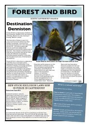
Ashburton - Forest and Bird
Ashburton - Forest and Bird
Ashburton - Forest and Bird

Create successful ePaper yourself
Turn your PDF publications into a flip-book with our unique Google optimized e-Paper software.
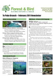
Hakatere News<br />
September 2011<br />
From the committee<br />
John Waugh, hydrologist, <strong>and</strong> member of our<br />
committee, made a submission on ecological<br />
issues on the <strong>Ashburton</strong> River (reprinted below)<br />
on behalf of <strong>Forest</strong> & <strong>Bird</strong> to the <strong>Ashburton</strong> Zone<br />
Committee of the Canterbury Water Management<br />
Strategy (CWMS).<br />
<strong>Forest</strong> & <strong>Bird</strong> is taking a great interest in the<br />
CWMS <strong>and</strong> has a responsibility to submit on<br />
water issues in our area. We are very pleased to<br />
have John’s expertise in hydrology <strong>and</strong> local<br />
knowledge of the <strong>Ashburton</strong> River.<br />
Ecological issues on the <strong>Ashburton</strong><br />
River<br />
Background<br />
• The <strong>Ashburton</strong> River is seriously overallocated<br />
in relation to out-of-stream water<br />
use<br />
• Total allocation (surface <strong>and</strong> groundwater) is<br />
17.934 cumecs (60.7% of the mean flow)<br />
• Stockwater takes in the <strong>Ashburton</strong> catchment<br />
total 5.47 cumecs<br />
• The average allocation of 14.53 cumecs is more<br />
than twice the NES recommendation of 7.1<br />
cumecs<br />
• <strong>Ashburton</strong> River is the most heavily allocated<br />
river in NZ, in relation to its natural mean<br />
flow of 29.56 cumecs.<br />
The Government’s NPS “Freshwater Management,<br />
2011” (12 May 2011) says overallocation has to be<br />
addressed.<br />
FIVE KEY ISSUES that need to be<br />
addressed on the <strong>Ashburton</strong> River<br />
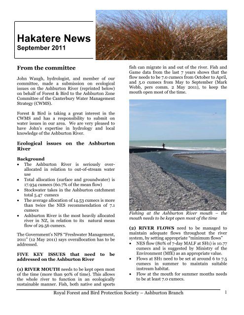
(1) RIVER MOUTH needs to be kept open most<br />
of the time (more than 90% of time). This allows<br />
the whole river to function in an ecologically<br />
sustainable manner. Fish, both native <strong>and</strong> sports<br />
fish can migrate in <strong>and</strong> out of the river. Fish <strong>and</strong><br />
Game data from the last 7 years shows that the<br />
flow needs to be 7.0 cumecs from October to April,<br />
<strong>and</strong> 5.0 cumecs from May to September (Mark<br />
Webb, pers comm. 2 May 2011), to keep the<br />
mouth open most of the time.<br />
Fishing at the <strong>Ashburton</strong> River mouth – the<br />
mouth needs to be kept open most of the time<br />
(2) RIVER FLOWS need to be managed to<br />
maintain adequate flows throughout the river<br />
system, by setting appropriate “minimum flows”<br />
• NES flow (80% of 7-day MALF at SH1) is 10.77<br />
cumecs <strong>and</strong> is suggested by Ministry of the<br />
Environment (MfE) as an appropriate value.<br />
• Flows at SH1 need to be set at around 6 to 7.5<br />
cumecs in summer to maintain suitable<br />
instream habitat.<br />
• Flow at the mouth for summer months needs<br />
to be at least 7.0 cumecs.<br />
Royal <strong>Forest</strong> <strong>and</strong> <strong>Bird</strong> Protection Society – <strong>Ashburton</strong> Branch<br />
1
• A flow regime also needs to be established to<br />
keep the river healthy. Floods <strong>and</strong> freshes<br />
play a vital role in maintaining the “braided”<br />
character of the <strong>Ashburton</strong> River.<br />
(3) RESTORE FLOWS to rivers that are now<br />
dry for (a) a greater period of time (months<br />
instead of days or weeks) <strong>and</strong> (b) over a longer<br />
reach of river. Examples where this applies are<br />
the North <strong>Ashburton</strong> River <strong>and</strong> the Hinds River<br />
around <strong>and</strong> above SH1.<br />
(4) WATER QUALITY Water Quality issues<br />
need to be thoroughly investigated by<br />
Environment Canterbury, from Buick’s Bridge to<br />
the hapua/mouth. Then actions need to be taken<br />
to clean up the river, to allow people to safely use<br />
the river for “contact” recreation.<br />
(5) PRESERVE the Upper South <strong>Ashburton</strong><br />
River <strong>and</strong> adjacent river-side flats in its natural<br />
state.<br />
(a) This particularly applies to the outwash plain<br />
from Buick’s Bridge down to Hakatere Corner,<br />
<strong>and</strong> between the Lake Heron Road <strong>and</strong> the river.<br />
Invasive weed species like broom <strong>and</strong> willow need<br />
to be kept out of this area. <strong>Forest</strong> <strong>and</strong> <strong>Bird</strong><br />
underst<strong>and</strong> that some weed <strong>and</strong> pest control<br />
action has been undertaken in this area, <strong>and</strong> this<br />
should be continued. This area is prime nesting<br />
habitat for b<strong>and</strong>ed dotterel <strong>and</strong> a few wrybill.<br />
(b) Hakatere Corner down to Blowing Point<br />
Bridge is more heavily infested with weed species,<br />
but endangered bird species are known to breed in<br />
this area. It also needs ongoing weed <strong>and</strong> pest<br />
control action.<br />
CONCLUSION The <strong>Ashburton</strong> River Water<br />
Management Plan should set long-term targets to<br />
be achieved over 20 years, but with working<br />
milestones to be met in 5, 10, <strong>and</strong> 15 years.<br />
Possible effects of climate change<br />
To check whether flows in the <strong>Ashburton</strong> River<br />
are stable, I computed decadal mean flows, set out<br />
below. The results are quite a surprise.<br />
North <strong>Ashburton</strong> River at Old Weir, site<br />
68810, the mean flow (1982 -2011) is 8.373<br />
cumecs.<br />
Decade mean flows are:<br />
1981-1990: 9.42 cumecs<br />
1991-2000: 8.63 cumecs<br />
2001-2010: 7.46 cumecs<br />
Hence the North <strong>Ashburton</strong> has lost 2 cumecs of<br />
natural inflow over the period 1981-2010.<br />
South <strong>Ashburton</strong> River at Mt. Somers, site<br />
68806, the mean flow (1967-2011) is 10.805<br />
cumecs.<br />
Decade mean flows are:<br />
1971-1980: 10.09 cumecs<br />
1981-1990: 10.73 cumecs<br />
1991-2000: 11.64 cumecs<br />
2001-2010: 9.74 cumecs<br />
Hence the South <strong>Ashburton</strong> river has lost around 1<br />
cumec of natural inflow between 1981 <strong>and</strong> 2010.<br />
Effectively the <strong>Ashburton</strong> at SH1 has lost 3 cumecs<br />
over this 30 year period. The most likely cause of<br />
the loss of natural inflows is the effect of climate<br />
change. It is very clear that the flows in the<br />
<strong>Ashburton</strong> River are not stable, <strong>and</strong> this needs to<br />
be allowed for in managing the water resource. At<br />
the same time irrigation dem<strong>and</strong> has more than<br />
doubled, placing increasing stress on the water<br />
resource.<br />
John R Waugh, Hydrologist, 20-08-2011<br />
<strong>Forest</strong> & <strong>Bird</strong> donates art award<br />
<strong>Forest</strong> & <strong>Bird</strong> donated a prize for the best native<br />
botanical art at the annual <strong>Ashburton</strong> Society of<br />
Arts exhibition held in June. This was won by<br />
Andrea Moonlight with a beautiful stylised fern<br />
painting. Congratulations Andrea!<br />
Royal <strong>Forest</strong> <strong>and</strong> <strong>Bird</strong> Protection Society – <strong>Ashburton</strong> Branch<br />
2
Kanuka planting at the Harris Reserve<br />
The Harris Scientific Reserve at Lovetts Road,<br />
Maronan, was a scene of great activity on Sept 4 th<br />
as about 250 people planted 2800 trees to<br />
augment the 2000 (mostly kanuka) plants already<br />
planted there by the <strong>Ashburton</strong> Community<br />
Conservation Trust (which was formed by <strong>Forest</strong><br />
& <strong>Bird</strong>). This big increase in the planting in the<br />
reserve has come about thanks to the Living<br />
Legends project.<br />
Living Legends was set up as part of the Rugby<br />
World Cup, <strong>and</strong> nationally, funding has been<br />
made available for 17 native plant restoration<br />
projects. The Harris Reserve is one of the sites<br />
chosen to participate. Our local Living Legend,<br />
ex-All Black Jock Ross, was on h<strong>and</strong> to help<br />
“draft” groups of helpers into the paddock to begin<br />
the planting.<br />
This is a huge boost to the development of the<br />
Harris Reserve <strong>and</strong> with ongoing support from<br />
Living Legends we will make progress much faster<br />
than previously expected. Conditions at the<br />
reserve are quite extreme, with low fertility soil<br />
which tends to dry out quickly. This site is one of<br />
only a h<strong>and</strong>ful of such Canterbury Dryl<strong>and</strong><br />
ecosystems still in existence, <strong>and</strong> as such is an<br />
important indicator of how the plains looked<br />
before settlement. It has also become a repository<br />
for plants that are fast disappearing.<br />
Thank you to all those people who helped prepare<br />
the site, then plant, water, <strong>and</strong> mulch the trees. It<br />
was very inspiring to see the transformation from<br />
bare paddock to a veritable forest of young trees,<br />
<strong>and</strong> it was great to see the enthusiasm from young<br />
<strong>and</strong> old.<br />
Native planting at the new industrial area<br />
It is encouraging to see how well the native<br />
planting, including beech trees, at the new<br />
industrial area is progressing. The council is to be<br />
commended for their planting work at the site.<br />
Survey of native vegetation<br />
The <strong>Ashburton</strong> Community Conservation Trust<br />
formed by <strong>Forest</strong> <strong>and</strong> <strong>Bird</strong> has recently invited<br />
tenders from botanists to carry out a survey of the<br />
<strong>Ashburton</strong> District dryl<strong>and</strong> vegetation from SH72<br />
<strong>and</strong> between the Rangitata <strong>and</strong> the Rakaia Rivers.<br />
A previous survey completed in 1996 identified<br />
many sites throughout the District where<br />
indigenous (native) vegetation was still existing.<br />
This data was available at the time of writing the<br />
original <strong>Ashburton</strong> District Plan <strong>and</strong> appeared<br />
to recognise the plight of these often tiny<br />
remnants. A rule was included which stated that<br />
there should be no clearance of indigenous<br />
vegetation on Rural A <strong>and</strong> B l<strong>and</strong> (7.6.5.1.13).<br />
A mature kanuka on the Lovetts Road which may<br />
be hundreds of years old<br />
Unfortunately this clause has had no ability to<br />
protect those remnants <strong>and</strong> we have seen native<br />
vegetation removed or lost due to other l<strong>and</strong> use<br />
<strong>and</strong> neglect often on public l<strong>and</strong>. The remnants<br />
remaining, because there are so few of them in the<br />
<strong>Ashburton</strong> District, are now regarded as being<br />
significant sites. An example is the<br />
meuhlenbeckia on the fence at Hinds School.<br />
The Canterbury Water Management Strategy <strong>and</strong><br />
the Canterbury Biodiversity Strategy recognise<br />
concerns about the loss of plains indigenous<br />
vegetation <strong>and</strong> as a result we were able to suggest<br />
to the District Council Biodiversity Action Plan<br />
that before decisions are made regarding<br />
Kanuka planting day at the Harris Reserve<br />
managing the remaining indigenous plantlife <strong>and</strong><br />
Royal <strong>Forest</strong> <strong>and</strong> <strong>Bird</strong> Protection Society – <strong>Ashburton</strong> Branch<br />
3
associated ecosystems we need to find out what is<br />
left. Hence the survey which will be completed<br />
over this summer.<br />
A recent situation exemplifies the urgency. A<br />
farmer developing l<strong>and</strong> for centre pivot irrigation<br />
bulldozed several mature Kanuka trees bordering<br />
the Rakaia River near the new Acton canal system.<br />
This was very disappointing when others in the<br />
community are spending many hours protecting<br />
indigenous ecosystems. Restoring a Kanuka forest<br />
in particular is a very difficult task. There has<br />
been a lots of publicity about this recently. In the<br />
Selwyn District when a similar situation occurred<br />
the farmer was required to replant much of the<br />
affected area as well as plant a separate area with<br />
locally sourced vegetation. As a signatory to the<br />
Canterbury Biodiversity Strategy we expect the<br />
<strong>Ashburton</strong> Council will apply the same rules <strong>and</strong><br />
require the l<strong>and</strong> owner to replant <strong>and</strong> maintain<br />
the Kanuka trees as was the case in Selwyn.<br />
Kanuka destroyed<br />
Nature in London<br />
While looking after my small gr<strong>and</strong>children in<br />
London we visited wonderful parks <strong>and</strong> even<br />
'farms' in the middle of the city. Families are well<br />
catered for <strong>and</strong> there are many opportunities for<br />
children to touch base with nature.<br />
The Royal Society for the Protection of <strong>Bird</strong>s has<br />
restored <strong>and</strong> manages the marsh which comprises<br />
ponds, streams <strong>and</strong> extensive reed beds. There is<br />
an abundance of wild plants including banks of<br />
blackberries <strong>and</strong> other 'weeds'. A network of<br />
tracks <strong>and</strong> boardwalks are provided as well as<br />
viewing points to observe the wetl<strong>and</strong>'s array of<br />
wildlife.<br />
The wetl<strong>and</strong> like others in UK is very family<br />
friendly <strong>and</strong> has a good array of information<br />
panels. Local RSPB members were on h<strong>and</strong> to<br />
explain <strong>and</strong> show various species to be found<br />
there. It is home to a diverse range of birdlife as<br />
well as insects such as the scarce emerald<br />
dragonfly. Grass snakes <strong>and</strong> huge frogs are in the<br />
marsh as well as the water vole which is seldom<br />
seen elsewhere in UK.<br />
Part of the site includes the Thames estuary shore<br />
line with a mix of sea, shore <strong>and</strong> migratory birds<br />
as well as an ancient petrified forest. A place such<br />
as this is a welcome contrast to the busy London<br />
city <strong>and</strong> well worth a visit.<br />
Edith<br />
One memorable place was the Rainham Marshes<br />
at Purfleet on the banks of the River Thames in<br />
the upper estuary area. These ancient marshl<strong>and</strong>s<br />
were a Ministry of Defence firing range for over a<br />
century. This historic place includes the firing<br />
range <strong>and</strong> lookout shelters as well as shells from<br />
The Rainham Marshes on the River Thames<br />
bombs off loaded by fleeing Germans<br />
during World War 2.<br />
Royal <strong>Forest</strong> <strong>and</strong> <strong>Bird</strong> Protection Society – <strong>Ashburton</strong> Branch<br />
4
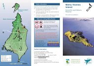
Wrybill research on Rakaia River<br />
Over the last three years DOC has undertaken<br />
research on wrybill in the upper Rangitata River.<br />
We have good information on distribution, key<br />
breeding areas, proportion of nests predated <strong>and</strong><br />
flooded, <strong>and</strong> have begun to get an idea of<br />
productivity – that is, the number of chicks each<br />
female produces per year. What we are learning<br />
indicates that the population is in decline. Other<br />
studies on wrybill have shown that for a<br />
population to remain stable, a female must<br />
produce 0.75 juveniles per year. Last season, the<br />
females that we monitored produced a third of<br />
that figure.<br />
This year, we have an opportunity to research<br />
wrybill in the upper Rakaia River. Contact Wind<br />
Limited has recently been granted resource<br />
consents for a 168 turbine wind farm in the North<br />
Isl<strong>and</strong>, on the coast between Raglan <strong>and</strong> Port<br />
Waikato. As part of the project Contact Wind Ltd<br />
is required to undertake a long term programme<br />
in the upper Rangitata River to offset any<br />
potential biodiversity losses (deaths) which may<br />
occur when wrybill fly north to their winter<br />
feeding grounds. Contact intend to do this by<br />
establishing a programme to enhance the<br />
breeding success of wrybill <strong>and</strong> the South Isl<strong>and</strong><br />
Pied Oystercatcher (SIPO) nesting in the upper<br />
Rangitata River. This will involve determining<br />
current productivity of wrybill <strong>and</strong> SIPO in the<br />
upper Rangitata River over the next 2-3 years<br />
before undertaking a mammalian predator control<br />
programme. This work will complement Project<br />
River Recovery, a predator control programme<br />
undertaken in the Tasman River, <strong>and</strong> provide<br />
DOC with further information on how effective<br />
mammalian predator control is at increasing<br />
productivity of SIPO <strong>and</strong> wrybill in braided rivers.<br />
Contact’s involvement provides the department<br />
with an opportunity to use its resources in the<br />
upper Rakaia River while still gaining information<br />
of wrybill productivity in the upper Rangitata<br />
River. There has been no research done on wrybill<br />
in the upper Rakaia River for over 30 years. At<br />
that time the upper Rakaia River, along with the<br />
upper Rangitata River, was considered stronghold<br />
populations for the species. DOC now has an<br />
opportunity to survey <strong>and</strong> research this<br />
population, which will assist in a better<br />
underst<strong>and</strong>ing of the species nationally. We will<br />
still be undertaking all other work such as weed<br />
control as normal in the upper Rangitata River.<br />
Our objectives for research in the upper Rakaia<br />
River over the next six years will be:<br />
1. undertake surveys to obtain an estimate of<br />
abundance of wrybill<br />
2. map wrybill distribution<br />
3. monitor up to 40 pairs to determine<br />
productivity<br />
4. undertake video monitoring <strong>and</strong> DNA analysis<br />
of predated nests to determine predator guilds<br />
5. underst<strong>and</strong> location <strong>and</strong> abundance of<br />
southern black-back gulls <strong>and</strong> harriers<br />
6. determine if avian control is beneficial in<br />
improving wrybill productivity<br />
Wendy Sullivan, DOC Geraldine<br />
Water meetings The <strong>Ashburton</strong> Zone<br />
Committee has put together a draft programme<br />
for water management which you are invited to<br />
review <strong>and</strong> give feedback on before it is finalised.<br />
Public meetings are being held <strong>and</strong> written<br />
comments are welcome – please send by Oct 21.<br />
Community Engagement meetings:<br />
Wed 28 Sept, 7-9 pm, Rakaia Church Hall<br />
Thurs 29 Sept, 7-9 pm, <strong>Ashburton</strong> District<br />
Council Office<br />
Fri 30 Sept, Mayfield Memorial Hall<br />
Fantails How are the fantails in your area?<br />
Fantails often do not survive snowfalls <strong>and</strong> despite<br />
it having been a generally warm winter, there have<br />
been two snowfalls which may have caused fantail<br />
deaths. It would be interesting to know how they<br />
are faring – please keep an eye out for fantails.<br />
Royal <strong>Forest</strong> <strong>and</strong> <strong>Bird</strong> Protection Society – <strong>Ashburton</strong> Branch<br />
5
Winter bird count The annual winter bird<br />
count on the <strong>Ashburton</strong> Lakes was again a great<br />
event. It was a warmish day but many of the lakes<br />
had some ice. A total of 4897 birds (but only 9<br />
grebes) were counted, as compared to 5900 last<br />
year. This was the 27 th year the count has been<br />
running. The lakes <strong>and</strong> mountains looked<br />
stunning under their winter covering of snow.<br />
Don counting from the ver<strong>and</strong>ah of Neville’s bach<br />
at Lake Clearwater<br />
Lake Emma<br />
The hut at Lake Emma<br />
Rubbish on our roads! Peter Howden <strong>and</strong><br />
his gr<strong>and</strong>sons recently picked up rubbish from a<br />
2.5 km section of road near Mayfield. They<br />
collected 648 pieces of rubbish of which there<br />
were 118 aluminium cans, 115 glass bottles, 112<br />
plastic bottles – the balance being car tyres, paper,<br />
chip packets etc. Just imagine the amount of<br />
rubbish on the roads across our whole district –<br />
surely the public can do better than this???<br />
Vehicle costs It would be appreciated if<br />
passengers would contribute to fuel <strong>and</strong> vehicle<br />
running costs. On trips to Christchurch or the<br />
high country please offer your driver $10 per<br />
passenger, <strong>and</strong> $5 within the <strong>Ashburton</strong> area.<br />
The <strong>Ashburton</strong> Branch of F & B:<br />
• Meets on the third Tuesday of every month at<br />
the Sinclair Centre, Park St, at 7.30pm<br />
• Excellent speakers entertain <strong>and</strong> educate<br />
• Kiwi Conservation Club – the junior branch of<br />
F&B – check the programme for KCC Great Days<br />
Out<br />
• F&B organises field trips to interesting locations,<br />
usually within mid-Canterbury<br />
• We welcome visitors <strong>and</strong> new members<br />
Committee<br />
Chair: Edith Smith 3084440<br />
Secretary: Val Clemens 3085620<br />
Treasurer: Peter Smith 3084440<br />
Committee: Bill Hood, Janet Hood, Donna Field,<br />
Peter Howden, Valerie Sheldon, Paul Dyas, Warren<br />
Jowett, Don Geddes, Jean Wragg, Allan Sinclair,<br />
Mary Ralston.<br />
Newsletter editor: Mary Ralston Contributions<br />
are welcome – please send to<br />
mary.ralston@xtra.co.nz or phone 3029202<br />
Royal <strong>Forest</strong> <strong>and</strong> <strong>Bird</strong> Protection Society – <strong>Ashburton</strong> Branch<br />
6