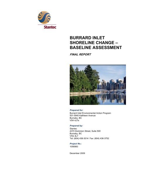
BURRARD INLET SHORELINE CHANGE – BASELINE ASSESSMENT
BURRARD INLET SHORELINE CHANGE – BASELINE ASSESSMENT
BURRARD INLET SHORELINE CHANGE – BASELINE ASSESSMENT

You also want an ePaper? Increase the reach of your titles
YUMPU automatically turns print PDFs into web optimized ePapers that Google loves.
<strong>BURRARD</strong> <strong>INLET</strong><br />
<strong>SHORELINE</strong> <strong>CHANGE</strong> <strong>–</strong><br />
<strong>BASELINE</strong> <strong>ASSESSMENT</strong><br />
FINAL REPORT<br />
Prepared for:<br />
Burrard Inlet Environmental Action Program<br />
501-5945 Kathleen Avenue<br />
Burnaby, BC<br />
V5H 4J7e<br />
Prepared by:<br />
Stantec<br />
4370 Dominion Street, Suite 500<br />
Burnaby, BC<br />
V5G 4L7<br />
Tel: (604) 436-3014 Fax: (604) 436-3752<br />
Project No.:<br />
1056983<br />
December 2009
Flat/Estuary<br />
EXECUTIVE SUMMARY<br />
<strong>BURRARD</strong> <strong>INLET</strong> <strong>SHORELINE</strong> <strong>CHANGE</strong> <strong>–</strong> <strong>BASELINE</strong> <strong>ASSESSMENT</strong><br />
Final Report<br />
Executive Summary<br />
The Burrard Inlet Environmental Action Program (BIEAP) is an inter-governmental partnership that<br />
coordinates environmental management of Burrard Inlet. In 2002, the Consolidated Environmental<br />
Management Plan was created to facilitate continued sustainability, enhancement and protection of<br />
the Inlet. The success of this program can be assessed using indicators that assess whether current<br />
practices are adequate in protecting Burrard Inlet or whether they should be modified.<br />
The present document was prepared to develop indicators that can be used to measure status and<br />
trends in marine habitat and shoreline areas over time and the effects of development within Burrard<br />
Inlet. The resulting information can be used to monitor future development in Burrard Inlet.<br />
The study area included Burrard Inlet east of a line between Ambleside Park in West Vancouver and<br />
Kitsilano Beach in Vancouver. It did not include much of the areas where development is less likely<br />
to occur, including most of Indian Arm and the Outer Harbour. The naming conventions used by<br />
BIEAP to denote basins of Burrard Inlet were followed: results were described for the Inlet as a<br />
whole and for False Creek, eastern Outer Harbour, Inner Harbour, Central Harbour, Port Moody<br />
Basin and southern Indian Arm.<br />
Six habitat types were defined to assess and quantify existing marine habitat in Burrard Inlet. Habitat<br />
types were defined based on consultation with members of BIEAP’s Plan Implementation<br />
Committee, GIS datasets and studies from Burrard Inlet, and professional expertise and knowledge<br />
of the area. The selected types are tidal flats/ estuaries, beach, natural rocky intertidal, river/stream<br />
inputs, purpose built high value and purpose built low value. The intentional use of these classifications<br />
is to identify general habitat quality and type available to marine organisms in Burrard Inlet. Riparian<br />
habitat (areas with trees and shrubs at the high water mark and extending at least five metres inland)<br />
was also considered since it has significant effects on associated intertidal habitats.<br />
The assessment focused mainly on linear (metre) amounts of shoreline in each habitat type, as this<br />
is the most applicable measurement for much of Burrard Inlet. However, areal calculations (hectare)<br />
were made where appropriate. Linear calculations were provided for natural rocky intertidal, riparian,<br />
purpose built high value, and purpose built low value for the entire Inlet study area, as well as for<br />
each basin. Area calculations were made for tidal flats/estuaries, beaches, wharfs and piers.<br />
Port Moody Arm, Indian Arm South and Central Harbour basins have the greatest proportion and<br />
amount of both natural habitat and purpose built high value habitat. These areas are especially<br />
important for the many species that rely on high quality habitat, including resident and migrating<br />
birds, juvenile salmon and invertebrates that use tidal flats and estuaries. Basins with the highest<br />
amount of purpose built high value and low value habitat are False Creek and the Inner Harbour.<br />
The information from this study will be useful in developing recommendations for evaluating<br />
proposed developments within any area of the Inlet, in particular Port Moody Arm and Central<br />
Harbour, and for habitat restoration and compensation programs in the areas such as False Creek<br />
and Inner Harbour, which currently contain a proportionally large amount of low value habitat to<br />
many species.<br />
December 2009<br />
Project No. 1056983<br />
i
<strong>BURRARD</strong> <strong>INLET</strong> <strong>SHORELINE</strong> <strong>CHANGE</strong> <strong>–</strong> <strong>BASELINE</strong> <strong>ASSESSMENT</strong><br />
Final Report<br />
Glossary<br />
GLOSSARY<br />
Anthropogenic <strong>–</strong> effects, processes, objects, or materials derived from human activities, as<br />
opposed to those occurring in natural environments without human influences<br />
Backshore <strong>–</strong> the upper part of the active beach above the normal reach of the high water, but<br />
affected by large waves occurring during a high tide<br />
Basin <strong>–</strong> geographic designation of harbours and areas of Burrard Inlet<br />
Bedrock <strong>–</strong> a layer of solid, unweathered rock along the shoreline<br />
BIEAP <strong>–</strong> Burrard Inlet Environmental Action Program (BIEAP), an inter-governmental partnership<br />
established to coordinate environmental management of Burrard Inlet<br />
Biodiversity <strong>–</strong> the richness of life forms within a given ecosystem, region or the entire planet; often<br />
used as a measure of the health of biological systems<br />
Ecosystem <strong>–</strong> a natural unit consisting of all plants, animals and micro-organisms in an area<br />
functioning together with all the non-living physical factors of the environment<br />
Estuary <strong>–</strong> the wide part of the river where its current meets the ocean tides and fresh and salt water mix<br />
Foreshore <strong>–</strong> the part of a shore between high water and low water; includes the backshore exposed<br />
at maximum ebb spring tides<br />
Habitat <strong>–</strong> the place or environment where a plant or animal naturally or normally lives and grows,<br />
which provides food, water, shelter and space<br />
Intertidal <strong>–</strong> the zone of influence from the tide; a component of the foreshore, includes the part of a<br />
shore between the high tide mark and the low tide mark<br />
Riprap <strong>–</strong> a permanent, erosion-resistant foundation or wall of large, loose, angular stone with<br />
granular underlining. Usually erected in water or on shorelines or soft ground as a foundation<br />
Riparian <strong>–</strong> typically refers to habitat along streams, rivers and lakes; in the marine context, it refers<br />
to shoreline areas with overhanging trees and/or shrubs<br />
Substrate <strong>–</strong> sediment, sand, gravel, cobble, boulder or bedrock in the bottom of a water body<br />
Subtidal <strong>–</strong> below the low tide line; submerged virtually continuously<br />
Tidal flat <strong>–</strong> coastal wetlands formed when mud is deposited by tides or rivers; nearly flat area<br />
covered and uncovered by the alternating tides<br />
ii<br />
December 2009<br />
Project No. 1056983
TABLE OF CONTENTS<br />
<strong>BURRARD</strong> <strong>INLET</strong> <strong>SHORELINE</strong> <strong>CHANGE</strong> <strong>–</strong> <strong>BASELINE</strong> <strong>ASSESSMENT</strong><br />
Final Report<br />
Table of Contents<br />
1 INTRODUCTION ....................................................................................................... 1<br />
1.1 Background and Project Objectives............................................................... 1<br />
1.2 Site Description.............................................................................................. 1<br />
1.3 Data Sources ................................................................................................. 1<br />
1.3.1 Shoreline Classification Study ........................................................ 1<br />
1.3.2 Historical Analysis of Shoreline Change ......................................... 2<br />
1.3.3 Habitat Inventory/Land Use Classification ...................................... 2<br />
1.3.4 Field Verification and Ground-Truthing (2009)................................ 2<br />
1.4 Geographic Coverage and Boundaries ......................................................... 3<br />
2 BACKGROUND INFORMATION.............................................................................. 4<br />
2.1 Shoreline Changes over Time (1930s vs. 2005) ........................................... 5<br />
3 METHODS FOR GENERATING THE <strong>SHORELINE</strong> INDICATOR............................ 6<br />
3.1 Habitat Classifications ................................................................................... 6<br />
3.1.1 Intertidal Habitat.............................................................................. 6<br />
3.1.2 Riparian Habitat .............................................................................. 8<br />
3.2 Calculating Habitat Quantity and Quality ....................................................... 8<br />
4 RESULTS AND DISCUSSION.................................................................................. 9<br />
4.1 Linear Shoreline Habitat ................................................................................ 9<br />
4.2 Area of Tidal Flats, Estuaries and Beaches................................................. 11<br />
4.3 Area of Wharfs and Piers............................................................................. 12<br />
4.4 Linear Extent of Riparian Habitat................................................................. 12<br />
4.5 Invasive Species.......................................................................................... 14<br />
4.6 Spawning Fish ............................................................................................. 14<br />
4.7 Waterbirds ................................................................................................... 15<br />
5 TRACKING <strong>SHORELINE</strong> <strong>CHANGE</strong> OVER TIME .................................................. 15<br />
6 SUMMARY AND GENERAL RECOMMENDATIONS ............................................ 15<br />
7 CAVEATS, UNCERTAINTIES AND LIMITATIONS ............................................... 16<br />
8 CLOSURE............................................................................................................... 17<br />
9 REFERENCES........................................................................................................ 19<br />
December 2009<br />
Project No. 1056983<br />
iii
<strong>BURRARD</strong> <strong>INLET</strong> <strong>SHORELINE</strong> <strong>CHANGE</strong> <strong>–</strong> <strong>BASELINE</strong> <strong>ASSESSMENT</strong><br />
Final Report<br />
Table of Contents<br />
List of Tables<br />
Table 1: Boundaries of and Uses in the Six Basins of Burrard Inlet......................................... 4<br />
Table 2: Length (m) and Area (Ha) of Burrard Inlet Shoreline in the 1930s and 2005............. 6<br />
Table 3: Working Habitat Types for Shoreline Classification in Burrard Inlet........................... 6<br />
Table 4: Linear Distance of Shoreline Habitat Type in Burrard Inlet ........................................ 9<br />
Table 5: Area Calculations (Ha) of Tidal flats/Estuary and Beach in Burrard Inlet................. 11<br />
Table 6: Area of Intertidal Habitat Occupied by Wharfs and Piers in Burrard Inlet ................ 12<br />
List of Figures<br />
Figure 9: Linear Distance (m) of each Habitat Type in Burrard Inlet ......................................... 10<br />
Figure 10: Linear Distance (m) of each Habitat Type in Burrard Inlet (Percent of Total<br />
Area) ......................................................................................................................... 10<br />
Figure 11: Linear Distance (m) of Riparian Habitat in Burrard Inlet (Percent of Total<br />
Area) ......................................................................................................................... 13<br />
Figure 12: Linear Distance (m) of Riparian in Burrard Inlet ....................................................... 13<br />
List of Appendices<br />
Appendix A ....................................................................................................................Figures 1-8<br />
iv<br />
December 2009<br />
Project No. 1056983
1 INTRODUCTION<br />
<strong>BURRARD</strong> <strong>INLET</strong> <strong>SHORELINE</strong> <strong>CHANGE</strong> <strong>–</strong> <strong>BASELINE</strong> <strong>ASSESSMENT</strong><br />
Final Report<br />
Section 1: Introduction<br />
1.1 Background and Project Objectives<br />
The Burrard Inlet Environmental Action Program (BIEAP) is an inter-governmental partnership that<br />
coordinates environmental management of Burrard Inlet. In 2002, BIEAP approved the Consolidated<br />
Environmental Management Plan for Burrard Inlet (CEMP, BIEAP 2002), a document that contains a<br />
series of goals aimed at improving management of the Inlet through monitoring, habitat protection<br />
and enhancement. In 2008, the Burrard Inlet Environmental Indicators Report was released to help<br />
guide planning for future development in Burrard Inlet by providing information on seven indicators.<br />
The following report was produced to provide baseline information on an eighth indicator that<br />
measures the status of marine habitat and shoreline in Burrard Inlet.<br />
1.2 Site Description<br />
Burrard Inlet is a productive marine and terrestrial ecosystem. It is unique from other inlets in British<br />
Columbia in the lack of a sill at its mouth and the relatively shallow slope of adjacent shoreline.<br />
Burrard Inlet includes over 11,000 ha of water and seabed, 190 km of shoreline and a drainage<br />
basin of 98,000 ha. The mean tidal range within the inlet is 3.3 m. The main freshwater inputs are<br />
from the Seymour River (monthly mean discharges of 3.8 to 24.9 m 3 ) and the Capilano River (5.7 to<br />
42.8 m 3 ) (Nijman 1990). The deepest waters contain salinity of 29 to 30 ppt, while surface salinity<br />
can vary from 20 to 25 ppt during the winter runoff, dropping down to less than 20 ppt during the<br />
summer due to runoff from the Fraser River (Nijman 1990). Surface water temperatures vary<br />
seasonally, from 5ºC in the winter to 20ºC in the summer.<br />
1.3 Data Sources<br />
Four primary data sources were referred to for completion of this report:<br />
Shoreline Classification (M.Sc. thesis by Dana Haggarty)<br />
Historical analysis of shoreline change over time by Integrated Mapping Technologies (I MT)<br />
using aerial photographs from the 1930s and 2005<br />
Habitat inventory/land use classification (Caslys Consulting 2009)<br />
BIEAP 2009 field verification and ground-truthing.<br />
1.3.1 Shoreline Classification Study<br />
Haggarty (2001) examined fish habitat in terms of substrate type and shoreline in Burrard Inlet.<br />
Substrate was chosen because it is a strong indicator of habitat type and is often strongly correlated<br />
with physical properties such as exposure and slope. From a management perspective, substrate is<br />
also considered a useful parameter because it can be mapped, is relatively stable and is often<br />
December 2009<br />
Project No. 1056983<br />
1
<strong>BURRARD</strong> <strong>INLET</strong> <strong>SHORELINE</strong> <strong>CHANGE</strong> <strong>–</strong> <strong>BASELINE</strong> <strong>ASSESSMENT</strong><br />
Final Report<br />
Section 1: Introduction<br />
altered by human activity. Indian Arm was not included in Haggarty’s study because of the physical<br />
differences between it and Burrard Inlet.<br />
Results indicated that almost 45% of the shoreline in Burrard Inlet has been altered; the Inner<br />
Harbour is the most altered basin with almost 80% alteration. Numerous species of fish were<br />
reported to use Burrard Inlet over a variety of substrates, varying by habitat type. For example,<br />
juvenile chum and chinook were found in greater abundances in the outer basins of the Inlet than the<br />
inner basins and more commonly occurred over bedrock, boulders and cobbles than mud and sand.<br />
1.3.2 Historical Analysis of Shoreline Change<br />
The historical analysis of the Burrard Inlet shoreline conducted by IMT (2009) assessed shoreline<br />
change over time using aerial photographs from the 1930s and 2005. The aim of the project was to<br />
calculate approximate habitat loss over time based on changes in the high water mark from the<br />
1930s and 2005. The resulting calculations showed an overall loss of 52.85 km of natural shoreline<br />
and a loss of 363 ha of the inlet area. Over the entire inlet, altered shoreline increased by 37.09 km<br />
between the 1930s and 2005, with 5.42 km of that classified as permanently altered. Further details<br />
on this study are provided in Section 2.<br />
1.3.3 Habitat Inventory/Land Use Classification<br />
Caslys (2009) created a summary report of Burrard Inlet, including all of Indian Arm, using air photobased<br />
land cover mapping. Major features of the inlet were digitized using an automated aerial photo<br />
interpretation program. Overall, this analysis produced satisfactory results for the upland areas (up to<br />
250 m from the high water mark), but less useful results for the intertidal zone.<br />
Results showed the north and south portions of Indian Arm contain almost all the coniferous forest in<br />
the Inlet and the north portion contains over half the intertidal vegetation in the Inlet. Overall findings<br />
are as follows:<br />
2<br />
The highest percentage of land cover was coniferous forest (>14%), followed by both<br />
deciduous forests and impervious substrates<br />
Nearly half of all riprap shoreline in Burrard Inlet occurs along the City of Vancouver<br />
foreshore<br />
Almost 90% of impervious surfaces are found along the foreshores of the City of North<br />
Vancouver, the District of North Vancouver, Port Moody and Vancouver<br />
Over 85% of all wharfs and piers are located in the City of North Vancouver, the District of<br />
North Vancouver and Vancouver.<br />
1.3.4 Field Verification and Ground-Truthing (2009)<br />
In 2009, a significant portion of the intertidal zone and shoreline was surveyed in a field verification<br />
and ground-truthing study (Lamagna and Walker 2009). The project classified over 7 million square<br />
metres of substrate, thus producing an excellent source of localized detail on substrate types<br />
December 2009<br />
Project No. 1056983
Retaining wall<br />
<strong>BURRARD</strong> <strong>INLET</strong> <strong>SHORELINE</strong> <strong>CHANGE</strong> <strong>–</strong> <strong>BASELINE</strong> <strong>ASSESSMENT</strong><br />
Final Report<br />
Section 1: Introduction<br />
throughout Burrard Inlet. The study concluded that almost 65% of the shoreline is structured and<br />
35% is unstructured, with nearly half of the unstructured area consisting of sand.<br />
Natural, short term influences<br />
on shoreline morphology<br />
include erosion by waves and<br />
the deposition and movement<br />
of sediments. To prevent this<br />
natural erosion, a structured<br />
shoreline, consisting of riprap<br />
and retaining walls, have been<br />
built along much of the<br />
shoreline. This type of shoreline<br />
significantly alters natural<br />
habitat, particularly fish habitat,<br />
Riprap<br />
if installed below the high tide<br />
line. Riprap tends to be less restrictive than retaining walls, as it provides some fish habitat. Of the<br />
142,056 m of shoreline surveyed, 91,651 m (65%) is structured with riprap and retaining walls. The<br />
unstructured shoreline includes natural shoreline and altered but unstructured shoreline. Most of the<br />
unstructured shoreline occurs in the southern portion of Indian Arm; Central Harbour has the most<br />
riprap and both False Creek and Inner Harbour have the most retaining walls with the least<br />
unstructured shoreline. Stonework and concrete retaining walls tend to be used in residential areas<br />
and riprap is used more frequently in commercial and industrial areas.<br />
Overall, the survey recorded a high diversity of wildlife along the shoreline of Burrard Inlet. The field<br />
verification survey found invasive terrestrial plant species along some shorelines. The most<br />
frequently reported were blackberry (Rubus spp.) and English ivy (Hedera helix, which grow along<br />
most of the shoreline, while knotweed (Polygonum japonica) and saltmarsh cordgrass (Spartina<br />
patens) made up about 1% of the total area inventoried.<br />
Information from the field verification and ground-truthing report was critical for classifying shoreline<br />
for the present study. However, due to the broader focus of the present study it mainly relied on the<br />
higher level information provided. For more detailed information on shoreline classification, refer to<br />
the field verification and ground-truthing report (Lamagna and Walker 2009).<br />
1.4 Geographic Coverage and Boundaries<br />
Shoreline conditions in all six basins in Burrard Inlet were assessed for this project, but the focus<br />
was on areas that have been most heavily altered by industrial, residential, commercial and<br />
recreational uses or are likely to be altered in the near future. The basin boundaries are identified in<br />
Appendix A, Figure 1, and described in Table 1. Naming conventions and boundaries are those<br />
defined by BIEAP.<br />
December 2009<br />
Project No. 1056983<br />
3
<strong>BURRARD</strong> <strong>INLET</strong> <strong>SHORELINE</strong> <strong>CHANGE</strong> <strong>–</strong> <strong>BASELINE</strong> <strong>ASSESSMENT</strong><br />
Final Report<br />
Section 2: Background Information<br />
Table 1: Boundaries of and Uses in the Six Basins of Burrard Inlet<br />
Basin Boundaries Uses<br />
Port Moody Arm East of Admiralty Point Mix of residential, park land, industrial and<br />
commercial (marina)<br />
Indian Arm (south) Southern boundary is narrowing at<br />
mouth of Indian Arm<br />
Central Harbour Western boundary at Second<br />
Narrows; eastern boundary at<br />
Admiralty Point<br />
Inner Harbour Western boundary at First Narrows;<br />
eastern boundary at Second Narrows<br />
False Creek Western boundary at Burrard Street<br />
Bridge<br />
Outer Harbour<br />
(east)<br />
4<br />
First Narrows west to Ambleside Park<br />
on the north shore and Burrard Street<br />
Bridge west to Kitsilano Beach on the<br />
south shore.<br />
December 2009<br />
Project No. 1056983<br />
Low density residential and some commercial<br />
Parkland (Belcarra, Maplewood Mudflats,<br />
Barnet Marine Park, Cates) with some industrial<br />
Industrial with some parkland (Stanley Park)<br />
Primarily high density residential and<br />
commercial, with high density of marinas<br />
Primarily park land (Stanley Park, Ambleside,<br />
Kitsilano Beach) with some high density<br />
residential.<br />
The northern part of Indian Arm was excluded because it remains in a relatively natural state and is<br />
experiencing relatively limited development in comparison with the rest of the Inlet. Only the eastern<br />
portion of the Outer Harbour is included because this is where most of the development has occurred<br />
and may occur in the future.<br />
2 BACKGROUND INFORMATION<br />
Shoreline substrate composition in Burrard Inlet in general is mostly sand. Composition ranges from<br />
mostly boulder with little bedrock (False Creek) to mostly bedrock and fine gravel with little cobble<br />
(southern portion of Indian Arm) to mostly fine and course gravel (Port Moody Arm and Central<br />
Harbour (Lamagna and Walker 2009). Port Moody Arm contains the most mud substrate while the<br />
Outer Harbour contains the most sand.<br />
Lamagna and Walker (2009) reported the following for Burrard Inlet<br />
There is over one million square metres of intertidal vegetation, most of which occurs in the<br />
Inner Harbour, with the lowest amounts in Port Moody Arm<br />
False Creek and Inner Harbour contain the greatest percent per total shoreline of retaining<br />
walls and least amount of unstructured shoreline<br />
Central Harbour contains the greatest percent per total shoreline of riprap<br />
Indian Arm (southern portion) contains the greatest percent per total shoreline of<br />
unstructured shoreline
<strong>BURRARD</strong> <strong>INLET</strong> <strong>SHORELINE</strong> <strong>CHANGE</strong> <strong>–</strong> <strong>BASELINE</strong> <strong>ASSESSMENT</strong><br />
Final Report<br />
Section 2: Background Information<br />
Port Moody Arm has the greatest percent per total shoreline of overhanging vegetation while<br />
False Creek has none.<br />
Port Moody Arm and Central Harbour have the greatest percent per total shoreline of<br />
erosion, while False Creek and the Inner Harbour have much less.<br />
The Burrard Inlet Air Photo-Based Land Cover Mapping Summary Report (Casyls 2009) reported the<br />
six basins in Burrard Inlet, including all of Indian Arm. Findings were generally similar to Lamagna<br />
and Walker (2009), although the studies reported on somewhat different aspects:<br />
Over half of the riprap occurs in the Inner Harbour,<br />
The majority of gravel substrate and nearly half of all sand substrate occurs in the Central<br />
Harbour<br />
Over 72% of all coniferous forest occurs in Indian Arm<br />
The majority of overhanging wharfs and piers are in the Inner Harbour<br />
88% of False Creek, the Inner Harbour, the Central Harbour and the Port Moody Basin<br />
contain impervious surfaces (Caslys Consulting Ltd. 2009).<br />
There are 19 recreational beaches throughout Burrard Inlet, 13 in the Outer Harbour, 4 in Indian<br />
Arm, one each in the Inner Harbour, Central Harbour and Port Moody Arm and none in False Creek.<br />
2.1 Shoreline Changes over Time (1930s vs. 2005)<br />
Integrated Mapping Technologies (IMT) calculated change in shoreline over time by creating digital<br />
ortho-imageries of 1930s and 2005 aerial photos of Burrard Inlet and Indian Arm and then overlaying<br />
these photos to calculate change between these years (Appendix A, Figure 2). The 1930’s photos<br />
were of poor quality and resolution, making them difficult to interpret accurately.<br />
This study classified shoreline into three categories:<br />
Natural: shoreline considered to be in its original condition and not altered by development<br />
Altered: shoreline that has been changed by development<br />
Permanently altered: shoreline that has been irreversibly altered, such as large piers and<br />
concrete sea walls<br />
The applicability of these classifications has since been questioned because ‘permanent altered’ is<br />
relative to time scale. As a result, findings presented below combine ‘altered’ and ‘permanently<br />
altered’ into a single classification ‘total altered’.<br />
This analysis indicates that the total area of Burrard Inlet has decreased by 363 ha since the 1930s.<br />
This is a result of dredging (55 ha) and filling (419 ha) activities. As may be expected, there was an<br />
overall decrease in natural habitat and an increase in altered habitat. There was an overall loss of<br />
spatial area in the Inlet due to fill.<br />
December 2009<br />
Project No. 1056983<br />
5
<strong>BURRARD</strong> <strong>INLET</strong> <strong>SHORELINE</strong> <strong>CHANGE</strong> <strong>–</strong> <strong>BASELINE</strong> <strong>ASSESSMENT</strong><br />
Final Report<br />
Section 3: Methods for Generating the Shoreline Indicator<br />
Table 2: Length (m) and Area (Ha) of Burrard Inlet Shoreline in the 1930s and 2005<br />
Shoreline Type 1930s 2005 Change<br />
Natural (m) 149,426 96,576 <strong>–</strong> 52,850<br />
Total altered (m) 56,148 93,238 + 37,090<br />
Inlet Area (Ha) 6,980 6,617 <strong>–</strong> 363<br />
3 METHODS FOR GENERATING THE <strong>SHORELINE</strong><br />
INDICATOR<br />
3.1 Habitat Classifications<br />
To assess and quantify the existing marine shoreline habitat present in Burrard Inlet, six intertidal<br />
and two riparian classifications or habitat types were identified based on consultation with members<br />
of BIEAP’s Plan Implementation Committee, review of GIS datasets and studies from Burrard Inlet,<br />
and professional expertise and knowledge of the area.<br />
3.1.1 Intertidal Habitat<br />
The intertidal zone is the area of shoreline exposed to air at low tide and underwater at high tide.<br />
This zone includes a variety of habitats from rocky intertidal to sandy beaches and tidal flats. For this<br />
study, six habitat types were used to classify the intertidal shoreline (Table 3). These classifications<br />
consider natural shoreline to be an area that is unaltered from its original state by anthropogenic<br />
activities. In contrast, purpose built shoreline is considered to be any shoreline that has been altered<br />
by humans for industrial or recreational purposes, including areas of restored shoreline.<br />
Table 3: Working Habitat Types for Shoreline Classification in Burrard Inlet<br />
Working<br />
Habitat Types<br />
Natural Rocky<br />
Intertidal 1<br />
6<br />
Description Details<br />
Bedrock<br />
Boulder/Cobble<br />
Extensive areas of bedrock exist throughout Burrard Inlet and Indian Arm.<br />
Rocky intertidal areas are characterized by high biodiversity and zonation<br />
vertically along a gradient of tidal exposure (Niesen 1997).<br />
Boulder and cobble provide lower diversity of intertidal species than<br />
bedrock areas, but provide habitat heterogeneity and structure useable for<br />
a wide variety of fish and invertebrates. Burrard Inlet has various locations<br />
with ‘naturalized’ rocky intertidal habitat indistinguishable from natural<br />
rocky intertidal. For this reason, areas that may have been altered, but are<br />
now ‘naturalized’ are included in this category.<br />
December 2009<br />
Project No. 1056983
Working<br />
Habitat Types<br />
Tidal flats and<br />
Estuaries<br />
River/Stream<br />
Inputs<br />
Purpose Built<br />
High Value<br />
Purpose Built<br />
Low Value<br />
Description Details<br />
Estuaries<br />
Tidal flats<br />
River/Stream<br />
Inputs<br />
Riprap<br />
Wharfs/Piers<br />
Retaining Wall<br />
<strong>BURRARD</strong> <strong>INLET</strong> <strong>SHORELINE</strong> <strong>CHANGE</strong> <strong>–</strong> <strong>BASELINE</strong> <strong>ASSESSMENT</strong><br />
Final Report<br />
Section 3: Methods for Generating the Shoreline Indicator<br />
Estuaries are key feeding habitat for migrating birds and provide staging<br />
and rearing areas for salmon and a variety of ecological functions for<br />
many types of species. The estuary at the head of Port Moody serves this<br />
important ecological role and is identified as an area of high sensitivity.<br />
Sand/tidal flats are characterized as expansive areas exposed at low<br />
tides, containing softer substrate than beaches (Appendix A, Figure 3).<br />
These areas are used for foraging by marine seabirds and shorebirds,<br />
and are a key resource to migrating species. A variety of fish (e.g. Starry<br />
flounder), bivalves and other invertebrates use this type of habitat.<br />
Bivalves have served as a Food, Traditional or Ceremonial fisheries for<br />
First Nations groups, although shellfish harvesting has been closed for<br />
several decades. The Maplewood Conservation Area is an example of<br />
this habitat type and has been identified as an area of high sensitivity.<br />
The areas at the low water line and extending into the shallow subtidal<br />
area provide ideal conditions for eelgrass communities, widely<br />
acknowledged as key rearing habitat for many species of fish and<br />
invertebrates, including juvenile salmon and Dungeness crabs.<br />
There are a number of freshwater inputs into Burrard Inlet from rivers and<br />
streams, which create unique conditions where fresh and saltwater mix.<br />
Several streams provide spawning habitat for salmonids. The stream and<br />
river mouths provide staging areas for salmonids (juveniles moving to<br />
saltwater and adults migrating upstream to spawn). Capilano, Seymour<br />
and Indian rivers and Lynn Creek are major salmon-bearing streams.<br />
Riprap is boulder-size substrate and is likely the most common type of<br />
alteration in non-industrial areas (Appendix A, Figure 4). The structural<br />
heterogeneity provided by riprap can provide habitat once it is recolonized<br />
by marine macrophytes and invertebrates.<br />
Piles, wharfs and piers have been installed for industrial and recreational<br />
purposes throughout Burrard Inlet. These structures can provide substrate<br />
for certain species, however they generally shade out intertidal areas,<br />
reducing marine macrophyte coverage and diversity. Piles associated with<br />
wharfs and piers can serve similar ecological function to vertical retaining<br />
walls. Concrete and wooden piles can be colonized by some sessile<br />
invertebrates; however the historical use of creosote-covered piles<br />
reduces the quality of this habitat and introduces a contaminant into the<br />
marine environment.<br />
Retaining walls can be built of stone, concrete or sheet metal and are<br />
generally considered the lowest quality habitat along altered shorelines<br />
(Appendix A, Figure 5). Vertical walls greatly reduce the areal extent of<br />
intertidal habitat. Concrete walls can be colonized to a certain extent by<br />
sessile invertebrates (e.g. barnacles, mussels, tube worms), while sheet<br />
metal walls are of limited value to fish and invertebrates.<br />
December 2009<br />
Project No. 1056983<br />
7
<strong>BURRARD</strong> <strong>INLET</strong> <strong>SHORELINE</strong> <strong>CHANGE</strong> <strong>–</strong> <strong>BASELINE</strong> <strong>ASSESSMENT</strong><br />
Final Report<br />
Section 3: Methods for Generating the Shoreline Indicator<br />
Working<br />
Habitat Types<br />
Beach 1<br />
8<br />
Description Details<br />
Sand/Shell<br />
Beach<br />
NOTE: includes natural and naturalized areas<br />
3.1.2 Riparian Habitat<br />
Natural beaches are composed of coarser substrate (i.e. sand, gravel,<br />
shell) than tidal flats. Due to their unstable and variable nature, beaches<br />
are associated with a lower diversity of invertebrate species than other<br />
natural habitat types. Exposed and sheltered beaches are distinct habitats<br />
and may support different species (Niesen 1997). Like tidal flats, they may<br />
host a variety of bivalve species which historically provided Food,<br />
Traditional or Ceremonial fisheries for First Nations groups. The shallow<br />
subtidal areas of beaches can provide eelgrass habitat, increasing the<br />
potential value of these areas to fish and invertebrate species.<br />
Recreational beaches have been created throughout Burrard Inlet and<br />
surrounding areas. These beaches can be colonized by native species<br />
and provide similar ecological functions to natural beaches.<br />
For the purposes of this study, riparian habitat includes all trees and shrubs immediately adjacent to<br />
the high water mark, with a minimum inland extent of 5 m. Marine riparian habitat contributes to<br />
biodiversity, erosion protection and some structural habitat features. The presence of marine riparian<br />
vegetation can increase the diversity and abundance of arthropods contributing food to the high<br />
intertidal zone, causing cascading effects through the food chain (Romanuk and Levings 2003).<br />
Erosion of backshore environments can decrease water quality by suspending sediment in the water<br />
column. If the backshore environment has been contaminated, erosion can lead to the mobilization<br />
of contaminants into the water column.<br />
The amount of marine riparian habitat varies widely throughout Burrard Inlet. The majority of Indian<br />
Arm has well-established coniferous vegetation in the backshore; however, the rest of Burrard Inlet is<br />
largely devoid of vegetation, with only a few areas where deciduous-dominated backshores persist.<br />
3.2 Calculating Habitat Quantity and Quality<br />
Tidal Flat<br />
December 2009<br />
Project No. 1056983<br />
Amounts of shoreline in the various habitat<br />
classifications were calculated using GIS data<br />
and aerial photographs provided by BIEAP,<br />
information from the 2009 field verification study<br />
(Lamagna and Walker 2009) and personal<br />
knowledge. Aerial photographs were taken in<br />
2005 at low water mark. Due to the linear nature<br />
of much of the riparian and shoreline habitat in<br />
Burrard Inlet, estimates of habitat quality and<br />
quantity could not be calculated as area for all<br />
basins. As a result, habitat types were quantified<br />
linearly and, where possible, by area. Habitats
<strong>BURRARD</strong> <strong>INLET</strong> <strong>SHORELINE</strong> <strong>CHANGE</strong> <strong>–</strong> <strong>BASELINE</strong> <strong>ASSESSMENT</strong><br />
Final Report<br />
Section 4: Results and Discussion<br />
measured by area include tidal flats/estuaries, beaches, wharfs and piers. The area of shoreline<br />
habitat covered by industrial and commercial wharfs and piers that overhang the water column was<br />
obtained from Port Metro Vancouver or calculated by multiplying the length of shoreline by an<br />
assumed depth of 5 m. The area of intertidal habitat occupied by marinas and private wharfs and<br />
piers was calculated by multiplying an assumed shoreline coverage of 2 m per wharf or pier by the<br />
intertidal coverage of 3.3 m (mean tidal height for the Inlet).<br />
4 RESULTS AND DISCUSSION<br />
4.1 Linear Shoreline Habitat<br />
The amount of linear shoreline within the various habitat types is shown in Table 4 and Figures 9 and<br />
10 for the Burrard Inlet study area as a whole and for individual basins. See Appendix A, Figures 3-8,<br />
for detailed results. For the entire study area, roughly one third of the shoreline is unaltered and twothirds<br />
is purpose-built. High value purpose-built habitat is the largest category (52% of the total<br />
shoreline), followed by purpose built low value and riparian habitat (16% and 17% respectively).<br />
Natural rocky intertidal, tidal flats/estuaries and beaches comprise 13%, 11% and 7% of the<br />
shoreline, respectively.<br />
Table 4: Linear Distance of Shoreline Habitat Type in Burrard Inlet<br />
Habitat Type<br />
Natural and Naturalized (m) Purpose Built (m)<br />
Basin<br />
Beach<br />
Natural<br />
Rocky<br />
Intertidal<br />
Riparian 1<br />
Tidal<br />
Flats/<br />
Estuaries<br />
Total<br />
Natural<br />
and<br />
Naturalized<br />
Purpose<br />
Built High<br />
Value<br />
Purpose<br />
Built Low<br />
Value<br />
Total<br />
Purpose<br />
Built<br />
False Creek 0 0 0 0 0 6,160 4,215 10,375<br />
Outer<br />
Harbour<br />
Inner<br />
Harbour<br />
Central<br />
Harbour<br />
Port Moody<br />
Basin<br />
Indian Arm<br />
South<br />
4,258 0 0 0 4,258 7,392 252 7,644<br />
2,879 989 0 0 3,868 23,212 14,295 37,507<br />
5 4,735 6,820 6,461 11,201 13,406 2,182 15,588<br />
1,159 2,845 5,667 7,719 11,723 7,448 0 7,448<br />
796 7,605 7,192 0 8,401 8,460 0 8,460<br />
Total<br />
NOTE:<br />
9,097 16,174 19,679 14,180 3,9451 66,077 20,944 87,021<br />
1<br />
Riparian habitat overlaps with other natural and naturalized habitat. For this reason it is not included as an independent<br />
parameter in the calculation of total linear area of shoreline. Riparian length (m) is not included in the calculation of ‘Total<br />
Natural and Naturalized’ calculation.<br />
December 2009<br />
Project No. 1056983<br />
9
<strong>BURRARD</strong> <strong>INLET</strong> <strong>SHORELINE</strong> <strong>CHANGE</strong> <strong>–</strong> <strong>BASELINE</strong> <strong>ASSESSMENT</strong><br />
Final Report<br />
Section 4: Results and Discussion<br />
Figure 9: Linear Distance (m) of each Habitat Type in Burrard Inlet<br />
Figure 10: Linear Distance (m) of each Habitat Type in Burrard Inlet (Percent of Total Area)<br />
10<br />
December 2009<br />
Project No. 1056983
<strong>BURRARD</strong> <strong>INLET</strong> <strong>SHORELINE</strong> <strong>CHANGE</strong> <strong>–</strong> <strong>BASELINE</strong> <strong>ASSESSMENT</strong><br />
Final Report<br />
Section 4: Results and Discussion<br />
The majority of unaltered habitat occurs in the Port Moody Arm (11,723 m) and the Central Harbour<br />
(11,201 m) followed closely by southern Indian Arm (8,401 m). Most of the unaltered habitat consists<br />
of tidal flats/estuaries, followed by natural rocky intertidal and beach.<br />
Retaining wall<br />
Purpose built habitat is most abundant in the Inner Harbour (37,507 m), which includes both high<br />
value (riprap) and low value (retaining wall) habitat and a small amount of natural rocky intertidal and<br />
beach habitat. False Creek, although small in total area, contains only purpose built low value and<br />
high value habitat (10,375 m).<br />
4.2 Area of Tidal Flats, Estuaries and Beaches<br />
The amount of intertidal area was calculated for tidal flat/estuary and beach categories (Table 5), in<br />
addition to estimates for shoreline length (Table 4).<br />
Table 5: Area Calculations (Ha) of Tidal flats/Estuary and Beach in Burrard Inlet<br />
Basin Tidal Flats/Estuary Beach<br />
False Creek 0 0<br />
Outer Harbour 14 8.3<br />
Inner Harbour 0 9.1<br />
Central Harbour 123 0<br />
Port Moody Basin 124 3.6<br />
Indian Arm South 0 1.5<br />
Total 261 22.5<br />
Tidal flats and estuarine habitats are extremely important areas within the Inlet. Estuaries provide<br />
important habitat for many animals, in particular migrating birds and juvenile marine fish species.<br />
Because an estuary is subject to both marine (tides, waves and saline water) and riverine (fresh<br />
water and sediment) influences, it is a highly diverse habitat with high biodiversity and productivity.<br />
Estuaries are considered endangered ecosystems, largely because they are attractive locations for<br />
marinas, homes and tourist developments. The tidal flat/estuary in Port Moody Arm is the largest<br />
unaltered area in the Inlet (124 ha), followed by the Central Harbour tidal flat/estuary at Maplewood<br />
Flats (123 ha), although this area also includes purpose built high value habitat (riprap). The Outer<br />
Harbour contains 14 ha of tidal flat/estuary (Capilano River estuary), although this area was altered.<br />
Aerial photos taken prior to 1927 show the Capilano River with several outlets to the east and west<br />
of First Narrows. During the 1930s, the discharge was restricted to the western side, likely for<br />
construction of the Lions Gate Bridge. Despite this, the Capilano estuary is considered valuable and<br />
sensitive habitat.<br />
Beaches cover 22.5 ha in Burrard Inlet, primarily in the Inner Harbour and Outer Harbour and, to a<br />
lesser extent in Port Moody Arm and Indian Arm (Table 5). As noted in Table 3, beaches are<br />
December 2009<br />
Project No. 1056983<br />
11
<strong>BURRARD</strong> <strong>INLET</strong> <strong>SHORELINE</strong> <strong>CHANGE</strong> <strong>–</strong> <strong>BASELINE</strong> <strong>ASSESSMENT</strong><br />
Final Report<br />
Section 4: Results and Discussion<br />
associated with a lower diversity of invertebrate species than other natural habitat types due to their<br />
unstable nature. Like tidal flats, beaches may host a variety of bivalve species and the shallow<br />
subtidal areas can provide eelgrass habitat, increasing the potential value of these areas to fish and<br />
invertebrate species.<br />
4.3 Area of Wharfs and Piers<br />
A total of 4,894 m 2 of intertidal habitat is covered by wharfs and piers (Table 6). The majority of<br />
industrial and commercial wharfs, piers and large marinas occur in the Inner Harbour and Central<br />
Harbour, where they are a common part of the altered shoreline. Southern Indian Arm contains<br />
primarily privately owned wharfs and piers.<br />
Table 6: Area of Intertidal Habitat Occupied by Wharfs and Piers in Burrard Inlet<br />
Basin Number of Wharfs and Piers Habitat Covered (m 2 )<br />
False Creek 18 119<br />
Outer Harbour 29 15,093 (includes overhang)<br />
Inner Harbour 111 1,878 (includes overhang)<br />
Central Harbour 119 785<br />
Port Moody Basin 91 601<br />
Indian Arm South 200 1,320<br />
Total 568 19,796<br />
NOTE: open water habitat lost as a result of structures that extend beyond the intertidal zone was not considered<br />
4.4 Linear Extent of Riparian Habitat<br />
Three of the six basins in Burrard Inlet contain riparian areas totalling approximately 20,000 m 2 ,<br />
accounting for just under 20% of the shoreline of the whole Inlet. Over 40% of the shoreline in<br />
southern Indian Arm and Port Moody Basin contains riparian habitat, compared to 30% in the Central<br />
Harbour (Figures 11 and 12).<br />
12<br />
December 2009<br />
Project No. 1056983
<strong>BURRARD</strong> <strong>INLET</strong> <strong>SHORELINE</strong> <strong>CHANGE</strong> <strong>–</strong> <strong>BASELINE</strong> <strong>ASSESSMENT</strong><br />
Final Report<br />
Section 4: Results and Discussion<br />
Figure 11: Linear Distance (m) of Riparian Habitat in Burrard Inlet (Percent of Total Area)<br />
Figure 12: Linear Distance (m) of Riparian in Burrard Inlet<br />
December 2009<br />
Project No. 1056983<br />
13
<strong>BURRARD</strong> <strong>INLET</strong> <strong>SHORELINE</strong> <strong>CHANGE</strong> <strong>–</strong> <strong>BASELINE</strong> <strong>ASSESSMENT</strong><br />
Final Report<br />
Section 4: Results and Discussion<br />
4.5 Invasive Species<br />
There are invasive non-native species in both the marine and terrestrial environments of Burrard<br />
Inlet. Some, such as Manila clam (Tapes philippinarum) and varnish clam (Nuttallia obscurata), were<br />
introduced accidentally through ship ballast water, pleasure boat traffic and ocean currents. Others,<br />
such as the Japanese oyster (Crassostrea gigas), were intentionally introduced to promote shellfish<br />
production (Jacques Whitford AXYS 2008). Some species were introduced so long ago that they are<br />
well established and would be extremely difficult to eliminate. It is possible that a strategic elimination<br />
program would be successful for the more recent introductions. These non-native species tend to<br />
outcompete native species.<br />
Two invasive marine plant species identified as threats within Burrard Inlet include English cord grass<br />
(Spartina anglica) and salt marsh cord grass (Spartina alterniflora) (JWA 2008). English cordgrass<br />
has been recorded at Deltaport, but has not been reported within the Inlet. Salt marsh cordgrass,<br />
however, is known to occur in Maplewood Conservation Area and was transplanted to Port Moody<br />
Arm, likely during a habitat compensation program associated with construction of a terminal.<br />
Terrestrial invasive plants identified include blackberry (Rubus spp.) and English ivy (Hedera helix)<br />
which grow along much of the shoreline, and lesser occurrences of knotweed (Polygonum japonica)<br />
and salt meadow cord grass (Spartina patens).<br />
4.6 Spawning Fish<br />
All species of Pacific salmon, including chum (Oncorhynchus keta), chinook (O. tshawytscha), pink<br />
(O. gorbuscha), coho (O. kisutch), sockeye (O. nerka), steelhead (O. mykiss) and cutthroat trout (O.<br />
clarki), utilize nearshore habitat of the Burrard Inlet extensively from spring through fall (Naito and<br />
Hwang 2000). Adult salmon have been observed to return to at least 17 streams in Burrard Inlet<br />
(Haggary 2001). In Burrard Inlet, juvenile chinook and chum were observed using larger substrates<br />
such as bedrock, boulders and cobble, as opposed to sand or mud, although some juvenile salmon<br />
were also found around riprap, small wharfs and piers, indicating use of some anthropogenically<br />
altered habitat (Haggarty 2001). However, Jennings et al (1999) observed that, although riprap<br />
increases structural integrity and, consequently, fish biomass and diversity, when the shoreline is<br />
uniformly one habitat type, species diversity is decreased.<br />
In addition to salmon, 75 other species of fish are known to use Burrard Inlet (Renyard 1988;<br />
Hanrahan 1994). Commercially important species include herring (Clupea harengus pallasi),<br />
anchovy (Engaulis mordax mordax), and lingcod (Ophiodon elongates), in addition to various<br />
species of sole and rockfish (Renyard 1988). Surf smelt, or sand lance (Hypomesus pretiosus<br />
pretiosus), an important recreational fishery (Levy 1985), are known to spawn on beaches in the<br />
Outer Harbour, including Ambleside and likely Stanley Park, as well as Cates Park in the Central<br />
Harbour. Historically herring spawned in False Creek, however, they have not been reported in<br />
recent years likely due to poor water quality and the loss of habitat.<br />
14<br />
December 2009<br />
Project No. 1056983
4.7 Waterbirds<br />
<strong>BURRARD</strong> <strong>INLET</strong> <strong>SHORELINE</strong> <strong>CHANGE</strong> <strong>–</strong> <strong>BASELINE</strong> <strong>ASSESSMENT</strong><br />
Final Report<br />
Section 5: Tracking Shoreline Change Over Time<br />
Numerous species of birds make use of the diverse habitat in the Burrard Inlet. Five year-round<br />
residents that were used as indicator species in the Burrard Inlet Environmental Indicators report<br />
(JWA 2008) were Double-crested Cormorants (Phalacrocorax auritus), Pelagic Cormorants<br />
(Phalacrocorax pelagicus), Black Oystercatchers (Haematopus bachmani), Glaucous-winged Gulls<br />
(Larus glaucescens) and Great Blue Herons (Ardea herodias). Populations of all these species were<br />
considered to be significantly increasing in Burrard Inlet, with the exception of Glaucous-winged Gull.<br />
The Maplewood Conservation Area is an important wildlife sanctuary located east of the Seymour<br />
River in North Vancouver. This area encompasses a variety of wildlife habitats, including tidal flat,<br />
saltmarsh and upland habitat. In addition to resident species, Burrard Inlet on the Pacific Flyway and<br />
is used by tens of thousands of migratory birds each year.<br />
There are three known Great Blue Heron nesting sites in the Burrard Inlet watershed: Stanley Park,<br />
Burnaby Mountain and Capilano River (Nelitz et al. 2006). Outside of the data from the Conservation<br />
Data Centre (CDC) regarding the Great Blue Heron, there is little known about most other bird<br />
species at risk in the Inlet (Nelitz et al. 2006). Rarely occurring breeding birds in the Inlet include<br />
Pigeon Guillemonts (Cepphus columba), Black Turnstones (Arenaria melanocephala) and Green<br />
Herons (Butorides virescens) (Nelitz et al. 2006). Barrow’s Goldeneye (Bucephala islandica) does<br />
not breed in the area, but it is known to occur in the Outer Harbour, in locations such as Brockton<br />
Point in Stanley Park, where it has been observed feeding on mussels (Internet site, 2009).<br />
5 TRACKING <strong>SHORELINE</strong> <strong>CHANGE</strong> OVER TIME<br />
The shoreline of Burrard Inlet changed considerably during development of the harbour facilities and<br />
communities, as shown by the differences between maps from the 1930s and present. However,<br />
much of this change occurred during a time when the regulatory approval process was very different<br />
from today. Any proposals to alter shoreline habitat, either intertidal or foreshore (riparian), are<br />
reviewed by BIEAP and must meet the requirements of the Fisheries Act, the Fisheries and Oceans<br />
Canada policy of No Net Loss of Fish Habitat (DFO 1986) and BIEAP’s Consolidated Environmental<br />
Management Plan (2002). Any developments that would result in loss of fish habitat must be<br />
authorized and compensated for. This includes activities under the jurisdiction of Port Metro<br />
Vancouver and municipalities, as well as private landowners who might wish to alter the foreshore or<br />
intertidal areas. As a result, there would be few predicted changes in the baseline levels discussed in<br />
this report. However, given the valuable ecosystem functions provided by shoreline habitat, it is<br />
important to track amounts of habitat in the various categories over time.<br />
6 SUMMARY AND GENERAL RECOMMENDATIONS<br />
Indian Arm South, Central Harbour and Port Moody Arm have the highest linear amount of natural<br />
and naturalized shoreline habitat in the Inlet. In addition, they contain the largest area of tidal<br />
December 2009<br />
Project No. 1056983<br />
15
<strong>BURRARD</strong> <strong>INLET</strong> <strong>SHORELINE</strong> <strong>CHANGE</strong> <strong>–</strong> <strong>BASELINE</strong> <strong>ASSESSMENT</strong><br />
Final Report<br />
Section 7: Caveats, Uncertainties and Limitations<br />
flats/estuaries, which are extremely important and sensitive habitat. Substantial losses of habitat in<br />
these basins could have implications for the rest of the Inlet, including migrating birds. The Inner<br />
Harbour and Central Harbour contain the highest linear amount of purpose built high value habitat<br />
and the Inner Harbour contains the highest linear amount of purpose built low value habitat.<br />
However, in terms of proportion, the small False Creek basin has 100% purpose built shoreline.<br />
In the event that information provided in this report is used to identify areas for habitat compensation,<br />
it is recommended that site selection focus on areas with the greatest potential value for important<br />
marine organisms, including migrating salmon, sand lance and waterfowl. One such area is the<br />
Central Harbour, which is on the path for juvenile salmon migrating through to the ocean. The high<br />
proportion of purpose built low value habitat along the southern shore of this basin provides few<br />
places for juvenile salmon to forage or take cover. As a result, attempts to make this shoreline more<br />
hospitable could help to increase juvenile salmon survival. In contrast, restoration priorities would be<br />
lower for False Creek, given the lack of remaining natural habitat, relatively poor water quality, and<br />
absence of salmon bearing creeks flowing into the basin.<br />
7 CAVEATS, UNCERTAINTIES AND LIMITATIONS<br />
Several uncertainties and limitations were encountered during this study. Firstly, due to the broad<br />
scale view of the map, area in hectares could be calculated only for large landscape features such<br />
as tidal flats, estuaries and some beaches. Some habitat types, such as natural rocky intertidal,<br />
could only be calculated using a linear measurement.<br />
Some areas contained more than one habitat type. For example, the mouth of the Capilano River is<br />
a tidal flat and estuary, but it has also been altered. Some tidal flats and rocky shorelines have riprap<br />
or seawall (retaining wall) along the backshore to stabilize the shoreline. The sea wall around<br />
Stanley Park is purpose built low value habitat, but the intertidal area in front of the wall is natural<br />
shoreline, including rocky intertidal zones. In these situations the area was classified according to<br />
whichever habitat is the most abundant.<br />
Riparian areas were difficult to<br />
assess accurately. As much data<br />
as possible was extracted from<br />
the background reports and<br />
additional information was<br />
gained from Google Earth<br />
searches for some locations.<br />
However, the amount of riparian<br />
area was likely underestimated,<br />
given the image resolution was<br />
Retaining wall not high enough to accurately<br />
assess vegetation within 5 m of<br />
the high water mark for some areas. Although the estimates for larger stream and river inputs was<br />
16<br />
December 2009<br />
Project No. 1056983
<strong>BURRARD</strong> <strong>INLET</strong> <strong>SHORELINE</strong> <strong>CHANGE</strong> <strong>–</strong> <strong>BASELINE</strong> <strong>ASSESSMENT</strong><br />
Final Report<br />
Section 8: Closure<br />
accurate, difficulties were encountered calculating amounts of shoreline attributable to inputs from<br />
the many small streams that enter Burrard Inlet.<br />
8 CLOSURE<br />
Stantec prepared this report for the sole benefit of the Burrard Inlet Environmental Action Program<br />
and associated committee members for the purpose of providing baseline information on an indicator<br />
of marine habitat and shoreline status in Burrard Inlet. The report may not be relied upon by any<br />
other person or entity, other than for its intended purposes, without the express written consent of<br />
Stantec and BIEAP. Any use of this report by a third party, or any reliance on decisions made based<br />
upon it, are the responsibility of such third parties.<br />
The information provided in this report was compiled from existing documents and data provided by<br />
the BIEAP and the personal knowledge of Stantec staff. The recommendations presented in this<br />
report represent the best professional judgment available at the time of preparation. Stantec<br />
reserves the right to modify the contents of this report, in whole or in part, to reflect any new<br />
information that becomes available. If any conditions become apparent that differ significantly from<br />
our understanding of conditions as presented in this report, we request that we be notified<br />
immediately to reassess the conclusions provided herein.<br />
If you have any questions or concerns about this report, please do not hesitate to contact the<br />
undersigned.<br />
Respectfully submitted,<br />
Stantec Consulting Ltd.<br />
December 2009<br />
Project No. 1056983<br />
Reviewed by:<br />
Original signed by: Original signed by:<br />
Michelle Marcotte, M.Sc., R.P.Bio. Karen Munro M.Sc., R.P.Bio.<br />
Marine Biologist Senior Aquatic Scientist<br />
Original signed by:<br />
Sandra Webster, Ph.D., R.P.Bio<br />
Project Manager,<br />
Environmental Management Group<br />
MM/SW/KM/mp<br />
Appendix A Figures 1-8<br />
17
<strong>BURRARD</strong> <strong>INLET</strong> <strong>SHORELINE</strong> <strong>CHANGE</strong> <strong>–</strong> <strong>BASELINE</strong> <strong>ASSESSMENT</strong><br />
Final Report<br />
Section 8: Closure<br />
MM/SW/KM/mp<br />
[File Ref: P:\_CMiC Projects\1056000_to_1057000\1056983 - BIEAP Habitat Trends - Measuring Shoreline Change over time in Burrard<br />
Inlet\Technical Document\CONTROL Final Marine Shoreline Indictors Report_Nov 27.docx]<br />
18<br />
December 2009<br />
Project No. 1056983
9 REFERENCES<br />
<strong>BURRARD</strong> <strong>INLET</strong> <strong>SHORELINE</strong> <strong>CHANGE</strong> <strong>–</strong> <strong>BASELINE</strong> <strong>ASSESSMENT</strong><br />
Final Report<br />
Section 9: References<br />
Caslys Consulting Ltd. 2009. Burrard Inlet Air Photo-Based Land Cover Mapping Summary Report.<br />
Report prepared for the Burrard Inlet Environmental Action Plan. Burnaby, BC by Caslys<br />
Consulting Ltd. Saanichton, BC. March 2009. 29 pp.<br />
Burrrd Inlet Environmental Management Plan, 2002. Consolidated Environmental Management Plan.<br />
Haggarty, D.R. 2001. An evaluation of fish habitat in Burrard Inlet, British Columbia. MSc Thesis,<br />
Department of Zoology, University of British Columbia. 161 pp<br />
Internet Site, Barrow’s Goldeneye, Vancouver. Accessed November 10, 2009.<br />
http://10000birds.com/barrows-goldeneyes-vancouver.htm<br />
Jacques Whitford AXYS Ltd. 2008. Burrard Inlet Environmental Indicators Report: Public<br />
Consultation Document. Report prepared for Burrard Inlet Environmental Action Program,<br />
Burnaby BC by Jacques Whitford AXYS Ltd. Burnaby, BC. February 2008. 47 pp.<br />
Jennings, M.J., Bozek, M.A., Hatzenbeler, G.R., Emmons, E.E. and Staggs, M.D. 1999. Cumulative<br />
effects of incremental shoreline habitat modification on fish assemblages in North temperate<br />
lakes. North American Journal of Fisheries Management 19, 18-27.<br />
Lamagna, S. and Walker, J. 2009. BIEAP Habitat Inventory Field Verification Project. A report<br />
submitted to the Habitat Working Group for the Burrard Inlet Environmental Action Program.<br />
47 pp.<br />
Nelitz, M., C. Murray, and K. Pawley. 2006. Developing Environmental Indicators for a State of<br />
Environment Report of Burrard Inlet. Final Report prepared for Burrard Inlet Environmental<br />
Action Program, Burnaby, B.C., Prepared by ESSA Technologies Ltd., Vancouver, BC. 61<br />
pp.<br />
Niesen, T.M. 1997. Beachcomber’s Guide to Marine Life of the Pacific Northwest. Houston, Texas:<br />
Gulf Publishing.<br />
Nijman, R. A. 1990. Coquitlam-Pitt River area, Burrard Inlet water quality assessment and objectives.<br />
Ministry of Environment, Canada. Water Management Division.<br />
(http://www.env.gov.bc.ca/wat/wq/objectives/burrard/burrard.html#figure1)<br />
Norse, E. (ed.) 1993. Global Marine Biological Diversity. 383 pp. Washington, DC: Island Press.<br />
Romanuk, T.N., and C.D. Levings. 2003. Associations between arthropods and the supralittoral<br />
ecotone: dependence of aquatic and terrestrial taxa on riparian vegetation. Environmental<br />
Entomology 32:1343-1353.<br />
Vitousek, P.M., Mooney, H.A., Lubchenco, J. And Melillo, J.M. 1997. Human domination of the<br />
Earth’s ecosystems. Science 227: 494-499.<br />
December 2009<br />
Project No. 1056983<br />
19
<strong>BURRARD</strong> <strong>INLET</strong> <strong>SHORELINE</strong> <strong>CHANGE</strong> <strong>–</strong> <strong>BASELINE</strong> <strong>ASSESSMENT</strong><br />
Final Report<br />
Appendix A <strong>–</strong> Figures 1-8<br />
APPENDIX A<br />
Figures 1-8
Source:<br />
Outer Harbour<br />
False Creek<br />
Stantec<br />
4370 Dominion Street<br />
Burnaby, British Columbia<br />
V5G 4L7<br />
Tel. (604) 436 3014<br />
Fax. (604) 436 3752<br />
Inner Harbour Central Harbour<br />
BIEAP<br />
Project Boundaries and Geographic Extent<br />
Burrard Inlet Shoreline<br />
Indian Arm South<br />
Port Moody Basin<br />
PROJECTION<br />
DRAWN BY<br />
UTM - ZONE 10 SS<br />
DATUM CHECKED BY<br />
NAD 83<br />
DATE<br />
Geographic Extent<br />
0 0.5<br />
Kilometers<br />
1 1.5 2<br />
1:60,000<br />
FIGURE NO.<br />
09-Nov-09 1<br />
R:\2009Fiscal\1056983_BurrardInlet_BIEAP\GIS\MXD
Source:<br />
Stantec<br />
4370 Dominion Street<br />
Burnaby, British Columbia<br />
V5G 4L7<br />
Tel. (604) 436 3014<br />
Fax. (604) 436 3752<br />
BIEAP<br />
Historical Change in Shoreline<br />
1930 versus 2005<br />
(Provided by IMT, 2009)<br />
Burrard Inlet Shoreline<br />
PROJECTION<br />
DRAWN BY<br />
UTM - ZONE 10 SS<br />
DATUM CHECKED BY<br />
NAD 83<br />
DATE<br />
1930 Shoreline<br />
2005 Shoreline<br />
0 0.5<br />
Kilometers<br />
1 1.5 2<br />
1:60,000<br />
FIGURE NO.<br />
09-Nov-09 2<br />
R:\2009Fiscal\1056983_BurrardInlet_BIEAP\GIS\MXD
Source:<br />
Beach<br />
Outer Harbour<br />
Purpose Built High Value<br />
Purpose Built Low Value<br />
Beach<br />
Geographic Extent<br />
Meters<br />
0 100 200 300<br />
1:10,000<br />
Stantec<br />
4370 Dominion Street<br />
Burnaby, British Columbia<br />
V5G 4L7<br />
Tel. (604) 436 3014<br />
Fax. (604) 436 3752<br />
BIEAP<br />
False Creek<br />
False Creek<br />
Burrard Inlet Shoreline<br />
KEY PLAN<br />
1:200,000<br />
PROJECTION<br />
DRAWN BY<br />
UTM - ZONE 10 SS<br />
DATUM CHECKED BY<br />
NAD 83<br />
DATE<br />
FIGURE NO.<br />
09-Nov-09 3<br />
R:\2009Fiscal\1056983_BurrardInlet_BIEAP\GIS\MXD
Source:<br />
Beach<br />
Purpose Built High Value<br />
Purpose Built Low Value<br />
Natural Rocky Intertidal<br />
River / Stream Inputs<br />
Tidal Flats and Estuaries<br />
Beach<br />
Geographic Extent<br />
Meters<br />
0 200 400 600<br />
1:15,000<br />
Stantec<br />
4370 Dominion Street<br />
Burnaby, British Columbia<br />
V5G 4L7<br />
Tel. (604) 436 3014<br />
Fax. (604) 436 3752<br />
KEY PLAN<br />
1:200,000<br />
BIEAP<br />
Outer Harbour<br />
Burrard Inlet Shoreline<br />
Outer Harbour<br />
PROJECTION<br />
DRAWN BY<br />
UTM - ZONE 10 SS<br />
DATUM CHECKED BY<br />
NAD 83<br />
DATE<br />
FIGURE NO.<br />
09-Nov-09 4<br />
R:\2009Fiscal\1056983_BurrardInlet_BIEAP\GIS\MXD
Source:<br />
Beach<br />
Purpose Built High Value<br />
Purpose Built Low Value<br />
Natural Rocky Intertidal<br />
River / Stream Inputs<br />
Tidal Flats and Estuaries<br />
Beach<br />
Geographic Extent<br />
Meters<br />
0 250 500 750<br />
1:25,000<br />
Stantec<br />
4370 Dominion Street<br />
Burnaby, British Columbia<br />
V5G 4L7<br />
Tel. (604) 436 3014<br />
Fax. (604) 436 3752<br />
BIEAP<br />
Inner Harbour<br />
Inner Harbour<br />
Burrard Inlet Shoreline<br />
KEY PLAN<br />
1:25,000<br />
PROJECTION<br />
DRAWN BY<br />
UTM - ZONE 10 SS<br />
DATUM CHECKED BY<br />
NAD 83<br />
DATE<br />
FIGURE NO.<br />
09-Nov-09 5<br />
R:\2009Fiscal\1056983_BurrardInlet_BIEAP\GIS\MXD
Source:<br />
Beach<br />
Purpose Built High Value<br />
Purpose Built Low Value<br />
Natural Rocky Intertidal<br />
Tidal Flats and Estuaries<br />
River / Stream Inputs<br />
Riparian<br />
Tidal Flats and Estuaries<br />
Beach<br />
Geographic Extent<br />
Meters<br />
0 250 500 750<br />
1:25,000<br />
Stantec<br />
4370 Dominion Street<br />
Burnaby, British Columbia<br />
V5G 4L7<br />
Tel. (604) 436 3014<br />
Fax. (604) 436 3752<br />
KEY PLAN<br />
1:200,000<br />
BIEAP<br />
Central Harbour<br />
Central Harbour<br />
Burrard Inlet Shoreline<br />
PROJECTION<br />
DRAWN BY<br />
UTM - ZONE 10 SS<br />
DATUM CHECKED BY<br />
NAD 83<br />
DATE<br />
FIGURE NO.<br />
09-Nov-09 6<br />
R:\2009Fiscal\1056983_BurrardInlet_BIEAP\GIS\MXD
Source:<br />
Beach<br />
Purpose Built High Value<br />
Purpose Built Low Value<br />
Natural Rocky Intertidal<br />
Tidal Flats and Estuaries<br />
River / Stream Inputs<br />
Riparian<br />
Tidal Flats and Estuaries<br />
Beach<br />
Geographic Extent<br />
Meters<br />
0 200 400 600<br />
1:18,000<br />
Stantec<br />
4370 Dominion Street<br />
Burnaby, British Columbia<br />
V5G 4L7<br />
Tel. (604) 436 3014<br />
Fax. (604) 436 3752<br />
BIEAP<br />
Port Moody Basin<br />
Port Moody Basin<br />
Burrard Inlet Shoreline<br />
KEY PLAN<br />
1:200,000<br />
PROJECTION<br />
DRAWN BY<br />
UTM - ZONE 10 SS<br />
DATUM CHECKED BY<br />
NAD 83<br />
DATE<br />
FIGURE NO.<br />
09-Nov-09 7<br />
R:\2009Fiscal\1056983_BurrardInlet_BIEAP\GIS\MXD
Source:<br />
Stantec<br />
4370 Dominion Street<br />
Burnaby, British Columbia<br />
V5G 4L7<br />
Tel. (604) 436 3014<br />
Fax. (604) 436 3752<br />
Indian Arm South<br />
BIEAP<br />
Indian Arm South<br />
Burrard Inlet Shoreline<br />
KEY PLAN<br />
1:200,000<br />
PROJECTION<br />
DRAWN BY<br />
UTM - ZONE 10 SS<br />
DATUM CHECKED BY<br />
NAD 83<br />
DATE<br />
Beach<br />
Purpose Built High Value<br />
Natural Rocky Intertidal<br />
Riparian<br />
Tidal Flats and Estuaries<br />
Beach<br />
Geographic Extent<br />
Meters<br />
0 200 400 600<br />
1:16,000<br />
FIGURE NO.<br />
09-Nov-09 8<br />
R:\2009Fiscal\1056983_BurrardInlet_BIEAP\GIS\MXD