

Eyes Over Puget Sound

Create successful ePaper yourself
Turn your PDF publications into a flip-book with our unique Google optimized e-Paper software.
<strong>Eyes</strong> <strong>Over</strong> <strong>Puget</strong> <strong>Sound</strong><br />
Flight log Weather Water column Aerial photos Ferry and Satellite Moorings<br />
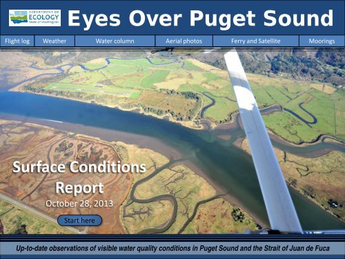
Surface Conditions<br />
Report<br />
October 28, 2013<br />
Start here<br />
Up-to-date observations of visible water quality conditions in <strong>Puget</strong> <strong>Sound</strong> and the Strait of Juan de Fuca
Marine conditions from 10-28-2013 at a glance<br />
Flight log Weather Water column Aerial photos Ferry and Satellite Moorings<br />
LONG-TERM MARINE MONITORING UNIT<br />
Mya Keyzers<br />
Laura Friedenberg<br />
Joe Leatherman<br />
Skip Albertson<br />
Julia Bos<br />
Suzan Pool<br />
Dr. Christopher<br />
Krembs<br />
Dr. Brandon<br />
Sackmann<br />
Previous <strong>Eyes</strong> <strong>Over</strong> <strong>Puget</strong> <strong>Sound</strong> reports:<br />
Personal flight log p. 3<br />
A historic glimpse into the life of our chartered plane:<br />
the de Havilland Beaver float plane.<br />
Weather conditions p. 5<br />
Cool, foggy mornings have been alternating with warm sunny<br />
afternoons. <strong>Over</strong>all air temperatures were low, increasing only in<br />
the last days. River flows are gradually decreasing. Winds have<br />
been light and from the north.<br />
Water column p. 7,<br />
Oxygen in <strong>Puget</strong> <strong>Sound</strong> waters are normalizing again after 7<br />
months of a lower oxygen phase that followed a 2-year period of<br />
colder temperatures and higher oxygen (2011 to 2012).<br />
Aerial photography p. 10<br />
Red-brown blooms and jellyfish in south <strong>Puget</strong> <strong>Sound</strong>. Grays<br />
Harbor has abundant surface debris with green algae in North<br />
Bay. Some rivers in Willapa Bay with red-brown blooming algae.<br />
Many unexplained patches of suspended sediment in shallow<br />
waters in Grays Harbor and Willapa Bay. Who knows the<br />
answer?<br />
Ferry and satellite p. 34<br />
Victoria Clipper IV – an unique sampling platform for monitoring<br />
water quality in <strong>Puget</strong> <strong>Sound</strong> – is getting upgraded. Foggy<br />
conditions for October limit availability of satellite data.<br />
www.ecy.wa.gov/programs/eap/mar_wat/eops/
Personal flight log 10-28-2013<br />
Flight log Weather Water column Aerial photos Ferry and Satellite Moorings<br />
History of the de Havilland Beaver - Before I started this job, I had never ridden in a small<br />
plane of any kind. <strong>Over</strong> the years I have come to appreciate the special abilities of the de<br />
Havilland Beaver DHC-2 float planes we fly in. These are fixed wing single engine planes,<br />
also called bush planes.<br />
Beavers lined up at Kenmore Air’s dock in Seattle<br />
De Havilland<br />
named all<br />
their planes<br />
after animals<br />
and so this<br />
hard working<br />
plane was<br />
named the<br />
“Beaver.”<br />
Developed by<br />
de Havilland<br />
Canada, 1,657<br />
Beavers were<br />
produced from<br />
1947 to 1967,<br />
helped by<br />
demands of<br />
the Korean<br />
War.<br />
Photo: Joe Leatherman 2013<br />
The combination of the large engine and long wing give it superb short landing and takeoff for its size, making<br />
it well suited for remote areas. A Beaver can easily be fitted with floats, skis, or wheels and the doors on both<br />
sides make it easy for loading passengers and cargo. It has a hatch that was used for crop dusting and other<br />
aerial applications.
Personal flight log 10-28-2013<br />
Flight log Weather Water column Aerial photos Ferry and Satellite Moorings<br />
The belly hatch was used for crop dusting and other aerial applications. The designers would probably be<br />
thrilled to learn that the hatch allows us to deploy our CTD. We can add one more application to the Beaver’s<br />
resume: oceanographic sampling platform.<br />
Capacity: 6 passengers or 2,100 lb payload, Cruise speed: 143 mph, Range: 455 miles<br />
Photo: Clint Ferrara 2013<br />
Height: 9 ft 0 in<br />
Wingspan: 48 ft 0 in<br />
Wing area: 250 ft 2<br />
Length: 30 ft 3 in<br />
Loading the Beaver with sampling gear in Olympia<br />
Service ceiling: 18,000 ft, Rate of climb: 1,020 ft/min (More details here)<br />
more<br />
Despite their age, hundreds of Beavers are still flying, thanks in part to Kenmore Air. These planes have been<br />
heavily modified and updated and are now known as “Kenmore Beavers.” Changes include the quieter 3-<br />
blade propeller and, my personal favorite, a bubble window for the back seat passengers.
Weather patterns from 10-14-2013 to 10-28-2013<br />
Flight log Weather Water column Aerial photos Ferry and Satellite Moorings<br />
Two week summary:<br />
Air temperatures were mostly<br />
below normal, with cool foggy<br />
nights. In the last days warm<br />
sunny afternoons contributed<br />
to increased temperatures.<br />
Sunshine levels have been<br />
high to the north, but lower to<br />
the south where the marine<br />
layer has not burned off.<br />
River flows have fallen below<br />
normal levels following a wet<br />
September.<br />
Winds have been weak but<br />
generally from the north.<br />
Meteorological conditions typically explain up to half of the variance in observed marine<br />
variables (Moore et al. 2008), particularly in shallower waters like those of south <strong>Puget</strong><br />
<strong>Sound</strong>. I summarized the specific conditions prevalent during the past two weeks, from north<br />
to south. Source: http://www-k12.atmos.washington.edu/k12/grayskies/nw_weather.html<br />
Moore et al. 2008. Local and large-scale climate forcing of <strong>Puget</strong> <strong>Sound</strong> oceanographic properties on seasonal to interdecadal timescales. Limnol. Oceanogr., 53(5), 1746–1758
Our long-term marine monitoring stations in Washington<br />
Flight log Weather Water column Aerial photos Ferry and Satellite Moorings<br />
Isl.<br />
We use a chartered float<br />
plane to access our<br />
monthly monitoring<br />
stations most cost<br />
effectively.<br />
Start here<br />
We communicate data and<br />
environmental marine<br />
conditions using:<br />
1. Marine Water<br />
Condition Index<br />
(MWCI)<br />
2. <strong>Eyes</strong> <strong>Over</strong> <strong>Puget</strong><br />
<strong>Sound</strong> (EOPS)<br />
3. Anomalies and<br />
source data
Conditions of the last two years change at our stations<br />
Flight log Weather Water column Aerial photos Ferry and Satellite Moorings<br />
In 2013: Is temp. warming? Salinity is normalizing Oxygen is rebounding<br />
<strong>Puget</strong> <strong>Sound</strong> water conditions are normalizing after a 7-month reduced oxygen phase from Jan. to July, 2013.<br />
This follows two years (2011, 2012) of higher oxygen. Anomalies are calculated in reference to a timeaveraged<br />
seasonal cycle using the years 1999 to 2008. Each pixel is a monthly survey at a single station.
The ocean affects water quality: Ocean Climate Indices<br />
Flight log Weather Water column Aerial photos Ferry and Satellite Moorings<br />
a) Pacific Decadal Oscillation Index (PDO, temperature) …(explanation)<br />
b) Upwelling Index (anomalies) (Upwelling, low oxygen) …(explanation)<br />
c) North Pacific Gyre Oscillation Index (NPGO, productivity)…(explanation)<br />
PDO/Upwelling Index<br />
Three-year running average of PDO, Upwelling, and NPGO indices scores<br />
1.5<br />
25<br />
20<br />
1<br />
15<br />
0.5<br />
10<br />
5<br />
0<br />
0<br />
-5<br />
-0.5<br />
-10<br />
-1<br />
-15<br />
-20<br />
-1.5<br />
-25<br />
1945 1950 1955 1960 1965 1970 1975 1980 1985 1990 1995 2000 2005 2010 2015<br />
NPGO<br />
Ocean boundary conditions have been favorable for water quality in <strong>Puget</strong> <strong>Sound</strong>: (a) colder water (PDO),<br />
(b) less upwelled low oxygen and high nutrient ocean water reaching <strong>Puget</strong> <strong>Sound</strong> (Upwelling Index), and<br />
.<br />
(c) higher surface productivity along the coast (NPGO). Where are we heading next?
Get the data and trends from us!<br />
We observe increasing nutrients and changing algal biomass patterns in <strong>Puget</strong> <strong>Sound</strong><br />
Algae bloom, Budd Inlet 2010<br />
Nitrate<br />
Phosphate<br />
Changing<br />
Nutrient Balance<br />
Nutrients in <strong>Puget</strong> <strong>Sound</strong> are increasing, read http://www.ecy.wa.gov/programs/eap/mar_wat/trends.html<br />
Nitrate Phosphate Nutrient Balance (Si:N)
Summary: Aerial photography 10-28-2013<br />
Flight log Weather Water column Aerial photos Ferry and Satellite Moorings<br />
Red-brown blooms and jellyfish in south <strong>Puget</strong> <strong>Sound</strong>. Grays Harbor has abundant surface<br />
debris with green algae in North Bay. Some rivers in Willapa Bay with red-brown blooming<br />
algae. Many unexplained patches of suspended sediment in shallow waters in Grays Harbor<br />
and Willapa Bay.<br />
Long pipes running across beach, Tokeland<br />
pipe<br />
Pipes end mid-channel, Willapa Bay<br />
float<br />
pipe<br />
pipe<br />
truck<br />
pipe<br />
Debris Bloom Plume<br />
Front<br />
Mixing and Fronts: 1 8<br />
Many fronts along river plumes and bay water flowing<br />
into the ocean.<br />
Debris:<br />
Abundant in North Bay of Grays Harbor.<br />
Start here<br />
Jellyfish: Many patches seen in Budd, Eld, and Totten Inlets.<br />
Fish schools in Willapa Bay. 1 2<br />
Suspended sediment: 1 2 3 8 9<br />
Numerous unexplained patches in shallow water without<br />
hydrodynamic cause, yet many birds in Grays Harbor and<br />
Willapa Bay fly around them.<br />
Visible blooms: 1 2 6 7 18 19 20<br />
Red brown: Eld & Totten inlets; Willapa River and tidal slough.<br />
Green: Grays Harbor, Ocean Shores.<br />
Brown: Along ocean shore.<br />
1 4 5 7 8 9 10 11 14 15 16 17
Flight log Weather Water column Aerial photos Ferry and Satellite Moorings<br />
Toke Point: H. tide: 9:16 AM, 9:04 PM, L. tide: 2:30 AM, 3:17 PM<br />
2<br />
Aerial photography &<br />
navigation guide<br />
5<br />
6<br />
8<br />
4<br />
7<br />
3<br />
South <strong>Sound</strong><br />
1<br />
Flight Information:<br />
9<br />
11<br />
Grays Harbor<br />
10<br />
14 19<br />
Morning flight, photos 1-14:<br />
Good visibility, calm<br />
Afternoon flight, photos 15-20:<br />
Good visibility, calm.<br />
12<br />
13<br />
20<br />
15<br />
17<br />
16<br />
18<br />
Willapa Bay<br />
Observation Maps:<br />
Coast & South <strong>Sound</strong>
1 Aerial photography 10-28-2013 Navigate<br />
Flight log Weather Water column Aerial photos Ferry and Satellite Moorings<br />
A. B.<br />
jellyfish<br />
jellyfish<br />
jellyfish<br />
jellyfish<br />
Debris<br />
Plume<br />
C. D.<br />
jellyfish<br />
jellyfish<br />
Plume<br />
boats<br />
jellyfish<br />
Bloom<br />
Jellyfish patches, front, suspended sediments, and red-brown algal bloom.<br />
Location: A-B. Budd Inlet. C-D. Eld Inlet. (South <strong>Sound</strong>) 9:30 AM.
A.<br />
2 Aerial photography 10-28-2013<br />
Navigate<br />
Flight log Weather Water column Aerial photos Ferry and Satellite Moorings<br />
B.<br />
Bloom<br />
jellyfish<br />
Plume<br />
Bloom<br />
Plume<br />
Bloom<br />
boats<br />
Red-brown bloom, jellyfish, and suspended sediment.<br />
Location: Totten Inlet, A. Looking south, B. Looking north (South <strong>Sound</strong>), 9:40 AM.
A.<br />
3 Aerial photography 10-28-2013<br />
Navigate<br />
Flight log Weather Water column Aerial photos Ferry and Satellite Moorings<br />
B.<br />
Plume<br />
boats<br />
Plume<br />
A. Cloud banks follow river plume with much suspended sediment. B. Low lying clouds follow<br />
Chehalis River into estuary. Location: Aberdeen (Grays Harbor), 10:06 AM.
Aerial photography 10-28-2013<br />
4 Navigate<br />
Flight log Weather Water column Aerial photos Ferry and Satellite Moorings<br />
Debris<br />
Debris<br />
Organic surface debris and suspended sediment near exposed mudflat.<br />
Location: North Bay (Grays Harbor), 11:13 AM.
5 Aerial photography 10-28-2013<br />
Navigate<br />
Flight log Weather Water column Aerial photos Ferry and Satellite Moorings<br />
Debris<br />
Organic surface debris in tidal channels near exposed mudflat.<br />
Location: North Bay (Grays Harbor), 11:14 AM.
6 Aerial photography 10-28-2013<br />
Navigate<br />
Flight log Weather Water column Aerial photos Ferry and Satellite Moorings<br />
suspended sediment<br />
Bloom<br />
Bloom<br />
Suspended sediment from waves and diatom bloom at beach.<br />
Location: Ocean Shores (Grays Harbor), 11:17 AM.
7 Aerial photography 10-28-2013<br />
Navigate<br />
Flight log Weather Water column Aerial photos Ferry and Satellite Moorings<br />
Debris<br />
Bloom<br />
Bloom<br />
Brown, fresh water with bright green algal blooms. Green bay water from bloom.<br />
Location: Duck Lake and North Bay (Grays Harbor), 11:18 AM.
8 Aerial photography 10-28-2013<br />
Navigate<br />
Flight log Weather Water column Aerial photos Ferry and Satellite Moorings<br />
Front<br />
Plume<br />
suspended sediment<br />
Debris<br />
plant<br />
Grays Harbor water flowing into ocean past Ocean Shores sewage treatment plant. Location:<br />
North Jetty (Grays Harbor), 11:19 AM.
9 Aerial photography 10-28-2013<br />
Navigate<br />
Flight log Weather Water column Aerial photos Ferry and Satellite Moorings<br />
ship<br />
Plume<br />
boats<br />
Debris<br />
Debris<br />
Debris<br />
Debris<br />
Waters with different sediment content and debris flowing out of bay on outgoing tide.<br />
Location: Westhaven State Park (Grays Harbor), 11:19 AM.
10<br />
Aerial photography 10-28-2013<br />
Navigate<br />
Flight log Weather Water column Aerial photos Ferry and Satellite Moorings<br />
fish?<br />
fish?<br />
Debris<br />
Debris<br />
Lines of organic debris from Sopun, Mallard, and Beardslee Sloughs entering South Bay. Unidentified<br />
patches of seagrass or fish? Location: Hwy 105 bridge (Grays Harbor), 11:24 AM.
11<br />
Aerial photography 10-28-2013<br />
Navigate<br />
Flight log Weather Water column Aerial photos Ferry and Satellite Moorings<br />
Debris<br />
Long debris line along sandbar in mouth of Willapa Bay.<br />
Location: North of Leadbetter Point State Park (Willapa Bay), 11:30 AM.
Aerial photography 10-28-2013<br />
12 Navigate<br />
Flight log Weather Water column Aerial photos Ferry and Satellite Moorings<br />
suspended sediment<br />
suspended sediment<br />
seagrass<br />
fish<br />
birds<br />
Schooling fish along shallow sandbar.<br />
Location: South of Tokeland (Willapa Bay), 11:32 AM.
Aerial photography 10-28-2013<br />
13 Navigate<br />
Flight log Weather Water column Aerial photos Ferry and Satellite Moorings<br />
seagrass<br />
birds<br />
birds<br />
seagrass<br />
birds<br />
fish<br />
Schooling fish along shallow sandbars surrounded by seabirds (white little dots, hard to see).<br />
Location: South of Tokeland (Willapa Bay), 11:33 AM.
Aerial photography 10-28-2013<br />
14 Navigate<br />
Flight log Weather Water column Aerial photos Ferry and Satellite Moorings<br />
suspended sediment<br />
seagrass<br />
Debris<br />
boats<br />
suspended sediment<br />
suspended sediment<br />
suspended sediment<br />
Long debris line. Green water originating from south and lined by re-suspended sediment<br />
flowing past Tokeland. Location: South of Tokeland (Willapa Bay), 11:35 AM.
15<br />
Aerial photography 10-28-2013<br />
Navigate<br />
Flight log Weather Water column Aerial photos Ferry and Satellite Moorings<br />
Debris<br />
suspended sediment<br />
Debris<br />
Debris<br />
Pattern of shellfish farming on flooded mud flats. Large suspended sediment cloud and debris<br />
lines. Location: Off Bone River (Willapa Bay), 12:04 PM.
16<br />
Aerial photography 10-28-2013<br />
Navigate<br />
Flight log Weather Water column Aerial photos Ferry and Satellite Moorings<br />
suspended sediment<br />
Debris<br />
Debris<br />
Debris<br />
Tidally suspended sediment spilling out of Shoalwater Bay during ebb tide. Location: Willapa<br />
National Wildlife Refuge (Willapa Bay), 1:35 PM.
17<br />
Aerial photography 10-28-2013<br />
Navigate<br />
Flight log Weather Water column Aerial photos Ferry and Satellite Moorings<br />
suspended sediment<br />
suspended sediment<br />
Debris<br />
suspended sediment<br />
One of many unexplained large clouds of suspended sediment in shallow water.<br />
Location: Jensen Point, a sand spit on west side of Long Island (Willapa Bay), 1:37 PM.
18<br />
Aerial photography 10-28-2013<br />
Navigate<br />
Flight log Weather Water column Aerial photos Ferry and Satellite Moorings<br />
Red-brown algae bloom in Palix River near Bay Center.<br />
Location: Palix River, US 101 bridge (Willapa Bay), 1:44 PM..
19<br />
Aerial photography 10-28-2013<br />
Navigate<br />
Flight log Weather Water column Aerial photos Ferry and Satellite Moorings<br />
boat<br />
red water<br />
suspended sediment<br />
red water<br />
red water<br />
Bloom<br />
Red-brown algae bloom, suspended sediment, vegetation alteration, and red water color on flats<br />
across from Willapa Harbor Airport. Location: Willapa River (Willapa Bay), 1:49 PM.
20<br />
Aerial photography 10-28-2013<br />
Navigate<br />
Flight log Weather Water column Aerial photos Ferry and Satellite Moorings<br />
red water<br />
boat<br />
Bloom<br />
suspended sediment<br />
Red-brown algae bloom, suspended sediment, vegetation alteration, and red water color on flats<br />
across from Willapa Harbor Airport. Location: Willapa River (Willapa Bay), 1:49 PM.
Flight log Weather Water column Aerial photos Ferry and Satellite Moorings<br />
6<br />
7<br />
4<br />
Aerial photography in S. <strong>Sound</strong> and Coastal Bays Navigate<br />
5<br />
Date: 10-28-2013<br />
8<br />
9<br />
3<br />
10<br />
12<br />
13<br />
20<br />
11<br />
19<br />
15<br />
18<br />
14<br />
2<br />
1<br />
17<br />
16<br />
Numbers on map refer to picture numbers for spatial<br />
reference
Legend to map annotations<br />
Navigate<br />
Flight log Weather Water column Aerial photos Ferry and Satellite Moorings<br />
Comments:<br />
Maps are produced by observers during and<br />
after flights. They are intended to give an<br />
approximate reconstruction of the surface<br />
conditions on scales that connect to and<br />
overlap with satellite images in the section that<br />
follows.<br />
Debris:<br />
Debris can be distinguished into natural and<br />
anthropogenic debris floating at the surface<br />
sensu Moore and Allen (2000). The majority of<br />
organic debris in <strong>Puget</strong> <strong>Sound</strong> is natural mixed<br />
with discarded man-made pieces of plastic,<br />
wood, etc. From the plane, we cannot<br />
differentiate the quality of debris at the surface<br />
and therefore, call it for reasons of practicality<br />
just “debris”.<br />
S.L. Moore, M. J. Allen. 2000. Distribution of<br />
Anthropogenic and Natural Debris on the<br />
Mainland Shelf of the Southern California Bight.<br />
Marine Pollution Bulletin, 40(1), 83–88.
Ferry and satellite observations 10-28-2013<br />
Flight log Weather Water column Aerial photos Ferry and Satellite Moorings<br />
A cost-effective collaboration with the Victoria Clipper<br />
IV has provided an unique insight into surface<br />
processes that affect <strong>Puget</strong> <strong>Sound</strong> water quality!<br />
Engine Room<br />
Bridge<br />
Brandon Sackmann<br />
Contact:<br />
bsackmann@ecy.wa.gov<br />
Start here<br />
Victoria Clipper IV:<br />
1. 132 feet long, 33.3 feet wide<br />
2. 30 knots top speed (among the fastest passenger<br />
vessels in Western Hemisphere!)<br />
3. Water jet propulsion system<br />
4. Seattle-to-Victoria in 2 hrs 45 min; 1-2 trips daily<br />
5. Holds 330 passengers<br />
6. Vessel operates year-round, except for 2 weeks in<br />
January (for dry dock operations)<br />
7. Water quality sensor suite installed in May 2010<br />
Water Quality Sensors<br />
“A Norwegian boat with German engines, Swedish<br />
waterjets, and an American crew going to Canada”<br />
-- Capt. Jason Mihok (Read more)<br />
Victoria Clipper IV<br />
Victoria Clipper IV Leaving Elliott Bay<br />
No Victoria Clipper data available – Hardware upgrades in progress!!!<br />
For more information -- http://www.clippervacations.com/vessel-information/
Ferry and satellite observations 10-28-2013<br />
Flight log Weather Water column Aerial photos Ferry and Satellite Moorings<br />
Satellite Remote Sensing in <strong>Puget</strong> <strong>Sound</strong><br />
-- Some days are easier than others ---<br />
2013 was the third worst October period on record for fog!<br />
Read more<br />
MODIS-Aqua True Color<br />
20 October<br />
MODIS-Aqua True Color<br />
29 October<br />
finally
Future Focus of Mooring Operations<br />
Flight log Weather Water column Aerial photos Ferry and Satellite Moorings<br />
Note: Due to state and federal budget reductions, our mooring program is being downscaled.<br />
Strength through collaboration across agencies, academic institutions and companies.<br />
We have plans to continue to collect data at our Admiralty Reach (UW Applied Physics Lab) and<br />
Mukilteo (ORCA College) moorings into the future. Operations at all other mooring locations<br />
have been suspended in order to reallocate existing resources.<br />
We are now focusing on measuring ocean intrusions!<br />
Why? The importance of the ocean on water quality in <strong>Puget</strong> <strong>Sound</strong> is being emphasized by<br />
Ecology’s mooring at Admiralty Reach, long term monitoring data, modeling studies, and<br />
academic publications. Admiralty Reach is a challenge - it requires a team effort!<br />
Upwelling along the coast can bring high nutrient, low oxygen and low pH ocean water into<br />
<strong>Puget</strong> <strong>Sound</strong>. Such intrusions explain much of the year to year variability in water quality.<br />
For intrusions to enter <strong>Puget</strong> <strong>Sound</strong>, several conditions have to align:<br />
• Prolonged upwelling along the Washington coast. Driver: Northerly winds<br />
• Estuarine circulation moving dense water from the coast into the Strait of Juan de<br />
Fuca. Driver: High Fraser River flow during summer<br />
• Neap-Spring tide phase and character favorable to intrusions along the 30 km length<br />
of Admiralty Reach. Drivers: Neap tides and tidal harmonics
Get data from Ecology’s Monitoring Programs<br />
Flight log Weather Water column Aerial photos Ferry and Satellite Moorings<br />
Long–Term<br />
Monitoring Network<br />
Real–Time<br />
Sensor Network<br />
christopher.krembs@ecy.w<br />
a.gov<br />
Ecology’s long-term marine<br />
monitoring stations<br />
Ferry track<br />
Morning flight<br />
Evening flight<br />
Ferry and satellite :<br />
brandon.sackmann@ecy.w<br />
a.gov<br />
Access core<br />
monitoring data:<br />
http://www.ecy.wa.gov/a<br />
pps/eap/marinewq/mwda<br />
taset.asp<br />
Freshwater Report:<br />
http://www.ecy.wa.gov/programs<br />
/eap/fw_riv/freshwaterReport/A<br />
mbient_Monitoring-<br />
Monthly_Summary.html<br />
Access mooring<br />
data:<br />
ftp://www.ecy.wa.gov/ea<br />
p/Mooring_Raw/<strong>Puget</strong>_S<br />
ound/
You may subscribe or unsubscribe to the <strong>Eyes</strong> <strong>Over</strong> <strong>Puget</strong> <strong>Sound</strong> email listserv by going to:<br />
http://listserv.wa.gov/cgi-bin/wa?A0=ECOLOGY-EYES-OVER-PUGET-SOUND<br />
Flight log Weather Water column Aerial photos Ferry and Satellite Moorings<br />
We are looking for feedback to improve our products.<br />
Dr. Christopher Krembs<br />
christopher.krembs@ecy.wa.gov<br />
Marine Monitoring Unit<br />
Environmental Assessment Program<br />
WA Department of Ecology<br />
Many thanks to our business partners: Clipper Navigation, Swantown Marina, and Kenmore Air.
