a new era of development - Government Finance Officers Association
a new era of development - Government Finance Officers Association
a new era of development - Government Finance Officers Association

You also want an ePaper? Increase the reach of your titles
YUMPU automatically turns print PDFs into web optimized ePapers that Google loves.
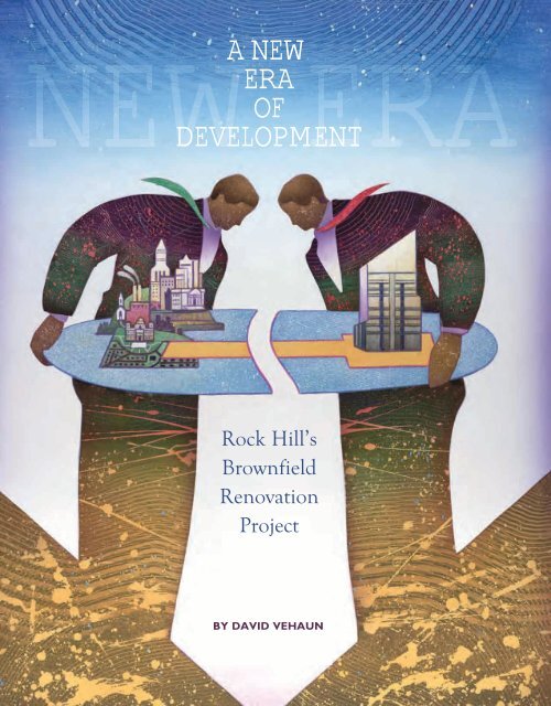
NEW<br />
A NEW<br />
ERA<br />
ERA<br />
OF<br />
DEVELOPMENT<br />
Rock Hill’s<br />
Brownfield<br />
Renovation<br />
Project<br />
BY DAVID VEHAUN
Along the banks <strong>of</strong> the Catawba River, a <strong>new</strong> <strong>era</strong> <strong>of</strong> opment partner was able to complete the investigation<br />
commerce is in the works. A joint effort between the and cleanup process efficiently. Demolition and asbestos<br />
City <strong>of</strong> Rock Hill, South Carolina, and a <strong>development</strong> abatement <strong>of</strong> the facility coincided with the environmental<br />
partner will provide a unique <strong>development</strong> opportunity. This<br />
his partnership grew from a vision <strong>of</strong> a group <strong>of</strong> entrepreneurs<br />
cleanup and started in October 2005. All site work was substantially<br />
completed 18 months later, in December 2007.<br />
who saw vast potential beyond the obstacle <strong>of</strong> a substantial<br />
The site currently op<strong>era</strong>tes under a RCRA Part B closure<br />
brownfield site. The city’s <strong>development</strong> partner — which<br />
permit. The part B permit includes the conditions setting forth<br />
specializes in remediating and redeveloping brownfield<br />
the <strong>development</strong> partner’s duty to comply with the permit<br />
sites, but also provides environmental services and real<br />
terms and the effect <strong>of</strong> such compliance, all reporting and<br />
estate <strong>development</strong> — purchased the 1,008-acre property in<br />
record-keeping requirements, and any conditions regarding<br />
October 2005 from a major industrial firm. At that time, the<br />
the duration <strong>of</strong> the permit and its re<strong>new</strong>al. The permit also<br />
site was occupied by what was once the largest cellulose<br />
provides an overview <strong>of</strong> the corrective action process, including<br />
a gen<strong>era</strong>l description <strong>of</strong> each phase, and sets forth the<br />
acetate manufacturing facility in the United States. The plant<br />
began op<strong>era</strong>tions in 1948 and, at its peak, employed 2,500<br />
specific conditions governing corrective action obligations.<br />
people. The facility closed in 2005 after 57 years <strong>of</strong> continuous<br />
op<strong>era</strong>tion.<br />
Because <strong>of</strong> agreements made regarding land use restrictions,<br />
op<strong>era</strong>tions, and maintenance, Rock Hill’s <strong>development</strong><br />
ENVIRONMENTAL ISSUES<br />
partner will maintain the ability to monitor and perform<br />
maintenance on any remedial systems<br />
In addition to the 2.5 million square<br />
This partnership grew from the to ensure the ongoing protection <strong>of</strong><br />
foot manufacturing facility, there<br />
were significant problems with the vision <strong>of</strong> a group <strong>of</strong> entrepreneurs<br />
human health and the environment<br />
well into the future.<br />
site because <strong>of</strong> environmental issues who saw vast potential beyond the<br />
caused by op<strong>era</strong>tions at the plant. As<br />
obstacle <strong>of</strong> a substantial brownfield DEVELOPING A VISION<br />
a result, cleanup <strong>of</strong> the site fell under<br />
regulations <strong>of</strong> the U.S. Environmental site.<br />
Once demolition and abatement<br />
Protection Agency’s Resource<br />
was underway, the developer began<br />
Conservation and Recovery Act<br />
intensive negotiations with city <strong>of</strong>ficials<br />
(RCRA). RCRA was enacted for the primary<br />
purpose <strong>of</strong> creating a program to regulate, “from cradle<br />
to grave,” the storage, transportation, treatment, and disposal<br />
<strong>of</strong> all types <strong>of</strong> hazardous wastes from all significant sources.<br />
The RCRA covers sites that are one step from receiving a<br />
Superfund designation. The industrial firm that originally ran<br />
the site estimated that the cleanup would cost approximately<br />
$45 million. In spite <strong>of</strong> these obstacles, the city’s <strong>development</strong><br />
partner purchased the property and provided indemnification<br />
to the manufacturing firm for all known and unknown<br />
environmental liabilities, on and <strong>of</strong>f the site. The <strong>development</strong><br />
partner also self-insured the site.<br />
Under the RCRA, a thorough environmental investigation<br />
<strong>of</strong> the property was required before any <strong>development</strong><br />
could begin. Through a partnership with the South Carolina<br />
Department <strong>of</strong> Environmental Control, Rock Hill’s devel-<br />
regarding future <strong>development</strong> on the<br />
site. Since the site was located outside the city limits, the<br />
process resulted in annexing the property and rezoning the<br />
land to suit the needs <strong>of</strong> the developer. The developer was<br />
motivated to agree to annexation since this would open the<br />
opportunity for a tax increment financing (TIF) arrangement<br />
with the city (something the county was not familiar with, but<br />
the city had extensive experience with TIFs).<br />
The developer hosted an intensive, two-day multidisciplinary<br />
design workshop in August 2006 to begin developing<br />
a plan for <strong>development</strong> on the site, facilitating an open<br />
discussion among project stakeholders. A team <strong>of</strong> design<br />
experts met with members <strong>of</strong> the City <strong>of</strong> Rock Hill, York<br />
County, representatives <strong>of</strong> the business community, other<br />
developers, and members <strong>of</strong> the education community, gathering<br />
information on issues related to the <strong>development</strong>. The<br />
October 2010 | <strong>Government</strong> <strong>Finance</strong> Review 9
workshop team then <strong>of</strong>fered solutions that resulted in a clear,<br />
detailed, realistic vision for future <strong>development</strong>.<br />
The results centered on the need for a mixed-use <strong>development</strong><br />
that would include residential, commercial, and light<br />
industrial elements (see Exhibit 1). The vision included a<br />
river village concept, distinguished by more than three miles<br />
<strong>of</strong> waterfront, intended to produce a <strong>development</strong> plan like<br />
no other in the Charlotte metropolitan area. The ultimate<br />
<strong>development</strong> proposal, called Riverwalk, would create a<br />
mixed-use, pedestrian-friendly community that emphasized<br />
employment, connectivity, recreation, and open space uses.<br />
The plan would incorporate industrial, commercial, and a<br />
diversity <strong>of</strong> residential products, all connected by greenway<br />
trails and parks to link the Catawba River to the various neighborhoods<br />
and public centers within the property. The project<br />
would also include the East Coast’s only oval bicycle racing<br />
track, a BMX (bicycle motocross) course, and other sports<br />
tourism-related attractions. Upon completion, the project<br />
is expected to produce $600 million in private investment,<br />
increase property taxes by $4 million annually, and gen<strong>era</strong>te<br />
4,000 <strong>new</strong> jobs for Rock Hill. The project is also expected to<br />
act as a catalyst for additional <strong>development</strong> in the surrounding<br />
area that will ultimately produce additional tax revenues<br />
and jobs.<br />
Exhibit 1: Riverwalk Master Plan<br />
10 <strong>Government</strong> <strong>Finance</strong> Review | October 2010
CREATING THE FRAMEWORK<br />
The city entered into a memorandum <strong>of</strong> understanding<br />
in March 2007 with its <strong>development</strong> partner to provide a<br />
framework under which both parties agreed to a set <strong>of</strong> goals<br />
before a final agreement. The obvious goal was to bring<br />
about a high-quality <strong>development</strong> on a very unusual and<br />
important site for the Rock Hill area and to take advantage<br />
<strong>of</strong> the unique opportunities the site affords, with three miles<br />
<strong>of</strong> frontage on the Catawba River and a large area <strong>of</strong> undisturbed<br />
woodlands.<br />
The memorandum <strong>of</strong> understanding stated that the <strong>development</strong><br />
would ultimately be annexed into the City <strong>of</strong> Rock<br />
Hill and would include a mixed-use <strong>development</strong> <strong>of</strong> commercial,<br />
residential, industrial and recreational components.<br />
The memorandum <strong>of</strong> understanding also stated that both<br />
the developer and the city intended to proceed with the<br />
<strong>development</strong> under a public-private<br />
partnership to ensure the public financial<br />
assistance required for the public<br />
infrastructure — including roadway<br />
improvements, trails, utilities, storm<br />
water, and recreational facilities. Both<br />
parties also agreed to create a land use<br />
plan that would provide design and<br />
planning flexibility based on the size,<br />
complexity, and projected absorption<br />
rates (the ability <strong>of</strong> the area to absorb<br />
or sell all <strong>of</strong> the real estate for sale in<br />
The city had never used a land<br />
<strong>development</strong> agreement, and the<br />
Riverwalk <strong>development</strong> provided<br />
an excellent opportunity to test<br />
the viability <strong>of</strong> this latest addition<br />
to the city’s zoning code.<br />
Rock Hill. The land <strong>development</strong> agreement provides the<br />
developer with greater certainty in the <strong>development</strong> process<br />
and creates a mechanism to tie <strong>development</strong> to the provision<br />
<strong>of</strong> adequate public facilities. It also encourages more efficient<br />
implementation <strong>of</strong> comprehensive planning through large<br />
or complex projects such as the Riverwalk project. In gen<strong>era</strong>l,<br />
the land <strong>development</strong> agreement parallels a rezoning<br />
application for the proposed project and gives the city and<br />
developer the maximum latitude for creative and flexible<br />
design and the ability to condition <strong>development</strong> on the provision<br />
<strong>of</strong> specific improvements or other phasing requirements.<br />
In addition, the land <strong>development</strong> agreement provides a<br />
mechanism to address incentives that might be agreed to<br />
due to a project’s economic <strong>development</strong> impacts. This tool<br />
ensures that the developer only receives certain <strong>development</strong><br />
concessions if the quality <strong>of</strong> the <strong>development</strong> reaches the<br />
city’s expectations.<br />
The completion <strong>of</strong> the land <strong>development</strong><br />
agreement requires two steps. The<br />
zoning component is accomplished<br />
through action <strong>of</strong> the planning commission,<br />
and the financing component<br />
is accomplished through a financing<br />
agreement. Both documents must be<br />
considered and approved by the city<br />
council.<br />
GAP FINANCING MODEL<br />
a given amount <strong>of</strong> time) associated with the project. This At about the same time the memorandum <strong>of</strong> understanding<br />
was worked out, the city and the developer began<br />
land use plan would minimize the cost <strong>of</strong> public services, be<br />
environmentally sensitive, seek efficient design <strong>of</strong> roadways negotiations regarding the possibility <strong>of</strong> public participation<br />
and trails, and preserve and dedicate land for adequate in financing the project. The most commonly discussed<br />
public facilities and rights <strong>of</strong> way. Most importantly, the method <strong>of</strong> public financing involved using tax increment<br />
memorandum <strong>of</strong> understanding obligated the city and the financing. The city had previously created and funded three<br />
developer to enter into a land <strong>development</strong> agreement under TIF districts for re<strong>development</strong> <strong>of</strong> publicly owned land and<br />
the laws <strong>of</strong> the State <strong>of</strong> South Carolina and the City <strong>of</strong> Rock for public improvements, but this would be a first: financing<br />
Hill. The city had never used this <strong>new</strong> <strong>development</strong> tool, and public infrastructure on private property to benefit a private<br />
the Riverwalk <strong>development</strong> provided an excellent opportunity<br />
to test the viability <strong>of</strong> this latest addition to the city’s<br />
<strong>development</strong>.<br />
In evaluating Rock Hill’s willingness to participate as<br />
zoning code.<br />
a partner in this venture, the city’s Economic and Urban<br />
The unique nature <strong>of</strong> the land <strong>development</strong> agreement Development Department began to investigate the use <strong>of</strong><br />
is that it combines zoning and financial commitments into what came to be known as a gap financing model. Urban<br />
a single agreement between the developer and the City <strong>of</strong> Development Department staff developed this model to<br />
October 2010 | <strong>Government</strong> <strong>Finance</strong> Review 11
For the Riverwalk project, a gap analysis was undertaken in<br />
the fourth quarter <strong>of</strong> 2008 to elucidate the sources and uses <strong>of</strong><br />
cash on the project so a determination could be made about<br />
the potential funding gap. This confidential analysis determined<br />
that a $12 million to $15 million gap existed for the<br />
early phases <strong>of</strong> the project. Almost all public improvements<br />
on the first phase <strong>of</strong> the project were identified as roadway<br />
infrastructure that would benefit the project as a whole.<br />
OVERCOMING THE FINANCIAL<br />
AND LEGAL CHALLENGES<br />
evaluate the developer’s financial ability to complete a<br />
project solely with private capital. If a developer is able to<br />
pr<strong>of</strong>itably develop and finance the entire project without<br />
public financing, then public participation is not appropriate.<br />
The gap analysis for the Riverwalk project demonstrated<br />
that the <strong>development</strong> would not be feasible without the<br />
city’s involvement.<br />
An important component <strong>of</strong> the gap financing model is the<br />
evaluation <strong>of</strong> the private developer’s annual financial reports.<br />
As part <strong>of</strong> the process, the Riverwalk developer agreed to provide<br />
year-end financial statements (personal and business)<br />
for the previous three fiscal years. To maintain confidentiality,<br />
the city agreed to employ a third party to review the information<br />
and provide an analysis <strong>of</strong> the developer’s financial<br />
position. Once this evaluation was complete, the city could<br />
decide whether it was necessary to financially participate in<br />
the project.<br />
For large <strong>development</strong> projects that include multiple<br />
phases over a period <strong>of</strong> years, gap analysis might require an<br />
it<strong>era</strong>tive approach in which the gap analysis is revised and<br />
amended with each phase <strong>of</strong> the project. In this case, the<br />
final financing gap might not be known until years into the<br />
project. The city then works with the developer to provide<br />
gap funding in early phases <strong>of</strong> a <strong>development</strong> project, with<br />
the understanding that adjustments to the ov<strong>era</strong>ll level <strong>of</strong><br />
public funding may be made in later phases <strong>of</strong> the project, if<br />
warranted by subsequent gap analysis.<br />
Once an agreement was in place regarding the use <strong>of</strong> a gap<br />
financing model, the city and the developer began more serious<br />
discussions regarding the financing agreement and the<br />
use <strong>of</strong> tax increment financing. To accommodate the use <strong>of</strong><br />
TIF financing, the city rolled the Riverwalk <strong>development</strong> into<br />
an adjacent TIF district and extended the term <strong>of</strong> the district<br />
until 2029. The revised TIF district would allow for the use <strong>of</strong><br />
existing city-gen<strong>era</strong>ted TIF revenues on the project (the use<br />
<strong>of</strong> county and school district tax revenues were not allowed<br />
by previous agreements).<br />
In 2007, the preferred guarantee for a TIF bond issued by<br />
the city was an irrevocable stand-by letter <strong>of</strong> credit issued by<br />
a bank that the developer would provide to the city. Through<br />
this letter <strong>of</strong> credit, the developer and the bank would<br />
assume the financing and construction risks associated with<br />
the project. These guarantees would allow the city to begin<br />
the issuance <strong>of</strong> TIF debt risk free. The first phase <strong>of</strong> debt for<br />
these “dirt bonds” was projected to be $10.5 million, with<br />
total TIF debt on the site expected to eventually reach almost<br />
$50 million.<br />
However, by late 2008, changes in the financial markets<br />
made it impossible for the developer to secure a bank letter<br />
<strong>of</strong> credit for the project. In response, the city began to<br />
research alternative means for securing a TIF bond. The most<br />
likely solution was for the developer to commit to making<br />
up any difference between incremental taxes in the district<br />
and the annual TIF debt service payments. Unfortunately,<br />
the city’s attorney indicated that would have constituted an<br />
impermissible agreement under Internal Revenue Service<br />
regulations. Such an agreement would have resulted in a taxable<br />
bond issue — something both the city and the developer<br />
wanted to avoid. This situation left the future <strong>of</strong> the project<br />
12 <strong>Government</strong> <strong>Finance</strong> Review | October 2010
very much in doubt, as the city was in no position to issue<br />
unsecured debt.<br />
Fortunately, the developer had started work in early 2008<br />
with a public finance consulting firm to develop an assessment<br />
district on the site. The consulting firm, which had<br />
extensive experience in establishing improvement districts<br />
and the fee structures to support them, was also a good<br />
fit because it had specialized experience in public-private<br />
partnerships, brownfield re<strong>development</strong>, and tax increment<br />
financing. Since there were legal restrictions on any guarantees<br />
the developer could make, a creative solution was<br />
needed both to secure the debt and to make sure this security<br />
would not be so onerous as to hinder the marketability <strong>of</strong> the<br />
site. The consulting firm suggested establishing a municipal<br />
improvement district (MID) to support the TIF bond that<br />
could both guarantee the debt and maintain the non-taxable<br />
status <strong>of</strong> the bonds. By overlaying a tax increment district<br />
with a MID, the property owner would be assessed annually<br />
for any shortfall in revenues needed to pay debt service on<br />
the 2009 TIF bonds.<br />
LAND DEVELOPMENT AGREEMENT<br />
Once these legal issues were resolved, the city and the<br />
developer began work in earnest on the land <strong>development</strong><br />
agreement. In November 2008, the Rock Hill City Council<br />
approved a zoning component that changed the property<br />
from industrial <strong>development</strong> to three separate and distinct<br />
categories <strong>of</strong> property: planned <strong>development</strong>-residential<br />
district, planned <strong>development</strong>-commercial district, and<br />
planned <strong>development</strong>-major employment center district.<br />
The residential district will include 950 residential units<br />
and up to 30,000 square feet <strong>of</strong> neighborhood commercial<br />
uses on more than 400 acres The district will also include a<br />
civic site, neighborhood amenities, and more than 150 acres<br />
Exhibit 2: Riverwalk Residential District<br />
October 2010 | <strong>Government</strong> <strong>Finance</strong> Review 13
<strong>of</strong> recreational space, including parks, open space, and recreational<br />
assembly areas. (See Exhibit 2 for a mockup <strong>of</strong> the<br />
residential district.)<br />
The commercial district will comprise approximately 286<br />
acres that will provide mixed-use commercial <strong>development</strong>.<br />
The area, adjacent to a major thoroughfare, will include a<br />
mix <strong>of</strong> uses, including up to 1 million square feet <strong>of</strong> retail and<br />
<strong>of</strong>fice and up to 1,100 multifamily residential units. Additional<br />
multifamily units may be constructed in the mixed-use area<br />
over or immediately adjacent to retail <strong>of</strong>fice uses. A civic site<br />
and additional open space are also envisioned for this area.<br />
The major employment center district will comprise approximately<br />
315 acres and will provide a mix <strong>of</strong> <strong>development</strong><br />
opportunities, including manufacturing, assembly, and warehouse,<br />
along with <strong>of</strong>fice <strong>development</strong>.<br />
This area, which is adjacent to a road<br />
with highway access, is programmed<br />
for approximately 3.5 million square<br />
feet <strong>of</strong> industrial space that transitions<br />
to flex <strong>of</strong>fice (flexible <strong>of</strong>fice buildings<br />
that can house sev<strong>era</strong>l types <strong>of</strong> business<br />
tenants).<br />
In summer 2009, the planning commission<br />
reviewed and approved the<br />
land <strong>development</strong> agreement for the<br />
Riverwalk site, and the city council<br />
approved it in July 2009. In August<br />
2009, the city council approved the creation<br />
<strong>of</strong> the Riverwalk Municipal Improvement District. The<br />
developer agreed to dedicate certain portions <strong>of</strong> the property<br />
for public use upon the city’s satisfaction with environmental<br />
mitigation.<br />
The plans for the <strong>development</strong>, which are included in the<br />
land <strong>development</strong> agreement, includes significant infrastructure<br />
improvements. One <strong>of</strong> the first is a roadway infrastructure.<br />
More than 15 miles <strong>of</strong> collector roads are planned for<br />
the <strong>development</strong>, although the primary roads will be constructed<br />
first. These initial roadway improvements include<br />
the industrial park access road; the extension <strong>of</strong> a road<br />
through the <strong>development</strong> to connect to US 21, the primary<br />
connector road through the commercial district; and a river<br />
district loop road. The balance <strong>of</strong> the roadway infrastructure<br />
comprises the remaining commercial and residential roads.<br />
By late 2008, changes in the financial<br />
markets made it impossible<br />
for the developer to secure a<br />
bank letter <strong>of</strong> credit for the project.<br />
In response, the city began<br />
to research alternative means for<br />
securing a TIF bond.<br />
These roadway improvements also include the costs associated<br />
with the engineering, right-<strong>of</strong>-way acquisition, and<br />
widening <strong>of</strong> an existing two-lane farm-to-market road that<br />
is undersized for both the existing traffic and the planned<br />
<strong>development</strong>. Other public improvements on site include<br />
streetscaping <strong>of</strong> US 21, utility relocations to remove existing<br />
power transmission and distribution lines on the property,<br />
and recreational amenities that will <strong>of</strong>fer an unparalleled<br />
number <strong>of</strong> public amenities.<br />
Finally, the Riverwalk trail, which is being constructed by<br />
the developer and will become part <strong>of</strong> the Carolina Thread<br />
Trail network, will be multi-use and open to the public. The<br />
trail will pass sev<strong>era</strong>l sites on the National Historic Register<br />
and provide unique opportunities for wildlife viewing, including<br />
bald eagle nesting areas.<br />
PUBLIC AMENITIES PLAN<br />
In addition to the land <strong>development</strong><br />
agreement, the city and the developer<br />
established a public amenities plan.<br />
This is an important part <strong>of</strong> the ov<strong>era</strong>ll<br />
plan, since the vision <strong>of</strong> Riverwalk is<br />
to provide a dynamic riverfront community<br />
with a distinctive and active<br />
outdoor lifestyle. The plan provides<br />
a summary <strong>of</strong> the proposed public<br />
amenities, the plan for how the city<br />
would finance certain amenities, and a<br />
description <strong>of</strong> related commitments by the developer.<br />
The public amenities plan dedicates 250 acres for the creation<br />
<strong>of</strong> a major riverfront amenity system, significant sports<br />
and nature-based tourism, and <strong>new</strong> athletic fields and other<br />
sports opportunities. The total estimated market value <strong>of</strong> all<br />
the land to be dedicated for public amenities is $8.1 million.<br />
The public amenities plan is separated into sev<strong>era</strong>l phases.<br />
Phase I, projected at $1.7 million, will include the construction<br />
<strong>of</strong> the Riverwalk Trail, pedestrian and bike trails, canoe<br />
and kayak access areas, environmental and historical sites,<br />
and mountain biking trails. This phase is expected to begin<br />
within thee months <strong>of</strong> the city’s initial TIF bond issue and to<br />
be completed within 24 months. Phase II, projected at $4.5<br />
million, will include the construction <strong>of</strong> an Olympic-quality<br />
14 <strong>Government</strong> <strong>Finance</strong> Review | October 2010
Exhibit 3: Riverwalk Velodrome and Urban Village<br />
bicycle track (known as a velodrome) that is built to standards<br />
for international competition and a BMX supercross<br />
course designed to similar standards. Future phases, currently<br />
projected at $4.5 million, will include construction <strong>of</strong> community<br />
recreational facilities and related training activities.<br />
Other amenities will include athletic fields, a closed bicycle<br />
road course, playgrounds, public parks and gardens, and city<br />
and regional trail connections. (See Exhibit 3 for a mockup<br />
<strong>of</strong> the velodrome and urban village.)<br />
The city’s financial commitments to the public amenities<br />
plan are provided within the financing agreement and are<br />
conditioned on private funding commitments by the developer<br />
or other private parties. The city anticipates that public<br />
funding for these facilities will come from three principal<br />
sources:<br />
n TIF/MID bonds, which will be used for the construction <strong>of</strong><br />
both Phase I and Phase II public amenities<br />
n hospitality tax certificates <strong>of</strong> participation (supported and<br />
backed by hospitality tax revenues), which will be used<br />
to provide up to $3 million <strong>of</strong> funding for both Phase I<br />
and Phase II projects<br />
n MID bonds, which will provide the developer with up to<br />
$3.5 million to fund community health and wellness facilities<br />
and up to $5.1 million to fund other publicly owned<br />
improvements and amenities.<br />
Future TIF and municipal district agreement bond financing<br />
<strong>of</strong> Riverwalk public amenities depends on the financial<br />
success <strong>of</strong> the initial phases <strong>of</strong> the <strong>development</strong>.<br />
FINANCING AGREEMENT<br />
The City <strong>of</strong> Rock Hill was able to incorporate the terms<br />
<strong>of</strong> the TIF and MID agreements into the land <strong>development</strong><br />
agreement and ultimately the financing agreement. The city<br />
would realize significant financial protections, since the city<br />
October 2010 | <strong>Government</strong> <strong>Finance</strong> Review 15
council had to approve the financing agreement and incorporate<br />
it into the land <strong>development</strong> agreement before the latter<br />
could be approved.<br />
The financing agreement included strong security and<br />
payment guarantees by the developer and its parent company.<br />
The main protection the city sought — and the developer<br />
agreed to — was a security interest in the Riverwalk<br />
site through creating the Riverwalk Municipal Improvement<br />
District. Should the developer fail to fulfill its financial obligations<br />
to the city, the city would have the right to foreclose on<br />
the Riverwalk site — which has an appraised market value <strong>of</strong><br />
approximately $40 million — and to sell it to repay the bond<br />
debt. In allocating the assessments for debt on the site, the<br />
city considered two principles: how the property will use the<br />
improvements, and how the property will benefit from the<br />
improvements. For example, certain bonds are intended pay<br />
for improvements that will benefit all <strong>of</strong> the property. As a<br />
result, a corresponding assessment is imposed on the entire<br />
<strong>development</strong> to secure these bonds. Certain other bonds are<br />
intended to pay for only improvements to a specific portion<br />
<strong>of</strong> the <strong>development</strong>, and only these specific areas would be<br />
assessed and responsible for this debt service.<br />
These arrangements and the corresponding guarantees<br />
were particularly important, since the city agreed to enhance<br />
the marketability <strong>of</strong> the TIF bonds and provide a pledge <strong>of</strong><br />
more than $900,000 annually in TIF revenues that are currently<br />
gen<strong>era</strong>ted in other parts <strong>of</strong> the Red River Tax Increment<br />
District. Specifically, the city would pledge these TIF revenues<br />
to make payments on the TIF bond, should tax revenues<br />
be insufficient to make the payments on the bonds. This<br />
structure, unlike the original bank letter <strong>of</strong> credit proposal,<br />
imposes significant financial risks on the city. In a worst case,<br />
the city’s taxpayers might have to pay higher taxes to cover<br />
costs associated with the <strong>development</strong> <strong>of</strong> the Riverwalk site<br />
— an outcome the city must avoid. The collat<strong>era</strong>l <strong>of</strong> the land<br />
on the site essentially removed the risk, since the city could<br />
now take ownership <strong>of</strong> the property and sell it to gen<strong>era</strong>te<br />
sufficient revenues to retire the debt.<br />
On June 22, 2009, the Rock Hill City Council approved a resolution<br />
in support <strong>of</strong> the improvement plan for the Riverwalk<br />
Municipal Improvement District. The plan describes the<br />
improvement district boundaries and the anticipated time<br />
schedule, costs, and funding sources for public improvements<br />
to be constructed in the improvement district (see<br />
Exhibit 4). Further, the resolution set forth the date and time<br />
for the next step in the process, a public hearing to be held by<br />
the city on establishing the improvement district.<br />
To enhance the marketability <strong>of</strong> both land in the <strong>development</strong><br />
and the bonds used to fund improvements in the <strong>development</strong>,<br />
the city and the developer worked with the consulting<br />
firm to create three types <strong>of</strong> bonds. The main advantage<br />
to this approach is allowing the developer to focus the debt<br />
in specific areas <strong>of</strong> the <strong>development</strong> and specify which segments<br />
<strong>of</strong> the <strong>development</strong> would be responsible for repay-<br />
Exhibit 4: Riverwalk Sources and Uses <strong>of</strong> Funds (in millions)<br />
TIF/MID MID Permanent MID Pay Down Total<br />
Sources <strong>of</strong> Funds<br />
Bond Proceeds $24.485 $19.200 $24.299 $67.984<br />
Interest Income 0.149 0.103 0.13 0.383<br />
Total $24.634 $19.303 $24.429 $68.367<br />
Uses <strong>of</strong> Funds<br />
Public Improvements $18.518 $12.843 $16.166 $47.528<br />
Bond Issuance Costs 0.65 0.5 0.5 1.65<br />
Underwriter’s Discount 0.244 0.192 0.485 0.922<br />
Capitalized Interest 2.881 3.847 4.846 11.575<br />
Reserve Fund 2.338 1.92 2.429 6.688<br />
Total $24.634 $19.303 $24.429 $68.367<br />
16 <strong>Government</strong> <strong>Finance</strong> Review | October 2010
not sufficient to pay the debt service on the TIF/MID bonds,<br />
then the developer pays added special assessments.<br />
The MID permanent bonds are paid <strong>of</strong>f over 30 years. These<br />
bonds provide improvements that benefit all properties in the<br />
district, and all property owners in the district repay these<br />
bonds through annual assessments. Industrial property is<br />
specifically exempted from these assessments because the<br />
developer needed to keep the obligations <strong>of</strong> the industrial<br />
property at a minimum to make that property as marketable<br />
as possible. In addition, no special assessments are levied on<br />
the industrial property, since the permanent bonds will not<br />
finance any improvements that benefit it.<br />
ment. TIF/MID bonds are used to finance public improvements<br />
such as roadways, water, sewer, and infrastructure the<br />
city would own. MID permanent bonds are used to finance<br />
public amenities that benefit the entire <strong>development</strong>, such<br />
as neighborhood parks and publicly owned recreation and<br />
wellness facilities. MID paydown bonds are used for actual<br />
<strong>development</strong> <strong>of</strong> the residential infrastructure in the residential<br />
subdivisions and are paid for as the lots are sold to future<br />
developers and builders.<br />
With each <strong>of</strong> the three types <strong>of</strong> bonds, the only property<br />
that pays these assessments is the property specified within<br />
the district. The city has no responsibility to repay these<br />
assessments or the bonds secured by these assessments, other<br />
than the tax increment revenue that is pledged to the bonds.<br />
No other property owner in the city has any obligation to pay<br />
for these improvements.<br />
The TIF/MID bonds are repaid through the increment in real<br />
property taxes that the <strong>development</strong> produces. If taxes are not<br />
sufficient to pay the annual debt on the bonds, they are paid<br />
through special MID assessments on the property. These special<br />
assessments are <strong>of</strong>ten referred to as a means <strong>of</strong> securing<br />
a minimum tax agreement. This means that when the TIF/MID<br />
bonds are issued, the developer must agree to pay whatever<br />
the normal property taxes are or whatever is necessary to<br />
repay the bonds, whichever is greater. If the tax revenues are<br />
The MID paydown bonds are paid <strong>of</strong>f as property is sold.<br />
These bonds finance improvements for only the residential<br />
areas, so only the residential areas are assessed. These<br />
improvements include buffer trees and internal streets. Since<br />
these assessments are paid <strong>of</strong>f as the property is sold to future<br />
builders, no homeowners will ever pay an assessment for the<br />
MID paydown bonds.<br />
The city would issue bonds in one or more series and<br />
use the proceeds to defray the costs <strong>of</strong> constructing public<br />
improvements, fund a debt service reserve fund, pay bond<br />
issuance costs, and pay interest coming due on the bonds<br />
during construction. Interest income on the bond proceeds<br />
will act as a supplement to the bond proceeds before they are<br />
fully expended. Exhibit 5 shows the estimated sources and<br />
uses <strong>of</strong> funds for the bonds.<br />
Exhibit 5: Estimated Costs<br />
<strong>of</strong> Public Improvements<br />
Public Improvement<br />
Estimated Cost<br />
(in millions)<br />
Onsite public roads, including $35.268<br />
paving, grading, engineering,<br />
utilities, landscaping<br />
Improvements to Cherry Road 1.25<br />
and Celriver Road<br />
Gen<strong>era</strong>l utility 0.914<br />
Trails, parks, recreational facilities 7.501<br />
Publicly owned buildings 3.5<br />
Total public improvements $48.433<br />
October 2010 | <strong>Government</strong> <strong>Finance</strong> Review 17
The developer committed to issue TIF/MID bonds to up to<br />
$5 million to fund additional Phase I infrastructure improvements,<br />
which would provide additional access to the public<br />
amenities, and to issue additional TIF/MID bonds subject to<br />
the city’s review <strong>of</strong> gap analysis. The developer also committed<br />
at least $1 million <strong>of</strong> <strong>new</strong> equity investment to the<br />
site (in addition to the more than $10 million in existing<br />
equity investments) and committed to issuing MID bonds <strong>of</strong><br />
up to $3.5 million to fund the <strong>development</strong> <strong>of</strong> community<br />
health and wellness facilities, and up<br />
to $5.1 million to fund other publicly<br />
owned improvements and amenities.<br />
The developer also agreed to complete<br />
all environmental assessment, remediation,<br />
permitting, and rough site grading<br />
as required to develop landfill areas for<br />
future public athletic fields.<br />
The financing agreement anticipates<br />
the use <strong>of</strong> approximately $19.4 million<br />
in tax increment bonds for public<br />
improvements and approximately<br />
$29 million in MID bonds. The process<br />
<strong>of</strong> creating a municipal improvement<br />
district, setting assessment levels, and<br />
apportioning those assessments across<br />
different uses and different parts <strong>of</strong> the<br />
property is a relatively intensive task.<br />
The assessments obviously need to be<br />
set at levels the market can bear.<br />
The ultimate <strong>development</strong> proposal,<br />
called Riverwalk, would<br />
create a mixed-use, pedestrianfriendly<br />
community that emphasized<br />
employment, connectivity,<br />
recreation, and open space uses.<br />
The plan would incorporate industrial,<br />
commercial, and a diversity <strong>of</strong><br />
residential products, all connected<br />
by greenway trails and parks to<br />
link the Catawba River to the<br />
various neighborhoods and public<br />
centers within the property.<br />
These assessments help create the capacity, but not the<br />
authorization, for bond issuances. The city council must<br />
ultimately approve a bond issuance for these assessments to<br />
be used. Additionally, the city and other Rock Hill property<br />
owners have no obligation to pay the assessments or debt<br />
service on the proposed borrowings. All debt within the<br />
improvement district is supported by those who live and work<br />
in the district.<br />
ASSESSMENT METHODOLOGY<br />
Implementing a municipal improvement<br />
district involves developing sev<strong>era</strong>l<br />
documents that are necessary to<br />
outline the parameters under which<br />
the district will op<strong>era</strong>te. These documents<br />
are typically — and in some<br />
cases statutorily — provided by a third<br />
party to assure the city, potential lenders,<br />
and future land owners that the<br />
assessments established in the district<br />
are reasonable and commensurate<br />
with the district improvements.<br />
The special assessment report<br />
explains the special benefits the property<br />
receives from the assessments.<br />
The main purpose <strong>of</strong> the document<br />
is to explain the method <strong>of</strong> allocating<br />
the assessments, and thereby the costs<br />
<strong>of</strong> the public improvements, to the<br />
18 <strong>Government</strong> <strong>Finance</strong> Review | October 2010
property within the improvement district as provided for in<br />
the assessment roll. These assessments are not a gen<strong>era</strong>l tax<br />
under the laws <strong>of</strong> the state, but all properties in the district are<br />
required to pay the assessment. Since these assessments must<br />
be based on the benefits received, the document provides<br />
findings that the property in the district does receive benefit<br />
from the special assessments and then explains those benefits.<br />
These benefits can be explained as follows:<br />
1) the property received a special benefit from these<br />
improvements, and the benefit is greater than the<br />
amount <strong>of</strong> the special assessment;<br />
2) special assessments are collected only to the extent necessary<br />
to pay for these improvements and the associated<br />
bond issues; and<br />
3) the method that has been used to allocate the special<br />
assessments reasonably reflects the benefit that has been<br />
received.<br />
The assessment roll identifies the tax parcels assessed as<br />
part <strong>of</strong> the project and quantifies the amount <strong>of</strong> the assessments<br />
on each one. Schedules attached to the assessment<br />
roll are updated annually, as parcels are subdivided, to<br />
revise the amounts on each parcel. As a result, homeowners<br />
and businesses that purchase property in the district can<br />
access a schedule showing the assessment on their property.<br />
Ultimately, a parcel that represents a single family home is<br />
responsible for TIF/MID assessments <strong>of</strong> not more than $860<br />
and MID permanent assessments <strong>of</strong> not more than $813 per<br />
year, and these amounts cannot be increased. These assessments<br />
are imposed to cover three specific three costs: the<br />
principal and the interest required on the TIF/MID and MID<br />
permanent bonds, and annual administrative costs incurred<br />
by the city related to this district — mainly the annual update<br />
to the assessment report.<br />
The rate and method <strong>of</strong> apportionment <strong>of</strong> assessments<br />
(RMA) is incorporated into the assessment roll and includes<br />
all terms and provisions regarding how assessments are<br />
collected over time. The intent is to specify all terms at the<br />
outset so all participants (the city, developer, future property<br />
owners, and bondholders) know exactly how all assessments<br />
are designed. The RMA includes terms related to total assessments<br />
collected each year, how they are paid over time, and<br />
how they are reallocated as property is subdivided. The RMA<br />
also defines how assessments are reduced if improvements<br />
in the district cost less than expected and how these assessments<br />
are then reduced for each one <strong>of</strong> the different parcels,<br />
and it provides guidance on how assessments can be prepaid<br />
if the property owner chooses to make payments over the life<br />
<strong>of</strong> the bonds.<br />
OVERVIEW OF PROJECT<br />
COSTS AND ASSESSMENTS<br />
Bonds will be issued to finance all or a part <strong>of</strong> the costs <strong>of</strong><br />
the public improvements (see Exhibit 5). Each <strong>of</strong> the three<br />
bonds previously mentioned and the assessments imposed<br />
on those bonds represent three “zones” on the property:<br />
the TIF/MID bonds (all <strong>of</strong> the property); the MID permanent<br />
bonds (all property except the industrial area); and the MID<br />
paydown bonds (only the residential area). There are multiple<br />
property types within each one <strong>of</strong> these zones, since<br />
the property in the improvement district is proposed to be a<br />
mixed-use <strong>development</strong>, including various residential types,<br />
retail, <strong>of</strong>fice, hospitality, and industrial uses. As a result, in<br />
addition to determining the assessments within the three<br />
zones, the assessments paid by the properties within each<br />
<strong>of</strong> those zones must also be differentiated by identifying the<br />
classes <strong>of</strong> property within the <strong>development</strong>. The city’s consultant<br />
worked with the developer to identify seven classes <strong>of</strong><br />
property and the approximate footprint each class one would<br />
leave on the <strong>development</strong> (see Exhibit 6). The city formally<br />
approved the uses <strong>of</strong> the property as a part <strong>of</strong> the land <strong>development</strong><br />
agreement.<br />
Assessments are based on a combination <strong>of</strong> two factors.<br />
First, certain improvements primarily benefit specific areas <strong>of</strong><br />
the property within the district. For example, roads interior to<br />
Exhibit 6: Classes <strong>of</strong> Property Use<br />
within the Improvement District<br />
Class Description Proposed Development<br />
1 Single-Family Homes 737 units<br />
2 Town Homes 310 units<br />
3 Apartments 500 units<br />
4 Hotel 120 rooms<br />
5 Office 135,000 square feet<br />
6 Retail 407,500 square feet<br />
7 Industrial 2,820,000 square feet<br />
October 2010 | <strong>Government</strong> <strong>Finance</strong> Review 19
the industrial area primarily benefit only<br />
the industrial area. Improvements that<br />
primarily benefit only certain areas are<br />
allocated to the property within these<br />
areas. Four benefit areas are defined for<br />
purposes <strong>of</strong> allocating improvements<br />
within areas <strong>of</strong> the district, as further<br />
described below. Second, within these<br />
benefit areas, assessments are based<br />
on the estimated assessed value for the intended use <strong>of</strong> the<br />
property. Seven land use classes were identified for allocating<br />
assessments to types <strong>of</strong> property.<br />
Four areas <strong>of</strong> benefit are defined in the <strong>development</strong>, and<br />
at least one <strong>of</strong> the seven land use classes is found in each<br />
An important component <strong>of</strong> the<br />
gap financing model is the evaluation<br />
<strong>of</strong> the private developer’s<br />
annual financial reports.<br />
area <strong>of</strong> benefit. Benefit Area 1 — the<br />
entire <strong>development</strong> site — includes<br />
improvements that benefit all <strong>of</strong> the<br />
property within the district, and the<br />
cost <strong>of</strong> these benefits are allocated to<br />
all <strong>of</strong> the property in the <strong>development</strong><br />
area. Benefit Area 2 includes only the<br />
industrial area, and the improvements<br />
that primarily benefit the industrial area<br />
are allocated to property in this benefit area. Benefit Area 3<br />
includes all the property in the district except the industrial<br />
area. Benefit Area 4, which includes the residential property<br />
(excluding the town center area), is the area proposed to be<br />
developed as single-family homes and townhomes. A break-<br />
Exhibit 7: Improvements Allocated to Each Development Benefit Area (in millions)<br />
Public Improvement Area 1- Area 2- Area 3- Area 4- Total<br />
Entire Industrial Only Entire District Residential Only<br />
Development<br />
Excluding industrial<br />
Collector Roads<br />
Main Street – Phase 1 $0 $0 $1.876 $0 $1.876<br />
Main Street – Phase 2 $0 $0 $2.126 $0 $2.126<br />
River District – Phase 1 $0 $0 $2.57 $0 $2.57<br />
River District – Phase 2 $0 $0 $0.25 $0 $0.25<br />
Eden Terrace – Phase 1 $0 $0 $2.425 $0 $2.425<br />
Eden Terrace – Phase 2 $0 $0 $3.769 $0 $3.769<br />
Industrial Park Road – Phase 2 $0 $3.367 $0 $0 $3.367<br />
Industrial Park Road – Phase 3 $0 $3.369 $0 $0 $3.369<br />
Cherry Road $0 $0 $0.57 $0 $0.57<br />
Celriver Road Design & R/W $0.68 $0 $0 $0 $0.68<br />
Residential Roads<br />
Phase 1 $0 $0 $0 $7.074 $7.074<br />
Phase 2 $0 $0 $0 $8.443 $8.443<br />
Gen<strong>era</strong>l Utility<br />
Utility Relocation $0 $0 $0.55 $0 $0.55<br />
Utilities Relocation/Right <strong>of</strong> Way $0 $0 $0.364 $0 $0.364<br />
Other<br />
Riverwalk Trail – Paved $0 $0 $1.777 $0 $1.777<br />
Parks, Recreation Facilities $0 $0 $5.075 $0.649 $5.724<br />
Publicly Owned Civic Buildings $0 $0 $3.5 $0 $3.5<br />
Total $0.68 $6.736 $24.850 $16.166 $48.433<br />
20 <strong>Government</strong> <strong>Finance</strong> Review | October 2010
Exhibit 8: Equivalent Unit Factors for Each Class <strong>of</strong> Property<br />
Part A Part B Part C<br />
Class Description Equivalent Unit Equivalent Unit Equivalent Unit<br />
1 Single-Family House 1.00 per unit 1.00 per unit 1.00 per unit<br />
2 Town homes 0.62 per unit 0.62 per unit 0.62 per unit<br />
3 Apartments 0.39 per unit 0.39 per unit 0.39 per unit<br />
4 Hotel 0.33 per room 0.33 per room 0.33 per room<br />
5 Office 0.64 per 1,000 square feet 0.64 per 1,000 square feet 0.62 per 1,000 square feet<br />
6 Retail 0.60 per 1,000 square feet 0.60 per 1,000 square feet 0.56 per 1,000 square feet<br />
7 Industrial 0.00 per 1,000 square feet* 0.29 per 1,000 square feet 0.29 per 1,000 square feet<br />
*The equivalent unit factor for Class 7 property for Assessment Part A is zero, since the MID-only permanent bonds<br />
will not be used to finance any <strong>of</strong> the improvements allocated to the industrial area.<br />
down <strong>of</strong> the improvements allocated to each benefit area is<br />
included in Exhibit 7.<br />
The assessments within each class are the same per<br />
expected unit, room, or 1,000 square feet. That is, each single<br />
family home is assessed the same amount, as is each town<br />
home unit, each apartment unit, each hotel room, each<br />
1,000 square feet <strong>of</strong> <strong>of</strong>fice space, each 1,000 square feet <strong>of</strong><br />
retail, and each 1,000 square feet <strong>of</strong> industrial and distribution<br />
space. The assessment on each parcel is based on the<br />
expected number <strong>of</strong> units, rooms, or thousands <strong>of</strong> square feet<br />
<strong>of</strong> space to be developed on that parcel.<br />
Future estimated assessed value reasonably reflects the<br />
increase in value to property that will result from the proposed<br />
<strong>development</strong>. The future estimated assessed value <strong>of</strong><br />
property in each class is used to calculate an equivalent unit<br />
factor. The assessments are then allocated on the basis <strong>of</strong> the<br />
equivalent units <strong>of</strong> each parcel. Exhibit 8 shows the equivalent<br />
unit factors for each class <strong>of</strong> property and each part <strong>of</strong><br />
the assessment.<br />
For example, a single-family home related to the MID permanent<br />
bonds represents one equivalent unit. Townhomes represent<br />
0.62 equivalent units because the estimated assessed<br />
value <strong>of</strong> townhomes is 62 percent <strong>of</strong> the estimated value <strong>of</strong> a<br />
single-family home. The assessments vary for the properties in<br />
each class to reflect the difference in assessed value. Exhibit 9<br />
shows the annual special assessments for the MID permanent<br />
bonds. For example, a single-family home would pay $813<br />
per unit per year, and townhomes would pay an assessment<br />
<strong>of</strong> $501 per unit. Apartments would be assessed $317 per<br />
Exhibit 9: Annual Special Assessments —<br />
MID Permanent Bonds<br />
Class Description Annual Assessment<br />
1 Single-Family House $813 per unit<br />
2 Town Homes $501 per unit<br />
3 Apartments $317 per unit<br />
4 Hotel $264 per room<br />
5 Office $522 per 1,000 square feet<br />
6 Retail $489 per 1,000 square feet<br />
7 Industrial $0.00 per 1,000 square feet<br />
unit. Office space would pay an assessment <strong>of</strong> $522 per 1,000<br />
square feet, or about 52 cents per square foot. Retail would<br />
pay about 49 cents per square foot.<br />
The annual installments <strong>of</strong> the assessments will be collected<br />
from developed property at the full level and from undeveloped<br />
property at the level required to pay debt service<br />
on the bonds actually issued. This method fairly represents<br />
the benefit to be received at any time by property within the<br />
improvement district. Each parcel will pay only the assessment<br />
allocated to that parcel, regardless <strong>of</strong> when it is classified<br />
as developed property.<br />
LOOKING FORWARD<br />
As grading and infrastructure improvements begin on the<br />
site, the developer and the city continue to work together on<br />
an appropriate marketing strategy for the <strong>development</strong>. The<br />
developer is focused on creating a brand with a sustainable<br />
active outdoor component, realizing that the Catawba River is<br />
October 2010 | <strong>Government</strong> <strong>Finance</strong> Review 21
Important Milestones in the Riverwalk Project<br />
October<br />
Demolition<br />
and abatement<br />
<strong>of</strong> the manufacturing<br />
site<br />
begins<br />
March 26<br />
Memorandum<br />
<strong>of</strong> understanding<br />
approved<br />
November 24<br />
Property rezoned<br />
and approved by<br />
the city council<br />
August 10<br />
Ordinance establishes<br />
a municipal<br />
improvement district<br />
October 12<br />
Gen<strong>era</strong>l bond<br />
ordinance for TIF<br />
bonds approved<br />
First TIF bond<br />
for $10.5 million<br />
approved<br />
2005 2006 2007 2008 2009<br />
August<br />
Negotiations<br />
between the<br />
developer and city<br />
<strong>of</strong>ficials begins<br />
December<br />
Demolition and<br />
abatement substantially<br />
completed<br />
May 26<br />
Reimbursement<br />
resolution for initial<br />
public improvements<br />
August 24<br />
Public amenities<br />
plan approved<br />
Assessment report<br />
completed<br />
Assessment roll<br />
rate and method<br />
<strong>of</strong> apportionment<br />
approved<br />
Land <strong>development</strong><br />
agreement<br />
approved<br />
Financing agreement<br />
approved<br />
About Rock Hill<br />
The City <strong>of</strong> Rock Hill, South Carolina, covers an area<br />
<strong>of</strong> more than 36 square miles, and more than 100,000<br />
people live in the city and the surrounding area. The city<br />
is the fourth largest in the state <strong>of</strong> South Carolina and is<br />
located only 20 minutes south <strong>of</strong> fast growing Charlotte,<br />
North Carolina. Rock Hill is considered to be one <strong>of</strong><br />
the most progressive municipalities in the State <strong>of</strong> South<br />
Carolina and has become a planning prototype for the<br />
entire Charlotte region.<br />
likely to be attractive to those interested in an active outdoor<br />
lifestyle. The first single-family homes are scheduled to begin<br />
construction in spring 2011, and the first retail and mixed-use<br />
will follow (with residential anticipated to be above retail).<br />
The velodrome is scheduled for completion in early 2012,<br />
and the second phase <strong>of</strong> commercial construction would<br />
begin at that time.<br />
In these difficult times, both the city and the developer<br />
realize that certain risks are necessary to accomplish a<br />
challenging project like the Riverwalk <strong>development</strong>. Publicprivate<br />
partnerships do take time and a significant amount<br />
<strong>of</strong> work. Establishing trust is paramount to a successful project.<br />
However, the long-term benefits to the community are<br />
immeasurable. y<br />
DAVID VEHAUN is assistant city manager for the City <strong>of</strong> Rock Hill,<br />
South Carolina. He is a member <strong>of</strong> the GFOA Executive Board.<br />
Vehaun is past president <strong>of</strong> the GFOA <strong>of</strong> South Carolina and past<br />
president <strong>of</strong> the Municipal <strong>Finance</strong> <strong>Officers</strong> <strong>Association</strong> <strong>of</strong> South<br />
Carolina.<br />
22 <strong>Government</strong> <strong>Finance</strong> Review | October 2010