Google Earth GeoSpat oogle Earth GeoSpatial Solution
Google Earth GeoSpat oogle Earth GeoSpatial Solution
Google Earth GeoSpat oogle Earth GeoSpatial Solution

You also want an ePaper? Increase the reach of your titles
YUMPU automatically turns print PDFs into web optimized ePapers that Google loves.
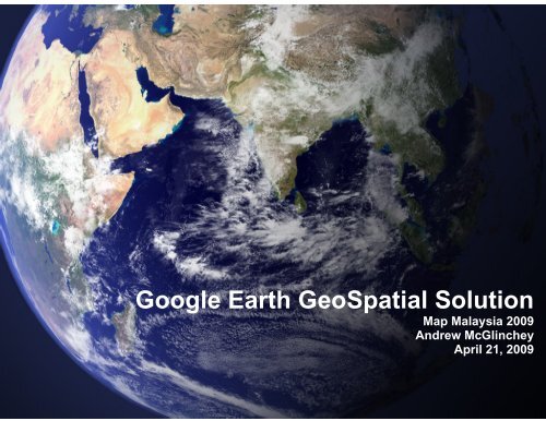
<strong>G<strong>oogle</strong></strong> <strong>Earth</strong> <strong>GeoSpat</strong>ial <strong>Solution</strong><br />
Map Malaysia 2009<br />
Andrew McGlinchey<br />
April 21, 2009
About <strong>G<strong>oogle</strong></strong><br />
Revenue Profit<br />
Employees Products Awards<br />
$21B in 2008 $13.1B in 2008 21,000 with 50%<br />
YouTube, Blogger<br />
Top company to<br />
in engineering Gmail, <strong>Earth</strong> work for 2007-2009<br />
Global<br />
117 language<br />
interfaces<br />
Search<br />
63% of the<br />
marketshare<br />
Ads<br />
70% of online<br />
advertising<br />
Apps<br />
100s of millions<br />
of users<br />
Platforms<br />
Chrome, Android,<br />
Maps, AppEngine<br />
Sources: ComScore qSearch, April 2008,<br />
<strong>G<strong>oogle</strong></strong> Confidential and Proprietary
<strong>G<strong>oogle</strong></strong> Maps in Southeast Asia
The product - <strong>G<strong>oogle</strong></strong> <strong>Earth</strong>
Workflow of Mapping data<br />
Within an organization<br />
Geospatial Data<br />
GIS Department<br />
Decision Makers<br />
Geospatial data is accessed by GIS engineers with<br />
expensive, technical software to prepare maps for key<br />
decision makers.
Value of <strong>G<strong>oogle</strong></strong> <strong>Earth</strong> Enterprise<br />
Public Safety<br />
Map data<br />
Agriculture<br />
Map data<br />
Your own globe<br />
Economic<br />
Development<br />
Map data<br />
Disaster Relief<br />
Map data<br />
Combine all mapping data into one<br />
fast, easy-to-use system accessed by<br />
all users from all departments<br />
<strong>G<strong>oogle</strong></strong> Confidential and Proprietary
What is <strong>G<strong>oogle</strong></strong> <strong>Earth</strong> Enterprise?<br />
Internal Map<br />
Data<br />
<strong>G<strong>oogle</strong></strong> <strong>Earth</strong><br />
Fusion Software<br />
<strong>G<strong>oogle</strong></strong> <strong>Earth</strong><br />
Server Software<br />
<strong>G<strong>oogle</strong></strong> <strong>Earth</strong><br />
Client or browser<br />
Imagery<br />
Vector<br />
2D<br />
Maps<br />
Terrain / Ocean<br />
3D<br />
Globe<br />
Internal map data<br />
from existing<br />
systems is input<br />
into GEE<br />
Fusion software<br />
processes data into<br />
3D globes or 2D<br />
browser based<br />
maps<br />
<strong>Earth</strong> Server<br />
software hosts<br />
the globe and<br />
maps<br />
For 1000s of<br />
users on closed<br />
networks
Benefits of <strong>Earth</strong> Enterprise<br />
Create a your own globe for visual<br />
geo data, , viewable by those who are<br />
given access.<br />
Fast, easy-to-use without extensive<br />
training and low cost compared to similar<br />
software.<br />
Works with existing GIS systems and is<br />
complementary to them.
<strong>G<strong>oogle</strong></strong> <strong>Earth</strong> Pro<br />
Product Description
Largest Fused <strong>Earth</strong> Database Ever Created
How customers use <strong>G<strong>oogle</strong></strong> <strong>Earth</strong> Pro<br />
Walmart<br />
Use case: Emergency management. Mapping open stores, trucks<br />
and weather conditions to route needed supplies.<br />
GE Pro features used: GIS data import, GPS tracking, image<br />
overlay<br />
Pioneer Natural Resources<br />
Use case: Drilling group view locations in <strong>G<strong>oogle</strong></strong> <strong>Earth</strong> Pro<br />
GE Pro features used: GIS data import, batch address<br />
geocoding, measurement tools<br />
Bell Canada<br />
Use case: Visualizing coverage area and outages for call center<br />
employees<br />
GE Pro features used: Computer based install and licensing, GIS<br />
data import, measurement tools
Benefits of <strong>Earth</strong> Pro<br />
Build on top of the <strong>G<strong>oogle</strong></strong> <strong>Earth</strong> globe<br />
Import GIS data from many sources for<br />
easy visualization<br />
Print and export high resolution images
Energy and Utilities
Case Study: Statoil Hydro<br />
<strong>Solution</strong>:<br />
Combined map data into 3D globe<br />
for research and development.<br />
Benefits:<br />
• Better field campaign planning<br />
with data sharing between<br />
teams<br />
• Visualizing complex temporal<br />
data with time animation<br />
• Display real time data to make<br />
on-the-fly decisions<br />
"It has transformed every part of the work process….In fact I have never seen a<br />
piece of software implemented so thoroughly, rapidly and completely," says Ole J.<br />
Martinsen, Vice Present for Exploration Research
Pictures worth 1000 words<br />
Electric Transmission Lines
Geographic Systems for Energy and Utilities<br />
Asset Management<br />
Mapping Transmission<br />
Projects<br />
Business Development<br />
Land Management<br />
Visualizing Growth<br />
Public Awareness
Case Study: Virtual Alabama
Problem:<br />
• Large US State with data across departments, counties<br />
• Needs “affordable, scalable, maintainable” system to visualize assets<br />
<strong>Solution</strong>:<br />
• <strong>G<strong>oogle</strong></strong> <strong>Earth</strong> Enterprise selected as visualization platform<br />
o intuitive interface, accessible to non-GIS specialist users<br />
o<br />
powerful enough to integrate large volumes of GIS data<br />
[1] Virtual Alabama Fact sheet http://www.dhs.alabama.gov/virtual_alabama/home.aspx<br />
[2] Virtual Alabama Case Study http://earth.g<strong>oogle</strong>.com/enterprise/virtual_alabama.html
<strong>G<strong>oogle</strong></strong> Enterprise Maps and <strong>Earth</strong> Products<br />
<strong>G<strong>oogle</strong></strong> Maps API Premier<br />
• Web based<br />
• API integration: add logic to your maps<br />
<strong>G<strong>oogle</strong></strong> <strong>Earth</strong> Enterprise<br />
• Build your own globe<br />
• Control who accesses what<br />
<strong>G<strong>oogle</strong></strong> <strong>Earth</strong> Pro<br />
• Build on <strong>G<strong>oogle</strong></strong>’s globe<br />
• Import and view 200 formats of GIS data
<strong>G<strong>oogle</strong></strong> <strong>Earth</strong> in Action
• YouTube “Virtual Alabama”<br />
http://www.youtube.com/watch?v=a-1I0JTWiIY