World Stress Map Conference - International Lithosphere Program ...
World Stress Map Conference - International Lithosphere Program ...
World Stress Map Conference - International Lithosphere Program ...
Create successful ePaper yourself
Turn your PDF publications into a flip-book with our unique Google optimized e-Paper software.
Wednesday, October 15 th<br />
Poster Session III: Strain measurements and interpretation<br />
Web application to determination of strain field from<br />
repeated geodetic measurement as a tool for data analysis<br />
and modelling<br />
Milan Talich<br />
Research Institute of Geodesy, Topography and Cartography (VUGTK) Czech Republic<br />
Milan.Talich@vugtk.cz<br />
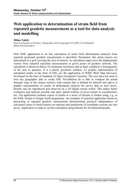
Web XML application to on line calculation of strain field (deformation analysis) from<br />
repeated positional geodetic measurement is described. Parameters like strain tensors are<br />
determined in a grid covering the area of interest. As calculation input serve the displacement<br />
vectors from repeated (epochal) measurements at given points of geodetic network. The<br />
calculation is based on theory of continuum mechanics and as basic condition is homogeneity<br />
of the area in question. It is a purely geometric solution. To graphic representation of<br />
calculated results in the form of GIS, use the application of WMS (Web <strong>Map</strong> Services),<br />
developed on the base of standards of Open Geospatial Consortia. The user does not need to<br />
own any geographic data to create GIS. Nevertheless he is able to compose his actual<br />
thematic map of the chosen territory with content that is defined by himself and add to it<br />
graphic representation of results of deformation analysis his survey data as next layers.<br />
Results may be reproduced and observed on a 3D digital terrain model. This makes better<br />
evaluation and analysis possible and takes spatial relation of given terrain in consideration,<br />
too. The application includes export of results to a series of formats to further using, e.g. as<br />
the KML format to Google Earth programme. An examples of practical application based on<br />
processing of repeated geodetic measurement demonstrating practical independence of<br />
calculated values of strain tensors on rotations and translations of coordinate systems are also<br />
given. Application is ready to on-line calculation using Internet for all interested people.<br />
58 3 rd <strong>World</strong> <strong>Stress</strong> <strong>Map</strong> <strong>Conference</strong>, 15.-17. October 2008 in Potsdam


