Nature-GIS White Paper
Nature-GIS White Paper
Nature-GIS White Paper

Create successful ePaper yourself
Turn your PDF publications into a flip-book with our unique Google optimized e-Paper software.
<strong>Nature</strong>-<strong>GIS</strong>:<br />
A European thematic network for Protected Areas/<strong>Nature</strong> Preservation<br />
and Geographical Information<br />
Project IST-2001-34641<br />
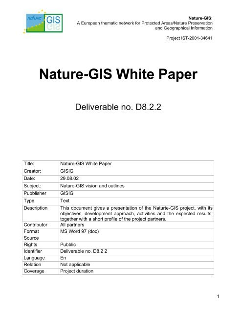
<strong>Nature</strong>-<strong>GIS</strong> <strong>White</strong> <strong>Paper</strong><br />
Deliverable no. D8.2.2<br />
Title:<br />
Creator:<br />
<strong>Nature</strong>-<strong>GIS</strong> <strong>White</strong> <strong>Paper</strong><br />
<strong>GIS</strong>IG<br />
Date: 29.08.02<br />
Subject:<br />
Pubblisher<br />
Type<br />
<strong>Nature</strong>-<strong>GIS</strong> vision and outlines<br />
<strong>GIS</strong>IG<br />
Text<br />
Description This document gives a presentation of the Naturte-<strong>GIS</strong> project, with its<br />
objectives, development approach, activities and the expected results,<br />
together with a short profile of the project partners.<br />
Contributor All partners<br />
Format MS Word 97 (doc)<br />
Source<br />
Rights Pubblic<br />
Identifier Deliverable no. D8.2 2<br />
Language En<br />
Relation Not applicable<br />
Coverage Project duration<br />
1
Table of Contents<br />
<strong>Nature</strong>-<strong>GIS</strong><br />
A European thematic network for Protected Areas/<strong>Nature</strong> Preservation<br />
and Geographical Information<br />
Project IST-2001-34641<br />
<strong>Nature</strong>-<strong>GIS</strong> <strong>White</strong> <strong>Paper</strong><br />
I.1 INTRODUCTION ......................................................................................................................3<br />
I.2 PROJECT CONTEXT AND OBJECTIVES .......................................................................................4<br />
I.3 THE NATURE-<strong>GIS</strong> VISION ....................................................................................................5<br />
I.4 PROJECT ACTIVITIES ..............................................................................................................6<br />
I.5 THE ROLE OF NATURE-<strong>GIS</strong> AND THE NETWORK PERSPECTIVE ...............................................8<br />
I.6 ECONOMIC DEVELOPMENT PERSPECTIVE .................................................................................8<br />
II. PARTNERSHIP ........................................................................................................................9<br />
PARTNERS PRESENTATION.............................................................................................................10<br />
II.1 <strong>GIS</strong>IG (I) - GEOGRAPHICAL INFORMATION SYSTEMS INTERNATIONAL GROUP ..........................10<br />
II.2 JRC - IES (EU) JOINT RESEARCH CENTRE - INSTITUTE FOR ENVIRONMENT & SUSTAINABILITY 11<br />
II.3 UNIVERSITY OF ABERDEEN ...................................................................................................12<br />
II.4 IONIC SOFTWARE S.A. .......................................................................................................13<br />
II.5<br />
II.6<br />
II.7<br />
UNIVERSITY OF ĖVORA.........................................................................................................13<br />
CEMAGREF..........................................................................................................................14<br />
REGIONE PIEMONTE.............................................................................................................14<br />
II.8 TARNIUM SARL .................................................................................................................15<br />
II.9<br />
UNIVERISTY OF GRENOBLE...................................................................................................16<br />
II.10 EURONATUR ...................................................................................................................16<br />
II.11 UNIVERISTY OF GIRONA .......................................................................................................17<br />
II.12 LULEÅ UNIVERSITY OF TECHNOLOGY (LUTH) ........................................................................18<br />
II.13 URSIT LTD .........................................................................................................................19<br />
II.14 UNIVERISTY OF CYPRUS.......................................................................................................19<br />
II.15 VÚGTK..............................................................................................................................20<br />
II.16 ESTONIAN ENVIRONMENT INFORMATION CENTRE (EEIC)........................................................20<br />
II.17 UNIVERSITY OF WEST HUNGARY...........................................................................................21<br />
II.18 UNIVERSITY OF JAGIELLONIAN...............................................................................................22<br />
II.19 UNIVERSITY OF ZILINA..........................................................................................................23<br />
2
I. <strong>Nature</strong>-<strong>GIS</strong> outlines<br />
<strong>Nature</strong>-<strong>GIS</strong><br />
A European thematic network for Protected Areas/<strong>Nature</strong> Preservation<br />
and Geographical Information<br />
Project IST-2001-34641<br />
<strong>Nature</strong>-<strong>GIS</strong> <strong>White</strong> <strong>Paper</strong><br />
I.1 Introduction<br />
The NATURE-<strong>GIS</strong> (IST project no. 2000-34641, start date April 1 st , 2002) is a European thematic<br />
network developing within the framework of the IST (Information Society Technologies) programme of<br />
the European Commission. It aims to bring together the many different stakeholders in protected<br />
areas, both users and experts in IT and nature conservation, to address the requirements for<br />
geographic information (GI) in protected areas, with special reference to European policies in this field.<br />
The objectives of the project are to offer a contribution to:<br />
• improve access to information for European policy making and evaluation, particularly reporting<br />
related to the implementation of the EU <strong>Nature</strong> Protection and Biodiversity policy area<br />
• raise awareness about the use of GI-<strong>GIS</strong> in this field. The project can be viewed in the context of a<br />
larger framework of contributions to European documents and conventions requiring research,<br />
identification and exchange of information to ease and promote the conservation of biodiversity<br />
• develop and broaden the dialogue amongst all levels of responsibility, from the EU to the local<br />
level; in other words the project is intended to support public access to data and information in the<br />
EU and in the new Accession countries.<br />
The network will be developed through the following activities comprising three phases of<br />
workpackages. The first phase involves assessment of the:<br />
• user needs to characterise the stakeholders in the field, and a survey of the scenarios for the use<br />
of GI in this domain<br />
• data requirements to individuate and specify the common kernel of GI content to describe<br />
protected areas<br />
• functional requirements for the management of GI and definition of the framework for spatial<br />
databases in protected areas<br />
The results of the assessment will be:<br />
• production of Technical Guidelines for data infrastructures in protected areas, as a means of<br />
integrating the workpackages and to contribute to geo-data access and exchange through<br />
standardisation of data infrastructures for protected areas<br />
• definition and prototyping of a web portal to information on European protected areas<br />
Finally, the project will place major emphasis on the dissemination of the results to the <strong>GIS</strong> and <strong>Nature</strong><br />
Preservation communities at a European-wide level. To achieve the best possible results the<br />
networking and dissemination will be carried out at the national and European level to ensure<br />
involvement of all the stakeholders in a pan-European network for protected areas and to develop a<br />
permanent “NATURE-<strong>GIS</strong> Group”.<br />
The expected results of the network are:<br />
• the use of the Guidelines to implement <strong>GIS</strong> in protected areas<br />
• a demonstration of how web access to information is applicable to the field of nature conservation<br />
• raising European awareness for a supra-national approach in GI management in the field and a<br />
call for more concerted and integrated actions<br />
• as the final follow-up stage to the project, the establishment of a pan-European “NATURE-<strong>GIS</strong><br />
Group” designed to ensure long-term continuity and evolution of the network<br />
3
I.2 Project context and objectives<br />
<strong>Nature</strong>-<strong>GIS</strong><br />
A European thematic network for Protected Areas/<strong>Nature</strong> Preservation<br />
and Geographical Information<br />
Project IST-2001-34641<br />
<strong>Nature</strong>-<strong>GIS</strong> <strong>White</strong> <strong>Paper</strong><br />
<strong>Nature</strong> conservation and protected habitats present complex problems ranging from environmental<br />
management and planning to social and economic issues. They are addressed by numerous different<br />
organisations, interest groups and individuals from diverse cultural or technical backgrounds. Many of<br />
these problems have a strong geographical element. However, the widespread use of Geographic<br />
Information Systems (<strong>GIS</strong>) is often restricted because of a lack of knowledge and understanding<br />
about the technology, and a lack of communication between the <strong>GIS</strong> experts and the end user<br />
community.<br />
One way to address this problem is by creating a pan-European network, the NATURE-<strong>GIS</strong> Network,<br />
that will link all the different organisations and stakeholders 1 who have an interest in the application of<br />
Geographic Information and Geographic Information Systems (GI-<strong>GIS</strong>) to protected areas. A key goal<br />
for the NATURE-<strong>GIS</strong>, project is to bridge this gap by bringing specialists from different disciplines<br />
together, thus enabling the potential of <strong>GIS</strong> to be applied in this crucial field. This is necessary<br />
because this multi-faceted arena has many different players and many different regional scenarios,<br />
and there is currently a lack of European awareness and consideration of the interrelated nature of<br />
many environmental issues. Furthermore, problems are currently often only tackled at a local or<br />
regional level and links with overall European policy and with relevant operators in other countries or<br />
regions are usually poor. NATURE-<strong>GIS</strong> seeks to remedy this by identifying the specific needs of<br />
public authorities responsible for environmental protection, who are often in a difficult position, trying<br />
to maintain a balance between spatial planning, rural development and nature conservation. At the<br />
same time, NATURE-<strong>GIS</strong> can assist them to see their problems and potential solutions within a<br />
national and pan-European context.<br />
The creation of the NATURE-<strong>GIS</strong> network also introduces a far broader perspective, enabling key<br />
players and policy makers at all levels to have access to high-quality GI-<strong>GIS</strong> content. The effective<br />
sharing of information at local, national and international level enables far more efficient and coordinated<br />
conservation initiatives and problem solving. In this way, NATURE-<strong>GIS</strong> makes a<br />
contribution to the EU’s Policies related to the field of Protected Areas and <strong>Nature</strong> preservation, and<br />
forms a focal point for the exchange of information and the identification of specific GI-<strong>GIS</strong><br />
requirements for promoting nature conservation and biodiversity across a whole range of EU policies<br />
and initiatives.<br />
The establishment of the NATURE-<strong>GIS</strong> network also anticipates an enlarged European Union, and<br />
places considerable emphasis on the participation of Accession and Adhesion Countries. In particular,<br />
nature conservation issues are of key importance in Central and Eastern Europe, where most of the<br />
countryside remains unspoilt, retaining natural habitats and landscapes of high ecological value and<br />
with extensive agriculture systems still in operation. Notwithstanding this high potentiality, there have<br />
been registered cases of decay of nature quality, with spoilt and polluted zones and destruction of<br />
many extensive agriculture areas, caused by events of the last decades history (in a first time to the<br />
low priority of nature conservation and currently to the problems of economic development). For these<br />
Countries then the <strong>Nature</strong>-<strong>GIS</strong> approach (to link different organisations and stakeholders, to support<br />
balance between spatial planning, rural development and nature conservation) can be fruitful and<br />
efficacious, particullary considering the recent registered better awareness of nature and of biodiversity.<br />
1 <strong>Nature</strong>-<strong>GIS</strong> Stakeholders: they are intended as actual or potential users and producers of GI technology in protected<br />
areas.<br />
4
<strong>Nature</strong>-<strong>GIS</strong><br />
A European thematic network for Protected Areas/<strong>Nature</strong> Preservation<br />
and Geographical Information<br />
Project IST-2001-34641<br />
<strong>Nature</strong>-<strong>GIS</strong> <strong>White</strong> <strong>Paper</strong><br />
Within this reference framework the objectives (see Figure 1) of the project can be summarised as<br />
being to:<br />
• create and apply new Guidelines on Spatial Data Infrastructure for protected areas;<br />
• demonstrate clearly how web access to information is applicable in this field;<br />
• increase European awareness of the importance and advantages of an international approach to<br />
GI management and increase impetus for more concerted and integrated action in relation to<br />
protected areas;<br />
• establish a permanent pan-European “NATURE-<strong>GIS</strong> Group”.<br />
Fig. 1. The <strong>Nature</strong>-<strong>GIS</strong> objectives<br />
I.3 The NATURE-<strong>GIS</strong> vision<br />
"The European Sustainable Development Strategy advocates a new approach to policy-making<br />
through more coherence in Community policies. An information base that provides detailed relevant<br />
harmonised spatial information for different policy areas and that is commonly accessible could<br />
significantly contribute to this objective.<br />
Currently, exploitation of the potential of geographical information is hampered by lack of standards, of<br />
data and of a coherent data policy. A Community initiative to address these difficulties could unlock a<br />
vast potential of information and information services, e.g. related to identification, access to and<br />
visualisation of information. These would stimulate increased coherence and integration of Community<br />
policies. Standardisation of geographical information services would open up new ways of<br />
communication, narrowing the gap between Europe and its citizens" 2 .<br />
Recent advances in moving from paper to digital data have created considerable opportunities to<br />
revolutionise access to data and the communication of information, and for informed decision-making<br />
at all levels of society. This transition from 'back room' to 'open door access to information' presents<br />
new challenges for those acquiring, handling, curating, and providing access to electronic data and<br />
2 Memorandum of understanding between Commissioners Wallstróm, Solbes, Busquin. “Infrastructure for Spatial<br />
Information in Europe (INSPIRE)”, 11 April 2002 D(02)330523<br />
5
<strong>Nature</strong>-<strong>GIS</strong><br />
A European thematic network for Protected Areas/<strong>Nature</strong> Preservation<br />
and Geographical Information<br />
Project IST-2001-34641<br />
<strong>Nature</strong>-<strong>GIS</strong> <strong>White</strong> <strong>Paper</strong><br />
information. Unfortunately the data are often of poor quality, of inconsistent standards, reside on<br />
specialist geographic information systems and are not accessible to the public at local, regional,<br />
national and international levels. This means that presenting collations of data as information is time<br />
consuming and costly.<br />
This scenario is also true of the current framework of GI management in protected areas and nature<br />
preservation.<br />
NATURE-<strong>GIS</strong> is therefore committed to comply with a vision that is designed to:<br />
• serve the community of people dealing with environmental protection programmes and<br />
management of protected areas;<br />
• at local, regional, national and EU administrative levels with applications and information services;<br />
• that streamline the flow of geographic information;<br />
• in their daily tasks.<br />
I.4 Project activities<br />
The network will be developed in nine work-packages:<br />
• four technical workpackages for assessing user needs, data requirements functional requirements<br />
and for addressing access to information and GI technology<br />
• three workpackages devoted to produce technical guidelines to disseminate the results and to<br />
develop a pan European network for protected areas<br />
• two workpackages related to project management and the assessment and evaluation of the<br />
project results<br />
These work-packages are:<br />
• WP1: Network management<br />
• WP2: User needs assessment<br />
• WP3: Data requirements and policy<br />
• WP4: Functional requirements<br />
• WP5: Access to information and GI technology<br />
• WP6: Technical guidelines for data infrastructures for protected areas<br />
• WP7: Assessment and evaluation<br />
• WP8: Dissemination<br />
• WP9: NATURE-<strong>GIS</strong> towards a pan-European network for protected areas<br />
The functional project structure is shown in Figure 2:<br />
WP1_Network<br />
management<br />
WP7_Assessment and<br />
evaluation<br />
WP2_User<br />
needs<br />
assessment<br />
WP3_Data<br />
requirements<br />
and policy<br />
WP4_Functio<br />
nal<br />
requirements<br />
WP5_Access<br />
to<br />
information<br />
and GI<br />
technology<br />
WP6_Technical guidelines for data infrastructures for protected areas<br />
WP8_Dissemination<br />
I.1.1.1. WP9_NATURE-<strong>GIS</strong> towards a pan-European network<br />
for protected areas<br />
Fig. 2. The Functional Structure of the NATURE-<strong>GIS</strong> Project<br />
6
<strong>Nature</strong>-<strong>GIS</strong><br />
A European thematic network for Protected Areas/<strong>Nature</strong> Preservation<br />
and Geographical Information<br />
Project IST-2001-34641<br />
<strong>Nature</strong>-<strong>GIS</strong> <strong>White</strong> <strong>Paper</strong><br />
In this scheme the “Technical guidelines for data infrastructures for protected areas” (WP6) provide<br />
the means to summarise all of the technical achievements of the work-packages.<br />
The first phase of the NATURE-<strong>GIS</strong> programme will be to assess user needs, define and characterise<br />
stakeholders and survey typical uses of GI in connection with nature conservation. Based upon this, it<br />
will be possible to establish the data that is required in order to specify the common kernel of GI<br />
content needed to describe protected areas. NATURE-<strong>GIS</strong> will also identify how the information can<br />
best be managed and will define a framework for these specialised spatial databases. The results of<br />
this assessment will enable access via the Internet to high-quality and comprehensive GI-<strong>GIS</strong><br />
information on European protected areas.<br />
In the second phase the project team will produce technical guidelines for data infrastructures for<br />
protected areas in order to contribute to improved geo-data access and exchange through<br />
standardisation. Figure 3 shows the approach followed by NATURE-<strong>GIS</strong>.<br />
Fig. 3 The <strong>Nature</strong>-<strong>GIS</strong> approach<br />
7
<strong>Nature</strong>-<strong>GIS</strong><br />
A European thematic network for Protected Areas/<strong>Nature</strong> Preservation<br />
and Geographical Information<br />
Project IST-2001-34641<br />
<strong>Nature</strong>-<strong>GIS</strong> <strong>White</strong> <strong>Paper</strong><br />
Finally, the project will have a strong commitment to disseminating the results to <strong>GIS</strong> and nature<br />
conservation organisations throughout Europe. The networking and dissemination will be carried out<br />
at both national and European levels in a way that will foster the creation of a permanent pan-<br />
European NATURE-<strong>GIS</strong> Group for protected areas. This network will continue to function effectively<br />
beyond the duration of the project.<br />
I.5 The Role of NATURE-<strong>GIS</strong> and the Network perspective<br />
NATURE-<strong>GIS</strong> seeks to exploit the operational potential of a thematic network and several different<br />
initiatives across the project at different levels, with the creation of a stable “NATURE-<strong>GIS</strong> Group”.<br />
Previous experience of the Members of the network reveals difficulty in establishing a link between<br />
protected areas management at the local level and the European context. It is therefore necessary to<br />
raise awareness within the European stakeholder community of the importance of exchanging<br />
experiences and the importance of developing a European-wide approach to dealing with these<br />
problems. There is also often a gap between the scope of the European problems and the policies and<br />
ways in which they are dealt with. To fill this gap requires the exchange of data and information and<br />
the wider use of Geographical Information; in other words the provision of GI support to the European<br />
Information Society.<br />
To this end, a Strategic Network Development Plan and a Memorandum of Understanding for the<br />
establishment of the “NATURE-<strong>GIS</strong> Group” are planned which define the network follow-up and the<br />
exploitation activities. Exploitation will be pursued through:<br />
• establishing mutual technical co-operation amongst the members for the realisation of NATURE-<br />
<strong>GIS</strong> initiatives at a local /regional level with particular emphasis on addressing the activities at the<br />
level of single group, or linked groups, of Protected Areas<br />
• enlarging the country scope of NATURE-<strong>GIS</strong>, to ensure a full regional coverage<br />
• creating linkages with other sectoral groups or initiatives that are complementary to NATURE-<strong>GIS</strong>,<br />
in such a way as to exploit the NATURE-<strong>GIS</strong> results within these initiatives and to transfer the<br />
experience of these initiatives towards the NATURE-<strong>GIS</strong> network. The value of the NATURE-<strong>GIS</strong><br />
approach within other complementary initiatives is clearly evident, especially if it is considered that<br />
there are already many sites on the Internet about protected areas and nature conservation but<br />
without reference to spatial data and GI;<br />
• creation of a permanent “NATURE-<strong>GIS</strong> Group” after the project ends to further develop the role of<br />
a European network of Protected Areas and Geographical Information that will continue to support<br />
the operators in this field and to further raise and encourage European awareness and<br />
collaboration<br />
• ensuring better targeting of the different stakeholders and new user groups through the<br />
development of an open network and the concept of national networks<br />
I.6 Economic development perspective<br />
It has to be considered that the improvement of knowledge in this domain, as per the NATURE-<strong>GIS</strong><br />
mission, could also influence the evolution of the market and the demand for more advanced<br />
management tools. In the context of nature protection, the network developed will promote the use of<br />
<strong>GIS</strong>, support its future development, and will contributing in developing the <strong>GIS</strong> market.<br />
NATURE-<strong>GIS</strong> applications could also provide a contribution to other economic perspectives, however<br />
indirect. For example to:<br />
8
<strong>Nature</strong>-<strong>GIS</strong><br />
A European thematic network for Protected Areas/<strong>Nature</strong> Preservation<br />
and Geographical Information<br />
Project IST-2001-34641<br />
<strong>Nature</strong>-<strong>GIS</strong> <strong>White</strong> <strong>Paper</strong><br />
• Provide a consistent framework for the development of the <strong>GIS</strong> industry in the field (a more<br />
uniform background, a solid assessment of user needs, an evaluation of requirements)<br />
• Target a User Community able to operate as an interface to Open<strong>GIS</strong> Development in the nature<br />
protection domain. The establishment of a NATURE-<strong>GIS</strong> Community could offer a communication<br />
medium for the stakeholders in the field of protected areas management and an interface to the<br />
progressive development of the OCG concept and approach in this aspect of the environmental<br />
domain<br />
• Support the organisational development in the protected areas sector, including the development<br />
of new services or their improvement<br />
• Introduce a concept for comparing the different policy perspectives and to provide a means for<br />
better integration of the management of natural areas into the overall framework of European<br />
policies, as represented by the current approach<br />
Furthermore, the development of a better knowledge of Protected areas and provision of improved<br />
exploitation of their potentiality, as fostered by the NATURE-<strong>GIS</strong> network, could also have an impact<br />
in Regional Development and territorial planning and then indirectly in Regional economic<br />
development.<br />
Finally, with reference to the potential impact on IT companies and consultants, the project should<br />
stimulate and foster an attitude towards developing business in <strong>GIS</strong> applications in the <strong>Nature</strong> sector.<br />
This will derive from an improved understanding and wider adoption of the methods resulting from the<br />
user-requirement analysis that is the base for an effective development of the <strong>GIS</strong> market.<br />
II.<br />
Partnership<br />
The NATURE-<strong>GIS</strong> network aims to create an operative framework at a European level amongst<br />
partners with different expertise in the field of protected areas and Geographical Information (see<br />
Appendix). The partnership reflects on the one hand the need to bring together experts and users in<br />
the thematic domain of protected areas with organisation leaders in Geographical Information and in<br />
the technology for accessing information; a partnership able to assess and address methods and tools<br />
for managing GI in the complex scenarios of “Protected Areas” with their various characterisations.<br />
This enables the project to be structured as a thematic interdisciplinary sectoral network. On the other<br />
hand, whilst European in coverage, the network also intends to ensure a local impact for the wider<br />
benefit of the operators and stakeholders of protected areas operating at this level. From this<br />
perspective, and with an approach that is both “local to global” and “global to local”, characterising<br />
a network built at different levels, the NATURE-<strong>GIS</strong> partnership has been defined to consider: national<br />
actors, the “Network Developers”, as well as involving key local operators and stakeholders, a<br />
countrywide analysis of needs and functional requirements, and to provide a basis for the wider<br />
diffusion of the project results at a National level.<br />
In a wider European context, particular attention has been devoted to the participation of organisations<br />
coming from the Adhesion Countries, with the following objectives i) to create a real pan-European<br />
common interest and approach to an important issue of human life, and ii) to support the<br />
enlargement and the adaptation of the European policies for protected areas to these countries.<br />
The members of NATURE-<strong>GIS</strong> have been selected to ensure comprehensive coverage of the<br />
problems and issues arising in relation to protected areas and GI and to bring with them a wide<br />
spectrum of skills and expertise. Key membership categories are:<br />
9
<strong>Nature</strong>-<strong>GIS</strong><br />
A European thematic network for Protected Areas/<strong>Nature</strong> Preservation<br />
and Geographical Information<br />
Project IST-2001-34641<br />
<strong>Nature</strong>-<strong>GIS</strong> <strong>White</strong> <strong>Paper</strong><br />
• Protected areas expert groups – These offer specific experience in the analysis of problems and<br />
the implementation of <strong>GIS</strong> applications in the field of nature protection<br />
• Users – Representatives from regional authorities and protected areas management authorities<br />
ensure a comprehensive view of the issues involved and that different sectoral requirements are<br />
taken into account.<br />
• <strong>GIS</strong>/IT expert groups and Companies – These manage the different technological aspects. Their<br />
expertise is used to ensure a user-friendly, state-of-the-art approach to the design of the tools that<br />
the network will use to access to information<br />
• JRC of the European Commission – Its presence ensures the project coherence with the strategic<br />
European vision of nature management<br />
Partners Presentation<br />
II.1<br />
<strong>GIS</strong>IG (I) - Geographical Information Systems International Group<br />
Sectoral non profit Association on Geographical Information Systems (<strong>GIS</strong>) and on<br />
Geographical Information (GI), constituted in 1992 to operate as Technology Transfer<br />
Centre on <strong>GIS</strong>. The member organisations (from more than 20 European Countries) are<br />
universities and research institutions, <strong>GIS</strong> technology suppliers, local bodies, companies<br />
operating on territorial subjects. That guarantees interdisciplinary expertise both on tools<br />
and on their applications (territorial planning, agriculture, technological networks and<br />
water resources, environment, regional development, ...).<br />
The Association objectives is to operate for Innovation and Technology Transfer in the <strong>GIS</strong> field<br />
through:<br />
• setting up a European network on <strong>GIS</strong> activities and applications;<br />
• grouping at European level expertise from universities, companies and other bodies dealing with<br />
<strong>GIS</strong> tools to make easier technology transfer and exchange of information and experience;<br />
• promoting and developing joint projects on <strong>GIS</strong> technologies and territorial problems;<br />
• promoting the participation in European Union programmes in the field of Geographical<br />
Information.<br />
To pursue its objectives the Association has set up an operative framework organised according to<br />
three different levels:<br />
• European level related with the main activities and the operational lines of the Association in the<br />
framework of the EU policies of Training and Education, Research and Technology Development,<br />
International Co-operation and Regional Development.<br />
• Regional level, with the aim of multiplying at a National/Regional level the University-Enterprise<br />
co-operation scheme, in order to favour and promote projects and initiatives involving a wider<br />
partnership in the Association activities.<br />
At present other than in Italy are active Secretariats in Finland, Germany, Greece, Portugal,<br />
Northern Spain, Southern Spain, Bulgaria, Czech Republic, Cyprus, Hungary, Romania, Slovakia.<br />
• Thematic level: thematic Networks are promoted in order to create frameworks of common<br />
interest among the <strong>GIS</strong>IG members and to establish links and partnerships with different <strong>GIS</strong><br />
application domains, users groups (including local Authorities) and professional operators,<br />
combining the use of <strong>GIS</strong> technology with the study and the development of the application<br />
domain thanks to an integrated approach. Initiatives have been promoted in the field of:<br />
• <strong>GIS</strong> and Water Resources.<br />
• <strong>GIS</strong> and Integrated Coastal Area Management.<br />
10
<strong>Nature</strong>-<strong>GIS</strong><br />
A European thematic network for Protected Areas/<strong>Nature</strong> Preservation<br />
and Geographical Information<br />
Project IST-2001-34641<br />
<strong>Nature</strong>-<strong>GIS</strong> <strong>White</strong> <strong>Paper</strong><br />
• <strong>GIS</strong> and rural areas.<br />
• <strong>GIS</strong> and historical cities.<br />
While promoting <strong>GIS</strong> technology and Geographical Information, a special attention is paid to<br />
technology transfer towards SMEs and Local Bodies, and to the exchange of experience at a<br />
European level, within the European Union and with Central and Eastern, and South Eastern,<br />
European Countries (CEEC and SEEC).<br />
II.2 JRC - IES (EU) Joint Research Centre - Institute for Environment & Sustainability<br />
The mission of the IES is to provide scientific and technical support to EU strategies for<br />
the protection of the environment and sustainable development. Employing an<br />
integrated approach to the investigation of air, water and soil contaminants, its goals<br />
are sustainable management of water resources, protection and maintenance of<br />
drinking waters, good functioning of aquatic ecosystems, and good ecological quality of<br />
surface waters.<br />
It is no longer possible to continue polluting the environment and exhausting natural resources as in<br />
the past quarter century. Environmental policies are the main instrument for achieving sustainable<br />
development.<br />
Prime objectives of IES are to investigate the level and fate of contaminants in the air, water and soil;<br />
assess the effects of these contaminants upon the environment and individuals; and promote a<br />
sustainable energy supply. Its integrated approach combines expertise in experimental sciences,<br />
modelling, geomatics and remote sensing. This puts the institute at the forefront of European research<br />
for the attainment of a sustainable environment.<br />
The Geographic Information and Geographic Information Systems (GI & <strong>GIS</strong>) Project activities are<br />
performed within the European Commission’s Research Framework Programmes. The GI & <strong>GIS</strong><br />
Project activities are performed by the Institute for Environment & Sustainability of the Joint Research<br />
Centre (JRC) in close co-operation with other Services and Directorate Generals of the Commission,<br />
and also with a large number of external institutions, both private and public.<br />
The GI & <strong>GIS</strong> Project, part of the Land Use and Land Cover Unit, aims to be considered as a<br />
Reference Centre on Geographic Information at European Commission level.<br />
The main concept of the GI-<strong>GIS</strong> Project is to consider GI as a common element to several thematic<br />
areas and thus to concentrate the work to build a GI infrastructure, GI being a multi-purpose layer in<br />
support to several thematic activities and projects.<br />
The main objectives of the GI & <strong>GIS</strong> Project (1999-2002) are:<br />
• To assist the creation of the European Geographic Information Infrastructure collaborating with<br />
the main European actors (<strong>GIS</strong>CO, EEA, EUROGI, Eurogeographics, etc.).<br />
• To conceive, create or harmonise Pan-European databases to be used to support and monitor the<br />
EU policies mainly through the support, co-ordination or technical co-operation with thematic<br />
networks such as the European Soil Bureau, EEA European Topic Centres, Eumetnet , etc.<br />
• To develop integrating spatial models (to assess the impact and to help in the definition of the EU<br />
policies).<br />
• To develop methods and tools to contribute to the definition of the future European geostatistical<br />
system (in co-operation with Eurostat-<strong>GIS</strong>CO).<br />
• To provide scientific and technical support on GI&<strong>GIS</strong> Interoperability to develop common<br />
European position and to operate as GI communications facility (web, discussion lists, etc.).<br />
• To create link and synergies to EU space activities; for example, in the field of earth observation.<br />
11
<strong>Nature</strong>-<strong>GIS</strong><br />
A European thematic network for Protected Areas/<strong>Nature</strong> Preservation<br />
and Geographical Information<br />
Project IST-2001-34641<br />
<strong>Nature</strong>-<strong>GIS</strong> <strong>White</strong> <strong>Paper</strong><br />
The <strong>Nature</strong> <strong>GIS</strong> Network proposal is retained as relevant for GI & <strong>GIS</strong> Project activities considering<br />
the recently launched INSPIRE (INfrastructure for Spatial Information in Europe) initiative.<br />
II.3 University of Aberdeen<br />
For over five hundred years the University, in one form or another, has been<br />
an integral part of the city of Aberdeen as a world leader in education and<br />
research. The University was founded by Bishop William Elphinstone in 1495.<br />
It is the third oldest university in Scotland and the fifth oldest in the UK. The<br />
earliest English-speaking Chair of Medicine was endowed by King James IV in 1497. The University<br />
united with Marischal College in the 19th century. Today, with almost 11,000 students, and nearly<br />
3,000 staff, we are at the forefront of teaching and research in medicine, the humanities and sciences.<br />
Aberdeen is an international university built on serving one of the most dynamic regions in Europe.<br />
The University of Aberdeen aims to create, develop, apply and transmit through the work of all its<br />
members, knowledge, skills and understanding at the highest levels of excellence.<br />
The University of Aberdeen offers over 450 first-degree courses. In 1999-2000, the number of full-time<br />
students at the Institution was 10,788, including 9,091 undergraduates and 1,697 postgraduates. One<br />
third of our postgraduate students come from countries outside the UK. 96% of our graduates entered<br />
directly into work, further study or training. The student population is 48.5% men, 51.5% women, and<br />
30% of new full-time undergraduate entrants were mature. Over 115 nationalities are represented.<br />
The University employs 2,937 staff members and there are 130 departments and service areas. There<br />
are 46 departments with 1,400 academic staff. The Library contains over 1,050,000 volumes and<br />
more than 6,000 journals and periodicals. There are more than 1,000 computers available for students<br />
to use. 89% of subjects which have been assessed are rated excellent/highly satisfactory. 155<br />
SOCRATES/ERASMUS links with institutions in 19 European countries.<br />
The Centre for Remote Sensing and Mapping Science (CRSMS) in the Department of Geography and<br />
Environment at the University of Aberdeen was established in 1989, and acts as a focus for education,<br />
training, teaching, research and consultancy in the environmental applications of the geospatial<br />
technologies (<strong>GIS</strong>, Remote Sensing, Cartography and Digital Mapping, Global Positioning Systems<br />
(GPS), Internet. The Centre for Marine and Coastal Zone Management (CMCZM) is a research<br />
grouping with a special focus on the application of the geospatial technologies to Integrated Coastal<br />
Zone Management (ICZM). The CRSMS runs a very successful M.Sc./Diploma course in<br />
Environmental Remote Sensing (ERS); is involved in the supervision of numerous PhD research<br />
projects; is engaged in <strong>GIS</strong> and Remote Sensing research and consultancy with a number of local,<br />
national and international agencies and organisations - including the Macaulay Land Use Research<br />
Institute (MLURI), the Joint <strong>Nature</strong> Conservation Committee (JNCC), the Environment Agency (EA),<br />
the European Union of Coastal Conservation (EUCC), and Scottish Natural Heritage (SNH) amongst<br />
others. We are currently involved in a number of EU and other research proposals (British Council) to<br />
undertake <strong>GIS</strong>-related research into integrated coastal zone management, erosion and disaster<br />
studies, <strong>GIS</strong> in the context of national parks, and the creation of geo-historical communities This will<br />
involve the environmental application of the geospatial technologies. Our current expertise lies with:<br />
online <strong>GIS</strong> and Decision Support Systems; <strong>GIS</strong>, remote sensing, cartography, databases, digital<br />
mapping, metadata, and the Internet; Internet-based Geoinformation Systems; Data compression<br />
(Map and image web server technology); Website design, creation and maintenance; IT (including<br />
server technology); ICZM; Landscape Ecology; mobile field data collection using a combination of<br />
PDAs, mobile phones, and GPS; and Map Design (including the use and choice of colour).<br />
12
II.4<br />
IONIC Software S.A.<br />
<strong>Nature</strong>-<strong>GIS</strong><br />
A European thematic network for Protected Areas/<strong>Nature</strong> Preservation<br />
and Geographical Information<br />
Project IST-2001-34641<br />
<strong>Nature</strong>-<strong>GIS</strong> <strong>White</strong> <strong>Paper</strong><br />
IONIC Software is a privately held Belgian company committed to providing<br />
fully interoperable, enterprise-class products for the publishing, discovery,<br />
access, integration, and application of corporate spatial data and services, in<br />
support of core business functions. IONIC has a vision of a world driven by<br />
standards-based interoperability, leading to reduced cost of ownership. IONIC’s mission is to leverage<br />
its extensive experience to create and deliver the best suite of commercial off the shelf (SCOTS) Java<br />
component products. Orienting enterprise data in space and time, and integrating spatial logic into<br />
enterprise decision-making, the IONIC Java Component Suite provides breakthrough business<br />
performance gains across an array of industries.<br />
IONIC is the first company worldwide to deliver as COTS products operational Web Feature Server to<br />
interact with GML data. These products are deployed since 2 years and successfully used in operation<br />
by ESA (European Space Agency) for Earth Observation application, by the Norwegian Mapping<br />
Authority as the spatial baseline within the national e-Gov Program (e-Norge) and more recently by a<br />
major world-wide Telecom Operator as their core infrastructure for offering Location Based Services<br />
(LBS) to 3G mobile phone subscribers.<br />
IONIC technology is designed in conformance with OGC, ISO and W3C directions; IONIC components<br />
are built to run on powerful J2EE Application Servers, on any hardware platform, and to scale to very<br />
large volumes of spatial data as well as large number of simultaneous users. IONIC has developed<br />
Java components on server side (Servlets, EJBs, business logic components, developer tools, and<br />
more) as well as a client side development toolkit to provide developers with the most advanced<br />
commercial Java components to create geo-enabled business solutions. The IONIC COTS are wellknown<br />
for being reliable, scalable, robust, ready-to-use and easy to integrate or configure when<br />
necessary. In addition, IONIC has created a set of GML<br />
Tools - as Java components - that can process XML Application schema and convert any kind of data<br />
to/from GML data, directly from typical sources like Oracle 8i/9i database, <strong>GIS</strong> files.<br />
II.5<br />
University of Evora<br />
The Centre of Applied Ecology is a research body within the University of Ėvora<br />
(Portugal). Research is divided into four areas, each of which is led by a group of<br />
researchers with their own laboratory: Biological Cartography; Applied Entomology;<br />
Freshwater Ecology; and Marine Ecology. Our lab – Biological Cartography - is<br />
concerned with three broad research questions:<br />
1) ‘why do species occur where they do?’;<br />
2) ‘what environmental and geographical factors affect persistence and extinction of species within a<br />
given area?’;<br />
3) ‘where should conservation effort be directed to, given information from questions 1 and 2?’<br />
We favour multi-species analysis; cross taxon-comparisons; and the development of statistical<br />
techniques to test hypothesis about current and future distributions of organisms. We are interested in<br />
exploring indicator relationships and short-cut approaches to the conservation of biological diversity.<br />
We explore <strong>GIS</strong> capabilities in the study of macroecological patterns and processes. We hope that<br />
developing methods and improving our understanding about scale in Ecology will help us to design<br />
better strategies for conserving biological diversity.<br />
13
II.6<br />
Cemagref<br />
<strong>Nature</strong>-<strong>GIS</strong><br />
A European thematic network for Protected Areas/<strong>Nature</strong> Preservation<br />
and Geographical Information<br />
Project IST-2001-34641<br />
<strong>Nature</strong>-<strong>GIS</strong> <strong>White</strong> <strong>Paper</strong><br />
Cemagref is a public agricultural and environmental research institute whose<br />
staff is 1000 permanents including 450 engineers and scientists in 34<br />
research units distributed in 9 regional centres all over the French territory. Its<br />
work focuses on sustainable development in non-urban areas. It contributes to the conservation and<br />
acceptable management of land and water systems, the growth of economic activity on a sustainable<br />
basis, and the prevention of associated risks.<br />
Its research usually addresses complex systems and their interaction with human society. An<br />
interdisciplinary approach is usually always appropriate.<br />
Besides advancing fundamental knowledge, Cemagref makes available its diagnostics and control<br />
methods, designs negotiation and management tools, develops innovative technologies and supports<br />
public and private enterprise with its skills and experience.<br />
Its four leading areas of interest are:<br />
• hydrosystem functioning<br />
• water and waste disposal engineering and management<br />
• management of predominantly rural areas<br />
• agriculture and food engineering<br />
Natural risk management will be one of the main areas of Cemagref scientific research in coming<br />
years. A rigorously scientific approach is a vital factor for success in engineering research. Full weight<br />
is given to computer modelling, geographical information systems and computational analysis.<br />
The Mediterranean Agriculture and Forest Research Unit fields of activities focused on<br />
spatialising, using <strong>GIS</strong>, thematic models produced by different disciplines in the unit: forest ecology,<br />
agricultural system functioning, spatial economy, forest fire risk modelling, and spatial analysis. The<br />
aim is to provide to decision-makers tools to help them to manage natural, agricultural and periurban<br />
territories.<br />
Some recent relevant studies undertaken by the research unit are the following:<br />
• Spatial impact and spatial constraints of human activities, and more specifically agriculture, in<br />
protected areas and non protected areas.<br />
• Spatial analysis using <strong>GIS</strong> to provide tools to decision-makers to manage territories: as applied<br />
to spatial changes on a local and regional scale in periurban areas<br />
• Complex area mapping, using remote sensing for the study of the interfaces between natural<br />
lands, farming lands and low-density urbanised lands.<br />
II.7<br />
Regione Piemonte<br />
Within the activities of Regione Piemonte, the Department for Protected Areas Planning<br />
mainly deals with all the aspects concerning the individuation, planning and scientific<br />
and promotional co-ordination of the regional Protected Areas. Moreover, the<br />
Department works, in connection with the Ministry and the European Union, on topics<br />
such as bio-diversity and nature preservation.<br />
Among the activities developed by the Department, we can also quote the co-ordination of Protected<br />
Areas participation in community programmes, as well as the Department direct participation in such<br />
programmes, together with the realisation of the regional Eco-museums.<br />
14
<strong>Nature</strong>-<strong>GIS</strong><br />
A European thematic network for Protected Areas/<strong>Nature</strong> Preservation<br />
and Geographical Information<br />
Project IST-2001-34641<br />
<strong>Nature</strong>-<strong>GIS</strong> <strong>White</strong> <strong>Paper</strong><br />
A particular attention has been paid to <strong>GIS</strong> development and diffusion, also aimed to monitor and<br />
manage the protected territory.<br />
CSI-Piemonte<br />
Funded in 1977, CSI-Piemonte, Consortium for the Information Systems, is the operative body of the<br />
regional Public Administration in the informatics and telematics fields.<br />
It develops specific products and services for public Bodies and promotes the technological innovation<br />
needed to reform and up-date the administrative processes.<br />
Following a convention concluded between Regione Piemonte and AIPA (the Italian Authority for<br />
Informatics in Public Administration), since 1998 CSI is the management technical centre for the Joint<br />
Network of the regional Public Administration (Rupar Piemonte).<br />
Territory and Environment Department<br />
The Territory and Environment Department of CSI-Piemonte gives support to regional local bodies on<br />
environmental management techniques, mainly when it comes to the correct integration of<br />
geographical data bases and the close co-operation among all the involved administrations (Region,<br />
Provinces, Municipalities).<br />
The Diffuse Information and Territorial System (Sistema Informativo e Territoriale Diffuso - Sitad),<br />
which was born as a result of experiences and projects developed on behalf of Regione Piemonte, of<br />
some Provinces from Piemonte Region and of the Turin Municipality, is managed and promoted by<br />
CSI-Piemonte to allow the sharing, among public bodies in Piedmont, of territorial and environmental<br />
information collected and systemised along the years.<br />
The managed information are geo-referenced and meta-documented according to current standards.<br />
II.8<br />
TARNIUM sarl<br />
TARNIUM is a small private independent company (SME) specialised on <strong>GIS</strong>, data<br />
management and information analysis in the field of environmental, natural resource and<br />
heritage management.<br />
The Company is committed to the application of the most advanced <strong>GIS</strong> and support<br />
decision system in particular for nature conservation, sustainable development and<br />
regional planning.<br />
Main activities cover research, studies, training, information management and design of environmental<br />
management tools (<strong>GIS</strong>); multi-actors decision support system, participative methods general,<br />
environmental awareness, socio-economic studies, public environmental policy studies; databases<br />
and indicators management, environmental regional planning, agro-biological production, evaluation,<br />
expertise, innovation management, information and scientific communication, multimedia and internet.<br />
The Company is also providing direct assistance and expertise for the European Commission in the<br />
field of Biodiversity (DG XII), Water Management (DG XII) and Rural Development (DG VI). Recently<br />
TARNIUM has been directly involved in SENSNAT Project initiated by the JRC of the European Union<br />
in order to provide support and training to European parks managers with Earth Observation<br />
techniques. We have also prepared many communication products for media, operational managers<br />
and public awareness (video, web site design, …) to promote awareness and results exploitation.<br />
TARNIUM is currently involved within EON2000+ (Earth Observation for Natura 2000) and within<br />
INCO Research Programme of Research Directorate as French partner for two European project<br />
aiming at setting up Decision support tool for Environmental resource management in karstic<br />
environments of Mediterranean and Eastern countries.<br />
15
<strong>Nature</strong>-<strong>GIS</strong><br />
A European thematic network for Protected Areas/<strong>Nature</strong> Preservation<br />
and Geographical Information<br />
Project IST-2001-34641<br />
<strong>Nature</strong>-<strong>GIS</strong> <strong>White</strong> <strong>Paper</strong><br />
At national level (France) TARNIUM currently assists for more than 6 years the Atelier Technique des<br />
Espaces naturels (ATEN) a subsidiary of the French Ministry for Environment in training and advices<br />
in the field of <strong>GIS</strong> for natural parks management.<br />
Within the Geographical data systems field our specific fields are as follows:<br />
• Preliminary audit, conceptual and functional analysis in order to establish a coherent project<br />
especially in data acquisition and structuralization<br />
• Programming and specific development in order to optimise the treatments and offer user-simple<br />
interfaces (Development of expert system and dashboards)<br />
• Dissemination of Information (Awareness campaigns, seminars, CD-Rom, Internet/Intranet<br />
Platform)<br />
• Training in order to improve user’s competence<br />
Maintenance and Management of Databases associated to <strong>GIS</strong> for the forement’s account, in order to<br />
offer a logistic support for users and deciders.<br />
II.9<br />
Univeristy of Grenoble<br />
The Grenoble region has four universities (50.000 students) among which Joseph<br />
Fourier, the science one. Its main excellence domains are physics and informatics.<br />
The Alpine Geography Institute is a department of Joseph Fourier University, whose<br />
research is mainly devoted to town and country planning.<br />
Its "SEIGAD " (Systèmes Environnementaux, Information Géographique et Aide à la Décision) lab is<br />
specialised in <strong>GIS</strong>, spatial analysis & modelling for environment management and planning. Besides<br />
general knowledge in this domain, we focus on two application domains :<br />
• visual landscape approach in territory management and simulation,<br />
spatial vulnerability in risks, nuisances & environment management.<br />
II.10 EURONATUR<br />
The Stiftung Europäisches <strong>Nature</strong>rbe (EURONATUR – European <strong>Nature</strong> Heritage Fund) is<br />
a non profit organisation under civil law set up in 1987, the European Year of the<br />
Environment. EURONATUR self-funds its activities and achieves this mainly by donations,<br />
public funds as well as by co-operating with selected sponsors.<br />
Since its foundation, Euronatur has experienced a rapid development. Apart from its headquarters in<br />
Radolfzell (Germany), Euronatur has also offices in Bonn-Rheinbach and Ludwigsburg as well as a<br />
branch in Austria. Many conservation and information centres have been set up with Euronatur´s<br />
support. Euronatur is now active in more than 20 countries and more then 1 Million hectares have<br />
been protected in the project areas. All conservation projects are of model character and are trendsetters<br />
reaching far beyond the limits of project areas, by encouraging and assisting other<br />
organisations and groups to help themselves.<br />
Euronatur´s experience in nature conservation in several European countries as well as in promoting<br />
and implementing programs of sustainable use and development (e.g., Sava Wetlands/Lonjsko Polje –<br />
Croatia, Lake Ohrid, Lake Prespa – Albania/FYROM, National Park Kemeri/Kanieris Lake - Latvia,<br />
National Park Narew Poland, Extremadura - Spain, Böhmer Wald/Sumava – Austria, etc.,), will be a<br />
good basis to secure best practice and results.<br />
16
<strong>Nature</strong>-<strong>GIS</strong><br />
A European thematic network for Protected Areas/<strong>Nature</strong> Preservation<br />
and Geographical Information<br />
Project IST-2001-34641<br />
<strong>Nature</strong>-<strong>GIS</strong> <strong>White</strong> <strong>Paper</strong><br />
Euronatur has 25 employees of which six are working as project managers all over Europe, in the<br />
Near East and North Africa. With an annual budget of five million DM, more than 50 project are<br />
financed each year (www.euronatur.org). Euronatur is co-operating with GOs, NGOs and large firms<br />
(e.g., DaimlerChrysler and Lufthansa), and supports European policies, such as the implementation of<br />
NATURA 2000 in Bulgaria or the European Species Action Plans (Ferruginous Duck, Red-crested<br />
Pochard).<br />
Projects are implemented in co-operation with the German Bundesamt für Naturschutz, the<br />
Umweltbundesamt and the GTZ or international funds as the Dutch PIN Matra Programme, the<br />
Rockefeller Brother Fund and the Mott Foundation.<br />
Euronatur is a member of the Bellagio Forum for Sustainable Development and IUCN. Intensive cooperation<br />
in the Bern. Ramsar and Bonn conventions and UNESCO is part of the work. One of our<br />
partners is EUROPARC (the federation of nature and national parks in Europe), which is the leading<br />
organisation concerning sustainable park development inter alia our experts are working in the EU<br />
PHARE Europarc Expertise Exchange Programme. As one of the three NGOs running the EECONET<br />
Action Fund supported by the Dutch government with 1 Mio NLG annually, projects have been<br />
established in Ukraine (Shatsky National <strong>Nature</strong> Park), Croatia (<strong>Nature</strong> Park Lonjsko Polje), Hungary<br />
(Danube Drava National Park), Albania (Prespa National Park) and Poland (Narew National Park).<br />
Special programmes support the preservation of large carnivores wolf, bear and lynx in Bulgaria,<br />
Croatia, Germany, Poland, Romania, Slovenia and Spain and old domestic breeds as a part of<br />
sustainable land-use programmes and rural development. Euronatur is co-operating with over 300<br />
scientists, environmental experts and partners in 35 countries and 50 organisations.<br />
II.11 Univeristy of Girona<br />
The <strong>GIS</strong> Centre of the University of Girona, created in 1994, is a technical research<br />
centre specialised in the processing of Geographical Information using computer and<br />
electronic means (<strong>GIS</strong>, GPS and Remote Sensing). Its main objective is to promote the<br />
use of <strong>GIS</strong> in the University of Girona, for academic and research purposes.<br />
There are 4 lines of activity we concentrate on:<br />
• Active support to academic personnel, technicians and researchers in the processing of<br />
Geographical Information. Our most recent project on this line includes the design and<br />
development of a virtual GI class for undergraduate students of the Catalan universities.<br />
• Completion of autofinanced external projects: municipalities, provincial and autonomous<br />
government offices, environmental organisations, etc, in the fields of urban cadastre, urban and<br />
regional planning, environmental management applications, local development, agriculture and<br />
utility companies. These projects usually include a training component.<br />
• Distance education in <strong>GIS</strong>. Since February 1999 we co-ordinate, together with the Geography<br />
Department, the UNI<strong>GIS</strong> International Distance Learning Programme in <strong>GIS</strong> for Spanish speaking<br />
countries. We have also developed a <strong>GIS</strong> Virtual Campus in Spanish to host not only the UNI<strong>GIS</strong><br />
courses, but also many more resources.<br />
• International scientific networks within the <strong>GIS</strong> educational sector that connect us actively with<br />
Europe and USA: Secretariat for the Spanish Association of <strong>GIS</strong>, Idrisi Resource Centre in Spain,<br />
Spanish Secretariat for Leonetwork – <strong>GIS</strong>IG, Spanish partner in the EU-US Consortia for a Virtual Lab<br />
project under the Leonardo Programme, and UNI<strong>GIS</strong> node in Spain.<br />
The <strong>GIS</strong> center of the University of Girona (SIGTE) has participated in several International Projects,<br />
the most important are the following: Programme EC/US Partnership-Proposal for EC/US Partnership<br />
in Education and Training, DG XXII-UE. LABGI: The Distributed geographic information education<br />
classroom and training Lab on the WWW. 1997-2000. Leonardo Da Vinci. GeoBASE: Professional<br />
17
<strong>Nature</strong>-<strong>GIS</strong><br />
A European thematic network for Protected Areas/<strong>Nature</strong> Preservation<br />
and Geographical Information<br />
Project IST-2001-34641<br />
<strong>Nature</strong>-<strong>GIS</strong> <strong>White</strong> <strong>Paper</strong><br />
training in fundamentals of <strong>GIS</strong>. 1998-2001. Socrates/Erasmus. EM<strong>GIS</strong>c: European Master in<br />
<strong>GIS</strong>cience. 1999-2000. INFO2000. CITUI: Change Initiative to Unlock Europe’s GI Public Sector<br />
Information. 2000-2001. Leonardo Da Vinci. Internet-FORBIS: Design of a platform of creation and<br />
distribution of training on <strong>GIS</strong> on Internet directed to the personal of local authorities. 2000-2003.<br />
A part from that, has also organised activities concerning <strong>GIS</strong> training workshops for the local<br />
and international community of GI end-users, teachers and researchers include, among others:<br />
• Urban Cadastre and <strong>GIS</strong>, June 1996<br />
• Introduction to ArcCAD, November 1996<br />
• Introduction to Idrisi 2.0 for Windows, April 1997<br />
• Municipal Urbanism and <strong>GIS</strong>, December 1997<br />
• Introduction to Arcview, April – May 1998<br />
• Advanced Idrisi 2.0 for Windows, July 1998<br />
• IInd Idrisi Users Meeting, July 1999<br />
• UNI<strong>GIS</strong> Workshop, February 1999, June 1999, July 1999, November 2000, July 2001, November<br />
2001, July 2002.<br />
• II International Summer School, July 2002.<br />
II.12 Luleå University of Technology (LUTH)<br />
Luleå University of Technology (LUTH) is the first technical university in Sweden. It<br />
was founded in 1971 and has today around 9300 students and 1250 employees.<br />
The university has two faculties, a faculty of arts and science and a faculty of<br />
engineering. The university has as a mission to interact with society to bring forth and convey<br />
knowledge and learning in the areas of engineering, teaching and learning, the social sciences, the<br />
humanities, music and drama.<br />
The department of environmental engineering is one of eight departments within the faculty of<br />
engineering. The department has a staff of around 90 employees and consists of seven different<br />
divisions, namely traffic engineering, water resources engineering, applied geophysics, applied<br />
geology, sanitary engineering, waste management and recycling and geographic information<br />
technology.<br />
The centre for applied geographic information technology is a consortium between the department of<br />
environmental engineering, state governments, local municipalities and private companies, all of them<br />
dealing with environmental issues. In total, around 20 different organisations are taking active part in<br />
the centre. The aim of the centre is to perform research and development, where geographic<br />
information is applied to environmental issues. The centre is from an organisational point of view an<br />
independent unit within the department of environmental engineering.<br />
The concept of open systems as defined by for instance the Open <strong>GIS</strong> Consortium (OGC) is one of<br />
the technical foundations of the work within the centre. Products conforming to the OGC specifications<br />
are used as the <strong>GIS</strong> base line. The R&D is then focussed on the development of methods and new<br />
products, based on the OGC specification.<br />
The activities within the centre may be grouped into the following sections<br />
• Basic resources (administration, <strong>GIS</strong> base line, metadatabase etc).<br />
• Development of new methods and products within the environmental sector<br />
• Test activities, where commercial products and proposed working procedures are tested<br />
• Installation, handbooks, best practices<br />
18
• Methods for support and maintenance of GI systems<br />
<strong>Nature</strong>-<strong>GIS</strong><br />
A European thematic network for Protected Areas/<strong>Nature</strong> Preservation<br />
and Geographical Information<br />
Project IST-2001-34641<br />
<strong>Nature</strong>-<strong>GIS</strong> <strong>White</strong> <strong>Paper</strong><br />
Through the division of geographic information technology, the centre is a member of AGILE<br />
(Association of GI Labs in Europe) and the <strong>GIS</strong>IG network. These memberships ensure an active cooperation<br />
with other universities and research centres in Europe.<br />
II.13 URSIT ltd<br />
URSIT Ltd. is based in Sofia, Bulgaria, and has been created in 2000 by two<br />
professionals, from Western Europe and from Bulgaria.<br />
URSIT advises on business opportunities related to Information Technologies in<br />
the European market expanding to the East. Services are provided to private companies, government<br />
and research organisations; business activities comprise business analysis, strategic planning,<br />
definition and management of projects, acquisition of public or private funding, and the establishments<br />
of international partnerships. URSIT Ltd. is partnering in Bulgaria with NGOs, international<br />
organisations, business associations, ministries and private companies.<br />
URSIT focuses on Information and Communications Technology, with a specialisation in geographic<br />
information systems (<strong>GIS</strong>). In the area of information systems, URSIT provides services on Internet<br />
technology and applications as well as on electronic commerce. The company has participated in<br />
developing national information society strategies, carried out surveys of the situation of Information<br />
and Communications Technology in Bulgaria and neighbouring countries, and is active in the area of<br />
business financing, such as venture capital or private equity funding for Bulgaria. URSIT has further<br />
delivered training courses on Internet programming and electronic commerce.<br />
URSIT participates in several <strong>GIS</strong> projects, dealing with surveys of geographic data, applications for<br />
cadastre and environment, and contributes to the establishment of a national spatial data<br />
infrastructure. In the area of geographic information, URSIT has gained a wide reputation, and is in<br />
contact with all actors in the country. This reputation has been obtained partially by participation in<br />
earlier projects in this field, Panel-GI, ABDS and GEIXS (Geological Information Exchange System),<br />
carried out together with the Technical University of Sofia, and the University of Mining and Geology.<br />
URSIT has developed, together with the Agency for Sustainable Development, an NGO in Bulgaria<br />
and other organisations concepts for environmental projects in the region, for example the Ecozone<br />
Sofia. URSIT participates in the European Commission funded project <strong>GIS</strong>EE, <strong>GIS</strong> market and<br />
technology in South East Europe, looking at spatial data infrastructures throughout the whole region of<br />
South East Europe, and is with these activities actively pursuing issues of the spatial data<br />
infrastructure in the region.<br />
II.14 Univeristy of Cyprus<br />
Department of Computer Science<br />
The University of Cyprus is a new university with its first departments set in operation in<br />
1992. Postgraduate studies started in 1995. The Department of Computer Science is a<br />
one out of three department in the Faculty of Pure and Applied Sciences, the other two<br />
being Mathematics and Statistics, and Natural Sciences. At the start of the academic year of 2001 the<br />
department had seventeen members of staff and twenty research assistants/PhD students. The<br />
number of its academic staff is expected to rise to more than twenty within the next few years. The<br />
Department of Computer Science is a research-oriented department active in several areas of<br />
19
<strong>Nature</strong>-<strong>GIS</strong><br />
A European thematic network for Protected Areas/<strong>Nature</strong> Preservation<br />
and Geographical Information<br />
Project IST-2001-34641<br />
<strong>Nature</strong>-<strong>GIS</strong> <strong>White</strong> <strong>Paper</strong><br />
information technology and communications. Its research falls under the following areas: artificial<br />
neural networks and genetic algorithms, knowledge representation, electronic commerce,<br />
computational logic, high-speed networks, knowledge engineering, mobile computing, multimedia,<br />
parallel algorithms, signal and image processing, parallel architectures, multi-language multicomputers<br />
compiles, theory of distributed computation and algorithms, and object-oriented databases<br />
and programming. The department's commitment to research can easily be seen from the fact that its<br />
first nine members of its academic staff produced over 250 research publications between 1995-2000.<br />
The department has also actively participated in a number of European Union projects under the<br />
ESPRIT and INCO-DC programmes including AMBULANCE, ILP2, MEDUSE, MEDWATER, CJIS,<br />
Compulog-Net, ERUDIT, NeuroNet. Currently the Department is participating in the following ten EU<br />
funded projects under IST, e-Minder, ENLARGE, FLAGS, ALCOM-FT, SOCS, CologNet, MEDICATE,<br />
DBWORLD, WIN-NAS, APART2<br />
The department is currently expanding its research interests including the area of Geographical<br />
Information Systems by developing a dedicated lab for this purpose. Currently the lab is being set-up<br />
with appropriate equipment and software, and manned with both academic staff and postgraduate<br />
students.<br />
The department participates in the NATURE-<strong>GIS</strong> project with the involvement of the academics<br />
Professor Christos N. Schizas and Dr Andreas S. Andreou, and the research associate Mr<br />
Constantinos Leonidou.<br />
II.15 VÚGTK<br />
The profile of VÚGTK is expressed in the list of its activities:<br />
• Development of systems and technologies for data acquisition, data processing and<br />
data utilisation in survey and photogrammetry, digitising and scanning of maps,<br />
especially for creation of Information System of Surveying, Mapping and Cadastre.<br />
• Exact astronomic-geodetical observations and data analyses for geodynamical applications.<br />
• Acquisition of home and foreign literature of surveying, geodesy, photogrammetry, cartography<br />
and cartographic printing industry, remote sensing, computer science and automation.<br />
• Elaborating and editing of secondary information gained from such literature, complete and<br />
condensed translations, reviews etc.<br />
• Issue of special geodetical literature.<br />
• Administration and management of Branch Library.<br />
• Training of authorised and licensed surveyors etc.<br />
• Expert and counsellor services in geodesy, surveying, cartography, cadastre and computer<br />
science, including software.<br />
The Institute is also active as a State Metrology Centre.<br />
II.16<br />
Estonian Environment Information Centre (EEIC)<br />
Estonian Environment Information Centre (EEIC) was established in 1989 and is<br />
currently subordinated to the Ministry of Environment. The EEIC has a role of national<br />
co-ordinator for environmental information activities along with responsibilities to<br />
represent Estonia in Baltic, Nordic and European environmental co-operation. In the<br />
June of 2001 the EEIC staff consisted of 40 persons. Main activities are:<br />
National Environmental Monitoring Program (EMP)<br />
20
<strong>Nature</strong>-<strong>GIS</strong><br />
A European thematic network for Protected Areas/<strong>Nature</strong> Preservation<br />
and Geographical Information<br />
Project IST-2001-34641<br />
<strong>Nature</strong>-<strong>GIS</strong> <strong>White</strong> <strong>Paper</strong><br />
During 1994-1999 EEIC has acted as the Co-ordinator for national EMP under the supervision of<br />
Ministry of Environment. This task is demanding the conducting of several applied and scientific<br />
institutions who are the contributors of monitoring data.<br />
Environmental Geographic Information System (E<strong>GIS</strong>)<br />
EEIC is developing a <strong>GIS</strong> comprising several digital databases of different resolution and coverage.<br />
EEIC is also building expertise for remote sensing (RS) techniques in environmental monitoring and<br />
assessment. The environmental <strong>GIS</strong> use the Arc/INFO NT, ArcView, MapInfo, for RS tasks<br />
EASI/PACE and IDRISI software. EEIC is experienced ArcInfo user since 1990 and EASI/PACE user<br />
since 1995.<br />
<strong>Nature</strong> Conservation<br />
EEIC has capacity to work in the field of nature protection and conservation. EEIC is developer of:<br />
• protection rules of the protected areas/objects<br />
• co-ordination of national biodiversity monitoring programme<br />
• nature conservation register<br />
• implementation of international biological conventions adopted by Estonia.<br />
Environment reviews and reports<br />
EEIC works with number of reports to increase knowledge of Estonia and its environmental issues.<br />
EEIC is responsible editor of:<br />
• the annual State of Environment Report<br />
• thematic review on state of Estonian waters, air pollution and mineral resources<br />
• reports on the National Environment Monitoring Programme<br />
• various leaflets and outlook publications on environmental issues and authorities<br />
• environmental homepages on the World Wide Web.<br />
International relations<br />
Over the years EEIC has become the contributor and representative for several international<br />
environmental activities. EEIC performs as a national focal point for: EC CORINE programmes on Air,<br />
Biotopes and Land Cover, UNEP INFORTERRA international environmental information system,<br />
UNEP ENRIN Environmental Networking Project, UN ECE Working Group on Effects of<br />
Transboundary Air Pollution, Baltic Integrated Monitoring Project, European Environmental Agency<br />
(EIONET), Clearing-house mechanism of Convention on Biological Diversity.<br />
II.17 University of West Hungary, College of Geoinformatics<br />
Department: Geoinformation Technology<br />
Our educational traditions may be led back to 1735, to the mining officers' training<br />
institute established by Emperor Charles VI in Selmecbanya. However the<br />
Department of Geoinformatics is very young, was founded in 1994. During the two-third part of the<br />
3200 hours, the six semesters long education is practical. Its forms are: lectures, practice lessons,<br />
exercises individually and in small groups, study excursions, workshop practices. Getting of the<br />
professional knowledge is continuously controlled by nearly thirty examinations at the end of the terms<br />
and twenty practical examinations. The conditions of acquiring the diploma are: a leaving certificate, a<br />
thesis and a successful state examination. The scientific work of our departments and the education<br />
are aided by our quite well equipped laboratories.<br />
<strong>GIS</strong>-activities/applications:<br />
As the national representative of the well known NCGIA (National Centre for Geographic Information<br />
and Analysis, USA) Core Curriculum in the frame of Technology Transfer Centre (Budapest) an<br />
21
<strong>Nature</strong>-<strong>GIS</strong><br />
A European thematic network for Protected Areas/<strong>Nature</strong> Preservation<br />
and Geographical Information<br />
Project IST-2001-34641<br />
<strong>Nature</strong>-<strong>GIS</strong> <strong>White</strong> <strong>Paper</strong><br />
adaptation project was started in and a Hungarian version was published by the Department of<br />
Geoinformatics in 1994. In 1995 the College has joined in the UNI<strong>GIS</strong> international distance learning<br />
network. The first course started in the autumn semester of 1995. The teaching material corresponds<br />
with the English original one, with additional Hungarian supplements. The language of teaching is<br />
Hungarian. The four semesters long course is finished by English certification and a Hungarian<br />
diploma.<br />
Sectors of major interest:<br />
• Geodesy: GPS, Recent crustal movements<br />
• Surveying: Data Processing in Surveying, Network adjustment<br />
• Photogrammetry and Remote Sensing: Softphotogrammetry, Crop assessment<br />
• Land Management: Land Evaluation, Land Consolidation<br />
• Geoinformatics: Error management, Modelling of spatial processes<br />
In the field of research:<br />
• Clark University (USA, Massachusetts): the aim is as a Regional Research Center making cooperation<br />
in the development, Hungarian introduction and spreading of the IDRISI geoinformation<br />
system developed by the university.<br />
• <strong>GIS</strong>IG Geographical Information Systems International Group, Genoa: the aim is joint researches<br />
on the application of geoinformatics and networking projects on <strong>GIS</strong> and their applications.<br />
• Universität Trier: the aim is application of spatial information technology in the researches of soil<br />
science and erosion.<br />
• The SIR/C-X/SAR Radar Image Processing Project was started for using Satellite Remote<br />
Sensing and Geoinformatics in archaeology. The project is sponsored by NASA, World Monument<br />
Found and Royal Angkor Foundation.<br />
International co-operation/networks:<br />
EU education development projects<br />
• Open Learning for Land Offices (OLLO) TEMPUS Joint European Project<br />
• Distance Learning in <strong>GIS</strong> (DLG ) MULTY-COUNTRY PHARE Project<br />
• PRONET CCE INCO COPERNICUS project<br />
• UNIPHORM MULTI-COUNTRY PHARE project<br />
• Staff Development in Land Administration (SDiLA) TEMPUS Institution Building Project<br />
• Land Information Management for Executives (LIME) LEONARDO project.<br />
II.18 University of Jagiellonian<br />
Institute of Geography and Spatial Management, Jagiellonian University, Kraków, was<br />
founded in 1849. Currently it is one of the leaders among the academic institutions in<br />
Poland in the field of geoinformation and <strong>GIS</strong>, with well-equipped <strong>GIS</strong> Laboratory<br />
(hardware and software: ARC/INFO, Erdas Imagine, ArcView, IDRISI) suitable for research<br />
and education.<br />
Staff: 1 professor, 2 postdocs, 2 PhD students, 1 technician<br />
Scientific experience covers physical geography, regional geography, landscape ecology, <strong>GIS</strong>, in<br />
detail: forest resources degradation studies, man-habitat studies, land use / landcover studies,<br />
mountain studies, digital database preparation for future implementation.<br />
The GI and Web works: development and servicing of Web-pages, development of on-line resources<br />
for teaching, development of <strong>GIS</strong> materials for schools, teacher training, teacher support.<br />
Main Projects:<br />
22
<strong>Nature</strong>-<strong>GIS</strong><br />
A European thematic network for Protected Areas/<strong>Nature</strong> Preservation<br />
and Geographical Information<br />
Project IST-2001-34641<br />
<strong>Nature</strong>-<strong>GIS</strong> <strong>White</strong> <strong>Paper</strong><br />
• "Environmental aspects of land use transformation in the Karpaty Mts." (RSS grant)<br />
• "Changes of the environment in the Karpaty Mts." (State Committee for Scientific Research grant)<br />
• "The relation between land use and environment in the Karpaty Mts." (State Committee for<br />
Scientific Research grant)<br />
• "Land use / land cover transformations in the mountain areas (State Committee for Scientific<br />
Research grant)<br />
• TEMPUS S_JEP Project "Applications of <strong>GIS</strong> in environmental studies"<br />
• HERODOT – "Using Web in teaching geography" (SOCRATES ODL).<br />
II.19 University of Zilina<br />
Faculty of Management Science and Informatics<br />
The University of Zilina is mainly technology-oriented higher educational institution. It<br />
provides basic educational programmes in Mechanical Engineering, Electrical<br />
Engineering, Civil Engineering, Management Science and Informatics, Economics and<br />
Operations in Transport and Communications.<br />
Beside these basic educational tasks the University pays large attention to research and applications<br />
of research results in development in Transport and Telecommunications.<br />
It participates in many international and EU activities. One of the most important ones is the<br />
participation in the EU Support of the Centres of Excellence project within the V. FP, where Centre for<br />
the Transport Research is one of the two Centres chosen for support in Slovakia.<br />
The orientation towards Transport and Telecommunications is because there is urgent need to involve<br />
Geographic Information Systems in education, specifically in branches of study dealing with<br />
infrastructure planning, construction and maintenance and engineering, networks and their<br />
environmental impact.<br />
The Faculty of Management Science has tradition in research and application of modelling and<br />
optimisation of processes on transportation and communication networks, while the use of <strong>GIS</strong><br />
constitutes a fairly new approach to provide basic data and geographic connections for these models.<br />
The Faculty has also experience in use of information technologies, databases, computer networks,<br />
and multimedia systems.<br />
The Faculty is involved in research and application of its results in the fields of the models of<br />
transportation networks and methods for optimisation of network design, location of service centres,<br />
allocation of consumers to centres, scheduling and routing algorithms on networks, editing and data<br />
input for definition of transportation networks. On the other hand we are interested to learn more about<br />
possibilities of application of the Geographic Information and <strong>GIS</strong>.<br />
The Faculty actively participates in many national and international projects in the framework of<br />
• National grant agency,<br />
• EU TEMPUS PHARE projects,<br />
• EU INCO-COPERNICUS projects,<br />
• EU SOCRATES projects,<br />
• EU LEONARDO projects.<br />
The projects with the highest relevance to the present project and to the use of Geographic<br />
Information and its applications were:<br />
• Study of the <strong>GIS</strong> application for the use in telecommunications – (for the national Telecom<br />
operator),<br />
23
• Regional Information System study,<br />
• EU INCO-COPERNICUS project WELL-<strong>GIS</strong>,<br />
• EU INCO-COPERNICUS project PANEL-GI,<br />
• CETRA <strong>GIS</strong>Lab - Team GEOMEDIA Registre.<br />
<strong>Nature</strong>-<strong>GIS</strong><br />
A European thematic network for Protected Areas/<strong>Nature</strong> Preservation<br />
and Geographical Information<br />
Project IST-2001-34641<br />
<strong>Nature</strong>-<strong>GIS</strong> <strong>White</strong> <strong>Paper</strong><br />
24