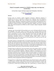
Dr. Shanker Kumar Sinnakaudan
Dr. Shanker Kumar Sinnakaudan
Dr. Shanker Kumar Sinnakaudan

Create successful ePaper yourself
Turn your PDF publications into a flip-book with our unique Google optimized e-Paper software.
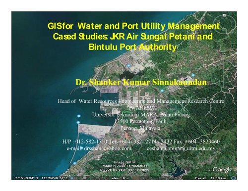
GIS for Water and Port Utility Management<br />
Cased Studies: JKR Air Sungai Petani and<br />
Bintulu Port Authority<br />
<strong>Dr</strong>. <strong>Shanker</strong> <strong>Kumar</strong> Sinnakaundan<br />
Head of Water Resources Engineering and Management Research Centre<br />
(WAREM)<br />
Universiti Teknologi MARA, Pulau Pinang<br />
13500 Permatang Pauh,<br />
Penang, Malaysia.<br />
H/P : 012-582-1710 Tel: +604- 382- 2714 / 3432 Fax: +604 -3823460<br />
e-mail: drsshan@yahoo.com ceshan@ppinang.uitm.edu.my
Collect<br />
Store<br />
Retrieve<br />
Analisis<br />
Display<br />
spatial<br />
&<br />
non spatial<br />
database<br />
Simultaneously
• Diverse Facilities/professionals<br />
• Different ownership – state or federal, leased<br />
or private properties<br />
• Port engineers responsible for – maintenance,<br />
projecting expansion and meet tight security<br />
requirements
• Deterioration over time-<br />
Port/Public facilities function in the harshest of<br />
environment (wind, wave, tidal, high chloride<br />
concentration and invasive marine life,<br />
Vandalism etc), heavy loading, impact damage<br />
from ships and cargo handling equipments<br />
Huge inventory list and difficult to be up to date
All basic data is maintained in hard copy format<br />
– Property surveys, facility base maps and<br />
– Property surveys, facility base maps and<br />
records, soil boring data, as build plans
-Tied together using a spatial context –<br />
geographic data frame work<br />
-Information is no longer isolated or fragmented<br />
-Multiple data types and scales –<br />
correlation to support decision making process
1) Problem conceptualization/justification and Project<br />
design<br />
- Four core elements -- Why, What, How and Who?<br />
2) Find methodology/GIS/Platform<br />
3) Information/Data needs assessment<br />
- Conduct interviews<br />
- Review documentation<br />
- Determine study/project area boundary<br />
- Analyze information needs
4) Existing data collection and evaluation<br />
- Selection of best data<br />
- Grouping/Cataloging existing data<br />
- Reconnaissance field survey/ Collection of<br />
imagery- Creation of a basemap
5) Database schema design<br />
- Data classification/Data Dictionary (DD)<br />
- Select scale and resolution<br />
- Determine update frequency
6) Data/Map integration<br />
- Geocoding<br />
- Georeferencing<br />
7) Application/Framework developments<br />
8) Updating/Editing of spatial database<br />
8) Updating/Editing of spatial database<br />
(automation and iteration)
GIS based Water<br />
Utility Management<br />
System
Softwares used for WUMS 1.0<br />
ArcView GIS 3.2a<br />
ArcView Dialog Designer<br />
ArcView Avenue Script<br />
Autocad 14
With security<br />
With security<br />
features..<br />
GUIs for WUMS 1.0
4 Main Components<br />
Data Analysis Unit (UAD)<br />
to display the main operations view of WUMS 1.0.<br />
Spatial Display Unit (UPK)<br />
to display addition information<br />
Database Display Unit (PPD)<br />
to display the attribute table of the map<br />
Project Window of WUMS 1.0/ WUMS1.0.apr<br />
to control main objects such as Views, Tables,Charts,<br />
Layouts
Penentuan kedudukan data<br />
WUMS 1.0 GUI<br />
1 2<br />
3 4
1<br />
WUMS Tools<br />
2<br />
3<br />
Menu WUMS<br />
Output<br />
Customized zooming tools<br />
Customized zooming tools<br />
to View multiple view simultaneously
Main Functions : WUMS Tools<br />
Operational tools<br />
Tambah Data Berlokasi<br />
Papar Data Tambahan<br />
UPK Autodata<br />
Label data<br />
Dapatkan Pangkalan data<br />
Database Query<br />
Function<br />
Menambah data pada UPK @ UAD secara manual<br />
Menambah data secara pilihan menu yang disediakan<br />
Menambah data secara automatik untuk UPK<br />
Melabel peta mengikut atribut tertentu<br />
Mendapatkan pangkalan data peta terpilih<br />
Melakukan pertanyaan pangkalan data<br />
Kira<br />
panjang/keluasan<br />
Padam Data<br />
perimeter/<br />
Mengira perimeter dan panjang untuk peta garisan seperti<br />
rangkaian paip dan keluasan untuk peta yang mempunyai ciri<br />
poligon seperti peta Lot<br />
Menutup data yang dipaparkan secara sementara<br />
Padam Semua<br />
Padam View Sementara<br />
Susun Paparan<br />
Menutup semua data yang dipaparkan secara sementara<br />
(perlu tentukan semula unit untuk paparan)<br />
Memadam paparan sementara (Full View) yang dihasilkan<br />
semasa paparan output/layout<br />
Menyusun semula UPK, UAD atau WUMS1.0.apr pada<br />
posisi asal
Various Water Utility Information<br />
available For Viewing and Analysis
Aut om at ic<br />
print ing size<br />
selec t ion
Automatic Layouts for Printing – Minimum<br />
user input requirements<br />
Title Information<br />
Default Format
Benefits:<br />
Pilot project on Water Utility Management using GIS<br />
WUMS 1.0 = Flexible can be customised<br />
OOP & Attractive GUI – Point & Click<br />
36 Avenue Scripts<br />
Performs various spatial database queries- Store, Retrieve,<br />
Display, Analysis - overlay, merge, union, intersect,<br />
spatial join etc.
Utility Managers
Some of the<br />
common<br />
Facilities that<br />
needs<br />
Integrated<br />
Asset<br />
Management<br />
at the Bintulu<br />
Port
• The idea of implementing a full fledge<br />
enterprise GIS mooted after the discussion<br />
with Captain Abdul Rahim in April 2008.<br />
• Detail project evaluation and existing<br />
operational behavior, Port future development<br />
and overall management procedures need to be<br />
identified and noted in planning the system<br />
development procedures
• Consultation on forming a project team and<br />
establishing project goals and objectives.<br />
• The GIS steering committee in-house members<br />
from the Port need to be carefully chosen for<br />
their ability to act as steadfast information<br />
providers, decision-makers and be good<br />
communicators, both up and down the<br />
management structure
• Situational Analysis<br />
• Situational Analysis<br />
-Training Program Template
• Project Plan<br />
• Communication & Coordination<br />
• The existence of redundancy and/or gaps in<br />
obtaining, maintaining, and sharing geographic<br />
data sets will be identified
ArcGIS<br />
ArcGIS Spatial Analyst<br />
ArcGIS 3D Analyst<br />
Visual Studio 2008<br />
- Concurrent use
• Data Conversion<br />
• Customization of test data<br />
• Topology building<br />
• Data Evaluation<br />
• Develop Applications<br />
• User friendly menu development for facility management<br />
• Common Analysis Menus<br />
• Customized printing menus<br />
• Standards & Procedures<br />
• User manuals
• Initiate Deployment<br />
• Conduct Testing<br />
• Conduct Training
Upcoming Facility<br />
management directions<br />
Expanding the usage for wide areas – Integrated<br />
Malaysian Port Facility Management Systemc<br />
All departments with spatial and attribute data<br />
management – GIS is the solution<br />
Expand to single department use to “mukim, wilayah, negeri<br />
ataupun negara”<br />
Latest computer tecnology to be adopted<br />
RAM & CPU & Storage
Jabatan Kerja Raya (Air), Kedah Tengah<br />
Bintulu Port Authority