Presentation - Gulf of Maine Research Institute
Presentation - Gulf of Maine Research Institute
Presentation - Gulf of Maine Research Institute

You also want an ePaper? Increase the reach of your titles
YUMPU automatically turns print PDFs into web optimized ePapers that Google loves.
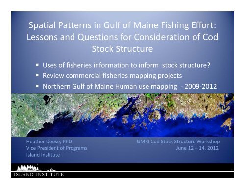
Spatial Patterns in <strong>Gulf</strong> <strong>of</strong> <strong>Maine</strong> Fishing Effort:<br />
Lessons and Questions for Consideration <strong>of</strong> Cod<br />
Stock Structure<br />
• Uses <strong>of</strong> fisheries information to inform stock structure?<br />
• Review commercial fisheries mapping projects<br />
• Northern <strong>Gulf</strong> <strong>of</strong> <strong>Maine</strong> Human use mapping ‐ 2009‐2012<br />
Heather Deese, PhD<br />
GMRI Cod Stock Structure Workshop<br />
Vice President <strong>of</strong> Programs June 12 – 14, 2012<br />
Island <strong>Institute</strong>
Fishing patterns and stock boundaries<br />
• Historical distribution <strong>of</strong> fish and fisheries provide<br />
important insights with respect to stock structure<br />
(Ames, Alexander, GoM CoML)<br />
• Shorter‐term changes may shed light on how the<br />
fishery could respond to changes in fisheries<br />
regulations (NEFSC, St. Martin, Hall‐Arber)<br />
• Fishermen’s knowledge and recent fishing<br />
patterns may impact management response to<br />
change in scientific stock assessment approach<br />
(Nenadovic, 2012)
Historical catch, effort, survey data<br />
• Effort and catch reporting is patchy in space and<br />
time<br />
• Subject to intentional and unintentional<br />
inaccuracies<br />
• Nonetheless, if one assumes that fishermen<br />
effectively target high‐value fish species like cod<br />
when and where they are available ….<br />
• Then fishing patterns indicate where fish are<br />
• Fish patterns indicate where fishing takes place<br />
• (<strong>Gulf</strong> <strong>of</strong> <strong>Maine</strong> Census <strong>of</strong> Marine Life, 2008).
Fisheries responses to spatial<br />
management<br />
• Analysis <strong>of</strong> VTR and VMS data shed light on these<br />
shifts with respect to spatial patterns (Murawski,<br />
et al. 2005; Michael Fogarty, pers. comm.)<br />
• Shoreside and at‐sea communities and their<br />
dependence on ocean space (St. Martin and Hall‐<br />
Arber, 2008).<br />
• Island <strong>Institute</strong>’s Mapping Working Waters ‐ shifts<br />
in fixed gear and mobile fisheries, and sharing <strong>of</strong><br />
territory between fisheries.
January
February
March
April
May
June
July
August
September
October
November
December
Fisheries mapping projects:<br />
Recent and ongoing<br />
• Rhode Island SAMP (Rhode Island Sea Grant)<br />
• Massachusetts Ocean Plan (Industrial Economics,<br />
et al, 2009);<br />
• NOAA Marine Protected Area Center‐led New<br />
Hampshire and Southern <strong>Maine</strong> Ocean Uses Atlas<br />
(NOAA, 2010);<br />
• Mapping Working Waters project (Nixon, et al.<br />
2012);<br />
• Bureau <strong>of</strong> Ocean Energy Management<br />
• Northeast Regional Ocean Council.
Mapping Working Waters<br />
• Human use mapping with fishermen who fish in the <strong>Gulf</strong> <strong>of</strong><br />
<strong>Maine</strong> between 2009‐2012<br />
‣ 38 fishermen<br />
‣ 16 harbors<br />
‣ 15 different fisheries<br />
‣ 6 GIS data layers<br />
Funding provided by <strong>Maine</strong> Coastal Program, <strong>Maine</strong> Sea Grant, private family<br />
foundations, and the University <strong>of</strong> <strong>Maine</strong>.
Project Objectives<br />
• Explore relationships between multiple (existing)<br />
community uses, marine ecosystems, and proposed future<br />
uses <strong>of</strong> the marine environment (including <strong>of</strong>fshore wind<br />
energy) using spatial data layers and associated conceptual<br />
models.<br />
• Collect spatial data on island and coastal communities’ uses<br />
<strong>of</strong> the marine environment, with a particular focus on<br />
commercial fishing data which is not currently<br />
documented.<br />
• Digitize and analyze community use data into formats that<br />
can be publicly disseminated and incorporated into<br />
multiple‐use marine spatial planning initiatives and which<br />
are useful and valued as a community resource within each<br />
community.
Vinalhaven, Stonington, and other<br />
harbors between Port Clyde and Bar<br />
Harbor NOT YET MAPPED<br />
Bar Harbor<br />
Friendship<br />
Port Clyde<br />
Cundy’s Harbor, Boothbay, and<br />
other harbors between<br />
Friendship and Casco Bay NOT<br />
YET MAPPED<br />
Saco/Camp Ellis<br />
Draft Proprietary Information<br />
Please request permission before reproducing
Mapping Working Waters –Offshore Lobster Data Layer with Harbors
Mapping Working Waters – Tuna Data Layer with Hotspots
Mapping Working Waters – Groundfish Data Layer with Gear Type
Mapping Working Waters – Place Name Data Layer
Management response to stock<br />
boundary change<br />
• Allocation <strong>of</strong> effort into different stock areas<br />
– How does my quota change?<br />
– Can I fish in the same areas as before?<br />
– What mechanism will determine who gets quota<br />
allocation if it is assigned to different geographic<br />
areas?
NROC Fisheries Mapping Objectives<br />
• VTR and VMS data as a start<br />
• Fisheries industry engagement<br />
• How do you want to look on the maps and in<br />
the process?<br />
• Project advisors from previous and ongoing<br />
mapping projects<br />
• June – December 2012
Fishing patterns and stock boundaries<br />
• Historical distribution <strong>of</strong> fish and fisheries provide<br />
important insights with respect to stock structure<br />
(Ames, Alexander, GoM CoML)<br />
• Shorter‐term changes may shed light on how the<br />
fishery could respond to changes in fisheries<br />
regulations (NEFSC, St. Martin, Hall‐Arber)<br />
• Fishermen’s knowledge and recent fishing<br />
patterns may impact management response to<br />
change in scientific stock assessment approach<br />
(Nenadovic, 2012)