Planet - GEES Subject Centre Home
Planet - GEES Subject Centre Home
Planet - GEES Subject Centre Home

Create successful ePaper yourself
Turn your PDF publications into a flip-book with our unique Google optimized e-Paper software.
I s s u e F o u r J u n e 2 0 0 2<br />
June 2002<br />
Issue Four<br />
LTSN <strong>Subject</strong> <strong>Centre</strong><br />
for Geography, Earth and<br />
Environmental Sciences<br />
<strong>Planet</strong><br />
Supporting learning and<br />
teaching in Geography, Earth<br />
and Environmental Sciences<br />
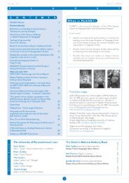
In this issue:<br />
• Teaching flood hazard management<br />
• Optimal use of MS PowerPoint for<br />
teaching<br />
• A courseware package for teaching<br />
geological field skills<br />
• Assessing student skill transfer<br />
between years<br />
• C&IT and fieldwork<br />
• QAA New Quality System<br />
• Geographers into teaching project:<br />
an update<br />
• <strong>GEES</strong> learning and teaching resource<br />
database<br />
• <strong>GEES</strong> projects and events
I s s u e F o u r J u n e 2 0 0 2<br />
P L A N E T<br />
C O N T E N T S<br />
Guest Editorial 3<br />
Michael Bradford, Pro VC for Teaching and Learning,<br />
University of Manchester<br />
Profile on…Yolande Knight 4<br />
Feature Articles<br />
Flood Hazard Management: Using an Alternative 5<br />
Community-Based Approach<br />
John Harrison, University of Stirling<br />
Optimal use of MS PowerPoint for teaching in the 7<br />
<strong>GEES</strong> disciplines<br />
Dawn Nicholson, Manchester Metropolitan University<br />
A CD-based courseware package for the teaching 10<br />
and consolidating of geological field skills<br />
Mike Smith, Neil Hudson, Adrian Watson, Don Mackenzie, University of Derby<br />
and Julia Gale, University of Texas at Austin<br />
Action research study to assess how well students 13<br />
transfer skills of communication into their second year<br />
Sue Burkill, University of Plymouth and<br />
Derry Corey, College of St Mark and St John, Plymouth<br />
Fieldwork Education and Technology: 17<br />
A <strong>GEES</strong> Perspective<br />
Steve Fletcher, Southampton Institute, Derek France, Chester College of Higher<br />
Education, Kate Moore, University of Leicester and Geoff Robinson,<br />
University of Leicester<br />
What is PLANET?<br />
PLANET is the bi-annual publication of the LTSN <strong>Subject</strong> <strong>Centre</strong><br />
for Geography, Earth and Environmental Sciences.<br />
Its aims are to:<br />
• Identify and disseminate good practice in learning and teaching<br />
across the three disciplines of Geography, Earth and<br />
Environmental Sciences and present examples and case<br />
studies in a “magazine” format.<br />
• Provide a forum for the discussion of ideas about learning<br />
and teaching in the three discipline communities.<br />
• Provide information for readers on <strong>Subject</strong> <strong>Centre</strong> activities<br />
and on related resources, conferences and educational<br />
developments.<br />
Have you seen this?<br />
Disability Update SENDA 2002: Are you Ready? 19<br />
LTSN-<strong>GEES</strong> Small Scale Learning and Teaching 20<br />
Projects 2001: 12 months on<br />
LTSN-<strong>GEES</strong> Small Scale Learning and Teaching 24<br />
Projects 2002<br />
UPDATE- The New QAA Systems for Quality 25<br />
Assurance and Enhancement<br />
Launching the LTSN-<strong>GEES</strong> Resource Database and 26<br />
Enquiry Service<br />
Linking Teaching and Research in the <strong>GEES</strong> Disciplines 27<br />
Geographers into Teaching (GiT) News: 28<br />
An update 18 months on<br />
The 2002 Committee of Heads of Environmental Sciences 30<br />
(CHES) Annual Conference and AGM<br />
Time to reflect? Promoting reflection among students 31<br />
and staff: a national conference on reflective learning<br />
<strong>GEES</strong> Goes to Hollywood: The Association of American 33<br />
Geographers (AAG), 98 th Annual Conference<br />
The LTSN-<strong>GEES</strong> Senior Advisors 35<br />
A Vintage Year for <strong>GEES</strong>! 36<br />
Diary Dates 37<br />
The PLANET Crossword 38<br />
The PLANET Archive 40<br />
DOWNLOAD<br />
TO YOUR DESKTOP<br />
PLANET is also freely available to download as<br />
a .pdf file from the <strong>Subject</strong> <strong>Centre</strong>’s website<br />
at http://www.gees.ac.uk. The website<br />
also provides general <strong>Subject</strong> <strong>Centre</strong><br />
information and specific links to other<br />
learning and teaching sites.<br />
Pay us a visit<br />
Further copies of PLANET are available in a variety of<br />
different formats - if you would like any further<br />
information please contact the <strong>Subject</strong> <strong>Centre</strong>:<br />
info@gees.ac.uk • (01752) 233530<br />
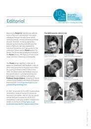
Editorial Board<br />
The University of Plymouth-based team<br />
Steve Gaskin<br />
Editor - <strong>Subject</strong> <strong>Centre</strong> Dissemination Co-ordinator<br />
Brian Chalkley<br />
<strong>Subject</strong> <strong>Centre</strong> Director<br />
Mike Sanders<br />
<strong>Subject</strong> <strong>Centre</strong> C & IT Manager<br />
Helen King<br />
<strong>Subject</strong> <strong>Centre</strong> Manager<br />
Yolande Knight<br />
<strong>Subject</strong> <strong>Centre</strong> Resource Co-ordinator<br />
The <strong>Centre</strong>’s National Advisory Team<br />
Mick Healey University of Gloucestershire<br />
<strong>Subject</strong> <strong>Centre</strong> Geography Senior Advisor<br />
Neil Thomas Kingston University<br />
<strong>Subject</strong> <strong>Centre</strong> Earth Sciences Senior Advisor<br />
Jennifer Blumhof University of Hertfordshire<br />
<strong>Subject</strong> <strong>Centre</strong> Environmental Sciences Senior Advisor<br />
Geoff Robinson University of Leicester<br />
<strong>Subject</strong> <strong>Centre</strong> C & IT Senior Advisor<br />
© 2002 • PLANET ISSN 1473-1835<br />
2
I s s u e F o u r J u n e 2 0 0 2<br />
P L A N E T<br />
Guest Editorial<br />
Michael Bradford<br />
Pro VC for Teaching and Learning,<br />
University of Manchester<br />
The two-way relationship between Teaching and Research<br />
Having attended part of the annual residential workshop for new lecturers<br />
in May at the University of Birmingham on teaching and learning run by<br />
LTSN-<strong>GEES</strong>, I thought it would be timely to write a short piece about the<br />
two-way relationships between research and teaching. I am interested in<br />
the links but, as a former Head of School of Geography and now a Pro-<br />
Vice-Chancellor for Teaching and Learning at the University of Manchester,<br />
I have also become increasingly aware of the magnitude of the lecturer’s<br />
job and the enormous tensions and conflicts that it involves. Alan Jenkins<br />
(Oxford Brookes University) and Mick Healey (University of<br />
Gloucestershire) were leading one of the sessions on linking teaching and<br />
research at the LTSN-<strong>GEES</strong> Birmingham workshop and are currently<br />
running a national project on this topic (see article in this edition of<br />
PLANET on page 27 Ed). I have co-ordinated a learning and teaching<br />
programme for new academics across the University of Manchester since<br />
1997 and in this article I draw on some focus group discussions with<br />
some participants who completed the course in 1998 and 1999.<br />
There has been much recent debate about the association between<br />
research quality and teaching quality, especially at the departmental level.<br />
Much of the discussion is about associations between scored outcomes<br />
of the RAE and TQA (<strong>Subject</strong> Review) and the reasons for these, with<br />
relatively little research into any underlying processes. The discussion can<br />
therefore sometimes become somewhat sterile. It is rarely of help to<br />
new academics who are confronted with a working context where<br />
research and teaching seem to be competing for their attention. Academics’<br />
time has recently been partitioned and commodified (‘research time’<br />
became a concept during the 1980s). This process has been exacerbated<br />
by accounting procedures that separate out teaching and research, such<br />
as profiling, which are partly meant to help sort out the tensions. Rarely<br />
is the two-way relationship explored. Here, I shall briefly explore that<br />
inter-relationship and the processes through which research and teaching<br />
can reinforce one another at the level of the individual academic. Better<br />
articulation of their relationship at the programme level can also improve<br />
the experience of students, but that is for another time.<br />
At the broad level, there are two obvious ways in which the distinction<br />
between research and teaching may be blurred: pedagogic research and<br />
the concept of scholarship that may underlie both. I take those as given. In<br />
our programme for new academics at the University of Manchester, they<br />
are asked to give a short presentation, which could form part of a first<br />
year lecture session, that demonstrates how they would use their own<br />
research in teaching and learning at that level. Although these academics<br />
are from a broad set of disciplines, their uses of research are applicable to<br />
the <strong>GEES</strong> disciplines. Before they approach the task, they are asked what<br />
may be gained from using their research at this level. Most suggest that<br />
they will convey their enthusiasm for their own research and that this<br />
alone may excite students. When students are questioned about the use<br />
of research in teaching, they invariably do speak about the enthusiasm<br />
and stimulus conveyed. Sometimes they suggest that it is the only way<br />
that they know what research their lecturers are involved in, or indeed<br />
that their lecturers did anything beyond teaching them. When a number<br />
of academics use their own research in their first year lectures then students<br />
gain an appreciation of some of the research being done in the department<br />
as a whole. It can aid their identification with the department. It can also,<br />
for some, suggest where they are heading in their studies, an early indication<br />
of the research frontier.<br />
There are a number of ways in which academics use their research in<br />
their lectures, and it is useful to make them explicit to students. Some use<br />
a theory or model to inform the structure of their lecture or set of<br />
lectures. This might be something that they have developed themselves in<br />
their research and it helps to organise students’ thinking. It might be a<br />
theory that they have critiqued in their research, and they use it as a way<br />
of demonstrating both the underlying ideas and a critique of them.<br />
Many use a case study from their own research to enliven their lecture,<br />
to show how a theory relates to the ‘real’ world, to relate theory to<br />
practice, or to illustrate the complexity of an issue. For example, I use a<br />
government-funded evaluation of a local urban development corporation<br />
to demonstrate the process of urban policy evaluation as well as the<br />
issues related to the policy instrument itself. Students are asked in what<br />
ways it might be difficult to evaluate the policy instrument, attributing<br />
causal links being one of them. So a research approach to the case study<br />
is used explicitly.<br />
The research process, then, may be demonstrated through lecturing.<br />
Physical geographers, for example, can explicitly demonstrate scientific<br />
method. When the demonstration remains implicit, the opportunity to<br />
link forward to future undergraduate dissertations and more generally to<br />
research practice is lost for most students. An interactive lecture, however,<br />
can involve students in thinking through the research process, deciding<br />
the steps to be taken or generating further ideas or hypotheses.<br />
Many of the above may be incorporated into a problem-based approach<br />
to a lecture which may begin with the students’ own ideas being elicited<br />
by the lecturer. One peer described one of the presentations as a ‘form<br />
of a puzzle – from the students’ simplistic solution to the terribly<br />
complicated truth’. One may debate the philosophy underlying this<br />
comment, but it shows how the lecturer has involved their students in<br />
the research problem and led them through the issue.<br />
These are all examples from lecturing rather than teaching and learning<br />
more generally. They do not involve problem-based or enquiry-based<br />
learning that may involve students more directly in a research process of<br />
their own. No great revolutions are then necessary to make the links<br />
between research and teaching. Even a traditional lecture session can be<br />
used. It requires being more explicit and, for some, greater interaction<br />
than perhaps they are used to.<br />
The focus groups of academics three years or less into their careers<br />
yielded some expected and some unexpected comments about the impact<br />
of teaching on research. Our expectation that teaching improved people’s<br />
research presentations was confirmed. Teaching had also given greater<br />
depth to their research, because they had to place it in a wider perspective<br />
and they had to understand it even more thoroughly when discussing it<br />
at that level. Their concepts and thinking were sharpened. Research<br />
questions had also arisen out of questions from undergraduates that could<br />
not be answered. In one case, the process of designing a first year course<br />
unit had even affected the research direction as it posed questions that<br />
the literature had not asked. In short, teaching had an effect in a number<br />
of ways on staff’s research.<br />
Articulating the links between teaching and learning, and research helps<br />
lecturers to see that these two major aspects of their professional careers<br />
are not as separate as the present environment in UK universities would<br />
suggest. I very much welcome more work on developing the two-way<br />
links and look forward to seeing people’s examples.<br />
If you have any case studies which you would like to share, please contact<br />
Alan Jenkins (alanjenkins@brookes.ac.uk) or Mick Healey<br />
(mhealey@glos.ac.uk) who are co-ordinating a LTSN project on linking<br />
teaching and research (see page 27)<br />
Michael Bradford<br />
School of Geography and Pro VC for Learning and Teaching<br />
University of Manchester<br />
m.bradford@manchester.ac.uk<br />
3
I s s u e F o u r J u n e 2 0 0 2<br />
P L A N E T<br />
Profile on…Yolande Knight<br />
What Does She Do?<br />
P R O F I L E<br />
Yolande is the most recent recruit to LTSN-<strong>GEES</strong> and is<br />
responsible for developing and managing the <strong>Centre</strong>’s advisory<br />
and enquiry service. As Resource Co-ordinator, she also oversees<br />
the harvesting, evaluation and dissemination of <strong>GEES</strong> learning,<br />
teaching and assessment resources in collaboration with the<br />
<strong>GEES</strong> discipline communities. Yolande is also responsible for the<br />
continuing development of the LTSN-<strong>GEES</strong> Resource Database.<br />
– THE –<br />
Background<br />
Yolande was brought up in Surrey and obtained her first degree<br />
in Genetics at the University of Birmingham. She completed a<br />
Ph.D. in Agricultural Plant Science at the John Innes Institute in<br />
Norwich before moving to the University of Leeds. She worked<br />
as a post-doctoral research fellow for 5 years whilst at Leeds,<br />
where she became involved in the supervision, tutoring and<br />
lecturing of undergraduates. In 2000, she joined LTSN<br />
Bioscience at its inception, where she was able to extend her<br />
skills and interests in educational development.<br />
Professional Interests<br />
Yolande’s professional interests lie within educational<br />
development and she is particularly interested in the areas of<br />
linking teaching with research and resource-based learning. She<br />
retains an active interest in the sciences, but is especially keen<br />
to develop her knowledge in human geography and the wide<br />
range of topics this encompasses.<br />
Personal Interests<br />
As surf buddy to the <strong>Centre</strong> Manager, Yolande spends a good<br />
deal of time under the sea. When not drinking salt water, she<br />
writes fiction, having had a number of short stories published<br />
in anthologies. In the depths of winter, when North Cornwall<br />
has frozen over, she travels to even snowier climes to practise<br />
her gully riding and jumps (see above).<br />
School of<br />
Informatics<br />
Masters in Geographic Information<br />
We are now recruiting globally for the October 2002 intake to<br />
this new course, which has been designed with the aid of GI<br />
professionals to produce graduates who meet the needs of<br />
business, science and technology.<br />
Based in the top-rated information science department,<br />
which has strong links with the GI industry, the course is<br />
taught by City's GI team comprising Professors Jonathan<br />
Raper and David Rhind, Dr Jo Wood and Dr Jason Dykes.<br />
The course has a number of distinctive features including:<br />
• legal, professional and ethical aspects of GI<br />
• cartographic visualisation and mobile internet positioning<br />
• GI programming with java and spatio-temporal metadata<br />
• a focus on environment, geodemographics and transport<br />
You can choose to study for one year full-time or two years<br />
part-time; and by means of face-to-face tuition at City or<br />
distance learning via our web-based resource centre.<br />
seeking new<br />
horizons?<br />
http://www.soi.city.ac.uk/mgi<br />
mgi@soi.city.ac.uk<br />
+44 (0) 20 7040 0215<br />
Susannah Quinsee<br />
Dept. of Information Science<br />
City University, London<br />
Northampton Square,<br />
London EC1V 0HB, UK<br />
The University for business and the professions<br />
4
I s s u e F o u r J u n e 2 0 0 2<br />
P L A N E T<br />
Flood Hazard Management: Using an<br />
Alternative Community-Based Approach<br />
John Harrison, University of Stirling<br />
Abstract<br />
The teaching of environmental hazards provides opportunities to explore<br />
different modes of learning, including role-play and internet-based exercises.<br />
This paper describes flood hazard games developed at The University of<br />
Stirling in the Department of Environmental Sciences which simulates conflicting<br />
views within a community and which attempts to take learning into areas<br />
requiring imagination and creativity. Flood hazard scenarios are provided,<br />
which include physical and community aspects of risk and a detailed list of<br />
the principal players. Students are required to role play as environmental<br />
consultants and to work through the game in self-selected groups. The outcome<br />
of the game is a draft flood management plan which must be presented to<br />
representatives of the local council, who have commissioned the work. Student<br />
engagement with the exercise has been impressive and feedback has been<br />
very positive.<br />
Introduction<br />
The teaching of environmental hazards provides an ideal platform for<br />
developing students’ understanding of the social, cultural, economic and<br />
political aspects of decision-making. Traditional approaches to the teaching<br />
of environmental hazards have been focussed on the literature-based<br />
description of physical processes, evaluation of risk, cataloguing of cost,<br />
and the formulation of mitigation strategies (e.g. Cutler and Hay, 2000;<br />
Jones, K. 1980). There are, however, opportunities to develop the critical<br />
use of internet sources, of which there is no shortage in this field, and selflearning<br />
opportunities where the student can formulate their own<br />
response to the risks posed by particular hazards. For example, in the<br />
field of flood hazards, there are a number of web sites offering historical<br />
information such as the Meteorological Office educational resources site<br />
www.met-office.gov.uk/education/historic/flood.html or pictorial records<br />
such as www.shrewsburyfloods.co.uk. There are also simulations and roleplay<br />
exercises such as those developed by Pauline Kneale at the University<br />
of Leeds (www.environment-agency.tv/education/studies/case.htm which<br />
attempt to root learning in the reality of handling hazards at community<br />
level. In this way, it is possible to deliver skills in team-working and problem<br />
solving while placing academic learning into the work context.<br />
While this is a very helpful approach to learning, it falls short of providing<br />
insights into the realities of decision-making at community level where<br />
factors such as personality, local networking, roles within the community,<br />
local traditions and the franchising of individuals and groups within the<br />
consultation and decision-making processes are vitally important. Decisions<br />
are affected by whether key players are assertive or passive and by when,<br />
and how, they chose to play their hand. The problems posed by a flood<br />
hazard thus involve real people with real personalities and with particular<br />
vested interests. Solutions require the reconciling of theoretical solutions,<br />
involving river engineering and catchment management, and community<br />
priorities, while at the same time reconciling conflicting interests within<br />
the community.<br />
If we are to develop meaningful learning environments, it is vital that we<br />
provide opportunities for students to step into this ‘real’ world of decisionmaking<br />
where their personality and their imagination can be used more<br />
powerfully to influence outcomes. Otherwise, we are in danger of leaving<br />
students with the impression that “formula solutions” to environmental<br />
problems can simply be imposed upon local communities. In an attempt<br />
to take learning into this more person-centred aspect of decision-making,<br />
flood hazard games have been developed in the Department of<br />
Environmental Sciences at The University of Stirling which provide a “field<br />
of play” and a set of local “players”. Students may not alter the field of play<br />
nor may they add players, but they are required to use their imagination<br />
to give character to the players. The objective is to leave the field of play<br />
with a draft plan which will help a local community deal with the problems<br />
of coastal and river flooding.<br />
Scene Setting<br />
Two scenarios have been developed which are used on alternate years in<br />
an environmental hazards unit offered to both third and fourth year honours<br />
students. Although both are based on imaginary locations, the situations<br />
are, in effect, compilations of real-world situations and can be found at:<br />
www.envsci.stir.ac.uk/floodgame/index.htm. The focal point in both scenarios<br />
is a fixed map area, which forms part of Avonside District, within which<br />
there is the small town of Avonbury. Outside Avonbury the majority of<br />
the map area is rural, with isolated small villages. In Case Study 1, Avonbury<br />
is a market town which stands at the confluence of two rivers and<br />
experiences river floods. In Case Study 2 Avonbury is a former port and<br />
fading seaside resort where the problem is a combination of coastal and<br />
river floods. There are case histories and notes for both, together with a<br />
recently commissioned report which suggests that climatic change will<br />
lead to an increased flood risk. Avonside District Council, the local<br />
government authority for the area, is to commission a full flood management<br />
plan for the area and is inviting environmental consultants to tender for<br />
Stage One of this process. This tendering process forms the basis of the<br />
exercise, the objective of which is to produce an outline draft report<br />
addressing the following:<br />
• the physical nature of the flood risk and future prospects;<br />
• a review of the damage experienced by previous floods and how well<br />
local services coped with the emergencies;<br />
• recommendations for damage limitation in the form of a structured<br />
community response to flood events, based on flood warning. This<br />
should consider the roles of all professional and voluntary agencies,<br />
and should pay particular attention to the need to protect the local<br />
economy and transport infrastructure during flood events;<br />
• recommendations for long-term flood protection measures along the<br />
coast and the valley of the Avon to reduce the risk within a 25yr<br />
planning horizon set by Avonside District Council;<br />
• a summary timescale for the implementation of short-term and longterm<br />
flood alleviation measures.<br />
Reports are to be presented verbally to representatives from Avonside<br />
District Council on the basis of which a full flood management contract<br />
will be awarded. The learning environment tries, therefore, to match some<br />
elements of the competitive bidding environment in which consultants<br />
operate. The principal deviation from reality, which is recognised as a<br />
significant one, is that there is no requirement to fully cost all the proposals,<br />
only to “keep costs within perceived reasonable limits”.<br />
Playing the Game<br />
Basic Skills and Related Teaching<br />
Students will have completed an environmental techniques module in the<br />
previous semester which provides training in group working and in verbal<br />
presentation. Related teaching is given in a lecture format, with notes<br />
provided on a local information network on the assessment and<br />
management of risk in the context of floods.<br />
Duration of the Game<br />
From initial briefing through to the presentation of the final written report,<br />
the game can last up to 8 weeks. Student groups organise their own<br />
schedule of group meetings.<br />
Procedures<br />
• Students form themselves into self-determined “consultancies”.<br />
Students not in groups, which is always less than 10% of the class, are<br />
assembled into one group by the course co-ordinator.<br />
• At a compulsory opening session, groups are issued with all the briefing<br />
notes, rules of the game, and the required format for their presentation.<br />
Briefing notes provide information on the physical nature and history<br />
5
I s s u e F o u r J u n e 2 0 0 2<br />
P L A N E T<br />
of the flood problem, the physical and socio-economic geography of<br />
the area, and the main ‘players’.<br />
• Groups choose their own mode of working through the briefing<br />
notes. Some select strictly management based approaches, working<br />
through the problem together, formulating and revising or rejecting<br />
solutions. Others adopt role play as a means of unearthing potential<br />
conflicts of interests within the community.<br />
• Groups must decide for themselves what supplementary information<br />
they require in order to develop their plans. This is made available at<br />
a weekly three-hour, open-door session with the “Avonbury Reference<br />
Librarian” (course co-ordinator). Only questions of fact are allowed<br />
and no opinion is offered on particular proposals. The requests include,<br />
for example, heights of bridges, forest plantation management statistics,<br />
and floor areas of available halls for public participation meetings.<br />
Not all questions can be answered and the students have to accept<br />
that in some cases no data are available (again simulating the “real<br />
world”). This “missing evidence” may include, for example, routine<br />
discharge characteristics for tributary streams and local climate data.<br />
All answers are logged by the reference librarian co-ordinator so the<br />
information provided remains consistent.<br />
• In an order determined by the drawing of lots, each group presents<br />
their proposals to representatives of Avonside District Council, thinly<br />
disguised as departmental colleagues! Time is allowed for detailed<br />
questioning which requires groups to justify some of their proposals.<br />
Assessment of a group’s performance is determined on a range of<br />
common criteria which include content, structure (including ability<br />
to answer questions), and delivery.<br />
• Each student is then allowed a further 10 days after the presentation<br />
in which to produce their own individual flood management report.<br />
This will be based on their group activity but will also take into account<br />
comments made at the verbal presentation.<br />
Performance and Assessment of the Flood Game<br />
The average registration for the Environmental Hazards module has been<br />
between 30 and 40 students per year, which generates 8-9 groups of<br />
four or five members for the flood game role-play exercise. As groups<br />
self-select their membership, they live with the consequences of their<br />
choice and no adjustment is made for a group member who fails to pull<br />
their weight. Although there is a risk of a student “hitching a ride” with a<br />
promising group, in reality the students tend to self-select like-minded<br />
individuals. To date, free-loading has not been a serious problem. The<br />
exercise makes up 50% of the assessment for the module which is divided<br />
into 10% for the presentation and 40% for the written report.<br />
The vast majority of students invest a considerable amount of effort in<br />
developing their proposals for dealing with the flood risks. Groups can be<br />
seen, and sometimes heard, in all corners of the University working through<br />
the game. As the librarian, the course co-ordinator’s contact with groups<br />
during this process is limited to the provision of factual information and it<br />
is not always easy to gauge the direction in which plans are heading.<br />
While many of the questions are clearly leading towards what one would<br />
expect as reasonable outcomes, others appear ill-targeted and irrelevant.<br />
The temptation to re-direct should be resisted but it may be appropriate<br />
to ask why a particular item of information is required.<br />
The final reports have contained an impressive array of well-designed<br />
flood hazard information leaflets, posters and information packs which<br />
have used a range of available graphics packages. Suitable photographic<br />
material has been downloaded from the internet to add to the<br />
effectiveness of the presentations.<br />
The atmosphere of competitive tender is maintained throughout the<br />
exercise. The Librarian does not divulge any questions asked by other<br />
groups. The majority of students carry this through to dressing for the<br />
part in the final presentation. Consultancies are given formal names and<br />
“councillors” have been provided with their business cards on more than<br />
one occasion. Why shouldn’t learning be enjoyable?<br />
In the four years in which these exercises have been offered, student<br />
feedback has been invariably very positive, rating highly on all criteria.<br />
Comments have suggested that the role-play concept is popular, but<br />
unfortunately generally under-used, in teaching environmental sciences.<br />
The following quotes appeared on recent student module evaluation<br />
questionnaire forms:<br />
“Flood study was very interesting and required a fair bit of searching –<br />
our plans changed several times. Very different to other coursework - we<br />
appreciated a taste of the real world”<br />
“The Avonbury flood project was a brilliant idea – I gained a lot from it”<br />
The chance to allow the imagination to drive the learning process rather<br />
than adopting strictly programmed learning appears to appeal to most<br />
students, although there will always be those who ask that their learning<br />
be closely prescribed. If there is a disappointment in using the game, it is<br />
the tendency for a growing minority of students to go for imposed<br />
engineering solutions in which flowing waters, be these fresh or salt, should<br />
be tightly confined within endless concrete walls. A recent well-meaning<br />
suggestion in this area has been to offset the visual impact of several<br />
kilometres of high concrete wall by the extensive painting of pleasant<br />
murals upon them!<br />
Summary<br />
The flood hazard game offers a basic template which can be adapted for<br />
application to other hazards taught in the <strong>GEES</strong> disciplines (e.g. volcanoes,<br />
earthquakes etc.). There are opportunities to modify the field of play to<br />
match in with other modules within a degree programme. It would be<br />
possible for example to lay more emphasis on the technical or engineering<br />
aspects of flood management, or on the socio-political aspects of how a<br />
community functions when facing a common threat. More emphasis could<br />
be placed on costing the proposals if one were delivering teaching in, for<br />
example, environmental economics. The complexity of the problem and<br />
the number of players can also be changed, allowing it to be used at a<br />
range of different credit levels. Above all, it allows students on a sciencebased<br />
degree programme to learn something about the practical<br />
application of environmental sciences to problem-solving in a manner<br />
which promotes imagination and creativity.<br />
The role-play material described in this paper can be accessed by the<br />
students on the local information network in the Department of<br />
Environmental Sciences at the University of Stirling. In addition, all of the<br />
flood game materials are currently being put onto the environmental<br />
sciences website at: www.es.stir.ac.uk for external viewing.<br />
References<br />
Cutler, C. and Hay, I. (2000) ‘Club Dread’: applying and refining an issuesbased<br />
role play on environment, economy and culture, Journal of Geography<br />
in Higher Education, 24: 179-197<br />
Environment Agency: Case Materials www.environment-agency.tv/<br />
education/studies/case.htm (Accessed 13.05.02)<br />
Environment Agency: Case Materials www.environment-agency.tv/<br />
education/studies/case.htm (Accessed 13.05.02)<br />
Jones, K. (1980) Simulations. A handbook for teachers (London: Kogan Page).<br />
Meteorological Office www.met-office.gov.uk/education/historic/<br />
flood.html (Accessed 13.5.02)<br />
Shrewsbury Floods www.shrewsburyfloods.co.uk/ (Accessed 13.5.02)<br />
John Harrison<br />
Department of Environmental Sciences<br />
The University of Stirling<br />
s.j.harrison@stir.ac.uk<br />
6
I s s u e F o u r J u n e 2 0 0 2<br />
P L A N E T<br />
Optimal use of MS PowerPoint for<br />
teaching in the <strong>GEES</strong> disciplines<br />
Dawn Nicholson, Manchester Metropolitan University<br />
Abstract<br />
Presentation software such as MS PowerPoint is increasingly being used to<br />
deliver classroom teaching. A questionnaire survey was conducted in the<br />
Department of Environmental and Geographical Sciences at Manchester<br />
Metropolitan University to determine staff and students’ perspectives on its<br />
use. Findings of the survey are summarised here and particular attention is<br />
given to considerations of relevance for teaching and learning in the <strong>GEES</strong><br />
disciplines. The use and pedagogical effects of special PowerPoint features to<br />
introduce colour, images, graphics, animation, layering and hypertext links are<br />
discussed and recommendations made for their optimum use.<br />
Introduction<br />
Increasingly, traditional face-to-face lectures are being delivered using<br />
presentation software such as Microsoft (MS) PowerPoint. There are<br />
mixed views about the pedagogical value of presentation software (e.g.<br />
Creed, 1997 and Rocklin, 1998) but it is clear from work involving student<br />
evaluations that its use can enhance learning (Hunt, 1998 and Lowry,<br />
1999). A questionnaire survey of staff and students in the Department<br />
of Environmental and Geographical Sciences at Manchester Metropolitan<br />
University was conducted to ascertain their perspectives on the use of<br />
MS PowerPoint for lecture delivery. The detailed findings of the survey<br />
are discussed at greater length elsewhere (Nicholson, 2002). The aim in<br />
this paper is to focus on some of the issues raised in responses that have<br />
a particular bearing on teaching and learning in the <strong>GEES</strong> disciplines and<br />
to offer some guidance on the use of MS PowerPoint based on both<br />
personal experience and that of colleagues.<br />
The survey was conducted through February and March 2002 in the<br />
Department of Environmental and Geographical Sciences at Manchester<br />
Metropolitan University, eliciting responses from 20 staff and 77<br />
undergraduate students (36 first year; 27 second year and 14 third year).<br />
The survey revealed that MS PowerPoint is used at least occasionally to<br />
deliver lectures by around two thirds of staff, and many also use the<br />
software to generate overhead transparencies and handouts. Difficulties<br />
associated with the use of presentation software largely revolve around<br />
lack of familiarity with the technology and provision and availability of<br />
projection equipment. Students find the provision of MS PowerPointgenerated<br />
handouts particularly useful and lecturers like the way in which<br />
presentations given using MS PowerPoint can assist in controlling the<br />
speed of both lecture delivery and notetaking by students. Staff and<br />
students are agreed that the clarity of structure and content of lectures is<br />
improved when MS PowerPoint is used for delivery and there is<br />
widespread use and appreciation of colour, images and simple graphics.<br />
There is evidence, however, that many of the specialist features of MS<br />
PowerPoint, which can potentially introduce a dynamic component to<br />
lectures, are under-exploited. This is a great pity, because imagery, graphics<br />
and dynamic elements, such as animation, can be of particular benefit in<br />
teaching <strong>GEES</strong> disciplines.<br />
Colour, images and graphics<br />
More than 70% of lecturers who used MS PowerPoint considered the<br />
use of colour, images and graphics to be of particular pedagogical value in<br />
teaching. This compared with 84% of students who agreed that the use<br />
of colour and images was helpful. There are a number of ways in which<br />
the use of colour, images and graphics can enhance learning:<br />
1) The use of colour, graphics and images can liven up ‘dry’ conceptual<br />
topics and stimulate interest. For example, in an otherwise relatively<br />
dry lecture on the history of geomorphology, I use scanned or webcopied<br />
images of key historical figures - the image of G. K. Gilbert on<br />
horseback usually raises a chuckle! It is important that the use of<br />
colour and images is relevant and reinforcing, otherwise it can become<br />
a distraction as Anderson and Sommer (1997) point out. For the<br />
same reason, it is important to keep colour schemes simple and<br />
consistent.<br />
2) Images and graphics can help students visualise processes and complex<br />
interactions. At its simplest, a topographic map could be alternated<br />
with digital photographs of the mapped area (Hunt,1998). Alternatively,<br />
several images can be juxtaposed on the same slide to enable<br />
comparisons to be made. This might be valuable, for instance, when<br />
attempting to explain soil development, continental drift, long-term<br />
coastal erosion or stages of river flooding.<br />
3) Images and graphics can also be used to emphasise linkages between<br />
separate elements of a concept to aid comprehension and recollection<br />
(Anderson and Sommer, 1997). For example, the ‘draw’ tool in MS<br />
PowerPoint can be used to create a simplified diagram of the<br />
hydrological cycle or a flow diagram which demonstrates inputs and<br />
outputs in a drainage basin.<br />
There are many sources of images and graphics:<br />
Create your own<br />
Simple graphics can be created using the ‘draw’ tools in MS Word and MS<br />
PowerPoint, or purpose-made software such as CorelDraw can be used<br />
to create more advanced graphics.<br />
Imported graphics<br />
Graphics can be imported from other software programmes. In particular,<br />
charts can be imported from MS Excel and clip art is available within MS<br />
PowerPoint and Word.<br />
The World Wide Web<br />
The web is a massive source of useful images. Advanced search tools in<br />
engines such as Google.com and Altavista.com can be used to search for<br />
images and it is possible to specify whether your search should include<br />
graphics or images, colour or black and white, and file attributes such as<br />
type and size. Care must be taken not to contravene copyright legislation,<br />
particularly if MS PowerPoint files are subsequently published onto the<br />
Internet.<br />
Scanned images<br />
Photographs and diagrams can be scanned in from textbooks and other<br />
published sources. Digital photographs of field locations can also be easily<br />
incorporated into PowerPoint slides or alternatively, 35mm slides can be<br />
scanned in. In the latter case, resolution may be lost and it is worth<br />
considering using a separate slide projector if good resolution is necessary.<br />
Image banks<br />
Libraries of images can be purchased very cheaply – for example the<br />
Geomorphology CD-ROM recently compiled by Slattery (2002), which<br />
contains 870 images of landforms and processes for a purchase price of<br />
US$25.<br />
In response to the Manchester questionnaire, one lecturer raised the<br />
issue of the time-consuming nature of converting 35mm slides into digital<br />
format by scanning. This is a particular issue for teaching in the <strong>GEES</strong><br />
disciplines, where it is common to make use of a large number of field<br />
images. This constitutes a disincentive for some staff to make use of<br />
PowerPoint. It is not an easy issue to resolve but there are several ways<br />
forward:<br />
• Given the generic nature of the issue across the <strong>GEES</strong> disciplines,<br />
raise awareness at managerial level and press for technical support<br />
to undertake mass scanning of slides;<br />
7
I s s u e F o u r J u n e 2 0 0 2<br />
P L A N E T<br />
• Attempt to pool departmental resources between academics and<br />
enable access to centralised digital slide collections;<br />
• Use a slide projector alongside a data projector (though this requires<br />
good co-ordination, appropriate lecture theatre and screen set-ups<br />
and availability of all the necessary hardware);<br />
• Bite the bullet and scan away - think of the time you could potentially<br />
save by not having to load and unload slide carousels! Think also of<br />
the scope you develop for using your digital images in other teaching<br />
(e.g. handouts and on-line resources) and publicity materials.<br />
Progressive revelation and animation<br />
Just 24% of lecturers who used MS PowerPoint considered the use of<br />
animations and layering to be of particular pedagogical value in teaching.<br />
This compared with 73% of students who agreed that the use of animations<br />
and layering was helpful. Post-questionnaire discussions with staff indicate<br />
that the apparent lack of enthusiasm for animations and layering reflects<br />
a lack of familiarity with this more advanced feature of the software,<br />
rather than any real belief that it cannot be used to great pedagogical<br />
advantage. Certainly, staff with experience of using the layering feature<br />
talk enthusiastically about its role in helping to control the speed of both<br />
lecture delivery and notetaking, and of the pedagogical value of<br />
progressively unwrapping complex concepts.<br />
The ‘custom animation’ feature of MS PowerPoint enables several ‘layers’<br />
of a slide to be built up and revealed progressively. The simplest use of<br />
this feature is to reveal items progressively in a bulleted list. I had recent<br />
personal experience of attempting to achieve the same effect with<br />
overhead transparencies using a sheet of paper to uncover bullet points.<br />
It was a reminder of how ‘busy’ one can feel when delivering a ‘conventional’<br />
lecture compared to the ease of mouse clicking when using MS PowerPoint!<br />
The animation feature can be used to unwrap complicated ideas, equations<br />
or graphics in MS Powerpoint. For example, the separate components of<br />
an imported Excel chart can be revealed along with a verbal explanation.<br />
Thus, the axis labels, several data series and their legends can be revealed<br />
step by step. A similar approach can be used to derive complex equations<br />
or to build up the annotations on an image. For example, I use layering to<br />
reveal annotations, strategically drawn lines and arrows to identify features<br />
on SEM micrographs of weathered rock. I use the annotations in<br />
conjunction with student volunteers who identify possible weathering<br />
features - and thus the software facilitates such interactivity. Progressive<br />
revelation not only helps to unravel complex topics and aid student learning<br />
but also adds an element of suspense, encouraging student attention<br />
(Sammons, 1997).<br />
It is easy to import ready-made animation sequences and video clips<br />
(with sound if desired) into MS PowerPoint presentations to enable more<br />
sophisticated, dynamic explanation (Johnson, 2002). These can be<br />
downloaded from the web, or if resources permit, specially created by inhouse<br />
media services. Video clips are particularly helpful for explanation<br />
of processes which are fundamentally dynamic in nature (Jackson, 1997).<br />
Thus, real footage of landslides and weather phenomenon, for example,<br />
has the potential to contribute much more to the student learning<br />
experience than can be achieved by just words or even static images.<br />
Hypertext links<br />
Only 5% of lecturers who used MS PowerPoint considered the use of<br />
hypertext links to be of particular pedagogical value in teaching. This<br />
compared with 48% of students who agreed that the use of hypertext<br />
links was helpful and 47% who said they had ‘no experience’ of hypertext<br />
links having been used in lectures.<br />
The lack of enthusiasm among staff for the use of hypertext links may, in<br />
part, reflect the fact that networked computers are rarely available in<br />
small teaching rooms, though it is evident that this feature is also rarely<br />
used even when networked facilities are available. Responses to the<br />
questionnaire also indicate that around 50% of staff had experienced<br />
some form of technological problem in using MS PowerPoint to deliver<br />
lectures. In the majority of cases this amounted to minor glitches in<br />
setting up the slideshow at the start and had no major ramifications for<br />
the remainder of the lecture. However, these experiences probably<br />
generate a heightened sense of techno-phobia when it comes to using<br />
hypertext links because one is venturing beyond the relative safety of the<br />
PC into the World Wide Web! Reassurance is the best way to reduce<br />
stress here and this can be achieved best by checking links beforehand.<br />
As a matter of course, links should be checked to ensure they are still<br />
‘live’, but it is also worth checking links immediately prior to the lecture to<br />
ensure connections are not down due to server maintenance or just<br />
very slow due to heavy traffic. Another strategy is to limit the amount of<br />
time you spend in the lecture at any one site – use web links to give<br />
students a taste of the material available and give them the web addresses<br />
so they can re-visit them during private study time. This means that if<br />
there is a problem with one particular site, then the impact is small. (The<br />
reader may also consider using the Lotus product Screencam<br />
(www.lotus.com.screencam). This enables you to record the accessing of<br />
web pages so that you can replay them offline in a presentation, thereby<br />
avoiding the risk of the network going down or enabling you to show the<br />
links even when not able to go online - Ed).<br />
If suitable hardware and connections are available, hypertext links can be<br />
used to draw on external sources of expertise, data, case studies, images,<br />
maps and multimedia during a lecture (Rossen et al., 1997). This enables<br />
the tutor to capitalise on resources which cannot be downloaded because<br />
of copyright or other restrictions. Use of web links also saves time recreating<br />
materials which are already available (effectively re-inventing the<br />
wheel). Web resources of particular value to the <strong>GEES</strong> disciplines include<br />
current news media (e.g. video and sound clips of recent natural hazard<br />
events), real time data (e.g. weather conditions and satellite imagery) and<br />
maps and atlases (e.g. of almost anything!). Information gateways such as<br />
the Resource Discovery Network (RDN) have vast sources of web links<br />
worth exploring (www.rdn.ac.uk/). (The LTSN-<strong>GEES</strong> resource database,<br />
soon to be launched will also have an array of learning and teaching<br />
resources for use in lectures and presentations, as well as links to many<br />
other e-resources - see page 26 of this editon - Ed).<br />
Links can be inserted directly into MS PowerPoint slides so there is no<br />
need to exit from the slideshow or go to a browser. Hypertext links can<br />
also be used within a presentation to move around between nonconsecutive<br />
slides. This is particularly useful for reiterating points and for<br />
dealing with students’ questions - you can refer back to an earlier slide<br />
without having to exit from ‘slideshow’ mode. It is also possible, if you<br />
have the relevant files at hand on disk, to link directly to a slide in another<br />
slideshow. I sometimes use this facility to recap topics covered in earlier<br />
lectures.<br />
Discussion<br />
So fundamentally, why do some of the features of MS PowerPoint appear<br />
to be under-explored? The questionnaire responses revealed several<br />
reasons:<br />
Lack of awareness of potential pedagogical (and practical) benefits<br />
It is to be hoped that this article will help increase awareness of the<br />
possibilities for using features such as images, animations, layering and<br />
hypertext links in teaching. Perhaps more effective would be dissemination<br />
of good practice between tutors at departmental level.<br />
Technological difficulties: Software<br />
There is clearly a learning curve involved in exploring the wider features<br />
of MS PowerPoint to deliver lectures but it is relatively painless to achieve<br />
quite impressive results. Even supposedly advanced features such as<br />
animations and layering are really not that difficult to gain expertise in. A<br />
good plan is to practise newly found skills in a small-group environment –<br />
preferably an informal departmental group or in front of ‘more<br />
8
I s s u e F o u r J u n e 2 0 0 2<br />
P L A N E T<br />
understanding’ third-year students! Peer evaluation of presentations is<br />
usually very productive but rarely practised. One of the difficulties is that<br />
staff training often focuses on novice users of software, neglecting<br />
intermediate users to ‘find their own way’. At best this can be frustrating<br />
and time-consuming, and at worst, skills may never be developed beyond<br />
a basic level. This is an institutional staff-development issue but again, the<br />
potential benefits of exchanging ideas and skills between academics at<br />
departmental level cannot be overstated.<br />
Technological difficulties: Hardware<br />
Training, practice and hardware provision are the critical words in relation<br />
to hardware constraints. Institutions do seem to be slowly increasing<br />
provision of projection and computing equipment but networked<br />
connections are often overlooked.<br />
Time to develop.....<br />
It is inevitable that developing visual electronic resources at the ‘front<br />
end’, whether it be creating new graphics, collecting useful URLs or tracking<br />
down and importing video clips is a time-consuming business.<br />
Nevertheless, in addition to the pedagogical value to students, you may<br />
save time at a later stage. MS PowerPoint presentations are quick and<br />
easy to update and manage.<br />
Whatever features of MS PowerPoint are used to enhance learning, it is<br />
vital always to remember that the medium is NOT the message! The<br />
style of presentation is important because it influences organisation and<br />
structure of delivery but it is the content which is paramount. This seems<br />
an obvious point to make but when you have witnessed presentations<br />
(usually at conferences, I have to say) that have been overwhelmed with<br />
text boxes flying around and whizzing in and out in all directions, and<br />
colours....... it’s a point to reiterate! It is always worth obtaining student<br />
feedback on the impact that the use of presentation software has had on<br />
student learning (Lowry, 1997).<br />
Lowry, R. B. (1999) Electronic presentation of lectures – effect upon<br />
student performance. University Chemistry Education, 3 (1): 18-21.<br />
Nicholson, D. T. (2002) (in review). Lecture delivery using MS PowerPoint:<br />
Staff and student perspectives at MMU. Learning and Teaching in Action ,1<br />
(2), (Manchester Metropolitan University, Spring 2002).<br />
Rocklin, T. (1998) PowerPoint is not Evil. The National Teaching and Learning<br />
Forum. (Greenwood Publishing Group).<br />
Rossen, S., McGraw, D., Graham, E. and Lee, D. (1997) Enhancing your<br />
lecture with presentation software (http://www.oid.ucla.edu/Fnmc/<br />
classtep.htm). Also: What are my goals? (http://www.oid.ucla.edu/Fnmc/<br />
goals.htm). Last updated September 1997 by David McGraw for Faculty<br />
New Media Center (FNMC) at UCLA Office of Instructional<br />
Development.<br />
Sammons, M. C. (1997) Using PowerPoint presentations in writing classes.<br />
The Technology Source (http://ts.mivu.org/default.asp?show=article&id=519)<br />
(Accessed August 1997).<br />
Slattery, M. (2002) Images from the Geomorphology Speciality Group of<br />
the Association of American Geographers (http://www.cla.sc.edu/geog/<br />
gsgdocs/geo_images.html) (Accessed June 2002)<br />
Dawn Nicholson<br />
Department of Environmental and Geographical Sciences<br />
Manchester Metropolitan University<br />
d.nicholson@mmu.ac.uk<br />
Conclusions<br />
<strong>GEES</strong> disciplines rely heavily on the use of visual information to explain,<br />
record and investigate ideas and concepts. Many complex ideas can more<br />
easily be presented to students using a variety of multimedia, coupled<br />
with MS PowerPoint special features such as graphics, layering, animation,<br />
hypertext links and multimedia. The beauty of presentation software<br />
such as MS PowerPoint is that all of this multimedia can be ‘seamlessly<br />
integrated’ (Jackson, 1997) using one file and a single set of equipment.<br />
Acknowledgements<br />
Many thanks to those staff and students in the Department of<br />
Environmental and Geographical Sciences at Manchester Metropolitan<br />
University who completed the questionnaires. Thanks also to colleagues<br />
who were willing to discuss with me some of the issues raised.<br />
References<br />
Anderson, W. and Sommer, B. (1997) Computer-based lectures using<br />
PowerPoint. The Technology Source (http://ts.mivu.org/<br />
default.asp?show=article&id=503) November 1997.<br />
Creed, T. 1998. PowerPoint No! Cyberspace Yes! The National Teaching and<br />
Learning Forum 6 (4). (Greenwood Publishing Group, Westport).<br />
Hunt, N. (1998) Enhancing lectures the modern way. The New Academic,<br />
1998: 3-9.<br />
Jackson, S. F. (1997) The use of PowerPoint in teaching comparative politics.<br />
The Technology Source (http://ts.mivu.org/default.asp?show=article&id=541)<br />
(Accessed May 1997).<br />
Johnson, N. (2002) Animating geography: multimedia and communication.<br />
Journal of Geography in Higher Education 26 (1): 13-18.<br />
From business cards<br />
to booklets ...<br />
quality printing on<br />
time every time<br />
50 Victoria Road Plymouth PL5 1RG<br />
Tel: 01752 350800 • Fax: 01752 350777<br />
E-mail: sales@interprint.searley.net<br />
9
I s s u e F o u r J u n e 2 0 0 2<br />
P L A N E T<br />
A CD-based courseware package for the<br />
teaching and consolidating of geological<br />
field skills<br />
Mike Smith, Neil Hudson, Adrian Watson, Don<br />
Mackenzie, University of Derby and Julia Gale,<br />
University of Texas at Austin<br />
Abstract<br />
This article explores a CD-based courseware package for the teaching and<br />
consolidating of geological field skills used for the interpretation of folding<br />
sequences in deformed rocks, focussing on examples from Anglesey in North<br />
Wales. The article briefly considers the advantages and disadvantages of<br />
virtual fieldwork and then discusses the rationale, structure, development and<br />
production of the CD courseware package.<br />
Introduction<br />
A wealth of information relating to Earth’s history, what Holmes (1965)<br />
called the “pages of earth history”, may be read by geologists from the<br />
rocks and minerals of our planet’s crust and mantle. The degree of detail<br />
which can be read from the rocks is generally underestimated both by<br />
non-scientists and, more worryingly, by scientists outside geology. The<br />
most powerful interpretation comes from a combination of field-based<br />
studies with analytical, computing and remote-sensing techniques based<br />
on modern instrumentation and underpinned by the principles of the<br />
physical sciences. Field-based studies are therefore absolutely fundamental<br />
to the geosciences, as fieldwork supplies raw data for detailed<br />
interpretation (e.g. of relative time relations, sedimentary environments,<br />
conditions of formation of minerals and ores, etc.) and, on the larger<br />
scale, allows the testing of theories proposed as a result of the synthesis<br />
of this detailed evidence. Further, these data are potentially invaluable for<br />
allowing extrapolation into our planet’s future, something which looks<br />
ever more important in the context of possible global environmental<br />
change. Professional geologists, trained in field skills (Charsley, 1997)<br />
amongst others, are required to do this work for society.<br />
An important example of a field technique required by professional<br />
geologists is the need to construct relative time-scales. One of the<br />
situations where this arises occurs when we study rocks from the roots<br />
of ancient mountain belts. These rocks contain data about the deformation,<br />
metamorphism, magmatism, fluid-rock interactions, exhumation and other<br />
processes which were involved in the mountain building events. A powerful<br />
technique for determining the number and sequence of deformation<br />
events uses the overprinting relationships of minor structures (folds,<br />
cleavage/schistosity, crenulation fabrics, lineations, veins, faults) in the<br />
deformed rocks (e.g. Cosgrove, 1980). Once the sequence is determined,<br />
it can be used as a structural time-scale (e.g. Johnson, 1962) and all of the<br />
other information (depths, temperatures, intrusion, fluid migration and<br />
ore-forming events, etc.) can be related to it. Erecting such time-scales,<br />
therefore, constitutes an important skill for professional geologists. This is<br />
the subject addressed in the CD discussed below.<br />
How do we teach this skill?<br />
The technique is best taught in the field as illustrated by The Derby<br />
University field-course which takes place in Anglesey and is part of the<br />
structural geology module for second year Geology undergraduates. This<br />
fieldtrip is long established and has been running for twenty years. Since<br />
the mid 1980s it has been co-ordinated by two of the authors NFCH<br />
and JFWS (latterly APW) who have been responsible for developing the<br />
teaching materials and approaches which form the basis of the CD<br />
package. Some of the teaching is based on our own research (Hudson<br />
and Stowell, 1997). The field-course is immediately preceded by lectures<br />
(APW) setting the scene and is followed by mapmaking and other<br />
workshops (e.g. fractal analysis). The field course has no “look-see” element.<br />
It is entirely devoted to the development of interpretation and structuralmapping<br />
skills. It has a field-based assessment in which candidates produce<br />
a field notebook, from observations on a small group of rock exposures,<br />
under examination conditions and in a controlled amount of time.<br />
Field teaching is essential for students intending to be professional<br />
geologists (Geological Society, 1996). However, students’ understanding<br />
can be improved by other delivery methods when used in conjunction<br />
with field teaching (Burnett et al. 1997). The CD package discussed in this<br />
paper aims to enhance the learning experience through improvements<br />
to pre-fieldwork preparation and fieldwork follow-up studies. The material<br />
addressed in the CD is only a part of the curriculum of field skills taught<br />
on the course.<br />
The package will eventually contain three CDs, which will take three<br />
years to develop and test. This article will focus on the first CD, “Geological<br />
field skills for structural geologists I: interpretation of deformation<br />
sequences from minor structures, a virtual field-instruction package based<br />
on the rocks of Anglesey, N. Wales”. Its contents include: recognising and<br />
differentiating bedding and cleavage, folds, axial-plane cleavage, cleavage<br />
fans, lineations and crenulation fabrics. It also covers identifying overprinting<br />
relationships of minor structures in deformed rocks including folded<br />
cleavages and lineations, refolded folds and refolded crenulation fabrics.<br />
Planned for the future are “Geological field skills for structural geologists<br />
II: interpretation of major structural geometry from minor structures”<br />
and “Geological field skills for structural geologists III: use of the<br />
stereographic projection”.<br />
Advantages and disadvantages of virtual field learning and<br />
teaching (VFLT)<br />
While the pros and cons of VFTL have already been discussed elsewhere<br />
(e.g. Stainfield et al. 2000), we consider the main advantages as:<br />
1) Improving the efficiency of learning and teaching in the field;<br />
2) Relieving pressure on time during field courses through better<br />
preparation;<br />
3) Relieving pressure on resources by reducing the number of<br />
preparatory field days;<br />
4) Informing non-geologists about geological techniques and methods.<br />
It was the first of these that attracted us. The specific advantages for<br />
teaching and for informal and formal assessment from our point of view<br />
are that VFLT:<br />
1) Provides an opportunity to prepare for fieldwork using pictures of<br />
actual fieldtrip outcrops;<br />
2) Allows graphics and text to be added to photographs of the<br />
structures;<br />
3) Gives the opportunity for formative practice and testing of field (i.e.<br />
close up space) skills;<br />
4) Allows computer-based assessment to be built into the package.<br />
The main disadvantage of VFLT is that development time is quite intensive.<br />
The need for planning well in advance cannot be over stressed and the<br />
time commitment should be balanced against other competing activities<br />
(RAE publications, grant applications and other teaching commitments)<br />
before beginning such a project. Some dangers, real or perceived (Burnett<br />
et al. 1997), are that managers might think VFLT replaces field teaching or<br />
even replaces staff.<br />
10
I s s u e F o u r J u n e 2 0 0 2<br />
P L A N E T<br />
Rationale and structure of the VFLT CD package<br />
A) The preparation section of the CD deals with background information<br />
setting the geological scene for the field course and presents a bibliography.<br />
This material was originally addressed in a pre-field course lecture. Figure<br />
1a overpage shows a touch sensitive map of Anglesey from this section<br />
which provides a summary of the geology of the rock units by clicking on<br />
each of them. More detail can be obtained for Holy Island where most of<br />
the field locations occur, through a second larger-scale touch sensitive<br />
map.<br />
B) Teaching and learning structure of main sections<br />
1) Pre-fieldwork sections are based on key fieldtrip locations and<br />
address terminology, identification of particular structures, notation<br />
systems and the interpretation of overprinting relationships. Figures<br />
1b and 1c are screen grabs showing an annotated teaching<br />
exposure and an example field sketch of that exposure from<br />
one of the tutorials. These tutorials build up in difficulty, starting<br />
with a location where only one deformation event has occurred<br />
and ending with three deformations. They can also be used for<br />
revision after the field course.<br />
2) Post-fieldwork sections are based on locations which have not<br />
been seen on the fieldtrip. Students can access these via hot<br />
spots on maps (Figure 1d) to try out their skills and receive<br />
feedback from the VFLT package. Tutorials have text-entry<br />
responses (Figure 1e) and label positioning.<br />
3) The pre-assessment section is formative and is based on an<br />
Authorware quiz format using the built-in question styles (Figure<br />
1f) which are quick to program. This tests general knowledge of<br />
the appropriate techniques and offers feedback.<br />
C) An assessment section of the VFLT package could be accessed by<br />
password on the CD but it is more likely that we will deliver this across<br />
the web for our own students using our well-tested methods (Mackenzie<br />
et al., in press - see next edition of PLANET).<br />
Use of passwords<br />
Pre- and post- fieldwork tutorial sections and the quiz are protected by<br />
a series of passwords that must be accumulated by completing the sections.<br />
The passwords allow access to progressively more complicated material.<br />
The final assessment section can only be accessed by password after the<br />
quiz has been completed. The passwords will be generated randomly for<br />
each student to avoid them becoming student currency. We have<br />
considered using quiz questions instead of passwords to control<br />
progressive access to tutorials but rejected this because it can deter weaker<br />
students.<br />
Developing and producing the package<br />
We have been considering a package of this type for some years. Initial<br />
attempts (by JFWS and NFCH) to produce a teaching video in the early<br />
1990s were unsuccessful when we discovered that the required image<br />
quality could not be achieved. Recently, DMM has encouraged<br />
undergraduates to undertake BSc projects that involve an element of<br />
tutorial production using Authorware and in 1999 MS elected to carry<br />
out such a project on structures in Anglesey, supervised by DMM and<br />
NFCH. The photography, the initial CD design and the primary<br />
programming were carried out by MS. The project involved structural<br />
geology, photography, tutorial design and programming and resulted in a<br />
project report and a CD. Feedback was sought at this stage from other<br />
students. The CD proved very illuminating because we had a student’s<br />
eye view of the learning curve immediately. However, a significant amount<br />
of re-ordering, redrawing and reprogramming has been necessary. The<br />
following production sequence is based on this experience.<br />
After producing a rationale for the package, as discussed above, the first<br />
production step was to carry out individual fieldwork to select the best<br />
exposures for demonstrating the structures. It was not possible to do<br />
11<br />
this task whilst simultaneously running the fieldcourse. In the event, MS<br />
used many of the fieldtrip locations for the teaching sections and chose<br />
new ones for the follow-up section. NFCH strongly recommends next<br />
writing material in the form of a storyboard as used in the film industry.<br />
Each view required is sketched in sequence and given a frame number.<br />
The text is written out to the right of each sketch. The designer can then<br />
see the whole flow of the tutorial and the material is easily communicated<br />
to third parties, such as programmers. Photographs can then be collected<br />
specifically for each frame, preferably on an overcast but bright day when<br />
the light is diffuse. It is best to have photographs developed whilst you are<br />
still in the field as the failure rate can be high. MS began using digital<br />
photography but soon found the quality was inadequate and reverted to<br />
a single lense reflex (SLR) camera. Programming is the next step and we<br />
recommend Authorware, as it is user friendly and therefore efficient in<br />
terms of time. The package can then be tested on students who have<br />
already been through the course (third year in this case) to obtain feedback<br />
prior to full testing. Adjustments will probably still be required.<br />
We believe that this VFLT package will make a significant contribution to<br />
our teaching. The package is also designed to “stand alone” so that it can<br />
be used by others. We would be happy to communicate with any potential<br />
users and would welcome feedback. It will eventually be available to<br />
order through the CIAD web pages at Derby. We also hope that it might<br />
bring some understanding of a small part of field geology to non-geologists<br />
through the <strong>GEES</strong> subject centre. Finally, we hope that the approach we<br />
advocate in this article will be of interest to others, including non-geologists,<br />
who are considering producing VFLT packages.<br />
End Note<br />
The particular contributions of the authors to the project are indicated in<br />
the text by their initials: Smith (MS); Hudson (NFCH); Mackenzie (DMM);<br />
Watson (APW); and Stowell (JFWS).<br />
References<br />
Bell, T. H. (1986) Foliation development and refraction in metamorphic<br />
rocks: reactivation of earlier foliations and decrenulation due to shifting<br />
patterns of deformation partitioning. Journal of Metamorphic Geology, 4:<br />
421-444.<br />
Burnett, J., Siddall, R., Filipescu, S., Bown, P., Hoare, T. & Howard, D. (1997).<br />
Effective teaching in the field: IMAGE, the future of geological fieldwork. In:<br />
King, H. (ed) UK Geosciences Fieldwork Symposium Proceedings. ESTA<br />
Occasional Series, 2, 47-51. http://www.gees.ac.uk/essd/field.htm#Burnett<br />
Charsley, T. (1997). Professional Fieldwork – The BGS Perspective. In: King,<br />
H. (ed) UK Geosciences Fieldwork Symposium Proceedings. ESTA Occasional<br />
Series, 2, 69-71. http://www.gees.ac.uk/essd/field.htm#CharsT<br />
Cosgrove, J. W. (1980) The tectonic implications of some small scale<br />
structures in the Mona Complex of Holy Island, North Wales. Journal of<br />
Structural Geology, 2: 383-396.<br />
Geological Society (1996). Accreditation Scheme for First Degree Courses in<br />
Geoscience. The Geological Society, London.<br />
Johnson, M R W (1962) Relations of movement and metamorphism in<br />
the Dalradians of Banffshire. Transactions of the Edinburgh Geological Society,<br />
19: 29-64.<br />
Holmes, A. (1965) Principles of Physical Geology, 2nd edition. Thomas Nelson<br />
and Sons, London.<br />
Hudson, N. F. C. & Stowell, J. F. W. (1997). On the deformation sequence<br />
in the New Harbour Group of Holy Island, Anglesey. Geological Journal, 32:<br />
119-129.<br />
Mackenzie, D.M., Hudson, N. F.C., Watson, A.P. , Stowell, J.F.W., Jones, P.F.,<br />
Wilkins, H. and Johnson, T. (in press) The use of C&IT to support fieldwork<br />
teaching and assessment at the University of Derby, PLANET, (5)
I s s u e F o u r J u n e 2 0 0 2<br />
P L A N E T<br />
(a)<br />
(b)<br />
(c)<br />
(d)<br />
(e)<br />
(f)<br />
Figure 1 Screen grabs from the CD. (a) Touch sensitive map from the introductory section. (b) Annotated exposure and (c) example field sketch,<br />
from the pre-field course section showing the overprinting relationships of the structures. (d) Map with hot spots giving access to the exposures for<br />
the post-field course section of which (e) is an example. (f) Example question from the pre-assessment quiz.<br />
References continued<br />
Phillips, E. R. (1991). The lithostratigraphy, sedimentology and tectonic<br />
setting of the Monian Supergroup, Western Anglesey, North Wales. Journal<br />
of the Geological Society of London, 148: 1079-1090.<br />
Stainfield, J., Fisher, P, Ford, B. and Solem, M. (2000) International virtual<br />
field trips: a new direction? Journal of Geography in Higher Education, 24(2):<br />
255-262<br />
Corresponding Author:<br />
Neil Hudson<br />
Earth Systems Science<br />
School of Environmental and Applied Sciences<br />
University of Derby<br />
n.f.c.hudson@derby.ac.uk<br />
12
I s s u e F o u r J u n e 2 0 0 2<br />
P L A N E T<br />
Action research study to assess how well<br />
students transfer skills of communication<br />
into their second year<br />
Sue Burkill, University of Plymouth (formerly at the<br />
College of Mark and St John, Plymouth)<br />
Derry Corey, College of St Mark and St John, Plymouth<br />
(An earlier version of this paper was presented at the 2nd Annual Skills<br />
Conference at the University of Hertfordshire in July 2001)<br />
Abstract<br />
We have noticed that students in Geography at the College of St Mark and St<br />
John are not easily ‘transferring’ their communication skills developed in year<br />
one into year two. Shepherd (2000) claims that skill transfer is the outcome<br />
of a complex set of interactions and successful transfer relates to a range of<br />
factors from which he produces an informal model. This research adopts this<br />
idea and addresses transfer, not from just one context to another but also,<br />
from one year to another. It focused on a cohort of year one Geography<br />
students taking a module, which emphasised the importance of skills in general,<br />
and communication skills in particular. They were then tracked into their second<br />
year. Our overall aim was to determine whether the assumption we had<br />
made that skills transfer happens between years is substantiated. A<br />
questionnaire was used to collect quantitative and qualitative data based on<br />
the following research questions:<br />
• Which communication skills do students ‘perceive’ that they have developed<br />
in year one?<br />
• Have they been able to use communication skills developed in year one<br />
in their second year?<br />
• Have they developed these skills further?<br />
The results showed that our students are not finding it easy to transfer their<br />
knowledge about communication skills between years but there is some<br />
evidence of improvement in skill acquisition; however, we need further research<br />
to investigate this. Finally, we return to Shepherd’s (2000) informal model to<br />
identify the areas where we could make some improvement in the courses.<br />
Background<br />
At the College of St Mark and St John we have noticed that students are<br />
not easily ‘transferring’ the communication skills developed in year one<br />
into year two of their undergraduate Geography programme. A growing<br />
body of research is investigating why it is difficult to transfer skills from<br />
one context to another (e.g. Perkins and Salomon, 1998; Moorkamp et<br />
al.1991 and Neath, 1998). Shepherd (2000) argues that student skills<br />
transfer is the outcome of a complex set of interactions and that success<br />
in transferring skills relates to a range of factors (Figure 1).<br />
It is likely that any problems our students experience in skills transfer<br />
will relate to some of these factors. Shepherd (2000) addresses the<br />
concept of ‘near’ and ‘far’ transfer and claims that there is ample evidence<br />
from the world of vocational training that even ‘near’ transfer (transfer<br />
between nearly identical tasks or situations) often fails to occur. This<br />
research builds on this idea and addresses transfer, not just from one<br />
context to another but also from one year to another.<br />
The research focuses on communication skills in a cohort of<br />
undergraduate Geography students. Geographers have a wellestablished<br />
interest in developing key skills into their courses and a<br />
good reputation for being adept at applying their skills in different<br />
contexts. Kneale (1999) contends that “geography degrees are awash<br />
with skills” but that geography students often gain their skills implicitly<br />
while becoming geographers. Increasingly, however, students are offered<br />
more explicit opportunities to develop the full range of skills defined<br />
by the Dearing Report (NCIHE, 1997) and more recently the<br />
Geography subject benchmark statement (QAA, 2000) has emphasised<br />
the importance of skills in Geography degrees.<br />
Birnie (1999) conducted a survey to identify the skills possessed by<br />
geography students entering HE in September 1998. This survey<br />
highlighted the wide range of experience we can expect from our<br />
incoming students. It showed the predominance of traditional<br />
examinations and essay skills and that, in most institutions, nearly a<br />
third of students had little or no experience of report writing or<br />
presentations.<br />
The students included in our study are all on a modular humanities<br />
degree course. As this is a combined honours degree, students will<br />
not gain all their skills from their geography modules. They take three<br />
geography modules in their first year all of which have an embedded<br />
communication skills element. Initially, this study focused on one module<br />
in year one, Contemporary Issues in South West England, which explicitly<br />
emphasises the importance of skills in general and communication<br />
skills in particular. This module was planned to increase student<br />
awareness of communication skills (Burkill, Corey and Healey, 2000:<br />
p40 & Appendix 4:1 p.29). During the introduction to the module all<br />
students were introduced to the descriptors for key skills as set out in<br />
The Qualifications and Curriculum Authority (QCA) (1999) Key Skills<br />
(Communication) at Level Three documentation. (This focuses on<br />
the skills one would expect students to possess on entry to HE).<br />
These are:<br />
• taking part in discussions;<br />
• making presentations;<br />
• reading and synthesising information;<br />
• writing documents.<br />
We made a point of providing the students with copies of the Key<br />
Skills at Level Three (QCA,1999) documentation on communication<br />
skills and we exemplified how these could be linked with the learning<br />
outcomes and assessment requirements for the module (report writing,<br />
presenting and listening). They were also shown that the assessment<br />
criteria were related to these skills.<br />
In the second year, while the list of skills was not made explicit, students<br />
were given further opportunities to develop their communication skills,<br />
enabling them to apply them in new situations in the Geographical<br />
Perspectives on Global Issues and Explorations in Geography 1 and<br />
Explorations in Geography 2 core modules (Figure 2).<br />
Figure 1: Possible influences on successful skills transfer (Shepherd, 2000 p.45)<br />
13
I s s u e F o u r J u n e 2 0 0 2<br />
P L A N E T<br />
Module<br />
Communication skills<br />
Contemporary Issues in South West England - Year One Module<br />
• Students were given the QCA (1999) Key Skills at Level 3<br />
documentation<br />
Communication Skills Developed:<br />
Oral:<br />
Presentations - peer assessed using Hay, (1996) criterion<br />
referenced marking sheets.<br />
Outcomes relating to communications skills:<br />
• Taking part in discussions<br />
• Presenting research orally<br />
Written<br />
Project proposal including a study action plan<br />
Project report including research methodology and results<br />
Assessment: all coursework<br />
• Research proposal<br />
• Verbal presentation- peer assessed<br />
• Written report on research project<br />
Geographical Perspectives on Global Issues -Year Two Module<br />
Outcomes relating to communications skills:<br />
• Developed skills in working with other students to produce<br />
and present work<br />
Assessment:<br />
Coursework: Group practical oral/written report<br />
Oral:<br />
Discussions<br />
Presentations, including visual aids<br />
Written:<br />
Report writing, including diagrams graphs, tables etc.<br />
Letter writing<br />
Explorations in Geography l: philosophies, methods and<br />
techniques - Year Two Module<br />
Outcomes relating to communications skills:<br />
• Communicate geographical ideas, principles and theories<br />
effectively<br />
Assessment:<br />
Literature review<br />
Essay based on a learning journal<br />
Oral:<br />
Discussions with peers and tutors<br />
Written:<br />
Literature review<br />
Learning journal<br />
Essay<br />
Explorations in Geography ll: practical fieldwork- Year Two<br />
Module<br />
Outcomes relating to communications skills:<br />
• Communicate geographical ideas, principles and theories<br />
effectively<br />
• Presenting results<br />
Oral:<br />
Discussions with peers and tutors<br />
Presentation of fieldwork results<br />
Written:<br />
Field reports<br />
Assessment:<br />
Fieldwork preparation<br />
Oral presentation of fieldwork results<br />
Field report(s)<br />
Figure 2: Summary of communication skills incorporated in a Year One module and Year Two core modules<br />
14
I s s u e F o u r J u n e 2 0 0 2<br />
P L A N E T<br />
The Study<br />
The overall aim of this action research study was to determine whether<br />
the assumption we had made that skills transfer happens between years<br />
is substantiated.<br />
Both qualitative and quantitative data were collected. Qualitative data<br />
came from module evaluation forms and from a questionnaire, which<br />
focuses on perceptions of skill acquisition. Quantitative data also came<br />
from this questionnaire based on the following broad research questions:<br />
• Which communication skills do students ‘perceive’ that they have<br />
developed in the first two years of the course?<br />
• Have they been able to use communication skills developed in year<br />
one in their second year course?<br />
• Have they developed these skills of communication further?<br />
The questionnaire was distributed to thirty two second year students at<br />
the end of year two. After a brief introduction to the purpose of the<br />
research, all students agreed to complete the questionnaire. Purposely,<br />
there was no explanation of what might constitute a communication skill<br />
as their perceptions were important to the study.<br />
The sample (Figures 3 and 4) was dominated by female students, the<br />
majority of whom entered with ‘A’ levels. Over half the sample were<br />
mature students (over 21 years of age).<br />
Number of students<br />
28%<br />
20<br />
15<br />
10<br />
5<br />
0<br />
72%<br />
Figure 3: Sample viewed by gender<br />
25%<br />
Figure 4: Sample viewed by age groups<br />
28%<br />
47%<br />
A level Access Other<br />
Entry Level<br />
Figure 5: Age group by entry level (raw data)<br />
Male<br />
Female<br />
I s s u e F o u r J u n e 2 0 0 2<br />
P L A N E T<br />
94% of year two students described at least one communication skill<br />
(usually presentation skills) used in their first year geography modules,<br />
and 50% of year two students described 2 or 3 of these skills. With<br />
regard to improving their communication skills, 82% said they had improved<br />
them in year two. However, only 31% improved more than one skill. For<br />
presentations, 37% said it was their first and Table 2 shows this<br />
disaggregated by entry level.<br />
‘A’ level Access other total<br />
Yes 25% 9% 3% 37%<br />
No 44% 19% 0% 63%<br />
Table 2: Response to “Was the year one presentation your first?”<br />
Student recall of skills<br />
In the questionnaire, the open questions were designed to ensure students<br />
had to think about the meaning of the term ‘communication skills’. We<br />
were attempting to establish whether their ‘formal’ introduction to these<br />
skills in their first year had enhanced their awareness of the skills developed<br />
in the second year. We assumed that this would give a measure of<br />
awareness. Of the four skills used in the first year only one was consistently<br />
referred to by second year students (Table 3). It is worth noting that this<br />
skill (presentation) was also the only one that was mentioned by name<br />
later in the questionnaire and there is no way of determining whether<br />
this overtly influenced the responses.<br />
QCA communication skill Directly (%) Indirectly (%) Not at all (%)<br />
Presentation 28 (87.5) 3 (9.4) 1 (3.1)<br />
Discussion 5 (15.6) 1 (3.1) 26 (81.3)<br />
Reading and synthesising info. 1 (3.1) 0 (0) 31 (96.9)<br />
Writing documents 1 (3.1) 3 (9.4) 28 (87.5)<br />
Table 3: QCA communication skills and the number of year two students<br />
mentioning these skills used in their first year<br />
Several second year students included references to skills that are usually<br />
described as research skills (questionnaire planning, interviewing) and to<br />
C & IT. There was also some evidence of a ‘contiguous effect’ - students<br />
sitting next to each other were clearly influenced by each others’ responses<br />
(for example three students in a row mentioned letter writing). The overall<br />
results suggest a very low awareness of the vocabulary of communication<br />
skills and a low overall awareness of any continuity built into the course<br />
from year one to year two (apart from presentation skills).<br />
Student perception of improvement and confidence level<br />
As mentioned above, presentation skills were the only ones widely<br />
identified and this analysis therefore focuses on this skill. Twenty-one<br />
students indicated that they felt that their skills had improved since the<br />
first year. In some cases they gave examples of contexts in which this had<br />
occurred; none referred to improved marks or feedback from tutors.<br />
Some additional longitudinal research would be useful to investigate<br />
whether perceptions were shared by tutors and students here.<br />
Levels of confidence varied in the first year, with 17 students suggesting<br />
that they had low/no confidence in their presentation skills and only five<br />
indicating that they were quite or very confident, showing that confidence<br />
levels do seem to increase with practice. No students indicated that<br />
their confidence had declined (Table 4), although 11 suggested that their<br />
confidence had remained the same. However, 6 students are still at the<br />
‘not confident’ stage. For 37% of these students, their year one presentation<br />
was their first (Table 2) tending to support Birnie’s (1999) study of entrylevel<br />
experience.<br />
16<br />
Confidence Improved Remained the No<br />
level in year (%) same improvement<br />
two (%) (%)<br />
No. of students 21 (65.6) 11 (34.4) 0 (0)<br />
Table 4: Confidence in giving presentations in year two<br />
It is interesting to consider whether awareness levels, improvement and<br />
confidence are in any way related. By grouping students roughly into<br />
cohorts showing combined levels of awareness and increased confidence<br />
we have been able to suggest that there are some distinct clusters.<br />
Generally, students who could articulate the skills they had developed<br />
13 students showed a clear knowledge of terminology and most of<br />
these also increased in confidence. In contrast, there is a cluster of 10<br />
students who seem barely able to articulate the skills they have developed<br />
and these all lacked confidence and do not seem to have been improving<br />
their confidence.<br />
Conclusions<br />
The study seems to show that our students are not finding it easy to<br />
transfer their knowledge about communication skills between years.<br />
However, this does not mean that the skills themselves are not improving.<br />
There is some evidence that they are, but we need to do some further<br />
research to investigate this.<br />
In order to explain our findings, we returned to Shepherd’s (2000) informal<br />
model (Figure 1). We suspect that we are providing a range of appropriate<br />
learning activities, sound tutorial support and an appropriate learning<br />
environment. However, all of these need tightening and reinforcing from<br />
year to year if our students are to clearly benefit from the strategies we<br />
have selected.<br />
It is clear that we need to think more carefully about the learning<br />
approaches favoured by individual students and the research that is<br />
informing our knowledge of skills transfer.<br />
Some recent innovations in our second year course do go some way to<br />
addressing these areas (e.g. through the introduction of more focused<br />
groupwork and learning journals). One way forward may be through<br />
the introduction of Personal Development Planning, which may help<br />
students to articulate their skill development across and between modules<br />
and years (see article by Duncan and Weatherston in the PLANET special<br />
edition on embedding careers education in the <strong>GEES</strong> disciplines, June<br />
2001 - Ed).<br />
This study, like most small-scale action research has raised as many<br />
questions as it has answered (Cohen and Manion, 1980). Our intention<br />
is to share this research with the students as we continue to monitor<br />
them in year three.<br />
References<br />
Birnie, J. (1999) Key Skills of Students on Entry to Geography in Higher<br />
Education. Cheltenham: Geography Discipline Network, Cheltenham &<br />
Gloucester College of Higher Education. Available at http://<br />
www.chelt.ac.uk/gdn/confpub/keystud.htm<br />
Burkill, S., Corey, D. and Healey, M., (2000) Improving Students’<br />
Communication Skills (Cheltenham: Geography Discipline Network,<br />
Cheltenham and Gloucester College of Higher Education).<br />
Cohen, L. and Manion, L. (1980) Research Methods in Education. (London:<br />
Croom Helm)<br />
Duncan, A. and Weatherston, D. (2001) The PDP For Geographers and<br />
Earth Scientists - PLANET, Special Edition One: 18-19<br />
Hay, I. (1996) Communicating in Geography and the Environmental Sciences.<br />
(Oxford: Oxford University Press)<br />
Kneale, P. (1999) Study Skills for Geography Students: A Practical Guide.<br />
(London: Arnold).
I s s u e F o u r J u n e 2 0 0 2<br />
P L A N E T<br />
Murphy, R.,Burke, P., Gillespie, J.,Rainbow, R. & Wilmut, J. (1997) The Key<br />
Skills of Students Entering Higher Education. University of Nottingham, School<br />
of Education. (Sheffield: UCoSDA).<br />
NICHE (1997) Higher Education in the Learning Society: Report of the<br />
National Committee of Inquiry into Higher Education. (London: HMSO).<br />
QAA (Quality Assurance Agency) Benchmark Statement for Geography.<br />
(Gloucester: Quality Assurance Agency for Higher Education).<br />
QCA (Qualifications & Curriculum Authority) (1999) The Key Skills Pilot.<br />
Available at http://www.qca.org.uk/keyskills/klspilot.htm<br />
Shepherd, I. (2000) Key skills: teaching & learning for transfer. Cheltenham:<br />
Geography Discipline Network, Cheltenham & Gloucester College of<br />
Higher Education.<br />
Sue Burkill<br />
Educational Development<br />
University of Plymouth<br />
s.burkill@plymouth.ac.uk<br />
Derry Corey<br />
Geography Department<br />
College of St Mark and St John, Plymouth<br />
dcorey@marjon.ac.uk<br />
Fieldwork Education and Technology:<br />
A <strong>GEES</strong> Perspective<br />
Steve Fletcher, Southampton Institute<br />
Derek France, Chester College of Higher Education<br />
Kate Moore, University of Leicester<br />
Geoff Robinson, University of Leicester and LTSN-<strong>GEES</strong><br />
Abstract<br />
This report summarises an LTSN-<strong>GEES</strong> funded and supported “Fieldwork<br />
Education and Technology” workshop held at the University of Leicester in<br />
May 2002. Reviews of the presentations outline a variety of ways that C&IT<br />
is currently used in fieldcourses. The WWW features in 11 of the 12<br />
presentations. Salient points from expert group discussions at the event provide<br />
insights into the driving forces, hindrances and future directions of C&IT with<br />
fieldcourses. The article will hopefully be of interest to all those involved in<br />
fieldwork teaching in the <strong>GEES</strong> disciplines.<br />
Introduction<br />
LTSN-<strong>GEES</strong> is undertaking a national project on “Enhancing Fieldwork<br />
Quality through Pedagogic Research” (see: http://www.gees.ac.uk/<br />
pedresfw/pedresfw.htm). As part of this, the “Fieldwork, Education and<br />
Technology (FEeT)” sub-group is investigating the relationship between<br />
C&IT and fieldwork as used in the undergraduate curriculum in geography,<br />
earth and environmental science (<strong>GEES</strong>).<br />
Prior to the May workshop discussed below, as a basic data gathering<br />
exercise, all <strong>GEES</strong> departments in Higher Education institutions were<br />
surveyed on their usage of C&IT in fieldwork, using LTSN-<strong>GEES</strong><br />
departmental representatives. The objective of the FEeT Workshop in<br />
May therefore was to provide a forum at which participants could display,<br />
exchange and develop ideas on the pedagogical use of C&IT with fieldwork.<br />
17<br />
A series of 10-minute presentations demonstrated the use of technology<br />
with fieldwork and discussed some of the educational implications.<br />
Participants in the workshop then convened as an expert group to discuss<br />
key pedagogical issues relating to C&IT and fieldwork. The main purpose<br />
of this short paper is intended to disseminate examples of good practice<br />
from the presentations at the workshop.<br />
Workshop abstracts and reviews<br />
The 12 presentations at the May workshop detailed below, clearly reflect<br />
the fact that technological developments in computer hardware, software<br />
and networks combined with increasing pressures on staff and students,<br />
have led to the rise of the use of C&IT within learning and teaching<br />
environments in general. Use of IT to deliver course notes and computeraided<br />
learning packages has proliferated considerably over the last few<br />
years. Computer-based assessment is now a regular mode of examination<br />
in many institutions. Computer technology is able to provide more than<br />
just passive teaching and its strengths lie in the ability of students to<br />
benefit from interactive and dynamic virtual environments. The workshop<br />
presentations demonstrated, in particular, the use of multimedia and the<br />
WWW as a successful teaching, learning and assessment tool in<br />
association with fieldcourses.<br />
Abstracts of the presentations, together with copies of the accompanying<br />
PowerPoint slides for almost all of the papers, can be found at:<br />
http://www.gees.ac.uk/pedresfw/pedresfw.htm#C&IT .<br />
Here, we simply summarise the various C&IT uses in fieldwork that these<br />
presentations exemplify, with the WWW featuring in 11 of the 12. Each<br />
of the papers are now briefly discussed in turn.<br />
So-called ‘virtual fieldcourses’ (VFCs) appeared in several presentations.<br />
Cromarty in the classroom - a virtual fieldcourse, by Steve Fletcher of<br />
Southampton Institute (steve.fletcher@solent.ac.uk) provided an example<br />
of a fieldwork project developed around a virtual learning environment,<br />
Learnwise. This software enabled the development of a resource-base<br />
about Cromarty and coastal management to be used together with<br />
collaborative tools in a problem-based fieldwork exercise. Students are<br />
required to adopt an enquiry-based and exploratory methodology, as in<br />
the ‘real’ world, and the approach demonstrated the importance of<br />
ensuring that the use of C&IT in fieldwork is aligned with the desired<br />
outcome of the teaching process.<br />
Barbara Rumsby at the University of Hull (b.t.rumsby@hull.ac.uk)<br />
presented a paper co-authored with Richard Middleton, C&IT Support<br />
Package for an Undergraduate Field Study Module on Tenerife (http://<br />
www.hull.ac.uk/geogmods). This reported on the use of a website both<br />
pre- and post-fieldwork in Tenerife. The website consists of a<br />
comprehensive information base and was unique amongst the projects<br />
described on the day, in that formative assessment related to the fieldwork<br />
was also incorporated into the site.<br />
Kate Moore (mek@leicester.ac.uk) described some of the visualisation<br />
software developed in the University of Leicester’s Virtual Field Course<br />
Project (http://www.geog.le.ac.uk/vfc). This can incorporate maps, spatially<br />
referenced multimedia and panoramic imagery to enhance student<br />
learning. The software is designed to be generic and a variety of projects<br />
have been successfully designed and run using the VFC software as a<br />
focus for project preparation, data collection, analysis and presentation.<br />
Another virtual fieldcourse package, illustrating the higher-order user<br />
interfaces now available, was demonstrated by Damion Young of the<br />
Open University (m.d.b.young@open.ac.uk). DVD-based virtual field<br />
trips for Environmental Science is a highly interactive package, which<br />
guides students through a series of learning experiences whilst visualising<br />
both the fieldwork site and the process of measurement.<br />
A virtual field trip based on the Teign Valley region of Devon provides a<br />
training module for working in the field and subsequent analytical<br />
procedures. As training software and as an introduction to the region it<br />
scores highly. However, the software appears dedicated to the one region<br />
and is sold as a commercial package that is not customisable to any<br />
other area. Nevertheless, some of the Computer Assisted Learning
I s s u e F o u r J u n e 2 0 0 2<br />
P L A N E T<br />
elements are refreshingly different for the average student user to maintain<br />
interest and involvement in the activity.<br />
A second element of the Open University package, focussed on Sevilleta<br />
in New Mexico, is the basis for a tutor-marked assessment, and student<br />
assessment is indeed another common use of the WWW in enhancing<br />
the educational value of fieldcourses. For example, Development of Webbased<br />
Field Classes for the Teaching of Earth Science in the North of<br />
Ireland by Alastair Ruffell (a.ruffell@qub.ac.uk) and Brian Whalley (Queen’s<br />
University, Belfast) (b.whalley@qub.ac.uk), showed the use of Web-based<br />
materials by staff for development of a resource base and by students for<br />
assessment. In this case, the emphasis was the use students made of<br />
digital photography and the web for presentation of their fieldwork. The<br />
annotation of digital images is replacing the use of field sketching, which<br />
perhaps indicated that observation is performed less on site and more in<br />
the classroom during the analysis phase of the fieldwork. Examples of<br />
‘flash’ movies, created by a former student, were shown and possibly indicate<br />
the next step in uptake of computer presentations as students become<br />
more familiar with the technology.<br />
In Integrating C & IT and Fieldwork: Using Web Sites for Assessment,<br />
Chris Ribchester (c.ribchester@chester.ac.uk) and Derek France<br />
(d.france@chester.ac.uk) of Chester College of Higher Education, again<br />
reported the dual use of the web for delivery of course information and<br />
for student feedback and assessment. The educational impact is clearly<br />
one of developing skills and generating a sense of achievement in students<br />
from the use of C&IT. The key innovation was to use the production of a<br />
website as the means to assess work undertaken during a field visit.<br />
However, one noteworthy pitfall was a tendency of some students to<br />
trivialise the presentation of scientific reports, sacrificing content to web<br />
design.<br />
Clare Milsom of Liverpool John Moores University (c.milsom@livjm.ac.uk)<br />
presented Maximising the student field experience: virtual fieldwork as<br />
a formative assessment tool, co-authored with Chris Settle, Mike Carr<br />
and Keith Crompton. Virtual fieldtrips have been developed in the School<br />
of Biological and Earth Sciences to help narrow the resource gap in<br />
fieldwork budgets and prepare students for field-related assessments. The<br />
use of C&IT in this example was driven by the need to relieve students of<br />
the pressure, felt by many of them, to get field-based assessment ‘rightfirst-time’.<br />
A website simulates field assessment in order that students are<br />
prepared better for the field. The use of panoramic imagery provides an<br />
interactive view of reality, students being able to zoom in on features of<br />
interest in the scene. In addition to the primary aim of maximising the<br />
effectiveness of time spent in the field by pre-training, a second objective<br />
was the provision of a replacement option for students with special needs.<br />
Web-based support for field mapping in the earth sciences featured in<br />
two presentations. In Web-based support for fieldwork - Mapping in<br />
NW Scotland, Rob Butler (r.w.h.butler@earth.leeds.ac.uk), of the University<br />
of Leeds, reported an open-access Internet resource created to support<br />
a two-week residential field class. The challenges were to provide<br />
interactive support materials to take pressure off staff on the field class<br />
(allowing them to concentrate on other forms of student feedback), to<br />
provide revision material to allow students to prepare better for the field<br />
class and to provide context for the field activities themselves. The<br />
structured resource that resulted includes materials available on-site and<br />
progressively back in the University (http://earth.leeds.ac.uk/assynt) http:/<br />
/earth.leeds.ac.uk/assynttrip).<br />
In the second presentation concerning support for field mapping, Ken<br />
McCaffrey (k.j.w.mccaffrey@durham.ac.uk) described his new project<br />
Introduction of 3-D computer visualization models in an Earth Science<br />
undergraduate Mapping training class at the University of Durham. Again<br />
focussing on the Assynt region, this project will use the new digital mapping<br />
technologies (combining GPS, Laser RangerTM, GIS data management<br />
systems and visualisation software) to construct a 3-D computer model<br />
to be introduced in an undergraduate field mapping class. During the<br />
field class, the model will be progressively revealed to students in step<br />
with their own mapping of the area.<br />
18<br />
‘Visualisation’ and the use of Geographical Information Science (GIS) also<br />
came together in Integrating GIS and fieldwork for geoscience<br />
undergraduates by Anne-Marie Nuttall (a.nuttall@livjm.ac.uk) of Liverpool<br />
John Moore’s University. This project demonstrated a well-integrated<br />
approach to using GIS during all phases of fieldwork: pre, during and post.<br />
(Data sets for satellite images and elevation maps of many parts of Britain<br />
are freely available through (http://www.landmap.ac.uk). The integration<br />
of GIS into fieldwork provides both a tool for familiarisation and<br />
appreciation of fieldwork observations and also a preliminary introduction<br />
to GIS software and concepts.<br />
The way students use websites was the subject of a presentation Website<br />
analysis and redesign using HCI techniques by Ian Stimpson<br />
(i.g.stimpson@esci.keele.ac.uk) of Keele University. He outlined the analysis<br />
and redesign of an academic website using human-computer interaction<br />
(HCI) techniques. Data mining of access logs, identifying user habits,<br />
designing and videoing tasks for test users, and analysing by expert users<br />
are all employed in the design and redesign processes. The project was<br />
presented as moving to a solution for technical problems. The methodology<br />
could, of course, be applied in pedagogical research on the use of websites.<br />
The remaining report was also based on a pedagogical research project.<br />
Bob Moore (rmoore@glos.ac.uk) of the University of Gloucestershire,<br />
presented Video in site and social survey. The objective of the project is<br />
for students to develop their skills in observing places over a period of<br />
time, the only example in the set of presentations of the substantial use of<br />
digital video footage to gain a sense of place. This is to be achieved by<br />
way of a more professional and technical competence in the filming, editing,<br />
interaction and analysis of digital video images, initially in the field of<br />
landscape architecture. The presentation was a work-in-progress evaluation<br />
and covered current video usage, the ease of digital video production,<br />
and a demonstration of the application of the technology. Particularly<br />
interesting was the suggestion that by encouraging students to make a<br />
film about a place, they have to consider in greater depth what goes on<br />
there and the meanings for the users of that space. An intended result of<br />
this approach was that students spent more time in the field than would<br />
otherwise have been the case!<br />
Expert Group Summary<br />
An expert group discussion led by Alan Jenkins (Oxford Brookes<br />
University) aimed to provide a distillation of thoughts about the major<br />
impacts of C&IT on fieldwork teaching at the end of the May workshop.<br />
A series of questions were posed and answered individually in an initial<br />
round. Small groups then formed to discuss the ideas generated about<br />
the key impacts. The following day the group findings were further discussed<br />
at a meeting of the FEeT team members, acting as a tighter focus group<br />
to refine the summary points from the workshop.<br />
What are the central trends in the use of C&IT in fieldwork?<br />
There is an expanding use of C&IT with fieldwork. The web features most<br />
prominently. The employment of web-based resources as a precursor to<br />
fieldwork features strongly, but the web is also used in other areas such as<br />
assessment and student presentations. The resources are becoming<br />
increasingly interactive rather than passive information providers. A wider<br />
range of multimedia and virtual environments are also being used, together<br />
with GIS and other visualization tools.<br />
Data is used in the field to a greater extent. Integration of primary (e.g.<br />
student collected) and secondary data (e.g. satellite imagery or geological<br />
maps) is done at the fieldwork base. Field mapping projects are good<br />
examples of this. In the field, the use of mobile phones and GPS can be<br />
clearly identified.<br />
What central factors are driving the integration of C&IT in<br />
fieldwork?<br />
This was answered by the response “because we can!” The availability of<br />
the technology is a key motivating force. Cheaper hardware, software<br />
and data are now readily available and there is a desire to use them to<br />
effect with a variety of educational aims, such as improving training in the
I s s u e F o u r J u n e 2 0 0 2<br />
P L A N E T<br />
field. Care has to be taken that the driving force is not totally technology<br />
led, but that the use of IT has definite pedagogic benefits. This technology<br />
drive can be linked with a wish to make more effective use of student<br />
time, particularly time spent in the field. Motivating staff to gain skills training<br />
and to ensure that IT skills are integrated into fieldwork training for the<br />
students is another perceived need. Accessibility, on several levels, is a key<br />
factor. Legislation requiring provision of opportunities for people with special<br />
needs, and accessibility to dangerous, inaccessible or distant sites were all<br />
seen as factors supporting the use of IT with fieldwork.<br />
Readers might like to refer to the special edition of PLANET on special<br />
education needs and disabilities (PLANET, Special Edition Three, April 2002).<br />
Available free from info@gees.ac.uk<br />
What central factors are hindering the integration of C&IT in<br />
fieldwork?<br />
All of the positive factors in support of C&IT could also be viewed in a<br />
different light as hindrances. Costs of hardware and data for use in the<br />
field can still be prohibitive to some institutions and use of cutting-edge<br />
technologies to many more. Transport of computer hardware to fieldwork<br />
areas may also be a problem. It was interesting to note that no institutions<br />
either represented at the meeting or in the survey were yet using palmtop<br />
computers. Additional time is needed for staff development and skills uptake<br />
to implement the use of new technologies. Time is also needed particularly<br />
in the initial phase, to develop learning and teaching materials for use online.<br />
The combined cost issues and lack of relevant skills may cause a<br />
widening breach between institutions with funds and skills and those<br />
without them.<br />
First reflections on the general trend of the expert discussion suggest that<br />
many of the responses were still very technology biased. The technology<br />
is leading the use of C&IT rather than new pedagogic thoughts generating<br />
novel ways of teaching fieldwork.<br />
What are the central educational impacts for how staff teach and students<br />
learn from the use of C&IT in fieldwork?<br />
The educational impacts of C&IT for staff and students seemed less easy<br />
to identify than the ergonomic impacts. The skills gap and skills development<br />
by staff were mentioned. The expectation of gains in time is illusory in the<br />
initial phases, as it takes considerable time to develop skills and resources.<br />
However, the goals and learning outcomes of fieldwork have not changed<br />
significantly; what have changed are the skills to be developed, for example,<br />
using GIS/GPS instead of maps and compass. Students are more aware of<br />
the fieldwork topic or region through more structured preliminary training.<br />
As C&IT becomes more embedded in the curriculum, the use of the<br />
technology becomes more transparent (that is, it becomes just another<br />
tool). However, there is a danger that fieldcourse venues will become<br />
‘fossilised’ over time, as teaching material becomes dated. There is more<br />
emphasis, however, on self-learning and problem-based learning than formal<br />
lectures and ‘Cook’s Tours’. Students therefore become more responsible<br />
for their own learning.<br />
What is a realistic expectation over the next 5 years for the<br />
use of C&IT in fieldwork?<br />
C&IT will become further embedded in the curriculum in general. There<br />
will be increasing resources available via the web. Ideally, technology will<br />
be more fully integrated in the whole experience of fieldwork and at all<br />
stages: pre-, during and post-fieldwork. If implemented well, C&IT can<br />
generate a greater feeling of engagement with, and understanding of, the<br />
topic or region.<br />
However, major changes over the next five-year period are dependent on<br />
a combination of lowering the cost of technology and increased funding.<br />
Unless this happens, the use of C&IT may become institutionally divisive:<br />
richer institutions will benefit from more and better technology.<br />
Possibly a major breakthrough may come if students are required to<br />
purchase their own hardware, particularly in the form of palmtop<br />
computers or mobile phones with effective internet access. At this point,<br />
true integration of IT with fieldwork becomes possible.<br />
Following the FEeT workshop in May, and a subsequent one-day data<br />
analysis training workshop for the project team at Coventry University,<br />
the survey responses, expert-group summaries and a focus-group<br />
19<br />
transcription are undergoing further analysis. A future publication is planned<br />
for a peer-reviewed scholarly journal and a shorter final paper will also be<br />
submitted to PLANET.<br />
Any PLANET readers interested in disseminating their own use of C&IT<br />
in fieldcourses can submit their website to be linked to the online C&ITin-fieldwork<br />
resource base (http://www.gees.ac.uk/pedresfw/<br />
pedresfw.htm#C&IT ), by contacting the <strong>Subject</strong> <strong>Centre</strong> (info@gees.ac.uk).<br />
Acknowledgements<br />
The authors of this paper would like to express thanks to all of those<br />
who presented at the FEeT workshop in May 2002.<br />
Steve Fletcher<br />
School of Maritime and Coastal Studies<br />
Southampton Institute<br />
steve.fletcher@solent.ac.uk<br />
Derek France<br />
Department of Geography<br />
Chester College of H.E.<br />
d.france@chester.ac.uk<br />
HAVE YOU SEEN THIS?<br />
Disability Update<br />
SENDA 2002: Are you Ready?<br />
Geoff Robinson<br />
Department of Geography<br />
University of Leicester<br />
gef@leicester.ac.uk<br />
Kate Moore<br />
Department of Geography<br />
University of Leicester<br />
mek@leicester.ac.uk<br />
With September 2002 fast approaching, many lecturers, departments<br />
and institutions will now (hopefully!) be working hard to implement their<br />
accessibility policy. Most <strong>GEES</strong> colleagues will be aware that September<br />
is the month in which the Special Educational Needs and Disabilities Act<br />
(SENDA) (2001) comes into effect with regard to learning and teaching<br />
(see for example the article by Skill, PLANET Special Edition 3, April<br />
2002 - copies available from info@gees.ac.uk).<br />
The summer of 2002 will therefore be one of much activity in all <strong>GEES</strong><br />
disciplines in preparation for September. There are many materials available<br />
to assist in the preparation for SENDA, including a book recently published<br />
jointly by the LTSN Generic <strong>Centre</strong>, TechDis and the University of Wales<br />
Institute Cardiff, entitled “Accessible Curricula: Good Practice For All”.<br />
This book is a great reference guide for making each aspect of teaching<br />
(lectures, laboratory work, field-trips, assessments etc.) as accessible as<br />
possible. It can be downloaded free from the TechDis website<br />
(www.techdis.ac.uk/pdf/curricula.pdf) and copies have been sent to every<br />
institution’s Disability Office, Staff Development Office, and Pro-VC for<br />
Learning and Teaching. Further hard copies are available from UWIC Press<br />
(details can be found at the end of the above pdf file).<br />
To undertake a more thorough review of your teaching materials, the<br />
Scottish Higher Education Funding Council Teachability project is an<br />
excellent guide through what is a thought-provoking procedure (see article<br />
by Simpson, A., PLANET Special Edition 3, April 2002). It can be a relief to<br />
a lecturer to discover that disabled students do not necessarily have to<br />
receive an identical experience to non-disabled students in absolutely<br />
every instance. In certain cases, once you have undertaken the Teachability<br />
review and determined what is ‘core’ to your module or course, it may<br />
transpire that there are several alternative experiences and pathways<br />
students can take to achieve the core course objectives and develop the<br />
required skills and knowledge.<br />
If you have questions regarding technology and disabilities, then please<br />
contact TechDis (details below).<br />
Simon Ball<br />
TechDis<br />
helpdesk@techdis.ac.uk<br />
http://www.techdis.ac.uk