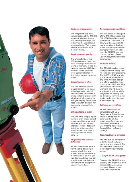
The new TPS300 Basic Series from Leica Geosystems - Geotech
The new TPS300 Basic Series from Leica Geosystems - Geotech
The new TPS300 Basic Series from Leica Geosystems - Geotech

Create successful ePaper yourself
Turn your PDF publications into a flip-book with our unique Google optimized e-Paper software.
Dual-axis compensation<br />
<strong>The</strong> integrated dual-axis<br />
compensation of the <strong>TPS300</strong><br />
automatically handles the<br />
fine leveling and angle correction<br />
for the vertical and<br />
horizontal axes. This improves<br />
the accuracy of your<br />
measurements.<br />
Ample memory capacity<br />
<strong>The</strong> affordability of the<br />
<strong>TPS300</strong> does not mean you<br />
have to accept a tradeoff in<br />
terms of memory: it has the<br />
capacity to store 4000 data<br />
records. That’s plenty to<br />
store coordinates for setting<br />
out or to save measurements.<br />
Biggest screen in class<br />
<strong>The</strong> <strong>TPS300</strong> features the<br />
biggest screen in its class:<br />
it displays eight rows of<br />
24 characters. <strong>The</strong>refore it<br />
offers a clearer picture with<br />
all relevant information in<br />
a single display. <strong>The</strong>re’s no<br />
need to switch displays for<br />
frequently required information.<br />
Only shorthand is faster<br />
<strong>The</strong> <strong>TPS300</strong>’s unique alphanumeric<br />
entry mode considerably<br />
simplifies your work<br />
because you can set any<br />
character faster – faster, in<br />
fact, than with any other<br />
instrument in this class –<br />
unless you know shorthand<br />
…<br />
Adaptability that makes a<br />
difference<br />
All <strong>TPS300</strong> models have a<br />
very flexible data output<br />
system which lets you<br />
upload format templates to<br />
the instrument so that you<br />
can download data in a selected<br />
format that is most<br />
convenient for post-processing<br />
in your office.<br />
No communication problems<br />
<strong>The</strong> fast serial (RS232) port<br />
of the <strong>TPS300</strong> supports the<br />
GSI (GEO Serial Interface)<br />
commands. <strong>The</strong>refore it is<br />
downward-compatible to<br />
many peripheral devices<br />
which communicate under<br />
the GSI protocol. In addition,<br />
the <strong>TPS300</strong> also supports<br />
a number of non-<br />
<strong>Leica</strong> <strong>Geosystems</strong> interface<br />
commands.<br />
On-board utilities<br />
<strong>The</strong> <strong>TPS300</strong> models come<br />
configured with many useful<br />
functions and programs.<br />
<strong>The</strong> USER or FNC key lets<br />
you activate a function at<br />
any time. You can assign<br />
one of the available functions<br />
to the USER key. REM<br />
(Remote elevation measurement)<br />
and REC are examples<br />
of functions while<br />
programs are setting out,<br />
tie distance, surveying, free<br />
station, reference line and<br />
area computing.<br />
Software for everything<br />
All <strong>TPS300</strong> models are<br />
compatible with <strong>Leica</strong><br />
<strong>Geosystems</strong>’ Open Survey<br />
World (OSW) platform. In<br />
other words, all data<br />
interchange functions are<br />
transacted with <strong>Leica</strong><br />
<strong>Geosystems</strong>’ <strong>new</strong> “LEICA<br />
SurveyOffice” software<br />
package.<br />
Your investment is protected<br />
<strong>TPS300</strong> can be configured<br />
with the latest software<br />
tomorrow and beyond. <strong>The</strong><br />
<strong>TPS300</strong> <strong>Basic</strong> platform is<br />
where technology makes<br />
sense.<br />
...To top it all off: <strong>Leica</strong> quality<br />
Granted, the <strong>TPS300</strong> is noticeably<br />
less expensive than<br />
comparable competitive<br />
products. However this<br />
does not compromise