Reconstruction of a colluvial body in an ... - Universität Bonn
Reconstruction of a colluvial body in an ... - Universität Bonn
Reconstruction of a colluvial body in an ... - Universität Bonn

Create successful ePaper yourself
Turn your PDF publications into a flip-book with our unique Google optimized e-Paper software.
<strong>Reconstruction</strong> <strong>of</strong> a <strong>colluvial</strong> <strong>body</strong> us<strong>in</strong>g geoelectrical resistivity<br />
by<br />
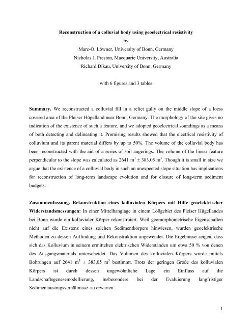
Marc-O. Löwner, University <strong>of</strong> <strong>Bonn</strong>, Germ<strong>an</strong>y<br />
Nicholas J. Preston, Macquarie University, Australia<br />
Richard Dikau, University <strong>of</strong> <strong>Bonn</strong>, Germ<strong>an</strong>y<br />
with 6 figures <strong>an</strong>d 3 tables<br />
Summary. We reconstructed a <strong>colluvial</strong> fill <strong>in</strong> a relict gully on the middle slope <strong>of</strong> a loess<br />
covered area <strong>of</strong> the Pleiser Hügell<strong>an</strong>d near <strong>Bonn</strong>, Germ<strong>an</strong>y. The morphology <strong>of</strong> the site gives no<br />
<strong>in</strong>dication <strong>of</strong> the existence <strong>of</strong> such a feature, <strong>an</strong>d we adopted geoelectrical sound<strong>in</strong>gs as a me<strong>an</strong>s<br />
<strong>of</strong> both detect<strong>in</strong>g <strong>an</strong>d del<strong>in</strong>eat<strong>in</strong>g it. Promis<strong>in</strong>g results showed that the electrical resistivity <strong>of</strong><br />
colluvium <strong>an</strong>d its parent material differs by up to 50%. The volume <strong>of</strong> the <strong>colluvial</strong> <strong>body</strong> has<br />
been reconstructed with the aid <strong>of</strong> a series <strong>of</strong> soil auger<strong>in</strong>gs. The volume <strong>of</strong> the l<strong>in</strong>ear feature<br />
perpendicular to the slope was calculated as 2641 m 3 ± 383.05 m 3 . Though it is small <strong>in</strong> size we<br />
argue that the existence <strong>of</strong> a <strong>colluvial</strong> <strong>body</strong> <strong>in</strong> such <strong>an</strong> unexpected slope situation has implications<br />
for reconstruction <strong>of</strong> long-term l<strong>an</strong>dscape evolution <strong>an</strong>d for closure <strong>of</strong> long-term sediment<br />
budgets.<br />
Zusammenfassung. Rekonstruktion e<strong>in</strong>es kolluvialen Körpers mit Hilfe geoelektrischer<br />
Widerst<strong>an</strong>dsmessungen: In e<strong>in</strong>er Mittelh<strong>an</strong>glage <strong>in</strong> e<strong>in</strong>em Lößgebiet des Pleiser Hügell<strong>an</strong>des<br />
bei <strong>Bonn</strong> wurde e<strong>in</strong> kolluvialer Körper rekonstruiert. Weil geomorphometrische Eigenschaften<br />
nicht auf die Existenz e<strong>in</strong>es solchen Sedimentkörpers h<strong>in</strong>wiesen, wurden geoelektrische<br />
Methoden zu dessen Auff<strong>in</strong>dung und Rekonstruktion <strong>an</strong>gewendet. Die Ergebnisse zeigen, dass<br />
sich das Kolluvium <strong>in</strong> se<strong>in</strong>em ermittelten elektrischen Widerständen um etwa 50 % von denen<br />
des Ausg<strong>an</strong>gsmaterials unterscheidet. Das Volumen des kolluvialen Körpers wurde mittels<br />
Bohrungen auf 2641 m 3 ± 383,05 m 3 bestimmt. Trotz der ger<strong>in</strong>gen Größe des kolluvialen<br />
Körpers ist durch dessen ungewöhnliche Lage e<strong>in</strong> E<strong>in</strong>fluss auf die<br />
L<strong>an</strong>dschaftsgenesemodellierung, <strong>in</strong>sbesondere bei der Evaluierung l<strong>an</strong>gfristiger<br />
Sedimentaustragsverhältnisse zu erwarten.<br />
1
Résumé. <strong>Reconstruction</strong> d'un corps <strong>colluvial</strong> en utilis<strong>an</strong>t la résistivité geoelectrical: Nous<br />
avons reconstruit un <strong>colluvial</strong> complétons une c<strong>an</strong>iveau de relict sur la pente moyenne d'un<br />
doma<strong>in</strong>e couvert par lœss du Pleiser Hügell<strong>an</strong>d près de <strong>Bonn</strong>, Allemagne. La morphologie de<br />
l'emplacement ne donne aucune <strong>in</strong>dication sur l'existence d'un tel dispositif. Nous avons adopté<br />
des mesures geoelectricales et en utilis<strong>an</strong>t cette méthode la détection du <strong>colluvial</strong> éait possible.<br />
Les résultats prometteurs ont prouvé que la résistivité électrique du colluvium et de son matériel<br />
de parent diffère jusqu'à de 50%. Le volume du corps <strong>colluvial</strong> a été reconstruit à l'aide d'une<br />
série de sondages. Le volume de la perpendiculaire l<strong>in</strong>éaire de dispositif à la pente a été calculé<br />
en t<strong>an</strong>t que 2641 m3 ± 383.05 m3. Bien qu'il soit petit d<strong>an</strong>s la taille nous arguons du fait que<br />
l'existence d'un corps <strong>colluvial</strong> d<strong>an</strong>s une situation si <strong>in</strong>attendue de pente a des implications pour<br />
la reconstruction de l'évolution à long temps de paysage et pour la fermeture des budgets à long<br />
temps de sédiment.<br />
1 Introduction<br />
Redistribution <strong>of</strong> sediment by diffuse <strong>an</strong>d l<strong>in</strong>ear erosion processes is the most characteristic<br />
feature <strong>of</strong> the small-scale l<strong>an</strong>dscape evolution <strong>of</strong> the loess-covered areas <strong>of</strong> central Europe (Bork<br />
1988), <strong>an</strong>d has been heavily <strong>in</strong>fluenced by agricultural l<strong>an</strong>d use over several millennia (Bork et<br />
al. 1998). The <strong>an</strong>thropogenic clear<strong>in</strong>g <strong>of</strong> vegetation cover represents the removal <strong>of</strong> a damp<strong>in</strong>g<br />
agent between climate <strong>an</strong>d the soil system, forc<strong>in</strong>g the l<strong>an</strong>dscape to readjust through<br />
redistribution <strong>of</strong> soil material. Where diffuse soil erosion processes are dom<strong>in</strong><strong>an</strong>t, a smooth<strong>in</strong>g<br />
effect on slope morphology masks l<strong>in</strong>ear erosional features through colluviation. This effect is<br />
re<strong>in</strong>forced by soil tillage on arable l<strong>an</strong>d (e.g. L<strong>in</strong>dstrom et al. 1990, L<strong>in</strong>dstrom et al. 1992, Govers<br />
et al. 1994, Govers et al. 1996). Where this readjustment takes place through l<strong>in</strong>ear erosional<br />
processes, like pip<strong>in</strong>g <strong>an</strong>d gully<strong>in</strong>g, we observe l<strong>an</strong>dscapes with more relief.<br />
Geomorphologists attempt to reconstruct these l<strong>an</strong>dform ch<strong>an</strong>ges us<strong>in</strong>g a variety <strong>of</strong> different<br />
approaches that <strong>in</strong>clude process-based models <strong>an</strong>d sediment budgets. Underst<strong>an</strong>d<strong>in</strong>g <strong>of</strong> long-term<br />
sediment fluxes is one <strong>of</strong> the keys to not only l<strong>an</strong>dform ch<strong>an</strong>ge, but also associated nutrient <strong>an</strong>d<br />
particulate fluxes. Further, sediment flux has implications for water quality, floodpla<strong>in</strong> fertility<br />
<strong>an</strong>d natural hazards. Because it is <strong>in</strong>fluenced by both, a sediment budget has the potential to<br />
highlight the relative signific<strong>an</strong>ce <strong>of</strong> climate <strong>an</strong>d <strong>an</strong>thropogenically driven environmental<br />
ch<strong>an</strong>ges. Irrespective <strong>of</strong> whether modell<strong>in</strong>g is based on empirical relationships or physical laws,<br />
2
the number <strong>of</strong> factors <strong>an</strong>d processes that must be considered <strong>in</strong>creases with area <strong>an</strong>d time sp<strong>an</strong>,<br />
creat<strong>in</strong>g problems when deal<strong>in</strong>g with questions <strong>of</strong> longer-term l<strong>an</strong>dscape ch<strong>an</strong>ge (Dikau 1999).<br />
Pip<strong>in</strong>g – or tunnel gullies – has been identified as <strong>an</strong> import<strong>an</strong>t process <strong>in</strong> the loess-covered<br />
l<strong>an</strong>dscape <strong>of</strong> the Pleiser Hügell<strong>an</strong>d to the east <strong>of</strong> <strong>Bonn</strong> <strong>in</strong> Germ<strong>an</strong>y (Botschek et al. 1996,<br />
Botschek & Skowronek 1999). In m<strong>an</strong>y <strong>in</strong>st<strong>an</strong>ces collapsed pipes form gullies, <strong>an</strong>d <strong>in</strong> some cases<br />
may even become <strong>in</strong>filled with <strong>colluvial</strong>ly derived sediments. The objective <strong>of</strong> this study was to<br />
map <strong>an</strong>d qu<strong>an</strong>tify such a <strong>colluvial</strong> <strong>body</strong>. Because these <strong>colluvial</strong> fills are <strong>of</strong>ten small <strong>in</strong> volume,<br />
detect<strong>in</strong>g them by drill<strong>in</strong>gs or trenches is very cost <strong>in</strong>tensive. Geoelectrical techniques have<br />
successfully been tested <strong>in</strong> permafrost research (rf. Schrott et al. 2003), <strong>an</strong>d have also been used<br />
<strong>in</strong> the <strong>in</strong>vestigation <strong>of</strong> soil properties (Lück et al. 2000, Kosz<strong>in</strong>ski & Wendroth 2001, Kosz<strong>in</strong>ski<br />
& Wendroth 2003). We have used geoelectrical resistivity <strong>in</strong> this study as a comparatively quick<br />
<strong>an</strong>d simple me<strong>an</strong>s <strong>of</strong> remotely detect<strong>in</strong>g <strong>in</strong>filled relict gullies. We argue that a l<strong>in</strong>ear erosional<br />
feature found at the study site is <strong>an</strong> <strong>in</strong>dicator <strong>of</strong> <strong>an</strong> <strong>an</strong>cient pip<strong>in</strong>g process, <strong>an</strong>d that this process<br />
should be <strong>in</strong>corporated <strong>in</strong>to attempts to reconstruct long-term sediment fluxes. We have estimated<br />
the volume <strong>of</strong> material stored with<strong>in</strong> the relict gully <strong>an</strong>d compared this to volumes <strong>of</strong> material<br />
eroded from the slope.<br />
2 Study Area<br />
The <strong>in</strong>vestigated slope is sited at Gut Fr<strong>an</strong>kenforst, a research station <strong>of</strong> the University <strong>of</strong> <strong>Bonn</strong><br />
situated <strong>in</strong> the Pleiser Hügell<strong>an</strong>d, a loess-covered predom<strong>in</strong><strong>an</strong>tly agricultural area 15 km east <strong>of</strong><br />
<strong>Bonn</strong> (figure 1). The region is characterised by a complex geology made up <strong>of</strong> Devoni<strong>an</strong> schists<br />
<strong>an</strong>d a series <strong>of</strong> alkal<strong>in</strong>e basalt <strong>an</strong>d <strong>an</strong>desite <strong>in</strong>trusions as well as deep deposits <strong>of</strong> trachyt tephras<br />
(Vieten 1983, Vieten et al. 1988) that have s<strong>in</strong>ce weathered to clay.<br />
Loess, derived pr<strong>in</strong>cipally from the alluvial pla<strong>in</strong>s <strong>of</strong> the Niederrhe<strong>in</strong>ische Bucht, <strong>an</strong>d<br />
accumulated dur<strong>in</strong>g the last glaciation (Sieberts 1983), is the parent material for soil<br />
development. Under Holocene climatic conditions <strong>an</strong>d without <strong>an</strong>thropogenic perturbation the<br />
soil type is Luvisol (Paas 1968), with a typical horizon sequence as shown <strong>in</strong> table 1 (Heide<br />
1988).<br />
3
Figure 1: The research area with<strong>in</strong> its regional sett<strong>in</strong>g. Measurement po<strong>in</strong>ts <strong>an</strong>d tr<strong>an</strong>sects are<br />
<strong>in</strong>dicated.<br />
Ow<strong>in</strong>g to agricultural l<strong>an</strong>d use these soils are highly eroded, <strong>an</strong>d <strong>in</strong> some locations only the<br />
recently formed calcareous plough<strong>in</strong>g layer c<strong>an</strong> be dist<strong>in</strong>guished from the parent loess material.<br />
Soil moisture movement <strong>an</strong>d groundwater lead to <strong>an</strong> additional differentiation <strong>of</strong> soil type. So-<br />
Symbol Illustration<br />
Ah/p<br />
Al<br />
Bt<br />
Bv<br />
C<br />
humic horizon / plough<strong>in</strong>g horizon<br />
illuviated horizon (≈ 10% clay) (l = lessiviert, i.e. illuviated)<br />
relatively dense clay (≈ 25% clay) <strong>an</strong>d silt enriched horizon (t = Ton, i.e. clay)<br />
less dense/more porous horizon, lower clay content (v = verwittert, i.e. weathered)<br />
parent material (loess or silty s<strong>an</strong>d)<br />
Table 1: Typical horizon sequence for the Holocene climax soil Luvisol (Heide 1988).<br />
4
called pseudogley vari<strong>an</strong>ts exhibit characteristic marbled <strong>an</strong>d striped features, reflect<strong>in</strong>g solution<br />
<strong>an</strong>d redistribution <strong>of</strong> iron <strong>an</strong>d m<strong>an</strong>g<strong>an</strong>ese dur<strong>in</strong>g wet phases <strong>an</strong>d leach<strong>in</strong>g <strong>an</strong>d concretion<br />
development dur<strong>in</strong>g dry phases. These features are highly variable <strong>in</strong> the research area. The<br />
current distribution <strong>of</strong> eroded soils <strong>an</strong>d colluvium on the study site is depicted <strong>in</strong> figure 2.<br />
���������������������<br />
���������������������<br />
���������������������<br />
���������������������<br />
���������������������<br />
���������������������<br />
���������������������<br />
���������������������<br />
���������������������<br />
���������������������<br />
���������������������<br />
���������������������<br />
���������������������<br />
���������������������<br />
���������������������<br />
���������������������<br />
���������������������<br />
���������������������<br />
���������������������<br />
���������������������<br />
���������������������<br />
���������������������<br />
���������������������<br />
���������������������<br />
���������������������<br />
���������������������<br />
���������������������<br />
���������������������<br />
���������������������<br />
���������������������<br />
���������������������<br />
���������������������<br />
���������������������<br />
���������������������<br />
� � � � � � � � � � � � � � � � � � � � � � � � � � � � � � �<br />
�<br />
� � � � � � � � � � � � � � � � � � � � � � � � � � � � � �<br />
�<br />
� � � � � � � � � � � � � � � � � � � � � � � � � � � � � �<br />
�<br />
� � � � � � � � � � � � � � � � � � � � � � � � � � � � � �<br />
�<br />
� � � � � � � � � � � � � � � � � � � � � � � � � � � � � �<br />
�<br />
� � � � � � � � � � � � � � � � � � � � � � � � � � � � � �<br />
�<br />
� � � � � � � � � � � � � � � � � � � � � � � � � � � � � �<br />
�<br />
� � � � � � � � � � � � � � � � � � � � � � � � � � � � � �<br />
�<br />
� � � � � � � � � � � � � � � � � � � � � � � � � � � � � �<br />
�<br />
� � � � � � � � � � � � � � � � � � � � � � � � � � � � � �<br />
�<br />
� � � � � � � � � � � � � � � � � � � � � � � � � � � � � �<br />
�<br />
� � � � � � � � � � � � � � � � � � � � � � � � � � � � � �<br />
�<br />
� � � � � � � � � � � � � � � � � � � � � � � � � � � � � �<br />
�<br />
� � � � � � � � � � � � � � � � � � � � � � � � � � � � � �<br />
�<br />
� � � � � � � � � � � � � � � � � � � � � � � � � � � � � �<br />
�<br />
� � � � � � � � � � � � � � � � � � � � � � � � � � � � � �<br />
�<br />
� � � � � � � � � � � � � � � � � � � � � � � � � � � � � �<br />
�<br />
� � � � � � � � � � � � � � � � � � � � � � � � � � � � � �<br />
�<br />
� � � � � � � � � � � � � � � � � � � � � � � � � � � � � �<br />
�<br />
� � � � � � � � � � � � � � � � � � � � � � � � � � � � � �<br />
��� ���<br />
��� ���<br />
� � � � �<br />
�<br />
� � � �<br />
�<br />
� � � �<br />
Figure 2: Soil distribution on the research site, as reconstructed from 55 auger po<strong>in</strong>ts.<br />
The first hum<strong>an</strong> activity <strong>in</strong> the <strong>Bonn</strong> area is assumed to have been associated with Neolithic<br />
people, who cleared forest from the more convenient sites for agricultural use (Erdm<strong>an</strong>n 1998).<br />
These sites were exp<strong>an</strong>ded by the Rom<strong>an</strong>s from 50 B.C. to 400 A.D. More widespread<br />
deforestation took place <strong>in</strong> the 6 th century A.D., <strong>an</strong>d over one hundred settlements were founded<br />
<strong>in</strong> this period, <strong>in</strong>clud<strong>in</strong>g Stieldorf, located 1.5 km north-east <strong>of</strong> the research site. Whereas the<br />
follow<strong>in</strong>g centuries saw little hum<strong>an</strong> impact on the l<strong>an</strong>dscape, more widespread deforestation<br />
occured <strong>in</strong> the 14 th <strong>an</strong>d 15 th centuries (rf. Bork et al. 1998). Gut Fr<strong>an</strong>kenforst as <strong>an</strong> occupied site<br />
5
is believed to have been <strong>in</strong> existence s<strong>in</strong>ce at least the 12 th century, although the earliest<br />
documented reference is from 1475, at which time it comprised five cultivated fields.<br />
Considerable research <strong>in</strong>to soil erosion <strong>an</strong>d pip<strong>in</strong>g has been carried out <strong>in</strong> the Pleiser Hügell<strong>an</strong>d<br />
<strong>an</strong>d at Gut Fr<strong>an</strong>kenforst (Botschek et al. 1991). Lessm<strong>an</strong>n-Schoch et al. (1991) found colluvium<br />
on a slope near the <strong>in</strong>vestigated site that was dated back to the 14 th century on the basis <strong>of</strong> pollen<br />
<strong>an</strong>alysis <strong>an</strong>d radiocarbon ages. Furthermore, Welp et al. (1999) found approximately 1.5 m <strong>of</strong><br />
colluvium overly<strong>in</strong>g moor at a nearby site. Radiocarbon ages from that colluvium are comparable<br />
to those <strong>of</strong> Lessm<strong>an</strong>n-Schoch et al. (1991); a sample <strong>of</strong> the buried moor dates back to 1300-1430<br />
A.D. The onset <strong>of</strong> colluviation at this time has been <strong>in</strong>ferred to be <strong>an</strong> <strong>in</strong>dication <strong>of</strong> the <strong>in</strong>itiation<br />
<strong>of</strong> <strong>an</strong>thropogenic impact through deforestation <strong>an</strong>d the <strong>in</strong>troduction <strong>of</strong> agriculture.<br />
3 Methodology<br />
The <strong>colluvial</strong> <strong>body</strong> was <strong>in</strong>itially located <strong>an</strong>d identified us<strong>in</strong>g a soil auger, <strong>an</strong>d was subsequently<br />
<strong>in</strong>vestigated us<strong>in</strong>g geoelectrical resistivity. This technique is based on the differential electrical<br />
resistivity <strong>of</strong> soil horizons <strong>an</strong>d regolith strata as a function <strong>of</strong> their material properties, moisture<br />
content <strong>an</strong>d porosity. Colluvial sediments <strong>of</strong>ten have a different density from surround<strong>in</strong>g<br />
material, <strong>an</strong>d thus exhibit different soil hydrological behaviour. It was one <strong>of</strong> the objectives <strong>of</strong><br />
this study to ascerta<strong>in</strong> whether this technique could also be applied <strong>in</strong> cases where <strong>colluvial</strong><br />
sediments were very similar to the material from which they were derived (<strong>in</strong> this case, loess).<br />
Resistivity measurements are made by <strong>in</strong>ject<strong>in</strong>g a direct current <strong>in</strong>to the ground via two<br />
electrodes <strong>an</strong>d measur<strong>in</strong>g the result<strong>in</strong>g voltage difference at two potential electrodes with the<br />
purpose <strong>of</strong> determ<strong>in</strong><strong>in</strong>g the subsurface resistivity distribution. The arr<strong>an</strong>gement <strong>of</strong> the electrodes<br />
determ<strong>in</strong>es the configuration, e.g. Schlumberger or Dipole-Dipole. More detailed descriptions <strong>of</strong><br />
the physical basis <strong>of</strong> geoelectrical resistivity are given by Reynolds (1997), Knödel et al. (1997)<br />
<strong>an</strong>d Friedel (1997), <strong>an</strong>d overviews <strong>of</strong> the application <strong>of</strong> geoelectrical sound<strong>in</strong>g <strong>in</strong> geomorphology<br />
by Schrott et al. (2003), Lück et al. (2000) <strong>an</strong>d Kosz<strong>in</strong>sky & Wendroth (2001, 2003). The extent<br />
<strong>of</strong> the <strong>colluvial</strong> <strong>body</strong> was determ<strong>in</strong>ed us<strong>in</strong>g a geoelectrical tr<strong>an</strong>sect parallel to the slope contours<br />
(figure 1). Both Schlumberger <strong>an</strong>d Dipole-Dipole configurations were tested, with 40 electrodes<br />
deployed at <strong>in</strong>tervals <strong>of</strong> one metre. While the Schlumberger configuration is less sensitive to<br />
lateral ch<strong>an</strong>ges <strong>in</strong> electrical resistivity, the Dipole-Dipole configuration could be used to detect<br />
this (L<strong>an</strong>ge 1997). Geoelectrical tr<strong>an</strong>sects were duplicated with two soil auger tr<strong>an</strong>sects (10 mm<br />
<strong>an</strong>d 55 mm diameter augers) <strong>in</strong> order to verify the results <strong>of</strong> the geoelectrical survey <strong>an</strong>d to<br />
6
establish boundaries between soil types. The nature <strong>of</strong> the sediment <strong>an</strong>d soils was determ<strong>in</strong>ed <strong>in</strong><br />
the field on the basis <strong>of</strong> texture, org<strong>an</strong>ic content, CaCO3 content, colour <strong>an</strong>d <strong>in</strong>clusions such as<br />
allochthonous stones <strong>an</strong>d charcoal. To detect CaCO3 <strong>in</strong> the sediment <strong>an</strong>d soils, we applied 10%<br />
HCl solution (AG Boden 1996).<br />
We dist<strong>in</strong>guished colluvium from the <strong>in</strong> situ soil on two bases. First, the occurrence <strong>of</strong> charcoal<br />
<strong>an</strong>d pottery is noted. The former is assumed to be associated with slash <strong>an</strong>d burn agriculture <strong>an</strong>d<br />
therefore with hum<strong>an</strong> impact on the ecosystem. Second, because decalcification is a soil-build<strong>in</strong>g<br />
process propagat<strong>in</strong>g down from the surface, the presence <strong>of</strong> detectable CaCO3 content <strong>in</strong> horizons<br />
above totally decalcified ones provides unequivocal evidence that the CaCO3-bear<strong>in</strong>g layers are<br />
<strong>colluvial</strong> material accumulated from above rather th<strong>an</strong> <strong>an</strong> <strong>in</strong> situ weather<strong>in</strong>g product.<br />
Recorded thickness at each auger po<strong>in</strong>t was grouped <strong>in</strong>to three classes, <strong>an</strong>d me<strong>an</strong> thickness for<br />
each class was multiplied by the mapped surface area <strong>of</strong> that class <strong>in</strong> order to estimate the volume<br />
<strong>of</strong> colluvium. Establish<strong>in</strong>g boundaries between classes <strong>in</strong>volved some resampl<strong>in</strong>g <strong>in</strong> places with<br />
<strong>in</strong>sufficient depth <strong>in</strong>formation. Although the sampl<strong>in</strong>g density was high (one metre between<br />
po<strong>in</strong>ts), boundaries are <strong>in</strong>evitably subjective.<br />
4 Results<br />
A series <strong>of</strong> geoelectrical surveys were made parallel to the slope contours, encompass<strong>in</strong>g the area<br />
where soil auger <strong>in</strong>vestigations had <strong>in</strong>dicated the presence <strong>of</strong> a <strong>colluvial</strong> <strong>body</strong>. Figure 3 shows the<br />
result <strong>of</strong> a 2D resistivity survey us<strong>in</strong>g the Schlumberger configuration. It is notable that the<br />
resistivities measured are extremely low, due to soil moisture result<strong>in</strong>g from a recent ra<strong>in</strong>fall<br />
event. Nevertheless lateral differences <strong>in</strong> resistivity c<strong>an</strong> be observed down to a depth <strong>of</strong> about<br />
four metres, vary<strong>in</strong>g from 45 Ωm to 22 Ωm between the 21 st <strong>an</strong>d 25 th metres along the pr<strong>of</strong>ile.<br />
The highest resistivities c<strong>an</strong> be observed at depths <strong>of</strong> less th<strong>an</strong> 1.2 m, possibly due to dry<strong>in</strong>g<br />
effects, <strong>an</strong>d at the 31 m mark at a depth <strong>of</strong> 2.2 m.<br />
7
Figure 3: Resistivity tomogram <strong>of</strong> a Schlumberger survey along Tr<strong>an</strong>sect T1.<br />
Figure 4 depicts the result <strong>of</strong> a 2D resistivity survey us<strong>in</strong>g the Dipole-Dipole configuration along<br />
the same tr<strong>an</strong>sect (figure 1). As <strong>in</strong> figure 3, the observed resistivities are notably low. Aside from<br />
the upper 1.5 m, resistivities <strong>of</strong> more th<strong>an</strong> 55 Ωm c<strong>an</strong> be observed at four locations along the<br />
pr<strong>of</strong>ile - at about 8 metres, 20 metres, 28 metres <strong>an</strong>d 35 metres. The values <strong>of</strong> higher resistivity <strong>in</strong><br />
both the Schlumberger <strong>an</strong>d the Dipole-Dipole configurations are restricted to a narrow zone.<br />
Figure 4: Resistivity tomogram <strong>of</strong> a Dipole-Dipole survey along Tr<strong>an</strong>sect T1.<br />
8
Figure 5: Stratigraphy <strong>of</strong> Tr<strong>an</strong>sect T1 <strong>in</strong>ferred on the basis <strong>of</strong> <strong>in</strong>dicated auger holes. The question<br />
mark <strong>in</strong>dicates the tentativeness <strong>in</strong> identify<strong>in</strong>g the horizon <strong>in</strong> question as a Bv horizon <strong>an</strong>d not <strong>an</strong><br />
elder colluvium. Figures 3 <strong>an</strong>d 4 illustrate results <strong>of</strong> geoelectrical surveys over the <strong>in</strong>terval 29-69<br />
m.<br />
Two soil auger tr<strong>an</strong>sects (T1 <strong>an</strong>d T2) are depicted <strong>in</strong> figures 5 <strong>an</strong>d 6, illustrat<strong>in</strong>g the form <strong>of</strong> the<br />
<strong>colluvial</strong> <strong>body</strong>. Tr<strong>an</strong>sect T1 crosses the widest part <strong>of</strong> the <strong>colluvial</strong> <strong>body</strong>. Two auger holes (T1-15<br />
<strong>an</strong>d T1-21) extended to the lower limit <strong>of</strong> the loess <strong>body</strong>, reveal<strong>in</strong>g weathered tuff at depths <strong>of</strong><br />
6.46 m <strong>an</strong>d 5.1 m respectively. The loess consisted primarily <strong>of</strong> silt with very little clay but<br />
occasionally large amounts <strong>of</strong> f<strong>in</strong>e s<strong>an</strong>d. Hydromorphic features were extremely variable over the<br />
whole pr<strong>of</strong>ile, <strong>in</strong>dicat<strong>in</strong>g strong horizontal groundwater migration. In situ soil was absent from<br />
almost the whole <strong>of</strong> tr<strong>an</strong>sect T1; only auger po<strong>in</strong>t T1-10 revealed <strong>an</strong> <strong>in</strong> situ Bt horizon. This<br />
implies that ≈ 3 m <strong>of</strong> the primary loess soil had been eroded from the middle slope. There is a<br />
sharp boundary between the <strong>colluvial</strong> fill<strong>in</strong>g <strong>in</strong> the centre <strong>of</strong> the tr<strong>an</strong>sect <strong>an</strong>d the underly<strong>in</strong>g loess.<br />
We found no <strong>in</strong> situ soil under the colluvium. Figure 6 depicts Tr<strong>an</strong>sect T2, situated 15 m<br />
downslope from T1. Auger po<strong>in</strong>t T2-04 extended to the base <strong>of</strong> the loess <strong>body</strong> at 4.25 m. As <strong>in</strong><br />
9
tr<strong>an</strong>sect T1, hydromorphic phenomena <strong>in</strong>dicate the <strong>in</strong>fluence <strong>of</strong> lateral groundwater migration.<br />
Aga<strong>in</strong>, the Holocene soil has been almost totally eroded from this part <strong>of</strong> the slope, <strong>an</strong>d we found<br />
calcareous loess underneath the colluvium rather th<strong>an</strong> <strong>in</strong> situ soil.<br />
Figure 6: Stratigraphy <strong>of</strong> Tr<strong>an</strong>sect T2 <strong>in</strong>ferred on the basis <strong>of</strong> <strong>in</strong>dicated auger holes.<br />
Two dist<strong>in</strong>ct <strong>colluvial</strong> units, a calcareous colluvium <strong>an</strong>d a charcoal bear<strong>in</strong>g colluvium (rf. Fig. 5<br />
<strong>an</strong>d 6) were recognised. The stratigraphically lower <strong>of</strong> the two is characterised by small<br />
fragments <strong>of</strong> charcoal. These are absent from the overly<strong>in</strong>g <strong>colluvial</strong> unit, which c<strong>an</strong> be<br />
characterised by the presence <strong>of</strong> CaCO3. Although this second <strong>colluvial</strong> unit is <strong>in</strong>dist<strong>in</strong>guishable<br />
<strong>in</strong> texture <strong>an</strong>d colour from the B horizon <strong>of</strong> a Luvisol (rf. table 1), both the CaCO3 content <strong>an</strong>d its<br />
stratigraphic location preclude it from be<strong>in</strong>g <strong>an</strong> <strong>in</strong> situ pedogenic horizon. Further, the law <strong>of</strong><br />
superposition implies that it must be younger th<strong>an</strong> the charcoal-bear<strong>in</strong>g colluvium.<br />
On the basis <strong>of</strong> these 55 soil auger po<strong>in</strong>ts, we <strong>in</strong>fer a distribution <strong>of</strong> three different units: a totally<br />
eroded soil, <strong>an</strong> eroded Luvisol, <strong>an</strong>d colluvium. The regional climax soil, a Luvisol, could not be<br />
found on the <strong>in</strong>vestigated slope (figure 2). Almost all <strong>of</strong> the upper slope is characterised by totally<br />
eroded soils. Only the plough<strong>in</strong>g layer, show<strong>in</strong>g a weak CaCO3 content, could be differentiated<br />
10
fom underly<strong>in</strong>g calcareous loess parent material, <strong>in</strong>dicat<strong>in</strong>g that all <strong>of</strong> the solum had been eroded.<br />
The underly<strong>in</strong>g material varied <strong>in</strong> colour due to hydromorphic action but not <strong>in</strong> soil texture or<br />
Depth [m] Horizon Colour Carbonate<br />
a) T1-08<br />
0 - 0.4<br />
0.4 - 2.3<br />
2.3 - 3<br />
Ap<br />
b) T2-09<br />
0 - 0.35<br />
0.35 - 2.7<br />
2.7 - 3<br />
loess (reduced)<br />
loess (reduced)<br />
Ap<br />
Bv<br />
Loess<br />
c) T1-19<br />
0 - 0.46<br />
0.46 - 0.73<br />
0.73 - 0.92<br />
0.92 - 0.95<br />
0.95 - 1.53<br />
1.53 - 1.71<br />
1.71 - 3.0<br />
3.0 - 4.0<br />
Calcareous<br />
Colluvium / Ap<br />
Colluvium<br />
Colluvium<br />
Colluvium<br />
Colluvium<br />
Colluvium<br />
Cv / Bv<br />
loess (reduced)<br />
10YR5/4<br />
10YR5/2<br />
mottles <strong>of</strong> rust<br />
10YR5/2<br />
10YR4/4<br />
10YR4/6<br />
10YR6/6<br />
10YR5/4<br />
10YR4/4<br />
10YR4/4<br />
10YR4/4<br />
10YR4/4<br />
10YR4/4<br />
2.5Y4/6<br />
10YR5/2<br />
Content [% <strong>in</strong><br />
mass]<br />
≈ 1<br />
≈ 20<br />
≈ 20<br />
0<br />
0<br />
≈ 20<br />
≈ 5<br />
0<br />
0<br />
0<br />
0<br />
0<br />
≈ 5<br />
≈ 20<br />
Soil Texture Inclusions<br />
Silt Loam<br />
Silt Loam<br />
Silt Loam<br />
Silty Clay<br />
Loam<br />
Silt Loam<br />
Silt Loam<br />
Silt Loam<br />
Silt Loam<br />
Silt Loam<br />
Silt Loam<br />
Silt Loam<br />
Silt Loam<br />
Silt Loam<br />
Charcoal<br />
Red pottery<br />
Charcoal<br />
Charcoal<br />
Charcoal<br />
Table 2: Pr<strong>of</strong>iles found on the <strong>in</strong>vestigated sites. a) A typical horizon sequence <strong>of</strong> totally eroded<br />
upper slope soil, b) a typical eroded Luvisol, <strong>an</strong>d c) a typical colluvium.<br />
CaCO3 content (table 2(a)). The second soil type, ma<strong>in</strong>ly occurr<strong>in</strong>g on the middle <strong>an</strong>d lower<br />
slope, was <strong>an</strong> eroded Luvisol with some rema<strong>in</strong><strong>in</strong>g <strong>in</strong> situ soil horizons (table 2(b)). In<br />
comparison to the first soil type, the second type revealed decalcified horizons, giv<strong>in</strong>g evidence<br />
11
<strong>of</strong> soil build<strong>in</strong>g processes. Additionally, <strong>in</strong> most cases there were clay-enriched layers on the top<br />
<strong>of</strong> such pr<strong>of</strong>iles, <strong>in</strong>dicat<strong>in</strong>g that a former Bt horizon had been exposed, possibly by diffuse soil<br />
erosion or plough<strong>in</strong>g.<br />
The third unit, colluvium, does not occur over the whole lower slope, but only as a l<strong>in</strong>ear feature,<br />
perpendicular to the Forstbach ch<strong>an</strong>nel (figure 2). Table 2(c) gives a description <strong>of</strong> the deepest<br />
colluvium found here. Noteworthy is the location <strong>of</strong> the <strong>colluvial</strong> <strong>body</strong> <strong>an</strong>d its extension to the<br />
upper slope, imply<strong>in</strong>g a filled l<strong>in</strong>ear erosional feature. The older, charcoal-bear<strong>in</strong>g, colluvium<br />
extends to the north-western boundary <strong>of</strong> the research area, i.e. to the ch<strong>an</strong>nel, <strong>an</strong>d a further 25 m<br />
upslope. The younger colluvium has <strong>an</strong> even wider distribution. The orientation <strong>of</strong> the l<strong>in</strong>ear<br />
<strong>colluvial</strong> <strong>body</strong> does not conform to the contemporary contour l<strong>in</strong>es. Preston (2001) gives three<br />
OSL ages for samples taken at or near the base <strong>of</strong> the mapped colluvium: 1220 a ± 100 a – 1380 a<br />
± 100 a, 1200 a ± 130 a – 1350 a ± 150 a <strong>an</strong>d 1200 a ± 110 a – 1280 a ± 110 a. An age <strong>of</strong> 1250 a<br />
is assumed to be representative for the base <strong>of</strong> the <strong>colluvial</strong> fill.<br />
Accumulation Class ≤ 1 m 1 – 2 m 2 – 3 m Total<br />
Area [m 2 ]<br />
Class me<strong>an</strong> [m]<br />
St<strong>an</strong>dard deviation [m]<br />
Accumulated Volume [m 3 ]<br />
1095<br />
0.4537<br />
0.03792<br />
497<br />
1261<br />
1.5717<br />
0.2688<br />
1982<br />
59<br />
2.734<br />
0.0436<br />
162<br />
2415<br />
2641<br />
Table 3: Estimated volume <strong>of</strong> accumulated colluvium on the <strong>in</strong>vestigated site. Row 2 <strong>an</strong>d 3 are<br />
related to the thickness <strong>of</strong> the layer.<br />
The total volume <strong>of</strong> accumulated material was calculated as 2641 m 3 ± 383.05 m 3 (table 3). Of<br />
this, 497 m 3 ± 41.5 m 3 accumulated on sites with thicknesses <strong>of</strong> less then one metre, 1982 m 3 ±<br />
339 m 3 on sites <strong>of</strong> 1-2 m thickness <strong>an</strong>d 162 m 3 ± 2.6 m 3 on sites with 2-3 m <strong>of</strong> colluvium. Of the<br />
total volume, 761 m 3 ± 159.35 m 3 belong to the younger colluvium. As figures 5 <strong>an</strong>d 6 suggest,<br />
this is partly cut <strong>in</strong>to the older charcoal-bear<strong>in</strong>g colluvium.<br />
5 Discussion<br />
The ma<strong>in</strong> po<strong>in</strong>t <strong>of</strong> this study is the reconstruction <strong>of</strong> a relatively large sediment s<strong>in</strong>k, which could<br />
not be identified on the basis <strong>of</strong> contemporary morphometry, us<strong>in</strong>g geoelectrical surveys as a tool<br />
for remote detection <strong>an</strong>d target<strong>in</strong>g <strong>of</strong> auger sampl<strong>in</strong>g. Although the observed resistivities are<br />
12
conceivable small, the extent <strong>of</strong> the <strong>colluvial</strong> <strong>body</strong> as subsequently revealed by auger<strong>in</strong>g is<br />
implied from both the Schlumberger (figure 3) <strong>an</strong>d the Dipole-Dipole (figure 4) configurations.<br />
Because the Schlumberger configuration is normally relatively resist<strong>an</strong>t to lateral ch<strong>an</strong>ges <strong>in</strong><br />
resistivity, a variation <strong>of</strong> more th<strong>an</strong> 50% <strong>of</strong> the measured resistivity r<strong>an</strong>ge is considered to reflect<br />
<strong>an</strong> effective difference <strong>in</strong> the material properties <strong>of</strong> the colluvium <strong>an</strong>d the surround<strong>in</strong>g soil<br />
material. On the other h<strong>an</strong>d, Dipole-Dipole configurations are more sensitive to lateral ch<strong>an</strong>ges<br />
(Lück et al. 2000), <strong>an</strong>d it is considered that the measured resistivity peaks are associated with the<br />
boundaries <strong>of</strong> a filled up sediment s<strong>in</strong>k. Thus, while the Schlumberger configuration shows the<br />
centre <strong>of</strong> the two reconstructed <strong>colluvial</strong> s<strong>in</strong>ks, the Dipole-Dipole configuration identifies their<br />
boundaries. The nature <strong>of</strong> this boundary might be a result <strong>of</strong> soil build<strong>in</strong>g processes that occurred<br />
while the gully was exposed to the air. To <strong>an</strong>swer this question more work has to be done to<br />
compare geoelectrical surveys with drill<strong>in</strong>g results.<br />
There are two possible expl<strong>an</strong>ations for the existence <strong>of</strong> this <strong>colluvial</strong> s<strong>in</strong>k perpendicular to the<br />
contour l<strong>in</strong>es. It c<strong>an</strong> be hypothesised that the feature <strong>in</strong> which colluvium has accumulated was<br />
formed by either backward <strong>in</strong>cision from a ch<strong>an</strong>nel b<strong>an</strong>k slump, or by simple l<strong>in</strong>ear <strong>in</strong>cision<br />
result<strong>in</strong>g from high rates <strong>of</strong> overl<strong>an</strong>d flow, i.e. gully<strong>in</strong>g. While the latter seems to be unlikely<br />
because <strong>of</strong> the small hydrological catchment, such <strong>an</strong> orig<strong>in</strong> is plausible if it follows the collapse<br />
<strong>of</strong> a pipe formed by subsurface flow. Botschek et al. (2001) found that loess-covered slopes have<br />
a strong aff<strong>in</strong>ity to pip<strong>in</strong>g <strong>in</strong>itially caused by <strong>in</strong>terflow (see also Botschek et al. 1996). Botschek<br />
<strong>an</strong>d Skowronek (1999) describe pip<strong>in</strong>g on a nearby slope with comparable soil <strong>an</strong>d <strong>of</strong> similar<br />
size. We <strong>in</strong>terpret the varied hydromorphic features depicted <strong>in</strong> figures 5 <strong>an</strong>d 6 as <strong>an</strong> <strong>in</strong>dication <strong>of</strong><br />
ongo<strong>in</strong>g lateral throughflow. Therefore a collapsed pipe, enh<strong>an</strong>ced by headward erosion, is<br />
argued to have occurred here.<br />
Nevertheless, pip<strong>in</strong>g does not account for the almost complete erosion <strong>of</strong> soil across the slope.<br />
We hypothesise that this <strong>an</strong>d the <strong>colluvial</strong> fill<strong>in</strong>g <strong>of</strong> the former gully are related <strong>an</strong>d that the<br />
truncated soils upslope (rf. figure 2) clearly <strong>in</strong>dicate the source area for the gully fill. We believe<br />
that both the sheet erosion <strong>of</strong> the slope <strong>an</strong>d the fill<strong>in</strong>g <strong>of</strong> the l<strong>in</strong>ear feature are the effect <strong>of</strong> hum<strong>an</strong><br />
impact on the slope through forest clear<strong>in</strong>g <strong>an</strong>d agricultural l<strong>an</strong>d use. Under forest the l<strong>in</strong>ear<br />
feature is more likely to have both formed <strong>an</strong>d been preserved (e.g. Müller-M<strong>in</strong>y, 1954; Nicke,<br />
1989). However, while it may have formed <strong>an</strong>d existed under forest for some time, it is likely that<br />
it did not beg<strong>in</strong> to be filled until the forests were cleared, <strong>an</strong>d that gully formation was probably<br />
contempor<strong>an</strong>eous with deforestation. The charcoal <strong>in</strong> the older <strong>of</strong> the two colluvia suggests that it<br />
13
was formed at the time <strong>of</strong> deforestation, <strong>an</strong>d as there is no other colluvium underly<strong>in</strong>g this, it<br />
seems reasonable to <strong>in</strong>fer that the gully was formed at approximately this time. Deforestation<br />
may <strong>in</strong> fact have <strong>in</strong>directly <strong>in</strong>fluenced the collapse <strong>of</strong> the pipe, by contribut<strong>in</strong>g to enh<strong>an</strong>ced<br />
<strong>in</strong>filtration <strong>of</strong> ra<strong>in</strong>fall <strong>in</strong>to the soils <strong>an</strong>d thus alter<strong>in</strong>g the slope hydrology. If the slope had been<br />
forested prior to the formation <strong>of</strong> the gully, then it is unlikely that the extensive <strong>an</strong>d ubiquitous<br />
erosion <strong>of</strong> the upper slope occurred before this. Gully formation, therefore, did not post-date l<strong>an</strong>d<br />
use ch<strong>an</strong>ge.<br />
Because the optically stimulated lum<strong>in</strong>escence technique dates the last exposure <strong>of</strong> sediment to<br />
daylight, the burial <strong>of</strong> the l<strong>in</strong>ear feature must have commenced no later th<strong>an</strong> 1250 years ago <strong>an</strong>d<br />
the collapse <strong>of</strong> the pipe <strong>an</strong>d its evacuation must have occurred either at that time or some time<br />
prior to that. If the gully fill<strong>in</strong>g was broadly contempor<strong>an</strong>eous with deforestation, then it follows<br />
that the age <strong>of</strong> the colluvium provides <strong>an</strong> <strong>in</strong>dication <strong>of</strong> the tim<strong>in</strong>g <strong>of</strong> this, <strong>an</strong>d therefore the<br />
beg<strong>in</strong>n<strong>in</strong>g <strong>of</strong> hum<strong>an</strong> <strong>in</strong>fluence on the slope. Us<strong>in</strong>g the age <strong>of</strong> 1250 a given by Preston (2001) for<br />
the colluvium, we suggest that this occurred dur<strong>in</strong>g the early Medieval period, which is some four<br />
centuries earlier th<strong>an</strong> suggested by Lessm<strong>an</strong>n-Schoch et al. (1991) <strong>an</strong>d Welp et al. (1999).<br />
Our evidence thus <strong>in</strong>dicates that a slope as a geomorphic element does not simply represent a<br />
source <strong>of</strong> sediment <strong>in</strong>put to the fluvial system, but even when considered over longer timescales<br />
also represents a sediment s<strong>in</strong>k. Storage capacity <strong>in</strong> the form <strong>of</strong> <strong>colluvial</strong> footslopes is common <strong>in</strong><br />
m<strong>an</strong>y l<strong>an</strong>dscapes. Bork (1988) describes basal colluvium deposits <strong>in</strong> m<strong>an</strong>y parts <strong>of</strong> central <strong>an</strong>d<br />
northern Germ<strong>an</strong>y, typically formed as a result <strong>of</strong> diffuse soil erosion. Temporary storage <strong>of</strong><br />
sediment on slopes is also common, but would perhaps not generally be expected on such a short<br />
slope with <strong>an</strong> undercutt<strong>in</strong>g ch<strong>an</strong>nel, such as <strong>in</strong> this case. In Forstbach, we found not a basal<br />
colluvium at the foot <strong>of</strong> the slope, but both on-slope sediment storage <strong>an</strong>d a buried l<strong>in</strong>ear feature.<br />
Exposures <strong>in</strong> other parts <strong>of</strong> the ch<strong>an</strong>nel reveal <strong>in</strong> situ soil <strong>an</strong>d loess. Colluvial sediment storage is<br />
locally restricted.<br />
The aforementioned f<strong>in</strong>d<strong>in</strong>gs have several implications for underst<strong>an</strong>d<strong>in</strong>g <strong>an</strong>d reconstruction <strong>of</strong><br />
long-term l<strong>an</strong>dscape ch<strong>an</strong>ge. First, the fact that the slope acts as a sediment s<strong>in</strong>k <strong>in</strong>validates the<br />
top-down approach <strong>of</strong> evaluat<strong>in</strong>g erosion on the basis <strong>of</strong> fluvial sediment load measurements <strong>an</strong>d<br />
estimations. One c<strong>an</strong>not properly underst<strong>an</strong>d sediment redistribution dynamics simply on the<br />
basis <strong>of</strong> catchment outputs. Second, because pip<strong>in</strong>g or s<strong>in</strong>khole erosion is a widespread<br />
phenomenon <strong>in</strong> loess areas (Botschek & Skowronek 1999, Pécsi & Richter 1996), this process<br />
must be duly considered <strong>in</strong> sediment budget approaches – at least <strong>in</strong> these areas. Slopes such as<br />
14
that presented here are found throughout the Pleiser Hügell<strong>an</strong>d <strong>an</strong>d further afield. We argue that<br />
these features are small but potentially numerous <strong>in</strong> the context <strong>of</strong> <strong>in</strong>vestigation or modell<strong>in</strong>g at<br />
the scale <strong>of</strong> higher order catchments. Failure to <strong>in</strong>clude them may contribute signific<strong>an</strong>tly to<br />
errors <strong>in</strong> assessment <strong>of</strong> long-term l<strong>an</strong>dform development <strong>an</strong>d sediment delivery. Data describ<strong>in</strong>g<br />
location <strong>an</strong>d volumes <strong>of</strong> onslope sediment storage such as revealed here are essential <strong>in</strong><br />
estimation <strong>of</strong> sediment delivery ratios, although clearly calculation <strong>of</strong> a sediment delivery ratio<br />
requires that further work is needed to qu<strong>an</strong>tify volumes <strong>of</strong> both onslope storage <strong>an</strong>d erosion.<br />
6 Conclusion<br />
There is a relatively large sediment s<strong>in</strong>k on the <strong>in</strong>vestigated site, which c<strong>an</strong>not be identified on<br />
the basis <strong>of</strong> contemporary morphometry. Geoelectrical surveys c<strong>an</strong> help to detect <strong>an</strong>d potentially<br />
qu<strong>an</strong>tify <strong>colluvial</strong> bodies such as this, especially when us<strong>in</strong>g a comb<strong>in</strong>ation <strong>of</strong> Schlumberger <strong>an</strong>d<br />
Diplole-Dipole configurations. More work is needed to be done to underst<strong>an</strong>d the <strong>in</strong>terrelation <strong>of</strong><br />
electrical resistivity <strong>an</strong>d material properties <strong>of</strong> erosion-derived sediment.<br />
The characteristics <strong>an</strong>d age <strong>of</strong> the reconstructed sediment <strong>body</strong> imply that <strong>an</strong>thropogenic<br />
<strong>in</strong>fluence on l<strong>an</strong>dform at this site beg<strong>an</strong> earlier th<strong>an</strong> previous evidence had suggested. More<br />
import<strong>an</strong>tly, the presence <strong>of</strong> sediment bodies such as this has implications for approaches to the<br />
reconstruction <strong>of</strong> longer term l<strong>an</strong>dform ch<strong>an</strong>ges <strong>in</strong> two major ways. Firstly, l<strong>an</strong>dform ch<strong>an</strong>ge<br />
occurs through multiple processes, <strong>an</strong>d over longer time scales it is likely that <strong>an</strong> <strong>in</strong>creas<strong>in</strong>g<br />
number <strong>of</strong> these will have to be <strong>in</strong>corporated. It is <strong>in</strong>appropriate, therefore, to attempt modell<strong>in</strong>g<br />
<strong>of</strong> l<strong>an</strong>dform ch<strong>an</strong>ge focuss<strong>in</strong>g on only one or two processes. Rather, the full r<strong>an</strong>ge <strong>of</strong> processes<br />
that may have occurred must be considered. Secondly, use <strong>of</strong> a sediment budget approach to<br />
validate models <strong>of</strong> l<strong>an</strong>dform ch<strong>an</strong>ge requires a high data density <strong>of</strong> sampl<strong>in</strong>g, enabl<strong>in</strong>g the<br />
reconstruction <strong>of</strong> erosion <strong>an</strong>d deposition sequences. Clearly sediment storage <strong>in</strong> small l<strong>an</strong>dscape<br />
units c<strong>an</strong> be signific<strong>an</strong>t even over longer periods.<br />
15
7 References<br />
AG Boden (1996): Bodenkundliche Kartier<strong>an</strong>leitung. – Schweizerbart’sche<br />
Verlagsbuchh<strong>an</strong>dlung, H<strong>an</strong>nover: 392 pp.<br />
Bork, H.-R. (1988): Bodenerosion und Umwelt. Verlauf, Ursachen und Folgen der<br />
mittelalterlichen und neuzeitlichen Bodenerosion. – L<strong>an</strong>dschaftsgenese und<br />
L<strong>an</strong>dschaftsökologie 13: 249 pp.<br />
Bork, H.-R., Bork, H., Dalchow, C., Faust, B., Piorr, H. P. & T. Schatz (1998):<br />
L<strong>an</strong>dschaftsentwicklung <strong>in</strong> Mitteleuropa. Klett-Perthes, Stuttgart: 328 pp.<br />
Botschek J., Abel, S. & A. Skowronek (1996): Tunnelerosion – unterirdischer Abtrag von Boden<br />
und Substrat. – Mitteilungen der Deutschen Bodenkundlichen Gesellschaft 79: 359–362.<br />
Botschek, J. & A. Skowronek (1999): Zum Abtragspotential der Tunnelerosion. – Mitteilungen<br />
der Deutschen Bodenkundlichen Gesellschaft 91: 1175–1178.<br />
Botschek, J., Grunert, J. & A. Skowronek (1991): Bodenerosionsforschung <strong>an</strong> der<br />
L<strong>an</strong>dwirtschaftlichen Fakultät und am Geographischen Institut der <strong>Universität</strong> <strong>Bonn</strong> – e<strong>in</strong>e<br />
kommentierte Bibliographie. – Arbeiten zur Rhe<strong>in</strong>ischen L<strong>an</strong>deskunde 60: 55–69.<br />
Botschek, J., Krause, S. & A. Skrowronek (2001): Tunnelerosion und Erodierbarkeit von<br />
Lößböden. – Mitteilungen der Deutschen Bodenkundlichen Gesellschaft 96: 587–588.<br />
Dikau, R. (1999): The need for field evidence <strong>in</strong> modell<strong>in</strong>g l<strong>an</strong>dform evolution. – Hergarten, S. &<br />
H. Neugebauer (eds.): Process modell<strong>in</strong>g <strong>an</strong>d l<strong>an</strong>dform evolution. Lecture Notes <strong>in</strong> Earth<br />
Sciences 78: 3–12.<br />
Erdm<strong>an</strong>n, K. H. (1998): Untersuchungen zur Bodenerosion im südlichen Nordrhe<strong>in</strong>-Westfalen. –<br />
MAB Mitteilungen 43: 391 pp.<br />
Friedel, S. (1997): Hochauflösende Geoelektrik – Geoelektrische Tomographie. – Beblo, M (ed.):<br />
Umweltgeophysik. Ernst und Sohn, Berl<strong>in</strong>: 131–151.<br />
Govers, G., v<strong>an</strong> Daele, K., Desmet, P.J.J., Poesen, P. & K. Bunte (1994): The role <strong>of</strong> tillage <strong>in</strong><br />
soil redistribution on hill slopes. – Europe<strong>an</strong> Journal <strong>of</strong> Soil Science 45: 469–478.<br />
Govers, G., Qu<strong>in</strong>e, T.A., Desmet, P.J.J. & D.E. Wall<strong>in</strong>g (1996): The relative contribution <strong>of</strong> soil<br />
tillage <strong>an</strong>d overl<strong>an</strong>d flow erosion to soil redistribution on agricultural l<strong>an</strong>d. – Earth Surface<br />
Processes <strong>an</strong>d L<strong>an</strong>dforms 21: 929–946.<br />
Heide, G. (1988): Boden und Bodennutzung. – G. L. Nordrhe<strong>in</strong>-Westfalen, (ed.): Geologie am<br />
Niederrhe<strong>in</strong>, Krefeld: 73–78.<br />
Knödel, K., Krummel, K. & G. L<strong>an</strong>ge (1997): Geophysik. Spr<strong>in</strong>ger, Berl<strong>in</strong>. 1063 pp.<br />
16
Kosz<strong>in</strong>ski, S. & O. Wendroth (2001): Field-scale variability <strong>of</strong> soil physical properties <strong>an</strong>d<br />
specific electrical resistivity. - Geophysical Research Abstracts: 26 th General Assembly,<br />
Europe<strong>an</strong> Geophysical Society (EGS) 3, GRA3, 2128 CD.<br />
Kosz<strong>in</strong>ski, S. & O. Wendroth (2003): Estimation <strong>of</strong> the spatial distribution <strong>of</strong> soil textural<br />
properties us<strong>in</strong>g resistivity tomography at field scale. – Water <strong>an</strong>d org<strong>an</strong>ic matter <strong>in</strong><br />
<strong>an</strong>thropogenic soils: dynamics <strong>an</strong>d processes, Berl<strong>in</strong>, 2.-4. April 2003: 56.<br />
L<strong>an</strong>ge, G. (1997): Gleichstromgeoelektrik. – Knödel, K., Krummel, K. & G. L<strong>an</strong>ge (eds.):<br />
Geophysik. Spr<strong>in</strong>ger, Berl<strong>in</strong>: 122–165.<br />
Lessm<strong>an</strong>n-Schoch, U., Kahrer, R. & G. W. Brümmer (1991): Pollen<strong>an</strong>alytische und 14 C-<br />
Untersuchungen zur Datierung der Kolluvienbildung <strong>in</strong> e<strong>in</strong>er lößbedeckten<br />
Mittelgebirgsl<strong>an</strong>dschaft. – Eiszeitalter und Gegenwart 41: 16–25.<br />
L<strong>in</strong>dstrom, M., Nelson, W., Schumacher, T., & G. Lemme (1990): Soil movement by tillage as<br />
affected by slope. – Soil <strong>an</strong>d Tillage Research, 17: 255–264.<br />
L<strong>in</strong>dstrom, M., Nelson, W. & T. Schumacher (1992): Qu<strong>an</strong>tify<strong>in</strong>g tillage erosion rates due to<br />
mouldboard plough<strong>in</strong>g. – Soil <strong>an</strong>d Tillage Research 24: 243–255.<br />
Lück, E. Eisenreich, M., Domsch, H. & O. Blumenste<strong>in</strong> (2000): Geophysik für L<strong>an</strong>dwirtschaft<br />
und Bodenkunde. – St<strong>of</strong>fdynamik <strong>in</strong> Geosystemen 4: 167 pp.<br />
Müller-M<strong>in</strong>y, H. (1954): Bodenabtrag und Erosion im südbergischen Bergl<strong>an</strong>d – E<strong>in</strong> Beitrag zur<br />
Frage der Bodenzerstörung und zur qu<strong>an</strong>titativen Morphologie. – Berichte zur Deutschen<br />
L<strong>an</strong>deskunde 12: 277–299.<br />
Nicke, H. (1989): Siefen – Geomorphologische Untersuchungen <strong>an</strong> e<strong>in</strong>er Sonderform der<br />
Tal<strong>an</strong>fänge im Bergischen L<strong>an</strong>d. – Decheni<strong>an</strong>a 142: 147–156.<br />
Paas, W. (1968): Stratigraphische Gliederung des Niederrhe<strong>in</strong>ischen Lösses und se<strong>in</strong>er fossilen<br />
Böden. – Decheni<strong>an</strong>a, 121(1–2): 9–38.<br />
Pécsi, M. & G. Richter (1996): Löss. Herkunft – Gliederung – L<strong>an</strong>dschaft. – Z. f. Geomorph. N.<br />
F. Suppl. 98: 391 pp.<br />
Preston, N. (2001): Geomorphic Response to Environmental Ch<strong>an</strong>ge: the Impr<strong>in</strong>t <strong>of</strong><br />
Deforestation <strong>an</strong>d Agricultural L<strong>an</strong>d Use on the Contemporary L<strong>an</strong>dscape <strong>of</strong> the Pleiser<br />
Hügell<strong>an</strong>d, <strong>Bonn</strong>, Germ<strong>an</strong>y. Phd thesis, Geographisches Institut der <strong>Universität</strong> <strong>Bonn</strong>.<br />
http://hss.ulb.unibonn.de:90/ulb_bonn/diss_onl<strong>in</strong>e/math_nat_fak/2001/0170/diss.pdf. 125 pp.<br />
Reynolds, J. M. (1997): An <strong>in</strong>troduction to applied <strong>an</strong>d environmental geophysics. John Wiley<br />
<strong>an</strong>d Sons, Chichester: 795 pp.<br />
17
Schrott, L. Hördt, A. & R. Dikau (2003): Geophysical applications <strong>in</strong> geomorphology. Z. f.<br />
Geomorph. N. F. Suppl. 132: 190 pp.<br />
Sieberts, H. (1983): Neue sedimentologische Untersuchungsergebnisse von weichselzeitlichen<br />
äolischen Deckensedimenten auf dem Niederrhe<strong>in</strong>ischen Höhenzug. – Arbeiten zur<br />
Rhe<strong>in</strong>ischen L<strong>an</strong>deskunde 51: 51–97.<br />
Vieten, K. (1983): Tertiary volc<strong>an</strong>ism <strong>in</strong> the Siebengebirge mounta<strong>in</strong>s. – Fuchs, K. von Gehlen,<br />
K-, Mälzer, H., Murawski H. & A. Semmel (eds.): Plateau uplift. The Rhenish shield - A case<br />
history. Spr<strong>in</strong>ger, Berl<strong>in</strong>, Heidelberg: 131 – 132.<br />
Vieten, K., Hamm, H.-M., Grimmeisen, W. & W. Meyer (1988): Tertiärer Vulk<strong>an</strong>ismus des<br />
Siebengebirges. – Fortschritte der M<strong>in</strong>eralogie 66(2): 1–42.<br />
Welp, G., Erlenkeuser, H. & G. W. Brümmer, (1999): Bodennutzung und Bodenerosion seit dem<br />
Mittelalter am Beispiel e<strong>in</strong>er lößbedeckten Mittelgebirgsl<strong>an</strong>dschaft des <strong>Bonn</strong>er Raumes. –<br />
Mitteilungen der Deutschen Bodenkundlichen Gesellschaft 91: 1367–1370.<br />
18