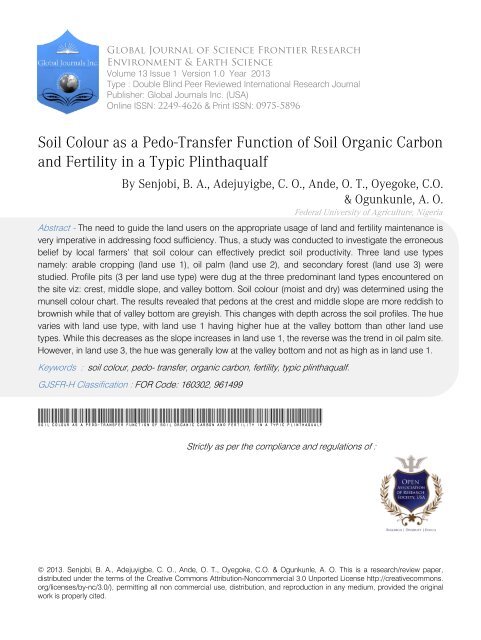
Soil Colour as a Pedo-Transfer Function of Soil Organic Carbon and ...
Soil Colour as a Pedo-Transfer Function of Soil Organic Carbon and ...
Soil Colour as a Pedo-Transfer Function of Soil Organic Carbon and ...

You also want an ePaper? Increase the reach of your titles
YUMPU automatically turns print PDFs into web optimized ePapers that Google loves.
Global Journal <strong>of</strong> Science Frontier Research<br />
Environment & Earth Science<br />
Volume 13 Issue 1 Version 1.0 Year 2013<br />
Type : Double Blind Peer Reviewed International Research Journal<br />
Publisher: Global Journals Inc. (USA)<br />
Online ISSN: 2249-4626 & Print ISSN: 0975-5896<br />
<strong>Soil</strong> <strong>Colour</strong> <strong>as</strong> a <strong>Pedo</strong>-<strong>Transfer</strong> <strong>Function</strong> <strong>of</strong> <strong>Soil</strong> <strong>Organic</strong> <strong>Carbon</strong><br />
<strong>and</strong> Fertility in a Typic Plinthaqualf<br />
By Senjobi, B. A., Adejuyigbe, C. O., Ande, O. T., Oyegoke, C.O.<br />
& Ogunkunle, A. O.<br />
Federal University <strong>of</strong> Agriculture, Nigeria<br />
Abstract - The need to guide the l<strong>and</strong> users on the appropriate usage <strong>of</strong> l<strong>and</strong> <strong>and</strong> fertility maintenance is<br />
very imperative in addressing food sufficiency. Thus, a study w<strong>as</strong> conducted to investigate the erroneous<br />
belief by local farmers’ that soil colour can effectively predict soil productivity. Three l<strong>and</strong> use types<br />
namely: arable cropping (l<strong>and</strong> use 1), oil palm (l<strong>and</strong> use 2), <strong>and</strong> secondary forest (l<strong>and</strong> use 3) were<br />
studied. Pr<strong>of</strong>ile pits (3 per l<strong>and</strong> use type) were dug at the three predominant l<strong>and</strong> types encountered on<br />
the site viz: crest, middle slope, <strong>and</strong> valley bottom. <strong>Soil</strong> colour (moist <strong>and</strong> dry) w<strong>as</strong> determined using the<br />
munsell colour chart. The results revealed that pedons at the crest <strong>and</strong> middle slope are more reddish to<br />
brownish while that <strong>of</strong> valley bottom are greyish. This changes with depth across the soil pr<strong>of</strong>iles. The hue<br />
varies with l<strong>and</strong> use type, with l<strong>and</strong> use 1 having higher hue at the valley bottom than other l<strong>and</strong> use<br />
types. While this decre<strong>as</strong>es <strong>as</strong> the slope incre<strong>as</strong>es in l<strong>and</strong> use 1, the reverse w<strong>as</strong> the trend in oil palm site.<br />
However, in l<strong>and</strong> use 3, the hue w<strong>as</strong> generally low at the valley bottom <strong>and</strong> not <strong>as</strong> high <strong>as</strong> in l<strong>and</strong> use 1.<br />
Keywords : soil colour, pedo- transfer, organic carbon, fertility, typic plinthaqualf.<br />
GJSFR-H Cl<strong>as</strong>sification : FOR Code: 160302, 961499<br />
<strong>Soil</strong> <strong>Colour</strong> <strong>as</strong> a <strong>Pedo</strong>-<strong>Transfer</strong> <strong>Function</strong> <strong>of</strong> <strong>Soil</strong> <strong>Organic</strong> <strong>Carbon</strong> <strong>and</strong> Fertility in a Typic Plinthaqualf<br />
Strictly <strong>as</strong> per the compliance <strong>and</strong> regulations <strong>of</strong> :<br />
© 2013. Senjobi, B. A., Adejuyigbe, C. O., Ande, O. T., Oyegoke, C.O. & Ogunkunle, A. O. This is a research/review paper,<br />
distributed under the terms <strong>of</strong> the Creative Commons Attribution-Noncommercial 3.0 Unported License http://creativecommons.<br />
org/licenses/by-nc/3.0/), permitting all non commercial use, distribution, <strong>and</strong> reproduction in any medium, provided the original<br />
work is properly cited.
<strong>Soil</strong> <strong>Colour</strong> <strong>as</strong> a <strong>Pedo</strong>-<strong>Transfer</strong> <strong>Function</strong> <strong>of</strong> <strong>Soil</strong><br />
<strong>Organic</strong> <strong>Carbon</strong> <strong>and</strong> Fertility in a Typic<br />
Plinthaqualf<br />
Senjobi, B. A. α , Adejuyigbe, C. O. σ , Ande, O. T. ρ , Oyegoke, C.O Ѡ & Ogunkunle, A. O. ¥<br />
Abstract - The need to guide the l<strong>and</strong> users on the appropriate<br />
usage <strong>of</strong> l<strong>and</strong> <strong>and</strong> fertility maintenance is very imperative in<br />
addressing food sufficiency. Thus, a study w<strong>as</strong> conducted to<br />
investigate the erroneous belief by local farmers’ that soil<br />
colour can effectively predict soil productivity.<br />
Three l<strong>and</strong> use types namely: arable cropping (l<strong>and</strong><br />
use 1), oil palm (l<strong>and</strong> use 2), <strong>and</strong> secondary forest (l<strong>and</strong> use 3)<br />
were studied. Pr<strong>of</strong>ile pits (3 per l<strong>and</strong> use type) were dug at the<br />
three predominant l<strong>and</strong> types encountered on the site viz:<br />
crest, middle slope, <strong>and</strong> valley bottom. <strong>Soil</strong> colour (moist <strong>and</strong><br />
dry) w<strong>as</strong> determined using the munsell colour chart.<br />
The results revealed that pedons at the crest <strong>and</strong><br />
middle slope are more reddish to brownish while that <strong>of</strong> valley<br />
bottom are greyish. This changes with depth across the soil<br />
pr<strong>of</strong>iles.<br />
The hue varies with l<strong>and</strong> use type, with l<strong>and</strong> use 1<br />
having higher hue at the valley bottom than other l<strong>and</strong> use<br />
types. While this decre<strong>as</strong>es <strong>as</strong> the slope incre<strong>as</strong>es in l<strong>and</strong> use<br />
1, the reverse w<strong>as</strong> the trend in oil palm site. However, in l<strong>and</strong><br />
use 3, the hue w<strong>as</strong> generally low at the valley bottom <strong>and</strong> not<br />
<strong>as</strong> high <strong>as</strong> in l<strong>and</strong> use 1.<br />
In l<strong>and</strong> use 1, the exchangeable b<strong>as</strong>es incre<strong>as</strong>e <strong>as</strong><br />
the hue 10YR – 25YR decre<strong>as</strong>es in the surface soils except for<br />
valley bottom soils, where the reverse is the trend.<br />
<strong>Organic</strong> carbon <strong>and</strong> exchangeable acidity incre<strong>as</strong>es<br />
with decre<strong>as</strong>e in hue irrespective <strong>of</strong> the l<strong>and</strong> type in l<strong>and</strong> use<br />
1. However, phosphorous value decre<strong>as</strong>es <strong>as</strong> the hue<br />
decre<strong>as</strong>es in all the l<strong>and</strong> types, while Zn is constant.<br />
At l<strong>and</strong> use 2, the exchangeable b<strong>as</strong>es except for<br />
calcium follow the reverse trend <strong>as</strong> in l<strong>and</strong> use 1. While<br />
organic carbon incre<strong>as</strong>es in l<strong>and</strong> use 1, the reverse is the<br />
trend in the l<strong>and</strong> use 2, with nitrogen following the same<br />
sequence <strong>as</strong> organic carbon.<br />
Exchangeable acidity, phosphorous <strong>and</strong> Zinc only<br />
decre<strong>as</strong>es with decre<strong>as</strong>ing soil hue in valley bottom soils, <strong>and</strong><br />
incre<strong>as</strong>es in the other l<strong>and</strong> types.<br />
At l<strong>and</strong> use 3, only sodium <strong>and</strong> pot<strong>as</strong>sium incre<strong>as</strong>e<br />
with decre<strong>as</strong>ing hue (7.5YR – 25YR) at the crest <strong>and</strong> middle<br />
slope sections, while at valley bottom soils the reverse is the<br />
trend.<br />
While magnesium incre<strong>as</strong>es with decre<strong>as</strong>ing soil hue<br />
across the l<strong>and</strong> types, organic carbon, calcium, zinc <strong>and</strong><br />
copper decre<strong>as</strong>es with decre<strong>as</strong>ing soil hue. Nitrogen,<br />
phosphorous <strong>and</strong> pH KCl <strong>as</strong> well <strong>as</strong> exchangeable acidity<br />
follow the same sequence with sodium <strong>and</strong> pot<strong>as</strong>sium in l<strong>and</strong><br />
use 3.<br />
Author α σ : Federal University <strong>of</strong> Agriculture, Abeokuta, Ogun State,<br />
Nigeria. E-mail : bol<strong>as</strong>enjobi @ gmail.com<br />
Author ρ ¥ : Institute <strong>of</strong> Agriculture <strong>and</strong> Research Training, Moor<br />
Plantation, Ibadan, Nigeria.<br />
Author Ѡ : University <strong>of</strong> Ibadan, Ibadan, Nigeria.<br />
It w<strong>as</strong> obvious from the study that soil colour is not a<br />
sufficient parameter in <strong>as</strong>certaining soil fertility status.<br />
Therefore, l<strong>and</strong> use analysis remains the vital tool in <strong>as</strong>sessing<br />
fertility status <strong>of</strong> the soil before optimal <strong>and</strong> sustainable<br />
production can be attained.<br />
Keywords : soil colour, pedo - transfer, organic carbon,<br />
fertility, typic plinthaqualf.<br />
I. Introduction<br />
The general erroneous concept <strong>of</strong> soil fertility status<br />
by pe<strong>as</strong>ant farmers through the colour <strong>of</strong> the soil<br />
calls for urgent investigation especially at this era<br />
<strong>of</strong> soil pollution. This is because sewage sludge <strong>and</strong> to<br />
some extent heavy metals such <strong>as</strong> lead (Pb) also<br />
constitute to the colour <strong>of</strong> the soil. Anthropogenic<br />
activities <strong>as</strong> well <strong>as</strong> fluctuating water level also play<br />
major role in the colour <strong>of</strong> the soil (Majlis, 1967).<br />
Farmers generally believe that dark colour is<br />
synonymous to fertile loamy soil. They tend to attribute<br />
fertility with colour without <strong>as</strong>certaining the physical <strong>and</strong><br />
chemical properties <strong>of</strong> the soil. <strong>Colour</strong> reflects an<br />
integration <strong>of</strong> chemical, biological <strong>and</strong> physical<br />
transformations <strong>and</strong> translocations that have occurred<br />
within a soil (Scheonberger et al., 2002).<br />
The colour <strong>of</strong> the soil is usually determined by<br />
the nature <strong>of</strong> the fine material. Generally, the colour <strong>of</strong><br />
the soil is determined by the quantity <strong>and</strong> state <strong>of</strong> the<br />
iron <strong>and</strong>/or the organic matter. Hematite (Fe 2 O 3 ) for<br />
example is responsible for the red colour in many soils<br />
developed under strongly aerobic conditions in tropical<br />
<strong>and</strong> sub-tropical are<strong>as</strong> (Majlis, 1967). However, the<br />
mineral responsible for most <strong>of</strong> the inorganic colouration<br />
in aerobic soils is goethite (Fe O-OH), with colours<br />
ranging from reddish – brown to yellow <strong>as</strong> it’s hydration<br />
incre<strong>as</strong>es.<br />
Many grey, olive <strong>and</strong> blue colours occur in the<br />
soils <strong>of</strong> partially or completely anaerobic situations <strong>and</strong><br />
originate from the presence <strong>of</strong> iron in the reduced or<br />
ferrous state. Sometimes, substances with blue colour<br />
such <strong>as</strong> vivianite may form under these conditions <strong>and</strong><br />
therefore contribute to the colouration (Ojo-Atere et al.,<br />
2009).<br />
The colour <strong>of</strong> the upper horizons usually<br />
changes from brown to dark brown to black, <strong>as</strong> the<br />
organic matter content incre<strong>as</strong>es, <strong>and</strong> there is a<br />
tendency for the organic matter to become darker in<br />
2013<br />
XII Issue I V ersion I Year<br />
31<br />
Global Journal <strong>of</strong> Science Frontier Research ( H ) Volume XIII<br />
© 2013 Global Journals Inc. (US)
2013<br />
Global Journal <strong>of</strong> Science Frontier Research ( H ) Volume XIII<br />
Issue I V ersion I Year<br />
32<br />
colour with incre<strong>as</strong>ed humification (Ojo-Atere et al.,<br />
2009; Noma et al., 2010).<br />
Horizons low in calcium <strong>and</strong> organic matter are<br />
<strong>of</strong>ten pale in colour, where<strong>as</strong> in the presence <strong>of</strong> large<br />
quantities <strong>of</strong> calcium or sodium, dark colours will form<br />
even with small quantities <strong>of</strong> organic matter. Dark<br />
colours are produced also through the presence <strong>of</strong><br />
manganese dioxide, or by the presence <strong>of</strong> elemental<br />
carbon following burning, Pale grey <strong>and</strong> white colours<br />
originate through the lack <strong>of</strong> alteration <strong>of</strong> grey or white<br />
parent materials, deposition <strong>of</strong> calcium carbonate, <strong>and</strong><br />
efflorescences <strong>of</strong> salts (Ojo-Atere et al., 2009).<br />
However, in view <strong>of</strong> other influences affecting<br />
the colour <strong>of</strong> the soil besides organic matter there is<br />
therefore the need to investigate the soil colour <strong>as</strong> pedotransfer<br />
functions <strong>of</strong> soil chemical constituents including<br />
organic carbon with the aim <strong>of</strong> guiding the l<strong>and</strong> users in<br />
the appropriate usage <strong>of</strong> l<strong>and</strong> <strong>and</strong> its fertility<br />
maintenance.<br />
II.<br />
Materials <strong>and</strong> Methods<br />
a) Description <strong>of</strong> the Study Area<br />
The research w<strong>as</strong> conducted at Olabisi<br />
Onabanjo University Main Campus, Ago-Iwoye. The<br />
area lies on latitudes 6 o 55′ <strong>and</strong> 7 o 00′N <strong>and</strong> longitudes<br />
3 o 45′ <strong>and</strong> 4 o 05′E. The area h<strong>as</strong> a bimodal rainfall, with<br />
peaks between June – July <strong>and</strong> September – October.<br />
It h<strong>as</strong> an annual rainfall <strong>of</strong> about 1150mm <strong>and</strong> it is<br />
located in the rainforest belt. Mean relative humidity <strong>of</strong><br />
the area is generally high (about 80%) with the peak<br />
between May <strong>and</strong> October. The annual mean<br />
temperature is 27 o C. Sunshine hour also follows the<br />
same trend <strong>as</strong> that <strong>of</strong> the temperature with the highest<br />
number <strong>of</strong> hours during dry se<strong>as</strong>on <strong>and</strong> the lowest<br />
during the wet se<strong>as</strong>on.<br />
The natural vegetation <strong>of</strong> the area consists<br />
mainly <strong>of</strong> secondary forest except where human<br />
interference through annual uncontrolled bush burning<br />
<strong>and</strong> small scale farming methods have reduced the<br />
original forest to secondary ones, bush re-growth <strong>and</strong><br />
thickets. The original forest is now mostly confined to<br />
river channels <strong>and</strong> swamps.<br />
The site is generally undulating with a few gentle<br />
to steep slopes. Most <strong>of</strong> the soils in the survey area<br />
developed from undifferentiated igneous <strong>and</strong><br />
metamorphic, pre-Cambrian b<strong>as</strong>ement complex rocks<br />
such <strong>as</strong> granite, biotite gneiss, biotite schist, quartz<br />
schist <strong>and</strong> quartzite. The rocks are fairly deeply<br />
weathered <strong>and</strong> the occurrence <strong>of</strong> rock out-crops in the<br />
survey area is not widespread. A major part <strong>of</strong> the site<br />
is generally well drained through the existing river<br />
channels.<br />
The soil investigation <strong>of</strong> the site shows that<br />
most <strong>of</strong> the soils derived from coarse grained rocks are<br />
generally characterized by their varying amounts <strong>of</strong><br />
quartz <strong>and</strong>/or ironstone gravel with some occ<strong>as</strong>ional<br />
stones in the top one meter <strong>of</strong> the pr<strong>of</strong>ile. Varying<br />
quantities <strong>of</strong> gravel <strong>and</strong> stones may be found in the<br />
surface <strong>of</strong> these soils.<br />
b) Field Work<br />
Three l<strong>and</strong> use types namely: Arable cropping<br />
(l<strong>and</strong> use 1), Oil palm (l<strong>and</strong> use 2) <strong>and</strong> secondary forest<br />
(l<strong>and</strong> use 3) were studied.<br />
At each <strong>of</strong> the chosen l<strong>and</strong> use type, pr<strong>of</strong>ile pits<br />
were dug at the three predominant different l<strong>and</strong> type or<br />
slope segment encountered. These were crest, middle<br />
slope, <strong>and</strong> valley-bottom.<br />
The general site description such <strong>as</strong> climate,<br />
vegetation, l<strong>and</strong> use, gradient <strong>of</strong> slope, drainage type,<br />
soil surface form, type <strong>and</strong> degree <strong>of</strong> erosion, field<br />
texture, micro-relief <strong>and</strong> depths to ground water table<br />
were recorded. The pits were described, sampled <strong>and</strong><br />
the samples analysed following st<strong>and</strong>ard procedures. A<br />
total <strong>of</strong> 9 pr<strong>of</strong>ile pits were dug (3 at each l<strong>and</strong> use) <strong>and</strong><br />
30 pr<strong>of</strong>ile samples were collected for laboratory<br />
analysis.<br />
c) Laboratory Analysis<br />
The soil samples were air-dried <strong>and</strong> sieved with<br />
a 2mm - mesh sieve. Some portion <strong>of</strong> the sieved<br />
samples w<strong>as</strong> further p<strong>as</strong>sed through 0.5mm - mesh<br />
sieve for organic matter <strong>and</strong> total N determination.<br />
<strong>Soil</strong> samples were analysed for the following<br />
parameters: <strong>Soil</strong> pH w<strong>as</strong> determined in both water <strong>and</strong><br />
0.01M pot<strong>as</strong>sium chloride solution (1:1) using gl<strong>as</strong>s<br />
electrode pH meter (Mclean, 1965). Total nitrogen w<strong>as</strong><br />
determined by the macro-kjeldahl digestion method <strong>of</strong><br />
Jackson (1962), available P w<strong>as</strong> extracted using Bray-1<br />
extract followed by molybdenum blue colorimetry.<br />
Exchangeable cations were extracted with 1M NH 4 OAC<br />
(pH 7.0), pot<strong>as</strong>sium, calcium <strong>and</strong> sodium were<br />
determined using flame photometer <strong>and</strong> exchangeable<br />
Mg by atomic absorption spectrophotometer (Sparks,<br />
1996). Exchangeable acidity w<strong>as</strong> determined by the KCl<br />
extraction method (Mclean, 1965), organic carbon w<strong>as</strong><br />
determined using dichromate wet oxidation method<br />
(Walkley <strong>and</strong> Black, 1934). <strong>Organic</strong> matter w<strong>as</strong> got by<br />
multiplying the percent organic carbon by 1.72. Cation<br />
exchange capacity (CEC) w<strong>as</strong> calculated from the sum<br />
<strong>of</strong> all exchangeable cations. Available micronutrients<br />
were determined by Atomic Absorption Spectrophotometer<br />
(AAS) method after leaching on NH 4 Cl<br />
(Water <strong>and</strong> Sammer, 1948). Saturated hydraulic<br />
conductivity w<strong>as</strong> determined using a constant head<br />
method, bulk density by core method, soil porosity w<strong>as</strong><br />
estimated from the bulk density data at an <strong>as</strong>sumed<br />
particle density <strong>of</strong> 2650kgm-3. Water retention at 15 bar<br />
w<strong>as</strong> determined in order to calculate available water<br />
holding capacities <strong>of</strong> the soil pr<strong>of</strong>ile horizons (Mbagwu,<br />
1985). Particle size analysis w<strong>as</strong> by the Bouyoucos<br />
hydrometer (1951) method using calgon <strong>as</strong> dispersing<br />
agent.<br />
© 2013 Global Journals Inc. (US)
d) <strong>Soil</strong> <strong>Colour</strong> Determination<br />
The soil colour (moist <strong>and</strong> dry) were determined<br />
by the use <strong>of</strong> the Munsell colour chart in which a soil is<br />
held next to the chips to find a visual match <strong>and</strong><br />
<strong>as</strong>signed the corresponding Munsell notation.<br />
III.<br />
a) Morphological Properties<br />
Results <strong>and</strong> Discussion<br />
i. <strong>Soil</strong> <strong>Colour</strong><br />
The soils <strong>of</strong> the l<strong>and</strong> use types were<br />
characterized by brown (5YR 5/4 – 10YR 6/4),<br />
s<strong>and</strong>yloam / loamys<strong>and</strong>, topsoil over reddish brown<br />
(2.5YR 4/8 – 7.5YR 6/8) s<strong>and</strong>y clayloam to s<strong>and</strong>y clay<br />
subsoil. The hue w<strong>as</strong> generally 10YR for lowl<strong>and</strong> arable<br />
soils, <strong>and</strong> 5YR to 7.5YR for the middle slope, while it<br />
ranges from 2.5YR to 7.5YR for the upl<strong>and</strong> section. The<br />
reverse w<strong>as</strong> the trend for l<strong>and</strong> use 2, with lowl<strong>and</strong><br />
portion having a hue <strong>of</strong> 5YR, while the middle portion<br />
ranges from 7.5YR to 10YR.<br />
However, in the secondary forest l<strong>and</strong> use type,<br />
both the middle <strong>and</strong> summit sections were<br />
characterized with 7.5YR hue, while the toes slope /<br />
valley bottom section ranges between 2.5YR to 7.5YR<br />
hue (Table 1).<br />
In addition, some sections <strong>of</strong> the valley bottom<br />
<strong>of</strong> both the arable <strong>and</strong> oil palm l<strong>and</strong> use types exhibited<br />
some level <strong>of</strong> mottling <strong>as</strong> evidence <strong>of</strong> water saturation at<br />
some period <strong>of</strong> the year.<br />
The colour difference showed that pedons on<br />
the crest <strong>and</strong> middle slopes were more reddish to<br />
brownish but greyish at the valley bottom. This variation<br />
in soil colour w<strong>as</strong> due to the obvious sequences <strong>of</strong><br />
drainage. This is in agreement with Noma et al., (2010).<br />
Besides, the influence <strong>of</strong> drainage on soil colour<br />
variation, it h<strong>as</strong> been reported by Majlis (1967) that soil<br />
colour h<strong>as</strong> been expressed too <strong>as</strong> a function <strong>of</strong> iron <strong>and</strong><br />
organic matter contents, pH <strong>and</strong> type <strong>of</strong> clay mineral in<br />
the soil.<br />
The fluctuating water table in the lower slope<br />
<strong>and</strong> valley bottom soils also resulted in the occurrence<br />
<strong>of</strong> hydromorphic mottles in these are<strong>as</strong>. The colours <strong>of</strong><br />
the studied soils vary with depth. This is in conformity<br />
with Brady <strong>and</strong> Well (1999), who reported that soil colour<br />
typically changes with depth through the various<br />
horizons in a soil pr<strong>of</strong>ile.<br />
ii. Physical Properties <strong>of</strong> the <strong>Soil</strong>s<br />
The main physical properties <strong>of</strong> the soils are<br />
presented in tables 2 – 4. The l<strong>and</strong> use 2 were generally<br />
more s<strong>and</strong>y than other l<strong>and</strong> use types (i.e. l<strong>and</strong> use 2 ><br />
l<strong>and</strong> use 3 > l<strong>and</strong> use 1). This decre<strong>as</strong>es with depth,<br />
except in some c<strong>as</strong>es, particularly at the sub-soil<br />
horizon (>50 in depth), where high percentage <strong>of</strong> s<strong>and</strong>s<br />
were concentrated.<br />
The high percentage <strong>of</strong> soil texture (41.8 –<br />
91.2%) in all the l<strong>and</strong> use types which is s<strong>and</strong>y is a good<br />
indication <strong>of</strong> the observable high infiltration rate <strong>and</strong> low<br />
water holding capacity <strong>of</strong> the soils, thereby resulting into<br />
moisture stress <strong>as</strong> reported by Senjobi, 2007. In<br />
addition, this scenario enhance rapid leaching <strong>of</strong> soil<br />
nutrients beyond roots exploration <strong>of</strong> the planted crops<br />
thereby threatens incre<strong>as</strong>e in food productivity <strong>and</strong><br />
security.<br />
The clay content incre<strong>as</strong>es down the pr<strong>of</strong>ile. It<br />
ranges from 4.8 – 38% in both the surface <strong>and</strong> subsurface<br />
soils. The differences in clay contents account<br />
for varied drainage pattern in the study site. Thus, while<br />
the valley bottom soils are poorly drained, the middle<br />
slope <strong>and</strong> crest are well drained across the l<strong>and</strong> use<br />
types. The higher clay content at the valley bottom soils<br />
reduces infiltration rate <strong>of</strong> water <strong>as</strong> confirmed by Ahn,<br />
1970 <strong>and</strong> Senjobi, 2007.<br />
The water holding capacity <strong>of</strong> the soils<br />
incre<strong>as</strong>es with incre<strong>as</strong>e in clay content <strong>of</strong> the soils. The<br />
silt content in the soil is generally low <strong>and</strong> there is no<br />
definite sequence in its distribution within the pr<strong>of</strong>ile.<br />
The silt: clay ratios are generally low.<br />
The gravel content w<strong>as</strong> very high ranging from<br />
6.0 to 89.9% in nearby all the pedons. The pedons are<br />
composed <strong>of</strong> concretions, ferruginous nodules, quartz<br />
gravel <strong>and</strong> stones which concentrate <strong>as</strong> stone lines or<br />
stone layers (Sharpe, 1938; <strong>and</strong> Nye, 1954).<br />
The erosion exposes a sheet <strong>of</strong> gravel mantle,<br />
which is subsequently buried by the sedimentation <strong>of</strong><br />
fine textured materials. Stonelines interfere considerably<br />
with manual soil tillage <strong>and</strong> thereby limits the aggregate<br />
size <strong>of</strong> farml<strong>and</strong> that a farmer can put under cultivation.<br />
According to Babalola <strong>and</strong> Lal (1976) <strong>and</strong> Stoop (1987),<br />
this type <strong>of</strong> physical feature is, permanent <strong>and</strong> difficult<br />
to change.<br />
The porosity <strong>of</strong> the l<strong>and</strong> use soils is directly<br />
proportional to percent s<strong>and</strong> <strong>and</strong> gravel concentration,<br />
where<strong>as</strong> the permeability is inversely proportional to the<br />
clay content. The bulk density <strong>and</strong> hydraulic<br />
conductivity are generally low with no definite sequence<br />
in their distribution within the pr<strong>of</strong>ile.<br />
iii. Chemical Properties <strong>of</strong> the <strong>Soil</strong>s<br />
The data on the chemical properties <strong>of</strong> the soils<br />
are given in Table 5 – 7. The pH values <strong>of</strong> the l<strong>and</strong> use<br />
soils ranged between pH (H 2 O (6.35 <strong>and</strong> 7.5) <strong>and</strong> KCl<br />
(5.10 <strong>and</strong> 6.46) in the surface layer. These values had<br />
no definite sequence in their distribution down the<br />
pr<strong>of</strong>iles.<br />
The organic carbon fluctuates irregularly with<br />
depth for most <strong>of</strong> the pedons <strong>and</strong> this is an indication <strong>of</strong><br />
continuous deposition <strong>of</strong> organic material. The value <strong>of</strong><br />
organic carbon ranged from 0.27% to 1.66% in the<br />
surface layers, with the highest concentration on the<br />
surface soils in most pedons. The low organic carbon<br />
values in some pedons may be partly due to the high<br />
temperature <strong>and</strong> high relative humidity, which favour<br />
rapid mineralization. <strong>Organic</strong> matter h<strong>as</strong> been reported<br />
2013<br />
XII Issue I V ersion I Year<br />
33<br />
Global Journal <strong>of</strong> Science Frontier Research ( H ) Volume XIII<br />
© 2013 Global Journals Inc. (US)
2013<br />
Global Journal <strong>of</strong> Science Frontier Research ( H ) Volume XIII<br />
Issue I V ersion I Year<br />
34<br />
to have positive influence on the CEC, b<strong>as</strong>e saturation,<br />
structure, pH, buffering capacity, soil colour <strong>and</strong> water<br />
holding capacity (Majlis, 1967 <strong>and</strong> Ahn, 1970). The<br />
organic matter content <strong>of</strong> the surface horizons in all the<br />
l<strong>and</strong> use types is appreciable. This may be due to the<br />
fact that most <strong>of</strong> the organic residues in both cultivated<br />
<strong>and</strong> virgin soils are incorporated or deposited on the<br />
surface. The organic matter content <strong>of</strong> soils under<br />
secondary forest <strong>and</strong> oil palm cultivation are higher than<br />
those <strong>of</strong> arable cultivation. This may be because the<br />
soils under those l<strong>and</strong> use systems are always covered<br />
<strong>and</strong> they have not been subjected to intense cultivation<br />
<strong>as</strong> in arable l<strong>and</strong> use type.<br />
The incorporation <strong>of</strong> organic residues into the<br />
soils through tillage practices at the arable l<strong>and</strong> use type<br />
h<strong>as</strong> contributed to the relatively higher level <strong>of</strong> organic<br />
matter in this site.<br />
The total nitrogen content in all the soils <strong>of</strong> l<strong>and</strong><br />
use types is generally low (0.01 – 0.19%) compared with<br />
the critical value <strong>of</strong> 0.15% (Agboola <strong>and</strong> Corey, 1973).<br />
The intense cultivation <strong>of</strong> the soils normally incre<strong>as</strong>es<br />
the rate <strong>of</strong> mineralization <strong>of</strong> the organic matter, thus<br />
negatively affect the level <strong>of</strong> total N content in the soil.<br />
The available P is generally moderate in most <strong>of</strong> the<br />
pedons <strong>and</strong> high in the remaining pedons compared<br />
with the critical level <strong>of</strong> 10 – 16 ppm (Adeoye <strong>and</strong><br />
Agboola, 1985).<br />
The exchangeable cations Ca, Mg, K <strong>and</strong> Na<br />
are generally low in all the pedons. This may be<br />
attributed to intense cultivation, leaching <strong>of</strong> nutrients <strong>and</strong><br />
weathering. Hence, the inherent low fertility status <strong>of</strong> the<br />
soils.<br />
iv.<br />
The relationship between soil colour <strong>and</strong> some<br />
selected soil chemical properties<br />
In l<strong>and</strong> use 1, the exchangeable b<strong>as</strong>es<br />
incre<strong>as</strong>es across the crest <strong>and</strong> middle slope l<strong>and</strong> types<br />
<strong>as</strong> the hue 10YR – 25YR decre<strong>as</strong>es in the surface soils<br />
except for Mg. However, at the valley bottom soils, the<br />
reverse is the trend.<br />
<strong>Organic</strong> carbon on the other h<strong>and</strong> incre<strong>as</strong>es<br />
with decre<strong>as</strong>e in the hue <strong>of</strong> the soils irrespective <strong>of</strong> the<br />
l<strong>and</strong> type in l<strong>and</strong> use 1. The same trend w<strong>as</strong> observed<br />
for exchangeable acidity. However, phosphorous value<br />
decre<strong>as</strong>es <strong>as</strong> the hue decre<strong>as</strong>es in all the l<strong>and</strong> types,<br />
while Zn is constant.<br />
At l<strong>and</strong> use 2, the exchangeable b<strong>as</strong>es except<br />
for calcium follow The, reverse trend <strong>as</strong> compared to<br />
the trend in l<strong>and</strong> use 1. While organic carbon incre<strong>as</strong>es<br />
in l<strong>and</strong> use 1, the reverse is the trend in the l<strong>and</strong> use 2,<br />
with nitrogen following the same sequence <strong>as</strong> organic<br />
carbon.<br />
Exchangeable acidity, phosphorous <strong>and</strong> Zinc<br />
only decre<strong>as</strong>es with decre<strong>as</strong>ing soil hue in valley bottom<br />
soils, <strong>and</strong> incre<strong>as</strong>es in the other l<strong>and</strong> types.<br />
At l<strong>and</strong> use 3, only sodium <strong>and</strong> pot<strong>as</strong>sium<br />
incre<strong>as</strong>e with decre<strong>as</strong>ing hue (7.5YR – 25YR) at the<br />
crest <strong>and</strong> middle slope sections, while at valley bottom<br />
soils the reverse is the trend.<br />
While magnesium incre<strong>as</strong>es with decre<strong>as</strong>ing<br />
soil hue across the l<strong>and</strong> types, organic carbon, calcium,<br />
zinc <strong>and</strong> copper decre<strong>as</strong>es with decre<strong>as</strong>ing soil hue.<br />
Nitrogen, phosphorous <strong>and</strong> pH KCl <strong>as</strong> well <strong>as</strong><br />
exchangeable acidity follow the same sequence with<br />
sodium <strong>and</strong> pot<strong>as</strong>sium in l<strong>and</strong> use 3.<br />
IV.<br />
Conclusion<br />
It w<strong>as</strong> evident from the study that the colour <strong>of</strong><br />
soils is not a sufficient parameter in determining the<br />
organic carbon accumulation <strong>and</strong> fertility status <strong>of</strong> the<br />
soil. Furthermore, the complex relationship between soil<br />
colour <strong>and</strong> some selected chemical properties <strong>of</strong> the<br />
soil revealed that l<strong>and</strong> use analysis or soil testing<br />
programme remains the vital tool in <strong>as</strong>sessing fertility<br />
status <strong>of</strong> the soil for optimal <strong>and</strong> sustainable production.<br />
This in turn will guide in the area <strong>of</strong> fertilizer<br />
recommendation <strong>and</strong> soil nutrient management.<br />
The occurrence <strong>of</strong> heavy metals in the soil<br />
beyond their critical levels is in no doubt contributing to<br />
the colour <strong>of</strong> the soil. This may misguide the absolute<br />
reliance on soil colour <strong>as</strong> pedo-transfer functions for soil<br />
fertility status especially in this age <strong>of</strong> global pollution <strong>as</strong><br />
the c<strong>as</strong>e were in the p<strong>as</strong>t when there w<strong>as</strong> little or no<br />
pollution history.<br />
Further studies are needed using a wide range<br />
<strong>of</strong> soil colour before <strong>as</strong>certaining possible relationship<br />
between soils <strong>of</strong> this area <strong>and</strong> those elsewhere <strong>and</strong> in<br />
addition, the chemical parameters.<br />
Furthermore, organic agriculture <strong>and</strong> precision<br />
farming will however go a long way to improve <strong>and</strong><br />
sustain the fertility status <strong>of</strong> the soil for optimal <strong>and</strong><br />
sustainable production. Thus, a good organic matter<br />
management involving residues incorporation through<br />
the addition <strong>of</strong> large quantities <strong>of</strong> farm yard manure <strong>and</strong><br />
the practice <strong>of</strong> green manuring that could impact dark<br />
colour to soil should be encouraged.<br />
References Références Referenci<strong>as</strong><br />
1. Adeoye, G. O. <strong>and</strong> A. A. Agboola (1985). Critical<br />
levels for soil pH, available P, K, Zn <strong>and</strong> Mn maize<br />
content <strong>of</strong> P, Cu <strong>and</strong> Mn in sedimentary soils<br />
<strong>of</strong> south – western Nigeria. Fertilizer Research<br />
6:65 – 71.<br />
2. Agboola, A. A. <strong>and</strong> Corey (1973). The relationship<br />
between soil pH, O. M., Av. P, Exch. K <strong>and</strong> nine<br />
elements in the maize tissue. <strong>Soil</strong> Science. 115:<br />
367 – 375.<br />
3. Ahn, P. N. (1970). West African <strong>Soil</strong>s. London<br />
Oxford University Press, 232pp.<br />
4. Babalola, O. <strong>and</strong> R. Lal (1977a). Subsoil gravel<br />
horizon <strong>and</strong> maize root growth I. Gravel<br />
concentration <strong>and</strong> bulk density effects. Plant <strong>and</strong><br />
<strong>Soil</strong>. 46: 337 – 346.<br />
© 2013 Global Journals Inc. (US)
5. Babalola, O. <strong>and</strong> R. Lal (1977b). Subsoil gravel<br />
horizon <strong>and</strong> maize root growth II. Effect <strong>of</strong> gravel<br />
size, inter gravel texture <strong>and</strong> natural gravel horizon.<br />
Plant <strong>and</strong> <strong>Soil</strong>. 46: 347 – 357.<br />
6. Bouyoucos, G. H. (1951). A recalibration <strong>of</strong> the<br />
hydrometer for making mechanical analysis <strong>of</strong><br />
soils. Agronomy Journal 43: 434 – 438.<br />
7. Brady, N.C <strong>and</strong> Well, R.R. (1999). The nature <strong>and</strong><br />
properties <strong>of</strong> soils. 12 th Ed. Macmillan, prentice Hall<br />
Inc. New York, 81pp.<br />
8. Jackson, M.L. (1962). <strong>Soil</strong> Chemical Analysis.<br />
Prentice Hall, New York.<br />
9. Majlis, M. A. K. (1967). Some factors affecting the<br />
production <strong>and</strong> me<strong>as</strong>urement <strong>of</strong> colors in<br />
montmorillonite <strong>and</strong> kaolinite clays <strong>and</strong> natural<br />
soils. Ph. D. dissertation, Tex<strong>as</strong> A <strong>and</strong> M. Univ.,<br />
College Station, Tex<strong>as</strong>.<br />
10. Mbagwu, J. S. C. (1985). Estimating dry se<strong>as</strong>on<br />
water requirements from climatological <strong>and</strong> soil<br />
available capacity data in the sedimentary <strong>and</strong><br />
b<strong>as</strong>ement complex are<strong>as</strong> <strong>of</strong> south Nigeria. Catena<br />
Vol. 12:201-209.<br />
11. Mclean, E. O. (1965). Aluminum: In methods <strong>of</strong> soil<br />
analysis (ed. C. A. Black) Agronomy No. 9 Part 2,<br />
Amer. Soc. Agronomy, Madison, Wisconsin, 978 –<br />
998.<br />
12. Noma, S.S; Obianyor, P.T; Yakubu, M; Audu, M;<br />
Abdullahi, A.A; Dikko, A.U; <strong>and</strong> Danmowa, N.M.<br />
(2010). <strong>Soil</strong> colour <strong>as</strong> a pedo-transfer function <strong>of</strong><br />
some soils in Sokoto, semi-arid Nigeria.<br />
Proceedings <strong>of</strong> the 34 th Annual Conference <strong>of</strong> the<br />
<strong>Soil</strong> Science Society <strong>of</strong> Nigeria pp 86-93.<br />
13. Nye, P. H. (1954). Some soil forming processes<br />
in the humid tropics I. A. field study <strong>of</strong> a catena<br />
in West African Forest. Journal <strong>of</strong> <strong>Soil</strong> Science.<br />
14.<br />
15.<br />
16.<br />
17.<br />
18.<br />
5: 7 – 21.<br />
Ojo-Atere, J.O; Ogunwale, J.A; <strong>and</strong> Oluwatosin,<br />
G.A. (2009). Fundamentals <strong>of</strong> Tropical <strong>Soil</strong><br />
Science. Evans Brothers (Nigeria Publishers)<br />
Limited, Ibadan, Nigeria.<br />
Scheonberger, P.J; Wysocki, D.A; Bencham, E.C;<br />
<strong>and</strong> Broaderson, W.D. (2002). Field book for<br />
describing <strong>and</strong> sampling soils. Version 2.0.<br />
Natl.<strong>Soil</strong> Surv. Cent, Lincoln, NE.<br />
Senjobi, B. A. (2007). Comparative Assessment <strong>of</strong><br />
the Effect <strong>of</strong> L<strong>and</strong> Use <strong>and</strong> L<strong>and</strong> Type on <strong>Soil</strong><br />
Degradation <strong>and</strong> Productivity in Ogun State,<br />
Nigeria. Published Ph.D. Thesis submitted to the<br />
Department <strong>of</strong> Agronomy, University <strong>of</strong> Ibadan,<br />
Ibadan. pp. 161.<br />
Sharpe, C. F. S. (1938). L<strong>and</strong>slides <strong>and</strong> related<br />
phenomena. Columbia Univ. Press New York.<br />
Sparks, D. L. (1996). Methods <strong>of</strong> <strong>Soil</strong> Analysis. Part<br />
3. Chemical Methods. SSSA <strong>and</strong> ASA. Madison,<br />
W1. p. 551-574.<br />
19. Stoop, W. A (1987). Adaptation <strong>of</strong> Sorghum/Maize<br />
<strong>and</strong> Sorghum Pearl millet inter crop system to the<br />
toposequence l<strong>and</strong> type in the north 5 – 2 or West<br />
African Savannah. Field Crops Resources. 16:<br />
255 – 272.<br />
20. Stoop, W. A. (1987). Variations in soil properties<br />
along 3 toposequences in Burkina F<strong>as</strong>o <strong>and</strong><br />
implications for the development <strong>of</strong> improved<br />
cropping systems. Agricultural Ecosystem. 19:<br />
241 – 264.<br />
21. Walkley, A. <strong>and</strong> Black, I.A. (1934): Determination<br />
<strong>of</strong> organic matter in soil. <strong>Soil</strong> Science 37, 549-556.<br />
2013<br />
Global Journal <strong>of</strong> Science Frontier Research ( H ) Volume XIII<br />
Issue I V ersion I Year<br />
35<br />
© 2013 Global Journals Inc. (US)
2013<br />
Global Journal <strong>of</strong> Science Frontier Research ( H ) Volume XIII<br />
Issue I V ersion I Year<br />
36<br />
: Morphological Properties <strong>of</strong> the <strong>Pedo</strong>ns <strong>and</strong> <strong>Soil</strong>s under the Different L<strong>and</strong> Uses<br />
Table 4.1<br />
Structure Consistency Quartz Concretions Roots Drainage Mottles<br />
<strong>Colour</strong> Boundary Textural<br />
Moist Dry<br />
Cl<strong>as</strong>s<br />
Slope (10%)<br />
Depth<br />
(cm)<br />
L<strong>and</strong> Use Horizon<br />
Designation<br />
Pr<strong>of</strong>ile No. Parent<br />
Material<br />
Fallow/C<strong>as</strong>sava Ap 0-46 10YR 6/4 10YR 5/6 cl SCL Sg – sbk ss, sp, vfr, Io - c vf, f pd -<br />
P1 (VB) B<strong>as</strong>ement<br />
Complex<br />
Bc 46-76 10YR 5/6 – gs SCL P ns, np, Io f vm vf, vf pd 5YR 5/4<br />
Bt 76-126 10YR 5/6 – cl SCL Co s, p, h f f vf, vf pd 5YR 4/2<br />
– ab, s SC G ns, np, Io f vm vf, f wd -<br />
Slope (5%<br />
P2 (MS) ” C<strong>as</strong>sava/Plantain Apc 0-18 7.5YR<br />
3/2<br />
Btc 18-57 5YR 5/4 – cl, w SC Ab s, p, fr - vm vf, vf wd -<br />
Bt 57-118 5YR 5/6 – ir SCL Sg st, sp, fr - c vf, vf wd -<br />
Slope (1%)<br />
” C<strong>as</strong>sava/Maize Apc 0-14 5YR 6/8 – di, s SCL Ab s, sp, f f vm vf, vf wd -<br />
P3<br />
(C)<br />
Bt 14-23 5YR 5/8 – di, s SCL Ab s, sp, f f vm vf, vf wd -<br />
– ab, s SCL G vs, p, f - vm vf, vf wd -<br />
Btc 23-53 7.5YR<br />
6/6<br />
– cl CL M vs, vp, vh - f vf, vf wd -<br />
Bt 53-112 2.5YR<br />
4/8<br />
Slope (6%)<br />
P4 (VB) ” Oil Palm Ap 0-30 5YR 4/3 ab, s SL Sg ns, ns, Io, vf - vm c – m wd -<br />
Btc 30-110 5YR 6/6 5YR5/8 s SCL g/m s, p, fr - vm vf, vf<br />
Slope (3%)<br />
wd -<br />
Oil Palm Ap 0-34 5YR 2/2 5YR4/2 ab, s S Sg ns, np, vfr f m,<br />
me-co<br />
P5 (MS) B<strong>as</strong>ement<br />
Complex<br />
AB 34-69 5YR 4/4 5YR6/3 cl, ir LS sg ns, np - c c, me wd -<br />
wd -<br />
B 69-113 7.5YR 5/6 7.5YR5/8 g, ir LS g ns, np - vm f,mc0<br />
BC 113-137 7.5YR 5/6 10YR6/6 di LS g-cr ns, np f vm vf,vf wd 5YR 3/2<br />
Slope (0.5%)<br />
wd -<br />
” Oil Palm Ap 0-33 7.5YR 3/2 7.5YR4/4 cl, s S sbk –gb ns, np f c m, f-<br />
co<br />
P6<br />
(C)<br />
wd -<br />
BC 33-65 7.5YR 5/6 7.5YR6/4 cl, w SC ab ns, np, Io f vm f, f–<br />
me<br />
Bt 65-112 10YR 5/8 7.5YR5/8 di, s SC m vs, p, fr - vm vf, vf wd -<br />
© 2013 Global Journals Inc. (US)
Structure Consistency Quartz Concretions Roots Drainage Mottles<br />
<strong>Colour</strong> Boundary Textural<br />
Moist Dry<br />
Cl<strong>as</strong>s<br />
Depth<br />
(cm)<br />
L<strong>and</strong> Use Horizon<br />
Designation<br />
Pr<strong>of</strong>ile No. Parent<br />
Material<br />
Slope (2%)<br />
Fallow Apc 0-19 5YR 5/6 – ab, w LS g ss, Io f vm f, vf wd -<br />
P8 (MS) B<strong>as</strong>ement<br />
Complex<br />
Bc 19-43 5YR 6/4 – cl, s SL g ss, fr f vm vf, vf wd -<br />
Bt1 43-64 7.5YR 6/8 – g w LS m s, f - vm - wd -<br />
Bt2 64-108 7.5YR 5/6 W SL m vs, p, vf - vm - wd -<br />
Slope (4%)<br />
” Fallow Apc 0-41 5YR 5/4 – cl, s S g ns, io f vm m,f-co wd<br />
P9<br />
(C)<br />
Bc 41-64 5YR 5/6 – ab, s SL sbk ns, io, vf - vm m,f-me wd<br />
– g, di SL sbk ns, io - vm m,f-me wd<br />
– Di SCL m ss, fr - vm vf, vf wd<br />
Btc1 64-147 7.5YR<br />
6/8<br />
Btc2 147-167 10YR<br />
7/6<br />
Slope (4%)<br />
- ab, s SL g vs, fr f f f, vf wd<br />
Apc 0-31 7.5YR<br />
5/8<br />
P10 (VB) ” Secondary<br />
Forest<br />
Btc 31-108 2.5YR 4/8 – di, ir SL sg Vs - f vf, vf wd<br />
Slope (2%)<br />
Ap 0-30 7.5YR 5/8 - ab, s LS sg ns, lo - f f, f-me wd -<br />
P11 (MS) ” Secondary<br />
Forest<br />
B 30-62 7.5YR 5/6 - g, w LS sg ns, lo - f vf, vf wd -<br />
- di SL g vs, vf f vm c,me-co wd -<br />
Btc 62-112 7.5YR<br />
7/8<br />
Slope (1%)<br />
Ap 0-50 7.5YR 6/8 – cl, w LS sbk vs, f f f f, vf wd -<br />
Secondary<br />
Forest<br />
B<strong>as</strong>ement<br />
Complex<br />
P12<br />
(C)<br />
Bt 50-86 7.5YR 5/8 – di, SCL m vs, vp, vf - f vf, vf wd -<br />
Btc 86-128 7.5YR 5/6 – g, w LS sg ns, lo - vm vf, vf wd -<br />
+ Boundary: ab = abrupt, cl = clear, g = gradual, di = diffuse, s = smooth, w = wavy, ir = irregular.<br />
Textural cl<strong>as</strong>s: LS = loamy s<strong>and</strong>, s = s<strong>and</strong>, SL = S<strong>and</strong>y loam, SC = S<strong>and</strong>y clay, SCL = S<strong>and</strong>y clay loam.<br />
1<br />
2<br />
Structure: sbk = Subangular blocky, ab = angular blocky, sg = single grain, m = m<strong>as</strong>sive, co = coarse, p = prismatic, cr = crumb, g = granular.<br />
Consistency: ns = non-sticky, np = non-p<strong>as</strong>tic, lo = loose, s = sticky, p – pl<strong>as</strong>tic, f = firm, h = hard VS = very sticky, vp – very pl<strong>as</strong>tic, vh = very<br />
hard, fr = friable, vfr = very friable, sp = slightly pl<strong>as</strong>tic, ss = slightly sticky.<br />
3<br />
Quartz: f = few, - = Absent<br />
Concretions: f = few, c = common, m = many, vm = very many.<br />
Roots: vf = very few, f = few, c = common, m = many (concentration) vf = very fine, f = fine, me = medium, co = coarse (size).<br />
Drainage: wd = well drained, pd = poorly drained.<br />
VB=Valley-Bottom, MS=Middle Slow <strong>and</strong> C=Crest<br />
Global Journal <strong>of</strong> Science Frontier Research ( H ) Volume XIII<br />
Issue I V ersion I Year 2013<br />
4<br />
5<br />
6<br />
7<br />
8<br />
37<br />
3 Global Journals Inc. (US)
Table 2 : Physical Properties <strong>of</strong> the <strong>Soil</strong> under C<strong>as</strong>sava<br />
Pr<strong>of</strong>ile<br />
No.<br />
P 1<br />
(VB)<br />
Horizon Depth Gravel S<strong>and</strong> Silt Clay Silt: Clay Porosity Textural WHC BD HC Permeability<br />
Designation (cm)<br />
(g/kg)<br />
Ratio (%) Cl<strong>as</strong>s (%) (g/cm 3 ) (cm/hr)<br />
Ap 0-46 226 508 202 290 0.70 50.6 SCL 24.1 1.31 1.68 13.6<br />
Bc 46-76 775 642 148 210 0.70 47.4 SCL 28.3 1.40 1.53 12.5<br />
Bt 76-126 102 522 118 360 0.33 44.2 SC 28.5 1.41 1.55 12.2<br />
P 2<br />
(MS)<br />
Apc 0-18 687 472 158 370 0.43 51.9 SC 34.8 1.28 2.82 23.8<br />
Btc 18-57 663 508 142 350 0.41 55.8 SC 31.6 1.17 0.54 3.24<br />
2013<br />
Global Journal <strong>of</strong> Science Frontier Research ( H ) Volume XIII<br />
Issue I V ersion I Year<br />
38<br />
P 3<br />
(C)<br />
Bt 57-118 201 468 202 330 0.61 43.4 SCL 35.0 1.50 1.08 4.43<br />
Apc 0-14 808 492 220 288 0.76 41.7 SCL 33.3 1.55 1.32 12.1<br />
Bt 14-23 593 672 120 208 0.58 45.9 SCL 38.9 1.44 0.99 7.4<br />
Btc 23-53 487 532 188 280 0.67 43.5 SCL 38.8 1.43 0.10 6.8<br />
Bt 53-112 135 418 202 380 0.53 42.6 CL 47.5 1.42 0.10 6.7<br />
p = ploughed, c = concretion, t = illuvial accumulation <strong>of</strong> clay<br />
LS = loamy s<strong>and</strong>, s = s<strong>and</strong>, SL = s<strong>and</strong>y loam, SC = s<strong>and</strong>y clay, SCL = S<strong>and</strong>y Clay loam<br />
VB=Valley-Bottom, MS=Middle Slow <strong>and</strong> C=Crest<br />
WHC = water holding capacity (%), BD = bulk density (g/cm 3 ), HC = hydraulic conductivity (cm/hr)<br />
Pr<strong>of</strong>ile<br />
No.<br />
P 4<br />
(VB)<br />
P 5<br />
(MS)<br />
2<br />
P 6<br />
(C)<br />
Pr<strong>of</strong>ile<br />
No.<br />
Horizon<br />
Designation<br />
Depth<br />
(cm)<br />
Table 3 : Physical Properties <strong>of</strong> the <strong>Soil</strong> under Oil Palm<br />
Gravel S<strong>and</strong> Silt<br />
(g/kg)<br />
Clay<br />
Silt: Clay<br />
Ratio<br />
Porosity<br />
(%)<br />
Textural<br />
Cl<strong>as</strong>s<br />
WHC<br />
(%)<br />
BD<br />
(g/cm 3 )<br />
HC<br />
(cm/hr)<br />
Ap 0-30 893 612 320 68 4.71 53.2 SL 43.8 1.24 0.57 5.01<br />
Btc 30-110 705 558 142 300 0.47 49.9 SCL 55.4 1.07 0.40 3.12<br />
Ap 0-34 174 912 40 48 0.83 30.6 S 18.6 1.84 0.84 6.12<br />
AB 34-69 253 872 80 48 1.67 37.4 LS 23.5 1.66 0.75 5.16<br />
B 69-113 631 872 40 88 0.45 41.0 LS 29.8 1.57 0.78 5.43<br />
Bc 113-137 612 812 140 48 2.92 42.8 LS 23.5 1.52 0.48 2.85<br />
Ap 0-33 251 912 40 48 0.83 42.5 S 28.7 1.53 0.54 3.39<br />
Bc 33-65 627 508 142 350 0.41 35.1 SC 25.7 1.72 1.13 9.90<br />
Bt 65-112 899 532 120 348 0.34 53.4 SC 38.7 1.24 0.85 7.90<br />
Horizon<br />
Designation<br />
Depth<br />
(cm)<br />
Table 4 : Physical Properties <strong>of</strong> the <strong>Soil</strong> under Secondary Forest<br />
Gravel S<strong>and</strong> Silt<br />
(g/kg)<br />
Clay<br />
Silt: Clay<br />
Ratio<br />
Porosity<br />
(%)<br />
Textural<br />
Cl<strong>as</strong>s<br />
WHC<br />
(%)<br />
BD<br />
(g/cm 3 )<br />
Permeability<br />
HC Permeability<br />
(cm/hr)<br />
P 10<br />
(VB)<br />
P 11<br />
(MS)<br />
Apc 0-31 133 712 160 128 1.25 42.5 SL 23.8 1.53 1.05 7.89<br />
Btc 31-108 99 752 120 128 0.94 43.8 SL 23.1 1.49 2.22 18.48<br />
Ap 0-30 60 812 140 48 2.92 54.2 LS 35.5 1.22 1.74 14.01<br />
B 30-62 157 812 120 68 1.76 38.9 LS 26.1 1.62 2.40 20.13<br />
Btc 62-112 444 672 140 188 0.74 31.2 SL 21.9 1.83 1.11 8.43<br />
© 2013 Global Journals Inc. (US)
P 12 (C) Ap 0-50 143 872 80 48 1.67 44.0 LS 53.2 1.49 0.69 1.77<br />
Bt 50-86 95 672 120 208 0.58 40.5 SCL 43.2 1.57 0.57 3.81<br />
Btc 86-128 495 872 80 48 1.67 45.5 LS 34.0 1.45 0.30 1.38<br />
Table 5 : Chemical Properties <strong>of</strong> <strong>Soil</strong>s under C<strong>as</strong>sava/Maize/Plantain/Banana<br />
Pr<strong>of</strong>ile<br />
No.<br />
P 1<br />
(VB)<br />
P 2<br />
(MS)<br />
Horizon<br />
Designation<br />
Depth<br />
(cm)<br />
pH<br />
H 2 0<br />
pH<br />
KCl<br />
cmol.kg -1 Ex ECEC B. % C Total P Zn Cu<br />
Exchange B<strong>as</strong>es AC (soil) Sat % N (%)<br />
mg.kg -1<br />
Na K Ca Mg<br />
Ap 0-46 7.20 5.10 0.34 0.21 1.04 2.06 0.05 3.70 98.65 0.32 0.02 4.71 5.70 5.60<br />
Bc 46-76 7.15 4.75 0.48 0.30 1.18 1.60 0.05 3.64 98.63 0.38 0.04 1.88 5.40 5.30<br />
Bt 76-126 7.05 5.65 0.29 0.19 0.86 1.73 0.05 3.12 98.40 0.29 0.02 5.18 6.90 5.10<br />
Apc 0-18 7.00 6.15 0.39 0.43 1.15 1.73 0.06 3.76 98.40 1.54 0.13 2.82 6.20 5.60<br />
Btc 18-57 7.25 6.10 0.30 0.36 0.78 1.87 0.05 3.36 98.51 0.29 0.03 13.65 5.80 3.70<br />
Bt 57-118 6.05 5.10 0.25 0.24 1.14 1.21 0.11 2.95 96.27 1.22 0.13 10.35 4.60 5.20<br />
P 3 (C) Apc 0-14 6.35 5.20 0.36 0.41 1.10 2.00 0.09 3.96 97.73 1.66 0.16 1.88 5.00 5.60<br />
Bt 14-23 5.95 5.20 0.27 0.21 1.16 1.19 0.11 2.94 96.26 0.40 0.03 10.35 7.00 6.10<br />
Btc 23-53 6.15 5.05 0.24 0.15 1.23 1.50 0.10 3.22 96.89 1.10 0.10 6.12 6.10 5.60<br />
Bt 53-112 6.05 4.95 0.23 0.14 1.18 1.65 0.11 3.31 96.68 1.13 0.11 7.06 6.40 4.80<br />
P = ploughed, c = concretion, t = illuvial accumulation <strong>of</strong> clay<br />
VB=Valley-Bottom, MS=Middle Slope <strong>and</strong> C=Crest<br />
Pr<strong>of</strong>ile<br />
No.<br />
P 4<br />
(VB)<br />
P 5<br />
(MS)<br />
Horizon<br />
Designation<br />
Depth<br />
(cm)<br />
pH<br />
H 2 0<br />
Table 6 : Chemical Properties <strong>of</strong> <strong>Soil</strong>s under Oil Palm<br />
pH<br />
KCl<br />
cmol.kg -1 Ex ECEC B.<br />
Sat % % C Total P Zn Cu<br />
Exchange B<strong>as</strong>es AC (soil) N (%)<br />
mg.kg -1<br />
Na K Ca Mg<br />
Ap 0-30 7.10 6.15 0.25 0.21 1.05 1.56 0.05 3.12 98.40 1.57 0.16 11.76 5.30 5.90<br />
Btc 30-110 6.65 5.05 0.47 0.29 1.15 1.83 0.08 3.82 97.91 0.43 0.05 3.29 5.00 5.20<br />
Ap 0-34 6.70 5.65 0.20 0.12 1.14 1.38 0.08 2.92 97.26 1.01 0.10 14.12 6.20 5.70<br />
AB 34-69 6.60 5.75 0.21 0.10 1.25 1.44 0.08 3.08 97.40 1.31 0.13 7.06 5.80 6.50<br />
B 69-113 6.70 5.90 0.28 0.14 0.90 1.71 0.08 3.11 97.43 0.16 0.01 10.35 4.80 3.90<br />
Bc 113-137 6.95 5.90 0.24 0.14 0.89 1.89 0.06 3.22 98.14 0.38 0.04 10.00 4.90 4.50<br />
2013<br />
Global Journal <strong>of</strong> Science Frontier Research ( H ) Volume XIII<br />
Issue I V ersion I Year<br />
39<br />
P 6 (C) Ap 0-33 7.50 6.20 0.31 0.30 1.04 1.75 0.04 3.44 98.84 0.99 0.10 5.18 6.00 4.90<br />
Bc 33-65 6.90 6.00 0.26 0.13 0.96 1.79 0.06 3.20 98.13 0.48 0.05 8.47 6.20 4.70<br />
Bt 65-112 6.80 5.90 0.26 0.15 0.99 1.19 0.07 2.66 97.37 0.50 0.06 6.59 6.00 6.50<br />
© 2013 Global Journals Inc. (US)
Table 7 : Chemical Properties <strong>of</strong> <strong>Soil</strong>s under Secondary Forest<br />
Pr<strong>of</strong>ile<br />
No.<br />
P10<br />
(VB)<br />
Horizon<br />
Designation<br />
Depth<br />
(cm)<br />
pH<br />
H 2 0<br />
pH<br />
KCl<br />
cmol.kg -1 Ex ECEC B.<br />
Sat % % C Total P Zn Cu<br />
Exchange B<strong>as</strong>es AC (soil) N<br />
mg.kg -1<br />
(%)<br />
Na K Ca Mg<br />
Apc 0-31 6.70 5.45 0.28 0.18 1.08 1.48 0.08 3.10 97.42 1.33 0.13 8.94 6.20 5.60<br />
Btc 31-108 6.40 5.65 0.23 0.13 1.03 1.38 0.09 2.86 96.85 0.67 0.07 5.18 6.00 5.40<br />
2013<br />
P11<br />
(MS)<br />
Ap 0-30 6.90 6.45 0.32 0.50 1.08 1.93 0.06 3.89 98.46 0.27 0.03 3.76 5.70 5.30<br />
B 30-62 6.80 5.80 0.23 0.15 1.06 1.98 0.07 3.49 97.99 0.32 0.03 1.14 4.80 4.70<br />
Btc 62-112 6.65 5.75 0.33 0.28 0.90 1.87 0.08 3.46 97.69 0.21 0.02 0.94 4.80 4.50<br />
Global Journal <strong>of</strong> Science Frontier Research ( H ) Volume XIII<br />
Issue I V ersion I Year<br />
40<br />
P12<br />
(C)<br />
Ap 0-50 6.80 5.60 0.28 0.24 1.01 1.93 0.07 3.40 97.50 0.54 0.05 8.47 5.10 4.10<br />
Bt 50-86 6.75 5.80 0.26 0.29 0.91 1.93 0.08 3.47 97.69 0.66 0.06 13.17 5.30 4.40<br />
Btc 86-128 6.30 5.30 0.36 0.21 0.99 1.73 0.09 3.38 97.34 0.61 0.06 1.14 5.40 4.40<br />
© 2013 Global Journals Inc. (US)