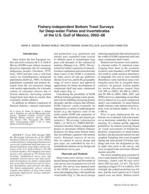
Fishery-independent Bottom Trawl Surveys for Deep-water Fishes ...
Fishery-independent Bottom Trawl Surveys for Deep-water Fishes ...
Fishery-independent Bottom Trawl Surveys for Deep-water Fishes ...
Create successful ePaper yourself
Turn your PDF publications into a flip-book with our unique Google optimized e-Paper software.
<strong>Fishery</strong>-<strong>independent</strong> <strong>Bottom</strong> <strong>Trawl</strong> <strong>Surveys</strong><br />
<strong>for</strong> <strong>Deep</strong>-<strong>water</strong> <strong>Fishes</strong> and Invertebrates<br />
of the U.S. Gulf of Mexico, 2002–08<br />
Mark A. Grace, Brandi Noble, Walter Ingram, ADAM POLLACK, and Alonzo Hamilton<br />
Introduction<br />
Since be<strong>for</strong>e the first European settlers<br />
arrived to colonize the U.S. Gulf of<br />
Mexico (GOM) coast, fishery resources<br />
played an important role <strong>for</strong> sustaining<br />
indigenous peoples (Swanton, 1979;<br />
Gore, 1992) and later were a vital food<br />
source <strong>for</strong> nonindigenous immigrant<br />
populations (Sullivan, 1985). As human<br />
populations expanded and protein demands<br />
from the sea increased (along<br />
with market opportunities <strong>for</strong> a broader<br />
variety of consumer choices due to<br />
diverse ethnicity), harvesting seafood<br />
ranged from near-shore to coastal, then<br />
eventually further offshore.<br />
In addition to offshore expansion of<br />
directed fisheries, mineral exploration<br />
M. A. Grace, B. Noble, W. Ingram, A. Pollack<br />
and A. Hamilton are with the Mississippi Laboratories,<br />
Southeast Fisheries Science Center,<br />
National Marine Fisheries Service, NOAA,<br />
P.O. Drawer 1207, Pascagoula, MS 39568-<br />
1207. Corresponding author is M. A. Grace<br />
(Mark.A.Grace@noaa.gov).<br />
ABSTRACT—From 2002 through 2008,<br />
the Mississippi Laboratories of the NMFS<br />
Southeast Fisheries Science Center, NOAA,<br />
conducted fishery-<strong>independent</strong> bottom trawl<br />
surveys <strong>for</strong> continental shelf and outer-continental<br />
shelf deep-<strong>water</strong> fishes and invertebrates<br />
of the U.S. Gulf of Mexico (50–500<br />
m bottom depths). Five-hundred and ninety<br />
species were captured at 797 bottom trawl<br />
locations. Standardized survey gear and<br />
randomly selected survey sites have facilitated<br />
development of a fishery-<strong>independent</strong><br />
time series that characterizes species diversity,<br />
distributions, and catch per unit ef<strong>for</strong>t.<br />
The fishery-<strong>independent</strong> surveys provide<br />
synoptic descriptions of deep-<strong>water</strong> fauna<br />
potentially impacted by various anthropogenic<br />
factors.<br />
and production (e.g. petroleum and<br />
natural gas) expanded from coastal<br />
to offshore areas as technologies kept<br />
pace with demands of the commercial<br />
industry (Managi et al., 2005). The potential<br />
<strong>for</strong> further expansion of mineralresource<br />
exploration and extraction into<br />
deep <strong>water</strong>s of the GOM is evidenced<br />
by many active oil and gas plat<strong>for</strong>ms<br />
already in service, and by the geographic<br />
range of active leases and approved<br />
applications <strong>for</strong> future development of<br />
continental shelf and outer continental<br />
shelf <strong>water</strong>s (Fig. 1).<br />
Considering the possibility of GOM<br />
offshore fisheries gaining a more prominent<br />
role <strong>for</strong> fulfilling increasing protein<br />
demands, and the scenario that offshore<br />
GOM fisheries could eventually be<br />
impacted by a variety of anthropogenic<br />
factors (e.g. the hypoxic zone of the<br />
north-central GOM and expansion of<br />
the offshore petroleum and natural gas<br />
industry), Mississippi Laboratories<br />
(MSL) of NOAA’s NMFS/SEFSC,<br />
initiated a baseline fishery-<strong>independent</strong><br />
project to document offshore-fisheries<br />
dynamics <strong>for</strong> deep-<strong>water</strong> bottom fishes<br />
and invertebrates captured with bottom<br />
trawls. Potential sources of survey<br />
bias (as related to survey design and<br />
gear type), are controlled by use of a<br />
standardized-random survey design and<br />
standardized survey gear.<br />
Materials and Methods<br />
<strong>Deep</strong>-<strong>water</strong> trawl surveys were conducted<br />
during October and November of<br />
each survey year (in general over a 6-wk<br />
period). The survey area spanned most<br />
of the GOM exclusive of prohibited<br />
areas and shipping lanes with significant<br />
vessel traffic (Fig. 1). The survey design<br />
utilized proportional allocation based on<br />
the width of GOM continental shelf and<br />
outer continental shelf <strong>water</strong>s.<br />
<strong>Bottom</strong> trawl locations were randomly<br />
selected within 21 statistical zones<br />
(ranging from shore to the economic<br />
exclusive zone boundary) of 60° latitude<br />
(<strong>for</strong> north to south oriented shorelines)<br />
or longitude (<strong>for</strong> east to west oriented<br />
shorelines); some statistical zones were<br />
irregular-sized due to irregular shore<br />
contours. In general, bottom depths<br />
<strong>for</strong> station allocations ranged from<br />
110–500 m (2002), 90–500 m (2003),<br />
and 50–500 m (2004, 2006, 2007, and<br />
2008); however, depending on ancillary<br />
survey objectives (e.g. gear comparison<br />
study), sea conditions, or steep bottom<br />
depth contours some bottom trawl locations<br />
were in bottom depths < 50 m or<br />
> 500 m.<br />
Prior to gear deployment the sea<br />
bottom was evaluated with echosounders<br />
to determine suitability <strong>for</strong> bottom<br />
trawling. If a bottom profile appeared<br />
prohibitive <strong>for</strong> bottom trawling (based<br />
on visual assessments of bottom-bathymetry<br />
irregularities or steep bottom<br />
inclines), the preselected station was not<br />
sampled. Sampling sites were occupied<br />
during any time period (24-h/day sampling)<br />
and were not designated as day<br />
or night sites prior to the survey, and<br />
were occupied in the most time-efficient<br />
manner possible.<br />
The trawl sampling gear consisted of<br />
a two-seam bottom trawl (27.4 m length<br />
footrope), fished with W-style trawl<br />
doors (682 kg each, 3.5 m 2 ). The trawl<br />
opening averaged 15.5 m width by 10.0<br />
m height, the codend mesh liner was 4.0<br />
mm, and the trawl speed was 6.3 km/h<br />
(speed over sea floor). <strong>Bottom</strong> trawls<br />
20 Marine Fisheries Review
Figure 1.—<strong>Deep</strong>-<strong>water</strong> bottom trawl survey area (S); approximate area of the predicted 2008 hypoxic zone (H); offshore locations<br />
of active petroleum and natural gas plat<strong>for</strong>ms (O) including approved applications to drill (locations are represented by small-gray<br />
dots); <strong>Deep</strong><strong>water</strong> Horizon Macondo/MC252 exploration oil plat<strong>for</strong>m (★).<br />
were 30-min duration once the trawl<br />
settled on bottom (as determined by net<br />
mensuration systems or trawl descent<br />
rate charts).<br />
At termination of the 30-min trawl,<br />
the ship pulsed speed to 10.5 km/h <strong>for</strong> 5<br />
min to flush catch from the trawl through<br />
a web-constructed fish funnel and into<br />
the trawl codend, then the trawl was<br />
hauled. After hauling, the catch was<br />
weighed either by individual baskets<br />
or, <strong>for</strong> relatively large catches, by use<br />
of a remotely-controlled electronic<br />
scale (dynamometer) used to weigh the<br />
entire trawl codend with catch; the trawl<br />
codend weight was subtracted from the<br />
total weight. Environmental sampling<br />
was conducted at each trawl location<br />
and included profiles of sea-surface<br />
to sea-bottom environmental parameters:<br />
temperature, salinity, dissolved<br />
oxygen, transmissivity (turbidity), and<br />
indirect measures of chlorophyll-a via<br />
a fluorometer.<br />
Results<br />
From 2002 to 2008, six deep-<strong>water</strong><br />
bottom trawl surveys were conducted in<br />
the GOM; sampling did not occur during<br />
2005. <strong>Bottom</strong> trawl ef<strong>for</strong>t (797 tows,<br />
398 h 30 min total tow time) resulted<br />
in the capture of 590 species (finfish,<br />
noncrustacean invertebrates, and crustaceans<br />
collectively), representing 54<br />
orders, 192 families, and 373 genera<br />
(Table 1). Total catch weight <strong>for</strong> all<br />
groups collectively was 74,987 kg; finfish<br />
were the primary catch component<br />
(94.2%), followed by noncrustacean<br />
invertebrates (5.2%), and crustaceans<br />
(0.6%). For the finfish catch component<br />
ranked by weight (Table 2), 22.8% was<br />
rough scad, Trachurus lathami, which<br />
was also the top ranked by number and<br />
weight <strong>for</strong> all groups collectively; followed<br />
by gulf butterfish, Peprilus burti,<br />
13.5%; and longspine porgy, Stenotomus<br />
caprinus, 10.7%.<br />
One of the most important finfish<br />
species of GOM management concern,<br />
the red snapper, Lutjanus campechanus,<br />
was ranked 27th by weight within the<br />
finfish group. The top-ranked elasmobranch<br />
by weight (finfish group)<br />
was the Atlantic angel shark, Squatina<br />
dumeril, ranked 6th, followed by the<br />
roughtail stingray, Dasyatis centroura,<br />
ranked 13th. Of 44 finfish orders known<br />
to occur in the GOM, 32 (73%) were<br />
represented during the surveys.<br />
Table 1.—Catch summary <strong>for</strong> finfish, noncrustacean<br />
invertebrates, and crustaceans, from deep-<strong>water</strong> bottom<br />
trawl surveys, 2002–08.<br />
noncrustacean<br />
Category Finfish invertebrates Crustaceans Total<br />
Orders 32 14 8 54<br />
Families 124 25 43 192<br />
Genera 260 34 79 373<br />
Species 445 39 106 590<br />
For the noncrustacean invertebrate<br />
catch component ranked by weight<br />
(Table 3), 73.8% were longfin squid,<br />
Loligo pealeii, also the highest percent<br />
frequency of occurrence of total trawls<br />
<strong>for</strong> all groups collectively; 21.9% were<br />
southern shortfin squid, Illex coindetti,<br />
and 2.7% were arrow squid, Loligo plei.<br />
For the crustacean catch component<br />
ranked by weight (Table 4), 33.0% were<br />
brown shrimp, Farfantepenaeus aztecus,<br />
followed by the longspine swimming<br />
crab, Portunus spinicarpus, 12.0%, and<br />
the rose shrimp, Parapenaeus politus,<br />
7.3%. In addition to commercially<br />
important brown shrimp, three other<br />
commercially important shrimp (ranked<br />
within the crustacean group) were royal<br />
red shrimp, Pleoticus robustus, 4.4%;<br />
pink shrimp, Farfantepeneaus duroraum,<br />
1.1%; and white shrimp, Litope-<br />
72(4) 21
Table 2.—Finfish (top 10 ranked by weight) captured during deep-<strong>water</strong> bottom trawl surveys, 2002–08. Depth, temperature, salinity, and oxygen saturation values are<br />
minimum-maximum/mean.<br />
Total Total % Frequency Depth Temp. Salinity Oxygen<br />
Taxon wt. (kg) no. of occurrence (m) (°C) (ppt) (mg/l)<br />
Trachurus lathami, rough scad 16,138 264,273 69.4 30–497/36 8.8–28.7/18.2 31.0–36.6/36.2 2.8–8.0/4.3<br />
Peprilus burti, gulf butterfish 9,499 135,268 34.3 42–347/117 11.0–28.7/19.1 28.2–36.6/36.2 2.8–8.0/4.3<br />
Stenotomus caprinus, longspine porgy 7,606 158,951 31.1 30–178/100 15.2–28.7/20.3 28.2–36.6/36.3 2.8–8.0/4.5<br />
Pristipomoides aquilonaris, wenchman 4,329 68,327 64.1 48–481/136 9.1–28.7/18.0 28.2–36.6/36.1 3.4–8.0/4.2<br />
Etrumeus teres, round herring 3,746 158,928 18.3 54–239/132 14.0–24.7/17.9 31.0–36.6/36.2 3.5–6.7/4.1<br />
Squatina dumeril, Atlantic angel shark 2,297 783 36.6 41–423/165 10.1–25.7/16.5 34.6–36.7/36.0 3.4–6.4/4.1<br />
Saurida normani, shortjaw lizardfish 2,168 30,359 38.4 53–355/152 10.2–25.2/17.0 34.6–36.7/36.1 3.4–6.4/4.1<br />
Lagodon rhomboides, pinfish 2,162 24,742 22.1 30–209/94 15.6–28.7/21.3 28.2–36.6/36.2 2.8–6.7/4.6<br />
Trichiurus lepturus, Atlantic cutlassfish 2,016 26,430 25.6 47–341/115 12.0–28.7/19.5 28.2–36.6/36.2 2.8–6.7/4.4<br />
Micropogonias undulatus, Atlantic croaker 1,940 21,904 10.4 42–141/71 16.0–28.7/23.3 35.6–36.6/36.4 2.8–6.4/4.9<br />
Table 3.—Noncrustacean invertebrates (top 10 ranked by weight) captured during deep-<strong>water</strong> bottom trawl surveys, 2002–08. Depth, temperature, salinity, and oxygen saturation<br />
values are minimum-maximum/mean.<br />
Total Total % Frequency Depth Temp. Salinity Oxygen<br />
Taxon wt. (kg) no. of occurrence (m) (°C) (ppt) (mg/l)<br />
Loligo pealeii, longfin squid 2,872 73,028 78.9 30–563/150 8.4–27.9/17.4 28.2–36.7/36.0 3.4–8.0/4.2<br />
Illex coindetti, southern shortfin squid 852 5,881 13.9 128–563/297 8.4–19.7/12.8 33.1–36.6/35.6 3.4–4.6/3.9<br />
Loligo plei, arrow squid 105 7,826 8.3 39–213/98 13.5–28.7/21.5 34.3–36.7/36.3 3.4–6.7/5.0<br />
Octopus vulagris, common octopus 13 85 5.1 39–189/116 9.3–26.1/19.2 35.1–36.7/36.3 3.5–6.5/4.5<br />
Amusium papyraceum, paper scallop 5 459 5.0 55–132/89 16.7–27.7/21.1 36.2–36.6/36.4 3.4–6.3/4.7<br />
Tonna galea, giant tun 5 16 0.9 130–176/151 14.4–17.4/16.1 34.6–36.3/35.9 3.6–4.3/3.9<br />
Pholidoteuthis adami, pink scaled squid 4 14 0.5 373–563/480 8.4–13.9/10.0 33.2–35.8/34.5 3.5–4.2/3.8<br />
Abralia redfieldi (no common name) 2 995 7.3 69–516/246 8.7–24.7/14.2 34.5–36.6/35.8 3.4–6.7/4.0<br />
Illex oxygonius, sharptail shortfin squid 2 10 0.4 172–444/270 8.9–16.0/13.0 35.1–36.1/35.7 3.8–4.0/3.9<br />
Semirossia equalis, greater shining bobtail 2 574 11.5 59–436/153 9.5–25.7/17.2 35.0–36.6/35.8 3.5–6.9/4.2<br />
Table 4.—Crustaceans (top 10 ranked by weight) captured during deep-<strong>water</strong> bottom trawl surveys, 2002–08. Depth, temperature, salinity, and oxygen saturation values are<br />
minimum-maximum/mean.<br />
Total Total % Frequency Depth Temp. Salinity Oxygen<br />
Taxon wt. (kg) no. of occurrence (m) (°C) (ppt) (mg/l)<br />
Farfantepenaeus aztecus, brown shrimp 163 5,255 13.8 48–144/86 16.1–28.7/21.5 35.5–36.6/36.3 3.3–6.7/4.8<br />
Portunus spinicarpus, longspine swimming crab 59 6,968 26.1 46–217/125 14.2–27.0/18.7 34.6–36.7/36.1 3.4–8.0/4.3<br />
Parapenaeus politus, rose shrimp 36 21,227 18.1 51–436/164 10.2–28.7/16.6 34.5–36.6/35.8 3.4–8.0/4.1<br />
Solenocera vioscai, humpback shrimp 25 7,267 29.9 41–337/144 9.5–28.7/17.7 34.3–36.6/36.0 3.4–8.0/4.2<br />
Calappa sulcata, yellow box crab 25 86 4.0 48–166/97 16.3–27.7/21.1 28.2–36.6/36.1 3.6–6.3/4.6<br />
Pleoticus rodustus, royal red shrimp 22 431 3.4 201–563/416 8.4–15.2/10.3 33.1–36.0/35.1 3.5–9.0/3.8<br />
Stenocionops spinosissimus, tenspine spider crab 20 33 3.4 103–418/168 10.1–19.2/16.1 33.3–36.5/36.1 3.5–4.4/4.0<br />
Penaeopsis serrata, pinkspeckled shrimp 11 7,760 10.3 41–516/200 8.7–25.7/15.9 34.3–36.6/36.0 3.4–6.4/4.1<br />
Anasimus latus, stilt spider crab 10 985 13.2 52–314/133 10.2–27.0/18.0 28.2–36.6/36.2 3.5–5.9/4.1<br />
Sicyonia brevirostris, brown rock shrimp 8 460 3.9 46–134/69 17.1–28.0/23.2 35.9–36.6/36.4 3.5–6.4/5.1<br />
naeus setiferus, 0.3%. Distribution of<br />
the top-ranked by weight rough scad (<strong>for</strong><br />
the finfish group) and longfin squid (<strong>for</strong><br />
the non-invertebrate crustacean group),<br />
was relatively uni<strong>for</strong>m across the survey<br />
area in bottom depths 100–500 m; distribution<br />
of the top-ranked by weight<br />
brown shrimp (<strong>for</strong> the crustacean group)<br />
was primarily west of long. 88°W in<br />
bottom depths 30–200 m.<br />
Discussion<br />
The importance of developing a<br />
fishery-<strong>independent</strong> time series <strong>for</strong> assessing<br />
life histories and distributions<br />
is of particular significance <strong>for</strong> populations<br />
that are unexploited or minimally<br />
exploited (Johnson, 1994; Jennings and<br />
Blanchard, 2004). On a global basis,<br />
with many fisheries fully exploited or<br />
nearing full exploitation due to increasing<br />
demands <strong>for</strong> fishery products (FAO,<br />
2004), with regards to outer-continental<br />
shelf bottom fishes and invertebrates,<br />
the MSL GOM survey represents a rare<br />
opportunity to assess species-specific<br />
population dynamics from a largely<br />
unexploited geographic region.<br />
Even though the variety of factors<br />
potentially affecting deep-<strong>water</strong> fish and<br />
invertebrate GOM populations overlap<br />
those in other global regions, three<br />
primary factors are encompassed (to<br />
varying degrees) within the geographic<br />
range of the MSL GOM deep-<strong>water</strong><br />
trawl surveys: the north-central GOM<br />
hypoxic zone, the probable expansion<br />
of fisheries offshore into deep <strong>water</strong>s<br />
(in particular bottom-trawl prosecuted<br />
fisheries), and the offshore petroleum<br />
and natural gas industry.<br />
One of the world’s most extensive<br />
hypoxic zones (dissolved oxygen concentration<br />
< 2.0 mg/l) is found along<br />
the GOM north-central coast (Rabalais<br />
et al., 1999, 2002a; Fig. 1). Hypoxiczone<br />
dynamics are influenced by the<br />
Mississippi River (flow rate 14,000 m 3 /<br />
22 Marine Fisheries Review
sec, Bratkovich et al., 1994), and effects<br />
of the hypoxic zone are varied and can<br />
include species displacement and eutrophication<br />
(Rabalais et al., 2002b) on<br />
both small and large geographic scales.<br />
It is common <strong>for</strong> the GOM-hypoxic<br />
zone to extend from near shore to well<br />
offshore to bottom depths of 60 m (Rabalais<br />
et al., 2007). Even though hypoxic<br />
conditions were not recorded from any<br />
of the MSL bottom trawl locations, some<br />
of the dissolved oxygen levels were as<br />
low as 2.8 mg/l (Table 2).<br />
During peak hypoxic events from<br />
June through August (hypoxic conditions<br />
have been recorded from late<br />
February to October (Rabalais et al.,<br />
2002a)), the effects on continental-shelf<br />
and outer-continental shelf fishes can<br />
be especially pronounced, and this in<br />
turn can affect the distribution, abundance,<br />
and behavior of fish (Stanley<br />
and Wilson, 2004) and invertebrates<br />
(Leming and Stuntz, 1984; Craig et al.,<br />
2005). Since the hypoxic zone is dependent<br />
in part on Mississippi River effluent<br />
that often contains various amounts of<br />
hypoxic precursors (i.e. nitrogen and<br />
phosphorus from fertilizer use (Diaz,<br />
2001; Rabalais et al., 2002a)), the likelihood<br />
exists that the GOM hypoxic<br />
phenomena will continue to influence<br />
fish and invertebrate distributions and<br />
their associated trophic relationships in<br />
the north-central GOM.<br />
According to a Louisiana Universities<br />
Marine Consortium Press Release 1 ,<br />
the predicted size of the 2008 hypoxic<br />
zone (Fig. 1) was one of the largest in<br />
area on record (22,790 km 2 ) and was<br />
attributed to a 37% increase above the<br />
2007 nitrate-nitrogen loading level of<br />
the Mississippi River (the highest level<br />
since measurements began in 1970); the<br />
press release also stated that increased<br />
farming of more land <strong>for</strong> the production<br />
of biofuels contributed to the 2008<br />
increased nitrogen-loading rate.<br />
Even though the actual size <strong>for</strong> the<br />
2008 hypoxic zone was less than predicted<br />
due to a number of contributing<br />
1 LUMCOM, 28 July 2008, Dead Zone Again<br />
Rivals Record Size (online at http://www.gulfhypoxia.net/news/documents/HypoxiaForecast13July2008.pdf).<br />
factors 2 , the potential <strong>for</strong> significant<br />
annual hypoxic events remains likely <strong>for</strong><br />
the north-central GOM. Prior to 1993,<br />
the average areal extent of the hypoxic<br />
zone was 8,000–9,000 km 2 (Rabalais<br />
et al., 1999), there<strong>for</strong>e, during various<br />
years since 1993 the hypoxic zone has<br />
more than doubled in size 3 , and has continued<br />
to expand westward 4 and further<br />
offshore toward the deep <strong>water</strong>s of the<br />
outer-continental shelf.<br />
As many commercial marine fisheries<br />
continue to decline on a global<br />
basis (Pauly et al., 2005), it stands to<br />
reason that the search <strong>for</strong> additional<br />
fishery resources will be driven by<br />
market incentives (Pauly et al., 2003).<br />
As fisheries-harvesting technology continues<br />
to improve (Pauly et al., 2002),<br />
offshore deep-<strong>water</strong> fishery resources<br />
are increasingly accessible to harvesting<br />
(Moore, 1999). Globally, the mean<br />
fishing depth <strong>for</strong> bottom fisheries has<br />
increased since 1950 (Morato et al.,<br />
2006), and in all likelihood the trend<br />
eventually will apply to GOM deep<strong>water</strong><br />
bottom fisheries.<br />
Even though the various species<br />
prone to capture by deep-<strong>water</strong> offshore<br />
GOM trawl fisheries are relatively<br />
unexploited at present (landings are<br />
primarily from the Florida GOM coast 5 ),<br />
there is a GOM-wide fisheries complex<br />
of potential exploitation: the coastalpelagic<br />
fishes (estimated biomass<br />
2,928,000 t (Brown et. al., 1999, Table<br />
5)). However, the effects of fishing on<br />
relatively unexploited populations are<br />
often difficult to quantify (Jennings and<br />
Blanchard, 2004; Morato et al., 2006;<br />
2 NOAA News Releases, 27 July 2009, Smaller<br />
than expected, but severe, dead zone in Gulf<br />
of Mexico (online at http://www.gulfhypoxia.<br />
net/News/default.asp?XML Filename=20090811<br />
1033.xml).<br />
3 2009 Forecast of the summer hypoxic zone<br />
size, northern Gulf of Mexico (online at http://<br />
www.gulfhypoxia.net/research/Shelfwide<br />
Cruises/2009/Files/2009_Hypoxia_Forecast.<br />
pdf).<br />
4 2009 Real-time environmental monitoring from<br />
a wind farm plat<strong>for</strong>m in the Texas hypoxia zone<br />
(online at http://ieeexplore.ieee.org/Xplore/login.<br />
jsp?url=http%3A%2F%2Fieeexplore.ieee.org<br />
%2Fstamp%2Fstamp.jsp%3Ftp%3D%26arnum<br />
ber%3D5422304&authDecision=-203).<br />
5 2008 Florida Fish and Wildlife landing statistics<br />
(online at http://research.myfwc.com/features/view<br />
_article.asp?id=19224).<br />
Table 5.—Coastal pelagic finfish species from Brown<br />
et al. (1999) in common with deep-<strong>water</strong> bottom trawl<br />
surveys.<br />
Taxon<br />
Sardinella aurita, Spanish sardine<br />
Opisthonema oglinum, Atlantic thread herring<br />
Decapterus punctatus, Round scad<br />
Trachurus lathami, Rough scad<br />
Harengula jaguana, Scaled sardine<br />
Etrumeus teres, Round herring<br />
Chloroscombrus chrysurus, Atlantic bumper<br />
Engraulidae, Anchovies (general category)<br />
Ariomma bondi, Silver-rag<br />
Peprilus burti, Gulf butterfish<br />
Anderson et al., 2008) and equally difficult<br />
to qualify (Moore, 1999; Pauly et<br />
al., 1999; Watson and Pauly, 2001), a<br />
situation that is often complicated when<br />
offshore fishery-dependent landings are<br />
grouped in non-specific genericallybroad<br />
categories.<br />
The range of effects on deep-<strong>water</strong><br />
GOM fish and invertebrate populations<br />
from offshore petroleum and natural gas<br />
structures includes increased offshore<br />
structures (3,740 active plat<strong>for</strong>ms 6 )<br />
possibly enhancing desirable habitats<br />
and productivity <strong>for</strong> a variety of species<br />
(Keenan et al., 2007; Shipp and<br />
Bortone, 2009), altered fish and invertebrate<br />
distributions (Lindberg, 1997;<br />
Stanley and Wilson, 2003; Sammarco<br />
et al., 2004; Shipp and Bortone, 2009),<br />
and benthic-organism responses to associated<br />
hydrocarbons (Montagna and<br />
Harper, 1996; Peterson et al., 1996).<br />
The likely expansion of the offshore<br />
petroleum and natural gas industry is<br />
reflected in a report released by the<br />
U.S. Department of the Interior 6 ; in<br />
2007 approximately 72% of GOM oil<br />
production and 54% of GOM leases<br />
were in <strong>water</strong> depths greater than 305<br />
m. For what is classified as approved applications<br />
to drill (37,293 applications 7 ),<br />
90% of applications are in bottom depths<br />
0–200 m, 3% from 201–400 m, 2%<br />
from 401–800 m, 1% from 801–1,000<br />
6 U.S. Department of the Interior, Minerals Management<br />
Service, Office of Public Affairs, 2008,<br />
(OCS Report MMS 2008-013, <strong>Deep</strong><strong>water</strong> Gulf<br />
of Mexico 2008: America’s Offshore Energy<br />
Future).<br />
7<br />
U.S. Department of the Interior, Minerals Management<br />
Service, 2009a, Gulf of Mexico Fast<br />
Facts, April 2009 (online at http://www.gomr.<br />
mms.gov/homepg/fastfacts/WaterDepth/Water-<br />
Depth.html).<br />
72(4) 23
m, and 4% (or 1,501 applications) from<br />
deeper than 1,000 m. Additionally, 13<br />
bids were received <strong>for</strong> the 181 South<br />
Area offshore of the central GOM 8 with<br />
maximum bottom depths <strong>for</strong> available<br />
leases exceeding 3,000 m.<br />
Conclusion<br />
The importance of the MSL GOM<br />
deep-<strong>water</strong> bottom trawl surveys is<br />
firmly established when considering<br />
various anthropogenic factors that potentially<br />
affect population dynamics of<br />
continental shelf and outer-continental<br />
shelf marine species (the expanding<br />
hypoxic zone, offshore expansion of<br />
fisheries, offshore petroleum and natural<br />
gas industry). Since the deep-<strong>water</strong><br />
trawl surveys do not target specific species<br />
and employ a randomized survey<br />
design with standardized survey gear,<br />
the time series is applicable as a fishery-<strong>independent</strong><br />
index <strong>for</strong> several key<br />
species that are of historic and future<br />
concern. Potential sources of survey<br />
bias are controlled as best they can be<br />
considering the limitations of the annual<br />
survey period (October and November),<br />
the geographic extent and bottom depth<br />
range (limited by survey logistics as a<br />
function of sea-day allocation), and gear<br />
selectivity (deep-<strong>water</strong> fish trawls are<br />
not ideally suited <strong>for</strong> efficient capture of<br />
all species or the sampling of all habitats<br />
(Herring, 2004)). As additional anthropogenic<br />
factors continue to influence<br />
the GOM, the MSL GOM deep-<strong>water</strong><br />
fishery-<strong>independent</strong> time series will<br />
contribute to important synoptic summaries<br />
of the abundance and distribution<br />
of biological communities.<br />
8 U.S. Department of the Interior, Minerals Management<br />
Service, 2009b, Central Gulf of Mexico<br />
lease sale 208 attracts $703,048,523 in high bids.<br />
News release, 18 March 2009 (online at http://<br />
www.gomr.mms.gov/homepg/whatsnew/newsreal/2009/090318.pdf).<br />
<strong>Deep</strong><strong>water</strong> Horizon Macondo/<br />
MC252 Oil Spill<br />
On 20 April 2010, there was a northcentral<br />
Gulf of Mexico oil spill (50 n.mi.<br />
southeast of the Mississippi River delta,<br />
Fig. 1) from a deep-<strong>water</strong> exploration oil<br />
plat<strong>for</strong>m (<strong>Deep</strong><strong>water</strong> Horizon Macondo/<br />
MC252, 1,523 m bottom depth). The oilspill<br />
event spanned 91 days and at one<br />
point lead to a fishery closure by NOAA<br />
that comprised 33.2% of Gulf of Mexico<br />
Federal <strong>water</strong>s. 9 The annual deep-<strong>water</strong><br />
trawl surveys conducted by Mississippi<br />
Laboratories will be an important timeseries<br />
component <strong>for</strong> assessing potential<br />
oil-spill related anthropogenic effects on<br />
marine fauna.<br />
Acknowledgments<br />
Special thanks are extended to MSL<br />
personnel John Moser, Butch Pellegrin,<br />
David Hanisko, Lagena Fantroy,<br />
William Driggers, Terry Henwood,<br />
and Lisa Desfosse <strong>for</strong> assisting with<br />
literature searches, developing data<br />
summaries and graphics, or conducting<br />
manuscript reviews. Ruth Mullins<br />
and Steve DiMarco (both of Texas<br />
A&M University) and Nancy Rabalais<br />
(Louisiana Universities Marine Consortium)<br />
provided literature or literature<br />
advice and helped clarify hypoxic zone<br />
specifics. Chris Gledhill (MSL) was<br />
instrumental <strong>for</strong> planning and conducting<br />
the deep-<strong>water</strong> bottom trawl survey<br />
pilot studies, and Dean Landi (<strong>for</strong>merly<br />
of MSL) provided expertise during<br />
surveys and in the laboratory. Paula<br />
Rychtar and Scott Noble are recognized<br />
<strong>for</strong> their vital supportive ef<strong>for</strong>ts. This<br />
article was based on its oral presentation<br />
<strong>for</strong> the “Issues Confronting the <strong>Deep</strong><br />
Oceans,” ICES Symposia in May, 2009,<br />
at Horta, Azores, Portugal.<br />
9 NOAA expands fishing closed area in the Gulf<br />
of Mexico, 2010 (online at http://www.noaanews.<br />
noaa.gov/stories2010/20100704_closure.html).<br />
Literature Cited<br />
Anderson, C. N. K., C. Hsieh, S. A. Sandin, R.<br />
Hewitt, A. Hollowed, J. Beddington, R. M.<br />
May, and G. Sugihara. 2008. Why fishing<br />
magnifies fluctuations in fish abundance.<br />
Nature 452:835–839.<br />
Bratkovich, A., S. P. Dinner, and D. A. Goolsby.<br />
1994. Variability and prediction of fresh<strong>water</strong><br />
and nitrate fluxes <strong>for</strong> the Louisiana-Texas<br />
shelf: Mississippi and Atchafalaya River<br />
source functions. Estuaries 17:766–778.<br />
Brown, B., J. A. Browder, J. Powers, and C. D.<br />
Goodyear. 1999. Biomass, yield models, and<br />
management strategies <strong>for</strong> the Gulf of Mexico<br />
ecosystem. In H. Kumpf, K. Steidinger, and<br />
K. Sherman (Editors), The Gulf of Mexico<br />
Large Marine Ecosystem, p. 534–564. Blackwell<br />
Sci., Inc., Malden, Mass.<br />
Craig, J. K., L. B. Crowder, and T. A. Henwood.<br />
2005. Spatial distribution of brown shrimp<br />
(Farfantepenaeus aztecus) on the northwestern<br />
Gulf of Mexico shelf: effects of abundance<br />
and hypoxia. Can. J. Fish. Aquat. Sci.<br />
62:1295–1308.<br />
Diaz, R. 2001. Overview of hypoxia around<br />
the world. J. Environ. Qual. [Symp. Pap.]<br />
30(2):275–281.<br />
FAO. 2004. The state of world fisheries and<br />
aquaculture. Food Agric. Organ. U. N., Rome,<br />
153 p.<br />
Gore, R. H. 1992. The Gulf of Mexico: a treasury<br />
of resources in the American Mediterranean.<br />
Pineapple Press, Inc., Sarasota, Fla., 384 p.<br />
Herring, P. J. 2004. Exploring the life in the<br />
ocean: how do we know what is there? Bioscience<br />
Explained 2(1):1–12.<br />
Johnson, L. 1994. Long-term experiments on the<br />
stability of two fish populations in previously<br />
unexploited artic lakes. Can. J. Fish. Aquat.<br />
Sci. 51:209–225.<br />
Jennings, S., and J. L. Blanchard. 2004. Fish<br />
abundance with no fishing; predictions based<br />
on macroecological theory. J. Animal Ecol.<br />
73:632–642.<br />
Keenan, S. F., M. C. Benfield, and J. K. Blackburn.<br />
2007. Importance of the artificial light<br />
field around offshore petroleum plat<strong>for</strong>ms<br />
<strong>for</strong> the associated fish community. Mar. Ecol.<br />
Prog. Ser. 331:219–231.<br />
Leming, T. D., and W. E. Stuntz. 1984. Zones of<br />
coastal hypoxia revealed by satellite scanning<br />
have implications <strong>for</strong> strategic fishing. Nature<br />
310:136–138.<br />
Lindberg, W. J. 1997. Can science resolve the<br />
attraction-production issue? Fisheries 22:10–<br />
13.<br />
Managi, S., J. J. Opaluch, D. Jin, and T. A. Grigalunas.<br />
2005. Technological change and<br />
petroleum exploration in the Gulf of Mexico.<br />
Energy Policy 33(5):619–632.<br />
Montagna, P. A., and D. E. Harper, Jr. 1996. Benthic<br />
infaunal long-term response to offshore<br />
production plat<strong>for</strong>ms in the Gulf of Mexico.<br />
Can. J. Fish. Aquat. Sci. 53:2567–2588.<br />
Moore, J. A., 1999. <strong>Deep</strong>-sea finfish fisheries;<br />
lessons from history. Fish. Manage. 24:16–21.<br />
Morato, T., R. Watson, T. J. Pitcher, and D.<br />
Pauley. 2006. Fishing down the deep. Fish<br />
and Fish. 7:24–34.<br />
Pauly, D., F. Arreguín-Sánchez, J. Browder, V.<br />
Christensen, S. Manickchand-Heilemann, E.<br />
Martinez, and L. Vidal. 1999. Toward a stratified<br />
mass-balance model of trophic fluxes in<br />
the Gulf of Mexico large marine ecosystem.<br />
In H. Kumpf, K. Steidinger, and K. Sherman<br />
(Editors), The Gulf of Mexico Large Marine<br />
Ecosystem, p. 78–293. Blackwell Sci., Inc.,<br />
Malden, Mass.<br />
________ , V. Christensen, S. Guénette, T. J.<br />
Pitcher, U. R. Sumaila, C. J. Walters, R. Watson,<br />
and D. Zeller. 2002. Towards sustainabil<br />
ity in world fisheries. Nature 418:689–695.<br />
________ , J. Alder, E. Bennett, V. Christensen,<br />
P. Tyedmers, and R. Watson. 2003. The future<br />
<strong>for</strong> fisheries. Science 302:1359–1361.<br />
________ , R. Watson, and J. Alder. 2005.<br />
Global trends in world fisheries: impacts on<br />
marine ecosystems and food security. Philosophical<br />
Trans. R. Soc. Lond. B: Biol. Sci.<br />
360(1453):5–12.<br />
Peterson, C. H., M. C. Kennicutt II, R. H. Green,<br />
P. Montagna, D. E. Harper, Jr., E. N. Powell,<br />
and P. F. Roscigno. 1996. Ecological consequences<br />
of environmental perturbations associated<br />
with offshore hydrocarbon production:<br />
a perspective on long-term exposures in the<br />
Gulf of Mexico. Can. J. Fish. Aquat. Sci.<br />
53:2937–2654.<br />
24 Marine Fisheries Review
Rabalais, N. N., R. E. Turner, and W. J. Wiseman,<br />
Jr. 1999. Hypoxia in the northern Gulf of<br />
Mexico: linkages with the Mississippi River.<br />
In H. Kumpf, K. Steidinger, and K. Sherman<br />
(Editors), The Gulf of Mexico Large Marine<br />
Ecosystem, p. 297–322. Blackwell Sci., Inc.,<br />
Malden, Mass.<br />
________ , ________ and D. Scavia. 2002a.<br />
Beyond science into policy: Gulf of Mexico<br />
hypoxia and the Mississippi River Nutrient<br />
policy development <strong>for</strong> the Mississippi River<br />
<strong>water</strong>shed reflects the accumulate scientific<br />
evidence that the increase in nitrogen loading<br />
is the primary factor in the worsening of<br />
hypoxia in the northern Gulf of Mexico. Bio-<br />
Science 52:129–142.<br />
________ , ________ , Q. Dortch, D. Justic, V.<br />
J. Bierman, and W. J. Wiseman, Jr. 2002b.<br />
Nutrient-enhanced productivity in the northern<br />
Gulf of Mexico: past, present and future.<br />
Hydrobiologia 475/476:39–63.<br />
________ , ________ , B. K. Sen Gupa, D.<br />
F. Boesch, P. Chapman, and M. C. Murrell.<br />
2007. Hypoxia in the northern Gulf of<br />
Mexico: Does the science support the plan to<br />
reduce, mitigate and control hypoxia? Estuarine<br />
Coasts 30:753–772.<br />
Sammarco, P. W., A. D. Atchison, and G. S.<br />
Boland. 2004. Expansion of coral communities<br />
within the northern Gulf of Mexico via<br />
offshore oil and gas plat<strong>for</strong>ms. Mar. Ecol.<br />
Prog. Ser. 280:129–143.<br />
Shipp, R. L., and S. A. Bortone. 2009. A perspective<br />
of the importance of artificial habitat on<br />
the management of red snapper in the Gulf of<br />
Mexico. Rev. Fish. Sci. 17(1):41–47.<br />
Stanley, D. R., and C. A. Wilson. 2003. Seasonal<br />
and spatial variation in the biomass and size<br />
frequency distribution of fish associated with<br />
oil and gas plat<strong>for</strong>ms in the northern Gulf of<br />
Mexico. Am. Fish. Soc. Symp. 36:123–153.<br />
________ , and ________ . 2004. Effect of<br />
hypoxia on the distribution of fishes associated<br />
with a petroleum plat<strong>for</strong>m off coastal Louisiana.<br />
N. Am. J. Fish. Manage. 24:662–671.<br />
Sullivan, C. L. 1985. The Mississippi Gulf Coast:<br />
portrait of a people. Windsor Publ., Northridge,<br />
Calif., 200 p.<br />
Swanton, J. R. 1979. The Indians of the southeastern<br />
United States. Smithson. Inst. Press,<br />
Wash., D.C., 943 p.<br />
Watson, R., and D. Pauly. 2001. Systematic distortions<br />
in world fisheries catch trends. Nature<br />
424:534–536.<br />
72(4) 25


