Parks For Paws - your guide to off leash areas - City of Edmonton
Parks For Paws - your guide to off leash areas - City of Edmonton
Parks For Paws - your guide to off leash areas - City of Edmonton

You also want an ePaper? Increase the reach of your titles
YUMPU automatically turns print PDFs into web optimized ePapers that Google loves.
<strong><strong>of</strong>f</strong>-<strong>leash</strong> PARKS FOR PAWS<br />
<strong>For</strong> more information on these sites, please call 311.<br />
Southeast Southeast continued Southwest continued<br />
31 91 St. Right-<strong>of</strong>-Way — East side <strong>of</strong><br />
berm on 91 St. starting on the west side <strong>of</strong><br />
10 Ave. and 81 St., north <strong>to</strong> Whitemud Dr.<br />
and east <strong>to</strong> 76 St. on south side <strong>of</strong> berm on<br />
Whitemud Drive<br />
32 Mill Woods Pipeline Corridor —<br />
Whitemud Dr. and 34 St. <strong>to</strong> Hillview Cres. at<br />
58 St., and 34 Ave., excluding ravine crossing<br />
33 Larkspur Pipeline Corridor —<br />
Undeveloped land along 25 St. from<br />
Whitemud Dr. <strong>to</strong> south Mill Creek<br />
34 Hazeldean — North boulevard on<br />
68 Ave. from 93 <strong>to</strong> 99 St.<br />
35 Granular Trail — bot<strong>to</strong>m <strong>of</strong><br />
Mill Creek Ravine North — Access is from<br />
68 Ave. and 93 St. (west side <strong>of</strong> Argyll Park)<br />
or north side parking lot <strong>of</strong> Argyll Park. The<br />
granular trail along bot<strong>to</strong>m <strong>of</strong> ravine <strong>to</strong> Whyte<br />
(82) Ave. overpass is the only part <strong>of</strong> this site<br />
that is <strong><strong>of</strong>f</strong>-<strong>leash</strong>.<br />
36 Riverside Hiking Trail — South bank<br />
granular trail from low level bridge <strong>to</strong> Rafter’s<br />
Landing. From lower <strong>For</strong>est Heights <strong>to</strong> east<br />
end <strong>of</strong> Riverside Golf Course.<br />
37 Gold Bar Hiking Trail — Capilano<br />
Amenity Building north side, east along lower<br />
granular trail <strong>to</strong> Rundle footbridge; excluding<br />
shelter and picnic area.<br />
38 Capilano Hiking Trail — Capilano<br />
Bridge, lower granular trail along the river<br />
only, east <strong>to</strong> Hardisty Dr. and 56 St.<br />
39 Jackie Parker Recreation Area —<br />
South <strong>of</strong> service road and west <strong>of</strong> 50 St. and<br />
44 Ave. Does not include golf course, area<br />
north <strong>of</strong> service road or ravine area north <strong>of</strong><br />
the ravine bridge. All other <strong>areas</strong> on-<strong>leash</strong> on<br />
path only.<br />
40 Upper Mill Creek Ravine South —<br />
From 50 St. and 42 Ave., <strong>to</strong> 34 St. and 34 Ave.<br />
Granular trail only in ravine area is <strong><strong>of</strong>f</strong>-<strong>leash</strong>.<br />
Southwest<br />
20 Belgravia — Boundary Under Review.<br />
Please refer <strong>to</strong> website.<br />
21 Royal Gardens Pipeline Corridor —<br />
Boulevard from Whitemud Dr. and Royal Rd.<br />
<strong>to</strong> 111 St. and 43 Ave.<br />
23 Saddleback Road — 29A Ave.<br />
along powerline, across 119 St. <strong>to</strong> edge <strong>of</strong><br />
Whitemud Park<br />
24 Erminskin — East berm from 29A Ave.<br />
<strong>to</strong> 34 Ave. on 111 St.<br />
25 Duggan and Rideau Park Roadway<br />
— East side <strong>of</strong> 111 St. and 34 Ave. north <strong>to</strong><br />
Whitemud Dr., southeast side <strong>to</strong> 104 St.<br />
26 Blue Quill North and East — South<br />
side <strong>of</strong> 34 Ave. from 119 St. <strong>to</strong> 111 St.<br />
and west side <strong>of</strong> 111 St. from 34 Ave. <strong>to</strong><br />
Saddleback Rd.<br />
27 Keheewin Blackmud — Pipeline<br />
corridor, 104 St. and 20 Ave. <strong>to</strong> south end <strong>of</strong><br />
109 St. (Excludes Bearspaw Dr. West., Excludes<br />
Blackmud Creek and Ravine, below the bank.)<br />
28 Terwillegar Park — Park access via<br />
Rabbit Hill Rd. This is a multi-use area.<br />
29 Whitemud and Hawrelak Park &<br />
Hiking Trail — Multi-use granular trail from<br />
Whitemud Park <strong>to</strong> footbridge. Excludes old<br />
Keillor Rd. and designated equestrian trail.<br />
30 Brander Gardens Pipeline Corridor<br />
Walkway — Boundary Under Review. Please<br />
refer <strong>to</strong> website.<br />
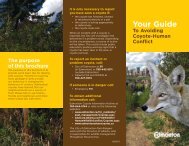
Be aware <strong>of</strong> urban coyotes; they travel through neighbourhood green spaces looking for food. Coyotes will habituate <strong>to</strong> neighbourhoods where they<br />
can easily eat garbage, pet food and fallen fruit from trees. Get rid <strong>of</strong> all food sources and shout and yell at the coyotes if you see them. They should not feel<br />
comfortable around humans. Coyotes can feel threatened by <strong>your</strong> dog. Always keep <strong>your</strong> dog on-<strong>leash</strong> if coyotes have been spotted.