Town of Frankford - Greater Salisbury Committee
Town of Frankford - Greater Salisbury Committee
Town of Frankford - Greater Salisbury Committee

Create successful ePaper yourself
Turn your PDF publications into a flip-book with our unique Google optimized e-Paper software.
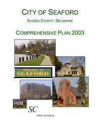
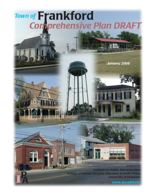
<strong>Town</strong> <strong>of</strong> <strong>Frankford</strong><br />
Comprehensive Plan DRAFT<br />
January 2008<br />
prepared by<br />
Institute for Public Administration<br />
College <strong>of</strong> Human Services, Education & Public Policy<br />
University <strong>of</strong> Delaware<br />
www.ipa.udel.edu
<strong>Town</strong> <strong>of</strong><br />
<strong>Frankford</strong><br />
Comprehensive Plan DRAFT<br />
adopted June 2007<br />
and certified<br />
January 2008
<strong>Town</strong> <strong>of</strong> <strong>Frankford</strong> Comprehensive Plan (draft – 1/08)<br />
TABLE OF CONTENTS<br />
TOWN, COUNTY, AND STATE OFFICIALS...................................................................................... i<br />
INSTITUTE FOR PUBLIC ADMINISTRATION................................................................................ ii<br />
INTRODUCTION..................................................................................................................................... 1<br />
CHAPTER 1. BACKGROUND.............................................................................................................. 2<br />
1-1. The Authority to Plan............................................................................................................... 2<br />
1-2. A Brief Overview <strong>of</strong> the Community ...................................................................................... 3<br />
1-3. Community Goals ..................................................................................................................... 7<br />
CHAPTER 2. MUNICIPAL DEVELOPMENT STRATEGY .......................................................... 11<br />
2-1. Community Pr<strong>of</strong>ile.................................................................................................................. 11<br />
2-2. Government, Community Services, and Facilities............................................................... 18<br />
2-3. Water and Wastewater........................................................................................................... 21<br />
2-4. Natural Resources and Environmental Protection.............................................................. 23<br />
2-5. Transportation ........................................................................................................................ 27<br />
2-6. Community Character and Design........................................................................................ 30<br />
2-7. Land Use and Annexation...................................................................................................... 31<br />
CHAPTER 3. IMPLEMENTATION AND COORDINATION........................................................ 40<br />
APPENDIX A: MAPS ........................................................................................................................... 44
<strong>Town</strong> <strong>of</strong> <strong>Frankford</strong> Comprehensive Plan (draft – 1/08)<br />
i<br />
TOWN, COUNTY, AND STATE OFFICIALS<br />
<strong>Town</strong> <strong>of</strong> <strong>Frankford</strong><br />
<strong>Town</strong> Council<br />
Planning & Zoning <strong>Committee</strong><br />
Comprehensive Plan <strong>Committee</strong><br />
<strong>Town</strong> Administrator<br />
<strong>Town</strong> Solicitor<br />
Greg Johnson, President<br />
Jesse Truitt, Vice-President<br />
Pam Davis, Secretary/Treasurer<br />
Cheryl Workman, Council Member<br />
Vincent Leon-Check, Council Member<br />
Robert Murray Jr., Chairperson<br />
Eric Heller<br />
Elma Gray<br />
Marla Daisy<br />
Ronald Atherton<br />
Crystal Holland<br />
Terry Truitt<br />
Dennis Schrader<br />
Sussex County<br />
County Administrator<br />
County Council<br />
Planning and Zoning Director<br />
David Baker<br />
Dale R. Dukes, 1 st District<br />
Finley B. Jones, 2 nd District<br />
Lynn J. Rogers, 3 rd District<br />
George B. Cole, 4 th District<br />
Vance Phillips, 5 th District<br />
Lawrence Lank<br />
State <strong>of</strong> Delaware<br />
Governor<br />
Senate<br />
House <strong>of</strong> Representatives<br />
Office <strong>of</strong> State Planning<br />
Coordination<br />
Ruth Ann Minner<br />
George H. Bunting, Jr., Senator, 20 th District<br />
Gregory Hastings, Representative, 41 st District<br />
Constance Holland, AICP, State Planning Director
<strong>Town</strong> <strong>of</strong> <strong>Frankford</strong> Comprehensive Plan (draft – 1/08)<br />
ii<br />
INSTITUTE FOR PUBLIC ADMINISTRATION<br />
The Institute for Public Administration (IPA), a unit within the College <strong>of</strong> Human Services, Education<br />
& Public Policy at the University <strong>of</strong> Delaware, assisted with the preparation <strong>of</strong> this document. IPA links<br />
the research and resources <strong>of</strong> the University <strong>of</strong> Delaware with the management and information needs <strong>of</strong><br />
local, state, and regional governments in the Delaware Valley. IPA provides assistance to agencies and<br />
local governments through direct staff assistance and research projects as well as training programs and<br />
policy forums.<br />
Jerome R. Lewis is the director <strong>of</strong> the Institute. Martin Wollaston manages IPA’s Planning Services<br />
Group and coordinated IPA’s role in preparing this document. Nicole Minni, GIS Specialist for IPA,<br />
assembled the digital data needed for this plan and developed all <strong>of</strong> the maps found in the Appendix.<br />
Institute Director<br />
Jerome R. Lewis, Ph.D.<br />
<strong>Town</strong> <strong>of</strong> <strong>Frankford</strong> Comprehensive Plan Team<br />
Martin Wollaston, IPA Planning Services Manager<br />
Troy Mix, Planner<br />
B.J. DeCoursey, Planner<br />
Barrett Edwards, Research Assistant<br />
Cori Gaul, Research Assistant<br />
Mapping and GIS Development<br />
Nicole Minni, GIS/Graphics Specialist<br />
Editorial Review and Cover Design<br />
Mark Deshon, Assistant Policy Scientist
<strong>Town</strong> <strong>of</strong> <strong>Frankford</strong> Comprehensive Plan (draft – 1/08) 1<br />
INTRODUCTION<br />
A MUNICIPAL COMPREHENSIVE DEVELOPMENT PLAN FOR<br />
FRANKFORD, DELAWARE<br />
January 2008<br />
Much <strong>of</strong> this 2008 Comprehensive Plan for the <strong>Town</strong> <strong>of</strong> <strong>Frankford</strong> was drafted utilizing information<br />
from the 1999 <strong>Town</strong> Comprehensive Plan. It is important to note that this document updates the policies<br />
set forth in the town’s 1999 Comprehensive Plan and, where appropriate, the language from the 1999<br />
Plan was inserted into this update. However, this document also contains new material that is necessary<br />
to meet the state plan certification requirements.<br />
Portions <strong>of</strong> this document were also developed by the former Sussex County Circuit Rider for the Office<br />
<strong>of</strong> State Planning Coordination, Ann Marie <strong>Town</strong>shend. Informational updates and assistance with<br />
coordinating the efforts <strong>of</strong> the town were provided by her replacement, and current Sussex County<br />
Circuit Rider Bryan Hall. IPA agreed to assist the town and OSPC in the preparation <strong>of</strong> this Plan well<br />
after the development <strong>of</strong> this plan was initiated. This draft plan will be reviewed by the State’s<br />
Preliminary Land Use Service (PLUS) review process and amended as needed before being finalized.<br />
Once the Plan is finalized, it will be formally adopted by the <strong>Frankford</strong> <strong>Town</strong> Council and certified by<br />
the State.<br />
The following document was crafted to meet the requirements set forth in the Delaware Code for a<br />
comprehensive plan for a town with a population less than 2,000. Upon its adoption, this plan will serve<br />
as an informational document for the public and a statement <strong>of</strong> town policy that will be implemented<br />
through actions, including the amendment <strong>of</strong> land use codes.
<strong>Town</strong> <strong>of</strong> <strong>Frankford</strong> Comprehensive Plan (draft – 1/08) 2<br />
CHAPTER 1. BACKGROUND<br />
1-1. The Authority to Plan<br />
The <strong>Town</strong> <strong>of</strong> <strong>Frankford</strong> 2008 Comprehensive Plan is <strong>Frankford</strong>’s authoritative statement <strong>of</strong> land use<br />
policy. This plan brings <strong>Frankford</strong> into compliance with Title 22 <strong>of</strong> the Delaware Code, Chapter 7,<br />
Section 702, which requires municipalities to prepare comprehensive plans to direct land use. The plan<br />
is a legal document serving as the foundation for the town’s land use decisions and annexation policy. It<br />
also serves as a consolidated reference guide containing demographic, economic, environmental, and<br />
historical information about <strong>Frankford</strong>.<br />
Delaware law requires that municipalities engage in comprehensive planning to encourage “the most<br />
appropriate uses <strong>of</strong> the physical and fiscal resources <strong>of</strong> the municipality and the coordination <strong>of</strong><br />
municipal growth, development, and infrastructure investment actions with those <strong>of</strong> other municipalities,<br />
counties, and the state….” This plan was written to comply with the requirements <strong>of</strong> a municipal<br />
comprehensive plan as described in the Delaware Code for towns with a population <strong>of</strong> less than 2,000.<br />
The municipal comprehensive plan for communities with fewer than 2,000 people is to be a “document<br />
in text and maps, containing, at a minimum, a municipal development strategy setting forth the<br />
jurisdiction’s position on population and housing growth within the jurisdiction, expansion <strong>of</strong> its<br />
boundaries, development <strong>of</strong> adjacent areas, redevelopment potential, community character, and the<br />
general uses <strong>of</strong> land within the community, and critical community development and infrastructure<br />
issues.” In addition, the town’s comprehensive-planning process must demonstrate coordination with<br />
other municipalities, the county, and the state during plan preparation. (22 Del. C. 1953, § 702; 49 Del.<br />
Laws, c. 415, § 1.)<br />
State law requires that planning be an ongoing process and that municipalities identify future planning<br />
activities. This document serves both as an update to <strong>Frankford</strong>’s 1999 comprehensive plan and<br />
<strong>Frankford</strong>’s Municipal Comprehensive Development Plan as required by state law. It is intended to<br />
cover a ten-year planning period and be reviewed at least every five years.
<strong>Town</strong> <strong>of</strong> <strong>Frankford</strong> Comprehensive Plan (draft – 1/08) 3<br />
1-2. A Brief Overview <strong>of</strong> the Community<br />
Location<br />
<strong>Frankford</strong> is located in the southeastern portion <strong>of</strong> Sussex County, along the U.S. Route 113 corridor. It<br />
is approximately 50 miles south <strong>of</strong> Dover and about 5 miles north <strong>of</strong> the Delaware-Maryland border.<br />
Vines Creek, a tributary <strong>of</strong> the Indian River, runs through <strong>Frankford</strong>. The town is in the center <strong>of</strong> a large<br />
agricultural region and is within a two to three hour drive <strong>of</strong> several metropolitan areas outside <strong>of</strong><br />
Delaware, including Washington D.C., Baltimore, and Philadelphia.<br />
History<br />
The following history <strong>of</strong> the <strong>Town</strong> <strong>of</strong> <strong>Frankford</strong> was provided in the 1999 Comprehensive Plan and is<br />
reproduced below.<br />
The <strong>Town</strong> <strong>of</strong> <strong>Frankford</strong> was established sometime between 1796 and 1820. Research on <strong>Frankford</strong>’s<br />
early history shows that the land on which <strong>Frankford</strong> grew was part <strong>of</strong> the tract known as Dagsworthy’s<br />
Conquest. It was resurveyed to General John Dagsworthy under the Penn Title in 1774. The 1791 will<br />
<strong>of</strong> David Long shows this land was once part <strong>of</strong> his plantation called Forest Flower. After Forest<br />
Flower, other names followed, including: Long’s Store on Vine’s Branch, Gum’s Store, and (written in
<strong>Town</strong> <strong>of</strong> <strong>Frankford</strong> Comprehensive Plan (draft – 1/08) 4<br />
the 1820 store ledger book) <strong>Frankford</strong>. The <strong>Town</strong> <strong>of</strong> <strong>Frankford</strong> appears for the first time on a Delaware<br />
Railroad map circa 1836.<br />
Founding Families<br />
The town was founded by the Long family. It is believed that the Forest Flower plantation was<br />
established by David Long, Sr. around 1750. David Long was born in Worcester, Maryland in 1717.<br />
He married Ann Lockwood on May 26, 1735. He subsequently had ten children. The most prominent<br />
<strong>of</strong> their four sons, all <strong>of</strong> whom served in the War <strong>of</strong> 1812, was Lieutenant Colonel Armwell Long, who<br />
commanded the Tenth Infantry Regiment <strong>of</strong> the Delaware State Militia. Armwell Long was born in<br />
February 1754 and married Elizabeth Robinson in July 1773. They were active members <strong>of</strong> the<br />
congregation at Prince George’s Chapel in Dagsboro. Church records show that Armwell Long was<br />
made a vestryman on Easter Monday, April 5, 1790. When David, Sr. died in 1791, Armwell was<br />
executor <strong>of</strong> his will. The Longs owned pew five at the Chapel until at least 1822.<br />
By appointment <strong>of</strong> the Governor <strong>of</strong> Delaware, Lieutenant Colonel Long was assigned to the Tenth<br />
Regiment on October 5, 1807, just a year and a half after that militia was formed. He was placed in<br />
command <strong>of</strong> the Tenth on April 12, 1813 and two weeks later the Secretary <strong>of</strong> War sent the regiment to<br />
New Castle to report to General Bloomfield, the District Commander. Governor Haslet ordered the<br />
Tenth to Lewistown on May 13, 1813, to defend the port from a British naval force. Near the end <strong>of</strong> the<br />
war, on October 15, 1814, Long was re-commissioned as Lieutenant Colonel and re-appointed<br />
Commandant <strong>of</strong> the Tenth Infantry Regiment. The final settlement <strong>of</strong> Colonel Long’s expense account<br />
was signed by Governor Daniel Rodney on January 9, 1817. Armwell Long died November 22, 1834.<br />
He was buried in <strong>Frankford</strong> at the Armwell Long Memorial Cemetery.<br />
Isaiah Long, the son <strong>of</strong> Armwell and Elizabeth R. Long and grandson <strong>of</strong> David Long, was born at the<br />
family’s property by Vine’s Branch on August 13, 1783. Isaiah married Elizabeth Sch<strong>of</strong>ield and they<br />
had twelve children. At the time <strong>of</strong> his death in 1832, Isaiah Long’s estate included 2,600 acres <strong>of</strong> land<br />
in Baltimore and Dagsboro Hundreds. With his wife Elizabeth, he founded the store at Thatcher and<br />
Main Streets in 1808, which became the anchor around which <strong>Frankford</strong> was built.<br />
While <strong>Frankford</strong> was founded by the Longs, the town’s early growth is largely attributed to the Gum<br />
family. The first Gum associated with <strong>Frankford</strong> was John Gum, born on November 17, 1784, a year<br />
after Isaiah Long was born. John Gum married Isaiah’s cousin, Martha Polly Long, on November 20,<br />
1806. By 1812 the settlement was commonly referred to as Gum’s Store, so it is probable that John<br />
Gum acquired the store from his Long relatives. John Gum fought with the Delaware Tenth Infantry<br />
Regiment at Lewes, under command <strong>of</strong> his wife’s uncle, Armwell Long, in 1813. He served in<br />
Company Four, under the command <strong>of</strong> Captain Isaac Waples. John Gum died on December 16, 1875 at<br />
age 91.<br />
John and Martha’s son, Manaen Gum, born on February 16, 1808, eventually took over as proprietor <strong>of</strong><br />
the general store. Manaen Gum kept the store for 33 years. He became the town’s first postmaster in<br />
1848 and most likely operated out <strong>of</strong> the store, as was the custom. Masaen Gum died June 21, 1886.<br />
His wife Mary died on June 2, 1895.
<strong>Town</strong> <strong>of</strong> <strong>Frankford</strong> Comprehensive Plan (draft – 1/08) 5<br />
<strong>Frankford</strong>’s Development During the 1800’s<br />
Before the arrival <strong>of</strong> the railroad in the 1830’s, <strong>Frankford</strong>’s transportation links were by water. It is<br />
likely that the Vines Creek location <strong>of</strong> the Long’s family store also had an early sawmill as well as being<br />
the transfer point for supplies brought by water from ships anchored downstream in Indian River Bay.<br />
The Vines Branch Canal provided the first major avenue <strong>of</strong> transportation for goods, which were loaded<br />
and unloaded at Thatcher’s Landing and then brought to Thatcher and Main Streets, which were listed in<br />
Orphan’s Court records as early as 1817 as being oyster shell-covered. Although the extent <strong>of</strong> the Vines<br />
Creek’s role as an early transportation route is difficult to determine, historical records do show that the<br />
town was home to several prominent sea captains.<br />
The available historical records show that <strong>Frankford</strong> steadily expanded through the majority <strong>of</strong> the<br />
1800’s. Like the neighboring towns <strong>of</strong> Dagsboro, Selbyville, and Millsboro, it served primarily as a<br />
commercial center for family-owned farms in the surrounding agricultural area. Whatever role the<br />
Vines Creek played in the town’s early development was soon overshadowed by that <strong>of</strong> the railroad,<br />
which provided an inexpensive means <strong>of</strong> shipping the area’s agricultural products to the larger, northern<br />
commercial centers <strong>of</strong> Wilmington and Philadelphia. The coming <strong>of</strong> the railroad brought new business<br />
opportunities to <strong>Frankford</strong>, while shifting the hub <strong>of</strong> commercial activity toward the current center <strong>of</strong><br />
town where the railway station was originally located.<br />
By the latter part <strong>of</strong> the century, the town was home to several industries. By 1887, Charles H. Treat<br />
operated a modern facility manufacturing patent barrels. His interest in using local woods for veneering<br />
led him to join James and Norman Huxford making veneers, plaques, and boxes under the name <strong>of</strong><br />
Huxford Company. In 1883 the operation moved to Georgetown where it later failed. Mr. Treat later<br />
became U.S. Treasurer.<br />
In addition to the smaller family-owned businesses that flourished along Main, Thatcher, and Reed<br />
Streets, <strong>Frankford</strong> supported a variety <strong>of</strong> other services. Dr. Francis Gum practiced medicine at Main<br />
and Delaware Streets from 1845 to 1924. Along with Dr. Andrew Gum, located across the street, Dr.<br />
Levin Murray practiced dentistry at Daisey and Clayton Streets. The town also boasted its own hotel<br />
and small opera house with an illustrious history <strong>of</strong> revues and entertainment.<br />
Most <strong>of</strong> the churches which now contribute so much to the town’s distinctive character date from the<br />
1800’s. The <strong>Frankford</strong> Methodist Church was organized in 1852 and moved into its present building in<br />
1853. Its spire was added in 1880 and its parsonage in 1882. Antioch Church was established in 1856.<br />
Its first building was constructed on Clayton Avenue in 1890 and rebuilt in 1946 after it was destroyed<br />
by fire. The Presbyterian Church that now stands at Thatcher and Main Streets was originally built on<br />
Reed Street in 1880 and moved to its present location in 1979. The old Jones Opera House served for<br />
many years as the Presbyterian Church hall before being demolished at the time the church was<br />
relocated.<br />
Much <strong>of</strong> <strong>Frankford</strong>’s current residential pattern was set during the mid to late 1800’s, as the population<br />
<strong>of</strong> the town grew and new homes were constructed, mostly in the Victorian style <strong>of</strong> the period. Visitors<br />
today are attracted to <strong>Frankford</strong>’s small-town feeling and solid, older-housing stock, both <strong>of</strong> which are a<br />
legacy from this period, during which <strong>Frankford</strong> thrived as a small commercial center.
<strong>Town</strong> <strong>of</strong> <strong>Frankford</strong> Comprehensive Plan (draft – 1/08) 6<br />
The Early 1900’s<br />
By the turn <strong>of</strong> the century <strong>Frankford</strong> continued to be home for a variety <strong>of</strong> tradesmen and merchants<br />
who served residents in the surrounding area. Small, mostly family-operated businesses flourished<br />
along Main and Thatcher Streets and elsewhere in town. The opening <strong>of</strong> the DuPont Highway in 1924<br />
further expanded the movement <strong>of</strong> goods and people. In the decade prior to WWII, a surge <strong>of</strong> new<br />
activity began. Eagle Poultry, the largest New York dressed poultry plant in the world, began<br />
operations. It employed hundreds <strong>of</strong> locals and contributed greatly to the local economy. <strong>Frankford</strong> was<br />
a bustling part <strong>of</strong> the local economy in the 1930’s. The Atlantic Refinery was located next to the<br />
railroad tracks on <strong>Frankford</strong> Avenue. Samuel J. Messick and Cannon sold coal and poultry feed at their<br />
store on Daisey Street. There were numerous general stores operated by Herman Campbell, Dan Long,<br />
Austin McCabe, Will Taylor, Frank Duke, and the Tingle Brothers. George Halsey operated a drug<br />
store on Thatcher Street and Samuel Lockwood operated a haberdashery on Main Street. Dr. Robert<br />
Long practiced family medicine on Thatcher Street, and undertaking services were provided by Clinton<br />
C. Watson at the corner <strong>of</strong> Thatcher Street and Roxana Road. Visitors could stay the night at John<br />
Long’s Boulevard Hotel near the railway station. The First National Bank <strong>of</strong> <strong>Frankford</strong> (now a<br />
Wilmington Trust branch) was in full operation in the building that now serves as the <strong>Town</strong> Hall.<br />
<strong>Frankford</strong>’s modest commercial growth led to steady improvements in the town’s infrastructure and<br />
services. A used water tower and delivery system were installed. Electricity was provided by a power<br />
station built around 1923. Streets and sidewalks were improved. The <strong>Frankford</strong> Volunteer Fire<br />
Department was chartered in 1933, and ambulance service began in 1937. The new fire hall also<br />
provided space for the <strong>Town</strong> Government and Library. Indian River High School was built in 1932 on<br />
Clayton Avenue, between <strong>Frankford</strong> and Dagsboro. The old <strong>Frankford</strong> School on Thatcher Street (now<br />
the site <strong>of</strong> the Melson Funeral Home) became the Eastern States Feed Store.<br />
<strong>Frankford</strong> from the 1950’s to the Present<br />
The decades following WWII brought many less-welcome changes. Several feed stores came and went<br />
as the poultry industry changed, leaving only the large growers, such as Cargill, Inc., (now the<br />
Mountaire plant) which today is <strong>Frankford</strong>’s sole large-scale industry. Many <strong>of</strong> the merchants,<br />
tradesmen, and shopkeepers that had operated within the town well into the 1950’s and 60’s lost ground<br />
to competition from more concentrated and accessible shopping areas, the forerunners <strong>of</strong> our modern<br />
malls and chain grocery stores.<br />
During the 1980’s, <strong>Frankford</strong> managed to make significant improvements in its public infrastructure and<br />
government, in spite <strong>of</strong> the weak local economy. When the bank moved to its third location, its former<br />
building at Main and Green Streets became the <strong>Frankford</strong> Public Library. Over $400,000 in grants<br />
improved the water system, raised a new water tower, and renovated the town hall. A new charter was<br />
enacted, fiscally sound accounting practices were put in place, new water meters were installed, and<br />
contracted trash collection was established.<br />
Through much <strong>of</strong> the 1990’s the steady growth <strong>of</strong> Sussex County’s tourism industry has made it clear<br />
that the strongest prospects for economic growth for towns like <strong>Frankford</strong> will likely be in the expanding<br />
residential development that is steadily moving inland from the beach. With this opportunity in mind,<br />
the <strong>Town</strong>’s leadership has turned its attention to preparing itself to manage that growth in a way that<br />
preserves and builds on its past and present strengths.
<strong>Town</strong> <strong>of</strong> <strong>Frankford</strong> Comprehensive Plan (draft – 1/08) 7<br />
1-3. Community Goals<br />
In 1999 <strong>Frankford</strong> adopted its first comprehensive plan and this document is an update to the 1999<br />
comprehensive plan. During the past five years, Sussex County, particularly the area east <strong>of</strong> Route 113,<br />
has been experiencing a large amount <strong>of</strong> land development and growth pressure. <strong>Frankford</strong>, which<br />
previously had not experienced much growth, is now also feeling development pressure.<br />
Public-Participation Process<br />
In 2005 the <strong>Town</strong> <strong>of</strong> <strong>Frankford</strong> began the process <strong>of</strong> updating the 1999 plan in accordance with the<br />
Delaware Code with the assistance <strong>of</strong> staff from the Office <strong>of</strong> State Planning and Coordination. To<br />
ensure <strong>Frankford</strong>’s growth keeps with the town’s character and the desires <strong>of</strong> the town’s residents, a<br />
questionnaire was sent out to residents in March 2005. The majority <strong>of</strong> people who responded to the<br />
survey owned a home in <strong>Frankford</strong>. While the race <strong>of</strong> the respondents was largely white, there were<br />
also many black respondents. The reported age was distributed in a bell shaped manner, with the age <strong>of</strong><br />
the majority <strong>of</strong> respondents falling between 25 and 75 years.<br />
Of those who responded to the questionnaire, 81 percent either agreed or strongly agreed that the <strong>Town</strong><br />
should seek to annex land that will be developed. However, it is also important to note that 67 percent<br />
<strong>of</strong> respondents either agreed or strongly agreed that <strong>Frankford</strong>’s small town character should be<br />
preserved. Seventy six percent agreed or strongly agreed that land adjacent to town should be annexed<br />
prior to outlying areas. This implies that the town will need to provide a balance between managed<br />
growth and preservation <strong>of</strong> the small town character currently enjoyed by its residents.<br />
Respondents also commented on those characteristics <strong>of</strong> the community they thought were most positive<br />
and those that were potential issues. Table 1 identifies the characteristics residents felt were most<br />
important to make their neighborhood a nice place to live, along with the most important potential issues<br />
identified by town residents.<br />
Table 1. Resident Survey Results<br />
Category<br />
% Responding “Highly<br />
Desirable” or “Desirable”<br />
Crime/Safety 96<br />
Property maintenance 93<br />
Pedestrian and bicycle safety 91<br />
Central water and wastewater 90<br />
Shopping opportunities 82<br />
Near-by shopping 80<br />
Parks and open spaces 77<br />
Mature trees and new landscapes 77<br />
Preservation <strong>of</strong> historic buildings 70<br />
Traffic calming streets 69<br />
Bike paths 66<br />
Sidewalks along residential streets 64<br />
Sidewalks along main roads 63<br />
Source: <strong>Town</strong> <strong>of</strong> <strong>Frankford</strong> public participation survey, 2005.<br />
Several issues regarding land development were addressed in the questionnaire. Fifty eight percent <strong>of</strong><br />
the respondents felt that it was extremely important to protect the watershed. An additional 31 percent<br />
felt that it was important. Seventy nine percent felt residential-land uses were either highly desirable or
<strong>Town</strong> <strong>of</strong> <strong>Frankford</strong> Comprehensive Plan (draft – 1/08) 8<br />
desirable for <strong>Frankford</strong>. Eighty percent felt the same way about community-commercial uses, and 66<br />
percent felt the same way about parks or recreational uses. Many respondents had a negative sentiment<br />
towards industrial and agricultural uses, with 41 percent identifying industrial as either undesirable or<br />
highly undesirable, and 42 percent feeling the same way about agricultural uses.<br />
Furthermore, respondents rated several possible facilities that would be welcomed in <strong>Frankford</strong>. Over<br />
80 percent <strong>of</strong> those responding thought that more shopping and dining opportunities and more<br />
businesses and jobs in the town would be highly desirable or desirable. Seventy four percent felt that<br />
housing suitable for young families was also highly desirable or desirable. Approximately 70 percent <strong>of</strong><br />
respondents felt that more medical facilities and a town park, with active or passive recreation, would be<br />
highly desirable or desirable. Finally, 65 percent felt that assisted living facilities for seniors would be<br />
desirable or highly desirable.<br />
Although the responses varied when asked about what housing styles would be acceptable in <strong>Frankford</strong>,<br />
there were some trends that stood out. All <strong>of</strong> the respondents said that “single family homes on modest<br />
lots, similar to existing neighborhoods” were highly desirable, desirable, or acceptable. Thirty-two<br />
percent said that “suburban style single family homes on large lots” were highly desirable. However, 61<br />
percent said that “large, older homes converted to apartments” would be either an undesirable or highly<br />
undesirable option. Regarding historic home preservation, 71 percent either agreed or strongly agreed<br />
that the historic homes in town should be “maintained and preserved, rather than demolished and<br />
replaced with newer structures.”<br />
Transportation-related topics were the final theme addressed in the survey. The two transportation<br />
issues that respondents felt strongest about were the lack <strong>of</strong> adequate sidewalks along the main roads in<br />
town and the inadequacy <strong>of</strong> bicycle routes in town. Sixty three percent felt the lack <strong>of</strong> sidewalks was<br />
extremely important or important, while 66 percent felt the same way about the town’s bike paths.<br />
In April 2006, a request was made to IPA to assist <strong>Frankford</strong> in preparing their town plan and IPA met<br />
with town staff and <strong>of</strong>ficials. Over the next year, IPA staff attended a number <strong>of</strong> public meetings with<br />
the town, providing draft materials including maps requiring review and acceptance by the town. The<br />
town provided a lot <strong>of</strong> guidance for issues raised during plan development and was particularly<br />
invaluable for correcting issues with the zoning and land use maps. Additionally, the town held a<br />
public workshop in November 2006 at the <strong>Frankford</strong> Fire Company to present and discuss the work that<br />
had been completed to date including the future land use and annexation plan. The town widely<br />
advertised the meeting in the local newspaper, posted notices, and contacted community leaders.<br />
Comments made at the workshop were discussed and some were included in the revised plan. A number<br />
<strong>of</strong> issues in early 2007 delayed progress on the plan, but once resolved the draft plan continued to take<br />
shape and most <strong>of</strong> the lingering issues were addressed.<br />
Overall Plan Goals<br />
Based on the responses from the residents <strong>of</strong> <strong>Frankford</strong> in the community planning questionnaire, their<br />
vision for the town remains much the same as it was when the 1999 Comprehensive Plan was approved.<br />
That overarching vision is to begin implementing a strategic development plan which will enhance<br />
quality <strong>of</strong> life and provide economic and housing opportunities for all residents while preserving the<br />
small town atmosphere that may be one <strong>of</strong> <strong>Frankford</strong>’s greatest assets. The following principles should<br />
guide the town’s future actions:
<strong>Town</strong> <strong>of</strong> <strong>Frankford</strong> Comprehensive Plan (draft – 1/08) 9<br />
• <strong>Frankford</strong> Should Focus on its Future as a Bedroom Community<br />
<strong>Frankford</strong> has never had a large commercial center, and it will likely continue to serve primarily as a<br />
bedroom community for people commuting to work elsewhere. Although it may attract some small<br />
service businesses and light industry as part <strong>of</strong> its future development, the town’s attractiveness as a<br />
residential community should be enhanced.<br />
• <strong>Frankford</strong> Should Seek Ways <strong>of</strong> Building on its Existing Assets<br />
<strong>Frankford</strong> has several assets to build on as it plans for the future, including its location near the<br />
beach, but away from the crowds and resort traffic congestion. It has sanitary sewer and water<br />
infrastructure, an attractive, affordable, older-housing stock and a small-town atmosphere that many<br />
prospective residents find desirable. It also boasts low taxes, which is an important consideration for<br />
households with moderate or fixed incomes.<br />
• <strong>Frankford</strong> Should Encourage the Development <strong>of</strong> a Traditional <strong>Town</strong> Center<br />
A large agricultural parcel (Dukes property) is located in the center <strong>of</strong> <strong>Frankford</strong>. It could present an<br />
opportunity to plan for a traditional town center. Although there are no proposals for developing this<br />
parcel at this time, the town should begin discussing ideas for this area, as it could provide a variety<br />
<strong>of</strong> residential, commercial, and open space uses for the residents <strong>of</strong> <strong>Frankford</strong>.<br />
• <strong>Frankford</strong> Should Actively Encourage and Guide Future Residential Growth.<br />
There is a general interest in supporting new, well-planned and attractive residential growth that<br />
would expand the town’s tax base and provide increased support for a small business/commercial<br />
center. <strong>Frankford</strong> wants to manage its future growth and will consider expanding its borders and<br />
existing infrastructure and services to accommodate the new development that is likely to occur<br />
around the town.<br />
With this broad vision as a guide, the town articulated a set <strong>of</strong> more specific development objectives.<br />
• Improve <strong>Frankford</strong>’s Image<br />
The town should strive to enhance its largely inaccurate, negative image. Significant progress has<br />
been made in recent years to improve the town’s physical appearance and curtail criminal activities,<br />
but there are still residential buildings in need <strong>of</strong> repair and abandoned structures to be cleaned up.<br />
In the short term, the town should strengthen its efforts to clean up its appearance and curtail noise<br />
and other nuisance activities that raise concerns for present and future residents.<br />
• Revitalize the <strong>Town</strong> Center<br />
As residential development increases, the central area <strong>of</strong> <strong>Frankford</strong> could likely support a modest<br />
number <strong>of</strong> businesses and pr<strong>of</strong>essional <strong>of</strong>fices, potentially serving local and regional markets.<br />
Ordinances should be developed to preserve the historic character <strong>of</strong> this area while addressing<br />
parking, landscaping, and open space issues. Future commercial activities should be compatible<br />
with the character <strong>of</strong> the town. Key issues include the future location <strong>of</strong> an expanded town hall and<br />
the improvement <strong>of</strong> the main gateway into the town from Route 113.<br />
• Target New Residents<br />
The three markets identified by the town to target for future residents are middle-age, middle-income<br />
families seeking second homes that can later serve as retirement properties, first-time home buyers<br />
who are seeking affordable family homes, and “fixer-upper types,” who are willing to invest the time<br />
and resources to fix up older homes.
<strong>Town</strong> <strong>of</strong> <strong>Frankford</strong> Comprehensive Plan (draft – 1/08) 10<br />
• Establish Building Guidelines to Help Blend New and Older Housing Stock<br />
The <strong>Town</strong> should consider establishing building guidelines and other steps to insure that future<br />
development within the town limits is in character with existing buildings and enhances the<br />
attractiveness <strong>of</strong> the current housing stock.<br />
• Manage Development Opportunities West <strong>of</strong> U.S. Route 113<br />
<strong>Frankford</strong> is interested in managing development on both sides <strong>of</strong> U.S. Route 113 because <strong>of</strong> the<br />
institutional, commercial, and industrial development opportunities that exist along the highway and<br />
the potential for new development to impact the town. While not an immediate priority, the future<br />
annexation <strong>of</strong> these areas would permit <strong>Frankford</strong> to guide development in a way that would<br />
strengthen the center <strong>of</strong> town.<br />
• Coordinate with U.S. Route 113 Transportation Corridor Plans<br />
The Delaware Department <strong>of</strong> Transportation (DelDOT) is undertaking a north/south study <strong>of</strong> U.S.<br />
Rt. 113 from Milford to Selbyville. The study is examining how U.S. Rt. 113 would become a<br />
limited access highway, looking at both on-alignment and <strong>of</strong>f-alignment alternatives. Potential<br />
bypass options would affect the level <strong>of</strong> traffic on U.S. Rt. 113 in the <strong>Frankford</strong> area. Several<br />
options will be selected by DelDOT for further study. <strong>Frankford</strong> should continue to be a participant<br />
in the U.S. Rt. 113 north/south study working group.<br />
• Expand Parks and Create an Open Space Network Within the <strong>Town</strong><br />
<strong>Frankford</strong> has successfully developed an attractive park on Clayton Avenue. It should now focus on<br />
acquiring and developing additional recreational facilities. These expanded recreational spaces<br />
should be connected by safe and attractive greenways and corridors for pedestrians and bicycles.<br />
Additionally, the <strong>Town</strong> should ensure that future development occurs in a manner that protects and<br />
enhances its natural features and open spaces, and keeps them accessible to all residents.<br />
• Develop the Vines Creek as a Regional Asset<br />
Improvement <strong>of</strong> Vines Creek—within the town and in the county, along the course <strong>of</strong> the Vines<br />
Creek Canal to the Baltimore Mills historic site (as yet undeveloped), and out to Indian River Bay—<br />
would provide <strong>Frankford</strong> residents and many others with a major new recreational asset. Cleaning<br />
up and enhancing Vines Creek could result in an environmentally sound greenway that provides<br />
hiking, canoeing, and fishing opportunities. This effort would enhance the town’s attractiveness to<br />
new residents and open tourism possibilities that benefit the region.<br />
• Seek More Grant Funding for <strong>Town</strong> Improvement<br />
In conjunction with image improvement, <strong>Frankford</strong> should expand its grant-writing efforts and seek<br />
political support to increase the grant funds it receives from the State <strong>of</strong> Delaware and other sources.<br />
The <strong>Town</strong> should also consider the approach used in Milford, which established a nonpr<strong>of</strong>it<br />
association to pursue grants not available to local governments.<br />
• Manage with Mountaire<br />
The Mountaire Farms, Inc., plant could be construed as detrimental to the town’s image, as it<br />
occasionally emits a smell. Steps need to be taken to screen objectionable views with plantings or<br />
fencing and to clean up the area.
<strong>Town</strong> <strong>of</strong> <strong>Frankford</strong> Comprehensive Plan (draft – 1/08) 11<br />
CHAPTER 2. MUNICIPAL DEVELOPMENT STRATEGY<br />
2-1. Community Pr<strong>of</strong>ile<br />
The following section provides a demographic pr<strong>of</strong>ile <strong>of</strong> the town <strong>of</strong> <strong>Frankford</strong>. Where appropriate,<br />
comparisons have been made with the state <strong>of</strong> Delaware and Sussex County. Most <strong>of</strong> the data included<br />
in this section have been collected from the U.S. Census Bureau. It is important to note that there might<br />
be some surveying error in these figures. Therefore, the data should not be taken as an absolute measure<br />
<strong>of</strong> the demographic conditions <strong>of</strong> the town.<br />
Demographics<br />
Current Population<br />
The United States Census indicates that from 1930 to 1990 the population in the State and Sussex<br />
County steadily increased. <strong>Frankford</strong>’s population has fluctuated. Its population peeked at 828 in 1980,<br />
but then saw a dramatic decline. By 1990 it had lost over a quarter <strong>of</strong> its population. During the 1990s,<br />
the town regained much <strong>of</strong> its population, growing by 20 percent. Although this growth rate was higher<br />
than the state (17.6%), it was significantly less than that <strong>of</strong> Sussex County (38.3%). The 2000 U.S.<br />
Census reported a continued population increase, with 714 residents living in <strong>Frankford</strong>.<br />
Figure 1. <strong>Frankford</strong> Population Trends, 1940-2000<br />
Population<br />
900<br />
800<br />
700<br />
600<br />
500<br />
400<br />
300<br />
200<br />
100<br />
0<br />
828<br />
714<br />
563 615<br />
635<br />
558<br />
594<br />
1940 1950 1960 1970 1980 1990 2000<br />
Year<br />
Source: U.S. Census, 1940-2000 and Delaware Population Consortium<br />
Table 2. Residents <strong>of</strong> <strong>Frankford</strong>, Sussex County, and Delaware, 1940-2000<br />
Year<br />
<strong>Frankford</strong> Sussex County Delaware<br />
Population % Change Population % Change Population % Change<br />
1940 563 52,502 266,505<br />
1950 615 +9.2 61,336 +16.8 318,085 +19.4<br />
1960 558 -9.3 73,195 +19.3 446,292 +40.3<br />
1970 635 +13.8 80,356 +9.8 548,104 +22.8<br />
1980 828 +30.4 98,004 +22.0 594,338 +8.4<br />
1990 594 -28.3 113,229 +15.5 666,168 +12.1<br />
2000 714 +20.2 156,638 +38.3 783,600 +17.6<br />
Source: U.S. Census 1940-2000 and Delaware Population Consortium
<strong>Town</strong> <strong>of</strong> <strong>Frankford</strong> Comprehensive Plan (draft – 1/08) 12<br />
Population Projections<br />
Population projections for areas as small as <strong>Frankford</strong> are extremely difficult to accurately forecast. One<br />
method is to use the Delaware Population Consortium’s population projections for Sussex County and<br />
forecast <strong>Frankford</strong>’s population by assuming it will grow at a rate similar to Sussex County. The<br />
following projections use the U.S. Census 2000 estimates as the starting point for the Delaware<br />
Population Consortium’s Sussex County growth rate. The results <strong>of</strong> these projections appear in Table 3.<br />
Table 3. Population Projections, 2005-2030<br />
Year 2000 2005 2010 2015 2020 2025 2030<br />
Sussex County 156,638 175,818 193,736 210,848 226,421 240,175 252,388<br />
<strong>Frankford</strong> 714 801 883 961 1032 1095 1150<br />
Sources: U.S. Census 2000 and Delaware Population Consortium Population Projections 2005<br />
These projections show <strong>Frankford</strong>’s population increasing to 961 by the year 2015 and to 1,150 by the<br />
year 2030. Using <strong>Frankford</strong>’s average household size <strong>of</strong> 3.15, as estimated in the 2000 U.S. Census, this<br />
population growth would create the need for approximately 51 new houses between 2005 and 2015, 60<br />
new houses by 2015, and 111 by 2030.<br />
Racial Composition<br />
In 1990 Sussex County and the state <strong>of</strong> Delaware showed similar racial compositions. <strong>Frankford</strong>’s<br />
population was, however, significantly more diverse, with a population that was 52 percent white, 47<br />
percent black, and one percent “other”.<br />
Table 4. Racial Composition for <strong>Frankford</strong>, Sussex County, and Delaware<br />
Race<br />
<strong>Frankford</strong> Sussex County Delaware<br />
% 1990 % 2000 % 1990 % 2000 % 1990 % 2000<br />
White 52 45 82 80 80 75<br />
Black 47 35 17 15 17 19<br />
Other 1 20 2 5 3 6<br />
Source: U.S. Census 1990 Summary Type File 1 (STF-1) and U.S. Census 2000 Summary File 1 (SF-1).<br />
Note: Some percentage totals do not equal 100 due to rounding.<br />
From 1990 to 2000, the racial makeup <strong>of</strong> Sussex County remained largely unchanged and Delaware<br />
became marginally more diverse. <strong>Frankford</strong>’s white population decreased slightly, from 52 percent to<br />
45 percent. The black population also decreased, going from 46 percent to 35 percent. The number <strong>of</strong><br />
people identifying their race as other went up sharply, from a single percentage point to 20 percent. This<br />
was probably due to the large increase in the Hispanic population in <strong>Frankford</strong>, as seen in Table 5.<br />
Table 5. Hispanic Population Comparison<br />
<strong>Frankford</strong> Sussex County Delaware<br />
Year 1990 2000 1990 2000 1990 2000<br />
Population 1 148 1,476 6,915 15,820 37,277<br />
Percentage 0.2% 21% 1% 4% 2% 5%<br />
Source: U.S. Census 1990 STF-1 and U.S. Census 2000 SF-1<br />
The U.S. Census Bureau categorizes the Hispanic designation not as a race, but as an ethnicity or origin.<br />
As such, it is likely that most <strong>of</strong> the Hispanic population is included in the “other” category. This is
<strong>Town</strong> <strong>of</strong> <strong>Frankford</strong> Comprehensive Plan (draft – 1/08) 13<br />
evidenced by the jump from 0.2 percent <strong>of</strong> people who identified themselves as Hispanic in <strong>Frankford</strong> in<br />
1990, to 21 percent in 2000. Sussex County and the state also showed large increases in the Hispanic<br />
population, but much less than <strong>Frankford</strong>.<br />
Age Pr<strong>of</strong>ile<br />
As seen in Table 6, the median age in <strong>Frankford</strong> is significantly younger than that <strong>of</strong> Sussex County and<br />
Delaware. <strong>Frankford</strong> has a higher percent <strong>of</strong> children 14 years and younger (27.3%) than either the<br />
County (18.7%) or the State (20.8%). The senior population (65 years and older) makes up 13.3 percent<br />
<strong>of</strong> the population, which is lower than in Sussex County (18.5%), but higher than in Delaware (12.9%).<br />
Table 6. Age Pr<strong>of</strong>iles for <strong>Frankford</strong>, Sussex County, and Delaware<br />
Age<br />
<strong>Frankford</strong> Sussex County Delaware<br />
Number Percent Number Percent Number Percent<br />
Under 5 years 57 8.0 9,009 5.8 51,531 6.6<br />
5 to 9 years 68 9.5 9,960 6.4 55,813 7.1<br />
10 to 14 years 70 9.8 10,250 6.5 55,274 7.1<br />
15 to 19 years 54 7.6 9,480 6.1 55,632 7.1<br />
20 to 24 years 51 7.1 7,556 4.8 51,665 6.6<br />
25 to 34 years 92 12.9 17,811 11.4 108,840 13.9<br />
35 to 44 years 89 12.5 23,425 15.0 127,601 16.3<br />
45 to 54 years 78 10.9 21,312 13.6 103,999 13.3<br />
55 to 59 years 37 5.2 9,615 6.1 39,320 5.0<br />
60 to 64 years 23 3.2 9,198 5.9 32,199 4.1<br />
65 to 74 years 57 8.0 17,091 10.9 56,415 7.2<br />
75 to 84 years 33 4.6 9,362 5.9 34,762 4.4<br />
85+ years 5 0.7 2,569 1.6 10,549 1.3<br />
Median Age 30.9 41.1 36.0<br />
Source: U.S. Census 2000, SF-1. Note: Some percentage totals do not equal 100 due to rounding.<br />
Education<br />
According to 2000 U.S. Census figures, the average education level in <strong>Frankford</strong> is lower than the<br />
average in Sussex County and the State. Table 7 shows 68 percent <strong>of</strong> <strong>Frankford</strong>’s adults (25 and up)<br />
have a high school degree or higher level <strong>of</strong> education.<br />
Table 7. Educational Attainment <strong>Frankford</strong>, Sussex County, and Delaware, 2000<br />
% High School graduate or higher % Bachelor’s Degree or higher<br />
<strong>Frankford</strong> 68 5<br />
Sussex County 77 17<br />
Delaware 83 25<br />
Source: U.S. Census 2000, Summary File 3 (SF-3)<br />
Housing<br />
Housing concerns focus on the stock <strong>of</strong> a community’s residential structures and its adequacy to meet<br />
the needs <strong>of</strong> residents living in the town. From 1990 to 2000, there was a net gain <strong>of</strong> 17 dwelling units
<strong>Town</strong> <strong>of</strong> <strong>Frankford</strong> Comprehensive Plan (draft – 1/08) 14<br />
in <strong>Frankford</strong>, an increase <strong>of</strong> seven percent. This was slower than the growth rate <strong>of</strong> housing in Sussex<br />
County (25%) and Delaware (18%).<br />
Table 8. Housing Units in <strong>Frankford</strong>, Sussex County, and Delaware<br />
Year<br />
<strong>Frankford</strong> Sussex County Delaware<br />
Total Units % Change Total Units % Change Total Units % Change<br />
1970 171* *** 34,287 *** 180,233 ***<br />
1980 208* 22% 54,694 60% 238,611 32%<br />
1990 241 16% 74,253 36% 289,919 22%<br />
2000 258 7% 93,070 25% 343,072 18%<br />
Source: U.S. Census 1940-2000, SF-1 and SF-3. *Numbers estimated from “year structure built” census data.<br />
Age <strong>of</strong> Housing Stock<br />
<strong>Frankford</strong> has retained many <strong>of</strong> its older structures. The 2000 U.S. Census reports 1957 as the median<br />
year housing was built in <strong>Frankford</strong>, significantly earlier than Sussex County (1981) and the state <strong>of</strong><br />
Delaware (1973).<br />
Table 9. <strong>Frankford</strong> Housing Stock Year <strong>of</strong> Construction<br />
Year Built<br />
Percentage<br />
1990-2000 13<br />
1980-1989 9<br />
1970-1979 14<br />
1960-1969 11<br />
1950-1959 13<br />
1940-1949 8<br />
1939 or earlier 33<br />
Source: U.S. Census 2000, SF-3. Note: Total percentage does not equal 100 due to rounding error.<br />
Type <strong>of</strong> Housing<br />
Tables 10 and 11 summarize changes in the types <strong>of</strong> housing in <strong>Frankford</strong>, Sussex County, and<br />
Delaware. In 1990 the overwhelming majority <strong>of</strong> housing in <strong>Frankford</strong> (90%) was single-family<br />
detached housing units. This number is significantly higher than the same type <strong>of</strong> units in Sussex<br />
County (57%) and in the State (54%).<br />
Table 10. Composition <strong>of</strong> Housing in <strong>Frankford</strong>, Sussex County, and Delaware, 1990<br />
Housing Type<br />
<strong>Frankford</strong> Sussex County Delaware<br />
Number Percent Number Percent Number Percent<br />
Single-Family, Detached 218 90 42,337 57 156,013 54<br />
Single-Family, Attached 3 1 3,339 4 40,161 14<br />
Multi-Family 9 4 6,816 9 56,679 20<br />
Mobile Homes 11 5 21,761 29 37,066 13<br />
Totals 241 100 74,253 99 289,919 101<br />
Source: U.S. Census Data 1990, STF-1. Note: Percent totals do not equal 100 due to rounding.
<strong>Town</strong> <strong>of</strong> <strong>Frankford</strong> Comprehensive Plan (draft – 1/08) 15<br />
Table 11. Composition <strong>of</strong> Housing in <strong>Frankford</strong>, Sussex County, and Delaware, 2000<br />
Housing Type<br />
<strong>Frankford</strong> Sussex County Delaware<br />
Number Percent Number Percent Number Percent<br />
Single-Family, Detached 234 88 55,171 59 191,688 56<br />
Single-Family, Attached 3 1 4,501 5 48,340 14<br />
Multi-Family 20 8 8,986 10 64,128 19<br />
Mobile Homes 9 3 24,412 26 38,916 11<br />
Totals 266* 100 93,070 100 343,072 100<br />
Source: U.S. Census Data 2000, SF-3. *Total is different than in Table 8 due to different Census surveys.<br />
The 2000 U.S. Census reported that the percentage <strong>of</strong> single-family housing units (both attached and<br />
detached) remained roughly the same as in 1990. Sussex County and the state experienced marginal<br />
increases in the percentage <strong>of</strong> their housing stock consisting <strong>of</strong> single-family homes during the same tenyear<br />
period. Between 1990 and 2000, <strong>Frankford</strong> experienced an increase in the percentage <strong>of</strong> housing<br />
stock made up <strong>of</strong> multi-family homes and a slight decrease in the percentage <strong>of</strong> mobile homes.<br />
Housing Value<br />
Figure 2 compares 1990 and 2000 median housing values for the <strong>Town</strong> <strong>of</strong> <strong>Frankford</strong> with housing<br />
values in Sussex County and the state <strong>of</strong> Delaware. During this time period, the median value <strong>of</strong> owneroccupied<br />
housing units in <strong>Frankford</strong> increased by 57 percent. In comparison, the median housing values<br />
in Sussex County increased by 53 percent. Throughout Delaware housing values increased by 30<br />
percent. However, the median value in <strong>Frankford</strong> is still below the median housing value in Sussex<br />
County and in Delaware.<br />
Of course, housing values in the state have risen rapidly since the U.S. Census 2000 was completed.<br />
According to the Delaware State Housing Authority (DSHA), median housing values in Sussex County<br />
have increased from $122,400 in 2000 to $240,000 in 2006. Median housing value data could not be<br />
found for <strong>Frankford</strong> for 2006. It is likely that the town has also experienced significant, though lesser,<br />
housing value appreciation.<br />
Figure 2. Median Housing Values for <strong>Frankford</strong>, Sussex County, and Delaware, 1990 and 2000<br />
$140,000<br />
$120,000<br />
$100,000<br />
$80,000<br />
$60,000<br />
$40,000<br />
$20,000<br />
$0<br />
$100,100<br />
$55,600<br />
<strong>Frankford</strong> Sussex County Delaware<br />
$87,300 $79,800<br />
$122,400<br />
$130,400<br />
1990<br />
2000<br />
Source: U.S. Census 1990 STF-1 and U.S. Census 2000 SF-3
<strong>Town</strong> <strong>of</strong> <strong>Frankford</strong> Comprehensive Plan (draft – 1/08) 16<br />
Ownership and Vacancy<br />
Figures 3 and 4 illustrate how <strong>Frankford</strong> compares to Sussex County and Delaware with regards to<br />
vacant housing and owner-occupied housing. In both instances, <strong>Frankford</strong> is nearly identical to<br />
Delaware but differs more from Sussex County (likely reflecting the many seasonal homes in the coastal<br />
communities).<br />
Figure 3. Occupied and Vacant Housing in <strong>Frankford</strong>, Sussex County, and Delaware, 2000<br />
90%<br />
80%<br />
70%<br />
60%<br />
50%<br />
40%<br />
30%<br />
20%<br />
10%<br />
0%<br />
88%<br />
87%<br />
67%<br />
33%<br />
12%<br />
13%<br />
<strong>Frankford</strong> Sussex County Delaware<br />
Occupied<br />
Vacant<br />
Source: U.S. Census 2000 SF-1<br />
Figure 4. Owner-Occupied and Renter-Occupied Housing in <strong>Frankford</strong>, Sussex County, and Delaware, 2000<br />
90%<br />
80%<br />
73%<br />
81%<br />
72%<br />
70%<br />
60%<br />
50%<br />
40%<br />
30%<br />
27%<br />
19%<br />
28%<br />
Owner Occupied<br />
Renter Occupied<br />
20%<br />
10%<br />
0%<br />
<strong>Frankford</strong><br />
Sussex<br />
County<br />
Delaware<br />
Source: U.S. Census 2000, SF-1<br />
Housing Pipeline<br />
According to the U.S. Census, there was a net gain <strong>of</strong> 17 dwelling units in the town from 1990 to 2000.<br />
Since 2000, new home construction has varied from year to year. According the building permit data<br />
provided by the town, three new homes were built in 2001, five in 2002, two in 2003, six in 2004, 13 in<br />
2005, and 16 in 2006, a total <strong>of</strong> 45 new homes. This includes several duplex homes built in 2005 and
<strong>Town</strong> <strong>of</strong> <strong>Frankford</strong> Comprehensive Plan (draft – 1/08) 17<br />
2006. It is anticipated that this growth will continue, given the increase in housing development in the<br />
surrounding areas.<br />
Affordable Housing<br />
According to the 2000 U.S. Census, median housing values in <strong>Frankford</strong> were about 30 percent below<br />
the median housing value for the state and Sussex County. Housing values have fluctuated significantly<br />
since 2000, steadily appreciating until a downturn in late 2007. Still, it is likely that housing continues<br />
to be more affordable in <strong>Frankford</strong> than in the surrounding regional area and nearby towns. As<br />
development continues to occur in <strong>Frankford</strong>, developers should be encouraged to include more<br />
affordable types <strong>of</strong> housing to meet the needs <strong>of</strong> town residents.<br />
Economic Pr<strong>of</strong>ile<br />
Table 12 provides economic information for <strong>Frankford</strong>, Sussex County, and Delaware. According to the<br />
U.S. Census, <strong>Frankford</strong>’s median household income was $35,333, about 10 percent lower than the<br />
median income in Sussex County and about 25 percent lower than the state’s figure. The unemployment<br />
rate in <strong>Frankford</strong> was lower than those <strong>of</strong> the county and state, though the poverty rate was somewhat<br />
higher.<br />
Table 12. Selected Income Data for <strong>Frankford</strong>, Sussex County, and Delaware, 1999<br />
Income Category <strong>Frankford</strong> Sussex County Delaware<br />
Median Household Income $35,333 $39,208 $47,381<br />
% <strong>of</strong> households with wage and salary income 73 71 79<br />
Mean wage and salary income $40,248 $45,299 $57,407<br />
% <strong>of</strong> households with social security income 37 36 27<br />
% <strong>of</strong> households with retirement income 22 27 21<br />
% <strong>of</strong> households with public assistance income 3.1 3.2 2.7<br />
% <strong>of</strong> individuals below poverty line 15 11 9<br />
% <strong>of</strong> individuals 65 and older below poverty line 3 2 1<br />
% <strong>of</strong> unemployed residents 16 years and older 2.5 2.8 3.4<br />
Source: U.S. Census 2000, SF-3<br />
Table 13 indicates that residents <strong>of</strong> <strong>Frankford</strong> work in a variety <strong>of</strong> employment sectors, with the<br />
education, health and social services sector being the most popular (18%). The manufacturing sector<br />
and the arts, entertainment, recreation, accommodation and food services sectors each employed 14<br />
percent. Retail Trades (12%) rounds out the dominating employment sectors.
<strong>Town</strong> <strong>of</strong> <strong>Frankford</strong> Comprehensive Plan (draft – 1/08) 18<br />
Table 13. Employment Sectors for <strong>Frankford</strong>, 2000<br />
Industry Number Percentage<br />
Agriculture, forestry, fishing and hunting, mining 10 3<br />
Construction 33 11<br />
Manufacturing 45 14<br />
Wholesale trade 13 4<br />
Retail trade 36 12<br />
Transportation and warehousing, utilities 13 4<br />
Information 8 3<br />
Finance, insurance, real estate, rental and leasing 17 5<br />
Pr<strong>of</strong>essional, scientific, management,<br />
administrative, and waste management services<br />
13 4<br />
Educational, health and social services 56 18<br />
Arts, entertainment, recreation, accommodation<br />
and food services<br />
43 14<br />
Other services 7 2<br />
Public administration 17 5<br />
Source: U.S. Census 2000, SF-3<br />
Summary <strong>of</strong> Key Issues<br />
The town <strong>of</strong> <strong>Frankford</strong>’s population has fluctuated, but has experienced overall growth over the past<br />
decade. It will likely see this growth continue in the future. The town is more diverse than the state and<br />
county. If the current trends endure, it will continue to diversify. The housing stock in town is more<br />
affordable than housing in many places in Delaware, and <strong>Frankford</strong> has home-ownership and occupancy<br />
rates similar to the state.<br />
The town believes its most promising future development pattern would be as a bedroom community<br />
and its housing stock appears to be meeting the needs <strong>of</strong> such a community. It also identified a variety<br />
<strong>of</strong> assets for attracting future residential development. It is close to the beach, has central sewer and<br />
water, a small-town atmosphere, and low property taxes.<br />
• The town recognizes that the growth recently experienced will continue and should plan to ensure<br />
the ensuing growth will fit with the character <strong>of</strong> the town and enhance the town’s positive<br />
characteristics.<br />
• The <strong>Town</strong> should develop a targeted approach to marketing <strong>Frankford</strong> to future residents, focusing<br />
on future retirees, first-time home buyers, and “fixer-uppers” willing to invest time and money in<br />
rehabilitating older housing within the town.<br />
2-2. Government, Community Services, and Facilities<br />
This section provides an overview <strong>of</strong> the town’s government structure and the variety <strong>of</strong> community<br />
services and facilities available to the residents <strong>of</strong> <strong>Frankford</strong>.
<strong>Town</strong> <strong>of</strong> <strong>Frankford</strong> Comprehensive Plan (draft – 1/08) 19<br />
<strong>Town</strong> Government<br />
<strong>Frankford</strong> was granted a charter by the State in 1980. It established the town as an incorporated area and<br />
provided the town with the powers to govern through elected <strong>of</strong>ficials. The town council consists <strong>of</strong> five<br />
members that serve staggered two-year terms and are elected by the public on the first Saturday in<br />
February. At the first meeting following an election, the council chooses a president and vice-president<br />
from among the members. Additionally, a secretary and treasurer are selected. They may or may not be<br />
members <strong>of</strong> the council. The council also has the power to appoint a town planning and zoning<br />
committee, which assists in the review <strong>of</strong> land use and zoning decisions.<br />
<strong>Frankford</strong> currently employs two individuals. The town clerk is located in the <strong>Frankford</strong> <strong>Town</strong> Hall,<br />
which is located at 5 Main Street. The <strong>Town</strong> also owns a public works building and employs a part-time<br />
maintenance operator. The public works building is located at the intersection <strong>of</strong> <strong>Frankford</strong> Avenue and<br />
Carey Street.<br />
Utilities<br />
<strong>Frankford</strong> does not provide or bill for electric services. Delmarva Power provides electric service to<br />
<strong>Frankford</strong> residents and businesses. Customers purchase electricity directly from Delmarva, which<br />
maintains and continually upgrades the system. Residents <strong>of</strong> <strong>Frankford</strong> receive cable television service<br />
from Mediacom, Inc. Telephone service is provided by a variety <strong>of</strong> companies. There is no natural gas<br />
service located within the town.<br />
Community Services<br />
Public Safety<br />
Public safety services include police protection, fire fighting, and rescue activities. The <strong>Town</strong> has <strong>of</strong>ten<br />
considered the development <strong>of</strong> its own police department in response to increasing interest by its<br />
residents. In November 2007, it initiated the building <strong>of</strong> the <strong>Frankford</strong> Police Department by hiring its<br />
first <strong>of</strong>ficer.<br />
Emergency medical and fire-protection services are provided by the <strong>Frankford</strong> Volunteer Fire Company,<br />
located on Main Street next to the town hall. The fire company was established in 1933 to provide fire<br />
protection and ambulance service to the community. There are about 50 members in the <strong>Frankford</strong> Fire<br />
Company, which operates a total <strong>of</strong> a dozen trucks and rescue vehicles. The <strong>Frankford</strong> Fire Company<br />
participates in mutual assistance agreements with the surrounding volunteer fire companies. In 2006 it<br />
responded to 115 calls for fire and 390 calls for emergency services.<br />
Paramedic service is provided by Sussex County Emergency Medical Services, which operates seven<br />
stations throughout Sussex County. The closest station to <strong>Frankford</strong> is Station 103, operating out <strong>of</strong> the<br />
Country Garden Business Center in nearby Dagsboro.<br />
Educational Services<br />
<strong>Frankford</strong> is located in the Indian River School District. The District operates 14 schools and serves<br />
approximately 7,800 students. Students in <strong>Frankford</strong> attend <strong>Frankford</strong> Elementary School, located on
<strong>Town</strong> <strong>of</strong> <strong>Frankford</strong> Comprehensive Plan (draft – 1/08) 20<br />
<strong>Frankford</strong> School Road <strong>of</strong>f Thatcher Street. They continue their education at either Sussex Central<br />
Middle School, located in Millsboro, Selbyville Middle School, located in Selbyville, or the Southern<br />
Delaware School <strong>of</strong> the Arts, also located in Selbyville. Students advance to Indian River High School,<br />
located on Armory Road, or Sussex Technical High School, a vocational school located nearby on<br />
County Seat Highway to the west <strong>of</strong> Georgetown.<br />
Library<br />
Citizens <strong>of</strong> <strong>Frankford</strong> are served by a small, local, public library operated by Sussex County. It is<br />
located at 8 Main Street in <strong>Frankford</strong>.<br />
Healthcare<br />
There are currently no healthcare facilities within the town limits, although there are several providers in<br />
the region. Medical service needs <strong>of</strong> the residents are met by facilities in Millsboro, Selbyville,<br />
Dagsboro, Ocean View, and Georgetown. Hospitals serving <strong>Frankford</strong> residents are located in Seaford,<br />
Lewes, and Berlin, Maryland. Beebe Medical Center also operates a seasonal emergency center in<br />
Millville.<br />
Postal Service<br />
A United States Post Office building, serving the 19945 <strong>Frankford</strong> zip code, is located at the corner <strong>of</strong><br />
Daisey Street and Clayton Avenue. Residents have the option <strong>of</strong> renting a box at the Post Office or<br />
home delivery.<br />
Solid Waste Disposal<br />
The <strong>Town</strong> contracts with a private firm for the collection and disposal <strong>of</strong> trash. Currently, Moor<br />
Disposal is under contract with the town and operates town-wide residential trash pick up. Also,<br />
recycling bins maintained by the Delaware Solid Waste Authority (DSWA) are provided at a centrally<br />
located area in town. DSWA also <strong>of</strong>fers voluntary curbside recycling for a nominal fee.<br />
State Service Center<br />
The Edward Pyle State Service Center is located nearby to the east <strong>of</strong> town at the corner <strong>of</strong> Thatcher<br />
Street and Pyle Center Road. The center <strong>of</strong>fers a wide variety <strong>of</strong> public services to help people with<br />
their health and human services needs. The center can assist the public obtain services provided through<br />
the State Department <strong>of</strong> Health and Social Services, the State Department <strong>of</strong> Services for Children,<br />
Youth, and their Families, and the Delaware Department <strong>of</strong> State, as well as many non-pr<strong>of</strong>it community<br />
services groups.<br />
Recreation & Open Space<br />
The <strong>Town</strong> owns and maintains one public park and playground. The park, located at Clayton Avenue<br />
and Hickory Street, provides a safe play area for children, a soccer field, two covered picnic pavilions,<br />
and washroom facilities. There are no other designated parks, open spaces, or recreational centers<br />
within the existing town limits.
<strong>Town</strong> <strong>of</strong> <strong>Frankford</strong> Comprehensive Plan (draft – 1/08) 21<br />
Active and passive recreation has become increasingly recognized as essential for maintaining a healthy<br />
lifestyle. The town has placed a strong emphasis on the need for recreational facilities and community<br />
open spaces that are accessible from all <strong>of</strong> <strong>Frankford</strong>’s neighborhoods by pedestrians and bicyclists.<br />
The development <strong>of</strong> a recreation system in <strong>Frankford</strong> will build upon its existing assets and will prove to<br />
be a valuable complement to the town’s residential development vision. Additionally, enhanced<br />
recreational opportunities in <strong>Frankford</strong> will help improve the town’s image, attract new residents,<br />
revitalize the center <strong>of</strong> town area, and expand the park and open-space network within town.<br />
<strong>Frankford</strong> envisions the future development <strong>of</strong> a town-wide park system and the achievement <strong>of</strong> the<br />
above goals through the redevelopment <strong>of</strong> the Vines Creek area.<br />
Summary <strong>of</strong> Key Issues and Recommendations<br />
<strong>Frankford</strong> residents have access to a variety <strong>of</strong> services provided by local, county, state, and federal<br />
levels <strong>of</strong> government and private sector companies. Part <strong>of</strong> the attraction and charm <strong>of</strong> the town is due,<br />
in part, to the availability <strong>of</strong> these services; accordingly, the town will strive to maintain access to them.<br />
It will also be necessary for the town to continually evaluate the adequacy <strong>of</strong> these services; particularly<br />
should the town begin to grow more rapidly than in past decades.<br />
Given its large amount <strong>of</strong> vacant land, the town is likely to continue to see proposals for new<br />
development within its boundaries. At this time, there is limited staff available for reviewing proposals;<br />
moreover, the staff may not have the experience to review larger or complex land-use proposals.<br />
• It is recommended that the town continue to work with the Office <strong>of</strong> State Planning Coordination<br />
and/or private consulting firms to assist it in assessing new land-development proposals.<br />
• The town has <strong>of</strong>ten discussed the need for more police services within the town. It should continue<br />
to explore options to improve police service.<br />
• <strong>Frankford</strong> has a nice park that is reportedly <strong>of</strong>ten used by the town’s residents. The park should be<br />
monitored to develop more information on its usage and to maintain its condition. Funding for park<br />
improvements may be available through grant programs administered by the Department <strong>of</strong> Natural<br />
Resources and Environmental Control (DNREC) Division <strong>of</strong> Parks & Recreation. Consideration<br />
should also be given to expanding the town parkland, particularly as more development is proposed.<br />
2-3. Water and Wastewater<br />
It is essential that a town have adequate drinking water and wastewater disposal services to meet the<br />
needs <strong>of</strong> its current residents and businesses. Most towns want to have enough capacity in both <strong>of</strong> these<br />
services to allow for future growth within their boundaries, as well as to attract growth through<br />
annexation <strong>of</strong> adjacent properties. This section reviews the current condition <strong>of</strong> these services and<br />
provides recommendations to improve future services.<br />
Public Water Supply<br />
The <strong>Town</strong> <strong>of</strong> <strong>Frankford</strong> owns its water system. It includes two wells, a treatment plant, and two tanks—<br />
one above ground and one ground-level. The system is currently operated by Tidewater Utilities
<strong>Town</strong> <strong>of</strong> <strong>Frankford</strong> Comprehensive Plan (draft – 1/08) 22<br />
through an agreement with the town. All properties within the corporate limits <strong>of</strong> <strong>Frankford</strong> have access<br />
to public water.<br />
Well 4 is an eight-inch well drilled in 1962. It is screened in the Columbia Aquifer, about 69 to 81 feet<br />
below ground surface (fbgs) and is allocated for 300 gallons-per-minute (gpm), but typically produces<br />
about 200 gpm. Well 2 is a twelve-inch well drilled in 1984. It is screened in the Columbia Aquifer,<br />
about 88 to128 fbgs. It is allocated for 300 gpm, but usually produces about 240 gpm.<br />
The treated water is stored in two facilities, an elevated 125,000-gallon tank and a ground-level, 88,000-<br />
gallon tank. The town is in the process <strong>of</strong> completing a new treatment plant and transferring operations<br />
to it. The old plant will back up the new one for approximately one year before it is demolished. The<br />
new water treatment plant, as designed, has two filter units, each capable <strong>of</strong> treating about 500 gpm.<br />
The new treatment plant can filter more water by adding more treatment units as the town grows. All <strong>of</strong><br />
this information is preliminary and actual rates will be determined once the filters are in service.<br />
The <strong>Town</strong> currently has water supply that exceeds current use. Water use reports filed with DNREC<br />
showed about the same amount <strong>of</strong> water was withdrawn from the ground in both 2005 and 2006,<br />
approximately 39.5 million gallons-per-year (gpy). This represents an average day water use <strong>of</strong> 108,000<br />
gallons, with an average day for the peak month (June/July) <strong>of</strong> about 115,000 gallons. With an allocated<br />
capacity <strong>of</strong> 250,000 gpd, and potential treatment capacity exceeding its allocation, the town should have<br />
sufficient water supply to meet current and future water demands.<br />
Wastewater Management<br />
<strong>Frankford</strong> is located in the Dagsboro-<strong>Frankford</strong> Sewer District. Wastewater and stormwater<br />
management are achieved through this system. The sanitary sewer district is administered by the Sussex<br />
County Engineering Department. The infrastructure consists <strong>of</strong> a series <strong>of</strong> gravity- and pressurizedpiping<br />
systems. They transmit untreated wastewater to the Piney Neck Regional Wastewater Facility,<br />
located east <strong>of</strong> Dagsboro. Most properties in <strong>Frankford</strong> are tied into the regional Dagsboro-<strong>Frankford</strong><br />
sanitary sewer system.<br />
The Dagsboro-<strong>Frankford</strong> Sewer District was created by Sussex County Council in 1988. The sewer<br />
district is an independent legal entity that the county operates and maintains on behalf <strong>of</strong> the users in the<br />
district. Included in the district are the towns <strong>of</strong> <strong>Frankford</strong> and Dagsboro, both old and new high<br />
schools, and the <strong>Frankford</strong> Elementary School. Wastewater from the Dagsboro-<strong>Frankford</strong> service area<br />
is collected via gravity sewers and these sewers then flow into lift stations located throughout the<br />
wastewater system. A force main transmits the wastewater to Piney Neck Wastewater Facility.<br />
A usage maximum has not been specifically allocated to each town; rather, the facility has a maximum<br />
to which the towns must jointly adhere. The design capacity for the facility is 200,000 gpd. The<br />
summer flow average is 88,000 gpd, and the winter flow average is 115,000 gpd (including Indian River<br />
High School).<br />
In August 2005, Sussex County initiated a study on the Dagsboro-<strong>Frankford</strong> sanitary sewer system. The<br />
study will assess the wastewater treatment needs in and around Dagsboro and <strong>Frankford</strong> and determine<br />
what upgrades will be necessary to the sewer system to support the demands. The study is expected to<br />
be completed soon.
<strong>Town</strong> <strong>of</strong> <strong>Frankford</strong> Comprehensive Plan (draft – 1/08) 23<br />
The current sewer collection and transmission system was designed to accommodate growth in the area<br />
to the north <strong>of</strong> town, between <strong>Frankford</strong> and Dagsboro. Growth to the south <strong>of</strong> <strong>Frankford</strong> may require<br />
significant infrastructure upgrades. In addition to collection and transmission capacity, the study will<br />
evaluate treatment and disposal needs. Recent development requests in Dagsboro could consume much<br />
<strong>of</strong> the existing capacity, so it will be important for the <strong>Town</strong> <strong>of</strong> <strong>Frankford</strong> to work with the Sussex<br />
County Engineering Department to determine how to phase any development proposals pending<br />
completion <strong>of</strong> the sewer study and necessary upgrades.<br />
Summary <strong>of</strong> Key Issues and Recommendations<br />
The town has recently invested in upgrades to its drinking water system and currently has sufficient<br />
capacity to meet anticipated demands.<br />
• The town should promote its water supply system as an asset for attracting new residential and<br />
commercial growth within the town, and through annexation.<br />
The main factor limiting growth is the wastewater-treatment capacity available to the town, which is<br />
being studied by the Sussex County Engineering Department. Currently the town believes that its<br />
wastewater collection and transmission needs are being adequately met by Sussex County. However,<br />
the existing wastewater system is operating at near capacity. New development opportunities in<br />
<strong>Frankford</strong> will be contingent on updates to these wastewater facilities. The following recommendations<br />
should be considered to ensure adequate wastewater service for current and future residents.<br />
• The <strong>Town</strong> should coordinate its efforts with Sussex County government to learn how to make<br />
wastewater service more affordable and to support the town’s efforts to encourage new residential<br />
growth within and adjacent to town.<br />
• The town should engage Sussex County to learn how the county could help in <strong>of</strong>fering incentives to<br />
allow and encourage the growth and development <strong>of</strong> affordable housing that makes use <strong>of</strong> the<br />
existing sewer system. Typically the transmission and treatment costs for an in-place sanitary sewer<br />
system become more affordable as the number <strong>of</strong> users increases. Strategies for connecting<br />
properties surrounding the town to the sewer system should be discussed with Sussex County<br />
<strong>of</strong>ficials.<br />
• Sussex County should be encouraged to respond to the Future Land Use and Annexation Map<br />
included in this Comprehensive Plan to determine which areas outside <strong>of</strong> the current town<br />
boundaries are more suitable for immediate development from a sanitary sewer availability<br />
perspective.<br />
2-4. Natural Resources and Environmental Protection<br />
This section <strong>of</strong> the plan describes the natural resource features in <strong>Frankford</strong> and addresses environmental<br />
concerns in the town. It includes information on the regional setting, including climate and soils, and<br />
important environmental protection issues like watershed protection, source water protection for<br />
drinking water supplies, and the preservation <strong>of</strong> trees.
<strong>Town</strong> <strong>of</strong> <strong>Frankford</strong> Comprehensive Plan (draft – 1/08) 24<br />
Topography and Climate<br />
A majority <strong>of</strong> Delaware, including <strong>Frankford</strong>, is located in the relatively flat Atlantic Coastal Plain. The<br />
town lies about 30 feet above sea level and sits on relatively flat terrain. It is suitable for most types <strong>of</strong><br />
rural and urban development.<br />
<strong>Frankford</strong> is located in the mid-latitudes <strong>of</strong> the east coast and is primarily influenced by weather patterns<br />
from the west. Generally, the climate is mild with warm and humid summer and cold winters. July is<br />
the warmest month with average temperatures ranging from 65 to 87 degrees, and January is the coldest<br />
month with average temperatures ranging from 25 to 44 degrees. Precipitation averages about 46 inches<br />
annually, with a range <strong>of</strong> 3.6 to 5.9 inches per month.<br />
Soils<br />
According to the 1974 USDA-NRCS Soil Survey for Sussex County, Delaware, the soils in and around<br />
<strong>Frankford</strong> belong to the Klej and Pocomoke series. Klej loamy soil consists <strong>of</strong> deep and moderately- to<br />
somewhat-poorly-drained soils and is easy to work with, though seasonably wet. Pocomoke sandy loam<br />
consists <strong>of</strong> deep, poorly-drained soils on upland flats and slight depressions within larger areas <strong>of</strong> other<br />
soils. This soil contains considerable amounts <strong>of</strong> sand, is easy to work with, and stays wet late into the<br />
spring.<br />
Watershed Protection<br />
There are four major drainage basins in Delaware and the <strong>Town</strong> <strong>of</strong> <strong>Frankford</strong> is located within the<br />
Inland Bays Basin, as shown in Figure 2. The Inland Bays basin is about 314 square miles in size, or<br />
200,702 acres, and is divided into four sub-basins. <strong>Frankford</strong> is located within the Indian River Bay<br />
sub-basin, which also includes Dagsboro, Millville, and Ocean View.<br />
Figure 2: Inland Bays Sub-Basins
<strong>Town</strong> <strong>of</strong> <strong>Frankford</strong> Comprehensive Plan (draft – 1/08) 25<br />
At this time, the Inland Bays Basin waters contain high levels <strong>of</strong> several contaminants, with nitrogen and<br />
phosphorus having the greatest impact on surface and ground water quality. Nitrogen and phosphorus<br />
are necessary for plant and animal life; however, excess quantities <strong>of</strong> these two nutrients will accelerate<br />
aquatic plant growth (i.e. algal blooms). Algal blooms, including Pfiesteria, and red and brown tides,<br />
block sunlight from reaching the lower end <strong>of</strong> the bay resulting in decreased levels <strong>of</strong> dissolved oxygen.<br />
Lower levels <strong>of</strong> dissolved oxygen have many impacts to the bay, including fish kills, loss <strong>of</strong> desirable<br />
sea grasses, and a decline or elimination <strong>of</strong> shellfish habitat. A 1999 DNREC study confirmed a decline<br />
in the quality <strong>of</strong> the water in the bays, marked by excessive nutrient levels, declining trends <strong>of</strong> some<br />
water-quality indicators, and frequent violations <strong>of</strong> water-quality standards.<br />
Total Maximum Daily Load (TMDL)<br />
Activity in <strong>Frankford</strong> can affect the water quality <strong>of</strong> the Inland Bays. Pollutants come from both point<br />
sources (like treatment plant discharges) and non-point sources (such as stormwater run<strong>of</strong>f). Total<br />
Maximum Daily Load standards have been established by the state for the Inland Bays; strategies are<br />
being established in Sussex County to reduce pollution in critical areas. A TMDL sets a limit on the<br />
amount <strong>of</strong> a specific pollutant that can be discharged into a water body and still protect water quality<br />
standards necessary to support activities such as swimming, fishing, providing drinking water, and<br />
shellfish harvesting. Although TMDL standards are authorized under federal code, states are charged<br />
with developing and implementing standards to support those desired activities.<br />
Since the main concerns for the Inland Bays Basin are the nutrients nitrogen and phosphorus, the TMDL<br />
standards are focused on reducing these contaminants. A nutrient-run<strong>of</strong>f-mitigation strategy, designed<br />
to reduce nitrogen and phosphorous loading from all land-use activities within the town, should be<br />
implemented. Nutrient reductions prescribed under TMDL regulations are assigned to those watersheds<br />
or sub watersheds on the basis <strong>of</strong> recognized water-quality impairments. In the Inland Bays, the primary<br />
source <strong>of</strong> water-quality impairment is associated with nutrient run<strong>of</strong>f from agricultural and residential<br />
development. In order to mitigate the identified impairments, a TMDL reduction level <strong>of</strong> 40 percent<br />
(from the baseline period <strong>of</strong> 1988-1990) will be required for non-point-source nitrogen and phosphorous<br />
loads. The town will need to work with DNREC, as well as other local and county governments in the<br />
region, to meet the TMDL requirements based upon an established pollution control strategy.<br />
In 2006, DNREC held workshops to solicit public comments on draft regulations governing TMDLs for<br />
bacteria in the Inland Bays basin. The protection <strong>of</strong> the Inland Bays and the surrounding waterways and<br />
water bodies is dependent upon the efforts <strong>of</strong> public, private, and corporate stakeholders. The <strong>Town</strong> is a<br />
member <strong>of</strong> this group <strong>of</strong> necessary participants in the protection <strong>of</strong> the regional environment and should<br />
participate along with the many stakeholders whose actions impact regional water quality. In December<br />
2006, DNREC adopted bacterial TMDLs for the Inland Bay drainage basin that can be viewed at:<br />
www.dnrec.state.de.us/water2000/Sections/Watershed/TMDL/tmdlinfo.htm#co<br />
Source Water Assessment and Protection Program<br />
The Safe Drinking Water Act Amendments <strong>of</strong> 1996 mandated that each state develop a Source Water<br />
Assessment and Protection (SWAP) Program to better protect public-drinking-water sources. There are<br />
three basic components <strong>of</strong> all SWAP Programs.
<strong>Town</strong> <strong>of</strong> <strong>Frankford</strong> Comprehensive Plan (draft – 1/08) 26<br />
• Delineate the boundaries <strong>of</strong> the land area most important to public water sources.<br />
• Identify the potential sources <strong>of</strong> contamination within those boundaries.<br />
• Assess the susceptibility <strong>of</strong> the public water source to these contaminants.<br />
In Delaware, the SWAP Program was coordinated by DNREC, which developed all <strong>of</strong> the assessments<br />
for groundwater-based public water supply systems in Delaware. The town’s source water assessment,<br />
completed December 3, 2003, can be viewed at:<br />
www.wr.udel.edu/swaphome/Publications/Final_assess/SussexCo/frankford%20water.pdf<br />
It is difficult to summarize the results <strong>of</strong> the assessment report for each water system since it is<br />
necessary to understand the assessment methodology and rating system explained in the report to<br />
understand the final susceptibility assessment. <strong>Frankford</strong> does rely exclusively on groundwater from its<br />
two wells for its drinking water supply. All public water systems that rely on groundwater need to<br />
protect two areas—the wellhead areas surrounding the wells and excellent-groundwater-recharge areas.<br />
Wellhead areas are usually the most important areas to protect from activities on the surface or<br />
subsurface <strong>of</strong> the land. These are the areas where the quality or quantity <strong>of</strong> groundwater moving<br />
towards the well may most likely be affected by land use. In <strong>Frankford</strong>, the Wellhead Protection Areas<br />
were delineated by DNREC using a computer model that simulates groundwater movement and is<br />
shown on Map 3 in the Appendix.<br />
The other land areas that are very important to protect are excellent-groundwater-recharge areas. These<br />
are areas where water on the surface is most easily absorbed into the land and the underlying aquifer. A<br />
review <strong>of</strong> the recharge area mapping developed for DNREC by the Delaware Geological Survey in 2002<br />
reveals that there are no excellent recharge areas in <strong>Frankford</strong>.<br />
In 2001 the Delaware General Assembly passed Senate Bill 119, which requires all jurisdictions with a<br />
population over 2000 persons to implement measures to protect sources <strong>of</strong> public drinking water within<br />
its boundaries by December 31, 2007. <strong>Town</strong>s with populations numbering under 2000 are not required<br />
to implement source-water-protection measures, but are strongly encouraged to do so to better protect<br />
their drinking water supplies. There are a variety <strong>of</strong> tools available to assist jurisdictions in better<br />
protecting sources <strong>of</strong> public water, including model ordinances, best management practices, and<br />
education. These measures are provided in the Source Water Protection Guidance Manual for the Local<br />
Governments in Delaware, developed for DNREC by the Institute for Public Administration’s Water<br />
Resources Agency at the University <strong>of</strong> Delaware.<br />
It would be prudent for the town to review the measures recommended in the guidance manual and to<br />
enact and adopt measures that would be most appropriate.<br />
Trees<br />
Part <strong>of</strong> the character <strong>of</strong> <strong>Frankford</strong> is the natural vegetation found throughout the community. The trees<br />
and ornamental shrubs located within the town are an important part <strong>of</strong> the visual appeal <strong>of</strong> the town.<br />
The Delaware Forest Service’s Urban and Community Forestry Program provides $100,000 each year in<br />
funding for tree planting, care, and management projects on publicly owned lands. In addition, the U.S.<br />
Forestry Service’s Tree City USA Program, <strong>of</strong>fered through the National Arbor Day Foundation,
<strong>Town</strong> <strong>of</strong> <strong>Frankford</strong> Comprehensive Plan (draft – 1/08) 27<br />
provides additional funding for tree-protection, education, and public-awareness projects. Currently,<br />
twelve Delaware municipalities participate in the Tree City USA program. Participation in the program<br />
requires that the town have a tree board or department, a tree-care ordinance, a community forestry<br />
program with a budget <strong>of</strong> at least two dollars per capita, and an Arbor Day observance or proclamation.<br />
Summary <strong>of</strong> Key Issues and Recommendations<br />
• <strong>Frankford</strong> is located within the Inland Bays Basin; therefore, land-use activity in the town can affect<br />
the water quality <strong>of</strong> the Inland Bays. The <strong>Town</strong> should be involved in developing the state policies<br />
that will affect land use within the town.<br />
• The <strong>Town</strong> should consider the development and adoption <strong>of</strong> a source-water ordinance to protect its<br />
drinking water sources. It is always less costly to protect drinking water supplies than it is to clean<br />
them up or replace them once contaminated.<br />
• It is recommended that the town promote the preservation <strong>of</strong> its existing forested areas as well as<br />
promote the establishment <strong>of</strong> new forested areas through participation in programs available through<br />
the Delaware Forest Service.<br />
2-5. Transportation<br />
This section describes the transportation system serving the <strong>Frankford</strong> vicinity. It includes streets and<br />
highways, bus, bicycle and pedestrian facilities, rail services, and airports.<br />
Road Inventory<br />
Several routes within the <strong>Frankford</strong> are currently owned and maintained by DelDOT.<br />
• Clayton Avenue Route 401<br />
• Main Street Route 376<br />
• Hickory Street Route 405<br />
• Daisey Street Route 54<br />
• <strong>Frankford</strong> Avenue Route 401<br />
• Thatcher Street Route 54<br />
• Honolulu Road Route 356<br />
• Roxana Road Route 92<br />
Street maintenance that is under the jurisdiction <strong>of</strong> the Delaware Department <strong>of</strong> Transportation is<br />
administered through the South District <strong>of</strong>fice in Georgetown. All new highway access including<br />
driveways, commercial entrances, and subdivision entrances are permitted by the South District Permit<br />
Supervisor. All construction within the DelDOT right-<strong>of</strong>-way must conform to standards and<br />
specifications adopted by the DelDOT Division <strong>of</strong> Highways. The town maintains the remaining streets<br />
within its corporate limits. The town is included in the state’s Municipal Street Aid Fund. Its total<br />
funding for fiscal year 2007, based on 2.68 miles <strong>of</strong> roadway maintained, was $15,622.<br />
With regard to vehicular movement, the town’s biggest concern is transportation issues within the<br />
town’s boundaries. Specific concerns included: the growing volume <strong>of</strong> through traffic (with trucks<br />
presenting the greatest problem), speeding along the town’s major traffic corridors (Thatcher Street,<br />
Main Street, Clayton Avenue and Honolulu Road), the eventual need for more on-street parking on<br />
Thatcher and Main Streets (where it is currently restricted), and the concentration <strong>of</strong> residential traffic at
<strong>Town</strong> <strong>of</strong> <strong>Frankford</strong> Comprehensive Plan (draft – 1/08) 28<br />
some intersections in town. Some <strong>of</strong> these problems are a result <strong>of</strong> historic road patterns which limit<br />
travel options within and between neighborhoods and which increase the risk <strong>of</strong> accidents at<br />
intersections where visibility is limited.<br />
U.S. 113 North/South Study<br />
DelDOT is continually in the process <strong>of</strong> updating and improving the transportation network in Delaware<br />
and one <strong>of</strong> these projects, the U.S. 113 North/South Study, has great potential to affect <strong>Frankford</strong>. As<br />
stated on the DelDOT web site, the study is being conducted to “identify, select, and protect an<br />
alignment for a limited access highway from north <strong>of</strong> Milford south to the Maryland state line. A<br />
limited access highway will be needed to meet the long-term transportation needs in the U.S. 113<br />
corridor to accommodate existing and planned economic growth and development while minimizing<br />
impacts to properties and environmental and historic resources.”<br />
Several alternatives are being studied. A majority <strong>of</strong> them create bypasses around neighboring towns.<br />
The project has been broken into four regions for study purposes, the Milford Area, Ellendale Area,<br />
Georgetown Area, and Millsboro-South Area. Working groups were formed for each area. <strong>Frankford</strong><br />
participated in the Millsboro-South working group and helped select the group’s preferred alternative,<br />
the Blue Route. The Blue Route runs just east <strong>of</strong> <strong>Frankford</strong> and realigns with U.S. 113 at a point south<br />
<strong>of</strong> the town. The study is continuing and DelDOT will reportedly make its final route selection in the<br />
fall <strong>of</strong> 2007. An environmental impact statement will be developed over the following months for the<br />
selected route. It is very important that <strong>Frankford</strong> continues to be involved in this study and voice its<br />
concerns since it will be impacted by this project.<br />
Public Transportation<br />
No public intercity bus service is available to <strong>Frankford</strong> residents. The closest DART bus routes service<br />
the Georgetown area. Paratransit is a public transportation services that is <strong>of</strong>fered in addition to regular<br />
fixed-route services and provides door-to-door services exclusively for elderly and disabled persons.<br />
Typically, a paratransit customer must make a reservation in advance for specific pick-up and drop-<strong>of</strong>f<br />
service.<br />
DART’s First State Paratransit, operated by the Delaware Transit Corporation (DTC), provides service<br />
to persons 60 or older and those with physical or mental disabilities throughout Delaware. One guest<br />
may ride with each eligible customer. The State <strong>of</strong> Delaware also provides financial assistance to<br />
support additional paratransit services <strong>of</strong>fered by private non-pr<strong>of</strong>it agencies, local governments, social<br />
service agencies, and taxicab companies. Pick-ups and drop-<strong>of</strong>fs are arranged in response to requests<br />
for transportation. Riders are transported in small and medium-sized buses and vans equipped with<br />
wheelchair lifts.<br />
Pedestrian and Bicycle Movement<br />
<strong>Frankford</strong> has a network <strong>of</strong> paved sidewalks serving the pedestrian needs <strong>of</strong> the citizens. Residents<br />
within the town can move on the sidewalk system from their homes to destinations such as the public<br />
library, fire house, post <strong>of</strong>fice, town hall, and the town park on the corner <strong>of</strong> Clayton Avenue and<br />
Hickory Street. A walk through <strong>Frankford</strong> will show that many residents, both young and old alike, use<br />
the sidewalks. As with most towns, the existing sidewalk network can be improved and expanded.
<strong>Town</strong> <strong>of</strong> <strong>Frankford</strong> Comprehensive Plan (draft – 1/08) 29<br />
Opportunities should be assessed for expanding sidewalks to connect to new open spaces as a means <strong>of</strong><br />
ensuring safe alternatives for the movement <strong>of</strong> pedestrians and bicyclists throughout the community.<br />
All new commercial and residential developments should be required to provide pedestrian and bike<br />
connections as part <strong>of</strong> the development-planning process.<br />
Rail<br />
There is one railroad right-<strong>of</strong>-way in <strong>Frankford</strong>. It passes through town in a north-south direction and<br />
roughly parallels Route 113. The rail lines are utilized exclusively for freight service to the region.<br />
Locally, the rail service is to the Mountaire poultry feed operation in town.<br />
The closest passenger-rail service in Delaware is in Wilmington. From there, Amtrak provides daily<br />
service to many major cities. In addition, DTC and the South Eastern Pennsylvania Transit<br />
Administration (SEPTA) provide daily commuter-rail service between Newark, Wilmington, and<br />
Philadelphia along Amtrak’s Northeast Corridor.<br />
Airport<br />
The closest commercial passenger service for <strong>Frankford</strong> residents is either Philadelphia International<br />
Airport or Baltimore-Washington International Airport. The travel time to each is between two to two<br />
and a half hours. Additionally, a small airport, originally owned by the United States Navy, is located<br />
near Georgetown. It is presently owned and operated by Sussex County and consists <strong>of</strong> four runways,<br />
the longest <strong>of</strong> which is 5,000 feet.<br />
Summary <strong>of</strong> Key Issues and Recommendations<br />
• The number one transportation issue facing the town is the U.S. Rt. 113 North-South Study. This<br />
project has the potential to dramatically affect <strong>Frankford</strong>; therefore, the town should continue to<br />
participate in the work groups that will help select the new alignment.<br />
• <strong>Frankford</strong> should work with county and state <strong>of</strong>ficials to develop a comprehensive plan for<br />
streetscape improvements to improve the appearance <strong>of</strong> <strong>Frankford</strong>’s Main Street and increase<br />
parking.<br />
• The <strong>Town</strong> should conduct a sidewalk inventory, ranking areas for repairs and new sidewalks. After<br />
the inventory has been completed, a capital improvements program should be developed for annual<br />
sidewalk construction and repair.<br />
• The <strong>Town</strong> should adopt an ordinance requiring sidewalks for all new commercial- and residentialdevelopment<br />
projects.<br />
• Transportation is a shared responsibility between the town and DelDOT. <strong>Town</strong> <strong>of</strong>ficials should<br />
continue to develop a working relationship with DelDOT and urge it to cooperate with the town in<br />
taking the necessary actions to resolve local transportation concerns, including: planned<br />
improvements to accommodate existing conditions and support future growth, the refinement <strong>of</strong>
<strong>Town</strong> <strong>of</strong> <strong>Frankford</strong> Comprehensive Plan (draft – 1/08) 30<br />
bicycle routes in and through the town, and an assessment <strong>of</strong> the potential for additional DART bus<br />
service.<br />
2-6. Community Character and Design<br />
Community Character<br />
During the process <strong>of</strong> developing the comprehensive plan, the prevailing theme was to preserve the<br />
small-town atmosphere <strong>of</strong> <strong>Frankford</strong>. The town plans to maintain its character by enhancing its smalltown<br />
atmosphere and preserving its historic resources.<br />
Small <strong>Town</strong> Atmosphere<br />
<strong>Frankford</strong> hopes to augment the town’s atmosphere and character by developing a central park and open<br />
space area, and by strengthening the existing network <strong>of</strong> sidewalks and trails. While these two goals<br />
have previously been discussed, their connection to community character can not be understated. A<br />
central park would provide residents with an opportunity to congregate for recreational purposes and<br />
provide a location for <strong>Frankford</strong> to engage residents in town activities. Enhancing the town’s network<br />
<strong>of</strong> sidewalks and bike trails will create a community where residents depend less on cars for intracommunity<br />
movement. These goals will help accentuate and define one <strong>of</strong> <strong>Frankford</strong>’s most valuable<br />
assets, its small-town character.<br />
Preserve Historic Resources<br />
As was noted earlier, 33 percent <strong>of</strong> the homes in <strong>Frankford</strong> were built before 1939. Historic resources<br />
are one <strong>of</strong> a town’s greatest assets and <strong>Frankford</strong> should seek to preserve its historic resources by<br />
preserving the character <strong>of</strong> the historic homes and promoting appropriate redevelopment. The town<br />
should ensure that residents are aware <strong>of</strong> the Historic Preservation Tax Credit Program that can assist<br />
property owners in preserving and rehabilitating their historic properties. Additionally, the town needs<br />
to establish guidelines that will help developers create new housing options that blend into the existing<br />
historic atmosphere.<br />
Summary <strong>of</strong> Key Issues and Recommendations<br />
<strong>Frankford</strong>’s small-town atmosphere is one <strong>of</strong> its most valuable amenities and will become an identifying<br />
characteristic as development occurs in small towns throughout Delaware. The following<br />
recommendations will help <strong>Frankford</strong> keep its small-town character.<br />
• <strong>Frankford</strong> should strive to attract and encourage development that will complement its character by<br />
ensuring that future land-use decisions affecting development within and around the town respect<br />
and complement the existing pattern <strong>of</strong> predominantly single-family residential land use that makes<br />
<strong>Frankford</strong> an attractive place for families to live.<br />
• Future development <strong>of</strong> commercial and industrial activities within the town should be managed to fit<br />
in with its predominantly residential character and, where possible, strengthen and enhance<br />
<strong>Frankford</strong>’s small, historic town center.
<strong>Town</strong> <strong>of</strong> <strong>Frankford</strong> Comprehensive Plan (draft – 1/08) 31<br />
• The <strong>Town</strong> should establish guidelines and ordinances to ensure that future development occurs in a<br />
manner that protects and enhances the town’s open space and natural features and keeps them<br />
accessible to all residents.<br />
• <strong>Frankford</strong> should strive to preserve its historic resources by establishing building guidelines to help<br />
blend the new and older housing stock and to ensure that newly constructed buildings <strong>of</strong> all types<br />
within the town limits are appropriate and help enhance the town’s distinctive historic character.<br />
• The town should encourage qualifying residents to take advantage <strong>of</strong> the Historic Preservation Tax<br />
credit Program.<br />
• The town should market itself to attract future retirees, new families/first-time home buyers, and<br />
“fixer-uppers” willing to invest time and money in rehabilitating older homes within the town.<br />
• The town should identify and actively market vacant parcels within its boundaries that would<br />
provide attractive opportunities for infill, or other planned-housing development, and whose owners<br />
may be interested in redevelopment.<br />
• In considering the kind <strong>of</strong> housing it wants to encourage, the town should attract new construction<br />
that encourages a balance <strong>of</strong> housing types that would include high quality affordable products, new<br />
moderate income products, and upper-end housing.<br />
• The <strong>Town</strong> should explore options for improving its ability to compete for new residential<br />
development in cooperation with Sussex County and State <strong>of</strong> Delaware. This could be achieved<br />
through the establishment <strong>of</strong> incentives which might include tax abatement, waivers <strong>of</strong> connection<br />
fees, and other types <strong>of</strong> incentives which might be made available to prospective owners as well as<br />
small and larger-scale residential developers.<br />
• In order to prevent a clash between new and existing development, the <strong>Town</strong> should establish<br />
building design guidelines to help blend new construction with the older housing stock. This should<br />
be completed before a wave <strong>of</strong> new development is attracted to ensure new development will<br />
enhance, not detract from, the development currently in <strong>Frankford</strong>.<br />
• The <strong>Town</strong> should undertake a thorough study <strong>of</strong> how it can creatively deal with manufactured and<br />
modular housing types. One approach may be to establish a demonstration program to show how<br />
modular and manufactured homes can be used to accomplish infill housing in established parts <strong>of</strong> the<br />
town. One or more modular home builders should be invited to participate in a demonstration that<br />
might also involve a bank or a lender that could assist in putting together attractive financing.<br />
2-7. Land Use and Annexation<br />
This section <strong>of</strong> the plan assesses existing land use conditions and discusses future land use for lands<br />
within the town boundary, as well as those lands identified for potential annexation.
<strong>Town</strong> <strong>of</strong> <strong>Frankford</strong> Comprehensive Plan (draft – 1/08) 32<br />
Existing Land Use<br />
There are a variety <strong>of</strong> land uses within <strong>Frankford</strong> (see Map 4 in the Appendix). There are 385 parcels <strong>of</strong><br />
varying sizes in town, totaling about 430 acres. A summary <strong>of</strong> this information is found below in Table<br />
14. Land use for each parcel was determined by town <strong>of</strong>ficials and staff. It should be noted that the<br />
existing land use map depicts numerous parcels that have non-conforming uses on them and are not<br />
currently in compliance with the town zoning code.<br />
Table 14. <strong>Frankford</strong> Existing Land Use Composition<br />
Existing Land Use # <strong>of</strong> Parcels Total Acreage % <strong>of</strong> Total Area<br />
Agricultural 21 126.4 29<br />
Commercial 22 36 8<br />
Institutional 14 27.6 6<br />
Industrial 1 8.9 2<br />
Open Space 1 2 < 1<br />
Railroad 4 9.8 2<br />
Residential 274 179 42<br />
Utility 5 2.1 < 1<br />
Vacant 43 38.5 9<br />
TOTAL 385 430 100<br />
Residential<br />
About 42 percent <strong>of</strong> the land area in <strong>Frankford</strong> is used for residential purposes. Four types <strong>of</strong> residential<br />
housing exist in <strong>Frankford</strong>: single-family detached, single-family attached, multi-family, and<br />
manufactured homes. The first type is single-family detached. These homes, not attached to other units,<br />
comprise most <strong>of</strong> <strong>Frankford</strong>’s residential housing stock. The second type, single-family attached, are<br />
homes that share at least one wall with an adjacent home. Multi-family, the third type, is homes that<br />
contain three or more dwelling units. The final category is manufactured homes. There are a few <strong>of</strong><br />
these units scattered throughout the town.<br />
Commercial<br />
Commercial land use refers to retail sales and service business areas and makes up about eight percent<br />
<strong>of</strong> the total land use. Most <strong>of</strong> <strong>Frankford</strong>’s commercial areas are located along U.S. Rt. 113 or Railroad<br />
Street, and serve a more regional population. There are also several scattered commercial properties<br />
located throughout residentially zoned areas <strong>of</strong> town.<br />
Light Industrial<br />
<strong>Frankford</strong>’s only light industrial use is the Mountaire Farms, Inc., a feed processing facility located on<br />
Daisey Street. Only feed mills or buildings accompanying a feed mill are permitted in the light<br />
industrial district.
<strong>Town</strong> <strong>of</strong> <strong>Frankford</strong> Comprehensive Plan (draft – 1/08) 33<br />
Institutional<br />
Institutional land use includes buildings owned by <strong>Frankford</strong>, Sussex County, the State or Federal<br />
government, schools, religious institutions, and facilities used by civic groups. It totals about six percent<br />
<strong>of</strong> the land use in town. Several community buildings are located within the limits <strong>of</strong> <strong>Frankford</strong> and are<br />
clustered in the downtown area on Main Street, between Daisey and Reed Streets, including a U.S. Post<br />
Office, a public library, a fire department building, and a church. Other institutional uses include the<br />
<strong>Frankford</strong> Elementary School, the old Indian River High School, and the town hall.<br />
Utilities<br />
Several parcels <strong>of</strong> land are dedicated to providing for the utility needs <strong>of</strong> residents. The town’s water<br />
treatment facility is located on these lots.<br />
Open Space<br />
This land-use category consists <strong>of</strong> lands that will likely never be developed due to natural features or<br />
legal restrictions associated with the property. A two-acre park at the intersection <strong>of</strong> Gum Tree and<br />
Clayton Streets is the only open space parcel in the town.<br />
Railroad<br />
Land located along the railroad tracks that run north to south through <strong>Frankford</strong> has been identified for<br />
railroad use. These tracks are still actively used by freight trains.<br />
Vacant Land/Agriculture<br />
There is a large number <strong>of</strong> vacant land parcels in <strong>Frankford</strong>’s. Several large parcels are currently used<br />
for agricultural purposes but are zoned for either residential or neighborhood business use and may be<br />
developed at some future date. Scattered throughout the town are smaller lots which may have once had<br />
a dwelling on them, but are now vacant. An estimated 165 acres in town is either vacant or currently<br />
being used for agricultural purposes, representing about 40 percent <strong>of</strong> the land within town. Included in<br />
these 165 acres is a 50-acre property in the center <strong>of</strong> town. Although there have been some development<br />
interests in this large parcel, it continues to be used for agricultural purposes. If developed, these 50<br />
acres will have a great impact on the town. It is worthy <strong>of</strong> focused attention by the town.<br />
<strong>Town</strong> Zoning<br />
The <strong>Town</strong> <strong>of</strong> <strong>Frankford</strong> adopted a comprehensive zoning ordinance in 1992. The six zoning districts in<br />
<strong>Frankford</strong> are:<br />
• R - Residential<br />
• MR - Medium Density Residential<br />
• RPC - Residential Planned Community<br />
• NB - Neighborhood Business<br />
• C - General Commercial<br />
• LI - Light Industrial
<strong>Town</strong> <strong>of</strong> <strong>Frankford</strong> Comprehensive Plan (draft – 1/08) 34<br />
Map 5 depicts the town <strong>of</strong> <strong>Frankford</strong>’s zoning districts. The map also shows the Sussex County zoning<br />
districts for areas adjacent to the town. Although there are six different districts in the town, there are<br />
only five districts shown on the map. The town has never zoned land RPC.<br />
Residential<br />
Most <strong>of</strong> the parcels in town are zoned Residential, which permits single-family detached dwellings.<br />
Additional permitted uses include farming uses (no animal operations), home occupations, and special<br />
exception uses including bed & breakfast inns, libraries, parks, churches, and public buildings.<br />
Medium Density Residential<br />
In addition to the residential zoning, a medium density residential zone has been established. Multifamily<br />
homes, such as apartment buildings and single-family attached homes are permitted. Few <strong>of</strong><br />
these homes currently exist within the town limits.<br />
Residential Planned Community<br />
The residential planned community district is designed to encourage large-scale development on parcels<br />
<strong>of</strong> at least ten acres. This district provides land owners and developers greater site planning flexibility to<br />
cluster housing and preserve and enhance natural site features. The district allows all uses allowed in<br />
the residential district as well as commercial convenience and necessity uses.<br />
Neighborhood Business District<br />
The neighborhood business district allows all uses in the residential zoning district, plus retail sales and<br />
service businesses which serve a relatively small, neighborhood population. The neighborhood business<br />
district is largely confined to <strong>Frankford</strong> Avenue, Main Street, and the large undeveloped property in the<br />
center <strong>of</strong> the town.<br />
General Commercial<br />
The general commercial district permits all uses in the residential and neighborhood business districts,<br />
plus a wider range <strong>of</strong> business operations including amusement facilities, apartments above commercial<br />
businesses, business machine shops, furniture and home furnishings stores, laundry and dry cleaning<br />
shops, motels, restaurants, theaters, and many more too numerous to list.<br />
Light Industrial<br />
There is only one parcel zoned for light industrial, the Mountaire Farms feed processing facility. Any<br />
use permitted in the general commercial district is allowed in the light industrial district. Feed mills are<br />
allowed as a conditional use.<br />
Summary <strong>of</strong> Key Issues and Recommendations<br />
• The <strong>Town</strong> should review and update its zoning code to ensure that uses permitted in each district are<br />
compatible with the town’s vision for the future.
<strong>Town</strong> <strong>of</strong> <strong>Frankford</strong> Comprehensive Plan (draft – 1/08) 35<br />
Future Land Use<br />
Map 6 provides the vision, developed by town residents and elected <strong>of</strong>ficials, for future land use within<br />
its boundaries. Most future land uses will remain similar to that which is currently permitted by the<br />
town’s zoning and few, if any, changes should be needed in the town’s zoning map. Additionally, the<br />
town assumes that most <strong>of</strong> the land that is currently used for agriculture will not be developed. If<br />
developed, the future use would be for either residential or the additional uses allowed by the<br />
neighborhood business zoning category. Table 15 summarizes the land use for each category, as<br />
provided on Map 6.<br />
Table 15. Future Land Use Composition<br />
Future Land Use # <strong>of</strong> Parcels Total Acreage % <strong>of</strong> Total Area<br />
Commercial 45 42.8 10<br />
Institutional 7 7.4 2<br />
Light Industrial 1 8.9 2<br />
Neighborhood Business 22 58.7 14<br />
Open Space 1 2 < 1<br />
Residential 315 300.8 70<br />
Railroad 4 9.8 2<br />
Total 396 430 100<br />
<strong>Town</strong> Center Area<br />
In considering how the town might develop, the strengthening and enhancement <strong>of</strong> the existing central<br />
area is a primary concern. <strong>Frankford</strong> would like to develop a town center that combines the mix <strong>of</strong> uses<br />
allowed in its neighborhood business district with new recreational and open space uses. However, the<br />
town recognizes that the owner <strong>of</strong> this property has continued to express no interest in selling or<br />
developing this property. Therefore, it will likely continue to be used for agricultural activities for the<br />
foreseeable future.<br />
Since this land is in the center <strong>of</strong> town, it is advisable the town maintains an open dialog with the owner<br />
and be prepared to discuss potential development options if an opportunity presents itself. The town<br />
should review the options for development that are currently permitted on this neighborhood businesszoned<br />
parcel and discuss changes that may be necessary to the town’s zoning ordinance to facilitate the<br />
land use envisioned for a town center. The town should also initiate efforts to identify funds for<br />
potentially acquiring a portion <strong>of</strong> this valuable central location to establish the nucleus for future<br />
development <strong>of</strong> pedestrian and bicycle networks to connect the surrounding neighborhoods in town.<br />
<strong>Town</strong> Park/Open Space<br />
It is recommended that the town take steps towards the development <strong>of</strong> a detailed parks and open space<br />
plan. The town should investigate potential funding from Sussex County and the state to fund a detailed<br />
study and prepare a design for a town park system. The park plan would include the designation <strong>of</strong><br />
potential greenways and pedestrian and bicycle links to current and planned recreational facilities. Once<br />
the plan is prepared and accepted, the town should develop options for funding the identified land. The<br />
results <strong>of</strong> this study, including identification <strong>of</strong> significant natural resources in the town and surrounding<br />
area, should also be considered when reviewing land-use proposals submitted by developers. A policy
<strong>Town</strong> <strong>of</strong> <strong>Frankford</strong> Comprehensive Plan (draft – 1/08) 36<br />
should be developed to encourage and/or require developers <strong>of</strong> residential communities within the town<br />
limits to incorporate recreational facilities and linkages that build upon the park system design into<br />
development plans.<br />
Vines Creek Greenway Development<br />
The town would like to enhance tourism opportunities in the region and stimulate local growth by<br />
developing a greenway corridor (waterway and trail routes) along the Vines Creek from the Indian River<br />
Bay past the Baltimore Mills historic site, terminating at the original Thatcher’s landing in the vicinity<br />
<strong>of</strong> Main and Thatcher Streets. Aside from its attractiveness as a means <strong>of</strong> reestablishing <strong>Frankford</strong>’s<br />
original connection with the Bay, such a proposal also <strong>of</strong>fers potential opportunities for redevelopment<br />
<strong>of</strong> the historical site <strong>of</strong> the Longs Store as a local landmark, where the town was originally founded.<br />
Aside from its attractiveness to the economic redevelopment <strong>of</strong> the town, the redevelopment and<br />
restoration <strong>of</strong> the Vines Creek area would provide a significant recreational feature, drawing tourists<br />
inland from the beach communities and helping to complete the state’s Greenway Corridor program.<br />
Redevelopment and Revitalization<br />
Closely tied to community character is how a jurisdiction deals with the re-use <strong>of</strong> properties within the<br />
town limits and the actions it takes to rejuvenate its civic atmosphere and physical appearance. The<br />
town endorses a plan to maintain the existing scale <strong>of</strong> development in established parts <strong>of</strong> town and<br />
encourages the preservation <strong>of</strong> older housing stock. Additionally, town beautification projects involving<br />
street lighting, street trees, and possibly the removal <strong>of</strong> utility poles will help improve the social and<br />
physical connections among neighborhoods.<br />
Annexation<br />
Growth pressure in Sussex County means additional development around the town is likely to occur.<br />
<strong>Frankford</strong> proposes a policy <strong>of</strong> managed growth, which would stage annexation in accordance with the<br />
ability <strong>of</strong> the town to provide adequate infrastructure to support the growth. With these general<br />
principals in mind, the town has identified areas around the town limits where future growth would be<br />
appropriate and which could be annexed as interest is expressed by existing land owners.<br />
The town’s short- and long-term annexation plans and the proposed future land use in those areas are<br />
displayed on Map 8, Annexation and Future Land Use. Short-term growth areas are lands that the town<br />
would like to be able to consider annexation requests for within the next five years. Long-term<br />
annexation areas are lands that the town may want to consider for annexation at a time beyond that time<br />
frame. It should be noted that the town’s current charter requires that any land annexed into the town be<br />
zoned for residential purposes at the time <strong>of</strong> annexation and would then have to be rezoned for any other<br />
use. However, Map 8 displays the land use the town would like to see on these properties once annexed<br />
into the town.<br />
The town has designated several parcels to the south, east, and north <strong>of</strong> town for short term annexation<br />
(within 5 years). In most cases, the town’s strategy for growth is based on the ability to provide services<br />
to these areas, particularly public water supply and wastewater service. Annexation would also enable<br />
the town to loop some <strong>of</strong> its water lines in these areas which would address some water quality<br />
concerns. A short explanation for targeting these areas is provided below. It is also important to note
<strong>Town</strong> <strong>of</strong> <strong>Frankford</strong> Comprehensive Plan (draft – 1/08) 37<br />
that, in many cases, the owners <strong>of</strong> the properties in these areas have already approached the town and<br />
expressed their interest in being annexed.<br />
South Annexation - the parcels to the south <strong>of</strong> town are <strong>of</strong> the greatest interest. Expansion to the south<br />
<strong>of</strong> town and adjacent to U.S. Rt. 113 would help improve living conditions for those who reside in this<br />
area and have poor-quality well water and improperly functioning septic systems. Annexation would<br />
enable the town to connect this area to the town’s water system. There is a signed agreement with<br />
Sussex County that would allow the installation <strong>of</strong> town water lines under the railroad tracks, concurrent<br />
with the installation <strong>of</strong> county sewer lines, at no charge to the town except for the costs for pipe.<br />
Residents in this area have met the criteria for public assistance for this work based on income.<br />
Furthermore, annexation <strong>of</strong> this area would enable the town to exert more influence over the pattern <strong>of</strong><br />
commercial development that occurs along U.S. Rt. 113 on the town’s southern boundaries.<br />
Eastern Annexation – priority should be given to the study <strong>of</strong> annexation opportunities to the east <strong>of</strong><br />
<strong>Frankford</strong> since there are already significant residential concentrations in this area (i.e., Cuelen<br />
subdivision and <strong>Town</strong>send development). Future residential growth pressures are most likely to be felt<br />
in these areas as a result <strong>of</strong> development pressures inward from the beach area. Additionally, water<br />
mains have already been installed along <strong>Frankford</strong> School Road and the town currently serves about 15<br />
customers in this area as out <strong>of</strong> town users. Once annexed, these customers would also become eligible<br />
for sewer service. Annexations along Armory Road and Murray Road are proposed to resolve some<br />
town boundary issues. Several parcels in the area split by the town’s municipal boundary.<br />
Northern Annexation – this is an attractive area for further residential and commercial/industrial<br />
expansion, extending north <strong>of</strong> town between Clayton Avenue and U.S. Rt. 113. This area is presently<br />
primarily agricultural. It is close to the Indian River High School and has excellent vehicular access to<br />
the U.S. Route 113. Development here would potentially result in lesser traffic impacts on the existing<br />
town center. This area is also attractive to the town for annexation since it represents the only area<br />
appropriate for light industrial and commercial uses. The area located near the railroad and U.S. Rt. 113<br />
provides easy access for the transportation <strong>of</strong> goods without entering the center <strong>of</strong> town.<br />
Map 8 also identifies areas the town wants to be able to annex in a longer time frame, beyond five years.<br />
In particular, <strong>Frankford</strong>’s opportunities to guide future commercial development along the U.S. Rt. 113<br />
corridor would be greatly increased through the eventual annexation <strong>of</strong> a strip <strong>of</strong> land to the west <strong>of</strong> the<br />
highway, extending along the town’s western boundary. By guiding the future development <strong>of</strong> this<br />
corridor, the town increases its influence over traffic through the community and broadens its ability to<br />
connect commercial development along the highway with its own plans to strengthen and expand its<br />
town center.<br />
Strategies for State Policies and Spending<br />
The state completed an update to the Strategies for State Policies and Spending in 2004. The update was<br />
prepared by the Office <strong>of</strong> State Planning Coordination, endorsed by the Cabinet <strong>Committee</strong> on State<br />
Planning Issues, and ultimately approved by Governor Ruth Ann Minner by executive order. The<br />
strategies have served as the basis <strong>of</strong> Governor Minner’s Livable Delaware Agenda.<br />
Under Livable Delaware, growth is encouraged in and around existing towns and population centers, in<br />
areas where infrastructure is available, and where state and local governments have planned for growth.
<strong>Town</strong> <strong>of</strong> <strong>Frankford</strong> Comprehensive Plan (draft – 1/08) 38<br />
The Strategies for State Policies and Spending identify areas where State policies will support<br />
development activities, in large part, through investment <strong>of</strong> state funds. Conversely, the Strategies also<br />
identify areas where State investments should encourage preservation <strong>of</strong> agricultural and natural<br />
resources.<br />
In the strategies document, the state is divided into four investment levels, Level 1 through Level 4. In<br />
Investment Levels 1, 2 and 3, State policies and investments support some level <strong>of</strong> growth. In Level 4<br />
areas, State policies discourage growth and encourage preservation. Map 7 shows the Strategies<br />
investment levels as they relate to the area surrounding <strong>Frankford</strong>.<br />
Key Land Use Issues and Recommendations<br />
The large vacant parcel in the center <strong>of</strong> the town will greatly affect the town if it is developed. The town<br />
should continue to discuss the potential use <strong>of</strong> this property and stay informed <strong>of</strong> any proposals for<br />
development. The property could become the basis for a new town center with a mix <strong>of</strong> uses and could<br />
also serve as a hub for non-motorized transportation around the town. The land is currently zoned<br />
Neighborhood Business. Therefore it is recommended that:<br />
• The <strong>Town</strong> review and revise its zoning ordinance so that the Neighborhood Business zoning<br />
category fully supports the types <strong>of</strong> neighborhood businesses and services it wishes to attract to this<br />
area.<br />
The town would also like to continue to preserve some <strong>of</strong> the undeveloped land in and around the town<br />
for a park and open space for future generations. In particular, there is interest in developing a greenway<br />
corridor, consisting <strong>of</strong> both waterway and trail routes, along the Vines Creek from the Indian River Bay<br />
past the Baltimore Mills historic site, terminating at the original Thatcher’s landing in the vicinity <strong>of</strong><br />
Main and Thatcher Streets.<br />
• The <strong>Town</strong> should facilitate the development <strong>of</strong> the Vine Creek Greenway by requesting that the state<br />
undertake a study to identify and map significant natural resources. Once identified, these<br />
significant natural resources will be given consideration by the town when reviewing land-use<br />
proposals submitted by developers.<br />
• The town should explore—with DNREC and other relevant agencies concerned with tourism,<br />
economic development, and historic preservation—the prospects for funding and technical<br />
assistance to support further study and development <strong>of</strong> the Vines Creek Greenway project.<br />
• The <strong>Town</strong> should seek technical assistance from the Natural Resources Conservation Service with<br />
regards to the maintenance and upgrade <strong>of</strong> public drainage ways within <strong>Frankford</strong>, including all<br />
those draining into the Vines Creek.<br />
As with most towns, <strong>Frankford</strong> would like to be able to consider requests for annexation when proposed<br />
by adjacent land owners. This plan proposes the town’s vision for expansion in both the short- and<br />
long-term. In all cases, it is important that any annexation provides benefits to the town.
<strong>Town</strong> <strong>of</strong> <strong>Frankford</strong> Comprehensive Plan (draft – 1/08) 39<br />
• <strong>Town</strong> <strong>of</strong>ficials should consider a fiscal impact assessment <strong>of</strong> annexation petitions. This assessment<br />
should include an estimate <strong>of</strong> the revenues that a proposed development would generate for the town<br />
and the costs <strong>of</strong> providing town services to the proposed development, including the need for<br />
additional personnel and expanded town facilities, including town hall.<br />
• The <strong>Town</strong> should consider the development <strong>of</strong> impact fees or annexation fees for land that is<br />
annexed into the town. The fees should be established based on the costs the new development<br />
would impose on the town for expanded services, personnel, etc.
<strong>Town</strong> <strong>of</strong> <strong>Frankford</strong> Comprehensive Plan (draft – 1/08) 40<br />
CHAPTER 3. IMPLEMENTATION AND COORDINATION<br />
Implementation is one <strong>of</strong> the most important parts <strong>of</strong> the comprehensive planning process, as it provides<br />
direction to the town to accomplish the ideas discussed in the Plan. Also, it is recognized that the <strong>Town</strong><br />
<strong>of</strong> <strong>Frankford</strong> cannot implement this plan without coordinating with other governments and agencies, in<br />
particular its neighbor to the north, Dagsboro, the surrounding jurisdiction, Sussex County, and <strong>of</strong><br />
course the many agencies within the state <strong>of</strong> Delaware.<br />
The following is a summary <strong>of</strong> the main recommendations made throughout this plan. It provides a<br />
guide to actions that will be needed following the certification and adoption <strong>of</strong> this plan.<br />
Population and Housing<br />
• The town recognizes that the growth recently experienced will continue and should plan to ensure<br />
the ensuing growth will fit with the character <strong>of</strong> the town and enhance the town’s positive<br />
characteristics.<br />
• The <strong>Town</strong> should develop a targeted approach to marketing <strong>Frankford</strong> to future residents, focusing<br />
on future retirees, first-time home buyers, and “fixer-uppers” willing to invest time and money in<br />
rehabilitating older housing within the town.<br />
Community Services and Facilities<br />
• It is recommended that the town continues to work with the Office <strong>of</strong> State Planning Coordination<br />
and/or private consulting firms to assist it in assessing new land-development proposals.<br />
• The town has <strong>of</strong>ten discussed the need for more police services within the town. It should continue<br />
to explore options to improve police service.<br />
• <strong>Frankford</strong> has a nice park that is reportedly <strong>of</strong>ten used by the town’s residents. The park should be<br />
monitored to develop more information on its usage and to maintain its condition. Funding for park<br />
improvements may be available through grant programs administered by the Department <strong>of</strong> Natural<br />
Resources and Environmental Control (DNREC) Division <strong>of</strong> Parks & Recreation. Consideration<br />
should also be given to expanding the parkland in the town, particularly as more development is<br />
proposed.<br />
Water and Wastewater<br />
• The town should promote its water supply system as an asset for attracting new residential and<br />
commercial growth within the town, and through annexation.<br />
• The <strong>Town</strong> should coordinate its efforts with Sussex County government to learn how to make<br />
wastewater service more affordable and to support the town’s efforts to encourage new residential<br />
growth within and adjacent to town.<br />
• The <strong>Town</strong> should engage Sussex County to learn how the county could help in <strong>of</strong>fering incentives to<br />
allow and encourage the growth and development <strong>of</strong> affordable housing that makes use <strong>of</strong> the<br />
existing sewer system. Typically the transmission and treatment costs for an in-place sanitary sewer<br />
system become more affordable as the number <strong>of</strong> users increases. Strategies for connecting<br />
properties surrounding the town that are connected to the sewer system should be discussed with<br />
Sussex County <strong>of</strong>ficials.
<strong>Town</strong> <strong>of</strong> <strong>Frankford</strong> Comprehensive Plan (draft – 1/08) 41<br />
• Sussex County should be encouraged to respond to the Future Land Use and Annexation Map<br />
included in this Comprehensive Plan to determine which areas outside <strong>of</strong> the current town<br />
boundaries are more suitable for immediate development from a sanitary sewer availability<br />
perspective.<br />
Natural Resources and Environmental Protection<br />
• <strong>Frankford</strong> is located within the Inland Bays Basin; therefore, land-use activity in the town can affect<br />
the water quality <strong>of</strong> the Inland Bays. The <strong>Town</strong> should be involved in developing the state policies<br />
that will affect land use within the town.<br />
• The <strong>Town</strong> should consider the development and adoption <strong>of</strong> a source-water ordinance to protect its<br />
drinking water sources. It is always less costly to protect drinking water supplies than it is to clean<br />
them up or replace them once contaminated.<br />
• It is recommended that the town promote the preservation <strong>of</strong> its existing forested areas as well as<br />
promote the establishment <strong>of</strong> new forested areas through participation in programs available through<br />
the Delaware Forest Service.<br />
Transportation<br />
• The number one transportation issue facing the town is the U.S. Rt. 113 North-South Study. This<br />
project has the potential to dramatically affect <strong>Frankford</strong>; therefore, the town should continue to<br />
participate in the work groups that will help select the new alignment.<br />
• <strong>Frankford</strong> should work with county and state <strong>of</strong>ficials to develop a comprehensive plan for<br />
streetscape improvements to improve the appearance <strong>of</strong> <strong>Frankford</strong>’s Main Street and increase<br />
parking.<br />
• The <strong>Town</strong> should conduct a sidewalk inventory, ranking areas for repairs and new sidewalks. After<br />
the inventory has been completed, a capital improvements program should be developed for annual<br />
sidewalk construction and repair.<br />
• The <strong>Town</strong> should adopt an ordinance requiring sidewalks for all new commercial- and residentialdevelopment<br />
projects.<br />
• Transportation is a shared responsibility between the town and DelDOT. <strong>Town</strong> <strong>of</strong>ficials should<br />
continue to develop a working relationship with DelDOT and urge it to cooperate with the town in<br />
taking the necessary actions to resolve local transportation concerns, including: planned<br />
improvements to accommodate existing conditions and support future growth, the refinement <strong>of</strong><br />
bicycle routes in and through the town, and an assessment <strong>of</strong> the potential for additional DART bus<br />
service.<br />
Community Character<br />
• <strong>Frankford</strong> should strive to attract and encourage development that will complement its character by<br />
ensuring that future land-use decisions affecting development within and around the town respect<br />
and complement the existing pattern <strong>of</strong> predominantly single-family residential land use that makes<br />
<strong>Frankford</strong> an attractive place for families to live.<br />
• Future development <strong>of</strong> commercial and industrial activities within the town should be managed to fit<br />
in with its predominantly residential character and, where possible, strengthen and enhance<br />
<strong>Frankford</strong>’s small, historic town center.
<strong>Town</strong> <strong>of</strong> <strong>Frankford</strong> Comprehensive Plan (draft – 1/08) 42<br />
• The <strong>Town</strong> should establish guidelines and ordinances to ensure that future development occurs in a<br />
manner that protects and enhances the town’s open space and natural features and keeps them<br />
accessible to all residents.<br />
• <strong>Frankford</strong> should strive to preserve its historic resources by establishing building guidelines to help<br />
blend the new and older housing stock and to ensure that newly constructed buildings <strong>of</strong> all types<br />
within the town limits are appropriate and help enhance the town’s distinctive historic character.<br />
• The town should encourage qualifying residents to take advantage <strong>of</strong> the Historic Preservation Tax<br />
credit Program.<br />
• The town should market itself to attract future retirees, new families/first-time home buyers, and<br />
“fixer-uppers” willing to invest time and money in rehabilitating older homes within the town.<br />
• The town should identify and actively market vacant parcels within its boundaries that would<br />
provide attractive opportunities for infill, or other planned-housing development, and whose owners<br />
may be interested in redevelopment.<br />
• In considering the kind <strong>of</strong> housing it wants to encourage, the town should attract new construction<br />
that encourages a balance <strong>of</strong> housing types that would include high quality affordable products, new<br />
moderate income products, and upper-end housing.<br />
• The <strong>Town</strong> should explore options for improving its ability to compete for new residential<br />
development in cooperation with Sussex County and State <strong>of</strong> Delaware. This could be achieved<br />
through the establishment <strong>of</strong> incentives which might include tax abatement, waivers <strong>of</strong> connection<br />
fees, and other types <strong>of</strong> incentives which might be made available to prospective owners as well as<br />
small and larger-scale residential developers.<br />
• In order to prevent a clash between new and existing development, the <strong>Town</strong> should establish<br />
building design guidelines to help blend new construction with the older housing stock. This should<br />
be completed before a wave <strong>of</strong> new development is attracted to ensure new development will<br />
enhance, not detract from, the development currently in <strong>Frankford</strong>.<br />
• The <strong>Town</strong> should undertake a thorough study <strong>of</strong> how it can creatively deal with manufactured and<br />
modular housing types. One approach may be to establish a demonstration program to show how<br />
modular and manufactured homes can be used to accomplish infill housing in established parts <strong>of</strong> the<br />
town. One or more modular home builders should be invited to participate in a demonstration that<br />
might also involve a bank or a lender that could assist in putting together attractive financing.<br />
Current Land Use<br />
• The <strong>Town</strong> should review and update its zoning code to ensure that uses permitted in each district are<br />
compatible with the town’s vision for the future.<br />
Future Land Use and Annexation<br />
• The <strong>Town</strong> review and revise its zoning ordinance so that the Neighborhood Business zoning<br />
category fully supports the types <strong>of</strong> neighborhood businesses and services it wishes to attract to this<br />
area.<br />
• The <strong>Town</strong> should facilitate the development <strong>of</strong> the Vine Creek Greenway by requesting that the state<br />
undertake a study to identify and map significant natural resources. Once identified, these<br />
significant natural resources will be given consideration by the town when reviewing land-use<br />
proposals submitted by developers.
<strong>Town</strong> <strong>of</strong> <strong>Frankford</strong> Comprehensive Plan (draft – 1/08) 43<br />
• The town should explore—with DNREC and other relevant agencies concerned with tourism,<br />
economic development, and historic preservation—the prospects for funding and technical<br />
assistance to support further study and development <strong>of</strong> the Vines Creek Greenway project.<br />
• The <strong>Town</strong> should seek technical assistance from the Natural Resources Conservation Service with<br />
regards to the maintenance and upgrade <strong>of</strong> public drainage ways within <strong>Frankford</strong>, including all<br />
those draining into the Vines Creek.<br />
• <strong>Town</strong> <strong>of</strong>ficials should consider a fiscal impact assessment <strong>of</strong> annexation petitions. This assessment<br />
should include an estimate <strong>of</strong> the revenues that a proposed development would generate for the town<br />
and the costs <strong>of</strong> providing town services to the proposed development, including the need for<br />
additional personnel and expanded town facilities, including town hall.<br />
• The <strong>Town</strong> should consider the development <strong>of</strong> impact fees or annexation fees for land that is<br />
annexed into the town. The fees should be established based on the costs the new development<br />
would impose on the town for expanded services, personnel, etc.<br />
Intergovernmental Coordination Efforts<br />
<strong>Frankford</strong> is influenced by a wide variety <strong>of</strong> intergovernmental activities. The town receives services<br />
from Sussex County in the operation <strong>of</strong> its sewer collection and treatment facilities and the provision <strong>of</strong><br />
some public safety services. The major roads through the town and area transit services are maintained<br />
by the Delaware Department <strong>of</strong> Transportation. The town is located within a developing area <strong>of</strong> Sussex<br />
County. The activities <strong>of</strong> the Sussex County Department <strong>of</strong> Planning and Zoning—particularly the<br />
updating <strong>of</strong> the county’s 2003 Comprehensive Plan Update and its administration <strong>of</strong> the county’s zoning<br />
code—could significantly impact the lands surrounding the town.<br />
The Sussex County Comprehensive Plan aims to direct development toward municipalities in<br />
accordance with their ability to accommodate future growth. Each municipality has its own character<br />
and it will be important to respect their heritage when planning for development. The county and state<br />
recognize that planning and zoning decisions impact municipalities’ economies and quality <strong>of</strong> life.<br />
According to the county’s plan update, “Sussex County strongly favors directing development to the<br />
incorporated municipalities that desire it.” This policy <strong>of</strong> encouraging growth in and around existing<br />
municipal centers is consistent with the state’s policy for land use. The development <strong>of</strong> <strong>Frankford</strong>’s<br />
comprehensive plan gives the town an opportunity to work with Sussex County to shape future growth<br />
around the town. <strong>Frankford</strong> will share its comprehensive plan with Sussex County for comment.<br />
The town further recognizes that its ability to guide development at its perimeter depends on its ability<br />
to achieve meaningful coordination with County and State governments. It is expected that this<br />
Comprehensive Plan will provide a clearer picture <strong>of</strong> the town’s vision and specific plans for<br />
development and that agencies at other levels <strong>of</strong> government will use this Plan to guide them in making<br />
decisions affecting the town and its residents.
<strong>Town</strong> <strong>of</strong> <strong>Frankford</strong> Comprehensive Plan (draft – 1/08) 44<br />
APPENDIX A: MAPS<br />
Map 1:<br />
Map 2:<br />
Map 3:<br />
Map 4:<br />
Map 5:<br />
Map 6:<br />
Map 7:<br />
Map 8:<br />
Aerial View<br />
Roads and Boundaries<br />
Environmental Features<br />
Existing Land Use<br />
Municipal and Sussex County Zoning<br />
Future Land Use<br />
State Strategies for Policies and Spending<br />
Annexation and Future Land Use
Dagsboro<br />
<strong>Town</strong> <strong>of</strong> <strong>Frankford</strong><br />
Comprehensive Plan<br />
Map 1: Aerial View<br />
£¤ 113 £¤ 113<br />
<strong>Frankford</strong><br />
Locator Map <strong>of</strong> Sussex County<br />
<strong>Town</strong> <strong>of</strong> <strong>Frankford</strong><br />
<strong>Town</strong> <strong>of</strong> Dagsboro<br />
United States Roads<br />
DelDOT Roads<br />
Railroad<br />
Stream or River<br />
Draft - January 2008<br />
0 300 600 1,200 1,800 2,400<br />
Feet<br />
Sources:<br />
Digital Orthophotogrpahy - National Agriculture Imagery Program, Farm Service Agency, USDA 2006.<br />
Roads - Delaware Department <strong>of</strong> Transportation centerline file December 2007.<br />
Hydrography - NHD is based on the content <strong>of</strong> the U.S. Geological Survey 1:100,000-scale<br />
Digital Line Graph (DLG) hydrography data, integrated with reach-related information<br />
from the U.S. Environmental Protection Agency Reach File Version 3.0 (RF3), 1999.<br />
Municipal Boundaries - Delaware Office <strong>of</strong> State Planning Coordination, downloaded January 2008.<br />
µ<br />
Note:<br />
This map is provided by the Institute for Public Administration (IPA) solely for display and reference<br />
purposes and is subject to change without notice. No claims, either real or assumed, as to the absolute<br />
accuracy or precision <strong>of</strong> any data contained herein are made by IPA, nor will IPA be held responsible<br />
for any use <strong>of</strong> this document for purposes other than which it was intended.
GUM ROAD<br />
PEPPER CREEK ROAD<br />
DUPONT BOULEVARD<br />
£¤ 113 <strong>Frankford</strong><br />
Dagsboro<br />
<strong>Town</strong> <strong>of</strong> <strong>Frankford</strong><br />
Map 2: Roads and<br />
Boundaries<br />
<strong>Town</strong> <strong>of</strong> <strong>Frankford</strong><br />
<strong>Town</strong> <strong>of</strong> Dagsboro<br />
US Highway<br />
DelDOT Roads<br />
Railroad<br />
Stream or River<br />
Parcel Boundaries<br />
Parks<br />
GUM TREE ROAD<br />
CLAYTON AVENUE<br />
WILLIAMS STREET<br />
SHOCKLEY DRIVE<br />
CEDAR LANE<br />
KAUFFMAN LANE<br />
HONOLULU ROAD<br />
MURRAY ROAD<br />
THATCHER STREET<br />
Comprehensive Plan<br />
Locator Map <strong>of</strong> Sussex County<br />
HICKORY ST<br />
<strong>Frankford</strong><br />
Community Park<br />
REED STREET<br />
THATCHER STREET<br />
FRANKFORD SCHOOL ROAD<br />
Draft - January 2008<br />
KNOX STREET<br />
BLUEBERRY LANE<br />
BERRY ROAD<br />
DAISEY STREET<br />
WALNUT STREET<br />
DOVER STREET<br />
GREEN STREET<br />
MAIN STREET<br />
0 310 620 1,240 1,860 2,480<br />
Feet<br />
Sources:<br />
Roads - Delaware Department <strong>of</strong> Transportation centerline file, December 2007.<br />
Hydrography - NHD is based on the content <strong>of</strong> the U.S. Geological Survey 1:100,000-scale<br />
Digital Line Graph (DLG) hydrography data, integrated with reach-related information<br />
from the U.S. Environmental Protection Agency Reach File Version 3.0 (RF3), 1999.<br />
Municipal Boundaries - Delaware Office <strong>of</strong> State Planning Coordination,downloaded January 2008.<br />
MILL STREET<br />
DELAWARE STREET<br />
PEPPER ROAD<br />
µ<br />
Note:<br />
This map is provided by Institute for Public Administration (IPA) solely for display and reference<br />
purposes and is subject to change without notice. No claims, either real or assumed, as to the absolute<br />
accuracy or precision <strong>of</strong> any data contained herein are made by IPA, nor will IPA be held responsible<br />
for any use <strong>of</strong> this document for purposes other than which it was intended.
NINE FOOT ROAD<br />
£¤ 113 !( 20<br />
CLAYTON STREET<br />
£¤ 113<br />
GUM TR EE ROAD<br />
SWAMP ROAD<br />
PEPPER CREEK ROAD<br />
MAIN STREET<br />
Dagsboro<br />
<strong>Frankford</strong><br />
HONOLULU ROAD<br />
CEDAR LANE<br />
MURRAY ROAD<br />
TOWNSENDS ROAD<br />
DUKES ROAD<br />
ARMORY ROAD<br />
OMAR ROAD<br />
<strong>Town</strong> <strong>of</strong> <strong>Frankford</strong><br />
Comprehensive Plan<br />
Map 3: Environmental<br />
Features<br />
Wellhead Protection Area<br />
Excellent Recharge Areas<br />
100 Year Flood Plain<br />
Parks<br />
Non-tidal Wetlands<br />
Agricultural Easements<br />
Agricultural Districts<br />
Municipal Boundaries<br />
DelDOT Roads<br />
Railroad<br />
Elevation<br />
Streams or Rivers<br />
DUPONT BOULEVARD<br />
CLAYTON AVENUE<br />
BLUEBERRY LANE<br />
<strong>Frankford</strong><br />
Community<br />
Park<br />
DAISEY<br />
STREET<br />
FRAN KFORD AVENUE<br />
GREEN STREET<br />
REED STREET<br />
THATCHER STREET<br />
PEPPER ROAD<br />
FRAN KFORD SCHOOL ROAD<br />
µ<br />
DRAFT - January 2008<br />
0 450 900 1,800 2,700 3,600<br />
Feet<br />
Sources:<br />
Roads - Delaware Department <strong>of</strong> Transportation centerline file, December 2007.<br />
Hydrology - USGS 7.5 Minute Series Topographic Maps. Created in cooperative agreement between<br />
the State <strong>of</strong> Delaware and the USGS, 1991-1993.<br />
Municipal Boundaries - Delaware Office <strong>of</strong> State Planning Coordination (OMB), downloaded<br />
January 2008.<br />
Protected Lands - DNREC, Division <strong>of</strong> Parks & Recreation, 2007.<br />
Wetlands - State-wide Wetlands Mapping Project (SWMP), DNREC 2000.<br />
100 Year Flood Plains - Delaware Department <strong>of</strong> Natural Resources and Environmental Control,<br />
Division <strong>of</strong> Soil and Water, 2003.<br />
Excellent Groundwater Recharge Areas - Delaware Geological Survey, February 2002.<br />
Wellhead Protection Areas - DNREC, Division <strong>of</strong> Water Resources, September 2007.<br />
Great<br />
Cypress<br />
Swamp<br />
CAT M A NS ROAD<br />
DELAWARE STREET<br />
LAZY LAGOON ROAD<br />
Note:<br />
This map is provided by the Institute for Public Administration (IPA) solely for display and<br />
reference purposes and is subject to change without notice. No claims, either real or<br />
assumed, as to the absolute accuracy or precision <strong>of</strong> any data contained herein are<br />
madeby IPA, nor will IPA be held responsible for any use <strong>of</strong> this document for<br />
purposes other than which it was intended.
<strong>Town</strong> <strong>of</strong> <strong>Frankford</strong><br />
Dagsboro<br />
Map 4: Existing<br />
Land Use<br />
Residential<br />
Commercial<br />
Institutional<br />
Light Industrial<br />
Open Space<br />
£¤ 113 Railroad<br />
Utility<br />
PEPPER CREEK ROAD<br />
DUPONT BOULEVARD<br />
£¤ 113<br />
GUM TREE ROAD<br />
BLUEBERRY LANE<br />
HICKORY STREET<br />
BERRY RD<br />
CLAYTON AVENUE<br />
DAISEY STREET<br />
MAIN STREET<br />
<strong>Frankford</strong><br />
WILLIAMS STREET<br />
GREEN STREET<br />
SHOCKLEY DRIVE<br />
MAIN STREET<br />
CEDAR LANE<br />
REED STREET<br />
KNOX STREET<br />
HONOLULU ROAD<br />
THATCHER STREET<br />
MURRAY ROAD<br />
THATCHER STREET<br />
FRANKFORD SCHOOL ROAD<br />
FLOOD STREET<br />
TOWNSE NDS ROAD<br />
Comprehensive Plan<br />
Agriculture<br />
Vacant<br />
<strong>Town</strong> <strong>of</strong> <strong>Frankford</strong><br />
<strong>Town</strong> <strong>of</strong> Dagsboro<br />
Roads<br />
Railroad<br />
Stream or River<br />
Sussex County Parcels<br />
Draft - January 2008<br />
0 305 610 1,220 1,830 2,440<br />
Feet<br />
Sources:<br />
2007 Existing Land Use - Developed by the <strong>Town</strong> <strong>of</strong> <strong>Frankford</strong> and the Institute for Public<br />
Administration, University <strong>of</strong> Delaware.<br />
Roads - Delaware Department <strong>of</strong> Transportation centerline file, December 2007.<br />
Hydrography - NHD is based on the content <strong>of</strong> the U.S. Geological Survey 1:100,000-scale<br />
Digital Line Graph (DLG) hydrography data, integrated with reach-related information<br />
from the U.S. Environmental Protection Agency Reach File Version 3.0 (RF3), 1999.<br />
Municipal Boundaries - Delaware Office <strong>of</strong> State Planning Coordination (OMB), downloaded<br />
January 2008.<br />
DOVER STREET<br />
MILL STREET<br />
DELAWARE STREET<br />
PEPPER ROAD<br />
µ<br />
Note:<br />
This map is provided by the Institute for Public Administration (IPA) solely for display and<br />
reference purposes and is subject to change without notice. No claims, either real or<br />
assumed, as to the absolute accuracy or precision <strong>of</strong> any data contained herein are<br />
madeby IPA, nor will IPA be held responsible for any use <strong>of</strong> this document for<br />
purposes other than which it was intended.
Dagsboro<br />
<strong>Town</strong> <strong>of</strong> <strong>Frankford</strong><br />
<strong>Frankford</strong> Zoning<br />
Residential<br />
£¤ 113 Medium Density Residential<br />
PEPPER CREEK RD<br />
£¤ 113<br />
DUPONT BOULEVARD<br />
GUM TREE RD<br />
BLUEBERRY LANE<br />
BERRY ROAD<br />
HICKORY ST<br />
CLAYTON AVE<br />
DAISEY ROAD<br />
DOVER STREET<br />
MAIN ST<br />
GREEN ST<br />
SHOCKLEY DR<br />
<strong>Frankford</strong><br />
MAIN ST<br />
DELAWARE STREET<br />
CEDAR LANE<br />
REED STREET<br />
HONOLULU ROAD<br />
THATCHER STREET<br />
PEPPER RD<br />
MURRAY ROAD<br />
THATCHER STREET<br />
FRANKFORD SCHOOL ROAD<br />
TOWNSENDS RD<br />
µ<br />
Comprehensive Plan<br />
Map 5: Municipal and<br />
Sussex County Zoning<br />
Neighborhood Business<br />
Commercial<br />
Light Industrial<br />
Sussex County Zoning<br />
Boundaries<br />
Agricultural<br />
General Residential<br />
Medium Residential<br />
General Commercial<br />
<strong>Town</strong> <strong>of</strong> <strong>Frankford</strong><br />
<strong>Town</strong> <strong>of</strong> Dagsboro<br />
Parcel Boundaries<br />
Roads<br />
Railroad<br />
Stream or River<br />
DRAFT - January 2008<br />
0 305 610 1,220 1,830 2,440<br />
Feet<br />
Sources:<br />
Zoning - Developed from a <strong>Town</strong> <strong>of</strong> <strong>Frankford</strong> Zoning Map.<br />
Sussex County Exisiting Zoning - Sussex County Mapping and Addressing Department, 2007.<br />
Roads - Delaware Department <strong>of</strong> Transportation centerline file, December 2007.<br />
Hydrography - NHD is based on the content <strong>of</strong> the U.S. Geological Survey 1:100,000-scale<br />
Digital Line Graph (DLG) hydrography data, integrated with reach-related information<br />
from the U.S. Environmental Protection Agency Reach File Version 3.0 (RF3), 1999.<br />
Municipal Boundaries - Delaware Office <strong>of</strong> State Planning Coordination,<br />
downloaded January 2008.<br />
Note:<br />
This map is provided by the Institute for Public Administration (IPA) solely for display and<br />
reference purposes and is subject to change without notice. No claims, either real or<br />
assumed, as to the absolute accuracy or precision <strong>of</strong> any data contained herein are<br />
madeby IPA, nor will IPA be held responsible for any use <strong>of</strong> this document for<br />
purposes other than which it was intended.
PEPPER CREEK ROAD<br />
Dagsboro<br />
T OWNSE NDS ROAD<br />
<strong>Town</strong> <strong>of</strong> <strong>Frankford</strong><br />
Comprehensive Plan<br />
Map 6: Future<br />
Land Use<br />
MAIN STREET<br />
GUM TREE ROAD<br />
£¤ 113<br />
DUPONT BOULEVARD<br />
HICKORY STREET<br />
CLAYTON AVENUE<br />
WILLIAMS STREET<br />
CEDAR LANE<br />
SHOCKLEY DRIVE<br />
HONOLULU ROAD<br />
MURRAY ROAD<br />
THATCHER STREET<br />
FLOOD STREET<br />
Residential<br />
Neighborhood Business<br />
Commercial<br />
Open Space<br />
Institutional<br />
Light Industrial<br />
Railroad<br />
Boundaries<br />
<strong>Town</strong> <strong>of</strong> <strong>Frankford</strong><br />
<strong>Town</strong> <strong>of</strong> Dagsboro<br />
Roads<br />
Parcel Boundaries<br />
Railroads<br />
Stream or River<br />
<strong>Frankford</strong><br />
DAISEY STREET<br />
REED STREET<br />
THATCHER STREET<br />
FRANKFORD SCHOOL ROAD<br />
DRAFT - January 2008<br />
0 300 600 1,200 1,800 2,400<br />
Feet<br />
BLUEBERRY LANE<br />
Future Land Use Map<br />
BERRY RD<br />
DOVER STREET<br />
MAIN STREET<br />
Draft<br />
MILL STREET<br />
GREEN STREET<br />
DELAWARE STREET<br />
KNOX STREET<br />
PEPPER ROAD<br />
µ<br />
µJanuary 2006<br />
Sources:<br />
2006 Future Land Use - Developed from the Existing Land Use Land Survey performed by the Office<br />
<strong>of</strong> State Planning Coordination (OMB) and the <strong>Town</strong> <strong>of</strong> <strong>Frankford</strong>, 2005.<br />
Roads - Delaware Department <strong>of</strong> Transportation centerline file December 2007.<br />
Hydrography - NHD is based on the content <strong>of</strong> the U.S. Geological Survey 1:100,000-scale Digital<br />
Line Graph (DLG) hydrography data, integrated with reach-related information from the U.S.<br />
Environmental Protection Agency Reach File Version 3.0 (RF3), 1999.<br />
Municipal Boundaries - Delaware Office <strong>of</strong> State Planning Coordination (OMB), downloaded<br />
January 2008.<br />
Note:<br />
This map is provided by the Institute for Public Administration (IPA) solely for display and<br />
reference purposes and is subject to change without notice. No claims, either real or assumed, as<br />
to the absolute accuracy or precision <strong>of</strong> any data contained herein are madeby IPA, nor will IPA<br />
be held responsible for any use <strong>of</strong> this document for purposes other than which it was intended.
DUPONT BOULEVARD<br />
£¤ 113 Out <strong>of</strong> Play<br />
Public-owned/legally restricted<br />
Strategy Levels<br />
Dagsboro<br />
!( 20 <strong>Town</strong> <strong>of</strong> <strong>Frankford</strong><br />
GUM TREE ROAD<br />
PEPPER CREEK ROAD<br />
DUPONT BOULEVARD<br />
£¤ 113<br />
MAIN STREET<br />
CLAYTON AVENUE<br />
SHOCKLEY DRIVE<br />
HONOLULU ROAD<br />
MURRAY ROAD<br />
THATCHER ST<br />
TOWN SE NDS ROAD<br />
DUKES ROAD<br />
OMAR ROAD<br />
Comprehensive Plan<br />
Map 7: State Strategies<br />
for Policies & Spending<br />
Level 1<br />
Level 2<br />
Level 3<br />
Level 4<br />
Municipal Boundaries<br />
Parcel Boundaries<br />
DelDOT Roads<br />
Railroad<br />
NOTE<br />
Please refer to the chapter<br />
"Directing Growth" in the<br />
State Strategies Document<br />
for definitions <strong>of</strong> the four<br />
investment Levels.<br />
Stream or River<br />
BLUEBERRY LANE<br />
HICKORY STREET<br />
<strong>Frankford</strong><br />
DAISEY RD<br />
BERRY RD DOVER ST<br />
MILL STREET<br />
GREEN STREET<br />
REED STREET<br />
KNOX STREET<br />
MAIN STREET<br />
THATCHER STREET<br />
FRANKFORD SCHOOL ROAD<br />
Locator Map <strong>of</strong> Sussex County<br />
Draft - January 2008<br />
0 300 600 1,200 1,800 2,400<br />
Feet<br />
PEPPER ROAD<br />
CAT MANS ROAD<br />
DELAWARE STREET<br />
µ<br />
Sources:<br />
State Strategies for Policies & Spending - Delaware Office <strong>of</strong> State Planning Coordination,<br />
September 2004.<br />
Roads - Delaware Department <strong>of</strong> Transportation centerline file December 2007.<br />
Hydrography - NHD is based on the content <strong>of</strong> the U.S. Geological Survey 1:100,000-scale<br />
Digital Line Graph (DLG) hydrography data, integrated with reach-related information<br />
from the U.S. Environmental Protection Agency Reach File Version 3.0 (RF3), 1999.<br />
Municipal Boundaries - Delaware Office <strong>of</strong> State Planning Coordination (OMB), downloaded<br />
January 2008.<br />
Note:<br />
This map is provided by the Institute for Public Administration (IPA) solely for display and<br />
reference purposes and is subject to change without notice. No claims, either real or<br />
assumed, as to the absolute accuracy or precision <strong>of</strong> any data contained herein are<br />
madeby IPA, nor will IPA be held responsible for any use <strong>of</strong> this document for<br />
purposes other than which it was intended.<br />
GUM ROAD
C STREET<br />
CLAYTON STREET<br />
!( 20<br />
Dagsboro<br />
£¤ 113<br />
DUPONT BOULEVARD<br />
PEPPER CREEK ROAD<br />
Creek<br />
MAIN STREET<br />
CLAYTON AVENUE<br />
OMAR STREET<br />
<strong>Town</strong> <strong>of</strong> <strong>Frankford</strong><br />
Comprehensive Plan<br />
!( 26<br />
SWAMP ROAD<br />
QUEEN ANNE ST<br />
MURRAY ROAD<br />
TOWNSENDS ROAD<br />
ARMORY ROAD<br />
Map 8: Annexation and<br />
Future Land Use<br />
Annexation Areas by Land Use Type<br />
Short Term, Residential<br />
Short Term, Commercial<br />
Short Term, Light Industrial<br />
Long Term, Residential<br />
Long Term, Commercial<br />
Dagsboro Area <strong>of</strong> Concern<br />
Pe pper<br />
DUPONT BOULEVARD<br />
GUM TREE ROAD<br />
HICKORY ST<br />
BLUEBERRY LADAISEY ROAD<br />
BERRY ROAD<br />
<strong>Frankford</strong><br />
GREEN STREET<br />
SHOCKLEY DRIVE<br />
REED STREET<br />
MAIN STREET<br />
HONOLULU ROAD<br />
THATCHER STREET<br />
THATCHER ST<br />
Vines<br />
DUKES ROAD<br />
Creek<br />
Dagsboro Annexation Area<br />
<strong>Town</strong> <strong>of</strong> <strong>Frankford</strong><br />
<strong>Town</strong> <strong>of</strong> Dagsboro<br />
Parcel Boundaries<br />
DelDOT Roads<br />
DRAFT - January 2008<br />
0 0.1 0.2 0.4 0.6 0.8<br />
Miles<br />
CAT MANS ROAD<br />
DELAWARE STREET<br />
PEPPER ROAD<br />
LAZY LAGOON ROAD<br />
SHOCKLEY TOWN ROAD<br />
GUM ROAD<br />
µ<br />
Sources:<br />
<strong>Frankford</strong> Annexation Areas - developed by the <strong>Town</strong> <strong>of</strong> <strong>Frankford</strong> with assistance from the<br />
Institute for Public Administration and the Office <strong>of</strong> State Planning Coordination (OMB).<br />
Dagsboro Area <strong>of</strong> Concern and Annexation Areas taken from Dagsboro Comprehensive Plan,<br />
August 2003.<br />
Roads - Delaware Department <strong>of</strong> Transportation centerline file December 2007.<br />
Hydrography - NHD is based on the content <strong>of</strong> the U.S. Geological Survey 1:100,000-scale<br />
Digital Line Graph (DLG) hydrography data, integrated with reach-related information<br />
from the U.S. Environmental Protection Agency Reach File Version 3.0 (RF3), 1999.<br />
Municipal Boundaries - Delaware Office <strong>of</strong> State Planning Coordination (OMB), January 2008.<br />
Note:<br />
This map is provided by the Institute for Public Administration (IPA) solely for display and<br />
reference purposes and is subject to change without notice. No claims, either real or<br />
assumed, as to the absolute accuracy or precision <strong>of</strong> any data contained herein are<br />
madeby IPA, nor will IPA be held responsible for any use <strong>of</strong> this document for<br />
purposes other than which it was intended.