energy corridor | livable centers plan - Houston-Galveston Area ...
energy corridor | livable centers plan - Houston-Galveston Area ...
energy corridor | livable centers plan - Houston-Galveston Area ...

Create successful ePaper yourself
Turn your PDF publications into a flip-book with our unique Google optimized e-Paper software.
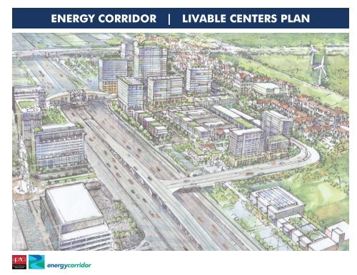
ENERGY CORRIDOR | LIVABLE CENTERS PLAN
ACKNOWLEDGMENTS<br />
Board of Directors,<br />
Energy Corridor District<br />
David W. Hightower, CCIM, CRE<br />
President, Board Chairman<br />
Robert B. Halick<br />
Vice President<br />
E. Alan Cochrane<br />
Investment Officer<br />
Steve Moskowitz<br />
Chuck B. Cervas<br />
Steve L. West<br />
Secretary / Treasurer<br />
Peter Johnston<br />
John DeWine<br />
Tim Milligan<br />
Harris County<br />
Steve Radack<br />
Commissioner Harris County Precinct 3<br />
City of <strong>Houston</strong><br />
Mayor Annise Parker<br />
Mayor, City of <strong>Houston</strong>, Texas<br />
Judge Ed Emmett<br />
Harris County Judge<br />
Brenda Stardig<br />
Council Member District A<br />
Oliver Pennington<br />
Council Member District G<br />
The Community<br />
We would like to thank the more<br />
than two hundred people who<br />
participated in the creation of<br />
this <strong>plan</strong>.<br />
Advisory Committee<br />
Stream Realty Partners<br />
Robert Halick<br />
METRO<br />
Clint Harbert<br />
City of <strong>Houston</strong><br />
Mike Kramer<br />
BP<br />
Todd Eads<br />
ECD<br />
Clark Martinson<br />
H-GAC<br />
Meredith Dang<br />
TxDOT<br />
Teri Ka<strong>plan</strong><br />
Lomonte’s Italian Restaurant<br />
Barbie Lomonte<br />
Bernstein Perwien Properties<br />
Bob Bernstein<br />
Lupe Tortilla<br />
Stan Holt and Carol Alonzo<br />
Consultant Team<br />
LRK Inc.<br />
GUNDA Corporation, LLC<br />
TBG Partners<br />
CDS | Spillette<br />
Transight LLC d.b.a. Bicycle Solutions<br />
THE BEST BUSINESS DISTRICT IN THE BEST BUSINESS CITY IN THE U.S.A.
TABLE OF CONTENTS<br />
Introduction<br />
History & Overview<br />
A Planned Business Center<br />
Livable Centers Study<br />
Recreational Assets<br />
Study <strong>Area</strong><br />
Opportunities & Challenges<br />
Land Use<br />
Existing & Proposed Trails - Regional<br />
Pedestrian & Bike Trails<br />
Regional Mobility<br />
Opportunities & Challenges<br />
Planning Process<br />
Kick-off & Advisory Committee<br />
Public Open House Workshops<br />
Community Vision Survey<br />
Concept Plan<br />
Translating the Vision<br />
Concept Plan<br />
The Bridge<br />
Addicks Park & Ride Lot<br />
Addicks Square<br />
Triangle Park<br />
Bridge to Letitia Village<br />
Park Row North to Reservoir<br />
Pedestrian & Bicycle Ways<br />
Parking<br />
A Transit Hub<br />
Transit Station Concept<br />
Transit Mall Concept<br />
Implementation<br />
Strategies<br />
Development Costs<br />
Conclusion<br />
Livable Centers Study Conclusion<br />
2<br />
3<br />
4<br />
5<br />
6<br />
7<br />
8<br />
9<br />
10<br />
11<br />
12<br />
14<br />
16<br />
17<br />
18<br />
19<br />
22<br />
23<br />
24<br />
26<br />
28<br />
30<br />
31<br />
32<br />
34<br />
36<br />
38<br />
39<br />
40<br />
41<br />
42<br />
44<br />
46<br />
48<br />
49<br />
1
610<br />
I-45<br />
INTRODUCTION<br />
HWY 6<br />
BROOKSHIRE<br />
I-10<br />
KATY<br />
I-10<br />
ENERGY CORRIDOR<br />
HOUSTON<br />
HWY 6<br />
BELTWAY 8<br />
SUGAR LAND<br />
BECOMING THE FUTURE GEOGRAPHIC CENTER OF THE HOUSTON REGION
HISTORY & OVERVIEW<br />
The Texas State Legislature created the Energy<br />
Corridor Management District in 2001 with the<br />
mission to improve, enhance and promote a 1,500<br />
acre area that extends along both sides of Interstate<br />
10 from Tully to east of Park 10 Boulevard and<br />
along North Eldridge Parkway from Interstate 10<br />
to south of Briar Forest. Founded to help guide the<br />
success of member businesses, the Energy Corridor<br />
District is made up of area members, staff, and an<br />
elected board of directors who work with public<br />
and private organizations at the local, regional,<br />
state and national levels to facilitate attracting,<br />
relocating and optimizing the success of companies<br />
in the District.<br />
Strategically located along IH-10, midway between<br />
Beltway 8 and the Grand Parkway, the Energy<br />
Corridor is home to multi-national and local<br />
growth-oriented companies. This broad range of<br />
companies, from <strong>energy</strong> to healthcare, engineering,<br />
and financial services, allows the District to<br />
diversify its economic base while strengthening<br />
its competitive edge in the global market place.<br />
Currently, the Energy Corridor is the third largest<br />
employment center in the region with more than<br />
77,000 employees. Premier shops and restaurants,<br />
beautiful parks and trails, and the growing<br />
residential population make the Energy Corridor<br />
one of the most desirable places for people and<br />
businesses to call home in <strong>Houston</strong>.<br />
3
A PLANNED BUSINESS CENTER<br />
The Energy Corridor District’s primary purpose is<br />
to increase the value of properties in the District.<br />
Local and national property interests recognize<br />
the benefit of special districts to protect property<br />
owners’ investments and increase values. There<br />
are opportunities within the City of <strong>Houston</strong> that<br />
emphasize the benefit of the District’s master<br />
<strong>plan</strong>ning initiatives, transportation and infrastructure<br />
<strong>plan</strong>s, park improvements, maintenance, security<br />
and advocacy for its constituents.<br />
The Energy Corridor is a model community of<br />
progressive companies recognized as a well<strong>plan</strong>ned,<br />
high-quality place that integrates regional<br />
and metropolitan commercial development. The<br />
District’s Master Plan includes long- and shortterm<br />
improvements that support current and future<br />
economic vitality. The master <strong>plan</strong> includes a<br />
marketing campaign for transit, other commuting<br />
options and infrastructure projects that address<br />
congestion, increase connectivity and improve<br />
traffic operations. Landscape and urban design<br />
elements aim to create identity, visual continuity<br />
and inviting streetscapes. The District has one of<br />
the most significant system of parks and trails in the<br />
region which will be tied together through a master<br />
<strong>plan</strong> prepared by the National Park Service.<br />
In its relatively short active life, the Energy Corridor<br />
District has registered significant accomplishments.<br />
By applying the effort and expertise of its staff in<br />
collaborative arrangements with public agencies,<br />
the District has leveraged its financial resources<br />
to design and implement several key projects.<br />
This success would not be possible without<br />
maintaining a strong relationship with locally<br />
elected representatives.<br />
THE MOST POWERFUL ENERGY COMPANIES IN THE WORLD CALL THIS HOME
LIVABLE CENTERS STUDY<br />
By 2035, the eight-county <strong>Houston</strong>-<strong>Galveston</strong><br />
region is expected to grow by an additional 3.5<br />
million people. Accommodating this growth will<br />
overburden the region’s transportation network<br />
unless we identify ways to reduce vehicle trips.<br />
The Regional Transportation Plan of the <strong>Houston</strong>-<br />
<strong>Galveston</strong> <strong>Area</strong> Council (H-GAC) lays out a new<br />
strategy to address this growth - Livable Centers.<br />
Livable Centers are walkable, mixed-use places that<br />
provide multimodal transportation options, improve<br />
environmental quality and promote economic<br />
development. These places are safe, convenient,<br />
and attractive areas where people can live, work,<br />
and play with less reliance on their cars.<br />
The Energy Corridor Livable Centers Study is a<br />
partnership between the H-GAC and the Energy<br />
Corridor District for developing a vision and <strong>plan</strong><br />
for a Livable Center. This <strong>plan</strong> will incorporate<br />
recommendations for transportation, infrastructure<br />
improvements, urban design and economic<br />
development.<br />
Goals & Objectives<br />
At the onset of this project, the following goals and<br />
objectives were established for the Plan:<br />
Vision Statement<br />
Prepare a vision and <strong>plan</strong> with community support that establishes<br />
a Livable Center as “the heart of the Energy Corridor”. This high<br />
quality mixed-use place will support transit, pedestrian and<br />
bicycle usage so people can LIVE, WORK, RIDE and PLAY and<br />
Energy Corridor companies can retain and attract the best and<br />
brightest candidates from around the world.<br />
• To improve connectivity and choices for all modes<br />
of movement and become a pedestrian, bicycle and<br />
transit-friendly community.<br />
• To envision how development/redevelopment<br />
can be a high-quality and mixed-use place with a<br />
focus on the Addicks Park & Ride Lot as a target<br />
opportunity site.<br />
• To become the transit hub for west <strong>Houston</strong>.<br />
5
RECREATIONAL ASSETS<br />
Parks, Trails and Recreation<br />
A wide variety of recreational activities are available<br />
in and near the Energy Corridor. There are 50<br />
miles of recreational trails for jogging, hiking,<br />
rollerblading and cycling – all of which connect<br />
neighborhoods and businesses in and around the<br />
Corridor.<br />
The Energy Corridor District was recently selected<br />
by the National Park Service’s Rivers, Trails and<br />
Conservation Assistance Program to receive<br />
<strong>plan</strong>ning assistance for the West <strong>Houston</strong> Trail<br />
System. Through this partnership, efforts will<br />
continue to develop and improve trails throughout<br />
the area.<br />
George Bush Park<br />
Barker Reservoir<br />
Park Row<br />
Interstate 10<br />
State Highway Highway 6 6<br />
Cullen / Bear Creek Parks<br />
Addicks Reservoir<br />
Westlake Park Park Blvd Blvd<br />
N Eldridge Parkway Parkway<br />
Addicks and Barker Reservoirs<br />
Located about 17 miles from downtown <strong>Houston</strong>,<br />
the Addicks and Barker Reservoirs lie entirely within<br />
the boundaries of the city and create places where<br />
visitors can find peace and quiet in the middle<br />
of a vital metropolitan area. The reservoirs are<br />
a flood damage reduction project that prevents<br />
downstream flooding of Buffalo Bayou in the City<br />
of <strong>Houston</strong>. The 26,000 acres of land that makes<br />
up these reservoirs is largely undeveloped, thus<br />
creating opportunities for recreational and natural<br />
experiences and observations. Visitors are welcome<br />
to experience and enjoy the diverse ecosystem and<br />
wildlife found in fields, lush woods and streams.<br />
The City of <strong>Houston</strong>, Harris County Precinct 3, and<br />
Fort Bend County operate daytime recreational<br />
facilities within Addicks and Barker Reservoirs.<br />
There are many miles of scenic trails that provide<br />
unlimited opportunities for walking, hiking and<br />
biking. Cullen / Bear Creek Parks and George<br />
Bush Park are blessed with a wealth of recreational<br />
facilities and amenities.<br />
CONVENIENT AND SAFE ON FOOT OR BICYCLE
STUDY AREA<br />
The Livable Centers Study focuses on the properties<br />
adjacent and near the Addicks Park & Ride Lot along<br />
SH-6 between Grisby and Park Row and along both<br />
sides of IH-10 from SH-6 to West Lake Boulevard.<br />
The Study <strong>Area</strong> includes public and private lands<br />
within one-half mile of a future Energy Corridor<br />
Transit Center and Transit-Oriented Development at<br />
and surrounding the Addicks Park & Ride Lot.<br />
Cullen / Bear Creek Parks<br />
Addicks Reservoir<br />
Park Row<br />
Interstate 10<br />
Addicks<br />
P&R<br />
Westlake Park Park Blvd Blvd<br />
N Eldridge Pkwy Pkwy<br />
1/4 mile<br />
State Highway Highway 6 6<br />
George Bush Park<br />
Barker Reservoir<br />
1/2 mile<br />
7
OPPORTUNITIES & CHALLENGES<br />
Cullen / Bear Creek Parks<br />
Addicks Reservoir<br />
1/2 mile<br />
George Bush Park<br />
Barker Reservoir<br />
1 mile<br />
2010 Land Use Map<br />
PROACTIVE PLANNING FOR FUTURE GROWTH
Current and Future Commercial<br />
and Industrial Space<br />
Building Size in Square Feet<br />
Type<br />
Total<br />
Current 2010<br />
Office / Mixed Use 20,185,815<br />
Industrial / Warehouse 2,642,764<br />
Retail 4,226,343<br />
Grand Total 27,054,922<br />
Future 2025<br />
Office / Mixed Use 27,963,211<br />
Industrial / Warehouse 3,024,786<br />
Retail 5,562,033<br />
Grand Total 36,550,029<br />
Current and Future Housing Units<br />
Number of Housing Units<br />
Type<br />
Total<br />
Current 2010<br />
Multifamily Condo / Apts 13,677<br />
Single Family, Attached 2,139<br />
Single Family, Detached 4,149<br />
Grand Total 19,965<br />
Future 2025<br />
Multifamily Condo / Apts 17,973<br />
Single Family, Attached 2,170<br />
Single Family, Detached 4,137<br />
Grand Total 24,280<br />
LAND USE<br />
The Energy Corridor is one of the <strong>Houston</strong> area’s<br />
premier employment <strong>centers</strong>. The Energy Corridor<br />
is so-called because it contains the headquarters<br />
locations and regional offices of prominent<br />
international <strong>energy</strong> and <strong>energy</strong> services firms<br />
including BP America, Shell Exploration and<br />
Production, ExxonMobil Chemical, ConocoPhillips,<br />
and CITGO. Other non-<strong>energy</strong> companies also<br />
have headquarters in the <strong>corridor</strong> including<br />
Cardinal Health Care, Inc., Sysco Corporation, Gulf<br />
States Toyota, Dow Chemical, and Star Furniture.<br />
Overall, the Energy Corridor includes a population<br />
of 44,000 and 77,000 jobs. The <strong>corridor</strong> contains<br />
over 20 million square feet of office space (of which<br />
72% is Class A) and over 4 million square feet of<br />
retail.<br />
The tables on this page illustrate the land use in the<br />
Energy Corridor as of January 2010 with projections<br />
for the year 2025. This data is based on the parcel<br />
level GIS information on land use prepared by<br />
CDS Market Research. The source data used in this<br />
analysis was updated for the 2010 inventory.<br />
Despite the softening of values, occupancy rates<br />
and absorption pace during the period of the Great<br />
Recession, the Energy Corridor is still extremely<br />
well-positioned to capture a substantial share of<br />
its projected growth over the coming decade or<br />
two. With proper <strong>plan</strong>ning and proactive efforts<br />
for public funding and public –private partnering,<br />
the Study <strong>Area</strong> is well positioned to become the<br />
premier location in the Energy Corridor. With the<br />
potential for approximately eight million square<br />
feet of new office space, more than one million<br />
square feet of future retail space and almost 5,000<br />
residential units, this is one of the most optimally<br />
located Livable Centers in the region from a land<br />
use potential standpoint. The growth is definitely<br />
coming to this location and this Livable Center<br />
only has to reshape that growth not create the<br />
demand.<br />
9
STATE HIGHWAY 6<br />
N. KIRKWOOD RD.<br />
ELDRIDGE RD.<br />
GRAND PARKWAY<br />
FM 723<br />
HEMPSTEAD RD.<br />
INTERSTATE 10<br />
EXISTING & PROPOSED TRAILS - REGIONAL<br />
GEORGE BUSH<br />
PARK/BARKER<br />
RESERVOIR<br />
EXPAND HIKE AND BIKE AS BEST IN REGION<br />
WESTHEIMER RD.<br />
LIVABLE<br />
CENTER<br />
C U L L E N /<br />
BEAR CREEK<br />
PARK/ADDICKS<br />
RESERVOIR<br />
FREEMAN RD.<br />
FM 529<br />
FM 1093
PEDESTRIAN & BIKE TRAILS<br />
A major competitive advantage of the Energy<br />
Corridor Livable Center Study <strong>Area</strong> location is the<br />
access to what may be the best regional trail system<br />
outside of a <strong>plan</strong>ned community development in<br />
the region. The Study <strong>Area</strong> is anchored to the north<br />
and southwest by two of the largest green spaces<br />
in Harris County: Cullen / Bear Creek Parks and<br />
Addicks Reservoir as well as George Bush Park and<br />
Barker Reservoir, respectively.<br />
Having these amenities enables the project to<br />
build upon a great quality of life environment<br />
that exists today. This <strong>plan</strong> leverages what exists<br />
by incorporating gateways to the existing parks,<br />
trail systems and neighboring developments so<br />
that the users of the Livable Center and the entire<br />
Energy Corridor District will have alternative<br />
transportation options as well as a high quality of<br />
life environment.<br />
As part of the City of <strong>Houston</strong>, the Energy Corridor<br />
District is coordinating its <strong>plan</strong>s with the City’s<br />
Bikeway Program which offers a 345-mile bikeway<br />
network that spans the city. The Energy Corridor<br />
District also falls within the area addressed by the<br />
West <strong>Houston</strong> Trails Master Plan (WHTMP) which<br />
proposes a 100+ mile interconnected trail system.<br />
These networks include bike lanes / routes, shared<br />
lanes, bayou trails, rail-trails and other urban multiuse<br />
paths. Bicycle commuters can use combinations<br />
of trails, bike lanes, transit and shared roadways to<br />
travel between their homes and work places.<br />
As development within the Energy Corridor District<br />
becomes denser, pedestrian circulation becomes<br />
a more critical element to the quality of life shared<br />
by those who work, live and play in the district. It is<br />
clear that the existing trails and sidewalks within the<br />
Study <strong>Area</strong> are not sufficient to support anticipated<br />
growth. A clear vision must be <strong>plan</strong>ned for the future<br />
which provides connection to existing developments<br />
and open spaces and weaves together the complex<br />
urban fabric of the Energy Corridor.<br />
11
REGIONAL MOBILITY<br />
Surveys conducted previously in the Energy Corridor<br />
District have indicated that employers, employees<br />
and residents all see traffic as a problem that is<br />
growing in significance. One reason is that several<br />
physical barriers limit connectivity and mobility<br />
to and within the Study <strong>Area</strong>. These barriers are<br />
IH10 in the center, Addicks Dam to the north and<br />
Buffalo Bayou to the south. East/west travel in and<br />
out of the Study <strong>Area</strong> is limited to Park Row, IH-10,<br />
and Memorial Drive. North/south travel in and<br />
out of the Study <strong>Area</strong> is limited to SH6. The local<br />
streets provide some relief and spread out travel<br />
patterns, but the lack of overall interconnectivity is<br />
a significant limitation.<br />
At present, only 6,000 people both live and work in<br />
the Energy Corridor District and there is a fairly low<br />
level of commuting using alternative modes to the<br />
private automobile. There is a relative imbalance in<br />
the jobs-to-housing ratio and the potential internal<br />
capture of trips is not only lost, it results in greater<br />
peak hour commuter traffic.<br />
TRANSPORTATION ENHANCING LIVABILITY
Modal Split<br />
Subject Subject Male Female<br />
Workers 16 years and over 70,869 35,558 35,311<br />
Car, truck or van 90.70% 89.70% 91.70%<br />
Drove alone 82.00% 81.10% 83.00%<br />
Carpooled 8.70% 8.60% 8.70%<br />
In 2-person carpool 7.30% 7.30% 7.30%<br />
In 3-person carpool 1.00% 1.00% 0.90%<br />
In 4-or-more person carpool 0.40% 0.30% 0.50%<br />
Workers per car, truck or van 1.16 1.17 1.15<br />
Public transportation (excluding taxi) 2.50% 2.50% 2.60%<br />
Walked 1.90% 2.00% 1.70%<br />
Bicycle 0.20% 0.30% 0.20%<br />
Taxicab, motorcycle or other means 1.20% 1.70% 0.70%<br />
Worked at home 3.50% 3.80% 3.20%<br />
Above is information from the US Census web site illustrating mode split data for the Study <strong>Area</strong>.<br />
The data was produced as part of the American Community Survey. Statistics shown are for a<br />
three year average from data collected during the period 2006 – 2008. This survey uses a random<br />
sample from the Study <strong>Area</strong> which is then expanded to the total population in the area.<br />
Addicks Park & Ride Ridership<br />
Year Vehicles 228 1 285 2 298 3<br />
FY96 1,368 2,270 333<br />
FY97 1,493 2,298 358<br />
FY98 1,404 2,486 376<br />
FY99 1,622 2,824 373<br />
FY00 1,828 2,977 409 342<br />
FY01 2,074 3,050 400 550<br />
FY02 2,186 2,967 456 809<br />
FY03 1,901 2,550 449 987<br />
FY04 1,811 2,460 408 1,009<br />
FY05 1,819 2,586 311 1,037<br />
FY06 2,021 2,705 1,238<br />
FY07 2,398 2,426 1,289<br />
FY08 2,082 2,414 1,498<br />
FY09 1,646 2,549 1,407<br />
FY10 1,567 2,174 1,199<br />
1 - Route 228 Addicks Boardings; 2 - Route 285 K-A-NWTC/U-G Boardings (discountinued in<br />
October 2004); 3 - 298 K-A-NWTC/TMC Boardings (began in January 2000).<br />
This data is for Public Use Microdata <strong>Area</strong> PUMA5 - 04612<br />
REGIONAL MOBILITY<br />
The current modal split among forms of movement<br />
was examined along with existing transit service and<br />
ridership. Below are some observations regarding<br />
mobility in the Energy Corridor:<br />
• METRO Bus Route 228 Addicks operates between<br />
the Addicks Park & Ride lot and downtown and<br />
carries approximately 80% of the transit riders from<br />
the lot.<br />
• The interchanges at both SH-6 and N. Eldridge<br />
were improved recently and no additional capacity<br />
improvements are <strong>plan</strong>ned.<br />
• The most critical east/west transportation need in the<br />
Study <strong>Area</strong> is the completion of Park Row to Eldridge<br />
in order to give motorists and transit more route<br />
options to enter and leave the Study <strong>Area</strong>.<br />
• The most critical north/south transportation need<br />
in the <strong>corridor</strong> and Study <strong>Area</strong> is the addition of<br />
a pedestrian/transit bridge over IH-10 which will<br />
greatly impact the utilization of the Addicks Park<br />
& Ride Lot.<br />
• The addition of an overpass between SH-6 and<br />
Eldridge at WestLake Park Boulevard would add<br />
cohesion to the Study <strong>Area</strong> and improve the general<br />
mobility in the <strong>corridor</strong>.<br />
13
OPPORTUNITIES & CHALLENGES<br />
At the inception of the <strong>plan</strong>ning process at meetings<br />
with The Advisory Committee members and key<br />
stakeholders, a series of “big ideas” and the<br />
associated opportunities and challenges for each<br />
was identified. These big ideas became major<br />
themes guiding the focus of this project and serve<br />
as the storyline for what a Livable Center can make<br />
possible for the Energy Corridor. There is perhaps<br />
no better single image that captures these big ideas<br />
and the opportunities and challenges than the<br />
incredible panoramic photographic at right.<br />
George Bush Park<br />
Barker Reservoir<br />
Future Lined Bridge<br />
Panoramic View of Addick’s Park & Ride<br />
Get people to the “great green backyards”<br />
Expand hike/bike trails as “best in region”<br />
Opportunity: The Energy Corridor is surrounded by 26,000<br />
acres of open space situated in the Addicks and Barker<br />
Reservoirs.<br />
Challenge: Connecting people to these vast open spaces by<br />
foot and bicycle as well as viewing magnificent green vistas from<br />
buildings tall enough to peer over the reservoir embankments.<br />
Opportunity: With 50 miles of trails, the Energy Corridor has<br />
more trails than any place in the <strong>Houston</strong> region outside of the<br />
Woodlands & Kingwood.<br />
Challenge: Implement the National Park Service <strong>plan</strong> so the<br />
Energy Corridor can become the region’s “trail head” for the<br />
West <strong>Houston</strong> Trail System.<br />
THIS MUCH CENTRALLY LOCATED DEVELOPABLE LAND CREATES POSSIBILITIES
Addicks<br />
Park & Ride<br />
Cullen / Bear Creek Parks<br />
Addicks Reservoir<br />
Future WestLake Park<br />
Bridge Connector<br />
Bridge the “great highway divide”<br />
Create the “missing center”<br />
More choices & access for all modes<br />
Opportunity: IH-10 is a lifeline that moves more than<br />
200,000 trips per day to and through the Energy Corridor.<br />
Challenge: At 24 lanes in width, this massive dividing line<br />
slices and separates the Energy Corridor, limiting the ability<br />
to create a connected Livable Center.<br />
Opportunity: Leverage redevelopment of the Addicks<br />
Park & Ride Lot to help anchor the “center” that does not<br />
yet exist.<br />
Challenge: Incorporating lands adjacent to the Addicks<br />
Park & Ride Lot and opposite the site on the south side of IH-<br />
10 to achieve a Livable Center with sufficient critical mass.<br />
Opportunity: Create and reshape places in the Energy<br />
Corridor to encourage more walking, biking and transit<br />
usage.<br />
Challenge: Traffic is one of the most significant challenges to<br />
the function and future prosperity of the Energy Corridor.<br />
15
PLANNING PROCESS<br />
TO GAIN THE MOST VALUE FROM GROWTH, YOU NEED STRONG GUIDANCE
KICK-OFF & ADVISORY COMMITTEE<br />
The <strong>plan</strong>ning process commenced in April 2010<br />
with a review by the consulting team of all existing<br />
available <strong>plan</strong>s and studies relevant to the Study<br />
<strong>Area</strong> and the immediate surroundings. Every effort<br />
was made to rely upon these existing studies and<br />
<strong>plan</strong>s for baseline data and projections related to<br />
mobility, land use, circulation and transit service.<br />
The consultant team conducted tours of the Study<br />
<strong>Area</strong> by driving, walking, bicycling and riding (by<br />
75 Connector bus) to gain a better understanding<br />
of existing conditions and mobility by all modes.<br />
Field observations of traffic, transit, bicycle, and<br />
pedestrian activity were used to identify deficiencies<br />
and impediments to the use of alternative modes<br />
of transportation and future needs.<br />
The Energy Corridor District established an<br />
Advisory Committee which included community<br />
representatives to develop a consensus on the<br />
goals and objectives for the project vision for the<br />
future of the area. Stakeholders representing land<br />
surrounding the Addicks Park & Ride lot and the<br />
Letitia Village restaurant area were included to<br />
provide input from existing businesses in the Study<br />
<strong>Area</strong>.<br />
Initial kick-off meetings in early May to explain the<br />
<strong>plan</strong>ning and community visioning process were<br />
held with the Advisory Committee and stakeholders.<br />
A stakeholders vision session was conducted on<br />
May 17 in order to understand private property<br />
owners’ perspectives and any <strong>plan</strong>s proposed<br />
for their lands. Two dozen stakeholders attended<br />
and helped the consultant team gain a detailed<br />
understanding of the opportunities, challenges and<br />
perspectives of the Study <strong>Area</strong> and its stakeholders.<br />
This input was used to custom-tailor the Public Open<br />
House Workshops on June 7-9.<br />
17
PUBLIC OPEN HOUSE WORKSHOPS<br />
A three-day, charrette-style workshop was conducted<br />
June 7-9, 2010 at the Crowne Plaza hotel at which<br />
more than 200 people attended. The Public Open<br />
House Workshops were promoted through a variety<br />
of methods ranging from broad public awareness<br />
through press releases, postcards, flyers and posters<br />
supplemented with direct outreach efforts by way<br />
of phone calls, letters and e-mail blasts. Specific<br />
groups identified by the Advisory Committee and<br />
stakeholders were targeted ranging from apartment<br />
complexes, restaurants, employers, neighborhood<br />
associations and various governmental and nongovernmental<br />
organizations. The offices of elected<br />
officials representing the Energy Corridor District<br />
were also invited.<br />
On the first day, June 7, community input was<br />
solicited in an “open house” where the public could<br />
“drop-in” any time at their convenience. Attendees<br />
were asked to identify with dots on maps where<br />
they live/work, traffic and pedestrian “hot spots”,<br />
and most/least favorite places in the Study <strong>Area</strong>. A<br />
Community Vision Survey allowed participants to<br />
help evaluate and select images to help guide the<br />
creation of the concept <strong>plan</strong>.<br />
The second day of the workshop consisted of work<br />
sessions to translate community input into the <strong>plan</strong>.<br />
Visions and concept <strong>plan</strong> studies were created<br />
throughout the day based on public input from<br />
the “open house”. The third day of the workshop<br />
involved refining the vision and design concepts<br />
followed by an “open house” where the public was<br />
invited to see how the <strong>plan</strong> was shaping up. This<br />
format made it easy for the public to follow the<br />
evolution of the vision and concept <strong>plan</strong>.<br />
Citizens identified locations where improved pedestrian and<br />
bicycle connections are needed.<br />
Residents and employees placed dots on maps to identify where<br />
they live and/or work in the Study <strong>Area</strong>.<br />
Walk over I-10 - great idea!”<br />
Citizen Comment<br />
A series of large-scale aerial photos helped make it easy for the public to identify issuesin the<br />
Study <strong>Area</strong>.<br />
The public placed green dots to identify “Favorite Places” and<br />
red dots for “Least Favorite Places”.<br />
PUBLIC SPACES WITH GREEN, SHADE, WATER AND A CHANGE IN GRADE
Public Spaces<br />
COMMUNITY VISION SURVEY<br />
A visually-based Community Vision Survey was used<br />
to gain public input on the “look and feel” of public<br />
spaces, streetscape and architectural character and<br />
transit facilities/vehicles. The Survey was conducted<br />
during the June 7 Public Open House Workshop<br />
and results have been incorporated into the concept<br />
<strong>plan</strong>. The survey arranged images in a series of<br />
four per topic to present a range of choices for<br />
possible future visions. Presented to small groups,<br />
participants were given a chance to view each set<br />
of images and then select the image they felt would<br />
be “most appropriate” for the Energy Corridor or,<br />
“none” if they felt that no image fit their vision.<br />
Scores were recorded on individual score sheets<br />
and afterward, select images were re-presented for<br />
follow-up discussions. A summary of these findings<br />
follows on this and the next few pages.<br />
50%<br />
Public Spaces – The images displayed at left<br />
were the highest rated public space images in<br />
the survey. Participants indicated that they want<br />
to see a diversity of public spaces ranging from<br />
passive greens to enticing water features to hard<br />
paved plazas. Discussions were very precise with<br />
participants noting that these spaces need shade,<br />
not too much concrete, places to site, open spaces<br />
for kids and changes in elevation to make add<br />
interest to the flat environment.<br />
42% 42%<br />
34%<br />
34% 32%<br />
30%<br />
19
COMMUNITY VISION SURVEY<br />
Architectural Character<br />
Architectural Character – There was more<br />
diversity of opinion when it came to architecture.<br />
Some participants like buildings that have a small<br />
town feel or look “vintage Texan” while others prefer<br />
more modern designs. Images of more typical<br />
<strong>Houston</strong>-area buildings did not fare as favorably.<br />
Buildings with specially-designed corner treatments<br />
seemed to catch many participants’ eyes in the<br />
survey. In some of the follow-up discussions<br />
participants talked of the need to create a unique<br />
architectural character for the Energy Corridor to<br />
help make the district uniquely identifiable in the<br />
region.<br />
Streetscapes – Street trees that provide for<br />
shade for pedestrians was a critical element of<br />
preferred streetscapes. Participants want to see<br />
wider sidewalks, old-style lampposts and touches<br />
of greenery that add interest for pedestrians.<br />
Participants clearly stated that they want more<br />
opportunities to walk in safety, with some protection<br />
from the sun and to destinations with activities that<br />
are currently missing or non-existent.<br />
44%<br />
Transit Facilities – The survey presented sets of<br />
images to test both transit facilities (bus shelters)<br />
and transit vehicles (buses). Participants had a very<br />
clear vision for transit facilities that are unique and<br />
not typical. Transit facilities that were more than<br />
just a shelter were strongly favored. In follow-up<br />
discussions, participants focused on how the mix<br />
and integration of multiple uses made the transit<br />
facility feel much more attractive, inviting and<br />
dignified.<br />
The design of transit vehicles was another area<br />
where the public would strongly like to see a<br />
new alternative. The overwhelming majority of<br />
participants selected images of more contemporary,<br />
sleek and highly-glazed vehicles versus typical<br />
buses.<br />
38% 32%<br />
30%<br />
28%<br />
32%<br />
26%<br />
BROAD COMMUNITY SUPPORT TO IMPLEMENT THE VISION
Streetscapes<br />
Transit Facilities<br />
40%<br />
56%<br />
50%<br />
38%<br />
22%<br />
24%<br />
32%<br />
2%<br />
6%<br />
21
CONCEPT PLAN<br />
TRANSLATING THE VISION INTO THREE DIMENSIONS
TRANSLATING THE VISION<br />
The Public Open House Workshop schedule<br />
was established in a charrette-style to enable the<br />
consulting team to focus intensely on the design of<br />
the concept <strong>plan</strong> immediately following gathering<br />
community input at the June 7 Open House, then<br />
presenting the concept <strong>plan</strong> for public feedback at<br />
the June 9 Open House. The charrette allowed<br />
the consultant team to listen to the community and<br />
translate their input as follows:<br />
• Identify potential locations for special places to<br />
create identity, activation and uniqueness.<br />
• Conceptualize the potential character and activities,<br />
including amenities and programming and<br />
management that occur for each place.<br />
• Explore multi-modal connections between the<br />
special places - walking, bicycling, shuttles and<br />
bus.<br />
• Envision how to enrich the human experience when<br />
moving between places so that it becomes a defining<br />
element of the entire district.<br />
• Analyze ways to layer a rich mix of uses within and<br />
between the special places that creates a synergy<br />
which can be a hallmark of the entire district.<br />
23
CONCEPT PLAN<br />
The concept <strong>plan</strong> transforms the Addicks Park & Ride<br />
Lot and the surrounding properties spanning both<br />
sides of the highway into the “heart of the Energy<br />
Corridor”. This place is a series of interconnected<br />
spaces, streets and parks that are all linked to one<br />
another and connected together by a landmark<br />
bridge lined with buildings and punctuated in the<br />
middle with a public plaza. Existing places such<br />
as Letitia Village, Helios Plaza and Park Row are<br />
integrated into the <strong>plan</strong>. All of the special places<br />
in this Livable Center will be activated by transit,<br />
pedestrians, bicyclists and motor vehicles. Parking is<br />
provided curbside along most streets, and funneled<br />
into parking garages lined with buildings at key<br />
intercept locations so people can “park once” then<br />
walk, bike or ride transit to get around.<br />
At the center of the Addicks Lot is a new transit facility<br />
with a multi-level commuter parking structure. The<br />
highest densities containing a mix of uses are<br />
focused in proximity to transit. Employees, residents<br />
and visitors all using transit for different reasons at<br />
different times will help to create a round-the-clock<br />
vibrancy to the transit experience. The bridge brings<br />
transit proximity to nearby, but difficult-to-reach<br />
properties across IH-10. A magnet match and<br />
science <strong>energy</strong> education campus is envisioned to<br />
the east, allowing Energy Corridor companies to<br />
partner in educating the next generation.<br />
This Livable Center is intended to promote<br />
sustainability, particularly as it relates to <strong>energy</strong><br />
efficiency and generation from renewable resources.<br />
The <strong>plan</strong> envisions buildings with green roofs to<br />
reduce heat gain and run-off, solar panels on<br />
buildings and parking structures, geothermal<br />
heating/cooling systems and wind turbines. Storm<br />
water run-off will be directed into recharge rain<br />
gardens. Sustainable agriculture will be promoted<br />
in rooftop and wall gardens, community garden<br />
plots in parks and perhaps a community-supported<br />
organic farm on nearby underutilized land.<br />
State Highway 6<br />
Park & Ride Drive<br />
Cullen / Bear Creek Parks<br />
Addicks Reservoir<br />
Park Row Boulevard<br />
Interstate 10<br />
Addicks-Howell Road<br />
Grisby Road<br />
Helios Way<br />
CREATING THE HEART OF THE ENERGY CORRIDOR
THE BRIDGE<br />
One key element that will connect the north and<br />
south sides of IH-10 into a walkable, bikable and<br />
transit-friendly Livable Center is to bridge over the<br />
24 lanes of highway with a structure that is lined<br />
with commercial uses and punctuated by public<br />
space resulting in an iconic landmark that defines<br />
the center of the Energy Corridor.<br />
Lining a bridge with retail shops and other business<br />
uses was common in Medieval times with roots<br />
tracing back to the Romans. Bridges were lined with<br />
commercial uses to help underwrite construction<br />
and maintenance costs. Today, only a handful of<br />
these historic commerce lined bridges still exist,<br />
however, they are among the most memorable<br />
landmarks in their respective cities and stand among<br />
the most famous structures in the world:<br />
• The Rialto, Venice, Italy<br />
• The Ponte Vecchio, Florence, Italy<br />
• The Pulteney Bridge, Bath, England<br />
There are numerous structures built on top of freeways<br />
in the United States including the following:<br />
• Civic Center MARTA Station over I-75/85, Atlanta, GA<br />
• Freeway Park and the Washington State Convention<br />
Center over I-5, Seattle, WA<br />
• Bartle Hall Convention Centers over I-670, Kansas City, MO<br />
St. Louis Science Center over I-64, St. Louis, MO<br />
• Prudential Center & Copley Place over I-90, Boston, MA<br />
Cobo Center over M-10, Detroit, MI<br />
• Great Platte River Road Archway Monument (museum)<br />
over I-80, Kearney, NE<br />
• Walgreens pharmacy over I-80, Reno, NV<br />
• Apartment buildings over I-95, New York, NY<br />
• High Street retail stores over I-670, Columbus, OH<br />
• Apartment buildings and Lytle Park, Cincinnati, OH<br />
• The largest McDonald’s in the world over I-44, OK<br />
• Parking garage over I-66, Arlington, VA<br />
• 6 rest stop/restaurant oases over I-80/90/94/294,<br />
Chicago, IL<br />
• US Post Office over I-290, Chicago, IL<br />
• Riverfront Plaza/Belvedere over I-64, Louisville, KY<br />
The Pulteney Bridge in Bath, England<br />
Great Platte River Road Archway Monument in Nebraska<br />
The Ponte Vecchio in Florence, Italy<br />
Freeway Park and the Washington State Convention Center in Seattle<br />
Civic Center MARTA Station in Atlanta<br />
High Street retail stores over I-670 in Columbus<br />
LET’S MEET AT THE BRIDGE
THE BRIDGE<br />
Tenant space<br />
within bridge<br />
Connecting together a Livable Center that spans<br />
both sides of a highway with 24-lanes of separation<br />
is a huge challenge. The solution is rather unique<br />
- a signature bridge lined with unique building<br />
space that encloses a “shared space” passage<br />
for pedestrians, bicycles and transit vehicles. The<br />
center of the bridge is envisioned as an open plaza<br />
that will accommodate special events.<br />
The buildings lining the bridge will contain<br />
specialized tenant space targeted to incubate<br />
unique one-of-a-kind establishments ranging from<br />
small cafes to <strong>energy</strong>-related start-ups. This space<br />
will be a landmark location that will be recognized<br />
throughout the region. The bridge also serves a<br />
critical mass transit function by creating a local<br />
transit connection between the north and south<br />
sides of IH-10, thus giving transit a competitive<br />
advantage in time efficiency within the Energy<br />
Corridor. From a transit function standpoint, the<br />
bridge will allow arrivals at Addicks to achieve what<br />
is impossible today: to hop a quick ride, walk or<br />
bike to a destination just across the highway.<br />
Elevation<br />
I-10<br />
Eastbound<br />
I-10<br />
Westbound<br />
Plaza<br />
Park & Ride Drive<br />
“Great Room” Road<br />
Feeder<br />
Feeder<br />
Old Katy Road<br />
Plan<br />
Existing Managed<br />
Lanes, Potential<br />
Rail Location<br />
575’ @ 4% slope 575’ @ 4% slope<br />
27
ADDICKS PARK & RIDE LOT<br />
At the center of the Addicks Lot, it is proposed there<br />
be a new transit facility which is under consideration<br />
by METRO. This new transit facility would be<br />
configured as either a Transit Mall or Transit Station<br />
integrated with a multi-level commuter parking<br />
structure. The highest densities containing a mix<br />
of uses are focused in this area close to transit<br />
service. Blocks and buildings will contain a mix of<br />
uses framing a series of public spaces, including<br />
Addicks Square and Triangle Park. The streets will<br />
have wide sidewalks where employees, residents<br />
and visitors all using transit for different reasons at<br />
different times create a round-the-clock vibrancy.<br />
Park Row Boulevard<br />
The bridge provides a multi-dimensional change<br />
in grades from above on the bridge to below in<br />
unique shaded spaces under the ramps which can<br />
host activities such as a “locally grown” Saturday<br />
market. Walks and trails from the bridge will<br />
also lead pedestrians and bicyclists gently down<br />
into Triangle Park where one can follow a series<br />
of interactive water features toward the Addicks<br />
Reservoir beyond.<br />
Triangle<br />
Park<br />
1<br />
Addicks<br />
Square<br />
4<br />
5<br />
3<br />
2<br />
Interstate 10<br />
FROM PARKING LOT TO “PLACE”
4<br />
1<br />
2 3<br />
5<br />
29
ADDICKS SQUARE<br />
Addicks Square is actually a series of interconnected<br />
and interrelated squares which contain a range of<br />
active gathering spaces and passive gardens within<br />
the squares. This space is more active where it is<br />
surrounded by shops, services and office space at<br />
its southern end, closer to IH-10, and becomes<br />
more passive at the other where it is enclosed by<br />
residential multi-family buildings.<br />
The square is anchored by a café kiosk and circular<br />
plaza at the more commercial end which provides<br />
focal point for surrounding shops and services. The<br />
center contains an oval-shaped “sunken green”<br />
that can support both informal gathering and<br />
programmed special events. The more residential<br />
end of the square contains shady gardens where<br />
neighbors can meet and greet or read a book in<br />
solitude.<br />
1<br />
1<br />
2<br />
2<br />
3<br />
3<br />
CREATING NEW WALKABLE PLACES FOR GATHERING, CAFES, CONCERTS AND SPECIAL ACTIVITIES
TRIANGLE PARK<br />
2<br />
1<br />
1<br />
This linear park helps provide a transition from the<br />
lined bridge to the trails leading towards Addicks<br />
Reservoir and Cullen / Bear Creek Parks. Coming<br />
off the bridge, pedestrians and bicyclists will be<br />
gently led down grade and into Triangle Park where<br />
they can follow a series of interactive water features.<br />
The water features will be a visible attraction from<br />
on the bridge, enticing young and old to interplay<br />
with fountains, bubblers and waterfalls that line and<br />
wind between the walks and trails.<br />
Triangle Park is very green and shaded by tree<br />
canopies to provide relief from the heat and sun<br />
and build anticipation for the incredible open space<br />
vistas that are just a short stroll or ride to the north<br />
at the top of the Addicks Reservoir embankment.<br />
3<br />
2<br />
3<br />
31
BRIDGE TO LETITIA VILLAGE<br />
The grade change provided by the bridge will create<br />
some interesting spaces “down under” the ramps<br />
that make great one-of-a-kind business such as<br />
restaurants, unique markets and night clubs.<br />
A hotel at the foot of the bridge on the south side<br />
of IH-10 is envisioned to be anchored by retail<br />
and service-oriented businesses which will extend<br />
toward Helios Plaza.<br />
The Post Office site is envisioned to be redeveloped<br />
perhaps as a multi-plex cinema and major structured<br />
parking intercept. The cinema and parking would<br />
provide a compliment to the restaurants in Letitia<br />
Village.<br />
Interstate 10<br />
Grisby Street could be the site of a long proposed<br />
green square shaded by existing mature Live Oaks.<br />
The adjacent street could be punctuated by an<br />
in-street fountain for traffic calming and a unique<br />
sense of arrival. The square is envisioned to be<br />
lined with a community garden on the edge of the<br />
new school. This garden could provide a learning<br />
interaction between student farmers and the nearby<br />
restaurants or perhaps be incorporated with a<br />
farmers market.<br />
State Highway 6<br />
Post<br />
Office<br />
Site<br />
2<br />
1<br />
4<br />
3<br />
Grisby Street<br />
5<br />
CONNECTING AND ENHANCING EXISTING ASSETS
10’ BUILDING LINE<br />
PROPERTY LINE<br />
C L<br />
PROPERTY LINE<br />
10’ BUILDING LINE<br />
3<br />
7<br />
5<br />
1<br />
2 2<br />
7<br />
5<br />
2 2<br />
2<br />
4<br />
5<br />
50’ R.O.W.<br />
There are several options for improving parking<br />
capacity and function in Letitia Village, ranging from<br />
extensive streetscape improvements and reorienting<br />
on-street parking as back-in diagonal spaces to<br />
a less costly “shared space” concept. This would<br />
maintain the mix of parallel and head-in parking<br />
that exists, but over time treats the surface of streets,<br />
parking spaces and walkways with a similar or<br />
complimentary textured paving and bollards to<br />
separate pedestrians. The <strong>plan</strong> envisions several<br />
parking structures proposed at intercept locations<br />
at the edges of Letitia Village that will provide the<br />
substantive increase in parking capacity that this<br />
area needs during peak periods.<br />
33
PARK ROW NORTH TO RESERVOIR<br />
The neighborhood along the north side of Park Row<br />
is envisioned as primarily residential and “green”<br />
in multiple ways. Townhomes and flats are set on<br />
blocks framing garden squares, lush mews and<br />
shady courtyards. Well-defined green streets and<br />
enclosed green spaces frame a series of outdoor<br />
living rooms for neighbors to meet and greet, gather<br />
informally and host block parties.<br />
The green and garden-like character of this<br />
neighborhood compliments its location at the<br />
“trailhead” of the Addicks Reservoir and Cullen /<br />
Bear Creek Parks. Streets and paths crossing the<br />
neighborhood are active with bikers and hikers from<br />
throughout the Energy Corridor who pass through<br />
on their way to and from the trail and park system to<br />
the north. On weekends, the neighborhood buzzes<br />
with bikers from across <strong>Houston</strong> who hop on buses<br />
with their bikes, disembark at the Energy Corridor<br />
transit hub and then ride-off on the most extensive<br />
trail system in the region.<br />
Living in this neighborhood is within walking<br />
distance of transit, employment and a range of<br />
restaurants and services. It is the ideal place to<br />
live-walk-ride-work during the week as well as<br />
hike-bike-hangout on weekends. Energy-efficient<br />
residences reinforce this as an ideal place for those<br />
interested in reducing their carbon footprints.<br />
Cullen / Bear Creek Parks<br />
Addicks Reservoir<br />
3<br />
2<br />
1<br />
Park Row Boulevard<br />
5<br />
4<br />
CONNECTING NEIGHBORHOODS WITH DESTINATIONS
4<br />
1<br />
2<br />
3 5<br />
35
PEDESTRIAN & BICYCLE WAYS<br />
The <strong>plan</strong> includes many recommendations for street,<br />
path and intersection improvements that support the<br />
Livable Center’s goals for bicycling and walking:<br />
• Employees, residents and visitors should find it safe,<br />
comfortable and convenient to reach all internal and<br />
nearby destinations on foot and bicycle.<br />
• Nearby families – including those with elementaryschool<br />
age children on their own bikes – should<br />
find it safe comfortable and convenient to walk or<br />
bike together to the Livable Center, and to nearby<br />
attractions including Leticia Village as well as<br />
Addicks Dam and Cullen / Bear Creek Parks.<br />
These photos illustrate several improvement areas<br />
for achieving these goals:<br />
1<br />
4<br />
1<br />
2<br />
3<br />
4<br />
5<br />
6<br />
Adding and improving walkways along Grisby<br />
Road through Leticia Village and making it<br />
convenient to cross the street;<br />
Widening IH-10’s frontage road sidewalks into<br />
two-way paths to facilitate bicycle travel between<br />
the Eldridge and Park Ten interchanges;<br />
Adding a signal on SH-6 to connect Grisby’s<br />
western segment, and adding bike lanes to SH-6<br />
south of IH-10;<br />
Adding a new east-west hike and bike trail on a<br />
pipeline <strong>corridor</strong> between Park Row and IH-10 to<br />
serve workplaces and residences west of SH-6;<br />
Creating additional high-quality neighborhood<br />
connections to Addicks-Howell Road, Grisby<br />
Road, and Gracie Lane to support walking and<br />
bicycling trips by residents of the Barker’s Landing<br />
and Fleetwood neighborhoods;<br />
Transforming Addicks-Howell Road with a hike<br />
and bike trail along its east side and several<br />
neighborhood gateways along its length, linking<br />
the Livable Center with Buffalo Bayou and the<br />
Terry Hershey Trail for walkers & bicyclists of all<br />
ages.<br />
2 5<br />
3 6<br />
NEIGHBORS CAN WALK AND BIKE TO THE LIVABLE CENTER
2<br />
PEDESTRIAN & BICYCLE WAYS<br />
This figure illustrates many of the recommended<br />
improvements to the area’s walking and bicycling<br />
network:<br />
1<br />
5<br />
5<br />
1<br />
2<br />
A new lined bridge would span IH-10 for<br />
walking, bicycling and local transit.<br />
Missing walkways and bikeways would be<br />
added to Park Row and Memorial Drive.<br />
3<br />
A new trail along Addicks-Howell Road<br />
would connect the Livable Center and several<br />
neighborhood gateways to Buffalo Bayou, with<br />
a western spur to Barker Dam.<br />
4<br />
A new hike and bike bridge would connect<br />
neighborhoods north and south of the<br />
Bayou.<br />
2<br />
5<br />
IH-10’s frontage road sidewalks would be<br />
upgraded to paths wide enough for two-way<br />
bicycling.<br />
4<br />
3<br />
Legend<br />
Neighborhood gate<br />
Traffic signal<br />
Path (new)<br />
Path (existing)<br />
Bridge or tunnel (new)<br />
Bridge or tunnel (existing)<br />
Improved major street<br />
Key local street<br />
37
PARKING<br />
Parking is provided curbside along most streets,<br />
but the bulk of major parking has been funneled<br />
into parking structures strategically located at key<br />
intercept locations. The strategy is to encourage<br />
people to “park once” and then walk, bike or ride<br />
transit to move within the Livable Center. The <strong>plan</strong><br />
anticipates that some existing surface parking lots<br />
would remain, but perhaps with additional streetedge<br />
screening. In other instances, surface parking<br />
may be an interim use until full redevelopment takes<br />
place in that area.<br />
Park Row North On-Street Parking<br />
Park Row North On-Street Parking<br />
This neighborhood is envisioned to have extensive<br />
on-street parallel parking that helps define and<br />
protect the pedestrian realm. Residents would utilize<br />
alleys to access rear parking.<br />
Addicks P&R On-Street Parking<br />
The active retail streets, with the exception of the Transit<br />
Mall, would have metered curbside paralell parking.<br />
Addicks P&R On-Street Parking<br />
Liner-building Structured Parking<br />
The <strong>plan</strong> envisions that most new parking structures<br />
would be lined with buildings along sides exposed<br />
to important streets and spaces. These liners could<br />
range from ground level commercial space with a<br />
fenestrated facade above to multi-level mixed-use<br />
structures.<br />
Letitia Village On-Street Parking<br />
There are two options for improving parking<br />
capacity and function in Letitia Village, ranging from<br />
extensive streetscape improvements and reorienting<br />
on-street parking as back-in diagonal spaces to a<br />
less costly “shared space” concept. In addition,<br />
there are several liner-building parking structures<br />
proposed at intercept locations at the edges of<br />
Letitia Village that will provide the substantive<br />
increase in parking capacity that this area needs<br />
during peak periods.<br />
Liner Parking Structured Parking<br />
Letitia Village On-Street Parking<br />
PARK ONCE, THEN WALK OR RIDE TRANSIT
A TRANSIT HUB<br />
INTERSTATE 10<br />
A primary goal of this Plan is to position the Study<br />
<strong>Area</strong> to become the transit hub for West <strong>Houston</strong>.<br />
There are three main elements that enable this to<br />
be achieved:<br />
BEAR CREEK<br />
GEORGE BUSH<br />
PARK/BARKER<br />
RESERVOIR<br />
Study <strong>Area</strong><br />
HIGHWAY 6<br />
MEMORIAL DR.<br />
ELDRIDGE PARKWAY<br />
BRIAR FOREST DR.<br />
DAIRY ASHFORD RD<br />
• The bridge and other connectivity improvements<br />
• Commuter-friendly station environment<br />
• Increased density within 10-minute walking distance<br />
of the transit hub<br />
The proposed “lined bridge” over IH-10 is the key<br />
link to make transit function effectively in competition<br />
with the private automobile. This bridge is designed<br />
for transit, pedestrian and bicycle modes with<br />
either no automobile access or only during limited<br />
hours. This bridge connection gives a competitive<br />
advantage to transit in terms of bypassing SH-6 to<br />
connect south of IH-10. The Park Row extension<br />
east to Dairy Ashford and a future vehicular bridge<br />
across IH-10 at WestLake Park Boulevard complete<br />
the major street system allowing greater flexibility<br />
and time-competiveness for local transit service.<br />
At present, the Addicks Park & Ride Lot consists of<br />
an isolated transit station surrounded by a sea of<br />
parking. The Plan clears the Addicks Lot for Transit-<br />
Oriented Development by stacking commuter<br />
parking in a lined parking structure. This parking<br />
structure will contribute to a more commuterfriendly<br />
station environment by replacing the<br />
existing sea of parking with spaces located closer<br />
to transit boarding allowing commuters to have a<br />
more convenient, mostly covered linkage between<br />
parking and transit. On the following pages, two<br />
alternatives for a more commuter-friendly station<br />
environment are presented in more detail.<br />
WESTHEIMER RD.<br />
39
TRANSIT STATION CONCEPT<br />
This concept involves retaining a covered bus<br />
Transit Station at the same location that it has<br />
currently. The commuter parking structure would<br />
be constructed adjacent to or as part of the station<br />
so that commuters would have convenient, covered<br />
linkage between parking and transit boarding.<br />
Circulation and turning movement of transit vehicles<br />
would approximate how buses circulate currently.<br />
The advantage of this scheme is that it functions<br />
similar to current operations. The disadvantages of<br />
this scheme are that it maintains the Transit Station<br />
in a location that is minimally integrated with other<br />
land uses and is not user-friendly for commuters<br />
choosing to arrive on foot, thus somewhat<br />
dampening the potential ridership capture from<br />
surrounding Transit-Oriented Development. It<br />
should be noted that during the Public Open House<br />
Workshops, people overwhelmingly indicated that<br />
they were more reluctant to use transit if it had the<br />
look and feel of typical public transportation.<br />
Perhaps the most significant long-term drawback of<br />
this scheme is that it will locate bus transfers furthest<br />
away from any future heavy or light rail station<br />
located under the proposed lined bridge in the<br />
center of the IH-10 right-of-way. Separating the bus<br />
and rail functions without direct visual connection<br />
will limit the ability to create a single overall station<br />
environment where users have the perception of<br />
convenient proximity between modes. The concern<br />
is that this will reduce the user-friendly commuter<br />
experience at a major multi-modal hub.<br />
Legend<br />
Regional, PM offloading<br />
Regional, PM empty<br />
Regional, AM loading<br />
Regional, AM empty<br />
Circulator<br />
Auto Circulation<br />
IMPROVED ACCESS TO PUBLIC TRANSPORTATION
TRANSIT MALL CONCEPT<br />
Legend<br />
Regional, PM offloading<br />
Regional, PM empty<br />
Regional, AM loading<br />
Regional, AM empty<br />
Circulator<br />
Auto Circulation<br />
This concept involves creating a two-way Transit<br />
Mall around a block adjacent to the commuter<br />
parking structure. The commuter parking structure<br />
would be constructed adjacent to the Transit<br />
Mall so that commuters would have convenient<br />
linkage between parking and transit boarding<br />
comparable to a Transit Station. This linkage can<br />
be continuously covered to protect users from the<br />
elements by canopies, arcades and station shelters.<br />
Circulation and turning movement of transit vehicles<br />
could be routed in either direction around the Transit<br />
Mall block.<br />
The disadvantage of this scheme is that it employs<br />
a new transit station design and function. However,<br />
Transit Mall concepts have been used successfully<br />
in many cities for decades, so Metro has the<br />
advantage of being able to gain “lessons learned”<br />
from other agencies. The advantages of this<br />
scheme is that it shifts bus boarding into a multifunctional<br />
public space that acts as a focal point<br />
for surrounding land uses. By designing the Transit<br />
Mall as a “shared space” between buses and<br />
pedestrians, commuters who arrive on foot have<br />
an inviting, safe, user-friendly experience. This will<br />
help maximize the potential ridership capture from<br />
surrounding Transit-Oriented Development.<br />
Another long-term advantage of this scheme is that<br />
it will locate bus transfers closer to any future heavy<br />
or light rail station located under the proposed lined<br />
bridge in the center of the IH-10 right-of-way. This<br />
more direct visual connection between the bus and<br />
rail functions within an integrated overall station<br />
environment will give users the perception and<br />
experience of convenient proximity between modes.<br />
A unique and defining station area experience,<br />
combined with the landmark established by the lined<br />
bridge over IH-10, would significantly reinforce<br />
the identity of this place as the transit hub for West<br />
<strong>Houston</strong>.<br />
41
N. Eldridge Parkway<br />
IMPLEMENTATION<br />
A PLAN FOR FUTURE GENERATIONS<br />
Park Row Boulevard<br />
Cullen / Bear Creek Parks<br />
Addicks Reservoir<br />
Interstate 10<br />
State Highway 6
Efficient use of infrastructure<br />
Variety and choice<br />
Quality Design<br />
Partnerships<br />
Transportation Improvement Program (TIP) Selection Criteria<br />
20 pts<br />
20 pts<br />
20 pts<br />
20 pts<br />
Fosters redevelopment and infill of areas within existing infrastructure of<br />
promotes the orderly and efficient provisions of new infrastructure.<br />
Sustain and facilitates a range of transportation mode opportunities<br />
and promotes a balance of development options and land use types for<br />
residents of multiple age groups and economic levels.<br />
Strengthens community identity through use of compatible, quality<br />
architectural and landscape designs and preservation of significant historic<br />
structure and or nature features.<br />
Consistent with local comprehensive <strong>plan</strong>ning efforts and demonstrates<br />
local coordination with stakeholders and leverages private investment.<br />
IMPLEMENTATION<br />
Implementation and Funding Strategies<br />
Implementation of the projects in this Livable<br />
Center <strong>plan</strong> is likely to occur over a long period,<br />
even decades. The <strong>plan</strong> calls for a variety of<br />
transportation-related improvements supporting<br />
both vehicular and pedestrian mobility and access.<br />
The most applicable funding sources relate to both<br />
the primary mode served and the scope of access<br />
intended (neighborhood vs. community / regional).<br />
Changes in federal and local funding systems,<br />
along with the growth within the Energy Corridor,<br />
will present new opportunities over time.<br />
Safety<br />
20 pts<br />
Facilitate safe walkable circulation and access to destinations within the<br />
center.<br />
Implementation Prioritization and<br />
Readiness<br />
Federal funds are programmed by H-GAC through<br />
the Transportation Improvement Program (TIP),<br />
a three-year horizon. Projects are prioritized for<br />
placement in the TIP based on their ability to meet<br />
the eligibility and objectives of the federal programs<br />
and project “readiness.” Two important ways that<br />
the Energy Corridor District can enhance project<br />
readiness include (1) funding detail project design<br />
and environmental assessments; and (2) facilitating<br />
the acquisition of right of way, if required by the<br />
design.<br />
Of particular interest with regard to this Livable<br />
Centers <strong>plan</strong>, H-GAC Livable Centers projects have<br />
opportunities for programming of STP and CMAQ<br />
funds in the TIP. Specifically, among the criteria<br />
that H-GAC uses in evaluating Livable Centers<br />
projects are a set of Livable Centers criteria, as<br />
shown at the top of this page. Most of the projects<br />
recommended by this <strong>plan</strong> should score well against<br />
these criteria.<br />
43
STRATEGIES<br />
Apart from the federal eligibility requirements and program<br />
objectives, there are two overarching readiness concerns that<br />
will affect the ability of the projects in this Livable Centers<br />
<strong>plan</strong> to be eligible for various types of federal funds:<br />
1. In order to be placed in the TIP, which covers all near-term<br />
federally-funded projects, the project needs to be able to<br />
demonstrate its level of readiness. Readiness factors may<br />
include right-of-way acquisition, engineering / design<br />
/ costing work, or environmental clearances (the NEPA<br />
process), depending on the type of project. Project sponsors<br />
should coordinate with HGAC to determine the specific<br />
eligibility requirements for their proposed project. As the TIP<br />
is constrained by expected funding, even projects with a high<br />
level of readiness are not guaranteed inclusion in the TIP; the<br />
selection process is competitive.<br />
2. Federal grants almost always require a local sponsor which<br />
provides matching funds. A typical local match ratio is 20%.<br />
Thus a strategy for acquiring federal funds to implement<br />
projects also requires a strategy for providing local matching<br />
funds.<br />
Two important ways that the Energy Corridor District can<br />
enhance project readiness include (1) funding detail project<br />
design and environmental assessments; and (2) facilitating<br />
the acquisition of right of way, if required by the design.<br />
The District can address (1) directly by procuring the<br />
required engineering and consultant services. Its projected<br />
budget currently anticipates expenditures for <strong>plan</strong>ning<br />
and design services in Fiscal Years 2011-2014 for such<br />
projects as Addicks Village, Park Row, and Transit Center<br />
TOD development. It is important that these expenditures<br />
take projects as close as possible to detail design and<br />
engineering if the District seeks to obtain federally-assisted<br />
implementation for them in the near term.<br />
Task (2) is more difficult for the District to accomplish, as it<br />
will not likely have enough of its own financial resources to<br />
purchase right of way outright. Instead, the District should<br />
work with the applicable public agencies (such as the City of<br />
<strong>Houston</strong> for local public streets) and property owners to have<br />
productive dialogue that can lead to right of way purchases<br />
or dedications. Projects need to have 70% of right of way<br />
procured and <strong>plan</strong>s to procure the remainder in place for<br />
inclusion in the TIP.<br />
State Funding<br />
In addition to the federal transportation funds administered<br />
by TxDOT, the State of Texas also aids local improvements<br />
through administration by the Texas Parks and Wildlife<br />
Department of Recreation Grants. Two types of grants could<br />
apply to the Energy Corridor Livable Center: Urban Outdoor<br />
Recreation Grants, which fund acquisition and development<br />
of park land with a 50% match up to a maximum of<br />
$1,000,000; and Recreational Trail Grants, which are<br />
Federal Highway Administration Funds for trails with an 80%<br />
match up to $200,000. These funds would obviously be<br />
used for parks and trails. Local funding matches may include<br />
certain types of in-kind contributions as well as cash.<br />
Local Funding<br />
As previously stated, some level of local funding commitment<br />
will be required for nearly all projects. While large<br />
transportation-related Livable Center projects could be<br />
targeted to obtain state or federal funding leveraged with<br />
a smaller local funding match, other non-transportation<br />
projects may be primarily funded locally. Several potential<br />
local sources could assist project implementation.<br />
City of <strong>Houston</strong><br />
Most of the public capital improvements contemplated in<br />
this <strong>plan</strong> will be owned by the City of <strong>Houston</strong>. Therefore,<br />
the City would be the most appropriate entity for generating<br />
local funding.<br />
• Capital Improvement Program - The Capital Improvement<br />
Program (CIP) is the standard method for the City to fund<br />
major capital improvements. Street and bridge improvements<br />
are funded from the General Fund.<br />
• Tax Increment Reinvestment Zone (TIRZ) - A TIRZ could<br />
allow the City to have a dedicated source of capital projects<br />
funding for many of the improvements and land acquisition<br />
proposed in this <strong>plan</strong> by segregating the incremental property<br />
or sales tax revenues generated by value appreciation or<br />
new development / redevelopment. In the case of the Energy<br />
Corridor, the potential increases in assessed values due to<br />
development of vacant or underutilized properties in the<br />
Livable Center would make it an appropriate place for TIRZ<br />
creation to assist in funding proposed improvements, though<br />
it is not a viable strategy at this time.<br />
• Chapter 380 agreements - With new TIRZ creations on hold,<br />
the appeal of economic development agreements created<br />
under Chapter 380 of the Texas Local Government Code<br />
become more appealing. Chapter 380 gives municipalities<br />
broad latitude to provide grants and loans to private<br />
developers and businesses. In practice, these agreements<br />
are often used to reimburse a developer for public facilities<br />
or infrastructure that were provided in a private development<br />
project.<br />
• Parking district - Several of the envisioned components<br />
of the Energy Corridor Livable Center are dense private<br />
developments with structured parking. Many buildings could<br />
include ground-level retail uses that will have demand for<br />
proximate parking facilities that will be critical to market<br />
viability. Some buildings south of the freeway may be retail<br />
only. Also, the <strong>plan</strong> suggests significant public parks and<br />
open spaces that could be significant enough to create their<br />
own demand for parking. However, providing parking for<br />
each use at each destination could have serious negative<br />
implications for financial feasibility and also detracts from<br />
the urban design objectives of this <strong>plan</strong>.<br />
• Hotel Occupancy Tax / Convention and Entertainment - If<br />
artistic display or performance venues are included in the<br />
public parks and plazas in the Livable Center, they could be<br />
eligible for funding by the Convention and Entertainment<br />
Department, using the occupancy tax revenues generated<br />
by adjacent hotels as a justification.<br />
METRO<br />
The core of this <strong>plan</strong> is the existing METRO Park & Ride.<br />
PUBLIC AGENCIES NEEDS TO PLAY A CRITICAL ROLE WITH CAPITAL IMPROVEMENTS
METRO can obtain federal funding for transit facilities,<br />
including structured parking for Park & Ride commuters.<br />
METRO will also likely take the lead in finding private<br />
development partners for the Park & Ride site. At its Cypress<br />
Park & Ride facility, this was the approach used to seek a<br />
development partner, initially for retail only then expanding<br />
to mixed-use; the private portions are on a 99-year ground<br />
lease. METRO will seek development that promotes transit<br />
ridership first and foremost, followed by revenues to the<br />
agency. Federal Transit Agency (FTA) guidance indicates that<br />
any joint development on the site must be “physically and<br />
functionally related” to the transit objective the Park & Ride<br />
facility is serving. Actual funds from the FTA, however, must<br />
be used explicitly for transit facilities.<br />
METRO may be able to contribute investment in other<br />
locations of the Livable Center if the improvements are<br />
at least partly to provide new or expanded transit service,<br />
such as changing the Addicks facility from a purely Park &<br />
Ride operation to a full Transit Center. Park Row expansion,<br />
construction or right of way purchase, for example, might<br />
benefit from METRO investment if special facilities such<br />
as bus-priority lanes were to be part of the design. Simply<br />
extending typical local bus service, without service-enhancing<br />
bus-targeted infrastructure, is not likely to qualify as sufficient<br />
for METRO to provide assistance of this type, however.<br />
It should be noted that a street improvement could be eligible<br />
for federal CMAQ funding if the project enables METRO to<br />
provide new transit service.<br />
Harris County<br />
Within the incorporated area of the City of <strong>Houston</strong>, Harris<br />
County primarily undertakes investments related to parks and<br />
recreation, public safety, and flood control. Harris County<br />
Precinct 3 has already made significant investments in the<br />
Energy Corridor area to provide park space and hike / bike<br />
trails. The County has already committed to extending the<br />
Terry Hershey Park trail northward past IH 10 and other trail<br />
investments are <strong>plan</strong>ned around Addicks Reservoir.<br />
Special Districts<br />
In <strong>Houston</strong>, special districts commonly play key roles in<br />
implementing and managing improvements. Fortunately<br />
for this <strong>plan</strong>, the Energy Corridor District, a municipal<br />
management district, is already in place.<br />
• Energy Corridor District - The Energy Corridor District has a<br />
key role to play in implementing Livable Center projects. While<br />
its resources are generally insufficient to implement large<br />
capital projects by itself, the District is appropriately positioned<br />
to fund the environmental, design, and engineering activities<br />
needed to get projects ready for acceptance into other<br />
entities’ funding programs. It also could act as a facilitator<br />
for agreements between property owners and public entities<br />
for tasks such as right of way acquisition and economic<br />
development agreements. The District could also fund<br />
operations and maintenance activities in the new rights of<br />
way and public spaces envisioned in this <strong>plan</strong>.<br />
• Public Improvement District (PID) - Certain projects of this<br />
Livable Center such as parks and public spaces and the<br />
proposed Ponte Vecchio-style bridge over IH-10 may be<br />
difficult to fund by existing public entities because they do<br />
not fit into standard funding and improvement programs. To<br />
address this problem, the property owners adjacent to these<br />
projects could consider requesting the formation of a Public<br />
Improvement District (PID). PIDs are created by the governing<br />
municipalities (in this case the City of <strong>Houston</strong>) and derive a<br />
revenue stream by assessing properties within their boundaries.<br />
The assessment amount must be tied to specific activities or<br />
projects that the PID will fund and could include both capital<br />
improvements and operating / maintenance activities.<br />
The drawback to a PID is of course the additional property<br />
owner assessment required, on top of their existing tax<br />
and assessment burden. The property owners would need<br />
to perceive the market and financial benefits of the PID<br />
improvements and activities to outweigh the assessment<br />
costs (including reduced competitiveness in the market due<br />
to higher cost burden) in order to support PID creation. Some<br />
property owners in the Livable Center area might be willing to<br />
join, others might not. City Council may be unwilling to create<br />
the PID if includes recalcitrant or opposed property owners,<br />
creating the possibility of a less efficient “patchwork” district.<br />
A PID can fund public improvements such as parks and open<br />
spaces. It can also fund some types economic development<br />
activities – meaning that it could also fund business<br />
recruitment and development, which may allow PID funding<br />
for the potential incubator space on the overpass.<br />
Private / Nonprofit Sources<br />
• Property Owners Association (POA) - Essentially a private<br />
version of a PID, property owners would need to voluntarily<br />
agree to create a POA and incorporate membership into<br />
their ownership deed. A POA could perform many of the<br />
operations and maintenance functions that the ECD or a PID<br />
could take on, as well as help fund elements of the proposed<br />
freeway overpass and parks. It may be less limited in its<br />
activities than a PID, which must follow Texas law regarding<br />
eligible expenditures. Its formation and operation is also a<br />
purely private exercise which would not require action by a<br />
political body.<br />
• Fundraising - Some types of improvements and amenities<br />
are highly appropriate for fundraising efforts targeting local<br />
residents, businesses, and organizations, including some<br />
<strong>Houston</strong>-area foundations that offer grants for community<br />
improvements. The overpass “business incubator” is an<br />
excellent candidate for such fundraising, similar to that done<br />
for the <strong>Houston</strong> Technology Center in Midtown <strong>Houston</strong>.<br />
Other candidate beneficiaries include park and public space<br />
improvements and particular events that might be held in those<br />
facilities. This is a way to keep stakeholders involved increase<br />
the awareness of the Livable Center <strong>plan</strong> throughout the region.<br />
The Energy Corridor District could consider creation of a<br />
not for profit 501c(3) affiliate organization as a fundraising<br />
vehicle for projects in this <strong>plan</strong>. An existing example would<br />
be Central <strong>Houston</strong> Civic Improvement (CHCI), the taxdeductible<br />
counterpart to Central <strong>Houston</strong>, Inc. CHCI helped<br />
fund projects such as Main Street Square in Downtown<br />
<strong>Houston</strong>.<br />
45
DEVELOPMENT COSTS<br />
Using 2010 dollars and relying on industry<br />
acceptable construction estimates, the table to<br />
the right quantifies the overall anticipated Public<br />
Improvement Costs and the resulting Private<br />
Development Investment.<br />
The developments and expected densities within<br />
the <strong>plan</strong> were determined using the “Most Likely”<br />
development scenario generated by the overall<br />
Energy Corridor Land Use study’s “Summary Table<br />
Growth Potential for the Study <strong>Area</strong>”. Below are the<br />
annotated quantities:<br />
Most Likely Actual Plan<br />
Office, Sq Ft 3,000,000 2,700,000<br />
Retail, Sq Ft 420,000 436,000<br />
Multi-Family, Units 2,300 900<br />
Hotels, Rooms 315 400<br />
Schools 1 2<br />
The primary difference between the “Most Likely”<br />
scenario and the “Actual Plan” are the number of<br />
Multi-Family units. It is anticipated that the larger<br />
number of 2,300 would be reached as development<br />
moves east once Park Row is connected through to<br />
North Eldridge Parkway.<br />
If the funding for the two schools is excluded from<br />
the Public Improvement Costs, as bond referendums<br />
will cover their construction, the Public Improvement<br />
Costs of $76,085,680 is anticipated to create a<br />
Private Investment of nearly $671,000,000.<br />
Public Improvement<br />
Private Development<br />
Project Costs Project Costs<br />
2011 A1 Terry Hershey Extension from I-10 to Park & Ride Road $2,500,000<br />
2011 A2 Addicks Village Streetscape & Parking Concept (Reclaiming Fortsmith) $7,500,000<br />
2013 A3 Wolfe School (via Katy ISD Bond) $30,000,000<br />
2013 A4 Lone Wolfe Office $4,000,000<br />
2012 A5 Lone Wolfe Parking Garage & Retail $2,000,000<br />
2012 B1 Purchase Park Row R.O.W. (600k sf @ $8/sf) $4,800,000<br />
2013 B2 Build Park Row Extension with required utilities $12,500,000<br />
2013 B3 <strong>Houston</strong> <strong>Area</strong> Energy Education Center $75,000,000<br />
2014 B4 Addicks-Howell Road & Grisby Trail Enhancements $750,000<br />
2014 B5 METRO Park Row service Addicks to Dairy Ashford<br />
2014 C1 Transit Center, 2,000 Car Metro Garage, Street Improvements $22,000,000<br />
2014 C2a Lined Bridge (Bridge & Approaches Only, Bridge: 800' x 100') $13,250,000<br />
2014 C2b Lined Bridge Retail & Incubator Office Space (120k sf) $9,600,000<br />
2014 C3 Addicks Park & Ride Public Street Network & Infrastructure $1,520,000<br />
2015 C4 Livable Center Park $2,076,300<br />
2015 C5 Bridge Approach Park $4,189,380<br />
2015 C6a East of Park & Ride Residential & Parking (75 du) $15,000,000<br />
2016 C6b East of Park & Ride Residential & Parking (100 du) $20,000,000<br />
2017 C6c East of Park & Ride Residential & Parking (75 du) $15,000,000<br />
2015 C7a Addicks Office Development & Parking (350k sf office, 12k sf retail) $52,500,000<br />
2017 C7b Addicks Office Development & Parking (750k sf office, 10k sf retail) $110,000,000<br />
2019 C7c Addicks Office Development & Parking (250k sf office, 6k sf retail) $37,500,000<br />
2018 C8 Central Garage & Mixed-use (160k sf office, 42k sf retail, 110 du, 2700 sp) $50,000,000<br />
2018 C9 IH-10 Mixed-use Liner (21k sf office, 22k sf retail, 140 du) $32,300,000<br />
2020 D1a Bernstein/Perwien Development Office & Parking (400k sf office) $60,000,000<br />
2020 D1b Bernstein/Perwien Development Hotel (150 rooms) $20,000,000<br />
2016 D2a North of Park Row Residential High Density (200 du) $40,000,000<br />
2017 D2b North of Park Row Residential Townhomes (200 du) $35,000,000<br />
2016 D3 North of Park Row Roads & Infrastructure<br />
2017 E1 Post Office integration (Public/Private Swap, 15k sf) $2,500,000<br />
2017 E2b BP West of Bridge Retail/Movie (105k sf Retail/Entertainment) $15,000,000<br />
2017 E2a BP West of Bridge Retail/Parking (40k sf Retail, 530 sp) $5,000,000<br />
2018 E3a BP East of Bridge Hotel & conference (250 rooms, 15k sf Retail, 500 sp) $40,000,000<br />
2020 E3b BP East of Bridge Retail/Parking I (60k sf Retail, 150 sp) $6,000,000<br />
2020 E3c BP East of Bridge Office I (350k sf Office, 12k sf Retail, 1100 sp) $45,000,000<br />
2020 E3d BP East of Bridge Retail/Parking II (30k sf Commercial, 15k sf Retail, 120 sp) $6,000,000<br />
2020 E3e BP East of Bridge Retail/Parking III (50k sf Retail, 150 sp) $6,000,000<br />
2020 E3f BP East of Bridge Office II (350k sf Office, 12k sf Retail, 1100 sp) $45,000,000<br />
2018 E4 Other Trail Upgrades $2,500,000<br />
Totals:<br />
Total Public :<br />
$181,085,680<br />
Total Private:<br />
$670,900,000<br />
Total Schools:<br />
$105,000,000<br />
Total Office:<br />
$354,000,000<br />
Total Public without Schools:<br />
$76,085,680<br />
Total Residential:<br />
$125,000,000<br />
Total Retail:<br />
$32,000,000<br />
Total Hotel:<br />
$60,000,000<br />
Total Mixed-Use:<br />
$99,900,000<br />
PARTNERSHIPS WITH STAKEHOLDERS CAN LEVERAGE PRIVATE INVESTMENT
47<br />
Phase A<br />
Phase D<br />
Phase B<br />
Phase E<br />
Phase C<br />
A1<br />
A1<br />
A2<br />
A2<br />
A5<br />
A5<br />
A4<br />
A4<br />
A3<br />
A3<br />
B5<br />
B5<br />
B1<br />
B1<br />
B2<br />
B2<br />
B3<br />
B3<br />
B4<br />
B4<br />
C1<br />
C1<br />
C4<br />
C4<br />
C5<br />
C5<br />
C6<br />
C6<br />
C3<br />
C3<br />
C7<br />
C7<br />
C8<br />
C8<br />
C2<br />
C2<br />
D2<br />
D2<br />
D1<br />
D1<br />
E1<br />
E1<br />
E2<br />
E2<br />
E3<br />
E3
CONCLUSION<br />
A BLUEPRINT FOR A MORE SUSTAINABLE FUTURE
ENERGY CORRIDOR LIVABLE CENTERS STUDY CONCLUSION<br />
The Energy Corridor District Livable Centers Study Team<br />
walked, bicycled and rode the bus to get to know the<br />
study area better. We verified demographic and land use<br />
data and estimated the square footage of future mixeduse<br />
development. The Team’s engineers, designers and<br />
<strong>plan</strong>ners produced 3-D mass models, illustrations and <strong>plan</strong>s<br />
based on the observations, public comments and projected<br />
development. We met with property owners, business owners,<br />
elected officials, agency representatives, employees and<br />
residents in three 3-day public workshops to review the<br />
concepts and make revisions.<br />
The first transit, parking, streetscape, bicycle and<br />
pedestrian improvements are proposed for the<br />
restaurant area formerly known as Grisby Square. The<br />
area has also been called Grasshopper Square and Letitia<br />
Village. Agreeing on a name and a marketing <strong>plan</strong> for this<br />
delightful restaurant area will help promote this midday,<br />
evening and weekend destination. Protecting the grand Live<br />
Oak trees, cleaning up the overgrown vacant lots, adding<br />
transit amenities and expanding casual dining experiences<br />
will make it a place that encourages walking, bicycling and<br />
transit use.<br />
Interested property owners, developers and public<br />
agencies are encouraged to review and evaluate the<br />
Energy Corridor District Livable Centers Study. The<br />
Energy Corridor District will continue to revise the <strong>plan</strong> to<br />
respond to real estate market realities and public budgets.<br />
We recognize that good <strong>plan</strong>ning includes a shared vision<br />
of where we want to go, bringing interested parties together<br />
to reach consensus and coordinating efforts in an on-going<br />
effort.<br />
METRO’s and BP’s involvement are crucial to implement<br />
much of the <strong>plan</strong>. The <strong>plan</strong>ning process occurred from<br />
May to July 2010. In that time METRO appointed a new<br />
board of directors and hired a new chief executive officer<br />
and BP responded to the Deepwater Horizon oil spill in the<br />
Gulf of Mexico. METRO’s senior management continued<br />
to participate and encouraged us to work on the transit<br />
oriented development concepts for the Addicks Park & Ride<br />
Lot. The Deepwater Horizon oil spill was capped and BP’s<br />
WestLake Campus leaders also asked us to include their<br />
future WestLake Commons mixed-use project in the <strong>plan</strong>.<br />
Perhaps the study’s biggest idea is the proposed Livable<br />
Centers Bridge over IH-10. The bridge is proposed<br />
to connect high density transit oriented development on<br />
METRO’s Addicks Park & Ride Lot on the north side to future<br />
WestLake Commons mixed-use development proposed by<br />
BP on the south side. Future <strong>plan</strong>s for the Addicks Park &<br />
Ride Lot and BP’s West Lake Commons lifestyle development<br />
project must provide space for the Livable Centers Bridge to<br />
make sure that the bridge aligns with the proposed transit<br />
mall and buildings.<br />
For more information please contact:<br />
Clark Martinson, General Manager<br />
Energy Corridor District<br />
14701 St. Mary’s Suite 290<br />
<strong>Houston</strong>, Texas 77079<br />
cmartinson@<strong>energy</strong><strong>corridor</strong>.org<br />
281-759-3800<br />
The <strong>plan</strong> calls for splitting the 75 Energy Corridor<br />
Connector bus route into two separate routes. A northsouth<br />
route will run from the Addicks Park & Ride Lot to the<br />
Eldridge Parkway <strong>corridor</strong>. A new east-west route along IH-<br />
10 would connect apartments, office <strong>centers</strong>, restaurants<br />
and the Addicks Park & Ride Lot providing faster service<br />
and more options for transit use along N. Dairy Ashford<br />
and Park Row.<br />
The Livable Centers Bridge can function as an exclusive<br />
transit facility with bicycle and pedestrian access or as a<br />
multi-modal facility adding local traffic. The bridge needs<br />
to be built to its ultimate width so that future construction<br />
will not conflict with transit service on the bridge. Transit<br />
amenities and commercial businesses can be added to the<br />
bridge when the real estate market is ready. The bridge must<br />
provide clearance for future rail transit underneath in the<br />
center of IH-10. A future rail-boarding platform would be<br />
connected with steps, escalators and elevators to the shops,<br />
promenades and transit mall above fulfilling the Energy<br />
Corridor Station at the Livable Centers Bridge.<br />
49