The Heritage Guide - Heritage Mississauga
The Heritage Guide - Heritage Mississauga
The Heritage Guide - Heritage Mississauga

Create successful ePaper yourself
Turn your PDF publications into a flip-book with our unique Google optimized e-Paper software.
Lost Villages<br />
Clogheneagh<br />
Little is known of Clogheneagh. It was<br />
located, roughly, near the intersection<br />
of Airport Road and Northwest Drive,<br />
near Malton. Clogheneagh was founded<br />
by Colonel Connell Baldwin. It has been<br />
said that “few more gallant gentlemen<br />
graced the colonial stage”. Named after<br />
his Irish birthplace, Baldwin built a large<br />
manor house, a small Catholic Church,<br />
and a schoolhouse on his property. <strong>The</strong><br />
church and school were dedicated to St.<br />
James. In the 1850s Baldwin turned his<br />
estate into an isolation hospital to support<br />
caring for the large number of recently<br />
arrived Irish famine immigrants. A small<br />
cemetery, now lost, was also established<br />
on the property. Nothing visible remains<br />
of Clogheneagh today.<br />
Credit Mission<br />
<strong>The</strong> Credit Mission, also known as the<br />
Credit Indian Village, was located on the<br />
site of what is today the Mississaugua<br />
Golf & Country Club on <strong>Mississauga</strong><br />
Road. Government-built in 1826 under<br />
the direction of Reverend Peter Jones<br />
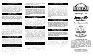
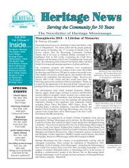
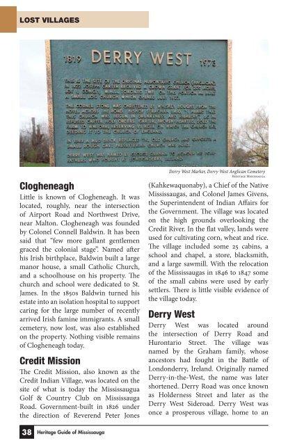
Derry West Marker, Derry West Anglican Cemetery<br />
<strong>Heritage</strong> <strong>Mississauga</strong><br />
(Kahkewaquonaby), a Chief of the Native<br />
<strong>Mississauga</strong>s, and Colonel James Givens,<br />
the Superintendent of Indian Affairs for<br />
the Government. <strong>The</strong> village was located<br />
on the high grounds overlooking the<br />
Credit River. In the flat valley, lands were<br />
used for cultivating corn, wheat and rice.<br />
<strong>The</strong> village included some 25 cabins, a<br />
school and chapel, a store, blacksmith,<br />
and a large sawmill. With the relocation<br />
of the <strong>Mississauga</strong>s in 1846 to 1847 some<br />
of the small cabins were used by early<br />
settlers. <strong>The</strong>re is little visible evidence of<br />
the village today.<br />
Derry West<br />
Derry West was located around<br />
the intersection of Derry Road and<br />
Hurontario Street. <strong>The</strong> village was<br />
named by the Graham family, whose<br />
ancestors had fought in the Battle of<br />
Londonderry, Ireland. Originally named<br />
Derry-in-the-West, the name was later<br />
shortened. Derry Road was once known<br />
as Holderness Street and later as the<br />
Derry West Sideroad. Derry West was<br />
once a prosperous village, home to an<br />
38 <strong>Heritage</strong> <strong>Guide</strong> of <strong>Mississauga</strong>