Future Plan of QZSS - IGS
Future Plan of QZSS - IGS
Future Plan of QZSS - IGS
- No tags were found...

Create successful ePaper yourself
Turn your PDF publications into a flip-book with our unique Google optimized e-Paper software.
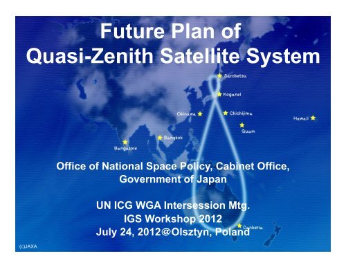
<strong>Future</strong> <strong>Plan</strong> <strong>of</strong><br />
Quasi-Zenith Satellite System<br />
(c)JAXA<br />
Office <strong>of</strong> National Space Policy, Cabinet Office,<br />
Government <strong>of</strong> Japan<br />
UN ICG WGA Intersession Mtg.<br />
<strong>IGS</strong> Workshop 2012<br />
July 24, 2012@Olsztyn, Poland
<strong>QZSS</strong> Overview<br />
Quasi-Zenith Satellite System <br />
n Functional Capability:<br />
¨ GPS Complementary<br />
¨ GPS Augmentation<br />
¨ Messaging Service<br />
n Coverage: Asia and Pacific region<br />
n Six Signals:<br />
¨ L1C/A, L1C, L2C and L5<br />
¨ L1-SAIF on 1575.42 MHz<br />
¨ LEX on 1278.75MHz<br />
n First <strong>QZSS</strong> satellite MICHIBIKI:<br />
launched in September 2010<br />
2
<strong>QZSS</strong> Functional Capability 1<br />
GPS Complementary <br />
<strong>QZSS</strong> improves positioning<br />
availability time<br />
Navigation signals sent from high<br />
elevation will improve the time<br />
percentage <strong>of</strong> positioning availability<br />
from 90 % (GPS only) to 99.8 % * (GPS<br />
+ <strong>QZSS</strong>.)<br />
GPS<br />
×<br />
QZS<br />
×<br />
* The time percentage that the position dilution <strong>of</strong><br />
precision (PDOP) is less than 6 when a satellite<br />
whose elevation angle is 20 degrees or over is<br />
used for positioning calculation. <br />
3
<strong>QZSS</strong> Functional Capability 2<br />
GPS Augmentation <br />
<strong>QZSS</strong> improves positioning accuracy <br />
<strong>QZSS</strong> upgrades the positioning accuracy to a sub-meter or several centimeter<br />
level.<br />
Augmentation Data<br />
Naviga&on Signal <br />
• Acquisition Support Data<br />
GPS Galileo<br />
• Correction Data <br />
QZS<br />
• Integrity Data <br />
GLONASS <br />
Ground Segment <br />
Master Control<br />
Station <br />
Navigation Signal and<br />
Augmentation Data<br />
L1-SAIF (250 bps)<br />
LEX (2000 bps)<br />
GPS Earth<br />
Observation<br />
Network <br />
Augmentation<br />
Data Generation <br />
Global Monitoring Stations <br />
User Segment <br />
LEX <br />
L1-‐SAIF <br />
centimeter (accuracy ) sub-meter <br />
4
<strong>QZSS</strong> Update <br />
n Verification <strong>of</strong> QZS-1 MICHIBIKI<br />
¨ Technical Verification by JAXA<br />
¨ Application Verification by private companies<br />
n Basic policy on the implementation <strong>of</strong> the<br />
operational <strong>QZSS</strong> project (Cabinet Decision on<br />
September 30, 2011)<br />
¨ The Government <strong>of</strong> Japan has decided to accelerate<br />
the deployment <strong>of</strong> the operational <strong>QZSS</strong> as<br />
expeditiously as possible.<br />
5
Basic policy on the implementation <strong>of</strong> the<br />
operational <strong>QZSS</strong> project (1)<br />
Cabinet Decision on September 30, 2011<br />
The <strong>QZSS</strong> will contribute to<br />
l Welfare <strong>of</strong> the Asia and Pacific region<br />
l Broad range <strong>of</strong> security including the<br />
improvement the capacity to respond to<br />
natural disasters<br />
6
Basic policy on the implementation <strong>of</strong> the<br />
operational <strong>QZSS</strong> project (2)<br />
Cabinet Decision on September 30, 2011<br />
l GOJ has decided to accelerate the deployment <strong>of</strong> the<br />
operational <strong>QZSS</strong> as expeditiously as possible.<br />
l Four satellites constellation shall be established by<br />
the late 2010s.<br />
l In the future, seven satellites constellation shall be<br />
completed to enable sustainable positioning. <br />
7
Basic policy on the implementation <strong>of</strong> the<br />
operational <strong>QZSS</strong> project (3)<br />
Cabinet Decision on September 30, 2011<br />
l The Cabinet Office shall develop, deploy and operate<br />
the operational <strong>QZSS</strong>, based on the achievement <strong>of</strong><br />
the first <strong>QZSS</strong> satellite MICHIBIKI, and shall submit a<br />
budget request to cover relevant cost.<br />
l Legal amendments shall be made in order for the<br />
Cabinet Office to fulfill such a role in time for budget<br />
implementation. <br />
8
<strong>QZSS</strong> Technical Verification <strong>of</strong> QZS-1 MICHIBIKI <br />
Accuracy : Signal-in-space User Range Error (SIS-URE)<br />
MICHIBIKI SIS-URE meets its specification, within +/- 2.6m (95%).<br />
Its SIS-URE(RMS) is about 40cm and less than that <strong>of</strong> GPS, about 90cm*.<br />
(*refer to GPS Program Update to CGSIC 2011)<br />
4.0 <br />
3.0 <br />
2.0 <br />
[ MICHIBIKI SIS-URE (12days duration) ] <br />
© JAXA. <br />
SIS-‐URE [m]<br />
1.0 <br />
0.0 <br />
-‐1.0 <br />
-‐2.0 <br />
-‐3.0 <br />
-‐4.0 <br />
SIS-‐URE[m]<br />
仕 spec 様 値 <br />
2011/6/3 2011/6/5 2011/6/7 2011/6/9 2011/6/11 2011/6/13 2011/6/15<br />
Date <br />
After we confirmed that MICHIBIKI performance including accuracy, integrity<br />
and availability met its specification, the L1-C/A and L2C signals were set<br />
healthy from June 22th, 2011. L5 and L1C signals were also set healthy from<br />
July 14th. MICHIBIKI has been working normally since those signals were set<br />
healthy.<br />
9
<strong>QZSS</strong> Technical Verification <strong>of</strong> QZS-1 MICHIBIKI <br />
Availability Improvement in Ginza, Tokyo (Feb. 19, 2011) <br />
Date <strong>of</strong> Observation: 2011/2/19<br />
250 minutes driving observation data<br />
during 6:00-12:30 obtained under JAXA-<br />
Melco joint research experiment<br />
Single Frequency DGPS positioning<br />
Availability <br />
GPS:39.5%<br />
GPS+<strong>QZSS</strong>:69.1% <br />
Reference route <br />
Positioning result <strong>of</strong> GPS stand-alone use <br />
Positioning result <strong>of</strong> GPS+<strong>QZSS</strong> combination use <br />
© JAXA. <br />
10
<strong>QZSS</strong> Technical Verification <strong>of</strong> QZS-1 MICHIBIKI <br />
Accuracy Improvement using augmentation signal L1-SAIF<br />
from MICHIBIKI<br />
[ m ] <br />
Positioning Error(RMS) <br />
Horizontal <br />
GPS Only<br />
1.56m <br />
N<br />
|<br />
S <br />
(c)SPAC <br />
Comparison with positioning<br />
accuracy for GPS stand-alone<br />
use and for GPS+L1-SAIF signal<br />
use (24 hours observation)<br />
E-W <br />
[ m ] <br />
GPS+<br />
L1-SAIF<br />
GPS Only<br />
GPS+<br />
L1-SAIF<br />
Vertical <br />
0.46m <br />
3.85m <br />
0.57m <br />
*Observation Point<br />
GPS-based control station<br />
in Kawagoe, Japan, 5/3/2011 <br />
11
<strong>QZSS</strong> Application Verification by private companies <br />
<strong>QZSS</strong> Application Verification Themes<br />
Using augmentation signals L1-SAIF and LEX from <strong>QZSS</strong>, over 200 private<br />
companies have been verifying their applications under the coordination <strong>of</strong> SPAC.<br />
Mapping 2 <br />
5 <br />
Railway and Bus <br />
6 <br />
IT Automatic Driving <br />
Automatic Driving for Total Themes<br />
Construction, 10 100<br />
Agriculture etc.<br />
Companies and<br />
Disaster<br />
Management <br />
Ground Displacement,<br />
Search and Rescue<br />
etc.<br />
Car Navigation <br />
Driver Assistance<br />
Route Optimization<br />
etc. <br />
Institutes<br />
16 214<br />
16 <br />
22 <br />
19 <br />
© SPAC (Satellite Positioning Research and Application Center)<br />
Land Survey <br />
Static and Moving Survey,<br />
Forest Survey,<br />
Cadastral Survey etc. <br />
Basic Research <br />
Verification <strong>of</strong> Basic<br />
Performance <strong>of</strong> the<br />
Augmentation <br />
Personal Navigation <br />
Navigation for Disabled<br />
and Aged persons,<br />
Tourist Navigation etc.<br />
12
<strong>QZSS</strong> Application Verification by private companies <br />
Precision Agriculture based on IT Automatic Driving<br />
Precision agriculture based on IT automatic driving is one <strong>of</strong> the prospective<br />
applications using the LEX signal. <br />
Centimeter class<br />
Augmentation Data<br />
LEX (2000 bps)<br />
QZS<br />
GPS<br />
Controller<br />
LEX<br />
receiver <br />
Mobile unit for<br />
Low-speed Vehicle <br />
Navigation map (target paths)<br />
for tillage by the robot tractor <br />
© SPAC<br />
13
<strong>QZSS</strong> Application Verification by private companies <br />
Tourist Navigation<br />
A memory card size receiver is used to receive L1 C/A and L1-SAIF signals.<br />
A mobile smartphone shows pin-point location and provides detailed map and<br />
contents.<br />
Sub-meter class<br />
Augmentation Data<br />
L1-SAIF (250 bps)<br />
QZS<br />
GPS<br />
Memory card size<br />
L1 C/A, L1-SAIF<br />
receiver<br />
© SPAC<br />
14
Summary <br />
n <strong>QZSS</strong> is a regional space-based PNT system covers<br />
the Asia and Pacific region and transmits six civil<br />
PNT signals.<br />
n The cabinet decided basic policy on the<br />
implementation <strong>of</strong> the operational <strong>QZSS</strong> project.<br />
n GOJ has decided to accelerate the deployment <strong>of</strong> the<br />
operational <strong>QZSS</strong> as expeditiously as possible. Four<br />
satellites constellation shall be established by the<br />
late 2010s.<br />
n Technical & applications verification <strong>of</strong> <strong>QZSS</strong> are<br />
being conducted continuously.<br />
15