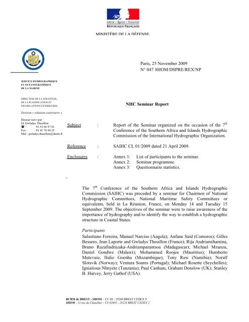
Report - IHO
Report - IHO
Report - IHO

You also want an ePaper? Increase the reach of your titles
YUMPU automatically turns print PDFs into web optimized ePapers that Google loves.
2<br />
The representatives of South Africa could not attend the meeting because of unforeseen<br />
events. In consequence, Gilles Bessero acted as chair of the seminar.<br />
Other participants from various organiszations attended the seminar: Alexandros Maratos<br />
(IHB), Neil Guy (GEF-WIO/MHD /CMC), Raj Prayag (GEF-WIO/MHD /CMC & Indian<br />
Ocean Commission), Gurpreet Singhota (IMO), Dimitri Travin (UNESCO/IOC).<br />
Survey companies were also represented by Maarten Peters (Caris); Art Kleiner, Aubrey Price<br />
(C&C Technologies); Michael Bergmann, John K. Klippen, Justin Hornby (Jeppesen); Ephan<br />
Potgieter (Underwater Surveys). Exhibits were presented by the survey companies (Caris,<br />
C&C Technologies, Jeppesen, Underwater Surveys).<br />
The list of attendees including all participants’ details is attached in annex 1.<br />
The final programme of the seminar is given in annex 2.<br />
Participants were requested to fill a questionnaire in order to better understand their<br />
expectations from this seminar. Statistics resulting from this questionnaire are given in annex<br />
3.<br />
All the presentations given during the seminar have been copied on a CD-ROM which will be<br />
distributed to the attendees.<br />
Monday 14 September<br />
Introductory words: welcome and opening address<br />
Jean-Marie Coupu, Head of Maritime Affairs in La Réunion (France), welcomed the<br />
participants on behalf of the Préfet of La Réunion and whished the participants a fruitful<br />
seminar.<br />
Gilles Bessero, acting chair of the seminar and representative of France, the hosting nation,<br />
in the International Hydrographic Organization, gave the opening address. He noted that<br />
hydrography in the SAIHC region is complex whereas the maritime stakes are huge. He<br />
recalled the objectives of the seminar: to raise awareness of the importance of hydrography<br />
for safety of navigation and national economic development, and to identify the way to<br />
establish a hydrographic structure in developing countries. He stressed that regional and bilateral<br />
co-operation under the aegis of the International Hydrographic Organization (<strong>IHO</strong>) and<br />
in liaison with other organizations is the key to achieve this realistically and sustainably by<br />
promoting and assisting in the development of national hydrographic committees.<br />
Alexandros Maratos, President of the Directing Committee of the International Hydrographic<br />
Bureau, emphasized that the two official languages of the <strong>IHO</strong>, English and French, well fit in<br />
with the seminar attendees. He gave the new definition of hydrography as approved during the<br />
4 th Extraordinary International Hydrographic Commission in June 2009. He stressed that<br />
hydrography is not only a necessity but also an obligation.<br />
Presentation of the objectives of the seminar (Alexandros Maratos, IHB)<br />
The main objective of the seminar is to make sure that countries within the region are well<br />
aware that the provision of hydrographic services is an international obligation under treaty<br />
law affecting all Member States of the International Maritime Organization (IMO) and that<br />
they take the necessary steps to meet their obligation, noting that most African countries are<br />
IMO Member States but are not <strong>IHO</strong> Member States. The importance of hydrography for<br />
2
3<br />
safety of navigation and national economic development was raised through data collection,<br />
charts production and maritime safety information. More than 80% of the world goods by<br />
volume are transferred by maritime transport. Penalties for inactivity in hydrography were<br />
reminded: risk of increase in marine accidents, lack of confidence from shipping companies in<br />
ports and routes, limitation of international trade, missed economic opportunities,<br />
environmental impacts, liability and litigation. He invited delegates to express assistance<br />
requests in order to establish their own hydrographic capability to meet their obligations under<br />
SOLAS Regulations.<br />
Importance of nautical information<br />
Morning session<br />
Hydrography: International Obligations on States (Alexandros Maratos, IHB)<br />
Obligations and commitments under SOLAS and UN Resolutions were developed and States<br />
responsibilities were stressed:<br />
• Mariners obligations<br />
SOLAS (V/19) carriage requirements for navigation equipment,<br />
SOLAS (V/27) nautical charts and publications,<br />
• Government obligations<br />
SOLAS (V/9) provision of hydrographic services,<br />
SOLAS (V/4) navigational warning.<br />
The lecturer highlighted the role of <strong>IHO</strong> in assisting countries of the SAIHC area to meet their<br />
SOLAS obligations. These obligations could be met directly via governments, bi-lateral<br />
assistance from other States or using commercial support providers.<br />
Hydrographic survey is a necessity if Coastal States are to meet their obligations under the<br />
SOLAS Convention for safety of life at sea and protection of the environment but it is also an<br />
important means to facilitate economic development. The benefits of hydrography for Coastal<br />
States were then presented.<br />
Roles and Functions of the <strong>IHO</strong> (Alexandros Maratos, IHB)<br />
Roles, functions and organization of the International Hydrographic Organization, the<br />
International Hydrographic Bureau (IHB) and the Regional Hydrographic Commissions<br />
(RHC) were explained.<br />
The benefits of RHC membership (as Member States, associate members or observers) were<br />
emphasized in relation to benefiting from Capacity Building assistance. <strong>IHO</strong> membership<br />
should be similar to IMO.<br />
<strong>IHO</strong> Capacity Building and Developing Hydrographic Capabilities (Alexandros Maratos,<br />
IHB)<br />
The building of hydrographic capacity allows Coastal States of the SAIHC region to meet<br />
their SOLAS international obligations. Capacity Building Funds, activities and work program<br />
were introduced. Capacity Building principles and processes are built around the four<br />
following steps: awareness (raising importance of hydrography), assessment (identification),<br />
analysis (prioritization) and action. The last step, corresponding to the building of<br />
hydrographic capacity was then developed:<br />
Collection and circulation of information to maintain existing charts and publications:<br />
every State can (and must) get to this phase.<br />
3
4<br />
<br />
<br />
Creation of a survey capability. This phase requires the State’s commitment to sustain<br />
capability and funding for personnel and equipment or contract surveys. <strong>IHO</strong> CBSC<br />
can assist in training/technology transfer.<br />
Production of charts and publications. Independent national capability at this level<br />
requires high levels of investment and continuous support in the long term.<br />
In order to conduct hydrographic activities, each country shall determine what infrastructure<br />
already exists for Maritime Safety Information, hydrographic survey and provision of<br />
navigational charts. This can be achieved through assessment visits, technical workshops and<br />
seminars, various projects (including co-operation with other International Organizations).<br />
Examples of bilateral assistance to improve hydrographic capabilities were given.<br />
IMO Objectives and its role in the safety of navigation (Gurpreet S. Singhota, IMO)<br />
The IMO and <strong>IHO</strong> co-operation was outlined. <strong>IHO</strong>’s involvement to promote safety of<br />
navigation and protection of the marine environment through Capacity Building, the<br />
development of international standards for hydrography, inputs to IMO’s technical bodies…<br />
was highlighted. Inversely, IMO whose mandate is related to safety of navigation and<br />
protection of environment can promote hydrography but cannot take decisions instead of<br />
governments. SOLAS Chapter V Resolutions were developed. Current status of long-range<br />
identification and tracking of ships (LRIT) implementation was given.<br />
In order to answer the question raised by the President of the IHB Directing Committee “Why<br />
IMO Members are not <strong>IHO</strong> Member States and how to improve <strong>IHO</strong> membership in Africa?”<br />
a discussion closed the first theme.<br />
The complexity to apply for <strong>IHO</strong> membership was stressed.<br />
Following a question of the representative of Mozambique, the feasibility to include <strong>IHO</strong> in<br />
the UN structure was discussed (because IMO which depends on UN and <strong>IHO</strong> are closely<br />
linked). It was recalled that this issue had been addressed by the <strong>IHO</strong> Strategic Plan Working<br />
Group (SPWG) which identified three options: statu quo, join the UN structure as a<br />
specialized body and join the IMO. After analysis, it seemed not appropriate for <strong>IHO</strong> to join<br />
the UN system with the risk to get embroiled in political issues. It was agreed that the <strong>IHO</strong><br />
should remain an independent intergovernmental organization of its own right. This decision<br />
does not affect the close link between IMO and <strong>IHO</strong>.<br />
The main obstacle to join <strong>IHO</strong> remains the lack of resources (manpower and equipment).<br />
Malawi stressed the difficulty to access training. It was recalled that training facilities is not<br />
restricted to military structures. In Seychelles, the hydrographic tasks which requires a lot of<br />
resources is considered as a load. In consequence, it is not identified as a priority for the<br />
government. In numerous Coastal States of the SAIHC region, it is difficult to identify the<br />
proper hydrographers to be trained, to find them a job at the end of the training period and to<br />
keep them in the national hydrographic structure. The problem of sustainability was raised.<br />
Afternoon session<br />
The basic activities of hydrographic offices: the <strong>IHO</strong> M-2 publication related to National<br />
Maritime Policies and Hydrographic Services.<br />
The importance of accurate nautical information (Paul Canham, UK)<br />
Phase I of the Capacity Building: collection and circulation of information to maintain<br />
existing charts and publications<br />
4
5<br />
The lecturer developed the context and stakes. Penalties for inactivity and benefits for<br />
accurate nautical information (charts, publications and services) were highlighted.<br />
Under the framework of safety of navigation, nautical charts and publications support the<br />
mariner for passage planning and navigation and provides port and harbour information.<br />
Safety of navigation also depends on the distribution of available, accurate and timely nautical<br />
information through urgent radio navigational warnings (RNW) and documentation updates.<br />
The definition of Maritime Safety Information and the content of nautical information were<br />
given. NAVAREA warnings were developed. In the SAIHC region, South Africa acts as<br />
NAVAREA VII coordinator and India as NAVAREA VIII coordinator.<br />
The importance of maintaining nautical charts and publications up-to-date was stressed. This<br />
task is carried out through Notices to Mariners for a permanent, temporary or preliminary<br />
update and through New Editions.<br />
To conclude, a vast amount of nautical information, services and products is available to the<br />
mariner. The importance of keeping products up-to-date was stressed in relation to the<br />
international obligations and responsibilities of Coastal States. Relevant information must be<br />
provided to the charting authority.<br />
Methods and instruments to optimize surveys (Jean Laporte, France)<br />
Phase 2 of the Capacity Building: creation of a survey capability<br />
The different steps of the roadmap to establish a prioritized survey plan was presented. Works<br />
to be achieved shall be identified and prioritized, regarding what exists and what needs to be<br />
done, the resources and the user needs. Once the national survey plan is formulated, the<br />
survey proceeding is articulated around the following axis: review of information available,<br />
delineation of area to be surveyed, selection of the appropriate equipment, validation and<br />
storage of data. Strategy adopted for a survey depends on the objectives and means available.<br />
Nautical chart production (Graham Denslow, UKHO)<br />
Phase 3 of the Capacity Building: production of charts and publications<br />
User requirements shall be established. Different users have different needs (scale, accuracy).<br />
<strong>IHO</strong> M-2 publication and the benefits of establishing a national chart series were introduced.<br />
Chart scheming and chart content were highlighted. The different steps of the chart<br />
production were presented: compilation, verification, validation, printing, distribution and<br />
maintenance up-to-date. Existing charts (accuracy, age, quality, data source) shall be<br />
identified with critical evaluation. The importance of source data types was stressed.<br />
Data management – a separate activity? (Noralf Slotsvik, Norway)<br />
Nautical information must be available timely and up-to-date.<br />
Coastal States of the SAIHC with limited in-house capability resort to external partners (cooperation,<br />
regional programs contracts) for surveying and chart production. Nevertheless,<br />
sometimes no data is available at the national hydrographic office whereas a lot of<br />
information already exists from various sources. In consequence, data management should be<br />
a core activity of the national hydrographic infrastructure, while data collection and nautical<br />
products can be shared with other partners. In addition to the three phases of the <strong>IHO</strong> M-2<br />
publication developed previously, the establishment of a data management solution should be<br />
the second step in the national maritime policies and hydrographic services process.<br />
A discussion on the necessity to transmit existing nautical information (from local port<br />
authorities, industry...) to national hydrographic office and/or national charting authorities<br />
(under SOLAS Chapter V Regulations) closed this theme. The objective is to make the<br />
nautical information available. Agreements between countries and charting authorities should<br />
5
6<br />
be formalized. The example of South Africa was given to illustrate a working interaction<br />
between hydrographic office and ports.<br />
The Organization of a National Hydrographic Office<br />
Economic impact and benefits of hydrography (Stanley Harvey, USA)<br />
Noting that the maritime traffic increases and that hydrography in Africa is often inadequate<br />
(unsuitable scale and accuracy, documentation not up-to-date…), the objectives are to<br />
convince governments to invest in hydrography as an enabler of economic growth and to<br />
obtain governments’ commitment. To demonstrate this important issue, the various benefits of<br />
hydrography that impact numerous domains were developed: marine transportation and safety<br />
of navigation, marine resources, environmental concerns, maritime boundaries, law<br />
enforcement and defence.<br />
In conclusion, investing in hydrography saves lives, supports national security and economic<br />
prosperity and contributes to protection of the environment.<br />
US naval oceanography (Stanley Harvey, USA)<br />
The organization of the different hydro-oceanographic services in the United States was<br />
explained. NAVOCEANO activities, fleet, equipments were presented. Involvement in<br />
Capacity Building and training opportunities were highlighted.<br />
IHPT (Ventura Soares, Portugal)<br />
Activities assigned to the national hydrographic offices were identified: navigation aids, MSI,<br />
cartography, surveying. In term of Capacity Building, resources shall be made available;<br />
partners and funding shall be established to implement a hydrographic structure. IHPT<br />
perspectives of co-operation with African Portuguese speaking countries are based on<br />
education, training and technical assistance. The specification by hydrographers of adapted<br />
fleet and equipment even modest is the key to develop a hydrographic capability.<br />
INAHINA (Ilidio Goenha, Mozambique)<br />
Created in 1989, INAHINA is the young national hydrographic service and light house<br />
authority of Mozambique. Organization, policies, budget, personnel management and training<br />
were highlighted.<br />
The paper chart production process was described and the use of S-44 <strong>IHO</strong> standard<br />
requirements was mentioned. However, INAHINA experiences difficulties in keeping pace<br />
with the evolution of <strong>IHO</strong> standards due to the training requirements, budget constraints and<br />
upgrading of equipment especially for ENC production. One solution to overcome this<br />
difficulty is the co-operation with other hydrographic offices.<br />
Tuesday 15 September<br />
Morning session<br />
Application of hydro-cartographic products and services<br />
6
7<br />
Restructuring of a national hydrographic service (John Klippen, Jeppesen)<br />
The Hydrographic Institute of the Republic of Croatia (HHI) and the Norwegian<br />
Hydrographic Service (NHS) defined the CRONO HIP (CROatian-NOrwegian Hydrographic<br />
Information Project) joint project which aims at providing the HHI with new technologies and<br />
methods for data collection, data management and chart production.<br />
MINTEC – Maritime Infrastructure New Technology for production/management of ENC<br />
and paper Charts (John Klippen, Jeppesen)<br />
The MINTEC program will provide the Norwegian Hydrographic Service (NHS) with an<br />
interface to existing back-office system and all means for production and maintenance of<br />
ENC and paper charts. Production and maintenance are based on sources and revisions<br />
collected from the primary data base and other miscellaneous formats. The MINTEC system<br />
will also support data handling through OGC (Open GIS Consortium) services (Web Map<br />
Services, WMS, and Web Feature Services, WFS).<br />
General information on the project was given.<br />
SDI developments in Europe (Paul Canham, UK)<br />
The European directive INSPIRE (INfrastructure for SPatial Information in Europe) which<br />
aims at establishing an infrastructure for marine and geographic data was described. This will<br />
promote access to metadata, interoperability of spatial data sets, network services, data<br />
sharing, …<br />
The role of the <strong>IHO</strong> Marine Spatial Data Infrastructure Working Group (MSDIWG) was also<br />
highlighted<br />
The UK Marine Environmental Data and Information Network (MEDIN) was presented. The<br />
objective is to improve knowledge of, access to and dissemination of marine data across all<br />
sectors related to the marine community in United-Kingdom.<br />
Introduction to MSDI: SHOM practical experience, the INFRAGEOS project (Jean Laporte,<br />
SHOM and Maarten Peters, Caris)<br />
The benefits of marine spatial data infrastructures (MSDI) in hydrographic offices were<br />
highlighted. The example of INFRAGEOS-H project which aims at procuring an<br />
interoperable data base management system capable of providing better access to optimised<br />
georeferenced databases and improved information processing was given. The INFRAGEOS-<br />
H project is the first step in a broader process consisting of grouping together within a<br />
coherent system all SHOM databases.<br />
Jeppesen Marine: navigational and logistic solutions (Justin Homby, Jeppesen)<br />
A presentation of Jeppesen company, products and services was given.<br />
Distribution of hydrographic data & products (Paul Canham, UK)<br />
Admiralty products and the corresponding distribution network were presented. Based on the<br />
example of IC-ENC, RENC organization and benefits of membership were highlighted.<br />
These presentations gave raise to a question. Which benefits can Coastal States gain from<br />
these tools acknowledging that the principal difficulty for national hydrographic services is to<br />
access existing data from port authorities, industry...? Moreover, are these sophisticated<br />
infrastructures suitable for developing countries where maritime safety has a low priority<br />
compared to other needs and where it is difficult to persuade the appropriate government<br />
authority?<br />
7
8<br />
Regional initiatives, projects and opportunities<br />
Western Indian Ocean GEF - Marine Highway Development & Coastal and Marine<br />
Contamination Prevention Project (Neil Guy, GEF-WIO/MHD/CMC)<br />
The West Indian Ocean is a region characterized by a high maritime traffic (30% of world<br />
crude oil), howling winds and strong currents with marine resources and fisheries. In order to<br />
increase the safety of navigation and the protection of environment, the marine highway and<br />
coastal and marine contamination prevention project was created. The main objectives are the<br />
building of capacity in the region and the assistance of countries to undertake technical work<br />
needed to meet their national obligations under the SOLAS Regulations. The project<br />
components and progress were described.<br />
Capacity Building for countries in transition (Neil Guy, GEF-WIO/MHD/CMC)<br />
To complete the Capacity Building theme already developed during the seminar, elements of<br />
context were given to better understand the situation in Africa. Despite of SOLAS Chapter V<br />
Regulations, maritime safety has a low priority in developing countries. African States need<br />
assistance with maritime safety information. The services necessary to improve trade and to<br />
ensure the safety of life and the environment need to be updated. Most ports, port approaches<br />
and critical areas in Africa need urgent and adequate hydrographic surveys. Confidence of<br />
international shipping in the information available is low.<br />
Afternoon session<br />
Regional initiatives, projects and opportunities (continued)<br />
Western Indian Ocean GEF - Marine Highways: project presentation (Raj Prayag, GEF-<br />
WIO/MHD /CMC & Indian Ocean Commission)<br />
The marine highway development and marine and costal contamination prevention project<br />
was presented according to the following axis: environmental challenges, risks, objectives and<br />
regional coordination. The project implementation is articulated around different components:<br />
• Development of a regional marine highway and institutions<br />
• Capacity Building for prevention of coastal and marine contamination<br />
• Building capacity for regional oil spill response<br />
• Port state control, fisheries monitoring, and project coordination and management<br />
Components implemented by the Indian Ocean Commission were highlighted.<br />
The Indian Ocean Commission today and tomorrow (Raj Prayag, GEF-WIO/MHD /CMC &<br />
IOC)<br />
The Indian Ocean Commission’s organization, budget, strategy, partnerships and funding<br />
were explained. Perspectives for the future were developed.<br />
Improving Emergency Response to Ocean-based Extreme Events through Coastal Mapping<br />
Capacity Building in the Indian Ocean (Dimitri Travin, UNESCO/Intergovernmental<br />
Oceanographic Commission)<br />
COAST-MAP-IO project goals, benefits, main achievements, sponsors, partnerships and<br />
perspectives were presented.<br />
Manufacturers’ presentation<br />
A presentation of C&C technologies company, products and services was given.<br />
8
9<br />
Seminar assessment and conclusion<br />
The seminar chair thanked the speakers for their thorough presentations.<br />
In accordance with procedure 5 developed by the <strong>IHO</strong> Capacity Building Sub Committee<br />
which provides guidelines and rules to assess the performance and success of all Capacity<br />
Building efforts, the chair organized a wrap-up session to collect feedback, to determine if<br />
participants expectations were met, to asses the seminar and to identify future perspectives.<br />
As the assessment should be carried out according to performance indicators rated on a scale<br />
from 0 (low) to 5 (high), attendees from developing Coastal States were requested to evaluate<br />
the following points.<br />
Question 1: Did the seminar raise the importance of safety of navigation and are you aware of<br />
this issue?<br />
All polled people gave a five. Nevertheless most participants were already aware of this issue<br />
and of the national obligations under SOLAS Regulations.<br />
Question 2: Will this seminar help you in the establishment or development of a hydrographic<br />
infrastructure in your country?<br />
All polled people gave a five. Most countries have already established a hydrographic<br />
infrastructure; the issue is to determine a roadmap to go further. Several countries raised the<br />
difficulty to be recognized at the governmental level as a proper hydrographic institution. The<br />
practical issue is a permanent need.<br />
Question 3: What are the next steps to consolidate what already exists?<br />
Angola: organization of a SAIHC Conference in Angola to raise national authorities’<br />
awareness, reporting on progresses following the technical visit two years ago.<br />
Comoros: establishment of the service itself and outside assessment through technical<br />
visits.<br />
Madagascar: access to training and equipment.<br />
Malawi: assistance in training required (software update and equipment) and funds.<br />
Mauritius: training (especially for very shallow waters in lagoons) and equipment.<br />
Mozambique: outside assessment to evaluate which strategy to meet <strong>IHO</strong> standards<br />
(S44, S57).<br />
Namibia: organization of the visit of IHB in Namibia upon invitation (IHB to contact<br />
Namibian authorities and details to be provided by Namibia) and training (category A<br />
hydrographers).<br />
Seychelles: manpower allocated for hydrography and budget, continuous support for<br />
awareness at the government level.<br />
Tanzania: raising Tanzanian authorities and government awareness about the needs of<br />
hydrography, whereabouts of the head of the national hydrographic committee (Dr<br />
Dubi?).<br />
It was noted that supporting nations in the region may not be able to sustain nine additional<br />
hydrographic offices. Only a regional approach in term of co-operation will help Coastal<br />
States in the SAIHC region to meet their maritime obligations. Mutualization of efforts and<br />
equipment will permit a gain of productivity for countries that have common interests.<br />
In term of Capacity Building, the regional approach appeared necessary for all participants,<br />
nevertheless the training and the development of hydrographic infrastructures required to<br />
support particular needs and national specificities must be taken into account to bring a<br />
benefit to all. A better understanding of the local needs can be achieved through the <strong>IHO</strong><br />
9
10<br />
technical visits and assessments. Co-operation must encourage the projects best suited to the<br />
situation of beneficiaries. For example, to allow hydrographers to follow course in their native<br />
language is a necessity. Moreover, States do not advance homogeneously in the establishment<br />
of a national hydrographic infrastructure. Countries that already perform a hydrographic<br />
activity need help; those that try to deliver services need continuous support effort and advice;<br />
those that do nothing need assistance to create a minimal capacity.<br />
Representatives from supporting countries and industry acknowledged that training and<br />
assistance can be customized to each country.<br />
One major concern is the sustainability of technology transfers. Training hydrographers and<br />
eventually giving them a survey boat is not sufficient. It is essential to make sure that<br />
Capacity Building will not cease at the end of co-operation programmes. On-site training,<br />
donation of the minimum equipment to enable specialists to perform their job, maintenance,<br />
faultless commitment of the beneficiaries themselves who bring the most precious<br />
contribution are the conditions of successful co-operation programmes. Moreover, supporting<br />
countries only accept to train those who will effectively work as hydrographers employed by<br />
their States in national offices.<br />
Participants were invited to express their requirements yearly through the SAIHC point of<br />
contact of Capacity Building matters in accordance with the CBSC procedures related to<br />
request of Capacity Building Funds.<br />
Developing Coastal States in the SAIHC region have to decide the level of national<br />
commitment to meet their international obligations. One of the roles of the International<br />
Hydrographic Organization is to help developing States to establish their own capability to<br />
provide at least updated hydrographic information to a charting authority in order to meet<br />
their SOLAS obligations and therefore fulfil their State responsibilities.<br />
Regional and bi-lateral co-operation is the key to acquire survey capabilities.<br />
The South Africa and Islands Hydrographic Commission is the regional hydrographic<br />
forum.<br />
The SAIHC is the access point for <strong>IHO</strong> Capacity Building and associated Funds even<br />
for non <strong>IHO</strong> Member States.<br />
The recommendations from the seminar can be summarized as follows:<br />
To continue in raising the awareness of IMO members on their (rights and) SOLAS<br />
obligations and to adopt a coherent, sustainable and consistent approach in liaison<br />
with IMO.<br />
To obtain government commitment to push that message forward in order to get the<br />
visibility and the recognition needed to take on and exercise hydrographic<br />
responsibilities.<br />
To promote and assist in the development of national hydrographic committees<br />
(national commitment).<br />
To facilitate the development of bilateral agreements with supporting countries and<br />
transition mechanisms (one size does not fit all).<br />
To involve industry in capacity development programmes.<br />
To develop partnerships with regional maritime related fora and organizations.<br />
To develop replicable programmes of work to be used by donor agencies.<br />
To encourage associate members in joining the <strong>IHO</strong>.<br />
10
11<br />
ANNEX 1<br />
Details of the seminar participants<br />
Delegation Name – Surname Phone number Fax Address E-mail<br />
THE INTERNATIONAL HYDROGRAPHIC BUREAU<br />
IHB Alexandros MARATOS +377 931 081 00 +377 931 081 40 4 quai Antoine 1 er BP 445 MC Monaco cedex amaratos@ihb.mc<br />
PARTICIPATING COUNTRIES<br />
Angola<br />
Salustiano P.F. Ferreira<br />
Manuel Narciso<br />
Gwladys Theuillon<br />
Jean Laporte<br />
Rija Andriamihamina<br />
+244 923 897 032<br />
-<br />
+33 1 53 66 97 81<br />
+33 1 53 66 97 84<br />
+261 331 175 705<br />
+244 917 631 027 IHSMA – Instituto de Hydrografia e de Sinalizacâo<br />
Maritima - Adr. Rua Rainha Ginga, 74 -5 o andar,<br />
Luanda<br />
orfeu-salu@yahoo.com.br<br />
manuelnarciso2000@yahoo.com.br<br />
Comoros Anfane Said +269 333 42 14 +269 773 41 42 Port authority of Comoros – P.O Box 858 - Moroni anfanesaid@yahoo.fr<br />
France<br />
Gilles Bessero<br />
+33 2 98 14 96 22 +33 2 98 22 12 08 SHOM – 13 rue du Chatellier - CS 92803 – 29228 gilles.bessero@shom.fr<br />
Brest cedex 2<br />
+33 1 41 74 94 25 SHOM – 2 avenue Pasteur – 94 160 Saint-Mandé gwladys.theuillon@shom.fr<br />
Madagascar<br />
-<br />
Foiben Tao Tsarintanin Madagasikara – BP 323 –<br />
101 Antananarivo<br />
Bruno Lazafindrazaka- +261 331 155 383<br />
-<br />
Ecole nationale d’enseignement maritime – BP 353 –<br />
Andriamparantsoa<br />
401 Mahajanga<br />
Malawi Michael Mzunzu<br />
+265 999 944 370 +265 175 2581 Surveys department P/B B 525 Lilongue3<br />
Daniel Gondwe<br />
+265 888 829 692 +265 175 2582<br />
Mauritius Mohammed Roojee +230 212 6020 - Ministry of housing and lands Mauritius – Sir<br />
William Newton Street – Port Louis<br />
Mozambique<br />
Humberto Mutevuie<br />
Ilidio Goenha<br />
+258 822 881 880<br />
+258 829 842 154<br />
+258 214 301 85 Instituto nacional de hidrografia e navegaçao - Av.<br />
Karl Max - 153 Maputo<br />
jlaporte@shom.fr<br />
rijandriamihamina@malagasy.com<br />
enem@morv.mg<br />
mzunzumtt@malawi.net<br />
docgondwe@yahoo.com<br />
mmroojee@mail.gov.mu<br />
mutevuie@inahina.gov.mz<br />
goenhail@msu.edu<br />
Namibia Tony Raw +264 81 128 3275 +264 208 2323 Namibian Ports Authority - No 17 Rikumbi tony@namport.com.na<br />
Kandanga Road – P.O Box 361 - Walvis Bay<br />
Norway Noralf Slotsvik +47 518 588 13 +147 518 587 01 Hydrographic service – P.O Box 60 4001 - Stavanger noralf.slotsvik@statkart.no<br />
Portugal Ventura Soares +351 210 943 020 +351 210 943 299 Instituto hidrografico - Rua das Trinas, 49 - 1249- ventura.soares@hidrografico.pt<br />
093 Lisboa<br />
Seychelles Michael Rosette +248 224 411 +248 224 665 Maritime safety administration – P.O Box 257 - mamrosette@yahoo.com<br />
Victoria<br />
Tanzania Igniatious Nhnyete +255 785 006 617 Tanzania Ports Authority – P.O Box 9184 – Dares<br />
Salam<br />
nhnyete@tanzaniaports.com<br />
nhnyete@yahoo.com<br />
UK<br />
Paul Canham<br />
Graham Denslow<br />
+44 1823 33 7900<br />
+44 1823 33 7900<br />
UK Hydrographic office - Admiralty way - TAI 2DN<br />
Taunton<br />
UK Hydrographic office - Admiralty way - TAI 2DN<br />
Taunton<br />
paul.canham@ukho.gov.uk<br />
graham.denslow@ukho.gov.uk<br />
11
12<br />
USA<br />
Stanley B. Harvey<br />
Jerry Gathof<br />
+228 688 5082<br />
+39 081 568 3674<br />
CNMOC BLDG 1100 Stennis Space Center MS<br />
PSC 809, Box 2462,FPO AE 09626-2462<br />
Naval Oceanography Program Representative -<br />
stanley.b.Harvey@navy.mil<br />
jerry.gathof@eu.navy.mil<br />
CNE-C6F – Naples - Italy<br />
OTHER ORGANIZATIONS<br />
IMO Gurpreet S. Singhota +44 201 581 3261 +44 201 581 3210 4 Albert Embankment - London SE1 75R gsinghota@imo.org<br />
GEF-<br />
WIO/MHD<br />
/CMC<br />
GEF-<br />
WIO/MHD<br />
/CMC & IOC<br />
Neil Guy +272 171 570 09 +278 257 804 78 IO Farmside 2S Homestead Aur Berguliat - 7945<br />
Capetown - South Africa<br />
Raj Hemansing Prayag +230 292 9800<br />
Mobile +230 422 4010<br />
+230 427 7281 Q4, Sir Guy Forget Avenue - BP 7 - Quatre Bornes –<br />
Mauritius<br />
nguy@zsd.corza<br />
raj.prayag@coi-ioc.org<br />
UNESCO/IOC Dimitri Travin +33 1 45 68 40 44 +33 1 45 68 58 10 1 rue Miollis - 75015 Paris - France d.travin@unesco.org<br />
Representatives Jean-Marie Coupu +33 2 62 901 960<br />
-<br />
DRAM - 11, rue de la compagnie - 97487 Saintfrom<br />
La<br />
Denis cedex – France<br />
Réunion Eric Banel<br />
+33 6 92 88 85 88<br />
-<br />
Jérôme Theillier<br />
+33 6 92 60 04 54<br />
-<br />
Commanding naval forces in La Réunion - State<br />
Action at Sea<br />
dram-reunion@developpementdurable.gouv.fr<br />
eric.banel@developpementdurable.gouv.fr<br />
czm.aem@fazsoi.defense.go<br />
MANUFACTURERS<br />
CARIS Maarten Peters +314 132 960 10 +314 132 960 12 Mgr.van Oorschotstraat 13 – 5473AX Heeswijk –<br />
The Netherlands<br />
C&C<br />
Technologies<br />
Jeppesen<br />
Underwater<br />
Surveys<br />
Art Kleiner<br />
Aubrey Price<br />
Michael.Bergmann<br />
John K. Klippen<br />
Justin Hornby<br />
+337 261 0660<br />
+27 217 052 741<br />
+49 610 250 7580<br />
+47 514 064 700<br />
+27 21 701 2930<br />
+337 261 0192<br />
+27 217 052 741<br />
+49 610 250 7581<br />
+47 51 464 701<br />
+27 824 110 465<br />
730 E. Kaliste Saloom Road – Lafayette – Louisiana<br />
70508 – USA<br />
53 Peninsula Road – Zeekoevlei 7945 – P.O Box<br />
30532 – Tokai 7966 – South Africa<br />
Frankfurter Str 233 – 63263 Neuisenburg – Germany<br />
Houlandsvn 52 – N-4379 Egersund – Norway<br />
Grapevine House – Steenberg Office park – Tokay<br />
9966 – South Africa<br />
Ephan Potgieter +27 839 968 166 +27 217 015 720 Underwater Surveys – Silverwood A1 – Steenberg<br />
Office park – Constamia 7806 – South Africa<br />
mpeters@caris.nl<br />
aak@cctechnol.com<br />
aop@ccttechnol.com<br />
michael.bergman@jeppesen.com<br />
john.klippen@jeppesen.com<br />
Justin.Hornby@jeppesen.com<br />
Ep@underwatersurveys.com<br />
12
ANNEX 2<br />
Seminar programme<br />
13<br />
Seminar for Chairmen of National Hydrographic Committees,<br />
National Maritime Safety Committees or equivalents<br />
programme / timetable: 14 –15 September 2009<br />
09:00 Day 1<br />
09:30 Welcome Address by Host Nation<br />
IHB Opening Speech<br />
09:45<br />
Objectives of the seminar<br />
IHB<br />
10:00 Coffee Break<br />
Morning Session<br />
10:30<br />
Importance of nautical information<br />
Hydrography: International Obligations on States<br />
Role and Function of the <strong>IHO</strong><br />
<strong>IHO</strong> Capacity Building and Developing Hydrographic Capabilities<br />
IMO Objectives and its role in the safety of navigation<br />
IHB<br />
IHB<br />
IHB<br />
IMO<br />
12:30 Lunch<br />
Afternoon Session I<br />
14:00<br />
The basic activities of hydrographic offices: the <strong>IHO</strong> M-2 publication related<br />
to National Maritime Policies and Hydrographic Services<br />
The importance of accurate nautical information (phase 1 – MSI)<br />
Methods and instruments to optimize surveys (phase 2 – national<br />
hydrographic office development)<br />
Nautical chart production (phase 3 – charts production)<br />
UKHO (UK)<br />
SHOM<br />
(France)<br />
UKHO (UK)<br />
15:30 Coffee Break<br />
Afternoon Session II<br />
16:00<br />
Data management – a separate activity?<br />
Economic impact and benefits of hydrography<br />
The Organization of a National Hydrographic Office<br />
USA – Navoceano<br />
Portugal - IHPT<br />
Mozambique - INAHINA<br />
NHS<br />
(Norway)<br />
Navoceano<br />
(US)<br />
17:00 Questions & Discussion<br />
13
14<br />
09:00 Day 2<br />
Morning Session I<br />
09:00<br />
Application of hydro-cartographic products and services<br />
Case Study 1: CRONO HIP joint project<br />
Case Study 2: MINTEC<br />
Case Study 3: INSPIRE – data interoperability<br />
Case Study 4: SHOM Maritime Spatial Data Infrastructure - INFRAGEOS<br />
10:30 Coffee Break<br />
Morning Session II<br />
Jeppesen<br />
Jeppesen<br />
UKHO (UK)<br />
SHOM<br />
(France) &<br />
Caris<br />
11:00<br />
Application of hydro-cartographic products and services (continued)<br />
Navigational and logistic solutions<br />
Distribution of hydrographic data & products<br />
Jeppesen<br />
UKHO (UK)<br />
Regional initiatives, projects and opportunities<br />
Western Indian Ocean GEF - Marine Highways<br />
Capacity Building for countries in transition<br />
GEF-WIO/<br />
MHD /CMC<br />
12:30 Lunch<br />
Afternoon Session I<br />
14:00<br />
Regional initiatives, projects and opportunities (continued)<br />
Western Indian Ocean GEF - Marine Highways: project presentation<br />
The Indian Ocean Commission today and tomorrow<br />
Improving Emergency Response to Ocean-based Extreme Events through<br />
Coastal Mapping Capacity Building in the Indian Ocean<br />
Manufacturers presentations<br />
15:30 Coffee Break<br />
Afternoon Session II<br />
GEF-WIO/<br />
MHD /CMC<br />
& IOC<br />
UNESCO<br />
C&C<br />
Technologies<br />
16:00<br />
Questions & Discussion<br />
Closure<br />
all<br />
14
ANNEX 3<br />
15<br />
Questionnaire statistics<br />
Your role in hydrographic activity and services in your State<br />
NHO<br />
Maritime & port<br />
authorities<br />
Other<br />
Industries<br />
Hydro & Maritime Org<br />
What are you hoping to gain from this seminar?<br />
Answers can be classified into four main categories.<br />
• To improve my knowledge in hydrography and to prospect for solution to implement a<br />
hydrographic infrastructure in my country<br />
• To better understand the needs in hydrography in the region<br />
• To propose relationship and co-operation for the developing countries (Hydrographic offices<br />
and organizations)<br />
• To make new contact and provide assistance in equipment or management to SAIHC Members<br />
(manufacturers)<br />
15