Integrated River Basin Planning – Replicable ... - India Water Portal
Integrated River Basin Planning – Replicable ... - India Water Portal
Integrated River Basin Planning – Replicable ... - India Water Portal

You also want an ePaper? Increase the reach of your titles
YUMPU automatically turns print PDFs into web optimized ePapers that Google loves.
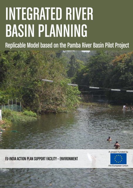
<strong>Integrated</strong> <strong>River</strong><br />
<strong>Basin</strong> <strong>Planning</strong><br />
<strong>Replicable</strong> Model based on the Pamba <strong>River</strong> <strong>Basin</strong> Pilot Project<br />
EU-<strong>India</strong> Action Plan Support Facility <strong>–</strong> Environment<br />
A project funded by<br />
the European Union<br />
i
<strong>Integrated</strong> <strong>River</strong> <strong>Basin</strong> <strong>Planning</strong>: <strong>India</strong> and the EU share experience on policy and practice<br />
<strong>Integrated</strong> <strong>River</strong> <strong>Basin</strong> <strong>Planning</strong>:<br />
<strong>India</strong> and the EU share experience on policy and practice<br />
Authors: Mr Nick Ahrensberg, Mr Narayan Bhat (DHI), Ms Annemieke Alberts (Euroconsult<br />
Mott MacDonald), with contributions from Mr George Chackacherry (CWRDM)<br />
Reviewed and edited by: Mr Wandert Benthem, Dr Johan Bentinck, Mr Surit Das<br />
This publication is produced by DHI in cooperation with Euroconsult Mott MacDonald.<br />
Further information<br />
Euroconsult Mott MacDonald: www.euroconsult.mottmac.nl, www.mottmac.com.<br />
DHI: dhigroup.com<br />
Information about the European Union is available on the Internet. It can be accessed through<br />
the Europa server (www.europa.eu) and the website of the Delegation of the European Union<br />
to <strong>India</strong> (http://eeas.europa.eu/delegations/india/index_en.htm).<br />
Legal notices:<br />
European Union<br />
This publication has been produced with the assistance of the European Union. The content of<br />
this publication is the sole responsibility of the Technical Assistance Team of Mott MacDonald<br />
in consortium with DHI and can in no way be taken to reflect the views of the European Union<br />
or the Delegation of the European Union to <strong>India</strong>.<br />
Mott MacDonald<br />
This document is issued for the party which commissioned it and for specific purposes<br />
connected with the captioned project only. It should not be relied upon by any other party or<br />
used for any other purpose.<br />
We accept no responsibility for the consequences of this document being relied upon by any<br />
other party, or being used for any other purpose, or containing any error or omission which is<br />
due to an error or omission in data supplied to us by other parties.<br />
<strong>Integrated</strong> <strong>River</strong><br />
<strong>Basin</strong> <strong>Planning</strong><br />
<strong>India</strong> and the EU share<br />
experience on policy and<br />
practice<br />
Copyright notice<br />
Reproduction is authorised, provided the source is acknowledged, save where otherwise<br />
stated.<br />
Printed in <strong>India</strong>.<br />
This report is printed on CyclusPrint based on 100% recycled fibres<br />
ii<br />
i
<strong>Integrated</strong> <strong>River</strong> <strong>Basin</strong> <strong>Planning</strong>: <strong>India</strong> and the EU share experience on policy and practice<br />
Table of Contents<br />
Acknowledgements<br />
List of Abbreviations<br />
LIST OF tables<br />
LIST OF FIGUres<br />
v<br />
vii<br />
ix<br />
x<br />
Summary 1<br />
1 Introduction 5<br />
1.1 EU-<strong>India</strong> Joint Action Plan 5<br />
1.2 The Pamba <strong>River</strong> IWRM Pilot 6<br />
1.3 IWRM in the European Union 8<br />
1.4 The Present Report 8<br />
2 IWRM Principles and <strong>Planning</strong> Processes 10<br />
3 <strong>Water</strong> and Environmental Policies in <strong>India</strong> 15<br />
3.1 Policies and Institutions 15<br />
3.2 Institutional Framework vis-à-vis IWRM 16<br />
3.3 National <strong>River</strong> Conservation Plan 17<br />
3.4 <strong>River</strong> <strong>Basin</strong> Organizations 19<br />
4 Pamba <strong>River</strong> <strong>Basin</strong> 22<br />
4.1 Physical context 22<br />
4.2 Socioeconomic context 23<br />
4.3 Status of water resources 24<br />
4.4 <strong>Water</strong> uses 24<br />
4.5 Domestic water use 25<br />
4.6 <strong>Water</strong> for agriculture 27<br />
4.7 <strong>Water</strong> for irrigation 28<br />
4.8 Groundwater 29<br />
4.9 Trends 30<br />
5 <strong>Water</strong> Policy, Legislation, Management and Institutions 32<br />
in Kerala<br />
5.1 Kerala water policy and legislation 32<br />
5.2 <strong>Water</strong> management and institutions in Kerala 36<br />
6 Prioritisation of Issues 40<br />
6.1 Methodology 40<br />
ii<br />
iii
<strong>Integrated</strong> <strong>River</strong> <strong>Basin</strong> <strong>Planning</strong>: <strong>India</strong> and the EU share experience on policy and practice<br />
6.2 Impact issues affecting quantity and quality of the Pamba 41<br />
water resources<br />
6.3 User requirement issues in the Pamba <strong>River</strong> <strong>Basin</strong> 42<br />
6.4 Risks 42<br />
6.5 Synthesis of water resources issues in the Pamba <strong>Basin</strong> 42<br />
7 SWOT Analysis 45<br />
8 Roadmap: Next Steps, Milestones and Indicators 47<br />
9 IWRM Progress in Kerala’s Pamba <strong>Basin</strong> 49<br />
9.1 Existing Situation 48<br />
9.2 Strengths and constraints in the management framework 52<br />
10 Proposed Pamba <strong>River</strong> <strong>Basin</strong> Organisation 57<br />
Acknowledgements<br />
Information enclosed in the present report has been generated in consultation with:<br />
1. George Chakkacherry, Scientist, CWRDM<br />
2. N K Sukumaran Nair, Pamba Parirakshaka Samithi<br />
3. S. Ratish, Kerala <strong>Water</strong> Authority<br />
4. K. Jayakumar, Additional Chief Secretary, Government of Kerala<br />
5. Prof. Jayakumar Executive Director, CWRDM<br />
6. Presidents of 12 Gram Panchayats<br />
7. Chairpersons of 14 Urban Local Bodies<br />
8. Fr. Thomas Peeliyanikal, President, Kuttanad Vikas Samithi<br />
11 Conclusion and Recommendations 62<br />
11.1 Conclusions 62<br />
11.2 Recommendations 65<br />
Annexes<br />
Annex 1 Roadmap for Pamba <strong>River</strong> <strong>Basin</strong> 67<br />
Annex 2 Ranked <strong>Water</strong> Resource Issues for Pamba <strong>River</strong> <strong>Basin</strong> 69<br />
using the WRIAM Method<br />
Annex 3 <strong>Water</strong> and Environment Policies in the European Union 72<br />
iv<br />
v
<strong>Integrated</strong> <strong>River</strong> <strong>Basin</strong> <strong>Planning</strong>: <strong>India</strong> and the EU share experience on policy and practice<br />
List of Abbreviations<br />
asl<br />
above sea level<br />
APSF<br />
action Plan Support Facility<br />
bgl<br />
Below ground level<br />
BIS<br />
Bureau of <strong>India</strong>n Standards<br />
CBO<br />
community Based Organization<br />
CGWB<br />
central Ground <strong>Water</strong> Board<br />
CPCB<br />
central Pollution Control Board<br />
CWC<br />
central <strong>Water</strong> Commission<br />
CWRDM<br />
centre for <strong>Water</strong> Resources Development and Management<br />
ELV<br />
emission Limit Value<br />
EU<br />
european Union<br />
GAP<br />
ganga Action Plan<br />
GOK<br />
government of Kerala<br />
GOI<br />
government of <strong>India</strong><br />
GP<br />
gram Panchayat<br />
GWD<br />
groundwater Department<br />
GWP<br />
global <strong>Water</strong> Partnership<br />
NWCP<br />
O&M<br />
PRBA<br />
RBO<br />
SIP<br />
SPV<br />
STP<br />
SWOT<br />
TA<br />
UN<br />
UNEP<br />
ULB<br />
USD<br />
WFD<br />
WIS<br />
WQO<br />
WRIAM<br />
WRM<br />
YAP<br />
national Wetlands Conservation Plan<br />
operation & Maintenance<br />
Pamba <strong>River</strong> <strong>Basin</strong> Authority<br />
river <strong>Basin</strong> Organization<br />
stakeholder Involvement Plan<br />
special Purpose Vehicle<br />
sewage Treatment Plant<br />
strengths, Weaknesses, Opportunities and Threats<br />
technical Assistance<br />
United Nations<br />
United Nations Environmental Program<br />
Urban Local Body<br />
United States Dollar<br />
<strong>Water</strong> Framework Directive (in EU)<br />
<strong>Water</strong> Information System<br />
<strong>Water</strong> Quality Objective<br />
<strong>Water</strong> Resources Issues Assessment Method<br />
<strong>Water</strong> Resources Management<br />
yamuna Action Plan<br />
HIS<br />
INR<br />
IWRM<br />
JAP<br />
KRWSA<br />
KSPCB<br />
KWA<br />
LSG<br />
MCM<br />
MDGs<br />
MoEF<br />
MoWR<br />
NGO<br />
NLCP<br />
NRCD<br />
NRCP<br />
hydrology Information System<br />
<strong>India</strong>n Rupee<br />
<strong>Integrated</strong> <strong>Water</strong> Resources Management<br />
(EU-<strong>India</strong>) Joint Action Plan<br />
Kerala Rural <strong>Water</strong> Supply Agency<br />
Kerala State Pollution Control Board<br />
Kerala <strong>Water</strong> Authority<br />
local Self Government<br />
Million cubic metre<br />
Millennium Development Goals<br />
Ministry of Environment and Forests<br />
Ministry of <strong>Water</strong> Resources<br />
non-Governmental Organization<br />
national Lake Conservation Plan<br />
national <strong>River</strong>s Conservation Directorate<br />
national <strong>River</strong>s Conservation Plan<br />
vi<br />
vii
<strong>Integrated</strong> <strong>River</strong> <strong>Basin</strong> <strong>Planning</strong>: <strong>India</strong> and the EU share experience on policy and practice<br />
List of Tables<br />
Table 1 Relevant national level institutions 16<br />
Table 2 Social development indices for Kerala State 24<br />
Table 3 Source dependency for drinking water in rural households 27<br />
Table 4 Contribution of agricultural income to gross income in Kerala 28<br />
Table 5 Kerala State level institutions managing water resources 33<br />
Table 6 Kerala State level acts and their relevance to IWRM 34-35<br />
Table 7 <strong>Water</strong> resource issues and causes 41<br />
Table 8 Ranked impact issues affecting the quantity and quality of water 43<br />
Table 9 Ranked user requirement issues 44<br />
Table 10 Ranked risk issues imposed by the resource 44<br />
Table 11 SWOT analysis for implementation of IWRM principles in Pamba <strong>River</strong> <strong>Basin</strong> 46<br />
Table 12 IWRM Roadmap for the Pamba <strong>River</strong> <strong>Basin</strong> 48<br />
List of Figures<br />
Figure 1 IWRM planning cycle 11<br />
Figure 2 Cross-sectoral water resources management 12<br />
Figure 3 The three IWRM pillars 13<br />
Figure 4 Organizational arrangement for the Ganga Action Plan 18<br />
Figure 5 Drainage map for Pamba <strong>River</strong> <strong>Basin</strong> 23<br />
Figure 6 Comparative water policy priorities at national and state levels 32<br />
Figure 7 <strong>Water</strong> Resources Management at Secretariat level 36<br />
Figure 8 <strong>Water</strong> Resources Management at District level 37<br />
Figure 9 Organogram of the Pamba <strong>River</strong> <strong>Basin</strong> Authority 39<br />
Figure 10 The ten steps in the IWRM planning process 50<br />
Figure 11 The European Union (in 2008) 73<br />
Table 13 Status on the IWRM planning process for the Pamba <strong>River</strong> <strong>Basin</strong> 50-51<br />
Table 14 Management constraints and suggested responses 53<br />
Table 15 Key functions of the Pamba <strong>River</strong> <strong>Basin</strong> Authority 61<br />
viii<br />
ix
<strong>Integrated</strong> <strong>River</strong> <strong>Basin</strong> <strong>Planning</strong>: <strong>India</strong> and the EU share experience on policy and practice<br />
Summary<br />
Summary<br />
Background<br />
The proposed IWRM Roadmap for the Pamba <strong>River</strong> <strong>Basin</strong> has been developed<br />
under the APSF (Action Plan Support Facility) Project financed by the European<br />
Union. The Pamba Pilot Project’s aim was to deliver “Policy Support to <strong>Integrated</strong><br />
<strong>River</strong> <strong>Basin</strong> Management” and to contribute to the continuing EU-<strong>India</strong> policy<br />
dialogue in the water sector.<br />
The <strong>Water</strong> Resources Department of the Government of Kerala has shown<br />
commitment towards a more integrated approach to water management planning.<br />
It has initiated the adoption of IWRM principles in its <strong>Water</strong> Policy as well as<br />
approved the establishment of a Pamba <strong>River</strong> <strong>Basin</strong> Authority represented by<br />
various governmental sectors, responsible for the management of the Pamba <strong>River</strong>,<br />
both being signs of strong political will to bring water management into line with<br />
international best practice. By agreement between the Government of <strong>India</strong> and the<br />
European Union it was decided that the present project should provide assistance<br />
to the Government of Kerala by piloting <strong>Integrated</strong> <strong>Water</strong> Resources Management<br />
(IWRM) in the Pamba <strong>River</strong> <strong>Basin</strong>. As a result, one of the activities that has been<br />
implemented under the water sector component of the APSF-Environment technical<br />
assistance is the development of a pilot study on IWRM in the Pamba <strong>River</strong> <strong>Basin</strong>,<br />
State of Kerala.<br />
The implementation on this activity resulted in the organization of a number of<br />
targeted workshops comprising:<br />
• Sharing EU experience and practices<br />
• IWRM training and use of IWRM planning tools<br />
• Stakeholder consultations on water resources issues<br />
• Management constraints faced within the present water management<br />
framework<br />
• Possible actions to improve management constraints<br />
x 1
<strong>Integrated</strong> <strong>River</strong> <strong>Basin</strong> <strong>Planning</strong>: <strong>India</strong> and the EU share experience on policy and practice<br />
SUMMARY<br />
The Pamba <strong>Basin</strong> IWRM pilot project has been implemented through targeted<br />
training/working sessions, consultations, a broad stakeholder forum as well as a<br />
final dialogue on the IWRM Roadmap for the Pamba <strong>River</strong> <strong>Basin</strong>. Moreover the<br />
press were invited at several occasions assuring that the process towards IWRM in<br />
the Pamba <strong>Basin</strong> reached an even broader group of stakeholders. The end result<br />
was a so-called IWRM Roadmap for the Pamba <strong>River</strong> <strong>Basin</strong> that was presented<br />
in a stakeholder dialogue by the Government of Kerala in December 2010. The<br />
Pamba Pilot Project has been seeking assurance that these authorities have access<br />
to current international best practice on integrated river basin management. The<br />
present document aims at providing relevant background information on global<br />
experiences in IWRM approaches as well as experience gained in river management<br />
planning in Kerala State that may be replicable in other parts of <strong>India</strong>.<br />
<strong>Integrated</strong> Principles and <strong>Planning</strong> Processes<br />
The basic premise of IWRM is that different uses of water are interdependent.<br />
Good water governance, the implicit objective of IWRM, ensures wise water<br />
use that contributes to economic development, social equity and environmental<br />
sustainability. The IWRM Roadmap developed by the European Union and the<br />
Government of Kerala for the Pamba <strong>River</strong> <strong>Basin</strong> enables the government to transit<br />
from ‘sector restricted’ outlook to ‘sector integrated’ water resources management.<br />
The IWRM Roadmap implies that water sector requirements for domestic supply<br />
and sanitation (water for people), for irrigation and fisheries (water for food) and for<br />
nature conservation (water for nature) etc. are weighed against each other in their<br />
water allocations and potential impacts. Therefore, the Roadmap that has been<br />
developed visualizes a conceptual framework and a vision for a long-term process<br />
of introduction of a number of water management reforms and practices.<br />
<strong>Water</strong> and Environmental Policies in <strong>India</strong><br />
A move towards an integrated approach in <strong>India</strong> is evident in the formulation<br />
of national and state water policies by the Ministry of <strong>Water</strong> Resources and the<br />
<strong>Water</strong> Resource Department of the state, respectively, and <strong>River</strong> Action Plans by<br />
the Ministry of Environment and Forests (MoEF) and the enactment of numerous<br />
regulations in support of water resource and quality improvement policies and<br />
directives. However, in most cases a significant gap remains with respect to the<br />
ability of present institutional frameworks to implement IWRM effectively.<br />
The Pamba <strong>River</strong> <strong>Basin</strong> Pilot Project<br />
IWRM is still in its embryonic stage in Kerala but important steps towards a<br />
commitment have been taken by the Government through the <strong>Water</strong> Policy, and<br />
the Pamba <strong>Basin</strong> Authority Act provides the enabling environment to establish<br />
an operational <strong>River</strong> <strong>Basin</strong> Authority. The Pamba <strong>River</strong> <strong>Basin</strong> was selected for<br />
the pilot project as a result of a focus group discussion held at the Central level.<br />
This basin was identified as a suitable location for a pilot as the Pamba <strong>River</strong> is<br />
relatively small and as it flows in one state only. The Government of Kerala (GOK)<br />
showed its commitment towards IWRM by enacting the Pamba <strong>River</strong> <strong>Basin</strong><br />
Authority in 2009. This Pilot Project has developed a Roadmap for the development<br />
of an IWRM Roadmap for the Pamba <strong>River</strong> and, at the same time, to support<br />
the newly set up Pamba <strong>River</strong> <strong>Basin</strong>g Authority in devising a management plan<br />
for future priority actions. The Roadmap has been developed in collaboration with<br />
stakeholders from various sectors of the Government of Kerala, the Centre for<br />
<strong>Water</strong> Resources Development and Management and civil society represented by<br />
non-governmental organisations (NGOs) active in the <strong>Basin</strong>. A ‘Roadmap’ is the<br />
transition to a sustainable water resources management practice which is crosssectoral,<br />
decentralized, and considers the entire catchment of a river basin as a<br />
single management unit. The current project has provided first of all, a framework<br />
for exploring the following questions:<br />
1. Where is the state (Kerala) in the IWRM planning process in the Pamba <strong>River</strong><br />
<strong>Basin</strong>?<br />
2. What are the constraints in the state to the planning process?<br />
3. Which actions should be taken to prepare the IWRM plan for the Pamba<br />
<strong>River</strong> <strong>Basin</strong>?<br />
4. What will the actions require?<br />
The Pamba Pilot Project analyzed water resources management practices currently<br />
being applied in the state according to the three IWRM pillars: (1) the existence<br />
of appropriate policies, strategies and legislation for sustainable water resources<br />
development and management; (2) putting in place the institutional framework<br />
through which to implement the policies, strategies and legislation; and (3) setting<br />
up the management instruments required by these institutions to do their job.<br />
A first attempt to integrate public participation in the creation of an Action Plan<br />
for the Pamba <strong>River</strong> was carried out by the Kerala State Pollution Control Board<br />
in 2002. A comprehensive Action Plan was developed for pollution abatement for<br />
the <strong>River</strong> Pamba. The document is an attempt towards solving water pollution<br />
issues in the <strong>River</strong> <strong>Basin</strong> but, according to IWRM principles, this is a piecemeal<br />
approach. In order to come to an integrated management plan for the Pamba <strong>River</strong>,<br />
various factors need to be considered. Those issues in need of attention have been<br />
explored in this document.<br />
IWRM in Kerala is more advanced than in other states in <strong>India</strong>. Kerala already has<br />
a vision which is encapsulated in the <strong>Water</strong> Policy of 2008 and in the enactment<br />
of the Pamba <strong>River</strong> <strong>Basin</strong> Authority which is represented by stakeholders from 11<br />
different governmental sectors as well as autonomous research institutes. However,<br />
water management is still sectoral and inclined towards service delivery with a bias<br />
towards the strong irrigation sector. Stakeholder participation is starting to exist<br />
with the recent resurrection of the Pamba <strong>River</strong> <strong>Basin</strong> Authority that has been called<br />
back into existence in the past year.<br />
<strong>Water</strong> related issues identified were accounted to the increase of pilgrims travelling<br />
to the area during the Sabarimala annual pilgrimage, to which an estimated 45<strong>–</strong><br />
50 million devotees come every year, lack of awareness, continuous increase of<br />
contamination due to urban waste, sand mining, encroachment and sedimentation.<br />
On the other hand, management problems were identified to ranging from<br />
legislations and policies not being enacted, lack of enforcement of existing legal<br />
framework, adjustment of existing legal water framework for Kerala state, setting-up<br />
2 3
<strong>Integrated</strong> <strong>River</strong> <strong>Basin</strong> <strong>Planning</strong>: <strong>India</strong> and the EU share experience on policy and practice<br />
INTRODUCTION<br />
a sustainable monitoring and evaluation system for water resources management<br />
and establishment of an information system on water resources.<br />
This Roadmap constitutes a blueprint for action that moves Kerala closer to its IWRM<br />
vision, starting with immediate suggested actions to develop an IWRM plan and<br />
thus towards adaption of IWRM principles. The IWRM Roadmap aims at identifying<br />
interventions, milestones and indicators for development of an action plan based<br />
on IWRM principles. The main actions identified in the Roadmap are the immediate<br />
need for operationalization of the Pamba <strong>River</strong> <strong>Basin</strong> Authority followed by adequate<br />
and thorough capacity building at state and local level in IWRM practices and the<br />
development of a full IWRM Action Plan for the Pamba <strong>River</strong>.<br />
1 Introduction<br />
A fair amount of work is needed to align Pamba’s <strong>River</strong> <strong>Basin</strong> Authority and its working<br />
structure to support the development and implementation of IWRM plans in the<br />
future as well as its constraints to water resources development. Another limitation<br />
is the insufficient enforcement of defined institutional roles and responsibilities with<br />
respect to the Pamba <strong>River</strong> <strong>Basin</strong> Authority. Another identified weakness is the lack<br />
of sharing of data and coordination between departments to constitute baseline<br />
data required for planning and decision-making..<br />
<strong>Water</strong> and Environmental Policies in the European<br />
Union<br />
In Annex 3 to this document, background information is provided on river basin<br />
management in the European Union, i.e. since the early 1970s when the first<br />
water legislation was enacted, which resulted in 2000 in the adoption of the <strong>Water</strong><br />
Framework Directive. It provides a framework for the protection of all water bodies<br />
and applies a combined approach of standardised methodologies (e.g. for setting<br />
<strong>Water</strong> Quality Objectives and Emission Limit Values) plus the adoption of overarching<br />
principles determining current water policies of the EU. The key requirements of the<br />
WFD are outlined as well. Further information on experience gained and challenges<br />
for achieving IWRM in Europe can be accessed on the website of the European<br />
Union, particularly at http://ec.europa.eu/environment/water/water-framework/<br />
index_en.html.<br />
IWRM and the EU <strong>Water</strong> Framework Directive are largely based on the same<br />
principles, but the issues they deal with are very different. IWRM focuses on peoplecentred<br />
management, sectors and economy,<br />
poverty, lowest appropriate level, gender sensitivity, public participation and<br />
decentralization. All these elements are of great importance to <strong>India</strong>, but less so<br />
to the EU WFD, which uses keywords such as protection, good status of waters,<br />
river basin management, water pricing, emission limits, streamlining legislation, and<br />
citizen involvement in planning. This supported the choice to base the Pamba pilot<br />
on IWRM principles and not on the EU <strong>Water</strong> Framework Directive. Nevertheless,<br />
there is still potential for <strong>India</strong> to review the EU WFD for elements that have proven<br />
their merit, such as a trans-boundary policy framework, institutional arrangements,<br />
and integration of sector-based interests. For purpose of reference, a summary of<br />
the EU WFD is provided in Annex 3.<br />
1.1 EU-<strong>India</strong> Joint Action Plan<br />
The EU-<strong>India</strong> Action Plan Support Facility (APSF) Programme has been designed<br />
to implement the EU-<strong>India</strong> Joint Action Plan (JAP) as adopted at the EU-<strong>India</strong> 2005<br />
Summit. The JAP outlines concrete cooperation initiatives in the field of environment/<br />
climate change in particular, to develop a dialogue on global environmental issues with<br />
a view to building mutual understanding on Multilateral Environmental Agreements<br />
(e.g. the UN Framework Convention on Climate Change and the Kyoto Protocol),<br />
hold regular meetings of the EU-<strong>India</strong> Joint Working Group on Environment and<br />
develop high-level visits. The 2005 Summit also produced an agreement to launch<br />
the EU-<strong>India</strong> Initiative on Clean Development and Climate Change as part of the<br />
JAP, linking the actions undertaken in the Environment and Energy sectors in a<br />
coherent manner and building on the work of the EU-<strong>India</strong> Energy Panel, the Joint<br />
Working Group on Environment and the newly created Environment Forum.<br />
The Action Plan Support Facility-Environment Technical Assistance, which is being<br />
implemented between December 2007 and June 2011, aims to improve policy<br />
analysis and knowledge, cooperation, regulation and civil society dialogue in<br />
relation to the environment in <strong>India</strong>. The APSF-Environment Component of the Joint<br />
Action Plan focuses on five sectors, i.e. water, waste, chemicals, air pollution and<br />
climate change, whereby technical assistance is provided by a consortium led by<br />
Euroconsult Mott MacDonald.<br />
One of the activities that have been implemented under the <strong>Water</strong> Sector of<br />
the APSF-Environment TA is the development and implementation of a pilot on<br />
<strong>Integrated</strong> <strong>River</strong> <strong>Basin</strong> <strong>Planning</strong>, i.e. for Pamba <strong>River</strong> in Kerala State. This resulted<br />
in the organization of a number of workshops on the identification of constraints and<br />
possible management interventions for Pamba <strong>River</strong>, and finally the preparation of<br />
4 5
<strong>Integrated</strong> <strong>River</strong> <strong>Basin</strong> <strong>Planning</strong>: <strong>India</strong> and the EU share experience on policy and practice<br />
INTRODUCTION<br />
the so-called Roadmap for Pamba <strong>River</strong> that was delivered to the Government of<br />
Kerala in December 2010. The aim of the Pamba Pilot Project was to deliver policy<br />
support to integrated river basin management which contributes to the continuing<br />
EU-<strong>India</strong> policy dialogue in the water sector. Although the Roadmap for Pamba<br />
<strong>River</strong> was produced in a format allowing replication in other states within <strong>India</strong>, it<br />
was felt that a separate and more generalized document on <strong>Integrated</strong> <strong>River</strong> <strong>Basin</strong><br />
<strong>Planning</strong>, using the Pamba <strong>River</strong> Pilot as a case study, would be appropriate. The<br />
present document is the result thereof. The following themes have been addressed.<br />
• Principles of <strong>Integrated</strong> <strong>Water</strong> Resources Management (IWRM) and planning<br />
processes<br />
• Existing water and environmental policies in <strong>India</strong>, with relevance to IWRM<br />
• The Pamba <strong>River</strong> Pilot in which problems and solutions for river basin<br />
management were identified and converted into decisions and actions<br />
leading to the preparation of the Roadmap, and lessons learned<br />
• Finally, linkages are being outlined to relevant legislation and experience built<br />
in the European Union<br />
1.2 The Pamba <strong>River</strong> IWRM Pilot<br />
<strong>Integrated</strong> <strong>Water</strong> Resources Management is recognised as a set of principles for<br />
achieving the Millennium Development Goals (MDGs). The Plan of Implementation<br />
adopted at the World Summit on Sustainable Development in Johannesburg in<br />
2002 called for countries to develop <strong>Integrated</strong> <strong>Water</strong> Resources Management and<br />
<strong>Water</strong> Efficiency Plans by 2005. These plans are milestones in recurring and longterm<br />
national water strategy processes.<br />
The implementation of a policy on integrated management of water resources is<br />
now a universally recognized goal. It is in this context that the Government of Kerala<br />
developed “an Act to provide for the constitution of an Authority in the State for the<br />
conservation of water resources of the Pampa <strong>River</strong> and its basins as an integral<br />
unit and for the management of allied activities and matters connected therewith or<br />
incidental thereto.” 1<br />
The Pampa <strong>River</strong> <strong>Basin</strong> Authority Act of 2009 goes further by recognizing the need<br />
for a “Pampa Action Plan” by the Government of Kerala “for the conservation of the<br />
Pampa <strong>River</strong> and its reservoirs by averting pollution through the projects undertaking<br />
integrated planning, monitoring, management and development of water sources”.<br />
The establishment of the Pampa <strong>River</strong> <strong>Basin</strong> Authority is supported by an ambitious<br />
<strong>Water</strong> Policy that identifies the need to “create greater social awareness about the<br />
rights and responsibilities in the use of water and to put in place better management<br />
practices in the utilization of this invaluable resource. It is also necessary to ensure<br />
people’s participation in water sector within the framework of decentralized<br />
democratic institutions and to evolve suitable frameworks and strategies for the<br />
continual up-gradation of water environment”.<br />
1 The name of the river concerned is in documents spelled as either Pamba <strong>River</strong> or Pampa <strong>River</strong>.<br />
In accordance with the spelling used in “the Roadmap”, the present document uses the wording<br />
Pamba <strong>River</strong> as well.<br />
IWRM provides the means of balancing and meeting the needs for use of water<br />
resources to ensure equitable and sustainable use of the water resource. It is based<br />
on the principle that, in order to maximise the benefits of the water resource and to<br />
ensure equitable use of water, all water use and discharges in the catchment need<br />
to be balanced. In achieving this, the following results were aimed at:<br />
• increased awareness on the importance of an environmental approach and<br />
considerations in IWRM;<br />
• increased access to relevant IWRM information and tools;<br />
• targeted training for key managers and decision makers in the water sector;<br />
• development of a Roadmap for the implementation of IWRM concepts in<br />
future planning processes;<br />
• guide the Pamba <strong>River</strong> <strong>Basin</strong> Authority to spearhead the implementation of<br />
IWRM plans and inclusion of IWRM in decision making;<br />
• prospect for implementation of a baseline study for the development of an<br />
IWRM Action Plan by local specialized organisations; and<br />
• documentation on best practices, case studies and guidelines to enhance<br />
replication.<br />
The Pamba Pilot Project strived to promote and support this process by guiding<br />
and giving support to the development and implementation of an IWRM plan for the<br />
Pamba <strong>River</strong> <strong>Basin</strong> by developing a Roadmap towards this purpose. The project<br />
respected the widely acknowledged approach that IWRM, based on effective<br />
stakeholder engagement, provides a direct link to MDGs, addressing poverty,<br />
hunger, gender equality, health, education and environmental degradation.<br />
The pilot project has encouraged and used a participative approach to develop<br />
identification of issues and outcomes to formulate and establish consensus<br />
on visions, strategies, outputs, activities and external factors for the different<br />
components of the project, as well as formulating and identifying the various factors<br />
influencing the long-term sustainability of the programme. Workshop facilitation was<br />
provided by APSF-TA team members and qualified water management experts.<br />
To promote joint ownership of this work, stakeholders were motivated to act upon<br />
the conclusions and recommendations during a final event organized by the APSF<br />
team to expose and discuss identified actions and recommendations based on<br />
analysis of outcomes assembled throughout the Pilot Project.<br />
At the beginning of the project, the Consultant developed an overall Stakeholder<br />
Involvement Plan (SIP), which started with a stakeholder mapping exercise. The SIP<br />
tackled involvement of stakeholders on the regional and local level for the duration<br />
of the project. The SIP was produced with the aim to including specific objectives<br />
for stakeholder participation at the different project stages; assure appropriate levels<br />
of participation for the various target groups (information provision, consultation,<br />
or active involvement); and establish needs and characteristics of each working<br />
session.<br />
The Pamba Pilot Project has been implemented through six workshops guiding the<br />
participants through a process of identifying the main issues related to water as<br />
well as the main issues related to the management of water resources by different<br />
institutions. Analysis was conducted taking the Pamba <strong>River</strong> <strong>Basin</strong> as one single<br />
6 7
<strong>Integrated</strong> <strong>River</strong> <strong>Basin</strong> <strong>Planning</strong>: <strong>India</strong> and the EU share experience on policy and practice<br />
INTRODUCTION<br />
entity. The sessions conducted ensured wide participation from different government<br />
sectors as well as the public sector represented by NGOs.<br />
The objective of the different sessions held over a period of 10 months was to<br />
identify and engage main stakeholders, provide the participants increased insight<br />
into IWRM, and share the use of relevant IWRM tools for action planning. Findings<br />
of the workshops were used to compile the Roadmap. The Roadmap sets out clear<br />
and coherent objectives as well as a timetable for implementation of priority actions<br />
and identified responsible bodies for implementation. The Roadmap indicates<br />
implementation responsibility and activities prioritised on clear short-, mediumand<br />
long-term goals. As well as the governmental authorities and institutions,<br />
the Roadmap ensures the means for public participation and engagement in civil<br />
society in the prioritization of actions.<br />
left largely unchanged in order to inform non-Kerala State readers and users of<br />
the present report about the level of detail that might be needed for Roadmaps for<br />
other river basins. Chapter 4 provides general data on geography, water resources,<br />
demographics, economy, climate and social development. Chapter 5 outlines<br />
relevant policies, legislation, and the institutional framework in Kerala State. Chapters<br />
6, 7 and 8 summarize the information emerging from the various workshops that<br />
was used to compile the Roadmap. Progress made on IWRM in Pamba <strong>River</strong><br />
<strong>Basin</strong> is reflected in Chapter 9, while Chapter 10 presents the operational options<br />
for Pamba <strong>River</strong> <strong>Basin</strong> Organisation. Finally, Chapter 11 concludes with lessons<br />
learned and recommendations.<br />
In general, the IWRM Roadmap serves as a tool to stay oriented and avoid obstacles<br />
while moving toward identifiable landmarks/milestones. In this regard, the IWRM<br />
Roadmap represents a key document when mobilising funds for managing the<br />
transition and monitoring implementation of the future IWRM Action Plan identified<br />
under the Roadmap. The State Governments could use the Roadmap to update,<br />
fine-tune and target their technical and financial support to water sector reforms.<br />
1.3 IWRM in the European Union<br />
<strong>Water</strong> quality, pollution and management have been priorities in substantial parts<br />
of the European Union for decades. The first EU water legislation dates to the early<br />
1970s. Since then, European water legislation has been innovative in the design<br />
of national water policies in many (new) EU Member States. In the late 1970s, this<br />
resulted in a large number of Directives and Decisions that lay down specific water<br />
quality objectives for different types of water bodies and emission limit values for<br />
specific water uses. Later, in the 1980s, additional Directives were introduced that<br />
aim at controlling discharges of pollutants to the water environment. However, due<br />
to the large number of Directives, which were often in conflict, the outcome was less<br />
successful than anticipated and desired. The need for a more coordinated approach<br />
was recognized, and a major EU water policy was launched, finally resulting in the<br />
adoption of the <strong>Water</strong> Framework Directive. This WFD aims at the protection of all<br />
water bodies, and its overall objective is to achieve ‘good status’ for all surface and<br />
groundwater by 2015. Further information on IWRM and the WFD can be found in<br />
Annex 3, while the website of the European Union provides ample information on<br />
experience gained and challenges for achieving IWRM in Europe (see, for example,<br />
http://ec.europa.eu/environment/water/water-framework/index_en.html)<br />
1.4 The Present Report<br />
Chapter 2 outlines the general principles of IWRM and the required planning<br />
processes. Chapter 3 provides a brief update on the current relevant legislation<br />
and institutional setting for IWRM in <strong>India</strong>. The remaining chapters of the present<br />
report, i.e. Chapter 4 to Chapter 11, deal with the Pamba <strong>River</strong> Pilot Project and<br />
stem from the Pamba <strong>River</strong> Roadmap report (December 2010). These have been<br />
8 9
<strong>Integrated</strong> <strong>River</strong> <strong>Basin</strong> <strong>Planning</strong>: <strong>India</strong> and the EU share experience on policy and practice<br />
IWRM Principles and <strong>Planning</strong> Processes<br />
Implementing an IWRM process is a question of getting the “three pillars” right:<br />
(1) moving towards an enabling environment of appropriate policies, strategies<br />
and legislation for sustainable water resources development and management;<br />
(2) putting in place the institutional framework through which to implement the<br />
policies, strategies and legislation; and (3) setting up the management instruments<br />
required by these institutions to do their job.<br />
2 IWRM Principles<br />
and <strong>Planning</strong><br />
Processes<br />
A roadmap for IWRM is a process leading from a vision about future development<br />
related to water resource use, conservation and protection to an actual IWRM plan.<br />
Roadmaps are concerned with the process that includes building commitment,<br />
analyzing gaps and preparing a strategy and action plan.<br />
A country’s roadmap contributes to improved water resources management and<br />
aims at providing its people access to water supply and sanitation services. The<br />
IWRM approach facilitates mainstreaming water issues in the political economy,<br />
as it focuses on better allocation of water to different water user groups and, in<br />
so doing, stresses the importance of involving all stakeholders in the decisionmaking<br />
process. In the process to move from an IWRM vision to the IWRM plan, it<br />
is useful at the outset to establish a roadmap with specific goals and milestones.<br />
This is particularly important for countries at the very beginning of the IWRM cycle,<br />
so that their achievement of the IWRM 2005 target can be reached through an<br />
orderly and well-structured process.<br />
If a country is well advanced in the IWRM cycle, the IWRM Roadmap may address<br />
present weaknesses in the existing assessments, policies, strategies and plans<br />
and map a road forward for addressing these weaknesses. The roadmap “maps”<br />
the road, but does not travel to the actual “milestones”.<br />
According to the Global <strong>Water</strong> Partnership (GWP) and other sources, many<br />
countries are experiencing water-related problems that are proving intractable<br />
to conventional, single-sector approaches. Some possible examples are<br />
drought, flooding, groundwater overdraft, water-borne diseases, land and water<br />
degradation, ongoing damage to ecosystems, chronic poverty in rural areas, and<br />
escalating conflicts over water. The solutions to such problems may fall outside<br />
of the normal purview of the agencies tasked with addressing them, and usually<br />
require cooperation from multiple sectors. In such cases, an <strong>Integrated</strong> <strong>Water</strong><br />
Resources Management approach makes identifying and implanting effective<br />
solutions much easier. It also avoids the all-too-common situation where solving<br />
one problem creates another.<br />
The basis of IWRM is that different uses of water are interdependent. Additional<br />
benefits can be derived when different user groups are consulted in the planning<br />
and oversight of water management programmes, as such users are likely to<br />
apply local self-regulation in relation to issues such as water conservation and<br />
catchment protection, which is far more effective than central regulation and<br />
surveillance.<br />
Figure 1<br />
Monitoring<br />
Implementation<br />
IWRM planning cycle<br />
IWRM<br />
Vision<br />
Enabling environment<br />
institutional framework<br />
management instruments<br />
IWRM Plan<br />
Assessment<br />
Strategy<br />
Roadmap<br />
How to come from vision to IWRM plan<br />
Where we are?<br />
What are the constraints?<br />
What actions need to be taken?<br />
What will such action require?<br />
IWRM is an important instrument to address poverty reduction. Good water<br />
governance, the objective of IWRM in general and of any “IWRM plan”, is to ensure<br />
wise water governance which contributes to economic development, social equity<br />
and environmental sustainability of the society (the “three Es, or, the three pillars”).<br />
In the context of international development co-operation, IWRM is increasingly<br />
being recognised as a suitable approach to achieve water security for people and<br />
10 11
<strong>Integrated</strong> <strong>River</strong> <strong>Basin</strong> <strong>Planning</strong>: <strong>India</strong> and the EU share experience on policy and practice<br />
IWRM Principles and <strong>Planning</strong> Processes<br />
Figure 2<br />
Cross sectoral water resource management<br />
Figure 3<br />
The three IWRM pillars<br />
Cross sectoral water resource management<br />
1 Enabling<br />
Environment<br />
Economic Equity Environmental<br />
2 Institutional<br />
Framework<br />
<strong>Water</strong> for People <strong>Water</strong> for food <strong>Water</strong> for nature<br />
<strong>Water</strong> for industry and<br />
other use<br />
3 Management<br />
Tools<br />
Management<br />
Instruments<br />
Assessment<br />
Information<br />
Allocation<br />
instruments<br />
Enabling<br />
Environment<br />
Policies<br />
Legislation<br />
Institutional<br />
Framework<br />
Central<strong>–</strong>Local<br />
<strong>River</strong> <strong>Basin</strong><br />
Public<strong>–</strong>Private<br />
the environment and thus as an important step on the road towards integrating<br />
water into overall sustainable socio-economic development.<br />
IWRM is the “integrating handle” leading from sub-sectoral towards cross-sectoral<br />
water resources management and at the same time providing a framework for<br />
provision of water services.<br />
The following definition by GWP has proven to be a useful definition of IWRM<br />
widely supported in an international context:<br />
IWRM is a process which promotes the coordinated development and management<br />
of water, land and related resources, in order to maximize the resultant economic<br />
and social welfare in an equitable manner without compromising the sustainability<br />
of vital ecosystems.<br />
An important aspect of IWRM is to enhance cross-sectoral water resources<br />
management in order to replace what is considered to be inefficient sub-sectoral<br />
management within the different individual water use sectors.<br />
IWRM is not a goal in itself. The specific goals, interests and challenges will vary<br />
from place to place depending on the specific ecological, social and economic<br />
situation. IWRM is the process of balancing and making trade-offs, in a practical,<br />
scientifically sound way, between economic efficiency in water use; social justice<br />
and equity concerns; and environmental and ecological sustainability. The specific<br />
details of these goals will have to be balanced in the IWRM process. Implementing<br />
IWRM is a political process that involves allocating resources between competing<br />
uses and users. Sometimes, it is possible to come up with win-win solutions.<br />
However, more often, compromises and trade-offs have to be negotiated.<br />
Agreeing to social, economic and ecosystem sustainability goals and finding the<br />
right balance between them lie at the heart of this process.<br />
As illustrated in Figure 3, concurrent development and strengthening of three<br />
elements is needed in order to pursue IWRM: an enabling environment, an<br />
appropriate institutional framework, and practical management instruments.<br />
Balance “water for livelihood” and “water as a resource”<br />
The enabling environment sets the rules; the institutional roles and functions<br />
define the players who make use of the management instruments.<br />
IWRM must not be interpreted as a universal blueprint for water resources<br />
management worldwide. Certain basic principles underlying IWRM may be<br />
commonly applicable, but they must be seen in the specific context and stage<br />
of economic or social development. The nature, character and severity of water<br />
problems, human resources, institutional capacities, and the relative strengths<br />
and characteristics of the public and private sectors, the cultural setting, natural<br />
conditions, and many other factors differ greatly between countries and regions.<br />
Practical implementation must reflect such variations in local conditions and<br />
should, consequently, take a variety of forms. The most appropriate mix of IWRM<br />
elements will change over time for a specific country and region due to internal or<br />
external developments.<br />
IWRM involves managing water resources at the basin or watershed scale,<br />
managing demand and optimizing supply including assessments of available<br />
surface and groundwater supplies and evaluating the environmental impacts of<br />
distribution and use options. IWRM principles are based on equitable access to<br />
water resources, broad stakeholder participation, an inter-sectoral approach to<br />
decision making based on sound science, and usually require establishment of<br />
adequate regulatory and institutional frameworks. The planning process should<br />
result in an IWRM plan endorsed and implemented by the government, more or<br />
less detailed depending on the situation and needs of the country.<br />
The institutional arrangements needed to bring IWRM into effect include:<br />
• water resources management based on hydrological boundaries;<br />
• a gender-balanced consortium of decision-makers representing all<br />
12 13
<strong>Integrated</strong> <strong>River</strong> <strong>Basin</strong> <strong>Planning</strong>: <strong>India</strong> and the EU share experience on policy and practice<br />
<strong>Water</strong> and Environmental Policies in <strong>India</strong><br />
stakeholders, reflecting society’s responsibility for water management;<br />
• organizational structures at basin and sub-basin levels to enable decision<br />
making at the lowest appropriate level, rather than a centralized decisionmaking<br />
model; and<br />
• the government coordinating the national management of water resources<br />
across water use sectors.<br />
3 <strong>Water</strong> and<br />
Environmental<br />
Policies in <strong>India</strong><br />
3.1 Policies and Institutions<br />
Given the federal structure of governance in <strong>India</strong>, it is the national (federal)<br />
government that lays down broad guidelines on policies and programmes and<br />
enacts national laws. The National <strong>Water</strong> Policy (2002) and National Environment<br />
Policy (2006) are typical examples of national policies. It is the respective state<br />
legislature that announces state-specific policies and programs and enacts statespecific<br />
laws. The states are free to adopt the national policies or announce<br />
completely new laws. However, by and large, states define their policies generally<br />
in line with national policies. For example, Kerala has announced its state water<br />
policy in 2008 following broad principles that are laid down in the national policy.<br />
The resource management related institutions at the national level and state level<br />
are broadly described in Table 1.<br />
14 15
<strong>Integrated</strong> <strong>River</strong> <strong>Basin</strong> <strong>Planning</strong>: <strong>India</strong> Practices and the of EU data share management experience in on target policy states and practice<br />
<strong>Water</strong> and Environmental Policies in <strong>India</strong><br />
Table 1<br />
3.2 Institutional Framework<br />
vis-à-vis IWRM<br />
A move towards an integrated approach in <strong>India</strong> is evident in the formulation<br />
of national and state water policies by the Ministry of <strong>Water</strong> Resources and the<br />
<strong>Water</strong> Resource Department of states, respectively, and <strong>River</strong> Action Plans by<br />
the Ministry of Environment and Forests (MoEF), and the enactment of numerous<br />
regulations in support of water resource and quality improvement policies and<br />
directives. However, in most cases, a significant gap remains with respect to the<br />
ability of present institutional frameworks to implement IWRM effectively.<br />
This difference between the intent and implementation is because of the existing<br />
water resources management culture and its associated institutional arrangements,<br />
legislation and instruments. They all take a sector-based approach, which is<br />
inadequate to achieve integrated, multi-sector and participatory management.<br />
Governance systems for IWRM thus require integration of social, economic and<br />
environmental policy planning, natural resource preservation, as well as public<br />
participation. Reforms in this direction are culturally and politically sensitive.<br />
Institutional reforms should be carried out for the successful implementation of<br />
the IWRM plans. These reforms include restructuring the role of water institutions,<br />
decentralization that provides more water management authority to water users,<br />
and stimulating coordination among water sector stakeholders through joint<br />
activities and shared investments. There is an urgent need for policy-makers to<br />
mobilize all water stakeholders to adopt a common and realistic vision on how<br />
reforms are to be implemented, including a clear description of roles and functions<br />
of the organizations involved in the implementation process, time schedule and<br />
level of responsibilities.<br />
<strong>India</strong> is encouraging all its stakeholders to move from the traditional supply-side<br />
orientation towards proactive demand management, under the broad framework of<br />
IWRM. However, at the operational level, there are gaps due to lack of an enabling<br />
environment, management instruments and improperly defined institutional roles.<br />
The main elements of IWRM are (but not limited to) the following.<br />
• A national water policy<br />
• <br />
Relevant national level institutions<br />
Institutions<br />
Ministry of <strong>Water</strong> Resources (MoWR) and<br />
Ministry of Environment and forests (MoEF)<br />
Inter-ministerial Committees<br />
Central <strong>Water</strong> Commission (CWC)<br />
Central Groundwater Board (CGWB)<br />
Central Pollution Control Board (CPCB)<br />
High Level Technical Groups<br />
A water law and regulatory framework<br />
Functions<br />
National policies, guidelines, stimulate inter-ministerial<br />
coordination<br />
Political priorities, public engagement<br />
Policy papers, implementation guidelines, setting functionspecific<br />
national level norms and standards; mainly technical role<br />
extending support to state level organizations<br />
Technical Advisories, Technical Guidelines which are interministerial<br />
or inter-state in nature<br />
• The recognition of the river basin as the appropriate unit of water and land<br />
resources planning and management<br />
• Treatment of water as an economic good<br />
• Participatory water resource management<br />
3.3 National <strong>River</strong> Conservation Plan<br />
The National <strong>River</strong> Conservation Plan (NRCP) covering 38 rivers over 20 states is<br />
a centrally sponsored scheme to assist the states in improving the water quality of<br />
rivers. The objective of the NRCP is to improve water quality through implementation<br />
of pollution abatement works. Interception and diversion of sewage and setting<br />
up of sewage treatment plants are the main components of pollution abatement<br />
schemes. The programme at the central level is coordinated by the MoEF, and at<br />
the state level a state agency is designated as the Nodal Agency. For example,<br />
in Kerala, the Kerala <strong>Water</strong> Authority (KWA) discharges this function. Other two<br />
major central schemes that promote IWRM are the National Lake Conservation<br />
Plan (NLCP) and the National Wetlands Conservation Programme (NWCP). The<br />
National <strong>River</strong> Conservation Directorate (NRCD) is the operational wing of NRCP<br />
that facilitates all technical, financial and capacity development inputs channelled to<br />
the states through the above schemes.<br />
The NRCP is actively involved in the transition from the traditional supply-side<br />
orientation towards proactive demand management under the broad framework of<br />
IWRM. The philosophical and operational context of the NRCP includes some of<br />
the main IWRM elements:<br />
• A national water policy<br />
• A water law and regulatory framework<br />
• The recognition of the river basin as the appropriate unit of water and land<br />
resources planning and management<br />
• Treatment of water as an economic good<br />
• Participatory water resource management<br />
Several NRCP components mark a significant shift from current paradigms, and<br />
making this transition is proving to be difficult. Drafting new water laws is easy;<br />
enforcing them is not. Renaming regional water departments as basin organizations<br />
is easy, but managing water resources at basin level is not. Declaring water an<br />
economic good is simple, but using price mechanisms to direct water to high-value<br />
uses is proving complex. As a consequence, the so-called IWRM initiatives have<br />
proved to be ineffective.<br />
The NRCP does not cover four major rivers i.e. the Ganga, Yamuna, Gomti and<br />
Damodar in North and Eastern <strong>India</strong>. They are covered separately by other major<br />
river-specific schemes. Two of the most important river conservation plans that<br />
have been implemented in <strong>India</strong> recently are the Ganga Action Plan (GAP) and<br />
the Yamuna Action Plan (YAP). Both have pollution load reduction as their core<br />
programme interventions. and they are not truly IWRM initiatives. However,<br />
they are the pioneer river management programmes, distinctly different in their<br />
16 17
<strong>Integrated</strong> <strong>River</strong> <strong>Basin</strong> <strong>Planning</strong>: <strong>India</strong> and the EU share experience on policy and practice<br />
<strong>Water</strong> and Environmental Policies in <strong>India</strong><br />
characterization as compared to conventional irrigation development programmes.<br />
Ganga Action Plan (GAP)<br />
The GAP was approved in April 1985 as a centrally sponsored scheme, with 100<br />
percent of the funds flowing from the federal government. To lay down policies<br />
and programmes, the Government of <strong>India</strong> constituted the Central Ganga Authority<br />
(CGA) and renamed this as the National <strong>River</strong> Conservation Authority in September<br />
1995. The GAP-I envisaged the interception, diversion and treatment of over 65<br />
percent of the wastewater in three states falling in the Ganga <strong>Basin</strong>. While the<br />
GAP-I was still in progress, the CGA decided in February 1991 to take up the GAP-<br />
II, undertaking additional work in the tributaries of the Ganga <strong>River</strong>, i.e. Yamuna,<br />
Damodar and Gomati. The GAP has incurred a total expenditure of INR 9.02 billion<br />
(about Euro 143 million) over a period of 15 years.<br />
The organizational arrangement of GAP is structured as set out in Figure 4.<br />
Figure 4<br />
Organizational arrangement for the Ganga Action Plan<br />
Yamuna Action Plan (YAP)<br />
National <strong>River</strong> Conservation Authority (NRCA)<br />
Function: Policies, Programmes, Approvals and Donor Coordination<br />
Steering Committee<br />
Function: Funds Allocation<br />
Standing Committee<br />
Function: Progress Monitoring<br />
National <strong>River</strong> Conservation Directorate (NRCD)<br />
Function: Implementation Monitoring and feedback to NRCA<br />
State Governments<br />
Function: State level<br />
Program Coordination<br />
State Agencies:<br />
Functions: Scheme level Coordination<br />
Monitoring Committee<br />
Function: Technical Review<br />
Central Government<br />
Function: Technical Guidance<br />
The Yamuna Action Plan was implemented in two phases envisaging the protection<br />
and preservation of Yamuna <strong>River</strong> from pollution. The Yamuna runs a length of<br />
1,375 km, spreading across three states (almost six times longer than, for example,<br />
Pamba <strong>River</strong>, involving an equally larger population base). The key objective of the<br />
YAP is to stop wastewater from drains being dumped into the river and to intercept<br />
and divert sewage. It was conceived in 1990 with a loan from the Government<br />
of Japan and implementation commenced in 1993. It covers eight towns in Uttar<br />
Pradesh, 12 towns in Haryana and the National Capital Region, involving schemes<br />
such as construction of Sewage Treatment Plants (STP), bathing ghats, improving<br />
drainage, erecting low cost sanitation facilities, etc.<br />
Phase 1 has already been completed, and activities of Phase 2 have reached the<br />
final stages of implementation. Various studies conducted on the impact of the<br />
YAP indicate that the success is only partial. Wastewater from some drains is not<br />
intercepted and continues to be dumped into the Yamuna, and some new pollution<br />
points have come up. Installed STPs are functioning inefficiently and erratically,<br />
as the wastewater to be treated does not reach it. Some details of the YAP are<br />
presented below.<br />
• Project Cost of Phase 1: INR 7 billion (about Euro 111 million); Phase 2 is<br />
in the advanced stage of implementation<br />
• Project Duration: 1993 to 2003<br />
• National Coordinating Agency: National <strong>River</strong> Conservation Directorate<br />
(NRCD), Government of <strong>India</strong><br />
• State Implementing Agencies: Uttar Pradesh Jal Nigam (UPJN)<br />
• Public Health Engineering Department (PHED) in Haryana, Delhi Jal Board<br />
(DJB) and Municipal Corporation of Delhi (MCD)<br />
• Towns covered: Delhi, Saharanpur, Muzaffarnagar, Ghaziabad, Noida,<br />
Vrindavan, Mathura, Agra and Etawah, Yamunanagar: Jagadhri, Karnal,<br />
Panipat, Sonepat, Gurgaon and Faridabad<br />
3.4 <strong>River</strong> <strong>Basin</strong> Organizations<br />
There has been the policy recognition in <strong>India</strong> that comprehensive management<br />
of river basins can be promoted through <strong>River</strong> <strong>Basin</strong> Organizations (RBO). These<br />
RBOs were initially expected to take up projects and later promote river basin<br />
development. However, none has emerged truly as a river basin development<br />
organization. They were either subject-oriented or project-oriented organizations.<br />
Organizations that were confined to construct and operationalize a specific<br />
engineering project were the Damodar Valley Corporation (DVC), Bhakra Beas<br />
Management Board (BBMB), Tungabhadra Board, Narmada Control Authority,<br />
Betwa <strong>River</strong> Board and Bansagar Control Board. Organizations that have been<br />
set up for specific subjects were the Brahmaputra <strong>River</strong> Board and Ganga Flood<br />
Control Commission. The Boards were created to construct and operationalize<br />
large dam projects or for a specific project, and they were guided with an<br />
engineering perspective of river management, ignoring community involvement.<br />
This perspective lacked comprehensive understanding of the river system for<br />
evolving various options to manage the river. So far, no RBO has been empowered<br />
to take up integrated development of water management. Some river boards that<br />
have been set up are described below.<br />
Brahmaputra Board: The Brahmaputra Board was set up in 1980 to prepare a<br />
master plan for flood control in the Brahmaputra Valley, taking into account the<br />
overall development and utilisation of water resources of the valley for irrigation,<br />
hydropower, navigation and other beneficial purposes. The Board is headed by a<br />
18 19
<strong>Integrated</strong> <strong>River</strong> <strong>Basin</strong> <strong>Planning</strong>: <strong>India</strong> and the EU share experience on policy and practice<br />
<strong>Water</strong> and Environmental Policies in <strong>India</strong><br />
chairman appointed by the GoI and has members from governments of the basin<br />
states. The main functions include<br />
(i)<br />
(ii)<br />
(iii)<br />
preparation of plans for flood control and utilisation of water resources for<br />
various uses;<br />
preparation of detailed designs and cost estimates for proposed projects;<br />
and<br />
construction, maintenance and operations of multipurpose projects with<br />
the approval of the Government of <strong>India</strong>.<br />
Bhakra-Beas Management Board: The Bhakra-Beas Management Board<br />
(BBMB) was constituted through an executive order in accordance with Section<br />
79 of the Punjab Reorganisation Act 1966 to regulate the supply of the Sutlej, Ravi<br />
and Beas <strong>River</strong>s to the states of Punjab, Haryana, Rajasthan and the National<br />
Capital Territory of Delhi. The Board is headed by a chairman appointed by<br />
the GoI and has members from basin states. The BBMB is responsible for the<br />
operation and maintenance of the projects under its jurisdiction and to allocate<br />
water for irrigation based on inflows to reservoirs. In addition, it distributes power<br />
in consultation with beneficiary states. The BBMB, like the DVC, functions under<br />
the control of the Union Power Ministry, and not the <strong>Water</strong> Resources Ministry.<br />
Upper Yamuna <strong>River</strong> Board: The Upper Yamuna <strong>River</strong> Board (UYRB) was<br />
constituted for the<br />
(i)<br />
(ii)<br />
(iii)<br />
(iv)<br />
regulation and supply of water from all storages and barrages up to and<br />
including Okhla Barrage;<br />
maintenance of minimum flows;<br />
monitoring of return flow quantities from Delhi after allowing for consumptive<br />
use; and<br />
coordination for the maintenance of water quality, conservation, etc.<br />
Narmada Control Authority is in charge of overseeing the implementation of<br />
the award of the Narmada <strong>Water</strong> Dispute Tribunal for planning and management<br />
and sharing of benefits from the Sardar Sarovar Project (World Bank, 1998,<br />
Union Ministry of <strong>Water</strong> Resources website, 1999). What is clear from the origin,<br />
functions and constitution of these RBOs is that they are all structured for planning,<br />
design and implementation of large projects. It is also clear that they do not even<br />
intend to be participation-oriented or open bodies. Proper river basin organisation<br />
encompassing the needs, resources and priorities of whole river basin or even for<br />
most of a river basin has not been done in the case of a single river basin in <strong>India</strong>.<br />
The origin, functions and constitution of RBOs in <strong>India</strong> show that they are all<br />
structured for planning, design and implementation of large projects and remain<br />
techno-centric. They do not yet factor in the need to be community participationoriented.<br />
The emergence of various community-based initiatives has been witnessed<br />
despite the above-described limitation. The approach of RBO management must<br />
become process-oriented and context-specific. The RBOs involved in managing<br />
the river systems should provide an ‘enabling environment’ for understanding the<br />
dynamic and complex river system through an ‘interactive approach’ to scaling<br />
up and participatory management. This requires the government institutions to<br />
restructure with a view to devolve powers to community institutions for evolving<br />
options for river basin development.<br />
The institutional structure for river basin management is relevant as water resources<br />
development in <strong>India</strong> has been centred on large dams. However, the RBOs in<br />
<strong>India</strong> do not truly reflect the characteristics of integrated river basin management.<br />
By and large, they have attempted to address issues in isolation, and have been<br />
centred mainly on pollution abatement (e.g. earlier Ganga Action Plan, Yamuna<br />
Action Plan and more recently the Pamba Action Plan of the State Pollution<br />
Control Board). The techno-centric approaches have been largely guided with an<br />
engineering perspective and have several operational and institutional drawbacks.<br />
The Board is headed by the Member, <strong>Water</strong> <strong>Planning</strong> and Projects of the CWC<br />
and has members from the basin states.<br />
Ganga Flood Control Board (GFCB) and Ganga Flood Control Commission<br />
(GFCC): The Ganga Flood Control Board was set up in 1972 by a GoI Resolution.<br />
The Ganga Flood Control Commission was set up as per Clause 5 of the<br />
Resolution to undertake specific works in the Ganga <strong>Basin</strong> and for assisting the<br />
Ganga Flood Control Board. The GFCC is expected to prepare a master plan of<br />
the basin to deal with problems emerging from flood erosion and waterlogging<br />
in the region. The implementation of these will be carried out by the appropriate<br />
riparian state. A chairman appointed by the GoI heads the Commission. The GoI<br />
also appoints two full time members. <strong>Basin</strong> states appoint part-time members to<br />
the Commission.<br />
Other organisations: Betwa <strong>River</strong> Board was constituted under the Betwa <strong>River</strong><br />
Board Act (1976) for efficient, economical and early execution of the Rajghat<br />
Dam Project. The Bansagar Control Board was constituted in January 1976 for<br />
efficient, economical and early execution of Bansagar Dam and connected works<br />
across the Sone <strong>River</strong>. Mahi Control Board was constituted for Mahi Bajajsagar<br />
Project across Mahi <strong>River</strong>.<br />
20 21
<strong>Integrated</strong> <strong>River</strong> <strong>Basin</strong> <strong>Planning</strong>: <strong>India</strong> and the EU share experience on policy and practice<br />
<strong>Water</strong> and Environmental Policies in <strong>India</strong><br />
Figure 5<br />
Drainage map for Pamba <strong>River</strong> <strong>Basin</strong><br />
4 Pamba <strong>River</strong><br />
<strong>Basin</strong><br />
4.1 Physical context<br />
Pamba <strong>River</strong> is the third largest river in Kerala. It has a length of about 176 km<br />
and a catchment area of about 2,235 sq km. The river has its origin in Pulachimala<br />
in the Western Ghats at an altitude of about 1,650 m above sea level (masl) and<br />
flows through highly varied geologic and geomorphic provinces of the state. At its<br />
upper reaches, the Pamba <strong>River</strong> is charged by 288 rivulets and streams. Figure 5<br />
shows the extent of the Pamba <strong>River</strong> <strong>Basin</strong>.<br />
Kerala is blessed with a pleasant and equable climate throughout the year, despite<br />
being in close proximity to the Equator. This is because of its location at the coast<br />
and the Western Ghats provide protection on the east from hot winds blowing<br />
in. Kerala receives good rainfall, i.e. average 3,000 mm annually. Temperature<br />
normally ranges from 28-32 °C on the plains but drops to about 20 °C in the<br />
upper reaches.<br />
Kerala is experiencing a paradoxical situation — despite abundant rainfall, there<br />
is significant variation and shortage of safe drinking water in many places in the<br />
state. Average rainfall in the low land region ranges from 900 mm in the south to<br />
3,500 mm in the north; in the middle region it ranges from 1,400 mm in the south<br />
to 4,000 mm in the north; and in the high lands from 2,500 mm in the south to<br />
5,500 mm in the north.<br />
Over 90 percent of the annual rainfall is received during the south-west monsoon,<br />
which sets in by June and extends up to September, and also from the north-east<br />
monsoons during October to December. However, because of the terrain condition<br />
in Kerala, rainfall runoff is very high. Over 60 percent of the geographical area of<br />
the state is covered by laterites and lateritic soil, allowing little infiltration (Agarwal<br />
and Narain 1997). Therefore, the state experiences severe summer conditions<br />
from January to May when rainfall is at a minimum. As rainfall is the main source<br />
of water availability in the state, any failure in the southwest or northeast monsoon<br />
affects the availability of drinking water, electricity production and agriculture and,<br />
hence, the livelihood of the population. Owing to its diversity in geographical<br />
features, the climatic condition in Kerala is diverse and divided into four seasons,<br />
i.e. winter, summer, south-west monsoon and north-east monsoon.<br />
4.2 Socioeconomic Context<br />
Kerala lies in the south-western coastal region and is one of the smaller states,<br />
corresponding to less than 1 percent of the land area of <strong>India</strong>. At an average of<br />
819 persons per sq km, it is three times more densely populated than the rest<br />
of <strong>India</strong>. With a population of about 32 million, Kerala is home to 3.4 percent of<br />
<strong>India</strong>’s total population. However, the population growth rate of Kerala is lower<br />
than the national average of 2.1 percent. The density of population ranges from<br />
as low of 250 persons per sq km in Pathanamthitta (which lies in the Pamba <strong>River</strong><br />
<strong>Basin</strong>) and Idukkki districts to as high of 1,500 persons per sq km in Trivandrum<br />
and Alappuza districts (the Pamba <strong>River</strong> drains into the sea in this district).<br />
22 23
<strong>Integrated</strong> <strong>River</strong> <strong>Basin</strong> <strong>Planning</strong>: <strong>India</strong> and the EU share experience on policy and practice<br />
<strong>Water</strong> and Environmental Policies in <strong>India</strong><br />
Economists estimate that the per capita income of Kerala is less than USD 300<br />
per year, which is lower than some other more industrialized states in <strong>India</strong>.<br />
Nevertheless, Kerala stands at the top of the pyramid in <strong>India</strong> with respect to<br />
social development indices such as primary education, maternal mortality, infant<br />
mortality, life expectancy and healthcare. The life expectancy of the population<br />
in Kerala is estimated to be 73 years. These figures compare favourably with<br />
developed countries. Because of these unique social achievements, despite suboptimal<br />
economic growth, Kerala is tagged as ‘unusual <strong>India</strong>’ by development<br />
analysts.<br />
Table 2 indicates how Kerala differs from the national average in all aspects of<br />
social development. In the 1991-2001 period, the all-<strong>India</strong> average decadal<br />
growth rate logged at a high of 21 percent, whereas Kerala recorded 9 percent,<br />
close to the developed world. Similarly, the sex ratio in Kerala stands clearly in<br />
favour of women at 1.058. At 91 percent, the literacy rate of Kerala is the highest<br />
in the country.<br />
Table 2 Social development indices for Kerala State<br />
Population 2001 Decadal growth (1991-2001) Sex ratio Density Literacy<br />
All <strong>India</strong> 1,027,015,247 21.34 933 324 65.38<br />
Kerala 31,838,619 9.42 1058 819 90.92<br />
4.3 Status of water resources<br />
It is generally observed that Kerala suffers fewer environmental problems, such as<br />
groundwater depletion, than most other regions in the country (WRI 1994; CSE<br />
1985). However, recently, environmental problems have become more apparent<br />
and have started to affect sustainability. For example, water conservation was<br />
the most neglected part of water resource development, but nowadays it has<br />
gathered attraction in both administrative and academic policy frames.<br />
4.4 <strong>Water</strong> uses<br />
Pamba is one of the most important rivers in the South Western Hills of Kerala.<br />
The famous shrine of Sabarimala is situated in the hills of Pamba plateau. It is one<br />
of the most popular pilgrim centres in South <strong>India</strong> and millions of pilgrims visit the<br />
shrine especially during the winter season, starting in mid-November and ending<br />
in mid-January. The gathering of very large crowds over a short period of time<br />
every year in an ecologically sensitive area has given rise to various environmental<br />
problems.<br />
The Pamba <strong>River</strong> originates from the Western Ghat and drains into Vembanad<br />
Lake. A survey conducted by the Central Pollution Control Board in collaboration<br />
with Kerala State Pollution Control Board revealed that solid waste and sewage<br />
generated at Pamba during the festival season causes severe pollution of the<br />
Pamba <strong>River</strong>. Lack of sanitary latrines, lack of facilities for sewage collection and<br />
treatment and the accumulation of wastes discharged from hotels and commercial<br />
Sabarimala base camp, December 2009<br />
establishments located at Sabarimala are the major sources for the pollution<br />
of Pamba <strong>River</strong>. To overcome this, the construction of a series of check dams<br />
upstream on the two branches of the river has been taken up. The purpose is to<br />
store sufficient water and release it during the summer months, especially during<br />
the Sabarimala festival, and provide more sanitary and water supply facilities to<br />
the pilgrims during the festival season (CPCB, Annual Report 2000).<br />
Various studies have recorded considerable changes in the land use, especially<br />
around Sabarimala shrine, during the past two decades. Considerable degradation<br />
has also been observed around the Pamba and Kakki reservoirs. The changes<br />
were mainly in the form of conversion and degradation of forests into forest<br />
plantations and other non-forest activities due to human activities. Remarkable<br />
differences were also noted in three major zones mainly based on the level of<br />
human intervention. In the first zone, major changes are from forest-to-forest<br />
plantations whereas in Zone II considerable amount of degradation has been<br />
noticed. The third zone is more or less unaffected compared to other zones. It<br />
has been recorded in the past two decades that the actual forest area has been<br />
reduced considerably, the percentage of reduction in forest cover being around<br />
10.5 percent. The plantation area has also increased considerably during this<br />
period and rubber plantation shows about 51 percent increase.<br />
Although no formal water use studies are available, a general assessment by<br />
experts in the field indicates that, measured by volume, close to 50 percent<br />
of water is utilized for irrigation and domestic water (including drinking) stands<br />
approximately at 10 to 25 percent. <strong>Water</strong> use for power generation and other use<br />
(commercial) are estimated to be about 30 to 35 percent and 10 to 15 percent<br />
respectively. It is also estimated that water for domestic<br />
purposes and commercial purposes records substantial<br />
increase during the peak pilgrim season (mid-November to<br />
mid-January).<br />
The Pamba <strong>River</strong>, from immediately upstream of Sabarimala<br />
to its lower reaches, is highly polluted, especially during the<br />
festival season. This is due to the huge quantity of waste<br />
generated by millions of pilgrims visiting the area. The<br />
pollution is mainly due to human excreta and biodegradable<br />
waste like used leaves, vegetable wastes, discarded clothes,<br />
food wastes etc. Indiscriminate disposal of used plastic<br />
bottles forms the major portion of the non-biodegradable<br />
waste.<br />
4.5 Domestic water use<br />
The drinking water system in Kerala can be classified into two broad categories:<br />
(1) schemes owned and operated by the state government and (2) familymanaged<br />
drinking water supply, which includes individual families creating their<br />
own drinking water resources by constructing wells on their house compounds<br />
and managing the water supply source by themselves. The family-managed<br />
drinking water supply system in Kerala has a substantial role in the water supply<br />
scenario, especially in rural areas.<br />
24 25
<strong>Integrated</strong> <strong>River</strong> <strong>Basin</strong> <strong>Planning</strong>: <strong>India</strong> and the EU share experience on policy and practice<br />
<strong>Water</strong> and Environmental Policies in <strong>India</strong><br />
The provision of piped water supply in rural areas is the responsibility of the<br />
state government, and funds have been provided in the state budgets right from<br />
the commencement of the first Five Year Plan. A National <strong>Water</strong> Supply and<br />
Sanitation Programme was introduced in the social welfare sector in 1954. The<br />
states gradually built up the Public Health Engineering Departments to address<br />
the problems of water supply and sanitation. In 1972-1973, the Government of<br />
<strong>India</strong> introduced the Accelerated Rural <strong>Water</strong> Supply Programme to assist the<br />
states and union territories with 100 percent grants-in-aid to implement schemes<br />
in problem villages. As a part of it, in the 1970s, more than 450 piped rural<br />
systems were launched in Kerala. During the 1980s, as part of the Drinking <strong>Water</strong><br />
Supply and Sanitation Decade Programme, several projects were launched with<br />
the support of bilateral and multilateral agencies.<br />
Kerala has a conventionally ‘water safe’ economy. However, despite heavy annual<br />
rainfall, high well density and numerous rivers and ponds, the state of Kerala<br />
is paradoxically situated among the country’s lowest per capita groundwater<br />
states. A few numbers of site-specific studies explained the ‘scarcity in the midst<br />
of plenty’ by several reasons, such as high rainwater runoff, loss of forest cover,<br />
sand mining, reclamation of paddy fields, etc. (State <strong>Planning</strong> Board 2002). It was<br />
observed that cities in the low land areas experience severe floods more often<br />
than earlier even under normal rainfall conditions. Also, many household wells in<br />
Kerala were drying up and need to be dug deeper to obtain water. Thus, even<br />
with abundant availability of water in the state, its beneficial use is constrained by<br />
many factors.<br />
There are variations in water quality between coastal, midland and highland<br />
areas of Kerala, with chloride and iron concentration being the major problems in<br />
many pockets. Wells near the coastal belt of Kollam, Trivandrum, and Alappuzha<br />
districts, some parts of Ernakulam district, and the entire Malappurum region, are<br />
rich in iron. The <strong>India</strong>n standards on drinking water prescribe a desirable limit of<br />
0.3 mg/l and, in the absence of alternate source, a permissible limit of 1.0 mg/l.<br />
There are many isolated pockets in Kerala with iron concentration above 1 mg/l,<br />
which affects the taste and appearance of water, has adverse effects on domestic<br />
use and water supply structures, and promotes iron bacteria. Besides metallic<br />
contamination, surface water in rivers is polluted by municipal and industrial<br />
discharges. Widespread biological and bacterial contamination as well as<br />
application of pesticides largely affects the water quality.<br />
With almost all the rivers in Kerala being rain-fed, any reduction in rainfall affects<br />
the water level. Declining water levels in turn affect the availability of piped water<br />
supply. Most households depend on open wells for drinking water. So, a declining<br />
water table has consequences on the family-managed drinking water supply.<br />
Table 3 provides the breakdown of source dependency of rural households<br />
for drinking water, and how Kerala ranks against the all-<strong>India</strong> average. At 58.8<br />
percent, well dependency is very high in Kerala and stands in total contrast to<br />
the all-<strong>India</strong> average of 21.3 percent. This has significant implications for IWRM in<br />
terms of water use, accessibility and equity.<br />
Table 3 Source dependency for drinking water in rural households<br />
Principal Source All <strong>India</strong> (%) Kerala (%)<br />
Tap 14.8 7.6<br />
Tube well/Hand Pump 46.5 1.2<br />
Well 21.3 58.8<br />
Tank/Pond restricted for drinking 0.9 1.1<br />
Other Tank/Pond 0.5 0.4<br />
<strong>River</strong>/Canal/Lake 1.0 < 0.1<br />
Spring 1.6 0.2<br />
Tanker 0.2 -<br />
Others 0.2 0.2<br />
Source: NSSO, 54th Round<br />
The percentage of households having sufficient drinking water throughout the<br />
year is also low in Kerala compared to other major <strong>India</strong>n states. If sufficiency of<br />
drinking water throughout the year also taken into consideration, the coverage<br />
of piped water supply in Kerala is merely 9 percent (taps and tube wells). The<br />
majority of households in Kerala traditionally depended on open wells for their<br />
household water supply needs. It has been estimated that Kerala has the highest<br />
percentage (30.4 percent) of households suffering from insufficiency of drinking<br />
water in some part of the year (NSSO). They had to find alternative sources of<br />
water supply for their domestic water needs. This seasonality of water availability<br />
is an important dimension of the water supply problem in Kerala and has major<br />
implications for IWRM.<br />
4.6 <strong>Water</strong> for agriculture<br />
The agro-climatic conditions suit the cultivation of a variety of seasonal and<br />
perennial crops. The net area sown in Kerala is estimated to be about 2 million<br />
hectares (ha). Fifteen principal crops (rice, pulses, coconut, rubber, tea, coffee,<br />
pepper, cardamom, areca nut, ginger, nutmeg, cinnamon, paddy, tapioca and<br />
other plantations) are cultivated in the state, mainly by marginal or small farmers.<br />
The key agricultural crop of Kerala is paddy. In fact, the Kuttanad region that falls<br />
in the Pamba <strong>River</strong> <strong>Basin</strong> is known as the 'rice bowl of the state'. While paddy<br />
is grown mainly for their own consumption by many households, widespread<br />
cultivation of coconut and rubber production constitutes the principal source<br />
of agricultural income. The state has a substantial share in the four plantation<br />
crops, i.e. rubber, tea, coffee and cardamom. These four crops together occupy<br />
600,000 ha, accounting for 31.4 percent of the net cropped area in the state.<br />
Kerala accounts for 92 percent of the total production of rubber, 76 percent of<br />
cardamom, 21 percent of coffee and 6 percent of tea in the country. The changes<br />
in cropping pattern during the past two decades were in favour of these crops.<br />
The major spices exported from Kerala are pepper, ginger and nutmeg. Kerala<br />
continues to enjoy a near monopoly in the cultivation area and production of<br />
pepper accounting for 98 percent in the country. The productivity of pepper<br />
26 27
<strong>Integrated</strong> <strong>River</strong> <strong>Basin</strong> <strong>Planning</strong>: <strong>India</strong> and the EU share experience on policy and practice<br />
<strong>Water</strong> and Environmental Policies in <strong>India</strong><br />
had achieved its peak of 376 kg/ha during 1998-1999. But in 2006-2007 it had<br />
declined to about 286 kg/ha.<br />
Table 4 presents the gross agricultural income and its percentage share of the<br />
gross income. It is evident from the table that, although the overall agricultural<br />
income has recorded about 18 percent increase between 2002 and 2007 (with<br />
the exception of 2003-2004), the share of agriculture income to the gross income<br />
has shown a steady declining trend i.e. from 16.4 percent in 2002-2003 to 14.6<br />
percent in 2006-2007.<br />
Table 4<br />
Year<br />
Contribution of agricultural income to gross income in Kerala<br />
Agricultural income (in<br />
million INR)<br />
4.7 <strong>Water</strong> for irrigation<br />
Percentage of gross<br />
income<br />
2002-2003 131,320 16.4<br />
2003-2004 128,190 15.1<br />
2004-2005 137,620 14.9<br />
2005-2006 146,730 14.8<br />
2006-2007 155,390 14.6<br />
Source: Directorate of Economics and Statistics<br />
Kerala has a wide network of river, rivulets and springs spread over its entire<br />
geographical area. Out of the net cropped area of the state, only 18 percent is<br />
irrigated. The net area irrigated declined from 399,000 ha during 2005-2006 to<br />
385,000 ha in the year 2006-2007 (about 4 percent). The major source of irrigation<br />
is from wells (30 percent), government canals (26 percent), tanks (11 percent)<br />
and private canals (1.1 percent), respectively. The peculiarity of the rivers flowing<br />
across Kerala is the short length of the rivers and the elevation difference between<br />
the high and the low land, leading to quick flow of water collected from the river<br />
basin and quickly discharged into the sea, a feature typical of the Pamba <strong>River</strong>.<br />
The major portion of the runoff through the rivers occurs during the monsoon<br />
seasons. Some 67 percent of the surface water area of 361,000 ha is constituted<br />
by brackish water lakes, backwaters and estuaries.<br />
Irrigation development in Kerala is mainly centred on the development of surface<br />
water resources, i.e. development of major and minor irrigation projects. About 60<br />
to 70 percent of the investment in each plan of the state was earmarked for major<br />
and medium irrigation. During the tenth Plan period (2002-2007), an amount of<br />
INR 9.3 billion (about Euro 147 million) was set apart for the irrigation sector. In<br />
the preceding ninth Plan, the outlay was INR 10.28 billion (about Euro 163 million).<br />
This decline was mainly due to the transfer of minor irrigation schemes to the local<br />
bodies and limited scope for the development of major projects. This has clear<br />
implications for IWRM planning, i.e. in the recognition of expanding roles of local<br />
bodies in water resource management and in decreasing space for conventional<br />
irrigation development projects.<br />
optimal utilization. It also envisages optimum utilization of the potential already<br />
created by introducing appropriate participatory management suitable to the<br />
systems and social groups. The Irrigation Department has completed 18 major<br />
projects for water resource development and management such as Mangalam,<br />
Peechi, Neyyar, Pamba, Periyar Valley, Kanjirapujha Project, etc. The engineering<br />
activities undertaken by the department are construction of field channels and<br />
farm channels, introduction of the warabandhi system, construction of drainage<br />
channels, construction of farm roads and improvements of existing tanks.<br />
4.8 Groundwater<br />
Groundwater has been the mainstay for meeting the domestic needs of more<br />
than 80 percent of the rural population and 50 percent of the urban population,<br />
besides fulfilling the irrigation needs of around 50 percent. The ease and simplicity<br />
of its extraction has played an important role in its development. However, the<br />
problems of decline in the water table, contamination of groundwater, seawater<br />
intrusion, etc. are being increasingly reported at many places.<br />
Along the hill ranges, the crystalline rocks are covered by a thin weathered zone.<br />
Thick zones of weathered crystalline are seen along midland region. The depthto-water<br />
level in the weathered crystalline in the midland area ranges from 3 to 16<br />
m below ground level (bgl). The midland area sustains medium-capacity dug wells<br />
for irrigation. Mostly, dug wells that can cater to domestic needs are feasible along<br />
topographic lows. Bore wells tapping deeper fractured aquifers are feasible along<br />
potential fractures in the midland and hill ranges. Potential fractures are seen<br />
down at 240 m, and the most productive zone is between 60 and 175 m. The<br />
discharge of bore wells ranges between 36,000 l/h and 125,000 l/h. The aquifers<br />
are largely developed in and around Alleppey and in Kuttanad area, which mainly<br />
fall in the Pamba <strong>River</strong> <strong>Basin</strong>.<br />
The groundwater potential of Kerala is very low as compared to that of many<br />
other states in the country. The estimated groundwater balance is 5,590 MCM.<br />
Dug wells are the major groundwater extraction structure in Kerala. The dug wells<br />
have a maximum depth of about 10 to 15 m. They have a diameter of about 1-2<br />
m in the coastal region and of about 2-6 m in the midland and highland, including<br />
the Pamba <strong>River</strong> <strong>Basin</strong>. The open well density in Kerala, at an average of 70 to<br />
200 wells per sq km, is perhaps the highest in the country. The groundwater<br />
withdrawal is estimated at 980 MCM and the State Groundwater Department<br />
calculated the effective recharge as 8,134 cubic metres. The groundwater level<br />
is receding drastically during the summer months and wells commonly dry up<br />
in many parts, including the Pamba <strong>River</strong> <strong>Basin</strong>. The depth of the water level in<br />
Kerala State varies from a few centimetres below ground level (bgl) to 56 m bgl<br />
and most of the area is in the range of 0-20 m bgl. The depth of the water level in<br />
the weathered crystalline of midland areas in Kerala varies from 3-16 m bgl. The<br />
midland area sustains medium capacity dug wells. Along the coastal plains, the<br />
groundwater occurs at depths ranging from less than 1 m bgl to 6 m bgl.<br />
Irrigation in Kerala mainly uses surface water resources. The development<br />
approach of water resources and its management aims to conserve natural<br />
resources including rainwater through appropriate intervention and to ensure their<br />
28 29
<strong>Integrated</strong> <strong>River</strong> <strong>Basin</strong> <strong>Planning</strong>: <strong>India</strong> and the EU share experience on policy and practice<br />
<strong>Water</strong> and Environmental Policies in <strong>India</strong><br />
4.9 Trends<br />
Traditionally, water has been revered and treated in <strong>India</strong> as an equitable<br />
community resource, which is deeply embedded in the <strong>India</strong>n socio-cultural<br />
milieu. The practice of community ownership of water is traditional and provided<br />
equal access to all. <strong>Water</strong> was allocated equally among community members<br />
and distribution was community-managed. There is enough empirical evidence to<br />
show that the model had worked well and the demand-supply situation was well<br />
balanced. As documented in many studies, the water economy in many states,<br />
including Kerala, is largely informal, with little interface with any public institution.<br />
Reform efforts were focussed mainly on direct regulation and management on<br />
the assumption that there exists a capacity within the government to influence<br />
water use patterns. On the contrary, ground realities indicate that water use and<br />
water management in the state is mainly informal in nature and the influence of the<br />
government in stimulating change in use patterns is marginal.<br />
institutional context and governance reference for water management, policies,<br />
legislation and institutions for the Pamba <strong>River</strong> <strong>Basin</strong> in Kerala.<br />
In Kerala, water users, mainly domestic users in the rural and peri-urban<br />
communities, depend on self-provision and local community institutions that are<br />
not under the direct influence of formal public institutions (IWRM Challenges in<br />
Developing Countries, Lessons from <strong>India</strong> and Elsewhere, International <strong>Water</strong><br />
Management Institute, Colombo).<br />
With the increased pressure on water demand, the spirit of community management<br />
was ‘watered’ down. As villages turned into semi-urban and urban hubs, the<br />
transformation became more prominent. The rights of water management<br />
(domestic and non-domestic) were ‘taken over’ by the elected governments.<br />
Several distinguishing characteristics that were integral to community ownership<br />
slowly degenerated; access quickly became unequal. Need-based turned out be<br />
supply-based, the community-managed system deteriorated into a governmentcontrolled<br />
system, and the new system failed to cope with the demands. Efficiency<br />
improvement through an induction of new irrigation technology and infusion of<br />
finances in large quantities became the norm. Consequently, the degeneration<br />
started manifesting in<br />
Pilgrims bathing at the banks of the Pamba, Sabarimala, December 2009<br />
(i)<br />
(ii)<br />
(iii)<br />
access becoming increasingly restricted;<br />
need-based management clearly deteriorated into supply-based control;<br />
and<br />
an increased emphasis on institutionalized sector management and<br />
legislation.<br />
The formal institutionalization of water management in <strong>India</strong> thus commenced<br />
about five to six decades ago and Kerala was not excluded from this change. With<br />
the increased ‘control’ by the government, proclamation of policies and enactment<br />
of acts, rules and regulations became necessary. Given the federal structure of<br />
governance in <strong>India</strong>, water is in the ‘state list’, in the sense that enacting water<br />
laws falls in the domain of state governments, with some in-built safeguards to<br />
address inter-state river disputes by the elected government at the centre. Pamba<br />
<strong>River</strong> <strong>Basin</strong> flows entirely in the state of Kerala and does not transcend the state<br />
boundaries. Therefore, the onus on making laws, rules and regulations related to<br />
Pamba <strong>River</strong> <strong>Basin</strong> lies entirely with the Government of Kerala, with the Central<br />
government playing only facilitation and funding support roles. This sets the<br />
30 31
<strong>Integrated</strong> <strong>River</strong> <strong>Basin</strong> <strong>Planning</strong>: <strong>India</strong> and the EU share experience on policy and practice<br />
<strong>Water</strong> Policy, Legislation, Management and Institutions in Kerala<br />
Table 5<br />
Kerala State level institutions managing water resources<br />
5 <strong>Water</strong> Policy,<br />
Legislation,<br />
Management and<br />
Institutions in<br />
Kerala<br />
5.1 Kerala water policy and legislation<br />
The IWRM initiatives in Kerala are primarily guided by the existing <strong>Water</strong> Policy.<br />
Kerala enacted its State <strong>Water</strong> Policy in 2008 along the lines of National <strong>Water</strong><br />
Policy 2002. Both the policies have set priorities of water allocation in unambiguous<br />
terms. Figure 6 compares the two policies<br />
Institutions<br />
Ministry of <strong>Water</strong> Resources (MoWR), Ministry of Forests, Ministry of<br />
Agriculture, Ministry of Local Self Government<br />
Irrigation Department (ID), Kerala Rural <strong>Water</strong> Supply Agency (KRWSA),<br />
Department of Forests, Department of Local Self Government<br />
Kerala <strong>Water</strong> Authority (KWA), State Pollution Control Board (SPCB),<br />
Urban Local Bodies (ULBs), Gram Panchayats (GPs)<br />
Functions<br />
State level policies, guidelines, proposing<br />
legislation<br />
Defining procedures, setting priorities,<br />
implementation of schemes and programs<br />
Defining state-specific norms, monitoring,<br />
ensuring compliance<br />
The national policy and the state policy are broadly comparable in their priority<br />
setting, with drinking water getting the top order priority and industry and other<br />
uses getting lower order priorities. However, the Kerala State <strong>Water</strong> Policy is<br />
defined broadly under Priority 1 to bracket drinking water within domestic needs.<br />
The National <strong>Water</strong> Policy defines meeting irrigation needs as Priority 2, whereas<br />
the corresponding priority in the Kerala’s State <strong>Water</strong> Policy is broader, and<br />
includes all agricultural needs e.g. household agro-processing industry or animal<br />
husbandry. The existing irrigation act (Kerala Irrigation and <strong>Water</strong> Conservation Act,<br />
2003) is limited in its scope to provide for construction, maintenance, distribution<br />
of water and levy of taxes. Therefore, the scope of IWRM in Pamba <strong>River</strong> <strong>Basin</strong><br />
and the functions of the Pamba <strong>River</strong> <strong>Basin</strong> Organization would have to extend<br />
beyond the application of the existing irrigation act alone.<br />
In a departure from the national water policy, the state water policy does not<br />
make any specific reference to ecological needs or navigational needs (Priority<br />
4 and 6 respectively under the national water policy). They are set as an agrobased<br />
industry and all other needs. The priorities thus set differently have different<br />
implications at both levels. The state water policy places emphasis on creating<br />
social awareness on rights and responsibilities and gives specific reference to the<br />
institutional mechanism of decentralized system of governance in Kerala. Some<br />
of the unique features of the state policy that have far-reaching implications to<br />
Pamba <strong>River</strong> <strong>Basin</strong> planning are listed below.<br />
Figure 6<br />
Comparative water policy priorities at national and state levels<br />
• Micro-watersheds have been considered as a basic unit for managing<br />
water with river basins as integrated units of micro-water sheds<br />
P1 : Drinking <strong>Water</strong><br />
P2 : Irrigation<br />
P3 : Hydropower<br />
P4 : Ecology<br />
P5 : Industry<br />
P6 : Navigation<br />
P1 : Domestic<br />
P2 : Agriculture<br />
P3 : Power Generation<br />
P4 : Agrobased Industry<br />
P5 : Industry & Commerce<br />
P6 : All Other<br />
• Enabling appropriate institutional mechanisms and legal measures for<br />
sustainable water resource development and management<br />
• Participation of local self governments in perspective planning and<br />
implementation; given the advanced level of local self government<br />
institutions in Kerala, this gives specific meaning to the Pamba <strong>River</strong> <strong>Basin</strong><br />
Authority<br />
• The state will establish a well-defined and transparent system for water<br />
entitlements and commercial exploitation and use and transaction of water<br />
by private establishments will be regulated. Again, this empowers the<br />
Pamba <strong>River</strong> <strong>Basin</strong> Authority to propose appropriate laws to ensure the<br />
principles of IWRM are adhered to.<br />
Some other national level policy documents, acts and institutional set ups that are<br />
relevant to the Pamba <strong>River</strong> <strong>Basin</strong> initiative are<br />
National <strong>Water</strong> Policy<br />
Kerala State <strong>Water</strong> Policy<br />
(i)<br />
the National <strong>Water</strong> Mission under the National Action Plan on Climate<br />
Change;<br />
32 33
<strong>Integrated</strong> <strong>River</strong> <strong>Basin</strong> <strong>Planning</strong>: <strong>India</strong> and the EU share experience on policy and practice<br />
<strong>Water</strong> Policy, Legislation, Management and Institutions in Kerala<br />
(ii)<br />
(iii)<br />
(iv)<br />
the Irrigation Act;<br />
the Central Groundwater Authority; and<br />
water pollution norms set by the Central Pollution Control Board.<br />
Constitutionally, water is a state subject in the sense that individual states are<br />
directly mandated to define policies, discharge service delivery functions and<br />
enforce legislation. However, because of fragmented responsibilities at the state<br />
level and beyond, there are significant overlaps and gaps in water management<br />
and service delivery. <strong>Water</strong> regulation is determined by state departments.<br />
Functions of state level regulatory bodies include allocation of water, water use<br />
balance and environmental management, water quality, land use planning, tariff<br />
determination, etc. Local bodies (such as ULBs and GPs) are responsible for<br />
direct programme implementation.<br />
In addition, technical bodies such as the Kerala <strong>Water</strong> Authority (KWA) and the<br />
Kerala Rural <strong>Water</strong> Supply Agency (KRWSA) provide technical solutions to ULBs<br />
and GPs as well as take up Operation and Maintenance work. The Constitutional<br />
Amendments made in 1986 (73rd and 74th Amendment) empower the ULBs and<br />
GPs to undertake water service delivery. This arrangement is yet to evolve fully,<br />
although Kerala is a pioneer in this regard. In the Pamba <strong>River</strong> <strong>Basin</strong>, for example,<br />
urban drinking water service delivery and waste management are managed by<br />
the respective ULBs and rural drinking water services is the responsibility of the<br />
respective GPs, with technical and O&M support from the KWA and KRWSA. The<br />
irrigation services in the basin are managed by the irrigation wing of the <strong>Water</strong><br />
Resources Department.<br />
Similar to other states, water regulation in Kerala is characterized by the absence<br />
of an umbrella framework. A large number of different principles, rules and acts<br />
adopted over many decades coexist and overlap with each other. In terms of<br />
statutory development, irrigation laws constitute, historically, the most developed<br />
part of water law. This is due to the promotion of government-owned irrigation<br />
infrastructure. As a result, some of the basic principles of water law applicable<br />
today in <strong>India</strong> derive from irrigation acts. The Government of <strong>India</strong> Act (1935)<br />
has in principle given power to the states to legislate water related provisions.<br />
For example, Kerala has enacted legislation to regulate water supplies, irrigation<br />
and canals, water supply, groundwater use, rainwater harvesting, protection of<br />
riverbanks, etc. The key features of some of the important pieces of legislation in<br />
Kerala and their significance to IWRM are described in Table 6.<br />
Table 6 Kerala State level acts and their relevance to IWRM<br />
Acts Key Features Importance to IWRM and the Pamba <strong>River</strong> <strong>Basin</strong> Authority<br />
Kerala Municipal<br />
Buildings Rules,<br />
1999 (Rain <strong>Water</strong><br />
Harvesting)<br />
This is one of the pioneering Acts in the country with<br />
regulations for roof water harvesting in residential,<br />
industrial and office buildings for the purpose of<br />
groundwater recharge. The capacity of the storage tank<br />
is well defined in the Act and it applies to all towns in the<br />
state.<br />
The concerned municipality is the authority to ensure compliance. There are<br />
several small and medium sized towns in the Pamba <strong>River</strong> <strong>Basin</strong>. Quantitative<br />
reduction of groundwater resources has been ranked as one of the problematic<br />
issues during this study tool and therefore, it has direct implication to IWRM in<br />
Pamba. The groundwater component of the Pamba <strong>River</strong> <strong>Basin</strong> Authority will have<br />
coordinating responsibilities with the state groundwater department and urban<br />
local bodies in this context.<br />
Cotnd...<br />
Table 6<br />
Kerala State level acts and their relevance to IWRM (Contd.)<br />
Acts Key Features Importance to IWRM and the Pamba <strong>River</strong> <strong>Basin</strong> Authority<br />
Kerala Protection<br />
of <strong>River</strong> Banks<br />
and Regulation of<br />
Removal of Sand<br />
Act, 2001<br />
The Kerala<br />
Irrigation and <strong>Water</strong><br />
Conservation Act,<br />
2003<br />
Kerala State <strong>Water</strong><br />
Policy, 2008<br />
The Kerala<br />
Groundwater<br />
(Control and<br />
Regulation) Act,<br />
2002<br />
The Kerala Forests<br />
(Vesting and<br />
Management of<br />
Ecologically Fragile<br />
Lands) Act, 2003<br />
The Kerala<br />
Conservation of<br />
Paddy Land and Wet<br />
Land Act, 2008<br />
The Pamba <strong>River</strong><br />
<strong>Basin</strong> Authority Act,<br />
2009<br />
This Act provides provisions for protecting river banks<br />
and river beds from large scale dredging of river sand<br />
and to protect their biophysical environment system and<br />
regulate indiscriminate mining of river sand. The District<br />
Collector and the concerned local governments have the<br />
power to regulate sand mining.<br />
This Act provides legal provisions to construct irrigation<br />
works, conserve and distribute water for the purpose<br />
of irrigation and levy water taxes on lands benefited<br />
by irrigation works in the state and to provide for<br />
involvement of farmers in water utilization system<br />
Promulgated in 2008, along the lines of the National<br />
<strong>Water</strong> Policy. Kerala has been a late starter in this regard.<br />
The key features include well defined rationale, emphasis<br />
on micro water shed approach leading to river basin<br />
approach, promotion of integrated water management<br />
practices, developing systems for transparent system for<br />
water entitlements etc.<br />
This Act provides for the conservation of groundwater and<br />
for the regulation and control of its extraction and use.<br />
The State Groundwater Authority, along the lines of Central<br />
Groundwater Authority has been set up for this purpose.<br />
The Authority comprises members drawn from various<br />
government departments and nominated members. All<br />
those desiring to dig a well or to convert the existing well<br />
into pumping well, in the notified area are required to<br />
obtain permission from the Authority. Permission will be<br />
granted subject to certain provision specified in the Act.<br />
The Act also specifies the requirement of registration of<br />
existing wells.<br />
This Act provides the power to control the exploitation of<br />
ecologically fragile lands and for the management of such<br />
lands with a view to maintaining ecological balance and<br />
conserving the biodiversity.<br />
This is an Act that aims to conserve the paddy land and<br />
wetland and to restrict the conversion or reclamation in<br />
order to promote growth in the agricultural sector and to<br />
sustain the ecological system.<br />
This is the first of its kind that has been constituted<br />
in Kerala. The Act provides arrangements for the<br />
management of activities connected with the<br />
conservation of water resources in the Pamba <strong>River</strong><br />
<strong>Basin</strong>.<br />
Unregulated sand mining in Pamba <strong>River</strong> <strong>Basin</strong> has been repeatedly mentioned<br />
by many participants during this study as a major reason for reduced flow in<br />
Pamba river, although it did not figure prominently in the applied WRIAM tool<br />
applied in this pilot project (Chapter 5). Nevertheless, this has an implication to<br />
IWRM in Pamba. The provisions of the Act can be leveraged by the Pamba <strong>River</strong><br />
<strong>Basin</strong> Authority to ensure mining is regulated.<br />
Stimulating farmer participation in water management is one of the most<br />
important implications of this Act to IWRM in Pamba. Ensuring water equity<br />
through balanced water allocation rights is another implication.<br />
This sets the context for introducing IWRM in Kerala. The Pamba <strong>River</strong><br />
<strong>Basin</strong> Authority can take pioneering initiatives by leveraging specific policy<br />
promulgations laid out in the state water policy.<br />
This is particularly relevant to the control and management of groundwater<br />
in the Pamba <strong>River</strong> <strong>Basin</strong>. It is possible for the Pamba <strong>River</strong> <strong>Basin</strong> to regulate<br />
groundwater extraction in the basin using provisions under Act.<br />
Damage to biodiversity in the Pamba <strong>River</strong> <strong>Basin</strong> due to various factors such as<br />
sand mining, deforestation etc. has been expressed as one of the important<br />
concerns by the participants during stakeholder consultation workshops under<br />
this pilot project. <strong>Water</strong> demand for eco systems has been ranked very high (a<br />
score of 72) in WRIAM tool. Therefore, the relevance of this Act to IWRM in Pamba<br />
cannot be undermined.<br />
In Kuttanad area, paddy is grown extensively and it falls in the Pamba <strong>River</strong><br />
<strong>Basin</strong>. In the past decade or so, Kuttanad has witnessed extensive decline<br />
in paddy cultivation, inadequate flow of water in the river being one of the<br />
contributing factors. This Act, therefore, holds high significance to IWRM in the<br />
Pamba basin.<br />
This has very specific relevance to IWRM in Pamba. The Authority has been set<br />
up at the state level. As a next logical step of institutionalizing IWRM, Pamba<br />
<strong>River</strong> <strong>Basin</strong> Organization (RBO) needs to be established with all operational<br />
responsibilities vested in it at basin level. The RBO then becomes the operational<br />
body that manages river basin planning and management.<br />
34 35
<strong>Integrated</strong> <strong>River</strong> <strong>Basin</strong> <strong>Planning</strong>: <strong>India</strong> and the EU share experience on policy and practice<br />
<strong>Water</strong> Policy, Legislation, Management and Institutions in Kerala<br />
5.2 <strong>Water</strong> management and institutions<br />
in Kerala<br />
<strong>Water</strong> resources management is presently operated at two administrative levels<br />
as illustrated in Figure 7 and Figure 8, respectively. One is the secretariat level,<br />
which assists respective ministers, and secondly at the field level, which generally<br />
operates at the districts. A description of the major institutions and agencies<br />
within the <strong>Water</strong> Resources Department involved in water resource management<br />
and their role is given below.<br />
Figure 7 <strong>Water</strong> Resources Management at Secretariat level<br />
Agriculture<br />
Department<br />
Bio-diversity Board<br />
Environment<br />
Department<br />
Figure 8 <strong>Water</strong> Resources Management at District level<br />
Animal Husbandry<br />
Department<br />
Mining &<br />
Geology Department<br />
Revenue Department<br />
Groundwater<br />
Department<br />
Field level<br />
Departments<br />
Land Use Board<br />
Panchayat<br />
Department<br />
Urban Affairs<br />
Department<br />
Fisheries<br />
Department<br />
Health & Family Welfare<br />
Department<br />
<strong>Water</strong> Resources<br />
Department<br />
Secretariat level<br />
Departments<br />
Devaswom Board<br />
5.2.1 Kerala <strong>Water</strong> Authority<br />
Forest & Wildlife<br />
Department<br />
Industries<br />
Department<br />
Local Self<br />
Government<br />
Department<br />
The Kerala <strong>Water</strong> Authority (KWA) was established in 1984 as an autonomous<br />
body of the Government of Kerala. It has been developed from the Public Health<br />
Engineering Department, its parent institution, for the development and regulation<br />
of water supply and wastewater collection and disposal in the state of Kerala.<br />
Though community-managed traditional water supplies in the form of open dug<br />
wells and ponds have been in existence for generations, the first form of protected<br />
water supply in Kerala started at Ernakulum in 1914. Another protected pipe water<br />
system for Thiruvananthapuram started in the 1930s by the erstwhile Travancore<br />
State. After the formation of the present Kerala State, various urban and rural<br />
piped water supply schemes were initiated. In tune with the national thinking,<br />
Kerala has adopted a comprehensive State <strong>Water</strong> Policy. The State Government<br />
has set a target of expanding water supply coverage to all districts. The Authority<br />
works for design, execution, promotion, operation, maintenance and financing<br />
of schemes for the supply of water and for the collection and disposal of the<br />
wastewater. It renders the necessary services to the Government in relating to<br />
water supply and collection and disposal of wastewater in the State of Kerala.<br />
Kerala <strong>Water</strong> Authority is also responsible for the collection of wastewater and<br />
disposal in the State of Kerala.<br />
Town <strong>Planning</strong><br />
Department<br />
5.2.2 Groundwater Department<br />
The Groundwater Department (GWD) is the nodal department in the state for the<br />
monitoring and management of the groundwater. This department collects and<br />
processes monthly data at the State Data Centre for 871 stations. These data are<br />
computerized and processed. Under the Hydrology II Project funded by the World<br />
Bank, these data are being processed at river basin scale. Data are collected for<br />
baseline and trend status analysis. Groundwater quality meets the BIS standards<br />
for drinking purpose in most stations except a few locations (Palaghat, Aleppey).<br />
The GWD has three water quality testing laboratories, i.e. at Thiruvananthapuram,<br />
Ernakulum and Calicut. The department provides training to staff from time to<br />
time for data management practices. In the Hydrology Project-I, training was<br />
provided extensively. The department also helps in public awareness raising. They<br />
educate school children on rainwater harvesting and water quality testing. The<br />
Groundwater Department collects groundwater samples for testing parameters<br />
such as pH, electrical conductivity, total dissolved solids, carbonate, bicarbonate,<br />
alkalinity, total hardness, calcium, magnesium, potassium, silica, chloride, fluoride<br />
and arsenic at few locations. From 1997 water quantity and quality data at district<br />
and taluka (lower administrative unit) level are being collected. <strong>Water</strong> quality data<br />
are collected four times a year and water level is collected monthly.<br />
5.2.3 Irrigation Department<br />
<strong>Water</strong> Transport<br />
Department<br />
The Irrigation Department aims at providing a most efficient Irrigation system to<br />
the state of Kerala, which functions as the backbone for the improvement of<br />
agriculture in the state. Canals provide safe drinking water as well as water for<br />
irrigation and navigation. In order to improve the irrigation potential, innovative<br />
minor irrigation schemes have also been implemented in almost all parts of the<br />
36 37
<strong>Integrated</strong> <strong>River</strong> <strong>Basin</strong> <strong>Planning</strong>: <strong>India</strong> and the EU share experience on policy and practice<br />
<strong>Water</strong> Policy, Legislation, Management and Institutions in Kerala<br />
state in the form of lift irrigation schemes, improvement of existing lakes and<br />
ponds, diversion schemes for natural streams, prevention of salinity intrusion<br />
in rivers, drainage works to paddy fields, construction of check dams, vented<br />
cross bars and sluices. Construction of sea walls, flood damage control works<br />
including side protection works of natural streams and channels, etc. are other<br />
major areas of activities under the Irrigation Department. <strong>River</strong> water comes under<br />
the jurisdiction of the Irrigation Department as well.<br />
5.2.4 Kerala State Pollution Control Board<br />
The Kerala State Pollution Control Board is entrusted with the responsibility<br />
of controlling pollution, restoring and maintaining the wholesomeness of the<br />
environment and implementation of statutes aimed at protecting the environment<br />
in the State. It also advises the State Government on all matters concerning<br />
prevention, control or abatement of pollution. Regarding water quality monitoring,<br />
the Kerala SPCB is carrying out two major schemes: the National Ambient <strong>Water</strong><br />
Quality Programme (NWMP) at 64 stations and the State Ambient <strong>Water</strong> Quality<br />
Programme at 119 stations in 21 rivers. Digitization of data has started. The<br />
department also keeps geo-referenced records of data. They provide data to the<br />
CPCB for environmental management.<br />
The intention is that the Authority will formulate policies and projects for<br />
sustainable development of water resources and river basins of the Pamba <strong>River</strong>,<br />
and for scientific management to protect the area’s ecosystems and its genetic<br />
variety and biodiversity. It has the power to impose control or restrictions over<br />
the exploitation of natural resources or encroachment that have an impact on the<br />
water resources and the basin of the Pamba <strong>River</strong>.<br />
At present, the Irrigation Department is the main functionary for the Pamba <strong>River</strong><br />
<strong>Basin</strong> Authority.<br />
The members represented in the Authority represent various sectors of the GOK,<br />
ranging from the irrigation department, to forestry, health, sanitation, as well as<br />
the local self government. A simplified organogram of the PRBA is provided in<br />
Figure 9.<br />
Figure 9 Organogram of the Pamba <strong>River</strong> <strong>Basin</strong> Authority<br />
Chair Person<br />
(Chief Minister)<br />
For the Pamba <strong>River</strong>, data is being collected mainly in the downstream area.<br />
The Pamba <strong>River</strong> flows through Pathanamthitta, Thiruvalla, Kuttanadu and<br />
Ambalappuzha and finally falls into Vembanad Lake. The monitoring stations are<br />
located at Parumala, Chenganoor and Thakazhy for trend analysis. Monitoring<br />
frequency is done quarterly for these locations.<br />
5.2.5 Pamba <strong>River</strong> <strong>Basin</strong> Authority<br />
On the basis of the water quality data of the State Pollution Control Board and<br />
the severity of environmental problems in the Pamba <strong>Basin</strong>, an Action Plan<br />
was prepared by the State and approved by the MoEF for reducing the level of<br />
pollution in Pamba <strong>River</strong>. However, this document does not address other issues<br />
affecting the Pamba <strong>River</strong>. The Ministry of <strong>Water</strong> Resources took the initiative for<br />
the formation of the Pamba <strong>River</strong> <strong>Basin</strong> Authority (PRBA) for the implementation<br />
of the Action Plan. PRBA has 15 members and is chaired by the chief minister.<br />
The water resources minister is its vice-chairman. The water resources secretary<br />
is member secretary. Other members include secretaries of various departments<br />
such as revenue, forest, local self-government, health, science and technology<br />
and environment, finance, power and Devaswom. The chairman of the Kerala<br />
State Pollution Control Board is also a member. Two water sector experts have<br />
been nominated by the government to the Authority.<br />
Director<br />
Members<br />
1, 2, 3 4 and 5<br />
Vice Chair Person<br />
(Minister of WR)<br />
Member Secretary<br />
(Secretary of WR)<br />
Members<br />
6,7,8,9 and 10<br />
The Pamba <strong>River</strong> <strong>Basin</strong> Authority Bill (2009) established an authority in the state<br />
as a statutory body for the conservation of water resources in the Pamba <strong>River</strong><br />
and its basin as an integral unit. According to the Bill’s Preamble,<br />
the government is bound to ensure the quality of water in the river and to<br />
take measures to prevent pollution and to undertake integrated planning,<br />
monitoring, management and development of water resources in the river<br />
with the river basins as an integral unit.<br />
38 39
<strong>Integrated</strong> <strong>River</strong> <strong>Basin</strong> <strong>Planning</strong>: <strong>India</strong> and the EU share experience on policy and practice<br />
Prioritisation of Issues<br />
system that can be reused to reexamine the problems and, importantly, to measure<br />
the effects of actions taken to address the problems.<br />
6 Prioritisation<br />
of Issues<br />
6.1 Methodology<br />
The general philosophy in the process towards <strong>Integrated</strong> <strong>Water</strong> Resources<br />
Management is, under the given conditions, to establish a balance between the<br />
requirements relating to water, of the economic/social environment and of the<br />
effects of human activities on the water resource.<br />
This balance will be established through a system of management functions<br />
targeted to solve the identified problems of the resource with respect to their<br />
importance. With a technical description of the current situation of the resources<br />
and their exploitation (availability/quality/demand/pollution), a general analysis of<br />
the current problems of the various management levels as well as a systematic<br />
analysis of the importance of the basic problems, it will be possible to identify the<br />
relevant measures for establishment/improvement of the management functions<br />
that will form the contents of an action plan.<br />
In short: «Knowing where you are in order to find out where you are going or<br />
where you can go».<br />
The state is subdivided into hydrographical basins, but the method can also be<br />
used to assess the issues at the national level as a whole. Relevant issues are<br />
then assessed and ranked (prioritised) against a set of predefined criteria used<br />
to assess the importance of a given situation. In order to structure the issues,<br />
the method operates with impact issues relating to quantity and quality of the<br />
resource, user requirement issues and risks imposed by the resource.<br />
This tool was used in the Pamba <strong>River</strong> <strong>Basin</strong> to reach a consensus on the priority<br />
issues through extended dialogue and discussions. Representatives drawn from<br />
the water resource department (irrigation, groundwater), agriculture department,<br />
forestry, pollution control board, water service delivery agencies (Kerala <strong>Water</strong><br />
Authority), electricity department, local self government departments, district<br />
collectors, other technical departments, bio-diversity board, NGOs and CBOs<br />
across the basin discussed various issues that are relevant to IWRM and ranked<br />
them based on their experience. The participants were taken through the key<br />
issues described in the tool and asked to consider the cause of the problem<br />
based on their first-hand experience and collectively rank them on a five-step<br />
scale (light problem, problem, important problem, very important problem and<br />
major problem). The open debate and collective ranking process neutralized<br />
the probability of individual biases influencing the ranking. A total of 104 water<br />
resources issues were ranked and thereby prioritised as part of a participatory<br />
consultation session performed in May 2010. Out of the 104 issues ranked 51<br />
issues were assessed to be of different degree of importance. The results are<br />
given in the following sections and a full list of the 104 issues ranked is given in<br />
Annex 2<br />
6.2 Impact issues affecting quantity<br />
and quality of the Pamba water<br />
resources<br />
Table 7 below shows the identified and ranked impact issues to be of importance<br />
in the Pamba <strong>River</strong> <strong>Basin</strong>. With respect to surface water, it appears that issues<br />
of major problems in the basin consist of reduced availability, water loss,<br />
turbidity, pathogenic contamination and organic pollution caused by sand<br />
mining, encroachment, sedimentation of reservoirs and excreta. Impact issues of<br />
importance for groundwater consist of reduced availability due to climate change<br />
and contamination of the quality of the resource due to excreta.<br />
Table 7<br />
<strong>Water</strong> resource issues and causes<br />
In order to prioritise the water resources issues for the Pamba <strong>Basin</strong>, the <strong>Water</strong><br />
Resources Assessment Method (WRIAM) was applied during a stakeholder<br />
working session conducted in May 2010. The WRIAM method was developed as<br />
part of a project concerning IWRM in Burkina Faso and has since been applied<br />
in more than 20 countries as part of their IWRM process. The method has been<br />
conceived to allow the attribution of reasonably qualified quantitative values to<br />
more or less subjective judgements, thus offering at the same time a monitoring<br />
<strong>Water</strong> Resource Issues<br />
Reduced availability and loss of the water resource<br />
Turbidity<br />
Pathogenic and organic pollution<br />
Resource availability and quality do not meet the demand for<br />
ecosystems and pilgrims<br />
Soil erosion and loss of crops<br />
Causes<br />
Sand mining<br />
Encroachment<br />
Sedimentation of reservoirs<br />
Contamination from excreta<br />
Climate change<br />
Floods and intensive pluviometry<br />
40 41
<strong>Integrated</strong> <strong>River</strong> <strong>Basin</strong> <strong>Planning</strong>: <strong>India</strong> and the EU share experience on policy and practice<br />
Prioritisation of Issues<br />
6.3 User requirement issues in the<br />
Pamba <strong>River</strong> <strong>Basin</strong><br />
A clear picture was seen with respect to whether the resource can meet the user<br />
demand in terms of quantity and quality. The highest ranked issues were seen to<br />
be that the surface water resource could not meet demands for the ecosystem,<br />
pilgrims, or the urban and rural water supply. The groundwater was assessed to<br />
be sufficient to meet the quantity requirements of users and the quality needed for<br />
different users was an issue of minor importance.<br />
6.4 Risks<br />
Besides the two types of issue above, the resource itself can cause a risk. The<br />
ranked issues of this type were soil erosion, loss of crops and risk of accidents<br />
(e.g. drowning and dam breaks) mainly due to the heavy monsoon.<br />
6.5 Synthesis of water resources<br />
issues in the Pamba <strong>Basin</strong><br />
The most urgent identified and prioritised water resources issues that must be<br />
addressed by management in the Pamba <strong>Basin</strong> are summarised in Tables 8, 9<br />
and 10.<br />
To ensure that the above-identified issues are those that urgently need attention,<br />
a broader stakeholder consultation was held in Chengannur in September 2010.<br />
Approximately 80 participants representing a broad range of local stakeholders<br />
were consulted on the water resources issues and a working session conducted<br />
to allow them to identify and rank the issues they face in the Pamba <strong>Basin</strong>. The<br />
outcome from this consultation showed an overall agreement with the prioritised<br />
issues from the WRIAM session. Moreover, the stakeholders concluded that water<br />
resources issues of importance also include impacts on the quality of the resource<br />
due to chemicals and pesticide pollution as well as solid waste, such as plastics.<br />
Table 8<br />
Ranked impact issues affecting the quantity and quality of water<br />
Nature of issue<br />
Cause<br />
A - SURFACE WATER RESOURCES - Pamba <strong>Basin</strong><br />
Quantitative reduction of surface water resources - Pamba <strong>Basin</strong><br />
Reduced availability Impact from sandmining 81<br />
Reduced availability Encroachment 72<br />
<strong>Water</strong> loss Sedimentation of reservoirs 72<br />
Reduced availability Abstraction for urban water supply 42<br />
Reduced availability Long term climatic changes 30<br />
Reduced availability Abstraction for rural water supply 28<br />
Pertubation of runoff Infrastructures 27<br />
Reduced availability Impact from upstream dams 18<br />
Reduced availability Abstraction for irrigation 14<br />
Pertubation of runoff Urbanisation 14<br />
Reduced availability Short term variability of precipitation 14<br />
<strong>Water</strong> loss Excessive evaporation 14<br />
Pertubation of runoff Modification of soils 5<br />
Reduced availability Abstraction for livestock 3<br />
Qualitative degradation of water quality resources - Pamba <strong>Basin</strong><br />
Turbidity Sandmining 72<br />
Pathogenic contamination Excreta 63<br />
Organic pollution Excreta 63<br />
Organic pollution Urban waste 63<br />
Other pollution Waste - plastic 54<br />
Pesticide pollution Agricultural cropping 42<br />
Other chemical pollution Urban waste 24<br />
Eutrophication Agricultural cropping 12<br />
Turbidity Erosion 12<br />
Organic pollution Livestock 6<br />
Eutrophication Excreta 6<br />
Other chemical pollution Energy/transport 6<br />
B - GROUNDWATER RESOURCES - Pamba <strong>Basin</strong><br />
Quantitative reduction of groundwater resources - Pamba <strong>Basin</strong><br />
Reduced availability Long term climatic changes 48<br />
Pertubation of infiltration Urbanisation 18<br />
Reduced availability Short term variability of precipitation 8<br />
Reduced availability Abstraction for rural water supply 4<br />
Qualitative degradation of geoundwater resources - Pamba <strong>Basin</strong><br />
Pathogenic contamination Excreta 81<br />
Organic pollution Excreta 81<br />
Pesticide pollution Agricultural cropping 7<br />
ES<br />
Light problem<br />
Problem<br />
Important problem<br />
Very important problem<br />
Major problem<br />
Pamba Pilot Project Inauguration, February 2010<br />
Pamba Pilot Project, Public Consultation, Chengannur,<br />
September 2010<br />
42 43
<strong>Integrated</strong> <strong>River</strong> <strong>Basin</strong> <strong>Planning</strong>: <strong>India</strong> and the EU share experience on policy and practice<br />
SWOT Analysis<br />
Table 9<br />
Nature of issue<br />
Cause<br />
A - SURFACE WATER RESOURCES - Pamba <strong>Basin</strong><br />
Match between demand and availability of surface water resources - Pamba <strong>Basin</strong><br />
Demand for ecosystems Insufficient water availability 72<br />
Pilgrims & Tourism Insufficient water availability 36<br />
Tot. demand/exploitable res. Insufficient water availability 36<br />
Demand for urban water supply Insufficient water availability 24<br />
Demand for rural water supply Insufficient water availability 24<br />
Demand for hydropower Insufficient water availability 18<br />
Fisheries Insufficient water availability 18<br />
Demand for terrestial wildlife Insufficient water availability 12<br />
Match between water quality needs and the available water quality of surface water<br />
resources - Pamba <strong>Basin</strong><br />
Demand for urban water supply Insufficient water quality 48<br />
Demand for rural water supply Insufficient water quality 48<br />
Demand for environment Insufficient water quality 24<br />
Demand from fisheries Insufficient water quality 24<br />
Demand for hydropower Insufficient water quality 6<br />
B - GROUNDWATER RESOURCES - Pamba <strong>Basin</strong><br />
Match between water quantity needs and available quantity of groundwater resources -<br />
Pamba <strong>Basin</strong><br />
Demand for urban water supply Insufficient groundwater resources 0<br />
Match between quality needs and available water quality of groundwater resources - Pamba<br />
<strong>Basin</strong><br />
Demand for rural water supply Insufficient groundwater quality 5<br />
Table 10<br />
Ranked user requirement issues<br />
Ranked risk issues imposed by the resource<br />
Nature of issue<br />
Cause<br />
C - RISKS - Pamba <strong>Basin</strong><br />
Risks imposed through water resources - Pamba <strong>Basin</strong><br />
Soil erosion Floods, intensive pluviometry 63<br />
Loss of crops Floods 28<br />
Accidents (dam breaks, etc) Reservoirs 21<br />
ES<br />
Light problem<br />
Problem<br />
Important problem<br />
Very important problem<br />
Major problem<br />
ES<br />
Light problem<br />
Problem<br />
Important problem<br />
Very important problem<br />
Major problem<br />
7 SWOT Analysis<br />
Part of the stakeholder sessions in July and September 2010 included an<br />
assessment of management constraints and possible solutions to the issues<br />
described in the previous chapter. Based on these findings, first-hand experience<br />
and observations in the field, a SWOT analysis was conducted to capture the<br />
current strengths, weaknesses, opportunities and threats in the process towards<br />
addressing high priority water resources issues and introducing water resources<br />
management based on IWRM principles in the Pamba <strong>River</strong> <strong>Basin</strong>. The results of<br />
the SWOT analysis are given in Table 11.<br />
44 45
<strong>Integrated</strong> <strong>River</strong> <strong>Basin</strong> <strong>Planning</strong>: <strong>India</strong> and the EU share experience on policy and practice<br />
Roadmap: Next Steps, Milestones and Indicators<br />
Table 11<br />
SWOT analysis for implementation of IWRM principles in Pamba <strong>River</strong> <strong>Basin</strong><br />
STRENGTH<br />
• The <strong>Water</strong> Policy adopted in 2008 supports IWRM principles<br />
• Legal framework is presently found sufficient to regulate some of the<br />
important issues that need to be addressed in the Pamba basin<br />
• Political will to adopt IWRM as future water management guidance<br />
principles and clarity of vision at the top political and administrative level<br />
• The Pamba <strong>Basin</strong> Authority Act, 2009 in place and the Authority has<br />
appointed a director and opened a bank account, which signal long-term<br />
commitment of the state government.<br />
• High technical capacity at centralized level<br />
• <strong>Water</strong> being a state subject, GoK has full autonomy in implementing IWRM<br />
(Pamba has no trans-boundary implications)<br />
• Ongoing capacity development/ training programmes on IWRM instituted<br />
by research institute on water in the State (CWRDM)<br />
OPPORTUNITIES<br />
• The <strong>Water</strong> Policy and the Pamba <strong>Basin</strong> Authority Act provides the enabling<br />
environment to establish an operational <strong>River</strong> <strong>Basin</strong> Authority<br />
• Skilled technical capacity present and capacity in IWRM is available at<br />
CWRMD<br />
• Data on water quality and quantity exist, though scattered in different<br />
government organizations; thus, a full assessment on the actual water<br />
resources situation can be conducted<br />
• The Government of Kerala has indicated willingness to provide funds for<br />
supporting the continuous implementation of IWRM in the Pamba <strong>Basin</strong><br />
• GoI support to Pamba IWRM approach (e.g. SPCB Action Plan)<br />
• Experiences gained from piloting IWRM in the Pamba <strong>Basin</strong> can provide<br />
valuable guidance for other basins of <strong>India</strong><br />
• Interest from multilateral donors to support future actions in the process<br />
towards adaption of IWRM principles in the Pamba <strong>River</strong> <strong>Basin</strong><br />
WEAKNESS<br />
• Present legal framework does not fully support the new water policy<br />
• <strong>Water</strong> policy does not address ecological needs<br />
• Existing legal framework is not enforced fully in order to address the<br />
water resources issues faced in the Pamba <strong>Basin</strong>, e.g. issues caused by<br />
uncontrolled sand mining<br />
• Fragmented and centralized management of the water resources and poor<br />
inter departmental coordination<br />
• Lack of a communication strategy to assure participatory approach<br />
towards IWRM <strong>–</strong> lack of a stakeholder platform.<br />
• Technocentric approach towards management of water resources issues<br />
• Lack of data sharing among the numerous governmental institutions<br />
collecting and assessing data concerning the water resource<br />
• Existing Pamba Action Plan focuses only on pollution abatement and as<br />
so only deals with technical solutions, not addressing reform processes<br />
needed to manage the resource<br />
• Translation of existing Acts into rules and practices has been weak<br />
• The Pamba <strong>Basin</strong> Authority exists through the Pamba <strong>Basin</strong> Authority Act,<br />
but an operational body is not yet in place<br />
• Relatively low human capacity in IWRM principles at centralized and decentralized<br />
level<br />
• Ecosystem needs not represented in the current water policy<br />
THREATS<br />
• The continuous change at Political and Administrative level can result in<br />
lack of institutional memory and focus may shift<br />
• Undue bureaucratic delays causing implications for keeping momentum in<br />
the initiated IWRM process and addressing high priority water resources<br />
issues in the Pamba <strong>Basin</strong><br />
• Funding limitations to prepare and implement elements identified in the<br />
IWRM Roadmap for the Pamba <strong>Basin</strong><br />
• Lack of awareness<br />
8 Roadmap:<br />
Next Steps,<br />
Milestones and<br />
Indicators<br />
In the process of movement from the IWRM Vision to the IWRM Plan, it is useful<br />
at the outset to establish a Roadmap with specific goals and milestones. The<br />
IWRM Roadmap describes how a country may proceed from making an IWRM<br />
Vision from the situation assessment, policy and strategy to make the IWRM Plan<br />
in accordance with the IWRM 2005 target. So, the Roadmap “maps” the road,<br />
but does not travel to the actual “milestones”. Based on the outcomes from the<br />
different sessions conducted, given in the chapters above, an IWRM Roadmap<br />
was developed and a final dialogue was conducted in October 2010.<br />
The final IWRM Roadmap for the Pamba <strong>River</strong> <strong>Basin</strong> is shown in Table 12. A set<br />
of 12 priority actions, considered necessary to make the transition from current<br />
management practices to develop and implement an IWRM Action Plan, is shown<br />
below. The more detailed Roadmap <strong>–</strong> including objectives, responsible institutions<br />
and expected source of support/financing <strong>–</strong> can be found in Annex 1.<br />
46 47
<strong>Integrated</strong> <strong>River</strong> <strong>Basin</strong> <strong>Planning</strong>: <strong>India</strong> and the EU share experience on policy and practice<br />
IWRM Progress in Kerala’s Pamba <strong>Basin</strong><br />
Table 12<br />
IWRM Roadmap for the Pamba <strong>River</strong> <strong>Basin</strong><br />
Next steps Milestones Indicators<br />
June 2011<br />
Form an operational body for water resources<br />
management in the Pamba <strong>River</strong> <strong>Basin</strong><br />
Pamba <strong>River</strong> Authority operational - offices,<br />
staff, work plans and budgets identified<br />
Capacity building in IWRM December 2011 Capacity need assessment conducted, IWRM<br />
training conducted at central and decentralised<br />
level<br />
Development of communication strategy<br />
September<br />
2011<br />
Communication strategy formulated and<br />
being implemented ensuring stakeholder<br />
involvement<br />
Enforcement of existing legal framework Immediately Identified priority issues addressed e.g. illegal<br />
sand mining<br />
Adjustment of existing legal water framework<br />
for the Kerala state<br />
January 2012 Enactment of primary water legislation<br />
Full assessment of the water resources situation<br />
(quantity and quality) in the Pamba <strong>Basin</strong><br />
Setting-up a sustainable monitoring and<br />
evaluation system for water resources<br />
management & establishment of an information<br />
system on water resources<br />
Initiation of elaboration and adoption of an IWRM<br />
Action Plan for the Pamba <strong>Basin</strong><br />
Elaboration of DPRs (Detailed Project Reports)<br />
for implementation of different actions identified<br />
Elaboration of financing plan and investment<br />
strategies<br />
Implementation of the IWRM Action Plan for the<br />
Pamba <strong>River</strong> <strong>Basin</strong><br />
Development of IWRM indicators to monitor the<br />
effects from implementing the IWRM plan<br />
March 2011<br />
August 2011<br />
August 2011<br />
December<br />
2012<br />
December 2011<br />
January 2012<br />
<strong>–</strong> December<br />
2015<br />
June 2012<br />
The quantity and quality of the resource<br />
assessed based on data from the numerous<br />
intuitions involved in monitoring<br />
MIS operational - databases, GIS and modelling<br />
tools<br />
Collaboration with the World Bank supported<br />
Hydrology II project for developing Hydrology<br />
Information System (HIS)<br />
IWRM action elaborated and endorsed by the<br />
government<br />
Detailed project reports prepared for the<br />
actions identified in the IWRM plan<br />
Financing strategies and development plans<br />
adopted<br />
Identified actions implemented.<br />
Set of indicators developed to monitor that the<br />
desired effect from the reform process is being<br />
achieved. Regular evaluation reports.<br />
9 IWRM Progress<br />
in Kerala’s<br />
Pamba <strong>Basin</strong><br />
9.1 Existing Situation<br />
The transition process crystallised by an IWRM Roadmap for the Pamba <strong>River</strong><br />
indicates how to go from an IWRM Vision to an IWRM Action Plan in an orderly,<br />
well-structured process. The Pilot Project applied a method developed by DHI<br />
in collaboration with the United Nations Environmental Programme (UNEP), the<br />
10 Steps/Results of the IWRM planning process (Figure 10). This approach<br />
clearly distinguishes the different stages the process is tied to and highlights the<br />
responsibilities and external factors needed for support to the process.<br />
The status of the IWRM progress in Kerala and the Pamba <strong>River</strong> <strong>Basin</strong> is reflected<br />
in Table 13, with its 10 rows corresponding to the 10 steps/results referred to<br />
above. The table represents a synthesis of where Kerala can be found in the<br />
IWRM planning process for the Pamba <strong>River</strong> <strong>Basin</strong>. Moreover, the comments<br />
indicate how the present Pilot Project has contributed in piloting IWRM in the<br />
Pamba <strong>River</strong> <strong>Basin</strong>. The current Roadmap has been developed to serve as a<br />
guiding document for the newly set-up Pamba <strong>River</strong> <strong>Basin</strong> Authority to direct its<br />
planning according to actions identified by the stakeholders and proposed means<br />
of implementation connected to specific timelines agreed during the workshops<br />
held during this pilot project.<br />
48 49
<strong>Integrated</strong> <strong>River</strong> <strong>Basin</strong> <strong>Planning</strong>: <strong>India</strong> and the EU share experience on policy and practice<br />
IWRM Progress in Kerala’s Pamba <strong>Basin</strong><br />
Figure 10<br />
Result 1. Awarensess and political will<br />
Table 13<br />
Step/<br />
Result<br />
1. Awareness<br />
and political<br />
will<br />
The ten steps in the IWRM planning process<br />
IWRM<br />
planning<br />
process<br />
properly<br />
said<br />
Result 3.<br />
Knowledge of<br />
the situation<br />
Result 9. Capacity strengthened<br />
Result 4.<br />
Problems & challenges<br />
of WRM<br />
identified<br />
Result 5.<br />
WRM functions<br />
defined<br />
Result 6.<br />
Opportunities<br />
& constraints<br />
identified<br />
Result 7.<br />
IWRM Action<br />
Plan drafted<br />
Result 8.<br />
IWRM Action<br />
Plan adopted<br />
Result 2. Framework for participation of<br />
stakeholders<br />
Result 10.<br />
Projects<br />
portfolio and<br />
financing plan<br />
elaborated<br />
Status on the IWRM planning process for the Pamba <strong>River</strong> <strong>Basin</strong><br />
Description Present Situation Comments and suggestions for the Pamba <strong>River</strong> <strong>Basin</strong> Authority<br />
2. Framework<br />
for<br />
participation<br />
of<br />
stakeholders<br />
3. Knowledge of<br />
the situation<br />
Awareness of IWRM concept and<br />
principles relatively limited.<br />
Moderate to strong political will to<br />
bring water management into line<br />
with international best practices.<br />
Presently non-existent<br />
Data scattered between different<br />
institutions monitoring quantity and<br />
quantity.<br />
Knowledge gaps e.g. environmental<br />
flows<br />
State<br />
objectives<br />
of IWRM<br />
planning<br />
Conduct targeted awareness raising of policy-makers, water sector managers, local councils,<br />
NGOs and CBOs.<br />
Present project has through involvement of stakeholders throughout the project created<br />
increased awareness. Involving the media at several occasions created awareness to a larger<br />
group of stakeholders.<br />
Take necessary steps to establish legal and regulatory framework for stakeholder participation.<br />
Development of communication strategy to help solve problems in a participatory manner and to<br />
explore opportunities for improvements in the water sector.<br />
Stakeholder involvement has been an essential part the Pamba Pilot Project implementation.<br />
Establish common databases and information systems so that a situation analysis can be<br />
conducted based on existing data.<br />
The on-going WB funded Hydrology Project II has already assembled an integrated Hydrology<br />
Information System (HIS). This information system will eventually be upgraded to provide a<br />
comprehensive <strong>Water</strong> Information System (WIS) at the state level and national level. Pamba <strong>River</strong><br />
<strong>Basin</strong> Authority can benefit from this.<br />
Priority water related issues assessed (WRIAM) during the Pamba Pilot Project, provided<br />
essential input to a future comprehensive situation analysis. The identification of issues was<br />
carried out with full participation of stakeholders, those prioritized issues should be addressed<br />
first.<br />
Cotnd...<br />
Table 13 Status on the IWRM planning process for the Pamba <strong>River</strong> <strong>Basin</strong> (Contd...)<br />
Step/ Description Present Situation Comments and suggestions for the Pamba <strong>River</strong> <strong>Basin</strong> Authority<br />
Result<br />
4. Problems and<br />
challenges<br />
of IWRM<br />
identified<br />
Problems and challenges identified In general well known. One of the outcomes of present pilot addressed this step by assessing<br />
water related issues and management constraints.<br />
Future planning towards a full IWRM Action Plan can benefit from the data and findings of the<br />
current pilot project, especially the identified water resources issues and management issues as<br />
defined by the stakeholders.<br />
5. WRM<br />
functions<br />
defined<br />
6. Opportunities<br />
and<br />
constraints<br />
identified<br />
7. IWRM Action<br />
Plan drafted<br />
8. IWRM Action<br />
Plan adopted<br />
9. Capacity<br />
strengthened<br />
10. Projects<br />
portfolio and<br />
financing plan<br />
elaborated<br />
Present WRM functions defined,<br />
including the Pamba <strong>Basin</strong> Authority<br />
Done under present Pamba Pilot<br />
Project<br />
Pollution abatement plan exists.<br />
No IWRM plan drafted<br />
No IWRM plan adopted<br />
Ongoing capacity building but<br />
accumulation rates quite low.<br />
Continued support required for reform process within IWRM paradigm<br />
Short-term focus should be given to setting up and operationalize the Pamba <strong>River</strong> <strong>Basin</strong><br />
Authority<br />
A future situation analysis should benefit from this project output.<br />
IWRM plan to be developed as part of implementing the Roadmap<br />
Future action plan to be adopted<br />
Capacity needs assessment and capacity building at all levels required<br />
Capacity building in IWRM has been conducted as part of all sessions in present project<br />
Part of implementing the Roadmap<br />
50 51<br />
To be developed<br />
The pilot project has attempted to draw the attention of a vast group of stakeholders<br />
at different levels to IWRM. It has provided a framework for participation of a core<br />
group of actors directly and indirectly involved with water matters. <strong>River</strong> basin<br />
stakeholders’ greater involvement and co-management of water issues promotes<br />
good governance and sustainability by improving accountability, encouraging<br />
support for decisions taken, improving the quality of those decisions, assisting<br />
with monitoring and early warning of potential challenges.<br />
Participatory approaches enhance project quality, ownership and sustainability,<br />
with stakeholders becoming active contributors to basin development and<br />
management. In order to guarantee stakeholders’ participation, institutional<br />
mechanisms need to be designed. <strong>Basin</strong> Forums can be a good means to ensure<br />
they have a say in decision-making, planning and sustainable co-management of<br />
Pamba <strong>River</strong>.<br />
Another very important aspect is the communication channels chosen to reach<br />
the public. A communication strategy needs to be made that is open and effective<br />
horizontally and vertically between and among the structures off the government<br />
and basin stakeholders via the development of accessible, timely and good quality<br />
information and dissemination mechanisms to build trust.
<strong>Integrated</strong> <strong>River</strong> <strong>Basin</strong> <strong>Planning</strong>: <strong>India</strong> and the EU share experience on policy and practice<br />
IWRM Progress in Kerala’s Pamba <strong>Basin</strong><br />
The Authority has no capacity to implement such a communication strategy.<br />
Other organizations outside the government may be better placed to provide the<br />
services. The PRBA remains the overall facilitator. A focused strategy is needed<br />
here, which needs to include, over time, the minimum required level of stakeholder<br />
involvement and guidelines to achieve it.<br />
Meaningful participation of stakeholders in the management of the basin requires<br />
effective communication and information exchange between all relevant role<br />
players at state and at basin level. A website with information on activities in the<br />
basin can serve as a water information portal as well as a platform for information<br />
exchange between stakeholders.<br />
Effective stakeholder participation also requires that all stakeholders have the<br />
necessary capacity to meaningfully interact and contribute to decision-making on<br />
matters relating to the management of the basin. This requires the strengthening<br />
of the PRBA’s future members’ capacity to interact with stakeholders and include<br />
them in decision-making. Capacity can be developed through the suggested<br />
regular basin forums.<br />
9.2 Strengths and constraints in the<br />
management framework<br />
As noted earlier, the universally accepted three pillars of IWRM are (i) Enabling<br />
Environment; (ii) Institutional Framework; and (iii) Management Instruments. An<br />
enabling environment stimulates desirable work practices of IWRM and forms an<br />
essential pre-condition.<br />
Examples of an enabling environment include nurturing of integrated policy<br />
perspective, holistic legal provisions and a culture of collaborative working across<br />
sectors. This enabling environment pre-condition will have to be supported by the<br />
other two pillars, i.e. establishment of an appropriate institutional framework and<br />
the development and operationalization of required management instruments.<br />
The current management constraints in institutionalizing IWRM in the Pamba <strong>River</strong><br />
<strong>Basin</strong> are described below along with appropriate responses. These constraints<br />
and suggested responses were essentially a compilation of articulation by the<br />
participants of the stakeholder consultation workshops held in the past 10 months<br />
over 2010.<br />
The essence of each of the constraints indicated and their implications across<br />
three IWRM pillars in the new RBO regime are explained in Table 14.<br />
Table 14<br />
Management<br />
Constraint<br />
Weak staff capacity<br />
both in number and<br />
Expertise in IWRM<br />
Management<br />
Constraint<br />
Weak linkages of<br />
WR department with<br />
important catchment<br />
organizations, resulting<br />
in fragmented<br />
responsibilities at<br />
the field level (e.g.<br />
forestry and revenue<br />
departments)<br />
Lack of scientific<br />
method and systems<br />
to assess demand<br />
for eco-system<br />
management<br />
Weak policy framework<br />
Inadequate<br />
sewage and waste<br />
management systems<br />
and methods<br />
Absence of policy<br />
framework to prevent<br />
reclamation of<br />
productive wetland for<br />
non-farming activities,<br />
resulting in man-made<br />
disasters<br />
Management constraints and suggested responses (Contd...)<br />
Enabling<br />
Environment<br />
Enabling<br />
Environment<br />
The culture<br />
of integrated<br />
working of various<br />
departments at<br />
the cutting edge<br />
level needs to be<br />
promoted<br />
Defining clear<br />
policies<br />
Making multiple<br />
technology<br />
choices available<br />
for on-site and offsite<br />
sanitation<br />
Defining waste<br />
management<br />
policy and tuning<br />
it to meet area<br />
specific needs<br />
Enacting laws,<br />
rules and<br />
regulations<br />
Institutional<br />
Framework<br />
Identify a nodal<br />
department to<br />
coordinate all staff<br />
capacity development<br />
activities<br />
Institutional Framework<br />
PRBA to take a lead<br />
role in catchment area<br />
treatment and ensure<br />
integrated working, thus<br />
avoiding overlaps and<br />
gaps in working<br />
PRBA to play a nodal<br />
agency role and<br />
institutionalize required<br />
scientific systems<br />
in participating<br />
departments<br />
Enacting laws and<br />
enforcing regulations<br />
Institutionalizing<br />
decentralized waste<br />
management solutions<br />
(defining norms and<br />
practices)<br />
Management<br />
Instruments<br />
Identify ways and<br />
means of promoting<br />
community<br />
involvement<br />
Management<br />
Instruments<br />
Develop, promote<br />
and institutionalize<br />
technical<br />
competence in IWRM<br />
working (e.g. silt<br />
management, biofencing,<br />
community<br />
participation in basin<br />
management etc)<br />
Standardize<br />
assessment<br />
methods to<br />
understand demandsupply<br />
situation.<br />
Develop models for<br />
ensuring minimum<br />
flow in the river.<br />
Institutionalize<br />
capacity<br />
development<br />
STP systems,<br />
decentralized<br />
sewage<br />
management<br />
Supportive systems<br />
at local level<br />
Public education<br />
Capacity<br />
development<br />
systems<br />
Responsibility<br />
RBO, LSG<br />
Responsibility<br />
PRBA, LSG,<br />
Department of<br />
Forestry<br />
PRBA and related<br />
departments<br />
PRBA, LSG, KWA,<br />
SPCB<br />
PRBA, LSG,<br />
District<br />
Administration<br />
Capacity<br />
development<br />
systems<br />
52 53
<strong>Integrated</strong> <strong>River</strong> <strong>Basin</strong> <strong>Planning</strong>: <strong>India</strong> and the EU share experience on policy and practice<br />
IWRM Progress in Kerala’s Pamba <strong>Basin</strong><br />
9.2.1 Enabling environment<br />
Weak policy framework<br />
Generally, policies and programmes are promulgated and regulations are<br />
laid down at the state level, whereas the implementation vests with field level<br />
organizations. This system is generally observed to be weak, with poor feed<br />
forward and feedback loop. For example, sanitation during peak pilgrimage is a<br />
major concern in the basin. However, this issue is hardly reflected in the policy or<br />
regulation mechanism. This needs urgent and immediate resolution. In addition,<br />
lead-time from programme announcement to actual implementation is inordinately<br />
long, as seen in the instance of the recent Action Plan of the State Pollution<br />
Control Board. Despite good intentions, there have been long delays in installing<br />
STPs at the identified locations. With the greater autonomy of decision-making<br />
vesting with the PRBA, such issues can be resolved in a more efficient manner<br />
with the built-in concurrence of all sectors of government. For example, project<br />
implementation can be fast tracked and the PRBA will have complete monitoring<br />
role, making it easy for taking corrective actions. In addition, the PRBA being<br />
closer to stakeholders, their concerns can be addressed and expectations can<br />
be managed more effectively.<br />
Absence of policy framework to prevent reclamation of productive wetland for<br />
non-farming activities, resulting in man-made disasters<br />
With rapid urbanization in and around many towns in the basin, reclamation of<br />
productive wetland for non-farming and commercial activities has become a<br />
widespread practice. Illegal sand mining to meet the civil construction industry<br />
demands and intense building activity along the river banks are some examples<br />
of this. This has resulted in reduced flow in the river as well as floods during<br />
monsoons. The existing laws are inadequate to tackle this problem and the<br />
systems to ensure transparency and more rigid methods to enforce compliance<br />
are required.<br />
9.2.2 Institutional framework<br />
Weak linkages of WRD with important catchment organizations, resulting in<br />
fragmented responsibilities at the field level<br />
Most departments work independently, although there is an immediate need<br />
for them to work in tandem. For example, treatment of catchment areas along<br />
Pamba <strong>River</strong> is mainly entrusted to the Department of Forests, which receives<br />
limited inputs from the irrigation department. Similarly, groundwater management<br />
in the basin is regulated by the groundwater department, largely independent of<br />
the irrigation department. For effective management of water resources in the<br />
basin (e.g. use bore wells for irrigation), there is an obvious need for the two<br />
departments to work synergistically. To an extent, this collaboration is seen at the<br />
state level, but this is inadequate at the field level. In the absence of collaborative<br />
working, water resource management gets fragmented, especially at the field<br />
level. Some of these key issues can be addressed by the proposed PRBA, by<br />
rearranging institutional responsibilities and developing appropriate management<br />
instruments. As explained in the roles and responsibilities in the following chapter,<br />
the project director will be responsible for all project level implementation activities<br />
and coordination with all other departments. This will ensure improved field level<br />
coordination resulting in fast-paced project implementation.<br />
9.2.3 Management instruments<br />
Lack of scientific method and systems to assess demand for ecosystem<br />
management<br />
The actual demand-supply situation for water in the basin is poorly understood<br />
in its totality by the stakeholders. Most water resource development projects<br />
are taken up depending on urgency (i.e. drinking water needs in summer, river<br />
flushing during the pilgrimage season, irrigation etc). To manage water resources<br />
more scientifically, a framework to assess the demand for ecosystem needs to<br />
be institutionalized and it needs to be done on an ongoing basis. Transiting from<br />
immediate, one-time solution to view the issue more strategically from IWRM<br />
perspective can be institutionalized by the proposed Pamba <strong>River</strong> <strong>Basin</strong> Authority,<br />
by developing appropriate systems and by undertaking capacity development<br />
efforts. This task of the PRBA will ensure more balanced approach to manage the<br />
ecosystem. For example, the demand for water during the peak pilgrimage season<br />
and during the agriculture season can be studied by undertaking purpose driven<br />
studies (demand side) and it can be matched with resource availability estimates<br />
(supply side, using Hydrology Information System (HIS) data and corrective action<br />
as needed can be taken up by the Pamba <strong>River</strong> <strong>Basin</strong> Authority .<br />
Inadequate sewage and solid waste management systems and methods<br />
Treatment of solid and liquid waste generated in the basin has received very poor<br />
attention. Domestic as well as commercial waste is discharged directly into the<br />
river in their raw form. Because of this, river pollution reaches its peak during the<br />
high pilgrimage season. Plastic and other waste discarded indiscriminately by the<br />
pilgrims as well as residents along the basin amplifies this problem. While on the<br />
one hand, sewage and waste management systems needs strengthening, on the<br />
other public education has become increasingly critical. This can be effectively<br />
carried out only with active people’s participation at the local level. The PRBA has<br />
an important role to play in this.<br />
9.2.4 Human capacity<br />
Weak staff capacity both in number and expertise in IWRM<br />
Most water resource development organizations in <strong>India</strong> are new to IWRM and<br />
Kerala is no exception to this. They are typically irrigation development organizations<br />
with their main focus on constructing and operating large-scale, medium-scale<br />
or small-scale irrigation schemes. Consequently, the staff skill development<br />
has been centred on construction and operation and maintenance of irrigation<br />
schemes. While adequate staffing of irrigation departments with conventional<br />
irrigation specialists has never been a problem, what needs strengthening is<br />
‘hands on’ skill development in IWRM. To achieve this, it is essential that a nodal<br />
54 55
<strong>Integrated</strong> <strong>River</strong> <strong>Basin</strong> <strong>Planning</strong>: <strong>India</strong> and the EU share experience on policy and practice<br />
Proposed Pamba <strong>River</strong> <strong>Basin</strong> Organisation<br />
department is mandated to coordinate this responsibility. As described earlier,<br />
the existing practice of allocating responsibilities across several departments (see<br />
weak linkages of WRD above) runs the risk of diluted IWRM implementation. By<br />
nominating a central coordinating agency to impart IWRM skills, this problem<br />
can be overcome. This will also ensure long-term institutionalization of IWRM<br />
practices. This responsibility can be ideally housed in the PRBA.<br />
9.2.5 Economic and financial instruments<br />
While the macro-assessment of economics at the state level is strong and<br />
understood well, the understanding of the situation at the basin level is poor,<br />
mainly because the relevant economic data is unavailable. For example, data<br />
on livelihood issues, opportunity costs of wetland agriculture and non-farm<br />
based activities, subsistence agriculture vis-à-vis large scale commercial farming<br />
etc are either not available or not dependable. Similarly, project managementrelated<br />
financial aspects such as cost benefit analysis of large-scale STPs visà-vis<br />
decentralized waste management systems need to be properly assessed<br />
and understood in the context of the Pamba <strong>River</strong> <strong>Basin</strong>. The RBO will have to<br />
develop such technology-related financial instruments and integrate them in the<br />
basin-wide planning process.<br />
10 Proposed Pamba<br />
<strong>River</strong> <strong>Basin</strong><br />
Organisation<br />
As <strong>River</strong> <strong>Basin</strong> Organisations (RBOs) are designed to help bring about IWRM<br />
and improve water governance, their responsibilities are becoming increasingly<br />
complex. For an RBO to become a well-functioning agency, it should extend<br />
itself beyond the mere discharge of technical functions. In many river basins in<br />
<strong>India</strong>, use of water through investment in water infrastructure for urban, industrial,<br />
and agricultural growth is far more than the extent of its renewability. Such<br />
overexploitation of water resources is caused by a disregard for environmental<br />
considerations, incomplete hydrological knowledge, undefined or poorly<br />
understood water rights, etc. The challenge for water management is to view<br />
it from an integrated perspective to provide much stricter scrutiny by decision<br />
makers to avoid over-commitment of water resources. In addition, river basins<br />
are experiencing multiple constraints such as contamination of freshwater,<br />
reduced flow due to sand mining, overdraft of aquifers, etc. On the demand side,<br />
requirement increases as population grows, irrigation often expands, and more<br />
water needs to be allocated. A typical response is too often to seek supply-side<br />
approaches for capturing more water.<br />
The organizational structure of an RBO is of great importance to its performance<br />
in managing the river basin. Three different domains can be identified for its<br />
performance: the institutional set up, its sources of financing, and its formal links<br />
to other organizations.<br />
The decision-making process and procedures of the members of the Authority<br />
that develops its general policies and strategies as well as intermediate bodies<br />
translating those policies into strategies, programmes and projects are of great<br />
56 57
<strong>Integrated</strong> <strong>River</strong> <strong>Basin</strong> <strong>Planning</strong>: <strong>India</strong> and the EU share experience on policy and practice<br />
Proposed Pamba <strong>River</strong> <strong>Basin</strong> Organisation<br />
importance for managing the river basin on the ground. Those processes and<br />
procedures need to be established early on.<br />
The roles and responsibilities of the PRBA need to be defined, especially its<br />
project implementation tasks. A top priority should be to form and operationalize<br />
the executive committee by assigning them on a full-time basis. The efficiency<br />
and effectiveness of an RBO also depends on interactions with different bodies.<br />
Elaborating on work descriptions of the executive committee representatives of<br />
the PRBA should be high on the agenda. The long-term sustainability of the PRBA<br />
depends on the operation of the executive committees’ skills and capabilities.<br />
Ensuring they have the human, financial and technical capacity to fulfil tasks is<br />
imperative. Capacity building at this level should be considered a priority.<br />
With regard to the decentralization of river basin management tasks within an<br />
RBO, clear roles and responsibilities need to be assigned to LSGs for performing<br />
functions that need to be implemented locally. Again, their capacity to implement<br />
tasks needs to be assessed and proper training given to build such capacity. In<br />
order to increase ownership at the local level, working groups can be established<br />
for different sectors such as fisheries, dams, water quality, pilgrims, data<br />
management, etc.<br />
If decentralized river basin management is to function well, the capacity of the<br />
different bodies to fulfil newly gained responsibilities needs to be ensured. The<br />
Authority therefore needs to make sure that all bodies possess the sufficient<br />
human, technical and financial capacity to successfully perform the functions<br />
assigned to them.<br />
It is important to note that the executive committee is the basin level planning<br />
and management organization and that its existence is an extension of the PRBA<br />
members at the state level. The Pamba <strong>River</strong> <strong>Basin</strong> Authority Act endorsed in<br />
2009.<br />
According to the Act,<br />
subject to the general supervision and control of the Authority, the management<br />
of the affairs of the Authority shall vest in the Executive Committee, which<br />
shall assist the Authority, as the Authority may require.<br />
And<br />
the Executive Committee shall coordinate the working of the implementing<br />
agencies such as <strong>Water</strong> Resources Department, Kerala <strong>Water</strong> Authority,<br />
Travancore Devaswom Board, Local-self Government and other Local<br />
Institutions and other Agencies and initiate the construction works to be<br />
undertaken and facilitate timely release of fund.<br />
The key functions, responsibilities and powers of the members of the Authority at<br />
the state level, as described in the Act, are listed below.<br />
1. Formulate policies and projects for enabling the sustainable development<br />
of water resources, reservoirs and water resources of the Pamba <strong>River</strong> and<br />
the scientific management for protecting the ecosystem containing various<br />
species and the environment with its genetic diversity<br />
2. Coordinate the activities of different departments and agencies of the<br />
projects under the plan for implementation<br />
3. Take decisions relating to the matters in the Pamba Action Plan and<br />
implement the projects coming under the plan<br />
4. Impose control or restriction over exploitation of natural resources or<br />
encroachments which may have impact on water resources and reservoirs<br />
of the Pamba <strong>River</strong><br />
5. Receive grants, contributions and funds for the Authority<br />
6. Undertake the project work in case of failure by the departments and other<br />
agencies<br />
7. Appoint committees from among the Authority’s members for the disposal<br />
of any business or for tendering advice in any matter pertaining to its<br />
functions<br />
8. To control the disposal of wastes or discharge of any industrial effluent or<br />
domestic effluent to the Pampa <strong>River</strong> in accordance with the provisions of<br />
the <strong>Water</strong> (/Prevention and Control of Pollution) Act, 1974 (Central Act 6 of<br />
1974) without proper treatment<br />
9. To bring the contravention of laws to the notice of the Authority concerned<br />
and to monitor the follow-up action<br />
10. To control and take steps including prohibition in accordance with the<br />
existing laws on any activity which may pollute the Pamba <strong>River</strong> and the<br />
river basins<br />
11. To do other things directly or indirectly connected with or incidental or<br />
conducive to the efficient administration for the protection of water sources<br />
and river basins of the Pamba <strong>River</strong><br />
12. To implement appropriate campaigns and awareness programmes for<br />
conserving and making the holy Pamba <strong>River</strong> pollution-free<br />
The Pamba <strong>River</strong> <strong>Basin</strong> Authority is a state-level policy making and regulatory<br />
institution that envisages project implementation through a coordination<br />
mechanism (refer item 2, above) amongst a multiple set of organizations. The<br />
multi-layered institutional set up (secretariat level and field level) in water resource<br />
management is described in Section 5.2. The Pamba <strong>River</strong> <strong>Basin</strong> Authority retains<br />
the role of policy-making, acts as a receptacle of funds and grants, sets out rules<br />
and regulations and discharges overall monitoring function at the highest level.<br />
It proposes to take up direct implementation work only in exigencies such as<br />
failures by the responsible departments and agencies. In the given scenario of<br />
multiple departments and agencies (over 18 of them) involved in water resource<br />
management in the state, the risks of delays, cost overruns, conflict of interests<br />
and failures are endemic.<br />
It is in this context the need emerges for establishing the Authority at the basin<br />
level that will be mandated with project implementation tasks. Thus, the PRBA<br />
at the local level needs to be viewed as a project implementing organization with<br />
strong autonomous institutional characteristics. The organization design of the<br />
Authority is based on the philosophy that it needs to have a new-generation work<br />
approach which responds to the needs of all stakeholders in a more efficient and<br />
58 59
<strong>Integrated</strong> <strong>River</strong> <strong>Basin</strong> <strong>Planning</strong>: <strong>India</strong> and the EU share experience on policy and practice<br />
Proposed Pamba <strong>River</strong> <strong>Basin</strong> Organisation<br />
equitable manner. The model suggested below is futuristic in its positioning and<br />
the envisaged relationships between and across departments is more organic.<br />
Arising out of this institutional arrangement, the Pamba <strong>River</strong> <strong>Basin</strong> Authority at<br />
the state and local level will be vested with some key functions such as policy<br />
and strategy development, funding and finance, water use regulation, physical<br />
implementation of programmes (thus making judicious supply of water on an<br />
equitable basis), basin-level institutional support, information management, and<br />
carrying out water audits. The key areas suggested below are derived from<br />
successful IWRM implementation experience in other countries including European<br />
countries as well as other developing countries. The key functional areas to be<br />
shared between the PRBA at the state and local levels are presented in Table 15.<br />
Keeping the above distinctions of functions in focus, it is envisaged that the<br />
Pamba <strong>River</strong> <strong>Basin</strong> Authority will also be set up at the local level. In this regard,<br />
two options exist. One option is to set it up as an extension of the water resources<br />
department and the second is to set it up as a separate, independent entity.<br />
By setting it up as an extension of the water resources department, it is likely<br />
that most of the management constraints described will be transferred to the<br />
new entity and collaborative working with other departments may be jeopardised.<br />
Therefore, it is recommended that the local Authority be set up with the status of<br />
a Special Purpose Vehicle (SPV).<br />
The Pamba <strong>River</strong> <strong>Basin</strong> Authority Act is very clear in providing the Authority with a<br />
project director as well as the employment of a number of officers and employees<br />
as it deems necessary for the efficient discharge of its duties under the Act. In<br />
order to manage a team of experts representing the different sectors as well as<br />
to operate at state as well as at local level, it is imperative the project director is<br />
entrusted with the full decision-making power in order to implement activities.<br />
As the executive committee is to coordinate the implementing agencies, the<br />
functions of the members of the Authority and the executive committee (chaired<br />
by the water resources secretary) are proposed to be as is outlined in Table 15.<br />
If it is decided to implement an SPV, the organization needs to be set up as a<br />
distinct entity under an appropriate Act (e.g. the Companies Act 1956 or Society<br />
Act, 1962) with complete operational freedom to ensure timely completion of all<br />
project activities within the overall budgetary limits.<br />
Table 15<br />
Key functions of the Pamba <strong>River</strong> <strong>Basin</strong> Authority<br />
Pamba <strong>River</strong> <strong>Basin</strong> Authority (PRBA) State level<br />
Members<br />
• Develop legislation, internal<br />
policy in line with state water<br />
policy<br />
• Develop catchment<br />
management strategies<br />
• Develop or support other<br />
statutes, strategies, plans and<br />
IWRM-related bodies<br />
Policy and Program Facilitation<br />
Funding and Finance<br />
Regulation and Control<br />
Inter-departmental Coordination<br />
Institutional Support<br />
Monitoring & Evaluation<br />
• Provide funding support<br />
• Decide on water tariffs<br />
• Decide on budgetary<br />
allocations<br />
• Explore public-privateparticipation<br />
(PPP)<br />
• Develop and maintain pricing<br />
policy and water tariff<br />
• Develop and announce norms<br />
and standards (e.g. WQ)<br />
• Coordination with various<br />
state level departments<br />
• Identify policy gaps and<br />
recommend solutions<br />
• Facilitate state level interdepartmental<br />
coordination<br />
• Establish statutory water<br />
management institutions<br />
• Facilitate establishment of<br />
non-statutory participatory<br />
bodies (stake holder<br />
involvement)<br />
• Build IWRM-related capacity<br />
• Coordinate activities of various<br />
water management agencies<br />
and institutions<br />
• Define Monitoring & Evaluation<br />
(M&E) Systems<br />
• Build capacities in M&E<br />
• Carry out impact evaluation<br />
Pamba <strong>River</strong> <strong>Basin</strong> Authority Executive Committee<br />
managed by the Project Director<br />
Physical Implementation and<br />
decision making<br />
<strong>Water</strong> Use<br />
<strong>Basin</strong> <strong>Planning</strong><br />
Information Management<br />
<strong>Water</strong> Resource Audit<br />
Monitoring & Evaluation<br />
• Develop water resource<br />
infrastructure<br />
• Operate and maintain water<br />
resource management system<br />
• Implement water conservation and<br />
manage demand<br />
• Manage flood and drought<br />
• Emergency response<br />
• Establish user connectivity<br />
• Register water users<br />
• Authorize water use<br />
• Collect water use charges<br />
• Enforce compliance<br />
• Regulate dam safety<br />
• Ensure supply equity and uniform<br />
accessibility<br />
• Assess demand-supply situation<br />
• Involve stakeholders in basin<br />
planning<br />
• Assess peak (pilgrimage) and<br />
seasonal requirements and adjust<br />
supply situation<br />
• Data acquisition<br />
• Data and information storage and<br />
management<br />
• Information generation and<br />
dissemination<br />
• Support for complex knowledge<br />
products<br />
• Information Management Research<br />
• <strong>Water</strong> Resource Audit strategies and<br />
their outcomes<br />
• Audit water use regulation and its<br />
efficacy<br />
• Conduct periodical water audits and<br />
develop feedback loop with water<br />
use regulations<br />
• Set up baseline data<br />
• Carry out basin-level Monitoring and<br />
Evaluation surveys<br />
• Report on physical and financial<br />
progress<br />
• Assess benefits derived from IWRM<br />
60 61
<strong>Integrated</strong> <strong>River</strong> <strong>Basin</strong> <strong>Planning</strong>: <strong>India</strong> and the EU share experience on policy and practice<br />
Conclusion and Recommendations<br />
special focus was given on operationalizing the Pamba <strong>River</strong> <strong>Basin</strong> Authority. The<br />
achievements from the conducted sessions and consultations are summarised<br />
below.<br />
• Experiences from the EU and elsewhere and capacity built in IWRM were<br />
shared<br />
11 Conclusion and<br />
Recommendations<br />
11.1 Conclusions<br />
The <strong>Water</strong> Resources Department of the Government of Kerala has shown<br />
commitment towards a more integrated approach to water management planning.<br />
It has initiated the adoption of IWRM principles in its water policy and has approved<br />
the establishment of a <strong>River</strong> <strong>Basin</strong> Authority represented by various governmental<br />
sectors that is responsible for the management of the Pamba <strong>River</strong>, both signs<br />
of strong political will to bring water management in line with international best<br />
practice. By agreement between the Government of <strong>India</strong> and the EU, it was<br />
decided that the present project should provide assistance to the Government of<br />
Kerala by piloting IWRM in the Pamba <strong>River</strong> <strong>Basin</strong>.<br />
The Pamba <strong>River</strong> Pilot Project has been implemented through targeted training/<br />
workshop sessions, consultations, a broad stakeholder forum as well as a final<br />
dialogue on the IWRM Roadmap. Moreover, the press were invited at several<br />
occasions, ensuring that the process towards IWRM in the Pamba <strong>River</strong> <strong>Basin</strong><br />
reached an even broader group of stakeholders. The focus of the sessions<br />
included<br />
• sharing EU experience and practices;<br />
• IWRM training and use of IWRM planning tools;<br />
• stakeholder consultations on water resources issues;<br />
• management constraints faced within the present water management<br />
framework; and<br />
• deciding upon possible actions to improve management constraints.<br />
The outcomes from these sessions have been given in the previous Chapters of<br />
this report, while session reports are annexed to the original Roadmap report of<br />
December 2010. It may be noted that by request from the Government of Kerala<br />
• A representative group of stakeholders was identified and involved in the<br />
IWRM Roadmap process;<br />
• <strong>Water</strong> resources issues were identified and ranked by importance<br />
• <strong>Water</strong> management constraints and possible solutions were identified<br />
• An IWRM Roadmap was prepared<br />
• Decisions and actions were taken to execute the Roadmap process<br />
• Lessons were learnt that will be of value to others in similar situations<br />
• Assessment of strengths, weakness, opportunities and threats (SWOT<br />
analysis) was conducted in implementing IWRM principles in the Pamba<br />
<strong>River</strong> <strong>Basin</strong><br />
• Final IWRM Roadmap identifying actions, timeline, responsible organisation<br />
and indicators developed to establish the IWRM plan<br />
The responsibility for various aspects of water resources management is shared<br />
among several government institutions. Overall, the main tasks associated with<br />
water resources management are carried out by one institution or another, but<br />
the newly established Pamba <strong>River</strong> <strong>Basin</strong> Authority has not yet been granted the<br />
official responsibility for catchment management of the river. The operationalization<br />
of the Authority should be considered a top priority, especially the appointment of<br />
full-time members at the local level for the implementation of water management<br />
tasks and coordination with the different sectors and stakeholders that have a<br />
stake in water.<br />
This Roadmap provides guidance to the process for continuing on the IWRM<br />
path. Actions that need to be addressed immediately are the full operationalization<br />
of the Pamba <strong>River</strong> <strong>Basin</strong> Authority and its definition of institutional roles and<br />
responsibilities. Another bottleneck that needs attention is the lack of sharing of<br />
data and coordination between departments to constitute baseline data required<br />
for future planning and decision-making.<br />
The technical skills required for basin management are widely available at the<br />
state level. However, there is still a need for targeted capacity building at all<br />
levels, especially at the basin level where the Pamba <strong>River</strong> <strong>Basin</strong> Authority is to<br />
be established. The decentralization process envisaged for the operationalization<br />
of the Authority will have to be accompanied by extensive capacity building at<br />
the local self governance (LSG) level to adequately manage and administer the<br />
interests of the different water users at the basin level. A proposal has already<br />
been approved to establish the Pamba <strong>River</strong> <strong>Basin</strong> Authority in Chengannur in the<br />
catchment area of the Pamba <strong>River</strong>. Once this decision has been taken officially,<br />
it will be appropriate to assess the capacity of the LSG groups to undertake<br />
the management of the river and to identify areas where it may be necessary to<br />
strengthen technical, administrative and financial capacity.<br />
62 63
<strong>Integrated</strong> <strong>River</strong> <strong>Basin</strong> <strong>Planning</strong>: <strong>India</strong> and the EU share experience on policy and practice<br />
Conclusion and Recommendations<br />
This study has brought together the experiences obtained from various projects<br />
conducted abroad. A clear methodology was used to develop the Roadmap and<br />
is suitable for replication in other states. First of all, a participatory assessment of<br />
the water resources situations was conducted using the WRIAM tool. This tool<br />
has been developed to assess, in a participatory manner, the physical problems<br />
of the river basin. Based on the physical problems identified, management issues<br />
within the sectors governing water and sectors affected with water quality and<br />
quantity problems were identified and outlined. The data gathered in those<br />
participatory workshops allowed the experts to conduct a SWOT analysis which<br />
led to the recommended actions in the Roadmap. The approach used to develop<br />
this Roadmap has been positively received in a number of countries, but the<br />
momentum and continued commitment towards the implementation of actions<br />
will depend entirely on the commitment and willingness of the sectors involved to<br />
engage in further reforms.<br />
The actions for implementation identified in the current IWRM Roadmap will assist<br />
decision-makers with an agenda for future prioritization of activities. Stakeholder<br />
engagement was assured throughout the project. The identified water related<br />
issues were ranked by representatives of a selection of different sectoral<br />
government representatives as well as NGOs.<br />
An important management issue encountered is the enforcement of existing<br />
legislation. It was perceived that while there is no lack of proper legislation<br />
addressing water, its enactment and enforcement is poor. The inter-sectoral<br />
silos may prove to be difficult to demolish but, with the implementation and<br />
operationalization of the Authority, a platform for inter-sectoral coordination<br />
of different interests can be brought on the table. However, it is imperative to<br />
ascertain the Authority’s proper mandate. Follow-up and proper attention to the<br />
IWRM Roadmap process, and a willingness to embark upon reforms within the<br />
enabling environment, institutional framework and management instruments, will<br />
be decisive for its long-term success.<br />
Several legal and institutional challenges exist in the creation of an inter-sectoral<br />
mechanism dealing with pollution control and reduced availability of water. Those<br />
mechanisms are needed as part of the basin-wide control measures that need to<br />
be taken with reference to the<br />
(i)<br />
(ii)<br />
lack of adequate enforcement of environmental legislation;<br />
fragmentation of responsibilities among the water, environmental and<br />
agricultural authorities; and<br />
(iii) limited integration of environmental requirements into economic<br />
development policies.<br />
An additional urgent need is for the elaboration of a full assessment of the water<br />
quantity and quality based on integration of available data from the numerous<br />
departments involved in monitoring of the resource, for which sharing of data is<br />
imperative.<br />
IWRM and the EU <strong>Water</strong> Framework Directive (WFD) are largely based on the same<br />
principles, but the issues they deal with are very different. IWRM focuses on peoplecentered<br />
management, sectors and economy, poverty, lowest appropriate level,<br />
Pamba Pilot Project, Final Dialogue<br />
on IWRM, 29th October 2010<br />
gender sensitivity, public participation and decentralization.<br />
All these elements are of great importance to <strong>India</strong>, but less<br />
so to the EU WFD, which uses keywords such as protection,<br />
good status of waters, river basin management, water<br />
pricing, emission limits, streamlining legislation, and citizen<br />
involvement in planning 1 . This supports the choice to base<br />
the Pamba pilot on IWRM principles and not on the EU WFD.<br />
Nevertheless, there is still potential for <strong>India</strong> to review the EU<br />
WFD for elements that have proven their merit, such as a<br />
trans-boundary policy framework, institutional arrangements,<br />
and integration of sector-based interests. For purpose of<br />
reference, a summary of the EU WFD is provided in Annex 3.<br />
11.2 Recommendations<br />
Obviously, the actions identified in the Roadmap must be initiated, which for a start<br />
should be supported by a detailed budget estimate to conduct these actions and<br />
financing sources and specifics on who will implement the Roadmap elements. It<br />
is of high importance that the implementation of actions identified in the current<br />
roadmap commences immediately to ensure that the momentum created is kept<br />
up. It is unfortunately often seen that the momentum created as part of a given<br />
IWRM project slowly ends after the project has been finalized. As indicated in<br />
the Roadmap, some of the identified actions will need external funding and may<br />
require technical assistance. A way to ensure that funds are allocated for the<br />
continuous IWRM process is for the Government of Kerala to call, in the near<br />
future, for a roundtable meeting involving state and national actors to discuss<br />
funding possibilities with potential external partners.<br />
A key factor of further progress is the continual involvement of relevant stakeholders.<br />
A starting point may be to invite the stakeholder forum already established as<br />
part of the present project and perform regular consultations whenever major<br />
achievements or decisions concerning the IWRM implementation process in the<br />
Pamba <strong>River</strong> <strong>Basin</strong> are in place. In order to reach a broader stakeholder forum,<br />
the involvement of the press should also be considered in the future, which<br />
could be combined with IWRM capacity building of the media to ensure a better<br />
understanding and, thereby, coverage of the IWRM process in Kerala as such and<br />
in the Pamba <strong>River</strong> <strong>Basin</strong>.<br />
Of special importance is the effort needed towards operationalizing the Pamba<br />
<strong>River</strong> <strong>Basin</strong> Authority, especially at the basin level. Suggestions for organizational<br />
set-up, staffing and areas of responsibility have been provided as part of the<br />
present project. However, as stated in the Act, the Authority shall prepare<br />
implementation plans, budgets, financing plans, etc., which presently are absent.<br />
Setting up the PRBA should be in line with the preparation of the IWRM Action<br />
Plan; a proposal for the structure of this Plan has been provided as part of this<br />
project. The IWRM Plan should include a full situational analysis, a strategy on<br />
how to obtain the vision stated in the water policy and a portfolio of actions with<br />
1 As explained in: EU <strong>Water</strong> Framework Directive versus international principles concerning IWRM:<br />
the seven mismatches, Muhammad M. Rahaman, Olli Varis and Tommi Kajander: http://www.euwi.<br />
net/files/euwi/niki_tmpphp23UK4Y.pdf.<br />
64 65
<strong>Integrated</strong> <strong>River</strong> <strong>Basin</strong> <strong>Planning</strong>: <strong>India</strong> and the EU share experience on policy and practice<br />
Annex<br />
detailed responsibilities, costs and implementation plans for each action identified.<br />
Outcomes from present project can be used especially in the situation analysis,<br />
where prioritized issues, management constraints etc. will provide valuable input.<br />
Moreover, actions identified in the Roadmap can be part of the foreseen portfolio<br />
of actions in the IWRM Plan.<br />
The IWRM approach strives to ensure coordination of all sector uses so that the<br />
impacts of one particular user are accounted for by all other affected users. This<br />
implies that water sector plans for water supply and sanitation (<strong>Water</strong> for People),<br />
for irrigation and fisheries (<strong>Water</strong> for Food) and for nature conservation (<strong>Water</strong> for<br />
Nature), etc. are weighed against each other in their particular water allocations<br />
and impacts. It is important to realize that IWRM is not a product to be achieved<br />
overnight. Rather, it should be seen as a conceptual framework and a vision for<br />
a long-term process of introduction of a number of national <strong>–</strong> and sometimes<br />
regional and international <strong>–</strong> water management reforms.<br />
This reform process contains six steps in a continuous circular flow to gradually<br />
improve the actual IWRM status to reach a future ideal vision for IWRM in the<br />
country.<br />
• What is the current achievement compared to the vision for the full<br />
implementation of IWRM?<br />
• What is the present assessment of water issues? How well is the present<br />
water management system coping with challenges?<br />
• What are the basic water policy rules? Which strategy do we apply to<br />
achieve full IWRM implementation?<br />
• What is the next step to be taken (and in some cases the first) in the IWRM<br />
implementation process, to be determined in the IWRM implementation<br />
plan?<br />
• How should we execute specific implementation programmes, projects<br />
and actions?<br />
• How are we monitoring progress towards the achievement of the national<br />
IWRM vision?<br />
The implementation of the IWRM approach will differ in nature from country to<br />
country and its basins, depending on where a given country is in the IWRM<br />
planning process, the issues and constraints faced, the presence of regional or<br />
international reforms and issues that should be addressed, etc. Hence, no specific<br />
blueprint exists on how to implement the IWRM approach. However, the approach<br />
used in piloting IWRM in the Pamba <strong>River</strong> <strong>Basin</strong> and creating a IWRM roadmap<br />
has been successfully applied in more than 20 countries in Africa, Central Asia,<br />
South East Asia and Latin America, providing valuable support in accelerating the<br />
process towards developing action plans and adapting IWRM principles (more<br />
information can be found at: www.gwp.org and www.unepdhi.org).<br />
Thus, the approach and experience gained from piloting IWRM in the Pamba<br />
<strong>River</strong> <strong>Basin</strong> is considered adequate and could in the future be applied in other<br />
states and basins of <strong>India</strong> in order to progress towards achieving the vision stated<br />
in <strong>India</strong>’s National <strong>Water</strong> Policy.<br />
Annex 1<br />
Roadmap for Pamba <strong>River</strong> <strong>Basin</strong><br />
Annex 1 Roadmap for Pamba <strong>River</strong> <strong>Basin</strong><br />
No Scope of Work Objectives Milestones Responsible Executors Expected Source of<br />
Financing<br />
1. Form an operational<br />
body for water resources<br />
management in the Pamba<br />
<strong>River</strong> <strong>Basin</strong><br />
To establish a de-centralised operational body for management<br />
of the <strong>Water</strong> Resources in the Pamba <strong>Basin</strong> to assure fulfilment<br />
of the objectives stated in the Pamba <strong>Basin</strong> Authority Act.<br />
2. Capacity building in IWRM To strengthen the human capacity at all levels (central and decentral)<br />
to assure adequate implementation of integrated water<br />
resources management in the Pamba <strong>River</strong> <strong>Basin</strong>.<br />
3. Development of a<br />
communication strategy<br />
4. Enforcement of existing<br />
legal framework<br />
5. Adjustment of existing<br />
legal water framework for<br />
Kerala state<br />
6. Setting up a sustainable<br />
monitoring and evaluation<br />
system for water<br />
resources management<br />
Establishment of an<br />
information system on<br />
water resources<br />
7. Full assessment of the<br />
water resources situation<br />
(quantity and quality) in<br />
the Pamba <strong>Basin</strong><br />
8. Initiation of elaboration<br />
and adoption of an IWRM<br />
Action Plan for the Pamba<br />
<strong>Basin</strong><br />
To establish and maintain clear and regular channels of<br />
communication between stakeholders to support the objectives<br />
of IWRM, thus providing a platform for stakeholder participation.<br />
Enforcement of existing legal framework to mitigate to present<br />
water resources issues in the Pamba <strong>Basin</strong><br />
Updating existing legal framework to assure compliance with<br />
IWRM principles and the <strong>Water</strong> Policy from 2008.<br />
Improvement of quality of measurements and reliability of<br />
forecasts of water resources availability and quality<br />
and develop an information and database system supported by<br />
GIS<br />
Elaborate a full assessment of the water quantity and quality<br />
based on integration of available data from the numerous<br />
departments involved in monitoring of the resource.<br />
Development and adoption of an IWRM Action Plan based on<br />
stakeholders participation<br />
Started <strong>–</strong><br />
June 2011<br />
Jan 2011 <strong>–</strong><br />
Dec 2011<br />
Jan 2011 <strong>–</strong><br />
Sep 2011<br />
Immediately<br />
June 2011 <strong>–</strong><br />
Jan 2012<br />
January<br />
2011 <strong>–</strong> Jan<br />
2013<br />
March 2011<br />
Jan 2011 <strong>–</strong><br />
Aug 2011<br />
Government / Pamba<br />
<strong>Basin</strong> Authority<br />
Pamba <strong>Basin</strong> Authority,<br />
CWRDM, regional/<br />
international experts<br />
Pamba <strong>Basin</strong> Authority<br />
Government<br />
Government, Ministry<br />
of Law/Ministry of<br />
Revenue/ Ministry of<br />
<strong>Water</strong> Resources<br />
Pamba <strong>Basin</strong><br />
Authority/<br />
relevant government<br />
institutions<br />
(<strong>Water</strong> Resources<br />
Department/KWA/<br />
Groundwater<br />
Department /SPCB/<br />
Kerala State Remote<br />
Sensing Agency),<br />
consultant<br />
Pamba <strong>Basin</strong> Authority<br />
/ consultant<br />
Government and<br />
consultant<br />
Government,<br />
development partners<br />
GOI MOEF/NRCD,<br />
development partners<br />
Government<br />
Government<br />
Government<br />
Government,<br />
development partners<br />
Government,<br />
development partners<br />
Government,<br />
development Partners<br />
66 67
<strong>Integrated</strong> <strong>River</strong> <strong>Basin</strong> <strong>Planning</strong>: <strong>India</strong> and the EU share experience on policy and practice<br />
Annex<br />
Annex 1<br />
Roadmap for Pamba <strong>River</strong> <strong>Basin</strong> (Contd...)<br />
9. Elaboration of DPRs<br />
(Detailed Project Reports)<br />
for implementation of<br />
different actions identified<br />
Development of detailed DPRs by corresponding governmental<br />
sectors and coordinated by the Pamba <strong>River</strong> <strong>Basin</strong> Authority to<br />
ensure collaboration and communication between departments<br />
December<br />
2012<br />
Corresponding<br />
government bodies<br />
and Pamba <strong>Basin</strong><br />
Authority<br />
Government / GOI<br />
No Scope of Work Objectives Milestones Responsible Executors Expected Source of<br />
Financing<br />
10. Elaboration of financing<br />
plan and investment<br />
strategies<br />
11. Implementation of the<br />
IWRM Action Plan for the<br />
Pamba <strong>River</strong> <strong>Basin</strong><br />
12. Development of IWRM<br />
indicators to monitor the<br />
effects from implementing<br />
the IWRM plan<br />
Develop a financing plan for prioritized actions<br />
To implement prioritized actions in the IWRM plan<br />
To monitor that the effects from implementing the action plan<br />
comply with the vision stated in the <strong>Water</strong> Policy<br />
December<br />
2011<br />
January<br />
2012 <strong>–</strong><br />
December<br />
2015<br />
Government, Pamba<br />
<strong>Basin</strong> Authority<br />
Pamba <strong>Basin</strong> Authority<br />
Government<br />
Government,<br />
development partners<br />
June 2012 Pamba <strong>Basin</strong> Authority Government,<br />
development partners<br />
Annex 2<br />
Ranked <strong>Water</strong> Resource Issues for<br />
Pamba <strong>River</strong> <strong>Basin</strong> using the WRIAM<br />
Method<br />
Nature of issue<br />
Cause<br />
ES<br />
Light problem<br />
Problem<br />
Important problem<br />
Very important problem<br />
A - SURFACE WATER RESOURCES - Pamba <strong>Basin</strong><br />
Quantitative reduction of surface water resources - Pamba <strong>Basin</strong><br />
Reduced availability Impact from sandmining 81<br />
Reduced availability Encroachment 72<br />
<strong>Water</strong> loss Sedimentation of reservoirs 72<br />
Reduced availability Abstraction for urban water supply 42<br />
Reduced availability Long term climatic changes 30<br />
Reduced availability Abstraction for rural water supply 28<br />
Pertubation of runoff Infrastructures 27<br />
Reduced availability Impact from upstream dams 18<br />
Reduced availability Abstraction for irrigation 14<br />
Pertubation of runoff Urbanisation 14<br />
Reduced availability Short term variability of precipitation 14<br />
<strong>Water</strong> loss Excessive evaporation 14<br />
Pertubation of runoff Modification of soils 5<br />
Reduced availability Abstraction for livestock 3<br />
Reduced availability Abstraction for industries 0<br />
Reduced availability Abstraction from mining 0<br />
Pertubation of runoff Deforestation 0<br />
Pertubation of runoff Irrigation schemes 0<br />
Match between demand and availability of surface water resources - Pamba <strong>Basin</strong><br />
Demand for ecosystems Insufficient water availability 72<br />
Pilgrims & Tourism Insufficient water availability 36<br />
Tot. demand/exploitable res. Insufficient water availability 36<br />
Demand for urban water supply Insufficient water availability 24<br />
Demand for rural water supply Insufficient water availability 24<br />
Demand for hydropower Insufficient water availability 18<br />
Fisheries Insufficient water availability 18<br />
Demand for terrestial wildlife Insufficient water availability 12<br />
Demand for irrigation Insufficient water availability 0<br />
Demand from industries Insufficient water availability 0<br />
Demand for mining Insufficient water availability 0<br />
Demand from neighbour countries Insufficient water availability 0<br />
Major problem<br />
68 69
<strong>Integrated</strong> <strong>River</strong> <strong>Basin</strong> <strong>Planning</strong>: <strong>India</strong> and the EU share experience on policy and practice<br />
Annex<br />
Nature of issue<br />
Cause<br />
ES<br />
Light problem<br />
Problem<br />
Important problem<br />
Very important problem<br />
Major problem<br />
A - SURFACE WATER RESOURCES - Pamba <strong>Basin</strong><br />
Qualitative Quantitative degradation reduction of of surface water quality water resources - Pamba <strong>Basin</strong><br />
Reduced Turbidity availability Impact Sandmining from sandmining 81 72<br />
Reduced Pathogenic availability contamination Encroachment Excreta 72 63<br />
<strong>Water</strong> Organic loss pollution Sedimentation Excreta of reservoirs 72 63<br />
Reduced Organic pollution availability Abstraction Urban waste for urban water supply 42 63<br />
Reduced Other pollution availability Long Waste term - plastic climatic changes 30 54<br />
Reduced Pesticide availability pollution Abstraction Agricultural for cropping rural water supply 28 42<br />
Pertubation Other chemical of runoff pollution Infrastructures Urban waste 27 24<br />
Reduced Eutrophication availability Impact Agricultural from cropping upstream dams 18 12<br />
Reduced Turbidity availability Abstraction Erosion for irrigation 14 12<br />
Pertubation Organic pollution of runoff Urbanisation Livestock 146<br />
Reduced Eutrophication availability Short Excreta term variability of precipitation 146<br />
<strong>Water</strong> Other chemical loss pollution Excessive Energy/transport evaporation 146<br />
Pertubation Organic pollution of runoff Modification Outlets from of food soils industries 50<br />
Reduced Eutrophication availability Abstraction Livestock for livestock 30<br />
Eutrophication Qualitative degradation Outlets of water from quality food industries resources - Pamba <strong>Basin</strong> 0<br />
Turbidity Eutrophication Sandmining Aquaculture 720<br />
Pathogenic Pesticide pollution contamination Excreta Livestock 630<br />
Organic Pesticide pollution Excreta Combat of disease vectors 630<br />
Organic Other chemical pollution pollution Urban Mines waste 630<br />
Other pollution chemical pollution Waste Outlets - from plastic industries 540<br />
Pesticide Match pollution between water quality needs Agricultural and the cropping available water quality of 42surface water<br />
Other chemical pollution resources Urban waste - Pamba <strong>Basin</strong><br />
24<br />
Eutrophication<br />
Demand for urban water supply Agricultural<br />
Insufficient water cropping<br />
quality 12<br />
48<br />
Turbidity<br />
Demand for rural water supply Erosion<br />
Insufficient water quality 12<br />
48<br />
Organic<br />
Demand pollution<br />
for environment Livestock<br />
Insufficient water quality 24<br />
6<br />
Eutrophication<br />
Demand from fisheries Excreta<br />
Insufficient water quality 24<br />
6<br />
Other<br />
Demand chemical<br />
for hydropower pollution Energy/transport<br />
Insufficient water quality 6<br />
B<br />
Demand - GROUNDWATER<br />
for livestock RESOURCES - Pamba<br />
Insufficient <strong>Basin</strong><br />
water quality 0<br />
Demand for irrigation Quantitative reduction<br />
Insufficient of groundwater<br />
water quality resources - Pamba <strong>Basin</strong><br />
0<br />
Reduced Demand from availability industries Long Insufficient term climatic water quality changes 480<br />
Pertubation Demand for of mining infiltration Urbanisation Insufficient water quality 180<br />
Reduced availability Short term variability of precipitation 8<br />
Reduced<br />
B - GROUNDWATER availability<br />
RESOURCES - Pamba Abstraction<br />
<strong>Basin</strong><br />
for rural water supply 4<br />
Qualitative<br />
Quantitative degradation<br />
reduction of of<br />
groundwater geoundwater<br />
resources resources<br />
- -<br />
Pamba Pamba<br />
<strong>Basin</strong><br />
<strong>Basin</strong><br />
Reduced availability Long term climatic changes 48<br />
Pathogenic contamination Excreta 81<br />
Pertubation of infiltration Urbanisation 18<br />
Organic pollution Excreta 81<br />
Reduced availability Short term variability of precipitation 8<br />
Pesticide pollution Agricultural cropping 7<br />
Reduced availability Abstraction for rural water supply 4<br />
Reduced availability Abstraction for urban water supply 0<br />
Reduced availability Abstraction for irrigation 0<br />
Reduced availability Abstraction for livestock 0<br />
Reduced availability Abstraction for industries 0<br />
Pertubation of infiltration Deforestation 0<br />
Pertubation of infiltration Modification of soils 0<br />
Pertubation of infiltration Irrigation schemes 0<br />
Match between water quantity needs and available quantity of groundwater resources -<br />
Pamba <strong>Basin</strong><br />
Demand for urban water supply Insufficient groundwater resources 0<br />
Demand for rural water supply Insufficient groundwater resources 0<br />
Demand for livestock Insufficient groundwater resources 0<br />
Demand for irrigation Insufficient groundwater resources 0<br />
Demand from industries Insufficient groundwater resources 0<br />
Demand for mining Insufficient groundwater resources 0<br />
Demand for tourism Insufficient groundwater resources 0<br />
Demand from ecosystems Insufficient groundwater resources 0<br />
Total demand/renewable res. Insufficient groundwater resources 0<br />
Nature of issue<br />
Cause<br />
ES<br />
Light problem<br />
Problem<br />
Important problem<br />
Very important problem<br />
Major problem<br />
Qualitative degradation of geoundwater resources - Pamba <strong>Basin</strong><br />
Pathogenic contamination Excreta 81<br />
Organic pollution Excreta 81<br />
Pesticide pollution Agricultural cropping 7<br />
Organic pollution Urban waste 0<br />
Organic pollution Livestock 0<br />
Organic pollution Outlets from food industries 0<br />
Organic pollution Aquaculture 0<br />
Pesticide pollution Livestock 0<br />
Pesticide pollution Combat of disease vectors 0<br />
Other chemical pollution Mines 0<br />
Other chemical pollution Industrial outlets 0<br />
Other chemical pollution Energy/transport 0<br />
Other chemical pollution Wastes 0<br />
Match between quality needs and available water quality of groundwater resources - Pamba<br />
<strong>Basin</strong><br />
Demand for rural water supply Insufficient groundwater quality 5<br />
Demand for urban water supply Insufficient groundwater quality 0<br />
Demand for livestock Insufficient groundwater quality 0<br />
Demand for irrigation Insufficient groundwater quality 0<br />
Demand from industries Insufficient groundwater quality 0<br />
Demand for mining Insufficient groundwater quality 0<br />
Demand from ecosystems Insufficient groundwater quality 0<br />
C - RISKS - Pamba <strong>Basin</strong><br />
Risks imposed through water resources - Pamba <strong>Basin</strong><br />
Soil erosion Floods, intensive pluviometry 63<br />
Loss of crops Floods 28<br />
Accidents (dam breaks, etc) Reservoirs 21<br />
Damage of infrastructure Floods, intensive pluviometry 18<br />
Increase of waterborne diseases Physical structures 0<br />
70 71
<strong>Integrated</strong> <strong>River</strong> <strong>Basin</strong> <strong>Planning</strong>: <strong>India</strong> and the EU share experience on policy and practice<br />
Annex<br />
Annex 3<br />
Figure 11 The European Union (in 2008)<br />
<strong>Water</strong> and Environment Policies in the<br />
European Union<br />
The following two European cases illustrate how proper management of water data<br />
can assist in forming the basis for better decision making so that priority issues can<br />
be addressed.<br />
A3.1 Relevance of the EU context to <strong>India</strong><br />
The European Union presently consists of 27 sovereign countries with a total<br />
population of nearly 500 million people. The EU's member states cover an area of<br />
4.4 million square kilometres. In comparison, <strong>India</strong> consists of 28 states and three<br />
Union Territories with a total population of approximately 1.2 billion people (2.4 times<br />
the EU). <strong>India</strong> covers an area of 3.3 million square kilometres (0.75 times the EU).<br />
A3.2 EU context<br />
The European Union (Figure 11), tracing its origins to the European Coal and Steel<br />
Community formed among six countries in 1951 and the Treaty of Rome in 1957,<br />
was established in 1993 by the Maastricht Treaty, adding new areas of policy to the<br />
existing European Community. The EU generates an estimated 30 percent share of<br />
the world's nominal gross domestic product (USD16.8 trillion in 2007).<br />
The EU has developed a single market through a standardised system of laws<br />
which apply in all member states, guaranteeing the freedom of movement of people,<br />
goods, services and capital. It maintains a common trade policy, agricultural and<br />
fisheries policies, environmental policies and a regional development policy. The EU<br />
has grown in size through the accession of new member states and has increased<br />
its powers by the addition of new policy areas to its remit.<br />
The original Treaty of Rome did not provide for the environment as a joint policy area.<br />
In the 1970s, governments realised the increasing importance of joint policies and<br />
action on the environment. In this period, the major driver for environmental policy<br />
was environmental and public health. The mandate for introducing environmental<br />
policy at the European level was for many years found in the first treaty’s objective<br />
of establishing a common market and removing trade barriers and distortion of<br />
competition in the economic domain.<br />
As long as there was no such basis, the EU was required to base its environmental<br />
decisions on articles of the treaty that were not designed to be used as a basis for<br />
environmental policy making. As the EU’s environmental policy activity increased,<br />
so too did the need to have a proper framework within the treaty. This was achieved<br />
with the Maastricht Treaty of 1992 that changed the objective of EU<br />
to promote throughout the community a harmonious and balanced<br />
development of economic activities, sustainable and non-inflationary growth,<br />
respecting the environment ….<br />
The treaty also stated that<br />
Community policy on the environment should aim at a high level of protection<br />
taking into account the diversity of situations in the various regions of the<br />
community.<br />
The later 1997 treaty goes a step further referring to<br />
a high level of protection and improvement of the quality of the environment.<br />
<strong>Water</strong> is now the sector with the most comprehensive coverage in EU environmental<br />
legislation.<br />
A3.3 Overview of EU <strong>Water</strong> Policy and Legislation<br />
<strong>Water</strong> and water pollution were among the first environmental concerns in the EU.<br />
The first pieces of EU water legislation were accepted by the European Council<br />
as early as 1973. Since then, European water legislation has taken a leading and<br />
innovative role in the design of national water policy in many EU Member States.<br />
There have been two important periods of EU water legislation. The first period<br />
occurred between 1975 and 1980, resulting in a number of Directives and Decisions<br />
that either lay down water quality objectives for specific types of water (e.g. the<br />
72 73
<strong>Integrated</strong> <strong>River</strong> <strong>Basin</strong> <strong>Planning</strong>: <strong>India</strong> and the EU share experience on policy and practice<br />
Annex<br />
Surface <strong>Water</strong>, Fish <strong>Water</strong>, Shellfish <strong>Water</strong>, Bathing <strong>Water</strong> and Drinking <strong>Water</strong><br />
Directives) or establish emission limit values for specific water uses (e.g. Dangerous<br />
Substances Directive and the old Groundwater Directive).<br />
The second major period of EU water legislation, between 1980 and 1991,<br />
introduced additional Directives controlling discharges of pollutants to the water<br />
environment, including the Nitrates Directive, the Urban Waste <strong>Water</strong> Treatment<br />
Directive, the <strong>Integrated</strong> Pollution Prevention and Control (IPPC) Directive, as well<br />
as several sub-Directives implementing the Dangerous Substances Directive.<br />
These second-period Directives mainly followed the Emission Limit Value (ELV)<br />
approach with respect to water pollution control at the source, both from point<br />
and diffuse sources. However, this piecemeal evolution on a case-by-case basis<br />
had led to a complex picture of <strong>Water</strong> Directives with differing and often conflicting<br />
methodologies, definitions and aims.<br />
Furthermore, the <strong>Water</strong> Directives were often less successful in environmental<br />
outcome than expected. The need for new and more coordinated EU water<br />
legislation was recognised, and a major revision of EU water policy was launched,<br />
finally resulting in the adoption of the <strong>Water</strong> Framework Directive (WFD) 2000/60/<br />
EC. The WFD provides a framework for the protection of all water bodies and<br />
applies a combined approach of WQOs and ELVs plus a number of overarching<br />
principles determining current EU water policies, as illustrated in Text Box 1 below.<br />
Text Box 1<br />
Important principles determining current EU water policy<br />
High level of protection: Taking into account the diversity of situations in the various regions of the Community<br />
Precautionary principle: Where there are threats of serious or irreversible environmental damage, lack<br />
of full scientific certainty should not be used as a reason for postponing cost-effective measures to prevent<br />
environmental degradation<br />
Preventive principle: Allows action to be taken to protect the environment at an early stage, before actual<br />
damage has occurred<br />
Rectification of pollution at source: Specifies that environmental damage should preferably be prevented at<br />
the source rather than by using ‘end-of-pipe technology’ (implies a preference for ELV rather than WQO approach)<br />
Polluter pays principle: Those who cause pollution should meet the costs to which it gives rise<br />
User pays principle: Calls upon the user of water to pay for the full cost, including capital, operation,<br />
maintenance, environmental costs and other externalities<br />
Integration of environmental protection into other sector policies; e.g. agriculture, transport and energy<br />
Subsidiarity principle: Encourages decisions and actions to be made at the lowest appropriate level. “Objectives<br />
at central level <strong>–</strong> plans and measures at local level”.<br />
All these principles are reflected in the WFD. Placing these principles at the<br />
centre of water policy has major implications for further policy development and<br />
implementation, as they support the following policy objectives and elements of the<br />
WFD:<br />
• The development of integrated policies for the long-term sustainable use of<br />
water, and its application in accordance with the principle of subsidiarity;<br />
• Expanding the scope of water protection to all water: surface water,<br />
including coastal water, and groundwater;<br />
• <strong>Water</strong> management based on river basins, with appropriate co-ordination<br />
provisions for international river basin districts;<br />
• Setting prices for water use, taking into account the principle of cost<br />
recovery and in accordance with the polluter pays principle;<br />
• Encouraging greater participation by citizens; and<br />
• Streamlining legislation.<br />
An overview of existing water-related legislation is provided in Text Box 2.<br />
Text Box 2<br />
EU water related legislation<br />
The Framework Legislation<br />
• <strong>Water</strong> Framework Directive (WFD) (2000/60/EC).<br />
<strong>Water</strong> Quality Objective oriented<br />
• Bathing <strong>Water</strong> Directive (76/160/EEC; to be repealed and replaced by the new Bathing Directive 2006/7/EC at<br />
the latest by 2014).<br />
• Drinking <strong>Water</strong> Directive (98/83/EC).<br />
• Directive on Surface for Drinking <strong>Water</strong> Abstraction (75/440/EEC; <strong>Integrated</strong> into the WFD, to be repealed<br />
under the WFD 2000/60/EC as from 22.12.07).<br />
• Freshwater Fish Directive (78/659/EEC); integrated into the WFD, to be repealed under the WFD 2000/60/EC<br />
as from 22.12.13).<br />
• Shelfish <strong>Water</strong> Directive (79/923/EEC; integrated into the WFD, to be repealed under the WFD 2000/60/EC as<br />
from 22.12.13).<br />
Emission-Control oriented<br />
• Urban Waste <strong>Water</strong> Treatment Directive (91/271/EEC) and related Decision 93/481/EEC.<br />
• Nitrates Directive (91/676/EEC).<br />
• Ground <strong>Water</strong> Directive (80/68/EEC; integrated into the WFD, to be repealed under the WFD 2000/60/EC<br />
as from 22.12.13; after 2013 the protection regime should be continued through the WFD and the new<br />
Groundwater Daughter Directive (2006/118/EC) adopted on 12/12/2006).<br />
• Dangerous Substances Directive (76/464/EEF; to be repealed under the WFD 2000/60/EC as from 22.12.2013;<br />
proposal for a new Directive setting limites for 41 substances was adopted on 17/07/2006 (COM(2006)397<br />
final)).<br />
• Daughter Directives of the Dangerous Substances Directive (to be replaced and repealed under the Directive<br />
proposed 17/07/2006).<br />
• <strong>Integrated</strong> Pollution Prevention and Control Directive (96/61/EC).<br />
Diffuse source emission controls<br />
• Plant Protection Products (91/414/EC).<br />
• Marketing and Use of Dangerous Substances and Preparations (76/769/EEC).<br />
• Biocides (98/8/EC).<br />
Monitoring and Reporting<br />
• Directive on the Measurement of Surface (Drinking) <strong>Water</strong> (79/869/EEC; to be repealed under the WFD<br />
2000/60/EC as from 22.12.07).<br />
• Common Procedures for Exchange of Information (Decision 77/795/EEC).<br />
Source: Handbook on the Implementation of EC Environmental Legislation; Guide on Convergence with EU Environmental Legislation in Eastern Europe, Caucasus and<br />
Central Asia.<br />
• Achieving “good status” for all water by a certain deadline, and preserving<br />
such a status where it already exists;<br />
74 75
<strong>Integrated</strong> <strong>River</strong> <strong>Basin</strong> <strong>Planning</strong>: <strong>India</strong> and the EU share experience on policy and practice<br />
Annex<br />
A3.4 <strong>Water</strong> Framework Directive 2000/60/EC<br />
The overall purpose of the <strong>Water</strong> Framework Directive is to establish a framework<br />
for the protection of European inland surface waters, transitional waters, coastal<br />
waters and groundwater. The environmental objective of the WFD is to achieve<br />
‘good status’ for all groundwater and surface water by 2015 at the latest.<br />
“Good status” is a concept that on the one hand ensures protection of all water<br />
bodies in a holistic way, and on the other hand integrates quality objectives for<br />
specific bodies of water derived from other legislation, e.g. the Drinking <strong>Water</strong> and<br />
the Bathing <strong>Water</strong> Directives. For surface water it consists of a general requirement<br />
for ecological protection (“good ecological status”) and a general minimum chemical<br />
standard (“good chemical status”). Good ecological status is defined in terms of the<br />
quality of the biological community, the hydro-morphological characteristics and<br />
the chemical characteristics. The controls are specified as allowing only a slight<br />
departure from the biological community that would be expected in conditions of<br />
minimal anthropogenic impact, thus accounting for ecological variability between<br />
different waters. Good chemical status is defined in terms of compliance with all the<br />
quality standards established for chemical substances at the European level.<br />
For groundwater, the WFD takes a precautionary approach, and defines ‘good status’<br />
both in terms of chemical purity and of balance between abstractions and natural<br />
recharge. Direct discharges to groundwater are generally prohibited. To control<br />
pollution from indirect discharges, there is a requirement to monitor groundwater<br />
bodies in order to detect changes in chemical composition and reverse pollution<br />
trends. In addition, the Directive also deals with groundwater quantity. There is only<br />
a certain amount of recharge back into groundwater each year; of this recharge,<br />
some is needed to support connected ecosystems (whether they be surface water<br />
bodies or terrestrial systems such as wetlands).<br />
activities of each river basin<br />
• International coordination is also required for those river basins that cross<br />
international boundaries.<br />
Programme of Measures<br />
Central to each <strong>River</strong> <strong>Basin</strong> Management Plan is a Programme of Measures to<br />
ensure that all water achieves good ecological status. This requires, at least, the<br />
full implementation of all national and EU legislation on water and related issues.<br />
If this basic set of measures is not sufficient to reach the goal of good ecological<br />
status, then the programmes must be supplemented by additional measures, such<br />
as stricter controls on pollution from industry or agriculture or from urban waste<br />
sources. This may also require consideration of land use planning measures.<br />
Combined Approach<br />
Pollution control should take a combined approach. <strong>Water</strong> Quality Objectives (WQO)<br />
and Emission Limit Values (ELV) must be established, with the stricter approach<br />
applying in any given situation. WQOs and/or ELVs already set in EU legislation<br />
have to be taken into account, such as the IPPC Directive, the Urban Wastewater<br />
Treatment Directive and the Directive on Discharges of Dangerous Substances<br />
to <strong>Water</strong>. <strong>Water</strong> used for the abstraction of drinking water is subject to greater<br />
protection.<br />
The WFD addresses water quantity insofar as it is relevant to water quality. Any<br />
abstraction of surface water or groundwater, except minor abstractions, has to be<br />
subject to a permitting procedure.<br />
Monitoring<br />
The key requirements of the WFD related to its implementation are described below.<br />
<strong>River</strong> <strong>Basin</strong> Management<br />
The new approach to water management requires water to be managed at the<br />
river basin level rather than according to administrative, geographical or political<br />
boundaries. This enables assessment of all activities that may affect the water and<br />
its control by measures which may be specific to the conditions of the river basin.<br />
<strong>River</strong> <strong>Basin</strong> Management Plans must be drawn up for each river basin; however,<br />
large river basins may be sub-divided into smaller units. The adoption of suitable<br />
institutional structures to achieve river basin management is one of the major<br />
challenges for the implementation. Some options are described below.<br />
• Utilising existing regional structures, but organised and adapted to ensure<br />
co-ordination of functions related to the river basin<br />
The monitoring of all water in terms of quantity and quality, especially surface water<br />
and groundwater, is an essential feature of the WFD. This requires surveillance<br />
monitoring, operational monitoring, investigative monitoring and compliance<br />
monitoring. Data on monitoring must be made available to the public.<br />
<strong>Water</strong> Pricing and Cost Recovery<br />
The Directive requires member states to apply the principle of cost recovery for<br />
providing water services, including environmental and resource costs, based on<br />
economic analysis and in accordance with the polluter pays principle. Costs must<br />
therefore be considered for the consumer/user of water, whether domestic, industry<br />
or agriculture. These costs should include construction, financing and maintenance<br />
of such measures as drinking water treatment and supply, the collection, treatment<br />
and discharge of waste water and water used for irrigation purposes.<br />
• Appointing a central supervisory body with river basin-based subsidiary<br />
departments or institutions to organise and undertake day-to-day work in<br />
Public Consultation and Information<br />
the river basins<br />
An important aspect of the <strong>River</strong> <strong>Basin</strong> Management Plans is the need to involve<br />
• Appointing individual river basin institutions with direct control over the<br />
the public. The authorities must inform the public of the proposals contained in the<br />
plans and obtain the opinions of the public and relevant stakeholders such as local<br />
communities, industry, other water users, water utilities, and relevant government<br />
departments and institutions. The authorities must ensure public access to draft<br />
<strong>River</strong> <strong>Basin</strong> Management Plans, finalised <strong>River</strong> <strong>Basin</strong> Management Plans, results<br />
76 77
<strong>Integrated</strong> <strong>River</strong> <strong>Basin</strong> <strong>Planning</strong>: <strong>India</strong> and the EU share experience on policy and practice<br />
Annex<br />
of monitoring and permit conditions and state of the environment reports, so<br />
that stakeholders and NGOs are enabled to participate actively in the discussion<br />
process.<br />
Implementation Process and Common Implementation Strategy<br />
The WFD sets deadlines for individual requirements. For instance, <strong>River</strong> <strong>Basin</strong><br />
Districts and authorities had to be identified by 2003; in 2006 the monitoring network<br />
had to be established and public consultation to be started; first draft <strong>River</strong> <strong>Basin</strong><br />
Management Plans had to be presented in 2008; pricing policies needed to be<br />
implemented by 2010; and Programmes of Measures are to be made operational<br />
by 2012.<br />
The implementation of the WFD raises a number of shared technical challenges for<br />
member states. In addition, many of the European river basins are international,<br />
crossing administrative and territorial borders; therefore, a common understanding<br />
and approach is crucial to successful and effective implementation of the Directive.<br />
For this reason, member states, Norway and the Commission agreed on a Common<br />
Implementation Strategy (CIS) for the WFD only five months after the Directive<br />
entered into force. The main aim of the CIS is to allow a coherent and harmonious<br />
implementation of the WFD. The focus is on methodological questions related to<br />
a common understanding of the technical and scientific implications of the WFD.<br />
Costs of Implementing the WFD<br />
The main costs, apart from administrative costs, for implementing the WFD include<br />
costs for an appropriate monitoring system, wastewater treatment beyond the<br />
provisions of the Urban Waste <strong>Water</strong> Treatment Directive, compliance with the<br />
IPPC Directive and compliance with new standards and requirements on the<br />
priority substances list. Moreover, the real cost impact of the WFD depends on the<br />
extent to which a country has already embarked on the charging of water costs<br />
closely aligned to financial costs, or even taking into account true environmental<br />
and resource costs.<br />
The most significant difference between the WFD, on the one hand, and on the other<br />
hand the international development co-operation founded efforts to operationalise<br />
the widely accepted concept of IWRM, is the difference in preferences ascribed to<br />
environmental sustainability and socio-economic development, and the importance<br />
ascribed to cross-sectoral management of the water resources.<br />
Considering all the resources and efforts that have been invested into the<br />
development of the WFD, it would of course be obvious and tempting to look into<br />
the possibility of using the WFD as a model of best practice for the implementation<br />
of IWRM also outside the EU. The above analysis as well as the identified differences<br />
between the WFD and the present thinking about IWRM seems, however, to indicate<br />
that due to the significant differences in the social, economic and environmental<br />
situation between the EU and most other countries, a certain amount of caution<br />
may be warranted in doing so. In conclusion, rather than exporting the Directive as<br />
a package solution, it might be more useful and advantageous to <strong>India</strong> to identify<br />
those elements that are universally beneficial and not very dependent on context,<br />
such as:<br />
• Securing public participation in WRM<br />
• Forming river basin councils<br />
• Making river basin plans<br />
• Setting time-bound, measurable targets<br />
• Establishing appropriate monitoring and enforcement<br />
• Introducing cost recovery mechanisms<br />
• Introducing a common knowledge and information platform<br />
A3.5 EU <strong>Water</strong> Framework Directive vis-à-vis IWRM<br />
As seen above, there is no doubt that the EU <strong>Water</strong> Framework Directive ascribes<br />
the highest priority in water resources management to environmental sustainability<br />
and a somewhat lower priority to social and economic development. These sectors<br />
actually seem to be seen more as those that “must be responsible for solving<br />
environmental problems”, first of all by providing the necessary financing through<br />
cost recovery mechanisms. In fact, the WFD is a genuine piece of environmental<br />
legislation, rather than comprehensive water sector legislation targeted towards<br />
both protection and development of the water resources. This situation is probably<br />
a true reflection of the political realities in the EC taking its present social, economic<br />
and environmental situation into consideration.<br />
As for IWRM, promoted in the international context, this concept emphasizes the<br />
need for cross-sectoral water resources management taking into due consideration<br />
all water uses, whether for people, food production, industry, or the environment.<br />
78 79
<strong>Integrated</strong> <strong>River</strong> <strong>Basin</strong> <strong>Planning</strong>: <strong>India</strong> and the EU share experience on policy and practice<br />
80 81
<strong>Integrated</strong> <strong>River</strong> <strong>Basin</strong> <strong>Planning</strong>: <strong>India</strong> and the EU share experience on policy and practice<br />
EU-<strong>India</strong> Action Plan Support Facility — Environment<br />
This project is funded by the European Union and implemented by a<br />
consortium led by Euroconsult Mott MacDonald, Arnhem, the Netherlands.<br />
The activity on <strong>Integrated</strong> <strong>River</strong> <strong>Basin</strong> <strong>Planning</strong> has been implemented in<br />
collaboration with DHI.<br />
The Ministry of Environment and Forests represents the Government of <strong>India</strong><br />
as counterpart to the EU for the implementation of the project.<br />
The project implementation period is from December 2007 until June 2011.<br />
The objectives are:<br />
• Improved sector policy analysis and knowledge<br />
• Enhanced mutual understanding and cooperational links and dialogue<br />
• Enhanced regulatory function and improved technical and institutional<br />
capacity of the <strong>India</strong>n administration<br />
• Enhanced dialogue, information exchange and awareness among civil<br />
society’s organisations<br />
The areas covered by the project are waste, chemicals, water, air, and<br />
climate change.<br />
Project activities to develop the policy dialogue between <strong>India</strong> and the EU<br />
include advisory services, workshops, seminars, training, studies, and<br />
capacity building.<br />
Contact Information:<br />
2nd Floor, 46 National Park, Lajpat Nagar IV<br />
New Delhi 110024 <strong>India</strong><br />
e-mail: info@APSFenvironment.in<br />
Phone: +91 (0)11 46501446<br />
Website: www.APSFenvironment.in<br />
European Union<br />
Delegation of the European Union to <strong>India</strong><br />
65 Golf Links, New Delhi - 110003 <strong>India</strong><br />
Phone: +91-11-24629237, 24629238 Fax: +91-11-24629206<br />
82<br />
Website: http://eeas.europa.eu/delegations/india/index_en.htm