application of remote sensing and gis for flood risk analysis: a case ...
application of remote sensing and gis for flood risk analysis: a case ...
application of remote sensing and gis for flood risk analysis: a case ...

You also want an ePaper? Increase the reach of your titles
YUMPU automatically turns print PDFs into web optimized ePapers that Google loves.
IRJC<br />
International Journal <strong>of</strong> Social Science & Interdisciplinary Research<br />
Vol.1 Issue 11, November 2012, ISSN 2277 3630<br />
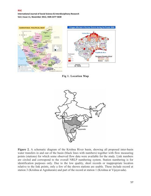
Fig 1. Location Map<br />
Figure 2. A schematic diagram <strong>of</strong> the Krishna River basin, showing all proposed inter-basin<br />
water transfers in <strong>and</strong> out <strong>of</strong> the basin (black lines with numbers) together with flow measuring<br />
points (stations) <strong>for</strong> which some observed flow data were available <strong>for</strong> the study. Link numbers<br />
are circled <strong>and</strong> correspond to the overall NRLP numbering system. Station numbering is <strong>for</strong><br />
identification purposes only. Due to the low quality, short records or inappropriate location<br />
relative to the link points, only a few <strong>of</strong> the shown stations are usable. These include record at<br />
station 3 (Krishna at Agraharam) <strong>and</strong> part <strong>of</strong> the record at station 1 (Krishna at Vijayavada).<br />
57