Workshop - March 24, 2010 - Orlando International Airport
Workshop - March 24, 2010 - Orlando International Airport
Workshop - March 24, 2010 - Orlando International Airport

You also want an ePaper? Increase the reach of your titles
YUMPU automatically turns print PDFs into web optimized ePapers that Google loves.
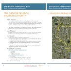
GREATER ORLANDO AVIATION AUTHORITY<br />
<strong>Orlando</strong> <strong>International</strong> <strong>Airport</strong><br />
Poitras Property <strong>Workshop</strong><br />
<strong>March</strong> <strong>24</strong>, <strong>2010</strong>
• Introduction<br />
AGENDA<br />
• Current Status<br />
• Purpose & Methodology<br />
• Regional Context<br />
• Transportation<br />
• Land Use<br />
• Planning Strategy<br />
• Discussion<br />
OIA<br />
POITRAS PROPERTY<br />
<strong>March</strong> <strong>24</strong>, <strong>2010</strong>
Introduction
TEAM<br />
• Greater <strong>Orlando</strong> Aviation Authority<br />
(GOAA)<br />
Owner<br />
• Schenkel Shultz<br />
General Consultant<br />
• Dykes Everett & Company<br />
Real Estate Development Consultant<br />
• Real Estate Research Consultants<br />
(RERC)<br />
Real Estate Market Consultants<br />
• Court Street Partners<br />
Community Planning/Site Design and Entitlement<br />
Planning<br />
• HDR<br />
Transportation Analysis<br />
<strong>March</strong> <strong>24</strong>, <strong>2010</strong>
Current Status
CURRENT STATUS<br />
2006: Due Diligence Report Completed which included preliminary transportation,<br />
market and financial analysis as well as recommendations intended to guide regulatory<br />
initiatives in the identification of development scenarios and methodology.<br />
2007: Completion of the amendment to the City of <strong>Orlando</strong>’s Growth Management<br />
Plan (GMP) to change the land use designation from Urban Reserve to Urban Village.<br />
•A portion of the property (approx. 45 acres) was identified as not being within the City of<br />
<strong>Orlando</strong>, but within Orange County. The annexation and the following GMP process for this<br />
portion has also been completed.<br />
Environmental / Permitting Status<br />
•December 2009 GOAA recorded a conservation easement over approximately 380 acres over<br />
primary wetland system (this matches the conservation are shown in the GMP)<br />
•This easement does not include the isolated wetlands on the Poitras property which may be<br />
removed with appropriate mitigation.<br />
<strong>March</strong> <strong>24</strong>, <strong>2010</strong>
CURRENT STATUS<br />
UPDATED GROWTH MANAGEMANT PLAN<br />
<strong>March</strong> <strong>24</strong>, <strong>2010</strong>
CURRENT STATUS<br />
Market Analysis<br />
• RERC 2007 Market Analysis analyzed office,<br />
industrial, residential and retail/services uses.<br />
Market-supported development program for Poitras<br />
Product Type<br />
Office<br />
Industrial<br />
Residential (SF)<br />
Residential (MF)<br />
Retail/Services<br />
Total<br />
1,000,000 SF<br />
1,000,000 SF<br />
3,000 units<br />
1,800 units<br />
400,000 SF<br />
• RERC provided update February <strong>2010</strong> which<br />
considered historical and current market conditions,<br />
relevant DRI annual reports, population and<br />
employment projections.<br />
<strong>March</strong> <strong>24</strong>, <strong>2010</strong>
Purpose and Methodology
PURPOSE & METHODOLOGY<br />
PURPOSE<br />
•Develop a strategic planning process which will lead to a Planned Development (PD)<br />
ordinance for the 1,800 acre Poitras Property.<br />
•Recommend strategies to sustain operating revenues and support future growth.<br />
•Develop Master Plan Guidelines for Real Estate assets to guide future decision making<br />
processes.<br />
METHODOLOGY<br />
•Poitras currently has Urban Village and Conservation future land use designations, and<br />
a PD ordinance is required to fully entitle the property.<br />
•Senate Bill 360 impacts this process, in that this project would have, in the past, been<br />
required to undergo a DRI review through the East Central Florida Regional Planning<br />
Council (ECFRPC).<br />
•In this instance, the City will be coordinating the project review.<br />
PLANNED DEVELOPMENT FRAMEWORK<br />
<strong>Workshop</strong><br />
PD Pre-<br />
Application<br />
PD<br />
Application<br />
Review<br />
Process<br />
Adoption<br />
<strong>March</strong> <strong>24</strong>, <strong>2010</strong>
REGIONAL CONTEXT
REGIONAL CONTEXT<br />
<strong>March</strong> <strong>24</strong>, <strong>2010</strong>
REGIONAL CONTEXT<br />
City of <strong>Orlando</strong> FLUM Map<br />
OIA<br />
POITRAS<br />
<strong>March</strong> <strong>24</strong>, <strong>2010</strong>
REGIONAL CONTEXT<br />
Future <strong>Airport</strong> Growth - Property Development<br />
<strong>Orlando</strong> VA Medical Center<br />
*<br />
TRADEPORT<br />
NTC<br />
FUTURE<br />
STC<br />
*<br />
GEE BEE<br />
Lake<br />
Nona<br />
Nemours Children’s Hospital<br />
*<br />
SOUTHERN<br />
SECTOR<br />
UCF College of Medicine<br />
*<br />
Medical City<br />
UF Research Center<br />
*<br />
POITRAS<br />
*<br />
AREAS FOR FUTURE DEVELOPMENT<br />
<strong>March</strong> <strong>24</strong>, <strong>2010</strong>
Transportation
TRANSPORTATION<br />
REGIONAL CONTEXT / BACKGROUND<br />
•2060 Florida Transportation Plan (FTP)<br />
•“How Shall We Grow” – 2050 Central Florida, A Vision for Our Future<br />
•2030 METROPLAN ORLANDO LRTP<br />
•OOCEA 2030 Expressway Master Plan / SR 417 Southern Extension<br />
•City of <strong>Orlando</strong> Southeast Sector Plan<br />
•Osceola County Northeast District Master Plan / Deseret Ranch<br />
•OIA Master Plan<br />
•Lake Nona Southern Circulation Specific Parcel Master Plan (SPMP)<br />
•Other Area DRIs<br />
•Poitras GMP<br />
•Osceola Parkway Feasibility Study<br />
•High Speed Rail<br />
•Commuter Rail<br />
•Innovation Way Circulator<br />
<strong>March</strong> <strong>24</strong>, <strong>2010</strong>
TRANSPORTATION<br />
2060 Florida Transportation Plan<br />
<strong>March</strong> <strong>24</strong>, <strong>2010</strong>
TRANSPORTATION<br />
Central Florida Regional Vision Project<br />
How Shall We Grow?<br />
C<br />
O<br />
R<br />
R<br />
I<br />
D<br />
O<br />
R<br />
S<br />
C<br />
E<br />
N<br />
T<br />
E<br />
R<br />
S<br />
<strong>March</strong> <strong>24</strong>, <strong>2010</strong>
TRANSPORTATION<br />
OOCEA – SR 417 Southern Extension<br />
INITIAL Level II Corridors (April 2008)<br />
<strong>March</strong> <strong>24</strong>, <strong>2010</strong>
TRANSPORTATION<br />
Roadway Improvements (2030 LRTP)<br />
SR 417 S.<br />
Extension<br />
Recommended<br />
Corridors<br />
Osceola County<br />
NE District<br />
Master Plan<br />
<strong>March</strong> <strong>24</strong>, <strong>2010</strong>
TRANSPORTATION<br />
Poitras Conceptual Roadway Network<br />
<strong>March</strong> <strong>24</strong>, <strong>2010</strong>
TRANSPORTATION<br />
Regional Growth – Multimodal Opportunities<br />
• Rail Systems: OIA Regional Hub for High Speed (HSR), Commuter<br />
and Light Rail<br />
• Tampa – <strong>Orlando</strong> Corridor Adjacency<br />
• Adjacency to major transportation Corridors<br />
• Geography<br />
• Ideal distances between Population Centers for HSR<br />
• <strong>Orlando</strong> Strategically placed as the “Crossroad” of the Region<br />
Source: Florida Department of<br />
Transportation<br />
August 2009<br />
<strong>March</strong> <strong>24</strong>, <strong>2010</strong>
TRANSPORTATION<br />
Metroplan <strong>Orlando</strong> 2030 LRTP – Transit Vision Concept Plan<br />
<strong>March</strong> <strong>24</strong>, <strong>2010</strong>
TRANSPORTATION<br />
Metroplan <strong>Orlando</strong> 2030 LRTP – Transit Vision Concept Plan<br />
<strong>March</strong> <strong>24</strong>, <strong>2010</strong>
TRANSPORTATION<br />
Summary and Conclusion<br />
• Think Regionally, Act Locally<br />
• Provide for New East-West Connection<br />
• Serve as Transit Hub<br />
• Gateway to Global Multimodal Transportation Center<br />
<strong>March</strong> <strong>24</strong>, <strong>2010</strong>
Land Use
LAND USE<br />
Existing Site Factors and Influences<br />
<strong>March</strong> <strong>24</strong>, <strong>2010</strong>
LAND USE<br />
GMP Conceptual Development Plan<br />
Key Items for Discussion:<br />
-Site Influences and Factors<br />
- Southeast Sector Plan<br />
- Organization of Property & Uses<br />
- Quantity of Uses and Where<br />
<strong>March</strong> <strong>24</strong>, <strong>2010</strong>
LAND USE<br />
Alternative Concept Plan<br />
<strong>March</strong> <strong>24</strong>, <strong>2010</strong>
LAND USE<br />
Alternative Concept Plan<br />
<strong>March</strong> <strong>24</strong>, <strong>2010</strong>
LAND USE<br />
Summary & Conclusion<br />
• Set Framework for a Regionally Significant Place and Plan<br />
• Series of “Centers” that Anchor different locations and uses<br />
in the plan<br />
• Mixed-Use and Multi-Use Nodes<br />
• Strong Civic and Public Realm Component<br />
• Appropriately Sized and Scaled for Success – slight resizing<br />
• Internalize Open Space Corridor<br />
• Position for Area Wide and Regional Transportation<br />
• Position to be ready for Multi-Modal / Transit Network<br />
<strong>March</strong> <strong>24</strong>, <strong>2010</strong>
Planning Strategy
PLANNING STRATEGY<br />
MARKET ANALYSIS<br />
• Medical/research-related industrial and flex space and multifamily for-rent<br />
apartments<br />
• On-going build out of uses, responsive to Research Park activities and needs<br />
TRANSPORATION<br />
• Think Regionally, Act Locally<br />
• Provide for New East-West Connection<br />
• Serve as Transit Hub<br />
• Gateway to Global Multimodal Transportation Center<br />
LAND USE<br />
• Set Framework for a Regionally Significant Place and Plan<br />
• Series of “Centers” that Anchor different locations and uses in the plan.<br />
• Internalize Open Space Corridor<br />
• Position for Area Wide and Regional Transportation<br />
• Position to be ready for Multi-Modal / Transit Network<br />
<strong>March</strong> <strong>24</strong>, <strong>2010</strong>
KEYS FOR SUCCESS<br />
• Visionary Leadership<br />
• Continue development of Global Transportation Center.<br />
• Develop surrounding terminal property to develop an<br />
“<strong>Airport</strong> City” with fully self sustainable amenities.<br />
• Provide job opportunities for the communities through<br />
various types of developments.<br />
• Flexibility / Adaptability<br />
• Manage a Planning Model that maximizes Flexibility<br />
• Ability to Manage Risks<br />
• Develop Contingency Plans<br />
• Diligent monitoring of Future Forecasting Projections<br />
• Demand Driven Expansion<br />
<strong>March</strong> <strong>24</strong>, <strong>2010</strong>
CONCLUSION<br />
• Uniquely positioned adjacent to a Global Transportation Center<br />
• Keys to Success<br />
• Visionary Leadership<br />
• Flexibility / Adaptability<br />
• Ability to Manage Risks<br />
• Recognize the importance of positioning the <strong>Orlando</strong> <strong>International</strong> <strong>Airport</strong><br />
as a “Community Asset” for the continued economic growth of the Region<br />
<strong>March</strong> <strong>24</strong>, <strong>2010</strong>
Discussion
LAND USE<br />
Current Status<br />
<strong>March</strong> <strong>24</strong>, <strong>2010</strong>
Concept 1<br />
LAND USE<br />
Proposed Concepts<br />
Concept 2<br />
<strong>March</strong> <strong>24</strong>, <strong>2010</strong>
Concept 3<br />
LAND USE<br />
Proposed Concepts<br />
<strong>March</strong> <strong>24</strong>, <strong>2010</strong>
REGIONAL CONTEXT<br />
City of <strong>Orlando</strong> Southeast Sector Plan<br />
City of <strong>Orlando</strong><br />
Economic Development Department<br />
City Planning Division<br />
April 2006<br />
<strong>March</strong> <strong>24</strong>, <strong>2010</strong>