Green River Reservoir State Park - Vermont Department of Forests ...
Green River Reservoir State Park - Vermont Department of Forests ...
Green River Reservoir State Park - Vermont Department of Forests ...

You also want an ePaper? Increase the reach of your titles
YUMPU automatically turns print PDFs into web optimized ePapers that Google loves.
123<br />
APPENDIX C<br />
Summary <strong>of</strong> Public Comments with Responses<br />
for the<br />
January 27, 2005 Draft Plan<br />
<strong>Green</strong> <strong>River</strong> <strong>Reservoir</strong> <strong>State</strong> <strong>Park</strong><br />
After careful review <strong>of</strong> all the comments received from the public meeting (held on<br />
March 10, 2005 in Morrisville, <strong>Vermont</strong>) to discuss the draft management plan and the<br />
comments received via email, mail and telephone during the public comment period<br />
(which ended April 30, 2005), the Barre District Stewardship Team has completed<br />
redrafting the long-range management plan for <strong>Green</strong> <strong>River</strong> <strong>Reservoir</strong> <strong>State</strong> <strong>Park</strong>. There<br />
were 39 people at the public meeting and 105 written comments were received.<br />
Most comments that clarified the text and were editorial in nature were simply<br />
incorporated into the final plan. As many <strong>of</strong> the comments received were relatively long,<br />
we chose not to repeat each comment in this appendix but instead created a few broad<br />
categories that represent concerns that pertain to similar resources. Doing this improves<br />
the readability <strong>of</strong> the responses, rendering this document relatively short. If someone<br />
would like a more detailed response to a particular comment or issue, the staff from the<br />
Barre or Waterbury <strong>of</strong>fices would be glad to make that available.<br />
Every effort has been made to incorporate into the plan suggestions that are compatible<br />
with the goals <strong>of</strong> the parcel and are fiscally realistic. Again, further explanation as to why<br />
suggestions were or were not used is available from Barre or Waterbury staff members.<br />
Summary <strong>of</strong> More Specific Changes to Draft LRMP<br />
Not included in this list are typographical and grammatical changes and minor clarifications<br />
that were suggested by various organizations and individuals:<br />
Section I – Introduction<br />
1) Clarified and added language in “Amendments to the Long-Range Management<br />
Plan” section.<br />
2) Revised <strong>Green</strong> <strong>River</strong> <strong>Reservoir</strong> <strong>State</strong> <strong>Park</strong> Long-Range Management Plan Structure<br />
section to include changes in plan format.<br />
Section II - Parcel Description and Background<br />
3) Added paragraph on why GRR is unique in <strong>Vermont</strong> and state park system in<br />
General Description section. GRR uniqueness is due to its large size and its more<br />
________________________________________________________________________<br />
<strong>Green</strong> <strong>River</strong> <strong>Reservoir</strong> <strong>State</strong> <strong>Park</strong> LRMP
124<br />
wild character when compared with other more developed state parks.<br />
4) Revised Acquisition History to make it less redundant.<br />
Section III – Public Input Summary<br />
No major changes.<br />
Section IV – Management Strategies<br />
5) In Land Management Categories section – added some clarifications – acreages and<br />
percentages <strong>of</strong> land base for the various management areas.<br />
6) Under the Highly Sensitive Management Areas Section – removed reference to<br />
“human activities will be minimized” as this was misleading.<br />
7) Under the Highly Sensitive Management Areas Section, Wiley Brook Wetland<br />
Complex – clarified implementation action 3 to read, “A sign indicating dates <strong>of</strong> the<br />
Great Blue Heron nesting season will be placed on the bridge over the water <strong>of</strong><br />
the Wiley Brook mouth to discourage boaters from approaching this area during<br />
this period <strong>of</strong> time.”<br />
8) Under Special Management Areas Section – added reference to importance <strong>of</strong> cloud<br />
sedge; clarified acres in deer wintering area; added language about ice fishing<br />
shanties remaining on the reservoir; and changed language about hunting during park<br />
operating season.<br />
9) Under General Management Areas section – added more information about these<br />
areas.<br />
10) Under Management Actions by Resource Category – added a “4. Hunting, Fishing<br />
and Trapping” subsection.<br />
Section V – Management Activities for the Next 20 Years<br />
11) Added acreages in the table for timber sales.<br />
12) Added a section on Future Land Acquisitions.<br />
Appendices for the LRMP include:<br />
Appendix A – Conservation Easement<br />
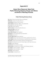
Appendix B –Public Planning Advisory Group (PPAG)<br />
Appendix C –Summary <strong>of</strong> Public Comments with Responses for the January 27,<br />
2005 Draft Plan<br />
Appendix C –Authorization to Plan and Manage<br />
Appendix D – Summary <strong>of</strong> Some Policies and Guidelines Used in the Management<br />
<strong>of</strong> <strong>Vermont</strong> Agency <strong>of</strong> Natural Resources Lands<br />
Appendix E – Glossary<br />
Technical Appendices<br />
Revised and updated all the Resource Assessments to be consistent with information in<br />
the LRMP. This will be published as a separate document – Technical Appendices (see<br />
Table <strong>of</strong> Contents in LRMP).<br />
________________________________________________________________________<br />
<strong>Green</strong> <strong>River</strong> <strong>Reservoir</strong> <strong>State</strong> <strong>Park</strong> LRMP
125<br />
General Comments About Some <strong>of</strong> the Changes in Draft LRMP<br />
Wild and Quiet Nature <strong>of</strong> the <strong>Park</strong><br />
Use <strong>of</strong> the term “wilderness-like” has been changed in the Final Plan. The new terms to<br />
describe the park are “remote and wild character.”<br />
The term “wilderness-like” was used during the planning process and in the Draft Plan.<br />
The Public Planning Advisory Group felt that this term best described the vision for the<br />
park. The change has been implemented for several reasons. Wilderness is primarily used<br />
as a congressional designation on federal land. The <strong>Green</strong> <strong>River</strong> <strong>Reservoir</strong> LRMP was in<br />
the final planning process at the same time as the planning process for the <strong>Green</strong><br />
Mountain National Forest. The <strong>Department</strong> <strong>of</strong> <strong>Forests</strong>, <strong>Park</strong>s and Recreation feels it is<br />
very important to reduce public misunderstandings and confusion on public land<br />
management. Eliminating the use <strong>of</strong> the term “wilderness-like” will help to clarify the<br />
difference in ownership and management <strong>of</strong> the state park. The allowed uses and<br />
development <strong>of</strong> the state park are far different than congressionally designated<br />
wilderness. <strong>State</strong> parks are simply not “wilderness-like.” The term served a purpose to<br />
help define the goal <strong>of</strong> maintaining the remote and quiet nature <strong>of</strong> <strong>Green</strong> <strong>River</strong> <strong>Reservoir</strong><br />
<strong>State</strong> <strong>Park</strong> during the planning process.<br />
Non-motorized use <strong>of</strong> the park has been clarified to refer to non-combustible engines on<br />
motorboats in summer months. Snowmobiles (which have a combustible engine) are<br />
allowed within the park on designated trails if included in the long-range management<br />
plan (under the Deed Conservation Easement; see page 15 and Appendix A).<br />
Roads, Signs, and Access<br />
Private roads will be designated as private roads on the maps, something that was not<br />
done for the draft plan.<br />
The theft and destruction <strong>of</strong> road signs is unfortunate. However, in <strong>Vermont</strong> each town is<br />
responsible for road signs. As this situation occurs, park personnel will report these<br />
occurrences to the town during the park operating season.<br />
The <strong>Department</strong> <strong>of</strong> <strong>Forests</strong>, <strong>Park</strong>s and Recreation can not put up <strong>of</strong>f-site signs directing<br />
users to the park. These would violate state law, which states that these signs must be on<br />
the property. The only signs that could be approved and erected would be the Travel<br />
Information Council (TIC) signs that you see along all the state highways. In this case,<br />
one would need to be erected on VT Route 15 and an annual cost would be associated<br />
with this sign. In addition, the Town <strong>of</strong> Hyde <strong>Park</strong> requested that a TIC sign not be<br />
erected.<br />
________________________________________________________________________<br />
<strong>Green</strong> <strong>River</strong> <strong>Reservoir</strong> <strong>State</strong> <strong>Park</strong> LRMP
126<br />
Illegal parking on the town roadsides will continue to be subject to ticketing and towing<br />
by local law enforcement <strong>of</strong> jurisdiction.<br />
There are at least two existing parking turnouts along non-park roads in the vicinity to<br />
disperse users and <strong>of</strong>fer hunting access. Currently, on park lands there are two parking<br />
areas on the west side <strong>of</strong> the property and two along <strong>Green</strong> <strong>River</strong> Dam Road. There is one<br />
parking area located <strong>of</strong>f <strong>of</strong> Garfield Road on Morrisville Water and Light land in the<br />
south eastern area <strong>of</strong> the <strong>Reservoir</strong>. There may be additional parking areas in the future<br />
when the trail system is developed in the southern section <strong>of</strong> the park. These parking<br />
areas will be available for all users, not just trail users.<br />
Hunting is allowed at all state parks consistent with <strong>State</strong> <strong>Park</strong> rules and regulations and<br />
Fish and Wildlife laws, rules and regulations.<br />
Vehicle access will not be allowed any closer to the water than it has been historically.<br />
<strong>Park</strong> staff can assist people in carrying boats to the water. If an ADA designed trail to the<br />
boat access site is built, it may be used by people who may have difficulty transporting<br />
and boarding boats.<br />
To minimize congestion, erosion, and boat collision with the boulders at the boat launch,<br />
a sign may be put up suggesting that boaters avoid using the launch during typically<br />
congested periods <strong>of</strong> time around 11 am or 5 pm. When they are available <strong>Park</strong>, staff will<br />
assist in directing users during heavy use periods.<br />
The <strong>Department</strong> will consider approaching the Town <strong>of</strong> Hyde <strong>Park</strong> to reclassify to “legal<br />
trail” the Class 4 portion <strong>of</strong> the Diggins Road from the state park boundary to its end near<br />
Sch<strong>of</strong>ield Pond. The road has not been maintained in recent years, and this area has<br />
sensitive resources (both natural and historical).<br />
Public vehicular use <strong>of</strong> roads in the park (other than park entrance road) is prohibited<br />
under the Conservation Easement, and controlling access on park lands minimizes<br />
potential resource degradation and enforcement issues for the state.<br />
Trails<br />
The district staff will work with VAST, Catamount Trail Association, and other<br />
stakeholders if it’s determined that recreational uses are having negative impacts on deer<br />
in the wintering area. If trail re-routes are needed, every effort will be made to maintain<br />
the number <strong>of</strong> trail miles available at the start <strong>of</strong> this planning period.<br />
Use <strong>of</strong> mechanized equipment for recreation is allowed in various circumstances.<br />
Mountain biking, for example, is allowed in the park but currently only on gravel<br />
surfaced roads in designated areas.<br />
________________________________________________________________________<br />
<strong>Green</strong> <strong>River</strong> <strong>Reservoir</strong> <strong>State</strong> <strong>Park</strong> LRMP
127<br />
The portage path on the south arm <strong>of</strong> the lake east <strong>of</strong> the Garfield intersection is on<br />
Morrisville Water and Light property. The park will not promote use <strong>of</strong> that path because<br />
visitors are expected to use the main access to the park.<br />
Forest and Wildlife Habitat Management<br />
Due to the hydrology <strong>of</strong> the Wiley Block’s alder swamp, lack <strong>of</strong> active vegetative<br />
management is not expected to result in the swamp succeeding to another natural<br />
community type.<br />
Barre District staff will continue to coordinate with abutting landowners when<br />
considering access for timber harvest whenever possible.<br />
Barre District staff members submit annual work plans each July 1 to affected towns and<br />
regional planning commissions. These indicate timber harvests planned for each fiscal<br />
year.<br />
A range <strong>of</strong> vegetative management systems and techniques, including even and uneven<br />
aged, will be used in appropriate places as sustainable forestry practices (which is one <strong>of</strong><br />
the primary goals for public ownership). Although sustainable forest management is an<br />
important objective, protecting important wildlife and ecological resources, providing<br />
quality back-country recreational opportunities, and preserving the undeveloped scenic<br />
character <strong>of</strong> the park are also important objectives.<br />
Harvestable acres are determined in a number <strong>of</strong> ways including topography, soils, and<br />
buffers for sensitive resources.<br />
Long-range management plans for ANR lands assign the lands generally to different<br />
levels <strong>of</strong> management. An estimate <strong>of</strong> acreages to be treated (usually designated as a<br />
“compartment”) is prepared for the annual stewardship plans that are made available<br />
every July 1. Therefore, acreages to be treated are not generally included in the longrange<br />
management plans.<br />
In the future it’s possible that overbrowsing by moose could be a concern on this parcel,<br />
and monitoring done on the lands in the park will determine if that happens.<br />
Removal <strong>of</strong> harvested moose by motorized means is not possible on this parcel due to<br />
deed restrictions. Those who wish to hunt here should find suitable non-motorized means<br />
for removal.<br />
Visual Quality<br />
The landscape in the 500’ buffer around the reservoir and other timber management<br />
exclusionary zones as required by a deed restriction (easement) will look different in<br />
________________________________________________________________________<br />
<strong>Green</strong> <strong>River</strong> <strong>Reservoir</strong> <strong>State</strong> <strong>Park</strong> LRMP
128<br />
about 30 years than it looks now. Some people may appreciate this change, while others<br />
will not like it. However, distant views from the reservoir should not be impacted by this.<br />
The draft plan expressed that the state encouraged towns to pass viewshed regulations.<br />
This will be removed from the final plan. However, district staff will provide information<br />
about scenic views from the park and <strong>Reservoir</strong> to the Towns <strong>of</strong> Eden and Hyde <strong>Park</strong> as<br />
they implement their goal to protect scenic resources.<br />
Management <strong>of</strong> Day Use and Campsites<br />
A goal for <strong>State</strong> <strong>Park</strong>s overall is to break even or be financially self-sustaining. There is<br />
general recognition that this is not possible at all state parks. The primary purposes <strong>of</strong> this<br />
park are to provide a certain type <strong>of</strong> recreational experience, one that is unique among<br />
state parks in this case, and to protect natural resources.<br />
Limiting group size to 8-12 people is designed to enhance the type <strong>of</strong> recreation<br />
opportunity provided at this park. The smaller group size is more likely to sustain the<br />
wild character <strong>of</strong> the recreational experience.<br />
The decision to not aggressively promote or market the park is also consistent with<br />
enhancing the wild character <strong>of</strong> the park. However, people who express desire for this<br />
type <strong>of</strong> experience will be directed to this park. General public information has been<br />
developed for the park.<br />
The generation <strong>of</strong> revenue from charging fees for primitive camping is not feasible.<br />
Remote camping at designated sites and day use will be evaluated annually for future<br />
revenue-generating potential. If additional revenue is determined be feasible, the<br />
<strong>Department</strong> will use the rules and regulations process to establish fees for day use and<br />
camping.<br />
Additional day use amenities, such as a designated picnic area with picnic tables, and<br />
picnic or group areas, such as large picnic shelters, were determined through the planning<br />
process as not consistent with the wild character <strong>of</strong> the park.<br />
Those who do not remove fish shanties in a timely manner may be prosecuted by Fish<br />
and Wildlife and/or local law enforcement personnel.<br />
Group use that is commercial in nature is the only group use that is prohibited on<br />
weekends. Please note that commercial use includes both “for pr<strong>of</strong>it” and “nonpr<strong>of</strong>it”<br />
group activities that are organized, promoted, and/or where a fee is charged or a donation<br />
is requested.<br />
With regard to the two-group limit per day, this rule is necessary for management <strong>of</strong> the<br />
park for at least two reasons. Staff cannot possibly monitor all the arrivals and departures.<br />
________________________________________________________________________<br />
<strong>Green</strong> <strong>River</strong> <strong>Reservoir</strong> <strong>State</strong> <strong>Park</strong> LRMP
129<br />
It is also needed in order to be consistently fair and equitable to all members <strong>of</strong> the<br />
public.<br />
Other Topics<br />
In the Special Management Areas subsection <strong>of</strong> Section IV, Management Strategies and<br />
Actions, the resource areas appear to be misnumbered. However, the decimal used for<br />
each area type, in this case Special Management Area as #2, represents a different type <strong>of</strong><br />
resource identified within the Agency <strong>of</strong> Natural Resources lands classification system.<br />
Therefore, resources numbered 2.1 are special Biological, Cultural, and/or Geologic<br />
Resources, 2.2 represents Critical Plant and/or Wildlife Habitats, and 2.5 represents<br />
Special Protection Areas. Contact the District for more details about the classification<br />
system.<br />
The <strong>Department</strong> and Agency Strategic Plans, upon which this plan is based and which<br />
have recently expired, have been extended and will be revised as part <strong>of</strong> the restructuring<br />
process underway for the Agency <strong>of</strong> Natural Resources.<br />
The conservation easement on the park that is co-held by the <strong>Vermont</strong> Housing and<br />
Conservation Board and the <strong>Vermont</strong> Chapter <strong>of</strong> The Nature Conservancy was made<br />
possible by the <strong>Vermont</strong> Legislature through 10 VSA Section 6303 passed in 1969.<br />
Through this legislation, certain state agencies, municipalities, and qualified 501c(3)<br />
organizations are defined as qualified holders <strong>of</strong> conservation easements on ANR lands.<br />
Gravel pits and other extractable resources like sandy fill that are available only for park<br />
use are identified on the wildlife habitats and significant natural resources maps in the<br />
ecological assessment section <strong>of</strong> the plan.<br />
________________________________________________________________________<br />
<strong>Green</strong> <strong>River</strong> <strong>Reservoir</strong> <strong>State</strong> <strong>Park</strong> LRMP
________________________________________________________________________<br />
<strong>Green</strong> <strong>River</strong> <strong>Reservoir</strong> <strong>State</strong> <strong>Park</strong> LRMP<br />
130