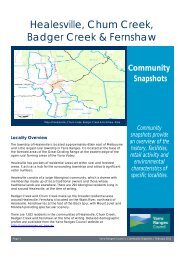
Community Snapshot Upwey - Shire of Yarra Ranges
Community Snapshot Upwey - Shire of Yarra Ranges
Community Snapshot Upwey - Shire of Yarra Ranges

You also want an ePaper? Increase the reach of your titles
YUMPU automatically turns print PDFs into web optimized ePapers that Google loves.
<strong>Upwey</strong><br />
<strong>Community</strong><br />
<strong>Snapshot</strong>s<br />
Locality Overview<br />
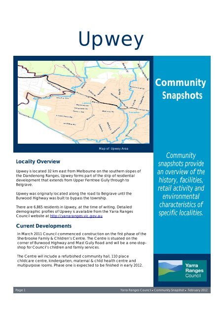
Map <strong>of</strong> <strong>Upwey</strong> Area<br />
<strong>Upwey</strong> is located 32 km east from Melbourne on the southern slopes <strong>of</strong><br />
the Dandenong <strong>Ranges</strong>, <strong>Upwey</strong> forms part <strong>of</strong> the strip <strong>of</strong> residential<br />
development that extends from Upper Ferntree Gully through to<br />
Belgrave.<br />
<strong>Upwey</strong> was originally located along the road to Belgrave until the<br />
Burwood Highway was built to bypass the township.<br />
There are 6,865 residents in <strong>Upwey</strong>, at the time <strong>of</strong> writing. Detailed<br />
demographic pr<strong>of</strong>iles <strong>of</strong> <strong>Upwey</strong> is available from the <strong>Yarra</strong> <strong>Ranges</strong><br />
Council website at http://yarraranges.vic.gov.au<br />
<strong>Community</strong><br />
snapshots provide<br />
an overview <strong>of</strong> the<br />
history, facilities,<br />
retail activity and<br />
environmental<br />
characteristics <strong>of</strong><br />
specific localities.<br />
Current Developments<br />
In March 2011 Council commenced construction on the first phase <strong>of</strong> the<br />
Sherbrooke Family & Children’s Centre. The Centre is situated on the<br />
corner <strong>of</strong> Burwood Highway and Mast Gully Road and will be a one-stopshop<br />
for Council’s children and family services.<br />
The Centre will include a refurbished community hall, 110 place<br />
childcare centre, kindergarten, maternal & child health centre and<br />
multipurpose rooms. Phase one is expected to be finished in early 2012.<br />
Page 1 <strong>Yarra</strong> <strong>Ranges</strong> Council ● <strong>Community</strong> <strong>Snapshot</strong> ● February 2012
Historical Context<br />
The area <strong>of</strong> <strong>Upwey</strong> was originally known as “Mast Gully” deriving its name from the tall strong straight trees<br />
that were cut down and used for ship masts in the 1850s. Mast Gully Creek and Mast Gully Road still remain<br />
as features <strong>of</strong> the <strong>Upwey</strong> township.<br />
In the mid 1890s sections <strong>of</strong> the locality were divided into ten acre blocks as part <strong>of</strong> the Scoresby village<br />
settlement scheme, which extended north towards Ferny Creek. It is believed that <strong>Upwey</strong> was renamed to its<br />
current name by the Tullidge sisters, who named it after an English village on the River Wey, in the late 1890s.<br />
A narrow gauge railway from Upper Ferntree Gully to Gembrook, stopping at <strong>Upwey</strong>, opened in 1901. In<br />
1954 the railway was closed due to a landslide along the line past Selby. The line was reopened, to Belgrave,<br />
in 1955 as a tourist railway but closed again in 1958. In 1962 the metropolitan train service to Belgrave was<br />
opened, giving <strong>Upwey</strong> a direct link to Melbourne.<br />
Belgrave – Main Street.<br />
By the 1920s and early 1930s many weekenders had been built in the area. When the Great Depression<br />
occurred the Government opened up the Dandenong <strong>Ranges</strong> to housing and the population <strong>of</strong> <strong>Upwey</strong><br />
and surrounding towns grew. The Primary School opened in 1934 and the high school in 1945.<br />
The main road to Belgrave originally ran along the Main Street <strong>of</strong> <strong>Upwey</strong>, but the construction <strong>of</strong> a bypass in<br />
the 1970s resulted in the town centre being separated from the Burwood Highway.<br />
Transport Options<br />
<strong>Upwey</strong> is well serviced by public transport with the metropolitan train line and bus service. The two-way bus<br />
service between Belgrave and Oakleigh (693) stops at <strong>Upwey</strong> and links the community to suburbs along its<br />
route; it also stops at Monash University. The service runs Monday to Friday, half hourly in the <strong>of</strong>f peak times and<br />
on the weekend it runs hourly.<br />
There is also a bus service between Belgrave and <strong>Upwey</strong> (699) with services running hourly between 8am and<br />
5pm, Monday to Friday, with a more limited service on Saturday and Sunday.<br />
Victorian taxis operate within prescribed taxi zones. The urban area <strong>of</strong> <strong>Yarra</strong> <strong>Ranges</strong> sits within the Metropolitan<br />
Taxi Boundary. <strong>Upwey</strong> sits within the Metropolitan Taxi Boundary. There are several taxis in operation in the area<br />
outside the Metropolitan Taxi Boundary these generally cover the <strong>Yarra</strong> Valley, Upper <strong>Yarra</strong> and Hills districts.<br />
Retail and Tourist Overview<br />
<strong>Upwey</strong> has a range <strong>of</strong> businesses operating, with a<br />
main street shopping strip <strong>of</strong>fering convenience<br />
and everyday retail services. Residents travel to the<br />
larger retail precincts <strong>of</strong> Ferntree Gully and Knox for<br />
their broader retail needs.<br />
Page 2<br />
<strong>Upwey</strong> Main Street Shopping Precinct<br />
The commercial centre <strong>of</strong> <strong>Upwey</strong> is also located <strong>of</strong><br />
Burwood Highway, which can be a disadvantage<br />
to businesses missing out on exposure and passing<br />
traffic.<br />
The retail and commercial businesses <strong>of</strong> <strong>Upwey</strong> are<br />
predominantly focused on servicing the needs <strong>of</strong><br />
the local communities with tourists travelling past<br />
<strong>Upwey</strong> on their way to Belgrave and the<br />
Dandenong <strong>Ranges</strong>.<br />
Page 2 <strong>Yarra</strong> <strong>Ranges</strong> Council ● <strong>Community</strong> <strong>Snapshot</strong> ● February 2012
<strong>Community</strong> Facilities & Services<br />
<strong>Upwey</strong> has a range <strong>of</strong> community facilities and<br />
services from public schools, kindergarten to<br />
churches and community halls. The Flexi Library<br />
Services visits the local playgroup once a fortnight.<br />
The Sherbrooke Children’s Centre <strong>of</strong>fers a range <strong>of</strong><br />
early year’s programs and services.<br />
Burrinja, located on Glenfern Road, is an important<br />
cultural facility for the broader community. Burrinja is<br />
located in the former <strong>Shire</strong> <strong>of</strong> Sherbrooke Council<br />
Offices. Burrinja was named after Lin Onus, a local<br />
Indigenous artist. Burrinja was Lin’s Yorta Yorta<br />
nickname meaning ‘star’.<br />
Indigenous art and culture is a major part <strong>of</strong> Burrinja’s<br />
charter. Burrinja is a community cultural centre that<br />
includes arts activities and events, Indigenous<br />
gallery, collection and cultural education,<br />
contemporary arts gallery, performing arts, artist<br />
studios, live music, workshops and café.<br />
Local Services<br />
Number In<br />
Area *<br />
Post Office 1<br />
Retail businesses (e.g. supermarket,<br />
31<br />
newsagent, drycleaners, etc)<br />
Police Station 0<br />
Childcare 1<br />
Kindergarten 2<br />
Public Primary School 2<br />
Public Secondary School 1<br />
Tertiary Education 0<br />
Library – Flexi Service 1<br />
<strong>Community</strong>/Neighbourhood House 0<br />
General Practitioner Clinic/s 0<br />
Recreational facilities (e.g. netball<br />
3<br />
court, football oval, swimming pool,<br />
tennis courts, reserves, etc)<br />
* This is indicative only and decisions should not be made on<br />
this information alone.<br />
Environmental Characteristics<br />
<strong>Upwey</strong> is located on the lower slopes <strong>of</strong> the southern<br />
face <strong>of</strong> The Dandenongs main ridge. To the north,<br />
<strong>Upwey</strong> is framed by the Sherbrooke Forest and the<br />
Dandenong <strong>Ranges</strong> National Park.<br />
There is a mix <strong>of</strong> forest types within the National Park<br />
and within some <strong>of</strong> the larger patches <strong>of</strong> native<br />
vegetation found on private land around Belgrave.<br />
Most <strong>of</strong> the residential areas retain a canopy <strong>of</strong><br />
indigenous trees which is significant for many <strong>of</strong> the<br />
fauna in the area.<br />
Page 3 <strong>Yarra</strong> <strong>Ranges</strong> Council ● <strong>Community</strong> <strong>Snapshot</strong> ● February 2012
<strong>Yarra</strong> <strong>Ranges</strong> Council<br />
PO Box 105<br />
Lilydale Vic 3140<br />
Phone: 1300 368 333<br />
Fax: (03) 9735 4249<br />
Email:<br />
mail@yarraranges.vic.gov.au<br />
Artwork at the<br />
<strong>Upwey</strong> Train<br />
Station<br />
References and Further Reading<br />
• Australian Bureau <strong>of</strong> Statistics (2008) Census <strong>of</strong> Population and Housing.<br />
www.abs.gov.au (accessed February 2011)<br />
• Burrinja Cultural Centre http://www.burrinja.org.au/ (accessed October 2011)<br />
• Coulson, H. (1968) Story <strong>of</strong> the Dandenongs, 1838-1958. F.W Cheshire.<br />
• Metlink. http://www.metlinkmelbourne.com.au/ (accessed February 2011)<br />
• Monash University, Australian Places Gazetteer, National Centre for Australian<br />
Studies. http://www.arts.monash.edu.au/ncas (site now decommissioned)<br />
• Railtrails Australia, http://www.railtrails.org.au (accessed February 2011)<br />
• U.S Bus Lines Timetable<br />
• Wikipedia. http://en.wikipedia.org (accessed November 2010)<br />
The community snapshots were developed by the <strong>Yarra</strong> <strong>Ranges</strong><br />
Council and its content is for general information and<br />
communication only. All attempts have been made to ensure<br />
the accuracy and reliability <strong>of</strong> the information contained in the<br />
snapshots. No responsibility is taken for any information or<br />
service which may appear on any linked websites. These links<br />
are provided for convenience only and do not constitute<br />
endorsement <strong>of</strong> information on those websites.<br />
If you have any enquiries about information in these snapshots,<br />
please contact the Economic and <strong>Community</strong> Development<br />
Unit on 1300 368 333.<br />
Page 3<br />
Page 4 <strong>Yarra</strong> <strong>Ranges</strong> Council ● <strong>Community</strong> <strong>Snapshot</strong> ● February 201<br />
<strong>Yarra</strong> <strong>Ranges</strong> Council<br />
PO Box 105