Using the EPSG Geodetic Parameter Dataset - OGP Surveying and ...
Using the EPSG Geodetic Parameter Dataset - OGP Surveying and ...
Using the EPSG Geodetic Parameter Dataset - OGP Surveying and ...

Create successful ePaper yourself
Turn your PDF publications into a flip-book with our unique Google optimized e-Paper software.
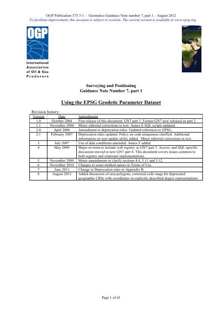
<strong>OGP</strong> Publication 373-7-1 – Geomatics Guidance Note number 7, part 1 – August 2012<br />
To facilitate improvement, this document is subject to revision. The current version is available at www.epsg.org.<br />
<strong>Surveying</strong> <strong>and</strong> Positioning<br />
Guidance Note Number 7, part 1<br />
<strong>Using</strong> <strong>the</strong> <strong>EPSG</strong> <strong>Geodetic</strong> <strong>Parameter</strong> <strong>Dataset</strong><br />
Revision history:<br />
Version Date Amendments<br />
1.0 October 2004 First release of this document, GN7 part 1. Former GN7 now released as part 2.<br />
1.1 November 2004 Minor editorial corrections to text. Annex E SQL scripts updated.<br />
2.0 April 2006 Amendment to deprecation rules. Updated references to <strong>EPSG</strong>.<br />
2.1 February 2007 Deprecation rules updated. Policy on code uniqueness clarified. Additional<br />
information on user update utility added. Minor editorial corrections to text.<br />
3 July 2007 Use of data conditions amended. Annex F added.<br />
4 May 2009 Major revision to include web registry as GN7 part 3. Access- <strong>and</strong> SQL-specific<br />
discussion moved to new GN7 part 4. This document covers issues common to<br />
both registry <strong>and</strong> relational implementations.<br />
5 November 2009 Minor amendments to clarify sections 4.4, 5.11 <strong>and</strong> 5.12.<br />
6 November 2010 Changes to some method names in Terms of Use.<br />
7 June 2011 Change to Deprecation rules in Appendix B.<br />
8 August 2012 Added discussion of area polygons, corrected code range for deprecated<br />
geographic CRSs with coordinates in explicitly described degree representations<br />
Page 1 of 41
<strong>OGP</strong> Publication 373-7-1 – Geomatics Guidance Note number 7, part 1 – August 2012<br />
To facilitate improvement, this document is subject to revision. The current version is available at www.epsg.org.<br />
CONTENTS<br />
PREFACE .............................................................................................................................................................. 3<br />
1 INTRODUCTION ......................................................................................................................................... 4<br />
2 METADATA .................................................................................................................................................. 5<br />
2.1 METADATA FOR THE <strong>EPSG</strong> DATASET ...................................................................................................... 5<br />
2.2 METADATA FOR THE <strong>EPSG</strong> REGISTRY ..................................................................................................... 6<br />
3 USE OF THE DATA ..................................................................................................................................... 7<br />
4 THEORETICAL CONCEPTS ................................................................................................................... 10<br />
4.1 COORDINATES ........................................................................................................................................ 10<br />
4.2 COORDINATE REFERENCE SYSTEMS ....................................................................................................... 10<br />
4.3 COORDINATE OPERATIONS ..................................................................................................................... 14<br />
4.4 IMPLICIT CONCATENATED OPERATIONS CREATED BY APPLICATION SOFTWARE ...................................... 16<br />
5 <strong>EPSG</strong> DATASET MAINTENANCE AND DATA POPULATION POLICIES .................................... 19<br />
5.1 CONTENT ................................................................................................................................................ 19<br />
5.2 HOW TO MAKE A REQUEST TO ADD TO OR AMEND <strong>EPSG</strong> DATASET CONTENT ........................................ 19<br />
5.3 DATA MAINTENANCE RESPONSIBILITIES ................................................................................................. 19<br />
5.4 DATA RELEASE CYCLE ............................................................................................................................ 19<br />
5.5 ARCHIVING............................................................................................................................................. 20<br />
5.6 DATA VALIDITY AND RECORD LIFE-CYCLE INFORMATION ...................................................................... 20<br />
5.7 DATA APPLICABILITY ............................................................................................................................. 21<br />
5.8 RECORD METADATA ............................................................................................................................... 21<br />
5.9 <strong>EPSG</strong> CODES AND NAMES ...................................................................................................................... 22<br />
5.10 UNITS ..................................................................................................................................................... 22<br />
5.11 AREA ...................................................................................................................................................... 23<br />
5.12 POPULATION OF COORDINATE REFERENCE SYSTEMS .............................................................................. 24<br />
5.13 POPULATION OF TRANSFORMATIONS ...................................................................................................... 25<br />
6 SEARCHING THE DATASET .................................................................................................................. 27<br />
6.1 VALID DATA ........................................................................................................................................... 27<br />
6.2 SEARCHING BY NAME ............................................................................................................................ 27<br />
6.3 SEARCHING BY AREA OF USE ................................................................................................................. 27<br />
6.4 SEARCHING FOR COORDINATE REFERENCE SYSTEM DEFINITIONS .......................................................... 28<br />
6.5 SEARCHING FOR COORDINATE OPERATION DEFINITIONS ....................................................................... 29<br />
7 BIBLIOGRAPHY ....................................................................................................................................... 31<br />
ANNEX A – ESSENTIAL ELEMENTS FOR DESCRIPTION OF CRS AND TRANSFORMATION ..... 32<br />
ANNEX B – RULES FOR DEPRECATION .................................................................................................... 33<br />
ANNEX C – DATA NAMING CONVENTIONS ............................................................................................. 35<br />
ANNEX D – COMPLIANCE WITH ISO/TS 19127 - REGISTRY OF GEODETIC CODES AND<br />
PARAMETERS ................................................................................................................................................... 38<br />
Page 2 of 41
<strong>OGP</strong> Publication 373-7-1 – Geomatics Guidance Note number 7, part 1 – August 2012<br />
To facilitate improvement, this document is subject to revision. The current version is available at www.epsg.org.<br />
PREFACE<br />
The <strong>EPSG</strong> <strong>Geodetic</strong> <strong>Parameter</strong> <strong>Dataset</strong>, abbreviated to <strong>the</strong> <strong>EPSG</strong> <strong>Dataset</strong>, is a repository of parameters<br />
required to:<br />
define a coordinate reference system (CRS), which ensures that coordinates describe position<br />
unambiguously.<br />
define transformations <strong>and</strong> conversions that allow coordinates to be changed from one CRS to<br />
ano<strong>the</strong>r CRS. Transformations <strong>and</strong> conversions are collectively called coordinate operations.<br />
The <strong>EPSG</strong> <strong>Dataset</strong> is maintained by <strong>the</strong> <strong>OGP</strong> <strong>Surveying</strong> <strong>and</strong> Positioning Committee's <strong>Geodetic</strong><br />
Subcommittee. It conforms to ISO 19111 – Spatial referencing by coordinates. It is distributed in three<br />
ways:<br />
<strong>the</strong> <strong>EPSG</strong> Registry, in full <strong>the</strong> <strong>EPSG</strong> <strong>Geodetic</strong> <strong>Parameter</strong> Registry, a web-based delivery<br />
platform in which <strong>the</strong> data is held in GML using <strong>the</strong> CRS entities described in ISO 19136.<br />
<strong>the</strong> <strong>EPSG</strong> Database, in full <strong>the</strong> <strong>EPSG</strong> <strong>Geodetic</strong> <strong>Parameter</strong> Database, a relational database<br />
structure where <strong>the</strong> entities which form <strong>the</strong> components of CRSs <strong>and</strong> coordinate operations are in<br />
separate tables, distributed as an MS Access database;<br />
in a relational data model as SQL scripts which enable a user to create an Oracle, MySQL,<br />
PostgreSQL or o<strong>the</strong>r relational database <strong>and</strong> populate that database with <strong>the</strong> <strong>EPSG</strong> <strong>Dataset</strong>;<br />
<strong>OGP</strong> <strong>Surveying</strong> <strong>and</strong> Positioning Guidance Note 7 is a multi-part document for users of <strong>the</strong> <strong>EPSG</strong> <strong>Dataset</strong>.<br />
<br />
<br />
<br />
<br />
<br />
Part 0, Quick Start Guide, gives a basic overview of <strong>the</strong> <strong>Dataset</strong> <strong>and</strong> its use.<br />
Part 1, <strong>Using</strong> <strong>the</strong> <strong>Dataset</strong>, (this document), sets out detailed information about <strong>the</strong> <strong>Dataset</strong> <strong>and</strong> its<br />
content, maintenance <strong>and</strong> terms of use.<br />
Part 2, Formulas, provides a detailed explanation of formulas necessary for executing coordinate<br />
conversions <strong>and</strong> transformations using <strong>the</strong> coordinate operation methods supported in <strong>the</strong> <strong>EPSG</strong><br />
dataset. <strong>Geodetic</strong> parameters in <strong>the</strong> <strong>Dataset</strong> are consistent with <strong>the</strong>se formulas.<br />
Part 3, Registry Developer Guide, is primarily intended to assist computer application developers<br />
who wish to use <strong>the</strong> API of <strong>the</strong> Registry to query <strong>and</strong> retrieve entities <strong>and</strong> attributes from <strong>the</strong><br />
dataset.<br />
Part 4, Database Developer Guide, is primarily intended to assist computer application<br />
developers who wish to use <strong>the</strong> Database or its relational data model to query <strong>and</strong> retrieve entities<br />
<strong>and</strong> attributes from <strong>the</strong> dataset.<br />
The complete text may be found at http://www.epsg.org/guides/index.html. The terms of use of <strong>the</strong> dataset<br />
are also available at http://www.epsg.org/CurrentDB.html.<br />
In addition to <strong>the</strong>se documents, <strong>the</strong> Registry user interface contains online help <strong>and</strong> <strong>the</strong> Database user<br />
interface includes context-sensitive help accessed by left-clicking on any label.<br />
This Part 1 of <strong>the</strong> multipart Guidance Note is primarily intended to assist computer application developers<br />
in using <strong>the</strong> <strong>EPSG</strong> geodetic parameter database. It may also be useful to o<strong>the</strong>r users of <strong>the</strong> data. Readers<br />
are recommended to have read Part 1 of <strong>the</strong> guidance note before tackling parts 3 or 4.<br />
Page 3 of 41
<strong>OGP</strong> Publication 373-7-1 – Geomatics Guidance Note number 7, part 1 – August 2012<br />
To facilitate improvement, this document is subject to revision. The current version is available at www.epsg.org.<br />
1 INTRODUCTION<br />
Coordinates describing a position on or near <strong>the</strong> earth's surface are referenced to a model of <strong>the</strong> earth<br />
ra<strong>the</strong>r than to <strong>the</strong> earth itself. There are many models, <strong>and</strong> each model may be located with respect to <strong>the</strong><br />
real earth in several different ways. The consequence is that one position on <strong>the</strong> real earth may be<br />
represented by multiple sets of coordinates, each referenced to different models. Fur<strong>the</strong>rmore, <strong>the</strong><br />
direction, order <strong>and</strong> units of <strong>the</strong> coordinate system axes are subject to variation. Hence without a set of<br />
geodetic parameters which identify <strong>the</strong> model <strong>and</strong> its relationship to <strong>the</strong> earth, toge<strong>the</strong>r with <strong>the</strong> coordinate<br />
system axes, coordinates are ambiguous.<br />
The European Petroleum Survey Group created a dataset of geodetic parameters in 1985 for internal use of<br />
its members. In 1993 <strong>the</strong> dataset was made public as reference data to <strong>the</strong> <strong>the</strong>n Petrotechnical Open<br />
Software Corporation data model (POSC has since rebr<strong>and</strong>ed as Energistics). In 2005 <strong>the</strong> European<br />
Petroleum Survey Group was reformed as <strong>the</strong> <strong>Surveying</strong> <strong>and</strong> Positioning Committee of <strong>the</strong> International<br />
Association of Oil <strong>and</strong> Gas Producers (<strong>OGP</strong>). Maintenance of <strong>the</strong> geodetic parameter database now resides<br />
with <strong>OGP</strong> <strong>Surveying</strong> <strong>and</strong> Positioning Committee's <strong>Geodetic</strong> Subcommittee. For continuity reasons <strong>the</strong><br />
dataset name remains as <strong>the</strong> <strong>EPSG</strong> <strong>Geodetic</strong> <strong>Parameter</strong> <strong>Dataset</strong>, or in short <strong>the</strong> <strong>EPSG</strong> <strong>Dataset</strong>.<br />
The terminology used in this Guidance Note follows that defined in ISO 19111 – Geographic information<br />
– Spatial referencing by coordinates. This was introduced to <strong>the</strong> world in <strong>the</strong> late 1990s. It regularises<br />
terms that were in use in different communities <strong>and</strong> different countries. Some terms used colloquially in<br />
<strong>the</strong> oil industry are used differently in ISO 19111 <strong>and</strong> this Guidance Note. In particular, <strong>the</strong> colloquial<br />
term "coordinate system" is coordinate reference system in this Guidance Note, whilst coordinate system<br />
as used in this Guidance Note has a narrower meaning (discussed below) than that used colloquially. The<br />
colloquial term "datum shift" is transformation in ISO 19111 <strong>and</strong> this Guidance Note. Fur<strong>the</strong>r ISO terms<br />
<strong>and</strong> <strong>the</strong>ir colloquial equivalents are given in (Iliffe <strong>and</strong> Lott).<br />
Page 4 of 41
<strong>OGP</strong> Publication 373-7-1 – Geomatics Guidance Note number 7, part 1 – August 2012<br />
To facilitate improvement, this document is subject to revision. The current version is available at www.epsg.org.<br />
2 METADATA<br />
2.1 Metadata for <strong>the</strong> <strong>EPSG</strong> <strong>Dataset</strong><br />
The metadata in this section follows <strong>the</strong> provisions of ISO 19115, Geographic information – Metadata.<br />
Register<br />
Title<br />
<strong>EPSG</strong> <strong>Geodetic</strong> <strong>Parameter</strong> <strong>Dataset</strong><br />
Alternate title<br />
<strong>EPSG</strong> <strong>Dataset</strong><br />
Date 2009-05-21<br />
Edition<br />
See latest entry in Version History<br />
Abstract<br />
This dataset holds codes <strong>and</strong> parameter values for coordinate reference<br />
system (CRS) definitions. The CRSs held in <strong>the</strong> dataset are typically<br />
those defined by national mapping organisations to be used for national<br />
mapping <strong>and</strong> spatial data infrastructures as well as additional items of<br />
especial interest to <strong>the</strong> petroleum exploration <strong>and</strong> production industry.<br />
The CRSs described are local, national, regional or global in extent;<br />
local, national <strong>and</strong> regional systems may be from any part of <strong>the</strong> Earth.<br />
Several thous<strong>and</strong> systems are currently described.<br />
The dataset includes all components of <strong>the</strong>se CRSs, for example<br />
datum, ellipsoid, prime meridian, map projection <strong>and</strong> coordinate<br />
system, as specified in ISO 19111.<br />
The dataset also includes definitions for over 1500 coordinate<br />
transformations between CRSs.<br />
Purpose<br />
Coordinates are ambiguous unless <strong>the</strong>ir reference system is defined. If<br />
coordinates are associated with a registry CRS entry, <strong>the</strong>y <strong>the</strong>n may be<br />
interpreted unambiguously.<br />
The inclusion of map projections <strong>and</strong> transformations facilitates <strong>the</strong><br />
merging of spatially-referenced datasets by allowing all to be<br />
referenced to a common CRS.<br />
Distribution<br />
The <strong>EPSG</strong> <strong>Dataset</strong> is made available through three delivery<br />
mechanisms:<br />
The <strong>EPSG</strong> Registry, a web-based delivery platform.<br />
an MS Access database;<br />
SQL scripts which enable a user to create an Oracle, MySQL,<br />
PostgreSQL or o<strong>the</strong>r relational database <strong>and</strong> populate that database<br />
with <strong>the</strong> <strong>EPSG</strong> <strong>Dataset</strong>;<br />
The Registry <strong>and</strong> <strong>the</strong> Access database include a user interface for<br />
querying <strong>and</strong> browsing <strong>the</strong> dataset as well as reporting capabilities. The<br />
Registry also supports a service-level interface. Up to <strong>and</strong> including<br />
version 6.18, <strong>the</strong> canonical version of <strong>the</strong> <strong>EPSG</strong> <strong>Dataset</strong> was <strong>the</strong><br />
Access database. From version 7.1 (May 2009) <strong>the</strong> Registry becomes<br />
<strong>the</strong> canonical version of <strong>the</strong> <strong>EPSG</strong> <strong>Dataset</strong>.<br />
The <strong>Dataset</strong> is supported by <strong>OGP</strong> <strong>Surveying</strong> <strong>and</strong> Positioning Guidance<br />
Note 7, a multiple part document describing how to get <strong>the</strong> most from<br />
<strong>the</strong> <strong>Dataset</strong> <strong>and</strong> giving ma<strong>the</strong>matical formulae for coordinate<br />
conversion <strong>and</strong> transformation methods supported in <strong>the</strong> <strong>Dataset</strong>.<br />
All are distributed at no charge through <strong>the</strong> internet,<br />
http://www.epsg.org<br />
Registry content<br />
coordinate reference systems, coordinate transformations<br />
technical st<strong>and</strong>ard defining items ISO/TS 19127:2004<br />
<strong>EPSG</strong> Guidance Note 7 part 1, "<strong>Using</strong> <strong>the</strong> <strong>EPSG</strong> <strong>Dataset</strong>", December<br />
2007, http://www.epsg.org<br />
URI<br />
www.epsg-registry.org<br />
Extent<br />
Global systems <strong>and</strong> local, national <strong>and</strong> regional systems from any part<br />
of <strong>the</strong> world.<br />
Page 5 of 41
<strong>OGP</strong> Publication 373-7-1 – Geomatics Guidance Note number 7, part 1 – August 2012<br />
To facilitate improvement, this document is subject to revision. The current version is available at www.epsg.org.<br />
Keywords<br />
<strong>EPSG</strong>, coordinate, reference system, code, datum, ellipsoid, map<br />
projection, geodetic, parameter, registry, spatial referencing, spheroid,<br />
transformation<br />
Constraints<br />
See Terms of Use, given in GN7-1 section 3 <strong>and</strong> www.epsgregistry.org/help/xml/Terms_Of_Use.html<br />
Update frequency<br />
Approximately twice per year. The Registry (but not o<strong>the</strong>r delivery<br />
mechanisms) may include more frequent interim updates.<br />
Language<br />
English<br />
Contact information:<br />
Organisation name<br />
International Association of Oil <strong>and</strong> Gas Producers (<strong>OGP</strong>)<br />
Contact position<br />
Chairman, Geodesy Subcommittee<br />
Role code 007<br />
Contact address delivery point 209-215 Blackfriars Road<br />
Contact address city<br />
London<br />
Contact address postal code SE1 8NL<br />
Contact address country<br />
United Kingdom<br />
Contact URI<br />
http://www.ogp.org.uk<br />
2.2 Metadata for <strong>the</strong> <strong>EPSG</strong> Registry<br />
The metadata in this section follows <strong>the</strong> provisions of ISO 19135, Geographic information – Procedures<br />
for item registration.<br />
Register<br />
Name<br />
<strong>EPSG</strong> <strong>Geodetic</strong> <strong>Parameter</strong> Registry<br />
Content summary<br />
Codes <strong>and</strong> parameter values for coordinate reference system (CRS)<br />
definitions. The CRSs held in <strong>the</strong> dataset are typically those defined<br />
by national mapping organisations to be used for national mapping<br />
<strong>and</strong> spatial data infrastructures as well as additional items of especial<br />
interest to <strong>the</strong> petroleum exploration <strong>and</strong> production industry. The<br />
CRSs described are local, national, regional or global in extent; local,<br />
national <strong>and</strong> regional systems may be from any part of <strong>the</strong> world.<br />
Several thous<strong>and</strong> systems are currently described. The Registry<br />
includes all components of <strong>the</strong>se CRSs, for example datum, ellipsoid,<br />
prime meridian, map projection <strong>and</strong> coordinate system.<br />
The dataset also includes definitions for over 1500 coordinate<br />
transformations between CRSs.<br />
Item class name<br />
coordinate reference system<br />
Item class technical st<strong>and</strong>ard ISO 19111:2007<br />
Item class name<br />
coordinate transformation<br />
Item class technical st<strong>and</strong>ard ISO 19111:2007<br />
URI<br />
http://www.epsg-registry.org<br />
Operating language name<br />
English<br />
Operating language code<br />
eng<br />
Operating language country code GBR<br />
Version name<br />
(Given with each published version of <strong>the</strong> Registry)<br />
Version date<br />
(Given with each published version of <strong>the</strong> Registry)<br />
Register Owner<br />
Name<br />
International Association of Oil <strong>and</strong> Gas Producers (<strong>OGP</strong>)<br />
Contact position<br />
Chairman, Geodesy Subcommittee<br />
Role name<br />
Owner<br />
Role code 003<br />
Contact address delivery point 209-215 Blackfriars Road<br />
Contact address city<br />
London<br />
Contact address postal code SE1 8NL<br />
Contact address country<br />
United Kingdom<br />
Contact URI<br />
http://www.ogp.org.uk<br />
Page 6 of 41
<strong>OGP</strong> Publication 373-7-1 – Geomatics Guidance Note number 7, part 1 – August 2012<br />
To facilitate improvement, this document is subject to revision. The current version is available at www.epsg.org.<br />
Registry Manager<br />
Name<br />
Contact position<br />
email address<br />
URI<br />
<strong>OGP</strong> Geodesy Subcommittee<br />
Chairman<br />
geodesy@ogp.org.uk<br />
http://www.epsg.org<br />
3 USE OF THE DATA<br />
1. The following definitions of terms apply:<br />
- “Registry” means <strong>the</strong> <strong>EPSG</strong> <strong>Geodetic</strong> <strong>Parameter</strong> Registry;<br />
- “<strong>EPSG</strong> <strong>Dataset</strong>” means <strong>EPSG</strong> <strong>Geodetic</strong> <strong>Parameter</strong> <strong>Dataset</strong>;<br />
- “<strong>OGP</strong>” means <strong>the</strong> International Association of Oil <strong>and</strong> Gas Producers, incorporated in Engl<strong>and</strong><br />
as a company limited by guarantee (number 1832064);<br />
- “<strong>EPSG</strong> Facilities” means <strong>the</strong> Registry, <strong>the</strong> <strong>EPSG</strong> <strong>Dataset</strong> (published through <strong>the</strong> Registry or<br />
through a downloadable MS-Access file or through a set of SQL scripts that enable a user to<br />
create an Oracle, MySQL, PostgreSQL or o<strong>the</strong>r database <strong>and</strong> populate that database with <strong>the</strong><br />
<strong>EPSG</strong> <strong>Dataset</strong>) <strong>and</strong> associated documentation consisting of <strong>the</strong> Release Notes <strong>and</strong> <strong>the</strong> multiple<br />
parts of Guidance Note 7.<br />
- “<strong>the</strong> data” means <strong>the</strong> geodetic parameter data <strong>and</strong> associated metadata, contained in <strong>the</strong> <strong>EPSG</strong><br />
<strong>Dataset</strong>; it also refers to any subset of data from <strong>the</strong> <strong>EPSG</strong> <strong>Dataset</strong>.<br />
2. The <strong>EPSG</strong> Facilities are published by <strong>OGP</strong> at no charge. Distribution for profit is forbidden.<br />
3. The <strong>EPSG</strong> Facilities are owned by <strong>OGP</strong>. They are compiled by <strong>the</strong> <strong>Geodetic</strong> Subcommittee of <strong>the</strong><br />
<strong>OGP</strong> from publicly available <strong>and</strong> member-supplied information.<br />
4. In order to use <strong>the</strong> <strong>EPSG</strong> Facilities, you must agree to <strong>the</strong>se Terms of Use. You may not use <strong>the</strong><br />
<strong>EPSG</strong> Facilities or any of <strong>the</strong>m in whole or in part unless you agree to <strong>the</strong>se Terms of Use.<br />
5. You can accept <strong>the</strong>se Terms of Use by clicking <strong>the</strong> comm<strong>and</strong> button ‘Accept Terms’ upon<br />
registering as a new user. You will also be required to accept any revised Terms of Use prior to<br />
using or downloading any <strong>EPSG</strong> Facilities. You underst<strong>and</strong> <strong>and</strong> agree that any use of <strong>the</strong> <strong>EPSG</strong><br />
Facilities or any of <strong>the</strong>m, even if obtained without clicking acceptance, will be acceptance of<br />
<strong>the</strong>se Terms of Use.<br />
6. The data may be used, copied <strong>and</strong> distributed subject to <strong>the</strong> following conditions:<br />
6.1 Whilst every effort has been made to ensure <strong>the</strong> accuracy of <strong>the</strong> information contained in<br />
<strong>the</strong> <strong>EPSG</strong> Facilities, nei<strong>the</strong>r <strong>the</strong> <strong>OGP</strong> nor any of its members past present or future warrants<br />
<strong>the</strong>ir accuracy or will, regardless of its or <strong>the</strong>ir negligence, assume liability for any<br />
foreseeable or unforeseeable use made <strong>the</strong>reof, which liability is hereby excluded.<br />
Consequently, such use is at your own risk. You are obliged to inform anyone to whom you<br />
provide <strong>the</strong> <strong>EPSG</strong> Facilities of <strong>the</strong>se Terms of Use.<br />
6.2 DATA AND INFORMATION PROVIDED IN THE <strong>EPSG</strong> FACILITIES ARE<br />
PROVIDED "AS IS" WITHOUT WARRANTY OF ANY KIND, EITHER EXPRESSED<br />
OR IMPLIED, INCLUDING BUT NOT LIMITED TO THE IMPLIED WARRANTIES<br />
OF MERCHANTABILITY AND/OR FITNESS FOR A PARTICULAR PURPOSE.<br />
6.3 The data may be included in any commercial package provided that any commerciality is<br />
based on value added by <strong>the</strong> provider <strong>and</strong> not on a value ascribed to <strong>the</strong> <strong>EPSG</strong> <strong>Dataset</strong><br />
which is made available at no charge.<br />
6.4 Ownership of <strong>the</strong> <strong>EPSG</strong> <strong>Dataset</strong> by <strong>OGP</strong> must be acknowledged in any publication or<br />
transmission (by whatever means) <strong>the</strong>reof (including permitted modifications).<br />
6.5 Subsets of information may be extracted from <strong>the</strong> dataset. Users are advised that coordinate<br />
reference system <strong>and</strong> coordinate transformation descriptions are incomplete unless all<br />
elements detailed as essential in <strong>OGP</strong> <strong>Surveying</strong> <strong>and</strong> Positioning Guidance Note 7-1 annex<br />
A are included.<br />
Page 7 of 41
<strong>OGP</strong> Publication 373-7-1 – Geomatics Guidance Note number 7, part 1 – August 2012<br />
To facilitate improvement, this document is subject to revision. The current version is available at www.epsg.org.<br />
6.6 Essential elements should preferably be reproduced as described in <strong>the</strong> dataset.<br />
Modification of parameter values is permitted as described in <strong>the</strong> table below to allow<br />
change to <strong>the</strong> content of <strong>the</strong> information provided that numeric equivalence is achieved.<br />
Numeric equivalence refers to <strong>the</strong> results of geodetic calculations in which <strong>the</strong> parameters<br />
are used, for example (i) conversion of ellipsoid defining parameters, or (ii) conversion of<br />
parameters between one <strong>and</strong> two st<strong>and</strong>ard parallel projection methods, or (iii) conversion of<br />
parameters between 7-parameter geocentric transformation methods.<br />
6.7 No data that has been modified o<strong>the</strong>r than as permitted in <strong>the</strong>se Terms of Use shall be<br />
attributed to <strong>the</strong> <strong>EPSG</strong> <strong>Dataset</strong>.<br />
Table 1: permitted modifications of data<br />
As given in <strong>EPSG</strong> <strong>Dataset</strong><br />
Permitted change for vendors / users to adopt<br />
Change of ellipsoid defining parameters.<br />
1a Ellipsoid parameters a <strong>and</strong> b. a <strong>and</strong> 1/f ; a <strong>and</strong> f; a <strong>and</strong> e; a <strong>and</strong> e 2 .<br />
1b Ellipsoid parameters a <strong>and</strong> 1/f. a <strong>and</strong> b; a <strong>and</strong> f; a <strong>and</strong> e; a <strong>and</strong> e 2 .<br />
Change of projection method<br />
2a Lambert Conic Conformal (1 SP) method<br />
with projection parameters O <strong>and</strong> k O.<br />
Lambert Conic Conformal (2 SP) method with<br />
projection parameters 1 <strong>and</strong> 2.<br />
2b<br />
3a<br />
3b<br />
4a<br />
4b<br />
5a<br />
5b<br />
5c<br />
Lambert Conic Conformal (2 SP) method<br />
with projection parameters 1 <strong>and</strong> 2.<br />
Mercator (variant A) method with projection<br />
parameters O <strong>and</strong> k O.<br />
Mercator (variant B) method with projection<br />
parameter 1.<br />
Hotine Oblique Mercator (variant A) method<br />
with projection parameters FE <strong>and</strong> FN.<br />
Hotine Oblique Mercator (variant B) method<br />
with projection parameters E C <strong>and</strong> N C.<br />
Polar Stereographic (Variant A) method<br />
with with projection parameters O <strong>and</strong> k O.<br />
Polar Stereographic (Variant B) method with<br />
projection parameter φ F.<br />
Polar Stereographic (Variant A) method<br />
with projection parameters φ O, k O, FE <strong>and</strong><br />
FN.<br />
Polar Stereographic (Variant C) method with<br />
projection parameters φ F, E F <strong>and</strong> N F.<br />
Polar Stereographic (Variant B) method with<br />
projection parameter FE <strong>and</strong> FN.<br />
Polar Stereographic (Variant C) method with<br />
with projection parameters E F <strong>and</strong> N F.<br />
Lambert Conic Conformal (1 SP) method with<br />
projection parameters O <strong>and</strong> k O.<br />
Mercator (variant B) method with projection<br />
parameter 1.<br />
Mercator (variant A) method with projection<br />
parameters O <strong>and</strong> k O.<br />
Hotine Oblique Mercator (variant B) method<br />
with projection parameters E C <strong>and</strong> N C.<br />
Hotine Oblique Mercator (variant A) method<br />
with projection parameters FE <strong>and</strong> FN.<br />
Polar Stereographic (Variant A) method with<br />
projection parameters φ O <strong>and</strong> k O.<br />
Polar Stereographic (Variant A) method with<br />
projection parameters φ O <strong>and</strong> k O.<br />
Polar Stereographic (Variant C) method with<br />
projection parameters φ F, E F <strong>and</strong> N F.<br />
5d<br />
Polar Stereographic (Variant A) method with<br />
projection parameters φ O, k O, FE <strong>and</strong> FN.<br />
5e<br />
Polar Stereographic (Variant C) method with<br />
projection parameters E F <strong>and</strong> N F.<br />
5f<br />
Polar Stereographic (Variant B) method with<br />
projection parameter FE <strong>and</strong> FN.<br />
Note: Permitted projection method changes 2 to 5 inclusive during <strong>the</strong> parameter conversion must<br />
use <strong>the</strong> ellipsoid for <strong>the</strong> relevant projected coordinate reference system.<br />
Change of transformation method<br />
6a Position Vector 7-parameter transformation<br />
method parameters R x R Y <strong>and</strong> R Z.<br />
6b Coordinate Frame transformation method<br />
parameters R x R Y <strong>and</strong> R Z.<br />
Coordinate Frame transformation method with<br />
signs of parameters R X R Y <strong>and</strong> R Z reversed.<br />
Position Vector 7-parameter transformation<br />
method with signs of parameters R X R Y <strong>and</strong><br />
R Z reversed.<br />
Page 8 of 41
<strong>OGP</strong> Publication 373-7-1 – Geomatics Guidance Note number 7, part 1 – August 2012<br />
To facilitate improvement, this document is subject to revision. The current version is available at www.epsg.org.<br />
7 Concatenated transformation using<br />
geocentric methods (Geocentric translations,<br />
Position Vector 7-parameter transformation,<br />
Coordinate Frame rotation).<br />
Equivalent single geocentric transformation in<br />
which for each parameter <strong>the</strong> parameter values<br />
of <strong>the</strong> component steps have been summed.<br />
Change of units<br />
8 NTv2 method grid file filename. NTv2 method grid file relative storage path<br />
with file name including removal (if<br />
necessary) of “special characters” [spaces,<br />
paren<strong>the</strong>ses, etc] which are replaced by<br />
underscore characters.<br />
9 <strong>Parameter</strong> value. Convert unit to ano<strong>the</strong>r, for example from<br />
microradian to arc-second, using conversion<br />
factors obtained from <strong>the</strong> <strong>EPSG</strong> dataset Unit<br />
table.<br />
Page 9 of 41
<strong>OGP</strong> Publication 373-7-1 – Geomatics Guidance Note number 7, part 1 – August 2012<br />
To facilitate improvement, this document is subject to revision. The current version is available at www.epsg.org.<br />
4 THEORETICAL CONCEPTS<br />
4.1 Coordinates<br />
The high level abstract model for spatial referencing by coordinates is shown in <strong>the</strong> diagram below:<br />
Coordinate Tuple<br />
(for example X,Y,Z)<br />
inputs<br />
outputs<br />
Coordinate Tuple<br />
(for example φ,λ,h)<br />
is referenced to<br />
Coordinate Operation<br />
(ETRS89 to WGS 84)<br />
is referenced to<br />
Coordinate Reference System<br />
(for example ETRS89)<br />
source<br />
target<br />
Coordinate Reference System<br />
(for example WGS 84)<br />
is comprised of<br />
is comprised of<br />
Datum<br />
(ETRS89)<br />
<strong>and</strong><br />
Coordinate System<br />
(X,Y,Z)<br />
Datum<br />
(WGS 84)<br />
<strong>and</strong><br />
Coordinate System<br />
(φ,λ,h)<br />
A coordinate is one of a sequence of values describing a position. The sequence is sometimes called a<br />
coordinate tuple. Coordinates are referenced to a coordinate reference system (CRS). A coordinate<br />
reference system is a coordinate system (CS) – an abstract ma<strong>the</strong>matical concept without any relationship<br />
to a physical object – that is referenced through a datum to <strong>the</strong> Earth or some o<strong>the</strong>r object such as a vessel.<br />
A coordinate operation may be used to change coordinate values which are referenced to one CRS to<br />
being referenced to a second CRS.<br />
4.2 Coordinate Reference Systems<br />
Most coordinate reference systems (CRSs) consist of one coordinate system that is related to an object<br />
through one datum. For <strong>the</strong> CRSs of interest to <strong>the</strong> <strong>EPSG</strong> <strong>Dataset</strong>, that object is <strong>the</strong> Earth.<br />
A coordinate system (CS) is a sequence of coordinate axes with specified units of measure. A coordinate<br />
system is an abstract ma<strong>the</strong>matical concept without any defined relationship to <strong>the</strong> Earth. Coordinate<br />
systems generally have not been explicitly described in geodetic literature, <strong>and</strong> <strong>the</strong>y rarely have wellknown<br />
names by which <strong>the</strong>y are identified. The historic colloquial use of 'coordinate system' usually<br />
meant coordinate reference system.<br />
A datum specifies <strong>the</strong> relationship of a coordinate system to <strong>the</strong> Earth, thus ensuring that <strong>the</strong> abstract<br />
ma<strong>the</strong>matical concept can be applied to <strong>the</strong> practical problem of describing positions of features on or near<br />
<strong>the</strong> earth’s surface by means of coordinates.<br />
Coordinate reference systems, coordinate systems <strong>and</strong> datums are each classified into several subtypes.<br />
Each coordinate system type can be associated with only specific types of coordinate reference system.<br />
Similarly each datum type can be associated with only specific types of coordinate reference system. Thus,<br />
indirectly through <strong>the</strong>ir association with CRS types, each coordinate system type can only be associated<br />
with specific types of datum.<br />
4.2.1 Coordinate Reference System subtypes<br />
<strong>Geodetic</strong> survey practice usually divides coordinate reference systems into a number of sub-types. The<br />
common classification criterion for sub-typing of coordinate reference systems can be described as <strong>the</strong><br />
way in which <strong>the</strong>y deal with earth curvature. This has a direct effect on <strong>the</strong> portion of <strong>the</strong> Earth’s surface<br />
that can be covered by that type of CRS with an acceptable degree of error.<br />
The following types of coordinate reference system are distinguished:<br />
a) Geographic. A coordinate reference system based on a geodetic datum <strong>and</strong> using an ellipsoidal<br />
(including spherical) model of <strong>the</strong> Earth. This provides an accurate representation of <strong>the</strong> geometry of<br />
geographic features for a large portion of <strong>the</strong> Earth’s surface. Geographic coordinate reference<br />
systems can be two- or three-dimensional. A Geographic 2D CRS is used when positions of features<br />
Page 10 of 41
<strong>OGP</strong> Publication 373-7-1 – Geomatics Guidance Note number 7, part 1 – August 2012<br />
To facilitate improvement, this document is subject to revision. The current version is available at www.epsg.org.<br />
are described on <strong>the</strong> surface of <strong>the</strong> ellipsoid through latitude <strong>and</strong> longitude coordinates; a<br />
Geographic 3D CRS is used when positions are described on, above or below <strong>the</strong> ellipsoid <strong>and</strong><br />
includes height above <strong>the</strong> ellipsoid. These ellipsoidal heights (h) cannot exist independently, but only<br />
as an inseparable part of a 3D coordinate tuple defined in a geographic 3D coordinate reference<br />
system. Thus ellipsoidal heights cannot be referenced to a vertical coordinate reference system.<br />
b) Geocentric. A coordinate reference system based on a geodetic datum that deals with <strong>the</strong> Earth’s<br />
curvature by taking <strong>the</strong> 3D spatial view, which obviates <strong>the</strong> need to model <strong>the</strong> curvature. The origin<br />
of a geocentric CRS is at <strong>the</strong> centre of mass of <strong>the</strong> Earth.<br />
ISO 19111 classfies both geographic <strong>and</strong> geocentric coordinate reference systems as geodetic CRSs.<br />
c) Projected. A coordinate reference system that is based on a geographic CRS <strong>and</strong> <strong>the</strong>n uses a map<br />
projection to convert <strong>the</strong> coordinates to a plane. The distortion that is inherent to <strong>the</strong> process is<br />
carefully controlled <strong>and</strong> known. Distortion correction is commonly applied to calculated bearings <strong>and</strong><br />
distances to produce values that are a close match to observed field values. One geographic CRS may<br />
serve as <strong>the</strong> base for many projected CRSs. One map projection may be applied independently to<br />
many geographic CRSs.<br />
d) Engineering. A coordinate reference system that is used only in a contextually local sense. This subtype<br />
is used to model two broad categories of local coordinate reference systems:<br />
<br />
<br />
earth-fixed systems, applied to engineering activities on or near <strong>the</strong> surface of <strong>the</strong> earth;<br />
coordinates on moving platforms such as road vehicles, vessels or aircraft.<br />
Earth-fixed Engineering CRSs are commonly based on a simple flat-earth approximation of <strong>the</strong><br />
Earth’s surface, <strong>and</strong> <strong>the</strong> effect of earth curvature on feature geometry is ignored: calculations on<br />
coordinates use simple plane arithmetic without any corrections for earth curvature. The application<br />
of such Engineering CRSs to relatively small areas <strong>and</strong> "contextually local" is in this case equivalent<br />
to "spatially local".<br />
e) Image. An engineering coordinate reference system that is applied to images. Image CRSs are outside<br />
<strong>the</strong> scope of <strong>the</strong> <strong>EPSG</strong> <strong>Dataset</strong>.<br />
f) Parametric. A coordinate reference system that uses parameters or parametric functions for a<br />
coordinate system axis. Parametric CRSs are outside <strong>the</strong> scope of <strong>the</strong> <strong>EPSG</strong> <strong>Dataset</strong>.<br />
g) Compound. In historic geodetic practice, horizontal <strong>and</strong> vertical positions were determined<br />
independently. It is established practice to combine <strong>the</strong> horizontal coordinates of a point with a height<br />
or depth from a different coordinate reference system. This has resulted in coordinate reference<br />
systems that are horizontal (2D) <strong>and</strong> vertical (1D) in nature, as opposed to truly 3-dimensional. The<br />
coordinate reference system to which <strong>the</strong>se 2D+1D coordinates are referenced combines <strong>the</strong> separate<br />
horizontal <strong>and</strong> vertical coordinate reference systems of <strong>the</strong> horizontal <strong>and</strong> vertical coordinates. Such a<br />
system is called a compound coordinate reference system (CCRS). It consists of a non-repeating<br />
sequence of two or more single coordinate reference systems.<br />
For spatial coordinates, a number of constraints exist for <strong>the</strong> construction of compound CRSs.<br />
Coordinate reference systems that are combined shall not contain any duplicate or redundant axes.<br />
Valid combinations include:<br />
1) Geographic 2D + Vertical<br />
2) Geographic 2D + Engineering 1D (near vertical)<br />
3) Projected + Vertical<br />
4) Projected + Engineering 1D (near vertical)<br />
5) Engineering (horizontal 2D) + Vertical<br />
6) Engineering (1D linear) + Vertical<br />
Page 11 of 41
<strong>OGP</strong> Publication 373-7-1 – Geomatics Guidance Note number 7, part 1 – August 2012<br />
To facilitate improvement, this document is subject to revision. The current version is available at www.epsg.org.<br />
4.2.2 Coordinate System<br />
The coordinates of points are recorded in a coordinate system (CS). A CS is an abstract ma<strong>the</strong>matical<br />
concept that is not tied to any physical or virtual object. A coordinate system is <strong>the</strong> set of coordinate<br />
system axes that spans <strong>the</strong> coordinate space. Implicit are <strong>the</strong> ma<strong>the</strong>matical rules that define how<br />
coordinate values are calculated from distances, angles <strong>and</strong> o<strong>the</strong>r geometric elements, <strong>and</strong> vice versa.<br />
<strong>EPSG</strong> recognises several types of coordinate system, differentiated by <strong>the</strong> geometric properties of <strong>the</strong><br />
coordinate space spanned <strong>and</strong> <strong>the</strong> geometric properties of <strong>the</strong> axes <strong>the</strong>mselves (straight or curved;<br />
perpendicular or not). Each CS type may be associated with only specific types of CRS. The following<br />
types of coordinate system are distinguished:<br />
(a) ellipsoidal. A 2- or 3-dimensional coordinate system in which position is specified by geodetic<br />
latitude, geodetic longitude <strong>and</strong> (in <strong>the</strong> three-dimensional case) ellipsoidal height. The ellipsoidal<br />
height direction is exactly perpendicular to <strong>the</strong> surface of <strong>the</strong> ellipsoid. An ellipsoidal CS may be<br />
associated with one or more geographic CRSs.<br />
(b) gravity-related. A 1-dimensional coordinate system dependent on <strong>the</strong> Earth’s gravity field used to<br />
record <strong>the</strong> heights (or depths) of points. In general <strong>the</strong> gravity field is not exactly perpendicular to <strong>the</strong><br />
surface of <strong>the</strong> ellipsoid used to model <strong>the</strong> Earth. A gravity-related CS may be associated with one or<br />
more vertical CRSs.<br />
(c) Cartesian. A 1-, 2-, or 3-dimensional coordinate system. In <strong>the</strong> 1-dimensional case it contains a<br />
single straight axis. In <strong>the</strong> 2- <strong>and</strong> 3-dimensional cases it gives <strong>the</strong> position of points relative to<br />
orthogonal straight axes. In <strong>the</strong> multi-dimensional cases, all axes shall have <strong>the</strong> same unit of measure.<br />
A Cartesian CS may be associated with one or more geocentric, projected or engineering CRSs.<br />
(d) affine. A 2- or 3-dimensional coordinate system with straight axes that are not necessarily<br />
orthogonal. An affine CS may be associated with one or more engineering CRSs.<br />
(e) linear. A 1-dimensional coordinate system that consists of <strong>the</strong> points that lie on <strong>the</strong> axis of a linear<br />
feature, for example a pipeline. A linear CS may be associated with one or more engineering CRSs.<br />
(f) spherical. A 3-dimensional coordinate system with one distance, measured from <strong>the</strong> origin, <strong>and</strong> two<br />
angular coordinates. Not to be confused with an ellipsoidal coordinate system based on an ellipsoid<br />
‘degenerated’ into a sphere. A spherical CS may be associated with one or more geocentric or<br />
engineering CRSs.<br />
(g) polar. A 2-dimensional coordinate system in which position is specified by distance from <strong>the</strong> origin<br />
<strong>and</strong> <strong>the</strong> angle between <strong>the</strong> line from origin to point <strong>and</strong> a reference direction. A polar CS may be<br />
associated with one or more engineering CRSs.<br />
(h) cylindrical. A 3-dimensional coordinate system consisting of a polar coordinate system extended by<br />
a straight coordinate axis perpendicular to <strong>the</strong> plane spanned by <strong>the</strong> polar coordinate system. A<br />
Cartesian CS may be associated with one or more engineering CRSs.<br />
The vast majority of CRSs documented in <strong>the</strong> <strong>EPSG</strong> <strong>Dataset</strong> use one of <strong>the</strong> first three types of CS.<br />
4.2.3 Coordinate System axes<br />
A coordinate system is composed of a non-repeating sequence of coordinate system axes. Each axis is<br />
completely characterised by a unique combination of axis name, axis abbreviation, axis direction <strong>and</strong> axis<br />
unit of measure.<br />
The concept of coordinate axis requires some clarification. Consider an arbitrary x, y, z coordinate system.<br />
The x-axis may be defined as <strong>the</strong> locus of points with y = z = 0. This is easily enough understood if <strong>the</strong> x,<br />
y, z coordinate system is a Cartesian system <strong>and</strong> <strong>the</strong> space it describes is Euclidean. It becomes a bit more<br />
difficult to underst<strong>and</strong> in <strong>the</strong> case of a strongly curved space, such as <strong>the</strong> surface of an ellipsoid, its<br />
geometry described by an ellipsoidal coordinate system (2D or 3D). Applying <strong>the</strong> same definition by<br />
analogy to <strong>the</strong> curvilinear latitude <strong>and</strong> longitude coordinates <strong>the</strong> latitude axis would be <strong>the</strong> equator <strong>and</strong> <strong>the</strong><br />
longitude axis would be <strong>the</strong> prime meridian, which is not a satisfactory definition. Bearing in mind that <strong>the</strong><br />
order of <strong>the</strong> coordinates in a coordinate tuple shall be <strong>the</strong> same as <strong>the</strong> defined order of <strong>the</strong> coordinate axes,<br />
Page 12 of 41
<strong>OGP</strong> Publication 373-7-1 – Geomatics Guidance Note number 7, part 1 – August 2012<br />
To facilitate improvement, this document is subject to revision. The current version is available at www.epsg.org.<br />
<strong>the</strong> ‘i-th’ coordinate axis of a coordinate system is defined as <strong>the</strong> locus of points for which all coordinates<br />
with sequence number not equal to ‘i’, have a constant value locally (whereby i = 1...n, <strong>and</strong> n is <strong>the</strong><br />
dimension of <strong>the</strong> coordinate space).<br />
It will be evident that <strong>the</strong> addition of <strong>the</strong> word ‘locally’ in this definition apparently adds an element of<br />
ambiguity <strong>and</strong> this is intentional. The specified direction of <strong>the</strong> coordinate axes is often only approximate.<br />
For example, geodetic latitude is defined as <strong>the</strong> “Angle from <strong>the</strong> equatorial plane to <strong>the</strong> perpendicular to<br />
<strong>the</strong> ellipsoid through a given point, northwards treated as positive”. However, when used in an ellipsoidal<br />
coordinate system <strong>the</strong> geodetic latitude axis will be described as pointing ‘north’. At two different points<br />
on <strong>the</strong> ellipsoid <strong>the</strong> direction ‘north’ will be a spatially different direction, but <strong>the</strong> concept of latitude is <strong>the</strong><br />
same.<br />
In a number of cases usage of coordinate system axis names is constrained by geodetic custom, depending<br />
on <strong>the</strong> coordinate reference system type. These constraints are shown in <strong>the</strong> table below. This constraint<br />
works in two directions; for example <strong>the</strong> names ‘geodetic latitude’ <strong>and</strong> ‘geodetic longitude’ shall be used<br />
to designate <strong>the</strong> coordinate axis names associated with a geographic coordinate reference system.<br />
Conversely, <strong>the</strong>se names shall not be used in any o<strong>the</strong>r context.<br />
Some naming constraints for coordinate system axis<br />
CS CRS Permitted coordinate system axis names<br />
Cartesian geocentric geocentric X, geocentric Y, geocentric Z<br />
spherical geocentric spherical latitude, spherical longitude, geocentric radius<br />
ellipsoidal geographic geodetic latitude, geodetic longitude, ellipsoidal height (if 3D)<br />
Cartesian geographic topocentric U, topocentric V, topocentric W<br />
vertical vertical depth or gravity-related height<br />
Cartesian projected northing or southing, easting or westing<br />
Engineering coordinate reference systems may make use of names specific to <strong>the</strong> local context or custom<br />
<strong>and</strong> are <strong>the</strong>refore not included as constraints in <strong>the</strong> above list.<br />
4.2.4 Datum<br />
A datum implies a choice regarding <strong>the</strong> origin <strong>and</strong> orientation of <strong>the</strong> coordinate system. It is <strong>the</strong> datum that<br />
makes <strong>the</strong> coordinate system <strong>and</strong> its coordinates unambiguous. <strong>EPSG</strong> recognises three types of datum –<br />
geodetic, vertical <strong>and</strong> engineering.<br />
A vertical datum defines <strong>the</strong> relationship of a gravity-related coordinate system to <strong>the</strong> Earth. An<br />
engineering datum defines <strong>the</strong> relationship of a coordinate system used for engineering purposes to <strong>the</strong><br />
Earth or some o<strong>the</strong>r object. For both vertical <strong>and</strong> engineering types <strong>the</strong> most important attribute is <strong>the</strong><br />
datum name, which implies <strong>the</strong> relationship. A geodetic datum defines <strong>the</strong> relationship of a geographic or<br />
geocentric coordinate system to <strong>the</strong> earth. In addition to <strong>the</strong> datum name (which again implies <strong>the</strong><br />
relationship), essential attributes of a geodetic datum are <strong>the</strong> chosen model of <strong>the</strong> Earth – <strong>the</strong> ellipsoid –<br />
including details of name <strong>and</strong> defining parameter values, toge<strong>the</strong>r with <strong>the</strong> details of <strong>the</strong> zero or prime<br />
meridian from which longitudes are reckoned.<br />
4.2.5 Ellipsoid<br />
The Earth's surface is highly irregular <strong>and</strong> <strong>the</strong>refore difficult to compute across. Spatial computations are<br />
simplified by modelling <strong>the</strong> Earth as an oblate ellipsoid (historically colloquially called a spheroid). Two<br />
parameters are required to describe <strong>the</strong> size <strong>and</strong> shape of an oblate ellipsoid. Historically <strong>the</strong> dimensions of<br />
<strong>the</strong> semi-major <strong>and</strong> semi-minor axes were defined. More recently <strong>the</strong> semi-major axis <strong>and</strong> inverse<br />
flattening, a ratio derived from <strong>the</strong> semi-major <strong>and</strong> semi-minor axes, have been used. O<strong>the</strong>r ellipsoid<br />
parameters, such as its eccentricity, e, may be needed for coordinate conversion. These may be derived<br />
from <strong>the</strong> two describing parameters.<br />
Page 13 of 41
<strong>OGP</strong> Publication 373-7-1 – Geomatics Guidance Note number 7, part 1 – August 2012<br />
To facilitate improvement, this document is subject to revision. The current version is available at www.epsg.org.<br />
4.2.6 Prime Meridian<br />
A graticule of latitude <strong>and</strong> longitude values is applied to <strong>the</strong> ellipsoid. Latitude has a natural starting point<br />
in <strong>the</strong> equator. There is no natural starting point for longitude, which is known as <strong>the</strong> prime meridian. It is<br />
arbitrarily defined. Historically, national systems usually adopted <strong>the</strong> meridian through <strong>the</strong>ir national<br />
astronomical observatory as <strong>the</strong> starting point for longitude. The meridian through Greenwich, Engl<strong>and</strong>,<br />
has been accepted as <strong>the</strong> international norm for over a century, but its adoption for geodetic purposes has<br />
lagged somewhat. Longitudes based on o<strong>the</strong>r prime meridians, for example Paris, remain in use today.<br />
Longitude is unambiguous only when <strong>the</strong> prime meridian is defined.<br />
4.3 Coordinate Operations<br />
4.3.1 General<br />
A coordinate operation changes coordinate values which are referenced to a source coordinate reference<br />
system to coordinate values which are referenced to a second (target) coordinate reference system. A<br />
coordinate operation is often popularly said to "transform coordinate reference system A into coordinate<br />
reference system B". Although this wording may be good enough for conversation, it should be realised<br />
that coordinate operations do not operate on coordinate reference systems, but on coordinates.<br />
The <strong>EPSG</strong> dataset recognises <strong>the</strong> following types of coordinate operation:<br />
Conversion – a coordinate operation where both source <strong>and</strong> target coordinate reference<br />
systems are based on <strong>the</strong> same datum. The most frequently encountered conversion is a map<br />
projection. This changes coordinates between geographic <strong>and</strong> projected (i.e. grid) values, or<br />
vice-versa.<br />
Transformation – a coordinate operation where source <strong>and</strong> target coordinate reference<br />
systems are based on different datums.<br />
Concatenated operation – a series of transformations <strong>and</strong>/or conversions executed in<br />
sequence.<br />
The fact that coordinate operations operate on coordinates ra<strong>the</strong>r than coordinate reference systems<br />
implies that a coordinate reference system cannot be created from ano<strong>the</strong>r coordinate reference system by<br />
a coordinate operation. Nei<strong>the</strong>r can a coordinate operation be used to modify <strong>the</strong> definition of a coordinate<br />
reference system. In all such cases, <strong>the</strong> source <strong>and</strong> target coordinate reference systems involved have to<br />
exist before <strong>the</strong> coordinate operation can exist. There is an exception to <strong>the</strong> rule of explicit specification of<br />
source <strong>and</strong> target coordinate reference systems. This exception is for so-called derived CRSs. Then a<br />
conversion applied to a source or base CRS defines <strong>the</strong> target CRS. The best-known example of this basederived<br />
relationship is a projected coordinate reference system, which is always related to a base<br />
geographic coordinate reference system. The associated map projection effectively defines <strong>the</strong> projected<br />
coordinate reference system from <strong>the</strong> geographic coordinate reference system. The derived projected CRS<br />
inherits attributes of <strong>the</strong> base geographic CRS, for example datum <strong>and</strong> ellipsoid. However, unlike<br />
projections, transformations always operate on coordinates referenced to two already-defined CRSs. The<br />
corollary is that transformations have no place in <strong>the</strong> definition of a CRS.<br />
4.3.2 Coordinate Operation Methods<br />
Every conversion <strong>and</strong> transformation has a method – a ma<strong>the</strong>matical formula applied to coordinates. The<br />
formulas are generally differentiated by name. Unfortunately, names do not always refer uniquely to a<br />
particular formula – some names can apply to different formulas which produce significantly different<br />
results. This is especially <strong>the</strong> case with map projections where <strong>the</strong> name does not differentiate between<br />
approximate formulas for a sphere <strong>and</strong> exact formulas for an ellipsoidal model of <strong>the</strong> Earth. And some<br />
map projection names, for example "Stereographic", refer to very different ellipsoidal formulas which are<br />
effectively different methods using <strong>the</strong> same name. The formulas <strong>the</strong>mselves <strong>the</strong>refore are critical to <strong>the</strong><br />
identification of conversions <strong>and</strong> transformations. For conversions <strong>and</strong> transformations included within <strong>the</strong><br />
<strong>EPSG</strong> <strong>Dataset</strong>, <strong>the</strong>ir formulas are documented as attributes of <strong>the</strong>ir method, but <strong>the</strong>se formulas are written<br />
more clearly in Part 2 of this Guidance Note.<br />
4.3.3 Coordinate Operation Method <strong>Parameter</strong>s<br />
Each coordinate operation method requires a set of parameters, <strong>the</strong> parameter set being particular to <strong>the</strong><br />
method. Some parameter sets or individual parameters are used by several methods.<br />
Page 14 of 41
<strong>OGP</strong> Publication 373-7-1 – Geomatics Guidance Note number 7, part 1 – August 2012<br />
To facilitate improvement, this document is subject to revision. The current version is available at www.epsg.org.<br />
In many coordinate operation method formulas <strong>the</strong> required parameters include ellipsoid parameters.<br />
These ellipsoid parameters are considered to be attributes of <strong>the</strong> ellipsoid <strong>and</strong> are not included in <strong>the</strong> set of<br />
parameters which are included in <strong>the</strong> definition of <strong>the</strong> coordinate operation method.<br />
4.3.4 Coordinate Operation <strong>Parameter</strong> Values<br />
Each individual conversion <strong>and</strong> transformation is defined through a specific set of values for each of <strong>the</strong><br />
parameters used by <strong>the</strong> method. <strong>Parameter</strong> values are numbers in given units. The units may not be those<br />
required by <strong>the</strong> method formula; when this is <strong>the</strong> case <strong>the</strong>y need to be converted to <strong>the</strong> required units.<br />
4.3.5 Transformation multiplicity<br />
From <strong>the</strong> perspective of ma<strong>the</strong>matical application, conversions <strong>and</strong> transformations are identical. But <strong>the</strong>y<br />
differ in <strong>the</strong> manner in which <strong>the</strong>ir parameter values are obtained. During application of <strong>the</strong> coordinate<br />
operation this impacts <strong>the</strong> accuracy of <strong>the</strong> output coordinates. In a conversion, <strong>the</strong> parameter values are<br />
defined. They are <strong>the</strong>refore exact. Application of <strong>the</strong> conversion introduces no loss of positional accuracy.<br />
In contrast, application of a transformation introduces some loss of accuracy in <strong>the</strong> output position. For a<br />
transformation <strong>the</strong> parameter values are deduced through comparison of coordinate sets in <strong>the</strong> source <strong>and</strong><br />
target CRSs. Multiple transformations between any two specific CRSs may coexist, derived for example<br />
through coordinate comparison at different locations, through different weighting strategies or through<br />
using different coordinate operation methods. These different variants or versions of <strong>the</strong> transformations<br />
have no common terminology within <strong>the</strong> geodetic community. Sometimes a certain version may be<br />
m<strong>and</strong>ated for a particular use.<br />
4.3.6 Coordinate Operation Reversibility<br />
There is usually a requirement to convert or transform coordinates in both forward <strong>and</strong> reverse directions,<br />
that is from being referenced to CRS 'A' to being referenced to CRS 'B' <strong>and</strong> also <strong>the</strong> reverse from being<br />
referenced to CRS 'B' to being referenced to CRS 'A'. For <strong>the</strong> reverse case, <strong>the</strong> roles of forward case<br />
source <strong>and</strong> target CRS are reversed.<br />
When a coordinate operation is reversible, <strong>the</strong> formula applies to both forward <strong>and</strong> reverse cases. Some<br />
operation parameters may need to have <strong>the</strong>ir sign reversed when defined for <strong>the</strong> forward direction <strong>and</strong><br />
being applied to <strong>the</strong> reverse. For example, <strong>the</strong> Geocentric translations method for transforming geocentric<br />
coordinates uses three parameters – X-, Y- <strong>and</strong> Z-axis translations. The transformation of coordinates from<br />
being referenced to <strong>the</strong> CRS 'AGD66' to being referenced to <strong>the</strong> CRS 'GDA94' has parameter values of –<br />
127.8m, –52.3m <strong>and</strong> +152.9m respectively. The formulae used for <strong>the</strong> forward transformation can be used<br />
unchanged for <strong>the</strong> reverse operation, but for <strong>the</strong> reverse transformation from GDA94 to AGD66 <strong>the</strong><br />
parameter values used by <strong>the</strong> method need to have <strong>the</strong>ir signs reversed, i.e. are +127.8m, +52.3m <strong>and</strong> –<br />
152.9m respectively. In this example all of <strong>the</strong> parameters required <strong>the</strong>ir signs to be reversed. This is not<br />
always <strong>the</strong> case. For example, in <strong>the</strong> Molodensky-Badekas 10-parameter transformation seven of <strong>the</strong><br />
parameters need to be reversed whilst three parameters should not have <strong>the</strong>ir signs reversed. The necessity<br />
to reverse <strong>the</strong> signs of each parameter is one of <strong>the</strong> attributes of a coordinate operation method.<br />
However not all methods are considered to be reversible. For example <strong>the</strong> Similarity transformation<br />
method is not reversible. This is because <strong>the</strong> parameters take quite different values for <strong>the</strong> forward <strong>and</strong><br />
reverse transformations, despite <strong>the</strong> formula remaining unchanged. Whe<strong>the</strong>r or not <strong>the</strong> method is<br />
reversible is ano<strong>the</strong>r of <strong>the</strong> attributes of a coordinate operation method.<br />
There is a third case. Some coordinate operation methods are in principle not reversible but in practice are<br />
considered to be. These methods describe two formula, one for <strong>the</strong> forward direction <strong>and</strong> a second for <strong>the</strong><br />
reverse. Both forward <strong>and</strong> reverse formulae are considered to be part of <strong>the</strong> one method. This is typically<br />
<strong>the</strong> case with map projections. For example, <strong>the</strong> Transverse Mercator coordinate operation method (a map<br />
projection method) includes formulae for both forward <strong>and</strong> reverse conversions. In this particular method<br />
for both forward <strong>and</strong> reverse transformations <strong>the</strong> same parameters are used without sign reversal.<br />
Note that whilst it is <strong>the</strong> method itself which is reversible, it is <strong>the</strong> treatment of <strong>the</strong> parameter values within<br />
<strong>the</strong> method's formulae that determines <strong>the</strong> reversibility <strong>and</strong> has to be considered in application<br />
implementation.<br />
4.3.7 Concatenated operations<br />
A concatenated operation is a series of transformations <strong>and</strong>/or conversions executed in sequence. For a<br />
concatenated operation with n steps:<br />
Page 15 of 41
<strong>OGP</strong> Publication 373-7-1 – Geomatics Guidance Note number 7, part 1 – August 2012<br />
To facilitate improvement, this document is subject to revision. The current version is available at www.epsg.org.<br />
<strong>the</strong> source CRS for <strong>the</strong> concatenated operation is <strong>the</strong> source CRS for step 1;<br />
<strong>the</strong> target CRS for step m is <strong>the</strong> source CRS for step m+1; <strong>and</strong><br />
<strong>the</strong> target CRS for <strong>the</strong> concatenated operation is <strong>the</strong> target CRS for step n.<br />
A concatenated operation is reversible only if each of its component steps is reversible.<br />
A concatenated operation is one of <strong>the</strong> potentially many transformation versions between <strong>the</strong> pair of initial<br />
source <strong>and</strong> final target CRSs.<br />
4.4 Implicit concatenated operations created by application software<br />
Transformation applications may need to be able to create concatenated operations that provide a route to<br />
match source CRS <strong>and</strong> target CRS with <strong>the</strong> type of coordinates upon which <strong>the</strong> method operates. For<br />
example, if <strong>the</strong> requirement is to change latitude <strong>and</strong> longitude values (geographic 2D) referenced to a<br />
CRS using datum A into a geographic 2D CRS using datum B, <strong>and</strong> a search on <strong>the</strong> <strong>EPSG</strong> dataset reveals a<br />
suitable transformation using a method which operates in <strong>the</strong> geocentric coordinate domain (such as <strong>EPSG</strong><br />
dataset coordinate operation method codes 9603, 9606, 9607 or 9636), <strong>the</strong> transformation application<br />
needs to implement <strong>the</strong> geocentric transformation as <strong>the</strong> central part of an implicit 5-step concatenated<br />
operation using <strong>the</strong> following steps:<br />
Geographic 3D to 2D conversion (reverse case, i.e. 2D to 3D)<br />
Geographic/geocentric conversions (forward case, i.e. geographic 3D to geocentric)<br />
The geocentric transformation<br />
Geographic/geocentric conversions (reverse case, i.e. geocentric to geographic 3D)<br />
Geographic 3D to 2D conversion (forward case)<br />
This implicit concatenated operation may be shown diagrammatically as:<br />
Source CRS<br />
Geographic 2D<br />
<br />
Geographic<br />
2D to 3D<br />
conversion<br />
Target CRS<br />
Geographic 2D<br />
<br />
Geographic<br />
3D to 2D<br />
conversion<br />
Conversion<br />
Transformation<br />
CRSs with <strong>the</strong> same<br />
background colour are<br />
referenced to <strong>the</strong> same<br />
geodetic datum.<br />
Intermediate CRS<br />
Geographic 3D<br />
h<br />
Geographic<br />
geocentric<br />
conversion<br />
Intermediate CRS<br />
Geocentric<br />
X Y Z<br />
Geocentric translations,<br />
Position Vector / Coordinate Frame<br />
Molodensky-Badekas<br />
Intermediate CRS<br />
Geographic 3D<br />
h<br />
Geocentric<br />
geographic<br />
conversion<br />
Intermediate CRS<br />
Geocentric<br />
X Y Z<br />
Alternatively if <strong>the</strong> transformation method operated in <strong>the</strong> geographic 2D domain (NADCON, NTv2, etc.)<br />
<strong>and</strong> <strong>the</strong> source CRS was geocentric, <strong>the</strong> flow would be:<br />
1. Geographic/geocentric conversions (reverse case, i.e. geocentric to geographic 3D);<br />
2. Geographic 3D to 2D conversion (forward case);<br />
3. The geographic 2D to geographic 2D transformation.<br />
which can be shown diagrammatically as:<br />
Page 16 of 41
<strong>OGP</strong> Publication 373-7-1 – Geomatics Guidance Note number 7, part 1 – August 2012<br />
To facilitate improvement, this document is subject to revision. The current version is available at www.epsg.org.<br />
Source CRS<br />
Geocentric<br />
X Y Z<br />
Geocentric<br />
geographic<br />
conversion<br />
Conversion<br />
Transformation<br />
CRSs with <strong>the</strong> same<br />
background colour are<br />
referenced to <strong>the</strong> same<br />
geodetic datum.<br />
Intermediate CRS<br />
Geographic 3D<br />
h<br />
Geographic<br />
3D to 2D<br />
conversion<br />
Intermediate CRS<br />
Geographic 2D<br />
<br />
Geographic 2D Offsets,<br />
NADCON, NTv2, OSNT<br />
Reversible Polynomials,<br />
General Polynomials<br />
Target CRS<br />
Geographic 2D<br />
<br />
The exact flow of steps of an implicit concatenated operation is dependent upon (a) <strong>the</strong> CRS domain in<br />
which <strong>the</strong> transformation method operates <strong>and</strong> (b) <strong>the</strong> type of CRS for <strong>the</strong> source <strong>and</strong> target CRSs. The<br />
concept of implicit concatenated operations can be extended as shown in <strong>the</strong> following diagram:<br />
CRS 1<br />
Engineering<br />
x y<br />
Affine<br />
transformation<br />
CRS 2<br />
Projected<br />
E N<br />
Cartesian Grid Offsets,<br />
Complex Polynomials<br />
CRS 9<br />
Projected<br />
E N<br />
CRS 10<br />
Vertical<br />
H<br />
Map<br />
Projections<br />
Map<br />
Projections<br />
Vertical Offset,<br />
Vertical Offset <strong>and</strong> Gradient,<br />
VERTCON<br />
CRS 3<br />
Geographic 2D<br />
<br />
Geographic<br />
2D to 3D<br />
conversion<br />
Geographic 2D Offsets,<br />
NADCON, NTv2, OSNT<br />
Reversible Polynomials,<br />
General Polynomials<br />
CRS 8<br />
Geographic 2D<br />
<br />
Geographic<br />
3D to 2D<br />
conversion<br />
Geoid<br />
Models<br />
CRS 11<br />
Vertical<br />
H<br />
CRS 4<br />
Geographic 3D<br />
h<br />
Abridged Molodenski<br />
CRS 7<br />
Geographic 3D<br />
h<br />
Geographic3D to<br />
Geographic2D+GravityRelatedHeight,<br />
Geographic 2D <strong>and</strong> Height Offsets<br />
Conversion<br />
Transformation<br />
Compound Transformation<br />
Geographic<br />
geocentric<br />
conversion<br />
CRS 5<br />
Geocentric<br />
X Y Z<br />
Geocentric translations,<br />
Position Vector,<br />
Coordinate Frame,<br />
Molodensky-Badekas<br />
Geocentric<br />
geographic<br />
conversion<br />
CRS 6<br />
Geocentric<br />
X Y Z<br />
Geog 2D<br />
<br />
+<br />
Vertical<br />
H<br />
Compound CRS 12<br />
The implicit concatenated operation technique embedded within transformation application design should<br />
not be confused with concatenated operations within <strong>the</strong> <strong>EPSG</strong> dataset. The concatenated operation<br />
records capture practice that has evolved over time or is documented as a sequence of individual steps.<br />
Implicit concatenated operation techniques can also be used to extend <strong>the</strong> transformations. For example, if<br />
a transformation is required from CRS A to CRS B <strong>and</strong> none is found in <strong>the</strong> dataset, it may be possible to<br />
transform indirectly via a third CRS. To be valid, <strong>the</strong> area of applicability for each of <strong>the</strong> steps forming <strong>the</strong><br />
indirect concatenation transformation must embrace <strong>the</strong> area in which <strong>the</strong> coordinates fall.<br />
Page 17 of 41
<strong>OGP</strong> Publication 373-7-1 – Geomatics Guidance Note number 7, part 1 – August 2012<br />
To facilitate improvement, this document is subject to revision. The current version is available at www.epsg.org.<br />
It is possible to fur<strong>the</strong>r extend this concept to a scheme in which a st<strong>and</strong>ard CRS is selected as a hub:-<br />
The hub concept is an appealing way of implementing a generalised transformation application. However<br />
it should be remembered that <strong>the</strong>re are several caveats:<br />
if a direct transformation is available, it must take precedence over any artificially created indirect<br />
concatenated operation.<br />
for an artificially created indirect concatenated operation through <strong>the</strong> hub to be valid, <strong>the</strong> area of<br />
applicability for both of <strong>the</strong> steps forming <strong>the</strong> indirect concatenated transformation must embrace <strong>the</strong><br />
area in which <strong>the</strong> coordinates fall.<br />
a generalised solution that allows any CRS to be <strong>the</strong> hub, although ma<strong>the</strong>matically possible, is<br />
unlikely to have any geodetic integrity.<br />
<strong>the</strong> implementation of a hub system must not be used to require CRS definitions to contain a<br />
transformation to <strong>the</strong> chosen hub CRS. CRS’s are self contained entities which can exist without any<br />
knowledge of a relationship to a second CRS referenced to ano<strong>the</strong>r datum. The elements required for<br />
CRS definition are given in annex A.<br />
Page 18 of 41
<strong>OGP</strong> Publication 373-7-1 – Geomatics Guidance Note number 7, part 1 – August 2012<br />
To facilitate improvement, this document is subject to revision. The current version is available at www.epsg.org.<br />
5 <strong>EPSG</strong> DATASET MAINTENANCE AND DATA POPULATION POLICIES<br />
5.1 Content<br />
The data model is capable of describing coordinate reference systems <strong>and</strong> coordinate operations. The<br />
<strong>EPSG</strong> dataset contains several thous<strong>and</strong> records. However it does not describe every system or operation<br />
known to mankind. The emphasis is on systems used for national mapping <strong>and</strong> similar systems used for<br />
mapping or engineering for <strong>the</strong> petroleum industry. The content is not limited to systems of interest to <strong>the</strong><br />
petroleum industry, <strong>and</strong> data of little interest to <strong>the</strong> petroleum industry is included in <strong>the</strong> dataset on request<br />
(see next section 5.2). But <strong>the</strong> primary focus of <strong>the</strong> maintenance group inevitably means that <strong>the</strong> content<br />
volume is biased towards that industry's requirements. There is minimal coverage of systems used for<br />
small-scale "atlas" mapping as <strong>the</strong>se systems tend to be designed for one particular map. North American<br />
legal survey systems (which cannot be described in <strong>the</strong> data model) are excluded.<br />
In general, supporting data for component parts of coordinate reference systems (such as ellipsoids, map<br />
projections or units) are only included within <strong>the</strong> dataset when <strong>the</strong>y are utilised by a CRS or a coordinate<br />
operation.<br />
Because <strong>the</strong> dataset does not describe every known CRS or coordinate operation, applications developers<br />
are cautioned that applications must be capable of using definitions from a full CRS description <strong>and</strong> not<br />
merely reliant on referencing a record from <strong>the</strong> dataset.<br />
It is anticipated that some users may wish to complement <strong>the</strong> <strong>EPSG</strong> dataset with records of sole interest to<br />
<strong>the</strong>mselves. To ensure that such users can take full advantage of <strong>the</strong> ongoing <strong>EPSG</strong> dataset releases, <strong>OGP</strong><br />
provides an "update utility" to append user records to <strong>the</strong> latest Access database; see <strong>EPSG</strong> Guidance Note<br />
7 part 4 annex B for a description of <strong>the</strong> update utility. Users with <strong>the</strong>ir own licence of <strong>the</strong> registry<br />
software have a facility to add <strong>EPSG</strong> updates.<br />
5.2 How to make a request to add to or amend <strong>EPSG</strong> <strong>Dataset</strong> content<br />
Suggestions for improvements or additions to dataset content are accepted from any interested party. They<br />
should be made by electronic submission of <strong>the</strong> change request form which can be found by following <strong>the</strong><br />
links to <strong>the</strong> geodetic subcommittee at <strong>the</strong> foot of <strong>the</strong> <strong>OGP</strong> <strong>Surveying</strong> <strong>and</strong> Positioning Committee web page<br />
www.epsg.org or at <strong>the</strong> foot of <strong>the</strong> geodetic dataset page www.epsg.org/geodetic.html.<br />
Change requests should clearly state what is being proposed. If <strong>the</strong> change is to existing dataset content<br />
<strong>the</strong>n <strong>the</strong> entity type <strong>and</strong> code for <strong>the</strong> entity in question must be stated, preferably along with its name. If<br />
<strong>the</strong> request is to add new data <strong>the</strong>n as a minimum <strong>the</strong> information tabulated in annex A of this document<br />
must be given. This minimum information may be included directly in <strong>the</strong> change request message or may<br />
be given indirectly by providing <strong>the</strong> URL for a publicly-available web site which contains <strong>the</strong> information.<br />
Requests received will be acknowledged by <strong>the</strong> <strong>OGP</strong> <strong>Geodetic</strong> Subcommittee, normally with one working<br />
week of receipt. If <strong>the</strong>y are within scope <strong>the</strong>y will be allocated a change request number <strong>and</strong> <strong>the</strong>n reviewed<br />
by <strong>the</strong> Subcommittee. The Subcommittee may require <strong>the</strong> proposer to provide supplementary information<br />
before reaching a decision. Changes that are accepted are first made in an unpublished copy of <strong>the</strong> dataset<br />
<strong>and</strong> are put through a quality control check. Correspondents may be asked to comment on draft entries.<br />
The Subcommittee aims to process all requests within one release cycle of <strong>the</strong> dataset. Correspondents<br />
will be advised <strong>the</strong> decision reached as soon as it has been made. Where new data is added, <strong>the</strong> code(s) for<br />
this are made public only at <strong>the</strong> time of <strong>the</strong> next dataset release.<br />
5.3 Data maintenance responsibilities<br />
The <strong>EPSG</strong> <strong>Geodetic</strong> <strong>Parameter</strong> <strong>Dataset</strong> is managed by <strong>the</strong> <strong>OGP</strong> Geodesy Subcommittee, members of<br />
which are appointed by <strong>OGP</strong> <strong>Surveying</strong> <strong>and</strong> Positioning Committee. Current membership of <strong>the</strong> Geodesy<br />
Subcommittee can be found on <strong>the</strong> <strong>EPSG</strong> <strong>Dataset</strong> web site at www.epsg.org.<br />
5.4 Data release cycle<br />
The dataset is updated on an as-needed basis. Publishing updated versions of <strong>the</strong> dataset is a compromise<br />
between making new information available as soon as possible <strong>and</strong> consolidating changes into batches<br />
issued on a regular but infrequent basis. Historically, new versions of <strong>the</strong> dataset have been released<br />
approximately twice per year.<br />
Page 19 of 41
<strong>OGP</strong> Publication 373-7-1 – Geomatics Guidance Note number 7, part 1 – August 2012<br />
To facilitate improvement, this document is subject to revision. The current version is available at www.epsg.org.<br />
With <strong>the</strong> introduction of <strong>the</strong> online registry <strong>the</strong> following process is followed:<br />
Full releases will continue to be published approximately twice per year.<br />
For <strong>the</strong> registry only, interim releases may be made as soon as data has been processed.<br />
Full releases will have a version number of <strong>the</strong> form x.y, for example 6.17. Interim release will<br />
have a version number of <strong>the</strong> form x.y.z, for example 6.17.2.<br />
At each full release <strong>the</strong> relational implementation (Access <strong>and</strong> SQL scripts) will consolidate all<br />
data released through registry interim releases since <strong>the</strong> previous full release.<br />
On publication of a new full release, <strong>the</strong> previous full release is moved to <strong>the</strong> dataset archive.<br />
Up to <strong>and</strong> including version 6.18, <strong>the</strong> canonical version of <strong>the</strong> <strong>EPSG</strong> <strong>Dataset</strong> was <strong>the</strong> Access database.<br />
From version 7.1 (May 2009), <strong>the</strong> Registry became <strong>the</strong> canonical version of <strong>the</strong> <strong>EPSG</strong> <strong>Dataset</strong>.<br />
5.5 Archiving<br />
<strong>OGP</strong> undertakes to make available an archive of all full releases of <strong>the</strong> <strong>Dataset</strong> from v6.1 (February 2002)<br />
onwards. Interim releases are not archived. The archive consists of:<br />
All Access databases from v6.1, in <strong>the</strong> version of Access used for that dataset publication (Access<br />
97 for dataset versions 6.x, Access 2000 for dataset versions 7.x. See Part 4 of this Guidance<br />
Note for fur<strong>the</strong>r details of <strong>the</strong> Access implementation).<br />
All SQL script files from v6.5 (January 2004). (See Part 4 of this Guidance Note for fur<strong>the</strong>r<br />
details of <strong>the</strong> SQL script implementation).<br />
GML Dictionaries for <strong>the</strong> Registry content from v7.1, using <strong>the</strong> GML schema used for that<br />
dataset publication (GML 3.2.0 for v7.x. See Part 3 of this Guidance Note for fur<strong>the</strong>r details of<br />
<strong>the</strong> GML implementation).<br />
The archive is accessible at http://www.epsg.org/archive.html.<br />
5.6 Data validity <strong>and</strong> record life-cycle information<br />
5.6.1 The Deprecated field<br />
Effective from <strong>the</strong> release of database version 6.1 in July 2001, a strategy of never deleting records from<br />
<strong>the</strong> <strong>EPSG</strong> dataset has been adopted. Any records found to be in error are corrected. Minor corrections are<br />
made through amendment to <strong>the</strong> record. Significant errors are dealt with through "deprecation". All<br />
primary data records include a deprecation indicator. A record containing significantly erroneous data will<br />
have its deprecation indicator set to "yes" (or "true" or "1") <strong>and</strong> a corrected record added as a replacement.<br />
Valid records have a deprecation indicator set to "no" (or "false" or "0").<br />
Records that have been deprecated in general should not be used – <strong>the</strong>y contain significant error <strong>and</strong> are<br />
retained in <strong>the</strong> dataset only for purposes of replicating historical use of <strong>the</strong> records. See annex B of this<br />
document for a more detailed description of <strong>the</strong> deprecation policy applied to <strong>the</strong> <strong>Dataset</strong>.<br />
Deprecated records have a “trail” which documents <strong>the</strong> date <strong>and</strong> reason for deprecation <strong>and</strong> if <strong>the</strong>re are<br />
replacement records gives links to <strong>the</strong>se records.<br />
Note that ISO 19135 states "items that require modification that results in substantive semantic or<br />
technical change <strong>and</strong> are to replaced by one or more new items are to be given a status of 'superseded').<br />
This is essentially what in <strong>the</strong> <strong>EPSG</strong> <strong>Dataset</strong> is termed deprecation. Note also that <strong>the</strong> <strong>EPSG</strong> <strong>Dataset</strong> also<br />
uses <strong>the</strong> term supersession, but in a different way to ISO 19135 - see below.<br />
5.6.2 Supersession <strong>and</strong> Retirement<br />
The concept of supersession is very difficult to apply in <strong>the</strong> context of coordinate reference systems <strong>and</strong><br />
transformations. This is because adoption of new systems or transformations is context dependent. The<br />
phasing-out of older systems <strong>and</strong> phasing-in of newer systems can be complex, varying by application,<br />
legal regime or user preference, <strong>and</strong> may take place over decades. However, replacement by ‘better’ data<br />
is one of <strong>the</strong> criteria that might influence <strong>the</strong> choice of transformation variant is selected when many are<br />
available in <strong>the</strong> dataset (see section 4.3.5). In v6.6 (October 2004), a "Supersession" entity (Access table)<br />
was added to <strong>the</strong> dataset. Although in principle applicable to any entity, it has only been populated for<br />
transformations, specifically to assist automated selection of transformation variant.<br />
Page 20 of 41
<strong>OGP</strong> Publication 373-7-1 – Geomatics Guidance Note number 7, part 1 – August 2012<br />
To facilitate improvement, this document is subject to revision. The current version is available at www.epsg.org.<br />
In v6.6 three forms of supersession were recognised:<br />
Replacement. The information as been withdrawn <strong>and</strong> replaced by its information source.<br />
Retirement. The information as been withdrawn by its information source <strong>and</strong> not replaced.<br />
Supersession. The old <strong>and</strong> new run in parallel. Adoption of <strong>the</strong> newer system is generally<br />
encouraged, but for backward compatibility reasons <strong>the</strong> older system remains in use.<br />
In v6.13, <strong>the</strong>se forms of supersession were redefined to bring <strong>the</strong>m into closer alignment with <strong>the</strong> ISO<br />
19135, Geographic information - Procedures for item registration. ISO 19135 uses <strong>the</strong> terms 'supersede'<br />
<strong>and</strong> 'retire' as status flags for life cycle management of data, making <strong>the</strong> data no longer valid for current<br />
usage. In <strong>the</strong> <strong>EPSG</strong> <strong>Dataset</strong> <strong>the</strong> supersession state does not impact record validity: superseded data<br />
remains valid, <strong>and</strong> validity is shown through <strong>the</strong> deprecation indicator.<br />
From v6.13, two forms of supersession were recognised:<br />
Retirement: item deemed no longer suitable for use in production of new data. In <strong>the</strong> context<br />
of geodetic parameters, adoption of a newer system is generally encouraged, but for backward<br />
compatibility reasons <strong>the</strong> older system may remain in use in parallel with a new system;<br />
Supersession: deprecated by <strong>the</strong> information source (as opposed to <strong>OGP</strong>) because <strong>the</strong>re is a<br />
significant problem with <strong>the</strong> data. Such records may <strong>the</strong>n also be deprecated in <strong>the</strong> <strong>EPSG</strong><br />
<strong>Dataset</strong> (see previous section).<br />
Data that is replaced through improved science is considered to be retired, not superseded. Where <strong>the</strong><br />
word 'superseded' was used extensively in its English language context in remarks it was changed to<br />
'replaced'.<br />
5.7 Data applicability<br />
The applicability of <strong>the</strong> geodetic data is described through textual information in several fields:<br />
Area of use. This corresponds to <strong>the</strong> horizontal component of ISO 19115’s Extent. Datum, CRS<br />
<strong>and</strong> coordinate operation records reference an area record. Historically in <strong>the</strong> <strong>EPSG</strong> <strong>Dataset</strong> <strong>the</strong><br />
area of use of <strong>the</strong>se entities has been a free text description. With effect from v6.6 (October<br />
2004), bounding geographic maximum <strong>and</strong> minimum coordinates were added to <strong>the</strong> Area table.<br />
The values of <strong>the</strong>se coordinates are approximate, intended for record selection purposes only, <strong>and</strong><br />
are given in decimal degrees in terms of <strong>the</strong> WGS 84 geographic 2D coordinate reference system.<br />
The Area table also includes a field to reference an external file of coordinates describing <strong>the</strong> area<br />
through a boundary polygon. This is currently not populated.<br />
Scope. Text describing <strong>the</strong> usage <strong>and</strong> applicability.<br />
Remarks. Miscellaneous textual comment including supplementary information on applicability.<br />
5.8 Record metadata<br />
Metadata for <strong>the</strong> <strong>Dataset</strong> as a whole is given in chapter 2 of this document.<br />
For each primary entity within <strong>the</strong> dataset, records include information on data <strong>and</strong> its source:<br />
Remarks. Text giving miscellaneous information about <strong>the</strong> data, including (if applicable) crossreference<br />
to superseding records.<br />
Information source. This is a brief textual description of <strong>the</strong> source from which <strong>OGP</strong> Geodesy<br />
Subcommittee has obtained <strong>the</strong> information. It may include an internet URL current at <strong>the</strong> time of<br />
record population.<br />
Data source. This is <strong>the</strong> organisation, body or person who populated this record; for <strong>the</strong> <strong>EPSG</strong> dataset<br />
it is always ei<strong>the</strong>r "<strong>EPSG</strong>" or "<strong>OGP</strong>".<br />
Change ID. This is a text field listing code or codes referencing a Change record in which any minor<br />
changes to <strong>the</strong> record are recorded. Not populated when records are first introduced to <strong>the</strong> dataset.<br />
Revision date. The date on which <strong>the</strong> record was created or, if minor changes to <strong>the</strong> record have been<br />
made, <strong>the</strong> date of <strong>the</strong> latest changes. The record revision date is not altered on deprecation.<br />
The above metadata applies to all primary entity types. In addition, for <strong>the</strong> datum, coordinate reference<br />
system <strong>and</strong> coordinate operation entities only <strong>the</strong>re is a text field describing <strong>the</strong> scope (applicability) of <strong>the</strong><br />
data.<br />
Page 21 of 41
<strong>OGP</strong> Publication 373-7-1 – Geomatics Guidance Note number 7, part 1 – August 2012<br />
To facilitate improvement, this document is subject to revision. The current version is available at www.epsg.org.<br />
5.9 <strong>EPSG</strong> codes <strong>and</strong> names<br />
5.9.1 Codes<br />
In <strong>the</strong> <strong>EPSG</strong> <strong>Dataset</strong> codes are assigned to CRSs, coordinate transformations, <strong>and</strong> <strong>the</strong>ir component entities<br />
(datums, projections, etc.). Within each entity type, every record has a unique code.<br />
Whilst <strong>EPSG</strong> codes are unique within any one entity type, a code value may be used for multiple entities<br />
of different types. For example, <strong>the</strong> code value 1234 is used to identify an area as well as a transformation.<br />
<strong>EPSG</strong> <strong>Dataset</strong> policy is to ensure no overlap of code values within <strong>the</strong> union of coordinate reference<br />
system <strong>and</strong> coordinate operation entity types. The corollary is that for an <strong>EPSG</strong> code to be unique it is<br />
necessary to identify both <strong>the</strong> entity type <strong>and</strong> <strong>the</strong> code.<br />
Codes are assigned by <strong>OGP</strong> Geodesy Subcommittee. For most entity types, codes are integers but for<br />
change records codes are real numbers. Although historically some codes embodied a meaning, for<br />
example <strong>the</strong> <strong>EPSG</strong> codes of US State Plane projections were related to <strong>the</strong> FIPS code, this quickly broke<br />
down <strong>and</strong> was ab<strong>and</strong>oned some years ago – it is unsustainable when entities may be deprecated <strong>and</strong><br />
replaced. Now codes are assigned sequentially <strong>and</strong> no meaning should be interpreted. Codes are within <strong>the</strong><br />
range 1024 to 32767 inclusive.<br />
With effect from <strong>EPSG</strong> dataset version 6.3 (February 2003), <strong>the</strong> integer range from 60,000,000 to<br />
69,999,999 was used for codes of geographic CRSs with coordinates in explicitly described degree<br />
representations. Although this mechanism is no longer supported by <strong>the</strong> <strong>EPSG</strong> dataset <strong>and</strong> <strong>the</strong> records<br />
have been deprecated, <strong>the</strong>y remain in <strong>the</strong> dataset.<br />
Users who wish to augment <strong>the</strong> <strong>EPSG</strong> data with <strong>the</strong>ir own information should utilise codes greater than<br />
32767. This will prevent conflict with future additions to <strong>the</strong> <strong>EPSG</strong> <strong>Dataset</strong>. <strong>OGP</strong> does not monitor codes<br />
used by 3 rd parties.<br />
5.9.2 Re-use of Codes<br />
Our deprecation policy came into effect in 2001 (see section 5.5.1 above). From this time - versions 5.3<br />
<strong>and</strong> 6.1 of <strong>the</strong> dataset (February 2002) - any significantly erroneous data is not removed from <strong>the</strong> dataset<br />
but flagged as deprecated <strong>and</strong> left in <strong>the</strong> dataset. The codes for those deprecated records have not been <strong>and</strong><br />
will not be reused.<br />
5.9.3 Names<br />
To assist users who wish to use names ra<strong>the</strong>r than codes as keys, with two exceptions described below <strong>the</strong><br />
<strong>OGP</strong> Geodesy Subcommittee endeavours to retain uniqueness within each entity across <strong>the</strong> names of<br />
coordinate reference systems, coordinate operations <strong>and</strong> o<strong>the</strong>r primary entities. Although <strong>the</strong>re is no global<br />
st<strong>and</strong>ard for naming geodetic entities, as far as is possible <strong>the</strong> <strong>OGP</strong> Geodesy Subcommittee adopts <strong>the</strong><br />
official or popular name or its English language equivalent, if necessary modified to remain unique within<br />
<strong>the</strong> <strong>EPSG</strong> <strong>Dataset</strong>. The conventions adopted for naming in <strong>the</strong> <strong>EPSG</strong> <strong>Dataset</strong> are detailed in annex C of<br />
this document.<br />
The first exception occurs if a record has been deprecated <strong>and</strong> replaced. Replacement records may, indeed<br />
often will, carry <strong>the</strong> same name as that of <strong>the</strong> record that has been deprecated. However, within any one<br />
entity type names should be unique across valid records (that is, records that have not been deprecated -<br />
see section 5.5.1).<br />
The second exception concerns geodetic coordinate reference systems. Where geographic CRSs are<br />
derived from a geocentric CRS <strong>and</strong> based on <strong>the</strong> same geodetic datum, <strong>the</strong>y will generally have <strong>the</strong> same<br />
name as each o<strong>the</strong>r. But <strong>the</strong> combination of name <strong>and</strong> geodetic CRS subtype will be unique across valid<br />
records.<br />
5.10 Units<br />
Unit of measure (UoM) information is referenced through <strong>the</strong> UOM_CODE field from records holding<br />
ellipsoid, prime meridian or coordinate operation parameter values or describing coordinate axis units.<br />
Three types of UoM – angle, length <strong>and</strong> scale – are included in <strong>the</strong> <strong>EPSG</strong> dataset, identified in <strong>the</strong><br />
UNIT_OF_MEAS_TYPE field. The table includes an ISO st<strong>and</strong>ard unit for each UoM type – radian,<br />
metre <strong>and</strong> "unity" respectively. Each unit record includes two factors which relate <strong>the</strong> unit to <strong>the</strong> ISO<br />
Page 22 of 41
<strong>OGP</strong> Publication 373-7-1 – Geomatics Guidance Note number 7, part 1 – August 2012<br />
To facilitate improvement, this document is subject to revision. The current version is available at www.epsg.org.<br />
st<strong>and</strong>ard unit. A unit equals (factor B / factor C) of <strong>the</strong> relevant ISO st<strong>and</strong>ard unit. For example a US<br />
survey foot (UoM code 9003) has values for FACTOR_B <strong>and</strong> FACTOR_C of 12 <strong>and</strong> 39.37 respectively.<br />
Then 1 US survey foot is 12/39.37 = 0.3048006096… metres. Units may be converted to o<strong>the</strong>r units of <strong>the</strong><br />
same type through <strong>the</strong> ISO st<strong>and</strong>ard unit.<br />
When parameter values are given by <strong>the</strong>ir information source in compound units, that is a 'unit' comprised<br />
of multiple units, for example "degrees <strong>and</strong> minutes", or "feet <strong>and</strong> inches", <strong>the</strong> unit of measure<br />
FACTOR_B <strong>and</strong> FACTOR_C fields are not populated. These compound units may be converted into a<br />
single unit by means of an appropriate formula.<br />
To allow coordinate operation parameter values given by <strong>the</strong>ir information source in <strong>the</strong> compound unit<br />
sexagesimal degrees to be stored in <strong>the</strong> <strong>Dataset</strong> in a single numeric field but retaining <strong>the</strong> given values, an<br />
<strong>EPSG</strong> artificial unit "sexagesimal DMS" (UoM code 9110) has been created. The general format is: signed<br />
degrees - period - minutes (two digits) - integer seconds (two digits) - fraction of seconds (any precision).<br />
The value must include a leading zero for minutes or seconds less than 10 <strong>and</strong> exclude <strong>the</strong> decimal point<br />
for seconds. For example, 35°24'06.42" = 35.240642 sexagesimal DMS. This ‘unit’ allows storage of<br />
sexagesimal values to any precision, including integer minute or integer second, for example 35°24' =<br />
35.24 sexagesimal DMS <strong>and</strong> 35°24'06" = 35.2406 sexagesimal DMS. When minute or second unit is a<br />
multiple of ten, <strong>the</strong> trailing zero will not be included if <strong>the</strong>re is no fur<strong>the</strong>r resolution, for example 35°20' =<br />
35.2 sexagesimal DMS <strong>and</strong> 35°24'10" = 35.241 sexagesimal DMS. Conversely, 35.3 sexagesimal DMS =<br />
35°30' = 35.5°. <strong>Parameter</strong>s which are angles may be stored in <strong>the</strong> <strong>Dataset</strong> as real numbers or sexagesimal<br />
DMS. The <strong>Dataset</strong> includes identification of <strong>the</strong> unit.<br />
5.11 Area<br />
The area record includes <strong>the</strong> following:<br />
AREA_NAME. A short cryptic text field used only to list area of use records in a compact manner for<br />
selection purposes. Although this text often summarises <strong>the</strong> area of use description it is not an<br />
abbreviation <strong>and</strong> may contain o<strong>the</strong>r, non-area, data. This field should not be confused with or used as<br />
a substititute for <strong>the</strong> area of use description…<br />
<br />
AREA_OF_USE. A text field describing <strong>the</strong> area, for example "New Zeal<strong>and</strong> – North Isl<strong>and</strong>". This<br />
field equates to <strong>the</strong> ISO 19115 extent attribute description. In <strong>the</strong> <strong>EPSG</strong> <strong>Dataset</strong> it will always include<br />
country name (using <strong>the</strong> spelling in English from ISO 3166) <strong>and</strong> may also include administrative units<br />
within a country or o<strong>the</strong>r geographical constraints such as longitude limits of a projection zone.<br />
GEOGRAPHIC BOUNDING BOX. Four fields giving <strong>the</strong> approximate (0.01 degree = 1 mile or 1.5<br />
km precision) latitude <strong>and</strong> longitude limits for <strong>the</strong> area. The values are referenced to <strong>the</strong> WGS 84<br />
geographical 2D CRS <strong>and</strong> are given in decimal degrees. For areas straddling <strong>the</strong> 180º meridian, <strong>the</strong><br />
"west" longitude will have a higher absolute value than <strong>the</strong> "east" longitude. These bounding boxes<br />
can be used for searches but <strong>the</strong> nature of bounding boxes means that as well as <strong>the</strong> area over which a<br />
geodetic entity is used <strong>the</strong>y include much spurious territory. A better representation of area is given<br />
by <strong>the</strong> area polygon…<br />
<br />
<br />
AREA POLYGON. This data was first populated in <strong>Dataset</strong> v8.0 from August 2012. In <strong>the</strong> online<br />
<strong>EPSG</strong> Registry, <strong>the</strong> polygon boundaries are described through GML documents. In <strong>the</strong> Access<br />
database <strong>and</strong> SQL scripts <strong>the</strong> field AREA_POLYGON_FILE_REF contains <strong>the</strong> urn for <strong>the</strong> polygon<br />
GML document in <strong>the</strong> registry. The polygons are also made available in ESRI shapefile format<br />
through <strong>the</strong> <strong>OGP</strong> web site. The polygons have been prepared for use at a nominal map scale of about<br />
1:15,000,000. The international <strong>and</strong> administrative area boundary data included has been taken from<br />
several publicly available sources. The data supplied by <strong>OGP</strong> is not an authority on <strong>the</strong> location of<br />
political boundaries.<br />
COUNTRY CODES, taken from ISO 3166 part 1. These fields are populated only for areas which are<br />
complete single countries. In ISO 3166, a "country" is a l<strong>and</strong>mass. In <strong>the</strong> <strong>EPSG</strong> database a "country"<br />
includes <strong>the</strong> offshore limits of maritime states. For most area records – subdivisions of a country or<br />
regions including multiple countries – <strong>the</strong> country code fields are not populated.<br />
Page 23 of 41
<strong>OGP</strong> Publication 373-7-1 – Geomatics Guidance Note number 7, part 1 – August 2012<br />
To facilitate improvement, this document is subject to revision. The current version is available at www.epsg.org.<br />
5.11.1 Population of polygons in registry<br />
Within <strong>the</strong> online Registry, polygons are stored separately from <strong>the</strong> area description <strong>and</strong> bounding box<br />
data. They are updated separately from <strong>the</strong> remainder of <strong>the</strong> registry data. As a consequence <strong>the</strong>re may be<br />
short periods during a Registry release when <strong>the</strong> publication of polygons lags slightly behind <strong>the</strong><br />
publication of <strong>the</strong> o<strong>the</strong>r data.<br />
Like <strong>the</strong> Access database <strong>and</strong> SQL scripts, <strong>the</strong> polygon Shape files are published approximately twice per<br />
year but interim updates of <strong>the</strong> online Registry may take place more frequently.<br />
5.12 Population of coordinate reference systems<br />
5.12.1 <strong>Geodetic</strong> coordinate reference systems<br />
Historically, <strong>the</strong> only geodetic CRSs defined were geographic 2D systems. These have no related<br />
geographic 3D or geocentric system in <strong>the</strong> <strong>EPSG</strong> <strong>Dataset</strong>. However transformation methods which operate<br />
in <strong>the</strong> geocentric domain may need applications to apply an implicit concatenated transformation to <strong>the</strong>se<br />
geographic 2D CRSs. See section 4.4 of this document <strong>and</strong> section 2.4.4.1 of Guidance Note 7 part 2.<br />
Modern geodetic CRSs are three-dimensional. When a geodetic system is 3-dimensional, in geodetic<br />
practice it is <strong>the</strong> geocentric CRS which is defined. The geographic 3D CRS is <strong>the</strong>n derived from <strong>the</strong><br />
geocentric CRS by conversion. Similarly, <strong>the</strong> geographic 2D CRS is derived from <strong>the</strong> geographic 3D<br />
CRS. From v6.6 of <strong>the</strong> dataset, this chain of conversions has been included in <strong>the</strong> <strong>EPSG</strong> <strong>Dataset</strong>. Related<br />
geographic 2D, geographic 3D <strong>and</strong> geocentric CRS records referenced to <strong>the</strong> same geodetic datum have<br />
different codes. For example, <strong>the</strong> codes for <strong>the</strong> CRSs based on <strong>the</strong> World <strong>Geodetic</strong> System 1984 (WGS<br />
84) datum are 4326 (geographic 2D), 4979 (geographic 3D) <strong>and</strong> 4978 (geocentric). However, although <strong>the</strong><br />
data model does not expect it, records for all three CRS subtypes geocentric, geographic 3D <strong>and</strong><br />
geographic 2D are individually related to <strong>the</strong> (same) geodetic datum record. This allows for datum<br />
attributes of <strong>the</strong>se derived systems to be obtained without navigating <strong>the</strong> complexities of <strong>the</strong> derived CRS<br />
mechanism.<br />
In early versions of <strong>the</strong> <strong>EPSG</strong> dataset (prior to v6.0, November 2001), <strong>the</strong>re was no distinction between<br />
geographic 2D, geographic 3D <strong>and</strong> geocentric CRS subtypes. All were implicitly included within <strong>the</strong> CRS<br />
type 'geographic', which is no longer used. That CRS type has been replaced by <strong>the</strong> CRS type geodetic<br />
which is subdivided into separate CRS types geographic 2D, geographic 3D <strong>and</strong> geocentric. When <strong>the</strong>se<br />
separate geodetic CRS subtypes of geographic 2D, geographic 3D <strong>and</strong> geocentric were introduced, to<br />
minimise disruption to users all CRSs of type ‘geographic’ were changed to be of subtype ‘geographic<br />
2D’ <strong>and</strong> <strong>the</strong>ir codes (<strong>and</strong> o<strong>the</strong>r attributes) were retained.<br />
5.12.2 Geographic CRS axis units<br />
When latitude <strong>and</strong> longitude coordinate values are given in degrees, several representations are in use, for<br />
example decimal degrees or degrees, minutes <strong>and</strong> seconds (sexagesimal degrees). Hemisphere quadrant<br />
may be indicated by sign or by abbreviation, as suffix or prefix. <strong>OGP</strong> recommends that real numbers are<br />
used for internal data processing but that for interfacing with human beings <strong>the</strong> preferred representation be<br />
sexagesimal degrees (degree, minute, second, hemisphere (DMSH)). For geographic coordinate reference<br />
systems supporting coordinates in degrees (as opposed to o<strong>the</strong>r units such as grads), early versions of <strong>the</strong><br />
<strong>EPSG</strong> dataset gave <strong>the</strong> degree representation explicitly as DMSH. In v6.4 (January 2003) CRSs using<br />
o<strong>the</strong>r explicitly described degree representations were introduced. These CRSs were given codes that were<br />
created by concatenation of datum code <strong>and</strong> CS code in <strong>the</strong> range from 60,000,000 to 69,999,999.<br />
Effective dataset v6.5 (January 2004) <strong>the</strong> strategy was changed. Support for CRSs with explicit degree<br />
representation given for <strong>the</strong> CS axes was withdrawn. CRSs with codes in <strong>the</strong> range from 60,000,000 to<br />
69,999,999 were deprecated whilst geographic CRSs with codes in <strong>the</strong> range from 0 to 32767 had <strong>the</strong>ir<br />
explicit DMSH degree representation changed to “degree (supplier to define representation)”. Coordinates<br />
are unambiguous only when <strong>the</strong> unit <strong>and</strong> unit representation used are identified. For geographic CRSs with<br />
units of degrees, <strong>the</strong> degree representation information is no longer explicitly provided as part of <strong>the</strong> CRS<br />
description in <strong>the</strong> <strong>EPSG</strong> <strong>Dataset</strong>. <strong>EPSG</strong> dataset geographic CRSs such as codes 4326 <strong>and</strong> 4267 allow (<strong>and</strong><br />
require) <strong>the</strong> degree representation to be defined for <strong>the</strong> user by <strong>the</strong> coordinate data supplier.<br />
Page 24 of 41
<strong>OGP</strong> Publication 373-7-1 – Geomatics Guidance Note number 7, part 1 – August 2012<br />
To facilitate improvement, this document is subject to revision. The current version is available at www.epsg.org.<br />
5.12.3 Coordinate Systems<br />
There is no global st<strong>and</strong>ard applied to CS attributes. For each CRS in <strong>the</strong> <strong>EPSG</strong> <strong>Dataset</strong> <strong>the</strong> local legal or<br />
conventional usage is implied through <strong>the</strong> CS associated with <strong>the</strong> CRS record. Many o<strong>the</strong>r combinations<br />
of axis order <strong>and</strong> unit are <strong>the</strong>oretically possible, some of which may be more straightforward to manipulate<br />
within computer systems, but because <strong>the</strong>se o<strong>the</strong>r combinations have no geodetic, conventional or legal<br />
usage CRSs using <strong>the</strong>m are not described in <strong>the</strong> <strong>EPSG</strong> <strong>Dataset</strong>.<br />
5.12.4 Ellipsoids<br />
The <strong>EPSG</strong> <strong>Dataset</strong> includes <strong>the</strong> following ellipsoid parameters:<br />
semi-major axis (a)<br />
semi-minor axis (b)<br />
inverse flattening<br />
ellipsoid shape indicator<br />
The semi-major axis is always given. The second ellipsoid parameter is semi-minor axis for some old<br />
ellipsoids or inverse flattening for more modern ellipsoids, as given by <strong>the</strong> information source. For some<br />
very modern ellipsoids <strong>the</strong> inverse flattening value is derived from gravity <strong>and</strong> earth rotation parameters<br />
which are given in <strong>the</strong> record REMARKS field. Occasionally an old information source may give both<br />
semi-minor axis <strong>and</strong> inverse flattening. In <strong>the</strong>se cases, values of both parameters will be given but <strong>the</strong> least<br />
preferred value as a remark.<br />
5.13 Population of transformations<br />
5.13.1 Transformations between geodetic coordinate reference systems<br />
In <strong>the</strong> <strong>EPSG</strong> <strong>Dataset</strong> most transformations that operate between geodetic CRSs have source <strong>and</strong> target<br />
CRSs of type geographic 2D, regardless of whe<strong>the</strong>r <strong>the</strong> method operates in <strong>the</strong> geographic or geocentric<br />
coordinate domain or in 2 or 3 dimensions. The reason is historic <strong>and</strong> briefly described in <strong>the</strong> last<br />
paragraph of section 5.11.1 above. Existing transformations retained <strong>the</strong> codes for <strong>the</strong> source <strong>and</strong> target<br />
CRS – now geographic 2D CRSs. For consistency with this older practice, most transformations in <strong>the</strong><br />
<strong>EPSG</strong> <strong>Dataset</strong> that operate in <strong>the</strong> geographic or geocentric coordinate domain continue to be associated<br />
with <strong>the</strong> CRS subtype geographic 2D even when <strong>the</strong>y operate between geocentric or geographic 3D CRSs.<br />
Applications using this data may need to make appropriate adjustments <strong>and</strong> use <strong>the</strong> implicit concatenated<br />
operation technique as discussed in chapter 4.4 above. An exception is for transformations between<br />
geodetic CRSs which only have a geocentric form, in which case <strong>the</strong> transformation will of necessity be<br />
between geocentric CRSs. Although <strong>the</strong> same transformation ma<strong>the</strong>matics is used in <strong>the</strong> geocentric<br />
domain, <strong>the</strong> transformation method is given a different method code from <strong>the</strong> equivalent implicit<br />
concatenated transformation method.<br />
5.13.2 <strong>OGP</strong> transformations to WGS 84<br />
Many transformations that are available are between a local or national system <strong>and</strong> a system which is<br />
defined relative to <strong>the</strong> global st<strong>and</strong>ard, <strong>the</strong> International Earth Rotation Service Terrestrial Reference<br />
System (ITRS). At a geodetic level of significance <strong>the</strong>se realisations of <strong>the</strong> ITRS are discrete. But at a<br />
level of accuracy quite satisfactory for most GIS <strong>and</strong> oil industry applications – nominally submetre<br />
accuracy – <strong>the</strong> differences between <strong>the</strong>se ITRS realisations are not significant. The <strong>EPSG</strong> dataset<br />
facilitates <strong>the</strong> use of <strong>the</strong>se transformations in a hub implementation (described in section 4.4 above) by:<br />
choosing <strong>the</strong> GPS satellite navigation system's CRS WGS 84, which in recent years has been<br />
maintained within 0.1m of <strong>the</strong> ITRS, as a st<strong>and</strong>ard for use as a hub CRS.<br />
creating transformations from national or regional realisations of <strong>the</strong> ITRS to WGS 84 which result in<br />
no change in coordinate values, with a transformation accuracy of 1m.<br />
duplicating selected transformations to national or regional realisations of <strong>the</strong> ITRS as a<br />
transformation to WGS 84, with a transformation accuracy of <strong>the</strong> lesser of 1 metre or that of <strong>the</strong><br />
original transformation.<br />
These transformations created by <strong>OGP</strong> Geodesy Subcommittee will include <strong>EPSG</strong> or <strong>OGP</strong> within <strong>the</strong><br />
coordinate operation version text <strong>and</strong> ascribe <strong>EPSG</strong> or <strong>OGP</strong> as <strong>the</strong> information source. It must be<br />
recognised that <strong>the</strong>se transformations may not necessarily be approved by <strong>the</strong> originator of <strong>the</strong> original<br />
transformation. It should also be recognised that CRSs o<strong>the</strong>r than WGS 84 may be more appropriate as a<br />
hub. For example, in Europe when <strong>the</strong>re is a need to retain positions with respect to <strong>the</strong> EuroAsian<br />
Page 25 of 41
<strong>OGP</strong> Publication 373-7-1 – Geomatics Guidance Note number 7, part 1 – August 2012<br />
To facilitate improvement, this document is subject to revision. The current version is available at www.epsg.org.<br />
tectonic plate, because with time positions on this plate change with respect to a global best fit system<br />
such as WGS 84, <strong>the</strong> adoption of ETRS89 as a hub would be preferable.<br />
5.13.3 Coordinate Operation accuracy<br />
Because transformations are empirically determined, <strong>the</strong>ir application to input coordinates in general will<br />
degrade <strong>the</strong> quality of <strong>the</strong> coordinates. From dataset v6.6 <strong>the</strong> approximate accuracy of a transformation, as<br />
reported by <strong>the</strong> information source, is included in <strong>the</strong> coordinate operation’s ACCURACY field. This is a<br />
value in metres, with smaller values indicating less loss of accuracy. A value of 999 is a flag to indicate<br />
that an accuracy estimate is not available.<br />
Map projections, which in terms of coordinate conversion are considered to be errorless, are given an<br />
accuracy of zero.<br />
5.13.4 Transformation <strong>and</strong> conversion methods <strong>and</strong> parameters<br />
Within <strong>the</strong> <strong>EPSG</strong> dataset, each transformation <strong>and</strong> conversion is related to a coordinate operation method.<br />
It is <strong>the</strong> method formula, not just <strong>the</strong> name, that fully identifies <strong>the</strong> coordinate operation method. Both<br />
formula <strong>and</strong> example are given in a more readable format in <strong>EPSG</strong> Guidance Note number 7 part 2,<br />
Coordinate Conversions <strong>and</strong> Transformations including Formulas.<br />
Each method utilises specific coordinate operation parameters. Each transformation <strong>and</strong> conversion has<br />
specific values for each of <strong>the</strong> parameters that its method utilises. For each method <strong>the</strong>re is a preferred<br />
order in which parameters should be listed. In <strong>the</strong> Registry this is implied through <strong>the</strong> order in which<br />
parameters are associated with <strong>the</strong> method. In <strong>the</strong> Access <strong>and</strong> SQL relational implementations <strong>the</strong> sort<br />
order is explicitly given. Generally <strong>the</strong> values will run from 1 through n where n is <strong>the</strong> number of<br />
parameters used by <strong>the</strong> method. For polynomial methods, for which <strong>the</strong> coefficients are considered to be<br />
parameters, provision is made for all coefficients to be ordered. However, those coefficients which have<br />
non-zero values in all transformations in <strong>the</strong> dataset which use <strong>the</strong> method are not entered in <strong>the</strong> <strong>Dataset</strong>.<br />
As a consequence <strong>the</strong> sort order values for <strong>the</strong> polynomial methods of higher degree may be<br />
discontinuous. For example, at <strong>the</strong> time of writing <strong>the</strong> sort order values for method 9654 (Reversible<br />
polynomial of degree 13) are 1, 2, 3, 4, 5, 6, 7, 8, 10, 11, 14, 20, 34… It is possible that currently missing<br />
coefficients could be added to <strong>the</strong> dataset at a later date, as needs arise.<br />
Page 26 of 41
<strong>OGP</strong> Publication 373-7-1 – Geomatics Guidance Note number 7, part 1 – August 2012<br />
To facilitate improvement, this document is subject to revision. The current version is available at www.epsg.org.<br />
6 SEARCHING THE DATASET<br />
This section describes information relevant for searching both <strong>the</strong> Registry <strong>and</strong> Access database<br />
implementations. Fur<strong>the</strong>r information specific to <strong>the</strong>se is given in GN7 part 3 for <strong>the</strong> Registry <strong>and</strong> GN7<br />
part 4 for <strong>the</strong> Access <strong>and</strong> SQL implementations.<br />
6.1 Valid data<br />
As described in section 5.6 <strong>and</strong> annex B, <strong>the</strong> dataset includes records which are invalid. Record validity is<br />
indicated by <strong>the</strong> setting in <strong>the</strong> DEPRECATED field.<br />
In general, searches for data should exclude <strong>the</strong> invalid records. This may be accomplished by searching<br />
for data including a filter for <strong>the</strong> value of <strong>the</strong> DEPRECATED field = "false" (or "No" or "0").<br />
There may be occasions when <strong>the</strong>re is a requirement to replicate data used previously, regardless of its<br />
current validity. On <strong>the</strong>se rare occasions <strong>the</strong> search constraint criteria should omit <strong>the</strong> filter of<br />
DEPRECATED. If <strong>the</strong>re is a need to exactly replicate a record, <strong>the</strong>n <strong>the</strong> search should be made on <strong>the</strong><br />
version of <strong>the</strong> dataset used for <strong>the</strong> earlier work.<br />
6.2 Searching by Name<br />
The strategy for <strong>the</strong> population of names is described in section 5.6 <strong>and</strong> annex C. Alternative names may<br />
be given as an alias field of <strong>the</strong> alias table. A user may not know whe<strong>the</strong>r <strong>the</strong> name of an object as he<br />
knows it is stored in <strong>the</strong> dataset as name or alias. A search on ‘name’ should <strong>the</strong>refore be made not only on<br />
<strong>the</strong> name of <strong>the</strong> relevant object, but also on its <strong>the</strong> aliases. A name may have many aliases <strong>and</strong> an alias<br />
may be associated with several names.<br />
6.3 Searching by Area of Use<br />
Datum, coordinate reference system <strong>and</strong> coordinate operation entities are associated with Area of Use.<br />
Searches on area of use description need to take into account <strong>the</strong> uncertainties of text string content. A text<br />
string might contain sub-area or super-area text within <strong>the</strong> description. A search on <strong>the</strong> country name alone<br />
<strong>the</strong>n will not return <strong>the</strong> record. For example, a search for "Sudan" would not find an area described as<br />
"Ethiopia <strong>and</strong> Sudan." or one described as "Sudan east of 30 deg East". To ensure success in <strong>the</strong>se<br />
circumstances <strong>the</strong> argument should be included within wildcards (e.g. "*Sudan*"). The use of <strong>the</strong> wildcard<br />
may return extra, unwanted, records. For example a search using "*Oman*" will return data not only for<br />
Oman but also for Romania.<br />
COUNTRY CODES are populated only for areas which are complete single countries. They fields are not<br />
intended for searching by area.<br />
BOUNDING BOX <strong>and</strong> AREA POLYGON<br />
For irregular <strong>and</strong> obliquely orientated areas <strong>the</strong><br />
polygon (shown in yellow in <strong>the</strong> figure) gives a<br />
more refined description than does bounding box,<br />
as indicated in <strong>the</strong> figure below where <strong>the</strong><br />
bounding box (shown in red in <strong>the</strong> figure)<br />
includes significant territory which is outside of<br />
<strong>the</strong> actual area<br />
In a mapping application, using <strong>the</strong> polygons will<br />
greatly reduce <strong>the</strong> risk of inappropriate CRS or<br />
coordinate transformation selection. It will also<br />
minimise <strong>the</strong> risk of applying <strong>the</strong> geodetic data to<br />
inappropriate areas.<br />
Page 27 of 41
<strong>OGP</strong> Publication 373-7-1 – Geomatics Guidance Note number 7, part 1 – August 2012<br />
To facilitate improvement, this document is subject to revision. The current version is available at www.epsg.org.<br />
6.4 Searching for Coordinate Reference System definitions<br />
6.4.1 Data mining<br />
The <strong>EPSG</strong> <strong>Dataset</strong>'s focus is on <strong>the</strong> complete description of Coordinate Reference Systems (CRSs). The<br />
values of parameters of CRS components such as ellipsoids <strong>and</strong> map projections are given, along with <strong>the</strong><br />
units for those values as described by <strong>the</strong> information source. In addition <strong>the</strong> Coordinate System (CS)<br />
elements necessary to make coordinates unique – <strong>the</strong> dimension, axes names, abbreviation, direction,<br />
order <strong>and</strong> units – are given. It is necessary to drill down through <strong>the</strong> data to mine this information <strong>and</strong><br />
resolve <strong>the</strong> lower-level entities.<br />
6.4.2 Geographic CRS axis units<br />
The axis unit associated with <strong>EPSG</strong> <strong>Dataset</strong> geographic CRSs is discussed in 5.11.2. Geographic CRSs<br />
require <strong>the</strong> degree representation to be defined for <strong>the</strong> user by <strong>the</strong> coordinate data supplier.<br />
6.4.3 Ellipsoids<br />
When reporting ellipsoid information it is recommended that name, semi-major axis <strong>and</strong> inverse flattening<br />
are given. The name of <strong>the</strong> unit for <strong>the</strong> ellipsoid semi-major axis should be included (obtained from <strong>the</strong><br />
unit of measure table). When reporting ellipsoid parameters as part of a geographic or geocentric CRS<br />
definition, use <strong>the</strong> ellipsoid table unit of measure. When reporting ellipsoid parameters as part of a<br />
projected CRS definition, <strong>the</strong> value of <strong>the</strong> semi-major axis should be given in <strong>the</strong> unit of measure used for<br />
<strong>the</strong> projected CRS CS axes, if necessary converting when <strong>the</strong> ellipsoid UOM_CODE differs from <strong>the</strong><br />
coordinate axis UOM_CODE using:<br />
[(ellipsoid UoM FACTOR_B * CS Axis UoM FACTOR_C) /<br />
(ellipsoid UoM FACTOR_C * CS Axis UoM FACTOR_B)]<br />
For example, for projected CRS code 2919 [NAD83(HARN) / Texas South Central (ftUS)] <strong>the</strong> CS axis<br />
unit of measure is "US survey foot" (UoM code 9003) but <strong>the</strong> ellipsoid used is GRS 1980 (code 7019) for<br />
which <strong>the</strong> ellipsoid axis UoM is "metre" (code 9001). The ellipsoid semi-major axis value of 6378137.0 m<br />
is converted to 20925604.474 ftUS.<br />
If <strong>the</strong> ellipsoid record includes an entry in <strong>the</strong> semi-minor axis field, inverse flattening should be<br />
calculated from:<br />
1/f = [a / (a – b)]<br />
<strong>and</strong> quoted to seven decimal places.<br />
6.4.4 Prime meridians<br />
The majority of geographic (<strong>and</strong> hence projected) coordinate reference systems use <strong>the</strong> Greenwich<br />
meridian as <strong>the</strong>ir prime meridian. Following <strong>the</strong> recommendations of <strong>EPSG</strong> Guidance Note number 5,<br />
when this is <strong>the</strong> case <strong>the</strong> prime meridian name <strong>and</strong> longitude may be omitted from <strong>the</strong> CRS description.<br />
Page 28 of 41
<strong>OGP</strong> Publication 373-7-1 – Geomatics Guidance Note number 7, part 1 – August 2012<br />
To facilitate improvement, this document is subject to revision. The current version is available at www.epsg.org.<br />
6.4.5 Projected CRSs<br />
Projected CRSs inherit geodetic datum (<strong>and</strong> its attributes including prime meridian) through <strong>the</strong>ir base<br />
geographic CRS. Projected CRSs are associated with <strong>the</strong>ir own coordinate system <strong>and</strong> <strong>the</strong> coordinate<br />
system for <strong>the</strong> base CRS should be ignored. Projected CRSs also have a reference to <strong>the</strong>ir map projection.<br />
These lower-level components need to be resolved.<br />
The components may not all be in consistent linear or angle units. This needs to be checked for <strong>and</strong> if<br />
necessary <strong>the</strong> parameter values need to be converted into a consistent unit, normally <strong>the</strong> CRS unit.<br />
Map projection methods include a parameter "Longitude of [natural/false] origin". This is incompletely<br />
specified within <strong>the</strong> projection because a longitude is meaningless without its reference prime meridian.<br />
Within <strong>the</strong> <strong>EPSG</strong> dataset <strong>the</strong> prime meridian for a projected CRS is inherited from its base geographic<br />
CRS. The value for "Longitude of [natural/false] origin" is implicitly referenced to <strong>the</strong> prime meridian<br />
forming part of this base geographic CRS definition.<br />
6.5 Searching for Coordinate Operation definitions<br />
6.5.1 Geocentric transformation methods<br />
The <strong>EPSG</strong> dataset currently supports four transformation methods between geocentric coordinate<br />
reference systems with 3-, 7- or 10-parameters. Two 7-parameter methods are supported which use<br />
different conventions for <strong>the</strong> rotation parameters. Care is required to ensure that <strong>the</strong> method <strong>and</strong> its<br />
parameter values are consistent with <strong>the</strong> method supported in applications.<br />
All transformations that operate between <strong>the</strong> CRS types geographic 2D, geographic 3D <strong>and</strong> geocentric are<br />
given in <strong>the</strong> <strong>EPSG</strong> dataset with geographic 2D CRSs as <strong>the</strong>ir source <strong>and</strong> target CRS. The reason is historic<br />
– see section 5.11 above. Consequently, if an application is presented with a CRS for which <strong>the</strong> type is<br />
geocentric or geographic 3D, a search of <strong>the</strong> <strong>EPSG</strong> dataset coordinate operation table on source- or target-<br />
CRS code will return no transformations. The application should first determine <strong>the</strong> CRS code for <strong>the</strong><br />
related geographic 2D CRS, <strong>and</strong> <strong>the</strong>n use <strong>the</strong> code for this CRS in <strong>the</strong> search for transformations.<br />
6.5.2 Transformation <strong>and</strong> conversion parameters<br />
If <strong>the</strong> parameter value is stored in <strong>the</strong> <strong>Dataset</strong> in sexagesimal DMS, for display at <strong>the</strong> human interface it<br />
should to be decoded into <strong>the</strong> implied degree, minute <strong>and</strong> second fields.<br />
Some methods use a gridded data file or files. These gridded values are not included in <strong>the</strong> <strong>EPSG</strong> <strong>Dataset</strong>.<br />
The <strong>Dataset</strong> does, however, include a reference to <strong>the</strong> data file(s) in <strong>the</strong> field<br />
PARAM_VALUE_FILE_REF. This may be an FTP or web URL address given from which <strong>the</strong> file may<br />
Page 29 of 41
<strong>OGP</strong> Publication 373-7-1 – Geomatics Guidance Note number 7, part 1 – August 2012<br />
To facilitate improvement, this document is subject to revision. The current version is available at www.epsg.org.<br />
be opened or downloaded (sometimes zipped). Alternatively it may be a file name, in which case<br />
information about where <strong>the</strong> file may be obtained from is given within <strong>the</strong> coordinate operation's<br />
INFORMATION_SOURCE field.<br />
6.5.3 Coordinate Operation reversibility<br />
See section 4.3.6 for general remarks on transformation <strong>and</strong> conversion reversibility.<br />
Within <strong>the</strong> <strong>EPSG</strong> geodetic parameter dataset, each coordinate operation method has a flag to indicate<br />
whe<strong>the</strong>r <strong>the</strong> method itself is reversible, that is <strong>the</strong> parameters for <strong>the</strong> forward operation can be used for <strong>the</strong><br />
reverse operation. If <strong>the</strong> method is reversible, <strong>the</strong> entry in <strong>the</strong> coordinate operation method table's<br />
REVERSE_OP field will be 'yes' (or 'true' or '1'). When a method is reversible, each parameter used by<br />
that method has a flag to indicate whe<strong>the</strong>r <strong>the</strong> parameter value needs to have its sign reversed for <strong>the</strong><br />
reverse transformation. When <strong>the</strong> method itself is not reversible <strong>the</strong> reversibility of parameter values is not<br />
indicated.<br />
These reversibility flags allow coordinate operation data for reversible operations to be stored only once in<br />
<strong>the</strong> dataset. For example, using <strong>the</strong> Australian example cited in section 2.2.5 above (<strong>EPSG</strong> dataset<br />
coordinate operation code 1278), <strong>the</strong> dataset stores <strong>the</strong> transformation giving <strong>the</strong> source CRS as AGD66,<br />
<strong>the</strong> target CRS as GDA94, <strong>the</strong> method as geocentric translations, <strong>and</strong> <strong>the</strong> values for <strong>the</strong> three parameters<br />
used by that method as –127.8m, –52.3m <strong>and</strong> +152.9m respectively. There is sufficient information here<br />
for applications to use this data to transform coordinates from AGD66 to GDA94 or from GDA94 to<br />
AGD66.<br />
Applications seeking to transform data from CRS 'A' to CRS 'B' <strong>the</strong>refore should not be searching on<br />
coordinate operation name but should examine coordinate operation's SOURCE_CRS_CODE <strong>and</strong><br />
TARGET_CRS_CODE fields for match using <strong>the</strong> code of each CRS as both source <strong>and</strong> target. If a match<br />
is found <strong>the</strong> coordinate operation method's REVERSE_OP field should be examined to determine whe<strong>the</strong>r<br />
<strong>the</strong> dataset contains <strong>the</strong> information needed to perform a reversible operation.<br />
When a coordinate operation is not reversible, two coordinate operations may be in <strong>the</strong> dataset for<br />
reciprocal 'forward' <strong>and</strong> 'reverse' directions. For example, a transformation published by <strong>the</strong> national<br />
mapping agency of The Ne<strong>the</strong>rl<strong>and</strong>s from <strong>the</strong> Amersfoort / RD New projected CRS to <strong>the</strong> ED50 / UTM<br />
zone 31N projected CRS uses <strong>the</strong> complex polynomial of degree 4 method (<strong>EPSG</strong> dataset coordinate<br />
operation code 1044), which is not reversible. This is complemented by a similar transformation using <strong>the</strong><br />
same method but with different parameter values (<strong>EPSG</strong> dataset coordinate operation method 1045). In<br />
coordinate operation 1044, <strong>the</strong> source CRS is 'Amersfoort / RD New' (CRS code 28992) <strong>and</strong> <strong>the</strong> target<br />
CRS is 'ED50 / UTM zone 31N' (CRS code 23031). In coordinate operation 1045, <strong>the</strong> source CRS is code<br />
23031 <strong>and</strong> <strong>the</strong> target CRS is code 28992. These reciprocal operations are cross-referenced in <strong>the</strong> remarks<br />
field of each coordinate operation. Reciprocal transformations have <strong>the</strong> following characteristics: <strong>the</strong>y use<br />
<strong>the</strong> same method, <strong>the</strong> source <strong>and</strong> target CRSs are transposed, <strong>and</strong> <strong>the</strong>y have identical transformation<br />
versions. The reciprocal transformation for a non-reversible transformation may be found using a SQL<br />
query: see Guidance Note 7 part 4 annex E example 1.09. Note that not all transformations using nonreversible<br />
methods will have a reciprocal.<br />
6.5.3.1 Concatenated operation reversibility<br />
A concatenated operation is a sequence of single operations (i.e. transformations <strong>and</strong>/or conversions). If<br />
any of <strong>the</strong> steps use a reversible transformation or conversion, that transformation or conversion will be<br />
stored only once in <strong>the</strong> <strong>EPSG</strong> dataset. Its source <strong>and</strong> target CRSs in <strong>the</strong> dataset may <strong>the</strong> opposite of that<br />
required in <strong>the</strong> concatenated operation step, in which case <strong>the</strong> reverse transformation or conversion needs<br />
to be applied.<br />
A concatenated operation is only reversible when all of its component steps are <strong>the</strong>mselves reversible.<br />
6.5.4 Multiplicity of transformations between specific source <strong>and</strong> target CRSs.<br />
In <strong>the</strong> <strong>EPSG</strong> dataset, <strong>the</strong> multiplicity of transformations <strong>and</strong>/or concatenated operations between two<br />
specific CRSs is represented in two ways:<br />
transformation variants of each pair of source <strong>and</strong> target CRSs are numbered sequentially as <strong>the</strong>y are<br />
loaded to <strong>the</strong> dataset. These sequentially-allocated numbers are artefacts of <strong>the</strong> <strong>EPSG</strong> dataset<br />
Page 30 of 41
<strong>OGP</strong> Publication 373-7-1 – Geomatics Guidance Note number 7, part 1 – August 2012<br />
To facilitate improvement, this document is subject to revision. The current version is available at www.epsg.org.<br />
<br />
management <strong>and</strong> have no prior meaning to users. They are given as integers in <strong>the</strong><br />
COORD_OP_VARIANT field.<br />
each variant is also allocated a textual version which cryptically indicates <strong>the</strong> transformation<br />
derivation or information source <strong>and</strong> its area of applicability. These are given in <strong>the</strong><br />
COORD_TFM_VERSION field.<br />
This multiplicity in transformations between given pairs of CRSs causes difficulties for transformation<br />
users. There is a need to select <strong>the</strong> appropriate variant. This is a non-trivial task. Several criteria may be<br />
used in <strong>the</strong> assessment, including:<br />
Area of use of <strong>the</strong> transformation – is it consistent with <strong>the</strong> area for <strong>the</strong> coordinate data to be<br />
transformed?<br />
Scope – is <strong>the</strong> purpose for which <strong>the</strong> transformation was derived consistent with <strong>the</strong> proposed usage?<br />
Supersession – has <strong>the</strong> data been replaced or superseded?<br />
Accuracy – is it sufficient for <strong>the</strong> purpose?<br />
Method – is it supported by <strong>the</strong> software application?<br />
In general, appropriate selection will require matching <strong>the</strong> purpose, area of applicability <strong>and</strong> accuracy of<br />
<strong>the</strong> transformation against similar user criteria.<br />
Take for example a hypo<strong>the</strong>tical situation in <strong>the</strong> nor<strong>the</strong>rn North Sea straddling <strong>the</strong> UK-Norway<br />
international boundary, in which data for oil exploration has been derived in ED50 geographic CRS terms<br />
in three general ways:<br />
(a) positioned using GPS <strong>and</strong> transformed from WGS 84 to ED50 using <strong>the</strong> transformation officially<br />
recognised by Norwegian regulatory authorities.<br />
(b) positioned using GPS <strong>and</strong> transformed from WGS 84 to ED50 using <strong>the</strong> de facto st<strong>and</strong>ard<br />
transformation for UK offshore oil industry purposes.©) older data predating satellite navigation systems<br />
<strong>and</strong> positioned directly in ED50 by radio-navigation.<br />
Users or <strong>the</strong>ir organisations may adopt different strategies for addressing <strong>the</strong> problem of merging <strong>the</strong>se<br />
datasets. User 1 may wish to work in ED50 coordinates honouring <strong>the</strong>m as <strong>the</strong>y have been produced. He<br />
or she will merge <strong>the</strong> three ED50 datasets without applying any fur<strong>the</strong>r transformation. User 2 may wish<br />
to adopt <strong>the</strong> official Norwegian transformation. He would accept <strong>the</strong> coordinates for datasets a <strong>and</strong> c but<br />
take <strong>the</strong> view that <strong>the</strong> ED50 coordinates of dataset b could be "improved" by returning <strong>the</strong> coordinates to<br />
<strong>the</strong>ir original WGS 84 form by applying in reverse <strong>the</strong> WGS 84 to ED50 transformation variant initially<br />
applied to <strong>the</strong> data, <strong>and</strong> <strong>the</strong>n applying to <strong>the</strong>se WGS 84 coordinates <strong>the</strong> official Norwegian transformation.<br />
User 3 may have a strategy to do all of her work in <strong>the</strong> WGS 84 CRS. She will take ED50 datasets (a) <strong>and</strong><br />
( b) <strong>and</strong> to each apply in reverse <strong>the</strong> transformation variant initially applied. For dataset (c) she may decide<br />
to arbitrarily prefer one ED50 to WGS 84 transformation variant, or alternatively apply <strong>the</strong> variant used<br />
for (a) <strong>and</strong> (b) depending upon whe<strong>the</strong>r <strong>the</strong> data falls on Norwegian or UK side of <strong>the</strong> international<br />
boundary. Meanwhile, user 4 has adopted a strategy of working in <strong>the</strong> ETRS89 CRS recommended for<br />
pan-European applications. For him, it is ETRS89, not WGS 84, which is <strong>the</strong> "st<strong>and</strong>ard" CRS. He will<br />
have to decide whe<strong>the</strong>r, for his particular purposes, <strong>the</strong> sub-metre difference between WGS 84 <strong>and</strong><br />
ETRS89 is significant.<br />
Application design should be capable of accommodating any of <strong>the</strong>se example user strategies <strong>and</strong> not<br />
forcing one strategy on all.<br />
6.5.4.1 Coordinate Operation accuracy<br />
The coordinate operation accuracy information may be used for ranking transformations applicable to an<br />
area of interest. It needs to be treated with caution. Although described as accuracy, in reality <strong>the</strong> value<br />
may be a measure of <strong>the</strong> internal precision of <strong>the</strong> transformation derivation. Whilst accuracy for<br />
transformations from a single information source may be safely ranked, "accuracy" from different<br />
information sources may not be consistent.<br />
7 BIBLIOGRAPHY<br />
Iliffe, Jonathan <strong>and</strong> Lott, Roger (2008). Datums <strong>and</strong> Map Projections, Whittles Publishing<br />
Page 31 of 41
<strong>OGP</strong> Publication 373-7-1 – Geomatics Guidance Note number 7, part 1 – August 2012<br />
To facilitate improvement, this document is subject to revision. The current version is available at www.epsg.org.<br />
ANNEX A – ESSENTIAL ELEMENTS FOR DESCRIPTION OF CRS AND TRANSFORMATION<br />
In <strong>the</strong> table below, elements that are essential for <strong>the</strong> unambiguous description of coordinate reference<br />
system or transformation are indicated by a 0.<br />
MS Access Table Name<br />
Element<br />
Entity Name<br />
<strong>Geodetic</strong> CRS<br />
Projected CRS<br />
Engineering CRS<br />
Vertical CRS<br />
Transformation<br />
Coordinate Reference System COORD_REF_SYS_CODE 0 0 0 0<br />
Coordinate Reference System COORD_REF_SYS_NAME 0 0 0 0<br />
Coordinate Axis Name COORD_AXIS_NAME 0<br />
Note 1<br />
Coordinate Axis COORD_AXIS_ORIENTATION 0<br />
Note 1<br />
Coordinate Axis ORDER 0<br />
Note 1<br />
Unit of Measure Axis unit name 0<br />
Note 1<br />
0<br />
Note 1<br />
0<br />
Note 1<br />
0<br />
Note 1<br />
0<br />
Note 1<br />
0<br />
Note 1<br />
0<br />
Note 1<br />
0<br />
Note 1<br />
0<br />
Note 1<br />
0<br />
0<br />
0<br />
Datum DATUM_NAME 0 0 0 0<br />
Ellipsoid ELLIPSOID_NAME 0 0<br />
Ellipsoid SEMI_MAJOR_AXIS 0 0<br />
Unit of Measure Ellipsoid sma unit name 0 0<br />
Ellipsoid<br />
INV_FLATTENING or (1/f calculated 0<br />
from a <strong>and</strong> b)<br />
Note 2<br />
Prime Meridian PRIME_MERID_NAME 0 0<br />
0<br />
Note 2<br />
Coordinate_Operation COORD_OP_NAME 0 0<br />
Coordinate_Operation Method COORD_OP_METHOD_NAME 0 0<br />
Coordinate_Operation Method REVERSE_OP 0<br />
Coordinate_Operation UOM_CODE_SOURCE_COORD_DIFF 0<br />
Coordinate_Operation UOM_CODE_TARGET_COORD_DIFF 0<br />
Coordinate_Operation PARAMETER_NAME 0<br />
<strong>Parameter</strong><br />
Note 3<br />
Coordinate_Operation<br />
<strong>Parameter</strong> Usage<br />
Coordinate_Operation PARAMETER_VALUE 0<br />
<strong>Parameter</strong> Value<br />
Note 3<br />
Unit of Measure <strong>Parameter</strong> unit name 0<br />
Note 3<br />
Coordinate_Operation<br />
<strong>Parameter</strong> Value<br />
0<br />
Note 4<br />
PARAM_SIGN_REVERSAL 0<br />
Note 4<br />
0<br />
Notes 4,5<br />
0<br />
Notes 4,5<br />
PARAM_VALUE_FILE_REF 0<br />
Notes 4,5<br />
Notes<br />
1. These attributes are required for each axis.<br />
2. When <strong>the</strong> dataset provides only ellipsoid parameters a <strong>and</strong> b, 1/f may be calculated from a/(a-b).<br />
3. These attributes are required for each projection parameter.<br />
4. These attributes are required for each transformation parameter.<br />
5. Ei<strong>the</strong>r <strong>Parameter</strong> Value with unit name or <strong>Parameter</strong> Value File Reference is required.<br />
Page 32 of 41
<strong>OGP</strong> Publication 373-7-1 – Geomatics Guidance Note number 7, part 1 – August 2012<br />
To facilitate improvement, this document is subject to revision. The current version is available at www.epsg.org.<br />
ANNEX B – RULES FOR DEPRECATION<br />
Revision history:<br />
Version Date Amendments<br />
1 July 2002 First release as <strong>EPSG</strong> Guidance Note Number 12.<br />
2 August 2004 Rules for deprecation of Transformation Name clarified.<br />
Incorporated into GN7 part 1; GN12 withdrawn.<br />
3 April 2006 CRS name removed from critical data.<br />
4 January 2007 Rules for <strong>EPSG</strong> duplicate to WGS 84 of ITRF<br />
transformations clarified.<br />
5 July 2008 Minor text changes to allow for both registry <strong>and</strong> relational<br />
implementations.<br />
6 June 2011 Transformation variant removed from critical data.<br />
1. If errors are found in data, <strong>the</strong>se are corrected as soon as possible. <strong>OGP</strong> Geodesy Subcommittee<br />
has adopted two distinct strategies for error correction, <strong>the</strong> first used up to July 2001 1 (up to <strong>and</strong><br />
including <strong>the</strong> release of version 5.21 of <strong>the</strong> data set) <strong>and</strong> <strong>the</strong> second brought into effect from July<br />
2001 (effective from <strong>the</strong> release of version 6.1 of <strong>the</strong> data set).<br />
2 In both strategies a distinction is made between critical <strong>and</strong> non-critical data. Critical data is<br />
anything that would significantly affect <strong>the</strong> result of a ma<strong>the</strong>matical operation applied to<br />
coordinates through a coordinate transformation or coordinate conversion (map projection), in<br />
particular changes to parameter values. Critical data also includes <strong>the</strong> codes of Coordinate<br />
Reference System <strong>and</strong> Transformation records, as well as three Transformation fields SourceCRS,<br />
TargetCRS, <strong>and</strong> Transformation_Version, as <strong>the</strong>se may be used as external references. All o<strong>the</strong>r<br />
information is non-critical. Non-critical data includes (but is not limited to) area_of_use <strong>and</strong><br />
remarks as well as names of coordinate reference systems, datums, ellipsoids, map projections<br />
(conversions) <strong>and</strong> transformations.<br />
3 From July 2001 (effective version 6.1 of <strong>the</strong> dataset) <strong>the</strong> following rules will be adhered to:<br />
(i) No record will be deleted from <strong>the</strong> database.<br />
(ii) If critical data is in error:<br />
(a) <strong>the</strong> erroneous record will have its deprecated flag set to true. No o<strong>the</strong>r<br />
change will be made to <strong>the</strong> deprecated record.<br />
(b) <strong>the</strong> error will be corrected through <strong>the</strong> introduction of a replacement record.<br />
This replacement record will have a new code allocated but will carry <strong>the</strong><br />
same name as <strong>the</strong> original (except when <strong>the</strong> name in <strong>the</strong> deprecated record is<br />
in error). The revision_date of this new record will be set to <strong>the</strong> date of <strong>the</strong><br />
deprecation <strong>and</strong> replacement.<br />
(c) all records that are dependent upon <strong>the</strong> deprecated record (for example,<br />
projected coordinate reference systems using a deprecated projection) will<br />
<strong>the</strong>mselves be deprecated <strong>and</strong> replaced as described in (a) <strong>and</strong> (b) above.<br />
(d) a change record will be entered into <strong>the</strong> dataset.<br />
(e) details describing <strong>the</strong> reason for deprecation <strong>and</strong> <strong>the</strong> deprecation <strong>and</strong><br />
replacement path will also be recorded in <strong>the</strong> dataset.<br />
(iii) Spurious or bogus records that are deprecated will not be replaced.<br />
(iv) Records with <strong>the</strong> deprecated field set to “true” (or “yes” or "1") are no longer valid.<br />
Conversely, records with <strong>the</strong> deprecated field set to “false” (or “no” or "0") are<br />
valid.<br />
(v) In many cases of deprecation <strong>and</strong> replacement, <strong>the</strong> name will be retained. For any<br />
one name, in any one entity type <strong>the</strong>re will be no more than one valid record, i.e. no<br />
1<br />
Prior to July 2001, erroneous data was corrected ei<strong>the</strong>r through amendment or deletion <strong>and</strong> replacement of <strong>the</strong><br />
record. Changes to critical data were recorded in <strong>the</strong> change table, <strong>the</strong> change record identifier included in <strong>the</strong><br />
amended data record <strong>and</strong> <strong>the</strong> date of <strong>the</strong> record changed to <strong>the</strong> date that <strong>the</strong> change was implemented. If noncritical<br />
data was amended <strong>the</strong> action may have been recorded in <strong>the</strong> change table, but regardless of this a change<br />
record identifier was not included in <strong>the</strong> amended data record.<br />
Page 33 of 41
<strong>OGP</strong> Publication 373-7-1 – Geomatics Guidance Note number 7, part 1 – August 2012<br />
To facilitate improvement, this document is subject to revision. The current version is available at www.epsg.org.<br />
more than one record with <strong>the</strong> deprecated field set to “false”. An exception to this<br />
rule is made within <strong>the</strong> CRS entity type where CRSs of type geocentric, geographic<br />
3D <strong>and</strong> geographic 2D which are based on <strong>the</strong> same geodetic datum may carry<br />
identical names. Additionally, a name may be duplicated across different entity<br />
types.<br />
(vi) Where non-critical data is amended, <strong>the</strong> revision_date in <strong>the</strong> affected data record<br />
will be updated. A change record will be added to <strong>the</strong> Change table <strong>and</strong> this<br />
reference added to <strong>the</strong> change_id field of <strong>the</strong> affected record. No change will be<br />
made to <strong>the</strong> record code or to any dependent records.<br />
(vii) Where a transformation name has not been constructed according to <strong>the</strong><br />
conventions of Annex D, it may be amended without deprecation to accord to those<br />
conventions. However a record will be added to <strong>the</strong> Deprecation table in which <strong>the</strong><br />
transformation record is replaced by itself <strong>and</strong> appropriate remarks included. The<br />
name before amendment will not be re-used.<br />
4. If data becomes obsolete or usage superseded, such historic data is not deleted from nor<br />
deprecated in <strong>the</strong> <strong>EPSG</strong> dataset.<br />
5. Transformations to WGS 84. As described in section 4, <strong>Dataset</strong> Maintenance, where<br />
transformations are given by <strong>the</strong> information source to a realisation of <strong>the</strong> ITRS o<strong>the</strong>r than WGS<br />
84 (for example, to ETRS89 or to GDA94) <strong>the</strong>n <strong>the</strong> <strong>EPSG</strong> dataset will duplicate <strong>the</strong><br />
transformation as a transformation to WGS 84. If <strong>the</strong> initial transformation (to <strong>the</strong> non-WGS84<br />
ITRS realisation) becomes deprecated, action as appropriate will be made with regard to <strong>the</strong><br />
<strong>EPSG</strong> dataset duplicate.<br />
Note: Deprecated records are not shown in <strong>the</strong> <strong>EPSG</strong> database browse forms or reports. In <strong>the</strong> registry<br />
web interface deprecated records are not shown to guest users nor, by default, to registered users;<br />
registered users may elect to override this default <strong>and</strong> see both valid data <strong>and</strong> deprecated data.<br />
Page 34 of 41
<strong>OGP</strong> Publication 373-7-1 – Geomatics Guidance Note number 7, part 1 – August 2012<br />
To facilitate improvement, this document is subject to revision. The current version is available at www.epsg.org.<br />
ANNEX C – DATA NAMING CONVENTIONS<br />
Revision history:<br />
Version Date Amendments<br />
0.1 August 2000 Geodesy working group internal draft<br />
1 January 2002 First release as <strong>EPSG</strong> Guidance Note Number 9.<br />
2 January 2003 Added provisions for degree representations.<br />
3 January 2004 Withdraw provisions for degree representations <strong>and</strong><br />
amend provisions for geographic 3D systems.<br />
4 August 2004 Incorporated into GN7 part 1; GN9 withdrawn.<br />
5 March 2008 Convention for Vertical CRS amended to include suffix.<br />
This annex documents <strong>the</strong> strategy <strong>and</strong> style adopted for <strong>the</strong> systematic allocation of names of records<br />
included in <strong>the</strong> <strong>EPSG</strong> dataset.<br />
Names are limited to 80 characters. Where names exceed 24 characters, or if an abbreviation is in<br />
common usage, an abbreviation is constructed (as an alias). Abbreviations are normally limited to 24<br />
characters. Names <strong>and</strong> abbreviations will use characters from <strong>the</strong> st<strong>and</strong>ard ASCII code set.<br />
Within any one entity type (corresponding to database table), names shall be unique except when:<br />
(i) <strong>the</strong> entity is a direct replacement for a deprecated record, or<br />
(ii) <strong>the</strong> entity is a 3-dimensional geographic CRS.<br />
Datums are allocated a name, usually in English, which corresponds to <strong>the</strong> local naming of <strong>the</strong> reference<br />
frame. This may be <strong>the</strong> name of <strong>the</strong> fundamental point, network adjustment, etc. Long names may also be<br />
allocated an abbreviation. Examples: datum name = European Datum 1950, datum abbreviation = ED50.<br />
Geographic coordinate reference systems (GeogCRS)<br />
Geographic CRSs are allocated <strong>the</strong> name of <strong>the</strong> related geodetic datum abbreviation (if it exists) else <strong>the</strong><br />
geodetic datum full name, followed by <strong>the</strong> prime meridian name in paren<strong>the</strong>ses. However if <strong>the</strong> prime<br />
meridian is Greenwich it is omitted from <strong>the</strong> GeogCRS name. For example:<br />
NGO 1948 (Oslo) Prime meridian is Oslo, i.e. not Greenwich.<br />
NGO 1948<br />
Prime meridian is Greenwich by implication.<br />
ED50<br />
Prime meridian is Greenwich by implication.<br />
In choosing <strong>the</strong> GeogCRS name, consideration should be given to its use as part of a projected coordinate<br />
reference system name.<br />
Where geographic CRSs are 3-dimensional, three CRS entries will be included in <strong>the</strong> dataset:<br />
(i) geographic 3D CRS.<br />
(ii) geographic 2D CRS, where <strong>the</strong> 3D vertical axis is omitted.<br />
(iii) geocentric.<br />
All three will have unique CRS codes but will carry <strong>the</strong> same CRS name.<br />
Where <strong>EPSG</strong> dataset data is mapped into a setting requiring unique names as <strong>the</strong> record key, <strong>the</strong> following<br />
strategy is recommended. The <strong>EPSG</strong> dataset name should be replaced by a name consisting of <strong>the</strong> <strong>EPSG</strong><br />
dataset name followed by <strong>the</strong> CRS type in paren<strong>the</strong>ses, for example:<br />
<strong>EPSG</strong> dataset <strong>EPSG</strong> dataset CRS Kind Recommended unique name<br />
Code<br />
Name<br />
4937 ETRS89 geographic 3D ETRS89 (3D)<br />
4258 ETRS89 geographic 2D ETRS89 (2D)<br />
4936 ETRS89 geocentric ETRS89 (geocentric)<br />
Projections are allocated a name, usually in English, which corresponds to <strong>the</strong> local naming convention.<br />
A country prefix or suffix may be added when local naming might result in ambiguity in a global database.<br />
Page 35 of 41
<strong>OGP</strong> Publication 373-7-1 – Geomatics Guidance Note number 7, part 1 – August 2012<br />
To facilitate improvement, this document is subject to revision. The current version is available at www.epsg.org.<br />
For a Transverse Mercator projection which takes UTM parameter values o<strong>the</strong>r than central meridian <strong>and</strong><br />
has no local name, <strong>the</strong> name assigned in <strong>the</strong> <strong>EPSG</strong> dataset comprises TM, space, longitude of natural<br />
origin value, space, two characters to indicate hemisphere quadrant. For example:<br />
TM 56 SW<br />
a projection with origin at 0ºN, 56ºW, scale factor of 0.9996, false<br />
easting of 500,000m <strong>and</strong> false northing of 10,000,000m.<br />
Zoned Gauss-Kruger projections are found with <strong>and</strong> without a zone prefix to <strong>the</strong> false easting value. In <strong>the</strong><br />
absence of a given naming convention, in <strong>the</strong> <strong>EPSG</strong> dataset <strong>the</strong>se are named:<br />
Gauss-Kruger zone 19 a projection with zone prefix to FE, for example FE = 19500000,<br />
with zone number 19.<br />
Gauss-Kruger CM 111E<br />
a projection without prefix to FE, for example FE = 500000, with <strong>the</strong><br />
longitude of natural origin being 111ºE.<br />
Projected coordinate reference systems (ProjCRS) are usually allocated a name comprising <strong>the</strong> Geog2D<br />
CRS abbreviation (if it exists) or name, space/space, projection abbreviation (if it exists) or name, for<br />
example:<br />
PSAD56 / TM 56 SW<br />
Pulkovo 1942 / Gauss-Kruger zone 19<br />
For projected CRSs using a UTM projection <strong>the</strong>re is no internationally-accepted convention for coordinate<br />
<strong>and</strong> axis order. In <strong>the</strong> <strong>EPSG</strong> dataset a UTM CRS with easting coordinate before northing coordinate is<br />
considered ‘st<strong>and</strong>ard’ <strong>and</strong> <strong>the</strong> projection part of <strong>the</strong> CRS name assigned in <strong>the</strong> <strong>EPSG</strong> dataset will be UTM,<br />
space, ‘zone’, space, zone number (1 through 60), one character to indicate nor<strong>the</strong>rn or sou<strong>the</strong>rn<br />
hemisphere, for example:<br />
ED50 / UTM zone 33N<br />
In abbreviations, ‘zone’ may be omitted, for example<br />
ED50 / UTM 33N<br />
UTM CRSs used locally with northing coordinate before easting coordinate may be added to <strong>the</strong> dataset<br />
on dem<strong>and</strong>. These will be given a different name to that just described. This may be as known locally, or<br />
<strong>the</strong> projection part of <strong>the</strong> CRS name assigned in <strong>the</strong> dataset may use <strong>the</strong> <strong>EPSG</strong> conventional syntax<br />
TMznXN, for example<br />
ED50 / TMzn33N<br />
<strong>and</strong> an alias added using <strong>the</strong> conventional <strong>EPSG</strong> naming convention as described in <strong>the</strong> previous<br />
paragraph. . In <strong>the</strong> example case an alias for this projected CRS ED50 / TMzn33N will be:<br />
ED50 / UTM zone 33N<br />
Note that this syntax is distinct from but not dissimilar to that used for a Transverse Mercator projection<br />
which takes UTM parameter values o<strong>the</strong>r than central meridian <strong>and</strong> has no local name, as described in <strong>the</strong><br />
projections section above.<br />
Vertical coordinate reference systems (VertCRS) are allocated <strong>the</strong> name of <strong>the</strong> related vertical datum<br />
abbreviation (if it exists) or of <strong>the</strong> vertical datum name. From dataset version 6.15 (April 2008) <strong>the</strong> suffix<br />
"height" or "depth" as appropriate is added.<br />
Compound coordinate reference systems are allocated a name comprising <strong>the</strong> GeogCRS or ProjCRS<br />
abbreviation (if one exists) or name, space+space, VertCRS abbreviation (if one exists) or name, for<br />
example:<br />
NAD83 + NAVD88<br />
NAD83 / UTM zone 15N + NAVD88<br />
CRS names including a relationship to a st<strong>and</strong>ard CRS<br />
Many applications (incorrectly) require that a coordinate reference system definition includes a<br />
transformation to a st<strong>and</strong>ard CRS (usually WGS 84). Where this practice exists it is recommended that <strong>the</strong><br />
Page 36 of 41
<strong>OGP</strong> Publication 373-7-1 – Geomatics Guidance Note number 7, part 1 – August 2012<br />
To facilitate improvement, this document is subject to revision. The current version is available at www.epsg.org.<br />
GeogCRS name, <strong>and</strong> for projected CRSs <strong>the</strong> GeogCRS element of <strong>the</strong> projCRS name, be modified to <strong>the</strong><br />
GeogCRS abbreviation or name, space*space, transformation version. For example:<br />
Name for GeogCRS + transformation: ED50 * IGN-Fra<br />
Name for ProjCRS + transformation: ED50 * <strong>EPSG</strong>-Nor N62 2001 / UTM zone 32N<br />
Transformations are allocated a name comprising source GeogCRS abbreviation (if one exists) or name,<br />
space, “to”, space, target GeogCRS abbreviation (if one exists) or name, space, (transformation variant).<br />
For example:<br />
ED50 to ETRS89 (1)<br />
Transformation variant is a sequential number for that source/target pair<br />
Where transformations are reversible, <strong>and</strong> one of <strong>the</strong> source or target CRSs is a realisation of <strong>the</strong> ITRS (for<br />
example, WGS 84 or ETRS89), <strong>the</strong>n <strong>the</strong> transformation should be entered in <strong>the</strong> direction from local to<br />
ITRF, i.e. ED50 to ETRS89 <strong>and</strong> not ETRS89 to ED50.<br />
Transformations are also allocated a version. These are constrained to be unique within any particular pair<br />
of source <strong>and</strong> target CRSs. The version comprises a cryptic indication of <strong>the</strong> information source for <strong>the</strong><br />
transformation (usually <strong>the</strong> organisations initials), - (hyphen), <strong>the</strong> ISO 3-character country code, <strong>and</strong> if <strong>the</strong><br />
transformation is not applicable to a complete country a cryptic indication of its area or scope. For<br />
example:<br />
IGN-Fra a transformation for all France from <strong>the</strong> Institut Géographique National (IGN).<br />
IGN-Fra NW a transformation for northwest France from <strong>the</strong> IGN.<br />
As described in section 5 <strong>Dataset</strong> Maintenance, where transformations are given by <strong>the</strong> information source<br />
to a realisation of <strong>the</strong> ITRS o<strong>the</strong>r than WGS 84 (for example, to ETRS89) <strong>the</strong>n <strong>the</strong> <strong>EPSG</strong> dataset will<br />
duplicate <strong>the</strong> transformation as a transformation to WGS 84. In such duplicate transformations <strong>the</strong> cryptic<br />
indication of <strong>the</strong> information source will be <strong>EPSG</strong> or <strong>OGP</strong>.<br />
Page 37 of 41
<strong>OGP</strong> Publication 373-7-1 – Geomatics Guidance Note number 7, part 1 – August 2012<br />
To facilitate improvement, this document is subject to revision. The current version is available at www.epsg.org.<br />
ANNEX D – COMPLIANCE WITH ISO/TS 19127 - REGISTRY OF GEODETIC CODES AND PARAMETERS<br />
Test Purpose Test Method Reference <strong>OGP</strong> Compliance Statement<br />
ISO 19127<br />
Verify that <strong>the</strong> register is managed<br />
according to <strong>the</strong> rules specified in this<br />
Technical Specification.<br />
Check <strong>the</strong> procedures described in <strong>the</strong><br />
information distributed by <strong>the</strong><br />
registration manager.<br />
ISO 19127 Clause 6 <strong>and</strong> ISO 19135,<br />
Clause 6.<br />
Pass. Procedures for registry <strong>and</strong> register<br />
management are described in <strong>OGP</strong><br />
Guidance Note 7 part 1.<br />
Verify that <strong>the</strong> register contains <strong>the</strong><br />
minimum specified content.<br />
ISO 19135<br />
Verify that <strong>the</strong> register owner has<br />
identified a register manager <strong>and</strong> a<br />
control body for <strong>the</strong> register, specified<br />
criteria that determine which<br />
organizations may act as submitting<br />
organizations, <strong>and</strong> established a<br />
procedure to process appeals of decisions<br />
made by <strong>the</strong> control body.<br />
Verify that <strong>the</strong> register manager<br />
distributes an information package<br />
containing a description of <strong>the</strong> register<br />
<strong>and</strong> how to submit proposals <strong>and</strong> that <strong>the</strong><br />
register manager provides reports to <strong>the</strong><br />
register owner at intervals specified by<br />
<strong>the</strong> register owner.<br />
Inspect entries in <strong>the</strong> register to ensure<br />
that <strong>the</strong>y include all elements of<br />
information required by ISO 19135 <strong>and</strong><br />
this Technical Specification.<br />
Request information about <strong>the</strong> register<br />
from <strong>the</strong> register owner <strong>and</strong>/or register<br />
manager. Verify that required<br />
information is included.<br />
Request a copy of <strong>the</strong> information<br />
package <strong>and</strong> review for completeness.<br />
Request copies of<br />
register manager reports from <strong>the</strong> register<br />
owner.<br />
ISO 19127 Clause 7 <strong>and</strong> ISO 19135,<br />
Clause 8.<br />
ISO 19135, 5.2<br />
ISO 19135, 5.3<br />
Exceptions: (i) entities with a status of<br />
submitted are not accessible except to <strong>the</strong><br />
registry management. (ii) <strong>the</strong> <strong>EPSG</strong><br />
Registry includes a status of ‘deprecated’<br />
to indicate erroneous data that has been<br />
withdrawn from <strong>the</strong> valid dataset. (iii)<br />
Superseded <strong>and</strong> retired as defined in ISO<br />
19135 are difficult to interpret in <strong>the</strong><br />
context of geodetic entities <strong>and</strong> are<br />
implemented as sub-states within <strong>the</strong><br />
Pass. Ownership, management <strong>and</strong><br />
procedures for item registration are<br />
described in <strong>OGP</strong> Guidance Note 7 part<br />
1.<br />
Pass. Information about <strong>the</strong> register is<br />
described in multipart document <strong>OGP</strong><br />
Guidance Note 7.<br />
Page 38 of 41
<strong>OGP</strong> Publication 373-7-1 – Geomatics Guidance Note number 7, part 1 – August 2012<br />
To facilitate improvement, this document is subject to revision. The current version is available at www.epsg.org.<br />
Test Purpose Test Method Reference <strong>OGP</strong> Compliance Statement<br />
Verify that all submitting organizations<br />
satisfy <strong>the</strong> criteria established by <strong>the</strong><br />
register owner, <strong>and</strong> that register items<br />
have been submitted by approved<br />
submitting organizations.<br />
Obtain a copy of <strong>the</strong> criteria for<br />
submitting organizations determined by<br />
<strong>the</strong> register owner <strong>and</strong> inspect <strong>the</strong> list of<br />
submitting organizations to verify that all<br />
satisfy <strong>the</strong>se criteria. Check <strong>the</strong><br />
submitting organization associated with<br />
each of a sample of register items to<br />
verify that each is listed as a submitting<br />
ISO 19135, 5.4.1, 8.9.10<br />
Pass. Procedures for registry <strong>and</strong> register<br />
management are described in <strong>OGP</strong><br />
Guidance Note 7 part 1.<br />
Verify that <strong>the</strong> register is managed<br />
according to <strong>the</strong> rules specified in this<br />
International<br />
St<strong>and</strong>ard.<br />
Verify that <strong>the</strong> items in <strong>the</strong> register<br />
contain <strong>the</strong> minimum specified content.<br />
Verify that <strong>the</strong> contents of <strong>the</strong> register<br />
are publicly available.<br />
ISO 19111:2007<br />
CRS Completeness test To<br />
determine whe<strong>the</strong>r all of <strong>the</strong> relevant<br />
entities <strong>and</strong> elements which are specified<br />
to be m<strong>and</strong>atory or m<strong>and</strong>atory under <strong>the</strong><br />
conditions specified have been provided<br />
in <strong>the</strong> description.<br />
organization.<br />
Check <strong>the</strong> procedures described in <strong>the</strong><br />
information package distributed by <strong>the</strong><br />
register manager.<br />
Inspect each of a sample of entries in <strong>the</strong><br />
register to ensure that <strong>the</strong>y include all<br />
elements of<br />
information required by this International<br />
St<strong>and</strong>ard <strong>and</strong> <strong>the</strong> technical st<strong>and</strong>ard that<br />
specifies <strong>the</strong> corresponding item class.<br />
Check <strong>the</strong> information packet distributed<br />
by <strong>the</strong> register manager. Visit <strong>the</strong> web<br />
site or electronically processable form<br />
<strong>and</strong> inspect <strong>the</strong> information made<br />
available.<br />
Check <strong>the</strong> coordinate reference system to<br />
ensure that <strong>the</strong> coordinate reference<br />
system description includes as a<br />
minimum all of <strong>the</strong> elements indicated as<br />
m<strong>and</strong>atory for that type of system in<br />
Tables 1 to 41 <strong>and</strong>, in <strong>the</strong> case of<br />
projected coordinate reference systems,<br />
additionally Tables 42 to 56.<br />
ISO 19135, Clause 6<br />
ISO 19135, Clause 8<br />
ISO 19135, 6.4<br />
ISO 19111, Clauses 6 to 10 <strong>and</strong>, in <strong>the</strong><br />
case of projected coordinate reference<br />
systems, also Clause 11.<br />
Pass. Procedures for registry <strong>and</strong> register<br />
management are described in <strong>OGP</strong><br />
Guidance Note 7 part 1.<br />
Pass. The register data model is an<br />
extension to <strong>the</strong> data model in ISO<br />
19111, <strong>the</strong> extension being<br />
supplementary metadata describing <strong>the</strong><br />
geodetic entities.<br />
Pass. Available through<br />
http://www.epsg.org.<br />
Pass. The register data model is fully<br />
compliant with <strong>the</strong> data model in ISO<br />
19111. The scope of <strong>the</strong> data within <strong>the</strong><br />
register is limited to a subset of geodetic<br />
data as described in <strong>OGP</strong> Guidance Note<br />
7 part 1.<br />
Page 39 of 41
<strong>OGP</strong> Publication 373-7-1 – Geomatics Guidance Note number 7, part 1 – August 2012<br />
To facilitate improvement, this document is subject to revision. The current version is available at www.epsg.org.<br />
Test Purpose Test Method Reference <strong>OGP</strong> Compliance Statement<br />
CRS Maximum occurrence test<br />
To ensure each coordinate reference<br />
system element occurs not more than <strong>the</strong><br />
number of times specified in <strong>the</strong><br />
st<strong>and</strong>ard.<br />
Examine <strong>the</strong> subject coordinate reference<br />
system for <strong>the</strong> number of occurrences of<br />
each entity <strong>and</strong> element provided to<br />
ensure that <strong>the</strong> number of occurrences<br />
for each shall be not more than <strong>the</strong><br />
“Maximum Occurrences” attribute<br />
specified in Clauses 6 to 10 <strong>and</strong>, in <strong>the</strong><br />
case of projected coordinate reference<br />
ISO 19111, Clauses 6 to 10 <strong>and</strong>, in <strong>the</strong><br />
case of projected coordinate reference<br />
systems, also Clause 11.<br />
Pass. The register data model is fully<br />
compliant with <strong>the</strong> data model in ISO<br />
19111<br />
CRS Data type test To determine if<br />
each coordinate reference system in <strong>the</strong><br />
dataset uses <strong>the</strong> specified data type.<br />
Transformation Completeness test<br />
To determine whe<strong>the</strong>r all of <strong>the</strong> relevant<br />
entities <strong>and</strong> elements which are specified<br />
to be m<strong>and</strong>atory or m<strong>and</strong>atory under <strong>the</strong><br />
conditions specified have been provided<br />
in <strong>the</strong> description.<br />
Transformation Maximum<br />
occurrence test<br />
To ensure each coordinate reference<br />
system element occurs not more than <strong>the</strong><br />
number of times specified in <strong>the</strong><br />
st<strong>and</strong>ard.<br />
systems, additionally Clause 11.<br />
Check <strong>the</strong> data type of each element of<br />
<strong>the</strong> description of a coordinate reference<br />
system to ensure that it is of <strong>the</strong> data type<br />
specified in Clauses 6 to 10 <strong>and</strong>, in <strong>the</strong><br />
case of projected coordinate reference<br />
systems, additionally Clause 11.<br />
Check <strong>the</strong> coordinate reference system to<br />
ensure that <strong>the</strong> coordinate reference<br />
system description includes as a<br />
minimum all of <strong>the</strong> elements indicated as<br />
m<strong>and</strong>atory for that type of system in<br />
Tables 1 to 41 <strong>and</strong>, in <strong>the</strong> case of<br />
projected coordinate reference systems,<br />
additionally Tables 42 to 56.<br />
Examine <strong>the</strong> subject coordinate reference<br />
system for <strong>the</strong> number of occurrences of<br />
each entity <strong>and</strong> element provided to<br />
ensure that <strong>the</strong> number of occurrences<br />
for each shall be not more than <strong>the</strong><br />
“Maximum Occurrences” attribute<br />
specified in Clauses 6 to 10 <strong>and</strong>, in <strong>the</strong><br />
case of projected coordinate reference<br />
systems, additionally Clause 11.<br />
ISO 19111, Clauses 6 to 10 <strong>and</strong>, in <strong>the</strong><br />
case of projected coordinate reference<br />
systems, also Clause 11.<br />
ISO 19111, Clause 11.<br />
Clause 11.<br />
Pass. The register data model is fully<br />
compliant with <strong>the</strong> data model in ISO<br />
19111.<br />
Pass. The register data model is fully<br />
compliant with <strong>the</strong> data model in ISO<br />
19111<br />
Pass. The register data model is fully<br />
compliant with <strong>the</strong> data model in ISO<br />
19111<br />
Page 40 of 41
<strong>OGP</strong> Publication 373-7-1 – Geomatics Guidance Note number 7, part 1 – August 2012<br />
To facilitate improvement, this document is subject to revision. The current version is available at www.epsg.org.<br />
Test Purpose Test Method Reference <strong>OGP</strong> Compliance Statement<br />
Transformation Data type test To<br />
determine if each coordinate reference<br />
system in <strong>the</strong> dataset uses <strong>the</strong> specified<br />
data type.<br />
Check <strong>the</strong> data type of each element of<br />
<strong>the</strong> description of a coordinate reference<br />
system to ensure that it is of <strong>the</strong> data type<br />
specified in Clauses 6 to 10 <strong>and</strong>, in <strong>the</strong><br />
case of projected coordinate reference<br />
systems, additionally Clause 11.<br />
ISO 19111, Clause 11.<br />
Pass. The register data model is fully<br />
compliant with <strong>the</strong> data model in ISO<br />
19111<br />
© <strong>OGP</strong> 2004-2012<br />
(<strong>OGP</strong> contact details, disclaimer <strong>and</strong> copyright notice to be inserted here).<br />
Page 41 of 41